
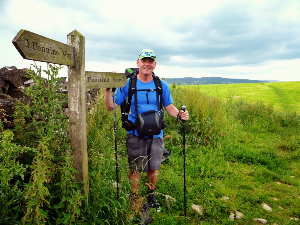
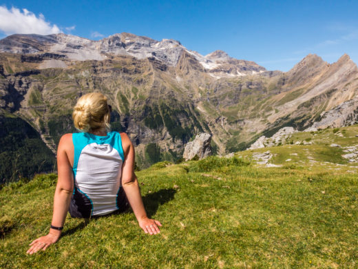
Keep Calm & Carry On Hiking…
The first thing we can confirm is that hiking the Pennine Way makes you constantly hungry! We’ve never denied that we both have BIG appetites and ‘food’ plays a large part in why we travel. We love to sample local delicacies everywhere we visit. But so far, in just a week we’ve consumed 10 Peperamis, 14 Snickers bars, 7 packets of Mini-Chedders, 14 coffees, 10 teas, 12 hot chocolates, 6 packets of Super Noodles, 12 sachets of porridge, 2 packets of cous cous, 2 packets of tuna, 26 flour tortilla wraps, 2 tubs of squeezy cheese, 1 tub of peanut butter, 16 packets of peanut crackle, 2 bags of mixed nuts and raisins, 2 full English breakfasts, 4 pork and leek sausages, a bag of Smash potato, 4 sausage rolls, 2 giant flap jacks, a tin of chopped pork and ham, and a slab of spam! And here we were thinking we’d lose weight with all this hiking!
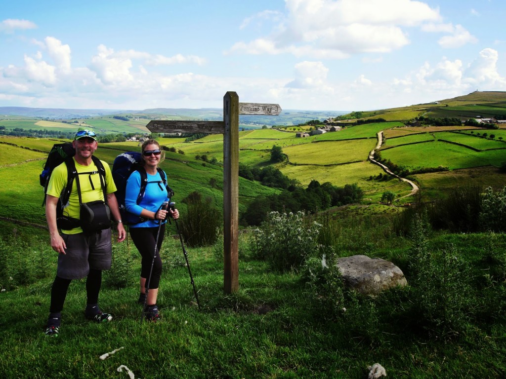
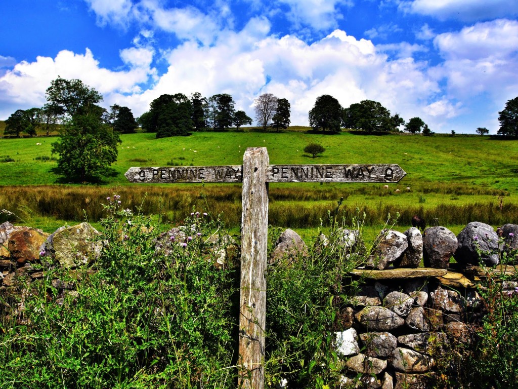
Continuing on the Pennine Way
Technically we should, as after a little research on Google, hiking 16 miles uses approximately 1,750 calories. For this mammoth 700 mile walk we should be consuming at least 4,000 calories per day, but even with all that ‘lightweight’ simple cook processed food, we’re struggling to consume even 3,000 calories a day. We haven’t even got alcohol to boost the figures. I’m sure we could do with a little of South America’s ‘deep fried goodness’! Anyway, enough of all this talk about calories and on to the hiking…
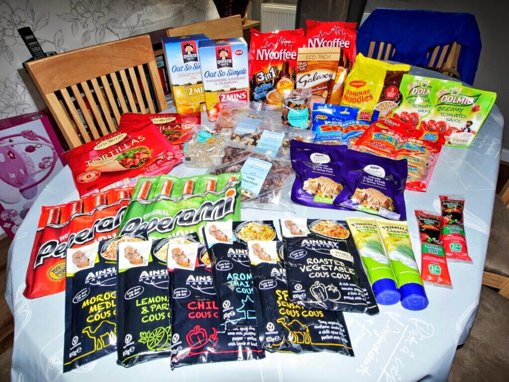
Just a few of our rations that we took away with us!
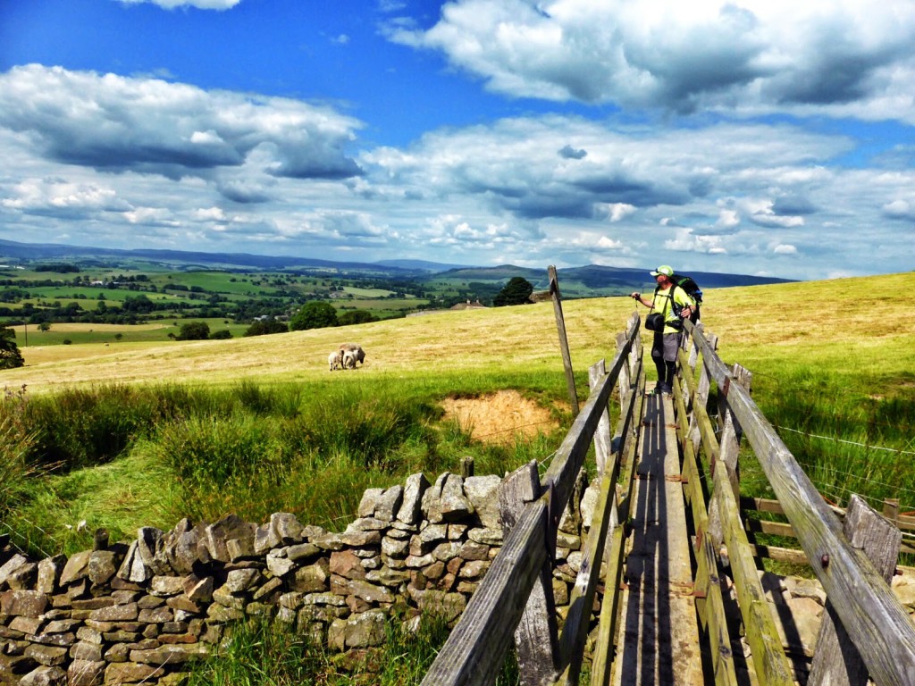
Day 7 – Ponden to Thornton in Craven. (14.1 miles) – Monday 30th June 2014 – “At Home In The Country”
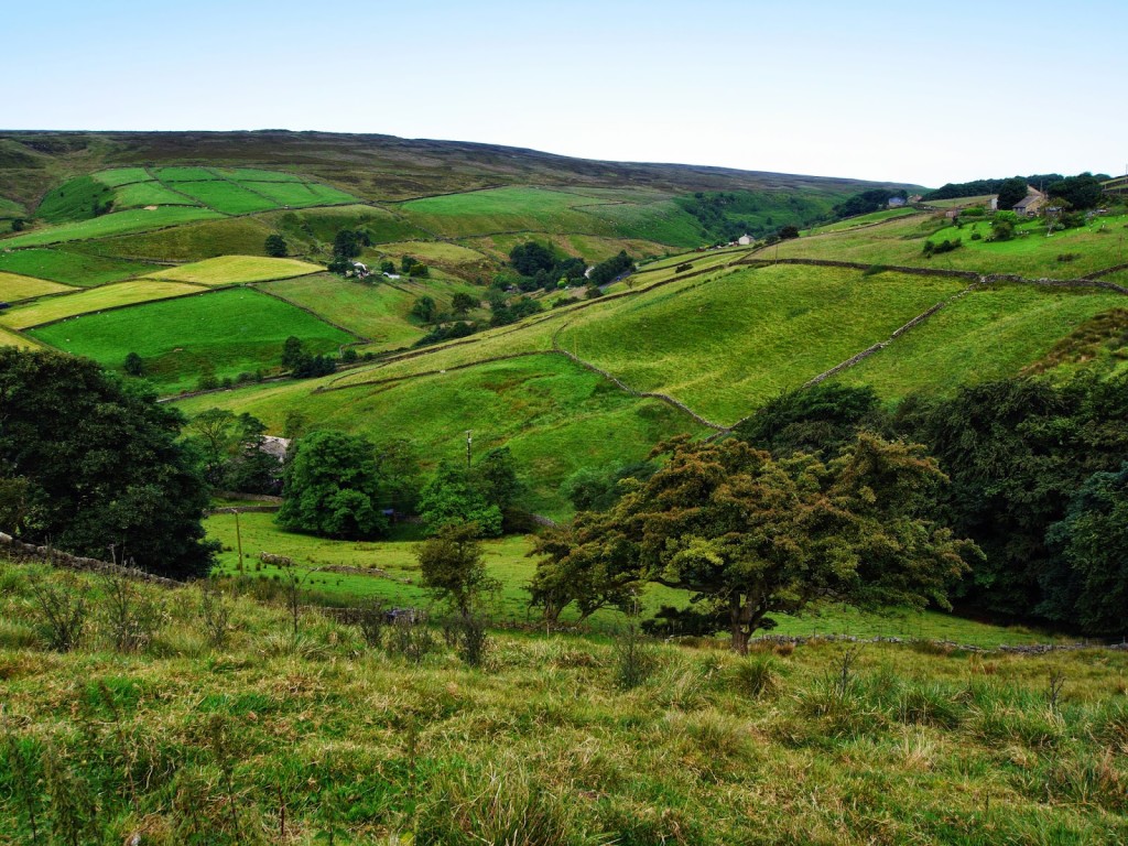
Today’s walk has been one of our favourites so far. It was a hike through a number of different villages giving me the perfect opportunity to nosey at some houses – one of my favourite pastimes!
Looking back to Ponden after leaving.
Morning sun over Ponden Reservoir.
The first section of the walk was through farmer’s fields to a village named Cowling so there was a lot of up and down over stiles and going through gates. (Note to ourselves, to pass the time, tomorrow we must count how many).
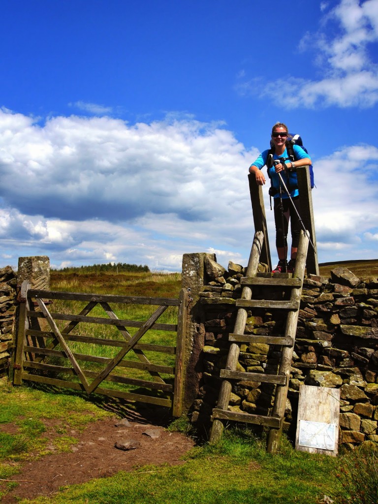
One of many! Just another stile to climb over…
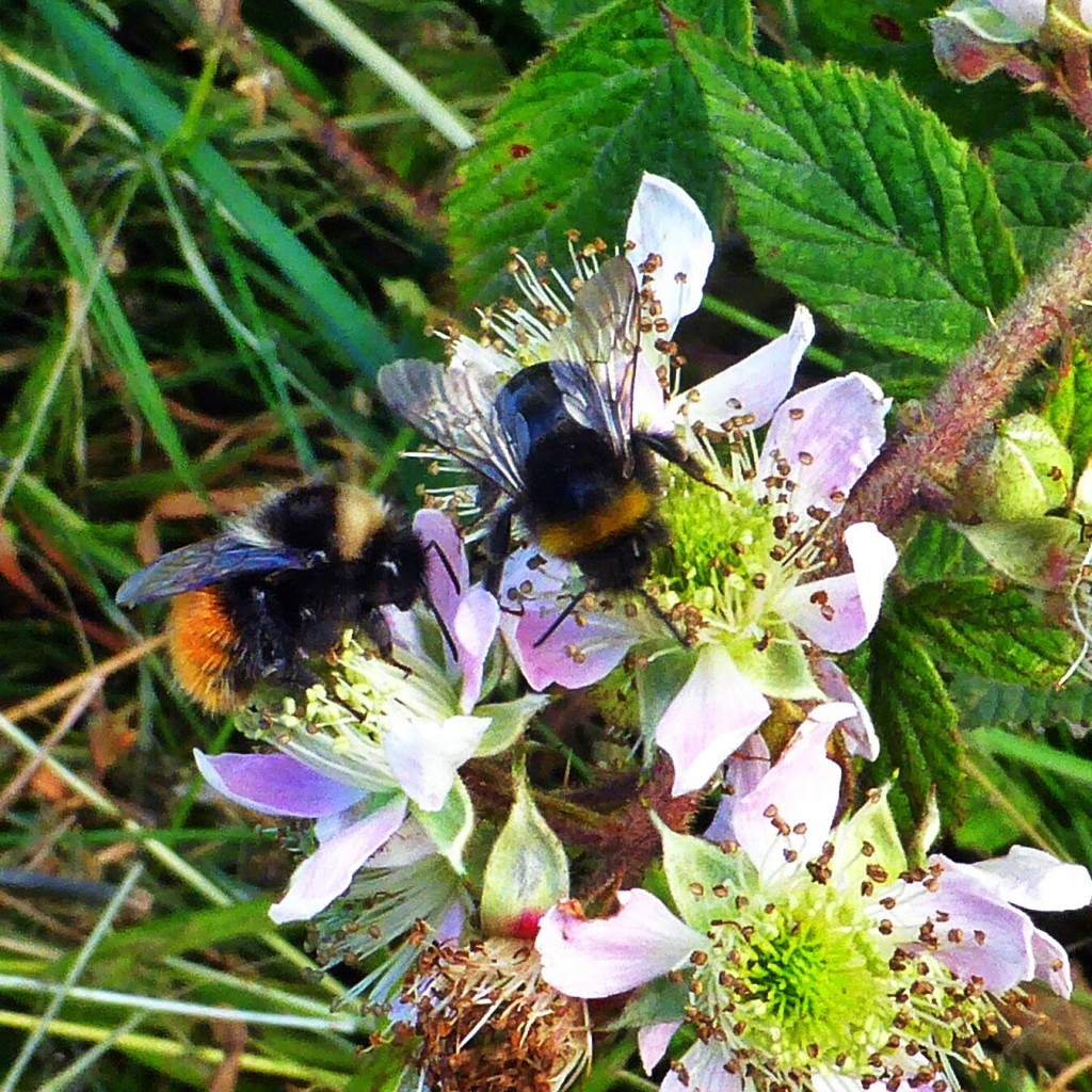
Our good deed for the day! Rescuing a lethargic bee by placing it on a flower.
A great stone trail to follow at first.
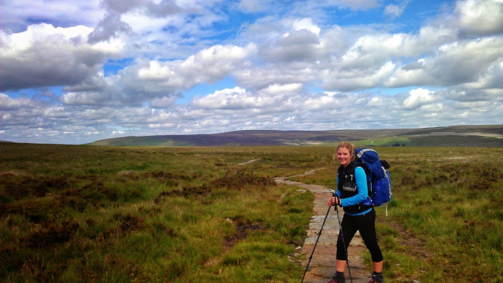
Heading over farmer’s fields.
Fantastic weather for walking.
English countryside at its best!
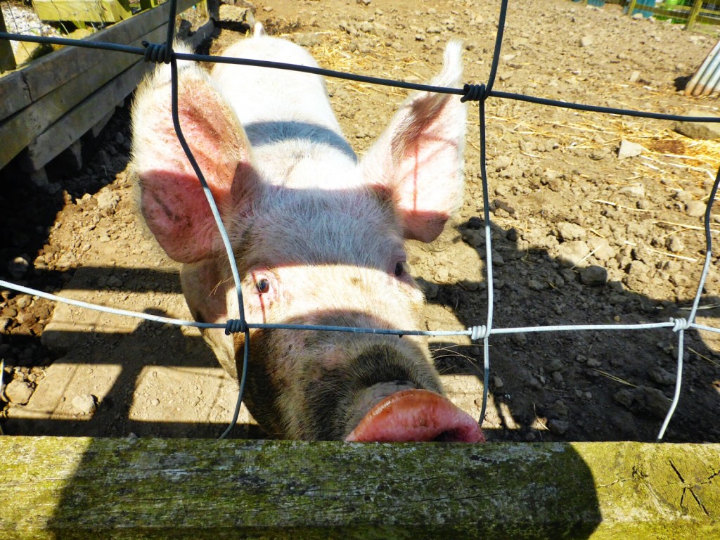
A friendly pig coming to see if we have any food for him.
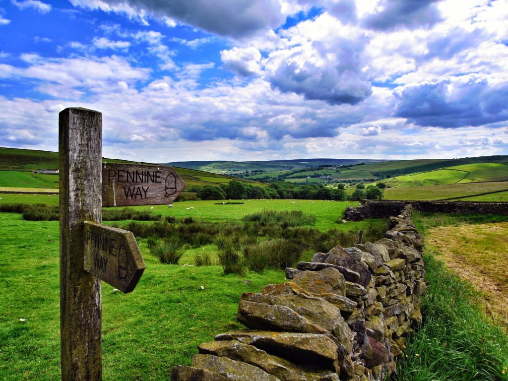
This way!
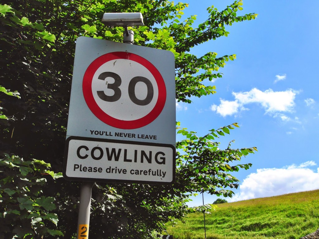
Check out the sign – “You’ll Never Leave”. At first we wondered if this was a good thing or a bad thing!
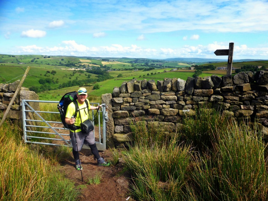
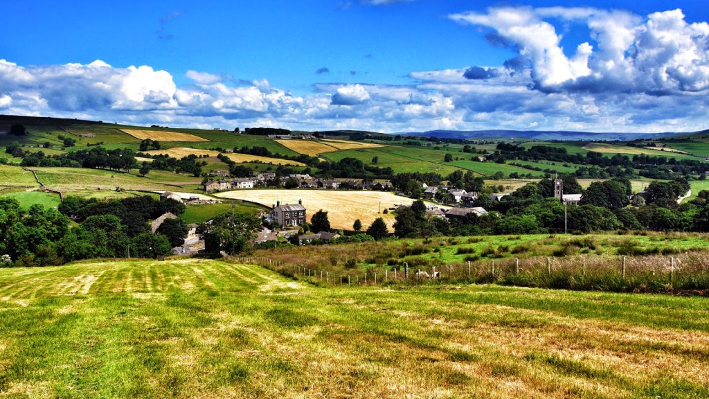
Cowling appeared a lovely village, but then continuing on to Lothersdale we were wowed by its idyllic location and beautiful views of the countryside. We both agreed that if we win the lottery it would be a great place to live!
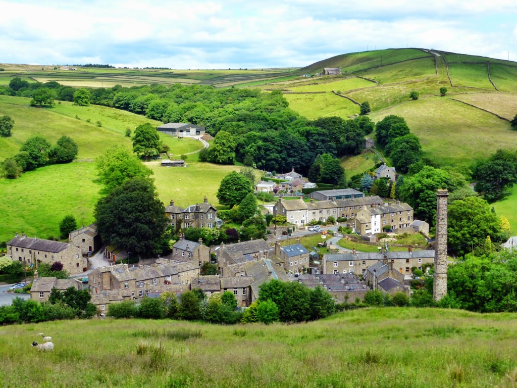
Looking down onto Lothersdale in its idyllic location.
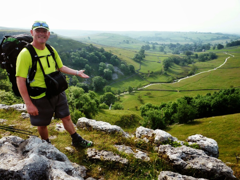
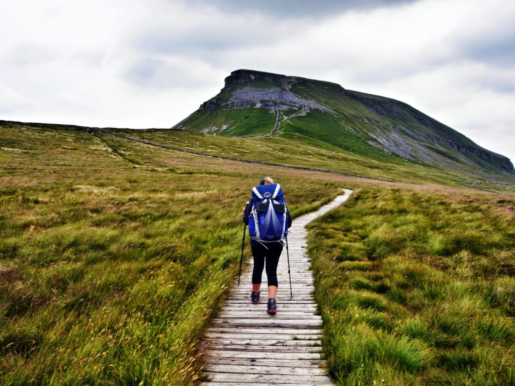
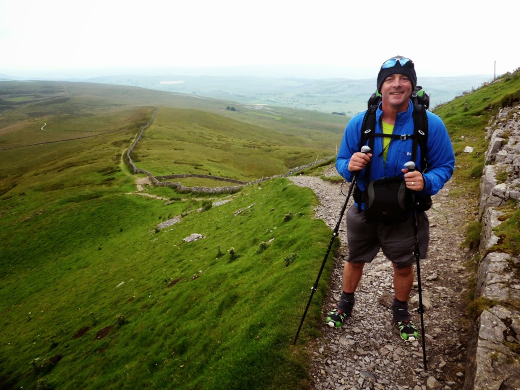
The next section of the walk was mainly uphill to Pinhaw at 388 metres. It’s the highest point around, so it offered us a great 360° view of the Yorkshire Dales from up there.
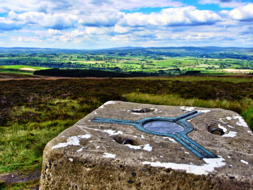
Pinhaw Beacon at 388 metres.
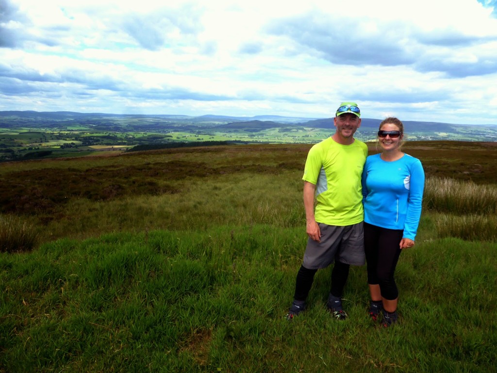
Stood at the top of Pinhaw. A fellow hiker took our photo!
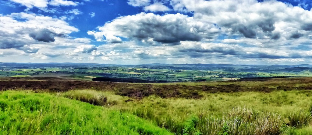
Panorama from the top of Pinhaw looking across the Yorkshire Dales.
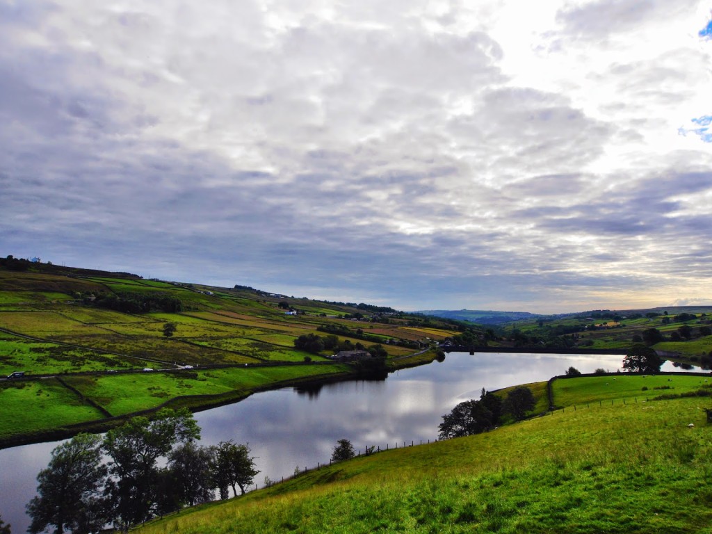
By 5pm, we’d made it to Thornton in Craven, another picturesque village, but sadly lacking in a shop and a pub (so we definitely couldn’t consider living there!) We camped at Thornton Hall Farm Country Park, with a nice, freshly mowed campsite. It was just a shame there wasn’t any showers! We couldn’t really complain as there is no other campsite off the Pennine Way for miles around and we did have the camp field all to ourselves. It was a lovely, sunny evening so we sat out on the grass to enjoy the sunset. There was no gourmet meal to go with the atmosphere though – it was good old ‘Smash’ and a tin of spam!
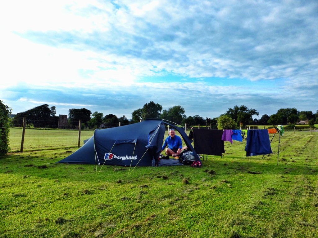
Setting up camp at Thornton in Craven.
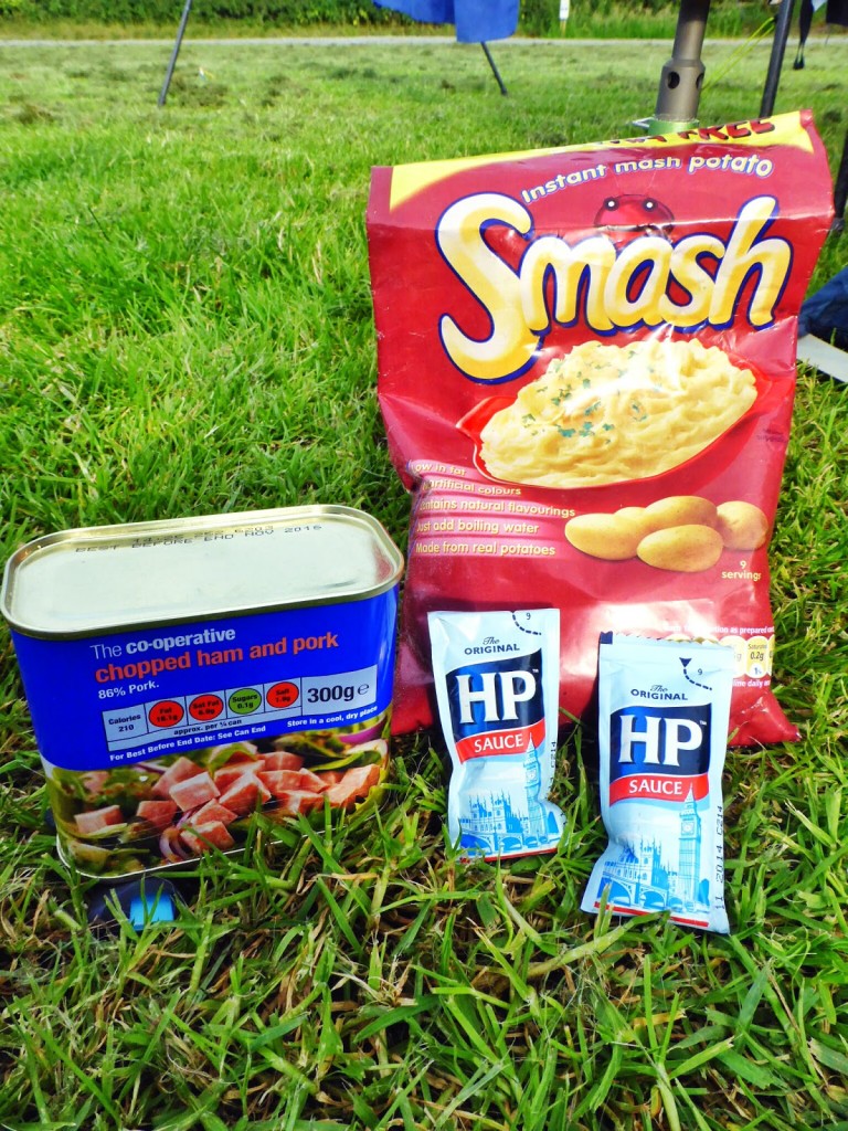
Our ‘spam’ feast!
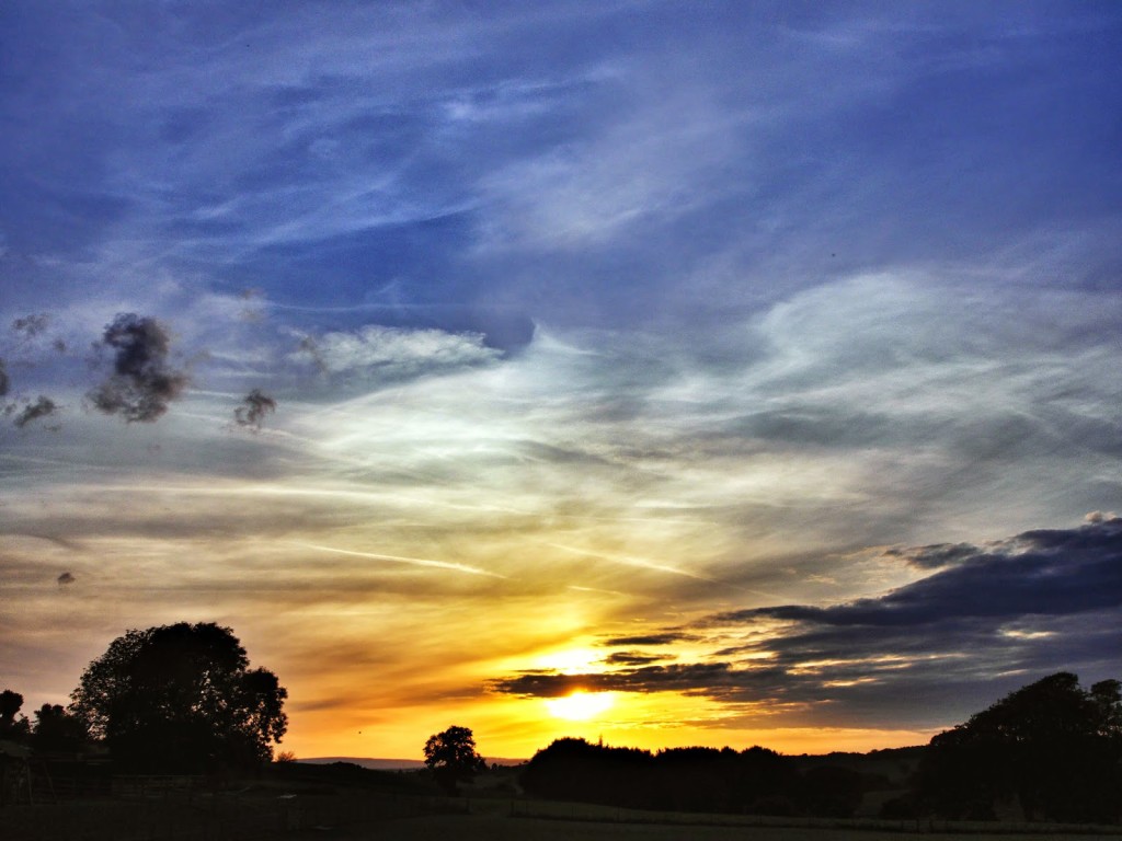
Enjoying our first sunset on the Pennine Way.
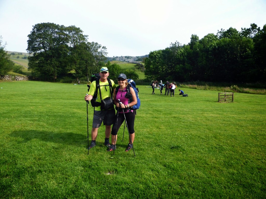
Day 8 – Thornton in Craven to Malham. (15.1 miles) – Tuesday 1st July 2014 – “Narrow Boat Or Campervan?”
Setting off from Thornton in Craven.
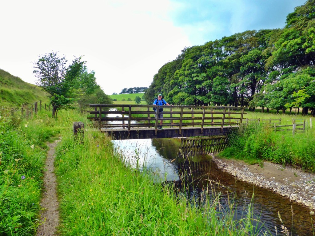
Crossing the river.
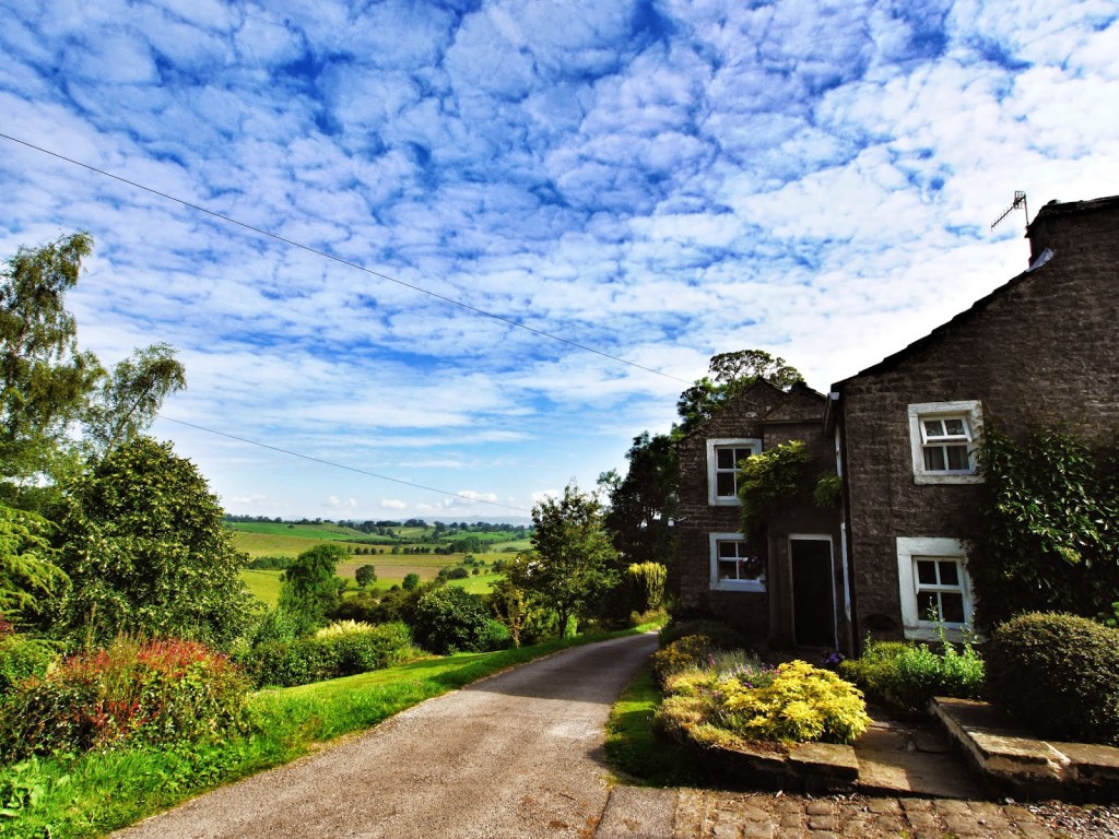
Another beautiful house in the country.
Today the weather was glorious, so it was the first time I’d worn shorts and a t-shirt. (I’m always happy to top up the sun tan!) And it was a peaceful start hiking along the Leeds and Liverpool Canal where we took our time to admire the collection of narrow boats moored at East Marton. Ooh decisions, decisions! That put a spanner in the works – shall we opt for a campervan or narrow boat when we retire?
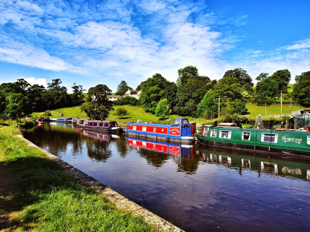
Walking along the Leeds & Liverpool Canal at East Marton.
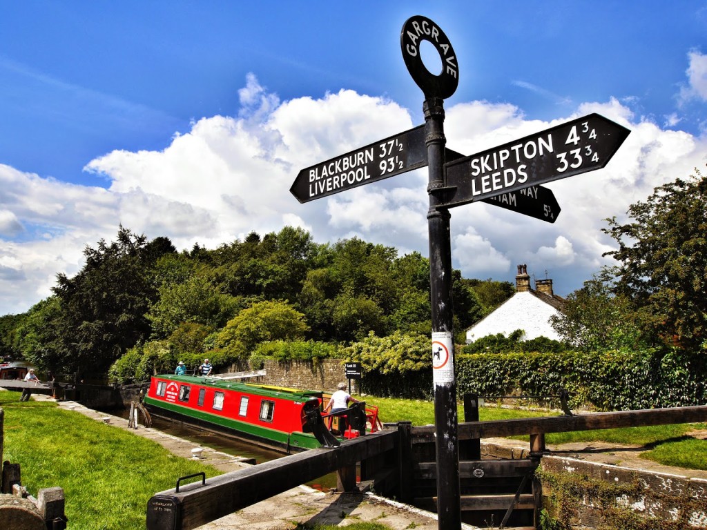
Watching the narrow boats go through the lock after leaving Gargrave village.
We reached the quaint village of Gargrave (our new favourite) by 11am so we popped into the Dalesman Cafe for a ‘beaker of tea’ served in cute Pennine Way hiker cups. The cafe also doubles up as a vintage sweetshop with Georgina’s Gardinaria around the back. The cafe is popular with Pennine Way hikers as it has an important landmark outside – a sign indicating we’ve hiked 70 miles already from Edale, with 186 miles to go to reach Kirk Yetholm on the border with Scotland. (Not quite accurate with our own GPS route tracking).
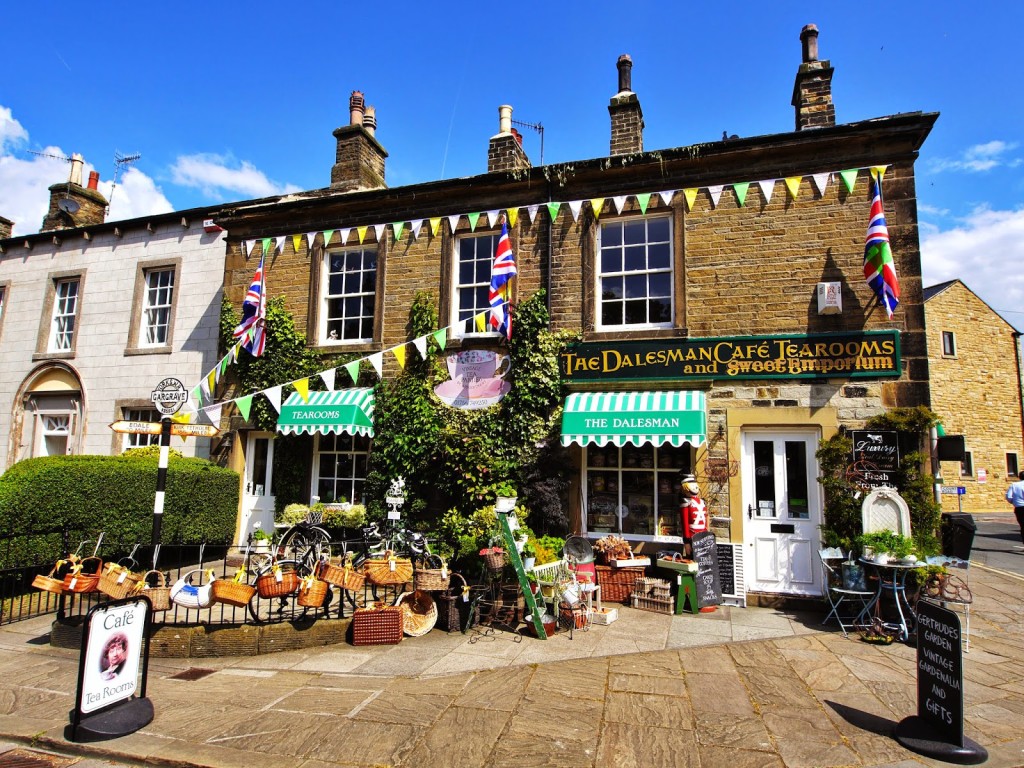
The Dalesman Cafe in Gargrave.
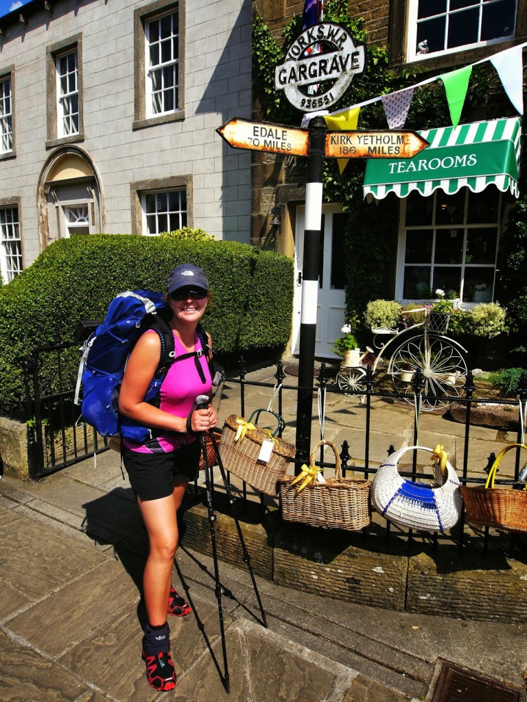
Still 186 miles to go to reach Kirk Yetholm.
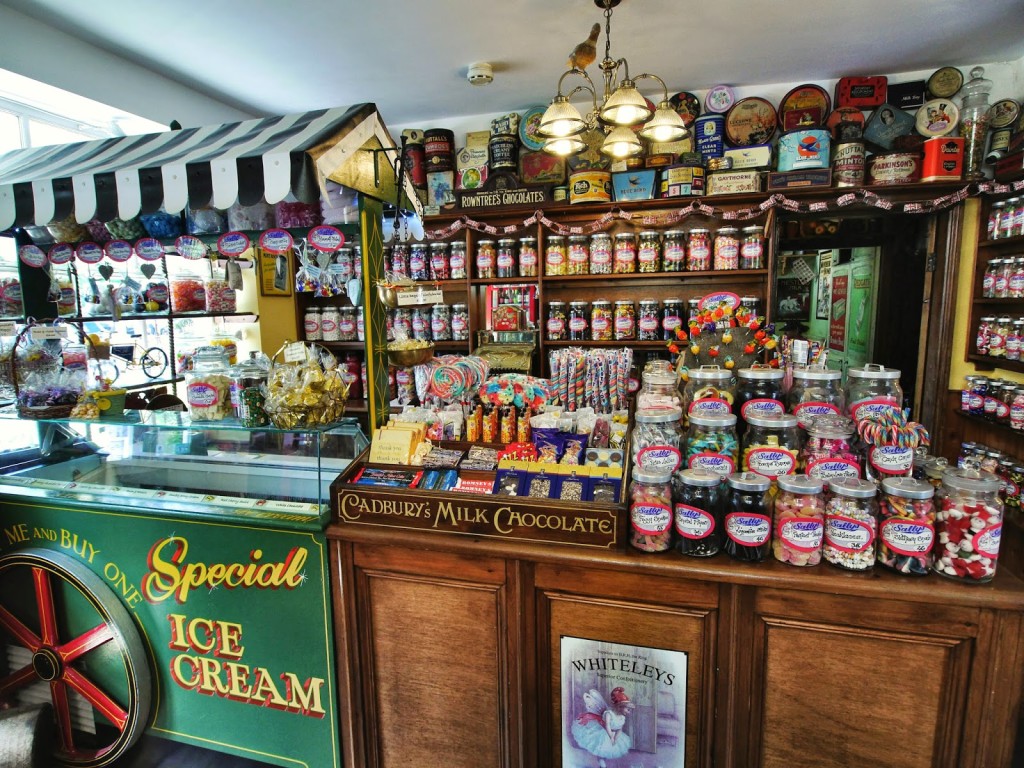
The traditional sweet shop joined with the cafe.
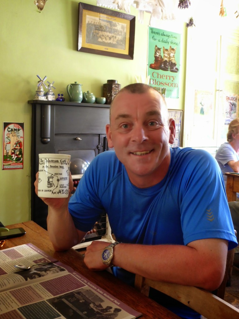
Enjoying a cup of tea and a rest.
From the cafe we moved on to the local Co-op store to resupply with food for the next couple of days.
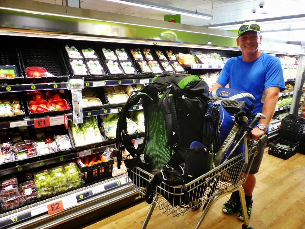
The only way to take the backpacks around a supermarket!
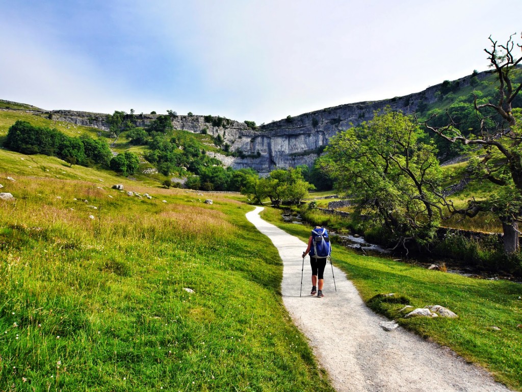
The rest of the walk basically followed the River Aire. But with this kind of walking also comes a lot of nettles, not a good combination when wearing shorts! We had a rest stop at Airton then continued on to the village of Malham. Malham is popular with day trippers due to the impressive limestone cliffs at Malham Cove.
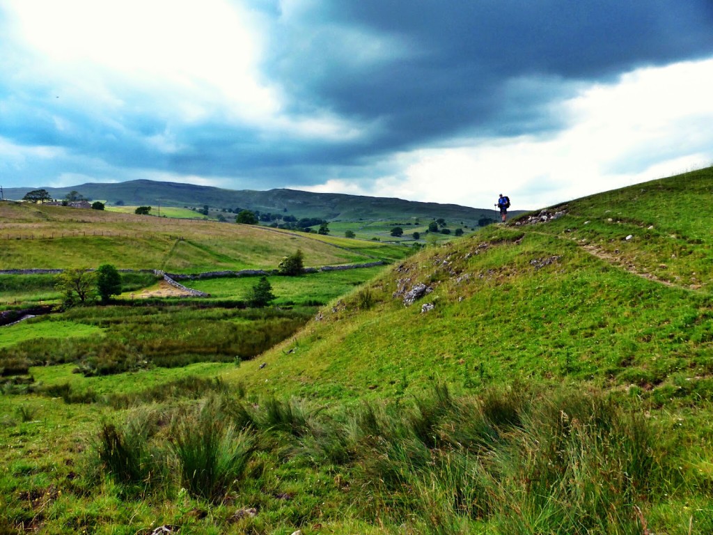
Walking over the hills as we continue on…
Next stop Malham.
Beautiful meadows by the River Aire.
We were shattered by the last couple of miles. My feet were killing me as I’d acquired a blister from hell on my 4th toe after our ‘soggy feet’ episode, which was getting worse despite our supply of Compeed plasters.
We reached Townhead Farm Campsite around 5pm just before hoards of Duke of Edinburgh students descended. We obviously chose the most popular campsite in the village. There was a big queue at the showers, but all was good in the world again when we sat down to a feast of sausage and black pudding cobs for tea! (We must add those to the food tally).
Did I mention that today we also went through 46 gates and climbed over 19 stiles? Yes we did actually count!
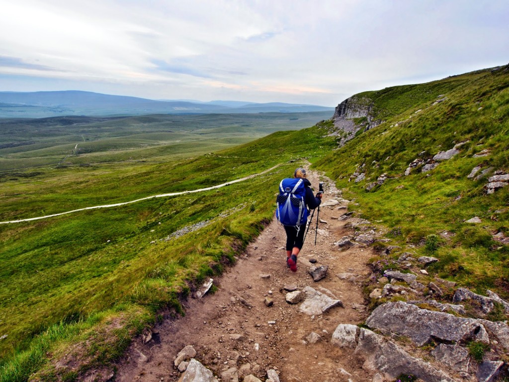
Day 9 – Malham to Horton in Ribblesdale. (17.3 miles) – Wednesday 2nd July 2014 – “Up Down, Up Down”
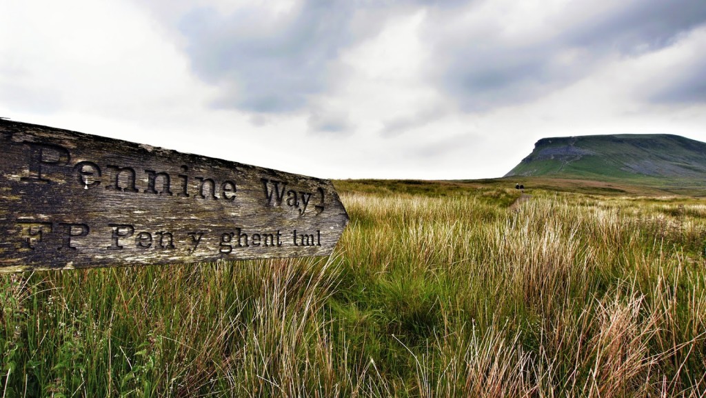
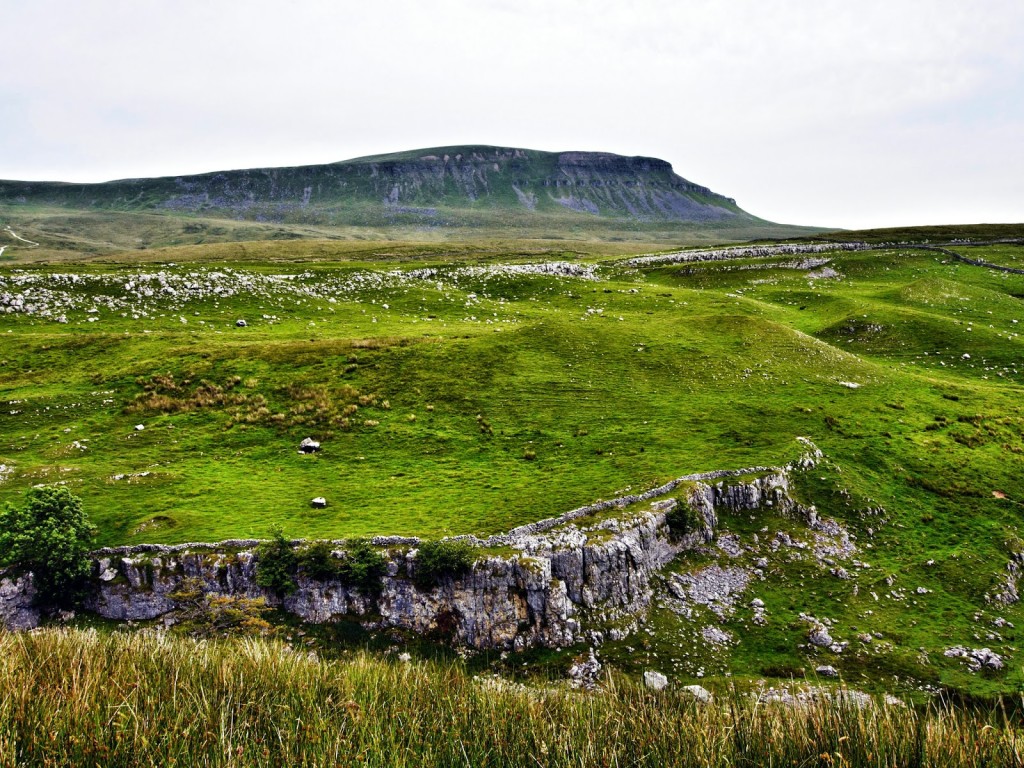
Today we accomplished reaching the end of the Pennine Way Southern Section. According to our GPS tracker, which includes to and from campsites, we’ve walked 102.9 miles already! Wayne was really looking forward to this day as the day’s itinerary included going up Pen-y-ghent, one of the famous Yorkshire 3 peaks.
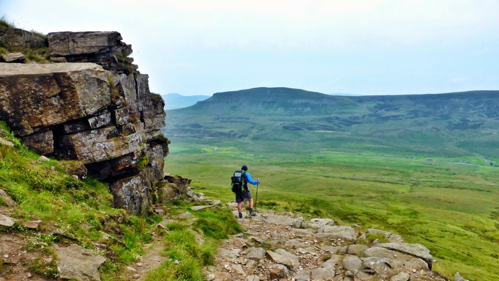
Looking across to Pen-y-ghent, one of the ‘Yorkshire 3 Peaks’.
We left the campsite at Malham after our usual breakfast of porridge and headed straight up to the top of the limestone cliffs known as Malham Cove. There were great views from the top looking straight down the valley.
All packed up at Townhead Farm Campsite and ready for a new day!
Setting off for Malham Cove.
Long exposure shot near Malham Cove.
The view from the top of Malham Cove.
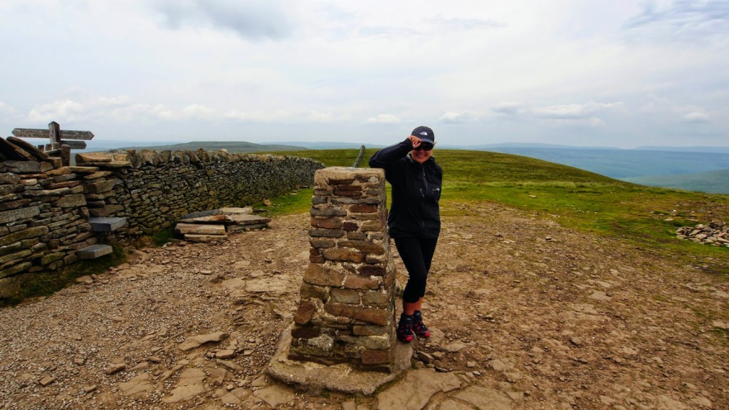
Next we hiked over to Malham Tarn, a high level mountain lake. But the highest point before lunch was reaching Fountains Fell at 668m.
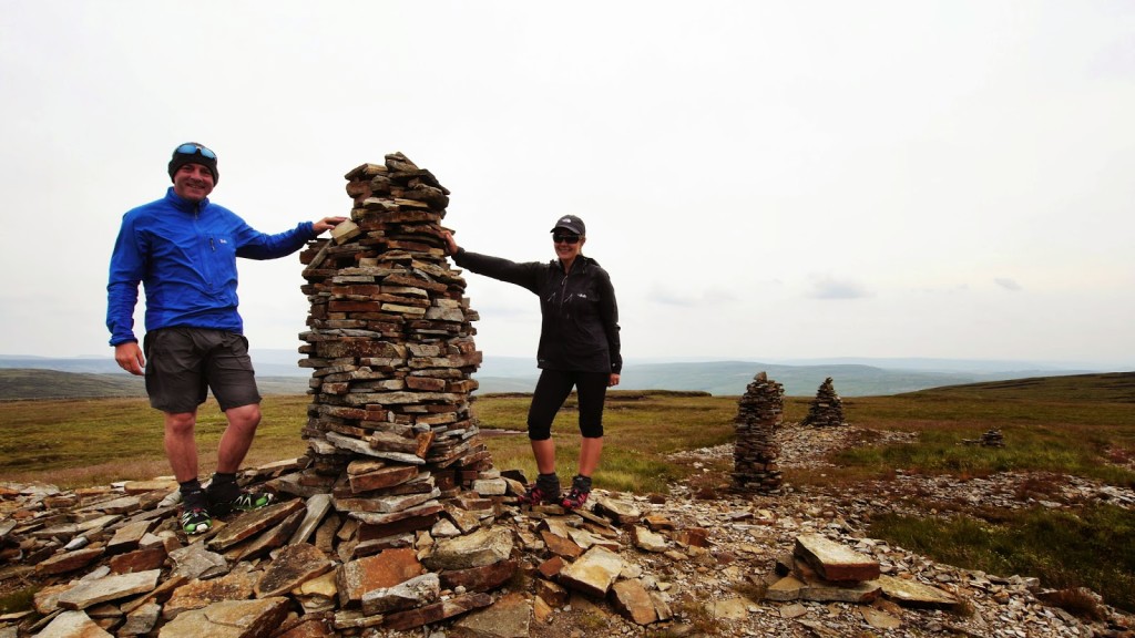
Stood at the cairn on Fountains Fell.
The whole day was a series of reaching a high point, going down the other side, then across the valley to the next mountain to do it all over again! I topped up on Ibuprofen for my blister and we psyched ourselves up for heading up Pen-y-ghent’s two steep sections up the front.
This way to Pen-y-ghent…
Setting off for the big climb of the day!
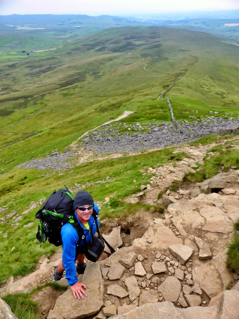
A bit of scrambling to get to the top!
Reaching the top of the first section.
The actual climb was not as bad as what it looks from afar and the fact that both steep sections have stone slabs going up really helps. At 694m we could see the other two Yorkshire peaks, Ingleborough and Whernside. After speaking to others we passed hiking the Pennine Way, it sounds like we were lucky that the rain held off, and that we had any view at all – although we did experience extremely high winds at the top.
It was windy at the very top of Pen-y-ghent.
Leaving Pen-y-ghent, it was a long, long gravel track down the other side to reach Horton in Ribblesdale.
Leaving Pen-y-ghent down the long gravel track…
Looking back to Pen-y-ghent from the track.
We expected the day’s mileage to be around 14 miles, bit in fact we did over 17. Some miscalculation somewhere! What brightened up the walk was when Wayne rescued a sheep that had got it’s head and horns stuck through a fence. A good deed to end the day! When we reached Horton in Ribblesdale we popped into the Pen-y-ghent Cafe for a cuppa and an ice-cream before pitching our tent at the olde-worlde Holme Farm Campsite for the night.
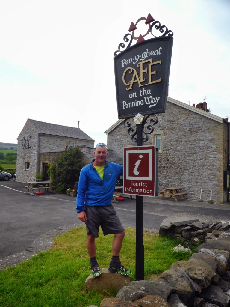
Heading straight for the cafe when we arrived at Horton in Ribblesdale.
No tasty camp grub tonight, just plain old instant noodles. (Tip – Avoid bacon flavour if you have the choice!)
Tomorrow – Starting ‘The Pennine Way Central Section’.
6 Comments
Loving the write up.
Thank you! It's hard to keep up with the blog as we're struggling to get wi-fi, but lots more to come!
No idea how you do it on the trail, Danielle! I find it hard enough to write up my trips when I get home. When you have finished I may want to pick your brains a bit about a very specific aspect of this walk if that is ok. If you ever fancy a read (ie if you are ever horribly bored) , my blog is: http://www.fellbound.co.uk
Anyway, meant it. great stuff and well done to you both on your walk so far.
Thanks! Will have a look at your blog next time we get decent wi-fi & we're happy to have our brains picked & help you in any way we can 🙂
Hi Danielle,
Great webpage, we actually did quite a few of the same walks as you. We finished the John Muir Trail in the summer of 2019, the West Highland Way in the pandemic summer of 2020, and are about 2/3 of our section-hike on the Coast-to-Coast (we made it to Richmond). The C2C is a bit harder to wild-camp, so we are now switching our focus for this early spring to the Pennine Way.
I was wondering whether you can comment on the feasibility of wild-camping the southern stretch of the Pennine Way? We are considering to section-hike the first part of the Pennine Way in early April (roughly Edale to Craven), before official camp sites are open (weather-pending), and stay with our lightweight tents high on the plateaus at night, dropping into valleys during the day. Do you think that is feasible? Given our experience on the JMT (with plenty of dry patches for pitching), are there sufficient places where one could erect a tent on the plateaus, or is it one boggy mess and not feasible?
Thanks,
Nathalie
Hi Natalie,
It’s possible, but we hiked it such a long time ago now, I don’t think I can really give an accurate view.
We wild-camped on Kinder but you’re never really that high compared with the Lake District where you can be more discreet and get above the intake wall.
There are also lots of variables to consider – how far you want to walk per day, where you are willing to camp, what the weather is like and the ground conditions (not just bog). There is not an abundance of pre-used sites like on the JMT. I seem to recall there being a lot of scrubby ground not suitable for pitching a tent.
I don’t want to put you off as it’s a beautiful section of the trail, but I think it would be quite difficult to wild camp as you are so close to towns and villages every day too.
Good luck with your hike! I hope the weather’s on your side.
Best regards,
Danielle