
Fleeing The Storm…
It was with a wave of apprehension that we took to the trail today. Yesterday’s storm had continued to rage around us throughout the night, and could still be seen on the horizon as we unzipped the tent to see what a new day would bring. As a flash of fork lightning electrified the dark clouds in the distance, a sense of dread filled my stomach. Should the lightning make its way inland, we’d be terrified out there on the ridge, not least because today we faced hiking over the highest point on the entire GR20.
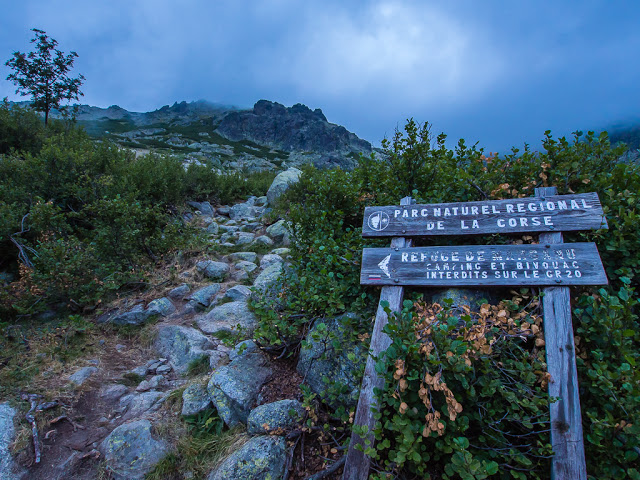
As we packed away a wet tent and debated what we’d do, we realised that we’d have to face the steep and rocky mountainsides whatever the weather, as this was the only route option today and it couldn’t be avoided. As the trail glistened under the light of our head torches, we knew it was undoubtedly going to be tough. Finally setting off, we tentatively started the uphill climb, cautiously navigating the wet and slippery rocks. We did not want to befall any danger or misfortune at this late stage in our thru-hike; after all, we were only 4 days away from victory drinks and a celebratory meal in Calenzana!
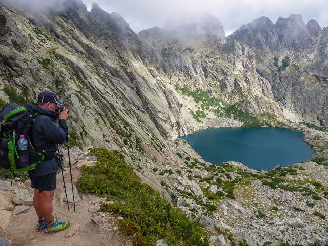
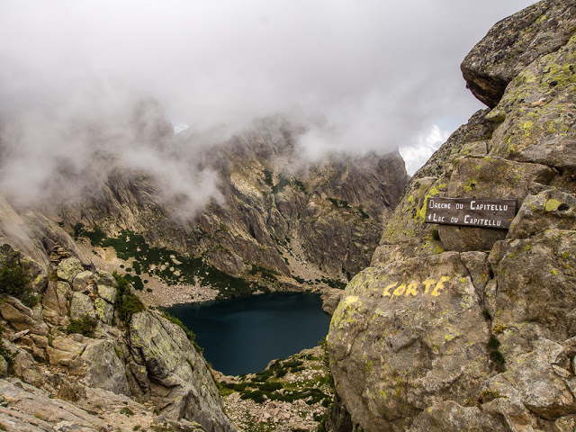
Blink and you’d miss it! Thankfully, the mist cleared enough for Wayne to get a picture of Lac de Capitellu. What a treat! It was the first day on the GR20 that we had seen some mountain lakes.
Although we had previously complained about the heat, we had in fact been extremely lucky thus far on the GR20 with the weather. It had not been that changeable, moreover it had followed a predictable pattern of clear skies early morning, with cloud cover building throughout the afternoon offering us some much needed shade and respite from the intense sun. Now on Day 8, we did not want the threat of lightning, or indeed heavy rain to scupper our plans for a 12 day finish. If we did face heavy rain and being exposed to the threat of a lightning strike out there on a ridge, we’d almost certainly have to bail out at the next available village. We had to take it seriously – even though the chances of being struck by lightning are small, during a storm, high on a mountain is a dangerous place to be, quite possibly deadly in fact.
Our success on completing this thru-hike was now hanging in the balance. If we fell just one day behind because of bad weather, we wouldn’t be able to make up the time or even double up enough further stages to make the deadline, as most stages in the north are just far too demanding. Anticipating the worst, we put on our rain jackets and hurried uphill, all the while wanting to stay one step ahead of the storm, but keeping our fingers crossed that it would rapidly dissipate. Would we manage to make it to the Refuge de Manganu today as planned, or would we have to stop and seek shelter?
Monday 10th August 2015 – Stage 8 – Refuge de Petra Piana to Refuge de Manganu – 6:30am – 2:30pm (8 hours)
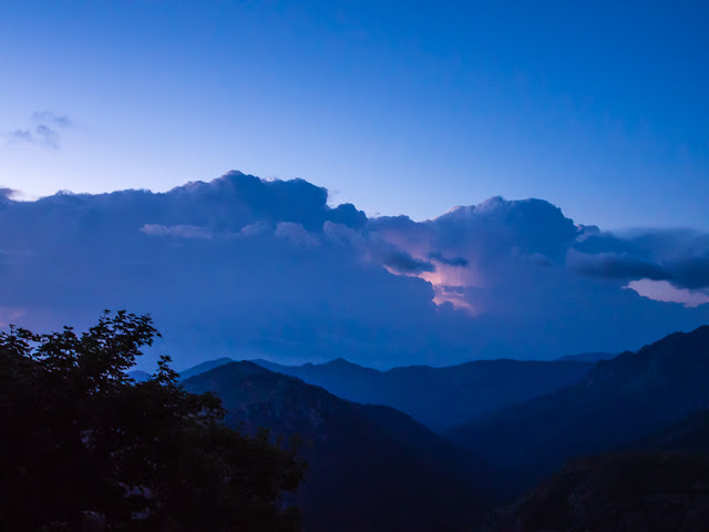
Sunrise, a new day, and we continued to watch the sky for signs of the approaching thunderstorm.
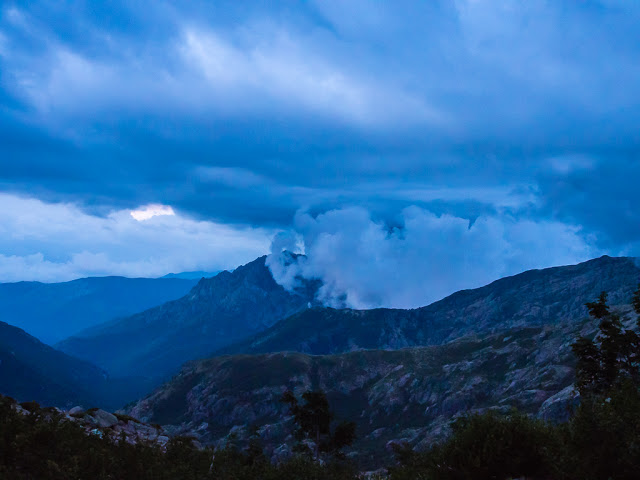
Darkening skies and towering cumulonimbus clouds made us quite fearful of what lay ahead for us out there on the ridge. Thankfully, this shot is looking back to where we had already come from yesterday. We did not envy today’s hikers making their way along the high route coming from the Refuge l’Onda.
In our direction going north, we also faced heading into rain clouds however.
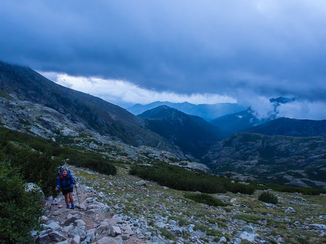
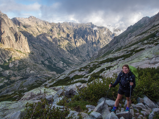
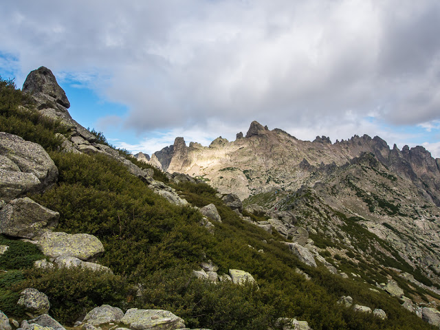
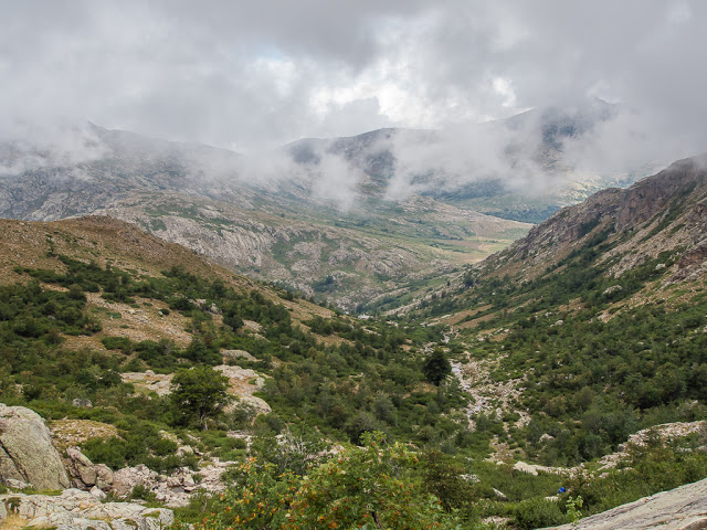
We set off uphill feeling trepidation about today’s stage, not least because we would be facing the highest point on the entire GR20 with the threat of bad weather overhead.
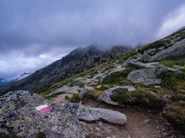
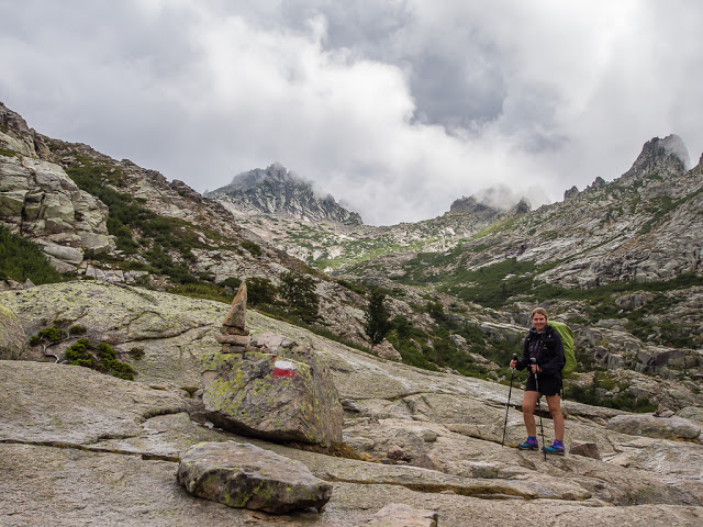
Although from below the route up had looked quite daunting, in fact it was not as bad as we were expecting. Despite the clouds and mist, our familiar red and white flashes were still clearly visible, reliably leading the way.
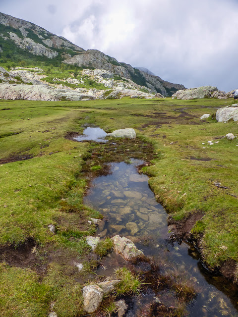
As we climbed up through the valley across the Bocca Muzzella, the mist cleared for just a few minutes to reveal our first mountain lake on the trail – the little ‘Lac du Renosu’ – and beautiful it was too.
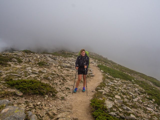
The ridge we were heading for was still shrouded in mist; however the sky was getting much brighter, as were our feelings about the day ahead.
Within a matter of minutes, the mist and cloud cleared even further and we were significantly more optimistic about reaching the Refuge de Manganu in one piece!
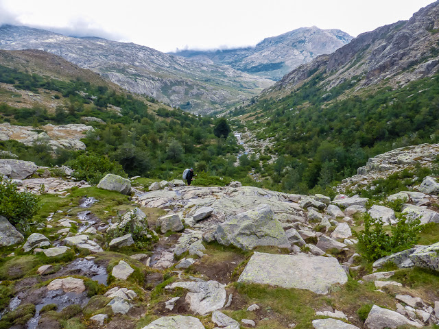
Wayne blends into the rocks in the foreground with his big, silver backpack rain cover. The GR20 route, heading north, takes you down to the left of Lac du Renosu.
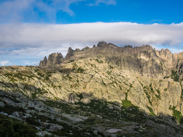
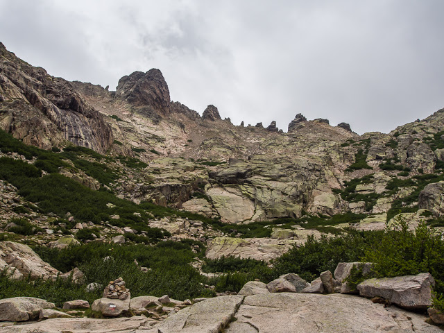
The top of the ridge becomes visible at last.
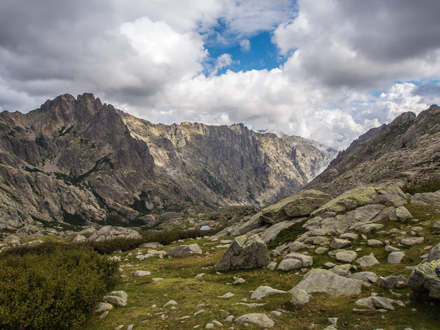
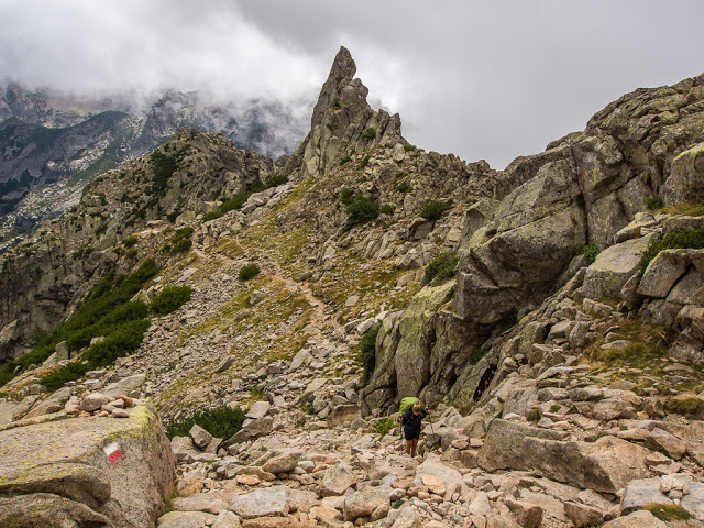
The ridge, with its jagged peaks, was our route to the Refuge de Manganu. After tackling the high route variant yesterday, we’re made of hard stuff now, meaning ridges no longer give us heart palpitations! Along this ridge is the highest point of the entire GR20 trail – the Bocca alle Porte, at 2225 metres. With the thought of being struck by lightning now downgraded to a minimal threat, we were looking forward to getting up there, especially as our guide book claimed that the views beyond the gap looking on to the twin lakes – Lac de Capitellu and Lac du Melo – were simply magnificent. This is exactly what we yearned for having been so spoilt on the John Muir Trail last summer. Wild camping close to stunning glacial lakes day after day really made us miss their presence, as up until now, there had been a real lack of them on the GR20 route.
Taking in the magnificent view! How extremely lucky we felt today!
Still donning the waterproof weather gear, just in case the weather turned rapidly for the worse.
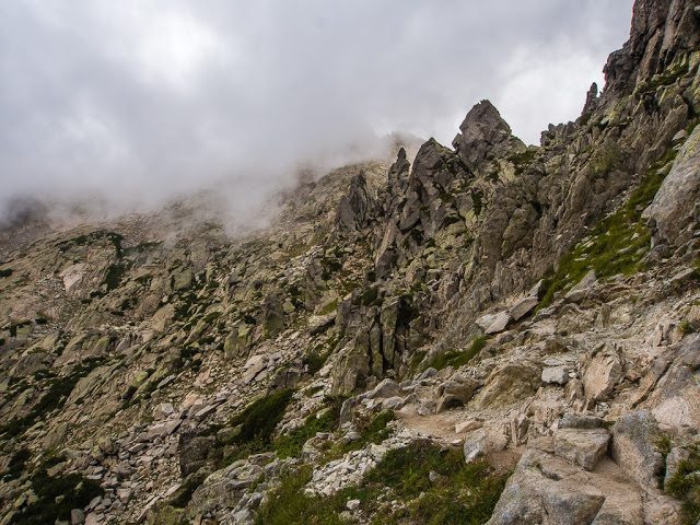
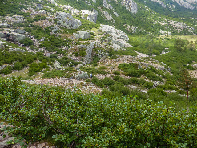
The path weaves its way across the steep and stony slopes which are covered in dense alder scrub.
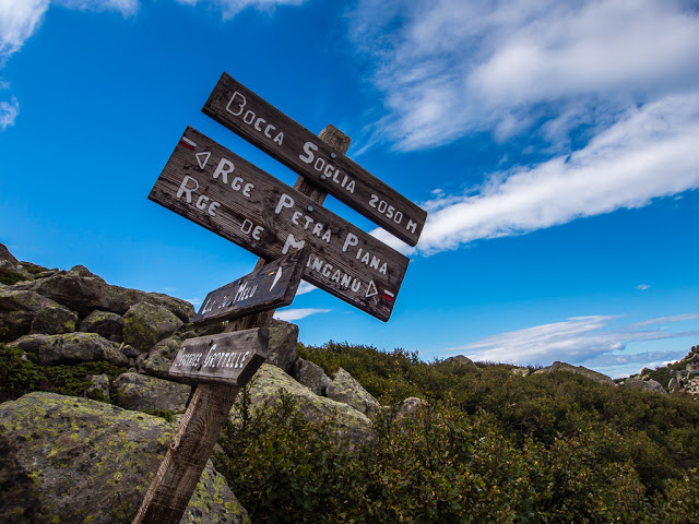
After a few boulder scrambles we reach the Bocca Soglia at 2050 metres. Here there is a junction of paths, with a route leading down to the Lac du Melo and the Bergeries de Grotelle, which is marked with yellow paint flashes.
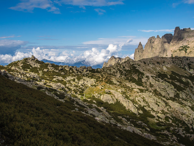
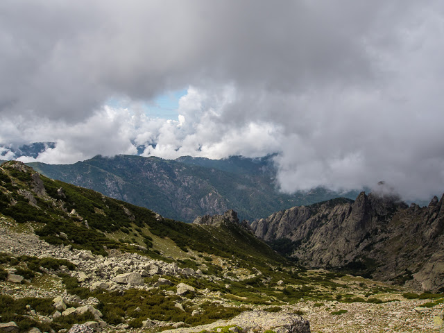
What an incredible skyline! All these majestic mountains are on one tiny island in the Med!
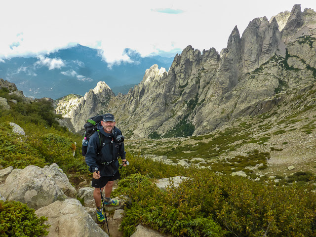
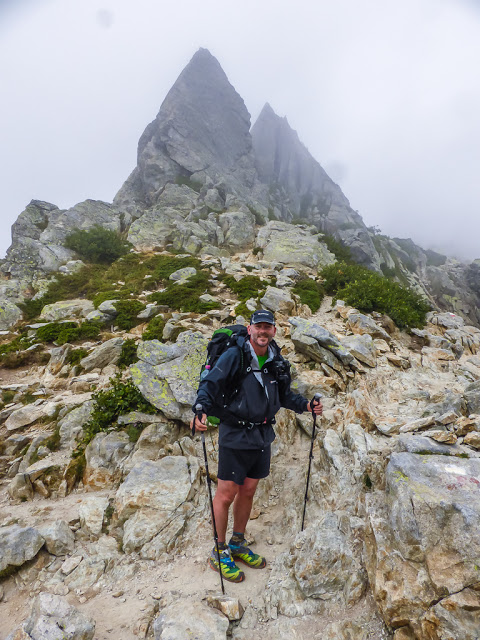
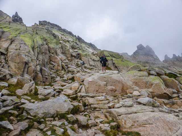
No time for jelly legs today! We were much more familiar with the rugged terrain, stony paths and awkward boulder scrambles. Confidence is key!
Those ominous clouds still threatened from above.
Whilst heading across the ridge, the route does follow a good stretch of the crest, however it switches to the flanks either side at times, which provides a much better pathway. This allows a little respite from careful maneuvering over boulders and grappling with rocky slabs on the harder sections.
There were a couple of high leg ups where we wished we were slightly taller, having had to grapple with huge boulders and haul ourselves up. But the most difficult section was having to climb up bare rock to get through a very awkward, steep sided gully. Thankfully, there was a chain bolted on to the rock for support so that we could pull ourselves up the trickiest section, whilst using notches in the rock as footholds. It took all the strength in my arms to get up the last section however as my legs just weren’t long enough to get a good foothold to push from. It didn’t help that the rock was also wet and slippery. On reaching the top, we had a proud moment, but then both agreed that by going uphill we actually had the easiest option to contend with. If we were heading southbound in the opposite direction, it would have been hell having to come down the gully instead.
Still smiling… Rain has not spoilt play – yet!
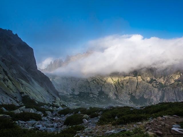
And the clouds begin to roll in once more…
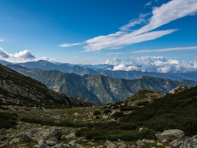
We are treated to incredible views down the valley before we headed into a complete white-out.
Thankfully this section of the trail provided us with a well trodden footpath seeing as visibility was at an all time low!
The trail flanked to the left of the ridge avoiding a scramble over the towering pinnacles.
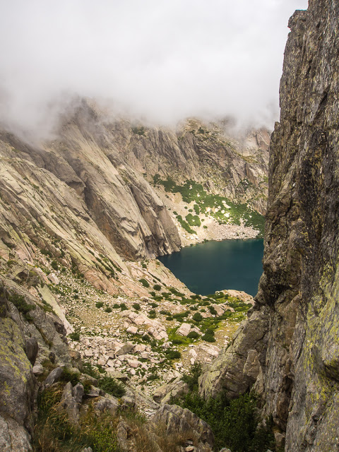
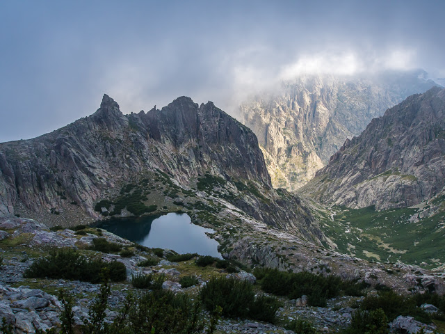
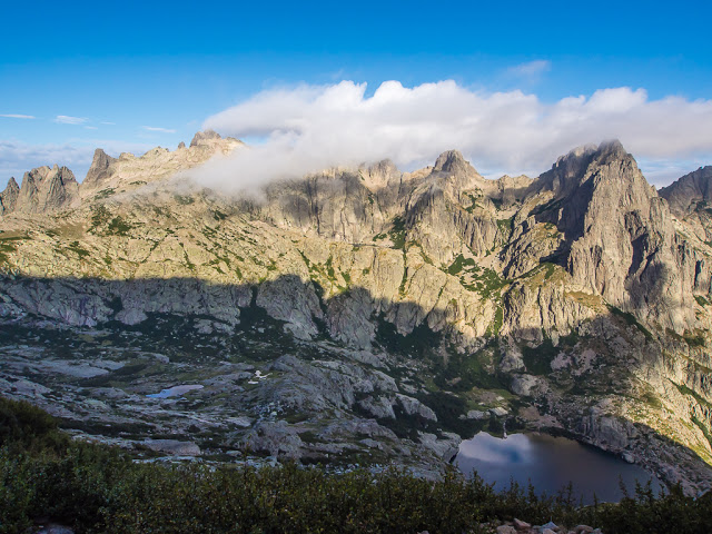
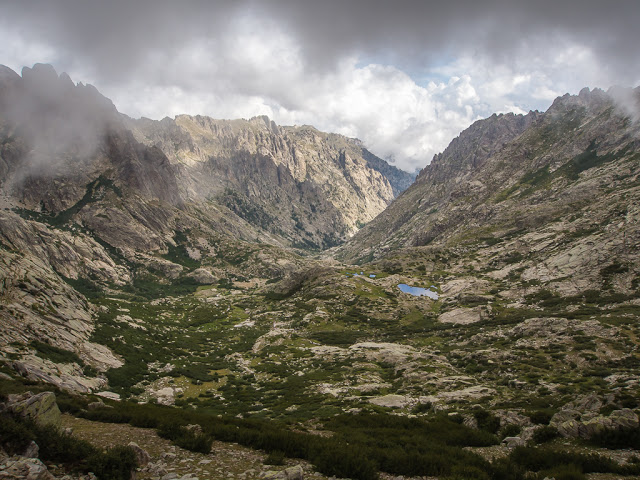
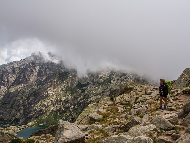
Our first glimpse of Lac de Capitellu from a gap in the rocky slopes.
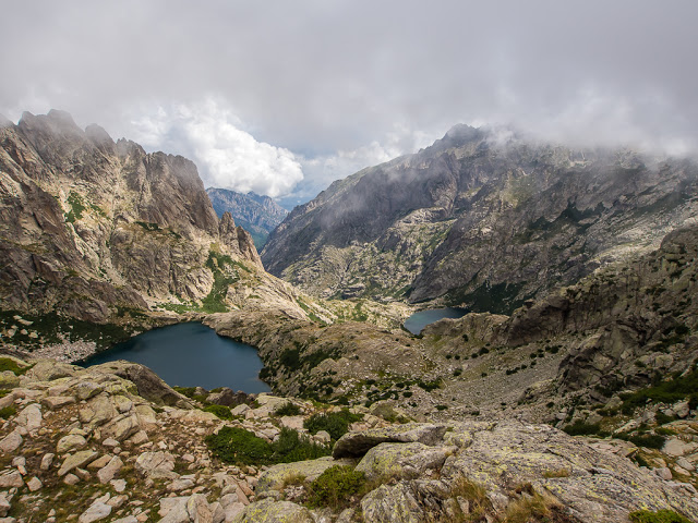
There are in fact two deep blue lakes far below the rugged peaks – Lac de Capitellu and Lac du Melo which lie in rocky hollows, attracting many day visitors that climb up from a car park at the head of the Restonica valley. This is where we had the opportunity to bail out and head down to the village of Corte, should we need to.
Soldiering on despite the low cloud drifting in and out.
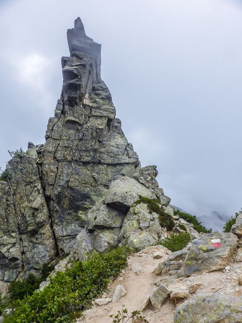
Looking back to the towering pinnacle we had just scrambled around.
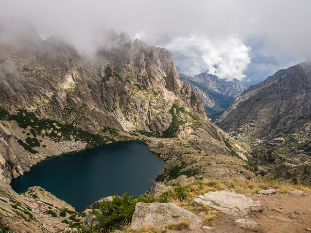
A closer view of Lac de Capitellu.
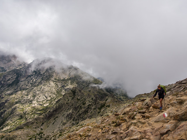
Heading up the stony slopes towards Bocca alle Porte, the highest point on the GR20 at 2225 metres. Looking back, you can see the clear path that we followed cutting across the mountainside.
The higher we got, the more spectacular the views!
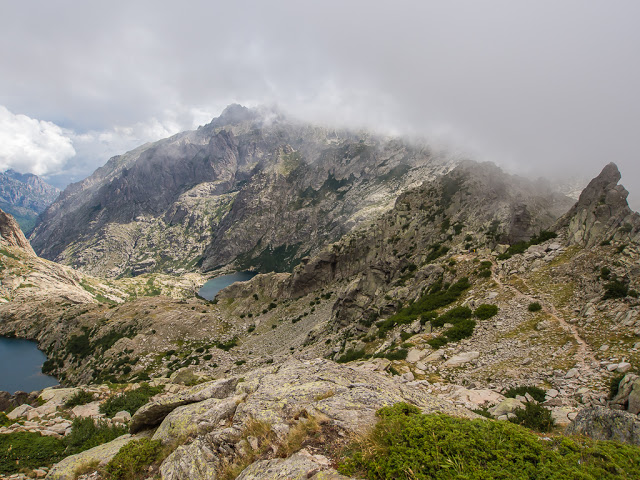
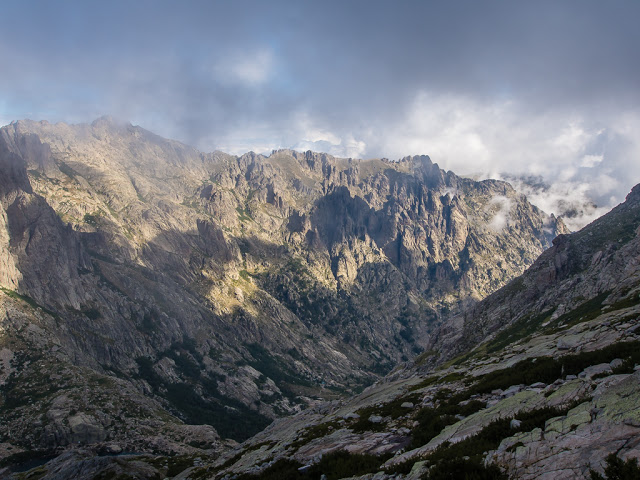
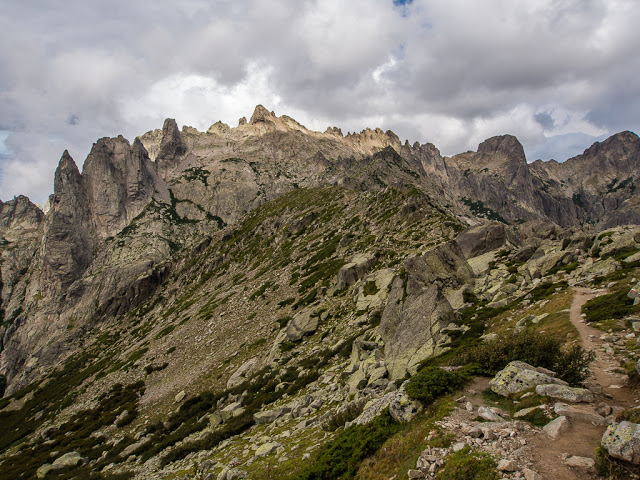
To the right of the picture, the ridge we had been slowly progressing across since leaving the Refuge de Petra Piana earlier that day.
Thankful we had made it across much of the ridge before the cloud came in once more.
The route had us picking our way across huge slabs of rock as we continued heading up to the Bocca alle Porte.
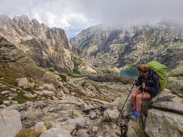
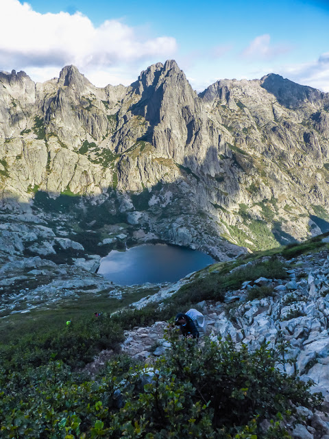
Taking a breather and looking down onto Lac de Capitellu and Lac du Melo from the rocky slopes below the Bocca alle Porte.
Almost at the narrow, rocky gap…
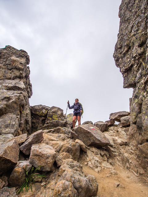
The Bocca alle Porte – the highest point of the GR20 at an altitude of 2225 metres. On reaching the top I burst into a rendition of Kool & the Gang’s “Celebrate Good Times… Come On!”
From the other side of the bocca, the day was not over yet.
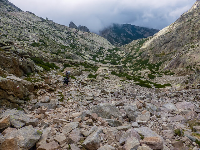
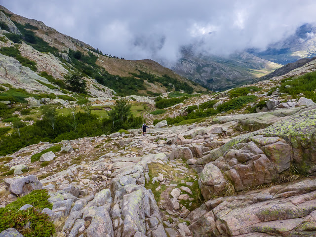
It was now time to head downhill, carefully picking our way across the heaps of boulders towards the Refuge de Manganu at the bottom of the valley. It was such a long way down and the rocky, bouldery pathways were really hard wearing on my knees. They had been playing up ever since that long descent into Vizzavona back on Day 5, and I was now really feeling the strain on them long before we reached the refuge. With so much stone to navigate, we really had to concentrate on our footing all the way downhill.
Looking back up to the Bocca alle Porte from where we had just descended.
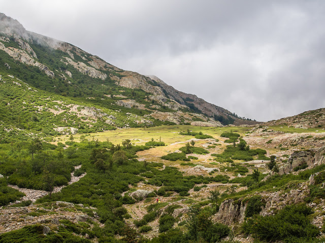
After navigating all that rock and having to carefully watch our footing for what seemed like hours, it was a huge relief to finally see grass! We couldn’t wait to feel it underfoot and have some relief from the hard, stony terrain.
Wayne continues downhill, although you could mistake his silver backpack cover for a rock in the centre of the picture!
It wasn’t fun having to carefully negotiate the giant slabs of rock when they were wet underfoot.
The grassy areas were extremely boggy so we had to tread carefully! It reminded us of a couple of sections of the Pennine Way in England.
How much further?! We were more than ready for a good, long sit down! (My knees were positively screaming at this point!)
The cloud was still following us.
We were determined to reach the Refuge de Manganu before the rain came so we didn’t have many rest breaks today!
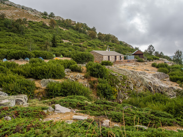
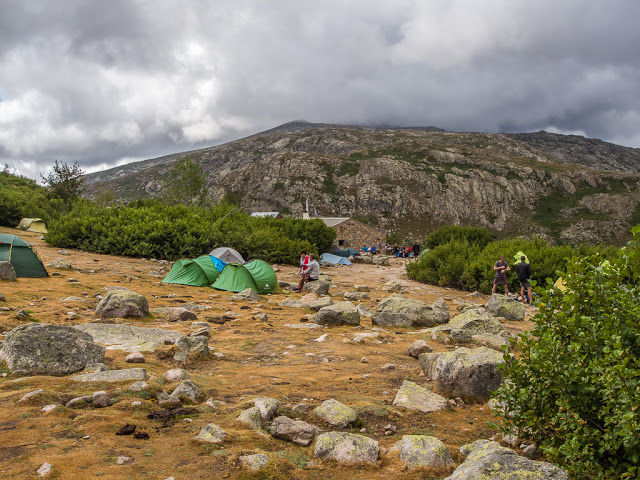
At last we could see the refuge nestled in the hillside. To reach it you have to cross a footbridge, and head up a final section of giant slabs.
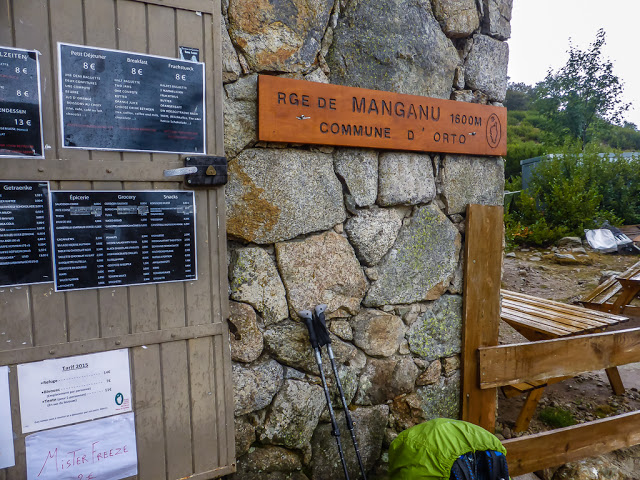
We had arrived!!! Bivouac camping prices are standardised throughout the national park and were the usual 7 Euros per person per night. Breakfast, evening meal and a variety of food supplies were on offer at the refuge, so we stocked up with some bread, saucisson and chocolate as a special treat.
We hoped this would be a good, sheltered spot should the heavens open and a storm come rolling in, as was forecast.
Arriving around half past 2, a demanding 8 hours since we had set off, it felt good to get both the backpacks and trail shoes off at last, and put on some flip flops. It also felt good having a quick shower to freshen up, despite the water being so cold we had to stifle squeals because of the queue building up outside the toilet block!
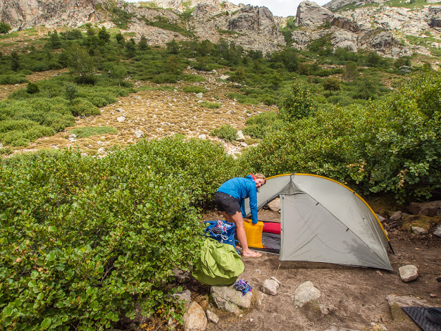
After a combined effort of pitching the tent, it was then my job to blow up the sleep pads using a special stuff sack. (I’m sure it has a special name). It’s new so it’s fair to say I’m still getting the hang of it, despite Wayne’s demonstrations of how to pump in the air effectively! Everything else, we’re pros at by now. Luckily, our mobile home was set up just in time…
Our view looking towards the refuge. This was our last photo of the day before the storm did eventually reach us and the rain came down for literally hours! Not good when your stomach is rumbling and you can’t cook inside the tent. It was a very long wait for dinner that evening.
Not only did the storm confine us to our tent for the rest of the day, it also meant we couldn’t do any laundry, resulting in us having zero clean clothes for the following day. No matter how hard we tried, the hiker look and smell was starting to make a reappearance! We also had problems with rainwater running right towards our tent as our camp pitch was in fact slightly downhill in a bit of a dip. Wayne creatively dug some channels in the ground alongside the tent to divert the gushing water away, but this was only effective for so long. By 7pm, the ground was completely saturated and we found ourselves camped in a giant puddle – no wonder this spot was still vacant when we arrived! The incessant rain really tested the mettle of our tent. – Talk about put the Henry Shire’s Tarptent under pressure, but it performed well, all things considered.
Inside the tent, listening to the rain hammering down and keeping our fingers crossed that we would not float away, we started to muse over plans B and C, should it continue to rain tomorrow. Then we really would have to bail out early.
Find out how we fared in our next trail report, Day 9 on the GR20, coming soon.
No Comments