
Returning to the Brecon Beacons National Park…
Having been forced to abandon our Beacons Way thru-hike earlier this year due to extreme weather conditions across southern England and Wales, we were left feeling rather incomplete and unaccomplished. We love nature and the outdoors, and that sense of adventure and anticipation when you’re about to embark on a long distance hike. Even more we love that deep sense of achievement at having just completed a gigantic goal which makes both us and our families proud. When long distance hiking, every day on the trail is a day with a goal. You have a goal for the day, and a larger goal for your journey. So to have to bail out early and not reach that end goal left us both disappointed and dissatisfied, the very premise of the Zeigarnik Effect – a human need for closure, to complete something that has been started. We found this very interesting as fundamentally we are exactly the kind of people that have to finish anything that we have started. We are also stubborn and never want to quit.
Our intention therefore was always to return to the Brecon Beacons National Park, if not to complete the trail as a whole this year due to time limitations, but to at least summit its most famous peak – Pen Y Fan – at 886 metres, also the highest peak in south Wales. So with British summertime finally upon us and great hiking weather forecast for the upcoming weekend, that’s exactly what we did!

Finishing what we started… Returning to the Brecon Beacons to hike up Pen y Fan!
There are several ways to walk up Pen y Fan, the most popular route known by regulars to the Brecon Beacons as ‘The Motorway’ – a four mile circular walk from the Storey Arms Outdoor Centre on the A470 or the nearby Port ar Daf car park, that takes approximately 2 and a half hours. As we wanted to give ourselves a good body work out in preparation for our upcoming long distance hike in Sweden and as the mountains looked so inviting from our campsite in Cantref, we devised our own 16 mile circular route taking in the 4 major summits – Fan y Big (719m), Cribyn (795m), Corn Du (873m) and of course, Pen y Fan (886m).
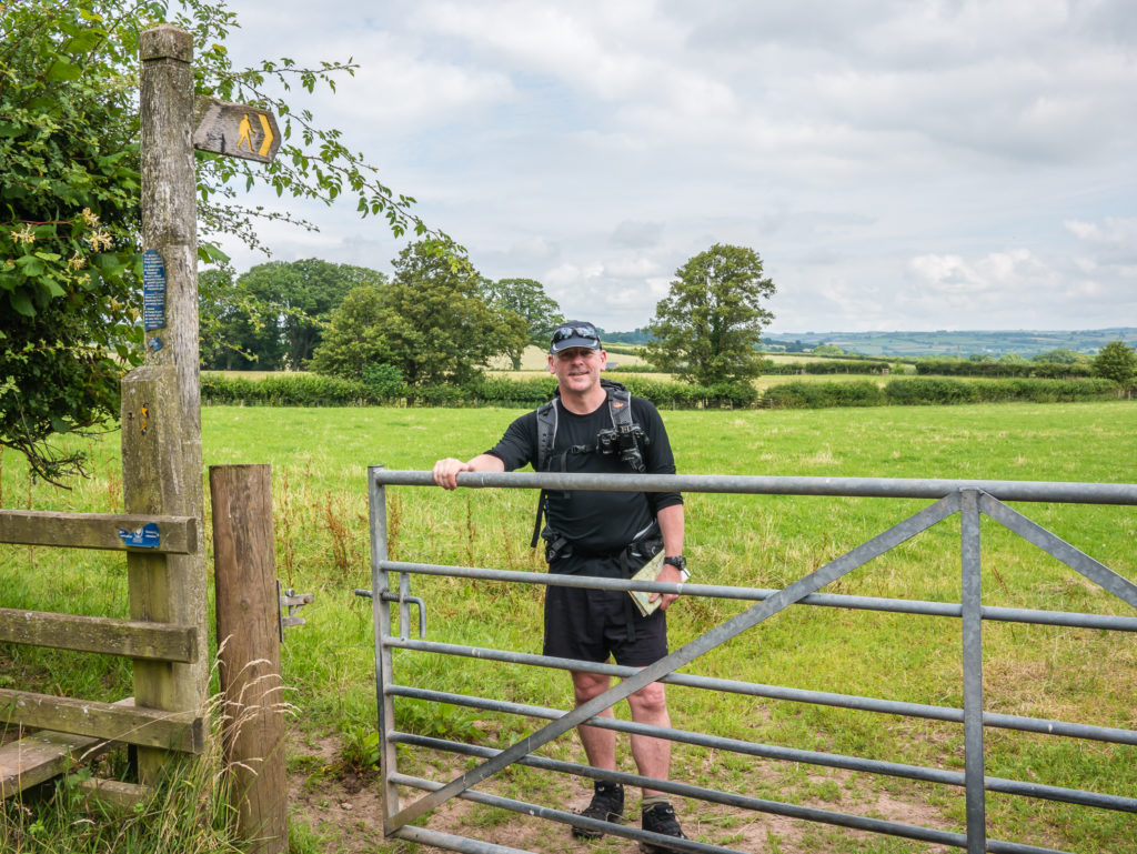
Starting from our campsite at Cantref Adventure Farm around 11 am, we walked in a clockwise direction, taking the road and public footpaths through farmers’ fields to the start of the trail over Clawdd Coch.
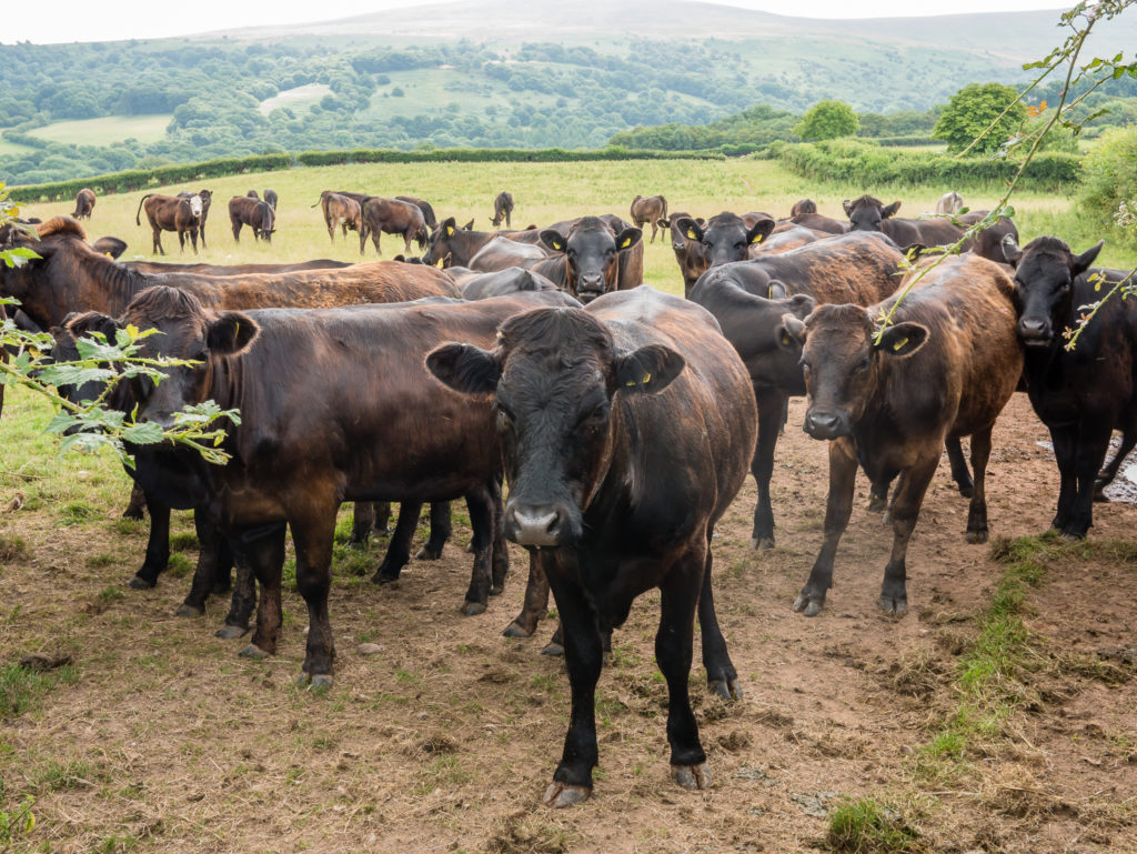
Our first hurdle of the day – the start of our route led us through a field of cows who didn’t look too inviting! So we avoided them by taking the road a short distance, then rejoined the track further on.
Cantref sits at a little over 200 metres, so we quickly gained height heading up Clawdd Coch.
We reached the summit cairn of the lesser known Bryn Hill after an hour or so. At at only 562 metres it is merely classified as a ‘Dewey’. It was our first peak of the day, so we stopped for a snack at the summit cairn and Wayne tried to get the drone up for a test flight.
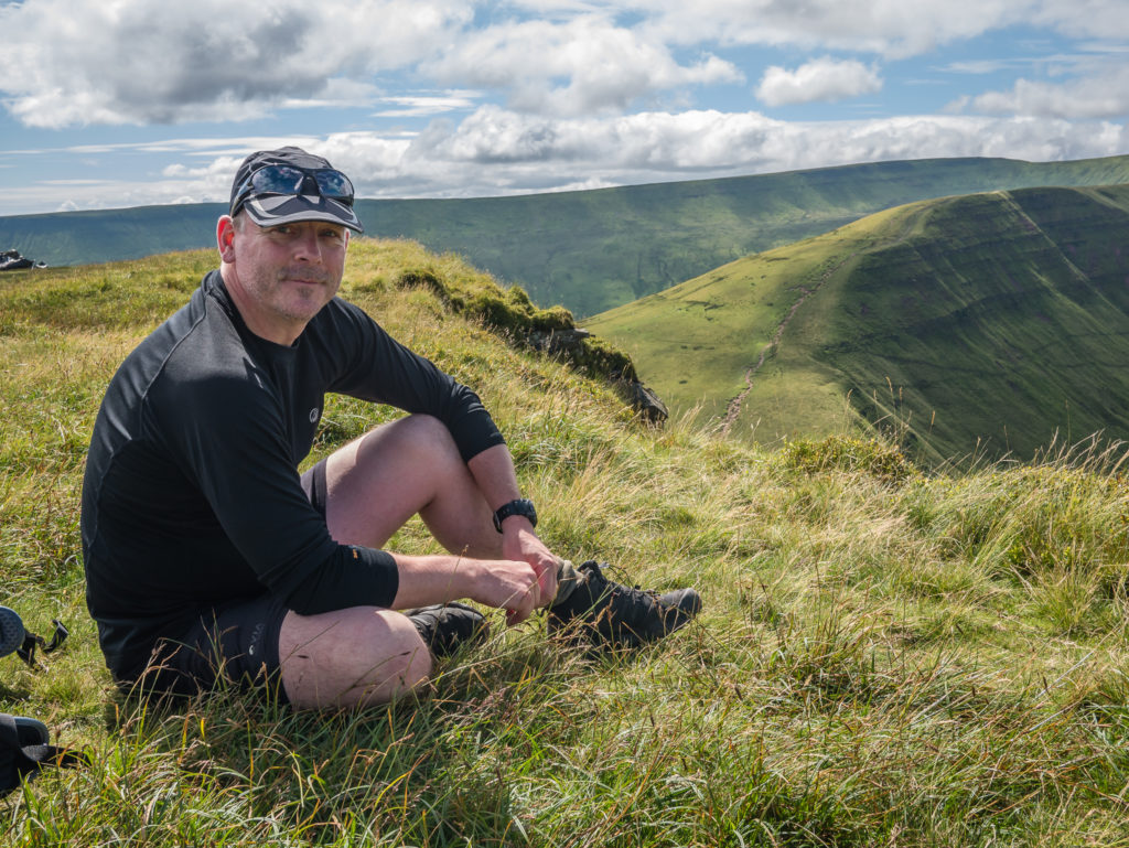
We had been in high hopes of getting some spectacular aerial footage of us walking along the mountain ridges with some panning shots of Pen y Fan. However, we had not considered how windy it was going to be up there, so the drone was struggling. We were nervous about having a ‘drone disaster’ and completely wrecking it before having even had chance to use it properly, so it was safely packed away in the hope that we could get it out again later. Instead we had fun playing around with our new GoPro session, filming the fine scenery of the Brecons as we walked along, eagerly stopping and perching on a precipitous rock here and there to grab a selfie!
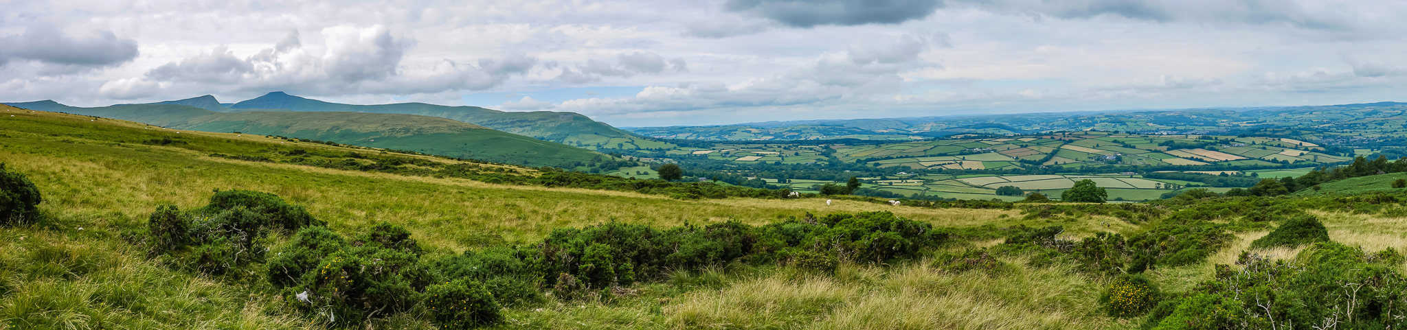
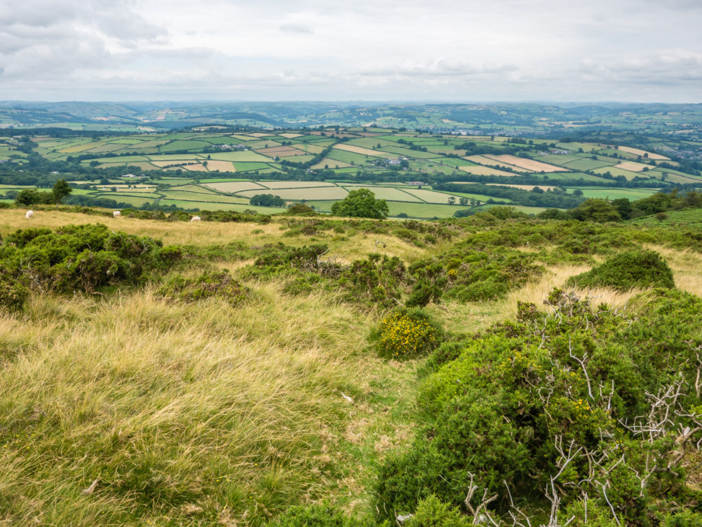
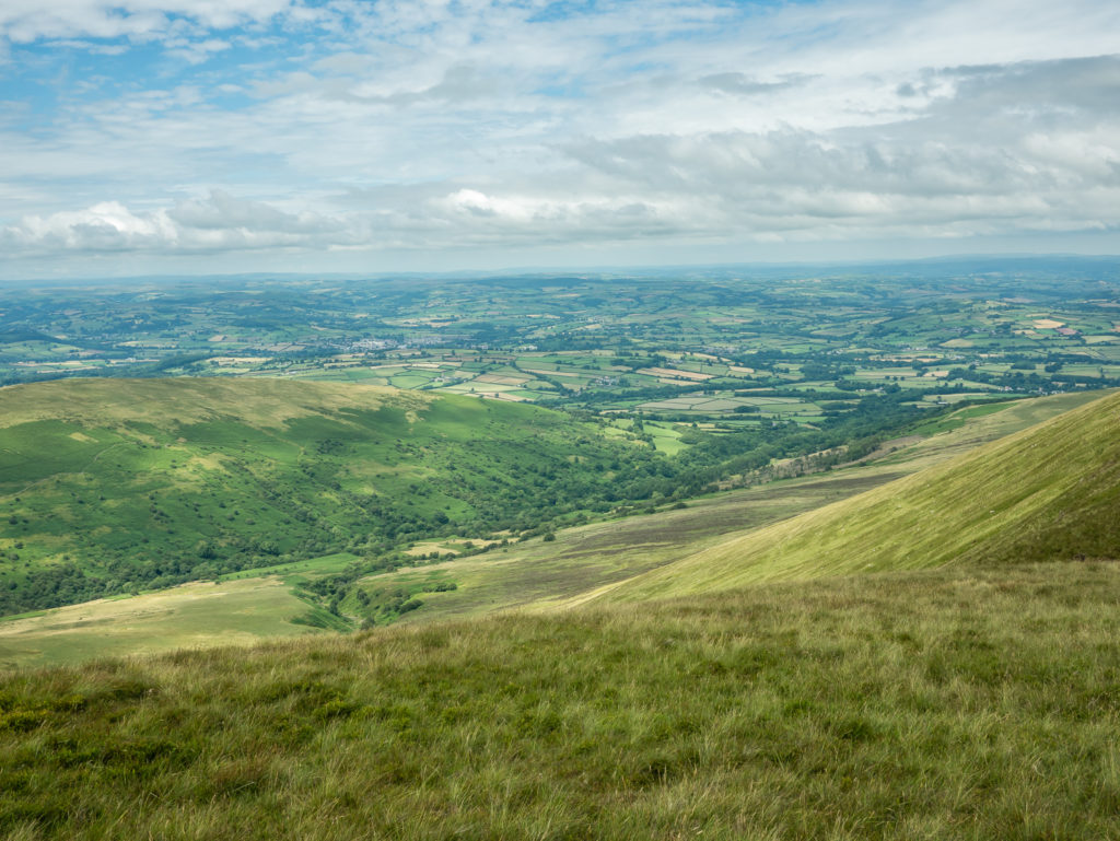
Panorama shot after leaving Bryn Hill. It is a superb vantage point for views and photographs of the ridges and summits of the northern part of the national park.
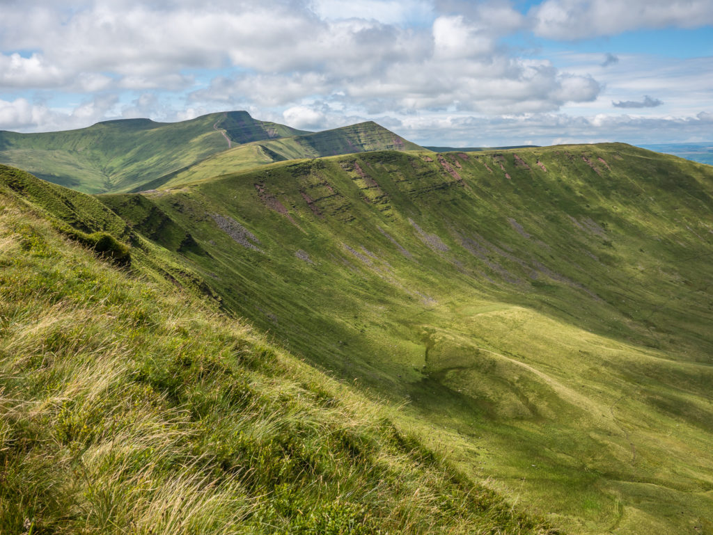
Magnificent mountain profiles… Breathtaking views across the Brecons awaits you!
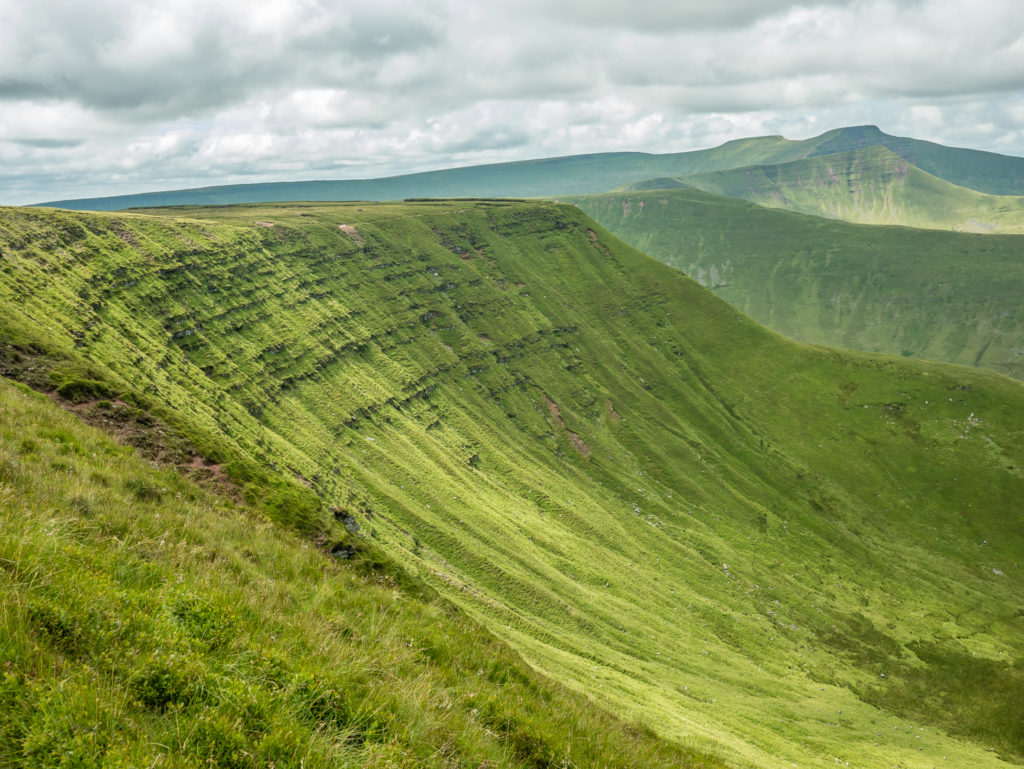
Looking to the right the twin peaks of Pen y Fan and Corn Du dominate the skyline.
We had only really just got started, but we already agreed we were on an incredible walk!
Looking out onto the dramatic central part of the Brecon Beacons.
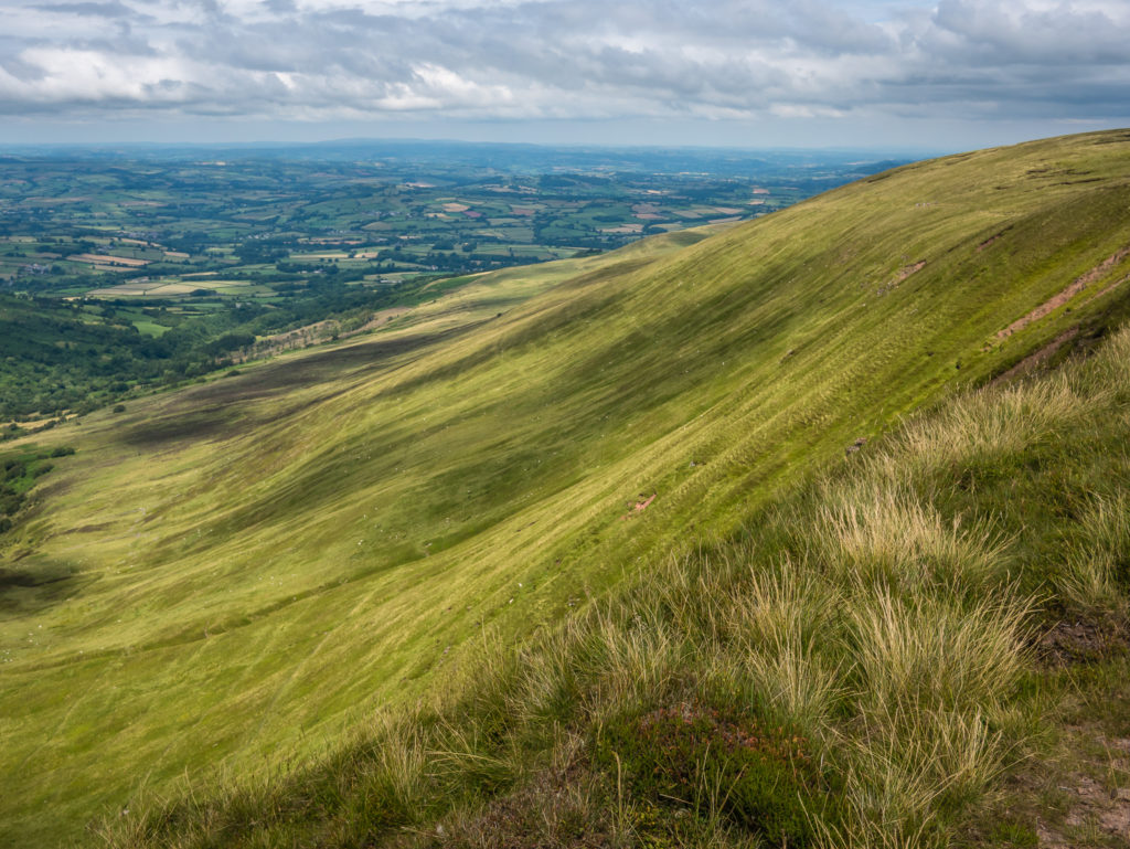
Reaching 730 metres, we followed the ridge line of Gwaun Cerrig Llwydion (Craig Cwareli) on a well trodden trail.
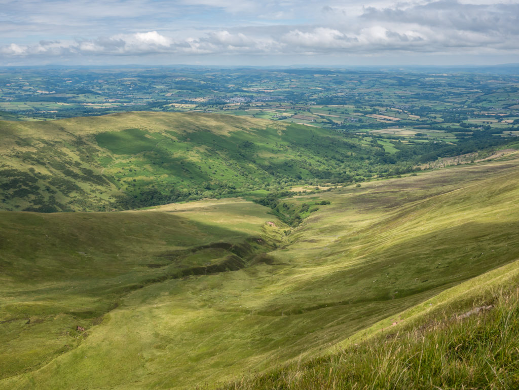
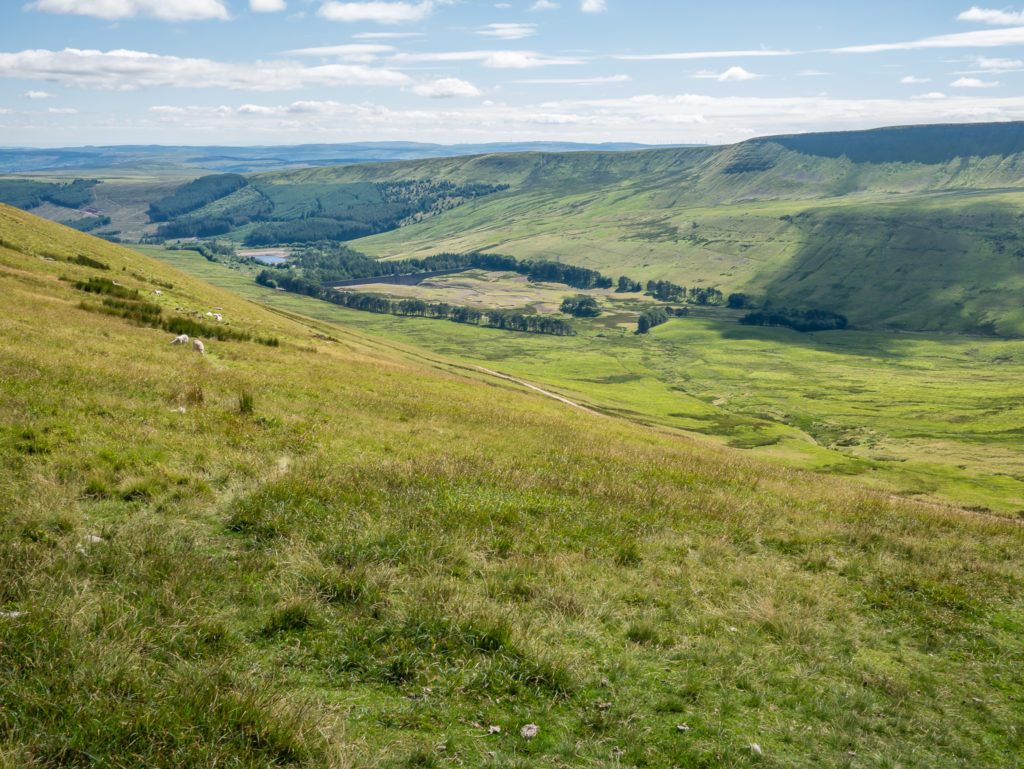
From the ridge, we looked down on Cwm Oergwm – literally translated as the Cold Valley – its name very apt for a glacial trough!
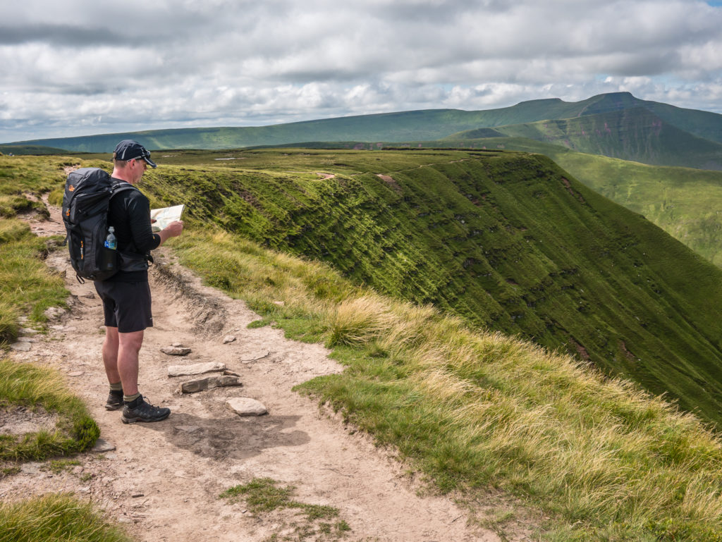
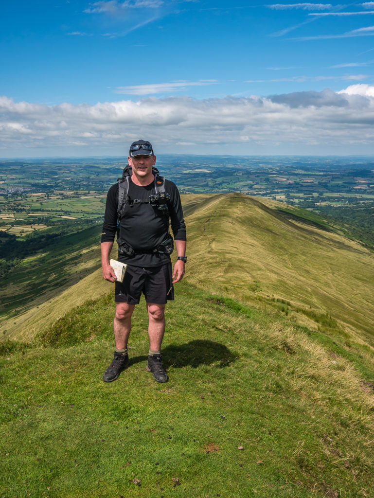
An essential piece of kit – a map! Even though the route seemed very clear and well trodden, it is always advisable to take a map for reassurance with route finding. The weather can be so unpredictable and rapidly change for the worse when in the mountains.
Up until now, we had been the only hikers along Bryn Hill and Craig Cwareli, which was in complete contrast to the caravan of walkers heading up to the summit of Scafell Pike during our last weekend away!
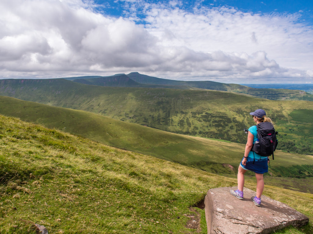
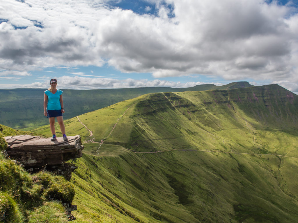
I couldn’t resist another rock shot! Stood on the ridge way we had commanding views.
What a glorious green day to be in the mountains!
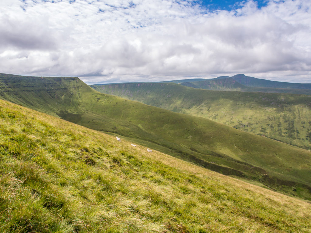
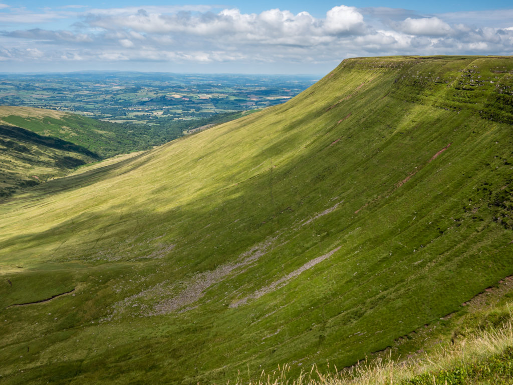
The view across Cwm Oergwm to Fan y Big and the other major summits is mightily impressive.
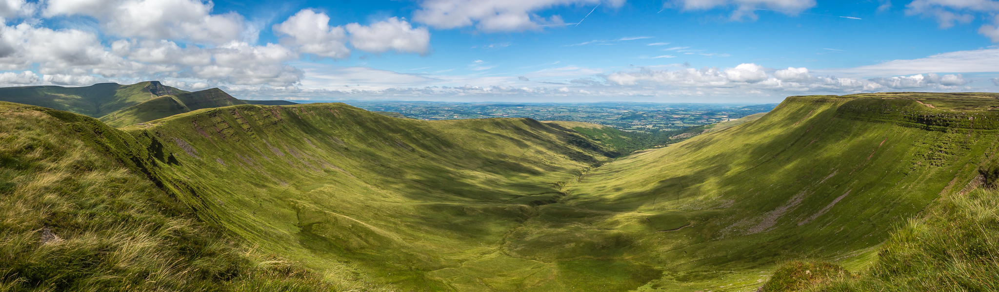
Panorama looking onto the u-shaped glacial valley – Cwm Oergwm.
Preparing for our ascent up to Fan y Big on the other side of the valley at 719 metres.
Although we would consider our choice of route to be a strenuous mountain walk overall, most of it was on well-made footpaths leading directly to each summit, so there was no scrambling involved.
Making our way to the summit cairn… Our first ‘proper’ peak of the day was the 719 metre Fan y Big, which lies at the western tip of the Gwaun Cerrig Llwydion plateau.
Its name translates as ‘peak of the bill’ – perhaps in allusion to its striking pointed shape. The summit is smooth and grassy, but marked by a cairn, which stands on the edge of its precipitous western face.
More popular than the summit of Fan y Big is a flat rock that projects over the escarpment known as the ‘Diving Board’. A few hikers were waiting their turn for a photograph, so of course I also had to get another selfie shot on a rock!
Time for lunch! Taking a quick breather and testing out the GoPro on Fan y Big!
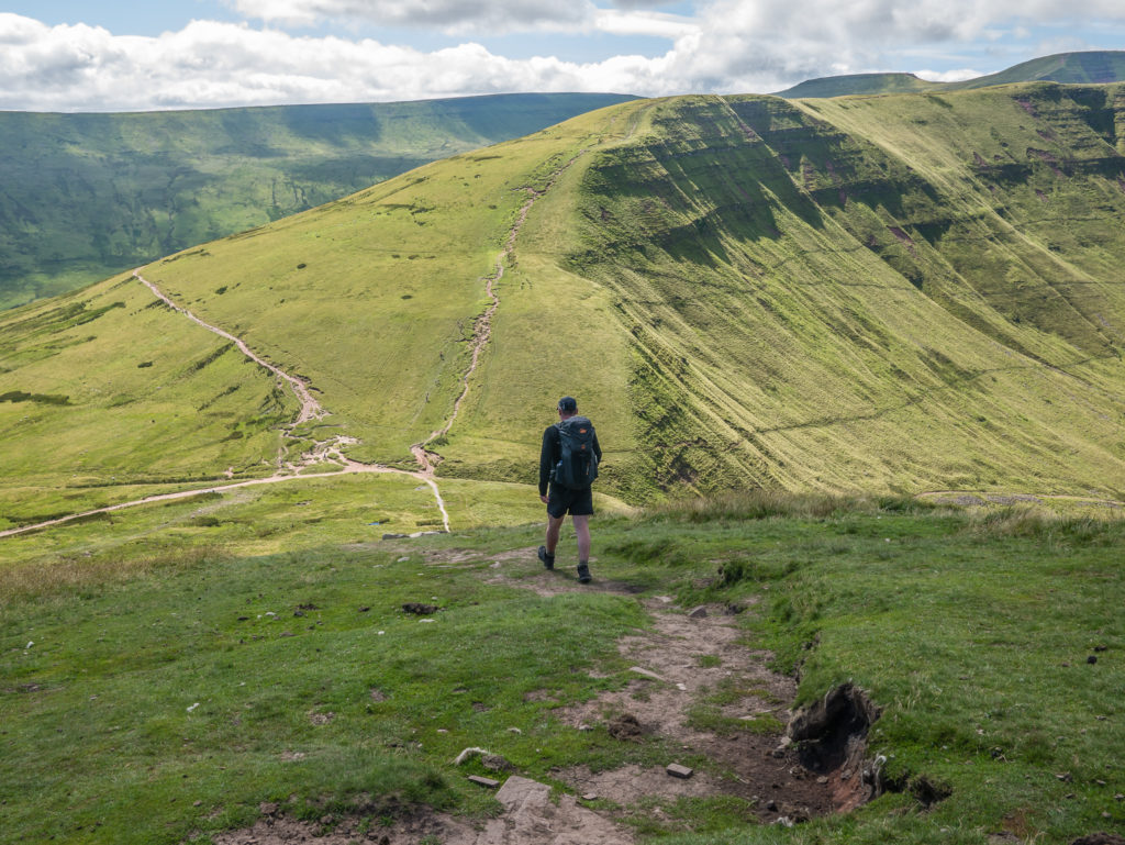
We crossed the peak of Fan y Big next aiming for Cribyn, standing tall at 795 metres. The route takes you down around 100 metres before your ascent starts again!
Looking back towards the Neuadd Reservoirs that were seemingly very dry.
Continuing on the trail towards Cribyn.
We had commented that on our journey so far, we had seen virtually no litter whatsoever – maybe as the trail was so quiet. What was disappointing to see on the busier sections however, is that not everyone sticks to the designated trails, despite signs asking for walker’s consideration. It is clear that a lot of time, effort and money has been put into restoration work on the most popular trails leading to each mountain summit in this national park. As with the trail restoration work leading up to the summit of Scafell Pike, it is an attempt to combat the erosion caused by the passage of thousands of feet up and down the most popular summits in England and Wales. We hope that more people will respect this fact and indeed stick to the designated trails once the work is complete.
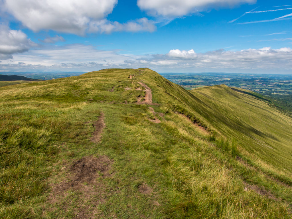
Following the trail and looking towards the town of Brecon in the distance.
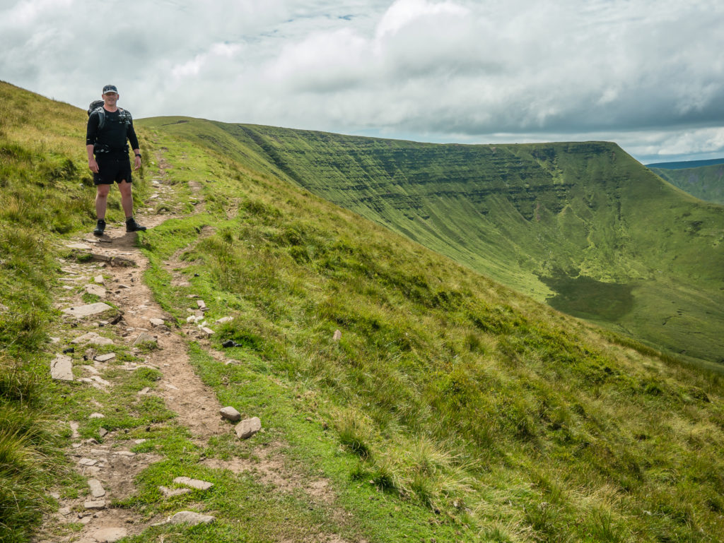
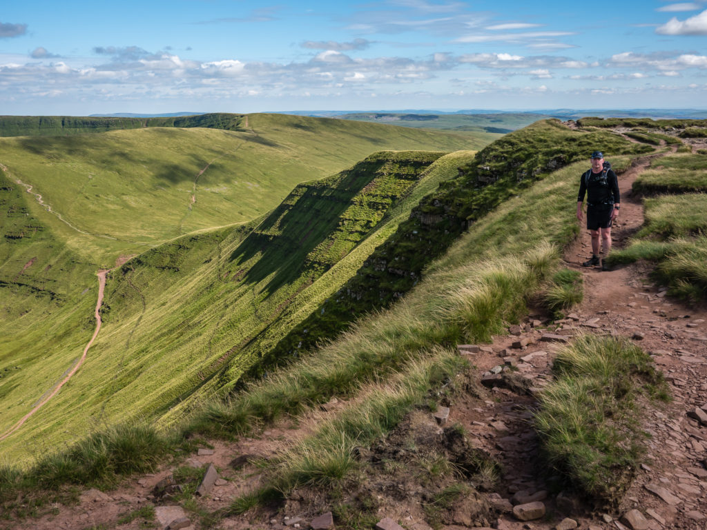
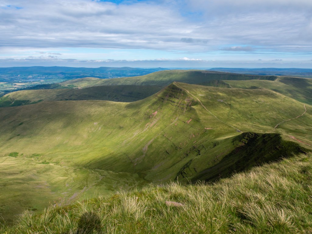
Looking back towards Fan y Big and the trail we had just walked down that zig zags down the mountainside.
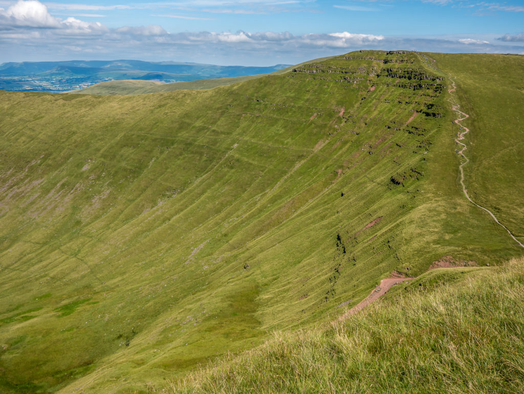
The sweeping ridge line. Looking back to the summit of Fan y Big.
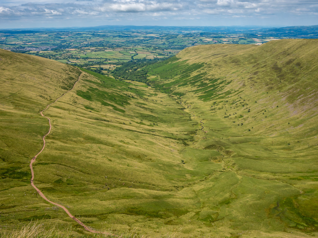
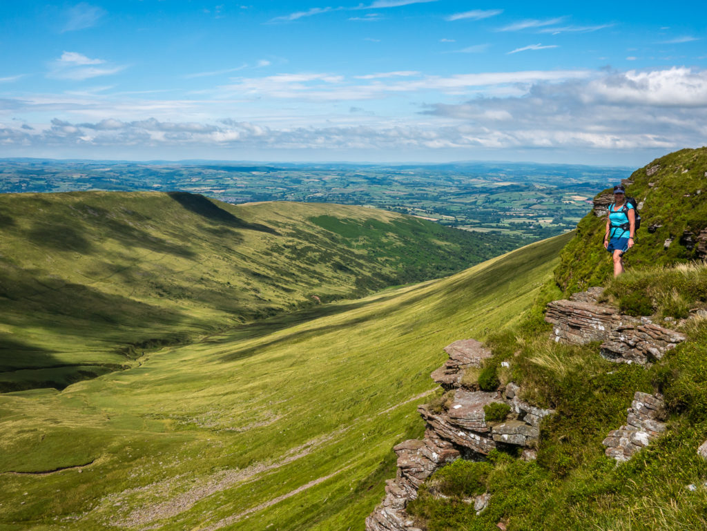
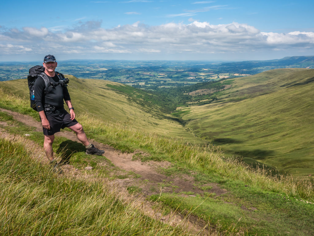
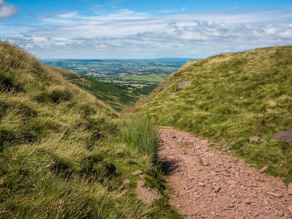
What a valley view! Looking north down Cwm Cynwyn towards the Vale of Usk.
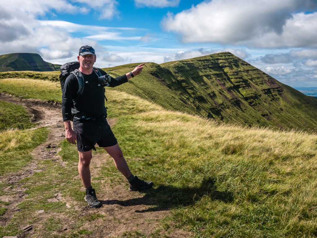
Wayne points to the summit of Cribyn where we were headed next.
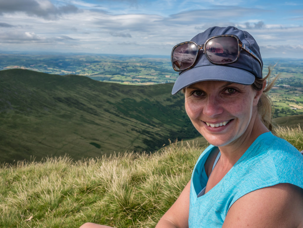
Taking a moment to savour the incredible landscape and make a lasting memory on camera!
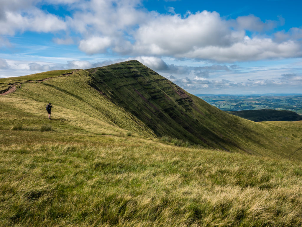
Heading around the top of the ridge to the summit of Cribyn.
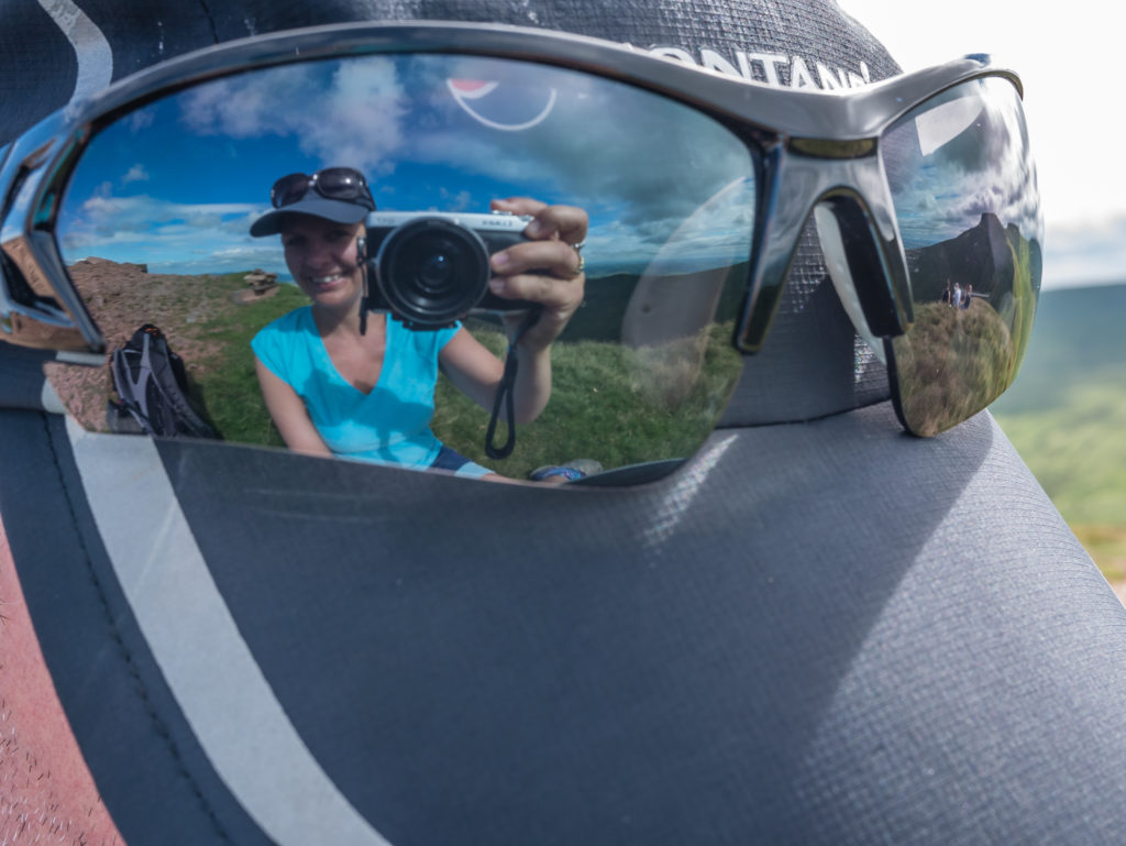
Reflection shot with the summit cairn in the background! (Again, not a busy summit!)
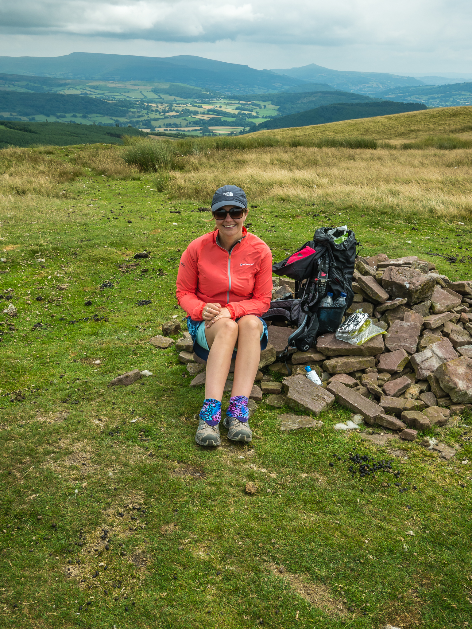
Resting at the top of Cribyn before the next big push!
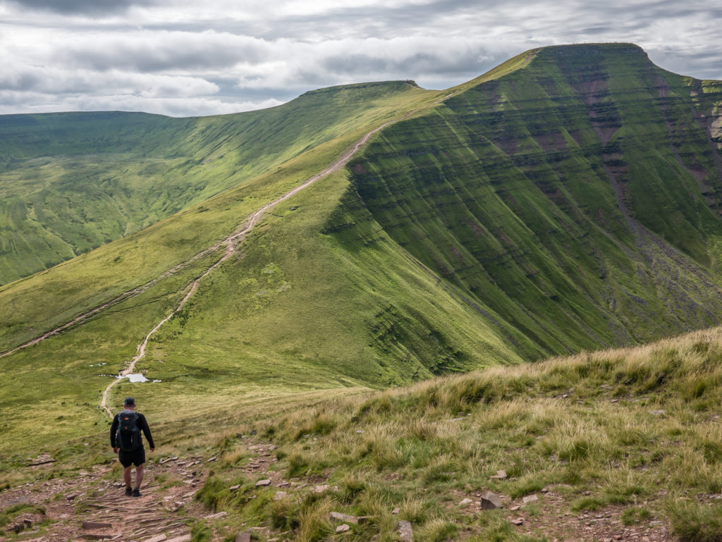
The traditional profile shot of Pen y Fan taken whilst descending Cribyn.
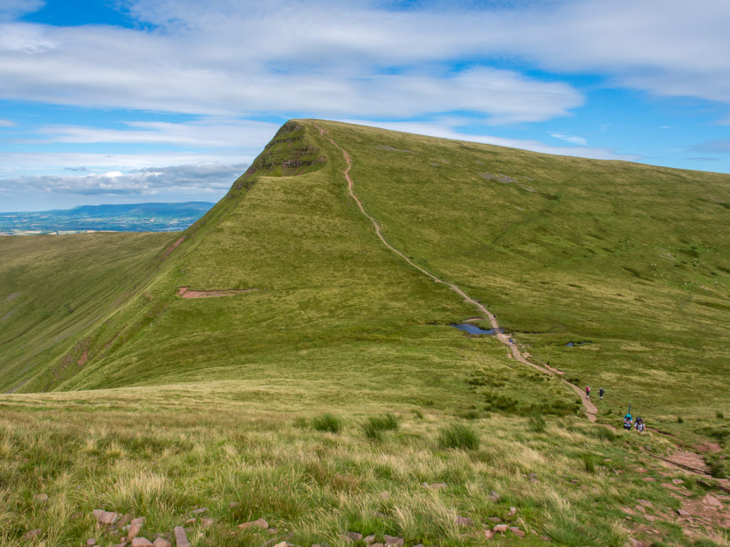
Looking back to the summit of Cribyn. Once again we had to descend just short of 100 metres before making our way back up to reach the next summit, which was Pen y Fan.
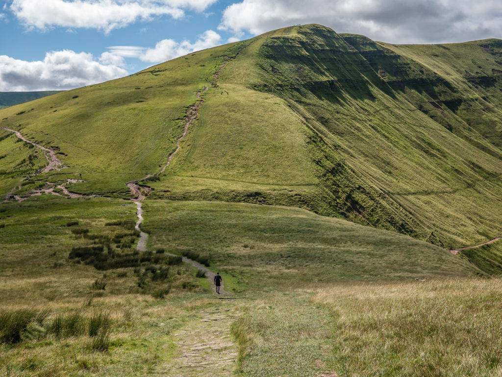
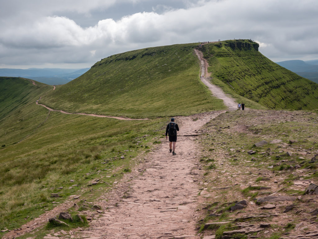
We took the most direct route straight up the mountainside heading up to Pen y Fan from Cribyn, avoiding the crowds coming up from the Storey Arms side.
Top tip: Take the hard route – thereby giving yourself expansive views of mountain vistas minus people!
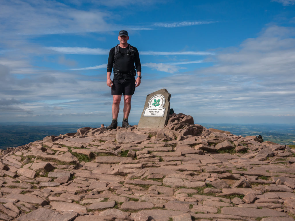
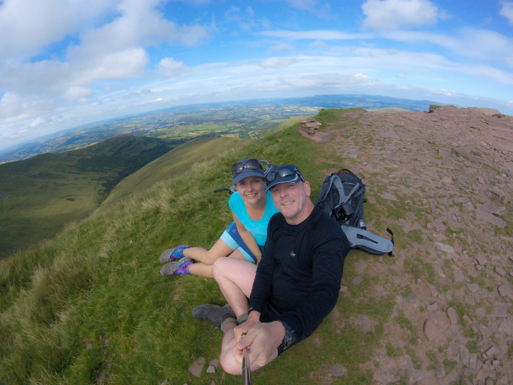
We made it to the top! The highest peak of the day, and the tallest mountain in Southern Britain – Pen y Fan – at 886 metres. It was busy at the summit, but people were courteous with taking turns at the cairn.
The views from the top are spectacular when weather permits. To the north, the town of Brecon can be seen and on a particularly good day the summit of Cadair Idris is just visible. Looking east you can just make out the Sugar Loaf in the far distance, and to the south-west the Bristol Channel at Porthcawl can be seen on a bright day.
Interesting Mountain Facts:
- Pen y Fan and the surrounding area is now owned by the National Trust.
- The name Pen y Fan roughly translates as ‘the mountain’s peak’, ‘the beacon’s summit’ or ‘top spot’.
- The twin peaks of Pen y Fan and Corn Du, were formerly referred to as Cadair Arthur or ‘Arthur’s Seat’.
- Both the summits of Pen y Fan and Corn Du were used as burial places in the Bronze Age. When the burial chamber on Pen y Fan was excavated in 1991, a bronze brooch and spearhead were found inside the chamber.
- Being the highest mountain in southern Britain at 886 metres, Pen y Fan is used by the military as part of the selection process of the UK’s Special Forces personnel.
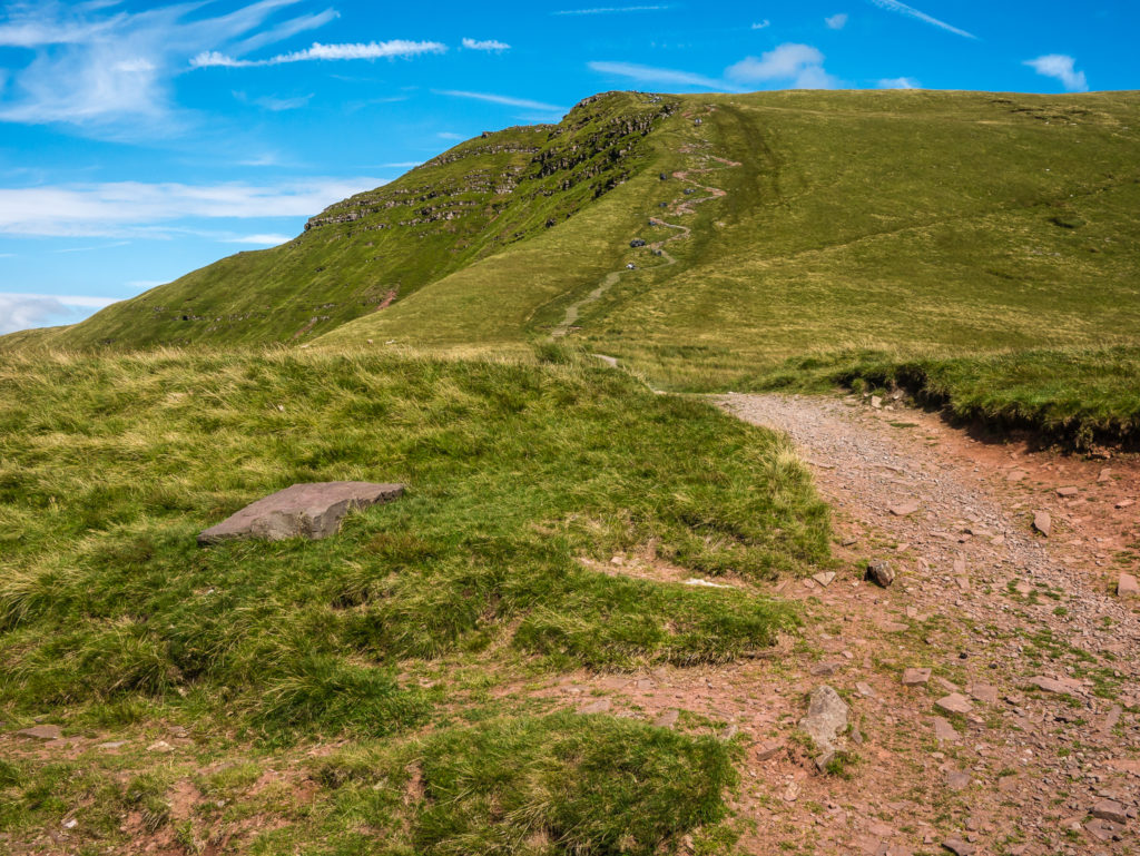
We quickly followed the trail to the saddle in between Pen y Fan and Corn Du, making our way up the pitched footpath to the summit plateau of Corn Du.
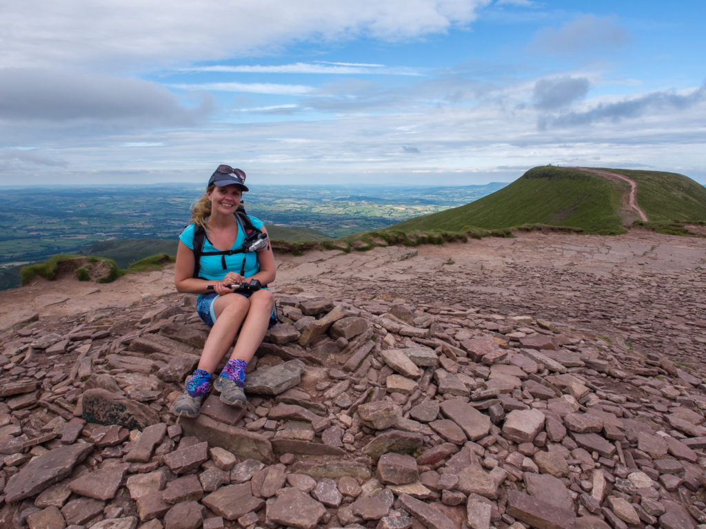
Sat at the summit cairn on Corn Du. At 873 metres, it is just a mere 13 metres lower than its twin peak, Pen y Fan, seen in the background.
We had planned on descending Pen y Fan rather than Corn Du as it was the more direct route back to our campsite and by now it was already nearing 6pm. The climb to Corn Du then back to Pen y Fan wasn’t as tough as expected, despite it being the last of five climbs of varying height and length during today’s walk.
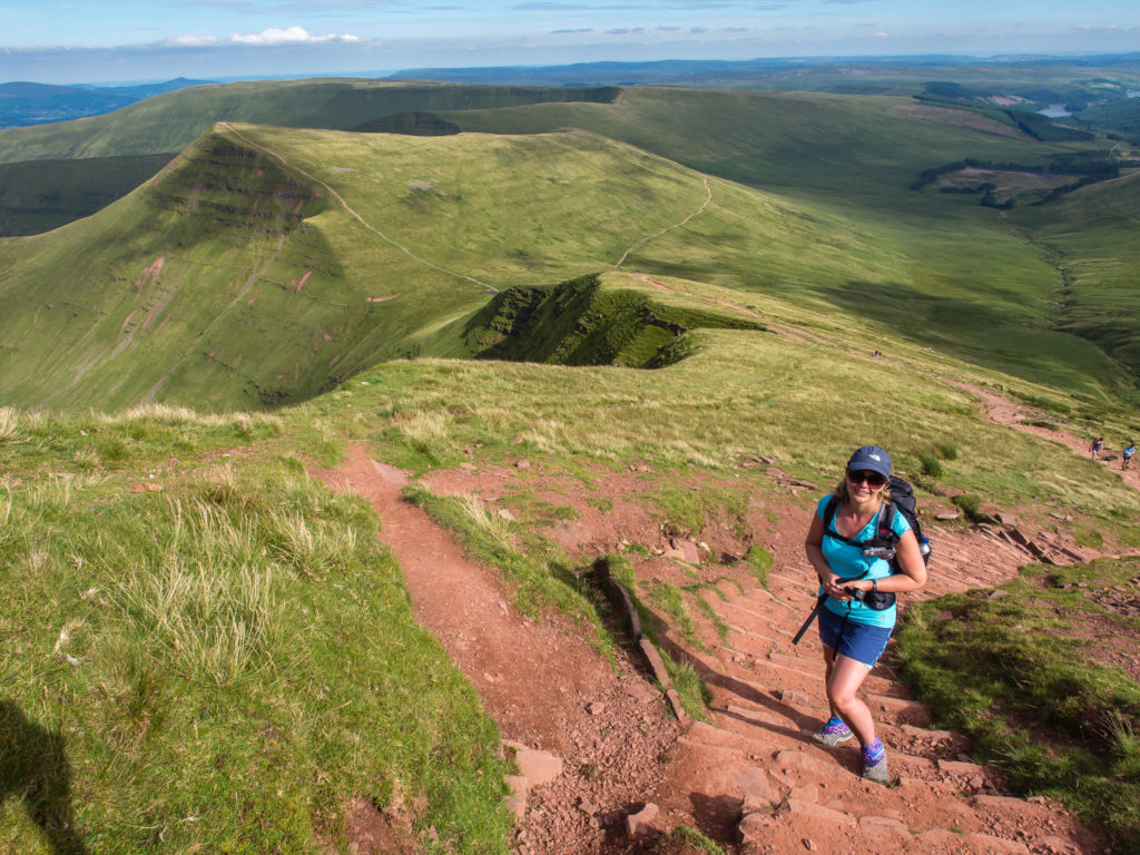
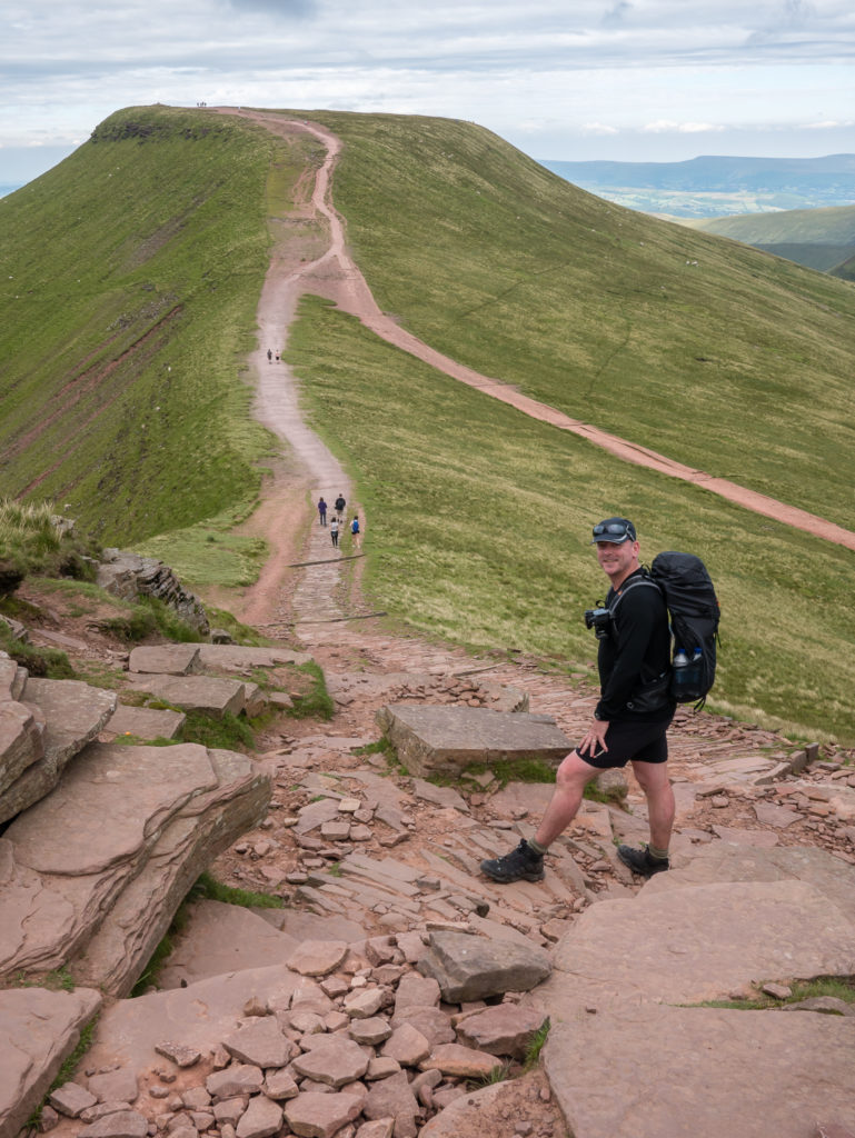
We returned to Pen y Fan, then took the most direct route along the ridge of Cefn Cwm Llwch back towards the valley bottom in the direction of Cantref.
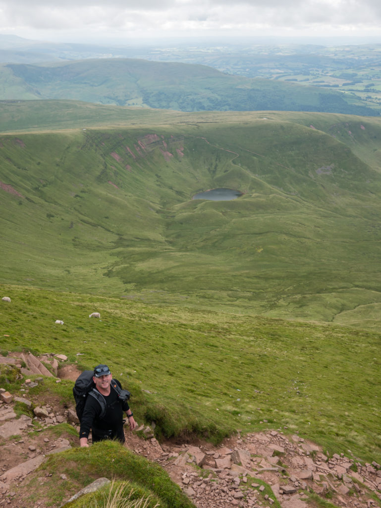
Heading down the northern flank of Pen y Fan. In the background is Llyn Cwm Llwch – known as the best preserved glacial lake in South Wales. There are many legends about the lake and the supposed fairies that live on an invisible island in the middle of it.
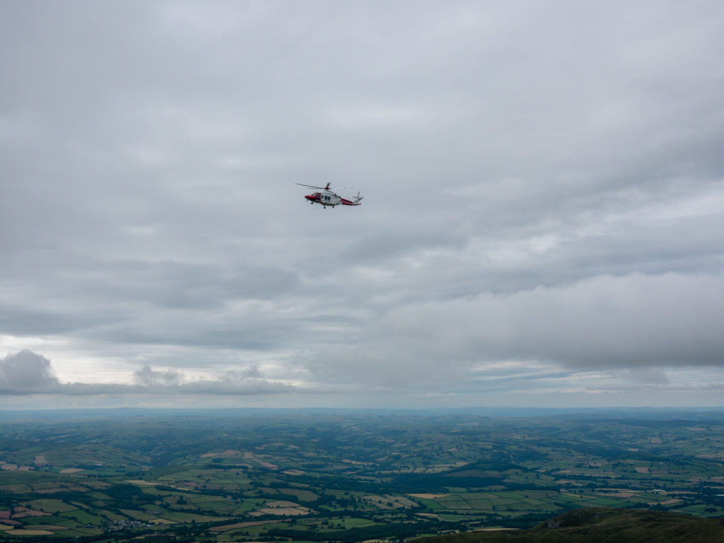
During our descent we saw a rescue helicopter circling the four major peaks. We weren’t sure if this was a training exercise or whether they were indeed searching for a lost or injured walker. We hoped it wasn’t the latter.
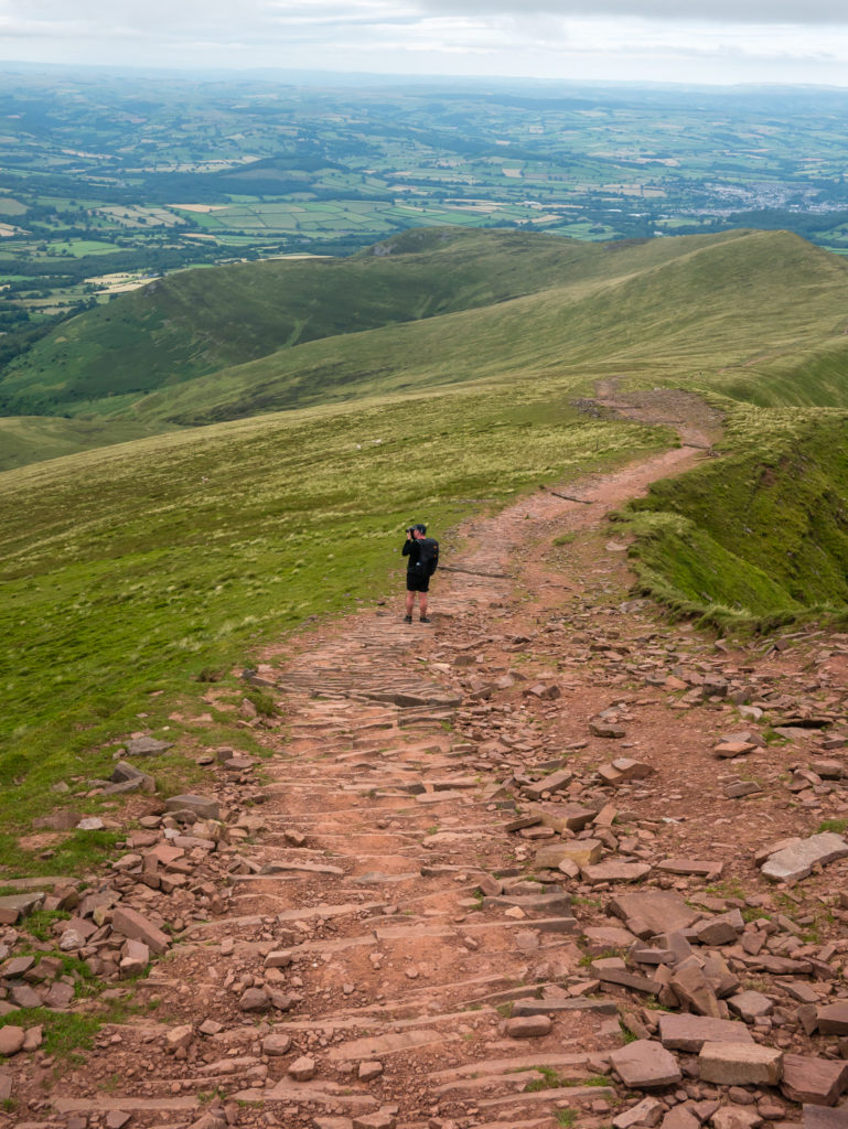
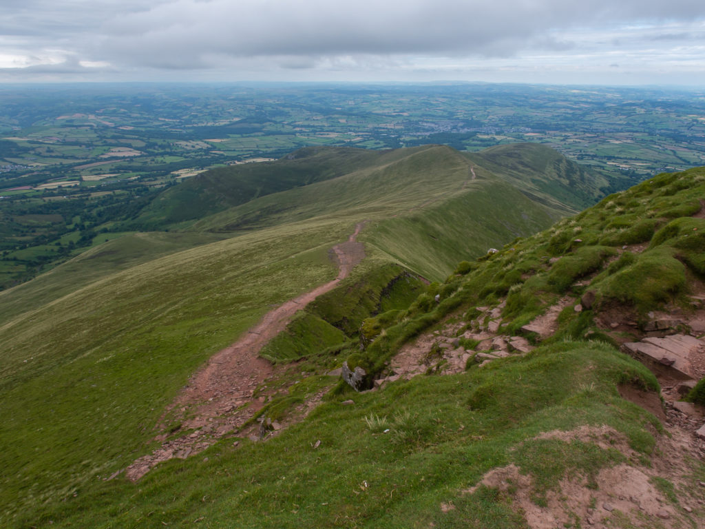
Continuing on the long but steady descent.
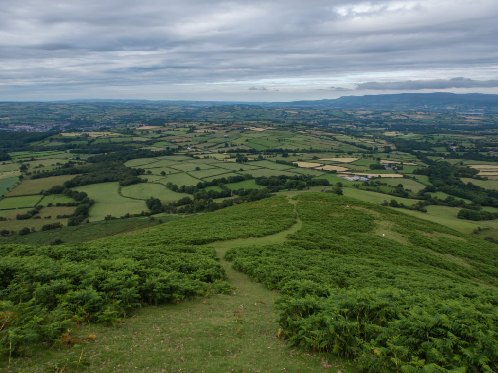
From the ridge of Cefn Cwm Llwch we enjoyed expansive views of rolling hills, moorland, and beyond…
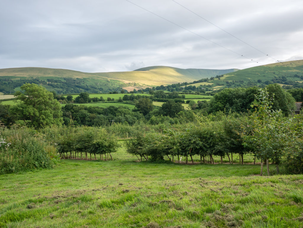
The wonderful view from our camp pitch. A final mile or so along the road leading back to the campsite saw us finish the walk around 7:30 pm, 8 hours after we started. A job well done!
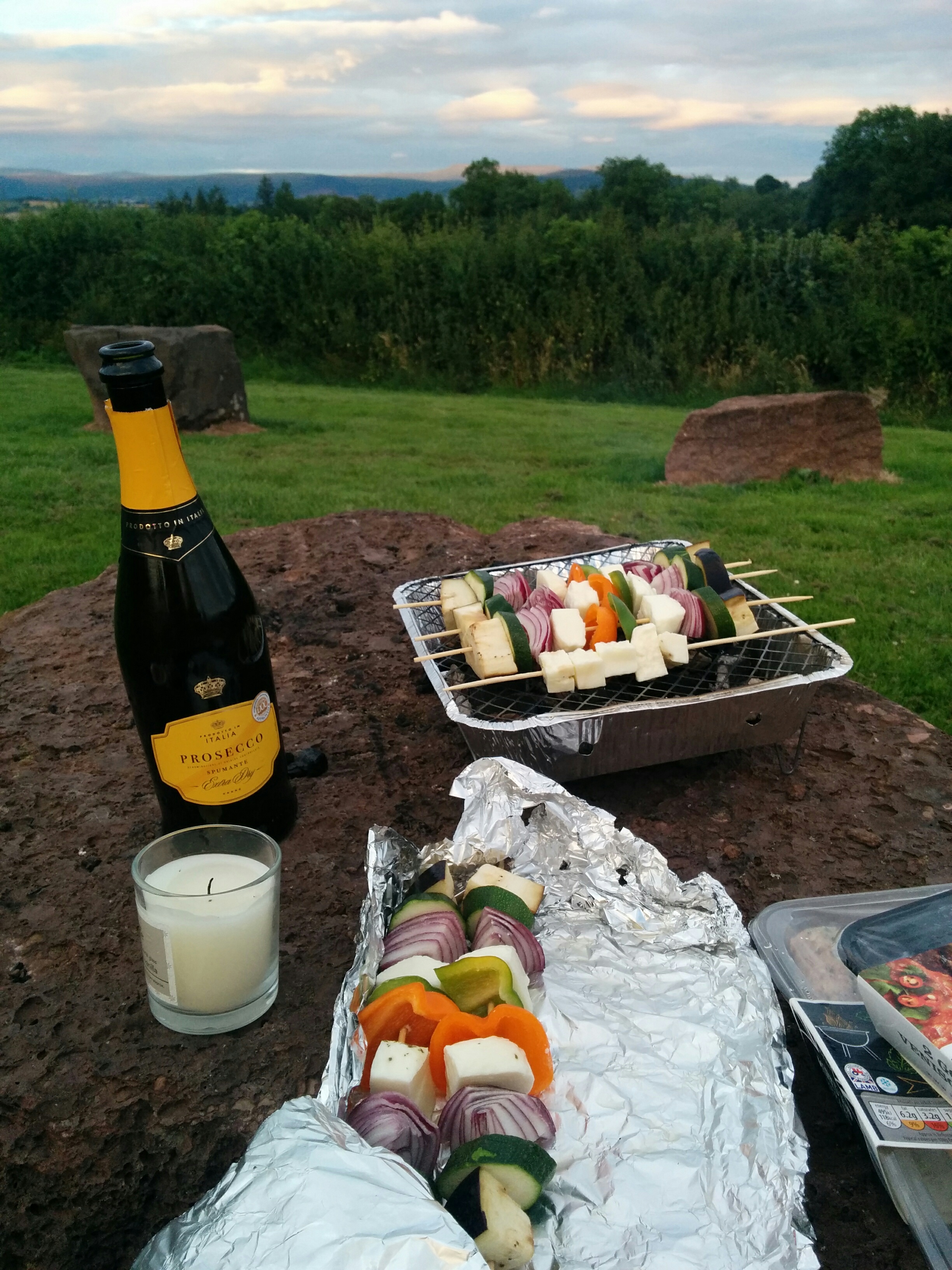
We were both ready for a shower, a much awaited glass of vino and a celebratory barbeque! A perfect way to end a magnificent hiking day!
Take A Look At Our Circular Route
You can export a GPX/KML file from this by clicking on the Pen y Fan Circular link.
With stunning scenery, peace and tranquillity, and above all a good whole body workout, this makes for an excellent day hike in good weather. Although there is over a kilometre in height gain over the course of the day, it is perfectly manageable with the right footwear, sufficient water and snacks and sheer determination.
You can easily spend a weekend or much longer exploring the landscape of the Brecon Beacons. It is an ideal spot for hiking, with its extensive range of mountains, ridges, and gentler valley paths and rivers. From the highest peak of Pen y Fan down to Taf Fechan river, and options for crossing between different peaks and paths around the 520 square miles of the national park, it is definitely worth packing up the car with your camping gear and taking a road trip to Wales!

1 Comment
What an awesome day for views and achievements. I love our rainforest trails but I do long for more variety and open spaces as you have in the UK. When do you head for Sweden?