
“The King’s Trail (Kungsleden) is the hiker’s stuff of dreams. We’re talking wild mountain landscapes, bubbling brooks, foaming rivers and high mountain plateaus. Swedish Lapland and UNESCO World Heritage site Laponia have a network of fantastic, wild national parks including Sarek and Abisko. In all, Sweden has 29 national parks stretching the length and breadth of the country and you have FREE access to all of them.”
– Web: Visit Sweden, 2017
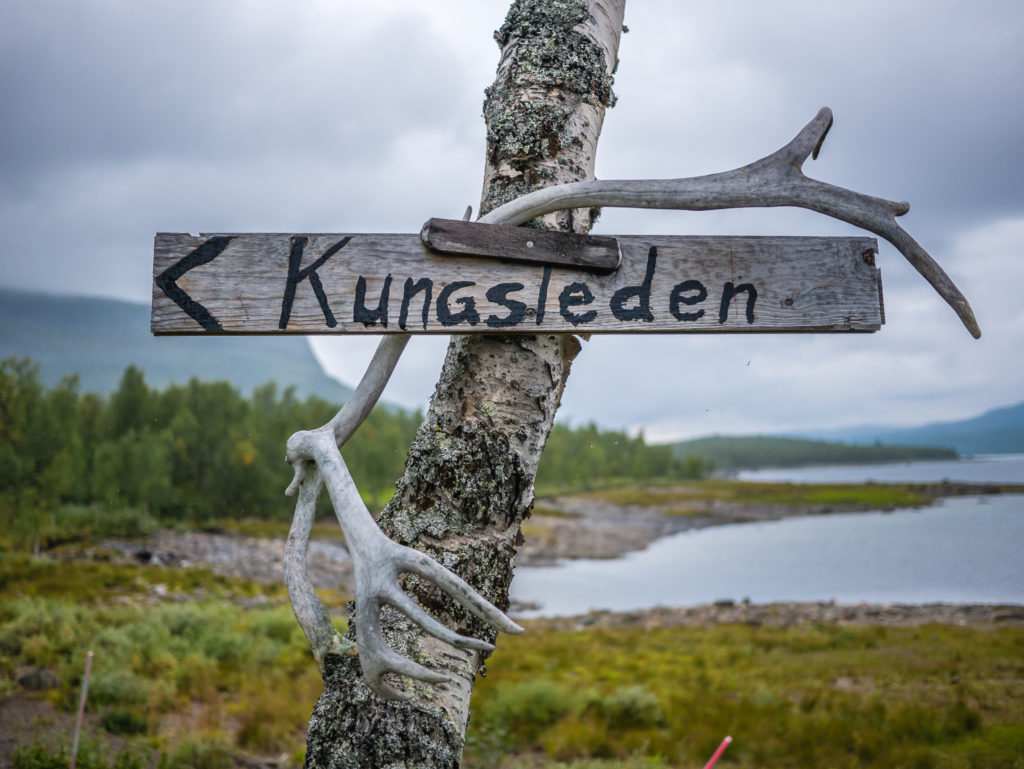
The Kungsleden or King’s Trail has many unique elements, one of which is taking you on an incredible journey into the Arctic Circle.
Sweden’s Long Distance Path Into The Arctic Circle
Located in what is considered to be the last true piece of wilderness in Europe, ‘The Kungsleden’ – Sweden’s premier long distance trail, winds its way approximately 270 miles (430km) between the country’s highest peaks and most dramatic landscapes in the far north. Characterised by craggy snow-capped peaks towering above perfect u-shaped valleys carpeted in light shades of green, we commented that the tremendous landscapes of the Kungsleden are reminiscent of the western fells back home in the UK, except these glacial valleys are much bigger and on a far grander scale – basically the Lake District on steroids. Except that in the Lake District you are not woken up by a herd of reindeer foraging around your tent, the tinkling of bells from these very timid and camera shy creatures one of the best wake up calls in nature we have experienced thus far on our hiking endeavours!
Is This Trail For You?
One of the harshest environments on our planet, the Arctic has always struck us as a place for serious adventurers and experts. However, the King’s Trail is wholly accessible to a wide range of walkers due to the relatively low-altitudes, somewhat easy-going terrain, and extensive network of mountain huts and emergency shelters along most of the route. Sleeping in the huts, topping up food supplies on the go from the available shops, and making use of their cooking facilities, as opposed to carrying a full backpack of equipment and food rations, means that such a trip is ever more accessible for the ordinary trail seeker. Despite its wild reputation and remote location, this hike is not about technical skill, but is more a test of your stamina and longevity. Even with a full pack and the intention to wild camp such as ourselves, an average hiker in moderate shape, with a taste for adventure and a good set of walking legs, can take on the challenge and find they can go the distance.
Into The Wild…
With a small population of 9 million in a country of around 174,000 square miles, days can be spent exploring the wilds of northern Sweden in undisturbed peace and quiet, but the sense of solitude you feel out there is never more apparent than when the Kungsleden leads you into the inhospitable Sarek National Park. Its sheer vastness and remoteness can be overwhelming, the trail taking you to what literally feels like the end of the world. The most dramatic and grandiose of all of Sweden’s national parks, Sarek cannot be accessed by road or helicopter. It is very much still a wild frontier, and rightly so, the Swedes want to keep it this way. One of the highlights of our trip was our journey through Sarek on our detour to the top of Skierfe, which provides a breathtaking look-out point over the Rapa river and Laitaure delta. We couldn’t have wished for better weather when we reached the flat summit. It can only be described as one of those ‘wow’ moments. The sun was reflecting brightly in the turquoise ribbons of water that weaved through the immense valley below and we couldn’t take our eyes off the tremendous view.
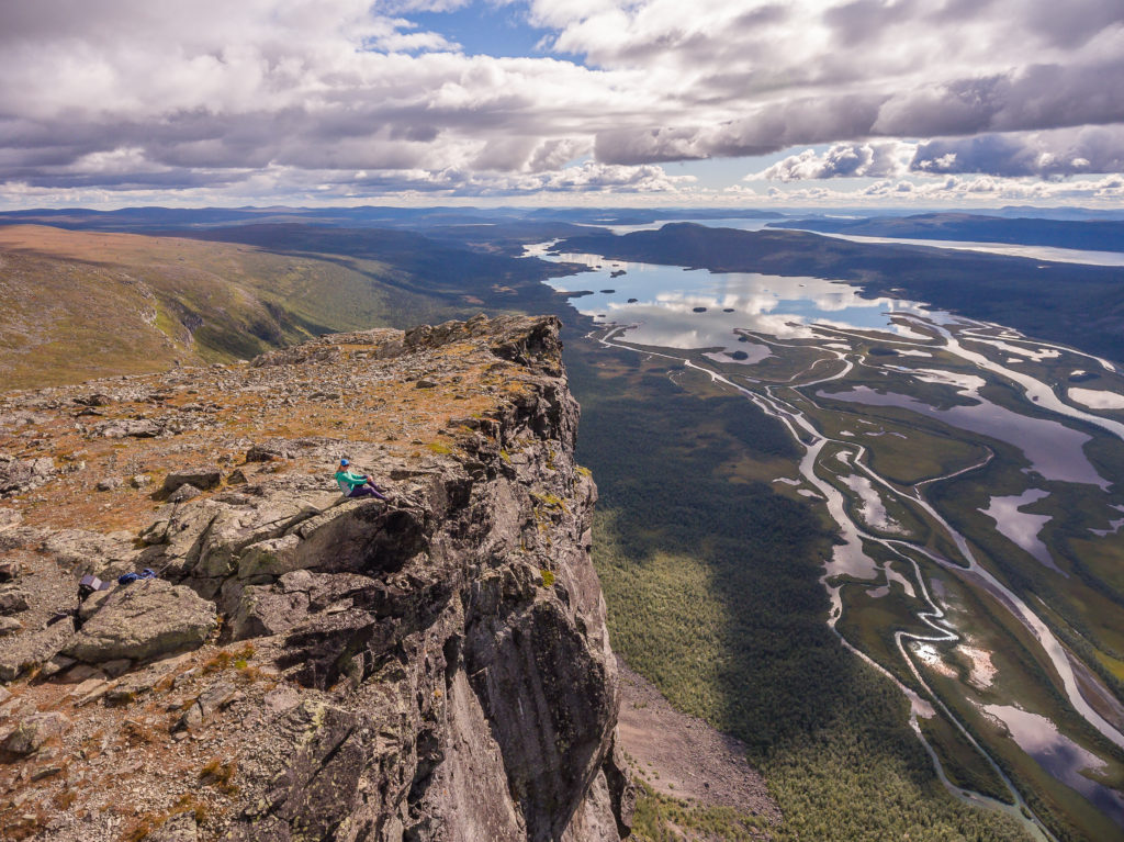
Drone shot overlooking the Rapa Valley. We enjoyed fine weather and tremendous views!
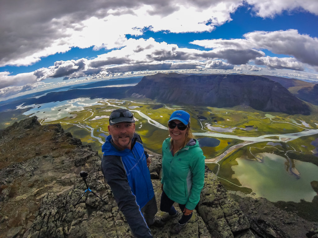
GoPro ‘Selfie’ on top of Skierfe.
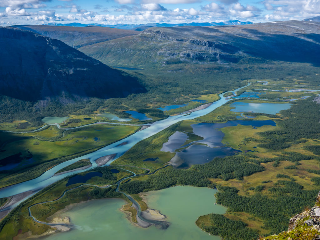
The amazing turquoise waters of the delta produced by the silt.
The Challenge
If you intend on completing the entire 270-mile/430-kilometre trail you need to be reasonably fit and prepared for some long walking days. On a fast paced itinerary such as ours, we covered average daily distances of around 16 miles/25 kilometres. The terrain is typically a combination of dense, flower-carpeted birch forest, opening out into vast, glacial mountain valleys, but the trail is well-defined and easy to follow. With the exception of going over Tjaktja Pass, (the highest point on the entire Kungsleden at 1,140 metres), you will only be faced with modest height gains and losses from start to finish, so walking is not too rigorous or demanding.
The main hindrances along the way are rocks, roots and boggy ground, so paying attention to the placement of your feet is a must. However, wooden boardwalks are a frequent feature of this trail, assisting you over boggier terrain and helping to alleviate erosion. (Albeit several board sections are in dire need of maintenance work.) There are also bridges across non-fordable streams and during the summer season, local charter boat services (fee payable, typically 200 SEK pp) or row-boats (free) are in place enabling you to get across several large lakes that form part of the trail.
Depending on when you go, the most challenging elements you will encounter will be plagues of mosquitoes and the unpredictable Arctic mountain weather. During the summer season, the tundra is abuzz with large clouds of biting, blood-sucking insects that can bring misery to even the most hardened hiker. Having experienced rain for at least a third of our trip, you should also be prepared for cold, wet weather as the norm.
Timescale
Based on our own itinerary of 21 day’s hiking, it is possible to complete the Kungsleden in just three weeks, but this is recommended as a fast pace. A more realistic target of completion is 28 days, as the trail can be conveniently separated into four segments, which each represent approximately one week of hiking. You may also want to allow for some spare days should the weather, fatigue, or minor injury hamper progress. Due to the unpredictable Arctic weather, we were advised that for every week on the trail, add on an extra day to allow for any contingencies. (However as we were time-limited with work commitments, we didn’t have the luxury of doing this!) As a side trip, you might also wish to add on a day’s ascent of Kebnekaise. We can also recommend taking an extra day to detour off the Kungsleden to the Skierfe look-out point for jaw-dropping views over the Rapa river and Laitaure delta, boasted as one of the best views in Sweden.
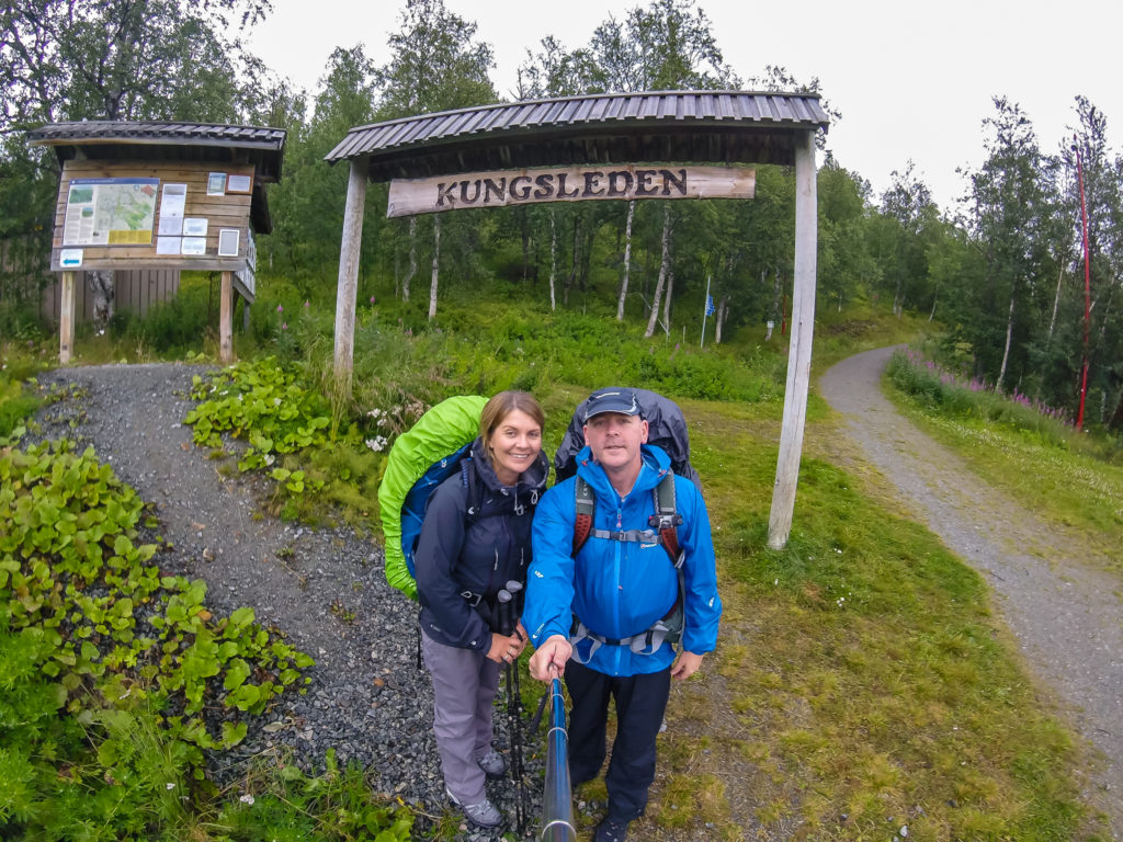
Starting out in Hemavan fully laden with supplies and clad in wet weather gear for our journey north into Swedish Lapland…
We completed our thru-hike between 13th August and 2nd September, 2016. Our daily trip reports with accompanying photographs are included below: