
The Start Of A New Hiking Adventure!
Crowned as the toughest long distance hike in Europe, the ‘GR20’ route at approximately 180 kilometres, is a long distance trail that traverses Corsica diagonally from north to south. ‘GR’ which stands for Grande Randonnée, meaning ‘big excursion’ in French is an extensive network of long-distance footpaths and trails in Europe, mostly in France, Belgium, the Netherlands and Spain. Not letting the GR20’s reputation as the most difficult of all the GR routes put us off, and being drawn to the fact it is also considered one of the most beautiful mountain trails in Europe, we decided to make it our next thru-hike.
Having completed the 16 stage route in 12 days, this is the start of our next series of trail reports where we will share our recent experiences and photographs of another incredible journey on foot that really pushed us to our limits and tested our resolve.
Read on to find out whether this could be a trail for you! We welcome any questions, or if you’d like to share your personal experiences related to the GR20 trail, then please leave a message in the ‘Comments’ section at the bottom of the post.
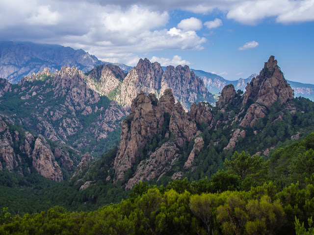
This is the rugged terrain you will not only witness daily on the GR20, but will find yourself scrambling over!
Reversing The Route – Opting To Walk South To North
Having buckets of confidence arising from walking 700 miles last summer, and now having 4 successful thru-hikes under our belts after completing the West Highland Way earlier this year, we booked our flights to the little French island of Corsica, located in the Mediterranean, then never really thought much more about it as August seemed a long while off. Leaving much of the logistical planning and organisation to Wayne, thereby reading very little about the trail before arriving in Bastia, but for the reassuring guide book rhetoric that ‘rock climbing skills are not a requirement’, I think it’s fair to say that getting back on the trail became a huge shock to the system for both of us and that the GR20 certainly lives up to its name as an extremely challenging hike!
We faced many tough days ahead with numerous ascents and descents, the variation in height over 12 days being that of about 10,000 metres.
Although our thru-hike was successful, which involved us reversing the route to build up to the more difficult sections, walking south to north from Conca to Calenzana in just 12 days, we completely underestimated how demanding it really would be. This was not just because of having to navigate the rugged terrain carrying backpacks weighing in excess of 17 kilograms with food and water supplies, but because of having to do it in searing August temperatures, with some days on the trail exceeding 30 degrees Celsius. We seriously questioned our decision to hike in the middle of the peak season and the hottest month. (My career choice as a teacher rather restricts us to having to holiday at this time of year however!)
So in hindsight, having been just a little too blasé about our next hiking adventure, we seriously advise that if you’re considering the GR20 as your next thru-hike, make sure that you allow enough time to do your research and make every effort to become well informed about what to expect. To put it simply, ensure that you plan and prepare yourself as much as possible for what is to come. Start by Googling the ‘spasimata slabs’. After listening to other hikers’ accounts of traversing the famous slabs, which they had already completed due to walking in the opposite direction to us ‘northbounders’, this was a section I was completely terrified of facing, having worked myself up listening to their tales of how difficult it was traversing the slabs that line Spasimata Gorge. In fact, it was nothing worse than anything we had already experienced up to that point. Yet as we were heading north, the southbound hikers seemed to have the wrong impression that the stages we had already completed south of Vizzavona (the half way point), which they would be facing towards the end of their hike, were ‘easy’. Nothing is easy on the GR20. Some sections are perhaps ‘less’ gruelling – but overall be prepared for a hard, intensive slog from start to finish whichever way you intend to hike the route!
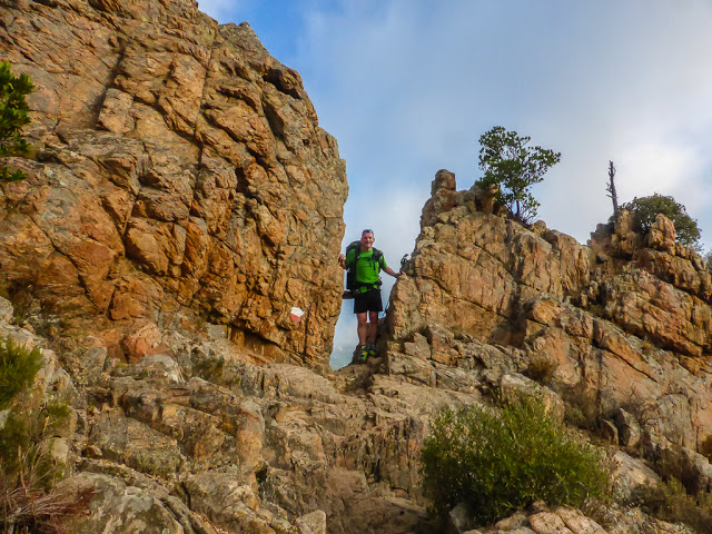
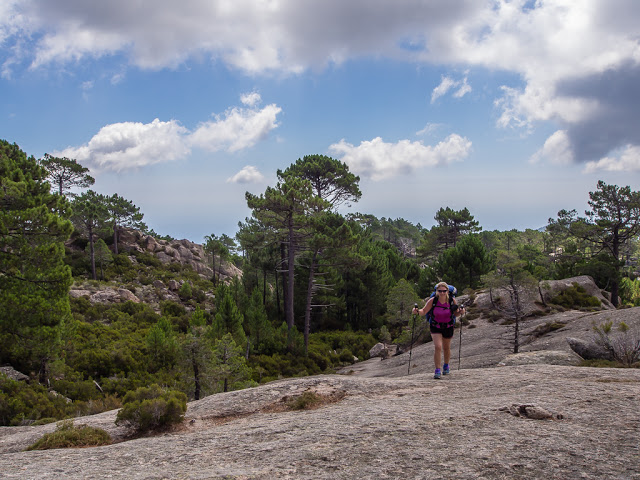
Although the GR20 is not considered ‘technically’ challenging, it involves plenty of steep ascents and descents, scrambling and the occasional use of fixed chains. You really need a head for heights and surefootedness for the rocky landscape and mountain ridges you will be faced with.
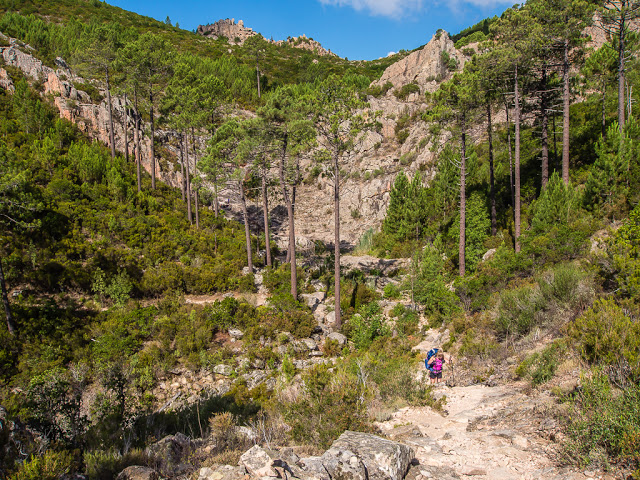
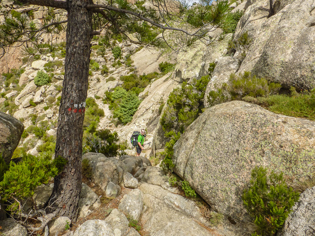
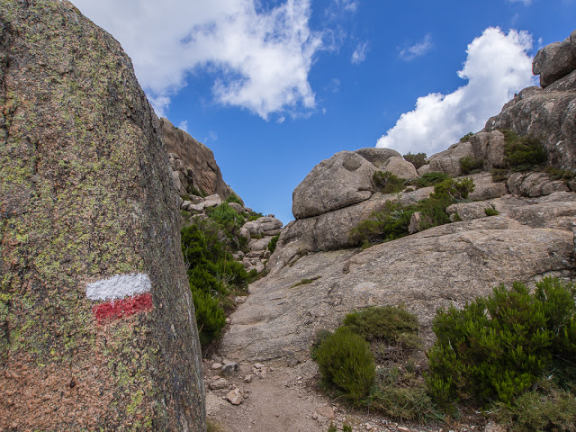
Even though the GR20 doesn’t require any climbing techniques, an excellent fitness level and a good degree of confidence in walking over a variety of rugged terrain is necessary. During several hours of toil, it will be rare that you will encounter a section of flat path that stretches for more than 10 metres, so enjoy a stride out while you can. In fact, there is no real path under foot for most of the time, which we had not really anticipated having been treated to a well trodden pathway and wonderfully placed switchbacks during our time on the John Muir Trail in the USA. During most stages you will encounter steep and rocky sections, some ridge-walking, and numerous ascents and descents navigating your way over rocks, stones, and granite slabs, some at a 45 degree angle. The white and red flashes of paint that serve as trail markers will send you scrabbling over nightmarish boulder fields, inching across precipitous rock faces and sliding down vertiginous scree slopes, which is both hard going on the feet and completely exhausting under the intense sun, as many of the stages involve very little tree cover or shade. At times, you along with your faithful backpack, will need to squeeze through gullies and between boulders, then scramble over rocky notches switching between one side of the ridge to the other, all the while averting your gaze from the sharp drop-offs and long way down. ‘No technical rock climbing skills necessary’ the guide book said – well this very much feels like rock-climbing without ropes!
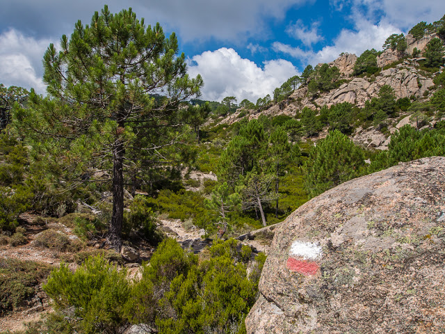
The trail is not always obvious but the well-placed white and red painted markers can be relied upon to guide the way.
Having faced what seems like another endless section of boulder scrambling, you may question why you ever thought this walk was a good idea. Be thankful it is not raining as well to compound the situation. During the most hair raising, leg trembling stages in the northern section, it is reassuring to note that chains or cables have been fixed to the rock to assist you in navigating around the most precarious of places. When dry, they are mostly superfluous, but when wet, they could be a life-saver. Despite the breathtaking mountain scenery, there’s very little time to stop and enjoy the view. You are just far too busy looking down to appreciate it all! Spurred on by an ever insatiable appetite and wanting to reach camp before dark, you will spend a lot of your time concentrating on where to place your feet, as well as seeking out the next white and red marker to ensure that you are going in the right direction and taking the best route possible. That being said, the trail is very well marked. However if you get lost in your thoughts or are too busy following the person’s footsteps in front of you, it is still easy to miss a waymark and find yourself retracing your steps to get back on the correct path. This trail requires 100% concentration, dedication and resolve both physically and mentally if you are to even make it beyond Stage One.
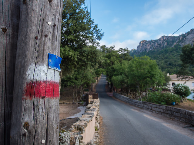
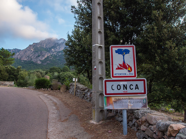
There is an abundance of white and red painted flashes, the symbol for the GR20 route, clearly daubed on rocks, boulders and trees every few metres or so. After setting off from Conca it became our symbol of reassurance.
The GR20 is the first hike we’ve encountered where days or stages are measured in number of hours as opposed to mileage as navigating the terrain can be so tough. A case in point is the Spasimata Gorge itself. 3 and 3/4 miles from Haut Asco to Refuge de Carozzu over Bocca a i Stagni (2010m), Bocca Muvrella (1980m) and through Spasimata Gorge, according to the guide book takes approximately 5 and 1/2 hours. Add in a couple of rest breaks and a half hour lunch stop and this short distance took us 7 hours and the best part of a day to complete.
Three words that come to mind are ‘brutal’, ‘relentless’ and ‘exhausting’. But don’t let that put you off! It’s extremely rewarding when you get to the finish knowing you have accomplished Europe’s toughest long distance trail and witnessed the most spectacular parts of Corsica.
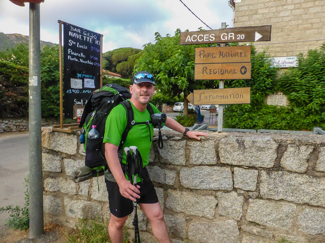
Conca is the traditional end point of the GR20 when travelling north to south. We still had a long way to go having reversed the route, instead choosing to hike south to north so that the sun would always be on our backs and our bodies would become better conditioned to face the more difficult sections in the north in the latter stages.
Getting There & Getting Started
Depending on whereabouts in Corsica you fly into, it can prove very time consuming in terms of actually getting to the trailhead and starting your hike, so ideally allow for a travel day at either end of your trip. Having paid for relatively cheap flights in and out of Bastia with Easyjet giving us a 14 day window, we had to allow for a travel day from Bastia to Conca to get started, as well as a day at the end of the hike to go from Calenzana to Calvi, then on to Bastia for our return flight.
In England, the cheapest direct flights we could find to Corsica during the month of August were with Easyjet, flying from London Gatwick. (We booked our flights in January 2015, 7 months in advance, to try and get the best price!)
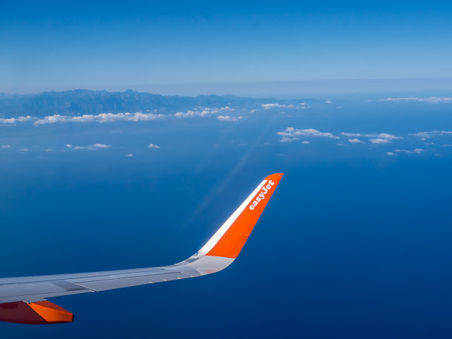
We used a ‘no frills’ airline, but that’s all we needed. The flight time to Corsica from England is only around 2 hours.
As our flights were on Sundays, this meant we had 12 days in between to complete the GR20, forcing us to double up or amalgamate 4 stages out of the 16 so that we could complete the trail in our time frame. We found this quite difficult as the trail was so hard. We were often reluctant to double up and carry on as we were already so tired and couldn’t face another ascent and descent in the same day. So after reading the stage descriptions very carefully in the guide book, we prudently picked out which sections we thought we could combine in one day and just about manage. Twelve days to complete the GR20 also meant that we didn’t have any spare days to factor in a ‘zero’ hiking day should we need it – just in case of bad weather, minor injury or simply fatigue and the need to spend a day resting. We agreed that 3 weeks would have been a better itinerary to allow us to hike a stage per day and to factor in a rest day here and there when needed. But that would mean using up a lot of ‘holidays’ in one go, which many people cannot afford to do depending on their employment. Twelve days is doable – as we proved – but you do have to think very carefully about your itinerary and personal capabilities and be realistic about what you can achieve based on your own hiking experience.

Contemplating what is to come! With the terrain unforgiving and the weather unpredictable, at times we wondered whether we could complete the hike in 12 days…
On arrival at Bastia Airport, we found that there is a regular bus service running between the airport and Bastia town centre which cost us 9 Euros each, the journey taking approximately 30 minutes.
Unfortunately, other services are not so regular especially on a Sunday, so after arriving in Bastia town centre around 11am, we had several hours to wait until our next bus connection to Saint Lucie en route to Porto Vecchio which departed at 4pm. However, this lengthy wait did mean we could visit the tourist information centre and gave us the opportunity to wander around the immediate area in search of gas so that we could use our stove to cook dinner that evening. Unfortunately we discovered that most shops are closed on Sundays and the two Spa supermarkets that we visited only sold ‘puncture’ type canisters, which is not suitable for our burner. After an unsuccessful shopping trip, we ventured into a coffee shop for a while, then went and sat in the park next to the bus stop, which is adjacent to the roundabout a little further down the street from the tourist information office, to enjoy some Corsican sunshine.
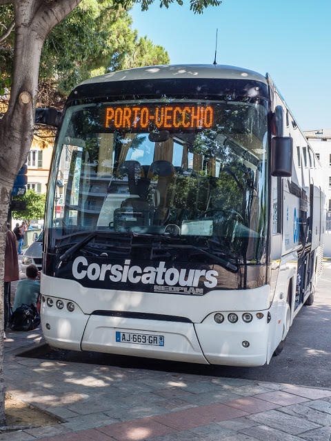
Due to there only being 2 bus services on a Sunday, we had to wait around in Bastia for several hours before we could head to the south of the island in preparation for starting our hike the following morning.
At 4 o’clock we boarded the bus, and 46 Euros lighter, we were finally on our way south to Saint Lucie, the closest stop to Conca. Another 2 and a half hours later, we had disembarked wondering where to find a taxi that would take us to the Gite d’étape La Tonnelle in Conca. Thankfully, another couple who got off the bus at the same stop donning hiking gear and backpacks phoned the gite and informed us a navette (minivan) was on its way to pick us up if we wanted to share a ride with them. Perfect! Our first bit of French hospitality that saved us walking around 4 miles uphill on a long, windy road that would have been an arduous trek in the early evening sun before we even got started.
The gite provided everything that was needed for a comfortable overnight stay, including all types of gas canisters.
If you wish to travel light and ditch the cooking equipment, food and drink is available to purchase at every refuge on the GR20 route, albeit for a heavily inflated price. Selection of goods varies but all usually have bread, saucisson (thick, dry, cured sausage), some kind of tinned fish, pasta and jars of tomato sauce. We found ourselves happily living on tinned sardines over the 12 days!
Camping at the gite was 10 Euros per person which included the cost of the navette. When we arrived we found plenty of people pitched already but there was still ample space for our small two man tent. We were thankful of the shady terraces at the back of the restaurant and happy to discover a shower and toilet block as well as the fact they sold every type of gas canister including a medium sized Optimus with a screw top, which is exactly what we needed. It set us back 9 Euros but we hoped it would last us at least a week based on our previous experience and eating habits.
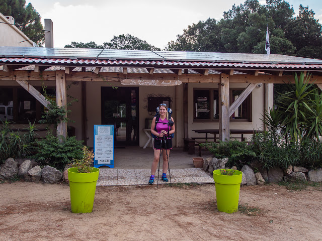
Setting up camp at the Gite d’étape La Tonnelle in Conca, the night before we started the GR20.
We decided an early night was in order ready for our impending hike, so we settled into our sleeping bags putting our new Exped Winterlite sleep pads to the test. Noise from the bar interrupted our sleep several times, but we couldn’t complain about the revellers celebrating the fact they’d just completed the GR20! As we had reversed the traditional route, most people in the campsite had in fact finished that day, whereas we were just about to embark on our most difficult hike to date!
Monday 3rd August 2015 – Stage 1 – Conca to Refuge d’ l Paliri – 7:00am – 14:30pm (7 & 1/2 hours)
All smiles and ready to embark on our 5th long distance trail… Little did we realise how challenging it would be!
Setting off from Conca at 7am. We were the last to leave camp and it was already hotting up. We agreed to set the alarm for 4am the following morning and be away at sunrise to minimise walking during the hottest times of the day. (Well that was the theory anyway!)

The lure of hiking on beyond the Refuge d’ l Paliri to Bavella, a small village on the other side of the mountain. Unfortunately, as there are no camping facilities in Bavella, we had to stay put and dream of the goodies we would be purchasing in the village shop the next morning!
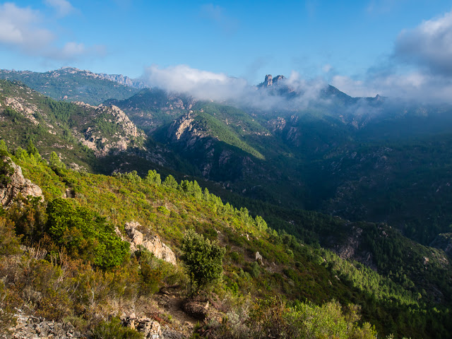
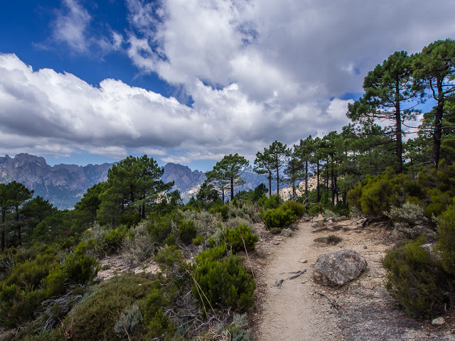
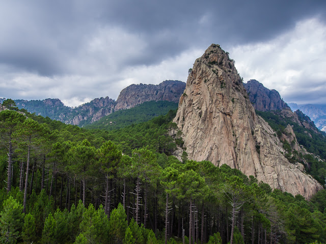
We were treated to some wonderful scenery during our very first ascent.
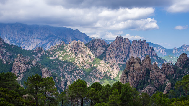
The mountains of Corsica… Our home for the next 12 days.
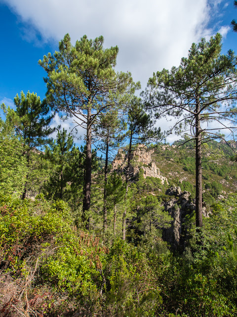
Stage One thankfully provided us with some shade in the woodland sections.
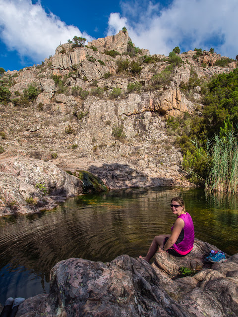
Spotting a pool, we took a break and soaked our feet for a while. They were incredibly hot after being stuck in Gortex lined trail shoes all morning.
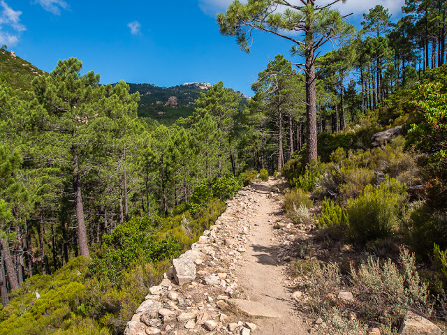
A good section of the trail that wasn’t too taxing.
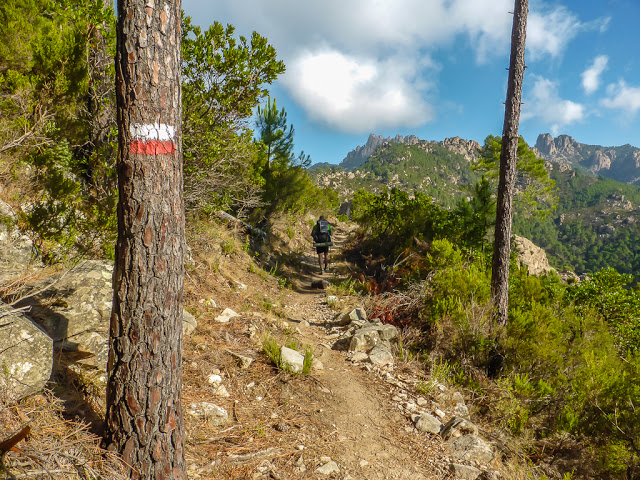
White and red flashes indicated that we were going the right way. They are painted on both sides of rocks, boulders and trees for northbounders as well as southbounders to follow.
Or in my case, more often than not I just followed Wayne if he wasn’t too far ahead or too camouflaged amongst the greenery!
You will spot lots of the reassuring waymarkers in our photos throughout the 12 days.
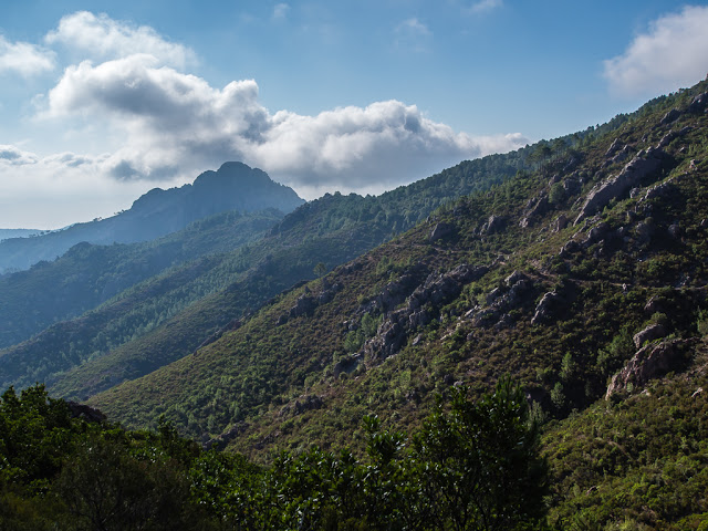
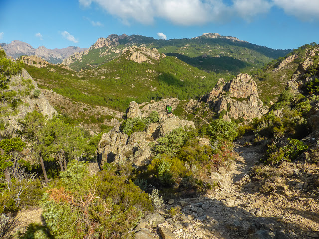
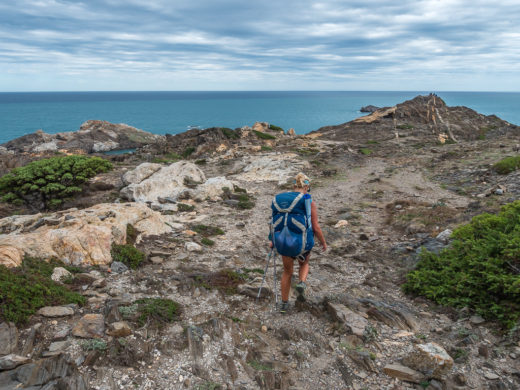
During our first day we had to traverse a whole range of terrain.
For once, we could stride out and enjoy the walk… But these flatter, well trodden sections don’t last for long.
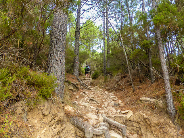
More often than not, you must watch your footing as the trail is littered with rocks and tree roots.
This way! Oh the joys of boulder scrambling.
The range of light.
The trees were seriously tall, but the mountains were almost touching heaven!
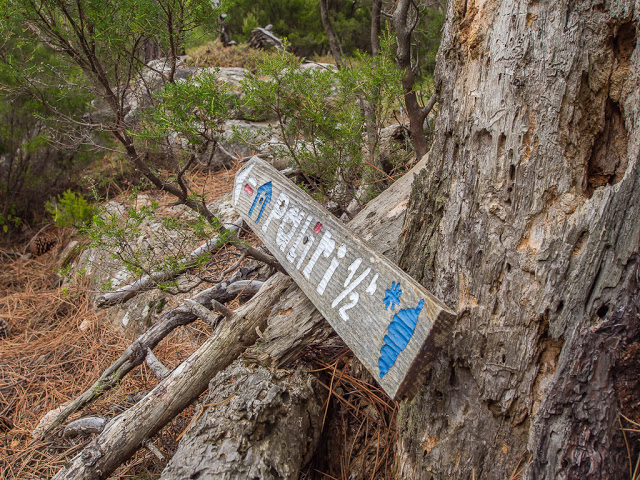
Signs do not provide distances, just times – Half an hour to go to reach Refuge d’ l Paliri…
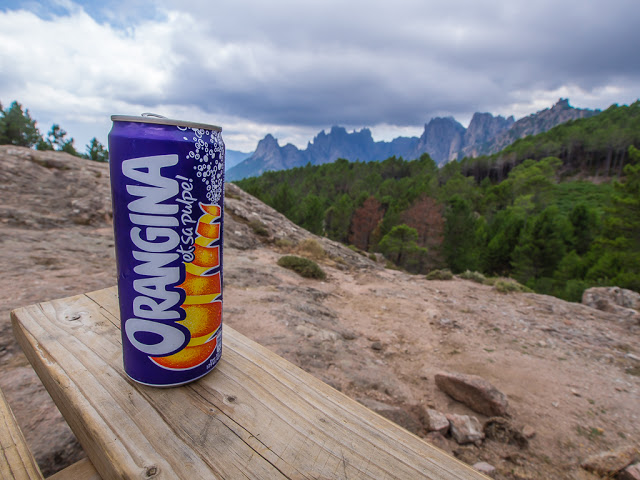
The most expensive can of Orangina we’ve ever purchased at 3 Euros, but thirst quenchingly good as a reward for completing Stage One!

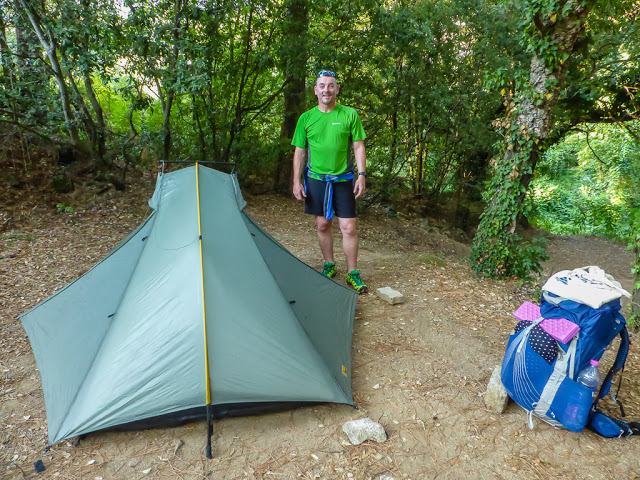
Our camp spot at Refuge d’ l Paliri. Almost a wild camp spot but with the added bonus of a squat toilet close to camp and a cold shower down the side of the mountain for the princely sum of 7 Euros each as we provided our own tent (bivouac in French).
Day One and the first stage of the GR20 opened our eyes for what was to come. The mountain scenery was much like what we had experienced in the Sierras and the strong smell of pine needles reminded us of being on the JMT. What was missing however was the flat, well trodden pathways and the gradual, well constructed switchbacks leading between passes that the USA National Park Service do so well. There was also a distinct lack of lakes, which on the JMT you pass daily. But we needed to stop comparing it! After all, the GR20 wouldn’t be rated as Europe’s toughest long distance trail if it was suitable for the casual day walker. It had proved to us already that you should have a good experience of the mountains, be comfortable with maps, self reliant, and most of all confident at managing your own effort as well as dealing with bad weather situations.
It was a hard day no doubt about it, but it would never do to fail – and once we put our minds to something, we stick at it until the job is done! So roll on tomorrow… and Stage Two.
Is This Trail For You?
Established in 1972 by the Regional Natural Reserve of Corsica to allow walking enthusiasts to discover the beautiful interior of Corsica, the GR20 is a long and tough trek which requires a high level of fitness, lots of mountain walking experience and surefootedness for the rocky landscape and mountain ridges you have to traverse. You also need a head for heights – this trek is not suitable for vertigo sufferers. Despite these prerequisites, the trail has grown in popularity every year and receives between 18,000 to 20,000 hikers each season. However only one third of this figure actually complete all sixteen stages.
You will need complete confidence in your physical ability to attempt this hike as if the weather turns during the walk you will at times have no other option but to increase your walking speed and continue on to the next refuge, or alternatively make it to a side trail that leads down into a village off-route. Each day expect to walk for an average of 6 to 9 hours (not including stops) with considerable daily ascents and descents that can be rough underfoot (averaging +800m and -800m per day). The descents can be a particular burden for those with knee problems.
To complete the entire trail, 15-16 days is ideal, but 12 days is adequate if you are physically fit and can manage to double up on some stages. We in fact made use of the shuttle service between Calasima and Haut Asco to miss out one stage as the Cirque de la Solitude remains closed following a rock fall and fatalities in June, thereby saving us some time because of our tight schedule. A sobering thought is that the Legionnaires of the French Foreign Legion stationed in Corsica usually rush it in 7 days as training for their role.
After completing the GR20, we came away with the view that it’s certainly not easy, but if you follow all of the common sense rules related to long distance hiking, then it’s not dangerous either. Be well prepared, know what to expect and enjoy your time in the mountains!
No Comments