
“I only went out for a walk, and finally concluded to stay out till sundown, for going out I found was really going in”.
– John Muir
The Third Week – Upping Our Game…
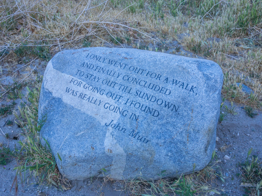
A wonderful reminder of why people endeavour to hike the Pacific Crest Trail!
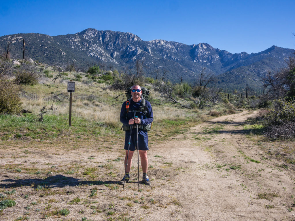
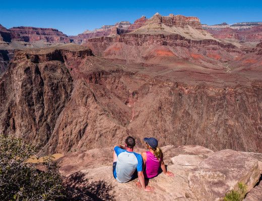
Day 15 – Tuesday 24th April 2018, Wild Camp at Mile 165 to Hurkey Creek Park Campground (PCT re-route along Spitler Trail), 11 miles
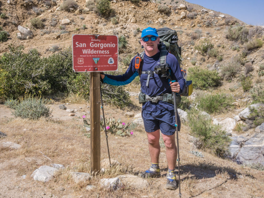
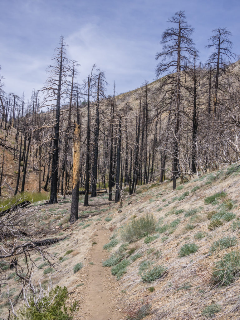
We had been really looking forward to today as it was going to be a ‘half’ day of sorts with us having to take the re-route option down the Spitler Trail because of a forced closure of an 8 mile section of the PCT. This was due to a large forest fire back in 2013 that destroyed the whole area. Even five years on, this section of trail is still undergoing restoration work and as the area remains so fragile, a ban on foot-traffic remains in place.
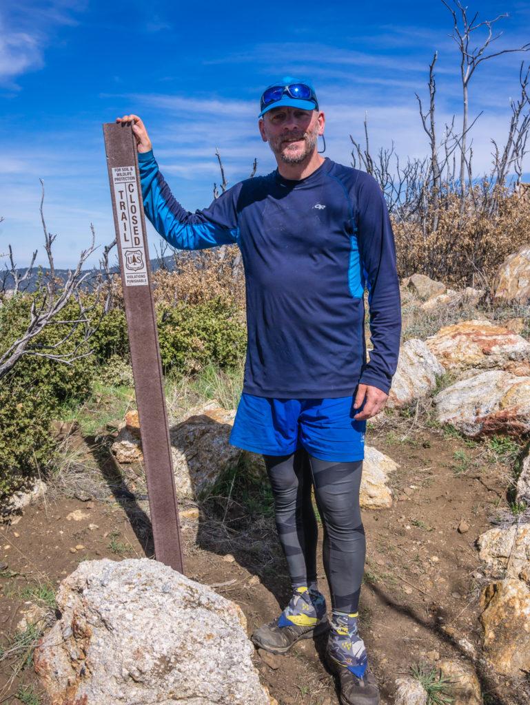
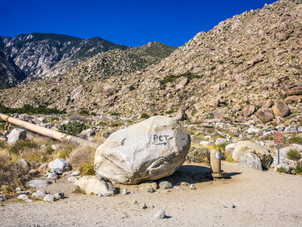
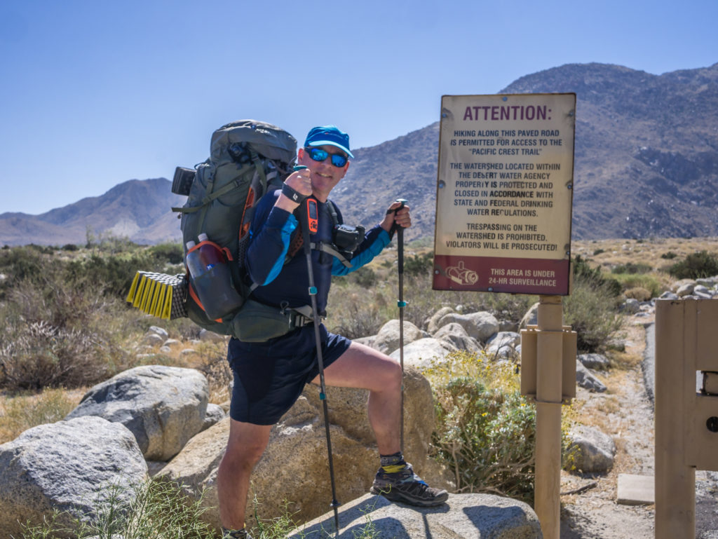
The PCT remains closed for 8.7 miles from Spitler Trail (Mile 168.6) north to Tahquitz Valley Trail (Mile 177.3).
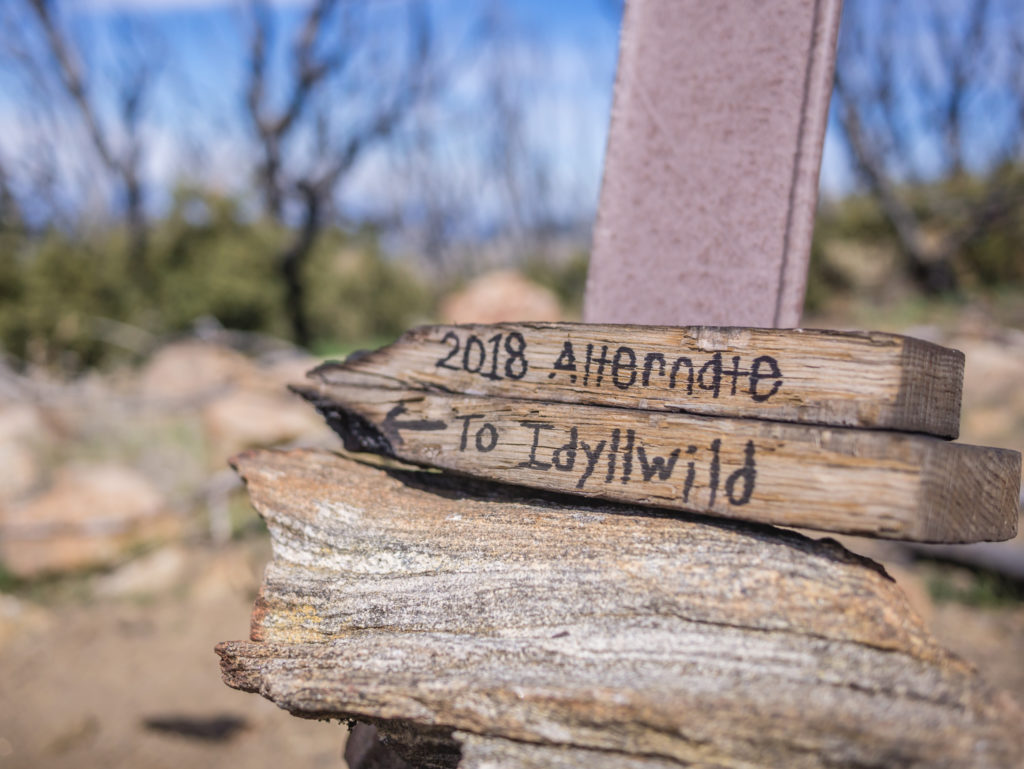
We took the alternate route down the Spitler Trail where we continued on to Hurkey Creek State Park Campground, prior to out town stop in Idyllwild.
Taking the re-route meant we were back down the mountains to Highway 74 and some semblance of civilisation by way of a proper state campground. After 5 days without regular access to water that meant all good things – flushing toilets, showers, a picnic bench, trash cannisters and even grass to pitch the tent on! (All listed in order of importance!)
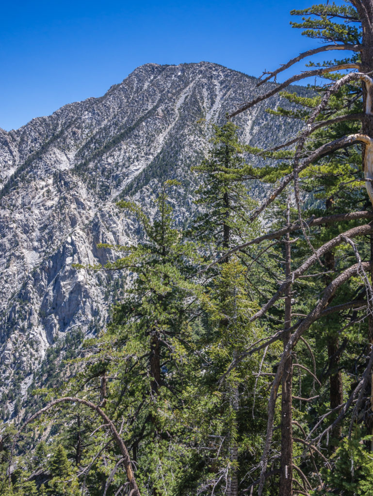
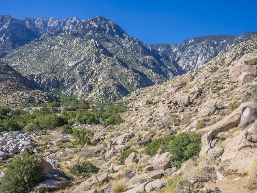
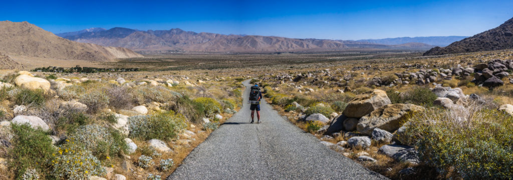
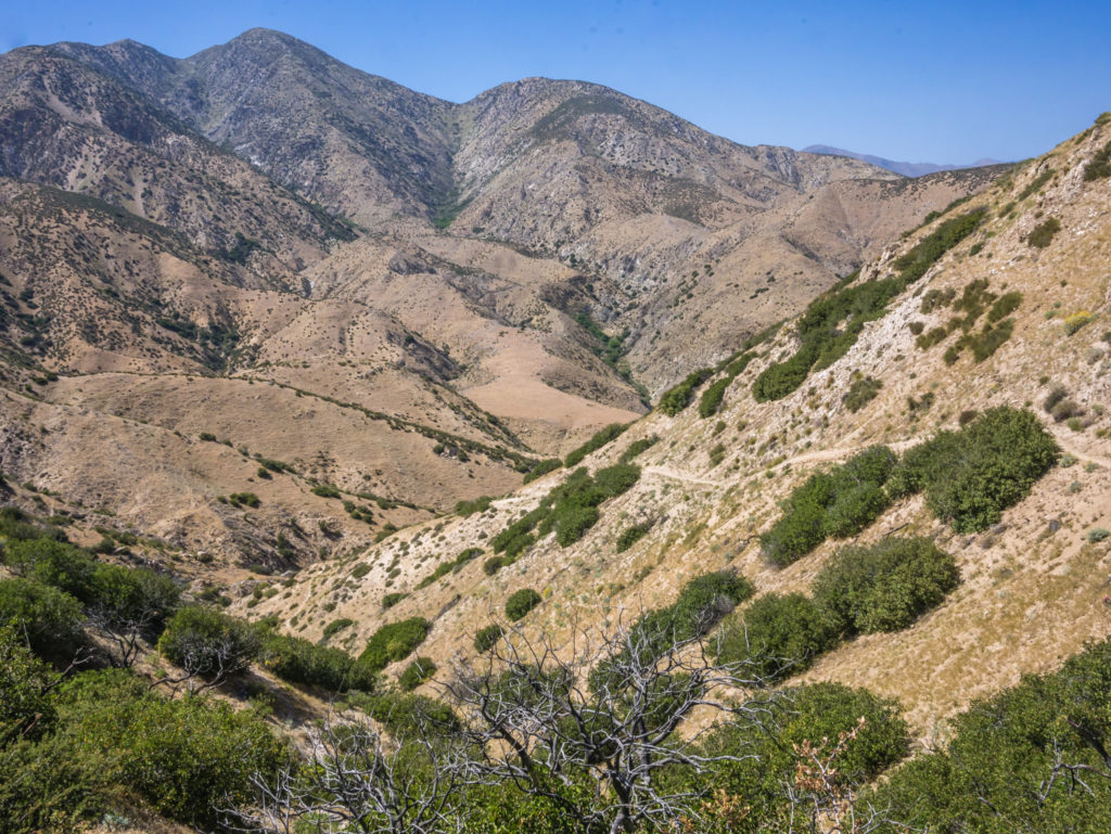
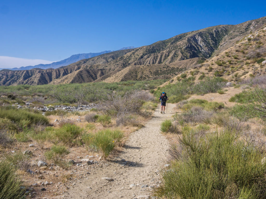
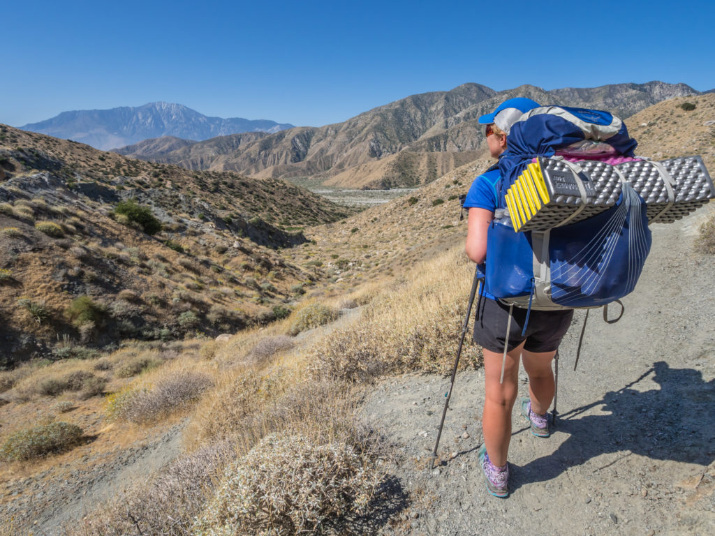
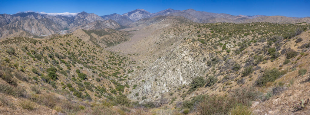
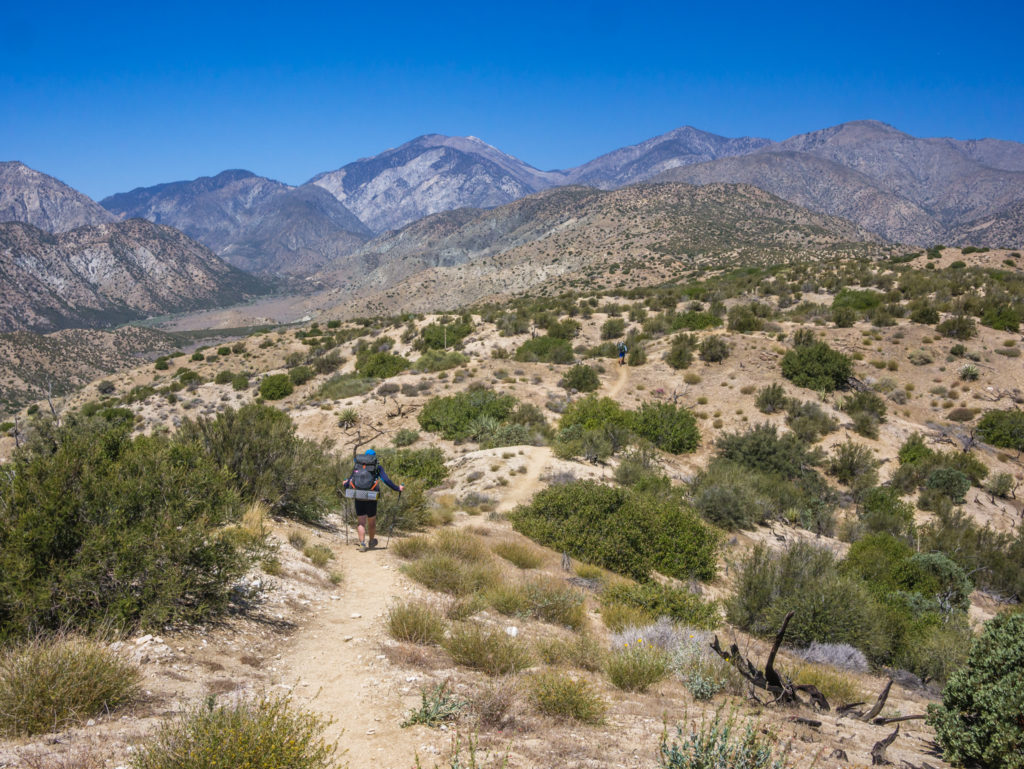
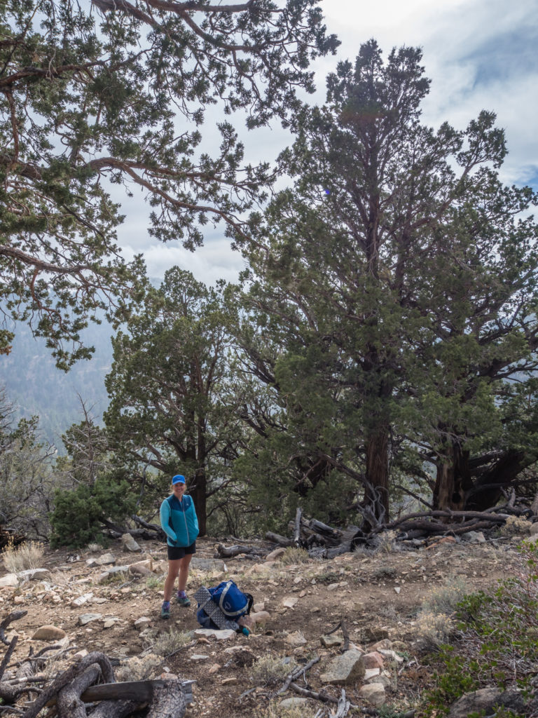
So after an uphill slog taking us around the east side of Spitler Peak, then a hurried descent down the Spitler Trail into Apple Canyon, a turquoise Lake Hemet in the distance enticing us on, we had covered 8 miles by mid-morning, with just a couple of miles or so of road walking left to reach the Hurkey Creek Park Campground. There’s nothing like the luxury of a proper toilet to get the legs moving at a 4 mile an hour pace!
We had to traverse around Spitler Peak before the alternate route took us downhill into Apple Canyon.
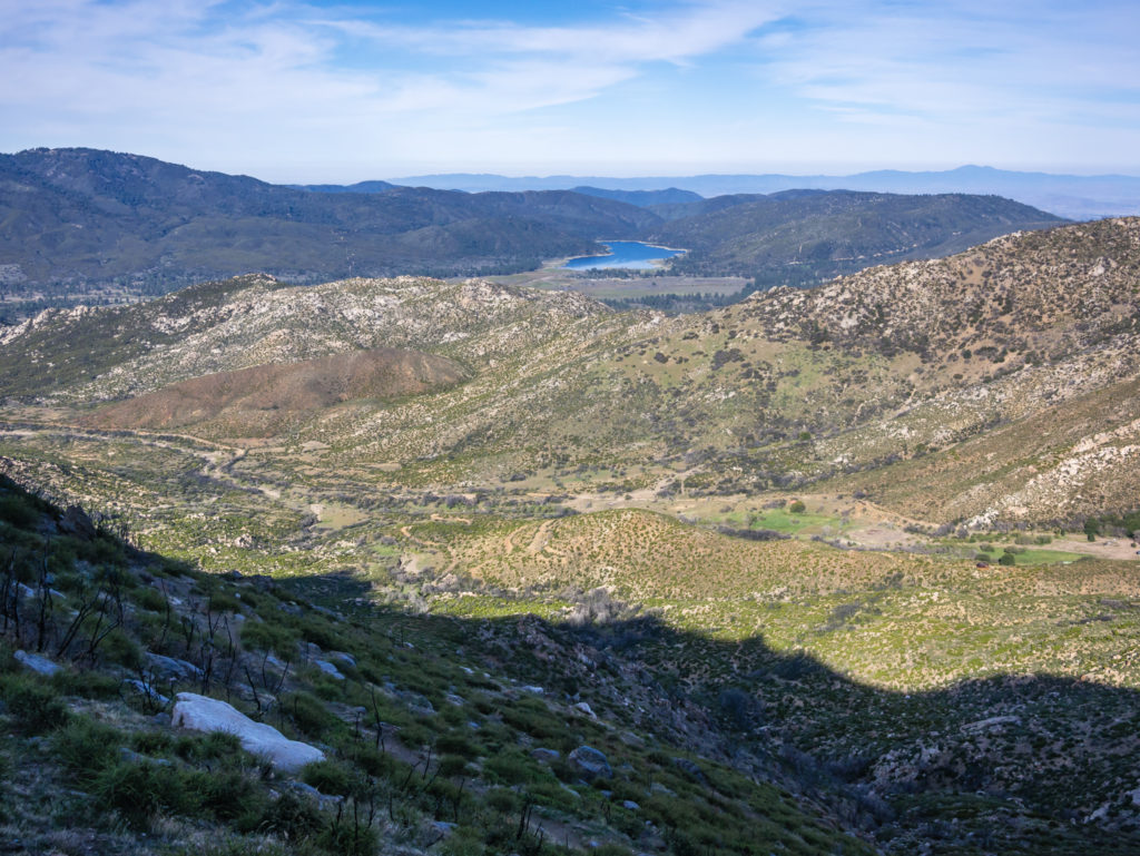
As the crow flies it didn’t look too far! In the distance, Hemet Lake was teasing us…
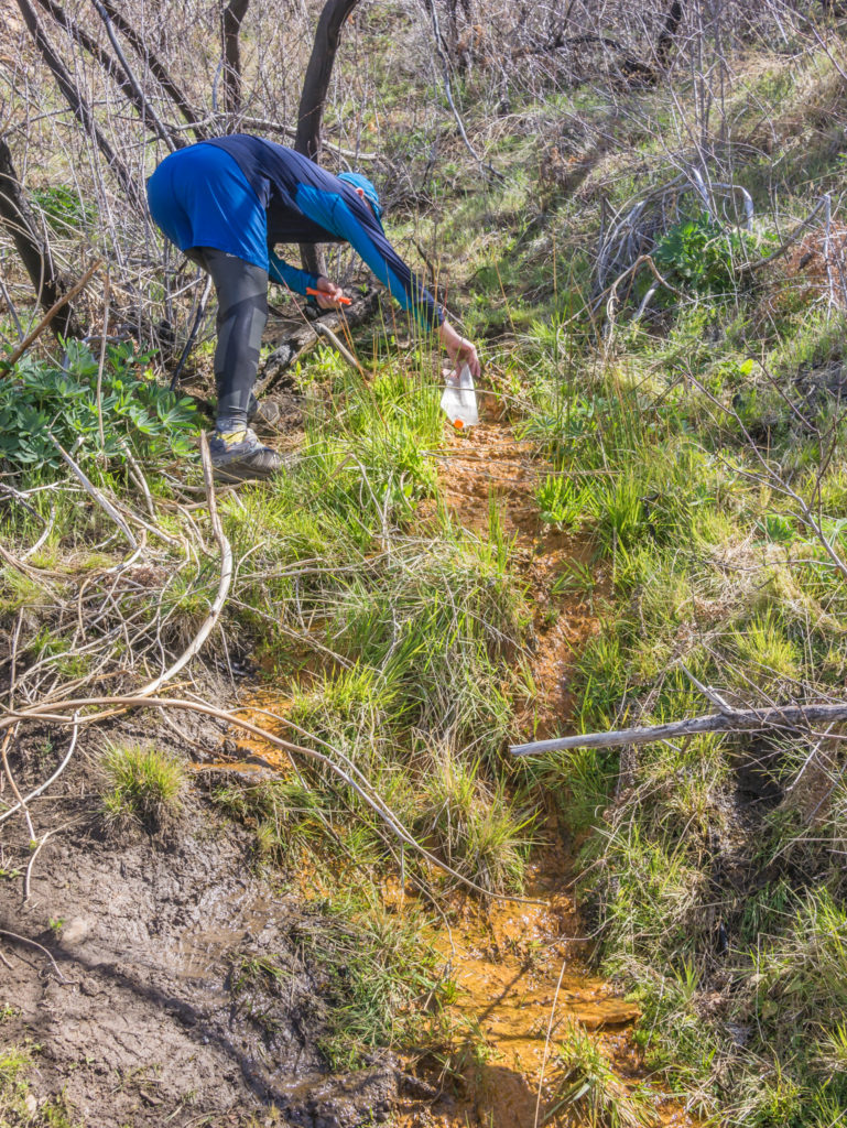
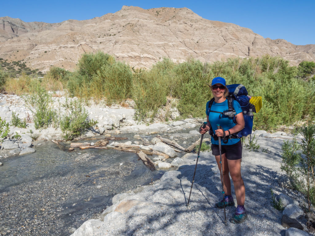
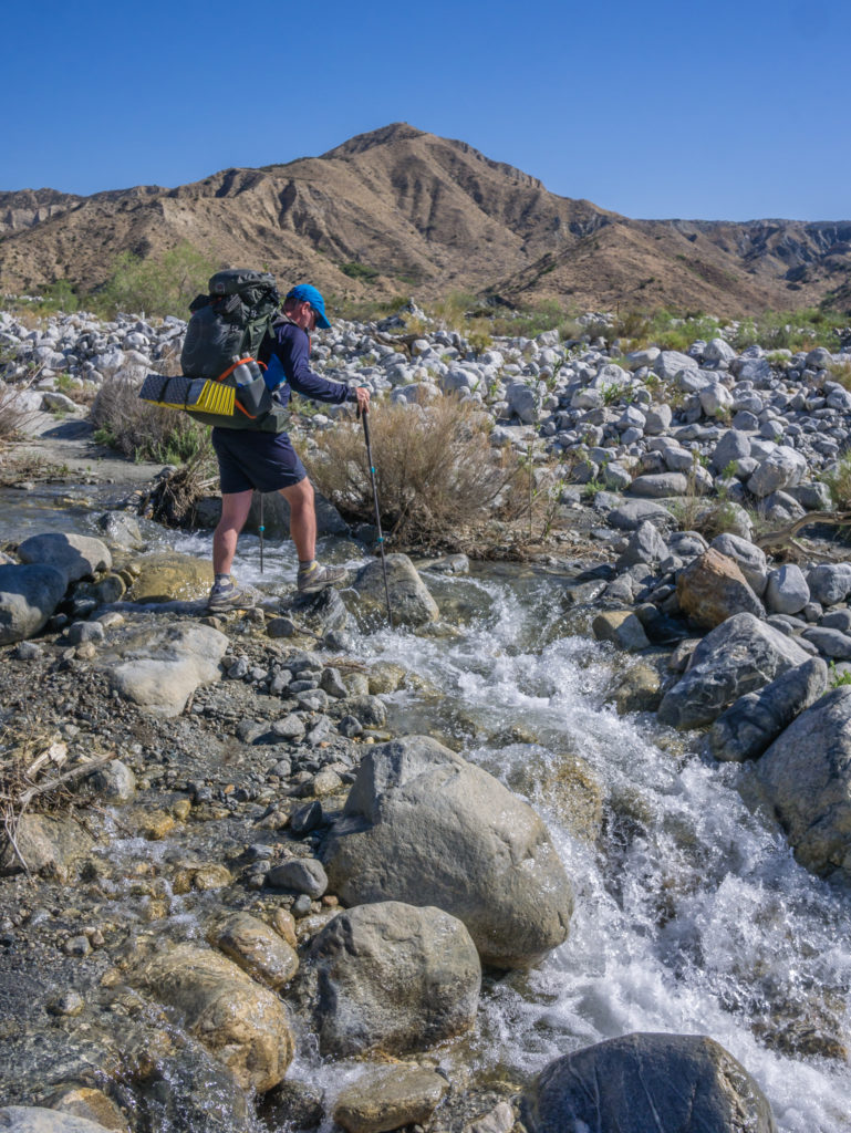
Wayne collects water from a spring ready to filter and drink. It was our first access to water since yesterday.
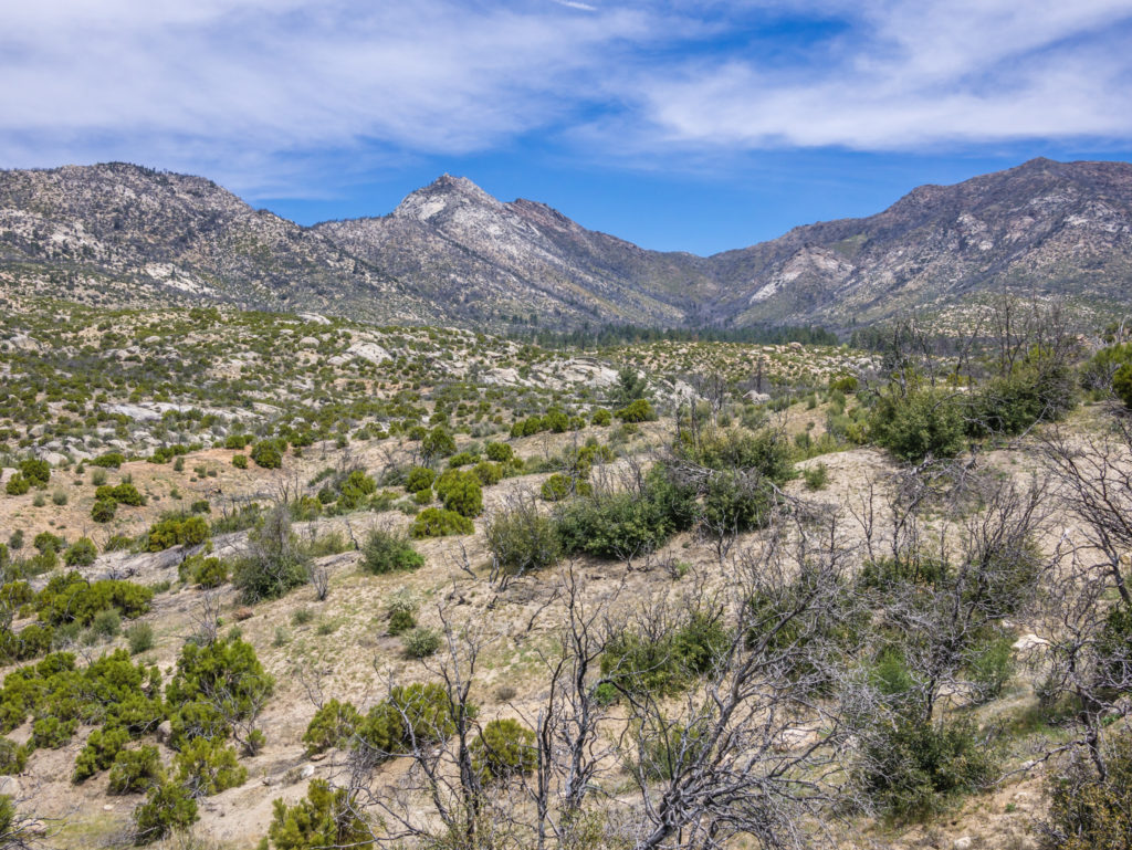
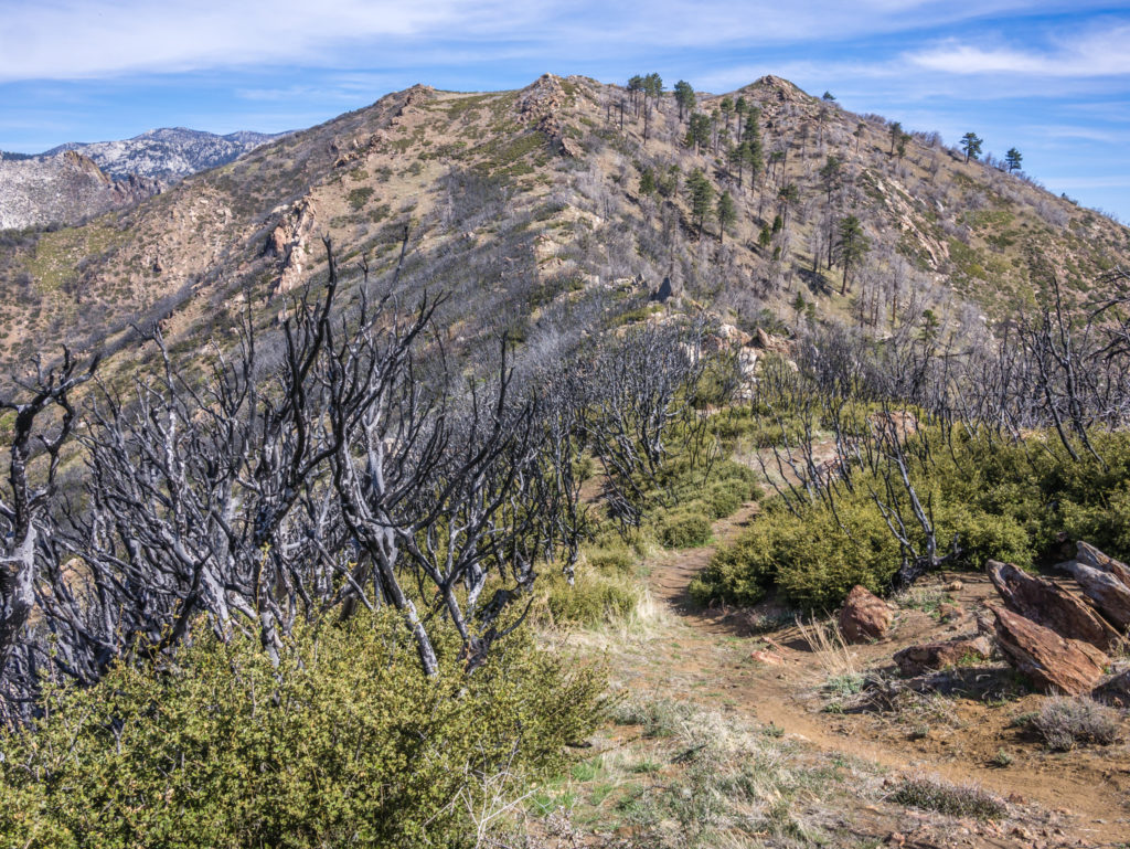
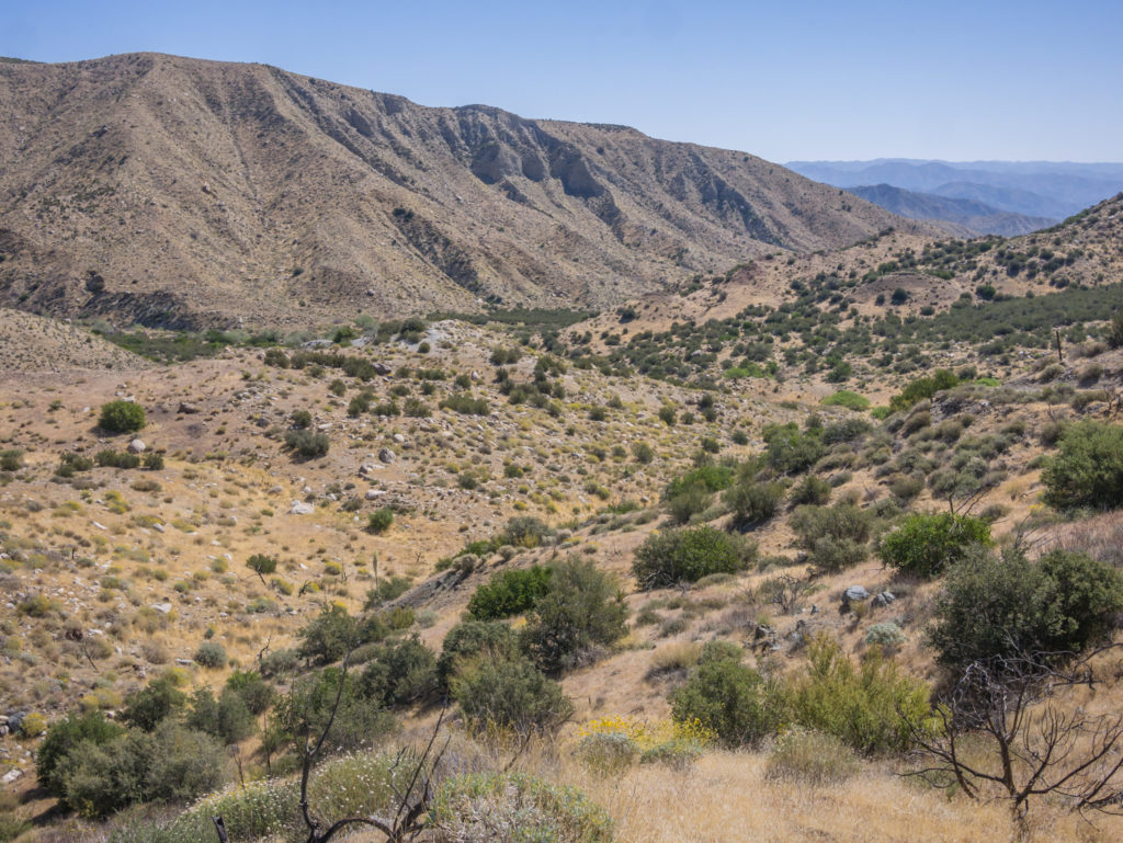
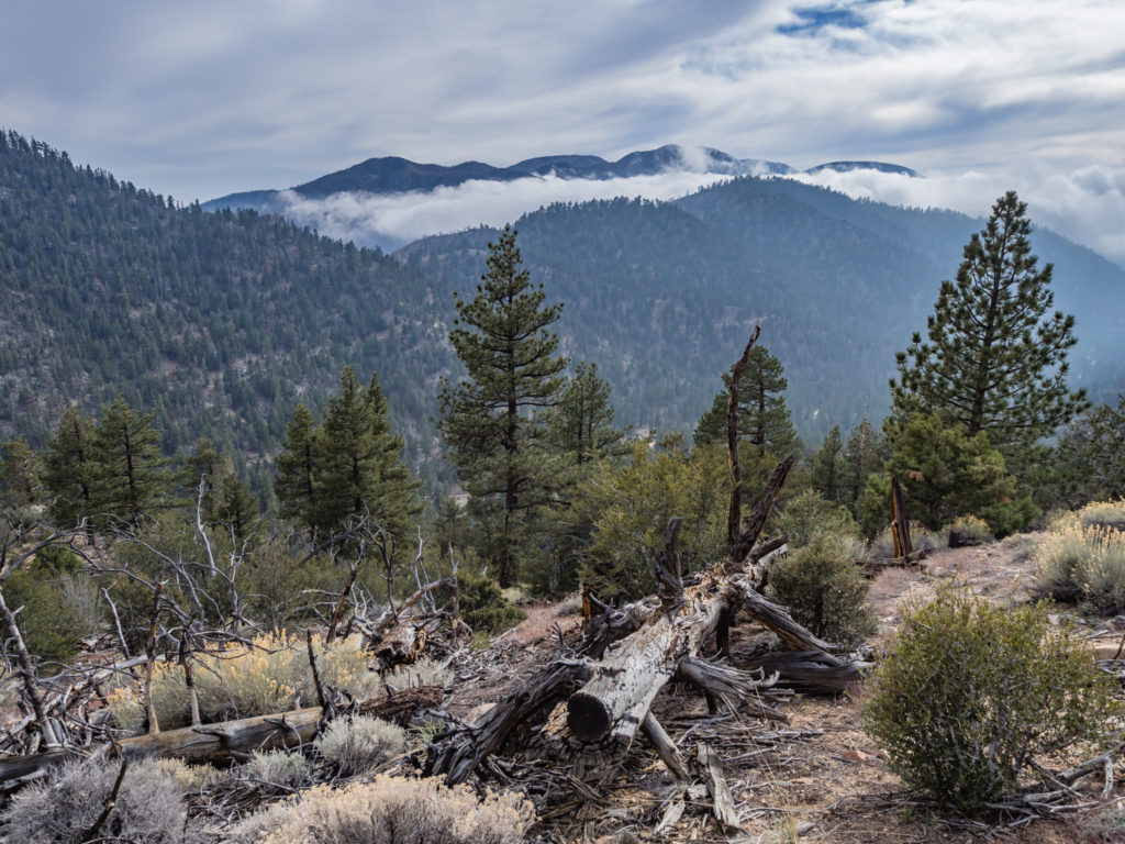
From pine forested peaks back down into desert chaparral.
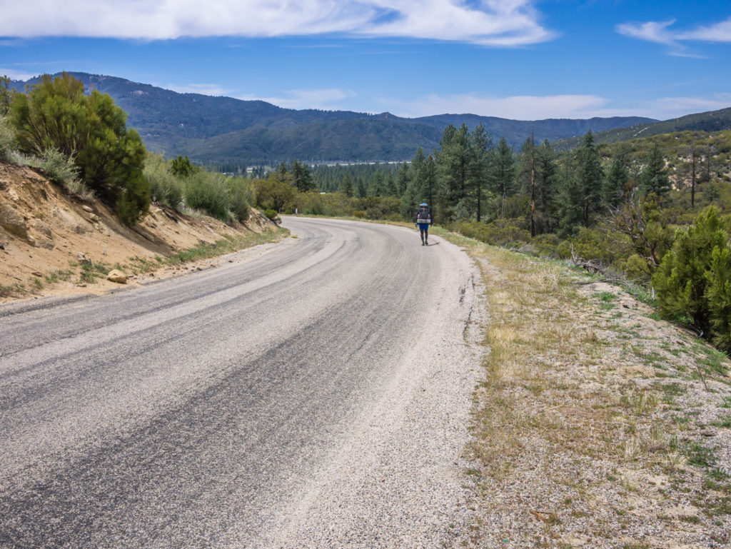
Hitting the road! It seemed a long walk down Apple Canyon to Hurkey Creek Campground.
It proved fortuitous that we would be staying somewhere with proper facilities today, as it meant I didn’t have to go roaming around the bush looking for an appropriate place to dig a hole. It seems my body intuitively stores up waste until the most opportune time. In 15 days, I feel lucky that I’ve only had to go for a ‘bush number two’ just twice! Unlike Wayne, who like clockwork, has mastered the art of squatting and goes every morning without fail. Yep, he’s certainly ‘regular’ and even commented this would make a good trail name. Unfortunately, you can’t name yourself! But enough ‘toilet talk’ for now…
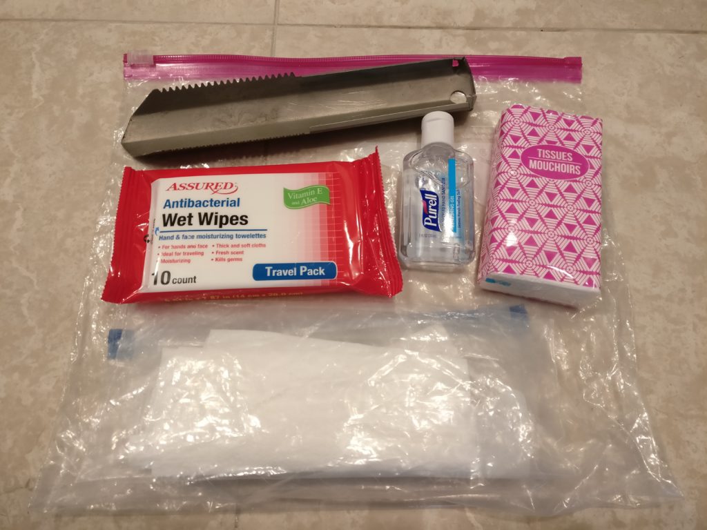
Wayne’s ‘Poop Kit’! A trowel for hole digging, tissues, wet wipes, hand gel and two plastic bags to pack out used toilet paper following the ‘Leave No Trace’ principles. There’s nothing like being prepared!
After reaching the campground and being told PCTers get to camp overnight for free, saving us $25, we were even happier! Without wasting any time we had unpacked and set the tent up by 1pm. Then we hot-footed it to the store, just less than a mile down the road, to see if we could get any fresh produce for dinner. Wayne had been dreaming of a sandwich with fresh tomato and onion, but alas, the store only sold packet convenience foods for day trippers passing by car. We did manage to treat ourselves to giant 20 oz mango slushies that were great for rehydration and cooling us down! (After a few brain freeze moments!) If we had thought it hot in the mountains, it was seriously hotter down in the valley.
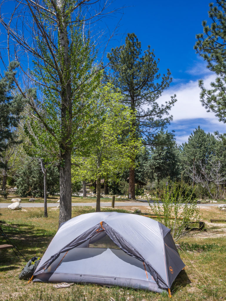
Our lovely camp spot at a ‘proper’ campground with full facilities!
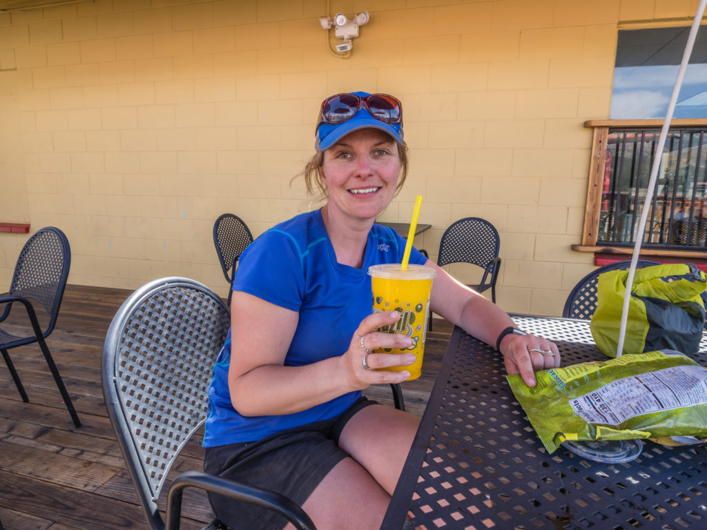
Rehydrating – Making the most of having access to a shop and ‘cold’ drinks!
As today was relatively short in both distance and time on trail, we could have pushed on a further 7 miles to Idyllwild, our next town resupply stop. However as we had already pre-booked accommodation for the 25th, we didn’t want to arrive a day early and pay for two nights of accommodation. Similarly, we didn’t want another full ‘zero’ day off trail, so we decided that we’d hike the 7 miles into Idyllwild in the morning giving us two ‘nearo’ days, to keep the body in a good routine, especially as we’d be upping the mileage this week to 17 / 18 miles per day to keep us on track to reach our next town stop at Big Bear Lake.
By the time we got back from the store, there was another group of 6 PCTers camped on the site opposite us, all looking freshly showered and groomed having made the most of the facilities, such is the life of a thru-hiker! They came over to chat to us about what products were available in the store as there were going to head there in pursuit of beer! Indeed, there were fridges full of alcohol, but we had refrained for now, saving ourselves for Idyllwild tomorrow!
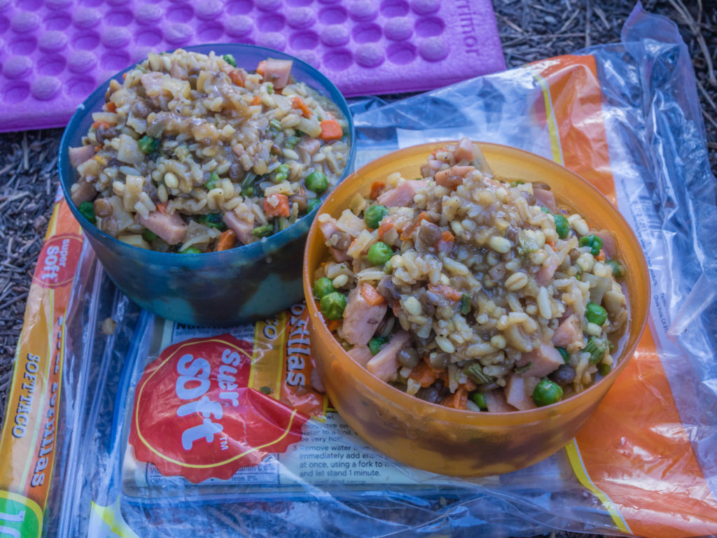
What we did buy was some additional items for dinner by way of fresh tortillas, salsa chips and a tin of beef chilli, to add to our rehydrated vegetable chilli mix. No matter how much we love Mexican food though, a big burger and fries would definitely be on the menu for lunch in town tomorrow!
Day 16 – Wednesday 25th April 2018, Hurkey Creek Park Campground to Bluebird Cottage Inn, Idyllwild, 7.5 miles
We were up early, obviously far too excited at the thought of a room with a ‘proper’ bed, toilet and shower after 15 nights on the trail! Eager to reach Idyllwild as soon as possible, we were back on the alternate trail (that leads from the back of the Hurley Creek Campsite) at 8am and practically hopping, skipping and jumping all the way to town! (In our minds anyhow!)
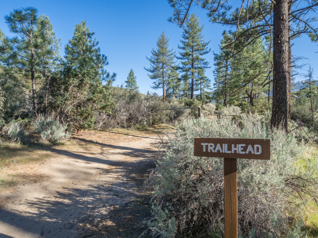
Taking the trail from the back of the campground that leads towards Idyllwild.
Passing by the perimeter of the section of trail that remains closed due to fire damage.
Switching back between desert and pine forest as we head into the hills once more.
To start with we had an uphill climb which was a little taxing, but with it only being a ‘short’ 7 miles or so over a mountain ridge and then downhill the rest of the way, it meant that we arrived in Idyllwild at the Bluebird Cottage Inn just after 10am. We couldn’t check in until after midday, but the receptionist kindly looked after our backpacks whilst we walked into the centre of town armed with a long list of errands and a bag of dirty clothes!
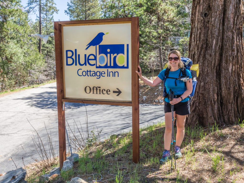
After two weeks on the trail, reaching Bluebird Cottage Inn we were very excited to be sleeping in a bed tonight!
A day in town is very different to a day on trail! Instead of heading straight for a burger and beer (although we made time for that too!), it’s not just a ‘day off’. We have so many ‘jobs’ to get done before we can really do any ‘relaxing’. These generally take the form of laundry, food resupply shopping, a visit to the Post Office to collect our ‘bounce box’, purchasing or replacing any gear/ toiletries e.g. cooking gas, sun cream, hand gel, then organising food into daily rations and parcelling things up again, and then another trip to the Post Office to forward on the ‘bounce box’ to the next resupply town.
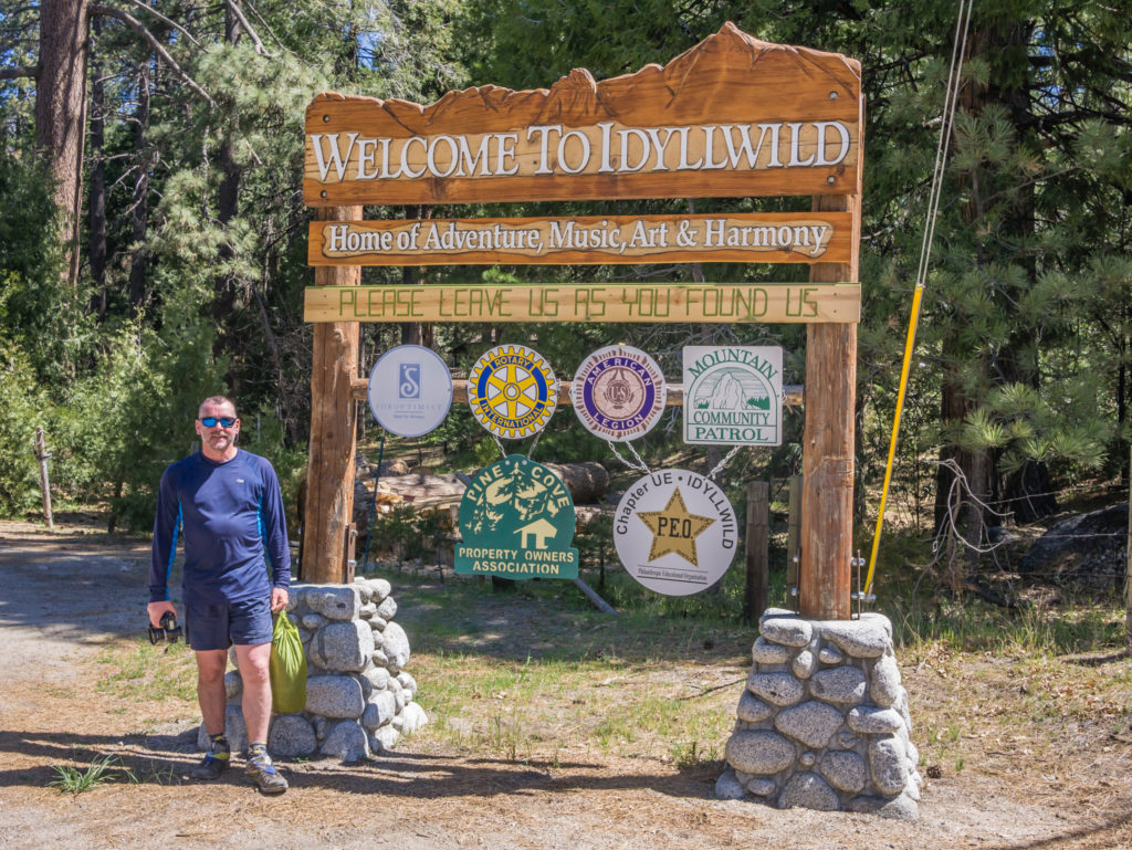
Reaching the charming mountain town of Idyllwild. ‘Home of Adventure, Music, Art & Harmony’.
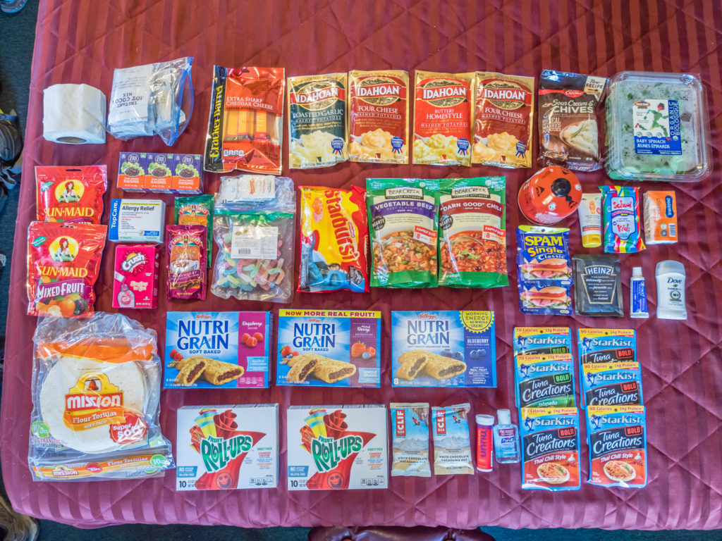
Re-supplying with another five days worth of food to see us on to the next town of Big Bear Lake. We have now ditched instant noodles replacing them with Idahoan instant mash instead!
What with then uploading and backing up photos, and getting a new blog post or video published online, any real ‘free’ time is limited. So to maximise our time off trail, and to minimise accommodation costs, our strategy is to try and camp as close to a town as possible the previous night, then hike in first thing the following morning, get all the chores done, and have a ‘free’ night to relax. This time around however it didn’t quite pan out that way! (Although we had some alcohol to help us along!)
Yes we were in town by 11am, but we didn’t manage to get everything done and return to our accommodation until 5:30pm! Completing everything on our list just took so much longer than we anticipated. (Even then it wasn’t until 2am the following morning that all the computer work was finished!) Honestly, towns are good for the amenities they provide, but life is so much simpler on the trail.
As most PCT hikers use Idyllwild to resupply, we weren’t surprised to see plenty of them milling about town running errands like ourselves. It was especially funny seeing hikers make their way back and forth to the laundry wearing their waterproofs or something they’d picked up from a ‘thrift’ shop, as most don’t carry a second set of clothing. We noticed signs everywhere welcoming PCT hikers, and we felt a real friendly buzz about the place.
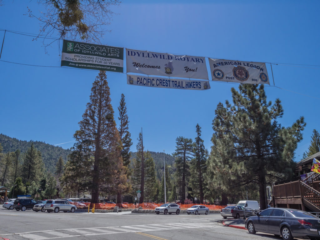
Lucky for us, (and the other 50 people passing through each day) Idyllwild welcomes PCT hikers with open arms!
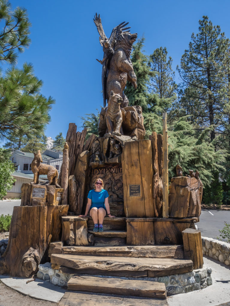
Walking around the centre of town, Idyllwild has a really friendly feel.
Both at the Post office and at the State Campground Office there are PCT registers, so when we signed them we checked the list of names to see who had passed through recently. Any hikers who had hitched a ride to Idyllwild straight from the Paradise Café on Highway 74, instead of taking the alternate route because of the PCT closure, would already be a day or two ahead of us now. We were pleased to see the ‘Three Musketeers’ had checked in the same day as us, so we should definitely see them on the trail again in the next few days.
As recommended by our accommodation, we chose The Lumber Mill (located just down from the laundry) as the place to go for lunch. The menu was extensive, but we couldn’t resist the homemade deli burgers and fries, which is what we’d been dreaming about for our first town stop! And we weren’t disappointed! Calorie loading is a must in town, so afterwards we bought more goodies for back in the room, too!
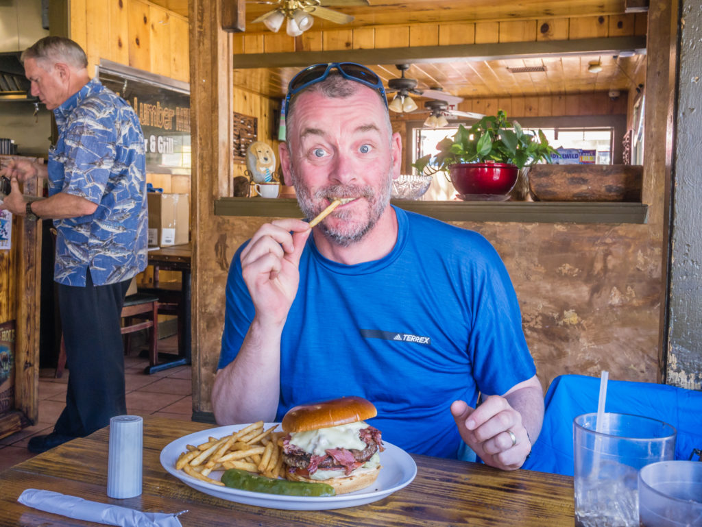
Enjoying our first burger and fries since being on the trail! And boy was it good!
With its uniquely styled wooden houses nestled in the hills amongst the Jeffrey pines, Idyllwild really is a picturesque place, and being so close to the San Jacinto Wilderness Area means there are numerous walking opportunities (not just the PCT) right on the town’s doorstep. It would have been great to spend more time in Idyllwild, but alas, the trail beckons… But we can definitely give our first trail town a thumbs up on all counts! (We just need to get faster at getting the chores done!)
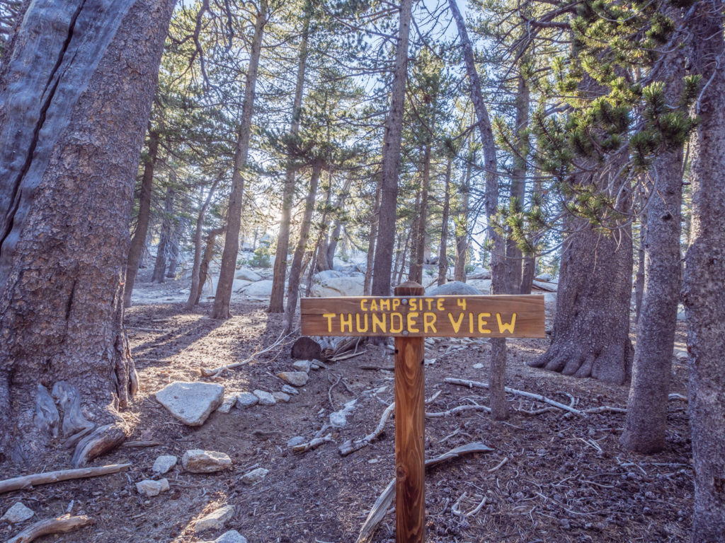
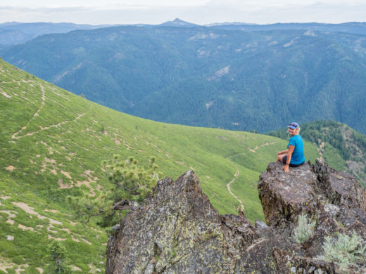
Day 17 – Thursday 26th April 2018, Bluebird Cottage Inn, Idyllwild, to Little Round Valley, Campsite 4 – Thunder View (Detour off the PCT to summit San Jacinto peak), 14 miles
With us being up so late the previous night, and wanting to make the most of sleeping in a bed, we didn’t set the alarm until 8am. As check-out wasn’t until 11am we didn’t have to rush, but it would mean us finishing at camp quite late in the day after a late start on the trail. For a couple of extra hours in the room, today we could cope with that.
Having filled the fridge up with practically every kind of fruit available after our splurge on ‘fresh’ food at the supermarket yesterday, we enjoyed a large mixed fruit salad for breakfast and made use of the filter coffee machine. (Room perks!)
But after re-packing our backpacks for what already felt like the zillionth time, we realised we had forgotten to purchase one of the most important items on our list yesterday. With a severe shortage of water so far on the PCT route, we had been heavily reliant on wet wipes for washing. So as we bid a fond farewell to the Bluebird Cottage Inn and headed back into town, we had to call at the local grocery store again to re-stock. Thankfully I got the last two packets on the shelf!
Wayne was also revelling in the fact he managed to pay $1 for 10 sachets of mayonnaise from the adjoining café. (The owner was taken aback by his politeness as she said hikers just usually steal them!) So that’s one in the bag for the Brits, and also a squirt of mayonnaise will make our lunch-time tuna wraps just that little bit nicer!
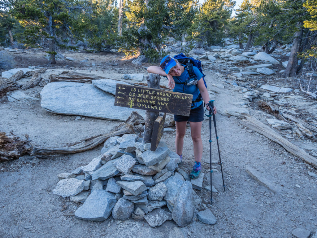
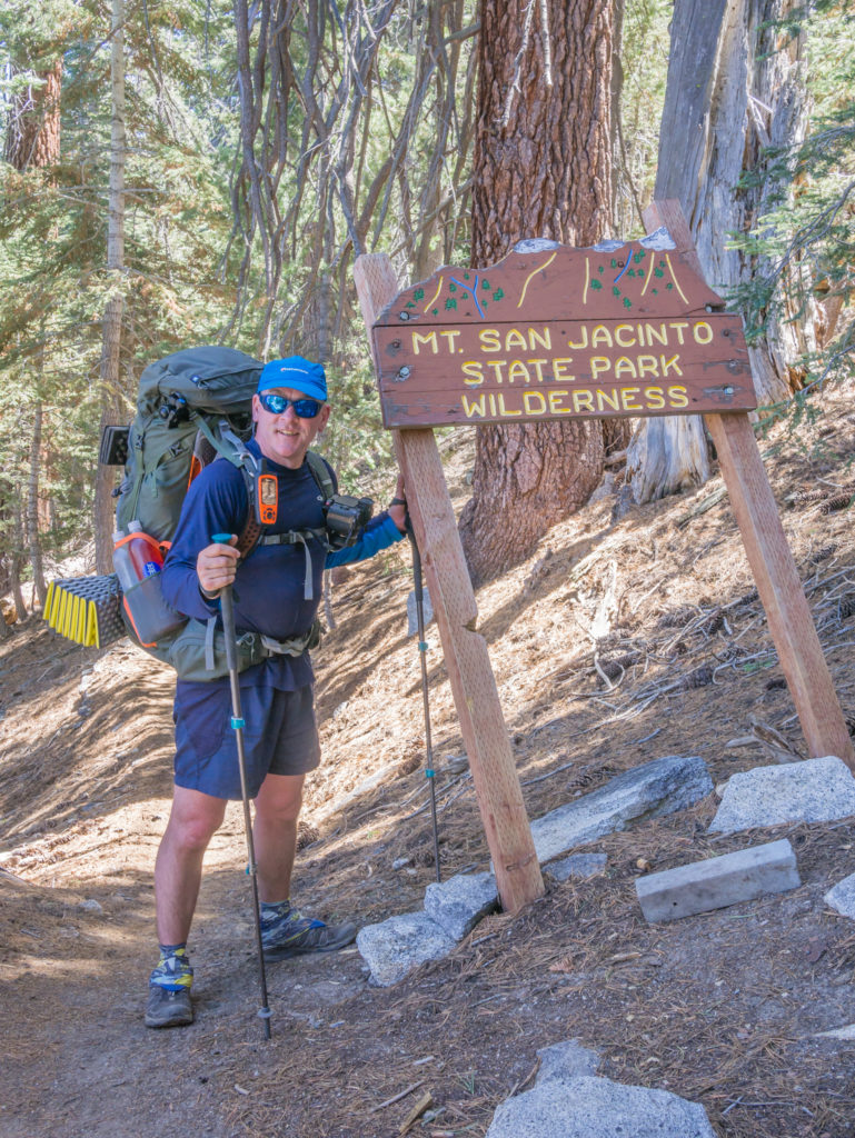
Next stop – the Ranger Station at the San Jacinto State Campground right on the edge of town. To get back on the PCT out of Idyllwild we had decided to take the Deer Spring Trail through the San Jacinto Wilderness Area, and re-join at Mile 183.5. We then planned on diverting off-trail again, this time to summit San Jacinto peak. At 10,834 feet, it is the second highest peak in Southern California, so we didn’t want to miss the opportunity of bagging it with it being so close. At the Ranger Station we had to purchase a permit to allow us to camp in the Little Round Valley Campsite, about a mile below the peak, which was $5 each. (However there was nobody up there to check our permits. In fact we only saw 1 other person at the summit, and 1 person camping just below it.)
By the time we got everything sorted, we didn’t reach the trailhead and start hiking until just after midday. We had over 5,000 feet of ascent to climb, but the terrain was good, and we slowly wound our way up the wooded mountainside on gradual switchbacks. We were startled at one point when a huge black snake (we’re not sure if it was a rattler) seemed to come out of nowhere and slither straight across the trail into some bushes. I literally didn’t see it until I almost stepped on it. No wonder Wayne now sends me up front! I am so oblivious to dangers on the trail that I don’t think I’ll be earning the trail name ‘Snake Eyes’ anytime soon!

‘Suicide Rock’ sounded a bit ominous! But we were continuing in the other direction to Mount San Jacinto.
Californian pines offered us much-needed pockets of shade.
As there was only one water point that we’d pass on this section of trail, which was a small flowing spring, we filled up with 4 litres of water each as we’d be ‘dry camping’ again, quite the norm so far on the PCT. We then continued uphill following the switchbacks without another break, but didn’t reach the Little Round Valley Campground until after 6pm. Arriving late kind of worked out OK however as we wanted to hike up San Jacinto for sunset. It just meant that after we had quickly set the tent up, we didn’t have time for dinner. So we threw a few things together in our backpacks and carried them up to the summit like day packs, with food, water and only the bare essentials.
We camped about a mile below the summit of San Jacinto at the Little Round Valley Campground.
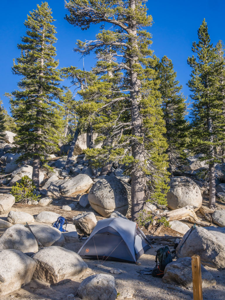
We had our own private spot with views looking out onto the San Gorgonio valley.
Even though our camp spot was at 9,800 feet, we still had a thousand feet climb to get to the summit. We just had enough time to make it up there for sunset, but we both felt exhausted, scrambling up the last section of boulders to the peak with very tired legs. We also felt hungry and a little light-headed because of the gain in elevation. But it was worth it!
After a late start and long hike uphill, we were thankful to have reached the trail junction below the summit. After a day off, it was tiring work!
Sunset was striking, especially looking out onto the San Gorgonio area on one side, and the city of Palm Springs on the other as it suddenly came to life and lit up the darkness. The smoggy haze we had seen obscuring anything in the valley all day now became a charming mist of pink.
Wayne looks out from the summit after a little boulder scramble to the top of San Jacinto.
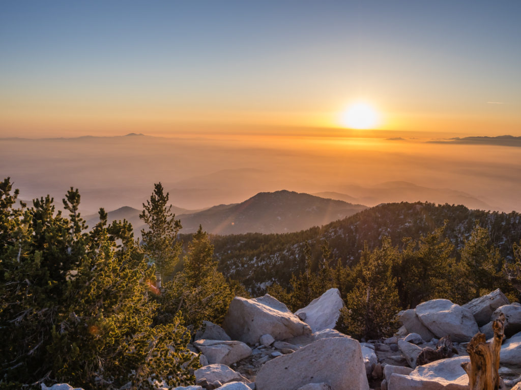
We arrived just in time to set the camera up and watch the sun go down.
The valley was cloaked in a smoggy haze.
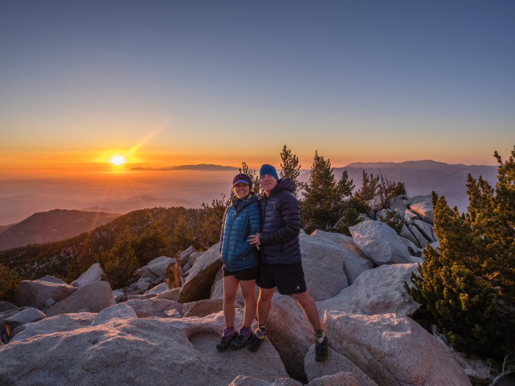
Bagging our first peak on the PCT and enjoying sunset up there.
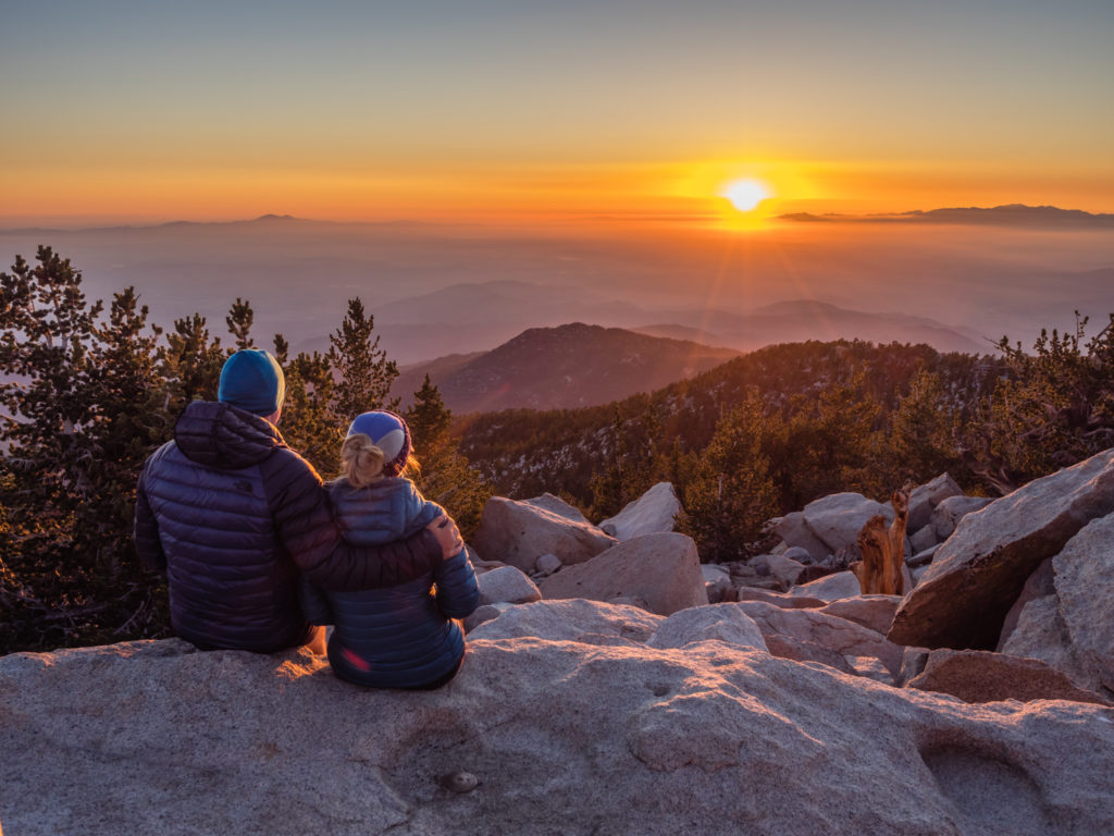
Simply beautiful! (And worth the effort to make it up there in time.)
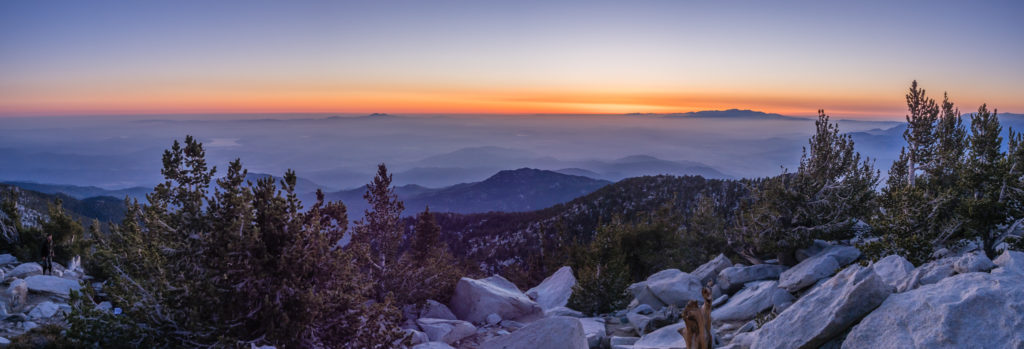
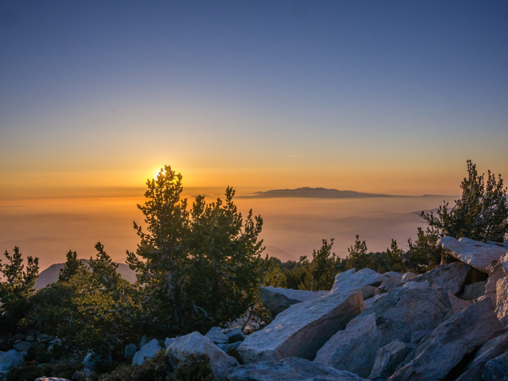
Panorama as the ‘Blue Hour’ lingers.
But it was cold up there! Unlike maybe just a few weeks ago, there wasn’t any snow directly on the summit, but there were thick pockets of snow that remained in between boulders and beneath large trees where the sun had yet to penetrate. We quickly put on extra layers then ate our dinner on the summit, enjoying the final light of the blue hour. It was a new menu idea – we are now trying to incorporate some fresh ingredients into our diet, both for variety, taste and health reasons. So we had tortilla wraps with spinach, cherry tomatoes, cheese and mayonnaise, and they were delightful!
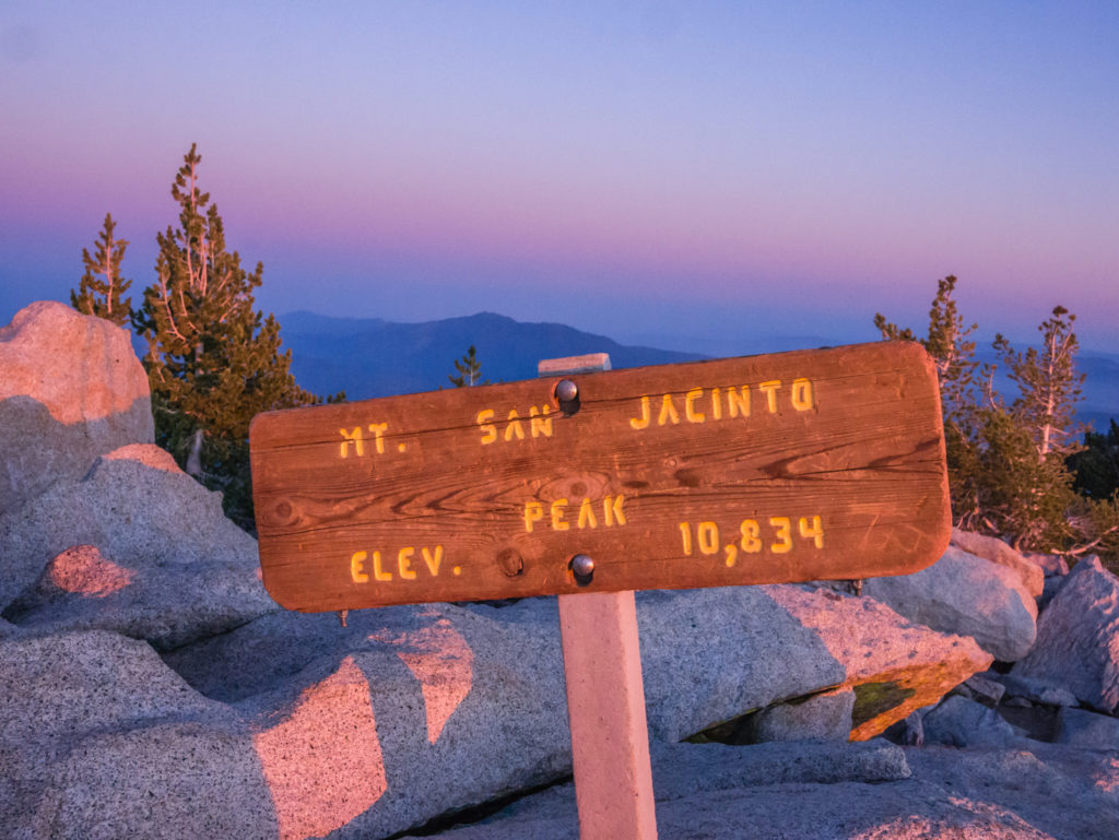
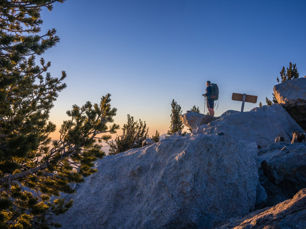
Reaching the summit of the second highest mountain in California.
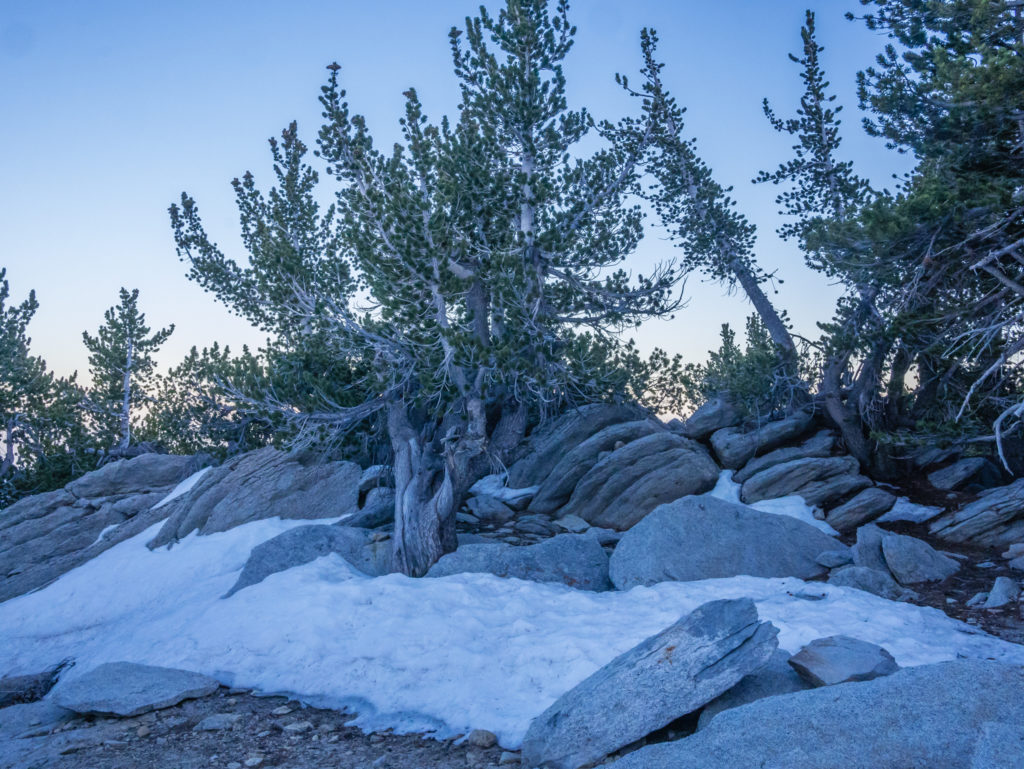
Pockets of snow that remained at the higher elevations of the mountain.
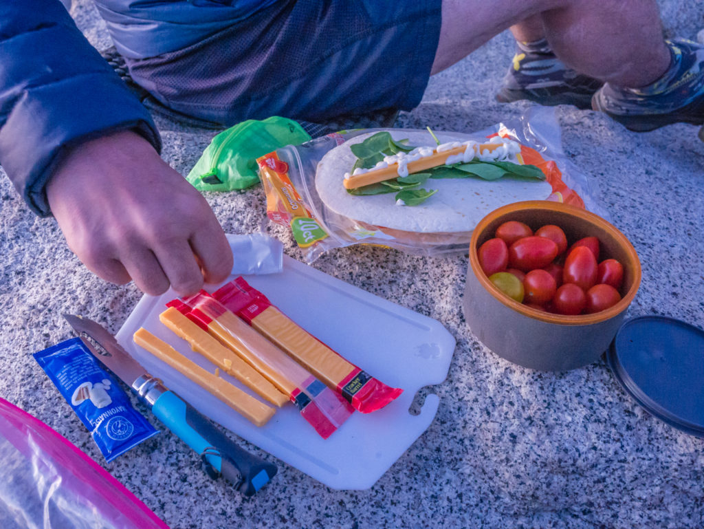
A new trail menu idea that is much healthier and requires minimal washing up!
We then had just over a mile to hike back down to the campsite in near darkness. Thank goodness for our head torches! Having usually arrived at camp before sunset and then being warm and cosy in the comfort of our tent by dark, it felt a little eerie walking back with just the head torch to guide us along the trail, especially thinking that out of the whole of California, we were literally the only people up there apart from the two others we’d seen earlier. I never usually get scared of noises in the night having camped out so much over the last 4 years, however I was glad not to be walking alone tonight!
As it was all downhill on the return, we were back at the campground just after 8:30pm and back to the reassurance of our tent. Quite what a thin wall of material will do to protect you if needed is debatable, but as our ‘home’ on the trail, it provides us with both comfort and a feeling of security. A cup of hot chocolate was then all that was needed to send us off to a sound sleep. It had been a long day!
Day 18 – Friday 27th April 2018, Little Round Valley, Campsite 4 – Thunder View to PCT Wild Camp Mile 201.5, 17.5 miles
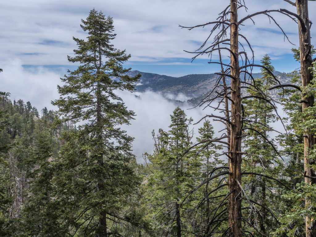
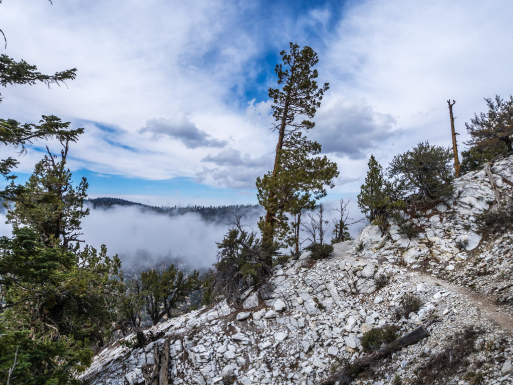
Having camped just below the summit of San Jacinto last night, now meant we had another tough day ahead as we would be descending almost 5,000 feet. (As Americans do everything in imperial measurements, we’ve switched from metres to feet as it’s just easier in case you’ve been wondering!) We would also be traversing ‘Fuller Ridge’, which is a well-known spot on the PCT for being precarious if there’s still snow on the ground. Thankfully with very little of it around now, even on San Jacinto peak, we were feeling lucky with that one and didn’t expect to have any problems.
Feeling tired from the previous night’s summit ascent, we switched the alarm off and agreed to wake up naturally after our bodies had rested. In hindsight though this was a bad decision as we didn’t wake up until 8am and then didn’t get away from camp until 10am. Considering we had at least 17 miles to go, possibly 20+ if we pushed on a little but further to Mile 206, the next water point, it was much too late in the day to get on the trail and cover the distance before sunset.
We’ve kind of taken the attitude that ‘it will be what it will be’ and we don’t have to be too rigid about start and finish times each day, but with sunset still taking place before 8pm, we don’t have maximum daylight hours yet, and we do like to get our miles completed before dark.
Going downhill meant we set a good pace from the get-go, but as soon as we reached Deer Spring again we had to stop and filter enough bottles of water to see us through the day as there would be no other water source en route. Beyond this point for the next 20 miles, all the creeks and seasonal streams were dry.
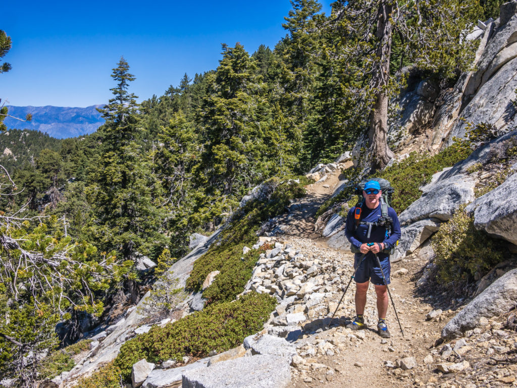
A late start to the day, but we felt well rested after yesterday’s taxing ascent.
Fuller Ridge was kind to us today! (It was nothing in comparison to the ridges we had walked on the GR20!)
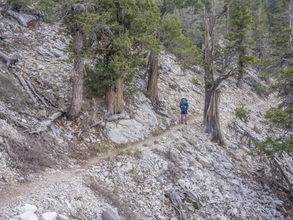
For the first couple of hours we enjoyed the walk heading down under the shade of Californian pine trees, weaving between giant boulders, spying squirrels and little chipmunks that were so skittish there was not a chance we could get a photo of one before it darted off.
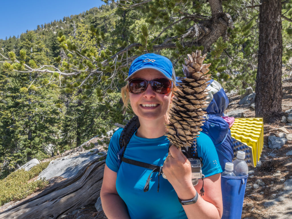
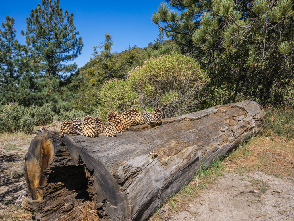
Americans do everything on the large size! The giant pine cones that I’ve mentioned before.
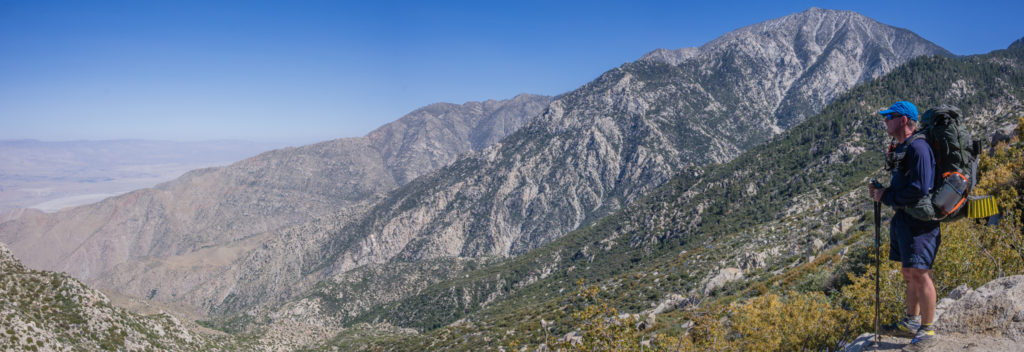
Looking back up to San Jacinto. We had already descended a fair way!
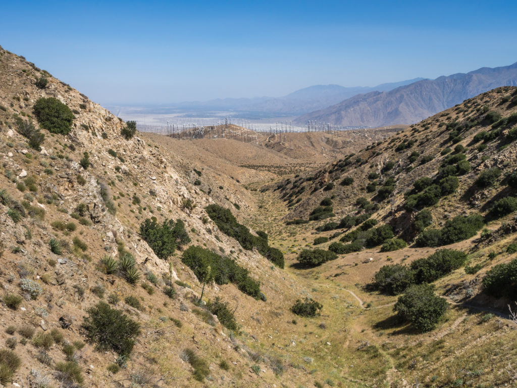
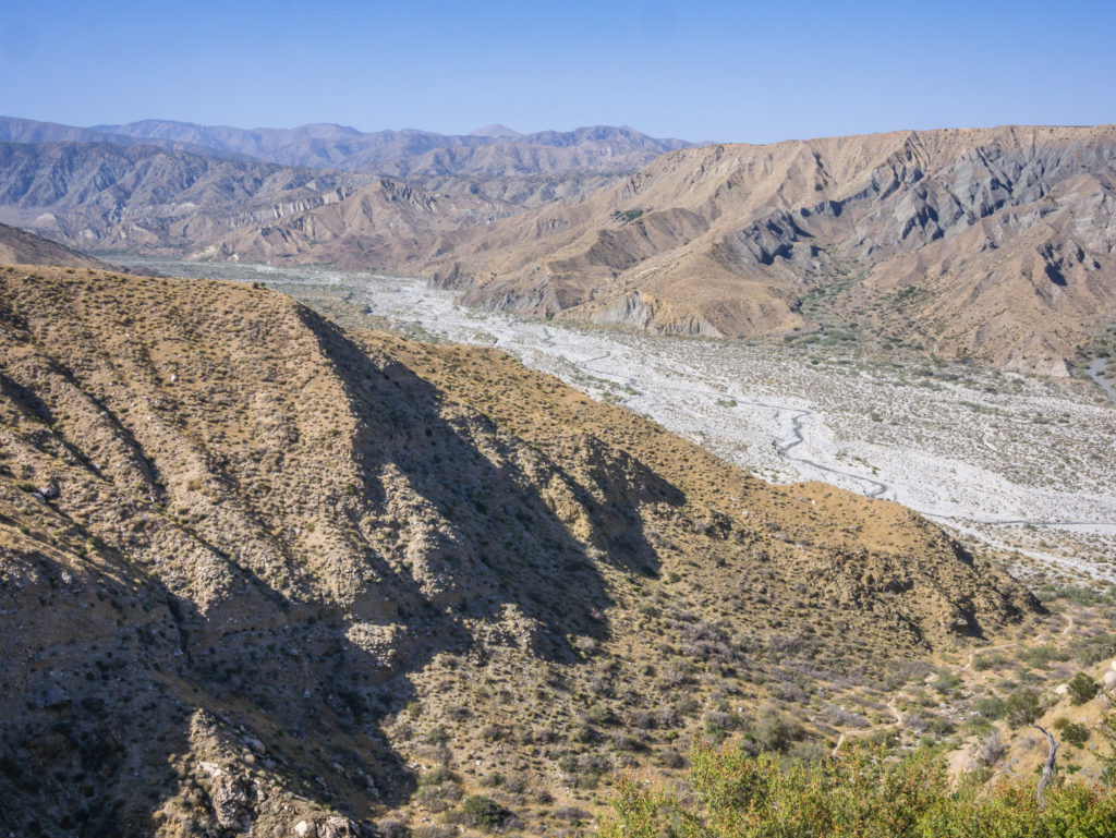
We looked out onto the valley below and could see a small community far off in the distance close to where Interstate 10 cut through the landscape. The Interstate 10 road is a significant marker on the PCT as it denotes the end of Section B (Warner Springs to I-10) and the start of Section C (I-10 to Highway 15 near Cajon Pass). We were pleased as we knew we’d be reaching this point tomorrow. There were also a couple of wind farms in our view, that again we’d be hiking through tomorrow. As landmarks, they were useful to help us gauge our progress, however it was also infuriating as they still appeared so far away. Literally the wind turbines looked like tiny little white match sticks standing side by side, and never seemed to be getting any closer.
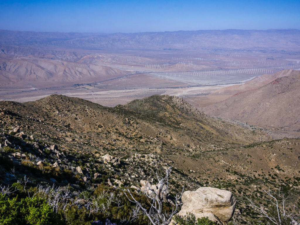
Looking across to the wind farms way off in the distance that we’d be hiking through tomorrow.
On the trail, the switchbacks that weaved from one ridge to another taking us on a gradual descent also appeared to be never-ending. Long and continuous, they seemed to cover twice the distance, when in fact there were perfectly good scrambling opportunities that could have taken us straight down by the most direct route to save a lot of time. Even though we were tempted to do the European thing, we refrained from cutting switchbacks and stuck to the trail despite our frustrations that it seemed to be adding on endless ‘pointless’ miles. (On a positive, taking the much gentler ‘horse route’ is far better for the knees.)
Continuing downhill through the Mount San Jacinto State Park Wilderness.
We had an amazing panoramic view across the valley as we hiked down.
Starting so late, we didn’t really expect to see many others on the trail. We knew the hikers we’d seen yesterday would be well ahead of us by now. However, we crossed paths with a few new faces and it was exciting for us to meet two PCT hikers from South Korea! It seems that at least 1 in 3 people on the trail are not from the US, but are international travellers. So far the trail seems extremely popular with Germans, but we have also met fellow Brits, Spanish, French and New Zealanders, to name a few!
Just when we were getting a little fatigued and about ready to call it a day, we reached Mile 200! We considered this another significant feat as when attempting a thru-hike of this magnitude, every mile most definitely counts towards the final distance!
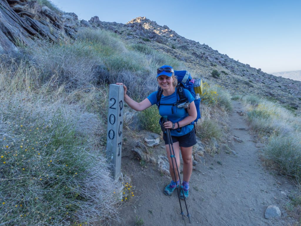
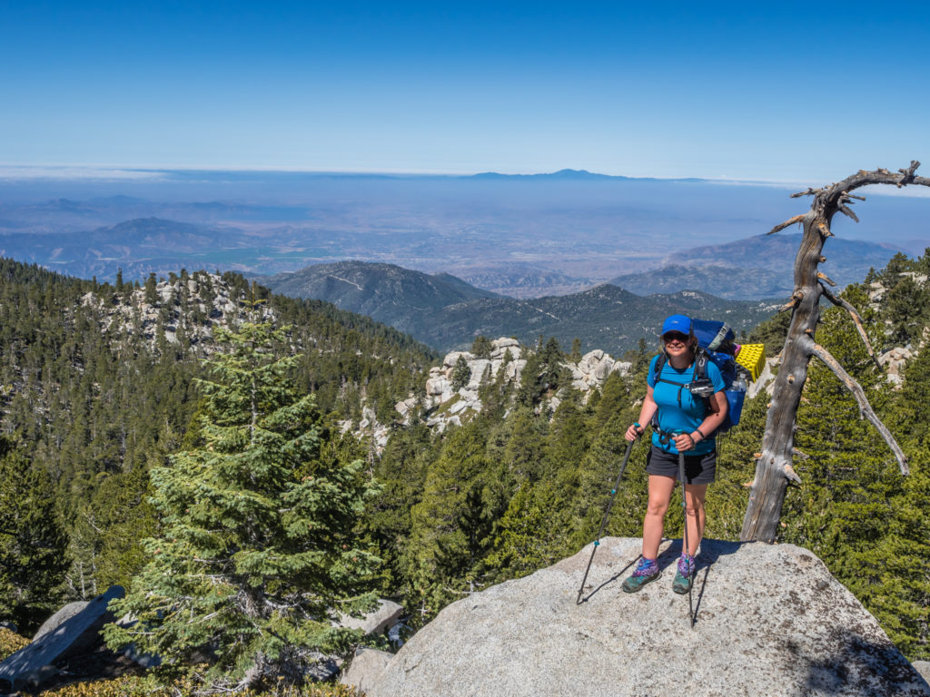
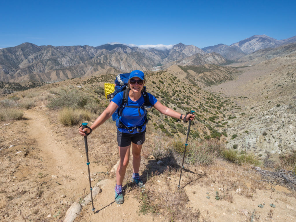
Day 18 and reaching Mile 200! Our steady approach has built up our trail hardiness and seen us free from injuries.
With it almost reaching 6pm, we decided not to try and push on to the water faucet at Mile 206. It would mean at least another 5 miles or so downhill, and we wouldn’t be able to make it before dark. We were beat, so finding a good, sheltered campsite at Mile 201.5, we stopped there, agreeing that we’d be better covering the last few miles down to the valley floor first thing in the morning. After a good night’s sleep our legs would be well-rested and we’d be feeling fresh.
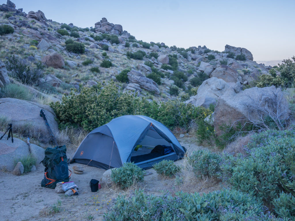
Our sheltered campsite at Mile 201.5. We stopped and made camp before darkness fell.
We still had enough water left to see us through the night, so our usual camp routine ensued. We just had to be careful as there were a lot of bees around, busying themselves collecting pollen from bright yellow flowers that were close to our tent. (Another potential danger we must be observant of when choosing a tent site in future!)
We hadn’t quite covered the miles we had initially intended, but looking up to San Jacinto towering high above us now, we had already come down a long way, which our achy feet and stiff legs were telling us. (From 9,800 feet at last night’s camp, we were now camped at 3,373 feet.) The trail wasn’t going anywhere, and with another 142 nights still to go, there will always be tomorrow…
Day 19 – Saturday 28th April 2018, Wild Camp Mile 201.5 to Whitewater Preserve Campsite, 18 miles
What a difference a good night’s sleep makes. It was our earliest start yet! We were packed up and back on the trail for 7am, powering down one long switchback after another, intent on reaching the water faucet before 8:30am.
A gorgeous morning on trail in the San Jacinto wilderness area.
Let’s do this! Making our way down the remaining switchbacks to the water faucet…
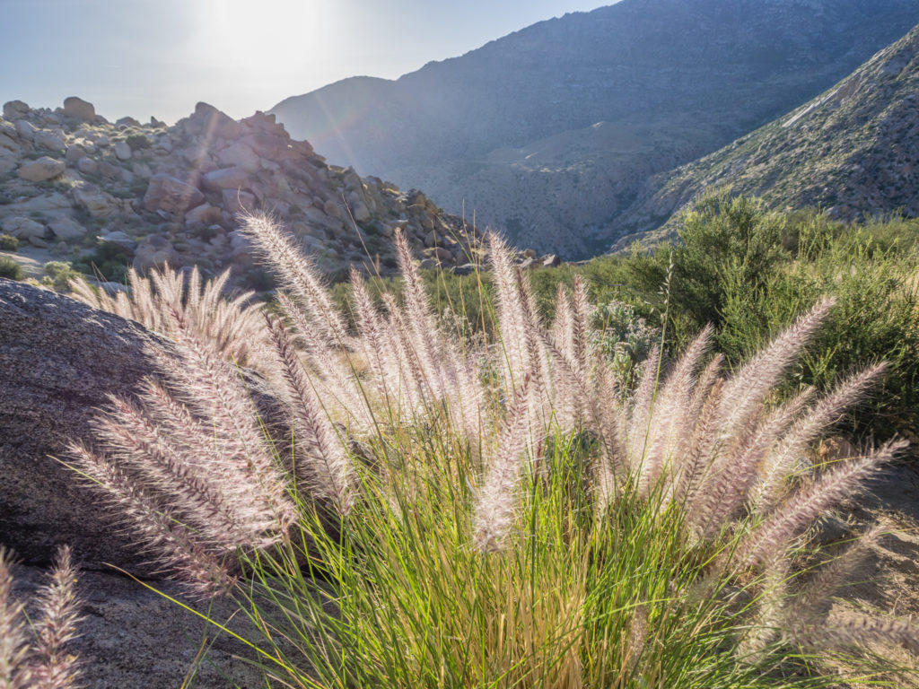
Simply beautiful! The ‘desert’ continues to surprise us in many ways.
The large water tank we had seen from on high last night was finally getting closer and when we reached the water tap beside the large rusty pipe (another well-known trail marker) it was a victorious moment! After 2 days coming down from the top of San Jacinto we were glad to have our feet firmly on the valley floor and to be heading somewhere new.
The infamous water faucet at Mile 206. We were indeed happy to have made it at last!
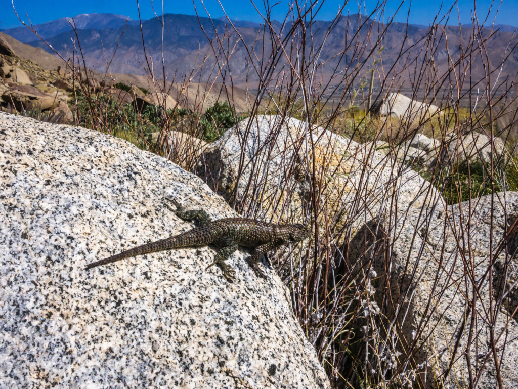
We weren’t the only thirsty ones hanging around the water tap! Lizards scurry across the trail every few seconds, but they are so difficult to capture on camera.
We took a water break before heading off again, our route now taking us along a tarmac road towards a small community that we can only describe as ‘Windy Gap’. Having viewed the wind farms from our vantage point up on the mountain, it hadn’t occurred to me that once we hit the valley floor we’d be hit by wind – quite literally almost knocking us off our feet! So again our legs were put to the test, not only battling through strong gusts knocking us sideways, but also because beyond the road the trail had turned to sand. Not compacted grit that is generally good for walking, but soft sand, like walking on a beach, the kind that you sink into, and when carrying a heavy backpack is a real calf burner as you try and manoeuvre your way through it.
The Pacific Crest Trail heads across the valley floor towards Interstate 10.
Road walking… Hard on the feet, but better than sand walking which is a real calf burner!
We had passed a lot of ‘Attention’ signs today. Clearly, there must be more dangers than we care to consider!
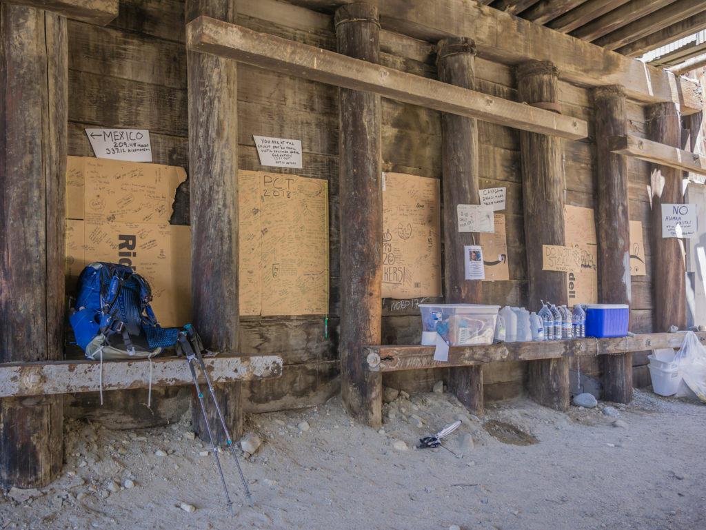
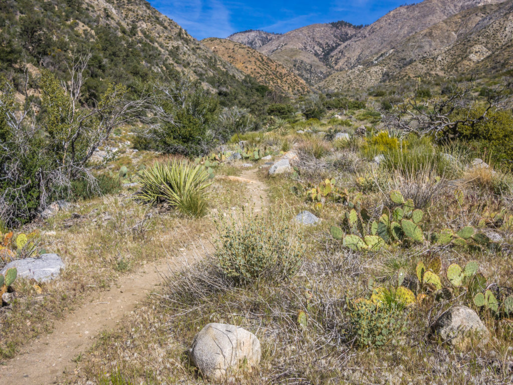
So we trudged on through the sand whilst battling with the wind, the landscape now void of any tall pine trees, returning once again to desert chaparral and the threat of being spiked by a cactus or bitten by a rattle snake. Slowly but surely we made our way to the Interstate 10 underpass. (How inconvenient of there not to be a gas station located right at the point where the PCT crosses! Planners have missed a trick there with 50 people a day going past wanting to impulse buy high calorie convenience food and drink.) But quite unexpectedly there was some trail magic!
Courtesy of previous PCT hikers (Mama Bear, Ice, and others) there was a box of hiker goodies which included doughnuts, cake bars, fruit, pasta and other sought after items, plus there was a large cooler with ice. Unfortunately by the time we got there, all the cold cans of drink had already been consumed, but we enjoyed bananas and chocolate brownies all the same.
Quite unexpected! The ‘trail magic’ under the I-10.
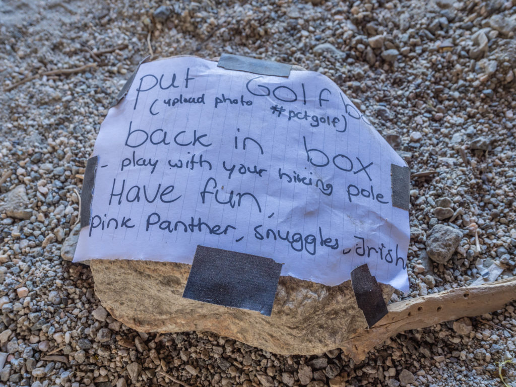
There was also a little fun by way of ‘Crazy Golf’. Rocks had been used to create a mini obstacle course, with a dug out hole in the dirt at the end for which to aim the golf ball. Instructions had been left explaining that to play you should use your walking pole to hit the ball. Ingenious! Of course we had to give it a go!
Every hiker likes a bit of fun off-trail!
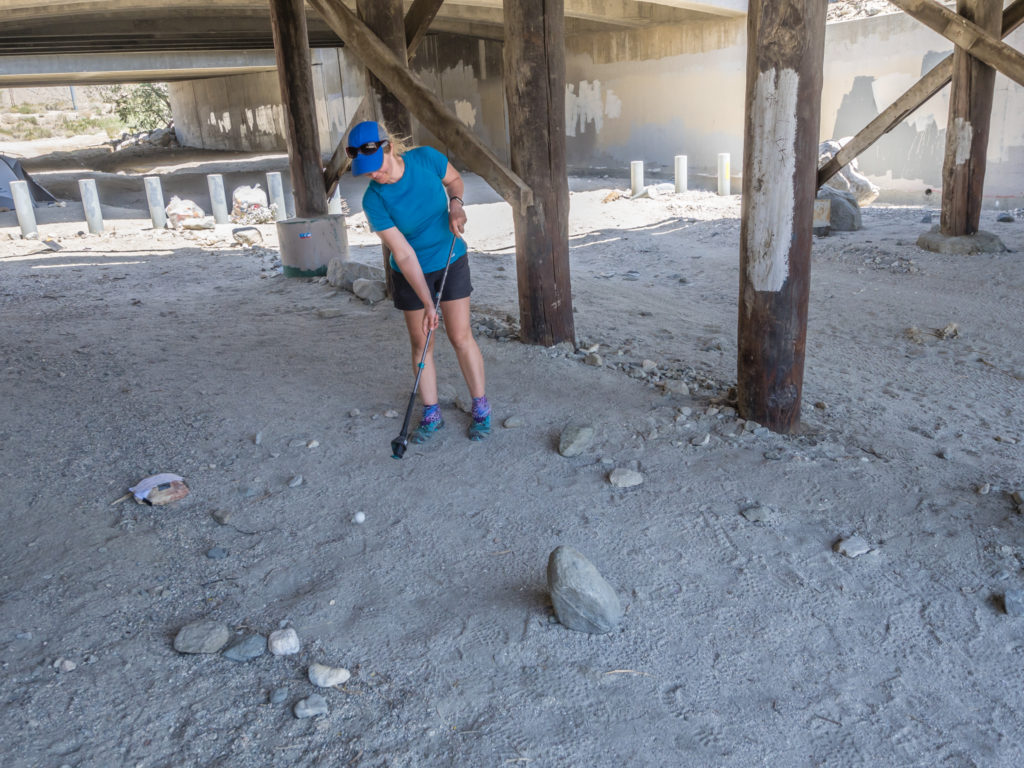
Attempting the homemade ”Crazy Golf’ course using my walking pole.
After an amusing lunch break, the next section of the trail wound steadily uphill to the wind farm we had seen from afar. And yes it was still windy – but on the plus side, as we were now heading towards the farm, the wind was also going in our direction and helping to push us uphill! The PCT actually goes right through the area and up past the site office. As it was Saturday the office was closed, but outside they have provided a large shaded area with a cool box containing bottles of water for PCT hikers. There is also a sign with the WiFi code! Yet again, another wonderful act of kindness on the trail.
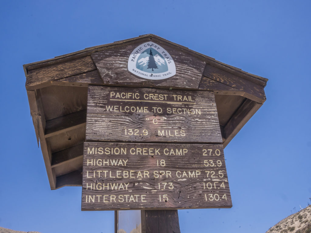
Woo hoo! We were now starting Californian Section C, which runs 132.9 miles from Interstate 10 to Highway 15 (Cabazon Pass). Let’s do this!
Heading through the valley and up to the wind farm with a little aid from the wind.
Beyond the wind farm as we headed across the top of the ridge into the next valley, we found ourselves in a different landscape once again. This time we were surrounded by jagged mountain peaks; the hillsides we would be traversing were much greener, and there were beautiful wild flowers growing alongside the trail. We came up to a sign introducing us to the San Gorgonio Wilderness – and we were already wowed by its beauty. The fact that the trail stayed high weaving around the edge of each mountainside afforded us fantastic views and in the direction we were heading there was a backdrop of red canyons. But it was crazy windy up there! Several times we almost got blown off our feet, but for the support of our walking poles.
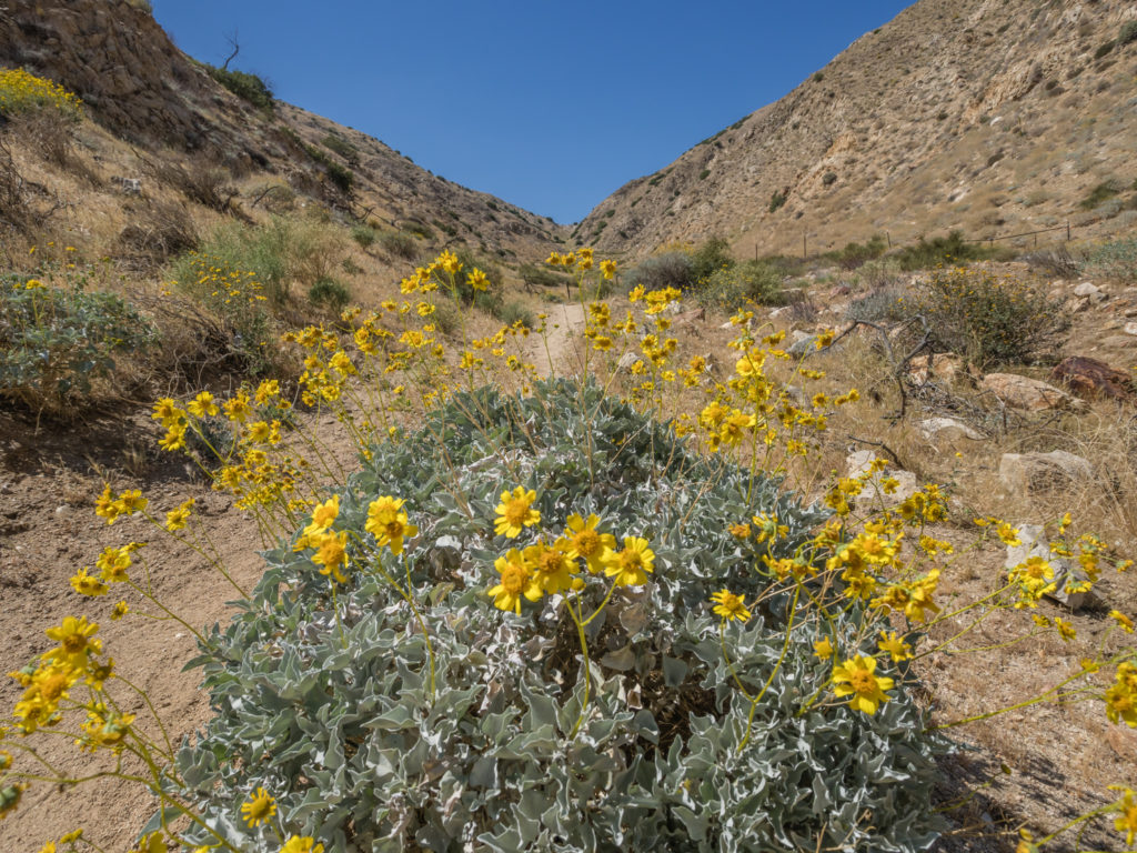
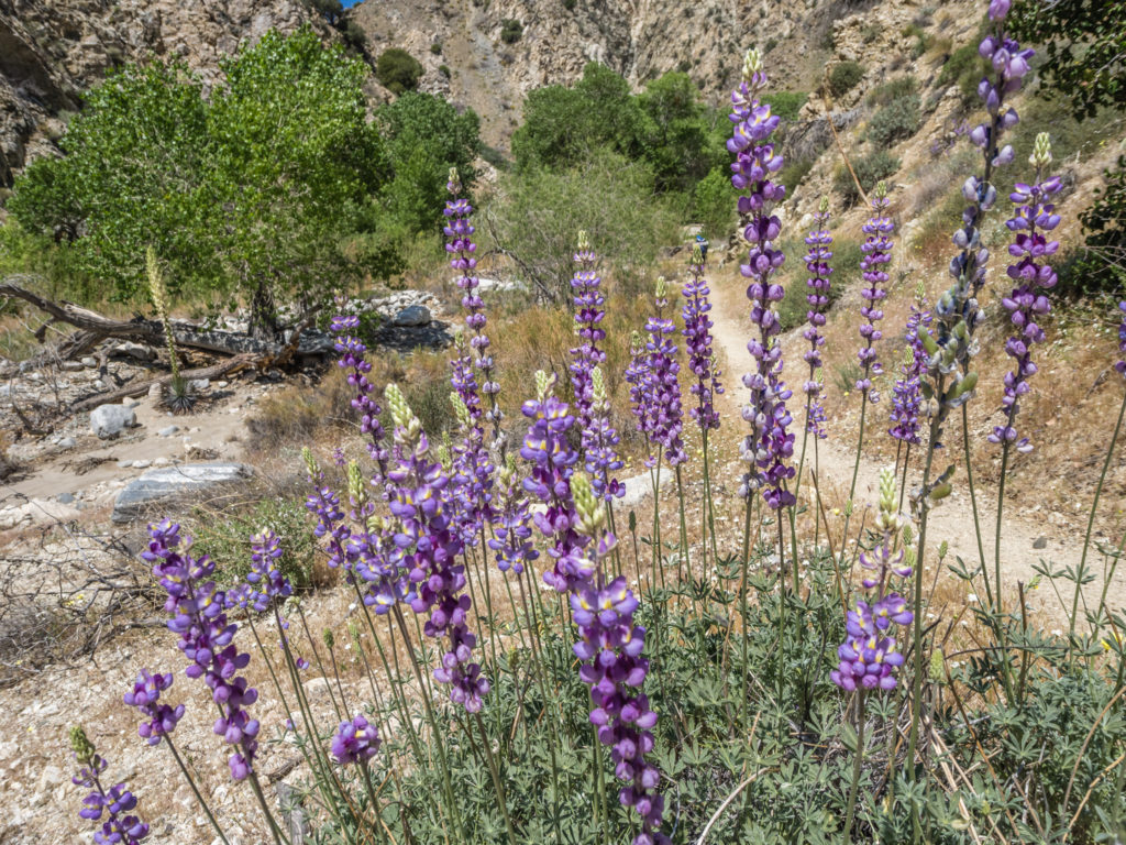
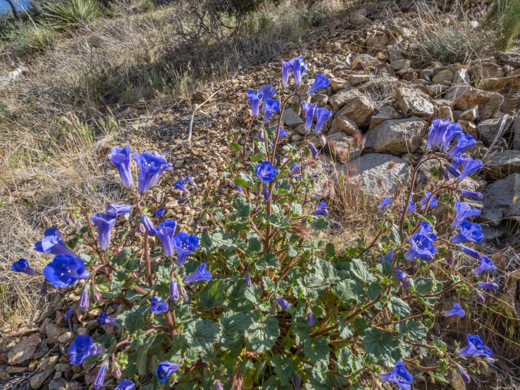
Beautiful wild flowers give the desert an injection of colour.
Our route meandered from one canyon to the next.
Entering the San Gorgonio Wilderness.
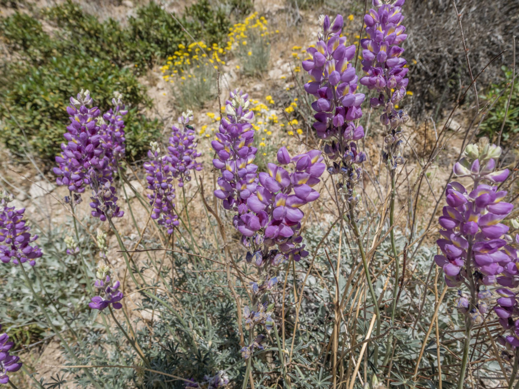
More striking flowers catch the eye!
Again the last 4 miles seemed long and never-ending as we traversed the ridge line of one canyon into the next. We were heading for the Whitewater Preserve, a protected area looked after by the National Park Service. Here there is a camping area for PCT hikers with picnic benches and flushing toilets. What had appealed to Wayne when picking where to camp was also the addition of a ‘wading pool’, whereby he thought we’d be able to soak our feet and relax. Unfortunately by the time we reached the Preserve, the wading pool was closing so we didn’t get to indulge in some water relaxation after all.
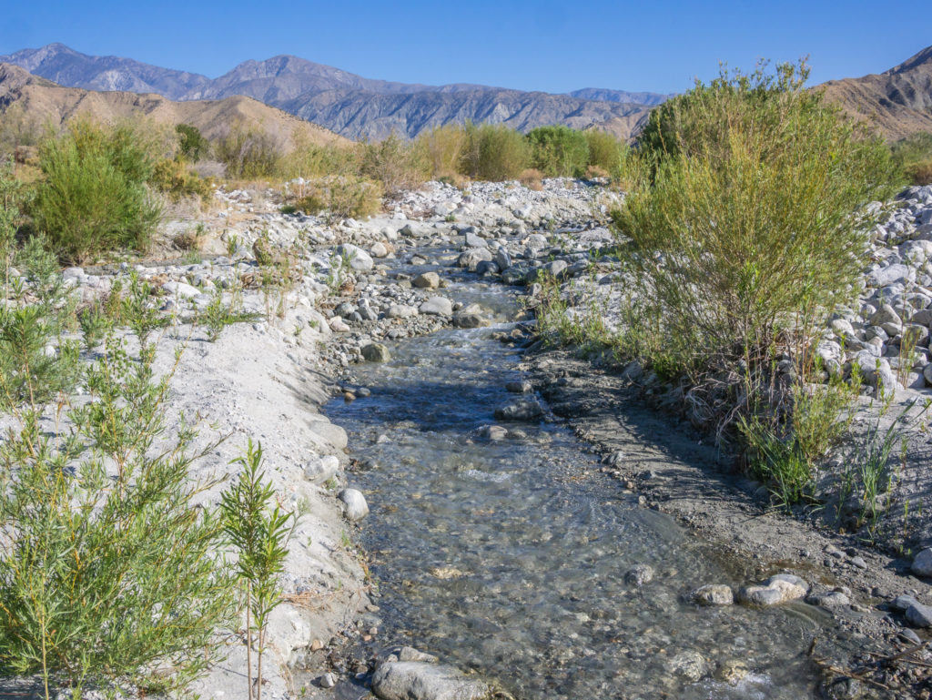
As we neared the Preserve, it was half a mile walk off the PCT to the camping area during which we had to cross the Whitewater River. After so many ‘dry’ miles of trail, it was amazing to see flowing water again!
Looking down onto the Whitewater River, which was flowing through the valley.
Excited at seeing flowing water again and having to do our first river crossing.
We managed to sign the trail register in the Ranger Station just before it closed and then caught up with a few friendly faces who were also camping there. This included the 3 Catalonians, (whom we met at the Post Office in Idyllwild and shared our mutual experiences about hiking in Spain on the GR11) Bug Juice, (an ultralight, ultra fast walker whom we met at the faucet earlier that morning) and the ‘Three Musketeers’. However, we were sad to learn that they have now become a duo since one of the guys has left the trail – not through injury, he’s enjoyed a good couple of weeks on the trail, but now he’s simply done with hiking.
When we pitched the tent we thought the campsite area would be fairly sheltered down in the valley. However, those strong winds were still persisting, so much so that our tent virtually took off at one point, and we had to do an emergency re-peg down and rescue everything! The campsite was not really turning out how we thought it would be, so we were beginning to regret our decision to pitch there. It was so windy that we only just managed to boil some water before cups and lids went flying off the table. If it literally wasn’t pinned down it was gone! So we bailed inside the tent without cooking properly and had to make do with instant mashed potato (poured into the boiling water) on its own without a sauce and just a portion of cheese mixed into it.
The tent was whipped and battered, but with peg reinforcements, thankfully it held. Because of the wind, it had been our worst night on the trail so far! But like us, everyone at the campsite was in the same predicament as it just seemed to be a complete wind trap with it funnelling through the area trying to destroy anything in its path. The one consolation as Wayne reminded me, ‘It could be worse… It could be raining too’!
Day 20 – Sunday 29th April 2018, Whitewater Preserve Campsite to Wild Camp Mile 231, 14 miles
Well what a difference a day makes! When we woke up this morning everything was calm and still and there was not a hint of a wind at all. There were still several PCT hikers milling around the Whitewater Preserve Camping area, probably having slept in after a night spent on tenterhooks, wide awake, trying to batten down the hatches and keep their tents in one piece. (Much like us!) But now all was good in the world again.
So it was not such an early start as yesterday. We set off at 8am, but within the first half mile we were already seeing new flowers and several blue dragonflies hovering around due to the presence of water, which was going to be a regular feature of the day. Hooray! After the long, dry stint in the desert, water was a welcome sight.
The Whitewater River was a welcome sight after spending so long in dry desert terrain.
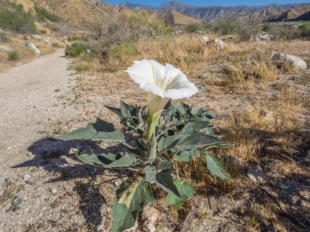
A brand new flower we had not yet seen along the trail until now.
Making the most of good, solid ground and striding out along the trail.
We crossed over the Whitewater River again, our route then taking us gradually uphill to the top of the canyon. It was fantastic as we had expansive views all around, plus a prime view looking on to San Jacinto, which from this angle did have some crevices still covered in snow. It looked so far away now, but still so high, towering well above its neighbours. We stopped for a breather and to enjoy the view, but it was our only water break then until we reached Mission Creek at midday.
A rock hop across the Whitewater River. The first real river crossing along the trail so far!
Looking across to Mount San Jacinto in the distance. It felt like we had come such a long way in just a couple of days.
We had walked around several ridges and crossed over the tops of canyon after canyon all offering amazing views of the area, before we eventually headed down to the water again.
More desert chaparral, but with a difference. This time we had flowing water!
There were several hikers on the trail this morning whom we kept leapfrogging, but we all congregated under a big Sweet Gum tree on reaching Mission Creek, as it was the only place that afforded a good amount of shade. Having been frustrated by the incessant wind yesterday, we were now wishing for a little of it back, having just blasted out 8 miles under the baking hot sun. But it was great literally having water on tap! The desert environment really makes you appreciate every drop. (Albeit we still filtered it out of the stream just to be on the safe side. Especially as some hikers were rinsing out clothes in the river down the way.)
What a wonderful morning to be in the great outdoors!
Panorama showing the enormity of the landscape we were walking through.
Continuing on through the vast expanses of the San Gorgonio Wilderness…
We ate lunch under the shade of the tree and rested for around an hour, then got back on the trail, eager to get our miles done and get to camp. We had intended on camping between Mile 232 and 235, right before an uphill section, leaving the ascent for the morning when we would be fresher. But as we reached Mile 231, a fantastic camp spot grabbed our attention and we just couldn’t pass it by.
Whoever had camped there the previous night had written in the sand ‘Good Wind Shelter’. After last night’s debacle, that factor was now high on our list of priorities. The other plus point was that a stream flowed right past the camp area with access via a short scramble down some rocks just behind the pitch so we could get water for washing and actually rinse out our clothes. There were stones we could use for seating and also a couple of branches wedged between rocks creating a washing line. As wild camp spots go, it was pretty much perfect! So we stopped right there, downed our packs and pitched the tent, a mile short of how far we really wanted to go. (But we’d just add that onto tomorrow’s distance.)
As hikers went past later that afternoon and evening, they all looked on with envy that we’d made it there first and commented what a great pitch we had bagged ourselves! And that was when Wayne inspired a fellow hiker to bestow on him the trail name ‘Condo’. Having watched us get out and set up our 3-person Big Agnes tent, Scoop, whom we had passed on the trail a few days ago heading up to San Jacinto, decided we had a little luxury going on, and combined with our excellent camp spot we could practically rent it out to passing hikers! Hence the name ‘Mr & Mrs Condo’ was born! (We actually thought this was hilarious what with all our other ‘comfort’ items weighing down our packs that he had no clue about!)
More striking flowers that caught our attention as we continued on aiming to get to at least Mile 232 or further.
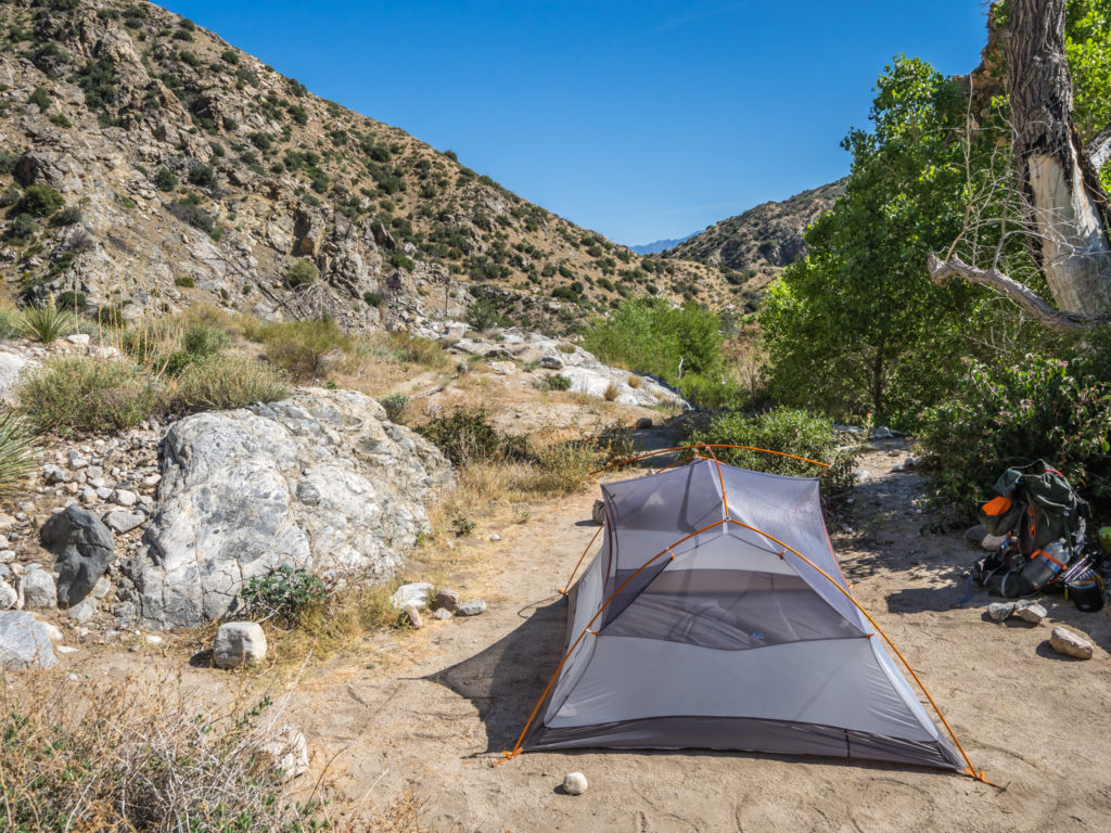
We couldn’t give up the opportunity of camping at Mile 231 with a stream running by (off-camera to the right of the trees).
As we arrived around 3:30pm, we had plenty of time to get our camp ‘chores’ done and a much more civilised dinner that night compared with the previous evening. You never know what you might find along the trail… This was just one of those fantastic moments of good fortune!
Day 21 – Monday 30th April 2018, Wild Camp at Mile 231 to Wild Camp at Mile 248, 17 miles
It was a warm night’s sleep and so cosy that it was the first morning I felt really reluctant to get up and get back on the trail. Maybe the thought of a 17-miler was also putting me off as I felt really tired today, but we had no choice but to make our miles having already booked a room in Big Bear Lake for the following night.
More pretty flowers stealing the thunder from the cactus!
So up we got and got going, with the thought of a room with a ‘jacuzzi’ bath spurring us on! The first section of trail today was very similar to yesterday, following along a mostly dry river bed, then weaving between pockets of dense undergrowth where the water still trickled. We crossed over Mission Creek at several points, some segments dry, some points with a light flow where we found ourselves dodging some ‘bog’. It felt like being back home in England! Using our poles to test out whether it was ‘good mud’ or ‘bad mud’, it was the first time we had navigated around any problematic wet ground after predominantly hiking through desert!
Today the desert was looking distinctly greener! The presence of water really has an amazing effect on an area!
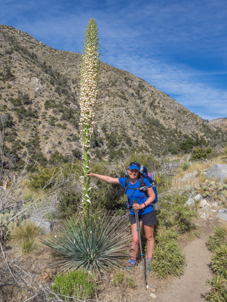
Me and my favourite desert flower. This extra-tall agave was a real beauty!
It was also the first time we had found it difficult to follow the trail as it weaved here and there, largely because a forest fire had burned through the area so there were a lot of fallen trees blocking the trail. At these points there were diversions around the original path, some easy to see, some not so. The presence of some cairns helped, but we still lost the trail at one point and found ourselves scrambling up the side of a ridge to get ourselves back on track. (We should have realised we had gone off-track as soon as it wasn’t possible for a horse to navigate the trail, but we live and learn!)
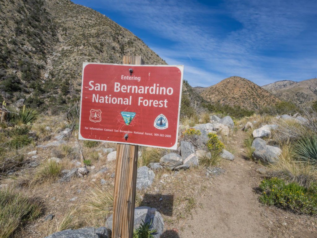
From one wilderness to another… Today we were entering the San Bernardino National Forest.
After a hectic morning of trail-finding, we reached Mission Camp around 12:30pm and agreed it was a convenient spot to have lunch as there were some picnic benches located there. Already making use of the conveniences were Scoop and Blue, the same two male hikers we had spoken to yesterday. At the call of ‘Condo’, we knew Wayne’s trail name had stuck. They asked us if we’d had a recent weather update and if we knew about the snow storm coming through later that night and the following day. Having been walking under blue skies and bright sunshine for the best part of three weeks, we hadn’t checked the weather forecast since before Idyllwild, so what they said was quite a shock and completely unexpected.
Another area of the PCT affected by forest fires. This section still remains fragile and there are signs reminding hikers to keep on the trail.
Heavy clouds rolling through. It looked so unique as we had not seen clouds in almost 3 weeks.
Carrying the Garmin InReach with us, Wayne requested a weather update. When it came through a few minutes later, the forecast was not good. Heavy snow was predicted during the night, continuing the following day through to Wednesday, with temperatures dropping below zero to minus 2. We knew our sleep gear would cope with the freezing temperatures but we weren’t sure our tent would hold up to heavy snow with it only being for 3-seasons. So we decided to play it safe. We already had accommodation booked for the following night in Big Bear Lake, so we decided to extend it for another night, take a proper ‘zero’ day and then hopefully avoid the worst of the snow. The forecast for Thursday was much better, so hiking out then would hopefully mean we would miss the worst of it up in the mountains.
We couldn’t avoid it tonight however as we were already at 8,000+ feet and still had a couple of hundred feet or so to go to reach our intended camp spot at Mile 248. But our plan was to hunker down tonight, ride it out, then hike on 4 miles in the morning to Mile 252, where the trail passes a main road and hitch out from there to Big Bear Lake. It all sounded good in theory, but it would be our first hitch, so I had better get practising my thumb moves to get us a ride!
Continuing up trail aiming for the camp site at Mile 248. In the morning we’d be heading to the road in the morning and getting off the PCT for a couple of nights at Mile 252.
There had been a chilly wind all day, and a rapid drop in temperature. Coupled with the fact there was also heavy cloud, it seemed snow was imminent.
We had already put a few extra layers on today to keep out the sudden cold. A cloudy sky signalled change was coming…
We had no choice but to continue on tonight, but we would get off trail in the morning and stop in Big Bear Lake until the snow storm had passed.
Our final rations! We used up our Spam, dehydrated vegetables, rice, and Idahoan potatoes. We needed hot food in our bellies to keep us warm tonight!
As soon as we reached Mile 248, we pitched the tent and got dinner on the go. The temperature was already dropping rapidly and we needed to get inside the tent and wrapped up in our sleeping bags to keep warm before sun went down and it got even colder.
Scoop and Blue also joined us at Mile 248 and pitched their tents close by, agreeing ours was a good plan to get off-trail the following morning where the PCT cut by the road. Everyone currently hiking that section seemed to have a similar plan as more hikers arrived and looked for places to pitch. I don’t think anyone would want to be stuck out in the mountains in a snow storm, particularly if they didn’t have adequate cold weather gear with them (which at this point, many hikers have already bounced forward thinking it wouldn’t be needed in the first 700 miles with the route predominantly going through ‘desert’!) So here’s to everyone getting off-trail safely for a couple of days. We can soon make the miles up in the next section.
Fingers crossed the snow is gentle and we make it through the night! What a completely unexpected end to our Week 3 on the PCT!
10 Comments
I’m enjoying ‘following’ you both again.
You’re doing really well!
‘Trash cans’? ‘Zero days’? You are both becoming very American!
More so than you’d believe!!! We’re assimilating new words every day. ‘Soda’ is the latest one as a ‘can of fizzy pop’ gets questionable looks!
Enjoying the blog and the videos of your trip.
Thanks for taking the time to comment and for following along!
Great to read and see about your adventures again. I’m starting to see that your Corsica trip was just about the best prep you could have done. And then heat and snow in the space of two days? It certainly keeps you on your toes that’s for sure.
Best wishes for the next part Mr & Mrs Condo!!!
Thanks John! Yep, we always say nothing can ever be as hard as the ‘GR20’! There were some brutal climbs and descents on that one. In comparison, the PCT follows gentle switchbacks with it being an equestrian trail as well. The tough part of this one is going the distance as we’re now starting ‘big’ mile days to complete in time!
Really enjoying your posts, it looks like fun but hard work. I’m planning on doing the PCT next year, this is really whetting my appetite. I’ve the hunger for a hike!
Hi David, thanks for commenting!
It’s a lot of dedication to do the big miles day after day, but it’s definitely worth it as every day we see something amazing and are meeting really interesting people along the trail. Good luck for your own PCT adventure next year and thanks for following along.
All the best, Danielle & Wayne
At last, we got some toilet talk. I assume you went more than twice in 15 days, but the other times were in a proper toilet. Stay safe. xxx
Yep, you got it! 😉