
“It had nothing to do with gear or footwear or the backpacking fads or philosophies of any particular era, or even with getting from point A to point B. It had to do with how it felt to be in the wild. With what it was like to walk for miles with no reason other than to witness the accumulation of trees and meadows, mountains and deserts, streams and rocks, rivers and grasses, sunrises and sunsets”.
– Cheryl Strayed
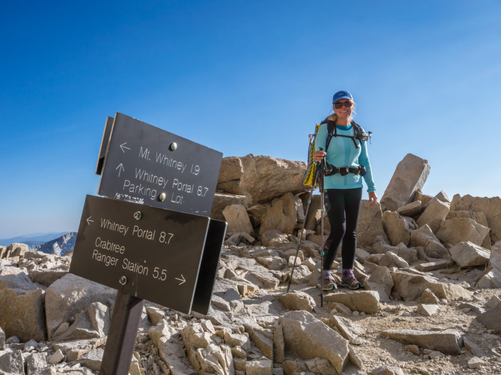
The Ninth Week – Hitting The Heights
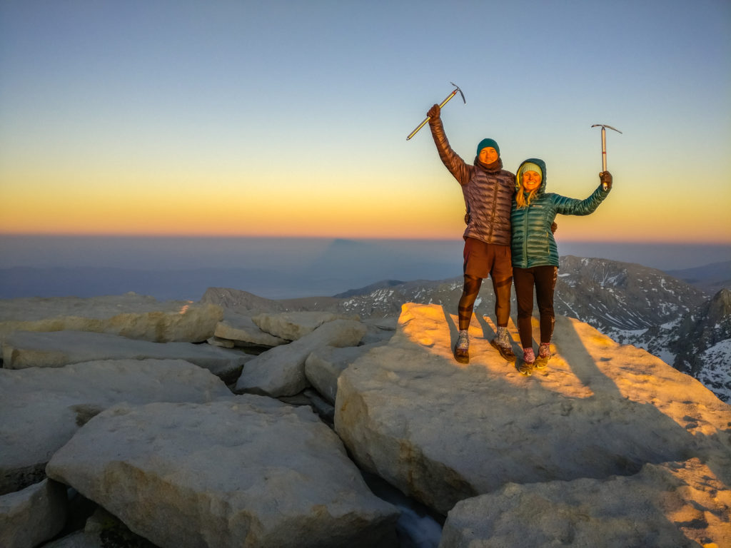
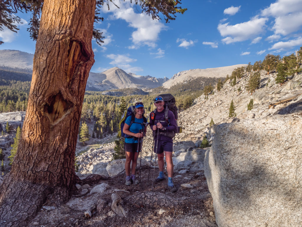
Our second time standing on the summit of Mount Whitney, the highest mountain in the contiguous United States! This time we made it for sunset…
Day 57 – Tuesday 5th June 2018, Wild Camp beside South Fork Kern River at Mile 716 to Wild Camp in Death Canyon at Mile 731, 15 miles
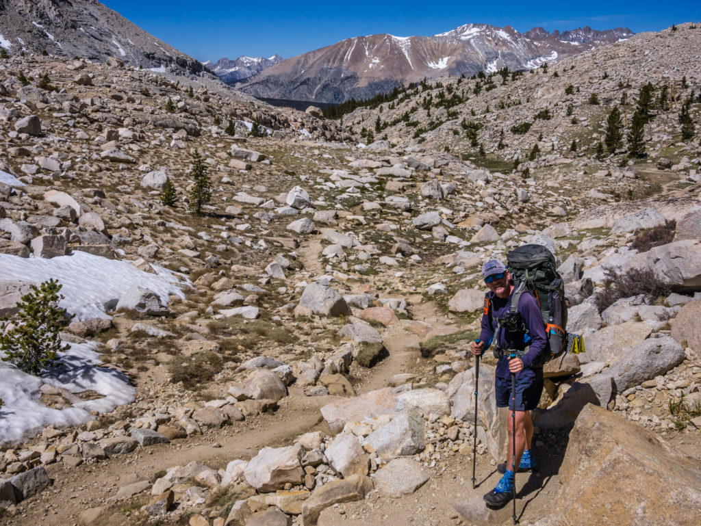
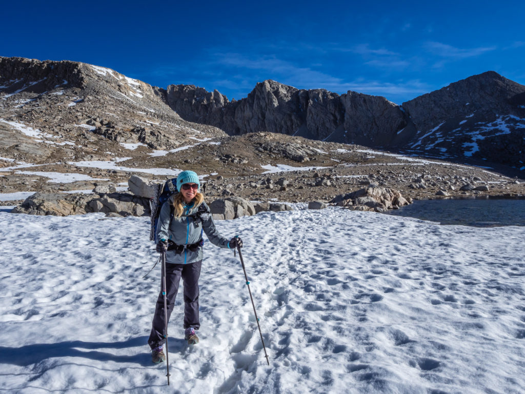
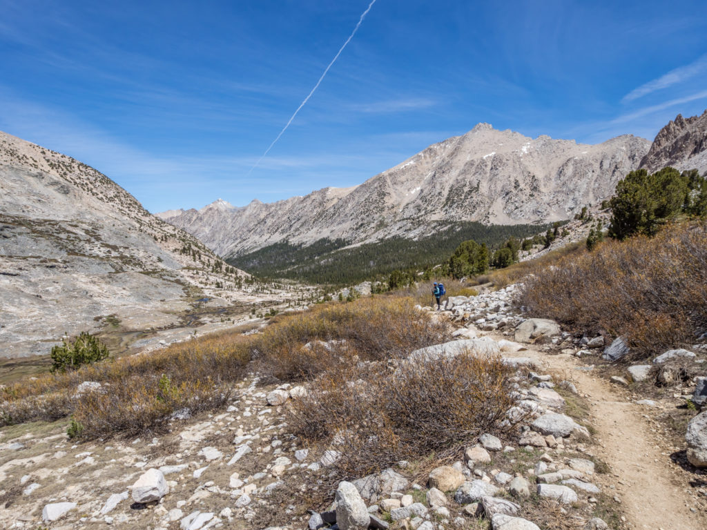
Beginning our 9th week on the trail, we were completely refreshed and looking forward to new challenges having entered the Sierra Nevada, which is considered to be the most beautiful section of the PCT. The trail fatigue I was feeling towards the end of last week had now been replaced with a keen desire to get moving knowing what an exciting segment we had coming up!
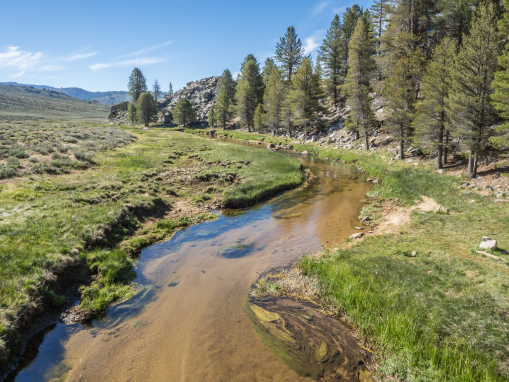
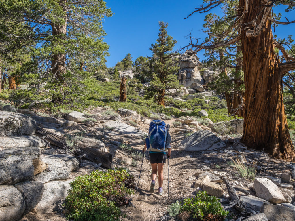
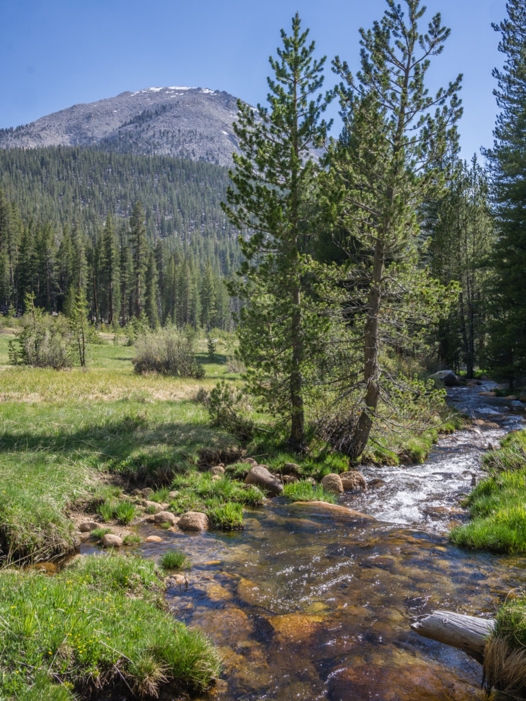
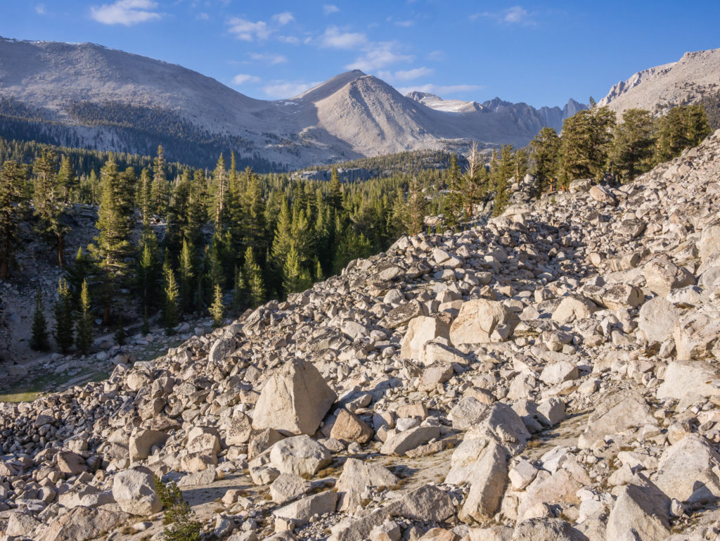
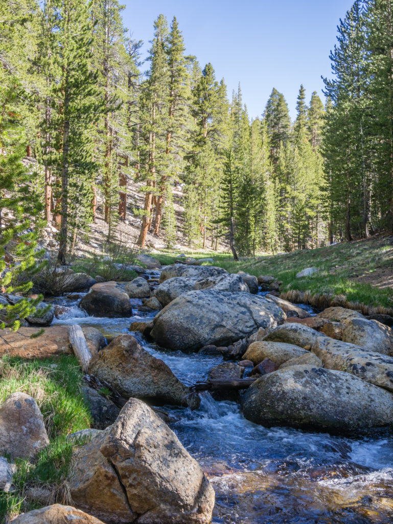
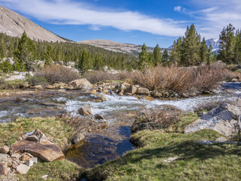
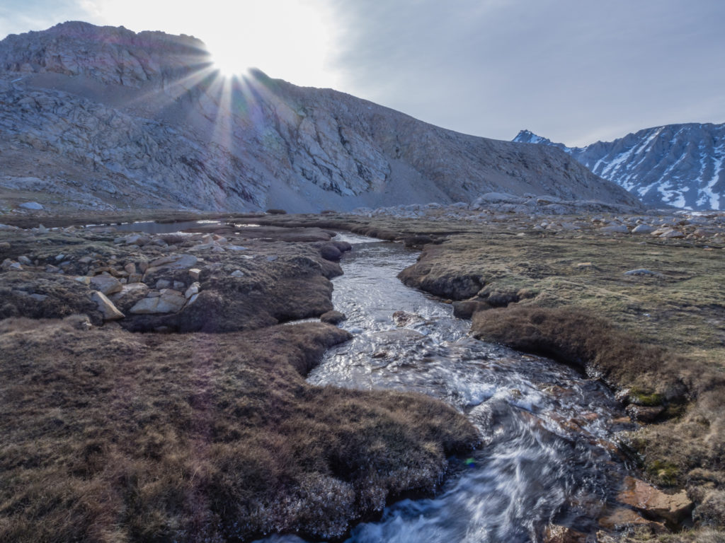
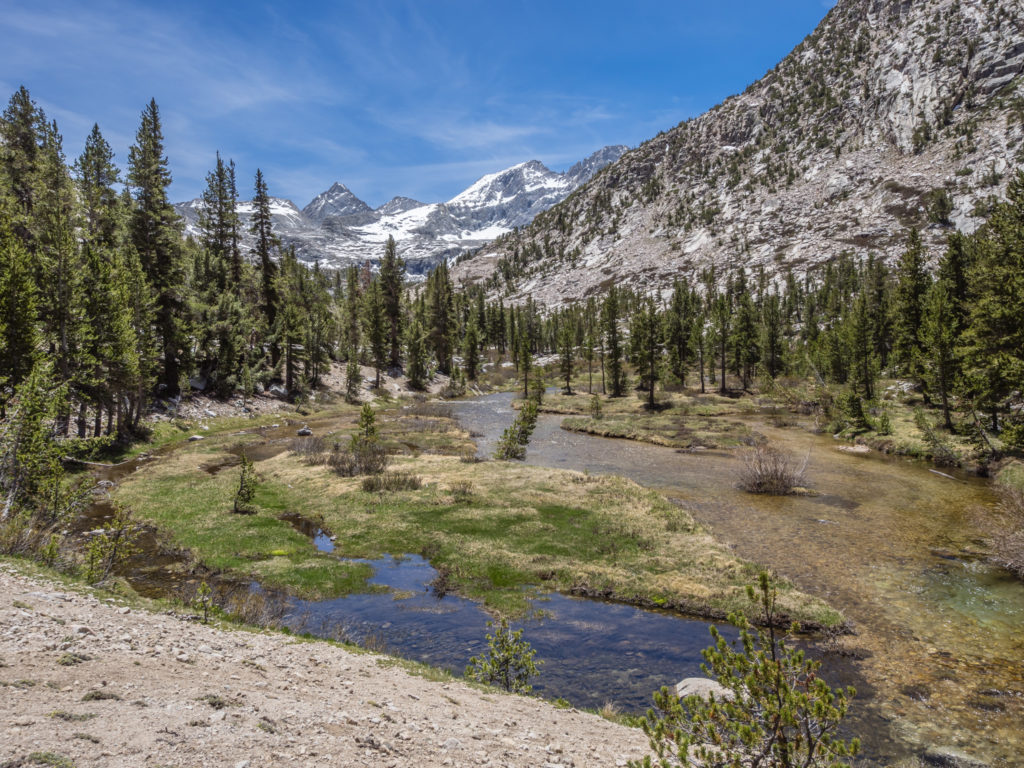
Having left the desert at last, we had already seen the landscape change dramatically. Crossing creek after creek, not only was there now an abundance of water, (which was amazing after so many hot, dry days where we were wholly reliant on water caches), but the trail was leading the way to new wonders. Walking beside lush green meadows surrounded by giant evergreen trees, set against a backdrop of granite, it felt amazing to have made it this far. What really captured our attention though was the skyline showcasing the high mountain terrain we would soon be traversing!
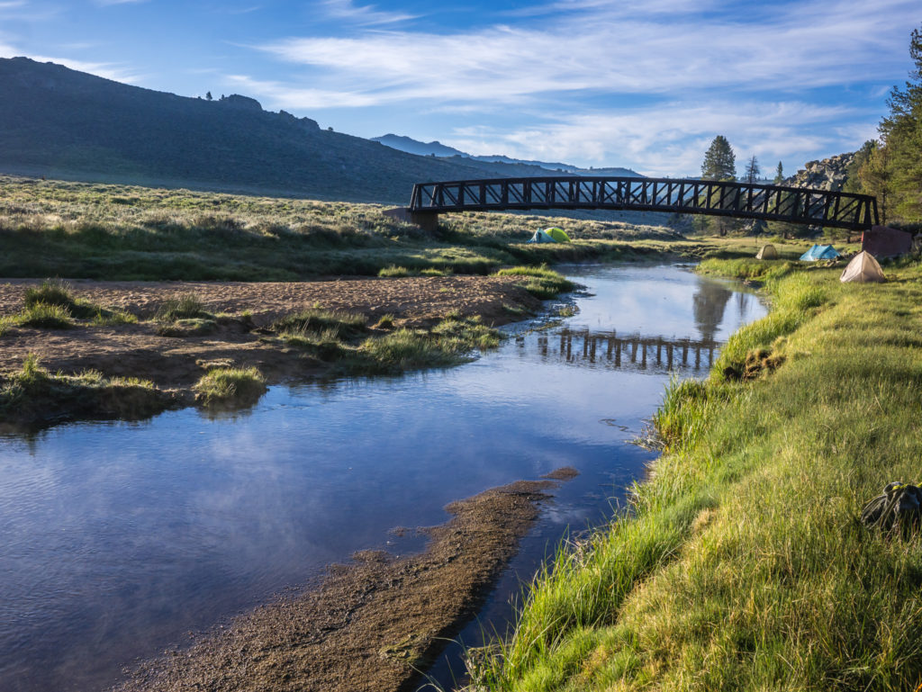
Looking very picturesque, several PCTers camped alongside the South Fork Kern River last night, just like ourselves.
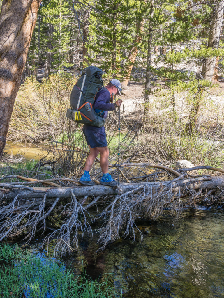
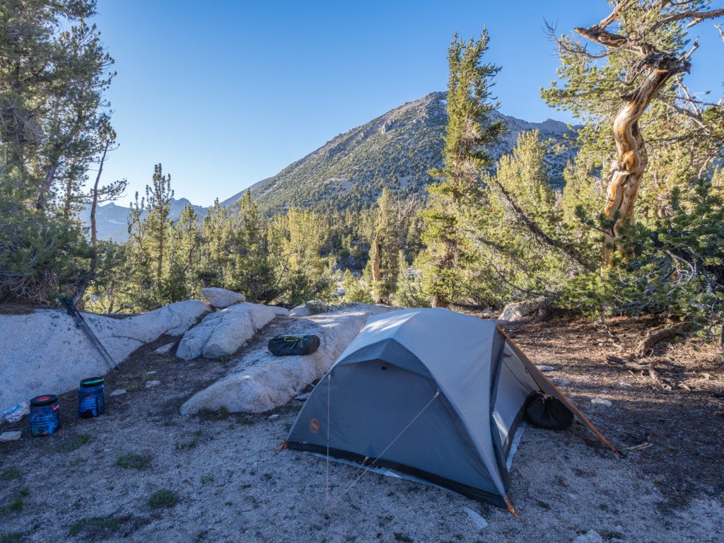
But our day didn’t quite start off so positively! Having been overwhelmed by the presence of grass yesterday, our choice to camp on it right next to the South Fork Kern River hadn’t been quite the success we had envisioned. Yes we had a beautiful spot right beside the water, where we paddled and enjoyed the warmth of the late afternoon sun. However, by the next morning we were regretting our decision to have pitched so close to it. You’d think we’d know better, but it never crossed our minds about the moisture in the air and how much it would condense on our tent. Made worse by the fact we had left off the tent fly all night, by the time we woke up at 6am, everything was frozen solid. Lesson learnt – we won’t be camping that close to a river again, grass or not!
So it was a case of wipe the tent down and be patient as we tried to dry everything out in the sun once it had risen above the mountains. That meant we didn’t get away from camp until almost 9am! It was a late-ish start, but at least the sleeping bags had dried out and fluffed up again along with all our other gear that was damp from the frost. Timing today wasn’t such a concern anyway as for the Sierra section of the PCT, we’ve dropped our mileage right down. Most recently we’ve been pushing on for 22 mile days, but we will now be averaging around 14 miles per day to give us more time to concentrate on video and landscape photography!
When we finally set off, Wayne was able to capture some good footage of the swallows swooping in and out from under the bridge over the river catching bugs to feed their young. As the sun lit up the river we were able to get some more photographs of the location in different light, so it wasn’t all bad.
Seeing water in the landscape making everything lush and green makes for a much different scene.
We stopped by the first crossing of Cow Creek, a couple of miles up the trail after about an hour for our second breakfast. Even though we hadn’t been hiking for long, we had still been up several hours and were trying to keep the hunger pangs at bay. An extra calorie boost was also going to give us a good burst of energy to help us through the big climb of the day. We were hiking up around 2,400 feet before heading downhill to Death Canyon. (A rather ominous name, but as there was water nearby, it was our planned camping spot that evening.)
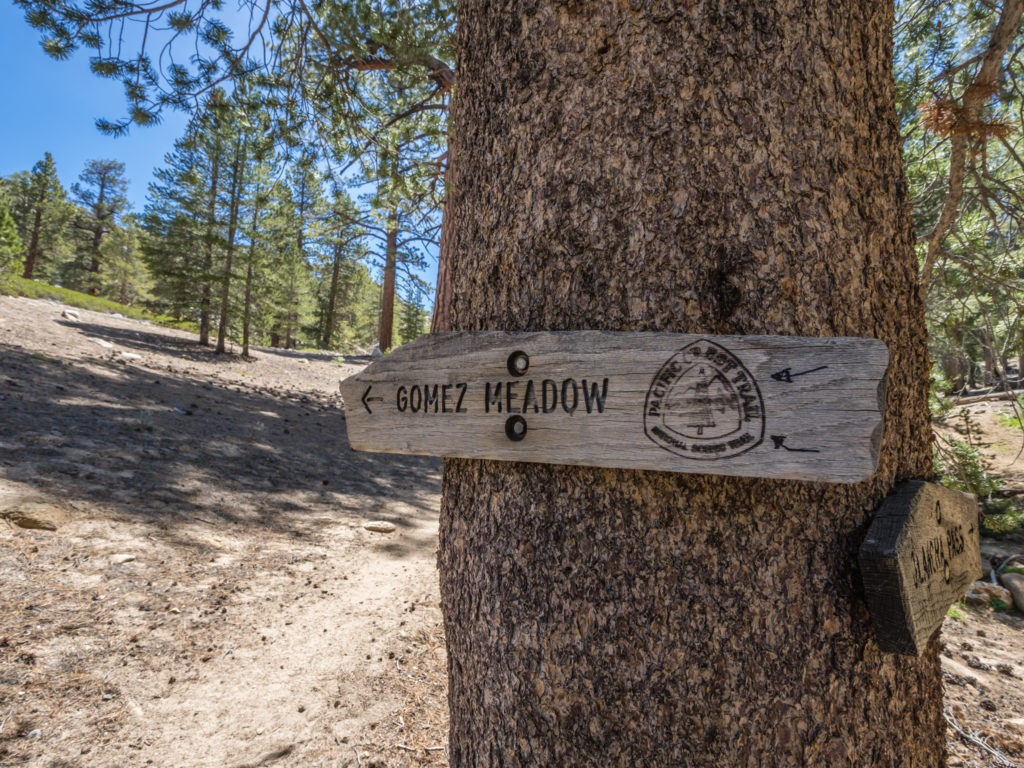
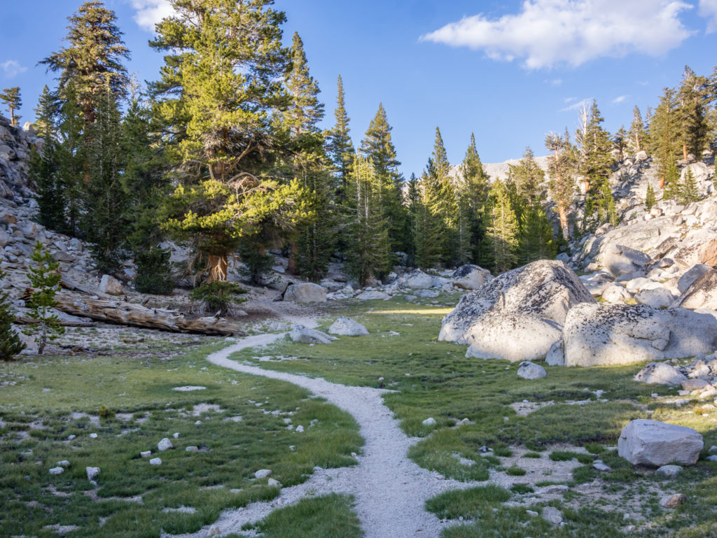
Heading in the direction of Gomez Meadow. Meadows and high mountains were to be a regular feature of the day!
We powered through some of the up, then took another rest break after about five miles at the final crossing of Cow Creek as both our hips and shoulders in particular, were beginning to ache with the addition of a fully laden bear can inside our packs. In theory, even with ice axe and micro spikes as well as the bear can, we should be used to carrying the weight as we can compensate for these by carrying less water. But fully loaded with 7 days of food, even with only one litre of water, was still taking its toll.
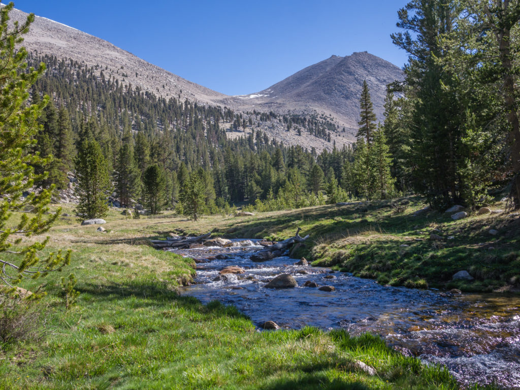
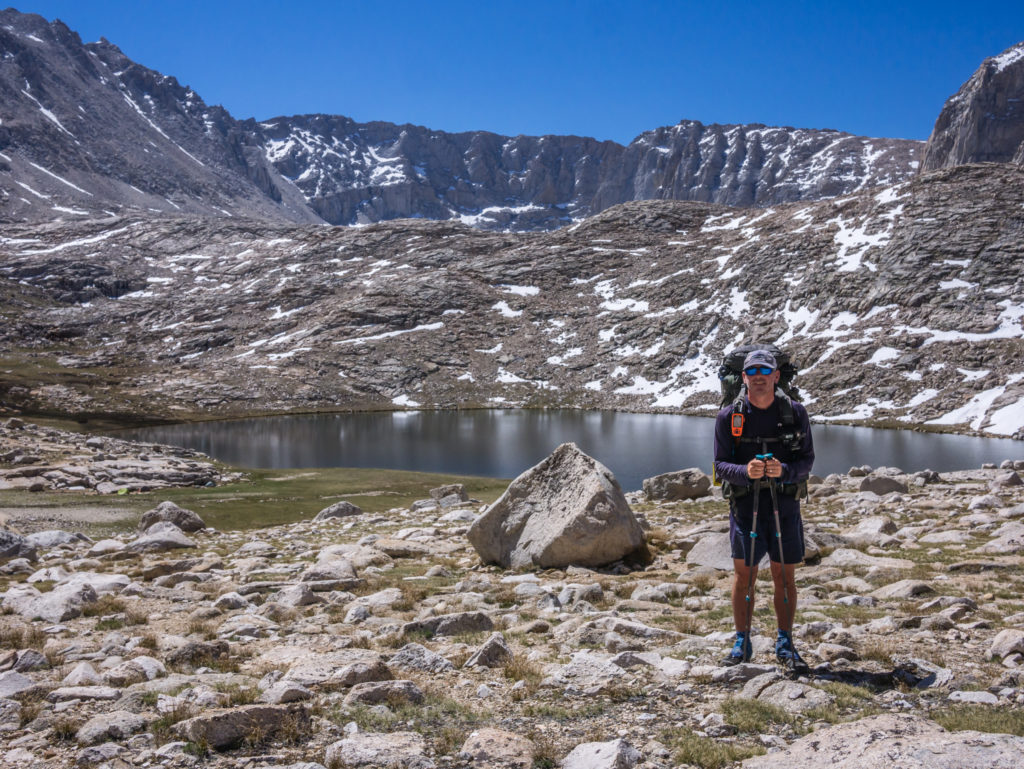
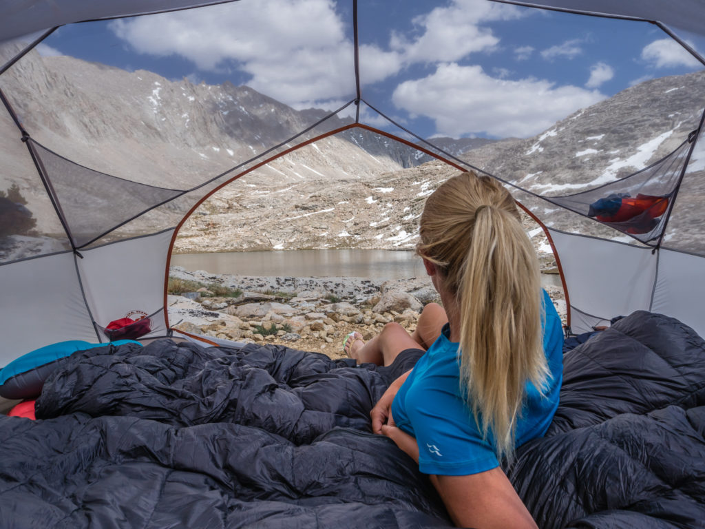
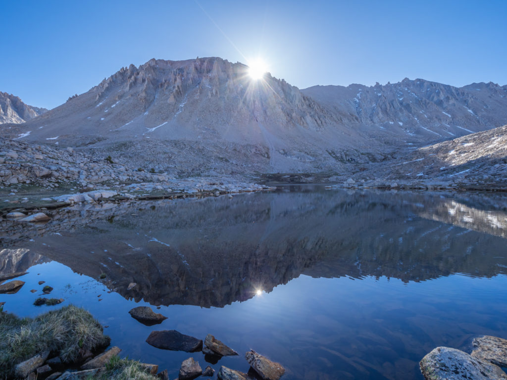
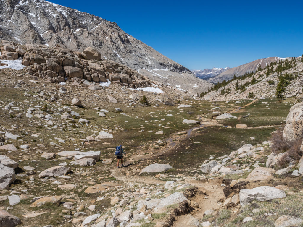
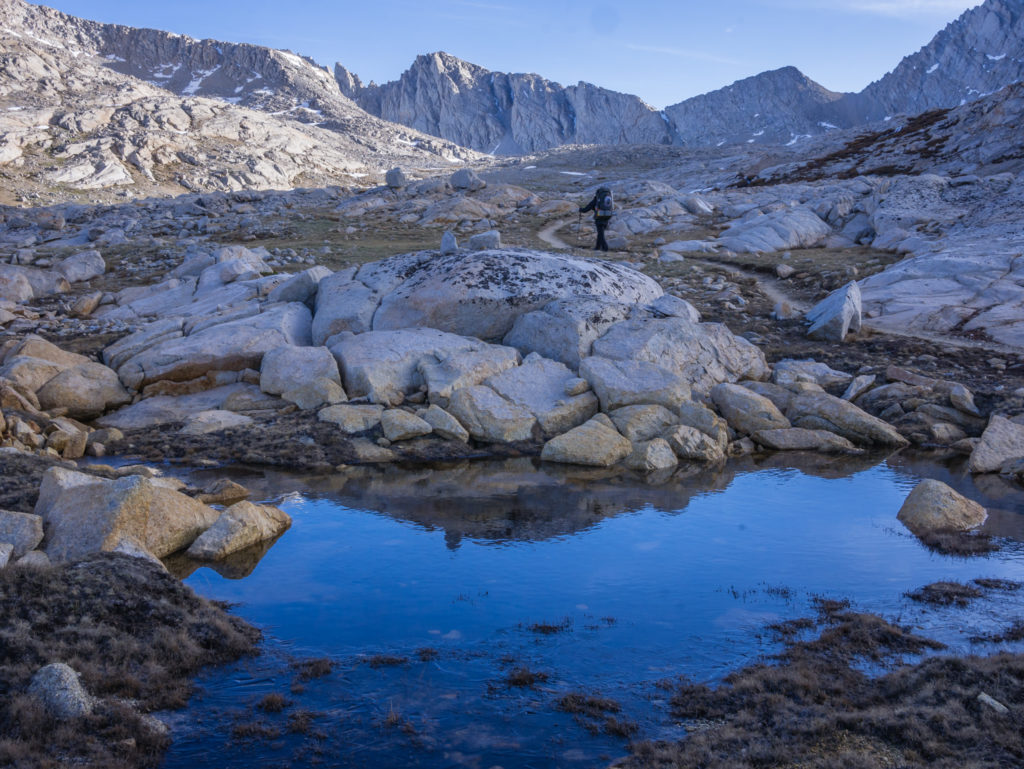
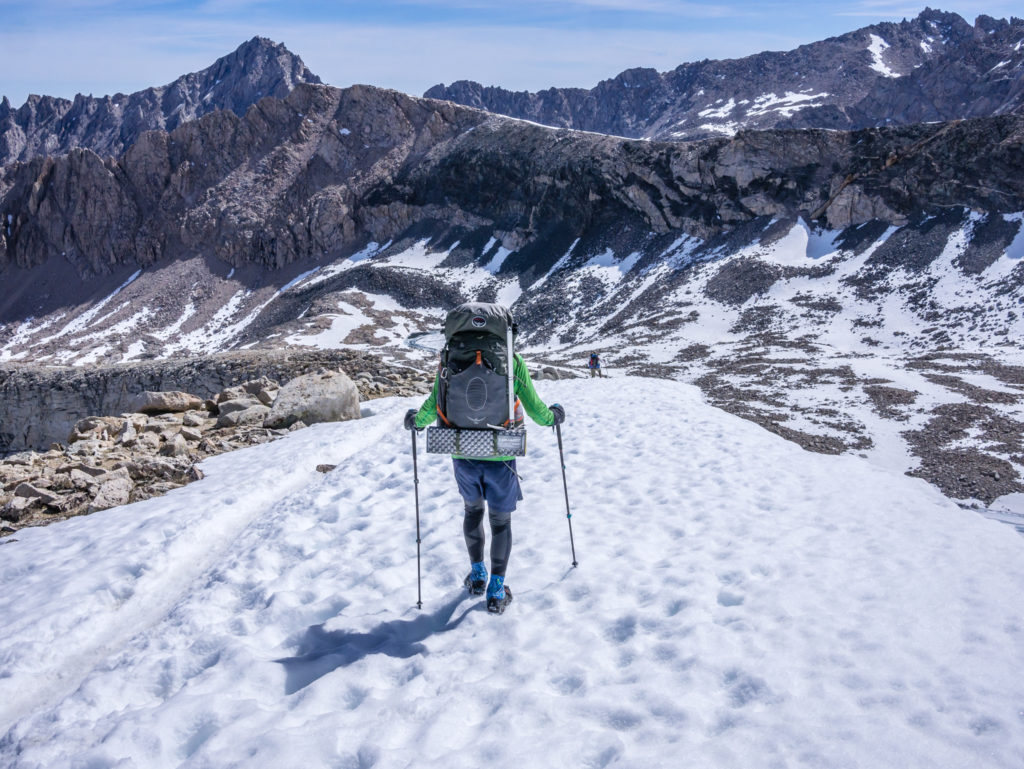
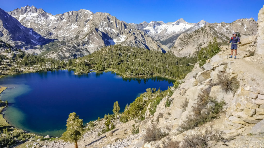
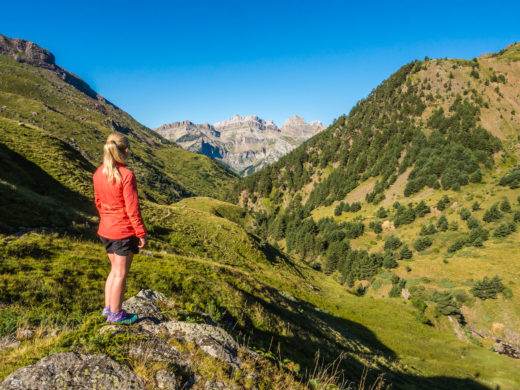
We had reached the top of the ridge by approximately 1pm where we were rewarded for our efforts with a clear view looking across to Mount Whitney. At 14,505 feet, she is the highest mountain in the United States outside of Alaska. The John Muir Trail finishes with a summit ascent, which we hiked in 2014, capturing a great sunrise from the flat peak. This time we are planning to return to the summit in time for sunset to capture it from a different perspective. What made us really happy today was that it looks like there is much less snow on the summit than what we were expecting after the recent Sierra snow storm. If the switchbacks are clear of snow it will be a far less demanding ascent and much more pleasant, especially as we’ve not had much experience of hiking in snowy conditions.
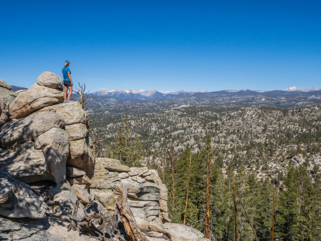
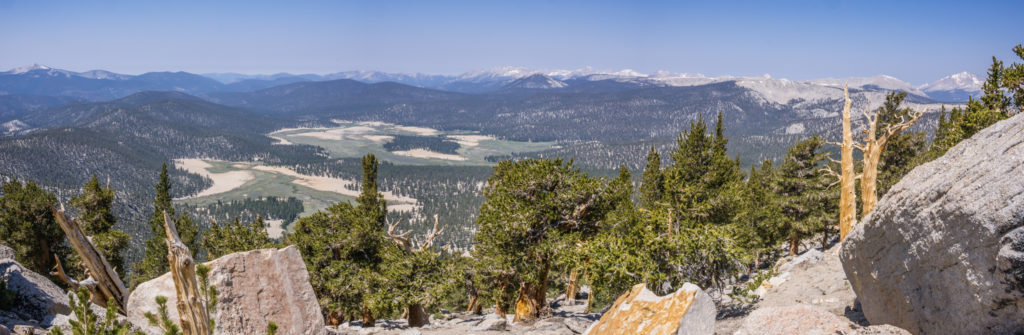
Getting a good vantage point to view the High Sierra mountains!
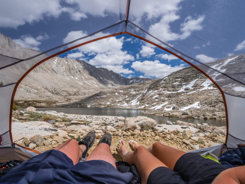
As the PCT would take us downhill back into the trees from here, we hiked off trail a little way and sat on some rocks to have lunch, which afforded us an unobstructed view of the skyline. We are still enjoying tuna wraps with mayonnaise as our staple midday meal!
Into the trees…
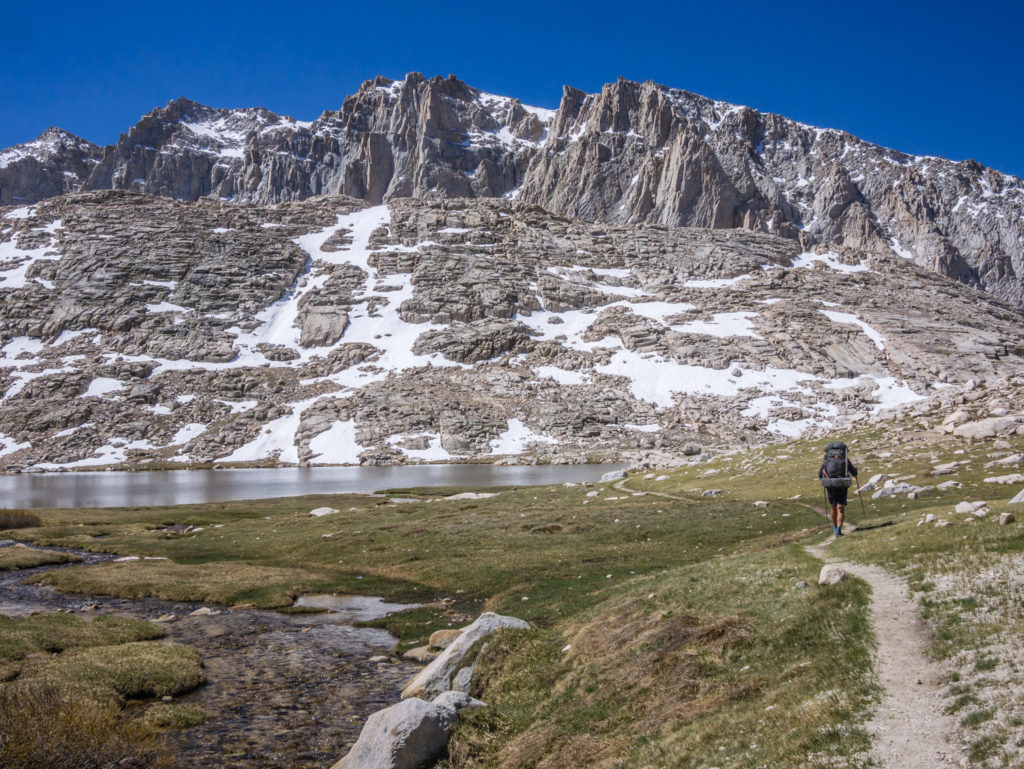
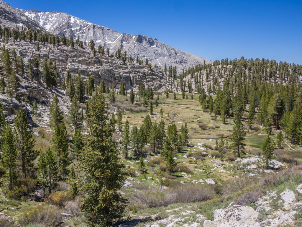
When we finally made the effort to get moving again, the trail wound around the ridgeline gradually taking us downhill and to the east of Big Dry Meadow. From up high it looks like one giant mass of sand amidst a sea of green. When we reached the valley bottom we found that the trail runs alongside, then cuts through Gomez Meadow before reaching Death Canyon, where we set up camp on a sandy area between some giant boulders. The camp area is close to a flowing creek so we had water for both washing and cooking, which should now be the ‘norm’ on the trail.
Passing by a very green Gomez Meadow.
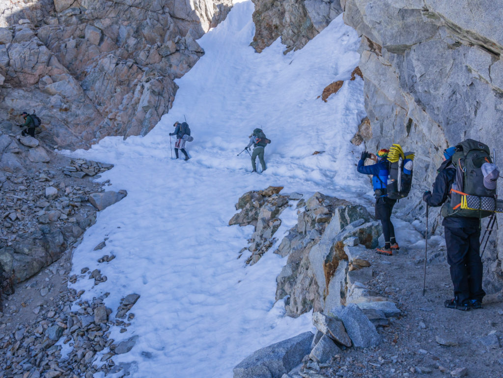
A group of hikers camped across the way from us, but we are now out of the bubble again with us covering less daily mileage, so we didn’t know them, the usual day-to-day faces we are familiar with now already ahead of us. We saw some hoof prints along the trail today as well as some horse poop that we considered quite fresh, but we haven’t caught up with Rooster or Horsey either. We hope they make it safely over Forrester Pass later in the week. We’re all prepared with our ice axes to cross the snow chute on the northern side, and are keeping our fingers crossed that Horsey can traverse it safely too. I’m sure we’ll get to hear about it as word filters down the trail sometime soon.
Going off trail just a little way afforded us a wonderful, private camp spot within Death Canyon.
Day 58 – Wednesday 6th June 2018, Wild Camp in Death Canyon at Mile 731 to Wild Camp above Poison Meadow at Mile 747, 16 miles
We had another very cold night, so again we had a late start getting back on the trail as we prefer to dry out all of our damp gear when the sun has risen, as opposed to packing it away and getting it out later in the day to dry. (As our sleeping bags sit at the bottom of our packs, it would be a lot of hassle to get everything out again.) Cold nights are to be expected when we’re reaching the higher elevations and camping above 10,000 feet, but hopefully we won’t have to endure too many frosts after we’ve gone over Forrester later this week with it being the highest pass on the PCT.
Finally setting off after taking some time to dry our gear out in the early morning sun.
We weren’t too worried about the time as today we were only hiking around 16 miles, before camping somewhere within the vicinity of Poison Meadow. (We hope whoever named some of these areas was doing it tongue in cheek! After Death Canyon and now Poison Meadow they must have had a fairly dark sense of humour!)
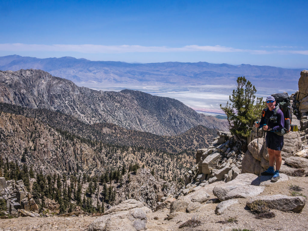
We had only been hiking for around an hour when we came to a small saddle area overlooking Owen’s Valley amidst a vast area of desert, where the Eastern Sierra town of Lone Pine is situated. With a direct line of sight to civilisation, we had an unexpected window of cell phone service that we quickly took advantage of, along with several other hikers all talking loudly and excitedly on their phones. We quickly checked our messages and emails, then took the opportunity to book some accommodation in the larger Eastern Sierra town of Bishop for the following week.
A brief window into civilisation with a rare opportunity of getting cell phone service in the Sierra.
Several hikers we had spoken to were planning on going over Mulkey Pass and hitching to Lone Pine to resupply so that they wouldn’t have to carry more than 4 days of food in their bear cans. We on the other hand, were on maximum capacity, having crammed 7 days of food into our bear cans so that we wouldn’t have to resupply until after we had hiked over Forrester Pass. Our plan was to hike over Kearsarge Pass to the Onion Valley Trailhead where we would hopefully hitch a ride to the town of Independence, then on to Bishop with it having more facilities (where we are also planning on taking two zeros so that we will have enough time to organise our food resupply and post it up trail all the way to North Kennedy Meadows and Sonora Pass some 200 miles north). It is not just about being super organised, but we have found that even with additional postage costs, it works out much cheaper to buy food supplies from larger towns with chain supermarkets, as opposed to small village grocery stores, where hiker goods can be double the usual price.
Not only did the saddle allow us a brief interlude communicating with the outside world, but it was also a prime viewing location for watching fighter jets practise aerial manoeuvres between the different valleys. Some of them came so close to the ridge that Wayne joked he could read their licence plate number. It was really exhilarating watching them turn sideways and sweep past, much like a scene out of the 80s movie ‘Top Gun’! (Back home in England, our military planes also fly between the mountains as we have seen them practising in the Lake District, which is always very exciting.) From our current location, we also saw a large plane flying overhead that was being escorted by a fighter jet, which we wondered was it Air Force One? (We thought maybe not as surely the President would require more than one escort.)
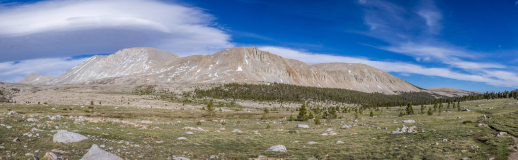
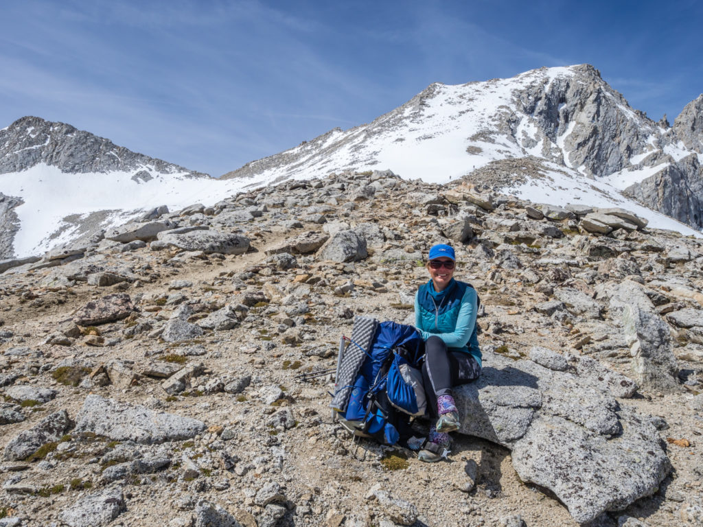
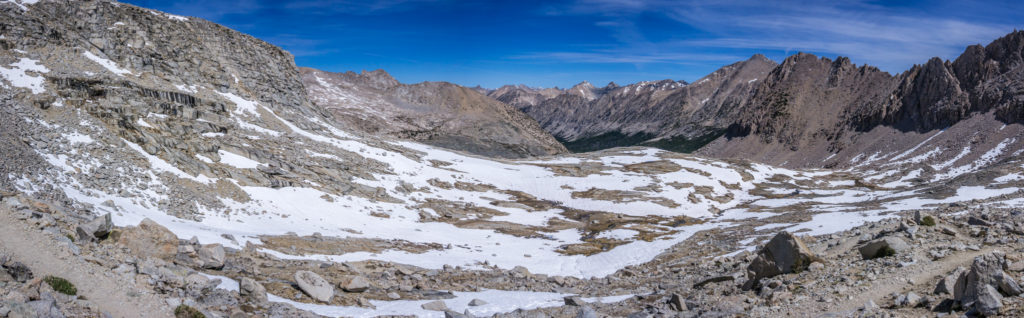
Having spent at least an hour there, we had to finally drag ourselves away and push on to complete the rest of today’s ascent. We were soon taking the packs off again however as we found another great spot looking on to the high Sierra peaks. The scenery is becoming more mountainous and more breath-taking with every step.
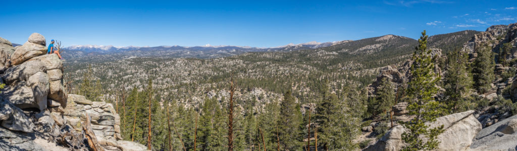
Panorama looking on to the high peaks of the Sierra, some still with snow on the summits.
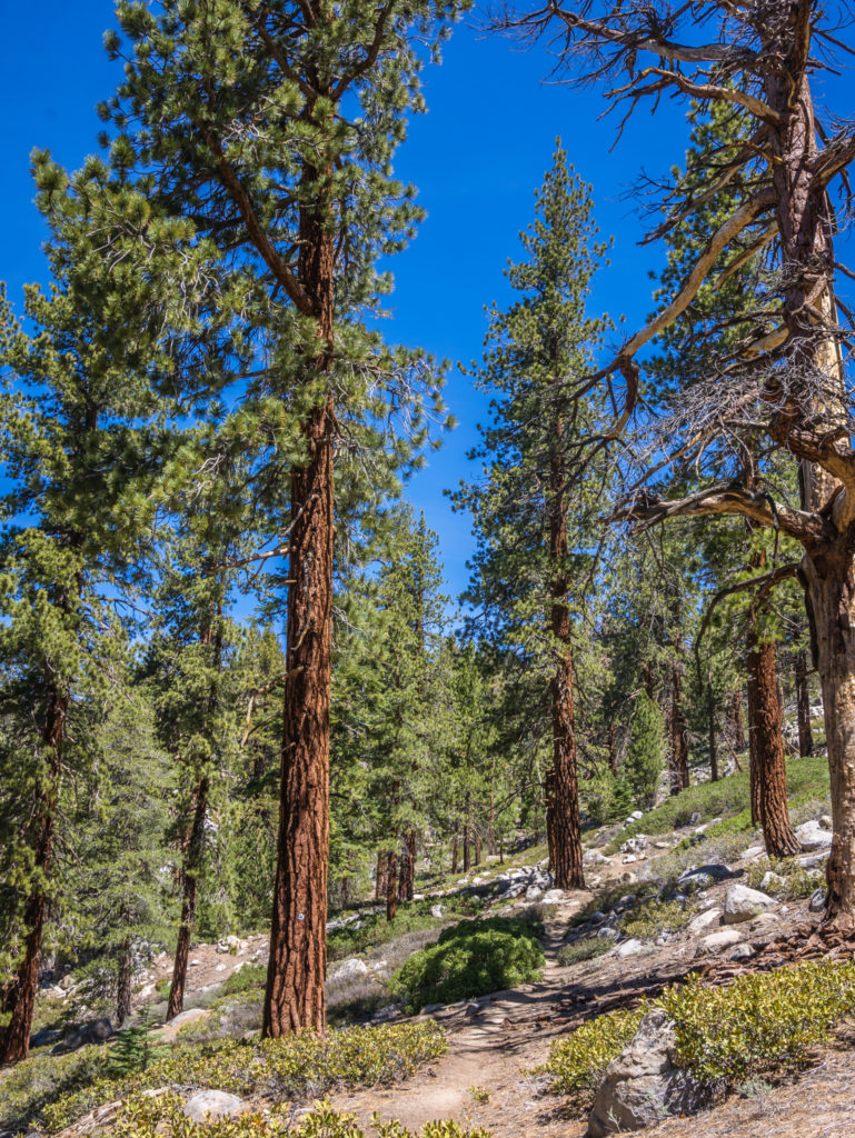
Again we were following a trail of horse poop, but we still haven’t caught up with Rooster and Horsey, whom we think are at least 10 miles ahead of us now. Once the trail had reached the high point of the day, it seemed to level off and was much kinder and gentler weaving through large, flat areas of pine forest. We spotted several small chipmunks, but no deer or bear, which is probably a good thing!
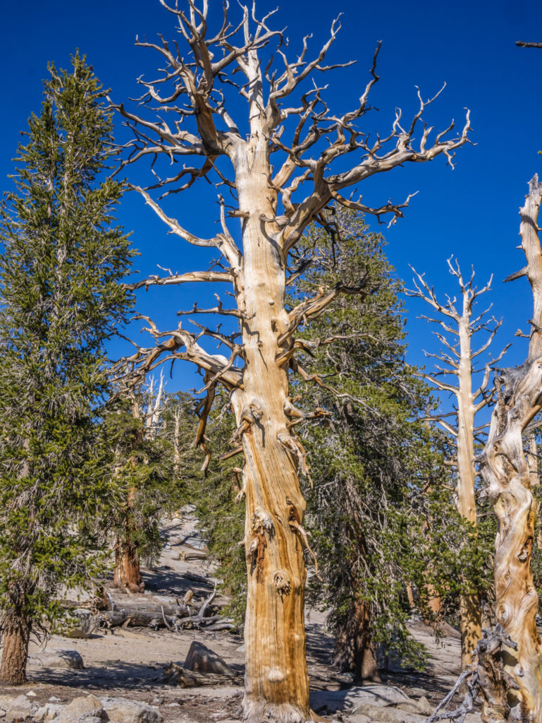
No longer hiking through sage brush being wary of prickly pear cactus, today we were walking amongst giant Jeffrey pines and Sequoias.
With a couple of reliable water sources on this section, we stopped at both just to top up with a litre of water each that we added electrolytes to. We shortened our lunch stop because of such a slow morning, but even with a fairly short day of only 16 miles, it seemed a long 16 miles because of our additional equipment.
We had a little laugh along the way when Wayne said he’d spied a green peanut M&M on the ground and was tempted to pick it up and eat it! Too late! I’d done exactly that! It was still round and in perfect condition, but was obviously dropped accidentally by the previous hiker coming through. It was a little longer than the ‘Three Second Rule’, but it tasted fine anyway! I can’t believe I told that story, but when you’re on the trail you find yourself doing tons of things you’d never dream of doing at home. My clear reasoning for eating it, that I was in fact following the principles of ‘Leave No Trace’! Not only was I clearing the trail of litter, but I was also preventing a bear (or other such wildlife) from getting a taste for human food!
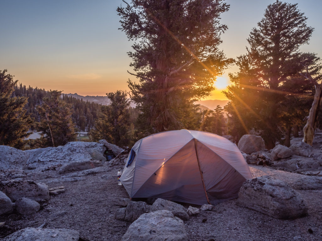
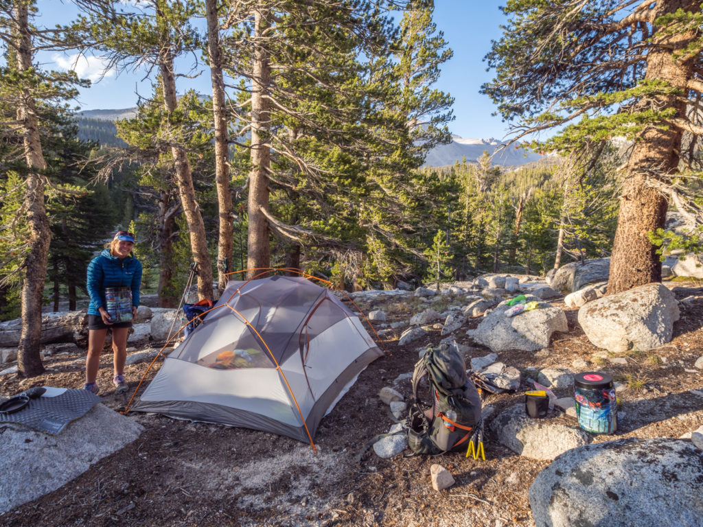
By 6pm, we had managed to bag ourselves a flat, wild camp spot below Trail Peak overlooking Poison Meadow, a little way off the PCT. A lot of hikers camp close to the trail, but when choosing our pitch, if possible, we like to get ourselves some privacy, which is easily done by looking a little further afield. Having chosen to camp higher up overlooking the meadow, we’re hoping that tonight’s spot will not be in a cold sink and will be frost-free in the morning.
Another wonderful wild camp spot in the Sierra, tonight overlooking Poison Meadow.
Dinner was one of our favourite hiker staples – Sour Cream & Chive Idahoan Mashed Potato with a mixed Bean, Chilli & Vegetable sauce. It goes a lot further than spaghetti, so is really filling, especially when there’s enough sauce for seconds! I am ‘Two Plates’ on the trail after all!
After washing up, we now have to be really careful to ensure anything with a scent, including the bags of trash we carry, are properly stowed in the bear cans. These are then placed quite away from the tent but still within eyesight. Having followed the same principles on the JMT in 2014, thankfully this time round we’re not so paranoid about bears sniffing out our cans, and can actually get some sleep without being alerted to every innocent noise in the night!
Day 59 – Thursday 7th June 2018, Wild Camp above Poison Meadow at Mile 747 to Wild Camp at Crabtree Meadow at Mile 766, 19 miles
Our choice of camp spot last night a little way off the PCT and above Poison Meadow worked out perfectly. Even though it was cold during the early hours there wasn’t any condensation on the tent and we woke up to the sun rising and shining straight on it. An absolutely wonderful start to the day!
Treated to a gorgeous sunrise this morning! The perfect start to the day!
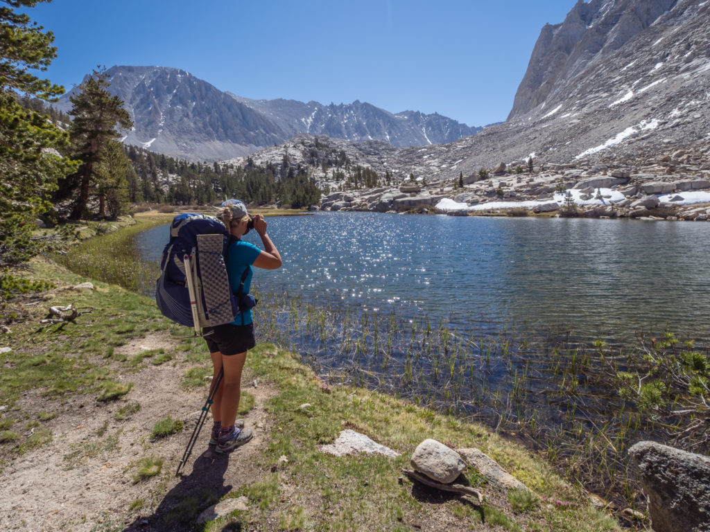
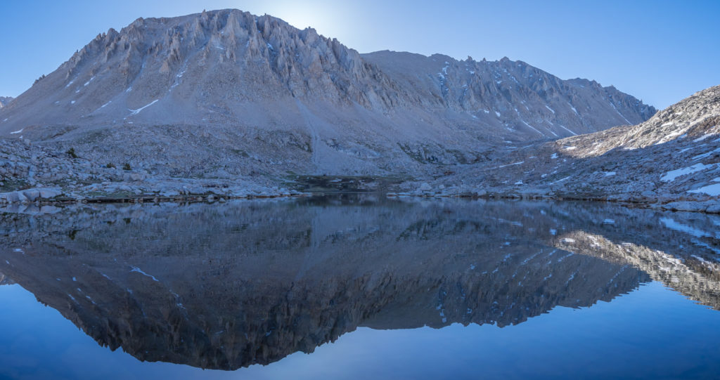
When we set off, we had already seen Windburn and the Canadian group that we now seem to be following (since leaving Kennedy Meadows the bubble is growing again) head up the trail. We were aiming to get beyond the Cottonwood Pass junction and reach Chicken Spring Lake at Mile 751 before stopping for our second breakfast. When we reached the lake, Machine and his 8 person crew were just getting back on trail after hitching out to Lone Pine to resupply. But best of all, camped beside the lake taking it easy with a fishing rod set up was Nick and Tiahnna! After saying farewell to them at Kennedy Meadows as we are now on different schedules, we did not expect to see them again on the trail. So it was great to catch up and discuss our plans for summiting Mount Whitney on Friday. We shared our idea about hiking up to Guitar Lake, setting up camp, then hiking up Whitney late afternoon for sunset. They liked the sound of our plan, so hopefully we’ll see them tomorrow and they’ll join us for the hike up there.
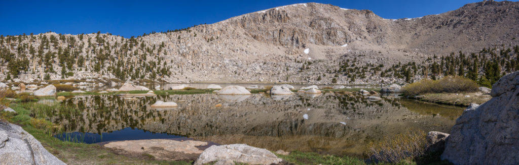
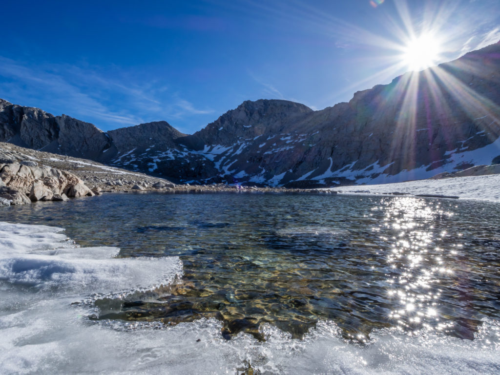
Panorama looking onto the beautiful Chicken Spring Lake. It was our first Alpine lake of the Sierra!
Early morning lake reflections…
By the time we had finished talking to them, we had already spent an hour sat at the lake. We were also introduced to Drippy, who was teasing us as he was heartily tucking into a breakfast bun with sausage which he had picked up in Lone Pine before getting back on trail. As he had hiked up with 3 of them, he did offer us one, which was extremely kind of him, but we couldn’t take another man’s rations, especially after he’d carried it all the way up and over Mulkey Pass!
As we continued uphill, we had a tremendous view looking onto Whitney and the surrounding peaks and she then became a regular feature throughout the day. Every time we got an open view of the skyline, she dominated it! We were pleased that the summit now only has a small amount of snow and were excited that with every step we’re getting closer.
Panorama of the High Sierra skyline with Whitney in the middle.
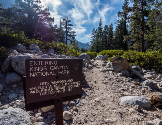
At Mile 754, we left the Inyo National Forest and Golden Trout Wilderness Area, crossing the boundary into the Sequoia & Kings Canyon National Park. The elevation we were now at was 11,320 feet, but we were managing well with the altitude. Setting a steady pace and breathing rhythm really helps, as does keeping well hydrated. Apart from getting a little out of breath when talking going uphill, or feeling dizzy when bending down and standing up too quickly, we couldn’t tell any difference. However, several hikers we had spoken to were feeling nauseous and not coping too well at all with the uphill climbs, so they were having to slow down their pace and take a few extra days to acclimate.

Managing well with the altitude as we made our way above 10,000 feet.
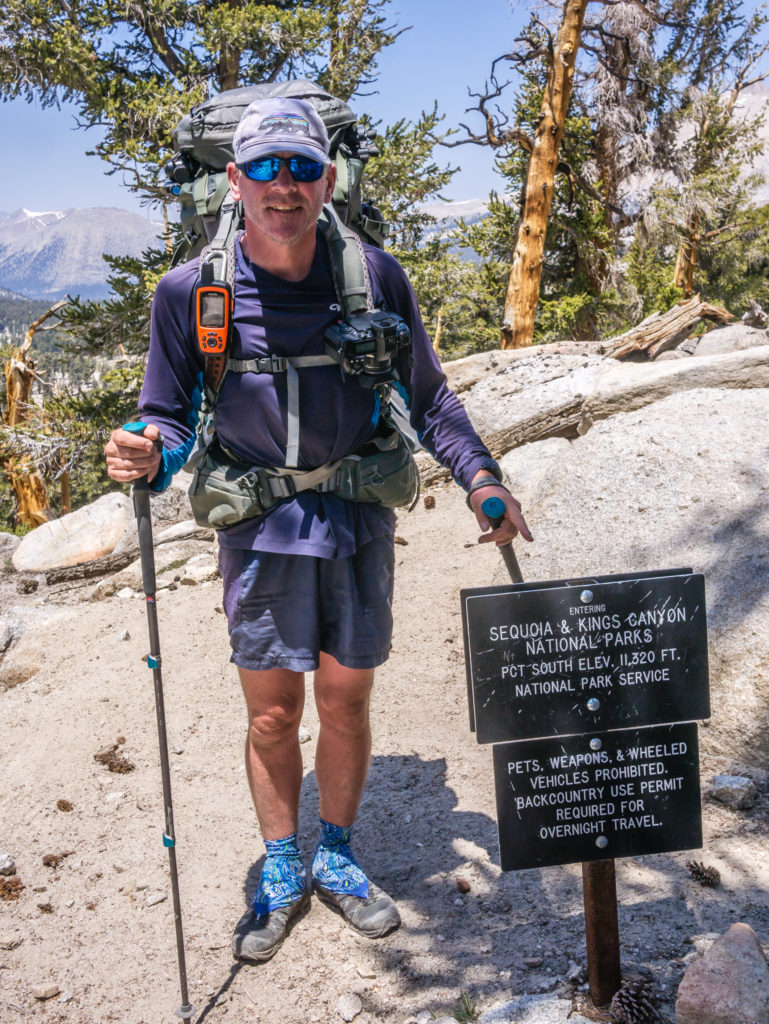
Entering the Sequoia & Kings Canyon National Park.
Winding back downhill to 9,500 or so feet to Rock Creek where we filtered water, we found a beautiful spot for lunch looking onto a sandy, green meadow surrounded by pine trees and there we met Becky and Louis (Trail name: The LBs or The Pounds because of combining their initials) who are from San Diego, and are PCT Section hikers. We chatted to them for a while, finding out about the High Sierra Trail which the couple have done previously and recommended to us, as well as Becky’s love of Prince Harry. Then we saw them again throughout the day at other water spots and rest stops and chatted some more! As we were doing a lot of socialising along the trail today, we weren’t doing well for time, so we knew it would be a late one into camp.
Taking a rest stop and filtering water from Rock Creek.
Two trail family groups of PCTers had already set up camp beside Guyot Creek when we got there, but we had already decided to push on to the Crabtree Meadow Campsite at Mile 766 as it would make for a much easier day tomorrow before summiting Mount Whitney. We crossed the creek on some precarious logs, then had another uphill section to contend with for the final part of the day. Thankfully there were some good switchbacks taking us up to 11,000 feet again and around the side of Mount Guyot, before the trail lead downhill to Crabtree Meadow.
Having to cross Guyot Creek on a precarious pile of logs before pushing on to Crabtree Meadow.
On the way down we had another stunning view of Whitney, so we had a rare photograph together, courtesy of PCTer Popcorn who was hiking just in front of us. Since entering the Sierra, the landscape has been incredible. With so much water, there seems to be a lush green meadow surrounded by giant pines every time we traverse a ridge or cross a pass and enter another huge alpine expanse.
We had a prime view of Whitney hiking down to Crabtree Meadow.
Whitney dominates the skyline behind us.
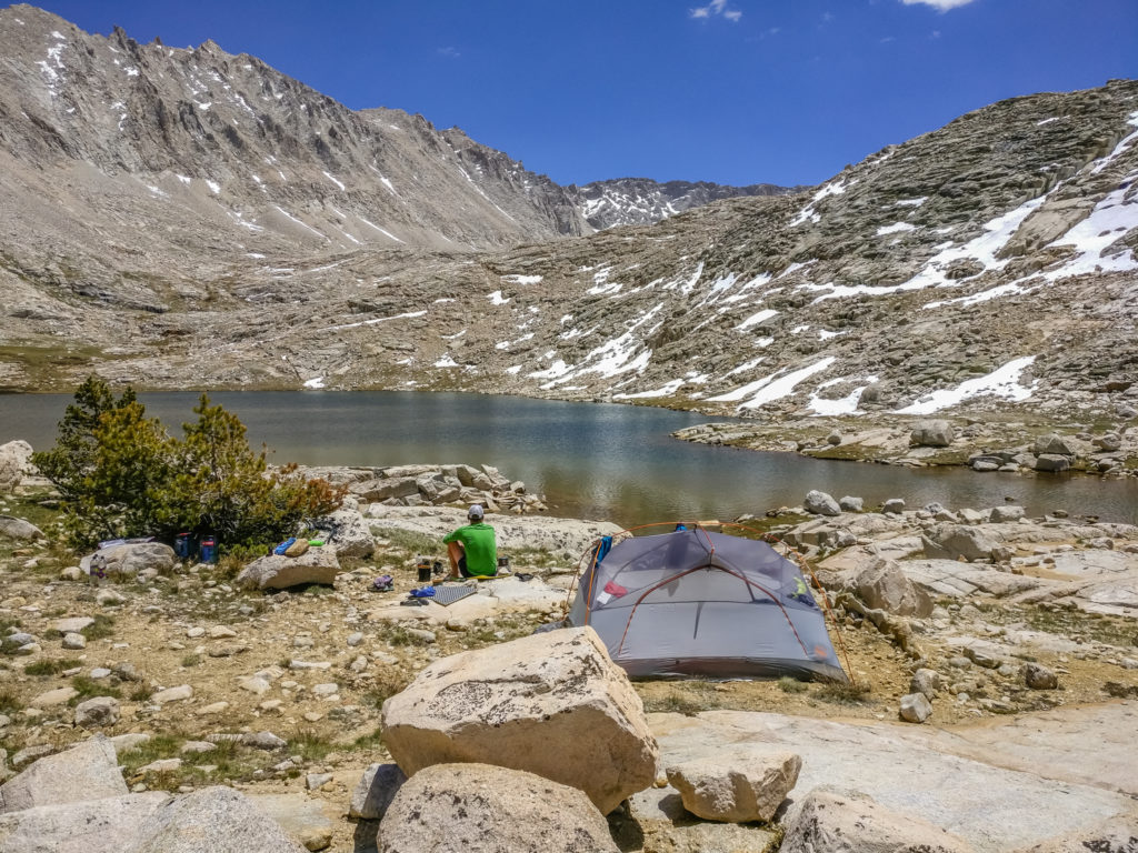
Crabtree Meadow was no exception. Beautifully green, it looked so inviting and a fantastic place to camp, except that camping is prohibited within the meadow areas to preserve the fragile ecosystem. Instead there are plenty of pre-used camp sites to be had in the surrounding rocky knolls. We climbed up a little way from the trail and found a great spot looking onto Whitney, with the sun setting the other side of the valley across the Sierra. It would have been perfect had it not been for the mosquitoes that were out in force. Having been bitten several times on my legs a couple of nights ago, it’s safe to say mosquito season has started. There’s no getting away from them and they are already bringing misery around camp, especially now that we can no longer wash or eat in the tent because of being in bear country.
Green and inviting, the trail leading down to Crabtree Meadow.
It would have been another awesome camp spot had we not been plagued by mosquitoes.
So we had a token wash just to make sure our feet were clean and quickly got covered up. Dinner was quick and easy – Idahoan Mash with Lemon and Black Peppered Salmon with a bowl of Cous Cous as a side, and then it was straight into the tent to avoid anymore annoying, biting, blood sucking machines! We have head nets, but how we’re going to cope when we get down into the valleys where they’ll be thriving, I don’t know. Next time we’re in town we’ll certainly be investing in some bug repellent spray with Deet!
Day 60 – Friday 8th June 2018, Wild Camp at Crabtree Meadow at Mile 766 to Wild Camp at Guitar Lake, detour off the PCT to summit Mount Whitney, 14 miles
Day 60 on the PCT and we couldn’t have asked for better weather or alpine scenery in the High Sierra. As we left Crabtree Meadow bound for Guitar Lake, we were in high spirits in anticipation of our sunset summit of Mount Whitney later that day; however we had one slight set-back.
Before leaving the meadow we had to cross over Whitney Creek. It was flowing well but wasn’t that deep, but instead of wading through (which in hindsight we should have done) we walked downstream a little where some fallen trees had been placed across the river to make a bridge. Sending Wayne first, I took a photograph of him crossing, right before he lost his balance and fell into the river. For a split second it was funny, but not when his pack and camera also plunged into the water, thankfully only for the briefest of moments as he managed to quickly turn himself around and get out.
Wayne attempts to cross Whitney Creek… This was just before he lost his balance and fell in the water!
A grazed knee, scraped leg, bloodied finger, muddied face and ripped sleeve later, all was OK. Luckily! We were so relieved that something quite minor overall didn’t turn into a catastrophe, as a broken ankle or similar would have meant time off trail, or worse still, put an end to our thru-hike. As they’ll be several more river crossings to come, we resolved from then on not to debate about it, just to walk on through the water. Shoes, socks and gaiters will always dry out!
We had to cross over the creek twice more that morning, so instead of deliberating the best way to cross to avoid getting wet, we now just waded on through!
After that near disaster, we were glad to have just a short morning’s walk to Guitar Lake, which from just before the Ranger Station was only 2.7 miles ahead, taking us closer to Whitney with every step. We reminisced about our summer hiking the John Muir Trail and as we passed by, we remembered the beautiful Timberline Lake, with its sparkling water filled with grassy reeds, (this season the water level is much higher than in 2014). We also remembered the marmots, unfazed by humans, that seemed to be scampering around everywhere too.
Up into the mountains we go…
Capturing the sparkling waters of Timberline Lake.
Looking on to Whitney, the amount of snow still present was much less than what we were expecting.
Heading off the main trail towards the outlet of Guitar Lake for a less exposed and much more private camp spot.
We passed several hikers on their way down from Whitney having been up there for sunrise, including Night Crawler and Keyboard. We enquired about the state of the trail and were pleased to hear that there are now only 3 or 4 patches of snow to traverse so micro spikes and ice axe are not needed as you can follow in the previous foot prints. (We’ll probably still carry them up with us in our packs just as a precautionary measure, but the news was good to hear!)
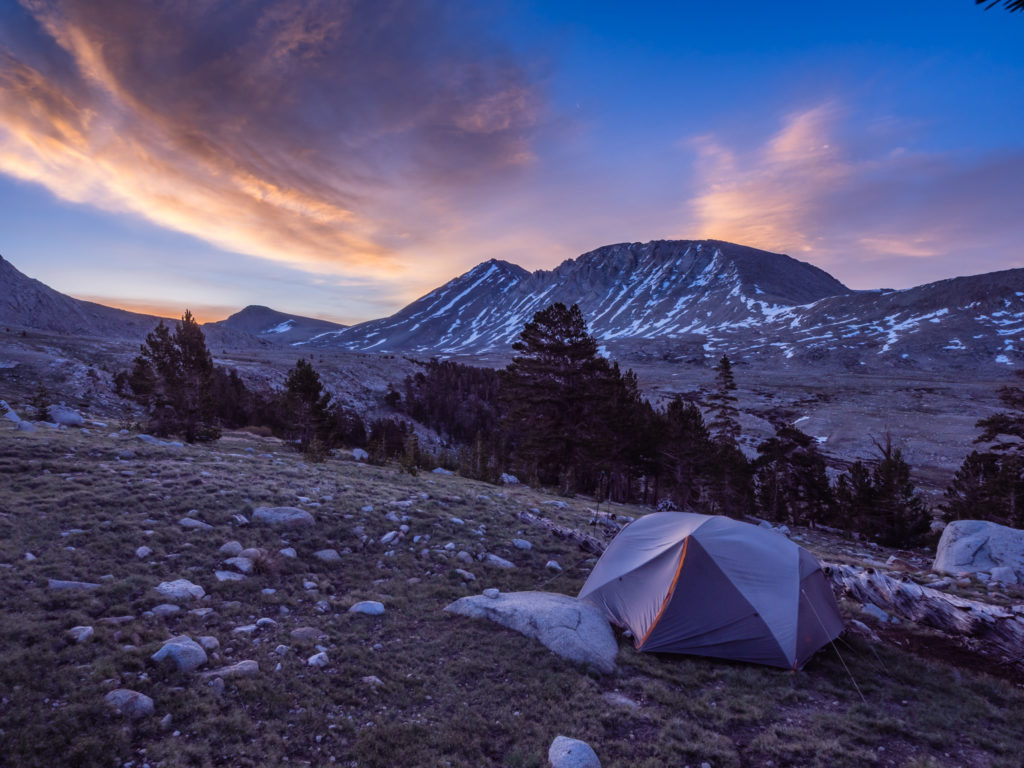
When we reached Guitar Lake there were several tents pitched on a grassy area close to the trail. But we followed the trail around the right-hand side of the lake towards the outlet, close to where we camped last time as it is a much more private spot. We pitched the tent on a rocky outcrop just above the lake with a tremendous view looking onto Whitney, then sat and enjoyed a cup of tea with biscuits. A proper English thing to do! We commented how amazing it was to be camped so close again looking up to the peak. People would seriously pay for this pretty spot in such magnificent alpine environment!
The wonderful Guitar Lake! (It is actually shaped like a guitar, but you can only see it from above as you hike up to Whitney.)
Enjoying the view looking on to Mount Whitney after setting up camp.
What a completely stunning wild camp spot looking onto the highest peak in the contiguous United States!
A definite contender for ‘Wild Camp of the year!’ What an awesome view! (This spot is going to take some beating in the top wild camp stakes.)
The afternoon then went fast as we busied ourselves with camp jobs. Wayne repaired some small holes that are beginning to form in the tent mesh, (everyday use is taking its toll), whilst I caught up with the blog, then washed my hair as we were able to get a bucket of water from the lake. (It really does make such a difference having regular access to water!) Then we ate an early dinner of Spaghetti with Spam and Alfredo sauce, before packing a lighter bag with warmer gear and essentials for heading up the mountain.
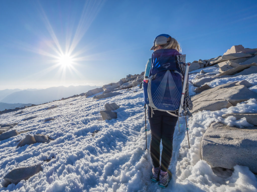
We set off a little later than planned at 4:45pm, but we still estimated we’d reach the summit by 7:30pm and have an hour up there before sunset. From our last experience, it’s really cold at the top anyway, so we didn’t want to hang around too long. We wondered how many other hikers would make a sunset ascent as the most popular time to summit Whitney, it seems, is for sunrise. Having already done that as a spectacular end to the JMT, this time we want to flip it for a new experience. Sunrise or sunset, you are still walking one way up or down the mountain in the dark, so we figured it would be better to hike up in the light and see the snow we’d have to traverse, then we’d know what was coming up and be prepared for it on our descent in the dark.
Setting off from Guitar Lake for a much less popular but no less spectacular sunset ascent of Mount Whitney – all the better for us!
We had discussed our plans with Nick and Tiahnna at Chicken Spring Lake the previous day and they too thought it sounded like a great idea, so were thinking of hiking up there to join us. As we started across the first switchbacks beyond Guitar Lake, we could see two people hiking ahead of us, and indeed it was them! Other than 4 various people who passed us coming down, who kindly gave us advice about the sketchy areas, we didn’t see another soul, so we were anticipating that the four of us would have Whitney to ourselves!
Heading up the long, rocky switchbacks with windows looking out to the Eastern Sierra town of Lone Pine. (As we hiked up this section in the dark the last time round, it felt like a completely new experience!)
Arriving at the trail junction… Not far to go to reach the top now!
Looking back to Wayne following up the rear. From down below it’s quite impossible to see a trail weaving across the rocky mountainside.
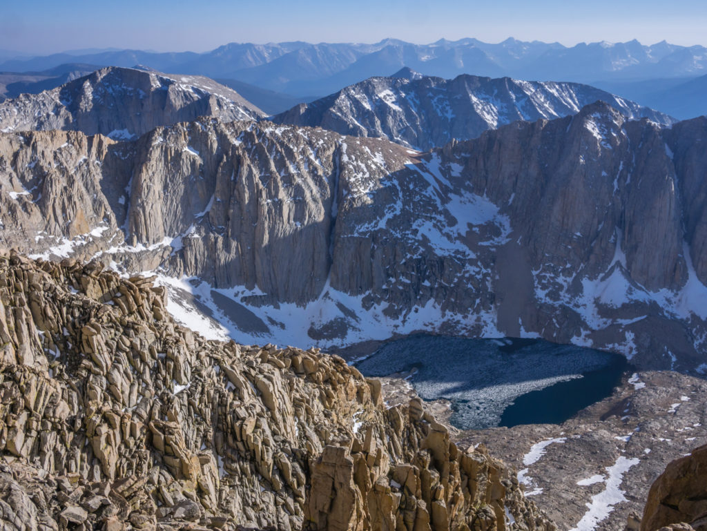
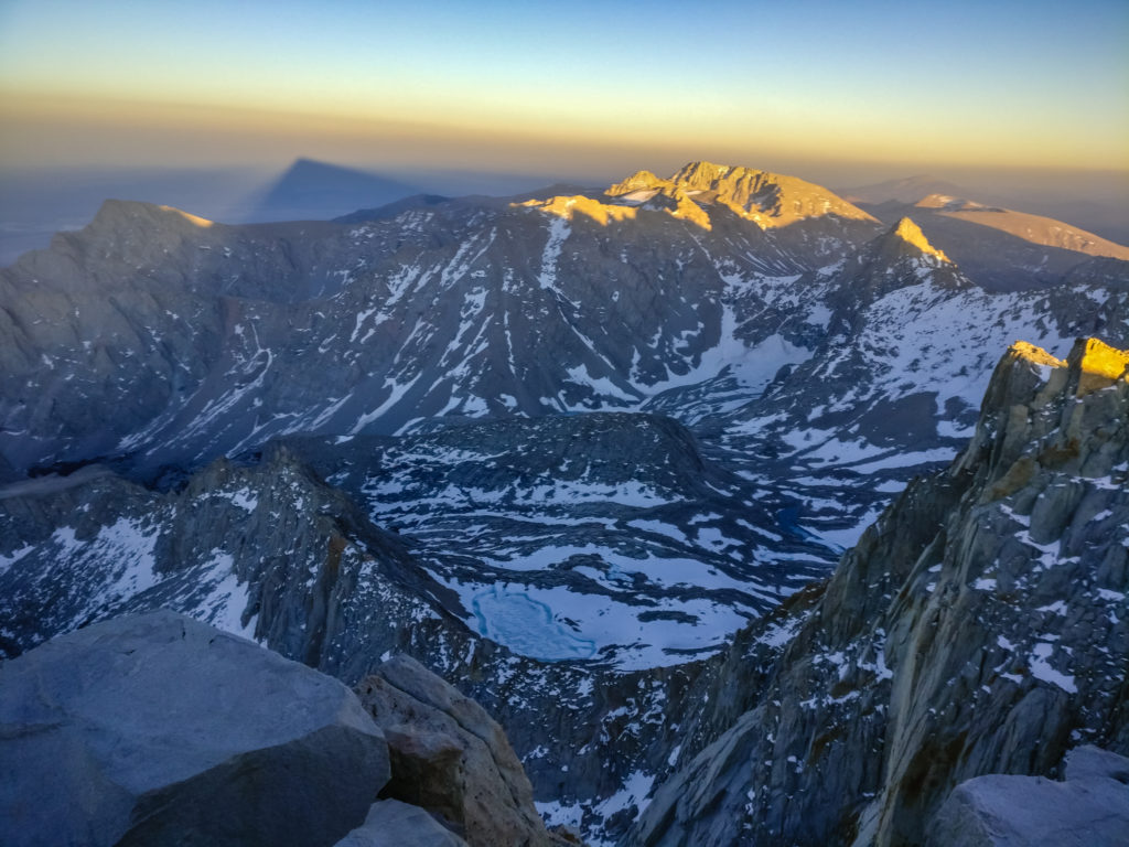
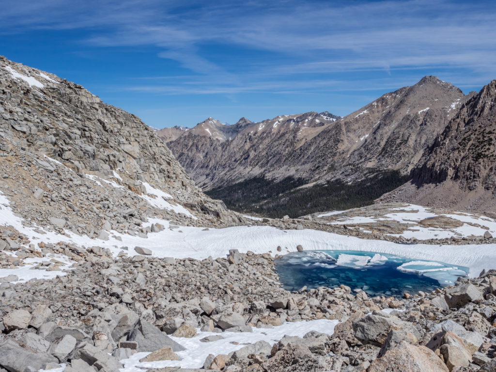
A tremendous view looking down to other glacial lakes that remained mostly frozen.
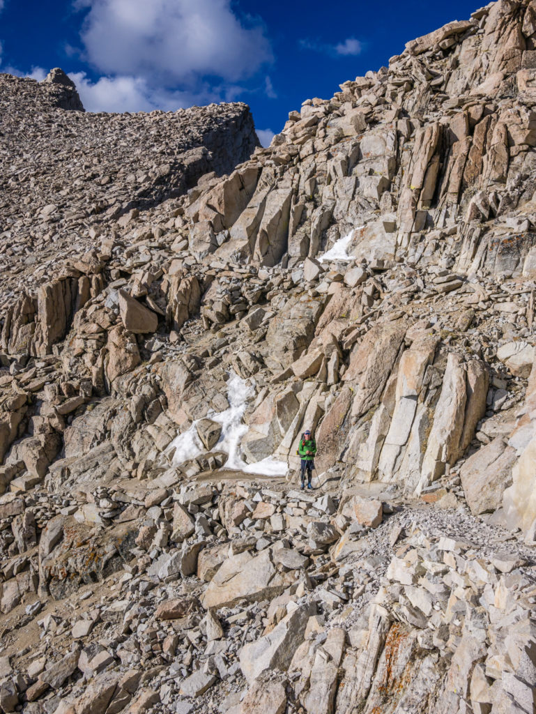
Towards the summit, there were still a few small sections of snow to traverse, but as we took our time across the icy sections, there were nothing too difficult and I shouldn’t have worried!
And indeed we did! After reaching the summit in around 2 and three-quarter hours, there was not another soul up there. The four of us were ecstatic! Not only we were standing on the highest point in the contiguous United States, but out of all the PCTers, JMTers and day-hikers on the trail today, we were the only ones to have ascended Mount Whitney for the sunset experience. And it was tremendous! Not only did we have an incredible view over to the east looking onto Lone Pine and the sprawling desert, we also witnessed an amazing range of light as the sun dipped behind the Sierra mountains in the west.
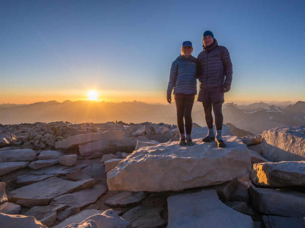
Making it onto the summit in time for a serene sunset.
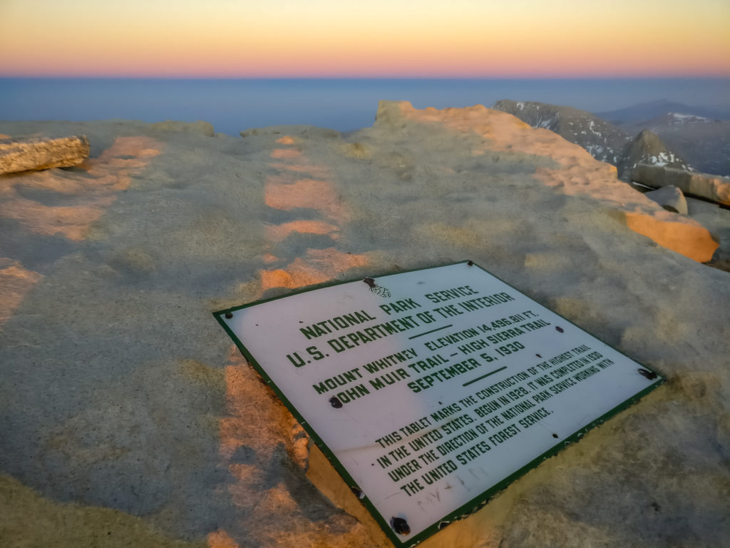
On top of Mount Whitney for the second time!
We had a tremendous view looking down from 14,505 feet!
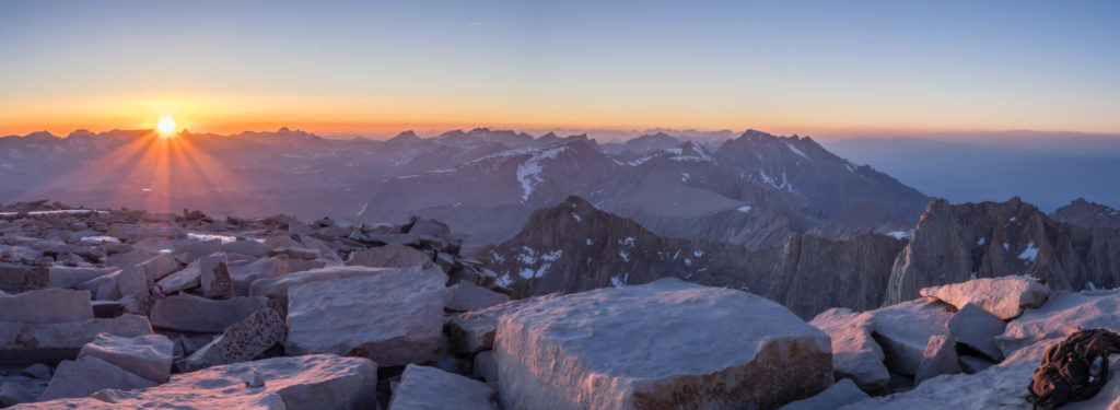
A stunning sunset panorama.
Before it got too cold, and as it is a PCT tradition to get naked on the summit of Whitney, we stripped off and did some tongue-in-cheek poses as the sun went down, Wayne armed with nothing but an ice axe! (We hope no one is offended, it was nothing too risqué, and all for fun!)
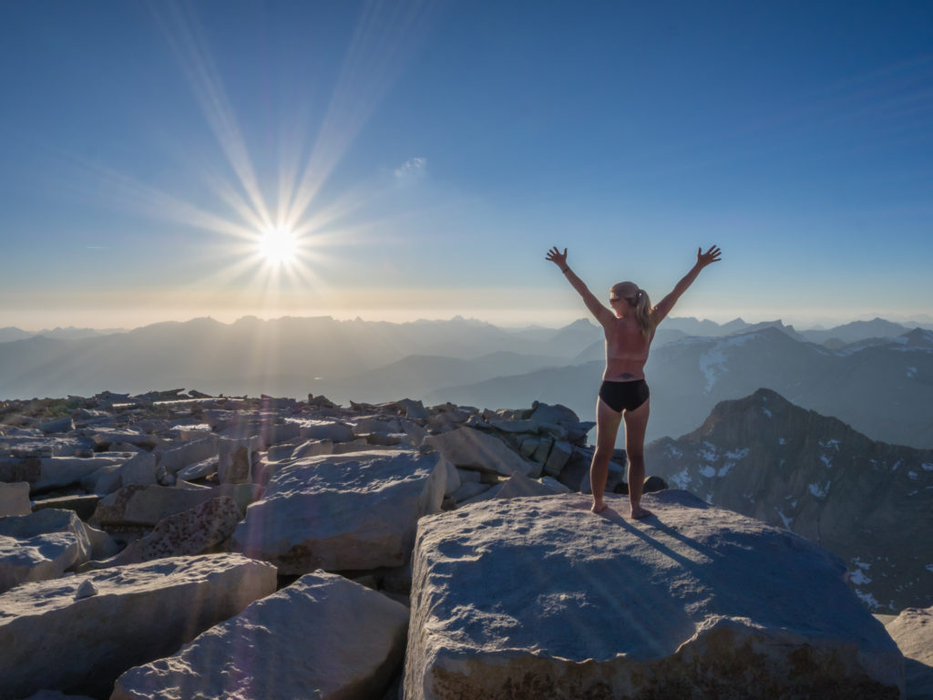
It is a PCT tradition to get naked on the summit!
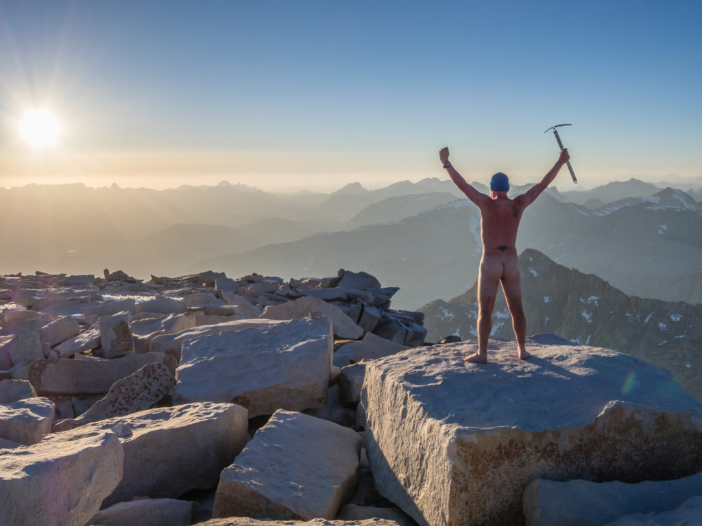
Wayne braved the cold much better than me!
As soon as the sun set, just as expected, the temperature dropped rapidly, so we got wrapped up in all the layers we had carried up with us, whilst snacking on nuts and chocolate. We watched the spectacle of the sky as it changed from a burning orange to a gentle blue, purple haze, then hastily got all of our gear stowed away for a hurried descent after signing the Trail Register. (The hut on the summit cannot currently be used as a place to take respite from the cold as it is literally filled with compacted snow!)
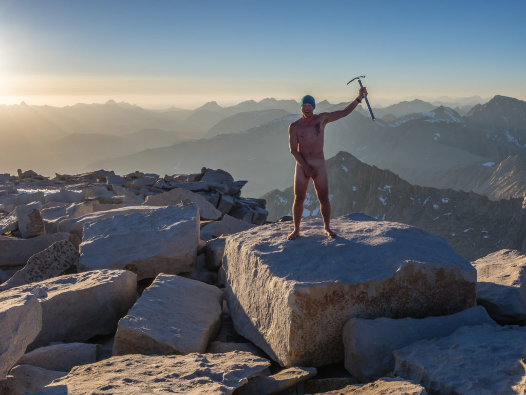
Armed with nothing but an ice axe!
As darkness started to fall, we felt good going back down the mountain armed in the knowledge of what was to come. Ascending in daylight and having already traversed the snowy sections of switchbacks gave us much more confidence now we were reliant on head torches to see. We took our time over the icy chutes, but they had already hardened with the drop in temperature and were not too difficult to cross with our walking poles to help us balance. We were all getting tired by the final set of switchbacks after concentrating so hard, but we made it down in one piece, thrilled to have had such a wonderful evening in good company, in such a very special place!
We were literally buzzing with excitement that everything had gone to plan and that sunset was every bit as beautiful as watching a sunrise up there. It was certainly a day to remember and one of our best experiences on the trail so far. A perfect end to the day on returning to our tent was then sitting and watching the stars for a while, before finally going to bed.
Day 61 – Saturday 9th June 2018, Wild Camp at Guitar Lake, (detour off the PCT to summit Mount Whitney) to Wild Camp at Mile 776, 14 miles
With not getting back until around 11:30pm last night, we enjoyed a lay in and a lazy morning at camp. We were still awake around 7am though, so Wayne took the opportunity to photograph the beautiful mountain reflections in the still waters of Guitar Lake, as well as film the sun cresting over Mount Whitney. We’ve had some awesome wild camp spots along the PCT so far, but with such an incredible skyline, this has got to be our favourite to date!
Beautiful mountain reflections on Guitar Lake…
We were up just in time to see the sun crest over the mountains.
The sun warms the soul…
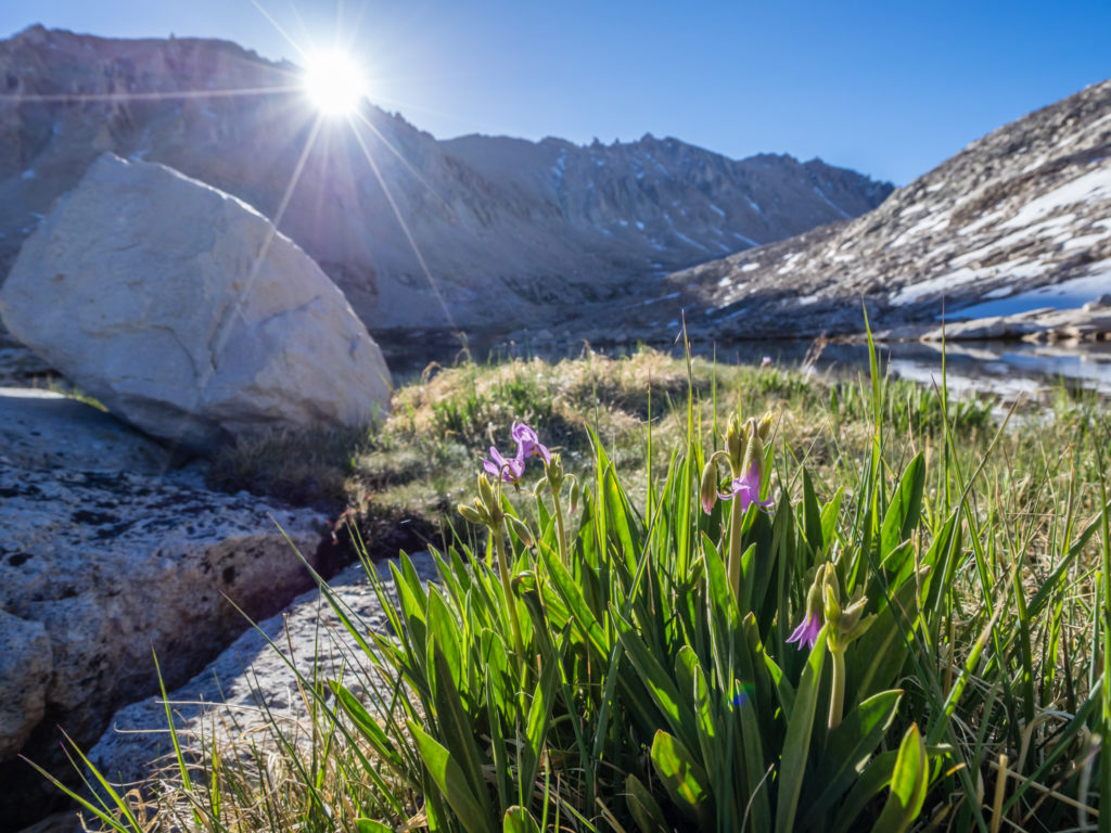
Pretty pink alpine flowers growing beside Guitar Lake.
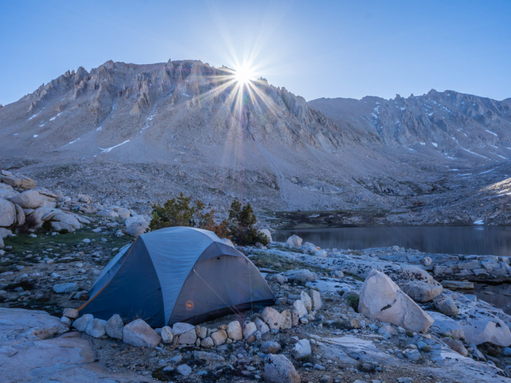
Our wonderful wild camp spot as the sun rises above Mount Whitney.
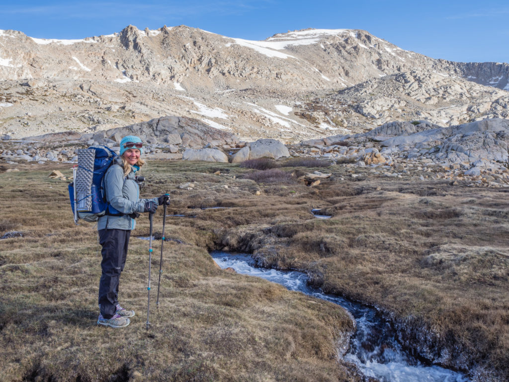
After a cup of tea and breakfast biscuits, we set off around 10am with a 3.7 mile walk from Guitar Lake back to the PCT trail junction at Mile 767. We were then aiming to hike approximately another 10 miles and camp as close to Forrester Pass as possible before reaching the snow line. As our plan is to hike over the pass early tomorrow morning whilst the snow chute is still firm (hopefully avoiding any post-holing), we would leave ourselves around 4 miles to get to the top of Forrester, plus a couple of miles of snow to traverse on the other side.
Leaving Guitar Lake in high spirits after an incredible evening summiting Mount Whitney.
Heading back to the trail junction to re-join the PCT.
The desert is now long gone as we cross through pretty alpine tundra.
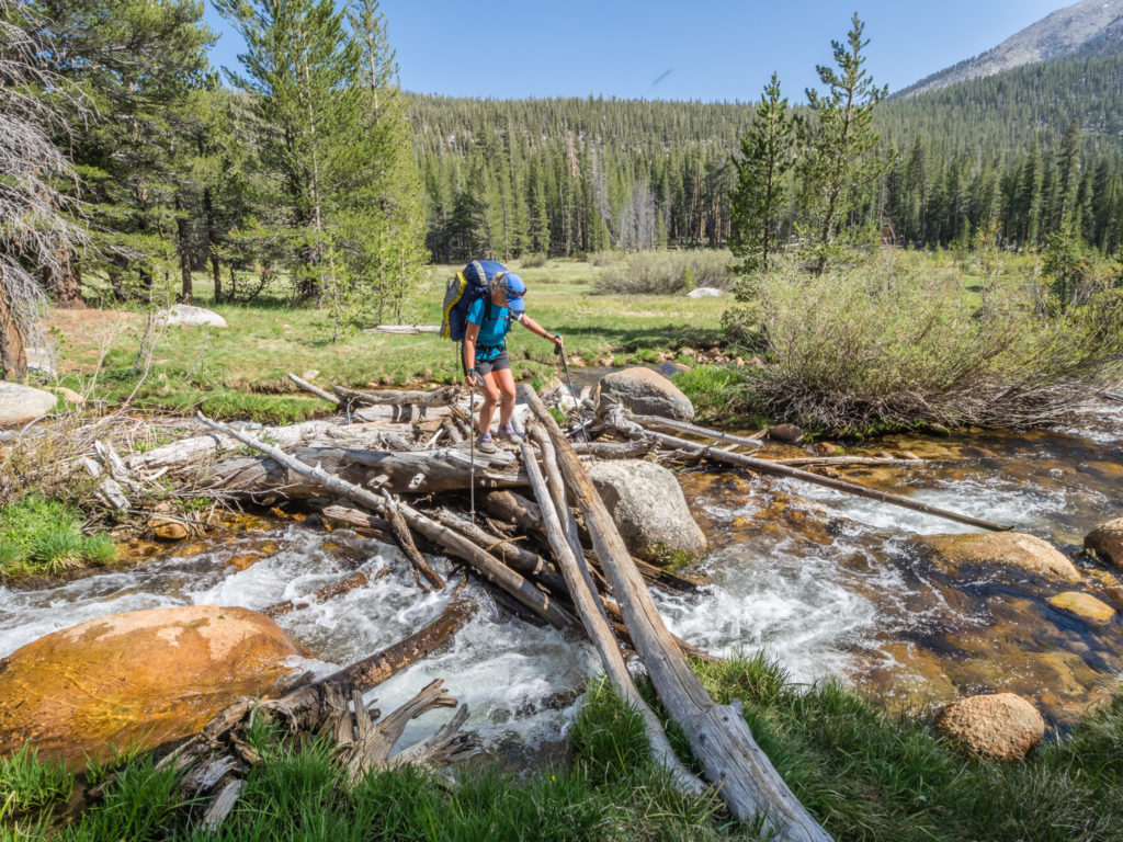
But that sketchy section is tomorrow’s challenge. Today we had our first major river crossing to contend with! There were actually three river crossings, the first two – Wallace Creek and Wright Creek were not too fast flowing, but after Wayne’s accidental fall into the river yesterday, we avoided the rock hops and simply waded through, the water level about calf deep. After crossing Bighorn Plateau however, it was Tyndall Creek that was a tough crossing as it was both fast-flowing and knee-deep.
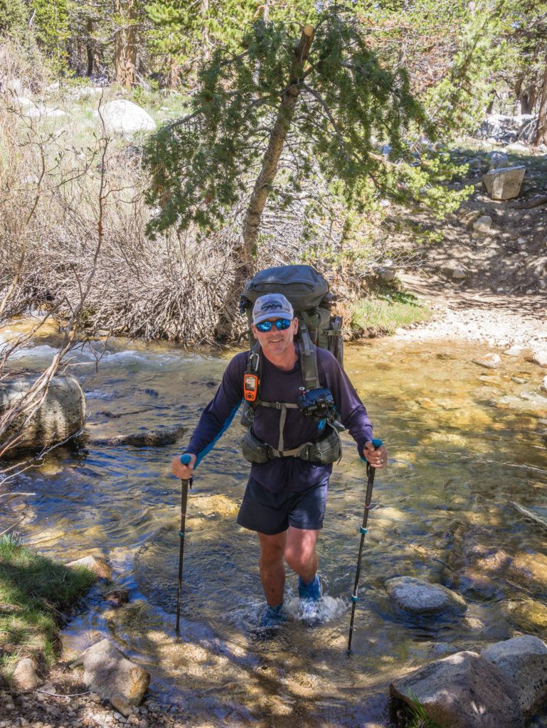
Wallace Creek did not present any problems as we waded through the water to the other side.
As recommended by contributors to the GutHooks app, we avoided the main crossing point off the PCT and followed the river upstream to where it divided into several branches. Here, the water was moving swiftly, but as the channels were wider, the current wasn’t as strong making fording between the rocks much more manageable. After spending some time securing all of our electronics in waterproof bags, thankfully we had no issues and reached the other side safely.
Tyndall Creek however was much more challenging, so we headed upstream to cross where the channel was wider and the water less powerful.
We could have camped then beside the creek as there are a couple of designated campsites with bear boxes at Miles 774 and 775. But we decided to push on that extra mile just to get us closer to Forrester. We chose not to go as far as Mile 777 however, as we wanted to stay within the treeline for some wind protection because it was really blustery today. As we were back at 11,000 feet, the temperature also felt much cooler, made worse by the wind chill. (The one consolation of camping higher in elevation is that it’s too cold for even the mosquitoes!)
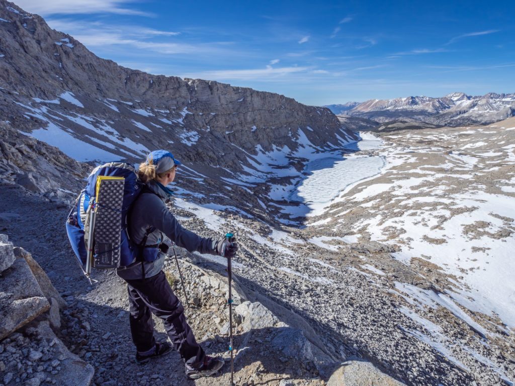
There were already several tents pitched in amongst the trees when we got to Mile 776, everyone having the same idea to get over Forrester at first light. So we struggled to find a pitch big enough and flat enough to house our tent. In the end we just had to make do with a slight slope in a grassy area, but it was close to a small creek giving us access to water, and we couldn’t complain about the view. We looked out onto a skyline dominated by rugged snowy peaks and could also see the snow-covered notch of Forrester Pass at the head of the valley.
The fantastic panoramic view from tonight’s wild camp spot.

Our camp spot just off trail at Mile 776, which would set us up for an early traverse of Forrester Pass the next morning.
Nick and Tiahnna were also planning on a similar itinerary to us, but when we left camp this morning Nick was busy trying his hand with a bit of fishing at Guitar Lake. As traversing Forrester is quite a daunting prospect for us as inexperienced ‘winter’ hikers, it would have been good for us all to tackle the snow chute together as a group, so we’re hoping to see them again in the morning before we set off. Other than them, we didn’t see anyone else we knew on the trail today… The waxing and waning effect of ‘the bubble’ occurring once again.
Dinner was a rapid affair so that we could get into the tent quickly and put all of our layers on in an effort to get warm. Both our feet were like ice blocks after crossing Tyndall Creek as the water had been icy cold with it being snow melt straight off the mountains. Also the crossing happened not long before reaching camp, so our shoes and socks didn’t have long to dry out. (We’re expecting them to be frozen in the morning!) So we treated ourselves to a ‘hot chocolate’ drink before bed which definitely helped. It’s on cold nights like these that I long to be back in the desert, the tent already warmed through from a hot, sandy ground. (I’m not a very good camper in ‘cold’ conditions!) As Forrester is the highest pass on the PCT at 13,200 feet, let’s hope we’ll be in for some warmer days and nights in the Sierra very soon!
We witnessed dramatic sunset skies to end the day!
Day 62 – Sunday 10th June 2018, Wild Camp at Mile 776 to Wild Camp at Mile 789, 13 miles
Wow! When we said summiting Mount Whitney for sunset was an incredible day, then traversing Forrester Pass in the snow is also up there in our top experiences on the PCT!
I must admit, I didn’t sleep very well last night as I was feeling quite apprehensive about traversing the snow chute on the south side of Forrester. Having had limited experience with an ice axe, it made me all the more nervous thinking about having to self-arrest if needed. As the Snow Report had not been updated for at least a week, we were kind of going in blind with not knowing how much snow was on the ground either side of the pass. It had been hot and sunny all week, so we hoped there had been a lot of snow melt going on during that time, but we still assumed there would be at least two miles of snow on the ground on both the approach on the south side, as well as over the pass on the north side.
So with this in mind, we set the alarm for a 5am get up, to be back on trail for 6-6:30am. We wanted to get up and over the pass before the sun had started melting the snow, which potentially could be very hazardous if we started post-holing through the softer areas. Without knowing what’s underneath the snow, it would be easy to break an ankle or do similar damage if landing between boulders or uneven terrain. As we were packing away our gear, we saw a steady stream of hikers go past along the trail, all with a similar idea to us, so we knew it was going to be busy along the switchbacks and especially at the top of Forrester.
Very early morning for us, leaving camp in all our layers.
After re-joining the trail, we could see the small notch of Forrester in the distance, covered in a small patch of snow, which we assumed was the ice chute. Even though it’s on the south face, it doesn’t melt because it is mostly in shadow from Junction Peak to the east of the pass. The rest of the trail however looked mostly free of snow, which we were relieved about.
The sun crests over the mountains as we follow the trail towards Forrester.
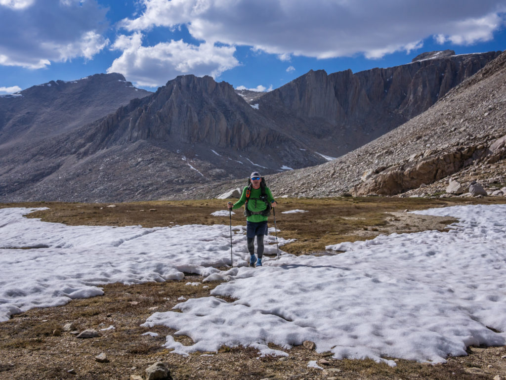
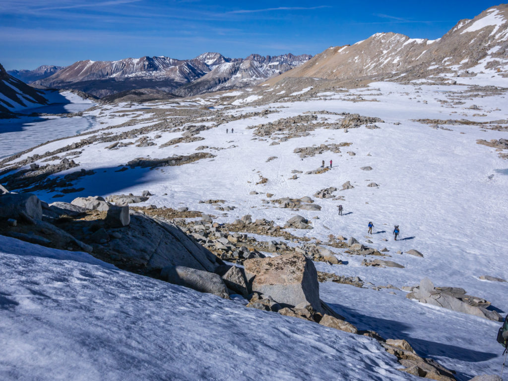
The scenery leading up to the switchbacks was absolutely stunning, with snow-covered peaks all around and icy blue lakes below, most of them still frozen. Although the sun had already risen, it just crested over Diamond Mesa as we passed by, affording us a great reflection shot in one of the trickling streams. As we got closer, the trail seemed to disappear under a blanket of snow, so we followed in other people’s footprints, the snow still firm and crisp. As we had already purchased micro spikes, we stopped to put them on to make crossing the snow easier. If we were carrying them, we might as well use them!
Stunning high mountain scenery on the approach to Forrester.
Wonderful reflections captured in the snow melt!
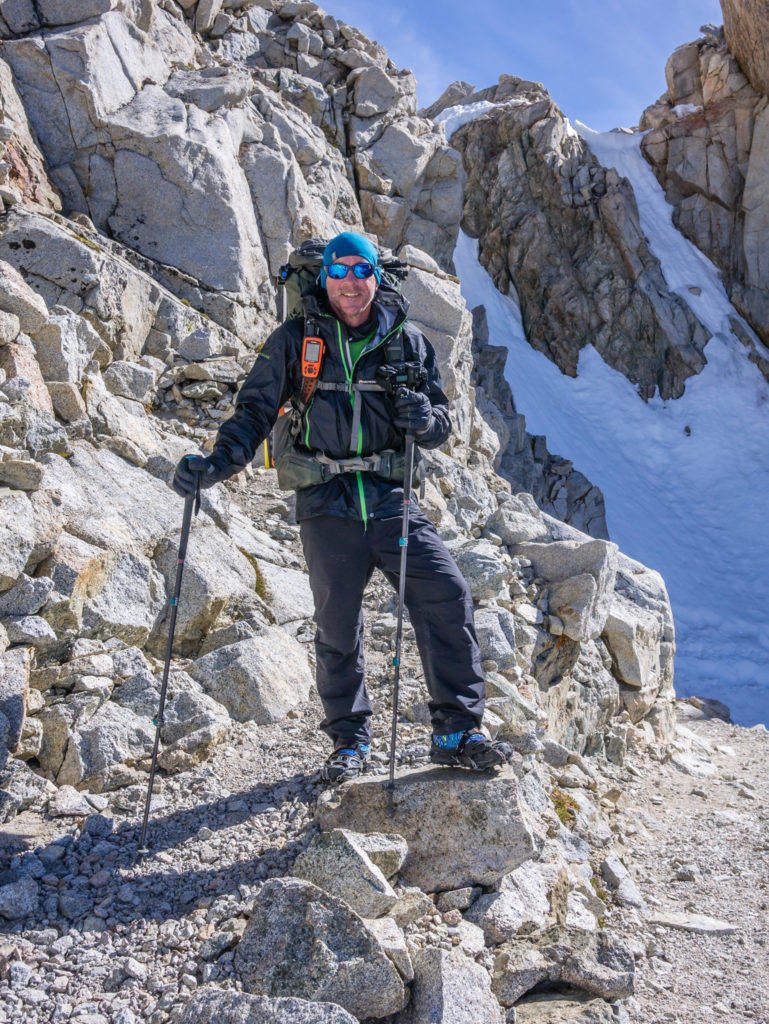
Putting on our micro spikes in preparation for starting the ascent.
And so it begins… The south approach covered in a blanket of snow.
An amazing morning to be on the trail! We couldn’t have asked for better weather.
Then we had a decision to make. We could follow the stony switchbacks that were mostly free from snow all the way to the top of the pass, or we could miss out a huge section and save ourselves some time by taking the direct route straight up a shelf of snow. As everyone seemed to be doing the latter, we also opted to go straight up on the snow, the micro spikes providing us with excellent grip. Beyond the snow line, we were back on the proper trail, walking along the stony switchbacks that got both shorter and steeper leading us to the snow chute. If I’m honest, up close it looked an easy traverse and was not daunting at all. We didn’t even need to use our ice axes as the trail was clear and the snow still hard. Wayne went first and we just placed our feet in previous footprints, using our walking poles to support our balance.
Heading straight up the snow wall, which made for a fast, easy start to the ascent.
Out of the snow and onto the stony switchbacks for the rest of the way up.
Reaching the snow chute, that in reality was no way near as scary as what we had seen on video footage!
After a relatively easy traverse, all smiles on the other side of the snow chute!
There were just another couple of switchbacks on rock and then before we knew it, we were on the top! Along with around 5 other PCTers, all filled with jubilation on a successful ascent, we had reached the top of Forrester Pass by around 9am. We took turns having photographs at the ‘trail sign’, then looked north at our route down. The proper trail was completely covered in snow on this side, so an alternate route through the snow along the left hand side of the ridge seemed to be the trail that everyone was taking. We had a quick second breakfast on the top, de-layered as it was already getting hot, then quickly got going again.
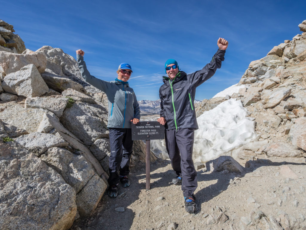
We did it! We made it to the top of the highest pass on the PCT!
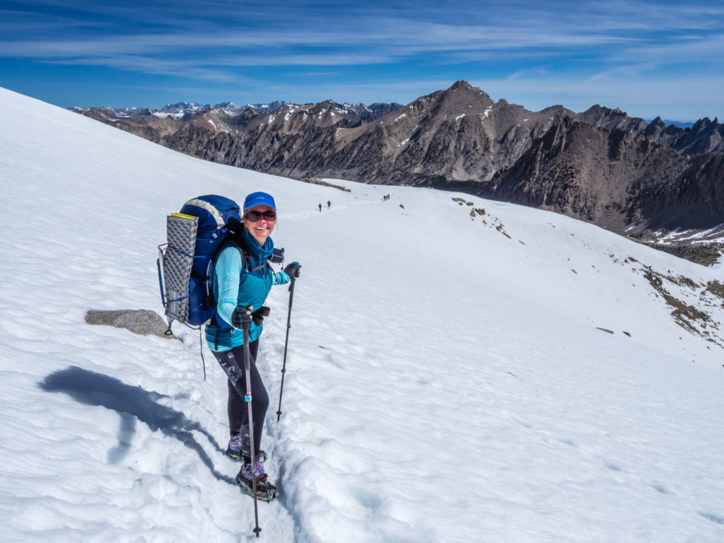
Leaving Forrester Pass and beginning the descent on the north side which was covered in a lot more snow.
Steady does it! With the sun already melting the snow at a rapid pace, we were grateful of the grip provided by the micro spikes on our descent.
Already the snow was beginning to feel soft and slippery underfoot, so we were grateful of the extra grip provided by the micro spikes. They were well worth the investment after all. Along the trail, there were places in the snow with deep holes that we did our best to avoid, evidence of previous post-holing, but Wayne did slip on his bottom a couple of times. We were extremely glad we had decided to have an early start as conditions later in the day would be much more of a challenge.
Beyond the snow line, so the micro spikes were removed before continuing down the rocky trail.
We enjoyed more stunning scenery on our route down.
Panorama after descending Forrester Pass.
As the trail meandered across another ridge, all the while heading downhill, the snow was becoming less and a trail through rock and gravel was becoming more dominant, so we took off the micro spikes as they were no longer needed. Avoiding another large section of snow, we scrambled down a boulder field taking us down towards Bubbs Creek. We crossed over the creek and then continued on a snow free trail from then on towards Vidette Meadow. We were soon back in the trees and instead of snow, we were having to contend with several creek crossings, some again that were fast flowing and wet feet couldn’t be avoided. (That’s where Sealskinz waterproof socks come in handy! We walk through the creek with shoes on, then dry our feet and put on the waterproof socks afterwards until our shoes dry out. It is much more comfortable!)
The trail leads us into the valley towards Vidette Meadow.
We took the opportunity to sit by a branch of Bubbs Creek where we had a wonderful lunch spot looking down the valley. We couldn’t quite believe what a fantastic morning we’d had and how much we enjoyed hiking on snow. Apparently the next two passes, Glen and Pinchot, will also have some areas of snow to traverse, so instead of being filled with trepidation, we’re excited about what’s to come and looking forward to more challenges!
We didn’t seen Nick and Tiahnna today. They could have been ahead of us this morning or most likely behind, so we hope they managed an equally successful traverse of the pass. What we did see on the way down from Forrester though was some horse poop that looked quite fresh, so we are assuming Rooster and Horsey made it over safely too. (They probably went over the pass yesterday as we think they’re still a day ahead of us!)
From Vidette Meadow, we hiked up to the Bull Frog Lake trail junction and took the PCT towards Charlotte Lake, camping on a rocky plateau at the top of the switchbacks to avoid mosquito hell down at the lake. As we seem to be their main food source, our plan is to try and camp high whenever possible to avoid being exposed to them. (At 11,000 feet, we’re hoping it’s too cold for mosquitoes to survive!) From here, we can then exit the trail in the morning over Kearsarge Pass as we need to resupply in the town of Bishop.
Walking through beautiful alpine scenery…
As it was our last night on the trail before two zeros, our bear cannisters were about empty having eaten most of our food rations over the last seven days. So dinner tonight was a ‘pot mess’ using up what we had left, which was two packets of Idahoan potatoes (Four Cheese, and Fully Loaded), two packets of Spam, and four portions of Pepperjack Cheese. A bonus ingredient was the addition of freshly chopped Spring Onions that Wayne picked from beside the creek earlier this afternoon. They were really hot and tasty, so now we need to research what else we might be able to find growing alongside the trail that would be a great addition to our trail kitchen meals!
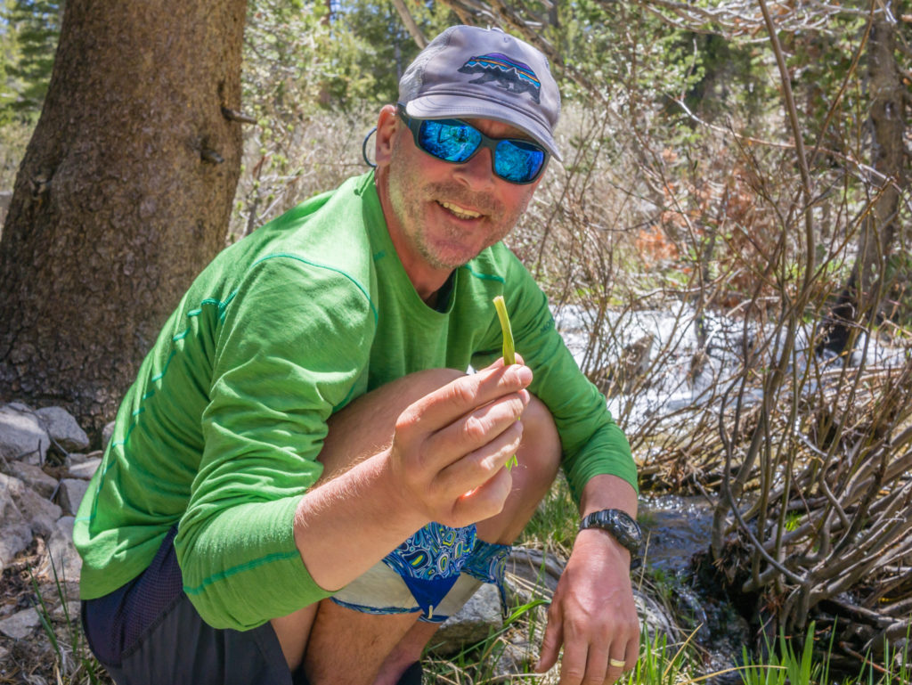
Wayne picks some wild spring onions growing beside Bubbs Creek.
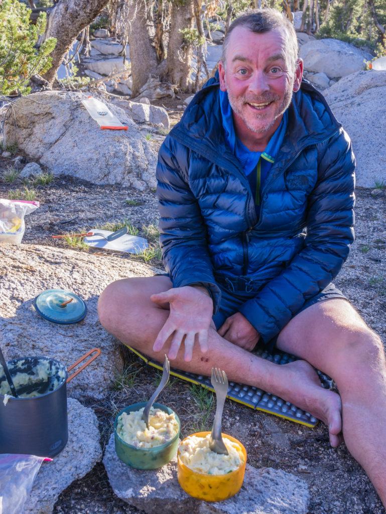
Voila! Cheesy Mashed Potato with Spam and freshly chopped Spring Onion.
Having arrived at camp around 4:30pm, it was nice to have all of our chores done and dinner over with before dark. In fact, we were in our sleeping bags by 7:30pm, quite exhausted from the effort and excitement over the past few days. Our legs have really been feeling it since summiting Whitney and climbing so high in a relatively short space of time, which was probably compounded today hiking up and over Forrester too. A few rest days in town and we’ll be fighting fit and ready to tackle the next big pass!
Our camp spot over 11,000 feet in the hope that the mosquitoes wouldn’t survive here!
Day 63 – Monday 11th June 2018, Wild Camp at Mile 789 to Onion Valley Trailhead via Kearsarge Pass, 8 miles, then hitch to Independence (13 miles), followed by hitch to Bishop (40 miles) to Vagabond Inn
We were awake at 6am, eager to get packed away and begin making strides towards Kearsarge Pass. We were taking two well deserved zeros off trail and had three nights booked in a motel in the Eastern Sierra city of Bishop, which after hiking down from the pass we were hoping to get to by hitching a ride. (Fingers crossed!) But what an introduction to the Sierra! It had been a wonderful week of immense scenery and incredible wild camp spots, which had only whet our appetite for more…
We allowed ourselves to have not just one, but two cups of tea before setting off, using up the last of our tea bag rations whilst we ate our final breakfast bar. So when we did get going, we were practically skipping down the trail now that our bear cans were empty and we quickly made it to the trail junction.
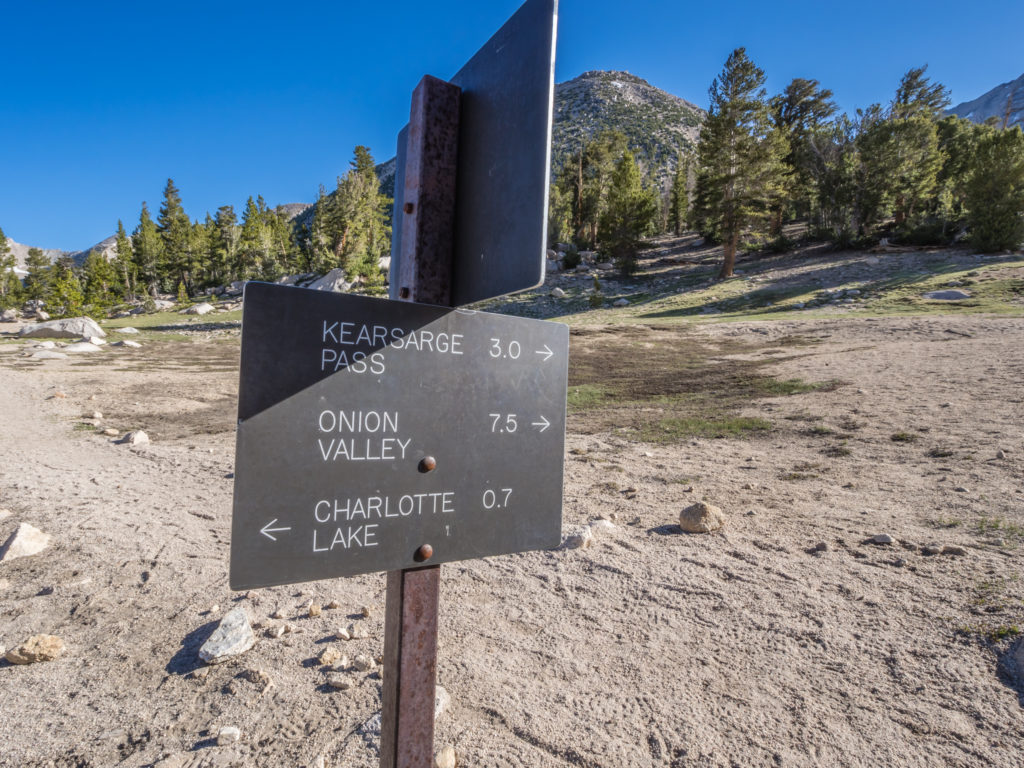
Taking Kearsarge Pass over to Onion Valley so that we could get off trail for a few days and resupply in the city of Bishop.
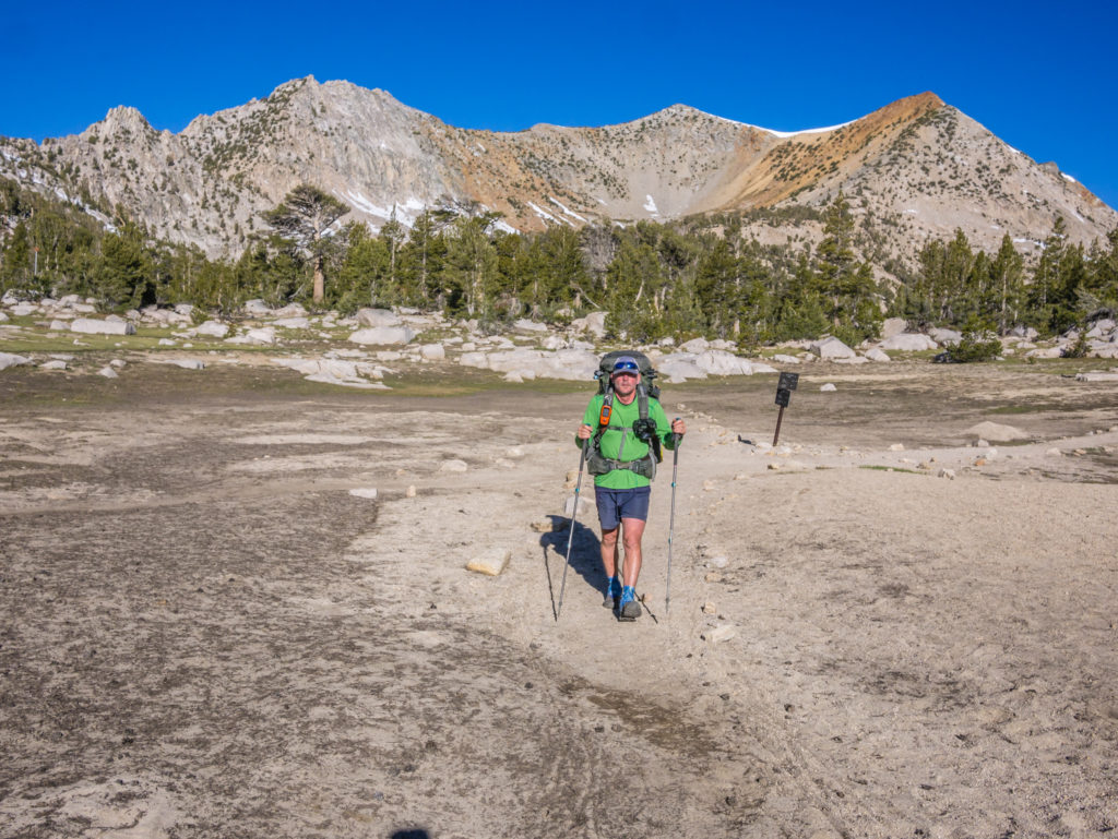
Making strides for Kearsarge Pass.
Even though our route was going to take us out of the mountains, it was none the less spectacular. As we made our way uphill towards the switchbacks, we had a tremendous view overlooking Bull Frog Lake and were surrounded by snow-covered peaks in every direction.
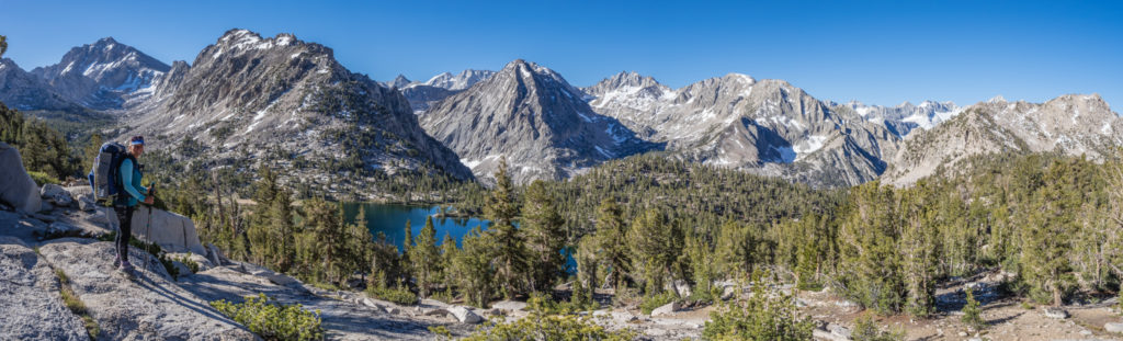
What an amazing view!
Looking onto the vibrant blue waters of Bull Frog Lake.
The last few switchbacks to the top of the pass were a little steeper and got us out of breath, but we made it to the top just after 9:30am. It was a busy meeting point as several ‘weekend hikers’ were also returning to the Onion Valley trailhead, (which was good news for us as it could help us get a lift to town), and there were also plenty of day hikers coming over the pass into the Sierra who were resting at the top too. We sat down enjoying the view, and chatted to a few different groups of people. One of them, a Kiwi named Paul, offered us a ride as far as the town of Independence. We hastily took him up on the offer as we knew from there we could get a bus the rest of the way to Bishop. (Good karma gives us a helping hand again!)
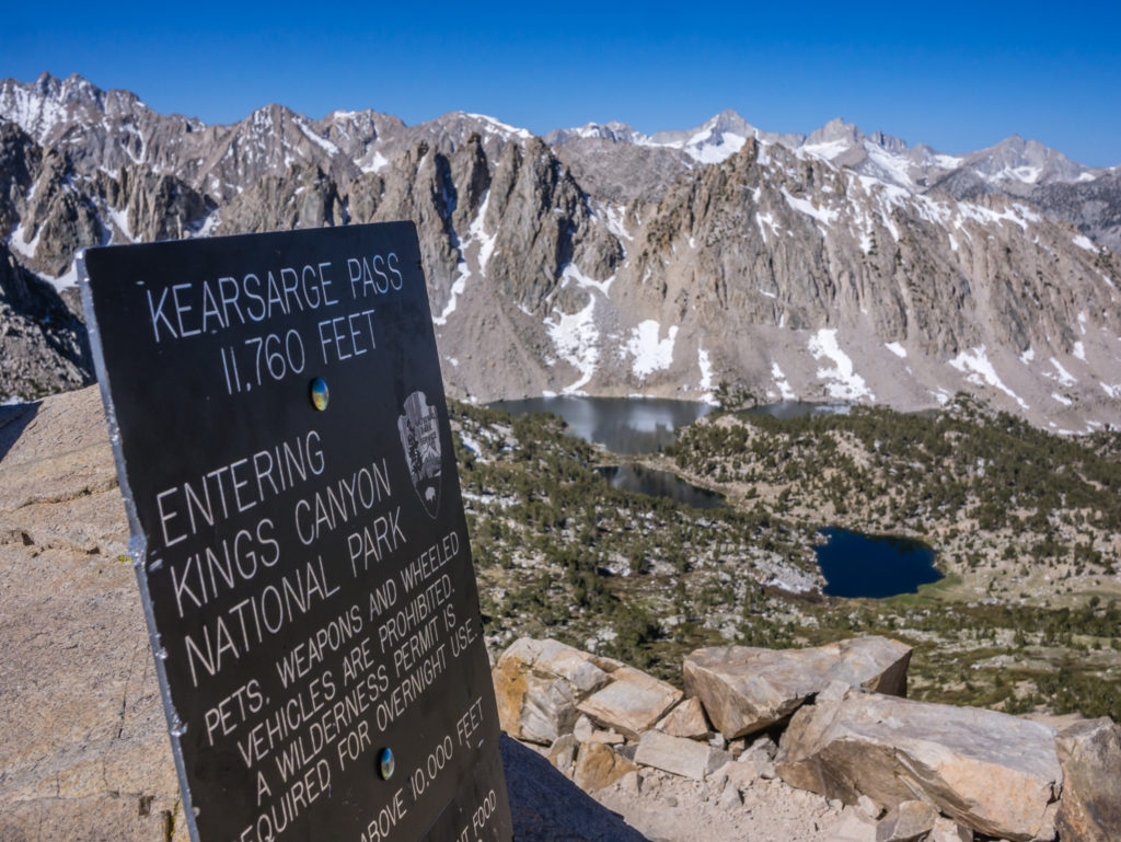
Reaching the top of Kearsarge Pass at 11,760 feet, our route out of the Sierra mountains, just for a few days.
Looking down to the Onion Valley.
We set off down the other side off Kearsarge Pass heading into the Onion Valley, happy that we had already bagged ourselves a ride for part of the way at least! It was another four miles or so, but the time passed by quickly, especially with talking to different hikers passing us in both directions. The thought of a ‘Texan BBQ’ in Bishop was keeping us going – we were certainly ready for a giant meat feast after eating so much chocolate lately!
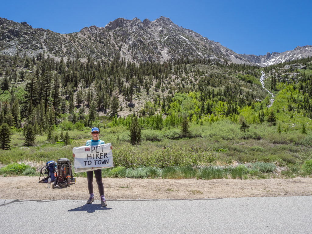
Getting out our poster in the hope that some kind driver would give us a ride to Bishop.
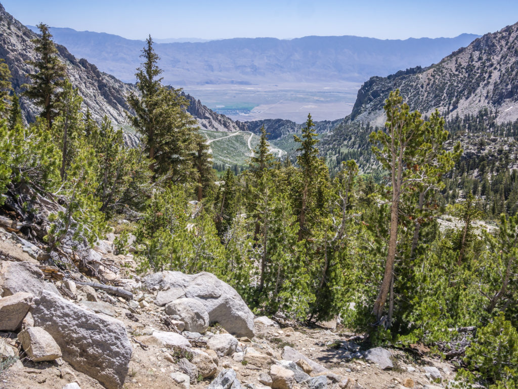
After reaching the trailhead and getting dropped off in Independence (around 13 miles away), it was around 1pm. We had missed the midday bus to Bishop, and the next one wasn’t until 5:15pm. So out came the poster again in the hope that we’d be able to bag ourselves another ride. It was intensely hot down in the Eastern Sierra valley, so we hoped we wouldn’t be stood at the side of the road with our poster and thumbs out for too long. And thankfully we weren’t! It took us about 10 minutes to get ourselves a ride with Amanda and Donny, a young couple travelling to Reno, who would be going straight through Bishop on Highway 395. They kindly let us ride with them the 40 miles for free and even dropped us off right outside our motel.
Amanda and Donny – our trail angels who gave us a ride all the way to Bishop.
We checked into the motel as soon as we arrived, and within minutes our room was the usual chaotic mess after emptying out our packs! Today the first priority was a shower before rushing to the Post Office before closing time to collect our bounce box and then we decided to wander through town before deciding where we wanted to eat. (With lots of fast food chains and other places to dine, we still opted for the Texan BBQ!) And the rest was as every nearo/ zero transpires… Food, drink, laundry, food resupply, Post Office, repeat!
Our lovely motel room before the Fenton’s were let loose on it!
What an incredible week on the trail! Entering the Sierra has certainly helped me get my mojo back! The scenery has been amazing and the sunrises and sunsets simply spectacular, no wonder Wayne calls it ‘The Wonderland’. Here’s to more of the same when we head back into the mountains in a few days time…
15 Comments
Now you are finally in the territory that I love; the high Sierras. And now you are also posting some nude and semi-nude shots as well! Most welcome. ha ha. Tell me about those tattoos, Wayne!
Beautiful pictures and helpful and funny commentary. Great job! Enjoy your rest in the hotel in Bishop and zero mile days.
Thanks Garry! It’s been a tough week going over a pass a day, especially Muir Pass that’s still covered in two miles of snow either side! But great fun & excitement seeing the Sierra in a different season. Currently buying burgers & wine from Vons in Mammoth as a reward. Hoping to get more updates online when we reach Lake Tahoe, July 5th, (if everything goes to plan)!
Wow. Stunning scenery and pics. Not the ones of Wayne’s backside, obviously.
Thanks David! Loving the High Sierra!
Wonderful. Thanks for sharing.
Thanks for commenting and continuing to follow along 🙂
Guys, absolutely fantastic scenery and with your posts and videos i feel like were with you every step of the way!
Keep safe and keep the posts and videos coming.
Thanks Dean. Really pleased that you’re enjoying following along and that you’ve taken the time to comment. Lots more updates to come when we’re back in the land of wi-fi!
Are you guys still out there? Alive?
Hey Bob, yes, we’re still hiking on! Currently reached Mile 1,090 of the PCT. We’ve not had a signal much in the Sierra.
We’ve made it to Lake Tahoe for 4th of July fireworks today! So we will be zeroing here and updating the blog in the next couple of days now we have WiFi. Thanks for your concern 🙂
Can’t wait!
When I did JMT, one of my friends back home in the UK said that following my InReach track became addictive. I get what he means now. I’m finding it fascinating following your track and predicting where you’ll end up each day. Looked like 25 miles yesterday (Carson Pass day). Didn’t predict that!
I’ve read a few PCT blogs over the years but yours is the best. Entertaining and informative with some great photos. Will follow it for the duration.
Wow, thank you so much for such great feedback Neil, it’s much appreciated!
Yes we did our first 25 miler yesterday as we wanted to get to South Lake Tahoe for Independence Day celebrations. We are now taking a couple of much needed days off to rest and resupply ourselves with food packages all the way to Ashland.
We’ve got to up the pace and regularly do 25 mile days after Tahoe to get to Canada on time. The elevation profiles for Northern California look quite demanding though, so we’ll see how it goes! Glad you’re enjoying following the live map 🙂
Brilliant write up and pictures yet again. Thanks for taking the time to share your adventure with the world. Keep on trekking!
Thanks so much! Now we’ve reached 1,000 miles it’s getting harder to keep going so you’re comments are much appreciated 🙂