
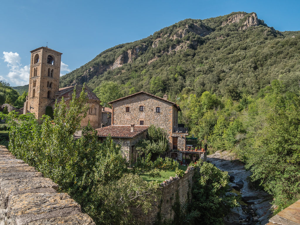
“My wish is to stay always like this, living quietly in a corner of nature”.
Claude Monet
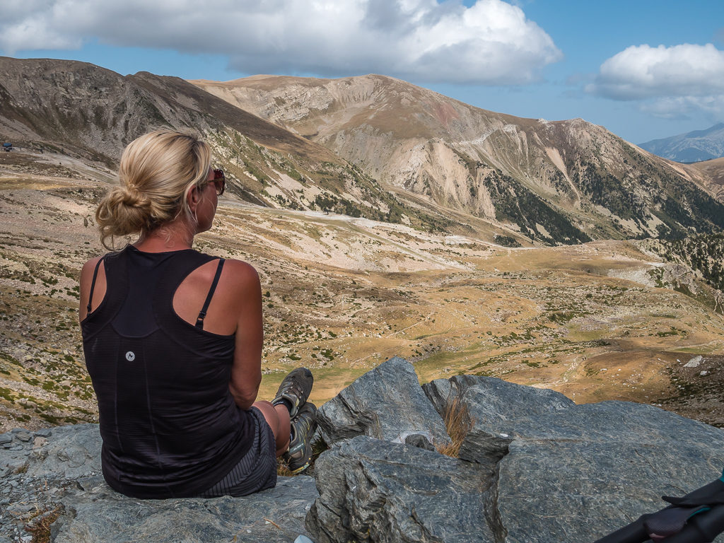
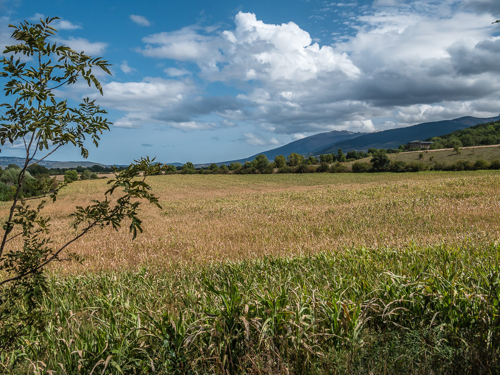
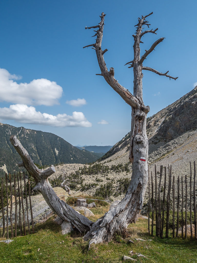
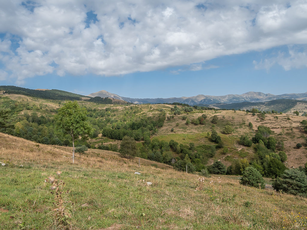
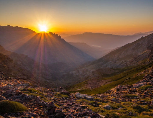
Wanting time to stand still as we savoured our last moments in the high mountains before descending into the Spanish foothills…
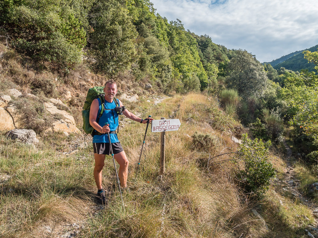
Considered an unlucky day in Western superstition, we began ‘Week 7’ of our Pyrenean adventure on Friday the 13th! – We weren’t exactly sure what the day had in store for us and whether it would bode well in terms of the weather, but we were now on a mission to pick up the miles and double up some stages to ensure a timely finish on the 25th September. Due to the unforeseen bad weather last week and the fact we had to spend an extra day in the Andorran town of Ordino, (the result of which saw us changing routes to safely allow us to complete the final 250 kilometres to the Mediterranean Sea), we now didn’t have any spare days left in our itinerary. So it was time to knuckle down and get some miles done on the GR11 in the hope of walking into sunnier climes the further east we went…
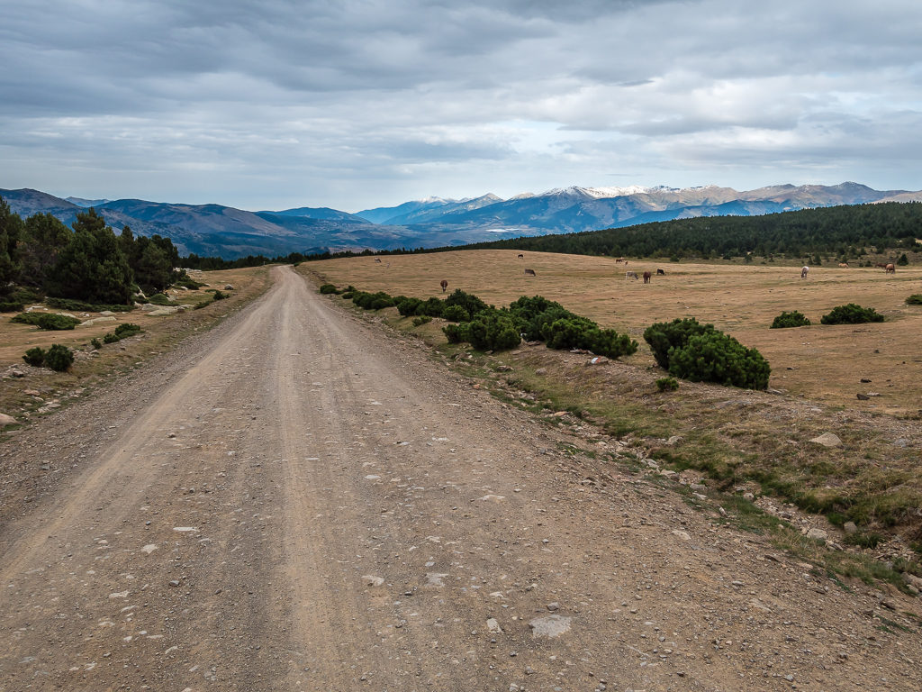
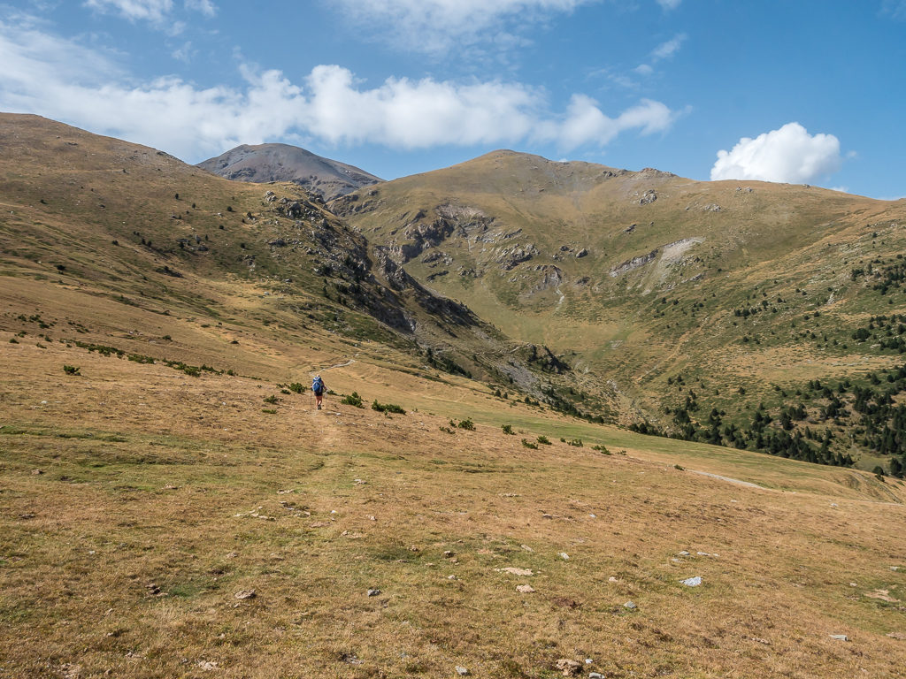
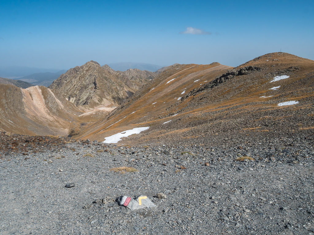
Day 43 – ‘Clawing Back The Miles!’ Friday 13th September, 2019, Refuge Riu dels Orris to Wild Camp on grassy plateau above Puigcerda town, GR11, 22km
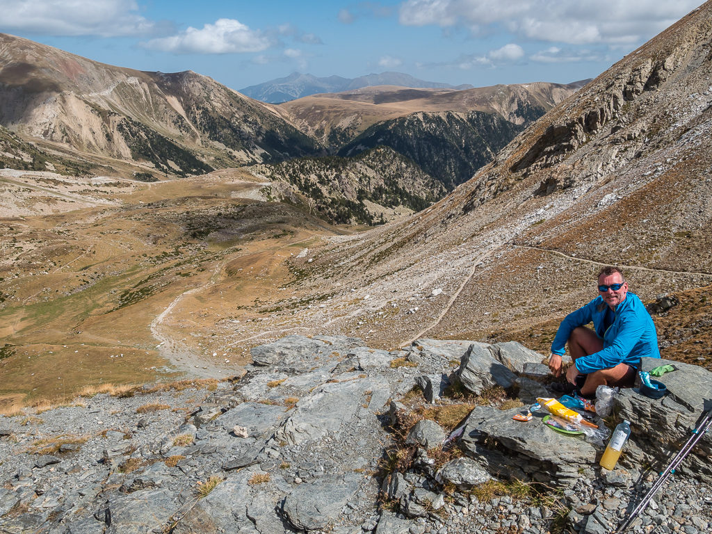
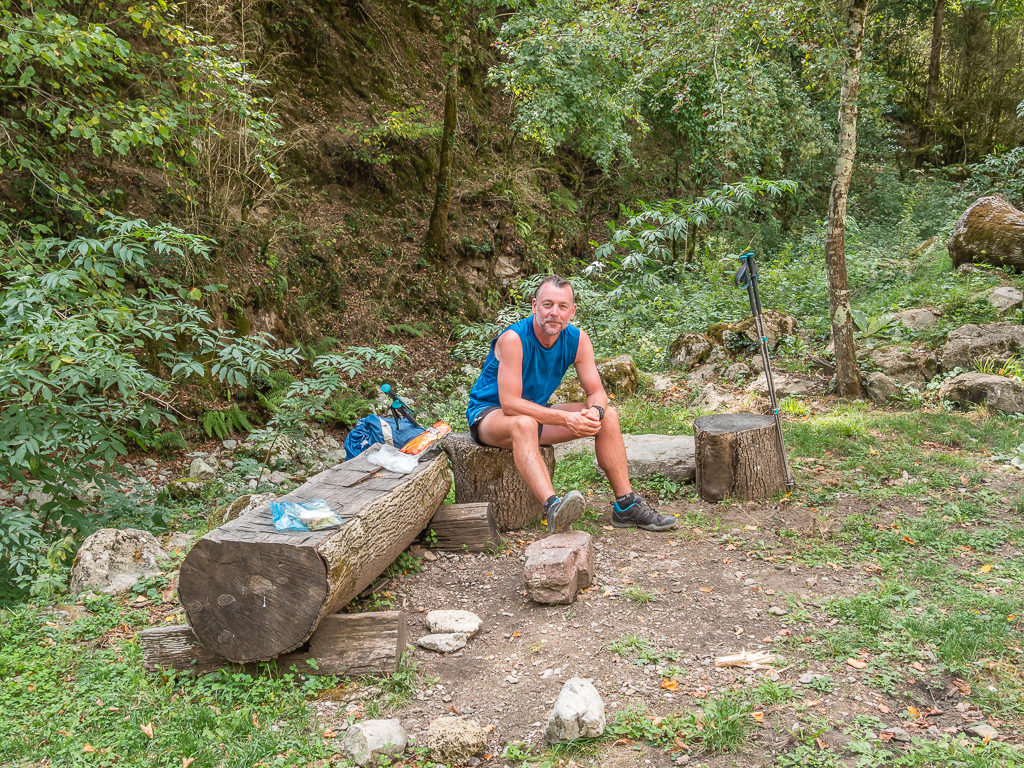
With at least 20 kilometres to cover from last night’s beautiful wild camp in a grassy meadow close to Refuge Riu dels Orris to reach Refugio Malniu, today we ensured we were up and ready in order to make a timely start as we were then planning on continuing further. Walking just another couple of kilometres would make it much easier for resupplying in town tomorrow as with just 12 days left to reach the coast, we now only had time for a quick ‘in and out’. So with a hot breakfast inside us and sandwiches already prepped for lunch, we left camp just after 9am in good spirits despite of today’s ominous date.
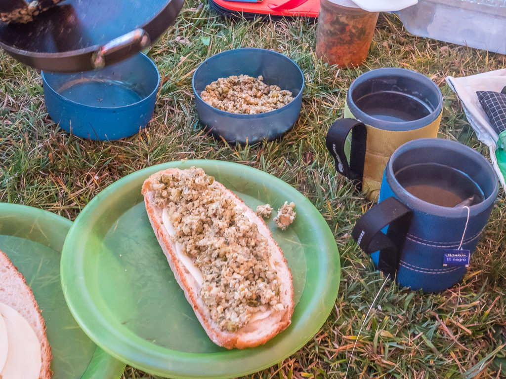
One of our new breakfast favourites – bread, cheese and mixed grains – which was really filling.
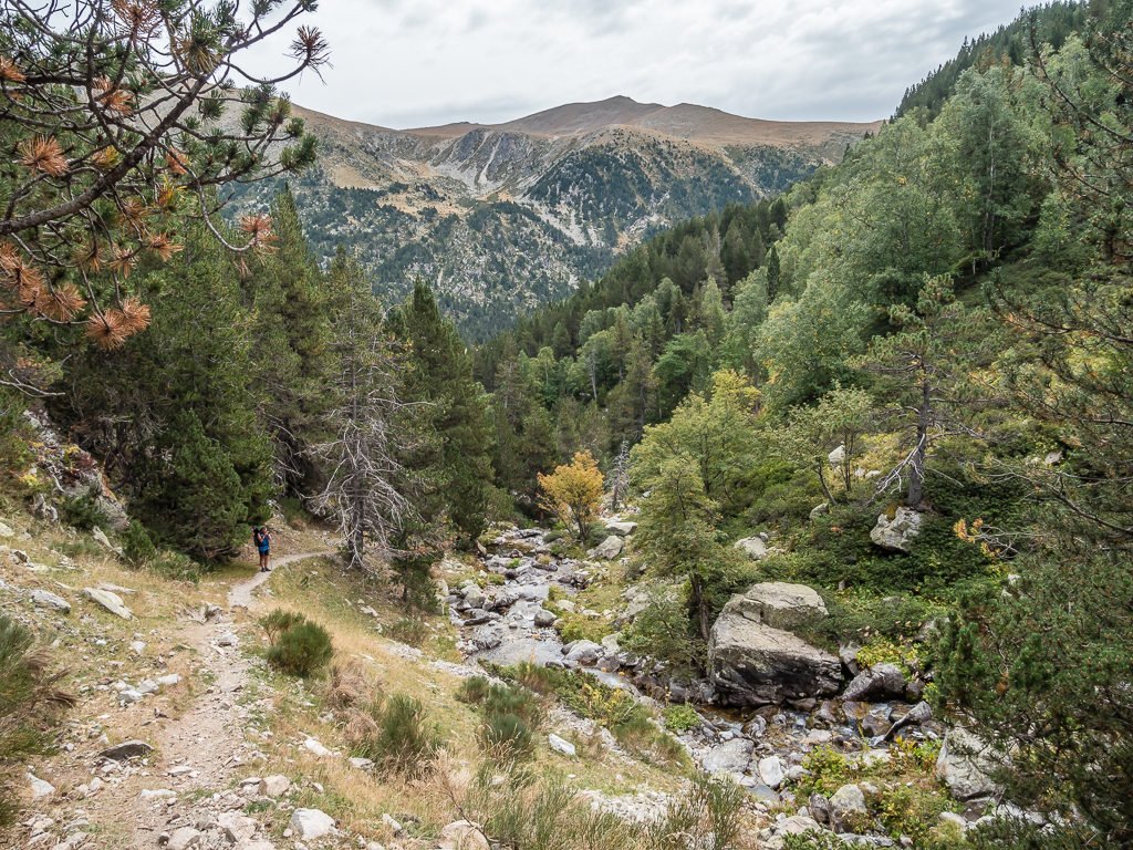
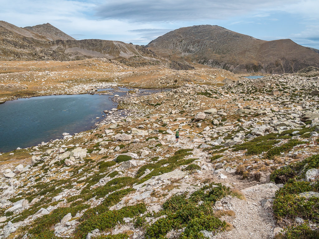
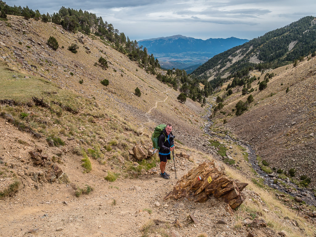
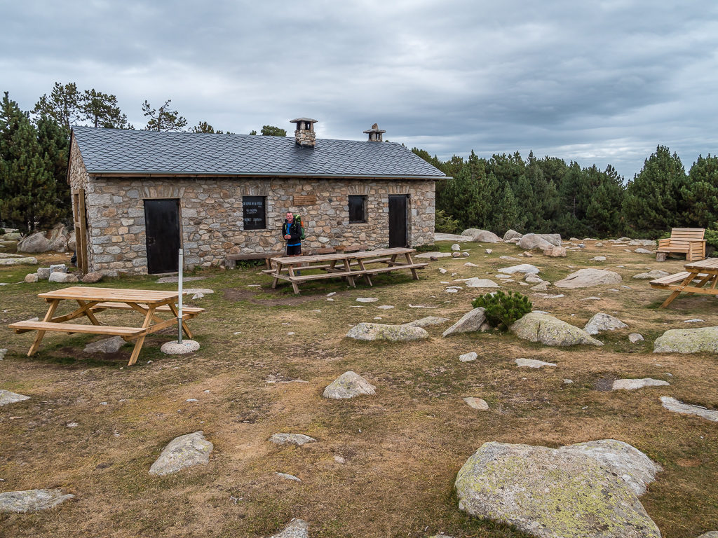
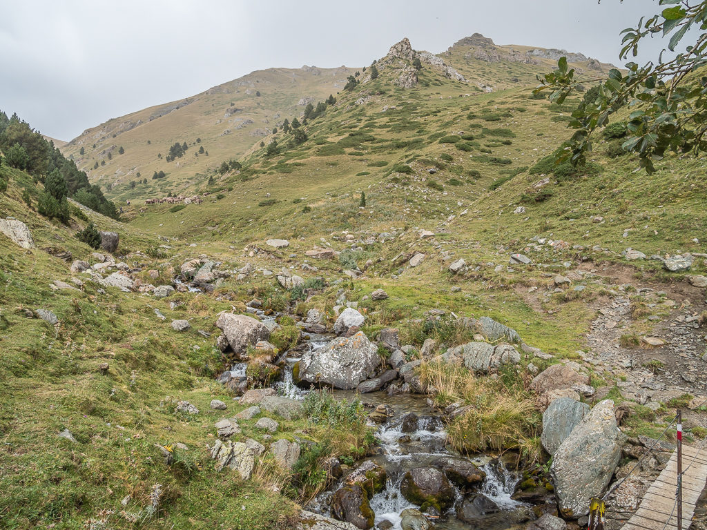
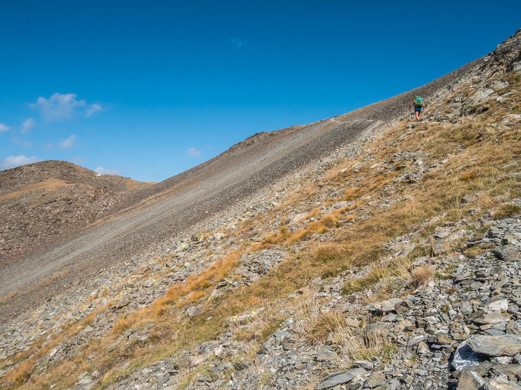
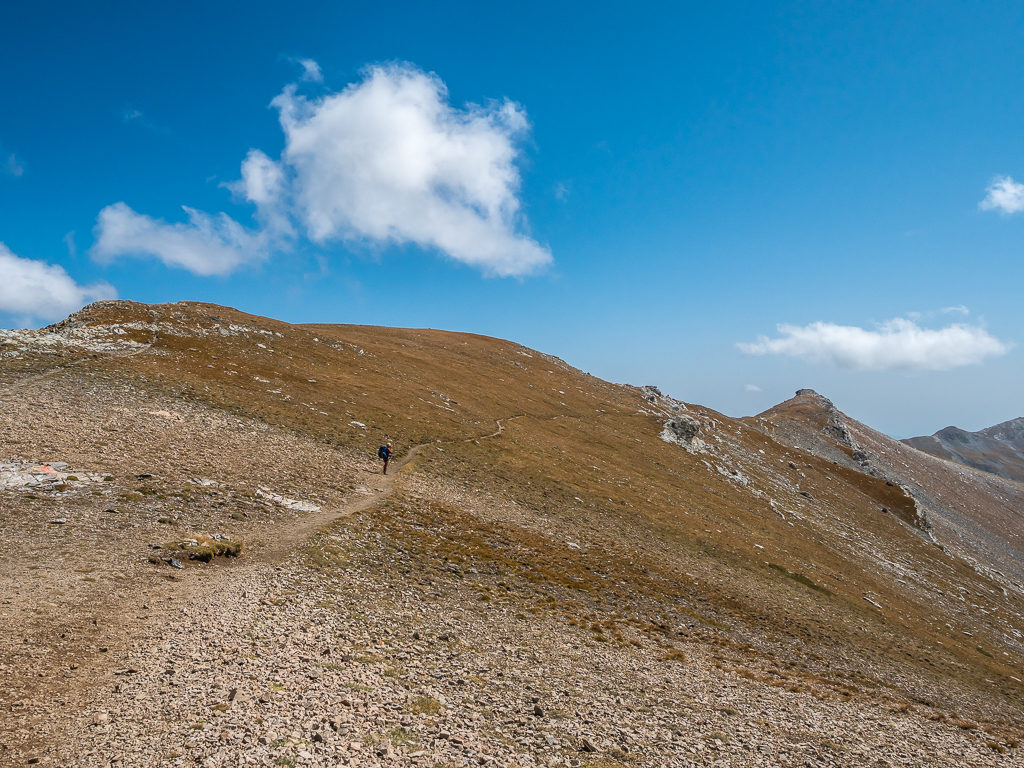
Winding between granite knolls on a clear path surrounded by slopes of pine, it took us around an hour and a half to reach Refugio de l’Illa, a huge manned refuge that looked recent in construction, complete with a roof of solar panels and even a chicken coop outside. We didn’t take the time to look around the facilities properly however. Eager to get some more miles done, we just filled up with water from the piped water point to save us the job of filtering, then we were quickly on our way again.
Enjoying our early morning walk along the valley. With blue skies and some thin cloud, the weather looked more promising.
Following the course of the Riu Madriu to the Refugio de l’Illa.
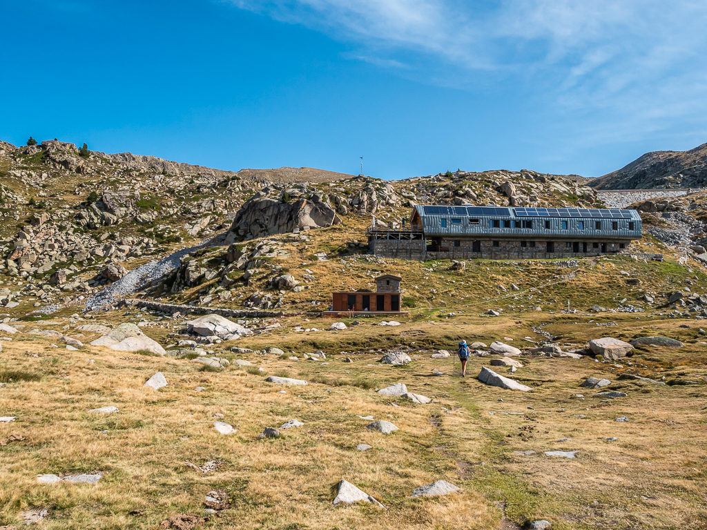
Located at an altitude of 2,488 metres, the Refugio de l’Illa is the highest refuge in Andorra. It has 6 rooms that can accommodate up to 50 people.
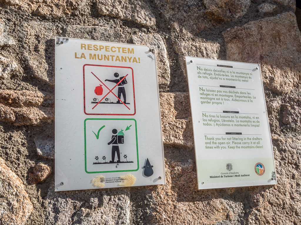
The refuge is located at the confluence of the GR11, GR7 and Coronallacs so receives plenty of passing hikers. We liked the fact there was signage reminding everyone of the ‘leave no trace’ principle.
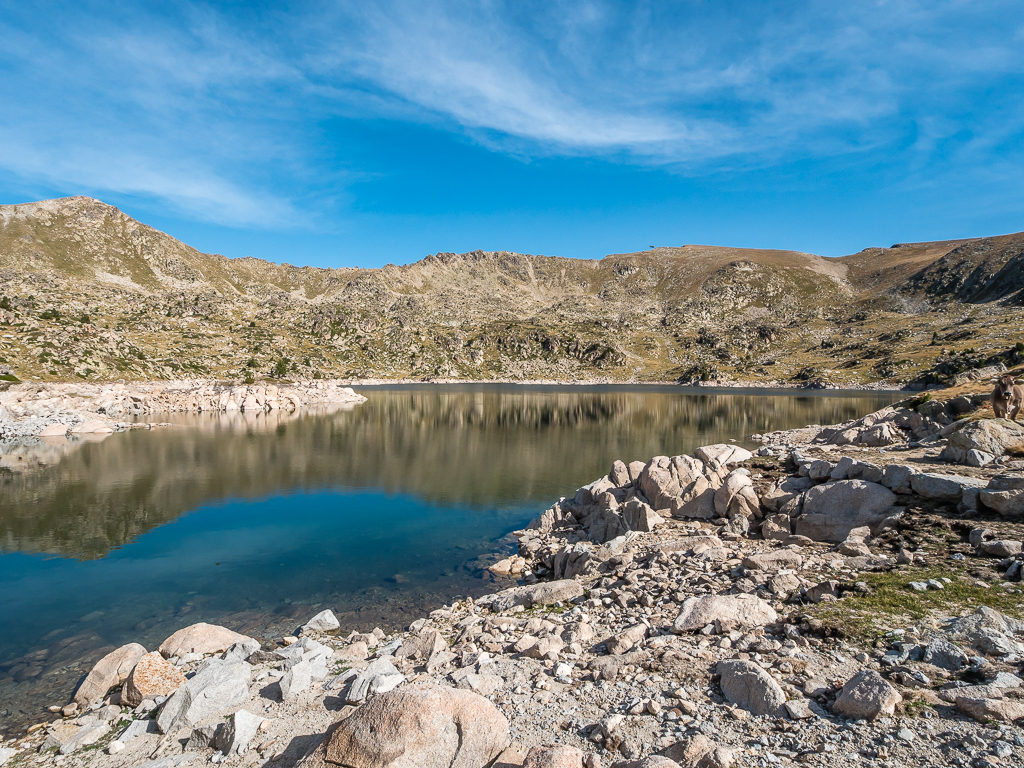
Mountain reflections on the glass-like surface of Estany de l’Illa.
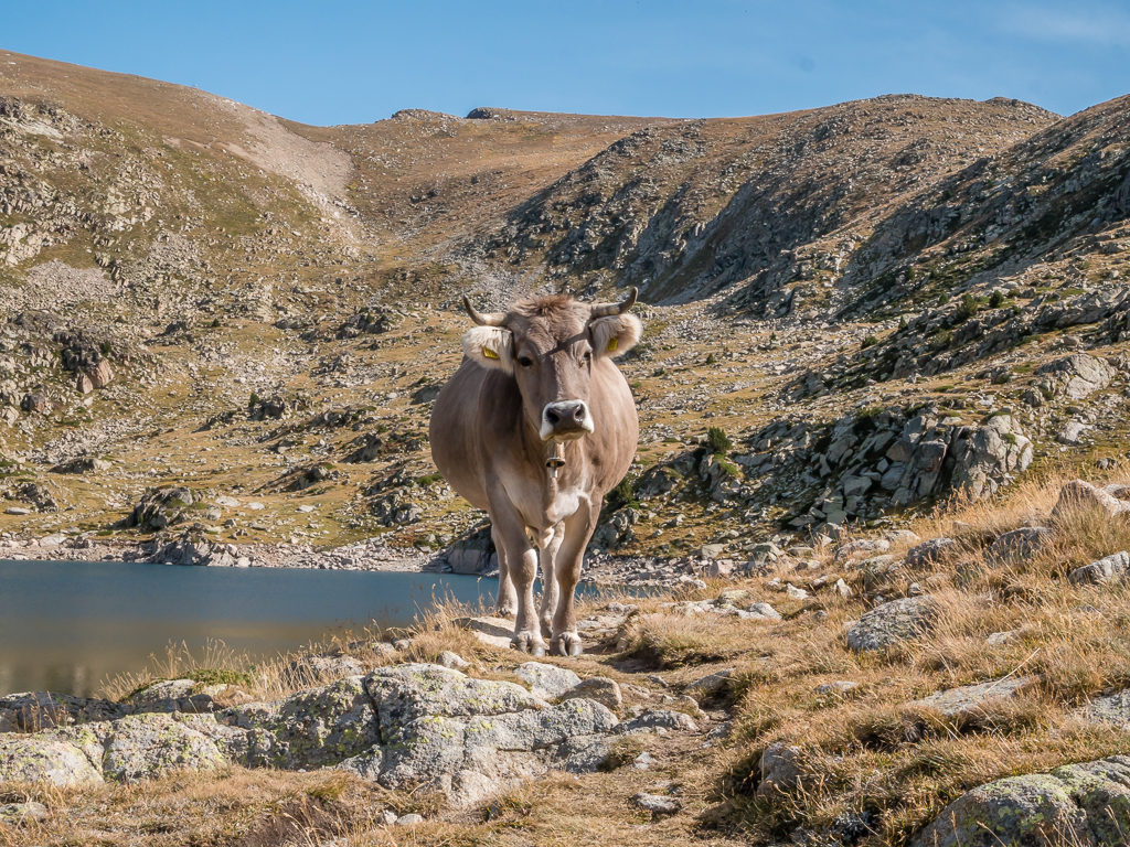
We hadn’t even contemplated having our path blocked by a cow – an annoyed looking cow at that! (Suffice to say we gave it a wide berth!)
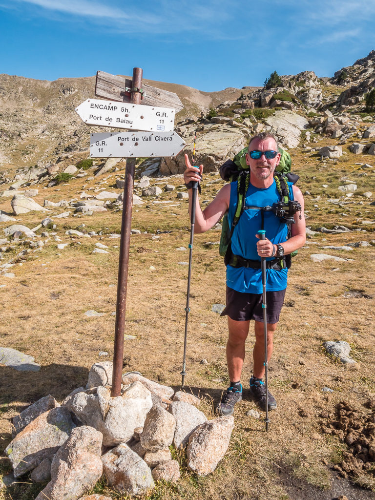
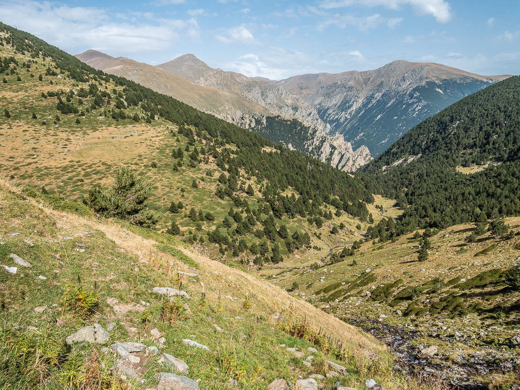
After continuing through the Vall d’Madriu, beyond the refuge we were heading southeast to the Port de Vall Civera – a 2,550 metre pass in Andorra carrying the GR11 across the mountains into the Spanish Civera valley.
Soaking up the beauty of the Madriu-Perafita-Claror valle – declared by UNESCO in 2004 as a cultural asset and given World Heritage status.
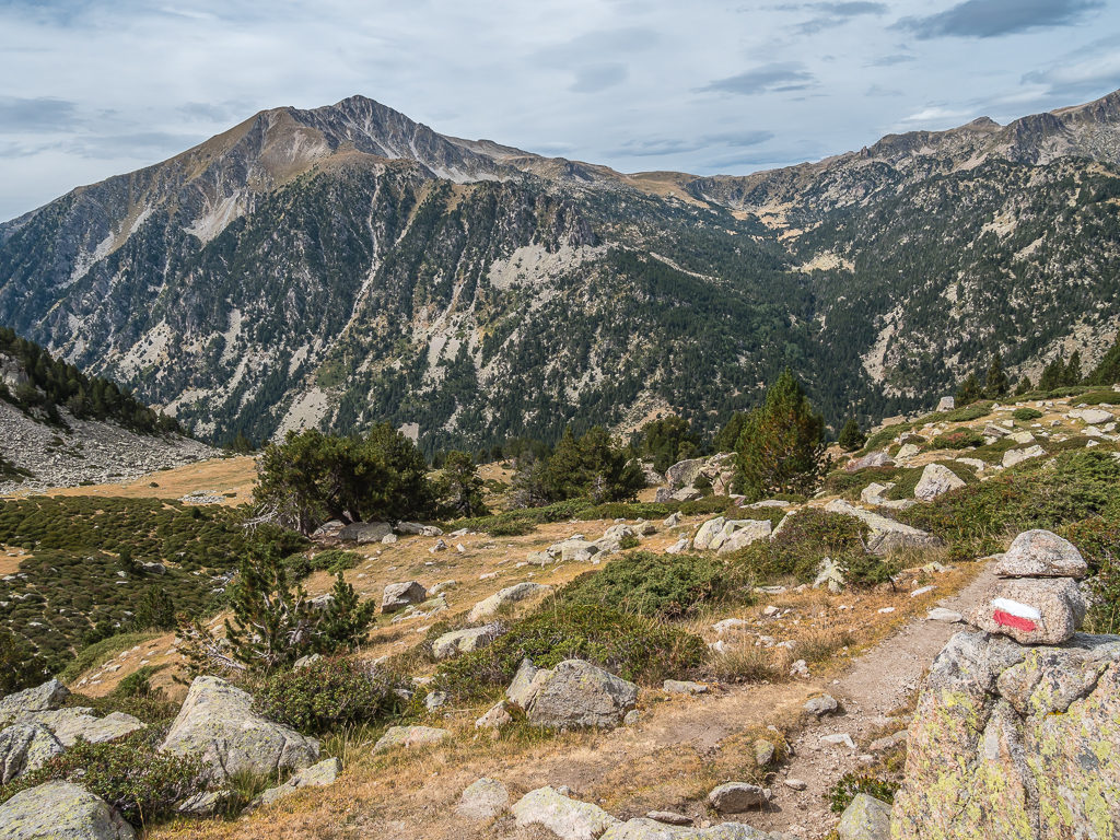
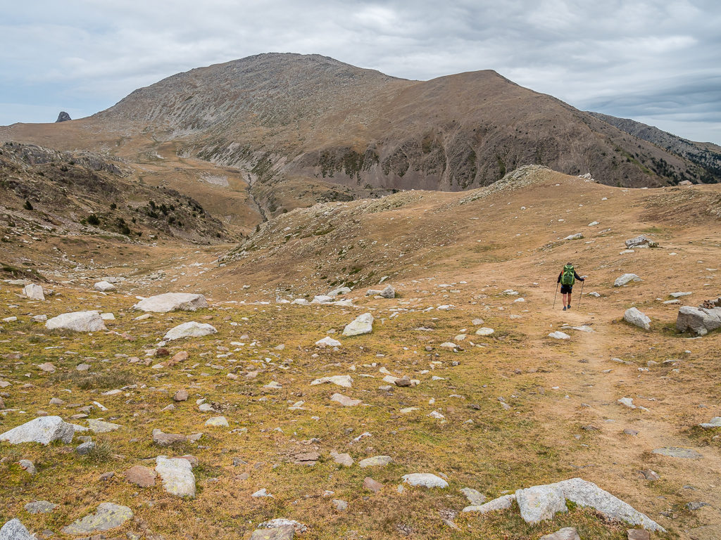
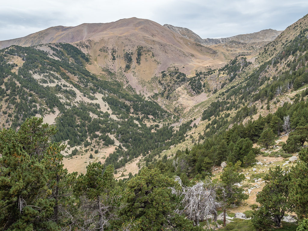
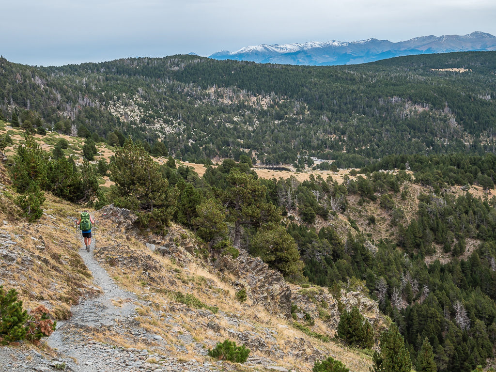
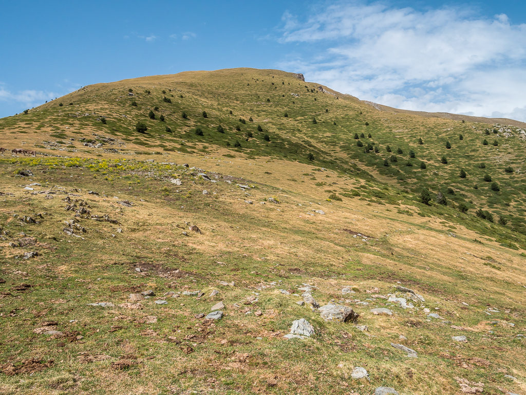
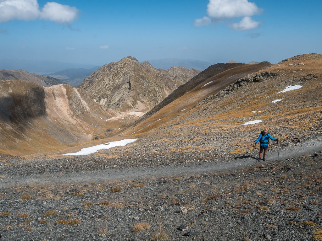
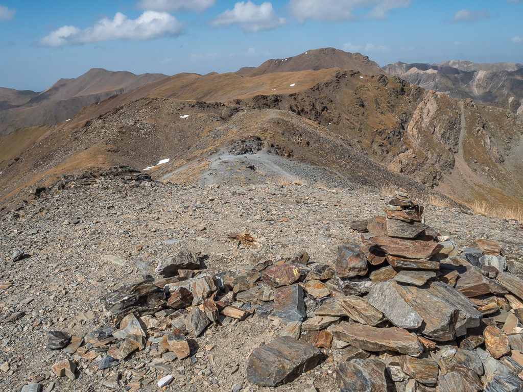
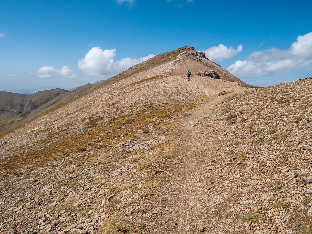
We had read that the next section of the trail would be rough going, the high points of the day being the Coll de Vall Civera at 2,550 metres, followed by the Portella d’Engorgs at 2,680 metres. But we figured that these mountain passes couldn’t possibly be as tough as those on the HRP, and in particular, we wouldn’t find them to be anywhere near as demanding as summiting Tuc de Marimanha where we had to do our own route finding and improvise somewhat on a steep mountain slope when we discovered we had gone the wrong way! (If you haven’t done so, read more of what happened in TrekSnappy’s Pyrenees Traverse – Week 5!) Having already completed the ‘High Pyrenees’ segment of the GR11 in 2017 and what are considered to be the two toughest stages, we weren’t particularly concerned about the trail now that we were nearing the foothills, especially as the mountains were looking much less rugged and almost fell-like cloaked in green.
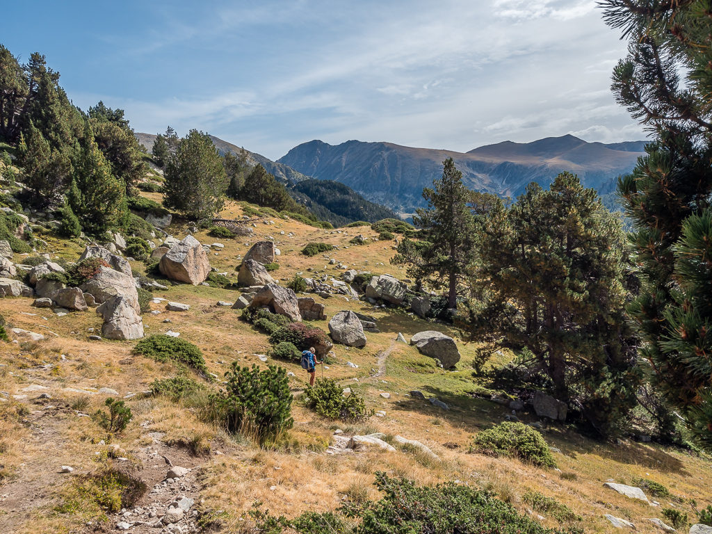
Again, we pushed quickly on to reach the grassy Coll de Vall Civera, which was significant as it was the point at which we left Andorra (having been here just a few days) and re-entered Catalonia. (The added bonus being that we would back in the EU and back to data usage inclusive of our monthly plan in the UK! Until Brexit finally happens…) Crossing several streams, and heading through lightly wooded pasture, we commented on how many potential wild camp spots there were on this section. But alas, we couldn’t take advantage of any of them as we still had a lot more miles to cover with currently trying to pull in more than one stage a day.
Heading towards the grassy Coll de Vall Civera on a well-trodden path.
The grassy slopes were reminiscent of the high fells of our beloved Lake District back home.
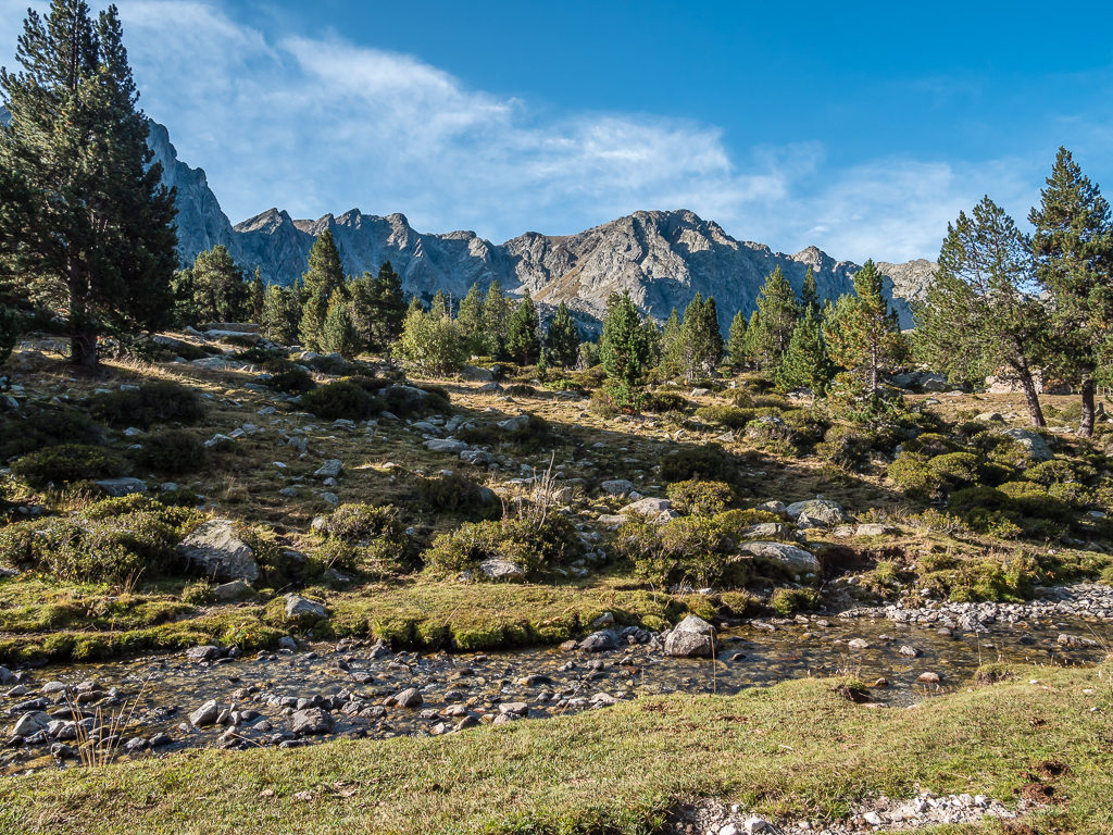
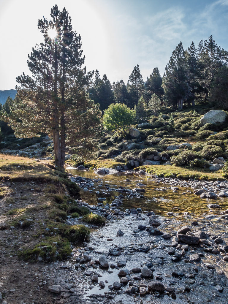
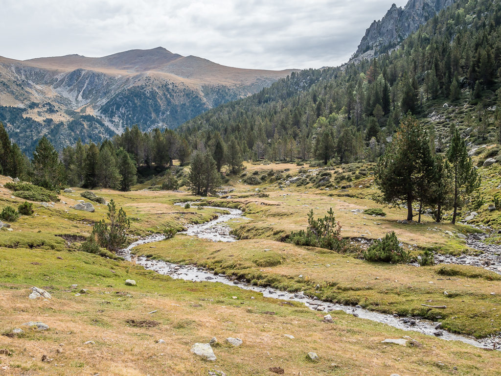
As the trail weaved between woodland and continued following the course of the river, it felt like a place of extraordinary beauty.
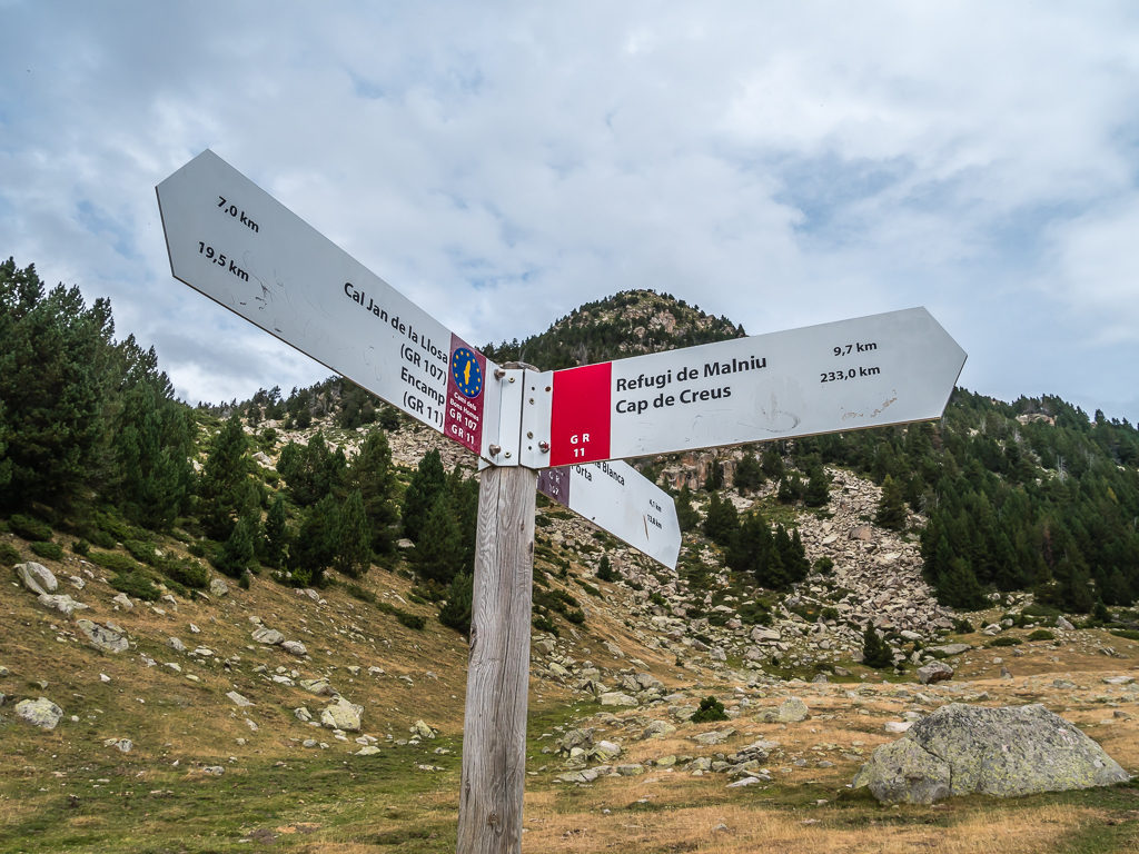
Our first indication that we were nearing the end of the trail – well it was still 233 kilometres away – but it was the first sign referencing ‘Cap de Creus’ that we’d seen, so this felt particularly exciting!

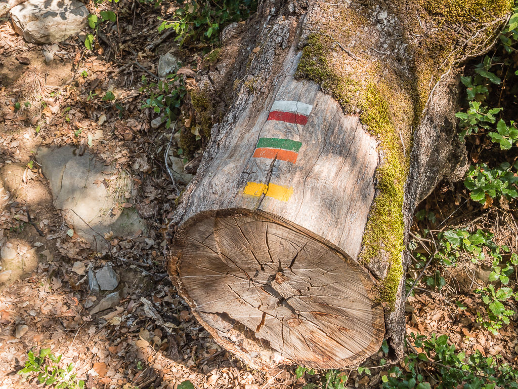
Back into Spanish territory and some familiarity with the white and red painted flashes of the GR11.
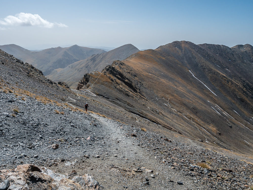
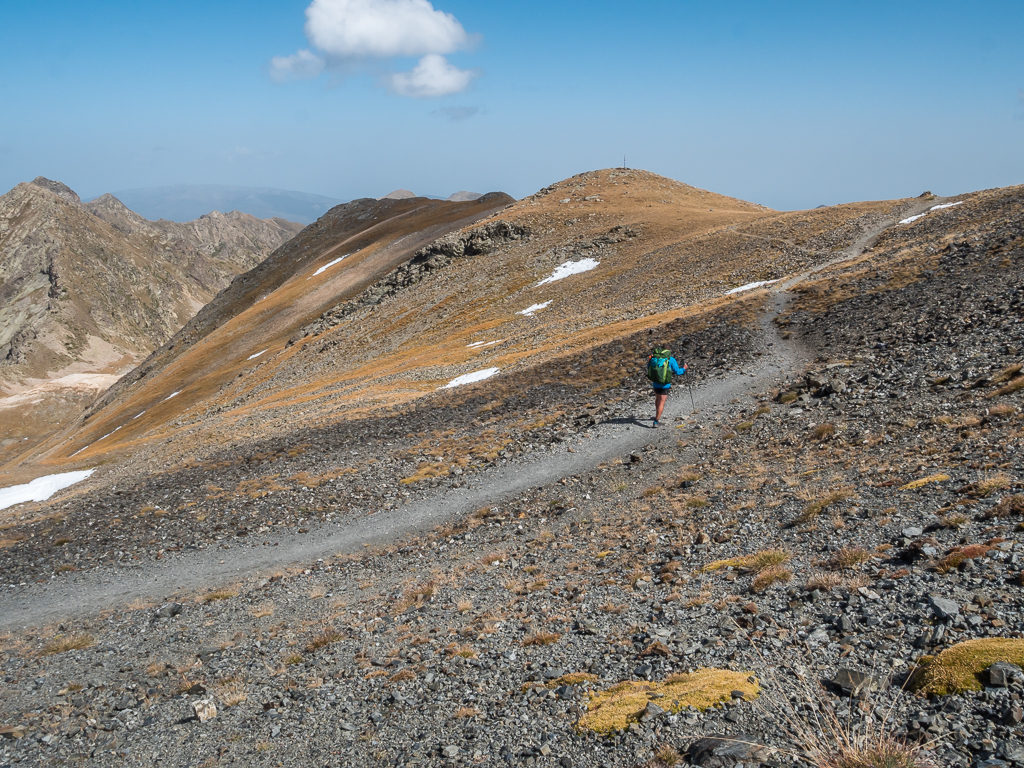
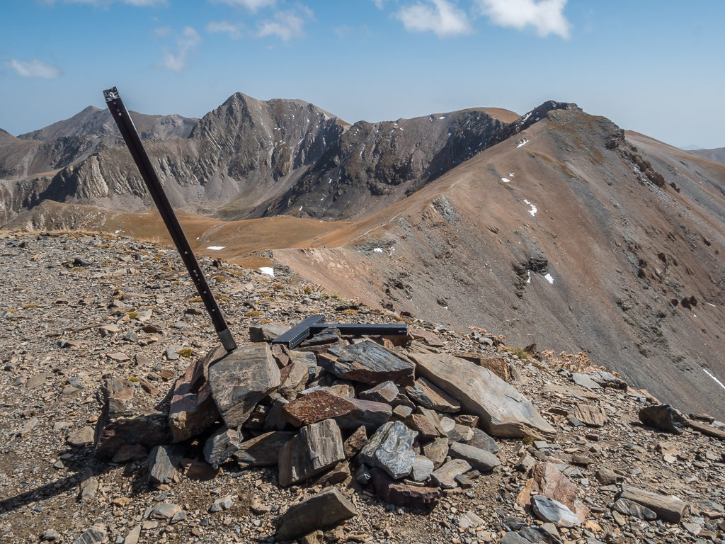
Pushing on to the Portella d’Engorgs, the next pass at 2,680 metres where we were still dwarfed by ever higher mountains.
Nearing the top of the pass and looking back at our incredible surroundings.
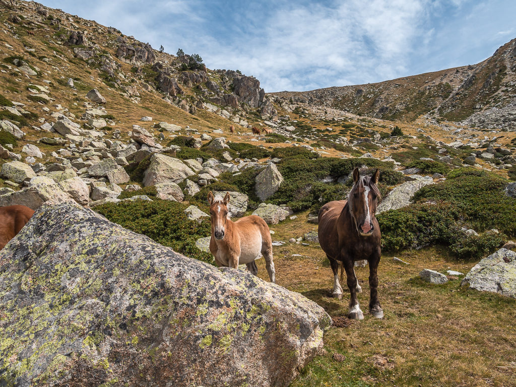
Curious horses stop us in our tracks along the path to Portella d’Engorgs.
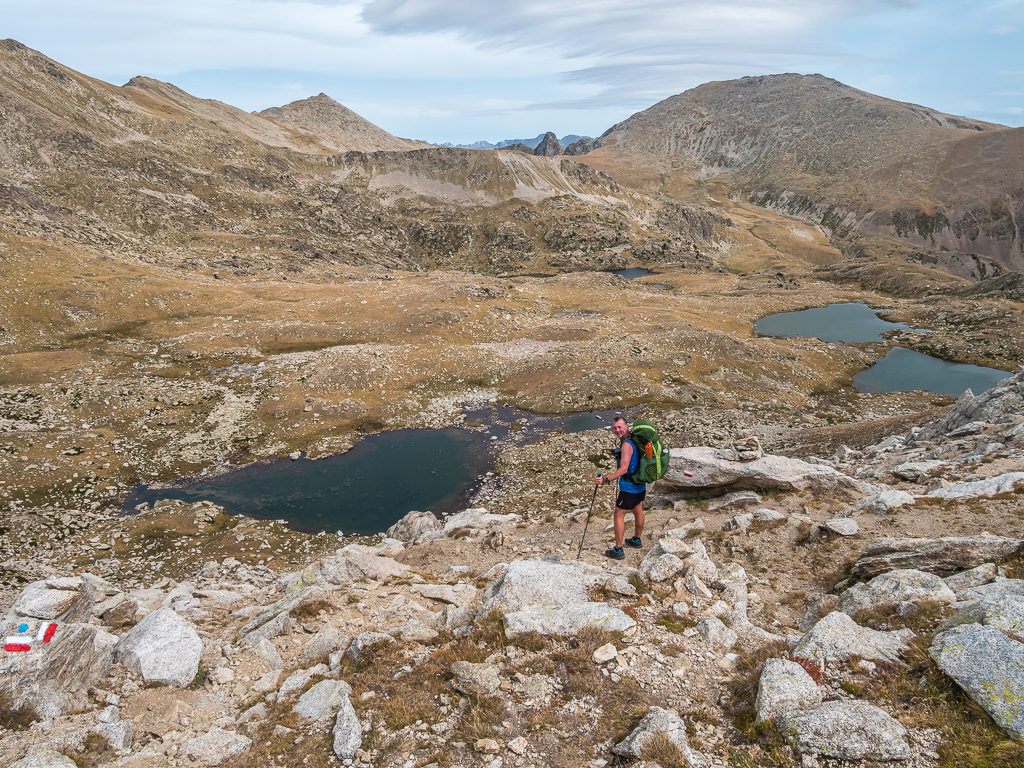
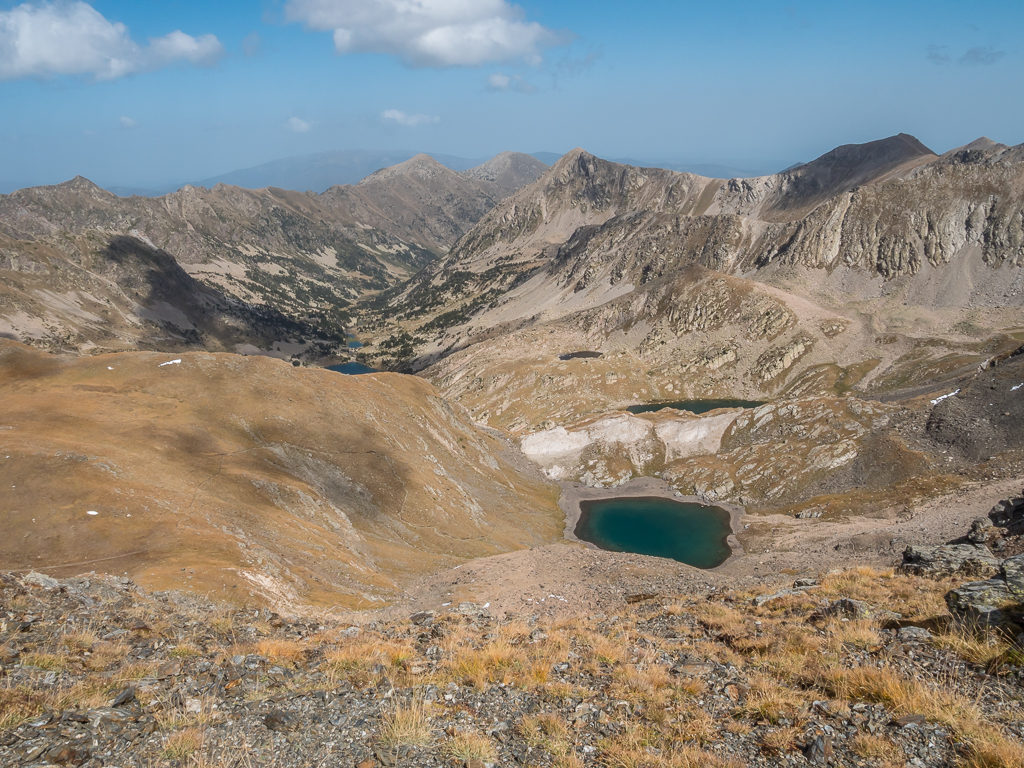
Crossing the broad plateau of Portella d’Engorgs before tackling the steep descent to the Estany de la Portella.
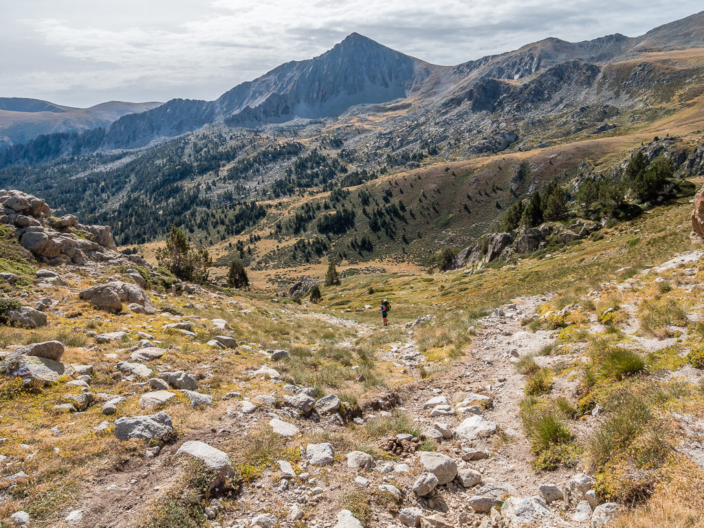
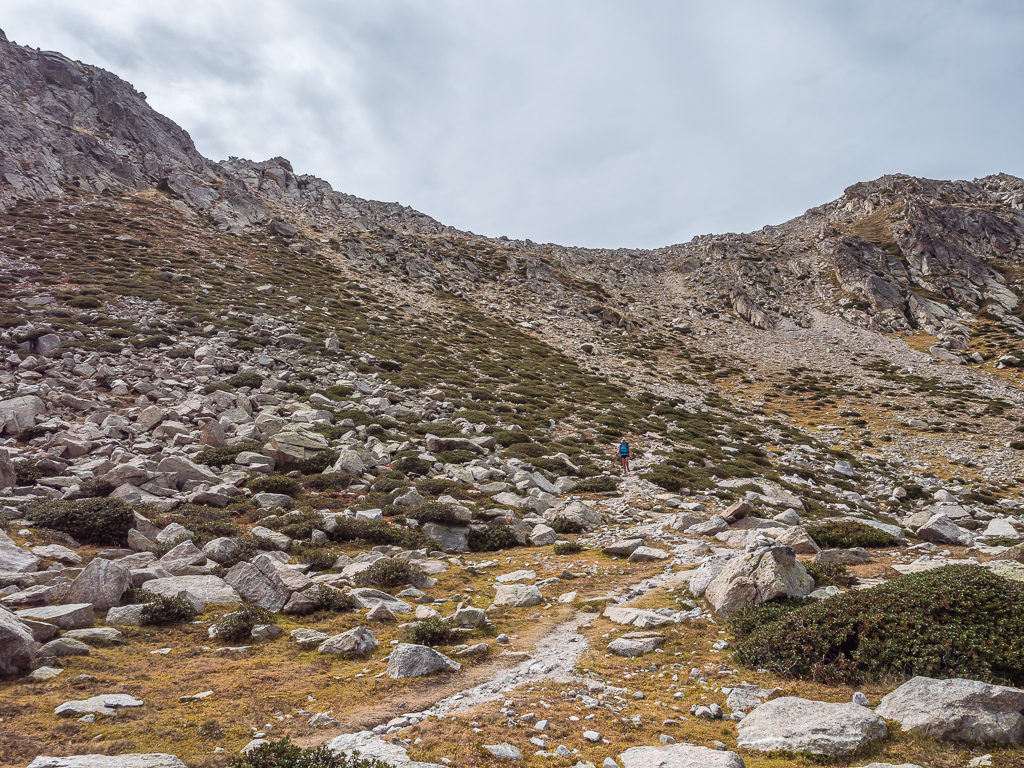
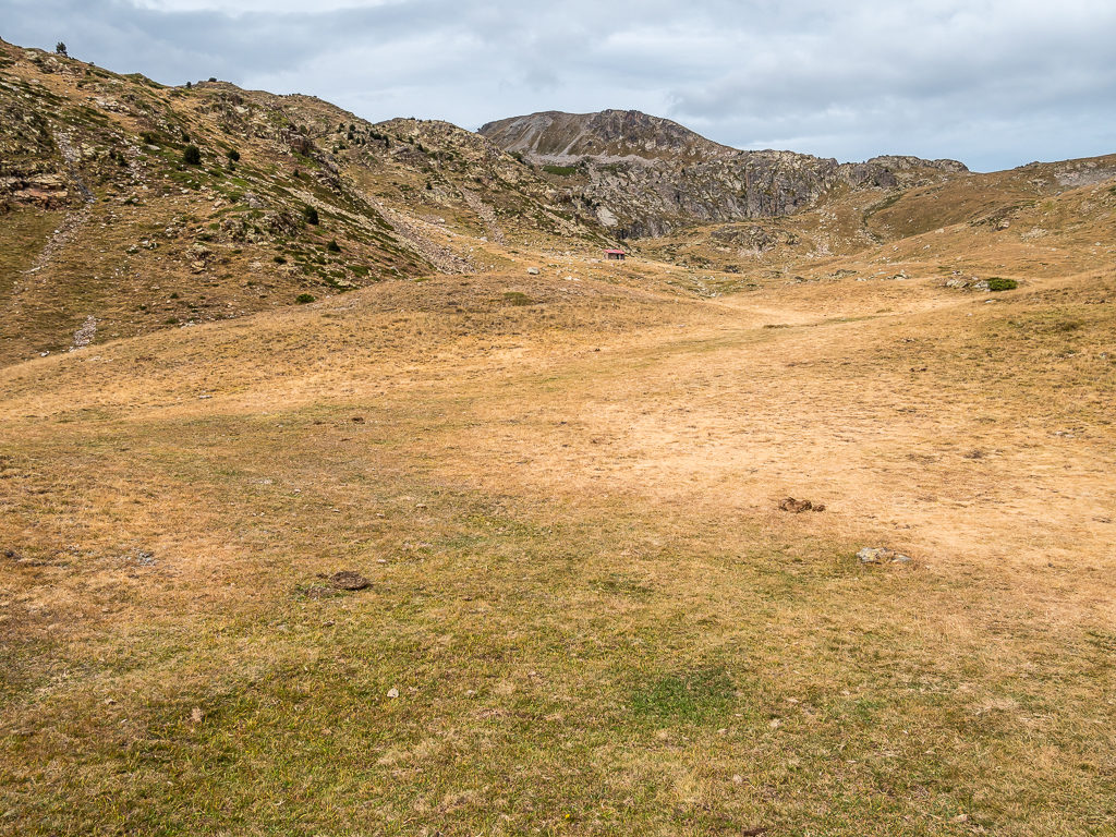
After a quick rest break on the broad Portella d’Engorgs we then had a steep descent from the pass where the trail crossed a short section of boulder field around the Estany de la Portella and the Estanys dels Minyons lakes before reaching the small, unmanned bothy – the Refugi Engorgs. We decided not to stop again as we were intent on pushing on to the Refugi de Malniu where, as it was a manned refuge, we’d be able to purchase drinks and have a short break later.
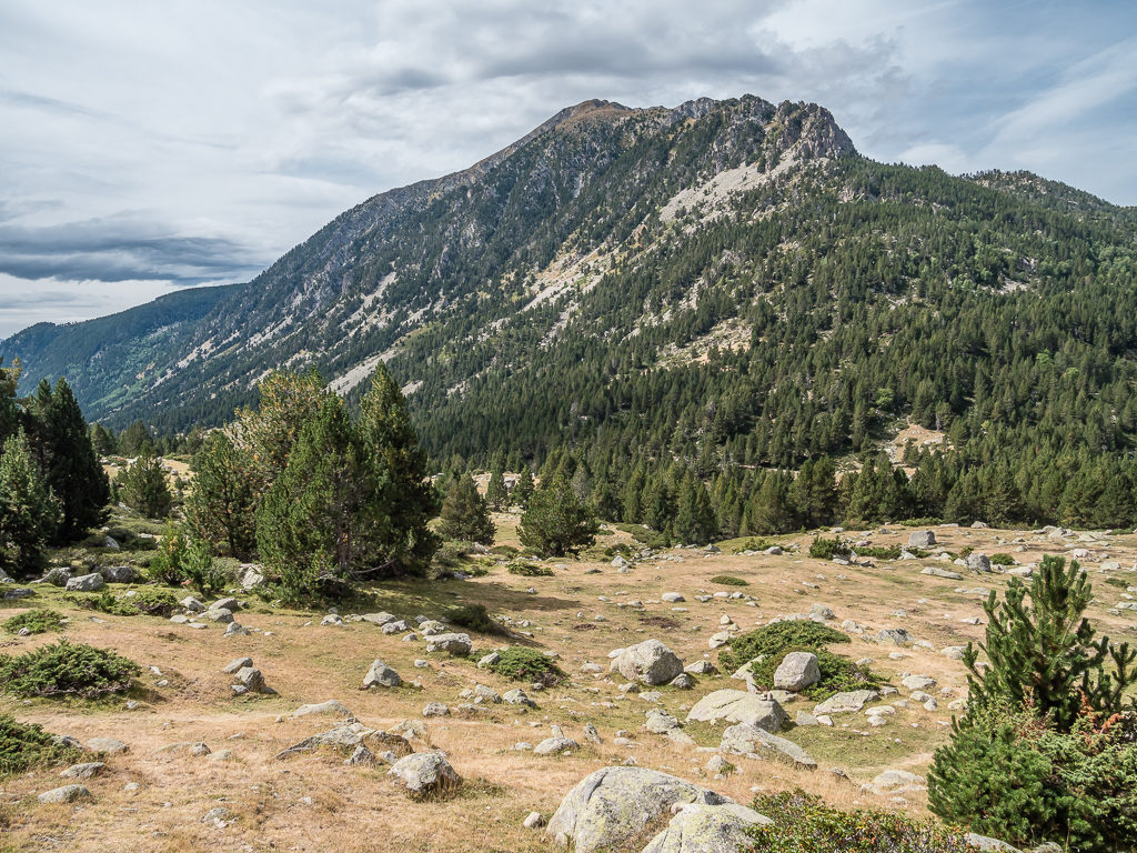
More steep paths then followed as we took a slow but steady climb across the south-facing slopes of Mount Puigpedrós before we eventually began to descend on a rough path towards the valley floor. From this point the GR11 follows the same route as the local 102 path, indicated with yellow markings, which leads to the Refugi de Malniu. Heading into pine forest, we found that the path began to peel definitively away from the river, although at times it became a little unclear. Almost at the end of the valley, we arrived at some fields that were dotted with tents, from where we could make out the car park at the refuge and the Estany Sec lake.
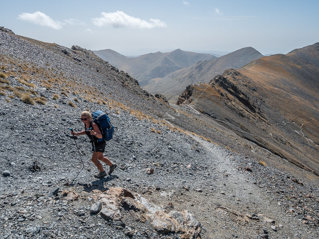
Descending through rough terrain from the Portella d’Engorgs at 2,689 metres.
Passing the Estany de la Portella, with Puigpedrós dominating the skyline.
Preparing to cross a section of boulder field as we head towards the Estanys dels Minyons lakes before the trail then turns towards the slopes of Mount Puigpedrós.
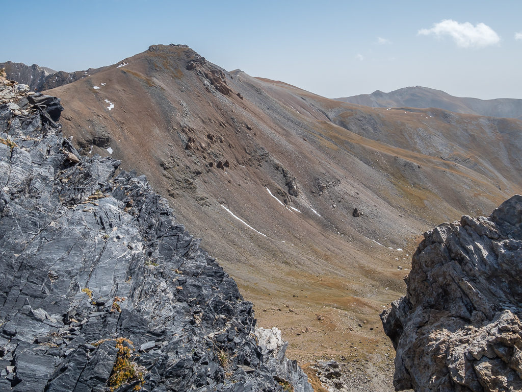
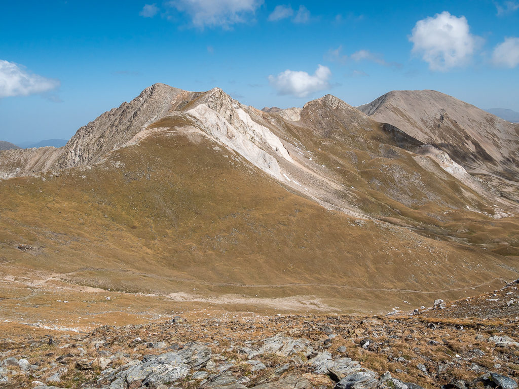
Looking towards Puigpedrós, where the trail traverses the southern-face of the mountain.
This section of nice, flat trail was very welcome after crossing some rough and rocky terrain. You can just make out the small d’Engorgs shelter in the distance, which we had already passed as this shot was taken looking back.
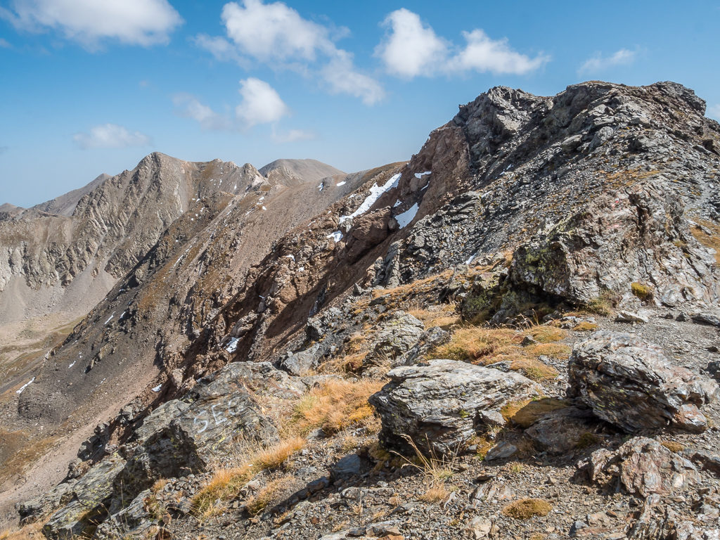
Flanked by the south face of Puigpedrós (2,914m), the narrow trail continues along the steep-sided slope, high above the Duran river.
We now faced a long descent to the Refugi de Malniu located at the foot of the Puigpedrós. Looking down the valley carved by the Riu Duran.
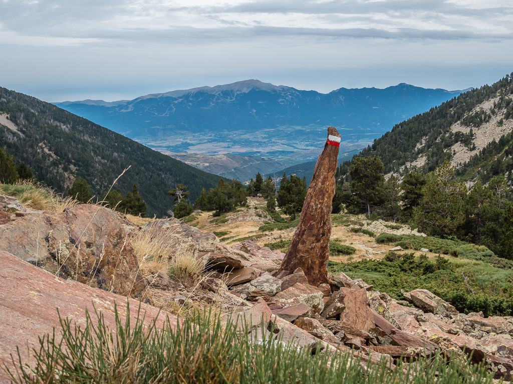
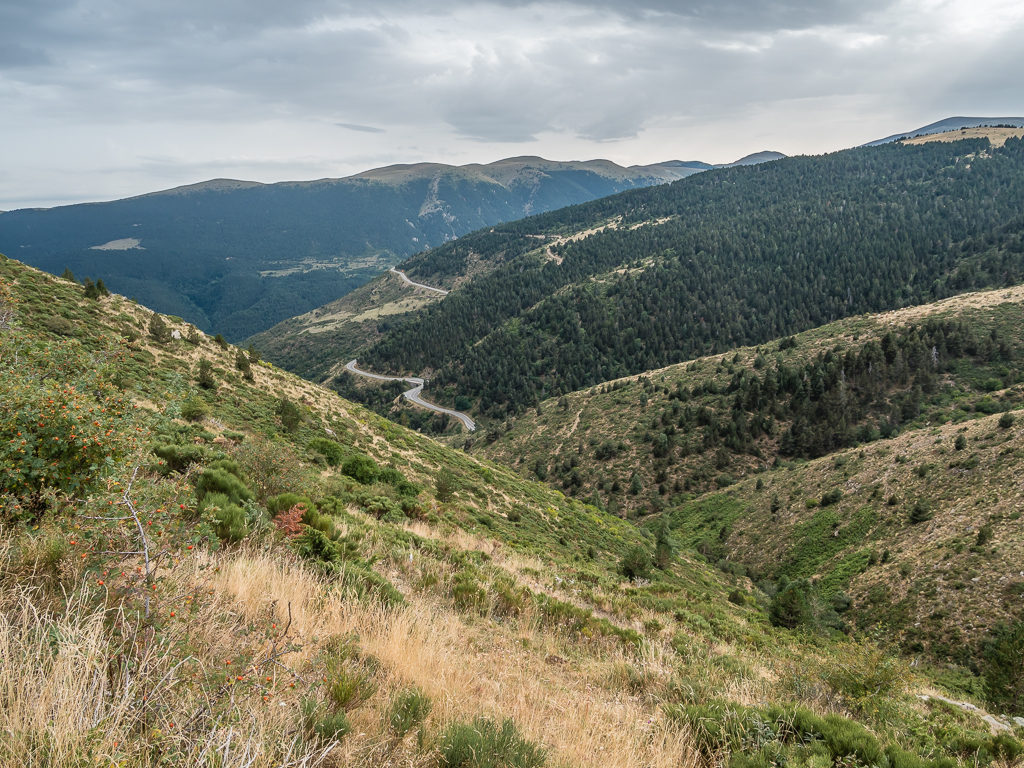
A conveniently placed red and white marker just in case we weren’t sure whether we had taken the correct route! Looking towards La Cerdanya – known as ‘The Great Valley of the Pyrenees’.
Looking back towards the mighty Puigpedrós as we continue on the long, steep descent to Refuge Malniu.
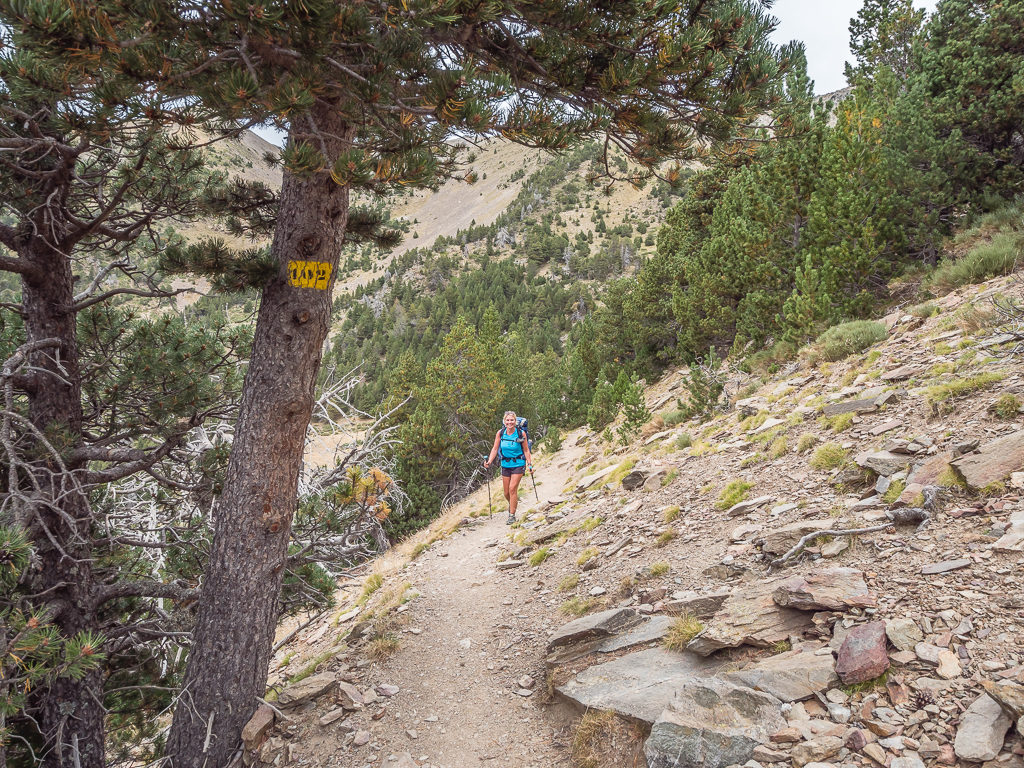
The GR11 follows the same route as the local 102 path, indicated with yellow markings such as on this tree.
Reaching the refuge around 4pm, we took the opportunity to stop and purchase cold drinks with it being a 54-bed manned refuge with full services. This was technically the end of ‘Stage 34’ of the GR11, but we were going to push on today and start ‘Stage 35’ as it was classed as an ‘easy’ downhill section reaching the high plateau around the town of Puigcerda – the capital La Cerdanya in the Catalan Pyrenees.
Leaving the refuge a short while later, we found some of the waymarks a little confusing, but managed to stay on the right track using GPS and Wayne’s map app on his phone. We had a short climb to a gentle ridge before arriving at an expansive grassy area where we then walked along a dirt road for a few kilometres. Unfortunately for us, we had unwittingly walked in the wrong direction and ended up having to crawl under an electric fence that was in place to restrict the roaming of some wild horses – it always seems to happen to us!
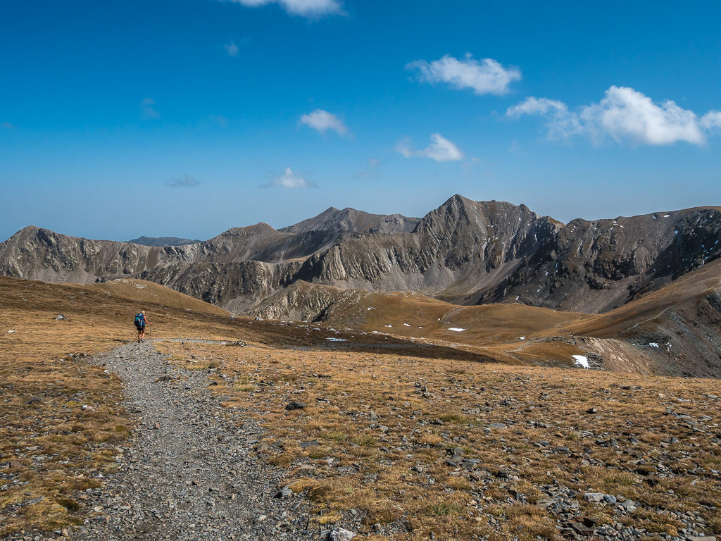
Topping up our water supplies from the water point just beyond the Refugi de la Feixa as it meant we didn’t have to filter, we then continued walking over a large grassy plateau to the eastern top of Roc Roig at 2,170 metres. From the top we could see the large town of Puigcerda spread out to the east as well as some other smaller settlements nestled along the hillsides.
This road walk section gave us the chance to make easy work of a few kilometres.
Pausing at the Refugi de la Feixa to pick up water, which was rather convenient as we were planning on a dry camp that evening. The water point was actually about 100 metres beyond the refuge, but it meant that we didn’t have to filter the water.
Looking out towards La Cerdanya, a flat-bottomed depression which spans both France and Spain.
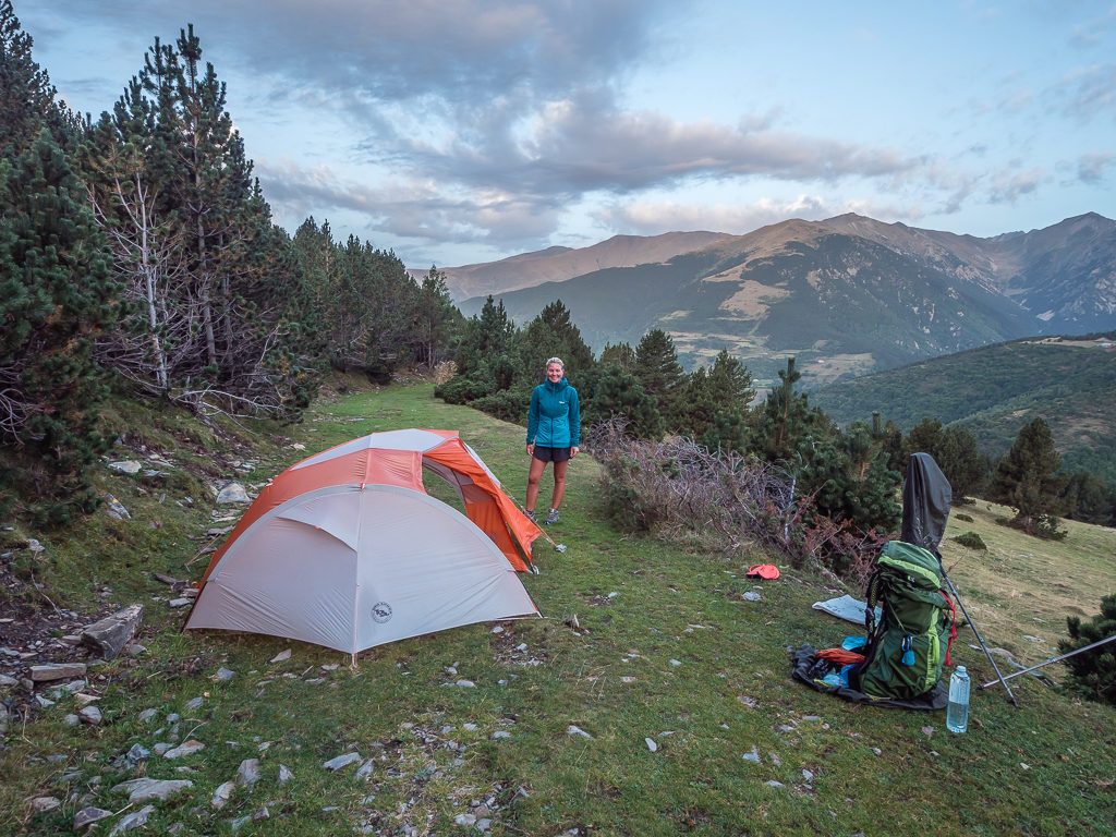
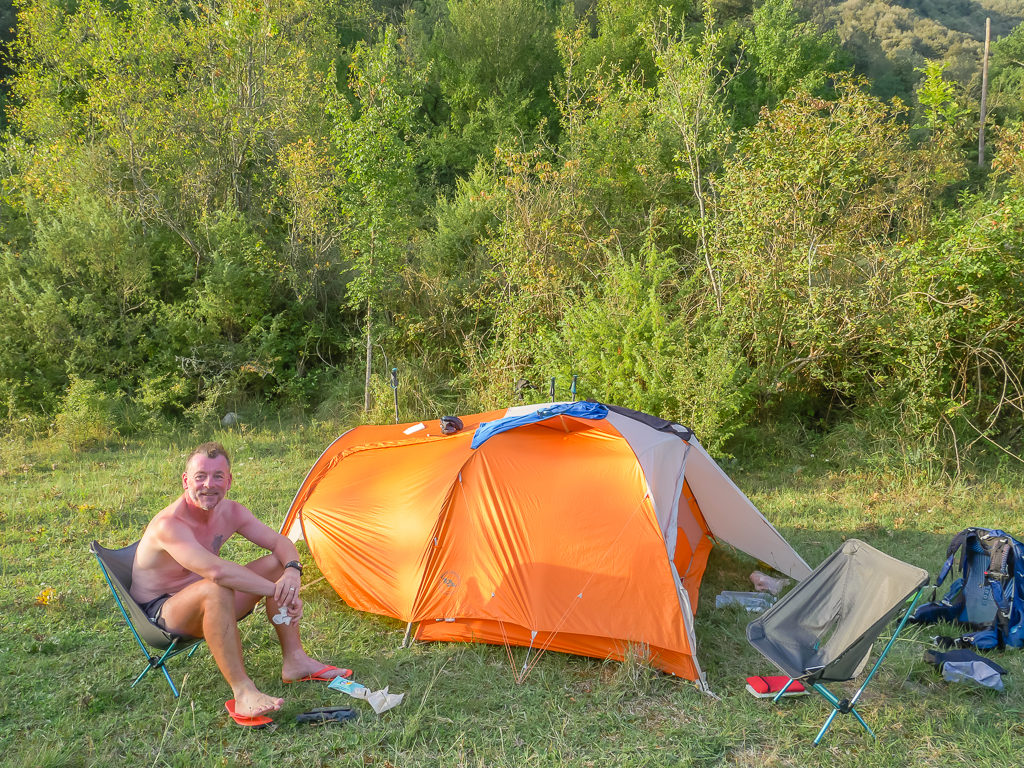
Starting downhill on an easy track, we were looking for a wild camp spot above the town on one of the flat areas outside of the woods before the descent took us into pasture and too near civilisation. At last, we came to a great location overlooking the far reaching valley below and as it was around 6pm, we decided to stop and set up camp as we thought that we’d done enough kilometres for today!
Hoping to find a flat patch of grass just out of the woods where we could pitch up for the night in readiness for resupplying in the town of Puigcerda the following morning.
At last we spied a suitable grassy spot behind the cover of a small rocky bluff that would keep us out of view from anyone across the valley who happened to be looking up the hillside in our direction. As we could see the cloud building towards the west, we were hoping for a colourful sunset, but apart from a lovely pink-orange glow, nothing more dramatic materialised. As it grew darker however, our attention was drawn to the twinkling lights on the surrounding hillsides coming from the numerous settlements either side of the valley. It was both calming and mesmerising to look at them in the still of the night. Having already descended a few hundred metres, it also felt like a much warmer night compared with the last few days.
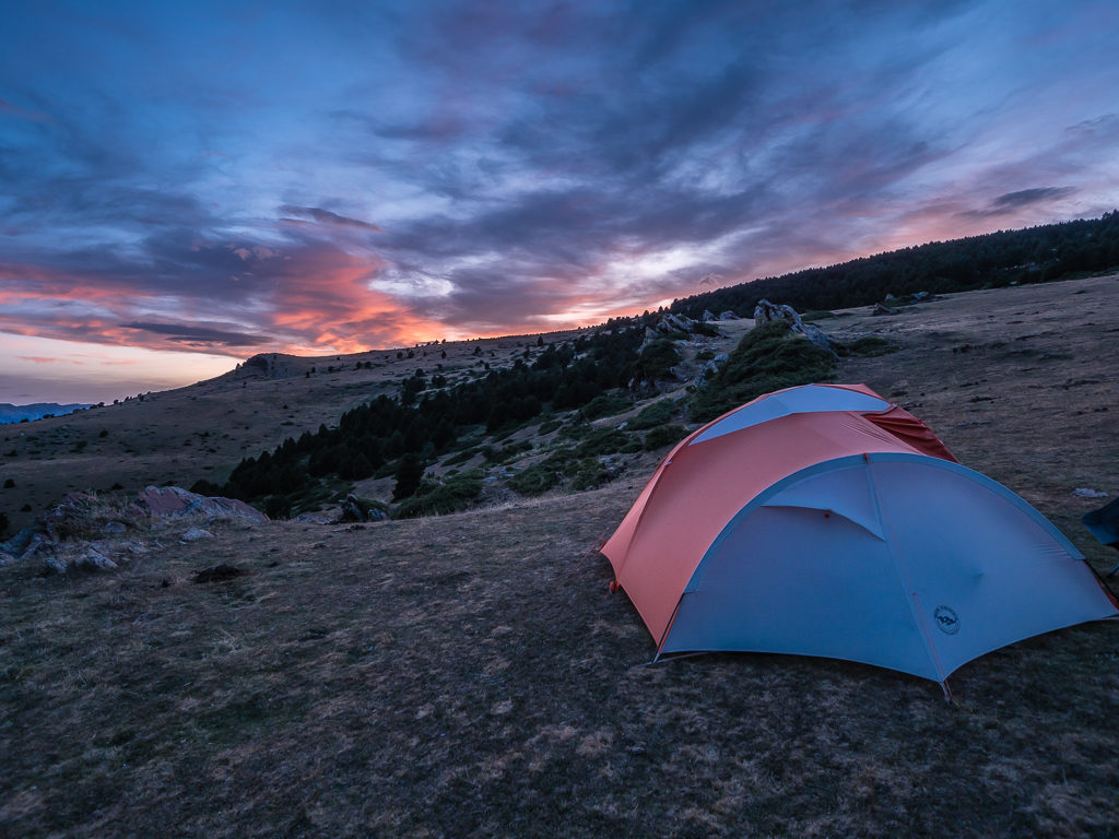
Wild camping above the town of Puigcerda. It was a serene end to what had been a particularly good day and beautiful section of trail.
Day 44 – ‘Burdensome Bushwhack!’ Saturday 14th September, 2019, Wild Camp on grassy plateau above Puigcerda town to Camping Can Fosses, GR11, GR4, GR11, 31km
We knew we had a long day ahead of us again today as we had decided to double up some more stages of the GR11 to keep us on track for our desired end date. So instead of a cooked breakfast, which adds on at least an extra half hour to our morning routine, we had a breakfast bar snack on the go whilst packing up to save us some time. Having eaten just a bowl of noodles and a fried egg for dinner last night and us now getting bored of some of our staples, we said we would treat ourselves to a meal at the bar-restaurant this evening as we would be staying in a proper campsite. The thought of a big plate of freshly cooked food is always a good motivating factor to spur us on throughout the day!
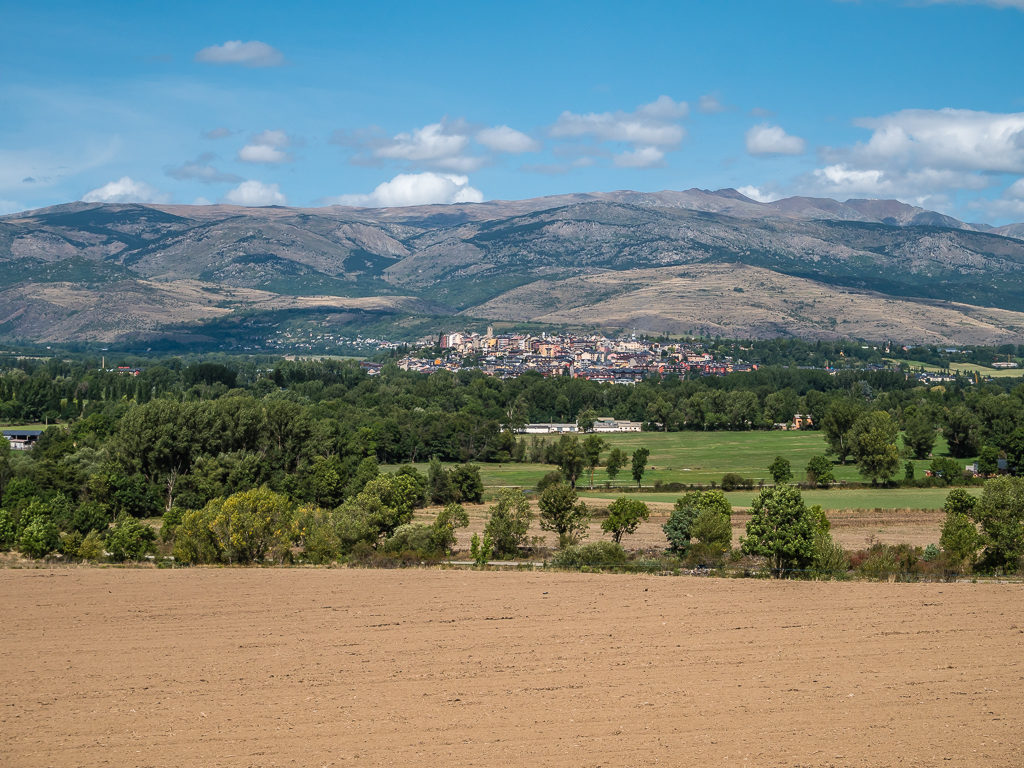
Setting off from camp before 9am and rejoining the track, we could see the larger town of Puigcerda directly across the valley on the hillside and worked out that we had around an hour and a half of walking, largely on road, to get there. As the town is well-serviced we wanted to make it our main resupply stop, then head back out and complete another of the GR stages taking us to Camping Can Fosses near Planoles, 25 kilometres away. With the high alpine mountains now behind us, it seemed a feasible plan as we would be traversing the gentler mountains that now formed the border between France and Spain. If all went to plan, we estimated that we’d be able to get to camp around 6:30pm, which would give us enough time to get some proper laundry done before dinner as we were now in desperate need of a washer and drying machine. (Rinsing things out at camp or in the hotel bathroom only lasts us so long before we feel that we’re starting to smell like ‘Hiker Trash’!)
So we began with a fast pace, the route taking us on good track downhill past several farming fields and a beautifully maintained settlement called Guils de Cerdanya, then out onto the main road. It was then basically a 5 kilometre road walk into Puigcerda, which in theory should have been simple. – Except that we turned off the main road onto a side road following the white and red markers, but then when we came to a signpost, realised we would be going a few extra kilometres out of the way to town, so we decided to back-track as the road would be more direct. With approximately 30 kilometres to cover overall, we didn’t want to add on any extra distance that would also cost us more time! (Which this already had!)
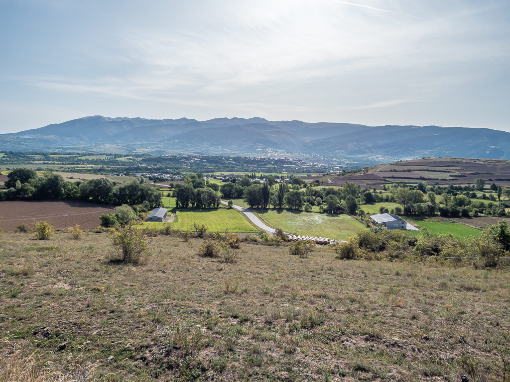
Known as the ‘Great Valley of the Pyrenees’, the vast plain of La Cerdanya is surrounded by towering mountains. It is a diverse and beautiful landscape that showcases both pure Mediterranean traits as well as alpine meadows of high altitude.
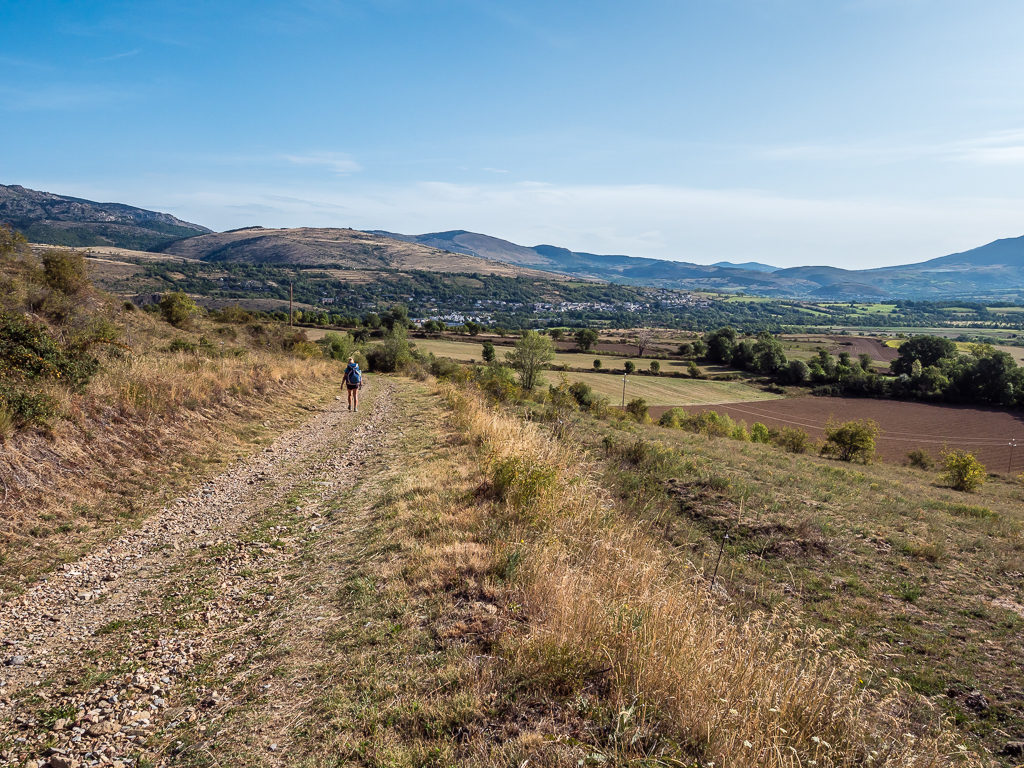
As the route to town was on farm track then road, we hit he trail at a fast pace anticipating that we’d reach Puigcerda in good time to resupply and double up GR stages again.
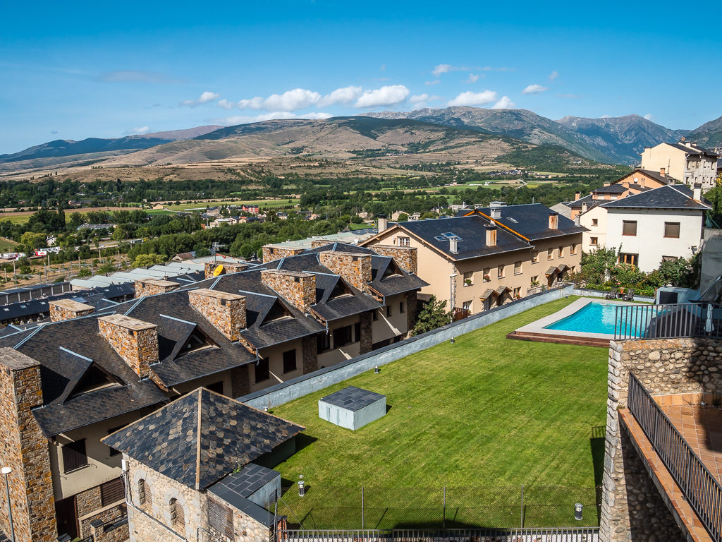
As we reached the train station on the outskirts of town, we then followed a sign indicating ‘Centro Ville‘ – town centre – only to find that all the main facilities were actually on the top of the hill above us. Looking with disdain at the hundred or so steps going uphill now right in front of us, we hadn’t noticed the funicular running up and down the hillside beside them which quickly put a smile on our faces! Taking it to the top, free of charge, it was a huge relief not to have to expend the extra energy when we hadn’t even started today’s proper GR section yet.
Heading uphill to the town centre on the funicular and looking back to the hills on which we had camped last night.
In town, which seemed rather upmarket and had the widest range of shops we’d seen the entire trip, we stumbled upon an Aroski supermarket, the brand we had resupplied at during our stay in Benasque, so we knew we’d be able to stock up well with all of our favourite staples without any problems. 37 Euros later and we were sat on a picnic bench in the main square eating pastries for a late breakfast/ early lunch whilst removing packaging and bagging up food supplies for the next 3 days.
Unfortunately as with all resupply chores, it takes longer than anticipated, so we didn’t end up leaving town until 12:30pm. Racing back to the funicular, we descended down the hillside and departed Puigcerda following the white and red GR11 markers south out of town. Or that’s what we thought…
That’s when we made our second route mistake of the day! We had actually followed the white and red markers taking us on the GR4 towards Quexians, instead of heading southwest towards the village of Age. Thankfully, after checking the map again we realised that we could recover some time by taking the road to Vilallobent where we were then able to rejoin the GR11 from there.
Walking past arable farmland on our road walk to Vilallobent.
From the plains of La Cerdanya, looking back to the Spanish capital Puigcerda, the town we had visited earlier to resupply.
From Vilallobent we followed a rough track, obstructed in places by overgrown vegetation, uphill towards Coll Marcer and Border Stone 500 (it had been a long time since we’d passed a border stone), where we took off our packs and sat atop the large, flat, grassy plateau looking out to the surrounding wooded hills. Enjoying a snack break, we then got out our map and checked the rest of the route. With the couple of detours, we now thought it would be more likely that we’d have a 7:30pm finish, which was still fine in the grand scheme of things. It’s not like we’d be walking into the dark and having to night hike like on the PCT to make our miles. We were later to find out that was another error of judgement however!
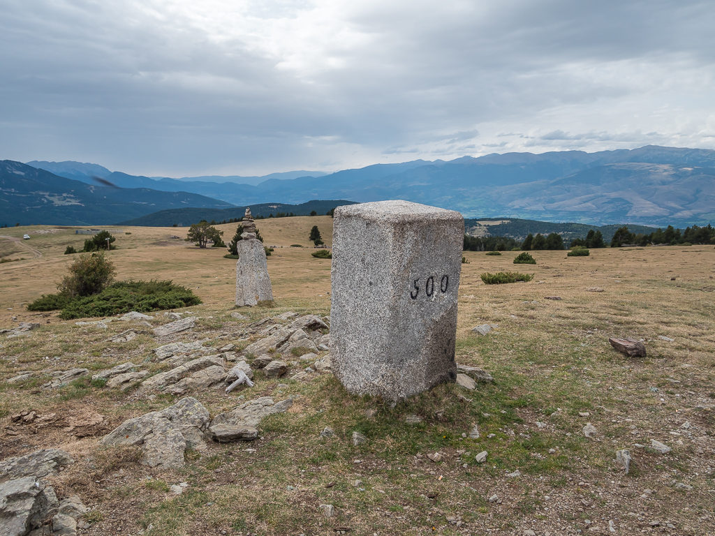
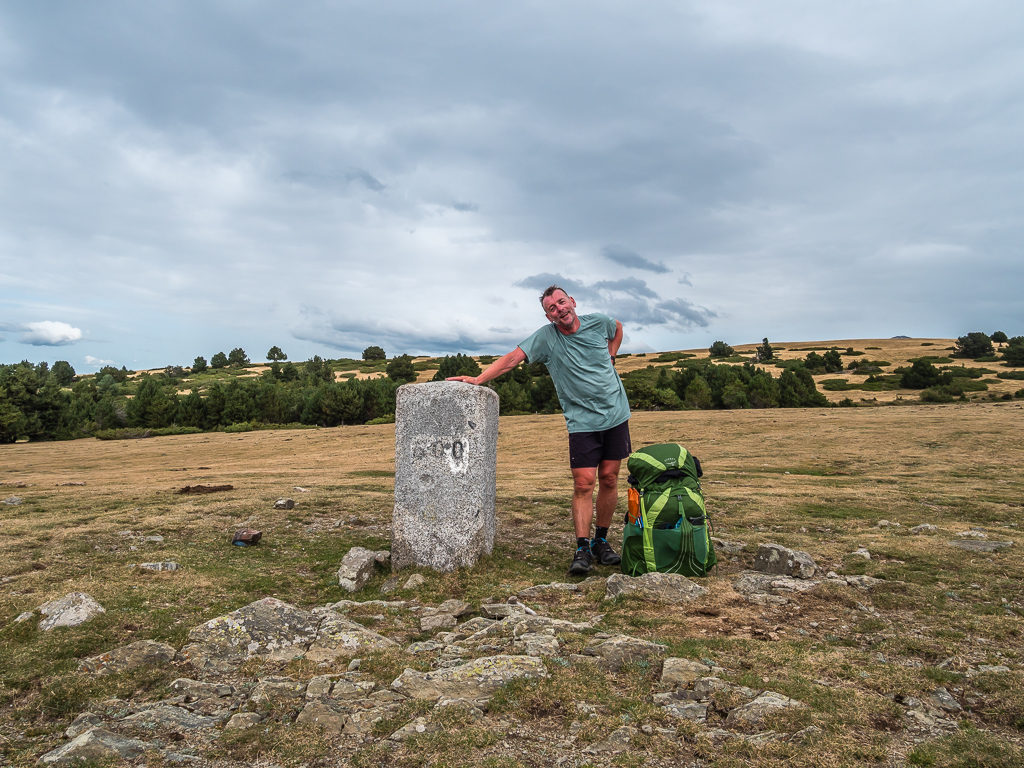
Reaching Border Stone 500!
Happy to take off our packs and take a break on Coll Marcer after a steady climb taking us back up to 1,980 metres.
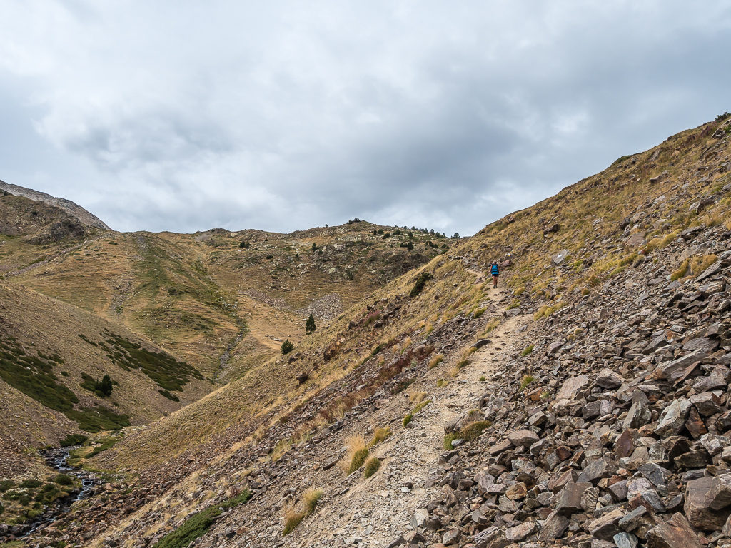
Continuing on from the plateau, we passed more border stones before reaching 2,000 metres and a grassy ridge leading to the Coll de la Creu de Meians, which was being occupied by a large group of wild horses. From here on in, we then found ourselves contouring around a series of wooded mountains, the trail weaving in and out of dense woodland. Heading down a boggy gully, it suddenly became very difficult to follow the correct route due to poor and insufficient waymarking, which we found highly unusual based on our experiences of the trail as a whole. Navigation was also hampered by the fact the path had become so overgrown in places it was problematic to see, so at times we were having to bushwhack through thick scrub, resulting in scratched legs and arms and a ripped wind jacket for Wayne, which unfortunately got snagged on some thorns.
Using GPS on our phone, it indicated that we were definitely on the right path – but it just felt wrong. The GR11 is a well-walked route so we shouldn’t have been facing that much difficulty. Hence, after looking around and forcing our way through the undergrowth, we spied a proper gravelled track just a few feet above us, which we fought our way uphill to join. It seemed that the path we had taken had been contouring just below this main track, and was now little used as it was much easier to stick to the track than bushwhack your way through on this lesser used part of the GR11. Again, we had lost yet more time as it had been very slow going on this section making us feel all the more frustrated.
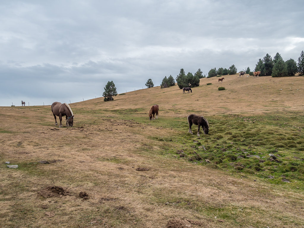
Wild horses grazing on the grassy ridge leading to the Coll de la Creu de Meians.
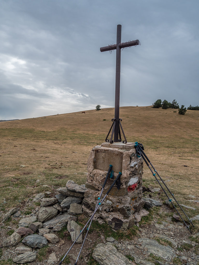
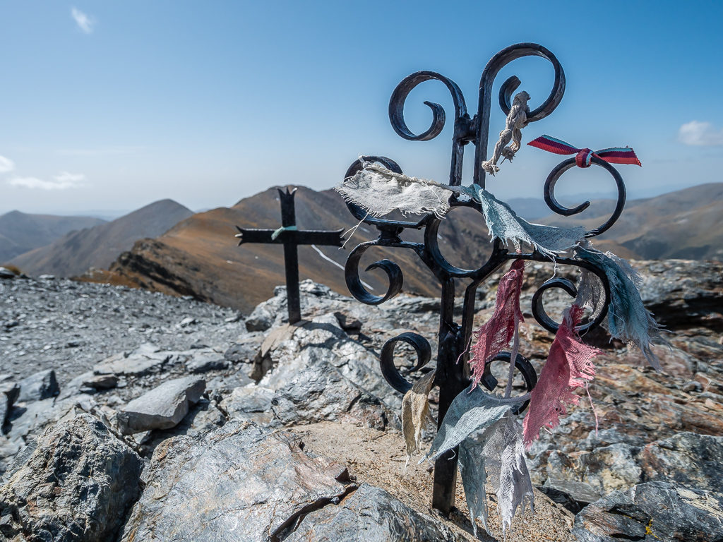
At 1,993 metres, the Coll de la Creu de Meians, marked by a memorial iron cross.
What seemed like several hours later, we were thankful to have finally reached the settlement of Doria and were even more relieved when we began descending from the village along switchbacks on good track to see a sign with camping stating ‘1 hour’. Having re-evaluated our end time again, we were now expecting to reach Camping Can Fosses around 8pm. As sunset was now just before 8:30pm, that was the latest time we really wanted to get there. Already our eyes felt heavy and our legs were tiring after powering on for most of the day – but we were firmly of the mindset that the more we do today, the better it would set us up for the remaining 10 days of hiking.
Again in our haste to reach the campsite before dark, we made another wrong turn. This one we put down to extremely poor waymarking and it was clear that several people had done similar as the incorrect route was so well-trodden. In fact, we had even attempted the incorrect path 3 times because we couldn’t find the ‘actual’ route. The first time clambering over a wire fence that had already been trodden down, we thought it to be highly unusual that there wasn’t a gate or access through. But we still tried again!
Scrambling up a steep sided ridge between trees and brambles, we then decided to turn back as again it didn’t feel right. We looked for an alternate way down to the stream to cross it, but the route was blocked with large boulders and bushes that we just couldn’t penetrate. Returning back to the last known marker, we tried again. This time we tried to stay high and traverse around the ridge at a higher point. There were footprints in the muddy path as we made our way up the steep bank, so we thought we must be on the right path this time – but yet again we came to a point where the thick, prickly vegetation was impenetrable.
Tracking back once more, we checked the description in our guidebook for help. Each attempt we had made, we had crossed over the steam onto the worn track before reaching the ridge that we couldn’t pass. Going back to the stream, we realised now that there was a narrow path following the stream downhill which was our actual route, and the mistake we’d made had been crossing the stream in the first place! There had been both a red and white cross and a yellow cross marked on rocks where the stream flowed down the hillside. We had wrongly assumed that these meant the trail didn’t go downhill, when in fact they were to indicate not to cross the stream. We had completely missed the path going downhill from the stream as we had come to the stream from the left and just followed the contour of the path going around the ridge, automatically crossing over the stream on the continuation of the path. Annoyed at ourselves for not spotting it sooner and also for losing at least another 20 minutes of time, we then just pushed on as fast as we could.
When we spied the road winding around the hills we knew that at last we were getting close to the settlement of Doria.
Phew! The campsite was just one hour away – or so we thought…
Discussing it afterwards, we both agreed that the downhill path should have had a white and red turn right flash painted beforehand to signal a change in direction, as had usually been the case with the GR waymarking. What few paint flashes we had seen in this section were in dire need of a re-paint as they were now so faint and worn away. Similarly, some proper maintenance was needed to clear the trail of obstructions including downed trees blocking the way and lots of thick, overgrown scrub obscuring the path.
With the path still weaving across a wooded mountainside, to make matters worse we were now quickly losing the little light that was left. Adjusting our eyes to the increasing darkness we had to concentrate on our footing as the track we were on was littered with rocks and cow pats. We were also conscious that an electric fence ran alongside the trail on the right-hand side, which at times on the narrowest parts of the ridge was a little too close for comfort. We were thoroughly exhausted and in the mindset that we just wanted to get there. Today, most definitely didn’t feel like a holiday! It was like being back on the PCT all over again.
Just when we were losing the will to live, we came upon another sign that we could only just make out in the last sliver of light stating ‘Campsite 5 minutes’. That was enough to give us a final spring in our step and get us to Camping Can Fosses. Arriving around 8:45pm, we were hoping to get checked in quickly and then get a meal at the bar-restaurant. It’s what had been keeping us going for the last few hours as we were now feeling famished. We were thoroughly disappointed however to find that the restaurant was more of a cafeteria, and that there wasn’t any food being served tonight.
So it was back to the cook-pot and a homemade meal of pasta and pesto followed by a much-needed hot shower. We had arrived too late to use the washing machine but thankfully we were told that we could do laundry from 9am the following morning. So we’d have a late start if we wanted to use the washer and dryer, but that was a priority as we were desperate for clean gear.
Overall, we were just glad to have arrived and to have got a pitch, with quite possibly the hardest day on the trail now done. (The term ‘pitch’ should be used lightly here as for €19, we weren’t given a proper pitch, just a piece of grass opposite the bar-restaurant, which is usually used for parking!) But after such a demanding day, we were just glad to have finally reached the campsite! After today’s mishaps and everything taking much longer than anticipated, we both agreed that we won’t be doubling up any more of the GR11 stages again!
Day 45 – ‘Time Saving Treat’ Sunday 15th September, 2019, Camping Can Fosses to Nuria, GR11, GR11.8, 16km
After a restful night’s sleep due to sheer exhaustion, we were up, showered and dressed early in readiness to sort out our laundry as soon as the campground host opened everything up at 9am. We just wanted to do a quick 30 minute wash then a tumble dry, so we expected to leave the campsite by 10:30am at the latest. Unfortunately, as the tumble dryer was small it was taking forever to dry our gear, so we didn’t actually get away until midday.
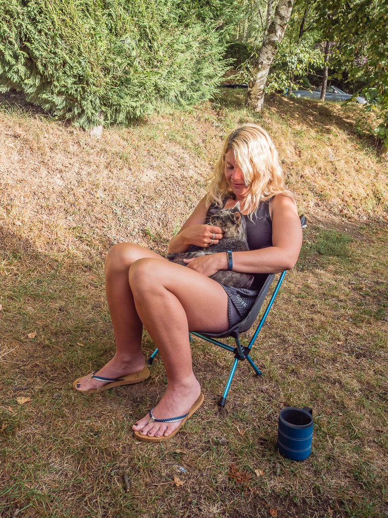
Finding myself a little friend in the morning. The resident cat just jumped on my lap for a fuss!
With such a late start, we knew that we’d be hard-pushed once again to get to camp at a reasonable hour so we had resigned ourselves to another late finish. We were still in good spirits however as today we would be hiking through the Gorges de Nuria – considered to be a spectacular stage on the GR11. With ‘spectacularity’ however, read ‘extremely popular’, so our one reservation was that we expected to be accompanied by hundreds of other tourists on the trail, especially with today being a Sunday – the busiest day of the week.
With fresh legs, we made short work of the steep ascent after leaving the campsite, the track taking us uphill into some pleasant woodland where there were already several day walkers ahead of us. We realised why there were so many people around as soon as we came to a tarmac road leading to a carpark and picnic site at the Collet de les Barraques. Now at 1,890 metres, from the top of the col we could see several trails going off in different directions leading to various summits around the valley. Taking notice of a signpost, we came to realise that there are in fact two different routes to Nuria with two very different walking times given.
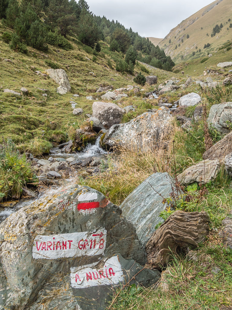
Having anticipated this section of trail to take us around 6 and a half hours in total to reach Nuria, we decided to use this new information to our great advantage. From the pass, the GR11 route to Nuria through the gorge goes via the town of Queralbs and would take us 4 and a half hours. The GR11.8 variant route following the high route above the gorge, would however only take 2 and a half hours. 4.5 hours versus 2.5 hours – we immediately opted on taking the variant route to save us some time. It was also a more appealing route as we’d be sharing the path with much fewer people.
After leaving the campsite, we returned to the GR11 junction in Planoles and set off for the Collet de les Barraques. From 1,260 metres, we had a steep climb of around 600 metres to reach the pass.
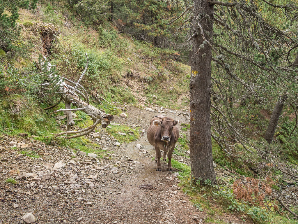
Another unforeseen obstruction on the trail. We weren’t having much luck with Pyrenean cows this week – she really did not want to move!
Opting to take the GR11.8 variant route to Nuria, which was already looking to be a good choice.
The alternate route was taking us back into the high mountains, but the rocky, rugged terrain we had got used to had now been replaced with rolling green fells.
The alternate GR11.8 path crossed a stream, then climbed initially through woodland before opening out and contouring around the huge slopes of Puigmal. We didn’t find it too taxing however as we were on fairly level ground, the best of it being the tremendous views we now had looking out to the surrounding peaks that were all nearing 3,000 metres. Reaching such a picturesque spot, we decided to stop for lunch near the Collada de Fontalba to enjoy the 360° view where we also had a brief glimpse of a deer bounding along on the grassy hillside opposite.
Much too fast for us to capture on camera, we saw a deer bounding along this grassy hillside.
Reaching 2,070 metres on the Collada de Fontalba where we decided to enjoy a particularly picturesque lunch stop surrounded by several 3,000 metre peaks.
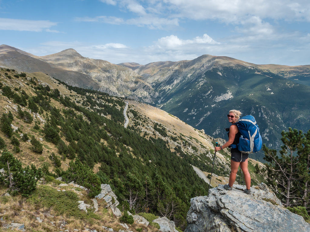
With wonderful 360° views, we were impressed with what the GR11.8 variant route had to offer and didn’t regret our decision not to hike through the gorge.
Continuing along the grassy trail, at certain times we could see the train running up and down the gorge from our vantage point. The closer we got to Nuria, the more day walkers we passed coming from the opposite direction who were completing a circular walk back to the parking area. From information given in our guidebook, we discovered that the Sanctuari de Nuria is actually a holiday complex with hotel, restaurant and basic campground that is both a ski resort in winter and a major tourist attraction in summer. It was also in Nuria that the first Catalan Statute on Autonomy was drafted in 1931, making Nuria and the surrounding mountains a popular destination for Catalans on their National Day – 11th September. Luckily, we had missed it by 4 days!
Taking the high route around the mountains to Nuria and enjoying the grassy trail.
Having thought just yesterday that we were now out of the high mountains, we were pleased to be treated once again to such splendid scenery.
La Vall de Núria has no road access. The trail winds around the mountainside before making a gradual descent to the valley, where apart from footpaths, the only other access is via a rack railway that opened in 1931. (The building on the opposite side of the valley is one of the ski lodges used in winter.)
After a thoroughly pleasant walk taking us high above the valley, which afforded us some magnificent mountain views that we had not expected, we reached the giant complex just before 5pm. We were feeling rather joyous at the prospect of a proper bar-restaurant and a hearty evening meal after last night’s disappointment. However our excitement was short-lived when we soon found out that both the bar and shop were now closed and the restaurant wasn’t opening until 8pm. Wandering around the complex, we quickly realised we were not the usual clientele as it appeared very upmarket, hence it was doubtful we’d be allowed in the restaurant as we didn’t have the appropriate clothing nor shoes for a ‘posh’ sit-down meal. So once again, we just had to make do with another bowl of noodles and a fried egg instead.
After paying €8 per person to camp onsite, we found the specific hiker camp area to the back of the main building complex located beside the river. Pitches were terraced and covered in gravel, so we wouldn’t be camping on the comfy grass we had been getting used to, but each site did have its own picnic bench which was a real bonus. There were toilets, pot-wash sinks and two cold water showers also nearby, plus some vending machines where we could buy chocolate and cold drinks. By the time we’d pitched the tent, the sun was already off the valley but we were more than happy as we had made it to camp two hours earlier than yesterday’s finish! It seemed our impromptu decision to take the variant route had proved very advantageous in more ways than one.
Day 46 – ‘Bisteck And Frites!’ Monday 16th September, 2019, Nuria to Wild Camp below Col Liens, GR11, 22km
Today was one of mixed emotions. We were excited to be nearing the foothills, which meant we were getting closer to the Mediterranean coast with each passing step. Yet we were also feeling sad to be leaving behind the high alpine environment and tremendous landscapes that we love so much. Today we would be reaching the highest point throughout our Pyrenean route, but also our last ridge walk, which made it kind of bittersweet.
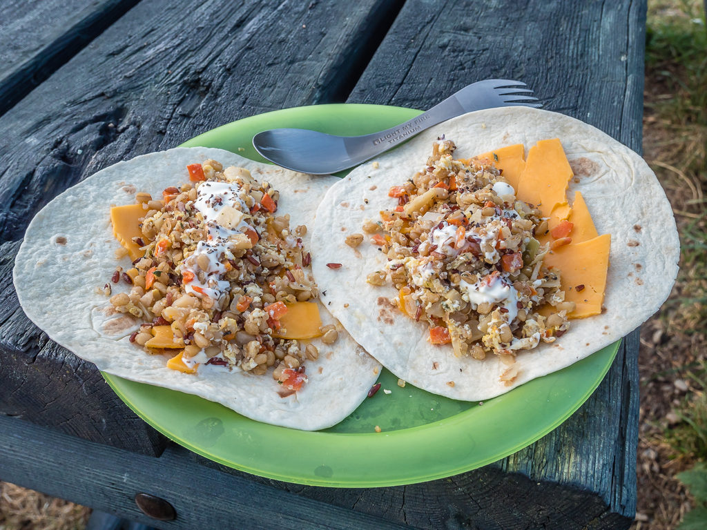
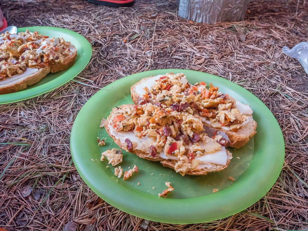
Filling up on hearty breakfast wraps filled with cheese and mixed grains, with a squeeze of mayonnaise.
Having managed to purchase a fresh baguette for lunch from the tourist souvenir shop inside the main complex, we were then on our way, leaving Nuria around 10am. With a long descent ahead of us totalling 1,800 metres today, we were appreciative that our guidebook considered this section of the GR11 to be ‘easy with good waymarking’, which is just what we wanted to hear after the unexpected hard slog we encountered a couple of days ago.
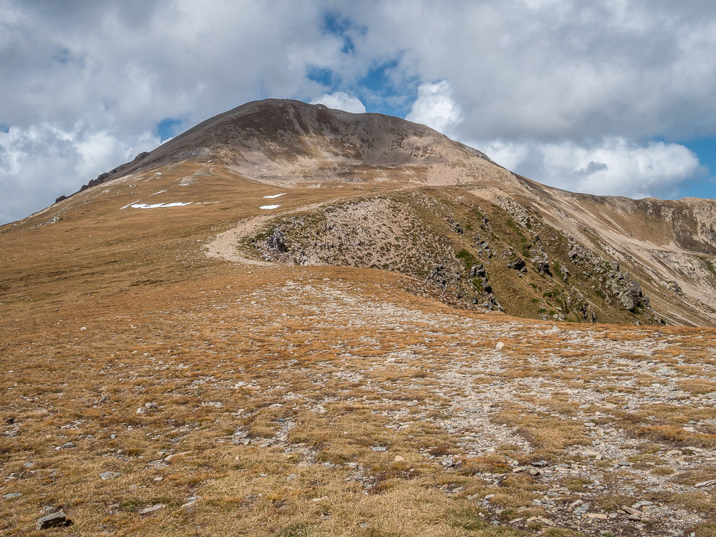
From the railway station at the Nuria complex, we climbed up a bank following the GR11 signed to ‘Nou Creus‘ taking us through woods above a stream. Once out of the woods, the path then weaved steadily up through the valley above the Torrent de Noucreus affording us fantastic views of the peaks lining either side of the river. The final climb to the Coll de Noucreus at 2,785 metres, although looking steep and severe from afar across a giant slope of scree, was much better than we expected as the path was well-trodden and followed two long switchbacks taking us up steadily to the col.
It was another beautiful day for a walk! Leaving Nuria behind and heading up the grassy valley following the course of the Torrent de Noucreus.

Continuing uphill where the path will eventually take us to the Coma de Noucreus. (This is one of those false summit moments as the ‘v’ on the skyline is far from the top of the pass!)
With a good, solid trail underfoot, we found we were making good time.
Pushing on towards the head of the valley known as the Coma de Noucreus.
From just below the col we had wonderful, clear views looking back to Puigmal, the imposing 2,910 metre peak to the west of Nuria that we had hiked around yesterday.
At the head of the valley, the trail now ascends fine-grained scree slopes via long, gentle switchbacks.
Following the switchbacks along the ridge towards the pass.
The final climb to the Coll de Noucreus at 2,785 metres.
On top of the col are nine crosses said to commemorate nine monks who died there when they were caught in a storm.
After taking a drink and snack break on the col, we then descended east to the Coll de Carança (2,730m) where we passed a group of five guys from Denmark who were also taking a break. Their rest break was rather more exciting than ours however as they were swigging tots of brandy and singing some local folk songs – a ritual they said they did twice a day, every day during their hike. They were fully prepared with song sheets and a big bottle of the hard stuff! It looked like a great example of male bonding – how far they’d actually be able to walk afterwards, who knows?!
With today’s clear skies, we had far-reaching views of the mountaintops, including some over the border in France.
With a few patches of snow lingering in the valleys on the other side of the pass, we were glad to be tackling the upcoming ridge walk in such fine weather.
From the Coll de Noucreus, the GR11 path follows the border ridge between several summits that are over 2,800 metres.
Making our way to the Pic de la Fossa del Gegant (2,808m), thoroughly impressed with today’s epic scenery.
Snaking its way across the ridge, the path was well-worn and easy to follow.
Reaching new heights this summer!
In the foreground the summit post on Pic de la Fossa del Gegant at 2,808 metres, with the trail running up the ridge from Coll de Carança to the Pic Superior de la Vaca behind.
Rugged mountain views looking to the summit of Pic Superior de la Vaca (2,824m).
Next we had another excellent ridge walk, steadily climbing uphill to pass south of the summit of Pic Superior de la Vaca (2,824m) before then reaching the Collado de Tirapits on its southeast ridge. Unlike the photo in our guidebook, which showed several large groups of people sat on the col, today we were the only ones here. So of course we had to make the most of being alone on the trail and take advantage of the great photographic opportunity it presented.
Having Skirted the Pic Superior de la Vaca at 2,824 metres, we make our way slightly downhill to the Collado de Tirapits.
Looking down from the Coll de la Vaca to the Estanys de Carança. The closest is the Estany Blau or ‘Blue Pond’.
On the left, the Pic L’Infern pierces the skyline as we make our way to the Collado de Tirapits.
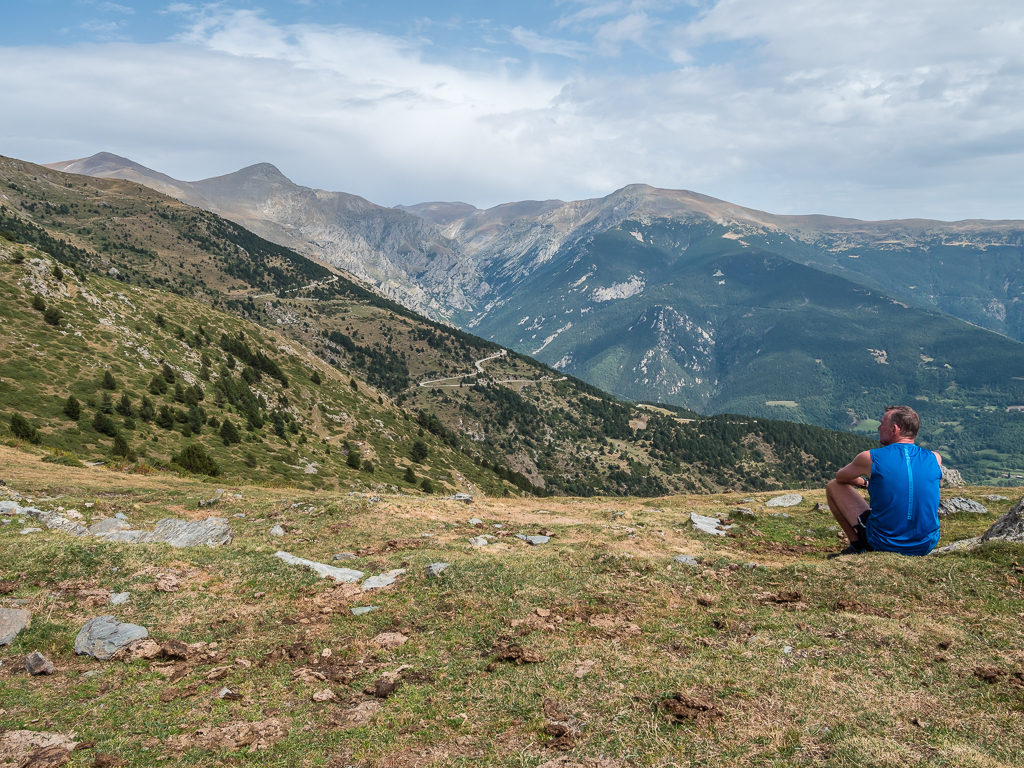
With far-reaching views along the valley looking northwest to the peak of Bastiments at 2,881 metres, we decided to stop, take off our packs and sit on a rocky outcrop just below the col to take it all in. What better place to also sit and enjoy a picnic lunch seeing as we had it all to ourselves! Having saved a packet of tuna bought from the grocery store in Ordino back in Andorra (the only shop we have found to sell packet tuna throughout this trip up to now), we made fresh baguettes filled with tuna mayonnaise, onion, tomato and black pepper. Then whilst indulging in one of the best trail lunches we’ve had so far on this thru-hike, we also savoured the incredible panoramic view!
From left to right, looking out from the Collado de Tirapits to the Pic de L’Infern, Pic dels Gorgs, Pic de Freser and Bastiments with the trail winding down the valley below.
To put it simply, there was no better spot to sit and have a picnic lunch!
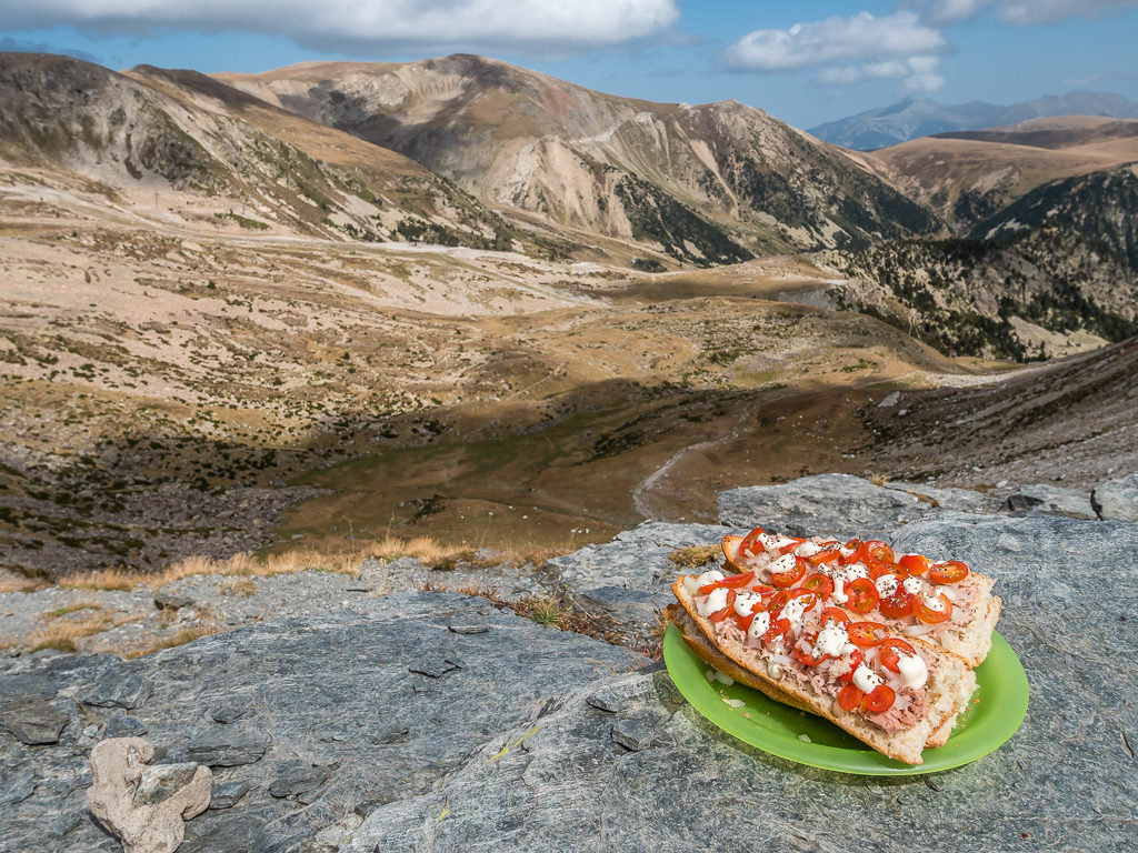
A particularly enjoyable trail lunch with a view!
Surely days in life don’t get any better than this!
Descending from the col, we passed a small emergency shelter before striding out along a level path that followed the Torrent de les Barranques to a large, flat area. The river was currently dry, as we had expected, but we knew that we’d be able to top up our water supplies at the refuge so this wasn’t a problem. Having descended a few hundred metres, we then had a gentle climb to the Coll de le Marrana at 2,520 metres, before an easy descent on switchbacks taking us to the manned Refugi d’Ulldeter (2,220m) where there were several hikers sat outside enjoying drinks in the sunshine.
Quickly pausing to top up our water supplies, we the descended past the refuge and continued on in order to reach the small village of Setcases where we wanted to pick up some more food rations. The GR11 shortcuts the switchbacks on the road leading up to the ski area, so we followed the proper route at first, but when it took us down to the river and the path became a stony track where we had to concentrate on our footing traversing over rocks and roots, we quickly made our way back up a muddy verge to rejoin the road where we could maintain a brisk, consistent pace to town.
Reaching the Collado de la Marrana (2,524m) before descending to the Refugi d’Ulldeter.
We made just a quick water stop at the refuge before pushing on as we wanted to get to the town of Setcases to pick up some more food rations.
Leaving the refuge, the path was once again well-marked and easy to follow.
After today’s ascents and descents, Nuria already seemed such a long time ago!
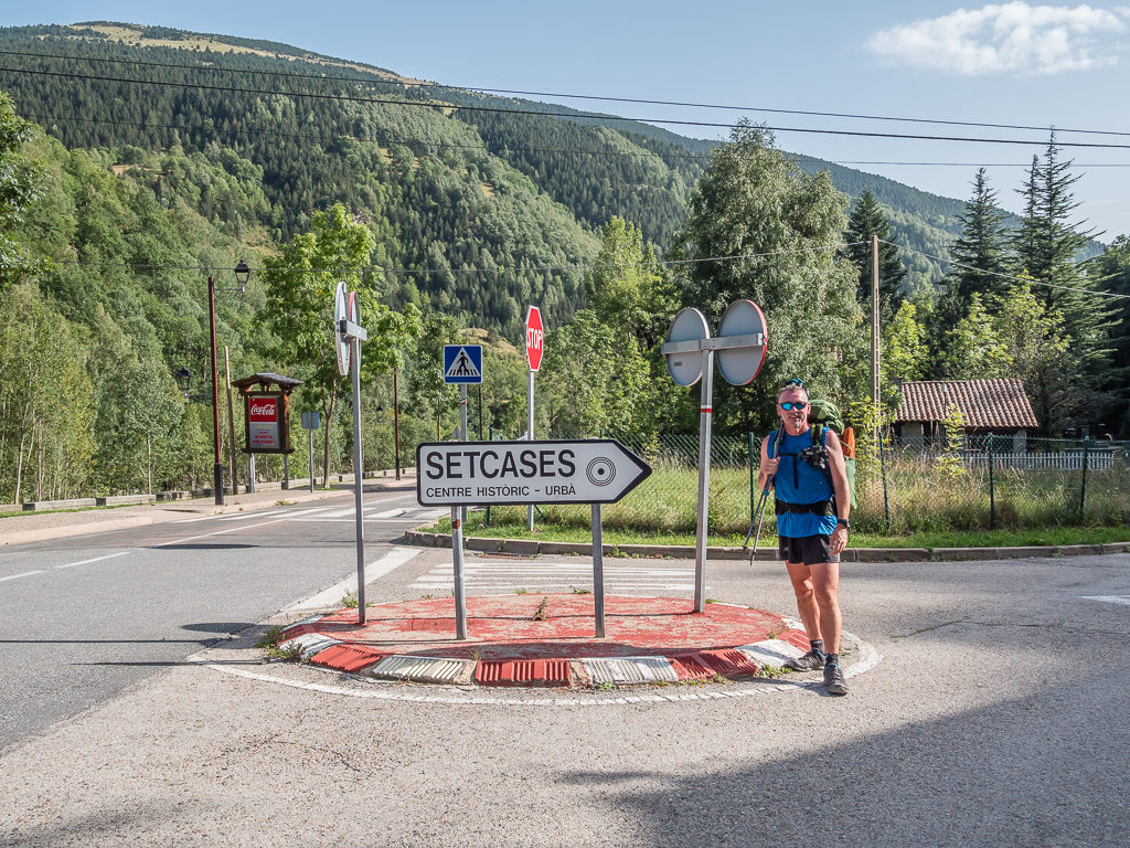
Reaching the Spanish settlement of Setcases (meaning ‘seven houses’). With a main street of bar-restaurants and guesthouses, the village is somewhat larger than its name would imply.
Reaching the mountain village of Setcases around 5pm, our plan was to resupply at the small local shop, have dinner at one of the bar-restaurants, then rejoin the trail and hike out for at least 40 minutes as there wasn’t any camping facilities in the village. We knew that the first opportunity for a grassy dry camp would be available to us after that time courtesy of our guidebook. (We have all three guidebooks – The HRP, The GR10 and The GR11 – downloaded on our kindles so we have access to them at all times.) It all sounded good in theory and we we would have enough time to pitch before dark as long as we didn’t dawdle too long in town.
The shop, although from the outside looked like an upmarket artisan store only selling local products and gifts such as honey and speciality chocolate, was in fact adequate enough for a basic resupply as it also sold typical hiker staples such as bread, cheese, eggs, pasta, crisps and pastries. They also had a small selection of fruit and vegetables for sale, so we purchased an onion, a tomato and two huge, soft nectarines. It felt like we hadn’t eaten fruit in ages so we were really looking forward to those!
With our resupply sorted for the next couple of days, we then headed down the main road to the first bar we came to. Unfortunately there was no dinner service until 7pm, so we left as we didn’t have time to wait with wanting to hike out and get to a decent camp spot before dark. The next place we tried was empty and looked closed. We thought we’d lucked out, but a little way down the main street we popped into Hostal Restaurant Can Felera where although ‘dinner’ wasn’t officially on, the lovely lady host said she would prepare us something to eat. Having just walked in off the street looking hot, tired and hungry, I’m sure she must have took pity on us! When she suggested bread, meat and cheese in Spanish I could have actually cringed as that’s what we’ve been living on for practically the past 7 weeks. So Wayne quickly interjected with some disjointed Spanish requesting ‘bisteck y patatas fritos‘. Off went the lady, followed by whom we assumed was her mother to help with the cooking. When she returned it was with two cervezas in hand and by then we could smell the aroma of food being fried wafting from the kitchen next door.
Ten minutes later and we were both presented with a plate of what we would class at home as thin frying steak served with with french fries. After bringing us salt and tomato sauce, the lovely lady then returned again with a plate of bread. We hadn’t realised just how famished we were after the day’s exertions until we devoured the first mouthful. So happy to have secured a meal in town, which we can never guarantee as happening largely because of annoying ‘set’ hours, we ate with gusto! (Us Brits just don’t realise how lucky we are at home with all the services we can access pretty much 24/7.) On request for the bill, we were even happier when she only charged us 20 Euros for everything – which included the beers! (At that point in the day and feeling so grateful, we would have gladly paid more!)
By now it was 6:30pm and definitely time to leave Setcases if we wanted to make camp before dark. We crossed the road of the main street and filled up with 4 litres of water from the font so that we wouldn’t have to filter water from a stream later, then it was time to head uphill. We had a climb of around 400 metres out of the village to reach an acceptable area for camping before the final push for the col, but we had psyched ourselves up for the challenge and were ready. Now full of energy and moving quickly on good track after refuelling on steak and chips, we seemed to make good time climbing up a series of switchbacks, all the while keeping our eye on the clock and looking for any flat, grassy patches, minus any cow pats.
Around 40 minutes later we came to an old, stony road that we assumed was largely disused as it was now covered in grass. Not being able to find a single spot flat enough on which to pitch our tent prior to this, we decided to pitch up there on the road. Seeing as by now it was almost 8 o’clock and the sun was dipping, it seemed like we had no other alternative. There was a GR marker close by indicating a right turn uphill leading towards the col, which was still at least half an hour away so we really didn’t want to push on nay further. Our concern however was whether cars still used this road and if they’d be able to see us or not if one came travelling through tonight.
You would expect that a bright orange and silver tent with reflectors all over would be spotted easily, but just to be on the safe side Wayne dragged two large rocks and some dead branches to the middle of the road creating an obstruction should a car happen to travel along there late at night. It didn’t make us feel any easier however, so we set the alarm for 7am for a quick get up and go before a farmer for instance, had chance to drive over and find we had blocked the road with our extra large tent!
Pitching up on what we thought was a disused road as it was literally the only flat spot around!
Having already eaten dinner before the hike up, it was a quick tent set up then straight to bed after catching up with some blog notes. Thankfully, the horses that we’d seen earlier along the track before making camp didn’t come back our way during the night, and neither did we get moved on or mowed down by a passing car! So all’s well that ends well, as they say.
Day 47 – ‘Into The Foothills’ Tuesday 17th September, 2019, Wild Camp below Col Liens to Wild Camp after Beget, GR11, 20km
As soon as the alarm went off this morning we were up and had everything packed away by 7:30am – an extraordinary record! We thought it was most important to get the tent down and vacate the road just in case a farmer did come along early to tend to his horses. We were then away at 8am for the final push up to Coll de Lliens at 1,877 metres.
The track went steeply up the hillside at first before it then switched back and took us to a large grassy area, but with fresh legs we soon powered on up. As we needed to dry the tent out, we decided to stop in a nice sunny spot, get out the camp chairs and do a bit of multitasking as it was the perfect spot to brew a cup of tea and have breakfast as well, which today was pastries, chocolate crepes and nectarines. (It felt quite novel to have something other than eggs!)
Whilst sat relishing the fact we had chairs to relax in, the five guys we had seen yesterday hiked past but on the opposite side of the electric fence where they were bushwhacking between the trees. We shouted “Good morning!” and had a quick chat, from which we found out that they had climbed over a stile and taken the wrong path but would be able to rejoin us just a little way down the trail where there was an insulated handle allowing access through the fence. We’ve got used to how these work now, instead of trying to scrabble underneath the electric wire!
After breakfast, we were soon on our way again, the trail weaving its way between managed farmland where we had to be mindful of the electric fences now in place either side of the track. Not only serving to keep people out, we also looked at it that they offered us some protection – at least they’d be no cows blocking the path today! Enjoying the ‘easy’ walk, we descended to the next pass, the Collada de Fembra Morta at 1,735 metres after which we could pick up the pace and stride out with ease on good track descending all the way to the village of Mollo where we wanted to pick up some more food supplies.
With fresh legs, we made easy work of the climb up to Coll de Lliens at 1,877 metres, where we arrived at an expansive grassy area.
Walking between managed farmland, we had to be mindful of the electric fences running parallel to the trail.
After breakfast, we enjoyed a pleasant walk to the village of Mollo. Both the excellent track and the fact we were descending enabled us to make good time.
Arriving in the village just after midday, we visited the grocery store where again we stocked up with just a few staples such as bread, cheese and eggs, as well as some fresh fruit and vegetables. Today we added an avocado and two apples to our lunchtime menu. We also bought cold cans of pop and ice-creams as it was baking hot and sat on bench opposite the shop to enjoy them before they melted! Mollo was only a quick lunch stop however as we intended on pushing on and camping somewhere past the little hamlet of Beget, so off we went again. Despite today’s conditions being hot and dry, we found that the vegetation was still lush and green, and although the landscape we were now walking through was shaped much more by the human hand, it didn’t mean it was any less beautiful.
In complete contrast to yesterday, today’s walk took us through vast areas of forest and picturesque villages.
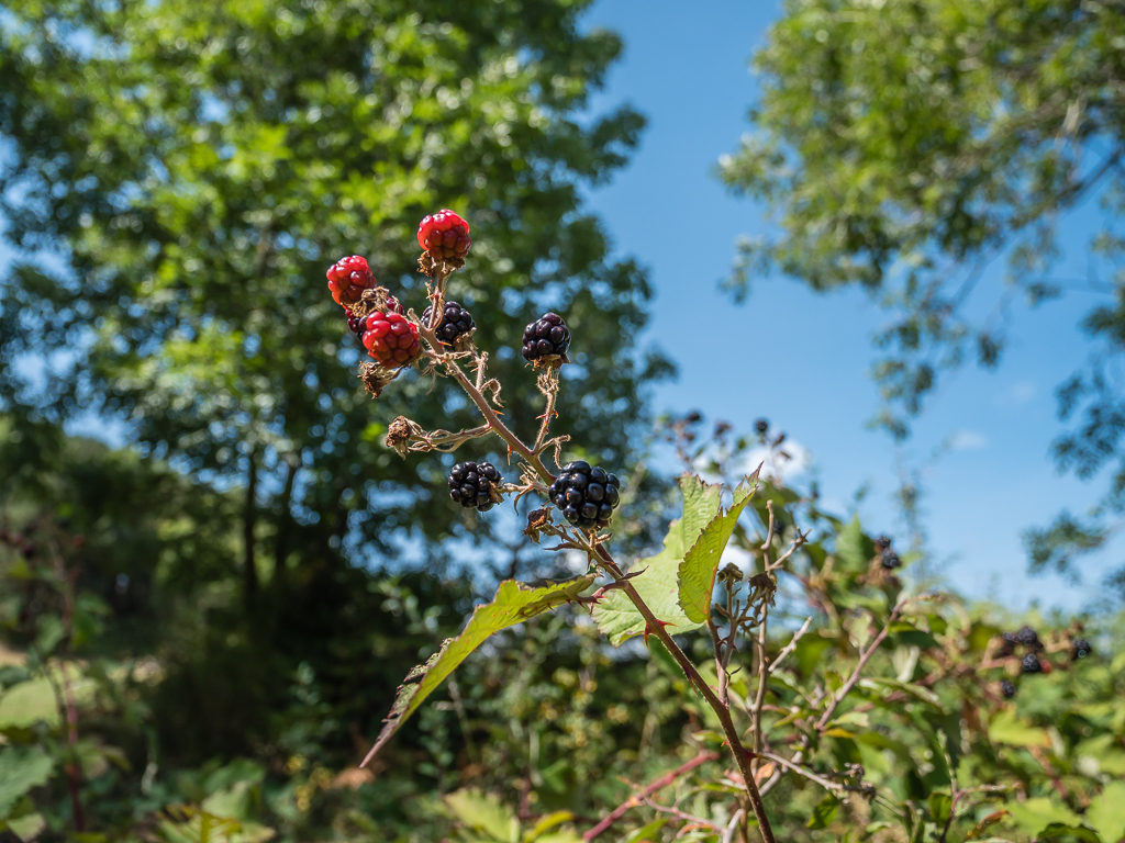
We were surprised to find blackberries still lining the trail. As we hadn’t pick any since the Basque country, we of course had to sample some.
Leaving behind the rugged peaks of the Eastern Pyrenees and entering the foothills, which are influenced much more by the Mediterranean.
After reaching the Coll de la Boixera at 1,110 metres we continued downhill, the GR11 route taking us on well-trodden tracks and grassy paths, which switchbacked here and there making for a really easy walk compared with what we had faced earlier in the week. During the descent we crossed an ancient bridge over a gorge, the path taking us down to the Riera de Beget. Although Beget had only one hostel and a bar-restaurant, it was full of tourists when we arrived. An entire tour bus of French seniors were wandering the cobbled streets taking photos of anything and everything – but to be fair Beget did have some lovely stone buildings that looked well cared for as well as some beautiful floral displays – just as we have seen in all of the smaller Spanish settlements that we’ve walked through.
Taking advantage of the dappled shade afforded by the woodland areas as it was such a hot day.
Reaching the pretty tourist village of Beget. Set beside La Riera de Beget, the cobbled streets are lined with lovingly-restored houses and Romanesque architecture.
We stopped by the first font we came to along one of the cobbled streets and replenished our water supplies, also taking a pack and snack break as we could sit down on some stone steps, much to the amusement of the French group who wandered past amazed at the sight of ‘real life’ hikers and the size of our backpacks. Also passing by were two of the five Danish guys. They told us that one of their group was sick so three of them had got a ride from Mollo to Beget where they were a staying in the hostel for the night. The other two, with the help of a shot of brandy and a song or two, had continued walking. They asked us if we were staying in the hostel too, but being the thrifty thru-hikers that we are, we informed them that we intended on doing a ‘stealth’ camp just outside of the village, as again there were no camping facilities.
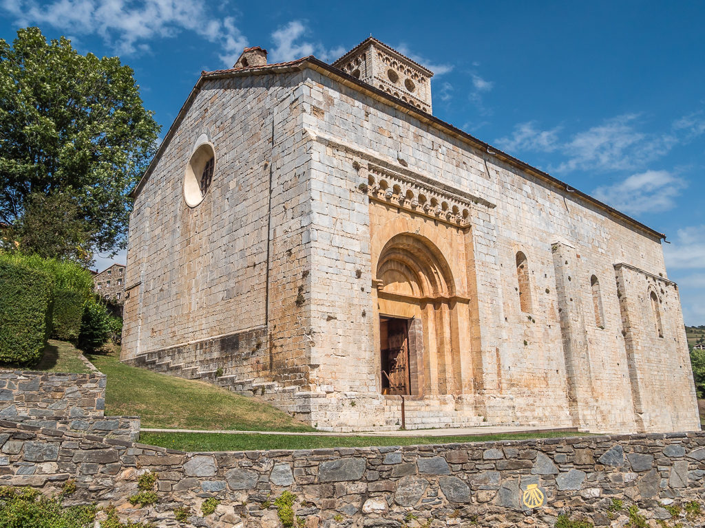
Built in the 12th century and magnificently restored, the Church of Sant Cristòfol de Beget is one of the most important examples of Romanesque architecture in the area.
Stocked up with full water supplies, we left the village just after 4pm. We knew from our guidebook that there were good dry campsites around a 30 minute walk out of town. So we headed up the main road and followed the GR11 taking a left turn up a concrete farm track where we started seeing some grassy areas. There was no chance of camping yet however as the perimeters of farmland were guarded with electric fences. Continuing on a little while longer, we then spied some open grassy terraces that we could access, and after conducting a quick inspection looked to be a good place to camp.
Quite conveniently, the terrace we chose as our camp spot had trees each end, which obscured us from the road below and gave us some cover from the farm track above. As there didn’t seem to be anyone around we decided to pitch straight away (ignoring the bivouac times of 8am until 8pm in Spain). After pegging out the groundsheet and getting the tent up however, we then heard a woman’s voice shouting from above so we were unsure what to do. We waited for a few minutes, but when she didn’t come down to us we assumed that her shouts we nothing to do with us at all. Still, we sat in our camp chairs in the sun for half an hour reading before we unpacked anything from our bags, just in case we were asked to move on.
Tentatively waiting to see whether we would be moved on from the camp spot we had chosen for tonight as it was on someone’s farmland.
Having finally started unpacking around 7pm, we then heard the woman again. She was talking to her cows and bringing them down the grassy terraces towards the road, leading them to the river. She waved at us, so doing the decent thing Wayne went over to speak to her in the best Spanish he could muster. She was completely fine about us camping there for one night and was even trying to give us some information about sunset and the weather, but most of which we didn’t understand. At least we could now rest without being worried that the landowner was going to come along and kick us off their property. Until that point we’d tried to be stealth-like and super quiet in the hope that no-one would realise we were there.
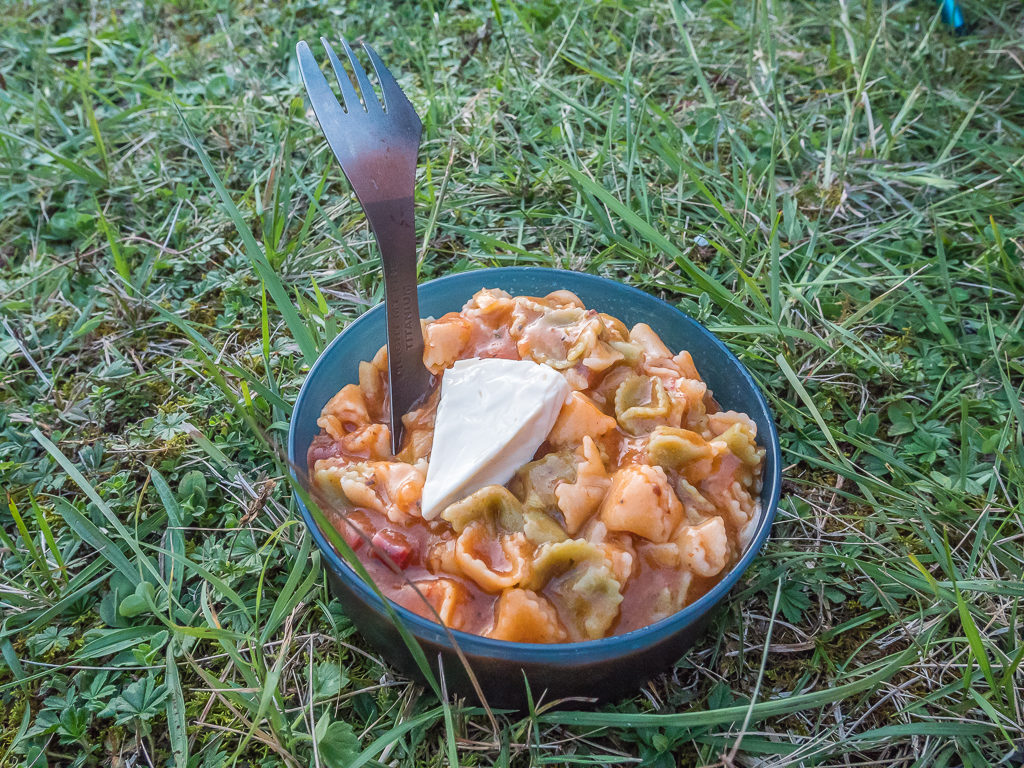
On tonight’s trail kitchen menu, we enjoyed pasta and bolognese sauce with chopped cured sausage. The dish was completed with a cream cheese triangle to mix in.
The sun dipped quickly from around 8pm so we ate dinner sat in our camp chairs before retiring to the tent. It was actually a really warm and muggy night as we were camped below 1,000 metres, which left the tent very wet by morning, something we hadn’t expected at all.
Day 48 – ‘Swimming Hole Sour Grapes’ Wednesday 18th September, 2019, Wild Camp after Beget to Wild Camp on Coll Roig, GR11, 15km
We’d had a much more restful night’s sleep with being sound in the knowledge that we weren’t going to get kicked off someone’s land in the night! Breakfast this morning wasn’t nearly as exciting as yesterday’s treat – we were back to having fried eggs seeing as eggs were the one main staple we’d been able to buy over the past few days with the small village shops only having limited supplies. It was enough to set us up for the day however as we’d only planned on walking 15 kilometres out of a possible 31, as we had decided to split the GR11 Stage 40 – Beget to Albanys – into two parts, otherwise it would have been a demanding 10+ hour day with a total of 2,200 metres of ascent and 2,500 metres of descent. Instead, we would walk to Sant Aniol d’Aguja, have a lunch break at the nearby swimming hole, then push on to wild camp at Coll Roig (840m). The following day we were then planning on hiking the remainder of Stage 40 and camping at Bassegoda Park – a proper facilitated campsite that is also recognised as a ‘Dark Skies‘ location.
We found that despite the uphill effort, today was relatively easy walking compared with the demanding ascents we’d already experienced on the HRP – but we were still glad that we had decided to split the stage into two sections. Crossing the Coll dels Muls for example, we were only at 700 metres, a massive drop in elevation compared to some of the highest colladas we had previously traversed on this trip. Today’s route however was very dry as we contoured along wooded paths hugging the limestone cliffs. Thankfully we had been able to get water from a little spring along the track early morning as what little water was left in the Riera de Beget at this point looked dank and stagnant.
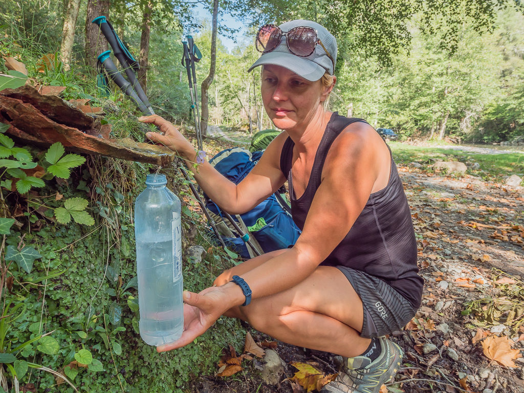
Filling up from a natural spring beside the track. With the fresh mountain water barely a trickle, it was a patient process!
Enjoying a gentler climb as well as some shade afforded by the woodland path as we headed for the Coll dels Mulls (700m).
Looking across to the Tossal de Meians (907m) as we walked through the Valle de Hortmoier in the heart of La Garrotxa.
Reaching the abandoned village of Talaixa an hour or so later, we stopped on a grassy bank to dry out the tent, taking advantage of the shade offered by a pocket of trees. We were eager to get to the swimming hole to cool off as it had been such a hot, sweaty morning. We also felt quite grimy after a couple of nights of dry wild camping. Even with a wet wipe wash, you never feel properly ‘clean’. We were definitely missing camping beside a lake as was so often the case in the high mountains. It seemed that now, even a flowing stream would be good!
Leaving Talaixa, we followed an ancient path seemingly clinging to the rock face, gradually descending around the steep southeast ridge of Puig de Sant Marc (1,327m), before a final steeper descent leading to Sant Aniol d’Aguja. Established in the 9th century, the building is the remains of a Benedictine monastery, which is still undergoing restoration works. We stopped in the churchyard for lunch, making use of the log benches after filling up from the water point so that we didn’t have to use our water filter. (It could do with a good back-flush at the moment as the flow has weakened so it’s taking a while to filter 4 litres!) There were a few tourists milling around taking photos, but not on the scale of yesterday in Beget – probably as there isn’t a road to Sant Aniol d’Aguja. If you’re not passing on the GR11, to gain access you have to hike up from the settlement of Sadernes, which is around 5 kilometres away and an approximate 4 hour round-trip.
The Benedictine monastery of Sant Aniol d’Aguja originally dates from the 9th century. Its walls have flowing water, which according to tradition, contain healing properties.
Restoration work on part of the monastery.
Having a quick spot of lunch in the grounds of the monastery as we found it conveniently had a seating area.
We didn’t stay long as we were eager to get to the swimming hole, however we thought our plans for a swim and a good wash might be scuppered when thick clouds came rolling in and with them several claps of thunder. Earlier, the clouds had stayed behind the mountain range to the north, but they were now passing over us and unfortunately bringing with them the threat of heavy rain. With the very real prospect of thunder and lightning happening later in the afternoon, we began to question our plans to push on to Coll Roig.
As we had made it this far, we decided that we couldn’t pass up the opportunity of at least going to see the swimming hole. So from the Sant Aniol d’Aguja, we followed the Riera de Sant Aniol as it flowed down a dramatic limestone gorge, the stony trail meandering along the narrow walls taking us past several inviting turquoise plunge pools. Eager to rinse off in the cool, natural water, we would have loved to have stripped off at one of the secluded coves and plunged right in had it still been sunny. But with dull skies and the intermittent sound of thunder still clapping out above, we couldn’t stay long as we had decided to still push on for the col.
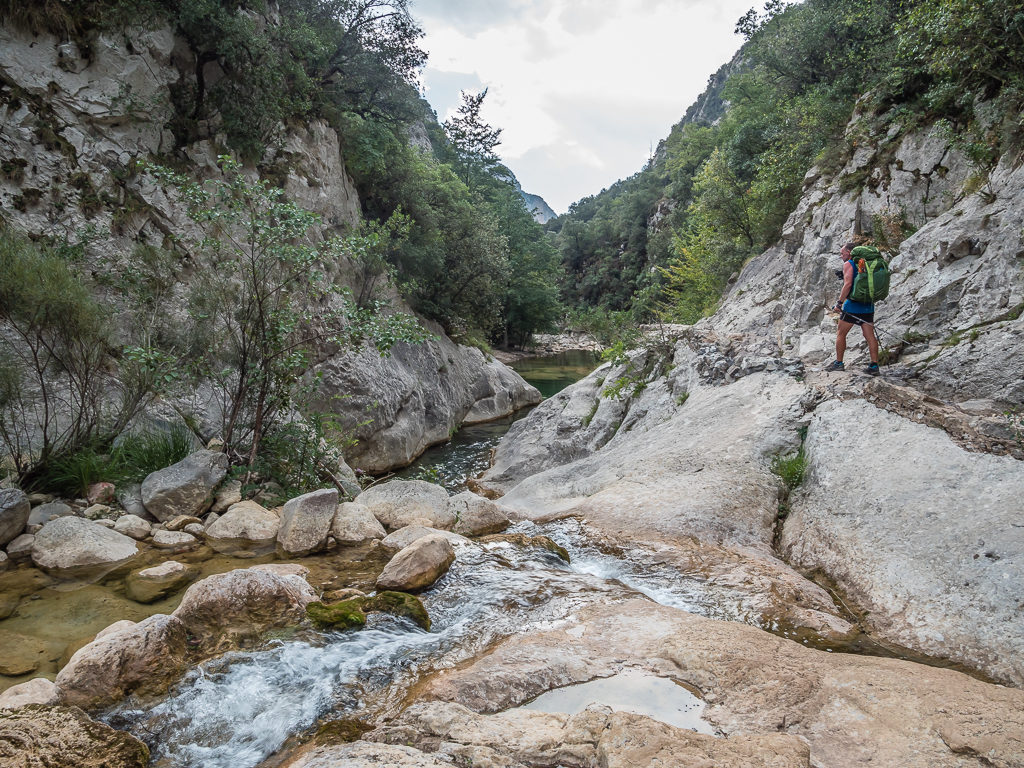
Had it still been sunny, we would have loved nothing more than to rinse off in one of the lovely secluded plunge pools.
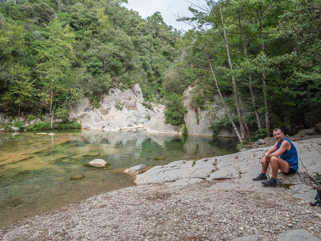
This larger swimming hole looked so inviting – it was such a shame that the change in weather prevented us from going for a proper dip.
We simply couldn’t leave without dipping our feet in the water though, so we took off our shoes, waded in and had a quick rinse off before gearing up for impending rain. With our cameras now safely stowed in our packs and waterproof covers on, we began the climb up to Coll Roig. We estimated that it would only take us around an hour to climb the 380 metres, which it did.
At the top of the col there is a small, flat section with a few trees for shelter and a grassy area with rocks for seats that has clearly been camped on before. We utilised the rocks, stopping for a break after another sweaty uphill climb, pondering whether to push on to the next col another hour or so away. When the raindrops started however, that informed our decision to set up camp there and then having already reached our intended destination for the day. We would much rather be warm and dry inside the tent than be out walking another 3 kilometres uphill exposing ourselves to the pouring rain. So we set up quickly before the worst of it came, glad we had already made it to Coll Roig in the dry.
We are really hoping that the weather picks up tomorrow for our stay at Bassegoda Park. As we only have 15 kilometres to reach the park, we are aiming to arrive by 1pm to make use of the swimming pool seeing as we couldn’t go for a swim today. We’re also hoping to have another barbeque, but we’ll see how that pans out what with the weather and what campsite facilities are actually available. We really can’t believe that we’ve come this far and have just one week to go! We can’t smell the sea air yet, but that’s because the coast is still around 165 kilometres away! With every step however, we’re getting closer to the finish…
Day 49 – ‘Walking Into Off-Season’ Thursday 19th September, 2019, Wild Camp on Coll Roig to Bassegoda Park Campsite, GR11, 15km
We had a successful night’s camp on Coll Roig – the rain petered out and by morning, we miraculously had a dry tent! But it was now a dry tent with a few holes nibbled through the inside mesh after a little critter had tried to get to our stash of bread during the night. Fortunately, I’d heard a rustle and shouted out, which scared the little pest off, but we hadn’t seen the holes until morning. Wayne was gutted with it being a brand-new tent, but nothing stays new for long on the trail, and it was nothing that a bit of patch sewing or tenacious tape couldn’t fix.
Setting off from the col around 9:30am after a good, filling breakfast of scrambled eggs and bread, the GR11 route climbed to a grassy area on which there were some ruins and then followed a dirt road where we soon reached the Coll de Principi at 1,126 metres. The climb wasn’t at all strenuous, but it was already feeling hot and we knew there wasn’t any chance of filling up with water until reaching our next camp later in the day. Pushing on again, we then reached the Coll de Bassegoda (1,102m) where we could have found an acceptable wild camp spot if we’d have continued up the trail last night, but I was still glad that we hadn’t what with the rain that came.
We opted to scramble the eggs today and mix in some re-hydrated vegetables and chopped chorizo, which we ate with bread and cheese. It made for a tasty change!
The GR11 also connects with several local trails running throughout the foothills, so we had to keep a closer eye out for the white and red markers to ensure we were on the right track.
Helpful signage directing us to the Coll de Bassegoda.
Descending steeply on switchbacks through dense woodland, we were then on a mission to get to the campsite as quickly as we could. Fortunately, we found that we could maintain a fast, consistent pace as the GR11 took us on good track and then onto a concrete road. In fact, we had missed the white and red markers at junctions a couple of times and had been following yellow markers signalling a local route instead, but we still managed to reach the Bassegoda Park Campground by 1:15pm.
Looking east across the valley hoping to get our first glimpse of the Mediterranean Sea!
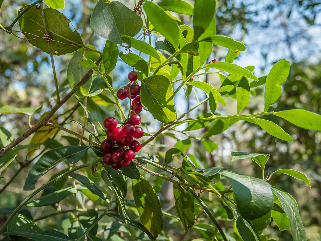
The scenery and vegetation was becoming distinctly Mediterranean with vast shrublands and wild editable plants along the trail. We didn’t pick these berries however as we weren’t sure whether they were poisonous!
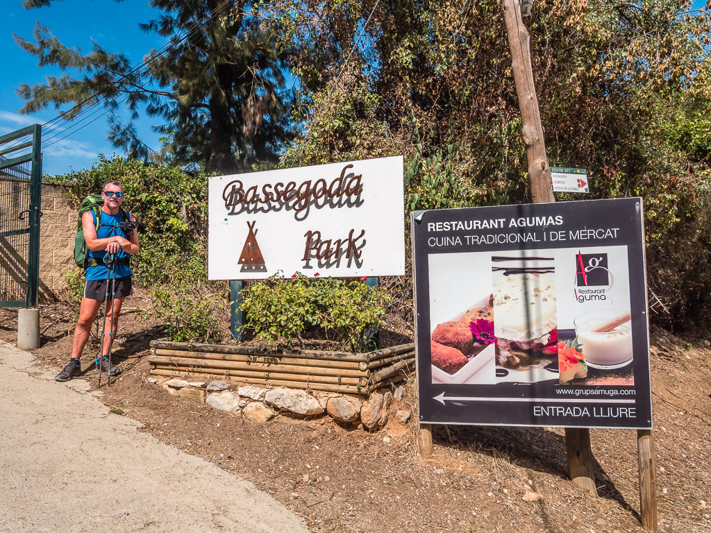
Reaching Bassegoda Park early afternoon. Located in Albanyà next to the natural park Parc d’Espais d’Interès Natural de l’Alta Garrotxa, the campground has been certified by the International Dark-Sky Association as a ‘Dark Skies’ location – the first in Spain.
Unfortunately, as always seems to happen to us in Spain, it was siesta time so the Reception wouldn’t be open again until 3pm, having closed at 1pm. With just under two hours to wait until we could check in, we decided to make our way to the bar-restaurant where we found the guy from Reception having lunch. He was very amenable and told us to go and set up camp and take a shower, then we could check in with passports later. This was great as it meant we could really maximise our time at the campground!
Walking round to the camp area, we noticed that the pool was empty, one of the toilet blocks was closed up and we were the first tent to pitch in the designated camp area. From this, we could tell right away that we were now in Spain’s ‘off-season’, particularly with the distinct lack of people around! Popping to the supermarket on site, we also felt the effects of off-season as there was very little fresh produce to buy and nothing that would even begin to form the basis of a barbeque menu. Oh well – we would have to be a little pragmatic about it – at least we could eat in the restaurant that night if we couldn’t get sufficient food supplies or purchase more gas to be able to cook.
After stocking up with alcohol and a few snacks, we went to find out if the restaurant would be open later. We were in luck as the owner had just arrived to prepare for the evening, although she said we had to dine at 7pm despite us requesting a table for 8pm. It wasn’t until we went along later that we realised we were the only customers there to have dinner! She didn’t give us a menu, just a choice from two starters and two mains. We had no idea of price, but seeing as we had no proper food and couldn’t cook for ourselves, we just hoped for the best.
Having not been able to swim in the pool earlier with the skies coming over all cloudy and the weather making another dramatic change, dinner was make or break in terms of whether it was actually worth staying at the campsite and paying €21.50 for a dry patch of ground that we could have got off-trail for free. At least we’d managed to get some laundry done in a washing machine, which we then had to hang out to dry on a make-shift line strung between two trees beside the tent. With the threat of more rain showers, we just hoped that our gear would dry by morning.
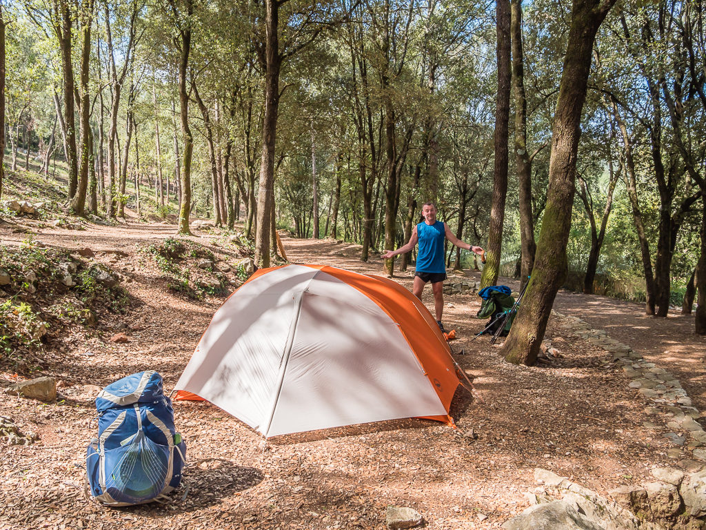
Setting up camp at Bassegoda Park. The tent area has been left ‘wild’ to provide an experience of camping in the middle of nature. (It wasn’t quite the same as a wild camp on trail however!)
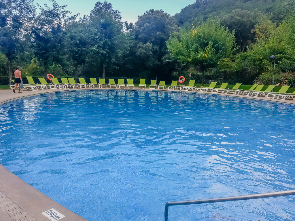
The large pool at the campground. We actually didn’t get chance for a swim as dark clouds rolled in during the afternoon bringing with them a passing shower.
Choosing the pasta bolognese starter for myself and Wayne opting to try the salmon salad, we weren’t disappointed as portion sizes were large. Our main course was a repeat of Setcases however, where we were given a plate of frying steak and chips. Accompanied with a house vino, it went down well, but you can have a bit too much of a good thing – as with cheese, cured meat, bread and eggs! We were hankering after variety so much! The redeeming feature was that we also got a home-made dessert, which was a layered pot of custard, chocolate and cream. In total the bill was €28 – inclusive of half a litre of wine, we definitely couldn’t grumble at that!
It was a nice end to what had been an enjoyable week leaving behind the high mountains of Andorra to re-enter Spain and begin our descent into the Catalonia foothills towards the Mediterranean Sea. Passing through beautifully preserved medieval towns, it was remarkable to think that we were living through history following in the footsteps of carters (traginers), charcoal burners (carboners), priests, bandits, peasants and smugglers who had all walked these paths of the Pyrenean foothills in northern Spain day and night, rain or shine, for millennia. Now with approximately 150 kilometres left to reach the coast, we were eager to find out what the final week of our latest walking adventure had in store for us!…
6 Comments
Superb stuff. Driven through that area but never walked it. Interesting to see the change in landscapes even though the peaks themselves are close to as high as anything in the range. Look forward to seeing you dip your toes in the Med!
Thanks Andy! Yep, just one week left. 👍
Excellent words and pictures as always, looking forward to the last section – and the YouTube of this section.
Thanks Kevin! I shall forward your message onto Wayne who takes care of the YouTube side. The videos are a bit behind the blog posts at present!
Hi Danielle,
thanks for sharing one more week of Your adventure with us. It was indeed interesting to see the change in landscape. Having not been there myself I am a bit surprised about the rather abrupt change. I was expecting seeing You gradually move into a more and more mediterranean landscape, but it was like going through a door and … Voila.
In some way it seems to me the adventure is over by leaving the high mountains. Did You feel this way on the trail?
I also watched the weekly videos, which add their own story and are impressive. So thanks to Wayne as well.
All the best for You, staying tuned for the final week.
Marcus
Hi Marcus,
Yes, it did feel like the best of the hike was over as soon as we left the high mountains.
As we couldn’t really wild camp in the foothills with being too close to towns etc, we felt like we just wanted to get to the end and enjoy time in a hotel!
Now we feel like we would love to hike more of the GR10, as the last couple of weeks on trail were predominantly on the Spanish side. We especially loved the Basque Country and definitely want to return at some point.
Thanks for all of your great comments and for staying tuned. I think the videos alongside the blog really do capture the true essence of the trail and show people what it’s really like out there.
All the best for your Kungsleden hike,
Danielle & Wayne