
Our Pennine Way Adventure Continues…
So far we’ve only used 5 blister plasters and taken 8 Ibuprofen tablets. That’s good going considering we’re well over halfway!
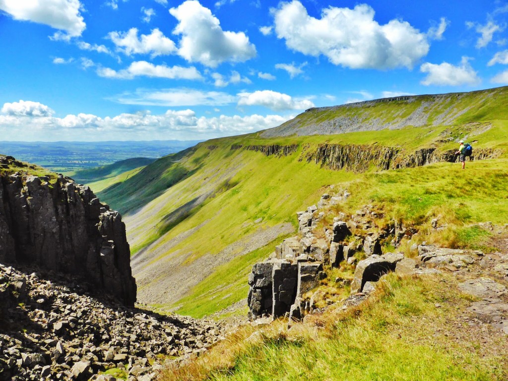
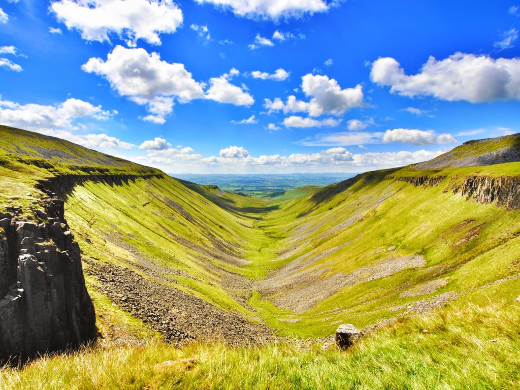
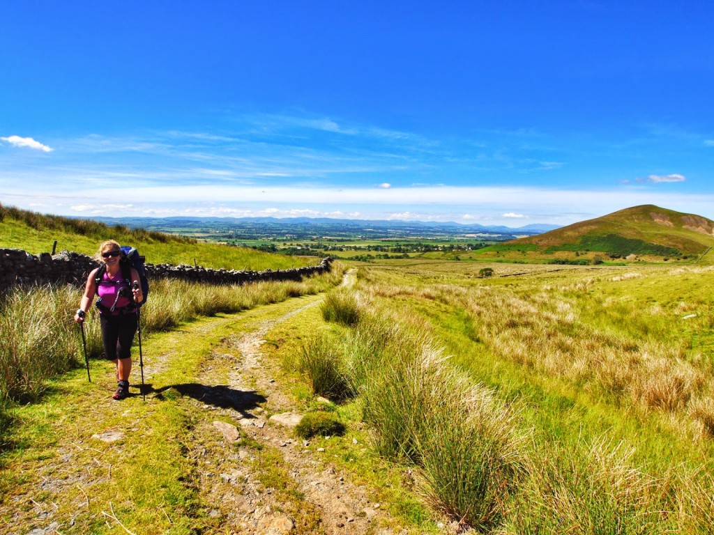
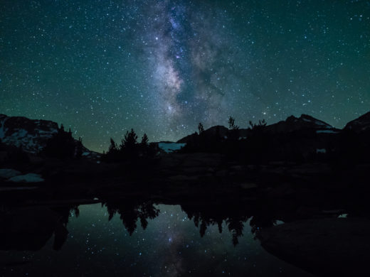
Join us on a cyber journey of some of Britain’s finest countryside. Alfred Wainwright might not have been that impressed with the Pennine Way trail through northern England. He thought it was a ‘trudge’ with not enough waterfalls. But he must have loved this view! We certainly did. Walking to ‘High Cup Nick’ and seeing the perfect U-shaped valley has definitely been our high point to date…
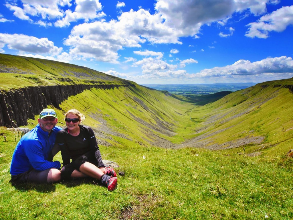
The ‘wow’ factor! Fantastic views down the U-shaped valley at High Cup Nick.
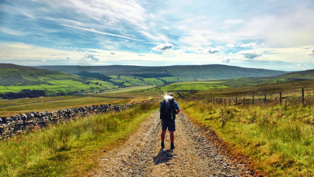
Day 16 – Wild Camp to Dufton. (14.7 miles) – Wednesday 9th July 2014 – ‘Good Old Nick’
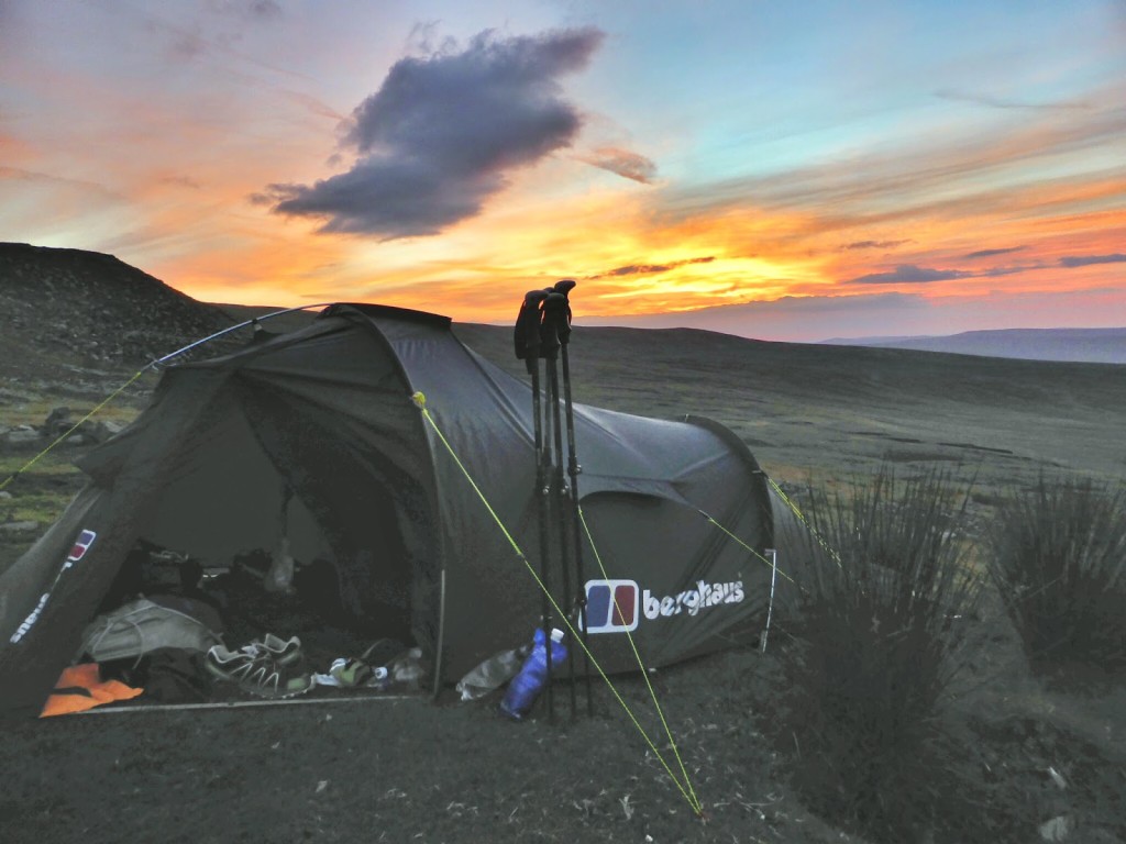
Day 16 was a swift get up and go! We set the alarm for 5am so we could try and sneak off before another major attack of the midges. No such luck however as they were hovering around the tent as usual waiting for us to appear. Cue the usual 5 minute midge massacre as we try to swat as many as we can. (Ok, not good for boosting our karma ratio but well and truly justified). Wondering why they seem to love us so much, Wayne later Googled what he could about midges, discovering they are attracted to our carbon dioxide as well as dark colours and sheltered environments. No wonder they love hovering around our tent, backpacks and ‘us’ so much. Breathing out carbon dioxide all night in a closed environment such as a tent is just the invitation midges need to have a good old party. And of course, when we pitched our tent at the wild camp spot, the first thing we looked for was a sheltered area out of the wind. Bad move! Now we know the facts, we’ll be much more midge aware!
One good thing about midges – they make sure we get an early start!
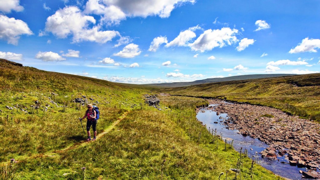
Rejoining the Pennine Way after our wild camp past Middleton in Teesdale.
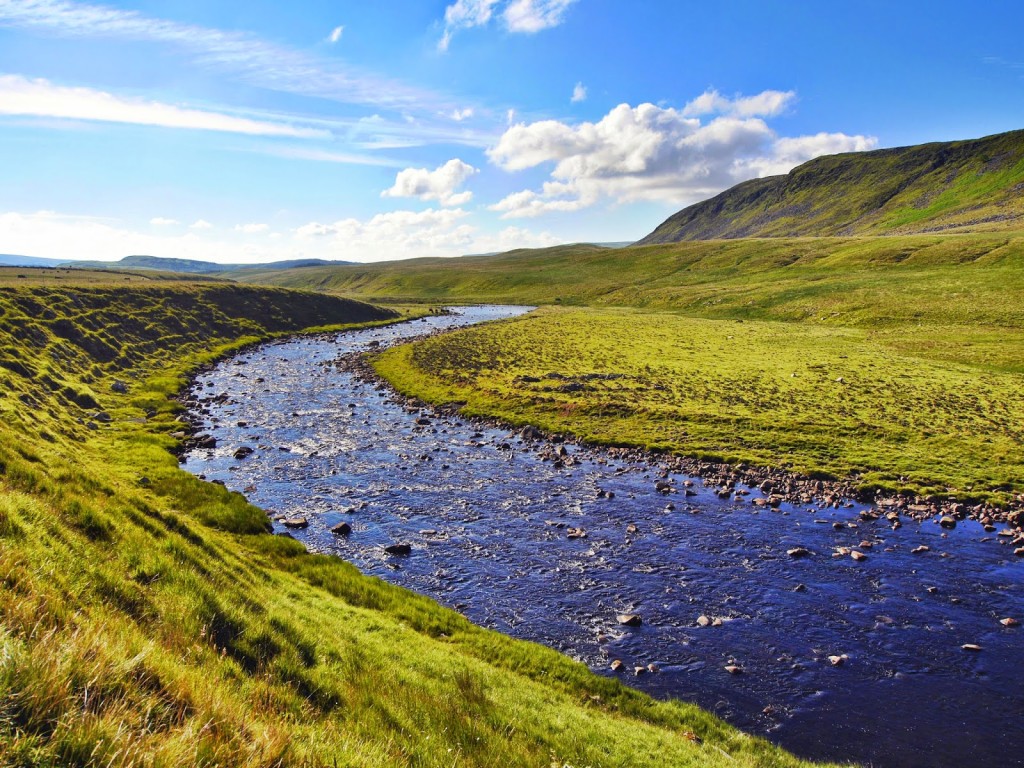
Our early morning walk followed the River Tees.
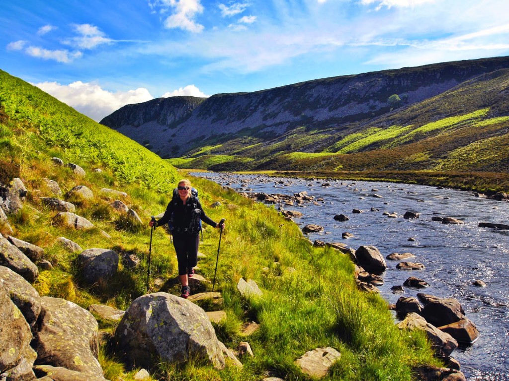
Not a gentle stroll along the river as we had expected!
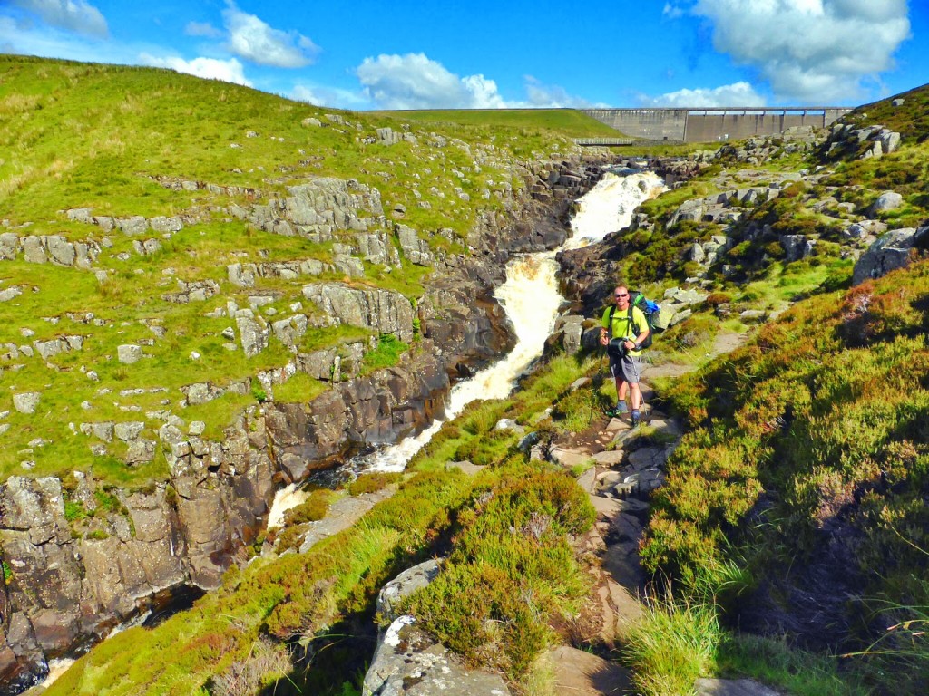
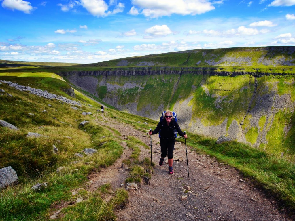
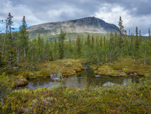
Anyway, after a stressful start, the day got better. A large part of today’s walk was along the River Tees, which was really pleasant as the sun began to shine. There was some scrambling over boulders that we didn’t expect. Likewise we weren’t expecting the huge waterfall and giant dam that appeared at Cauldron’s Snout.
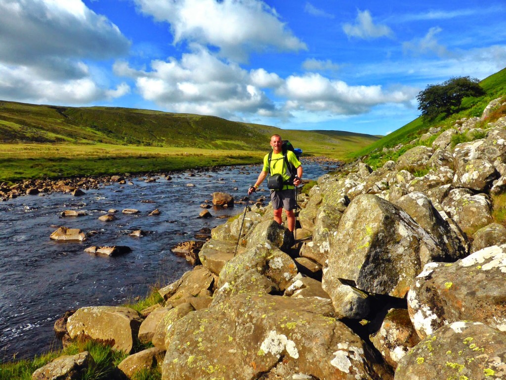
A bit of boulder scrambling along the way!
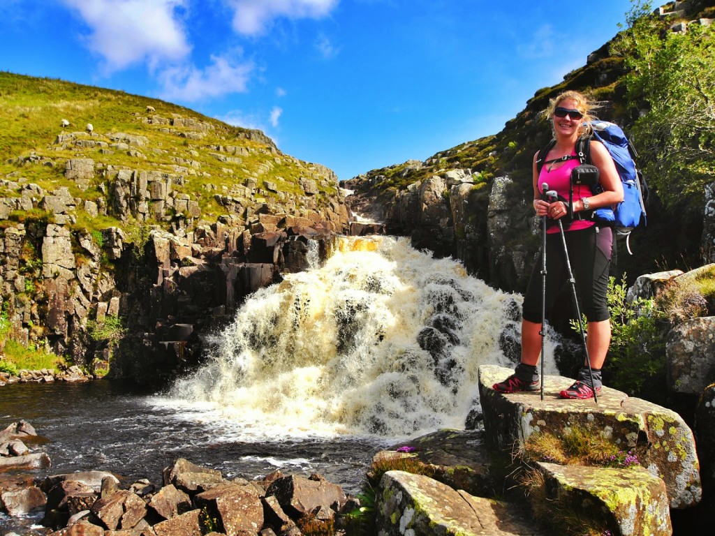
In front of the unexpected waterfall!
Perfect spot for a photo.
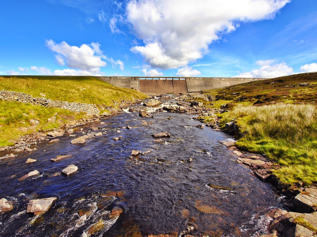
The dam at Cauldron’s Snout.
Continuing along a better trail.
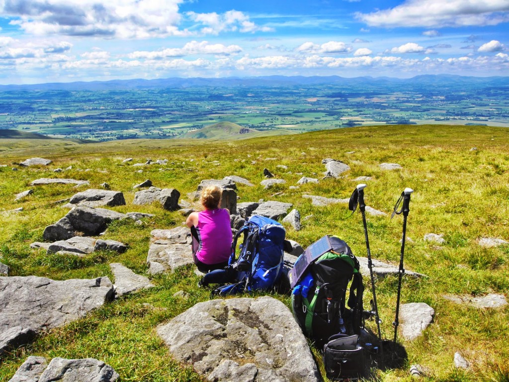
But the highlight of the day was undoubtedly ‘High Cup Nick’, a large U-shaped valley created by a glacier a long time ago. (If you want more facts, remember Google is your best friend!) As it was a bright, sunny day, the views down the valley were simply stunning. The actual U-shape of the valley is so large that it’s hard to fit it in its entirety on your camera screen (unless you happen to own a wide angle lens like Wayne).
Approaching High Cup Nick.
Great for a geology lesson – the perfect glacial valley.
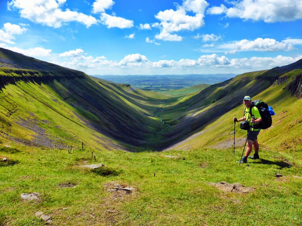
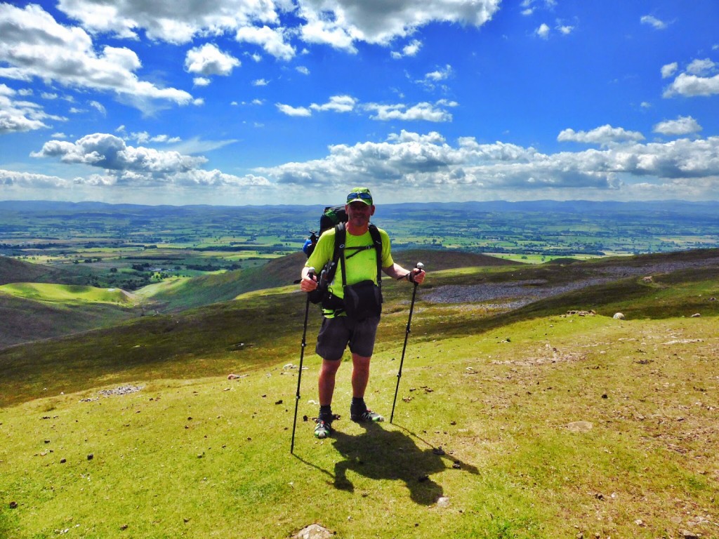
Wayne’s favourite spot on the Pennine Way so far!
We had a ‘selfie’ shot in front of the valley and picked a spot for lunch where we could enjoy the view (along with lots of other day walkers, the most we’ve seen along the route so far).
As we left High Cup Nick we saw wild horses as we made our way down off the mountain. But the best sight of all was the view. It was such a clear day that we were able to see as far as the Yorkshire Dales to the left, as well as some of the famous peaks of the Lake District to the right.
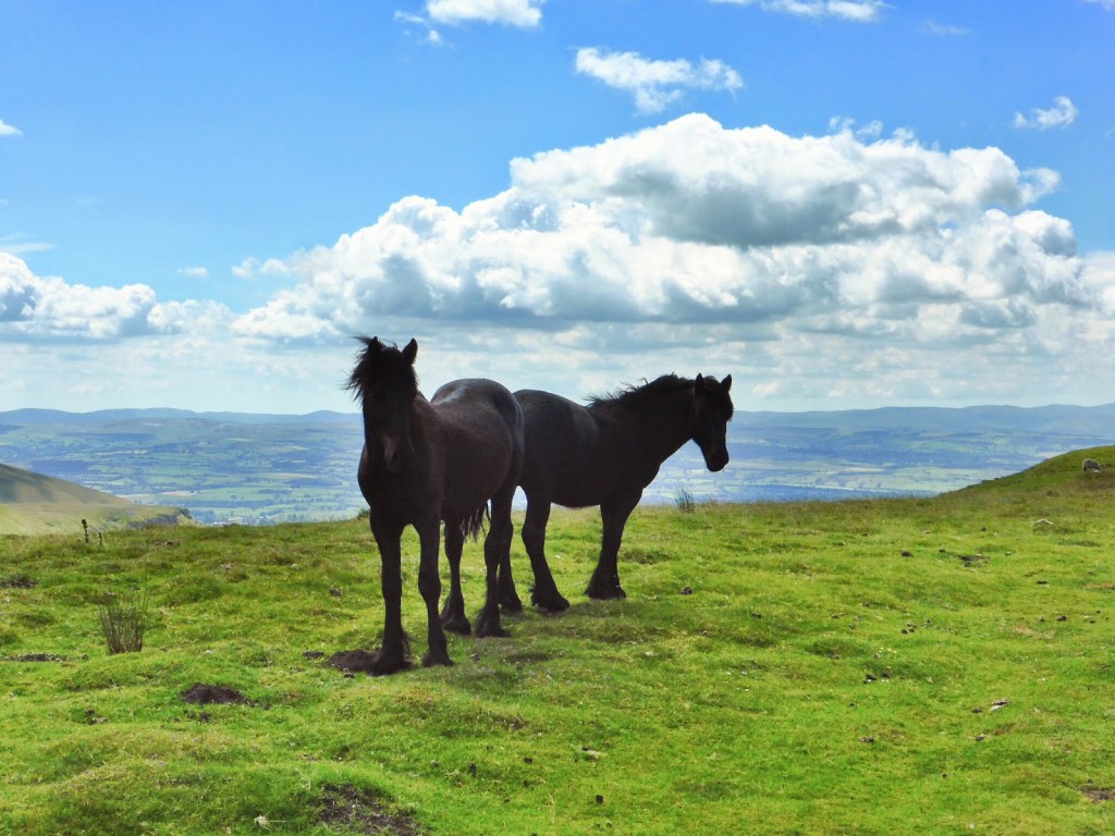
A pair of book-ends!
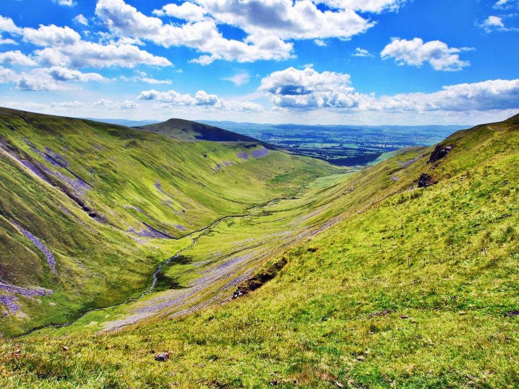
Stunning views down the valley.
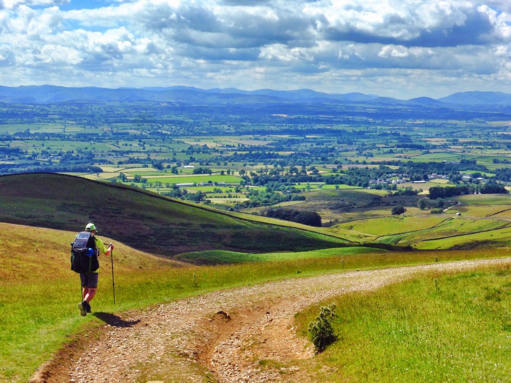
Leaving High Cup Nick…
Fabulous weather affording us wonderful views!
The mountains of the Lake District in the distance.
And then it was just a simple stroll downhill all the way into Dufton! It was an early arrival for us at the campsite. We reached the Grandie Caravan Park around 4pm and promptly made use of the shower facilities in view of our wild camp the previous night. Arriving early also gave us chance to do some laundry and buy some fresh eggs from the local cafe. There was even time for some last minute sunbathing and catching up with writing the blog diary.
Definitely a day on the Pennine Way to remember.
Day 17 – Dufton to Greg’s Hut. (9.4 miles) – Thursday 10th July 2014 – ‘The High Point’
Today was to be one of our shortest walking days. From Dufton to our destination, Greg’s Hut, which is a bothy in the hills maintained by volunteers, it was only 9 or so miles. So this gave us the chance to have a more leisurely morning at the campsite instead of our usual get up, pack up and go. We enjoyed a hearty breakfast of omelette wraps (we can’t believe how many eggs we’re eating) and finally set off around 10.30am.
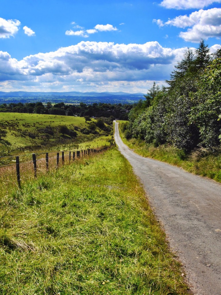
The long road out of Dufton.
Walking around Brownber Hill.
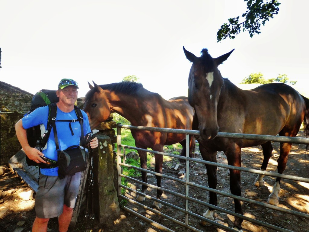
‘If your name’s not down, you’re not coming in!’ We had to pass the horses whilst going through this gate.
Continuing up!
It was a long, gradual uphill walk out of Dufton, which was fine apart from the section along a narrow track that was covered in nettles and swarming with midges, our favourite friends! As we continued up through farmland we were able to watch some farmers rounding up the sheep with their trusty dogs, which was a welcome breather at that point.
Enjoying the view.
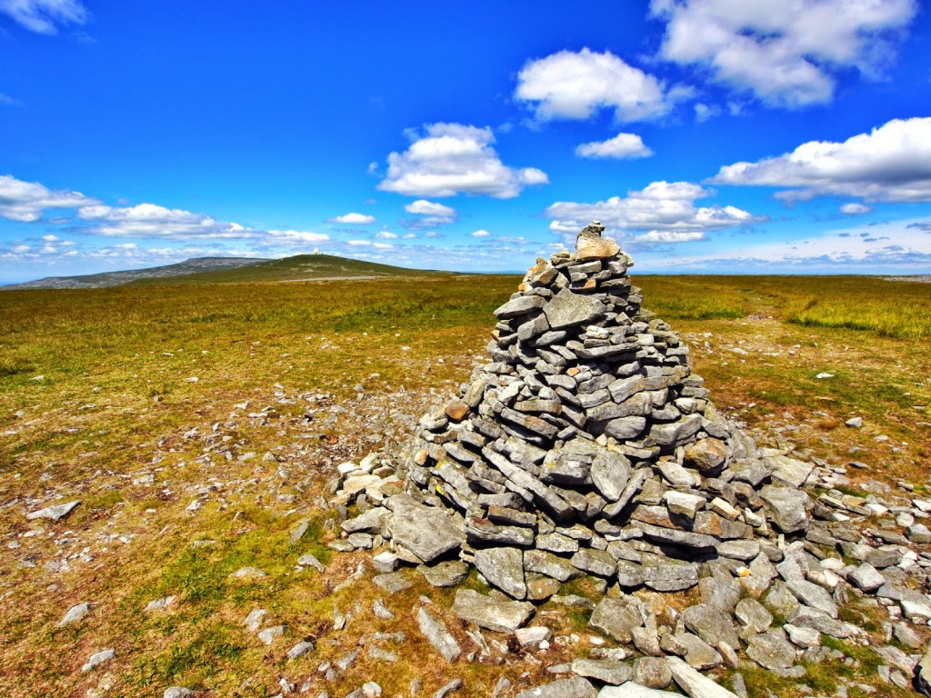
The first of many cairns today.
We headed up to Knock Old Man at 794 metres, then on to Great Dun Fell, unmissable for miles around due to the Radar Station positioned on top, then to Little Dun Fell at 842 metres where Wayne set his tripod up for a time lapse as there was a wonderful view with the clouds moving in.
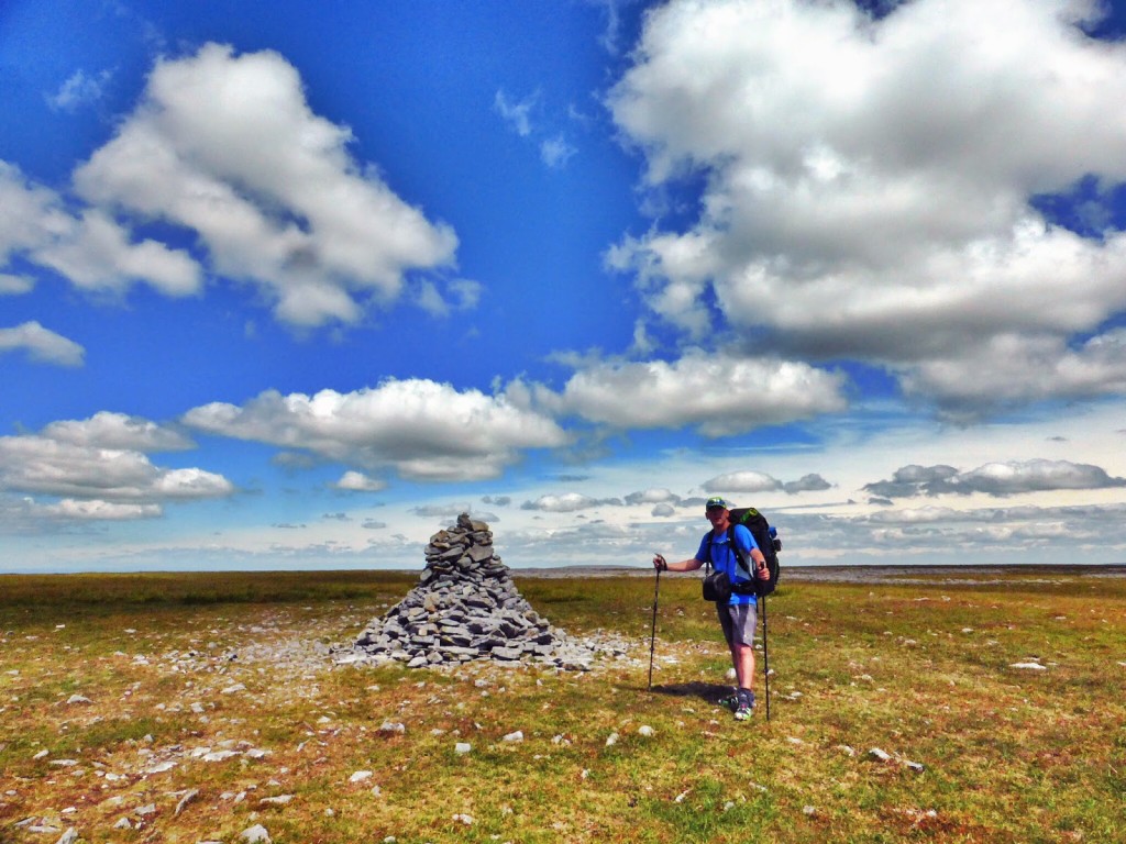
Reaching Knock Old Man.
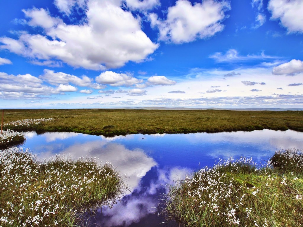
Beautiful reflections at the top.
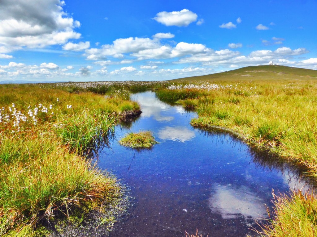
But with water comes the dreaded bog!
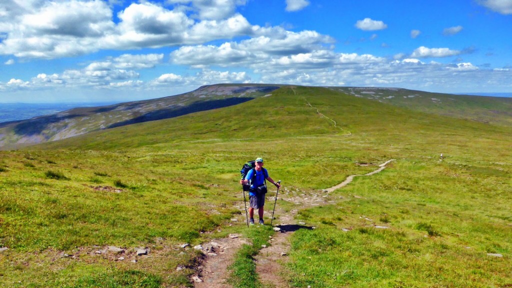
Continuing on to Cross Fell, the highest point on the Pennine Way.
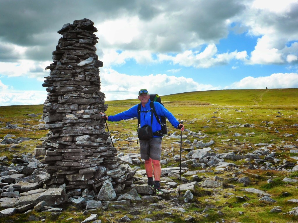
Probably the tallest cairn ever!
The highest point of the day however was reaching the top of Cross Fell, which at 893 metres is also the highest point on the entire Pennine Way. It was incredibly blustery up there, but a new shelter proved invaluable in shielding us from the penetrating wind.
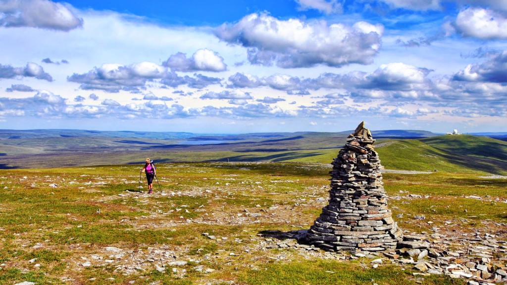
The cairn marks the spot!
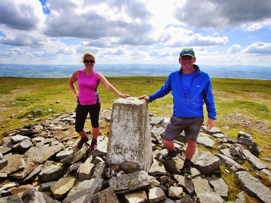
Reaching the ‘trig point’ at the top of Cross Fell.
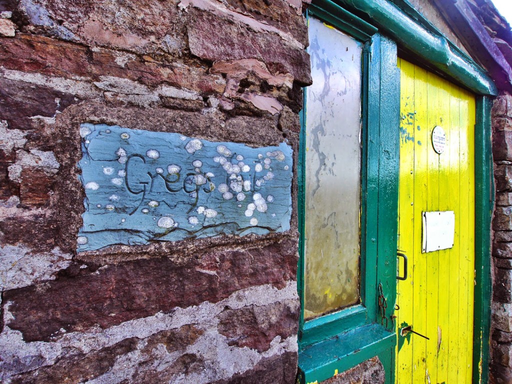
It was only a short distance from this point until we reached Greg’s Hut, named in honour of John Gregory, a keen climber, who was killed by an avalanche in the Alps in 1968. (His parents funded much of the restoration work of the hut in memory of their son, in conjunction with the Mountain Bothies Association.)
As we had good weather we didn’t stay inside the hut, choosing to pitch our tent in the garden at the front of it. Although basic, we can see how the hut is invaluable for hikers when the weather turns providing a much needed place of shelter and respite. It can be very bleak out on the fells, with no sign of civilisation for miles around.
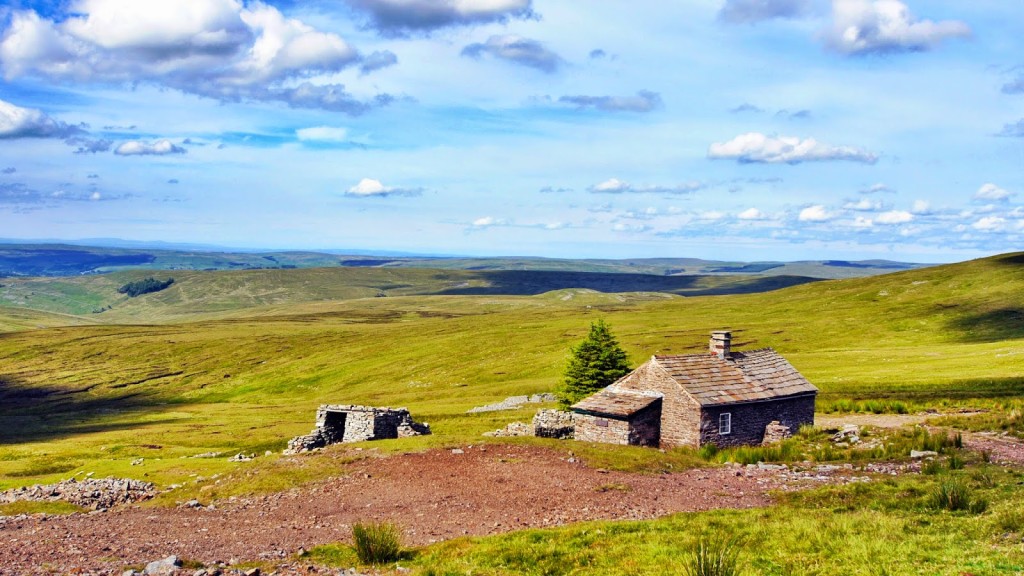
We head to the bothy, ‘Greg’s Hut’.
Rustic but does the job!
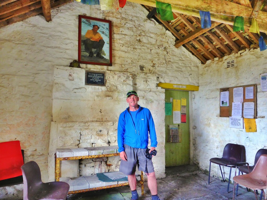
The main room inside the hut.

Our lovely pitch at the front of the hut.

Deciding whether to cook outside. The midges won so we went indoors!
The hut also proved a good place for Wayne to cook dinner so we could be out of the wind and away from any midges hoping for a feast. On tonight’s menu it was Thai cuppa soup, followed by Chinese super noodles, followed by a Bounty bar and hot chocolate!
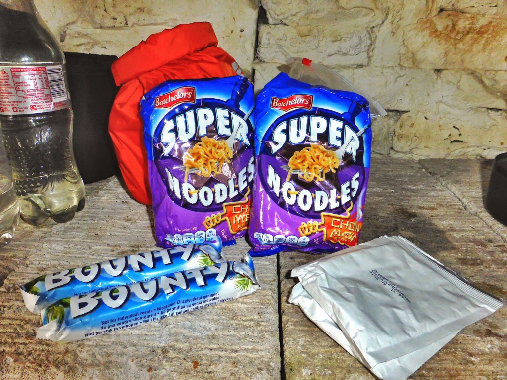
Our a-la-carte menu for tonight!
A great sunset to end the day.
We were lucky enough to see a good sunset from up there too before we retired to the tent. The other good thing about the hut is that there’s no fee, so much like a wild camp we enjoyed a ‘freebie’ night, but slept far more soundly without fear of being caught camping on private land!
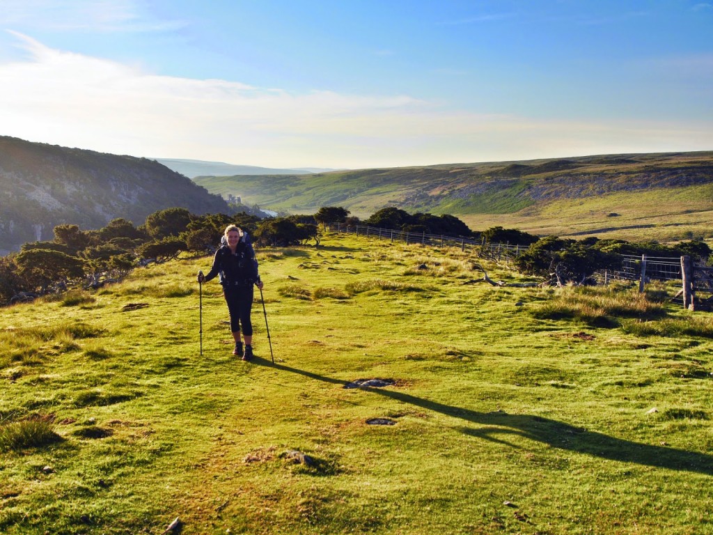
Day 18 – Greg’s Hut to Alston. (10.5 miles) – Friday 11th July 2014 – ‘Birthday B&B Pick Me Up’
We were in high spirits today as our destination, Alston, had been earmarked as a rest day the following day, which was Wayne’s birthday. We set the alarm for 6am, had breakfast in the hut (ooh back to lovely porridge, not so lovely made with water instead of milk however), got packed up and left by 8am. Yay, on time for once!
Solar panel in action – Wayne making full use of the sun!
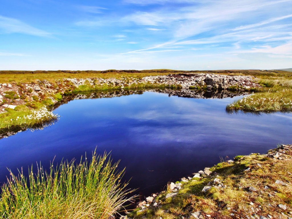
A beautiful tarn we passed on the way.
It was quite an easy walk. The track was clearly marked and mostly flat so we averaged a speed of 2.7 miles an hour, a good pace with our heavy backpacks. (We usually aim for 2 miles per hour with a full pack and when there’s a lot of elevation change). We reached the village of Garrygill in what seemed like no time, which was our halfway marker, so we sat on the village green for a drink and a snack.
Not far to go…
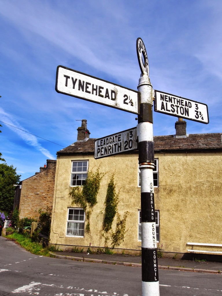
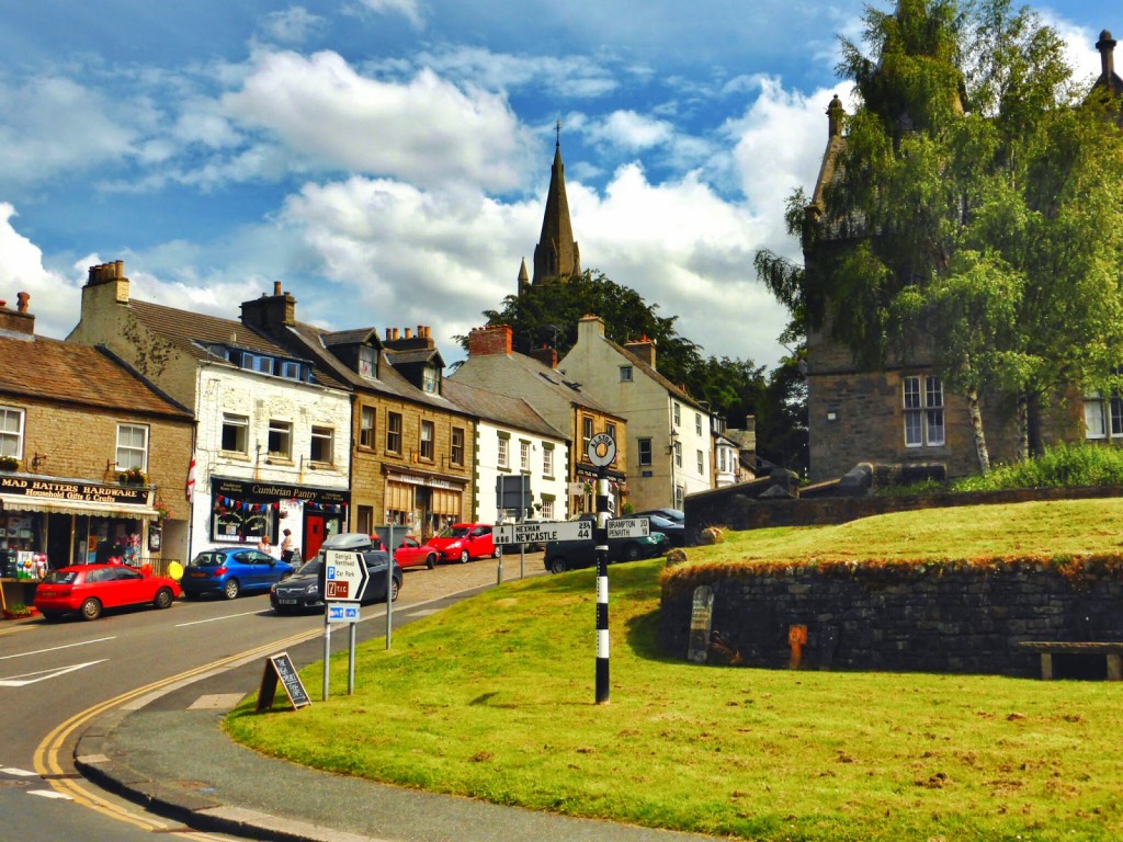
We were looking forward to arriving in Alston by lunchtime so we powered on, getting there around 1pm. After doing a quick reccy of the town (it was a lot smaller than what we were expecting) we headed to The Pantry, a nice, cosy cafe, where we treated ourselves to a proper lunch. After living mainly on packet food for a couple of weeks, the jacket potato and salad I ordered was just perfect. The owner was really chatty and amiable and the added bonus was the free Wi-Fi, which meant we could finally upload some pictures and post an update of our progress along the Pennine Way.
Walking into Alston.
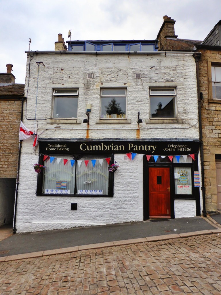
The friendly ‘Cumbrian Pantry’, complete with free Wi-Fi!
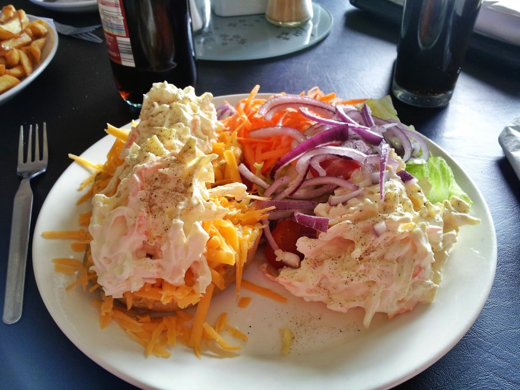
After lots of packet food, this was quite possibly the best jacket potato and salad EVER!
Alston was proving a winner until we headed to the only campsite in town, which did not fill us with much enthusiasm. Set at the back of a scrapyard, complete with some old sofas and a couple of rubbish skips outside Reception the place looks rather dodgy. As no one was around to check us in, we made a rash decision to get the hell out of there and book into a cheap and cheerful B&B we’d spotted in town. Well it was Wayne’s birthday the next day after all. So it didn’t take much convincing to decide to treat ourselves to a proper bed for one night after 17 nights of camping.
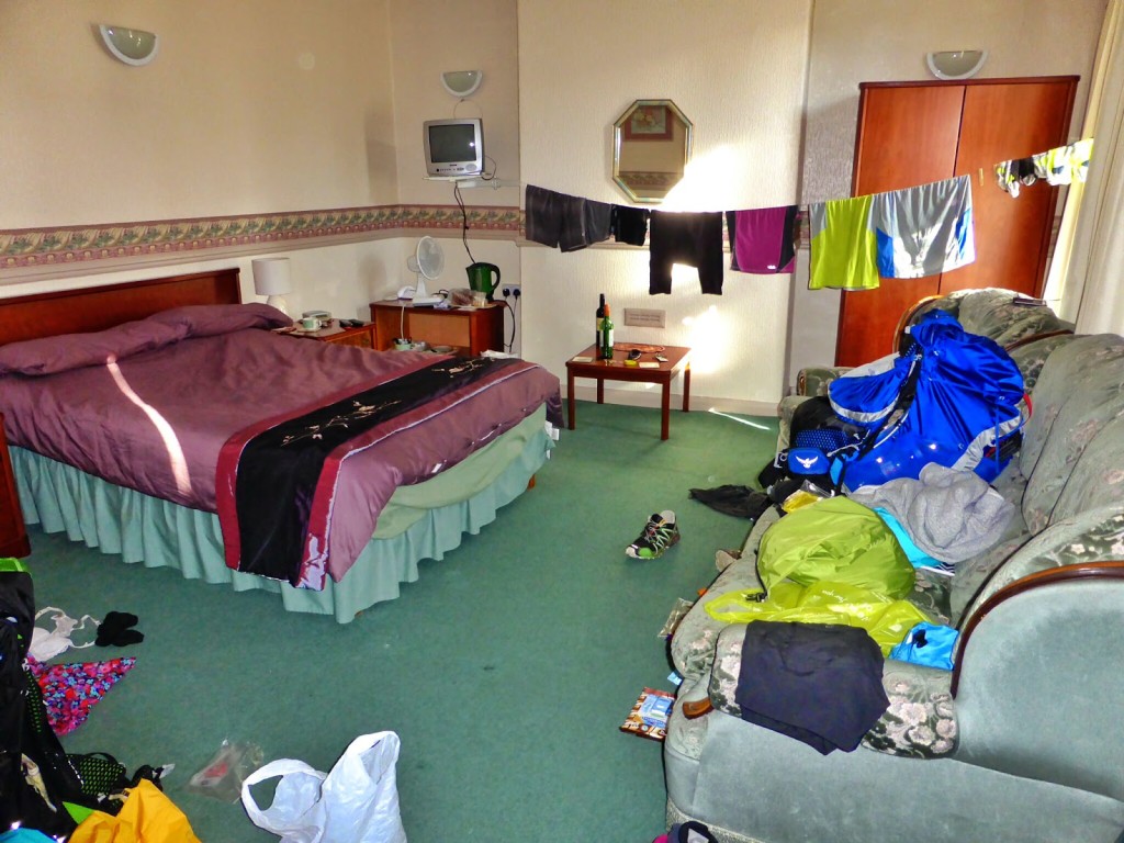
It didn’t take us long to spread out!
For £50 including full English breakfast, we checked into a double room with ensuite shower at the Victoria Inn, which as well as it’s B&B status, doubles up as a pub, as well as an Indian restaurant, which is bizarrely ran by a Chinese lady who seems to be constantly rushed off her feet!
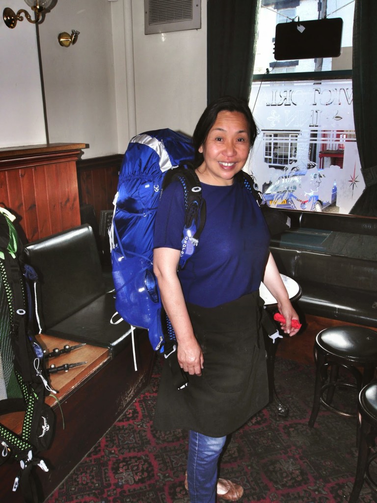
The lovely Chinese owner Tian trying on my backpack!
If you’re not too fussy, it’s good value for money and does the job, so it was perfect for us. Especially as all we wanted to do was have a hot shower, get some laundry done and stretch out in a real bed! The TV and tea/ coffee making facilities were just an added bonus (and gave us the chance to stock up on some tea bags and sugar!)
Well birthday celebrations are not complete without a few beers, so as we were staying the night we decided to have a mini pub crawl and celebrate Wayne’s birthday a night early. We got changed and headed straight to the Turks Head, which felt like a ‘locals’ kind of pub, then moved on to the Angel Inn, which looked to be serving some fantastic bar meals, then finally settled in The Cumberland, which was recommended to us for serving ‘real ales’. For such a small town, there was a large number of public houses to choose from!
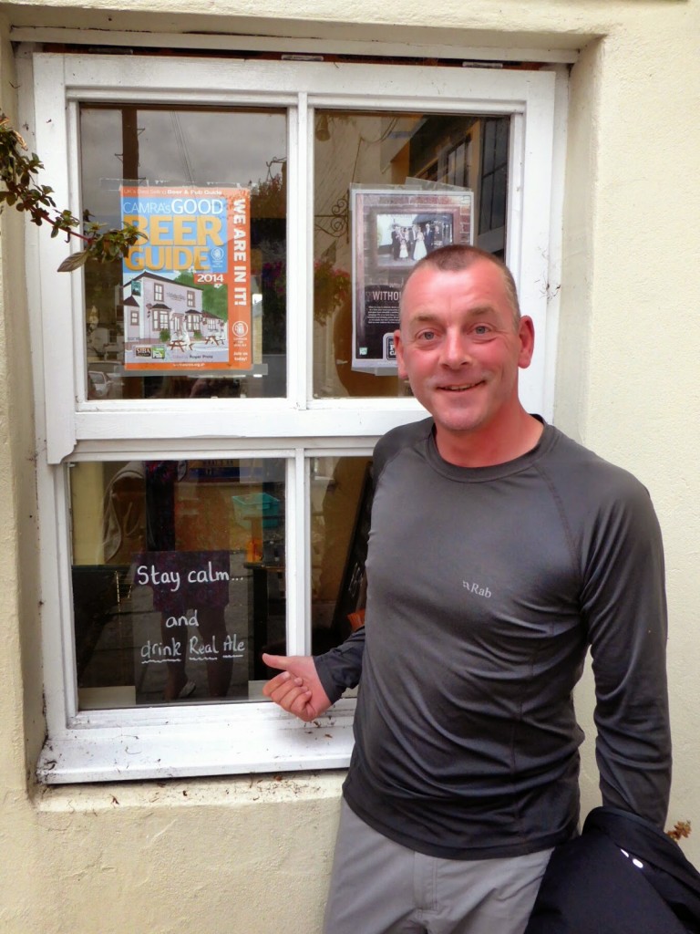
‘Stay calm and drink real ale’. Of course!
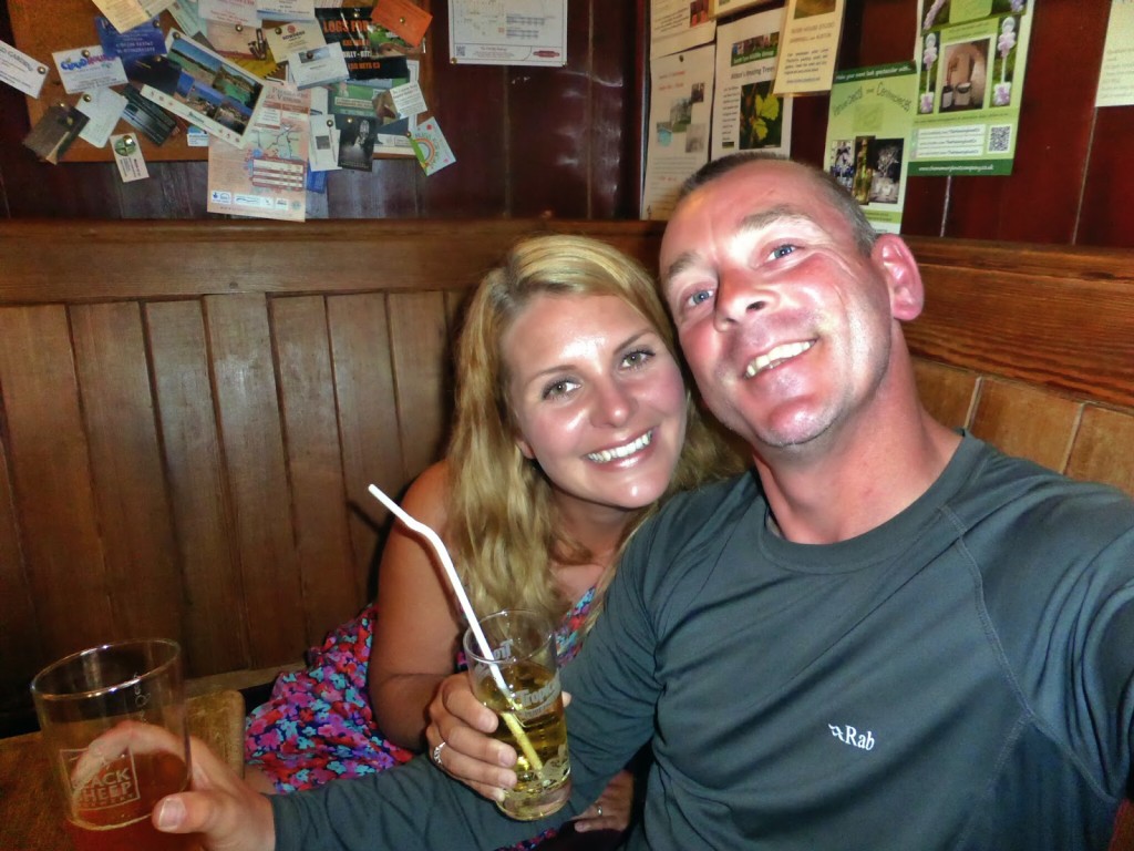
Birthday drinks in The Cumberland!
We finished the night off with a bag of chips and curry sauce, just in time before the chippy shut at 10pm. And then it was off to retire to our nice, comfy, warm BED. The sleeping bag was well and truly banished for the night!
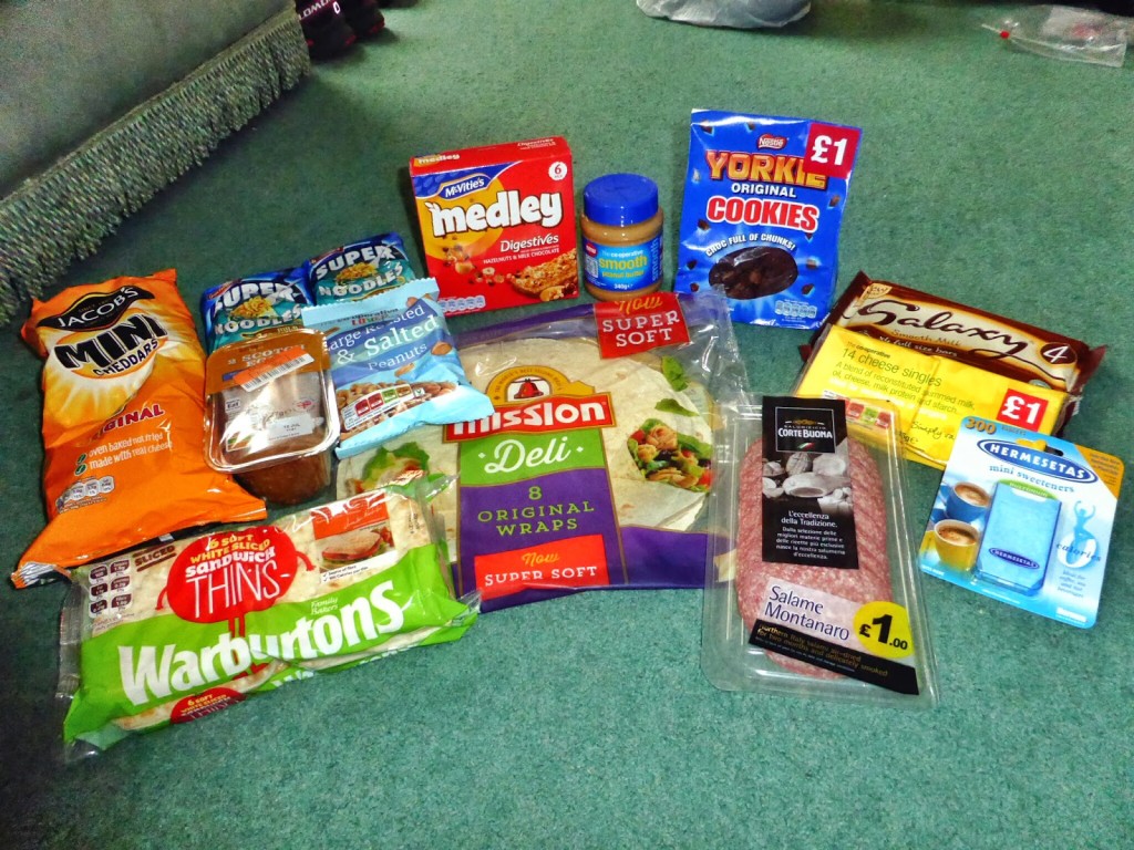
We were wise to stock up on food rations for the next few days pre- birthday drinks!
But as with all good things there comes a price and ours was forfeiting our planned rest day the following day. As we had spent extra on the B&B and because Alston didn’t really have enough to keep us occupied for an extra day without spending money, we were moving on. We still had our miles to cover after all! So Wayne’s actual birthday was going to be spent hiking 18 miles, one of our longest days yet. Boy, we were not looking forward to that one!
Find out how we got on in the next installment of our Pennine Way adventure – Days 19 – 21 coming soon!
5 Comments
Having walked the PW up to Hadrian's Wall in May 2014, I like reading about your experiences along the PW and am looking forward to read about the remaining sections! Your photos are very nice and it seems that you were very lucky with the weather!
If you don't like porridge with water, I suggest you get some milk powder. I usually carry milk powder on my walks, such that I can always prepare milk for muesli and cereals (and for tea) when no fresh milk is available.
I am curious to know how many kilos/pounds you are carrying and how you are getting along with your shoes – are the shoes sturdy enough and provide sufficient ankle support considering the terrain and your load?
It also looks like you are wearing rather short gaiters. Doesn't this cause problems when hiking through the bogs?
I have recognised that you are already on the C2C by now. I wish you all the best for this wonderful route across England!
Hi Stephen, thanks for taking the time to read and comment on our post!
Yes, we have been really lucky with the weather, it's been unusually dry for England!
In answer to some of your questions: Wayne's pack with 3 days of food rations is approx 20kg and mine is around 16kg, but we have got used to carrying that weight now!
We like hiking in trail runners because they are light on your feet and comfy. (Heavy boots are extra weight on top of a backpack!) Ours are Salomon Speed Cross 3's. They have no Gortex so your feet do get wet but they also dry really quickly. There's no ankle support but we've found that's been ok for this kind of trail. The one problem we've had is that the soles have worn out really quickly & we are already in need of new footwear because the trails have been so stony.
In terms of bog, we've only got wet feet from a few sections. It has been so dry lately that the ground has been much better than what we expected! Plus a lot of the PW is now slabbed across the worst parts.
Our ankle gaitors are for keeping out grass seeds and grit so you're not constantly emptying out your shoes. They do a great job!
Finally, we usually use milk powder but we had ran out! The small shops we could re-supply in only had large tins of it which we didn't want to carry – hence porridge with water! But thanks for the tip!
Lots more to come with posts on the Coast to Coast and John Muir Trail. Happy reading! Maybe we'll see you on the trail one day 🙂
Hi Danielle,
Thank you for your explanations! Wow, you have heavy backpacks, but I guess that's inevitable when carrying a tent, sleeping bags and cooking equipment. I use to stay in hostels and B&Bs and try to carry less than 8kg.
I've been walking the C2C in 2009/2010 and I really loved it! In terms of variety of landscape, I think the C2C has more to offer than the PW, therefore I tend to rate the C2C higher than the PW – but in the end I think it depends on the people you meet along the way and on the weather that make up your own, subjective rating of a path.
I am going to do the remaining PW parts north of Hadrian's Wall next year and will continue on parts of the St Cuthbert's Way and the Southern Upland Way (well, at least that's the current plan).
My goal is to having walked end-to-end from Land's End to John o'Groats one day. I am still missing the southern sections, so maybe we'll meet there …
I am still unsure whether to change to lighter shoes – I prefer to wear lightweight waterproof boots, but I might change to mid-height ones soon.
All the best for you for your further walks!
Stephan
John Gregory was a founder member of the Mercian Mountaineering Club who died in 1968 in a ski traverse accident in the Alps. AFAIK he hadn't been involved in maintaining the hut but it was named after him in his memory:
http://www.mercianmc.org.uk/welcome/history/
Thanks for taking the time to read our blog post & pointing out the error! I've made amendments to the post 🙂