
“A combination of spectacular peaks, glistening tarns, deep valleys and expanses of wild beauty, unseen by most visitors, makes a walking holiday in the Pyrenees an excellent choice for the adventure seeker.”
– Collett’s Mountain Holidays
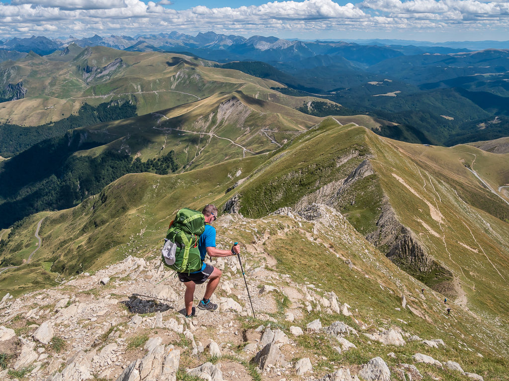
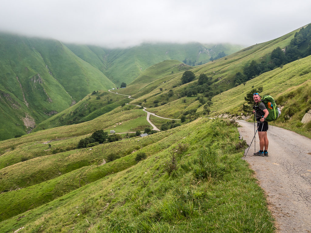
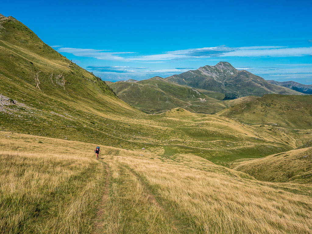
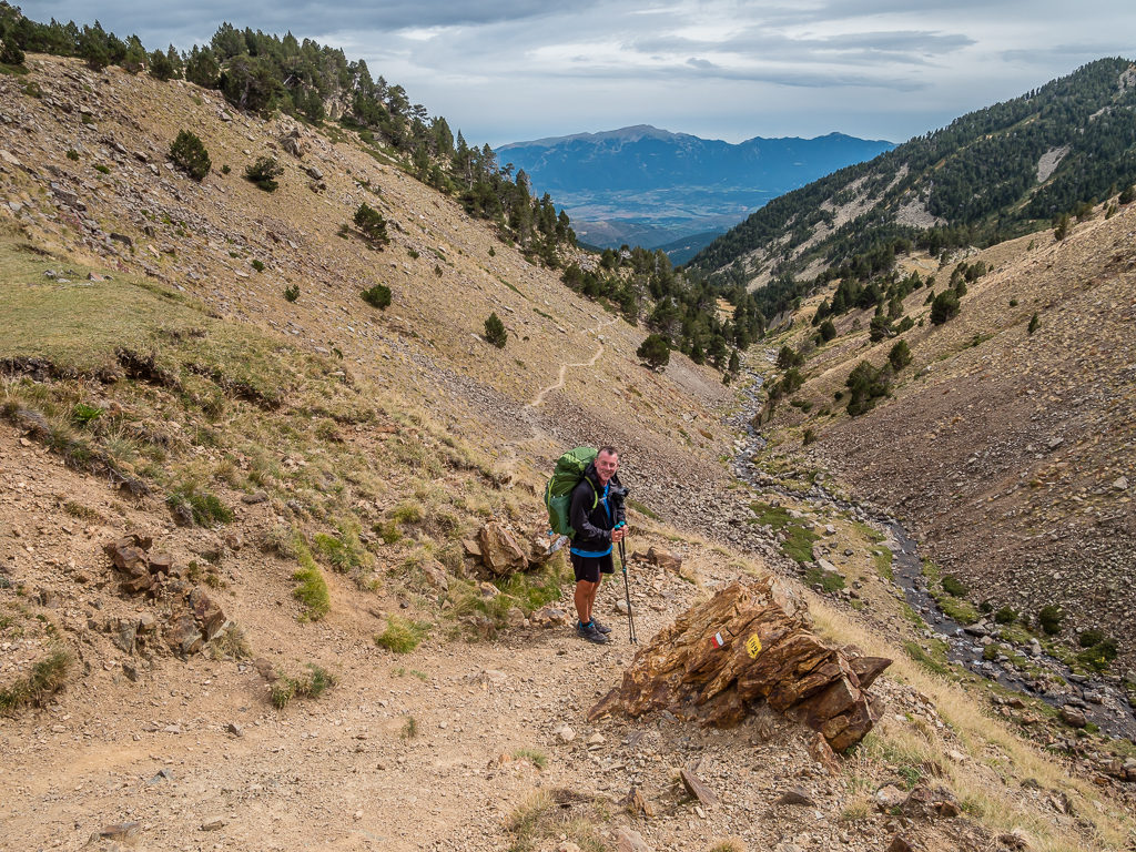
Descending Pic d’Orhy (2,017m) on the Spanish-French border. At the end of our first week on trail we had summited our first 2,000 metre peak in the Basque country following the HRP route.
From the Atlantic Coast to the Mediterranean Sea – A Pyrenees Traverse via the GR10, GR11 and HRP
If you’re considering a walking holiday, then a traverse of the Pyrenees is the hiker’s stuff of dreams! Running some 491 kilometres (305 miles) from the rugged coast of the Atlantic Ocean to the natural blue waters of the Mediterranean Sea, and rising to over 3,400 metres (11,168 ft), the mighty Pyrenees mountain range forms the huge natural barrier that divides Spain and the Iberian Peninsula from France and the rest of Europe.
With spectacular topographical features including some of Europe’s most impressive canyons and highest waterfalls, Europe’s highest limestone mountain, numerous glacial cirques and various extinct volcanoes, the Pyrenees is without a doubt some of Europe’s finest hiking terrain. In 1817, Baltic-German naturalist, explorer, and mountaineer Friedrich Parrot was the first to complete a Trans-Pyrenean route taking 53 days. His exploit has since been followed by many others but it was Georges Veron, a member of the French Alpine Club and collaborator of the French Federation of Hiking, who after successfully crossing the high mountains of the Pyrenees in 1968 made this trek popular by describing it in topoguides, stage by stage.
A grand traverse switching back and forth between France and Spain and staying high – how could we resist such an adventure! Having already hiked a section of the GR11 in the Spanish Pyrenees in 2017, we were eager to return and complete a full traverse from west to east. But wanting to take in the full magnitude and grandeur of what the Pyrenees has to offer in its entirety, we decided to create our own coast-to-coast walking route by combining what are considered to be some of the best sections of all three Pyrenean trails – the French GR10, the Spanish GR11 and the Haute Randonnée Pyrénéenne or HRP.
What a view! The Pyrenees is home to some of the most dramatic scenery in all of Europe.
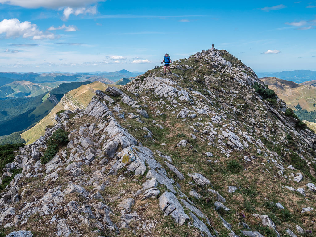
You’ve got to have surefootedness and a head for heights as the HRP includes some incredible ridge walks!
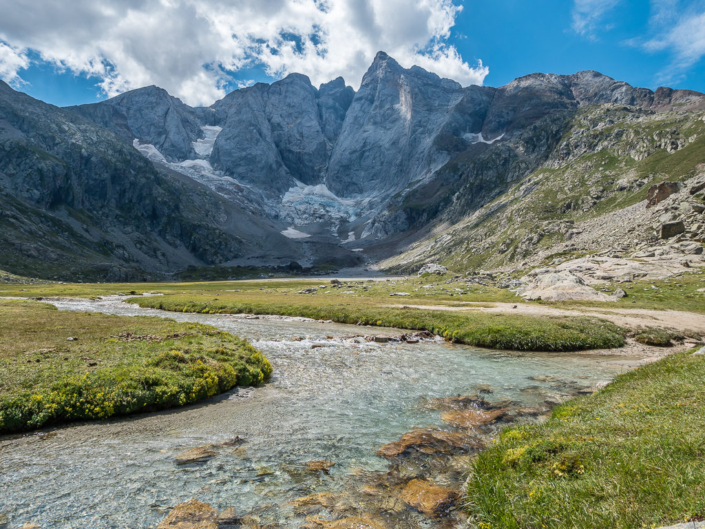
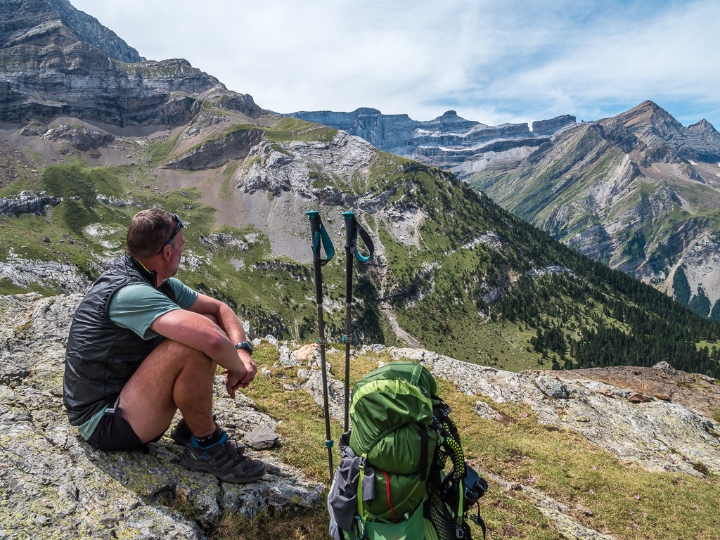
Looking onto the spectacular north face of the Vignemale massif. At 3,298 metres, the ‘Grand Vignemale’ is the highest point in the French Pyrenees.
Into The High Mountains – The Challenge
For hikers with 30–60 days to spare, a complete trek from the Atlantic to the Mediterranean along the spine of the Pyrenees is a fantastic expedition that offers great diversity of geological forms, climate and vegetation to satisfy even the most ardent naturalist. From the green, rolling hills of the Basque country to the deep and looming canyons of Ordesa, taking in the iconic high peaks of Vignemale, Gavarnie, Mont Perdu and Aneto, to crossing the arid Mediterranean landscape of the Canigou, the Catalans’ favourite mountain – travelling the full length of the Pyrenees makes for an interesting and energetic trip on foot. But which trail is for you?
From peak to peak, pass to pass, and valley to valley, the 800 kilometre (497 miles) Pyrenean High Route takes in the entire chain of mountains and stays, as its name implies, above villages and valleys on the highest path possible. This route does not have dedicated waymarking in the same way as the other trans-Pyrenean trails, the GR10 and GR11, and there are no borders as you cross from Spain to France to Andorra and back again. The HRP therefore is far more demanding in terms of orientation and also requires a greater degree of self-sufficiency.
All three routes, whether it be the GR10 from Hendaye to Banyuls-sur-Mer through the French Pyrenees in 55 stages, the GR11 from Irún to Cap de Creus through the Spanish Pyrenees in 47 stages, or the Pyrenean Haute Route, described in 44 stages, follow a varied, scenic traverse through magnificent, often remote, mountains. The French GR10, largely considered the easiest, oldest and most popular of these routes, remains in France and stays north of the watershed. The Spanish GR11 is also a well waymarked mountain path, which passes through Spain and Andorra. Frequent visits to towns and villages mean that resupply isn’t an issue, yet accommodation is more limited than on the GR10. The HRP in comparison, which crosses France, Spain and Andorra, does not require any technical skills such as mountain climbing, rock climbing, or glacier travel. However as the route stays high, it is particularly demanding in bad weather or in early summer when snow could mean serious winter mountaineering skills are required, hence conditions can make it less of a walk and more of a mountain expedition, which you should be prepared for.
If you are unsure as to which route would best suit your skills and experience as a walker, it is recommended that you read the most up-to-date editions of all three Cicerone guidebooks and take it one week at a time, choosing the sections you find the most attractive, or those that suit your schedule. Above all, and in reference to our own experiences which we have detailed in our weekly blog reports, be prepared to adapt your itinerary in light of the changing weather and trail conditions.
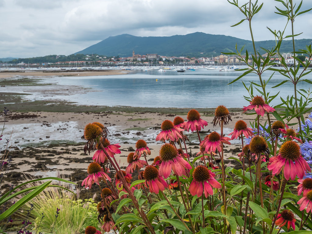
Starting from the Atlantic coast in the west, setting off from Hendaye on the French GR10 in August 2019.
The prevailing wind in the Pyrenees is from the north-west. This means that the Basque country gets more than its fair share of mist and gentle rain, which gives the landscape a very green look.
Taking in the tremendous view from the Refuge des Espuguettes after leaving Gavarnie. At the head of the valley, the natural gap that can be seen in the cliff-line is known as the ‘Breche de Roland’.
The magnificent Muraille de Barroude in the Central Pyrenees. The immense wall, where a glacier still clings to life, stretches for almost 4km in a roughly north-south line forming the back of the gigantic Cirque de Troumouse.
What To Expect
It is important to keep in mind that although the approximate distance between the Atlantic and Mediterranean is 400 kilometres – all three main hiking routes will more than double this. With a well-developed network of trails thanks to many centuries of explorers and mountaineers, travellers and traders, smugglers and shepherds, the three routes tend to cross passes rather than climb over peaks, but all three Cicerone guidebooks give details of the easier peaks which can be climbed from the passes or from mountain refuges, should you so wish to include some peak bagging en route.
Generally, the walking on both the GR10 and GR11 is quite straightforward as paths are well-trodden. However, the terrain underfoot varies hugely. You can be walking on simple tracks through to exposed and narrow, rocky paths in high mountainous terrain, where a slip would be very serious. Throughout both routes there are regular white and red paint flashes to support with navigation. However, some way-marking along the trail isn’t always clear, especially if markers have faded or people have added several cairns which cause confusion. (It would therefore be foolish to not carry a paper map and compass!) Depending on your planned itinerary and how many days you have allowed to complete your thru-hike, if you are limited on time be prepared for some very long and strenuous hiking days, particularly in the central section of the Pyrenees where high mountain passes are a daily occurrence.
During the peak summer months from late June to early September, the entire HRP route can be traversed without crampons or any specialist gear. However, it’s important to note that the highest passes on the HRP can still be snowy, even in mid-Summer. There are numerous mountain passes to cross, so you should at least be comfortable with crossing snowfields, as well as terrain such as boulders and scree. Without the regular waymarking found on the GR10 and GR11, the HRP can be difficult to follow at times so requires careful navigation. As it is a lesser walked route, the going underfoot can also be difficult and tiresome. Paths can be steep, rocky and loose and may be considered by some to be exposed. Previous hiking experience, surefootedness, a good head for heights and a good level of fitness are essential. If you choose to tackle the higher route, some basic scrambling experience would also be beneficial. Also, despite the fact that the HRP stays high for much of its duration, don’t be fooled into thinking that there isn’t a lot of elevation gain and loss. According to one guide, the HRP goes up and over 23 passes above 2,500 metres (8,202 ft), as opposed to just two for the GR10 and 12 for the GR11.
Whichever path you choose – the rewards are immeasurable. Even embarking on a traverse that involves a combination of all three, just like ourselves, you will visit places that are only accessible on foot. You will see mountains in their dawn glow and sunset glory, be able to swim in cool mountain lakes, and experience the remoteness and true wilderness of the Pyrenees.
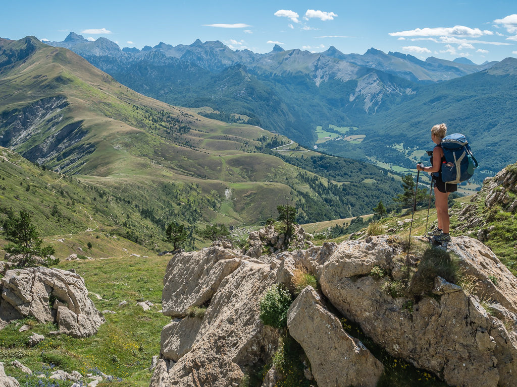
The northern foothills and slopes of the Pyrenees tend to get a lot more cloud and rain than the southern slopes. We regularly found clear skies and better weather by crossing the border into Spain.
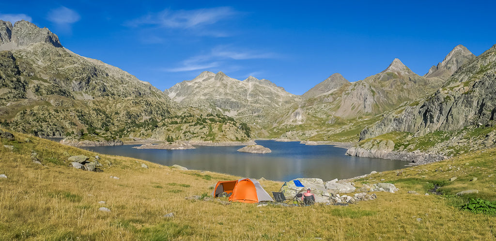
Enjoying a picturesque wild camp location beside Embalse de Respomuso after hiking through the beautiful Rio Aguas Limpias valley. We had camped at the exact same idyllic spot in 2017 during our section hike of the GR11.
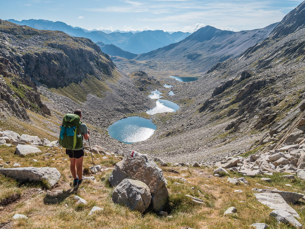
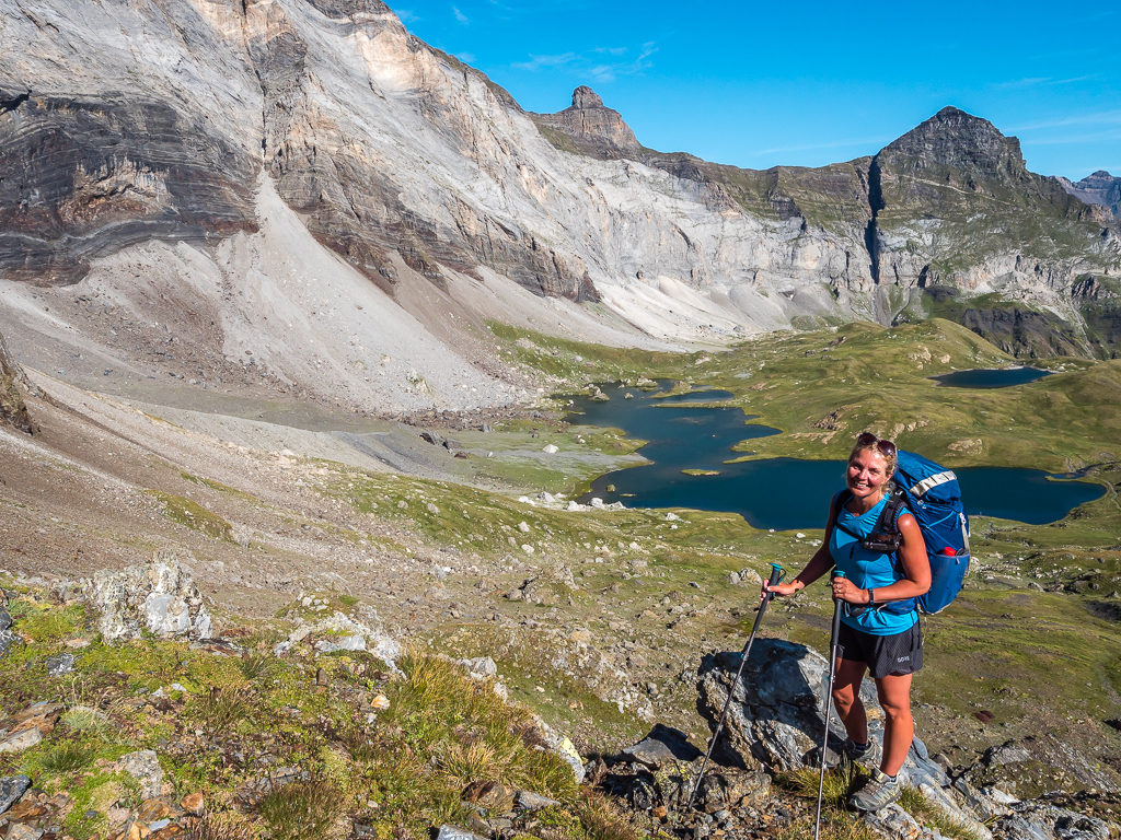
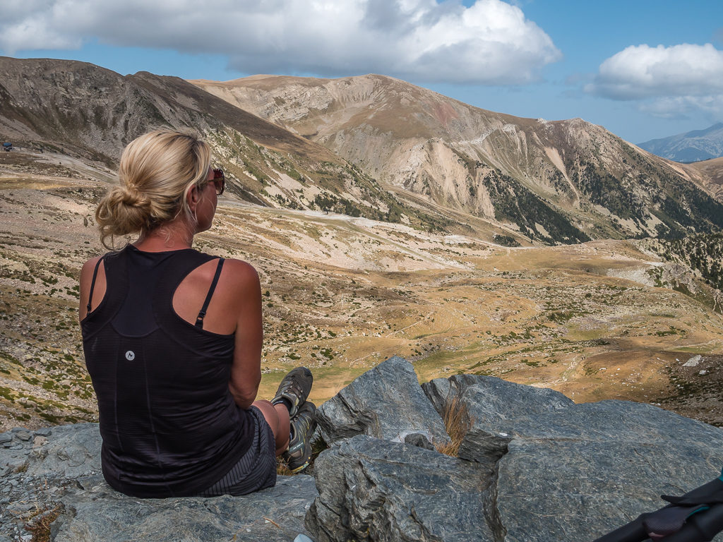
After climbing up to the Collet dels Estanyets at 2,521 metres, enjoying far-reaching views down the Anglos valley looking onto the four Estanyets de Cap d’Anglos.
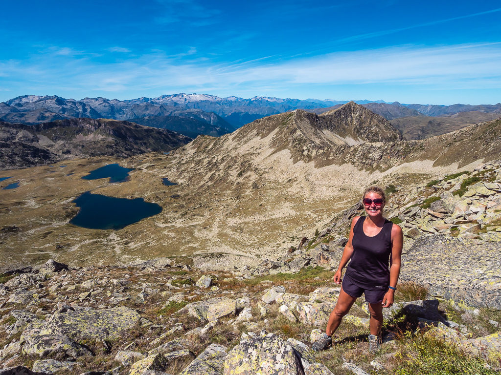
Taking the HRP route to the summit of Tuc de Marimanha, we were treated to a wonderful panorama of the Pyrenees’ grandiose mountains including the Maladeta massif on the distant horizon.
As we head further east, the climate becomes warmer and drier and the vegetation pricklier and squatter. Descending the south face of Puigpedrós and looking towards La Cerdanya – known as ‘The Great Valley of the Pyrenees’.
Looking out from the Collado de Tirapits and wanting time to stand still as we savoured our last moments in the high mountains before descending into the Spanish foothills…
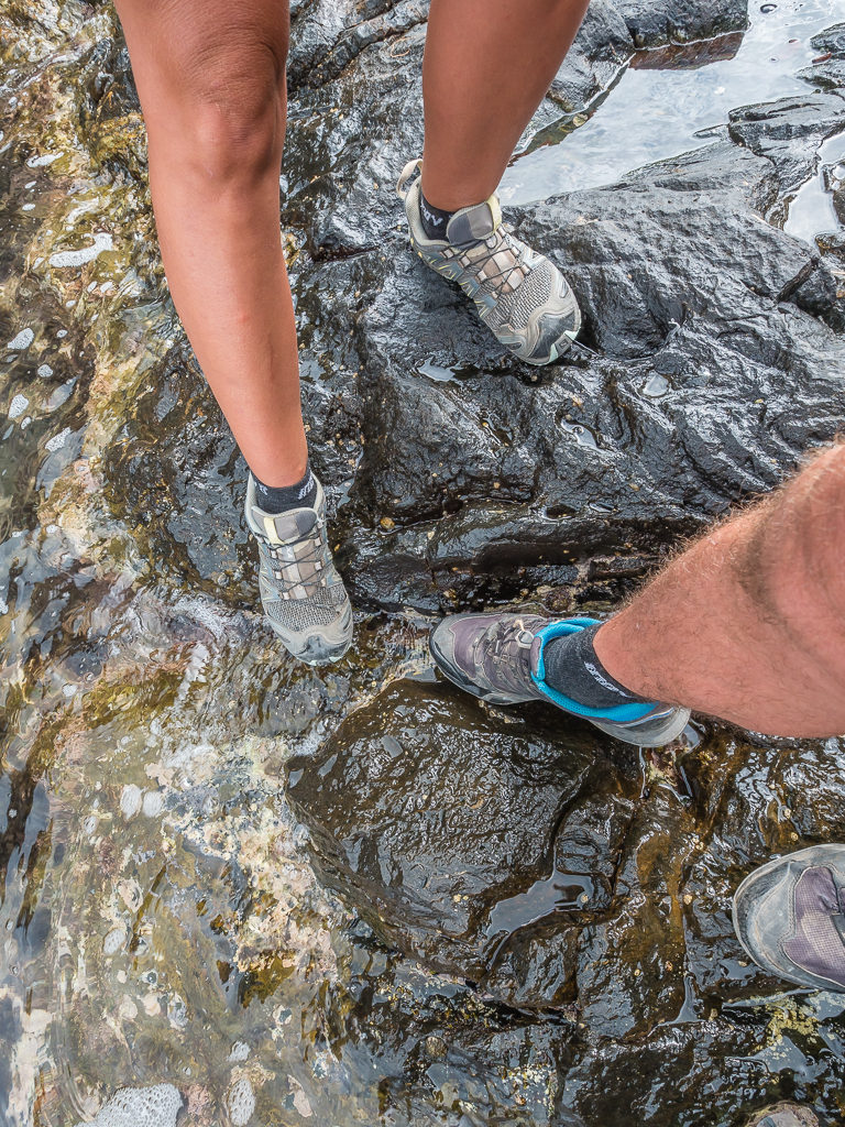
Dipping our toes in the Med after reaching Cap de Creus and the end-point of the GR11. After 55 days on trail, finishing our Pyrenees thru-hike on a high!
More Helpful Information…
Accommodation
In the High Pyrenees there is a network of manned refuges which provide relatively cheap hostel-style accommodation as well as meals and drinks. In addition, particularly in Andorra and Catalonia, there is a network of unmanned refuges which are similar to the Scottish bothy. The best of these are purpose built and well-maintained, but we would only consider using others in a real emergency. There is also the option of staying at a gite d’etape or hotel in the larger villages. Most of the mountain huts have free designated camping areas close by. These spots come in handy if you plan on eating some of your meals at the refuges, although we didn’t make use of the meal or sleep facilities.
Wild camping
Wild camping is possible throughout the route, although suitable places in the Spanish foothills as you get closer to the Mediterranean are harder to find. In France, camping in the wild is called ‘bivouacking’. This means you can camp overnight when you are in the hills, away from habitation, but you cannot leave a camp up through the day. A few areas, particularly national parks and nature reserves have specific regulations on bivouacking, but in general it is permissible to set up your shelter late in the day (after 7 pm) but you must head off again early the next morning (by 9am). Be sure to pitch away from villages and out of sight of the trail. We would recommend carrying a tent as this will provide you with a greater degree of accommodation flexibility and also gives you the freedom to soak in a beautiful Pyrenean sunrise or sunset from that idyllic location you suddenly discover.
Resupply
In most of the settlements along the HRP you can buy basic staples such as pasta, bread, sausage, cheese, eggs, cereals and chocolate. Some provisions can also be purchased at the staffed mountain huts where available. In comparison, frequent visits to towns and villages on both the GR10 and GR11 means that supplies are rarely a problem. You should never have to carry more than two day’s worth of food at a time unless you choose to do so. Dependent on what cook system you choose to carry, purchasing gas cannisters can sometimes be problematic however, especially if you are using the screw top style. (That being said, we do use a lot of gas with carrying a frying pan and cooking a lot of eggs!)
Post
Although it isn’t necessary to send resupply boxes on the HRP, for those who would like to have paper maps in addition to their electronic devices (recommended), consider sending map/ food packages to the following villages: Lescun (end of Stage 1), Gavarnie (end of Stage 2), Salardu (end of Stage 3) and L’Hospitalet-près-l’Andorre (end of Stage 4). The cheapest and quickest way to do this is most probably from the post office in Hendaye before beginning your thru-hike.
Water
The villages along the routes have fountains or pumps from which potable water can be obtained. In the mountains it is recommended to treat any water taken downstream of human settlements, grazing animals or agriculture so we carried a Sawyer Squeeze water filtration system and never had any problems or illnesses.
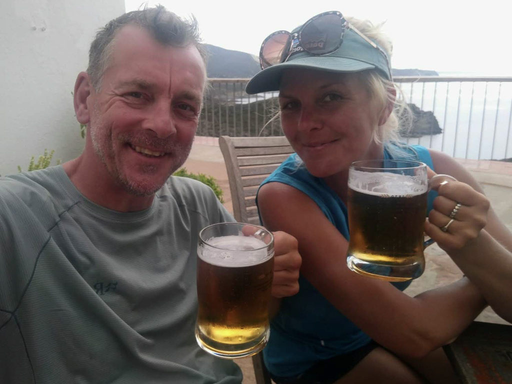
Toasting another successful thru-hike! Traversing the Pyrenees was the 8th long distance hike that we have completed in its entirety and it’s up there with the best of them.
We completed our thru-hike between 2nd August and 25th September, 2019. Our daily trip reports with accompanying photographs are included below:
You can also watch our journey via our video trail diaries.
Organised by ‘week-long’ sections to match our trail diaries, this is a video companion to our written blog content showing what you can expect from this amazing thru-hike!
Summer 2019 – Pyrenees Traverse – Week 1
Summer 2019 – Pyrenees Traverse – Week 2
Summer 2019 – Pyrenees Traverse – Week 3
Summer 2019 – Pyrenees Traverse – Week 4
(Weeks 5 to 8 still to follow…)
We fully recommend embarking on a Pyrenean adventure of your own. Whichever route option you take, it’s sure to be a magnificent hiking experience as you traverse of one of Europe’s most beautiful mountain ranges!