
“Doing what you like is freedom. Liking what you do is happiness”.
– Frank Tyger
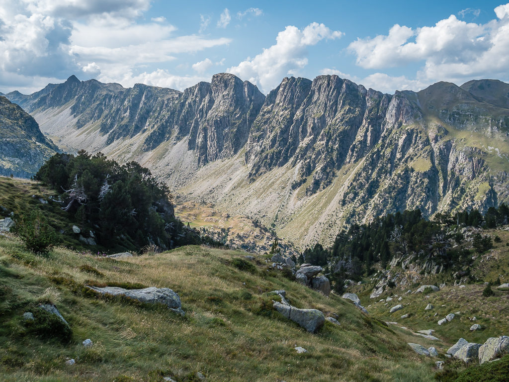
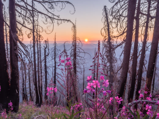
Week 5 brought with it one of our toughest challenges when we tackled the Marimanha ridge.
Last week had seen us winding down and recharging the batteries in the beautiful Spanish town of Benasque. But now, well rested and raring to go once more, we were ready to rejoin the HRP and experience some more high mountain thrills. Maybe we shouldn’t have been quite so keen on the latter however as ‘Week 5’ brought with it a series of unanticipated events that not only challenged our route-finding skills but also our marital bliss on trail! Thankfully, after successfully scrambling around two very exposed and improbable looking sections of rock wall in our effort to summit Tuc de Marimanha (2,679m) having taken the wrong line up, we lived to tell the tale. Read on to find out more…
Day 29 – ‘Following Another Variant!’ Friday 30th August, 2019, Wild Camp north of Hospital de Vielha to Wild Camp by Lac deth Cap deth Port, GR11, GR11-18, HRP, 10km
Having stayed up until midnight surfing the internet and uploading photos of our trip so far on social media because of an unexpected phone signal at camp, we didn’t wake up until around 8am that morning and then still lazed around in our sleeping bags until nearer nine. Breakfast was two hearty scrambled egg wraps with chopped salami and melted cheese, not just because it’s a delicious breakfast in itself, but because they’re extremely filling and set us up for the day. With a long climb ahead, it’s what we needed to get us up and over the pass!
It’s a good job there aren’t any ‘bivouac police’ out in force, as it wasn’t then until around 11am that we were actually ready to get going. I think we’re probably taking the more leisurely aspect of this trail a bit too far now! But as we only had around 11 or so kilometres to hike, there was no urgency to us getting ready and getting back on trail early. Even with this ridiculously late start, we still estimated that we’d be at camp by 4pm, or 5pm at the very latest depending on our breaks.
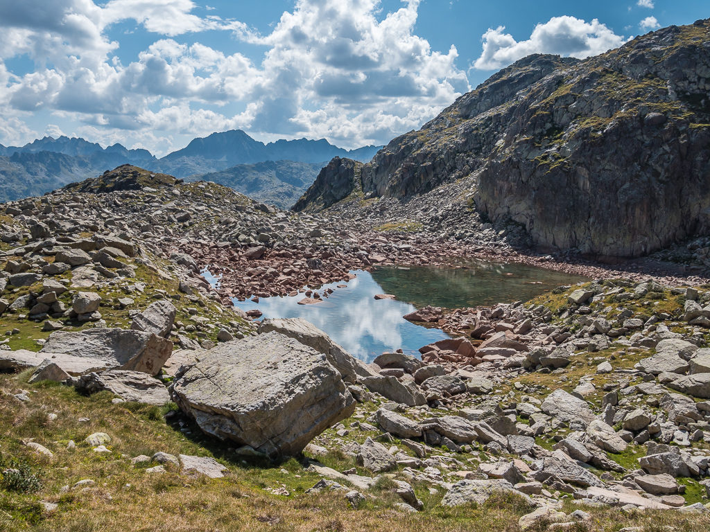
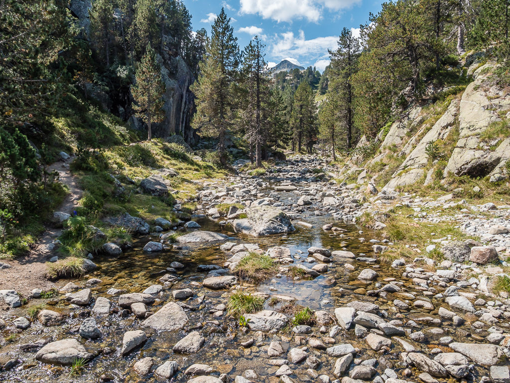
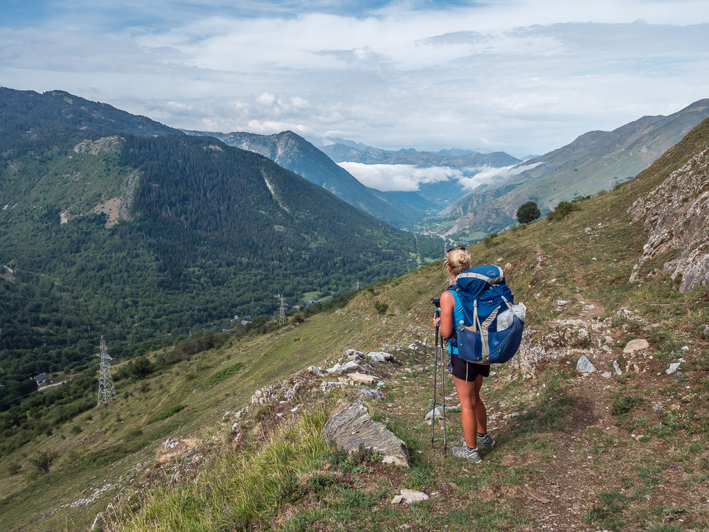
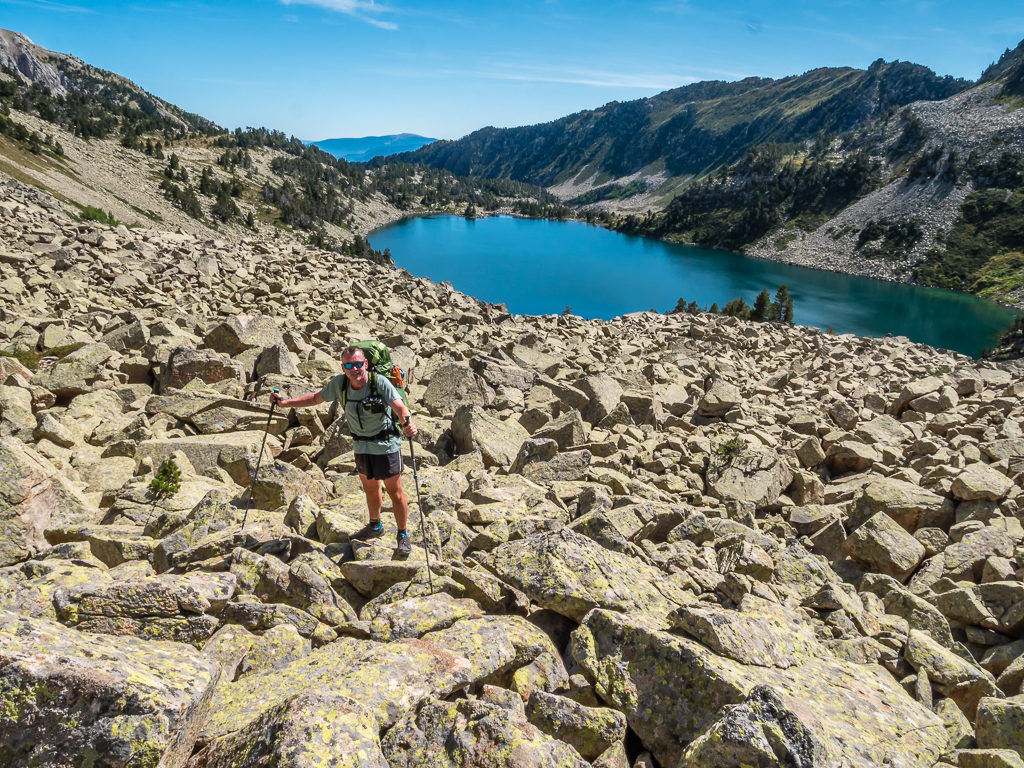
Following a path with only a few paint flashes occasionally marked but with several cairns to signal the way, we steadily made our way up the grassy slopes of the Tuc de Sarrahera. Despite the trail switching back here and there, we could see it was generally following the course of the Barranc de Lac Redon. However we still made a wrong turn at one point, blindly veering left when the path split, which would have unwittingly taken us down to the lake instead of up to the pass. Fortunately, we were quick to realise our mistake, which meant we only had to backtrack around 150 metres or so. Switching back sharply right, we rejoined the GR11 having completely missed the red and white cross indicating ‘wrong way’, but then had an easy climb to the Port de Rius – our first pass of the day at 2,355 metres.
Looking back to the imposing Tuc deth Port de Vielha (2,605m) as we set off from camp and began hiking up to the Port de Rius.
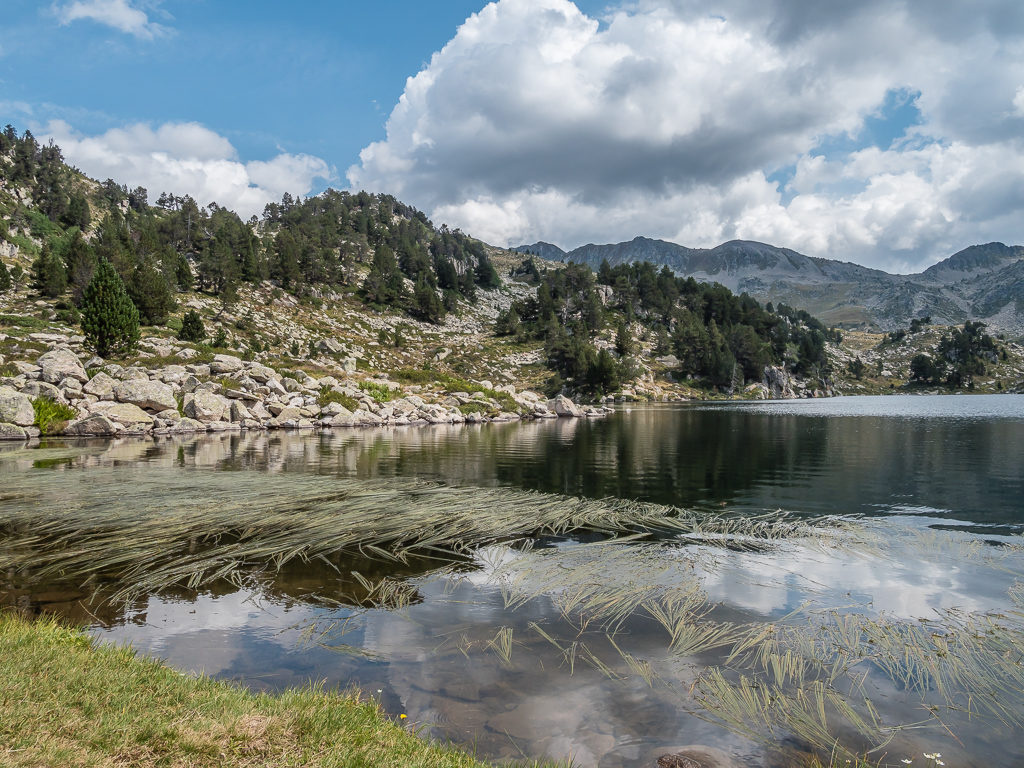
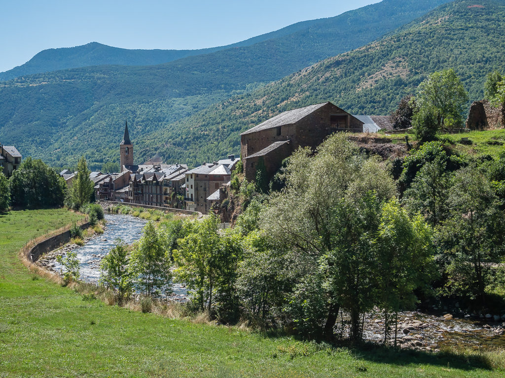
The trail levelled off somewhat before taking us around the rocky northern shore of Lac de Rius. Then as the valley opened out, we found ourselves walking through magnificent granite scenery. Making our way downhill on the right-hand side of the valley on the original GR11 trail with an imposing wall of rock to our left, we took the shorter, more direct route to the Refugi dera Restanca in the Parque Nacional de Aigüestortes i Estany de Sant Maurici following the Barraca de Rius.
There is a fork in the path where the Haute Randonnée Pyrénéenne veers to the right taking an alternate route to the refuge passing the Estanh Tort de Rius and the Lac de Mar, which is cited in the guidebook as “…A magnificent alternative to the GR11”. However, we opted not to take the HRP in this instance as it would have added 4 hours onto our day.
Descending from the Port de Rius (2,355m), we passed the northern shore of the Lac de Rius following a fairly level path.
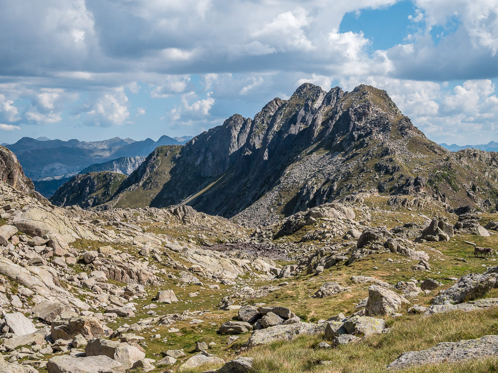
Climbing above the treeline, we were surrounded by steep slopes and rocky ridges as we followed the GR11 along the Barraca de Rius.
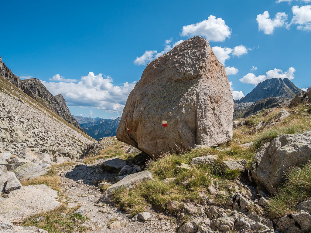
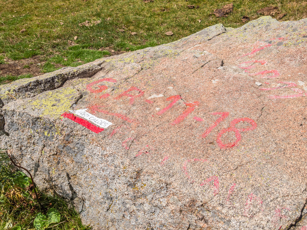
Passing a huge boulder marked with white and red paint flashes signposting the GR11 route.
A clear paths winds its way into the magnificent Rius valley taking us on a more direct route to the Refugi dera Restanca.
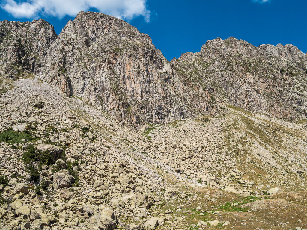
Flanked by towering granite cliffs to our left, we were treated to tremendous views as we made our way down the Rius valley.
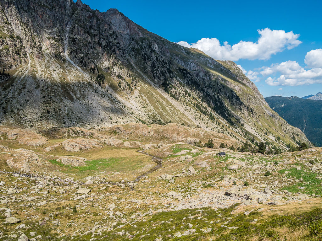
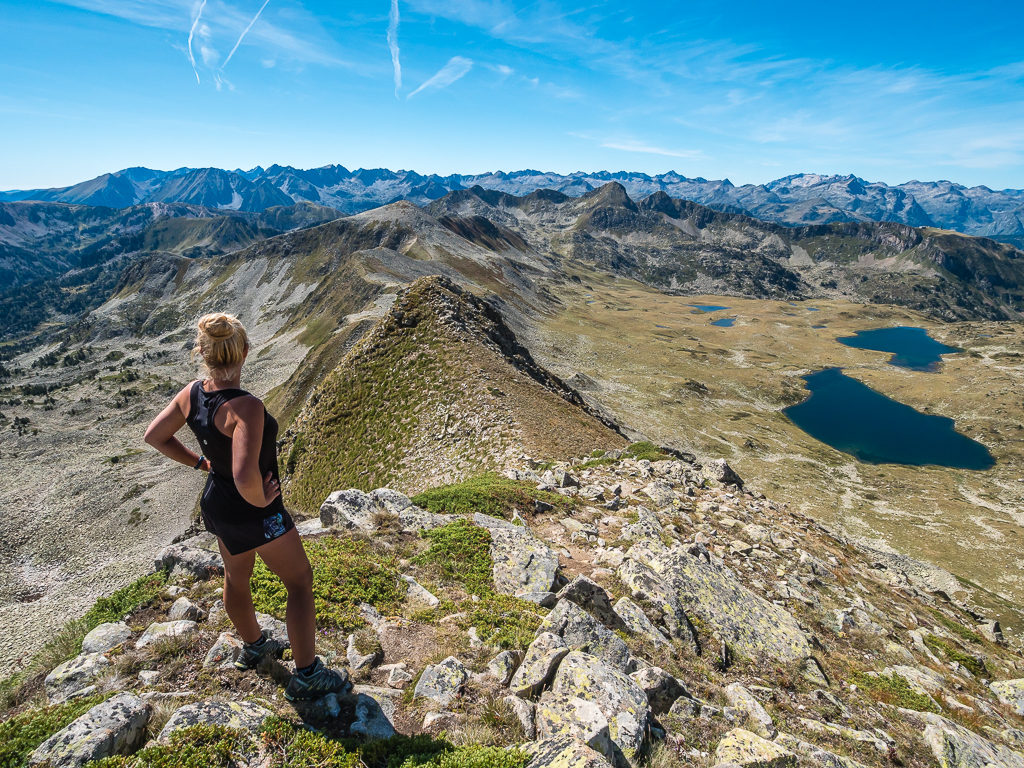
This photo provides a real sense of scale. Looking towards the small Cabana de Rius located on the rocky hillside at the foot of the mountain.
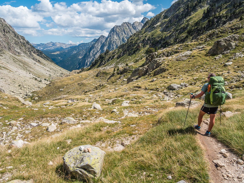
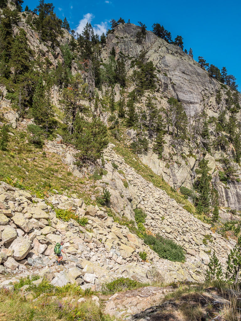
Great and grandiose, this high mountain section of trail reminded us very much of some of the backcountry trails we have hiked in the USA.
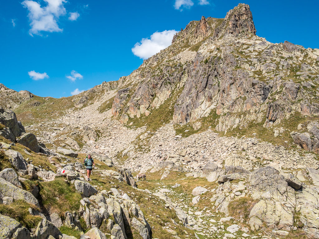
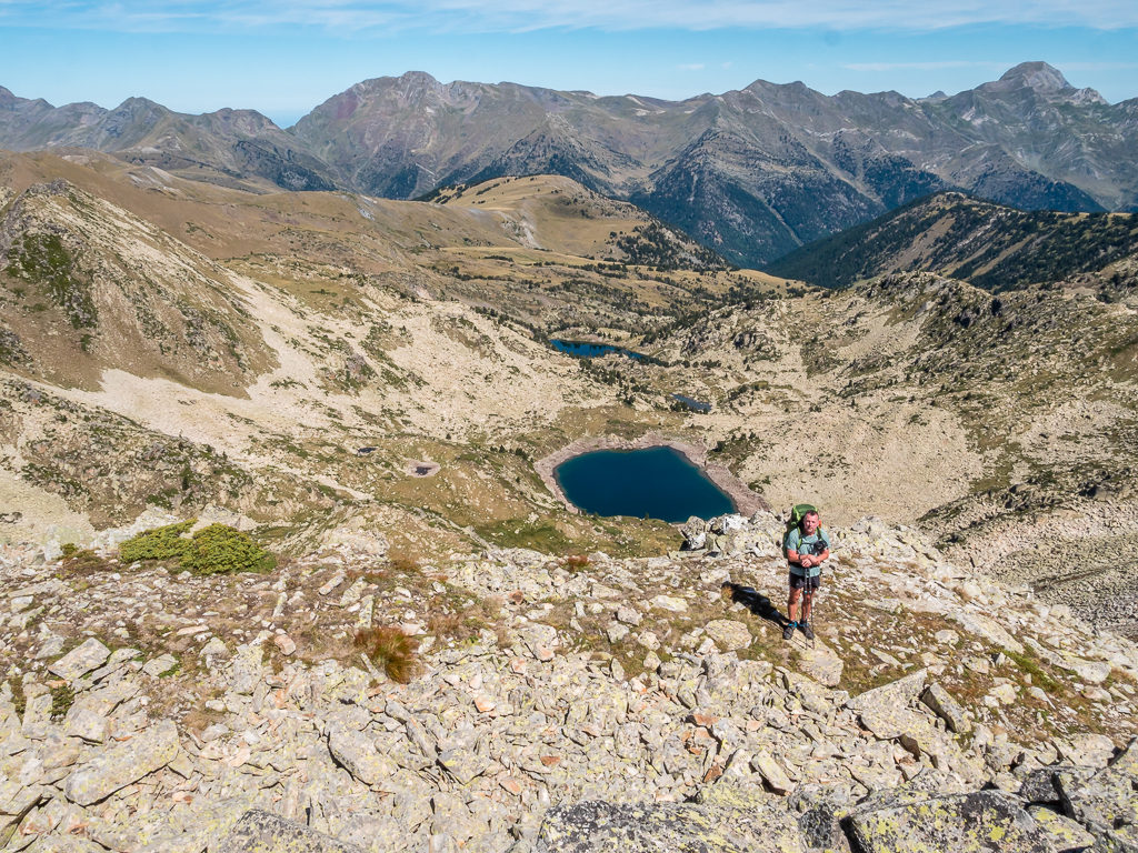
With the path becoming a little rougher, we were pleased to have cairns signalling the way as we climbed over a couple of ridges before descending towards the refuge located at the east end of the dam. Reaching the Refugi dera Restanca soon after, we were treated to splendid views of the lake – the Estany dera Restanca lit up in the late-afternoon sun.
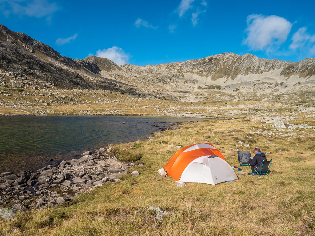
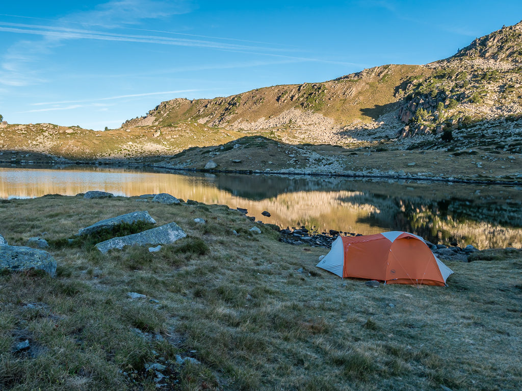
As camping is not allowed within the vicinity of the refuge however, we decided not to stop. Instead we pushed on, this time joining the southerly variant route – the GR11-18, as it was highly recommended as being the more interesting and attractive of the two paths leading to the Colomèrs Refuge located at the top of the Aiguamòg valley and the southernmost tip of the Val d’Aran. By taking this route, we had earmarked another lakeside wild camp spot for this evening – namely, we were hoping to pitch somewhere along the Lac deth Cap deth Port in the Aran valley.
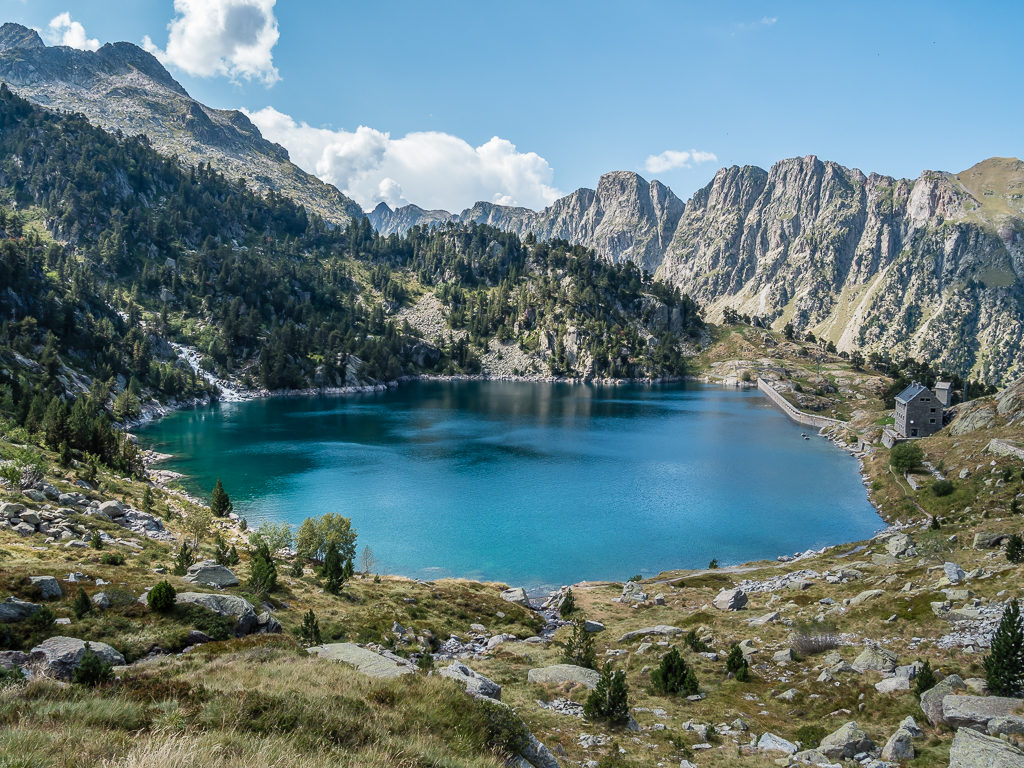
Looking back to the stunning, sapphire waters of Estany dera Restanca, beside which the Restanca Refuge is located.
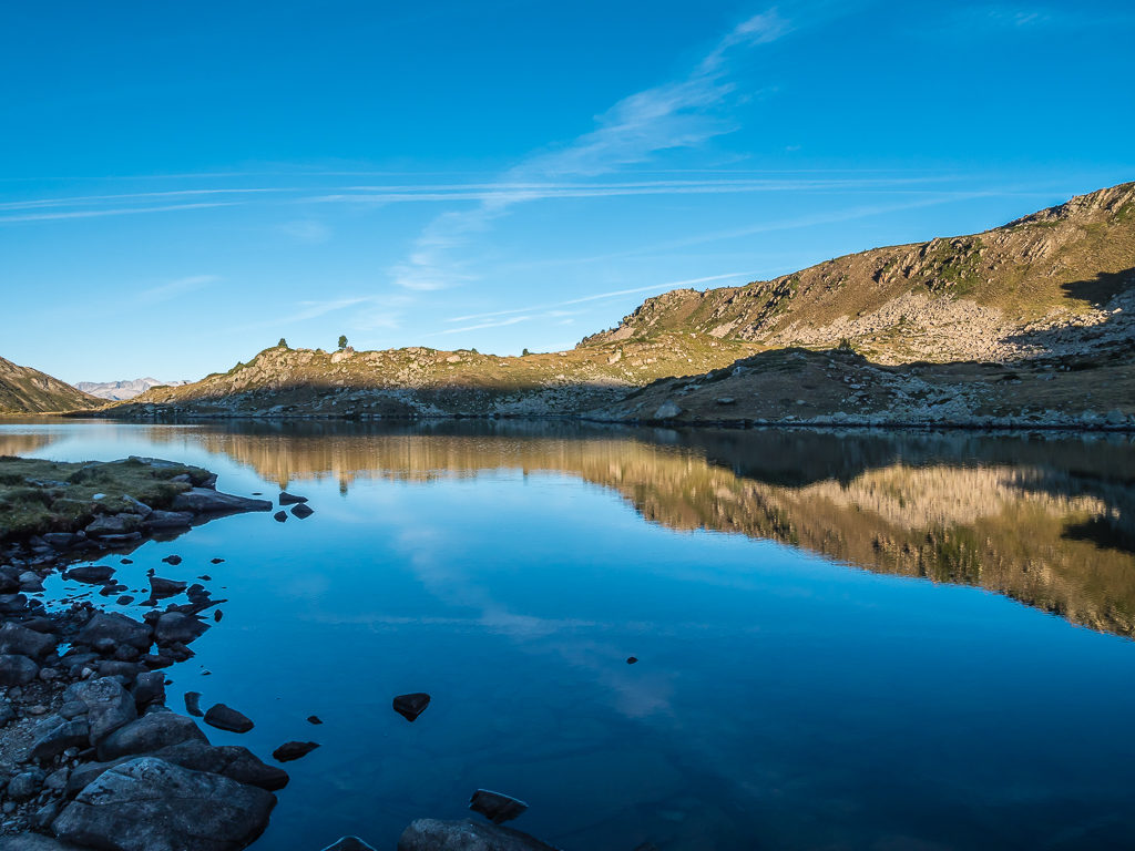
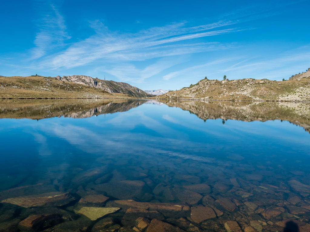
From the refuge, we zig-zagged uphill climbing to 2,230 metres in order to reach the Lac deth Cap deth Port, which we had earmarked as tonight’s prospective wild camp spot.
Reaching the outlet of the lake, we decided to stop and filter some water for dinner that evening, then sit awhile and enjoy the wonderful mountain reflections in the gentle waters. Half an hour later, walking above the northeastern shore of the lake in search of a big enough spot to pitch up, we then managed to bag ourselves a secluded grassy patch atop a rocky outcrop. As there were already a couple of tents pitched at the opposite end of the lake, we felt fortunate to have spied this particular spot.
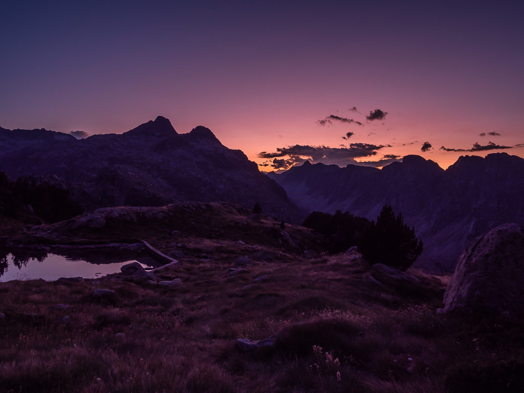
Like yesterday, the clouds had been building all day and by late afternoon we were unsure whether we’d be hit with sudden thunder showers. But thankfully they never materialised. Instead, we were treated to some subtle pink sunset skies later that evening, followed by a deep purple glow right before the sky descended into darkness.
Enjoying some down time at our pre-used camp spot above the reservoir outlet.
Looking back towards the stunning Rius valley.
The clouds had been rolling in all afternoon, but we were fortunate enough not to have thunder showers today despite the dramatic skies.
Using up the last of our dinner rations, we devoured curry flavoured instant noodles cooked with re-hydrated vegetables, served with a fried egg on top. It’s one of our staple trail kitchen menus that we never tire of! We wouldn’t be going to sleep at midnight tonight though as we had a relatively long day tomorrow where we would be crossing another couple of mountain passes prior to walking north to the Spanish town of Salardu to resupply for the next section. Then later in the week, we’d be entering completely new territory for us with our ‘Pyrenees Traverse’ crossing more mountain wilderness into the small, independent principality of Andorra, which we were really looking forward to.
Enjoying a more subtle sunset as the sky becomes a blanket of pastel pink and purple.
The mountains take on a more sombre mood as darkness begins to descend over us all.
Day 30 – ‘Rewarded With Steak’, Saturday 31st August, 2019, Wild Camp by Lac deth Cap deth Port to Hotel Mont Romies, Salardu, GR11-18, HRP, 19km
It was early Saturday morning and the day hikers were out in force! Whilst having breakfast and packing away, two large walking groups had already hiked past us heading up the valley towards the mighty mass of Montardo, one of the classic peaks of the Spanish Pyrenees within the Parc National de Aiguestortes i Estany de Sant Maurici.
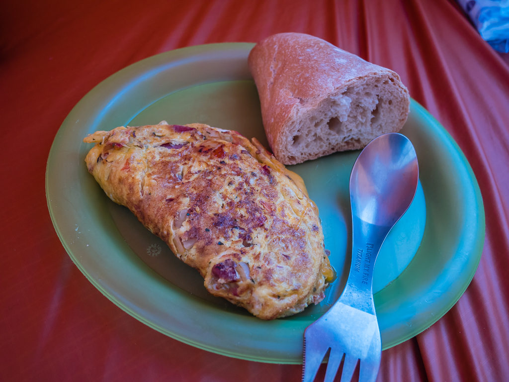
Fuelling up with a hearty breakfast of cheese and vegetable filled omelettes in readiness for the day ahead.
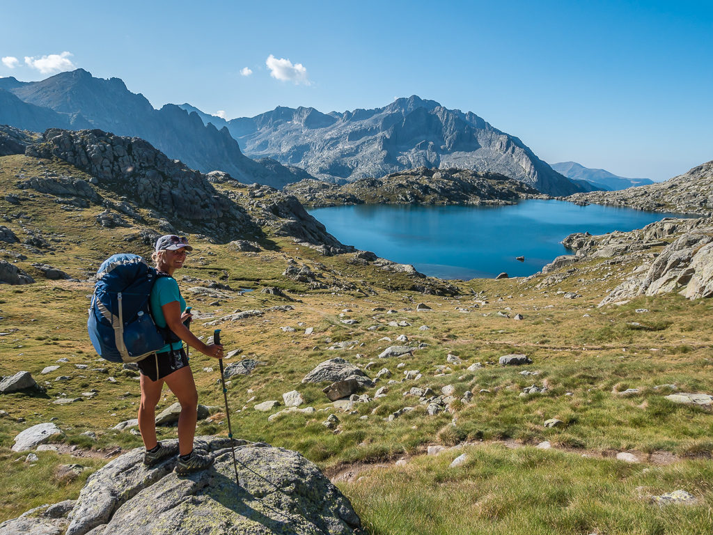
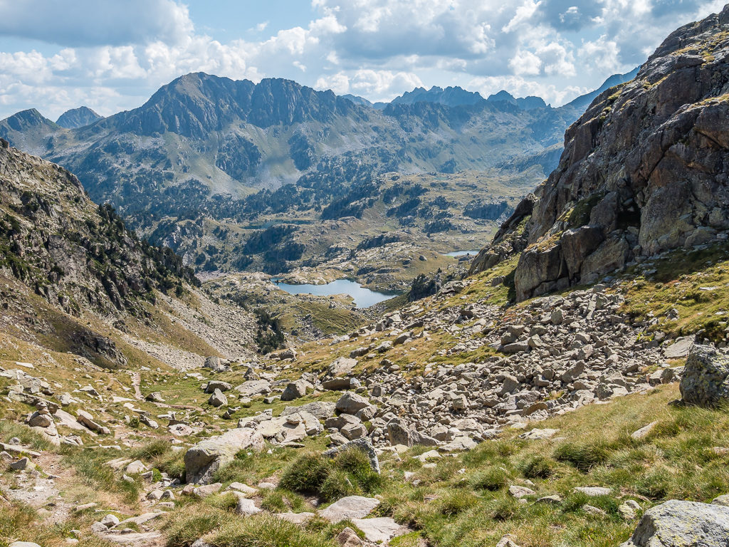
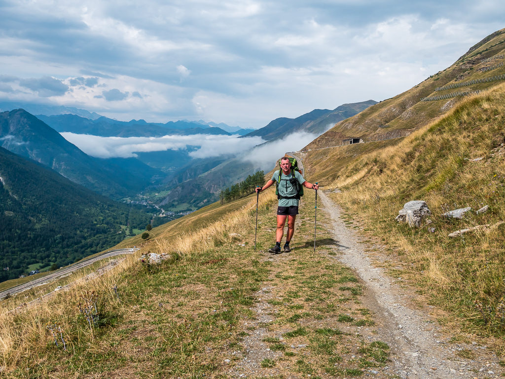
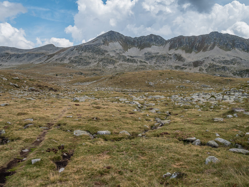
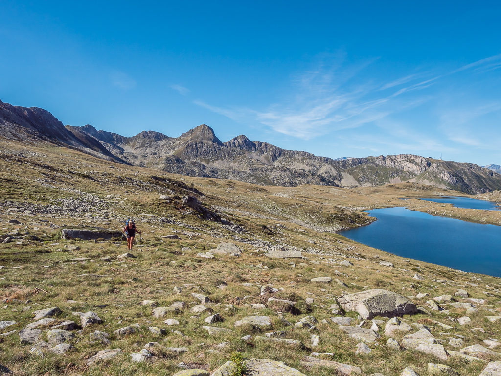
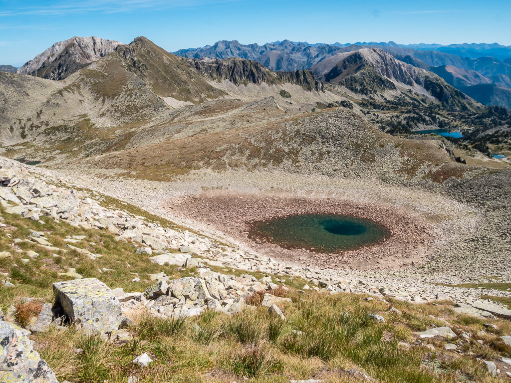
After setting off around 9am, this morning’s beautiful and dramatic route took us straight uphill to the Coll de Crestada (2,475m) situated on the border of the national park. We had indeed reached an extensive landscape of wild and rugged slopes, the rough trail taking us over rocks and boulders, interspersed with fine views of magical mountain lakes. With the top of the pass affording us a wonderful vantage point of the Estany des Monges glistening in the early morning sun, we then continued to another smaller pass on a ridge that again presented us with a beautiful panorama of the two Mangades lakes sprawling out between the rocky terrain.
Looking back to the Lac deth Cap deth Port high above the Rius valley where we had wild camped last night.
Reaching the Coll de Crestada we were treated to another mountain lake glistening in the early morning sun – the Estany des Monges.
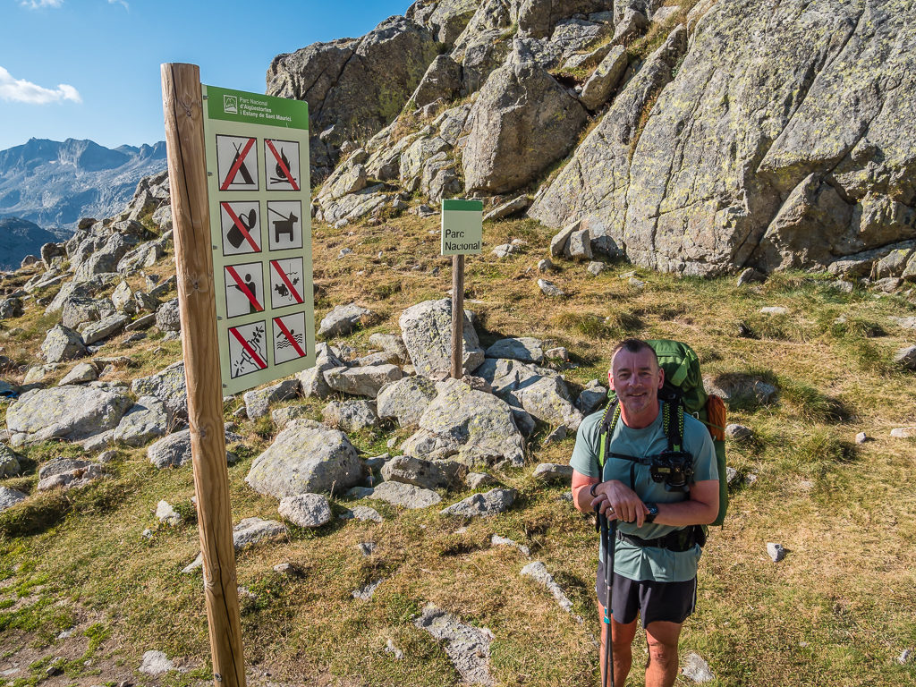
Crossing the boundary into the Parc National de Aiguestortes i Estany de Sant Maurici where from this point wild camping is prohibited, as indicated by the prominent signage.
Climbing to the Port de Caldes at 2,570 metres, we stopped to film an update of our progress. Looking back, with the sun highlighting the lakes and Montardo dominating the skyline on the right we needed to capture and share the tremendous scene we had just passed. It was then all downhill, following a rocky path towards the Colomèrs Refuge. We weren’t going to the refuge however, instead we had planned on heading to a small Spanish town around 11km away to resupply.
With an incredible vista that we wanted to share, we took the opportunity on reaching the Port de Caldes to film an update of our progress.
Simply enjoying the spectacular view!
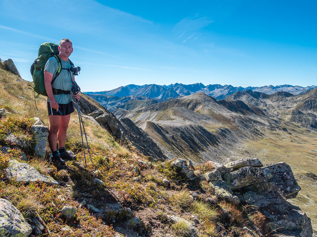
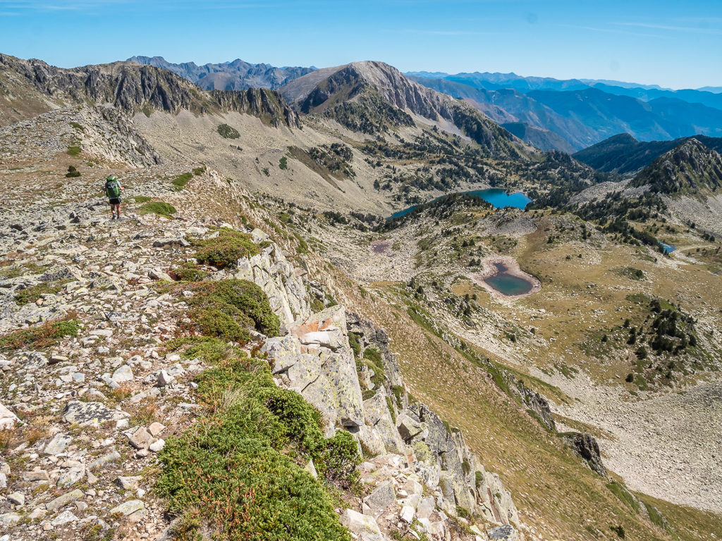
Looking back to the trail where a lone hiker follows behind us to give a sense of the enormity of these far-reaching mountains.
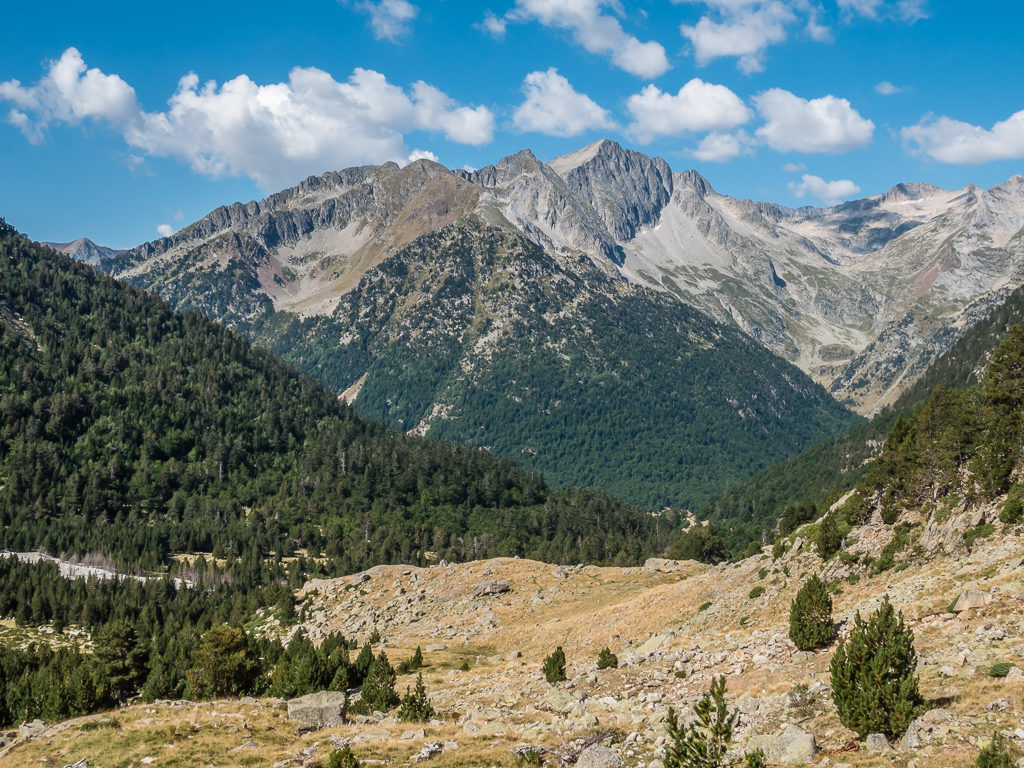
Today, we were mostly wandering through an extensive landscape of wild and rugged slopes, interspersed with fine views of magical mountain lakes. Behind the Needles of Travessani, are the Pic de Comalespada and Pic de Comalesbienes.
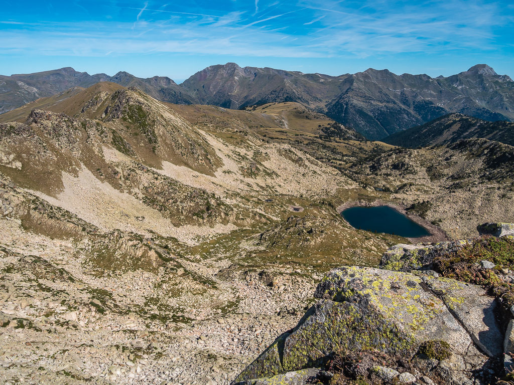
Capturing cloud reflections on one of the smaller tarns.
Looking towards the Pic dera Lòssa whilst setting off on a steep descent that would take us to the foot of the valley (Coma deth port de Caldes).
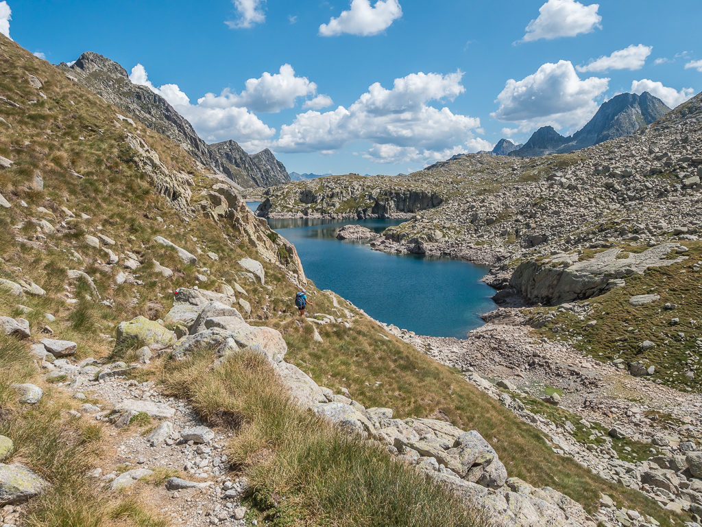
After descending from the Port de Caldes, we continued to follow the GR11.18 variant that would take us all the way to the new Colomèrs mountain refuge.
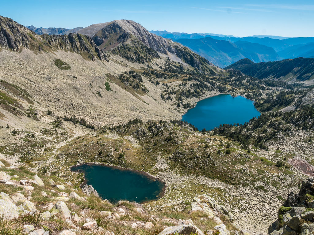
Looking downhill towards the Lac Major de Colomèrs beside which the new Colomèrs mountain refuge is located.
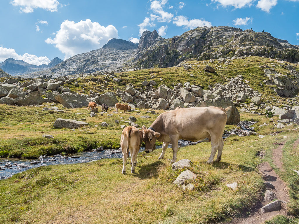
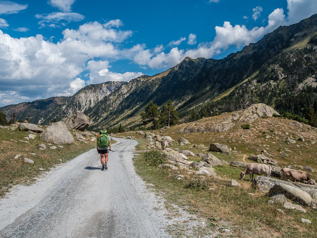
Back in cattle country, we had to be mindful of where we filtered water once again.
Passing the dammed Estany Major de Colomèrs, we followed the course of the stream further downhill, the valley we were now walking through lined with towering granite peaks, tall pine trees and large slabs of rock, reminding us distinctly of the USA’s Yosemite valley. Finally reaching the valley floor, we stopped to have lunch in a small grassy clearing beside the stream. The fact that there was a bridge allowing for easy crossing and a steady stream of day walkers now coming our way indicated we were close to the trail junction. From the town of Salardu, there is direct access by road to the trailhead car park, from where it is then about a 40 minute walk to the refuge. Hence, we had already decided to hit the tarmac and walk the road route to town as we thought it would have less obstacles and be the quickest option for us.
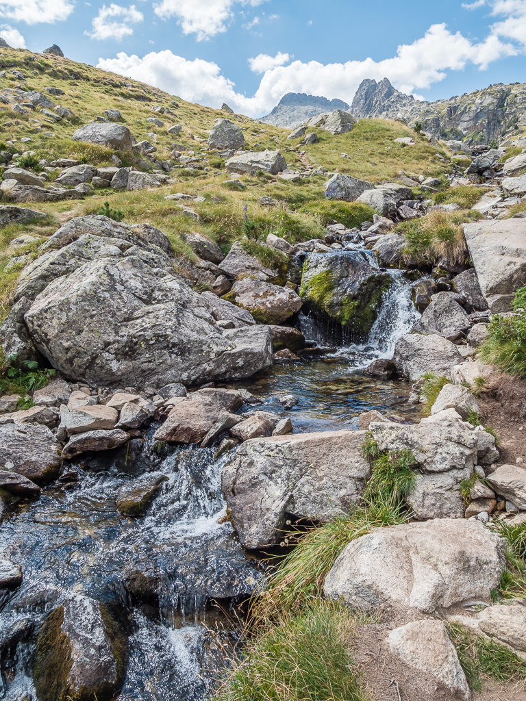
As we were travelling downhill following the course of the Arriu d’Aiguamòg, we had plenty of flowing water to top up our supplies.
Continuing along the GR11.18 variant towards the Refugi de Colomèrs as it is recommended as the more picturesque route. From what we saw that day – it didn’t disappoint!
Flanked by towering granite peaks and tall pine trees, the trail then descended into the Aiguamòg valley.
Following an easy trail beside the river, we stopped for a picnic lunch in a small grassy clearing just beyond the bridge crossing.
Rejoining the trail, which was now conveniently covered with boardwalks, we headed through a large open field before reaching the car park. From here, despite the road appearing to wind down the mountainside for evermore, we set off at full speed. We thought we could make better time on the road as we had pre-booked a hotel for the night in Salardu, so as usual when we’re heading to town, we wanted to get there as quickly as possible.
Two hours later, we could see the settlement of Salardu nestled in the hills on the other side of the adjoining valley teasing us. It seemed so close, yet we still had to follow the road to the western end of the valley and cross the bridge over the River Garonne before making it to the centre of town.
Setting forth on the long, winding road to Salardu. There’s nothing like having a hotel booked for the night as sheer motivation to keep going!
Looking onto the small settlement of Tredòs, a few kilometres off from reaching our destination of Salardu.
Arriving at 4pm, we found that the supermarket was closed for ‘siesta’, as is typical of every Spanish town that we’ve visited so far on our Pyrenean journey. Thankfully it would reopen again at 5pm until 8pm so we could do our resupply shop in readiness for leaving tomorrow as it was closed on Sundays. That meant we could check into the hotel and shower first. We also had to hand-wash all of our gear and string a line up in the bathroom in the hope that it would dry by morning as there wasn’t any laundry facilities in town. (We had not done our research very well in this instance!)
Looking onto the Église Sant Andrèu, the main church in Salardu.
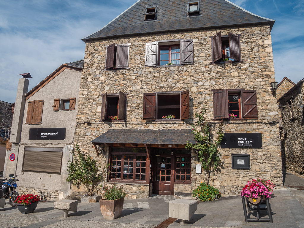
Our wonderful boutique hotel in Salardu, in the Aran valley.
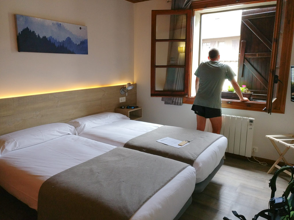
We were very impressed with the modern facilities in our room and ensuite bathroom, which added a little luxury to our overnight stay.
As a refurbished ski hotel, we found the Mont Romies to be both welcoming, modern and functional and a really lovely place to stay for the night. The supermarket however (I say supermarket – it was more the size of a small corner shop) was very limited in terms of provisions for hikers, even with our inventive trail kitchen menus. So we had to settle on some basics again – bread, cheese, cured meats, eggs and pasta that would have to see us through to Tavascan, our next resupply town in 4 day’s time.
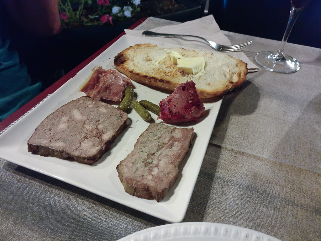
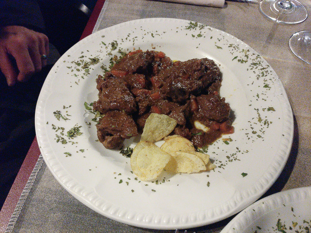
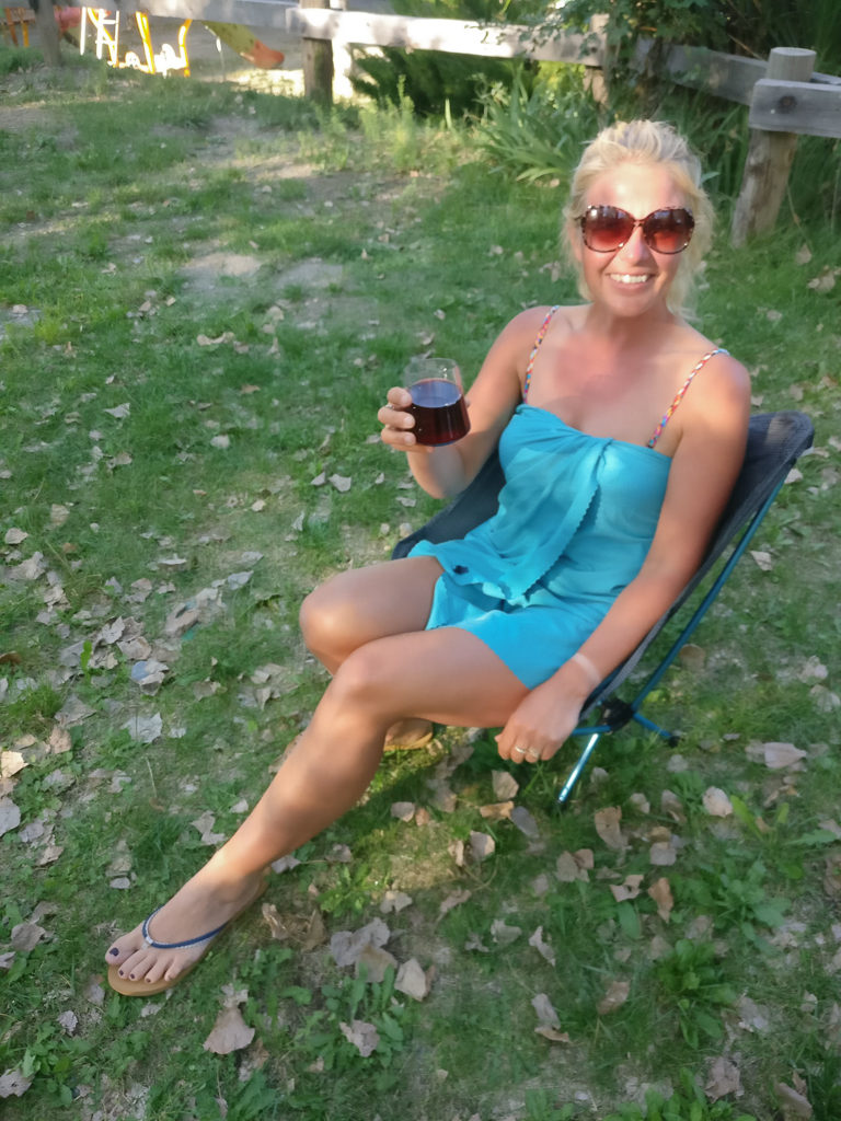
With it being Saturday night, we thought Salardu would be rocking as there were plenty of tourists around. However it was extremely quiet and nothing like Benasque, with the pizza restaurant we had earmarked for dinner remaining closed at 8pm. Having walked around to have a look at what limited options there were, we decided on Cafeteria Era Trobada and we didn’t regret it as we had the best steaks and red wine of the trip so far!
What Salardu lacked in amenities (no laundry too), the meal certainly made up for after a taxing day on tarmac!
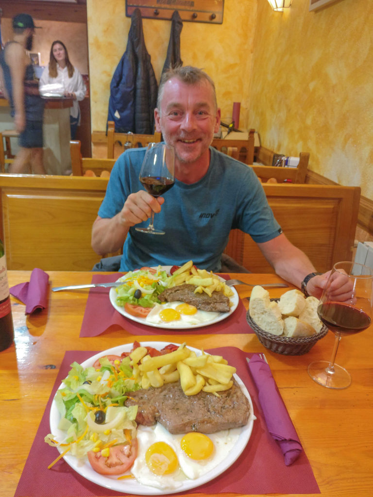
Steak, egg and chips – the perfect feast after a long day’s walk!
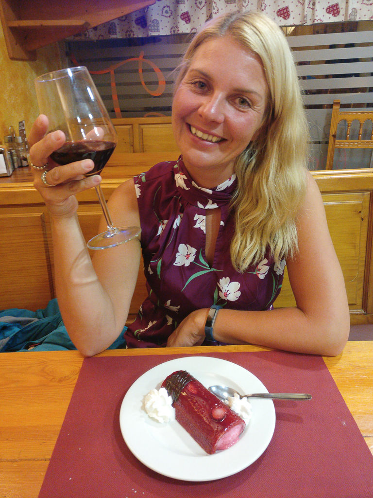
We also indulged in desserts and a bottle of vino. (From the pictures you can see how tired we both were though, so we felt they were well-deserved!)
Day 31 – ‘Cutting It Short’, Sunday 1st September, 2019, Hotel Mont Romies, Salardu to Wild Camp by Estanys de Dalt de Bacivèr, GR211, HRP, 11km
With breakfast included in the room rate at the hotel, we were up in good time to make the most of the lovely buffet on offer, which was typical ‘continental style’. Instead of choosing bread, cheese and meat however, I was more than happy with muesli and chopped banana, plus a pan au chocolate with my cup of tea. With over one thousand metres of climb out of Salardu up to the Bacivèr mountain range, it was going to be hard-going especially with the addition of a hangover after too much vino last night! So with a long climb ahead coupled with the threat of thunder showers again mid-afternoon, we wanted to leave town as readily as possible.
However, returning to our rooms to organise our food rations after yesterday’s resupply and make some lunch for later that day meant it was still around 10:30am before we finally waved goodbye to Salardu. The town is indeed a quaint little place in the hills, but for a hiker we wouldn’t recommend visiting if the purpose is solely to resupply. Had we done more initial research ourselves instead of relying on the recommendations in our guidebook, we would have found out that there is a much better resupply town 5km east of Salardu which has both a 24-hour laundry and large supermarket that also opens on Sundays. From where we hiked north from Refugi de Colomèrs to get to Salardu, there is also a secondary trail that branches off leading directly to the larger settlement of Baqueira. Had we known beforehand that this town has better facilities, we would have gone directly to Baqueria and missed out Salardu altogether as it’s not directly on the HRP anyway.
Having been generally following the stages recommended in the guidebook throughout our journey so far, we had already pre-booked and pre-paid for accommodation in Salardu on the information given regarding the fact the town doesn’t have a campsite. It’s our own oversight for not looking more closely at the map and realising that we could have adapted the itinerary to suit our own needs better, but at least we know for future reference to check things out more thoroughly.
Following the GR211 route out of Salardu in order to rejoin the HRP going through the Bacivèr valley, we soon passed Baqueira tucked in the hillside below us. Spying the large supermarket and many more conveniences, how we wished we had stayed there instead! Sparing a moment to stop and look back down the valley to where we had just hiked up from, we could see low cloud forming above the mountains in the distance, as well as a thick layer of mist that was now shrouding the whole of Salardu in white. Knowing full well it would soon be heading in our direction, we quickly pushed on.
Looking back down the valley towards Salardu now obscured behind a curtain of mist.
Fortunately after leaving town, there were some good switchbacks that helped us gain height quickly as we headed towards the Bacivèr Range.
Soon hiking through the large ski area under the shadow of the high mountain peak Tuc de Saumet at 2,642 metres, we passed a Moet Champagne Lounge, busy with a large family dining outside. There was no drinking for us today though – we had to get to a suitable camp spot before the heavy afternoon rain came.
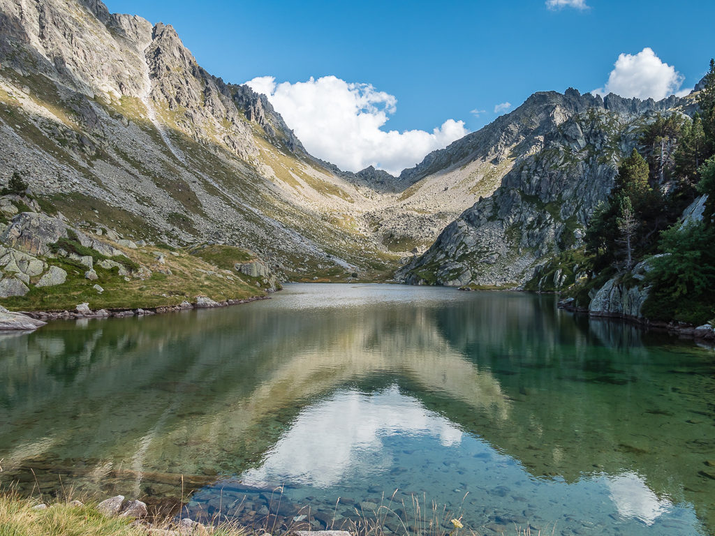
After stopping briefly at the shore of the beautiful Estany de Baix de Bacivèr for lunch around 2pm, we then pushed on over the final pass and crossed the wild, expansive plateau towards the Estanys de Dalt de Bacivèr where we hurriedly decided to set up camp as light rain had begun. We had originally planned on hiking along the Tuc de Marimanha ridge at 2,679 metres, but had thought better of it when dark clouds began rolling our way threatening heavier rain.
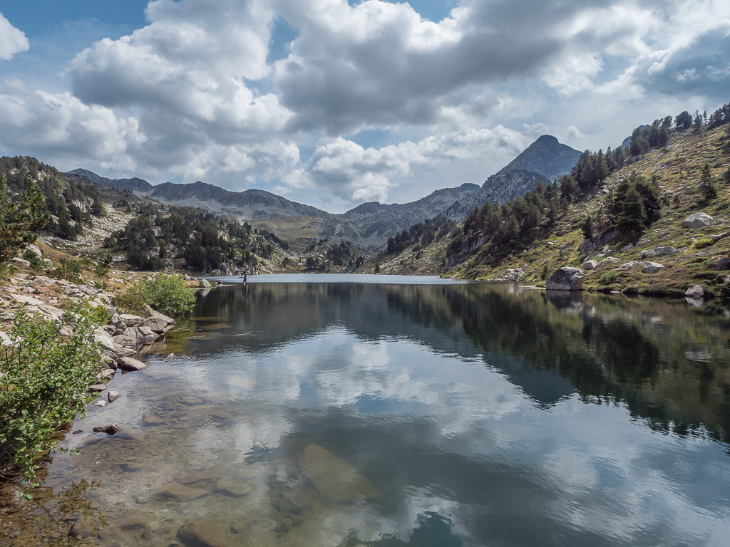
Mountain reflections on the Estany de Baix de Bacivèr where we decided to stop briefly for lunch.
It was a pretty spot with crystal clear water that allowed us to watch the great number of fish darting between the rocks in the shallows.
But with dark clouds gathering overhead, we cut lunch short and quickly pushed on in the hope of getting to a suitable camp spot before a downpour.
Continuing on our way up to the Estanys Rosari Bacivèr where the path levels out and crosses an immense plateau flanked by the Tuc deth Rosari at 2,594 metres.
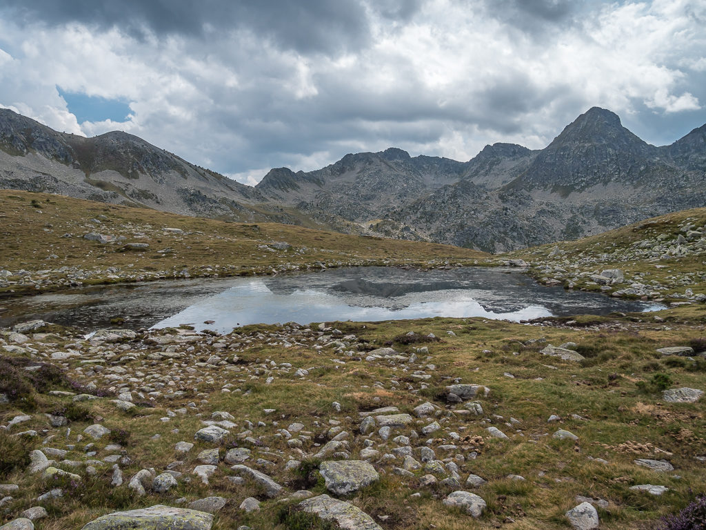
With dark clouds rolling in and the threat of rain imminent, we had wanted to set up camp on reaching the first lake but the stony ground just wasn’t suitable.
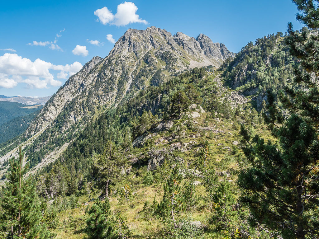
The horseshoe ridge of the Tuc de Marimanha comes into view as we head along the trail towards the second lake looking for a flatter spot on which to pitch the tent.
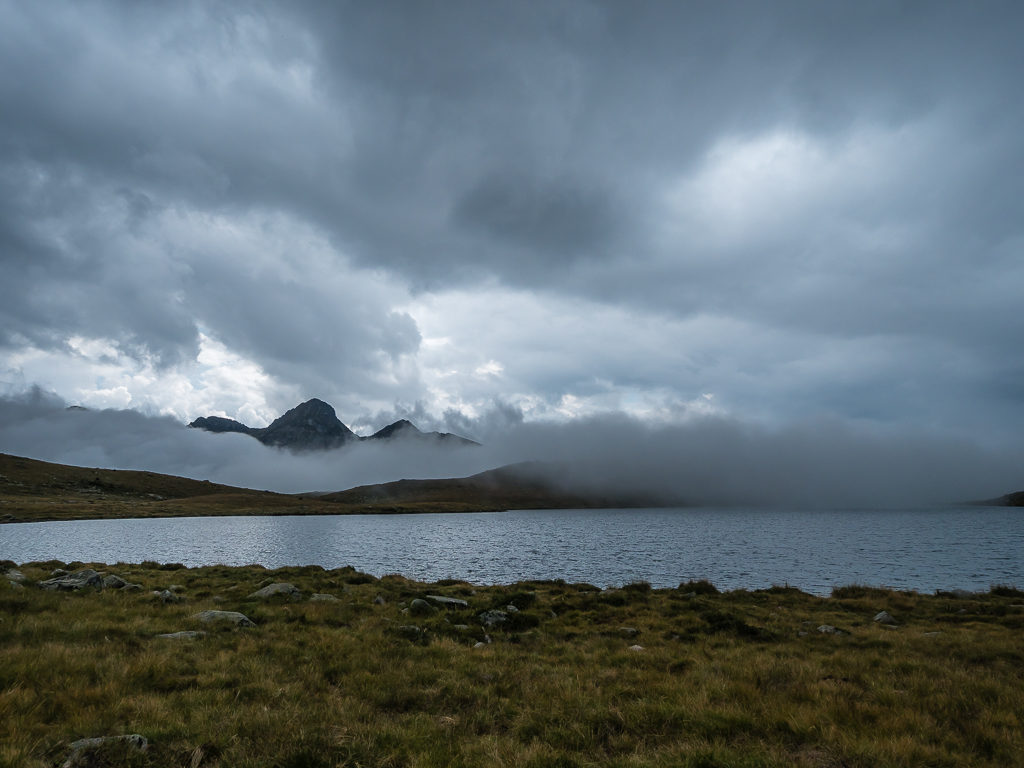
With the cloud blowing in thick and fast we couldn’t be too choosy if we wanted to stay dry!
No sooner had we got pitched and got all of our gear inside the tent than the heavens really opened and thunder clapped out around the valley. It had been a wise decision to stop. It also gave us chance to nurse the lingering headaches by having a late afternoon nap.
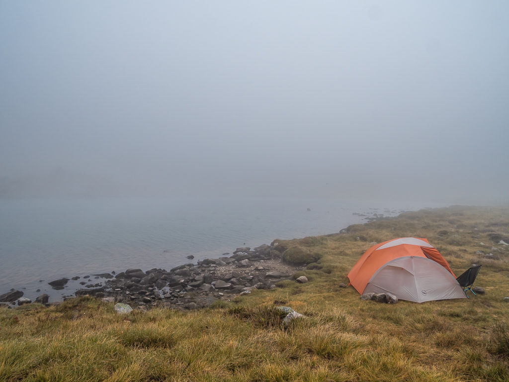
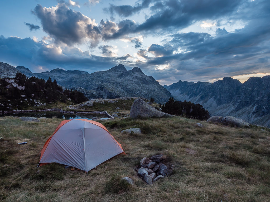
A quick pitch beside the Estanys de Dalt de Bacivèr provided us with a safe haven in which to ride out the storm.
By dinner time, we were in complete white-out with no signs of the weather improving. At least we could console ourselves with a fresh bag of food rations for tonight’s dinner, which consisted of cheese filled tortellini pasta with a tomato and vegetable sauce that warmed us through nicely. Having only completed half of our intended distance today, the one bonus of where we ended up camping was that it was right below a peak with a phone mast on top so at least we had the internet for some in-tent entertainment in such drab weather!
Day 32 – ‘Staying Safe And Staying Put’ Monday 2nd September, 2019, Wild Camp by Estanys de Dalt de Bacivèr, Zero kilometres
Having been using the weather app ‘Meteoblue’ on this trip and finding the forecasts remarkably accurate, we knew that we’d wake up to a complete white-out, much like the night before. The cloud wasn’t forecast to lift until at least 2pm so we had to make a decision about moving on or staying put.
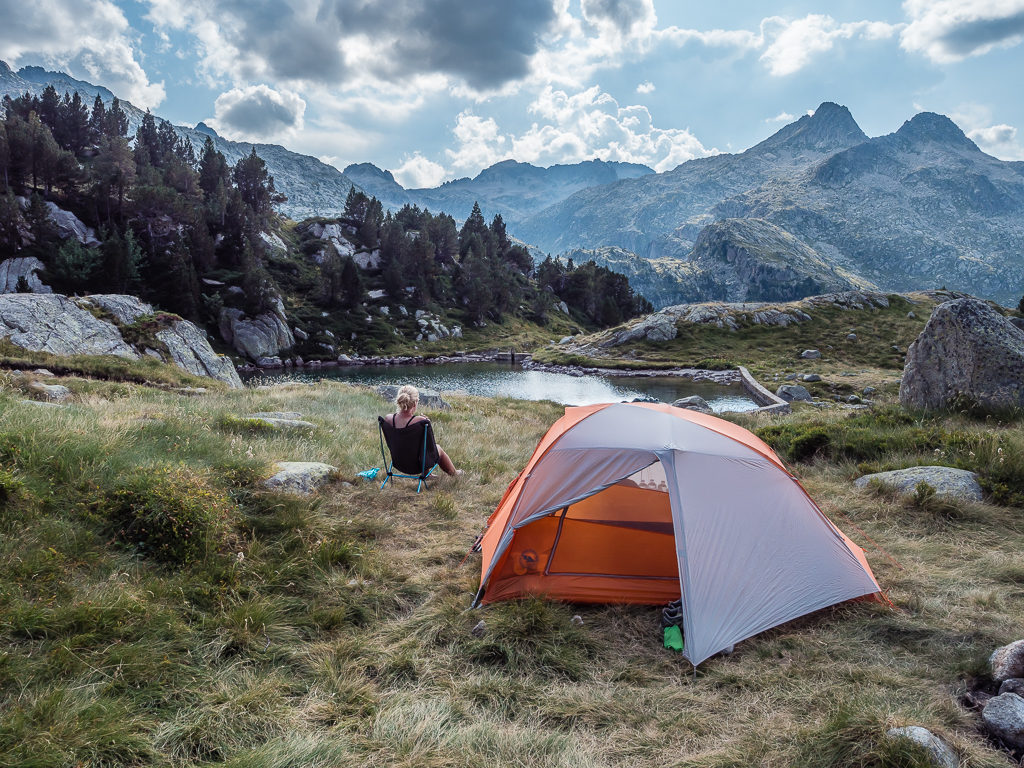
As we could barely see more than a few metres out of the tent throughout the entire morning, meaning that the large ridge and peak of Tuc de Marimanha to the east of us was completely obscured, we didn’t want to risk a ridge walk in such poor visibility. So we had two options: we could stay in the tent until tomorrow when it was forecast to return to sunshine and clear skies, or we could backtrack and take an alternative route going over the Forqueta d’Arreu instead, which was around 300 metres lower – but there was no telling whether visibility would be any better. Therefore, putting our safety first and negating any risk we decided to stay camped.
We had a direct water supply as we were next to the lake, enough food to last us at least the extra day, plus a phone signal which was thoroughly being utilised, so we could easily ride out the bad weather for another 24 hours. We would just tag the extra miles onto the next two days and still make it to Tavascan, our next resupply stop, on Wednesday. The ridge walk would be much better in clear, sunny conditions and we really didn’t want to walk back any distance, so ultimately it was a ‘no brainer’!
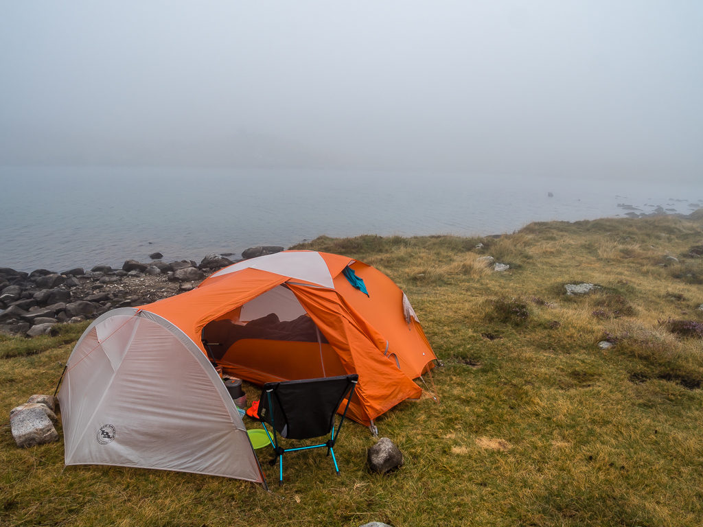
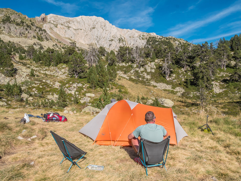
Perfectly comfortable in our home from home, we decided to stay put for another 24 hours.
The vestibule has proven an invaluable addition for housing our ever-growing amount of ‘essential’ kit!
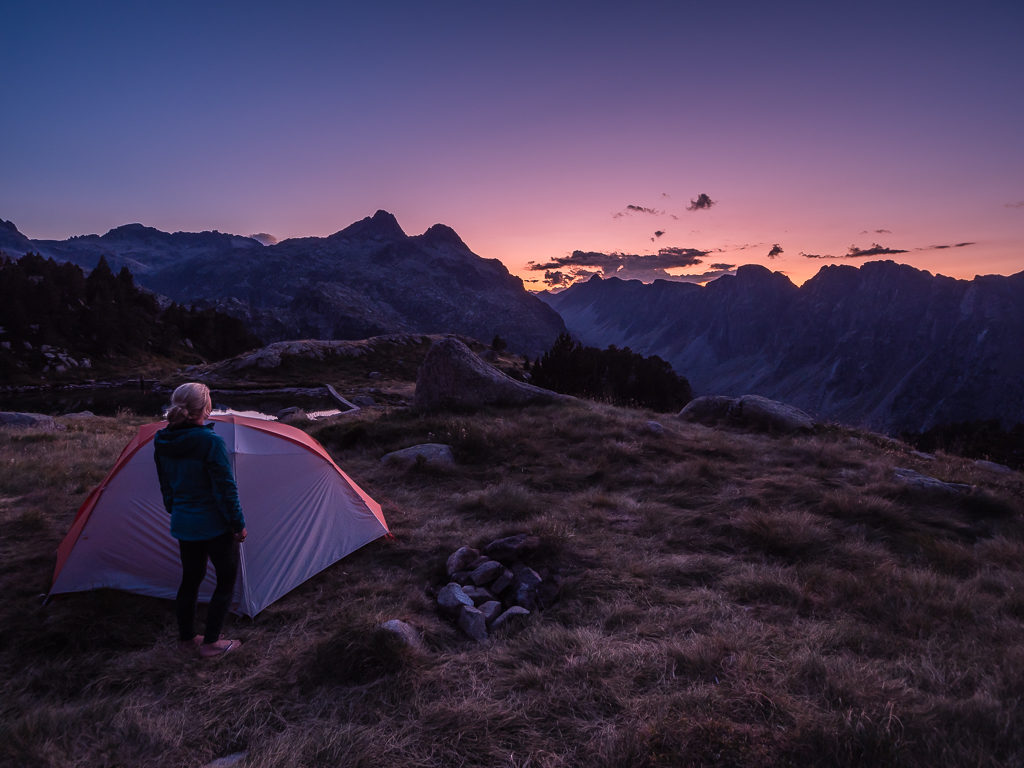
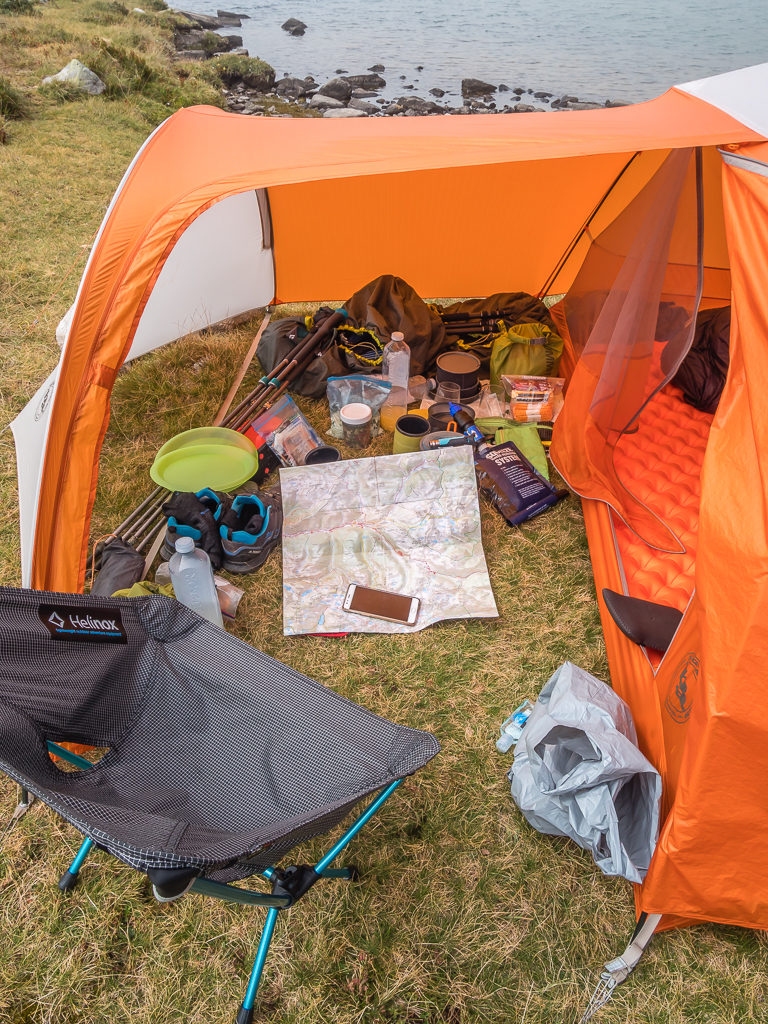
Hence a day in the tent didn’t afford us the chance of many pictures – although when 2:30pm came, the mist had lifted almost completely and we were treated to some great views of the ridge once again. It was much too late in the day to get packed up and set off up the trail by that time however. So sticking with our revised plan, we spent an enjoyable afternoon utilising our Kindles (another one of our must-have hiker comforts, despite the fact I usually get very little chance at camp to read as I spend so much time writing the blog!). After reading Levison Wood’s recount of his adventure ‘Walking The Nile’, I wanted to start the Phillip Pullman trilogy – ‘His Dark Materials’ before the HBO show comes out later in the autumn, which Wayne had already finished.
With a 100% improvement on visibility, it was worth the wait in order to tackle the Tuc de Marimanha in better conditions!
Thoroughly enjoying a day of relaxation, the only real downside was that we seriously had to stop ourselves from eating all of our food rations, as it would seem a day at camp doing nothing makes us hungrier than ever!
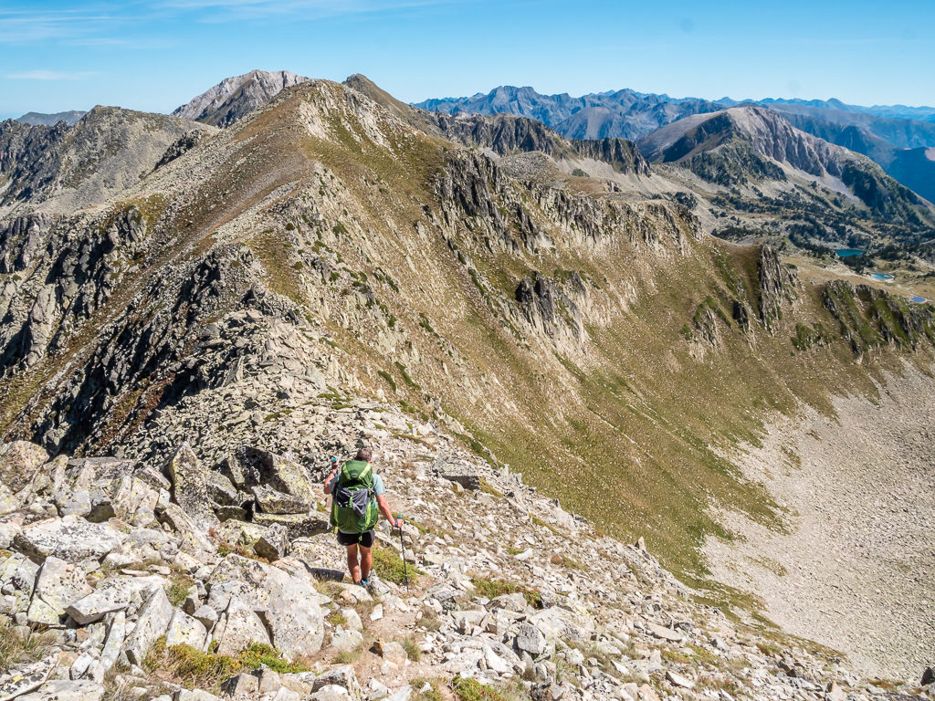
Day 33 – ‘Stick To The Path!’ Tuesday 3rd September, 2019, Wild Camp by Estanys de Dalt de Bacivèr to Wild Camp by Refugi Gracia Airoto, HRP, 6km
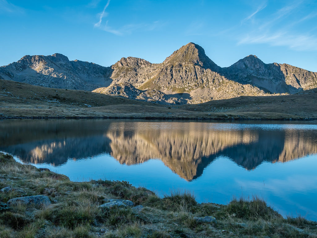
Well what a difference a day makes! As forecast on our trusty Meteoblue app, the weather had completely changed for the better. With bright blue skies all around and not a cloud in sight, we now had extensive views of the mountain range ahead of us, which meant unlike yesterday with near zero visibility, we finally felt at ease with the challenge that lay ahead – making our way to the summit of Tuc de Marimanha at 2,679 metres.
Venturing out of the tent, we couldn’t believe what a clear view we were treated to. It was in complete contrast to yesterday’s white out.
The surrounding landscape was silent, serene and stunningly beautiful.
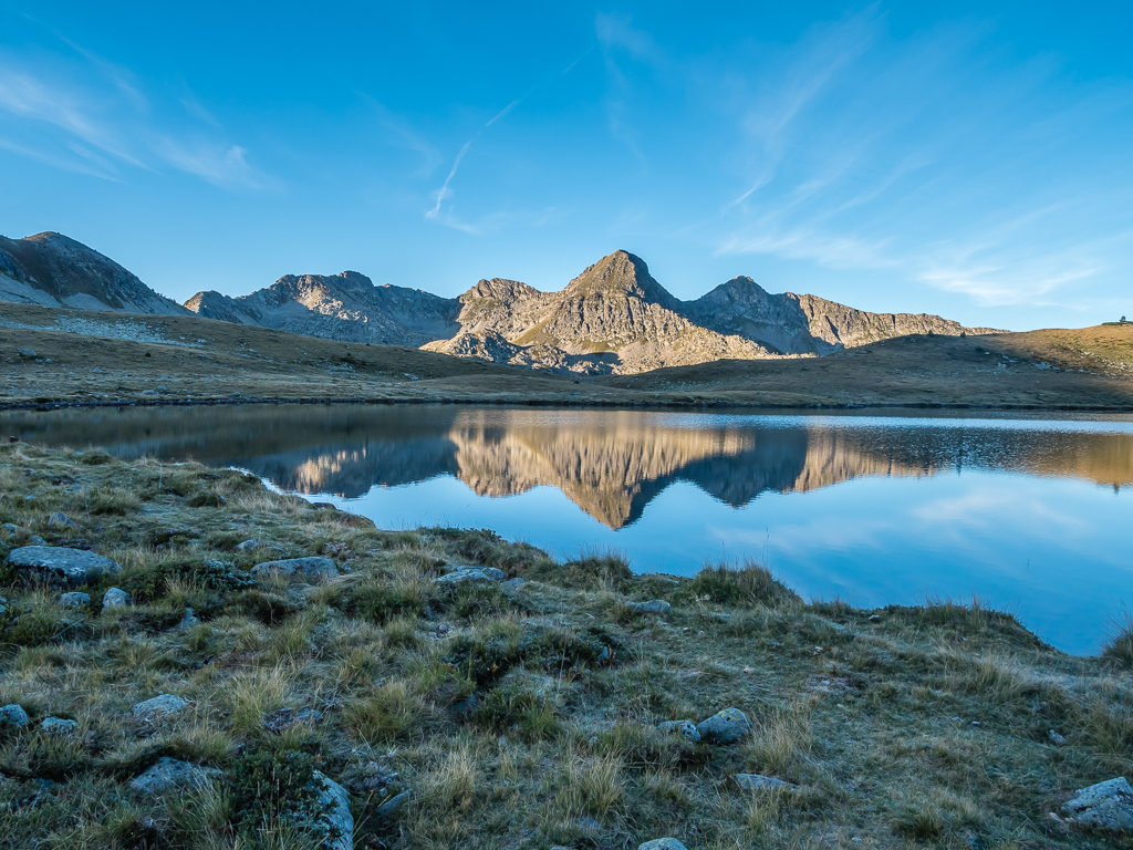
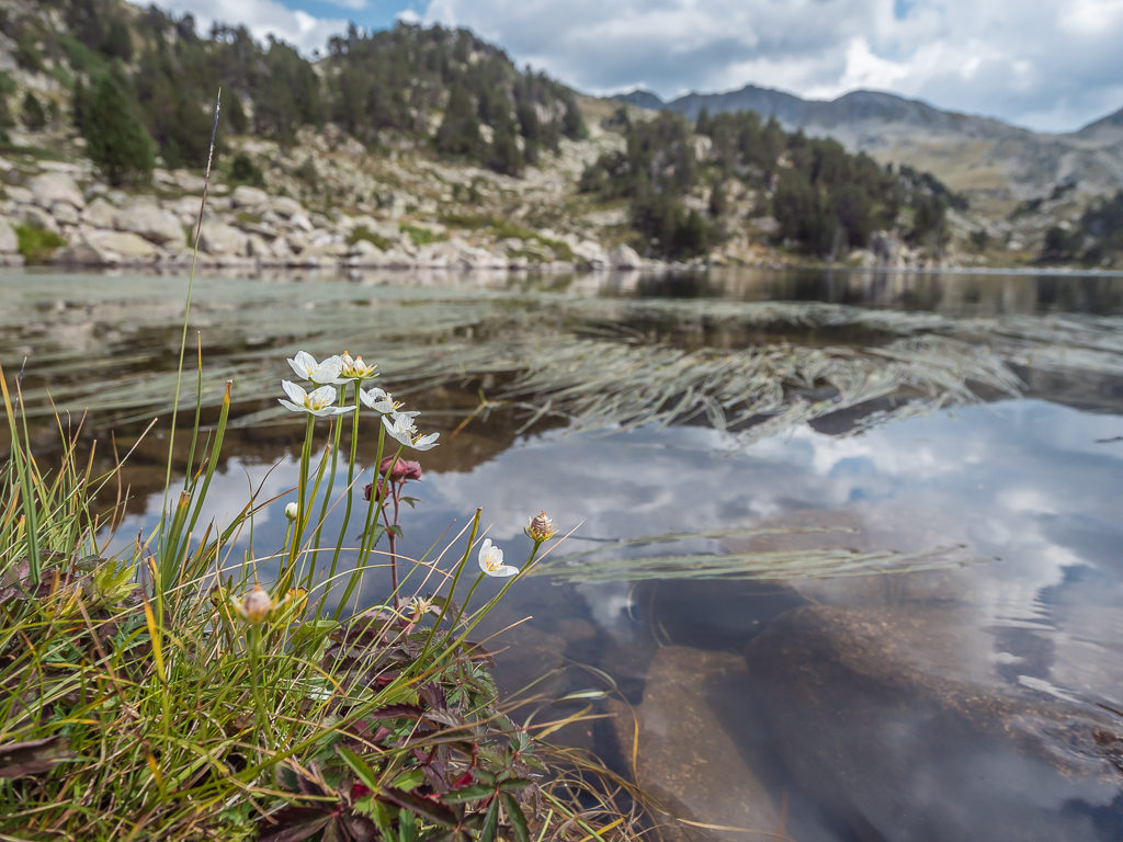
Early morning mountain reflections on the mirror surface of the lake.
Not such a bad camp spot after all considering we were in such a rush to get pitched!
Looking towards the outlet of the lake, where the the snow-capped peaks of the Maladeta massif on the distant horizon are reflected on the still water.
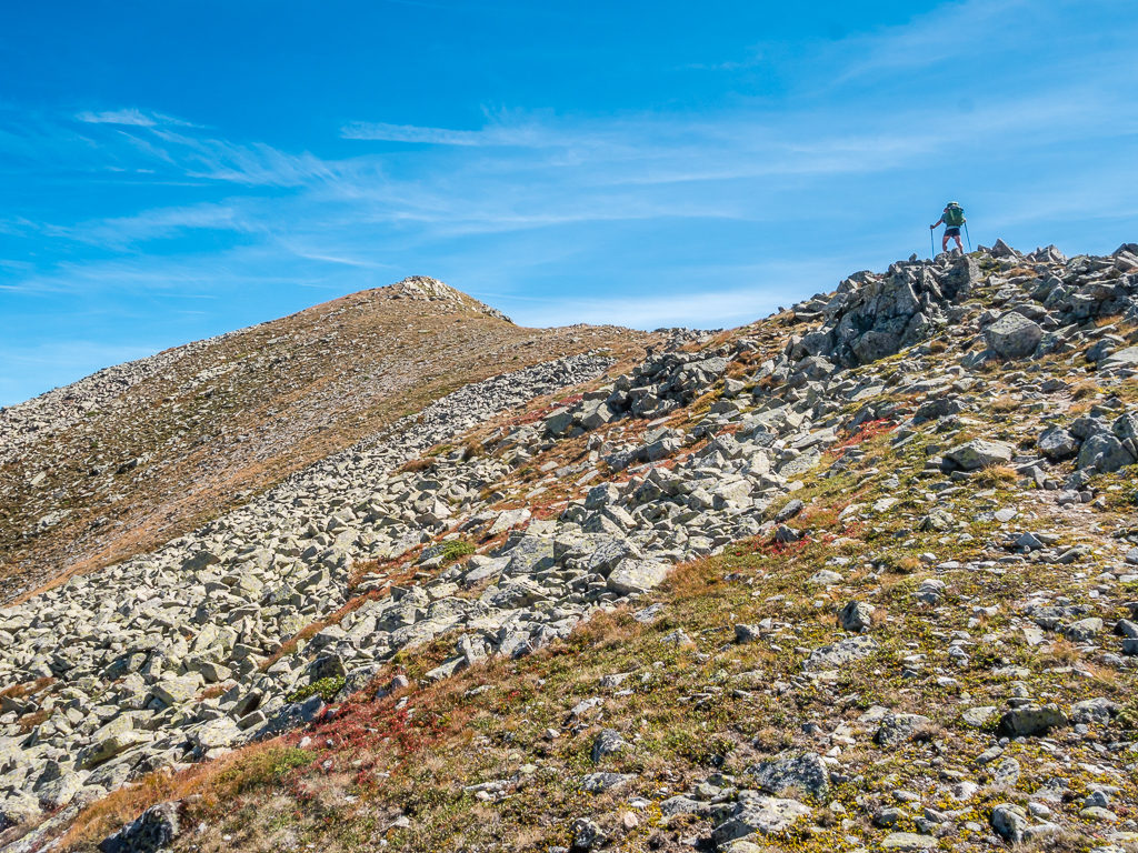
Setting off around 10:30am in readiness to tackle the boulder field leading to the ridge, we knew the route up to the summit would not be so straightforward as there weren’t any flashes signalling the way. Likewise, there wasn’t a visible path as such, just a few small cairns dotted here and there through the boulder field serving to reassure us that we were generally going in the right direction. From advice given in our guidebook, we knew to aim for the two peaks jutting out along the ridge line in a northeasterly direction, then beyond the boulder field we should reach a grassy slope where a steep climb would then take us to a point on the ridge where we would be just a couple of metres below the summit. It sounded perfectly simple, but in reality, we managed to get ourselves way off-course and into a very precarious situation, which was my fault entirely!
After two nights, we were finally leaving the lakes behind and heading towards the Marimanha ridge.

Preparing to tackle the boulder field before reaching the steep grassy section leading to the top of the ridge. (From this position it doesn’t look that steep!)
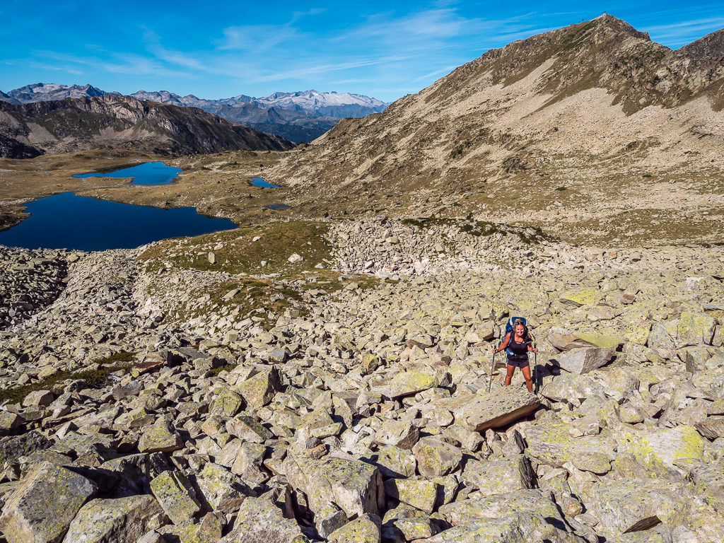
Starting up the boulder field following some ad hoc cairns. All was good in the world at this stage!
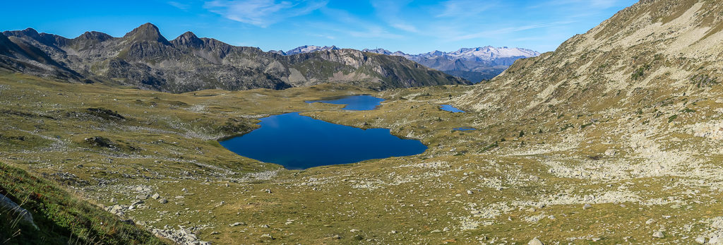
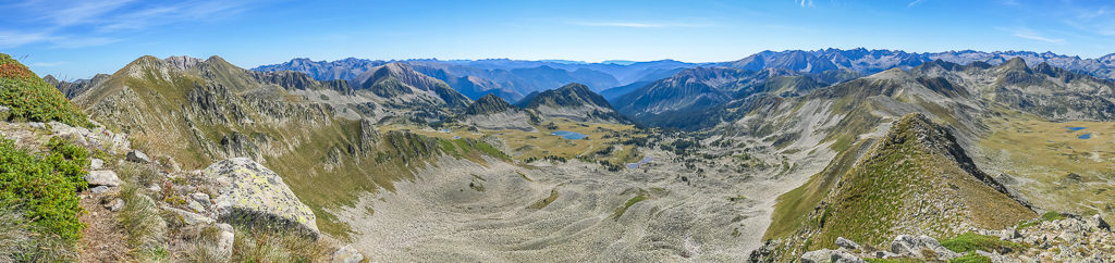
Panorama looking back to the Estanys by Dalt de Bacivèr, with the Maladeta massif on the distant horizon.
Starting up the boulder field, Wayne began following the few sporadic cairns that were piled here and there aiming for the grassy slope between the two peaks further to the east, as was described in the guidebook. I on the other hand, thought there was another way up that looked easier going to the left of Wayne’s intended route. To my eye, the grassy section looked well-trodden like plenty of people had gone that way before so I assumed (very wrongly) that it was a desire line leading directly to the ridge. Ignoring Wayne’s protestations to stick to the proper route, I continued on my own path, quite happy at that moment that I had made a good choice. Wayne being the chivalrous man he is, couldn’t let me go off track by myself so dutifully worked his way across to the ‘path’ I was now taking.
Ascending easily at first, the route quickly got steeper and much tougher resulting in us looking for ways to backtrack. It wasn’t quite that simple however, as we were now very high and very exposed. The line up I thought I’d been following had all but disappeared and it just didn’t seem possible for us to turn back and retreat as our view down the mountainside was now a sheer drop. With heavy packs, I didn’t even want to attempt such a steep and daunting descent, so we had no choice but to push on and continue to the top of the ridge. Thankfully Wayne isn’t one to gloat when he’s right, but I should have listened to him and not gone off course letting the terrain determine my path. After a couple of tricky sections where the grass gave way to steep ledges of rock, we finally managed to scramble between the rocks, up the bank and out onto the top of the ridge.
The feeling of euphoria to at last plant our feet on solid ground was very much short-lived however. Despite the tremendous view of the Bacivèr lakes and our amazing vantage point looking onto the Tuc de Bacivèr directly to the west of us, from our current position we quickly realised we had no direct access to the Marimanha summit. Not only was the ridge top like a knife-edge in parts with drop offs either side preventing us from going straight across the top, there was also a large gully that we would have to navigate around. With no feasible ‘safe’ route from this point on either side of the ridge, we had no other option but to backtrack after all.
So ensued a painful and precarious downwards scramble across the rocky slopes, which felt rather like a via ferrata without ropes, and one of the scariest things we have ever experienced. With racing hearts, sweating palms and trembling legs, it was a slow and lengthy process. It’s no exaggeration to say that at times our hands literally clung onto thick tufts of grass whilst our knees were dug into pockets of earth for some stability on the steep-sided mountain. Despite the sharp blades of grass and scrubby vegetation piercing our skin and our arms growing weary from clinging on for dear life, we slowly but surely contoured across the side of the ridge in more of a crab-like sideways crawl in the desperate hope of reaching the proper trail in one piece.
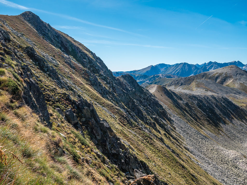
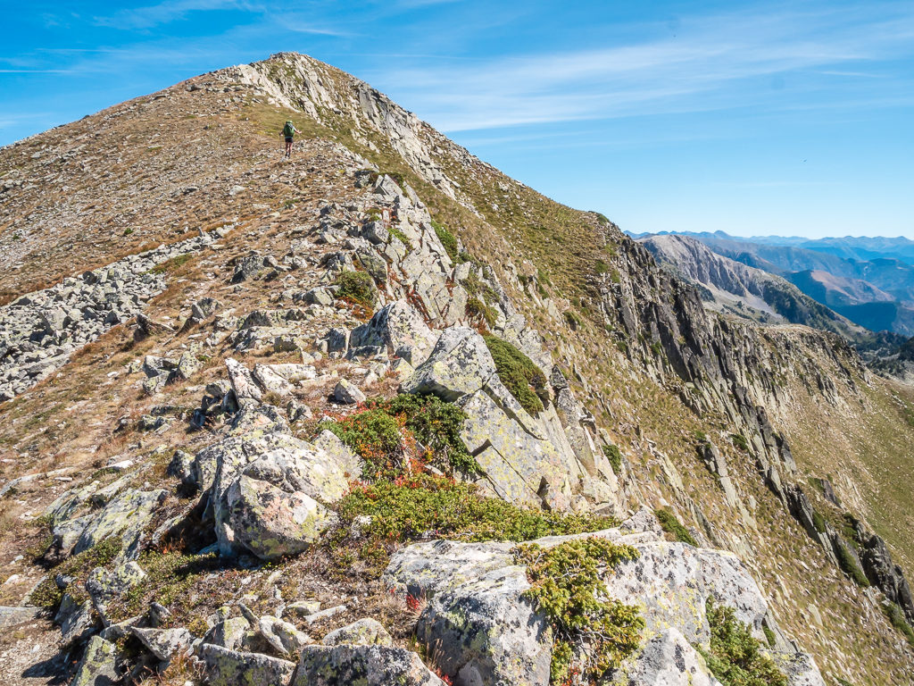
Looking east across the ridge to where we should have approached the Tuc de Marimanha summit from the much more accessible Collada dels Estanys de Rosari.
Looking towards the Cap de Marimanha and Tuc de Bacivèr with the Maladeta massif and the Aneto peak in the distance top left.
After what felt like a life-time later, we eventually reached the ‘proper’ trail directly below the Tuc de Marimanha summit. Feeling both physically and emotionally drained after such an unpleasant and prolonged experience where the constant steepness and mountain exposure became thoroughly overwhelming, it was to our utter relief that we could take off our packs and sit down on solid ground. Taking a few deep breaths and a huge sigh of relief, we were grateful to have got off so lightly with just a few scratches and scrapes, but it will always serve as a reminder to stick to the path and for me to appreciate Wayne as the ‘navigator’ instead of thinking I know best!
After the danger and drama of the past two hours, we were extremely relieved to be back on solid ground and taking the proper path to the Marimanha summit. The prominent peak behind is the Tuc de Bacivèr at 2,644 metres.
Looking across the horseshoe ridge to the Collada dels Estanys de Rosari, from where we should have approached the summit.
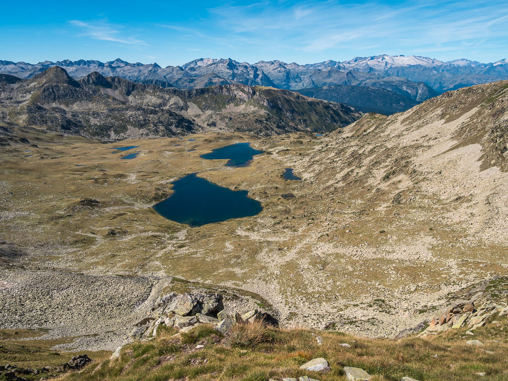
Looking down towards the Marimanha lakes with Pic de Barlonguère dominating the skyline at 2,802 metres over in France.
Wayne looks slightly frazzled after our never to be repeated experience!
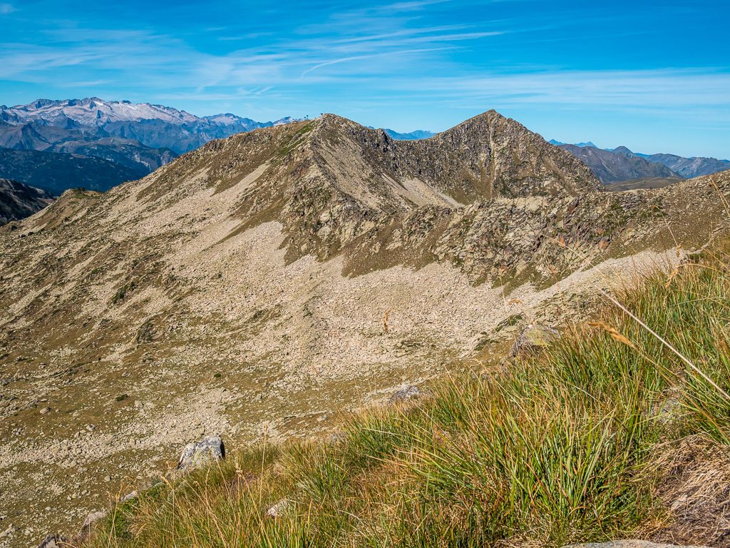
Looking towards the Cap de Marimanha and Tuc de Bacivèr. From this shot, you can see why we couldn’t just walk across the top of the ridge to reach the Marimaha summit.
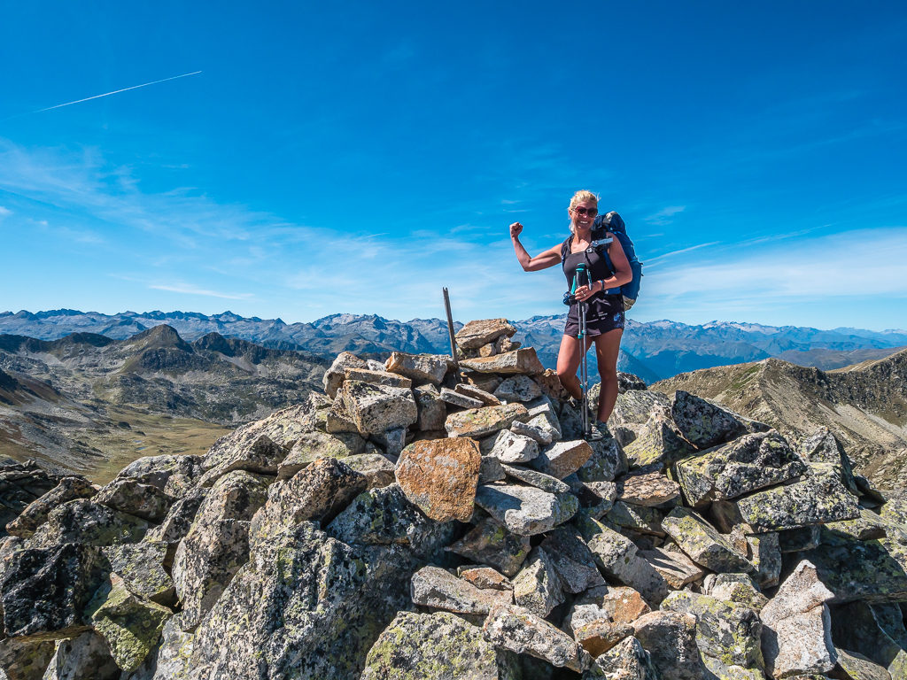
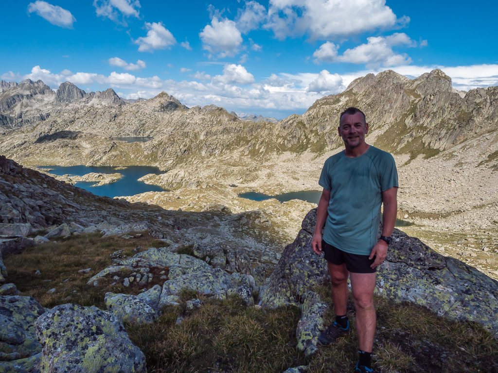
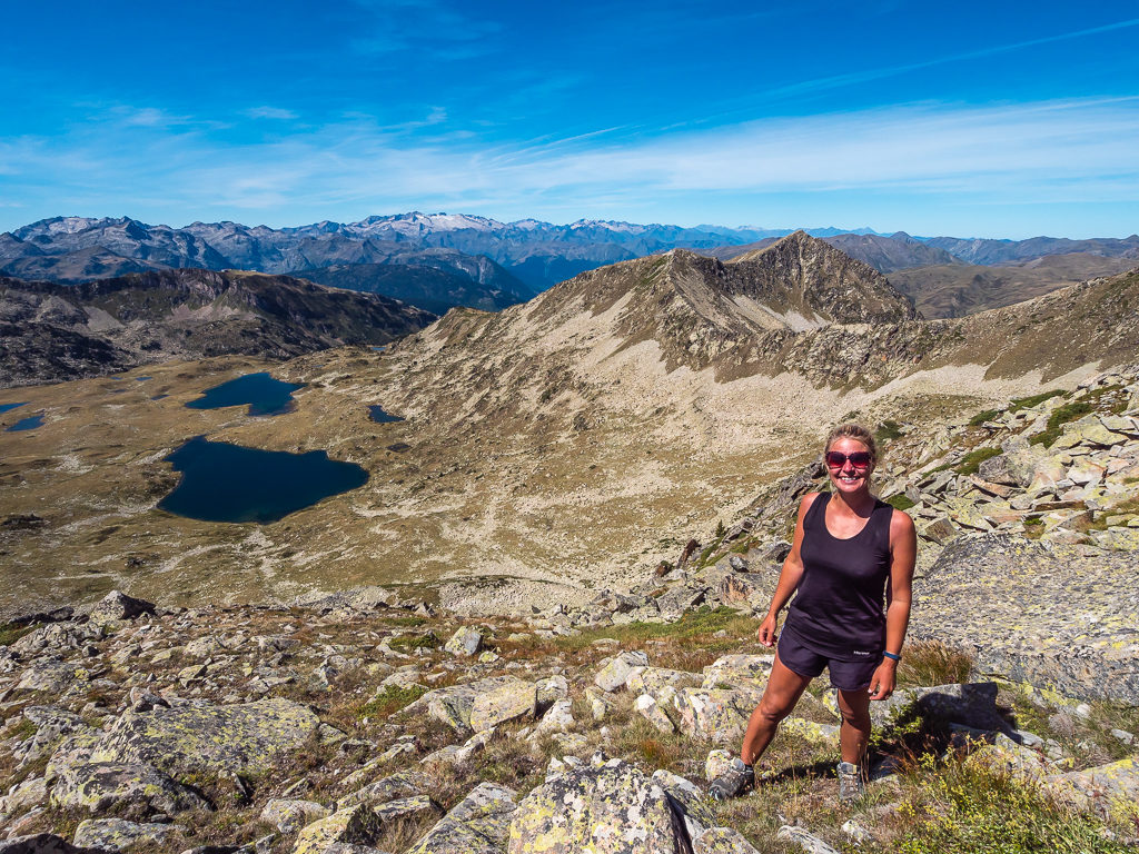
At 2,679 metres, finally on the summit of Tuc de Marimanha after taking the most arduous route to get there!
The summit afforded us far-reaching views of the Pyrenees! Here, the Maladeta massif and the Aneto peak dominate the distant skyline.
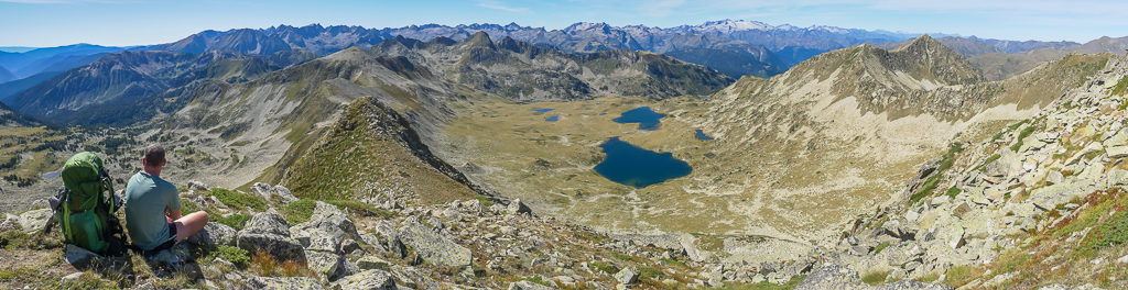
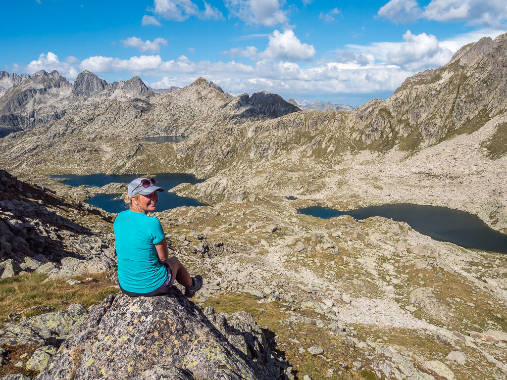
Panorama from Tuc de Marinmanha with the Bacivèr lakes in the centre and endless views of the Pyrenees.
With a clear blue sky, the 360º views of the mountains in every direction afforded from the summit were extraordinary.
Taking in the tremendous views after our painstaking efforts to reach the summit.
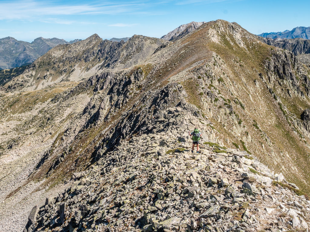
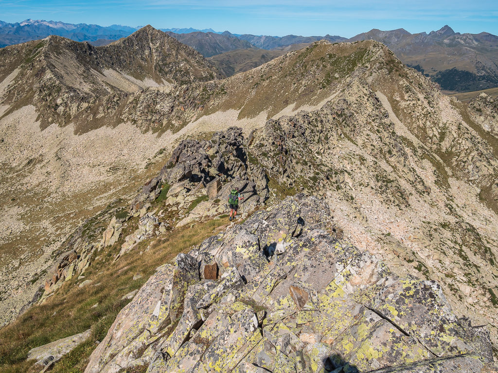
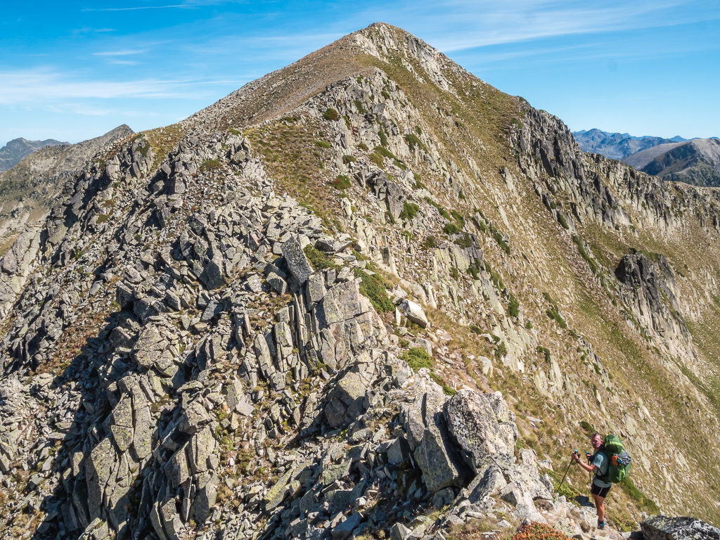
Ready to tackle the rest of the ridge…
Looking across to the Tuc deth Rosari de Bacivèr (2,660m) where our path continued along the ridge.
Northeast view from Tuc de Marimanha.
Looking towards the Estanys de Marimanha at 2,330m and 2,260m (North of Tuc de Marimanha) in the upper Valls d’Àneu with French peaks dominating the skyline.

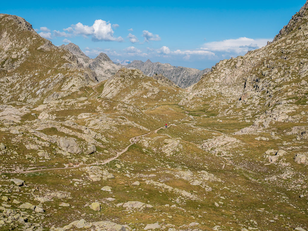
Descending from Tuc de Marimanha and continuing along the ridge where we enjoyed a much wider path!
Looking at our route leading to the Airoto valley, which was no less demanding as we would have another huge boulder field to cross on our descent.
Following the ridge-top trail towards the Tuc deth Roasari Bacivèr (2,660m), our second summit of the day.
With the look on Wayne’s face I think the caption here should read: “After the morning we’ve had, have we really got to do this?”
Pushing on towards the Tuc deth Rosari de Bacivèr summit.
The path along the ridge towards the summit is actually much wider and easier than it looks from afar!
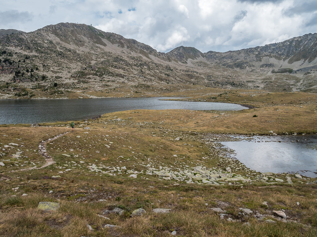
Having reached the Tuc deth Rosari de Bacivèr, our second summit of the day at 2,660 metres, we were very glad to begin descending towards the Coll d’Airoto. At 2,510 metres, it didn’t take us long to reach the col, but then followed a steep and arduous crossing of an extensive boulder field as we slowly made our way downhill towards the large Estany d’Airoto. After such a challenging morning, stepping our way across a seemingly never-ending sea of giant boulders felt particularly burdensome. It was only after we checked our route map again that we came to the realisation that this time Wayne had inadvertently taken the wrong route making the boulder field crossing much more difficult as we had dropped too far, descending a couple of hundred metres below the real path.
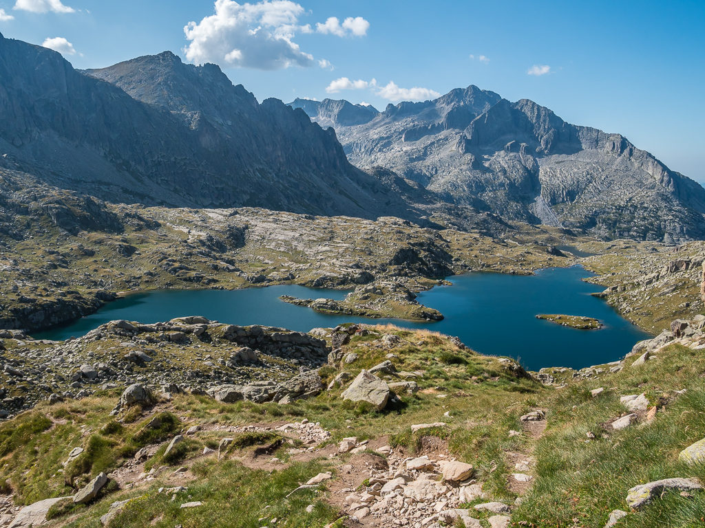
From the trail we could see the small Lac Gelat deth Rosari (2,575m), after which we headed off the ridge towards the Coll d’Airoto.
From the ridge, looking towards the large Estany d’Airoto in the distance.
Starting our descent towards the large second lake, which was going to take us across an extensive boulder field.
We had in fact unwittingly descended around 200 metres or so below the real path, which made crossing the boulder field much more burdensome.
Feeling rather fatigued after all of today’s efforts, on reaching the lake we decided that we would stop for the day and set up camp beside the small Refugi Gracia Airoto instead of pushing on over the next pass to the tiny tarn called La Besseta that we had originally earmarked for tonight’s camp spot. When we arrived, there was already a family sat around the picnic table making use of the cook area who had also filled the refuge with their sleep gear and kitchen stuff having carried up beer, wine, a large cook pot, and an axe for chopping down wood to make a fire. (That’s generally what happens when unmanned refuges are located close to a road and car park – people use them for a cheap party weekend and not as they’re intended e.g. for passing long-distance hikers.) Luckily we didn’t need to make use of the refuge; all we really wanted to do was sleep! (We would have gladly taken a glass of wine from them however if they’d have offered it!)
Setting up camp with the refuge behind us on a relatively flat, grassy patch. Luckily we had pitched before four other hikers also came looking for a spot.
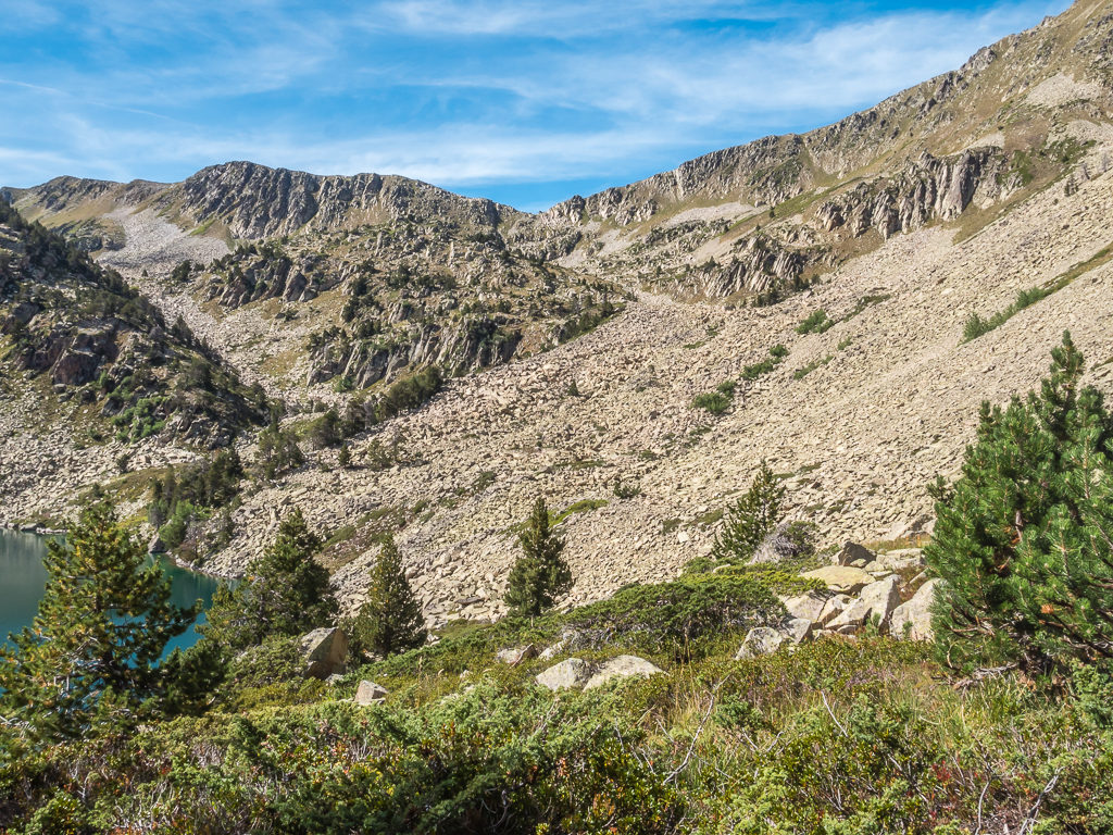
Looking back up the extensive boulder field we had hiked down from the col. The real path actually follows a line below the ridge before cutting down to the lake. No wonder we felt exhausted!
After cooking dinner, we chatted with a young Swedish couple who had set up camp next to us who we found out were walking a circular route taking in the adjoining valleys. A while later, two French guys also arrived so we moved some of our gear to create room for their tent and accommodate them as there were no other good, flat spots near to the refuge. By now, the day’s events had taken their toll and we were thoroughly exhausted, so we wanted nothing more than to climb in our sleeping bags and enjoy a good night’s rest.
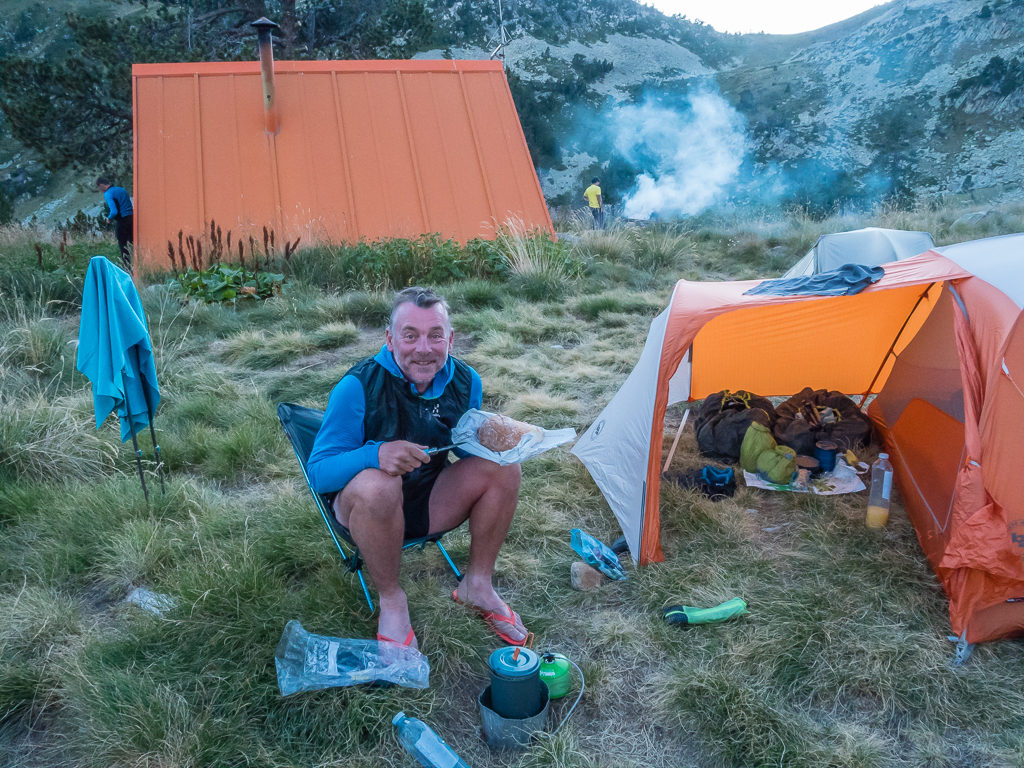
Preparing dinner after what seemed like a long day. In reality we had merely hiked 6 kilometres from last night’s camp spot – but it was a demanding 6 kilometres to say the least. (Thankfully Wayne was still smiling and not mad with me!)
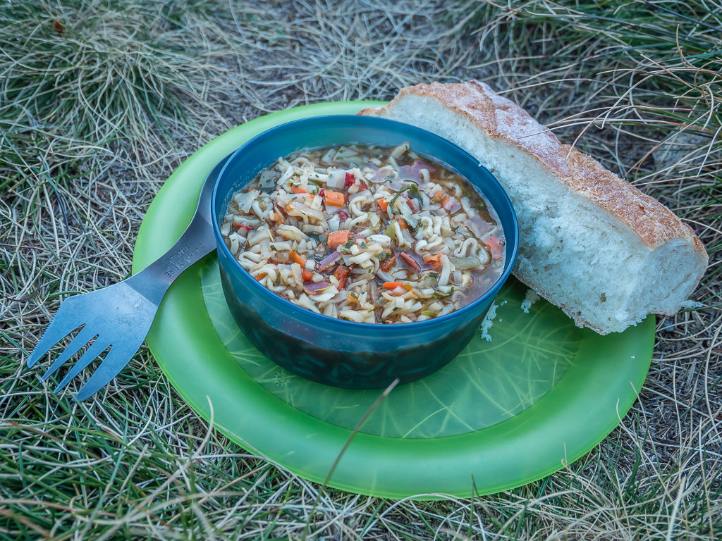
Dinner was a heartwarming bowl of noodles and re-hydrated vegetables with a huge chunk of bread, which we devoured with gusto.
Unfortunately, we didn’t get the sound night’s sleep we were hoping for due to one of our neighbours snoring heavily throughout the night. It reminded us very much of a night on the PCT where several thru-hikers camped close together for safety in numbers but we had regretted the decision in the morning after getting very little sleep! Another lesson learned today… Always camp away from popular hot spots along the trail.
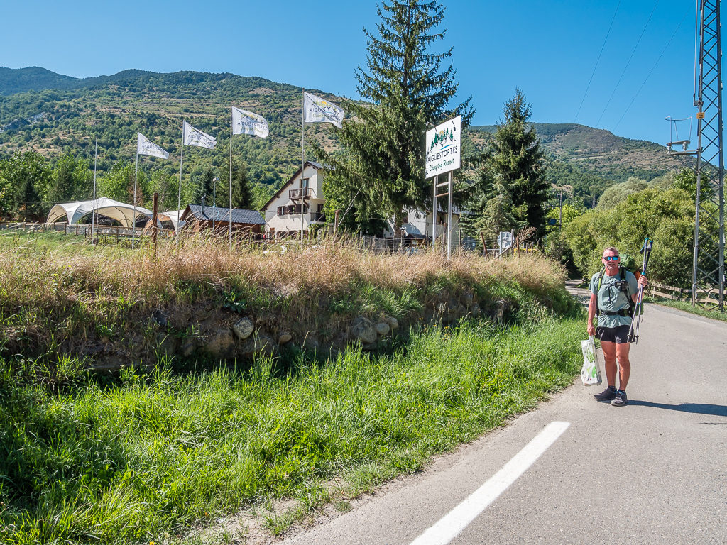
Day 34 – ‘Route Improvisation For A Proper Resupply!’ Wednesday 4th September, 2019, Wild Camp by Refugi Gracia Airoto to Aiguestortes Camping Resort, Esterri d’Àneu, HRP, 12km
Having stopped short of our intended camp spot yesterday, coupled with staying an extra night at the Bacivèr lakes due to bad weather, meant that we were now running low on gas and ideally needed a resupply before Tavascan if we didn’t want to be eating dry food for the next couple of days. We knew that today’s route would take us through the tiny hamlet of Alós d’Isil, but that wouldn’t be of any help as our guidebook had already stated that there were no shops in the settlement. So with food being a major motivating factor for us, we needed to come up with an alternate plan and re-route to a bigger town.
After looking closely at our paper map we found the perfect place midway between our current location and Tavascan that we could easily hike to in around 5 hours or so in order to resupply – the small town of Esterri d’Aneu located right on the bank of the Noguera Pallaresa river. The fact that the town also had a campground with full facilities including a swimming pool, plus a reasonable hiker rate, meant that we just had to take advantage of an overnight stay, which as is ever the TrekSnappy way turned into two nights and what we considered a well-deserved ‘Town day’ after yesterday’s dramas!
With the decision made, we packed up quickly and left the refuge around 9:30am. As usual, we were the last of the hikers who had camped there yesterday evening to be on our way. But with an impromptu re-route and forthcoming rest day ahead, our mood was now suddenly brighter especially as we knew it would be a relatively easy walk to town as we would be travelling downhill into the valley. (We simply ignored the fact for now that we’d have a long climb out again in a couple of day’s time!)
Setting off on a much better path than yesterday with sunshine and cloudless skies, plus an upcoming ‘Town day’ spurring us on.
Following the trail through the forested hills towards the valley floor.
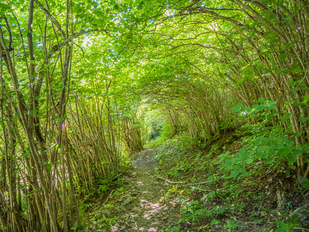
We were glad of a little shade as the trail took us through a living tunnel of greenery.
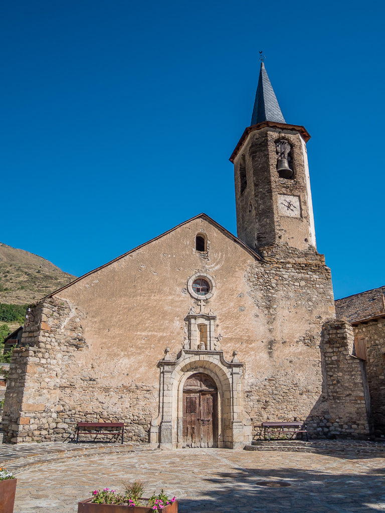
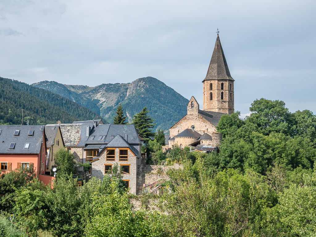
Passing by the Romanesque parish church of Sant Lliser in Alós d’Isil located in the Plaça Major.
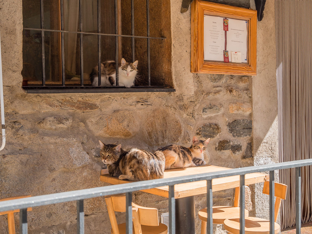
We couldn’t resist taking a picture of these cats outside one of the restaurants as we always miss our cats dearly when we’re away.
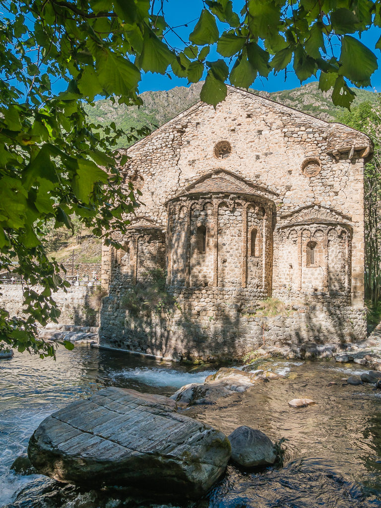
Located in the outskirts of Isil by the Noguera Pallaresa River, the Romanesque church of Sant Joan d’Isil.
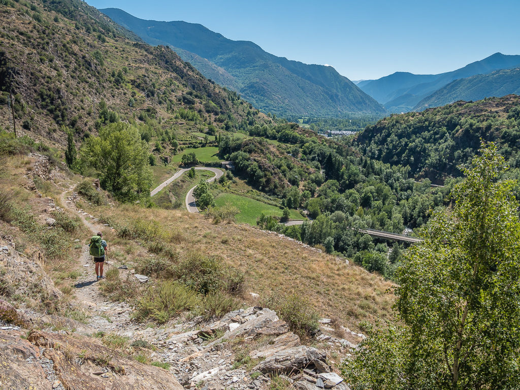
Continuing on a local trail from Alós d’Isil that would take us to the larger town of Esterri d’Aneu, which we spied further down the long valley.
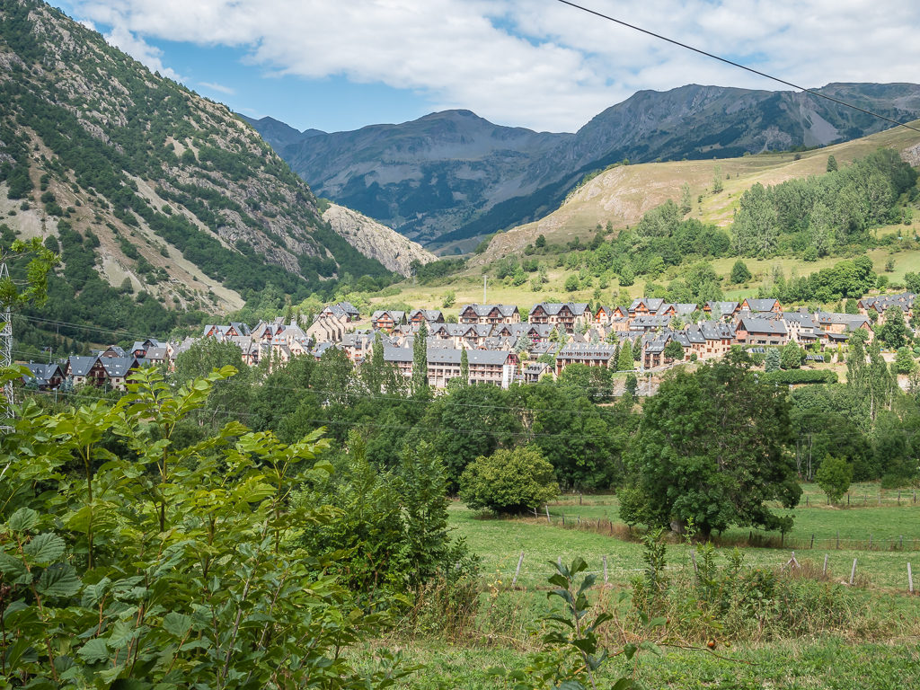
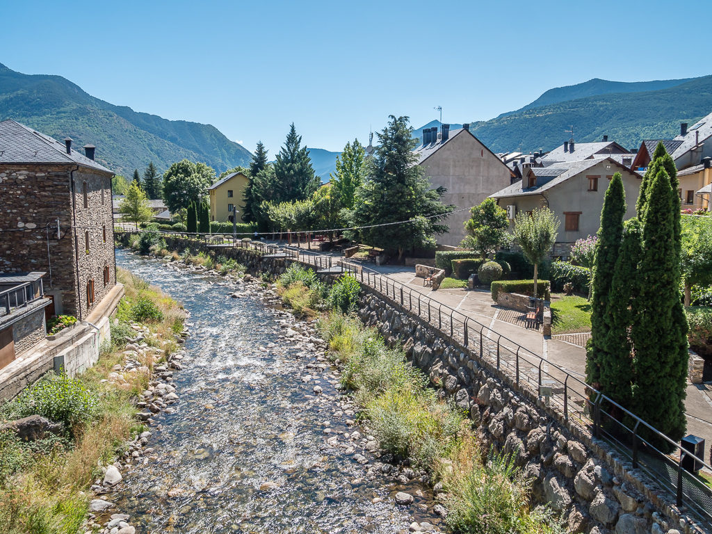
Nestled in the Aneu valley along the banks of Noguera Pallaresa river, is the historic Spanish town of Esterri d’Aneu. A network of small squares and narrow streets, lined with houses that are excellent examples of rural architecture, we immediately fell in love with the place.
Set in such a beautiful location, we were more than happy with our decision to divert off the HRP in order to resupply and take an unplanned rest day.
Arriving in Esterri d’Àneu at 2pm just as most shops were closing for siesta, we were fortunate enough that the shopkeeper of the hardware store saw us looking through his window and allowed us inside to purchase the one and only gas cannister he had left before he shut up shop for the afternoon. Grateful that we had been successful in our mission to procure one of our most essential items, we celebrated with a beer sitting outside one of the bars on the main street before walking a further kilometre or so to the campsite resort. (It doesn’t take much for us to find reason to celebrate!)
Walking along the main road to the Aiguestortes Camping Resort, located just outside of Esterri d’Àneu on the C-13 road.
With an outdoor swimming pool and on-site bar-restaurant, as well as large, clean bathroom facilities, we were very impressed with the campground as a whole. We took a regular tent pitch for two nights, but there are also fully-equipped wooden bungalows that can be rented for a longer stay.
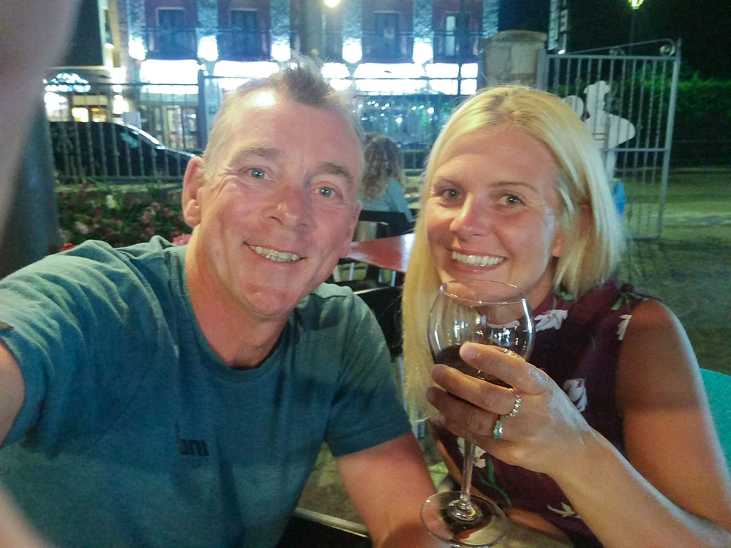
After pitching the tent and showering, we decided to do any further chores such as shopping and laundry the following day, so were quick to head back to town and make the most of a night out. This started with enjoying a few beers at some of the local bars and was followed by a ‘posh’ dinner where we ate some authentic dishes of both French and Spanish influence, which included wild boar in a red pepper jus and rabbit and wild mushrooms. All of which was washed down nicely with an obligatory glass of vino tinto!
The ‘town dress’ makes it out of the backpack again. It’s definitely getting some good wear on this long distance hike!
Pâté and pickles for starters with toasted bread.
A plate of wild boar with a rich red pepper gravy that was strangely served with crisps instead of potatoes or chips!
Day 35 – ‘Making The Most Of A Good Thing!’ Thursday 5th September, 2019, Zero Day at Aiguestortes Camping Resort, Esterri d’Àneu, Zero kilometres
We generally find that unplanned nights are always the best and last night was no exception. We had a great evening with the locals enjoying the best of Esterri d’Àneu. It is certainly another place we would like to return to and will add to our future Pyrenees road trip itinerary. As with all good town nights though, follows a day of getting jobs done! So our actual ‘rest day’ was filled with off-trail tasks such as shopping, organising our resupply, making some kit repairs, as well as the never-ending cycle of washing and drying of our entire set of clothing before any relaxation could take place.
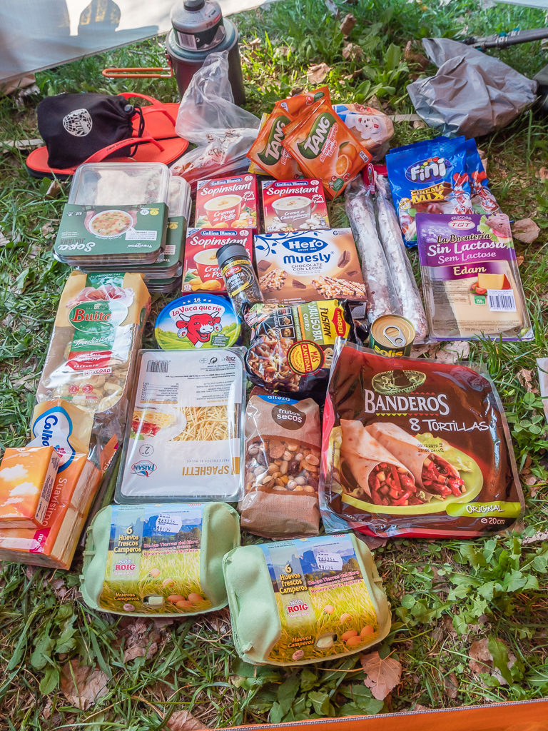
Happy to have obtained lots of our favourite food rations!
Having eaten breakfast at the panaderia in town and completed our shopping by midday, we were back at camp by around 12:30pm. We found the Plusfresc Supermarket complete with a butcher’s counter inside to be the best in town as we were able to get all of our usual supplies, including more dehydrated mixes of vegetables. Having stocked up with food supplies for the next 3 days, we also purchased some goodies to have a BBQ later that evening.
With the main tasks done and our washing drying satisfactorily on our make-shift line, it was soon time for an ice-cream and beer at the on-site bar-restaurant. We always like to make the most of the facilities when we have access to them! We then of course spent the rest of the day lazing around the pool, as for the most-part, we had it to ourselves.
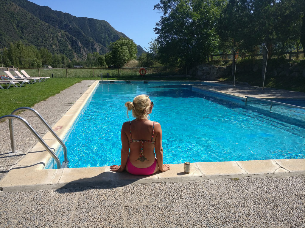
Enjoying a beer beside the pool and enjoying the great view from the campsite.
Trying my best to even out my patchy hiker tan!
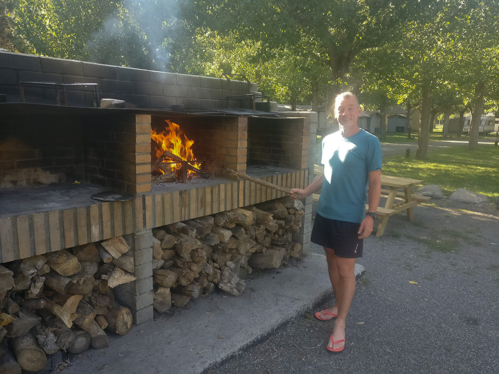
Keen to get the BBQ going, Wayne lights the fire late afternoon!
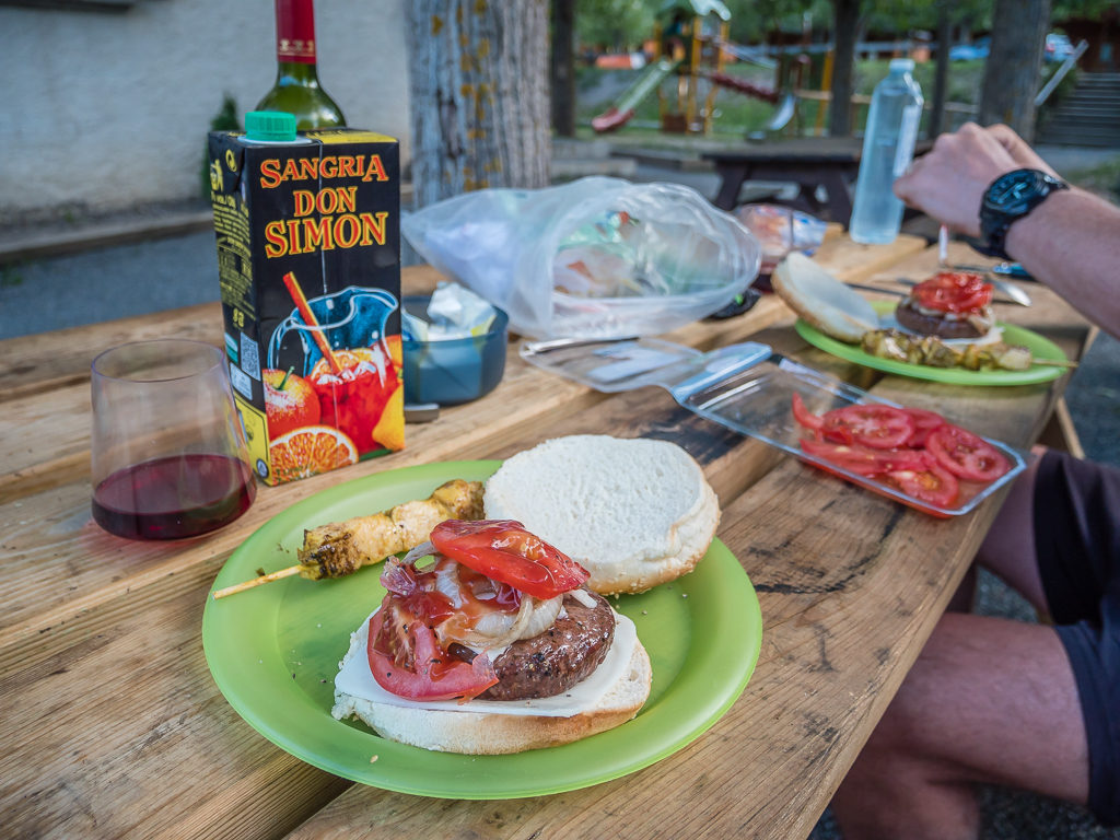
We overindulged on burgers, sausages, chicken, sweetcorn, wine and our favourite sangria.
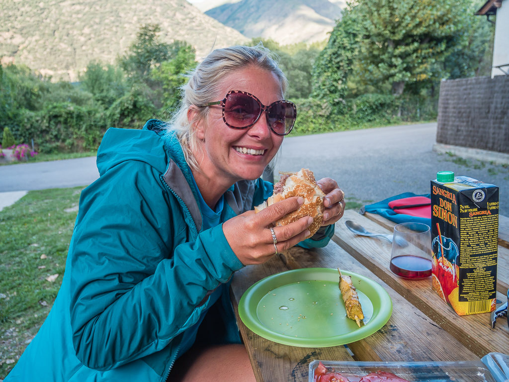
Feeding that hiker hunger!
Overall, we enjoyed a lovely, chilled day – so much so that we could have easily stayed longer at the campground in Esterri d’Àneu. We resisted our urge to remain in town however, quickly realising that with the extra couple of days off trail we had taken this week due to one reason or another, we would be falling behind in terms of our intended end-date if we didn’t try and stay on track.
If we ever wanted to reach the Mediterranean Sea, we really needed to keep our minds focussed on the mission to finish the thru-hike, and not let town become a vortex as it so easily can…

13 Comments
Hi Danielle and Wayne,
Good food, good hike… and beautiful weather for week 5
Nice balance between the difficulties of the Marimanha ridge and rest in nice villages and hotels with a glass of wine.
September is the best period for the Pyrenees . Usually weather is stable and most of the refuges are still open is case of.. The only issue is that landscape is mainly rocky . Boulder fields are painful and boring when it is so easy to cross them when snow covers the blocs in June or July. But then you have to carry ax and micro spikes. October is still nice with wonderful trees colours but days are shorter , refuges often close and snow storm may arrive on summits but usually it is till good mainly on the Spanish side. And also much less hikers.
But how many weeks still to walk to arrive to the sea?
Best wishes
Yves
Hi Yves, looking back through our pics and trail notes it feels like we spent just as much time off trail as we did on it! But we did have a great 8 weeks – so in answer to your question we have just 3 posts left… And then no new content whilst travel is restricted.😪
We are missing the high mountains so much and would have been spending the Whitsun holiday week in our beloved Lake District. But for now we are taking walks in our local area and staying at home when we’re not working.
Thanks so much for your info regarding the best times to visit the Pyrenees. With me being a teacher, we are confined to the school summer holidays, so most of our hikes take place in August, unless we’re on a big trip & we have given up our jobs. It looks unlikely that we’ll get to travel to the Pyrenees this year anyhow.
Thanks for reading and taking the time to comment again,
Best regards,
Danielle & Wayne
Now that was a proper adventure! I’ve lost count of the number of times I’ve fallen into the trap of letting the terrain push me off route and ended up clinging to grassy ledges, heather and tree roots, especially in Scotland. I fact we ended up just calling it Vegetation Scrambling! 🙂
I have to say even before I read the captions the look on both your faces told me where your heads were after getting back on track.
The only problem with these wonderful posts is I’m running out of superlatives to describe the views and the experience. I simply MUST go back there and do some more Pyrenees through hiking.
Hi Andy, yes you must!
We are sad that it’s unlikely we’ll get to do any long distance hiking this year with the travel restrictions in place.
But we can still dream, plan and research ideas for future adventures. If travel to the the Lake District and overnight camping is allowed by August, we are contemplating hiking all 214 Wainwrights in a 3-week adventure! But it will be a tough one if there are no pubs open to celebrate when we get to towns, as that’s all part of the fun.
Hope you’re keeping well and thanks for taking the time to read and comment again.
Best regards,
Danielle & Wayne
Excellent as always, I’m already looking forward to the next instalment.
Thanks Kevin! I’m busy working on it this week.👍
Hope you’re keeping well.
Hi Danielle,
indeed, this was hard stuff. Congratulations You mastered this situation. Looking at Your great pictures my heart rate was rising immediately. Thanks for again letting us participate in Your traverse.
Standing by for week no. 6.
Best Regards
Marcus
Thanks Marcus! Glad you’re enjoying following along with us.😊
Danielle,
on Your hikes You have Your camera tucked so nicely to one of the shoulder straps of Your backpack. May I ask how You do attach the camera there? Is this a readily available clip, or a homebrew solution?
See You
Marcus
Hi Marcus, we use a ‘Peak Design’ clip that consists of a clip that fastens to your rucksack strap and a plate that attaches to the bottom of your camera.
The plate slides into the clip on the rucksack strap and has a button release. Having the camera there makes it readily accessible whilst being hands free for us to use our walking poles.
It’s a really excellent piece of kit that we wouldn’t be without now. I think they retail at around £50.
I have included a link to a YouTube video from the original manufacturer for more info: https://www.youtube.com/watch?v=SfBCwadeK5g
Best regards, Danielle
Hi Danielle,
sorry for late reply. I have been out hiking a few days (yessssss). The Peak Design clip seems to be the perfect solution. Thanks so much for pointing me there. Just watched and ordered.
Now heading for Your week 6 🙂
Best Regards
Marcus
Glad to be of help Marcus! The clip will make access to your camera a lot easier.
Hope you’ve had some great weather for your hiking. Lucky you – we still haven’t been anywhere as lockdown rules still don’t allow any overnight stays.
Hoping that campsites will open up by August though so we can get to the Lakes!
Best regards,
Danielle
What a trip! I’m going to Baqueira tomorrow and solo hiking / Wildcamping some of the places you did (Lake Baciver, then the refuge and looping back round to Baqueira) 3 nights total. Your wonderful blog has given me so much information and helped me plan my trip and stop off points on the way) Thanks again!