
Visiting The Rockies & Hiking In Colorado’s Finest National Park!
Colorado can boast 13 national parks, 15 national historic landmarks, 11 national natural landmarks and three national historic trails. As it was our first time to the ‘Centennial State’, at the top of our list was none other than a visit to the Rocky Mountain National Park.
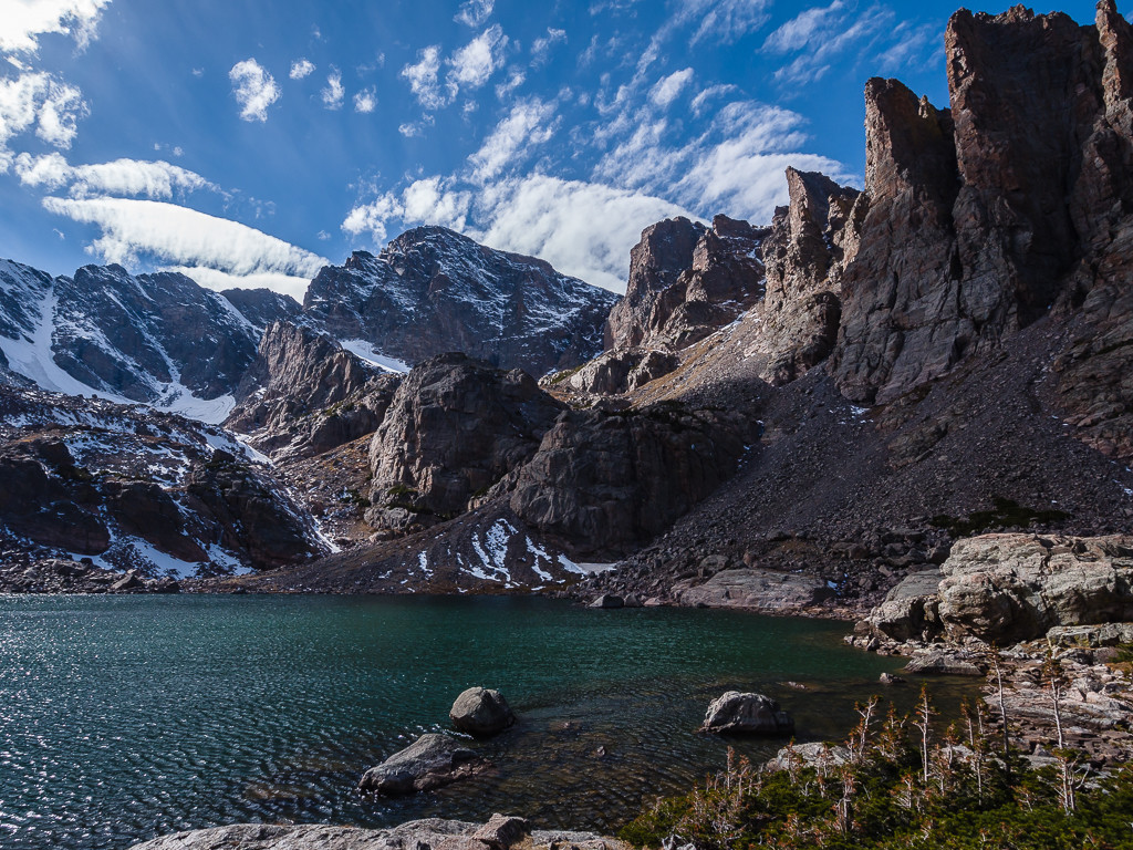
Featuring majestic mountain views and crystal clear mountain lakes, the sweeping vistas of Rocky Mountain National Park are the main attraction, which makes it one of the USA’s ‘Top Ten’ visited national parks. Another major draw for tourists are the wide variety of animals which inhabit the park, including beaver, elk, mule deer, mountain lions and bighorn sheep, as well as many bird species. We were also made aware that black bears frequent the area, which got us both excited at the thought of finally meeting a bear!
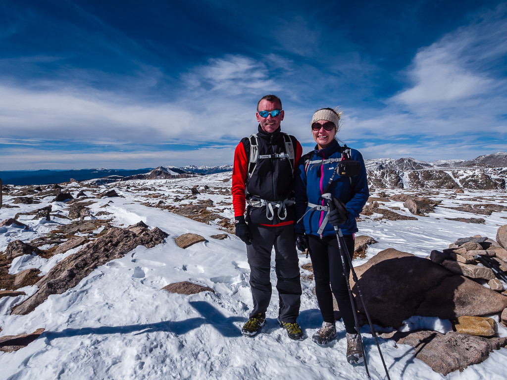
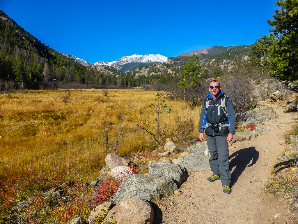
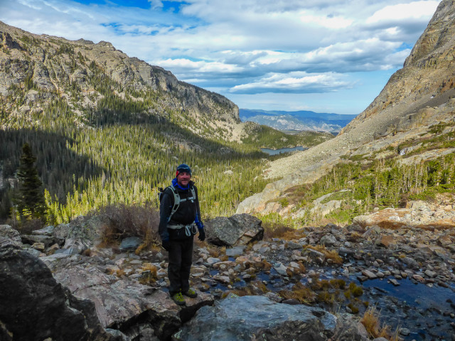
At the summit of Flat Top Mountain in Rocky Mountain National Park, Colorado. Wait, is that a bear behind us?!
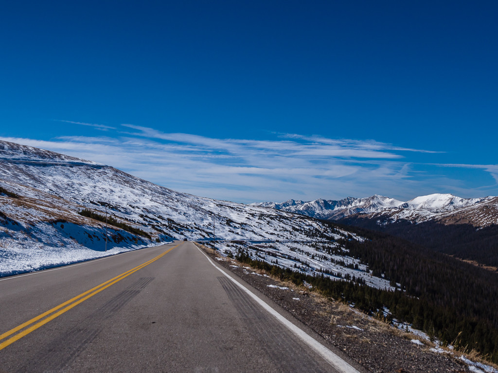
We knew Rocky Mountain National Park would provide us with plenty of hiking opportunities so we planned to stay there for a week. We just had to get there first! With the roads getting much steeper and windier, as well as icier by the day, it was a real shock to the system heading into colder climes, not to mention the added stress for me of driving the hire car in what we considered uncharted territory having never ventured into Colorado before!
So after leaving the Great Sand Dunes National Park & Preserve and making an impromptu overnight stop at Buena Vista KOA so we could take a shower and catch up with laundry, we were on our way again heading for Estes Park, the gateway town to the Rockies. Continuing on our journey north, we passed through the infamous town of ‘South Park’, where if you like doing the tourist thing, you can stop, poke your head through a billboard and have your photograph taken as one of the characters – Stan, Kyle, Kenny or Cartman, from the popular USA adult cartoon show. We avoided stopping however as 1, we’re not big fans of the show and 2, I was actually scared to stop because of the increasingly icy roads.
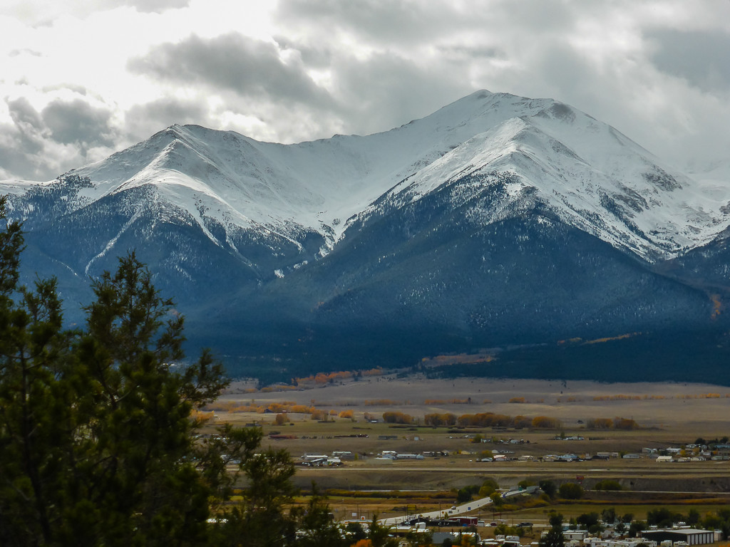
Our view of the snow-capped peaks of Mount Princeton from our campsite at the KOA in Buena Vista.
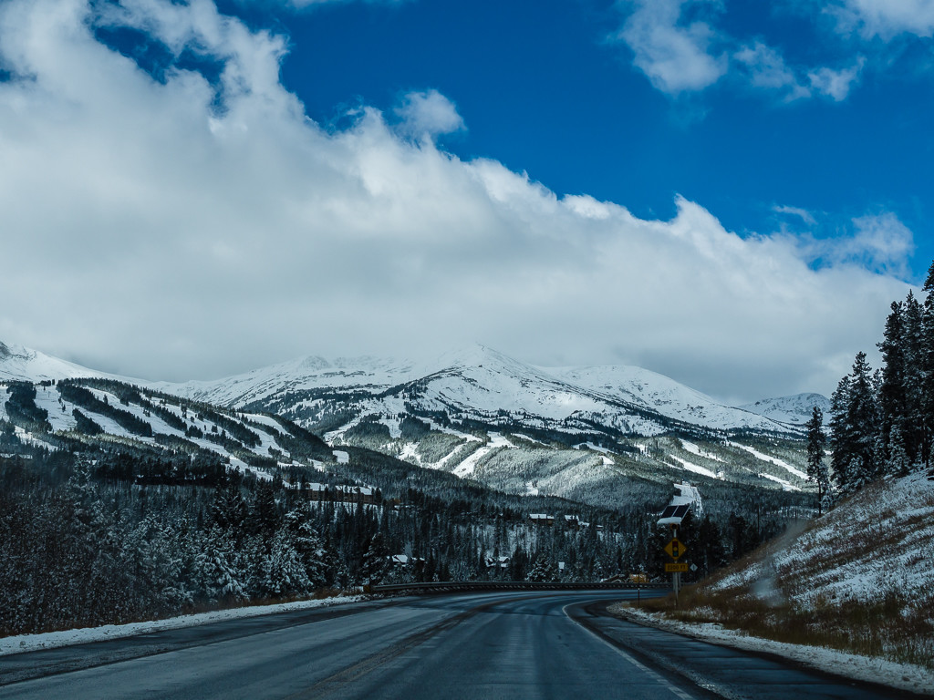
Winter is upon us! Mountain vistas as we head further north in Colorado.
But if the weather had been better and we weren’t in such a hurry to get to our destination before nightfall, we would have most certainly stopped for coffee and taken a seat on the quirky ‘Cafe Train’ that we spotted when driving through Nederland, another strange tourist town seemingly in the middle of nowhere.
Instead, we made a quick stop at the ski town of Frisco complete with Walmart, Safeway and a Starbucks to stock up with food and supplies for the next few days. Not knowing what shops and facilities to expect at Estes Park and not wanting to spend ‘tourist dollar’, we made sure we had enough food, alcohol, wood and laundry to last us for at least 5 nights.
When we arrived at the Rocky Mountain National Park, the park was already working to its ‘Winter schedule’, which means shorter opening hours at the Visitor Centres, limited ranger talks, limited facilities at the campgrounds and no shuttle bus service operating inside the park. We were quick to wonder whether it would live up to our expectations. Well, having already completed the John Muir Trail and experienced several of America’s best parks, it’s fair to say we expected a lot!

A brand new Rocky Mountain National Park sign in preparation for the 100th anniversary.
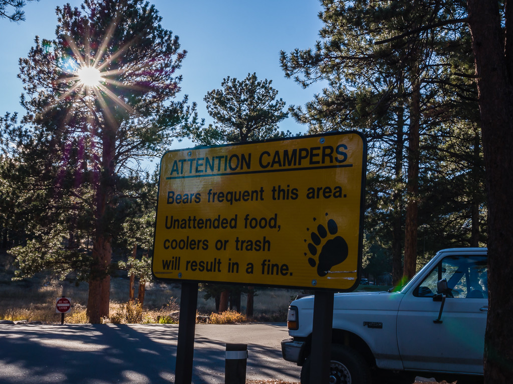
The elusive black bear… We are still yet to see one!!!!
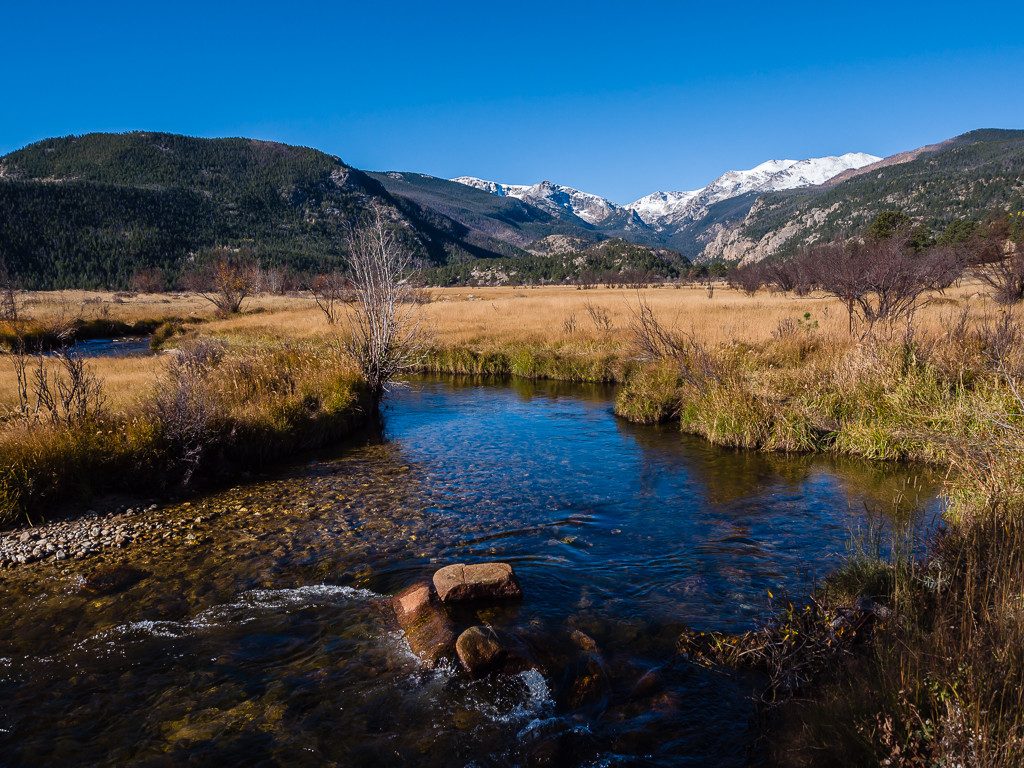
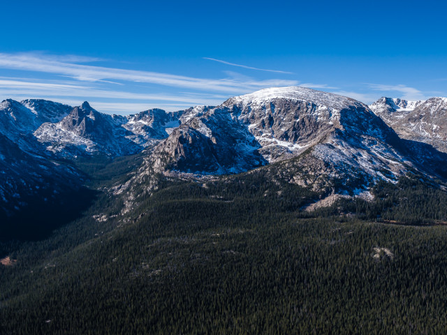
Moraine Park Area – We were treated to beautiful views as soon as we entered the park.
Considering the popularity of the park, we were a little disappointed with the Moraine Park Campground. ‘B Loop’ is the only section open during the winter season and has 77 sites operating on a first-come, first served basis. Only basic facilities are provided on B Loop, which are 2 vault toilets located near either end of the loop. Water had already been switched off and was only available at the RV Dump Station. The Ranger Station at the entrance to the campground was also unmanned. There were very few remaining camp sites available as most had been taken up with RVers. We were desperate to acquire one close to a bear locker having taken note of the huge yellow sign warning us of the presence of black bears at the entrance to the Moraine Park Campground. Unlike other campgrounds that provide a bear locker at each site, B Loop only provides 7 food storage lockers randomly situated between all 77 sites, which we felt was very unfair and wholly inadequate for campers, particularly if bears do frequent the area. Luckily for us and any hungry bears, we managed to find a vacant campsite with close access to a bear locker so that we could keep all of our food stuffs and any other scented items secure.
Well, I guess you have to take the rough with the smooth sometimes! One good thing about our campsite was that it had a clear view down to Beaver Meadow where much of the rutting took place each evening at dusk. This meant we could watch the spectacle of male elk vying for the hearts of their female counterparts from the comfort of our campsite, without having to pull up on the side of the road ‘en masse’ with all of the other day tourists driving through the park, capturing a photo of the elk their sole purpose for being there.
September and October is the rutting season for elk in Rocky Mountain National Park.
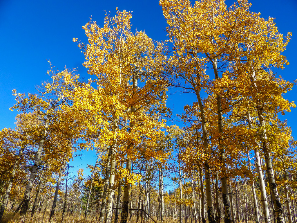
Unfortunately as Autumn was already upon us, many of the aspens had shed their leaves. But a few remaining trees provided us with a glimpse of that golden yellow colour they’re so famous for.
Due to the lack of facilities at the campground, the threat of bad weather towards the end of the week and the fact that ‘Trail Ridge Road’ was closed on the day we arrived (our proposed exit route out of the park) we amended our itinerary and chose to stay for just 4 nights. So to make the most of our time in ‘The Rockies’, we set ourselves a challenge of completing 3 day hikes over the three full days of our stay.
Our three day hikes mapped using shareyouradventure.com
Day 1 – 17.5 miles, A Circular Hike to Bear Lake
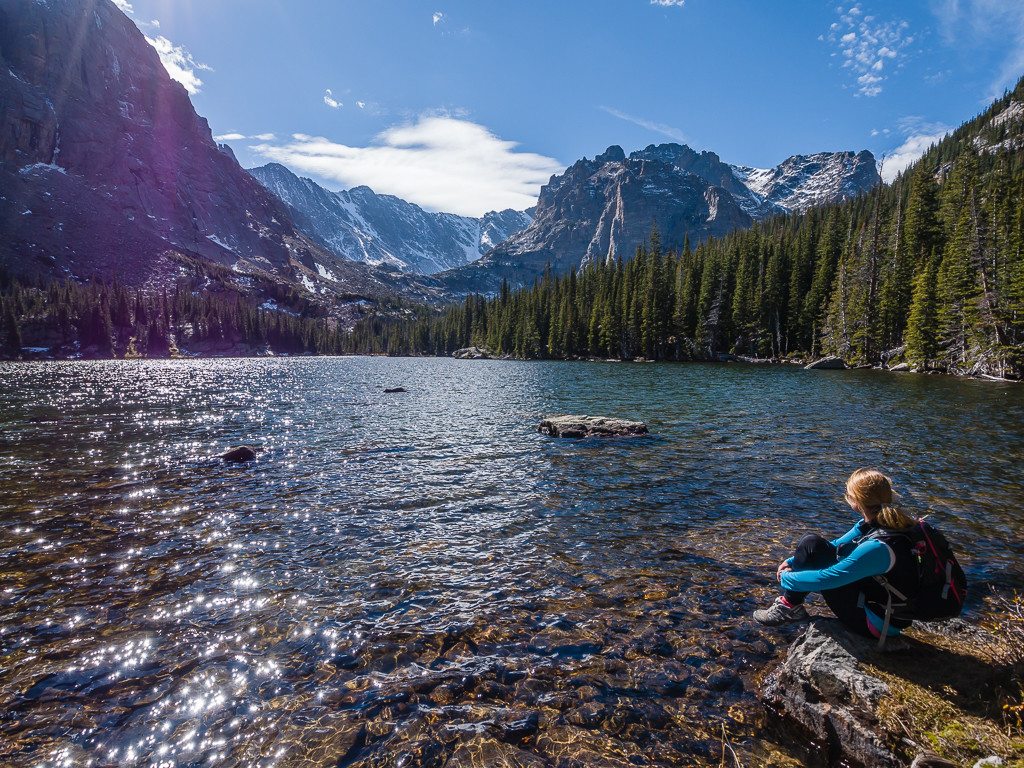
On Day 1 we devised our own 17 and a half mile circular route by joining up several shorter walking trails. Our route started at the Moraine Park Campground and took us out to Bear Lake, one of the most popular spots in the park offering great views of Hallett Peak and Longs Peak. At 9,475 feet, it is the most accessible area particularly for day visitors, with a levelled pathway going all the way round the subalpine lake where you will pass through a forest of spruce, fir, lodgepole pine and aspen.
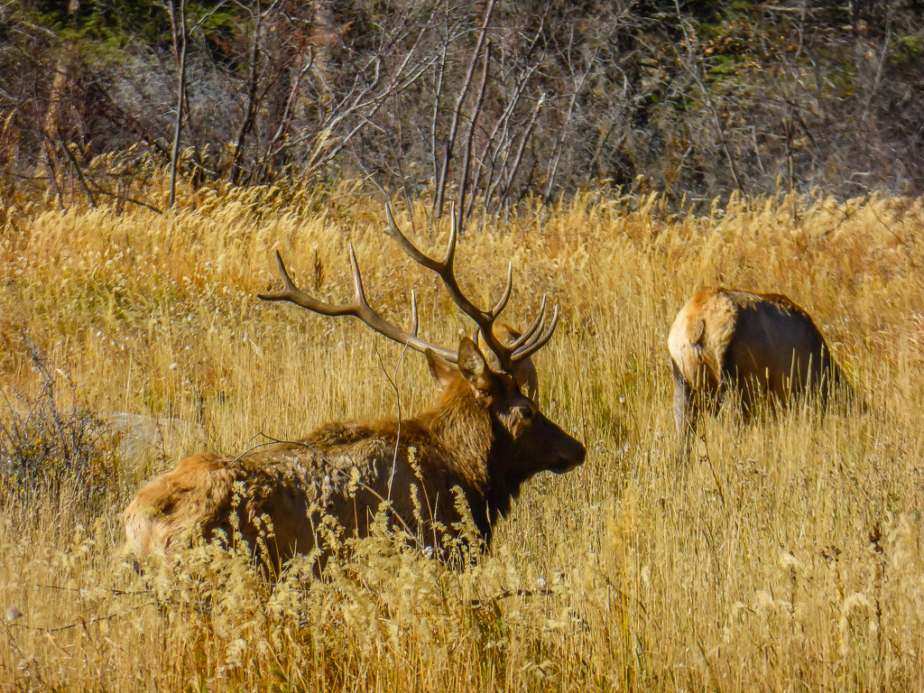
We set off after breakfast around 9am heading in a clockwise direction and had our first surprise of the day before even reaching our first destination, Cub Lake. As we rounded a corner on the trail we were unexpectedly stopped in our tracks by a mature and sizeable elk doing his best to impress a large harem of females. Both nervous and excited, we slowly backed off and took refuge on a rocky ledge nearby. We watched for a few minutes, the elk completely aware of our presence but totally unfased by it. Wanting to make the most of the opportunity, (it’s not every day you bump into an elk) we tentatively took out our cameras and tried to get a shot of the imposing male with his spectacular antlers, all the while counting our blessings that we hadn’t been impaled on them when we first rounded the corner!
A great day for a walk! Joining the trail near Beaver Meadow and heading off in the direction of Cub Lake.
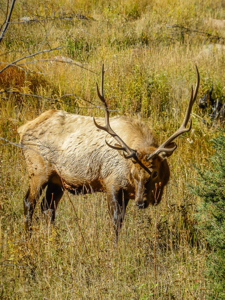
The impressive looking elk that literally stopped us in our tracks!
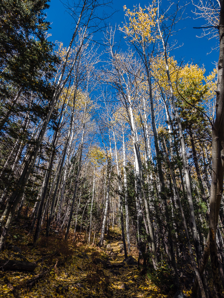
Heading through lodgepole pines and aspen with their last remaining golden leaves.
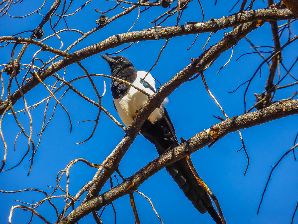
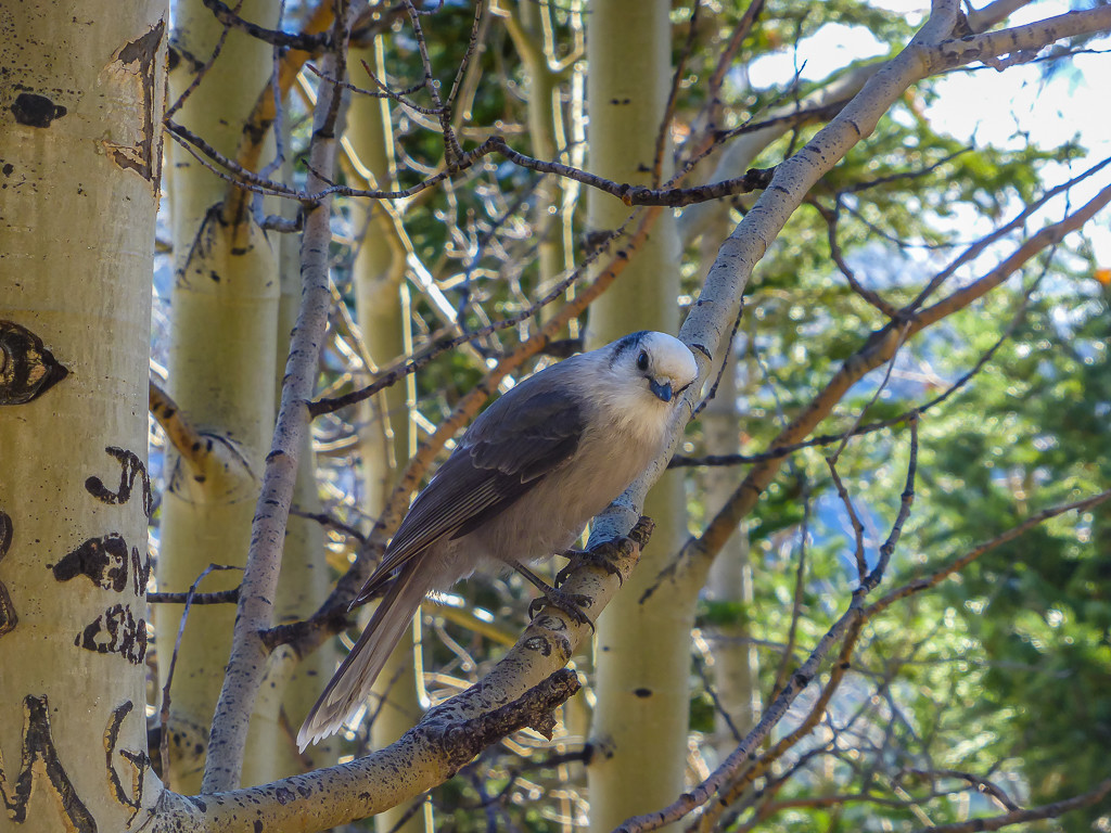
We think this bird was a black-billed magpie. It flew from tree to tree following us as we walked.
When we reached Cub Lake we stopped for a quick drink and some photographs, then continued on to Bear Lake. Bear Lake was quite busy when we arrived, so after a snack and another quick rest we decided to get moving again and continued on to Fern Lake. Most trails ascend higher than Bear Lake so we soon found ourselves amidst snow and walking on trails that were increasingly icy. It was such a contrast to hiking in the lush, green, rolling hills of England where we had been just a few months earlier!
Looking down onto Cub Lake as we continued on the trail.
Another bird that seemed to enjoy following us along the trail. (Possibly as it was thinking it was going to get fed!)
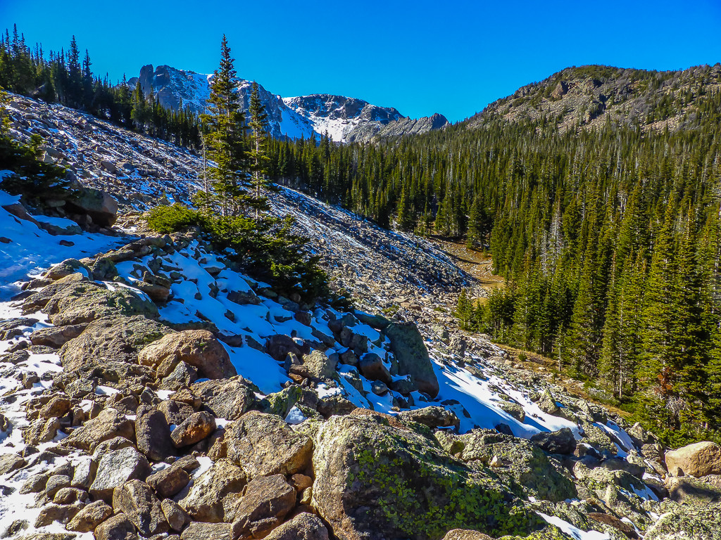
As we got higher in elevation we started to see snow and had to contend with icy patches along the trail.
Taking tentative steps as we didn’t have crampons and had not taken our walking poles that day.
After Bear Lake, we continued on to Fern Lake and The Pool before finally making our way back to the campsite. It was a great walk that took in a variety of scenery and was not particularly challenging, apart from the few icy patches we had to traverse with care. We returned to the campsite just before sunset and were both more than ready for a beer as a reward for our efforts. It had been a while since we had walked 17 miles in one day!
Tomorrow we had set ourselves the goal of reaching Flattop Mountain!
Day 2 – 7.6 miles, Hiking to the Summit of Flattop Mountain
After another early-ish get up, we set our sights on Flattop Mountain where we knew we’d be rewarded with some spectacular views of the park. It is regarded as a strenuous hike in terms of ‘Difficulty Rating’, and hiking in snow proved to be just that.
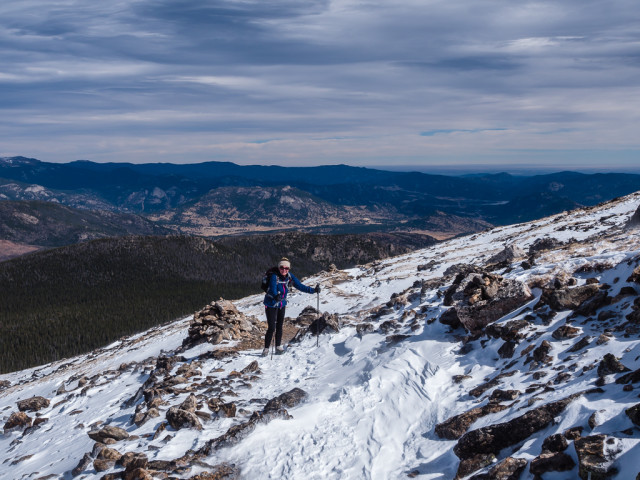
The hike to Flattop Mountain begins from the Bear Lake Trailhead. Today we drove to the trailhead and parked the car as we knew the walk would be a tough one. From the Bear Lake Loop Trail directions to Flattop Mountain are clearly signposted. The trail passes through a nice aspen grove as it begins ascending the slopes of the Bierstadt Moraine. When you reach the junction that leads to Bierstadt Lake and the Mill Creek Basin it is a left turn to continue on towards Flattop Mountain. From here the route begins heading due west and as it climbs higher you’ll have spectacular views of Longs Peak, the Keyboard of the Winds, Pagoda Peak and Chiefs Head Peak as you look towards the south.
A stunning view of snowy peaks from ‘Dream Lake Overlook’ on our way up to Flattop Mountain.
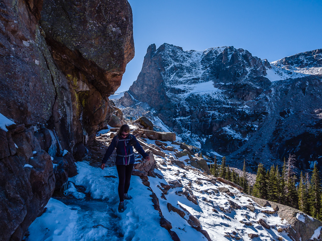
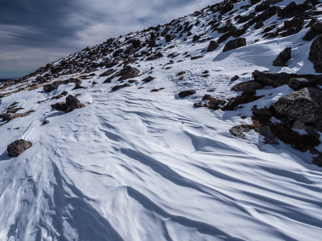
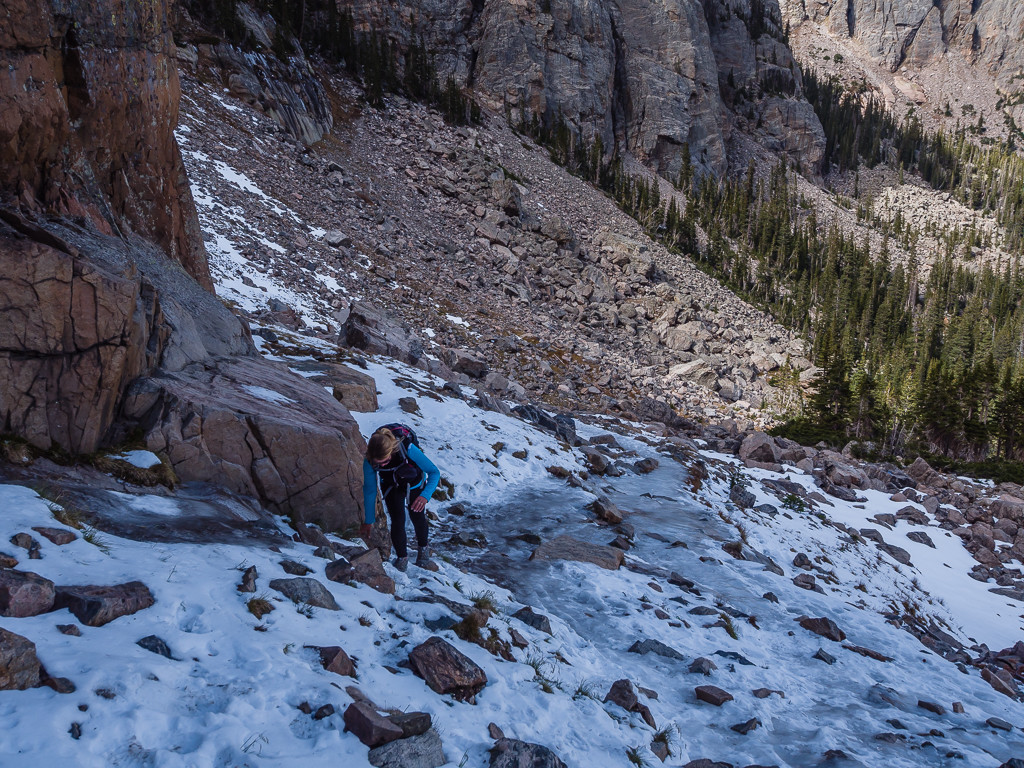
We passed only a handful of hikers after the last junction which forks off to the left and begins ascending the eastern slopes of the mountain. Those whom we spoke to were considering turning back because they either had a lack of warm clothing or inadequate footwear. Although we had bright blue skies overhead, it was biting cold and we had to contend with a chilling wind right in our faces that made it even harder moving forward. Coupled with extremely icy trails and post-holing in the deep snow, I also considered turning back a few times!
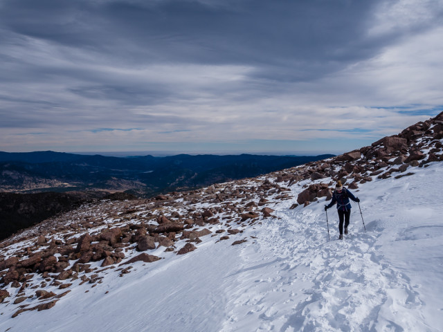
Thankfully we brought our walking poles today to support us on the snowy trail.
The trail was not always easy to follow as previous footprints had disappeared!
Huge cairns marking the way helped us with navigation.
Slowly but surely making our way up the icy slopes.
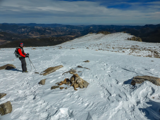
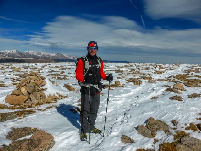
Almost there… The summit at 12,324 feet is literally a flat section on the top of the mountain giving it it’s namesake ‘Flattop’ Mountain. We were slightly disappointed that after all that effort, there isn’t a sign indicating that you’ve actually reached it!
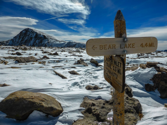
This trailhead junction sign is recognised as the official summit of Flattop Mountain.
Hikers will reach the end of the Flattop Mountain Trail when they reach the junction with the North Inlet Trail and Tonahutu Creek Trail. Although there are no signs indicating that you’re at the top, this is usually recognised as the summit of Flattop Mountain. At this junction, roughly 4 and a half miles from the Bear Lake Trailhead, you’ll be standing at an elevation of 12,324 feet. Boy was I happy to get to that sign! We made ourselves have one ‘selfie’ photograph (used at the start of this blog post), then it was time to make our way back down the mountain as it was simply far too cold to stand around. The spectacular views made it worth it, but thank goodness for our layers and walking poles that day!
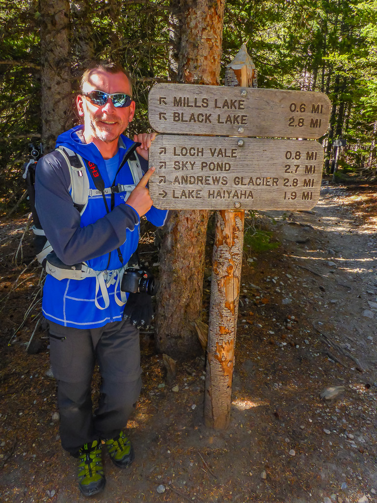
Day 3 – 5.4 miles, Return Hike to The Sky Pond
Although we planned on Day 3 being a little less strenuous, we found ourselves facing a difficult scramble over an icy ridge as we made our way up to the ‘Sky Pond’. This time we parked at the Glacier Gorge Trailhead and set off from there first passing Alberta Falls. Alberta Falls, one of the more popular hiking destinations in Rocky Mountain National Park is a scenic 30-foot waterfall that thunders down a small gorge on Glacier Creek. We discovered it is named after Alberta Sprague, the wife of Abner Sprague, one of the original settlers in the Estes Park area. We stopped at the falls for a while so that Wayne could capture some long exposure shots of the water cascading down the gorge, then continued on heading for The Loch.
Sky Pond was our final destination today.
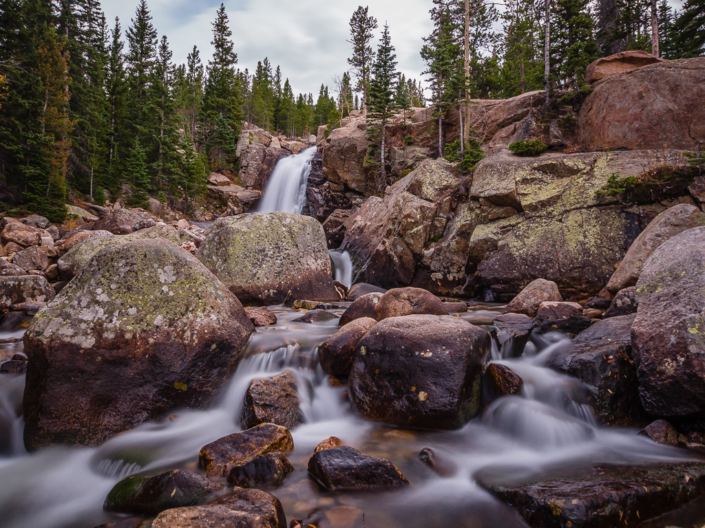
Stopping for a rest break at Alberta Falls so that Wayne could capture some long exposure shots of the water thundering down the gorge.
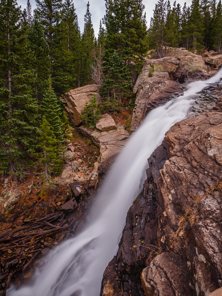
Looking down on Alberta Falls.
From Alberta Falls you head onto the Loch Vale Trail which leads you to ‘The Loch’, a beautiful subalpine lake situated at 10,190 feet. We could have quite easily stopped here, but determined to reach the Sky Pond we soldiered on to Timberline Falls. As you continue along the trail, it climbs very steeply and you’re faced with several switchbacks before Timberline Falls come into view. It was worth the extra effort though as we were treated to a great spectacle. The falls were actually frozen solid. That’s really how cold it was!
To reach the Lake of Glass and ultimately the Sky Pond the trail then continues up a chute to the right of the Timberline Falls. The falls being frozen and our route up looking very precarious we took a breather and mulled over the decision to proceed with the scramble or whether to turn back and call it a day. The path was extremely icy, but as experienced hikers we decided to attempt it…
Carefully ascending up the side of Timberline Falls making use of all fours following Wayne’s chosen route.
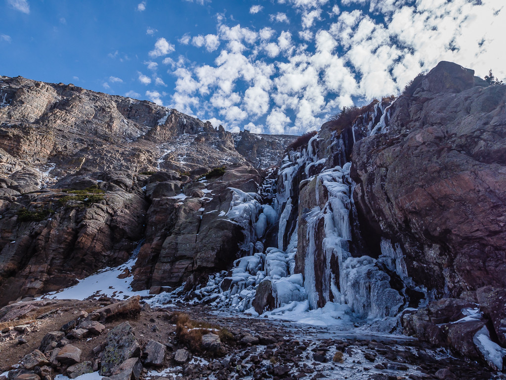
A striking scene finding Timberline Falls frozen solid!
While looking at a park map you might think that it’s a relatively easy walk from Timberline Falls to the Lake of Glass or Sky Pond. However it’s a really tough scramble, particularly when the waterfall is frozen and the route up is covered in ice. We had to take great care clambering up the rough terrain around the waterfall, which was actually very slippery and dangerous in places. Taking it slow and steady and using all fours helped us make it past the worst section, then it was a relatively easy scramble up the next part before the Lake of Glass came into view.
Our advice would be to take your time and be extremely cautious. If you have a fear of heights you may want to think twice about proceeding any further. Also, if rain or snow is imminent, it would not be wise to continue beyond this point.
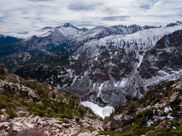
Our efforts had been worth it. On a clear day such as ours, we were treated to outstanding views of The Sharkstooth, Taylor Peak and Powell Peak towering overhead, as well as the Lake of Glass itself which looked beautiful in the late afternoon sun. What made it even more special is that once again we had something so magnificent all to ourselves.
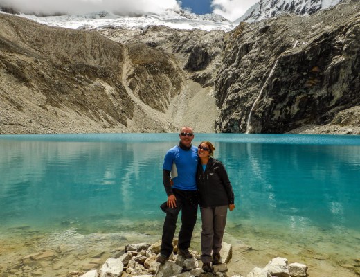
Looking out across the Lake of Glass. It was certainly crystal clear.
From the Lake of Glass, we made the final push to the Sky Pond, which sits at an elevation of 10,900 feet. Some people turn back at this point realising that you’ll have to go down whatever you go up! But that final uphill struggle is most definitely worth it. The views from the Sky Pond are simply spectacular. The alpine lake fills a cirque basin, and is surrounded on three sides by sheer cliff walls. Off to the right are the granite spires of The Sharkstooth. Against the backdrop of a cobalt blue sky, the scene makes for an extremely dramatic view. The mountain directly across the lake is 13,153 foot Taylor Peak, and towards the south is 13,208 foot Powell Peak.
Looking on to the Sky Pond with The Sharkstooth towering above on the right.
After scrambling up to the Sky Pond Wayne poses looking back with ‘The Loch’ in the distance.
The space between the Lake of Glass and the Sky Pond is dotted with ponds, meadows and cascading streams and well worth an explore if you have time. As it was so cold, we posed for a few photos up there, then carefully made our way back down.
Three hikes in three days – each with different scenery and terrain but equally amazing views – mission complete! Now for a campsite feast to celebrate!
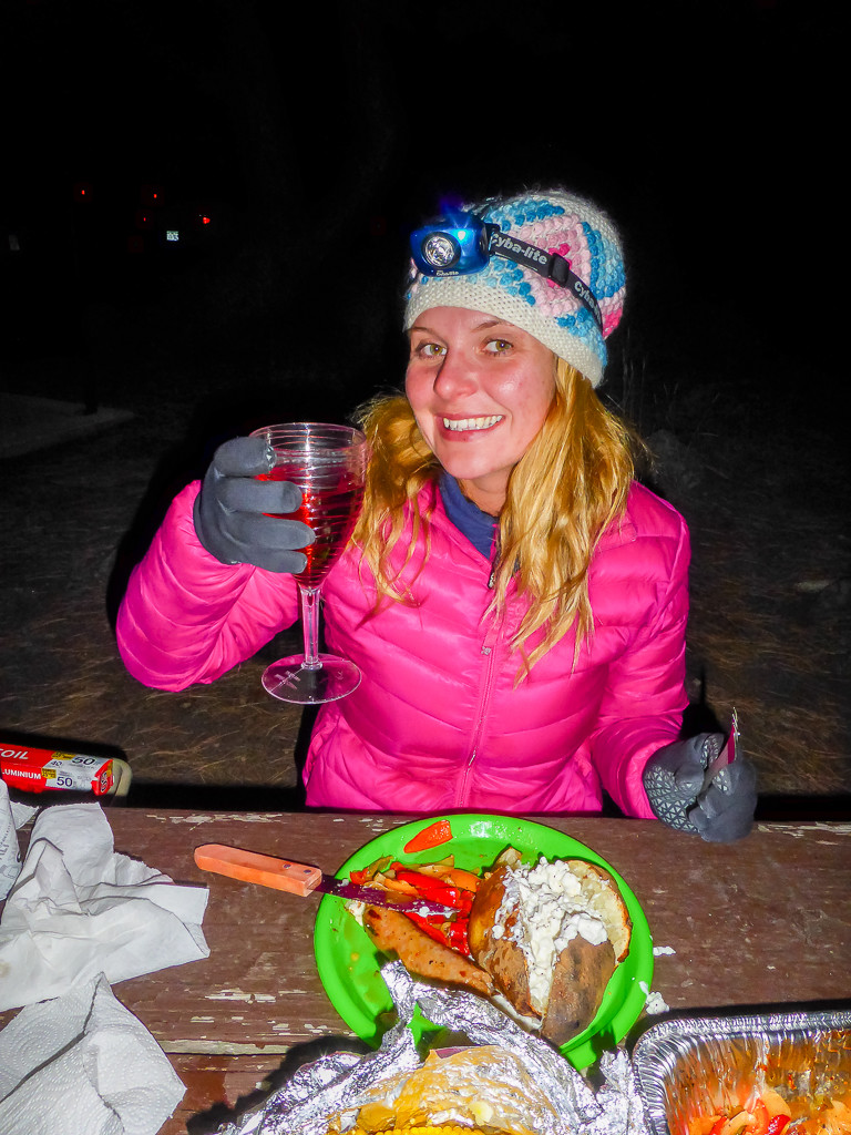
A celebratory drink and BBQ feast after completing three days of hiking!
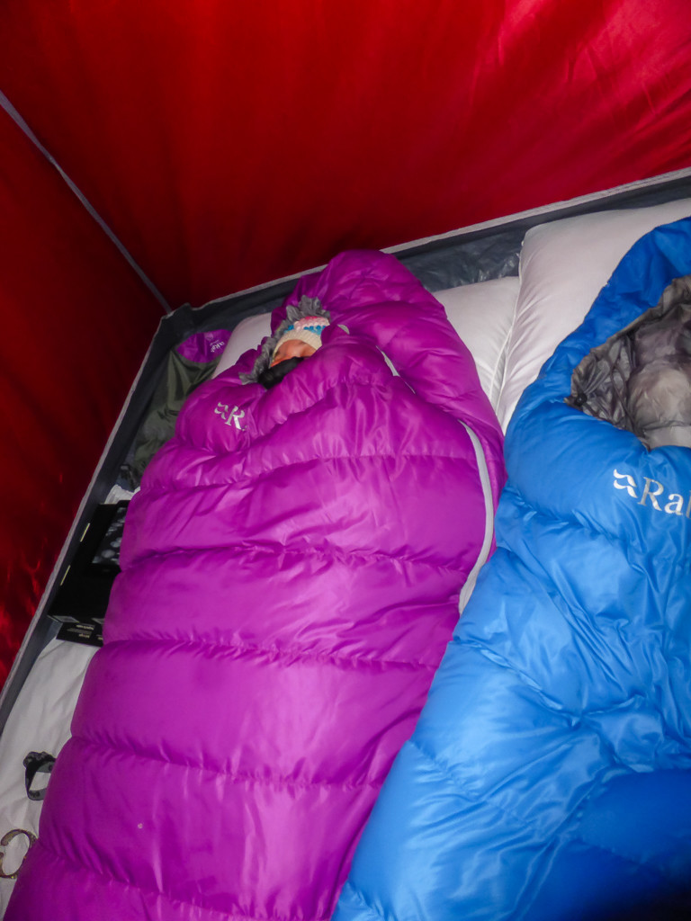
The Rocky Mountain National Park proved to be our coldest nights of camping. Thankfully our Rab down bags proved their worth and kept us nice and snug!
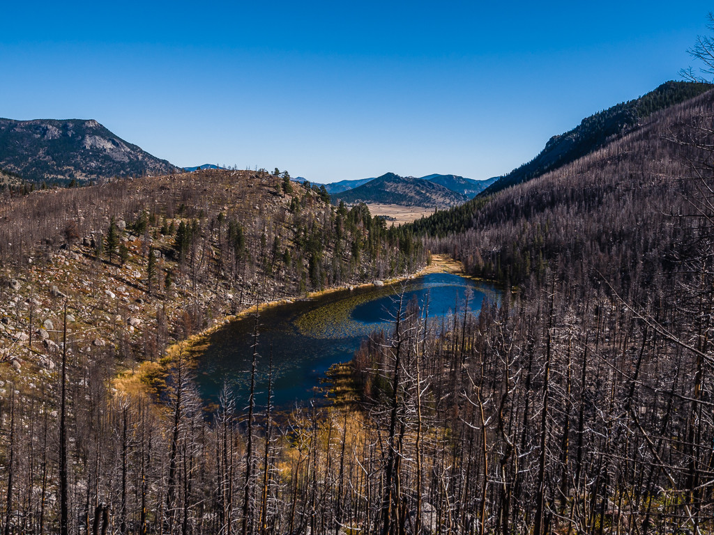
Thankfully, by the time we were ready to leave The Rockies, the Trail Ridge Road was open allowing us to drive west along Route 34 to experience some of the features and scenic vistas dominating the west side of the park.
Views of Flattop Mountain as we leave the Moraine Park area and head west in the national park along the Trail Ridge Road.
Thankfully the road had been cleared of ice, which made for a much more pleasant drive!
Farewell Rocky Mountains – ‘Til We Meet Again…
Overall, we had a fantastic time visiting the ‘Rocky Mountains National Park’ and enjoyed the opportunity it gave us for hiking on very different terrain than what we’re used to. We are by no means only ‘fair-weather’ hikers, but our experience to date of hiking on snow is very limited. We were so very lucky that during our entire 27 days hiking the JMT, we managed to avoid any hazardous winter conditions!
We completely understand the need for layers, a warm hat and face buff, as well as gloves, as the challenge of a hike becomes even tougher when a harsh wind is constantly battering your face, ears, head and hands. From just our experience heading up Flattop Mountain, we know it certainly makes it harder to keep going, especially when you feel cold and exhausted. Likewise the visibility of the trail or lack of it when it’s covered in snow makes it particularly slow going, as does the presence of ice forcing you to take a much steadier pace and be really sure-footed. The annoyance of post-holing in the snow really slows you down too, which is something else to contend with during winter hikes. But with all this comes the reward of seeing something already beautiful, look even more stunning covered in a blanket of white.
It has certainly piqued our interest in attempting more winter hikes in the future. We didn’t have crampons and luckily we managed without them, but we will definitely be looking into purchasing them as an addition to our kit in the future.
From snowy peaks and cold climes we bid farewell to the ‘Rockies’ in search of the sunshine once more. Next stop… Utah and ‘The Big Five’! Find out more in our next road trip post coming soon…
1 Comment
Hi Paul, thanks for your comment and I appreciate the tip about snow shoes! As you can tell, we've not done much winter hiking before 😉 The Rockies were stunning, no wonder you've been several times. We'd also like to go in summer & see the difference in scenery, although Flattop Mountain covered in snow did look pretty spectacular!