
Returning To Our Favourite Spot On The Pennine Way…
It doesn’t seem almost two years ago that we first encountered the magical glaciated chasm carved into the side of the Cumbrian Pennines that is ‘High Cup Nick’. After walking the first 150 miles of Britain’s oldest long distance trail, The Pennine Way in 2014, and already being charmed by the northern English countryside, we were not expecting to find High Cup Nick so impressive.
But impressive it is! Aptly nicknamed ‘the Grand Canyon of the North’, the view can rival even the best spots of the Lakeland fells, and is a great day walk in its own right. Therefore we couldn’t resist returning to this magical spot on our second ‘weekend adventure’ of 2016.
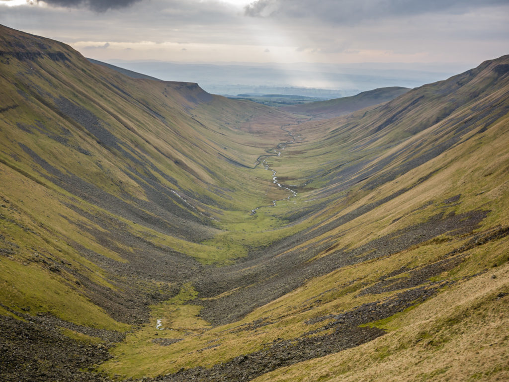
Standing at the top of High Cup Nick and looking out on the perfect u-shaped valley.
During our Pennine Way thru-hike, we were making our way across rugged moorland down to the village of Dufton, when this hidden gem soon revealed itself. Standing in front of one of the most spectacular landforms in England, we were completely mesmerised by the view.
Looking out upon the perfect u-shaped valley was one of those jaw-dropping moments where the scenery simply took our breath away, made all the better with it being a beautiful summer’s day with bright blue skies and fluffy clouds. How could we not stop there for a spot of lunch and enjoy the view for longer! Take a look at our first encounter with High Cup Nick here.
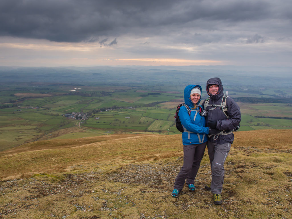
The same great place but very different weather and conditions on our second visit to High Cup Nick.
‘High Cup Nick’ often becomes the topic of conversation when people ask us for recommendations about where to go in England for a good day hike. Within a few square miles, this area of the northern Pennines encompasses both interesting geology, wild moorland and fantastic views, so is a great place to visit. As a 10 mile or so day walk is not beyond the capabilities of most walkers, it is one that we would highly recommend. Plus you may even find yourself alone in this spectacular setting, which is a rarity on popular day walks.
As our plan for 2016 is to have a weekend hiking adventure every month, whilst we save and prepare for our next big thru-hike, we decided to take our own advice and return to this beautiful spot. We were looking forward to seeing the High Cup in a different season, possibly with a covering of snow that would giving us some more great photo opportunities.
A Circular Walk From Murton
Despite it being late February and still in the colds of winter, we were all set for a camping weekend in readiness to re-visit High Cup Nick on the Saturday. We had travelled up north on the Friday evening after leaving work and based ourselves in Kirkby Stephen, a quaint little market town that we had discovered whilst hiking the Coast to Coast path, with the intention of staying at Takoda Camping (one of our favourites from the C2C). But as the campsite was temporarily closed, we stayed at a B&B in the centre of town instead. (I’m certainly not complaining about that one!)
From where we live in the Midlands, it is a straightforward drive up the A1, turning onto the A66 at Scotch Corner. As you are so close to the Lake District from here, the north Pennines can often get overlooked. But for us, a 2 & 1/2 hour drive is perfect for a weekend get-away, and as we already know, the north Pennines has plenty to get excited about! And excited we were…
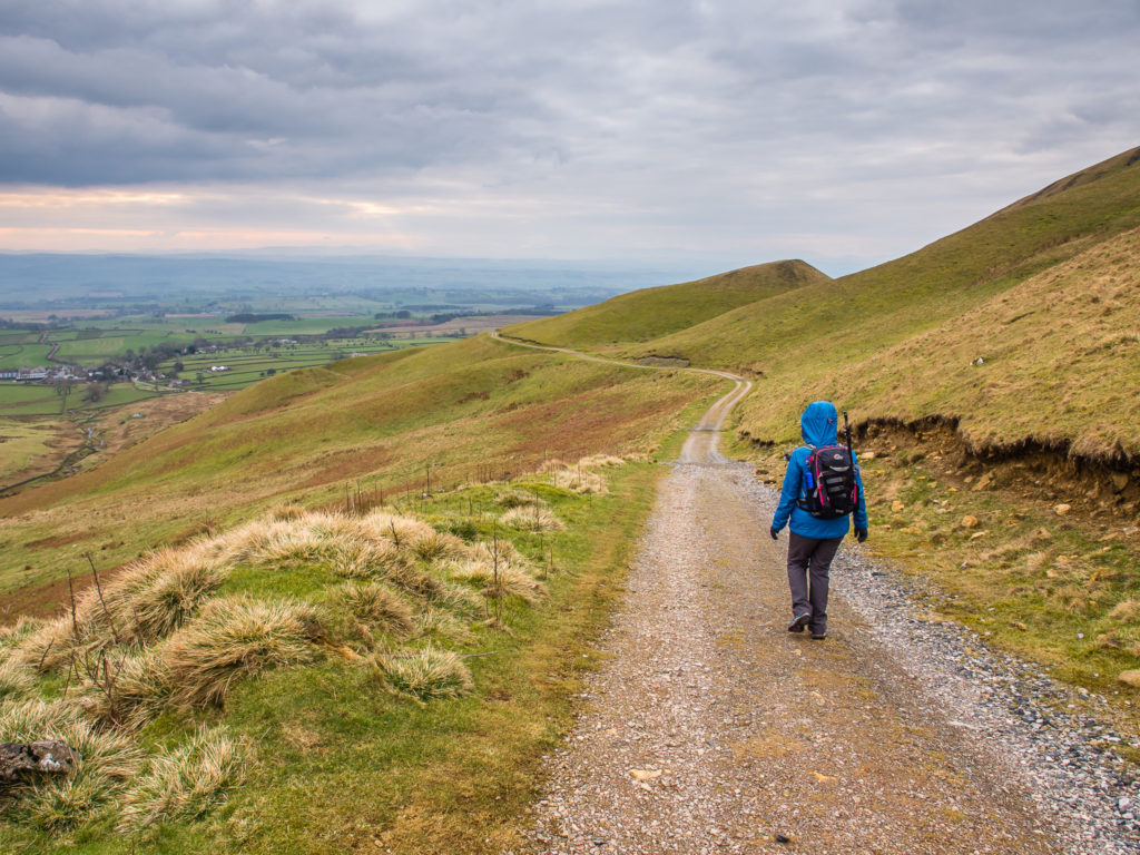
This time around, we decided to walk an alternative route. Instead of following the Pennine Way in reverse and coming up and around the rim of High Cup Nick from Dufton, climbing the 600 metres or so steadily over a number of miles on a stony track, which is the most popular circular route; we planned on hiking over the moors from Murton and walking up the centre of the cup.
This meant that our walk took us along the valley bottom, following the meandering path (this term is used loosely as it was barely visible with flags marking the way instead) alongside High Cup Gill, where we then had to negotiate a strewn boulder field at the bottom of the chasm, followed by a not-too-difficult scramble on the final section up to the top of the cup.
It turned out to be a great day for a hike! Here is our walk in pictures…
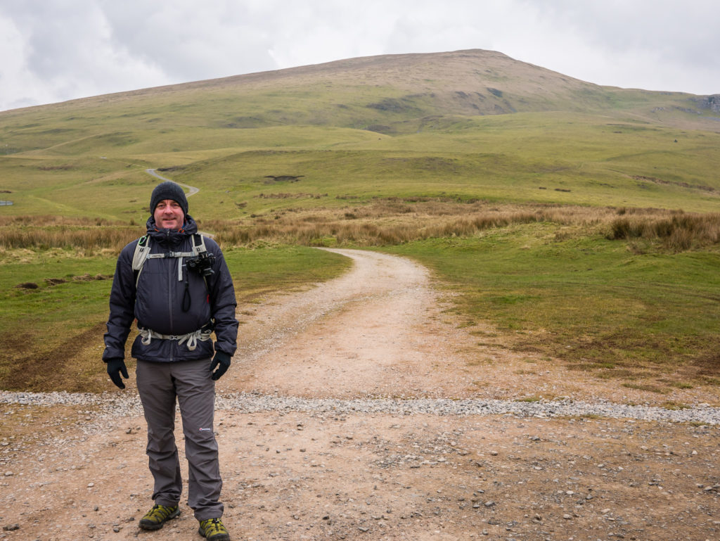
We parked the car for free at the little public car park in Murton, then set off on the trail. Murton Pike can be seen dominating the skyline.
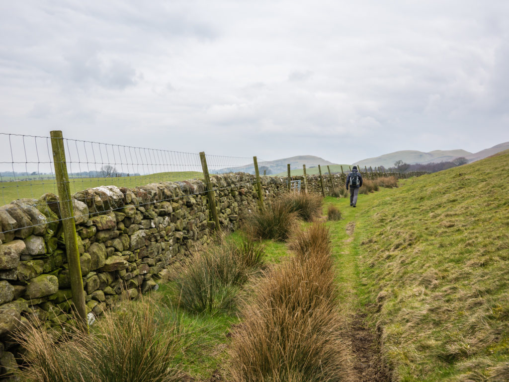
The path was well marked here and the ground was relatively dry.
That sprinkling of snow we were hoping for had already melted away on the lower fells.
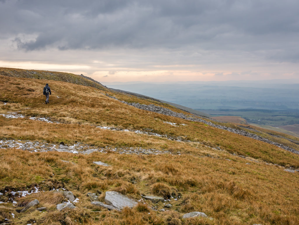
Making our way uphill following the ridge.
We were beginning to see the first signs of Spring.
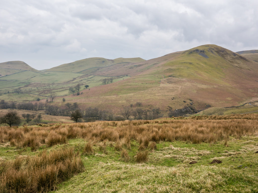
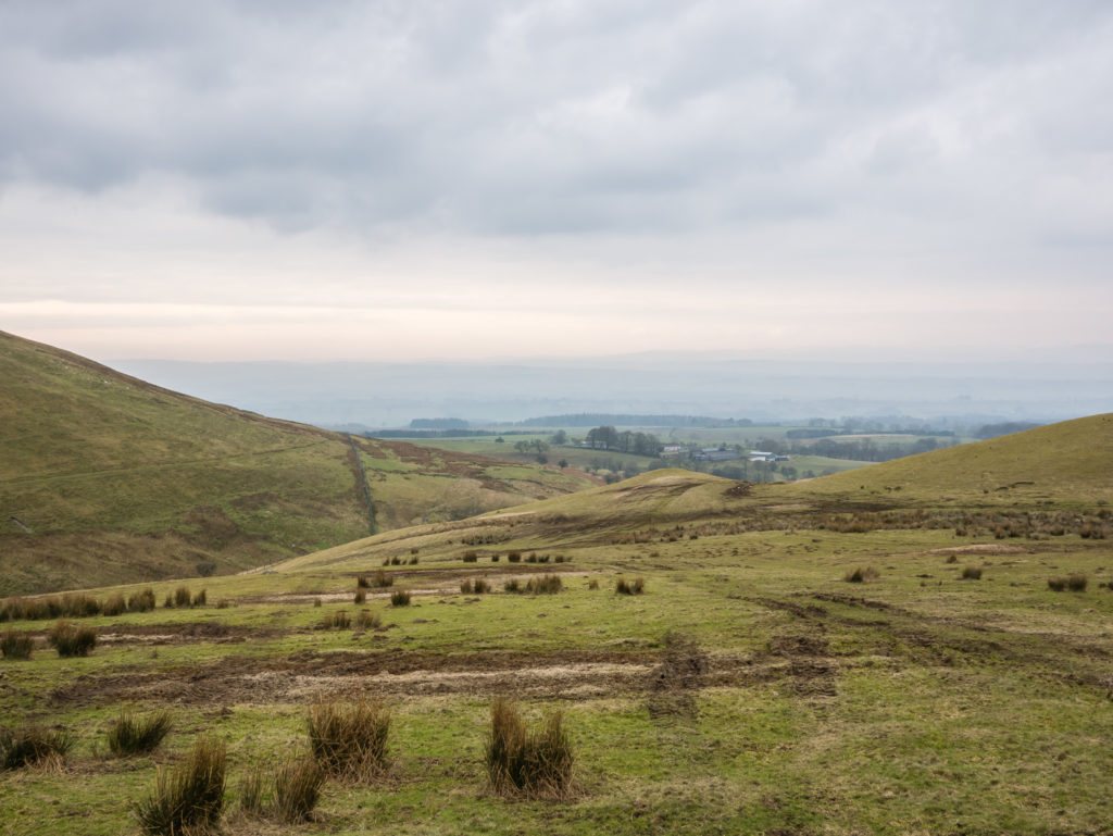
The trail follows the contours of the valley.
Below Murton Pike on the approach to High Cup Nick.
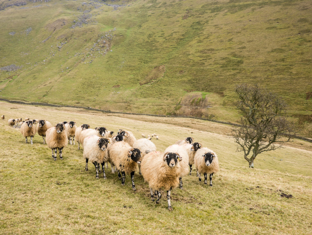
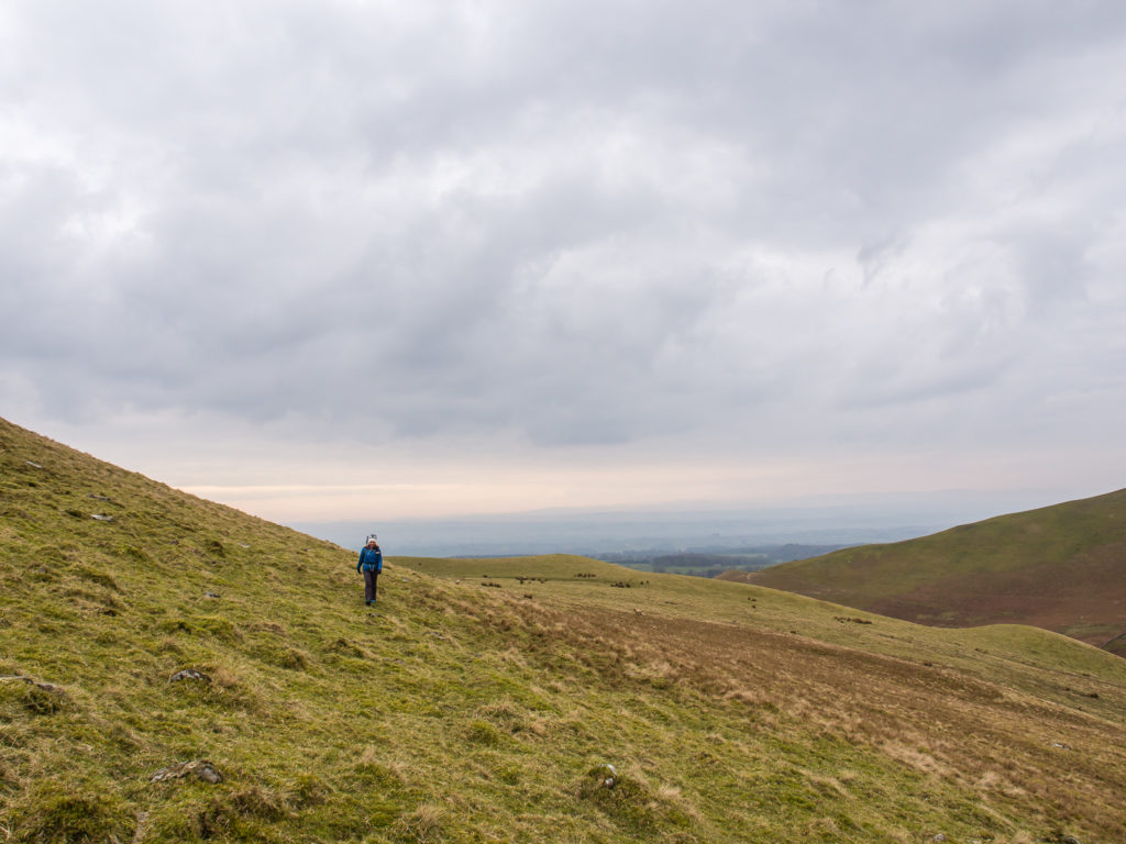
Crossing farmland, I felt like the ‘sheep whisperer’ as they curiously came towards us en masse! (Unlike any other sheep we have ever known whom have instantly run away!)
Great early morning light.
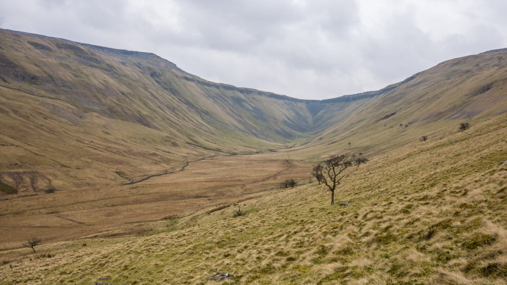
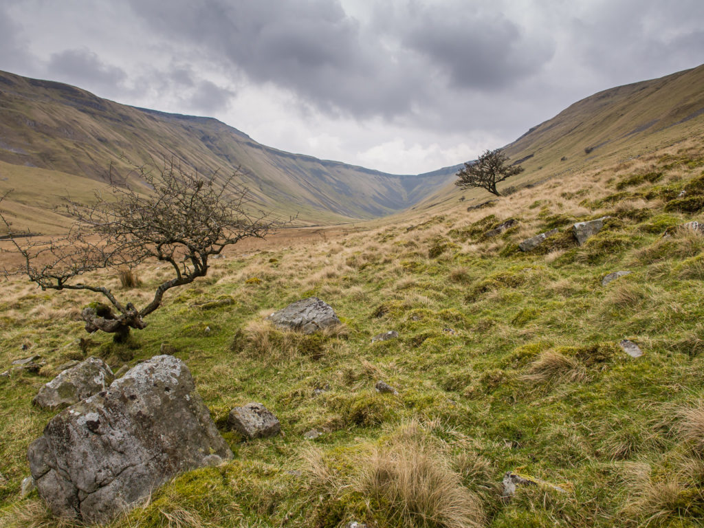
The High Cup u-shaped valley opens up before us…
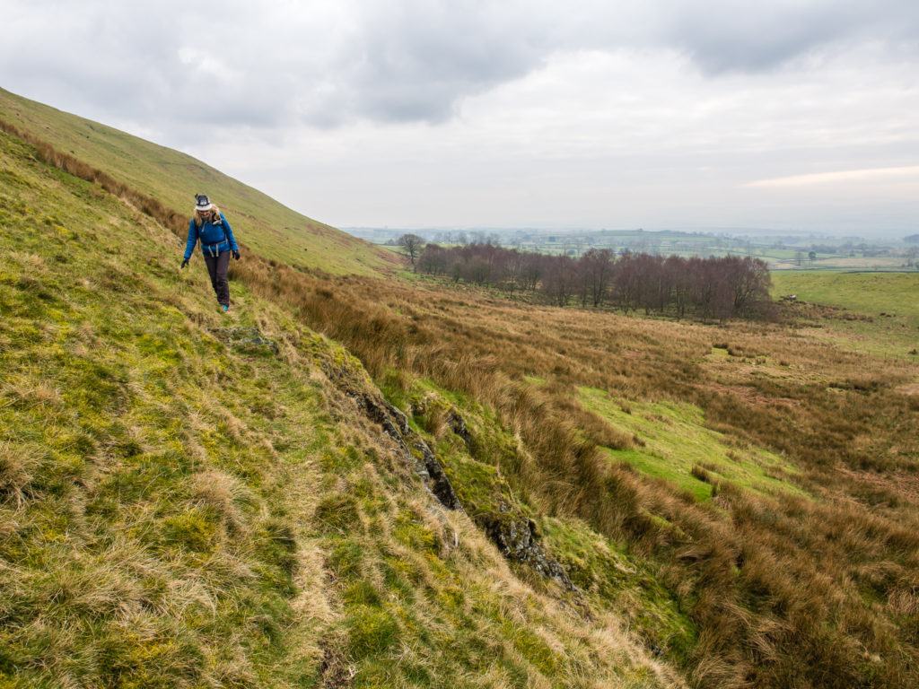
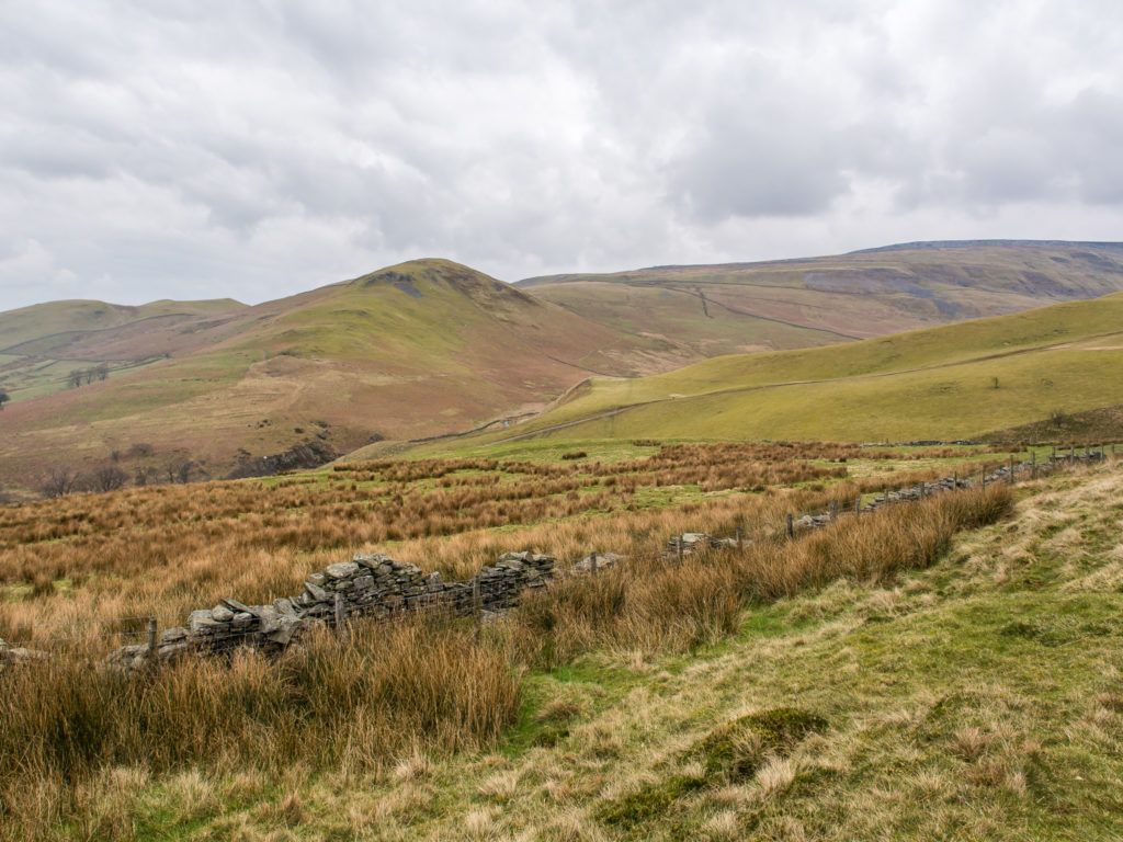
Following the ridge line once again before heading down to the valley floor. The trail at this point becomes much less clear.
Trying to avoid any boggy sections on our route down to High Cup Gill.
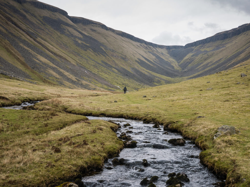
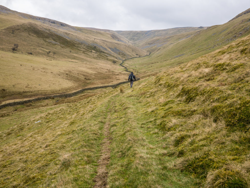
Following the trail to the right of High Cup Gill.

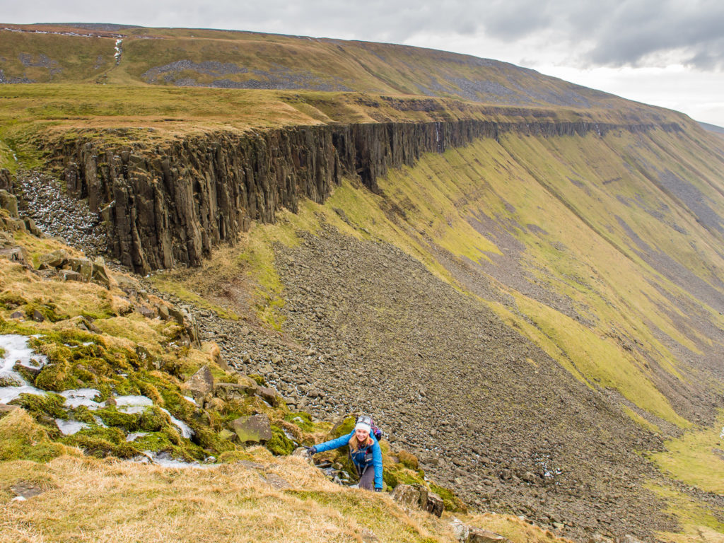
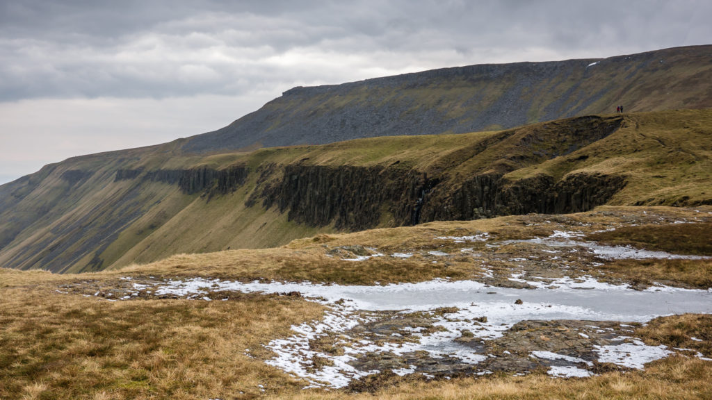
From a distance, the vertical cliffs of Whin Sill rock make it look like it’s going to be a tough scramble to the top!
Leading the eye to High Cup Nick.
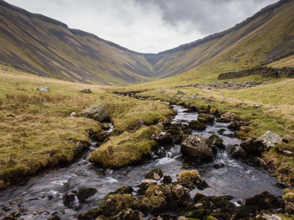
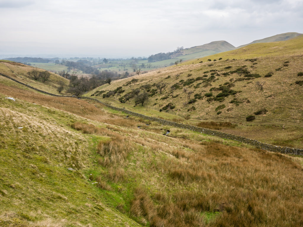
High Cup Gill cuts through the valley floor.
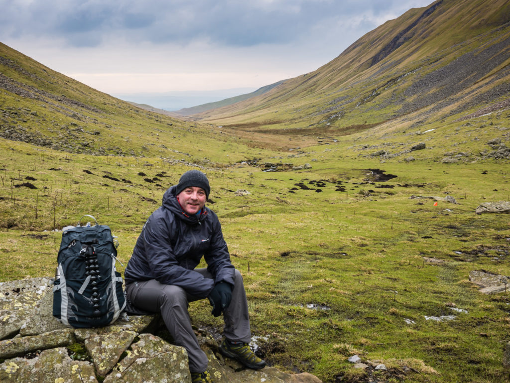
Time for lunch!
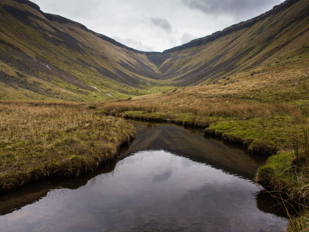
Reflections on a calm High Cup Gill.
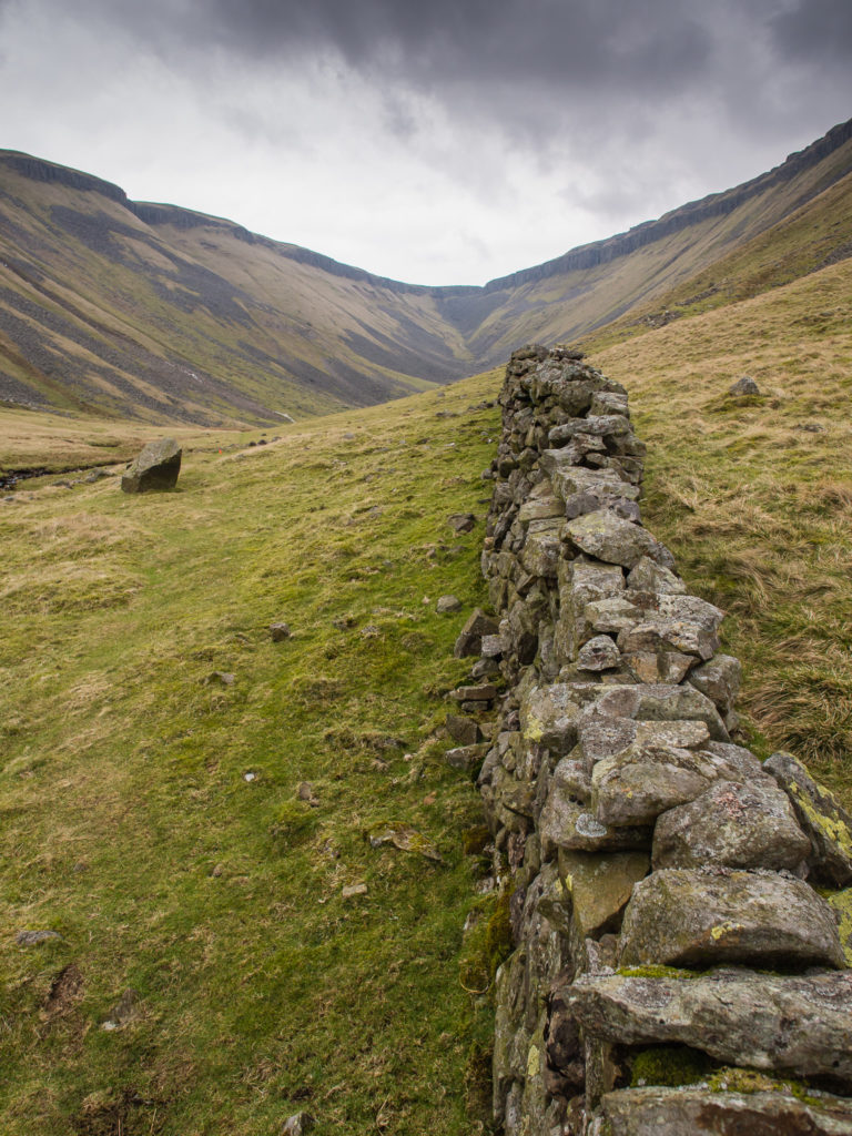
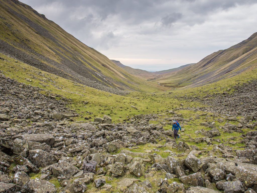
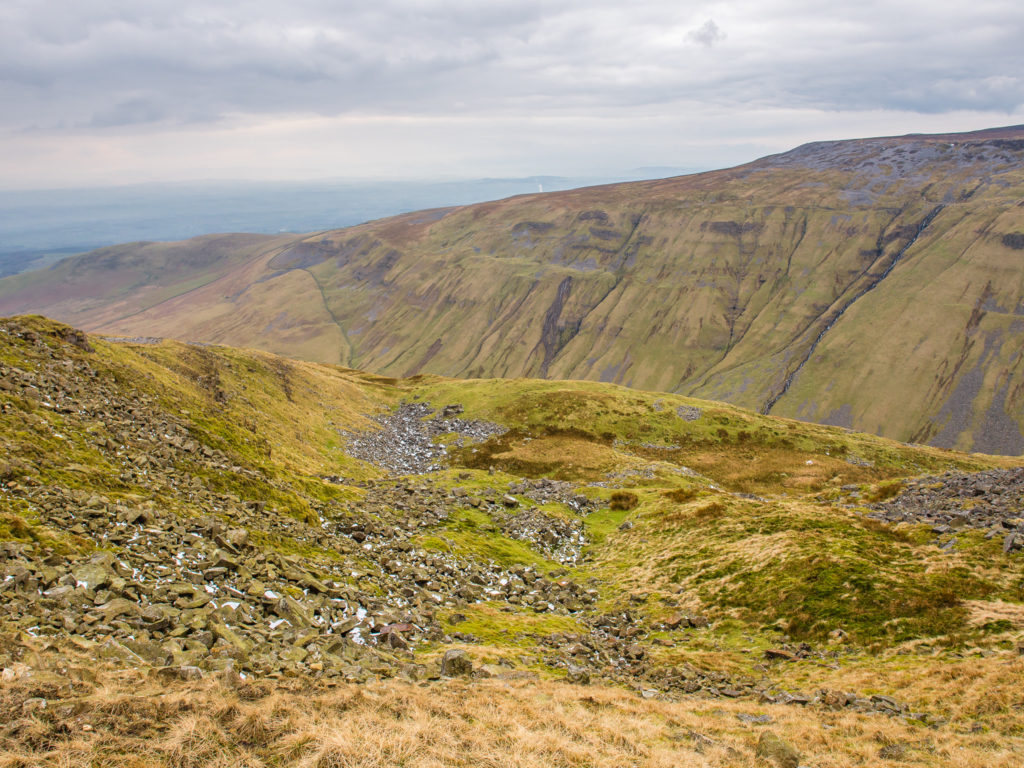
Heading to the boulder field below High Cup Nick.
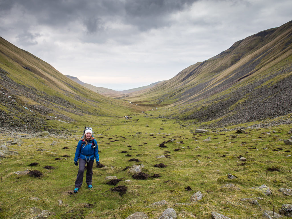
We had already covered a huge section of the valley floor. Looking back to where we had just walked from.
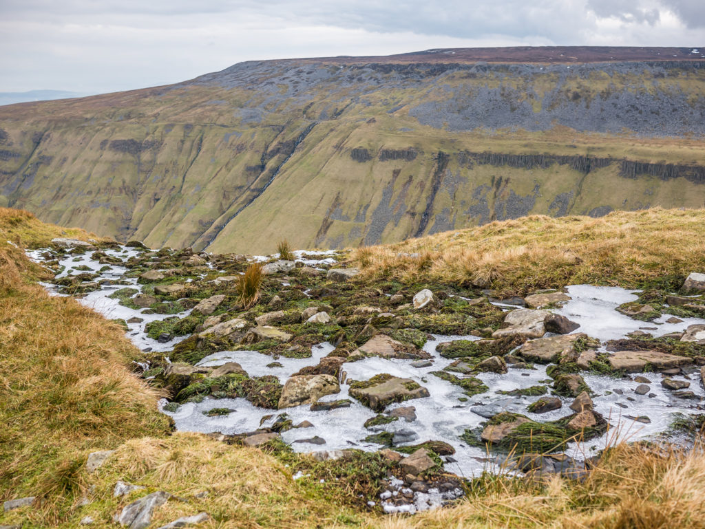
The last remnants of snow…
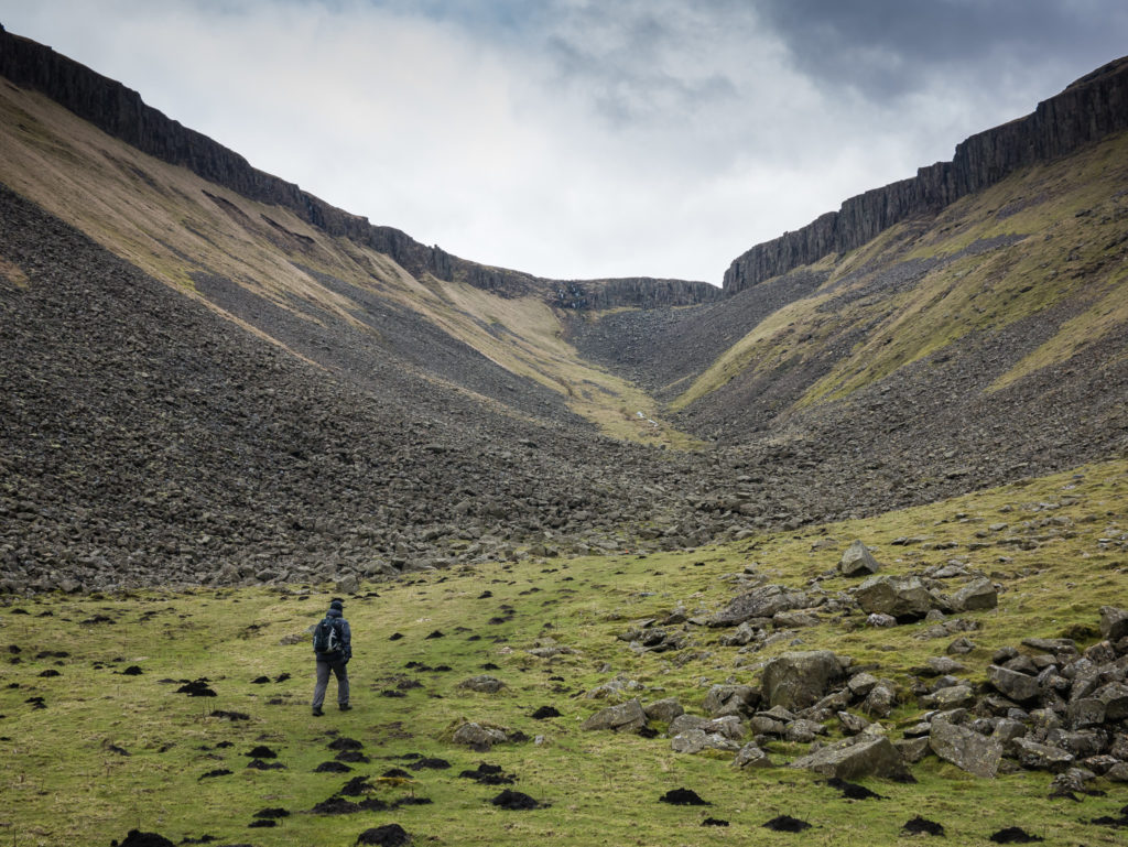
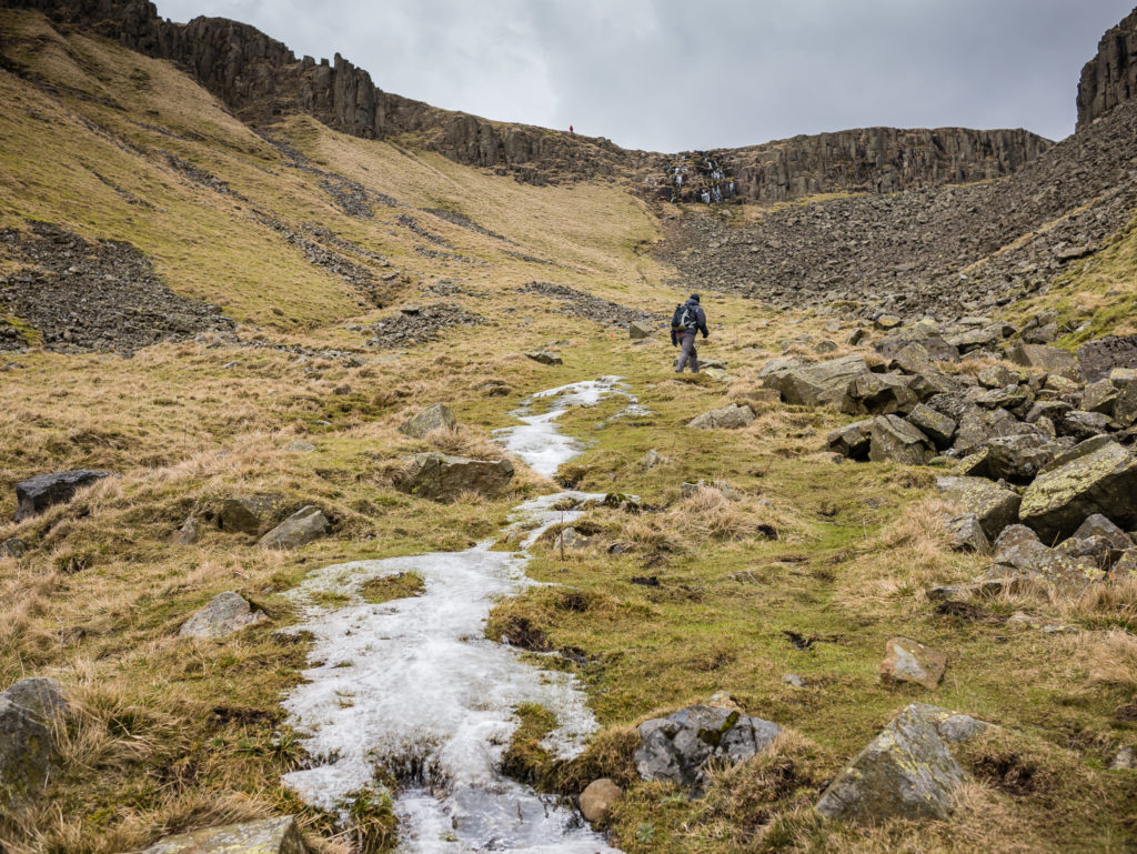
The start of the boulder field at the head of the chasm.
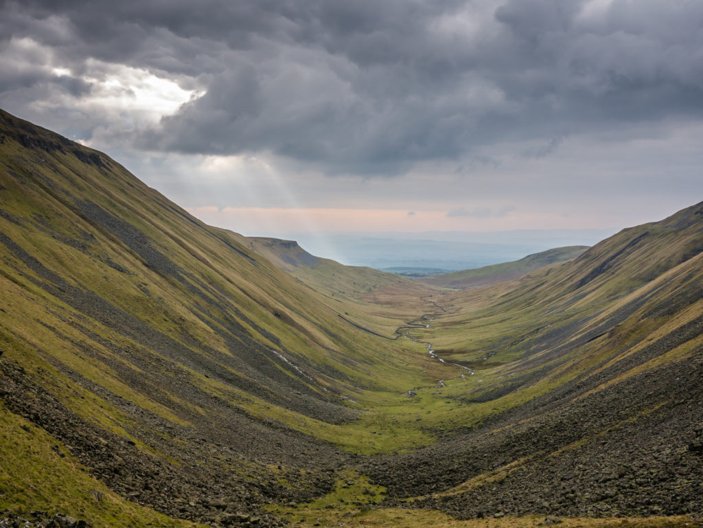
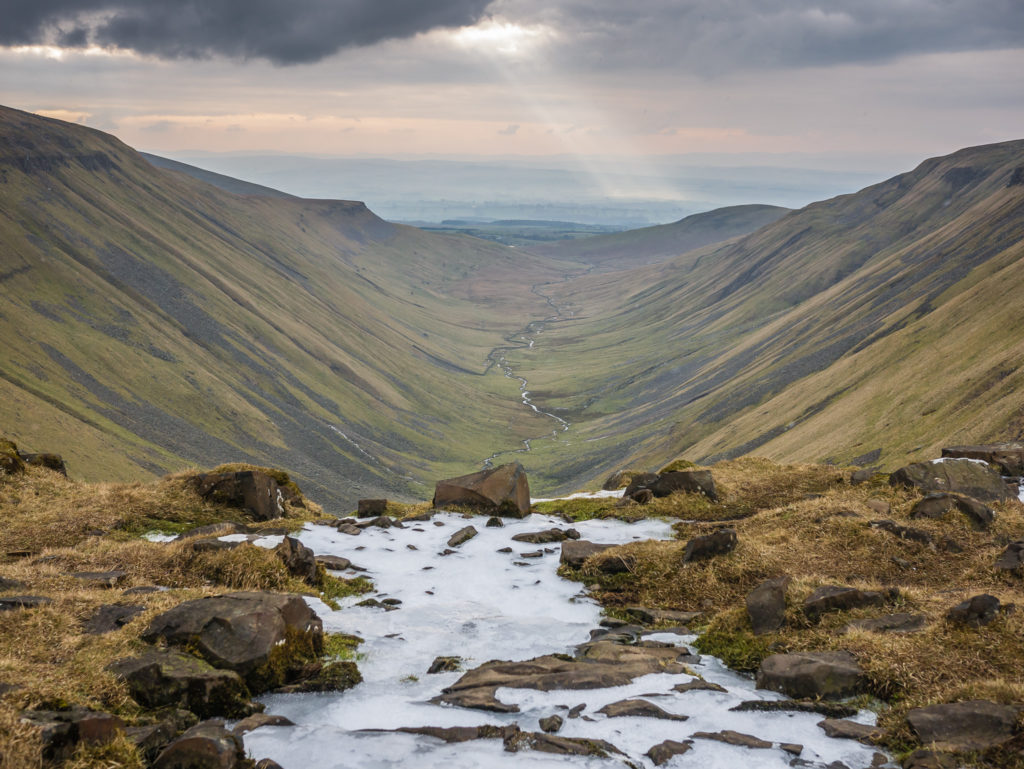
Capturing crepuscular rays over the cup.
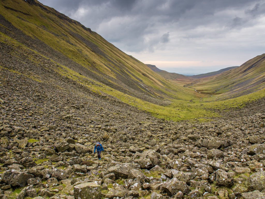
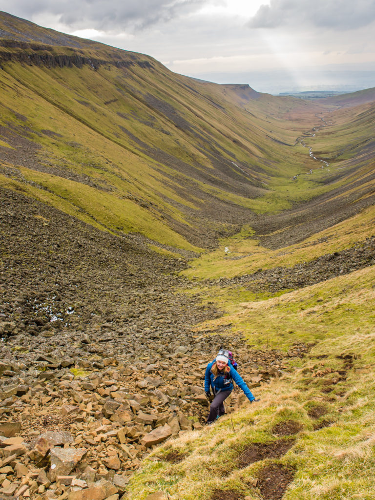
Navigating the boulder field becomes slightly more intensive.
The final push to the top!
The final scramble to the top of the cup was actually not too difficult, in spite of there being some icy sections, as there are well-trodden steps carved into the hillside, with some good rocky notches that offer support as hand and footholds. However, coming in the opposite direction would have been a different story. Hiking down the cup would be much more difficult as the edge is both steep and awkward. I would have been extremely wary navigating the fallen rocks – but maybe that’s just me as I never enjoy the coming down part if it’s steep!
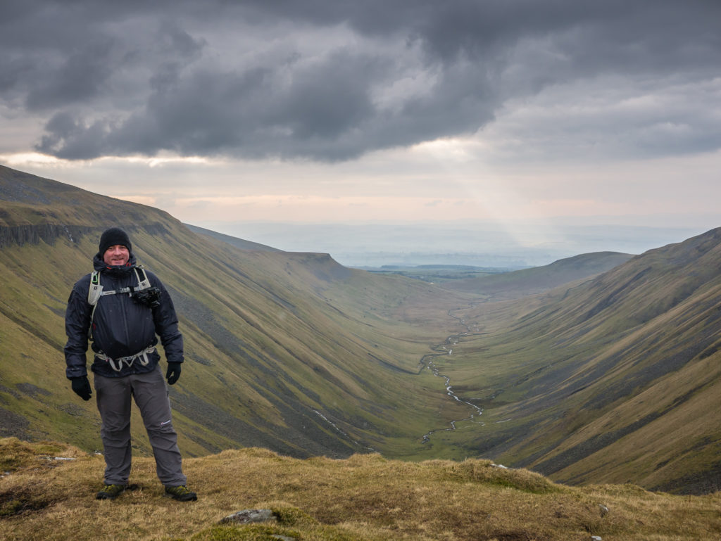
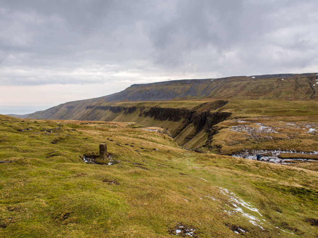
Looking upon the cup in all its glory.
The ridge at the top of the chasm that we came up over. Going over the edge and down looks a lot steeper and trickier.
It is the waterfall at the top of the cup that takes the name of High Cup Nick, although the name is often used synonymously with the ‘High Cup’ valley itself.
Two hikers follow the trail that heads around the top of the cup, then down into Dufton.
Leaving the High Cup on our circular route back to Murton.
This is the first view of the geological wonder before the u-shape valley reveals itself if you are hiking north on the Pennine Way.
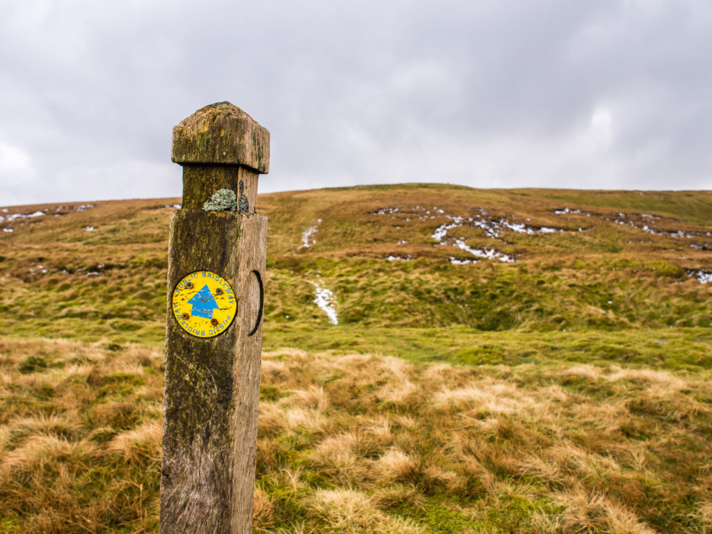
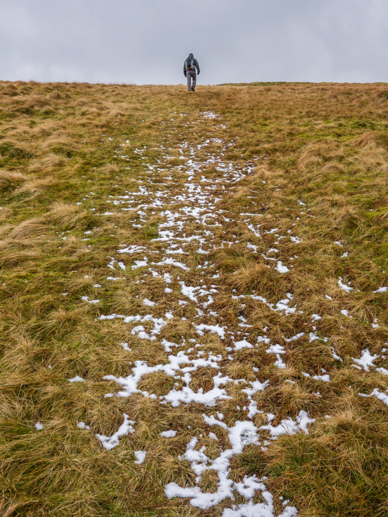
Where the trail is not always clear there are waymarks to look out for, particularly if the ground is covered in snow.
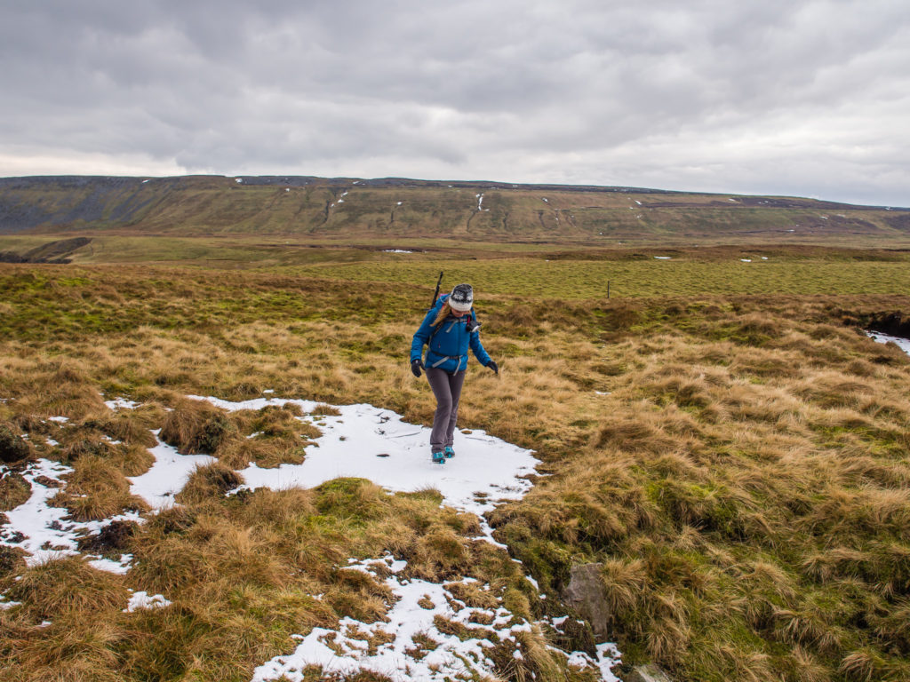
Finding the only bit of proper snow to walk on!

More snowy patches on higher ground.
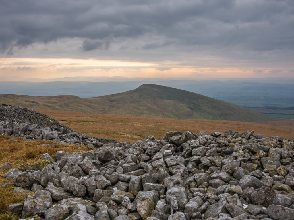
One final glimpse of the High Cup.
They may not be as tall, but they are just as impressive as the Lakeland fells.
Heading across the moors in the golden hours.
Gorgeous skies to end the day.
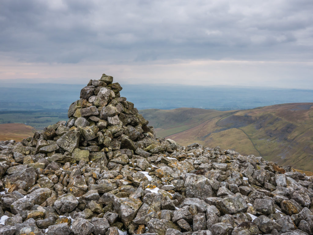
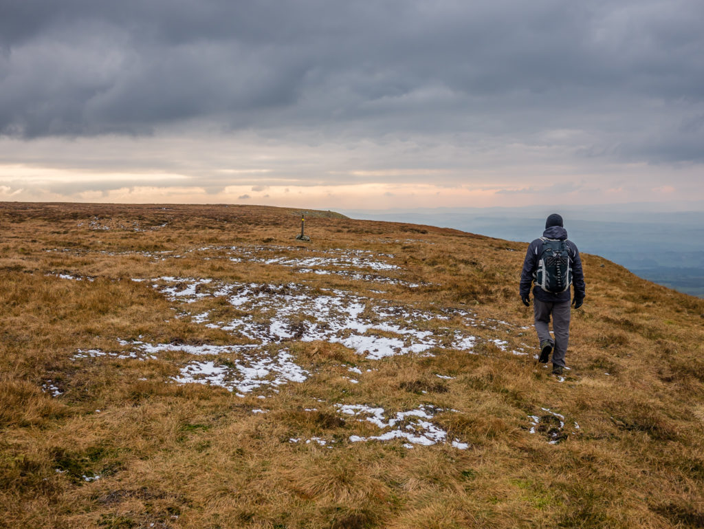
Cairns mark the route as we head for Murton Pike.
Murton Pike in the distance.

Crossing another valley as we make our way to Murton Pike.
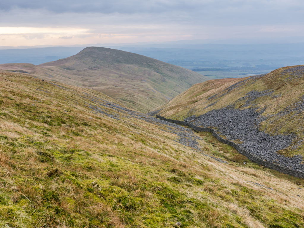
So near, yet so far… But we might as well bag ourselves another peak!
Having a quick snack break whilst there was the presence of a wind shelter.
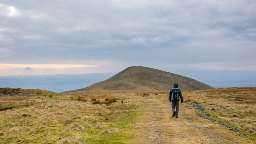
The approach to Murton Pike. We decided that we’d scale the shapely peak on our return to the car park.
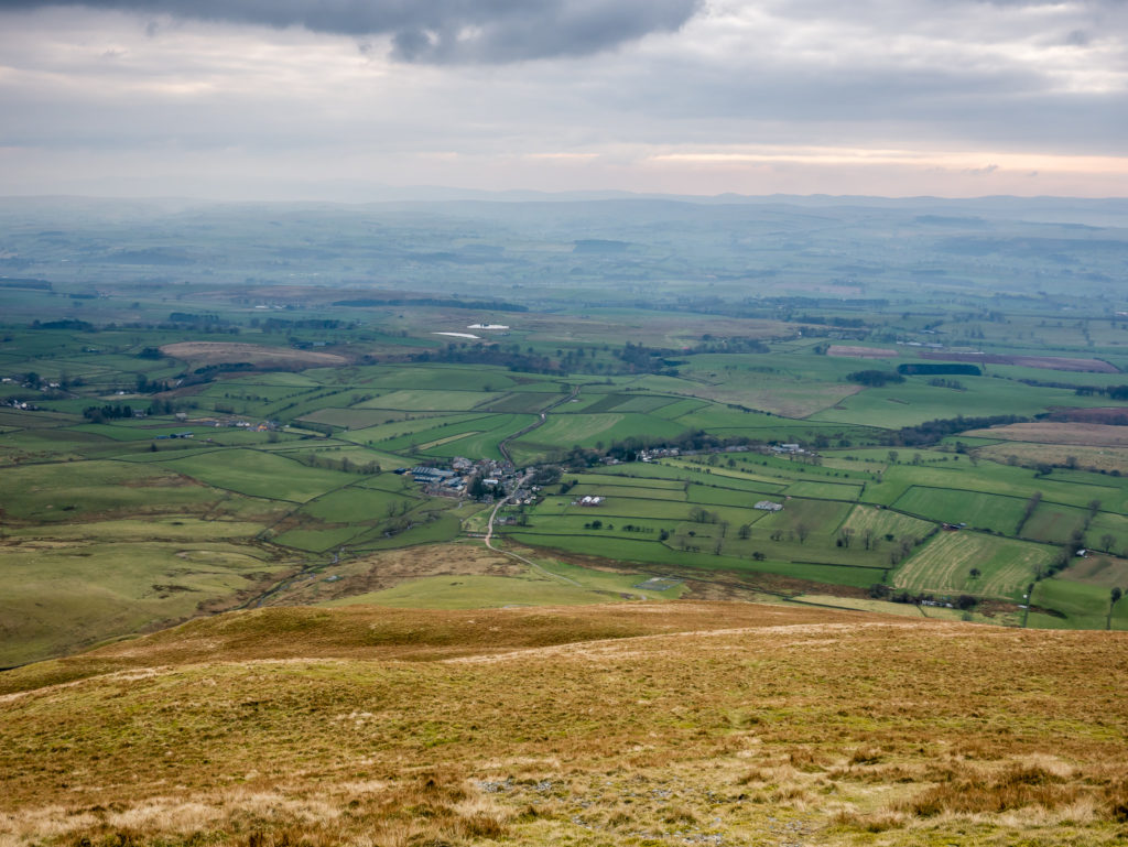
The great view from the top.
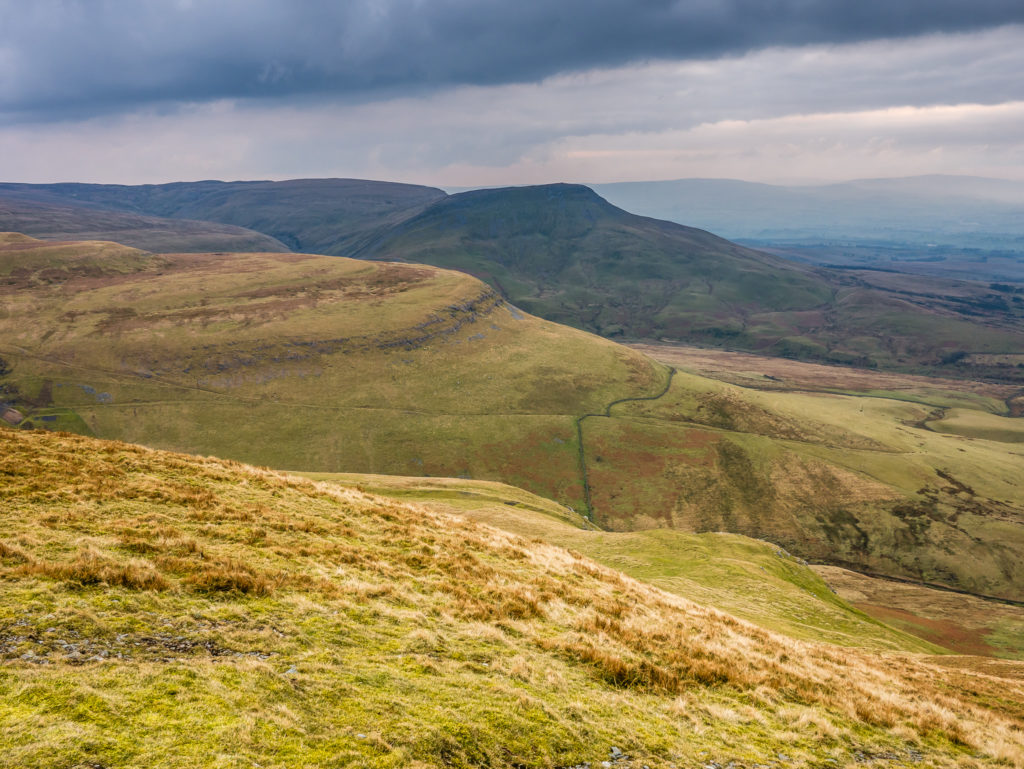
More impressive fells that would be perfect for a day hike.
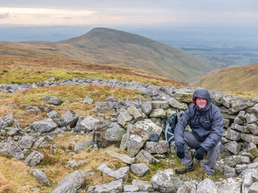
Tripod ‘selfie’ shot from the top of Murton Pike.
Following the trail back into the village of Murton.
As you can see, a visit to High Cup Nick is undoubtedly a day hike to remember. The view is certain to be impressive whatever the weather!
The route map for the hike. You can export a GPX/KML file from this by clicking on the ‘High Cup Nick’ link.
Our next thru-hike will be the Beacons Way, in the Brecon Beacons National Park, Wales, commencing Easter weekend. Look out for our trip reports that will follow shortly after our 8 day hike!

3 Comments
Hi guys, just did this route after reading your article and pics. 8yr old son’s first hike & scramble over the boulders went great. 10m in 6hrs, relatively easy walk. Thanks so much for the detailed write up! Brad.
Thanks for your feedback Brad! We’re so impressed that your son did this with you. At 8 years old you must be so proud of him. Glad you enjoyed the hike. High Cup Nick is one of our favourites!
Regards, Danielle & Wayne 🙂
Yeah we really enjoyed it, a nice steady walk which I thought was ideal for the bairn. He managed it no problem at all and loved the rock scramble. I really thought it was a great route and felt the people doing the cup the other way round were missing out massively as we had the view in front of us the whole way. never saw a soul on the way back past Murton Fell. Would have been really peaceful if it wasn’t for the Challenger tanks target shooting just out of sight! Cheers again guys and I’d definitely recommend this route to anyone who wants to see High Cup.