
Heading North For A New Adventure…
Traversing some of the least frequently visited regions in Scandinavia, the Kungsleden or King’s Trail is a 270 mile/ 440 km long distance trail in northern Sweden that takes you on an incredible journey into the Arctic Circle, where as far as the eye can see, unfolds an unspoiled land of flower-carpeted birch forest and spectacular glacial valleys. (If it’s not raining that is!) Yet despite its wild reputation and remote location, the trail being situated within the last, largest, remaining wilderness in Europe, the Kungsleden is wholly accessible to a wide range of hikers due to the relatively easy-going terrain and network of mountain cabins along most of the route.
The most practised part of the route is by far the northernmost section, between Abisko and Kebnekaise. (Kebnekaise being Sweden’s highest mountain at 2,100 metres, a popular tourist attraction in its own right, and a detour off the Kungsleden.) Therefore the trail is predominantly hiked from north to south, even if not in its entirety. If you do make the effort to walk all 270 miles, you will pass through four national parks – Abisko, Stora Sjöfallet, Padjelanta and Sarek (the latter three forming part of the UNESCO World Heritage Site of Laponia) as well as the Vindelfjällen Nature Reserve, one of the largest protected areas in Europe. The southern terminus or indeed start point if hiking in the opposite direction, is the small but very well equipped ski-town of Hemavan, (the Kungsleden becoming a ski trail in the winter months, following approximately the same route).
But for us, choosing the Kungsleden for our next long distance hike was not just about the scenery or the terrain. With unique elements such as daylight at midnight whilst hiking at the height of summer, being woken up to wild reindeer foraging around the tent, the potential to experience a rare glimpse of the Northern Lights dancing up above, as well as relaxing your muscles at the end of a hard day in a sauna – the cornerstone of Swedish culture (every English household needs to get one!) – This promised to be a hike very different to any other we had experienced before! And it certainly proved to be a unique adventure holiday for us, both in terms of the challenging weather we had to endure almost every other day, coupled with a real test of our longevity as we set out to complete the entire trail in just 21 days – which by the way, we did successfully!
From board walks to boulder hops, to bog avoidance tactics to boat crossings, this is the start of our latest collection of trail reports detailing our diverse journey on the Kungsleden. We hiked northbound, starting from Hemavan on Saturday 13th August 2016, finishing in Abisko on Friday 2nd September 2016. (Of course we couldn’t just follow the guide book and walk in the standard direction!)
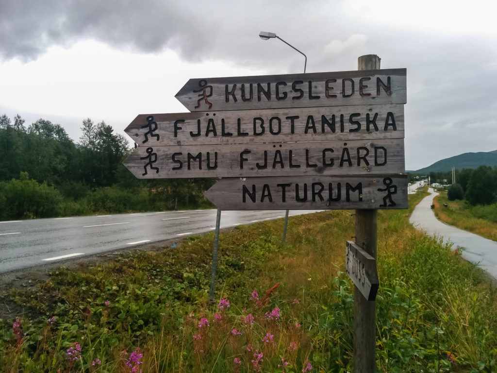
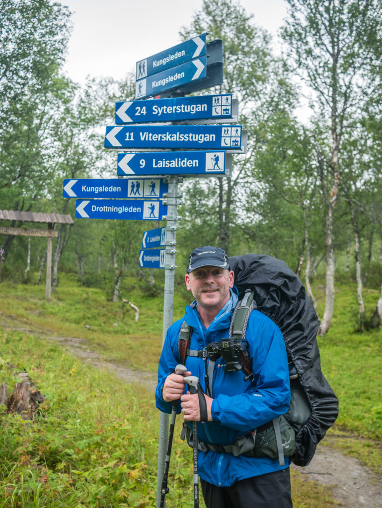
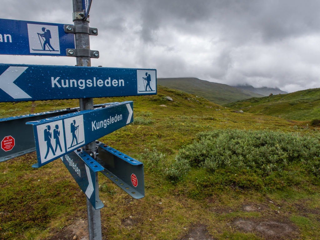
Kungsleden sign on the main road through Hemavan.
So Why Sweden? When To Go? Which Way? & What To Pack?
We often get asked the question: ‘How do we pick a hike?’ We always have a really long list of potential places to go walking, arising from articles we read in magazines and on the internet, panoramas of the most scenic landscapes working their magic and making us want to step right into the picture! I admit that apart from being able to roughly locate Sweden on a world map (Geography has never been my forte), the only thing I really knew about the country is that they make great flat pack furniture (IKEA), have awesome tasting meatballs (IKEA), and Stieg Larsson’s ‘Girl With The Dragon Tattoo’ trilogy is one of my favourite reads of all time! Hiking the Kungsleden therefore really came about as Wayne suggested it – based on the scenery, distance, it being a walking trail as opposed to scrambling route GR20 style – and what really appealed to me was knowing that we would be hiking into the Arctic Circle for the very first time – the trail taking us the furthest north either of us have ever been, into the heart of Swedish Lapland. Excited at the thought of seeing wild reindeer along the route, I was quite taken aback when Wayne announced that he was hoping to celebrate reaching the end of the trail by eating a big, fat, juicy reindeer burger! – In my mind that was just plain wrong. No I cannot let myself eat Rudolph no matter how hungry I am after 3 weeks on the trail!
Touring in the mountains during winter, which we still have very little experience of, requires more knowledge and equipment than hiking in the summer, so we opted for a summer hike. However, we were keen to avoid the mosquitoes. During the peak breeding season, the utter misery they bring to every minute of your day cannot be underestimated! Practically the only relief that comes is early evening when you can barricade yourself in your tent! If you want to avoid the horrors of the mosquitoes, then the walking season is short: just August to mid September – and even then there are still some blighters around. The Arctic mountain weather is also unpredictable – so even if you time your visit carefully, you still need to be prepared for cold, wet days – which seemed the norm by week 3 and just reminded us of being at home.
Having researched all that we could (there are some good blogs out there – but not so much up-to-date information in English), we knew that it wouldn’t be the best time of year for seeing the Northern Lights, but we remained hopeful and thought that we might get lucky! What we did realise is that the Kungsleden was crying out for ‘Team TrekSnappy’ to get on the trail and walk the entire distance, and subsequently write a guide book to support others through our own experiences! (Currently work in progress.)
In contradiction to the majority of things we’d read, hiking south to north was our preference and seemed the most appealing direction for several reasons: first and foremost the sun would be on our backs and not in our faces – therefore better for photography and charging our batteries using our solar panels. Our other reasoning was that our bodies would have time to get accustomed to the rhythms of the trail once more, thereby making us fitter and stronger to handle what are considered the tougher sections in the north. Supposedly the scenery is also more spectacular in the north, hence we would be saving the best until last; and most importantly, by starting in the south we would be avoiding the ‘Fjällräven Classic’ where around 2,000 people from over 30 countries descend on the northern part of the Kungsleden every year in August, hiking 110 kilometres from the Sami village of Nikkaluokta (another popular start-point for trekking up Kebnekaise), finishing in Abisko. We are all for meeting and conversing with people on the trail, but a handful of trekkers per day is much more preferable than having to say ‘Hej’ to two hundred passing by within minutes.
So destination set, vacation time away from our ‘real’ jobs agreed, flights booked… Now it was time to get our gear out of the loft and fill up our backpacks with essentials! There was one thing we learned for sure by the end of this trip and that was: if you’re not going to use something every single day – leave it at home. We doubled up on so much gear that really was superfluous to our needs – but we keep learning as we go along. We really do now know what is necessary and what is simply desirable, thus a complete waste of effort carrying those extra grams! For instance, we both took a cheap lightweight umbrella – Wayne binned his in the hostel on arrival; I on the other hand carried mine for 21 days, putting it up only twice to shelter from the rain during a night time toilet run. (Any other time it rained we were in full waterproofs and the wind would have easily blown the umbrella inside out!) We both carried solar panels; one between us would have been more than adequate to charge our smart phones. Wayne carried a lightweight tripod, whilst I carried a gorilla pod – one or the other would have been sufficient for the amount of times either of them were used. We also both carried sandals for fording rivers – however we didn’t have to ford a single one – streams were usually covered with a plank walkway, or if not, a simple rock hop was required, and larger fast-flowing rivers had swing bridges to see us safely across. As a brilliant example of bringing too much, it has made us all the more determined to be as lightweight as possible when we hike the PCT in the future. (Let’s not even get on to the subject of Wayne carrying a drone just yet!) ‘Dual purpose’ and ‘multi-functional’ – we’ve both agreed that it’s got to do at least two jobs to make it into the pack from now on!
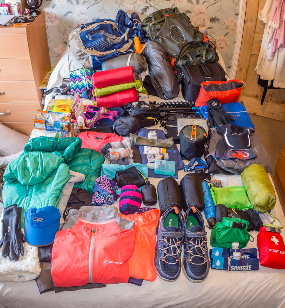
Choosing and organising our gear. We took a 3-person lightweight tent, 3-season sleep gear, plus cooking equipment as we like a hot meal at the end of the day! Food is such a great motivator!
Day 1 – Hemavan to Wild Camp, 2km past Syterstugan Hut. (15.9 miles/ 25.5 km, 10 hours) – Saturday 13th August, 2016 – ‘Wild And Wet!’
What a start! After an incredibly scenic flight into Hemavan yesterday evening, today we woke up to light rain. It didn’t bode well for our first day on the trail. Would the Kungsleden prove to be a wash-out or would we be lucky enough to see a changing landscape of forest, valleys, lakes, mountains and huge sweeping vistas of vast wilderness under a blue sky? We sure hoped so! And after 270 miles, would we be ranking Sweden’s trekking among the best in the world? Well today, we just wanted the rain to stop long enough for us to put up our tent so we could keep our gear dry!
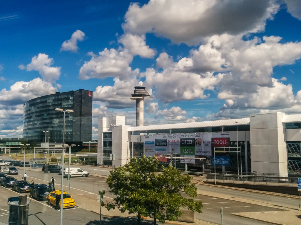
Arriving in Stockholm at Arlanda Airport where we were taking an internal flight to Hemavan. We flew with Norwegian Air from Gatwick – flight time approximately 2 and 1/2 hours.
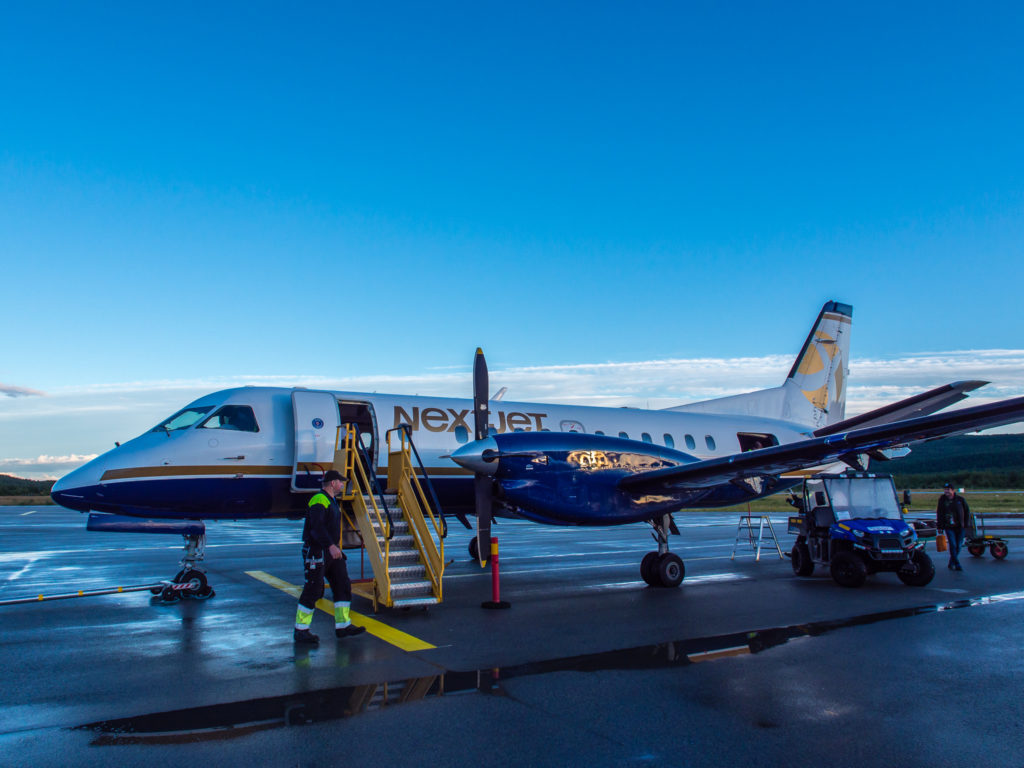
We flew to Hemavan and Tarnaby with NextJet, the largest regional airline in Sweden – flight time approximately 3 hours.
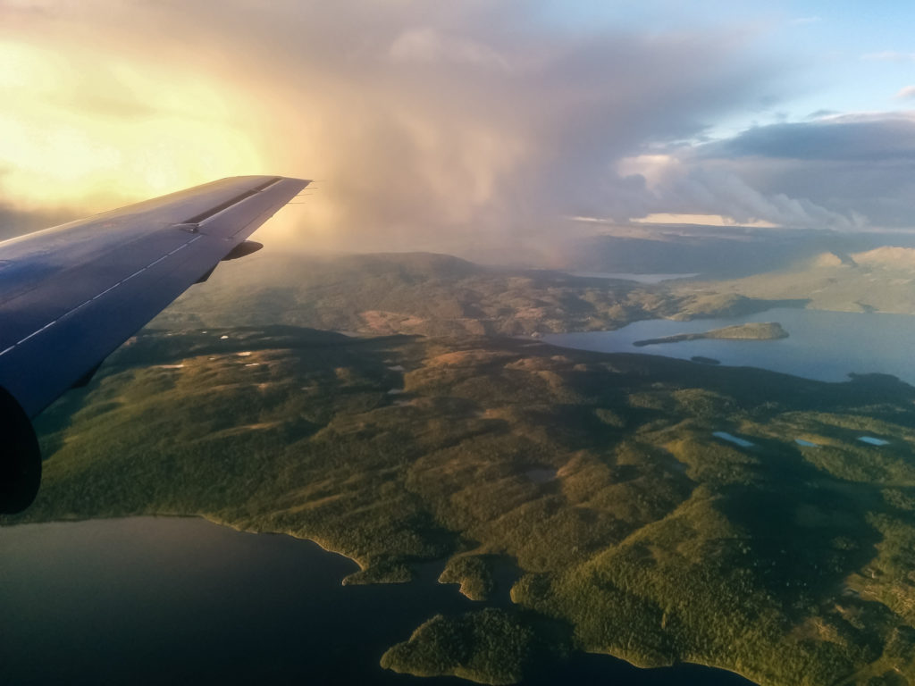
Always try and bag yourself a window seat! Descending into Hemavan we were treated to spectacular views of the surrounding lakes and mountains.
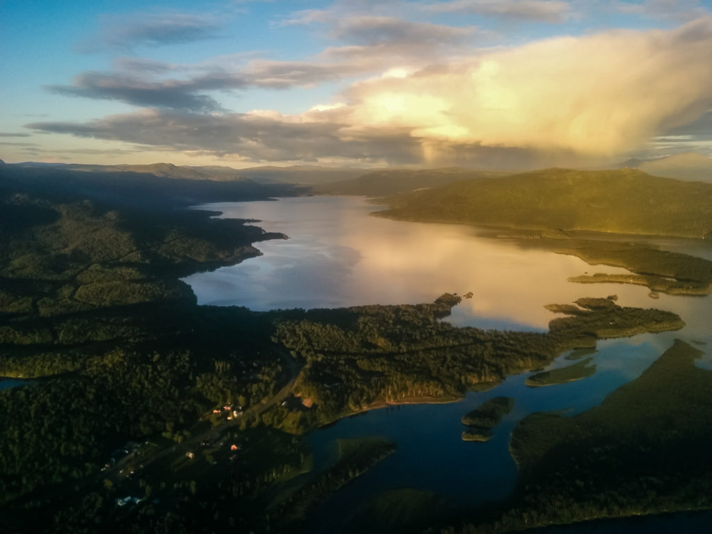
What a welcome treat! Our first evening in Sweden – We hoped this was a sign of great things to come!
(We pre-booked the STF (Swedish Tourist Association) Hemavan Hostel (Hemavans Fjall Center) as we knew we would be arriving late. What we didn’t know beforehand is that everything in Hemavan closes by 9pm, but luckily the hostel restaurant prepared a meal for us before closing.)
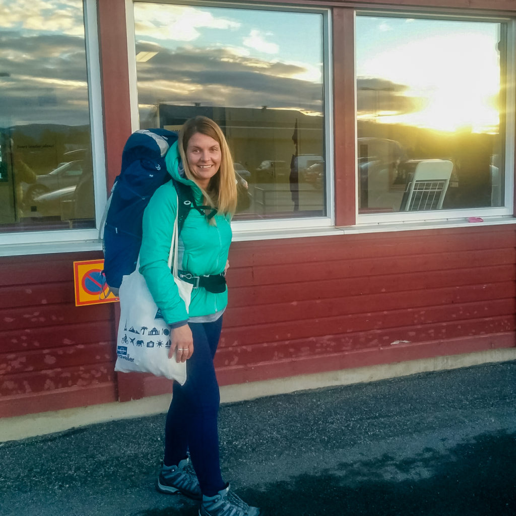
Leaving the small airport just before 9pm in search of our hostel for the night.
The following morning (unbelievably so), we were already up, showered, packed and walking into the centre of town to the supermarket by 8am – however, what we didn’t realise is that nowhere was open! We take it for granted in England that shops conveniently open all hours, particularly with 24 hour supermarkets – however in little, old Hemavan, the general timings for everything – the garage, supermarket, restaurants/cafes, and the Post Office are 9am until 9pm. (The Post Office is inside the shopping centre that also houses the supermarket.) What we didn’t realise at the time is that these are ‘lengthy’ opening hours – all of the other settlements we passed through on the Kungsleden, if they had a shop/ restaurant at all, had later opening times and earlier closing times, so this did not work in our favour!
Having an hour to kill, we walked back to the hostel where we discovered an all-you-can-eat style buffet breakfast in the café area priced at 85 SEK p/p. (For the purposes of exchange rates and the pound being a little weaker because of the Brexit fallout, we divided prices in Kroner by 10, a much simpler mathematical calculation than 11.2!) So at a rough £8.50 each we went for it – a hearty breakfast to set us up for the day – it didn’t take much persuading! It was to be our first day of hiking with heavy packs in around a year so we needed all the energy we could get! It was ‘Continental Style’ and there was ample to choose from: Various cereals, fruit, yoghurt, breads and crackers of all kinds, pâté, cheeses, cured meats, bacon, scrambled egg, boiled eggs, coffee, fruit teas & juices! (This turned out to be the best breakfast selection we had on the entire trail and it was the best value for money – we thoroughly recommend it whether it be at the start or end of your own Kungsleden adventure!) Unfortunately as we were so eager to eat, we didn’t take any photos!
Feeling very full, we walked back into town at 9am. Our mission was to purchase food rations for the next few days. We also needed to post on our hand luggage (containing anything we didn’t need for the hike e.g. extra protection for the drone during transporation) to the hostel in Abisko, that we had pre-booked in anticipation of our finish on September 2nd. We found a box in the supermarket that we used to package up our stuff, had it weighed and sent it off to Abisko for 167 SEK. (Probably one of the cheapest services we found in Sweden!) We then spent 250 SEK in the supermarket on 2 day’s hiking rations. Our supplies mostly consisted of chocolate, bread, and a large tin of chilli for that evening to go with our instant potato!
Incidentally, there was a lovely English girl working on the checkout in both the Post Office and the supermarket (they must interchange staff), who had assumed a Swedish accent and could speak the language fluently after living there for two years, even though she announced to us that she was from Liverpool and still supported the football team! We’d never have guessed. We still needed to buy a canister of gas, but as the sports/ hiking gear shop inside the shopping centre didn’t open until 10am, we walked back to the hostel area where there is a hiking gear/ cycle shop on site that had opened at 9am. A 230g canister of Primus power gas will set you back around 65 SEK (or more on the trail. The most we paid was 79 SEK).
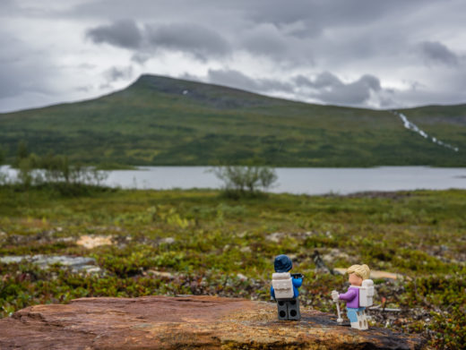
Well enough dilly-dallying! After packing our new supplies and checking out at 10:30am, we set off to find the ‘official’ start of the trail – of course we had to get a photo at the large, wooden Kungsleden trail sign. After seeing two different Kungsleden signs leading off uphill from the main street in town, we struggled to then find the right way to the trailhead. Basically, you need to head up in the direction of the ski lifts to the Naturum Visitor Centre that overlooks the town. The start of the trail is right next to the building, which presents information about the Vindelfjällen Nature Reserve, located near to Hemavan. After several attempts to get the right angle with the GoPro attached to a ‘selfie’ stick, we got our selfie shot at the start of the trail!
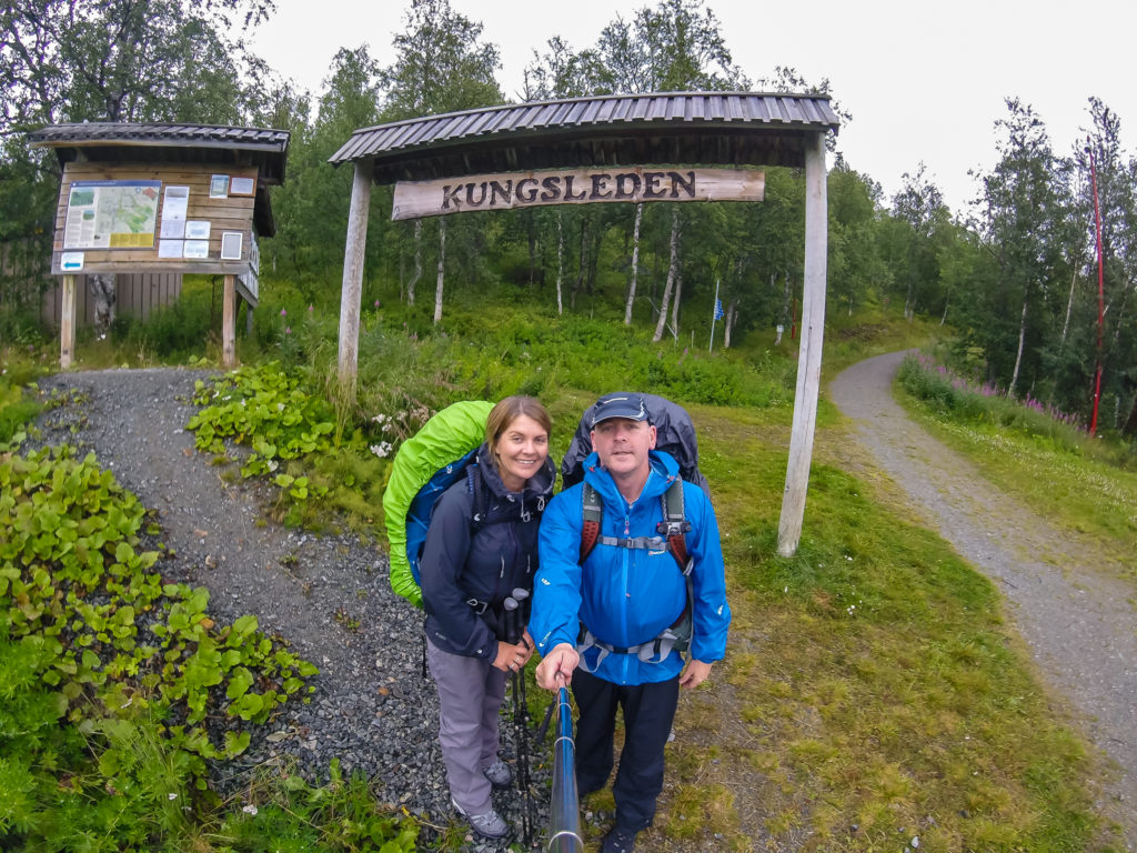
And so it begins… The ‘official’ start of our Kungsleden journey in full waterproofs, that we seemed to wear more often than not!
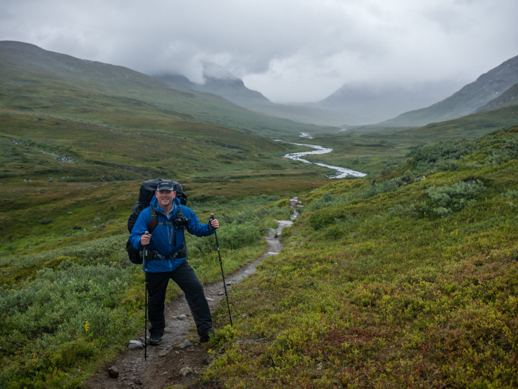
We finally got going at 11:10am! It was light drizzle to start with; in fact we really had light rain the entire day. It got a little worse in the last hour before reaching camp, which meant our waterproof boots had eventually reached saturation point and had started leaching in water. Our jackets had mostly held up to the rain, but I got through two pairs of gloves in the first afternoon – both were soaked by the time we reached camp, but I wore them as there was such a cold wind. We were heading towards the Arctic after all!
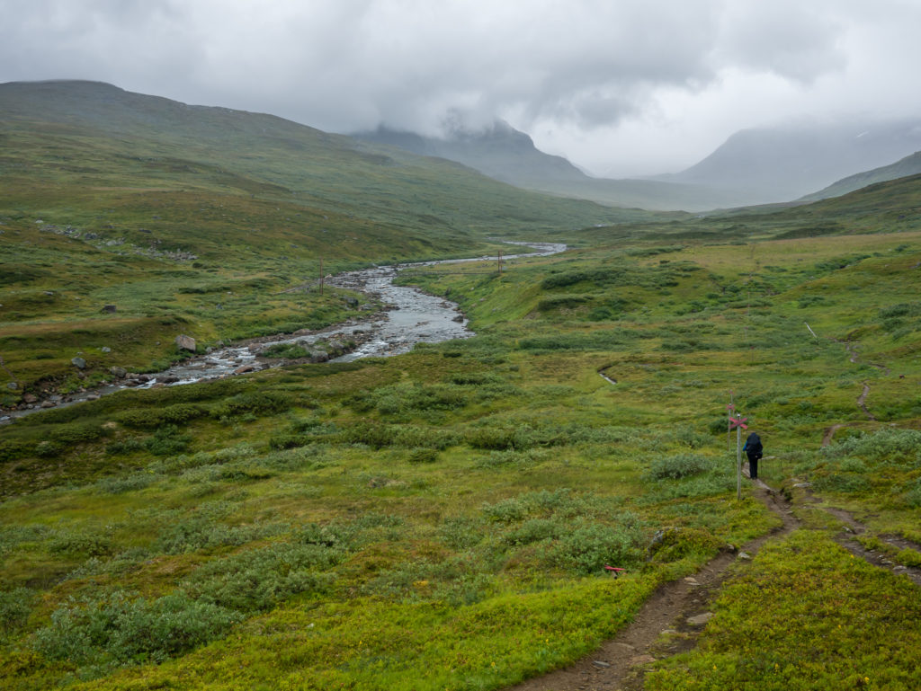
The trail is well marked with orange/ red paint flashes on rocks or trees. There are also signposts along the route signalling distances between mountain huts. (Distances are in kilometres.) Our aim for the day was to camp just beyond the Syterstugan Hut.
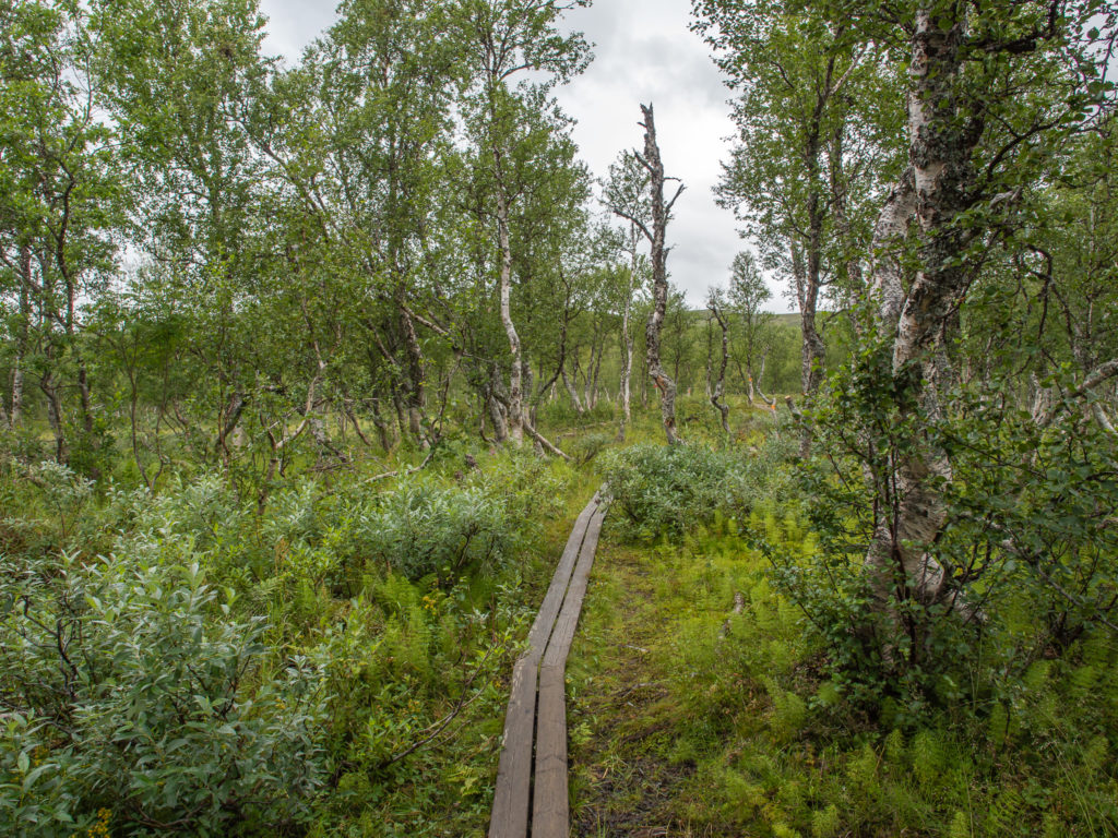
Wooden boards cover the ground on several sections, helping to alleviate erosion of the trail and assist you over boggier terrain.
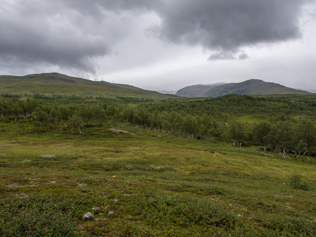
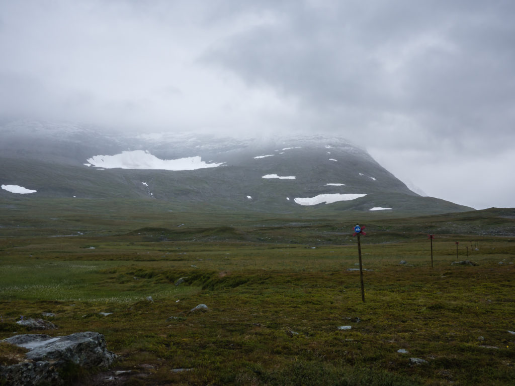
Ominous clouds loomed overhead bringing light rain with them for most of the day.
Immediately putting our waterproof gear to the test and making use of the GoPro for wet weather photography!
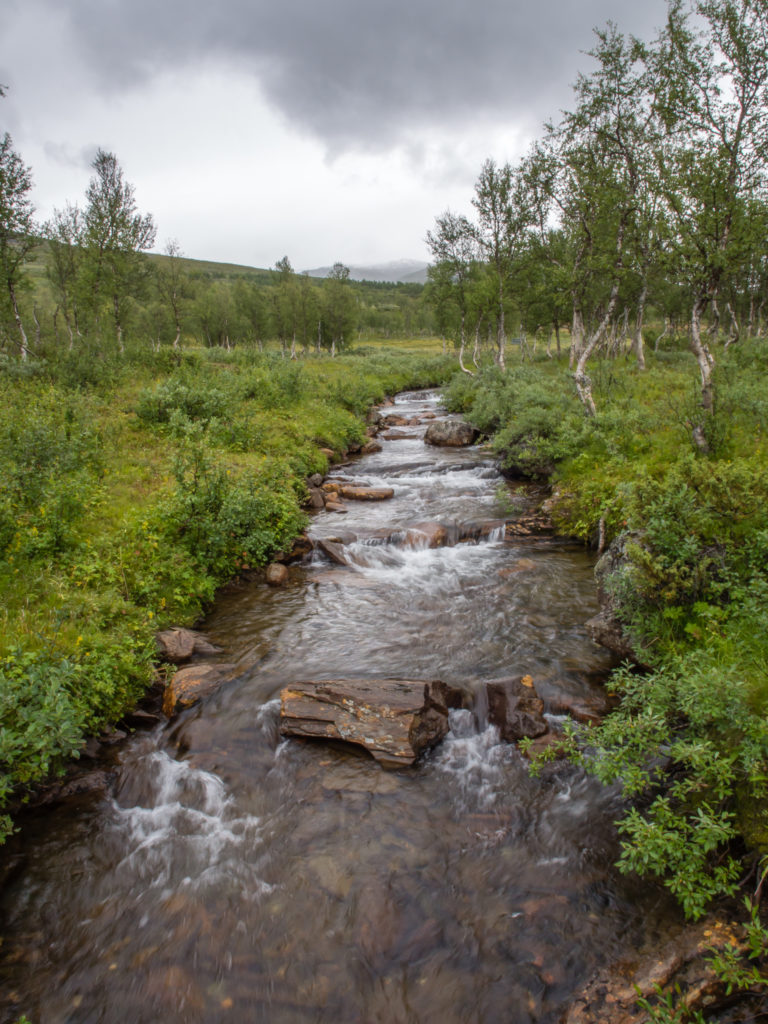
The Kungsleden has several stream and river crossings that range from a simple rock hop to walking over large-scale swing bridges.

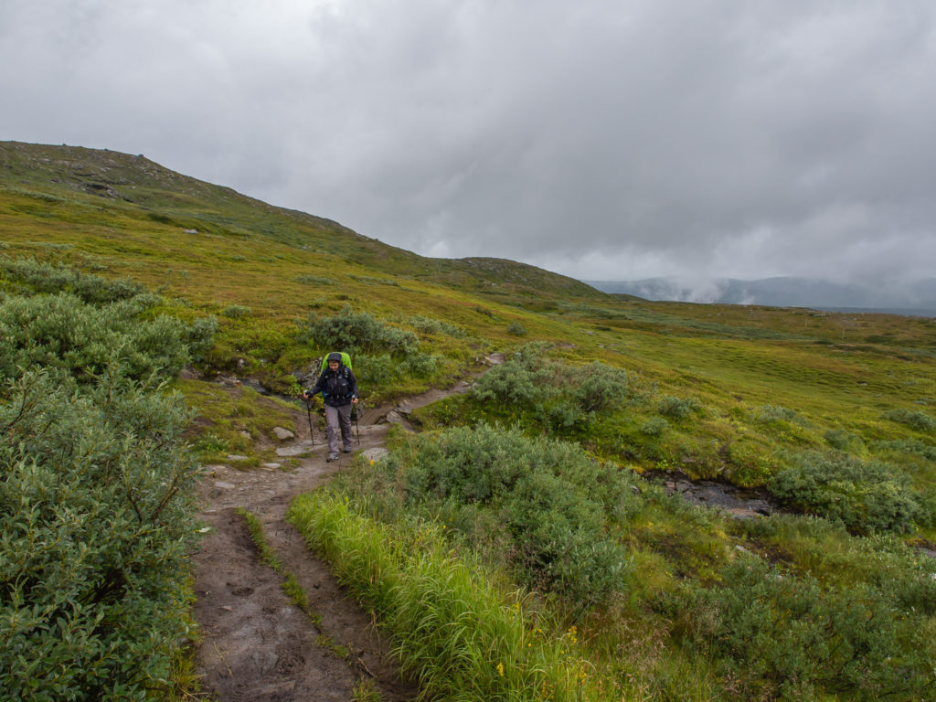
The trail is well trodden, making it both clear and easy to follow.
However, several sections were very boggy, so we were grateful of the provision of wooden boardwalks along the route where the trail went straight through it!
This valley would have been an incredibly scenic start to our Kungsleden journey, had it not been for the persistent rain clouds looming overhead throughout the day.
We were already getting a sense of the Kungsleden’s reputation as wild and remote.
The Kungsleden becomes a ski route in winter with appropriate signage for the alternative trail.
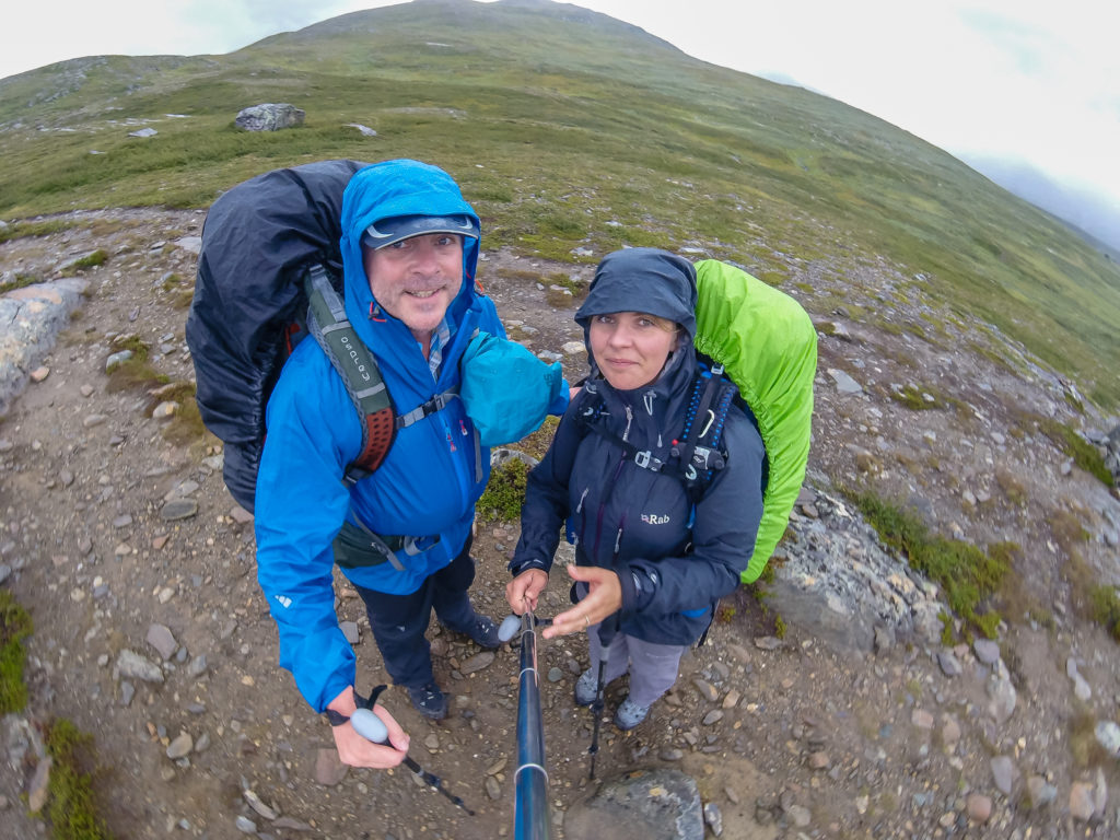
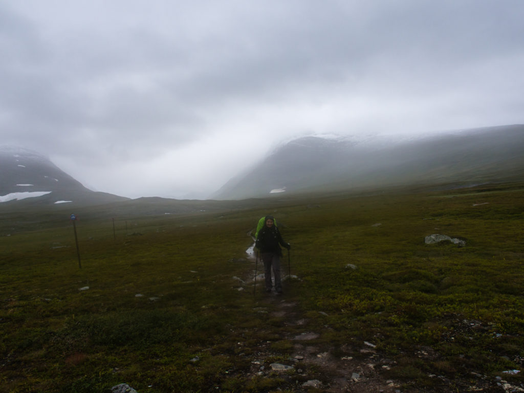
Still smiling… The mountains were appearing grander in the distance, so we couldn’t wait to see them on a clear day.
Alone on the trail and feeling very insignificant in the wilds of Sweden… Would we make it the entire distance?
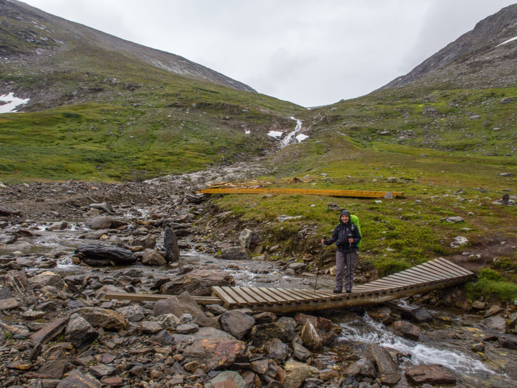
A dubious looking bridge over a rocky stream – it was probably safer to rock hop whilst the water level was low.
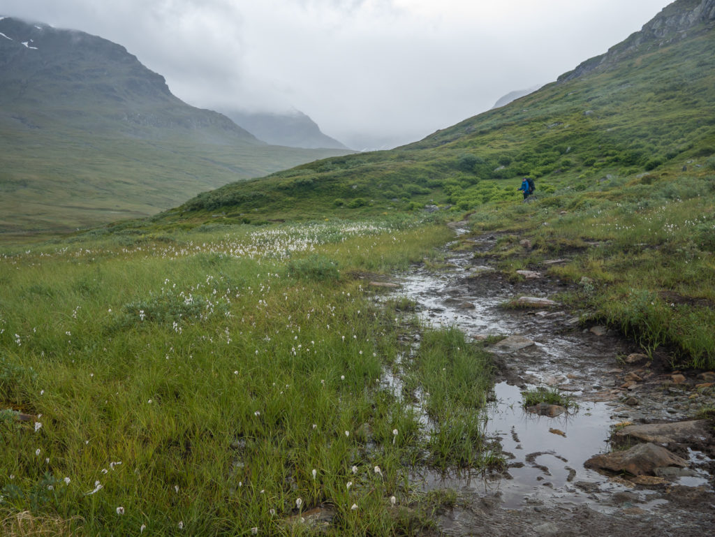
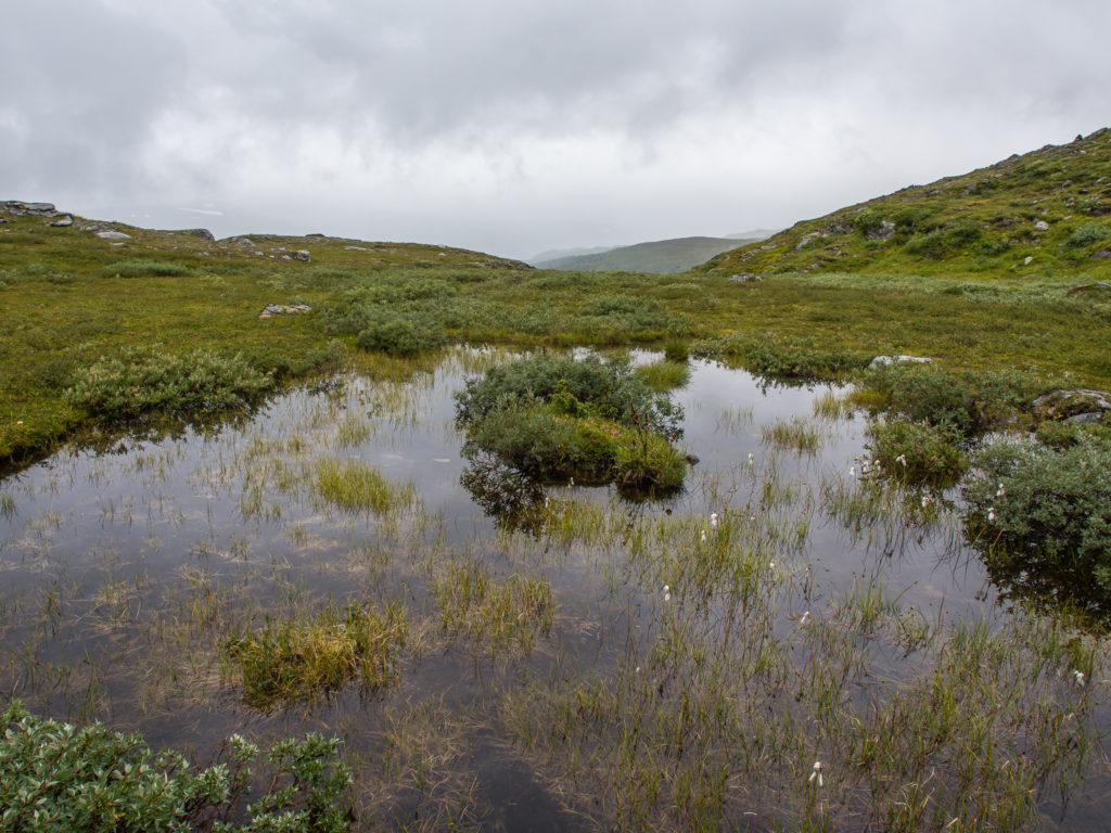
We quickly came to realise that the presence of white, fluffy, cotton heads – aptly named ‘Bog Cotton’ – was indicative of a boggy section of trail. Therefore, we soon became experts on bog avoidance tactics, using our walking poles to search out available rocks for deliberate and measured placement of our feet.
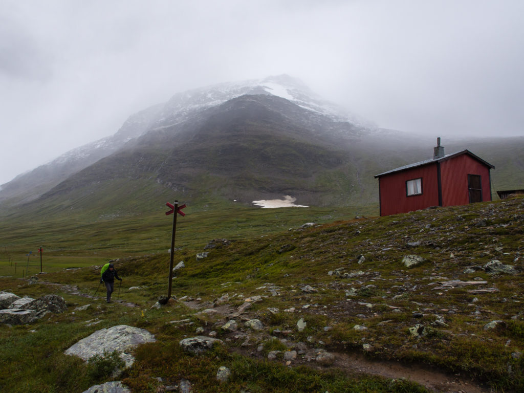
But let’s back-track a few hours… It was still a long way to go before we would find a suitable place to camp. We took a rest at the very first mountain hut situated on the trail. After 11 kilometres you reach Viterskalsstugan. We arrived around 3pm and were warmly welcomed by the volunteer host couple. We were invited inside to dry out and take a look at what goodies were available in the little boutique shop. We were also given a brief history about the area, including some advice about the weather. Basically it was hit and miss! In August, temperatures can range from 4 to 18 degrees Celsius daily – with the possibility of cloud, rain and sun all rolled into one! We expected nothing less as we are well versed on the fact mountain valleys tend to have their own distinct micro-climates that vary greatly to the general weather forecast of an area.
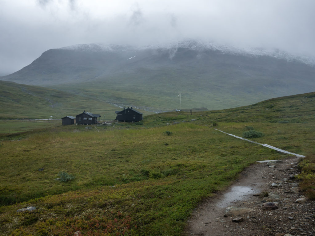
11 kilometres complete! Nearing the first STF mountain hut and our first proper rest stop at Viterskalsstugan.
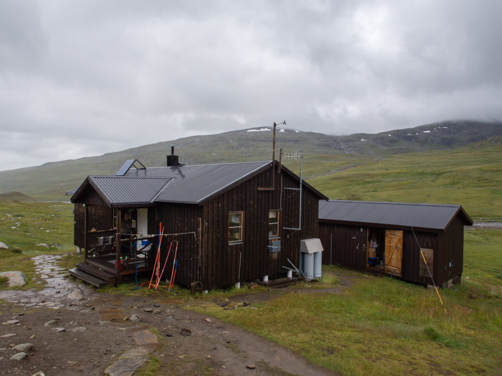
The warden’s hut which housed a small boutique shop with a limited selection of food and medical supplies.
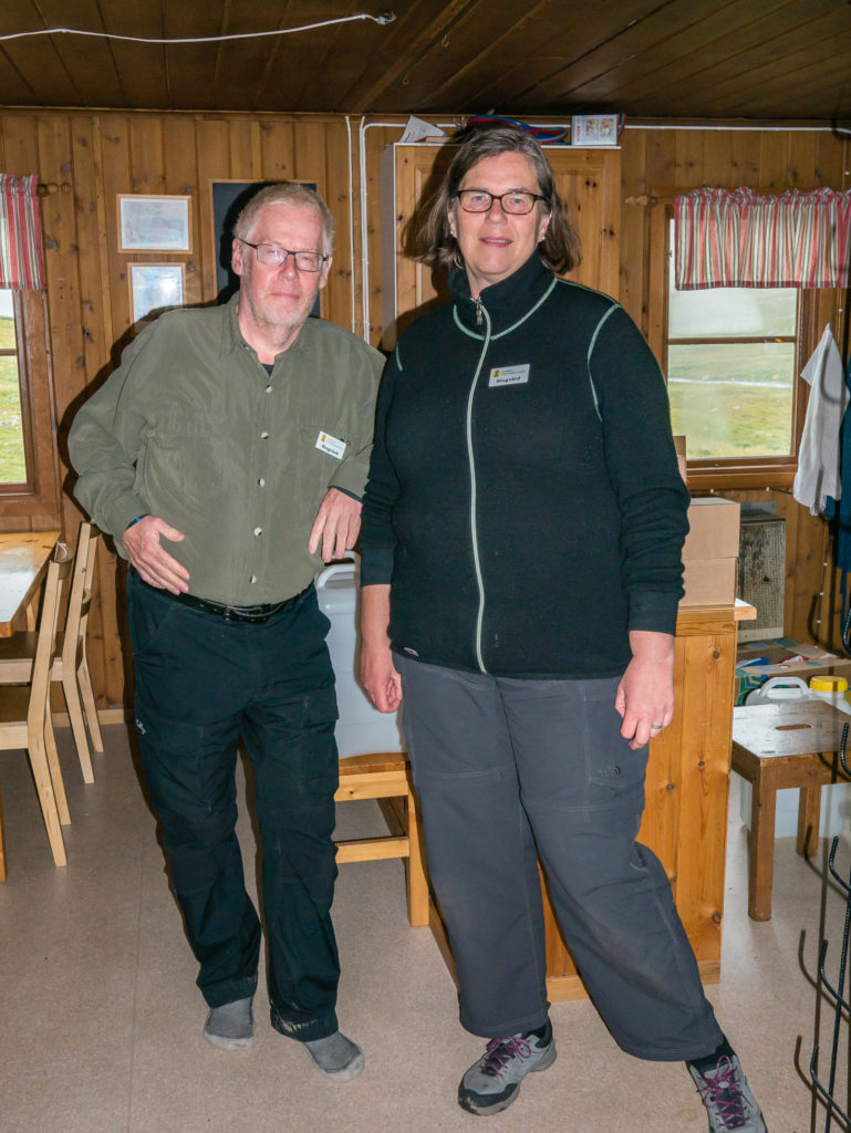
The friendly wardens at Viterskalsstugan.
Snacks for sale in the boutique shop.
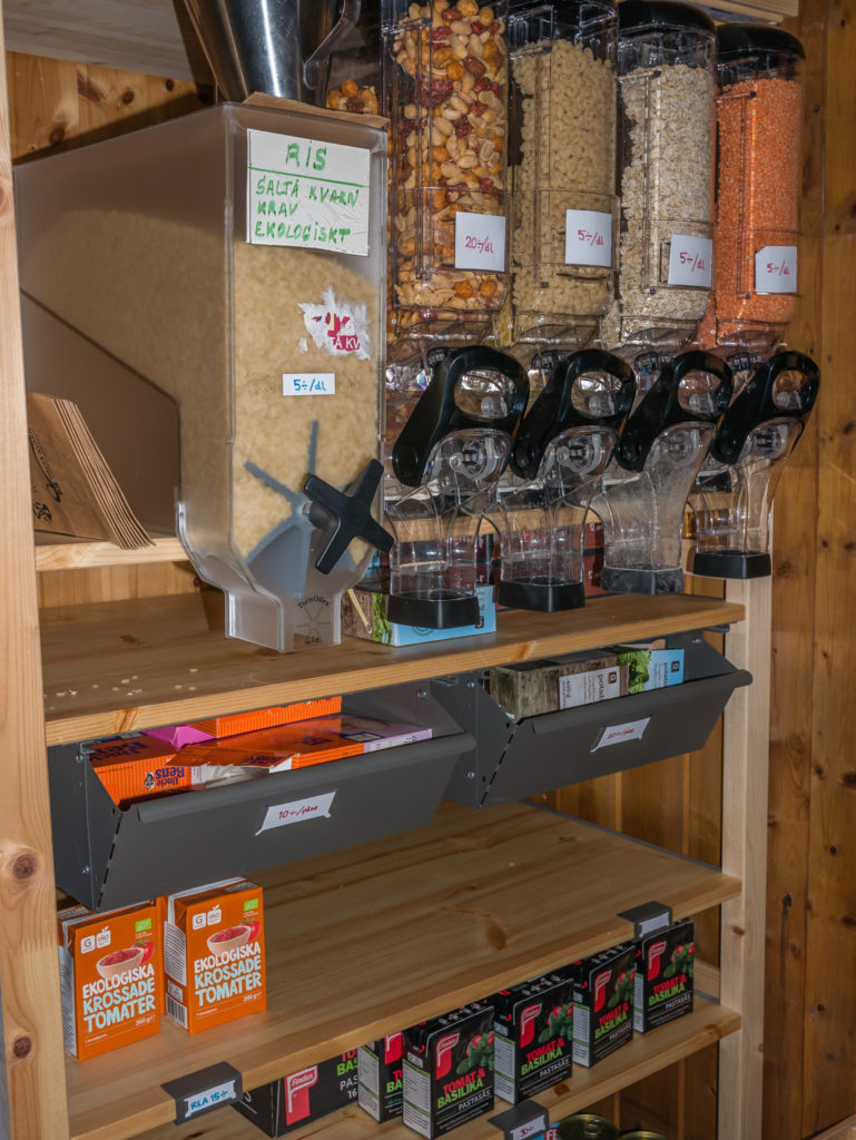
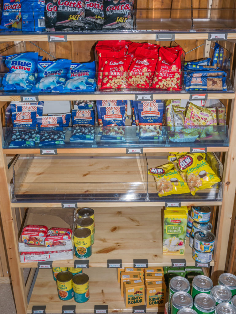
Most of the boutique shops along the route sell cereals, pasta, crisps, peanuts, sweets, chocolate, a selection of tinned foods, and cans of fizzy drink. It is also possible to purchase beer in some of the larger huts, although it is low strength for a high price. (Therefore we abstained from alcohol for 3 weeks!)
After visiting the warden’s hut, we went inside the main hut to use the day facilities. We were technically late as ‘day use’ is between the hours of 11am and 3pm – but the warden waivered the strict timings, allowing us use of the facilities anyway as the weather was so awful. There is a fee to use the facilities available in all of the STF mountain huts, unless you are an STF member and have a discount card. The STF card gives you free day use in the mountain huts, as well as good discounts on other elements. This could be staying inside a mountain hut in a shared dorm room, where typically you save 100 SEK per night by being a member. Camping in the immediate vicinity of a hut costs 100 SEK with an STF discount card or 200 SEK if you are a non-member. Keep in mind that wild camping is free and completely legal in Sweden, so camping along the entire trail without the use of hut facilities or accommodation would be a significant saving if you are on a tight budget. Knowing that you can take respite in a hut should you need to however is very reassuring, particular in severe weather.
We had planned on purchasing an STF card on arrival at the STF hostel in Hemavan, however after a little research on the web we realised that as members of ‘Hostelling International’, if we produced our membership cards, we could also access the same discounts. (Good to know as this will save you a considerable amount of kroner over the duration of your trip!) TOP TIP: In particular, if you reside in the UK, it is far cheaper to join the YHA for a year’s family membership – £25 – which then automatically includes ‘Hostelling International’ membership, giving you discounts in Sweden e.g. using the STF mountain huts, than it is to purchase the STF card online or when you arrive in Sweden.
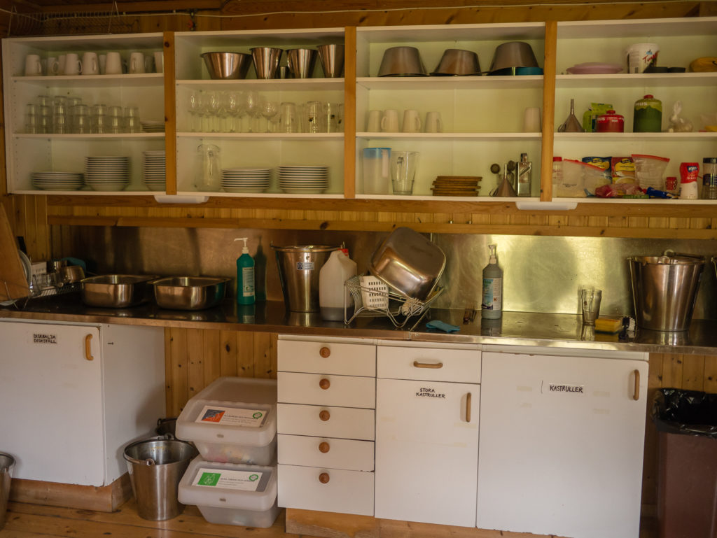
Despite the fact there is no electricity or running water, every mountain hut is well equipped and follows the same procedures. In the kitchen area there are large buckets that are denoted as ‘Blue’ or ‘Red’ for collecting fresh water from the river or spring, and disposing of waste water in the slask outside, usually located near the pit toilets. A substantial wood burning stove warms the dining area, as well as pans of water that are placed on top, the hot water is then used for washing up. A large kitchen unit houses pots and pans, crockery and utensils, with gas stoves for cooking positioned on each work top. All items can be used as long as they are washed and returned. Similarly, you have the responsibility of re-filling/ emptying water if you have used it, as well as chopping wood in the wood shed to maintain a good supply for the kitchen stove (and sauna if the hut has one). Furnishings include wooden tables and chairs, candles, and there are usually a few pictures on the walls of Swedish flora and fauna. Often there will also be a shelf with several books and games for entertainment. One of the key features we tended to use a lot was the ‘Tork’ (Drying Room). In every mountain hut these rooms are equipped with a burner to keep the space heated, and have several wash lines and wooden racks on either side to hang your gear, so that you can quickly and efficiently dry it out. We found these invaluable along the route as we often had wet gear by the end of the day when faced with continuous rain!
We had a look around at all of the facilities and were immensely impressed with the set up! We then felt very civilised (and very English) having a cup of tea with biscuits, whilst we refreshed ourselves and dried out a bit, thankful of the large wood burning stove in the kitchen area that warmed us through as soon as we entered the cosy space. Having hardly seen a soul on the trail from the moment we got started, we were surprised that the hut was very busy with hikers using it as lodging for the night. Well why not?! It was so well equipped with everything, that if you didn’t want to carry a tent or cooking equipment, you could make the hike much easier for yourself by overnighting in each hut. (You would just need a lot of money to do so! At 360 SEK per night even with the STF discount card, rising to 410 SEK to sleep in the 5 main huts in the northern section – it would easily set you back several thousand kroner over 21 days!)
Despite we what consider a hefty price for lodging (especially as you are sleeping in a bunk bed in a shared room), we do believe that the presence of the mountain huts along the Kungsleden is an excellent feature of the trail. – Not least because there may also be the opportunity for you to indulge in a hot sauna at the end of a particularly long day – perfect for resting your muscles and relaxing. And for a truly Swedish experience, you must do it naked! (But more of that in later posts!)
The mountain huts have a very homely feel. You can relax in the dining area and feel free to loan books and games to pass the time.
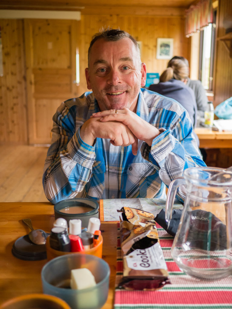
Enjoying tea and biscuits during our first visit inside a mountain hut.
But we couldn’t let ourselves get too comfy inside the hut! After warming up and drying out a little, we had to motivate ourselves to get the packs back on and get going again as we weren’t even halfway to the intended area that we’d selected for camping that evening.
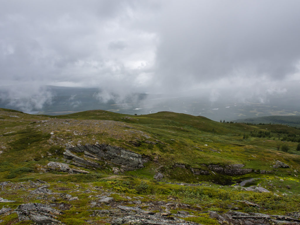
Despite the continuous light rain, we found ourselves making good progress, albeit a little slower than our usual pace. (But hey, it was only Day 1, and our bodies were still getting accustomed to the weightiness of our packs after a year off!) It was an easy trail to follow with regular paint markers and good signage, even if we couldn’t see that far ahead of ourselves because of the low cloud and mist. We felt relieved that the boggiest sections had wooden planks to step along, and hoped that this would be common place from start to finish, as navigating bog is always very tedious and stressful! We still had to watch our footing in places and had several rock hops over small streams, but the trail remained quite flat and we weren’t really faced with any strenuous walking. The valley would have looked incredible, had it not been for the rain. Already humongous snow-capped mountains loomed either side and we felt we were heading further and further away from civilisation into the wilds of northern Sweden.
Our next rest stop was at the emergency hut at Syterskalet, where we found two Swedish guys who had set off on a fishing trip already taking respite in there. We had a quick snack, brewed a hot drink and chatted to them about how good (or not?) the fishing was in Sweden. Then we were quick to get going again, conscious of how late it was getting, having set off from Hemavan much later than we’d anticipated. The one thing we didn’t have to worry too much about though was daylight, with it still easily being light until around 11pm. A little further on, and exactly 24 kilometres after setting off from Hemavan, we passed the mountain hut at Syterstugan. It was just before 8pm. We had already decided that we wouldn’t stop there; instead we would collect water from the river and continue on a bit further to find a camp spot, thereby avoiding the 100 SEK per person charge for camping near to the hut. What we hadn’t realised however was how difficult it would be to find a suitable camp spot large enough for a 3-person tent within a few kilometres of the hut. This was because the ground cover was mostly dense scrub, or very boggy. Therefore we had to continue around 2 kilometres further before we could find anywhere half reasonable to pitch our Big Agnes, which we were not really expecting.
The further north on the trail we went, the bleaker it looked.
We soldiered on through the continuous drizzle hoping this wasn’t going to be a typical characteristic of the Kungsleden.
We had a quick break in the emergency hut at Syterskalet.
24 kilometres after setting off from Hemavan, we passed the mountain hut at Syterstugan. We did not intend on camping there, so we pushed on a further two kilometres or so along the trail, despite the awful weather.
When we were just about losing our will to live, we finally found a piece of flattish, grassy looking ground under a canopy of trees, just sizeable enough to squeeze in our tent. We knew it wasn’t boggy as there was no sign of the dreaded ‘Bog Cotton’ that we quickly came to recognise as signalling wet, soggy terrain – caution, careful navigation needed! On the map it was near to Stokkeklippen, just before Lake Tarnasjon.
Thankfully there was a short break in the rain in which we could erect the tent, set up our sleep pads and other essentials, and get everything else comfortably inside the porches to dry out before the heavens opened again. By the time we had then gotten into our sleep gear, and done the most important task of the day – cooking and eating dinner – it was nearing 10:30pm! It had seemed a long day…
It was still not yet dark, (which felt quite strange) but by now the rain was heavier than ever, so we were glad our new shelter was proving its worth and keeping us dry. We hoped the weather would significantly improve tomorrow, especially as we couldn’t bear to think of 20 repeats of today. Photography is such an important part of our hiking – and as the drone isn’t waterproof, we were yet to take it up into the sky. We hoped it wouldn’t be a mistake bringing it with us; Wayne having to carry an extra 6 kg because of spare batteries and camera gear.
However we both agreed on the one consolation of a rainy day – no mosquitoes! Find out how we fared on Day 2 in our next trail report…
6 Comments
Today, 12 months ago, 4 of us set off from St Bees to hike the C2C in rain, our fervent wish was that we wouldn’t have it accompanying us for 16 days. We were were fortunate. I sincerely hope your blog will reveal the same.
I just love all the details that your blog contains. A fabulous read.
Thank you so much Helen! We try and include as many details as we can to help people with their planning if they fancy doing a similar hike. As for the weather, well no matter how much planning you do, it is what it is! Fortunately we did have some lovely days too, but not as many in the northern section as what we’d hoped for. That being said, it was still a great hike overall!
Really interesting and useful post, Danielle. As ever I admire the get up and go that you and Wayne exhibit.
Thank you! We wish we could get out & hike more, but as ever, real work always gets in the way!!!
Hi Danielle,
Great blog pieces; thanks for all the details.
I will do mine, starting early August, going from Abisko to Hemavan. I will tent camp as much as I can and would love to get your feedback on good spots for camping. Also, did you use a gps aps and which one? I have a handheld gps, but it is very expensive to buy maps and I don’t want to carry the batteries, as I will be going pretty light and fast.
I would buy your book from Amazon, but there is not much time left to wait the mail arrive. Finally, when do you think you will publish the entries for the final section of the trail?
Thanks a lot for the great blog entries and have a nice day!
Hi there,
Thanks for your positive feedback! The entries for the final section of the trail were posted on the blog a while back in March/ April time. The latest posts are always first on our homepage – but I guess you have been searching via our static ‘Kungsleden’ page, which was not updated at the time. Thanks for the reminder to get this done! I have updated it today with links to the final posts that describe the northern section of the trail.
As to good camping spots – there are many – it depends how far you walk each day and what your itinerary is. As our blog posts are a daily round-up, you will find where we camped described in each post. You are sure to find some amazing spots yourself as you walk along the trail!
The GPS app we use is ‘View Ranger’ – we downloaded the relevant map tiles before travelling to Sweden. But we also carried paper maps as well – we bought the Calazo set of maps that cover the areas of Sweden that the Kungsleden runs through. We also carried a solar panel for charging batteries when needed.
Wishing you all the very best with your own Kungsleden adventure. Happy hiking!
Danielle & Wayne