
What A Difference A Day Makes…
After an exceedingly wet start, we were by now dubious as to what the Kungsleden would bring. Had we made the right decision choosing to start our hike in late summer? By the very fact that there was no one behind us, we were also wondering if were we the last hikers in the season to be venturing north from Hemavan? We would be so disappointed if our trip into the Arctic Circle ended up as a complete wash-out. By its very nature, we knew it would be completely different to last year’s long distance hike across the island of Corsica. But I couldn’t help but wish for some of that Mediterranean sunshine right now! (And some Corsican wine!)
Read on to find out whether we did ‘Have a nice trip’ after all… This is a round-up of Day 3.
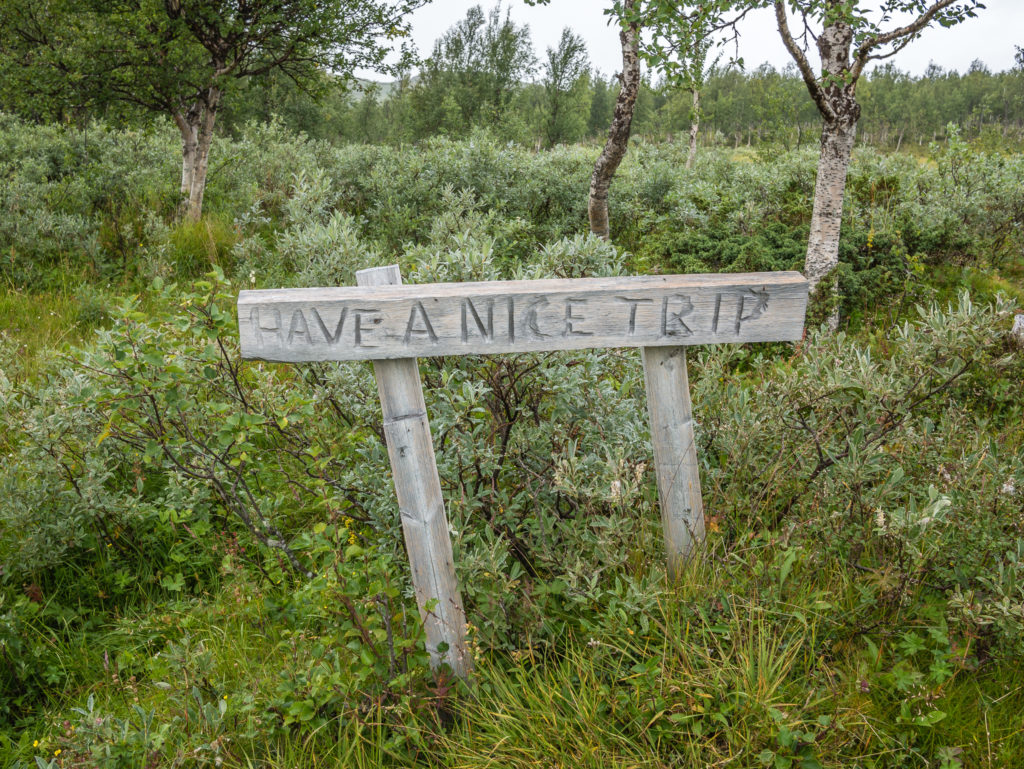
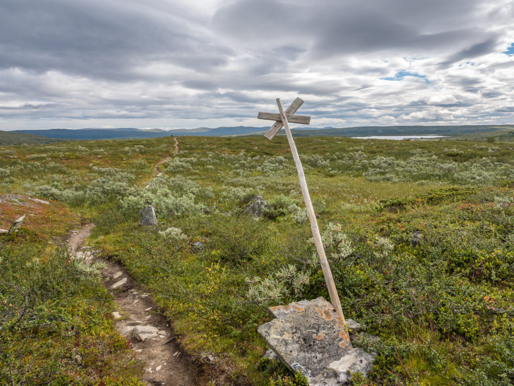
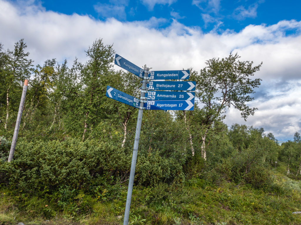
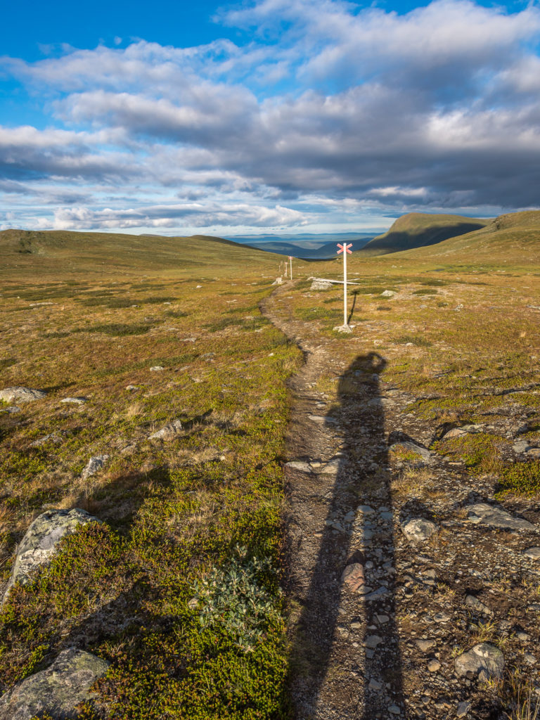
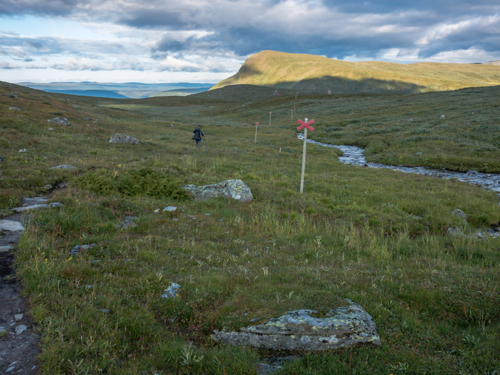
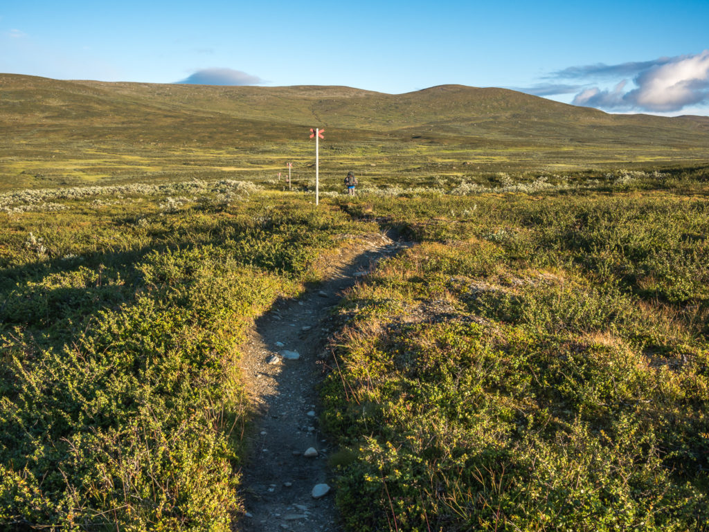
A great motivational sign we saw along the way! We needed to stay positive about what lay ahead for us…
Day 3 – Tarnasjo Mountain Hut to Wild Camp past Serve (14.4 miles/ 23.2 km, 10 hours) – Monday 15th August, 2016 – ‘Perfect Drone Flying Day!’
After yesterday’s unique sauna experience we had a great night’s sleep. In fact, suffice it to say, we both slept like logs and woke up feeling really refreshed and ready to face a new day, whatever the weather would bring. (Fingers crossed we’d finally see some sun today!)
But instead of hitting the trail and putting our renewed energy to immediate use, as we had camped next to the Tarnasjo Mountain Hut we thought we might as well make use of the facilities one last time. (Just in case you were thinking it – no, we didn’t have another sauna!) Armed with a bag of Swedish muesli, and of course our trusty English tea bags, we headed inside for breakfast. There’s nothing like a good cuppa in the morning to set you up for the day…
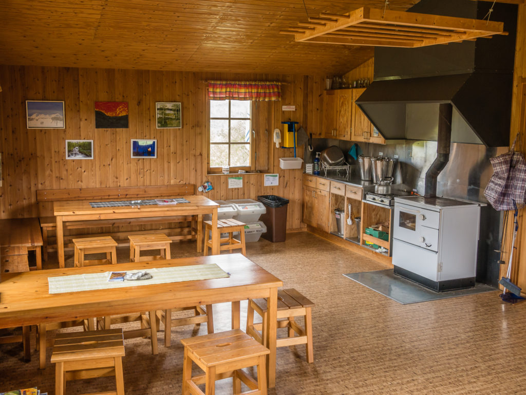
All mountain huts are operated in the same way with specific procedures for their smooth operation, including being environmentally friendly. Recycling is a must!
Having already been introduced to the effective operational procedures of the mountain hut system where everyone is expected to do their bit, we dutifully refilled the fresh water buckets, disposed of any waste water in the slask and sorted out our rubbish into the correct recycling bins before bidding farewell to what had been a cosy, little retreat.
Back on the trail about an hour or so later, we were reliving last nights’s events, firm in the opinion that we’d most definitely be camping at the next mountain hut we came across that was located beside a lake, making full use of the facilities again. Because of the rain, the sauna had been our best experience on the Kungsleden so far! But all of that was about to change…
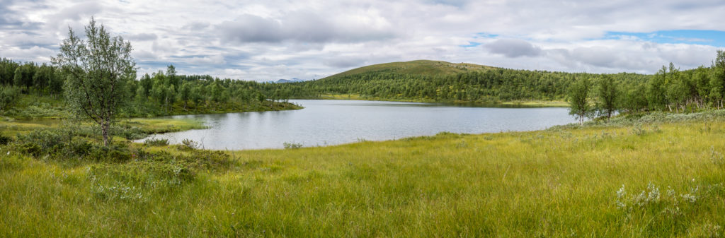
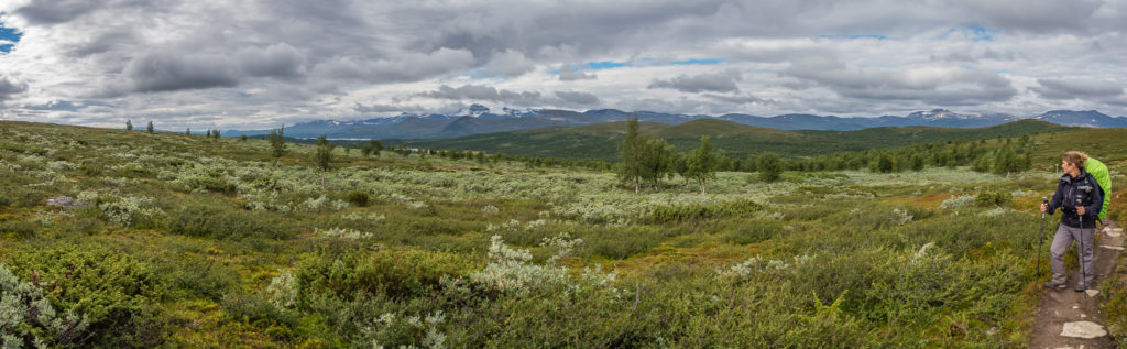
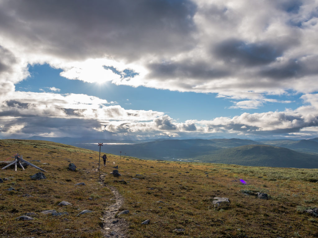
First panorama of the day – A dry start and the weather looks more promising.
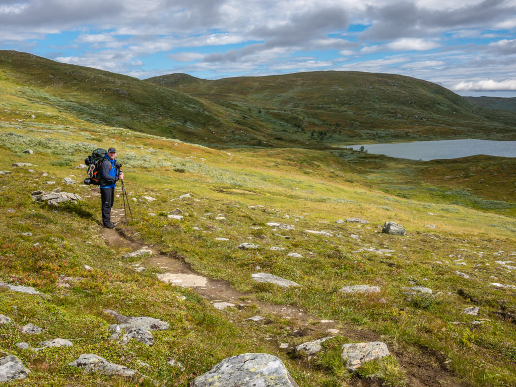
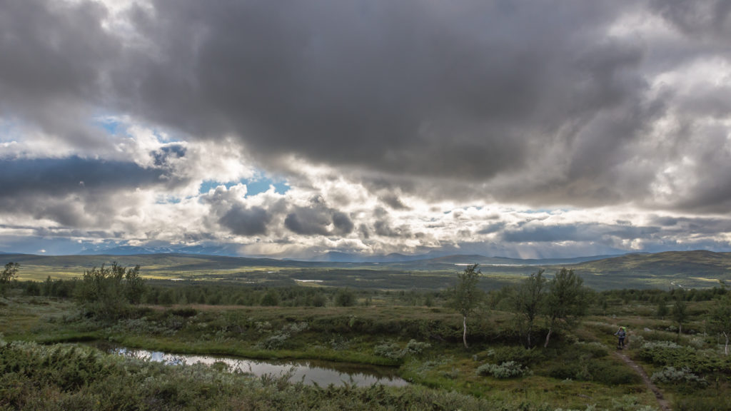
Being cautious, we kept our waterproof gear on because of the dark clouds overhead.
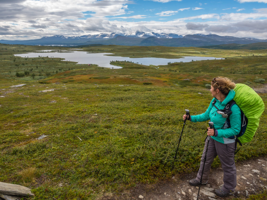
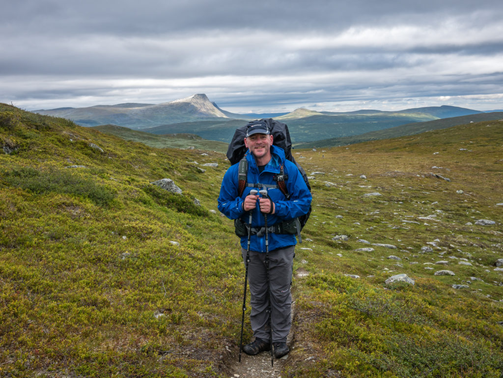
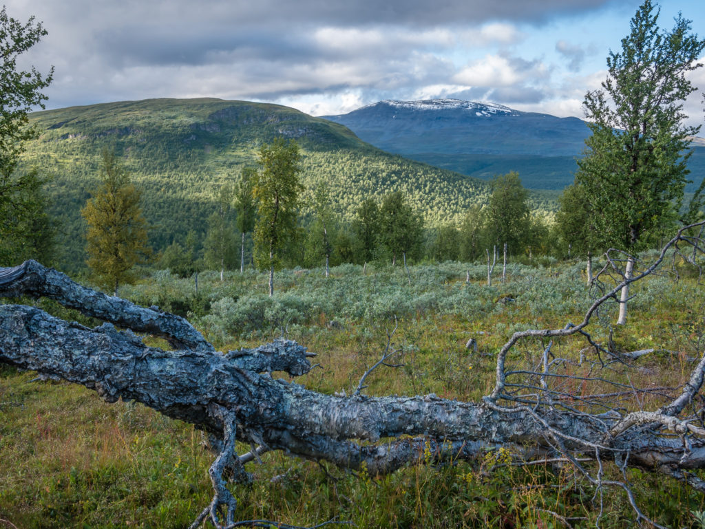
Taking in the view. Distant, harsh mountains pointed at what was to come further north.
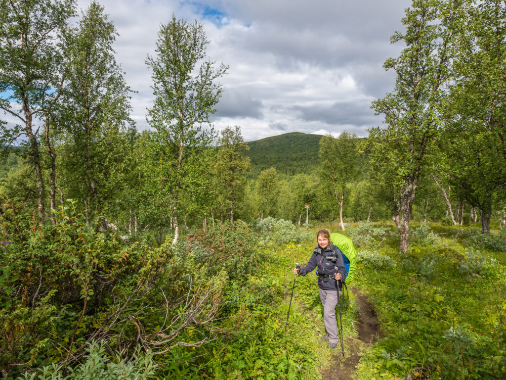
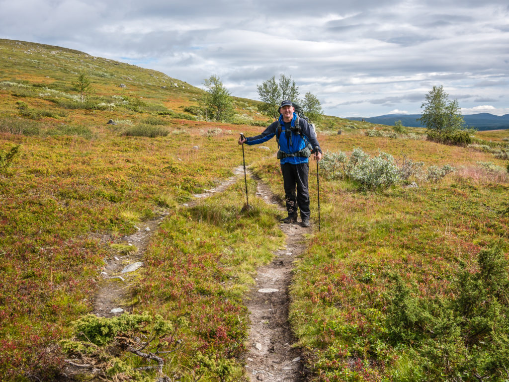
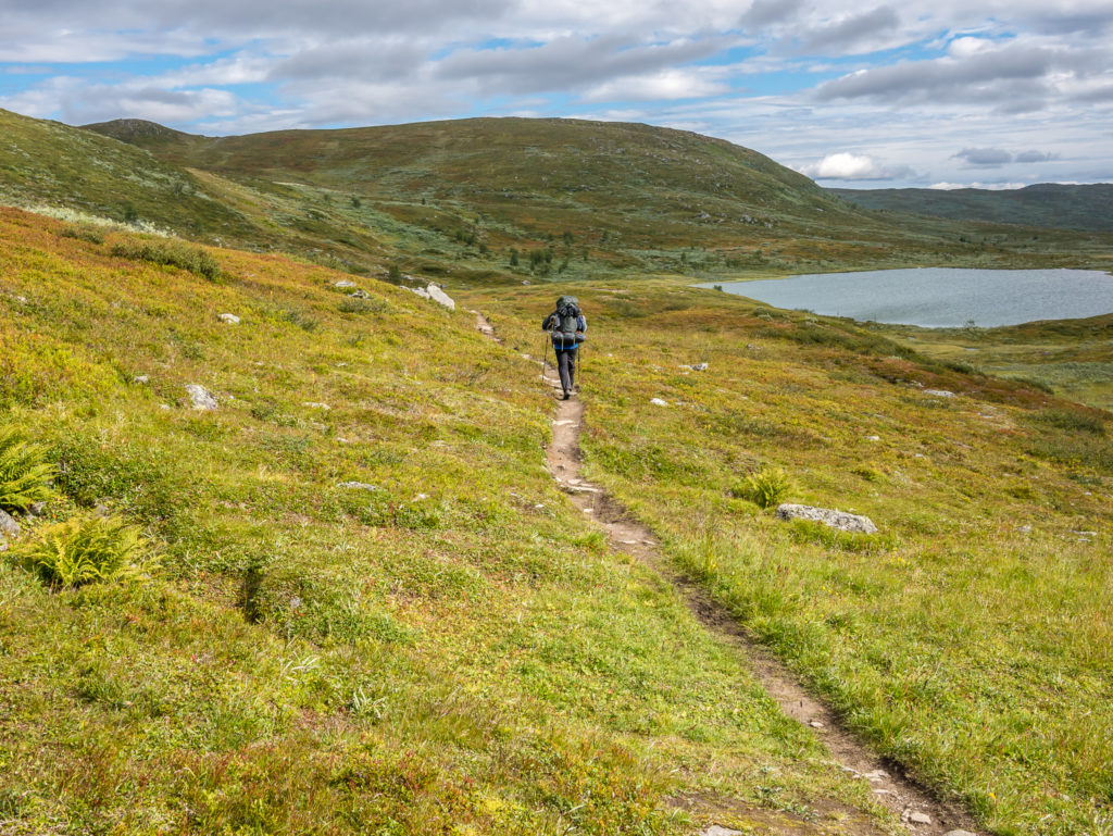
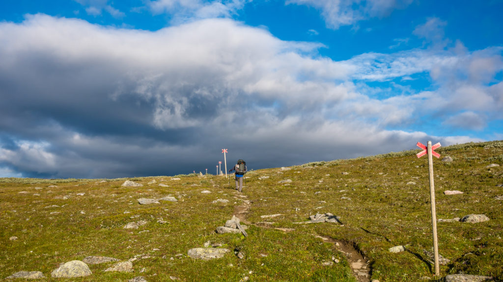
A flatter, dryer trail made for a much easier walking day.
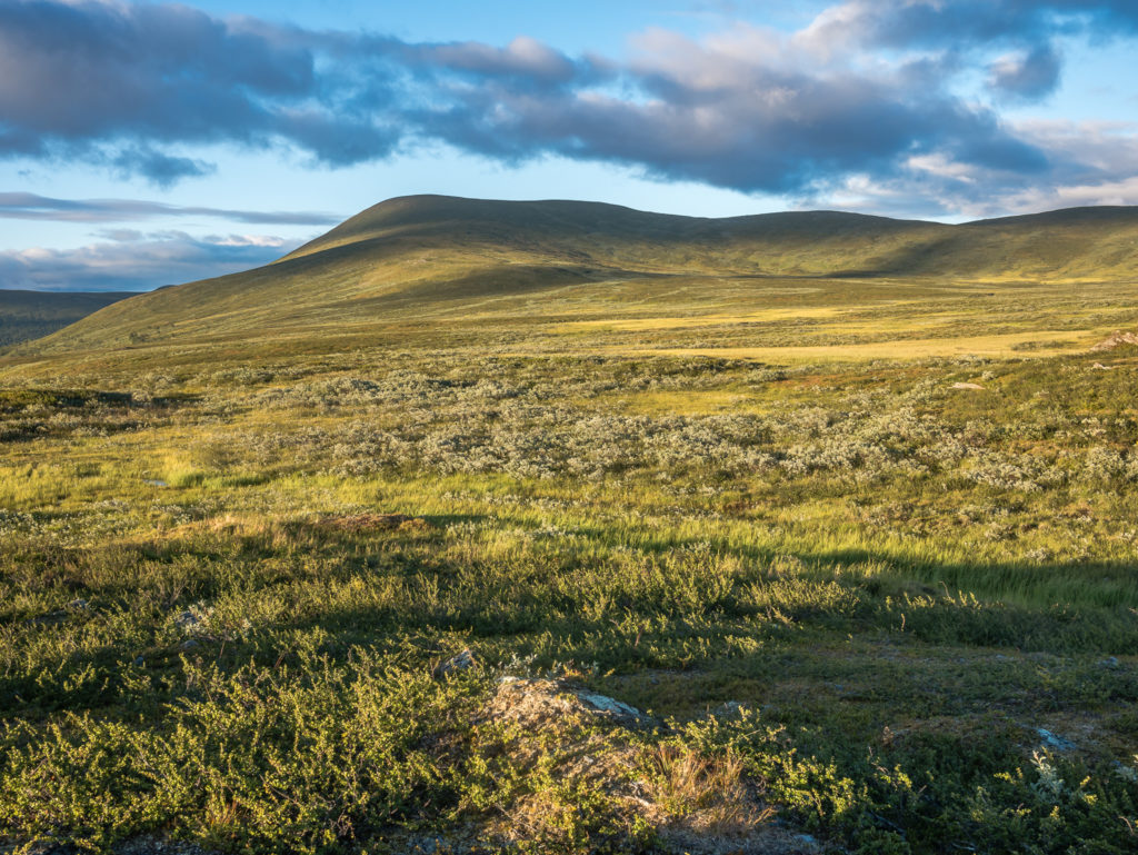
Not only was the weather much more forgiving; the landscape too was both vast and varied but remarkably flat, making for a much easier day’s walk. When you think of the Arctic Circle what comes to mind is one of the harshest environments on our planet where little can survive, yet the Kungsleden was taking us across miles upon miles of vibrant green wide-open land, richly covered in a variety of flora. From the striking purple thistle that reminded us of roaming the Scottish highlands, to moors filled with golden yellow buttercups, to Sweden’s tiny national treasure – the prized cloudberry, growing in waterlogged ground; the open fells were abundantly alive and beginning to show the first signs of autumn.
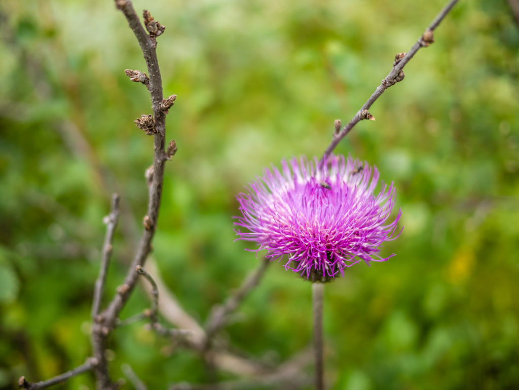
Purple thistles growing tall at lake-sides and along streams, reminding us of our journey on the West Highland Way in Scotland.
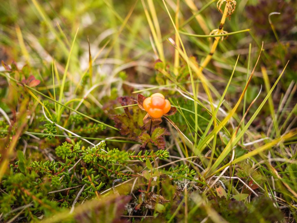
We spotted cloudberries growing in wet, boggy ground. The best time to pick them is when their colour changes to orange/yellow. In our opinion they had quite a peculiar flavour as they were unfamiliar to us. We thought they tasted like a tomato with hints of watermelon.
We saw the first signs of autumn as the heather-covered moors began to change colour.
We became more optimistic about the day ahead as the clouds dissipated and patches of blue sky began to appear!
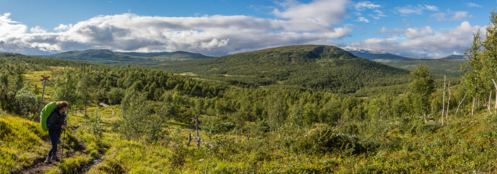
We took a slow and steady walk up a gentle hill that was carpeted in wild blueberries. From the highest point, we had a full 360-degree view of the surrounding valley, so we decided that this would be a perfect spot to get the drone out and fly it for the first time on the trail. Wayne sent it straight up into the air, circling around us, then turned the camera outwards to reveal the vast landscape.
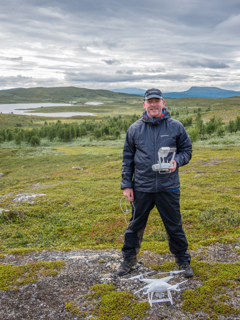
Getting the drone out for the first time on the Kungsleden trail.
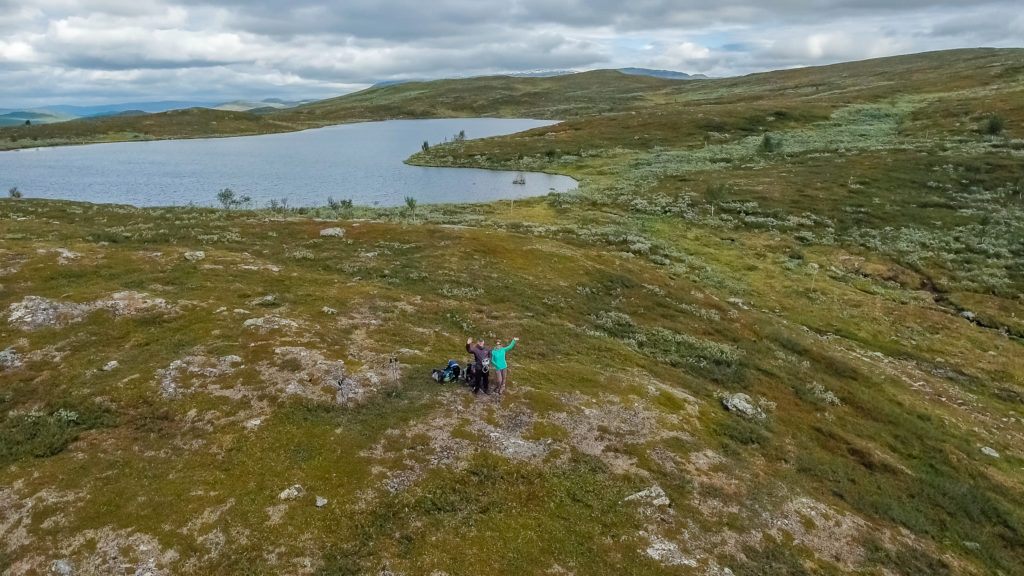
Our first photograph in flight on the Kungsleden captured by our Phantom 4 drone!
Whilst he then set up some different shots, I busied myself with trying to find the biggest and most ripe blueberries, picking a bag full of them to enjoy as a snack for later.
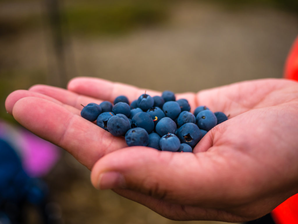
Wild blueberries – The best ‘free’ food on the trail.
Throughout the day we had also been curiously checking out the mushrooms as well. Apart from blueberries, they are the other most prominent source of ‘free’ food on the trail. However, we were very wary as to which of the mushrooms were edible. We were given some guidance by a Swedish hiker whom we got chatting to, who explained that red and white mushrooms are the most deadly, and that if a mushroom has vertical lines on its underside, it too is likely to be poisonous. During the course of the afternoon, we picked two mushrooms that we deemed to be edible and just to be on the safe side, asked two different Swedish groups of hikers to confirm that they weren’t poisonous. However, we ended up throwing them away – just in case, as both groups said they thought they’d be fine to eat, whilst also stressing that they weren’t mushroom experts. Sometimes it’s better to err on the side of caution!
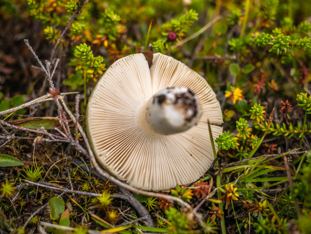
From the advice we’d be given, we classified this as a ‘poisonous’ mushroom due to the vertical lines on its underside.
*While many mushrooms are wonderful to eat, others are toxic enough to cause serious discomfort. Most are simply unpalatable, tasteless, or tough. A few are deadly. Though the odds are ever in your favour for picking an edible rather than a inedible mushroom, you can never be too careful. If you want to pick and eat mushrooms on the Kungsleden, we advise that you buy a regional field guide and take the book with you when out in the woods to aid in identification. You can also benefit from learning to identify trees, as many mushrooms grow with particular species of host trees.*
Realistically, you will find that the most ripe things right by the trail have already been picked. You will have to wander a little further off-trail to find anything substantial.
The horizon is lined with impressive peaks.
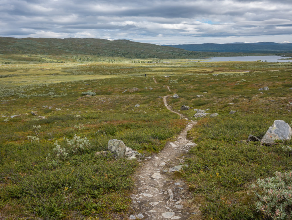
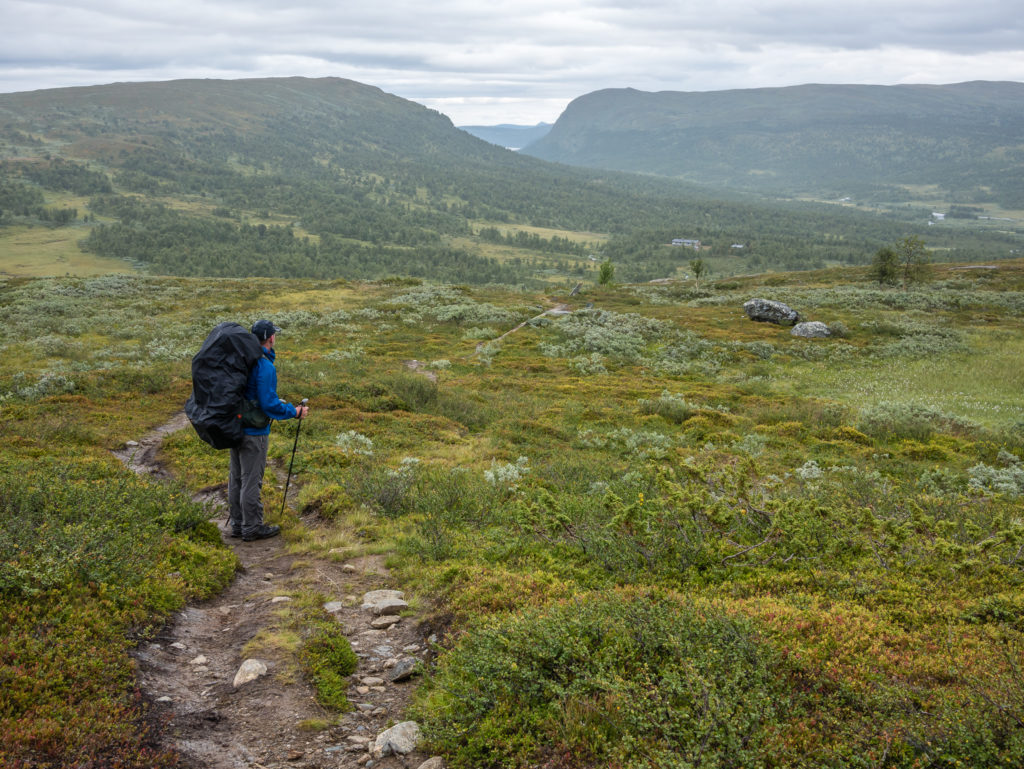
Although it was a long day of hiking, the trail wasn’t too taxing.
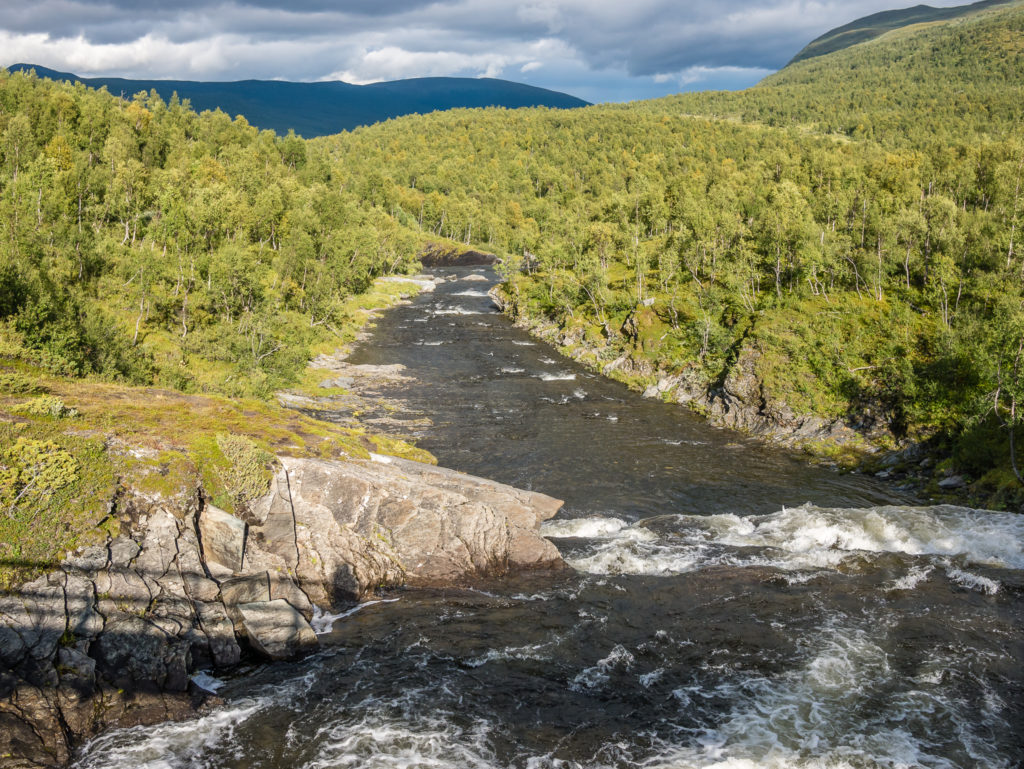
We passed numerous lakes on this section of the trail.
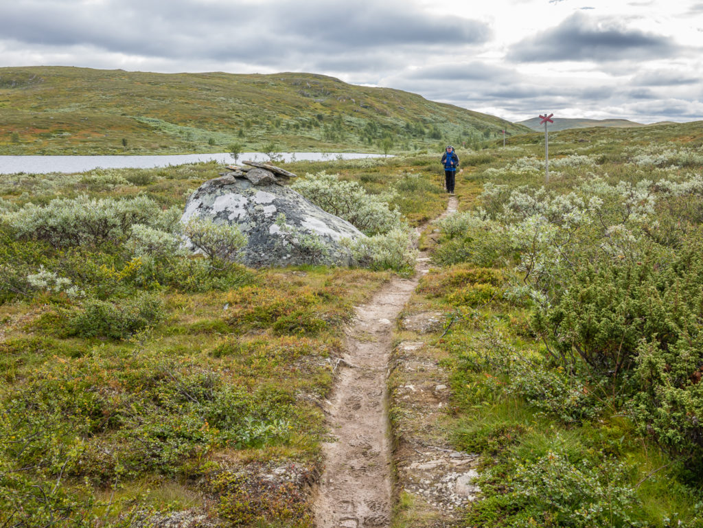
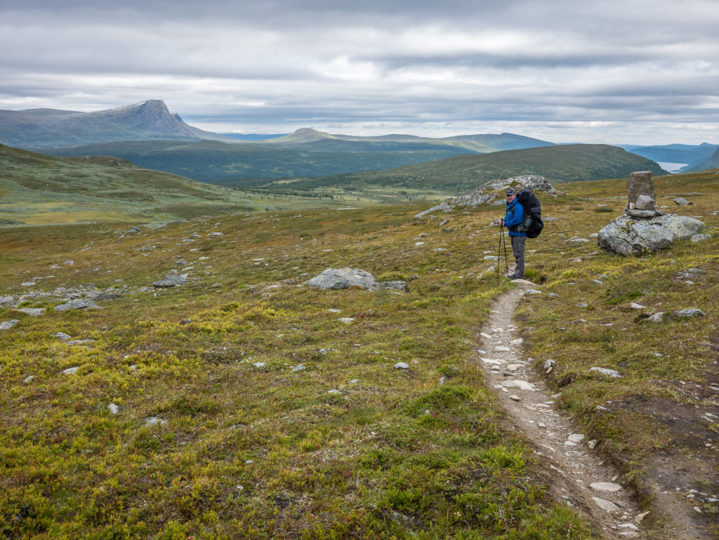
The route over the lower fells is on a well-defined footpath.
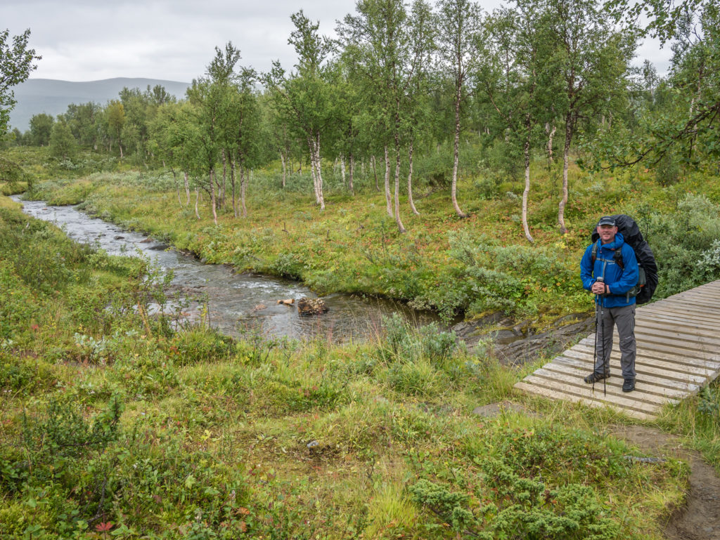
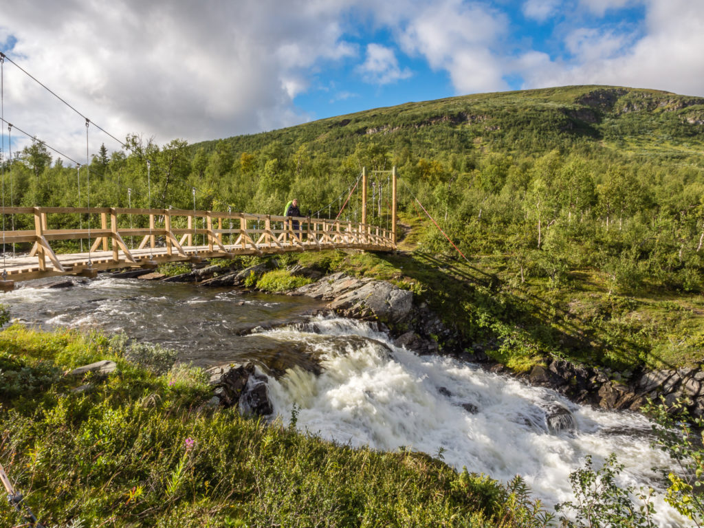
Hiking over a river with a small waterfall, Wayne got another great drone shot as I crossed the bridge. However rain came in just before we reached the mountain hut at Serve. We rapidly put on our waterproofs and made it to the hut without getting completely soaked again. We had checked the forecast earlier that day and knew rain was unavoidable for a couple of hours mid-afternoon, and right on cue, down it came. But we hoped that by stopping for a late lunch in the hut, we could miss the worst of it.
Our journey on the Kungsleden continues through vast amounts of uninhabited territory
The thick scrub is very much alive with a rich variety of flora.
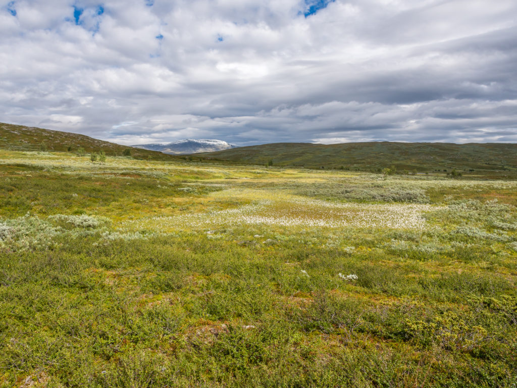
Although they look pretty, those fluffy white heads on the open plain are a sure sign of boggy wet ground. They are the dreaded ‘bog cotton’ – to be avoided completely when looking for a wild camp spot!
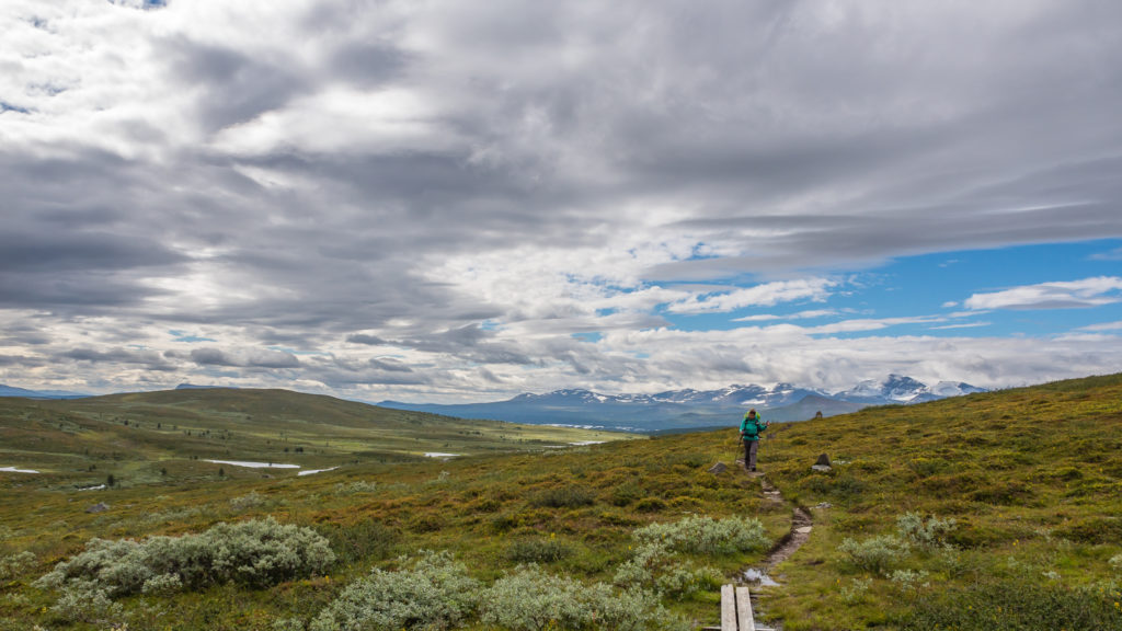
Still a long way to go… But soaking up the Swedish wilderness on a much better day!
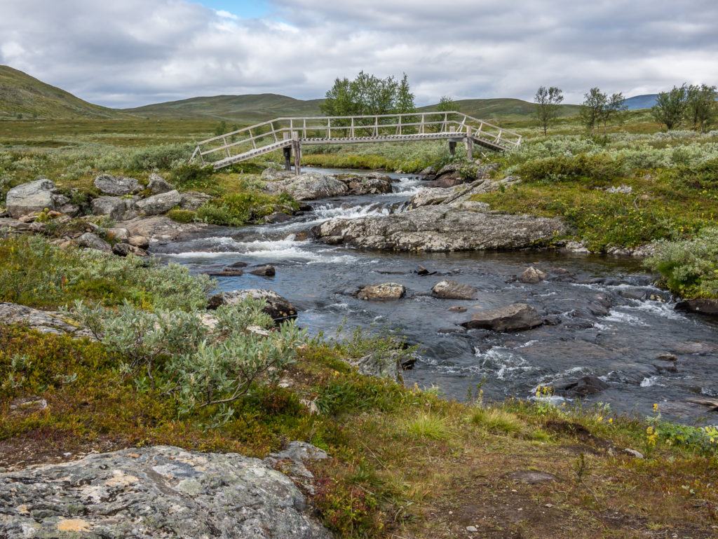
Although we took sandals for river crossings, we didn’t ford a single river as there was always a suitable rock hop or bridge in place to aid with crossing.
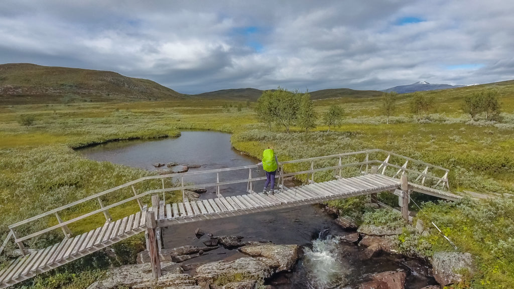
Enjoying the view from the bridge. This shot was taken from our drone footage.
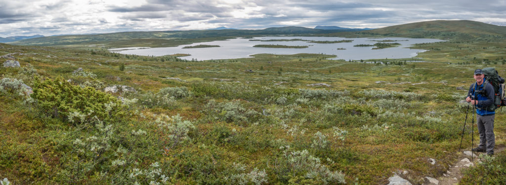
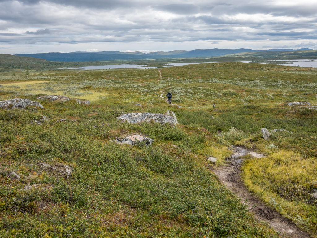
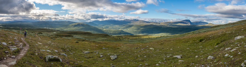
The whole scale of the area we looked upon is hard to get across even with a panorama as it was just so vast.
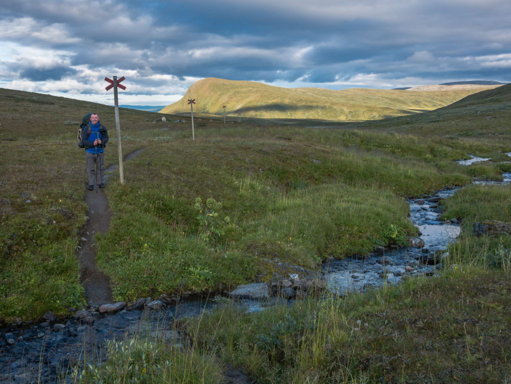
En route to the Serve Mountain Hut.
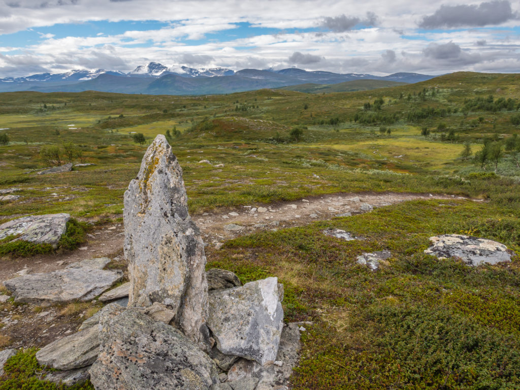
Stone markers lead the way… We were enjoying the views of the mountains before the rain came in.
Trying to stay one step ahead of the rain and make it to the mountain hut in the distance before the downpour.
The vast open moors are edged with pine and beech forests.
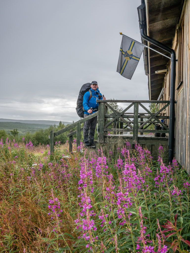
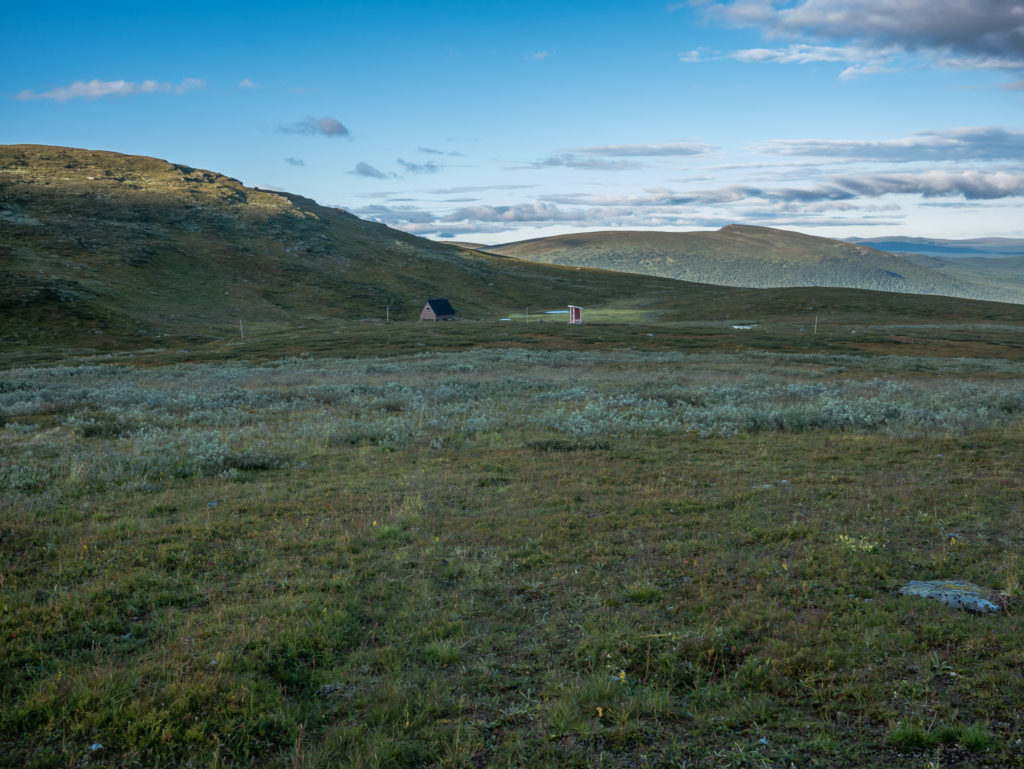
Reaching the Serve Mountain Hut just in time!
Grateful of a nice, warm place to shelter whilst we had a very late lunch.
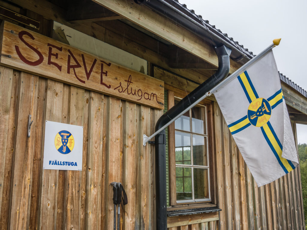
An excellent resource for hikers, the Serve Mountain Hut had exactly the same set up as other mountain huts we’d visited so far, minus a shop. We showed our YHA/ Hostelling International membership card, which allows day use for free, and despite it being past the ‘official’ day use time, we were still welcomed inside to use the facilities. This meant we could use the kettle and gas to boil water and cook food. Today was our favourite meal on the trail so far – tinned mackerel in tomato sauce added to a Heinz Mexican tomato cupa soup, served with a bread roll. (We know how to do camp food a la carte!) The two Swedish guys on a fishing trip whom we’d met on Day 1 also arrived at the hut for a quick snack break, one looking a little worse for wear with his feet all taped up.
Arriving just before 4pm, it was clear to us that we had greatly over-estimated how far we would walk today. Our initial plan to reach Ammarnäs by the end of Day 3 was just way too unrealistic, so we decided on aiming for halfway to Ammarnäs instead – or as near as we could push ourselves.
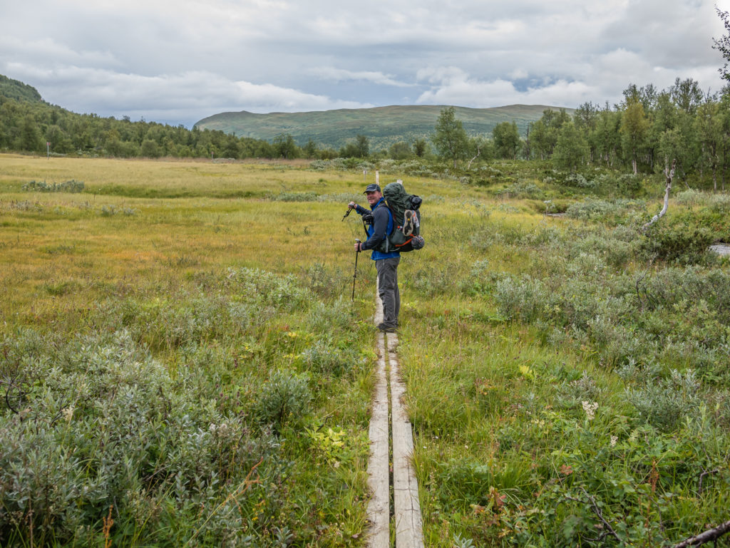
Setting off on the trail once more… The boards lead the way…
Only 25 kilometres to go to reach Ammarnäs! Leaving Serve at 5pm, no wonder we adjusted our plans…
Thankful of this bridge across the river!
Taking in the view from the bridge…
Looking back and realising how far we’d already come…
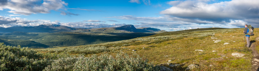
The mighty mountains get closer…
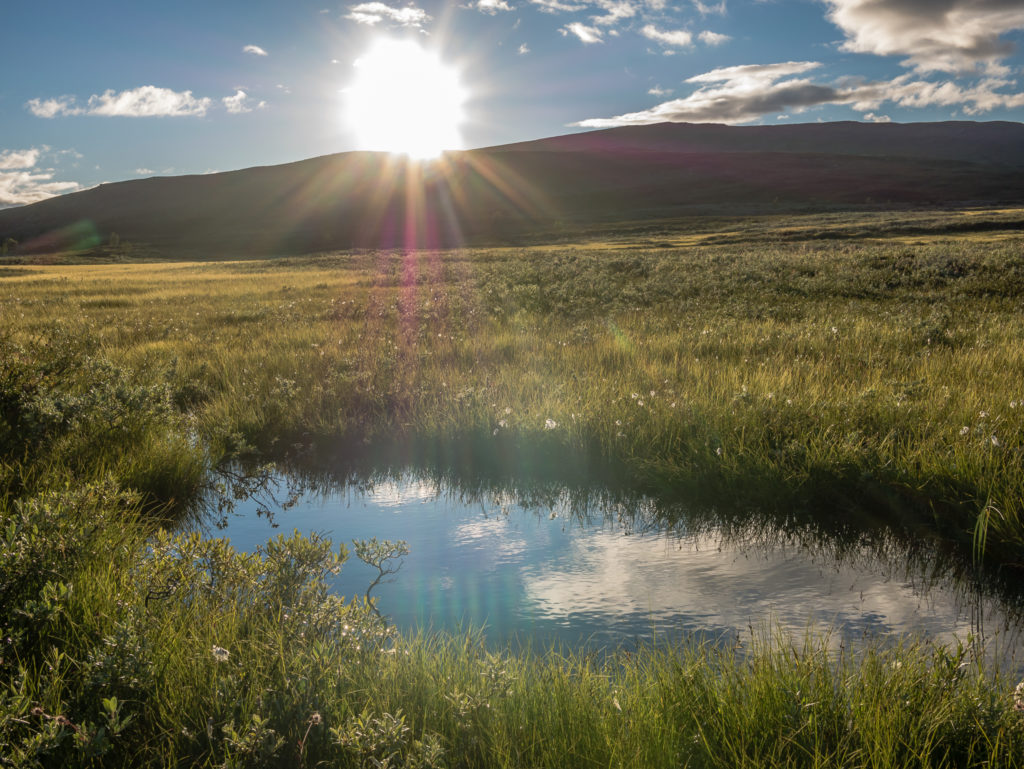
Wonderful light.
The Kungsleden sees you walking through such a varied landscape… From emptiness, dense forests, vast valleys, rushing rivers, serene lakes…
Getting lost in your own thoughts and admiring the wonderful arts that nature has crafted.
The walking route and ski route join for a while.
Chasing shadows…
Hoping we weren’t walking into wet weather!
After leaving the Serve Mountain Hut around 5pm, the rain had passed and we enjoyed good weather once more. The range of light bathing the fells at this hour of the day made this part of the walk particularly mesmerising. Despite changing our plans, it was still 17 kilometres to the Aigert Mountain Hut located at the foot of Mount Äijvisåive, a holy mountain for the Sámi people, so we knew we wouldn’t make it that far either. Instead we decided that we’d camp close to one of the emergency shelters that we’d be passing withing the next hour or so.
Continuing on but realising that we wouldn’t make it to the Aigert Mountain Hut either as it was still quite a distance away.
We could see the first emergency shelter in the distance.
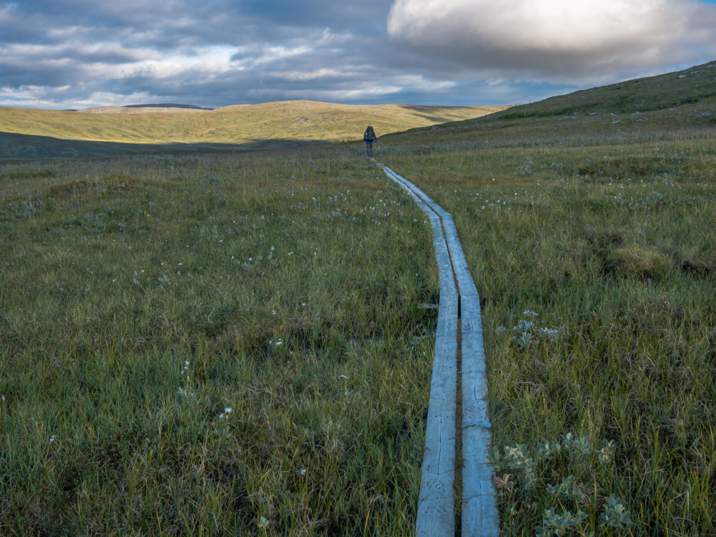
This picture typifies the Kungsleden trail. More wooden boards lead us over boggy ground.
Looking towards the first emergency shelter. As the weather was good and we still had several hours of light, we decided to continue hiking around the valley past the first shelter and head on towards the second.
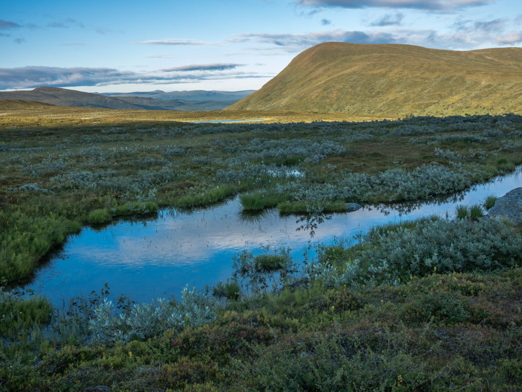
We found water readily available on this trail. We rarely used our water filter, choosing to fill up and drink straight from clear, flowing streams.
How much further? We started looking for a clear, flattish spot suitable for pitching our 3-man tent.
We wanted to set up camp before the sun dipped behind the mountains.
Gorgeous evening light.
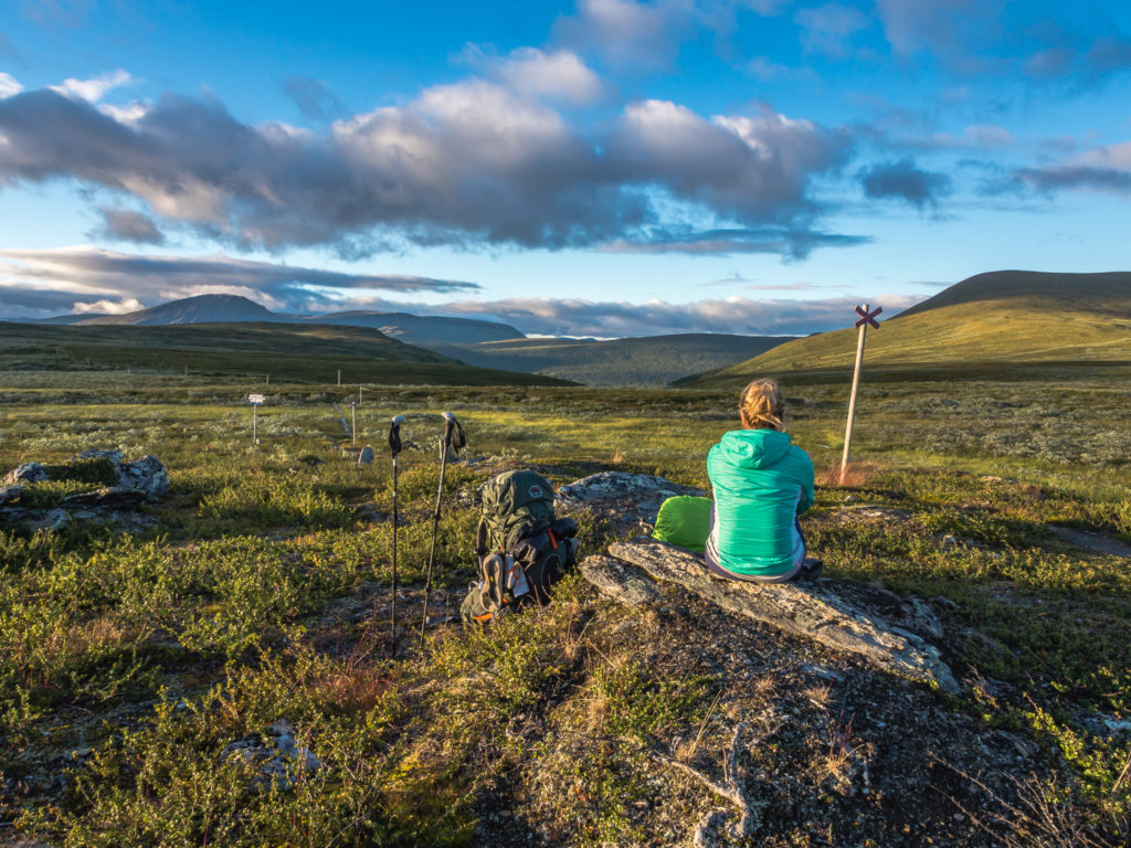
We took the opportunity to stop and enjoy the view for a while.
After walking a while longer in search of a suitable place to camp, we settled on a little patch of scrubby ground that looked like it had been cleared and used previously as a campsite as there were some rocks positioned into a fire ring and a perfect tent-shaped clear patch. It was just off the trail, a minute or so walk to a babbling brook for resupplying with water, but also importantly it was by a large rock right in the middle of the valley that offered us some protection from the wind. The rock also gave us some privacy, although there was really no one else around at all – just several reindeer stopping and starting at us from across the way, which I was really excited about!
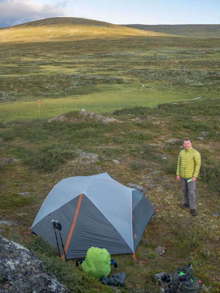
We pitched the tent a little way off the trail behind a rocky outcrop that we hoped would shelter us from the wind during the night. You can just see the trail snaking off into the distance.
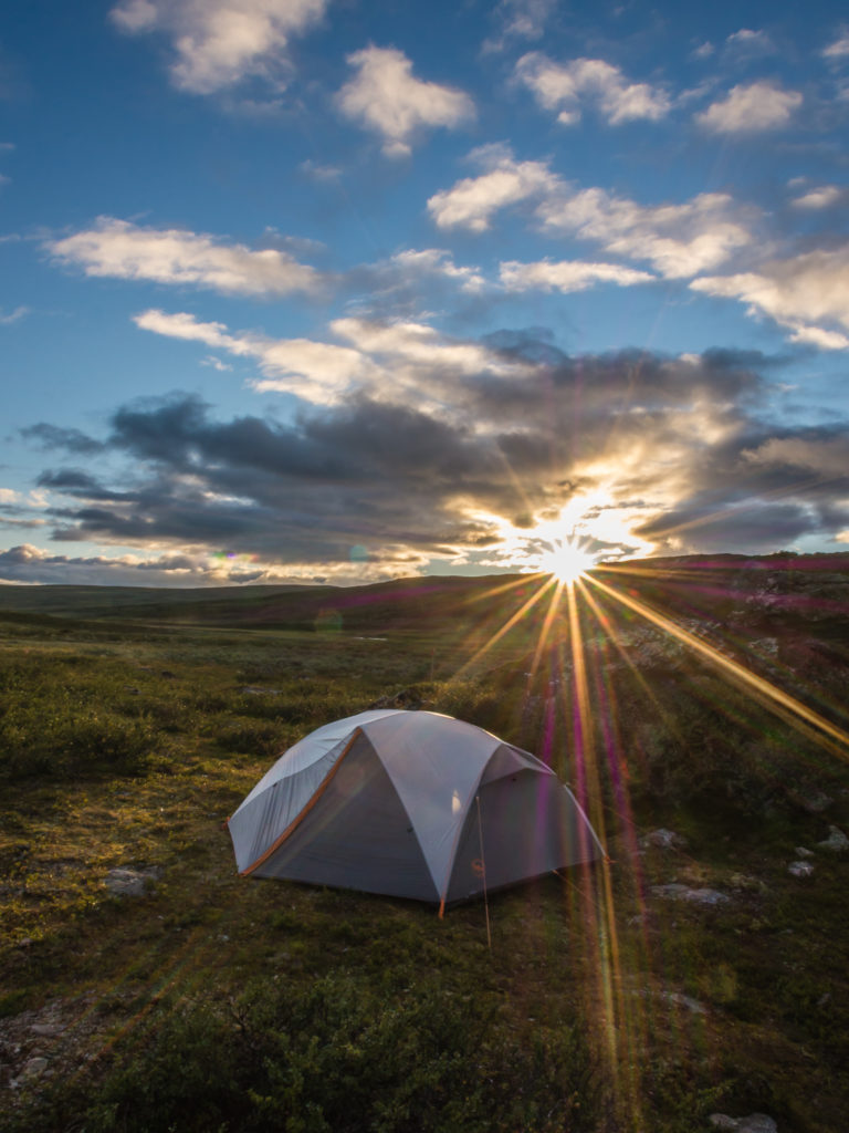
What a glorious end to the day!
We had a quick wet-wipe wash, which was soon to become the norm on this trail. Then for dinner Wayne cooked up an Italian feast, a la camp style, of instant noodles, pepperoni and carbonara sauce. It was actually around 10pm when we finally got into our sleeping bags to settle down for the night.
As I was trying to drift off, I couldn’t help but think about a conversation we’d had earlier that day with two older Swedish couples hiking together, whom we passed walking in the opposite direction. After debating whether we had picked poisonous mushrooms or not, and discussing the merits of south going north as opposed to north going south, one of the ladies said it was her lifetime dream to hike the entire Kungsleden. She was very envious of the challenge we’d set ourselves, particularly as she was Swedish born and bred. How then could we be miserable on this trail, even when faced with walking long distances in driving rain and suffering some horrendous weather when we were living someone else’s dream? We simply couldn’t! We just had to get on with it and make the best of each new day.
We were now part of the Kungsleden hiking community. Every day would bring us challenges, but we had to treat these as an opportunity to discover something new. There was no going back now… We would experience the Kungsleden to the fullest and enjoy every single aspect that this trail would throw at us, come rain or shine!

4 Comments
Enjoying the trip with you. In a cyber space sort of way ????. It’s good to read when feeling down.
Thanks for your continued support and following along. We can fully recommend a Swedish sauna – It would definitely cheer you up! 🙂
We’re hoping to take the drone out in the Peak District this weekend if the weather stays fine. Whenever we make camping plans though, the opposite seems to happen!
Another fabulous read. The area appears so vast and isolated. Your final photograph is awesome.
What a difference a blue sky makes. I’m curious as to when it actually got dark. I thought that in August the days would still be quite long.
Hi Helen, yes we still had plenty of daylight hours in August. It was usually light until around 10pm, then sunrise was around 3am. Towards end Aug/ beginning of Sept when we finished though, there was a marked difference with it getting dark by 8:30pm ish. It was strange at first going to sleep in the tent when it was still light outside and we never really used our head torches at all until the last few days. It definitely makes a difference photography wise having blue skies!!! There are some better photography days to come 🙂