
Feeling On Top Of The World… Literally!
61 kilometres into our Kungsleden journey and about to embark on ‘Day 4’, we were thrilled to wake up to blue skies and sunshine at last! Good weather certainly makes all the difference for us on the trail, not just in terms of getting an early start and feeling raring to go, but it changes our whole perspective on what has gone before and what is yet to come!
Just days before, rain had been pouring from the heavens, wind lashing our soaking bodies, and not feeling at one with nature I wanted nothing more than to be away from it all relaxing by the pool in a swanky hotel. This was our summer holiday after all! But it’s amazing how when reflecting on the experience, whilst walking under a cloudless blue sky with a blazing sun overhead, you can convince yourself it was actually great fun! The rain long since forgotten and the Kungsleden revealing its beauty at last, we were re-energised and fully motivated to make our miles and go the entire distance…
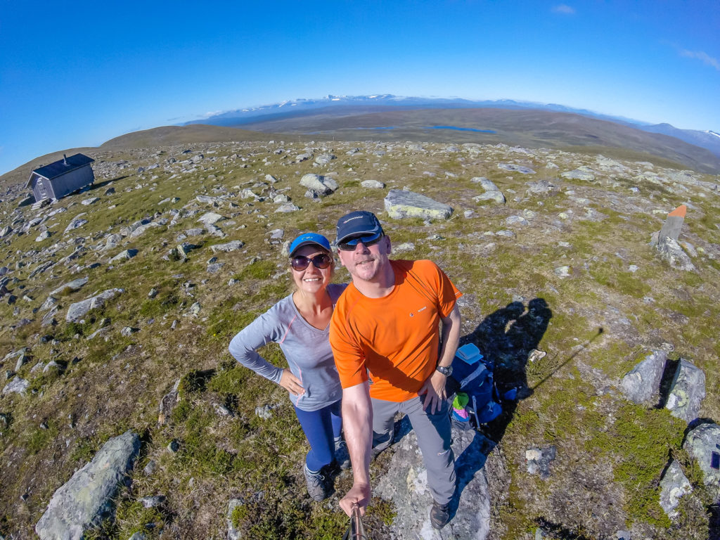
All smiles and ready to take on the challenges of Day 4. Blue skies and sunshine are a great motivating factor! This spot by the Aigert shelter really feels like you are standing on the top of the world!
Great weather also makes for great photography, so we wasted no time in getting the drone up into the air to finally show the spectacular wilderness scenery the Kungsleden is renowned for. Read on to see more… Here is a round-up of our 4th day on the trail, which proved to be a big day with big views! (Particularly from the toilet – excuse the lavatorial humour that is about to come!)
Day 4 – Wild Camp past Serve to Wild Camp by Vindelälven (Vindel River) after Ammarnäs (15.6 miles/ 25.1 km, 11 hours) – Tuesday 16th August, 2016 – ‘A Toilet Stop With A View!’
Having selected what we thought was a really good wild camp spot last night, it didn’t prove to be quite so satisfying. We thought that camping next to a large rock would be advantageous as it would shelter us from any wind. However we neglected to think about the fact we had camped in a cold sink in the middle of the valley, therefore I in particular, struggled to stay warm during the night. It meant I had a fairly restless sleep as I kept waking up with cold knees or freezing feet, and so wished I had brought along my favourite extra-thick fleecy pyjamas that I always wear when car camping. (Not quite appropriate for long distance hiking as they are neither compact nor lightweight!)
With clear skies above and temperatures getting below freezing during the night, we weren’t surprised to find the tent covered in a thin layer of frost when we awoke the next day. It wasn’t anything to complain about though as we were far too busy relishing our first morning of complete blue skies and sunshine as far as the eye could see.
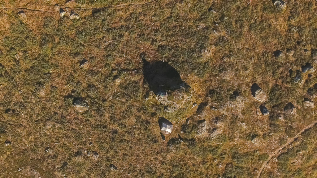
Aerial shot taken of our wild camp spot before we packed away the tent.
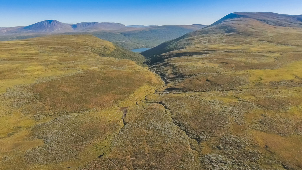
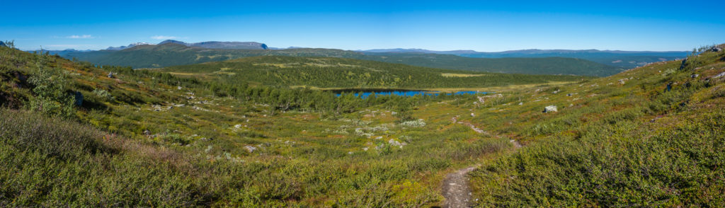
Phantom 4 drone shot looking across the valley to where we’d hiked from yesterday.
With not a cloud in sight, we soon got warmed up and the tent quickly dried out saving Wayne a few grams and the hassle of having to stow and carry a wet tent. But before we packed it away, we climbed up and sat on the large rock next to our pitch to enjoy breakfast with a view. Instead of muesli, today we’d opted to try soup and a bread roll, which we found to be much tastier and more filling, so we agreed that we’d go with that alternative for the foreseeable future. (Well until we could no longer buy any fresh bread!)
Wayne sent the drone up for a flyover shot to try and capture the essence of our wonderful surroundings – 360 degrees of pure wilderness that we were soaking up from the top of the rock, the golden rays of the sun warming our faces and lighting up the vast valley that we couldn’t wait to explore.
A new day… Walking under a canopy of brilliant blue.
This is exactly the kind of weather that we’d hoped for on the Kungsleden trail.
This is what the wilderness looks like on the southern section of the Kungsleden. Simply no one else for miles around…
As we were enjoying both the amazing weather and an incredible feeling of solitude right at that spot, we didn’t set off on the trail again until around 10am. Our first aim of the day was to get to the Aigert emergency shelter. It was a gentle uphill walk, so we could really take in the vast view of the valley that lay before us, or switch off and get lost in our own thoughts. It was such a surreal feeling knowing that apart from a handful of other hikers going in the opposite direction, we were really the only people for miles around.
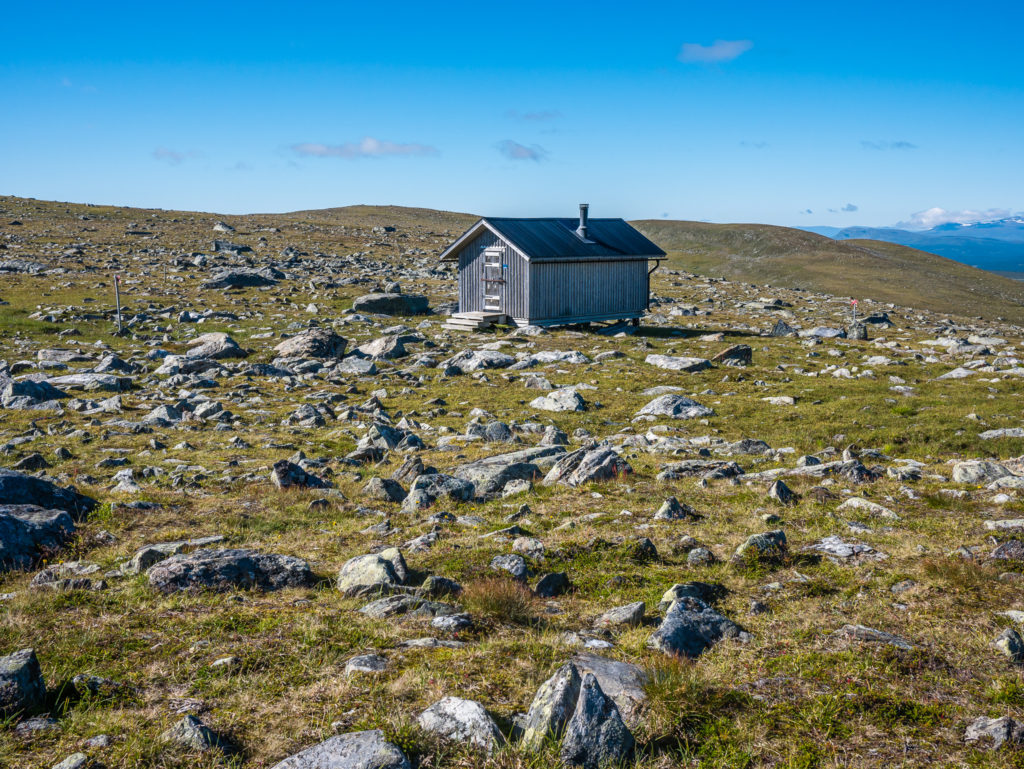
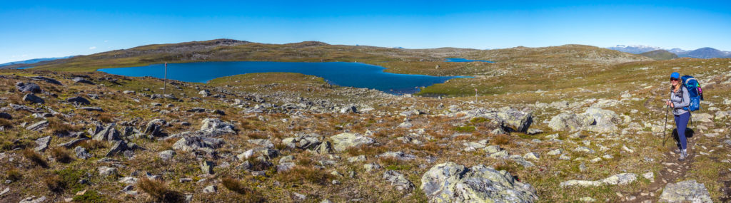
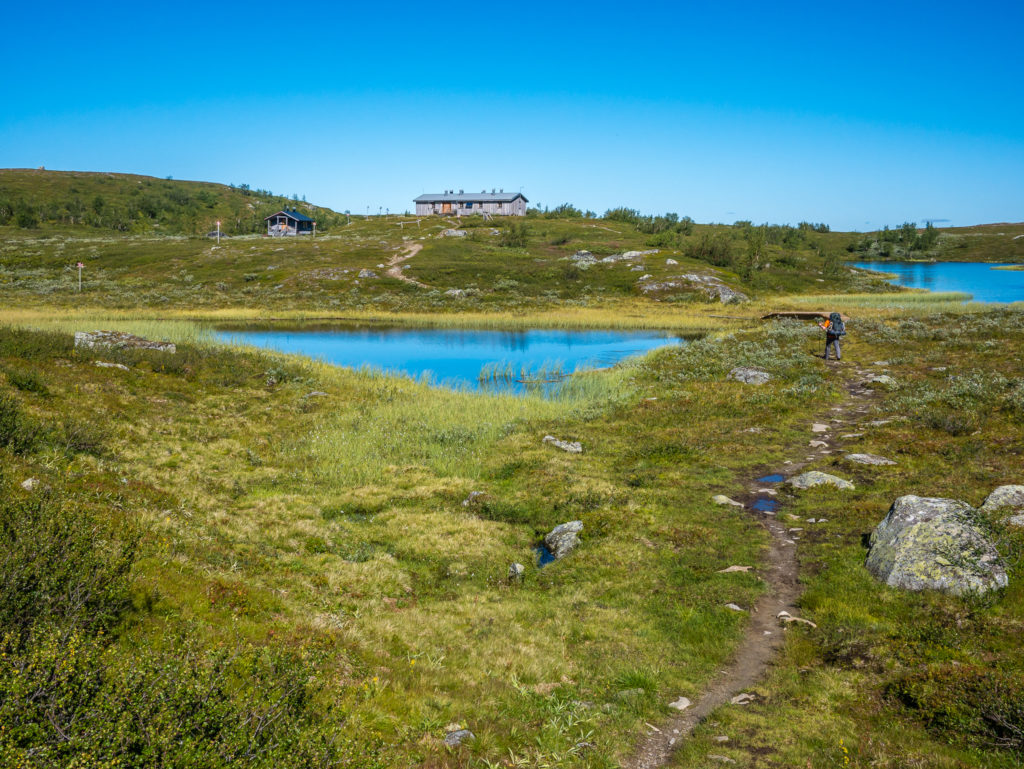
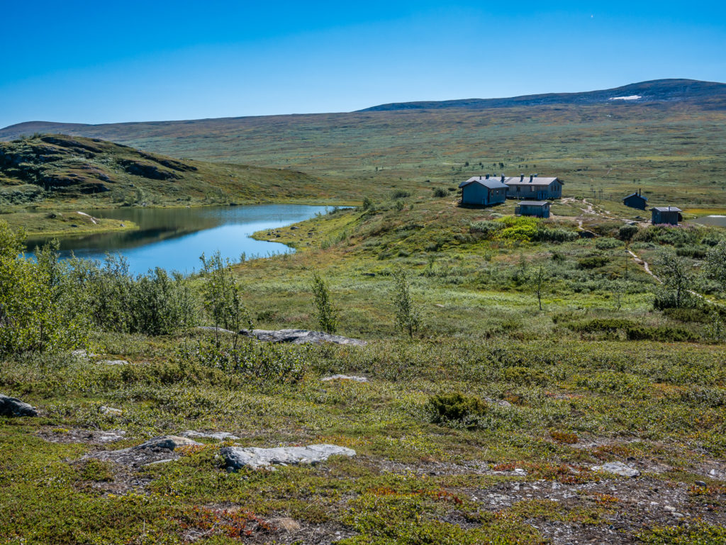
Our first rest-stop of the day was by the Aigert shelter. With no other shelter for several miles, this is a complete godsend in severe weather.
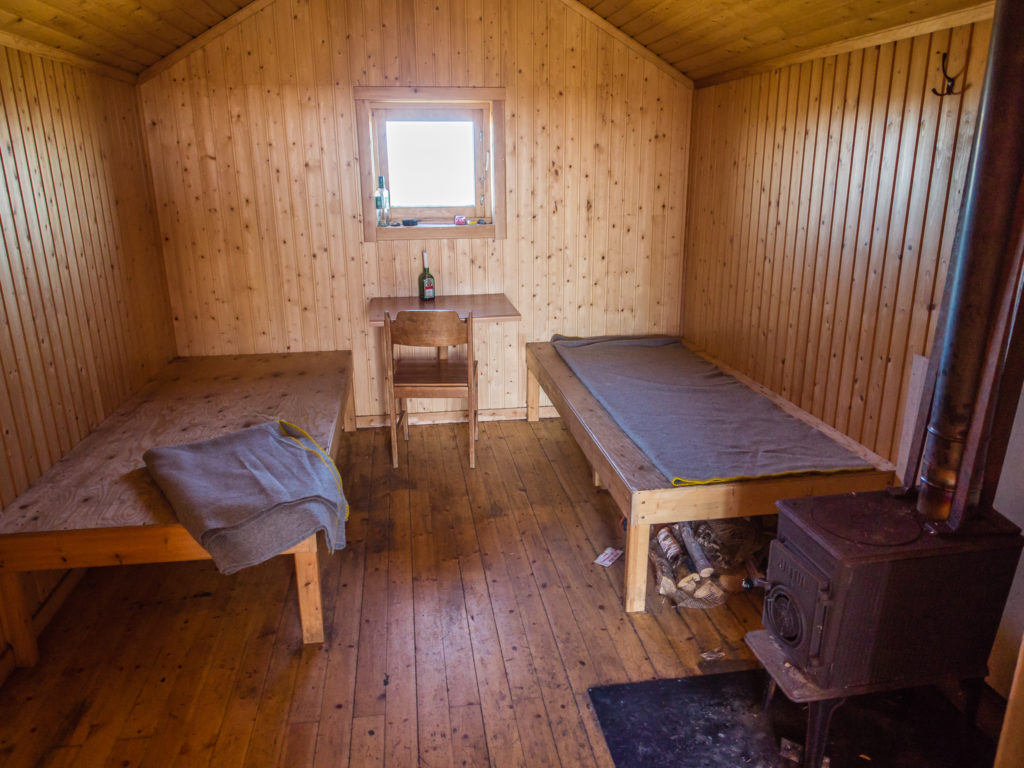
Inside the shelter there are basic provisions, but it would make for a comfortable night’s rest in severe mountain weather.
Having not seen another soul for at least 16 hours, we found the Aigert emergency shelter to be a busy junction point – two groups of hikers heading southbound were just setting off as we arrived. After they had disappeared down the trail we decided to take a quick look inside the hut and also photograph the toilet! If you’ve ever wondered about toileting procedures in the wilderness, you usually go off somewhere discreet and dig a hole… But in Sweden we were finding perfectly placed long drop toilets along the trail with especially good views when taking a dump! (Please excuse our toilet humour, but we find that toileting on the trail frequently sparks off a frenzy of interest and becomes a hot topic of conversation when discussing the merits of long distance hiking with friends and family. Obviously, going for a ‘bush wee’ is far more interesting to a non-hiker than the fact you’ve just walked 20+ miles with your home on your back!)
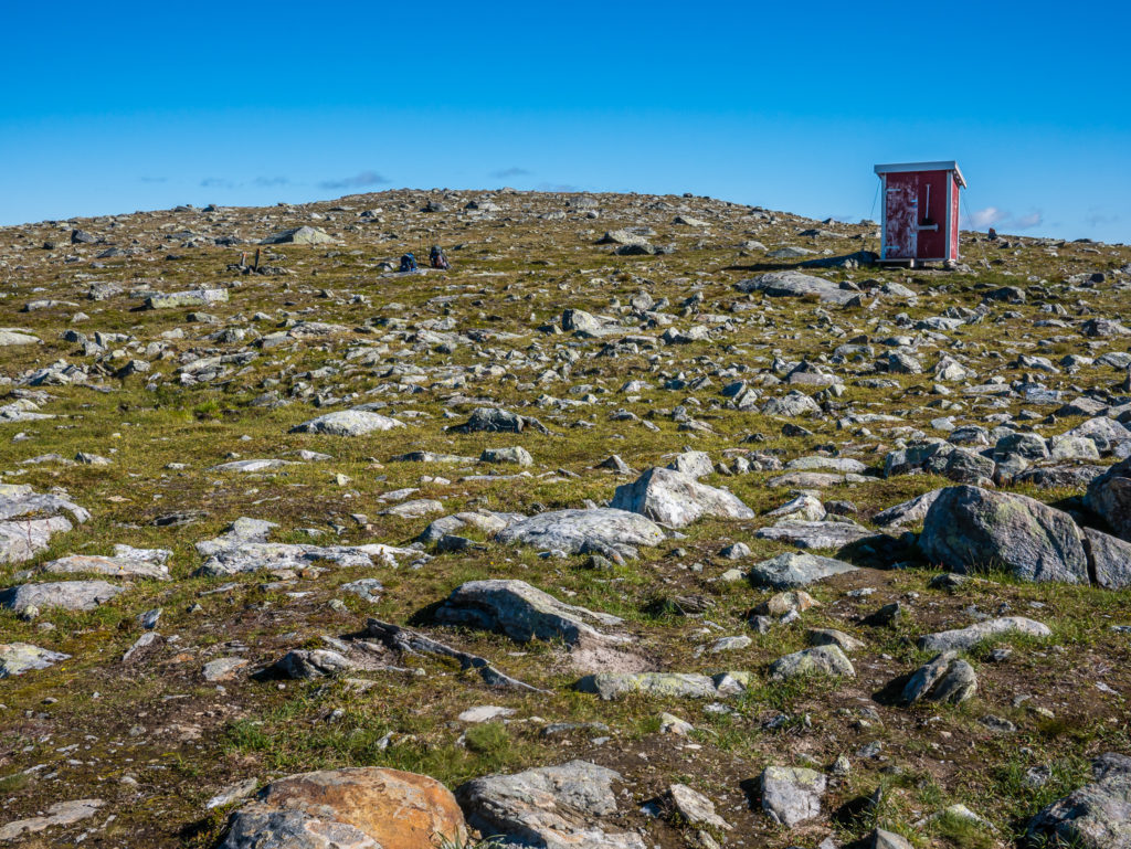
The long-drop toilet opposite the shelter. What this trail definitely does well is the provision of WC conveniences along the route!
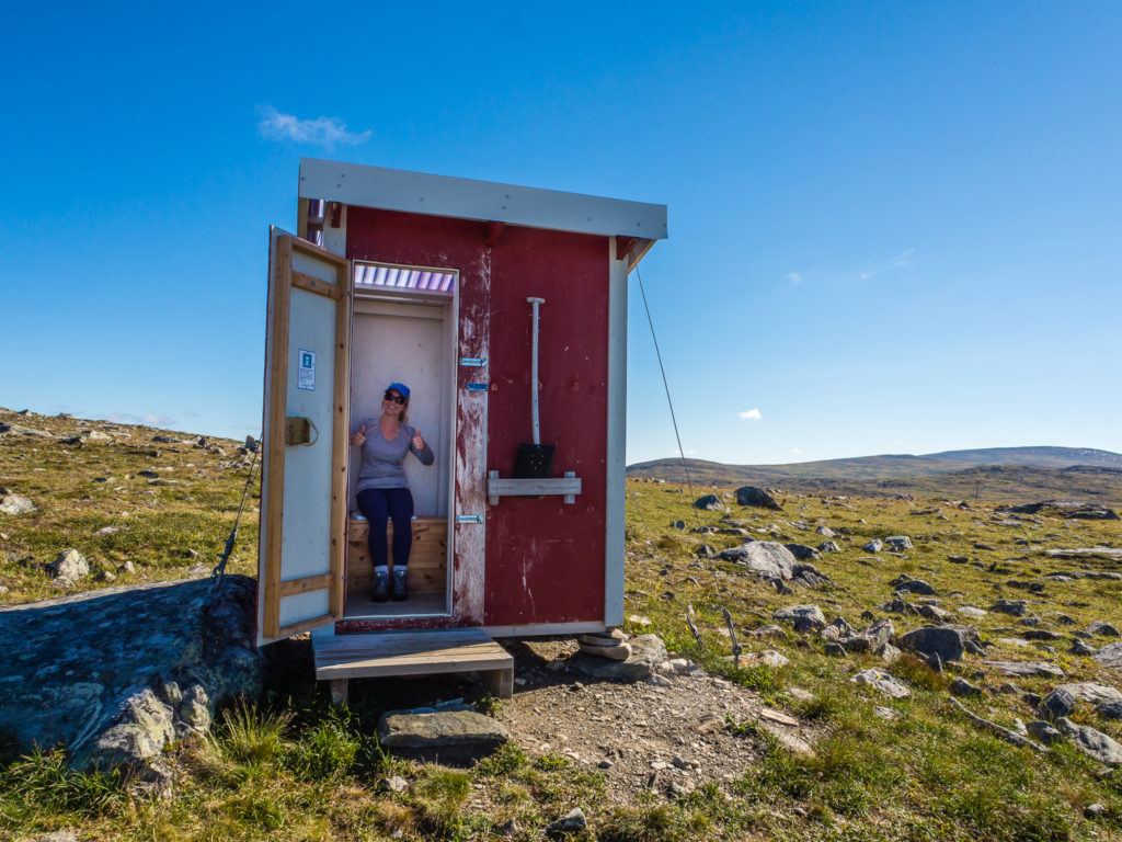
Excuse our toilet humour… Enjoying the view from the loo!!!
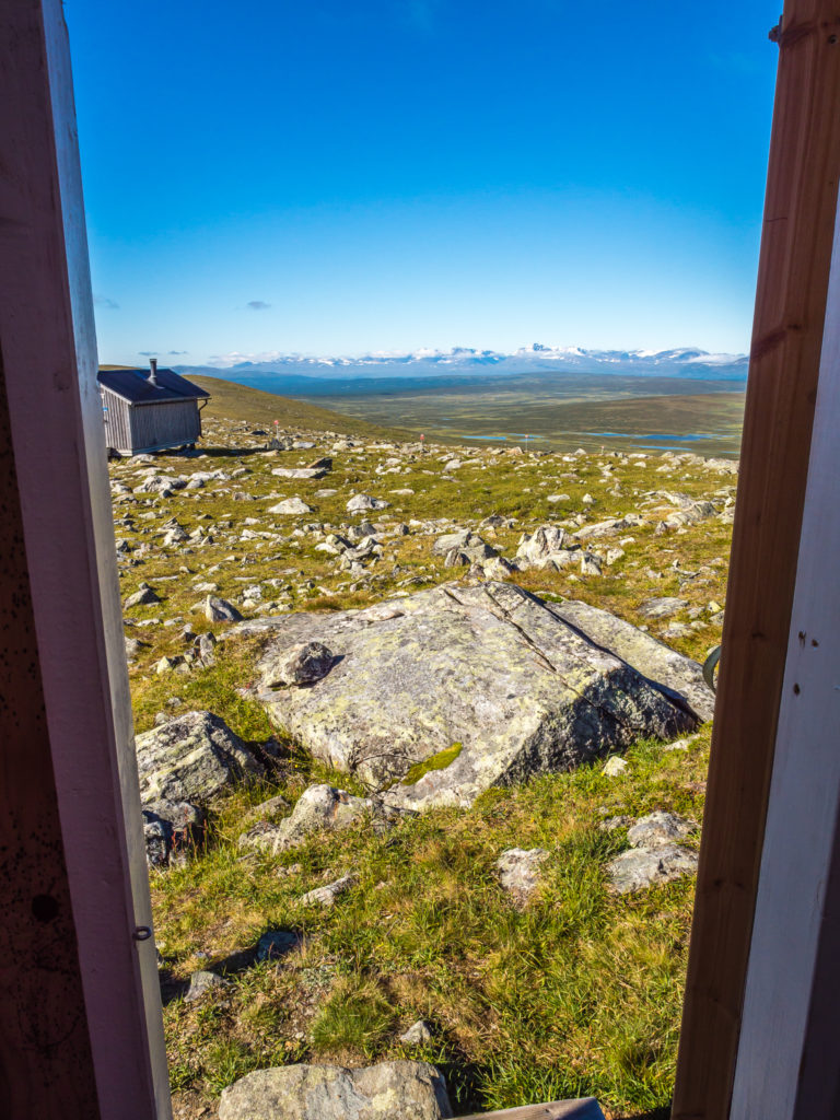
Looking out from the toilet onto the emergency mountain shelter & beyond… The toilets always seem to be located in the most incredibly scenic spots!
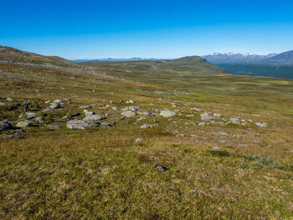
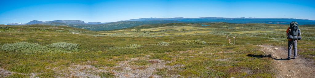
Even more so than on Days 1 and 2, we found the scenery to be very much like that of the Lake District, one of our favourite areas to go walking back home in the UK, but as said previously, on a much bigger and far grander scale. Walking through the wild, wide green expanses, passing several giant glistening tarns, and traversing the huge rolling fells, many already much taller than Scafell Pike, England’s highest peak at 978 metres, made us wonder why such few people neglect to venture this far south and hike the entire Kungsleden route. Greatly impressed with the changing landscapes we had seen in such a short space of time since setting off from Hemavan, we were all the more eager and excited for what was to come further along the trail in the north.
We were already impressed with the vast changing landscape and it was only Day 4!
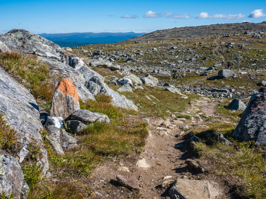
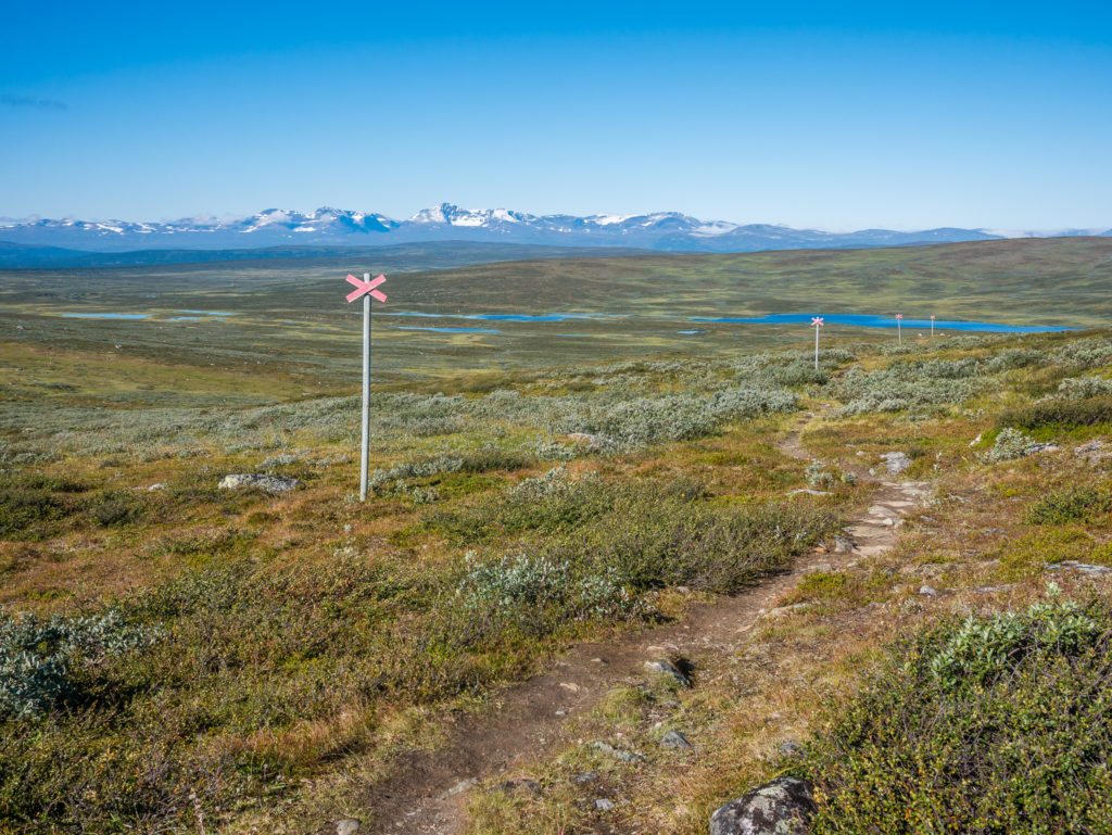
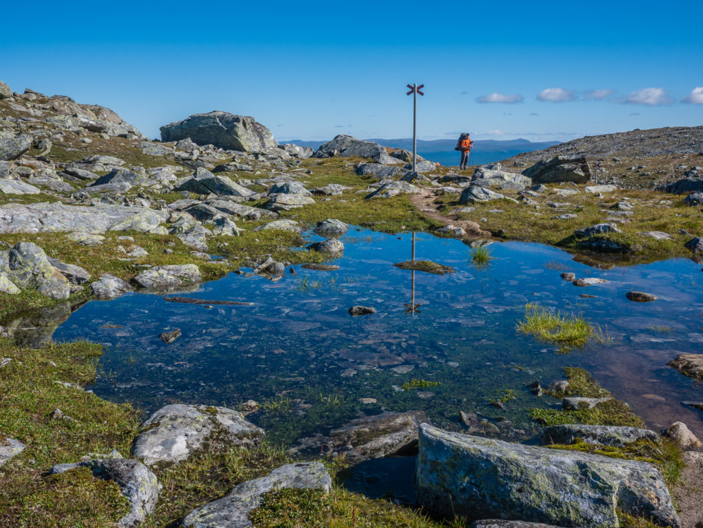
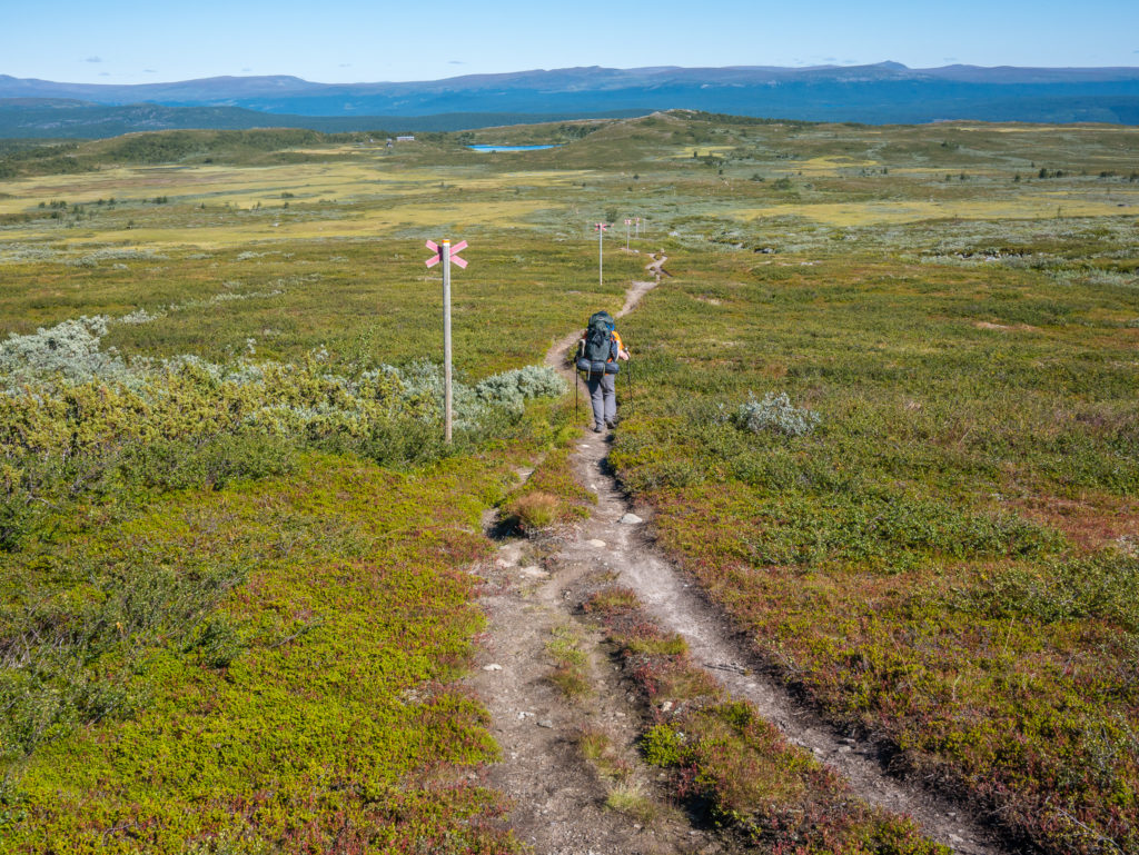
Stones with orange paint flashes signal the way.
The trail winds its way through the boulder field.
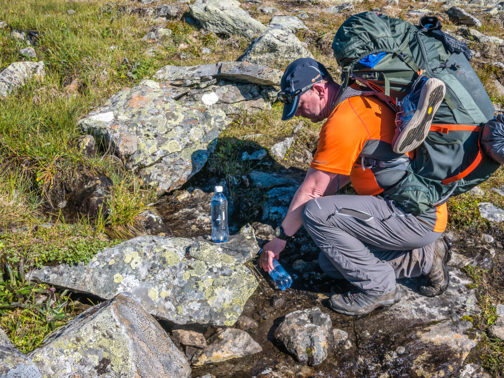
We topped up our water supplies along the way from running streams or fresh water springs and drank straight from the source without using our water filter.
Heading past another crystal clear tarn the scenery was reminiscent of the Lake District fells back home.
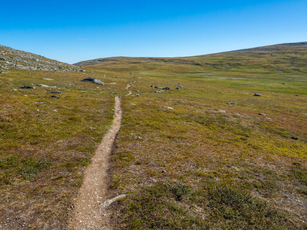
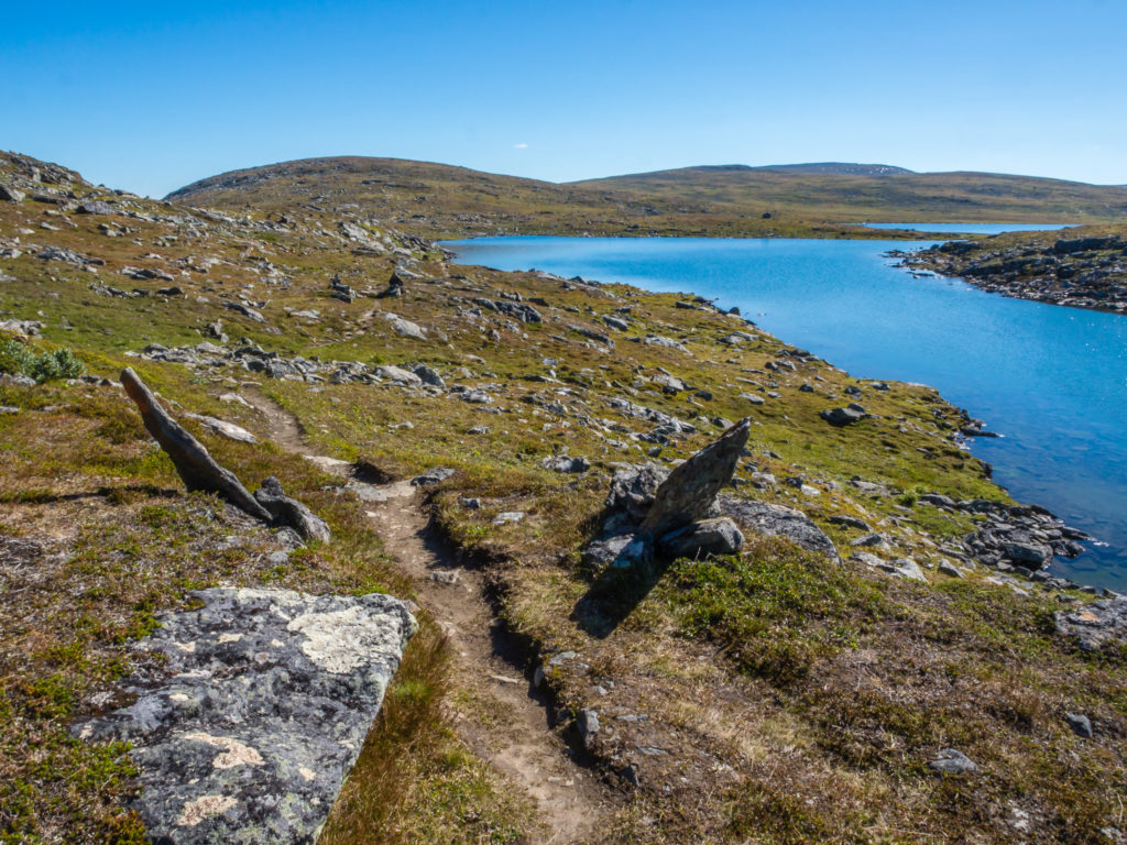
The trail is easy to follow and not too taxing. We always make good time on the longer, flatter sections.
Gorgeous blue skies, perfect for photos and getting the drone up into the air.
Heading to Ammarnäs you’ll pass over low fells and heather-covered moors, through birch forests and wetlands, the horizon lined with impressive fell peaks.
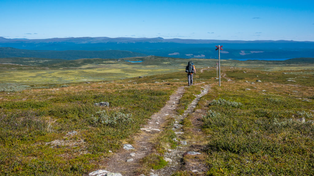
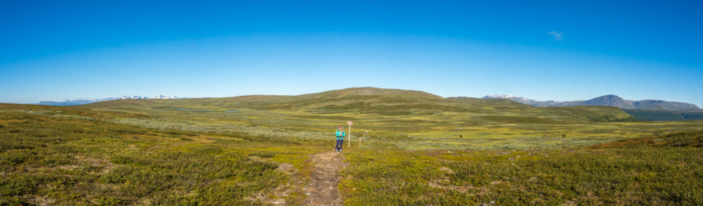
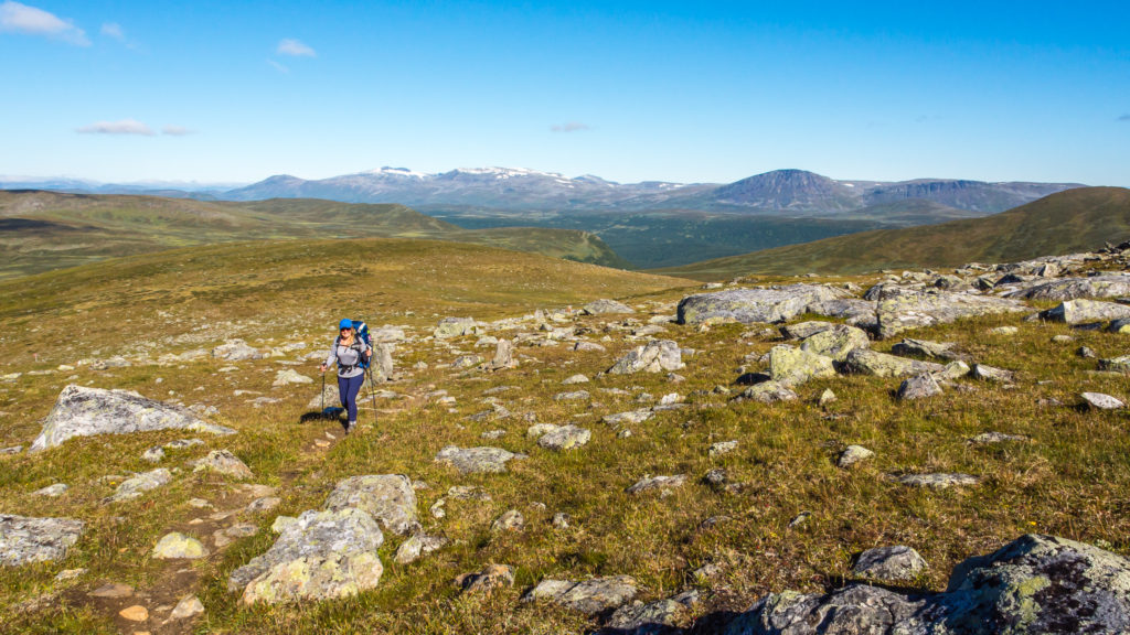
The lone hiker… On a journey through the wilds of Sweden. This is very much how it felt on the southern section of the Kungsleden as we only passed a handful of people each day.
Although the southern half of the trail is less frequented with walkers thru-hiking the Kungsleden in its entirety, we did pass several other people throughout the day heading in the opposite direction, including a couple hiking with a baby who were donning a special carrier backpack. This is because the section from Ammarnäs to Hemavan, with its vast landscapes but modest height gains and losses, makes an excellent week-long hiking trip. Convenient for local Swedes, it also seemed a popular section for Germans taking a week’s vacation.
The landscape is vast…
The trail is long…
The Aigert STF Mountain Hut can just be seen beyond the tarn in the distance on the left.
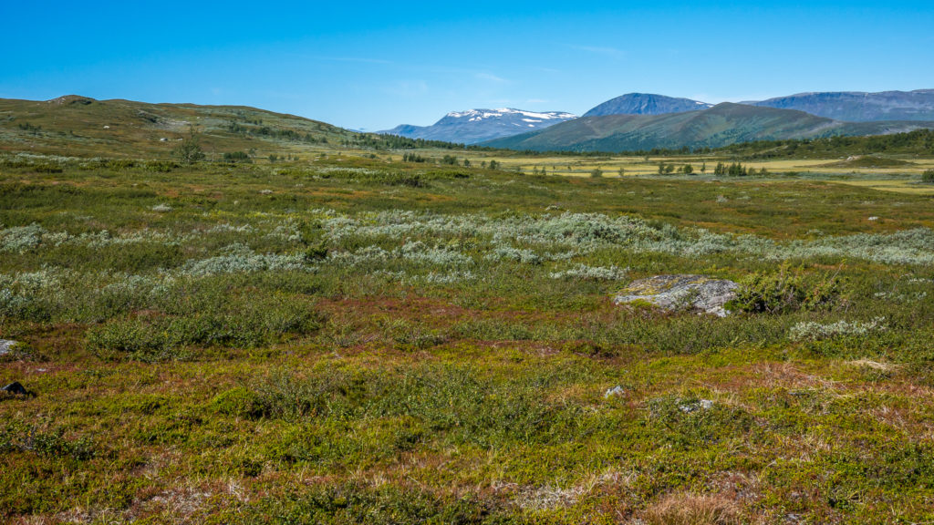
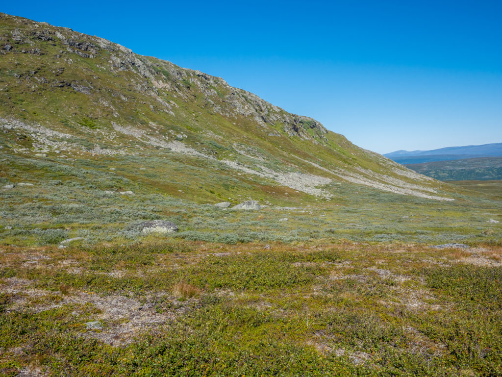
Plant life is remarkably vigorous and beautiful on the lower fells. Autumnal colour is beginning to make an appearance.
It was a beautiful day for walking! Although the tarns looked very inviting, we resisted the urge to take a dip as we knew the water would be icy cold!
Hemavan to Ammarnäs is 48 miles (78km) and typically takes 4 days on foot. It is considered the easiest part of the Kungseledn trail as the only steep climb is the 8km section between Ammarnäs and the Aigert STF Mountain Hut. However, as we were travelling northbound, it wasn’t a climb for us at all, more of a steep descent, which in all honesty is not our hiking preference. It’s the age-old conundrum of ascent vs. descent, but we typically find that going downhill carrying a heavy pack can be particularly hard-wearing on the knees. But in this instance the downhill momentum helped us pick up the pace and cover more ground, which we were pleased about as we were now on a mission to reach Ammarnäs before the supermarket closed!
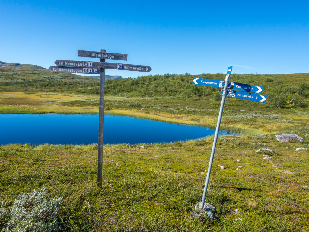
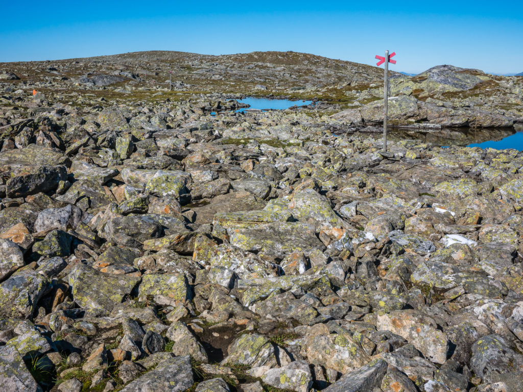
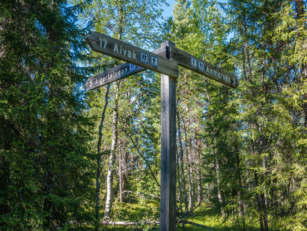
Double signage, just in case we weren’t quite sure how far to Ammarnäs!

The Aigert STF Mountain Hut. As it was such a nice day we didn’t venture inside. Instead, we sat on a bench, took off our boots and enjoyed cold drinks whilst enjoying the view of the surrounding peaks.
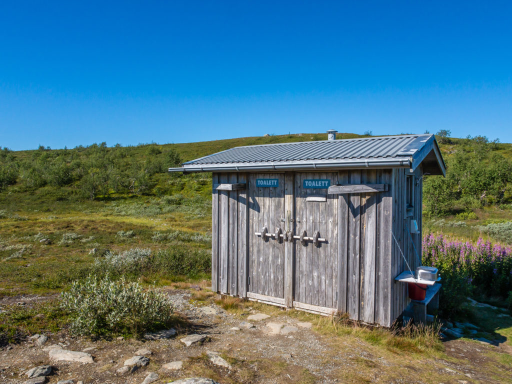
The toilet block complete with wash bowl and soap dispenser! How every civilised for the wilderness!
Looking back to the Aigert Mountain Hut after setting off on the last 8km to Ammarnäs.

Beautiful mountain scenery, clear skies and striking colours certainly made this a day to remember.
The trail winds its way along the mountainside towards Ammarnäs.

The heather-covered moors give way to dense birch forest.
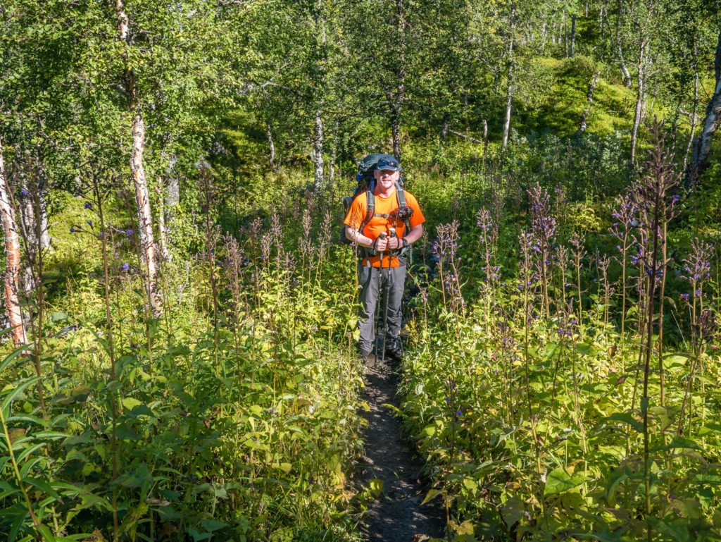
The trail becomes a woodland walk as we pass through the lush and dense vegetation of the birch forest.
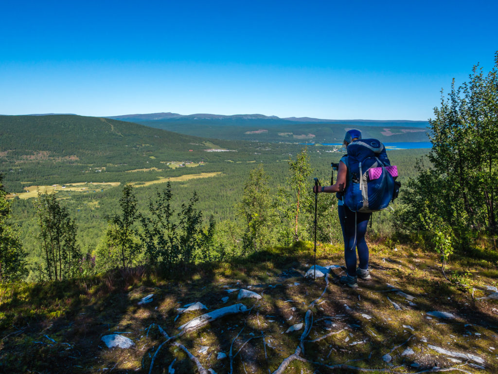
Coming out of the trees into a clearing and looking down onto Ammarnäs. So near, yet so far…
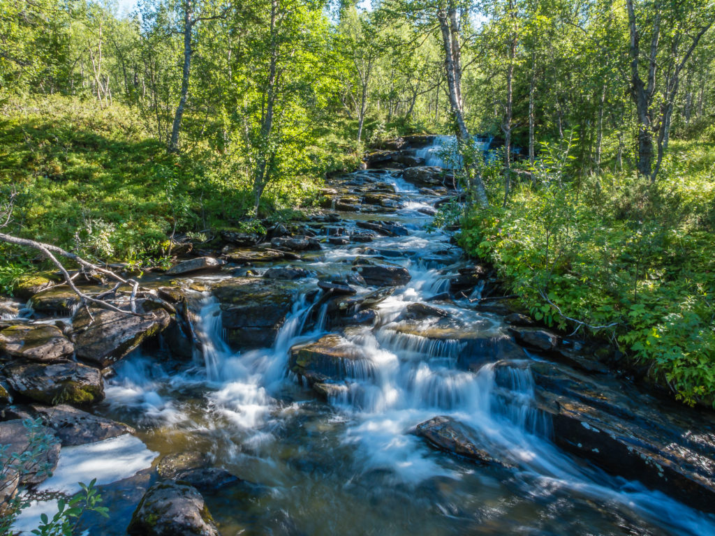
Stopping for a long exposure shot of the mini falls.
Just 3 kilomteres to go to reach our first town on the trail and an opportunity to resupply with some fresh food!
I spy houses and civilisation!
Ammarnäs is a tiny mountain village with a population of around 280. Set in a wide river valley at the foot of the Ammarfjället mountains and by the side of the Gautsträsk Lake, it is the first settlement that you will reach on the Kungsleden after leaving Hemavan. One third of the villagers here are reindeer herders, the local Sami people having migrated with their animals to the surrounding fells for hundreds of years. As we walked into Ammarnäs along the main road, a guy who was busy pruning his hedge looked up and greeted us with a friendly “Welcome to Ammarnäs!”. If the locals bother to speak to you, it always bodes well.
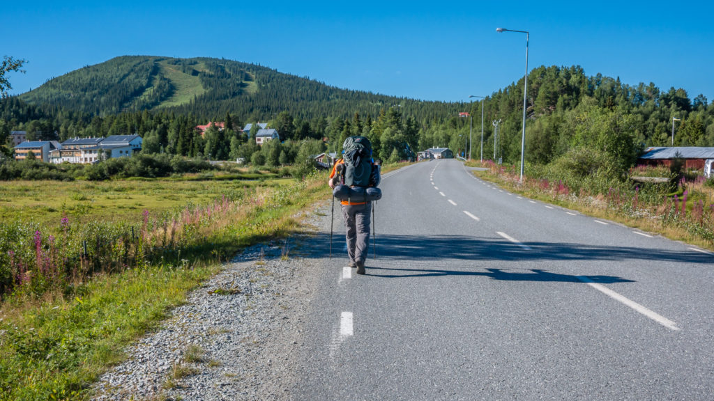
Heading into Ammarnäs along the main road.
Although we were aiming to reach Ammarnäs, it was not the final stop of our day. We intended on hiking further, camping just north of the village to make for a less demanding hike the following day. So we took our main break when we reached the village green, which is conveniently located opposite the supermarket, and hiked on a further 7 km after we had refuelled with some fresh goodies from the shop. It’s not always a good idea to go food shopping when you’re hungry and tired and could literally eat your own hiking partner! We came away with far more things than we really needed, and basically just gorged on as much as we could as we didn’t know when we’d have access to a supermarket again. But it was wonderful all the same!
After just 4 days on the trail, we had already been craving fresh fruit and vegetables, so tomatoes, bananas, oranges and yogurts (that turned out to be rice puddings) were the first things we put in the shopping basket, along with potato salad, bread and chocolate bars – all to be eaten in great haste as we enjoyed a picnic on the village green in the sunshine. We had first called in at the Tourist Information office that doubles up as a restaurant as we had been planning on having a proper meal so that we didn’t have to cook that evening, but after seeing the menu and what we considered were extortionate prices for pasta and reindeer meat, we decided to improvise and save money. The dishes on offer did sound really nice and the chef said that everything was cooked fresh, which was really tempting – we just didn’t like the price tag of a plate of food costing us around 200 SEK each. We are budget hikers after all! So a potato salad picnic would have to suffice! The total of our goodies (including cold drinks and ice-creams) and stocking up with 2 further day’s worth of food rations, plus a postcard and stamp to send home, came to approximately 300 SEK. So we were quids in and pleased with our decision not to go for a meal at the restaurant after all!
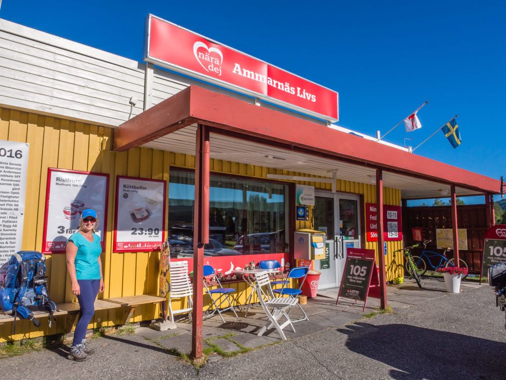
The supermarket was well-stocked with everything you could need, including some emergency supplies for hikers such as camping gas, hiking socks, sun cream etc. Opening times were limited to 10am-6pm Monday to Friday, 10am-2pm Saturday and 3pm-6pm Sunday. You can use a debit/ credit card with chip & PIN to pay for your goods.
Instead of sitting at the cooking area, we ended up lounging out in the sun and having a picnic on the grass.
From the green in Ammarnäs it was one of the first times we’d managed to get a phone signal in a while that was good enough to upload some photos to social media. So we updated everyone back home with our progress and checked the weather forecast for the next few days. For once it looked quite promising!
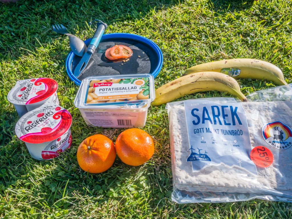
We couldn’t wait to eat some fresh fruit after living off hiker rations for the last few days.
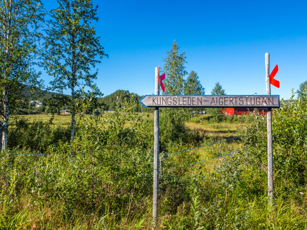
We had planned on taking a short cut out of Ammarnäs, along a road by the river Vindelälven, as advised by the local Swedish. We were told that most people now take this route as being the official Kungsleden, as the original trail marked on the map we were using takes you well out of the way to then come back on yourself. We couldn’t argue with what the locals say, especially if it was going to save us a few miles! It wasn’t quite as easy as we thought it would be however, as we struggled to find the track that led off by the river. On the map, the route looks like it runs behind a small group of houses. However we couldn’t find it at all, so we knocked on the door of a house next to where we thought the trail should go. Thankfully, a fantastic friendly Swedish guy who could speak perfect English, answered the door and explained to us that he wasn’t very happy with our map. He said that it was outdated (even though we had bought the latest edition only published this summer) and that two other couples this week had gone past and asked him the very same question about where the trail was. He informed us that we could get an updated map in Ammarnäs and that a local guide would explain the current trails. Along with giving us a brief historical overview of the area, and telling us some stories about his grandfather fishing with gunpowder back in the day, he also explained that there has been a lot of recent development of the hiking trails in this particular area, but that the maps have not yet caught up. As foreign visitors, we like to have a map before we travel to support us with our initial planning etc, but it’s worth knowing that you can purchase an up-to-date local map in Ammarnäs, if you ever want to do further exploration of the area.
His final recommendation was that we should make time to visit the reindeer herding area at Beirgenis on our way to Adolfström, which is signposted along with the Kungsleden trail. Although it sounded interesting, we just didn’t have any spare time to do this, but if you have a more flexible itinerary, you could easily spend a zero hiking day exploring points of interest around this area. We thanked the guy for his time and his interesting tips and information, and said that we’d send him a postcard from where we live in the UK to tell him whether we were successful in completing the trail.
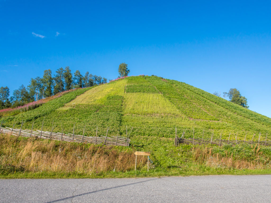
Potatisbacken – The Potato Hill. The most famous thing in town, a sheer hill rising 200 feet and planted on its south side with potatoes for maximum sunshine during the short growing season.
Ammarnäs has several points of interest and cultural attractions, the most famous of which is the Potatisbacken or Potato Hill. Potato Hill was cultivated for the first time in the mid-1800s by one of the village’s first settlers, Nils Johansson, who discovered that potatoes do not freeze as easily on the slopes of the moraine hill. The reason being the hill’s south-facing slope and its ability to store heat provides a favourable climate and lengthens the growing season. It remains in full use to this day, and has become a well-known point of interest throughout the country. A tractor is used to plough the hill during spring, but during the rest of the growing season work is done by hand. There is a path leading up the back of the hill, on the top of which there is a barbecue site – and a fabulous observation point. On a clear day you will have a magnificent view of the meadows of the Ammarnäs delta and see into the southern part of Europe’s largest nature reserve, the Vindelfjäll.
On your way to the Potato Hill, you will also see that Ammarnäs has a very distinctive looking church designed by architect Torben Grut, who also designed the Olympic Stadium in Stockholm. The first Sami chapel of Ammarnäs was inaugurated in 1858, but was replaced in 1912 by the present church, which is in the national romantic style and consists of a nave with a vestry to the east and a small tower above the west gable. Located close to the church are a dozen or so wooden stilted huts which form the Sámi Church Town. These huts, perched on horizontal logs to help keep them dry, were used overnight by the Sámis when they came to worship at the church. Today, the church town is still in use as Sami families continue to gather here three times a year to celebrate important festivals, and the huts are now considered some of the best preserved Church buildings in Västerbotten.
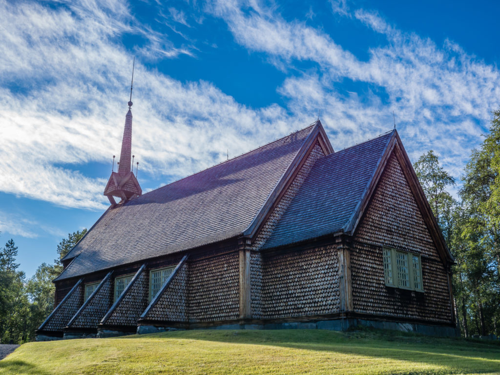
Built between 1910 and 1912, the present church in Ammarnäs was designed by architect Torben Grut, who also designed the Olympic Stadium in Stockholm.
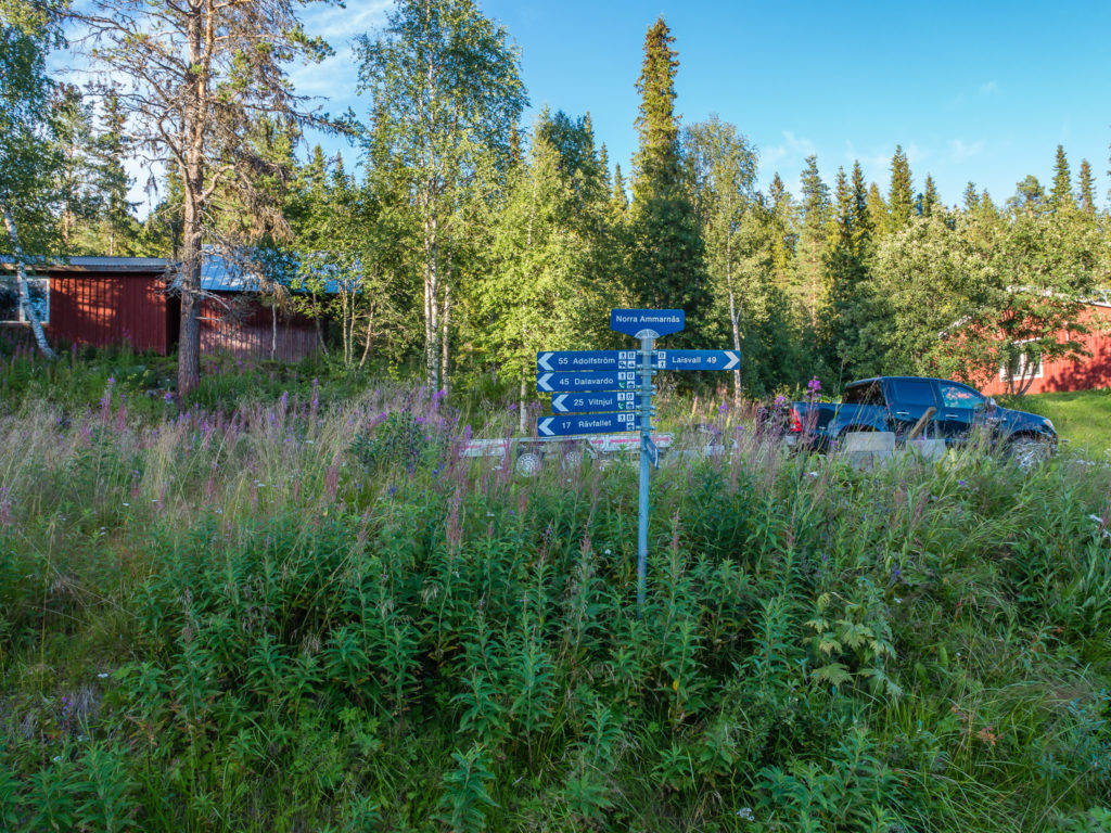
North Ammarnäs. We decided to take the shorter Kungsleden route on the advice of the locals.
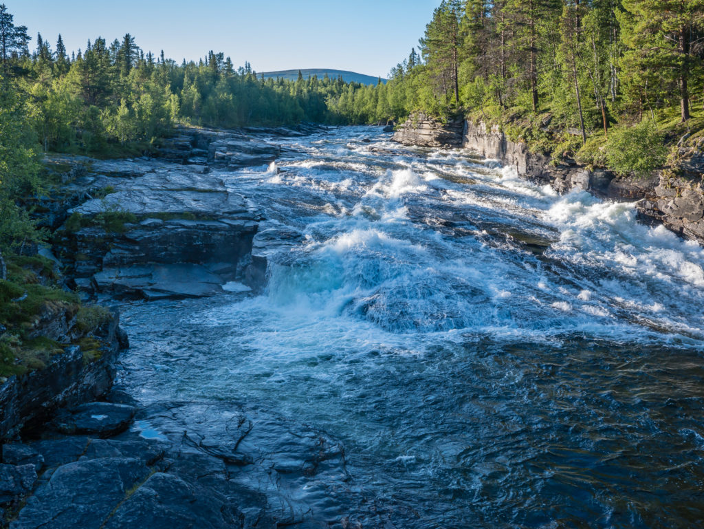
After leaving Ammarnäs we followed the road adjacent to the Vindelälven – Vindel River. Its rapids attract anglers and fly fishermen from around the world.
We left Ammarnäs around 6:30pm and set off for our final segment of the day. To make for much easier walking, we decided to take the road on the right-hand side of the river thereby avoiding the trail along the left-hand side that was littered with obstructions after a recent heavy storm. Having to navigate around several obstacles, such as fallen trees and upturned roots, would have been very time consuming as the trail had not yet been cleared, so we went for what we considered was the easier option so late in the day. We picked up the pace for the last 7 km of the day and pushed on looking for a wild camp spot beside the river.
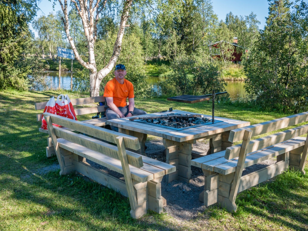
Fortunately we came across a clearing next to river with a picnic bench and fire pit, with a sheltered spot by some bushes a bit further up offering us some privacy from the road, perfect for pitching our tent. We guessed it was usually a camp spot for fishermen, but as it was vacant we made use of the table and set up camp. We didn’t light a fire but there were logs available should you wish to do so. There was also a small wooden shelter a little further along the road (about 200m) that had benches and a fire pit in the middle, that we could have made use of had it been a particularly cold and wet evening. The Swedes have definitely got it sussed with their wild camping spots! What we also liked was that there was a recycling station on site, which meant the following morning we’d be able to dispose of all of our trash saving us a few extra grams of baggage!
What a gorgeous evening for a stroll along the river!
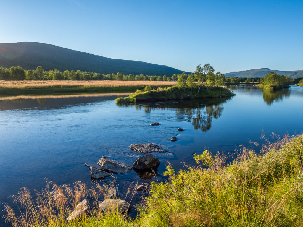
There are several islands along the Vindelälven or Vindel River which lends its name to the Vindelfjällens Nature Reserve, one of the largest protected areas in Europe.
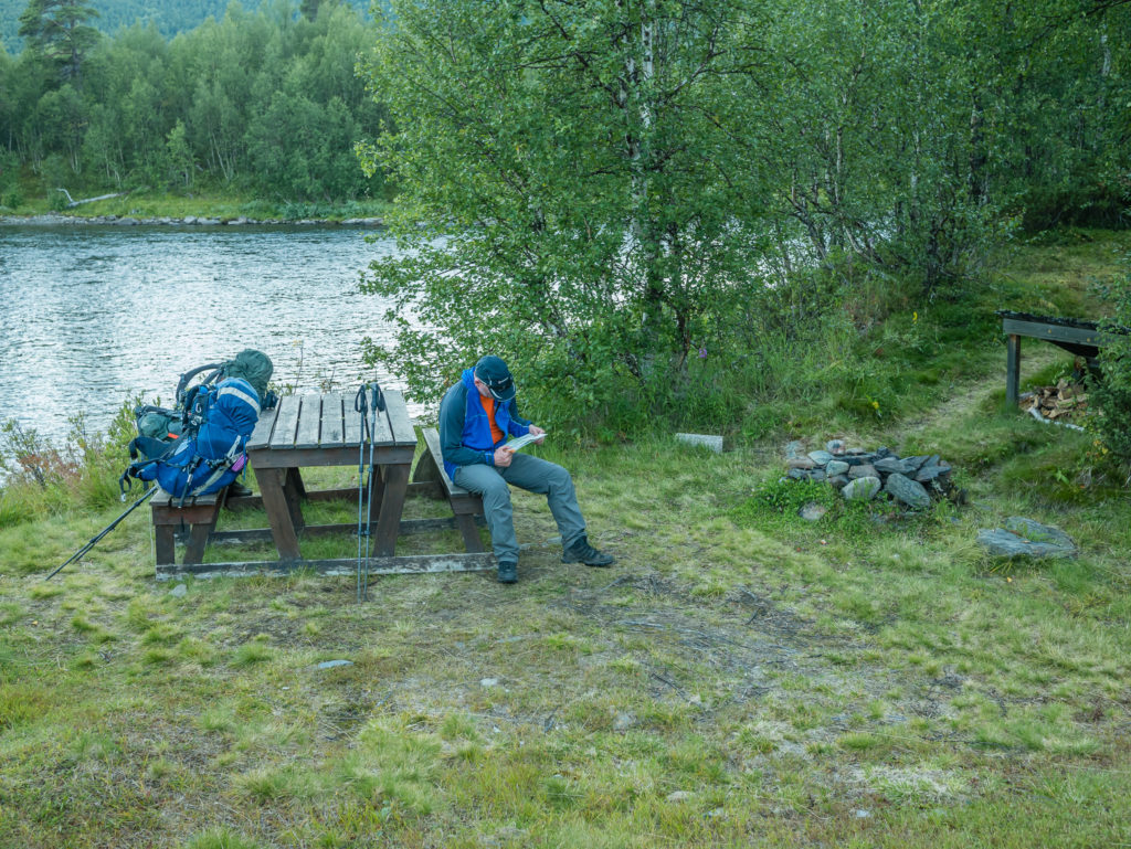
A perfect spot for camping by the river. We pitched the tent further up so we could be sheltered from the road by the bushes.
Although the setting looked beautiful and serene, as soon as the sun dipped behind the fells on the other side of the river we were plagued by bugs. So I opted for a quick strip wash inside the tent, whereas Wayne braved it outside but was attacked in seconds! Thankfully, they weren’t mosquitoes, but more like midges – small, flying, biting insects that are equally as annoying!
Apart from covering ourselves up from head to toe (Wayne now has a preferred jacket with what he calls ‘The Bug Hood’), escaping to the tent was our only option of avoiding them. At least we didn’t have to bother with cooking any dinner or washing up as we were still full from our earlier feast in Ammarnäs! But the bugs were not going to put a dampener on our spirits – as what a brilliant day to be on the trail!

2 Comments
Yes, a totally awesome day to be on trail. Magnificent views, especially from the loo. I fully understand your excitement, not just for the view but the convenience too.
Another fabulous read. Your images are stunning.
Thanks Helen! Sorry to not reply sooner. We’ve been busy writing and working on a Kungsleden guide book which has now been submitted to the publisher for editing. (Exciting!) So now I’ll have time for the blog and can finish off writing about this magnificent trek! 🙂