
Wet Weather Gear Is A Must!
In northern Sweden the summer hiking season is typically late June until late September, when the STF mountain huts along the Kungsleden trail are open and manned. Each part of summer has its own characteristics, but as the Arctic is so unpredictable, the trail can always be susceptible to rain and severe mountain weather, whichever month you choose. Some years have encountered better conditions than others (i.e. sunnier and warmer climes) but be prepared for the fact that the most popular months on the Kungsleden are also some of the wettest.
For each of the months: July, August and September, it is expected to rain for at least half the amount of days. This can range from persistent light showers, to brief downpours of heavy rain between valleys. Our best piece of advice therefore, regardless of the forecast, is to be prepared for rain at any time. This includes organising your gear so that your rain jacket and waterproof trousers are readily available either in your front pouch or at the top of your pack. Your waterproof pack cover should also be easily accessible.
As we continued north on our own Kungsleden journey, we felt like we were definitely experiencing a ‘wet summer’, so were grateful of our tried and tested waterproof gear! Good rain jackets will cost you money, but on this trail, it will be money well spent. You might find a cheaper jacket that will do the job, but if it decides to rain persistently over several hours, (or days!), you may regret choosing cost over performance. Thankfully, the dark, brooding rain clouds that featured heavily on Day 13 finally dissipated leaving us optimistic for our forthcoming side trip to Skierfe, something we had been looking forward to for days… Find out how we fared in our latest trip report!
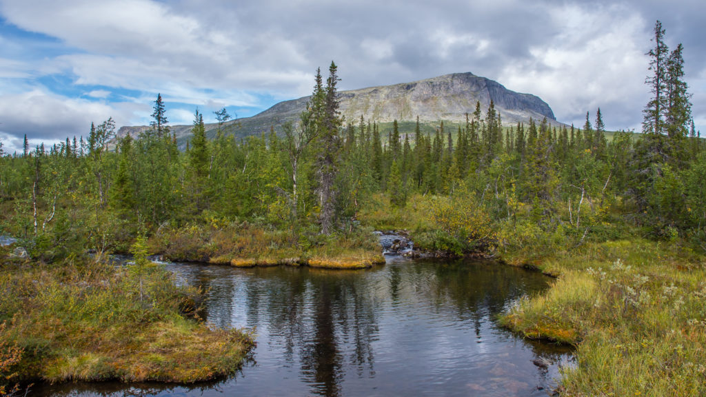
We couldn’t see further than a few feet when we first ventured out of the tent. But as the weather improved throughout the day, we were treated to wonderful views of the Bårddegiehtje mountains.
Day 13 – Wild Camp (Pårte +4km) to Skierfe Detour (1km from Kungsleden trail) (14.8 miles/ 23.8 km, 12 hours, 41 mins) – Thursday 25th August, 2016 – ‘From White-Out To Wow!’
Well we knew the run of good weather we had enjoyed for the past few days on the trail wouldn’t last forever! It had rained continuously through the night, and seemed ever more persistent when we got up, with no sign of abating. But with big plans for today, there was no time for hanging around and dawdling in the hope they’d be a break in the cloud. We just had to get on with things, pack the tent away in a wet state, and hope that better weather would be forthcoming later in the day to give us a chance of drying it out. With low cloud in the valley and a virtual white-out when we set off however, we weren’t too optimistic.
We had decided on having breakfast 5km further along the trail once we reached the Jagge Shelter, as we’d be more than ready for a hot drink and some respite by then. To begin with, it was an uphill climb through thick mountain forest, which was now very muddy again, so our waterproof trousers and boots did their job, but were reaching saturation point before long. Thankfully we made it to the hut within a couple of hours, where a Swedish couple were already making use of the shelter and drying out. Having started in Saltoluokta, they were on a 5 day hike, walking in the opposite direction to us, and now heading for Kvikkjokk. Speaking excellent English, they invited us inside and quickly made space for us to sit down, then proceeded to off-load some of their surplus goods onto us which we were grateful to receive! (We’ve never been known to turn down food!) We chatted about our journey so far, and feeling a little drier and re-energised, we prepared to head off again. However, as the rain was coming down heavily once again, we thought it best to stay put a while longer. It was a good decision. After the final downpour, the skies ahead looked much brighter in our direction of travel and it then seemed to dry up quickly.
Our first view of the day after venturing out of the tent.
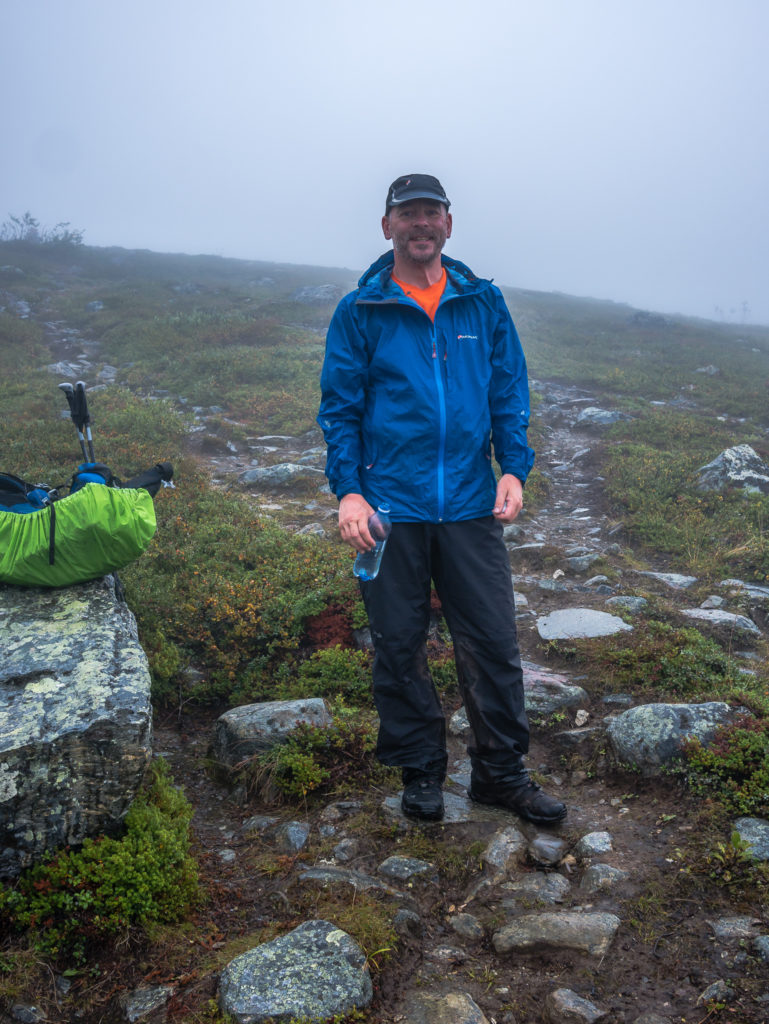
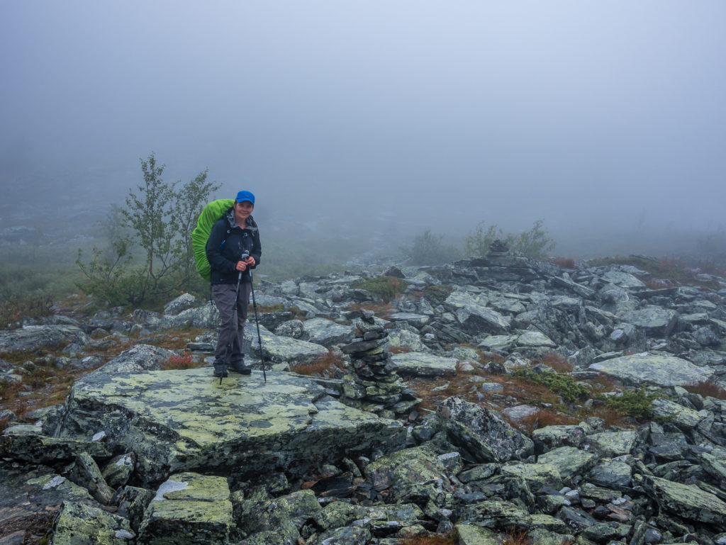
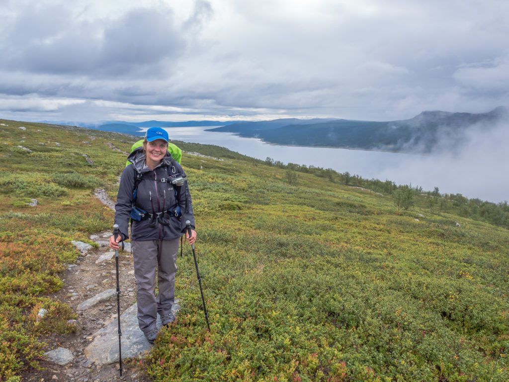
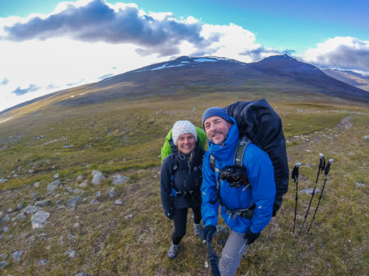
Grinning and bearing the weather. After packing up our wet tent we just had to get on with it and get going!
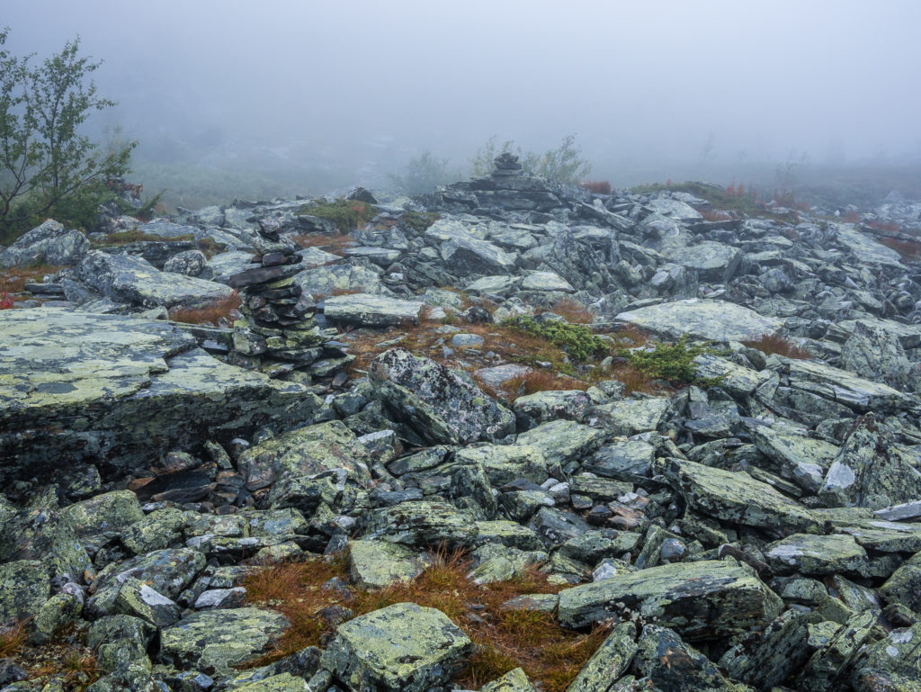
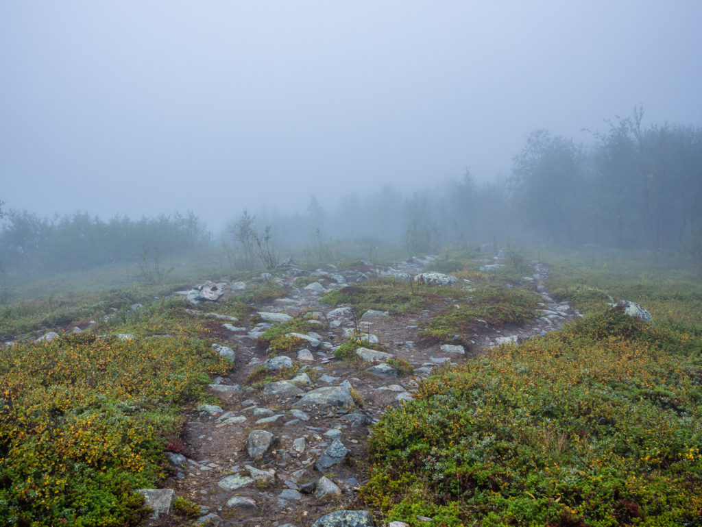
Navigating can be a little tricky in the rain, but cairns signalled the way over this rocky section of trail.
We were hoping the clouds would lift once we reached the next valley.
Crossing the river in a virtual white-out.
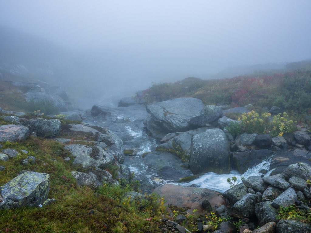
In better weather, we’re sure this would have been a wonderful view overlooking the waterfall.
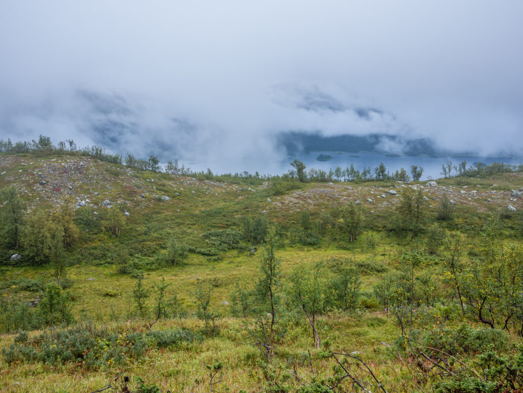
Thankful to be above the tree line where the dank air seemed to be lifting at last.
With a break in the cloud, we enjoyed our first glimpse of today’s trail delights.
Happy that the weather was improving, and that the trail here was well trodden, (less rocky and muddy) and so much kinder to our feet!
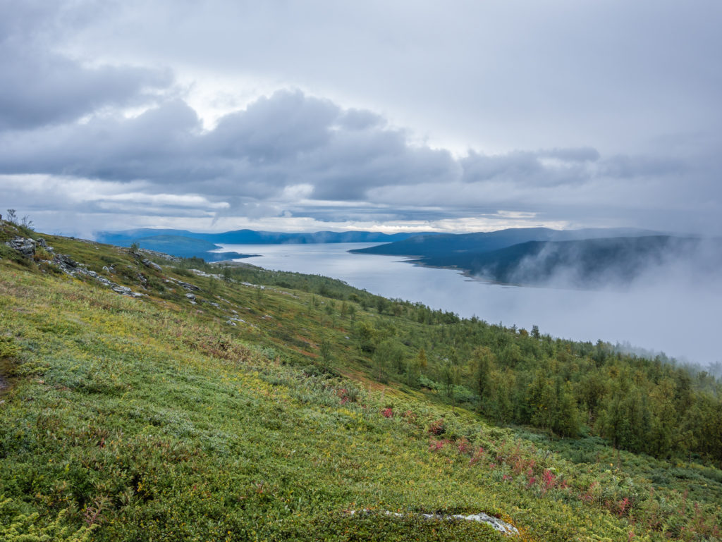
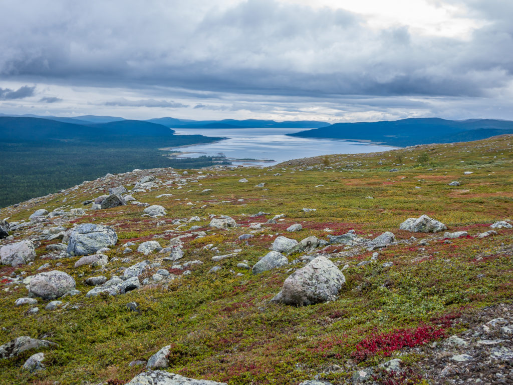
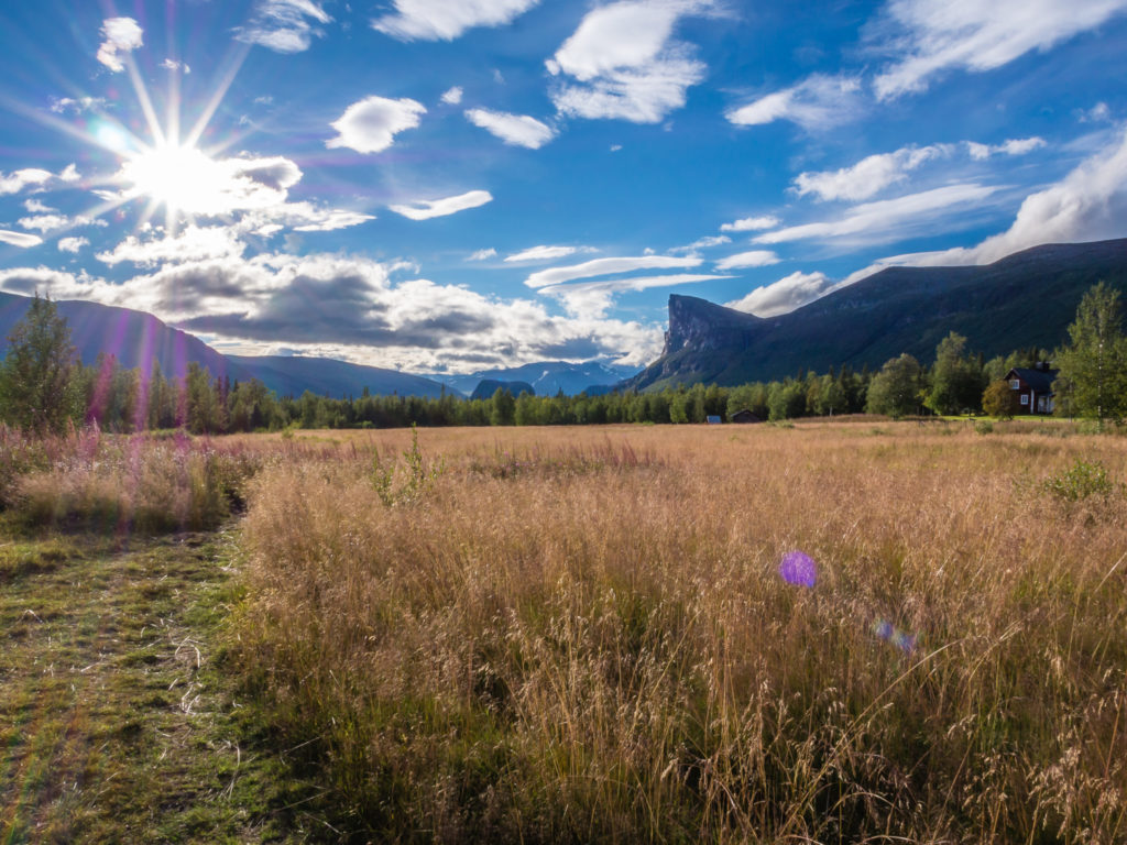
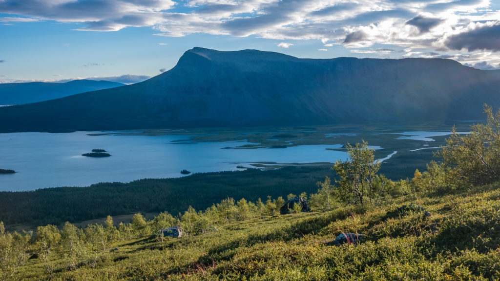
After a miserable start, the last lingering clouds finally cleared, revealing a huge mountain ridge with an icy blue river delta below. It looked stunning, so we found a rock to sit on and admire the view, all the while 8 people, looking like tiny worker ants from afar, then hiked up the valley in periodic waves.
The Bårddegiehtje mountain ridge reveals itself!
The perfect spot to take off our packs and sit and enjoy the view of the impressive peaks lining the valley!
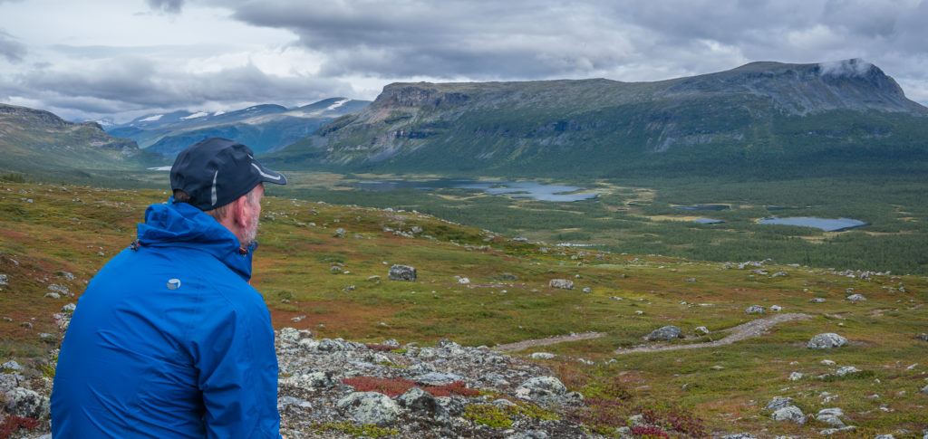
We had almost 360° panoramic views from atop the highest point on the plateau.
Nature at work… A moody morning on the trail.
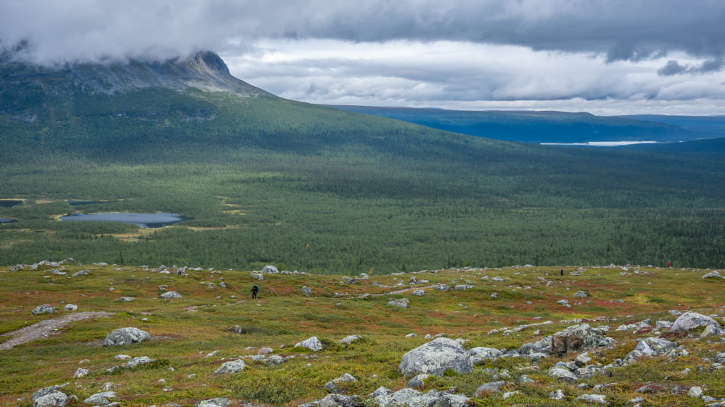
Southbounders hiked up the ridge in waves. It looked like hard work, so going in the opposite direction, we were grateful that we’d be travelling downhill!
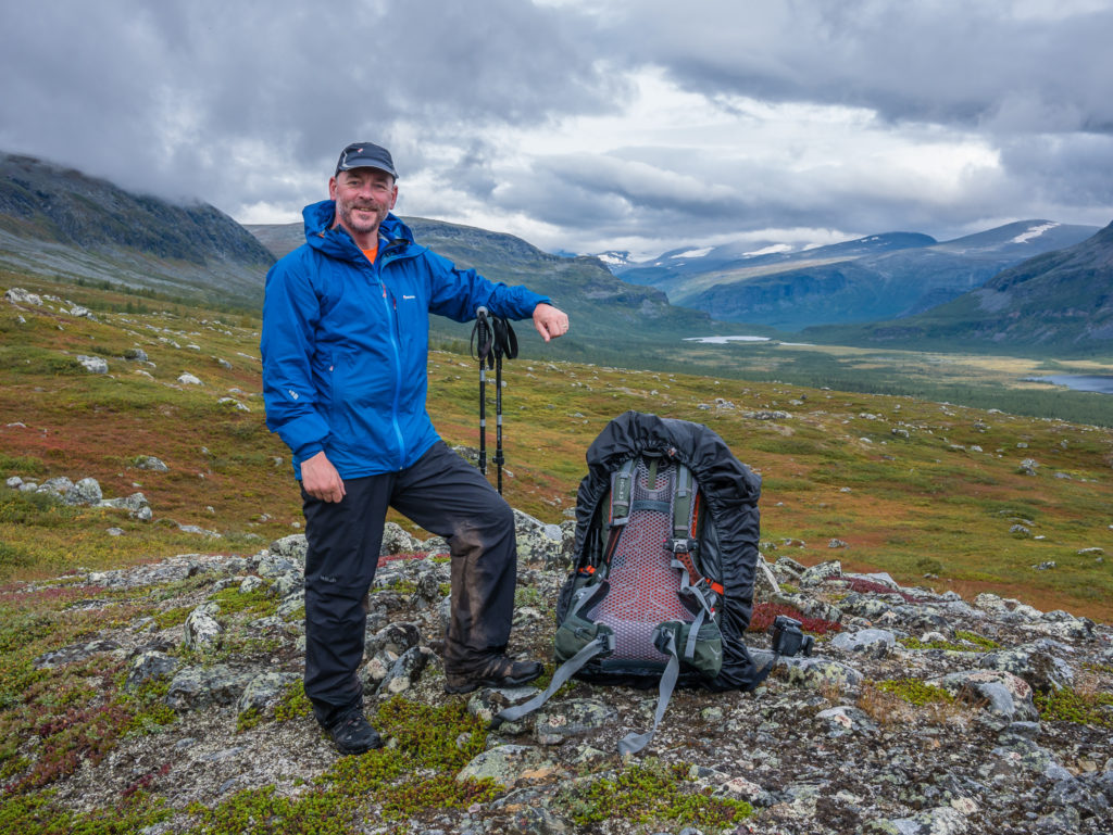
Psyching ourselves up for the next part of the day! The Kungsleden continues along the valley floor, taking you back into the forest, skirting the Bårddegiehtje mountains.
After chatting with passing hikers coming up the ridge who were heading southbound, we set off again at a gentler pace walking downhill, heading for the lakeside where we would take another motor boat, crossing 3km over Lake Laitaure to the settlement of Aktse. There is also the free option to row across this lake, however seeing as Wayne would get the short straw and end up doing that job (again), he said he would rather pay the 200 SEK (£17) per person fee and make use of the motor boat, giving us the additional peace of mind that we’d actually make it all the way across safely. The only downside of taking the motor boat instead of rowing is that it operates on fixed times. On our side of the lake, departure was at 9:15am and 17:15pm. As we arrived at the lakeside around 3pm we had a couple of hours of waiting time, which we spent making a brew and relaxing in the hut located just before the jetty.
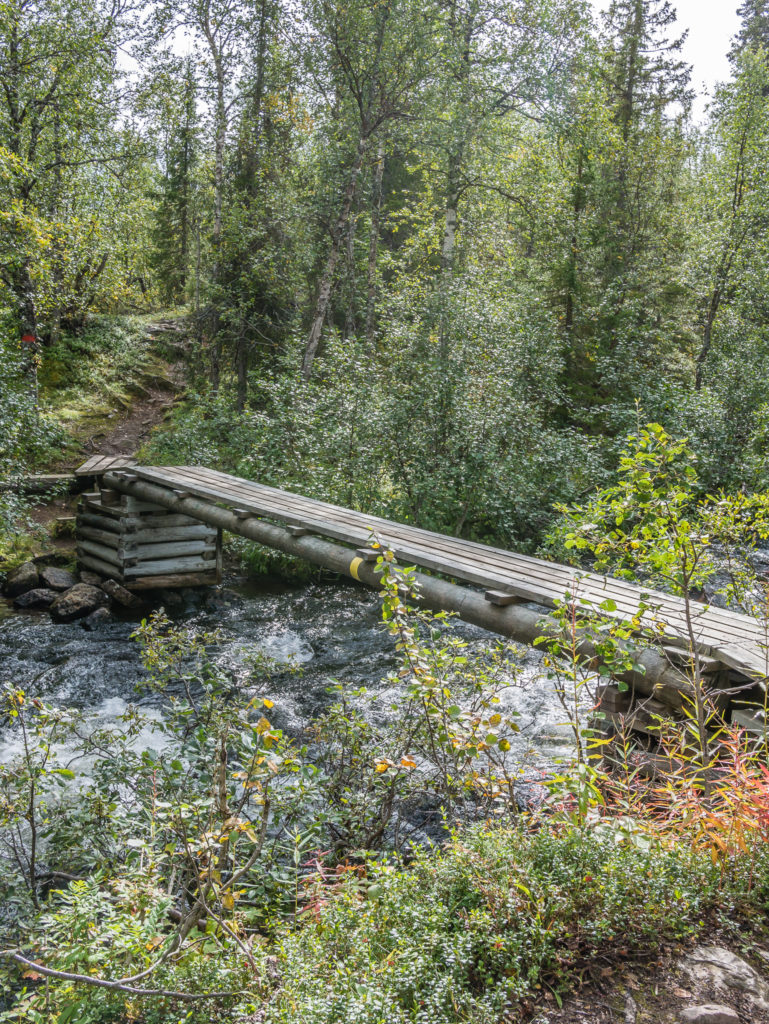
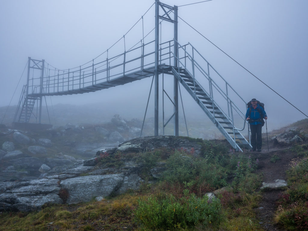
It looks straightforward, but it was a little nerve-wracking walking across this bridge!
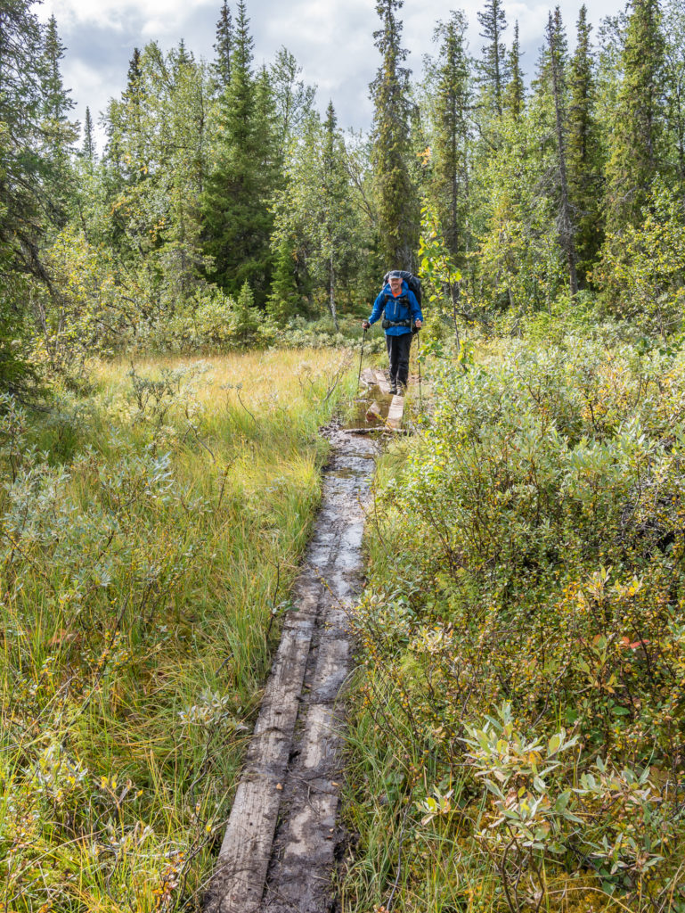
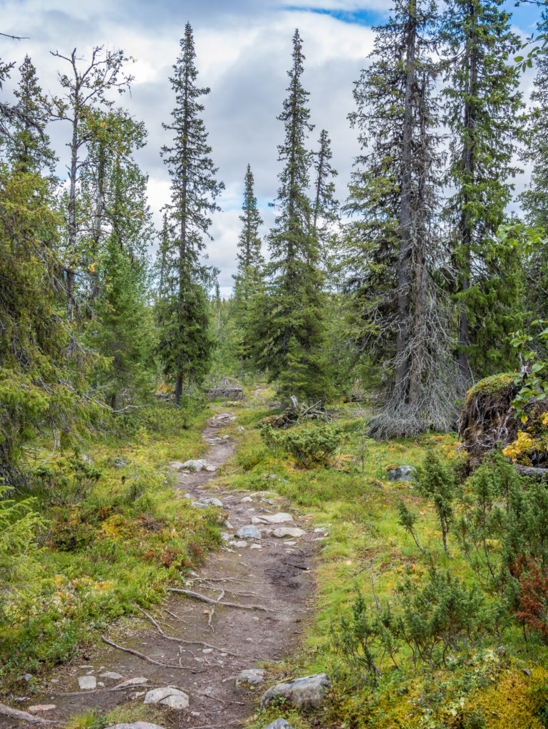
An important feature of the trail to assist you over boggy ground, but in many areas along the Kungsleden the boardwalks are in dire need of maintenance.
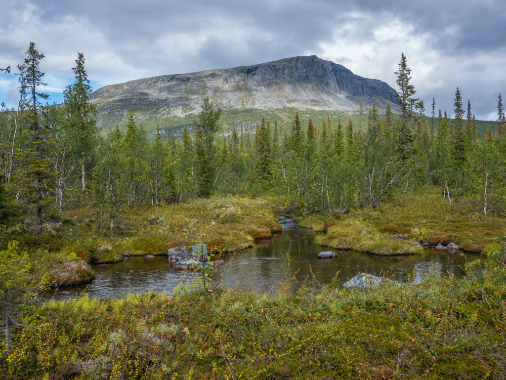
Ever closer… Looking onto the Bårddegiehtje mountains.
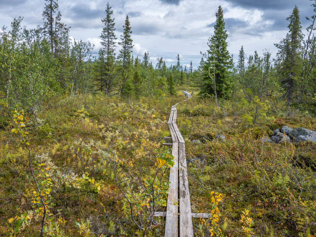
Boardwalks lead the way! They are very useful taking you over uneven ground and through dense vegetation as you can stride out and pick up the pace. (If the boards are in good working order!)
The trail weaves its way through pine forest down to Lake Laitaure. If you arrive late and intend on crossing the lake early the next morning, there are several flat spots close-by suitable for camping.
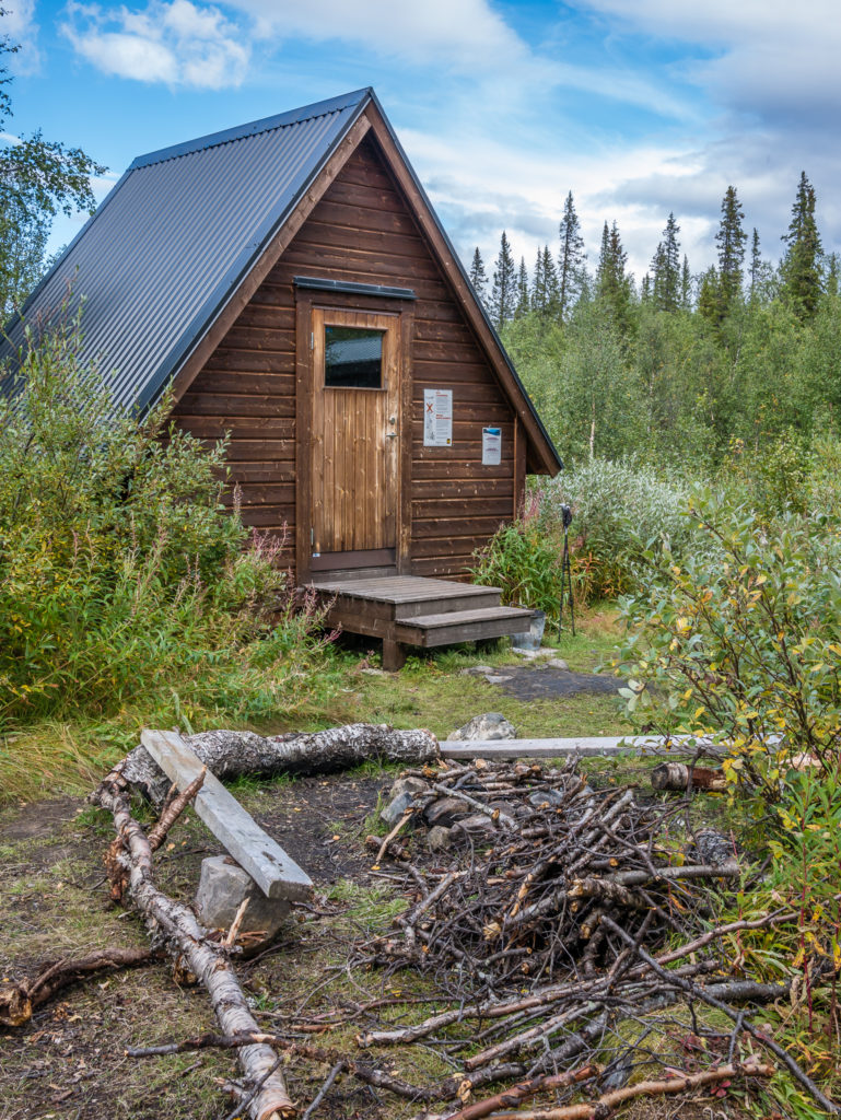
The basic hut located by Lake Laitaure where you can shelter whilst waiting for the motor boat.
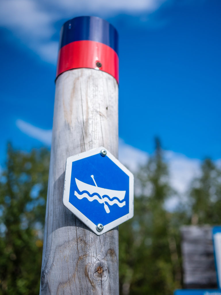
Row boats are also available at Lake Laitaure if you want to cross the lake for free.
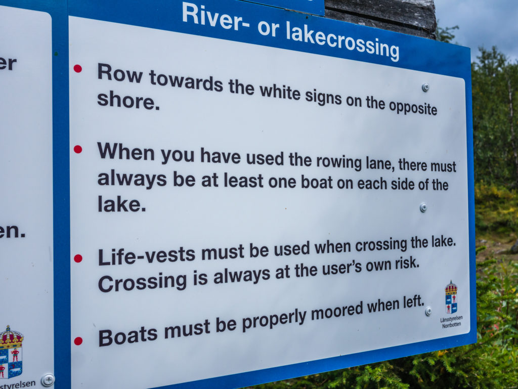
Rules for using the row boats are clearly displayed. There must always be at least one boat left at each side of the lake.
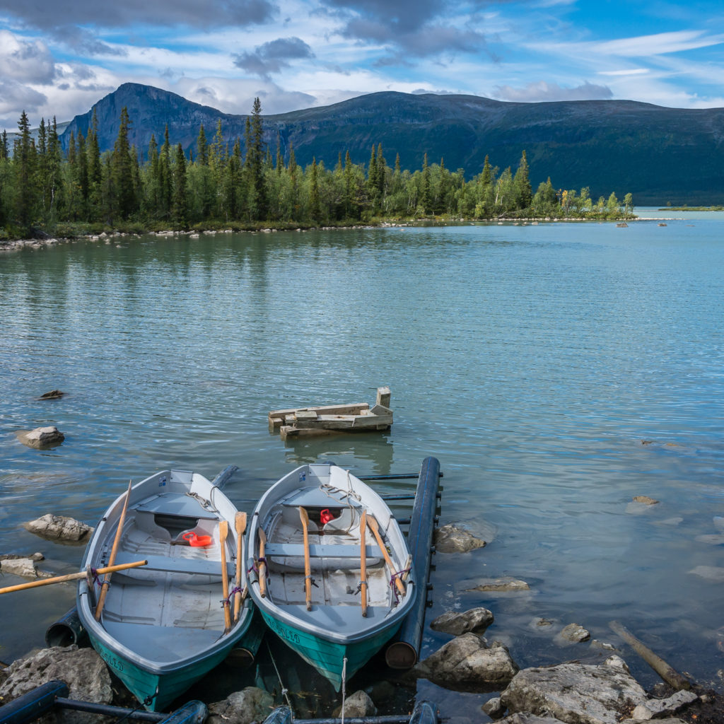
Two row boats on the southern side of the lake ready for use. As Aktse looked a fair distance, we decided that we’d rather pay to cross Lake Laitaure via motorboat!
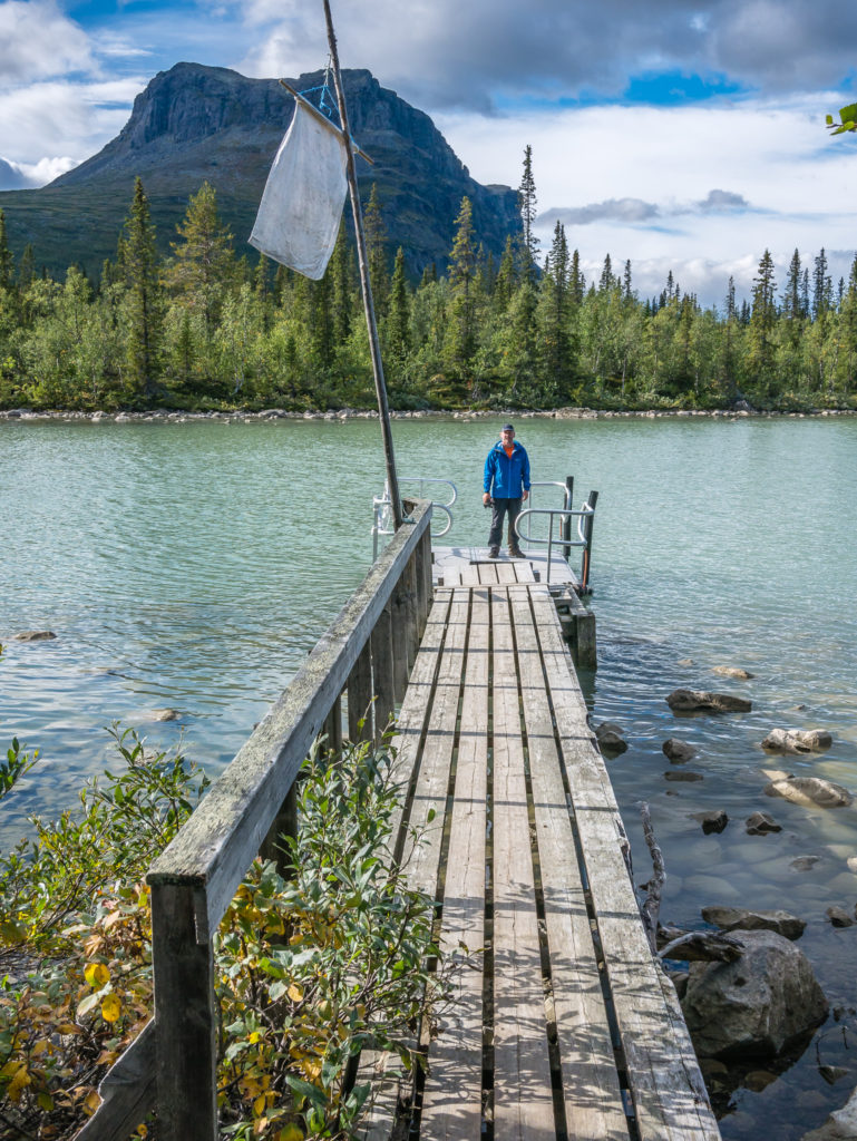
From the southern side of Lake Laitaure, you have to put up the white flag to signal that you want to cross in case there isn’t anyone wishing to travel south from the Aktse side.
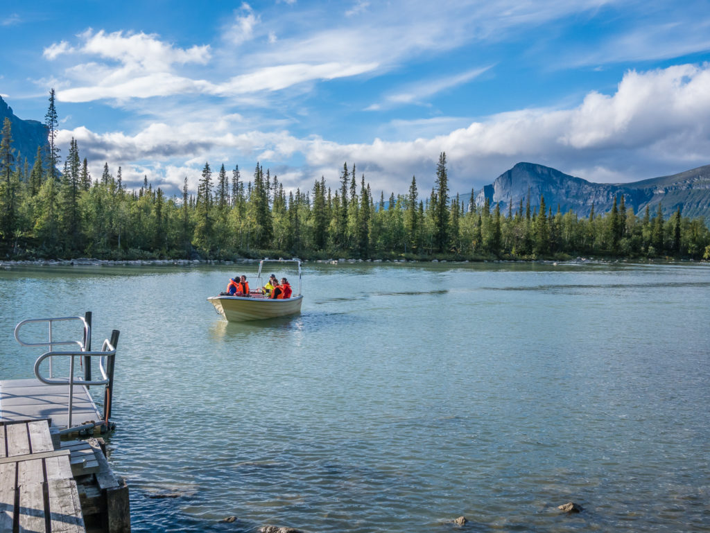
Southbounders taking the early evening motorboat across the lake.
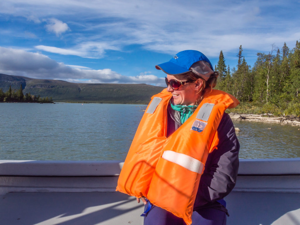
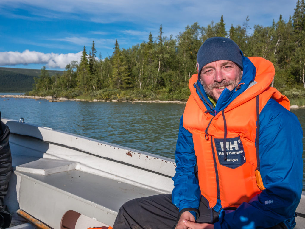
Our turn! Following the rules and putting on life jackets.
The weather had improved but we were still faced with a biting, cold wind as the boat headed back across the lake.
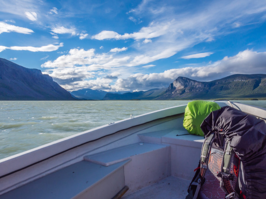
What a view!
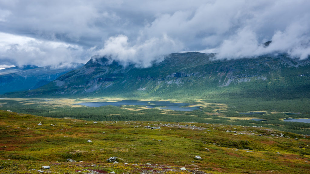
The water was quite choppy the further out we travelled, so Wayne was glad he hadn’t gone with the rowing option! The high peak down the valley is the Skierfe look-out point where we intended heading the following morning to look out over the Rapadalen.
From the jetty it’s a 1km walk to the STF hut at Aktse along wooden planks for most of the way. One of the STF cabins was having renovation work done at the time of our visit so that it will have a large supply shop for the next hiking season. Currently goods are housed in a lockable tin shed, where you can help yourself to what you want and put money in a tin to pay for the goods, rather like an extra-large honesty box! There was a good selection of food stuffs, even some hiking gear for sale such as a buff, head torch, postcards, and beer in a bucket of ice! (Not that there was much chance of it being warm!) We even managed to pick up a packet of wet wipes – for an extortionate price though – a 10 pack was 45 SEK (£4) so they are being well and truly rationed! The Aktse hut also has a novel ‘outdoor’ shower. It uses cold water piped downhill from a natural spring, but there is a makeshift wooden cubicle for some privacy and the luxury of a proper shower head! We just reccied the facilities, then decided that we’d continue up the ridge to the top of the valley to the Skierfe/Kungsleden junction.
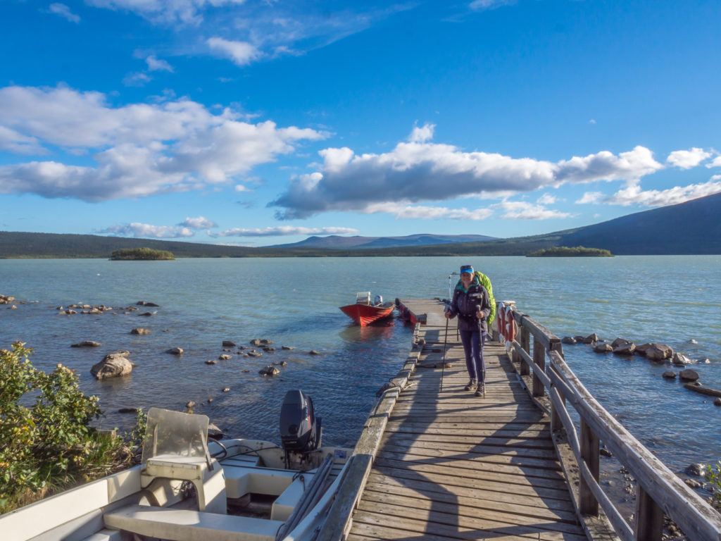
Arriving on the northern side of Lake Laitaure… But Aktse was not our intended stop. We wanted to continue several kilometres to the Skierfe/Kungsleden junction to make for an easier morning the following day.
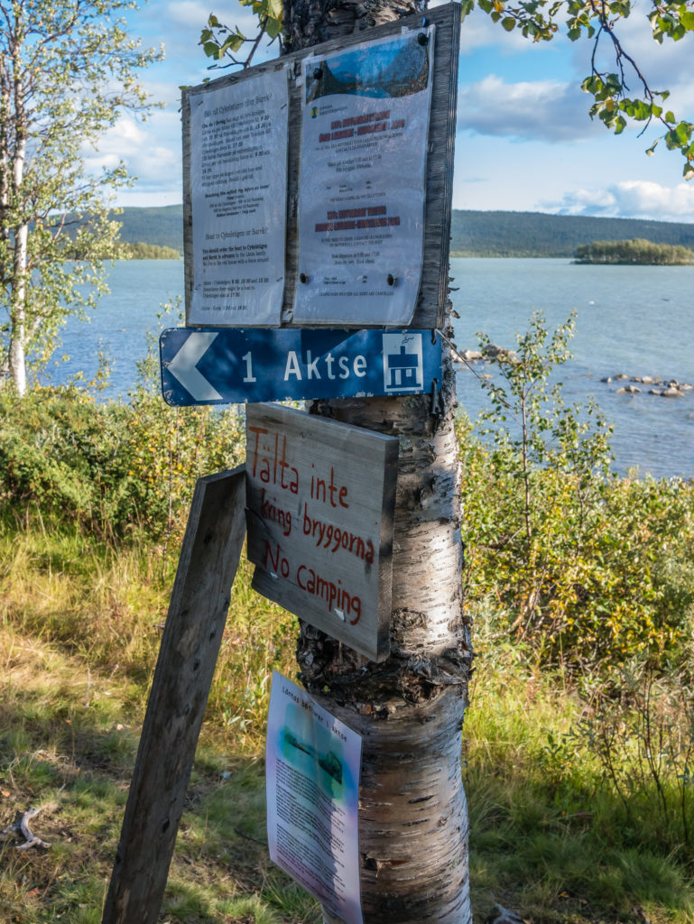
Some information is given about side trips/boat tours into Sarek National Park operated by a local Sámi family. If you have a spare day, this would be an excellent option to see more of this particularly beautiful area.
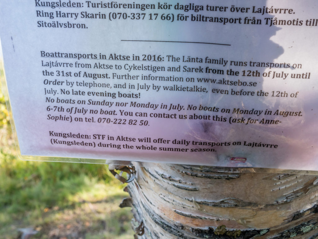
Contact details if you want to plan and organise a side trip from Aktse into Sarek National Park.
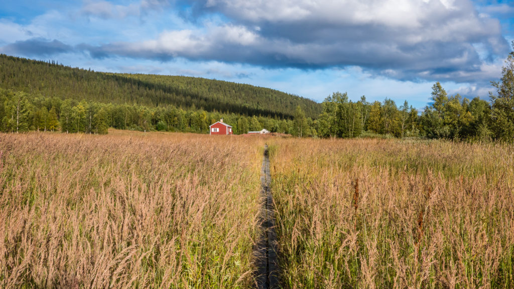
After leaving the jetty on the northern shore of Lake Laitaure, it is around a kilometre of walking across wetlands to reach the Aktse mountain farm area, where the STF has two cabins. Thankfully, wooden boards have been laid here making it an easy traverse.
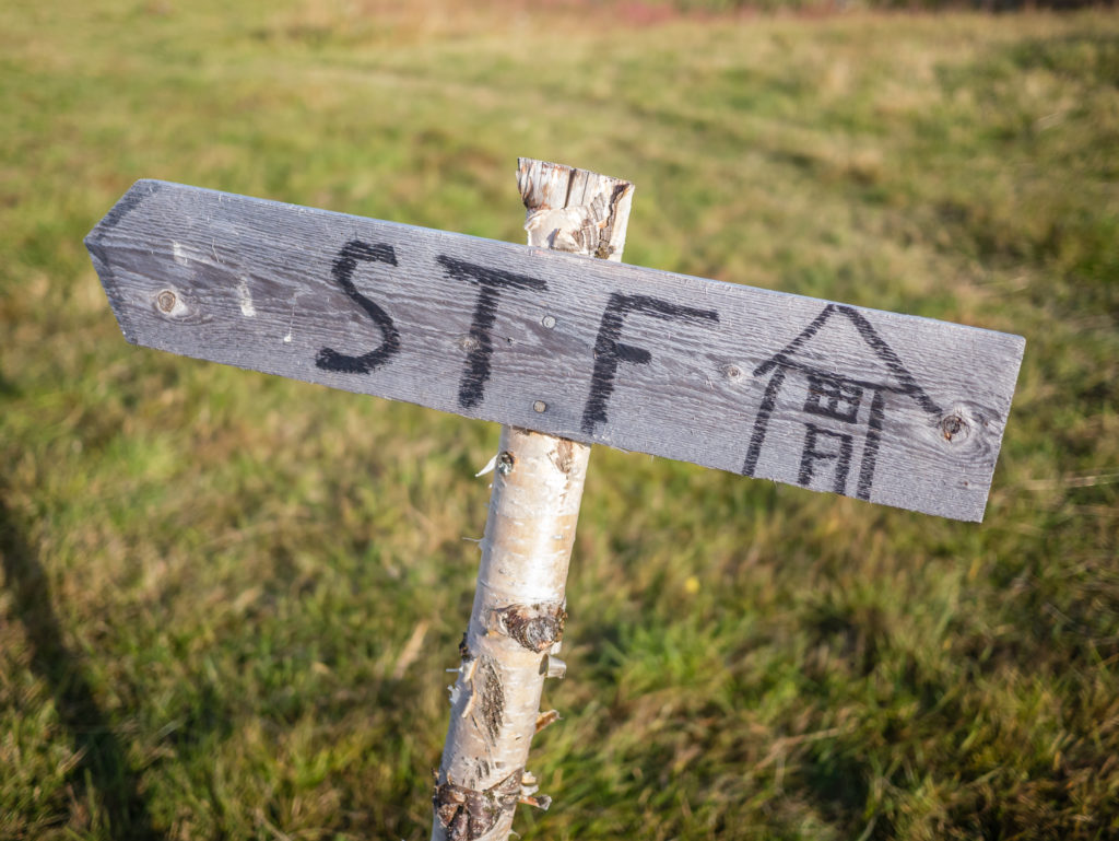
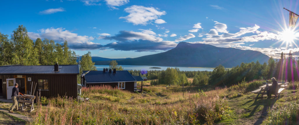
The life-blood of the Kungsleden and helping to make the Arctic Circle accessible to all! The STF (Svenska Turistföreningen – Swedish Tourist Association) operates a series of huts and cabins across the mountainous regions of Sweden that serve your basic needs. On most of the Kungsleden route, you will find that these huts are conveniently located within a day’s walk of each other. They are invaluable, especially if camping isn’t your first choice!
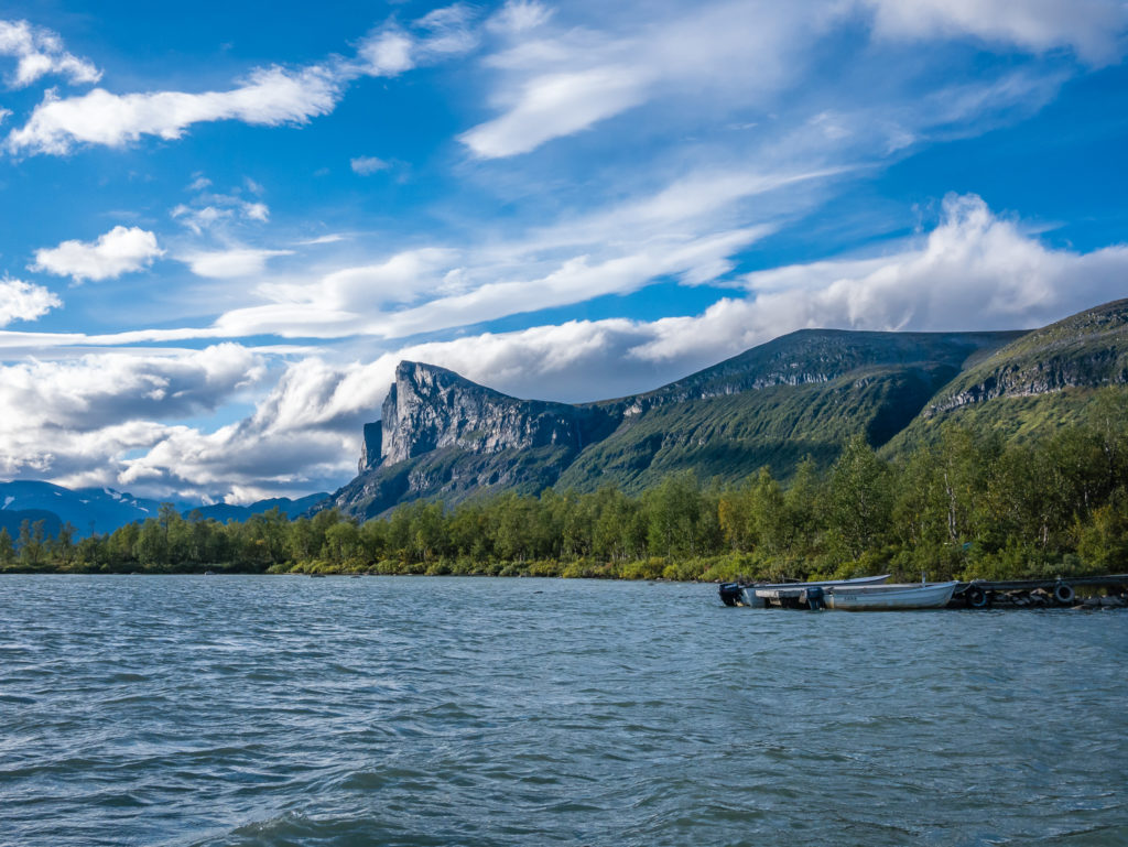
Looking towards Skierfe from Aktse.
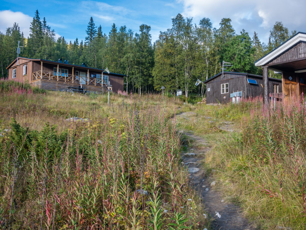
The STF Aktse hut is located on the northern side of Lake Laitaure, 15 miles (24km) from Pårte. It is a good location to spend a zero hiking day if your itinerary allows.
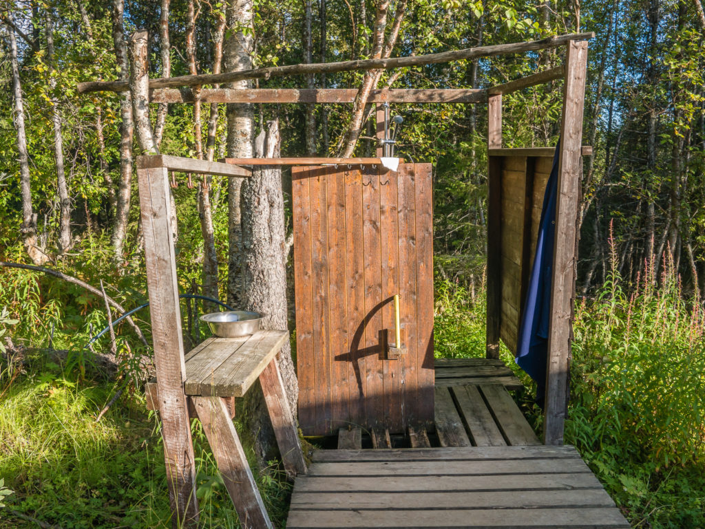
The innovative outdoor shower at Aktse!
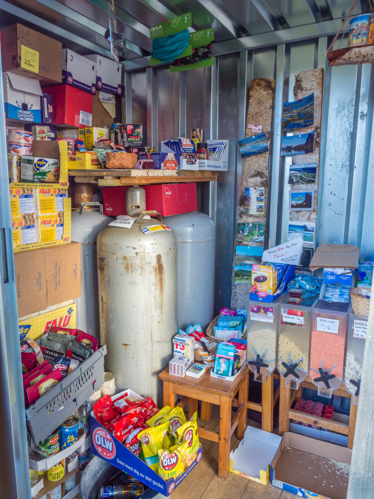
Now this is what you call an ‘Honesty Box’! Supplies at Aktse are currently located in a giant tin shed whilst renovation work takes place to provide a new on-site shop ready for the next hiking season.
Located along the Rapa valley, the STF Aktse facilities are approximately halfway between Kvikkjokk and Saltoluokta, making this an excellent place for taking some side trips off the Kungsleden trail. From here you can make day trips into Sarek National Park, learn of the Sámi and mountain farmers’ cultural history or just enjoy the tranquility and beautiful surroundings, particularly in mid-summer where the vast meadows become carpeted in bright yellow buttercups.
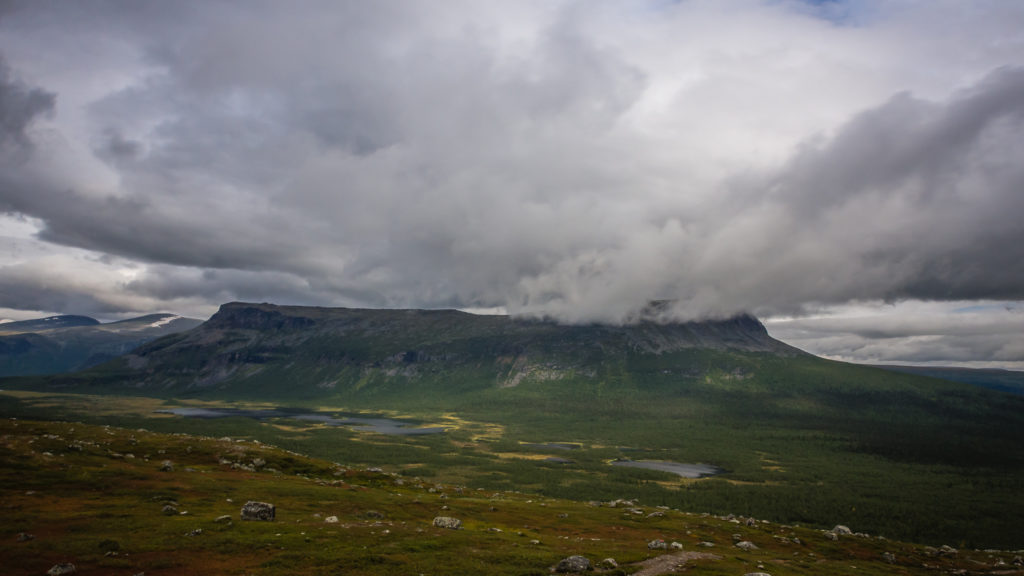
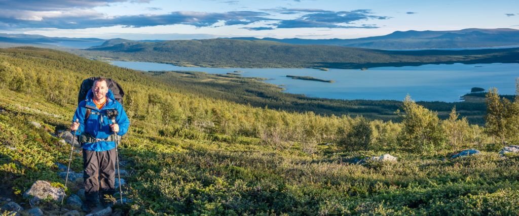
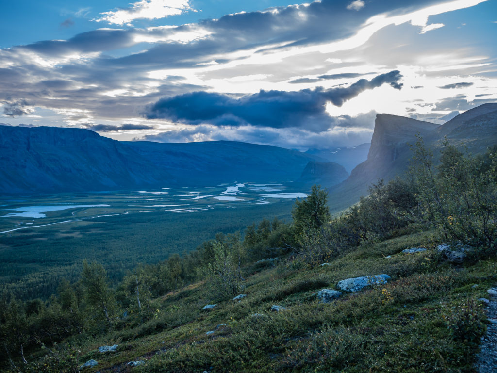
Beyond here, this segment of the Kungsleden sees you moving in an exciting borderland between Sarek’s sharp ridges and towering peaks of granite contrasted with lush, dark green forest scenery to the east. With limited mapped trails, Sarek National Park is the largest high mountain area in the country and remains a piece of true wilderness. The Kungsleden runs through the southern part of the park for a stretch of 10 miles (16km), with the closest STF huts being Pårte and Aktse. From Aktse, taking a detour to the summit of Skierfe right on the edge of the park is said to provide you with perhaps the best view in Sweden, as you look across the meandering milky rivers of the Rapadalen (Rapa valley) 600 metres below.
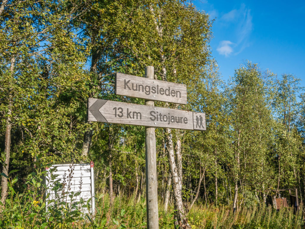
We were told it would be a hefty climb to get above tree line, but the detour was well worth earmarking a day in our itinerary to do, as in good weather we would experience a magnificent vista! With promises like that we had to see what all the fuss was about! So instead of continuing along the Kungsleden to Sitojaure, we made time for this much anticipated side trip.
Leaving the Aktse STF huts and looking back towards Lake Laitaure.
We were not heading straight for Sitojaure, but had allowed time in our itinerary to take a side trip to the top of the mountain, Skierfe, to overlook the Rapadalen.
Some German guys whom we’d met earlier that morning had told us that it was possible to camp at the Kungsleden/Skierfe junction, then leave our stuff and effectively day hike to the Skierfe look-out point over the Rapa delta, thereby meaning we didn’t have to hike up there with heavy, cumbersome packs. We asked the warden at the hut about availability of camping and drinking water and he said that along the side trail there was currently both. (Water is not marked on the map as it is not a permanent feature, but very much season dependent.) He recommended that we continue on the Skierfe trail for around half an hour where there’d be an extremely large rock (unmissable) with good camping nearby.
It looked like it was going to be a good sunset, so off we went powering uphill on a steep incline to eventually reach the ridge line and the junction turn off. We turned onto the Skierfe trail and continued in a westerly direction, all the while admiring the incredible view over the valley, finally reaching the point that the warden had recommended about 7:30pm. It was not such an easy task finding water, but there was a spring a little further uphill from our campsite where we could fill up our bottles, making sure we had enough water for the rest of the hike the following morning.
Finally on top of the ridge where we were treated to some impressive views!
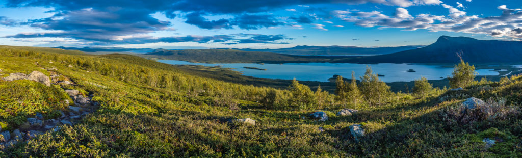
Panorama shot looking onto Lake Laitaure.
Our first glimpse of the Rapa delta.
The sun casts its rays over the Skierfe look-out point.
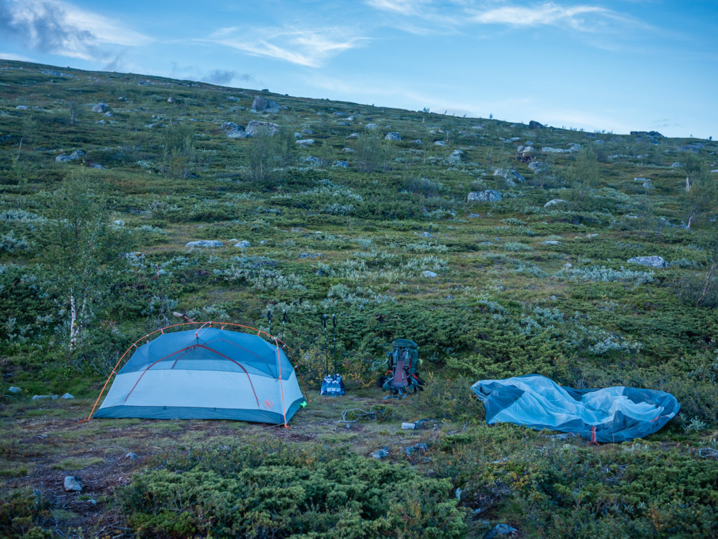
We found a pre-used camp spot, the surrounding Arctic scrub offering a little shelter from the wind. That evening, there was no other soul around…
And this was our view!
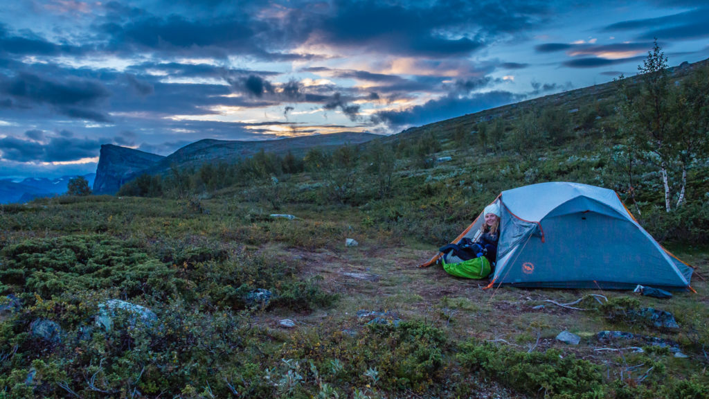
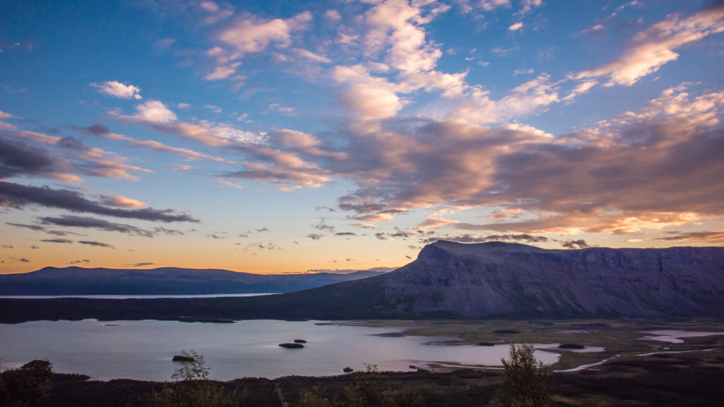
We enjoyed a calming sunset with pastel skies from the comfort of our tent.
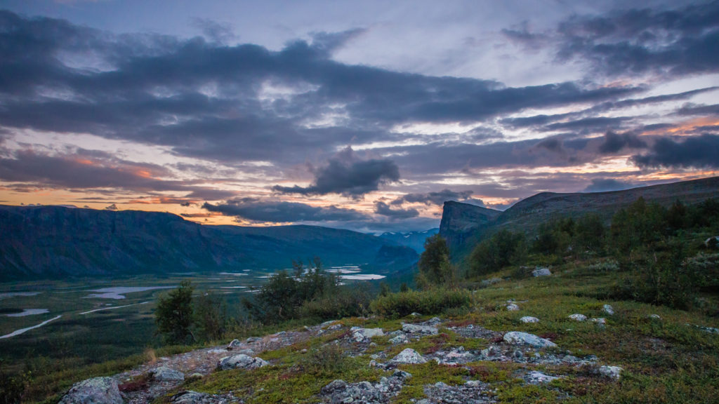
Looking towards the Rapa delta and the Skierfe look-out point that we’d be hiking up at first light the next morning.
It proved a fruitful decision to continue up the side trail to find a camp spot as we were treated to a wonderful, calming sunset over the Rapa delta, whetting our appetites all the more for what was to come in the morning…
We were just keeping our fingers crossed that the weather would hold and we wouldn’t be waking up to another white-out, or they’d be no chance of witnessing the much talked about and most-anticipated view of the entire trail!
4 Comments
Such a spectacular trail once the rain stopped.
I love that the isolation brings you so much joy.
Thanks Helen. We love having the trail all to ourselves to enjoy! 😀
Thank you for fully detailed report from Kungsleden. Thanks your website Ive got a lot of practical info, nowhere such a well described as you did, including such a wonderfull art-pictures of the nature and expierienceses
Kungsleden is also my main destination for this year ( 2017).
Waiting for next reviews of the Kungsleden trail I wish you “All the best !!!”
Regards from Beskidy Mountains.
Tomash
Hi Tomash, thank you for reading our blog and taking the time to comment. We’re glad that you have found our trail reports on the Kungsleden useful in planning your own trip.
Good luck with your hike later this year! We hope the weather is kind to you. Best regards, Danielle & Wayne 😀