
The Kebnekaise Loop…
It’s claimed that you can see ten percent of Sweden from the top of Kebnekaise! Situated in the far north of Swedish Lapland, Kebnekaise – meaning ‘Kettle Top’ in Lappish, is the highest mountain in the country, its southern peak reaching over 2,100 metres (6,889 ft). In Scandinavia, only Norway has higher peaks. As part of your own Kungsleden journey, if you have both the time and tenacity, you can take a detour off the main trail to include a trip to the summit. If you choose to include the ‘Kebnekaise Loop‘ in your itinerary, this would be considered an additional stage, whereby you need to allow at least an extra couple of days.
Our original plan was to do just that and divert off the trail at Singi where we would then head for the STF Kebnekaise Fjällstation, situated at the foot of Sweden’s highest peak, prior to attempting an ascent of the summit. However, after just a few days into our trip, we decided to change our plans and stick to the main Kungsleden trail for a variety of reasons. Firstly, based on the time it was taking us to reach our intended camps, (which started off being significantly longer than anticipated), we didn’t want to put pressure on ourselves to have to hike greater distances each day just to free up some ‘spare days’ to allow enough time to make the detour. We were already on a tight time schedule, so instead we prioritised visiting Skierfe as opposed to Kebnekaise. Secondly, the unpredictable and very changeable weather was a prime factor in our decision making, as was the opinions of other hikers we passed who all said that the Kebnekaise Fjällstation was extremely busy and touristy, particularly with large corporate groups, (and should be avoided where possible). Plus we had been advised that a successful hike to the summit was not guaranteed because of the current trail conditions, which were very sketchy due to heavy snow and ice. As we didn’t have crampons or an ice axe, we were reluctant to attempt any of the three routes up the mountain, so putting our safety first, we decided to leave Kebnekaise for another adventure!
(Don’t let our decision put you off! If you are intent on on including the Kebnekaise Loop in your own itinerary, further details are given in the post below.)
Singi is the junction where you would divert off the main Kungsleden trail and head to the Kebnekaise Mountain Station, before attempting an ascent of the southern peak. (Afterwards, it is possible to terminate your trip at Nikkaluokta, which is served by a main road connecting with Kiruna, instead of rejoining the Kungsleden trail going south.)
Day 18 – Wild Camp (-1km from Singi STF Hut) to Wild Camp (Tjäktja STF Hut +1km) (16.4 miles/ 26.4 km, 11 hours, 50 mins) – Tuesday 30th August, 2016 – ‘The High Point…’
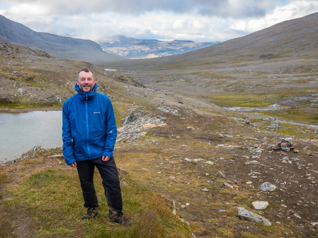
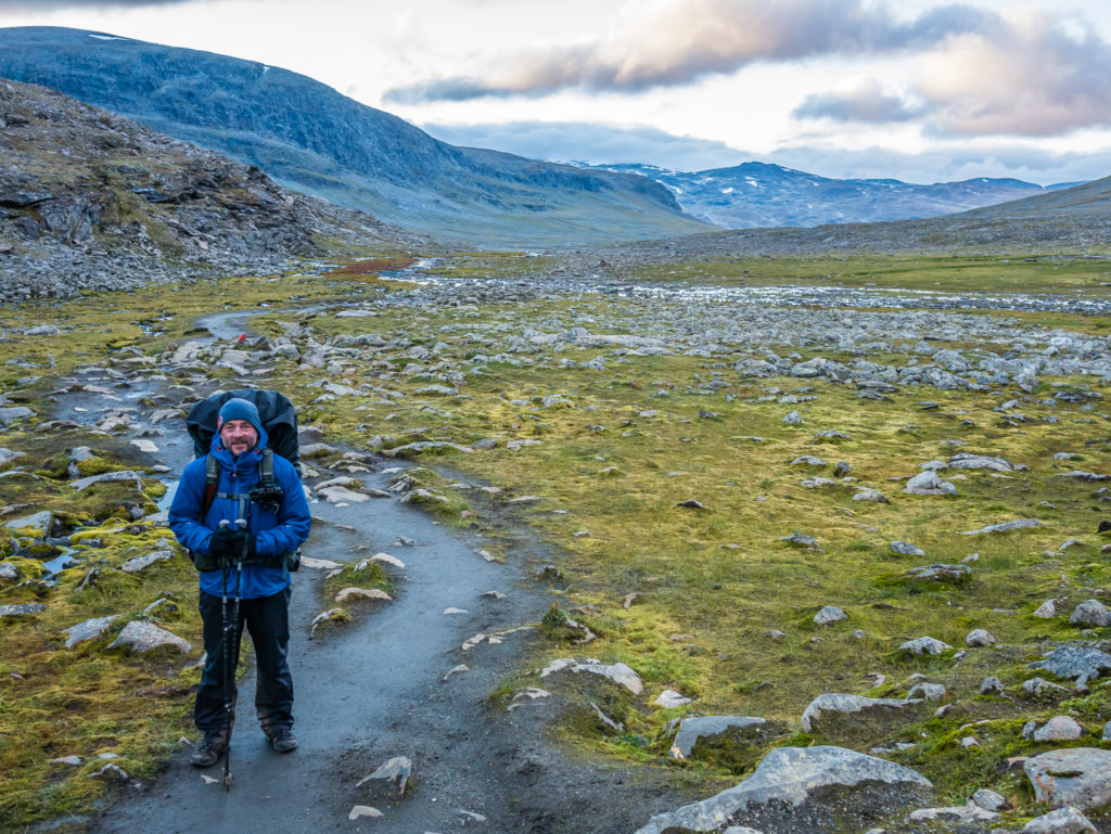
We had a really long sleep, and still didn’t want to get up when the alarm went off at 6am. However, when we did finally drag ourselves out of the comfort of our sleeping bags we were pleasantly surprised that it wasn’t raining and the tent was dry, which is always a great, positive start to the day! We knew we had a lengthy walking day ahead, so we started with a hot bowl of muesli to warm us through and give us that much needed boost of energy before packing the tent away. Then we were off, rejoining the Kungsleden with a slight spring in our step knowing we had just 3 nights of camping left before a bed awaited us in Abisko, but also feeling quite melancholic that our arctic circle adventure was nearing the end…
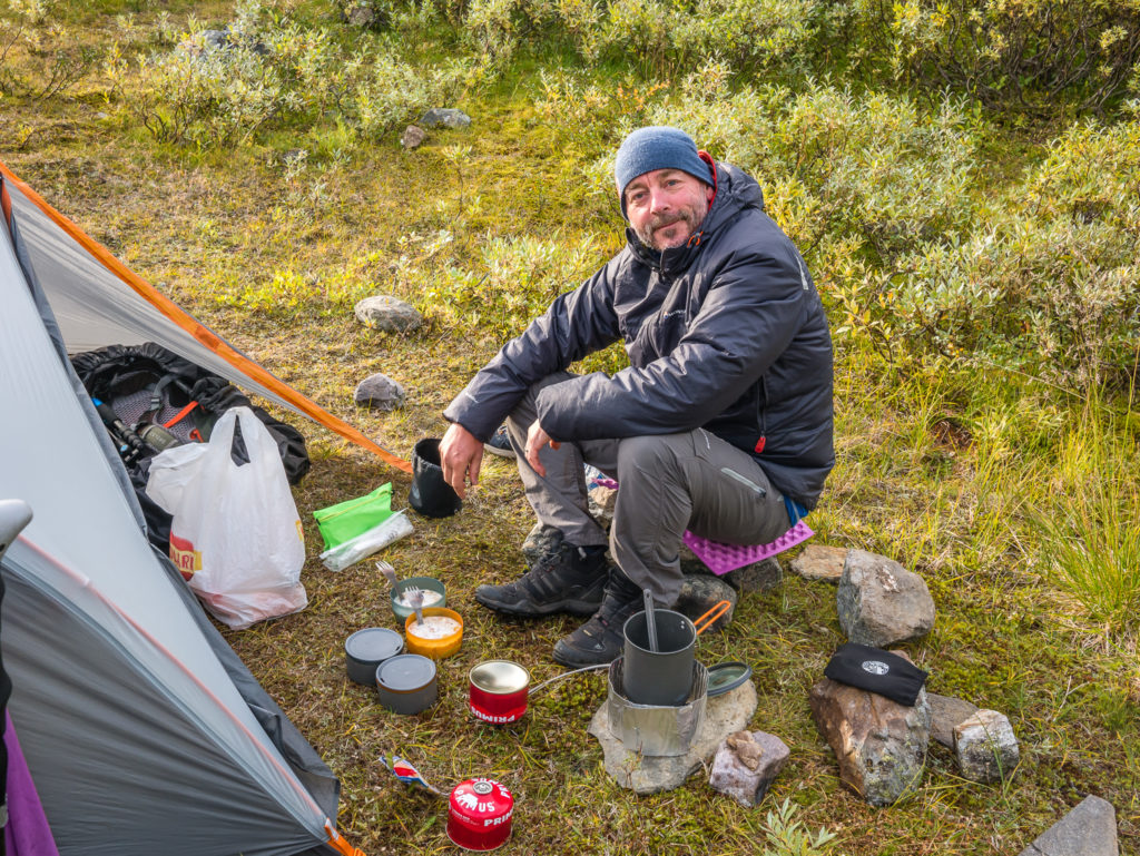
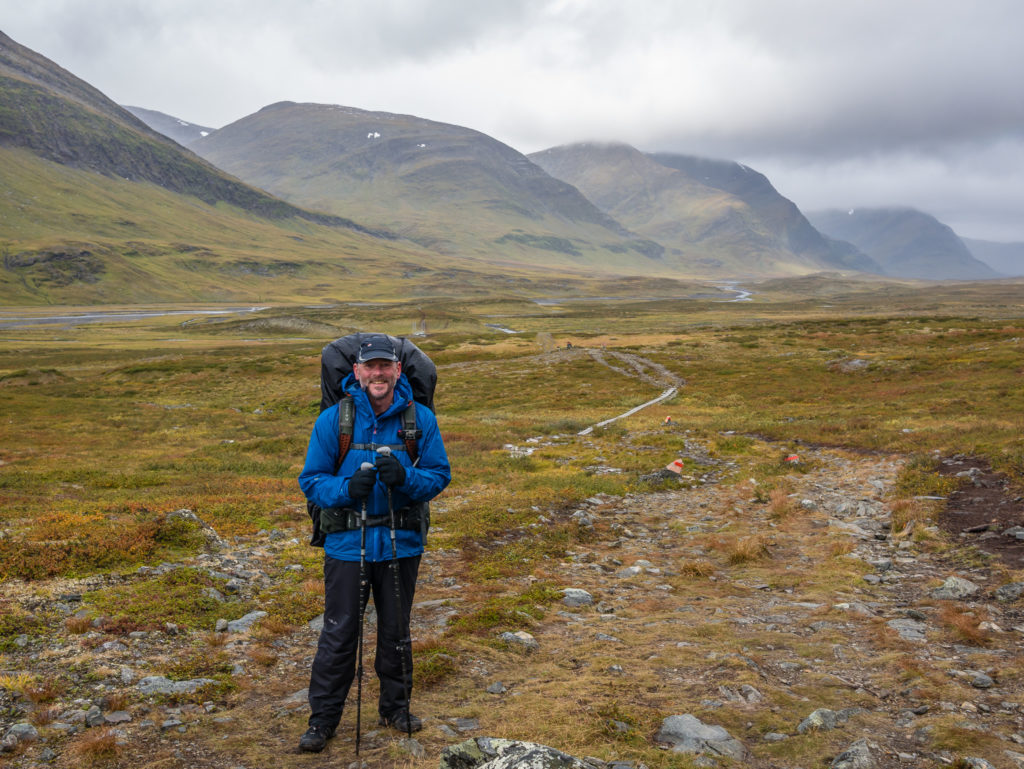
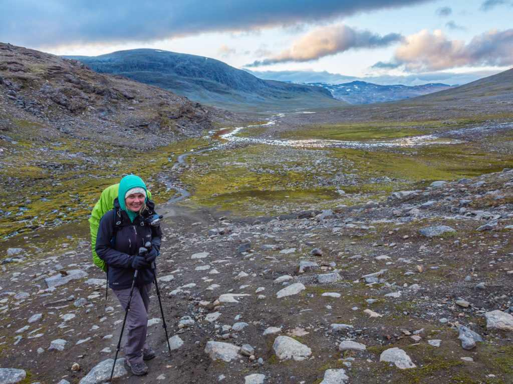
After waking up to a dry, but cool and crisp Arctic morning, Wayne prepares a hot breakfast to set us up for the day.
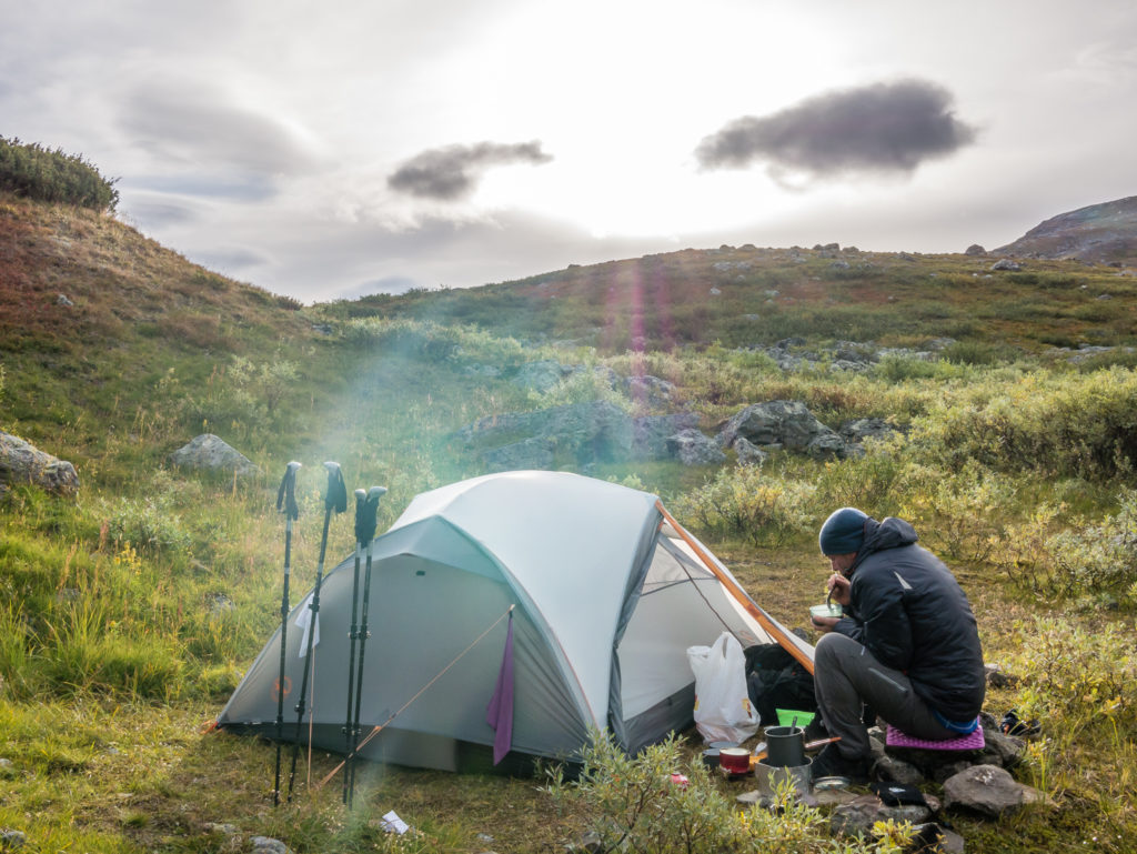
Feeling optimistic about today’s weather as the sun breaks through the clouds.
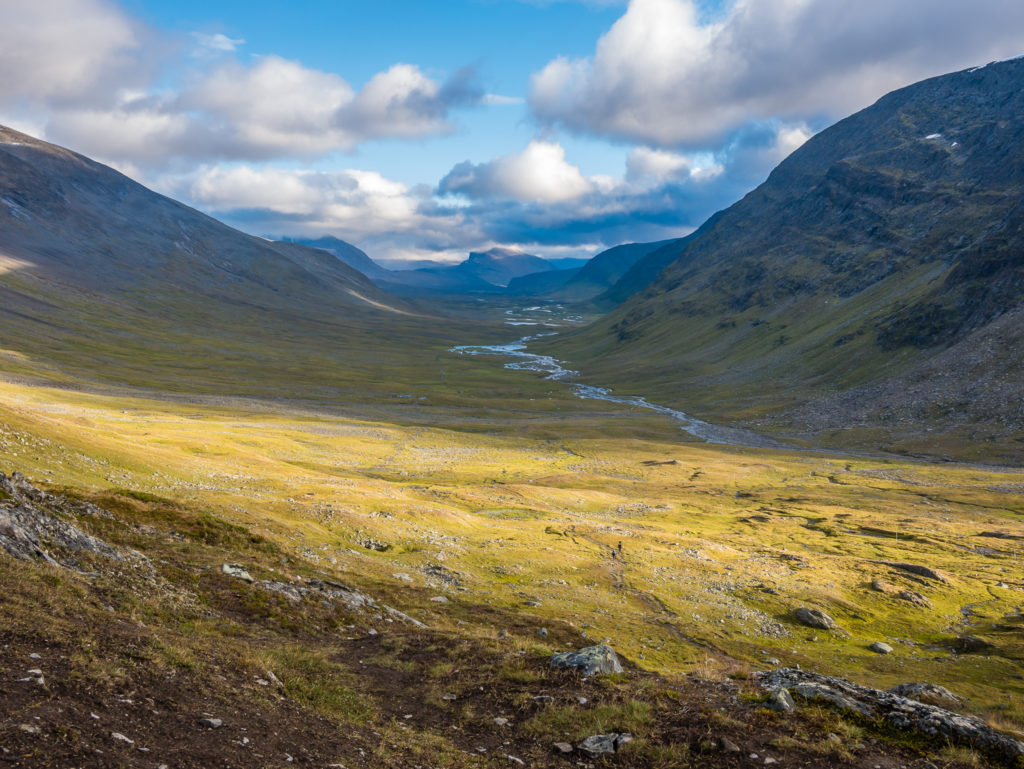
The early morning sun filters through the clouds, illuminating the mountainside.
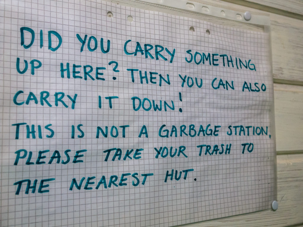
It was only a kilometre or so to the Singi STF hut, so no sooner had we got going, than we stopped again to dispose of our rubbish in the recycling bins and to also make use of the toilets. (As every gram counts, it’s important to take advantage of any opportunity to lighten the load wherever possible!) Sweden as a whole has implemented a cohesive national recycling policy, resulting in less than 1 per cent of Swedish household waste being sent to landfill since 2011; therefore recycling is high profile and expected on this trail. Visitors are expected to sort their rubbish and wash out and crush anything that can be used again. Each STF hut has recycling bins with directions of what to do with specific materials. Anything non-recyclable is then burnt on site, with the rest hauled away by snowmobile during the winter.
What the Kungsleden also does brilliantly is offer toilet facilities regularly along the route, alleviating the need for you to go off somewhere discreet and dig a hole. The provision of WC facilities has been so well thought out, that you will find perfectly placed long drop toilets along the trail with especially good views, making the whole ‘toileting in the wilderness’ experience much more pleasant.
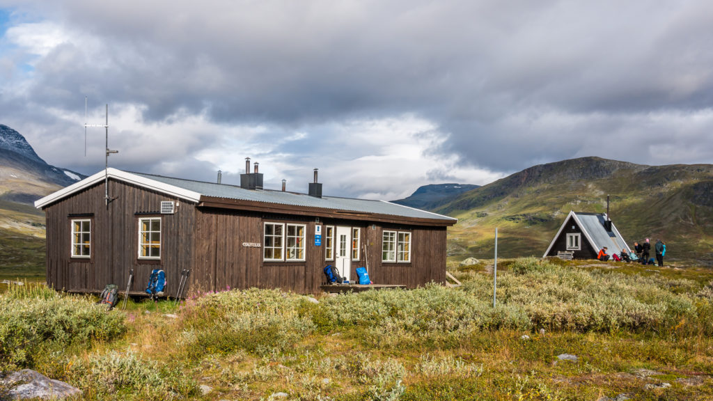
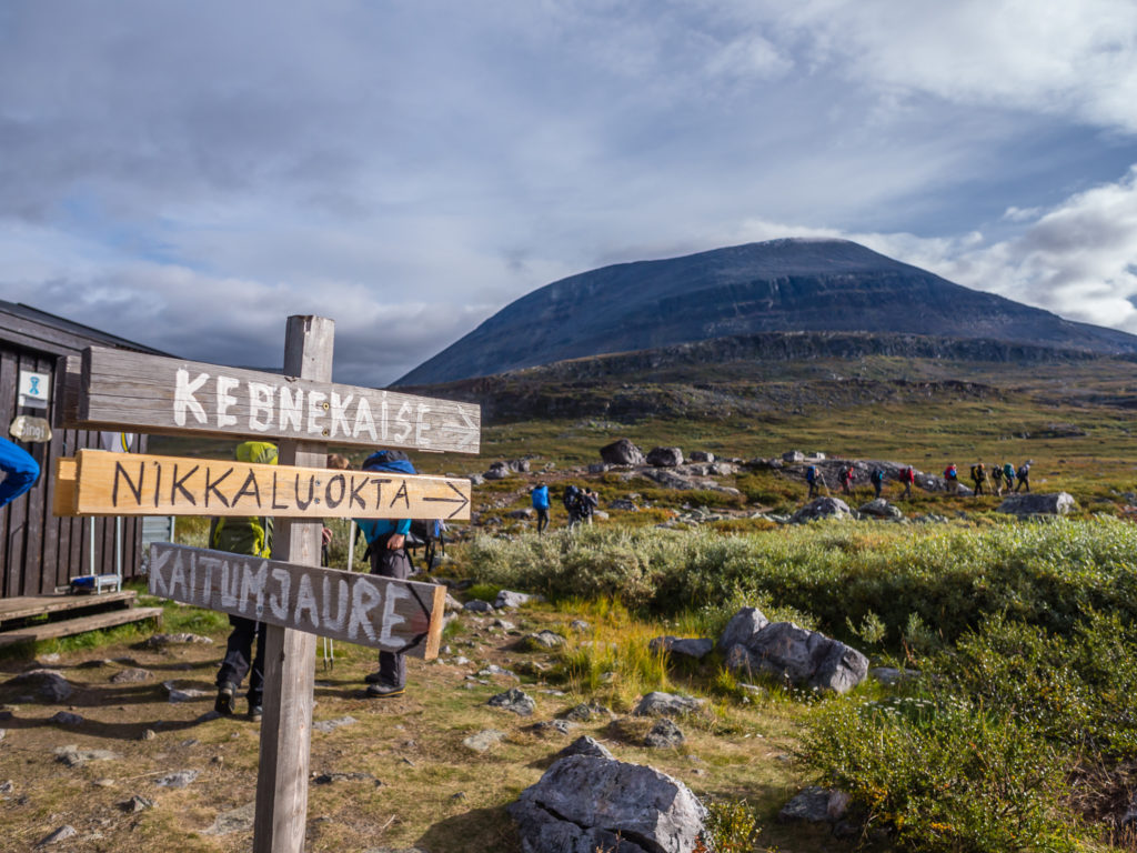
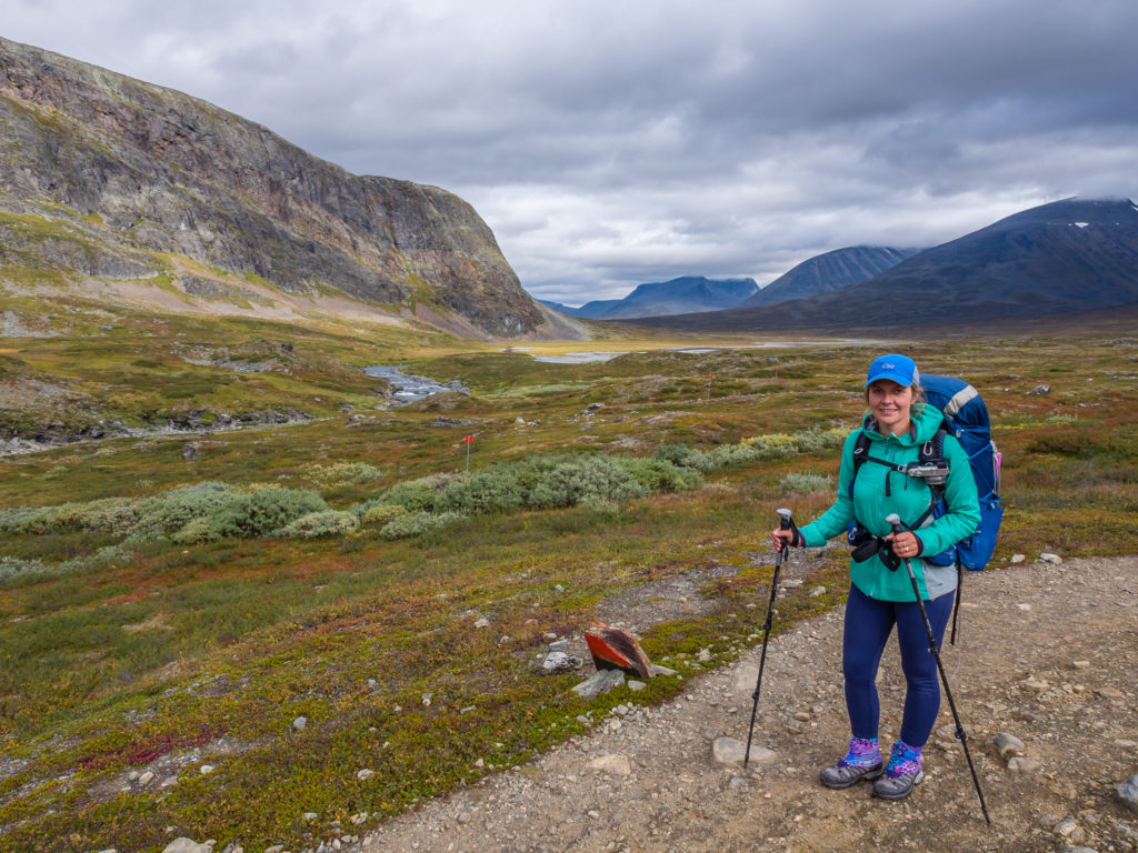
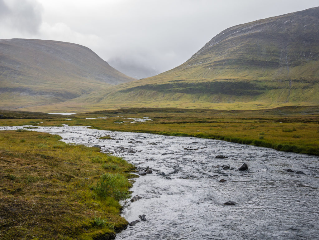
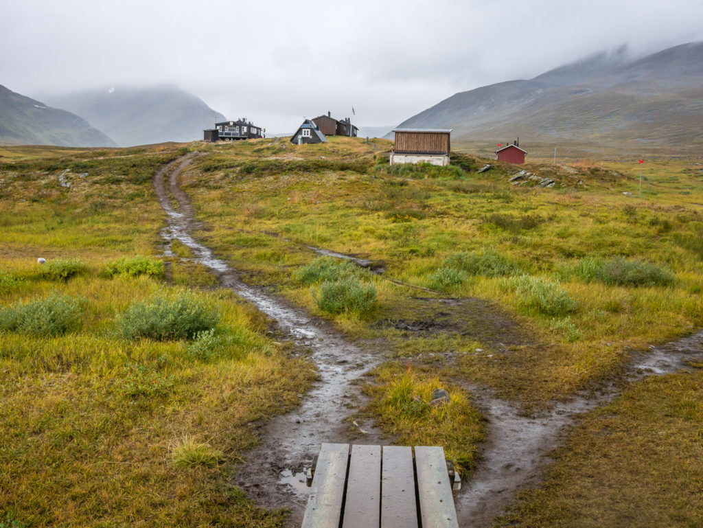
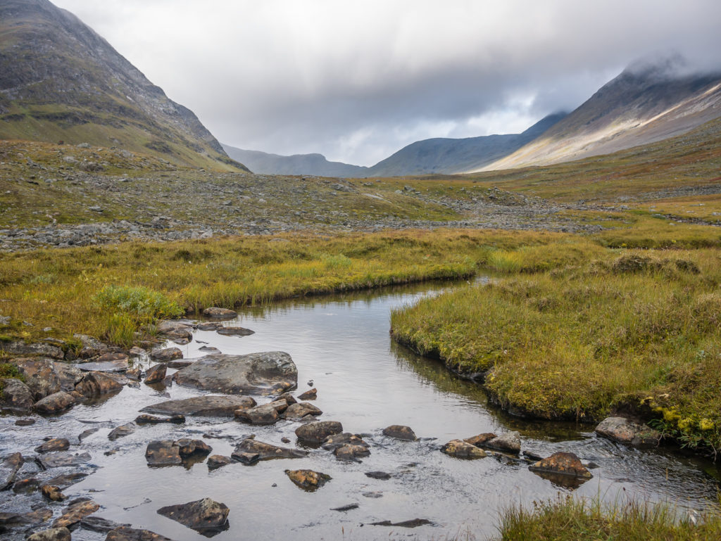
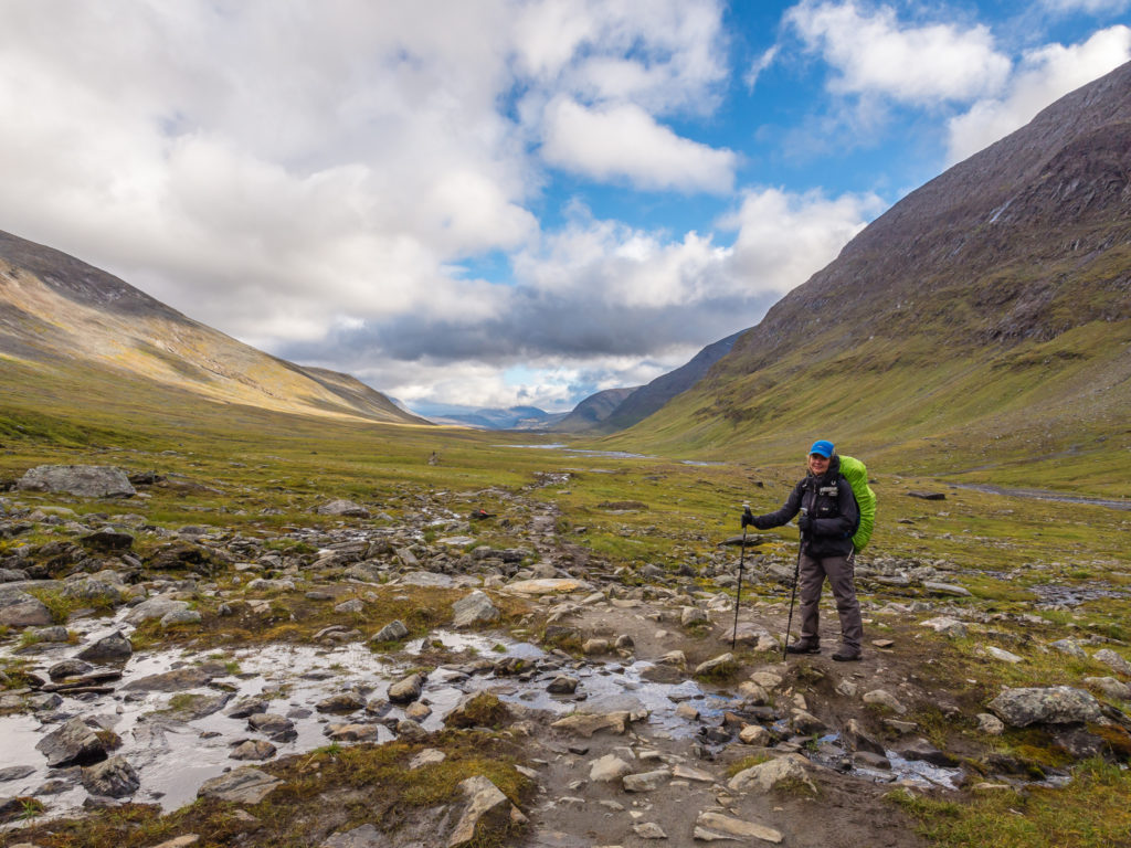
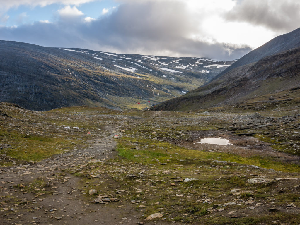
The Singi STF Hut lies in the open, barren landscape where the valleys of Ladtjovagge and Tjäktjavagge meet, which is in the Kebnekaise mountain range.
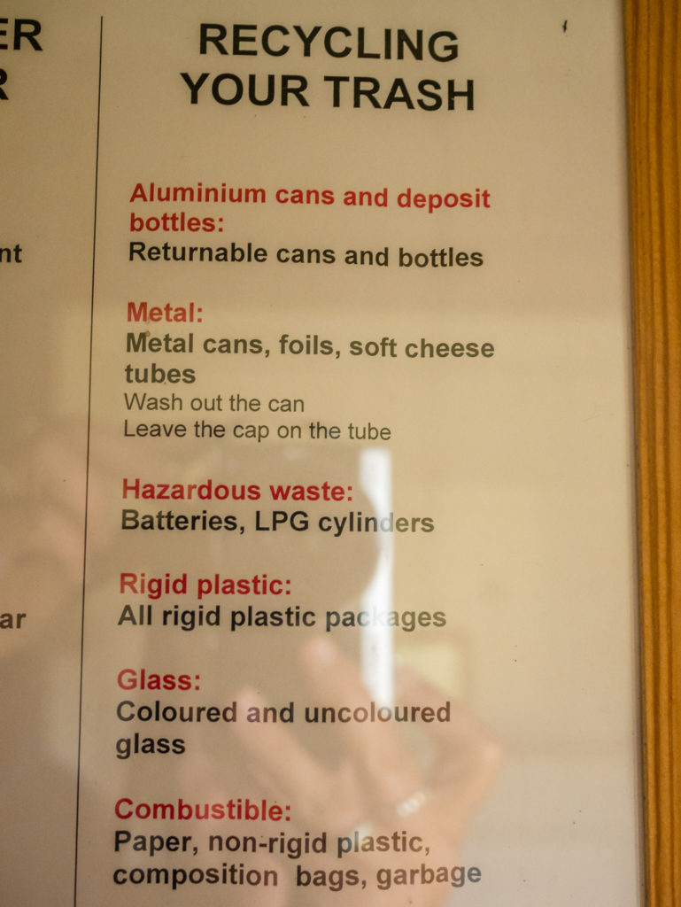
STF huts have strict recycling procedures that guests must adhere to.
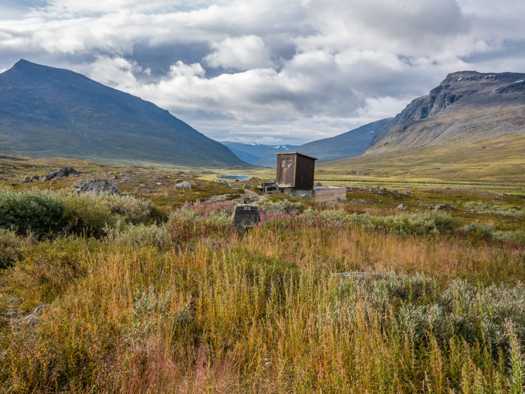
This is quite possibly the most scenic toilet stop of the entire route!
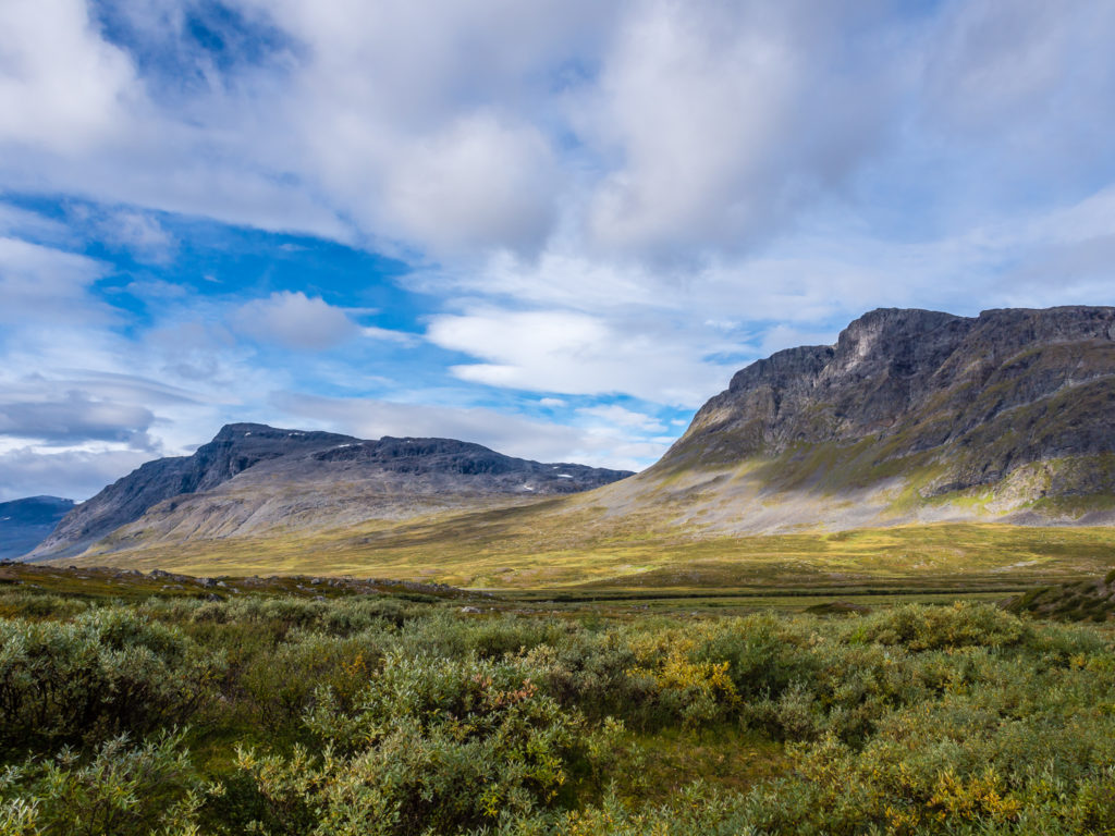
We were treated to stunning views of the surrounding peaks in the Tjäktja valley.
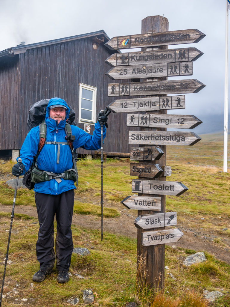
After using the facilities at the hut, we spent a few minutes chatting with the hosts about the latest weather predictions and what to expect further up the trail as today we would be going over the Tjäktja Pass, which is the highest point on the entire Kungsleden route, reaching 1,140 metres (3,740 ft). They were impressed with our fast pace and the fact we were hiking the entire Kungsleden in the unusual way of travelling south to north. As we had the camera at the ready, I had a photo with them stood on the porch, whilst Wayne was quizzed about the English premiership and who his favourite football team is!
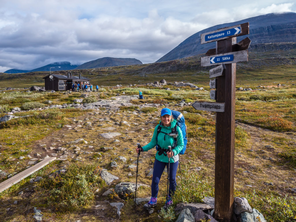
Not exclusively for thru-hikers, the 45-mile (72km) northernmost section of the Kungsleden, from Abisko to Singi, is the most frequented part of the entire route as this segment also forms part of a week-long trip for hikers hoping to summit Kebnekaise. On reaching Singi this was immediately apparent as we met with the most hikers we had seen in 18 days!
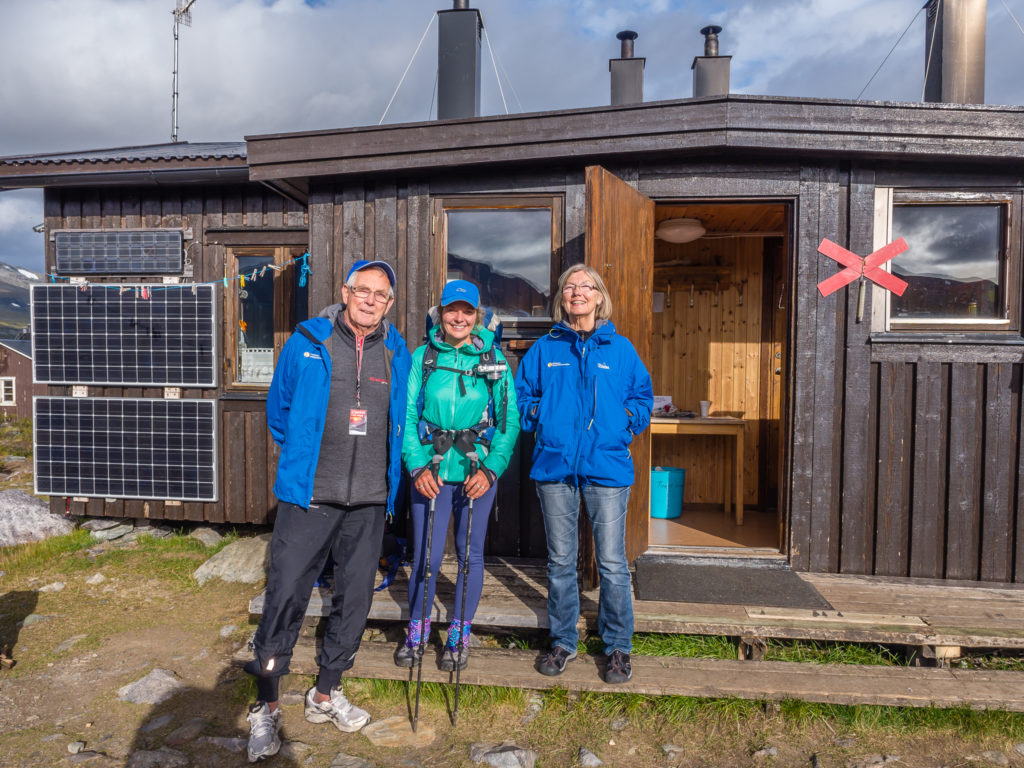
All smiles – a photo with the lovely, chatty hosts at Singi.
Side Trip Option: Divert off the Kungsleden trail at Singi and take the ‘Kebnekaise Loop’ if you want to attempt to summit Sweden’s highest mountain. As we arrived, several hikers were setting off on a guided mountain tour.
If you choose to include the Kebnekaise Loop in your itinerary, this would be considered an additional stage, whereby you need to allow at least an extra couple of days. Generally, hikers complete the 32 miles (52km) from Saltoluokta to the Kebnekaise Mountain Station in 3 days, but allow an extra day if you intend on making a trip to the summit. Even then, as the weather conditions are so unpredictable, you may find it is not possible to make the ascent, despite careful planning and preparation. To complete the northern section of the Kungsleden, the final 54 miles (87km) from Kebnekaise to Abisko can then be undertaken in 5-6 days.
If you want to attempt an ascent of Kebnekaise, on reaching the Singi STF hut, take the side trail to the east following the Lássajávri river along the Ladtjovagge valley for 8.5 miles (14km), where the Kebnekaise Fjällstation is located at the base of the mountain. From the mountain station, you can book a guided tour taking you to the summit. A guided walk in the Tarfala valley is another popular excursion if you have a few spare days. The side track doesn’t terminate at the Fjällstation; rather it continues through the forest to the village Nikkaluokta, which has connecting transport with Kiruna, making it possible to end your thru-hike there. (If you do not want to hike all the way to Nikkaluokta, you can shorten the walking distance by taking a boat across the mountain lake Ladtjojaure). Similarly, there is the option of taking a helicopter between Kebnekaise and Nikkaluokta, which is why the mountain station also receives a lot of weekend visitors.
Happy to be away from the crowds and have the trail to ourselves again – for a short while at least!
We set off again, the skies above us cloudy but bright, yet looking more ominous down the valley in the direction we were heading. It was around 6km to the next emergency shelter where we had planned on having a tea break. When we arrived at the Kuoperjåkka shelter, it was busy around the little hut with people sitting outside and coming and going. But it was here that the rain clouds came in so we quickly got our waterproof gear ready and went inside to finish our drinks. The hut was laid out in the same way as the previous emergency shelters we had visited: it had 3 benches, a table, a wood burning stove and hooks for hanging wet gear. What was disappointing however, was a giant pile of rubbish left in the entrance porch. (So much for following recycling procedures and the principle of ‘Pack it in, pack it out’. It was saddening to say the least.) In this very busy section between Abisko and Nikkaluokta where people take a detour to hike up Kebnekaise, it was already evident that people do not follow the unwritten rules of hiking and trail etiquette, which is very frustrating for hikers in the true sense, as opposed to day trippers!
Enjoying the solitude in such epic surroundings…
Staying one step ahead of the weather for now and enjoying a well trodden trail underfoot.
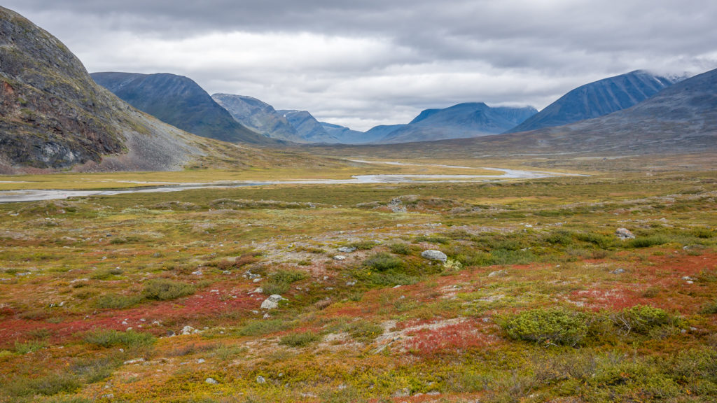
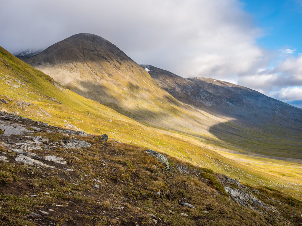
The stark mountains contrast with the tundra alive with colour.
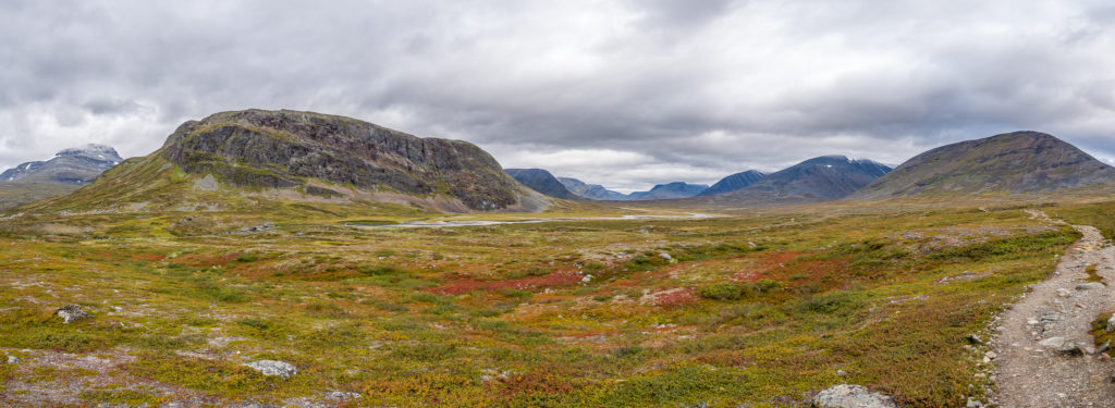
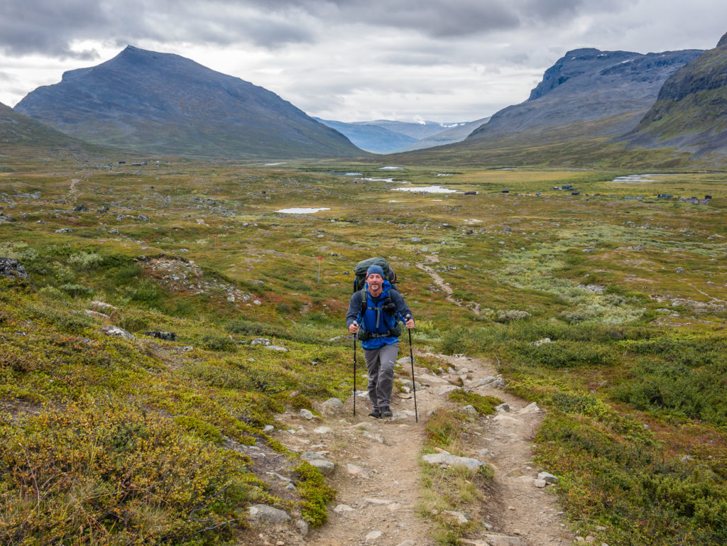
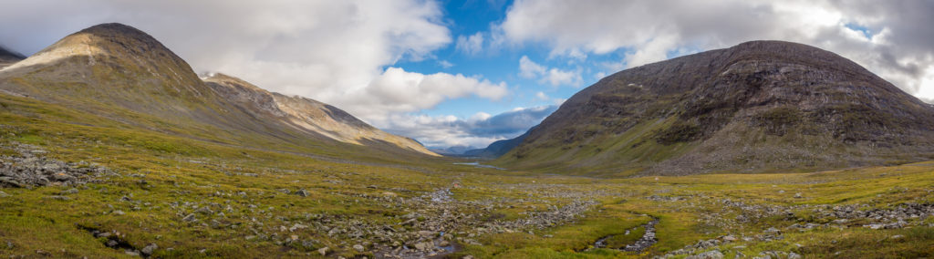
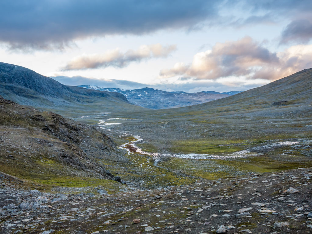
Panorama hiking through the beautiful Tjäktja valley.
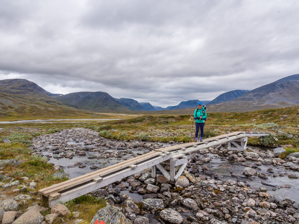
We could have managed a rock hop here, but the bridge makes for an easier crossing!
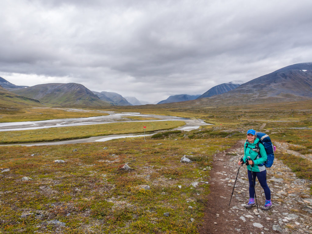
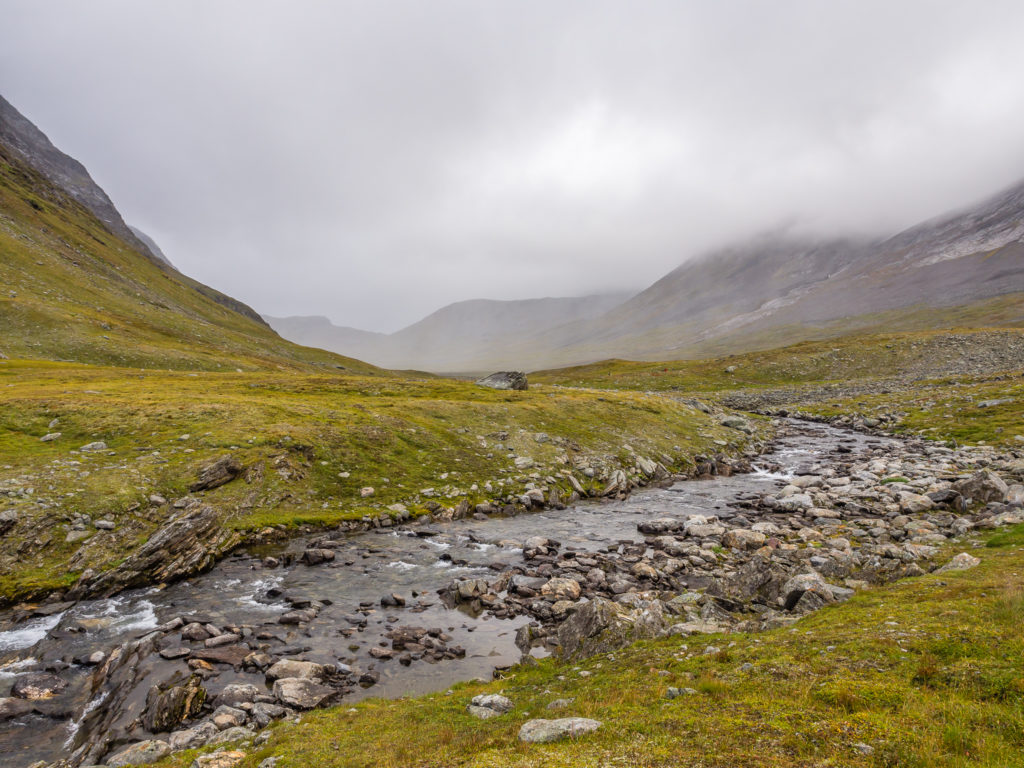
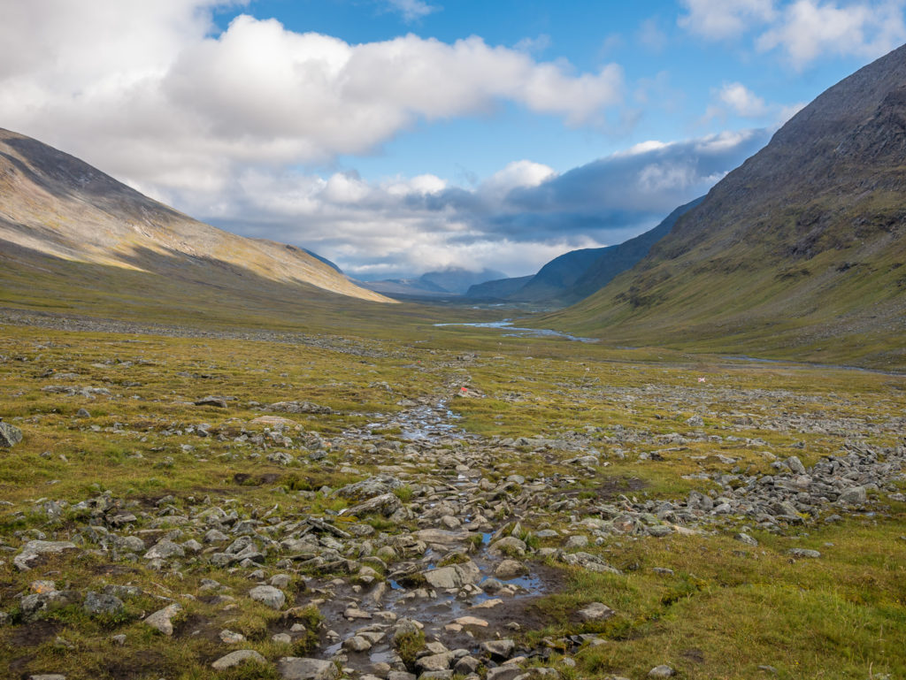
We were aiming for the emergency shelter 6km from Singi for our mid-morning tea break.
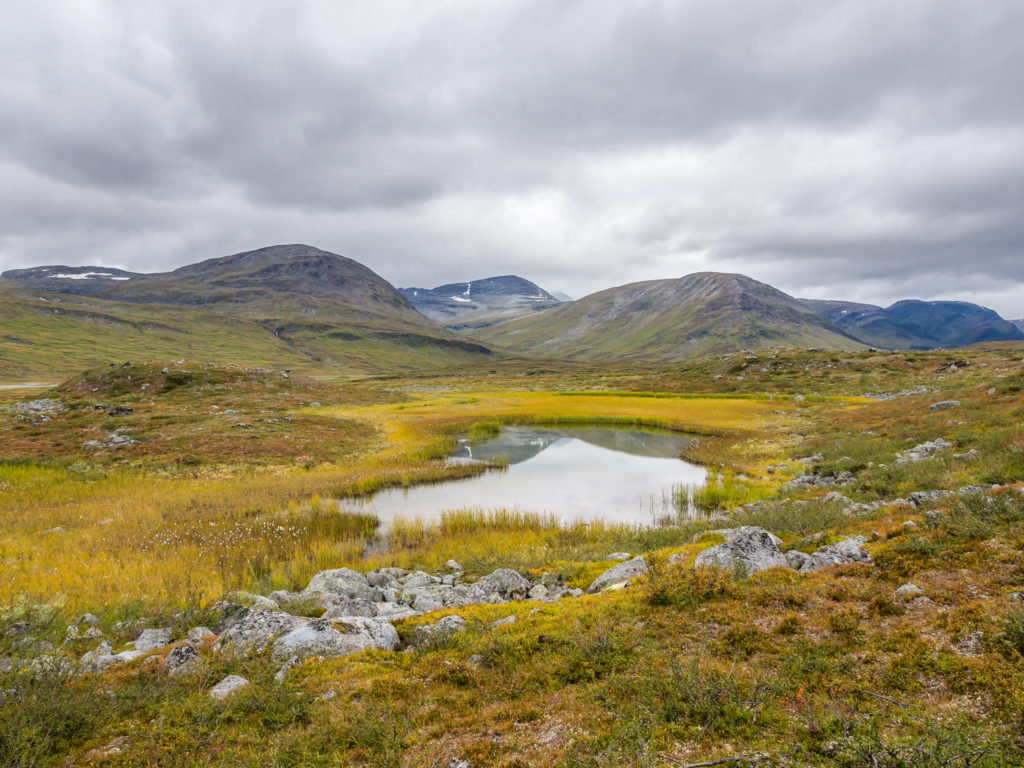
Autumnal yellow catches the eye in this serene scene.
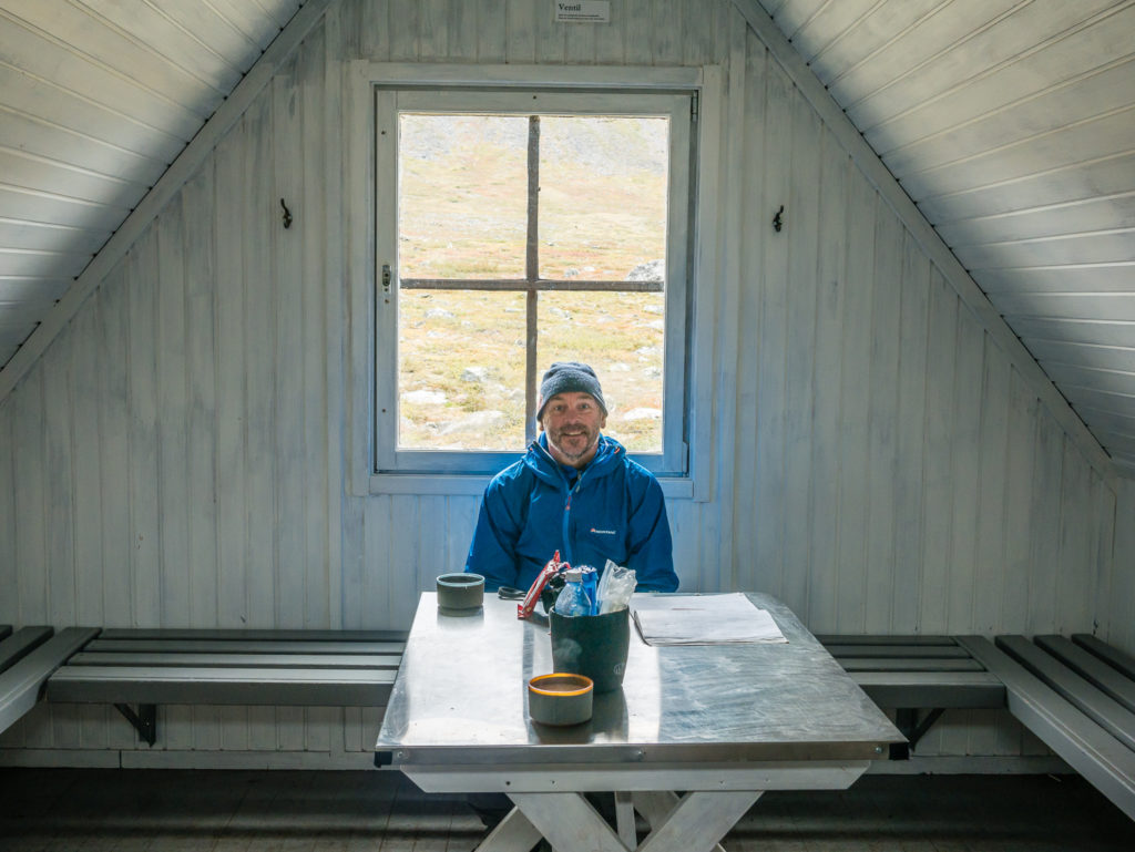
A brief interlude in the dry. We moved inside the the Kuoperjåkka emergency shelter to escape the rain.
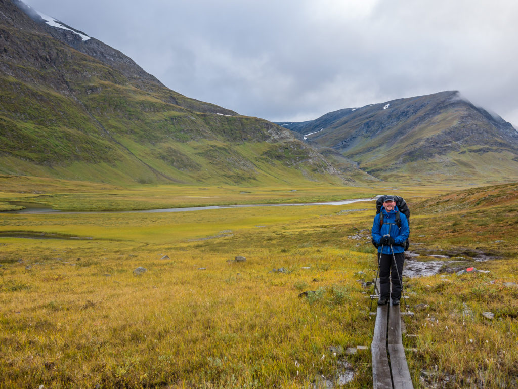
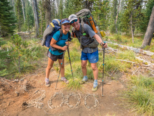
After a quick tea break, we set off down the valley again heading for the Sälka STF hut, where we were going to make use of the day facilities and have some lunch. The wind and rain was intermittent along the way, sometimes heavy, but not quite soaking us through. It was much more bearable than the day we were heading for Saltoluokta! We reached the hut around 2pm. The shop is almost identical in layout to Kaitumjaure with an electronic till, and it also has the facility of a sauna. The shop area was very busy, not so the day use hut, which we were surprised about. There was only one other couple using it, long distance hikes like ourselves tackling the Kungsleden south to north. They had changed plans on which direction to hike the route after arriving in Abisko and finding out that the Fjallraven event was in full flow with 2,000 people on the northern section of the trail. Not wanting to hike amongst that many people, they hitch-hiked to Hemavan and started in the south instead. (Admittedly, preferring solitude on the trail, we would have done the same thing!)
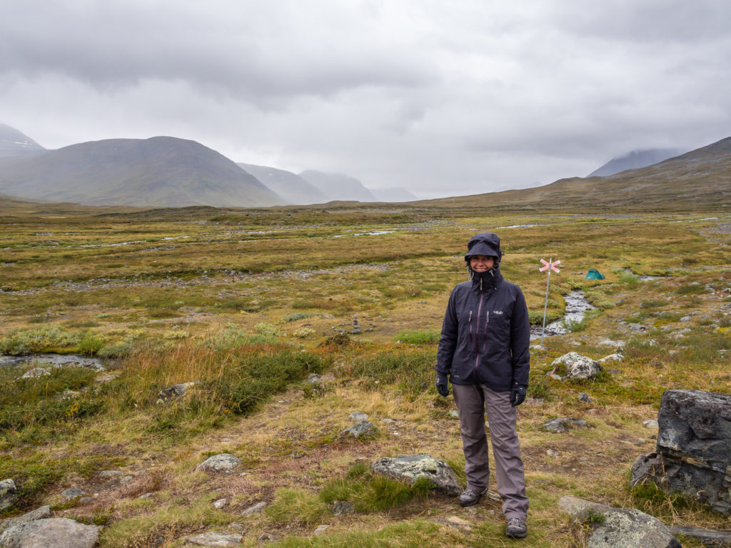
Donning full waterproofs but still smiling as the rain was in no way as brutal as the morning we hiked to Saltoluokta!
The trail was relatively flat and we could still see the mountains, so all was good in the world! (Apart from the fact it was too wet to use the drone.)
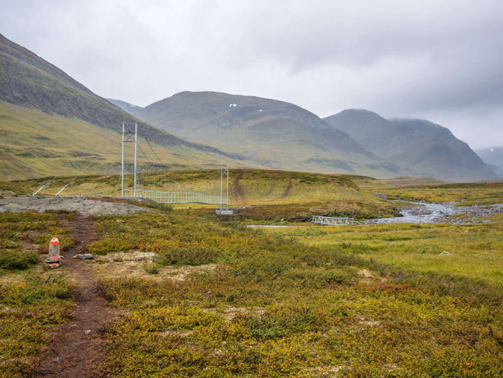
Large rivers along the Kungsleden route are so well bridged that you shouldn’t encounter any dangerous crossings.
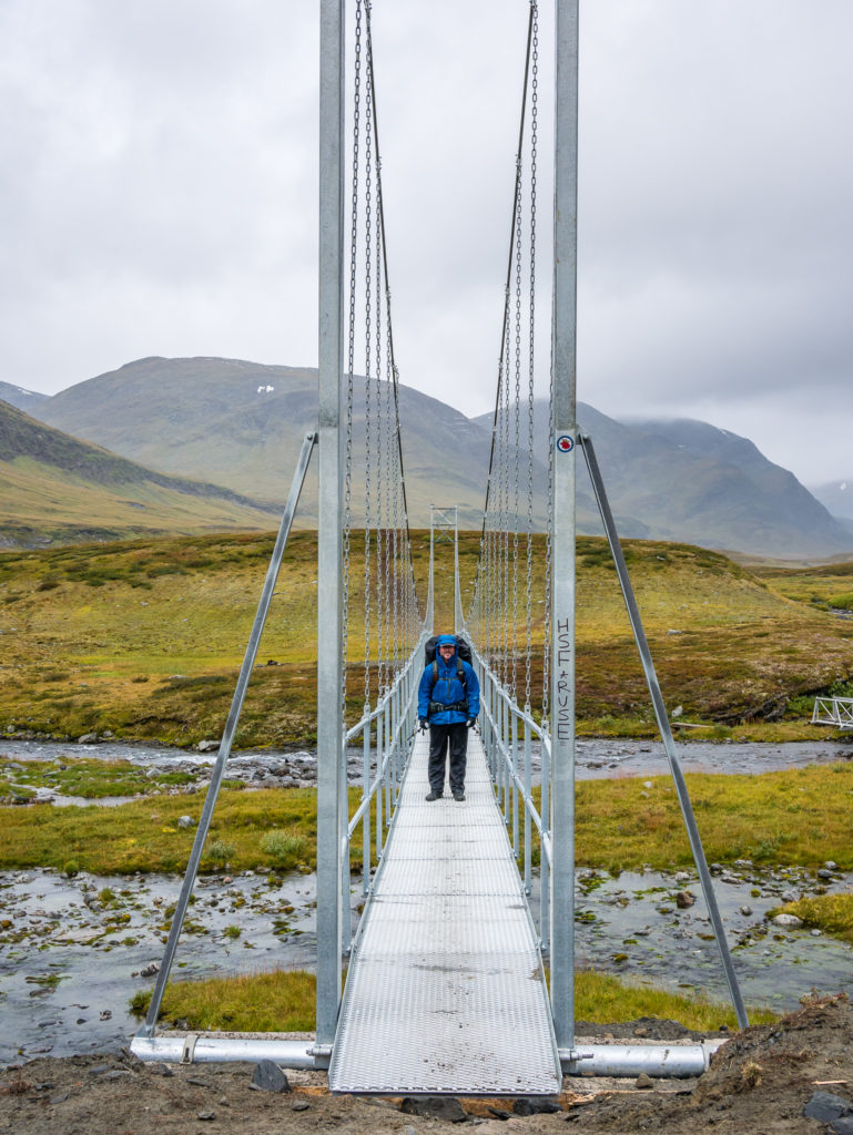
Heading across the large suspension bridge.
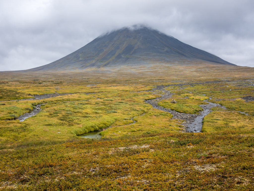
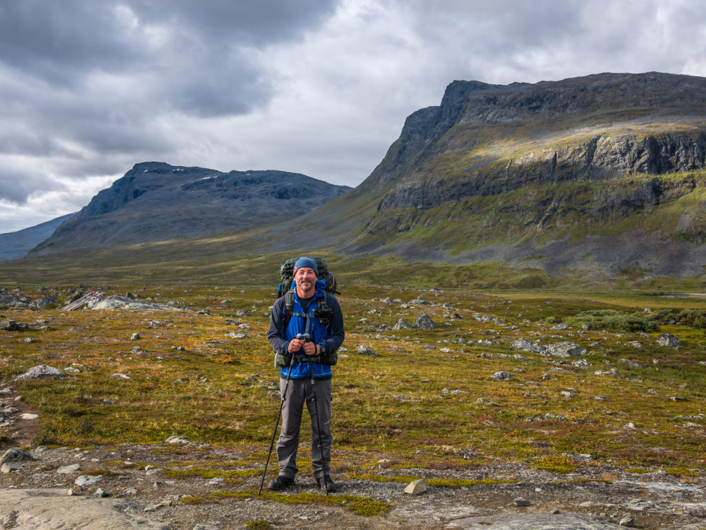
A slumbering giant beneath a thick blanket of cloud.
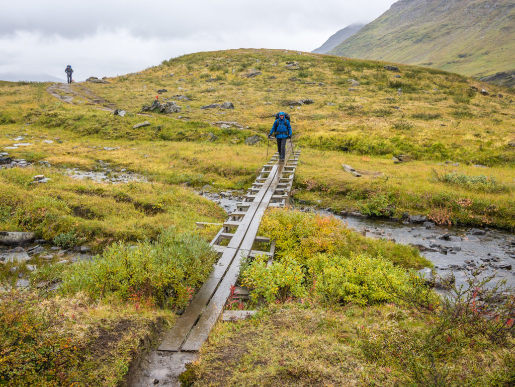
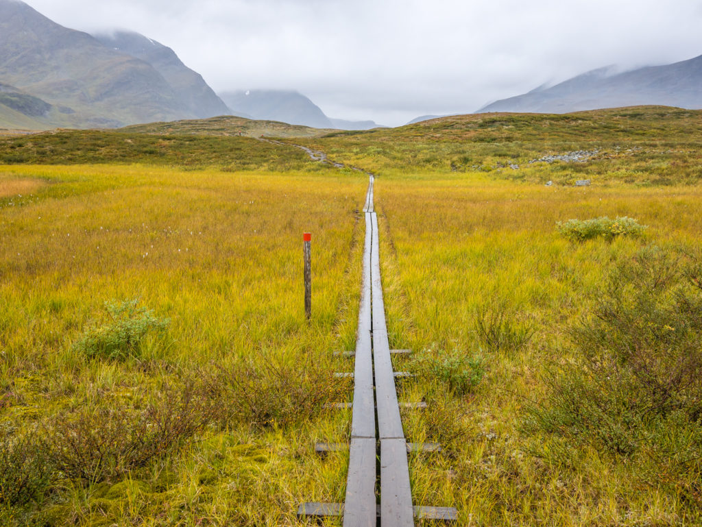
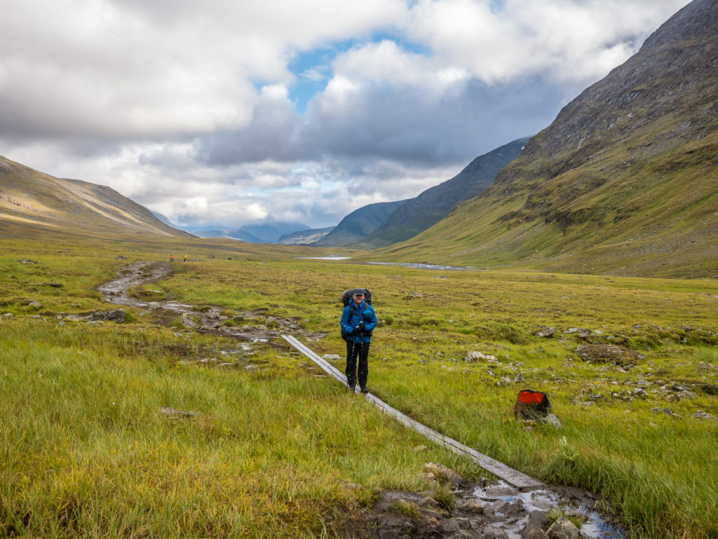
We were grateful where wooden boards had been put in place to assist us over the worst sections of ground. (I spy a hiker! Someone was actually walking behind us today!)
The route north was becoming significantly wetter with each step.
The valley bottom changes to a bright, burnished gold.
We could see the Sälka STF hut in the distance, so it wouldn’t be long until lunch time!
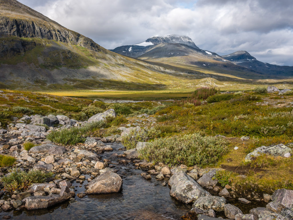
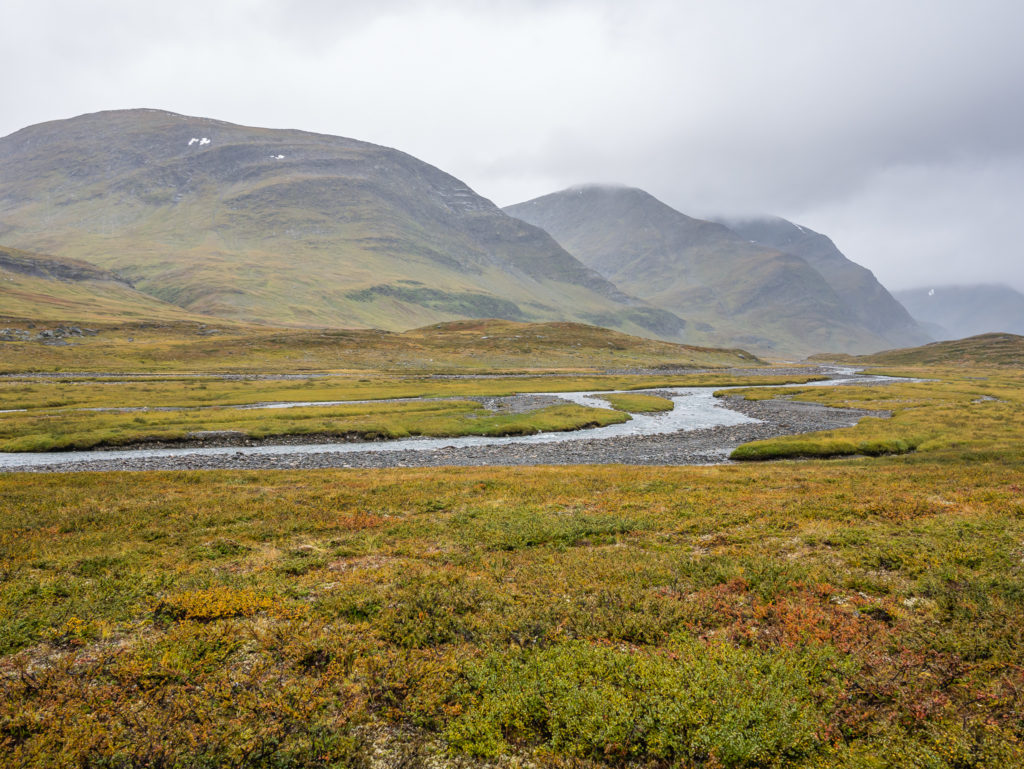
There are plenty of streams to drink from through the long and scenic Tjäktjavagge. Water was definitely not a problem today!
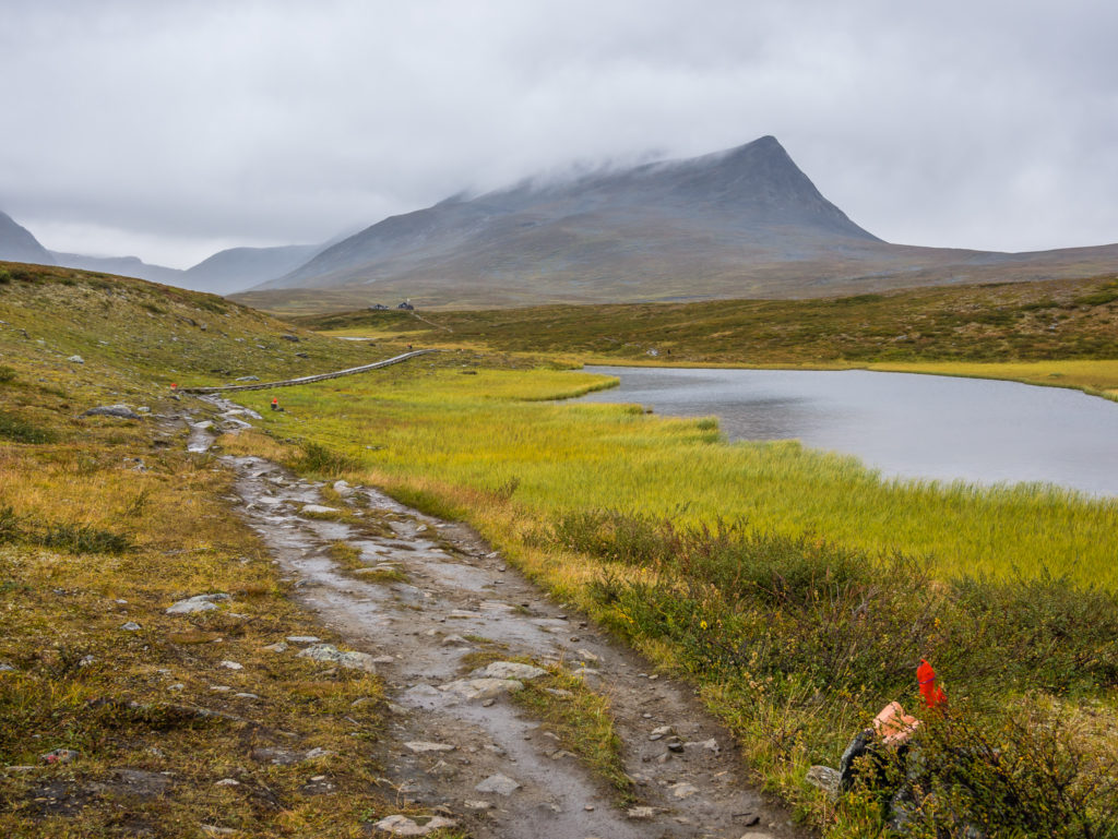
Arriving at the Sälka STF hut. From Singi it is an easy 7.5 mile (12km) walk to Sälka, which showcases some stunning mountain scenery. We would have enjoyed it all the more had it not been raining.

Utilising the ‘free’ day use facilities once again courtesy of our ‘Hostelling International’ membership cards.
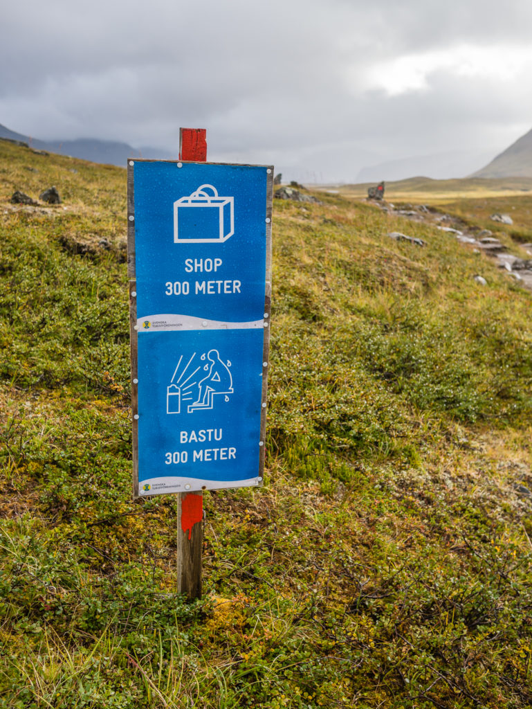
With more tourist signs on the trail, it is evident that this area receives many more visitors.
With our hiker hunger satiated (for a while at least), we got going again around 3pm for the final push. We wanted to reach the end of the valley and hike up and over Tjäktja Pass, before setting up camp for the night. Our original plan was to camp just before the pass but we decided that we’d do a few extra miles to make the following day easier, plus we wanted to camp at a slightly lower elevation as we knew it would be a few degrees warmer. As we left Sälka, we were still experiencing a flurry of rain showers as we made it further north towards the pass, but the sky kept brightening, with the clouds breaking every now and then to reveal a bright blue atmosphere, so we were hopeful for a dry late afternoon and evening.
It was 8km to the emergency hut at the top of the pass, and although it was only a steady 200 metre climb, after 3 hours of solid walking we felt drained and needed a quick burst of energy for the last section in order to reach the hut. So we took off our packs and had 5 minutes admiring the valley view looking back to where we’d spent the last several hours walking, whilst sharing a bag of jelly sweets. From striding out along the valley floor, we found it quite exhausting heading uphill to the top of the pass. After a false summit, (and a few expletives!), we were steadily winding our way up another steep section hoping that this really would be the top, when all of a sudden the mountain hut came into view and we could breath a sigh of relief. Just as an aside, again there is another well-placed toilet block with an excellent mountain view!
More signage, just in case you were in any doubt about your location!
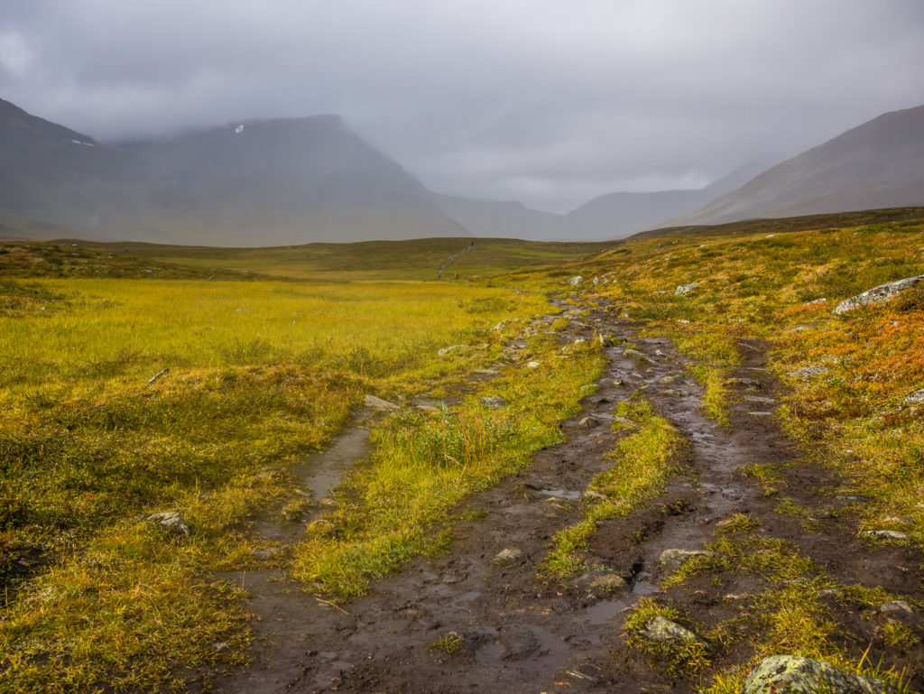
The weather looked much worse where we were headed. The ground here is very churned up because of the increased amount of foot traffic widening the trail.
Thankful for wooden boards assisting us over the boggiest sections!
More evidence of trail erosion and the impact of heavy foot traffic. There were several sections of trail in the north like this.
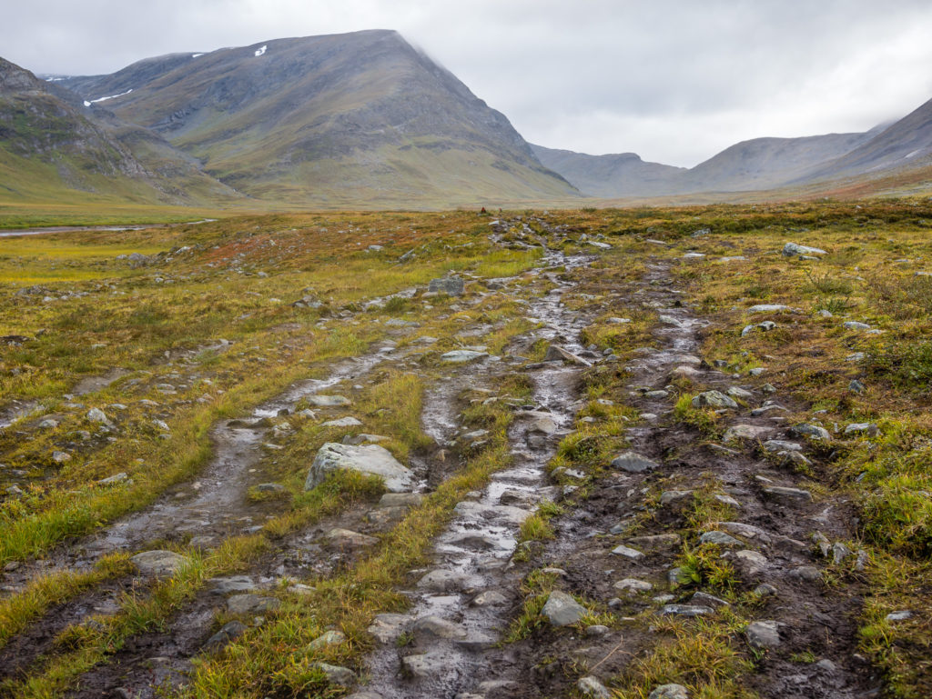
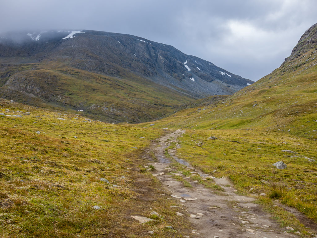
Heading through the long and lush Tjäktja valley, the trail gets rockier requiring you to watch your footing.
The trail also gets wetter!
We wondered what we’d be heading into the closer we got to the pass as visibility worsened.
Hoping for better weather as the trail meandered between the peaks. Still no chance of getting the drone up today which was a shame as there was so much wonderful mountain scenery to behold.
Although there are some boardwalks to assist you across the worst sections of waterlogged ground, you need to take care as some are broken in places.
Thinking how much further have we got to go?

Early evening light cuts across the gentle peaks.
Taking a much needed breather and looking south down the vast Tjäktja valley.
Panorama: Tjäktja valley looking south.
Looking to the Tjäktja pass where we’d be heading over into the next valley.
Looking back down the Tjäktja valley from where we had just walked. No wonder it seemed a long day!
Beautiful, early evening light bathes the mountains.
Making our way over Tjäktja Pass. At 1,140m (3740ft) it is the highest point on the Kungsleden and possibly the most strenuous section of trail.
Reaching the top of the pass where there is an emergency shelter and another well-positioned toilet with a tremendous view!
Looking over the other side of the pass. As the wind funnels through the pass, expect it to feel significantly colder.
It was bitterly cold at the top of the pass so we took respite in the emergency shelter located there before continuing north.
We reached the top of the pass and the emergency shelter around 6:30pm. As it was bitterly cold at the top, we ventured inside the hut to get out of the wind and rain, and took the opportunity of being indoors to make dinner where it was both warm and dry. The couple whom we had met at lunch arrived a few minutes later with the same idea. The hut was very cosy and very appealing in terms of staying out of the cold and spending the night in there – however as you’re only meant to sleep in them in the event of emergency we got packed up and hiked on.
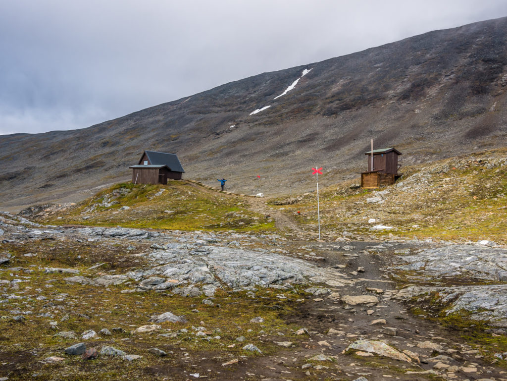
It was a further 3km to the next STF hut, so we decided that we’d camp before or after it, wherever there was a stream close by for a water supply. We’d already been warned by a hiker coming in the opposite direction that after the pass it was around 4km of walking over a rocky boulder field that was hard going on the feet. So we were pleasantly surprised to find that it wasn’t as bad as we were expecting. (Surprisingly, there are long sections over the rocks that have been boarded which makes for quick, easy walking.) Having bellies now full with hot food, we were moving at a good pace, quickly nearing the next STF hut, aptly named Tjäktja, around 8:30pm. To access the hut you have to leave the Kungsleden trail and cross the river. As we didn’t want to pay the camp fee, we continued on the proper trail, finding a camp spot with access down to the river on the opposite side to the hut. (We were still in view of the hut but several hundred metres away.)
The sign says it all really!
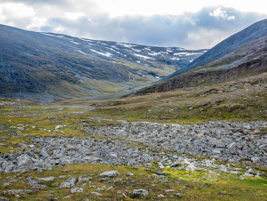
Looking down onto the Alisvággi where the Kungsleden trail now meanders north for 8 miles (13km).
The rolling mountains to the west are in stark contrast to the vast alpine landscape that stretches towards the Kebnekaise range to the south and east.
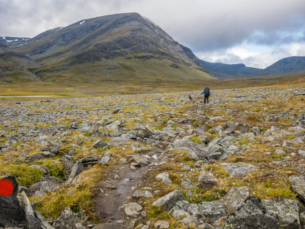
Preparing for 4km of rocky terrain. It can be tiresome and slow going at first navigating your way across the sprawling, jagged boulder field.
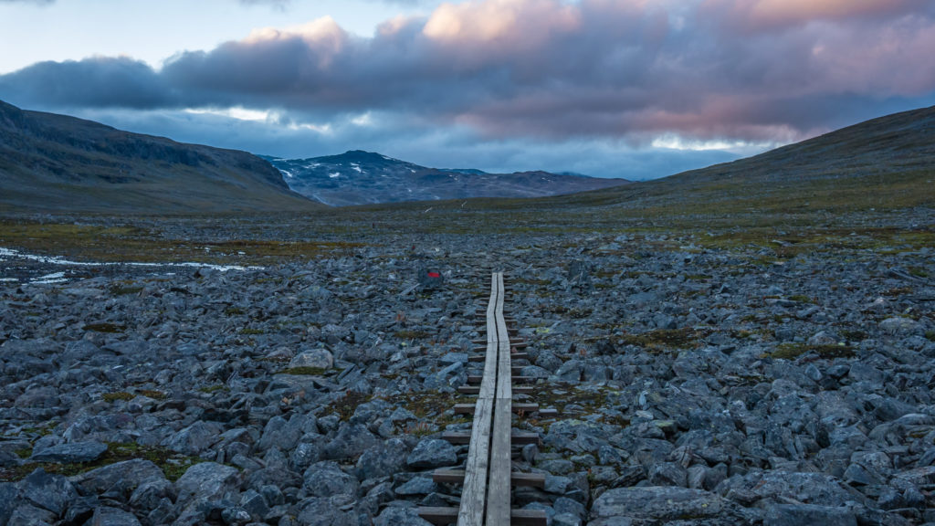
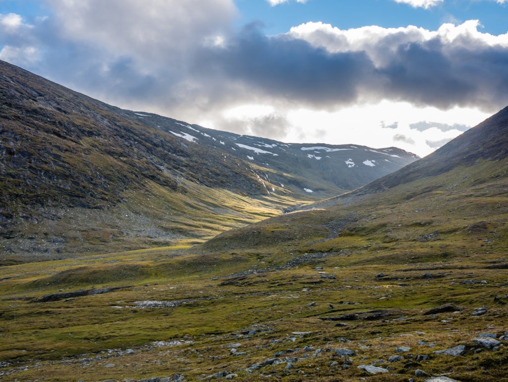
On the other side of the Tjäktja Pass stretches a fascinating and unique moonscape through the Alisvággi valley.
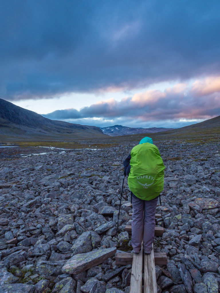
Boardwalks in place over the rocks assist with traversing the worst sections and help with quickening your pace.
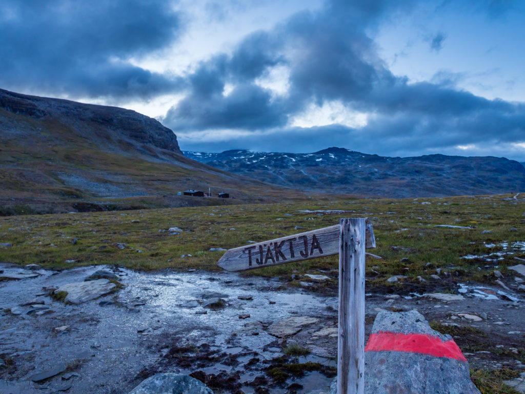
The Tjäktja STF hut lies on a barren slope just off the Kungsleden trail to the left side of the creek.
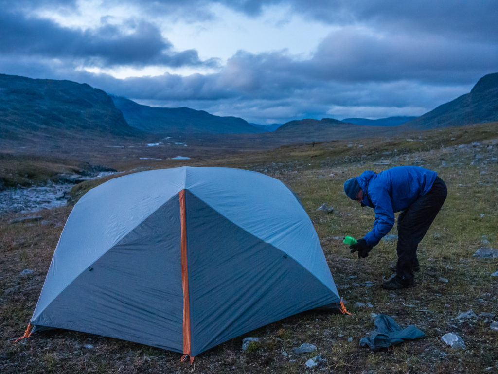
We didn’t want to pay the STF camping fee, so we stayed on the Kungsleden trail and camped on the opposite side of the river to the STF Tjäktja hut. We thought we had picked a flattish and relatively sheltered wild camp spot.
The Northernmost Section…
Today, beginning the northernmost section of the Kungsleden we have found that the landscape has changed dramatically. Here in the pass, there is almost no life, neither birches nor bush; just tundra grass. Everything looks really rough and rugged with patches of snow lying on the slopes of the surrounding peaks. We also found it was much busier on the trail today. We passed several people hiking south, as well as a large group leaving Singi heading for Kebnekaise and it now feels like this is where the true tourist section begins and everything is geared towards them. Our splendid isolation is most definitely over… And although excited at the thought of finally reaching Abisko, we have conflicting emotions – it’s bittersweet that we only have 2 nights remaining to wild camp in such tremendous surroundings. Sweden truly showcases the miracles of nature… And we will certainly miss this wonderful and wild place!
6 Comments
Wow, wow and double wow!
It may have been a busy people day on trail, but sooooo much space and beauty for everyone.
Yes definitely! We are so glad we walked the route in the unconventional way of south to north though as we had the trail much to ourselves for the best part of 18 days!!! Magical 🙂
this blog is excellent – really excellent.
I’m planning a south north trip this summer and you’re really helping me here – everything I’ve seen and read before is N-S! At last – its good to hear I’m not the only one!
I shall be coming back to these pages often in the coming weeks as my plans come together
Thank you
Hi David, thank you so much for taking the time to comment with such positive feedback. It’s great to know when our blog has been useful to others!
We’re in no doubt that you’ll have a wonderful trip, especially heading south to north. If we can help with any queries whilst you’re planning, don’t hesitate to get back in touch.
All the best with your own Kungsleden adventure!
Danielle & Wayne
I don’t know your schedule for the release of the Kungsleden guide book but I would very much like one. If its out before I head off at the end of July, I’ll buy two! One for the trail to scribble in and one for the bookcase when I get old!
I’m sure you’ll have a winner on your hands – a south north guide in English with your material will be a popular choice.
Thanks for that! The manuscript is currently with the editor/ publisher, so we’re hoping for May/June time. As we really struggled for detailed and up-to-date information about the trail in English, we’re hoping it will support people with all the information we couldn’t find prior to our hike of the Kungsleden!