
Our Penultimate Day on the Trail…
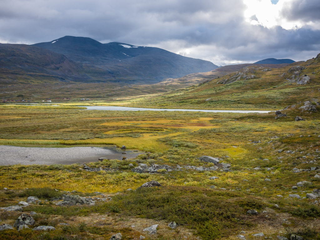
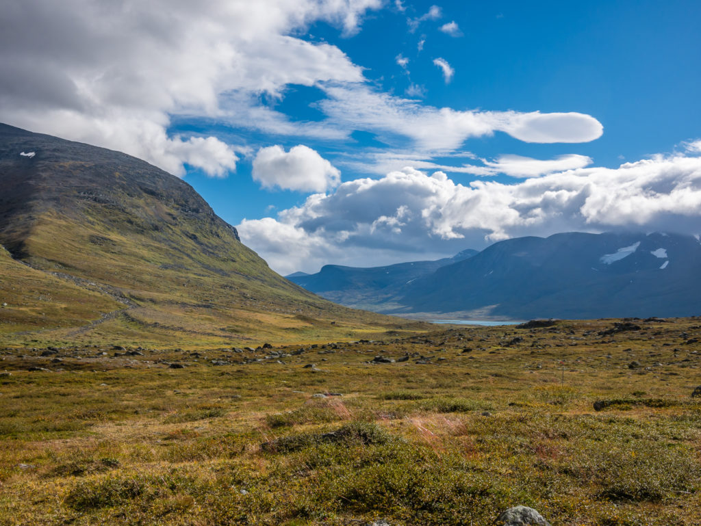
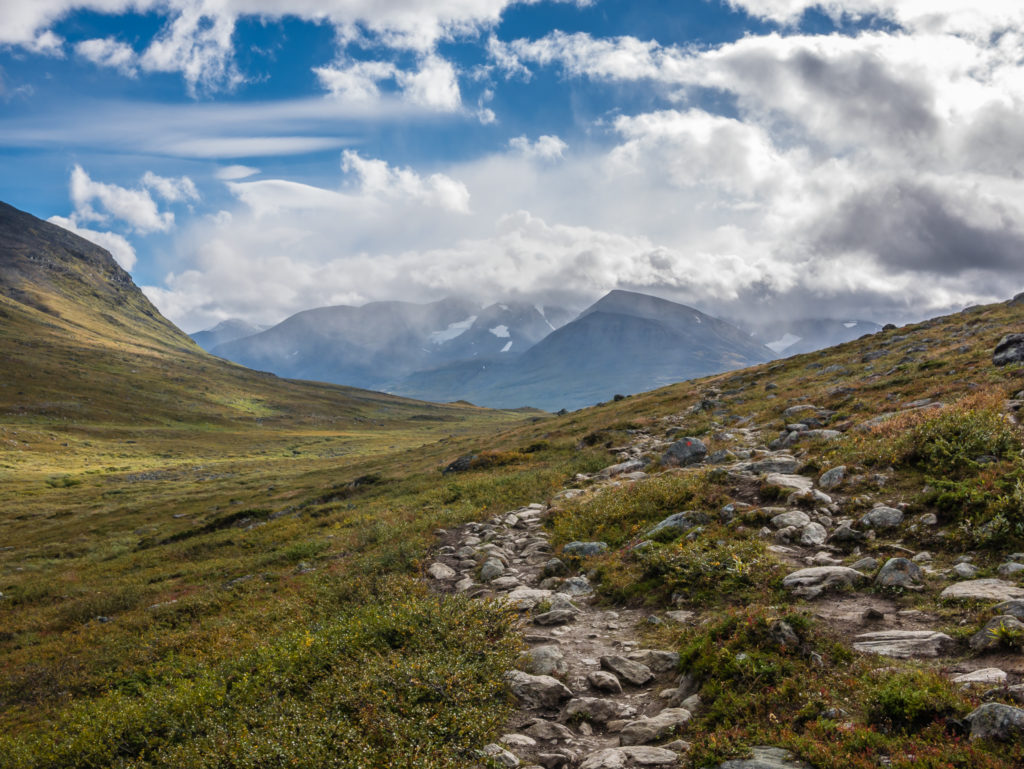
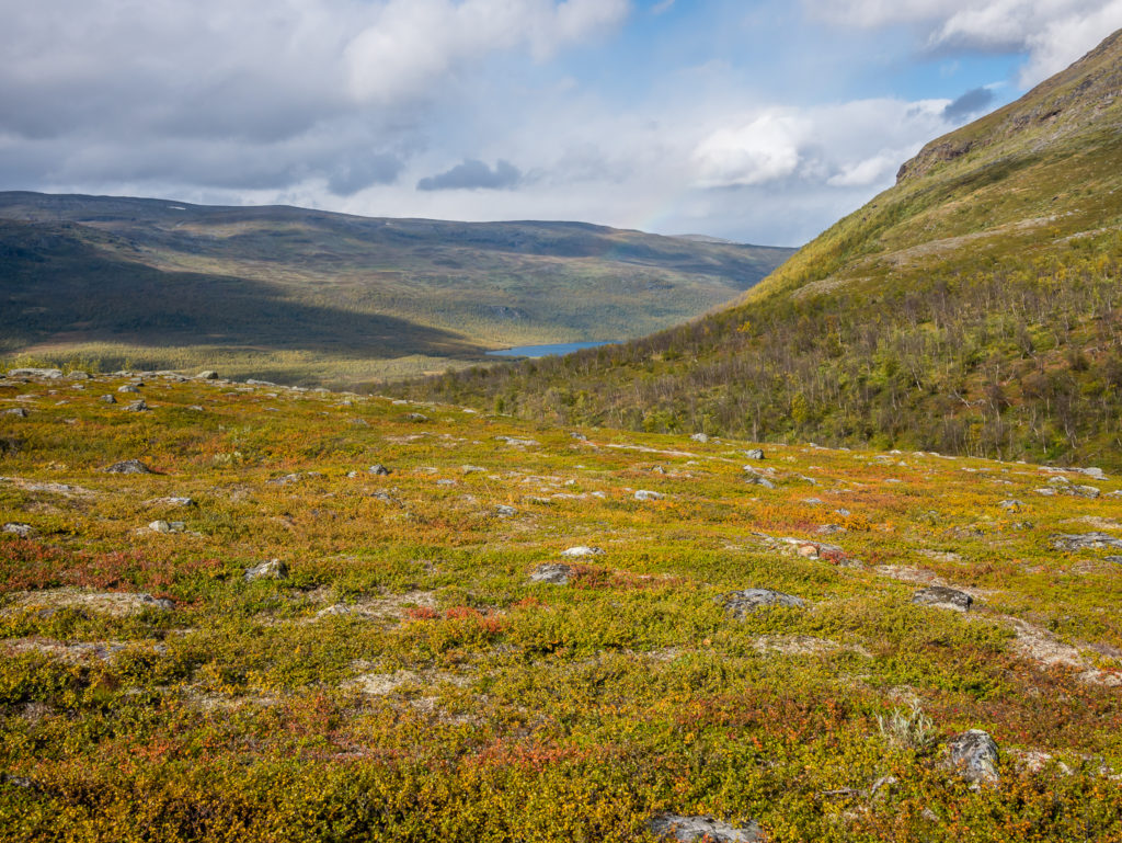
Feeling lucky that the cloud finally lifted to allow us chance to admire some of the stunning north. The final section of the Kungsleden is characterised by high altitude meadows, grassy fells, jagged rocks and craggy peaks in every direction. This is mountain walking at its best!
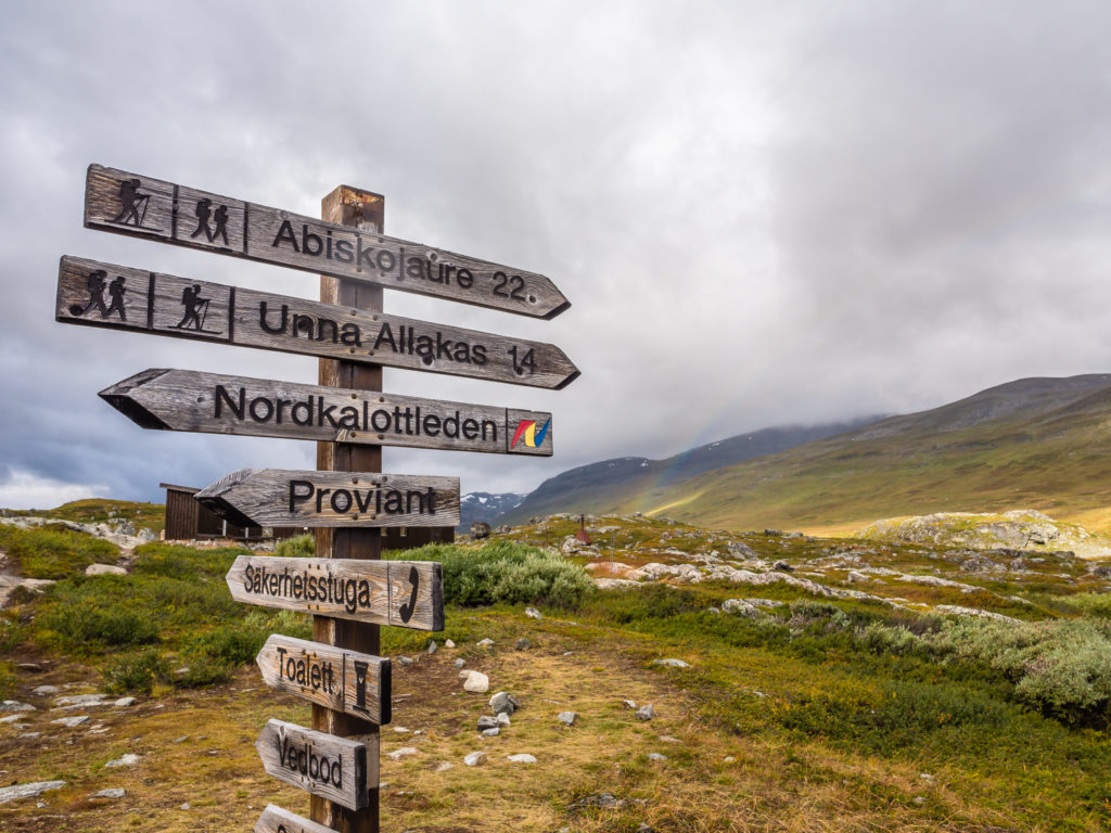
Day 20 – Alesjaure STF Hut to Nissonjokk (Designated campsite inside Abisko National Park) (19.4 miles/ 31.2 km, 9 hours, 19 mins) – Thursday 1st September, 2016 – ‘Chasing Rainbows’
It was our penultimate morning on the trail and we awoke completely refreshed having had the best night’s sleep in 20 days! It might have been something to do with yesterday’s ‘relaxing’ half day and wonderful sauna before bed time, which meant we were now raring to go to tackle the last stretch. We had a quick breakfast in the hut – our last rations of muesli and milk powder – then mentally prepared ourselves for a long day. We had already decided that instead of covering the last 23 miles or so in equal segments over the last two days, we would push on and try and camp as close to Abisko as possible to allow for a very short hike into town on the final day. We were of course keen to reach the end of the trail and celebrate with a long-awaited beer, plus we wanted to make the most of the amenities in town and the facilities at the hostel where we’d be staying, for as long as possible! So it made sense to us to forge ahead and knock off as close to twenty miles as we could!
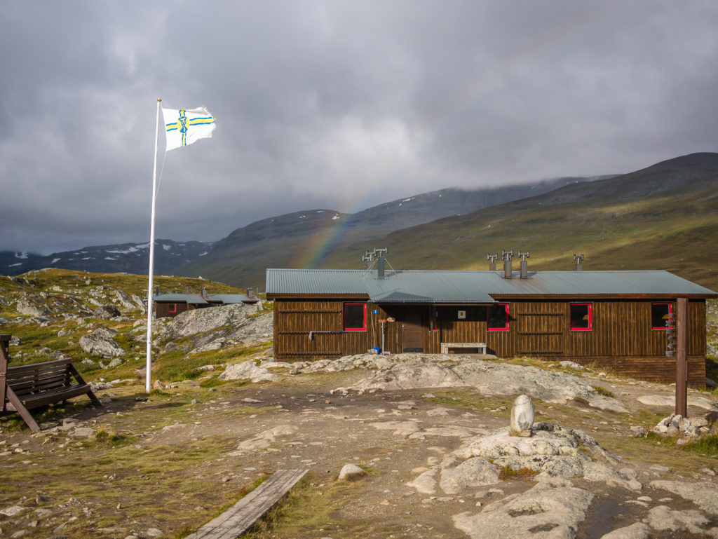
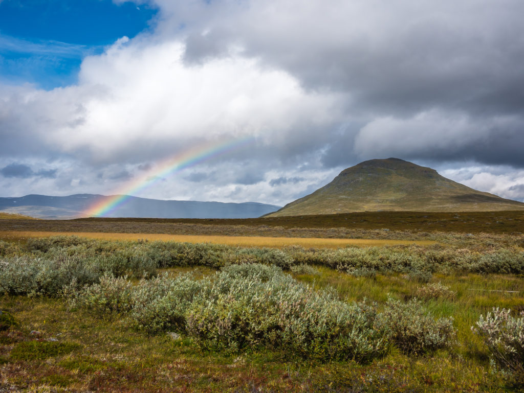
Capturing our first rainbow of the day behind the STF Alesjaure mountain huts.
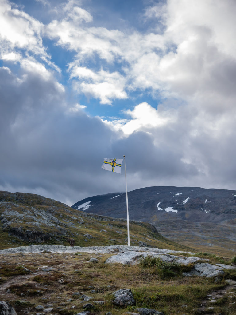
Flying the Swedish Tourist Association flag along the Kungsleden trail, next to the STF Alesjaure mountain huts.
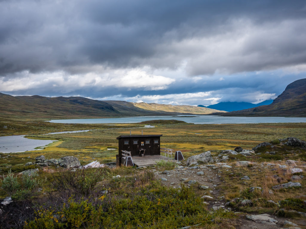
Looking onto the toilet block in front of the STF Alesjaure mountain huts. Beyond is the vast Lake Alesjaure. As is typical of this trail, toilets are always located in the most scenic of places!
Having rained during the night, we were dubious as to what the day would bring in terms of the weather, but thankfully the rain had stopped for now, giving us the chance to pack both our gear and tent away in relative calm, the light wind having dried it out. Once again we were making use of all the layers we had brought with us, the temperature, as anticipated, now feeling much cooler. We also put on our waterproofs by way of precaution regarding the huge cumulus clouds that were quickly building up further down the valley in the direction we’d be heading! We were slightly disappointed that we still hadn’t been able to capture any grand valley shots with either our cameras or the drone having experienced mostly white-out and continuous light rain the last few days. So despite the northern section of the Kungsleden famed as being ‘the best’ as it were, our day hiking up to the Skierfe look-out point remained our ‘best’ views on the trail in almost 3 weeks. Yet we were still hoping that today we’d get a lucky break with the weather!
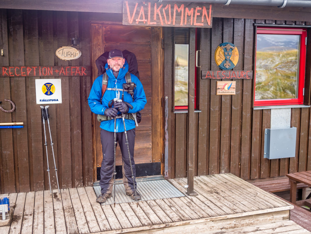
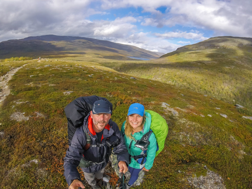
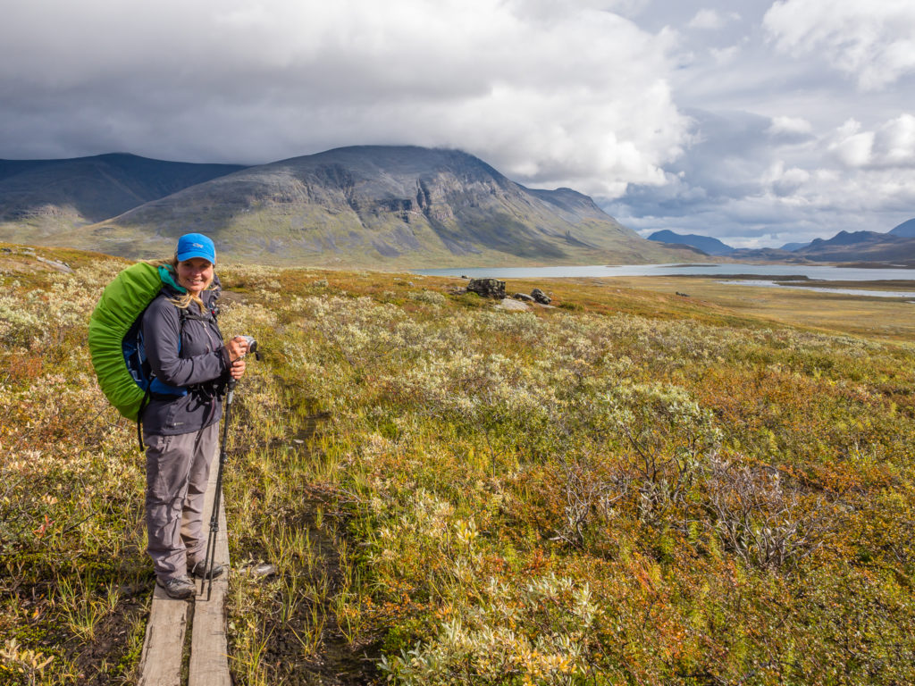
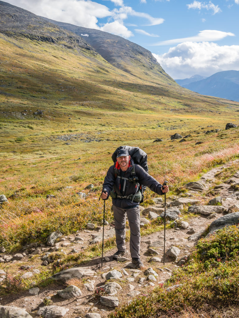
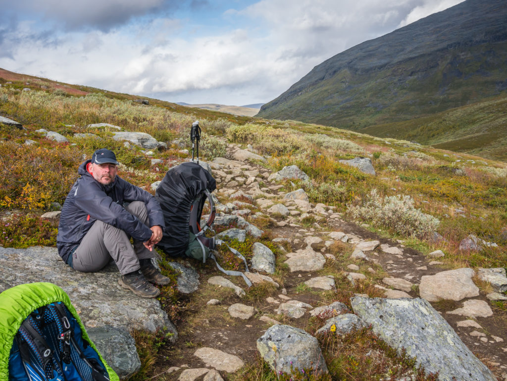
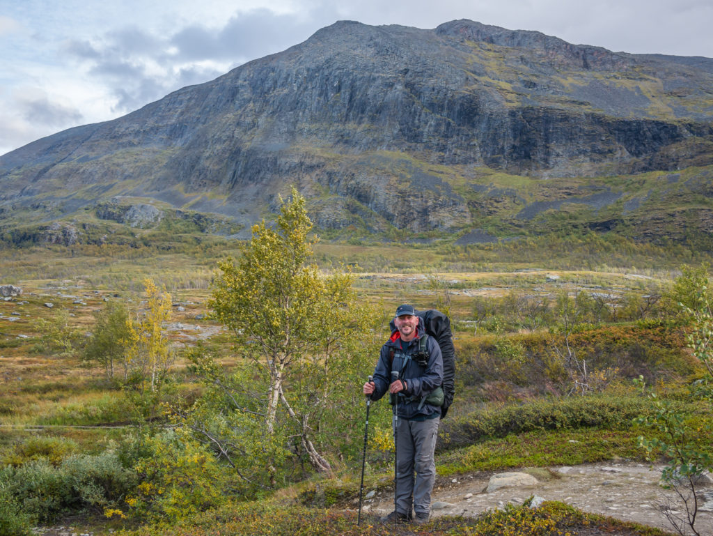
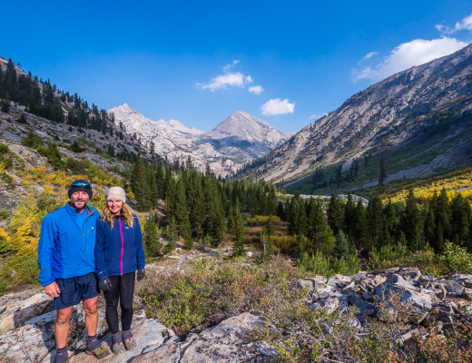
Wrapped up in all of our layers ready to face our penultimate day on the trail…
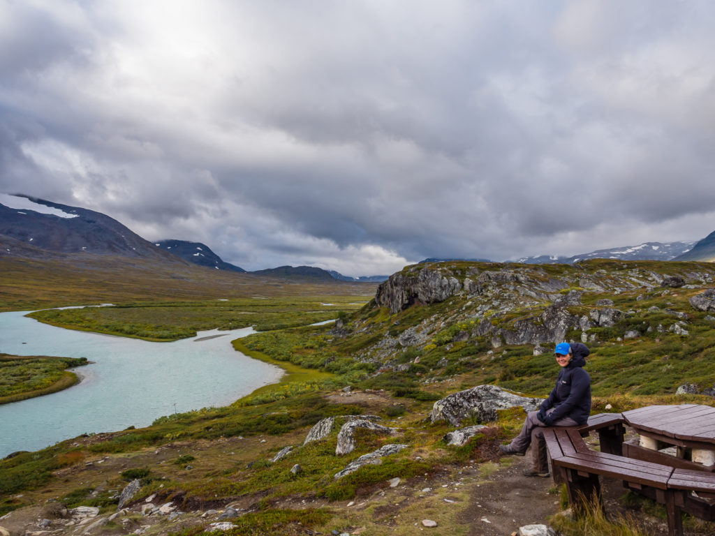
The picnic benches located next to the STF Alesjaure huts offer tremendous views of the rugged landscape. (Sunshine not included!)
Despite the grey clouds rolling in, usually signalling a downpour would be imminent, we were pleasantly surprised that heavy rain never really came. Apart from a few patches of light drizzle blowing in and out of the valley, we seemed to have a bright blue patch of sky right above us every step of the way. Our first segment of the day was an 8km walk to the Rádunjárga emergency shelter situated at the end of Lake Alesjaure. We had already decided that we’d take a tea break inside the hut to give us some respite from the wind, although the southbounders were having a much tougher time with it today than ourselves as they were walking straight into the chilly face of it. Luckily for us it was on our backs and seemed to be helping us along!
*Note that to access the Rádunjárga hut it is around a 100 metre detour from the trail, following the Kungsleden snow route. It was difficult to see the actual track as it meanders down towards the hut through dense marshy scrub and parts of it were very boggy and churned up due to use by quad bikes. However, for us it was worth the detour as we wanted a good break having planned on a 30km day! Additionally, during the peak season it is possible to take a boat ride 3 miles or so (5km) across Lake Alesjaure to save you some walking time, although the trail conditions along the shore side are fairly good and the terrain is fairly flat.
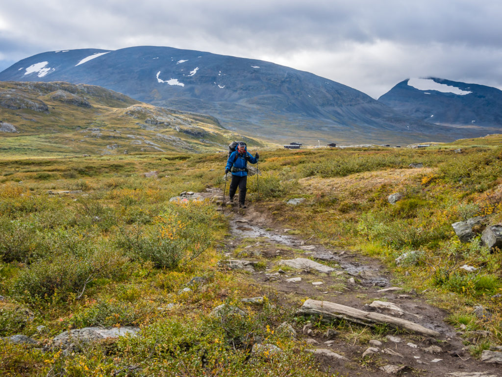
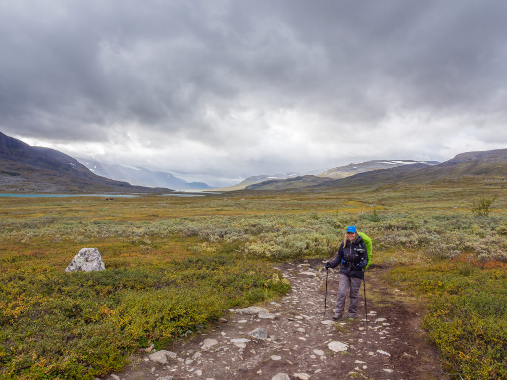
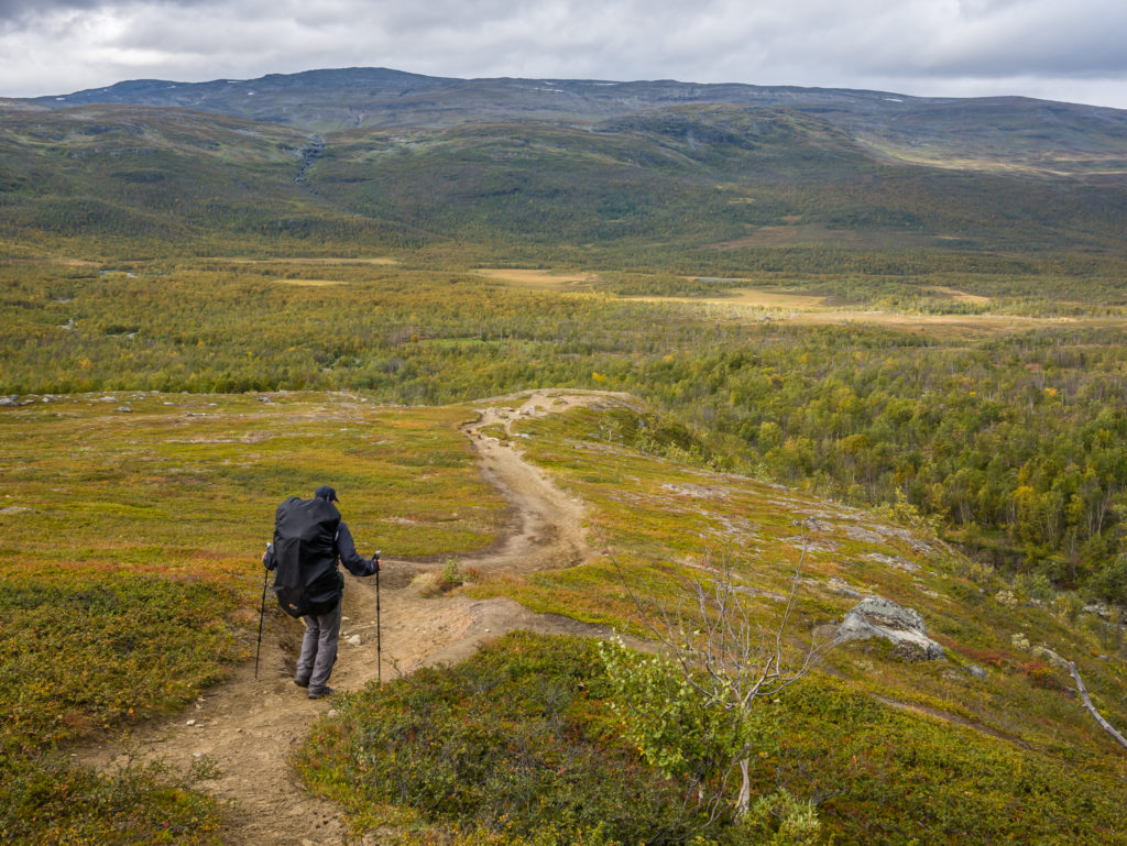
Setting off with the intention of bypassing the STF huts at Abiskojaure and camping as close to Abisko as we could.
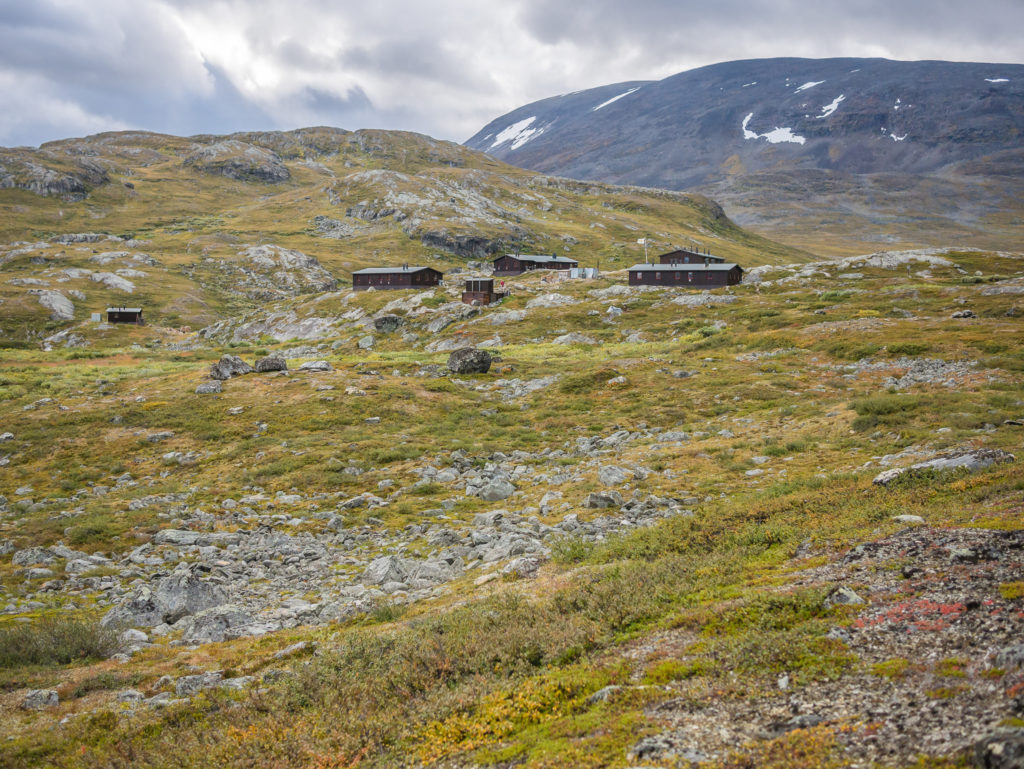
Looking back to the STF Alesjaure mountain huts. This is the largest of the STF mountain huts and indicates the popularity of the northernmost section of the Kungsleden by the fact it has up to 100 beds available.
To the west of the STF huts at Alesjaure is the Leavas Sámi village which has a summer camp. If you visit here at the beginning of July, there is a good chance to participate in the Sámi calf marking.
We were dubious about the weather as dark clouds hung over the valley, so we played it safe and put on all of our layers.
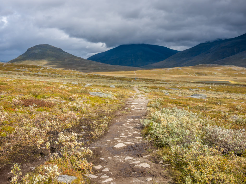
The trail was a little rocky and muddy in places, but was fairly flat so we could make good time.
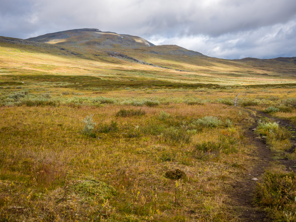
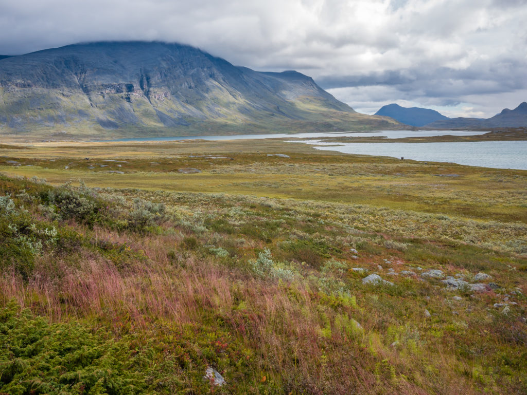
Despite the dull skies, the landscape emanates a golden glow.
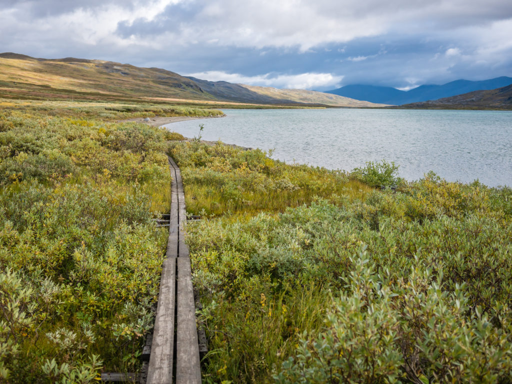
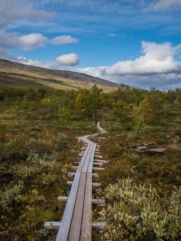
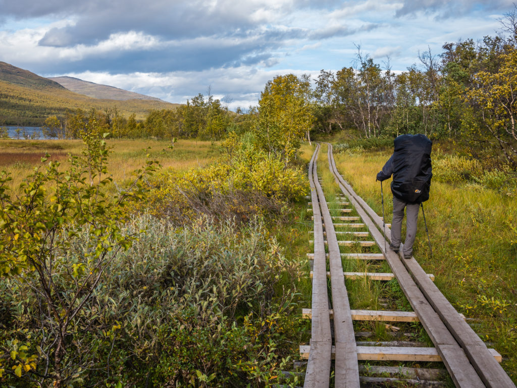
Boardwalks alleviate problems negotiating the boggy scrub.
The cloud began to break and there was intermittent sunshine so we became more optimistic for a better day!
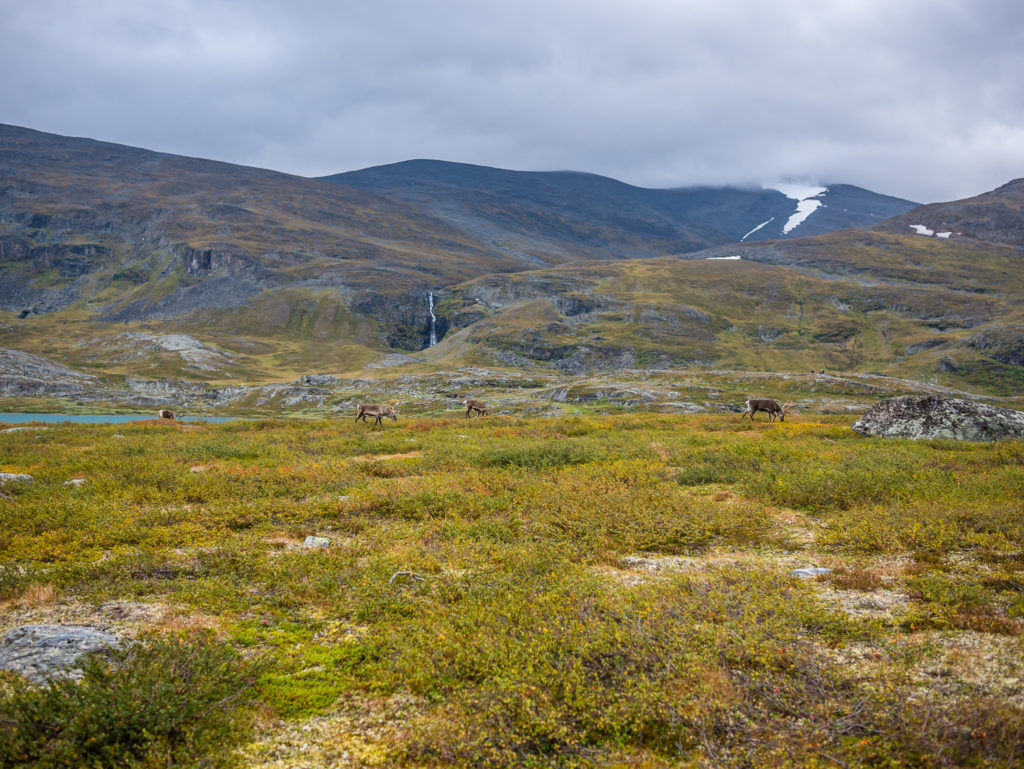
We spotted grazing reindeer along Lake Alesjaure. It’s always wonderful to see wildlife on the trail.
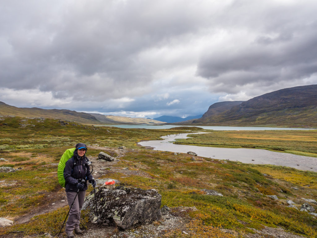
It can seem a long walk to reach the end of the lake! Alternatively, there is a boat trip across the lake for 350 SEK (£30) pp between the months of July and August.
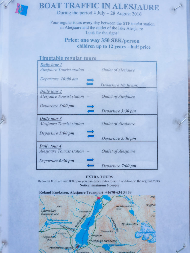
Alesjaure Lake crossing – Boat price, times and contact details for 2016.
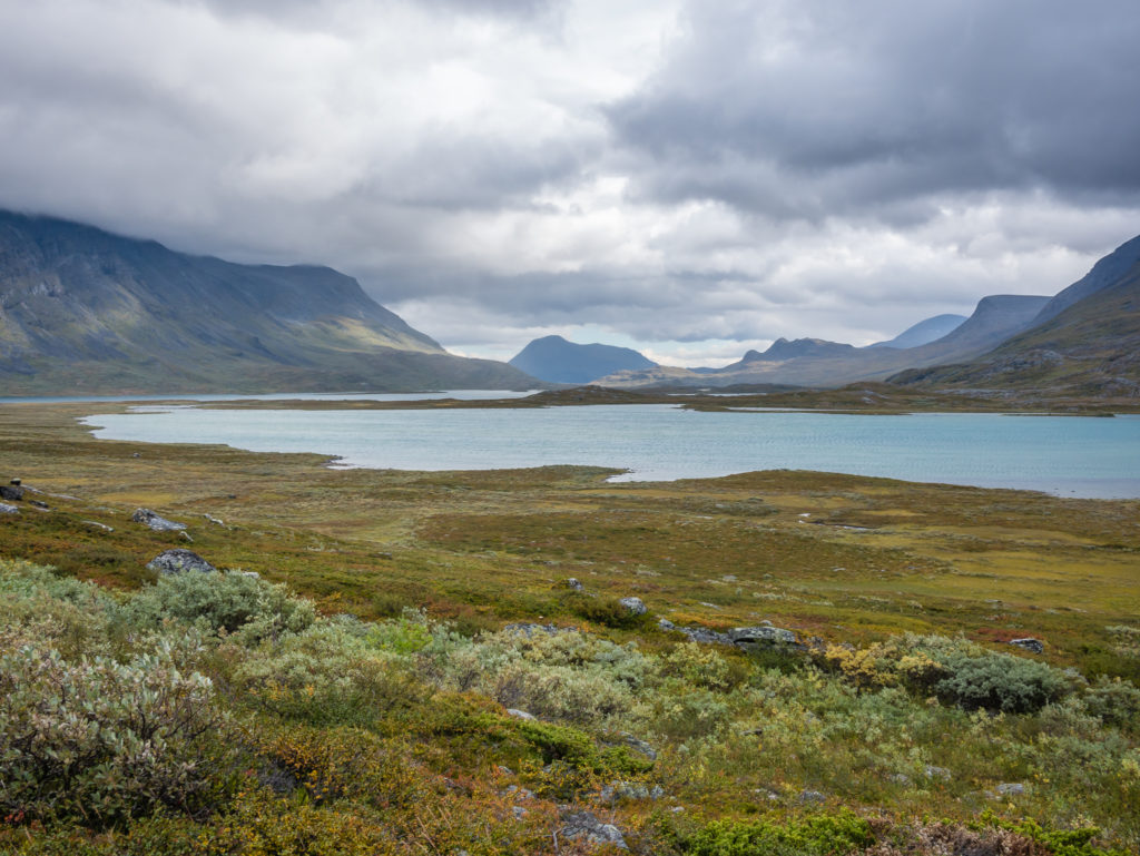
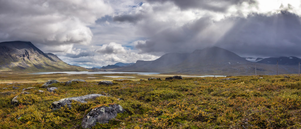
A splendid lakeside walk to start the day. The rain was holding off so we couldn’t complain!
Despite the ominous clouds, we enjoyed a grand mountain view and a wonderful lakeside walk.
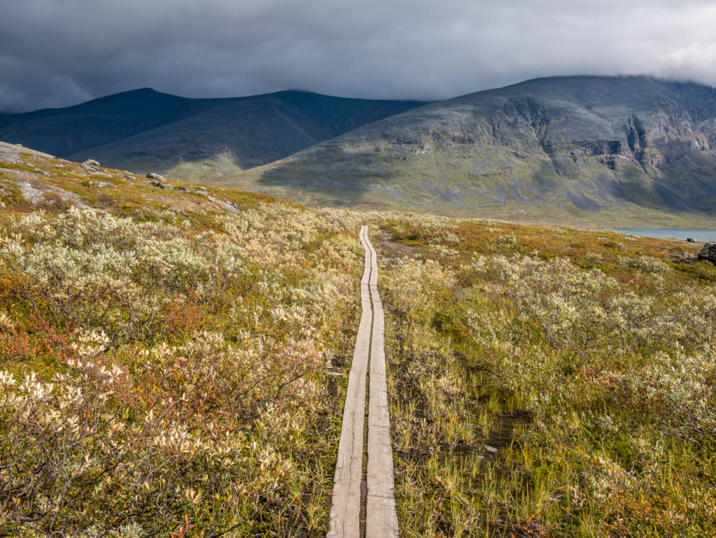
This image typifies much of our Kungsleden journey! Boardwalks lead the way…
Battling with the incessant winds, but fortunately it was on our backs for the majority of the day.
Beyond lake Alesjaure, willow shrubs and mountain moors edge the trail. Immediately before the reindeer enclosure, it is advisable to top up your water supplies as this is the last opportunity to do so for about 4 miles (6km), not counting the creek just after the enclosure that may or may not have running water.
Heading beyond the reindeer enclosure and towards the Gárdden valley.
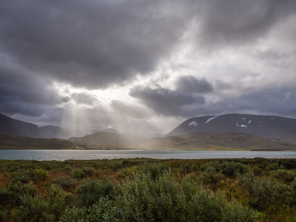
Setting off again, we were aiming to complete another 8km before we would stop for a lunch break. The weather seemed to have improved dramatically since our rest in the hut and we now found ourselves having to de-layer as the sun kept making an appearance! Even more pleasing was that we thought we had just about out-walked the rain showers that were still looming over the southern end of the valley. We were amazed at how many rainbows kept appearing ahead of us, so we stopped and sat on some rocks admiring their fleeting presence and the changing intensity of their colours.
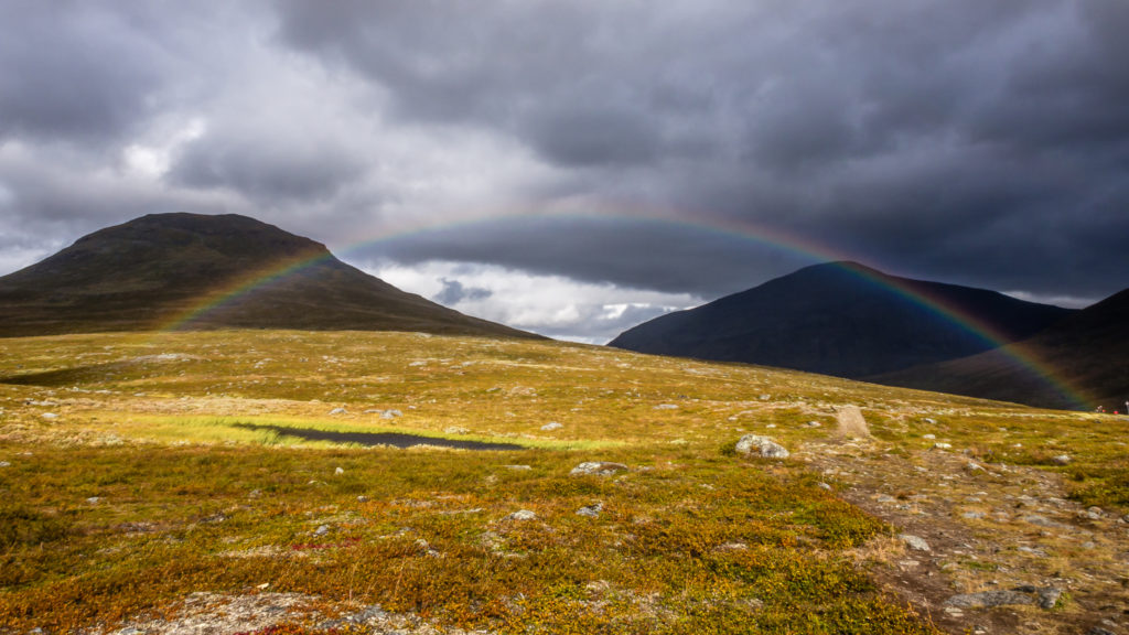
Magnificent rainbows dominate the skyline…
When a rainbow appears, everything seems magical!
And as if by magic, we had bright blue skies, if only for a brief interlude!
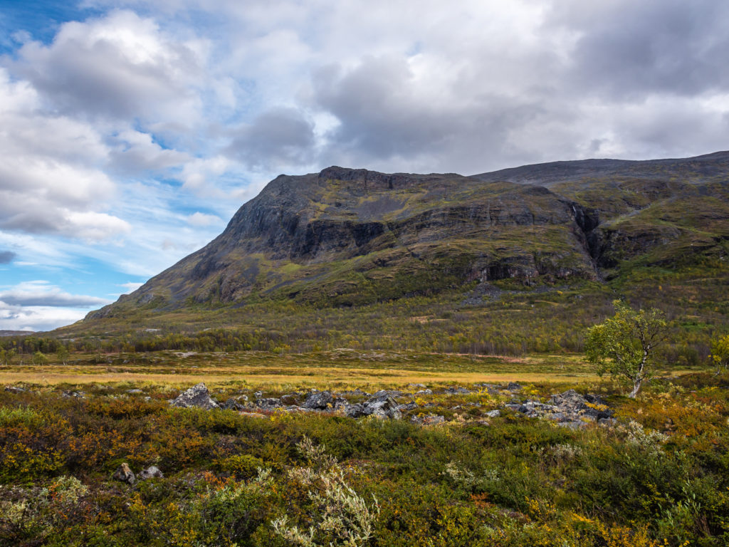
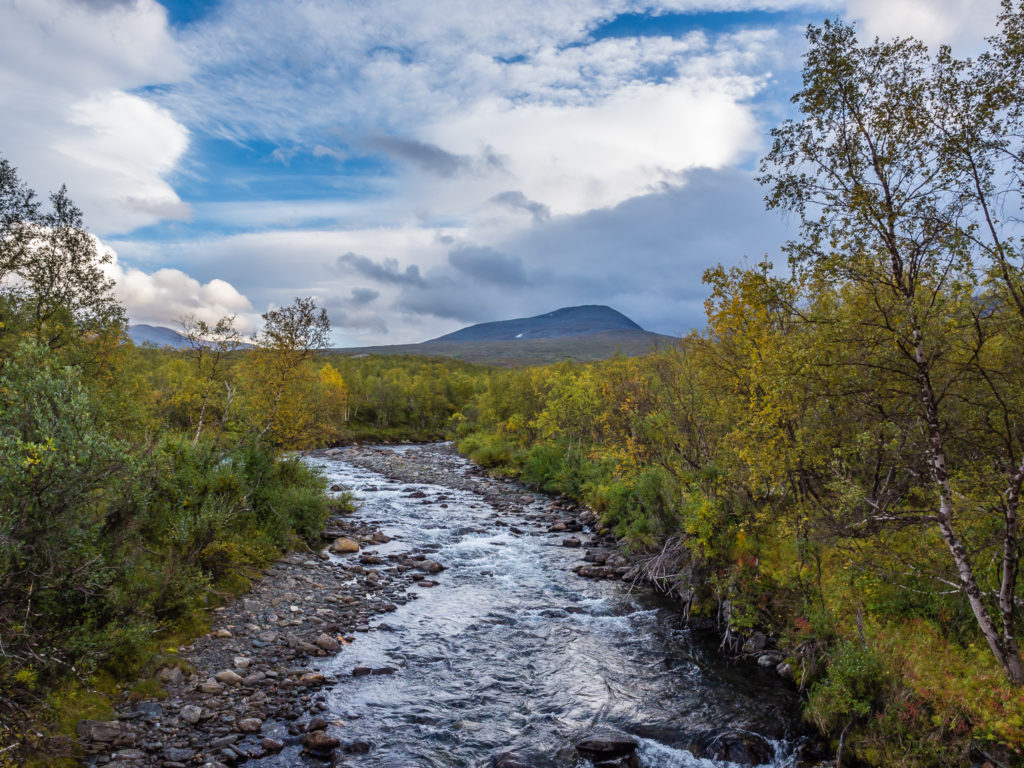
This final section of the Kungsleden is characterised by high altitude meadows, grassy fells, jagged rocks and craggy peaks in every direction. We took a quick breather and sat at the side of the trail to admire the impressive views through the Gárdden valley. Under clear skies, this is mountain walking at its best! The mountainsides here were still verdant with low-growing, bushy willow and dwarf-birch, but it was the towering peak of Gárddenvárri (1154m) that really caught our attention before we began a gradual descent of around 300 metres to the valley bottom.
The lush Gárdden valley was carpeted in green.
A ray of light instantly lifts the spirits.
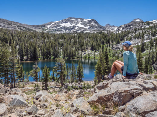
We sat down to soak up the views from one end of the valley to the other.
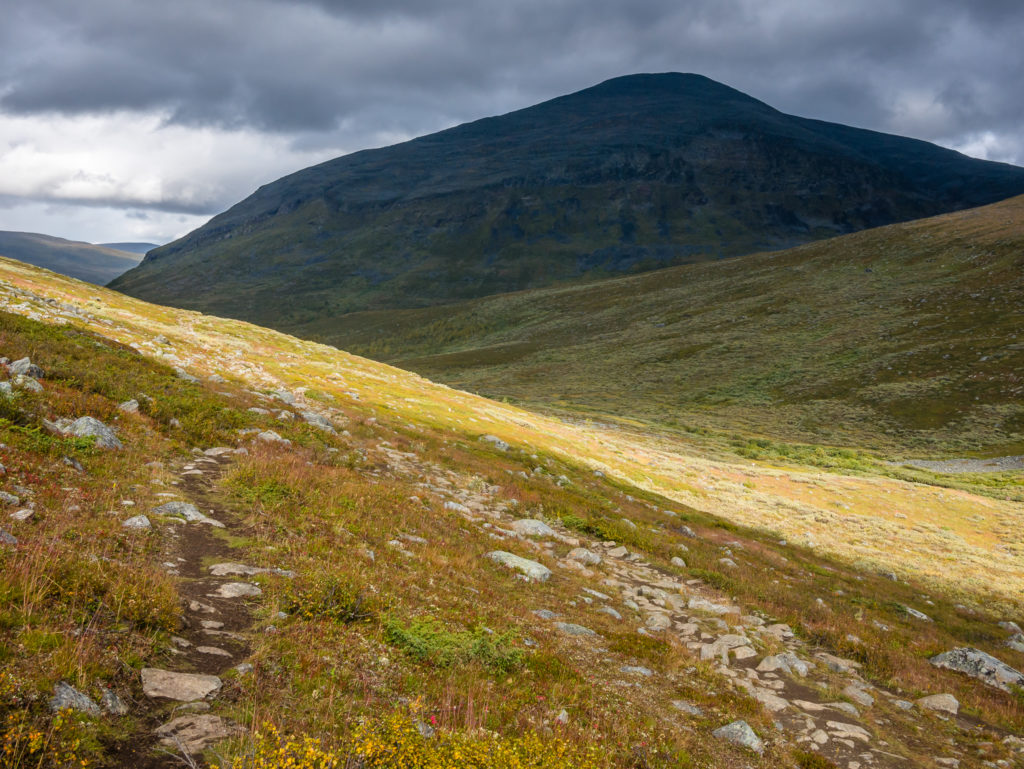
Leaving the bare mountain region behind.
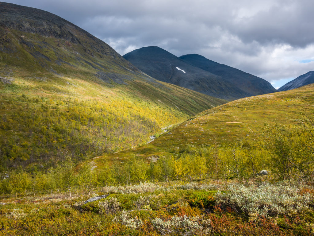
Gorgeous greens and golds – here the mountainsides were cloaked in low-growing, bushy willow and dwarf-birch.
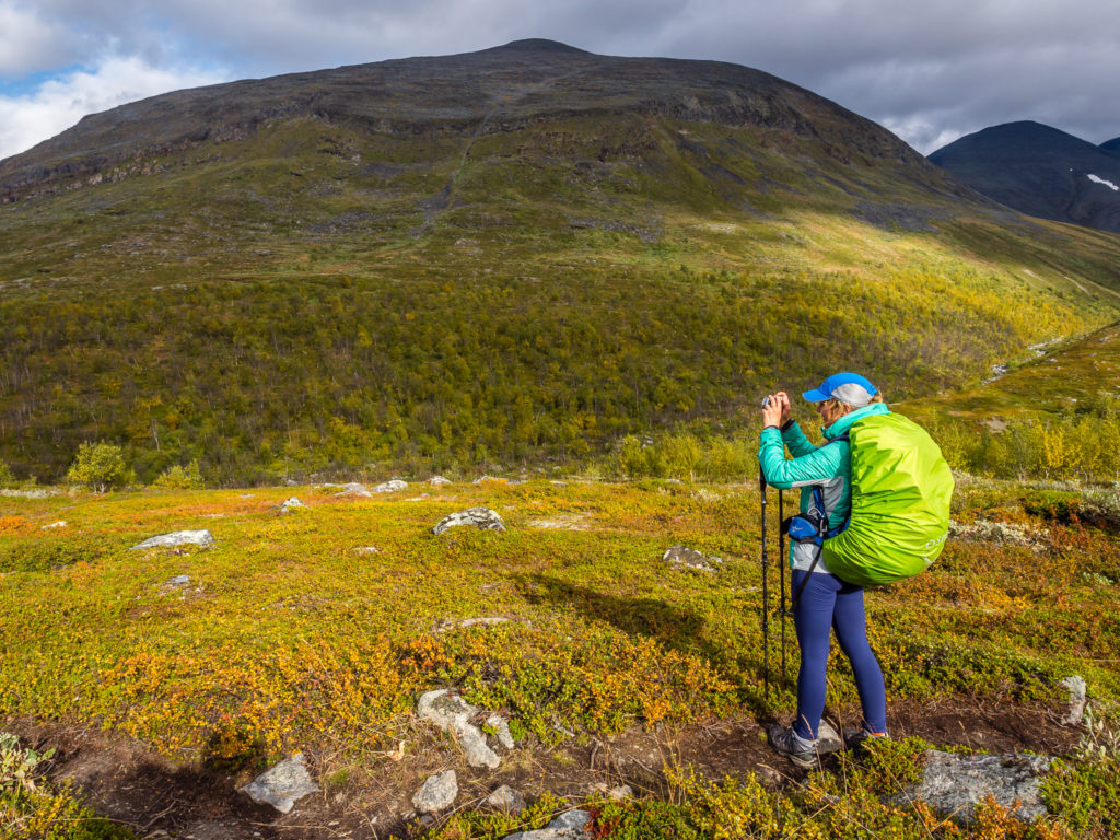
Trying to capture the wild and rugged beauty on camera.
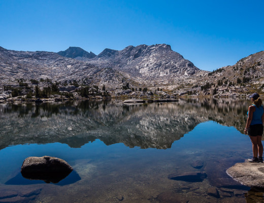
Looking towards Abiskojaure Lake.
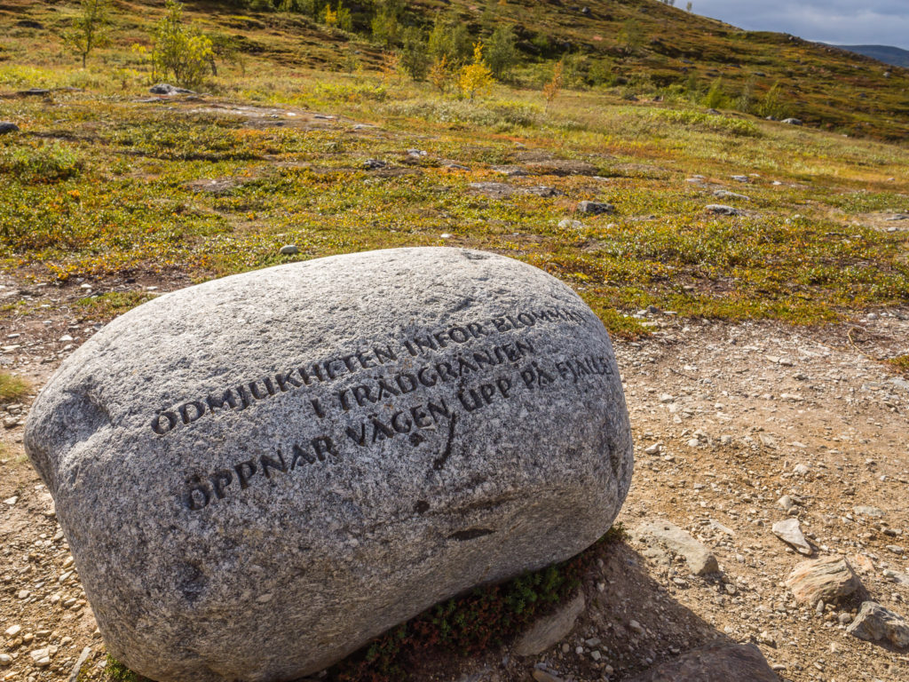
One of seven meditation spots along the Kungsleden, with a quote from Dag Hammarskjöld’s spiritual diary engraved on a stone. The Dag Hammarskjöld Trail was inaugurated in 2004 as a pilgrim route between Abisko and Nikkaluokta.
After passing one of the seven meditation stones along the northern Kungsleden that forms part of a pilgrim route between Abisko and Nikkoluokta, from this point the trail winds downhill through woodland, across a suspension bridge over the Ŝiellajohka river and past a designated camping area before entering the rugged but peaceful landscapes of Abisko National Park. A little further along the trail, the STF Abiskojaure hut is located on the other side of a suspension bridge at the southwestern end of Lake Abiskojaure.
Abisko National Park is the only area of the Kungsleden where wild camping is prohibited. You must either camp before entering the park, camp or stay at the STF hut, or continue further along the trail to another designated camping area – Nissonjokk. As the STF mountain hut at Abiskojaure wasn’t quite far enough for our mission to knock off as many miles as possible, we had planned on getting to the national park designated campsite – Nissonjokk, just 4km out of Abisko. Overall it meant a very long day today, but it would be of great benefit tomorrow with us then only having 4km to go to reach the end of the trail, allowing us plenty of time in Abisko to celebrate!
Following the trail downhill into the woodland. Thankfully it was a gradual 300 metre descent.
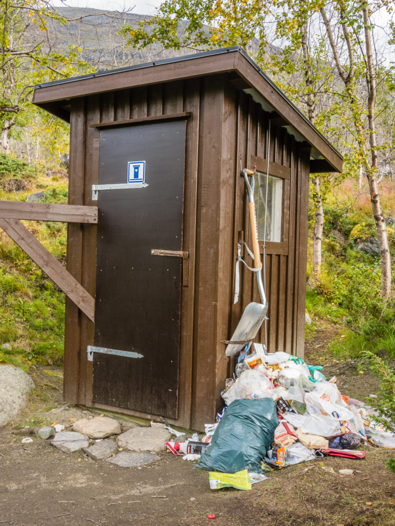
At the first designated camping area before entering Abisko National Park, we were disappointed to see that people had disregarded the ‘pack it in, pack it out’ rule and left their rubbish by the toilet. How rude!
The trail was extremely easy to follow from this point onwards. There are lots of new wooden boards, and what ensued was very steady walking, mostly on flat paths – the trail seemingly a bit sanitised from here, it being well maintained for the use of weekenders and day trippers exploring the national park as opposed to thru-hiking the Kungsleden. We noticed that the boards here are laid like tracks and assumed that the two sets are for more foot traffic, for example, so that southbounders and northbounders could continue walking at the same time, passing each other without having to give way, but Wayne realised they have been constructed in this way to allow for vehicle access. There are some private huts at the end of the lake whereby vehicles need to get in and out, and the boards also allow for quad bikes to reach both the Alesejaure and Abiskojaure mountain huts to replenish supplies. We also heard and saw several helicopters on this section of the trail, which provide day tours for visitors from Abisko and Nikkaluokta. So whereas further south the Kungsleden offers wild, undisturbed solitude, prepare yourself for quite the opposite in the north!
New extra-large boardwalks had been laid through this area.
The rugged but peaceful landscape as we entered Abisko National Park.
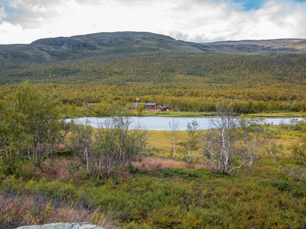
Looking across to STF Abiskojaure which is located on the other side of a suspension bridge at the southwestern end of Lake Abiskojaure.
Still smiling after 20 kilometres of walking!
Wooden tracks running alongside Abiskojåkka river allow for quick, uninterrupted walking.
We made excellent time, covering around 4.5km per hour, as per our tracking data. By 3:30pm, we’d already hiked 20km, and we were in high spirits at the thought of two thirds of the day done, with just 10km left to go! We stopped and had a chocolate break in readiness for the last 10km push! An Ibuprofen also helped as we were both feeling a little strain in our ankles and necks, but not enough to make us rethink our plans.
As Lake Abiskojaure finally comes to an end, the trail then follows alongside the Abiskojåkka river. Here the ground is well trodden and flat, with shady birch forest offering a wonderful break from the open, windy mountain moors. We were still one step ahead of the rain and marching along the newly constructed boards when we were suddenly startled by a huge reindeer that ran across the trail in front of us and up the ridge on the right-hand side. In fact, there was a large group of them that then all skittered and darted right across the trail. It was the closest we had been to any reindeer throughout our Kungsleden journey as they usually bolt as soon as they realise a human is in sight, and it brightened up our last 2km as it was completely unexpected!
As we reached the designated camp area, it had already become a ‘tent village’ and was buzzing with teenagers clearly on a school trip. We walked around looking for a pitch, but as we didn’t want to be in the thick of the furore, we picked a more secluded spot at the edge of the area.
Along the Abiskojåkka river is some of the most lush and dense vegetation of the trail, the shady birch forest offering a wonderful break from the open, windy mountain moors.
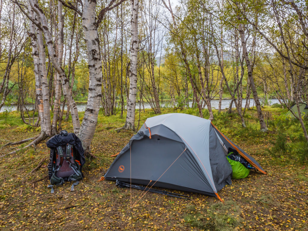
We pitched our tent at the designated camping area – Nissonjokk, as wild camping is not permitted inside the Abisko National Park boundary.
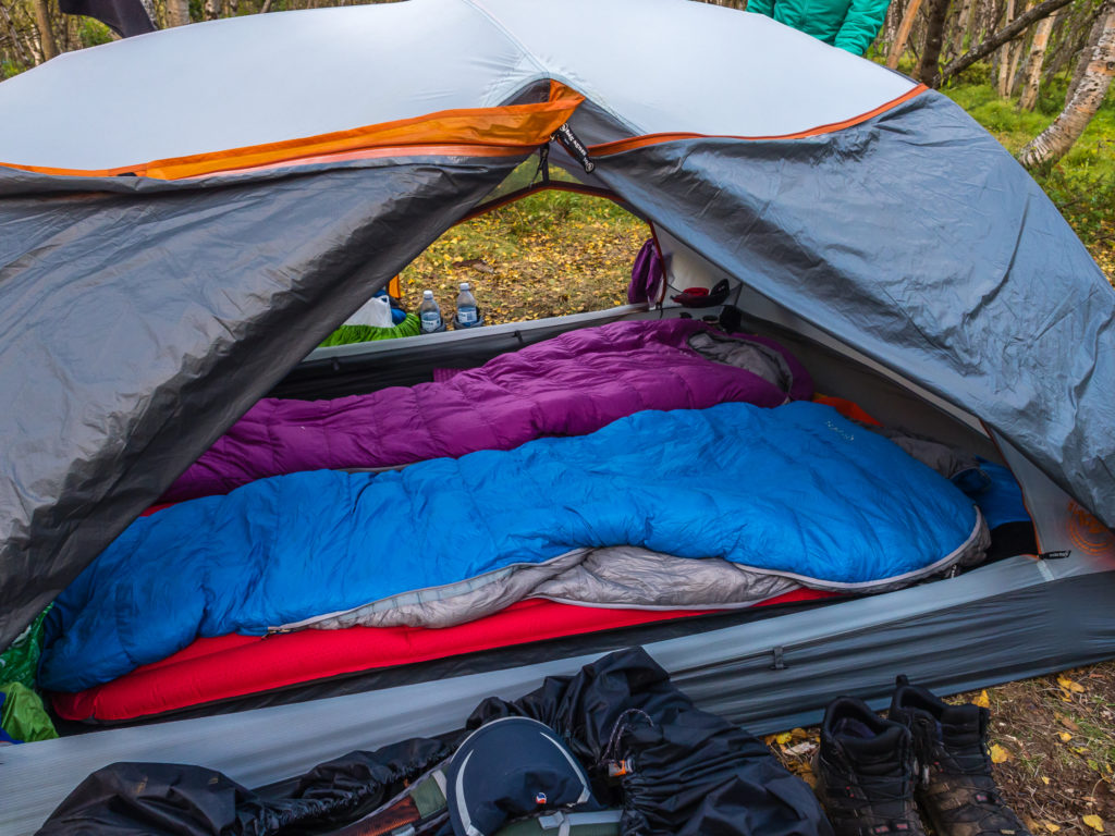
Our camp set up! We were pleased to have upgraded our backpacking tent to a lightweight 3-person option as we have much more space both inside and in the vestibules for all of our gear.
With a look of dismay all over my face, Wayne said to me, “Don’t be sad that it’s your last camping night!” I wasn’t dispirited about that, it was more the fact that for our final night on the trail we wouldn’t be camping in an amazing wild camp spot complete with fire pit and awesome view, that by now we’d gotten used to and taken so much for granted as being ‘normal’. That being said, it didn’t take long for us to get into our sleeping bags and drift off to sleep, hiker midnight looming early after a 30km day. That didn’t stop us from waking twice in the night however, and looking out of the tent expectantly to catch a glimpse of the northern lights dancing above our heads. Hope as we might, it was still a little too early in the year for such delights, the sky very much pitch black. Maybe we’ll be lucky tomorrow on what will be our last night in northern Sweden!
5 Comments
Nice write up and some lovely photographs.
Thanks! It seems to have taken forever to get to the end of this set of blog posts! One more to go… 😉
Another sensational day – rainbows, reindeer, lakes, mountains and vast views. Maybe a few too many people, but fewer than if you had started here in the warmer weather. I wonder if it took much adjustment when you returned to the hustle and bustle of life in the UK.
Hello!
I am doing the full Kungsleden from north to south in a weeks time.
Thank you for all your info.
I am wondering what map you used?
Cheers,
-Cabiri
Hi Cabiri, sorry for the late reply. We used the Calazo maps and ordered them online.
Good luck with your hike!