
Walking the Wainwrights… Another 9 Bagged!
Making the most of every school holiday and it being May half-term, our crazy idea of a relaxing week off work was to create our own circular route around the Lake District, with the intention of hiking 50 Peaks in a week to bag some new Wainwrights!
Completely ‘do-able’ with a generous 8 day itinerary, we were keen to get our backpacks on and take to the hills. However, even with careful route-planning and preparation, not everything always goes to plan…
You’d have thought we would have learnt our lesson by now! Yet again, in typical English style, it was the changeable weather that became our biggest challenge and put paid to our hopes of completing what on paper was a tremendous exploration of the Southern, Central and Far Eastern Fells, the latter being an area of the Lake District we were yet to explore.
Reaching the summit of Scafell below glorious skies, to sheltering under a bridge during a raging thunderstorm down in Eskdale, to wild camping in complete white-out near the top of Hardknott Pass – on Day 1 alone we encountered practically four seasons in a day. With the forecast for the week ahead rapidly deteriorating, we decided to set off and see how far we would get before having to make the decision to bail out!
Having notched up over 3,000 metres of ascent and descent in the first 3 days, we found it was a huge amount of effort considering we had only bagged 9 peaks along the way… Yet we were still intent on achieving the full 50 at this point! With photographs telling the story, here’s a round-up of days 1 – 3…
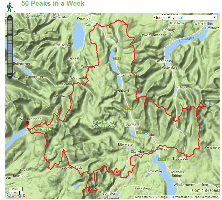
Our planned circular route taking in 50 Wainwrights over a week.
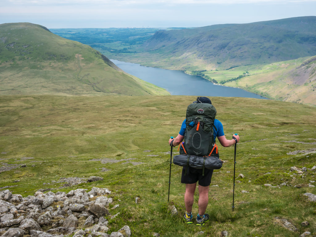
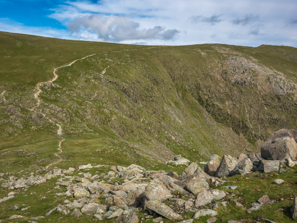
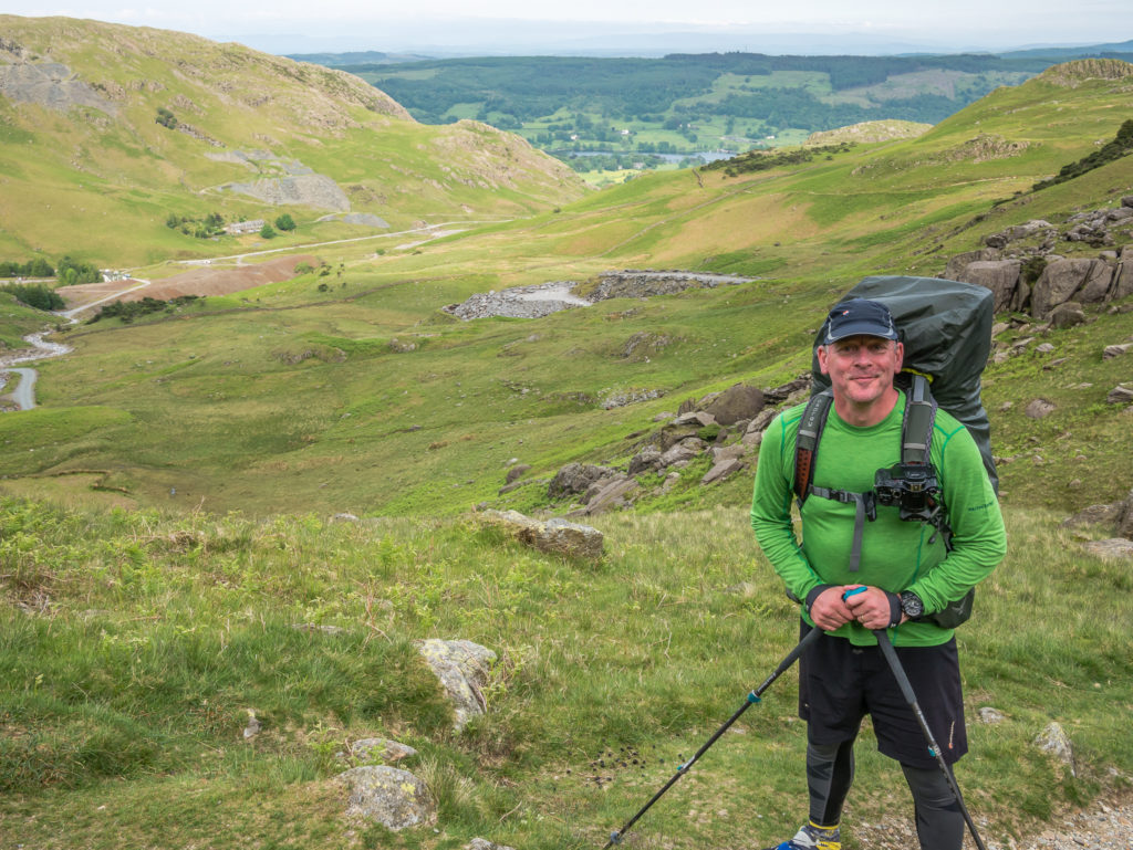
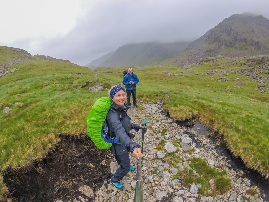
Day 1 – Wasdale Head Inn Campsite to Hardknott Pass Wild Camp (10.1 miles/ 16.3 km, 7 hours, 38 mins) – Height Gain: 1,391m/ Height Loss: 847m – Saturday 27th May, 2017 – ‘Rain, rain go away – We want to bag some fells today!’
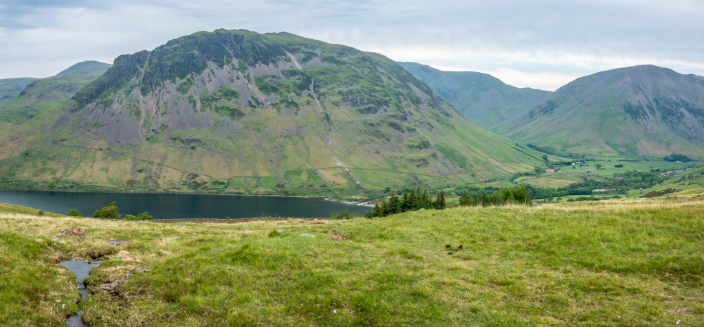
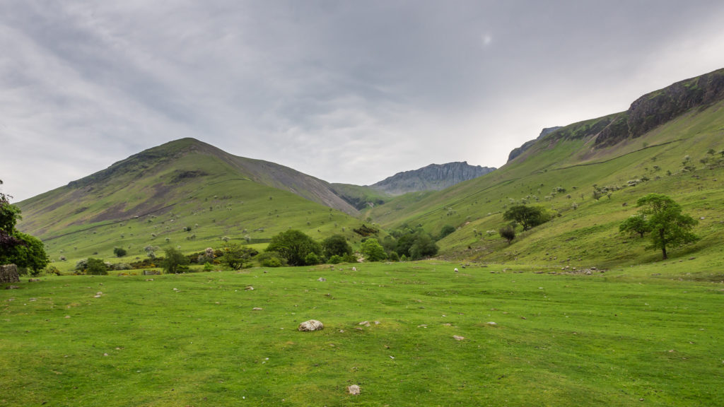
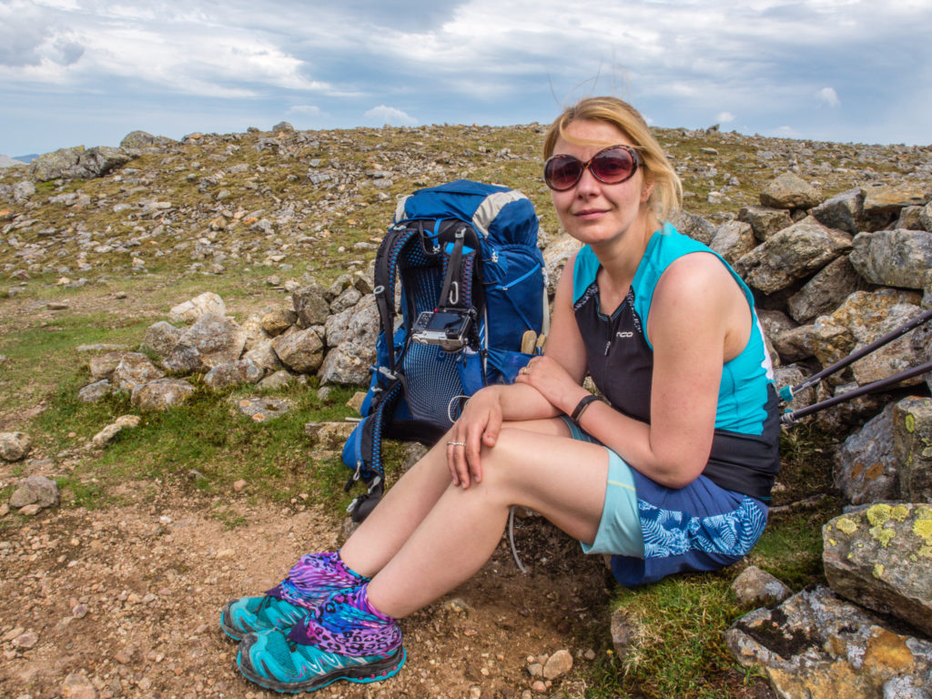
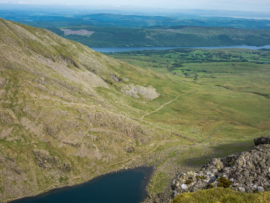
We set off from the walkers campsite at Wasdale Head Inn under cloudy skies. Looking onto Wast Water and Yewbarrow.
Enjoying the surrounding ‘green’ scape. We had high hopes that the cloud would lift later that morning.
So far so good… Slowly but surely making our way up towards Scafell.
Looking back onto Wast Water.
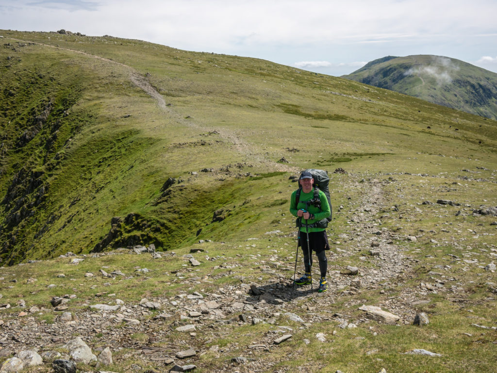
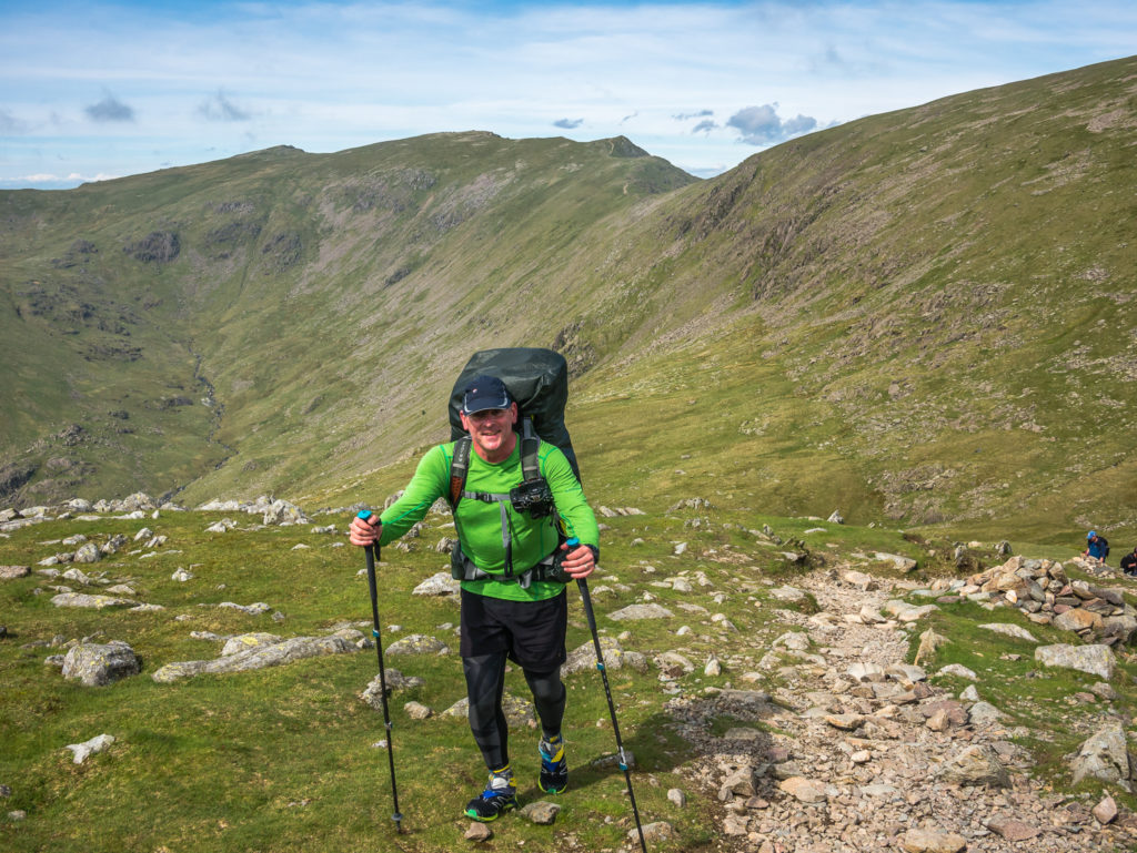
A great start to the day… Taking a quick rest break on our way up the steep mountainside.
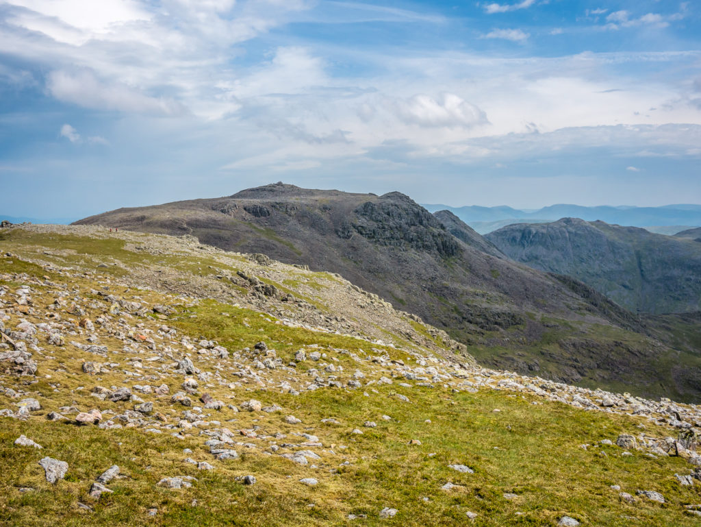
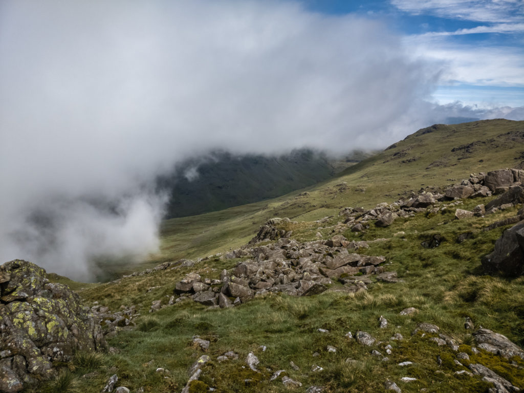
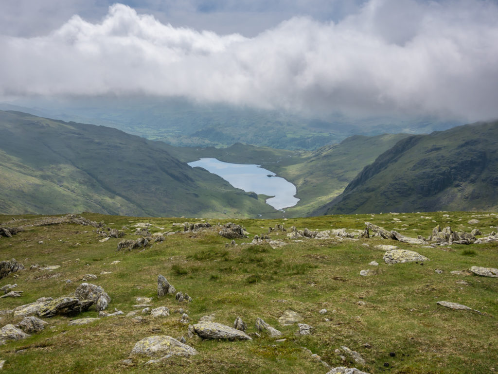
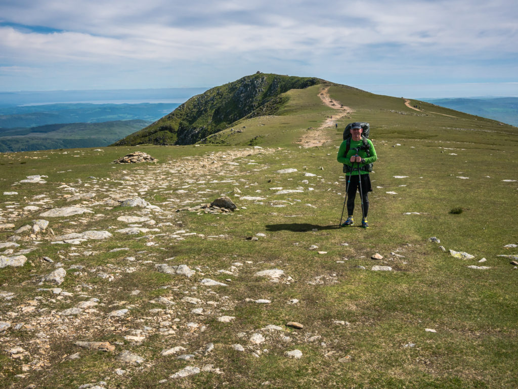
Looking towards Scafell Pike from Scafell. Incredibly, the summit was in clear view!
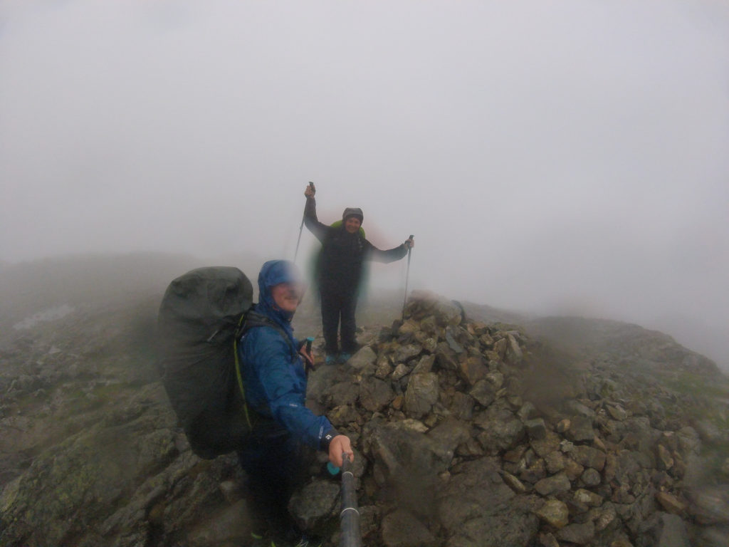
1st peak bagged! At 964m, Scafell is the 2nd highest mountain in England. It was very blustery walking along the ridge path, but it still felt warm with the intermittent sunshine.
Taking a breather just below the summit whilst Wayne shoots some video…
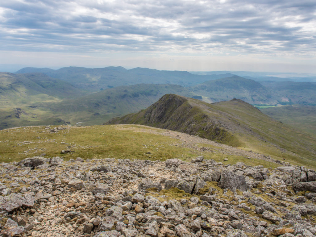
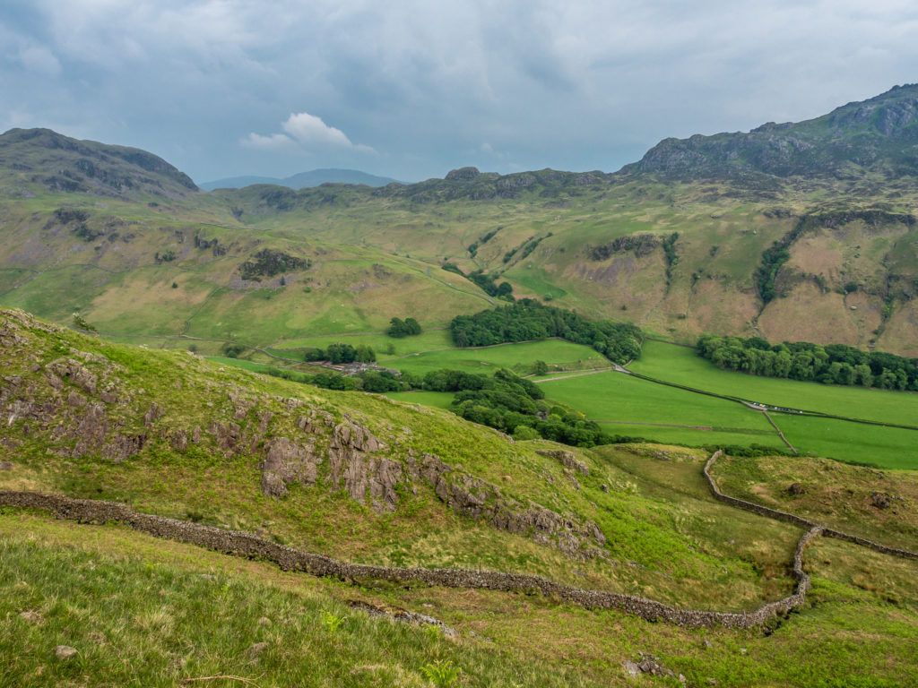
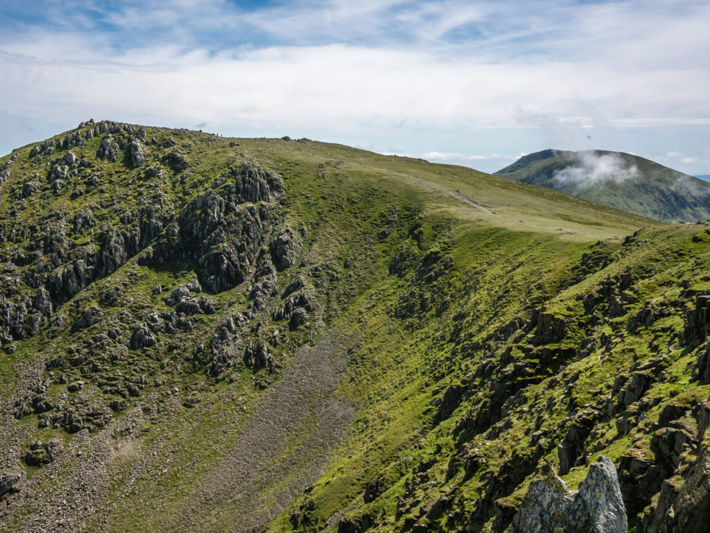
Descending from Scafell looking ahead onto Slight Side, the next Wainwright at the far end of the ridge.
Looking back towards Scafell and Scafell Pike, the weather very promising for day hikers heading to the summit of England’s highest mountain.
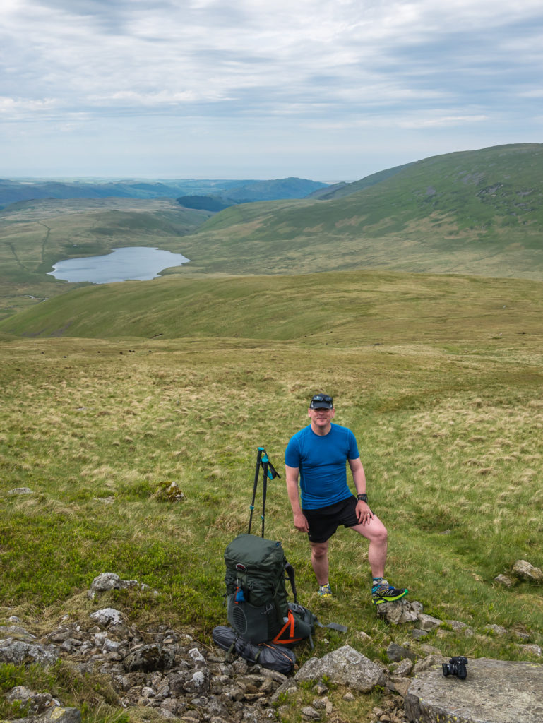
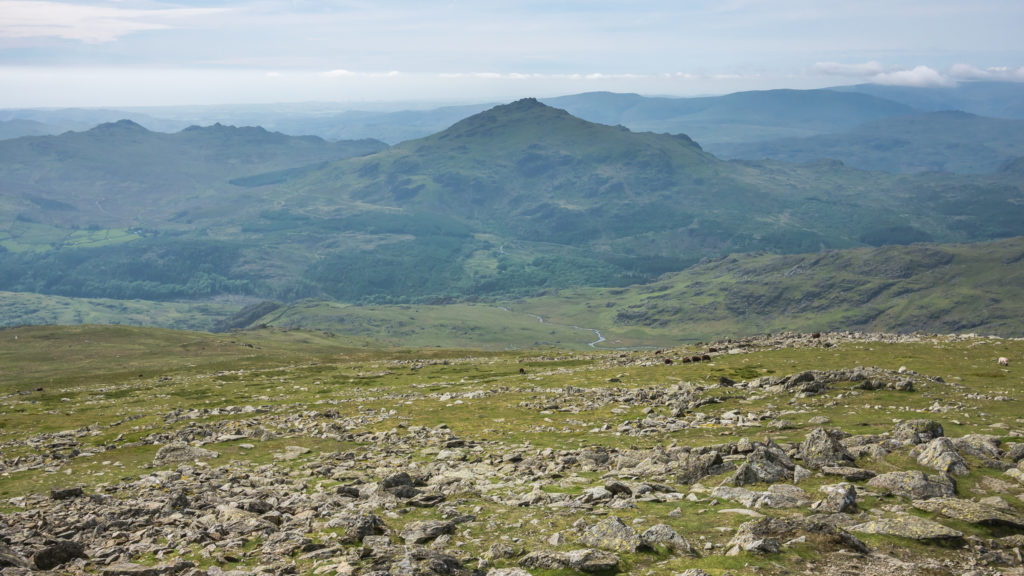
We enjoyed a lovely walk over Long Green. Looking back across the Western Fells towards the Irish Sea.
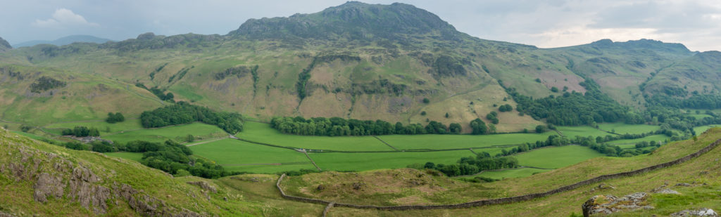
Panorama – Looking across to Harter Fell, one of the Southern Fells, as we headed down to Eskdale.
Trying to stay one step ahead of the rain as dark clouds came rolling in from another valley.
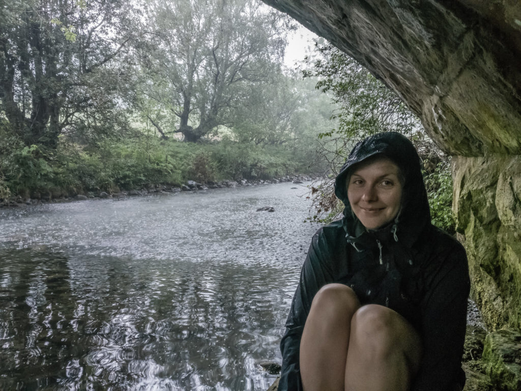
By the time the thunder showers came at around 3:30pm, we had managed to get off the fells and were seeking refuge under Wha House Bridge down in Eskdale.
We didn’t get going again until around 5pm when the rain had finally eased a little. With the possibility of more thunder showers looming, we decided on road walking to make it to the top of Hardknott Pass where we intended to wild camp.
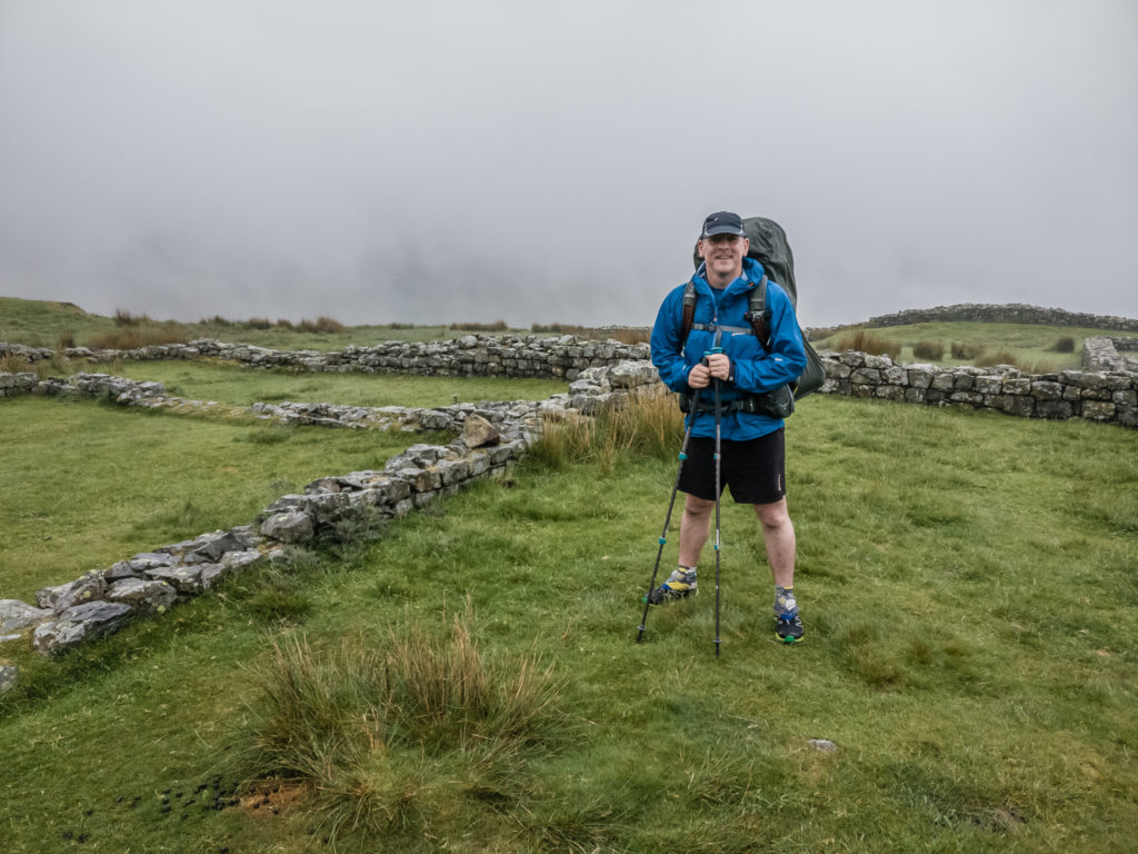
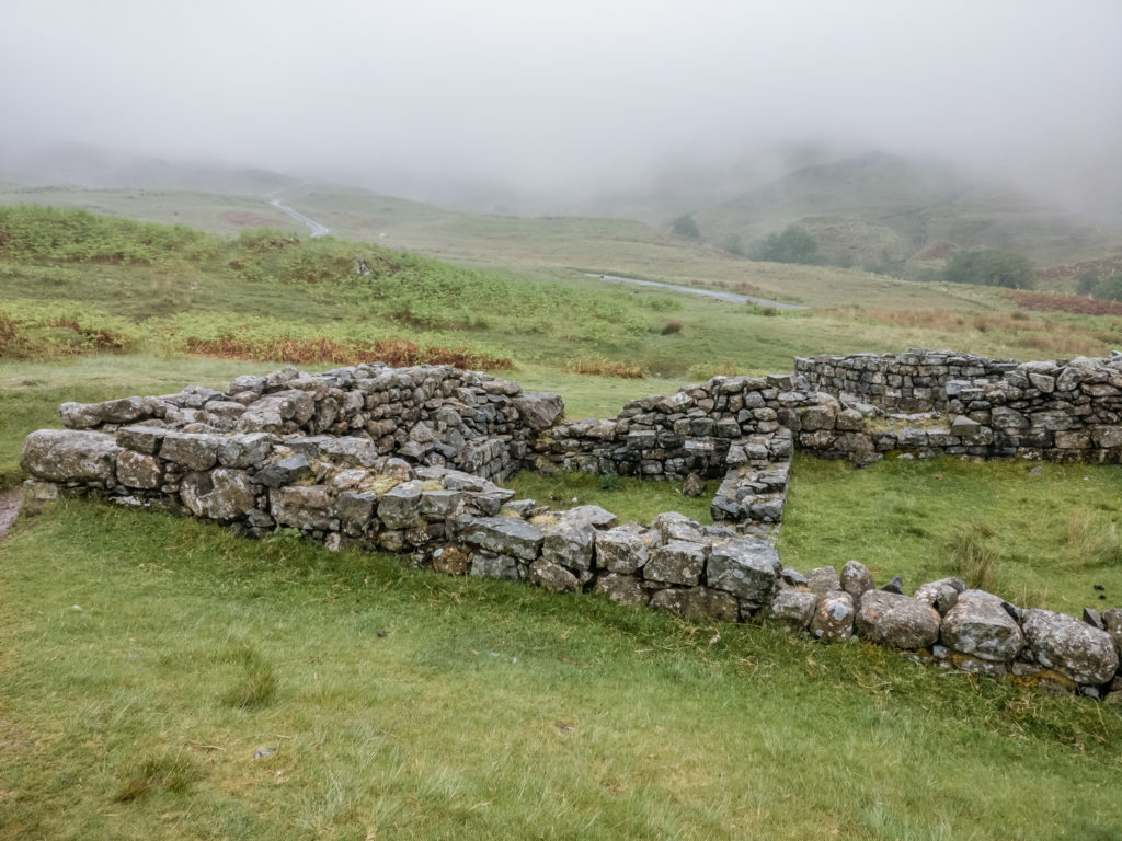
We took some time to have a look around Hardknott Roman Fort (known to the Romans as Mediobogdum) located near the Eskdale end of Hardknott Pass.
The fort, one of the loneliest outposts of the Roman Empire, was built between AD120 and AD138. It is on a spectacular site overlooking the pass, which forms part of the Roman road from Ravenglass to Ambleside and Brougham at Penrith. Our view that evening was complete white-out however!
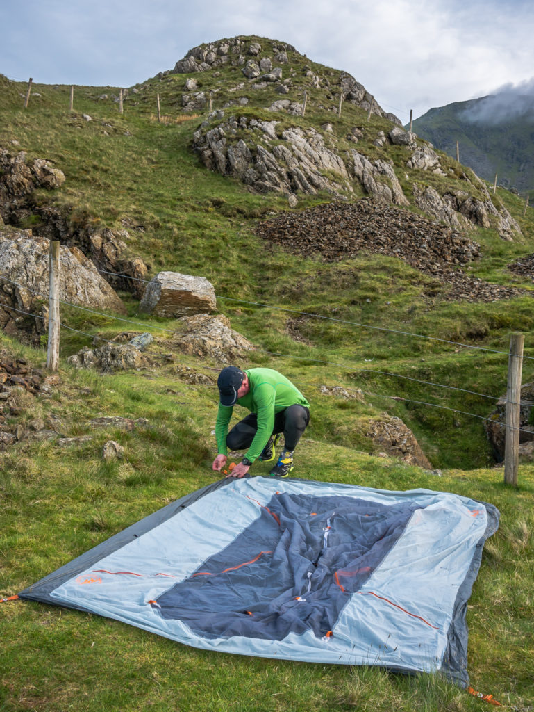
Moving on and looking for a suitable place to wild camp before the rain came down again!

Just off trail, we found a relatively flet patch of grass, so we put the tent up quickly and sought refuge inside, very much hoping for better weather the following day!
Day 2 – Hardknott Pass Wild Camp to Levers Water Wild Camp (10.9 miles/ 17.5 km, 9 hours, 30 mins) – Height Gain: 1,558m/ Height Loss: 1,606m – Sunday 28th May, 2017 – ‘Taking A Turn For The Better… Tackling The Coniston Fells’
With only 2 Wainwrights in the bag on Day 1 – heavy rain having hampered our progress throughout yesterday causing us to reassess our route and miss off Harter Fell – we were now already one summit behind and looking for alternative options to get us back on track to complete our intended 50 peaks!
Whether or not we could achieve our circular route within a week’s time frame was now very much dependent on the weather… But thankfully on Day 2, the clouds parted and the sun shone allowing us to have a fantastic day exploring the Coniston Fells – unchartered territory for us!
When we ventured out of the tent at first light however, it was a completely different story…
Leaving our wild camp spot off-trail and heading back to the road for easier walking. At that point, the morning looked rather grim.
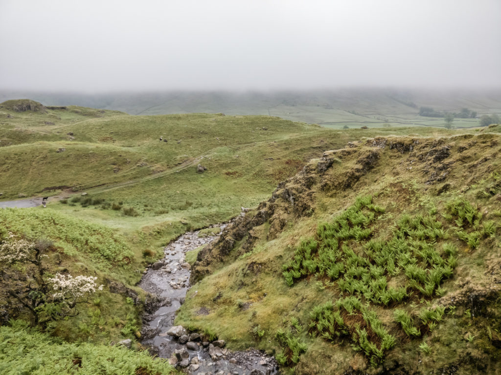
Low mist kept blowing in and out as we continued downhill on the other side of Hardknott. We filtered water from Cockley Beck before heading sharply uphill, the public footpath taking us across farmland, in our efforts to ascend Grey Friar from probably the least used of the direct routes (which we kind of regretted after getting soaking wet feet).
Continuing along the road, Hardknott changes to Wrynose Pass which leads down towards Little Langdale. At the top of Wrynose Pass is the ‘Three Shire Stone’, marking the meeting point of the historic counties of Cumberland, Lancashire and Westmorland. But on this particular morning, there was no point us making a detour just for a photograph as it was doubtful we’d have been able to see it!
Grey Friar is a little off the beaten track so tends to be the least visited of the Coniston Fells, but was our first summit of the day! We made our way up the steep hillside with no clear path to follow, crossing extremely boggy ground, resulting in sodden trail shoes and me wishing I had worn my trusted Gortex pair!
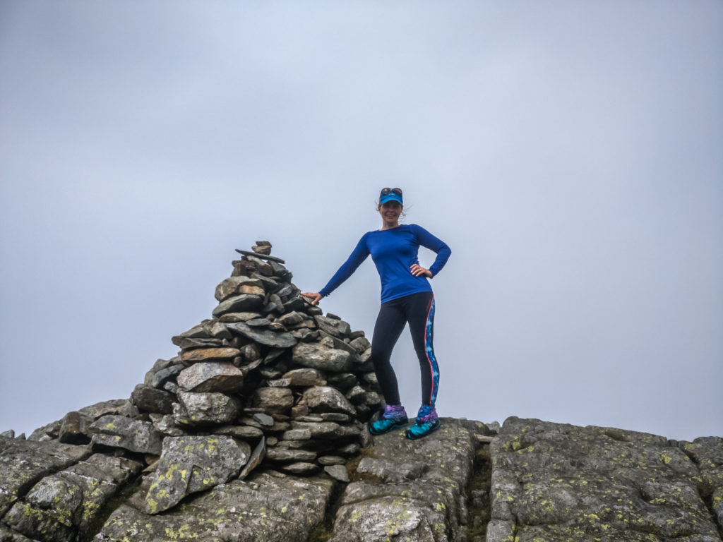
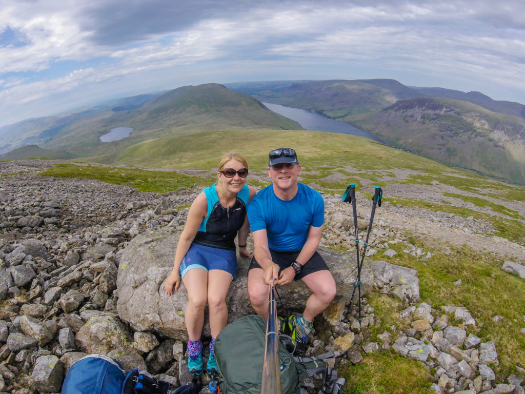
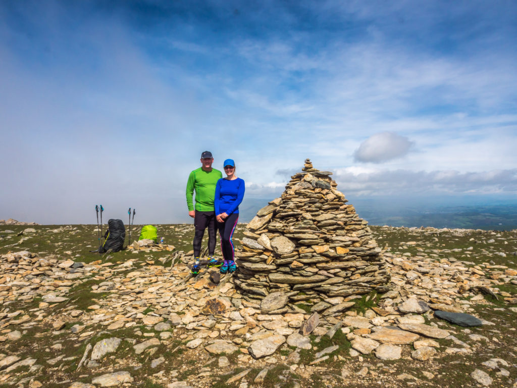
Atop Grey friar at 772 metres – our first Wainwright of the day.
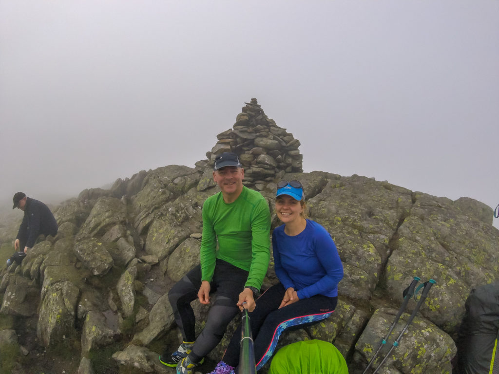
Selfie of us both at the summit sitting on what is basically a giant jumble of rock!
Leaving Grey Friar, the low mist cleared momentarily revealing a stunning view that allowed us to see the trail weaving across the fells and into the distance.
As we set off over the top of Broad Slack towards Great Carrs summit, we felt much more positive about the day ahead, especially as the mist seemed to have finally lifted.
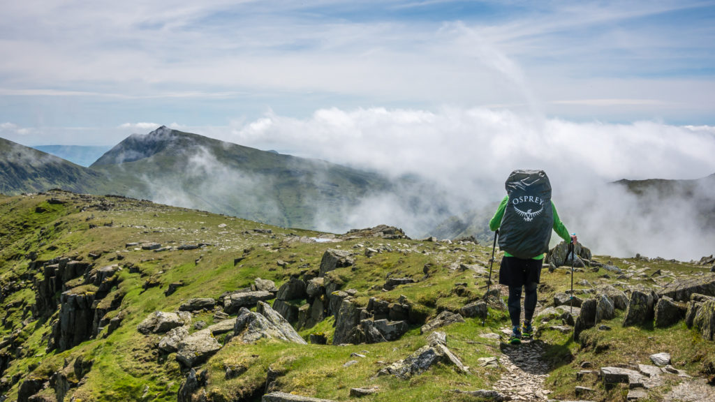
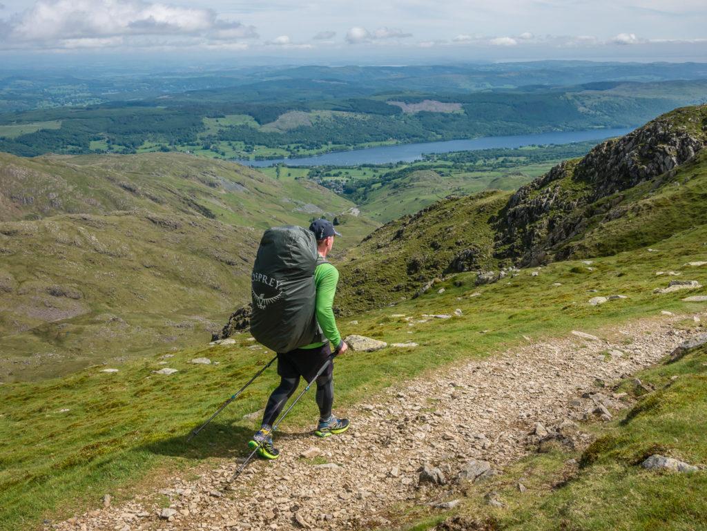
A completely unintentional plug for Osprey – although we do love their Exos packs (Other outdoor gear suppliers available!)
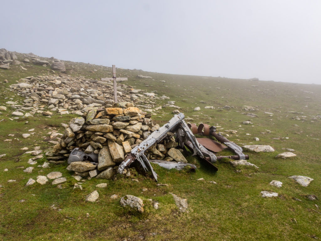
Plane wreckage and a memorial on Great Carrs.
This is the site of a wartime air crash and bears the remains of a Royal Canadian Air Force Handley Page Halifax bomber. The undercarriage together with a wooden cross and memorial cairn is near the top of the ridge. The rest of the wreckage is spread around Broad Slack.
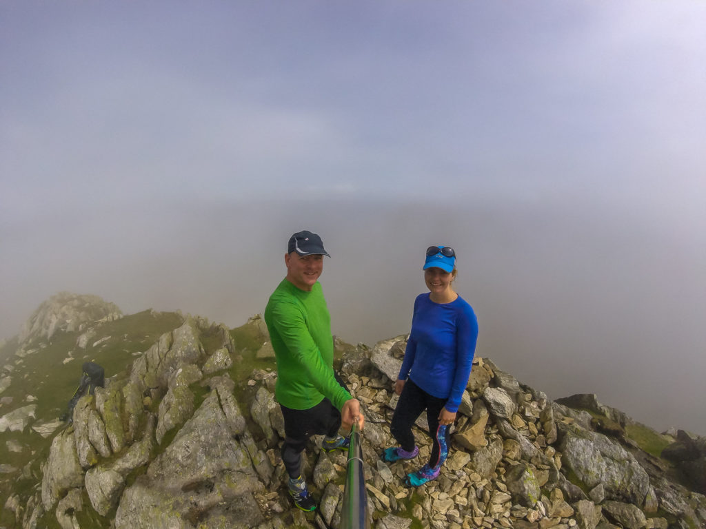
Summit No. 2 – At 788 metres, posing on Great Carrs. Maybe we spoke too soon – blink and you’d miss the view as the mist came in once more!
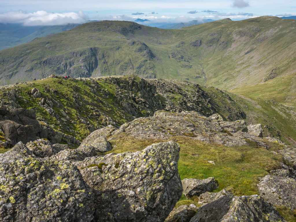
After taking a break at the summit, we were thankful of better visibility and an easier walking trail as we continued on to Swirl How.
En route to Swirl How. Coniston Water creates a scenic backdrop.
If you have the time, take a break at Swirl How. On a clear day the views are tremendous from the top! (The summit is considered one of the best vantage points in all of the Coniston Fells.)
Looking back towards the Scafell massif.
Seathwaite Tarn can be seen when looking to the west.
On the summit of Swirl How at 804 metres. Bagging our 3rd Wainwright of the day!
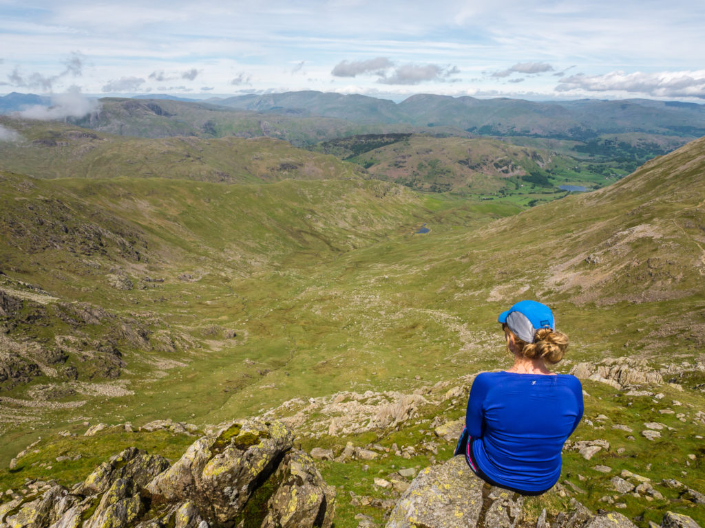
What a view! Sitting on a craggy ledge just below the summit of Swirl How looking down Greenburn towards Little Langdale.
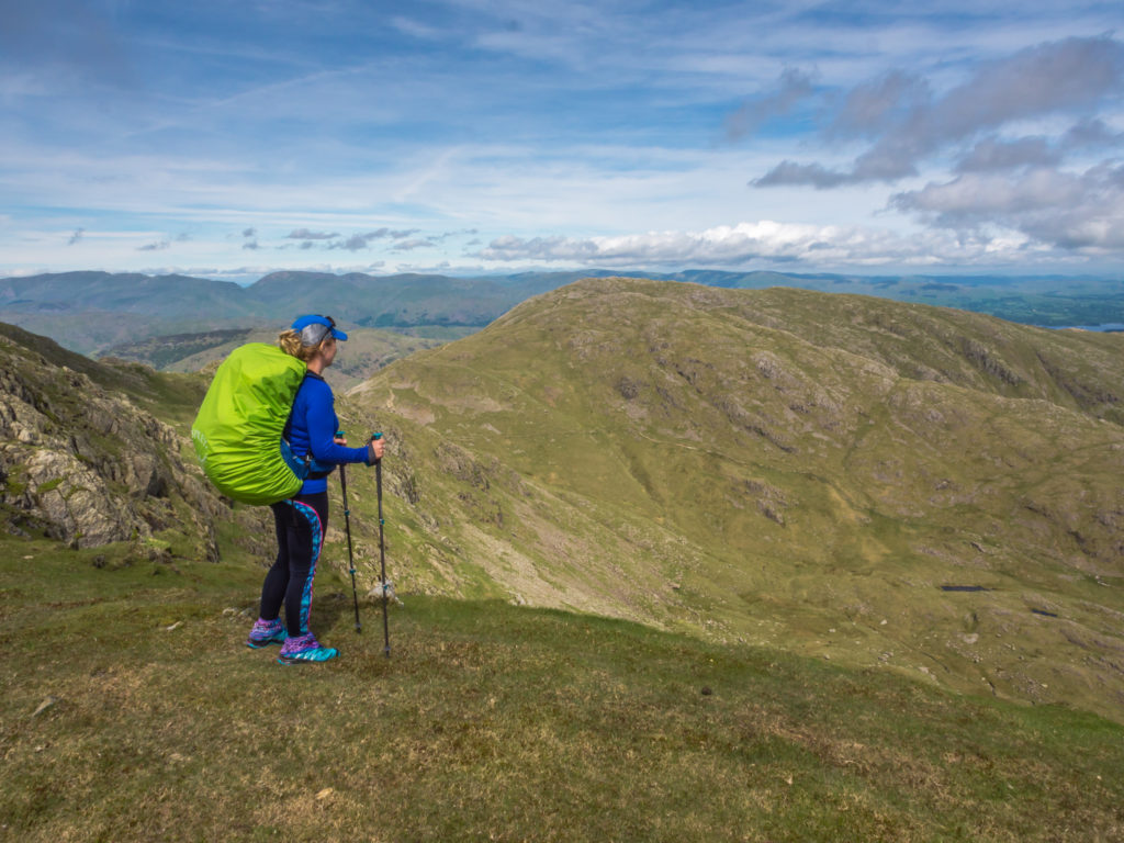
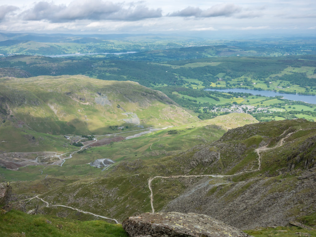
As we made our way to Brim Fell, looking down onto Levers Water reservoir, our intended wild camp spot later that day.
Coniston Old Man is straight ahead in the distance – but after reaching Brim fell (796m), we hiked out to Dow Crag and back again before visiting the Old Man.
Posing at the cairn on Brim Fell at 796 metres.
Taking a detour… Goat’s Water and Dow Crag in the top right.
Enjoying the tremendous views that we were now treated to!
Looking back towards Brim Fell. Heading to Dow Crag, although fairly straightforward, meant we had to descend the ridge over 100 metres to 650m in the coll, then hike back up again to reach the summit of Dow Crag at 778m. We then had to do this again in reverse to head back up the ridge towards Coniston Old Man!
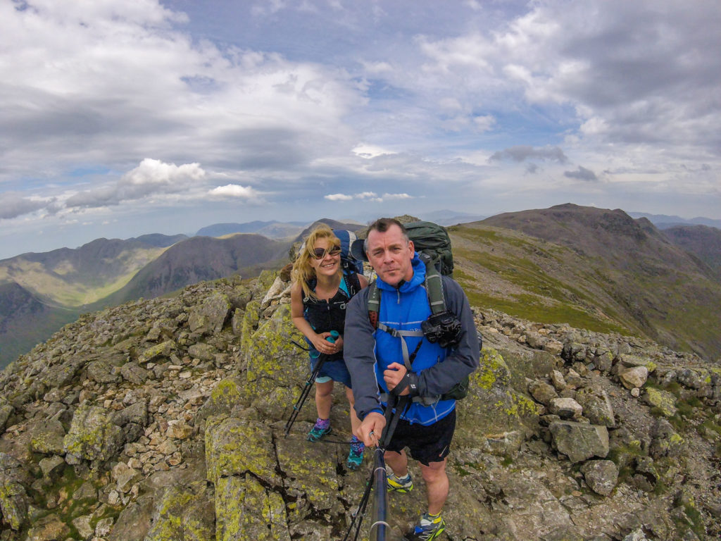
Happily making our way up to the summit of Dow Crag, making it our 5th Wainwright of the day!
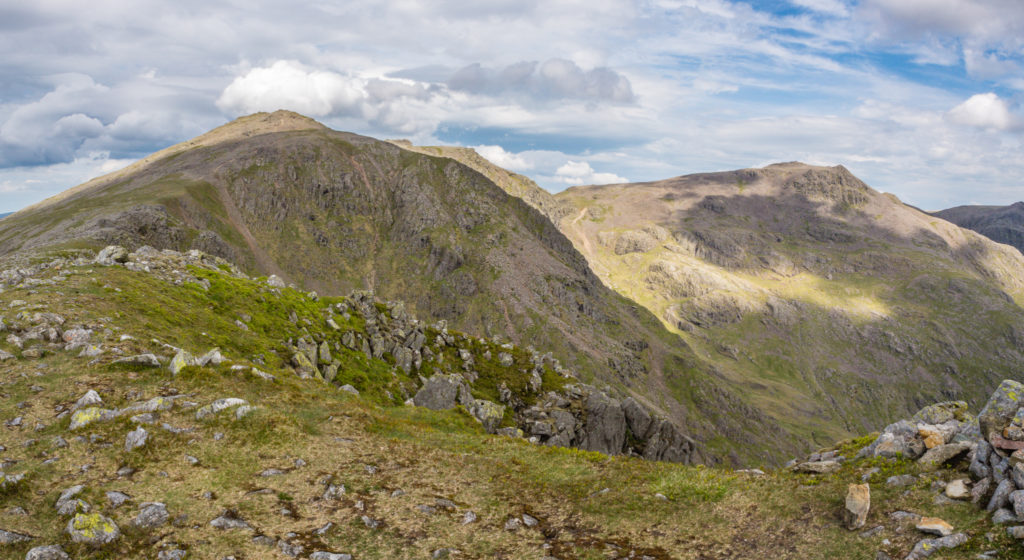
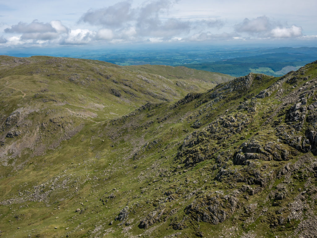
Looking back to where we had walked from that day. Great Carrs, Swirl How and Brim Fell seen from Dow Crag summit.
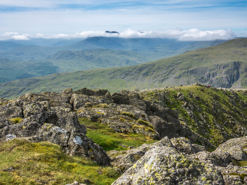
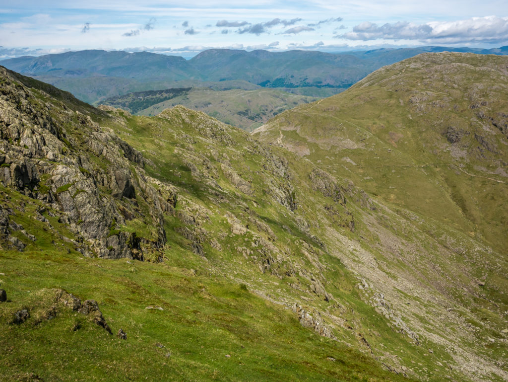
The view towards the Sca Fells from Dow Crag.
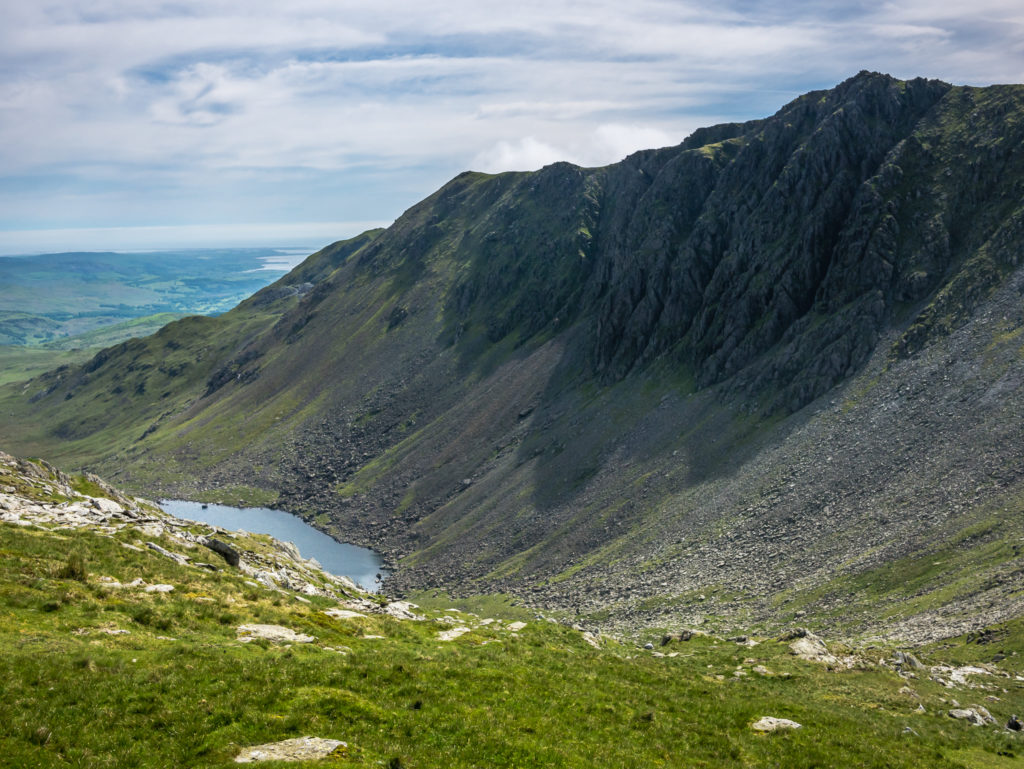
Looking onto Goats Water from Dow Crag. A low-level trail weaves into the distance heading to Coniston village.
Dow Crag affords wonderful expansive views across the Southern Fells.
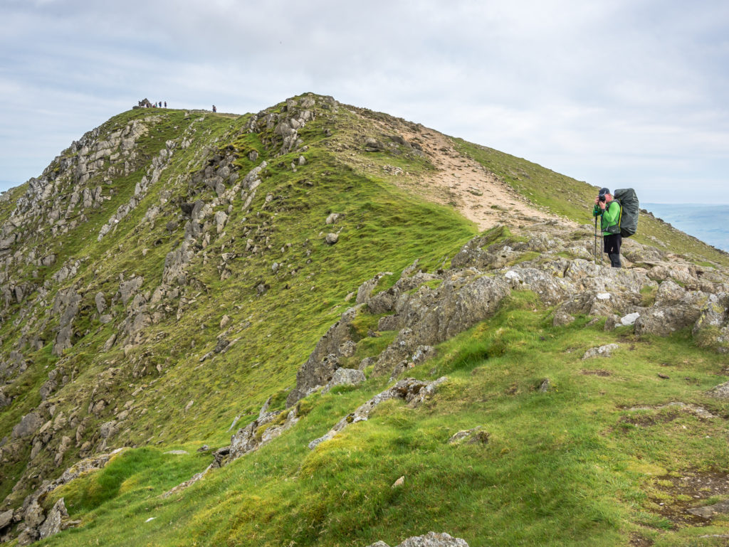
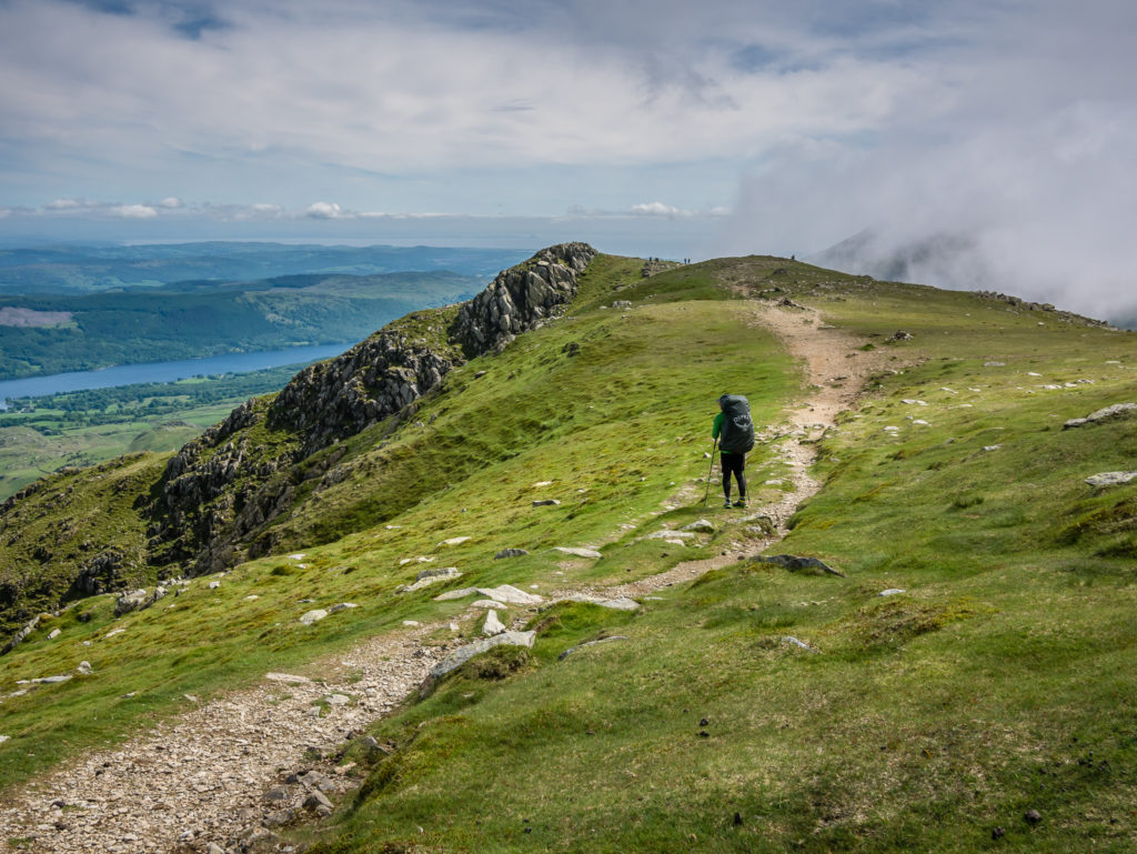
After descending Dow Crag we took the trail heading right leading up to Coniston Old Man. There had been a steady trickle of hikers making their way to the summit.
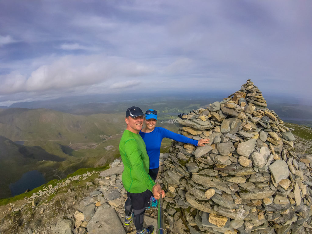
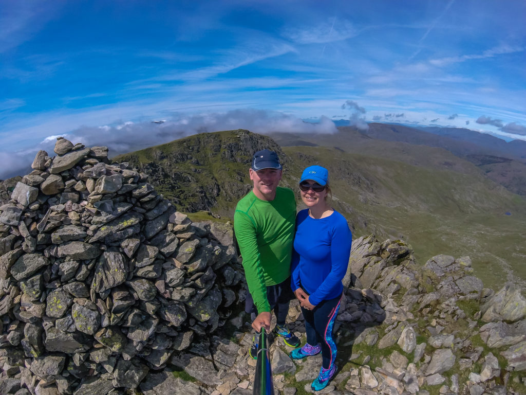
Selfie on the summit! Our 6th Wainwright of the day and first visit to the Old Man of Coniston standing proud at 803 metres.
Looking over to Coniston village and our route back down the mountain.
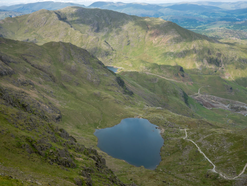
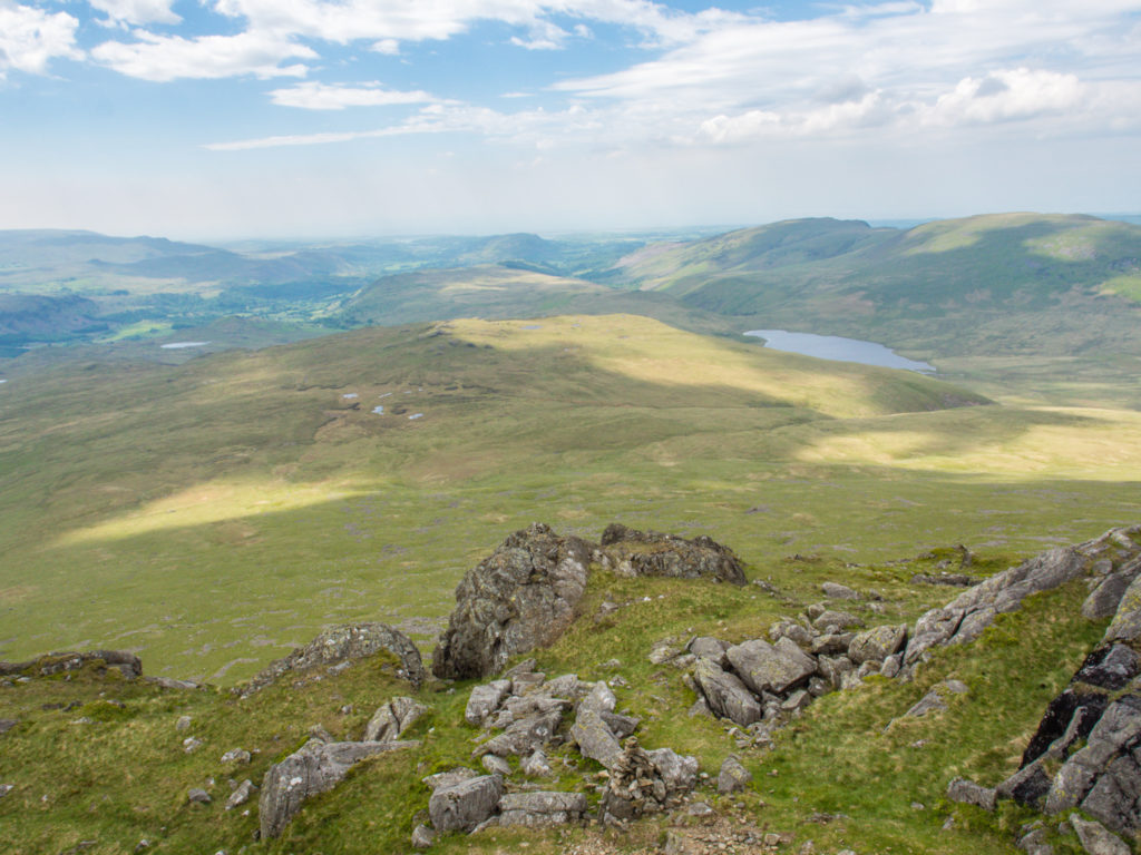
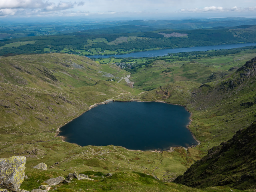
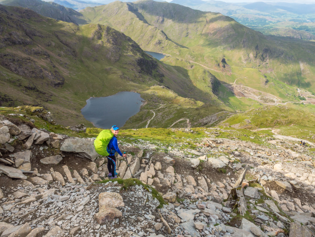
Looking directly onto Low Water. Our plan was to wild camp that evening around the next ridge close to Levers Water reservoir, which would be a good starting point to head up to Wetherlam the following day.
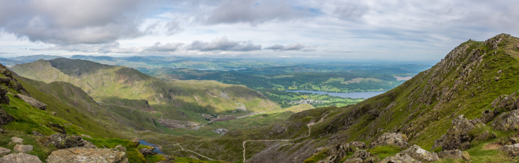
Panorama with Coniston Water and Old Man of Coniston in the right of the shot.
Making a start on the steep downhill section – thankful of the switchbacks and steps making life a lot easier!
Enjoying a wonderful day of walking – In the end, we couldn’t have wished for better weather and views.
Leaving Coniston Old Man. Looking onto Low Water, with a tiny glimpse of Levers Water reservoir around the ridge.
We descended past Saddlestone Quarry then took the switchbacks past Low Water, then back around the ridge towards Levers Water reservoir. It seemed a long way down!
Looking down to Saddlestone Quarry. Coniston village is in the distance.
Off trail and largely out of sight on a ridge, we camped at the eastern end of Levers Water reservoir.
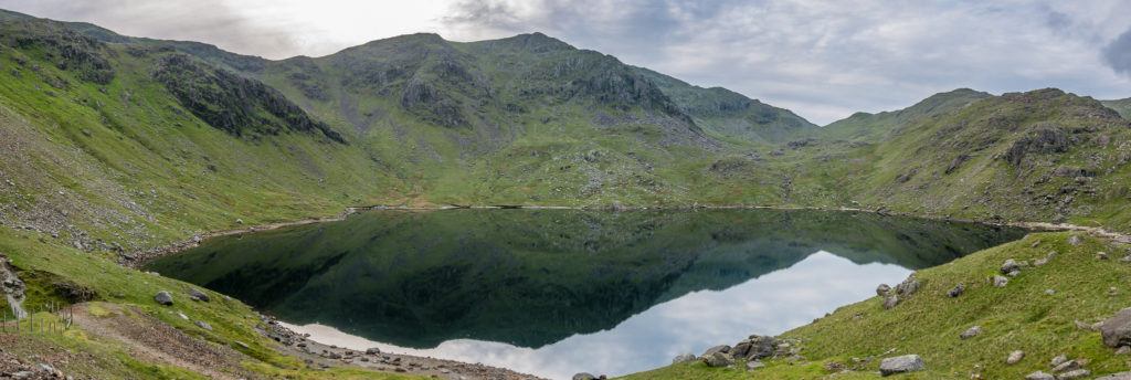
Panorama of Levers Water at dusk.
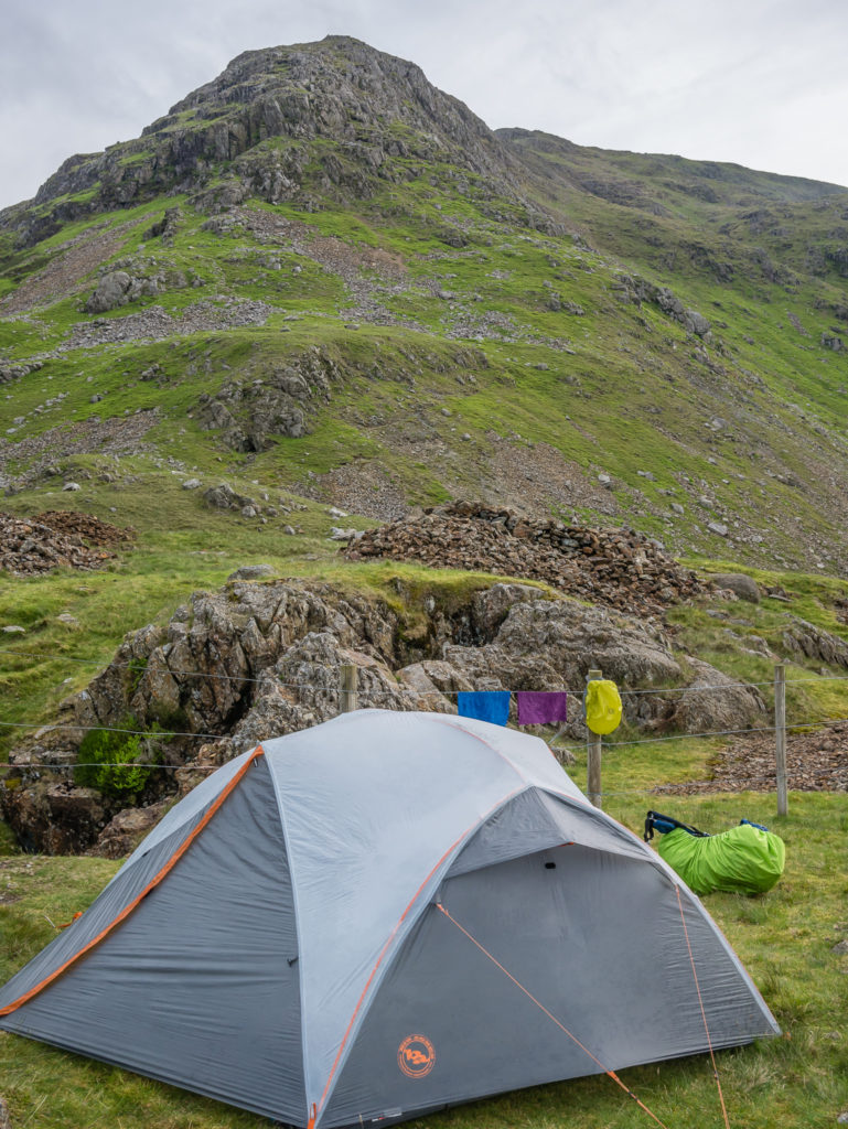
With a gentle breeze coming off the reservoir, we were able to let the tent dry out somewhat before settling down for the night.
Day 3 – Levers Water Wild Camp to Ambleside Football Club Camping (12.1 miles/ 19.4 km, 7 hours, 3 mins) – Height Gain: 794m/ Height Loss: 1,112m – Monday 29th May, 2017 – ‘Thank Goodness For Muddy Boots Welcome…’
After wonderful weather yesterday hiking up Coniston Old Man, it was a bit fortuitous of us to expect it to continue…
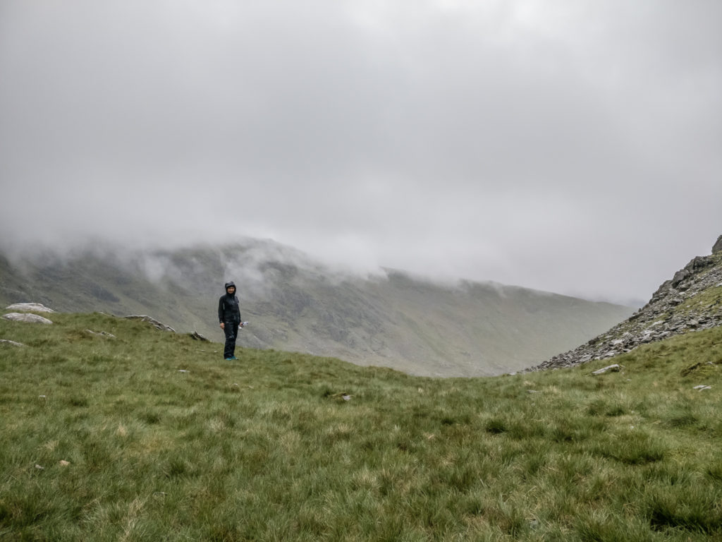
The next morning was not good. Yet, in high spirits and with true Fenton grit, we set off in the mist and rain hoping it would clear as it did yesterday – but to no avail.
After an arduous trudge to reach the summit of Wetherlam and getting disoriented by the white-out, we took what we considered the easiest and safest route off the mountain, then headed down into Ambleside for some hot food and the chance to dry out. Being back in ‘civilisation’ also gave us chance to check the upcoming forecast and assess the rest of our planned route.
Leaving Levers Water in full waterproofs as the weather had taken a turn for the worse.
Smiling for now! Sheer optimism that the day was bound to get better set us off in good spirits.
A wet and wild summit selfie on the top of Wetherlam at 762 metres! We took the shot and did not hang around for long!
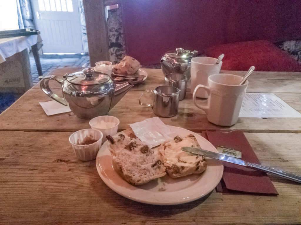
We were overjoyed to discover ‘Muddy Boots Barn’ at Skelwith Bridge (Elterwater Park Country Guest House). Even more so because it was open and the sign outside read ‘Muddy Boots Welcome’! With a roaring fire and fairy lights, it was the perfect rest stop as we felt almost soaked to the skin. We couldn’t say no to homemade scones, so we indulged in afternoon tea for two – a much-needed pick-me-up.
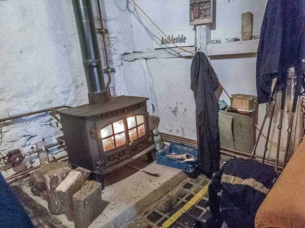
A pleasant surprise – warming up nicely and attempting to dry out our gear by the wood burning stove in the Muddy Boots Barn which is a very welcoming, quirky café.
Quite simply, Day 3 was a wash-out! Not only did we now have the troublesome task of trying to get all of our gear dry, but because of the incessant rain we were also getting further behind in terms of our intended daily peak bagging quota.
Although we hate to give up on a challenge – especially one that we had set ourselves – it was time to rethink things…
7 Comments
Beautiful shots and fun commentary as always. You two are looking very fit as well. Looking forward to the next installment. Has the selfie stick replaced use of a tripod entirely?
Hi Garry, thanks for your comments! We have taken up jogging to try and stay in shape off-trail, which seems to be working well at the moment. As for the selfie stick – it’s a new toy so maybe getting a little over-used! Wayne has still been carrying either his tripod or gorilla pod, but in wet weather we are making use of the GoPro attached to the selfie stick just for ease and to get some shots even in rain. Hopefully, when we head to Spain on Friday we’ll be treated to a fortnight of sunshine allowing for more time on sceneic shots with our standard camera gear. When do you head to the Pyrenees?
Pyrenees was in late June for me, bit of a heatwave but great. Met a bunch of Brits through Collett’s Mountain Holidays. Wind River Range in Wyoming coming up this week! Keep up the great travel posts!
Sounds great and thanks! We loved Wyoming on our road trip through the USA 🙂 Have a wonderful time!
Wonderful to be back in the Lake District and find her showing her true colours. Muddy Boots Barn was an amazing find. Fingers crossed for the next 4 days!
Thanks Helen 🙂 The fells were looking incredibly green and we were glad to be hiking in England again, despite the rain – very different to your recent hike to Toogoolawah that looked hot and dry – but scenic all the same! Your panorama shots of the clouds are really great! What an interesting walk, and even more so, done with friends!
Sadly Australia often looks brown, even in a good season. That’s why I love coming to England an Europe, so much.