
A Chance At Night Landscape Photography…
Camping under the stars literally every night has made us all the more appreciative and eager to capture the beauty of the night sky.
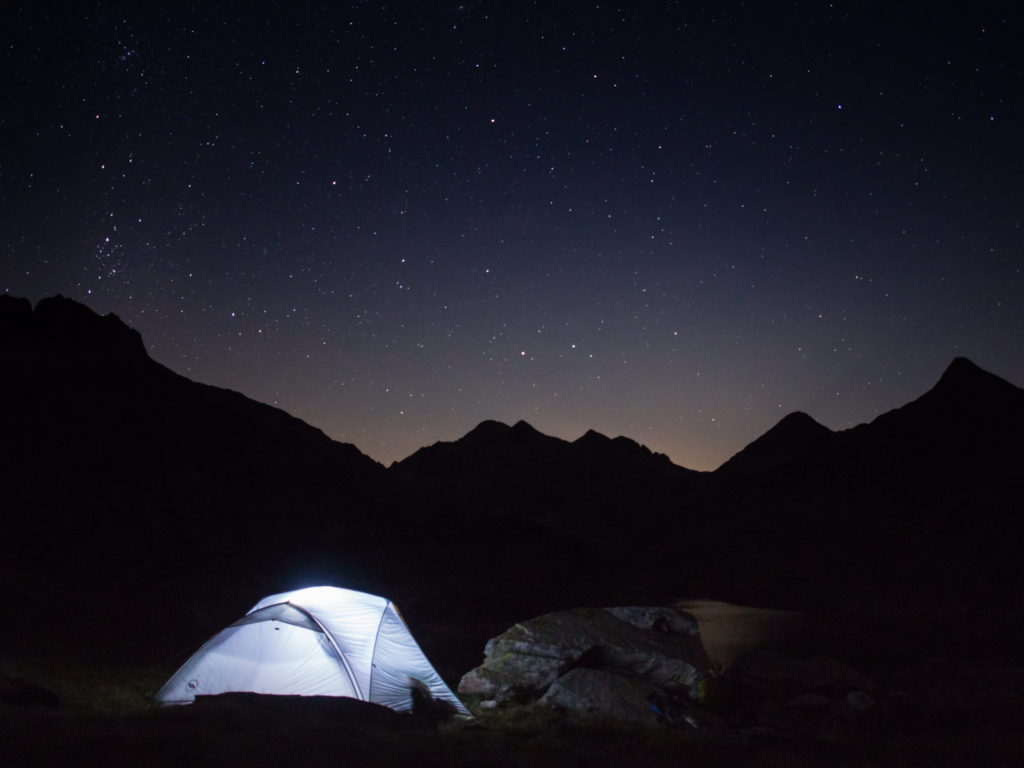
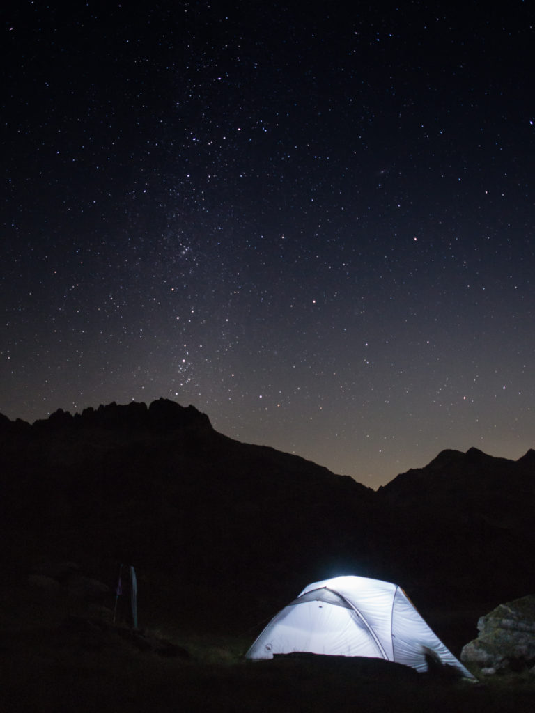
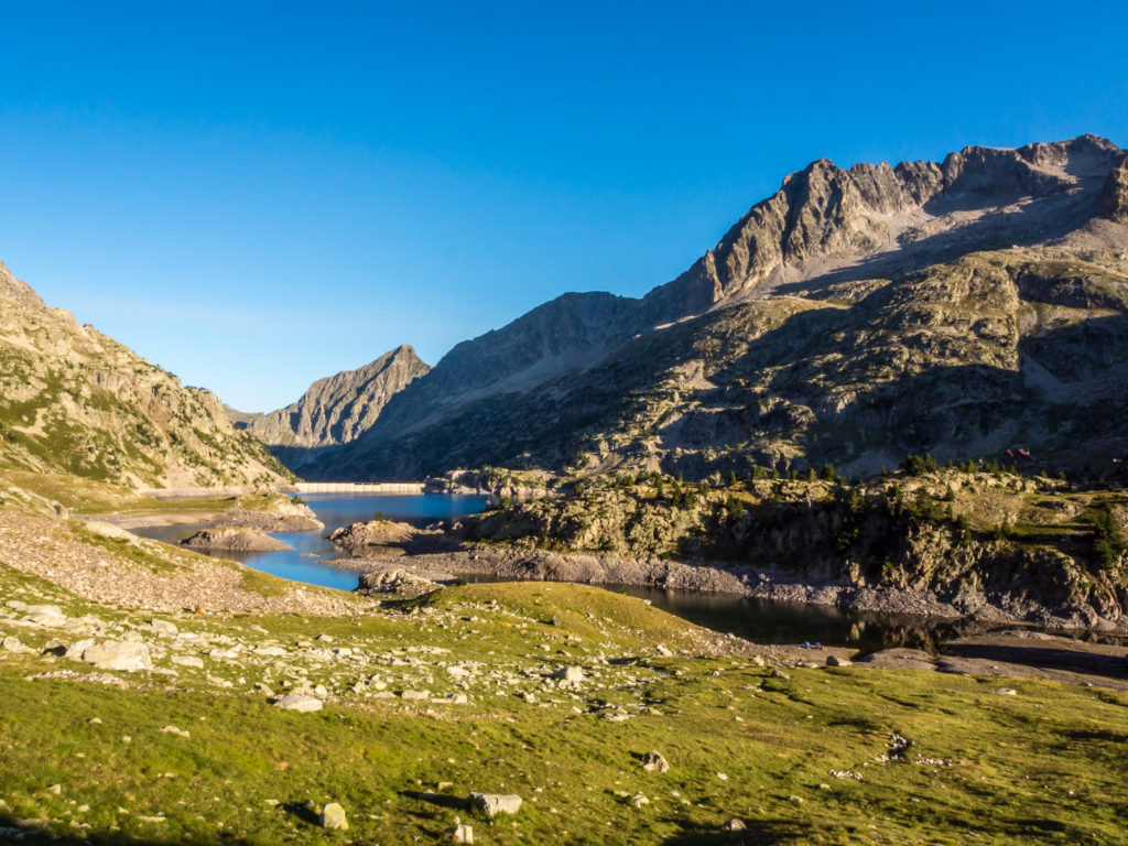
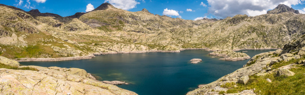
So with our current wild camp location on the southern shore of Respomuso Reservoir affording us such a wonderful scenic view with dramatic skyline, we couldn’t waste the opportunity of setting an alarm and waking up after midnight.
Well rested from an early finish the previous day, we were straight out of our sleeping bags in the early hours, excited to see the night sky unfold over the mountains and capture on camera that iconic glowing tent and starry sky shot.
Lost in the beauty – In the calm and still of the darkness, star-gazing at a clear night sky gives an enchanting feeling.
A realisation of just how small and insignificant we are in the world.
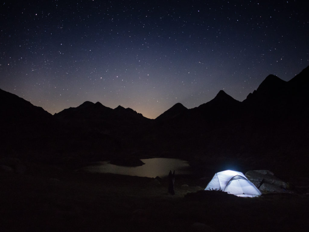
An alternative perspective – Our wonderful wild camp location by night!
From what we considered was our #wildcampoftheyear and things couldn’t possibly get any better, we then experienced yet another incredible day on the trail… The pictures say it all, (and apologies that we couldn’t select less than a whopping 75 in one post!) Here we are, hiking on and showcasing another spectacular section of the GR11!
Monday 14th August 2017 – Day 4 – Wild Camp at the southern shore of Embalse de Respomuso to Rio Caldares (after Refuge Bachimaña down the granite valley, crossing the stream, before Panticosa)– ‘El Scorchio!’
Start time: 08:05. End time: 16:50. Distance: 12.1km. Ascent: 1,085m / Descent: 1,057m.
After a successful evening capturing our glowing tent and starry sky shot, we re-set the alarm for 6am! We got up straight away, aiming to leave by sunrise, as today (by way of guidebook info) was considered the toughest day on the entire GR11. This is because we would be reaching the highest point on the trail – the Cuello de Tebarrai (Piedrafita) at 2,765 metres.
To set us up for the challenge, we savoured a cooked breakfast of scrambled egg and chopped chorizo in bread wraps, along with a hot cup of tea, so after cooking and washing up, we didn’t do too badly getting away at 8am.

Enjoying a hot breakfast to see us through a challenging day!
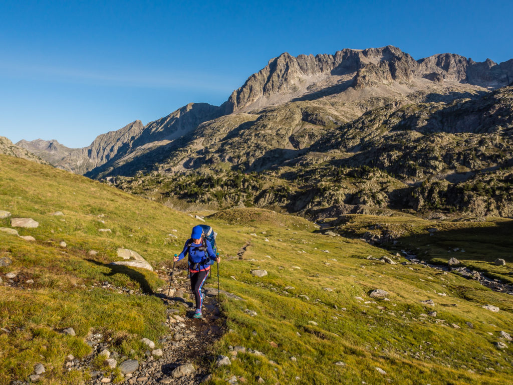
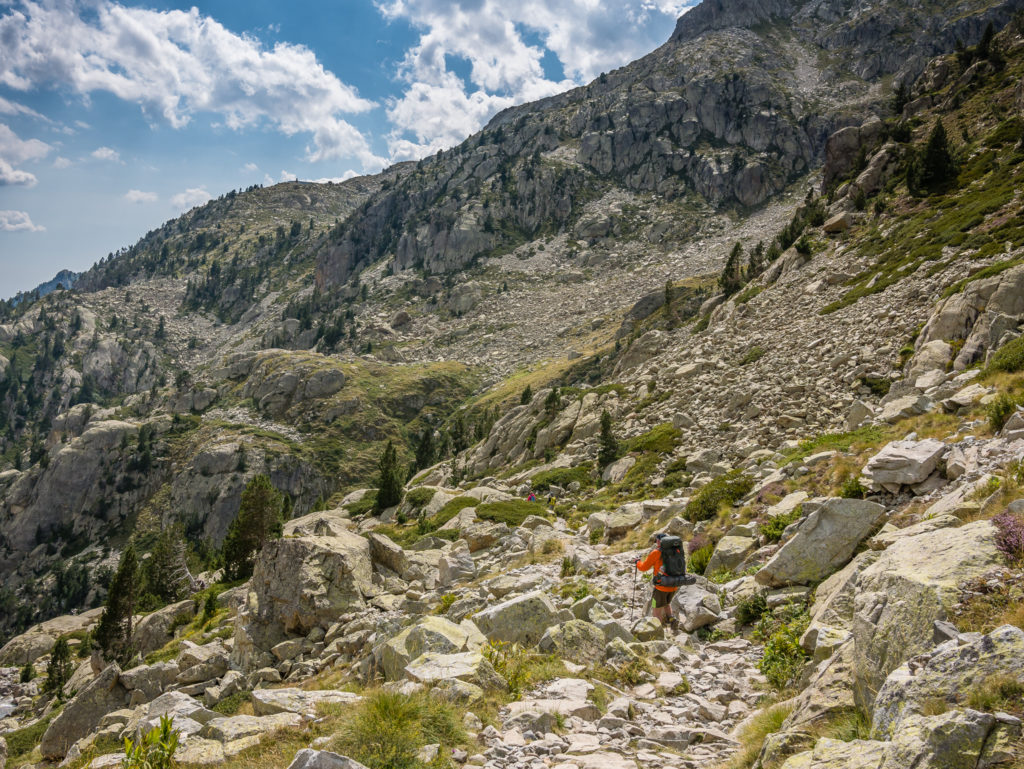
Based on the times and information given in our guide-book, we expected a short trail day, hiking around 7km, so we were considering hiking on an extra 5km before finding a wild camp spot to make for a shorter day the following day. (The reasoning behind it was to shorten the next days’ ‘long one’ of 22km!) However, either we were mega slow or the guide-book times are incorrect as everything seemed to take much longer, especially with having to contend with a steep ascent up scree, followed by numerous descents over craggy boulder fields. We could pick up the pace well on the descents as we like rock hopping and feel confident navigating our way over giant stones having had lots of practise, but we still didn’t make good time.
That being said, we might have been slow as there were so many amazing photo opportunities! We were wowed by one outstanding vista after another and made several stops to capture the beautiful alpine scenery that sprawled out in front of us in every direction…
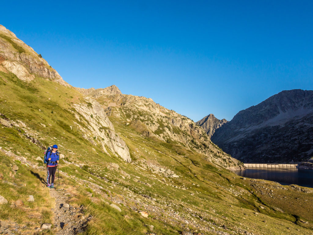
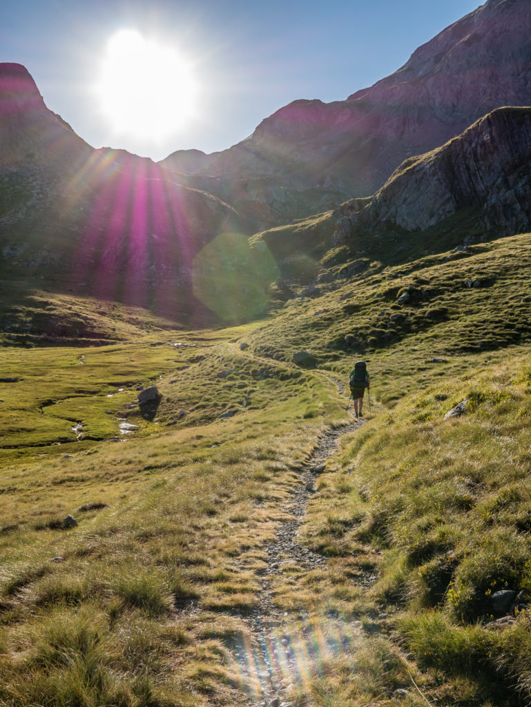
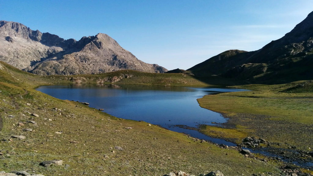
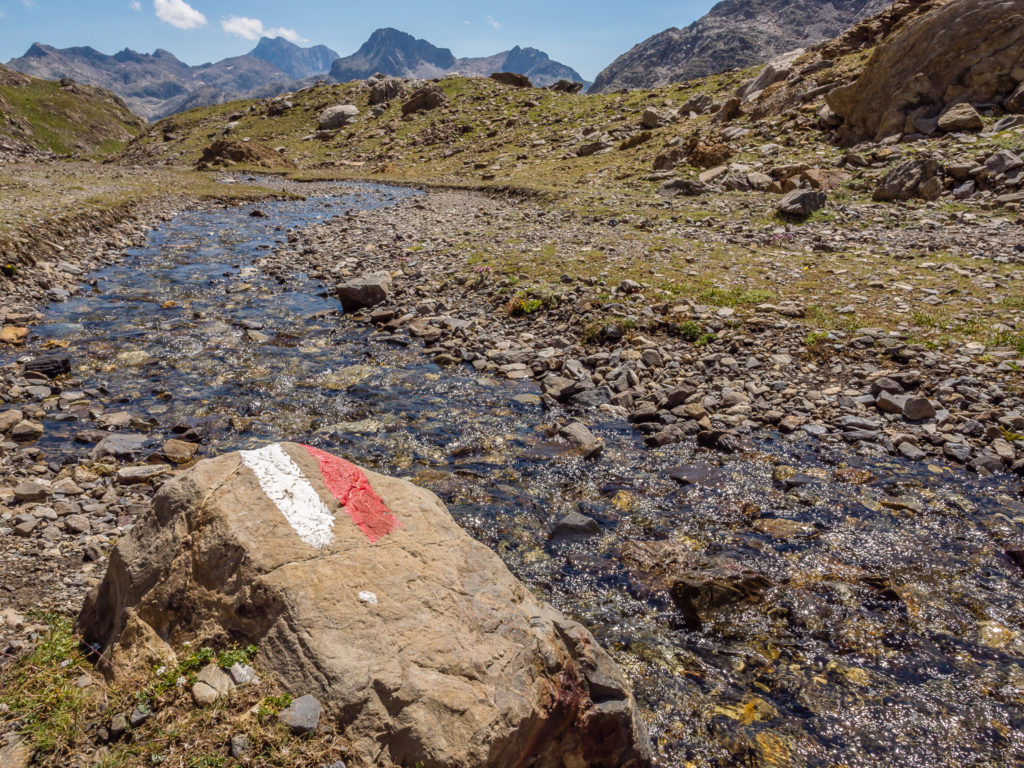
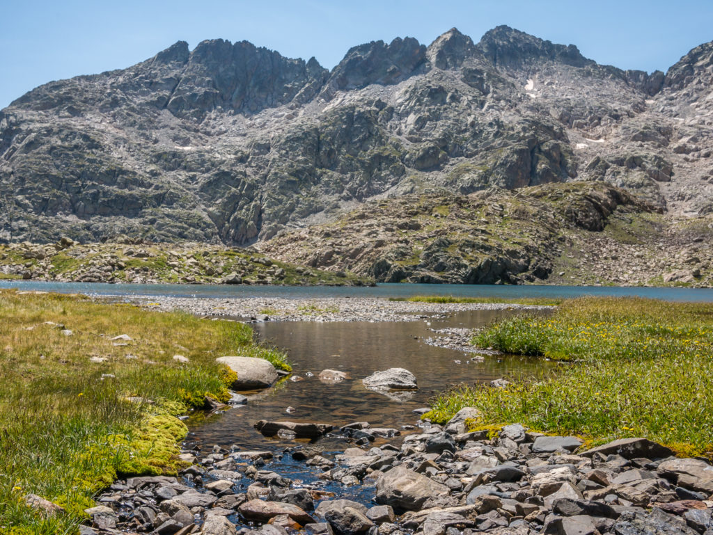
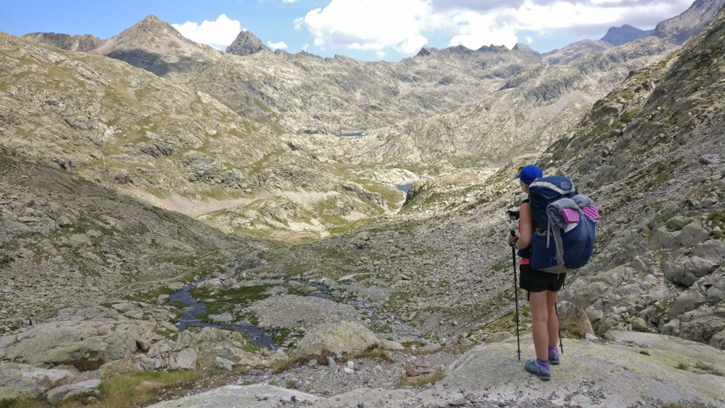
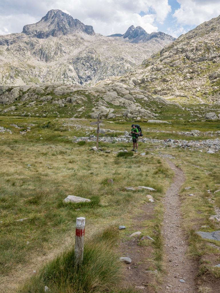
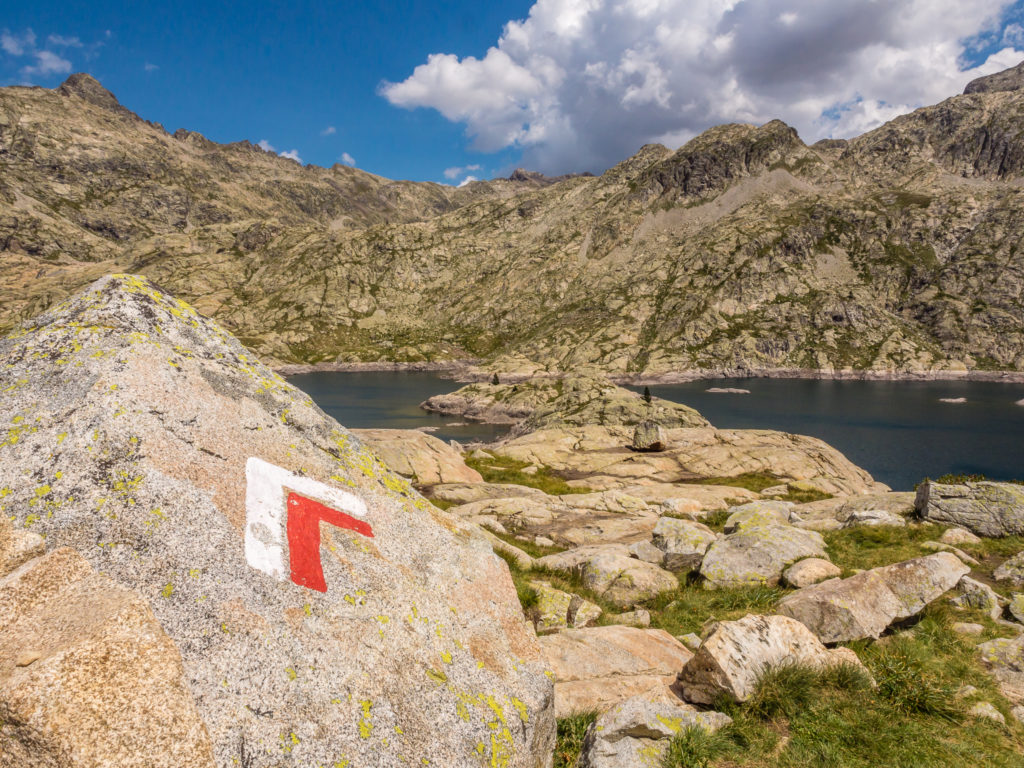
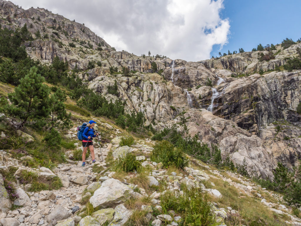
As the sun crested over the jagged peaks, we left our wonderful wild camp spot and rejoined the trail on the south shore of Respomuso reservoir. We were meant to take a side trail up to the right but having rock hopped over the river, we realised we had gone too far, so back-tracked a little, then spotted some cairns leading uphill. The red and white flashes in some parts were a little faint, so in bad weather it would be easy to see why hikers could miss the trail and head in the wrong direction. Now on the right track, we continued on and hiked up to Ibon de Llena Cantal. Here we took a break and ate some energy snacks to psyche ourselves up for the big climb of the day!
Leaving Respomuso Reservoir and rejoining the trail going along the eastern shore.
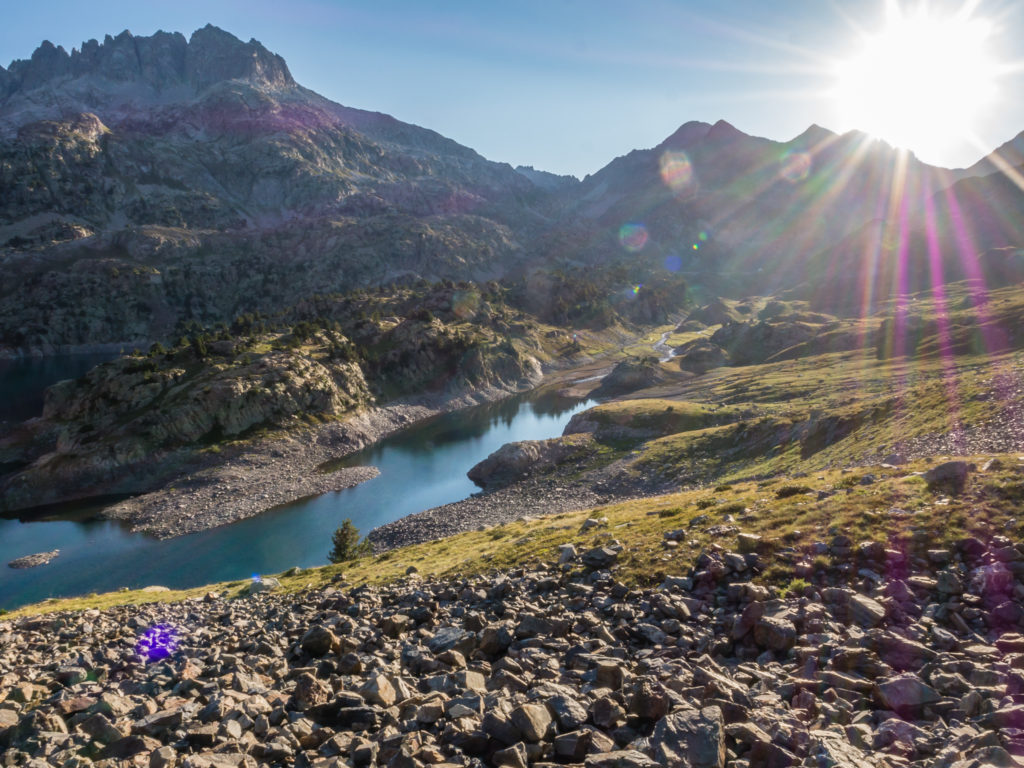
Early morning and the sun was already strong, so we quickly got warmed up.
Looking back onto the reservoir.
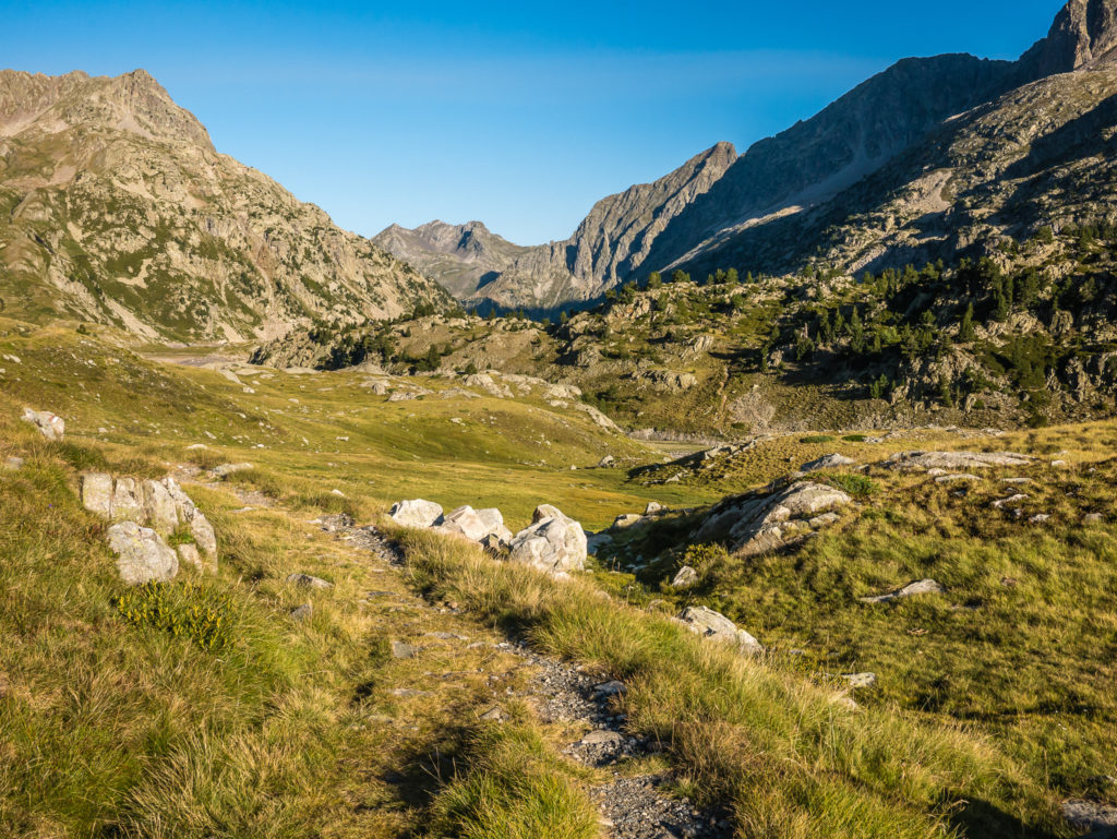
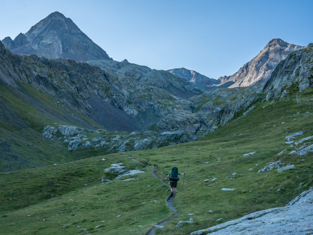
The trail weaves its way towards the mountains.
Enjoying the beautiful alpine scenery.
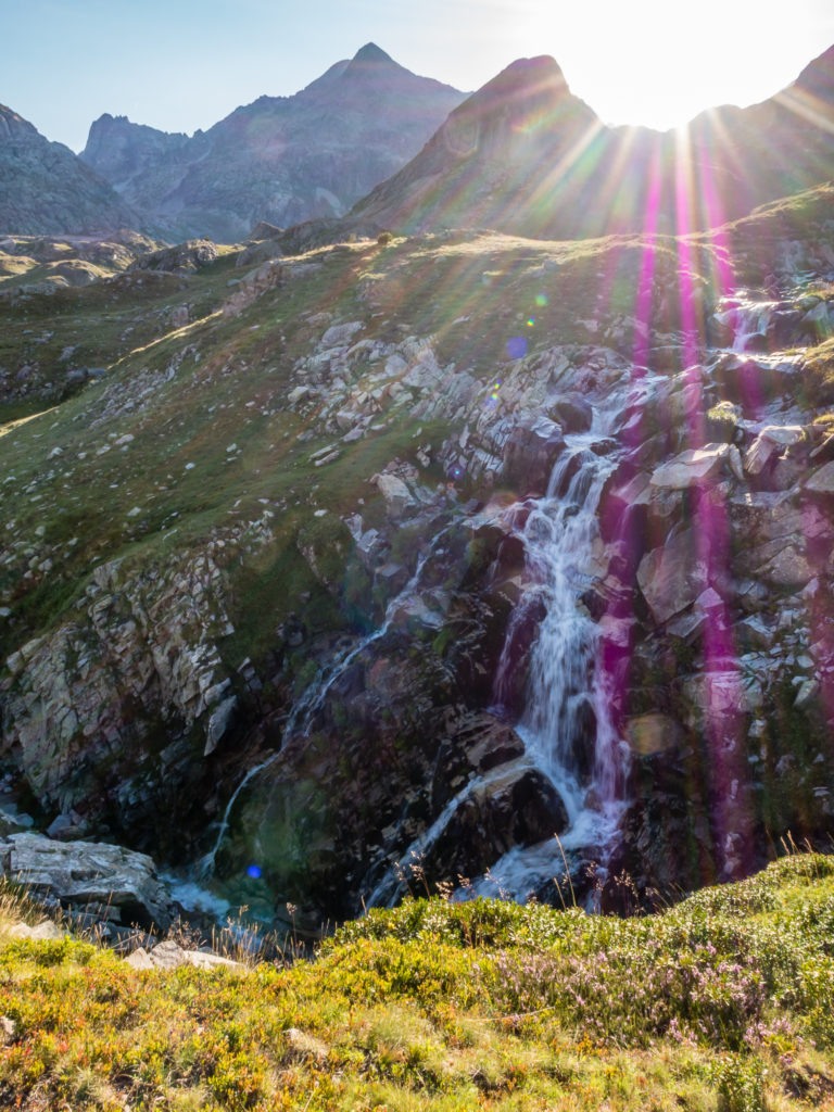
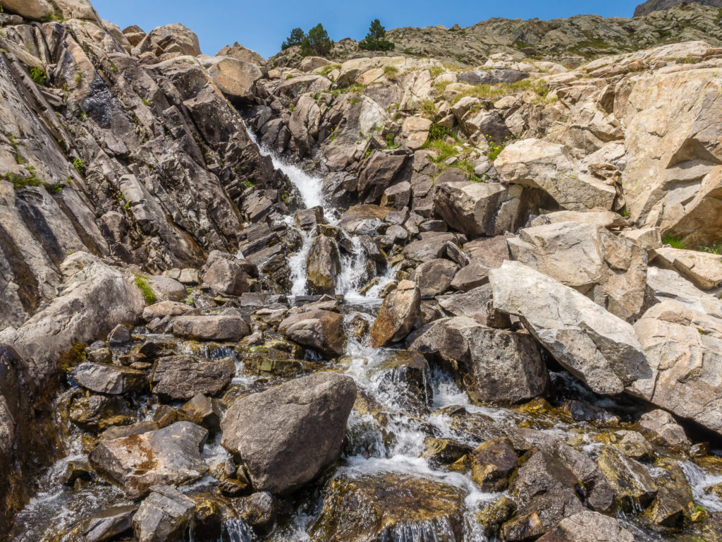
Passing some rushing cascades.
On the right trail and heading up to Ibon de Llena Cantal.
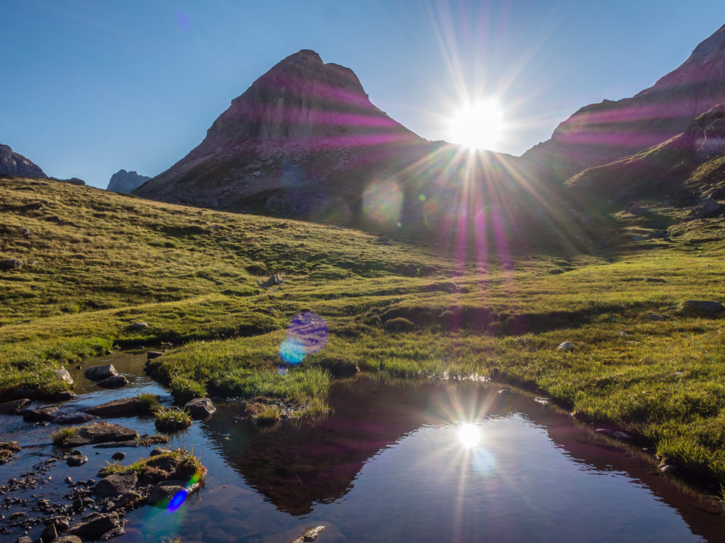
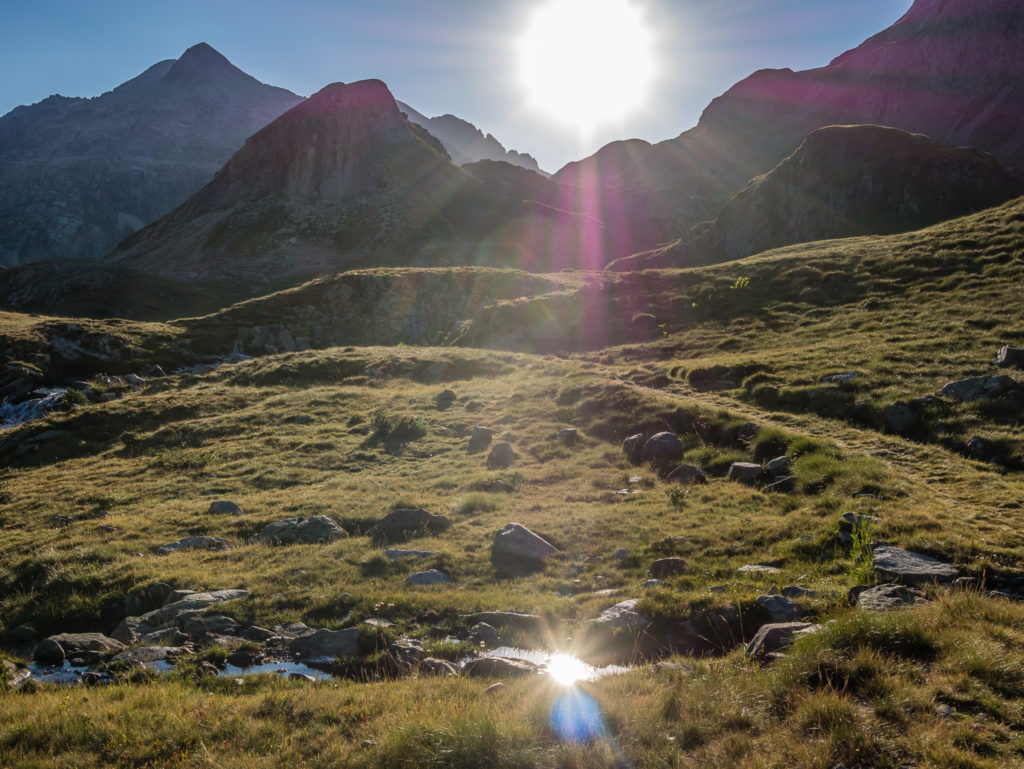
Intensified sun rays reflecting in a small tarn.

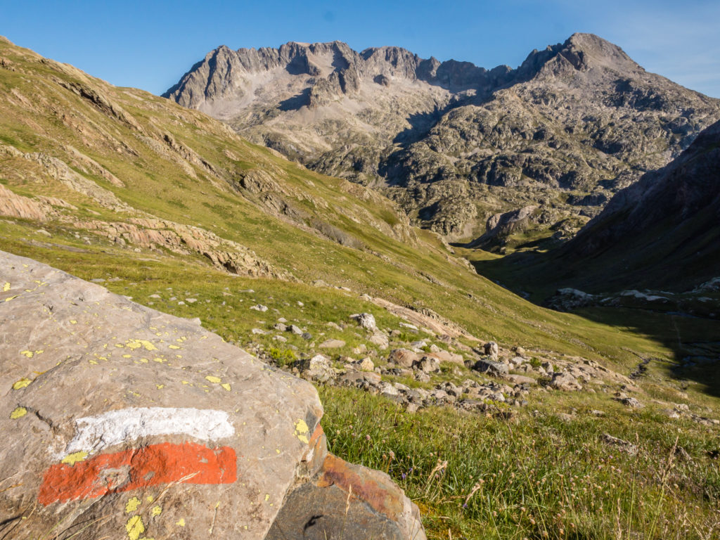
Along this section, many paint flashes had faded; however some cairns were more obvious signalling the route.
Hiking on amidst an incredibly scenic backdrop.
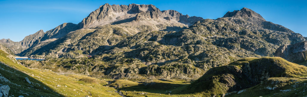
Panorama of the surrounding rugged peaks that dominate the skyline.
Continuing uphill under the shadow of the mountains.
Reaching new heights and looking back down the trail.
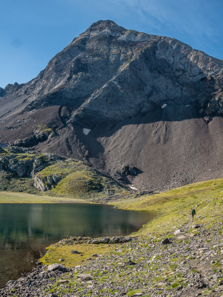
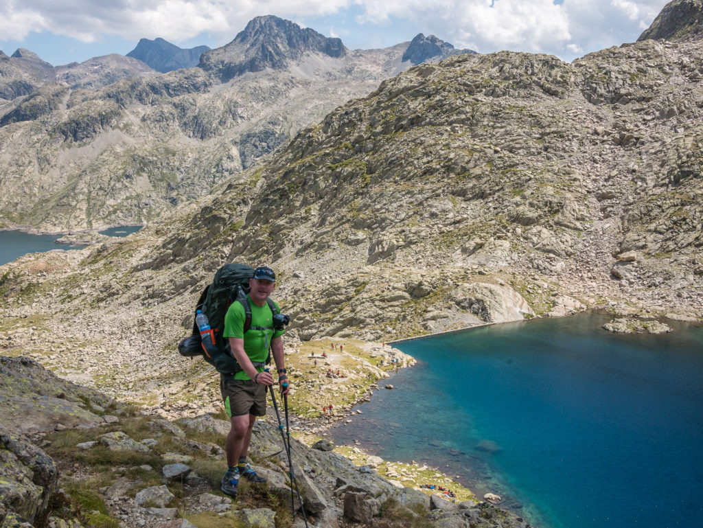
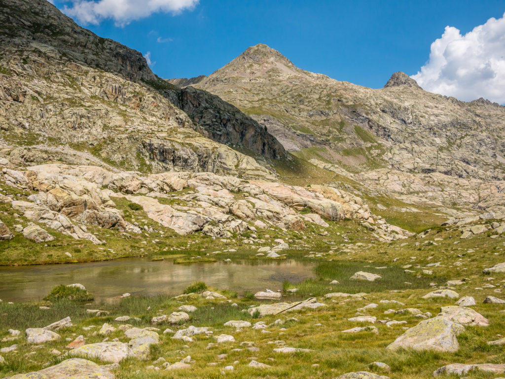
Our first glimpse of Ibon de Llena Cantal.
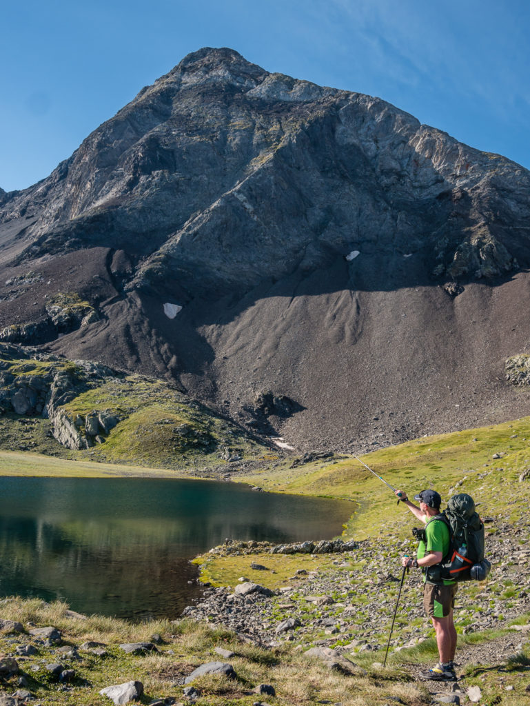
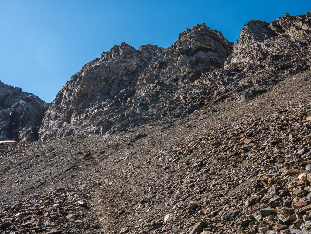
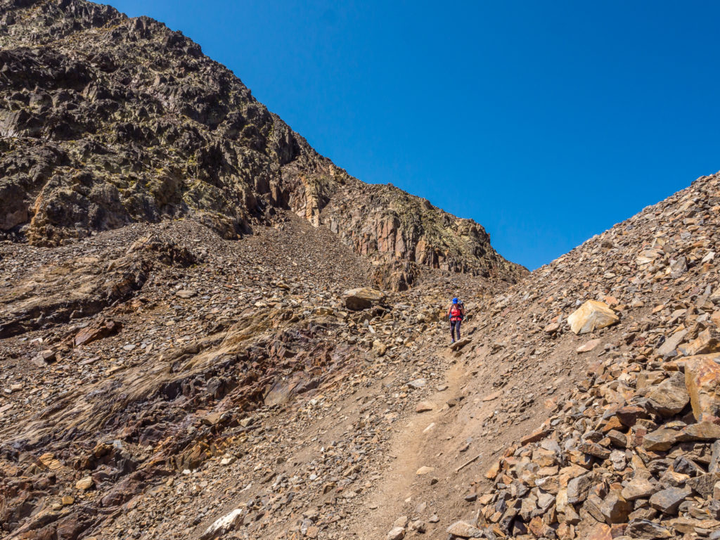
Looking for our route up! The trail weaves its way along scree to the left hand-side of the peak.
Looking back on Ibon de Llena Cantal.
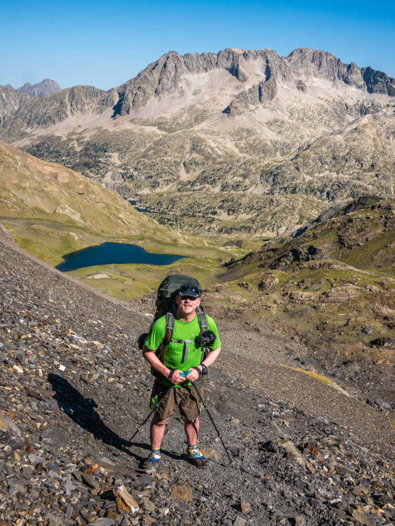
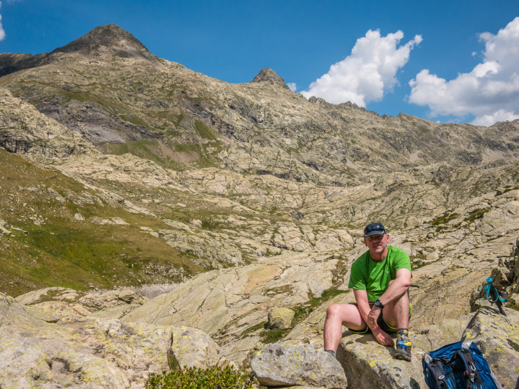
Showing the scale of the climb. We needed to reach over 2,700 metres. Just a few hundred metres left to go!
Crisp mountain reflections…
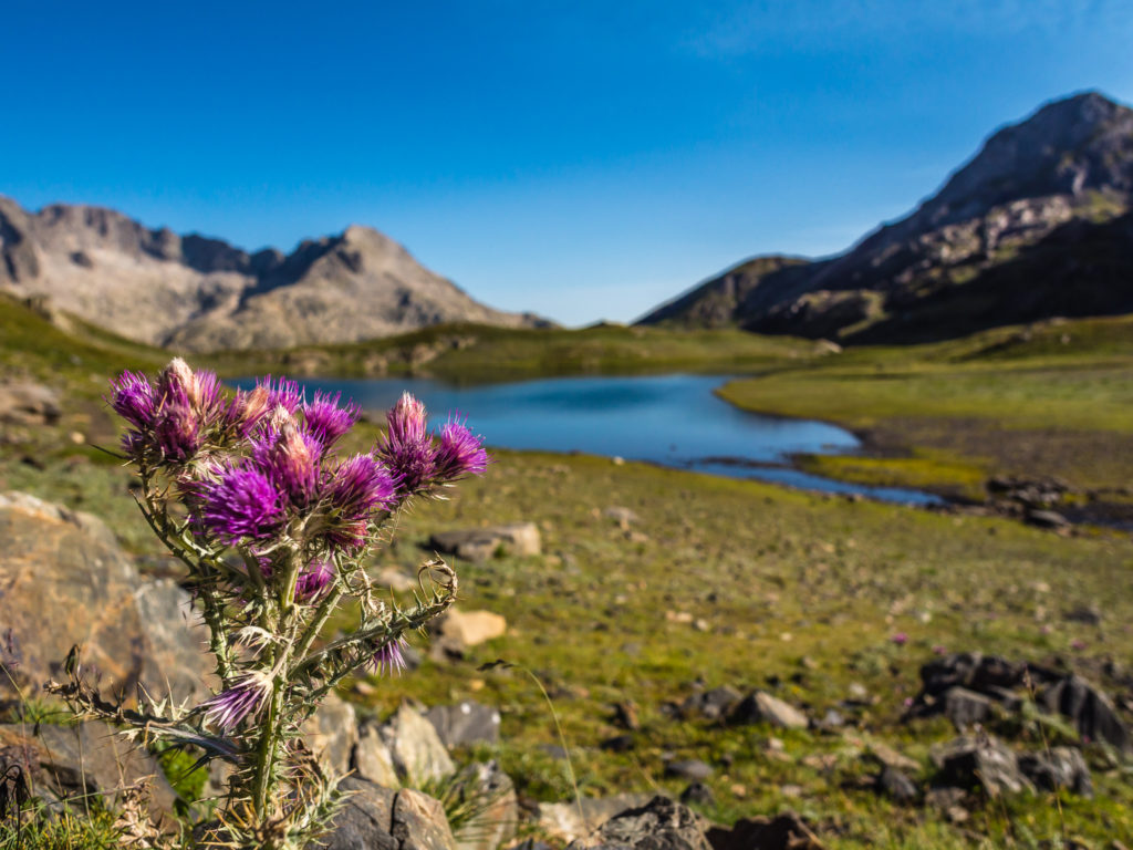
An injection of colour from beautiful wild thistles flowering in the mountain landscape.
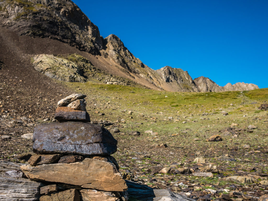
A cairn signals the route up….
Slowly but surely making our way up the steep scree slope, with Ibon de Llena Cantal now down below.
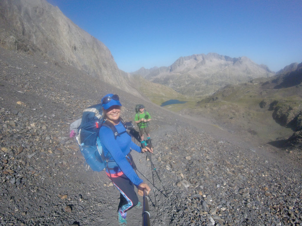
‘GoPro Selfie’ of the trail. We were glad to be hiking uphill, rather than heading down on the loose scree! (Our least favourite hiking terrain.)
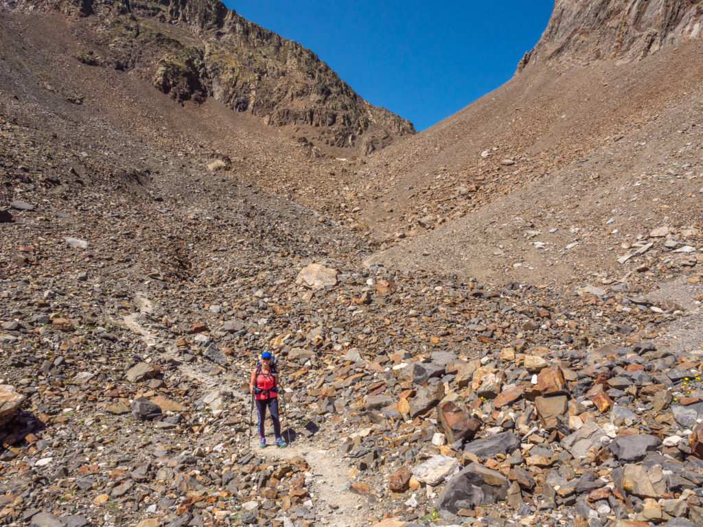
Tentatively making our way towards the pass. The photo doesn’t do justice to how steep of an angle and how narrow the trail path actually was.
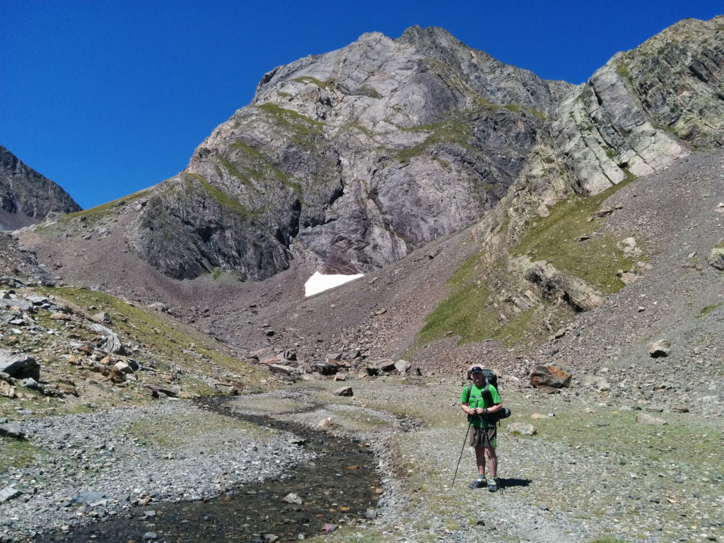
After successfully reaching the end of the scree path, the GR11 then heads up a rocky ridge straight through the moraine. Some patches of snow were still visible under the craggy peaks, with a large area of bright white ice reluctant to melt away in the direction of the gully we’d be hiking through. We could see the trail clearly as it wound its way towards the craggy pinnacles, but it was steep and we had to watch our footing as the rocks were very loose. At this point we were grateful of our walking poles to give us more stability, especially with having our heavy packs to contend with as well.
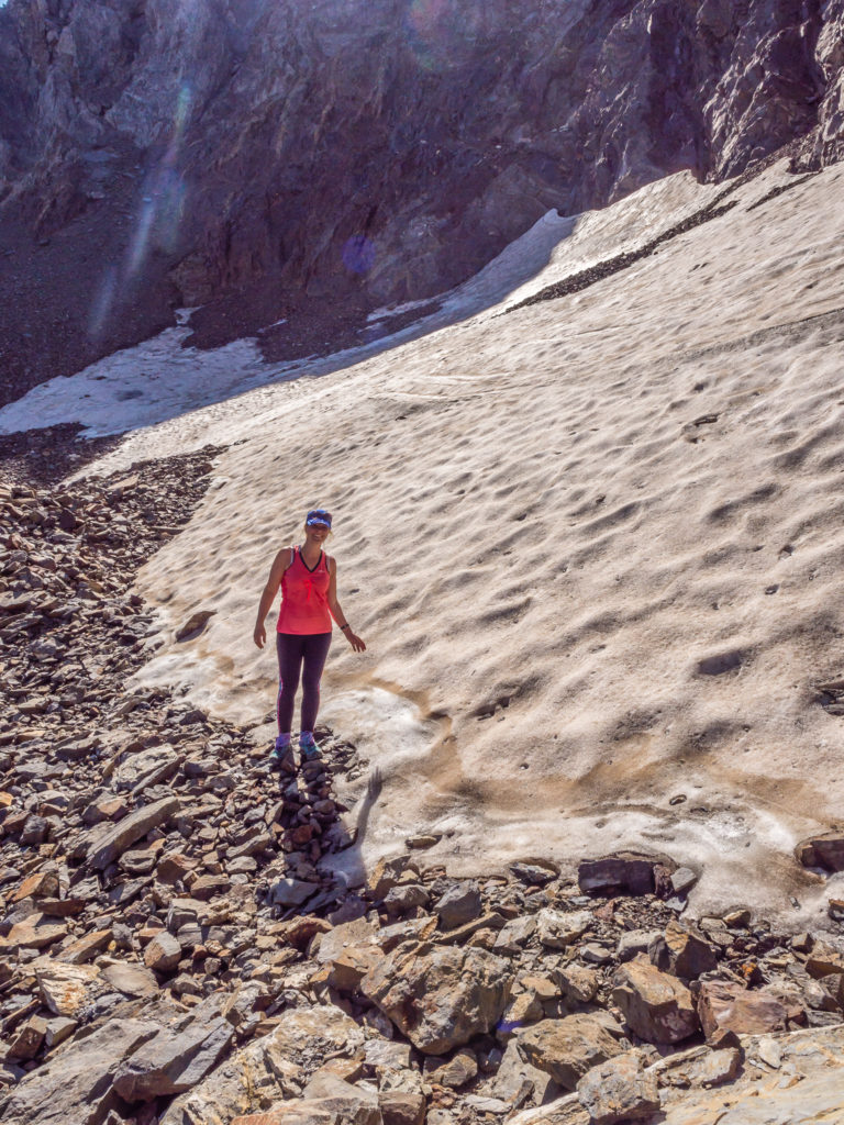
Reaching new heights, which meant a covering of snow! It was also off with a few layers as it was extremely hot!
When we arrived at the rocky notch in the ridge – the Cuello de Tebarrai (2,765m) – some hikers were already steadily scrambling down, so we took off our packs and waited at the bottom so that we had a clear run at it and wouldn’t have to pass or give way to anyone. (The hikers we had come across so far didn’t seem to have much trail etiquette, powering on past us regardless of how precarious a position we were in with a large pack and not being able to move out of the way.)
We both used the left ridge to support us scrambling up, finding lots of pointy notches to grab onto and use as hand and foot holds. It was a little demanding with our large, heavy packs and poles still in hands (in hindsight they should have been safely stowed away to free our hands properly). But overall, it was not too bad a scramble going up (we always prefer going up to coming down) and we seemed to reach the top of the pass in no time at all!
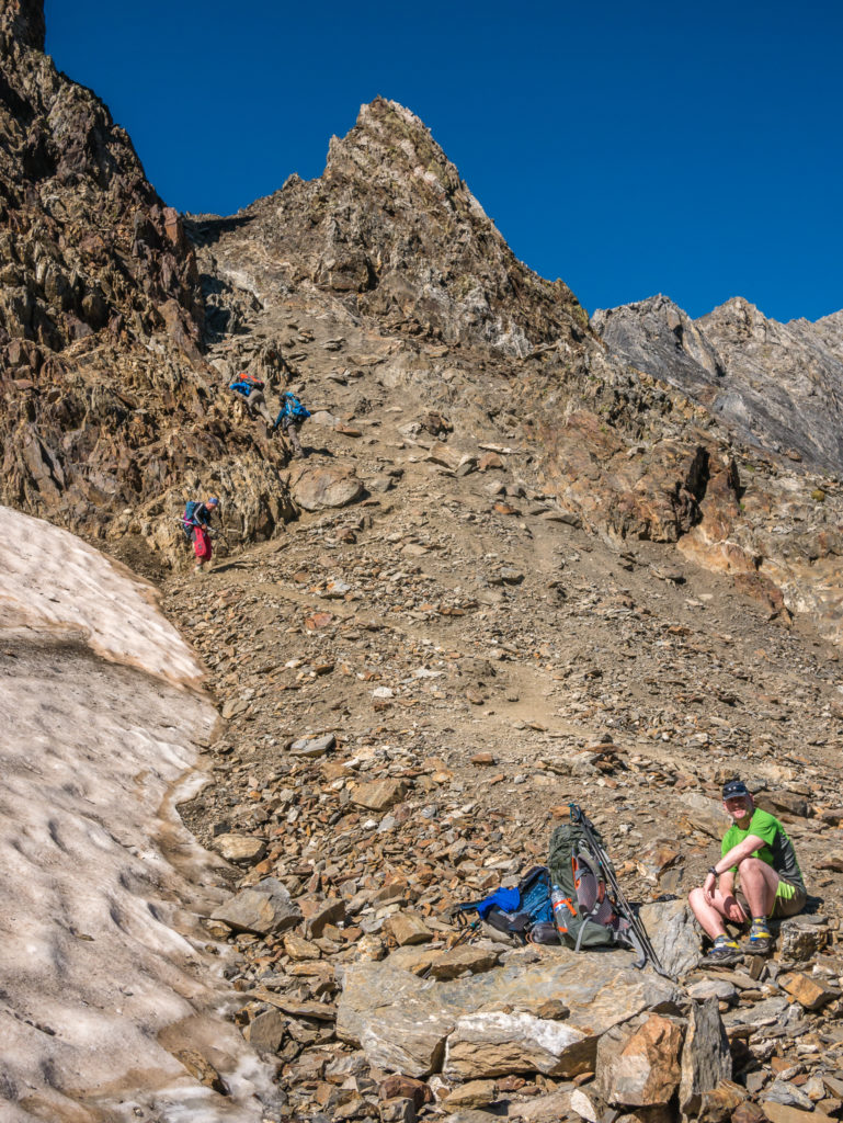
Waiting patiently at the bottom of the pass for hikers coming down who were walking in the opposite direction. This scrambly section through the gully would not be a good place to manoeuvre around people and their big backpacks!
Ready to scramble up the final section to the top of the pass, whilst looking down on the scree slope we had just hiked up! It was an awesome view!
Heading up through the gully. There were plenty of hand and foot holds to assist with the scramble to the top.
All smiles as we like a good scramble now we have grown in confidence from our experiences on the GR20 and tackling the Via Ferrata at Honister Slate Mine.

Woo-hoo! Reaching the top of the pass and the highest point on the GR11 trail – the Cuello de Tebarrai (Piedrafita) at 2,765 metres.
We found it to be a bit of a highway at the top with several people congregating there at once, crammed onto various ledges in a really small space. So we took our packs off again for a break, hoping that someone else would head through the gully on this side first, as the way down to the trail looked a thoroughly unpleasant descent.
We were in luck! One guy literally flew down the next steep, gravelly section. He was full of confidence, not even batting an eye lid at how precarious the path looked!
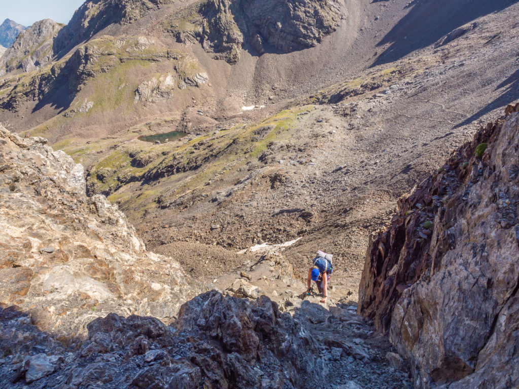
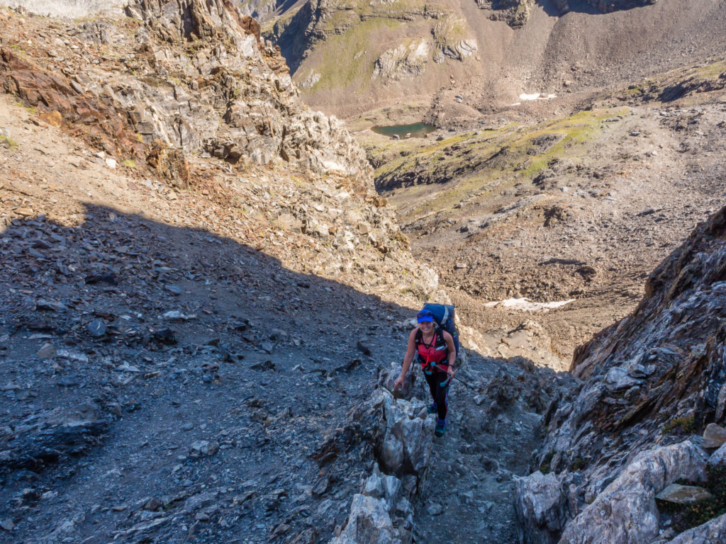
Looking over the other side of the pass and realising where the trail headed to next! We had to catch our breath and psyche ourselves up for the descent down the other side of the gully to get back on the trail! This photo doesn’t show it, but the descent looked very scary!
We could mull it over all day – but we just had to go for it! So we put away our poles and decided on a backwards scramble down, where we would be facing the rock and felt more in control. We gingerly stepped down onto each rocky notch, whilst gripping firmly onto any craggy hand holds, and steadily manoeuvred our way down to the path.
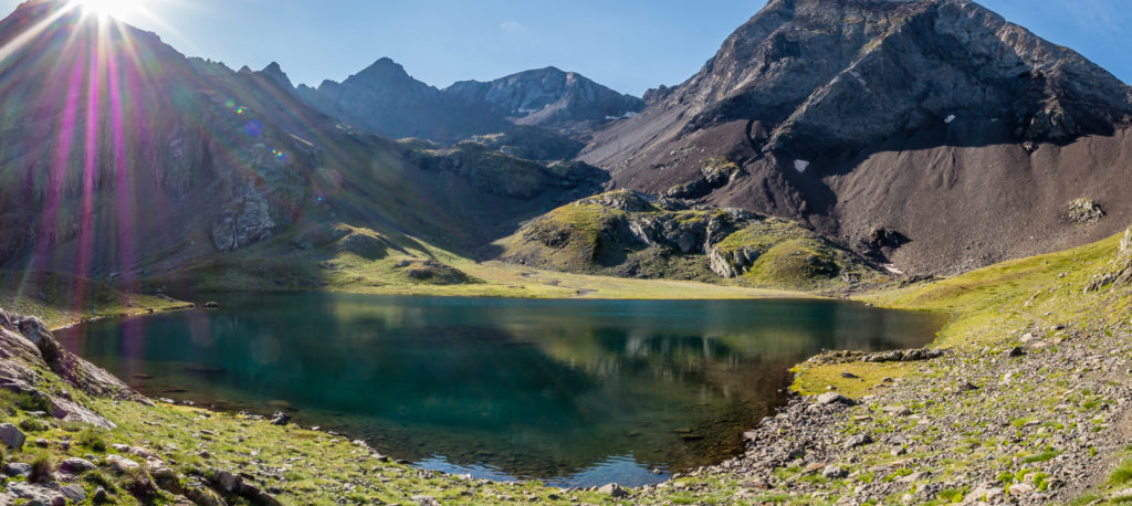
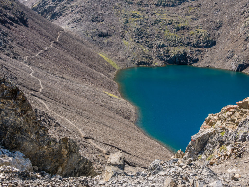
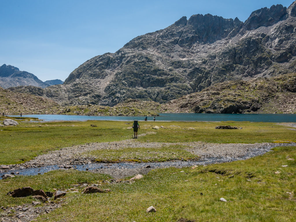
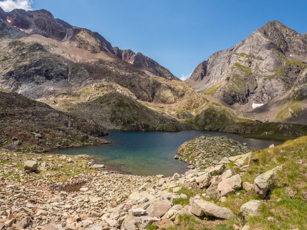
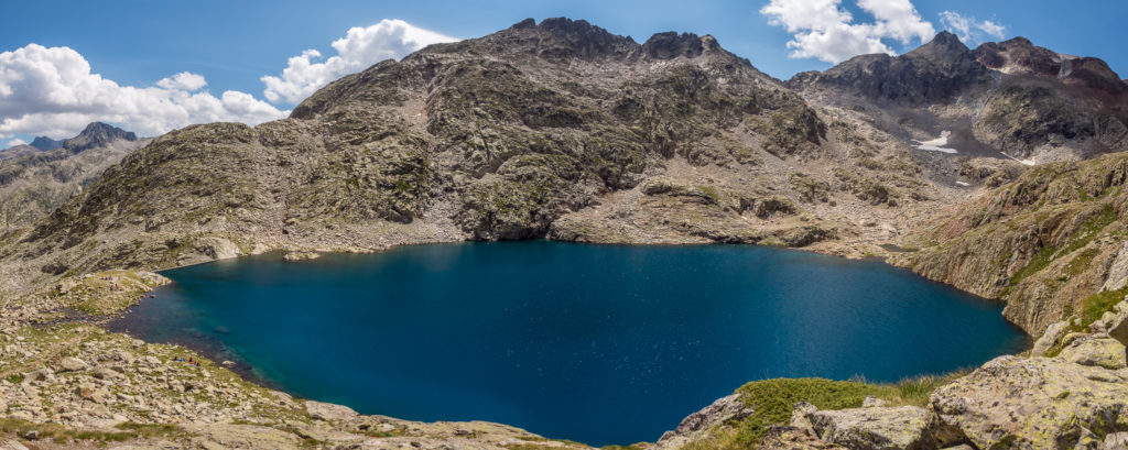
The GR11 trail heads to the left of the stunning turquoise waters of Ibon de Tebarrai.
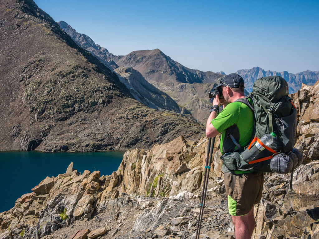
Wayne photographs the still waters of the mountain lake.
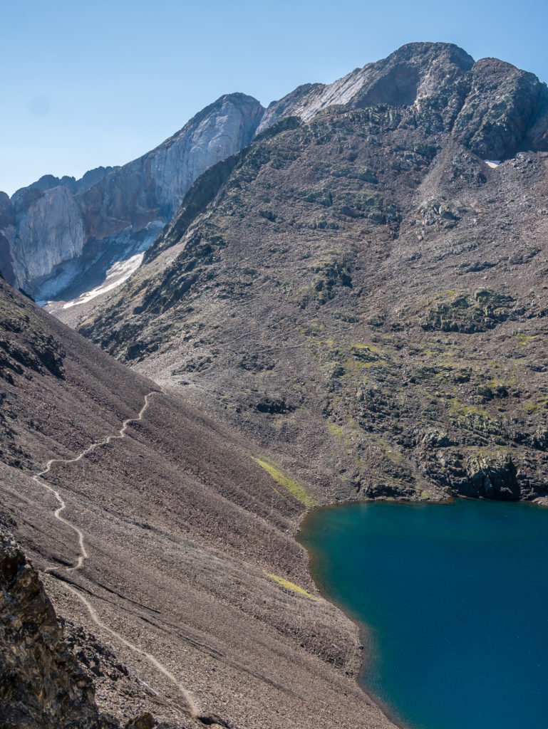
Looking to the left, the GR11 path contours along the moraine above the Ibon de Tebarrai. Our next stop was the Cuello de L’Infierno (2,721m), a slightly less precarious pass leading into the next valley. Again there were lots of people taking rest breaks on the pass, huddled in a series of stone wind shelters that had been built along the trail. We stopped for a quick selfie shot looking down the vast valley in the direction we were heading, but then decided to push on as we were already way behind our intended schedule.
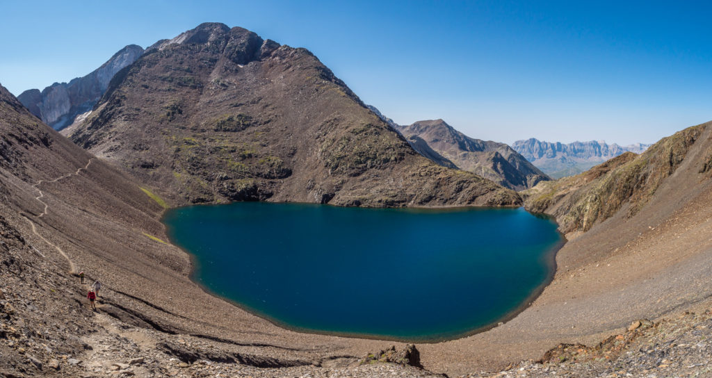
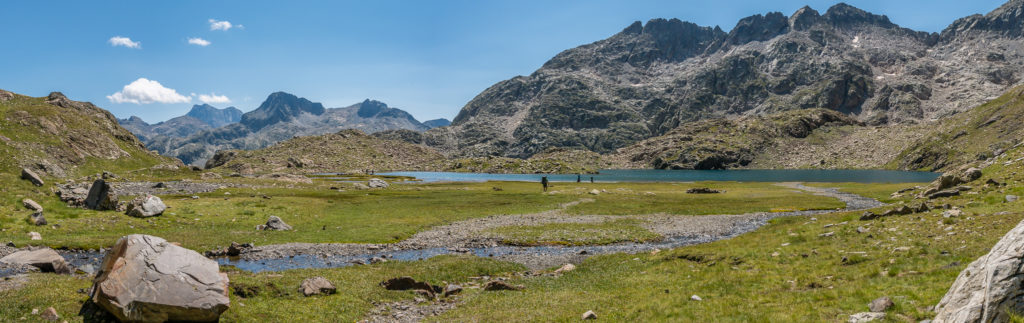
Panorama of the stunning Ibon de Tebarrai.

Carefully making our way downhill through the moraine towards the Cuello de L’Infierno (2,721m).
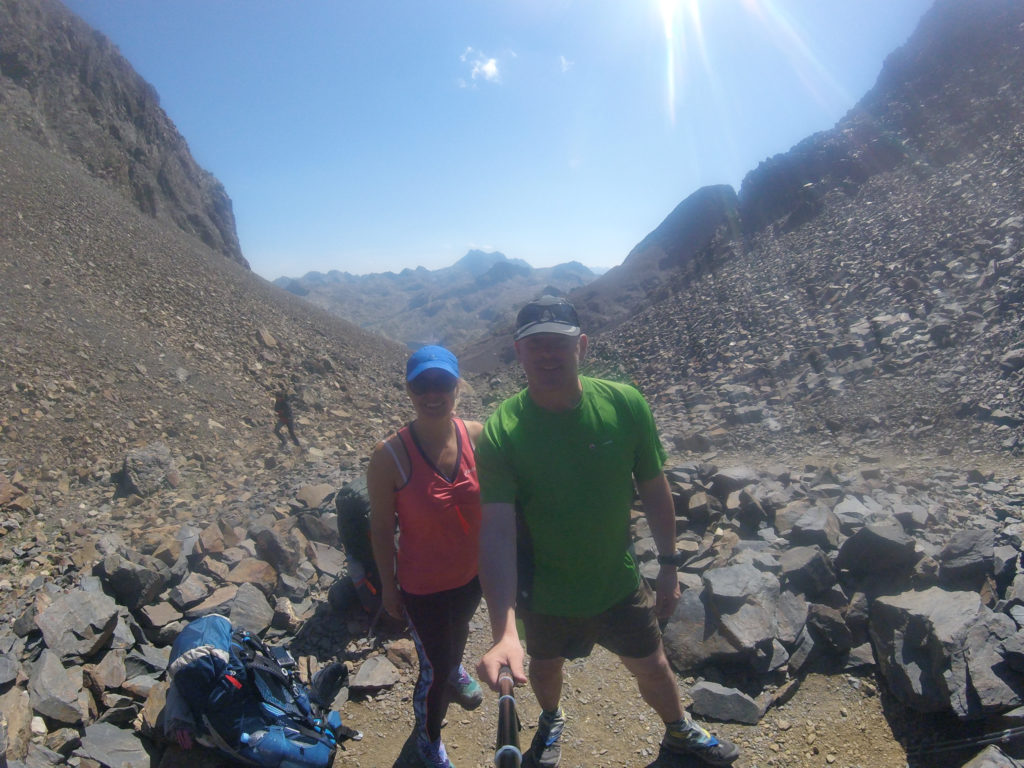
Selfie shot looking down the vast valley from the Cuello de L’Infierno (2,721m). Hikers may take a detour here to the Picos del Infierno (Hell’s Peaks), considered one of the most attractive in the Pyrenees. The three ‘Infiernos’ joined by an elegant but dangerous ridge are Western (3,073m), Central (3,082m) and Eastern (3,076m) .
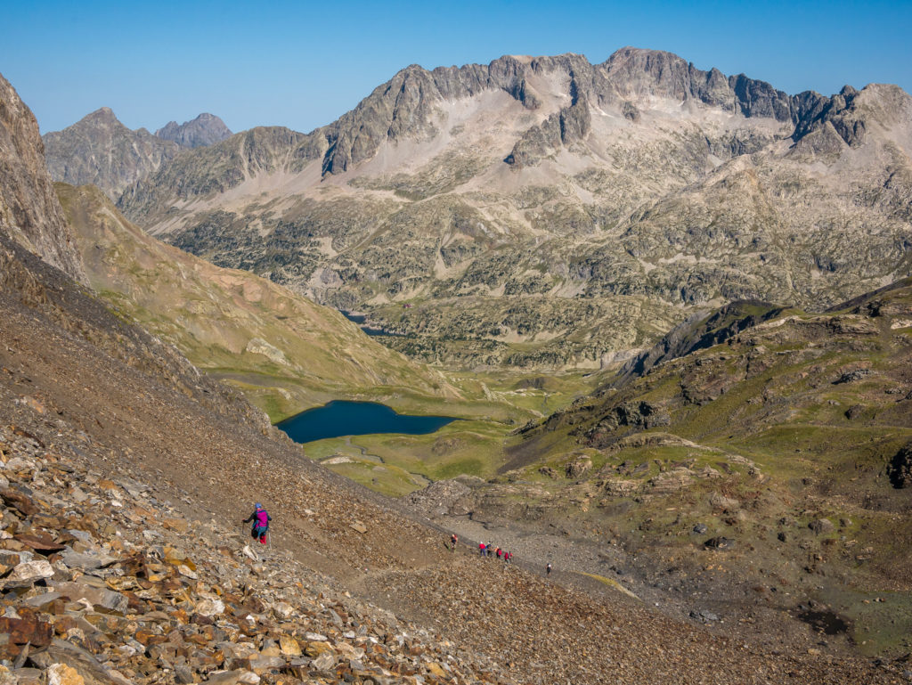
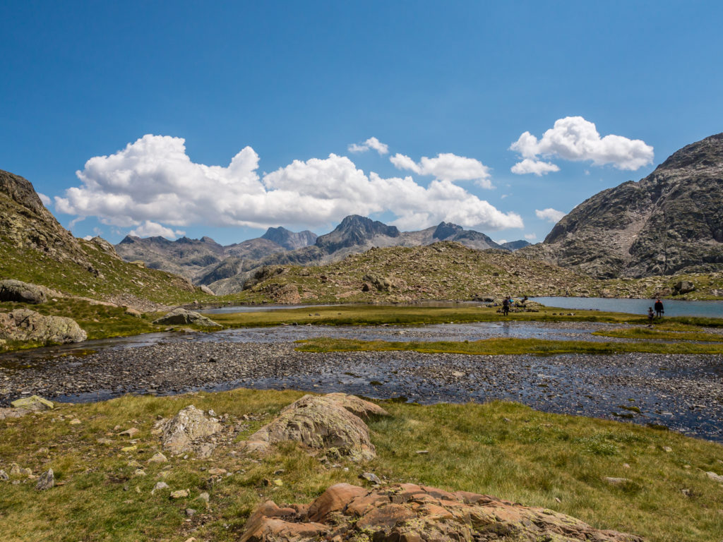
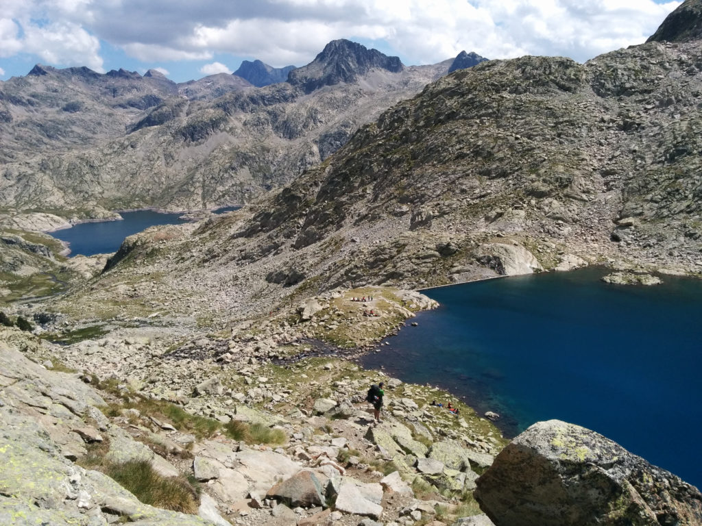
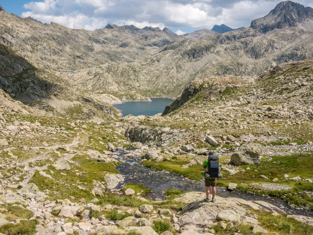
We were then back on a well-marked route where we found ourselves clambering over a large boulder field down to the Ibon Azul Alto, another gorgeous lake surrounded by jagged peaks. We both agreed that it would have been another fantastic wild camp location if we were ending the day here.
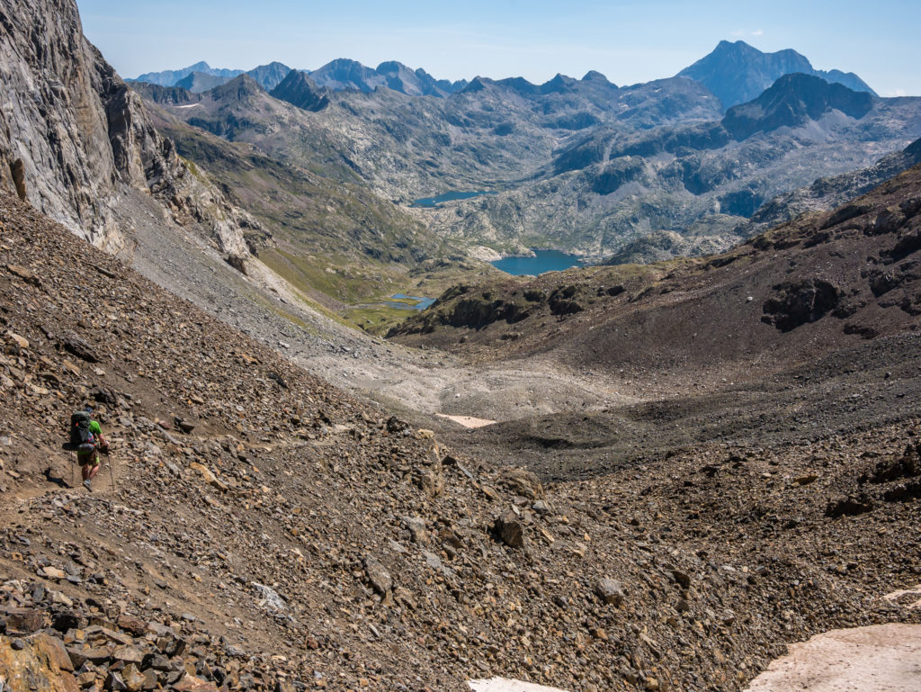
Our route down leading us to another fantastic wild camp location beside the Ibon Azul Alto.
Navigating the slippery slopes…
It felt much better to be on more stable ground!
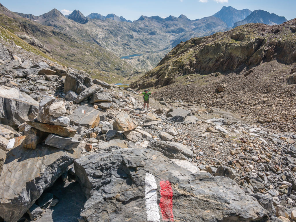
The Gr11 is well way-marked on this side of the ridge.
Just a few more mountains to navigate our way through! (And today was meant to be a short hiking day!)
We had plenty of opportunities to top up our water supplies if needed.
Perfect weather accompanied the tremendous views!
Reaching the Ibon Azul Alto (2,410m), but the day wasn’t over yet!
On reaching the lake, we found there were several other hikers taking a rest break here. It was also ‘Day Hiker’ territory (aka busy!) with families hiking up from the small spa town of Panticosa. We chose a grassy knoll by the outlet so we could take off our trail shoes and dip our feet in the flowing water. It was icy cold, but in the intense Spanish heat, it felt so good.
We took the time to enjoy a picnic lunch, consisting of bread rolls, cheese and chorizo, then sun bathed a while on the grass in the centre of a pre-existing makeshift wind shelter made out of rocks. (I really needed the toilet, but I just couldn’t go anywhere discreetly because of the trail winding it’s way around the lake and so many people dotted all over the area. As is often the case on the trail, I just had to wait!)
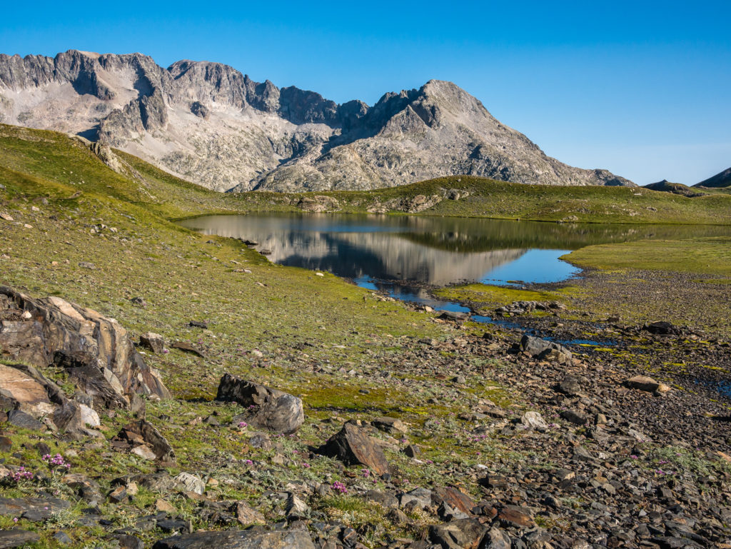
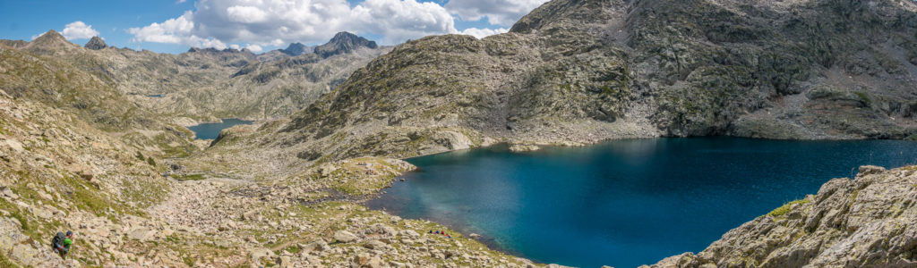
Panorama of the beautiful high mountain area.
The crystal clear lake is flanked by striking craggy peaks.
We decided to stop by the lake for a picnic lunch.
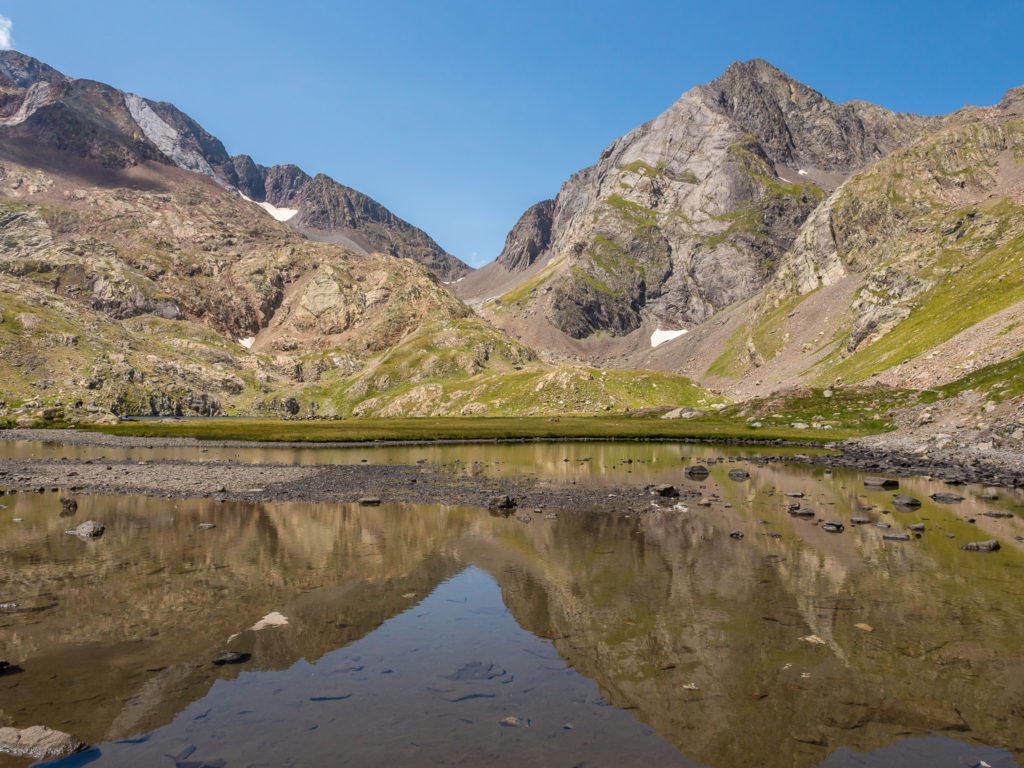
Beautiful reflections on the Ibón Azul Alto. Looking back towards the Cuello de L’Infierno.
Stunning view looking back from further along the lake. The water looked so inviting but was icy cold!
After about an hour of relaxation, we followed the GR11 around lake to a large rocky outcrop. Here, the trail heads over it and down the other side across large boulders to the dam of the Ibon Azul Baxo, (2,360m). Here, there were simply incredible views of reservoirs and mountain peaks as far as the eye could see!
(We had to get several photos on all our devices as the scene was perfect to update our social media profiles!)
Standing above the Ibon Azul Baxo that was busy with day trippers.

When you think things can’t get any better and another day just bowls you over!
The absolutely stunning Ibon Azul Baxo in all its glory!
Beauty on a grand scale – This section of the Pyrenees is truly magnificent!
Bottom left, Wayne is used to give a sense of scale in the panorama shot.
Just another spectacular day on the GR11!
Passing rushing waterfalls as we continue downhill.
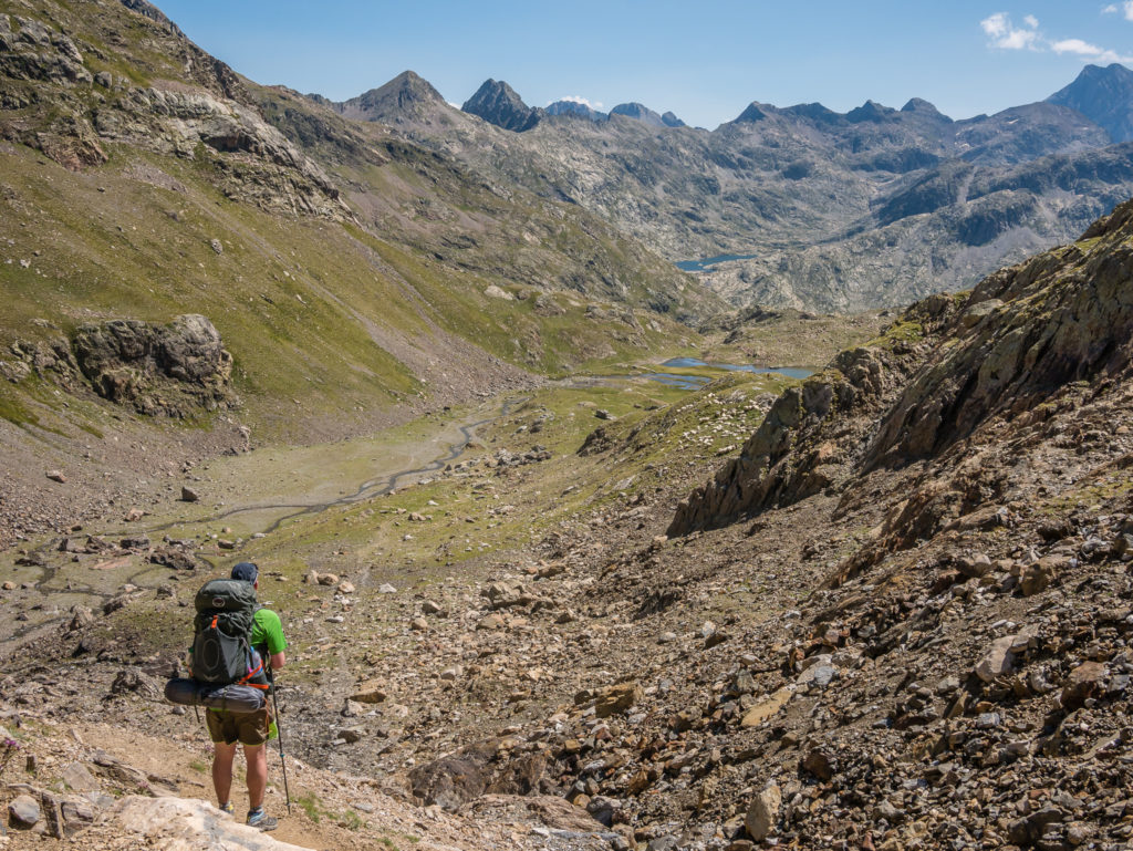
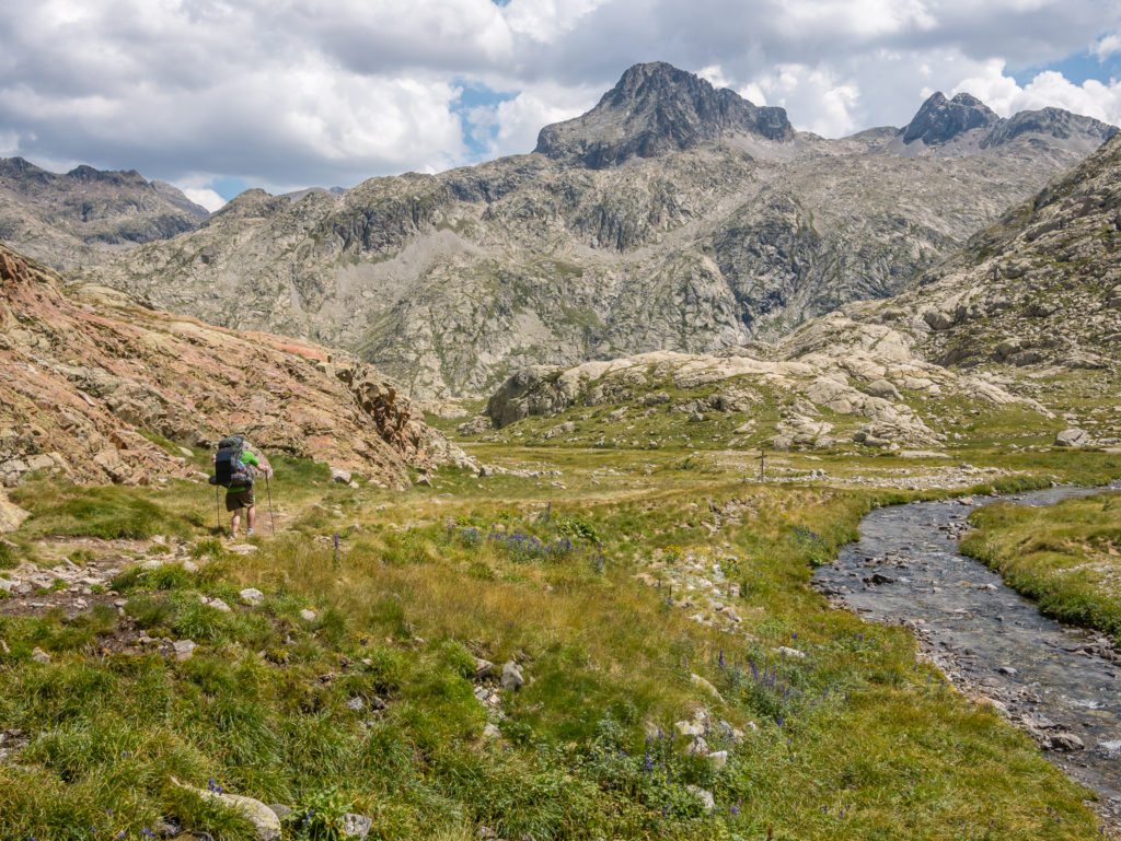
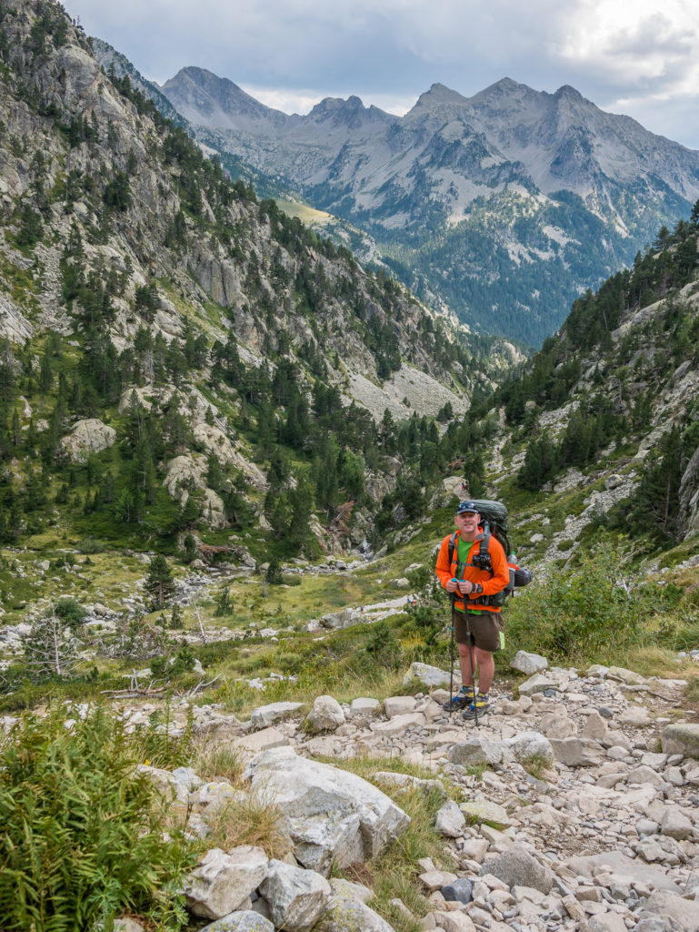
Again we faced a long, rocky walk downhill towards the next set of reservoirs but the scenery was so spectacular we still had a spring in our step! By late afternoon though, the intense heat was beginning to take its toll. We had walked with the full force of the sun on our right-hand-side for the best part of the day – the temperature on the valley bottom forecast to reach 35 degrees. Even though we were still well over a thousand metres in elevation, it didn’t feel much cooler!
Continuing downhill to the Ibones de Bachimaña.
Seemingly on flatter ground… For now!
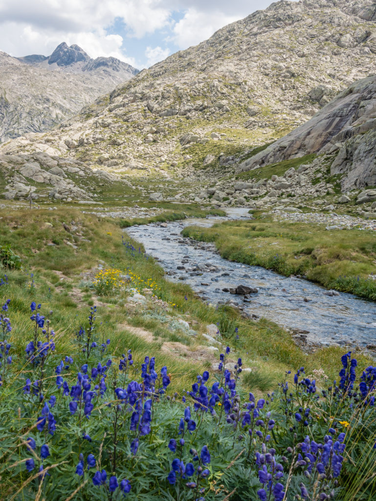
Wild flowers along the river give an injection of colour.
We finally came to a set of cross roads that had a GR11 signpost. Here, the trail turns right along a rocky path, heading up high above the west bank of the Ibon de Bachimaña Alto reservoir.
Captivated by grand mountains in every direction.
Taking a breather before the last big push to Refugio Bachimaña.
Another beautiful section of trail – the Ibon de Bachimaña Alto reservoir. (It’s not possible to wild camp on this section however as there aren’t any flat areas.)
Paint flashes signal to turn right.
The path lead us around to the dam of the Ibon Baxo de Bachimaña Reservoir. From here if you look across to the left, you can see the Refugio Bachimaña, which is a large, modern manned refuge that first opened in July 2012. (Open all year offering full refuge services – beds, meals, drinks/snacks.)
We crossed over the dam to the refuge to ask the warden about the old GR11 route that went to the left of the valley following a water pipeline. We thought we could follow the old route instead of hiking down into Panticosa to then have to hike straight out again – a completely unnecessary descent as the town is basically a ‘thermal spa’ resort catering for big budgets. We had no intention of staying in town, so thought we could save ourselves some miles and a lot of effort by using the old route as an alternative.
A guy at the refuge said it was still possible to follow the old route and showed us some personal photos of the trail, explaining what cairns to look out for, and to keep closely to the left as the trail is narrow with sheer drop-offs. He advised us to take our time and warned us to take even greater care with carrying big packs. He even went so far as to reiterate – “…Those cliff edges mean death!”
As soon as he said that and explained how narrow the trail is, we decided against the old route, opting to hike down into Panticosa after all! Better to be safe than sorry. Some extra descent didn’t seem at all bad now, and we regarded taking the newer GR11 route as the best and safest option. Of course, anything was preferable to “death”!
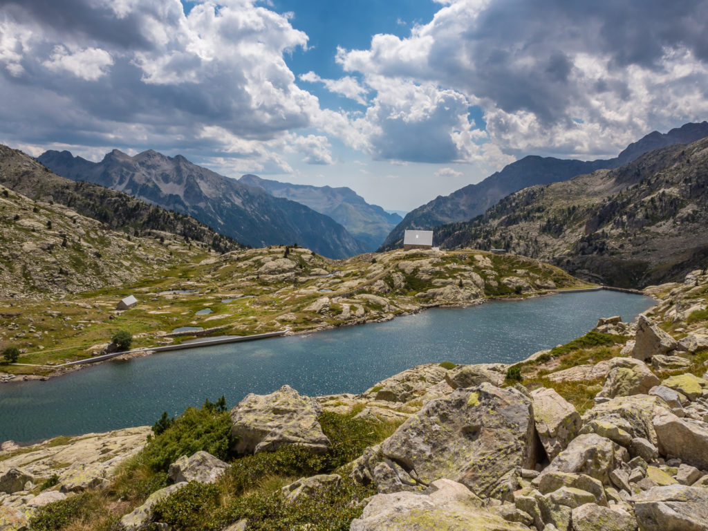
Refugio Bachimaña is situated off the GR11 trail across the reservoir.
After visiting the refuge for advice on the state of old GR11 route, we decided against taking this alternative. We therefore had to no other option but to continue with the long hike down towards Panticosa.
Looking back to the falls and to where we had just hiked down from the refuge.
Enjoying the gorgeous high mountain landscape.
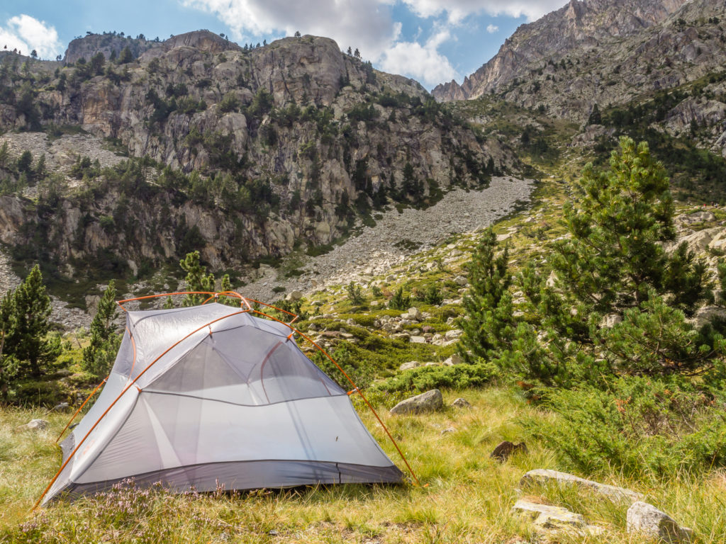
After leaving the Refuge, we began heading down the striking granite valley on another long descent. The path was rocky and steep in places and it didn’t look like we’d be lucky enough to find a wild camp spot large enough to fit our 3-person tent. However, after another half hour of walking we spotted a flat patch of grass alongside the Rio Caldares. We had to rock hop across the river to reach it, but we knew it had been used as a wild camp spot before as there was already a fire pit that had been built out of rocks with some wood gathered beside it. In this hot, dry month of August, we knew not to have a campfire, but the spot was perfect for pitching our tent. So we decided to stop and make camp as it saved us an extra couple of kilometres hiking into town. (This still meant we had to finish the descent the next morning, which would be followed by a demanding ascent back out of the valley. But at least we’d be fresher, and it would be much cooler at first light.)
Thankfully, we didn’t have to push on all the way to town after what had already seemed an exceedingly long day of hiking! (We were not expecting such a long day considering the time suggested in the guidebook for this section was only 6 hours!)
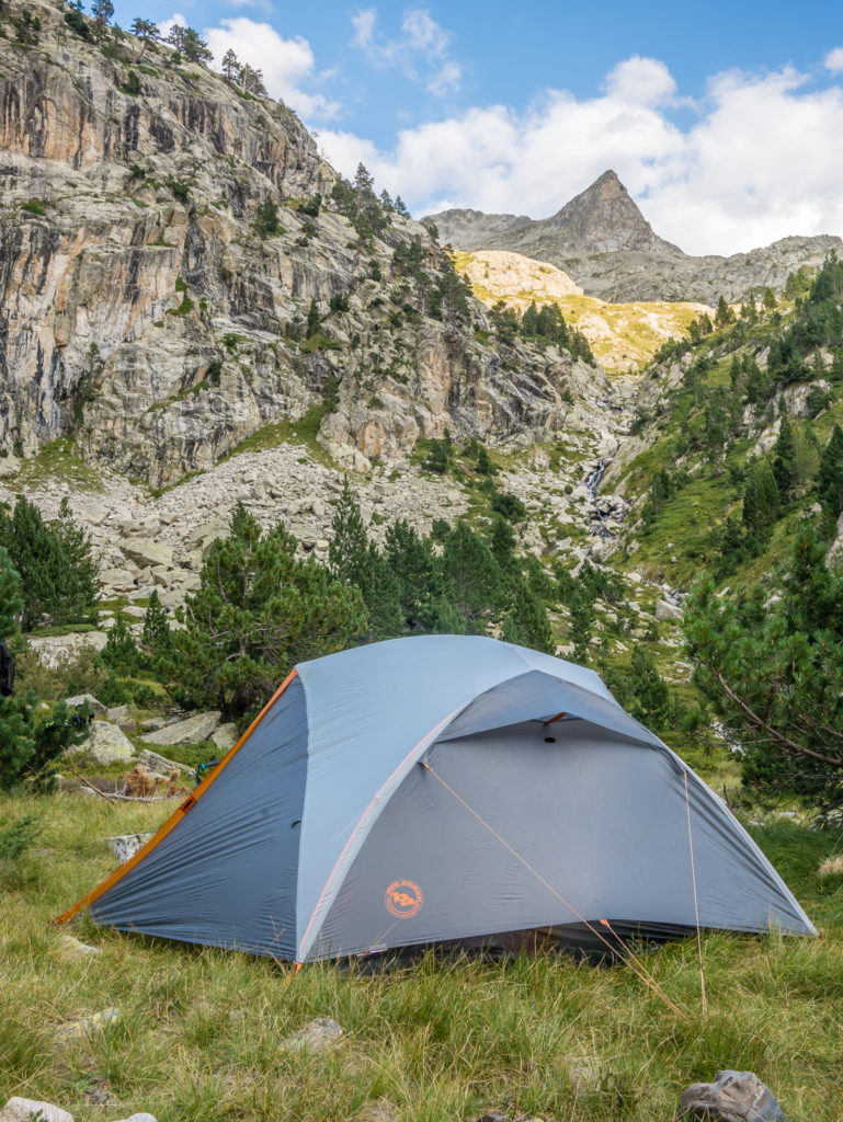
From one inspiring wild camp to another!
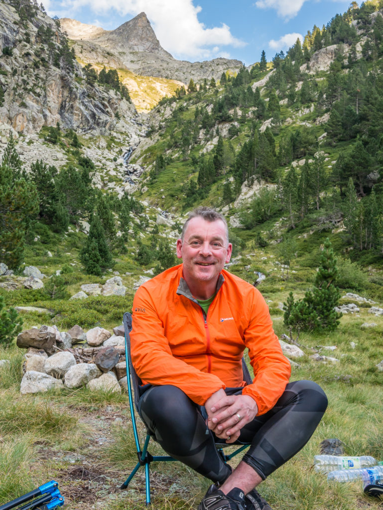
Making good use of his camp chair once again! (It’s a complete luxury and by no means ultra-light hiking, but I’m kind of convinced that I need one too!)
So we set up the tent and did the usual chores of blowing up our sleep pads, filtering water and making notes about the day. (I also tried to sunbathe a bit but by now lots of clouds had built up and the sun kept going in and out.) There were still people hiking up and down the trail who, when stopping at various sections for a breather, found it very entertaining looking across the valley to see us setting up home. (We had no chance at winning any ‘stealth’ awards when Wayne’s bright orange top made us clearly visible!)
We had soup and noodles for dinner, then settled in for an early night ready for a long hiking day tomorrow. Tonight there’d be no midnight alarm call for any star photography, as on paper we knew we had just short of a 1,000 metre climb out of Panticosa to contend with, so we needed to be well rested.
Hiking is certainly good for the soul and we love nothing more than being immersed in magnificent surroundings – but it’s also hard work! Find out how we fare on Day 5, coming soon…


2 Comments
Wow, wow, wow! Thanks for taking me along this sensational trail, without all the hot hard work. Fantastic photos and description of your day. I had difficulty finding Wayne in the ‘scale shot’. Certainly ruggard and vast. My favourite pics are looking down from the pass to that incredibly blue lake, with the trail winding across the slope. I can well understand your hesitation to head down.
Hi Helen, yes it truly is an incredible trail! You are literally walking from one wow moment to the next, day by day!
We definitely want to go back in the future and explore more of the area, including the French side of the Pyrenees. 🙂