
The Hardest Mile…
Usually after the first week on any thru-hike we have our camp routines well refined and feel completely trail fit to tackle whatever we’re presented with along the way. Today however put that theory to the test as we were up against the biggest challenge we had yet faced on the GR11.
After successfully completing a traverse of the Cuello de Tebarrai (2,765m) on Day 4, which our guide-book pinpoints as the highest and most difficult part of the GR11 route, we weren’t then expecting to encounter anything too onerous further along the trail… That was until we were faced with a horrific descent of over 1,300 metres from the top of Añisclo Canyon down to the valley floor!
In our opinion, this section of the GR11 certainly tested both our physical and mental endurance more than any other. With a combined descent throughout the day of around 3,000 metres – in layman’s terms, that’s like coming down half of Everest! And it really felt like it at times – manoeuvring down rocky pinnacles, climbing between gullies, stepping down crag after crag onto precarious rocks and loose scree, then following lengthy switchbacks through thick forest, with an intense concentration so as not to lose your footing or become off-balance with a heavy pack! Yes, today was much worse than the Cuello de Tebarrai, which on reflection we didn’t find too demanding at all in comparison.
After several merciless hours of never seeming to get any nearer to the bottom, it became a real mental battle to keep going… (All the while I was questioning why we had decided to take on this perilous section when red wine and tapas were free-flowing and in need of consumption in Barcelona. We were on holiday after all!) But you do keep on going. You just have to take whatever the trail gives you, and accept that it’s not always smiles and miles.
It might not seem like it at the time, but thankfully, these horrible episodes on the trail are few and far between and easily forgotten on the dawn of a new day!
The view was tremendous… But it was the hardest and most dangerous descent of the route – Añisclo to Pineta. It became a real battle with nature and test of endurance for us to continue on the trail and reach the valley floor!
Friday 18th August 2017 – Day 8 – Refugio de Goriz (Camping) to Stealth Wild Camp beside the Rio Cinca (next to parking area just outside Ordesa & Monte Perdido National Park boundary) – ‘One Hell Of A Down!’
Start time: 07:40. End time: 18:45. Distance: 19.3km. Ascent: 2,122m / Descent: 3,040m.
When we woke up for breakfast, after camping close to Refugio de Goriz, we were in good spirits despite knowing it would be a tough day. We had read the section chapter in our guide-book and dutifully checked the map so we knew we had an uphill climb to the Collada de Arrablo first off, then a scrambling section down a limestone cliff face, followed by a gradual descent into the Añisclo valley, then a long climb up to the next pass at the top of Añisclo, followed by a very steep descent into the Valle de Pineta. On paper it was doable – a long day – but doable. However by the final steep descent leading to the Pineta valley, our legs felt like dead wood. This would definitely give some sections on the GR20 a run for their money!
Packed up and ready to leave our camp spot near the Refugio de Goriz. The sun was just reaching the surrounding peaks and it was looking to be a fine morning!
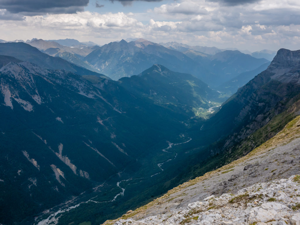
Looking back down towards Ordesa Canyon.
Setting off for the Collada de Arrablo. Some hikers use Goriz as a base and head off to summit Monte Perdido from here.
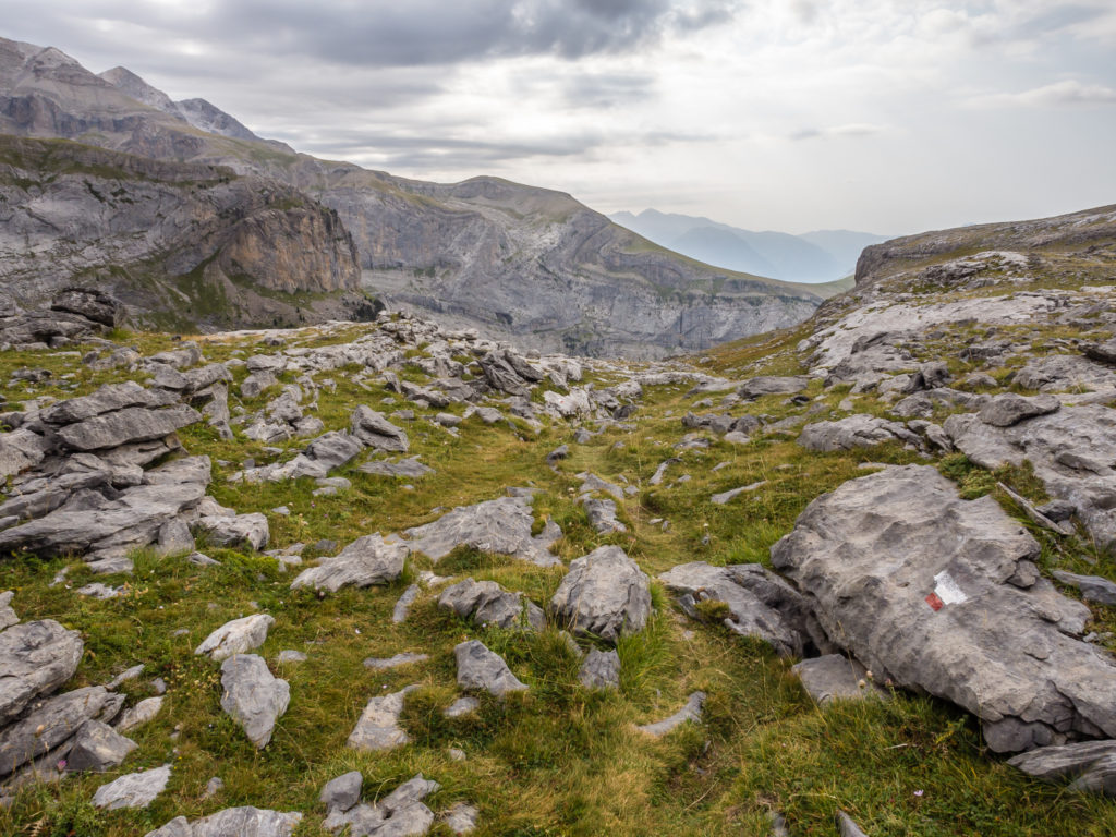
Continuing on the new GR11 route, which heads down from the Collada Arrablo into the Añisclo valley, before ascending to the top of Collada Añisclo for the final descent into the Pineta valley. We hadn’t quite realised what a strenuous day it would be!
Leaving the refuge, it was not too much of a climb from 2,160 metres to the Collada Arrablo at 2,343 metres. Several other hikers left around the same time as us but decided to make a left turn and take the old GR11 route, which saves at least half an hour of walking time, but more importantly 400 metres of combined descent and ascent, which is important on a long hiking day. As our guide-book mentioned the old route as being ‘difficult and exposed’, we opted to stay on the new trail despite the fact we would be descending around 3,000 metres in total throughout the day. We kind of regretted that decision after chatting to some other GR11 hikers the following day whom we met up with again whilst heading towards Parzan. They said that the old ‘balcony’ route was well-marked and much easier to navigate in comparison to the final descent we all had to complete in order to reach the Pineta valley. (At 2,453 metres, the old trail rejoins the new GR11 route at Collada Añisclo, where the descent into the Pineta valley begins.)
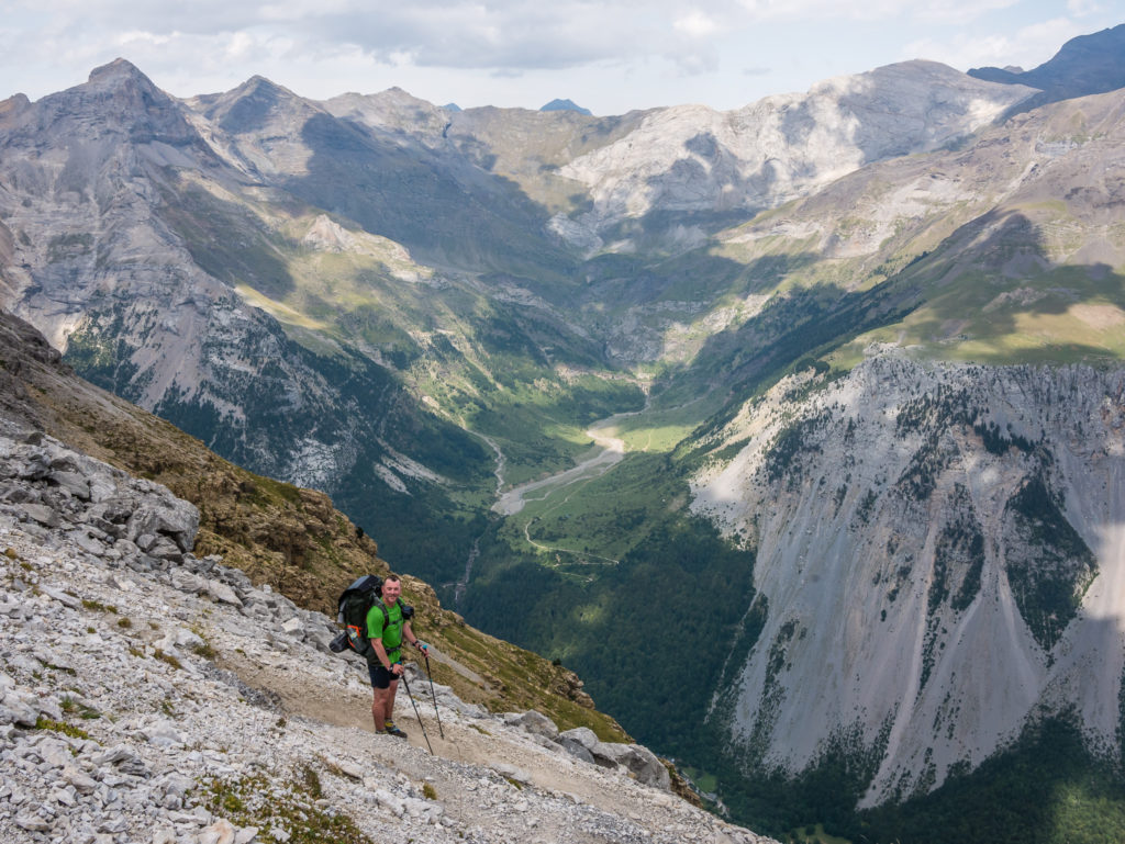
From the top of the pass, we started our first descent of the day, climbing down a number of large rock steps as the path finds its way down bands of limestone crags that line the canyon containing the Barranco Arrablo. Although not technically difficult, we still took great care, particularly as some of the steps were lengthy and we had to over reach. (We’re not the tallest of people!) Also on some sections, it was our preference to turn around and come down backwards thereby facing the crags, so that we could find the rocky notches we were utilising as hand and foot holds much easier. When we reached the bottom of the last limestone ledge and put our feet firmly on the trail again, we breathed a huge sigh of relief! That was the first tricky section done.
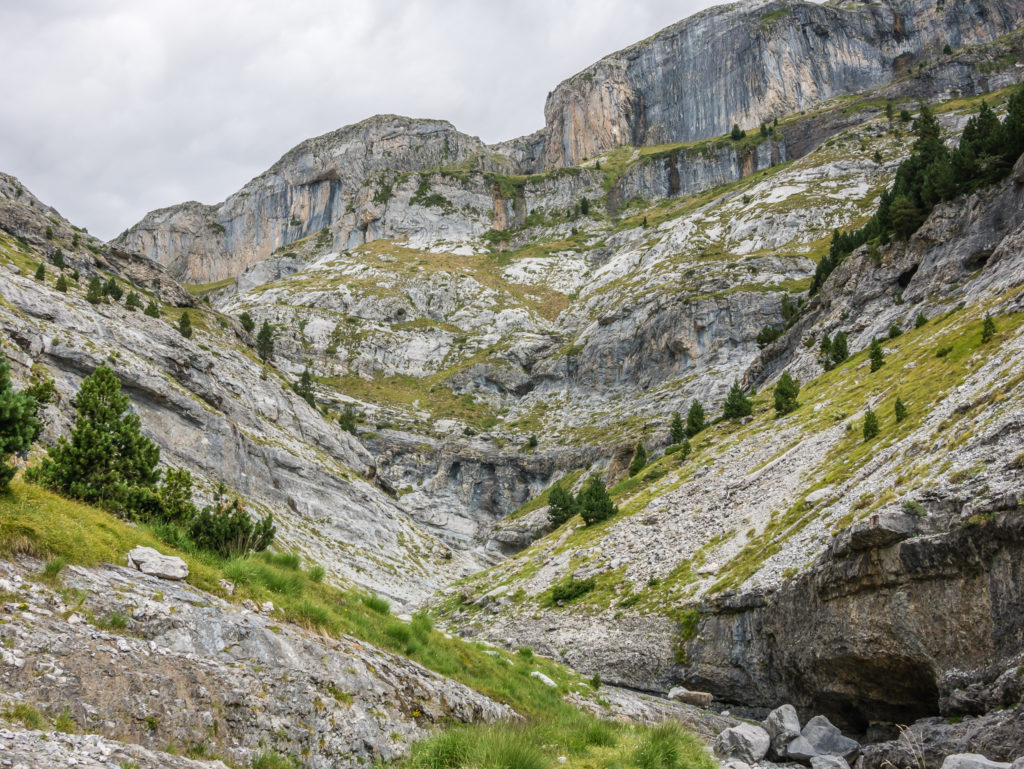
The trail winds its way across several craggy bands, but this was nothing compared to what we had to face later in the day!
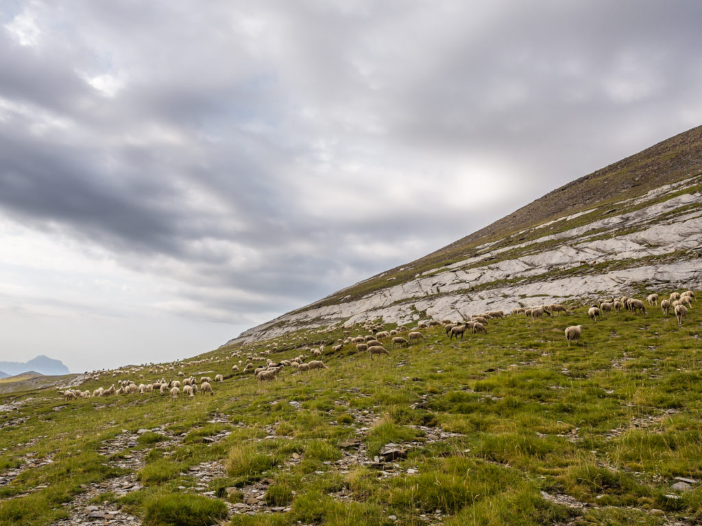
We were surprised to find sheep grazing above the tree line.
From the Collada Arrablo at 2,343 metres we enjoyed fantastic mountain views of the Torre de Góriz.
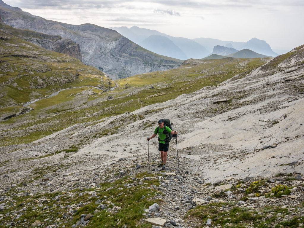
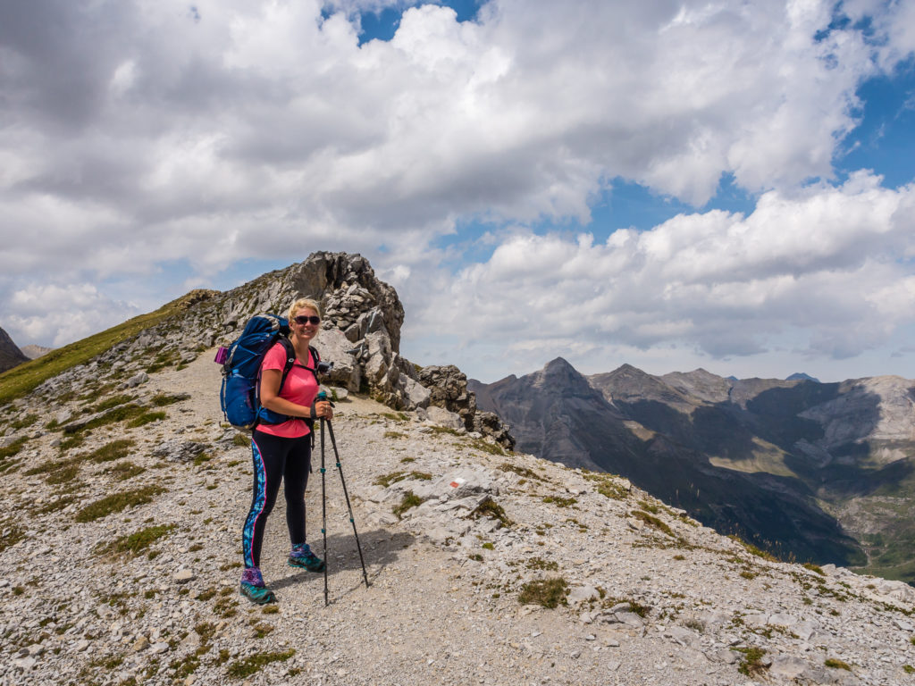
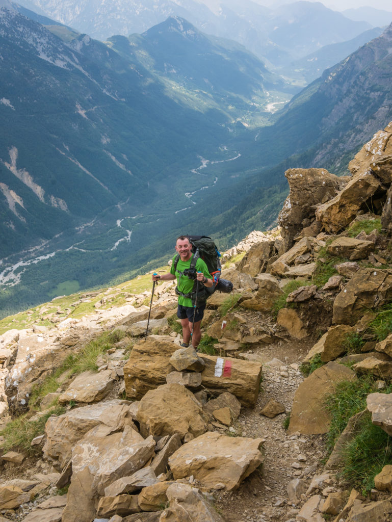
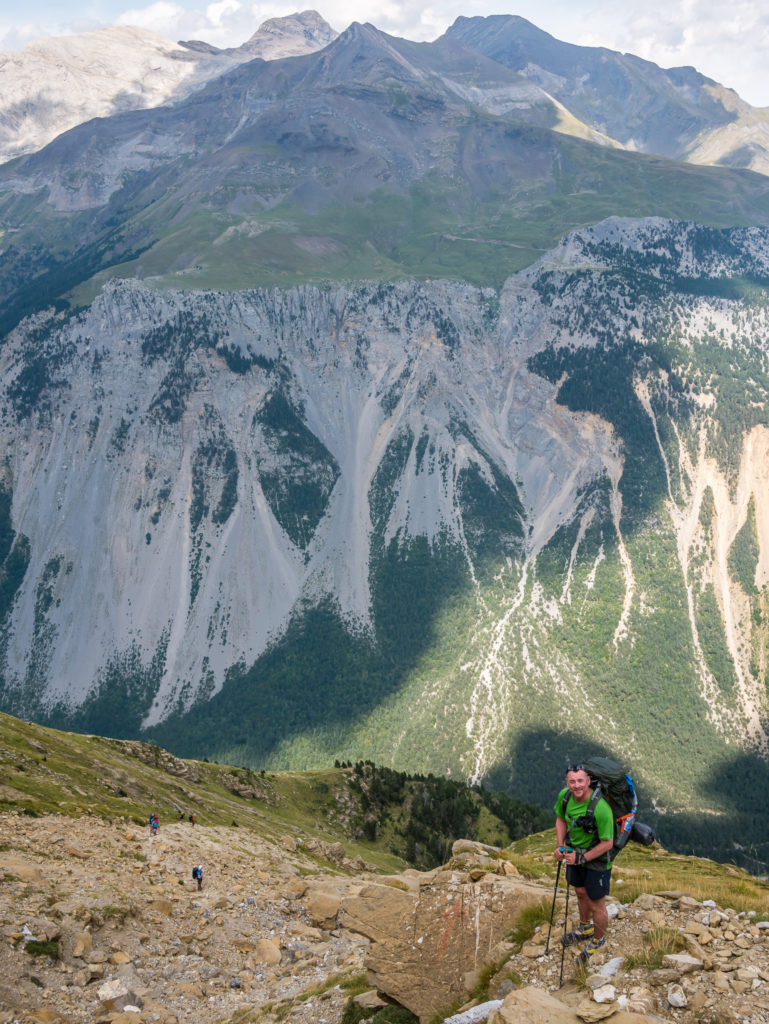
Getting ready for the first tricky descent of the day.
Wayne heads down first following the GR11 path as it winds its way through the bands of limestone.
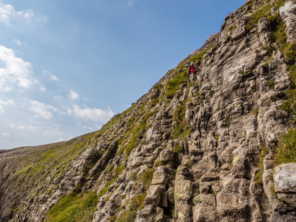
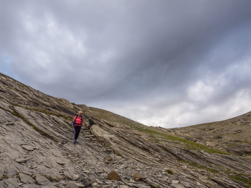
Tentatively stepping down through the bands of limestone, and steadily making my own way down.
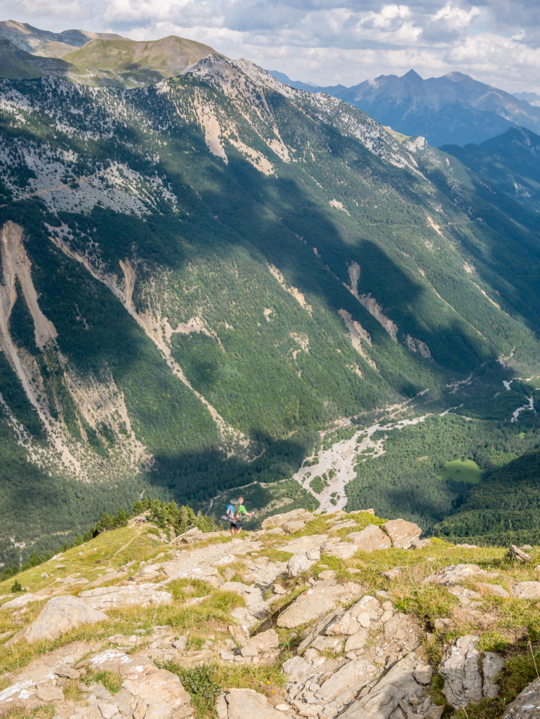
Happy when ‘normal’ trail conditions resumed! But we still had a lot of descent to go…
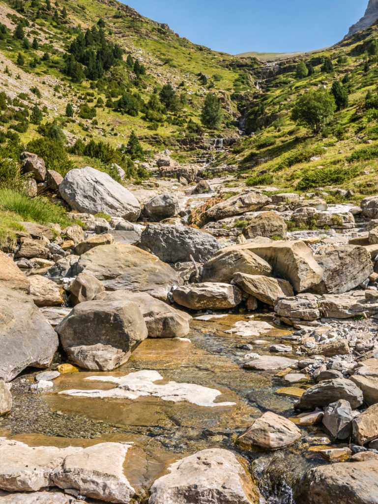
Grateful to be back on solid ground, we continued downhill thereafter for some time before reaching the Rio Bellos at 1,660 metres. We then took great delight at soaking our feet in one of the many plunge pools collecting in pockets along the valley cut by the river. A few other hiking couples had already picked their own spots for a midday swim. It was both refreshing and a feel-good-factor boost in readiness for the long climb up to the next mountain pass – Collada de Añisclo at 2,453 metres.
We couldn’t rest for long as we needed to make it over into the Pineta valley and find somewhere suitable to camp before dark, so we were soon back on the trail and pushing on to get to the pass. But despite our best efforts, the sun was fierce on the way up, so it was slow going. We were also hindered in a couple of places by poor waymarking. Several cairns were dotted around, but we could have done with a few more paint flashes to keep us on the right track. We had planned on having lunch at the top of the pass, but when we finally got there, we realised there was neither a suitable nor safe place to sit and take off our packs.
Continuing on through the Añisclo valley. On first glance it was often difficult to see exactly which way the trail would go.
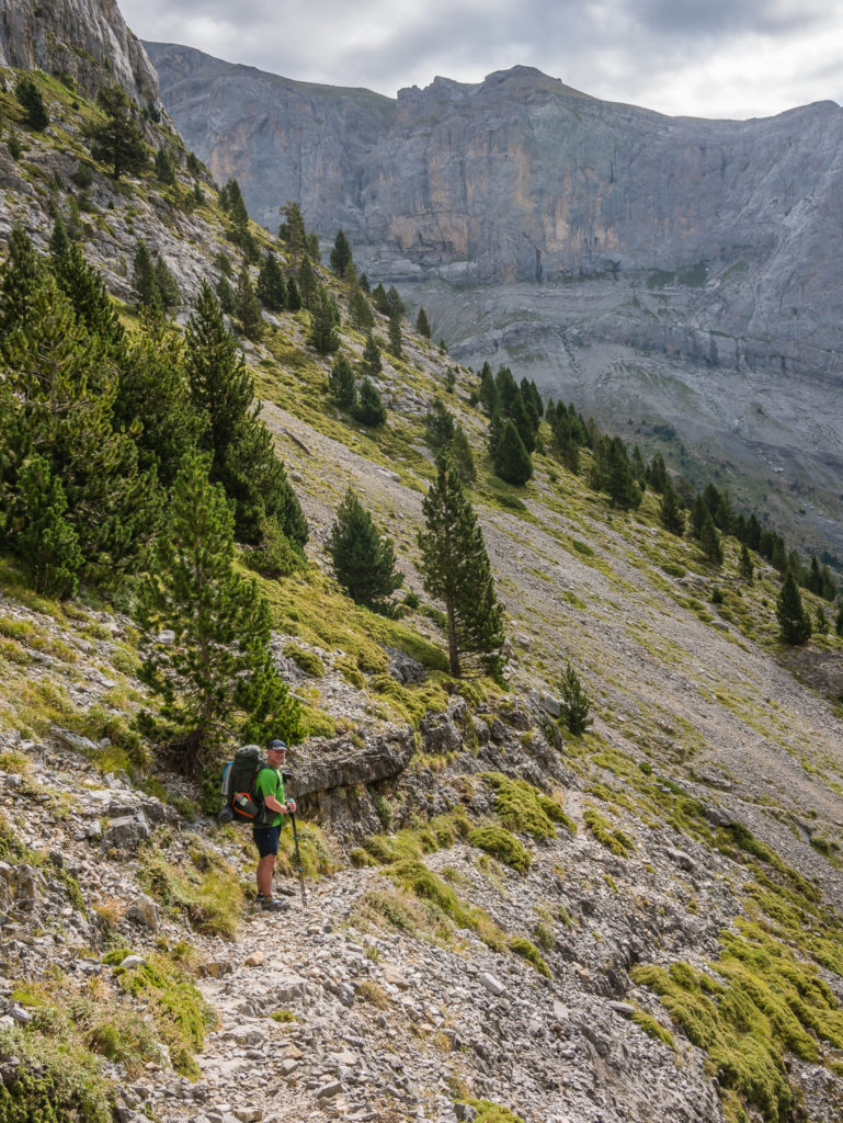
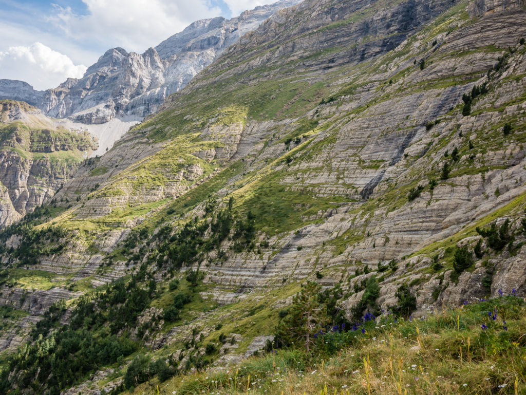
Some parts of the trail are narrow and have to be navigated with care, especially where there is loose rock and scree.
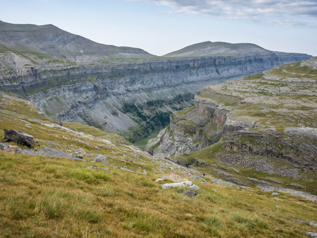
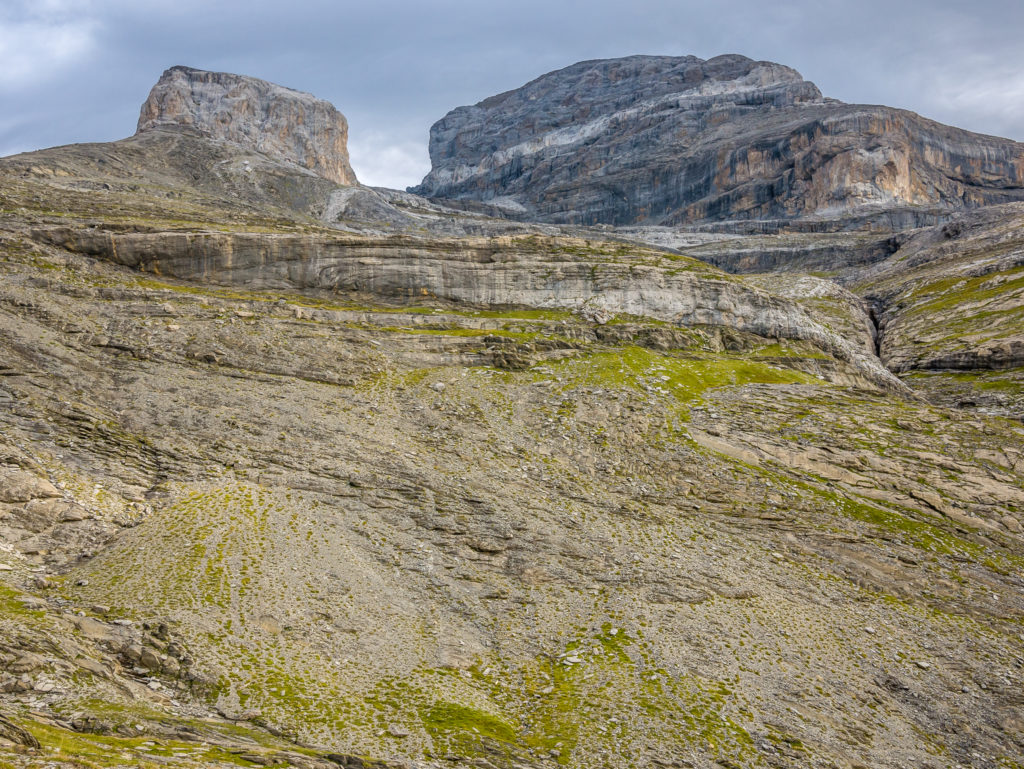
Taking in the dramatic mountain views in every direction. Añisclo Canyon is Spain’s deepest canyon.
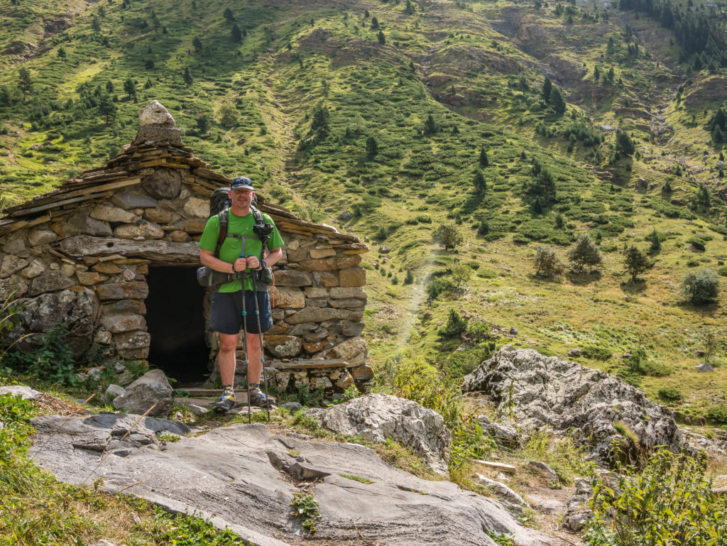
We had a quick rest break outside the Refugio de Fuen Blanca, an unmanned emergency shelter we passed along the way.
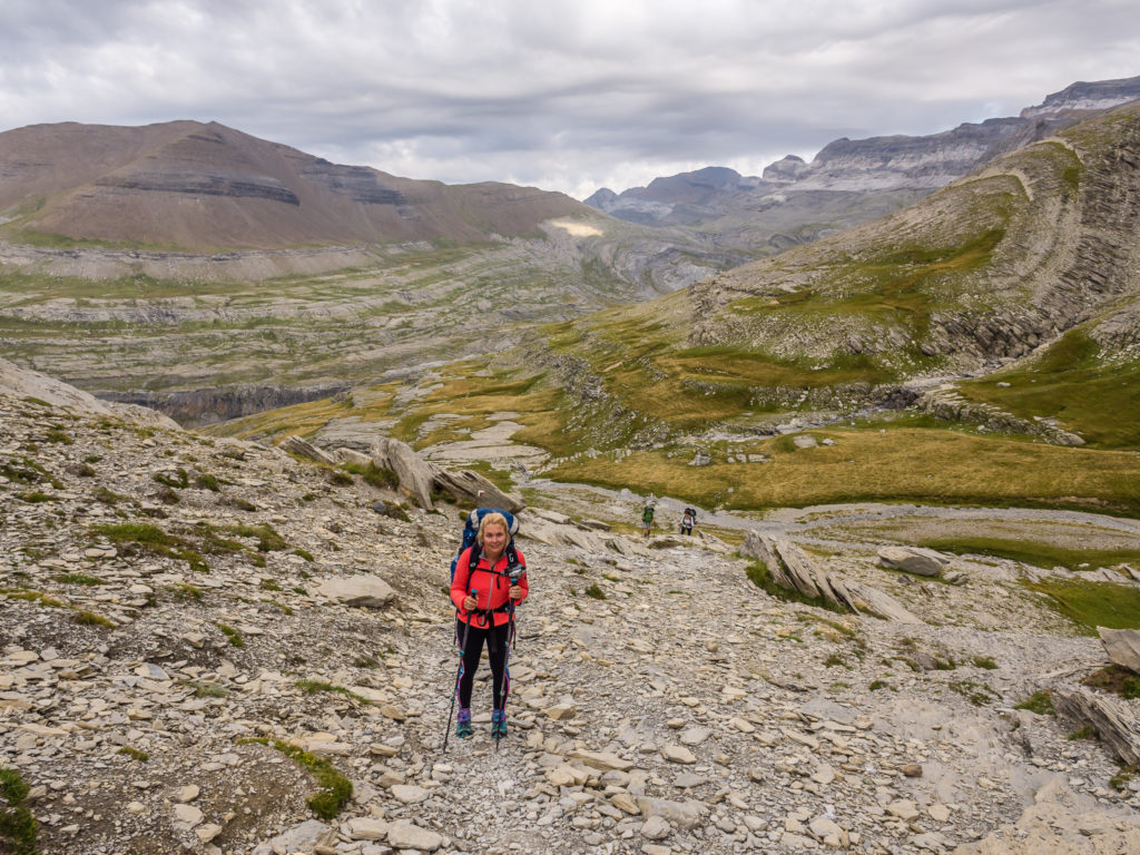
Looking up to the Collada de Añisclo in the distance. We still had a hefty climb to reach the top of the coll.
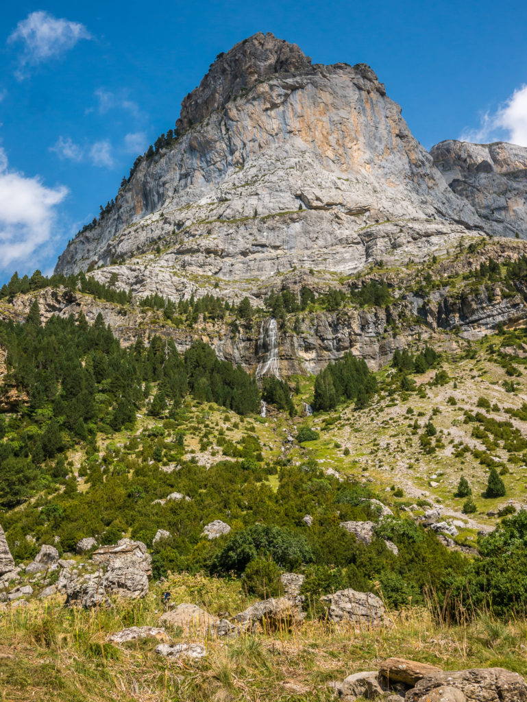
The Fuen Blanca waterfall.
From Goriz, it is possible to avoid the descent into the Rio Bellos valley by tackling the ‘balcony’ route to Collada de Añisclo, but we weren’t confident to do this with large, heavy packs.
Taking in the views back down the Rio Bellos valley whilst still making our way uphill on the final segment to reach the Collada de Añisclo.
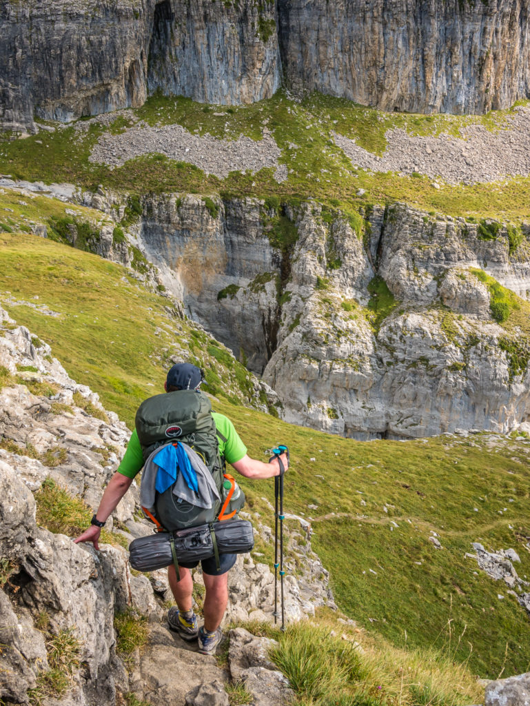
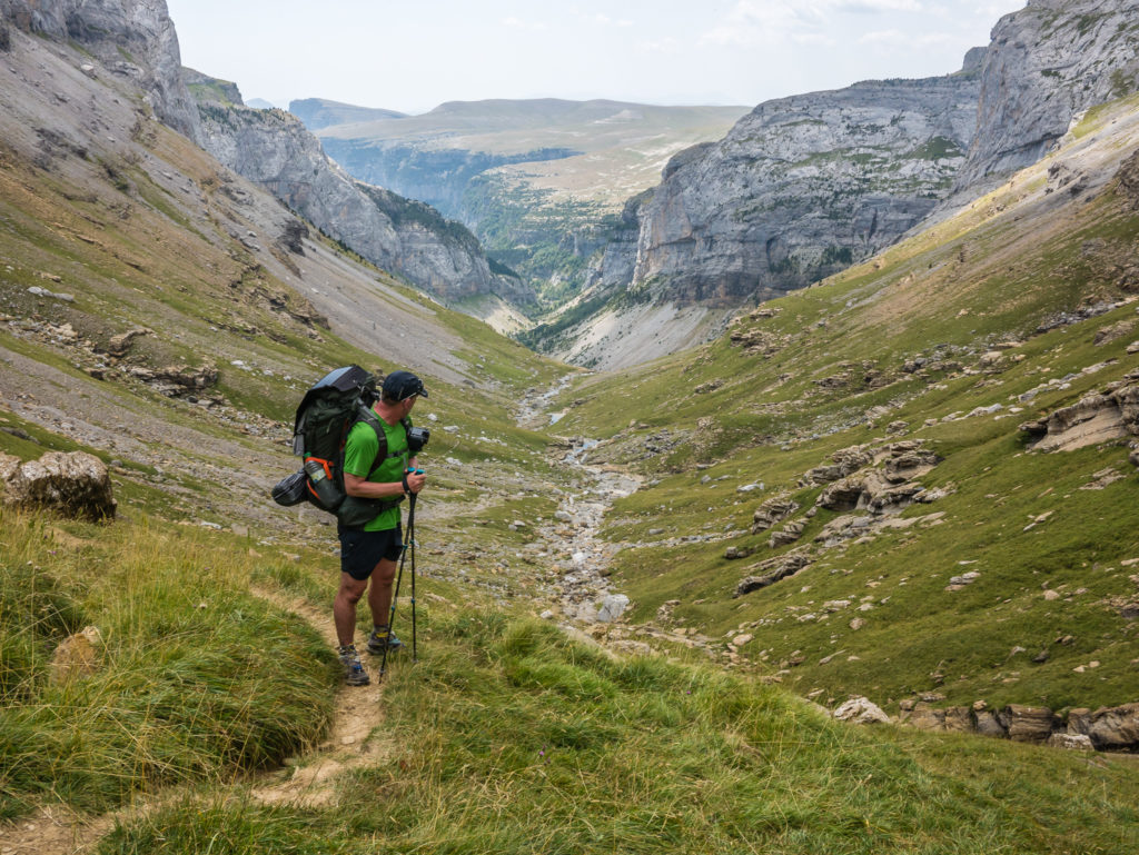
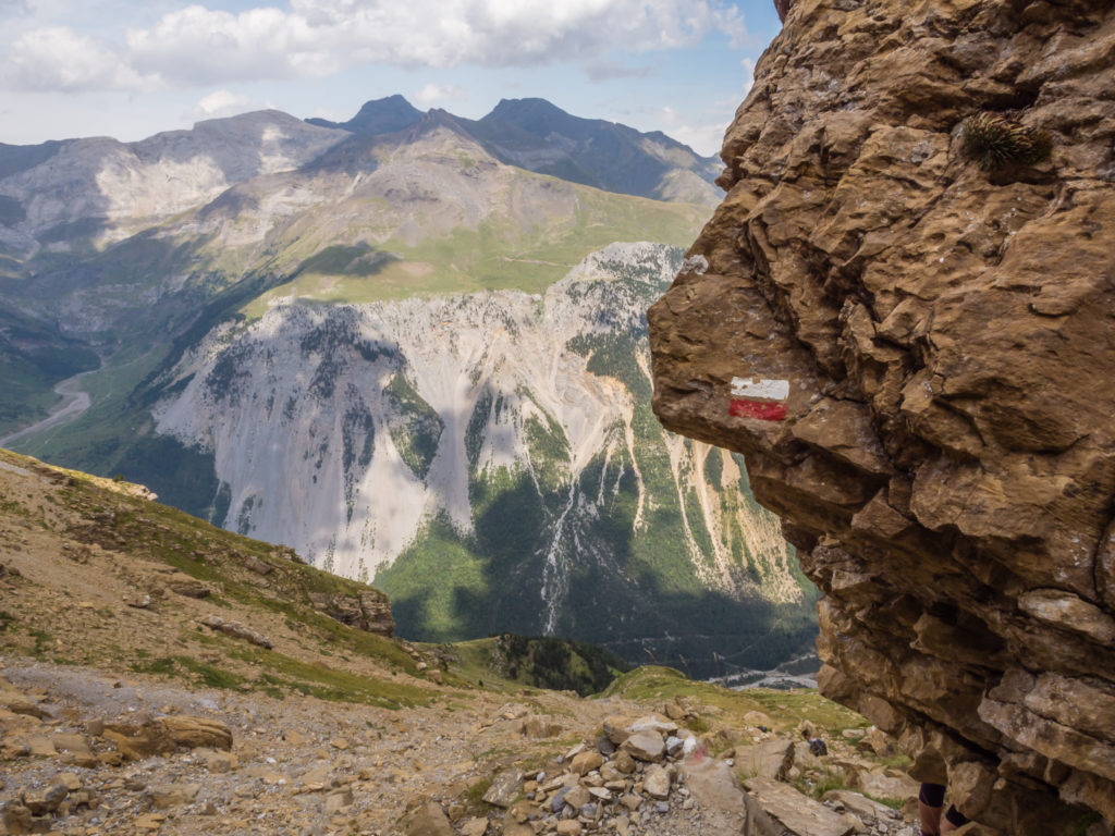
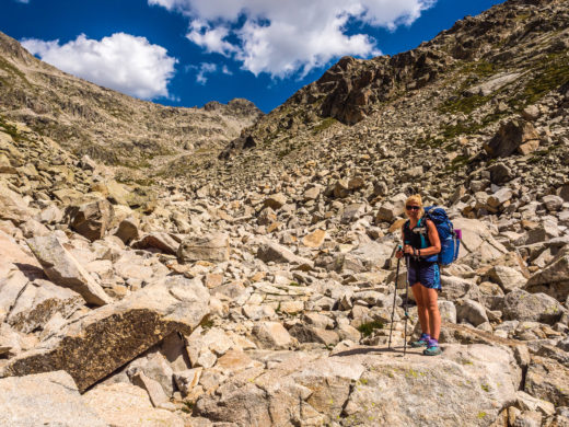
From the top of the Collada Añisclo the descent looks very intimidating – (kind of like looking down from the top of ‘The Wall’ if you are in the ‘Nights Watch’ – in reference to Game Of Thrones!) From where the trail starts descending, it literally looks like a sheer drop and there can’t possibly be a way down – but of course there is! The first part of the descent is along grey, rocky, scree switchbacks that had my heart in my mouth throughout this entire stretch. I was so thankful to the regular paint flashes signalling the route down or I wouldn’t have had a clue which way to zigzag next. I firmly gripped my poles and used them for support, but my steps were tentative because it was so unpleasantly steep – and so I was a lot slower making my way down than Wayne. Another group of hikers descended much faster and overtook me, obviously fearless youth up for the challenge – unlike myself, who was now perspiring by the bucket load and wondering why on earth I had signed up to this!
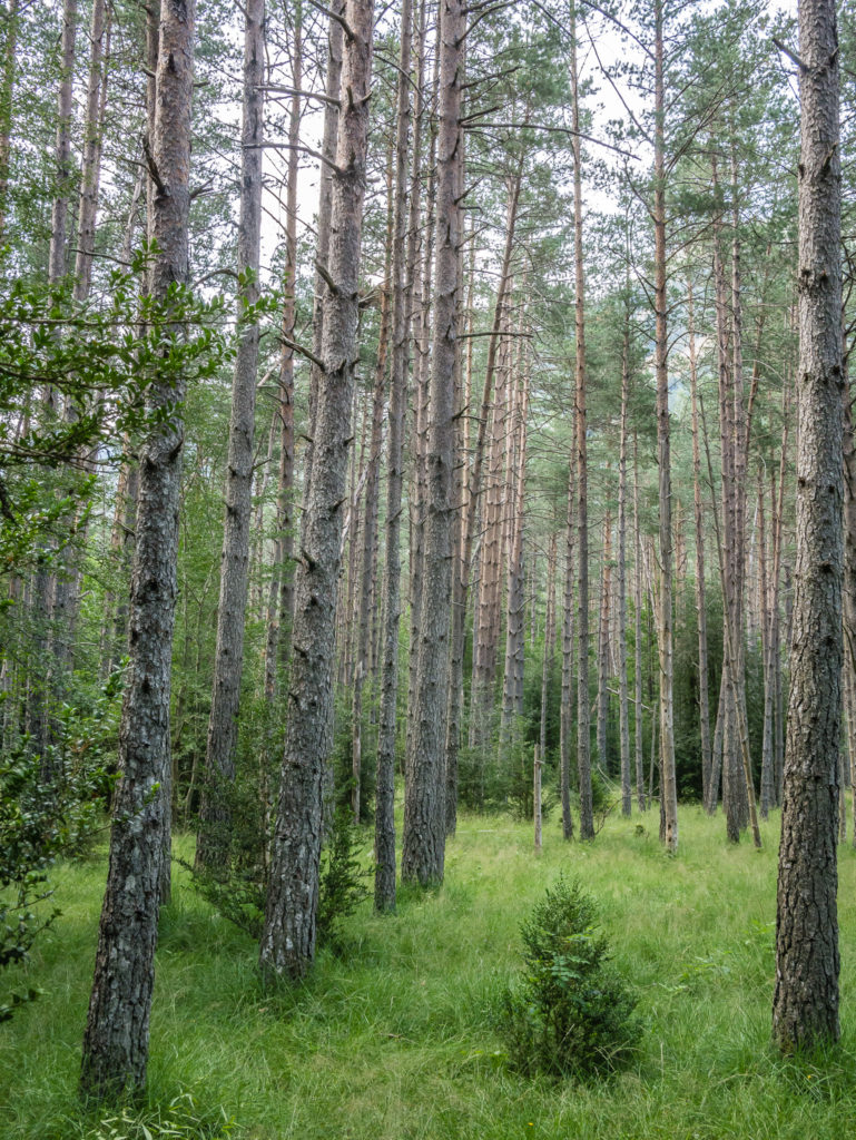
The whole way down was mentally as well as physically exhausting, requiring continuous concentration both in terms of taking care with footing as well as with route finding, particularly so later in the woodland section, where climbing down rocks and scrambling through crags was the ‘norm’. We were thankful to reach a small grassy ridge where we felt comfortable enough to take off the packs and rest. Thankfully, there was a small piped spring where we could get cold water to drink, which was just what we needed after sweating so much in the first section down! We weren’t even half way down the mountainside. It was definitely not over yet…
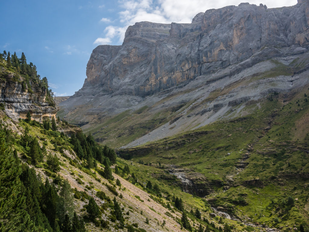
At the top of Collada de Añisclo looking down into the Valle de Pineta where the River Cinca flows through the entire valley.
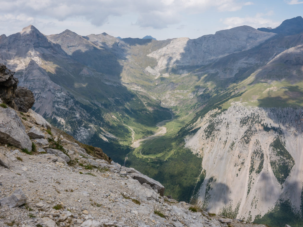
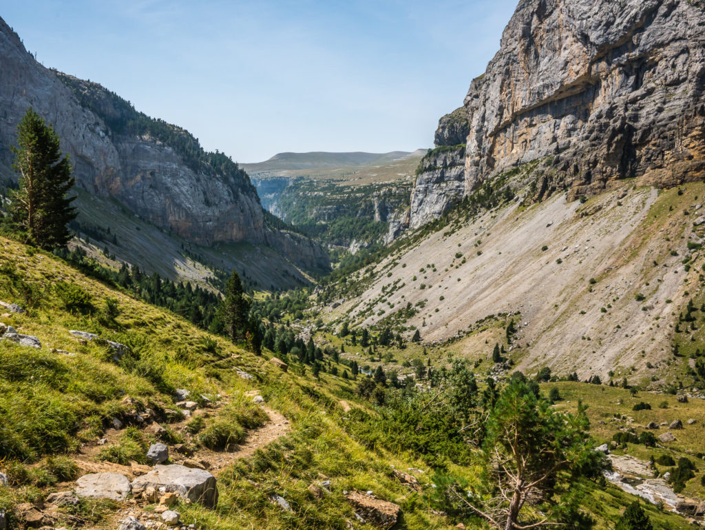
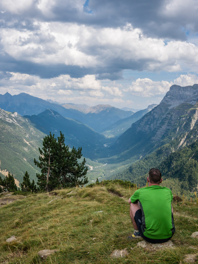
Looking towards the sprawling Parque Nacional de Ordesa y Monte Perdido in the Pineta valley where we were now heading.
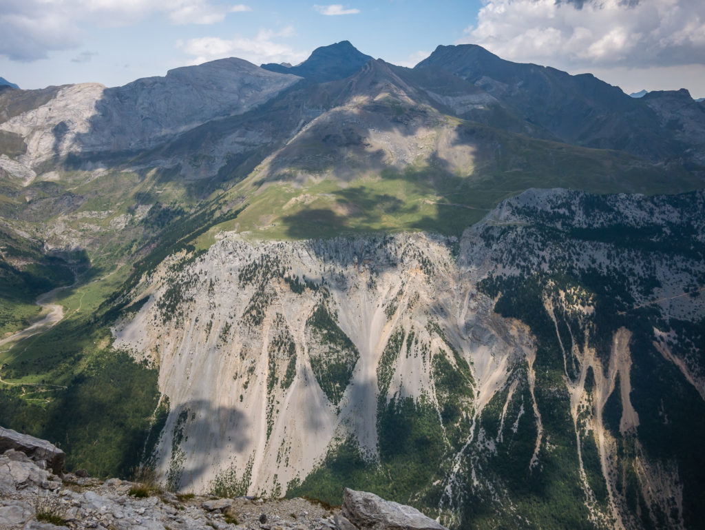
Looking straight across the valley to La Larri from the top of Collada de Añisclo. It’s hard to believe we’d be sat on the grassy plain at the top the very next day looking across to where we were now!
At the top of Collada de Añisclo. It wasn’t going to be a great spot to sit down and have lunch!
Smiling through gritted teeth after looking over the edge!
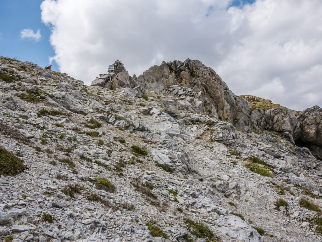
Yes, there is actually a route down across all of this loose rock!
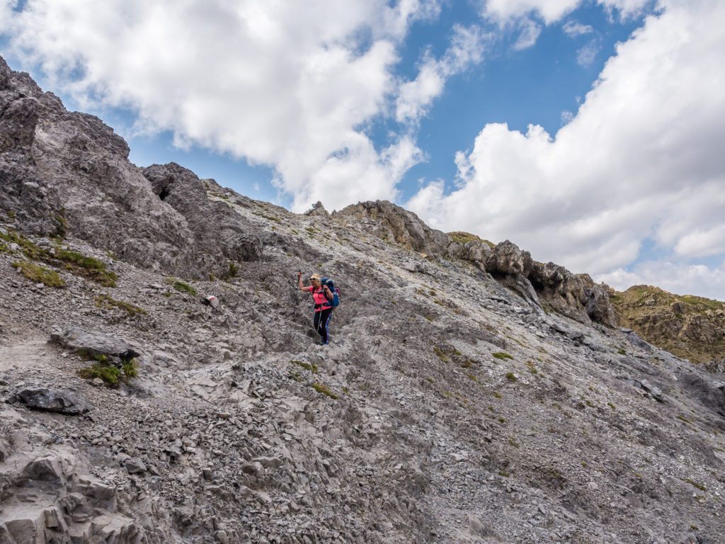
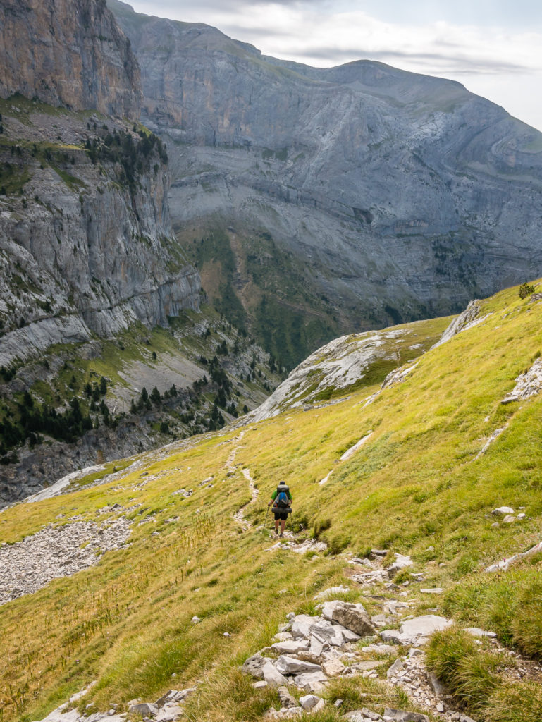
Setting off downhill… Literally one step at a time…
Thankfully there were plenty of reassuring paint flashes to signal the way.
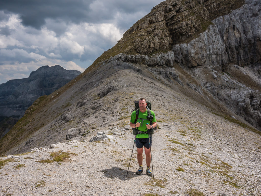
Wayne heads up front and leads the way.
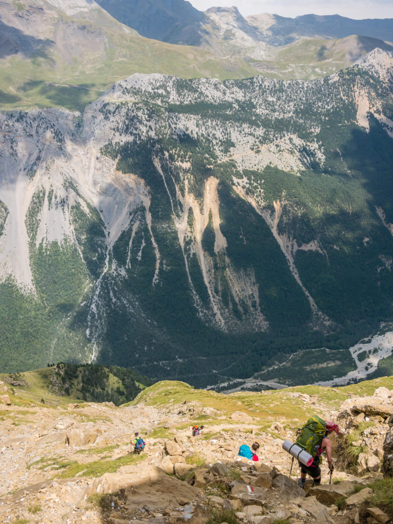
Being overtaken by fearless youth!
Wayne continues on, a lot more confident than me!
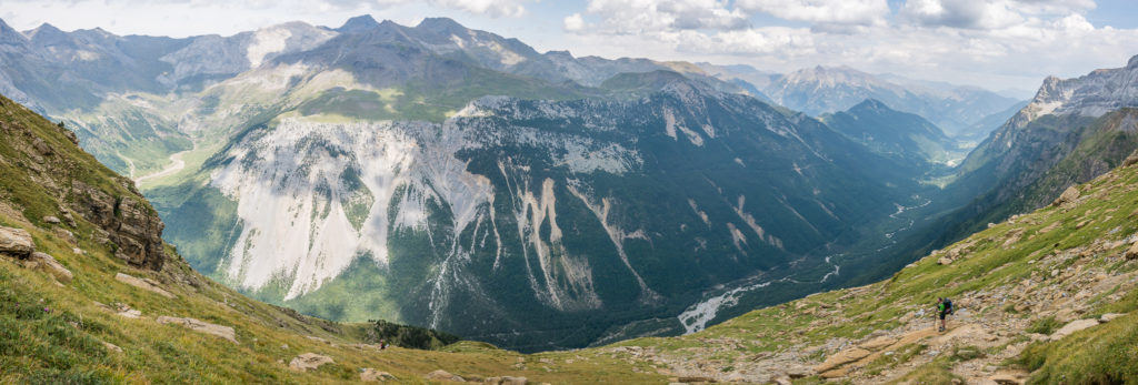
Panorama of the tremendous Pineta valley!
We were aiming for the grassy ridge to have a proper rest stop and late lunch!
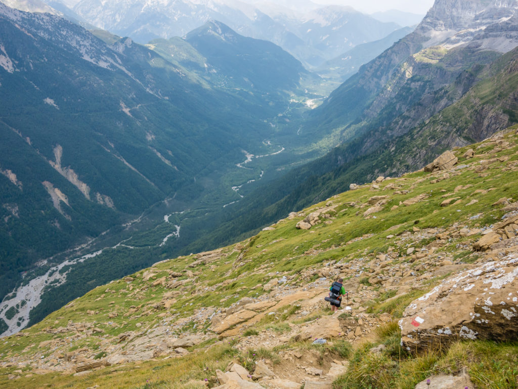
Heading down to the grassy ridge, bottom left of the picture.
Our view of the mountainside from the grassy ridge. It’s difficult to see any route down.
Looking out from the grassy ridge, debating whether or not the worst part of the descent was over?
The wooded section seemed to go on forever, so we were thankful to finally reach the valley floor, several hours and several gallons of sweat later. The GR11 trail leads to the Refugio de Pineta, however as we had a camping symbol on our map next to the car park just outside the entrance to the national park, we were hoping to camp there. Wayne had originally intended us to push on at least another 5km to wild camp at La Larri across the other side of the Pineta valley, but as both of us were completely fatigued, neither of us were up for that!
So we headed off along the valley floor following the River Cinca, finally striding out and stretching our overused legs as we walked through meadows and woodland to reach the National Park Information Office (which was closed at 8pm). We understood that there was no camping inside the national park, but the large car parking area was technically outside the park boundary and as we had seen several campervans settling in for the night, we found it highly unfair that there was no area for GR11 thru-hikers. (Especially as camping is also not permitted at the Refuge de Pineta.) With the sun dipping behind the mountains and the fact we had zero energy to walk any further, we opted for a stealth camp near to the parking area, making use of the toilet block and potable water available there. (At that time in August, the water point outside the national park office was dry.)
Overjoyed to be on solid ground at last. What an exhausting day of extreme ups and downs! But we still had to make camp somewhere before darkness fell…
We washed and ate dinner by the river, then put our tent up when it was dark. We were completely obscured by the trees and out of view from the road, but we still didn’t sleep that comfortably thinking that someone might come along and move us on. We set the alarm for 6am so that we could pack up and have the tent away before first light and all went to plan. But it was not what we had originally planned or really wanted to do!
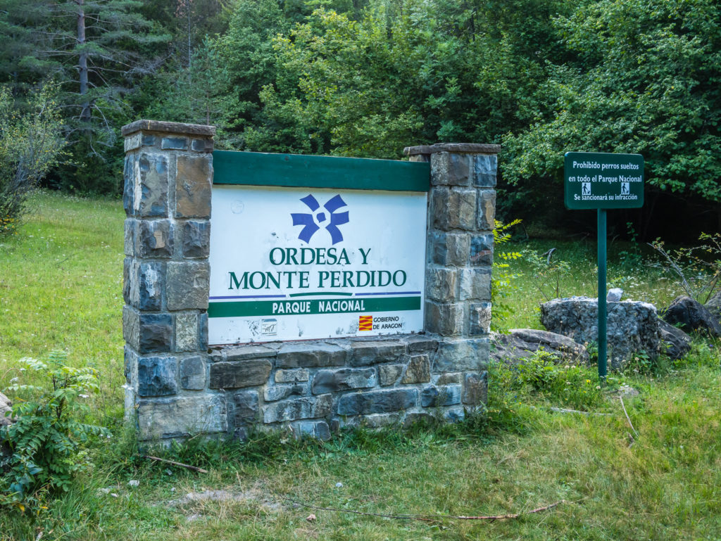
Camping is prohibited within the national park boundary.
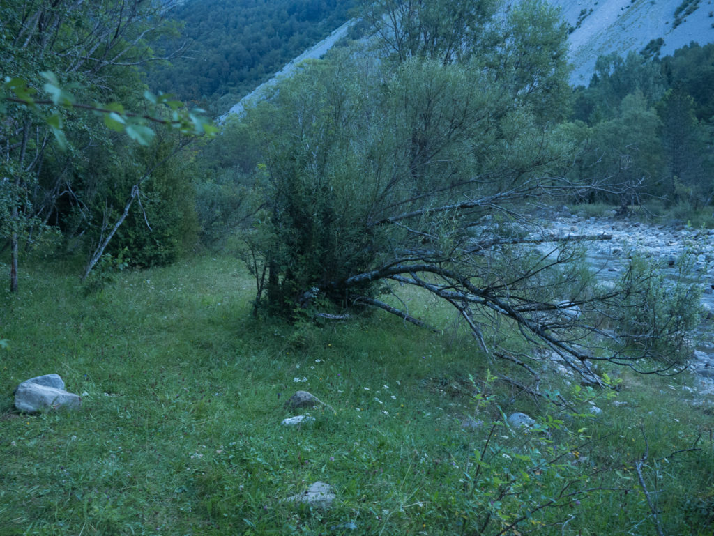
As we reached the entrance to the national park, dusk was quickly upon us, so we made a hasty decision to stealth camp rather than push on any further as we’d soon be in darkness. We felt like the area near the river had been used previously as a camp spot and left all as was when we vacated at first light.
We learn valuable lessons on every thru-hike. This one – that we picked the hardest section of the GR11 to complete, giving ourselves some long, arduous days that we were not quite expecting, going on the notion that the GR20 is the hardest of the GRs. We expected the GR11 to be just as scenic with striking high alpine mountains and captivating valleys, but by no means as strenuous or demanding with such exposed routes and scrambling sections as we were finding. It was very mentally draining as we psyched ourselves up for another lengthy section and long day with a late finish at camp, just before dark. So we resolved that in future, unless we were completing an entire thru-hike from start to finish, we wouldn’t follow each stage by the letter – we would break the hike up into what is more comfortable and rewarding for us – because currently the GR11 was becoming one big slog – and that’s not what we wanted it to be at all!
But being more of ‘the glass is half full than half empty’ kind of people – the bonus of all this was that we were becoming much fitter and stronger, and losing a few pounds wouldn’t hurt. (I was also walking in sunshine and topping up my hiker tan!) And surely, there couldn’t be any further days as gruelling as this! Could there?

2 Comments
Oh, my goodness, what an incredibly demanding but dramatic day of sensational scenery, this has been!
Looking back at the photos, it was truly an incredibly scenic day. But at the time, I spent most of it huffing and puffing my way (with a few expletives in there!) up and down scary looking cliff faces and didn’t fully appreciate how amazing it was!