
Tackling The Lost Mountain…
As the third highest mountain in the Pyrenees, ranking only below Pico de Aneto (3,404m) and Posets (3,371m), Monte Perdido at 3,355 metres stands as the highest summit in the massif comprising Las Tres Sorores (The Three Sisters) – the other two being Cilindro de Marboré (3,328m) and Soum de Ramond (3,263m).
It is the centre-piece of the Ordesa and Monte Perdido National Park, and a popular goal for hikers wanting to bag some peaks, the limestone escarpment offering an easy way to cross over the barrier of three thousand metres for the first time. Many hikers following the GR11 route use the Refugio de Goriz as their base and take a day out of their schedule to summit Monte Perdido. (The Spanish translation of the French “Mont Perdu“, which in English means “Lost Mountain“.) In summer, the route considered easiest is quite a steep walk-up, going over a scree corridor in the north side of the peak. Rewards for getting to the top are spectacular views across the range and down into the canyons below.
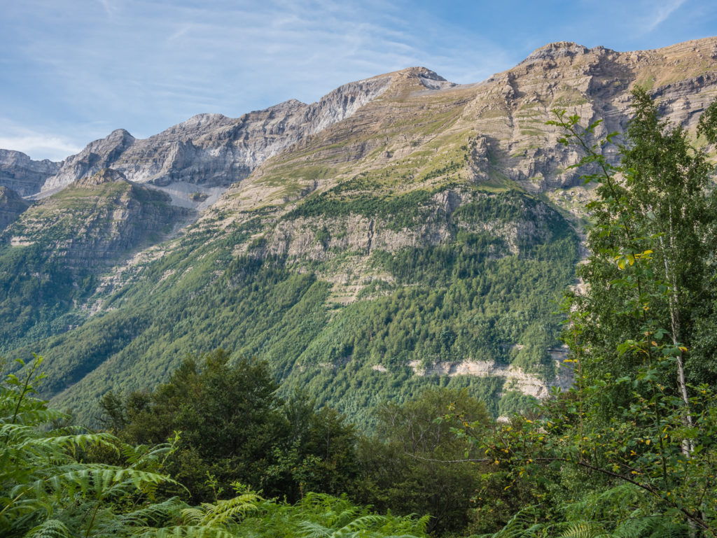
In 1802, Monte Perdido was described by the Frenchman Louis Ramond de Carbonnières as “The most beautiful limestone peak in Europe” after he paid French guides Laurens and Rondo, accompanied by an unknown local shepherd, to climb it. (This was the first documented climb, however the first successful summiting of Monte Perdido prior to this date remains unclear.) Dominating our view from La Larri on Day 9, we could see why the mountain gets plenty of visitors!
As we were thru-hiking on the GR11 and we were limited for time, we didn’t make summiting Monte Perdido part of our itinerary, but tackling the peak is definitely something we would like to do when returning to the Pyrenees in the future. We can’t say we have the same enthusiasm for another descent from the Collada de Añisclo – but maybe it wouldn’t be so gruelling a second time round?
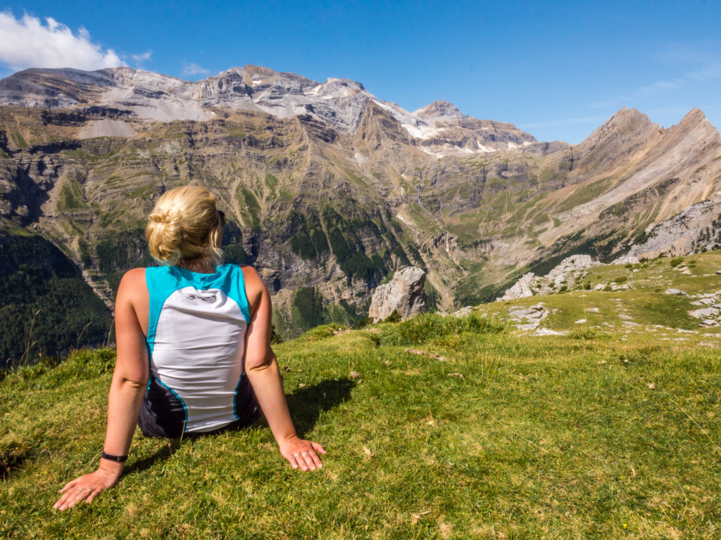
The huge limestone escarpment of the Monte Perdido Massif. We couldn’t take our eyes off the captivating scene! The third highest mountain in the Pyrenees at 3,355m, Monte Perdido was described by the Frenchman Louis Ramond de Carbonnières as “The most beautiful limestone peak in Europe”.
Saturday 19th August 2017 – Day 9 – Stealth Wild Camp beside the Rio Cinca (next to parking area just outside Ordesa & Monte Perdido National Park boundary) to Wild Camp (approx. 5km after Parzan along the Barranco d’Ordizeto) – ‘Track To Track!’
Start time: 06:20. End time: 18:20. Distance: 25.5km. Ascent: 2,125m / Descent: 1,844m.
As we were stealth camping just outside of the national park boundary, I had quite a restless sleep. I guess I was subconsciously worrying that someone might come along and move us on or give us a fine, despite the fact several campervans were making overnight use of the car park behind some trees. One consolation was that we had left the fly off the tent, so every time I woke up I could look up and gaze at the stars before nodding off again.
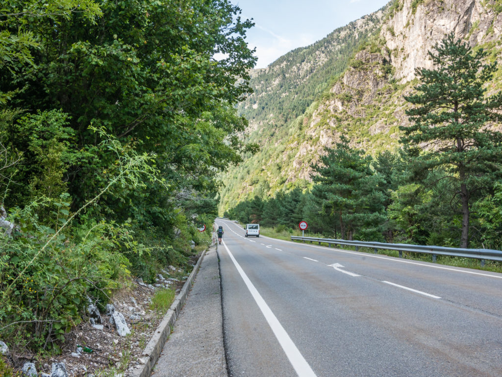
It didn’t feel long before the alarm was going off at 6am and we were packing away our sleeping bags, everywhere still shrouded in darkness. Sunrise today was going to be just after 7am, but we wanted the tent down and everything packed away before first light. We managed it easily, then walked down to use the toilet facilities conveniently located in the car park area, before seating ourselves outside the Tourist Information Office on a couple of makeshift benches ready to cook breakfast. There were already cars pulling up in the parking area by 8am with day hikers eager to set off up the myriad of hiking trails within the national park, plus we also saw some climbers whom we assumed had set their sights on Monte Perdido.
The Tourist Information Office wasn’t opening until 9am (and we were long gone by then), so no one bothered us as Wayne cooked up a hiker breakfast fit for a king consisting of scrambled eggs and chorizo to get us going after yesterday’s extreme exertions. (We love eggs and carrying a frying pan – it’s well worth the extra grams!)
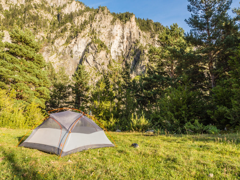
Our stealth camp spot in the morning, left exactly how we had found it.
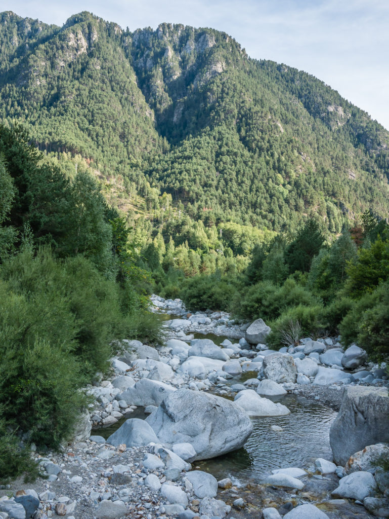
The Cinca River that we camped close to is 110 miles long and flows across the entire Pineta Valley.
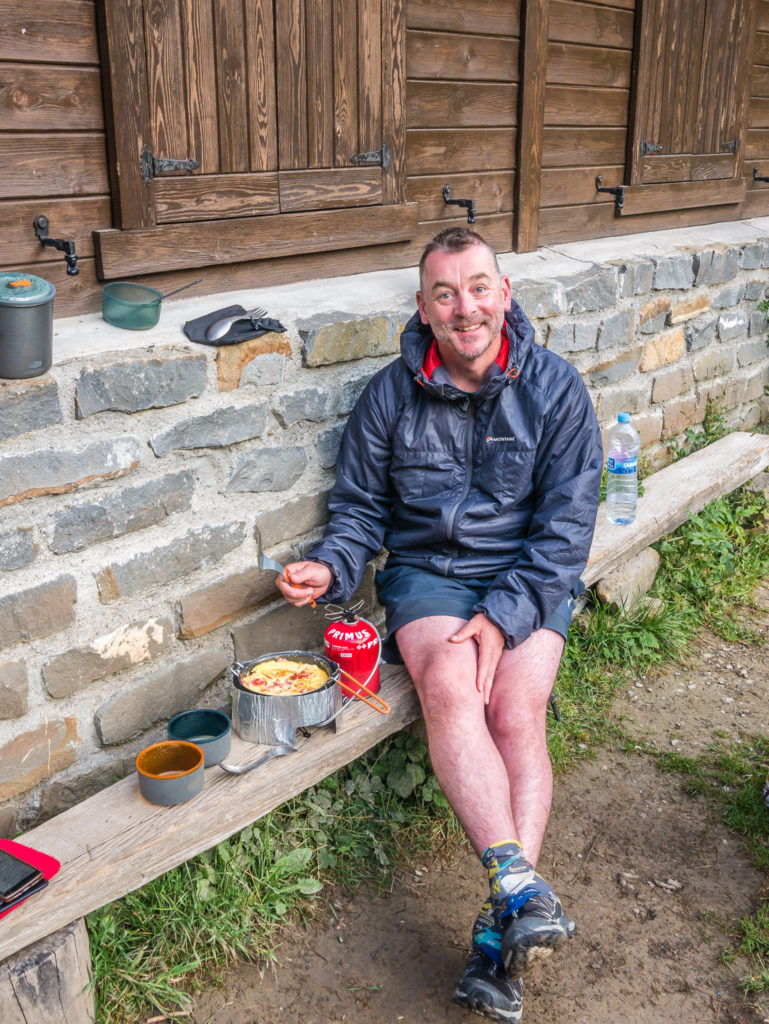
We made use of the makeshift bench outside the Tourist Information Office to sit and have breakfast as it wasn’t opening until 9am.
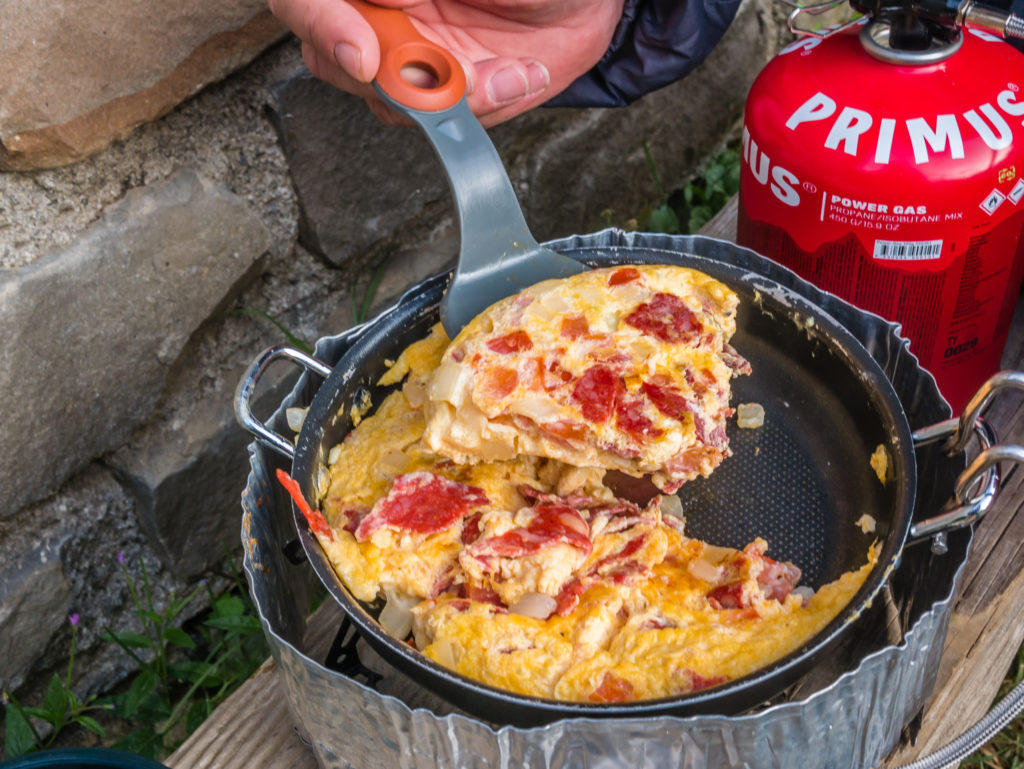
Wayne’s homemade Spanish tortilla on the trail – what an awesome way to start a hiking day!
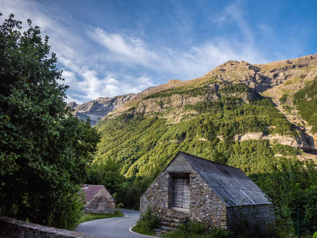
Compared with yesterday’s mammoth descent, today was supposed to be an ‘easy’ mountain walking section. We set off following the road to the Ermita de Pineta Chapel. The fuente (natural water source) there was dry, but fortunately we had already replenished up our water supplies at the car park restrooms. There is a path to the right of the chapel that then heads up to Llanos de Larri. It was a bit of an uphill climb through a woodland area and our legs were still feeling the burn from yesterday, but there were some good switchbacks and we soon reached the open pasture of La Larri.
We happened to bump into a German couple that we knew, who had wild camped in this area the previous evening. We had camped next to them at Bujaruelo on Day 6, so it was good catching up with them again. (Not so the part where they told us they had camped a few metres away from a dead cow without realising it, having pitched in the dark, until the smell alerted them to it this morning!) La Larri had also been our intended wild camp spot the previous evening, but there was just no way we could have made it there before sunset, or even had the energy to complete another ascent after finally making it down to the Pineta valley floor.
Leaving the Ordesa and Monte Perdido National Park and following the road to the start of the trailhead.
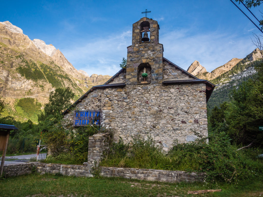
The Romanesque Ermita de Pineta Chapel. The GR11 path goes to the right of the chapel, signed to Llanos de Larri.
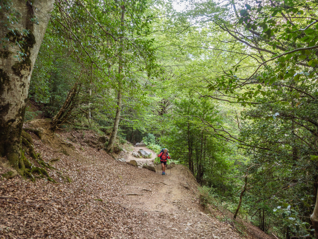
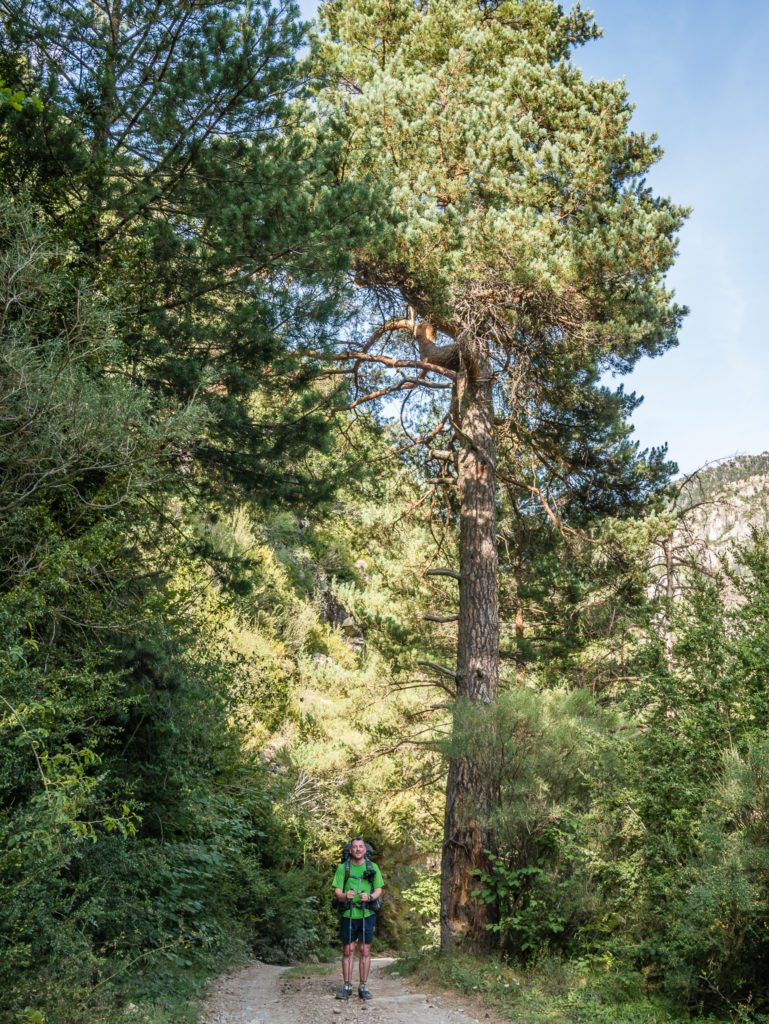
Our legs were still tired and stiff from yesterday, so we were grateful of the switchbacks that helped us ascend through the forest to La Larri.
Our first glimpse through the trees up to Collada de Añisclo from where we had descended yesterday.
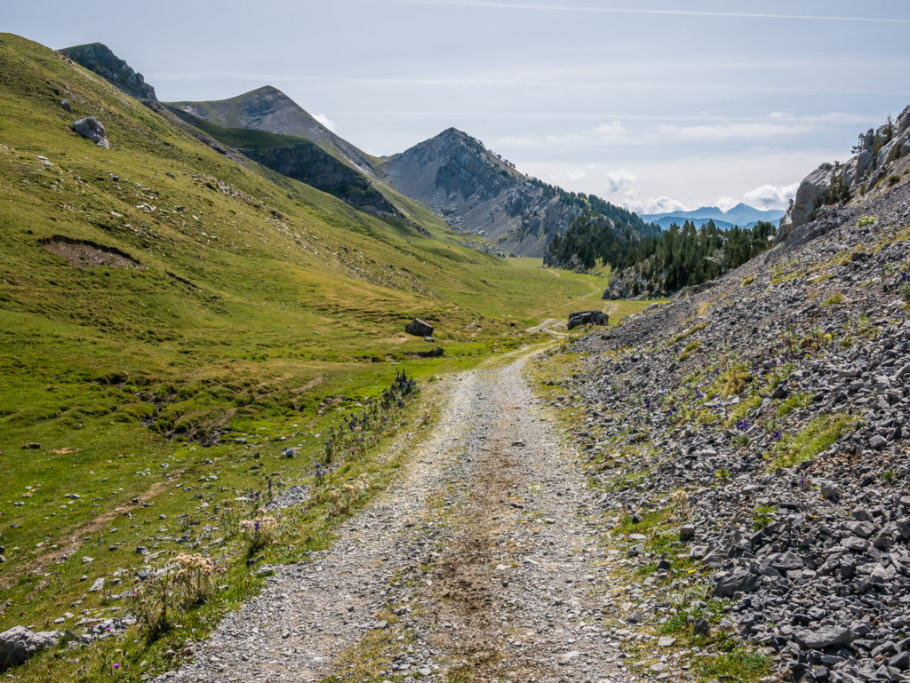
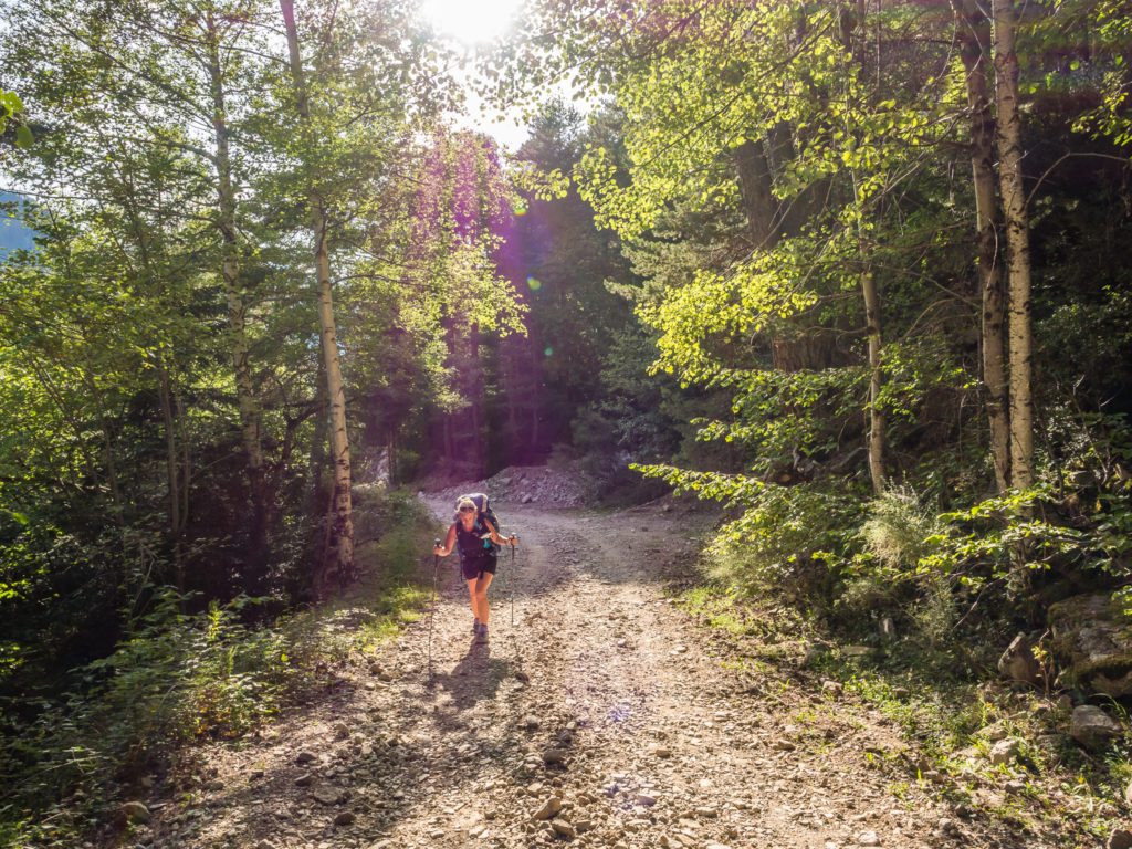
From out of the woodland we found that the trail followed a stony track, which was much easier on our legs and perfect for striding out!
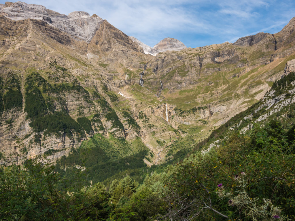
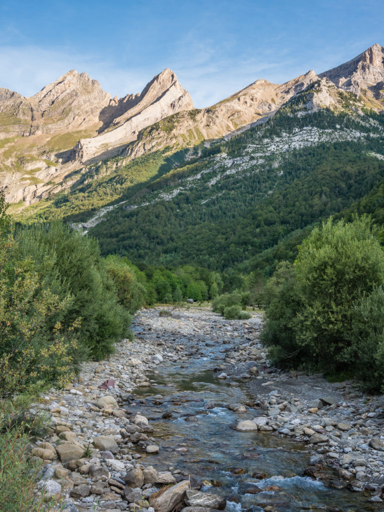
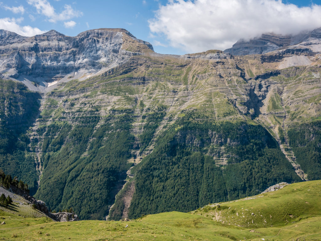
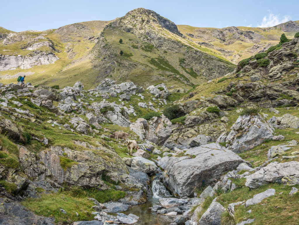
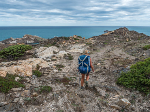
Looking across the Pineta valley to the flowing cascades below Monte Perdido.
Enjoying both the spectacular mountain views and today’s ‘easy’ walking!
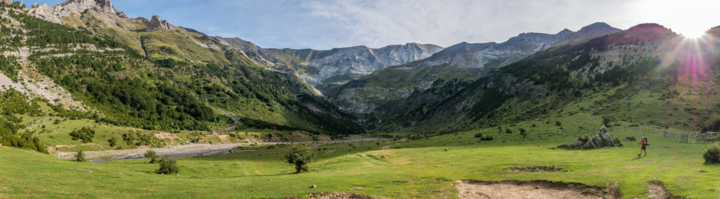
We finally reached the beautiful, grassy, hanging valley of La Larri.

What a view! The Pyrenees is a treasure trove of spectacular craggy peaks, wonderful waterfalls and fairy-tale pine woods.
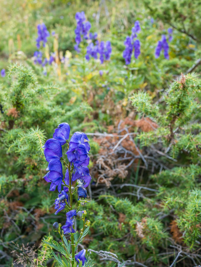
Purple Pyrenees mountain wild flowers, growing in the meadow at La Larri.
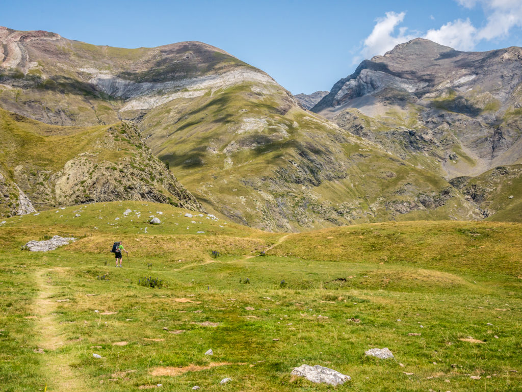
The grassy plateau of La Larri is a hanging valley and it affords tremendous views back to the Circo de Pineta. We couldn’t believe we had hiked down over 1,200 metres from the top of the Collada de Añisclo just yesterday. The entire mountain looked so inaccessible and intimidating!
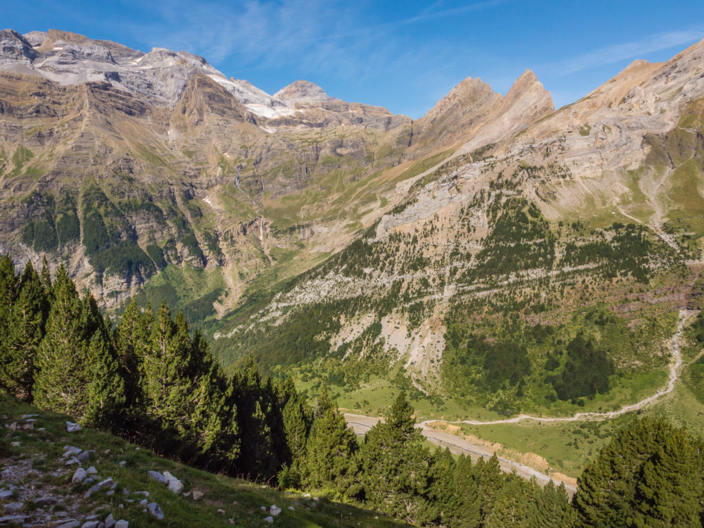
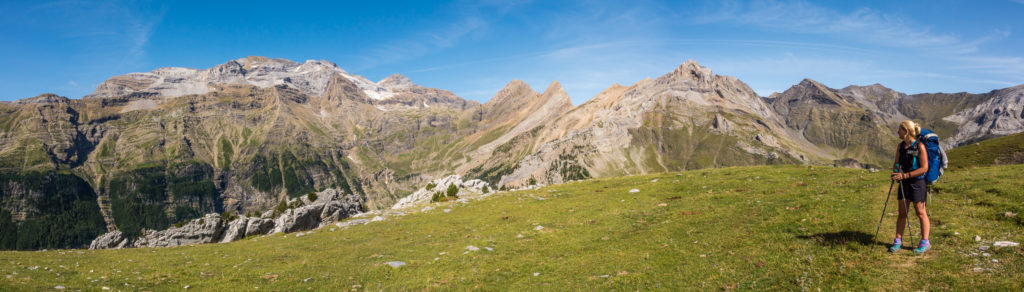
View towards Monte Perdido from Llanos de la Larri, in the Pineta Valley.
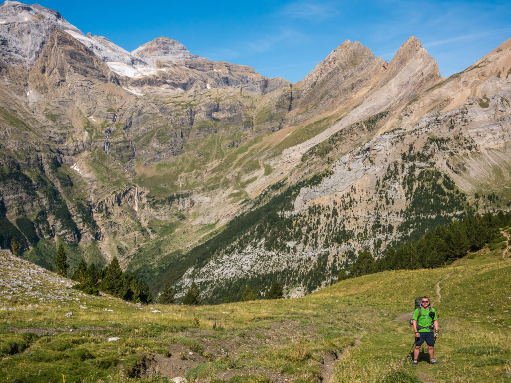
What a glorious morning to be in the mountains! The wonderful view certainly took our minds off our aches and pains and made yesterday’s slog seem a distant memory.
Monte Perdido stands as the highest summit in the ‘Massif of the Three Sorores’ (the other two being Cilindro de Marboré and Soum de Ramond).
Gazing across to the Collada de Añisclo. With no obvious route to look upon, how on earth did we make it down that mountainside?
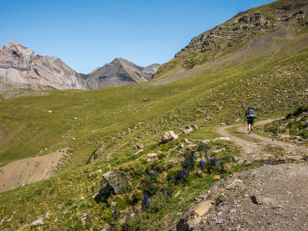
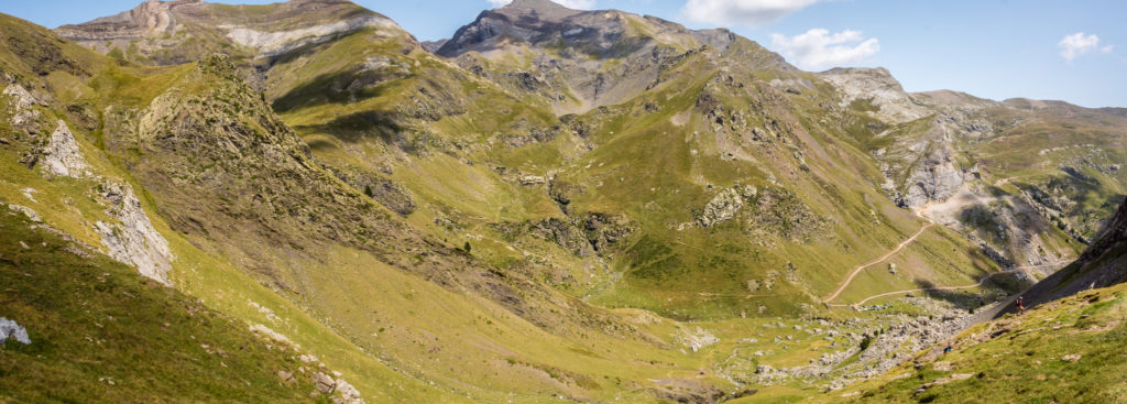
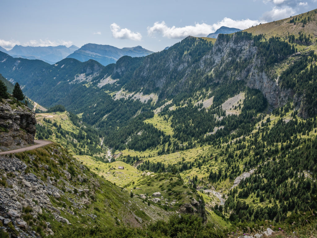
After taking in the incredible view and pondering where exactly our route went from the top of Collada de Añisclo, or how on earth we even made it down in one piece, we finally tore ourselves away and continued along the GR11. From here we enjoyed excellent walking conditions along a clear track, passing a bothy at around 2,100 metres, known as the Refugio Gandero, before the trail winds its way between imposing peaks into the Plana Fonda, a beautiful, long grassy bowl. With the mountains now cloaked in a vivid green, our surroundings became reminiscent of the Lake District back home in England, and we felt the walking in this area was just wonderful. (It would be possible to make camp here if you have sufficient water supplies, but this area is used by cattle so be wary of flies and mosquitoes.)
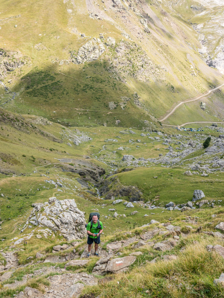
The red and white paint flashes then led us uphill to the Collada las Coronetas (2,159m). (Also known as Collada de Pietramula). It was a short, steep ascent on the left hand side to the top of the coll, but it was no way near as taxing a climb as yesterday, so we were hoping the descent would be kind as well. We reached the top of the grassy ridge just before a young group of five hikers arrived, whom we’d been leap frogging along the trail for several days (the ‘Spanish Ed Sheeran’ from Refugio Goriz was part of this group). Everyone celebrated with a ‘whoop’ and high fives as this was the high point of the day done. Yippee, from here on in, it was downhill all the way to Parzan – our resupply town. (There’s nothing like the thought of a supermarket and a fresh supply of food to rejuvenate the spirit and up one’s motivation!)
Wayne makes the most of the sunshine to charge our devices with our trusted Goal Zero solar panel.
Enjoying the views and a much easier level of walking today.
We followed the track for the majority of the way towards the Plana Fonda. After the bothy, the route is less clear, so take care to check which way the paint flashes go.
What a contrast to yesterday! We were loving every single second on the trail.
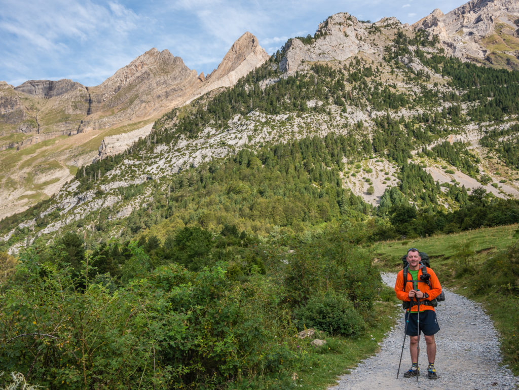
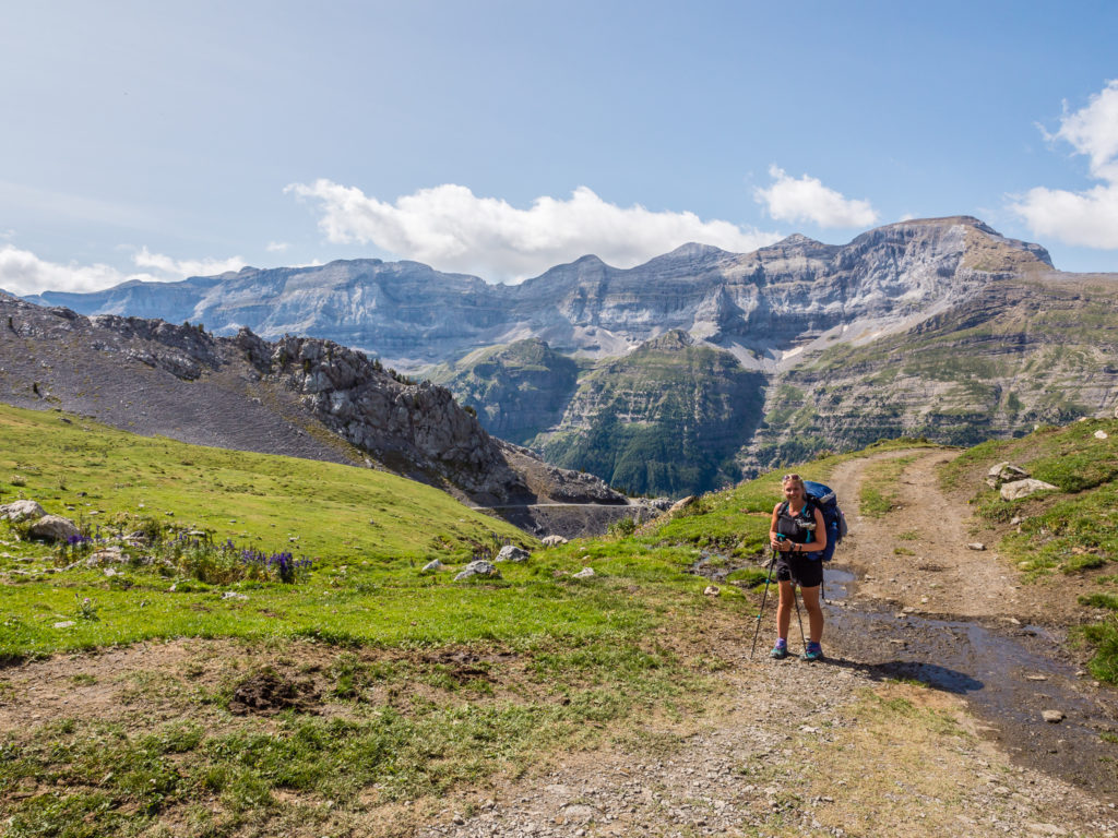
At 2,159 metres, the tremendous view from the Collada las Coronetas, looking across to the track to Chisagües.
The first part of the hike down was both pleasant and scenic. We followed the river running through the valley, which led us down to a busy car park. The car park had virtually been taken over by cows though, who were lazing in the sun between vehicles – well, we were encroaching on their territory after all! We paused for a quick drink then pushed on, the trail now following a dirt road. On the right hand side we could see several good camping spots next to flowing streams along the Rio Real valley, so water was readily available. But we couldn’t stop early and make camp no matter how scenic the area was. With our rations now fully depleted, we were in desperate need of food! (Is there ever a time that we’re not?!)
The dusty dirt road then transformed into asphalt before we finally reached Parzan. It was a long, hot stint, powering along the smooth black surface, but we managed to achieve between 3 and 4 kilometres an hour on the descent, which meant we got into Parzan at a reasonable time. We arrived at approximately 4pm and headed straight for the ‘supermarché’. As Parzan is only a short distance from the border with France, there was a continuous stream of French people who were bootlegging alcohol because of the cheaper prices over in Spain. We were quite jealous of them coming out of the supermarket with huge boxes filled with brandy and other spirits! So after utilising the toilet facilities, we took turns going in and out of the supermarket (one of us had to stay outside to keep an eye on our packs) and stocked up ourselves – not with alcohol – but with more bread, cheese, chorizo and eggs, our main staples here on the GR11. We then sat outside the main entrance in the blistering sun (as there was no shade) guzzling cans of Fanta and Peach Iced Tea.
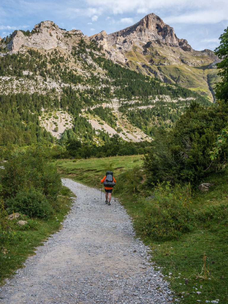
Starting our descent from the Collada las Coronetas. The thought of reaching a proper town with supermarkets put a spring in our step!
We found grazing cattle all along this section of the GR11 towards Parzan, so we made sure to use our water filter when topping up with fresh supplies from streams.
Our route to Parzan followed the dirt track that snakes along the left of the mountainside. We saw lots of good camp spots heading down into the Rio Real valley.
Heading away from Pineta towards Parzan, our next re-supply town.
The other GR11 hikers we were passing regularly went by and headed straight to the bar/restaurant across the road, intending on trying to wild camp later on the outskirts of Parzan. (Note: There are no proper camping facilities in this town. We were finding more and more that the GR11 is not particularly well set up for campers, but is more geared towards ‘refuge to refuge’ hiking.) What about us? No, we were going to push on at least 5km further out of town and continue on the GR11 to try and shorten the following day. Don’t get me wrong, we were tired and didn’t particularly want to continue further, but as there was no option of camping in Parzan and we didn’t want to pay for a hostel, we had little other choice.
One saving grace was that we’d had quite a good rest and were fully re-hydrated by the time we got going again. Also, the route was on a decent track, even though we would be going uphill. That being said, we do have a love/hate relationship with ‘track’! On a positive, it’s good with helping you manage a fast pace if you want to push on and is easy to navigate, but at the same time is more hard-wearing on both your feet and knees, so becomes very tiring. Also, we generally find that tracks in the main are not particularly scenic, so it becomes a mental test to keep positive and keep going as it can feel like you’re getting nowhere fast!
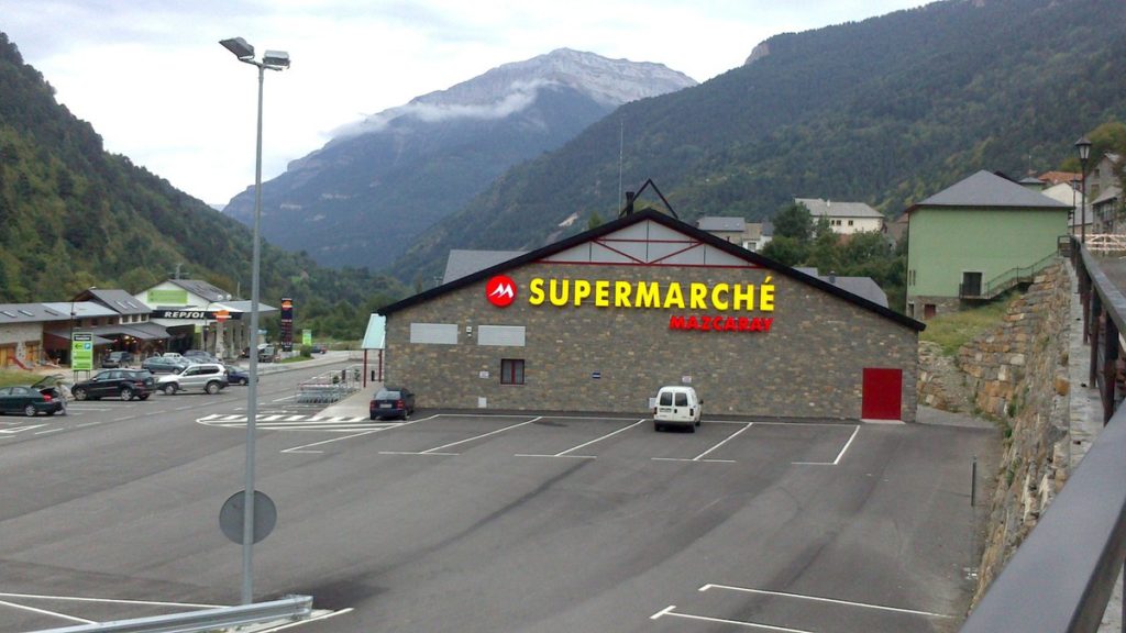
We were so overwhelmed by the presence of a supermarket, we forgot to take any pictures of it! Hence, this a shot courtesy of Google images.
There was no stopping us today! Leaving Parzan along the main A-138 highway that crosses over the border into France. The GR11 track cuts right and heads into the trees.
The last accessible water we would see today! (But we had already stocked up with some fresh bottles of drinking water from the supermarket.)
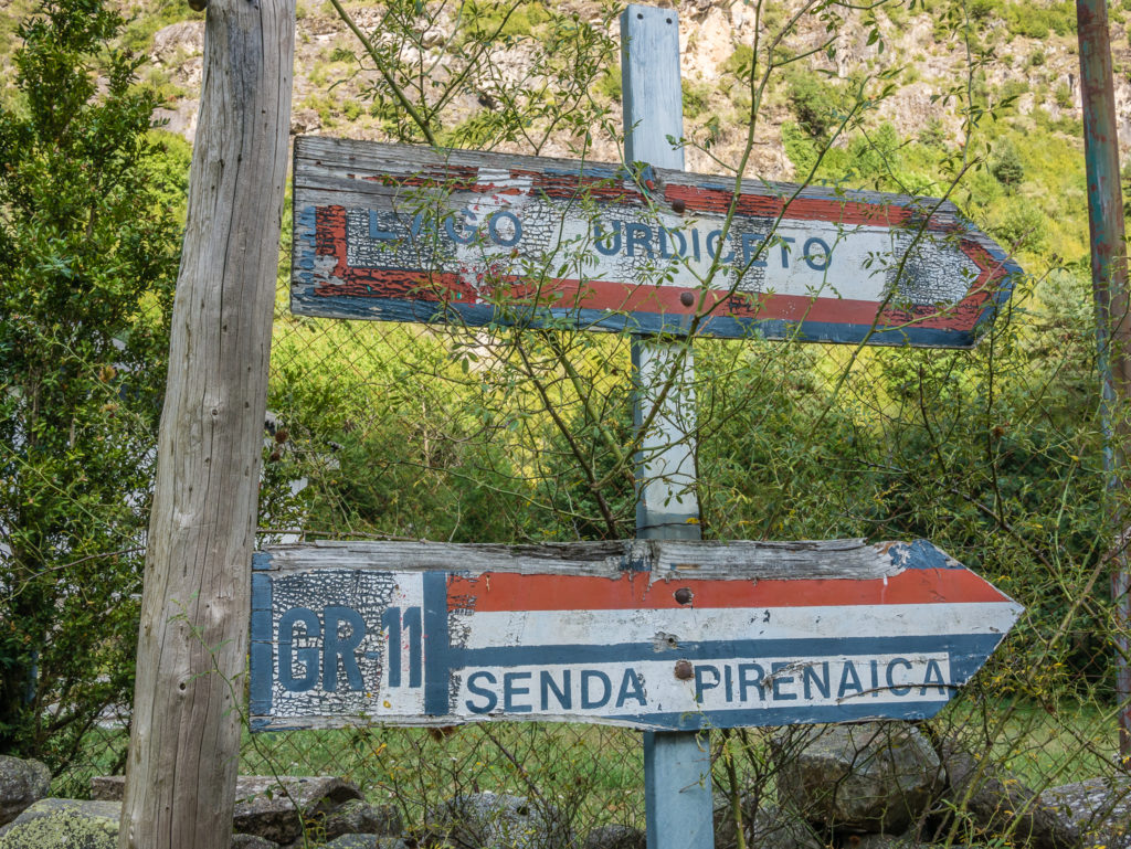
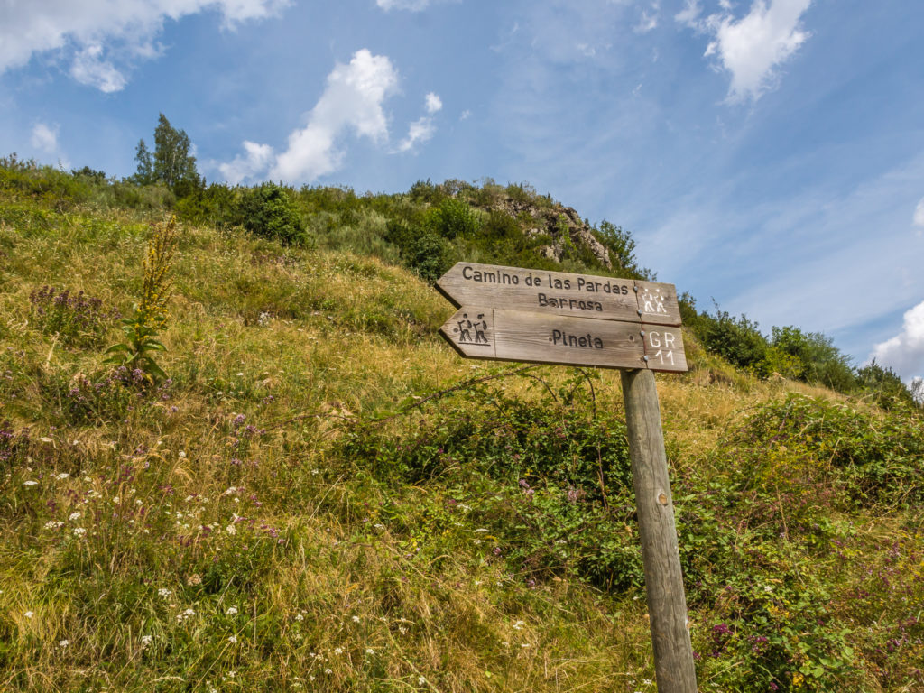
Old signage indicates which way to go to continue on the GR11.
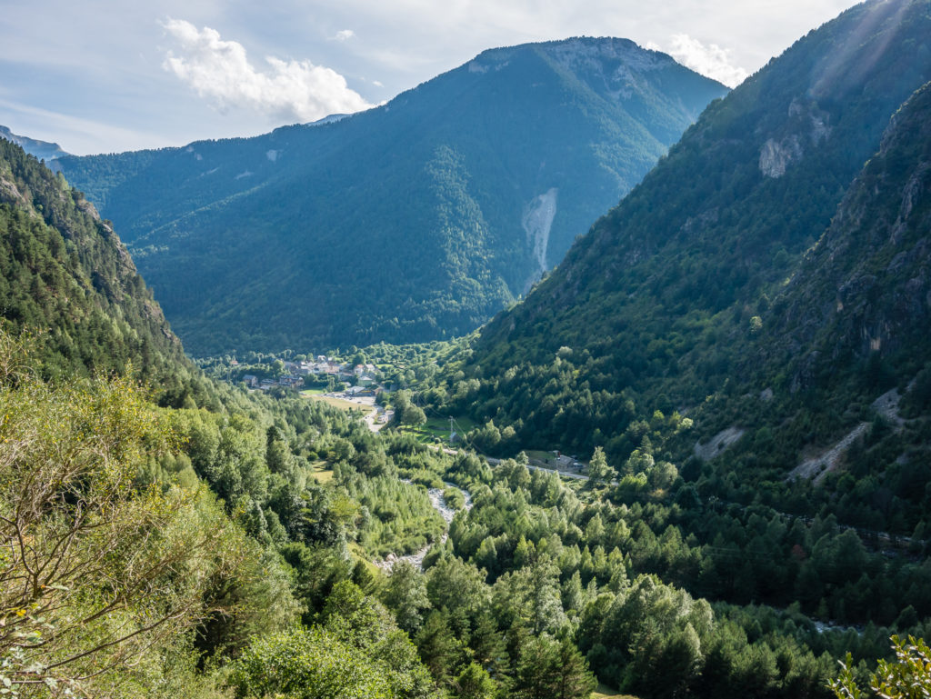
Following the track uphill, we seemed to gain height really quickly. Looking back towards Parzan, which is really a one street town nestled between the mountains.
We were thankful of the shade offered by the tall pine trees as it had been an oppressively hot day.
Pushing on… We wanted to cover at least 5 more kilometres before making camp somewhere along the barranco, which we were hoping would open out a little and offer enough space to fit our 3-person tent. (We hadn’t seen any spots so far!)
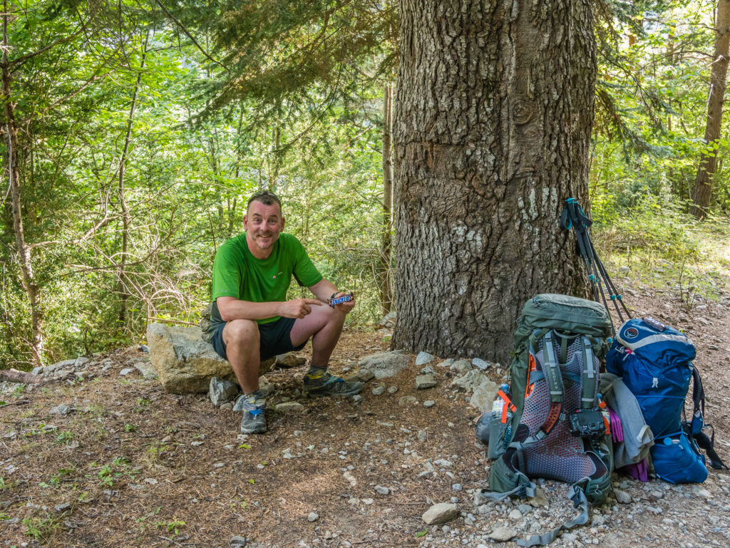
Stopping in the shade for a quick energy boost. ‘Snickers’ are perfect on the trail (if they haven’t melted!).
So positive we stayed – and it all turned out well in the end. After having little idea where we’d camp, as we were basically hiking up a ridge, the barranco did open out and we found some lovely, grassy spots out of view from the track across from a derelict building.
It was our first experience of ‘dry camping’, but it wasn’t a problem that we didn’t have access to a river or stream nearby, as we had bought four new 1.5 litre bottles of water from the supermarket. This meant we had an adequate supply for cooking and drinking for one night. We couldn’t however waste any water with the luxury of a proper wash! (We opted to clean our feet as they were dusty from the track, but literally used an egg cup full of water and a few wet wipes to get them clean. We could manage until tomorrow.)
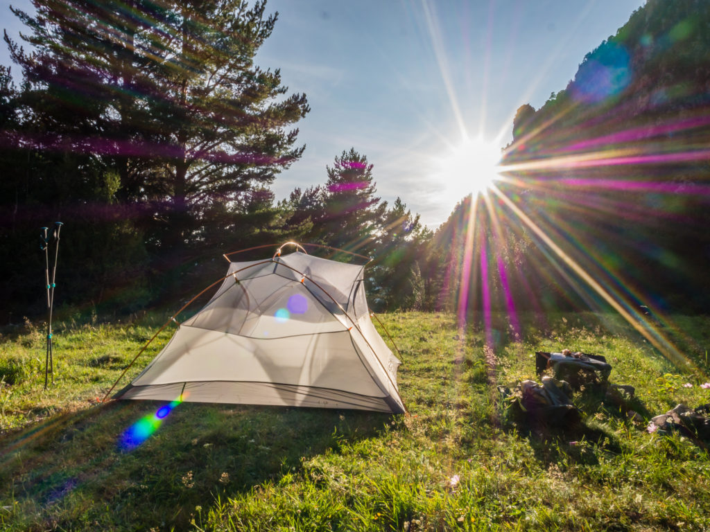
We put the tent up quickly to make the most of the last rays of sun to warm everything up, but didn’t sleep with the fly off again as there were a few flies around.
Our lovely grassy camp spot along the barranco. We just missed having access to flowing water nearby.
Having just stocked up with fresh food supplies, we decided on having pasta for dinner. But once everything was sorted, we were more than ready to get into our sleeping bags and call it a day.
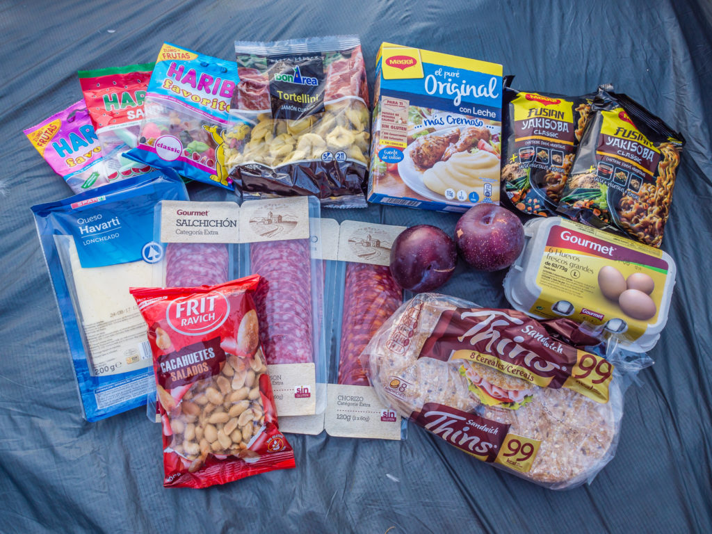
Our resupply of goodies from the supermarket. These rations were to last us 3 days.
At around 25 kilometres, it had been another long one with us continuing further along the trail out of Parzan, but hopefully it would pay dividends tomorrow, affording us a much shorter day. This would be especially beneficial as we were planning on utilising a proper campsite at Es Plans, so to make the most of the facilities we needed to get there early!
4 Comments
Brilliant scenery. I can well imagine your relief to have an ‘easier’ day on this leg. I’m so enjoying this hike with you.
Thank you for taking the time to follow along with our journey!
I’ve just seen where you are headed in April. Fantastic. I’ve followed a number of people as they have done this, via their blogs. One chap was wearing wedding dresses. So many more incredible experiences ahead of you. I sincerely hope the dry winter of the west coast, won’t impinge on your journey. Two Oregon friends [bloggers] are very concerned by the conditions. Happy planning and training, I believe in snow, at present.
We’re all set to go! Really excited about our upcoming hike in the US. We have a few hiker friends over there who want to meet up at various points and join us on the trail for a few days, which will be fab. We are following the weather reports closely and are pleased that it should be a low snow year compared to last! But we’re prepared to take whatever comes… Looking forward to you following along. 🙂 We are intending on filming and uploading some short vlogs this time too!