
“Always there will be the lonely ridge, the dancing beck, the silent forest; always there will be the exhilaration of the summits. These are for the seeking, and those who seek and find while there is still time will be blessed both in mind and body”.
Alfred Wainwright
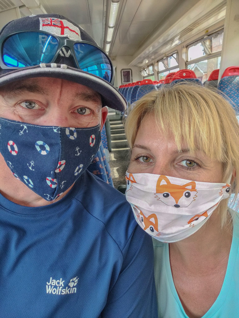
Embracing the ‘new-normal’ and heading off on our first hiking trip post lockdown!
Whilst preparing to set off on our latest adventure, the UK was still enforcing partial lock-downs of specific regions and continuing with strict social distancing measures in response to the coronavirus pandemic. Hence we were feeling both excited but cautious about a trip to one of our favourite places in the UK – the Lake District National Park.
The last time we were there in the winter of 2019, we hiked up Skiddaw for the first time and enjoyed new year celebrations in a packed Keswick town centre along with many of the Lakeland locals. Little did we know that 2020 would bring with it a global pandemic and a complete shut down of our home country where only essential workers were able to travel and the rest of us spent weeks upon weeks indoors in an effort to stop the spread of the virus.
Washing hands frequently, wearing a mask, and keeping 2 metres apart have all become the ‘new norm’. With us all having to accept this new way of living and do our bit for the world, we had resigned ourselves to the fact we wouldn’t be going on any extended hiking trips this year and we certainly wouldn’t be travelling abroad. But with the easing of travel restrictions at the start of the summer holidays, we decided to make the best of things and challenge ourselves with walking all 214 Wainwrights in one continuous loop!
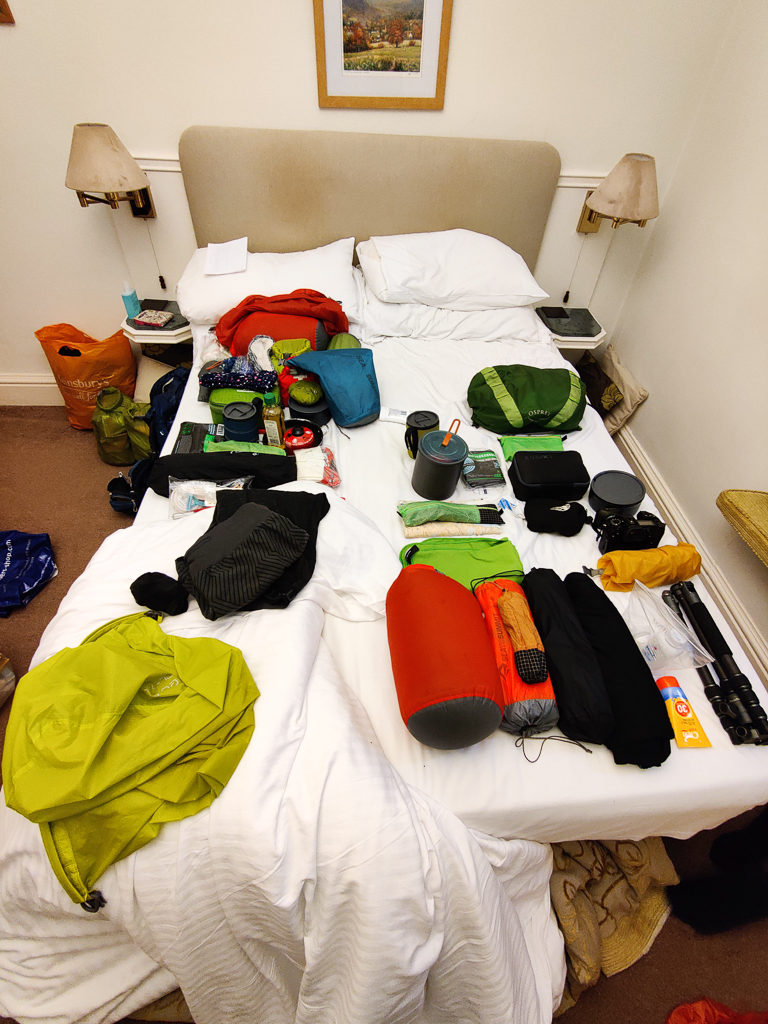
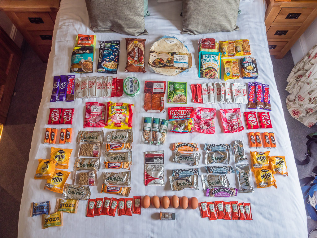
Covering a total distance of 613 kilometres, our aim would be to traverse all 214 summits over 28 days, starting off in Windermere and walking in an anti-clockwise direction. Akin to hiking up Everest 4 times – with so much elevation change we agreed it would be a challenge like no other! We have no ‘spare’ days in our itinerary and as most campsites are still closed to tents and walk-ins in an effort to reduce the spread of the virus, our plan is to hike every day and wild camp each night – so it will be a very different kind of walking experience compared to last year’s easy pace in the Pyrenees.
Having read so much lately about the rise in anti-social behaviour across our country’s beauty spots, we have actually been wary of heading to the fells. In the Lake District in particular, there has been a huge rise in anti-social fly-camping on accessible lakeshores with campers lighting fires, damaging trees and littering. This enormous increase in littering and general disregard for open spaces, which has worsened throughout lockdown is giving true ‘wild campers’ a bad name. It seems that places such as The Lakes, along with numerous coastal areas, are becoming ever more popular as people try a ‘staycation’ for the first time, but who are not aware of the Countryside Code.
Since the easing of lockdown restrictions in England, various tourist hot spots including the Peak District, Lake District and the South West have seen significant increases in the numbers of people camping who have just discarded equipment and left litter behind. It seems they have adopted a ‘disposable’, ‘festival’ mentality and are there essentially to ‘have a good time’. Their failure to socially distance also means that these areas are quickly developing into coronavirus hot spots.
The latter is not so much of a worry for us as we intend on heading straight into the hills and typically keep to ourselves on trail anyway, but it’s more the fact we don’t want to contribute in any way to what is becoming a growing problem in rural spaces. We have been both shocked, saddened and outraged at the images we have seen of so much trash in the countryside – general rubbish being discarded at otherwise beautiful locations, abandoned tents, chairs and cooking equipment, scorched trees and burn marks on the ground – all left for someone else to deal with, remove and clear up after them.
One of the few positives of lockdown has been the rise in people enjoying the outdoors, nature and the countryside. And while we want to do all we can to encourage more people to spend time in nature, we all have a responsibility to leave places as we found them. Better still, we believe in the principle of leaving a place better than you found it – both for other people to enjoy but also for the sake of nature itself. Hence, we always practice ‘leave no trace’ to minimise our impact wherever we go and will be emphasising these ethics even more so throughout our latest blog posts and video diaries of this particular journey.
If you want to find out how we fared with our latest personal endeavour, please continue reading…
Walking The Wainwrights – Section 1 – Windermere to Patterdale
Saturday 1st August 2020, Windermere to Wild camp at Garburn Pass, 9.2km
Peaks bagged: 1. Sour Howes (483m) 2. Sallows (516m)
Today was mainly a travel day as we weren’t due to arrive in Windermere until 16:40. Instead of driving north to The Lakes we had booked a series of trains (Newark – Nottingham – Manchester Piccadilly – Windermere) so that we wouldn’t have to worry about leaving our car parked up for a month anywhere. We weren’t actually sure if we’d even make it at first because yesterday there was an unexpected government briefing and emergency announcement that Manchester was now under a regional lockdown. Stricter social distancing measures were being reintroduced as the ‘R’ number had risen significantly in some areas of the northwest meaning the coronavirus was spreading rapidly again. As one of our train connections was via Manchester, we were now expecting to have it cancelled. Fortunately, Northern trains were still operating, although we had been informed by email that our connecting train departing from Nottingham to Manchester had been cancelled.
After hastily getting in touch with Trainline using their online chat service, we were reassured that we could take any train that day following the same route and use our cancelled tickets. So that’s what we did, armed with a print-out of the conversation as back-up so that we wouldn’t have to purchase new tickets to travel. Wearing our face masks, we simply boarded an earlier train and made it all the way to Windermere without any further problems. (We didn’t even have to show tickets between Nottingham and Manchester!)
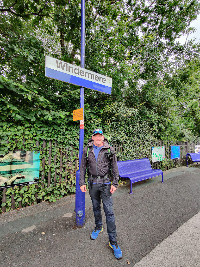
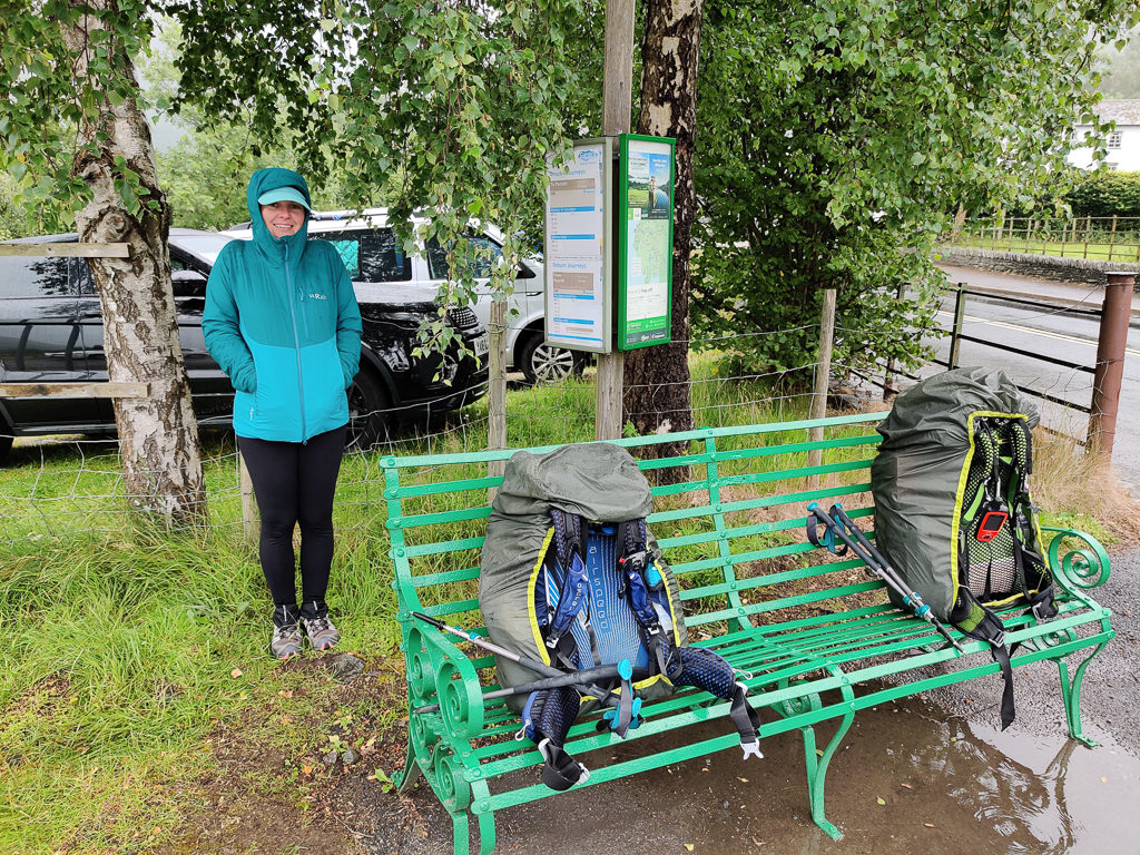
Reaching Windermere late afternoon after what felt like a long travel day due to several train connections and apprehensiveness relating to COVID-19.
On arrival into Windermere, it came as no surprise that the town itself was heaving with visitors. Each pub we passed as we took a walk along the main thoroughfare was busy with people enjoying drinks in the outdoor seating areas and even the ‘Chip Shop’ had a regular flow of customers socially distancing outside waiting to place their orders. As we still had to hike out of Windermere into the surrounding fells and look for a wild camp spot that evening, we too decided that a ‘chippy tea’ would be the perfect option for an early dinner before leaving town. It was much more convenient not having to think about cooking on our first night especially as we still wanted to get started on our new challenge and bag our first couple of peaks before dark.
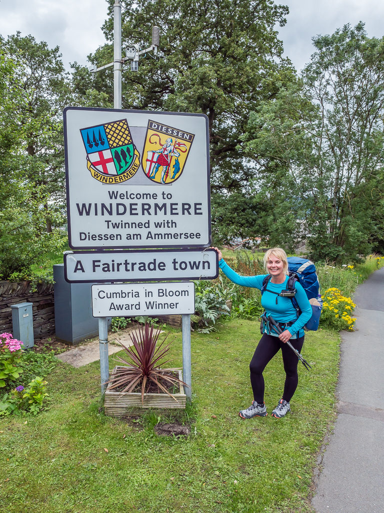
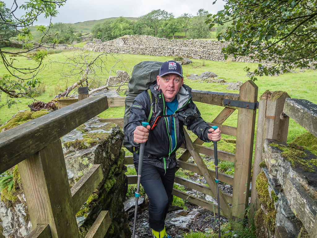
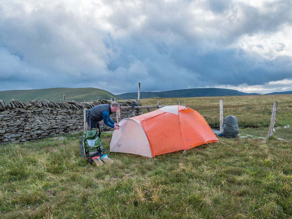
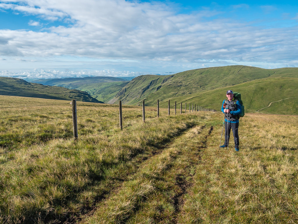
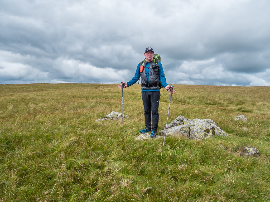
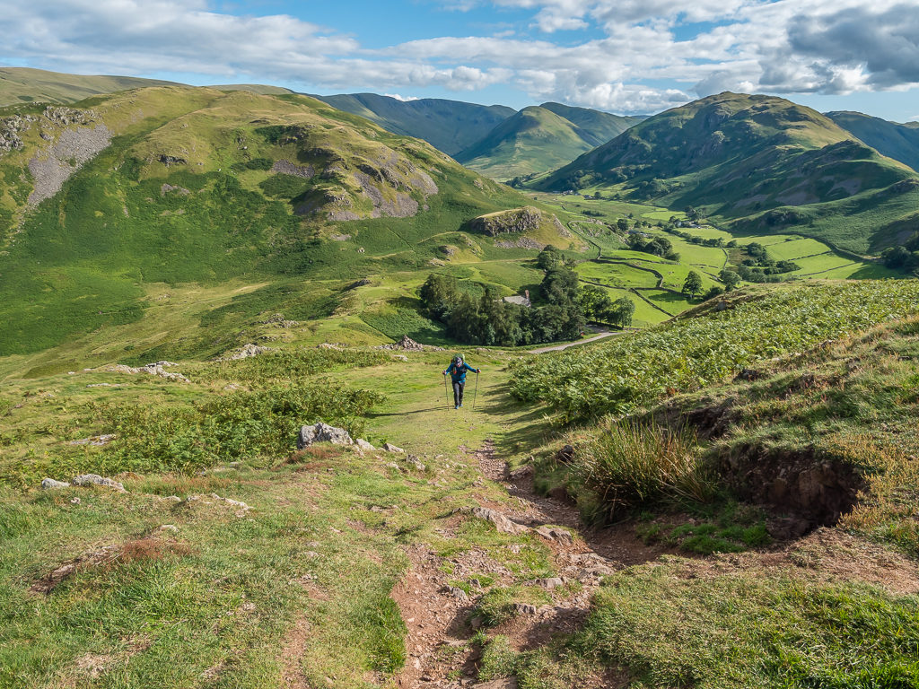
Setting off from Windermere around 5:30pm determined to bag a couple of peaks before dark on our first evening in The Lakes!
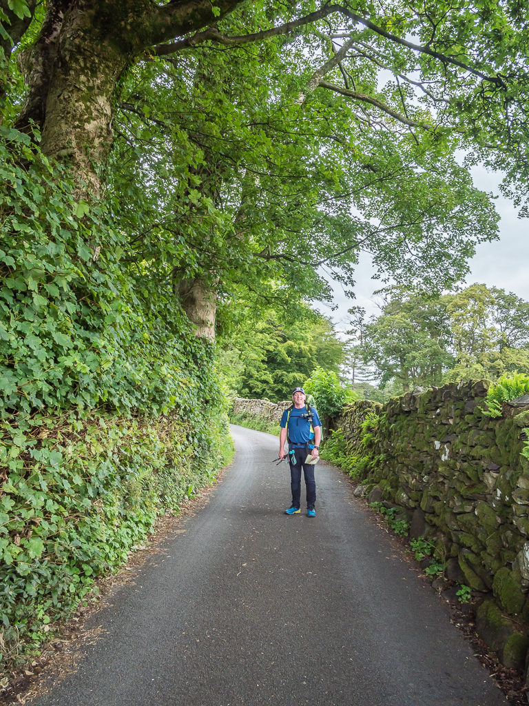
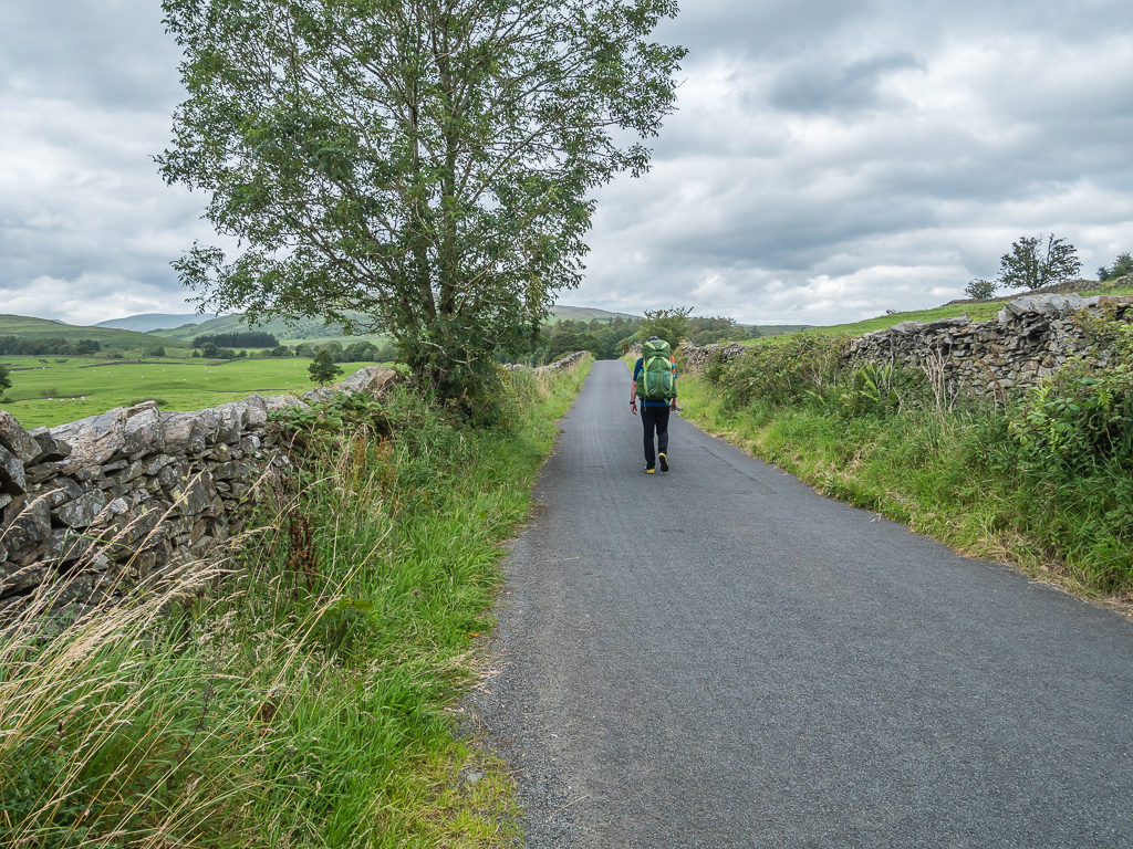
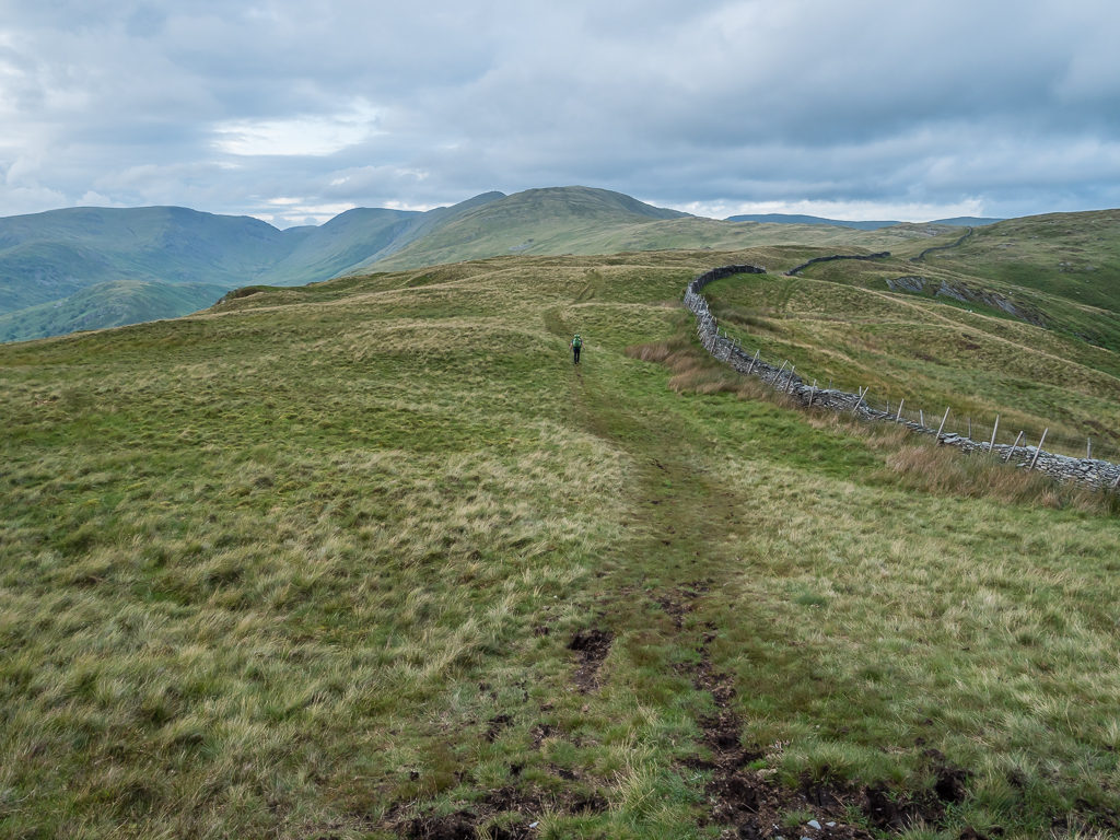
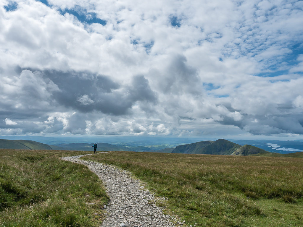
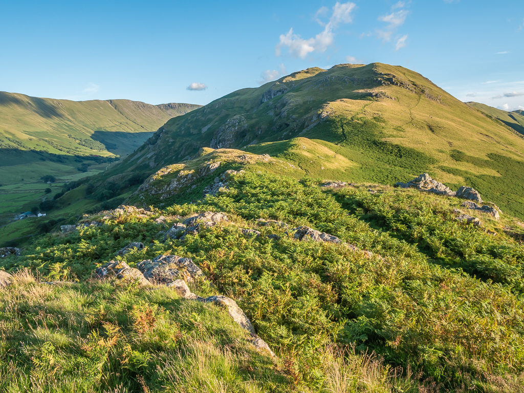
Leaving the centre of town, we followed the main road east before turning off up a track now heading north, which would take us to Dubbs Reservoir via Dubbs Road. Despite having full packs and still needing to break our bodies in to get back into the rhythm of things, the hike up to Sour Howes wasn’t too taxing. Obscuring the taller fells, the cloud layer was low and gloomy-looking but from our vantage point it was still high enough that we had good views out across the valley. It looked very serene with the late evening sunlight filtering through and especially so as we entered the blue hour.
Enjoying an easy road walk to Dubbs Reservoir.
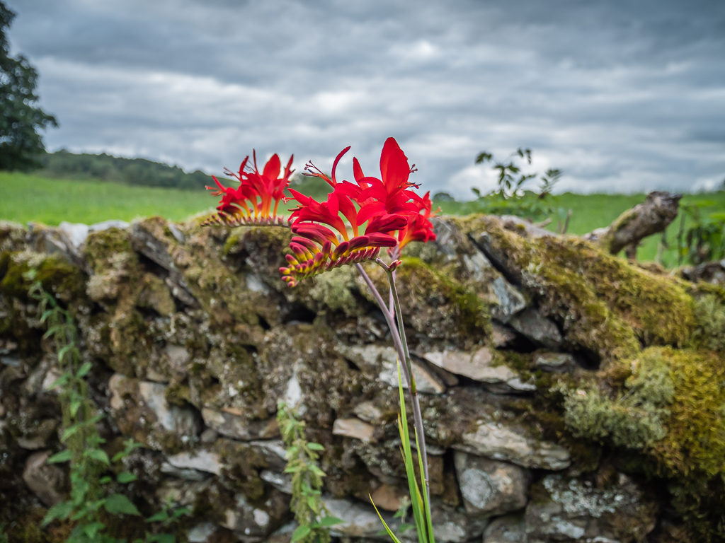
Stopping to admire the flora and fauna all around. The vibrant red of this Crocosmia really captured our attention.
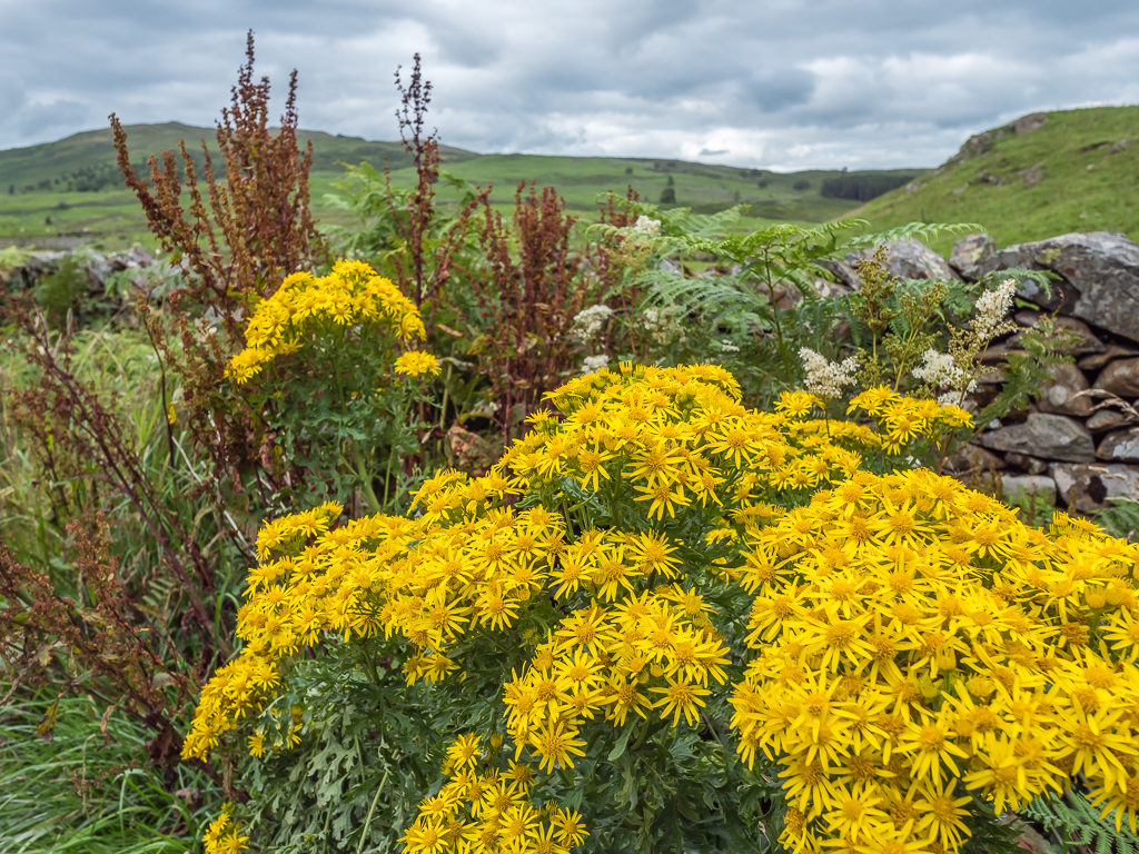
What we thought were bright yellow chrysanthemums in full bloom is in fact ‘Ragwort’, a common wildflower that is highly poisonous to livestock. Flower identification is clearly not our forte!
After lockdown and not being able to travel, it really is the little things that we appreciate.
We were hoping that the grey skies wouldn’t bring rain on our first evening.
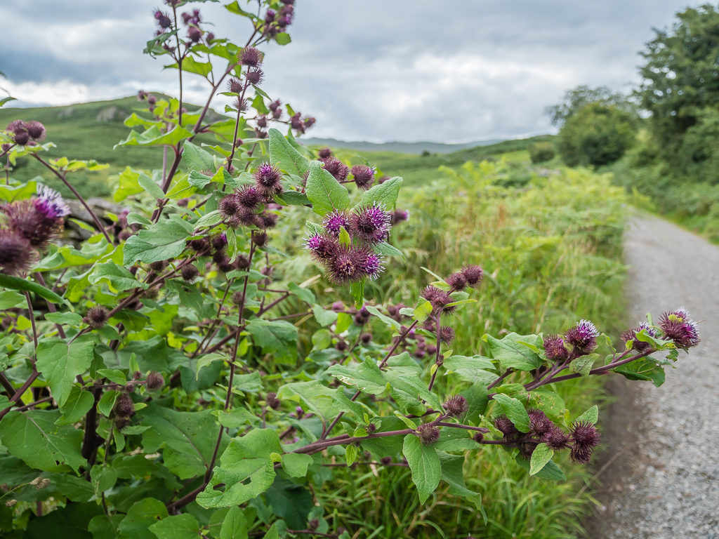
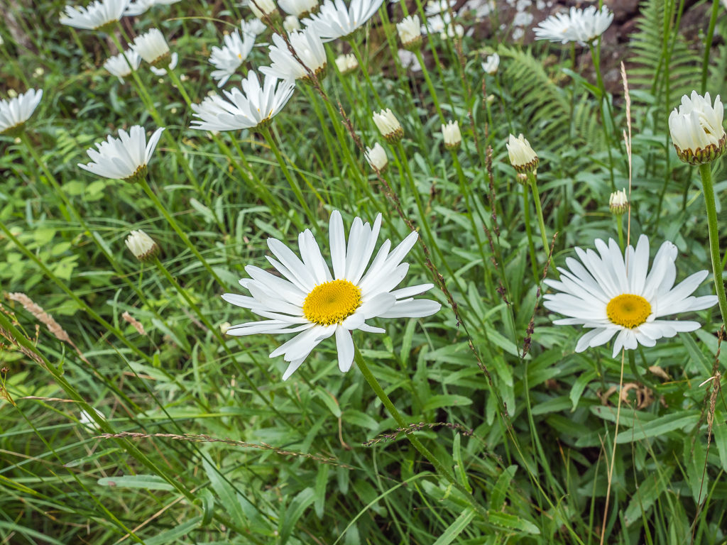
More beautiful wild flowers livening up the roadside.
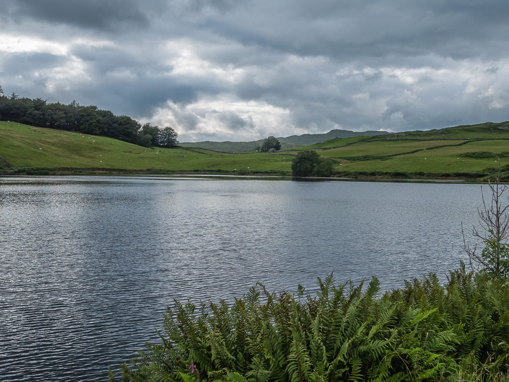
Reaching the reservoir. Originally built to supply water to Windermere, Dubbs Reservoir is now used as a supplement to the Thirlmere system.
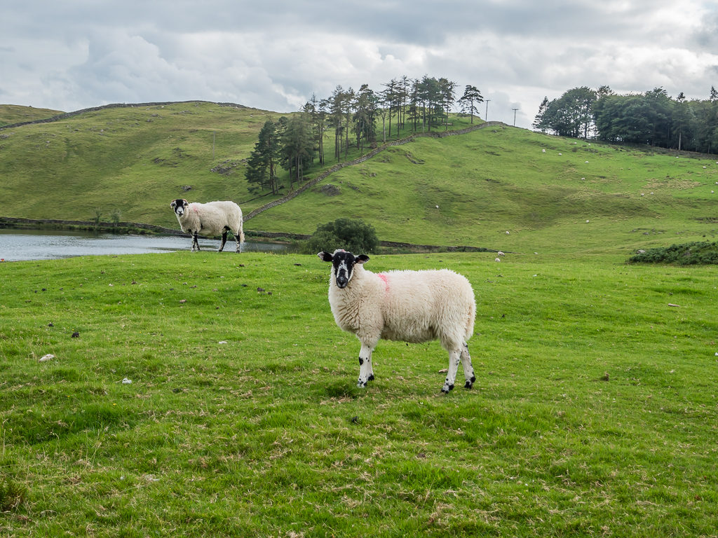
It wouldn’t be the Lake District if we didn’t see some sheep within the first mile! This one was particularly amenable to the camera.
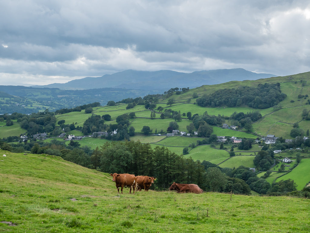
Some cow spotting too! Thankfully we didn’t have to cross this field as we’re still not wholly confident around cows – particularly moody English ones!
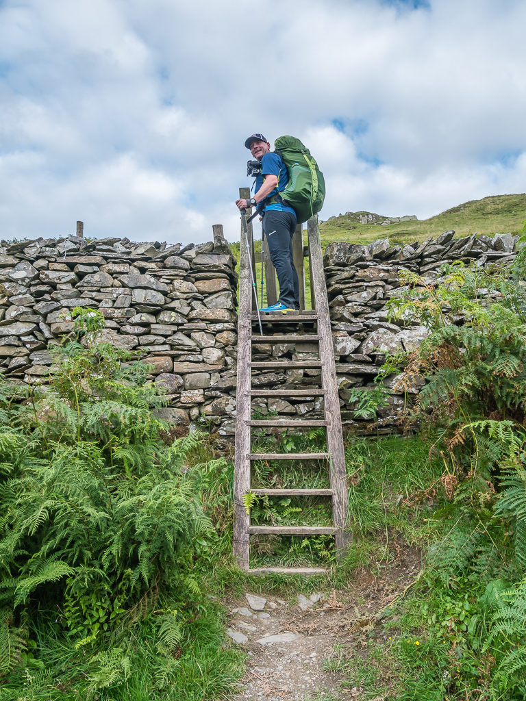
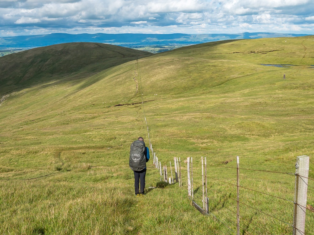
Over the stile we go! Cutting up to Applethwaite Common above Limefitt Park we had a fairly steep climb of almost 300 metres.
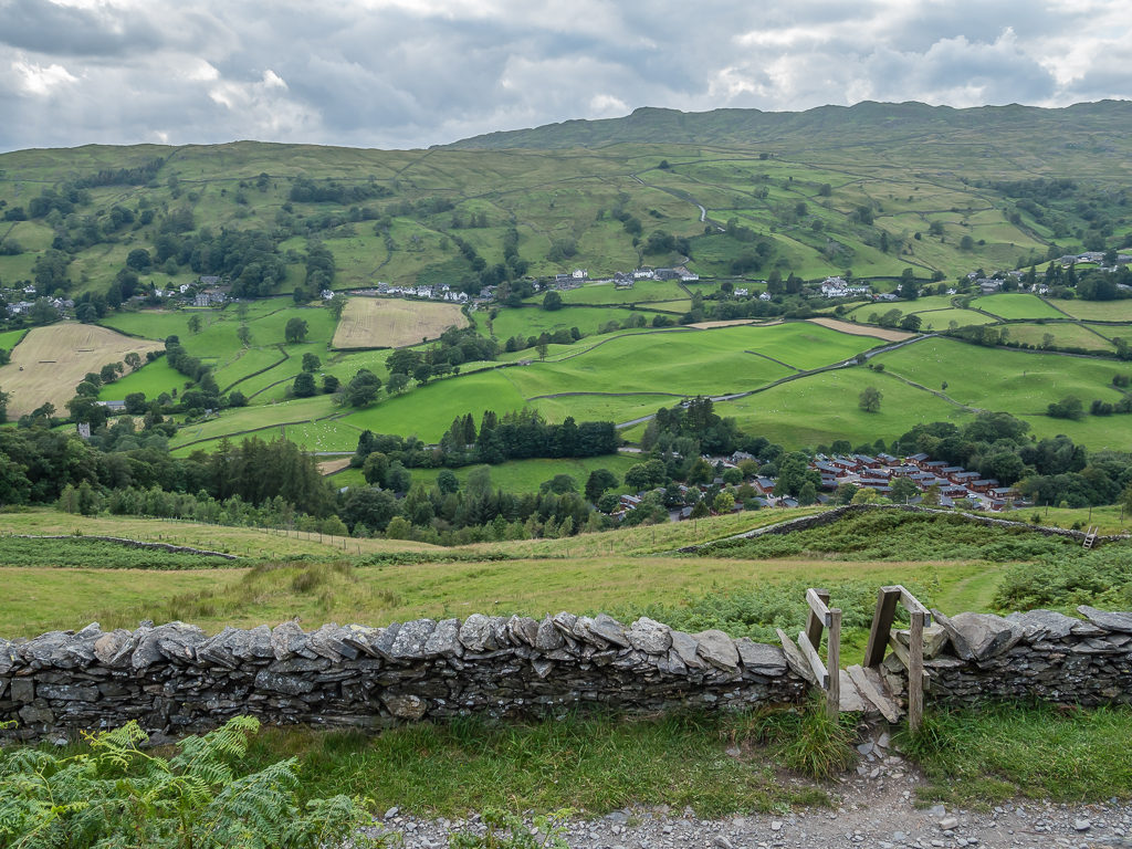
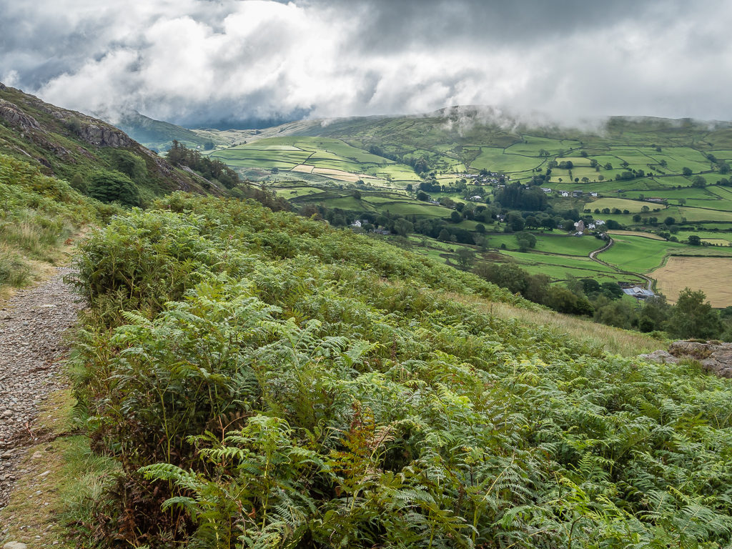
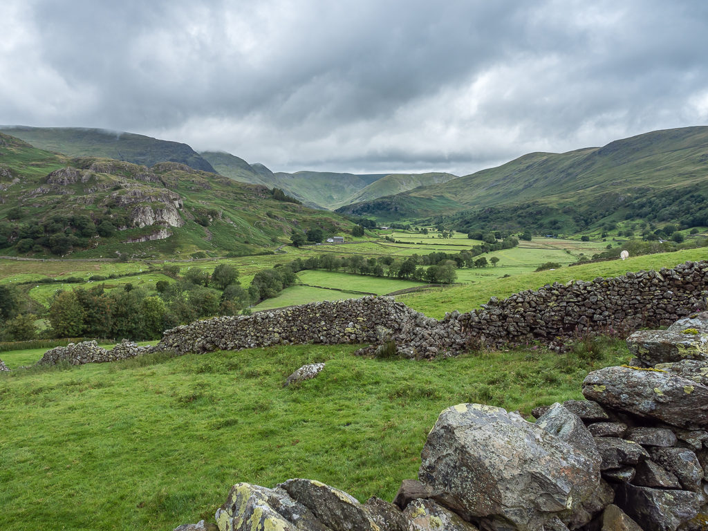
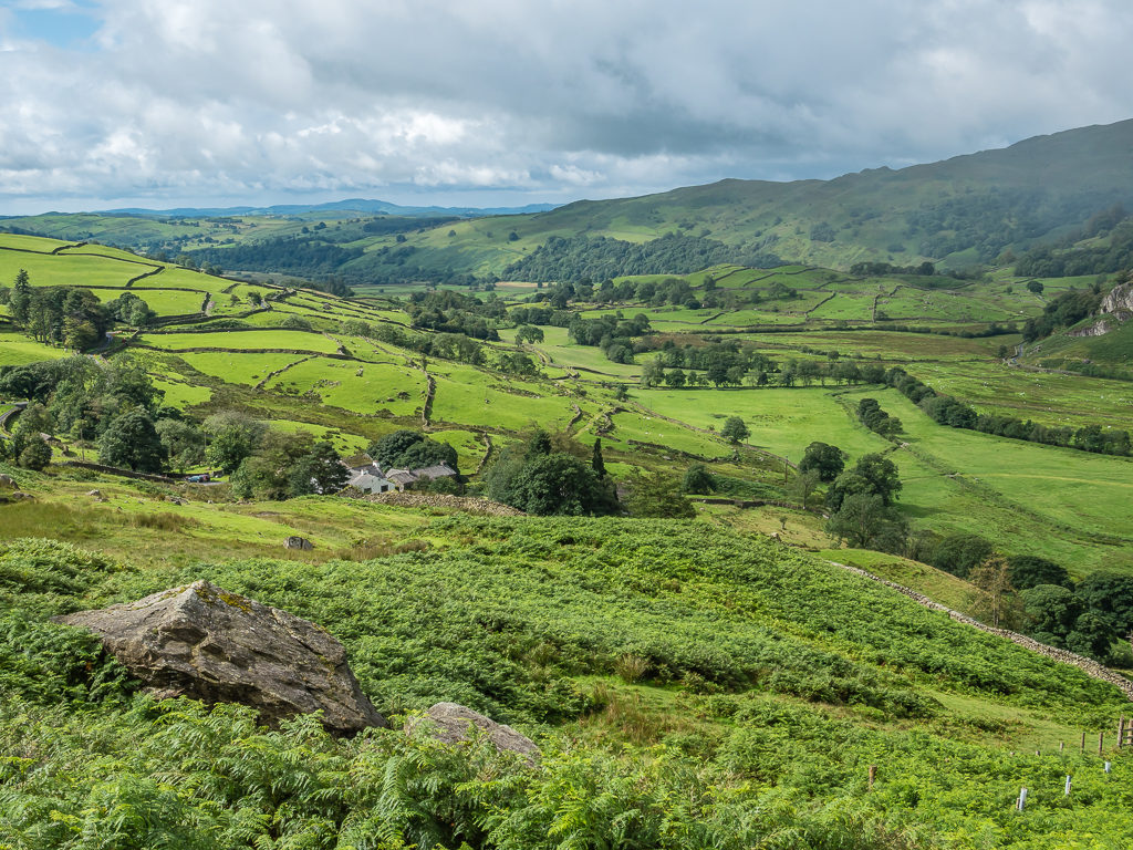
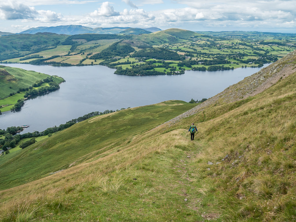
Looking towards the rich, green, patchwork of Troutbeck valley and the fells east of Ambleside.
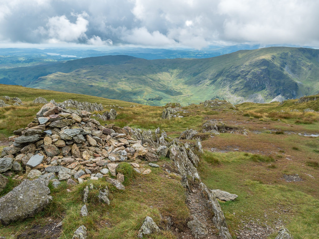
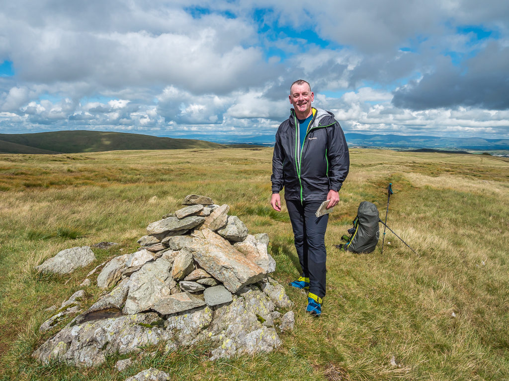
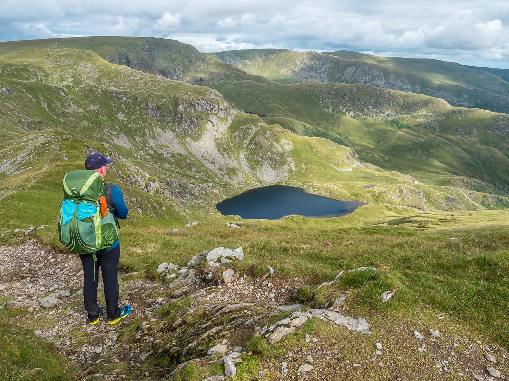
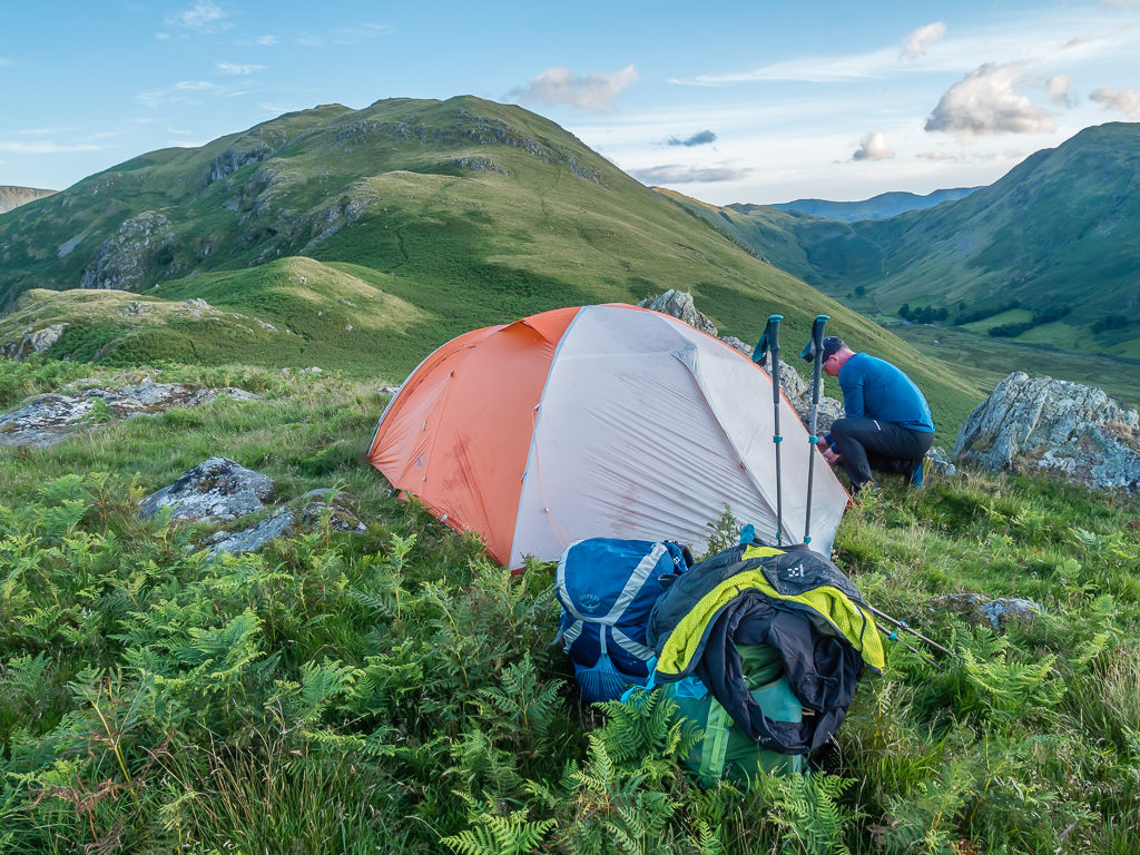
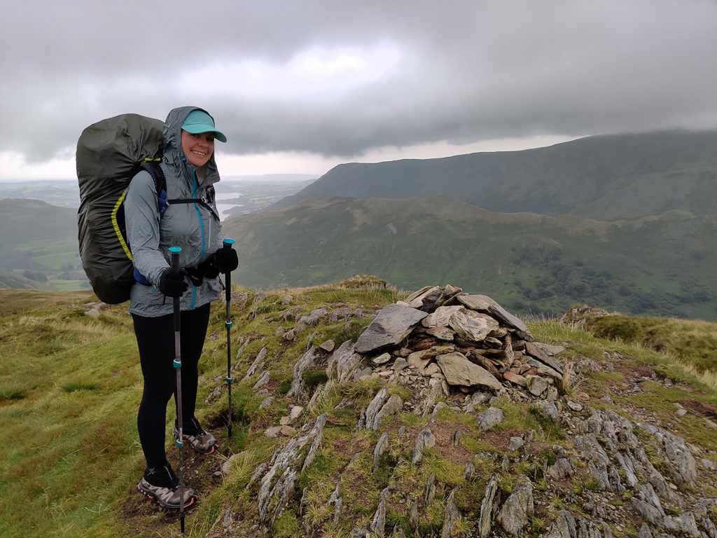
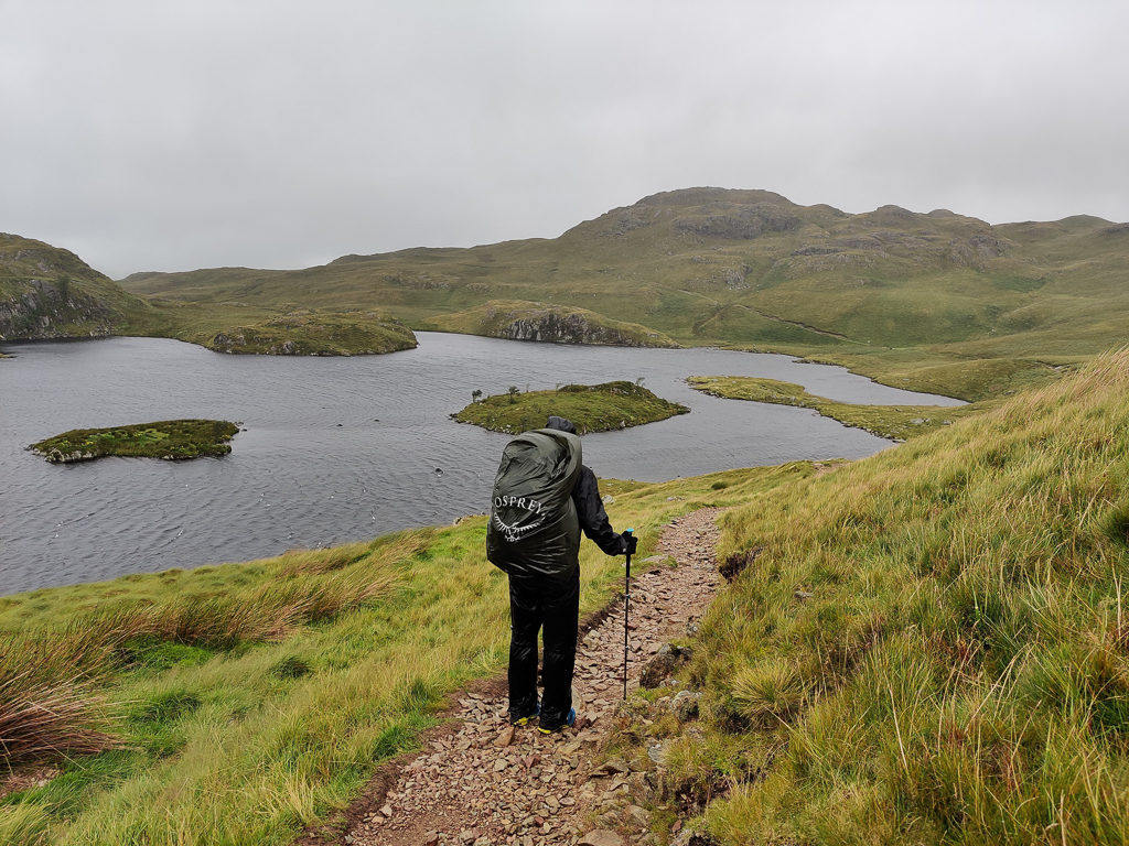
Almost 9 kilometres later and we had bagged our first two peaks and barely seen a soul. Now just 212 of Wainwright’s summits left to go! The most difficult task was then finding somewhere to sleep. The options around Sour Howes and Sallows were limited. Other than camping on a flattish patch we admired by Sallows summit, the ground everywhere else was both boggy and tussocky making walking quite an onerous task, never mind about pitching a tent on such uneven ground. Luckily, with a bit of perseverance we found an OK spot off Garburn Pass tucked away behind a large rock that was perfect for protection from the wind, as well as shielding us from view.
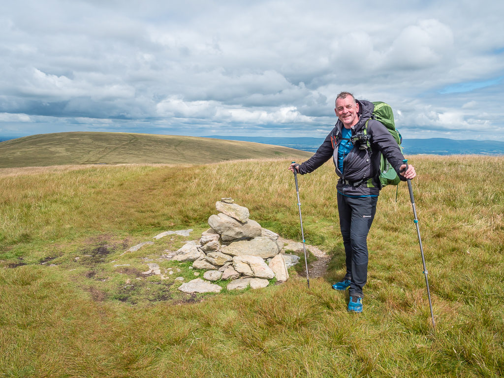
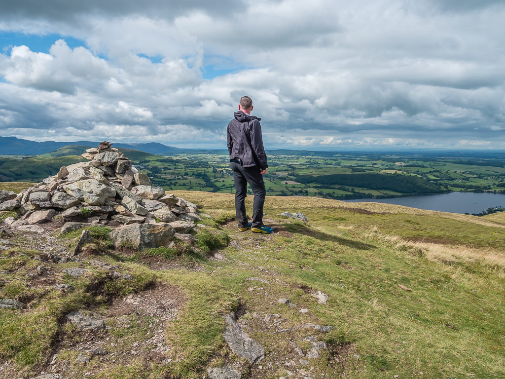
Our first peak bagged! At 483 metres, the summit of Sour Howes with Lake Windermere beyond.
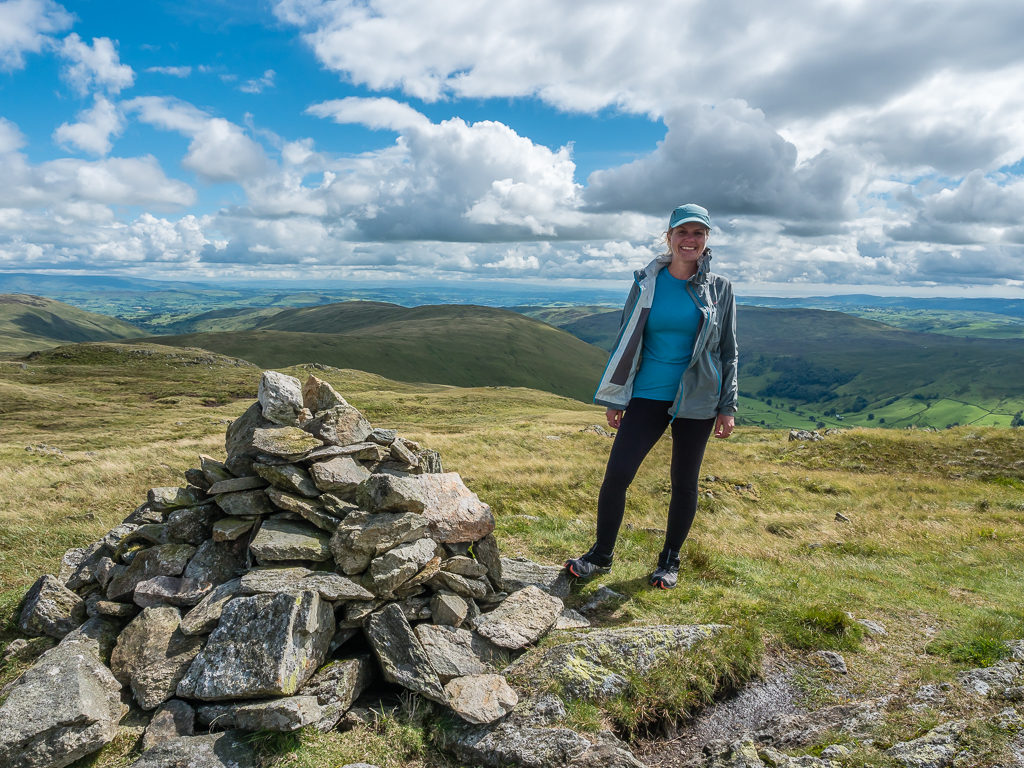
Continuing onto Sallows, our next summit at 516 metres whilst entering the blue hour in what seemed like a dramatic change in light and landscape.
With two peaks in the bag, we headed up from Garburn Pass in search of a non-boggy wild camp spot. The ground seemed particularly sodden and we weren’t having much luck in terms of viable options!
By then it was after 8pm so we hurriedly got pitched, not because of the waning light but because it looked like rain was imminent. Getting everything inside the tent quickly, we were pleased when it was just a fleeting shower.
With sunset not until after 9pm, I still had good enough light to perform an emergency repair to my rucksack. Annoyingly, one of the clips had pulled off my top lid where the sewing had failed earlier that morning whilst we were stowing our packs on the train. Using a needle and thread from our essentials repair kit, it was fixed in no time however and would be good to go the next morning.
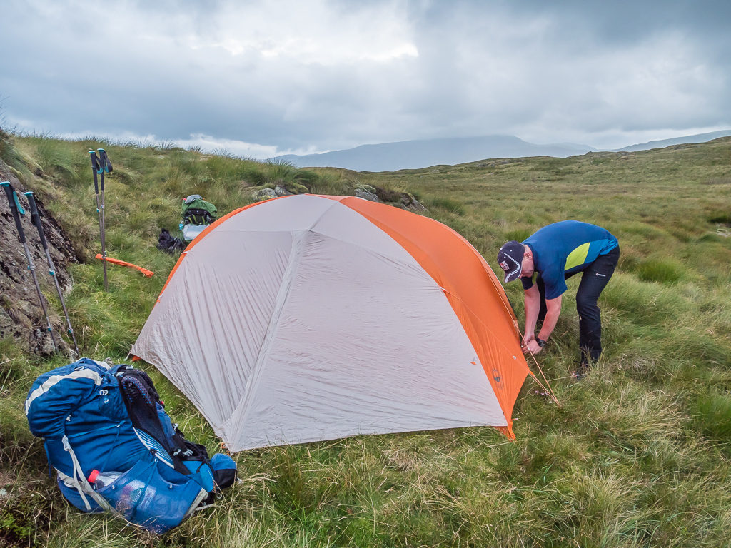
Our first night back in our Big Agnes Hotel since hiking in the Pyrenees last summer. (We had camped out in the garden during lockdown but being limited on space, we could only squeeze in our old Big Agnes UL3 tent as it doesn’t have a vestibule.)
We then enjoyed an early night as we just love the comfort of our sleep pads and bags and the feeling of freedom that comes with being inside the tent. It felt good to be sleeping outside again and starting a new adventure. Whether our bodies would agree in the morning or whether it would be a complete shock to the system after lockdown, that’s yet to be seen!
Sunday 2nd August 2020, Wild camp at Garburn Pass to Wild Camp near Branstree, 24.1km
Peaks bagged: 3. Shipman Knotts (587m) 4. Kentmere Pike (730m) 5. Tarn Crag (664m) 6. Grey Crag (638m) 7. Branstree (713m) 8. Selside Pike (655m)
Apart from hearing the pitter patter of light rain showers on the tent during the night, we enjoyed a restful night’s sleep. Rain had been forecast from midnight so it was no surprise that it was still raining when we woke up at 5am. Hence we decided to stay put for another hour in our sleeping bags as it had been forecast to stop by around 6am. As is always the way with the Great British weather however, it was actually nearer to 7am when the sound of raindrops hitting the tent fly finally ceased.
At last it was all systems go! We had a quick wet wipe wash then got dressed. To save us time in the mornings on this trip (as well as gas), we had already agreed that we would have a ‘cereal bar’ breakfast each day and boil up some water for a hot drink at our first morning rest stop like we had got used to previously on the PCT. By our reckoning, this would save us at least half an hour each morning – there’s nothing like a bit of procrastination whilst waiting for a pot of water to boil instead of prioritising getting packed away!
By the time we were ready to repack our bags and take down the tent we were pleasantly surprised that the rain had stopped completely and there were even patches of blue sky now visible as the early morning mist began to break. Instead of waiting around for the tent to dry, we packed it away wet, stuffing the fly into a carrier bag with the intention of getting it out later to dry when the sun broke through.
Gearing up for a wet day, but we were pleasantly surprised when the rain seemed to have stopped so it was all systems go to get packed away and hike on.
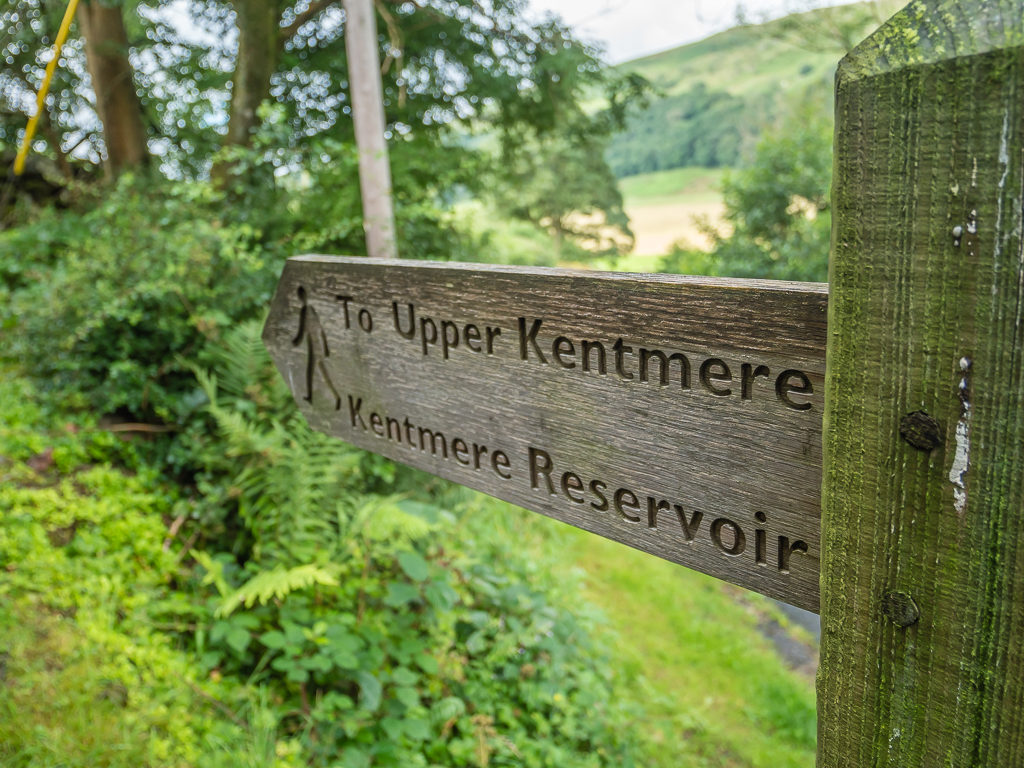
Setting off just after 8am (for once, we had made a great start) it was quite a nice walk down Garburn Pass into Kentmere as the weather was brightening and it was all downhill, although we’d forgotten how annoying it can be walking down a wet, stony track trying to avoid slippery rocks.
Even more promising, the sun was beginning to break through as we set off for the Kentmere valley.
The recent wet weather in The Lakes meant that all of the becks, brooks and ghylls were flowing nicely so access to water shouldn’t be a problem.
Heading back over Garburn Pass and looking towards Kentmere where the cloud was lifting.
After reaching the village, we found a perfect grassy bank where we could sit and make a brew. Unfortunately as soon as we got everything out and started to boil some water it began spitting with rain again, so we quickly took shelter underneath the branches of a large tree and out came our waterproof coats once more.
Having made a good start, we decided to stop for a brew and get the tent out to dry.
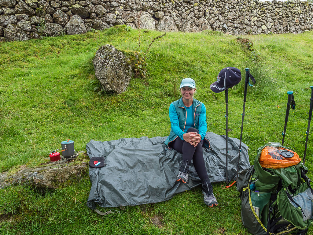
We found the perfect grassy bank to sit on and enjoy our first morning cuppa – but our plans were then thwarted when the rain returned.
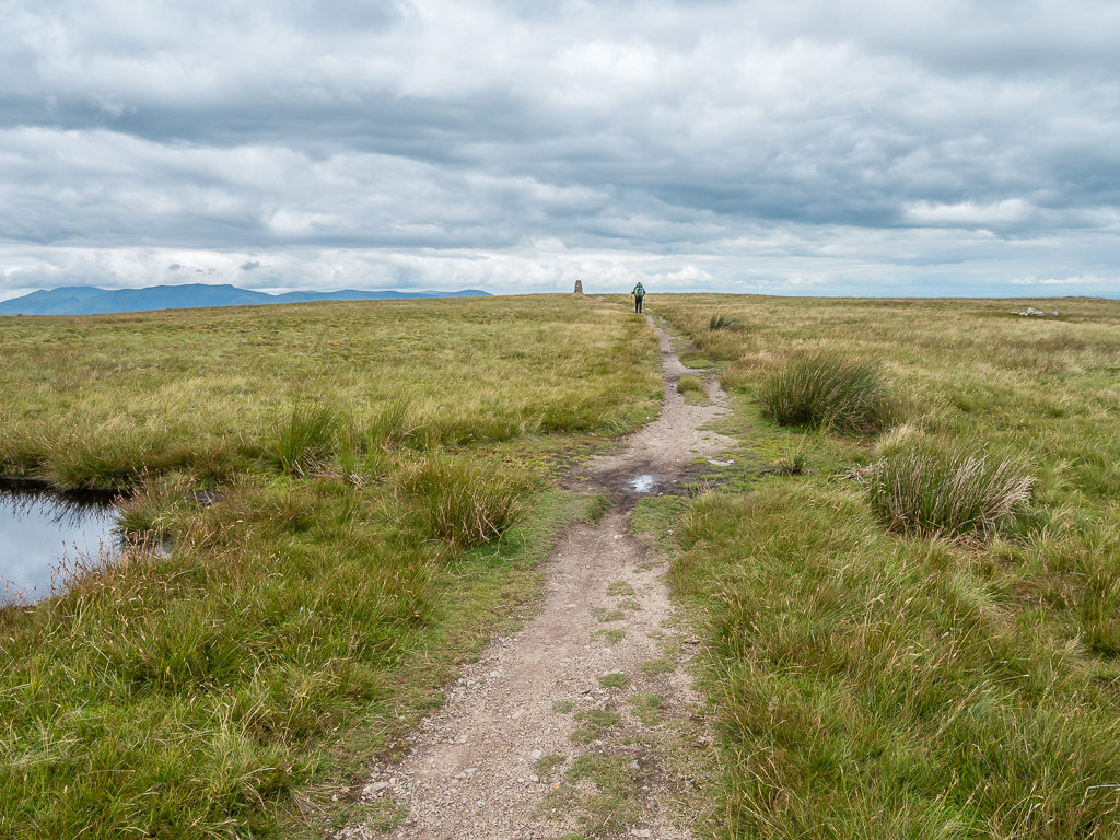
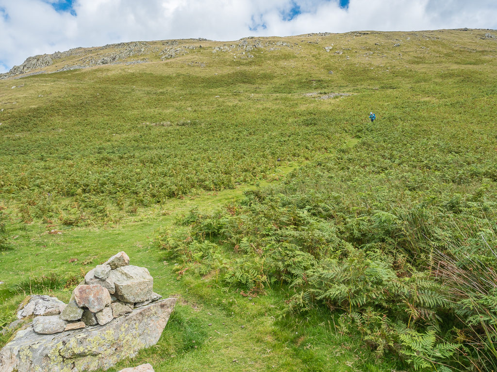
Soon after we pushed on to bag our first summit of the day, which was Shipman Knotts. It was a long, steady walk up the side of the grassy fell taking us from 170 metres down in the valley to 587 metres at the summit cairn. It was one of those not-so-straightforward summits however where we had to cut back on ourselves to find the actual high point marked with the smallest of cairns – just a tiny pile of rocks making us question if indeed it was the summit? We could tell this wasn’t a popular Wainwright as the trail wasn’t too well worn, with a series of different paths or ‘desire lines’ that met together along the fell top.
With our big packs on, it can often be tricky fitting through the stile gate and this was one of those times!
Starting the climb, which from afar looked quite gentle.
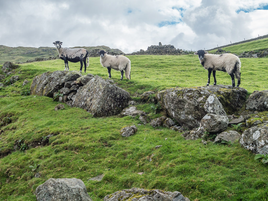
‘See no evil, hear no evil, speak no evil’ – The three wise sheep comes to mind!
Looking back towards Lake Windermere where the skies were looking much brighter than those ahead of us.
Having tried really hard on our ascent to dodge the numerous boggy patches of ground, we quickly resigned ourselves to the fact we were going to have wet feet today. As we then hiked along the top of the fell and further uphill towards Kentmere Pike, it looked like we were heading straight into thick cloud and rain. Yet as we got higher, the wind was actually blowing the cloud away affording us good visibility of the surrounding fell tops as well as excellent views looking southwest down to Lake Windermere. The best spectacle however was when we glimpsed a rainbow straddling the Kentmere valley to the left of us.
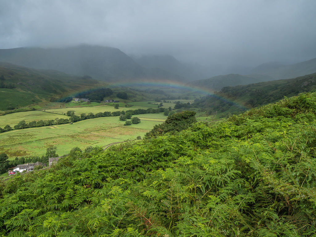
Capturing a full rainbow straddling the Kentmere valley.
Another shot looking back giving us hope that the weather would improve in our direction too.
Taking it in our stride – the long, gradual hike up to Kentmere Pike.
Reaching Kentmere Pike at 730 metres marked with both a large cairn and a trig point on the opposite side of the stone wall running up the mountainside, we then stopped for lunch. Today was quite a feast as we had hiked up with flatbreads and a packet of salmon mixed with couscous but it was good refuelling as it was such a long walk out to Tarn Crag at 664m, followed by Grey Crag at 638m.
Looking across the Kentmere valley to Yoke (706m), Ill Bell (757m) and Froswick (720), which we bagged in white-out back in 2017.
Looking back, 0ur view from the summit of Kentmere Pike. It was pleasing to see that the cloud layer was definitely lifting.

Looking north towards Harter Fell (778m). We had decided to head east however to bag Tarn Crag and Grey Crag before tracking back to Branstree and Selside Pike.
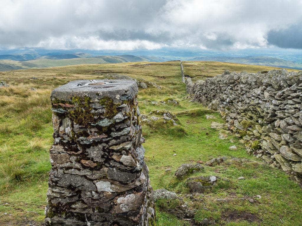
The trig point on Kentmere Pike over the other side of the boundary wall.
If we didn’t have wet feet already, we were sure to get them going out to the next fell tops. We basically followed the fence line downhill from Kentmere Pike taking the ‘runner’s route’ past the disused Wrengill Quarry, before crossing the river at Brownhowe Bottom. It should have been a fairly simple rock hop, but the boulders were slippery and unstable so my foot was straight in the water!
Taking the runner’s route as we thought it was more direct but not accounting for the fact it was much boggier! On reaching the disused quarry we would cross Brownhowe Bottom, then head southeast up to Tarn Crag and Grey Crag.
The gate here was padlocked so we had no choice but to climb over it. Tarn Crag looked to be another mighty climb in the distance.
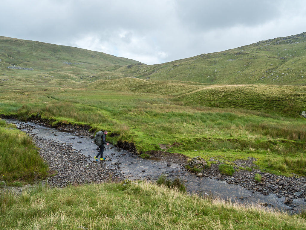
Trying hard not to get wet feet, but it was pretty much inevitable along the runner’s route.
A section of boggy ground that we tried to navigate around. On our way up to Tarn Crag, we found that the bog was really slowing our pace.
The Survey Pillar found at Tarn Crag. It is located a few metres from the actual summit cairn.
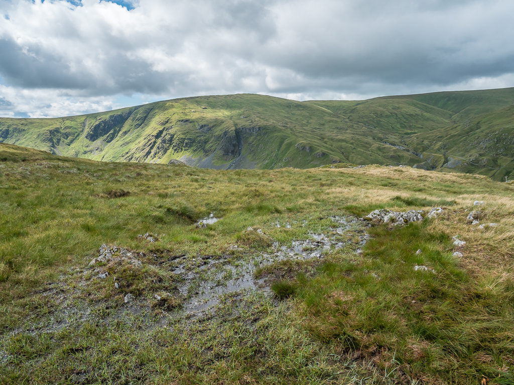
After bagging Tarn Crag, we continued on towards Grey Crag where we found ourselves having to dodge enormous pockets of thick, wet, black bog before the climb. Luckily we didn’t fare too badly trying to find the best way across the quagmire unlike a hiker we passed going in the opposite direction who said he’d sunk to his knee and thought he was never getting out!
With far-reaching views out to Morecambe Bay and Heyham Nuclear Power Station on the south-west coast, the Howgill Fells to the southeast, and the Eden Valley below the Pennines, Grey Crag was the perfect place to stop for a snack break – no wonder Wainwright had selected it as one of his 214! The views were so clear we could even see a ship out at sea on the distant horizon, which kind of made up for the fact we now had another long walk back, retracing our steps to find the best way to avoid the bog and head up to Branstree at 713 metres, which we did following a direct line up Selside Brow where there is a clear path right along the boundary wall.
Crossing more boggy moorland between Tarn Crag and Grey Crag under atmospheric skies.
Finally reaching the summit of Grey Crag, which seemed to be an arduous out and back due to the trail conditions underfoot.
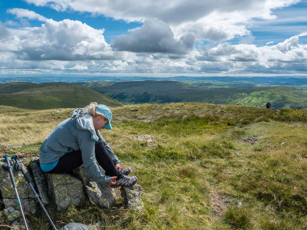
Stopping to adjust my new scree gaiters. They were doing a great job at keeping the grass seeds out although they’d lost their stickiness because of the bog.
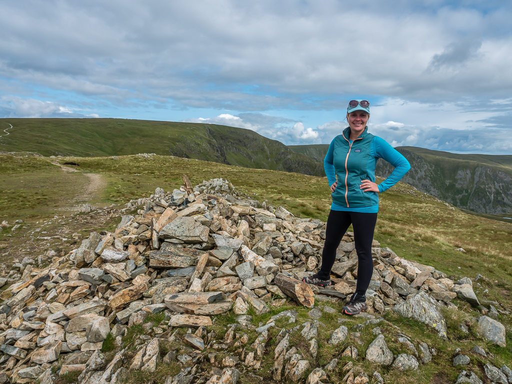
At the summit cairn on Grey Crag. At 638 metres, a clear day gives a beautiful panorama looking in both southeast and southwesterly directions.
The remains of a trig point along Grey Crag – just in case this is the ‘official’ summit.
We then had another lengthy out and back to Selside Pike (655m) from Branstree to contend with, where along the return route we wanted to pick up water from a small, unnamed tarn marked on our map. Thankfully the path was clear and we stopped partway at Artlecrag Pike (not a Wainwright) for another sugar boost, resting on the stones beside two large cairns, as we were feeling zapped of energy after so many climbs. We had forgotten just how many snacks we need to keep us going with so much change in elevation!
Taking the most direct route following the fence line up to Branstree before turning northeast to bag Selside Pike.
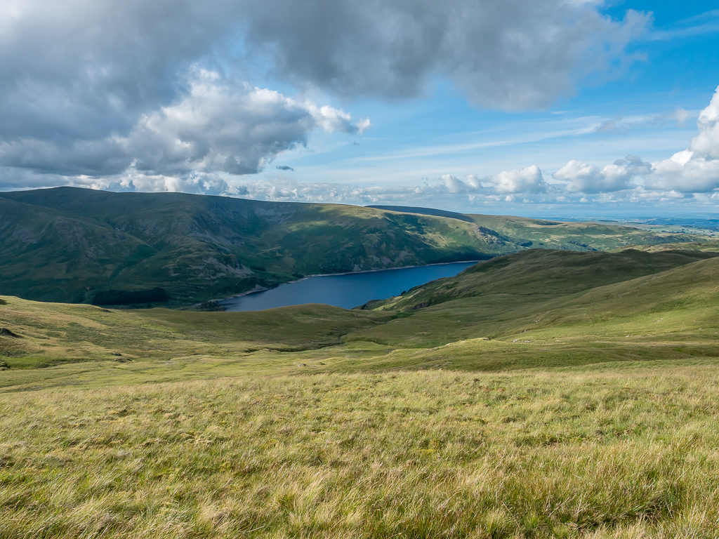
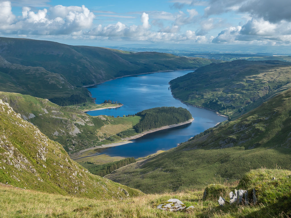
Climbing up to Branstree we had our first glimpse of Haweswater Reservoir.

Finally reaching the enormous summit cairn that doubles up as a wind shelter atop Selside Pike at 655 metres.
Bagging Selside Pike, we enjoyed clear views of the Pennines but didn’t linger for long as we still needed to filter water and get to camp as by now it was nearing 6pm. We had originally earmarked Little Harter Fell as a potential wild camp spot, which would mean returning to Branstree and descending 150 metres or so to cross Gatesgarth Beck, to then go up the pass on the opposite side and begin the climb onto Harter Fell. As we were both exhausted after our first proper day on trail, Wayne suggested camping just off the summit of Branstree instead. It was music to my ears! He had already spotted a decent grassy patch behind the fence line where the stone wall would offer us some protection from the wind. It seemed a good plan as after today’s experiences with extensive sections of bog, we didn’t know how saturated the ground would be over on Harter Fell if we were to push on.
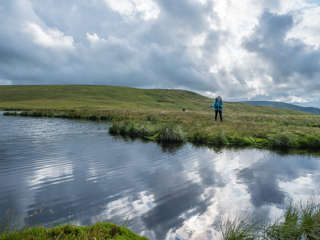
Heading to the tarn to fill up with water on our way back to Branstree, it was then that we suffered a real setback that was completely unexpected. Our trusty Sawyer Squeeze filter just wouldn’t work. After tapping it and trying our best to squeeze water through, the water flow was minimal, like literally drip by drip. It would take all night to filter even a litre! With the real problem of getting sick if we drank straight from the tarn due to the amount of sheep around, hence bacteria in the water, we had no alternative but to boil the water we collected once we set up camp and hope that we could purchase a new filter from town in a couple of day’s time.
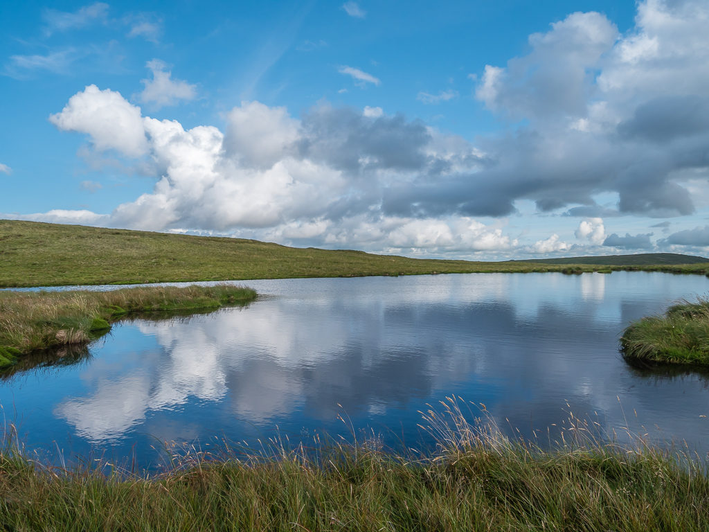
Enjoying the beautiful cloud reflections as we made our way over to the tarn to top up our water supplies. Unbeknown to us at the time, our water filter was no longer functioning properly.
Spectacular light filters through the cloud onto the tarn.
Heading back to Branstree, we set up camp quickly as by now it had passed 7pm, meaning we’d been on the go for 11 hours. No wonder we were feeling tired. Pitching behind the stone wall, we then got a pot of water on the stove after filtering it through our wash flannel, leaving it boiling for a timed 4 minutes just to be on the safe side. We used the first lot for dinner and did the same again to fill up our water bottles for the following day once it had cooled.
Setting up near the boundary wall on Branstree after a long hiking day that bagged us 6 new summits.
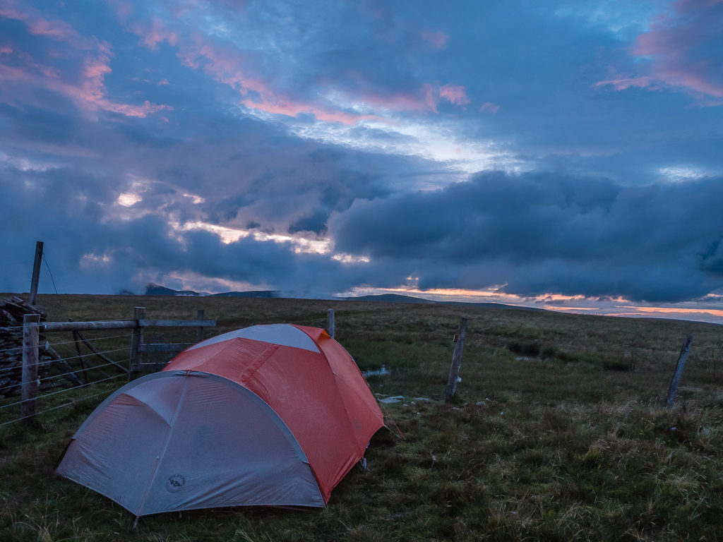
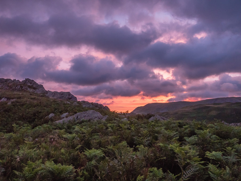
We were treated to dramatic skies and the promise of a fine sunset.
Dinner was creamy vegetable soup with croutons, followed by instant mashed potato served with Spanish beans on top (it’s a new packet mixture by Heinz and very tasty!). Dinner was followed by hot chocolates and Twix bars whilst watching a lovely sunset from the tent reflected in a small bog pool on the other side of the fence right beside our camp. With so much hot food inside us, needless to say, we were warm and content and slept well!
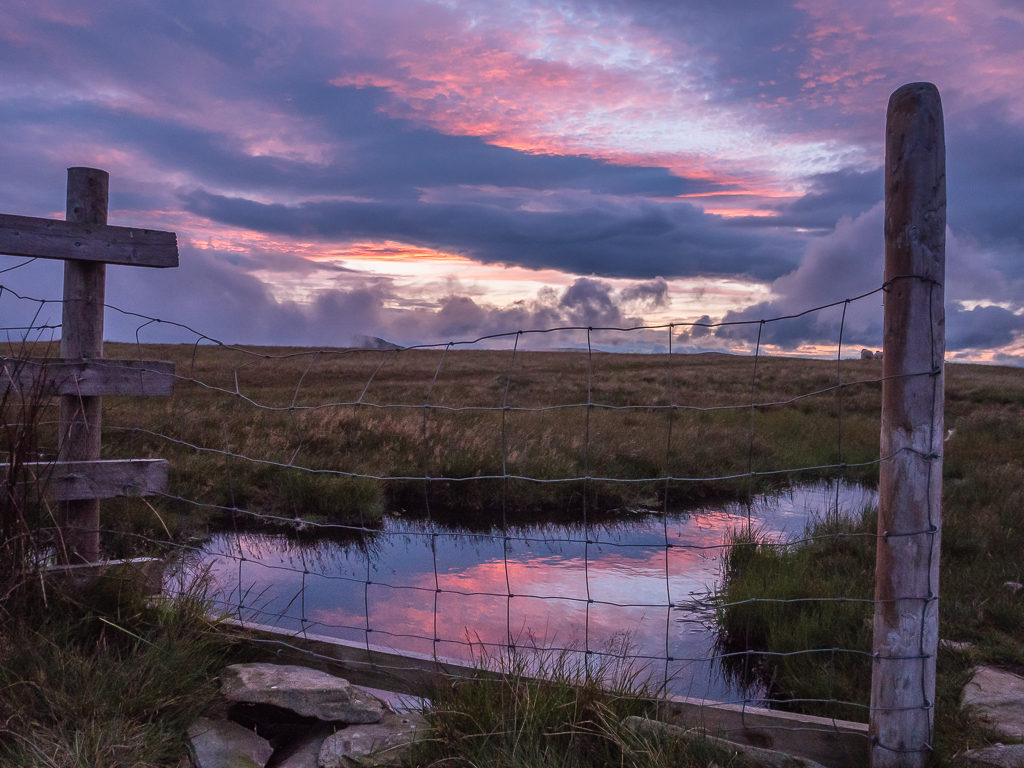
Capturing the colourful skies from inside the tent. Having unzipped the door, we were instantly wowed by the pretty reflection on what was actually a pool of bog water on the opposite side of the fence!
Monday 3rd August 2020, Wild Camp near Branstree to Wild Camp along Beda Fell, 30km
Peaks bagged: 9. Harter Fell (778m) 10. Mardale Ill Bell (761m) 11. High Street (828m) 12. The Knott (739m) 13. Rampsgill Head (792m) 14. Kidsty Pike (780m) 15. High Raise (802m) 16. Wether Hill (673m) 17. Loadpot Hill (671m) 18. Arthur’s Pike (533m) 19. Bonscale Pike (529m) 20. Hallin Fell (388m) 21. Steel Knotts (432m)
On paper, today looked like it was going to be a much easier day than yesterday. In reality however, it turned out to be longer in distance by 6km and with more climbing – well it certainly felt that way after walking for over 12 hours! But it was worth it as we managed to bag 13 summits in one day, keeping us on track for our planned ‘Section 1’ hiking from Windermere to Patterdale.
There were a few showers in the night over the eastern fells so we awoke to a wet tent once again, but by morning the skies looked fairly clear and with the sun out intermittently it would soon be dry. Continuing our new and improved ‘early morning’ routine, we were up and ready to leave camp again just after 8am having had breakfast bars and a cold drink instead of boiling water and cooking eggs. We were looking forward to hiking the High Street once again and revisiting Kidsty Pike after our time on the Coast to Coast back in 2014, so we were in high spirits as this is a part of the Lake District we know well.
As the sun was already up, we decided to utilise the fence for drying out the tent and ground sheet before we left.
This morning began with retracing our steps back along the fence line from Branstree so that we could finally make it to the top of Harter Fell, seen in the distance behind Wayne.
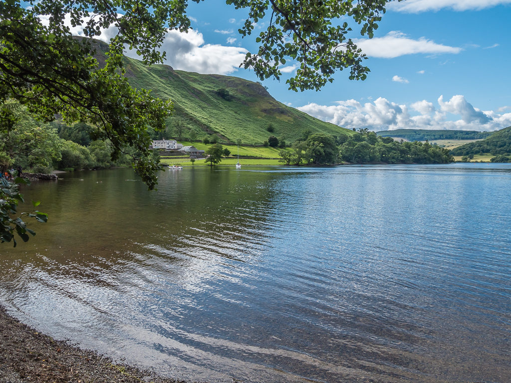
Descending from Branstree we had to dodge more boggy ground once again, but then the hike up to Harter Fell at 778 metres, continuing on to Mardale Ill Bell at 761 metres and then up to the ancient Roman road that is High Street at 828 metres was all straightforward. Along the path to Mardale Ill Bell, we looked onto the sapphire blue tarn known as Small Water and also had a beautiful, clear view of Haweswater Reservoir.
Controversially created in 1929 to provide a water supply for Manchester, Haweswater Reservoir is one of the lesser-visited lakes in the Lake District due to a lack of public facilities – but it is for this reason that it is also one of the more tranquil areas of the national park.
Continuing on good track towards the summit of Harter Fell. Routes to the more popular summits are much better underfoot.
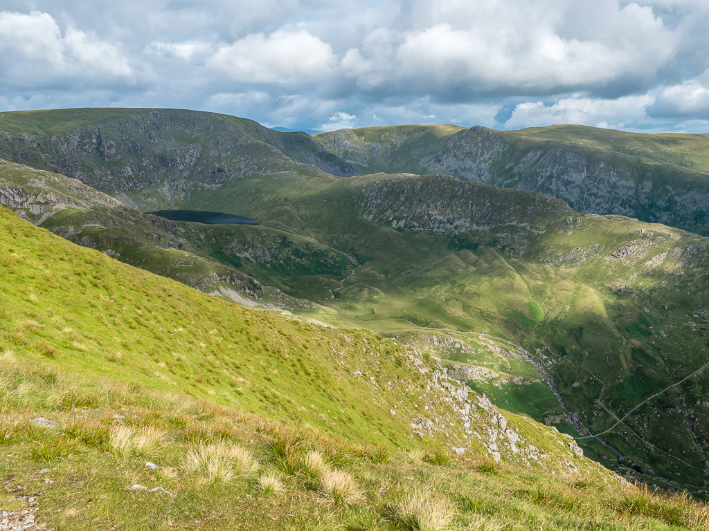
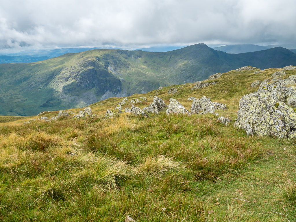
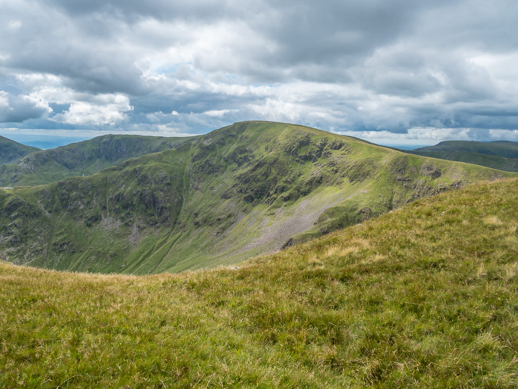
A stunning view from Harter Fell to Blea Water with Pilot Crag, High Street, Long Stile, Short Stile, Kidsty Pike and High Raise in shot.
Looking onto the sapphire blue tarn known as Small Water below Blea water.

To help give a sense of scale, hiking along the path from Harter Fell to Mardale Ill Bell, a beautiful, remote fell overlooking Mardale and Haweswater.
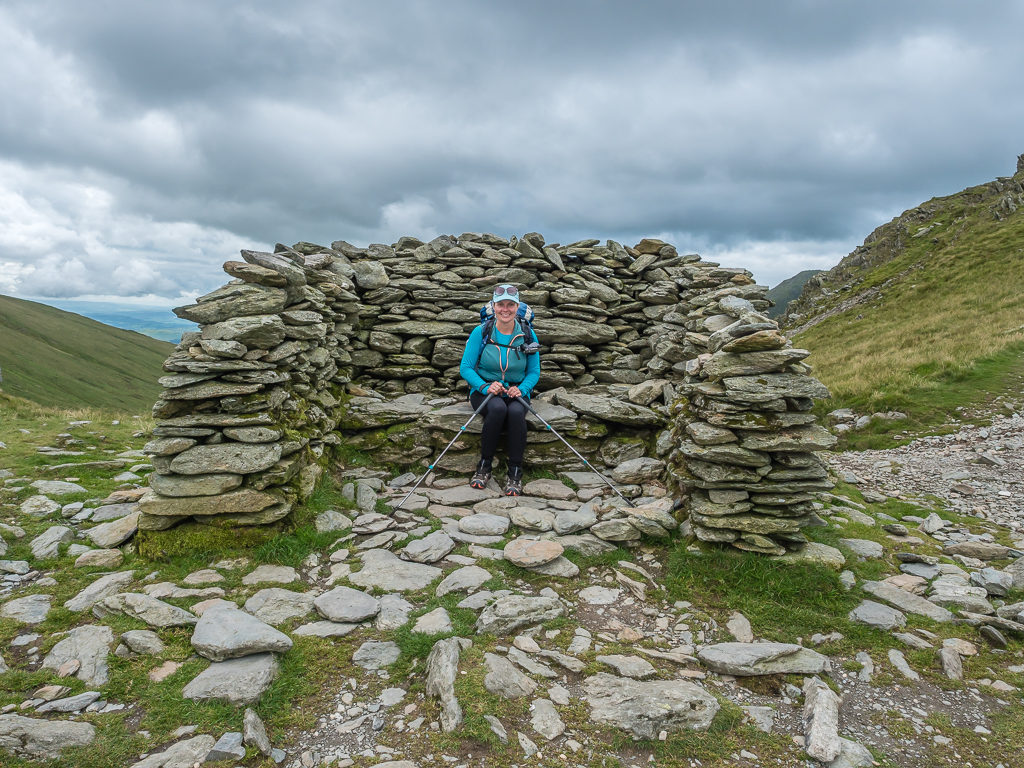
The stone shelter at the crossing point of Nan Bield Pass. The back of the shelter is set against the prevailing winds and as there’s some seating inside we took the opportunity to take a short break.
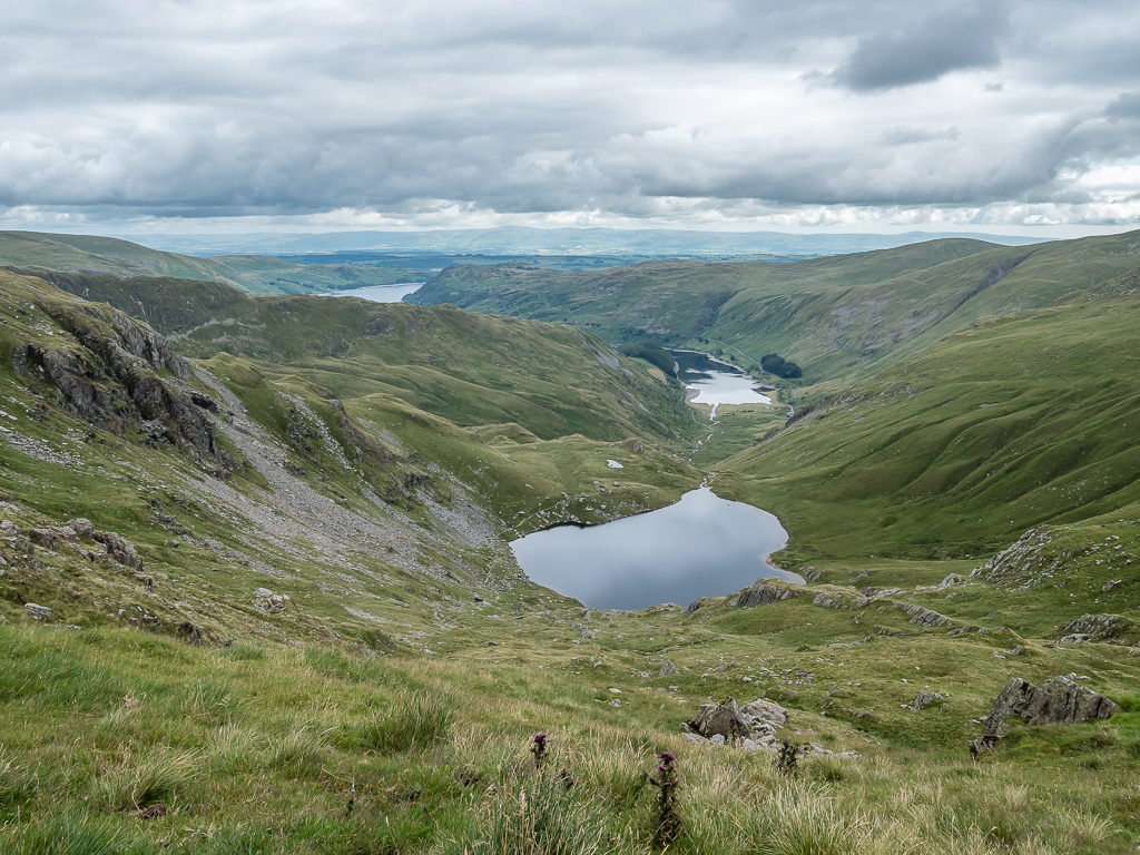
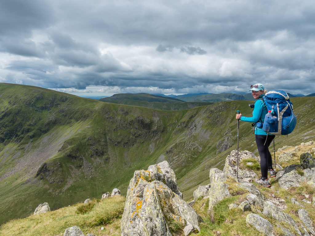
From Mardale Ill Bell, admiring the view of Small Water and Haweswater curving around the Mardale valley.
At the summit of Mardale Ill Bell looking to High Street.
Hiking up to High Street from Mardale Ill Bell on an excellent path – it was originally a Roman road that went straight over the summit!
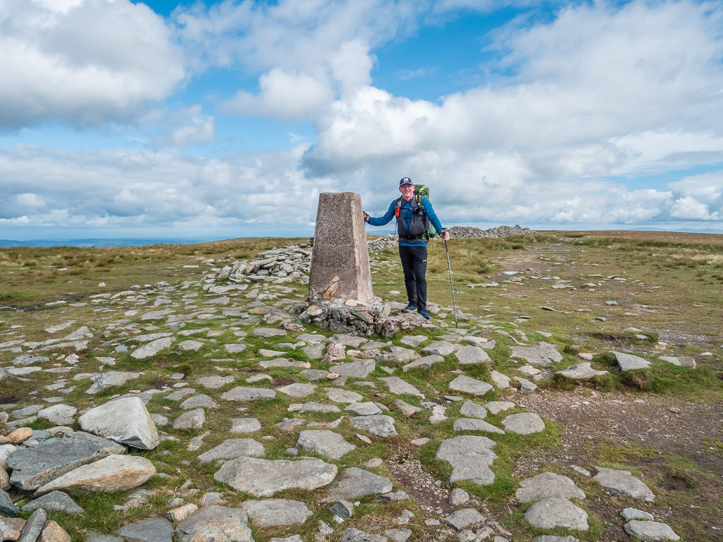
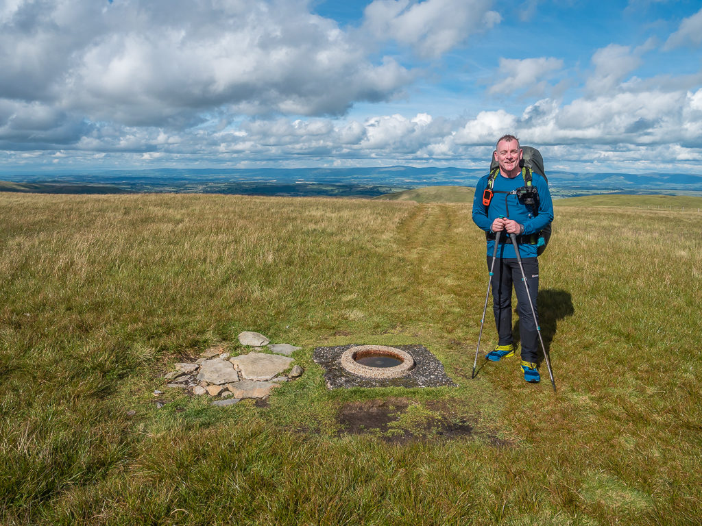
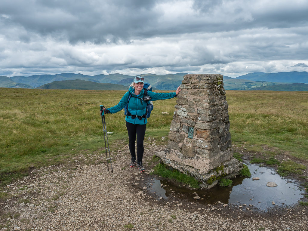
The OS trig point at the summit of High Street at 828 metres. It is the highest point in the far eastern part of the national park.
Looking towards Rest Dodd and The Knott from High Street.
Looking back to the Straits of Riggindale and High Street as we make our way to the trail junction in readiness to summit The Knott.
With the weather being markedly improved, there were a significant amount of runners out on the fells today putting us to shame and it felt much busier than yesterday with walkers – but we recognise that these particular fells are also more popular, especially as the Coast to Coast path crosses The Knott and Kidsty Pike – Kidsty Pike being the highest point on the C2C at 780 metres.
It was great to return to places we had visited previously, although if I remember rightly we had tremendously good weather in The Lakes at the start of our C2C adventure. We just hoped some of that good luck would show a resurgence now! The actual summit of Rampsgill Head was still as elusive as ever with us not knowing exactly the right spot to bag. There is a giant cairn in view as you hike up from The Knott, however when you reach it, it doesn’t seem to be the highest point – hence we continued along the path to a rocky area that seemed marginally higher – except that our Garmin tracker put the summit in a completely different place. So just to be sure, we tramped all over that fell top to ensure wherever the 792 metre summit really is, we bagged it without question before veering off to the summit of Kidsty Pike!
This was the second spot on Rampsgill Head that our Garmin indicated as the summit. We walked to them all just to be sure we’d bagged it!
Capturing High Street in all its glory from Kidsty Pike.
At 780 metres, on the summit of Kidsty Pike with High Street in the background and dramatic skies above.
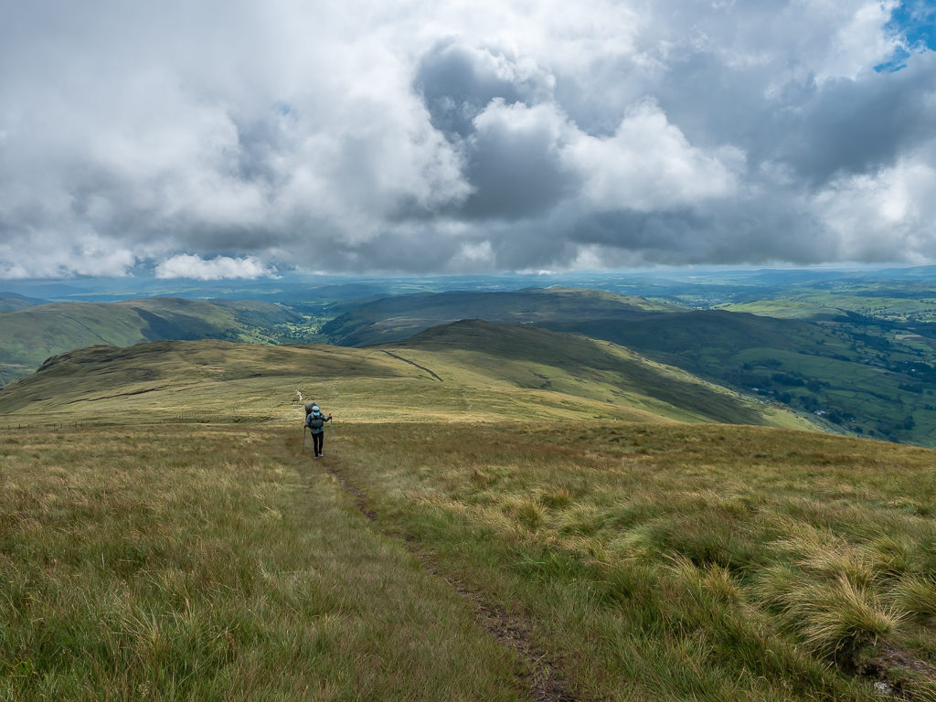
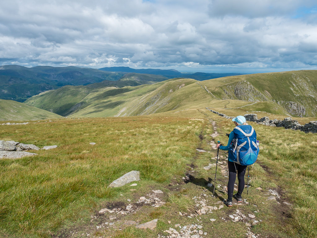
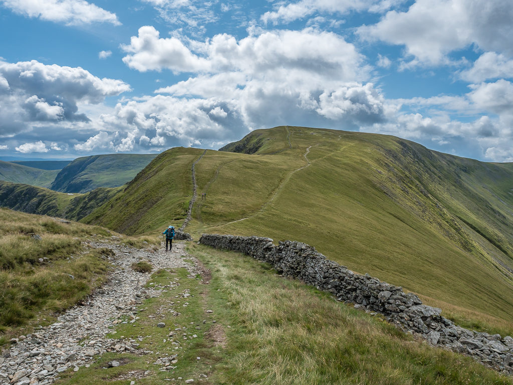
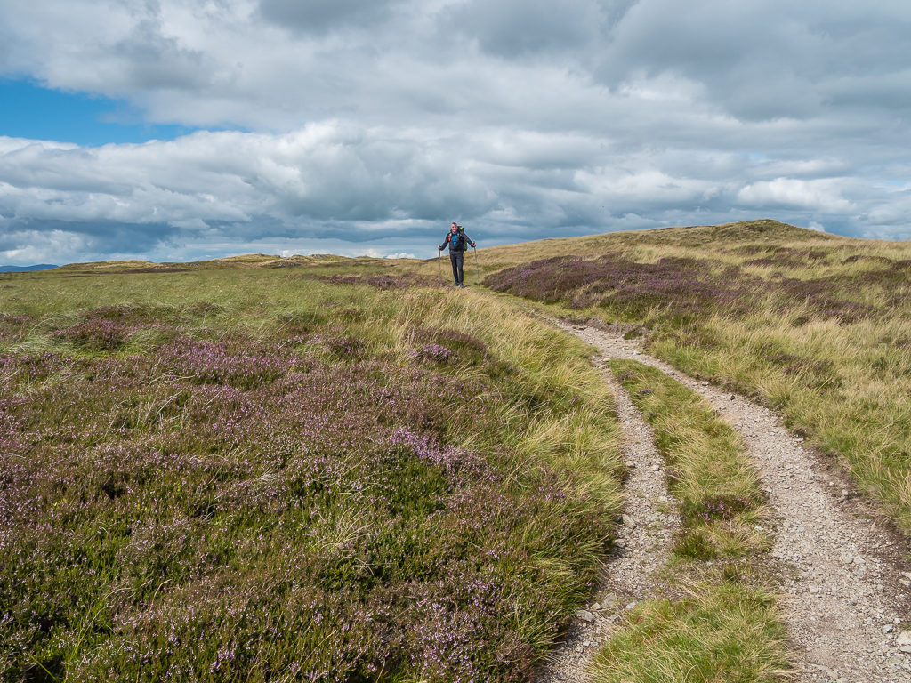
The walk then to High Raise (802m), Wether Hill (673m), Loadpot Hill (671m) and Arthur’s Pike (533m) wasn’t too taxing as the path follows a fairly straight line north gradually going downhill – except that the distance between the first and last of these summits is around 7km so it took us a while longer than we anticipated. With the path running along the tops also being so open and exposed to the elements, it was very windy and cold at times, which meant we were having to stop and layer up then stop again and de-layer when the sun came out for any length of time. (This was also why Wayne’s face was beetroot red by the end of the day – a combination of wind burn and sun burn – despite him applying Factor 30 sun cream at the start of the day!)
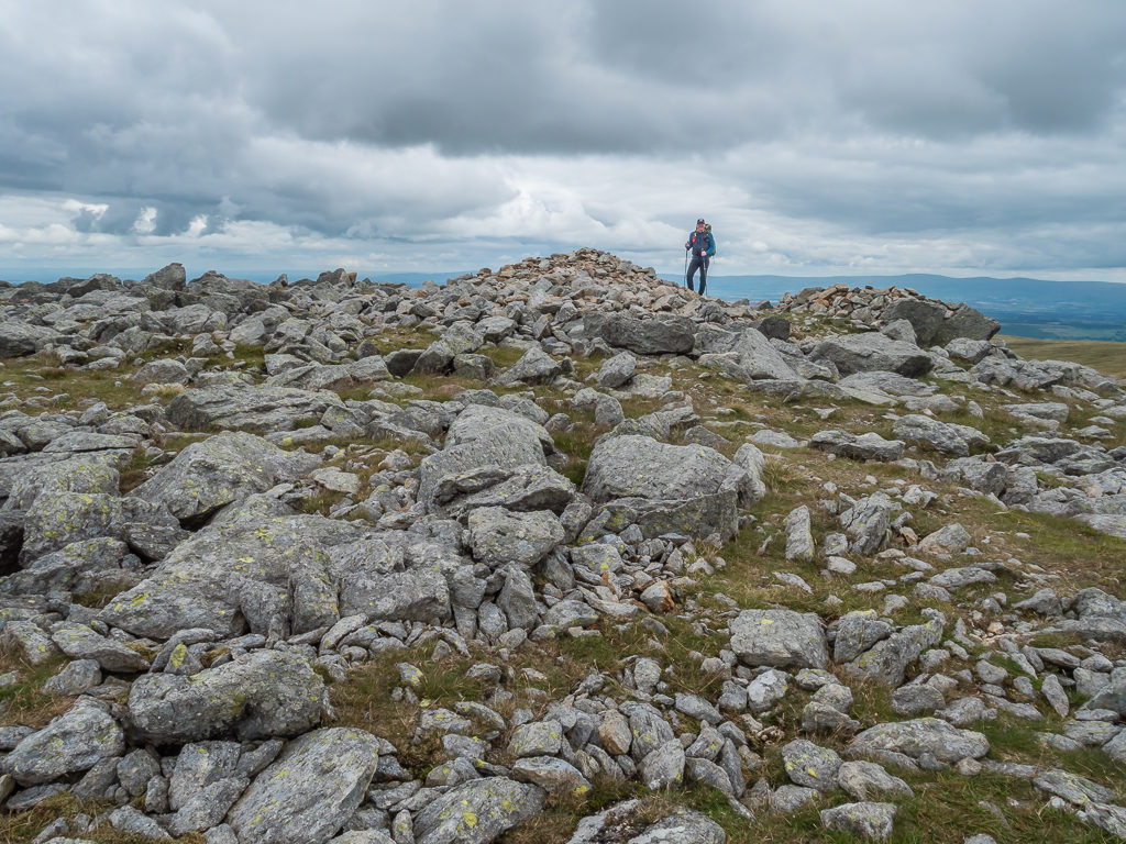
The summit cairn on High Raise (802m). The top is a rash of stones in contrast to the grass all around.
The simple summit cairn on Wether Hill (673m) and the well-worn track stretching along in the distance over to Loadpot Hill (671m).
It was a nice, easy walk over to Loadpot Hill, although very windy across the open expanse.
The trig point at the summit of Loadpot Hill (671m). It was our 9th summit of the day and we still had 4 to go!
Arthur’s Pike was well worth the effort however. Covered in swathes of purple heather, it reminded us more of the North Yorkshire Moors, and with tremendous views looking north to Ullswater, it quickly established itself as one of our favourite fell tops. (This was soon short-lived however when we discovered Hallin Fell with even better views!)
Looking east, away from Ullswater, it was like being on the North York Moors whilst heading up to Arthur’s Pike.
Looking out to Ullswater beside the summit cairn on Arthur’s Pike. This fell top has incredible views looking north.
Backtracking along the path from Arthur’s Pike, then veering off to the west we bagged the summit of Bonscale Pike at 529 metres. Then followed a steep descent straight to Howtown and the valley floor taking us back down to around 150 metres. Thankfully it was on grass so we had confidence stepping down the steep-sided mountain as we could plant our feet well, unlike the fear that coming down on scree at such a steep angle gives us. By the time we had reached the bottom our legs were shaking, such was the intensity of the descent and the build up of lactic acid thereafter! It just reminded us of the long, steep descents we had suffered when hiking the GR20 in Corsica back in 2015.
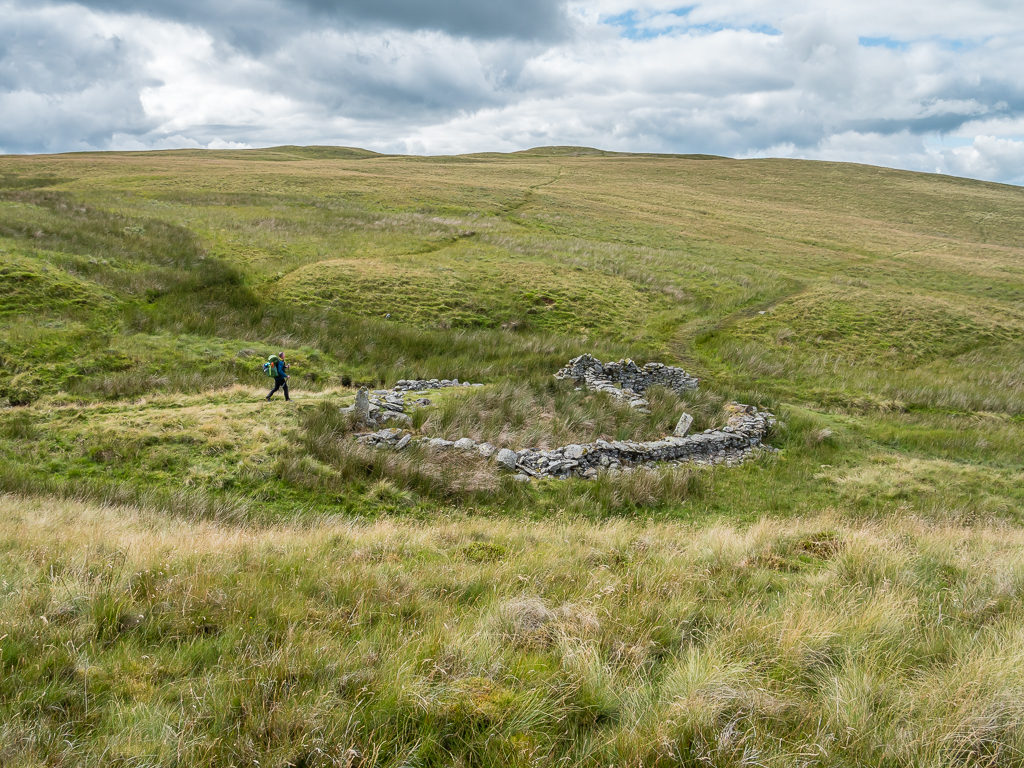
Veering off the main track to head over to Bonscale Pike we passed a derelict building at Swarth Beck.
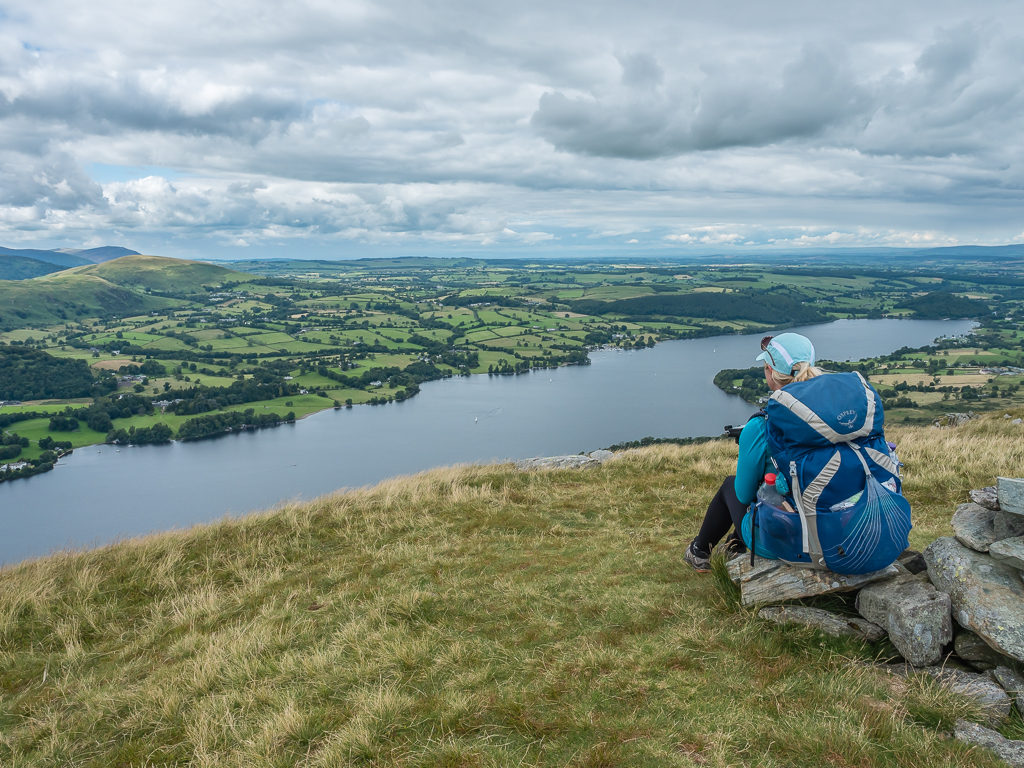
Enjoying a breather at the summit. Bonscale is a terrific viewpoint with grand vistas across to Hallin Fell, down to Howtown Wyke and across the lake to the mighty tops around Glenridding and Patterdale.
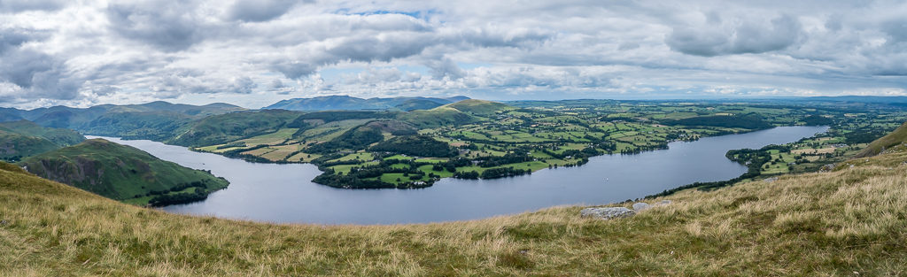
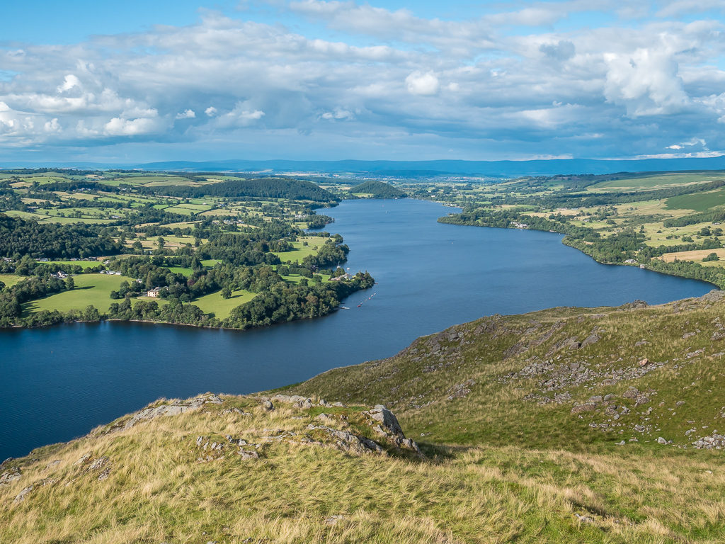
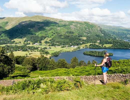
A panorama of Ullswater. At around 9 miles long and three quarters of a mile wide, it is the second largest lake in the English Lake District.
Looking onto Ullswater and Howtown as we begin a steep descent from Bonscale Pike.
Despite its steepness, we had a clear path to follow between the bracken that made for a quick descent.

Both our calves and thighs had endured an extreme workout by the time we reached the valley bottom, so we immediately stopped and had a much needed pack break before pushing on to the next fell.
We took a breather and a well-earned snack break as soon as we hit level ground in Howtown, one difficulty over, but with another about to begin. We were almost out of water and hoping there was a café or ice-cream van where we could purchase drinks as we were yet to obtain a new water filter. We were in no such luck however and with coronavirus still prompting extra precautions and restrictions everywhere, the only hotel in the tiny hamlet looked closed. So we had no alternative but to fill our water bottles up from the fast flowing stream that we passed en route to Hallin Fell and hope for the best after quenching our thirst by drinking without filtering – something we’ve only ever done abroad if we know the water source is from a natural spring and deemed safe to drink.
The hamlet of Howtown lies behind a small harbour on the east shore of Ullswater. The name Howtown means “farmstead on the hill”.
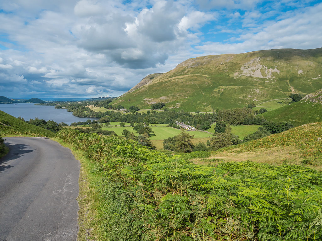
Looking back to Ullswater and Howtown as we walked up the road to begin our ascent of Hallin Fell.
The water seemed to give us a resurgence of energy and we soon powered up to the 388 metre summit of Hallin Fell. With an expansive grassy summit and a giant cairn marking the top, it also has far-reaching views across Ullswater. It was beautiful up there, so much so that if we hadn’t had an agenda to stick to, it would have made an excellent wild camp spot. (It’s definitely earmarked as one for the future!)
Following the wide, grassy path straight up to the top of the fell, which made for an easy climb.
Located on the southern end of Ullswater, Hallin Fell is one of the lesser visited fells meaning it is possible to get the summit all to yourself!
At 388 metres, the summit is marked by a large cairn that over the years has seen its size diminished from its original 12 foot height.
From the top of Hallin Fell you can see Ullswater laid out beneath you, whilst the magnificent fells of Martindale stretch out behind.
With several flat, grassy patches, the summit would have made a perfect wild camp spot had we not have needed to push on to keep to our schedule.
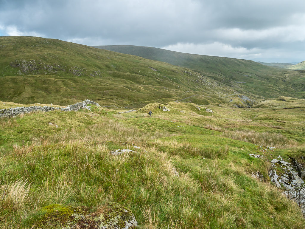
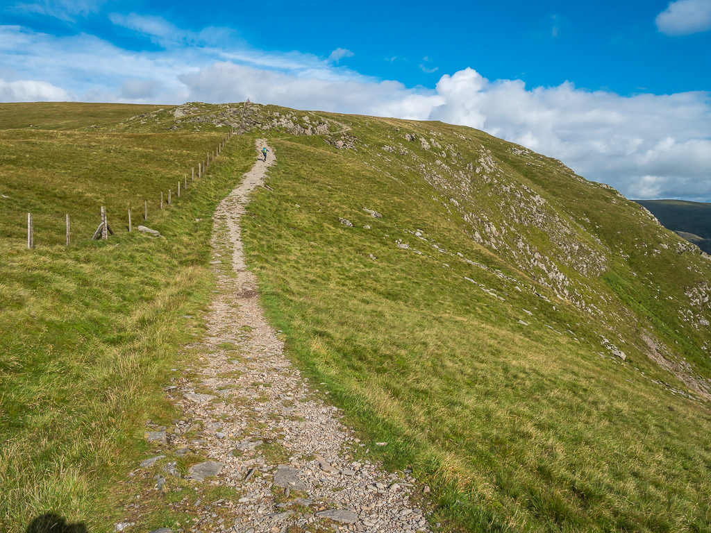
Returning to the valley floor, our final summit of the day at 432 metres was to be Steel Knotts – however it was directly opposite us on the other side of the valley, which meant we had another up and down to tackle. Taking the more direct ‘runners’ route’ up as we thought it would be quicker, the narrow, less-used path that we were now on weaved around the western flank of the fell through swathes of fern, gradually taking us up towards the summit.
Being the 13th summit of the day, of course we were now tiring, so we decided to do a bag drop at the Martindale trail junction and hike the rest of the way just armed with camera, Garmin to track the route and walking poles. It was the best idea as we suddenly felt lighter on our feet and had a lot more spring in our step. It seemed like we made it the rest of the way to the summit at a much faster pace, where we quickly took photos and made a video update then raced to get back down again. On our descent, we had clear views out towards The Nab, which looked quite intimidating as fells go as our planned route to the top was going to be directly up the steep front nose – but that would be tomorrow’s problem!
As we climbed up the western flank of Steel Knotts, we had a clear view across Martindale with The Nab dominating the scene to the south.
Relieved to have reached our thirteenth and final fell top of the day! At 432 metres, Steel Knotts has a fine summit pinnacle named Pikeawassa.
Returning to our bags, we then hiked down into Martindale where we were going to fill up with water from the river ready for boiling again that evening after making camp. Passing a farmhouse close to the river however, I decided to be brave and ask the owner if they could fill up our water bottles for us as our water filter was broken. Pleasingly, the lovely lady who answered the door obliged and a few minutes later we were hiking off 6 litres heavier. The kindness of strangers is a wonderful thing and we were even more appreciative of such an act given that everyone has become so wary of everything and everyone due to the global pandemic. She could have quite easily refused because of COVID-19! But thankfully she helped us as we would anyone else. (We must have accrued some good karma over the years!)
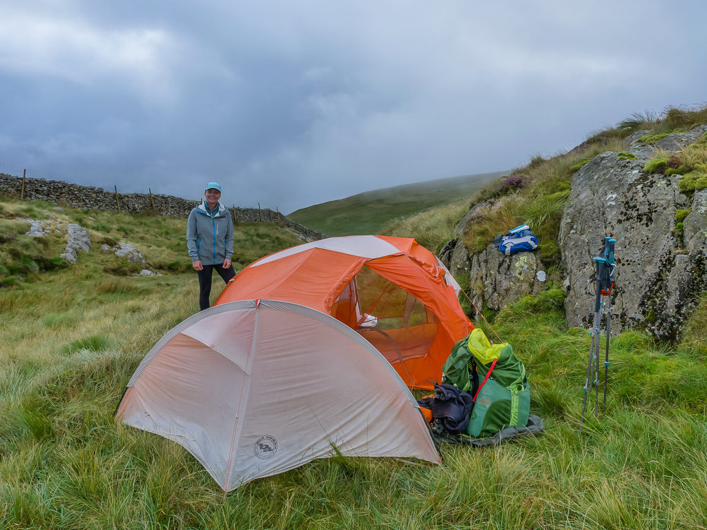
We were then on our way making the final climb of the day in search of a wild camp spot along Beda Fell, which was proving quite difficult seeing as much of the fell is covered in ferns and where there is grass, it grows in thick tussocks. Fortunately, we found a patch of ground just large enough to squeeze in our tent, that was shielded slightly by some rocks. As it was almost 9pm by this point, we actually didn’t care where we pitched – we just want to take off our shoes and sleep.
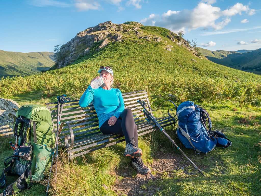
A perfectly positioned bench on Beda Fell where we could stop and take a long drink! We were so grateful to have had our bottles refilled from the farmhouse located just before the climb.
The north ridge along Beda Fell where we were hoping to find a wild camp spot. We would make the climb to the summit the following morning.
The sky around us was almost clear and we enjoyed the last few rays of sun before it dipped behind Place Fell across the valley. It was hard to believe that the weather forecast for the following day was so dire, as the current conditions were near on perfect for camping. It was warm, with barely a breeze, and it was almost silent except for the odd sheep bleating in the valley.
Squeezing the tent in amongst the ferns on a patch of tussocky grass. With the beautiful sunrise we were treated to the following morning, it proved to be a really picturesque wild camp spot.
We had wanted to film a ‘trail kitchen’ but we were so tired that dinner was a hurried bowl of curry flavoured noodles with a packet of tuna thrown in. We didn’t even have hot chocolates as we were so desperate to get our heads down. It felt good that we were on track with our plan and making good progress, yet we were also exhausted. But we did have to remind ourselves that it was only ‘Day 2′ and we were not yet anywhere near peak performance. We would have to build up the enormous stamina again that we had mastered on the PCT! (But not to the extent of hiking 30 miles a day, we hoped.)
Tuesday 4th August 2020, Wild Camp along Beda Fell to Patterdale, 15.6km, then Bus 508A to Windermere, followed by Bus 599A to Ambleside, 1 night at Easedale Lodge, £106 inc. breakfast
Peaks bagged: 22. Beda Fell (509m) 23. The Nab (577m) 24. Rest Dodd (697m)
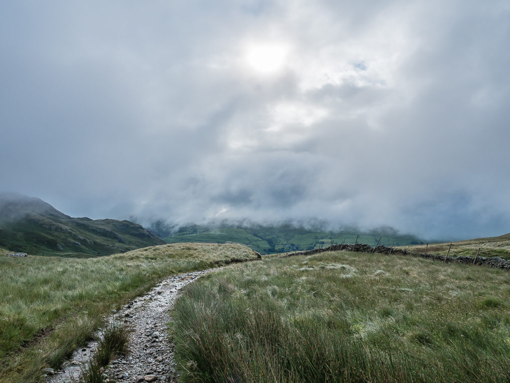
Having already checked the weather forecast for the next four days, we knew that rain would be falling for the best part of the next two days and that gusts of up to 40 miles per hour would be hitting the fell tops. With this in mind, we set an alarm today for 5am with the intention of being away from camp by 6am so that we could bag today’s six summits before descending to the village of Patterdale to resupply.
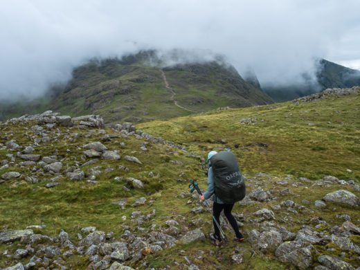
It was nearer to 5:30am when we actually got up, but we had still broken camp and were off up the trail making our way to the summit of Beda Fell at 509 metres just after 6am. The skies had been a deep purple red after sunrise, but then it had completely clouded over and before long rain had begun to fall. It was much earlier than expected, so we were glad to have got packed away so quickly. It soon became apparent it was a ‘waterproofs’ kind of day and we would have been real fools not to have brought waterproof trousers to the Lake District – but of course we did having sworn never to repeat our lack of foresight having omitted them from our kit list during our Pyrenees traverse last year. That being said, there’s only so much water they can fend off. Once gear reaches saturation point after being in persistent heavy rain for a time, even the best products fail!
Wow! What wonderful skies to wake up to.
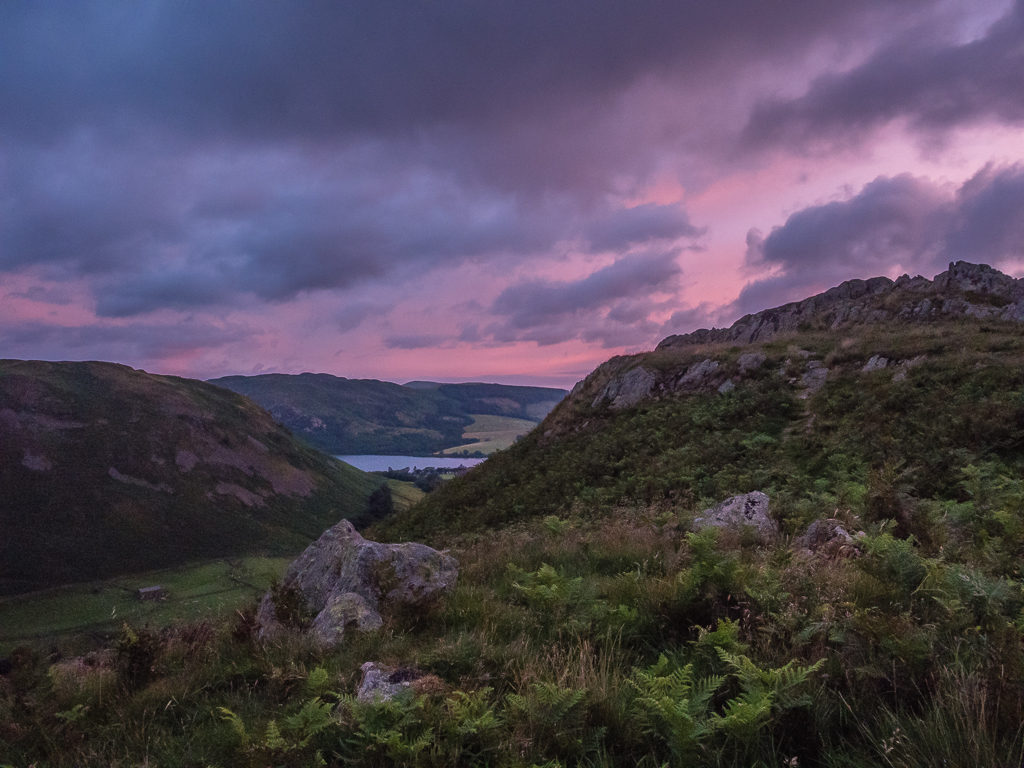
After such a tremendous sunrise, the skies were quick to cloud over and there was a dramatic change in weather.
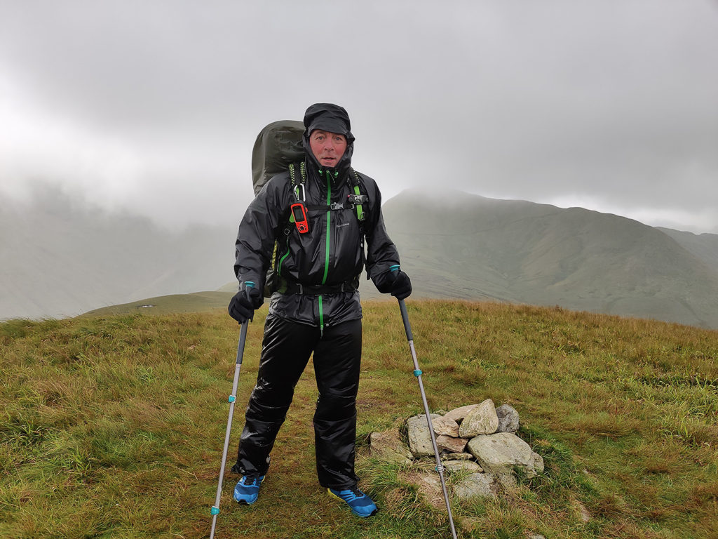
Smiling through gritted teeth as the rain began to lash down on the summit of Beda Fell.
With our wet weather gear on and putting our best foot forward, we then hurried on descending from Beda Fell in readiness to tackle the front nose of The Nab. Again, Wayne had picked the running route, which as we began making our way up didn’t seem too bad as routes go as we gained a lot of height quickly. The problem came when we reached the last section however, as we somehow lost the proper trail and had to make a scramble right up the steepest part of the front. We were literally digging our feet into grassy clumps and pulling ourselves upwards much akin to that terrifying time last year traversing Tuc de Marimanha in the Spanish Pyrenees that we said we never wanted to repeat.
Finally making it to what we thought was the top, we saw the proper path that we should have taken, which would have been slightly easier, but we didn’t have time to debate it too much as by now we were getting battered with heavy wind as well as rain. It was merely a false summit, so we had to push on further but after last night’s clear skies and calm night, we just couldn’t believe the dramatic change of the elements. Finally reaching the summit at 577 metres, we took a quick phone picture as our cameras were safely stowed in our packs, then hot-footed it down the backside of The Nab towards Rest Dodd.
The photos don’t show how wet and windy it really was up there! We were lucky to stay on our feet. A hurried shot on the summit of The Nab.
Looking back to The Nab as we made our way towards Rest Dodd.
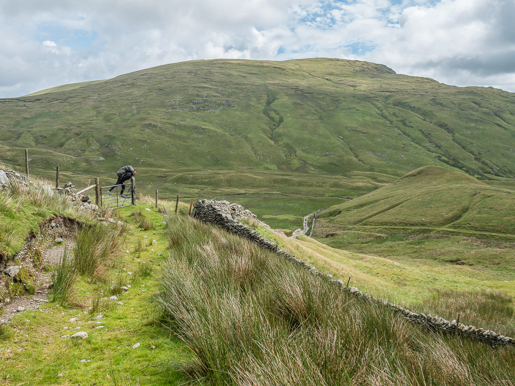
We had another climb, but as the summit was straight ahead at 697 metres, we still pushed on despite now getting battered by the 40 mph winds that had been forecast. It was a real struggle to stay upright in such strong gusts and at one point I did get blown over onto my bottom, but nevertheless we persisted. After reaching the summit however and it now being complete white out around us, we decided to bail and miss out the last 3 summits of our planned route. We had intended on hiking up Brock Crags (561m), Angletarn Pikes (567m), and Place Fell (657m) before hiking down to Patterdale to resupply, but in the current conditions we decided that it was just too crazy to continue, so had to abandon going to these summits. There would always be another day…
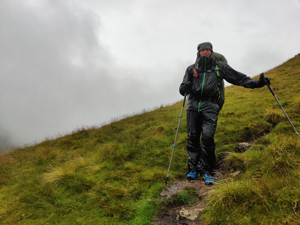
Starting our descent, satisfied that in the current conditions it would be crazy to continue.
Looking towards Angle Tarn before our final descent into Patterdale.
As the weather seemed to worsen still, we were glad of our decision and couldn’t get to the village quick enough. Our new plan was to try and get a bed and breakfast for the night in a bigger town such as Ambleside as that would also give us the opportunity to buy a new water filter. Win win! We could then look at our plans and re-route and see if we could pull in the three fell tops we missed later in our itinerary as we would be returning to Patterdale to bag another section at some point. Anyhow, it would not discourage us, as with any trip in England, the weather is always unpredictable.
Reaching Patterdale just after 11:30am, we were able to get the bus to Windermere just after midday, followed by a bus to Ambleside where we were lucky and picked up a room cancellation at the Easedale Lodge Guesthouse close to the centre of town. It didn’t matter to us really about the cost for one night as we just wanted to get warm and dry and have the opportunity to dry out all of our gear, which a room for the night provides. The room rate also included a full English breakfast the following morning, which was a great consolation after being forced off the fells.
Happy to have removed our waterproofs and got some warmer, dry clothing on whilst waiting at the bus stop in Patterdale.
Our room in Ambleside where we were able to re-organise our gear and thankfully get everything dry.
Tomorrow was also not looking good. With more of the same, we decided to stay an extra night and hike out again from Thursday – the problem being that the hotel we were currently staying in didn’t have any rooms available for the following night. So again, we had to come up with a new plan.
The time in town however gave us the opportunity to resupply in a larger supermarket, which meant we had a better choice of hiker foods. we were also able to buy a new water filter and a couple of other bits and bobs like talcum powder and Sudocream as Wayne was already experiencing some chafing, plus we were able to do laundry, and of course have an essential shower! Not only that, but we could actually have a full day’s rest, which was very much needed after our exertions the past few days.
Wednesday 5th August 2020, Easedale Lodge, Ambleside, Bus 516A to Langdale, 1 night at Old Dungeon Ghyll, £116 inc. breakfast, Rest Day
After spending the morning in Ambleside, we travelled to Great Langdale by bus in readiness for our check in time at the Old Dungeon Ghyll Hotel. We had picked this hotel as it’s location was perfect for starting what would now be our ‘Section 2’ hiking from Langdale to Keswick over 5 days.
The hotel is ‘oldy worldy’ but it sufficed for the night. To our surprise we found there was no TV or internet in the room, which actually allowed for some good rest, catching up with the blog and reading on our Kindles. As it was still raining in Langdale from when we arrived until when we lay our heads down for the night, we were pleased with our decision to stay off-trail until Thursday when the weather forecast for the week ahead was much improved.
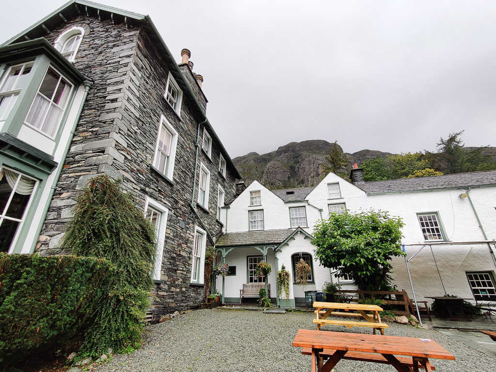
Arriving at the Old Dungeon Ghyll Hotel where it was still raining in Great Langdale.
Another day off trail gave us time to organise our food resupply for the next 4 days.
With 24 peaks bagged so far, we’re already a day and a half behind schedule, but we’re still optimistic that we can pull some peaks back in and maximise our time, especially as we get fitter and stronger. If anything our previous trails have taught us is that perseverance and resilience are key to being successful and we are good at motivating each other to keep going! That being said, it will be ever more difficult if bad weather persists and we get further behind schedule.
With the Lake District being well-known as one of the wettest places in England – let’s see what the next week will bring…
8 Comments
Feels a bit strange reading about your trip to a familiar area after all your global travels and hikes. Ambitious plan entering such an unsettled spell of weather as well. Replacing sun hats and sun burn with wet boots and wet feet I guess 🙂
It was a complete mixed bag of weather – as is always the way whenever we do any hiking at home!
It was good to get up to the Lakes again though after such a long time in ‘lockdown’.
Great read guys. I’ve climbed all those fells but mostly the other way round and your description brought back some great memories. I can particularly remember climbing down the steep face of the Nab and thinking ‘never again!!’ My knees have never forgiven me. Looking forward to part 2.
Thanks Steve! I had a quick look on your blog and think we should have stuck with your much more achievable goal of completing the Wainwrights in a leisurely fashion via day hikes and wild-camping trips.👍 It was definitely an eye-opener in terms of what a real challenge we had taken on, especially with the weather – so full respect to all those who have managed to summit all 214 in one continuous walk. It really is as hard as it sounds!
Wow,
Treksnappy again headed out for one of those big projects. You are doing really long daily mileages. Seeing all this bog just one word came into my mind: mosquitoes
However, You didn’t mention them, so the Lake District doesn’t seem to have “this” kind of problem 🙂 ?
Nice pictures. The Lake District is already on my list for a hiking adventure in the UK.
Looking forward for the next part.
Best Regards
Marcus
Thanks Marcus. No mosquitoes weren’t a problem for us, and in the UK thankfully they mostly feed on birds rather than humans! Its the biting midges we have to watch out for.
It was indeed a ‘big project’ – one that unfortunately we didn’t succeed with this time due to various reasons. They will be outlined in the blog posts – one of them being persistent bad weather, but also Wayne was ill for five days, which really put us behind schedule. As we were already walking for 12+ hours a day, we just knew we couldn’t make up the time. We were also limited on our trip duration as we both started back at work on Sept 1st, so we couldn’t extend our walking period.
We’re OK about calling it a day and coming home early. In the circumstances, it was the best thing for us to do. We had underestimated what a challenge it really is to summit all 214 fells in one go! We are definitely aiming to do the remainder at a much more leisurely pace.
All the best,
Danielle
HI Danielle and Wayne,
Just catching up with the Lake’s Diary. I thought I’d trace the route as we have a ‘Lakeland Round’ planned (next year hopefully). Out came our 4 Lakeland Explorer maps and I started to trace your route.
Here I am thinking, ‘ah yes they are here, I guess they will turn left soon after Windermere’….. errr no!
Ever northwards and I am starting to run out of map and then you turned and came back again!!
The Great British weather, as a stark contrast from all that overheating on the French/Spanish Pyrenean Route, made sure you felt right at home I’m sure!
Looking forward to reading more as you head off from Langdale to Keswick..
Best wishes
John
Hey John, nice to hear from you!
It was great to return to the Lakes for some proper fell walking after ‘lockdown’ – although our plan was rather ambitious to summit all 214 wainwrights in one continuous walk.
We didn’t take into account the good old British weather and how persistent rain and high winds can really impact on safety and accessibility for the higher summits.
Needless to say, we bailed more than once and didn’t complete the challenge we had set ourselves. All the same, it was still a good experience that provided us with some lovely wild camping opportunities.
We were following the fell runner’s route to reach as many summits as we could in the easiest way, which is why it might have seemed strange that we were having to go back on ourselves. (But as we found out, they weren’t always the easiest of ways!)
Hope you’re keeping well,
Danielle