
A Circular Hike From Wasdale…
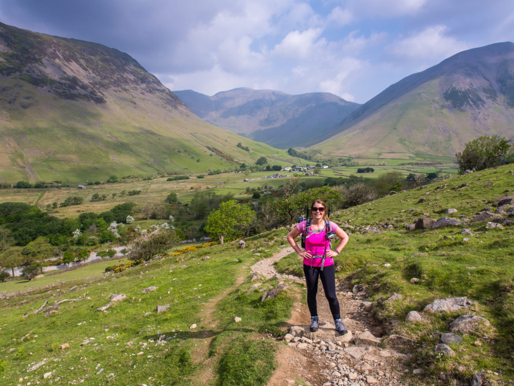
A ‘Bank Holiday’ weekend in England is usually synonymous with rain. Remarkably however, this Bank Holiday weekend was our first successful camping trip of 2016! Intent on sticking to our New Year’s resolution of embarking on a mini-adventure each month, we headed for Wasdale, a remote valley on the far western side of the Lake District.
Long delays and huge tailbacks due to the increased volume of traffic, as is typical on a national holiday, did not deter us. Sitting in a car for around six and a half hours after a full day at work just made it all the more important for us to get outside. Our gamble with the weather had paid off! Against all odds, and in complete contrast to the eastern half of the UK where it was cold and wet, we had our own little ray of sunshine radiating over Cumbria, urging us to get out onto the fells.
Our goal for this weekend was to summit Scafell Pike – England’s highest mountain at 978 metres (3,209 ft). It may sound small compared with the eight-thousanders located in the Himalayan and Karakoram mountain ranges in Asia, but hiking up almost a thousand metres from sea level is still a good day’s challenge! And we were ready for it!
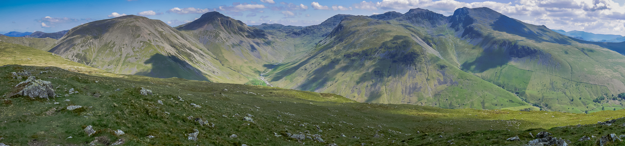
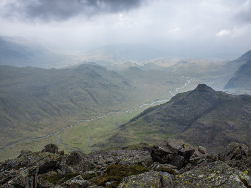
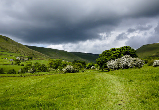
Looking onto the Scafell Massif from Yewbarrow, with Kirk Fell and Great Gable on the left hand side. (This panorama shot was taken during our 2nd day hike.)
It’s hard to work out from the panorama which is England’s tallest mountain. Peeking in the distance, Scafell Pike is the highest point for over 90 miles. But it is just 14 metres taller than its counterpart, Scafell – England’s second tallest peak at 964 metres. Depending on your perspective and viewpoint it can actually be hard to tell which is the higher of the two.
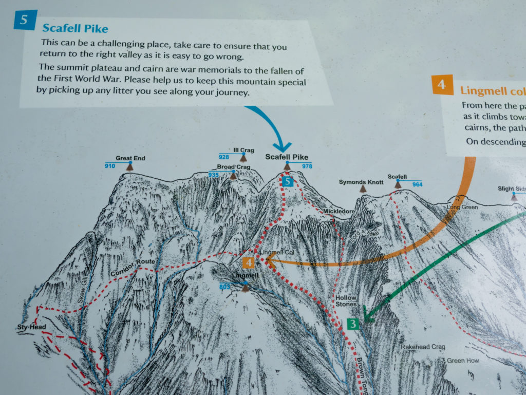
This route map is situated in the National Trust car park. If you look from the middle to the right hand side of the panorama photograph it is possible to work out the peaks of Great End, Ill Crag, Scafell Pike, Symonds Knott and Scafell respectively.
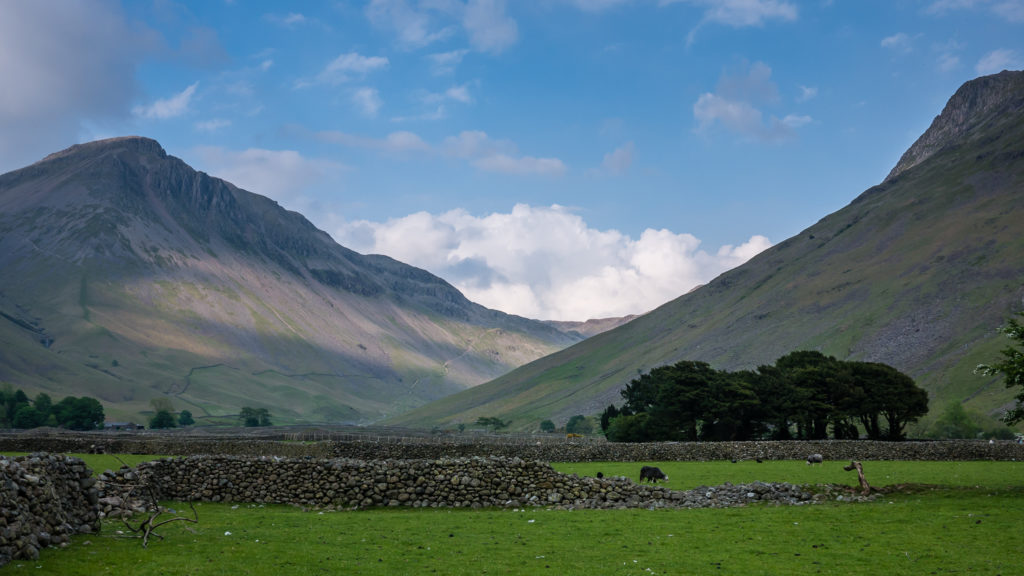
There are four main Scafell Pike routes which cater for all levels of expertise. They are from Wasdale Head, Great Langdale, Borrowdale and Eskdale; each route following the valleys that carry these names. We wanted to take the shortest and most direct route up to the summit. This is the Wasdale Head route, which takes around 2-3 hours. Therefore we camped in the hiker’s field for £5 per person, per night, next to the Wasdale Head Inn, which is nestled at the bottom of the pike. Camping here is on a first-come first-served basis, with no booking facility. Despite our late arrival on the Friday evening, we still managed to find a spot to pitch our small backpacking tent and stayed for three nights. (This is the only other camping option in the Wasdale valley as the National Trust campsite at Wasdale Head was fully booked.)
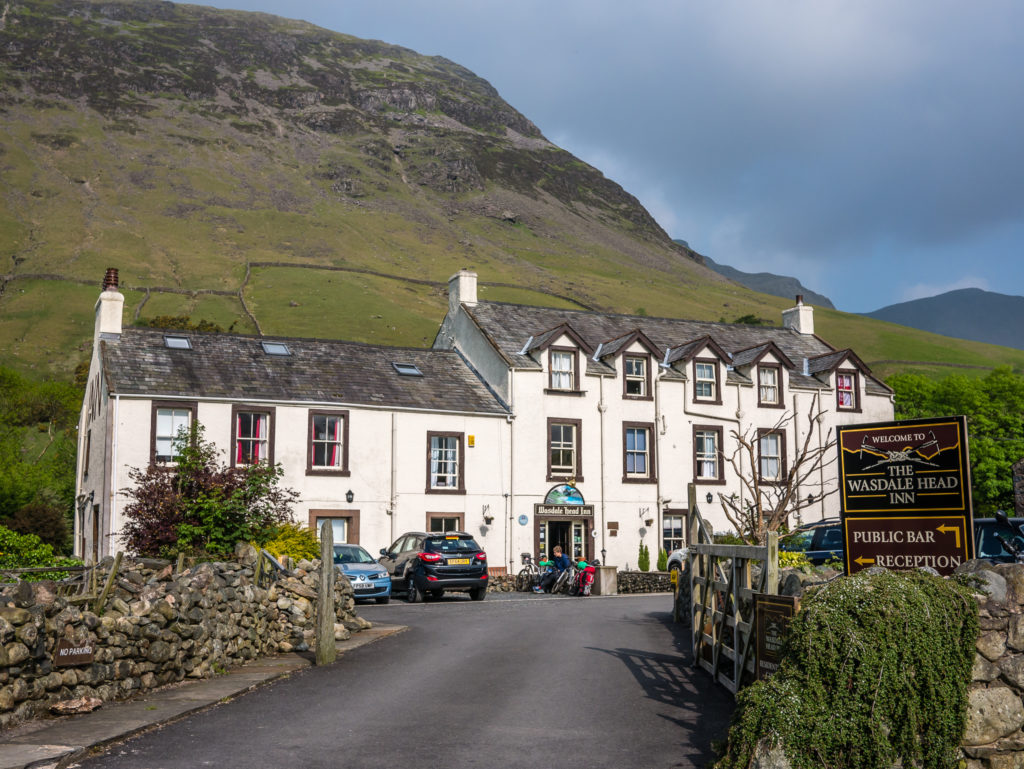
A tranquil corner of West Cumbria – The Wasdale Head Inn is situated at the head of remote and unspoiled Wasdale, approximately nine miles from the nearest main road, the A595.
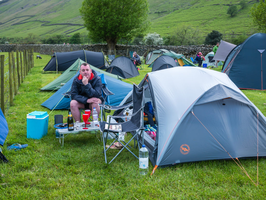
Adjacent to Wasdale Head Inn is their camping field, ideally situated for a day on the fells. Basic facilities are located next to the inn: new toilets exclusively for campers, a new sink/washup area and hot showers for an extra £1!
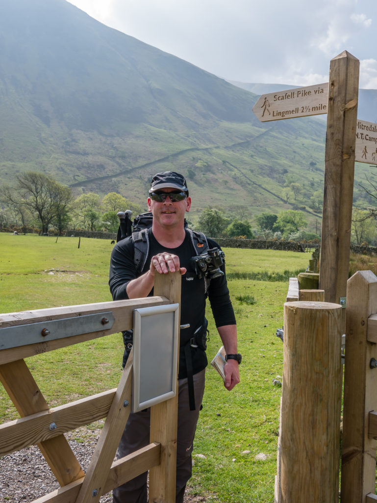
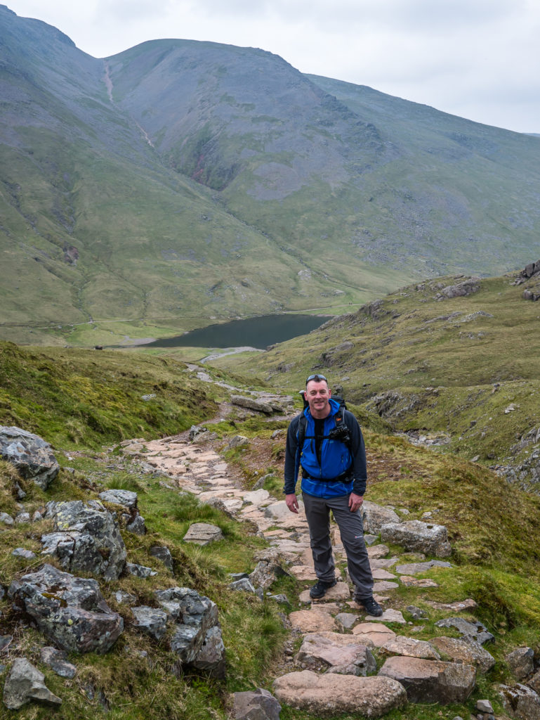
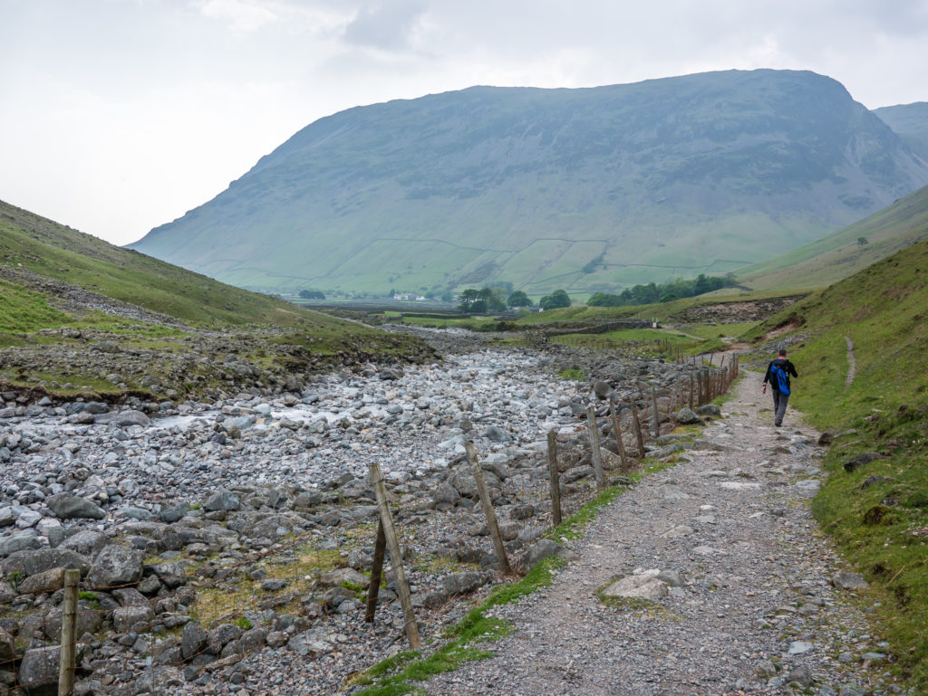
Setting off for Scafell Pike from Wasdale Head.
Although the route is signposted at the start and has cairns as waymarks, it is recommended that you should always carry a map as there are route variations along the trail, and it is easy to take the wrong path. (Particularly with low visibility and/or bad weather.)
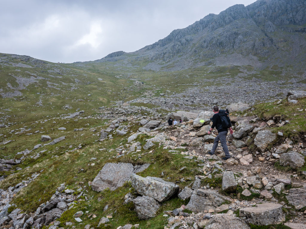
Starting the long pathway uphill… But with a spring in our step as the weather seemed promising!
The walk from Wasdale Head is fairly steep, and much of it is up a staircase of rocks. We followed the path that runs alongside Lingmell Gill, crossing it around the 300 metre mark. When you reach a height of around 550 metres the path then forks – left for walkers and right for those not adverse to scrambling! The pathway that leads to the right, which is the Hollow Stones route past Lord’s Rake to Mickledore, is the much more challenging option.
We had been very optimistic waking up to a clear blue sky at 7am, but by mid-morning the clouds were rolling in. We just hoped it would remain dry!
Following the stepped pathway. After a rapid climb, we had to catch our breath. We had already climbed around 300 metres – about a third of the way up! Looking back down the incredible valley onto Wast Water.
Continuing with the ascent on a stony track. The National Trust looks after 20% of the Lake District and spends a huge amount per year on path maintenance. Reconstruction and repair work to this popular walking route costs £160 per metre, which works out at around £250,000 per mile!
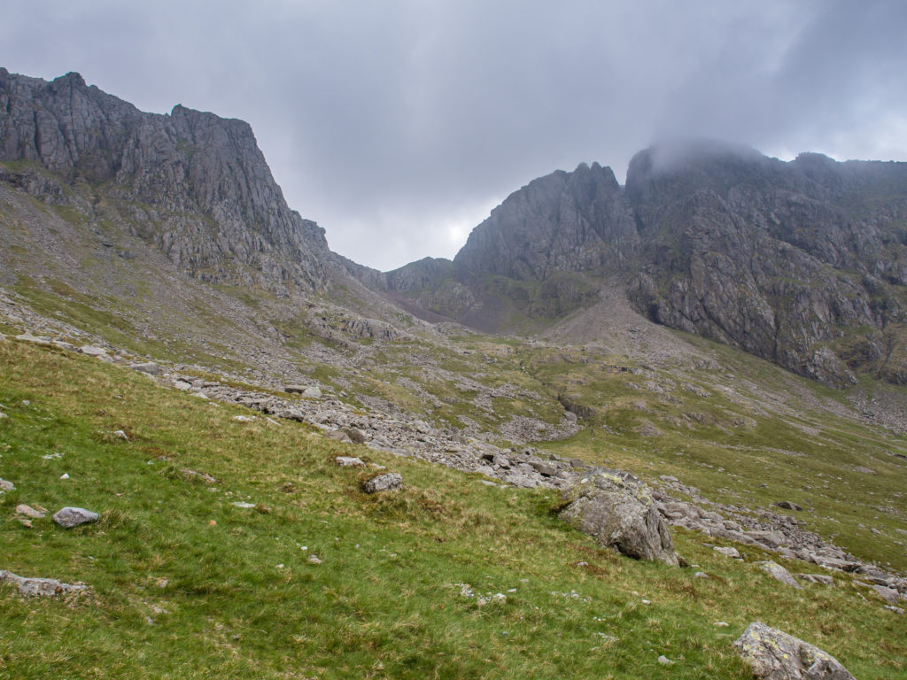
Looking across to Mickledore, the scrambler’s route to the summit of Scafell Pike, which is much more challenging. Even the approach to Mickledore looks intimidating!
We avoided the more challenging route to the summit of Scafell Pike via Mickledore as we had read that current conditions are potentially hazardous. As the ground has had limited foot traffic since winter, it remains very fragile and the final ascent contains loose scree and boulders which are dislodged easily. Despite gaining experience with such terrain from the GR20 route last summer, we never enjoy scrambling over steep, loose ground. In our opinion, it does not make for a fun day hike, so we were quite happy taking the ‘tourist’ route!
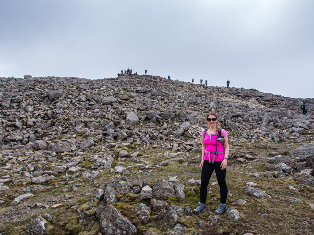
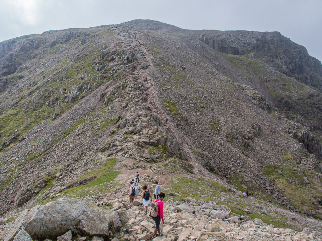
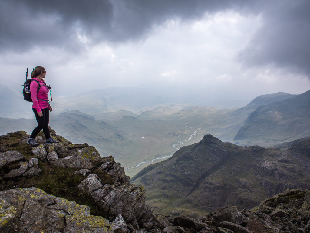
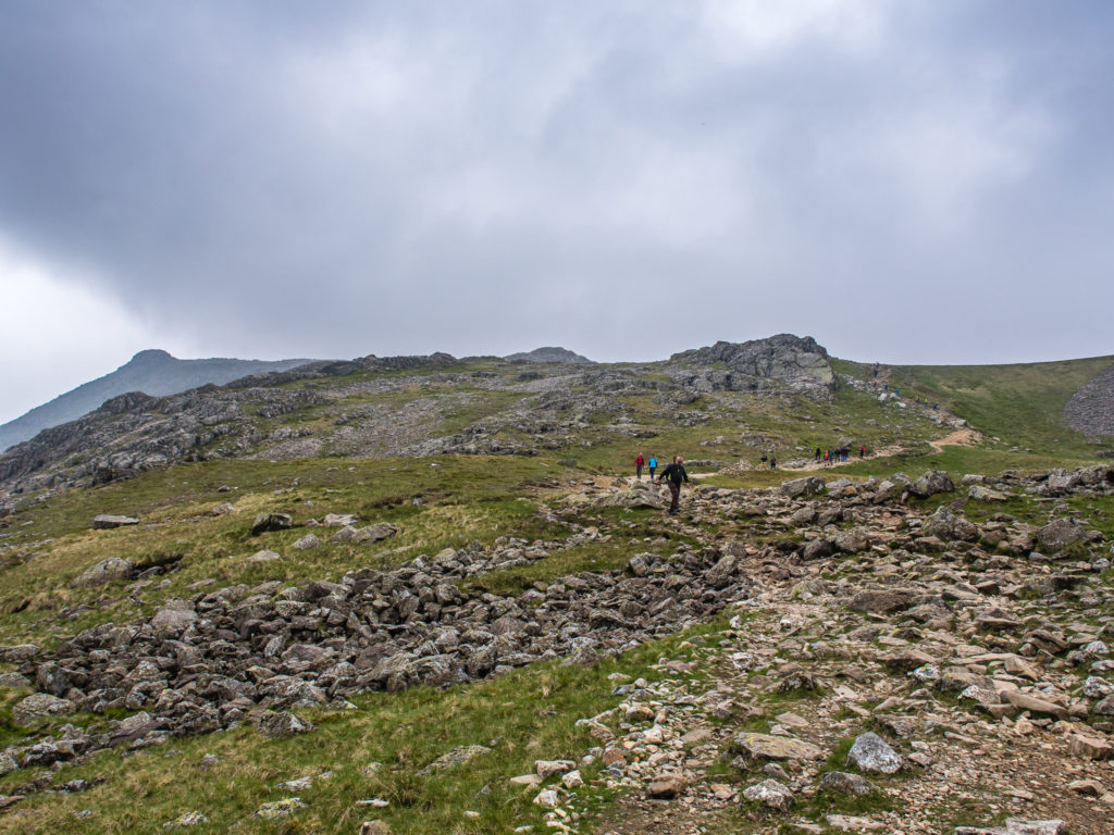
The last 300 metres or so steadily climbs on rocky ground up to the summit. Cairns mark the way, but the route is easy to see in good visibility and with plenty of other walkers around you know you are headed in the right direction. It took us around 2 hours to reach the summit from Wasdale Head. By the time we got to the top, we had limited views due to mist and cloud rolling in over the surrounding mountains. On a clear day however, I’m sure it would offer the ‘wow factor’ as the platform provides 360 degree views of the dramatic mountain scenery as far as the eye can see. (It’s doubtful you’ll have the platform all to yourself though!)
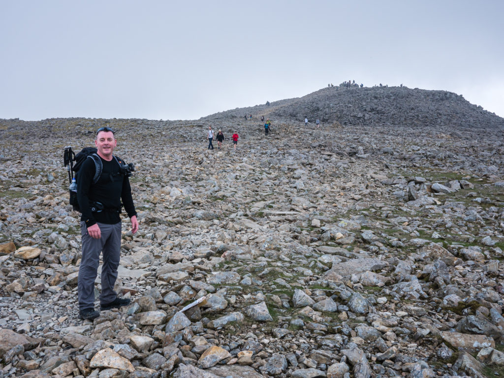
The busy summit of Scafell Pike in the distance. It is estimated that Scafell Pike was formed more than 450 million years ago, and is part of the Borrowdale Volcanic Group of igneous rock formations.
The summit of Scafell Pike is covered with an extensive boulder field, composed of shattered rocks formed through weathering and frost action. Therefore the last 100 metres or so involves clambering over these boulders to reach the huge stone-built platform that signifies you have finally reached the top.
Prepare for a very rocky approach to the summit. After all your efforts, take a deep breath and hope to be rewarded with a great view. It could have been worse for us – it was not complete whiteout and thankfully the rain held off!
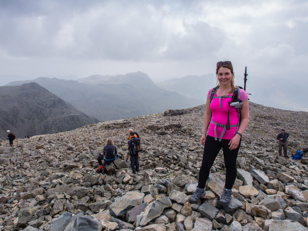
Our brief moment on the summit, whilst sharing it with several other visitors.
Unlike some well-known mountains, there are no buildings or ruins at the top of Scafell Pike, just a stone-built platform that signifies you have reached the summit. The summit plateau and cairn are war memorials to the fallen of the First World War.
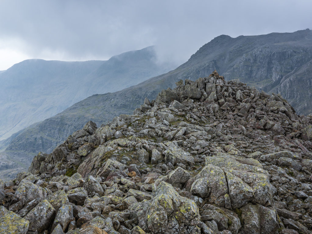
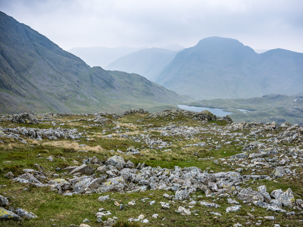
Leaving the summit before working our way around the mountain range leading to Great End.
We read several accounts that the summit plateau of Scafell Pike with its vast boulder field can be extremely challenging, even more so in the mist, rain and wind that is the usual weather for the top. Although we weren’t able to see the surrounding mountains in all their glory, we felt extremely lucky to have hiked there on a day with good navigational visibility. We wore hiking boots with good grip and to support our ankles, and were confident with both route finding and placing our feet, issues that can be hazardous in poor weather and for the unprepared.
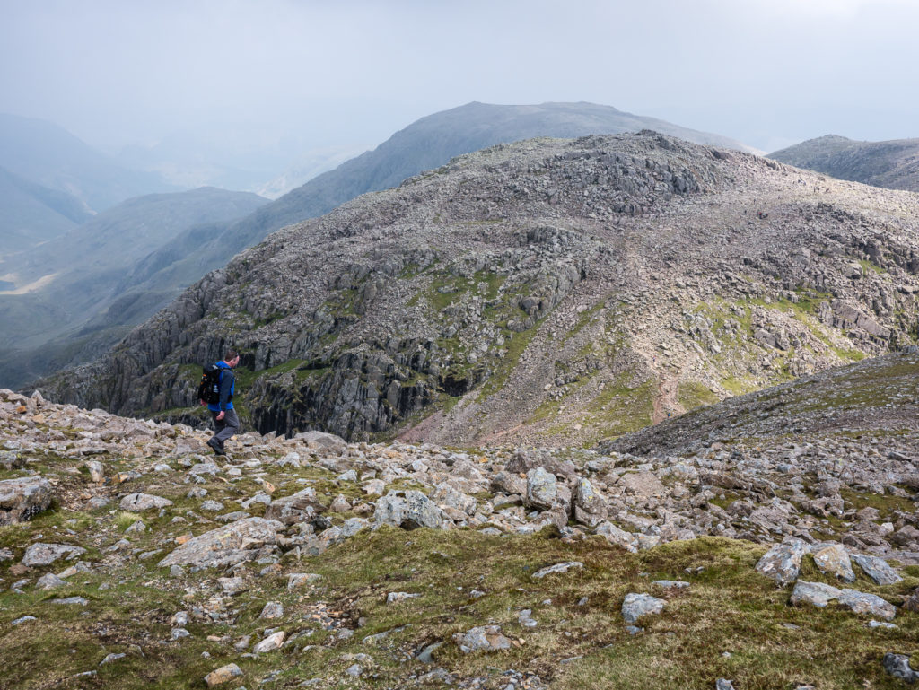
Enjoying a breather after coming down the other side of Scafell Pike, looking towards our route leading to Great End.
Following the stony pathway towards Broad Crag, England’s 5th highest mountain at 934 metres.
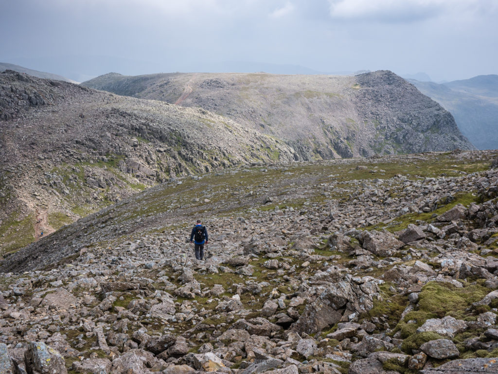
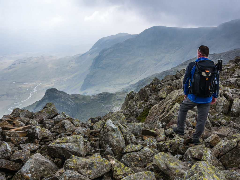
After coming down from Scafell Pike, the views started to improve!
As it was only lunch time after reaching the summit, rather than returning to Wasdale Head via the way we had come, we followed a circular route taking in the summits of Ill Crag at 935m, Broad Crag at 934m, and Great End ridge at 910m, which are respectively the 4th, 5th and 8th highest mountains in England. (Although Ill Crag and Broad Crag are not listed in Wainwright’s 214.)
Whether Wainwright had listed them or not was of little importance – we decided to bag those peaks anyway! Despite the mountain being busy today, especially with it being a Bank Holiday, much of the rest of our circular route felt quiet. In fact, we were the only hikers at Ill Crag, so we savoured the view for ourselves and took a lunch break at the summit cairn.
The trail becomes a little busier again with people heading for Great End ridge.
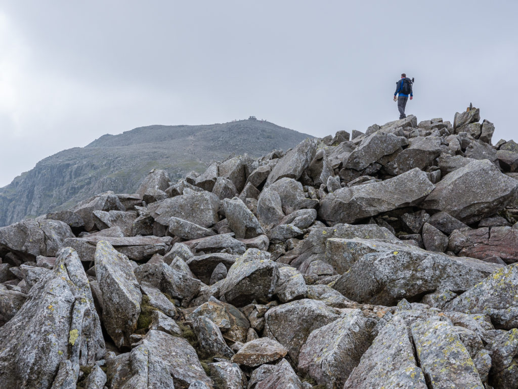
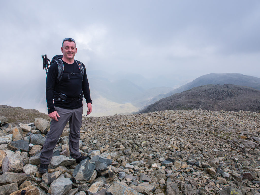
From the summit cairn of Broad Crag, looking back to Scafell Pike in the distance.
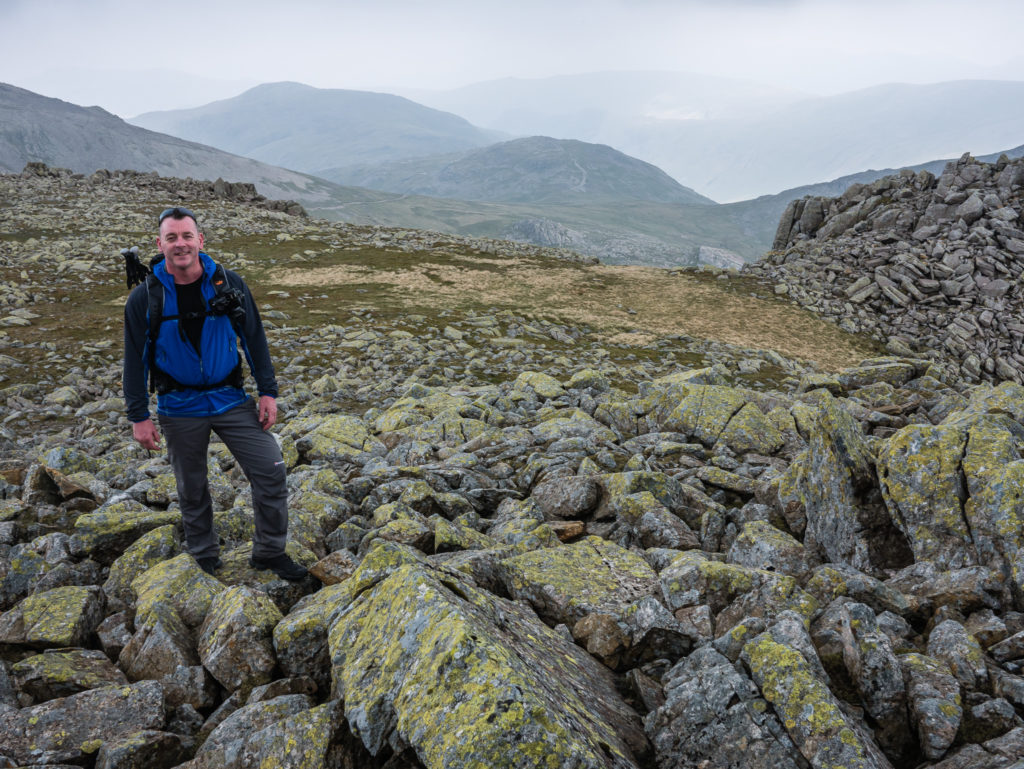
We’re not technically ‘peak baggers’, but we went to each summit cairn en route simply as they were quiet so had them to ourselves to enjoy! (Although we have since purchased a Wainwright map to tick and date each of his 214 summits!)
Making our way to Ill Crag – England’s 4th highest mountain at 935 metres. It is just one metre taller than Broad Crag.
From the summit cairn of Ill Crag, Scafell Pike can just be seen in the distance on the far right-hand side.

Taking in the view under dramatic skies…
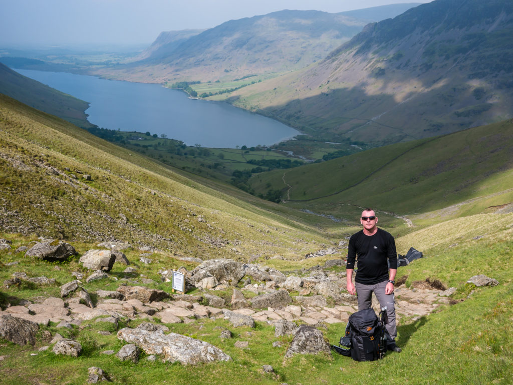
Looking down to the River Esk in the next valley.
We still had a long way back to Wasdale. Today’s total distance was just over 11 miles.
Returning to the trail and making our way to Great End – England’s 8th highest mountain at 910 metres. This was another busier section of the route.
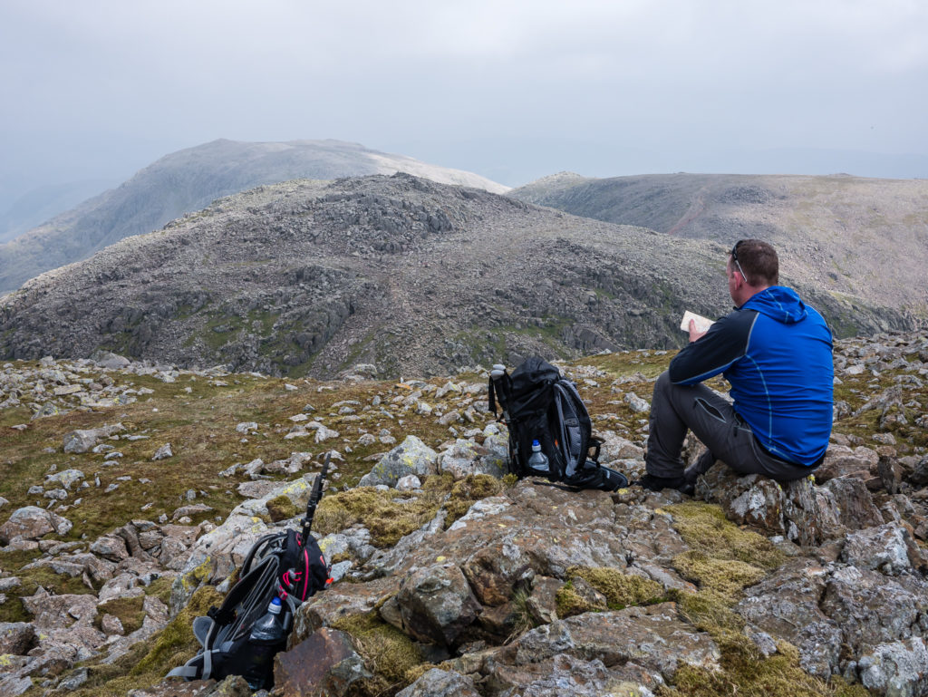
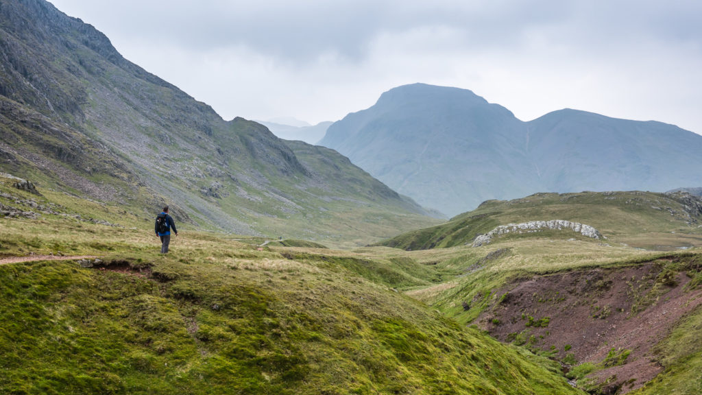
From Great End, we carried on further to the summit of Allen Crags, a little lower at 785 metres. Again, it was worth the extra effort to have a peak to ourselves. From here, our route took us past a very calm and serene Sprinkling Tarn to Sty Head, then back down the valley on a gradual descent rejoining the trail alongside Lingmell Beck. We had decided to save the ‘Corridor Route’ for a future adventure, especially as this looked very busy with several large walking groups snaking along the mountainside.
Our final peak of the day… Continuing on to Allen Crags.
Leaving Allen Crags and following the trail to Sprinkling Tarn.
It felt good stretching the legs out and walking on a relatively flat section at last!
Descending to Sprinkling Tarn on a paved section that was much easier underfoot.
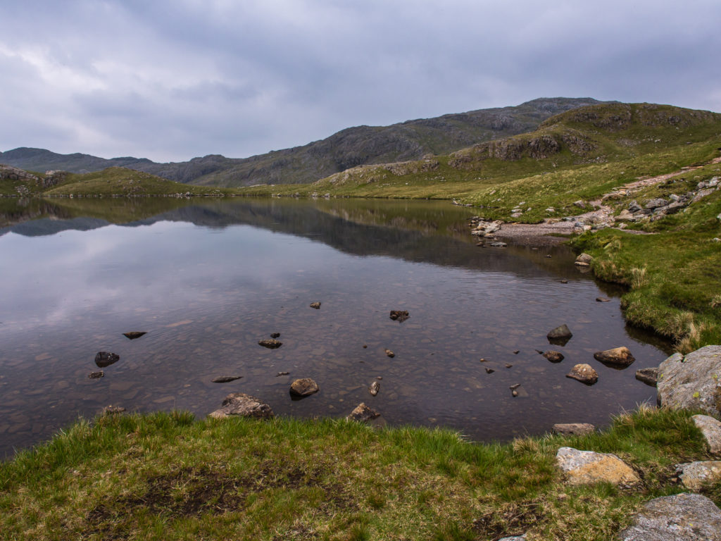
The clear but cold water of Sprinkling Tarn. We agreed that this would make a good wild camping spot as there were several flat grassy sections in this area perfect for pitching a tent.
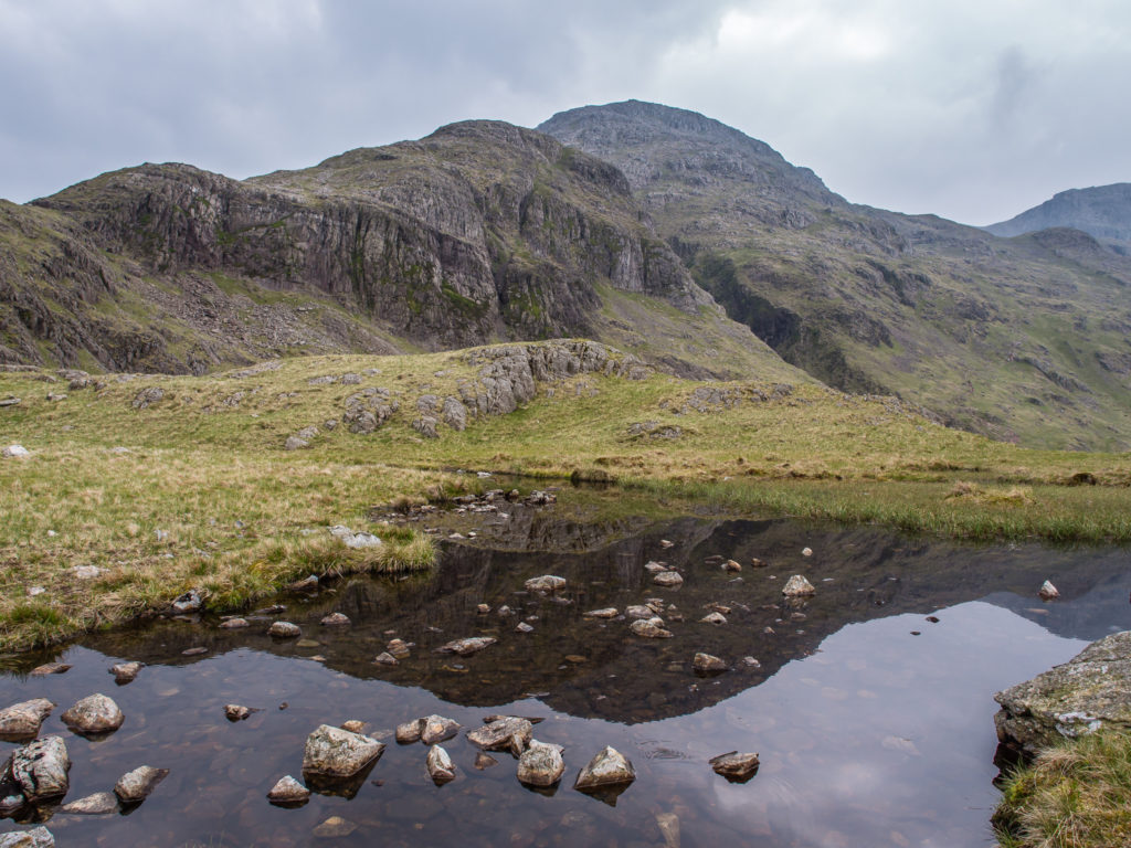
Reflections on a smaller tarn we passed.
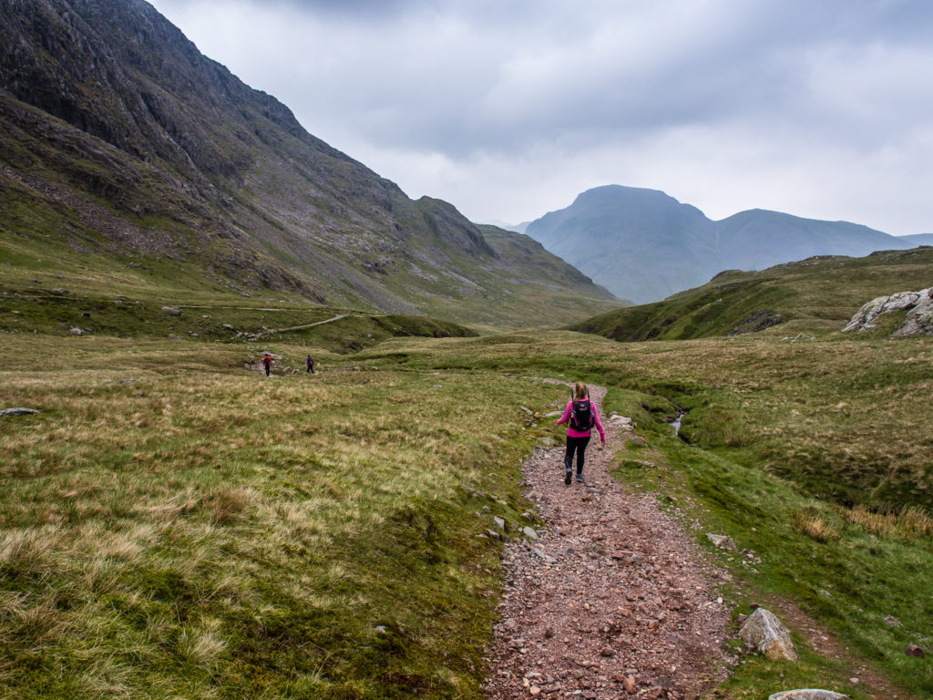
After Sprinkling Tarn, the path then meanders downhill past Sty Head, overlooking Styhead Tarn, where we spotted a wild camper covertly pitched near some large boulders.
Looking across to Lingmell Beck. The Wasdale Head Inn was beckoning us on in the distance!
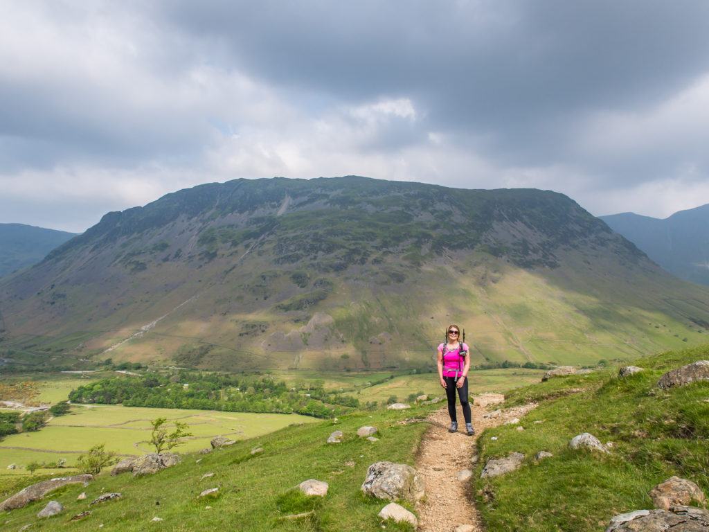
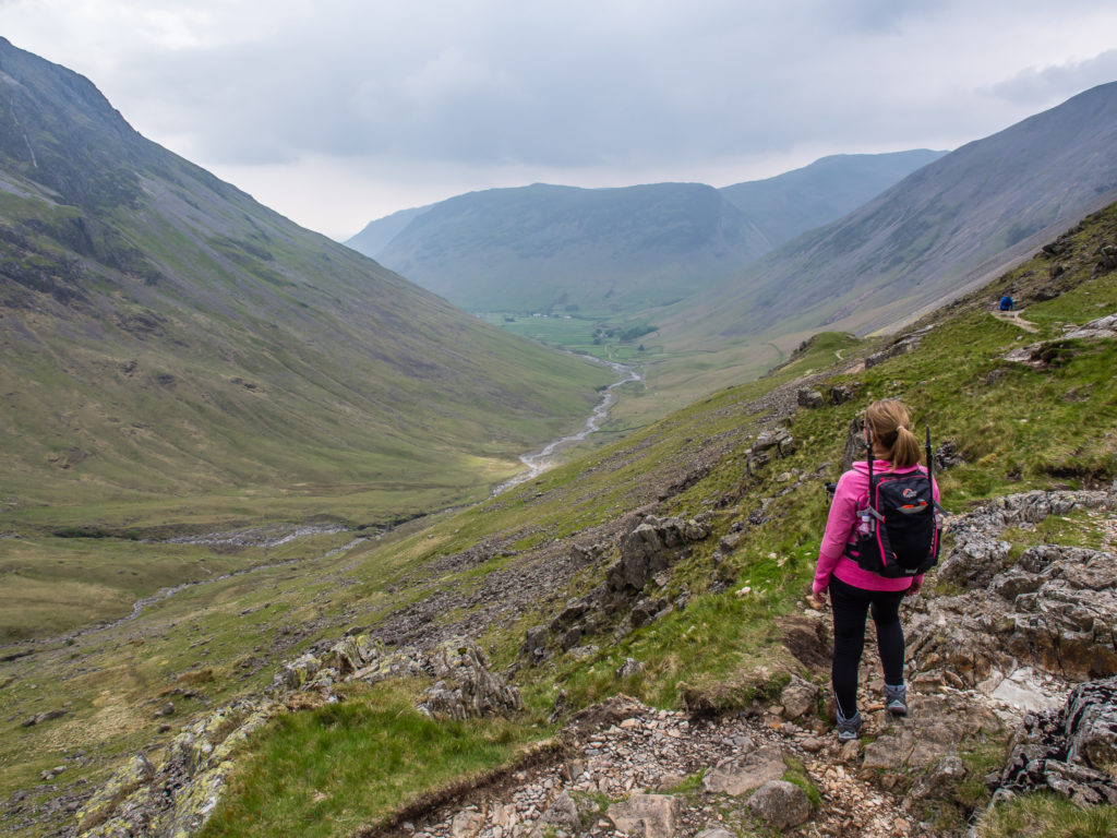
Picking up the pace on the flatter sections, it didn’t take us long to reach the valley floor. Looking straight ahead at Yewbarrow, our first ascent earmarked for Day 2.
Our circular route took us right back to Wasdale Head. Not only does the valley have the most direct access to England’s highest mountain, but it is also home to England’s deepest lake, Wast Water. Measuring three miles long, just over half a mile wide, and a staggering 258 feet deep, the lake is what also draws swathes of visitors to this lesser known Lake District valley. We walked alongside part of the lake the following day before our ascent up Yewbarrow and it really did look inviting. (But more of that, including pictures in our next post!)
No sooner had we stepped off the trail, were we then stepping foot inside the Wasdale Head Inn, which was bustling with outdoor enthusiasts of all sorts. The meals in there looked amazing, but as we’d brought food of our own, Wayne was all prepared to cook up a campsite feast as usual. So we took off our packs and relaxed a while at one of the picnic benches by the river, enjoying the tales of other hiker’s adventures that day. And of course we had a pint or two, too!
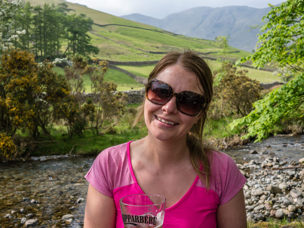
Enjoying a much deserved pint of cider at Ritson’s Bar adjoining the Wasdale Head Inn.

Too true!
Our view from the campsite.
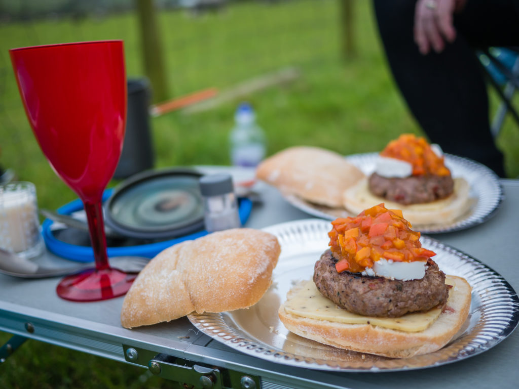
Gourmet chilli burgers with goats cheese and homemade tomato and sweet bite pepper relish. (We believe in hearty meals as reward for our efforts. Camp food does not have to be freeze dried and out of a packet!)
Take A Look At Our Circular Route
You can export a GPX/KML file from this by clicking on the Scafell Pike link.
All in all, it was a successful first visit to the Wasdale valley and first trip up to the summit of Scafell Pike, whether it was the ‘easy’ option or not, we can proudly say we’ve been to the top of England’s highest mountain. Having already summited Mount Snowdon, the highest peak in Wales, back in 2013, that now just leaves Ben Nevis… Scotland’s great ‘Beinn’, which is also Britain’s highest summit at 1,344 metres.
With our trip to Sweden to hike the Kungsleden rapidly approaching, we’ll maybe save that one for next year!

8 Comments
Oh how I love the Lake District. Great hike. Great read.
It certainly was! The Lake District feels like a home from home for us 😀
When do you of to Sweden?
We fly out on August 12th!!! Very excited to be heading off on a long distance trail again 😀
Fantastic photos, great commentary. I have climbed scarfell Pike twice, 3 peaks, and on its own with friends (in February), i plan to do it again this year with my daughter in May, can’t wait, we have climbed Snowdon, she wants to do Scarfell. Dabbling in the technology that’s available now, and seeing your experience for one, i have just brought a GPS for the 3 peaks. Last time i did the 3 peaks scarfell was in the dark, and a nightmare, we missed a crucial way point, walked ages for no gain, hopefully this time it will be OK.
Hi Steve,
Thanks for reading and commenting!
Sounds like you’ve had some great hiking experiences and have passed your passion on to your daughter.
Good look to the both of you for your hike in May,
All the best,
Danielle & Wayne
Excellent read. I am going up there this weekend, and this was very useful and entertaining. I may start writing on my travel blog again, as I had stopped writing, thinking everyone now gets all their information from Wikipedia.
Hi Kudakwashe, thanks for reading and taking the time to comment.
I hope you have a great walk up Scafell Pike and the weather is kind.
Definitely write your blog! People still love to read others’ experiences and relate in a more personal way.
Happy hiking!
Danielle