
Taking A Side Trip Into Sweden’s First National Park…
Day 17 on the Kungsleden and today we were witnessing the towering peaks of the Stora Sjöfallet National Park, known as Stuor Muorkke in Sámi language. This wilderness area is located 200 kilometres north of the arctic circle and forms another piece of the World Heritage of Laponia.
Designated a national park in Sweden in 1910, Stora Sjöfallet is significant as it was also Europe’s first national park. Here the landscape is a mixture of imposing mountain ridges, deep sculpted valleys, high boulder fields and beautiful pine primeval forests – hence the green slopes of mountain birch and ancient pine are still used as foraging areas by the Sirges and Unna tjerusj Sámi communities.
As in the rest of Laponia, this is an area where you can watch reindeer and moose, and with some luck, even predators like lynx, wolverine and brown bear. The mountain massif Áhkká, is the most characteristic mountain here, also known as the Queen of Lapland.
Traversing five of Sweden’s 29 national parks along the 270-mile route, the Kungsleden comprises a magnificent mosaic of different landscape types, from the leafy birch forests and alpine peaks of Stora Sjöfallet to Padjelanta’s sparkling fresh water lakes and vast expanses of open moorland. Therefore it is well worth allowing for some ‘zero’ hiking days in your Kungsleden itinerary so that time can be spent exploring the national parks further.
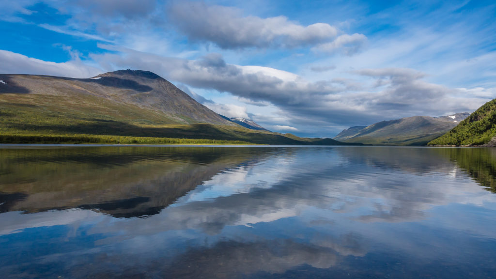
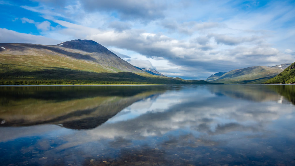
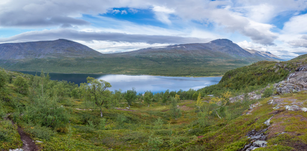
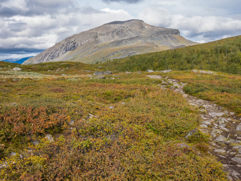
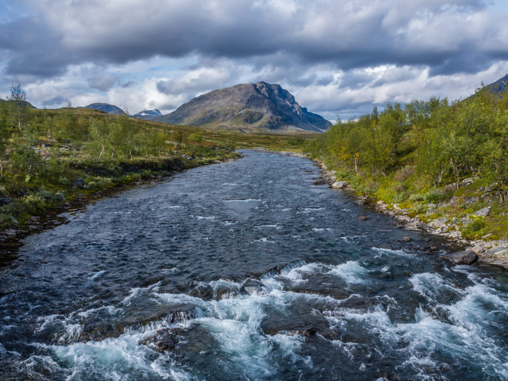
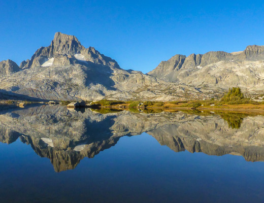
Looking back across Lake Teusajaure to the high peaks in the Stora Sjöfallet National Park.
Day 17 – Teusajaure STF Mountain Hut to Wild Camp (-1km from Singi STF Hut) (13.1 miles/ 21.1 km, 8 hours, 13 mins) – Monday 29th August, 2016 – ‘The Mountains Are Calling…’
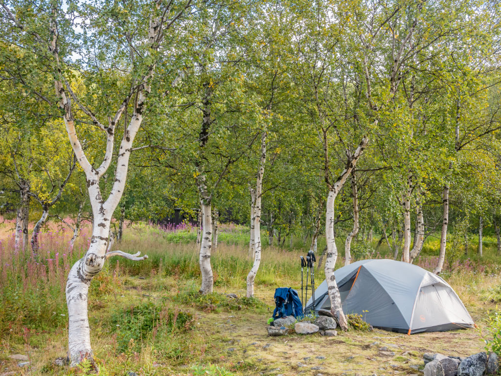
Our wonderful camp spot within the vicinity of the Teusajaure STF hut.
The sauna, a fantastic facility at the Teusajaure STF hut that we made use of the previous evening.
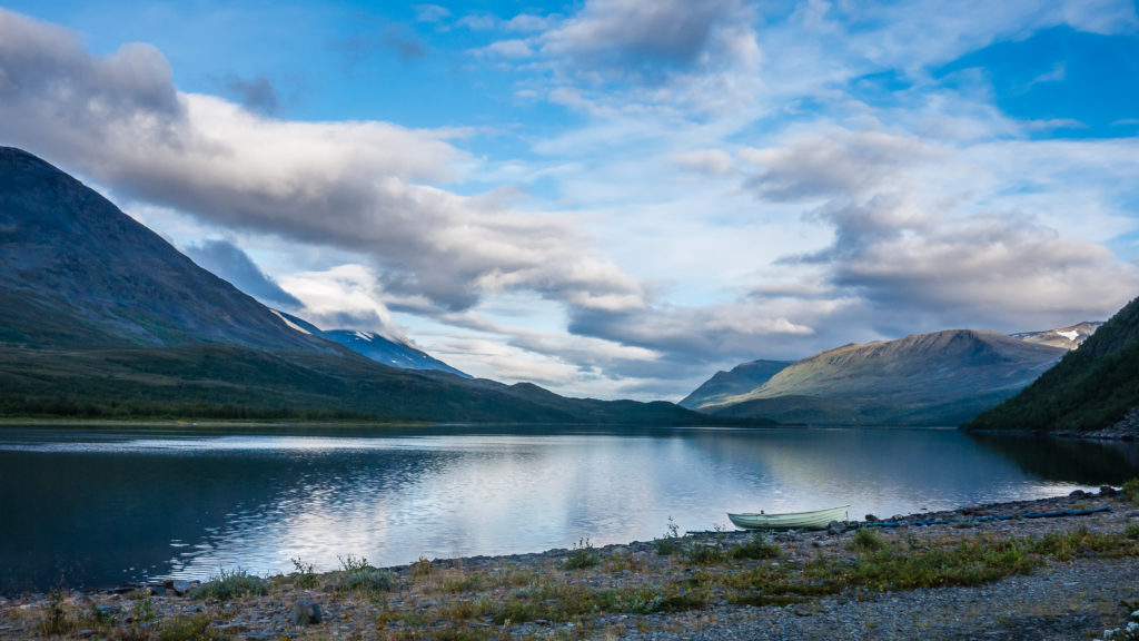
What a view to wake up to! Our camp spot looked directly out onto the beauty of Lake Teusajaure.
What an amazing camp spot! Our decision to row across Lake Teusajaure the previous evening and set up camp by the STF hut had been an excellent one! Not only would it be advantageous to start our hiking day on the north side of the lake, saving us some time, but when we ventured out of the tent around 7:30am that morning, we awoke to a stunning panorama of lake reflections. As the Teusajaure STF hut is beautifully located right on the edge of the lake at the foot of the Slieknjamačohkka mountainside (1,730m), we were treated to an early morning spectacle of the bulbous Gáppetjåhkkå peak (1,457m) mirrored in the still waters of the lake, whilst looking across to the west.
Wanting to make the most of such a wonderful view, Wayne hastily set up his tripod and camera in an effort to capture a time lapse sequence of the moving clouds and changing light before the sun crested over the mountains. We sat and soaked up the scene, agreeing that this picturesque location was now in our ‘top three’, whilst contemplating our favourite camp spots along the Kungsleden so far.
Moody skies and dramatic reflections kept us spellbound. This stunning scene just looks like it’s been painted onto canvas.
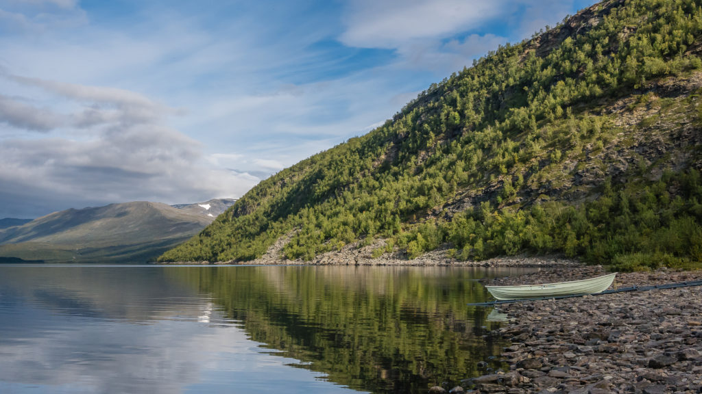
The row boat we had used the previous evening to cross the lake.
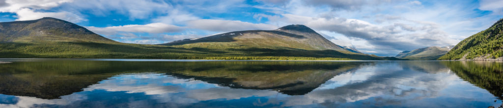
Panorama looking across the lake to the west.
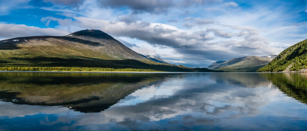
The bulbous Gáppetjåhkkå peak is mirrored in the calm waters.
The water of Lake Teusajaure is crystal clear.
Hunger pangs soon getting the better of us, we collected our food rations then went inside the hut to cook breakfast. Don’t have any misconceptions – it wasn’t a traditional ‘full English’ or a delightful breakfast buffet by any stretch of the imagination – we just needed to boil a pan of water that we’d pre-mixed with milk powder, ready to pour on some muesli – our standard trail breakfast fayre. Feeling satisfied for now, we then packed up our stuff for what seemed like the 100th time (!), bid farewell to the warden at the hut, and headed up the trail to re-join the Kungsleden.
We earmarked the STF Kaitumjaure hut for today’s lunch stop!
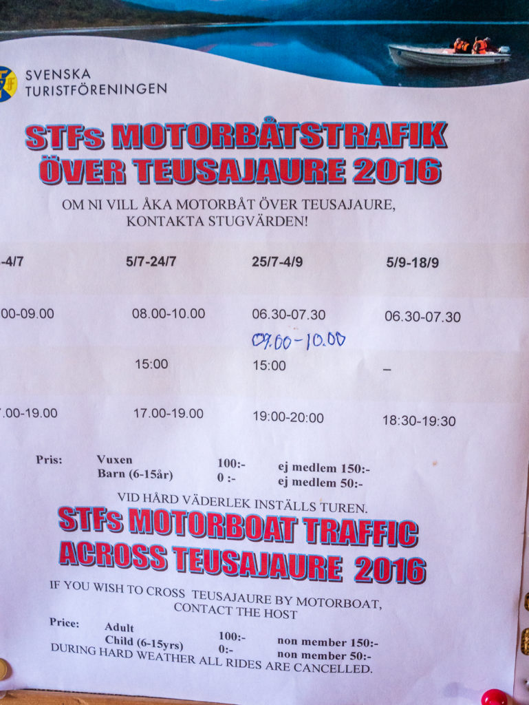
If you are travelling southbound, you will need to cross Lake Teusajaure either by row boat, or you can pay 100 SEK (£9) and cross by motorboat operated by the STF. This was the timetable for summer 2016.
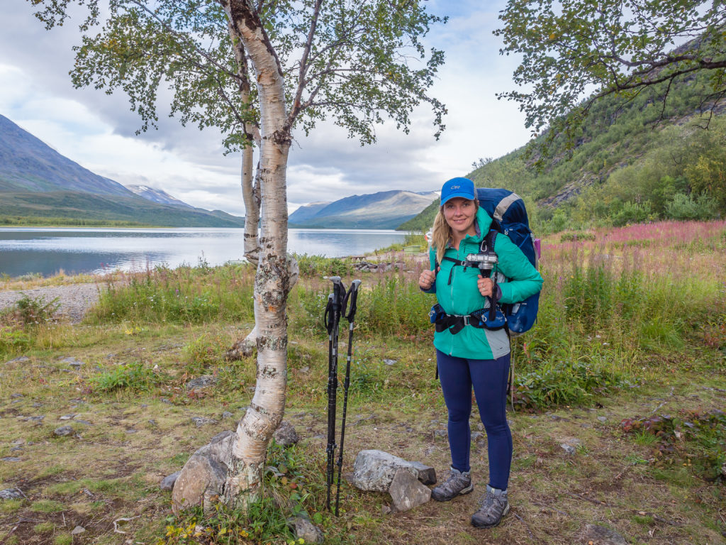
All packed up and ready to get back on the trail. We left Teusajaure around 9:30am.
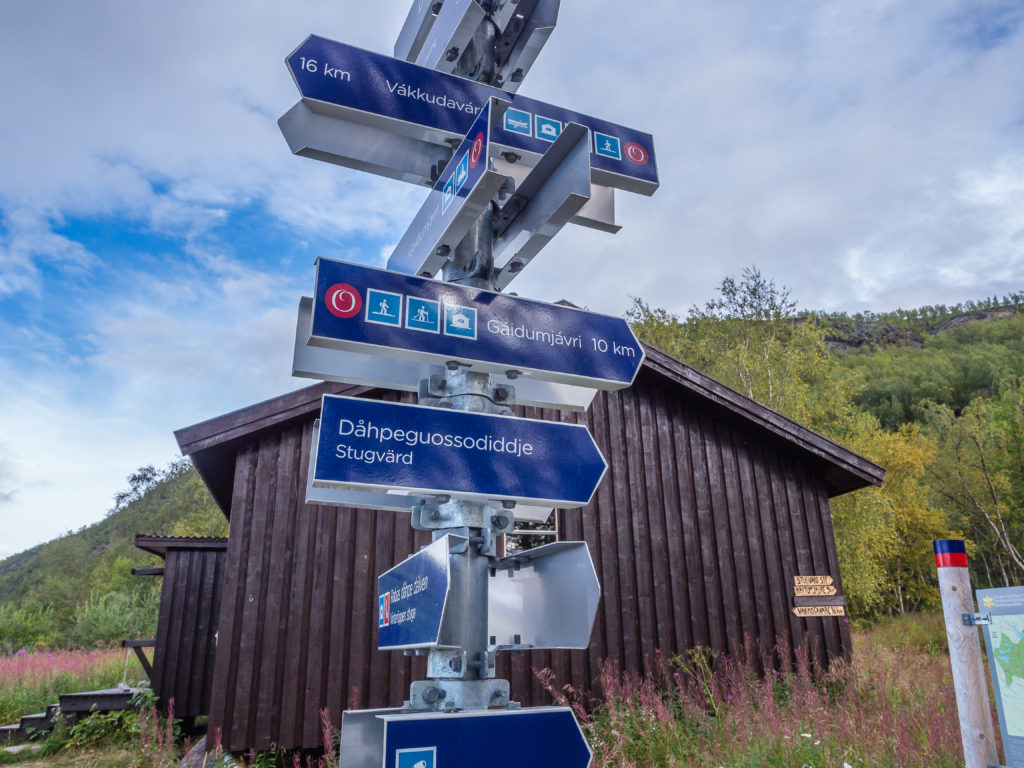
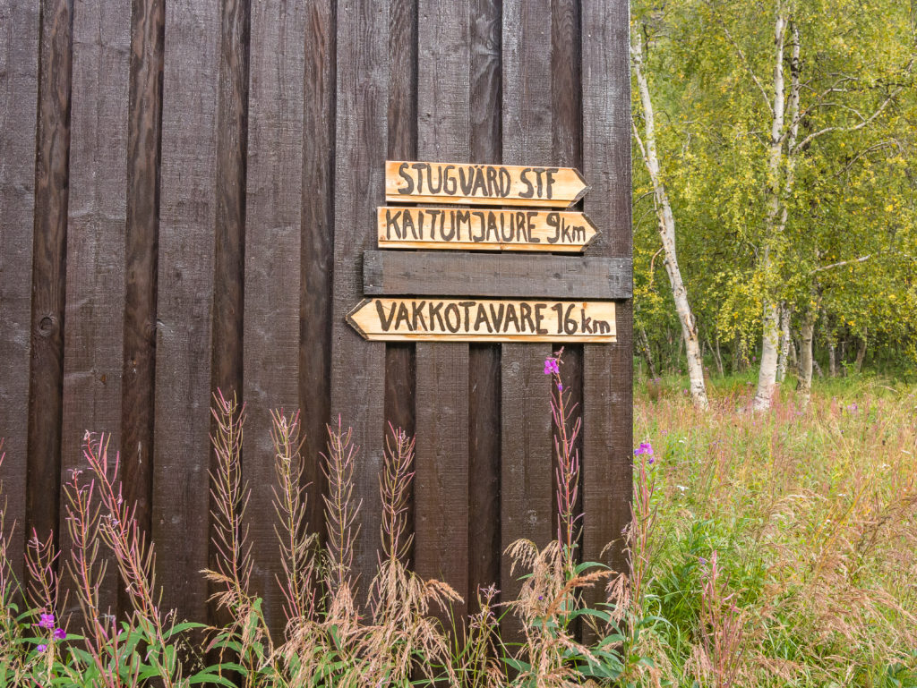
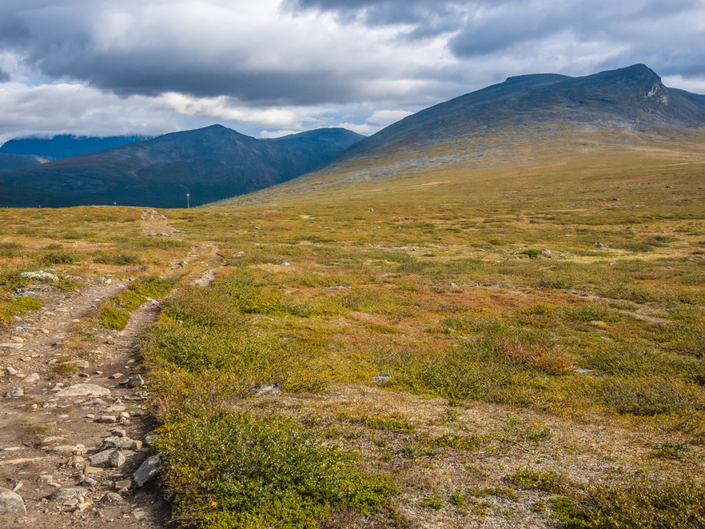
You can tell this area receives more visitors as there are more information boards about the national parks, plus extra signage leading to different places of interest that are not part of the Kungsleden trail.
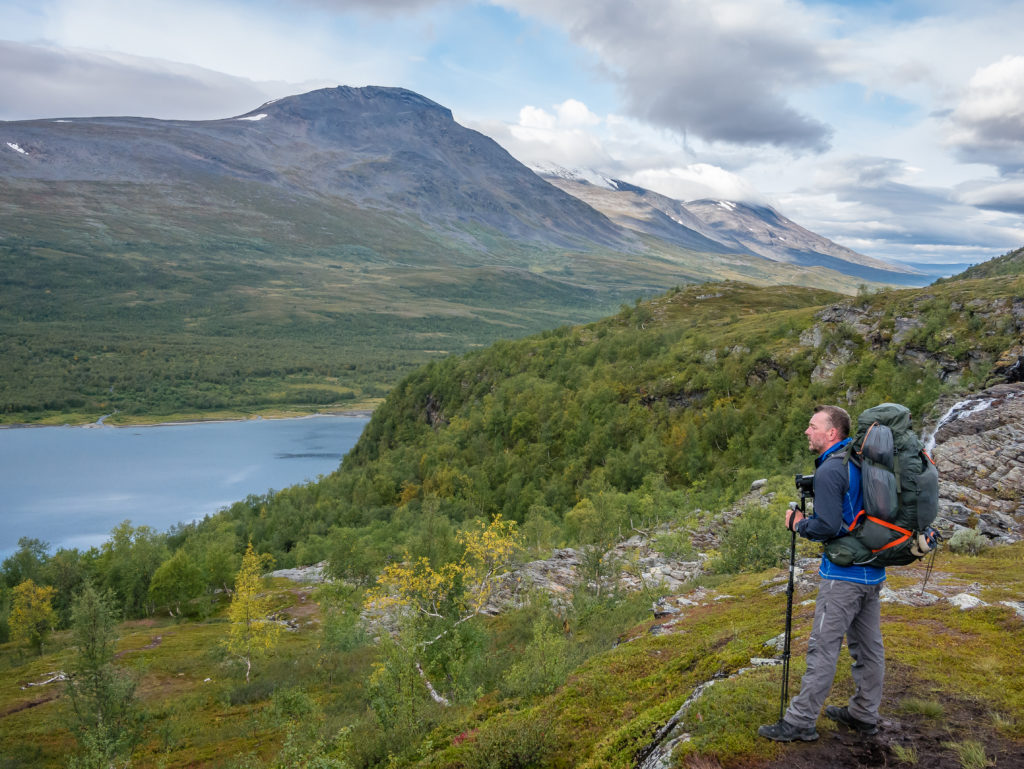
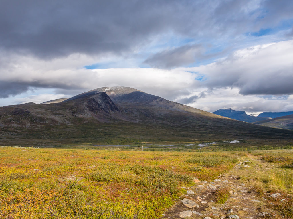
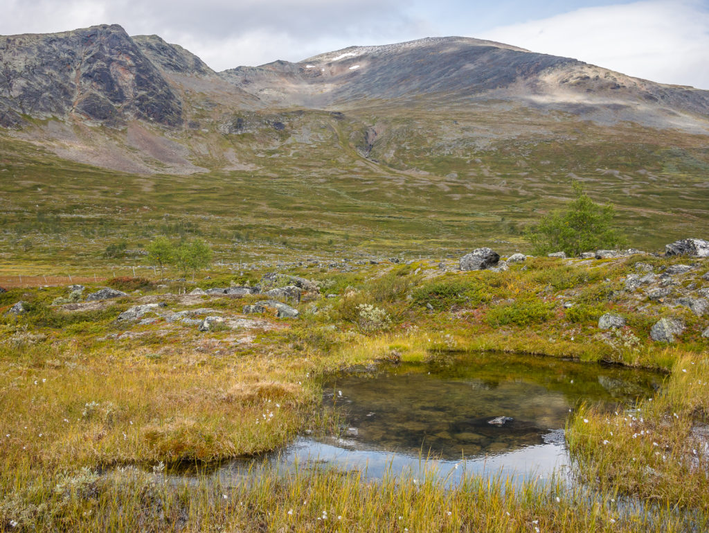
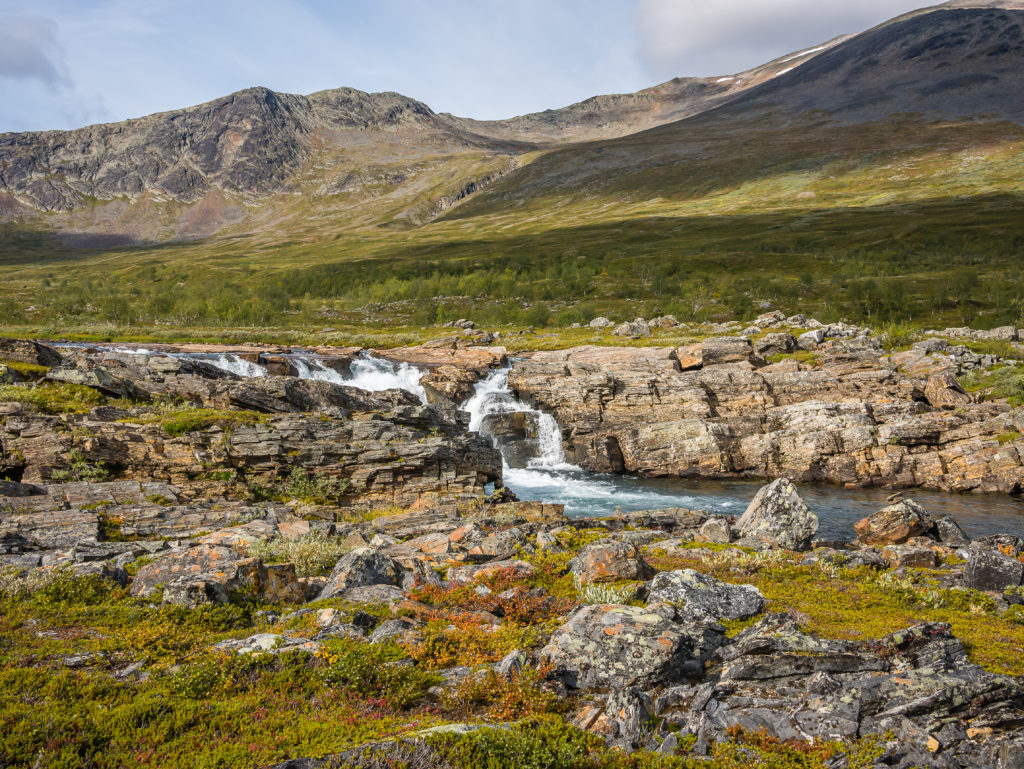
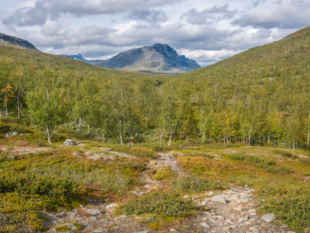
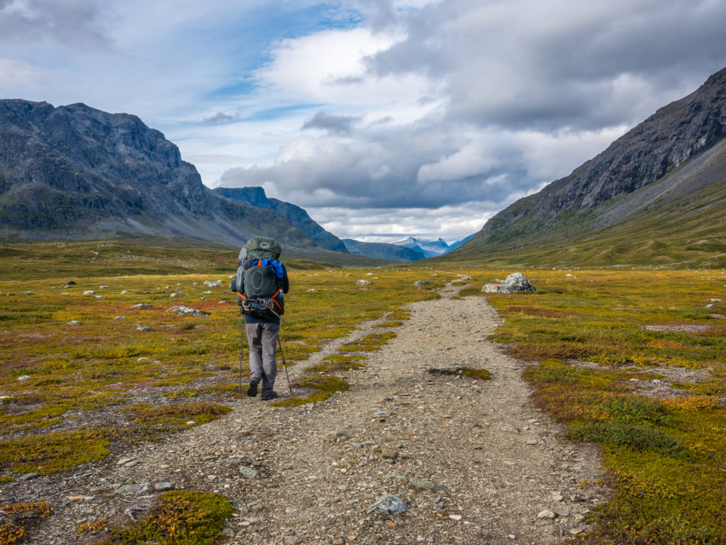
Leaving Teusajaure behind at the foot of the lake, we were immediately faced with a tough ascent, the trail leading us uphill through green slopes of mountain birch and ancient pine forest, where we passed beside a large waterfall that was crashing down the steep hillside. It took it out of us first thing as we were severely lacking in calories compared to yesterday’s quadruple breakfast feast at Saltoluokta. But thankfully this was the ‘big climb’ of the day, after which we reached another highland plateau. Here we took a much needed breather and enjoyed the tremendous view looking back across the lake to the high peaks in the Stora Sjöfallet National Park.
Thankfully our big climb of the day was done! Taking a breather and looking onto the imposing mountain ridges in the Stora Sjöfallet National Park.
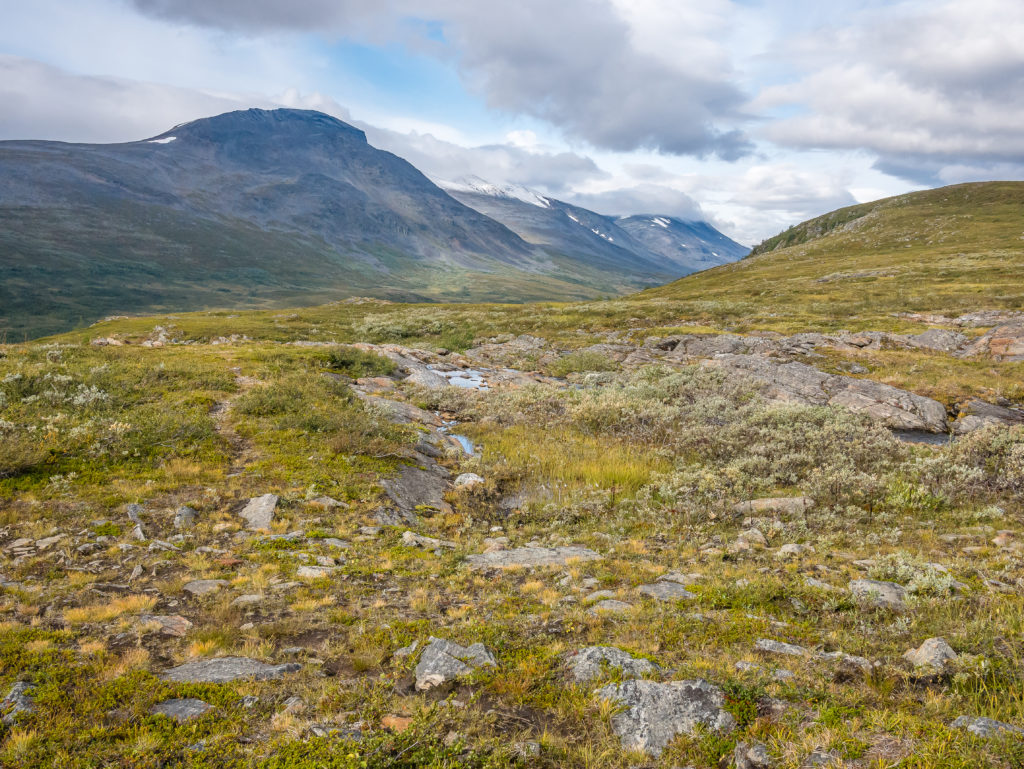
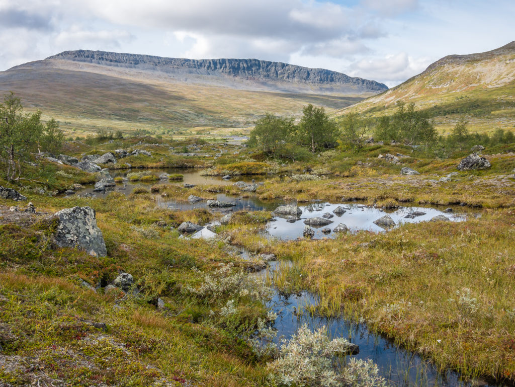
We found that the plateau was very wet with large parts of the path flooded. From here on, the trail was also very rocky and churned up in places, needing us to watch every step and take care with our footing.
The trail is easy to follow, but we found it hard wearing on our feet and ankles with lots of rocks to negotiate.
The trail heads between the mountains…
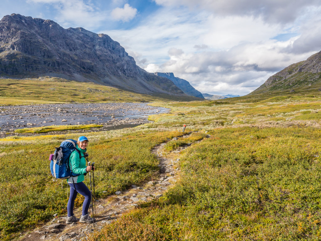
Hiking with full packs we find walking poles are advantageous with helping us to manage the load. They are also good for testing out areas of boggy ground!
The northern section of the Kungsleden is famous for its magnificent mountains and we had them in our sights.
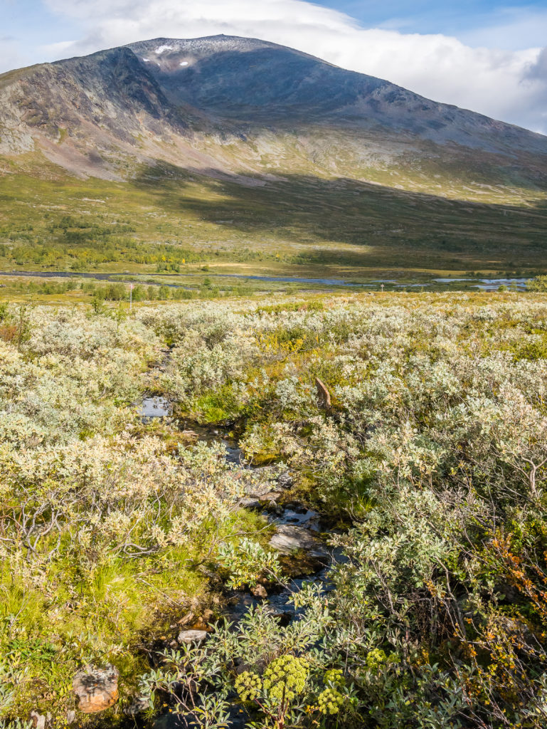
Despite the cooler temperature, the arctic scrub along the valley bottom was still thriving.
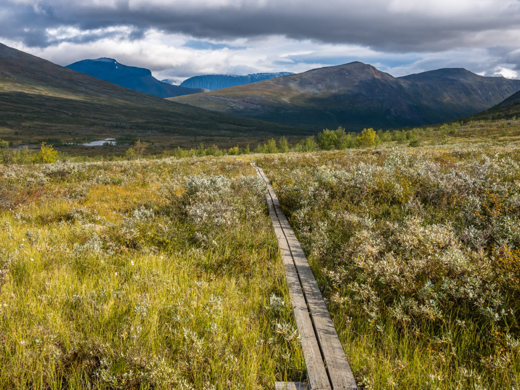
A familiar feature of the trail… Wooden boardwalks head off into the distance…
A rugged ridge dominates the skyline.
The further north we went, the grander the scenery. We were now seeing mountains of epic proportions!
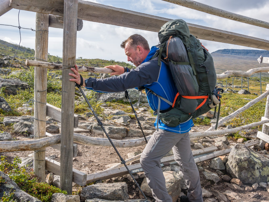
Crossing a rengärde. Wooden planks have to be moved to allow passage through the reindeer fence.
We had 9km (5 1/2 miles) to go to reach the next STF hut at Kaitumjaure, but it seemed a long 9km. We downed our packs several times to delayer, then had to wrap back up again as there was an intermittent chilly wind blasting down the valley. We were also hungry for snacks, eating some squares of chocolate and a bag of jelly sweets to give us a boost of energy. What we had assumed would be a gentle walk along the river was another ankle buster over a trail littered with rocks and boulders that meant concentration was paramount every step of the way. Not wanting to put a downer on the day, but this soon becomes wearing on both your feet and your mood.
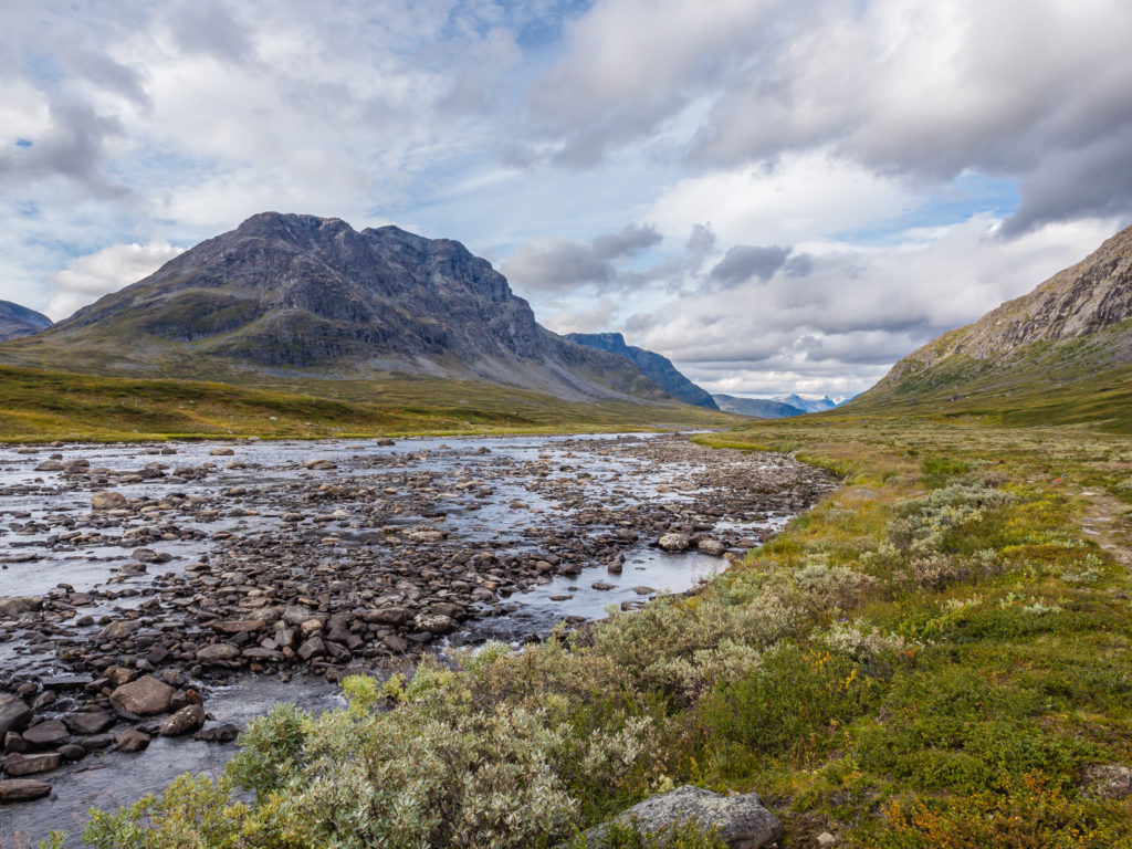
Our mood was soon lifted when the trail got closer to the Kaitumjåkka river. We knew on reaching the waterfall that we were not far from the STF hut.
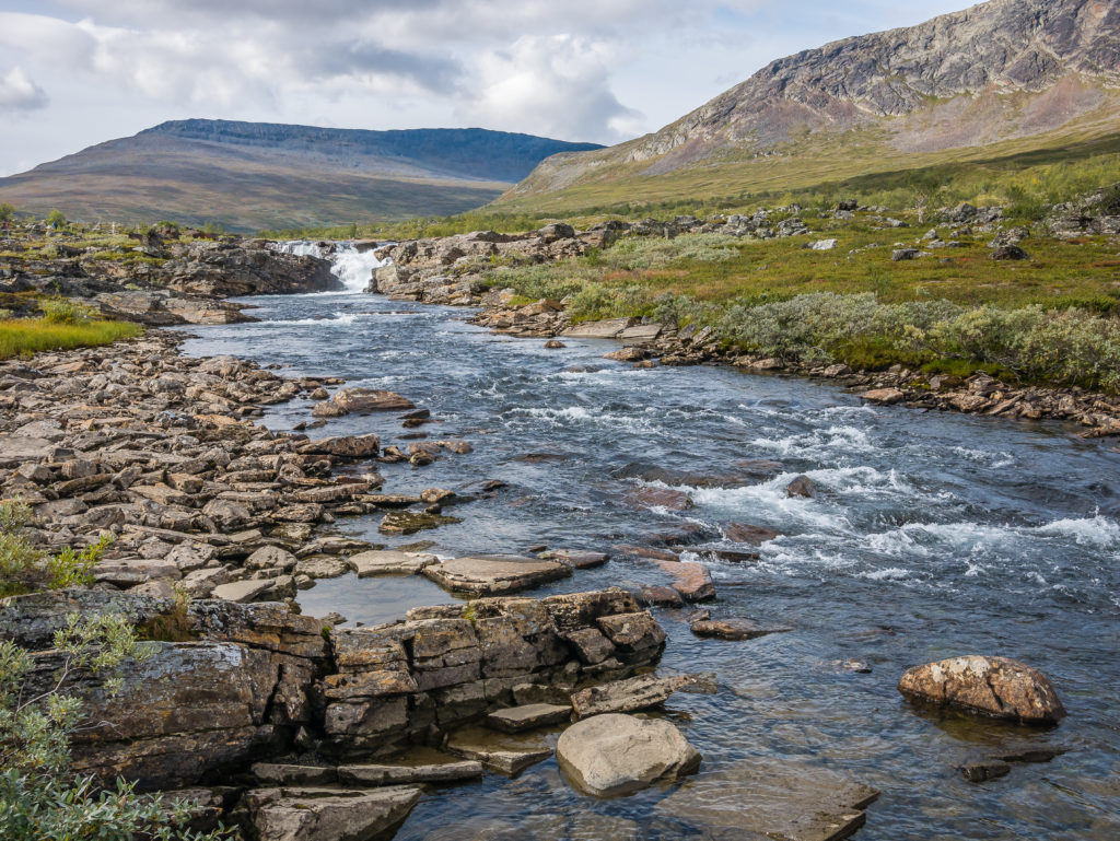
Looking onto Kaitumjåkka, which today was not as fast flowing as we had expected.
It was a welcome relief when we arrived at the Kaitumjaure STF hut around 1:15pm. We were impressed with the large shop, new toilet block and new sauna, which we were sad not to get to sample as this was just a quick rest stop to recharge our batteries and have lunch, as we could use the hut’s ‘day facilities’ for free – courtesy of having Hostelling International cards.
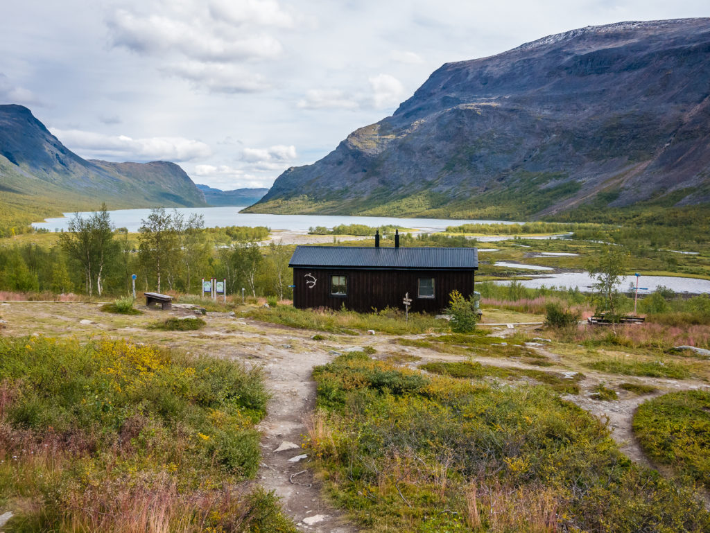
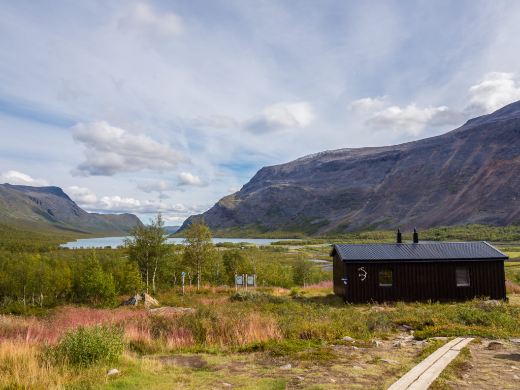
Looking onto the Kaitumjaure STF hut. After several kilometres negotiating a rocky trail that proved extremely tiresome, it was a welcome sight!
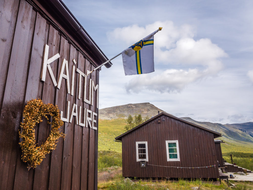
Kaitumjaure is well facilitated, offering hikers a good selection of food stuffs in the large shop as well as the use of a sauna.
The shop was well stocked and in our opinion had a better selection of goods than Saltoluokta, so we couldn’t refrain from buying a few extra essentials such as salted peanuts, crackers, salami, and a tin of mixed fish (the picture was of salmon and lobster so we hoped for a kind of seafood salad/ prawn cocktail kind of mixture). Notice how we are currently hankering after savoury items much more than sweet – but we did also buy a cake each to go with our cup of tea that we would be brewing in the hut. The shop also has a till as it has large solar panels on the roof, obviously generating enough electricity to power it as the warden asked if we were paying by card. We paid cash, but it’s good to know if you’re running low on notes, that some places do accept card payments. The warden also pointed out a moose and it’s young calf grazing across the river – it’s the first one we’ve seen, albeit from a distance, but even from so far away it still looked huge!
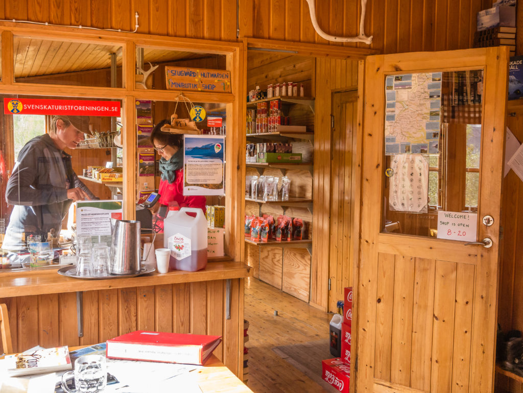
The Kaitumjaure STF hut is a great place to stock up with food for the rest of your journey north as it has the largest resupply shop south of Singi (excluding Fjällstations). It also has the facility to pay by card if your cash reserves are running low.
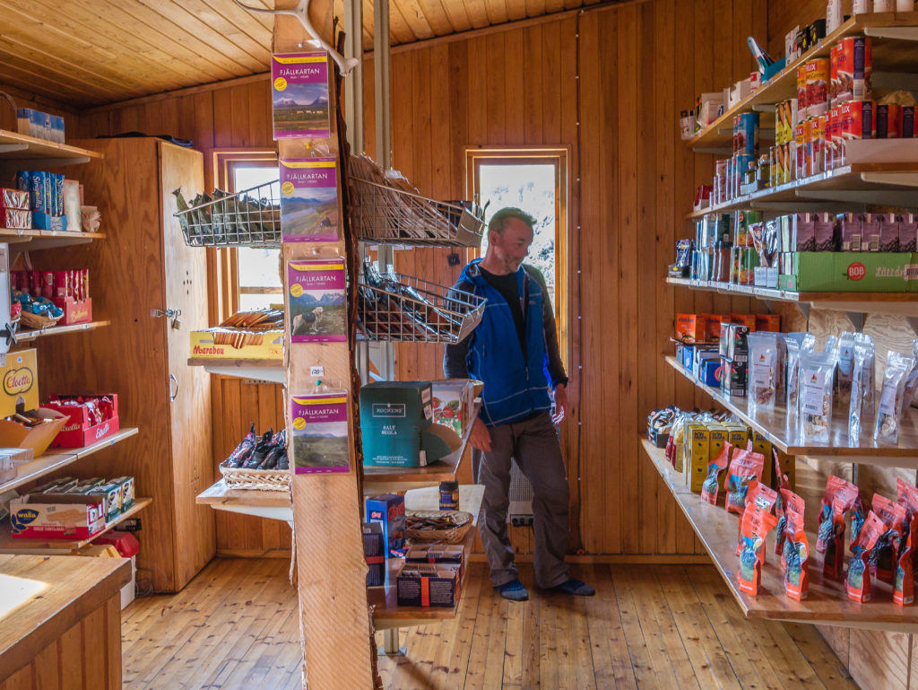
Even though we had resupplied at Saltoluokta, we couldn’t resist buying a few extra goodies!
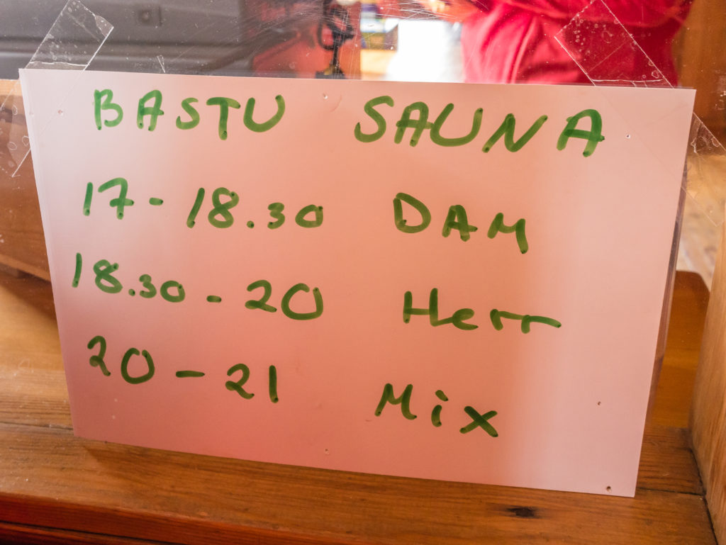
The all important timetable for sauna use! (Ladies, men, then mixed sessions.)
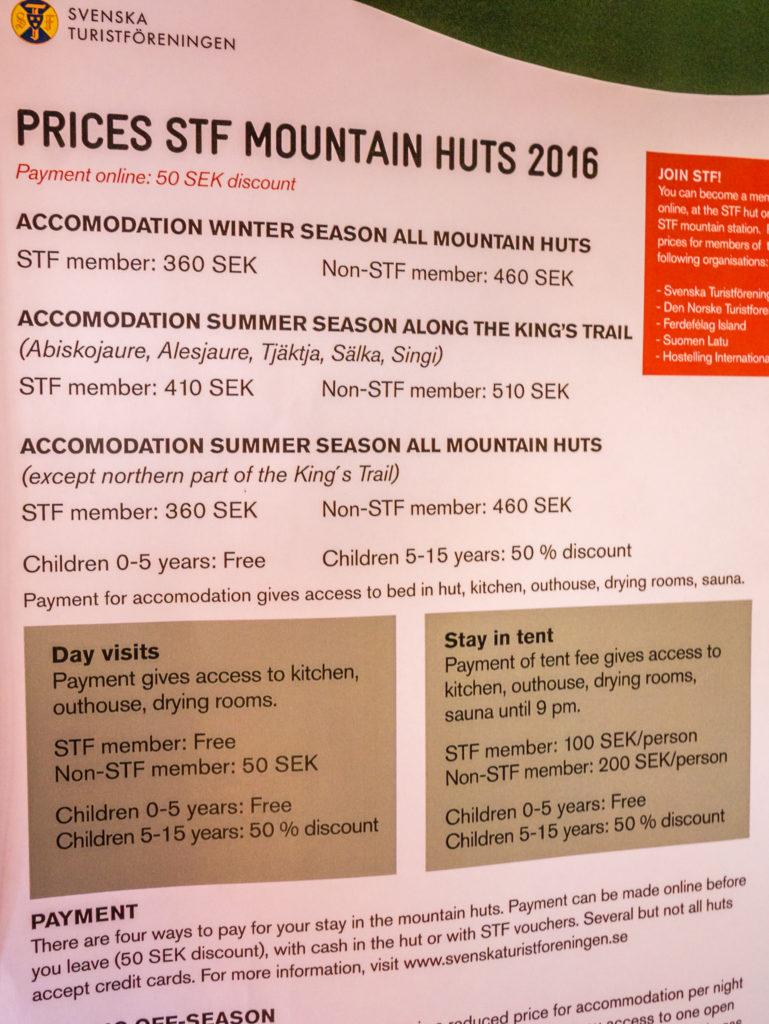
General fees for STF Mountain Huts in 2016. After reaching Singi, the price increases by 50 SEK per person. (Consider this the proper touristy north!)

Inside the ‘day use’ hut. Facilities inside the huts are standard. e.g. gas burner, pots and pans, tables and chairs etc.
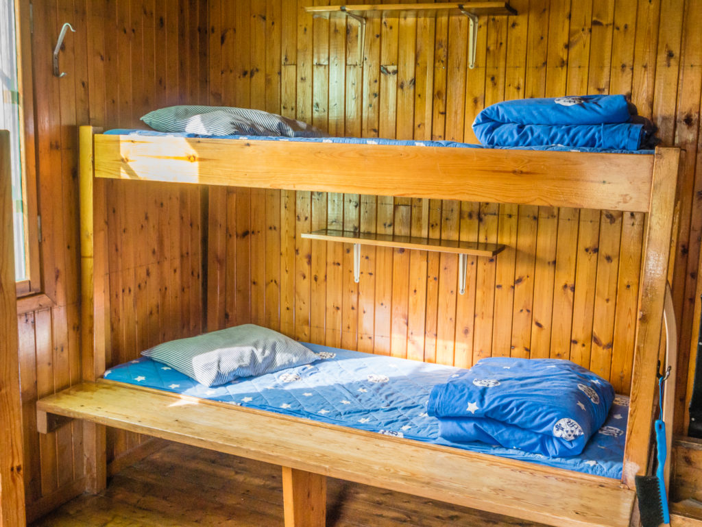
This hut also had a sleeping area with a double set of bunk beds.
Kaitumjaure is one of the best places to see more elusive wildlife on your hike, as there is a resident moose that can often be spotted wandering in the lakeside marches below the hut.
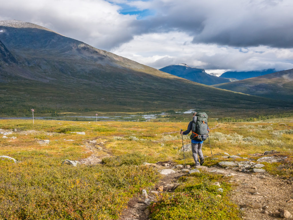
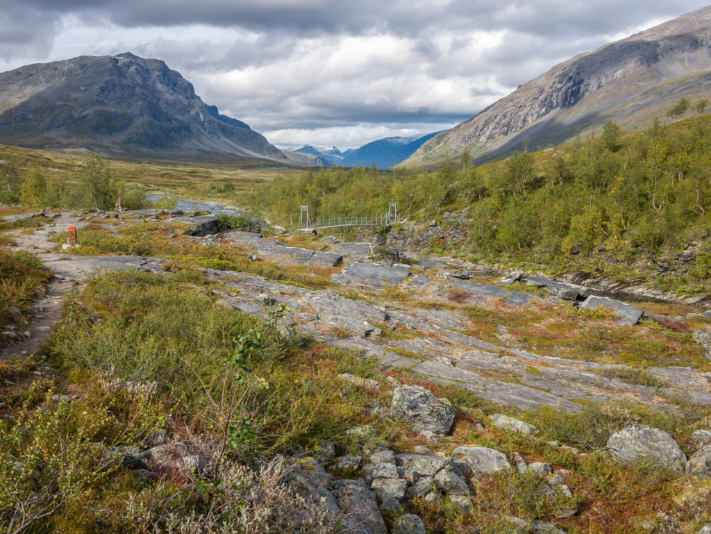
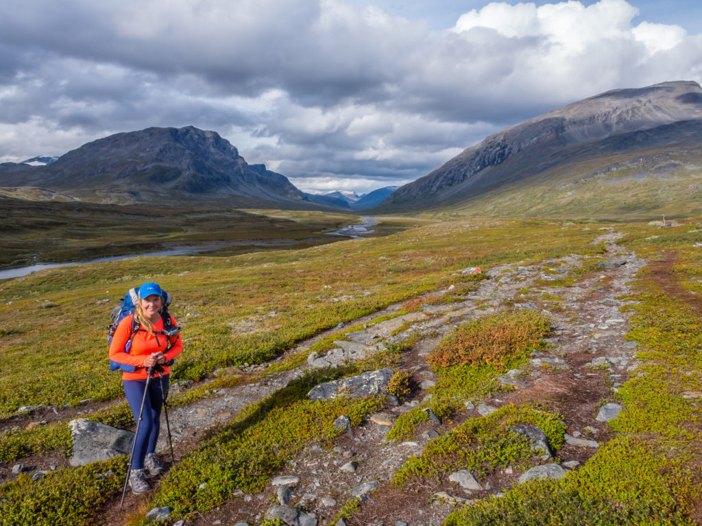
We had around an hour’s rest before setting back off up the trail. Our plan was to get within a few kilometres or so of Singi, where we would wild camp before reaching the hut. This next segment of the Kungsleden takes you through birch forest, open fells and deep valleys, all with impressive views of the surrounding peaks. From Kaitumjaure, it is basically a long valley walk due north on a stony but flat trail that runs alongside the fast flowing Tjäktjajåkka river. A large suspension bridge takes you across the river where the Kungsleden continues on the eastern side. We knew we had to make the most of this section being one of the quieter places, as beyond Singi the trail becomes much busier, especially during the height of summer.
Here the lower slopes are covered in thick birch forest, which contrasts greatly with the stark granite peaks in the distance.
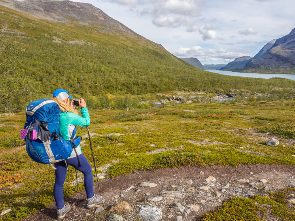
Photographing the incredible view as we head down towards the Tjäktjajåkka river.
Autumnal colours paint the landscape with an orange/ red glow.
The Kungsleden trail heads across these large, rocky slabs down towards the river. Rocks are still daubed in red paint acting as regular waymarkers.
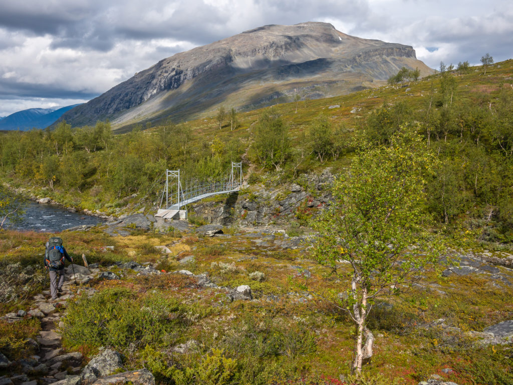
The largest river on this section of the trail, the Tjäktjajåkka, has a huge suspension bridge in place to see you safely across.
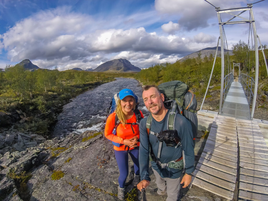
Having a GoPro selfie before crossing the bridge!
Crossing the fast flowing Tjäktjajåkka and pausing to capture the scene.
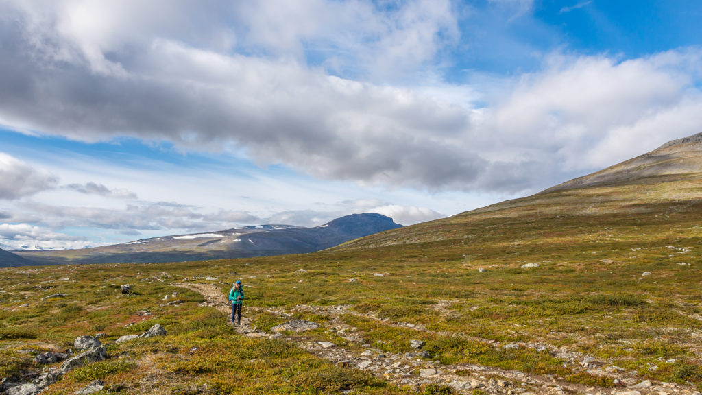
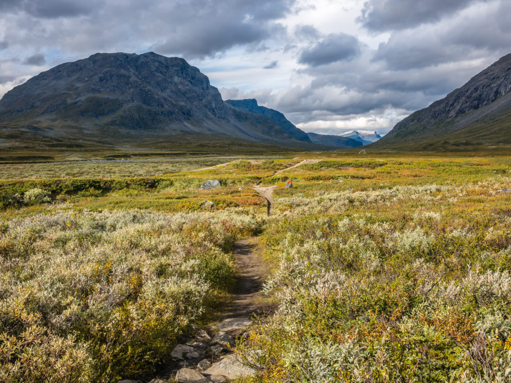
As the valley rolled out before us, gradually taking us north, we could see much bigger mountains in the distance. The Kaitumjaure warden had told us that it had been snowing beyond Singi this morning, so we hoped that it was only a flurry and wouldn’t persist as we were due to hike that section tomorrow. The trail was a lot better along the valley – much less stony, which meant we had a much quicker pace compared with our morning’s efforts. Around 3km before Singi, we started looking for a good place to camp, knowing it would be much quieter in the valley compared with at the hut as the STF hut at Singi is part of the Kebnekaise loop. (More details about this to follow in the next post.)
From Kaitumjaure, it is a long valley walk, the Kungsleden trail following the course of the Tjäktjajåkka river.
Surrounded by imposing peaks, the mountains begin to look more rugged.
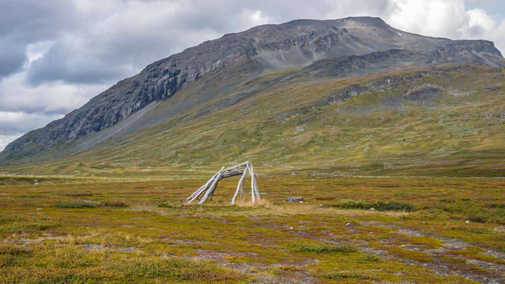
Passing by what we thought were the remnants of an old Sámi shelter.
Up until now, we had only passed a handful of people on the trail each day – but we knew it was going to get a lot busier beyond Singi.
With a beautiful valley walk such as this, we were excited for what was to come further north!
“The mountains are calling and I must go…” One of our favourite quotes from Scottish born naturalist and conservationist John Muir.
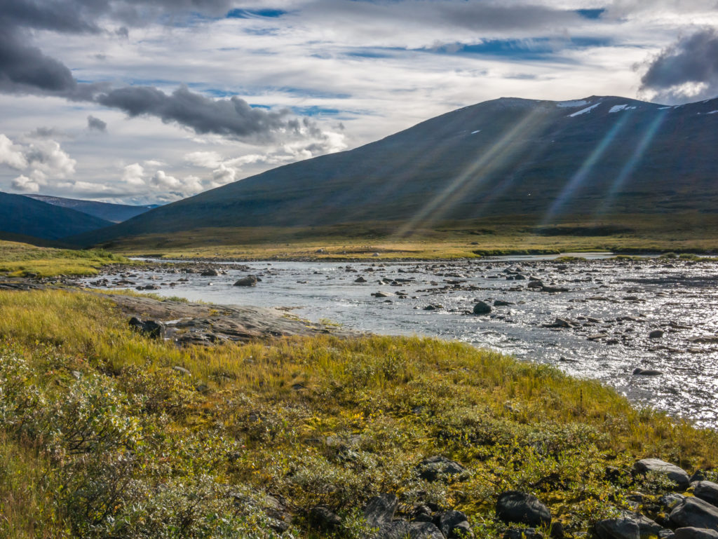
Gorgeous early evening light filters through the valley.
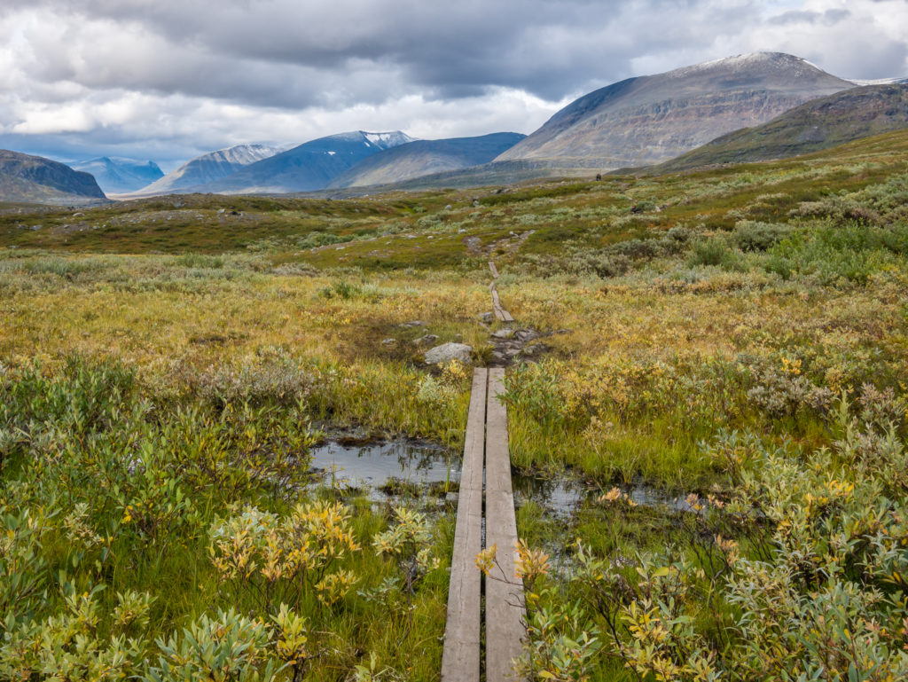
We were grateful of the wooden boards in place over these particularly boggy areas.
Before long we found a wild camp spot down in a sheltered dip just off the main trail that was close to a stream. It was grassy and dry, with a slight breeze funnelling through, all the prerequisites we like. We hoped it wouldn’t be too cold a night, knowing that the next few nights will certainly put our gear to the test sleeping at over 800 metres.
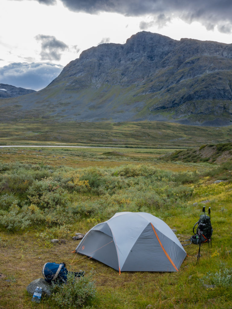
We chose a wild camp spot next to a small ridge that offered us some protection from the wind.
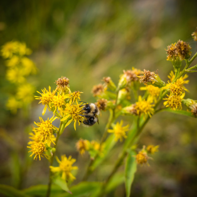
Despite it feeling colder, there were no real signs of winter here yet… A bee collects pollen close to our tent.
Our hiker dinner was a bit of a disappointment! The tin of salmon and lobster turned out to be a tin of ‘fishy balls’ – basically fish whizzed up in a blender and pre-shaped into balls that have a really smooth texture like baby food pureed. I really wouldn’t like to think how much fish was actually in there. I think we’ll stick to meat balls in future – at least that’s what the Swedes are famed for! As it was feeling significantly colder, we quickly got wrapped up in our sleeping bags and settled down for the night.
Just 4 Days To Go!
We are still on track to finish around lunch time Friday, leaving us 20 or so kilometres to cover each day for the next 3 days, plus a shorter 14km to complete on Friday. We have planned our final few days like this to give us an earlier finish time, so that we can get some laundry done at our hostel Friday afternoon before we go out and celebrate! We can’t quite believe that we’ve not had an alcoholic drink for nearly 3 weeks, so we are very much looking forward to a celebratory beer (or two!) at the end of 270 miles, if we successfully complete the Kungsleden!
3 Comments
Truely magnificent hiking.
Still so interesting reading. Thanks so much for putting this together. It feels nearly like being there.
And WOW, the tent fee for the STF huts has increased by 150% within four years. Sweden must have a real inflation issues. Or maybe Kungsleden is becoming more and more touristy and earning money becomes mandatory; as seen so often.
Hi Marcus,
Thank you so much again for your lovely words and taking the time to comment.
We hadn’t realised how much the price and popularity of the Kungsleden has increased!
Remember, we used our Hostelling International cards to get a discount at the STF Huts. I think this is still applicable – “Holders of HI membership cards pay the same rates as STF members”, so if you have the card it could save you quite a considerable amount on fees. We also used the huts when passing as a place to cook and have dinner etc and tended to wild camp when we could. The fee is worth it to camp by the hut if the hut has a sauna though!
Hope the info helps. Best regards, Danielle