
“Everywhere is walking distance if you have the time”.
– Steven Wright
The First Week – Breaking Ourselves In!
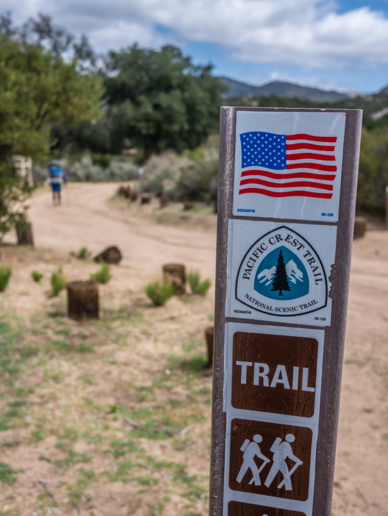
Beginning our dream hike across western USA on the Pacific Crest Trail.
Day 1 – Tuesday 10th April 2018, Campo to Wild Camp just off dirt road, 11 miles
As it was going to be our last cooked breakfast in a while, we wanted to make the most of our final morning in San Diego and saviour one last breakfast burrito at our favourite seafood restaurant in Point Loma where we’d been staying in order to conduct our PCT Prep.
Hence, we didn’t arrive in Campo until midday – the hottest part of the day to begin hiking. Our journey to Campo was both scenic and hassle free having taken a lift to the start of the trail from our American friend, Kelly. Kelly had also been instrumental in helping us get around San Diego over the 5 days prior to our hike, enabling us to make our final gear purchases from REI, and to stock up with food rations from various supermarkets for our resupply parcels. This would have been much harder and more time-consuming for us if we had to use public transport, so we are very grateful for all of his help. Whilst we are overseas, it seems Kelly has now assumed the role from our parents, and become the American arm of our ‘Support Team’.
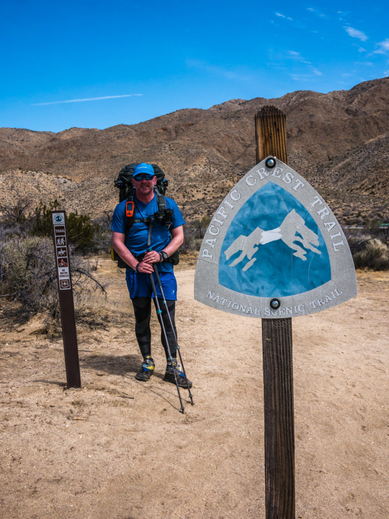
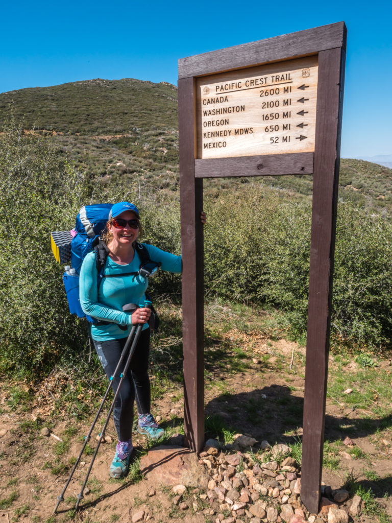
As it could well be our last chance of a ‘proper’ toilet in a while, we made use of the restroom at the well-stocked village store in Campo, then drove up to the trailhead just a few minutes away, which was up a sandy track. A couple of border agency guys were working alongside the road, but they were disinterested in us as we put on our fully laden packs and walked up to the Southern Terminus PCT monument. As we were the only hikers there so late in the day, and having Kelly with us to be ‘official’ photographer, we took the opportunity to have several photographs at the monument.
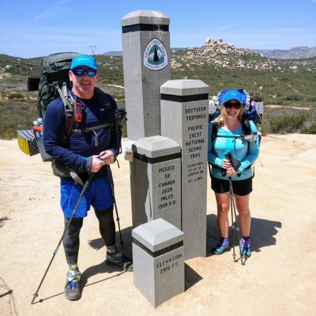
The ‘official’ start of a new walking adventure!
Just a short walk then…
Right next to the monument is a line of barbed wire, and behind it is a tall, continuous metal fence denoting the border between the US and Mexico. Supposedly Trump has despatched 4,000 National Guard to police the entire border and make it more secure, but we didn’t see a lot going on, neither were we asked to show our PCT permits. There were several regular flybys above however, with the border patrol helicopters checking the vicinity from the air.
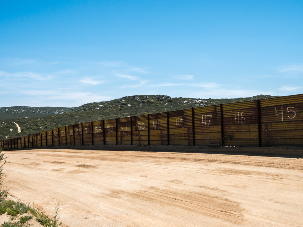
Looking across to the border with Mexico.
We took great pleasure in signing the PCT trail book – our personal goal of walking all the way to Canada was now very real – we were finally doing this! Then we proceeded to look through the names listed above us and on the previous few pages. Restricted to 50 permits a day on the PCT, we counted 42 names before ours starting the trail today – so we were not the last to begin. 6 more hikers in theory would be starting behind us. And then we were off…
We found the trail was well signposted with the PCT markers and before long we were at the sign for ‘Mile One’. Meanwhile, Kelly was driving along in his van pulling up at various points where the trail intersected the road taking more photos of us, before he finally headed back to San Diego.
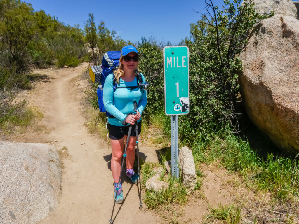
Reaching Mile One! We’re actually doing this!
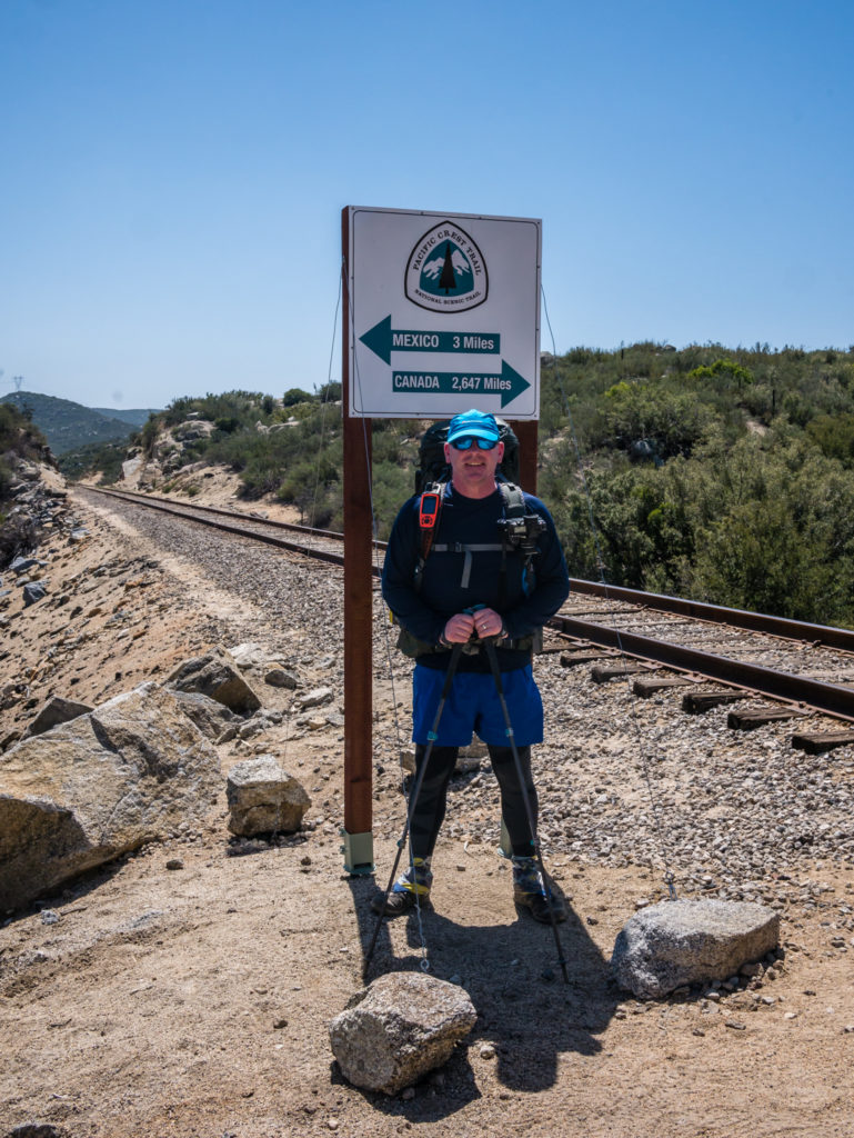
Mile 3 was denoted by a Mexico/ Canada distance sign next to a rail track which we had to cross.
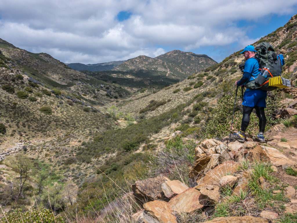
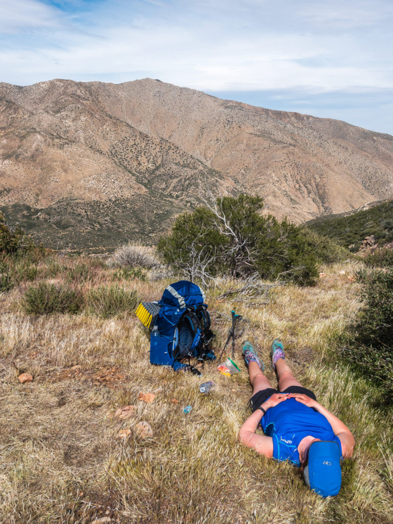
Having carried 4 litres of water each, we weren’t thrilled with the prospect of drinking a litre, then refilling the bottle to replace the said litre, but the creek at mile 4 was the only definite water source between here and Lake Morena, which was approximately mile 20, and our schedule wasn’t to reach there until the following day. So we took a break by the creek in a spot of shade, being careful not to sit on any poison oak (after asking a fellow hiker to identify it for us). Just one of the dangers I had no idea about! Then we continued on, our aim for the day being the 10 miles marker. We had already decided to break ourselves in gently, especially as we were carrying fairly heavy loads in comparison to other ‘ultra lightweight’ PCT hikers.
Early evening but still grateful of any spots of shade as it was so hot.
Another trail danger we quickly became aware of was giant red ants after Wayne had sat on a rock for a rest, then discovered after setting off walking again that there were several of them crawling up his legs and even between his shorts! Luckily he was wearing leggings under his shorts or he would have been in a world of pain! That could have been his trail name right there –‘Ant Bite’! But that’s yet to be confirmed.
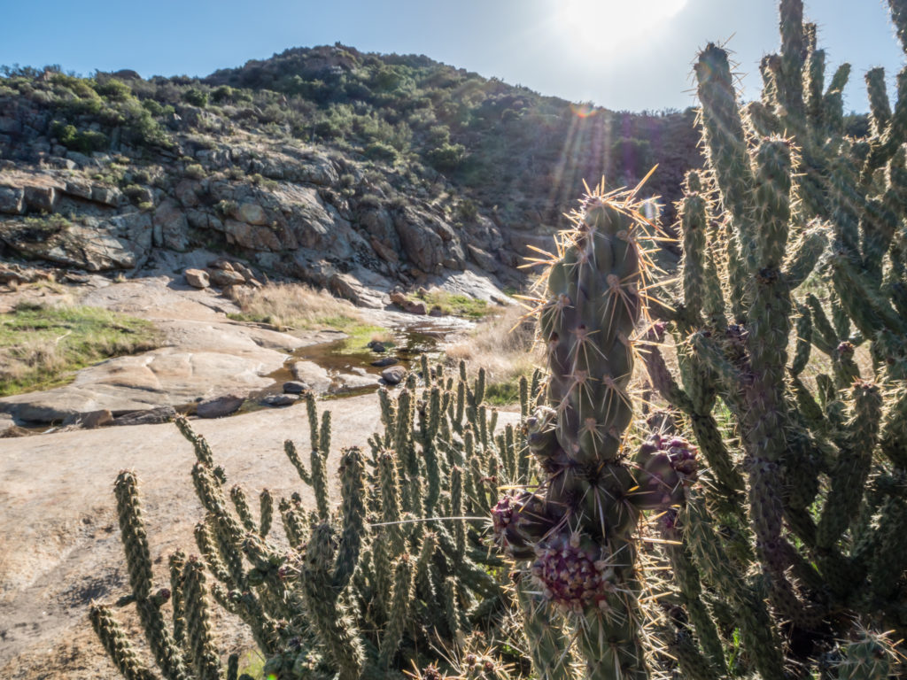
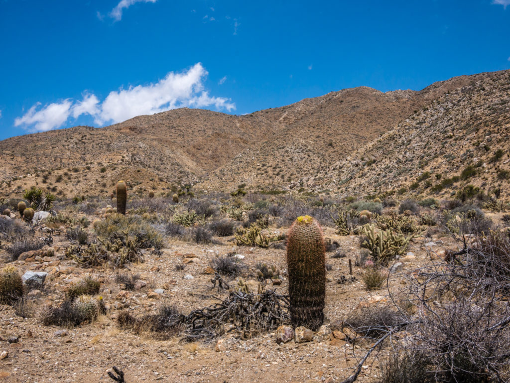
Beautiful desert agave flowers.
Having checked on the map there seemed to be a good camp spot where the trail crossed a road junction at mile 11, so we aimed on reaching there, which turned out to be just before dark. Sunset was at 7:13pm, so we didn’t have light for very long.
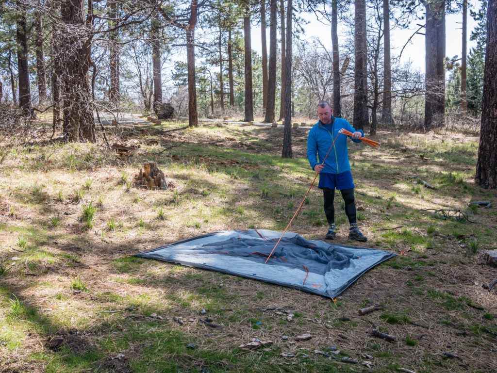
We set up the tent on a nice patch of ground, and wanted to get straight into our sleeping bags. But first we had to wet wipe the dust and grime from our legs and feet. No water means no ‘proper’ washing. Thankfully there would be showers at the Lake Morena campground tomorrow.
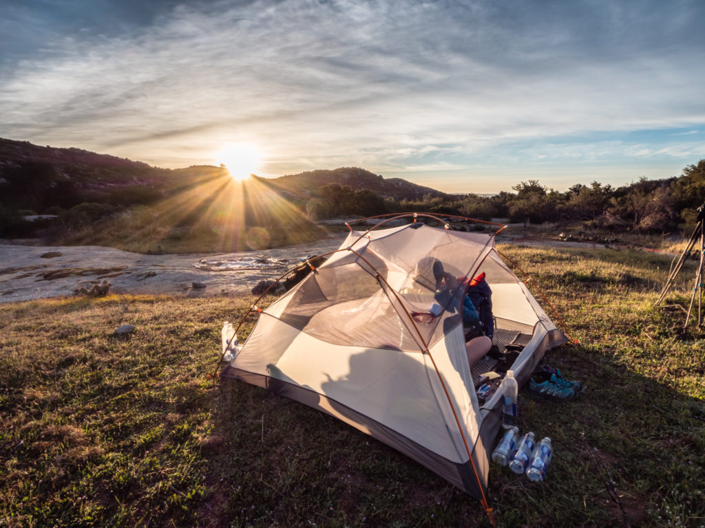
We pitched just as the sun was setting, which was the perfect end to the day.
The heat had taken it out of us, so we weren’t even that hungry for dinner. So instead of a cooked meal we decided to eat a blueberry bagel with peanut butter as a light, no cook tea option. This was win-win on two counts as there was no washing up, and as the bagels were technically for breakfast, in a bag of six that weighed a kilogram, we had managed to lighten the load a little!
Then it was hiker bed time at 9pm. We set the alarm for 5am and slept a straight 8 hours, but then when it went off in the morning we decided on an extra hour of sleep, changing it to 6am instead.
Day 2 – Wednesday 11th April 2018, Wild Camp at Mile 11 to Lake Morena State Park Campground, 9 miles
When we got up at 6am we didn’t think it would take us long to pack everything away and get going as we had a dry breakfast, much like dinner, of bagels and jam, and didn’t bother boiling any water to have a drink. But we still didn’t manage to set off until 8am because the tent was a little damp, so we waited for the sun to crest over the mountains to try and dry it out.
Early morning on Day 2 and we were already treated to impressive views.
It was another hot one, but we had plenty of rest breaks and we were thankful of the 2 litres of water we each had left. As another PCT hiker caught up with us and told us about a large snake laying across the trail that had stopped him in his tracks, we were also thankful we were up front as we never saw a thing!
Taking it steady and heading for Lake Morena.
Hiking over a ridge, we could see Lake Morena in the distance, but the water level was low, meaning we wouldn’t be able to swim in the lake from the campsite as the shore was now a few miles out. As we couldn’t have that pleasure, we decided on stopping at the local store a bit further down the road to enjoy ice creams and cans of iced tea to cool us off.
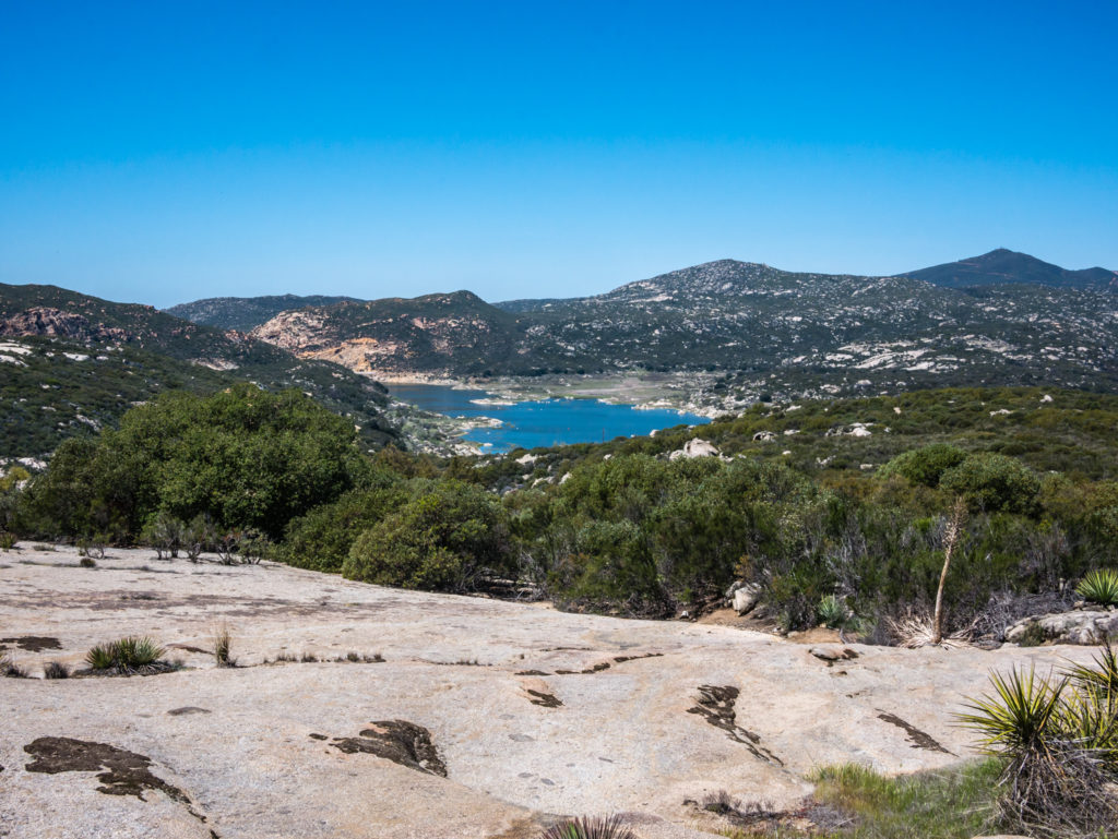
The water level of Lake Morena was low so the shore was unfortunately a fair way off from the campsite.
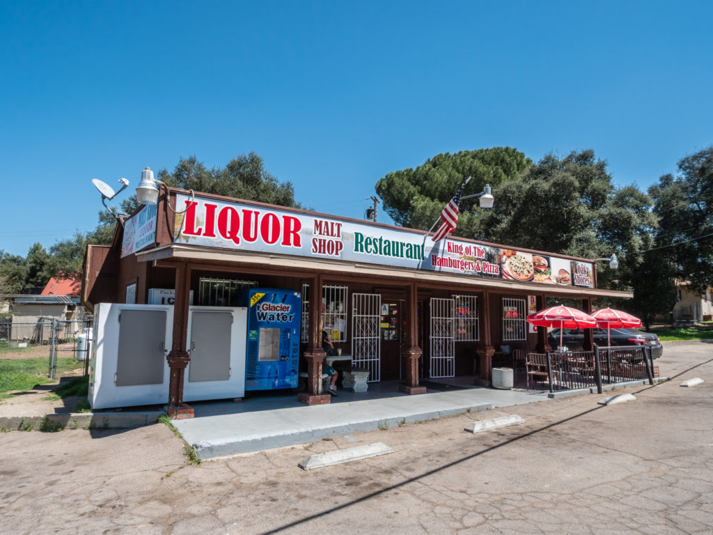
Stopping at the store for cold drinks and an ice-cream.
It felt like half a day as we reached camp around 2pm, but that was great as we had plenty of time to use the facilities. We showered and hand washed the clothes we’d been wearing the past 2 days as they were already ingrained with dirt from the trail. It’s so sandy and dusty there’s just no chance of staying clean. Wayne then did his usual washing line trick with walking poles and cord so we could hang our stuff out to dry, catching the attention of all the other hikers now pitching up around us creating our very own PCT tent village.
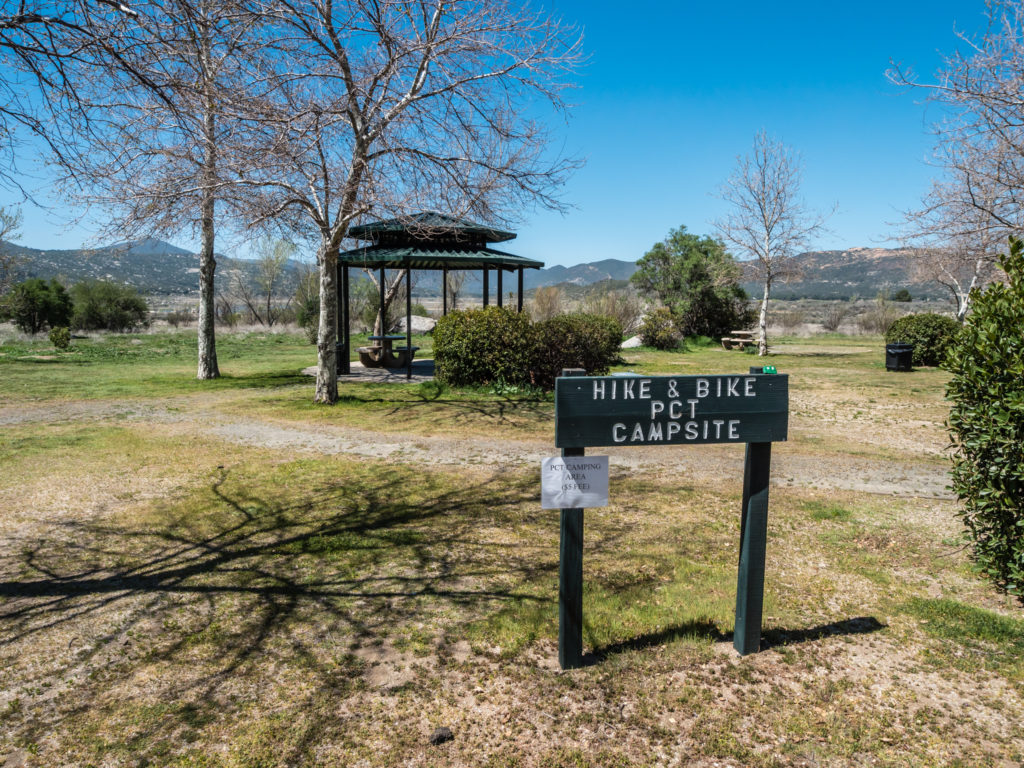
The campground at Lake Morena has a specific section for PCT hikers. You can can camp for $5 a night.
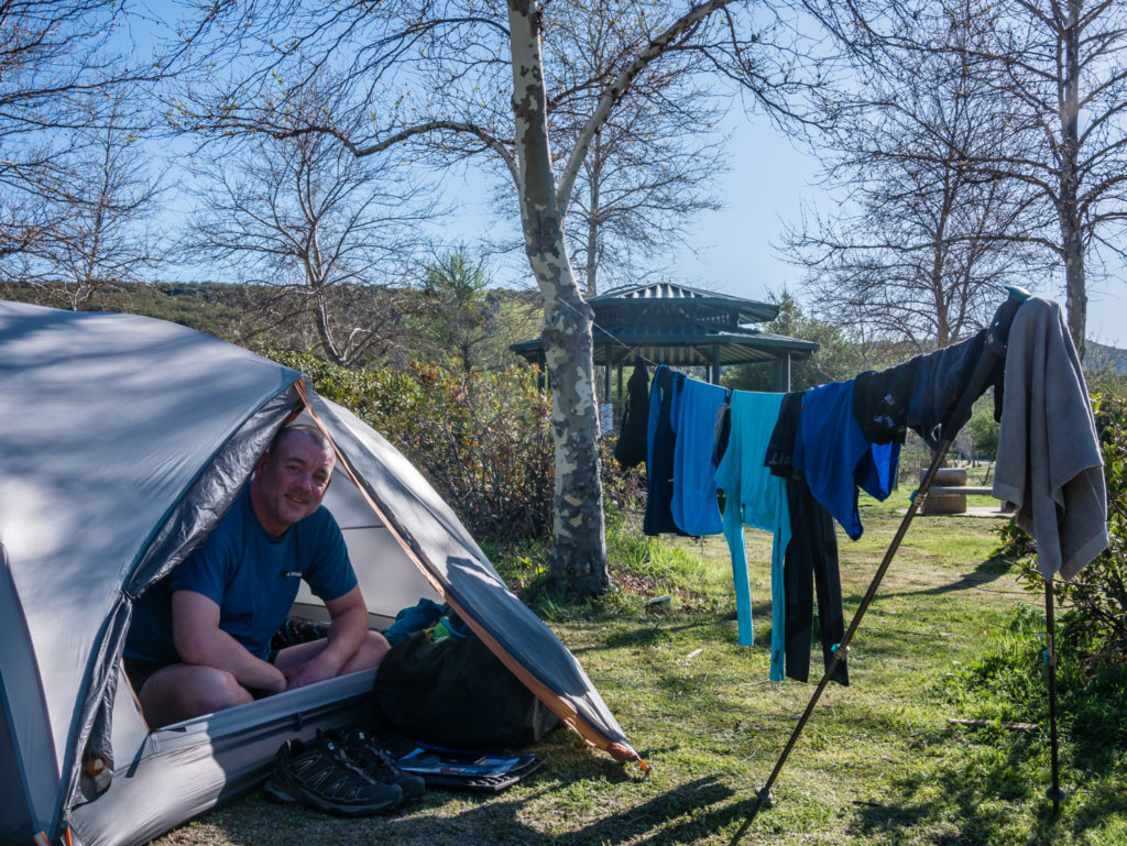
Rocking our traditional camp washing line, which other hikers thought was ‘cool’.
Then with our camp chores done we lazed around in the sun for a while, listening to other hikers’ stories about the past 2 days and where they had hiked previously. Many had already completed the Appalachian Trail, and were now attempting their second thru-hike towards the ‘Triple Crown’.
For dinner it was a new hiker concoction: a packet of shredded pork with Spanish style rice cooked together in the one pot then spooned into small tortilla wraps. We even made use of our new little kitchen gadget – a mini cheese grater, and put a sprinkling of grated cheese inside each wrap which melted perfectly. We are certainly ‘comfort hikers’ in a sea of ultra lightweighters on this thru-hike!
A new hiker recipe – Tortillas with Spanish rice and shredded pork topped with cheese.
With around 50 people pitched in this specific PCT camping area, we were fearful of a ‘party night’ erupting, especially when one guy came back from the store with two wine boxes. However as soon as it got dark everyone seemed to disappear into their tents, weary from a twenty miler, as most of the hikers in the campground had got to Lake Morena in just one day, unlike us who chose to take it steady.
We had already heard that a guy on day one was taken to the hospital with heat exhaustion and kidney failure, so we were pleased with our decision to take it steady for the first week or so. Only time will tell how many of these fast pacers will continue or drop out in a week or two because of injury and going too hard, too soon.
Day 3 – Thursday 12th April 2018, Lake Morena State Park Campground to Kitchen Creek Wild Camp (Mile 30), 10 miles
We were awake and up before 7am, but even by that time half of the camp had vanished up trail on their mission to get in another 20 miler. We, on the other hand, were still taking it steady with another 10 mile day planned. We finished off the last of the blueberry bagels for breakfast, packed up, then we were away around 8:30am.
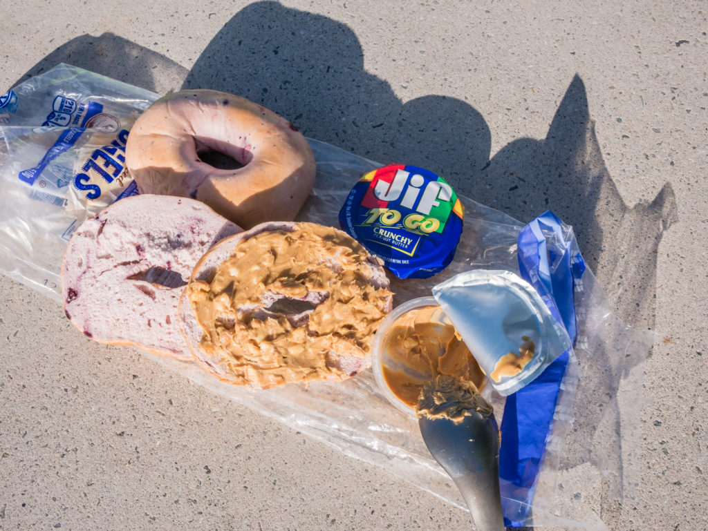
A quick, easy breakfast of blueberry bagels and peanut butter.
The weather forecast for the day was good, but with a drop in temperature of around 10°c, which Wayne was really pleased about. It was indeed noticeably cooler compared to the previous two days, so I put on leggings instead of shorts and also wore a mid-layer, but as these conditions were much more pleasant for walking our pace seemed somewhat faster. That might have also been due to the fact we were carrying at least 3kg less as we were now down to 2 litres of water as there were some reliable water sources on today’s section of trail to top up our supplies as we went, and because we’d finally eaten our way through all of the bagels!
Beautiful views of the desert teeming with life.
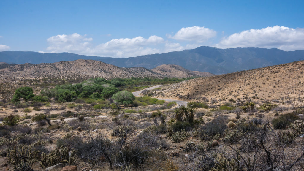
Having crossed over Interstate 8, we saw graffiti under Cotton Creek Bridge, largely from PCTers telling everyone they had ‘been there’. (We refrained.) We seemed to cover the first 6 miles in no time, where we then took a rest break at Boulder Oaks Campground simply as it had picnic benches that we could sit at. Very convenient!
Hitting the trail for the third day!
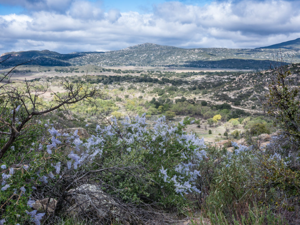
From 3,600 feet, the PCT then climbed around 100 metres more, the route staying high but following the course of Kitchen Creek flowing through the bottom of the valley. We were already higher than the tallest mountain in England (Scafell Pike at 990m) but we hardly noticed the gain in elevation as the trail follows gentle switchbacks through the chaparral. We were surprised at how green the whole area looked considering this is classed as the ‘desert’ section, and there was also an injection of colour with some beautiful purple California honeysuckle, as well as other yellow and pink cactus flowers.
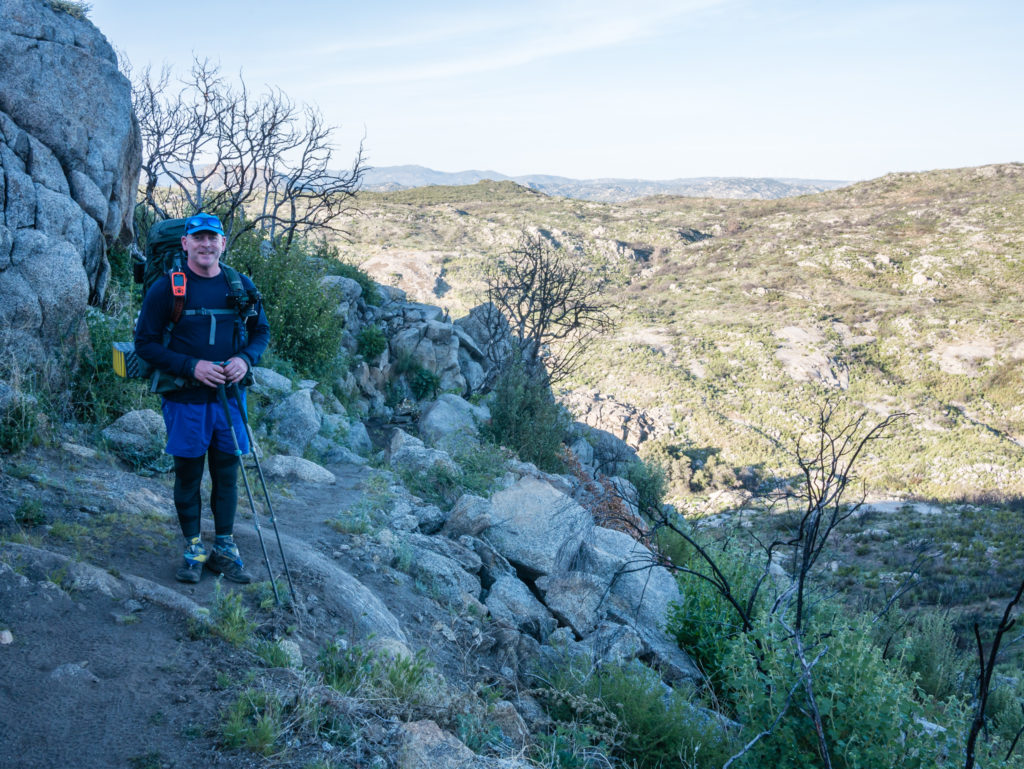
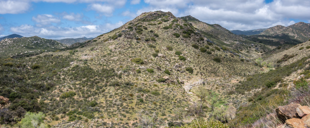
The PCT route traditionally stays high, so once again we had expansive views as we made our way north heading for Mount Laguna.
Looking on to Kitchen Creek flowing through the valley.
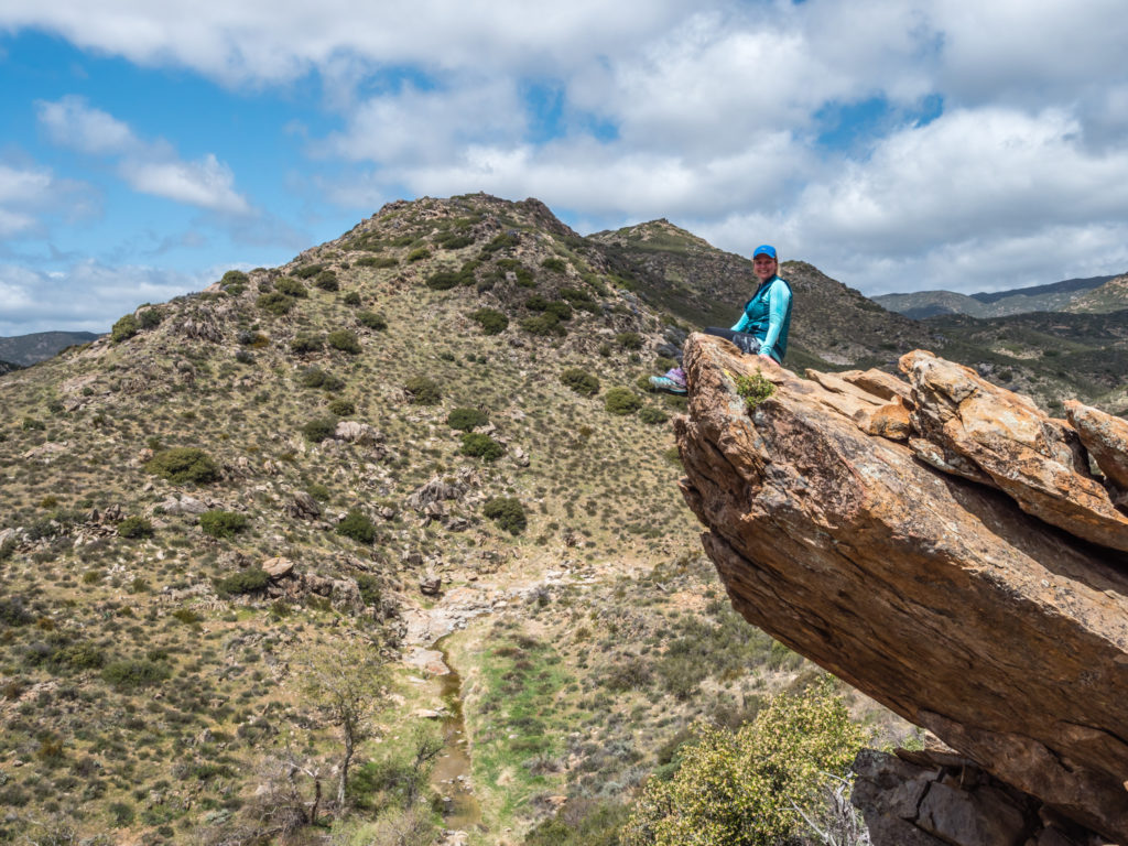
I couldn’t resist the obligatory hanging rock shot!
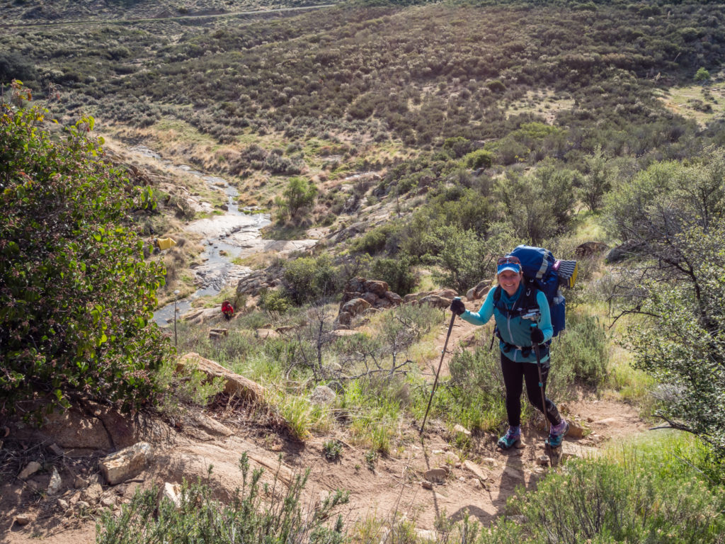
We had been leapfrogging a group of six young male hikers who had already formed a ‘trail family’ and came across them again when we reached Kitchen Creek. They were filling up with water and hiking on another 3 miles, but this was our 10 for the day done, so this was where we decided to camp. The route downhill to the creek is a little steep, so we used our walking poles to steady us, but it was nothing in comparison to what we had traversed with full packs during our time in the Pyrenees last year on the GR11.
Considering we were walking through desert chaparral, we couldn’t believe how green everywhere was!
Making our way around the ridge to a potential camp spot.
We crossed the creek and picked what we thought was a good spot to pitch the tent, then chilled out relaxing in the sun for a while. By late afternoon though, it was really windy down by the creek bed and we were wondering if we had made a bad choice of campsite. Thankfully by sunset the wind had died down and all we could hear then was a lot of croaking from some very active frogs nearby.
It was a short scramble down to Kitchen Creek, where we camped nearby.
Considering we are picking up a food resupply box tomorrow when we reach Mount Laguna, we seem to have a lot of food rations left, which we found quite surprising! Clearly we have yet to develop our ‘hiker hunger’ and are not yet eating our way through our planned meals and snacks. We swapped around our hot meal today and had it at lunchtime to make it easier in terms of pot washing and drying before the sun went down. On today’s lunch menu was instant noodles cooked with a Thai chicken cupa soup for flavouring, with added chopped pepperoni. Dinner was 3 tortilla wraps each, filled with spicy tuna from a packet. We also shared a small packet of Ritz cheese crackers and had a cup of tea.
By 7:20pm we were both nodding already, despite it not yet being dark. The hunger might not have kicked in yet, but ‘hiker midnight’ definitely has!
Day 4 – Friday 13th April 2018, Kitchen Creek Wild Camp (Mile 30) to Burnt Rancheria Campground, Mount Laguna, 11 miles
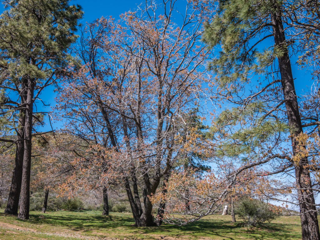
With 10 hours of sleep in us, we were well rested and ready to get back on the trail after a quick breakfast of peanut butter wraps. It was a steady uphill climb all the way to Mount Laguna, which saw us first walking along sandy ridges surrounded by prickly cactus and desert scrub, before the flora changed quite dramatically into pine forest with grassy banks either side of the trail. Instead of the sandy track we had got used to over the past 3 days, the trail was now littered in pine needles making it soft underfoot. The wonderful aroma of pine as we walked sparked off a whole multitude of memories of us hiking the John Muir Trail back in 2014, which gave us something new to talk about for a while, instead of the usual topics of food and toileting on the trail!
Hiking back up from Kitchen Creek where we camped the previous evening.
There are little settlements and campgrounds in the absolute middle of nowhere… But what a retreat!
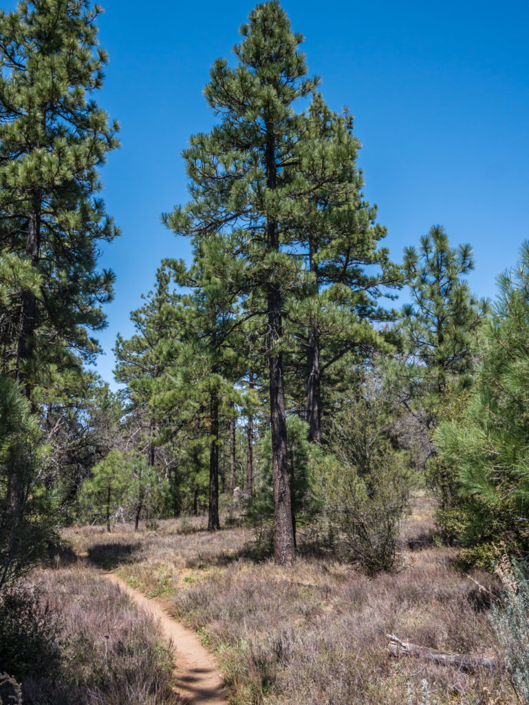
Walking into pine forest reminded us of wonderful days in the Sierra on the John Muir Trail!
We had a little excitement early on when Wayne got stung on his arm by a bee, but it was nothing too serious! After leaving camp we hadn’t come across any one else on the trail for a few hours, until around 2 miles from Mount Laguna when we saw a couple of hikers hobbling along in front of us, the guy at the back limping somewhat more than the girl in front. We stopped to chat to them and found out that Rob had pushed on too hard and his knee was hurting when he bent it, so he had decided that once he got to town he was going to have a ‘zero’ the following day to rest it and hopefully make a quick recovery.
We were once again reminded about how quickly you can injure yourself and be forced off the trail, so we were pleased that we had not joined a trail family or powered through the miles just for the sake of it – we were hiking our own hike and managing to stay injury free because of our steady pace. Even the campground host, once we got settled at the Burnt Rancheria Campground in Mount Laguna, was surprised when we turned down his offer of plasters because we didn’t have a single blister!
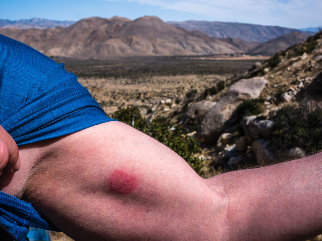
Wayne’s bee sting! This shot was actually taken from a few days later, and it was still causing him some pain.
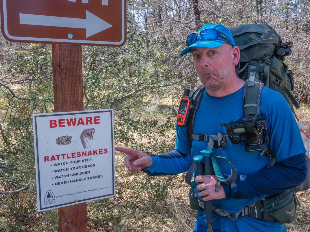
We’ve had several warnings about rattlesnakes, but as yet, we haven’t seen one (luckily!).
We headed straight to the Mount Laguna Store when we arrived in town as we had a resupply box waiting to be collected from there. It was the largest box on the hiker shelf and the shop assistant was bewildered with what we could possibly have in there when we said it contained 6 days of food rations. He weighed the box, which came in at 18lb or 8.5kg and proceeded to give Wayne the trail name ‘Sherpa’ for carrying such a heavy load! We agreed it might have been a little excessive, so we decided that we’d ditch some food and up our daily mileage from 10 to 12 miles, in effect meaning that we’d get to Warner Springs in 5 days instead of our intended 6, thereby bagging a spare day to utilise somewhere down the line when we wanted another ‘zero’ in a town.
Collecting our resupply package from the Mount Laguna Store.
Once pitched at camp, we organised all the food rations again, choosing some of the heavier items to cook for that evening’s dinner. Then we made use of the hot showers as we knew that for the next 5 days on trail water would be scarce, with us even having to rely on a couple of water caches courtesy of some trail angels on a particularly dry section between miles 70 and 100.
Pitching at the Burnt Rancheria Campground in Mount Laguna. (A site costs $25 for up to 8 people.)
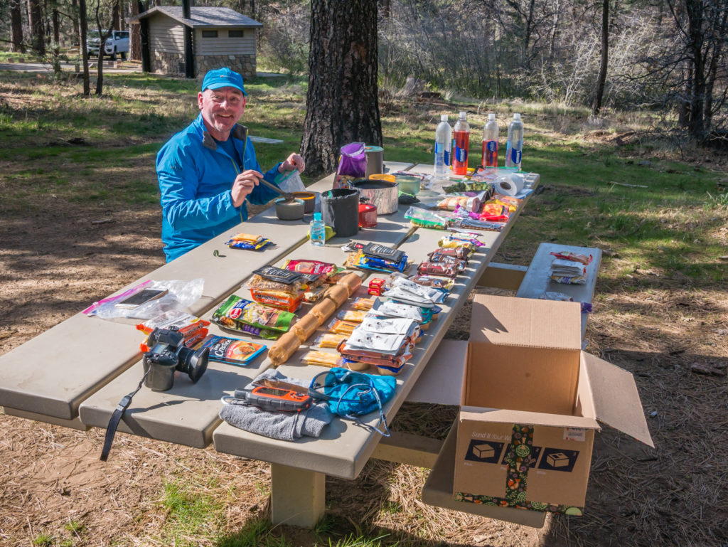
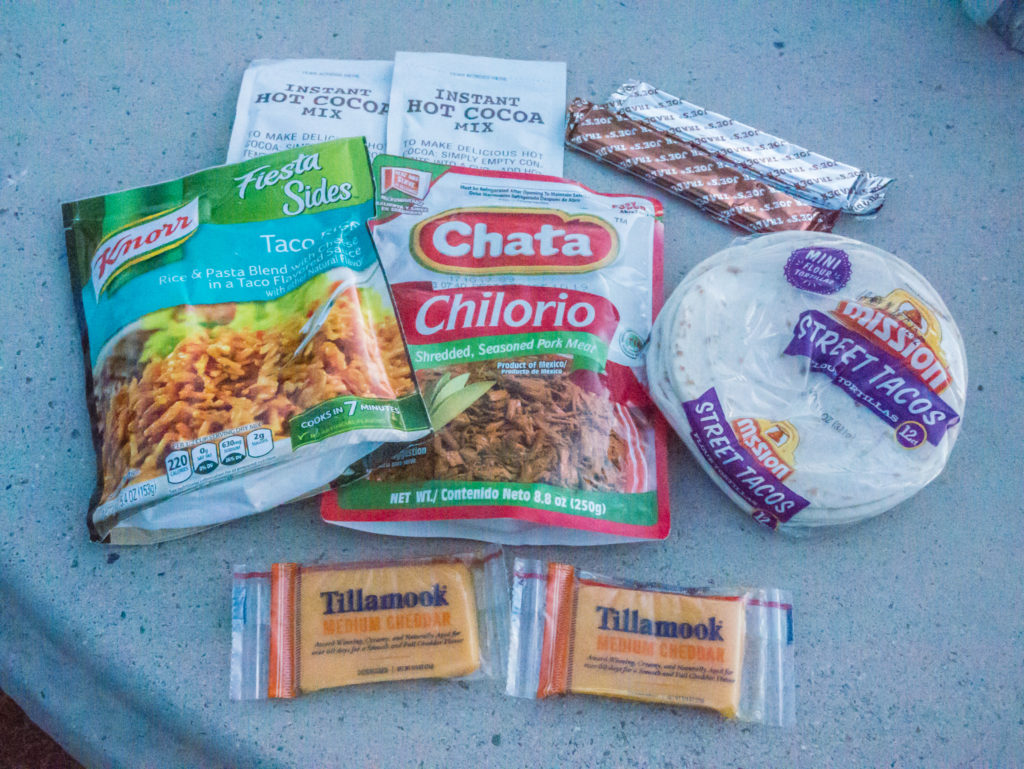
Organising our food rations into 5 days worth of breakfasts, lunches, dinners and snacks. (Maybe we bought a little too much as the hiker hunger hasn’t kicked in yet!)
We also had the pleasure of Kevin, our book publisher and friend from San Diego, coming to camp with us that evening, which was a real treat on the trail, especially as he proved to be our own little trail angel by bringing us beer, wine, firewood and a box of other food goodies! It was a fun evening camping together sharing hiker tales around the fire, and we even managed to keep awake and stay up later than 10pm!
Day 5 – Saturday 14th April 2018, Burnt Rancheria Campground, Mount Laguna, to Wild Camp at Oriflamme Canyon, 15 miles
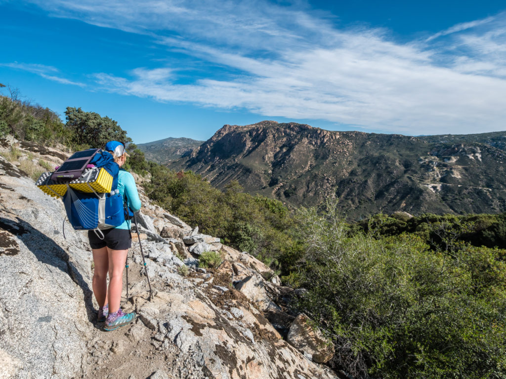
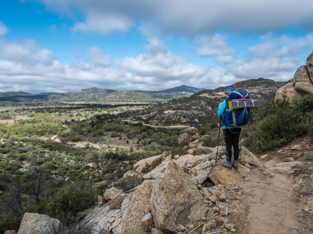
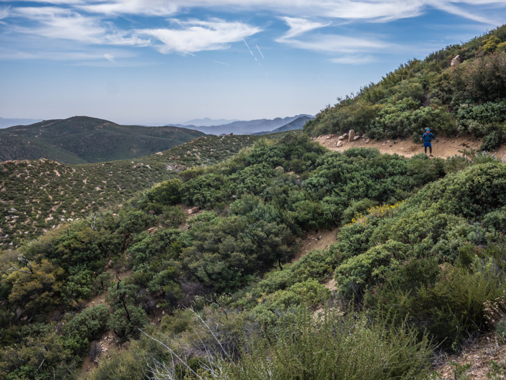
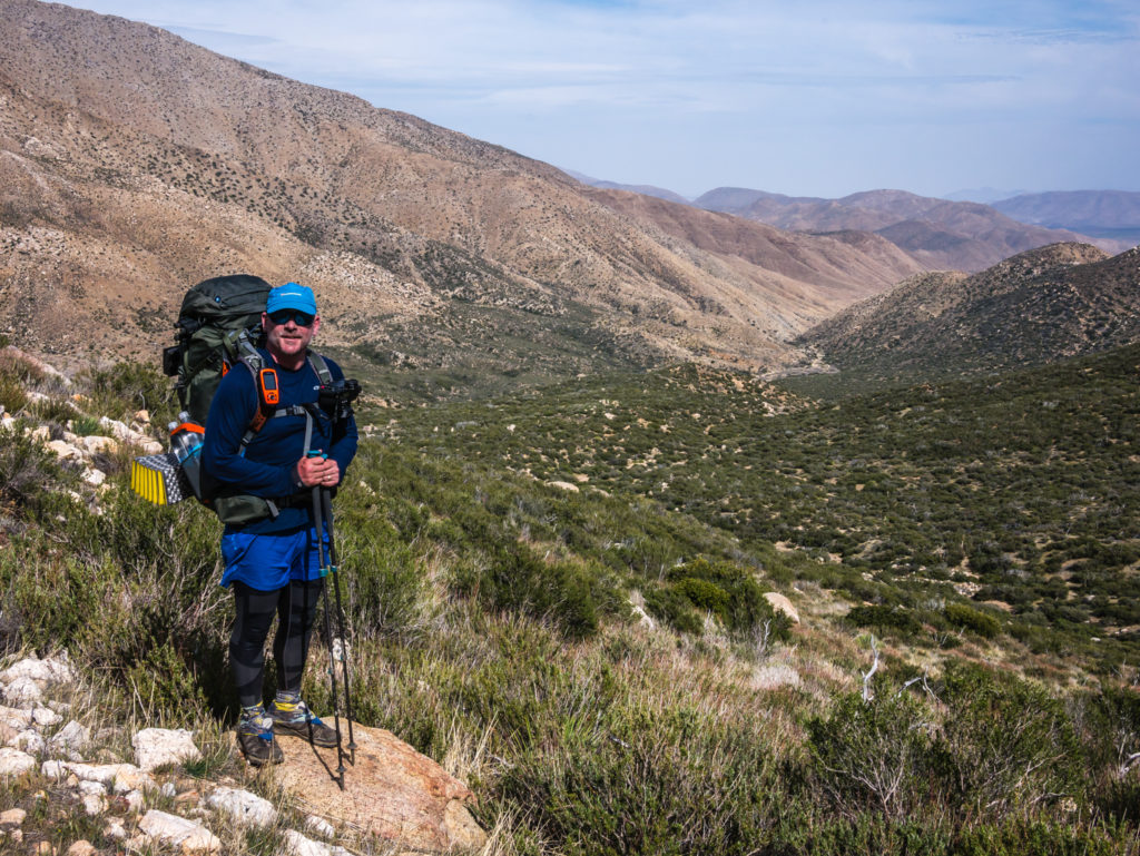
After a fun night, we enjoyed a leisurely breakfast with Kevin, then re-joined the PCT from the Burnt Rancheria Campground around 9am. Fully laden with our next lot of food rations, our packs were as heavy as Day 1 again, but as we were now getting our ‘trail legs’, meaning we were getting fitter and stronger by the day, we managed the packs well and did a 6 mile stint straight off, reaching the Mile 48 Road Look Out before we had a rest break.
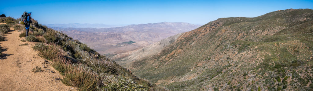
Today the trail afforded magnificent views of the Anza-Borrego Desert State Park.
Between miles 41-53 we were hiking through the Laguna Mountain Recreation Area, which also meant there were a lot of day walkers on the trail too, especially with it being a Saturday. Kevin was also going to hike a section of the trail with us so it was a busy morning of conversation as we stopped and chatted with several hikers going in either direction. One older guy from San Diego doing a training hike at Mount Laguna commented ‘You’ll never make it all the way to Canada if you keep on stopping and chit-chatting!’ It was true – we had spoken to more people on the trail today than in the past 4 days, but on doing so we were sad to learn that an older Korean guy whom we had seen on and off during the previous 4 days, hiking at a similar pace to us, had yesterday suffered a heart attack on the trail and died, despite the paramedics’ best efforts to revive him. Sad times. We have no confirmation of whether the guy had a pre-existing medical condition, but again, it made us think of the importance of hiking at your own pace and not going too hard or doing too many miles early on.
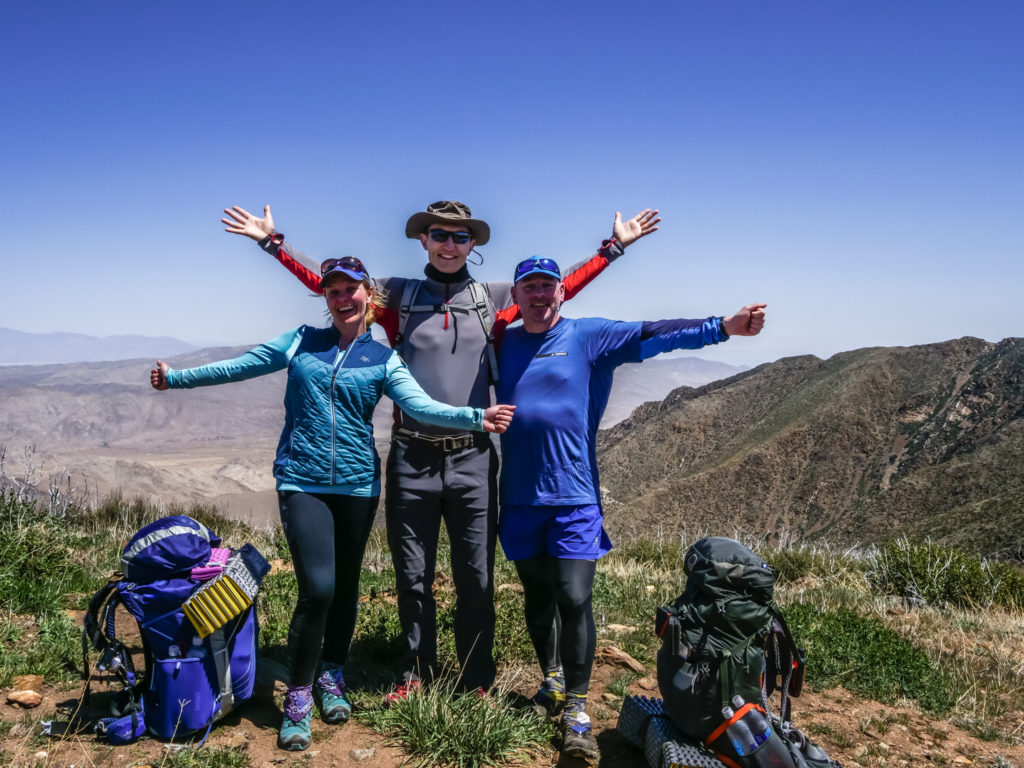
Meeting up with our friend Kevin on the trail. He had driven out specially from San Diego to spend the night with us at camp at Mount Laguna.
Our first water stop was at the Penny Pines Trailhead which thankfully had a working water faucet. Wayne had planned out the next 5 days really carefully as there was the potential for a completely dry 40 miles segment of trail. We downloaded the latest water report and were pleased to read that one water source en route was now working again and that we wouldn’t have to carry another 4 litres each at this point, but we could get away with 2 and a half if we ‘camelled’ up before leaving. This meant drinking at least one litre of water at our rest stop to make sure we were well hydrated, much like a camel storing up water.
Even the desert has bursts of colour!
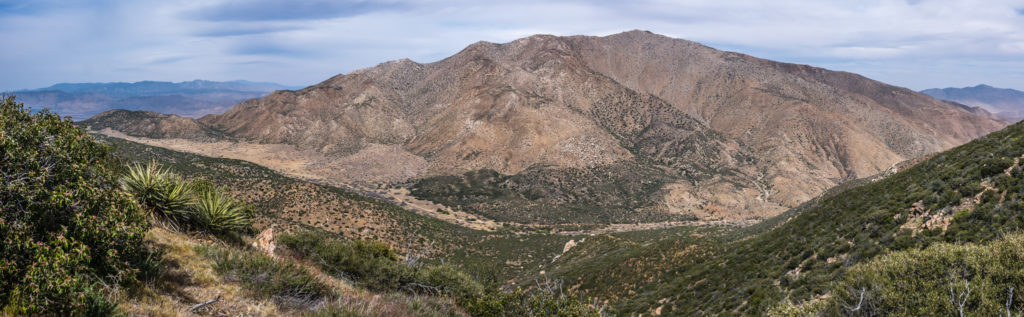
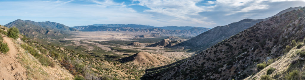
Unlike yesterday’s fairly monotonous walk through desert scrub with little in the way of a view out beyond the bushes, today’s scenery was pretty spectacular. In the foreground and where our trail meandered, the mountains were covered in a thick green underbrush, but contrasting greatly was the landscape beyond. Here the mountain ridges looked both dry and desolate and so inhospitable that the vast area reminded us of Death Valley. We were so glad the PCT stayed this side of the valley, but it was a tremendous view and we enjoyed it for much of the day as our trail stayed high, skirting around the entire bulk of Garnet Mountain.
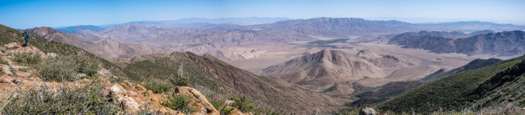
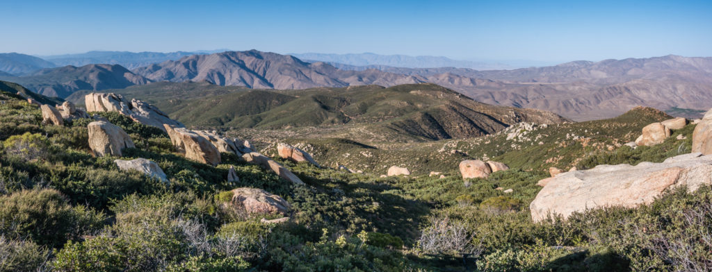
A panorama showcasing the difference between valleys. Quite literally the side we were walking on was lush green, whereas just across the mountains it was brown and dry.
Despite our valley having more vegetation, we were still hiking through what is classed as ‘desert’ and it felt like it too as the sun blazed down. Each time the trail followed around a ridge, we were kept cool however as there was a cold, biting wind blasting up the mountainside, so we were thankful of our extra layers.
We were glad of another rest as well as another water top up when we reached the Pioneer Mail Picnic Area, at mile 53. As we had read about cases of e-coli in the Mount Laguna area, we still filtered the water we took from the tap at the trailhead, just to be on the safe side. Diarrhoea on trail in the first week would just be the worst luck in the middle of the desert with limited access to water, let alone there being no toilets!
52 miles in and still no blisters! We were faring well.
We spy trees! The picnic area was like its own little oasis.
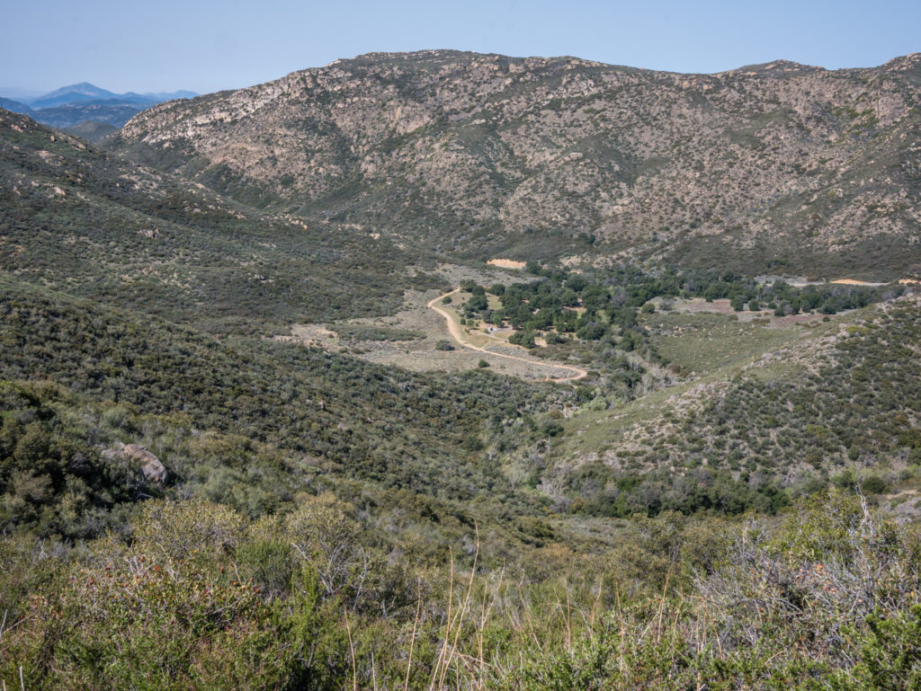
Afterwards, our route took us through the Anza-Borrego Desert State Park where we camped at mile 56 above Oriflamme Canyon. The wild camp spot we were lucky enough to bag was the best so far, with views right across both sides of the canyon. Several other hikers had found decent pitches on a flattish part of the ridge between the scrub and large boulders by the time we arrived just after 5pm, but we were more than happy with our spot, which afforded us a great view looking out on to the canyon.
Looking across to where we’d be walking tomorrow.
Our view from the top of Oriflamme Canyon where we managed to find an amazing camp spot.
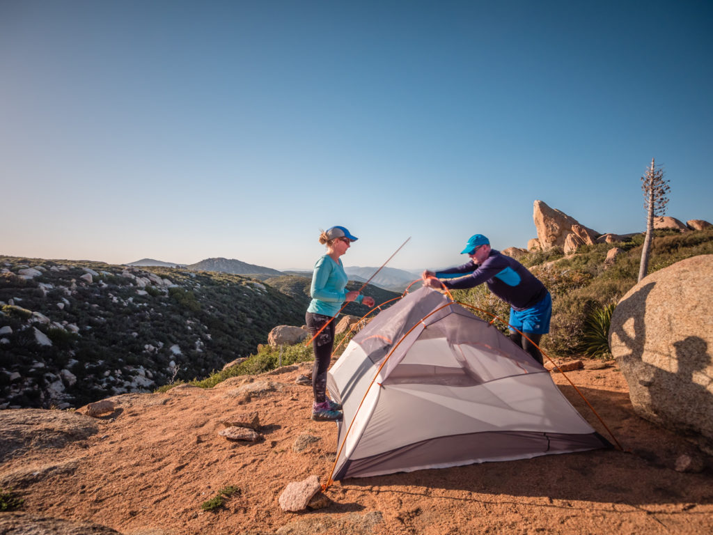
Pitching our tent on a flattish spot overlooking Oriflamme Canyon.
We even saw the sun dip behind the opposite ridge whilst drinking hot chocolate and cooking dinner. Tonight’s menu was another new meal idea: sour cream and chive Idahoan potatoes with a chilli bean, tomato and rice thickened soup poured over the top. What a trail feast!
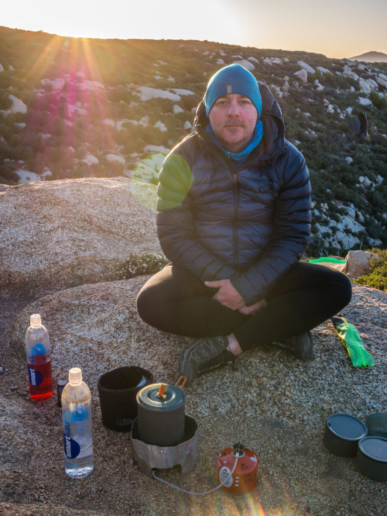
Master Chef Wayne hard at work again cooking up a trail feast!
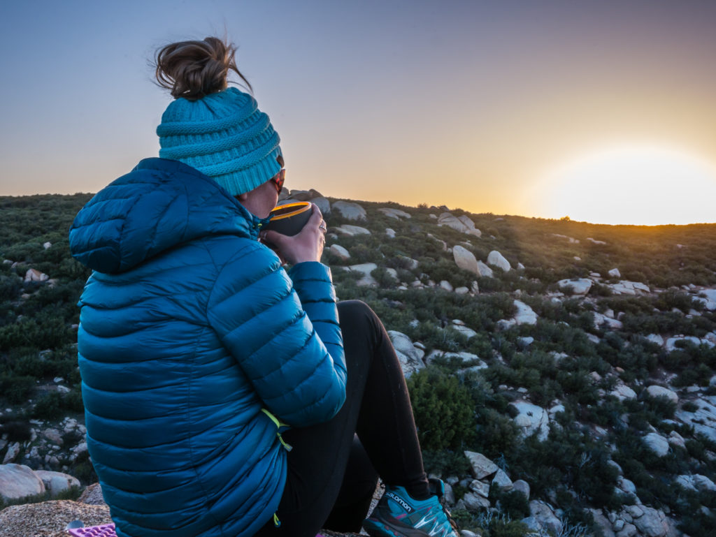
Enjoying a hot chocolate whilst watching the sun go down. Is there anything better in life!
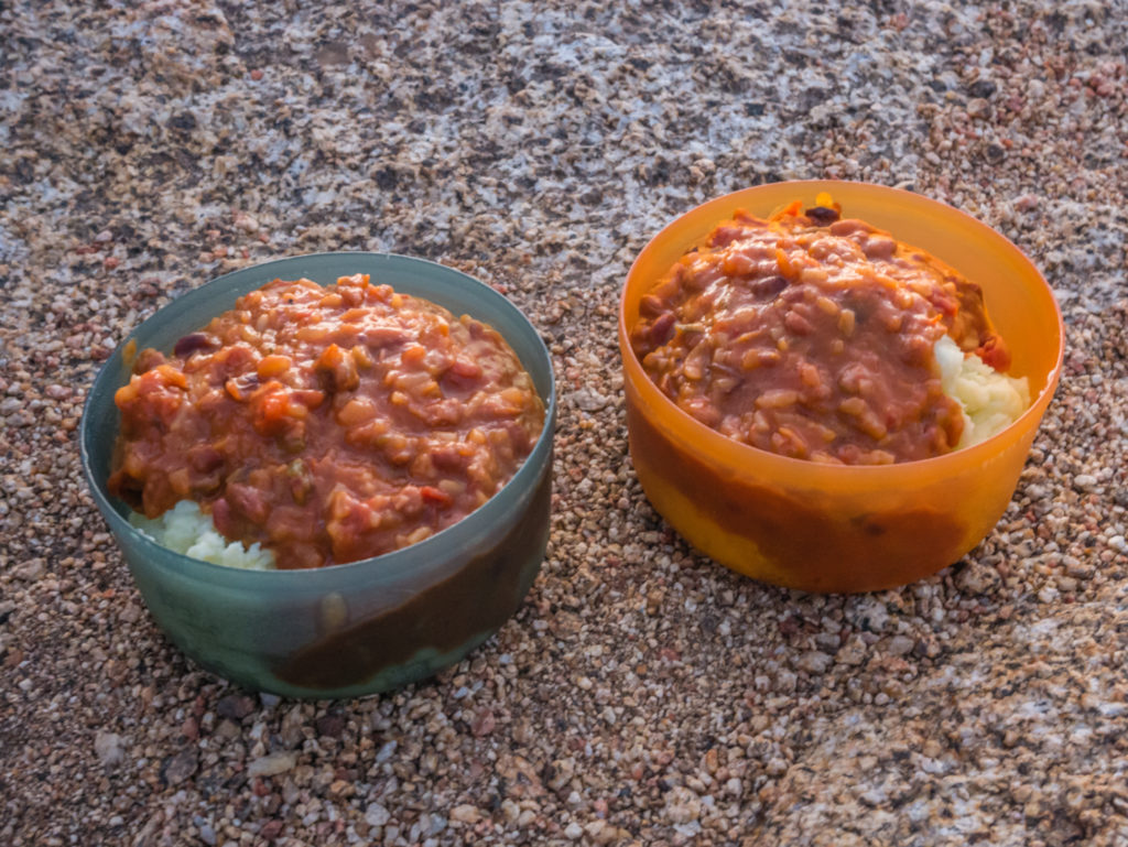
Another new tasty and more importantly ‘filling’ hiker meal: sour cream and chive Idahoan potatoes with a chilli bean, tomato and rice sauce.
Day 6 – Sunday 15th April 2018, Wild Camp at Oriflamme Canyon to Wild Camp at Mile 68.4 (Rodriguez Spur Truck Trail), 13.5 miles
Everyone had left by the time we ventured out of the tent around 7am. We slept in longer than anticipated as we were kept awake until the early hours because of heavy winds funnelling up the canyon making the tent creak continuously. We only slept properly after putting in ear plugs to filter out the noise, it was that bad!
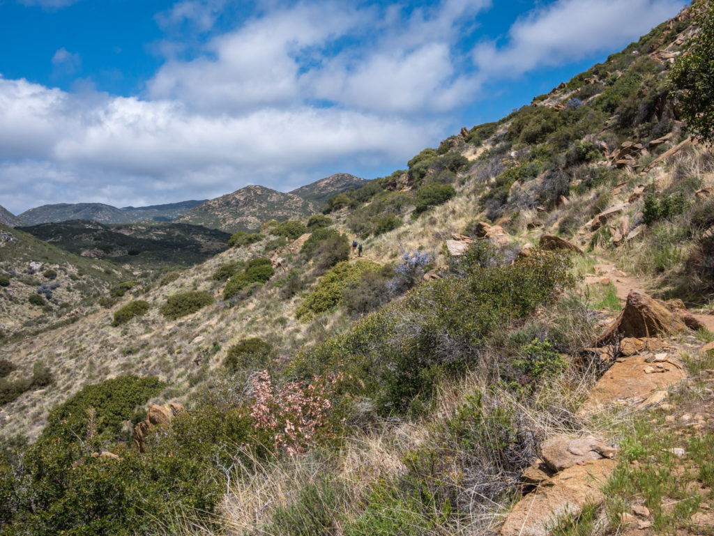
Much of the day was then spent hiking through Anza-Borrego State Park, as the PCT weaved from one ridge to the next along gentle switchbacks that cut in high across each mountainside.
Setting off through the Anza Borrego State Park once again.
Our first chance at replenishing our water supplies was at the Sunrise Trailhead, just off the Sunrise Highway, were there is a large water tank. Our water report stated that the tap had been fixed, so we were able to filter and top up with 4 litres each, much like every other PCT hiker was doing when we arrived. It’s funny how when walking along it’s quite a solitary experience as we barely see anyone on trail from one day to the next. Yet, every hiker will converge at water sources and campsites as if they arrived there by magic!
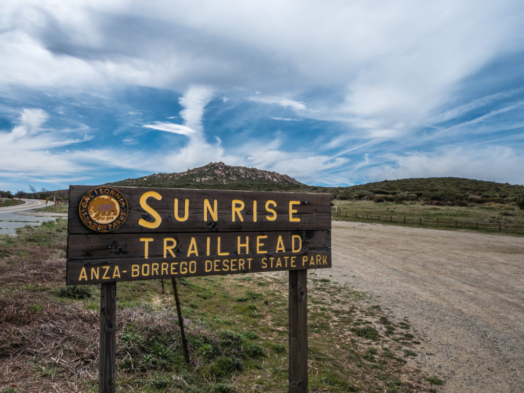
Reaching Sunrise Trailhead, our first opportunity of the day to top up our water supplies.
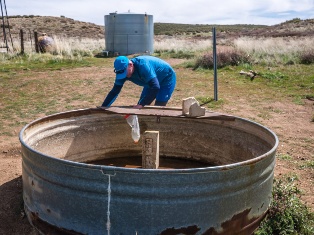
Wayne fills our water pouch from the tap that is fed from the large water tank at the back. We then filtered the water into our bottles to avoid any chance of getting sick.
We had to carry such a large amount as our next water source would not be until the following day, another 9 miles on from tonight’s camp where we would be relying on the cache located at Scissors Crossing, mile 77.
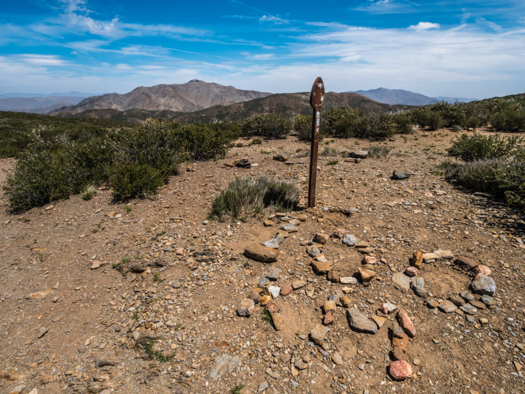
The first 100 kilometres done! It’s not so exciting when we are measuring the distance in miles, so we’re looking forward to the 100 mile marker.
This way for the PCT! There are several handy rock signs to help hikers where a marker isn’t obvious.
As it was going to be another ‘dry camp’ we pushed on a few miles more, making the most of the cloud that had suddenly built up overhead. From past experience, wispy clouds generally signalled rain, but we couldn’t quite believe we’d see any of that here in the desert!
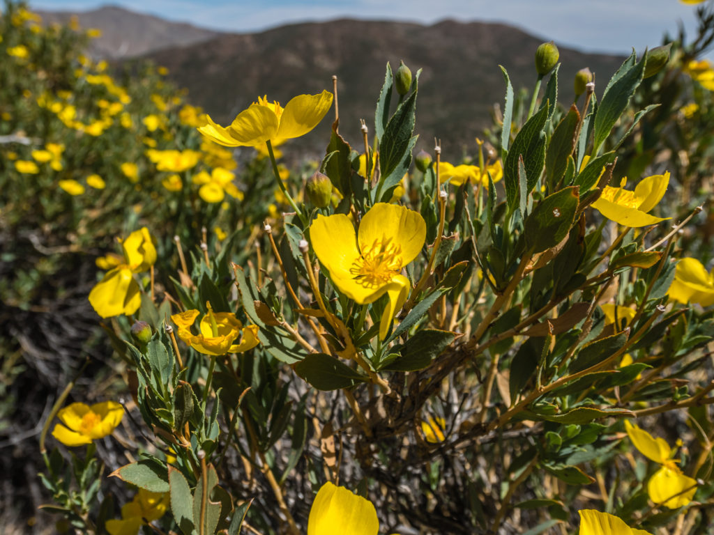
Beautiful desert flowers brighten up the day!
Looking on to the San Felipe Hills – we would be traversing them on our way to Warner Springs.
Taking a quick cat nap. So far we had avoided getting sun burnt by covering up, but it was short sleeves today to try and get the tan going.
We didn’t see it, but we heard it… Well what we thought was our first rattle snake! The rattling sound is really distinctive, but it came from just off trail, from what we determined was something hiding in a bush. One of the girls we met on the trail yesterday goes by the trail name of ‘Snake Eyes’ as she is excellent at spotting them – we could have done with her visionary skills right at that moment to tell us if we were correct. I guess they’ll be plenty more opportunities to spot a rattle snake seeing as we’re walking through 700 miles of desert before we reach the High Sierra. Then of course we’ll forget about snakes and be more concerned about bears!
Heading to the road… Still a long way to go.
Our wild camp spot tonight was just off a dirt road, where we were joined unexpectedly by several other PCT hikers arriving after us. Usually, we choose a spot by ourselves for privacy, but we had no choice when others pitched close to us, obviously with the mind-set early into the thru-hike of safety in numbers.
We camped in a grassy spot along the dirt road to make it easier to get to the water cache the following morning.
Again we trialled another new hiker dinner utilising our mini frying pan to brown off some ‘packet’ chicken, which was added to a boiling pan of teriyaki noodle soup, with chilli flakes for an added punch. It was actually really good, although I still liken packet chicken to that of cat food. (We don’t get it in the UK, so how much chicken we’re really eating from that packet is wholly debatable!)
But with our bellies full, we were hoping for a better night’s sleep.
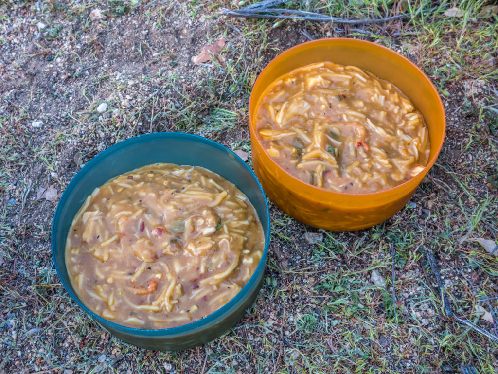
Another trial hiker recipe – pan-fried ‘packet’ chicken, with thickened teriyaki noodle soup. It doesn’t look great but it tasted good!
Day 7 – Monday 16th April 2018, Wild Camp at Mile 68.4 (Rodriguez Spur Truck Trail) to Dry Creek Bed (near the trail) San Felipe Hills, 10 miles
We were awake at 6am, but it seemed that everyone around us had already decamped and set off for the water cache at mile 77, Scissors Crossing, before the sun had fully risen and it was still cool.
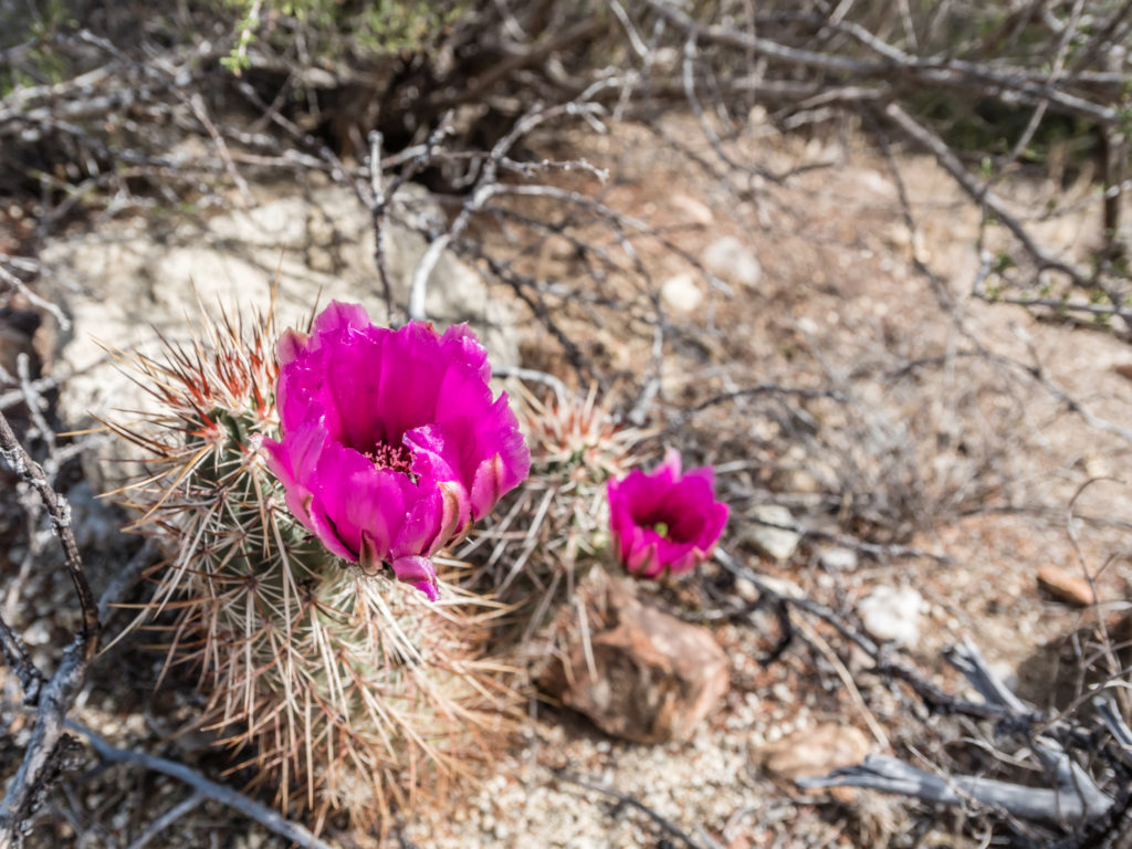
We packed up quickly too, ate a dry breakfast of Belvita fruit bars and were away just after 7:30am, our earliest start time yet. Today, our route went high, taking us around several ridges and gullies that from a distance looked dry and barren, but up close we found they were covered in a whole variety of desert vegetation. We noticed that many of the low-growing cacti had buds about to flower, and further up trail we were lucky to spot a couple of early bloomers with bright cerise pink flowers that had opened up.
Another wonderful panoramic view from the trail
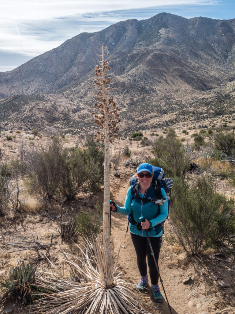
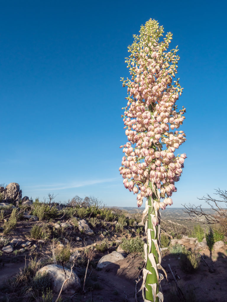
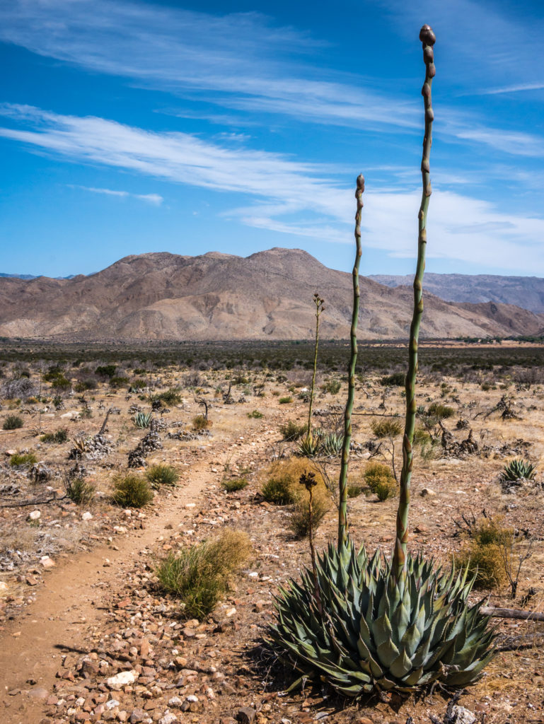
Trying to put into perspective just how tall these desert agaves are!
Many of the cacti are about to bloom, which will make the desert even more striking to walk through.
Unusually so for the PCT, here the route was taking us along narrow, sandy ledges that seemed far too thin to accommodate a horse, the PCT also being an equestrian route. With us having to keep a watchful eye on our own footing and take it steady in places, we both commented that we would not have liked riding horses along this section, particularly not the horses we rode in Colombia that galloped off at will, as one slip on the ledge and it was a long way down to most likely instant death!
We stopped for a rest break after about 5 miles, where we had a tremendous 360° view of the desert plain and surrounding mountains. We mused over which way our route would take us as we were progressively heading towards the community of Warner Springs, which we had planned to reach by Thursday. We knew we’d be crossing the highway, which we could just see in the distance, then heading through the San Felipe Hills that lay straight ahead. Three miles further on we reached Scissors Crossing and the water cache located under the bridge.
Hot but still full of life.
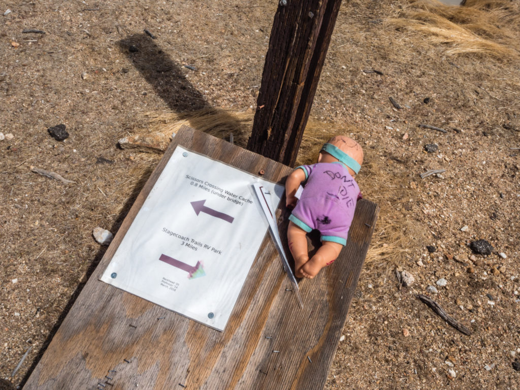
Almost at the Scissors Crossing water cache, we had a nice reminder about how important it is to carry enough water on these dry desert sections of trail.
At the time of our arrival, we were lucky to meet the ‘Professor’, a former PCT thru-hiker who lives in the nearby community of Julian and maintains the water cache at Scissors Crossing for the benefit of current thru-hikers. He was taking away empty bottles and checking on supplies and offered us a lift into Julian. We chatted with him for a while and thanked him for the amazing job he does. Without him maintaining a water supply for hikers passing through what is otherwise a completely dry area of around 40 miles, it would be a very difficult section of the PCT for many to undertake.
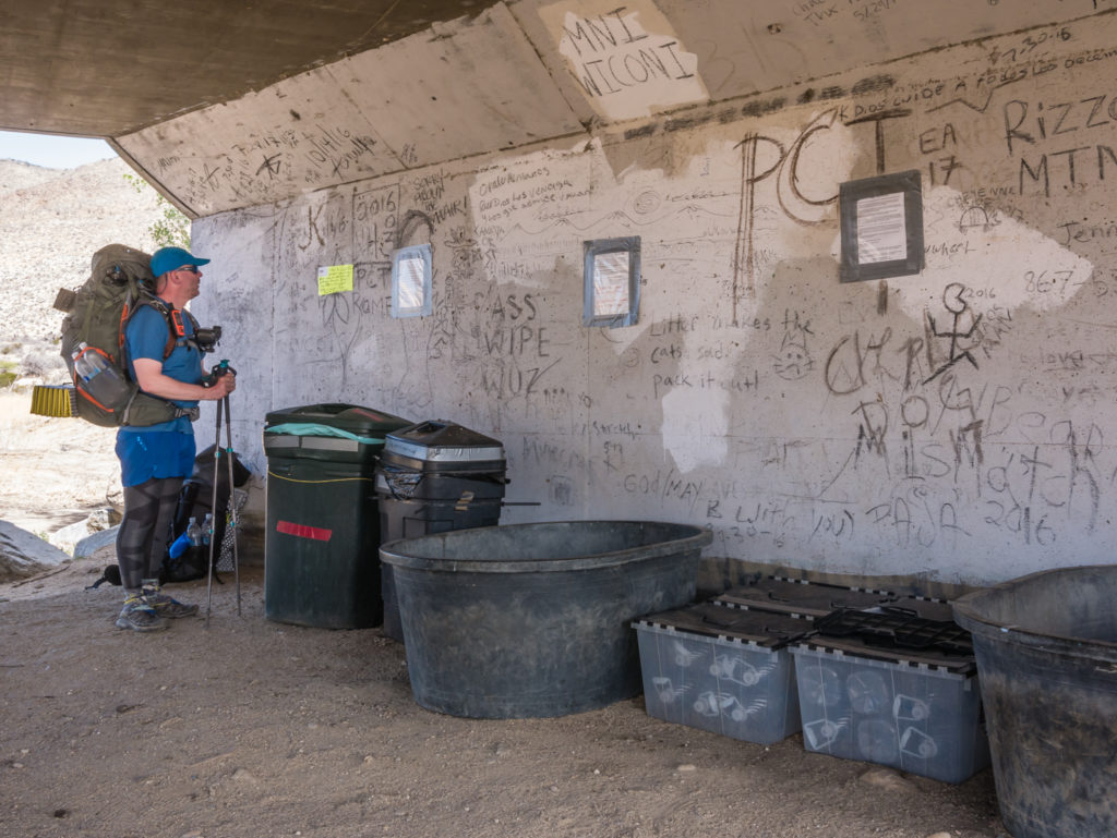
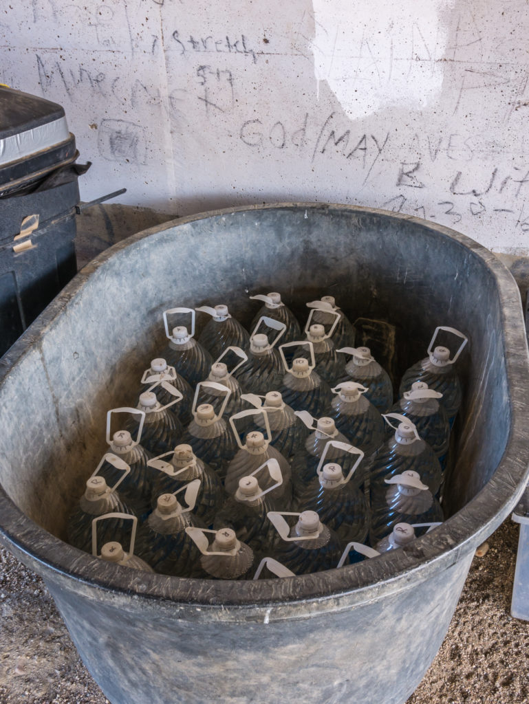
The water cache under the bridge at Scissors Crossing that is invaluable for PCT hikers. As a community run, voluntary operation, it truly is a life saving service out here.
The ‘Professor’ was there taking away empties and checking on supplies and it was great to chat with him about PCT trail life.
We turned down the lift into Julian, (plus the chance of a ‘free’ pie at the café for PCT hikers), instead deciding to hike on a further 2 miles or so to find a wild camp spot further up trail. The wind was getting stronger as we zigzagged up the ridges, so we were hoping that we’d be able to find a tent spot in a sheltered gully, which thankfully we did. Our first attempt to pitch however, failed miserably as strong winds kept funnelling up through the gully and buffeting the tent, so much so that it got flattened and our tent poles bent under the pressure. At this point we decided to hike on a few more miles in the hope of finding a better spot up trail, however we spied a more sheltered pitch around the bend and opted to try there instead to save us walking any further.
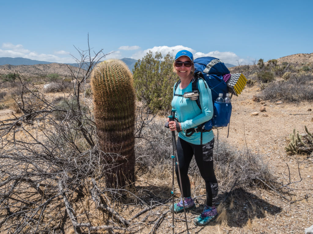
Now that’s a BIG cactus!
We really felt like we were in the desert ‘proper’ now!
The road to Warner Springs… But that wasn’t our route, so around the San Felipe Hills we go!
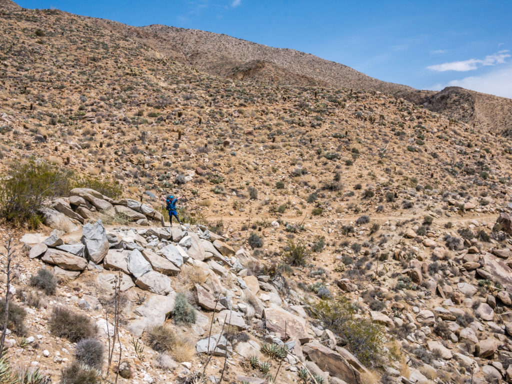
Heading into the hills. It was literally switchback after switchback winding around several rocky mountains.
The spot, which was essentially on a dry creek bed, was much better, although we still had an issue with the wind funnelling through at times, but pile of dead trees acting as a wind break helped a great deal. We felt lucky to have bagged such a good spot before anyone else as several other hikers then followed, all with the hope of finding a decent pitch nearby.

Our camp spot in the San Felipe Hills, with some wind protection behind the tent courtesy of some dead scrub piled up creating a wind break.
As it was another dry camp and we wanted to conserve water, we had instant noodles and packet tuna for dinner, just for ease of cleaning the pots. We then hunkered down, keeping our fingers crossed that it wouldn’t rain through the night as the latest weather report gave a 30% chance of precipitation and the clouds that were blowing in above us looked very grey. The desert might need rain, but at the moment we certainly don’t. (It’s a good job we didn’t send our waterproof gear forward in the bounce box as we might just be needing it!)
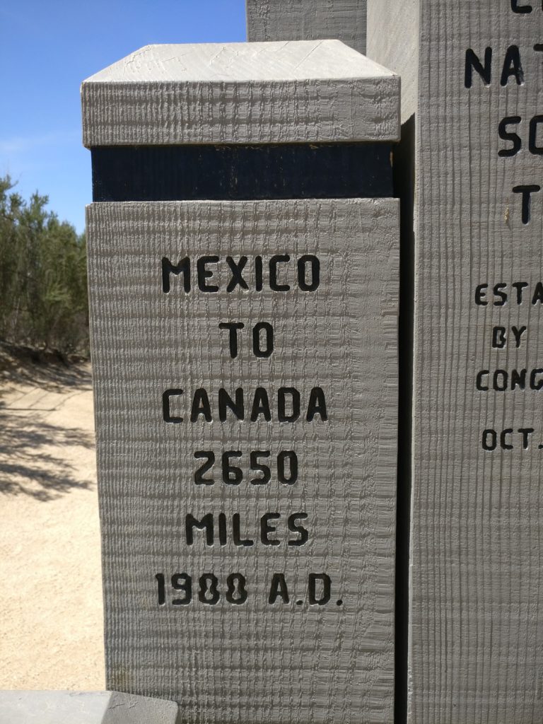
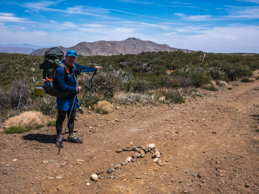
What a great start to our thru-hike – 79 miles of the PCT completed in the first week! (That’s just 2,580 miles* to go until we get to Canada!) *If you’re confused about the total distance after reading ‘2,650 miles’ on the Southern Terminus Monument, the figure of 2,659 miles comes from the extra 9 miles of hiking into Manning Park beyond the Canadian border, which is the official end point of the PCT.
It has certainly paid dividends going at a steady pace and not pushing too hard, too soon. There will be plenty of days for ‘big miles’ as we head into Oregon and Washington in the future. So for now, we’re simply enjoying what Southern California has to offer as we’ve never been to this area before, and are happy adjusting to the routines of trail life once again. #PCT2018 bring it on!

18 Comments
Off to great start. I really enjoyed reading your first post and I look forward to more. Not only in the desert but in northern California and Oregon, you’ll have opportunities to see rattlesnakes.
Thanks for your comment Mike and for following along! I’m not sure if we really do want to see a rattle snake or not!!! But there’s plenty of time!
Great write up, Danielle. Looking forward to the next one. Sally is disappointed that there was no toilet talk. Keep safe, love to Sherpa Fenton. 😘xxx
Thanks Alan! There’s a bit of toilet talk to come in week 2 😉 and Wayne wants to compose a video of all aspects of trail life in the future!
Hope you and Sally are both well xx
Great to read about the beginning of your latest adventure. Great reading and photos as usual – just finished reading over my morning coffee and really enjoyed it – looking forward to the next installment!!
I loved the “only 2650 miles to go” photo – rather puts my own “only 50 miles to Bath” from the Cotswold Way to shame – but at least we didn’t have to keep a look out for rattlesnakes !!!!!
Great to see your ‘slow but steady wins the race’ philosophy is really paying off – plenty of time and miles to play with yet.
Looking forward to seeing your next installment.
Best Wishes
John
Hi John, thanks for your lovely comments and for following along.
We are really pleased with how well things are going so far, but still a long way to go!
All the best, Danielle & Wayne
Nice start.
Loved to read about the first week on the Trail. Followed the progress on the Garmin site and was already wondering that the distance was not the needed 120 mile a week to make it until mid September. I am sure that the needed progress to make it in time is planned. Have fun, stay safe and keep on going!
Thanks for following along Walter!
We have a plan and are steadily increasing the mileage and are on track to finish around September 14th, all going well. Our plan to go slow the first week has really paid off as we are blister and ailment free, unlike a lot of other hikers who pushed 20 milers from the get go and are now suffering because of it.
We’re up for 17 miles today so steadily getting there!
Best regards, Danielle & Wayne
Pleased you’re staying safe.
Your food looks disgusting!!!
Showed the children in Shakespeare class the “live map” They clearly don’t appreciate scale as the comments were, “they’ve not gone very far!” They also wanted me to keep zooming in so they could see Wayne!!! :))
Look forward to your next instalment, very envious (but not of the food and camping bit) x
When you’ve been walking all day, you don’t really care what you eat you’re that hungry! We eat a lot better than most as they don’t want to carry the weight of a cook pot etc.
Glad the live map is being of use! Maybe now the children will realise why it will take us until September to get to Canada 😂😂 Thanks for showing them👍
Fantastic start to this new adventure. Considering you are still on trail, this post is exceptional. Just love that you are seeing the desert in its full beauty. Now looking forward to your next post.
Thanks for your wonderful comments Helen! 🙂
Best of luck on your latest adventure. Hope it all goes well. Beats work. Next year me and a friend are going to do the Kungsleden Trail. Keep us posted.
Thanks Aaron, it’s all going well so far, and yes, living on the trail is definitely better than working! Good luck with your Kungsleden hike, you will have an amazing adventure in the Arctic Circle!
Hello Danielle en Wayne.
I follow your walk on the Garmin site. I can see that you left the PCT . I hope everything is oke, and you are both in good health. Hope to read a report on the site soon.
Hi Walter, everything is fine thank you! Due to a forest fire back in 2013, an 8-mile section of the PCT is still closed just before Idyllwild, so there is a -re-route around it as the area regenerates. You will find out about it on our next blog post! Thanks for your concern, Danielle & Wayne
The start of another adventure! The hiking on the PCT looks incredible – and looks like some amazing wild camps already! Really enjoying following along on this one with you blogging as you go – the words and photographs are brilliant – brings the whole thing to life. 79 miles done. Keep it going guys and looking forward to future updates! 👍
Thanks for such great feedback and for following along! The ‘desert section’ so far has been completely different to what we were expecting. Really enjoying the hiking and being able to camp just about anywhere. Americans also make it so much gentler with switchbacks!