
“If you can find a path with no obstacles, it probably doesn’t lead anywhere”.
– Frank A. Clark
The Nineteenth Week – Staying Strong And Motoring On…
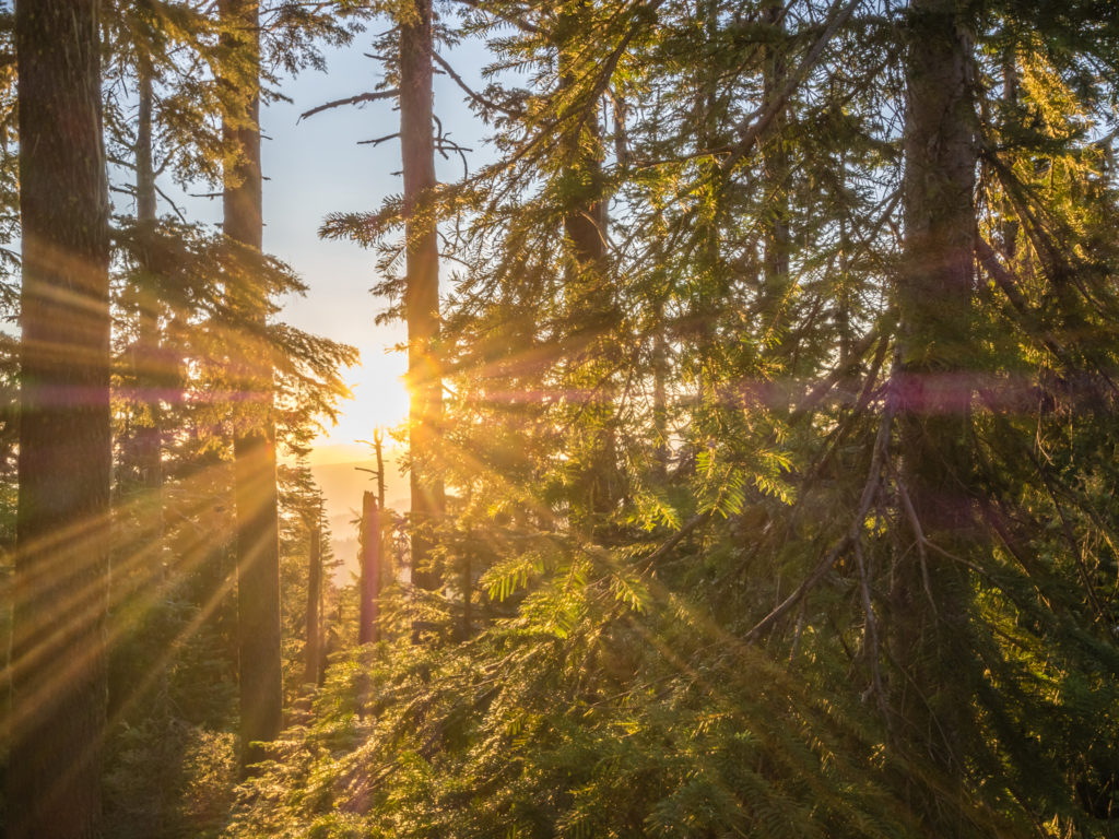
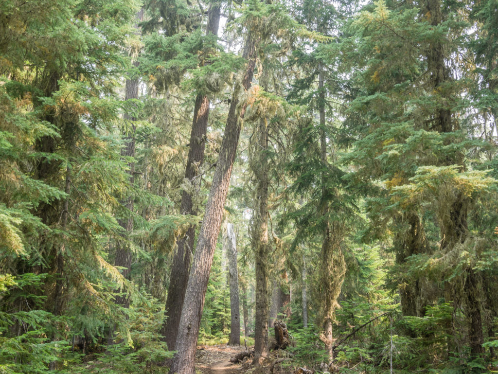
Continuing north on the PCT enjoying a relatively smoke-free day in Oregon, which up until now has been a rarity…
Having already spent a week amidst the heavily polluted air of Southern Oregon, the result of the continuing wildfires on both sides of the California/ Oregon border, we begin ‘Week 19’ hoping that as we progress further north along the PCT, the smoke will finally clear so that we are able to enjoy the scenic views once again. This is especially so as we make our way closer to Crater Lake National Park.
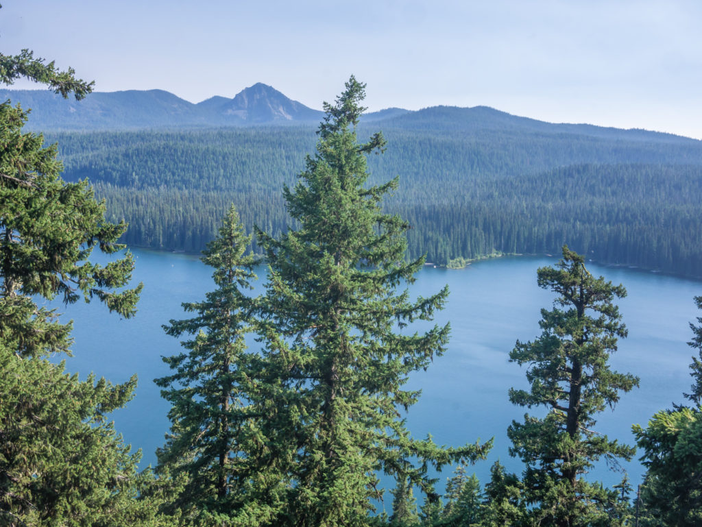
As the USA’s deepest lake with a maximum depth close to 2,000 feet (making it also one of the ‘Top 10 deepest lakes in the world’), Crater Lake with its crystal blue waters attracts hundreds of thousands of visitors each year. Formed in a caldera created by the collapse of the volcano Mount Mazama around 7,700 years ago, Crater Lake is considered one of the most spectacular views on the entire PCT, so of course having never visited Oregon before, we really wanted to be able to see it in all its glory! Whether we’d be lucky enough with a break in the smoky pall later in the week, only time would tell…
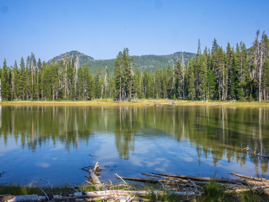
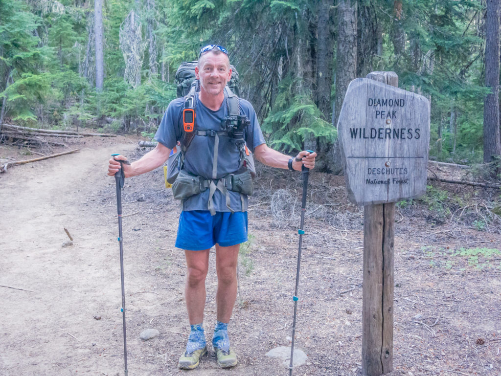
Day 127 – Tuesday, 14th August 2018, Wild Camp at Mile 1,781.5 to Wild Camp at Mile 1,806, 24.5 miles
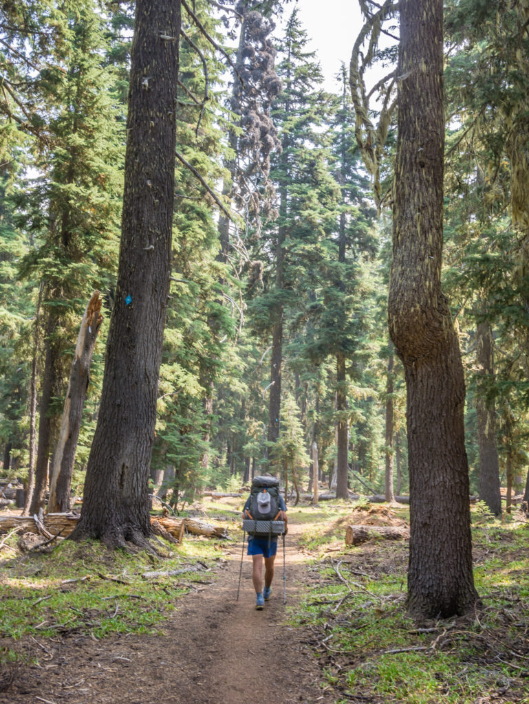
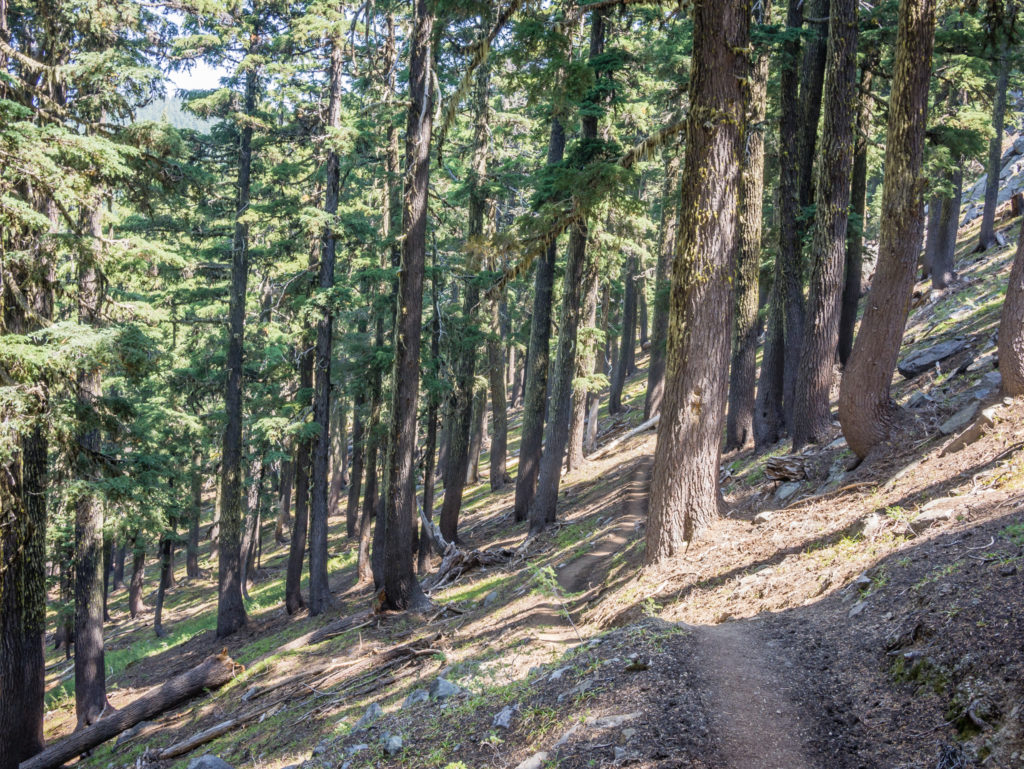
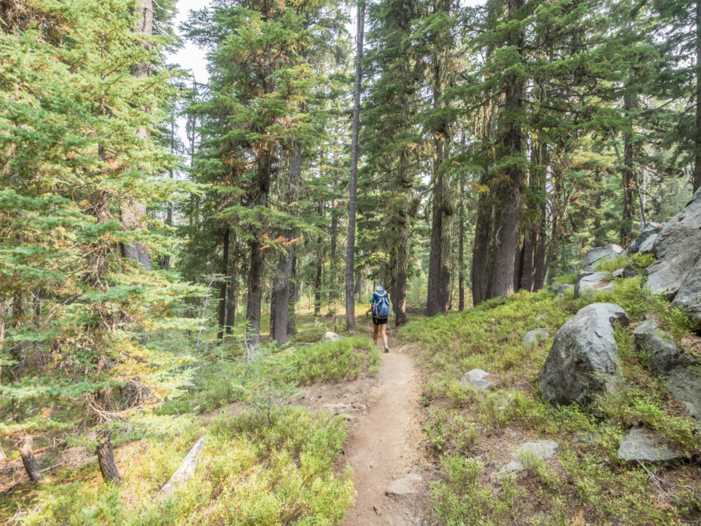
Having made the firm decision to continue hiking north regardless of the air quality, we awoke to another smoky day on the trail. When we set off from camp around 7:30am, the sky was still shrouded in smoke with the mountains beyond the trail barely visible. We just hoped that this wasn’t going to become the ‘norm’ all the way to Washington, which would make for a disappointing final few weeks after such an incredible four months. We concluded however that it could be worse – it could in fact be raining too, so with the sun trying its best to break through and the trail still firm and gentle underfoot, we couldn’t complain too much.
When we stopped after just 3 miles to filter water from Christi’s Spring, we saw Fern and Tommy Pickles again, as well as several new trail faces including Mr Bojangles, a french guy whose father was coming out to join him for the remainder of the trail. He was really excited to be meeting up with his dad later in the week at Shelter Cove and to have him as his hiking companion for the rest of his PCT journey. It made us think about how special it has been to experience the trail together as a couple, to have shared every moment, whether good or bad, and to have made these memories together. Taking on the challenges associated with such an epic endeavour as walking from Mexico to Canada (navigating the terrain, making the miles, managing the budget, being together 24/7); overcoming the little everyday struggles (such as a heavy pack, tired feet, general fatigue, hiker hunger); feeling the intense lows and highs of living outdoors and doing the same thing day after day to reach your goal; knowing when to talk and when to hike on in silence – have only strengthened our relationship and made us wholly appreciate the skills and qualities in each other that really shine through when everything else is stripped back and life is made simple. Through this ‘shared experience’ we have seen each other grow stronger – both mentally and physically, become more confident in our own abilities, and be much more appreciative of both the small treasures and vast wonders of the world.
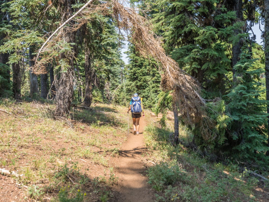
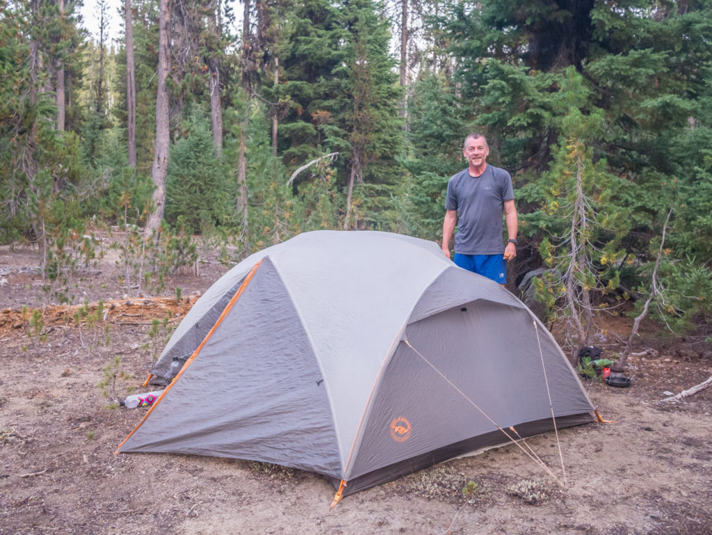
Packing up and preparing to leave camp ready for another gentle day of walking in Oregon.
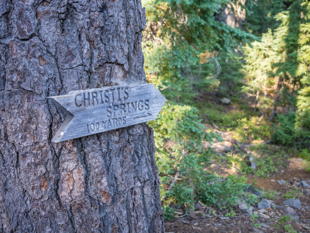
Taking a pit-stop at Christi’s Spring to filter water we happened upon several new trail faces. Having taken an extra ‘zero’ day in Ashland we are now out of our familiar ‘bubble’ once again and meeting new trail folk, which is always interesting!
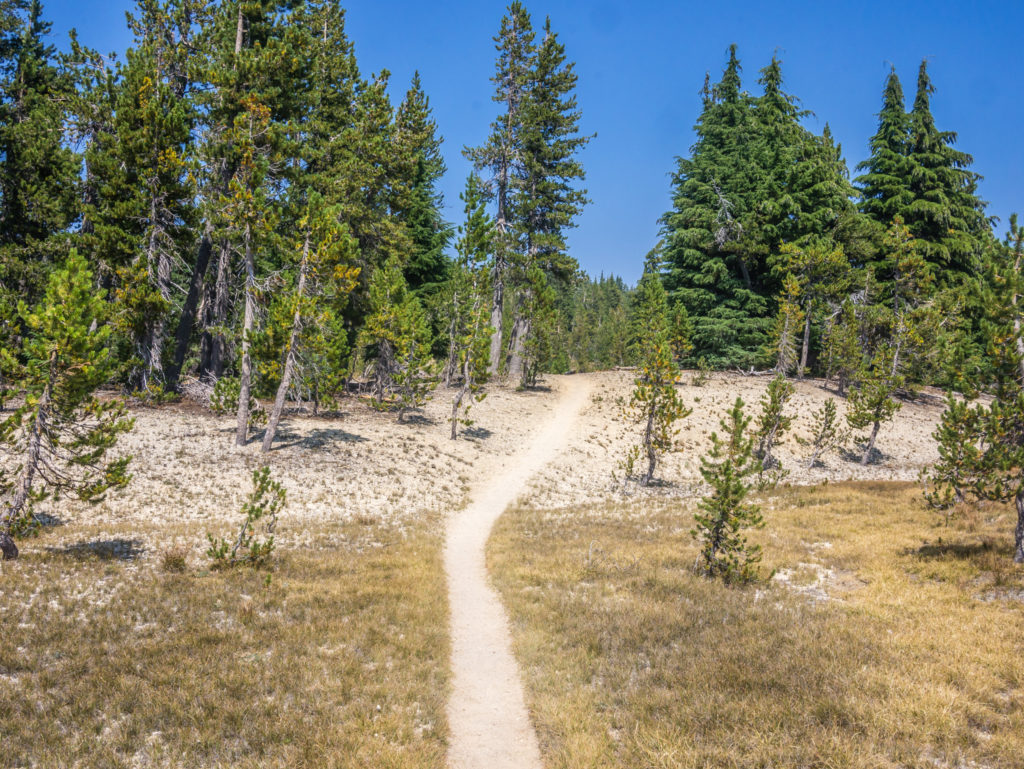
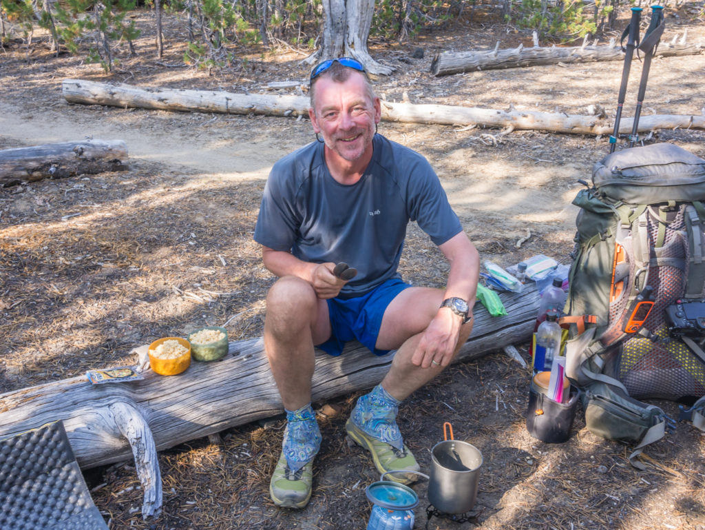
Once we got going again and got into a rhythm, because the first 8 miles or so were across easy terrain, both the time and miles seemed to fly by. (That is one good thing about our experience of Oregon so far! The trail is far from flat but ‘smooth’ is the perfect word to describe it!) So when we reached PCT Mile 1,790 at the Sky Lakes Trail junction, we decided to stop for a break below Imagination Peak and take our ‘Elevenses’ snack, which was basically an early lunch. We were excited for today’s menu as there was a new flavour tuna packet on offer in the supermarket in Ashland – so today we had whole-wheat flat breads with ‘Sun-dried Tomato and Basil‘ tuna, Philadelphia cream cheese and some mayonnaise. It was the best lunch we’d had in a while (largely to do with the change in flavour and the fact it didn’t involve tortillas or bagels) and was really satisfying!
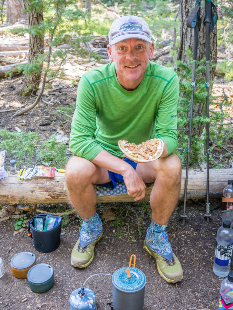
Enjoying our new tasty ‘elevenses’ menu!
The photos can give the impression of a ‘flat’ trail which is misleading! However, when we did have some ‘flat’ sections we really appreciated them especially with my shoulder and arm still in the process of healing.
Making the most of the ‘gentle’ sections of trail and getting into a good walking rhythm. Unfortunately it didn’t last for too long…
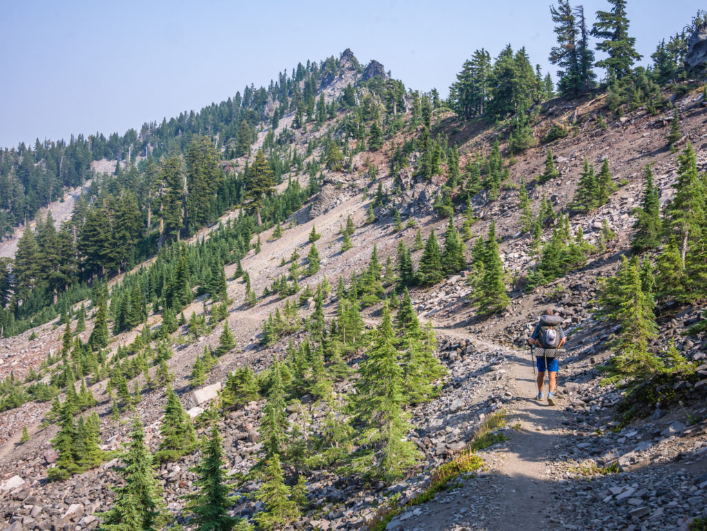
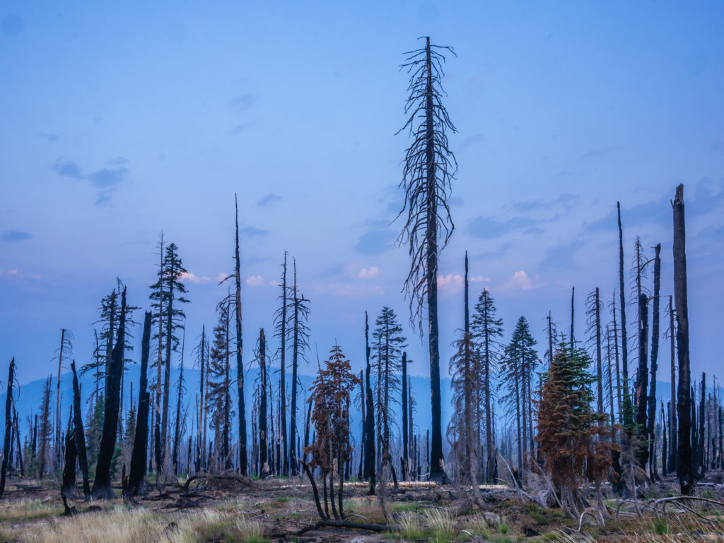
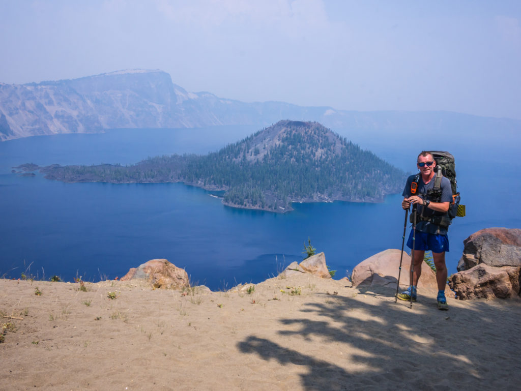
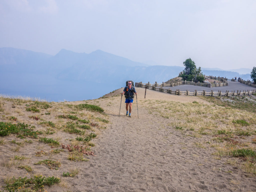
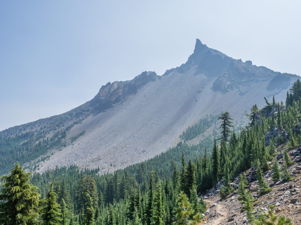
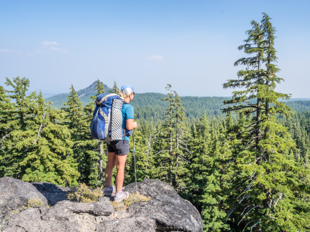
When we set off hiking again however, our jubilant mood was quickly cut short as the trail became more difficult and unexpectedly so. I just need to reiterate again that it is a misnomer of thru-hikers to think that ‘Oregon is flat’ – yes in comparison to the Sierra, elevation changes are minimal, but Oregon is definitely NOT flat as we were about to find out! During this section in particular, the trail was rocky and cumbersome underfoot with a continual uphill climb over several miles to contend with taking us out onto a rocky ridge. But despite the tiresome climb, there was a positive to be gained from our efforts. We had in fact hiked out of the forest and into a clear view at last! Even the smoke seemed to have dispersed somewhat. Now that was really encouraging!
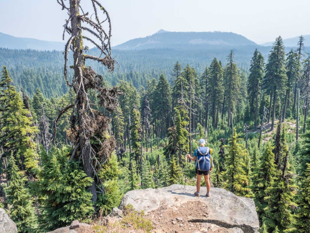
Taking in the expansive forest views as the smoke seemed to be lifting at last. We could even see a volcanic peak way off in the distance.

Happy to be out of the trees and into the open for some satisfying views of our surroundings.
We had hiked up and around this rocky ridge, but we liked being back out in the open again, particularly as our views were getting better with each step.
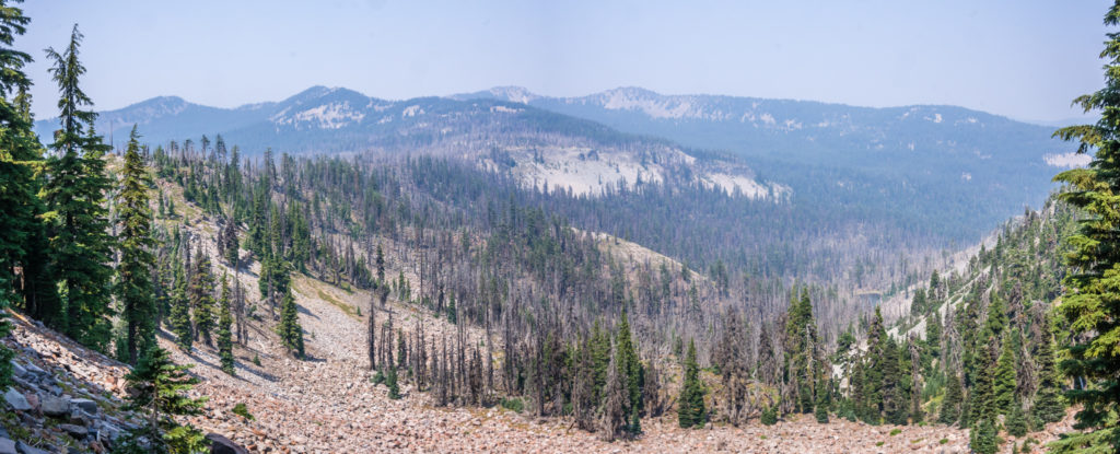
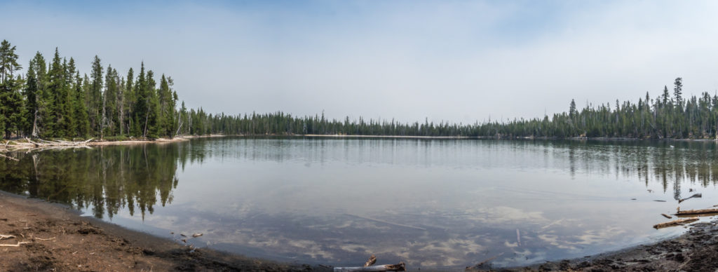
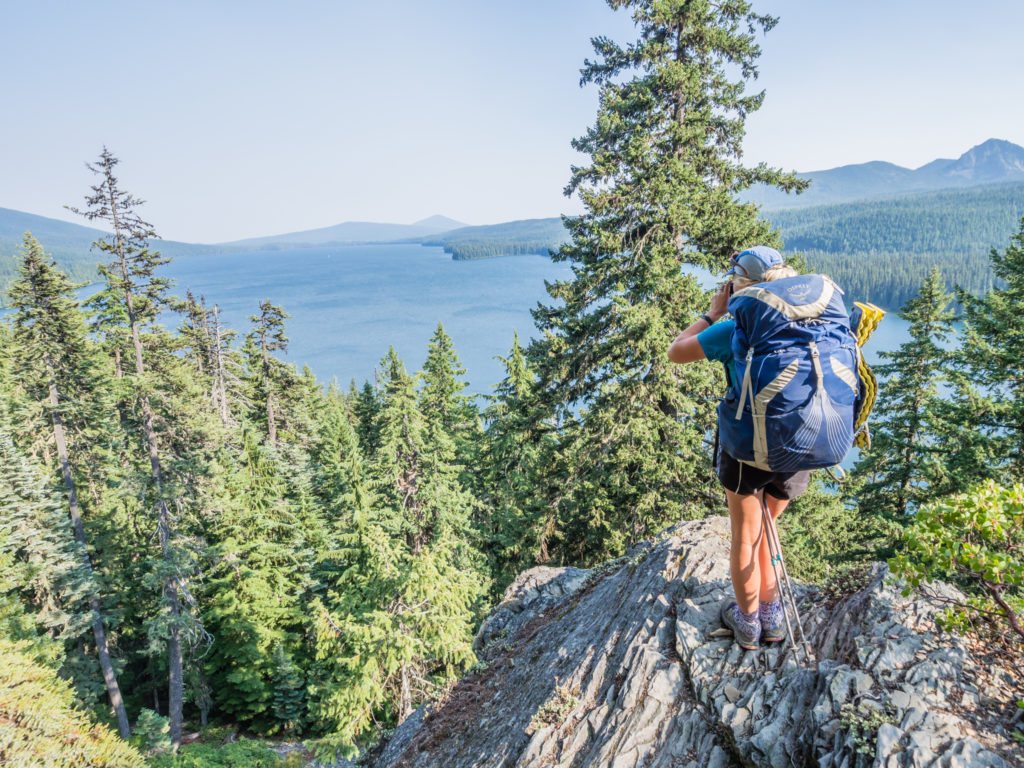
Panorama shot from the ridge. It was heartening to find the smoke had dissipated considerably compared with earlier in the day.
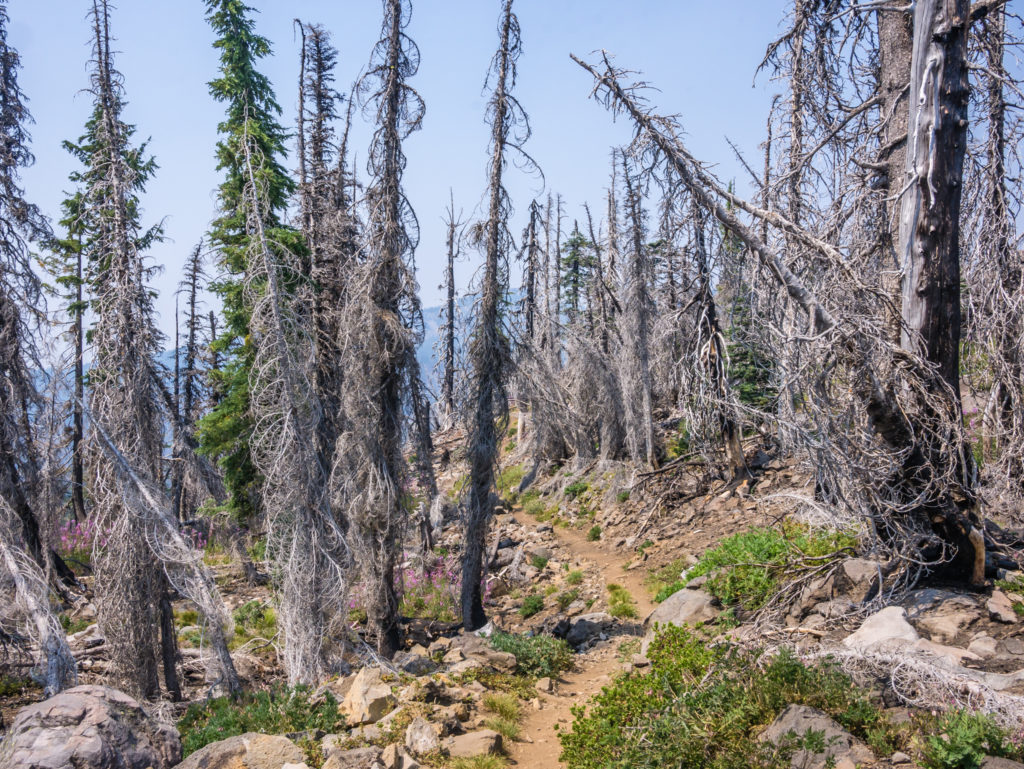
A wildfire’s burn scar can last long after the fire is squashed. Walking through here we were pleased to see new plants growing in the scarred area.
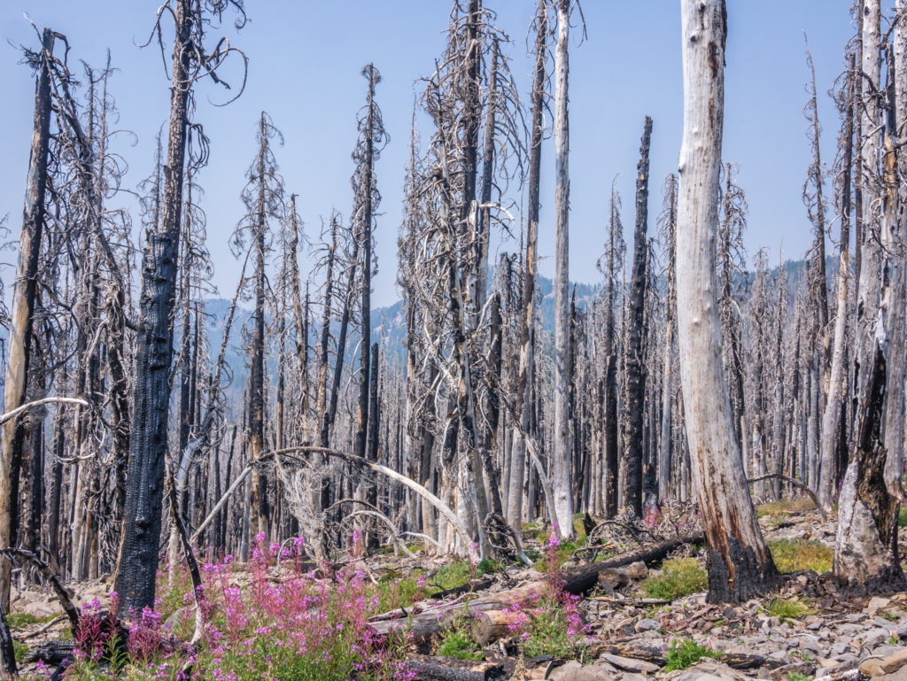
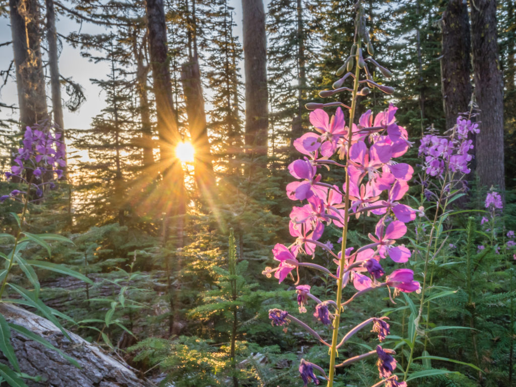
Just as we had seen in Northern California, these pretty pink flowers known as ‘fire followers’ bloom after a blaze and bring new life to a burn area.
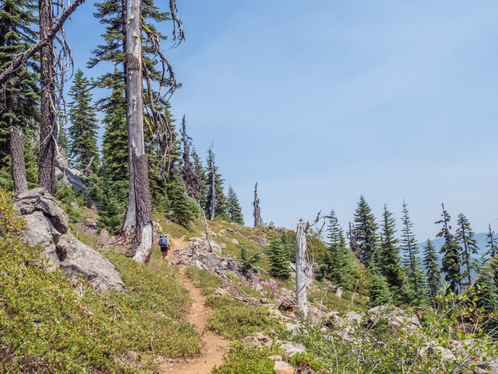
As a reward for our efforts, the trail kept us high taking us along the ridge of Shaler Butte. It then skirted Lucifer before switch-backing up the eastern flank of Devil’s Peak. For me, with my arm and shoulder injury still not fully recovered, it was tough going uphill using only one trekking pole so I was glad when we finally reached the Grass Lake Creek where we stopped for an early dinner and a much-needed rest!
Here we saw a few familiar faces amongst the hiker crowd congregated around the water source, that on this particular stretch had been few and far between. This included Down Dog and Canadian tall-guy Tim whom we’ve been leap frogging the last couple of weeks. It gave us reassurance that even with taking an extra zero day in Ashland we are still on track for our end date, especially having caught up with people on a similar itinerary to us. Hiking past, Snake Eyes and Fugitive also stopped by to chat with us as we were packing up. It seems everyone is eager to reach Mazama Village tomorrow after putting in some big miles the past few days.
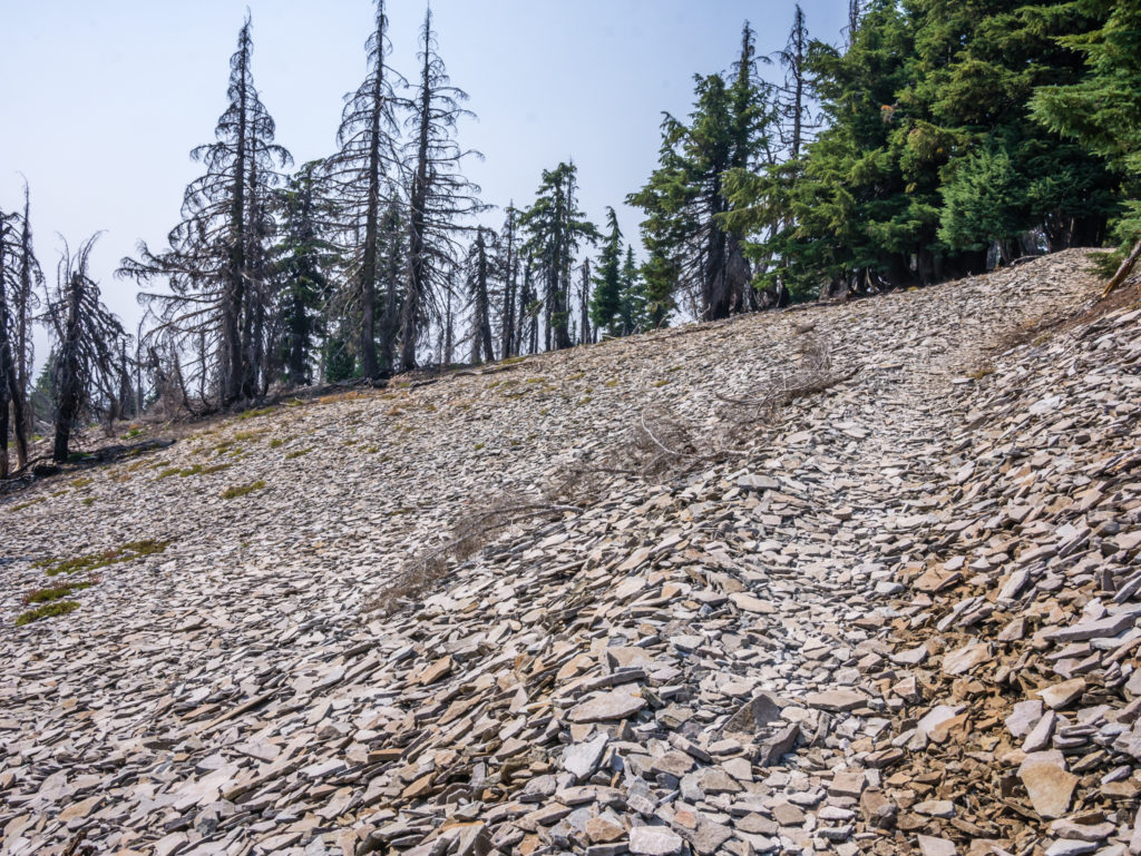
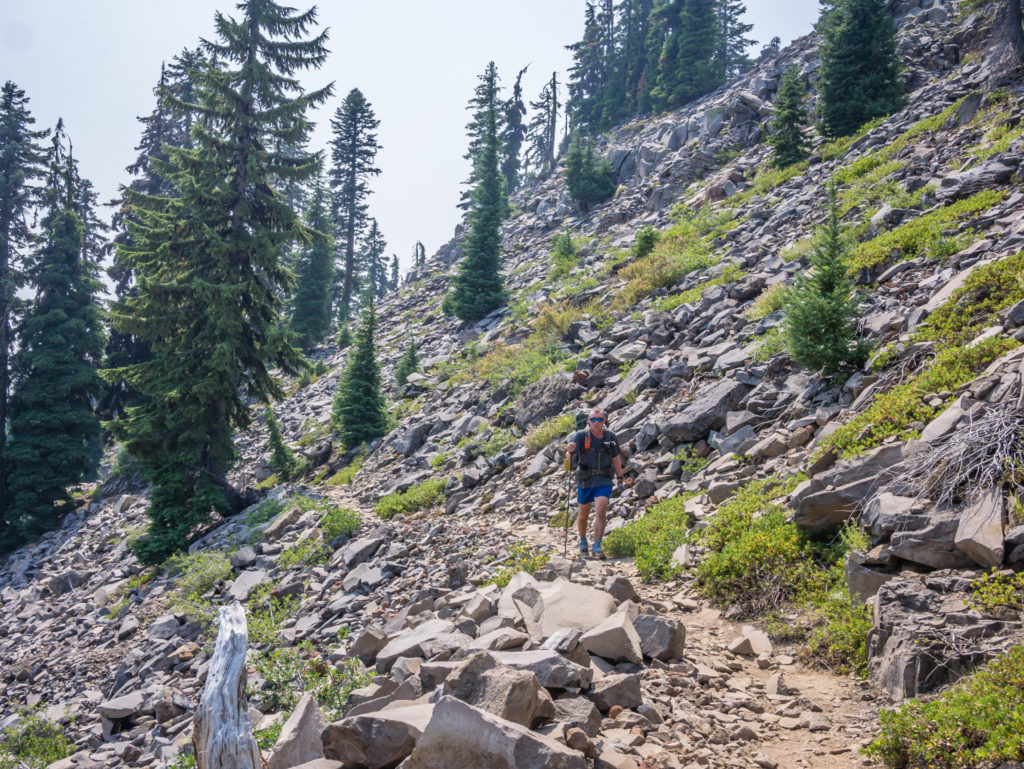
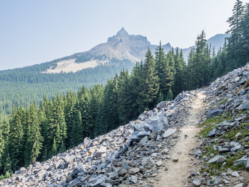
The trail becomes a pathway through loose scree as we head up the mountainside.
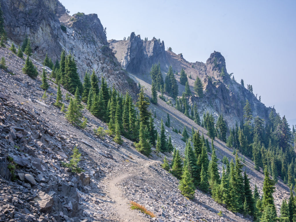
Thankfully the trail was well trodden as we weaved our way across the slope before switch-backing up the eastern flank of Devil’s Peak.
Thankfully the final 6 miles of our day was much less taxing than earlier. As we would be dry-camping, we stopped at the next creek (avoiding Honeymoon Creek as it was just a stagnant pool) and filled up with 6 litres of water between us to see us through the final few miles, plus the 15-mile dry-section of trail that would take us to Mazama Village tomorrow. (Surprisingly, we have already found that the PCT in Oregon generally stays away from the big lakes and other reliable water sources, so we have to be mindful of how much water to carry, much like in the desert.)
The final prize to off-set such a tough day was that we passed the 1,800 trail mile marker! That’s another 100 miles down in less than a week. We seem to be motoring on now! It certainly helped motivate us to cover the last few miles and get to camp before dark, something it feels like we haven’t done in a long while.
Wow indeed! That’s 1,800 miles walked in 127 days.
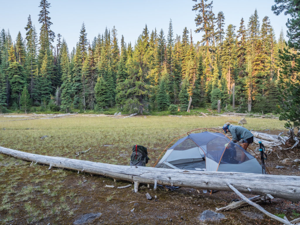
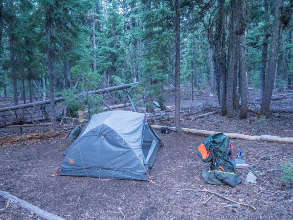
We stopped in a large clearing in the forest at Mile 1,806, where the GutHooks app (every hiker’s PCT Bible) indicated there was enough space for at least 5 tents. So of course we weren’t the only ones to camp there, but at least we arrived first and had the best pick of spots for once. Again, everyone had pushed on to make it easier for getting to the village tomorrow. With ‘town food’ on the mind, it’s amazing how far people will push the miles!
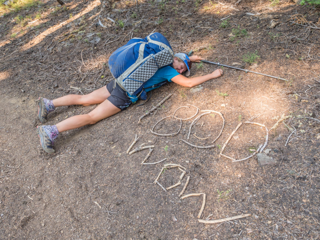
I too was really looking forward to reaching Mazama Village, but this time it wasn’t for the food and beer (although I’d be partaking in both), but because we had given ourselves only 15 miles to get there, which is now just a ‘half day’ on the trail. After big mile days getting up at the crack of dawn and not reaching camp until after dusk, it would be wonderful to finish ‘early’. Feeling both exhausted and emotional as I climbed into my sleeping bag, more than anything right now, I just wanted an afternoon off! After 127 days on trail, I know that I still have a love for camping in the great outdoors, but the walking right now, not so much. Don’t get me wrong, I am determined to walk to Canada to complete the challenge we set ourselves, but it gets harder every day and is becoming less enjoyable, much of which I think is down to fatigue and the lingering pain in my arm. Wayne on the other hand remains buoyant about the whole adventure and since setting foot in Oregon has thoroughly embraced being in the trees, not letting the smoke or the lack of views or the big miles bother him too much. So with six weeks and around 850 miles still to go, I hope the trail can re-inspire me, and I can rekindle my love of simply putting one foot in front of the other, because at the moment it feels anything but simple…
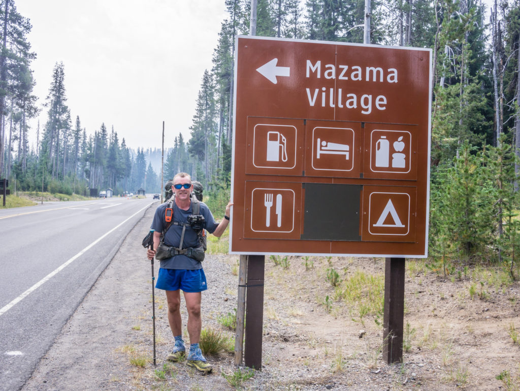
Day 128 – Wednesday, 15th August 2018, Wild Camp at Mile 1,806 to Mazama Village Campground, Crater Lake National Park, PCT Mile 1,821, 15 miles
As we had approximately 15 miles to go to reach ‘civilisation’ (something I was really looking forward to, both for the food and a shower, but more importantly, for the rest), we made a real effort today to get up as soon as the alarm sounded and be ready within the hour so that we could get to Mazama Village within Crater Lake National Park as early as possible. With full hiker facilities, including showers, laundry, restaurant and store, we had planned in a nearo so that we could have a proper meal and get some housekeeping tasks done. Camping there the night would also put us in a good position for accessing the ‘Rim Trail’ the following morning, which we have chosen to hike as an alternative to the PCT so as to get a good view of Crater Lake, albeit smoke permitting.
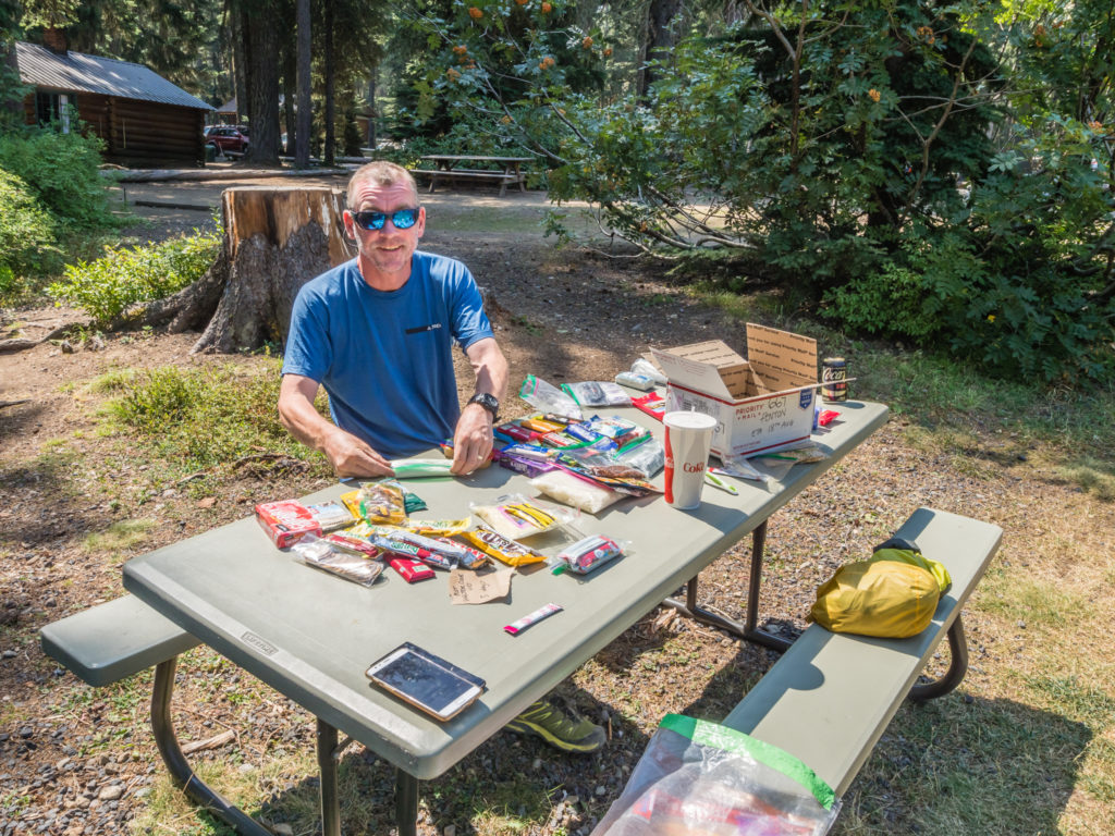
We didn’t do too badly leaving camp at 6:30am, and knocking off 8 miles before 9:30am when we stopped for a cup of tea and a snack break, devouring the last of our rations, which for me consisted of a packet of Belvita Breakfast Biscuits and Wayne had saved a Peppermint Lunar Bar to see him through to Mazama. (There had been a slight miscalculation with our food rations since leaving Ashland hence we were so low on supplies. Therefore, after 15 miles of hiking with only a couple of snack bars to boost our energy levels, we knew we’d be practically ravenous on reaching the village!)
Trying to make a quick get away from camp this morning in an effort to reach Mazama Village as early as possible.
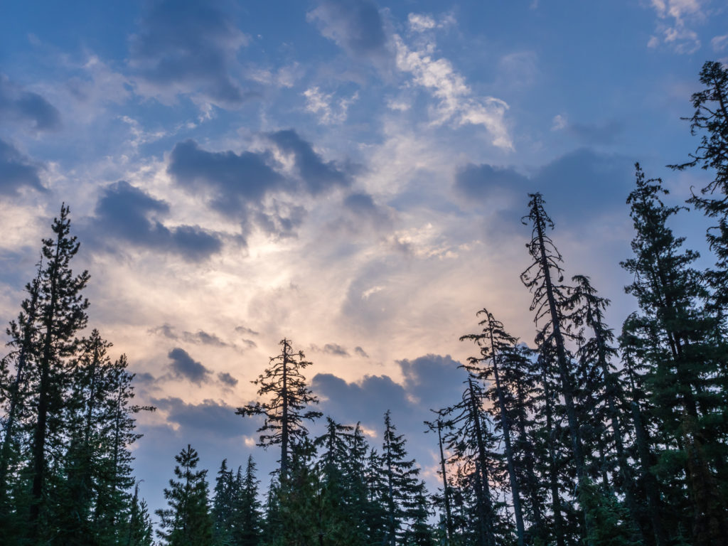
Beautiful but dramatic early morning skies!
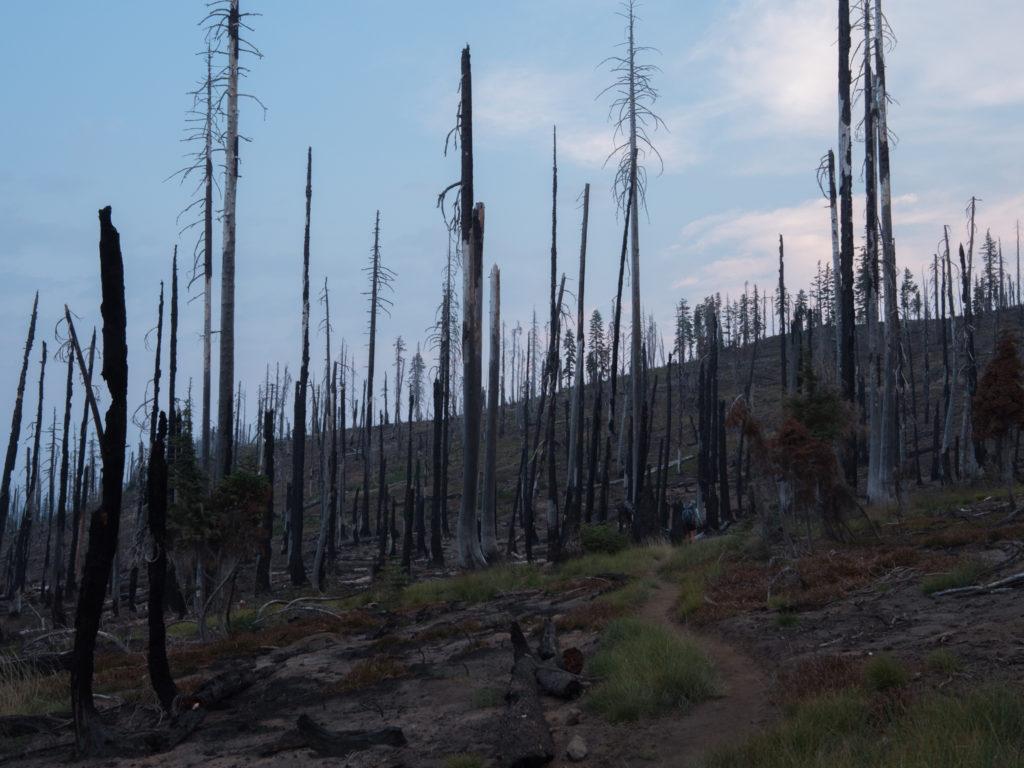
The blue hour seemed to linger a little longer this morning making for a moody shot as we entered an old burn area.
We were pleased then that we didn’t have to expend too much energy when the trail afforded us a long stint on ‘soft’, almost flat terrain, weaving through an old burn area. As we hiked further into the expanse of charred tree stumps sticking out of the dry earth like spears, here and there we had to dodge or climb over several large pieces of dead fall that were obstructing our path. It was eerily quiet and sad to look at as there was no colour, nor bird song, and what seemed like no life at all. The sheer size of the burn area made us think about the ongoing fires both south and north of us, and realise how lucky we are to have still missed the epicentres and avoid any trail closures. Today, walking felt like a gift, and after last night’s emotional roller coaster, I in particular, was so thankful to be doing it and still be on trail right now.
Further into the burn area there were few, if any, signs of life. The thought of the encroaching wildfires from both the north and south made us grateful to still be on trail right now.
After our earlier tea break, there was no stopping us. We just put our heads down and flew through the miles, the reward of a ‘restaurant lunch’ when we got to the village keeping us motivated and going strong. Our efforts had paid off as we strode into Mazama Village at 12:30pm. 15 miles, job done!
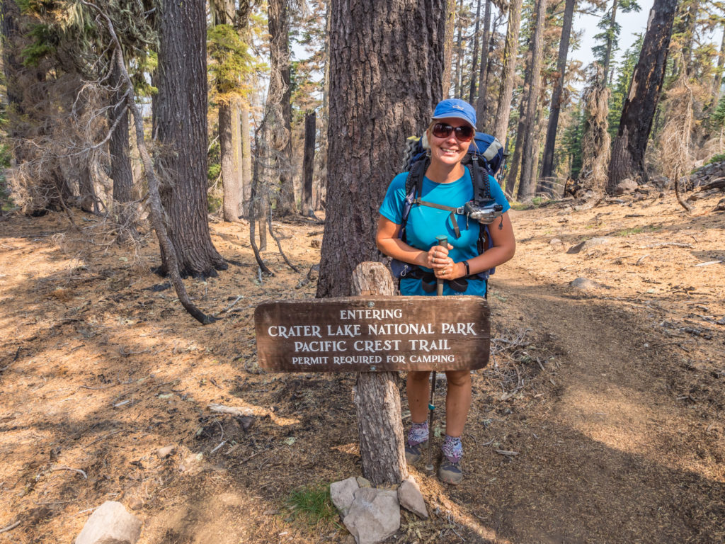
Entering the Crater Lake National Park for the first time. The PCT crosses 33 miles of the National Park (off Highway 62), including 6 miles along the edge of the caldera with spectacular views of Crater Lake’s deep blue waters.
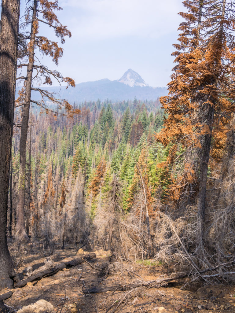
Spying Mount Thielsen through a break in the trees.
Making our way to Mazama Village where we intended on camping in the National Park campsite that evening.
Almost there and in record time!
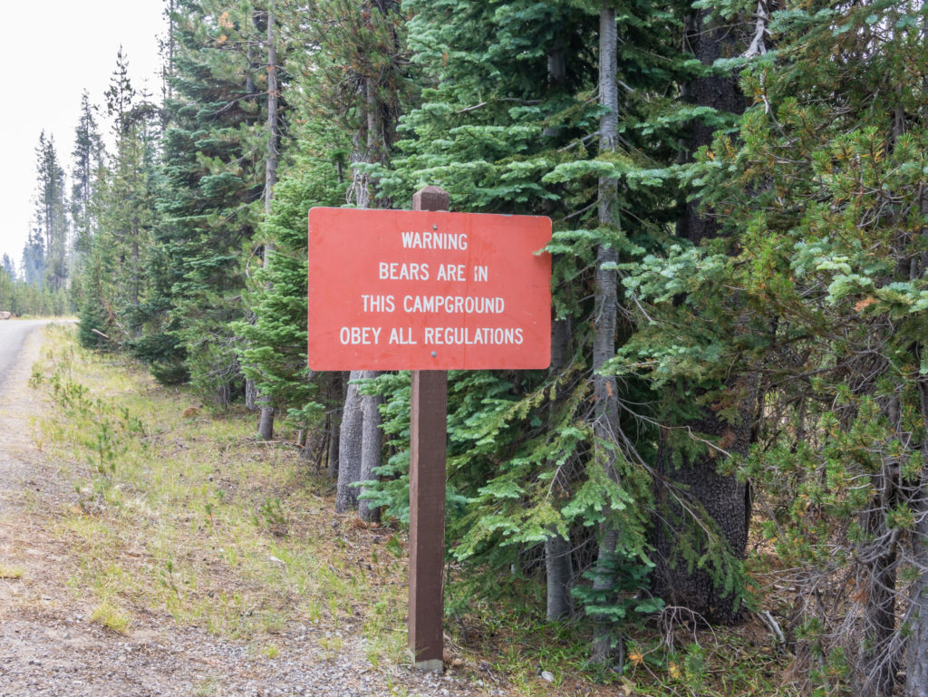
Another bear warning, but we still had not encountered a single bear on the trail so far!
When we arrived in the village, the area at the front of the store was already teeming with half-naked hikers waiting for their clothing to finish the wash and dry cycles in the small laundry next door. Others were sat on the pavement sorting out food resupply boxes, waiting their turn for a shower. Backpacks and gear were sprawled out everywhere, along with used gas cannisters, worn out trail shoes and other hiker box trash that nobody wanted but hadn’t cared to dispose of properly in a bin. Intent on going straight to the restaurant for lunch, from across the car park as we walked by it seemed like one chaotic mess! We didn’t stop to photograph it, but if ever there was a scene to encapsulate the term ‘hiker trash’, this was it! (To all who are part of the long distance hiking community, the term Hiker Trash is affectionately used to describe a hiker or group of hikers who have sunk down to a lower standard of living. E.g. If you live in the woods for long enough, you slowly forget about societal norms. For instance, you might forget that it’s not ‘normal’ to clip your nails in public or become frustrated that you have to wait in line to use the restroom. We have seen plenty of worse things and also done a few of them too!)
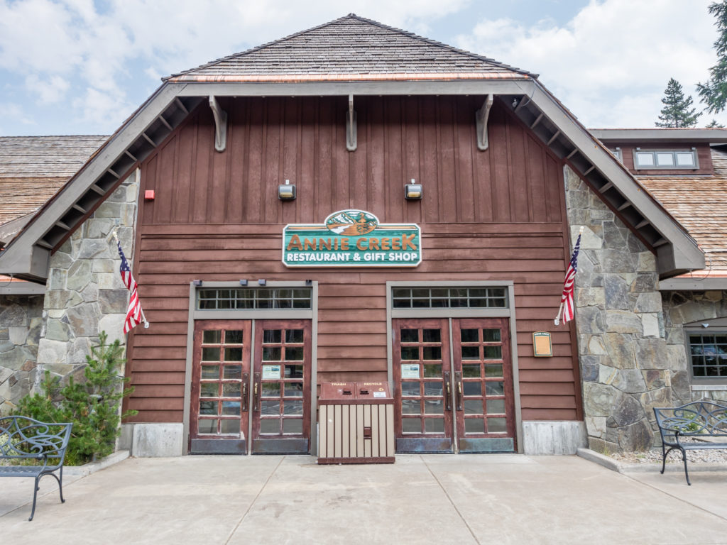
Heading straight for the Annie Creek Restaurant to enjoy a spot of lunch.
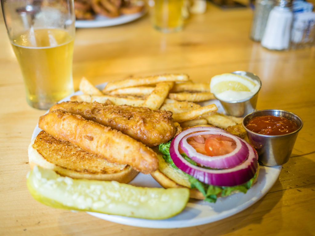
Savouring a battered fish sandwich with ‘proper’ chips! Being from England this was a delightful find!
Having staved off our ‘hiker hunger’ for now, we then got on with the next most important job, securing ourselves a campsite in what was an extremely busy National Park Campground. At Mazama Village there is a designated PCT Camp Area, however as it seemed like every single thru-hiker had descended on the village that very day, including a huge influx of southbounders too, we decided to pay the $22 fee for a tent pitch in the general camping area so that we could have our own space and some privacy. Having an amenities block with toilets and free shower close by was also beneficial, but to us it was worth it just for the picnic bench alone! We’ve mentioned several times about how much we miss a chair when thru-hiking so just the simple prospect of having a table to sit at, both for cooking and blogging, as well as the pure pleasure of not sitting on the ground cross-legged meant we were happy to pay for this little trail luxury.
Then ensued an afternoon of trail chores – namely showering, collecting our resupply package from the store (which we were glad we had sent ourselves as the store had very limited resupply options), doing some laundry once the queue for the washing machines had dissipated somewhat, as well as sampling a few Oregon beers and getting to know some SOBOs whilst waiting for the wash cycle to finish. This was then followed by some relaxation time sat at our picnic bench! The time went by in a whirlwind and it was soon dark, but an afternoon ‘off’ had done us the world of good. We felt well-rested and excited at the prospect of hiking along the rim of Crater Lake in the morning. As our first visit to the National Park, we just hoped the smoke would hold off so that we’d be able to ‘see’ Oregon’s iconic jewel for ourselves.
Day 129 – Thursday, 16th August 2018, Mazama Village Campground, Crater Lake National Park at PCT Mile 1,821 to Wild Camp at PCT Mile 1,842, via Crater Rim Alternate Trail, 21 miles
Having already paid for a proper tent site in the National Park Campground, just for an hour we pretended that we were regular campers, laying in until 7am and fetching cereal and fresh milk from the camp store to have for breakfast at our campsite. We sat at our picnic table with the early morning sun on our faces enjoying the fact that we could take our time. The only thing missing was a hot cup of tea. We couldn’t make a brew as the store had run out of gas cannisters, which meant we would have to conserve what little gas we had left for cooking our hot dinners each night until reaching Shelter Cove in 3 day’s time. (With plenty of SOBOs now coming through, in conjunction with the large herd moving north, we are really hoping that places along the way have stocked up with hiker staples and are not all completely sold out!)
Leaving Mazama Village around 10am, we rejoined the PCT via the Annie Springs Trail. This short trail is a connector between the PCT and Mazama Village passing through a fairly open forest of lodgepole pine and mountain hemlock. (We found out that Annie Springs was named for Annie Gaines, the young sister-in-law of the Fort Klamath commander, Captain William Rinehart. In 1865, Annie, Captain Rinehart, and some of his soldiers descended to Crater Lake and Annie became the first known white woman to do so, earning her great recognition.) Alternatively, a shuttle service for PCT hikers between Mazama Village and the Rim Village is provided by the Crater Lake Trolley. Just before we left we saw the trolley pulling away from Mazama Village full of hikers eager to feast their eyes upon Crater Lake, however as we considered this to be a break in our continuous footpath, we opted to walk the 7 or so miles to the Rim Village instead.
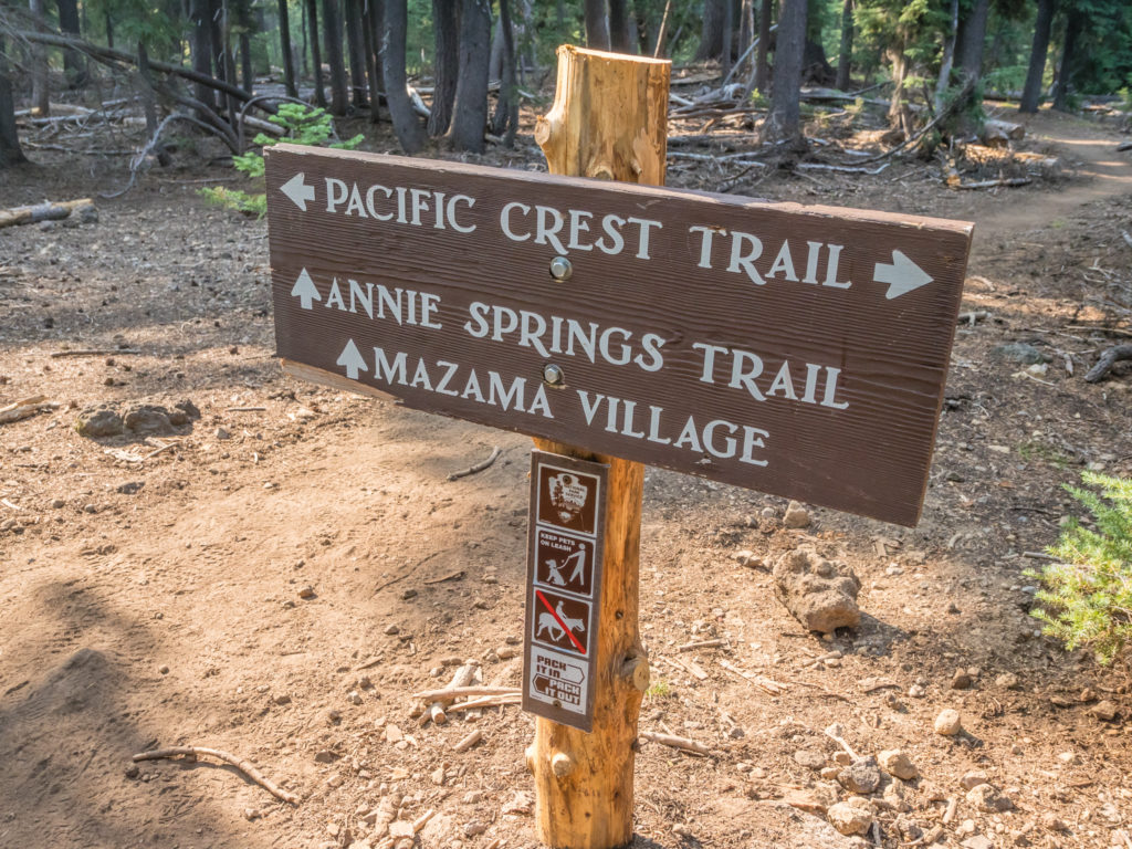
Rejoining the PCT via the Annie Springs Trail after leaving Mazama Village. As we considered it to be a break in our continuous footpath, we resisted the option of taking the free bus.
Whenever we’re hiking in the USA, we love to find out as much as we can about a particular area or feature from the National Park Visitor Centre and browse the gift shop and today was no different. Treating today as if we were ‘tourists’ as opposed to thru-hikers, we headed straight for the Visitor Centre where we bought a few souvenirs in the form of ‘lightweight’ Crater Lake postcards, as well as stickers for our bear cans back home. It was then time to explore the Rim Village and take in our first views of Crater Lake, which disappointingly was under a haze of thick, white smoke. Based on the weather forecast and the latest wildfire and air quality updates, we had predicted as much, but had been ever hopeful that the wind direction would change helping the smoke to disperse. Today unfortunately, it was not to be. So to ease our disappointment a little, we stopped for lunch at the Rim Village Café, where we also splurged and bought some ‘Red Wine and Huckleberry‘ luxury dark chocolate from the adjoining gift shop. That would be a real treat to enjoy later when we reached camp. There’s nothing like a good hot meal or unexpected trail treat to boost morale. For hikers, it’s simple – food is happiness on a plate! Just as an aside, the upstairs part of the cafe has a viewing platform that you can walk out on that overlooks the lake with an exhibit explaining how Crater Lake was formed, however as it was extremely busy and the lake was obscured by the smoke anyway, we didn’t go up there.

Heading to the Visitor Centre next to Crater Lake to find out the weather forecast for the week ahead and any updates with regards to the spread or containment of the wildfires.
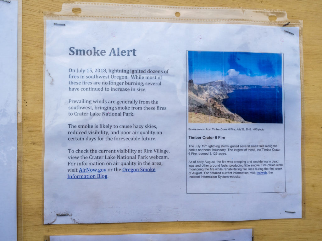
Noticeboards outside the Visitor Centre had updates and further information regarding the wildfires in Oregon from which the smoke was greatly affecting Crater Lake National Park.
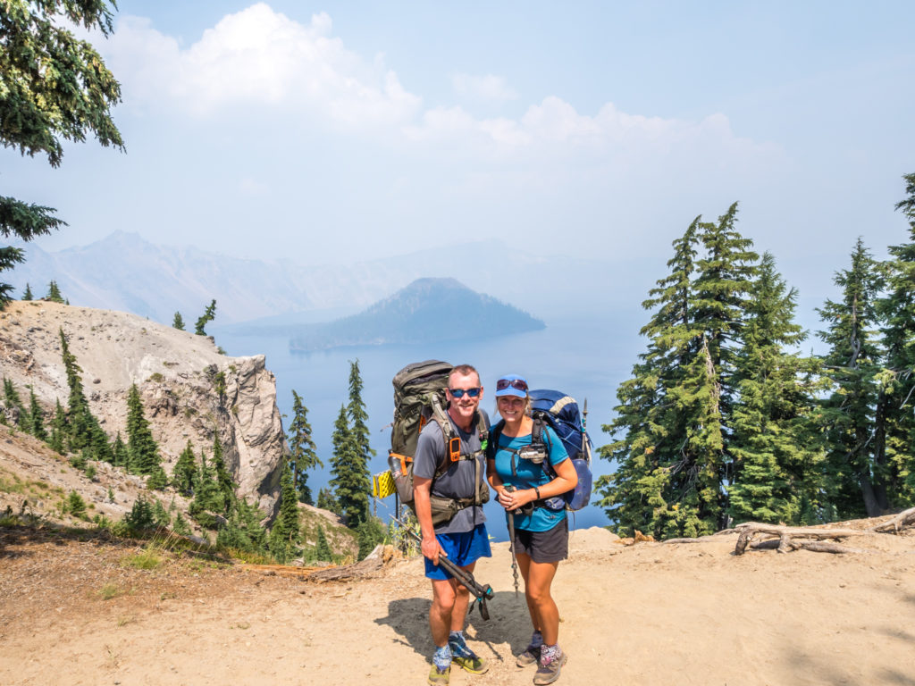
Our first glimpse of the lake was somewhat disappointing because of the relentless smoke, but it is still an incredible spectacle. A passer-by takes a photo of us in front of Crater Lake.
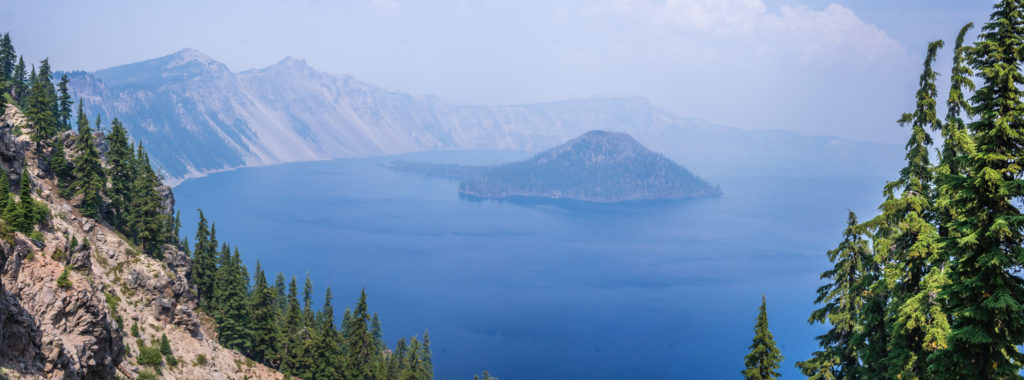
With the lake shrouded in smoke this was the best edit we could get to show the deep blue colour of the water and the rim on the opposite side of the caldera, which was barely visible.
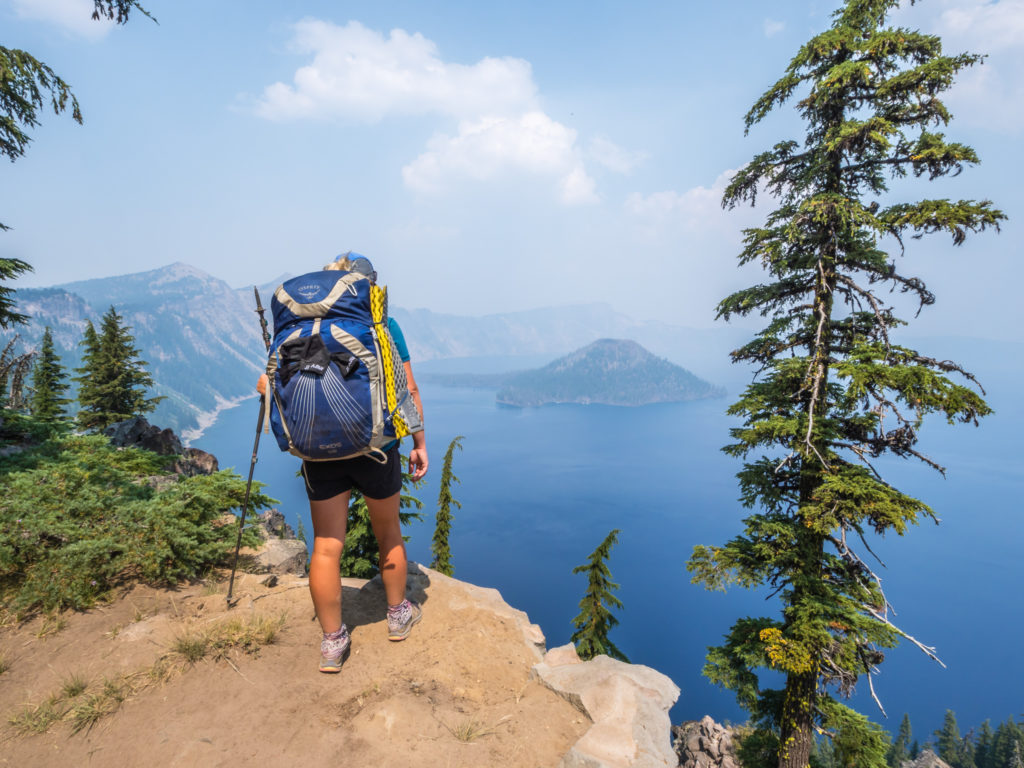
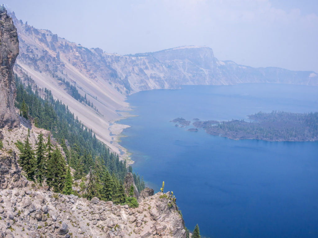
Close to the edge and looking onto Crater Lake after setting off along the ‘Rim Trail’.
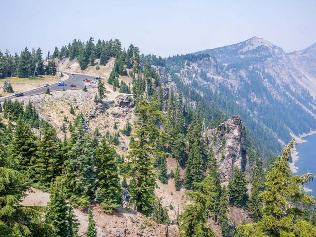
There are several viewpoints and overlooks along the Rim Trail as well as pull-ins for visitors in cars taking the ‘Rim Drive’ option.
Thirty-three miles of the PCT pass through Crater Lake National Park, offering thru-hikers magnificent views of the mountains surrounding the lake. (On a good day!) Yet previously hikers could only get a view of the lake by leaving the main trail to enter the developed Rim Village area. In June 1995 however, an alternate trail opened in the National Park which brings hikers right up to the rim of Crater Lake. Coming from the south, the trail ascends the Dutton Creek Trail to the rim, then follows the edge of the caldera for six miles of spectacular views. The ‘Rim Trail’ then parallels the North Entrance Road from its junction with the Rim Drive, out to Grouse Hill. There the alternate trail rejoins the PCT after 7 or so miles. As the Rim Trail offers the best views of Crater Lake, we chose to take this alternate route and hike around the edge of the caldera justifying our decision to hike off the PCT for this reason. Despite the smoky skies, it was still a great experience with impressive views of the vast lake, including a good vantage point overlooking Wizard Island.
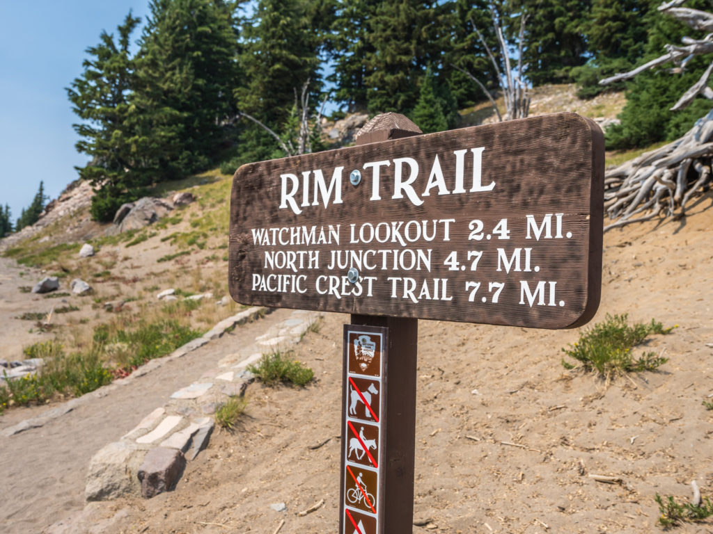
The ‘Rim Trail’ is an alternate to the PCT, which allows hikers the opportunity to follow the edge of the caldera for six miles. We chose to take this route as it offered the best views of Crater Lake. (We couldn’t hike through Crater Lake National Park and not actually see the lake!)
Although the smoke obscured our views across the lake making it difficult to see the far rim of the caldera, we were able to see Wizard Island, a volcanic cinder cone which has formed an island at the west end of Crater Lake. The top of the island reaches 6,933 feet above sea level, which is around 755 feet above the average surface of the lake. The cone is capped by a volcanic crater about 500 feet wide and 100 feet deep, which was named the ‘Witches Cauldron’ by William Gladstone Steel in 1885, who also gave Wizard Island its name at the same time. There is a trail to the top of Wizard Island, which involves a rocky climb to a path leading around the crater summit. A commercial tour boat will take visitors to the Wizard Island boat dock where the trail to the summit begins and will return later to pick you up as overnight stays on the island are not permitted. As this activity is a full day-trip, we didn’t have time in our schedule to do it, however it is something we would like to do in the future as a return to Crater Lake National Park on a non-smoky day for us is a must.
Looking onto Crater Lake from the Rim Trail with views of Wizard Island.
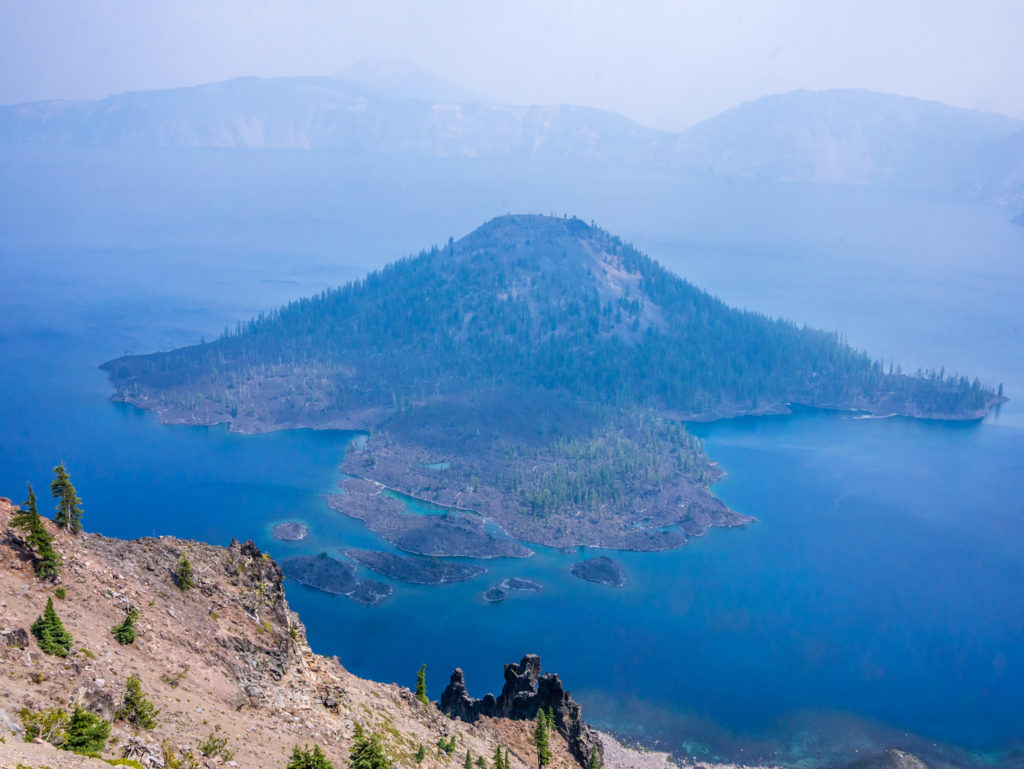
Wizard Island ascends around 755 feet above the average surface of the lake. The oldest trees on the island are about 800 years old, so it is unlikely that it rose above the surface of the lake before that time.
Looking onto the west end of Crater Lake. It was still magnificent despite the smoky haze.
On the Rim Trail we only actually saw PCTers walking the route around the lake. It seemed that ‘day visitors’ were happy to reach the look-out points by car via the ‘Rim Drive’!
Hiking off the Rim Trail ready to rejoin the PCT.
After reaching the Rim Alternate junction at Mile 1,839.2 we rejoined the PCT but then followed the trail southbound just a tenth of a mile to see if there was a water cache at Highway 209. As water is so scarce in the Crater Lake backcountry, (in a typical year, many sources are dry by late July or early August), we thought it prudent to top up our supplies as the next reliable water source was Thielsen Creek, some 17 miles north. Thankfully, trail angel Devilfish who maintains the water cache at Highway 209 had only recently restocked it with around 100 gallons, which we found inside the bear locker at the trailhead car park. Knowing this is just a small cache, we each took only an extra litre of water in an effort to conserve water for the multitude of hikers about to pass through.
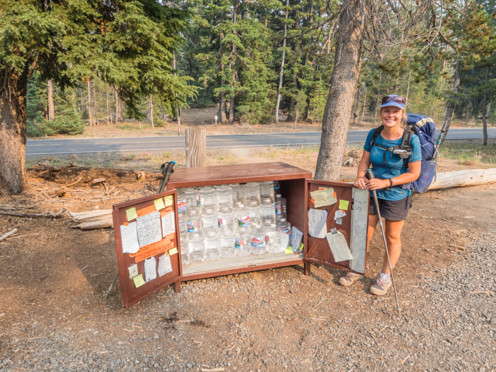
Thankfully the water cache along Highway 209 had recently been restocked. A huge thanks to trail angel Devilfish for maintaining this cache.
We then resumed our walk along the PCT northbound for around three miles before deciding to pitch up for the night. The ground was littered with a tangled mass of dead fall and under brush, but after looking around and walking on a bit further, we managed to find a spot big enough for the condo that had been previously cleared. Down Dog, Canadian Treasure (whom we’d met earlier that morning), Tipsy and Generic Eric then passed by our camp spot a little while later all looking for a clearing too.
Finding ourselves right in the midst of another growing ‘bubble’ of hikers, we knew that we wouldn’t be short of trail company over the ensuing weeks heading through Oregon and Washington. The trail was getting busier by the day with everyone aiming to get to the Canadian border sometime mid-September. Having had so much ‘alone’ time thus far on the trail, we couldn’t really complain. Our solitude in the wilderness might be short-lived, but we could envisage one hell of a party when everyone finally reached Manning Park!
Day 130 – Friday, 17th August 2018, Wild Camp at PCT Mile 1,842 to Wild Camp at Six Horse Spring Mile 1,872, 30 miles
Today was a good trail day! In typical Oregon style, the PCT was soft underfoot following gentle grades, and weaved in and out of the trees throughout much of the day offering us inviting glimpses of Mount Thielsen at various points along the trail. We found it so easy-going that we powered out 30 miles, getting to camp at a respectable 7:30pm, our earliest finish time to date on such a big mile day!
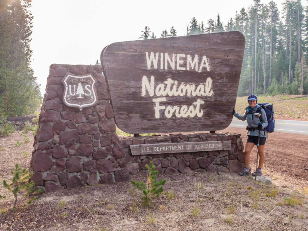
Entering the Winema National Forest eager to get closer to Mount Thielsen.
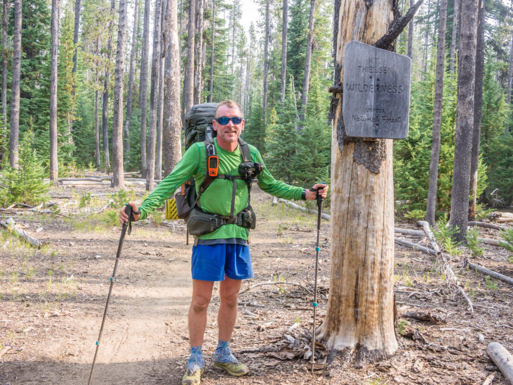
The Mount Thielsen Wilderness, which is part of the Deschutes, Umpqua and Fremont–Winema National Forests.
We were excited to be making our way into the area known as the ‘High Cascades’ and what a great introduction to be able to see the prominent horn of Mount Thielsen on the skyline in front of us, the spire-like shape forming a centrepiece for the entire Mount Thielsen Wilderness.
Heading north and looking onto the prominent horn of Mount Thielsen.
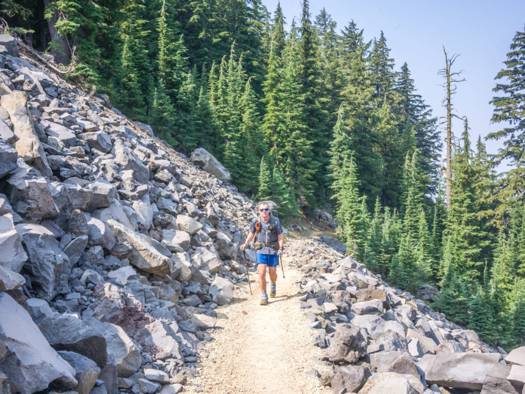
A huge round of thanks goes to the fabulous ‘trail crew’ who cleared the rock from this section of trail making it a very pleasant walking experience!
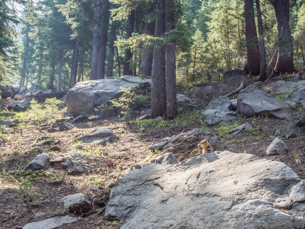
A hungry chipmunk is too busy eating to be scared off by our presence.
Mount Thielsen’s sharp peak is a prominent feature of the skyline making it visible from as far away as Crater Lake National Park. Because eruptive activity ceased 250,000 years ago, glaciers have heavily eroded the volcano’s structure, creating precipitous slopes and the horn-shaped peak that we see today. This peak is famous for its ability to attract lightning. Fortunately there weren’t any episodes of lightning when we hiked past – although a strike would have made an excellent photograph!
Instantly recognisable by its horn-like peak, Mount Thielsen lies in the southern section of the Mount Thielsen Wilderness. During storms, the peak is often struck by lightning, so has been given the nickname ‘The Lightning Rod of the Cascades’.
Heading into the trees again but we couldn’t complain as the trail was so good underfoot.
More excellent trail enabling us to maintain a fast, consistent pace.
At PCT Mile 1860.8 we reached 7,560 feet and what is known to be the highest point on the trail in both Oregon and Washington. (Apparently, never again on the PCT will we reach an elevation above this!) Denoted by a simple wooden sign on a tree stump (did we ever expect anything more!), the spot wasn’t anything spectacular. However as we found ourselves in a pretty open meadow with the sun shining overhead, we decided to sit a while, dry out our sleeping bags that had been a little damp from condensation this morning, and have lunch utilising a couple of logs as seats.
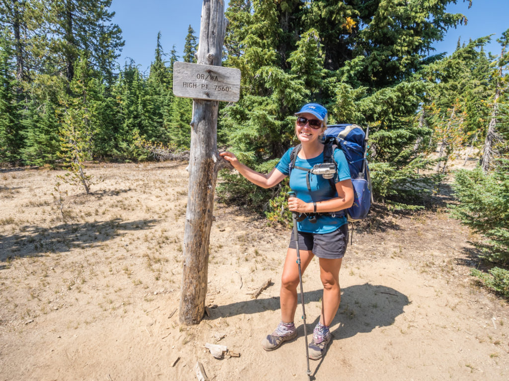
Reaching the highest point on the PCT within both the states of Oregon and Washington. As the nights were drawing in and getting colder it was good to know that we’d no longer be camping higher than 7,500 feet!
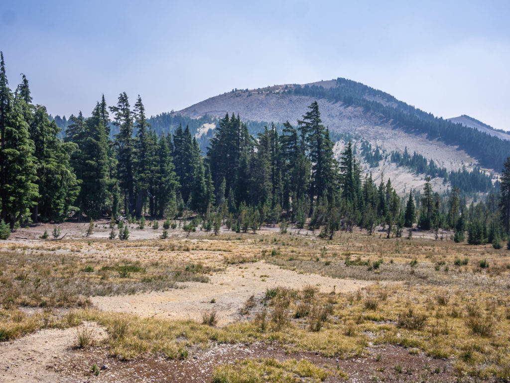
Looking towards Mount Bailey. Standing 8,368 feet tall, it is located on the opposite shore of Diamond Lake from Mount Thielsen.
Enjoying getting above the trees to see what the view was like.
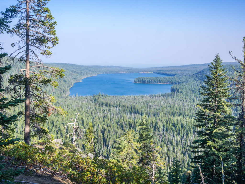
Looking across to Miller Lake, a large natural fresh-water lake named for an early Klamath County ranching family.
After a glorious afternoon on trail surrounded by the monumental trees of Oregon, we found a beautiful camp spot close to Six Horse Spring at PCT Mile 1,872 and decided to pitch up there having completed 30 miles for the first time before sunset. It had been a really wonderful day on the trail and we now felt much more positive about the final weeks that lay ahead. It’s amazing how a single day of sunny skies and incredible views can rejuvenate your passion for the trail. What made it even more special was the spectacular sunset we witnessed from the comfort of our tent.
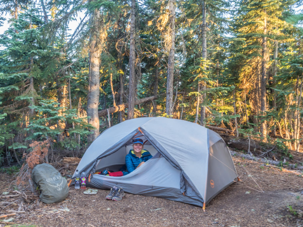
It felt like such a rarity – we were actually setting up camp in the light!
A special moment – watching the sun go down from the luxury of our tent.
Simply stunning! Witnessing a beautiful Oregon sunset.
We are debating having a shorter day tomorrow as we will have the option of taking the Oregon Skyline Trail as an alternate route into Shelter Cove (our next resupply pickup point). It’s about 6 miles shorter than the ‘official’ PCT, stays around 1,000 feet lower in elevation and also passes more water sources, so it is very appealing. Not feeling 100% about missing out some miles, we decided to sleep on it and make our minds up in the morning…
Day 131 – Saturday, 18th August 2018, Wild Camp at Six Horse Spring Mile 1,872 to Wild Camp at Shelter Cove, via Oregon Skyline Trail Alternate, 26 miles
When we set off this morning we had just 6 miles to go to reach Windigo Pass where we would have to decide whether to stay on the official PCT or take the Oregon Skyline Trail as an alternative route to Shelter Cove. As we were walking along debating what to do, we were startled by two ‘fisher cats’ (to us they looked like a cross between a fox and a bear cub, but Fern later confirmed what species we had seen) who ran right past us and her as she was a few metres ahead, chasing each other playfully along the trail. (We later discovered that the fisher is a small, carnivorous mammal native to North America, sometimes incorrectly referred to as a fisher cat, although it is not a feline. They are not very common and are a protected species in Oregon, Washington, and Wyoming – so we felt extremely lucky to have seen two of them!)
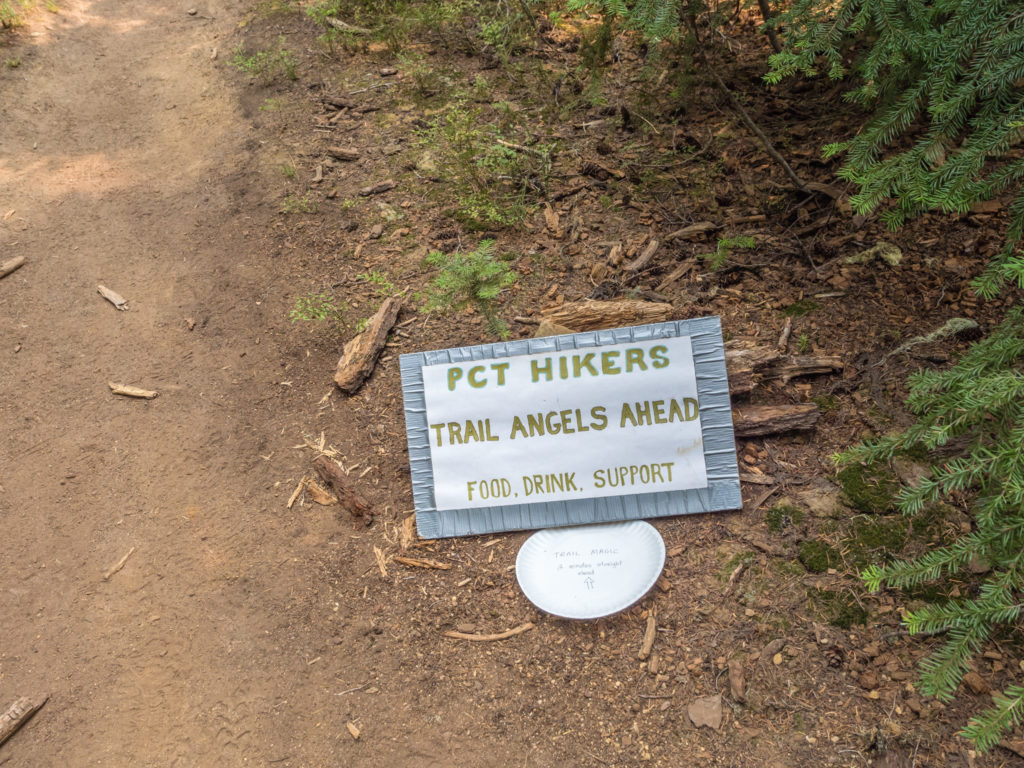
But that wasn’t the best surprise of the morning. Nothing could compare with the ‘Trail Magic Extravaganza’ that was waiting for us at Windigo Pass! We arrived at the trailhead located at Forest Road 60 to find that PCT veteran Wolf and his two friends had organised a feast for passing thru-hikers consisting of burgers, sodas, crisps and ice-cream! Even though it was only 9:30am, we couldn’t refuse to partake in such a wonderful and generous spread. The burgers were what we would class as ‘gourmet’ – freshly made patties straight from the butchers, cooked to order and served with dill pickles, onion, tomato and a drop of chipotle! They were deliciously satisfying and we have to say it was the best trail magic set-up we had experienced by far.
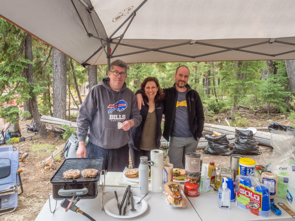
Wolf and friends generously treated us to the best trail magic we’ve had along the PCT so far!
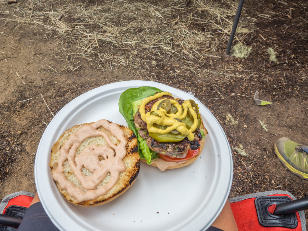
Serving us up ‘gourmet’ burgers – this is trail magic at its best! (I have to say they were tastier than some of the burgers we have sampled in trail towns to date.)
Already sitting in camp chairs around the cook station when we arrived were Fern and Tommy Pickles, Orangutan (a long, red-haired guy, hence the trail name) and Juicy (a beautiful Israeli girl wearing a kaftan who was the epitome of ‘glamour’ on the trail). By the time we had devoured our burgers and were eagerly tucking into double chocolate ice-cream for desert, Down Dog, and the Swiss couple whom we now keep leap-frogging – Bubbles and Nap, had also arrived, all keen to experience some trail magic of their own. Lively conversation and laughter echoed through the trees, with everyone abuzz with excitement at such an amazing and unexpected treat. We felt like we never wanted to leave and could have easily sat around all day listening to everyone’s trail tales and travel stories. Yet, we still had miles to cover, so hike on we must.
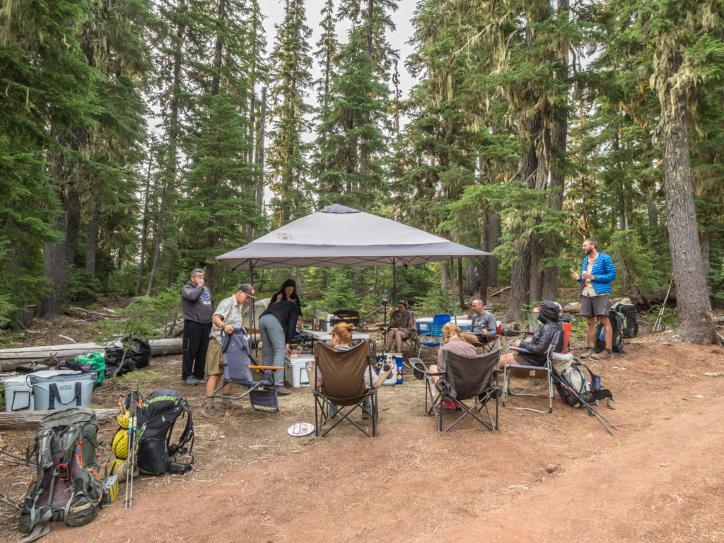
There was a good band of merry hikers enjoying the trail magic and swapping hiker tales when we finally dragged ourselves away after more than an hour of pure indulgence!
After practically dragging ourselves away from what was quickly becoming an all-out trail party, we then had to decide on which route to take leaving Windigo Pass. The alternate route, known as the Oregon Skyline Trail, is similar to the PCT in that it is also a designated horse route. However, despite its name, it stays lower in elevation compared with the PCT and takes you past several lakes, offering a good viewpoint of Diamond Peak from Diamond View Lake. We finally agreed – as the OST would provide us with more access to water and because it was 6 miles less to Shelter Cove than taking the PCT route, we decided on the shorter option! This would also help us shave off a few miles over the next few days having adjusted our itinerary so that we could make it to the Oregon town of Sisters by Thursday morning, where we had arranged to meet a friend for dinner.
In the guide-book we were using for reference purposes, it stated that the OST was the more scenic of the two routes anyway. Without hiking both routes, we couldn’t judge the truth in that, but this being Oregon, we found that the trail still took us through lengthy sections of woodland and offered us little in terms of open views of the surrounding volcanic peaks, as the alternative had promised. The OST did however take us along several lakes so we had plenty of access to water. These lakes weren’t particularly spectacular, but how could they be when we were comparing them to those of the Sierra, so of course there was no competition!
Looking onto Oldenberg Lake along the Oregon Skyline Trail where we stopped to have a tea break.
Taking the alternate route did however present us with an amazing bonus factor – when we stopped at Whitefish Horse Campground near to Crescent Lake to fill up our water bottles from the spigot, a guy camped opposite came over and handed us two cold beers telling us to enjoy them as we probably hadn’t had one in a while! He was really friendly and spent some time asking us lots of questions about the PCT in general. He seemed in complete awe that we had started at Campo on the Mexican border way back in April and was thoroughly impressed with how many miles we were now covering per day. We sat on some wooden posts enjoying the cold beers and it felt great to tell someone completely unrelated to the PCT our story. Even better was the fact that this total stranger was really interested in what we were doing. But just as it had been at the trail magic earlier, time was quickly ticking on, so we soon had to be on our way again.

Cheers! Enjoying some unexpected beers at the Whitefish Horse Campground.
From the campground, we then took the Whitefish Creek Trail towards Shelter Cove that on the sign indicated was still 11 miles away. The first 5 or so miles was all uphill, where we had to give way to a group of horse riders using the trail. (On the actual PCT, considering it is also an equestrian trail, we have found this to be an uncommon occurrence.) But as if the day couldn’t get any more eventful, we then happened upon a chance sighting of what we thought were possibly bear prints. In comparison to Wayne’s footprint we thought they were rather large, but we weren’t fully convinced that they were the tracks of a bear. We later compared the print with some information and track examples given on a noticeboard and deduced that they were the prints from a ‘wolverine’. (Note: We are not experienced animal trackers so this may still be incorrect!) As well as the animal tracks, we also passed 3 SOBOs heading for Windigo Pass. Even though it was now later in the day, we hoped that the trail magic was still in full flow and that they wouldn’t miss out!

We spotted these animal tracks that we first thought were bear prints, then after a lot of consideration decided that they could have been made by a wolverine!
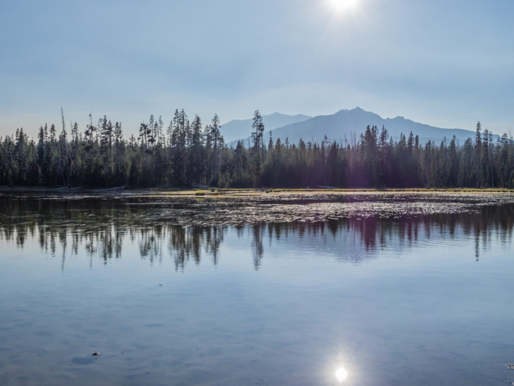
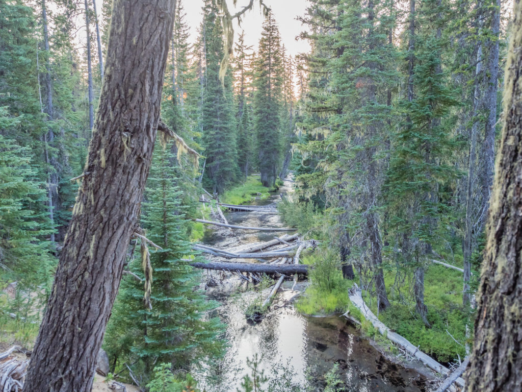
Reaching Diamond View Lake around 6pm, we decided to stop and cook dinner whilst we had easy access to water. Already camped close to the lake were a father and young daughter from Oregon who were section hiking the PCT, but had also chosen to take the Oregon Skyline Trail alternate. They came to chat with us and again time flew by at a rapid rate. By the time we got on our way again it was getting close to sunset, however the final five miles leading to Shelter Cover were the most scenic of the entire day. Our path followed Trapper Creek, a huge, gushing river that we could see directly below us from high up on the ridge. Walking beneath a dense forest of mountain hemlock, lodgepole and western pine, and silver, noble, and other true firs in the Diamond Peak Wilderness it felt very atmospheric, the tremendous trees standing guard, sentinel-like, either side of the trail.
Reaching Diamond View Lake where we stopped to have dinner.
Wayne cooks up a quick rice and tuna combo for an energy boost before covering the last 5 miles.
Reflections of Diamond Peak on Diamond View Lake.
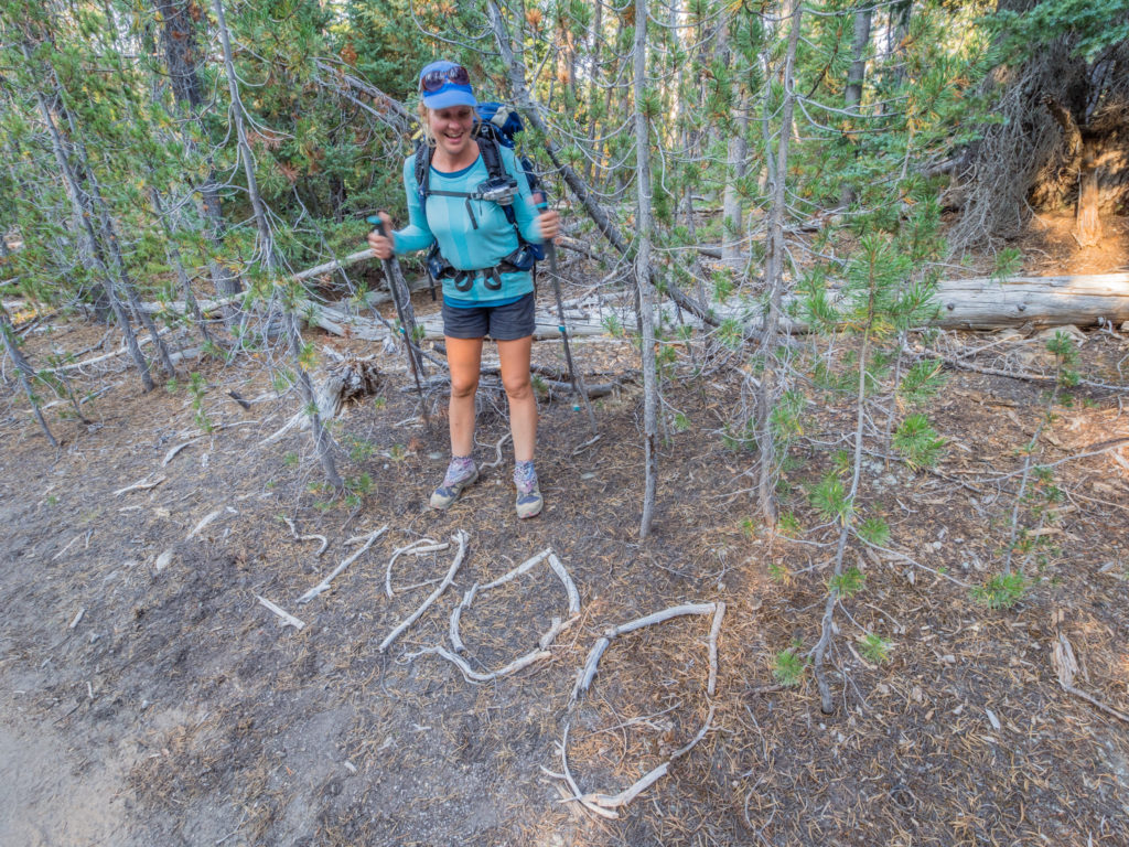
Reaching another milestone! Despite taking the alternate route, someone had kindly made a 1,900 mile trail marker, which made my day!
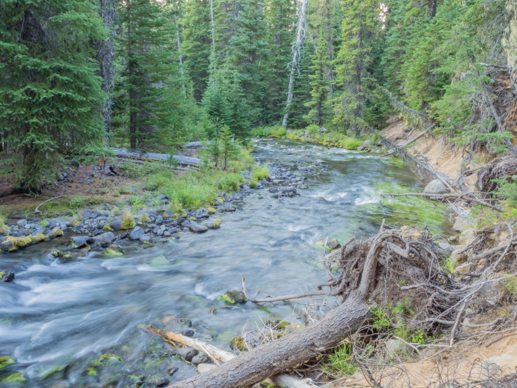
The Oregon Skyline Trail follows the course of Trapper Creek towards Shelter Cove.
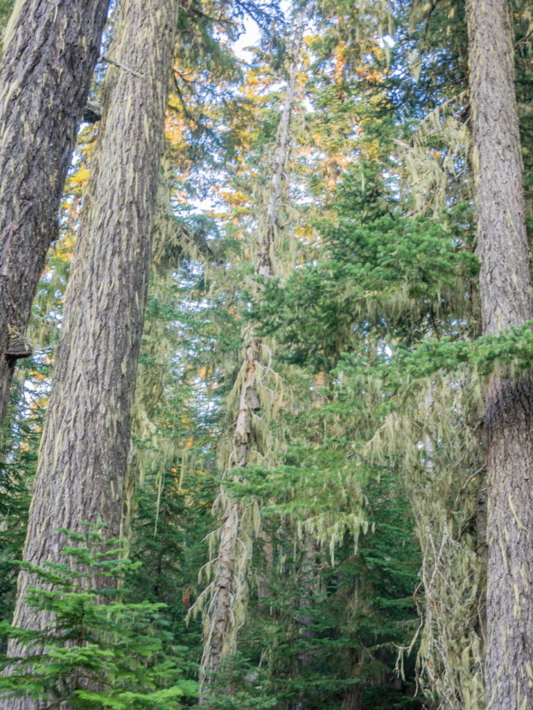
Ancient trees tower above, mighty and majestic with long strands of murky green moss hanging down from their branches.
Looking onto Trapper Creek as the sun goes down.
Enjoying our time hiking in the Diamond Peak Wilderness.
Just before the sun finally set, we came to a camp area on the edge of the Diamond Peak Wilderness, situated directly opposite the West Coast’s main north-south rail line. Crossing the tracks, we would have less than a mile to go to reach the Shelter Cove Resort. As we still had enough light in which to pitch our tent effortlessly and because we felt really tired after such an eventful day, we decided to stop there at the camp area and save the $22 it would have cost us for camping at the resort. Instead we would hike in the following morning for breakfast.
A section hiker called See-Saw had already strung up a hammock between two trees, and was comfortably sat in a camp chair enjoying a cigar, so tonight we would have company, but we didn’t mind. It turned out it was See-Saw’s birthday and he was also treating himself to a small bottle of bourbon too! We’d been told that trains run frequently during the night so to expect a broken sleep. But in actual fact we were only woken twice, the first time admittedly felt like an earthquake as a freight train rumbled past and shook the ground, but after that we both slept soundly for a good ten hours, exhaustion taking over. It was the most sleep I’d had in ages (I normally get between 6 and 7 hours of sleep after each night spent writing notes for the blog), so by morning I was well-rested and in the best mood.
Day 132 – Sunday, 19th August 2018, Wild Camp at Shelter Cove, via Oregon Skyline Trail Alternate, to Wild Camp by Maiden Peak Shelter, PCT Mile 1,914, 10 miles
Happy at the thought of a proper cooked breakfast this morning and just a ‘half day’ of hiking, we set off for the Shelter Cove Resort at 8:30am. Tucked in the trees, along the south shore of Odell Lake, our first impressions as we strolled into the resort were of a wonderful lakeside holiday retreat. It was full with RVers and looked very picturesque with sail boats bobbing beside the lake shore. We would love to have stayed longer to enjoy some down time beside the lake, but still on our tight schedule to reach the town of Sisters on Thursday, it wasn’t an option.
So we consoled ourselves with a hearty breakfast at the ‘Hook and Talon Café‘, which consisted of breakfast biscuits, sausage gravy and scrambled eggs, plus we were treated to some leftover birthday cake that had been brought over for the hikers, generously donated by a family holidaying at the resort.
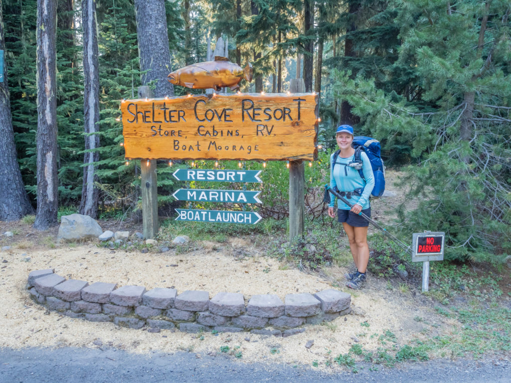
Reaching the Shelter Cove Resort, a pleasant and picturesque resupply point on the PCT where we wished we could have stayed longer.
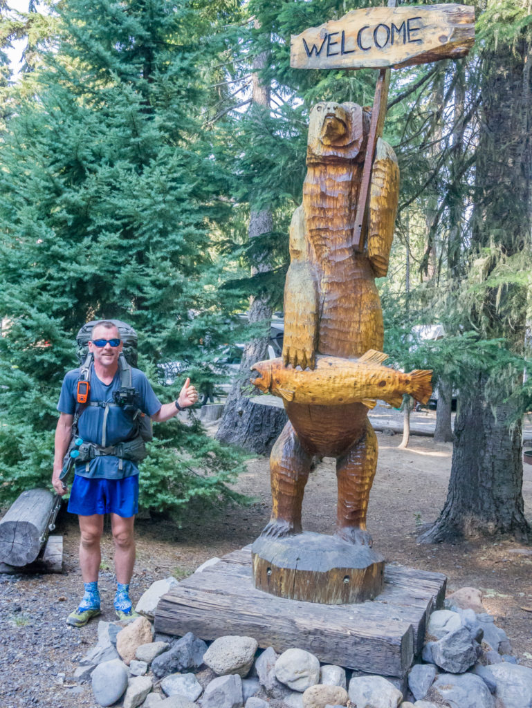
Feeling welcome already! (Would this be the only bear we would see on trail?)
Not only is Shelter Cover well worth a visit for breakfast or lunch, but the fact that they have a ‘Hiker Hut’ – a gazebo with charging station, hiker boxes and picnic tables, makes it an advantageous stop-off for any thru-hiker. We thought it was an excellent set-up and hikers passing through were made to feel really welcomed, whether they were collecting a resupply package or not. In addition to this, the thing that impressed us the most were the exceptional shower facilities. The individual shower rooms, complete with free toiletries, fresh towels and a mirror made them the best showers we have paid for along the entire PCT! (It was $2 for 3 minutes, but for hot running water and a clean towel, it was worth every quarter!)
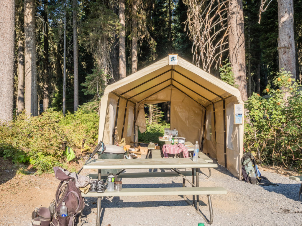
The much appreciated ‘Hiker Hut’ provided by Shelter Cove Resort for PCTers.
There is no competition. So far, Shelter Cove has provided the best shower facilities along the PCT! (I treated myself to 6 minutes in there!)
Collecting our resupply box from the on-site shop and organising our next lot of rations.
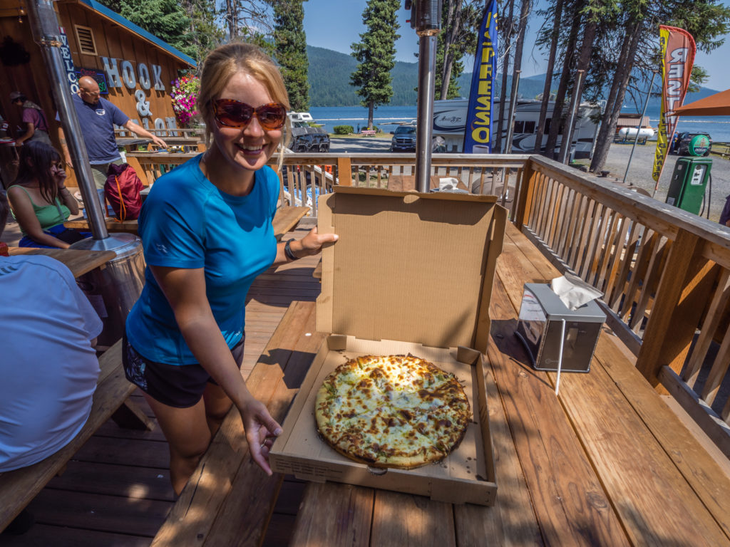
We couldn’t resist it! Treating ourselves to a ‘pesto chicken’ pizza before heading off and rejoining the PCT.
Just before we left Shelter Cove, we had some really upsetting news via trail talk. We had been told that the last 30 miles of trail is currently closed due to a spreading wildfire in Washington so PCTers cannot now make it to the Canadian border. Shocked at what we’d heard, we immediately logged onto the WiFi at the resort to try and confirm the validity of it. As stated on the PCTA website: “The Pacific Crest Trail is closed from Harts Pass (PCT Mile 2,622) to the Canadian Border due to a 300 acre fire burning on the PCT at Holman Pass… Folks who choose to venture to Harts Pass will need to return to Highway 20 via the PCT. As such, it is recommended that folks do not proceed north on the PCT from Highway 20. While this closure is in effect, one cannot hike to the PCT’s Northern Terminus”.
We were utterly blindsided by the news. We just couldn’t believe it! After hiking all this way, we might not even get to finish, a prospect we had never really genuinely considered and were truly gutted about. We needed time to digest what we had found out and to make a plan. We agreed that when we got to town later in the week we would see if there are any alternate options we can consider, but really as we have accommodation already booked in Vancouver and flights out of there to Hong Kong, we have got to get to Canada no matter what! What makes it worse is that we can’t even wait out the fire as we are now time-limited with regards to our visa and onward travel, so have a set schedule to keep.
We finally left Shelter Cove just after 4pm and continued mulling over the bad news and debating different alternative options and scenarios for the entire 10 miles of hiking. We passed by some pretty lakes including the Lower, Middle and North Rosary Lakes, but we weren’t in the mood now to appreciate them fully. Our aim was to reach the Maiden Peak Shelter to make tomorrow’s hiking a little easier. When we arrived around 7:30pm there was already a bunch of hikers there, including Tipsy and Night Crawler. We all congratulated ourselves on managing to drag ourselves away from Shelter Cove, which could easily have become a vortex as it is such a nice place.
We had some wonderful views after leaving Shelter Cove, yet our minds were elsewhere as we became preoccupied with the trail closure in Northern Washington.
Looking back to the beautifully serene Odell Lake.
An important message not just for thru-hikers on the PCT but anyone out enjoying some time in the backcountry.
Passing one of the three Rosary Lakes on our way to the Maiden Peak Shelter.
With talk of the wildfire and trail closure in Washington dominating the conversations inside the cabin, we made camp outside in one of the large clearings close by as we didn’t want to keep dwelling on it. Hopefully the fire would be contained and the trail would reopen before long. We still had around 6 weeks for that to happen before we were in the final stages of making it to Canada – or not. For now, no one knew what the overall outcome would be…
Down a little track just off PCT Mile 1,914, we set up camp close to the Maiden Peak Shelter.
Day 133 – Monday, 20th August 2018, Wild Camp by Maiden Peak Shelter at Mile 1,914 to Wild Camp by Mac Lake at Mile 1,942, 28 miles
We had suffered a terrible night’s sleep. Whether it was down to us whittling about not being able to finish the trail through a complete and unforeseen act of force majeure, or whether it was the strong smell of smoke permeating the tent that kept us on a high state of alert, our bodies subconsciously reacting to the threat of a wildfire close-by, we were continuously waking up throughout the night. By the fresh light of day however, the smoke had come in again but thankfully the fire had not spread to our vicinity. We had even rationalised the trail closure predicament we found ourselves in, coming to the conclusion that in all likeliness, if the trail couldn’t reopen this season then the PCTA would come up with a work-around. It was perfectly reasonable to assume that an alternate trail would be utilised to get the remaining NOBOs to the Canadian border so they could at least finish their thru-hike. But for now, we just had to be patient and not let the situation in Northern Washington hinder our current progress.
When we broke camp around 8am, we had 3 miles to hike to reach Bobby Lake, our first water source since yesterday evening. But being on a mission to try and get in another 30-mile day, we decided not to go down to the lake and collect water, pushing on instead with the intention of covering ten miles before stopping for second breakfast or what has now become our ‘elevenses’. Unbeknown to us at the time, it had been an excellent decision as we stumbled upon some more unexpected ‘trail magic’ just past Charlton Lake.
With only managing to hike 10 miles out of Shelter Cove yesterday, today we were on a mission to pull in another 30-miler!
That was until we got waylaid with more extraordinary Oregon trail magic!
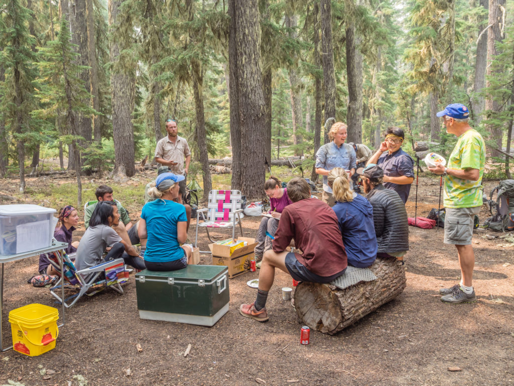
Courtesy of Ducky and Ducky’s dad (Ducky being a fellow PCT thru-hiker from the ‘Class of 2017’), we were treated to waffles and jam, crisps, cans of coke, and pints of Häagen-Dazs ice-cream! We couldn’t believe our luck to have had such amazing treats within just a few days of each other. The trail magic on offer in Oregon had really been top class! We found out that these wonderful trail angels had already done a consecutive 7 day stint, with today being their last day of ‘magic’ as they were running out of supplies. We were not surprised in the least when Ducky told us that around 25 hikers had already been through this morning, and that on average he had seen 30 thru-hikers per day, with yesterday’s numbers peaking at 55! We were definitely part of a huge bubble making its way through Oregon right now! (How immensely disappointed would we all be if we couldn’t then get to the Canadian border? The thought was still niggling at the back of our minds.)
A selfie picture at the northern terminus, no matter how much we wanted to get there, would not however be our defining moment of the trail. We recognise that this ambitious endeavour is much more than covering the distance between two points. One of the biggest things we’ll take away from hiking the PCT is the fundamental goodness of humanity. Running into trail magic and finding that people from all walks of life have genuinely wanted to help us along with our journey to Canada has been one of the most heart-warming and memorable aspects of the adventure. It has been incredible how many times complete strangers have given us rides, food, water, beer, hugs and kind words. Particularly after a tough and tiring day, we have really appreciated the energy and morale boost after receiving unconditional kindness from someone who just wanted to help and was expecting nothing in return.
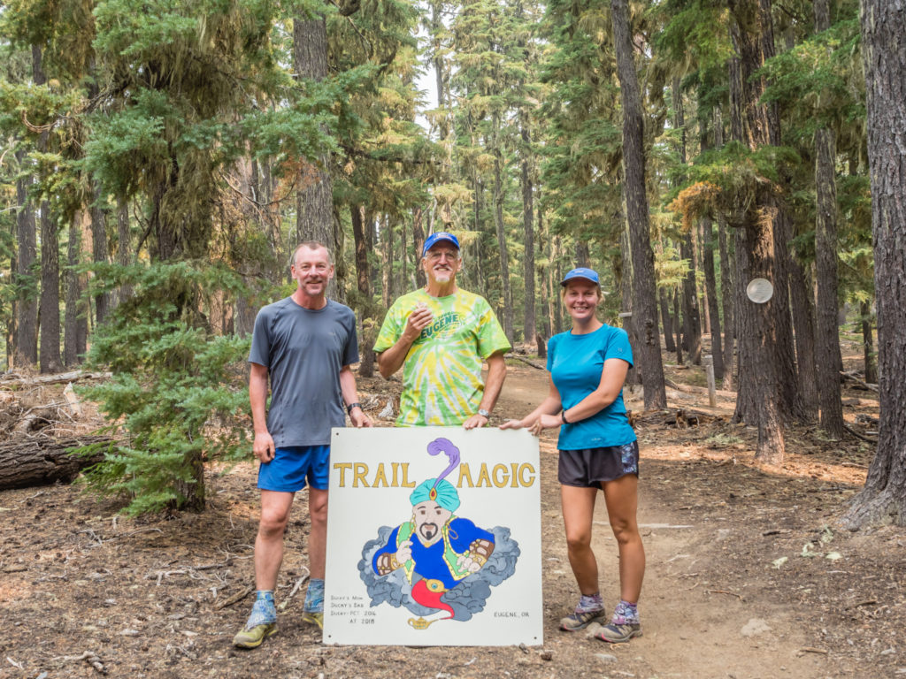
Ducky’s Dad and his amazing hand-painted ‘Trail Magic’ sign.
Ducky and his dad had gone to so much effort to support the thru-hikers passing by over the past 7 days. ‘Paying it forward’ in such a way shines a tremendous spotlight on the beauty of humanity.
After thanking both Ducky and his dad for the wonderful treats and signing their ‘Trail Magic’ book, we hit the trail once more continuing on another 7 miles to Irish Lake. The same crowd we had enjoyed the trail magic with were also there topping up water supplies and eating lunch. Not long after, we entered the Three Sisters Wilderness, an area within the Willamette and Deschutes National Forest renowned for its particular beauty showcasing the three strato-volcanoes named by early settlers as Faith, Hope and Charity. Today, they are known from left to right as South Sister, Middle Sister, and North Sister. Part of the Cascade Volcanic Arc, South Sister is the highest of the three volcanic peaks at 10,363 ft, but each exceeds 10,000 feet in elevation. They are also the third, fourth and fifth highest peaks in Oregon and contain 16 named glaciers. Although they are often grouped together as one unit, the three mountains each have their own individual geology and eruptive history.
Heading back under a thick canopy of Douglas fir, mountain hemlock and ponderosa pine.
Continuing along the PCT in the ‘Three Sisters Wilderness’ area.
Once again we found ourselves in the midst of another large burn scar. Walking through the vast area of dead trees, it was good to see new life taking hold amongst the ground cover. Grasses, hardy flowers and strong saplings had sprung up all over the place having adapted to the dry, ash-laden soil in an effort to survive.
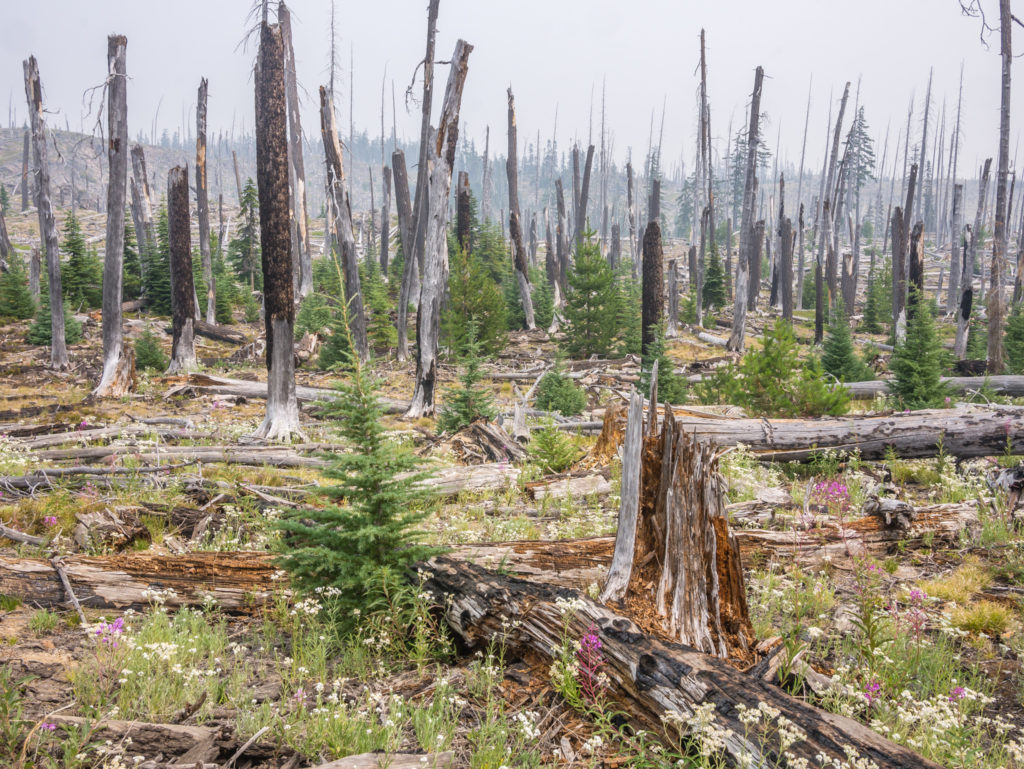
Passing through another old burn area. Recovery from large wildfires can take years, but we were pleased that this area was regenerating.
After yesterday’s clear and expansive views across Odell Lake at Shelter Cove Resort, today was the complete opposite. Thick, heavy smoke hung in the air, lingering above the lakes that we passed, also obscuring the volcanic peaks that every once in a while teased us through a gap in the trees. This section of the Deschutes National Forest was so dense that a mountain was a rare sighting, and even less of an occurrence with the prevailing smoky pall overhead.
We pushed on again to a small, unnamed pond where we stopped to have dinner. Tonight ‘Ramen instant noodles’ were on the trail kitchen menu, which was the first time we’d had them since starting out in the desert back in April! Cooked in a creamy chicken broth and paired with salmon in a spicy soy sauce, it proved a tasty combination that we’d enjoy again.
This section of the PCT passes by numerous lakes, so access to water today was not an issue.
We finally made it to Mac Lake at PCT Mile 1,942 just as it was descending into darkness, so we decided to set up camp there along with what felt like 50 other hikers whom we’ve been leapfrogging the past few days. We had only achieved 28 miles, but considering we had spent over an hour enjoying the earlier trail magic, we couldn’t be too dismayed with our efforts. It seemed that everyone was pushing harder this week to make it to the Oregon town of Bend for a zero day – and who could blame them with Bend being famous for having the most microbreweries per capita in the nation, earning it the moniker of ‘Beer City USA‘. (We would have loved to have spent a night in Bend and taken a zero day there, however with taking the extra day in Ashland we just don’t have room in our itinerary for it. We’ve already pushed on quicker than we originally planned to allow for a nearo in the town of Sisters to enable us to buy a new sleep pad from the outfitters there, but also coincide our stay with a visit from a friend who is going to drive over from Eugene and meet us for dinner, so it’s all good.)
Unlike in the earlier stages of ‘big mile’ days, now after completing a 28-mile day for instance, it’s pleasing that our legs feel strong and in good shape and that our packs no longer bother us, especially with only having two or three day’s worth of food to now carry. However what I am finding is that my toes now take a hammering if we hike any more than 25 miles. The toe nails on my little toes are black and ready to fall off and I have blisters on the underside of the next toes along where they seem to be getting squashed and feel sore later in the day. With my new pair of trail shoes, I already opted for half a size bigger, which felt fine at first as they were roomier around the toes. Whether my feet have grown or flattened out, or that they simply swell up by the end of a long day’s walk, I don’t know, but I really thought I’d be past the blister stage by now. Also when I say ‘new pair’ of trail shoes, I consider these as being relatively new having only purchased and worn them since Castella at PCT Mile 1,500. Since then though they’ve already done almost 500 miles, so I shouldn’t be surprised that they are wearing into holes on the front bridge where the foot bends and that the material is also wearing away on the inside heel. I might have to consider changing from Salomon to a different brand of trail shoes for Washington, although I’d still prefer this pair to see me through to the end!
Despite the state of my feet, we went to sleep that night much happier as we had throughout the day worked out a ‘Plan B’! If the PCT remained closed to the Canadian border, we would hitch a ride from Hart’s Pass and enter Canada via an official road border crossing. We would then take a bus to Vancouver and once there, hire a car from the city to drive out to Manning Park. Our plan was then to walk the 8 miles from Manning Park on the Canadian side to the border with the US to reach the PCT Northern Terminus and Monument 78. We intrinsically need to do this to feel like we’ve ‘officially’ finished and bring closure to the thru-hike, (as well as get some photos of us at the end!). We will then have to return to the US in the future to hike the very last section of trail that was closed.
To us, if the situation in Northern Washington remained the same, we had a good plan!
6 Comments
Wow! So much to take in. An awesome post from two awesome hikers, seeing awesome scenery and enjoying the awesome company of trail angels and fellow hikers.
Fantastic that if needed, you have been able to make a plan B. I await the next post with bated breath!
Wow, awesome comments!😜 We couldn’t believe our luck with all of the wonderful trail magic we received in Oregon. It was definitely a week to remember in more ways than one!👍
More adventure tales and stories of amazing kindness. I’d read of trail magic in other PCT stories but this is the first time I’ve been able to grasp the scale. Those people are a amazing and it must be such a huge boost to morale not just for the calories but the sheer joy at receiving help from people just out of good nature. I’ve seen the photos of you at the finish point so I’m Waiting to see how you get there.
Yep we made it to Canada, but how we got there – I won’t give it away then!
‘Trail Magic’ and more importantly the wonderful ‘Trail Angels’ that make it happen was without a doubt one of the most heartwarming and memorable aspects of the trail. The food was a bonus, but without all of the rides we were given to and from towns back to trailheads, re-supplying would have been much more difficult. The kindness of a stranger really did make all the difference on a tough day!
Just found your blog and YouTube, I’m really enjoying them. I’m hiking Oregon next month. What did you do with your food at night in Oregon? Did you hang it, leave it in your pack outside, or bring it in your tent? Thanks!
Hi Alex, thanks for taking the time to read and comment.
We always kept our food inside the tent in Oregon and we never had a problem.
We used to double bag it – First we keep all food & scented items inside an Opsak (odour proof bag), which we then put inside a dry bag.
We then just kept these at the bottom of our tent at the end of our sleep pads.
Hanging is actually harder than you think – finding suitable trees in terms of accessible height and width of branches can be an issue.
We only hung our food once and that was in Washington where we stayed in a North Cascades National Park designated camp area, where we had to get a permit to camp and were required to hang our food.
Good luck with your Oregon hike – there are many picturesque spots especially around the ‘3 Sisters’! Having already spent almost 4 months hiking through California, I don’t think we fully appreciated the beauty of Oregon. We’d love to go back someday and explore more of Oregon’s hiking trails.
Happy hiking & best regards,
Danielle & Wayne