
Walking the Wainwrights…
It’s been our favourite hike in the Lake District to date! We decided on embarking on a 12 mile circular route from Wasdale Head, the remote and picturesque valley on the far western side of the national park, and we were not disappointed. Excellent weather and a long weekend courtesy of a national holiday in the UK gave us the opportunity to both explore a new area and do a bit of peak bagging! Hence, we added 5 more Wainwrights to our collection of lakeland summits, bringing our current total to a modest 21. (Only 193 to go!)
We began with traversing the steep crags of Bell Rib to the summit of Yewbarrow (627m), a most distinctive looking mountain in the shape of an upturned hull of a boat, before continuing on to tackle the long ridge of Red Pike (826m), followed by a serene stroll across Scoat Fell (841m) to take a detour to Steeple (819m), then crossed over Black Crag and the vast bulk of Pillar (892m), before meandering down Black Sail Pass and returning to Wasdale Head – where, as is the custom, we celebrated with a well deserved pint at the pub.
Here is our hike in pictures… We hope you get a sense of how dramatic this hike is and why we were so impressed!
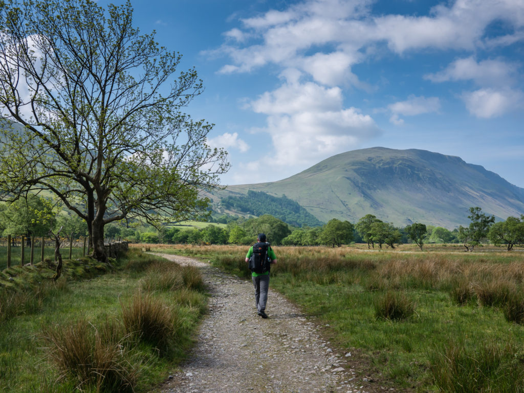
With our day bags packed, we set off around 10am on our circular route.
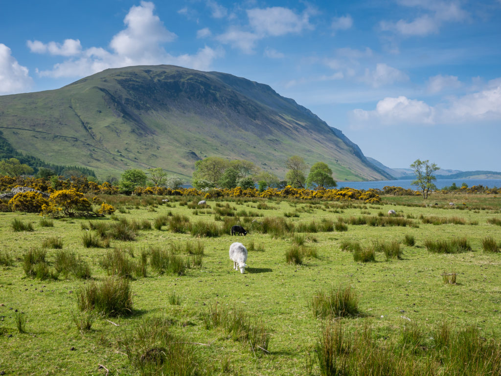
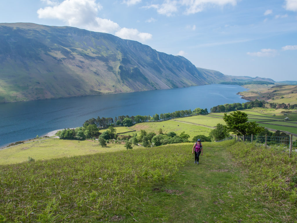
Looking onto the northen end of Wast Water. We opted to begin our ascent of Yewbarrow from its southern end, where there is a small car park if you prefer to drive to the trailhead.
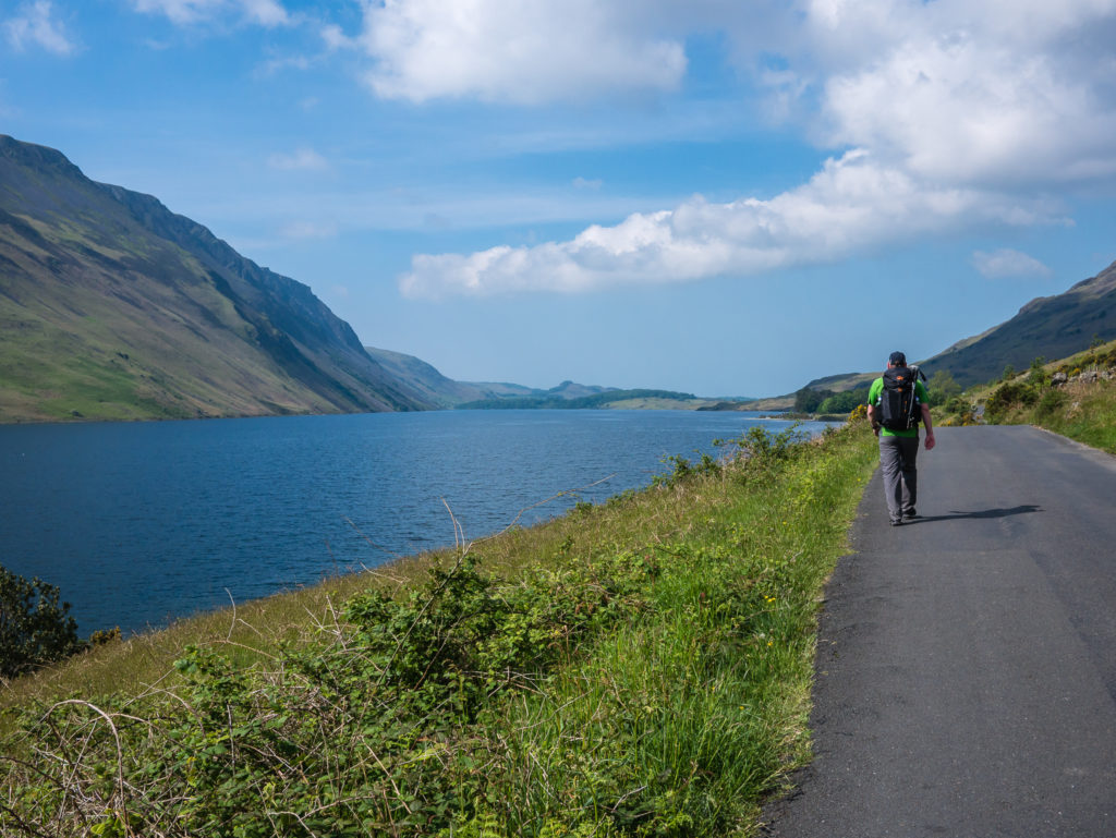
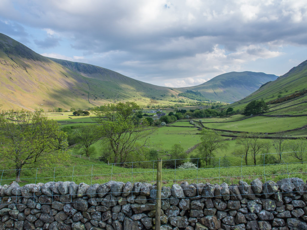
Starting from the campsite opposite the Wasdale Head Inn, the only downside in our circular route was having to walk along the narrow, winding roadside to the southern end of Wast Water to properly begin our hike. Unfortunately there is not an accessible footpath running along this side of the lake.
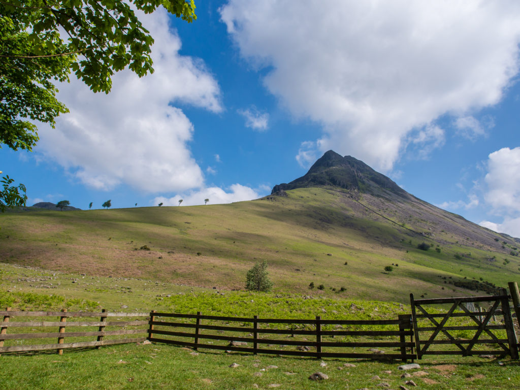
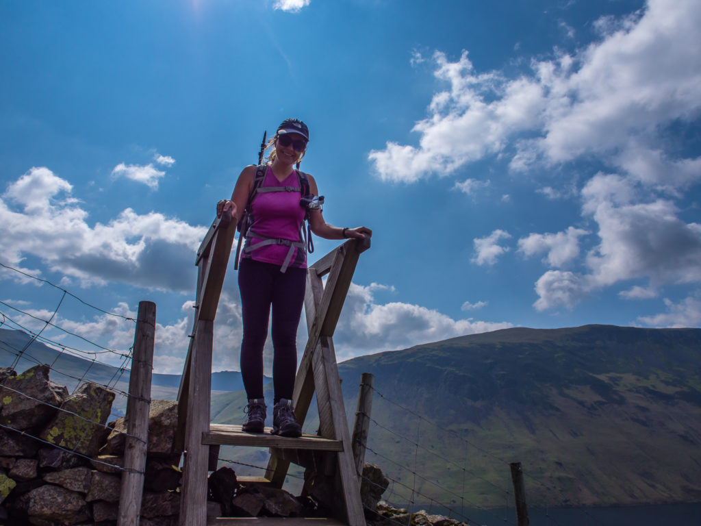
The southern ridge of Yewbarrow rises steeply from the shoreline at about a 50% incline! It’s hard to appreciate the scale of it from the picture. At the back of the car park, a path leads via a gate and a couple of stiles to the foot of the south ridge.

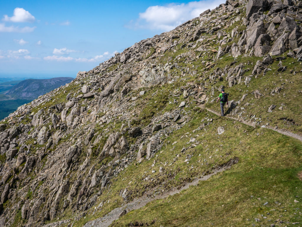
Wayne begins the steep ascent heading towards Bell Rib in the distance.
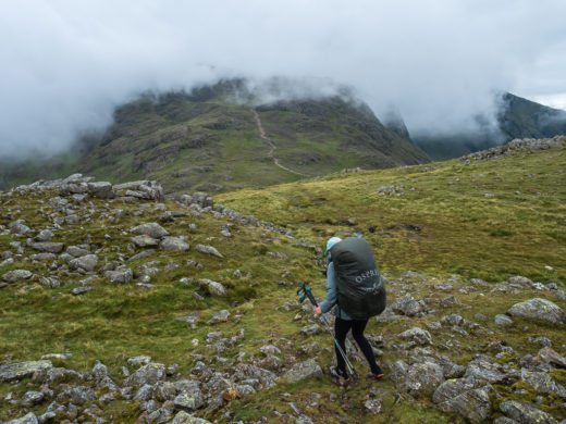
You really need a good level of fitness for this walk – the steep, relentless climb is even more testing in the heat!
We set a decent pace and climbed rapidly up the fence line towards Yewbarrow. With great views of Wast Water and the Screes behind us, we decided to take a breather, turn around and enjoy the scenery.
We climbed over the stile to the left-hand side of the fence. As it was our first trip up Yewbarrow, we decided to take the worn path that skirts around the left of Bell Rib, rather than scramble right over the top of it.
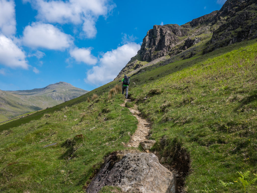
The path to the left avoids the crags on the end of the fell, and gains the ridge a little further up.
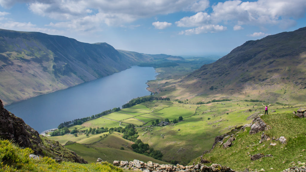
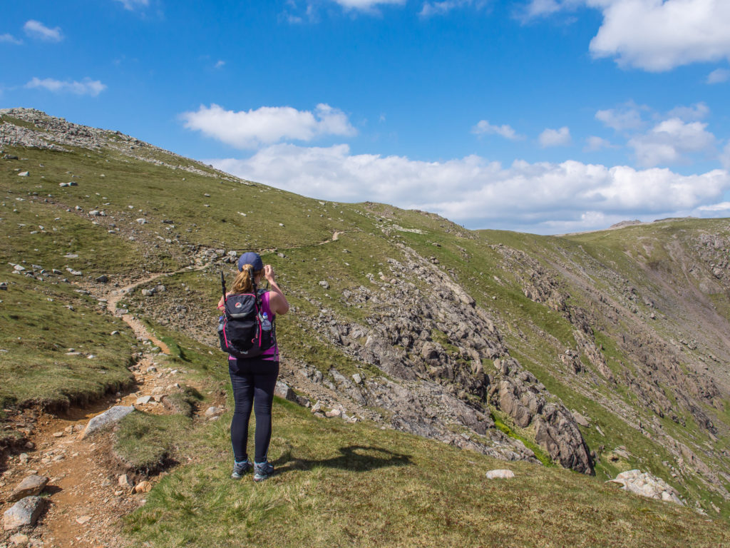
We were treated to stunning views and we were only mid-way up!
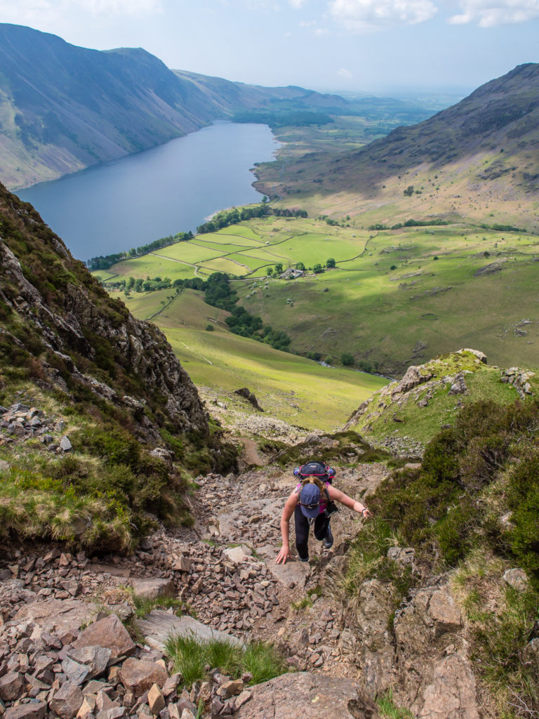
Scrambling can’t be avoided altogether! After traversing the steep grassy nose, you go up a rocky zigzag by the foot of Dropping Crag and then head up gully where you can take a peek through ‘The Great Door’(a cleft in the rocks providing thrilling views of Wast Water on a clear day).
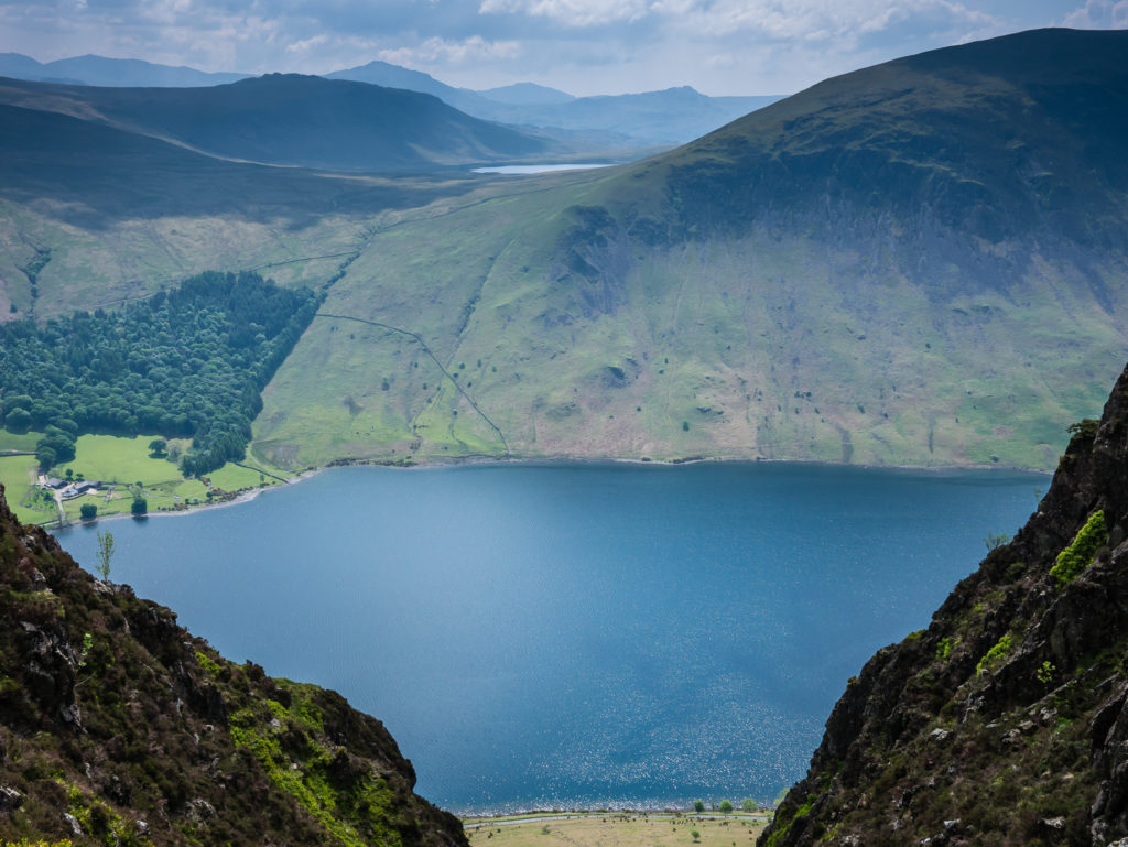
The view from Great Door across Wast Water to Burnmoor Tarn.
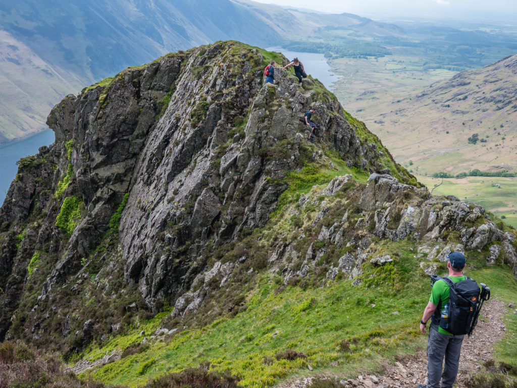
Looking back towards Bell Rib where some hikers had scrambled directly over the top.
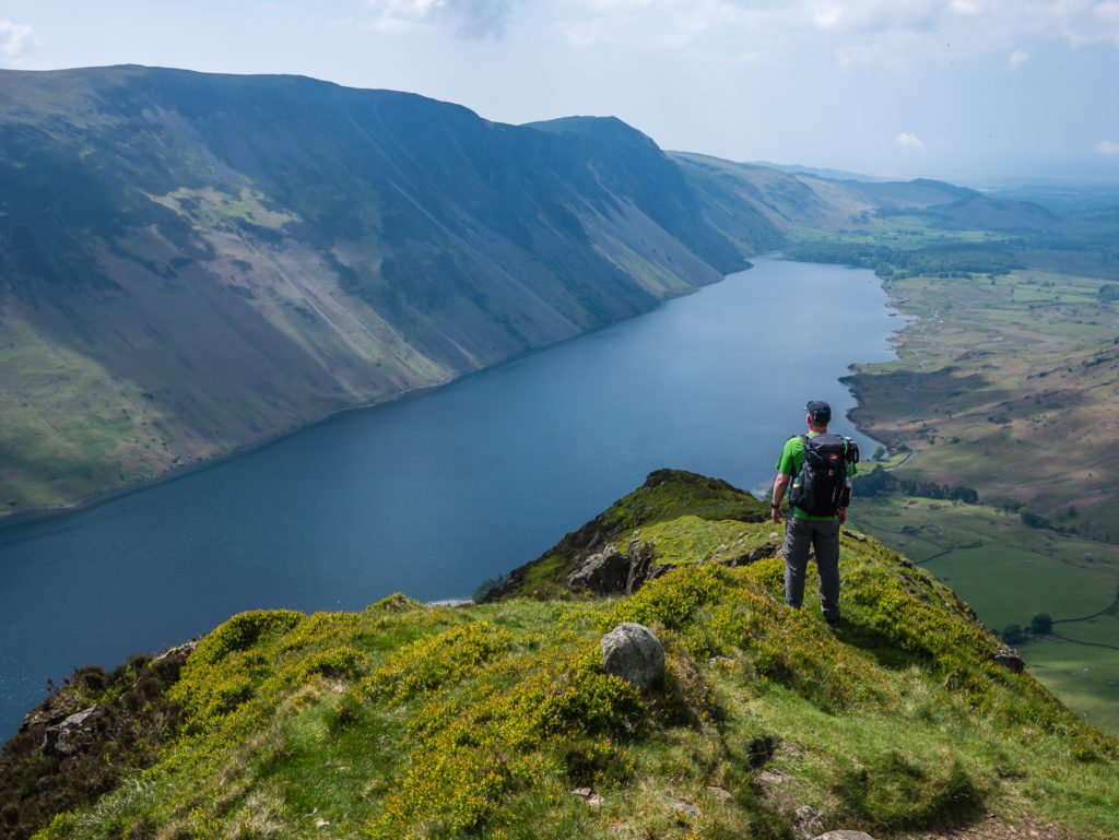
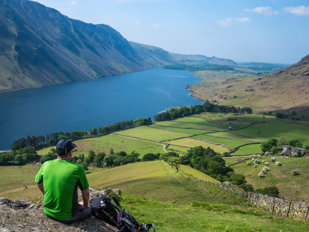
A great vantage point to take in the views of Wast Water and the Screes.
Continuing up… Aiming for the summit, Wayne checks his watch to see how long it has taken us. The ascent was around an hour and a half.
Yewbarrow is 627 metres high and the crest of the fell runs for approximately two miles. Its name comes from the distinctive ‘upturned hull of a boat’ or barrow shape seen from alongside Wast Water, in conjunction with yew trees having grown on its slopes long ago.
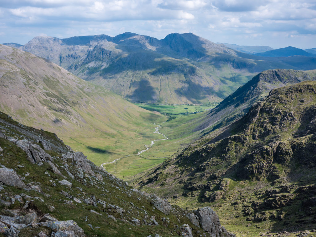
The entire day hike was a long and demanding 12 miles crossing vast and rocky paths, but a memorable one, not just because of the fantastic walking weather (a rarity on our hikes so far this year) – but because of Yewbarrow’s excellent vantage point for the high fells in this part of the Lake District. Its unique location makes it the only place to enjoy uninterrupted views of the Scafells, Great Gable, Kirk Fell and Pillar. Equally as impressive are the tremendous views over Wast Water and Wasdale Head, making the breathtaking walk along Yewbarrow’s summit ridge the highlight of our day.
Looking out towards the Scafells. Scafell Pike at 978 metres is the highest point for over 90 miles. But Scafell – England’s second tallest peak at 964 metres – always appears to look the taller of the two.
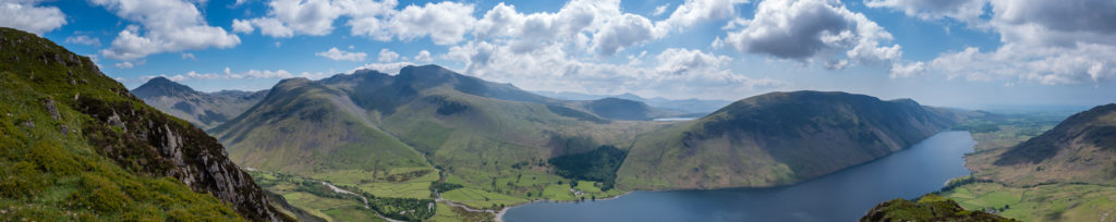
Panorama shot looking onto the Scafell Massif from Yewbarrow. Left to right – Great End, Broad Crag, Scafell Pike and Scafell, with Lingmell to the fore. In normal conditions, as Alfred Wainwright remarked, you can see all of the Lake District’s 3000 feet summits from here!
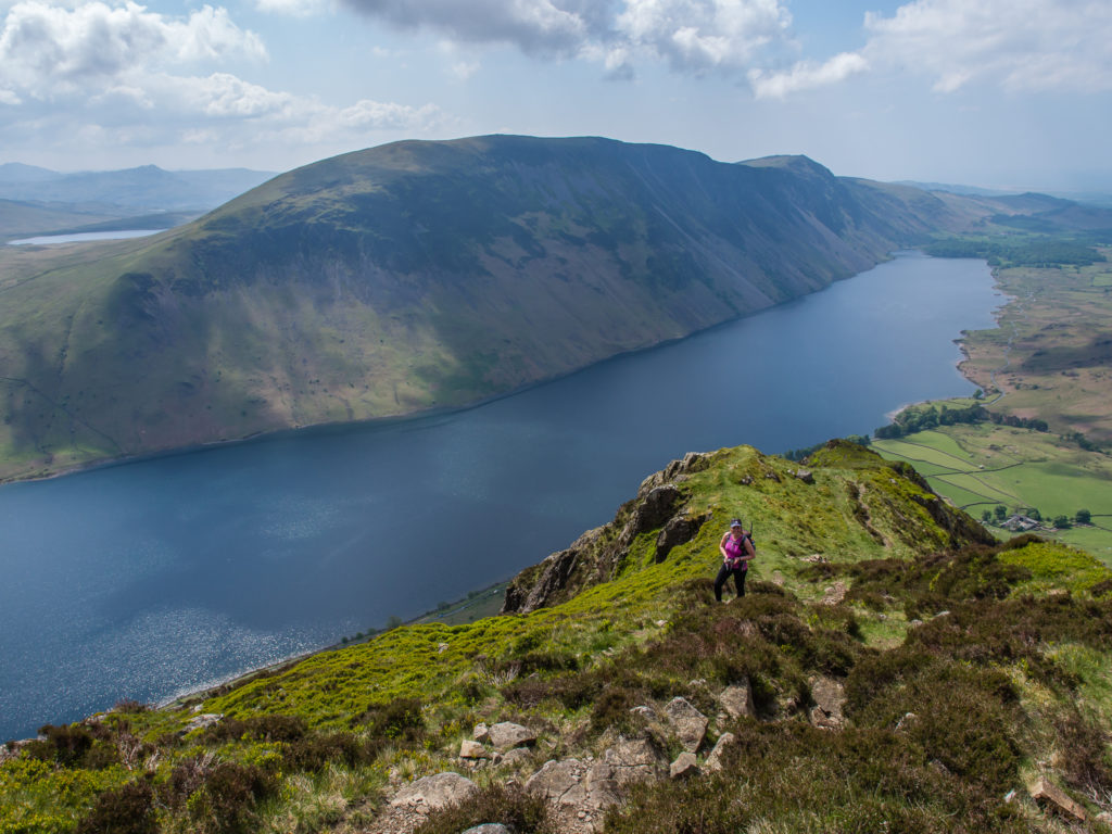
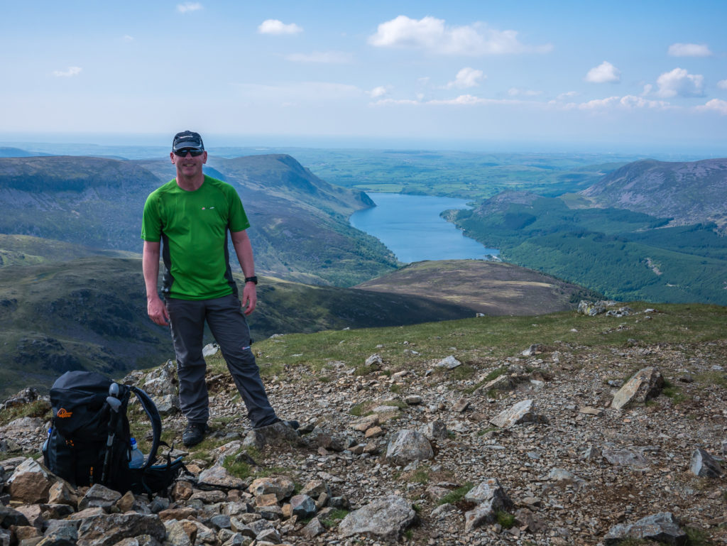
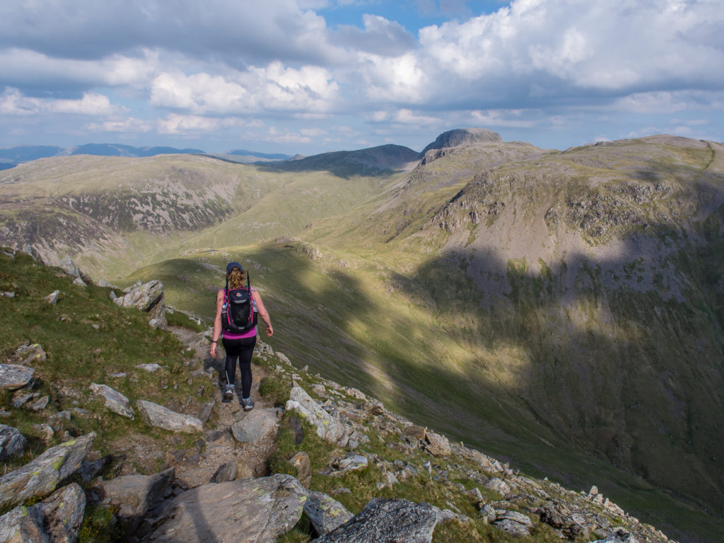
A steep, narrow, rocky ridge eventually widens into a grassy summit ridge with easy walking to the cairn. We finally made it! Stood at the summit cairn atop Yewbarrow at 627 metres.
Continuing on to the end of the ridge. After navigating the boulder field leading to the rocky summit of Scafell Pike the previous day, it was wonderful walking on grass and being surrounded by green.
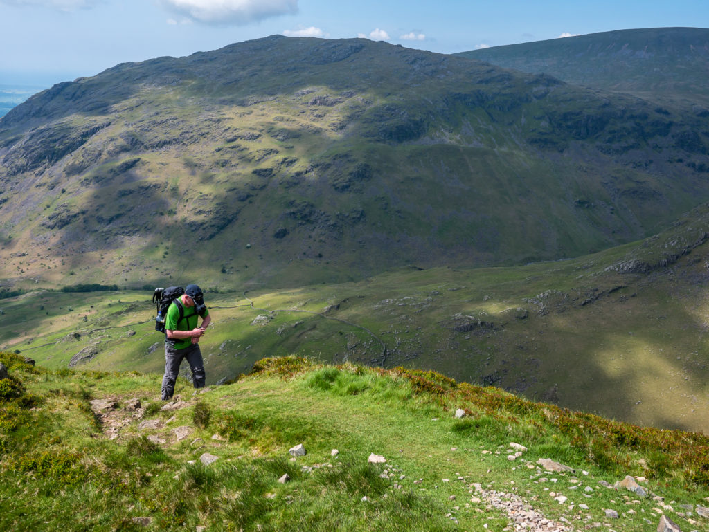
Debating our route options for going down. Fell runners take a minor track down the left-hand flank to avoid the onerous scramble down at the northern end of Yewbarrow to Dore Head.
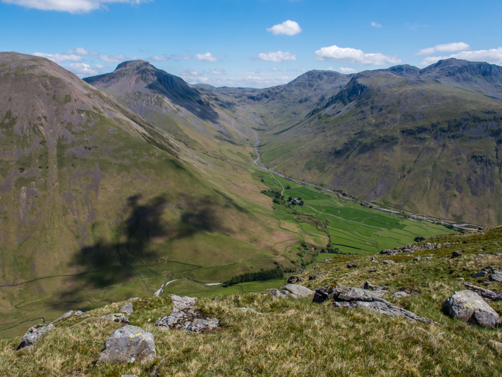
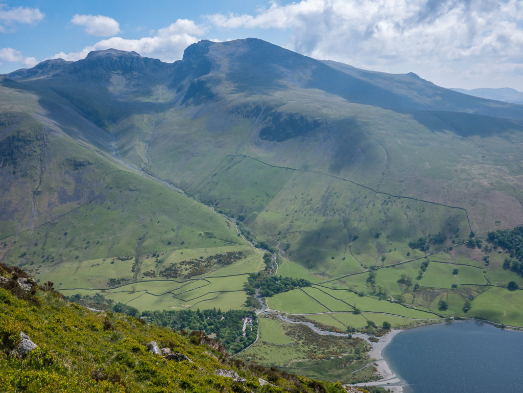
Looking across to Wasdale and Lingmell Beck, our return route from Scafell Pike the previous day, with Kirk Fell and Great Gable on the left.
Looking north from Yewbarrow towards the bulk of Pillar.
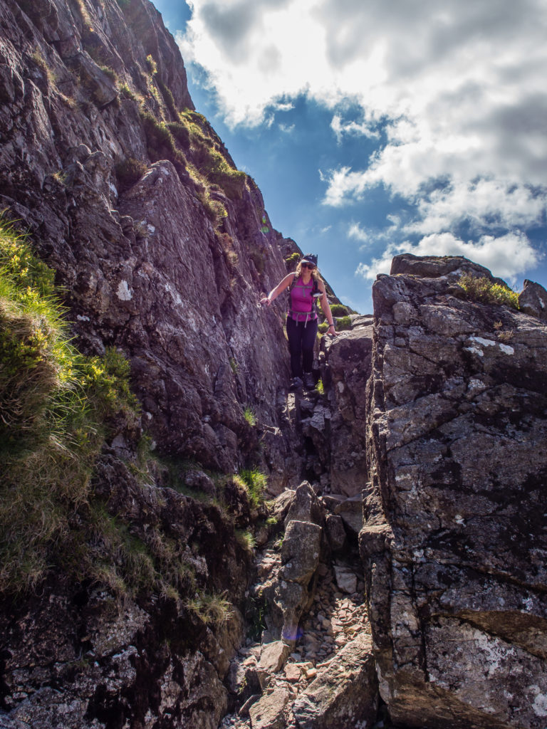
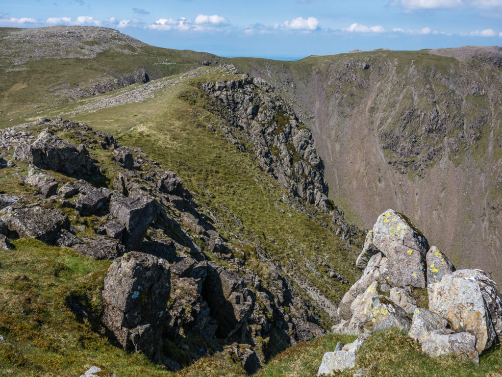
The ridge swings sharply to the west at the depression of Dore Head. The descent to Dore Head is definitely more of a scramble than a walk. We managed it without any problems, however wouldn’t want to take this route in winter conditions.
Having scrambled down the northern end of Yewbarrow, we agreed that it is one of those sections that is much more intimidating looking back at where you’ve come from than in the actual doing.
Looking directly onto the northern end of Yewbarrow. It was almost impossible to see the route we had taken to descend the mountain.
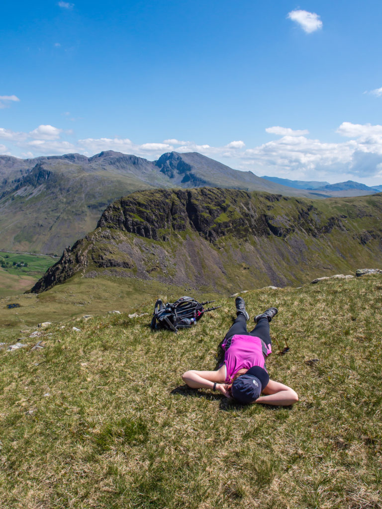
Enjoying the sunshine and taking a few minutes respite before our second ascent of the day.
The ‘barrow’ shape that gives Yewbarrow its name is clearly seen in this shot!
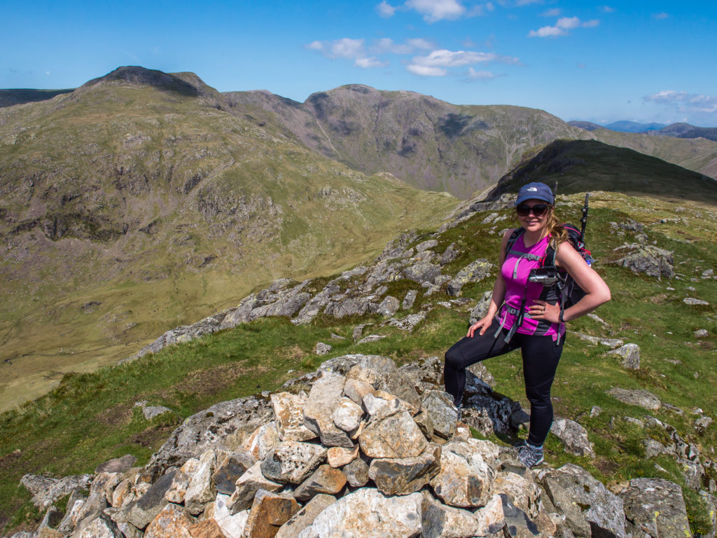
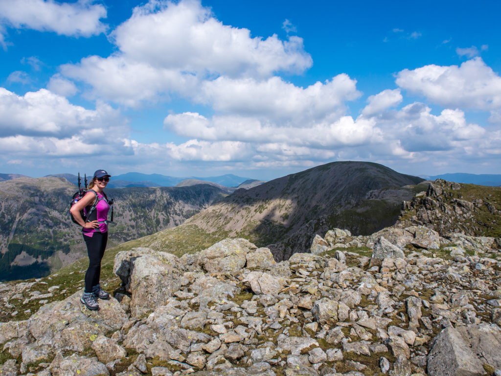
Reaching our second summit of the day – Red Pike at 826 metres.
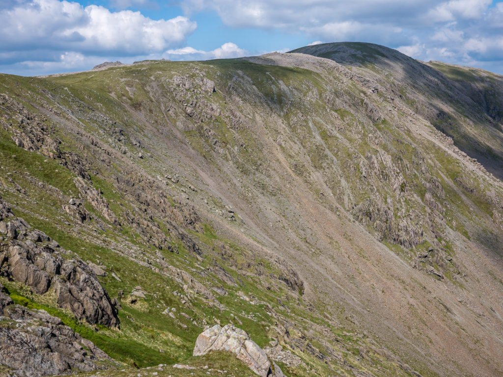
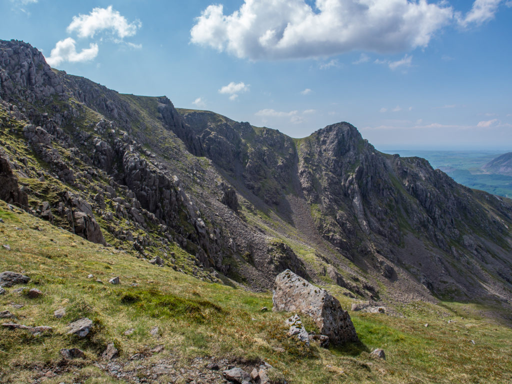
Looking along the ridge line to the screes of Black Crag.
Looking back to the summit cairn on Red Pike.
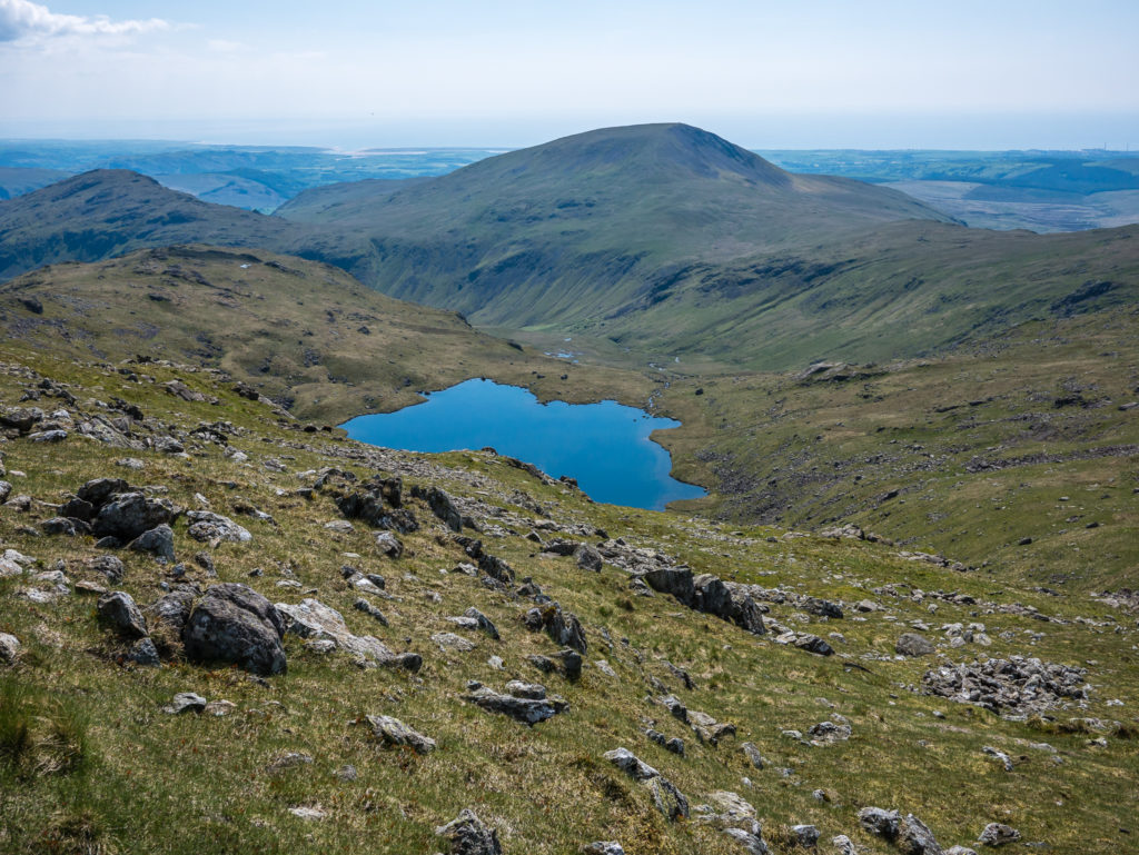
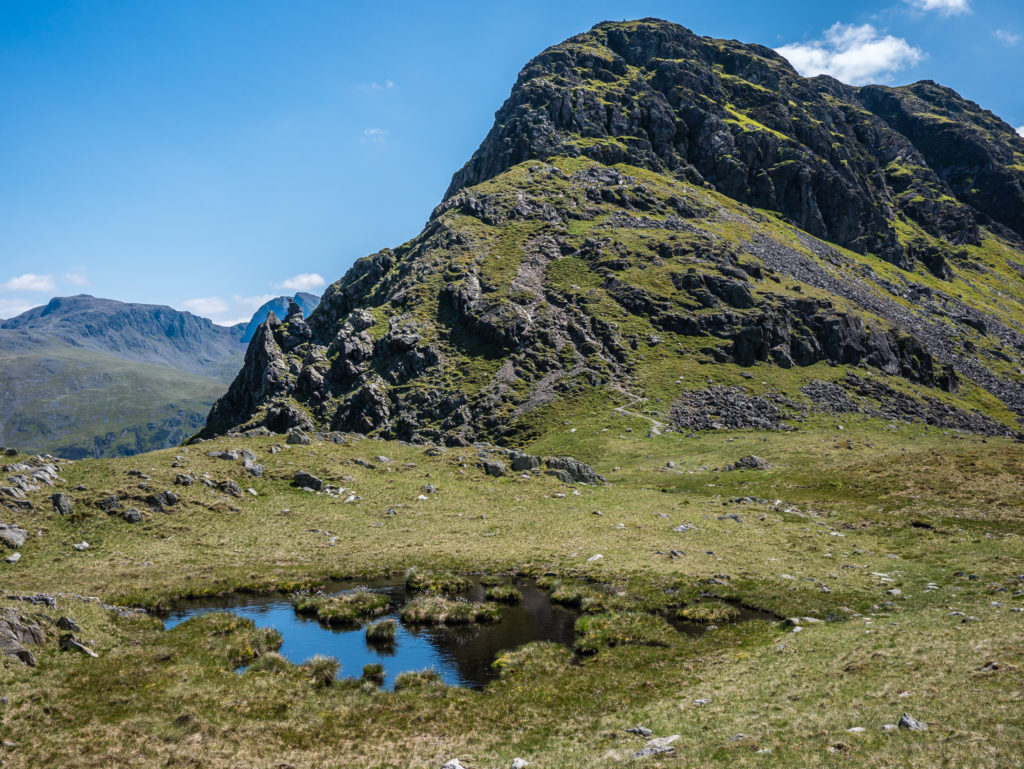
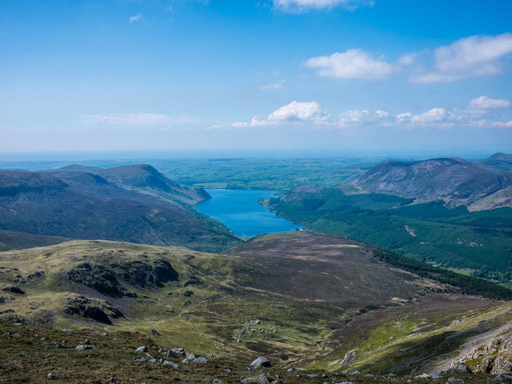
Looking over Scoat Tarn towards Seatallan, a remote Wainwright on the far western edge that we decided to leave for a separate hike!
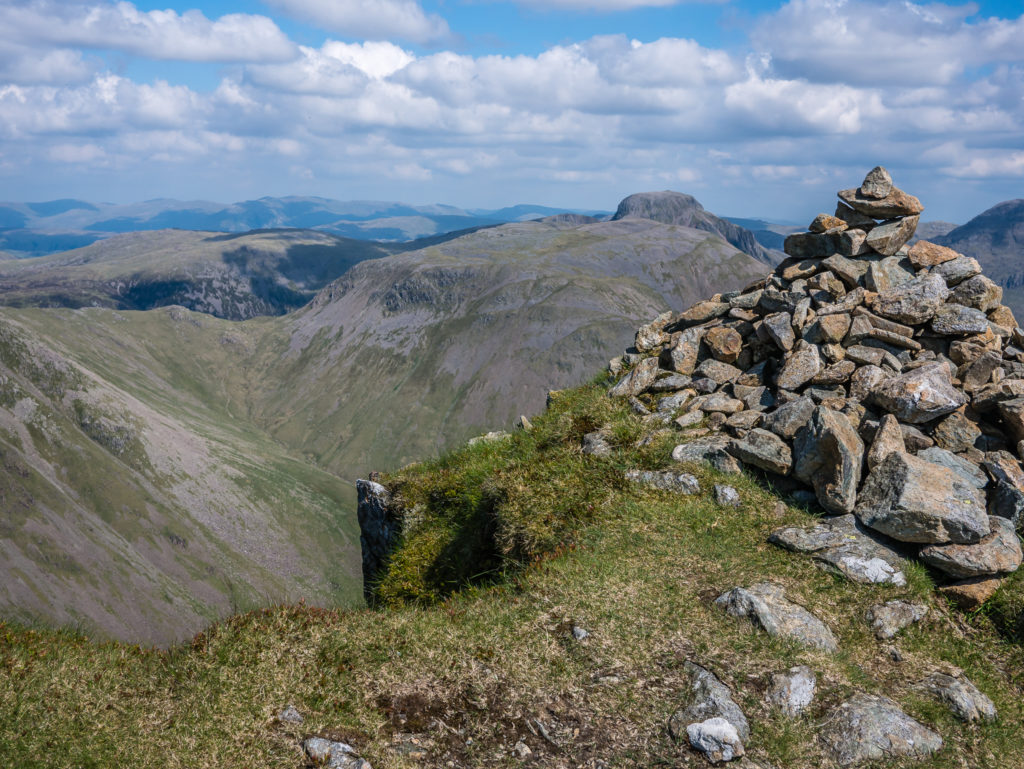
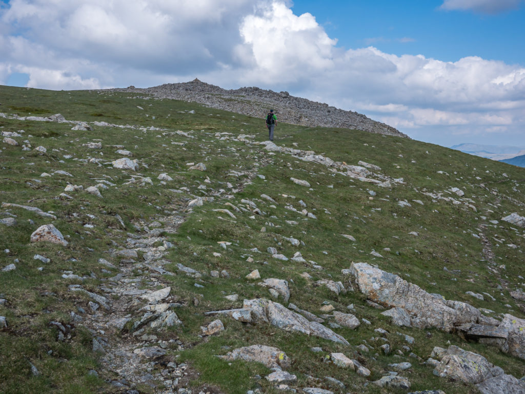
Instead of following the trail round to Pillar (seen in the distance), we took the path veering left to the summit of Scoat Fell, which was our third Wainwright of the day.
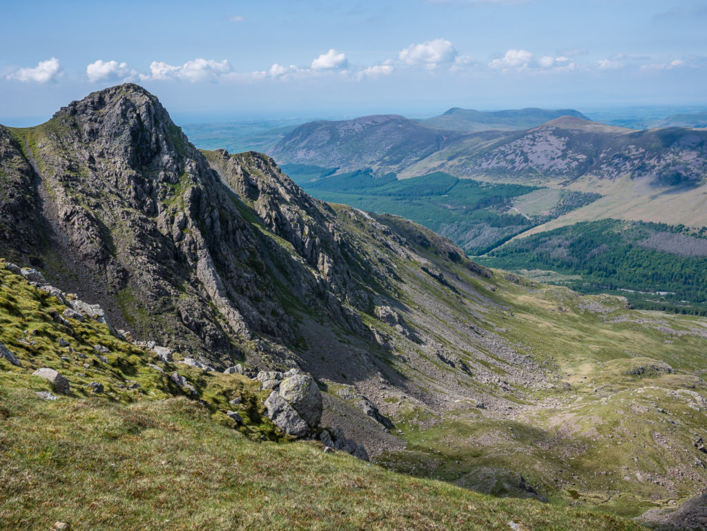
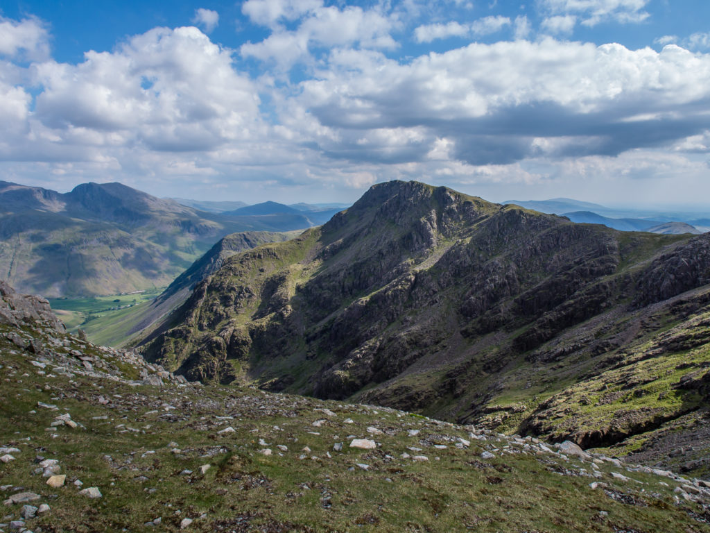
The long ridge leading to Pillar. We still had a lot of work to do before we would get there!
Looking across the screes to Pillar from Red Pike.
Heading along the trail leading to Scoat Fell, looking towards the craggy pinnacles of Steeple.
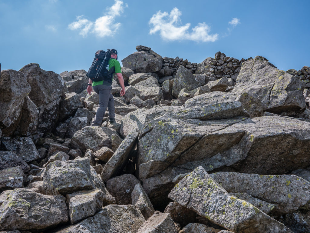
Navigating the boulder field on our way to the summit of Scoat Fell.
Just past the summit cairn of Scoat Fell on our detour to Steeple.
Looking across the valley. The west coast of England lies beyond these mountains.
From the trail leading to the summit of Steeple, looking across to Ennerdale Water.
Looking to the rocky summit of Steeple, the trail meanders to the left.
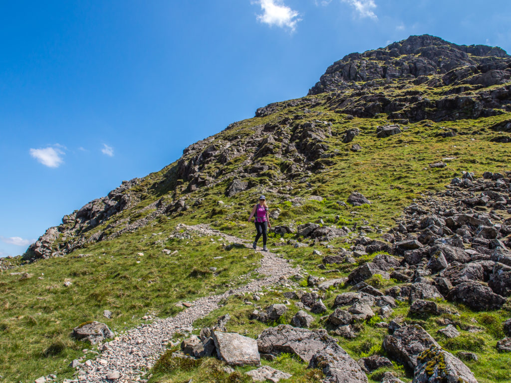
Wayne heads along the trail making his way up Steeple. Further up the track, it is a bit exposed in places, but there is no real scrambling involved to get to the summit.
We were treated to fantastic views of Ennerdale Water from the summit of Steeple.
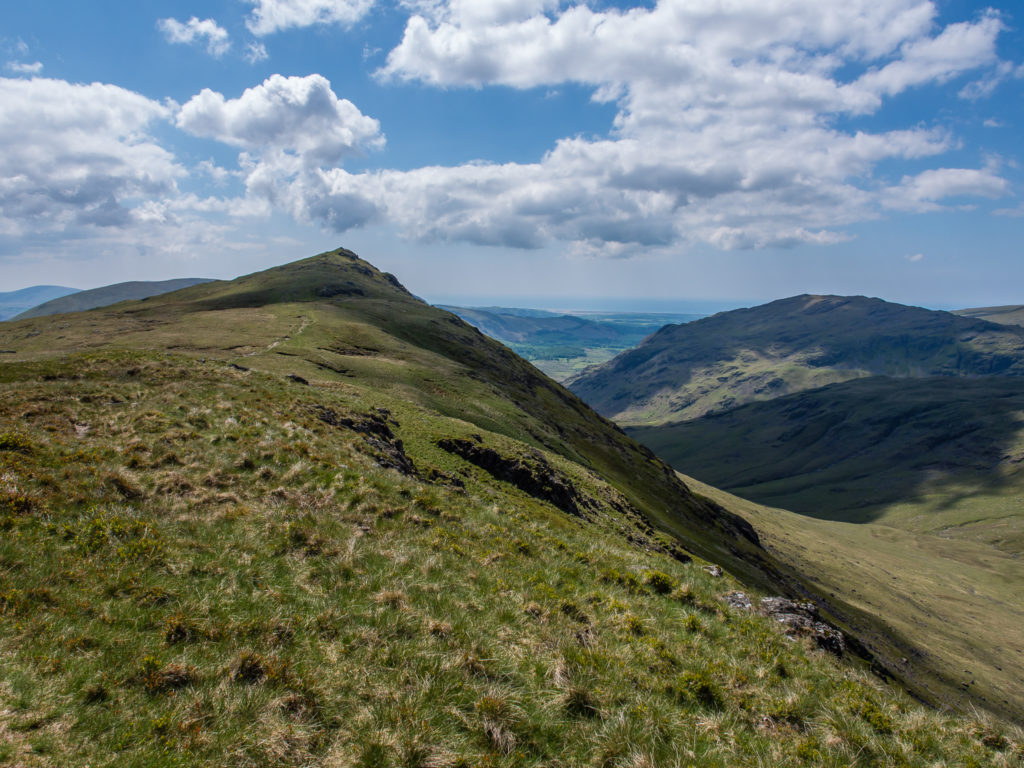
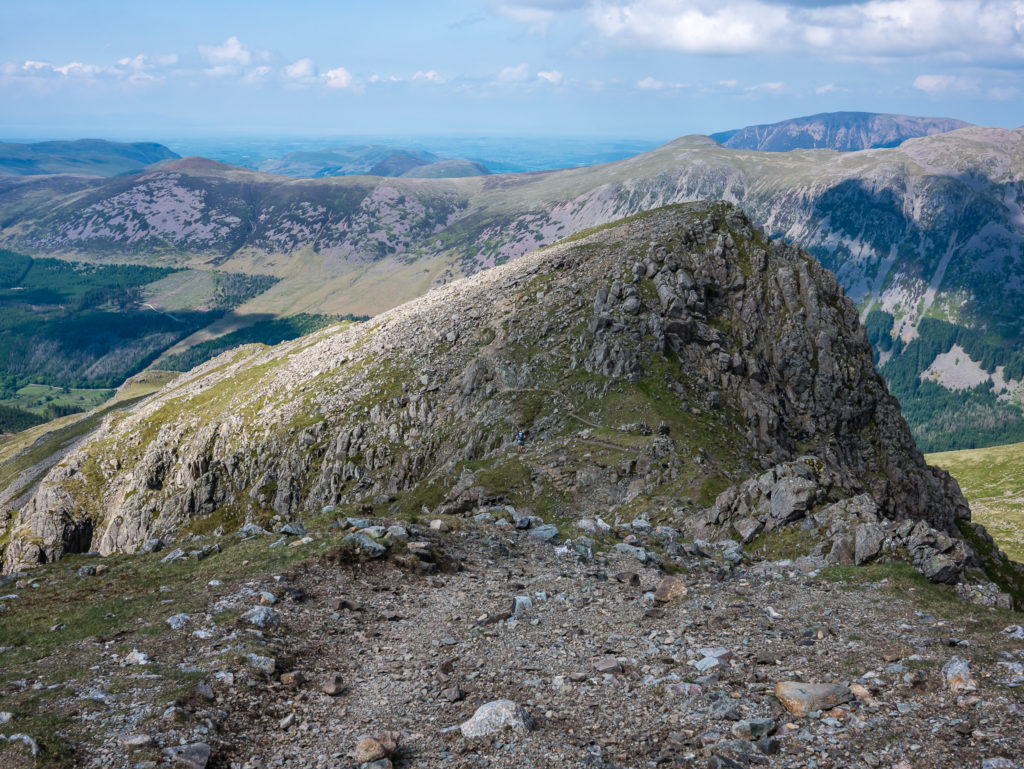
Looking back at the ridgeline of Scoat Fell. The walk to the summit was the least taxing of all five Wainwrights on this circular route.
Looking back at the summit and ridge line of Red Pike.
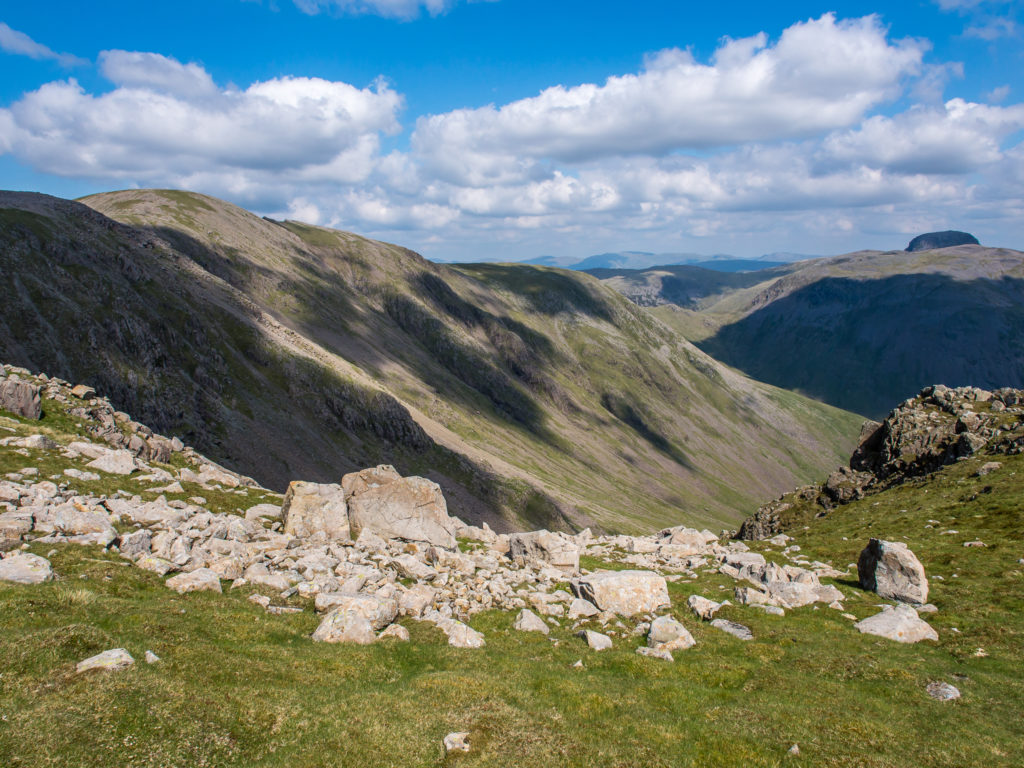
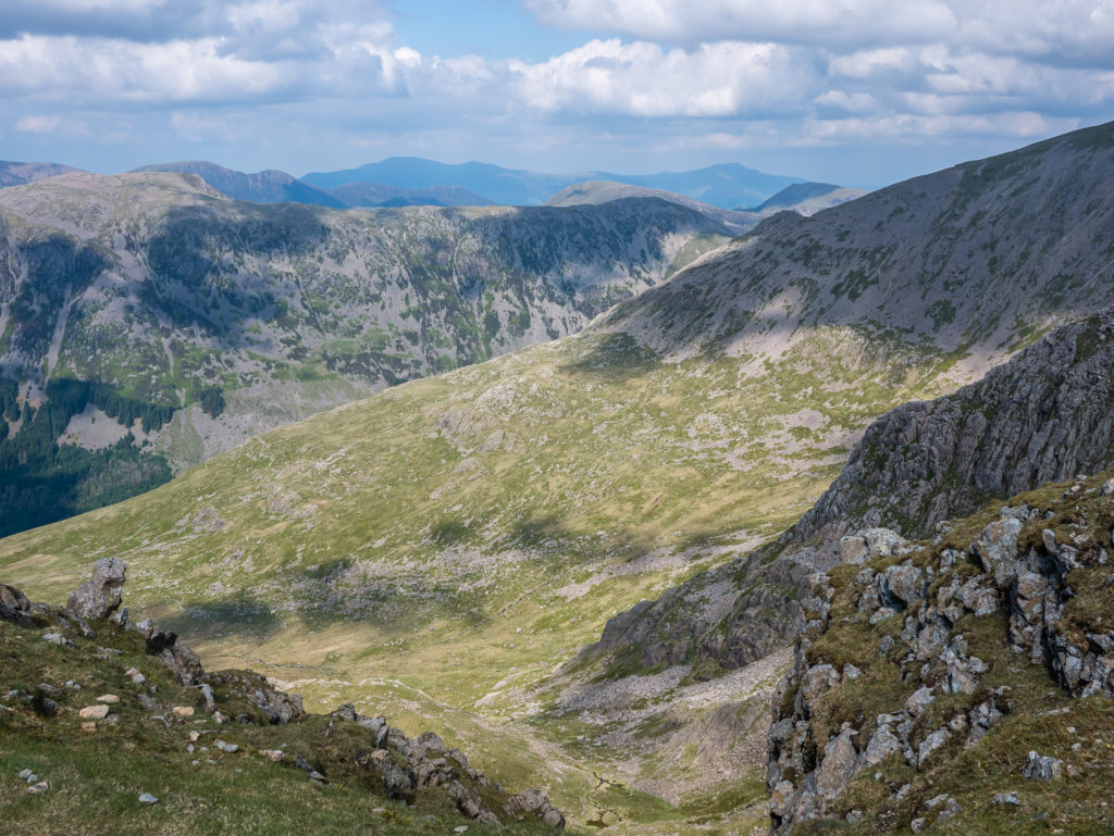
Looking down the valley at Mosedale with the Scafells in the distance.
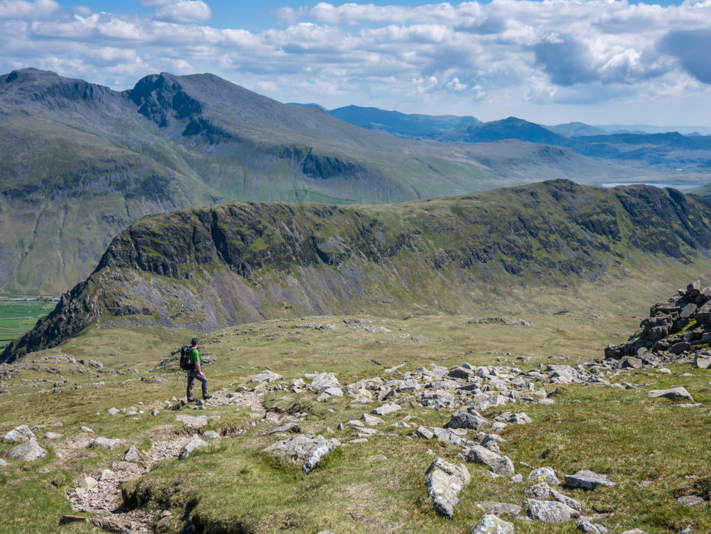
The trail continues to Black Crag – a prominent rock classed as a Hewitt, Nuttall and Birkett – but not counted amongst Wainwright’s 214.
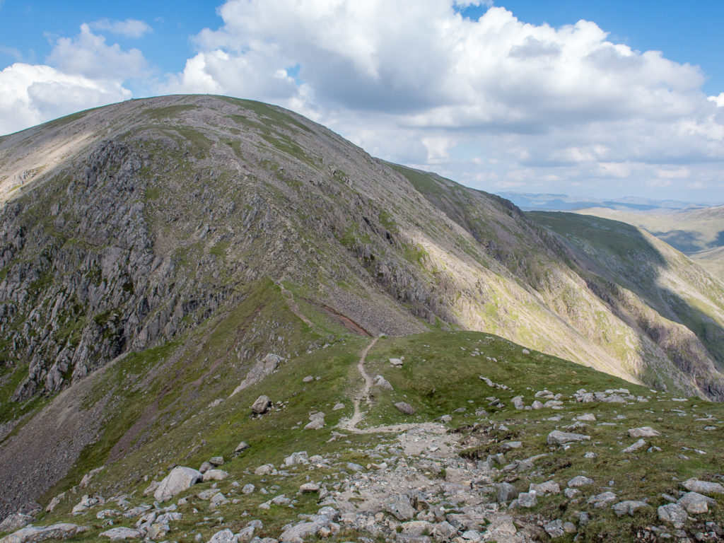
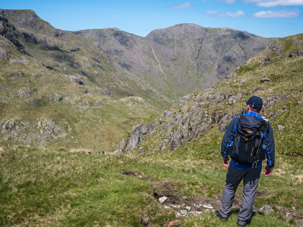
Looking along Wind Gap to the huge bulk that is Pillar. We had a walk about on the wide grassy summit area of Pillar and decided that this would be a great place to wild camp in the future if we had adequate water supplies.
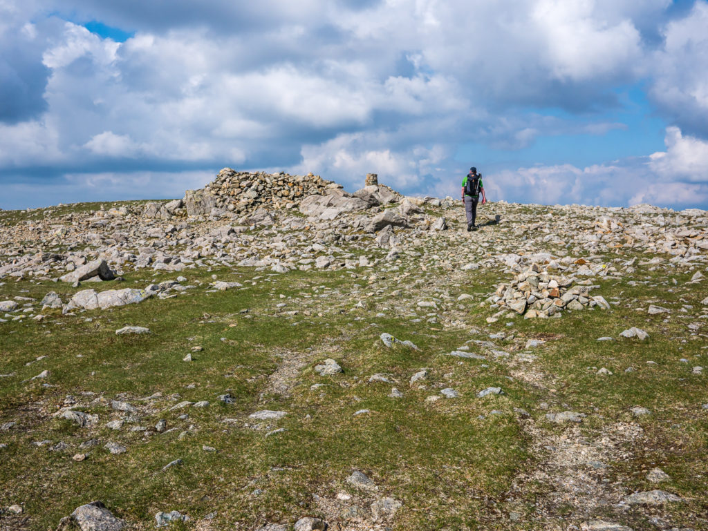
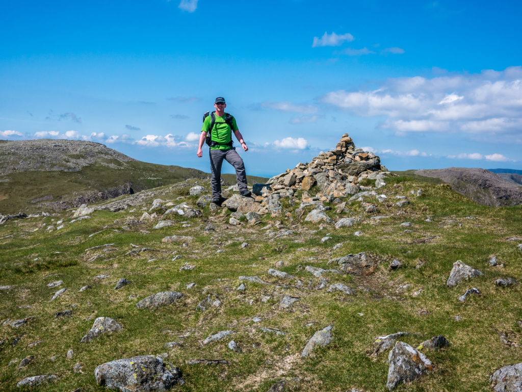
Wayne heads to the summit cairn on Pillar.
At 892 metres, Pillar is England’s 12th highest mountain. It is just 22 metres short of 3000 feet. There are only six peaks in England above 3000 feet, (two of which are really tops of Scafell Pike: Ill Crag and Broad Crag). The other three are Scafell, Helvellyn and Skiddaw.
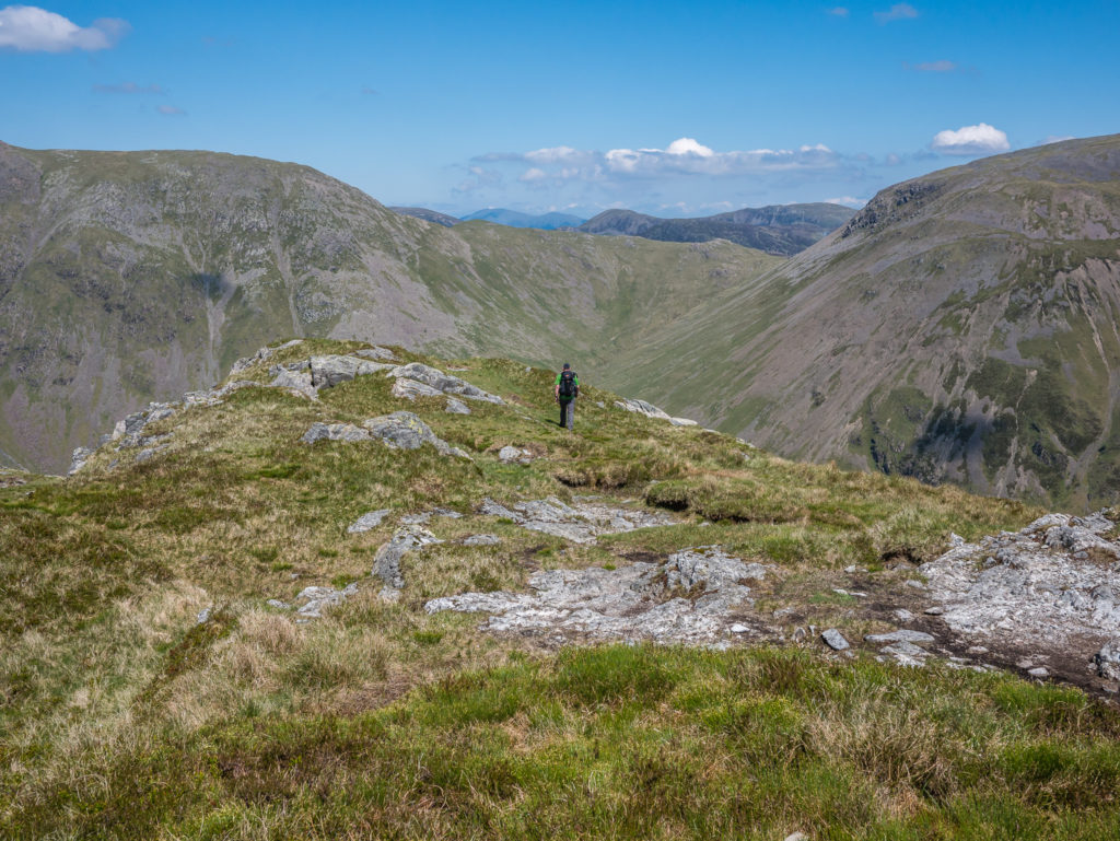
Leaving Pillar and following the trail towards Looking Stead and Black Sail Pass.
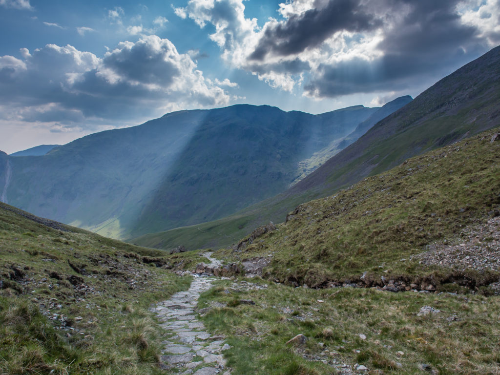
Crepuscular rays light up the valley on our hike down Black Sail Pass.
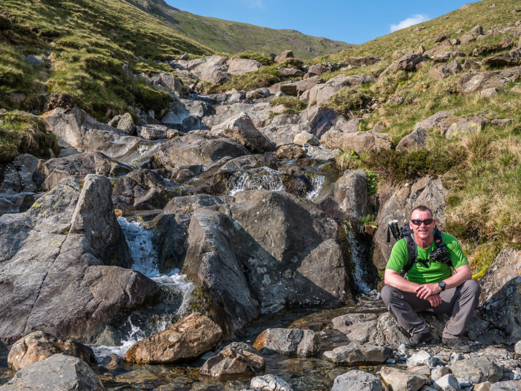
Resting very briefly at the waterfall fed by Mosedale Beck. It would have been a good place to dip our toes in the water and revive our feet! (But we were too eager to reach the end of the trail, which conveniently coincided with the pub!)
Looking up to Stirrup Crag, Yewbarrow’s northern top. Over the course of the day we had given ourselves a good work-out with 4,738 ft (1.4km) of ascent!
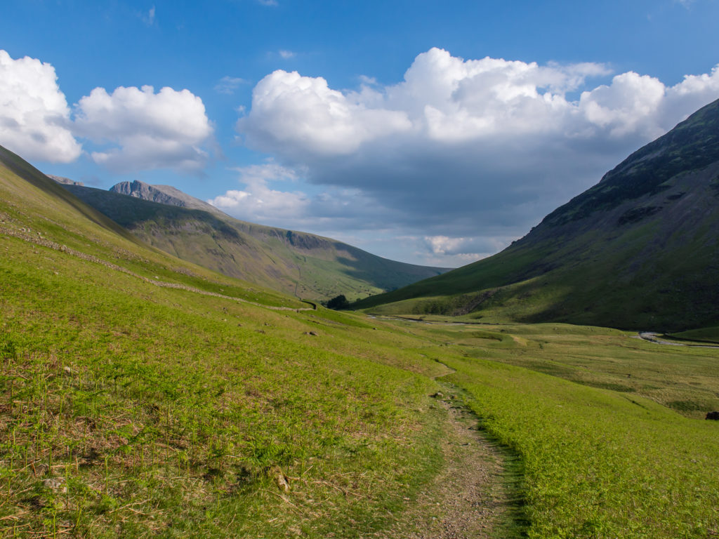
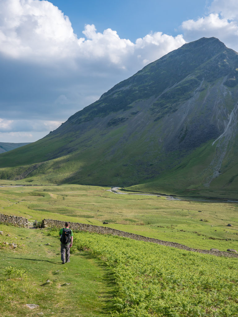
A beautiful summer’s evening… The circular route ended with a brisk stroll back to Wasdale Head along this gentle grassy trail.
Looking down the valley onto Wasdale Head. The track leads directly to the bridge that crosses Mosedale Beck at the back of the Wasdale Head Inn, where of course we had to pop into Ritson’s Bar for some much needed refreshments!
Take A Look At Our Circular Route
You can export a GPX/KML file from this by clicking on the Yewbarrow Circular link.
We are always trying to expand our hiking repertoire and today’s walk at times did put us through our paces. It tested our abilities with both scrambling and walking on scree, with the steep crags at either end of Yewbarrow providing a good challenge after our time on the GR20. But it was nothing we couldn’t handle!
We also enjoyed it all the more as it is a quiet route. Along the entire 12.3 miles, we only ever saw a handful of other walkers, plus a pair of fell-runners hard at work on a Bob Graham Round. This was in complete contrast to the the previous day where crowds of people were congregating on the summit of Scafell Pike, such is the popularity of hiking up and down England’s highest mountain.
If you prefer the solitude of the mountains and want to be alone, or simply want to get some quality landscape photos minus the crowds, then we recommend this circular as an excellent route to try.
Surrounded by all of the Lakeland giants, a walk up Yewbarrow’s steep slopes onto a green grassy plateau complete with 360 degree views, really outshines any other hike we have done in the Lake District so far!
2 Comments
What a sensationally magnificent hike!
Absolutely! We were treated to the most tremendous views. 😀