
Does Skierfe Offer The Best View In Sweden?
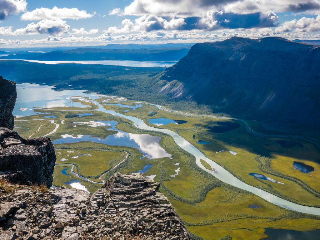
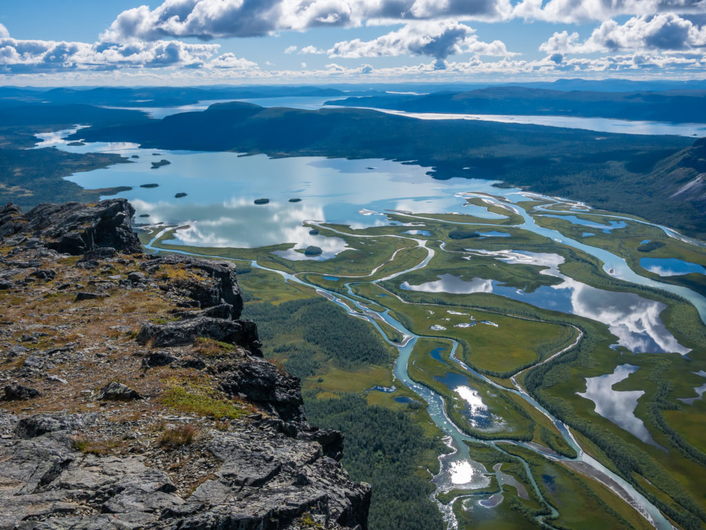
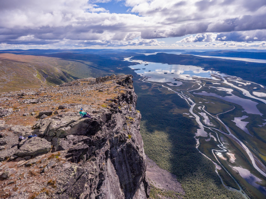
Situated on the eastern border of Sarek National Park, the long, deep, narrow valleys and the wild, turbulent grey-green coloured waters caused by the sediment, create a fantastic delta landscape in the Rapadalen valley, some 600 metres below. In good weather, this incredible vista presents a perfect photo opportunity, especially from the best look-out position along the valley standing on top of Mount Skierfe. The 1,179m (3,868ft) mountain’s flat summit can be reached easily by taking a 5-mile (8km) detour off the Kungsleden, and is a point of interest not to be missed!
Considered by many to offer one of the best views in Sweden, this mountain is not only an incredible look-out, but has historical significance too. For Sámi people, the mountains often had religious connotations, and several were Sieidi (places of worship). Offerings, such as antlers from reindeer, were regularly made in these places and one of the most significant Sieidi was situated at the foot of Mount Skierfe. With its location being at the entrance to the Rapa Valley, Sámis from the entire region would gather here for special ceremonies.
Don’t just take our word for it! Allow an extra day in your itinerary to go and check out the views for yourselves. In our opinion, no Kungsleden adventure is complete without a visit to this natural wonder!
On top of Mount Skierfe… With a view worth waiting for!
Day 14 – Skierfe Detour (1km from Kungsleden trail) to Wild Camp (Sitojaure +5km) (17.5 miles/ 28.2 km, 10 hours, 30 mins) – Friday 26th August, 2016 – ‘The Joy Of Isolation’
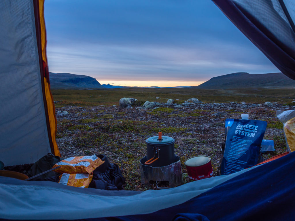
We awoke abruptly to grunting and the jangling of bells… But there was no need to be alarmed, more like we couldn’t contain our excitement as we spied a small group of reindeer foraging around our tent! We stayed silently still, and watched them through a tiny opening in the porch zipper before they went bounding off over the ridge into the cover of trees. It was a little after 7am (much later than when we had intended on getting up and setting off for the summit of Skierfe) and by now the sun was already warming the tent through creating a little haven of cosy comfort. We were so grateful of its presence having been thoroughly wet through yesterday that we didn’t want to move, and were relishing every second of being warm and snug in our sleeping bags. Staying put also meant that the tent should completely dry out and our down bags would fluff up nicely after a bit of heat. We were so comfortable, we dismissed the rush to get going, instead enjoying a leisurely breakfast whilst taking in the view of the Rapadalen from our superb camp spot. We had fantastic blue skies and great lighting, perfect for some time lapse photography and drone footage from the top of Skierfe. With that unique wake-up call and such wonderful weather we couldn’t quite believe what a difference a day makes! We felt very lucky indeed!
Pristine wilderness… What a beautiful morning to be outdoors!
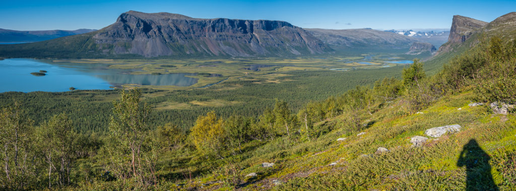
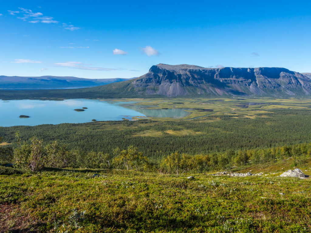
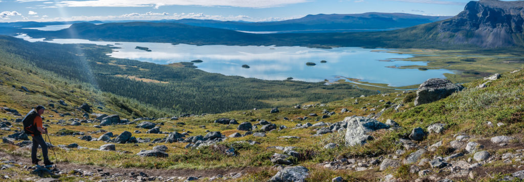
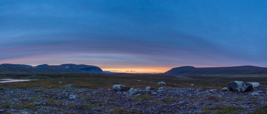
This incredible panoramic view is what we could see from our wild camp spot after detouring off the Kungsleden and taking the side trail towards Skierfe.
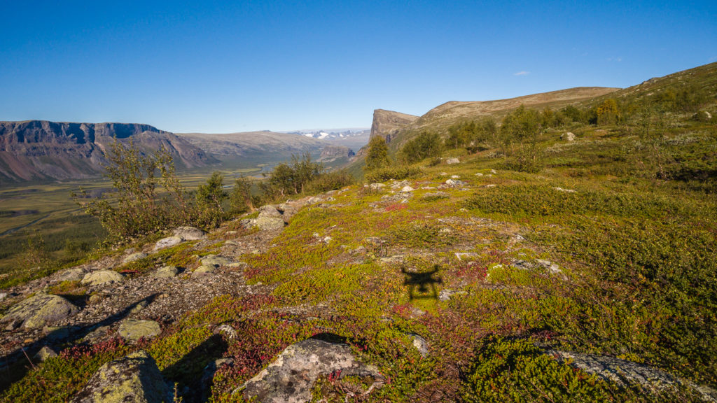
We were in complete isolation, so Wayne got the drone up in the air to capture our position from the sky.
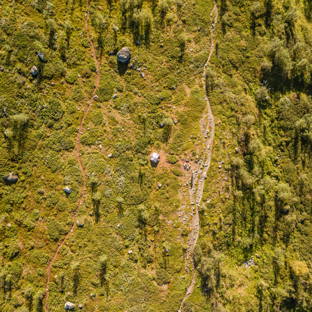
Aerial photograph of our wild camp spot. Our tent is in the centre of the picture, set-back from the side trail.
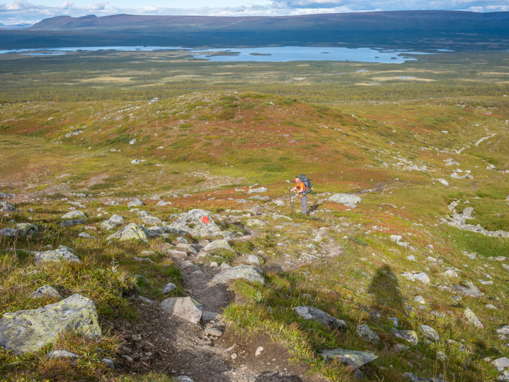
Setting off up the trail around 9:15am with our backpacks merely filled with water, snacks, and camera gear, we didn’t think it would take us more than an hour to reach the look-out point atop of Skierfe’s flat summit. Our packs felt ‘empty’ in comparison to what we usually carry, having left the tent behind with virtually everything else so we didn’t have heavy packs for the climb up there. Although in hindsight, it wasn’t too bad at all and we could have easily left our full packs along the trail just before the final ascent. We had underestimated how long it would take us however.
From where we had camped, the distance to Skierfe was approximately 6 kilometres so in fact it took us two hours to reach the summit, double the time that we had estimated. But still there were only two other people on top of Skierfe when we arrived, who after chatting with us, were keen to see the drone in action and the footage we could get of the delta. Note: Since our Kungsleden thru-hike, drone laws have drastically changed in Sweden and it is currently illegal to fly camera drones due to the country’s ever-more stringent surveillance laws. We feel very lucky and privileged to be quite possibly the only couple EVER (?) to have hiked the Kungsleden with a drone and have aerial footage of the trail! You can watch Wayne’s video showing aspects of the trail here:
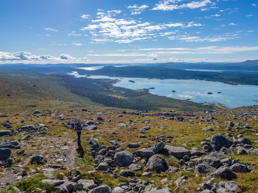
Looking back towards Aktse and the Laitaure delta where we had hiked up from yesterday following the Kungsleden trail.
Heading towards the Sarek National Park Boundary.
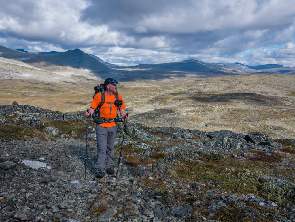
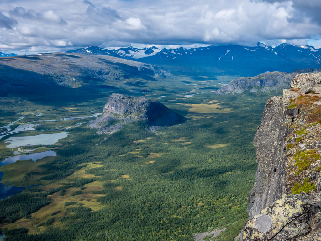
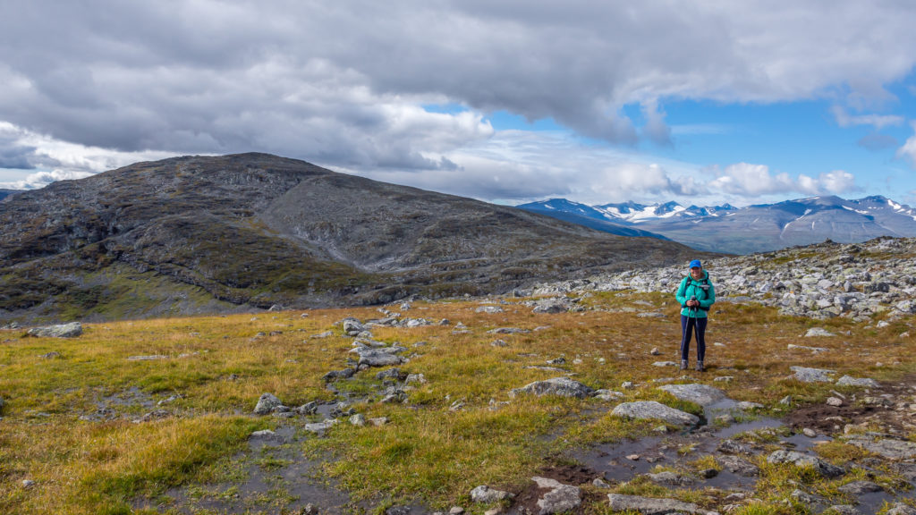
Heading into the wilds of Sarek National Park… In complete contrast with the lush, dark green, forest scenery to the east, we found ourselves in an exciting borderland looking upon Sarek’s sharp ridges and towering peaks of granite whilst making our way to Skierfe.
Containing six of Sweden’s 13 highest mountains and almost 100 glaciers, Sarek National Park is the largest high mountain area in the country and remains a piece of true wilderness. The Kungsleden merely runs through the southern part of the park for a stretch of 10 miles (16km), with the closest STF huts being Pårte and Aktse. If you are considering allowing extra time in your itinerary for some exploration of Sarek, be aware that hiking in this area is very demanding. There are limited mapped trails, many streams can be difficult to cross, and there are no trail markers or cabins to spend the night in. However, if you have a reasonable level of backcountry experience, spending a few extra days in Sarek is highly recommended as it offers a much wilder, off-the-beaten-track experience than the Kungsleden, and provides the solitude that is absent in the northern section.
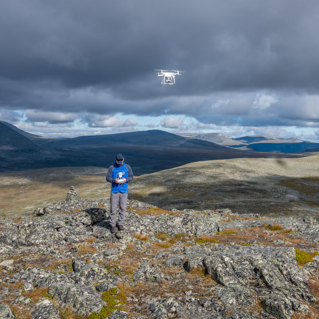
The drone in action!
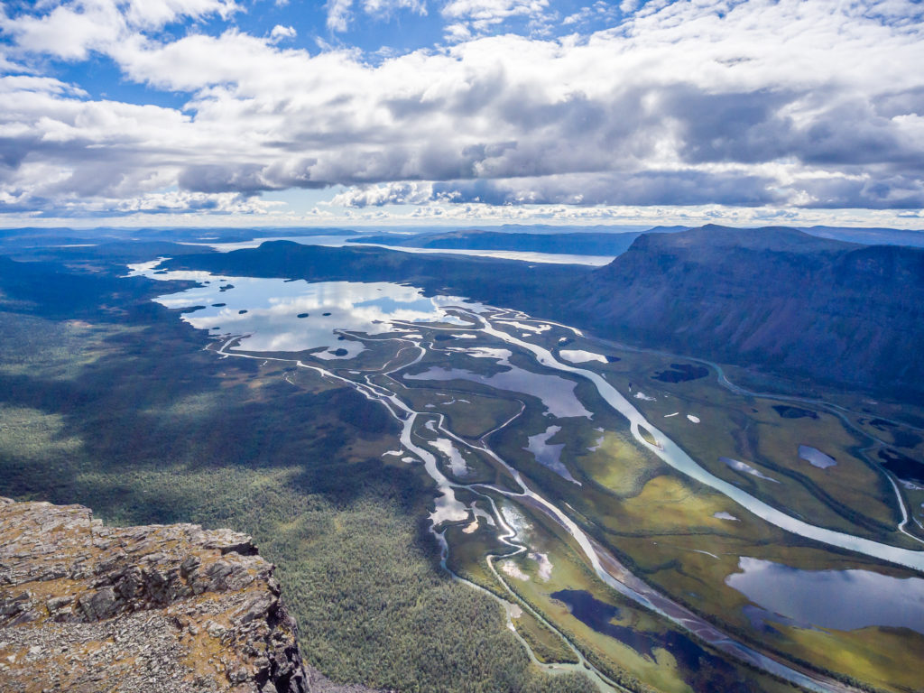
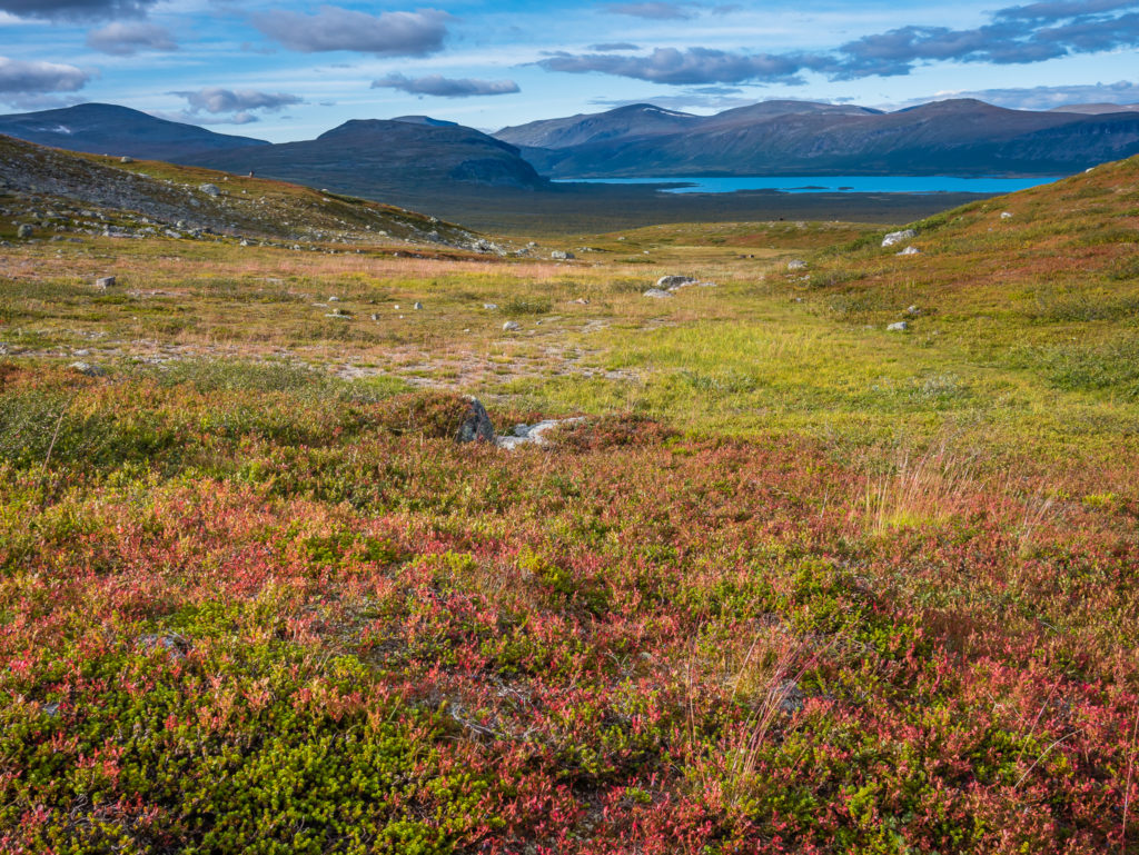
The delta of the Rapa River is considered one of Europe’s most noted views.
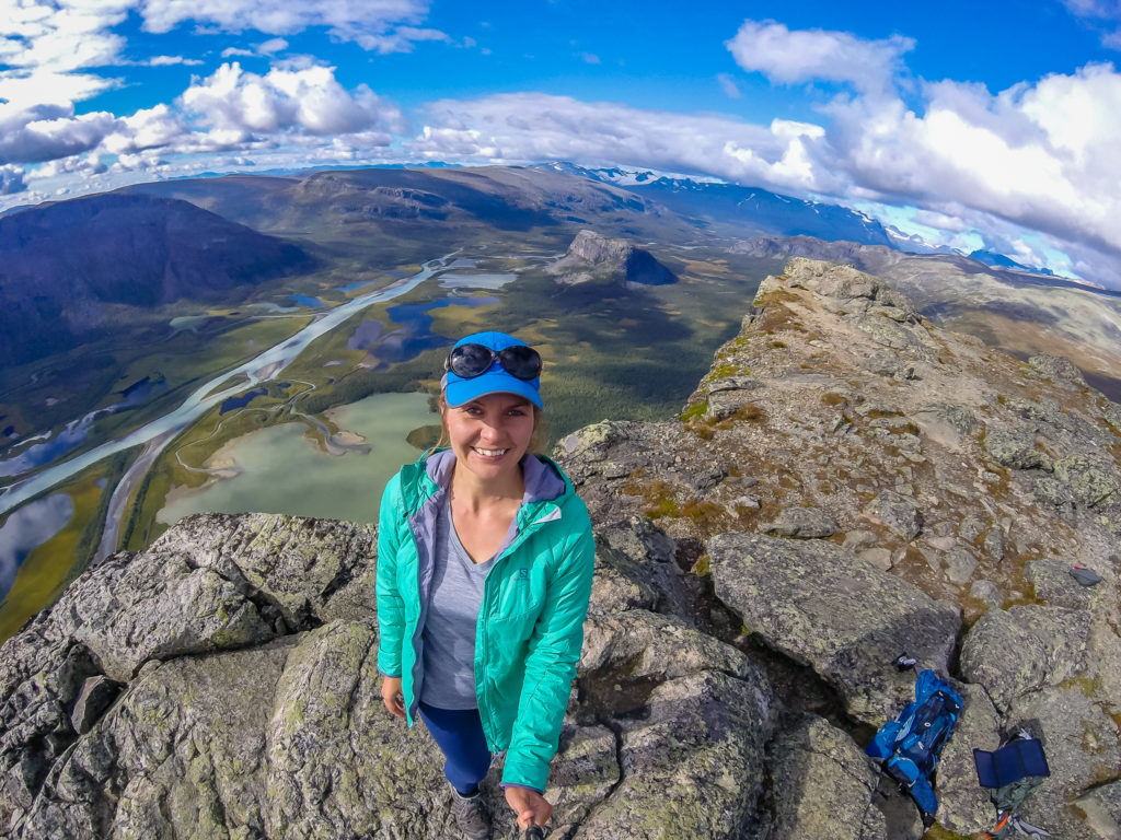
Selfie with the GoPro!
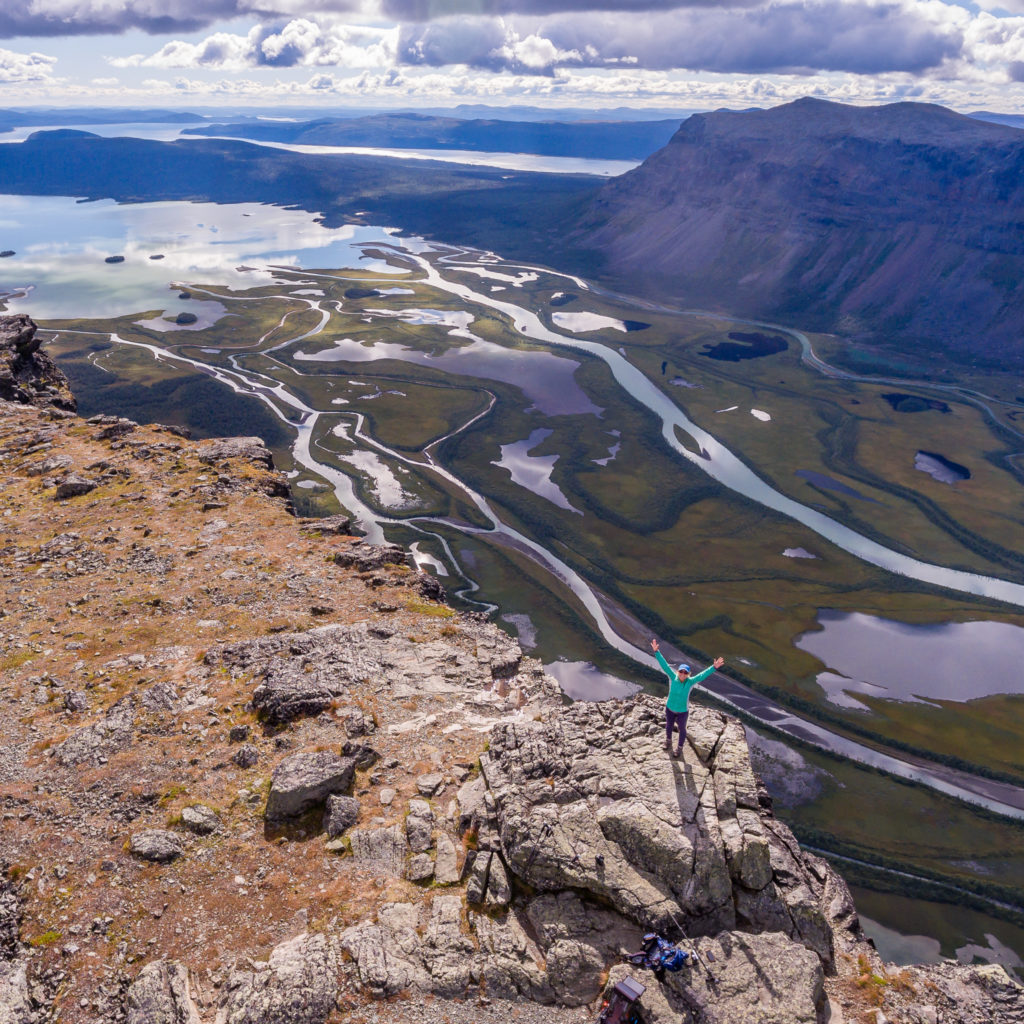
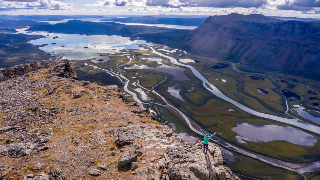
The best look out position is from the giant, flat rock on top of the summit, and the view we had in such good weather was breathtaking! Clouds were mirrored in the still waters, whilst the sun, glinting off one of the tributaries reflected a delicate ball of brightness. Looking down from above, each channel resembled a ribbon weaving its way across the valley floor, each a striking colour. These ranged from dark pools of inky, blue black to long strands of icy, emerald green, the mesmerising colours caused by silt in the glacial waters. It felt like we were witnessing the Earth from a position in space, much like the photographs captured by NASA. Eventually having the whole summit to ourselves, we stayed there soaking up the view on the top of Skierfe for about an hour before the temperature began to drop, and unfortunately the weather started to change.
The weather didn’t concern us too much however, as we’d been lucky enough to have an incredible experience up there! Our first mission of the day was done therefore, but now for Part 2. We still had to get back to camp, pack the tent and gear away (staying one step ahead of the rain), and reach the lake on the other side of the plateau, preferably in time for the last boat of the day to take us across to Sitojaure.
Quite simply… WOW!
You don’t need a drone to witness it in all its glory. The summit of mount Skierfe offers an incredible overlook of this stunning, glacial, trough valley.
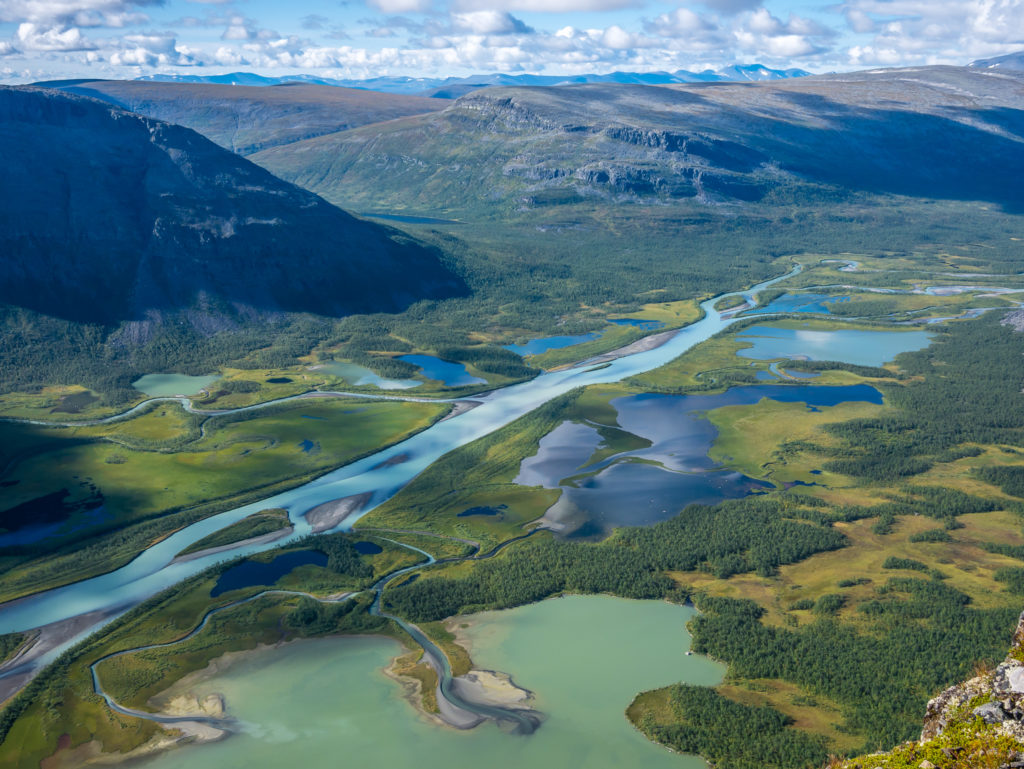
Incredible colours! The icy, emerald green and milky turquoise hues are created due to the sediment in the waters.
A delicate ball of brightness, the sun is reflected in one of the tributaries.
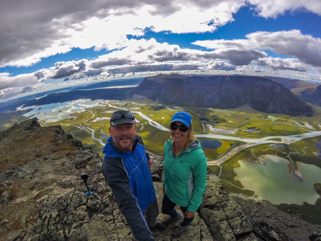
On the summit of Skierfe, captured with the drone.
Feeling brave and sitting on the most accessible edge of Skierfe!
If you want to take a closer look at the delta, from Aktse it is possible to take boat transportation through the delta of Rapaätno to the Rapa valley where you can also explore a little more of Sarek National Park.
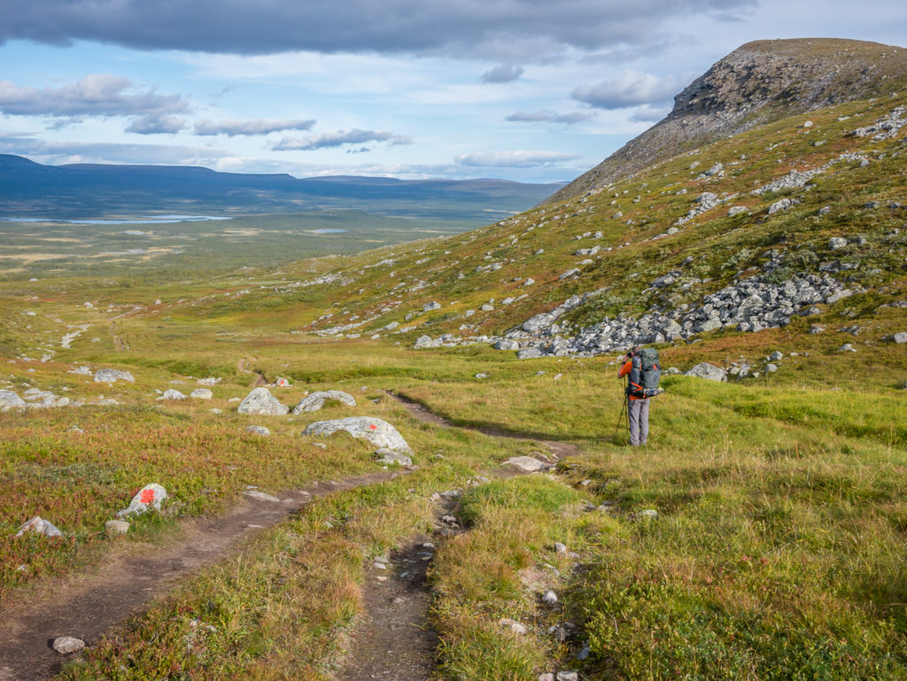
After the weather turned, we quickly layered up and powered back down Skierfe mountain following the jumble of cairn markers. There seems to be a few extra cairns here and there signalling a criss-cross of pathways, but they all reliably get you to the look-out spot at the top and back down. Our one concern about availability of water up there was quickly abated as there were at least 3 springs with flowing water that we passed whilst heading up the ridge. After finding this out, we realised that we could have camped closer to Skierfe making for a shorter hike that morning, but it didn’t really matter as we loved the view from our wild camp spot! How could we be disappointed when it afforded us great views of both ends of the valley, and we also had the company of the reindeer. Just perfect!
The wilds of Sarek and beyond… Somewhere we wouldn’t be exploring further on our own Kungsleden journey as there wasn’t time in our itinerary.
Following the trail back down the mountainside. We needed to de-camp, re-join the Kungsleden and reach the other side of the plateau in time for the last boat!
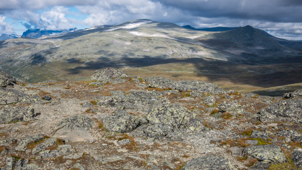
We arrived back at camp around 1:30pm, had a quick lunch break to re-fuel, re-packed our gear, then set off back to the trail junction to re-join the Kungsleden. We had around 8km to go to reach the lake – first an uphill climb to get over the ridge, the high point being 940 metres, then a flattish section to cover taking us across the plateau, followed by a steep downhill power walk to reach the lakeside. We instantly noticed lots more autumnal colour as large patches of the scrubby ground cover had changed to a deep red.
Leaving Skierfe and heading back along the side trail to collect the rest of our gear, which we had left at our wild camp spot inside the tent.
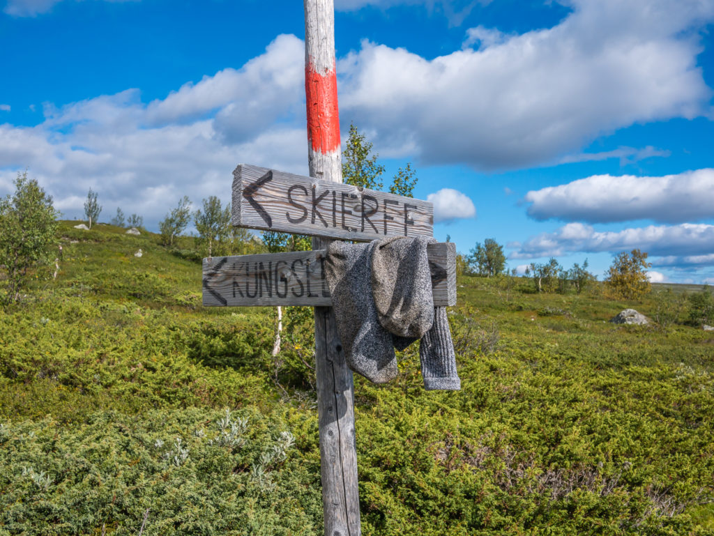
The trail junction marker, complete with someone’s misplaced hiking socks!
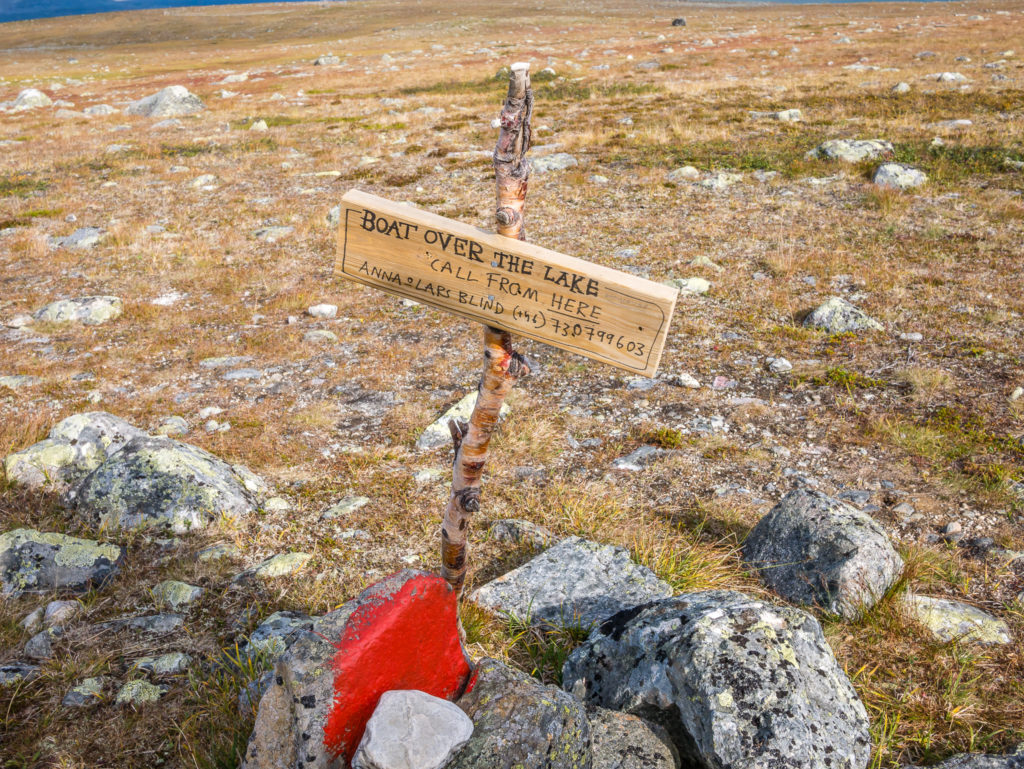
The next sign we saw whilst hiking over the plateau. If you are hiking northbound, you should phone to pre-arrange boat transportation across the lake. There is no cell phone coverage beyond this area heading down to the lake.
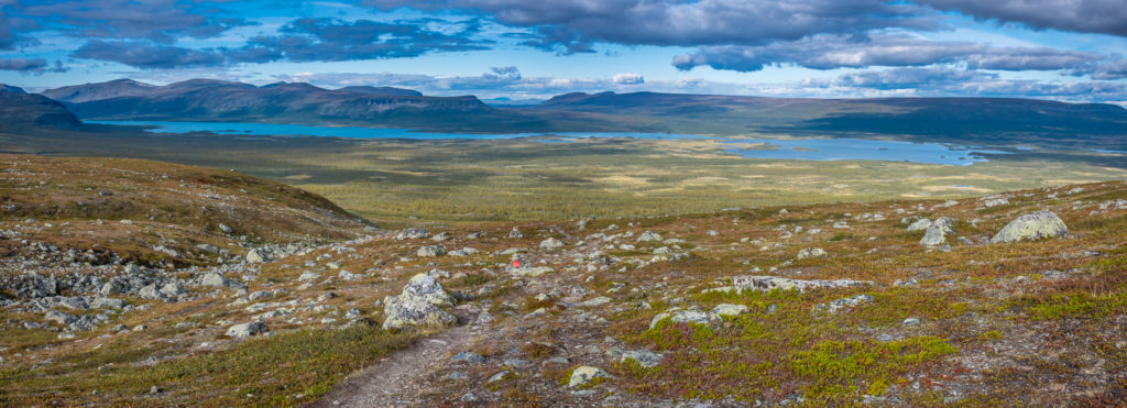
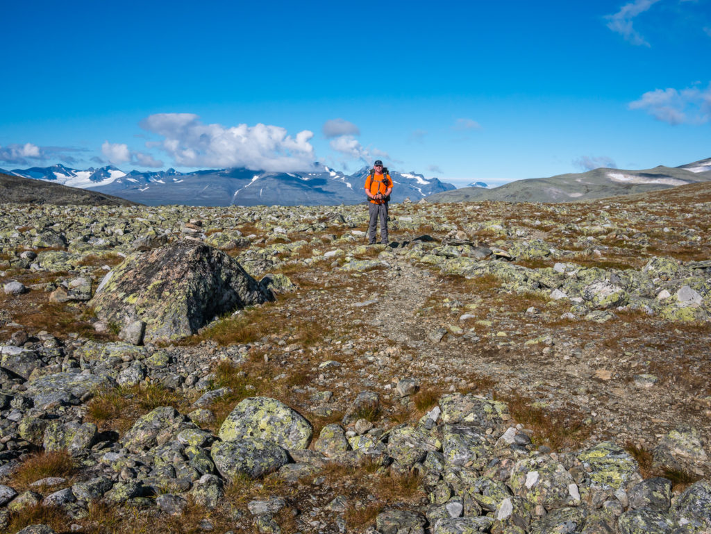
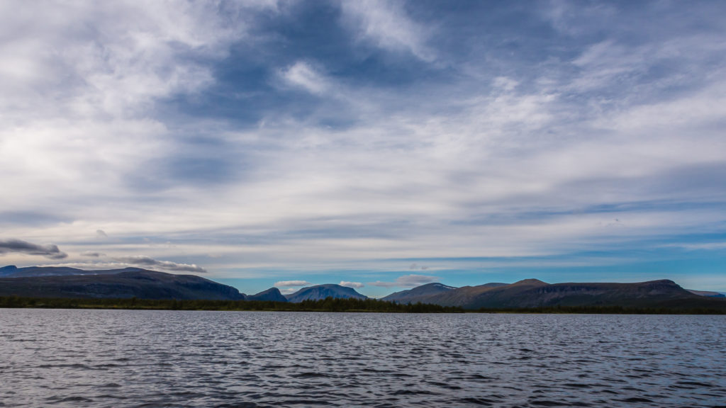
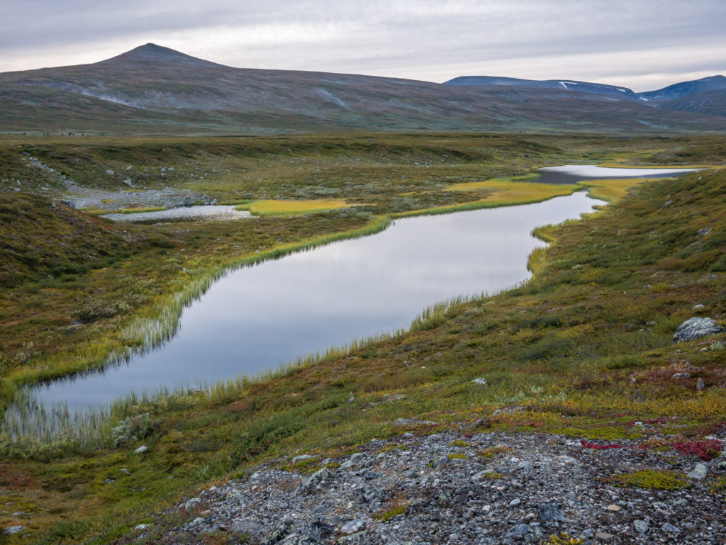
Coming over the plateau. Panorama looking onto Lake Sitojaure.
Continuing on the Kungsleden… The trail was a little stony underfoot but easy to follow with rocks daubed in red paint at regular intervals.
Autumn splendour!
There is a small sign located at the top of the plateau explaining that you need to call to pre-arrange boat transportation from this point as it is the only area with a cell phone signal. We phoned several times but there was no answer, so we left a message stating that we’d arrive at the lakeside hopefully in time to get the boat around 5:30pm. Luckily we made it over the plateau and down to Lake Sitojaure arriving just after 5pm where there were already 7 people waiting on the jetty. We hoped that they’d be enough room for us – thankfully 2 people on the jetty had just finished rowing across the lake to this side and were continuing southbound. They were the second pair of hikers that day who we’d seen telling us that they’d had to make the arduous journey across the lake 3 times because of there only being one boat left on their side! Thankfully going northbound, the odds have seemed to work better in our favour, with more often than not there being two boats on our side. This means you have the simplest task of rowing across the lake just once – or in our case we would rather pay for the motor boat transfer! (200 SEK/£17 per person – On Sitojaure Lake transfers are privately run by the Sámi community, not by the STF.)
It was an easy walk down to the lakeside. As the trail was flattish, we could increase our pace and make good time.
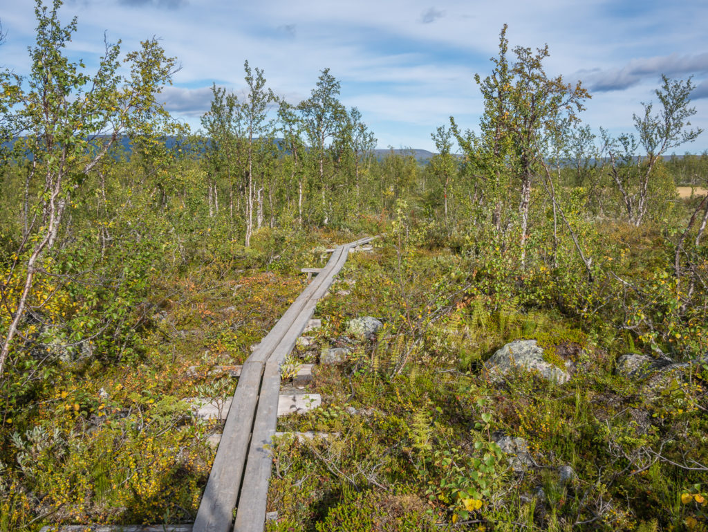
Boardwalks were in place to help us over thick ground cover and obstructions.
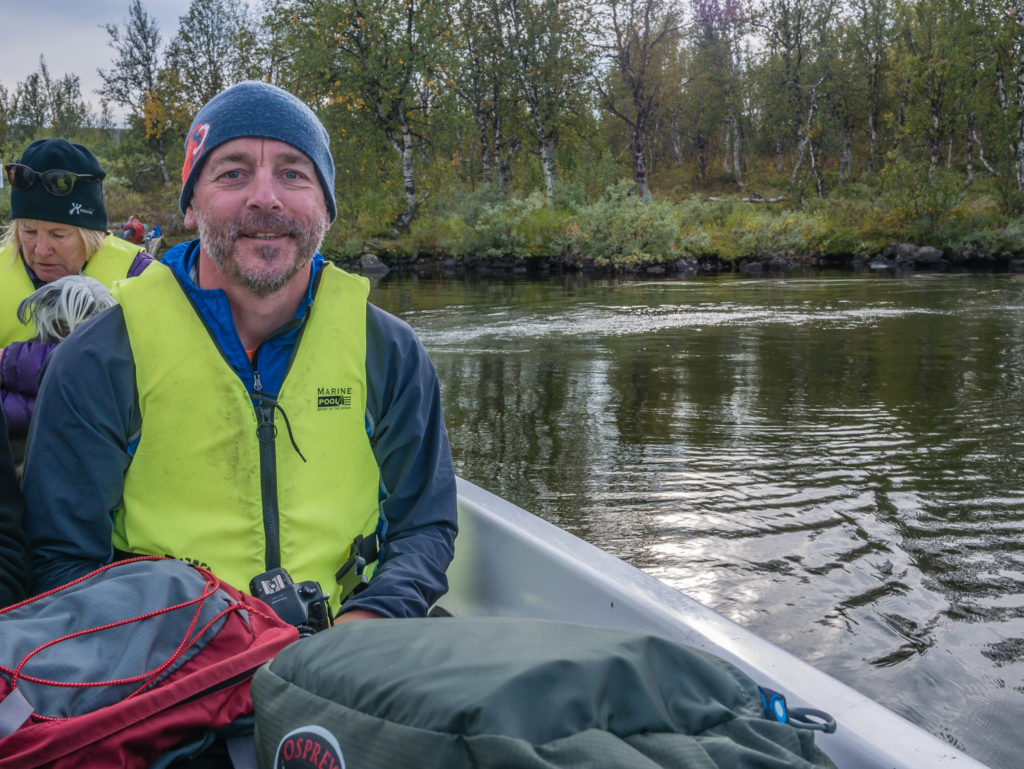
Taking the motorboat across Lake Sitojaure. On the Calazo map we used there is a confluence of lakes Gåbddåjávrre and Gasskajávrre – but on the Kungsleden trail this lake crossing is commonly known as Sitojaure, with the STF hut of the same name located on the northern side of the lake.
A calm evening on the lake, with the rain holding off for now. The crossing is around 4km.
The warden from the Sitajoure STF hut was also getting a ride back across the lake after hiking up Skierfe that morning. She asked if we were intending on staying at the hut or pushing on further to wild camp up the trail. As our map again had no permanent water source marked in the area, we weren’t quite sure. She suggested that there was both water and some pre-existing camp spots around 3km further up the trail, so we decided that we’d continue walking beyond the Sitojaure hut to give us less miles the following day. This would benefit us greatly as the next day we were heading for the Fjällstation at Saltoluokta. In actual fact, we pushed on another 5km in search of running water so we wouldn’t have to filter it, as well as a sufficient camp spot out of the bog and away from clouds of bugs that seemed to be appearing now it was dusk. After leaving the boat, two other couples were now also hiking north in the same direction as us. After such splendid isolation on most of our journey so far, this was something we were not used to at all – especially hiking and having to overtake!
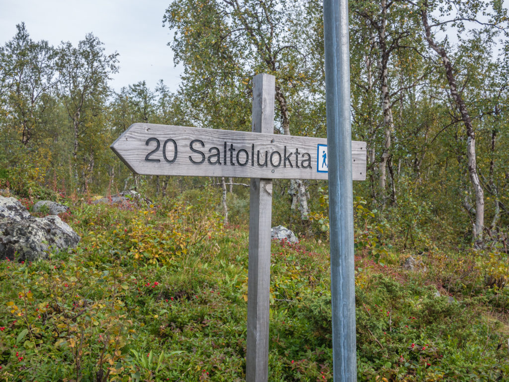
Just 20 kilometres to Saltoluokta, our destination for the following day where we hoped to make use of the washing facilities at the Fjällstation.
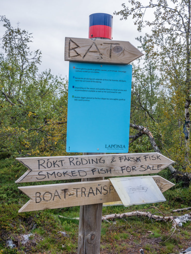
Members of the Sirges Sámi Community periodically live in the settlement east of the Kungsleden trail at Tjåhke (1.7km). You can contact them if you need boat transportation across Sitojaure Lake or if you wish to visit Rinim. There is also the possibility of buying bread and fish.
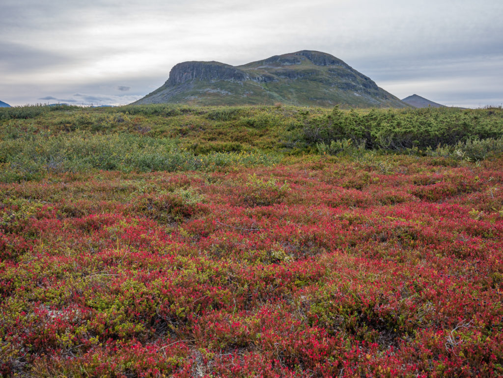
The landscape is painted in colourful red.
We found water along the trail, however as we didn’t want to filter it, we were searching for a spring or a running stream to top up our supplies.
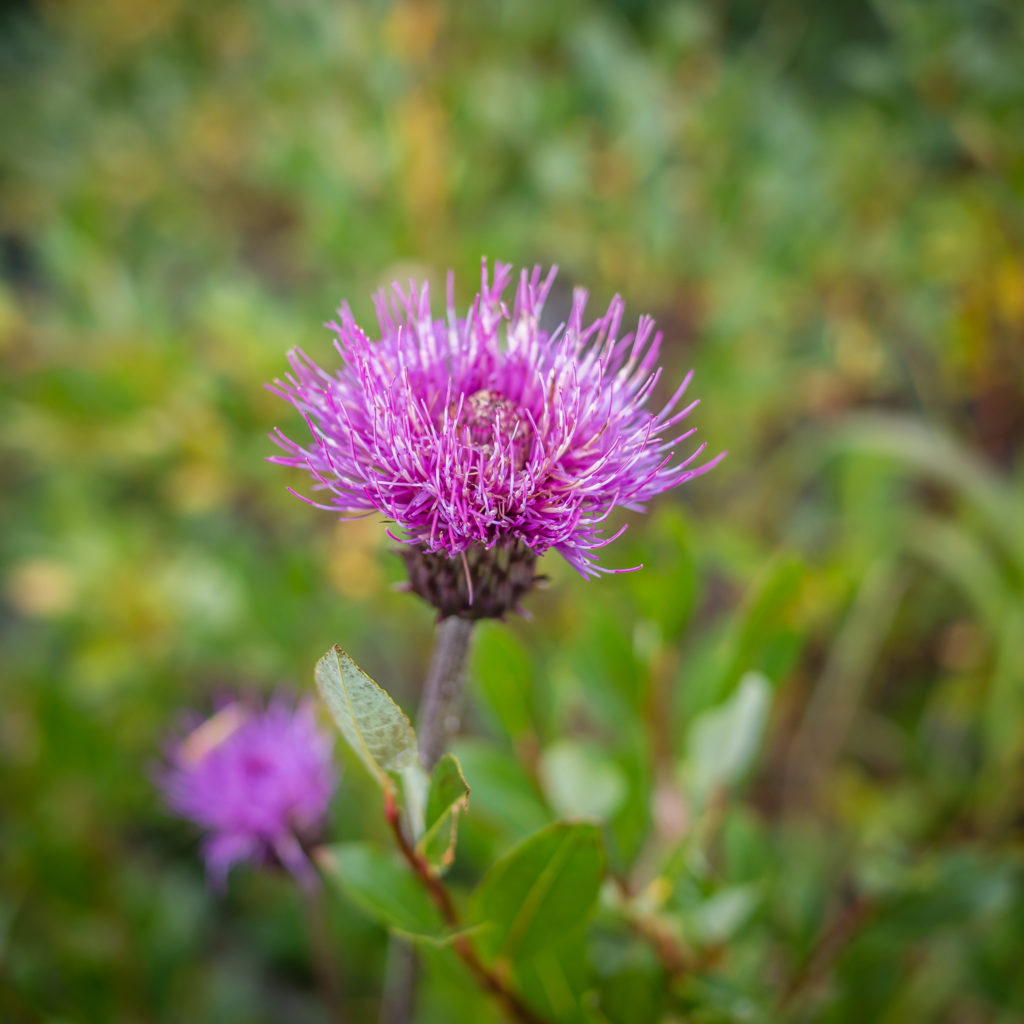
The striking spear thistle makes another appearance along the Kungsleden trail.
We found flowing water soon after, but as the grassy camp spots were on low ground and close to boggy areas where there were huge clouds of biting bugs hovering around, we decided to camp higher up. At the expense of avoiding the bugs however, we had to pitch on rougher, scrubbier ground. To combat this, we used a little ingenuity and put our maps to good use. Made from waterproof, durable material, we laid them out like a groundsheet and positioned the tent on top, the maps offering some extra protection for our sleep pads. We didn’t want to acquire a puncture from any twigs or scrubby, spiky bits poking through the base of the tent, and as we didn’t carry a separate ground sheet, the maps were a perfect substitute!
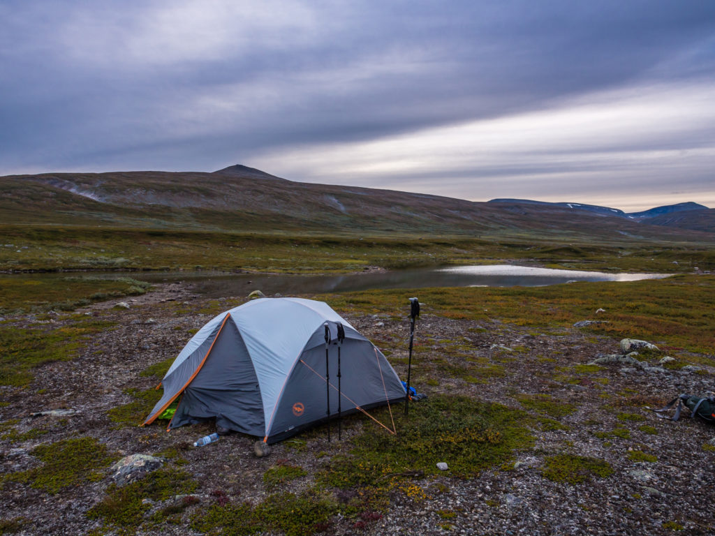
The tent is carefully laid out and pitched on top of our Tyvek maps. We hoped this would provide some protection for our sleep pads, avoiding a puncture from the scrubby ground.
Cooking up a camp feast whilst watching sunset from the comfort of the tent!
Enjoying a calm evening and the view meant it wasn’t a bad spot to pitch overall.
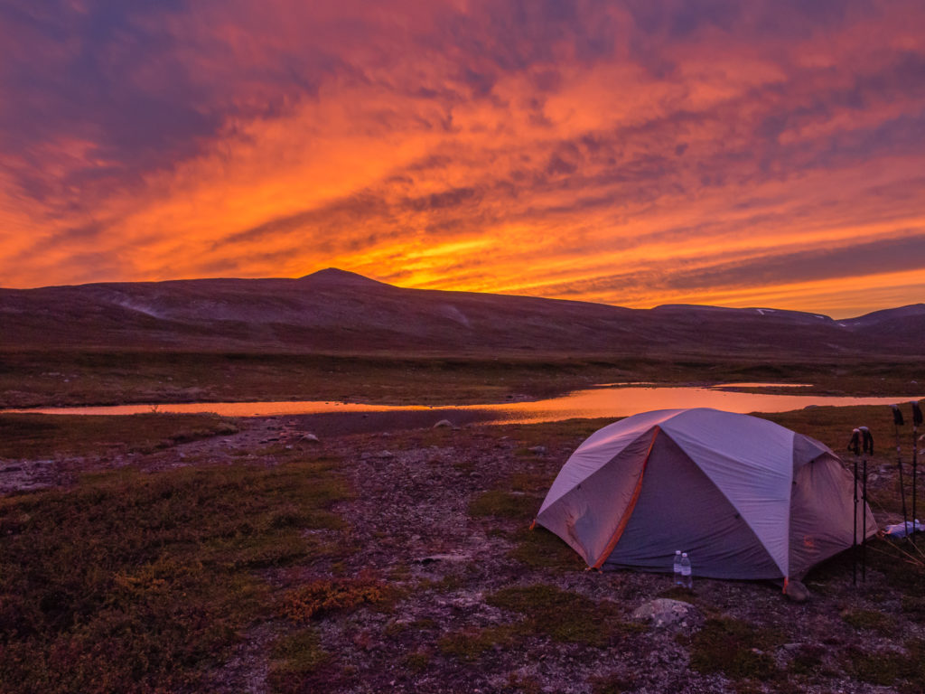
Sunset surprise!
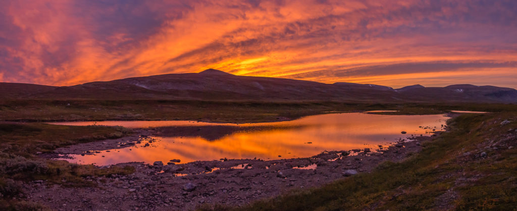
We were completely taken aback by the fiery skies!
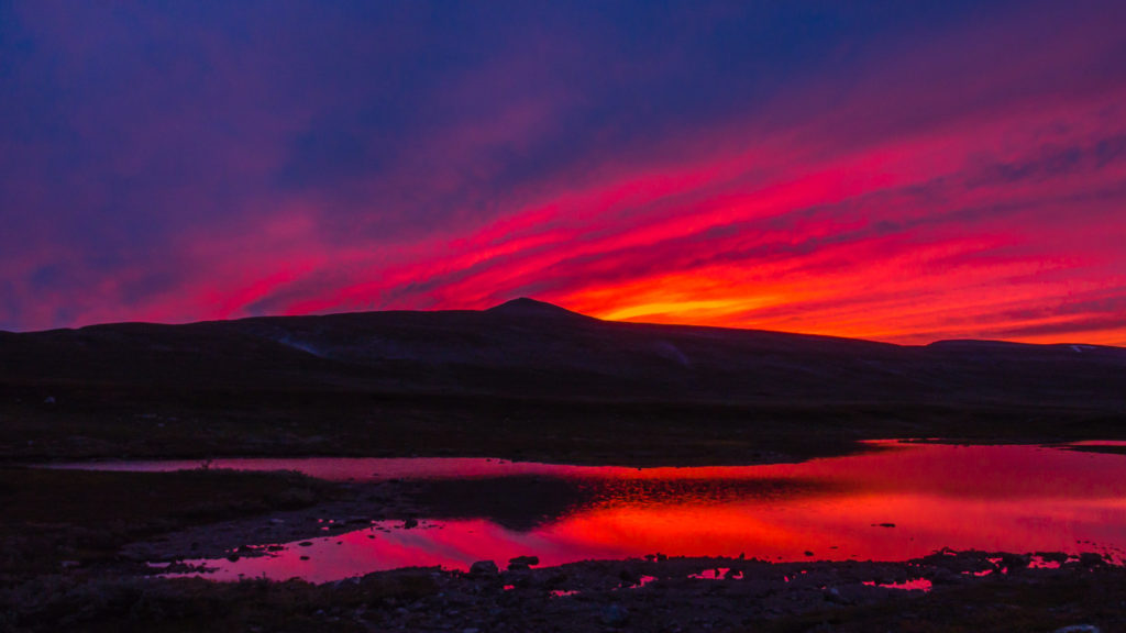
It proved to be an incredible wild camp spot as we witnessed our best Swedish sunset so far on the trip!
By the time we were ready for bed, we witnessed beautiful, bold and intense sunset colours at the end of the valley over a small lake, the sky changing in a matter of minutes from a deep pink orange, to intense orange red, through to vivid red purple, where it literally looked as though we were staring at hot, molten lava through the caldera of a very active volcano.
All in all, today proved a very successful hiking and photography day! Without a doubt, it was a day on the Kungsleden to remember!
4 Comments
What a sensational day you had. Morning visit from the reindeer, magnificent views from Skierfe and glorious sunset colours.
Just fantastic you were able to capture the views from Skierfe with your drone. The colours, reflections and vastness were just amazing to see.
Thanks for continuing to follow our journey Helen and always taking the time to comment on our posts! It’s much appreciated. 🙂
It’s a shame that Sweden have changed their drone laws. We are so thankful to have our drone footage as it really gives a sense of scale for this amazing place.
Wow – what an incredible day on the trail! The sort of day you dream of when planning a trip! Some amazing photos – looks like you really experienced the very best the Kungsleden had to offer on day 14. Glad in the end it was well worth those extra drone kilos! Brilliant set of posts as always and really enjoying following your adventures on this trail.
Hi Mark, thanks for continuing to follow along! It’s great to have such positive feedback from you again and is much appreciated! 🙂 We didn’t get to use the drone very much in the last week on the trail as the weather kind of went downhill for the majority of the northern section! (As you’ll find out in our remaining posts!) But we’re still glad we brought it along with us.