
Reaching The Finish…
We made it! After 20 nights in the wild on Sweden’s premier long distance trail, walking approximately 270 miles (430km) between the country’s highest peaks and most dramatic landscapes in the far north, we finally reached Abisko!
Completing the Kungsleden, our 6th long-distance hike to date, we were in good shape and an even greater mood knowing we had the whole day ahead of us to celebrate!
Here’s a round-up of our final few kilometres…
Reaching the finish line on our 21st day!
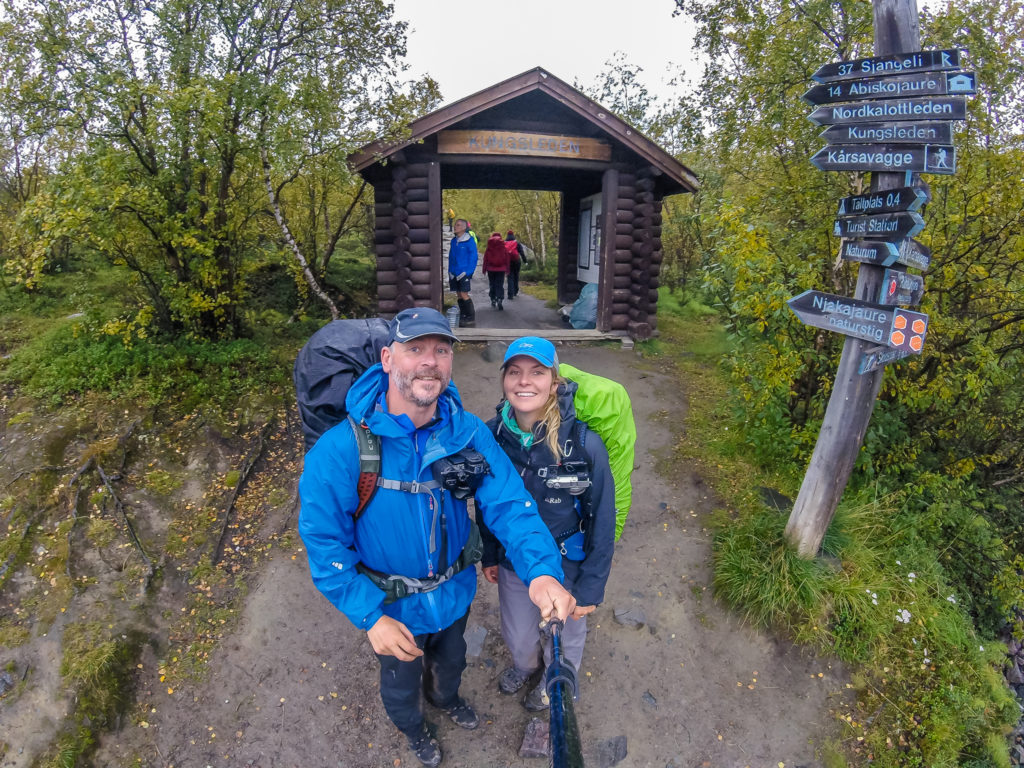
Day 21 – Nissonjokk (Designated campsite inside Abisko National Park)(2.7 miles/ 4.4 km, 1 hour, 39 mins) – Friday 2nd September, 2016 – ‘In Time For Last Orders!’
We were suddenly woken by big, fat drops of water landing on the tent around 5:30am! That’s exactly what we didn’t want for our final morning. So we stayed cocooned in our sleeping bags until 7:30am, but the rain didn’t let up. We’d just have to brave the dismal weather for our final 4km to Abisko.
We had a bag of trail mix left for breakfast (a mixture of nuts, raisins, cranberries and chocolate drops that we had procured from the Mountain Station in Saltoluokta, which seemed a long while ago now), so we ate it quickly and with gusto, then packed everything away inside the tent knowing we were just a short distance away from the finish line! It was a rapid de-camp compared to our usual lengthy two-hour getaway – as always, the best motivator – the promise of food and beer waiting at the end of a trail!
Fully prepared in our wet-weather gear but grateful that the rain had almost stopped by the time we set off on our final section of trail.
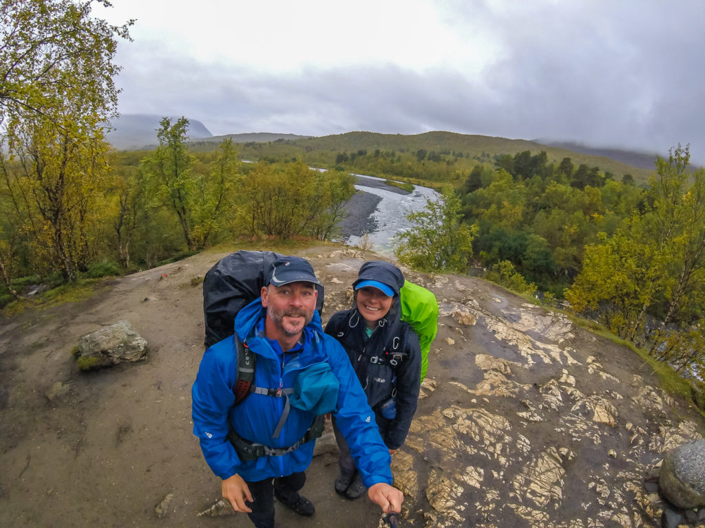
Pleasantly, the rain had about stopped by the time we got going. What we had heard from inside the tent was the splattering of raindrops from the surrounding trees. However, our excitement at the thought of skipping our way along the last few kilometres of the Kungsleden under blue skies, free of obstacles, was short-lived. We anticipated that the last 100th of the trail should take us around an hour, but it turned out to be a very taxing last few kilometres as the heavy rain that had persisted throughout the night served to create a trail that was now completely saturated. We therefore found ourselves having to tread carefully, in our attempt to dodge the huge puddles of water that swamped the compacted ground as well as skirt around lengthy sections of churned up mud – that was neither bog mud, bad mud or good mud – more of a perilous mud that sucked you in as soon as your foot hovered anywhere near and was tantamount to a nasty fall as it was so slippery.

The boardwalks can be very slippery when wet so we had to cross them with caution.
The ground was saturated and the drizzle was persistent, but we didn’t let it dampen our spirits.
We had been warned that this section of the trail, above all others, is like a ‘highway’. And indeed it was! Freshly groomed and newly kitted out hikers, expectant for their own Arctic Circle wilderness experience passed us every few minutes, some laden with very big packs and heading off on a long-distance adventure of their own, some enjoying a weekend jaunt away from the city – all of them smelling of soap and cleanliness – making us ever more conscious of how much we needed to launder our very lived-in clothes! (Making pants and socks last 3 days really is an experienced hiker skill!)
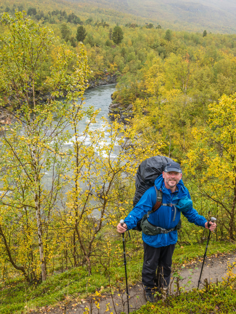
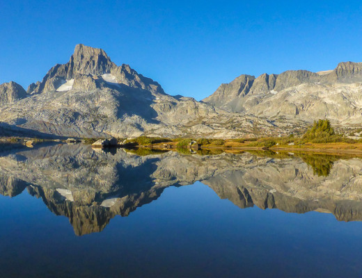
It was tiring, especially when we thought we’d be all but running along the trail at lightning speed in glorious sunshine with the drone set in ‘follow me’ mode dutifully tracking us to the end and recording our accomplishment. Unfortunately not, on all counts! It was slow going, trudging along the last section of trail under a grey sky, dark clouds still covering us in a fine drizzle. It was too wet and windy for the drone, and there were too many obstructions overhead as the last section takes you through dense woodland alongside the river. The final kilometre sees you passing through a limestone canyon with a series of gushing waterfalls presenting a good photographic opportunity along the Abiskojåkka river, complete with cairn upon cairn built by the numerous visitors that have passed by over the years.
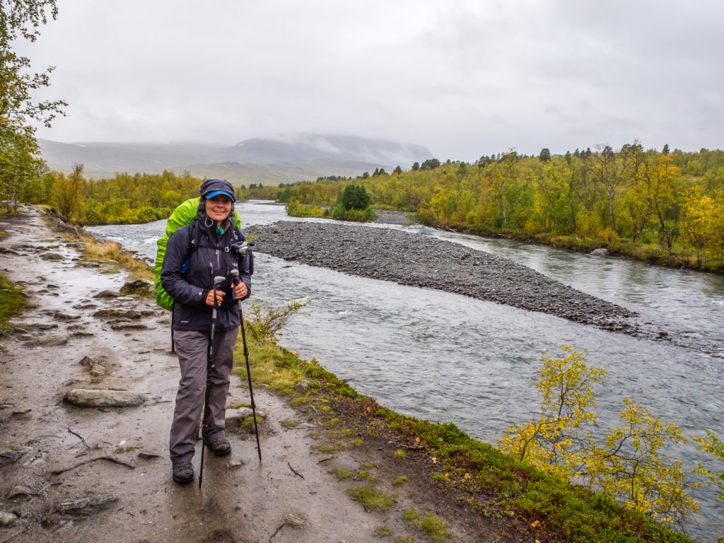
The final segment of the Kungsleden follows alongside the Abiskojåkka river, which eventually flows into Lake Torneträsk in Abisko.
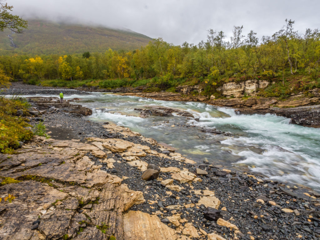
The Abiskojåkka river was full and fast flowing after all of the rain of late.
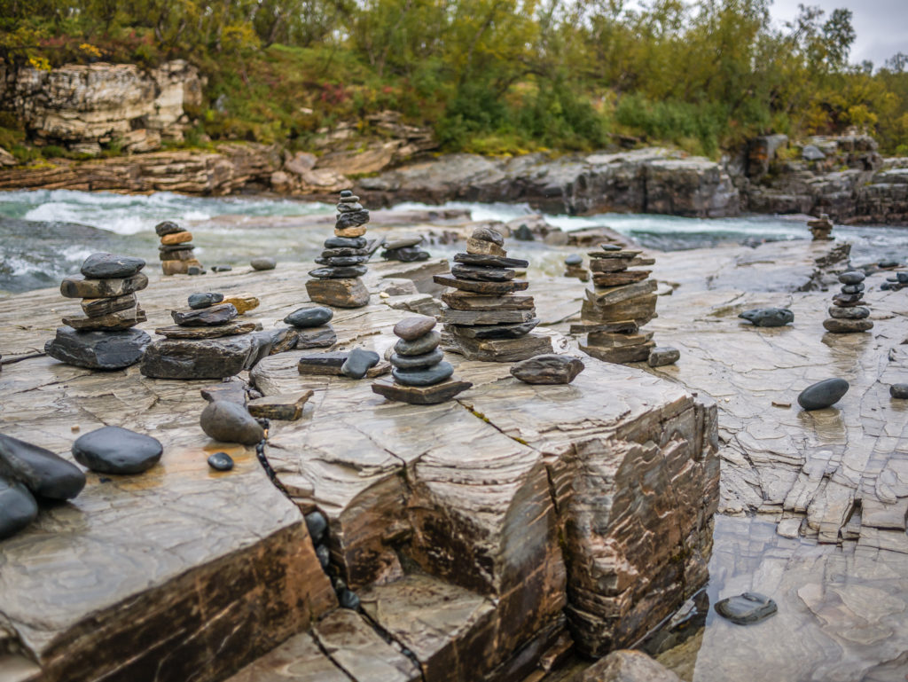
Numerous cairns are dotted alongside the river.
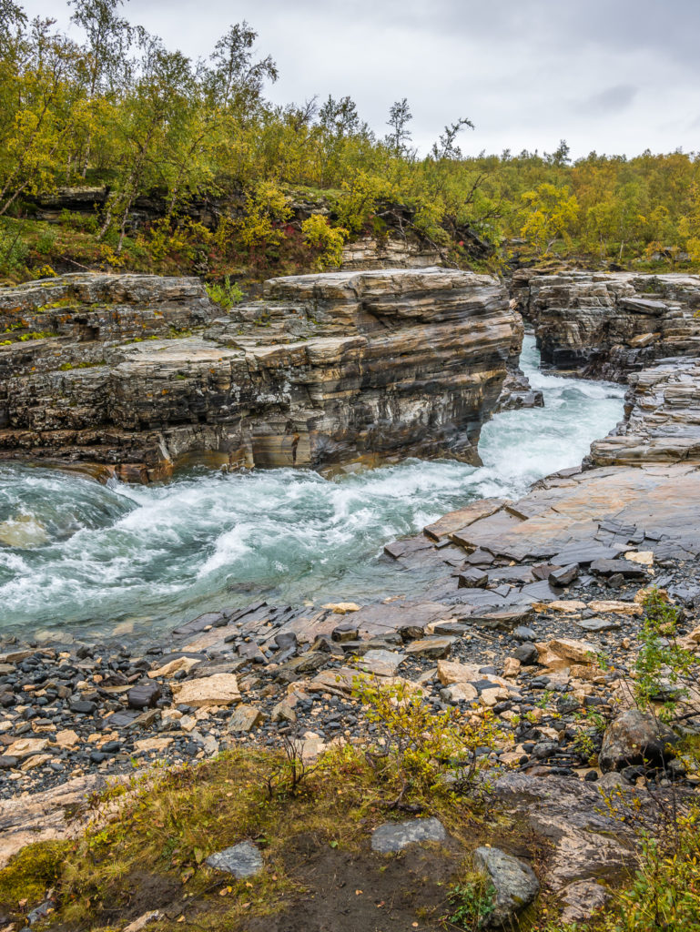
The water gushes through the limestone canyon.
As we neared the ‘Kungsleden’ sign signalling our finish, we met an American guy from Maryland who had already been hiking for 10 days in Norway, yet was now busy getting his gear ready for the off from Abisko to Nikkaluokta. He congratulated us on our achievement – he said it really was an achievement as he’d never met anyone who’d hiked the entire Kungsleden before. He took our photo and told us where they did a great buffet lunch in town for 100 SEK (£9) pp. Returning the favour, we gave him some info about a few good camp spots we’d seen just outside the National Park.
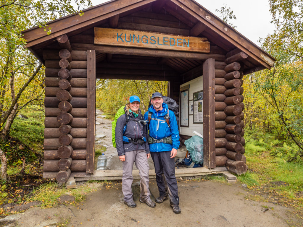
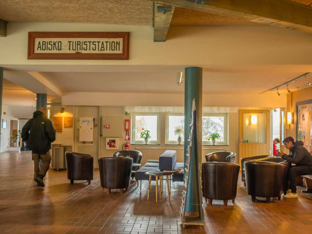
The finish line is the wooden arch marking the end (or beginning if you are starting in the other direction) of the Kungsleden trail. It is located next to the train station Abisko Turiststation, and just 300 metres from the STF Abisko Mountain Station, where if you have completed the full 270 miles, you will want to toast your success with a drink from the bar!
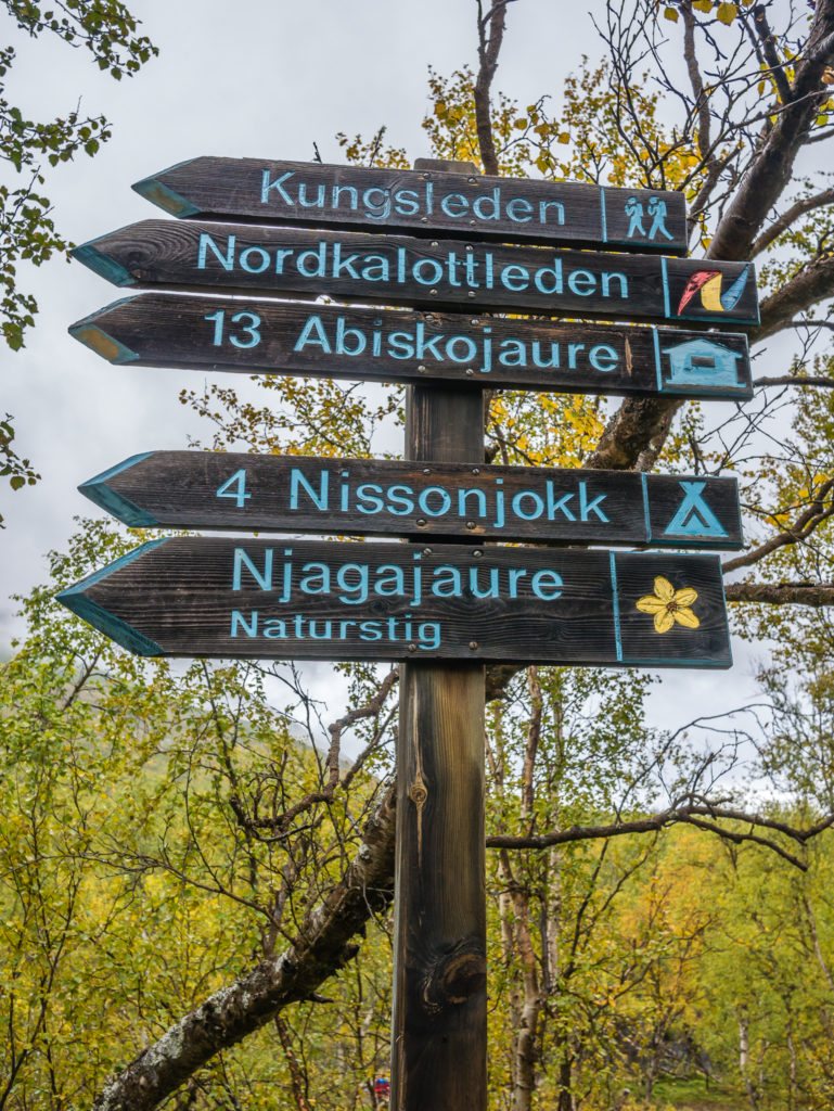
After 270 miles, the final Kungsleden sign we would see!
We filmed a little bit of our arrival at the end of the trail, which seemed a little surreal as there were several other people preparing to set off – this ‘Kungsleden’ sign signalling just the beginning for them! Then off we went to the STF Fjällstation for that celebratory beer we’d been hankering after for days!
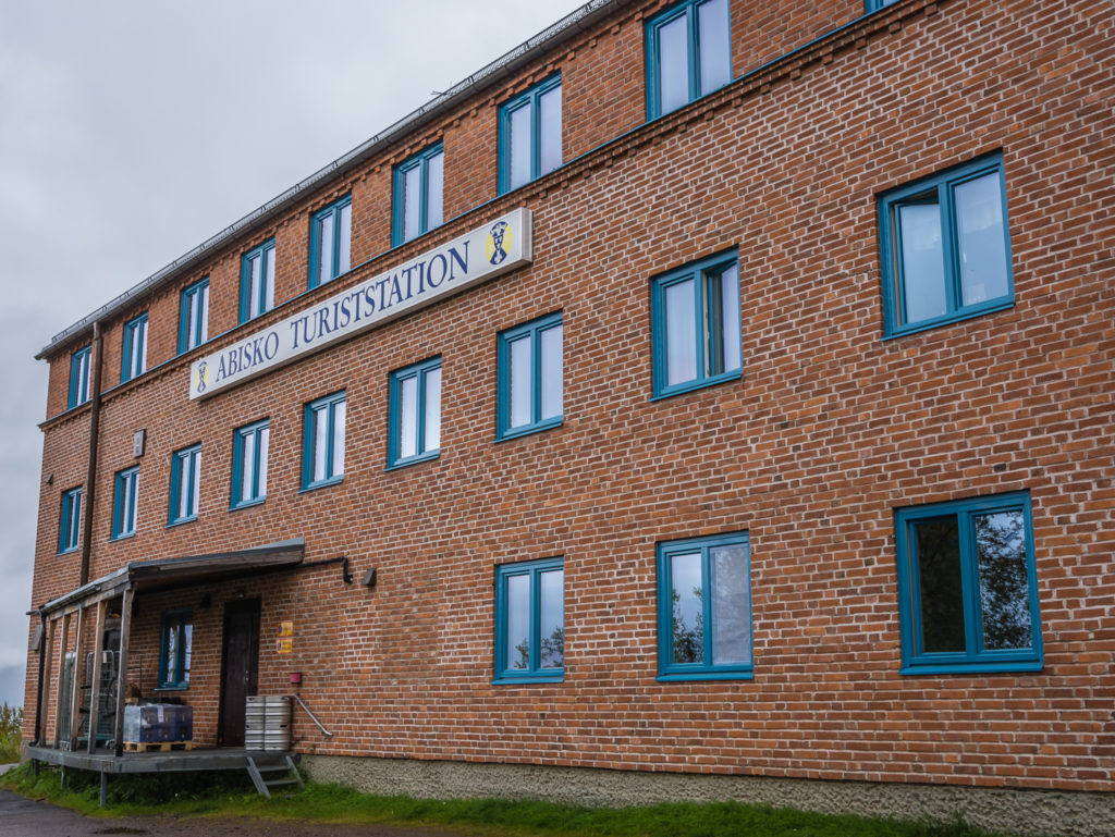
The Abisko Turiststation looks quite underwhelming when you first come upon it!
But this sign was immensely pleasing!
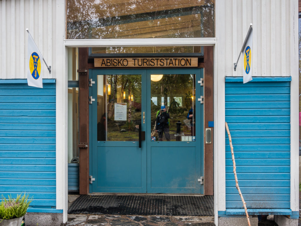
After much anticipation and daydreaming about our final day on the trail and how we would celebreate – TrekSnappy enter the building!…
The Fjällstation was extremely busy – people of all ages and nationalities were sprawled out in every nook and cranny around the building, glued to their smartphones making use of the free Wi-Fi. We too wanted a comfy seat and to update social media of our progress! 440km later – job done! We savoured the most expensive beer we’ve ever had, ate an equally expensive but tasty sandwich from the shop, then set off to Abisko Ostra, 3km down the way, to find our hostel for further celebrations and to muse over our Kungsleden adventure, and what an adventure it was!
This picture was taken after the hordes of trekkers departed on their various trips, leaving a few comfy chairs for us!
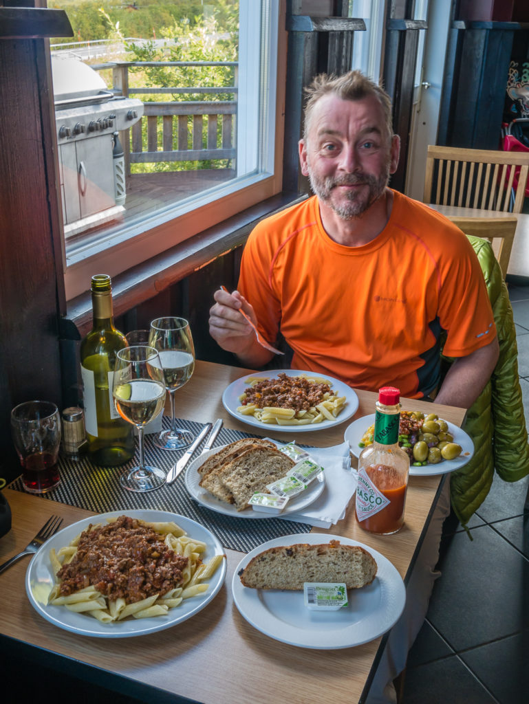
Extra large portions and of course, a bottle of vino to finish!
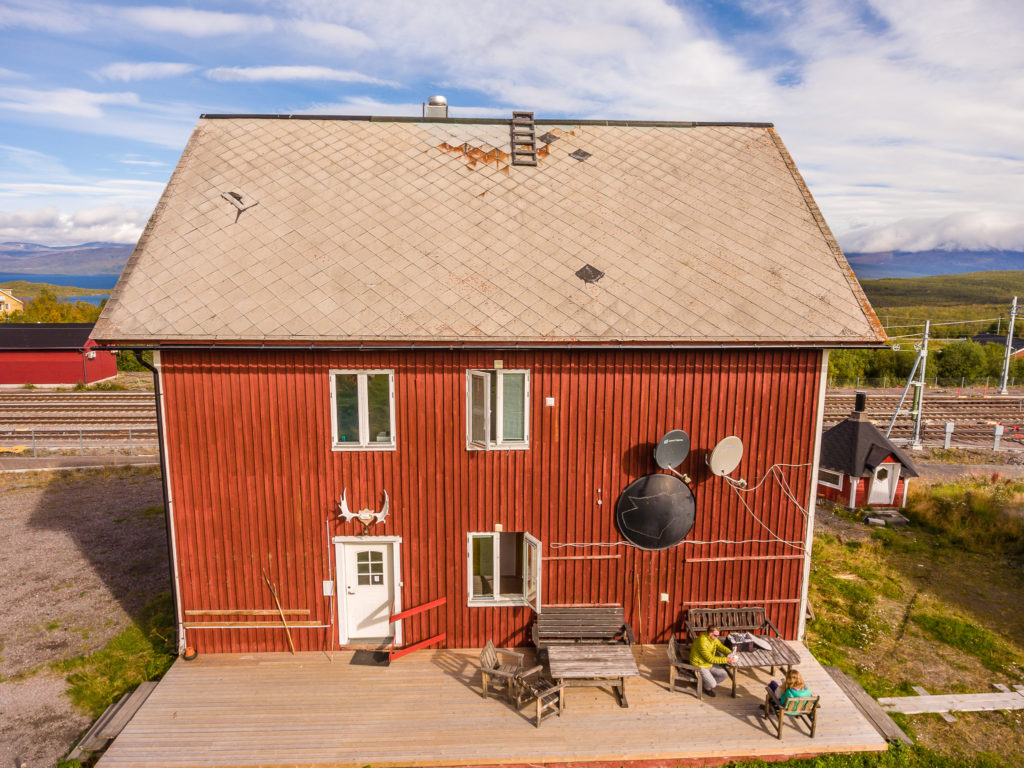
Drone shot showing our hostel in Abisko Östra where we were sat outside chilling out.
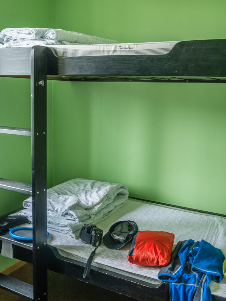
After 20 nights on the trail, we didn’t mind a bunk bed so much!
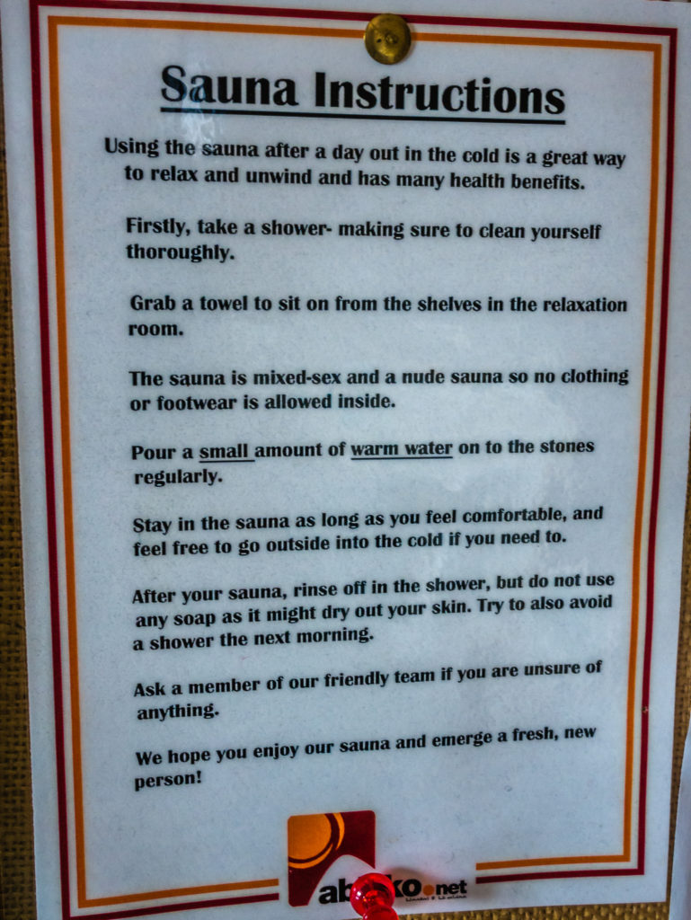
The hostel also had an incredible looking sauna room – however we were far to merry after our celebrations to make use it! (That’s what 20 days of no alcohol does to you!)
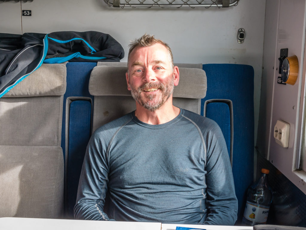
The following day, taking the overnight train from Abisko back to Stockholm in readiness for our flight home to the UK.
Overall thoughts…
While the Kungsleden in its entirety remains an epic journey and an incredible experience for the long-distance walker, some people may prefer to walk sections of the trail at a time. With several entry/exit points along the route, it is possible to choose any of the stages described in our blog and make them into a one or two-week walking holiday. This of course also lets you cherry pick what you may consider are the best features of this trail!
If solitude is what you’re looking for, walking the southern section between Hemavan and Ammarnäs may suit your preferences better than the busier northern section. However, if you want grand mountain views and beautiful valley walks, plus the opportunity to summit Sweden’s highest peak, then the northernmost section between Abisko and Singi, taking in Kebnekaise and terminating at Nikkaluokta, may offer you a better flavour of Arctic Sweden.
Ultimately, this is a walk with many opportunities! Compared to other long distance trails we have completed, we found that the Kungsleden is not just about the immense scenery or the changing terrain. It’s about the endless possibilities of witnessing such unique elements as to only be found when crossing into the Arctic Circle, and so is both appealing and accessible to all.
One of the harshest environments on our planet, the Arctic has always struck us as a place for serious adventurers and experts. However, the King’s Trail is wholly accessible to a wide range of walkers due to the relatively low-altitudes, somewhat easy-going terrain, and extensive network of mountain huts and emergency shelters along most of the route. Sleeping in the huts, topping up food supplies on the go from the available boutique shops, and making use of their cooking facilities, as opposed to carrying a full backpack of equipment and food rations, means that such a trip is ever more accessible for the ordinary trail seeker.
What we came away with are fantastic memories of a place that we had always considered to be both out of our reach and out of our comfort zone. But you don’t have to be a serious trekker or hardened wild-camper to access this trail, such are the excellent facilities provided by the mountain hut system. Whether on foot or by boat, the Kungsleden is by far a special and distinctive journey – you just can’t be averse to a little rain!
14 Comments
Congratulations on completing this awesome hike and epic blog, for your readers to enjoy the trail, if from a distance.
Thank you so much for following along with our journey every step of the way Helen and taking the time to always leave a comment. It’s very much appreciated knowing someone is reading & enjoying what we love to do! Danielle 🙂
10/10 for this trip report. This must now be THE best written and most inspiring guide to the Kungsleden and I’ve enjoyed every minute reading it. It’s been entertaining and informative but best of all, it’s made me even more excited for my own South-North passage – I set out 100 days from today!
A lot of people told me that the full Kungsleden cannot be walked in less than a month but Danielle and Wayne have shown us that with a good plan and determination on the tough days, 3 weeks is a good target.
Thanks again and good walking.
Thank you so, so much David! You have truly given us a glowing review that is very much appreciated!
You must be so excited about your own upcoming adventure. Good luck with everything and savour every moment of this magnificent trail.
Danielle & Wayne
PS FYI We’ve had an update from the publisher that our book is in the final stages & should be ready next month. I’ll announce it on the blog as soon as it’s available on Amazon. Thanks again 🙂
Hi Guys: Thank you so much for sharing these great photos and travel comments on your experience on this hike. I did not recognize the name of the hike at first as I have heard it described as The King’s Trail and not Kungsleden. A friend of mine and I have talked about the hike; it is included in the book, 50 Places to Hike Before you Die by Chris Santella. Great job showing us what we might expect doing all or parts of this hike. I second all of what David Wright said as well. Great job! Very helpful and informative.
Hi Garry, thank you for taking the time to comment and give us such positive feedback. It is very much appreciated! Good luck with your own hiking adventures this summer, best regards Danielle & Wayne
Thoroughly enjoyed following your adventures on the Kungsleden – the writing and photographs have been top notch as always. Really detailed and comprehensive coverage of the trail and what to expect. Thanks again for a great and entertaining read.
Thank you Mark for taking the time to read our blog and post a comment. It’s great to know when people enjoy our trail reports and find them useful! All the best, Danielle & Wayne
Thanks for the detailed account of your trip which has really helped me in my planning. I’ve especially enjoyed the inspiring photos. I’m happy to get the final instalment just in time before I set off to hike Kungsleden myself (I’m flying to Kiruna this Saturday and plan to start walking from Abisko on Monday or Tuesday next week). This blog has helped me to feel more confident that I can do this even though I’m hiking solo and I don’t have loads of experience with long-distance hiking. Wish me luck!
Hi Catharine, you will be well on your own Kungsleden journey by now! Thanks for getting in touch and sorry for not replying sooner. Our work commitments get in the way of keeping up to date with the blog sometimes!
It’s always good to hear when our experiences and info on the blog have been useful to others. Best of luck with your trip. It would be nice to hear how you get on hiking in the opposite direction to us and starting earlier in the season. Happy hiking! Danielle & Wayne 🙂
Dear Danielle,
reading through Your complete Kungsleden blog posts I’d like to thank You so very much for putting this together. The blog and the book have provided me with the most comprehensive information for my planned thru-hike. It’s fantastic. I’ve also learnt I definitely need to mentally prepare for wet weather. I think my shells will be good; hopefully the one inside the shells will be, too 🙂
May I ask for some additional information:
How many gas did You use on the trail? I have made an own estimate, but would like to have proven real life figures.
How many cash did You spend on the trail? (if You do not want to disclose this, just ignore the question)
Did You check, if there is a shop to top up Your food at Vietas/Stora Sjöfallet bus stop?
At some point You mentioned usage of a solar generator. What have Your experiences been with this? I would really like to keep some electronics going, like phone and GPS device. I will roughly need 20 Wh per day average (incl. charging losses).
Happy hiking and keep going.
Best Regards
Marcus
Hi Marcus, as it was so long ago and we have done lots of hikes since then, I’m just going on memory.
I think we used one 230g gas cannister per week, purchasing them in Hemavan, Kvikkjokk and Saltoluokta. It is possible to cook inside the huts to save on gas if you pay to use their facilities with an STF card or Hostelling International card, which provides the same discount. We used quite a lot of gas as we cooked pasta and rice and had hot drinks. We also bought some tinned foods from the hut shops e.g. meatballs, which took longer to heat up. You will use less if you cook quick boil food e.g. noodles/ instant mash.
We changed around £700 to Swedish krona prior to the trip. I’m not sure of the current exchange rate and whether you will need more, but we took enough to ocver our estimated costs of boat crossings and food. The supermarket in Ammarnas takes debit card, as do some of the bigger STF shops. I think we just had enough cash, but that was for 2 people, so you might need less.
At Vietas/Stora Sjöfallet – We don’t recall there being a shop – but things could have changed.
The solar panel wasn’t great on the Kungsleden trip because of the weather! We had to use our waterproof cover on our packs for much of the time because of rain showers so I would recommend carrying a power pack. (We don’t use a solar panel at all during our long distance hikes now as they are insufficient for charging our newest model phones.) Now we both carry a battery pack (high capacity power banks by Anker – Anker PowerCore 13000) that usually lasts us 3-4 charges each for our smart phones. As we need to charge camera batteries too, we usually stay in some form of accommodation to facilitate charging at least once a week. At that time, we were also carrying the drone, so we needed to charge drone batteries too, which is why we paid for a room at Kvikkjokk, for example.
We’re currently on a ‘big save’ year, but have lots of hiking ideas for the future. We would particularly like to explore Slovenia and Montenegro’s hiking trails!
All the best for your Kungsleden trip! Sorry it’s taken a while to reply, but if you have any further questions, please don’t hesitate to get in touch.
Warmest wishes & happy hiking,
Danielle & Wayne
Hi Danielle,
thanks for Your reply. While my gas estimate roughly matches Your figures, Your experiences with the solar charger make it necessary to re-think my plans. So this is very useful information.
Thanks again. I hope Your “big save” year is not becoming too long and have fun with new plans.
Best Regards
Marcus
Thanks Marcus.
Glad to be of help!
All the best for your hike,
Danielle