
Walking the Wainwrights… Another 19 In The Bag!
So we might not have completed all 50 – severe weather conditions once again the reason for us conceding and coming down off the fells (foresight, common sense and prudence an essential trait of every hiker) – but we did manage to knock off another 19 summits – bringing our grand total to 28 Wainwrights in 6 days!
Continuing on our week-long adventure, here’s a round-up of our final 3 days from leaving Ambleside…
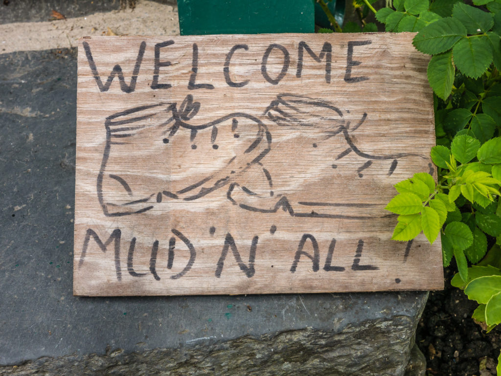
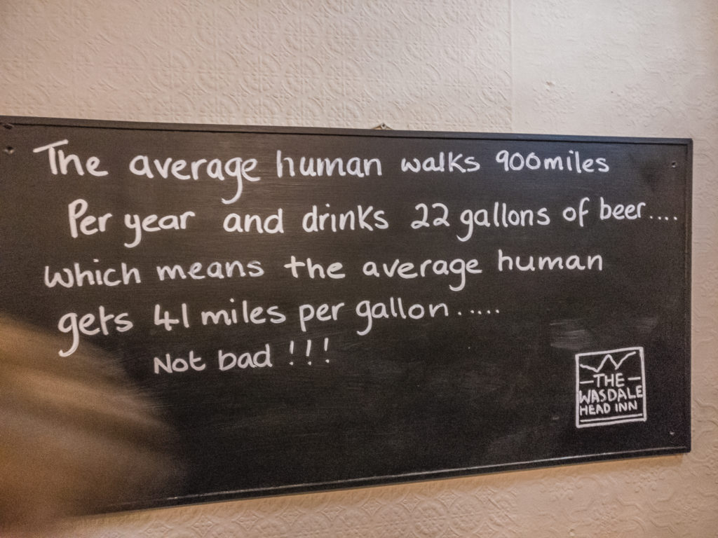
Whatever the weather – It’s always a welcome relief to see hikers are welcomed with open arms – muddy boots an’ all!
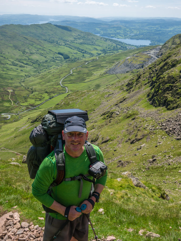
Day 4 – Ambleside FC Campsite to Thornthwaite Crag Wild Camp (18.8 miles/ 30.2 km, 9 hours, 53 mins) – Height Gain: 1,784m/ Height Loss: 1,020m – Tuesday 30th May, 2017 – ‘Taking Comfort In Life’s Little Pleasures’
With the forecast set to improve later that morning, we were in good spirits to continue with our Lake District circular. We had an amended plan to get us back on track to still achieve 50 Wainwright summits within the week and so freshly showered and rested, and with our gear now dry, we set off…
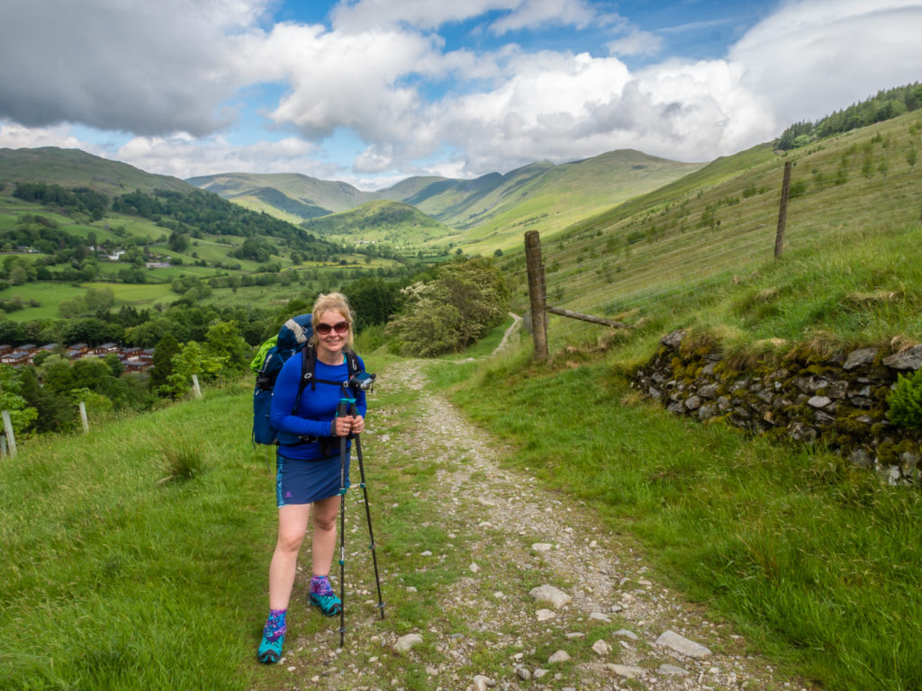
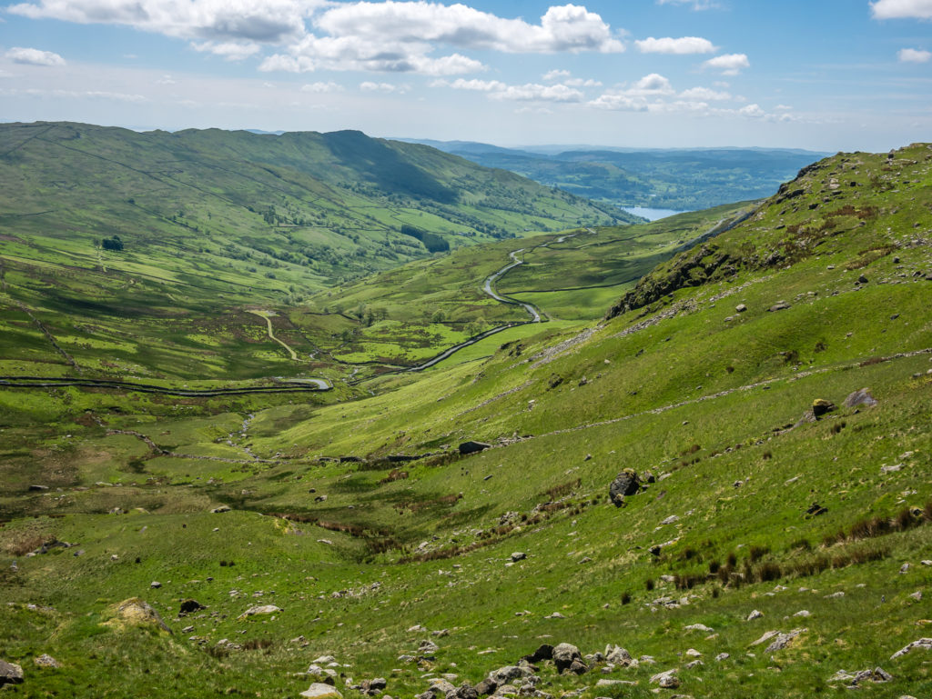
As we left Ambleside, a gentle climb affording us views over Lake Windermere, it was a dull and cloudy start to the day, hence the lack of a spectacular panorama shot! We intended on bagging three Far Eastern Wainwrights starting from the church at Town End in Troutbeck. But as the sun began to shine when we arrived in the village, we were waylaid with an impromptu visit to the Post Office and Café. The lure of freshly brewed coffee was just too much, and to top it off we just couldn’t resist sitting on the bench outside to soak up some rays after the dreadful weather the previous day.
Such are life’s little pleasures… Especially on the trail!
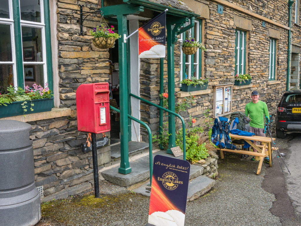
We stopped for an early caffeine boost in the village of Troutbeck. The Post Office doubles up as a tea room and gift shop, perfect for picking up a post card on the go to send home with a brief update of our progress. (Even in this digital age, our parents enjoy us putting pen to paper and receiving news through the letter box – not just the inbox!)
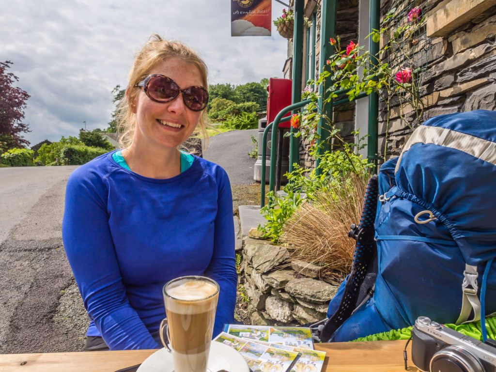
No plastic hiking cup this morning – taking the opportunity to enjoy a latte on the trail!
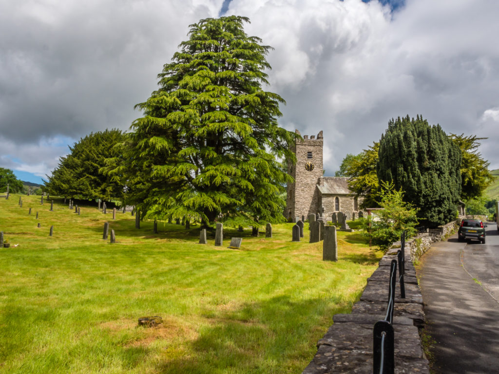
Passing Jesus Church in Troutbeck.
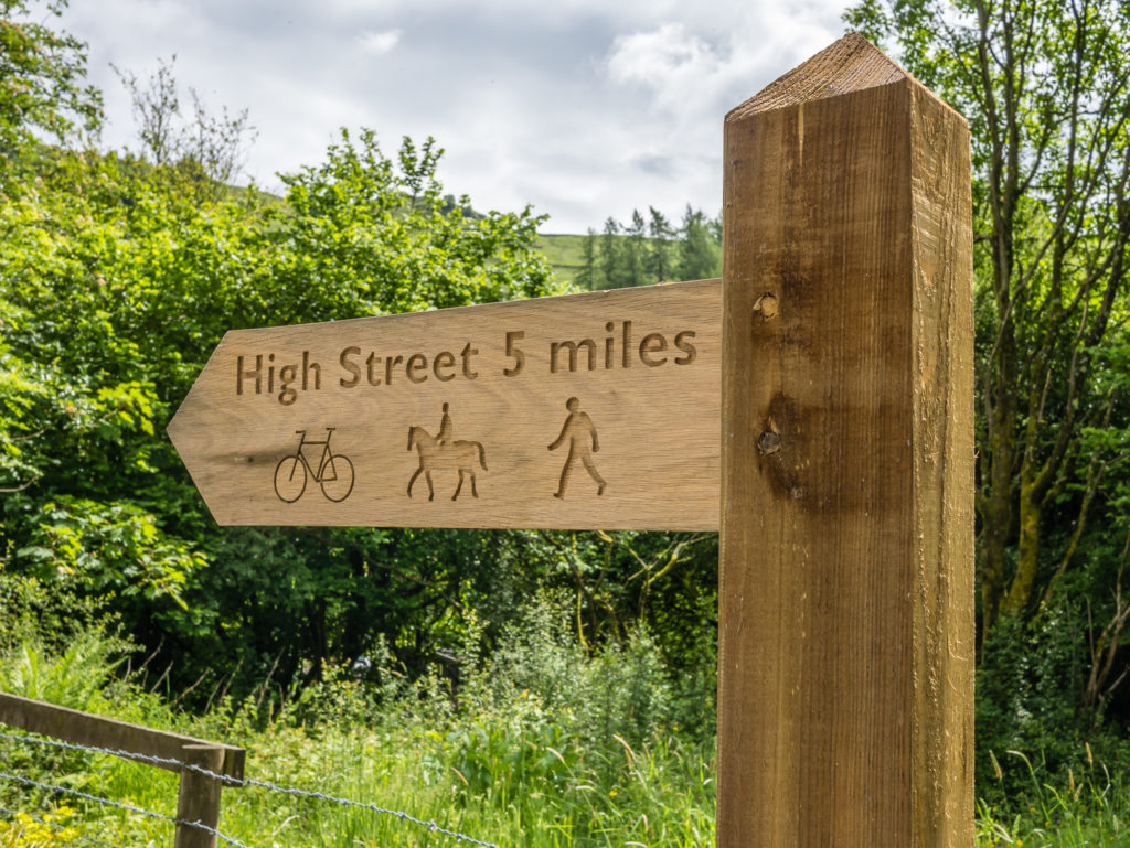
Whilst taking the public footpath through Limefitt Park we took note of signage indicating how far it was to reach High Street. (This was our planned 7th summit of the day – so we had a lot of work to do before then!)
The clouds were lifting, so with blue skies and sunshine making an appearance the legs and sunglasses were out at last!
Taking the Dubbs Road Track uphill onto Applethwaite Common.
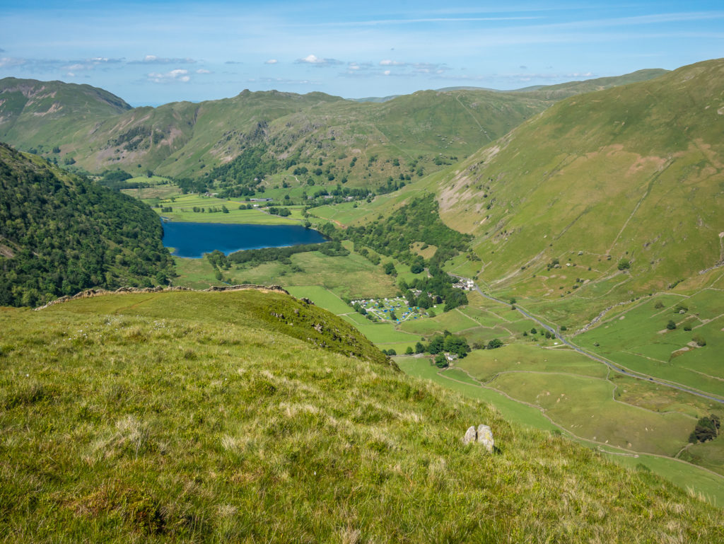
Panorama looking back to Troutbeck and on to Lake Windermere.
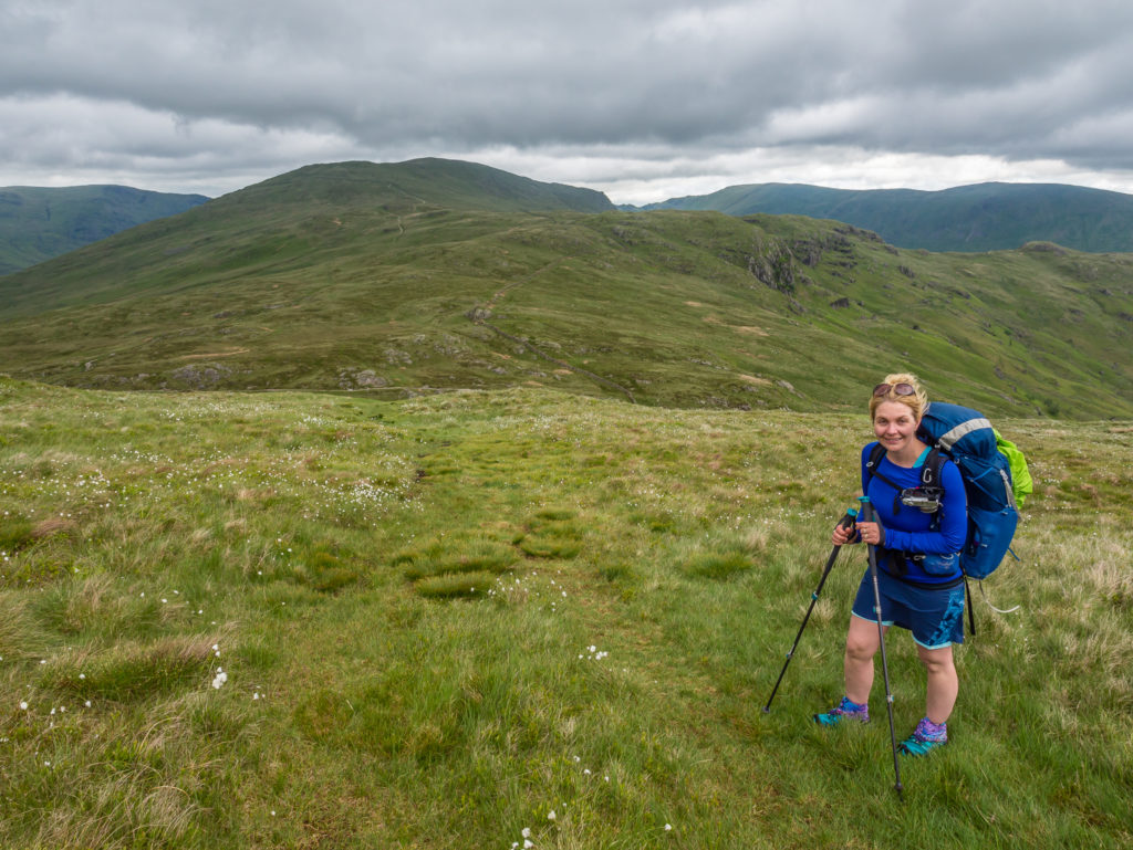
Heading for our first Wainwright of the day – Sour Howes – a little ‘un at 483 metres.
Summit selfie on Sour Howes – Another one in the bag!
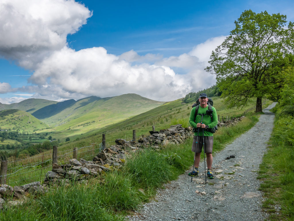
We continued over Moor Head to Sallows at 516 metres – our 2nd Wainwright of the day. By this point grey cloud was looming overhead and the promise of a better day was diminishing fast! It was blustery and cold up on the fell tops, so we took a lunch break down in the junction at Garburn Pass which provided some respite from the cold blasts of wind that were now forcing us to put on some extra layers.
A wash-out on Yoke at 706 metres, and a dreary outlook for the ensuing summits.
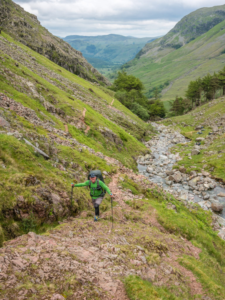
By the time we got going again up Buck Crag, we were in full waterproofs, thankful to have put them on before reaching the summit of Yoke, which was experiencing a downpour. With the rain clouds now blowing in thick and fast, our ridge walk between Ill Bell (757m) and Froswick (720m) was one of those times when we just put our head down and ploughed on, putting one foot in front of the other whilst day-dreaming of a roaring fire and hot meal!
By now, any view whatsoever was completely obscured. We didn’t realise it at the time, but perhaps that was a good thing as when looking back towards Ill Bell a while later when the cloud had lifted, we had been walking along a steep-sided ridge!
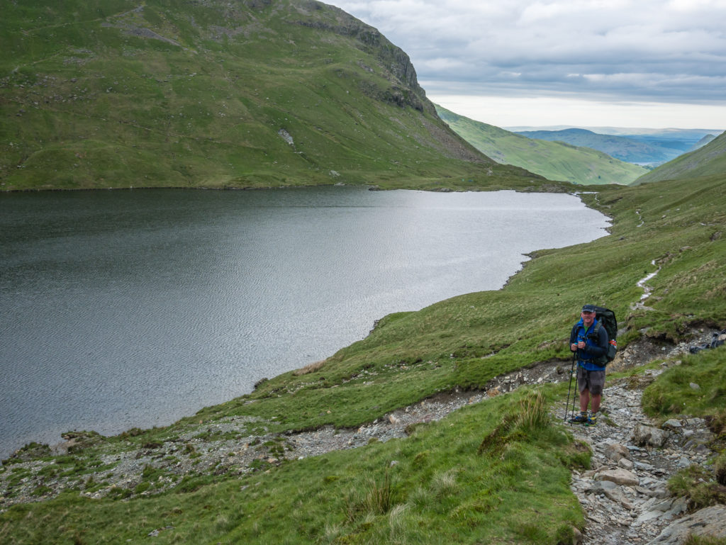
A bit of respite from the rain. In the background is Small Water with the tip of Haweswater also visible.
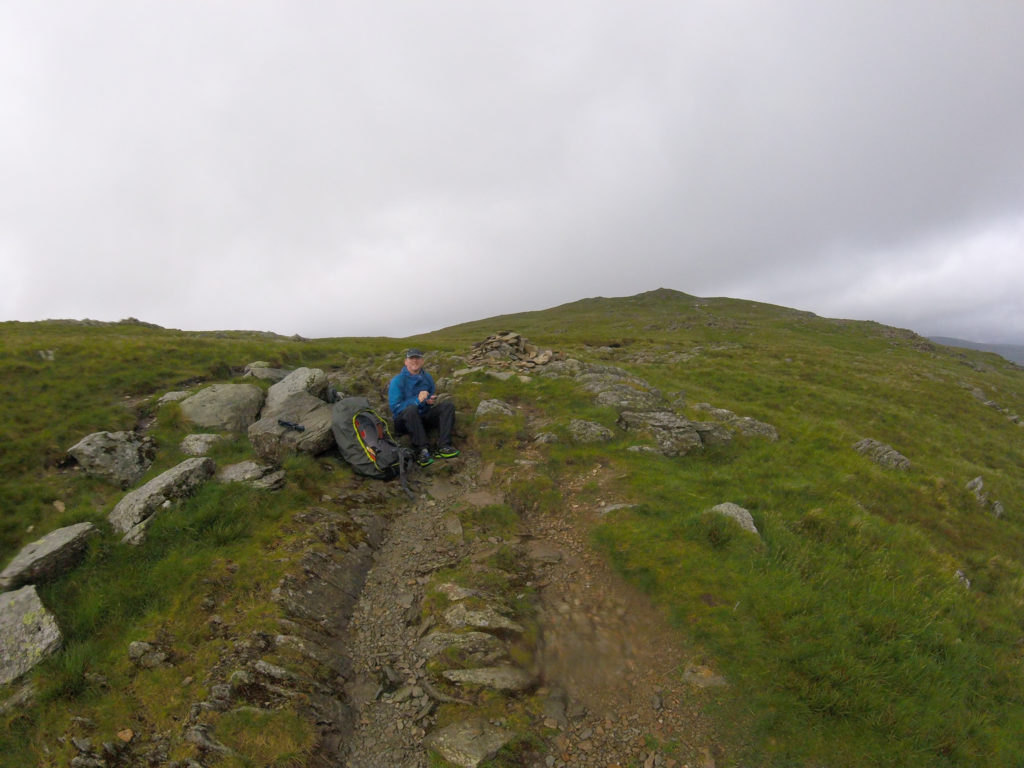
Taking a snack break at the trail junction. Mardale Ill Bell (760m) can be seen in the distance – our next peak.

Selfie at Mardale Ill Bell summit (760m) with Haweswater in the background.
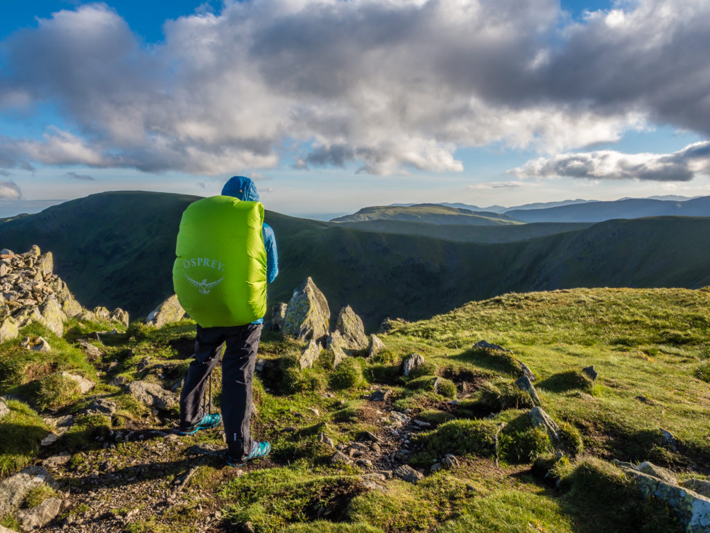
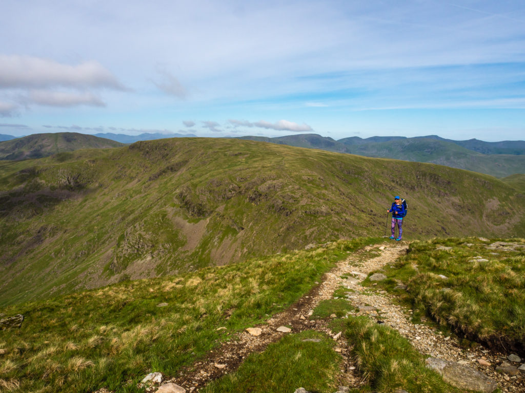
Rampsgill Head (792m) – Feeling cold up high but still pushing on to bag some more peaks.
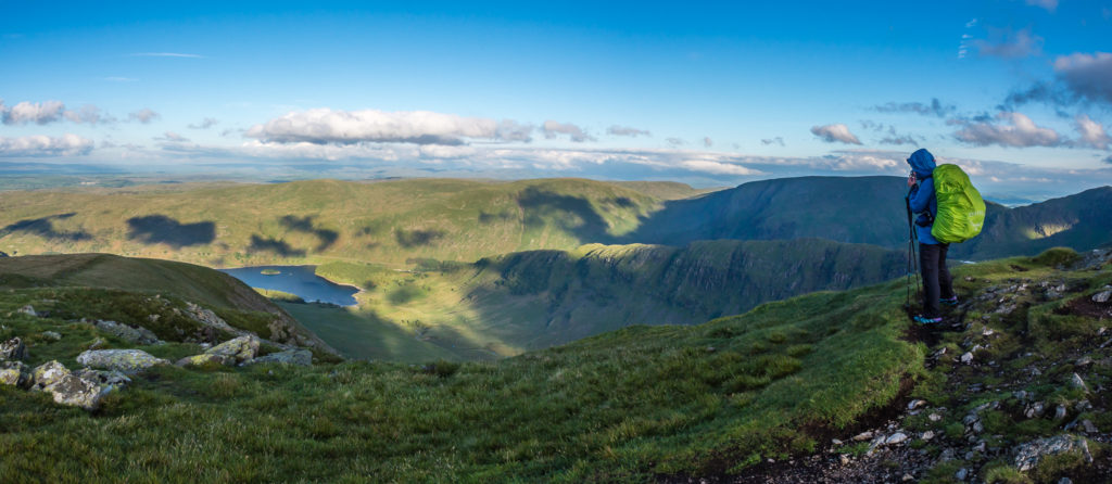
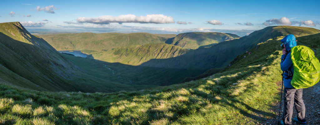
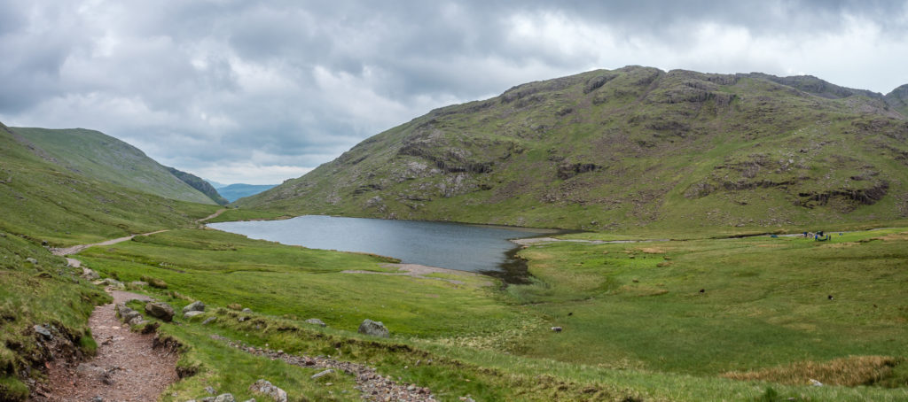
Panorama from near the summit of Kidsty Pike looking down into Riggindale and the end of Haweswater.
Approaching the summit cairn on Kidsty Pike (780m).
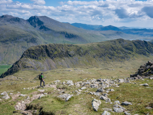
Looking on to High Street from Kidsty Pike.
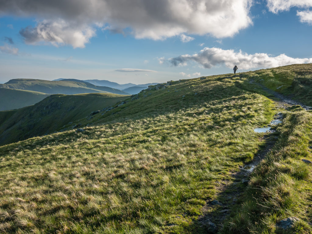
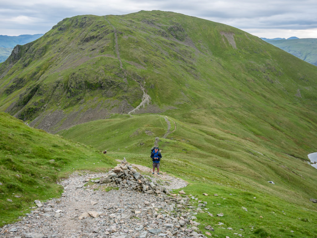
Walking back from Kidsty Pike over to High Street. The fell is named after the Roman road which ran over the summit. At 828 metres, its summit is the highest point in the Far Eastern part of the National Park.
Panorama looking towards Riggindale Crag with Kidsty Pike in the background.
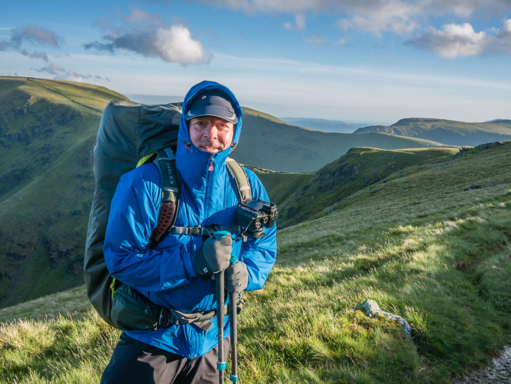
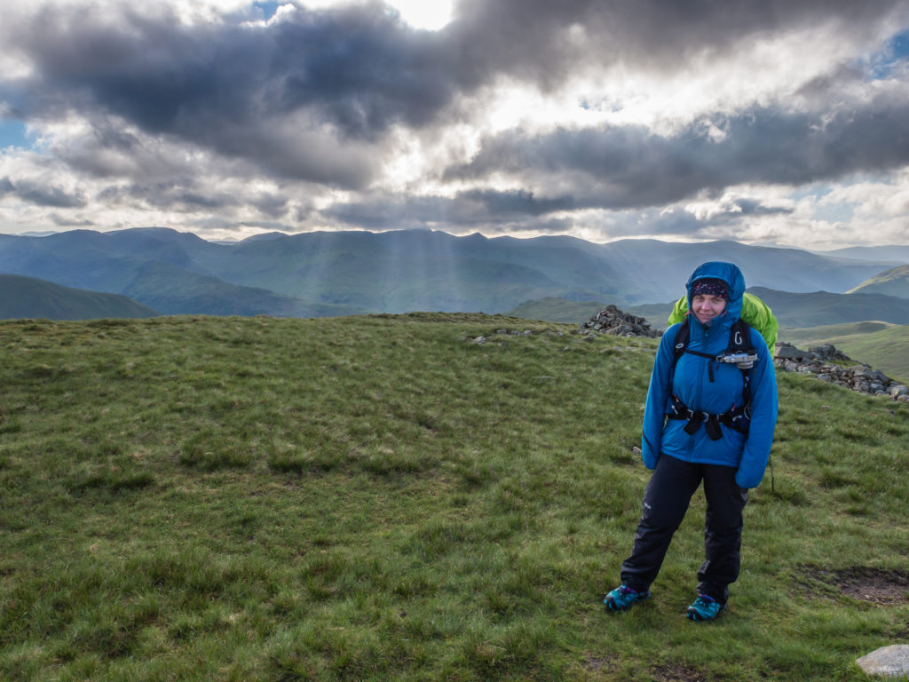
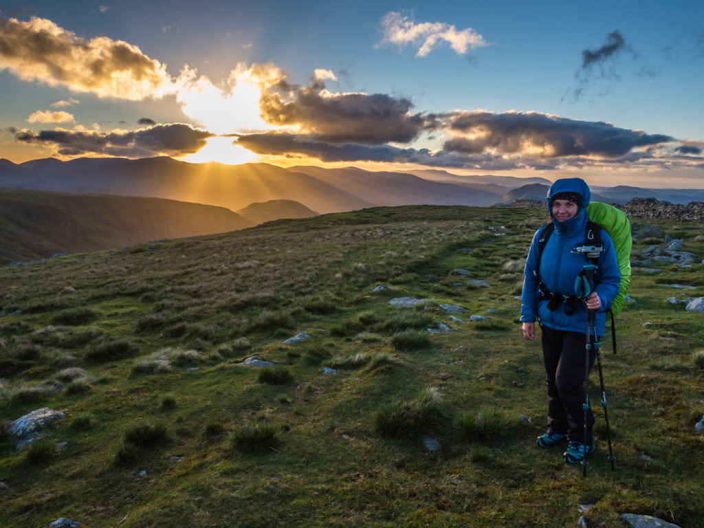
Wrapped up well because of the blustery winds on the fell tops and thankful of the late evening sun.
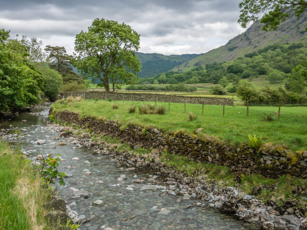
Riggindale Beck flowing into Haweswater Reservoir.
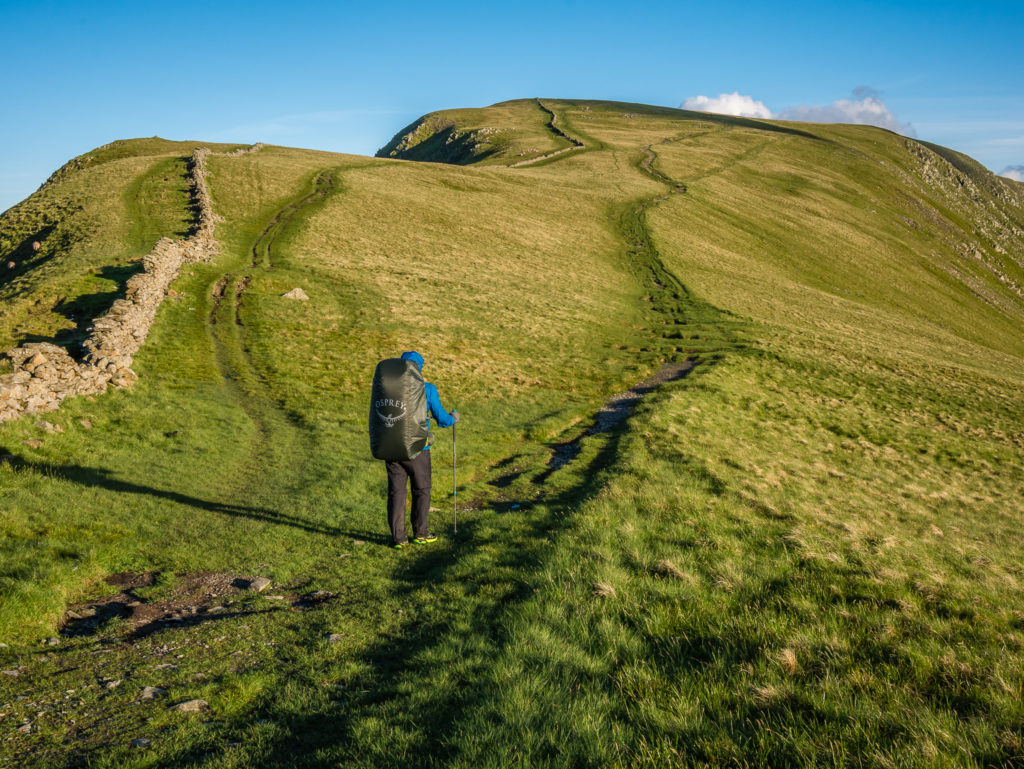
Heading up High Street.

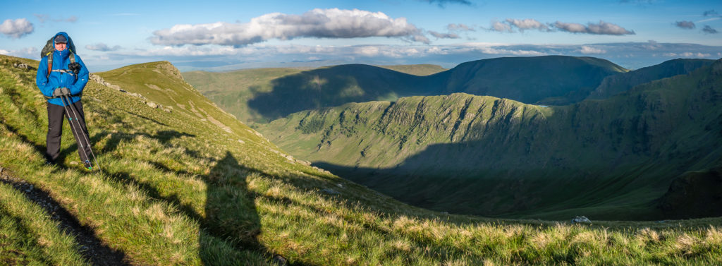
On High Street looking across to Thornthwaite Crag.
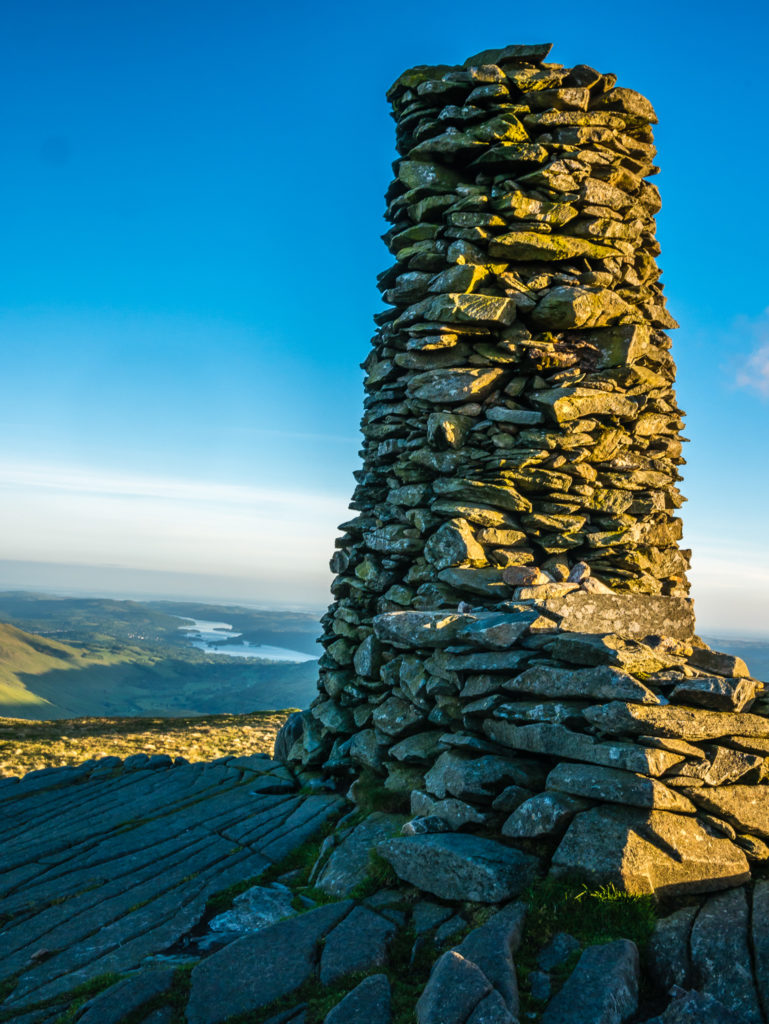
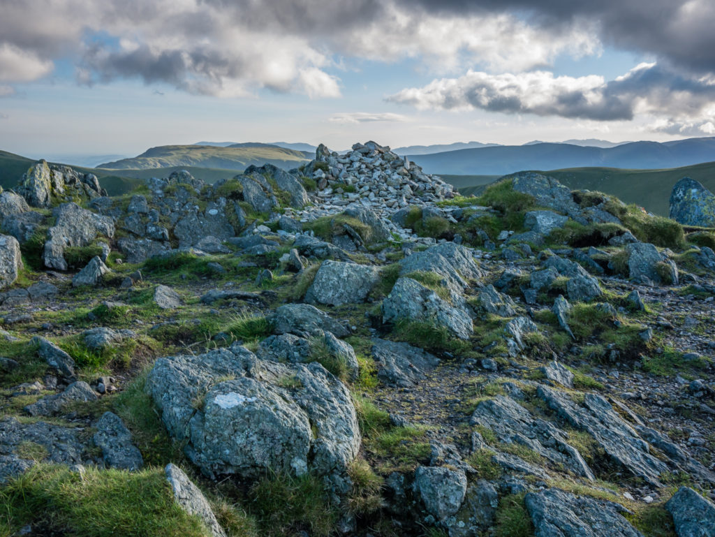
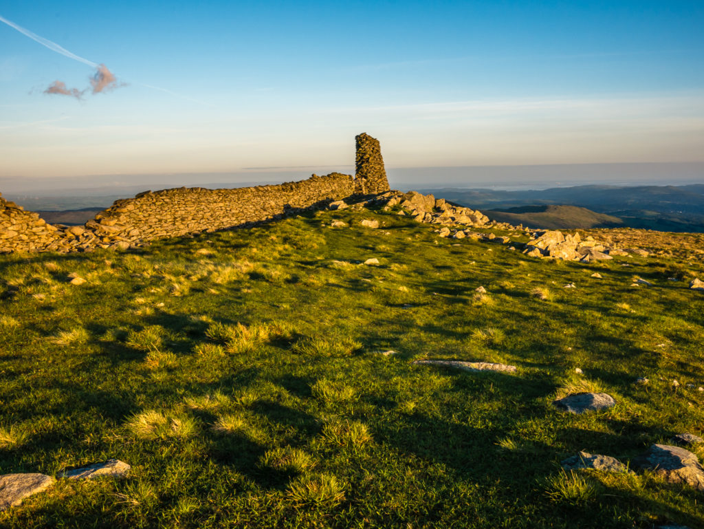
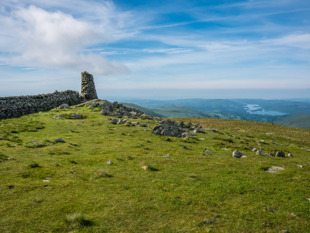
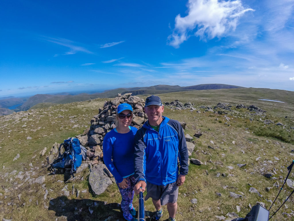
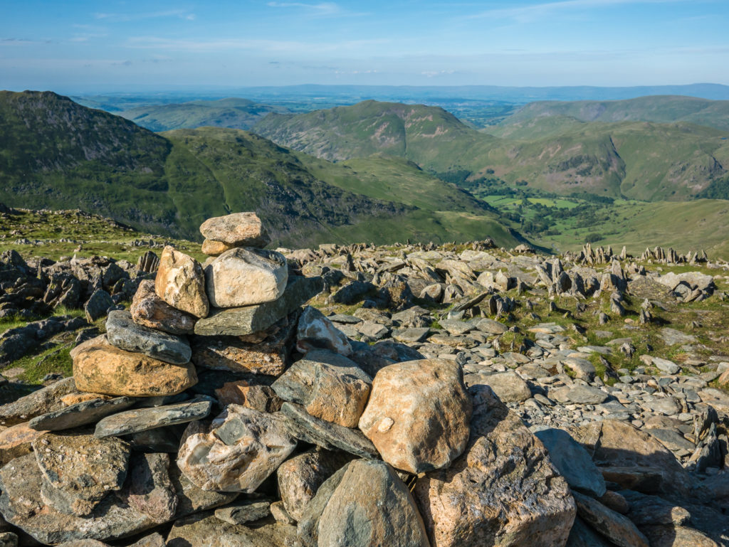
Summit cairn on Thornthwaite Crag (784m).
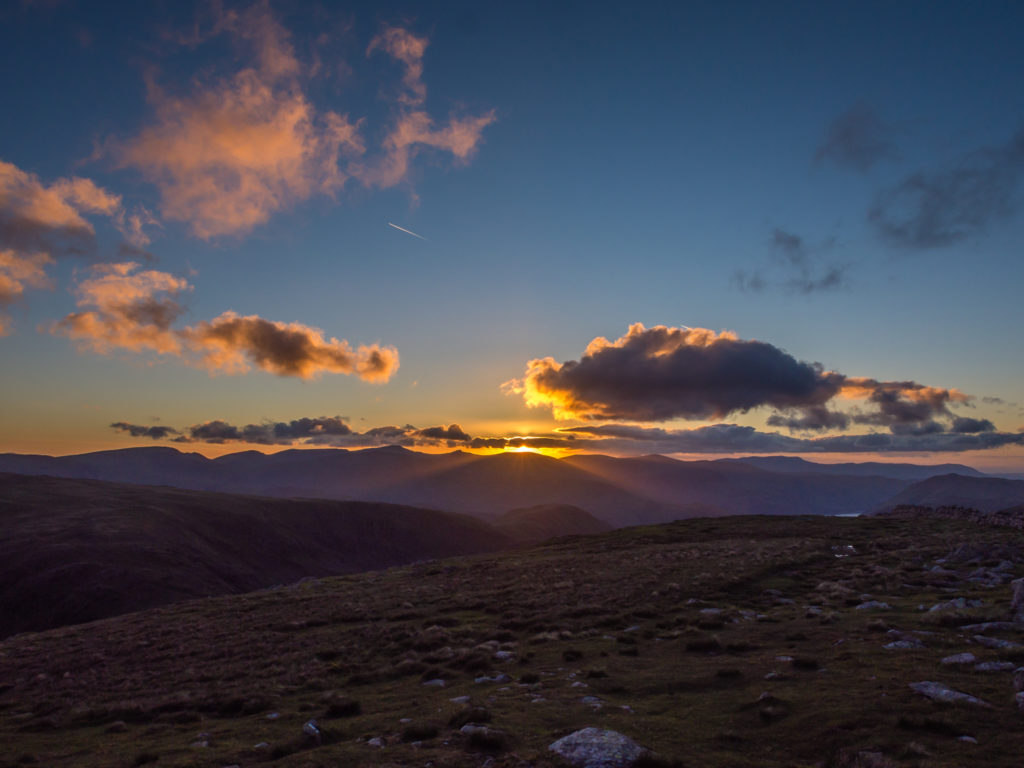
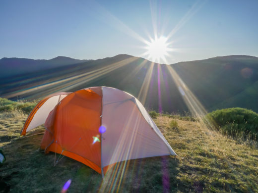
Sunset over Thornthwaite Crag… whilst looking for a suitable spot to wild camp that evening.
Beautiful light during the golden hour.
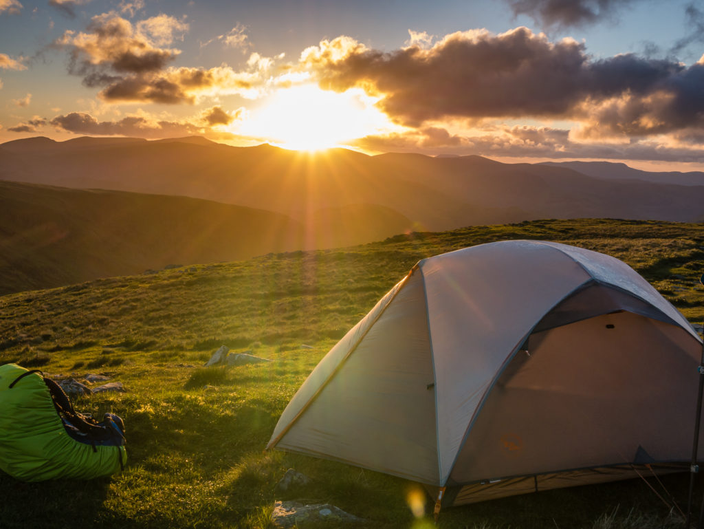
Enjoying sunset from our second home.
Gorgeous skies… Enjoying more of life’s little pleasures.
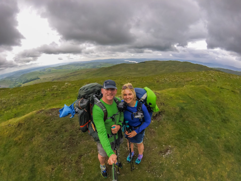
Despite a dreary start, we had a successful day overall with 11 more Wainwrights to add to our cumulative total taking us to 20 in 4 days, over which we had walked approximately 52 miles (83.3 kilometres). But that was still far off our target of 50 in a week!
We had to acquiesce that it was now highly unlikely we’d meet the target we had set ourselves – but at that point we were still very much willing to give it a go with ‘Plan B’ well under way!
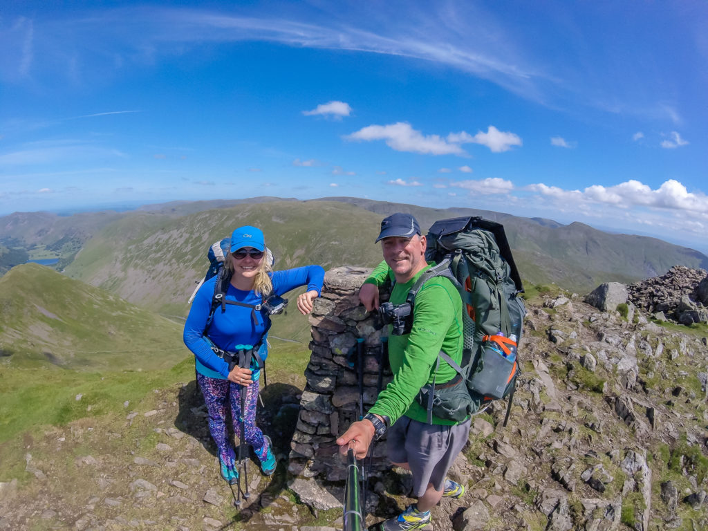
Day 5 – Thornthwaite Crag Wild Camp to Grisedale Tarn Wild Camp (11.1 miles/ 17.9 km, 8 hours, 50 mins) – Height Gain: 1,263m/ Height Loss: 1,506m – Wednesday 31st May, 2017 – ‘Fine Weather For Tackling the Eastern Fells to Fairfield’
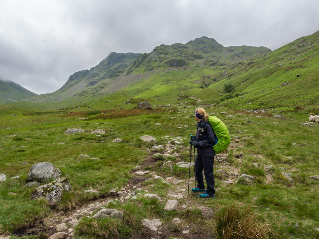
We had planned on bagging 9 Wainwrights today – Seat Sandal the grand finale on this fine day – before wild camping beside Grisedale Tarn. However after what seemed like an exceedingly long walk with a couple of out and backs to bag Middle Dodd and High Hartsop Dodd, plus a tough descent off Fairfield down a steep path of scree towards Grisedale Hause, we thought better of then adding on an even tougher ascent up Seat Sandal. From where we stood the way up looked steep and sketchy to say the least – the map didn’t offer any better-looking options – so we decided to leave Seat Sandal for another day. (When we were fresher and carrying day packs!)
So yet again, we were considering alternative options to pull in another peak…
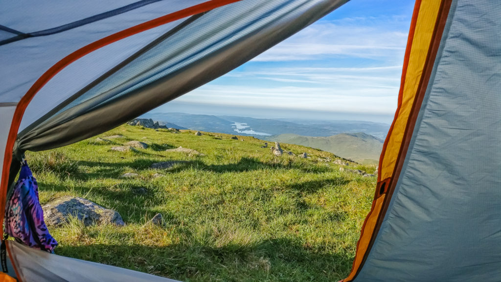
Waking up to a beautiful morning… View of Windermere from the tent!
Cairn atop Thornthwaite Crag early morning.
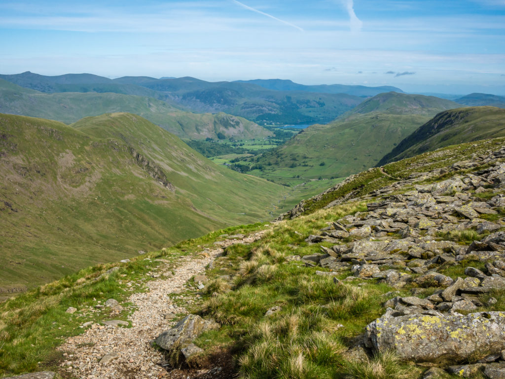
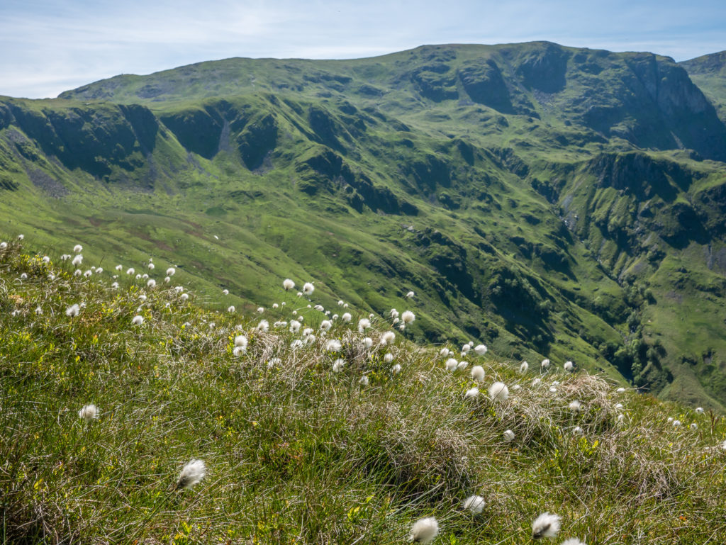
Looking towards Ullswater, the Helvellyn range in the distance.
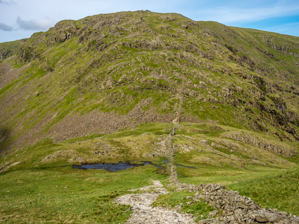
Heading down from Thornthwaite Crag to Threshthwaite Mouth before ascending again to Stony Cove Pike (Caudale Moor).
Looking back from Threshthwaite Mouth to Troutbeck Park and The Tongue.
Walking over Stony Cove Pike (Caudale Moor) – our first Wainwright of the day at 763 metres!
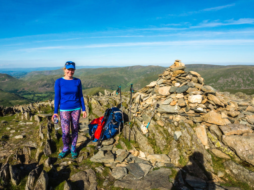
Selfie at Caudale Moor summit cairn (755m).
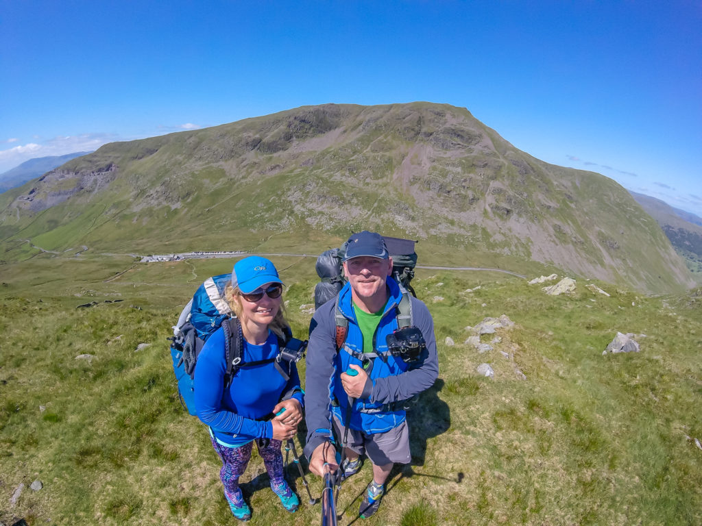
Standing on St Raven’s Edge with Red Screes behind us – At 776 metres, Red Screes would be our 2nd Wainwright of the day but was just a warm up for what was to come later!
After a quick pit-stop for refreshments at the Kirkstone Pass Inn, we began our ascent of Red Screes.
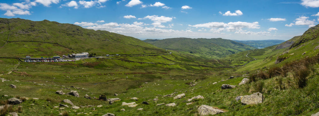
Kirkstone Pass leading back to Ambleside.
Continuing up Red Screes with expansive views to Lake Windermere.
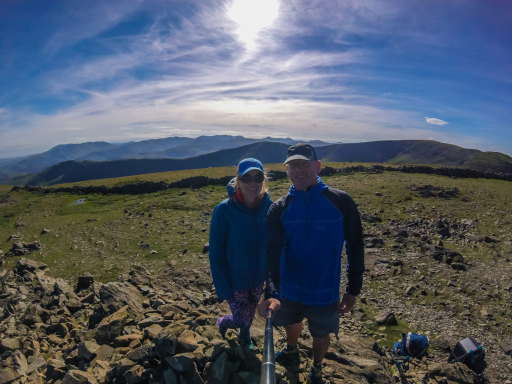
All smiles reaching the Trig Point on Red Screes at 776 metres!
From Red Screes we followed the trail to Middle Dodd (654m).
Beyond Middle Dodd it was a scenic walk along the fell top passing by Little Hart Crag (637m), continuing on to High Hartsop Dodd (519m), which was an easy out and back across the top of a grassy knoll. Looking onto Brothers Water and Kirkstone Pass from High Hartsop Dodd.
Looking back towards Little Hart Crag.
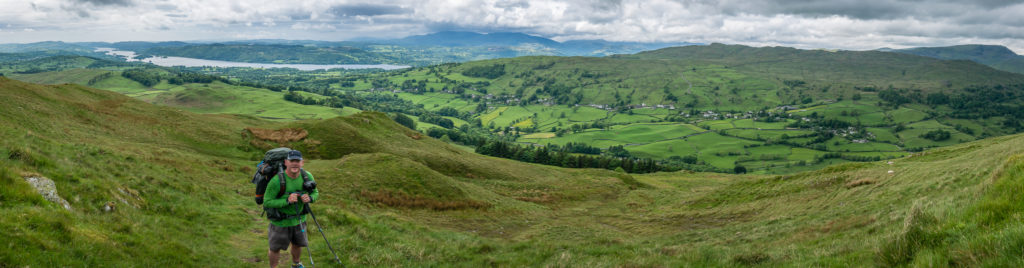
On the summit plateau of Dove Crag (792m). From here the trail leads around to Hart Crag (822m) and Fairfield, which was to be our highest point of the day at 873 metres.
After leaving Dove Crag (792m), we headed uphill to the rocky summit of Hart Crag.
Taking a rest break at Hart Crag summit cairn (822m) with Place Fell beyond.
The summit of Hart Crag has a covering of rock with two cairns marking the ends of a short ridge running along the top.
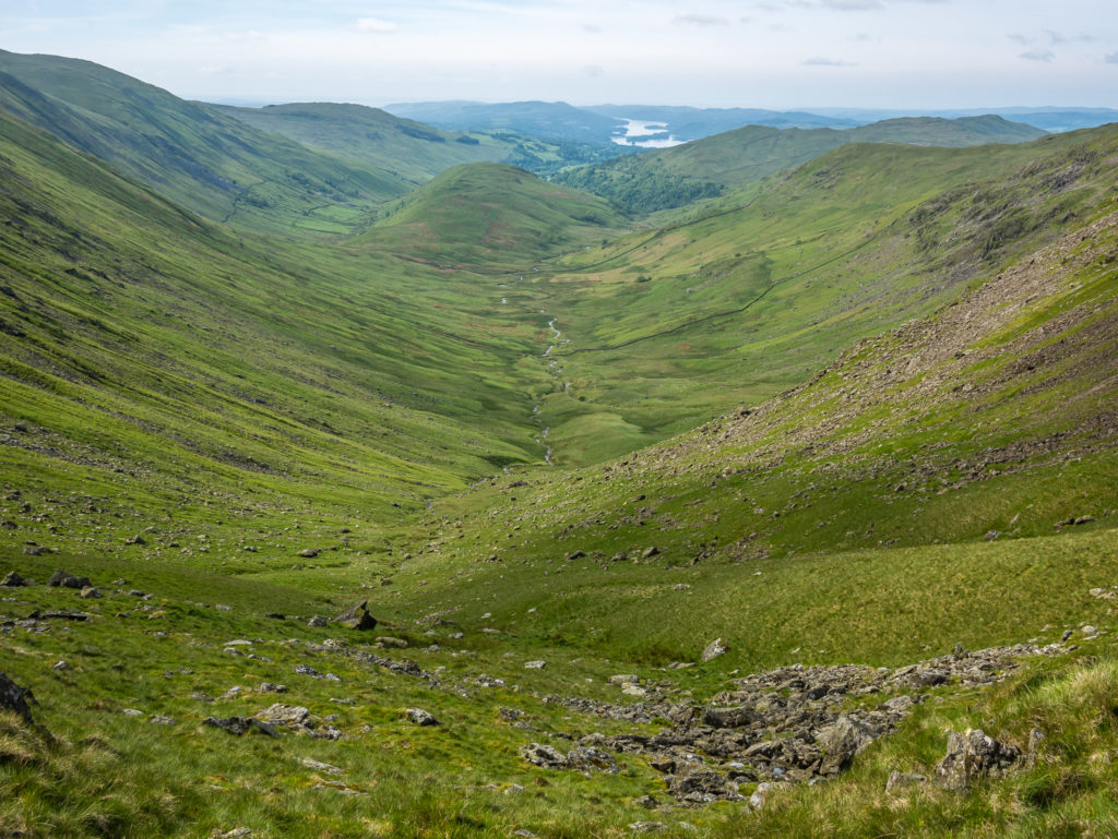
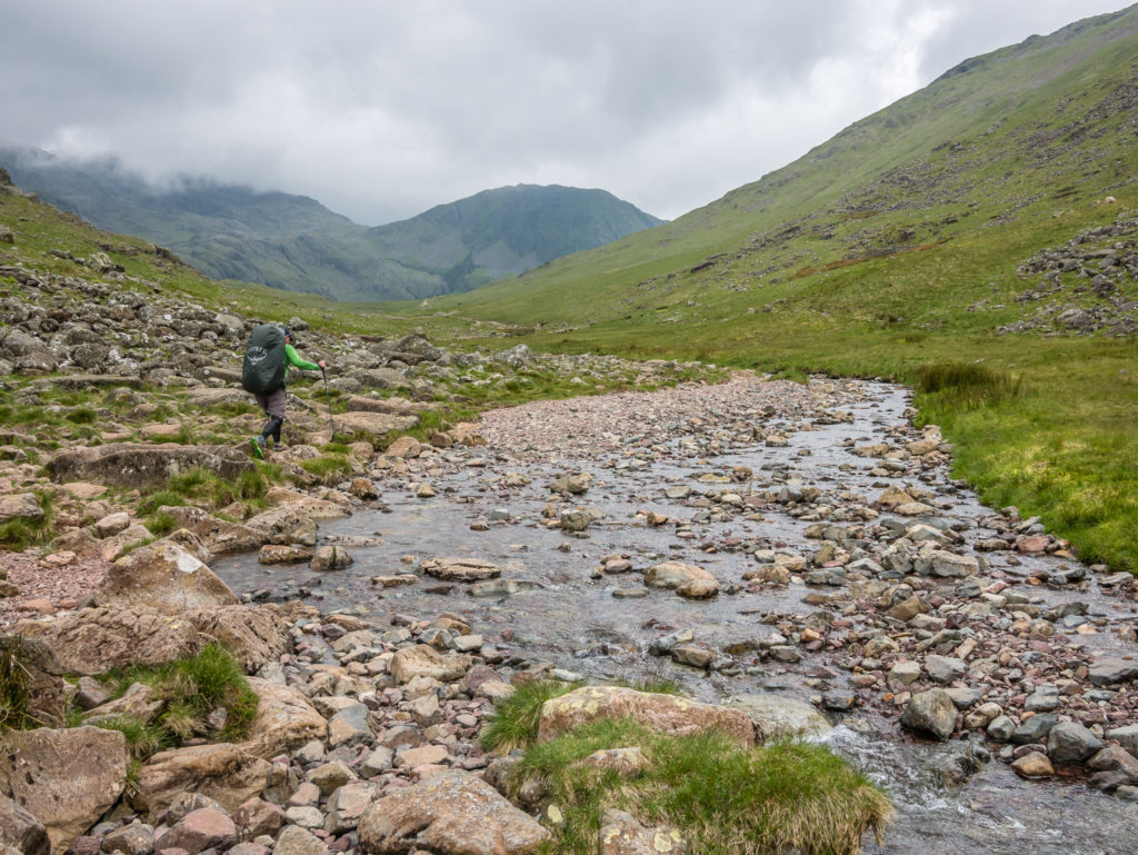
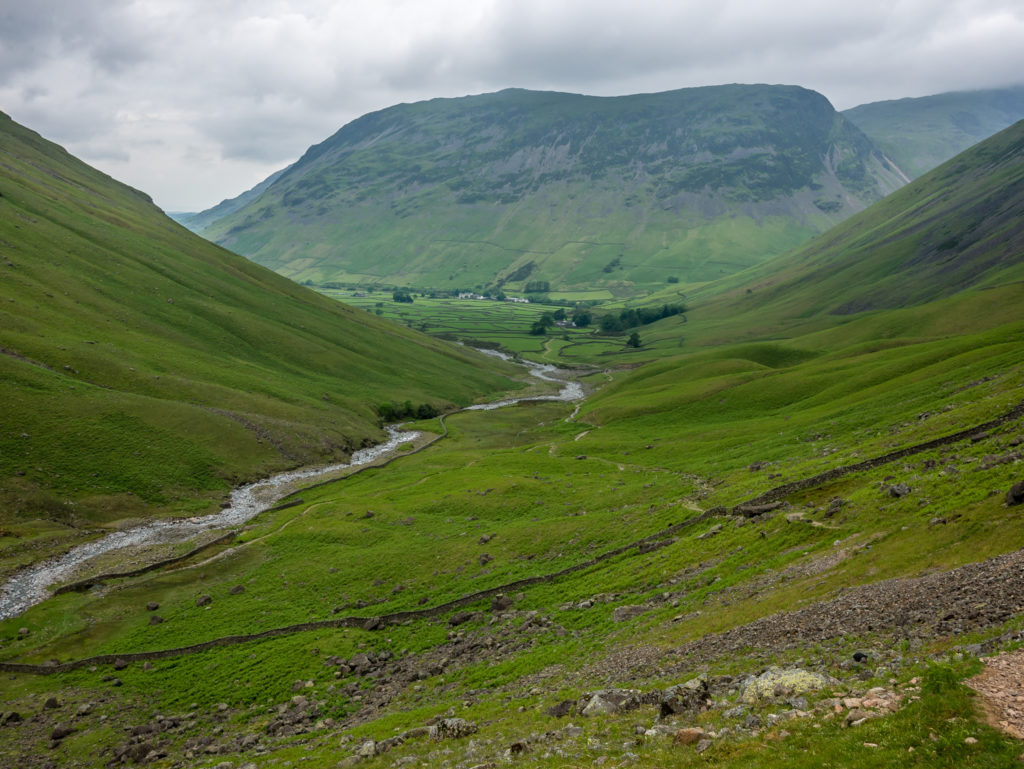
Descending Fairfield (873m), we took the steep scree path down to Grisedale Hause debating whether to head up Seat Sandal and make it our 9th Wainwright of the day. From our perspective the ascent looked steep and unforgiving on more scree, especially carrying heavy packs. It was also getting late in the day, so we decided against it.
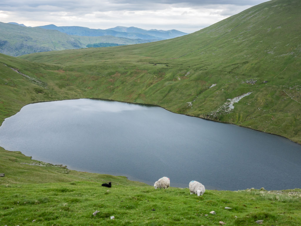
Sheep grazing in front of Grisedale Tarn.
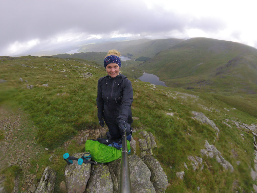
Heading down to Grisedale Tarn intending to camp at the north-eastern end.
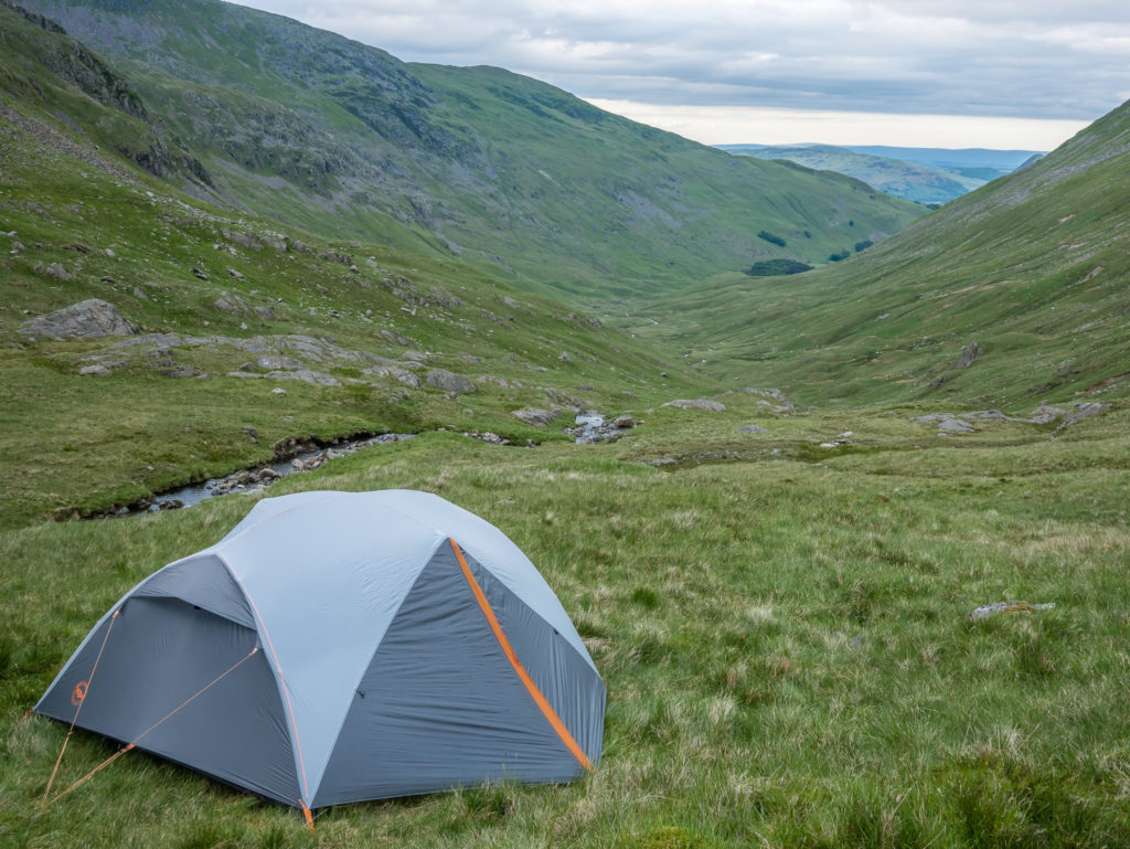
As it was busy with wild campers around the north-eastern outlet, we camped beyond the tarn, opposite Dollywaggon Pike. We filtered water from Grisedale Beck that was fast flowing through the valley.
Day 6 – Grisedale Tarn Wild Camp, returning to Wasdale Head (Hike to Patterdale, Buses to Windermere, Keswick & Borrowdale, Hike to Wasdale Head) (Walking: 5.8 miles/ 9.3 km, 3 hours, 7 mins) – Height Gain: 436m/ Height Loss: 476m – Thursday 1st June, 2017 – ‘Better To Be Safe Than Sorry!’
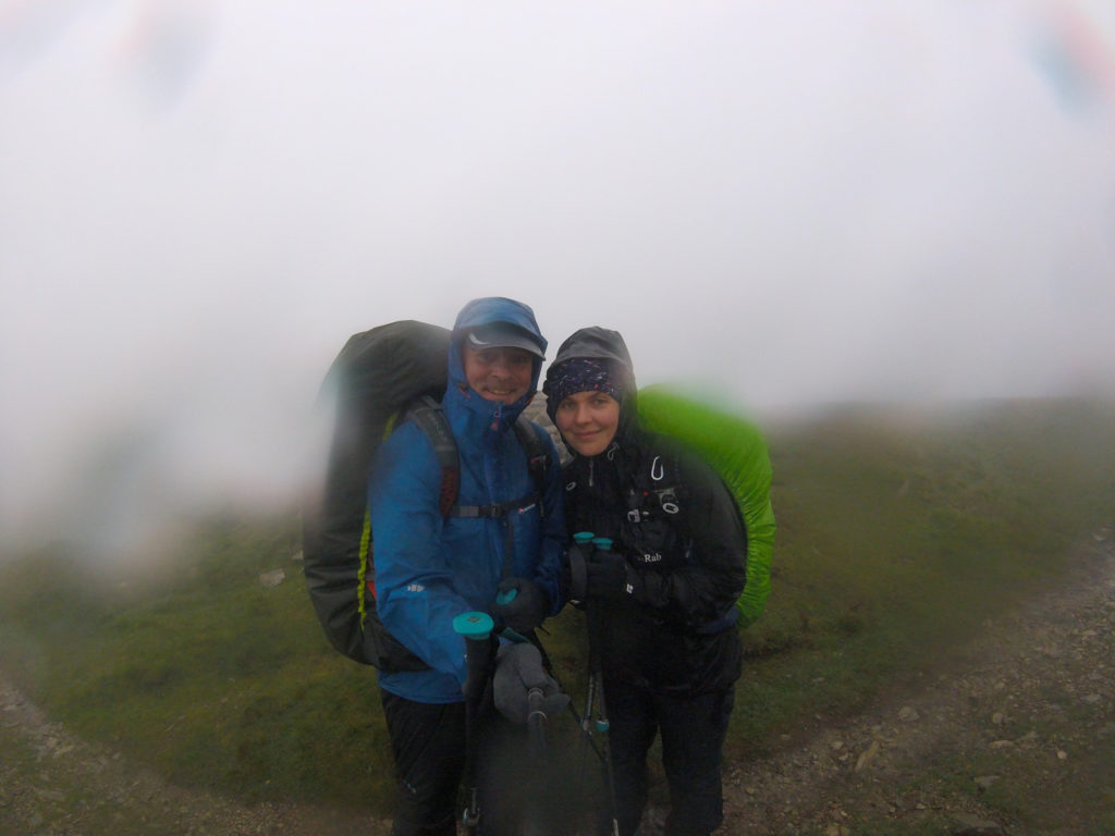
Well having thought we had picked a sheltered camp spot the previous evening, we were rudely mistaken come nightfall when the winds picked up and set about battering the tent as they funnelled through the valley.
Not only that, the tent then faced its next test by way of heavy rain that was relentless until morning. By then we were severely lacking in sleep, and in even shorter supply of enthusiasm to get a wet tent packed away and get back up on the fells. (Especially since Dollywaggon Pike was earmarked as our next summit with a steep ascent from Grisedale Tarn.) As we peeked out of the tent hoping we’d be pleasantly surprised with a break in the weather, we couldn’t even see the trail leading up to Dollywaggon, low cloud swamping the entire valley.
So we made an assessment of the current weather and trail conditions, coupled with how we were feeling at that point (very hungry and sleep-deprived), and agreed, with some reluctance, that it would be better (and safer) to call time on our ambitious endeavour and head back to Wasdale. There’s always another walking day…
It was easier said than done however, as until that point, we hadn’t realised just how inaccessible a place Wasdale is in terms of reaching it by public transport! But as that’s where we had parked the car – we had no alternative but to set about finding a way (in as quick a time as possible) of returning to our start point!
Looking towards Eagle Crag. The start of our valley walk to Patterdale hoping to catch public transport to Wasdale (or as close as possible as that’s where we had parked the car!)
Looking back towards Eagle Crag and wondering if the weather would clear.
Dark clouds still loomed back up towards Grisedale Tarn, reinforcing that we had made the right decision to bail out.
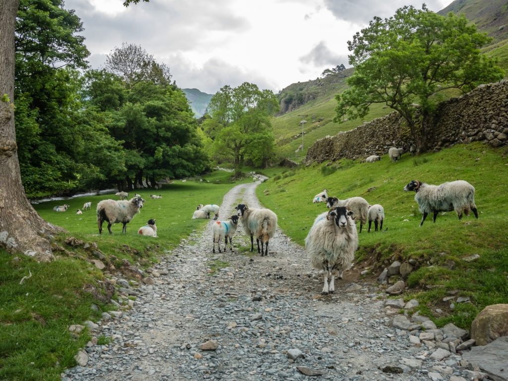
Sheep on the main farm path leading down into Patterdale.
Too late to turn back as the clouds began to lift and break…
As the weather seemed to improve we became more disappointed at not completing the entire circular route and bagging the full 50 peaks, so we decided to reward ourselves regardless with an ‘afternoon tea’ in Windermere at Booths before catching the next bus in our long journey back to Borrowdale! After all, 28 peaks was still an achievement for us, taking our total Wainwright tally to 53!
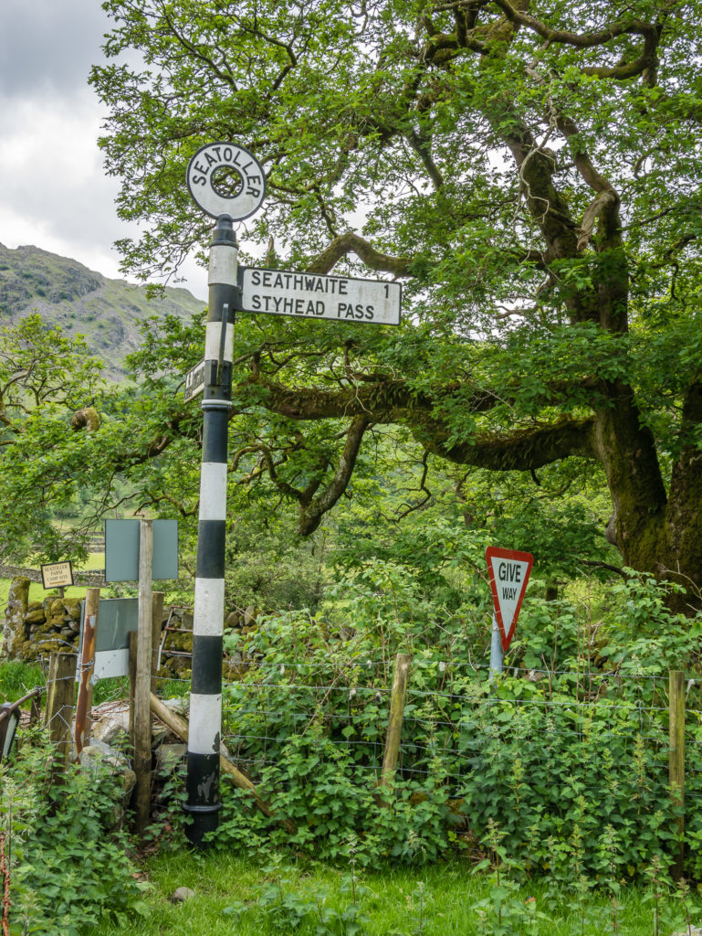
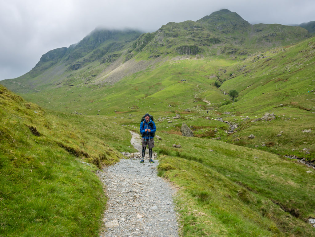
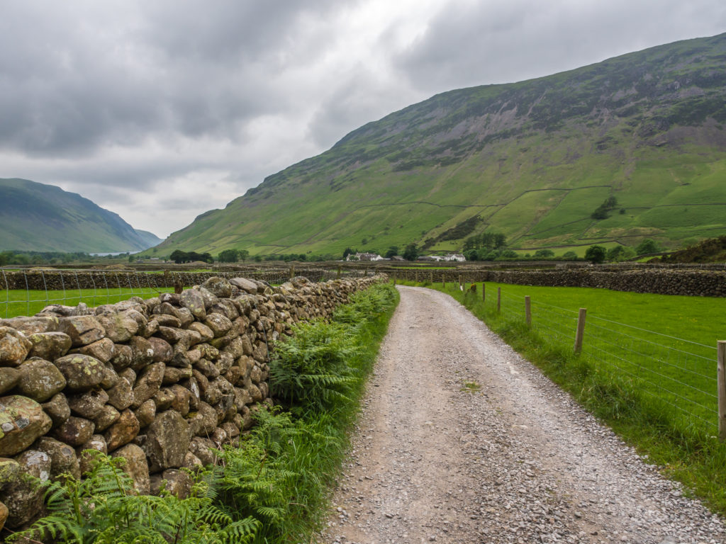
Reaching Borrowdale and beginning the second stage of the day – hiking on from Seatoller Farm in the hope of reaching Wasdale Head at a reasonable hour!
Looking on to the River Derwent.
Crossing the river beyond the farm.
The River Derwent leads the eye down the valley.
Heading uphill past Taylor Gill Force below Base Brown. Some scrambling required!
Heading up alongside Styhead Gill. The weather was much better than forecast.
Making our way to the top of the pass.
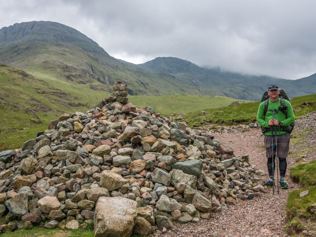
A giant cairn marks the way…
Hold on to your hats! It was windy at the top of the pass!
Looking back towards Styhead Tarn. A few hikers are setting up camp to the right of the picture.

Over the pass and taking the easiest trail down to the valley bottom.
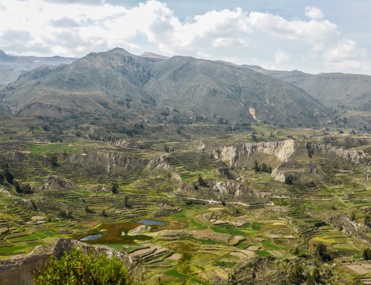
Yewbarrow dominates the scene looking down to Wasdale Head.
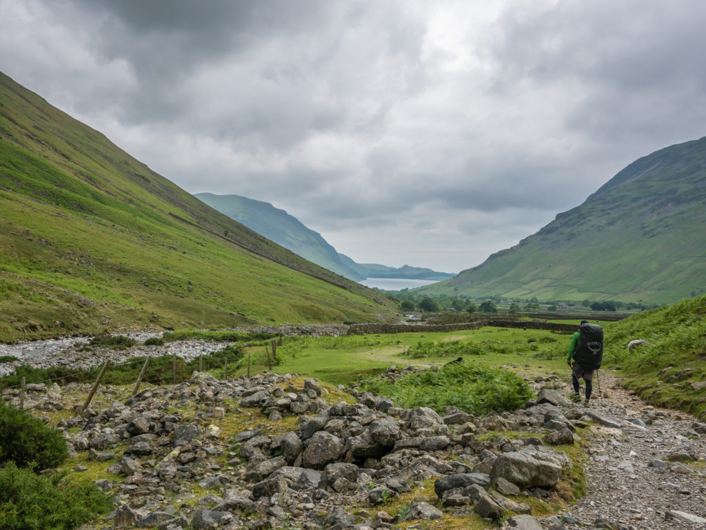
Wayne hikes on towards Wasdale with Wast Water now in view.
The pub is in sight! Hot-footing it to Wasdale Head Inn to grab a spot at the hikers’ campsite before collecting the car from the National Trust Campsite car park.
All’s well that ends well! A perfect pick-me-up – a pint at the end of any walk is always a well-earned treat!
Completing all 214 summits named by Wainwright is a worthy challenge for any walker.
Since 2013, when we purchased our very first tent and decided to explore more of our home country, we have seen the view from atop 53 Wainwrights – some spectacular and grandiose, albeit others in complete white-out! (Making us want to hike them again!)
We haven’t set a time limit to complete all 214 – we want to take pleasure in the walk as much as enjoying the view – and so we just venture north to the Lakes whenever we can!
If the weather takes a turn for the worse – we’ve learnt to adapt and have a contingency plan. After all, every route down off the fells leads to a pub… Eventually!
6 Comments
I almost feel the need to apologise for the weather you experienced, Danielle. Such a shame you didn’t complete your plan but you still managed a magnificent walk so well done both.
I’m also doing a multi-day walk in the Lakes this September but as I’ve done all the Wainwrights, almost all twice, with some fells twenty plus times, I have tbe luxury of not having to peak bag or stay high if the weather is poor. Having said that your route has given me a few ideas and I am now amending some of my plans, pinching ideas from you. I already planned to start at somewhere with relatively decent public transport (Windermere) just in case I too have to pack in early. I hope I will meet up with you and Wayne one day as you return to the most beautiful place in England!
Thanks David 🙂 We had much better weather this weekend walking the Coledale Round and managed to knock off 12 more peaks! It was such a great walk and a beautiful part of the Lakes that we had not explored previously. Weather wise – It’s always hit and miss for us as the forecast is so changeable so we often take a chance in the hope it will improve! (It’s just such a long drive from Notts for a weekend hike and stuck on a congested A1 on a Friday night is never much fun!)
I’m sure our paths will cross one day! We are looking to relocate further north after the PCT – well that’s the plan for the future anyway!
Good luck with your hike in September – I’m sure you’ll know many great spots having walked the fells so much! 🙂
Just out of interest – what is your favourite fell? With nowhere near as much experience as you – ours is Yewbarrow – so far!
Hi again!
I am not at all sure which my favourite fell is. Too many to choose from and it depends on my mood, the weather, the number of people I meet (I’m an antisocial sod!). To some extent it’s easier to mention the Wainwrights that are less good. I’m convinced he was having a joke on hill baggers by including, for example, Mungrisdale Common and a number of others. I can name some great combinations of fells though eg the western half of the Fairfield Horseshoe from Nab Scar to Fairfield; all the Coledale Round which you did recently; the Haystacks to Red Pike walk to the SW of Buttermere….could bore from England on this.
Oh but one little gem is High Rigg approached from the south.
Let me know if you are both over in the NE Lakes and fancy meeting up for a drink or even a walk 🙂
Clearly we are just ‘newbies’ to the Lakes and have much more to see! We wish we could get up there more often.
Wayne has planned for us to do the Newlands Horseshoe one weekend mid-September and have a wild camp on the Saturday, weather dependent. (That’s NW though, not sure how far away from you?)
We will most likely then go for breakfast in Keswick on the Sunday morning before driving home.
We’ll have to keep High Rigg in mind for next time 🙂
I just loved my return to the Lake District. She certainly dished up all types of weather, but of course that is not unusual. We were definitely very fortunate on our Coast to Coast walk in September 2015.
Fabulous photos. Thanks.
Congratulations on 28 peaks in 6 days. Your boots sure do the walking!
Thanks for your continued support Helen. We’ve just got back from hiking in the Spanish Pyrenees and the scenery was incredible!
(Blog posts to follow in due course!)