
“Potest quia posse videntur – He can because he thinks he can”.
– From ‘The Pacific Crest Trail’, Cicerone, by Brian Johnson Muir
The Fifth Week – Turning Into Walking Machines…
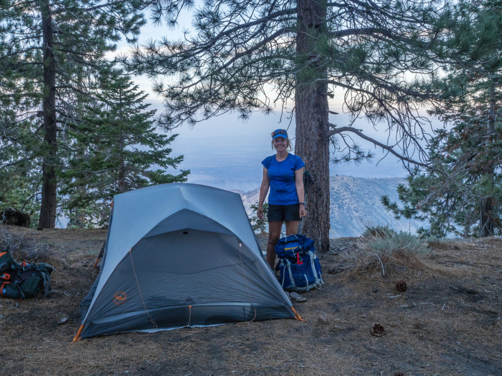
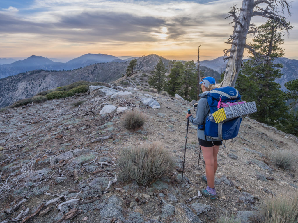
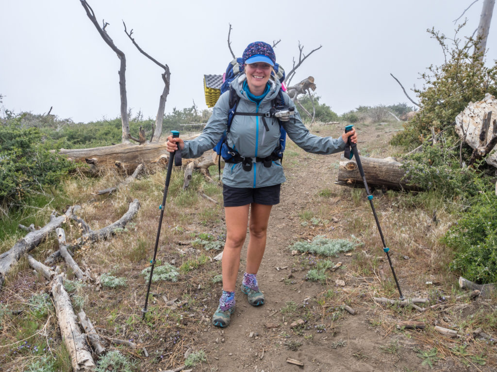
Celebrating being a month on the trail and summiting Mount Baden-Powell on the same day!
Day 29 – Tuesday 8th May 2018, Wild Camp at Mile 343.5 to Wild Camp at Mile 361.5, 18 miles
4:45am was an early wake-up call but it had to be done as we were facing an uphill climb of around 5,000 feet and didn’t want to be hiking during the hottest part of the day.
Despite the area being so hot and dry, the desert chaparral cloaks the mountains in a lush green.
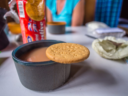
So just after 6am we were back on the trail, already feeling warm as soon as the sun crested over the mountains. Having filled up with water from the McDonald’s on Interstate 15 at Cajon Pass last night, we both had 4 litres to see us through the next 26 miles to Wrightwood. We just hoped that would be enough.
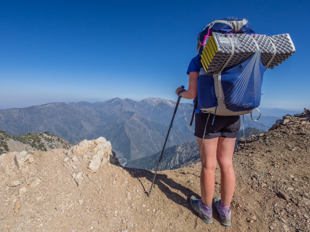
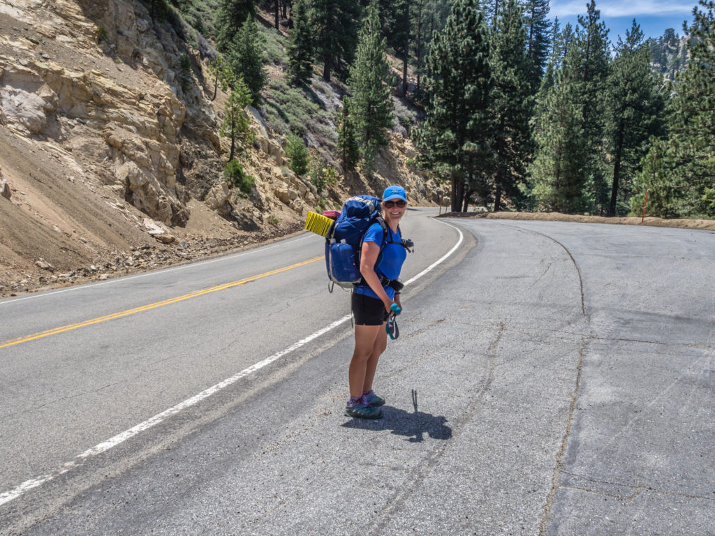
Early morning shadows of two weary hikers!
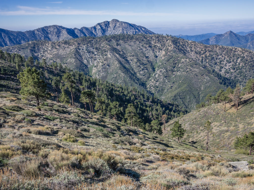
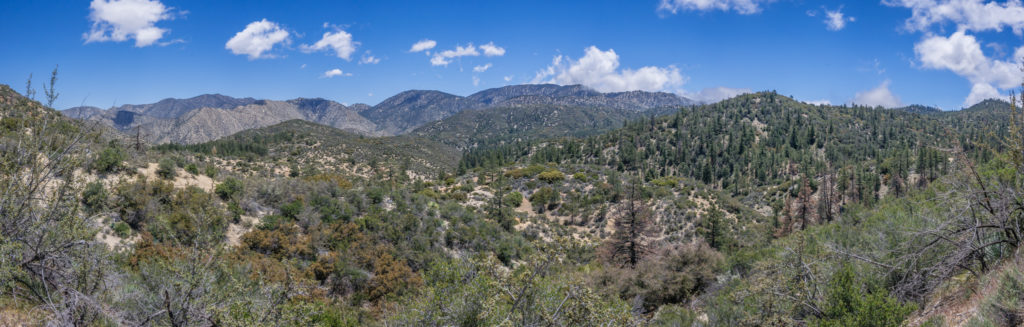
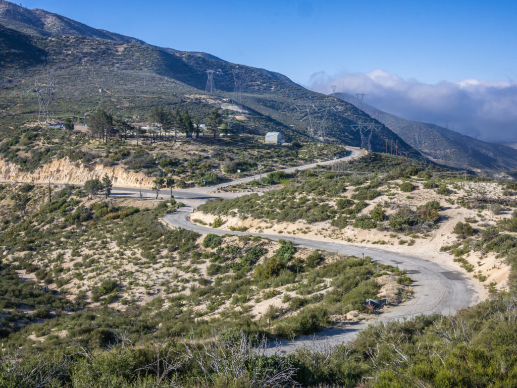
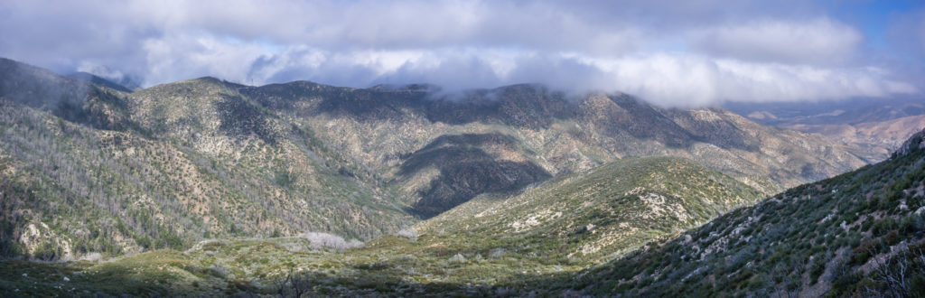
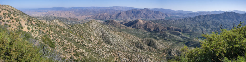
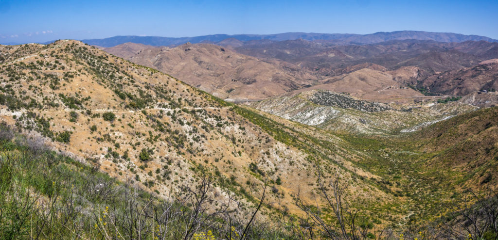
Panorama as we made our way uphill from the road running through the valley, now way off in the distance.
We knew there was a water cache at Mile 347, (off Swarthout Canyon Road) just 3 and a half miles ahead, but we couldn’t rely on that being restocked recently. The PCTA Water Report had said there were 20 gallons left but that was 3 days ago, so with plenty of thirsty hikers passing through day by day, we assumed it would be dry by now. But amazingly we were in luck!
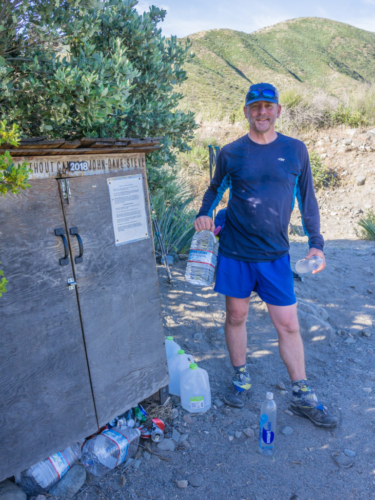
We were expecting the water cache to be empty, however when we arrived there were still a couple of bottles of water remaining.
When we arrived at the cache, there were just 2 gallon bottles left. So not to be greedy, we drank a litre each of the water we carried, then re-filled our bottles from the cache, leaving enough water for the PCTers following behind.
And this morning there were quite a few of them! Almost all of the hikers we had seen in McDonald’s whilst we were there yesterday were on the trail this morning, either pushing on the full distance to reach Wrightwood, or having a similar plan to us and splitting the mileage between two days because of the heat and elevation gain. We leapfrogged Germanator and Chaos a couple of times and remembered to check that Chaos hadn’t left anything behind at camp last night, and fortunately all was good!
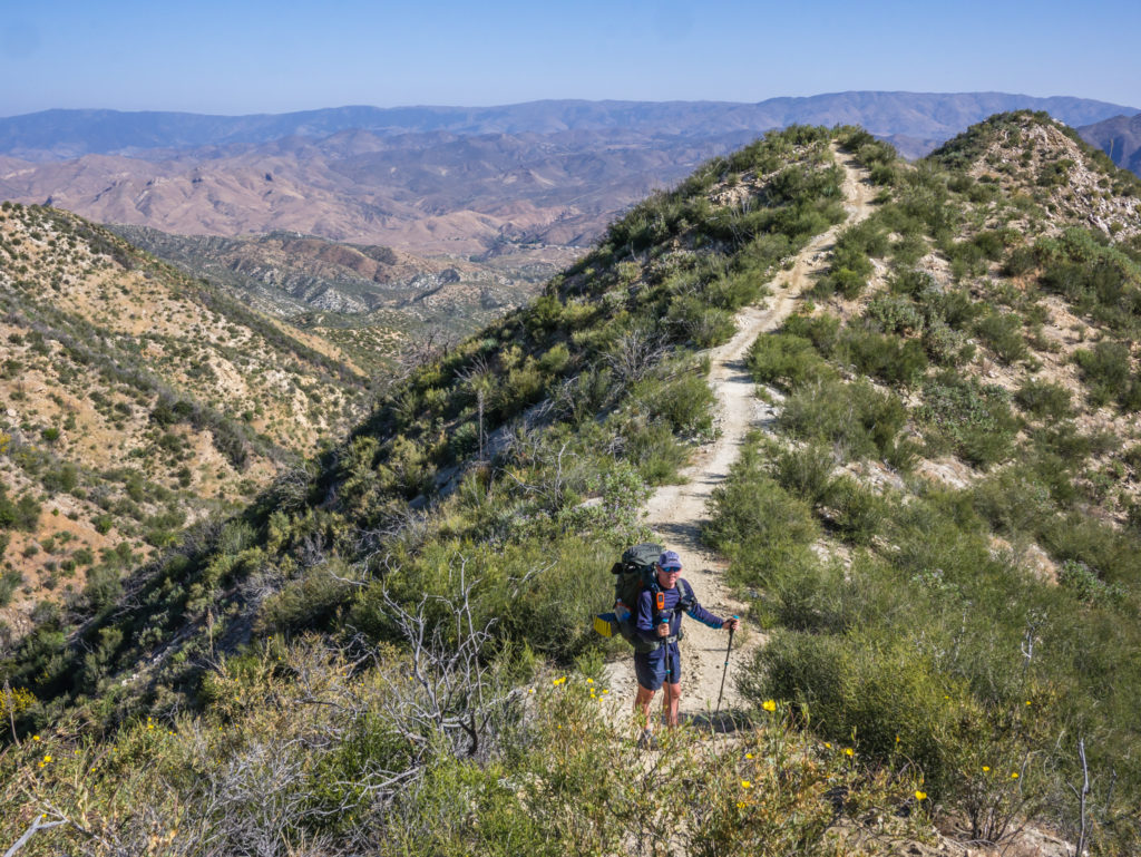
As today’s route took us up high, we were trying to walk at a steady pace and not push on too fast, both to conserve our energy as well as our water. It was extremely hot even before 10am so we were hiking for around an hour then taking a good rest break in any little piece of shade we could find, which wasn’t much as the area had suffered a fire in the past so many of the big trees had burned down. The hillsides were therefore mostly bare making the uphill walk quite brutal. Hence we failed with our intention of hiking 10 miles before 10am as we couldn’t maintain our usual pace and we were breaking more often.
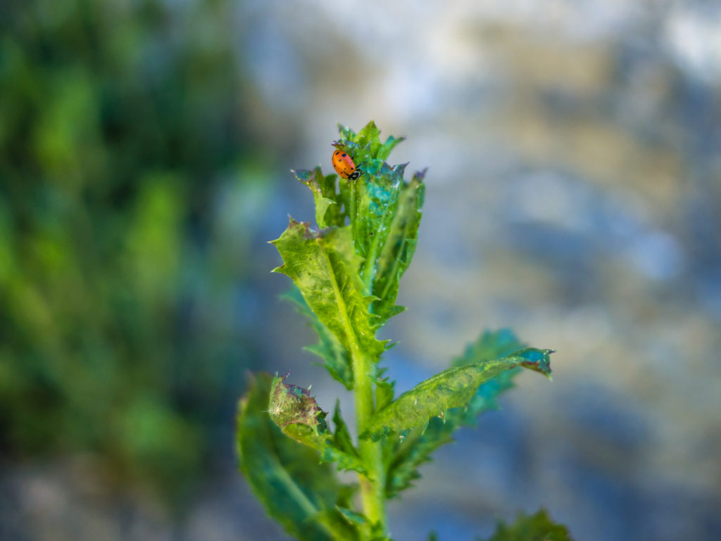
Also taking respite from the sun – a ladybird we spotted along the side of the trail.
Apart from the threat from the sun causing dehydration, another real danger on the trail today was the presence of ‘Poodle Dog Bush’. It is a flowering plant that when touches the skin causes severe blistering that at worst case can result in hospitalisation. The plant flourishes after a forest fire so it was particularly prevalent throughout the burn area we were walking through today. Having read that the leaves look like that of marijuana, the plant giving off a similar smell, (but that the leaves at the base are brown and wilted), and with a purple flowering head, it wasn’t long before we spotted our first specimen.
Easily identifiable, we were then dodging the Poodle Dog Bush growing in abundance along the sides of the trail being careful to avoid any contact with our skin. It was such an annoyance, and it didn’t help that we were both wearing shorts, but most other plants (apart from Poison Oak and Poison Ivy) are harmless, so we’ve got used to pushing on through the brush and getting our legs all scratched up, especially on the spiky agave leaves. Sometimes they’re just unavoidable!
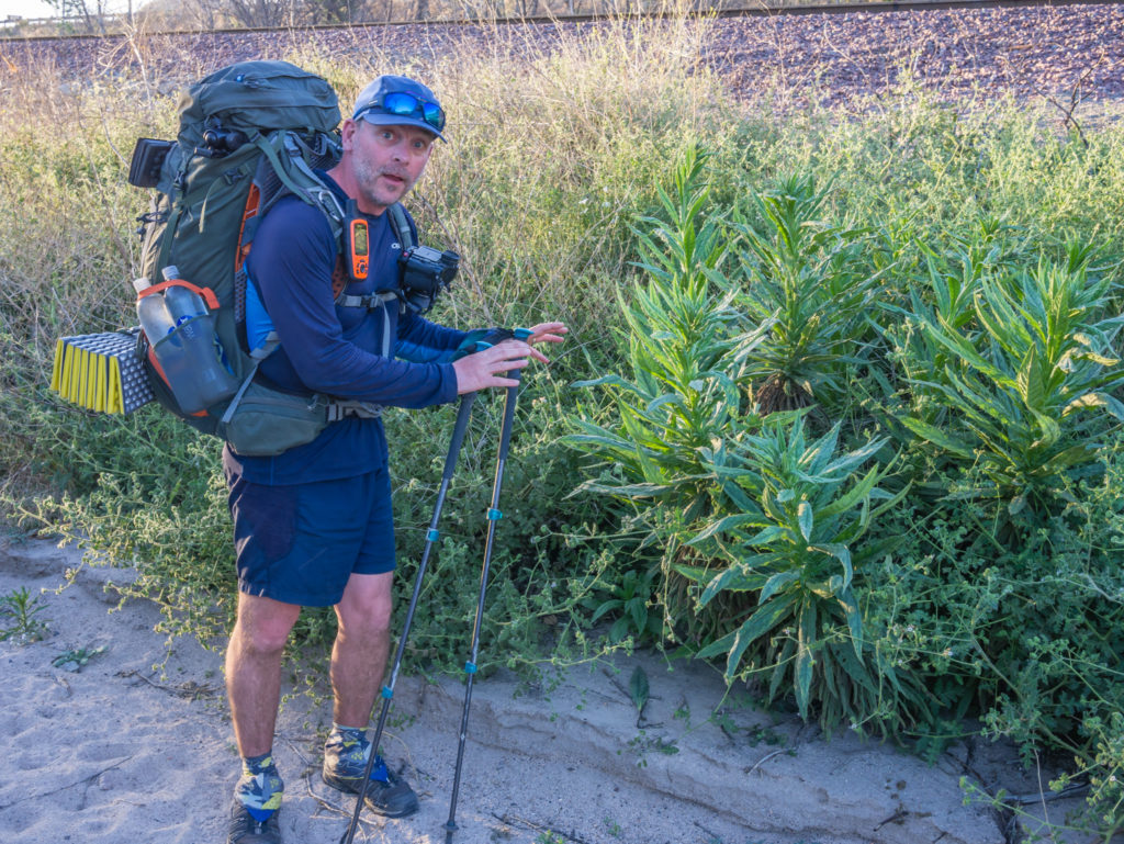
The annoying Poodle Dog Bush that we quickly became familiar with is a real hazard along this section of trail because it thrives in burn areas.
As shade was so scarce, we had earmarked a camp spot en route that we were going to rest at between the hours of midday until around 5pm, after which the temperature would be much cooler for walking. There was literally nowhere else to stop before that point as we were hiking along ridges that wound around the tops of the mountains once again and the trail was so narrow. But about half a mile or so off reaching an area we thought might be suitable for a rest stop judging by the contours on the map, we found a flattish scrubby corner by a dirt road that we decided would be a good place to try and create some shade using the ground sheet from our tent.
We tried hanging it between the branches of a tree but even the slightest hint of a wind uplifted it like a parachute and blew it off. So we came up with the idea of tying each end to our walking poles and staking them in the ground. The poles were then supported by our backpacks and some rocks. It wasn’t the best or the sturdiest set up but it worked, keeping the worst of the sun off us. So we laid out on our sleep pads under our homemade pocket of shade and thought we’d have a chilling afternoon before completing the last 5 miles or so before sunset.
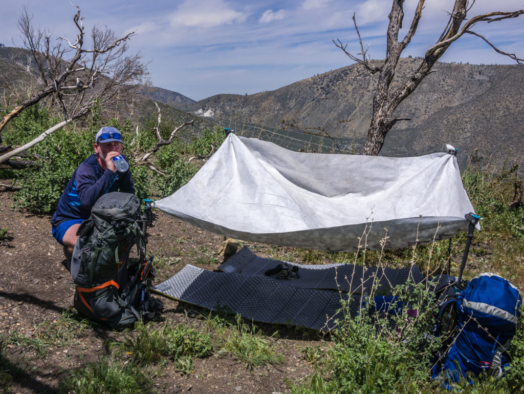
Our make-shift sun shade held up by trekking poles!
That was until we inadvertently got roped into helping out two nice ladies and trail angels who got a flat tyre! Whilst laying under our sun shade we heard a vehicle come up the dirt road. A lady shouted out of the window “Do you want anything from Wrightwood?” as she was heading there, then returning here to leave her car as she would be section hiking the PCT tomorrow, walking southbound to this point and back to her parked car. We said “No” at first, then quickly requested that she bring us a couple of bottles of Gatorade as we had limited water supplies. (An electrolyte sports drinks popular in the US.) We said we’d repay her the money for the drinks but she wouldn’t accept and said she’d be our trail angel today! Again, such is the kindness of strangers in every community we have hiked past.
Unfortunately, when she and her friend returned to leave the car, and kindly gave us the drinks, it turned out her vehicle had a flat tyre. So of course we went over to help. Wayne was going to assist in changing the flat to the spare tyre, but she didn’t have the jack in the car to be able to do it. Thankfully she called ‘Triple A’ who were going to come out and save the day, but she had to get the car off the track and back onto the paved road, which she could only do by driving it. We wished her good luck in completing her own PCT adventure as she has already completed over 2,000 miles as a ‘Section’ hiker. We just hope her car was back on the road quickly after the help she gave us!
After they had left, we rapidly took respite under our sun shade once more, the sun still high and fierce. But we still had 5 or so miles to complete, so we literally dragged ourselves back on the trail around 5pm. The hike uphill was a hot and sweaty one even with it being so late in the day. We checked the weather forecast and today’s temperature had reached 28°C, so it had been the hottest day on the trail we had experienced so far.
By the time we reached the area where we had planned on camping, it was already after 7pm, but we had just about enough light to set up the tent and start cooking dinner. As we were camped at 8,100 feet it was soon very cold so we had to quickly put on our down jackets, gloves and woolly hats to warm up. We have found that quite literally the temperature goes from one extreme to the other!
By the time we reached camp we had already missed the last of the sun, and above 8,000 feet it was already feeling colder.
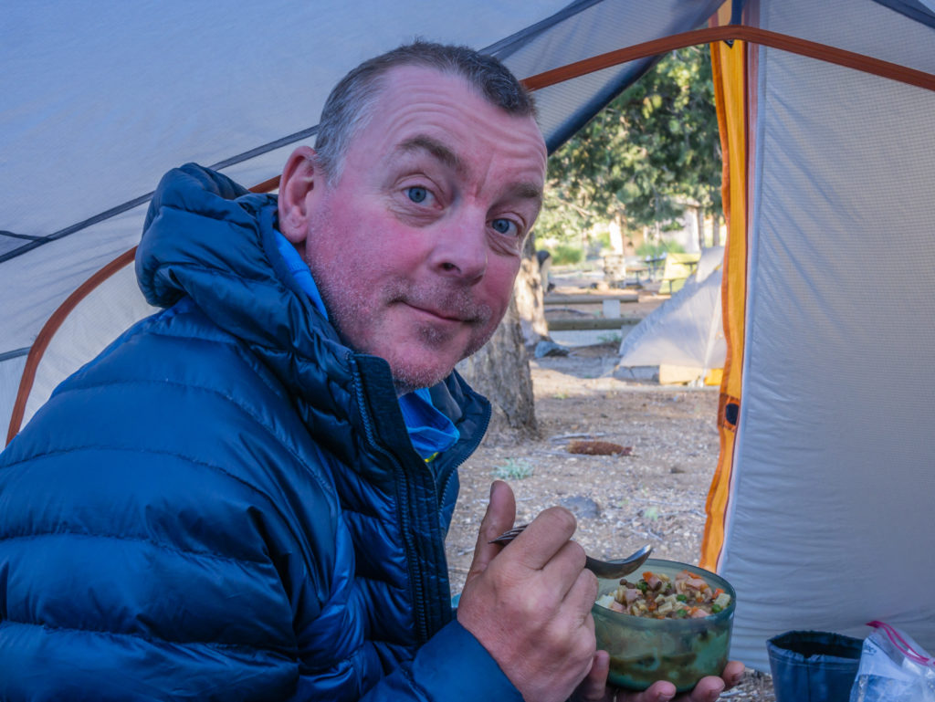
It was a ‘dry’ dinner as we didn’t have enough water to do any washing up, but that didn’t mean we compromised on flavour. Wayne has now mastered the art of quesadilla making in our mini frying pan and it was one of the best camp meals yet. We had wholemeal tortillas, which he first spread some green pesto onto. Then he put on a sprinkling of chopped sun-dried tomatoes, chopped spam, and Italian herbs, followed by a torn up mozzarella cheese string. He then folded the tortilla in half, then in half again and toasted each side. When each side was crisp and had some colour, he then refolded it into quarters and toasted the other sides so that each pocket was hot and the cheese had melted. For trail food, the quesadillas tasted amazing, so needless to say, I had three of them!
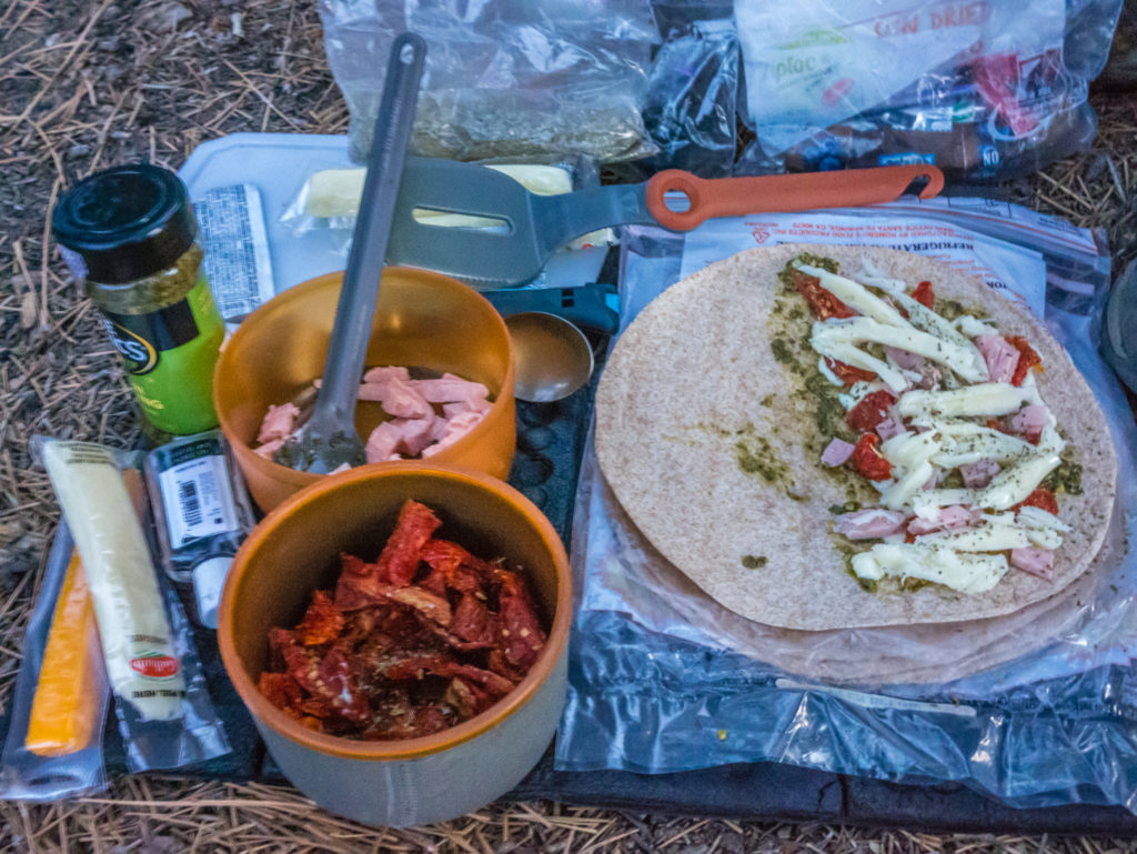
Prepped and ready to fry up some quesadillas. A top ‘trail kitchen’ idea with minimal washing up!
Our serious lack of water has also meant that we have been even more limited with washing. After having hand washed with soap at the McDonald’s yesterday and feeling a little bit cleaner, today we seem to be the dirtiest we have ever been. Both our hands and feet look grimy and are completely ingrained with the dust of the trail. Similarly, I thought my legs were looking really tanned from the last few days, but mostly it’s just muck! Wet wipes can only do so much and we’ve even had to ration them to last us until Wrightwood! A shower will be a real novelty when we get to town.
Day 30 – Wednesday 9th May 2018, Wild Camp at Mile 361.5 to Libby’s Place, Wrightwood, (Hitched into town from Mile 369), 7.5 miles
We had left ourselves only a handful of miles to cover this morning so that we could make it to Wrightwood in good time. Again, we were not taking a full ‘zero’ day off trail, but trying to maximise our time in town and give ourselves a ‘nearo’. That meant having to get all of our town jobs done in a single afternoon, but the benefit of that being we would only spend money on one night’s accommodation. So to get to town before midday we left camp just before 7am. (We’re getting a lot better with the early rises!)
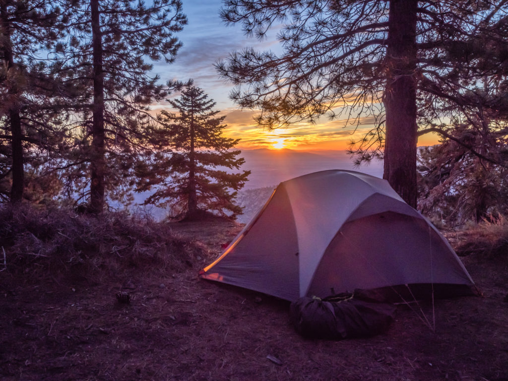
As we were up so early today, Wayne managed to capture sunrise from camp!
The promise of another beautiful morning on the trail beckons.
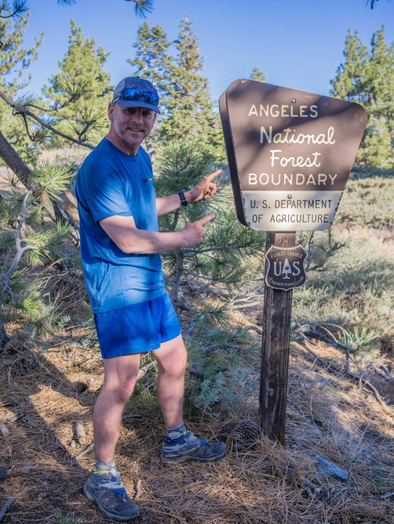
It wasn’t long before we had crossed over the San Bernardino boundary and into the Angeles National Forest, so we stopped to do a short video update and have a snack break. We still had around a litre of water left each that we had conserved from the previous day, but we could have quite easily chugged it all in one go!
Hiking from one wilderness area to another…
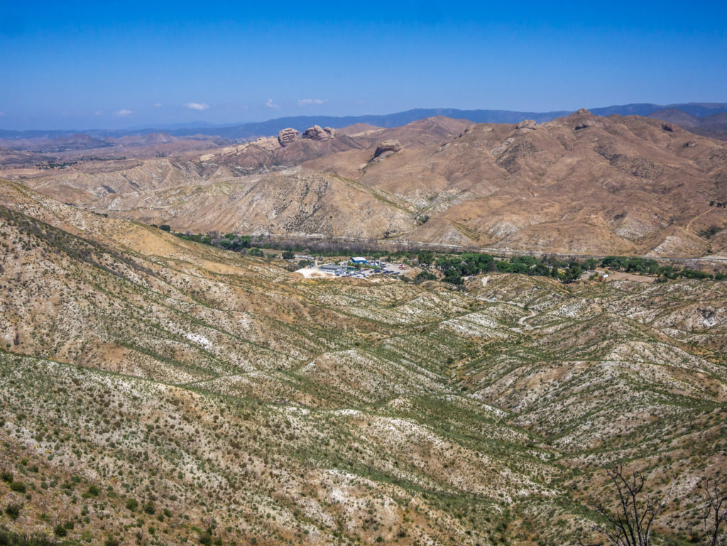
Our wonderful mountain view as we made our way towards the small community of Wrightwood.
At Mile 364 we reached the Guffy Campground, where we already knew the spring was dry. But quite unexpectedly we found a water cache of around 20 gallons stashed next to a large metal container. Once again we were amazed at how when you most need it, the trail will provide. As we only had around 5 miles left to go, we drank a litre each to see us through, very thankful to whoever had left the cache up there.
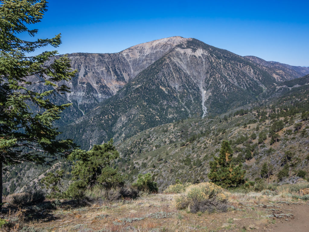
Our tremendous view looking on to Mount Baden-Powell that we’d be summiting from the PCT tomorrow.
We were aiming to reach Mile 369 before 10am, as this is where the PCT crosses Highway 2 just before the Inspiration Point look-out, and where hikers predominantly hitch a ride into Wrightwood. We were all geared up for our second hitch with poster in hand when a Ranger’s truck pulled over. Driving it was a Forestry Commission Ranger whom we learned was named Spirit Wolf. He shook our hands and asked us if we were thru-hiking the PCT and if we knew the history of the trail. Of course we had read up on the history, but in fact our knowledge was very limited to that of the vision of Clinton C. Clarke, often referred to as ‘The Father of the PCT’, promoting the trail, writing the first guides and setting up the Pacific Crest Trail System Conference in 1932.
Spirit Wolf was happy to enlighten us on a few lesser known facts! He told us how the PCT was in fact a native trail going back centuries, when his ancestors used to travel up and down the lands telling stories and sharing their knowledge of plants and medicines from one place to another. The trail also provided them with a means of bartering as they used to swap shells and other precious materials found along the route for goods and services. We were really intrigued by what he was saying and his knowledge and stories have whet our appetite to find out more about the trail going back further than the 20th century.
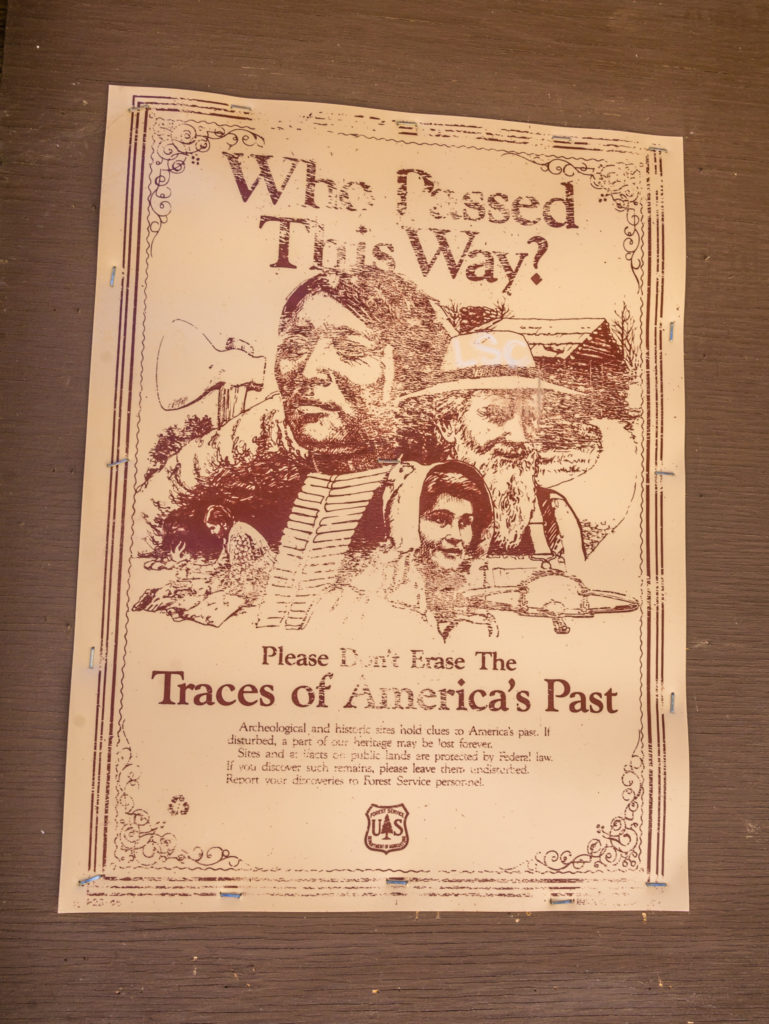
This poster at one of the campgrounds made us think even more about what Spirit Wolf had said to us about the ‘real’ history of the Pacific Crest Trail.
Even more inspiring, was when Spirit Wolf impressed on us the importance of feeling the journey. He said the next time we hear the winds or the bird song, or general sounds of nature, to listen harder for the whispers and the drums of the ancestors watching over us, keeping us safe as we walk. We are not particularly religious people, but we do believe in honesty, kindness and fairness and generally try to do the right thing. We are also big believers in ‘karma‘ as in you reap what you sow. Spirit Wolf and his beliefs are not so different.
When we were alone later on, we both said that when Spirit Wolf spoke to us, his words gave us goose bumps and that it really does feel like someone/ something is watching out for us on the trail! He bid us a safe onward journey and left us with one final piece of his wisdom: ‘The Earth doesn’t need you or I. Mother Nature provides and will still be here long after us’. As it stands, humans are quite possibly the worst thing that could have happened to our beautiful planet.
No sooner had we said goodbye and turned our attention back to hitching, when a pick up truck pulled over and trail angel ‘Mamasita’ was offering us a ride and welcoming us to Wrightwood, along with another hiker who’d joined us. We didn’t even have to try!
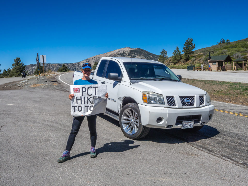
What a stroke of good luck! Having just literally got my poster out, we had already been offered a ride into town by trail angel Mamasita!
This was when we were officially introduced to Dutters, a 71-year-old surfer and section hiker of the PCT, whose mantra is ‘You’ve got to use it or lose it!’ Too true. He had been out hiking for a couple of weeks but was taking a zero day in Wrightwood to meet up with his lady friend. What a guy! He didn’t look his age at all and had such a wonderful, positive attitude to life. We hope we cross paths with him on the trail again.
Our first port of call in Wrightwood was Cinnamon’s Bakery Shoppe as we had read so many great things about the place. We didn’t go for pastries or cakes however; the one thing we’ve really been hankering after on the trail lately is a ‘sandwich’ – filled with plenty of salad. And I couldn’t have chosen anything better from the menu when I was presented with ‘The Compost Heap’! Soft cheese, pumpkin seeds, lettuce, onion, cucumber, tomato, Swiss cheese, sweet pickles and avocado on rye bread – it really was a door step of a sandwich that set me up for the day!
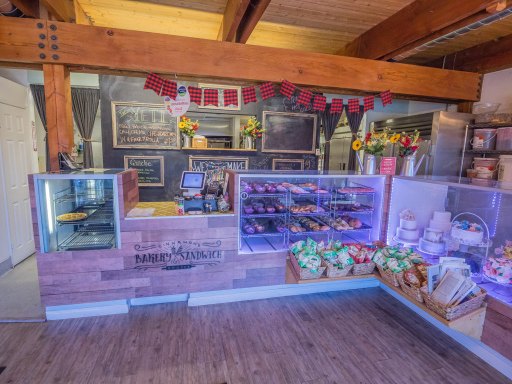
We fully recommend visiting Cinnamon’s Bakery Shoppe in the centre of Wrightwood for excellent, fresh homemade food and great, friendly service.
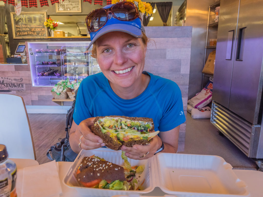
What a filling sandwich! The ‘Compost Heap’ certainly lives up to its name.
As we had a few hours to kill before we could check in to our cabin accommodation, we had coffee too and made use of the free Wi-Fi. Here we then met ‘Ironman’ and ‘Weatherman’, both just a little older than Wayne, thru-hiking the PCT as well. They had started the day before us at Campo on April 9th, so having spoken to them about their itinerary and intended finish time, and ours being similar, we felt much happier that we are just about on track and maintaining a similar pace. As the snow significantly reduces in the Sierra from June onwards, no one wants to reach that point of the trail too early. We are currently on track to reach Kennedy Meadows and the start of the Sierra Nevada from the first week in June, which seems to be the ‘norm’ on a low snow year.
Our cabin was ready from 1:30pm, so after collecting our bounce box and resupply parcel from the Post Office, off we went to check in. This was when we met Bernie, a local, older guy pottering outside his house, who, when he found out we were Brits, decided to walk the rest of the way with us and chat about the impending marriage of Prince Harry to Meghan Markle, followed by a little history of the American Constitution amongst other things! Clearly this was a town for making friends!
Wrightwood has a real community feel and is a wonderful, friendly place to stay along the PCT when hiking through the Southern California section.
We had booked and paid for our accommodation by telephone the previous day through the Canyon Creek Inn, who said they were fully booked on rooms and only had a cabin available. As we were desperate for a shower and clean clothes, and not being sure how busy the other few places in Wrightwood would be with lots of other hikers passing through wanting the same things, we took the cabin for a hefty $140 for the night. (It turned out that the cabin was a few blocks out of the centre of town and owned by Libby, hence the name ‘Libby’s Place‘. – Libby short for Elizabeth, not Liberty, as she informed us.)
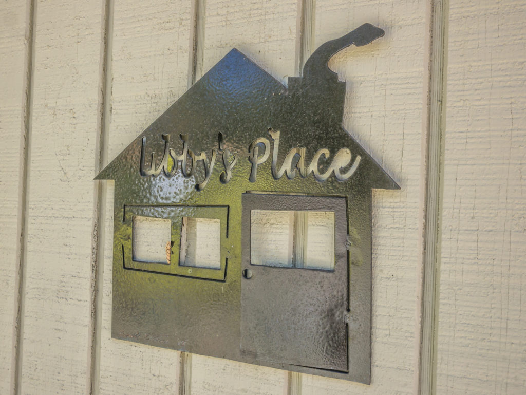
We fell in love with the quirky little cabin known as ‘Libby’s Place’.
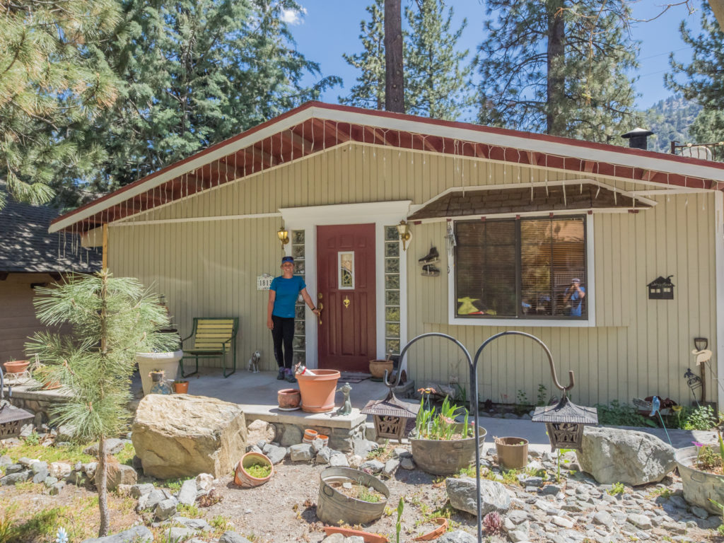
The owner has put a lot of effort into making it feel cosy and comfortable with her unique style.
It was both a unique and quirky styled wooden house on one level that she rented out whilst living in the granny flat next door. As we opened the front door there was a decorated Christmas tree at the entrance and the entire place was adorned in a whole array of different ornaments, books and antiques that she must have collected throughout her life time. There was even a tray with a vintage teapot and cups set out on the bed! (A cute, little touch for us tea drinking Brits!) Libby was very welcoming and even let us do our laundry in the private part of the house that adjoins hers. Again, just another example of how hikers are whole-heartedly supported in this community.
With having a fully equipped kitchen at our disposal, we decided that we’d go back into town to the supermarket, and then cook our own dinner. So we composed our own meat platter, choosing sausage, chicken and beef from the deli counter, to be accompanied by a large salad of lettuce, tomatoes and onions. Wayne got to work preparing and cooking everything, whilst I tried to get another blog update completed and posted online with having a good internet connection. Obviously, as it was a night in town as opposed to a night on trail there was some beer and wine involved too! With a busy evening of tasks, it also meant we stayed up later than 8pm, which seems to have become our standard time for falling asleep in the tent, such is the life of a thru-hiker!
Day 31 – Thursday 10th May 2018, Libby’s Place, Wrightwood, (Hitched back to trailhead at Mile 369), to Little Jimmy Campground at Mile 384, 15 miles
It was a celebratory day of sorts. Having started our journey on the PCT on April 10th, it was now May 10th, so we had ‘officially’ completed our first month on the trail! In such a short time we have witnessed some wonderful spectacles of nature, camped in some amazing locations, experienced tremendous acts of kindness from complete strangers and met so many interesting and inspirational people along the trail – Bristlecone the 80-year-old hiker completing the PCT for the third time*, Scoop, who knows everything there is to know about everything happening on the trail, and Spirit Wolf, educating hikers about the legacy of his ancestors – just to name a few!
*Unfortunately, we were saddened to hear this week that Bristlecone’s 3rd PCT adventure has come to an untimely end as he broke his leg at Mile 299.5 falling down a hole. We wish him a speedy recovery and hope he is able to get back on the trail in the future.
Woo-hoo! Celebrating being a month on the trail and today we would also be summiting Mount Baden-Powell!
Having enjoyed some home comforts at Libby’s Place last night, this morning it was time to get back on the trail. But no matter what time we have in mind for leaving town, it never quite works out that way. We should literally add on two more hours to our planned exit time and that would probably be more realistic. The problem is that towns are like a vortex. Once you get sucked in and begin enjoying the conveniences and pleasures that come with being back in civilisation, it becomes very difficult to leave!
We could see this as soon as we checked out of Libby’s and walked back into the centre of town. There were around 15-20 hikers sat outside Jensen’s Supermarket on the picnic tables provided looking all freshly laundered and groomed, charging their electronic devices and making the most of a phone signal, whilst eating sandwiches from the shop. In their ‘town’ clothes and sandals none of them looked like they’d be heading back to the trail today. There was even a bit of light entertainment when Kate (who I refer to as Katniss as she is the double of Jennifer Lawrence in ‘The Hunger Games’) started strumming the ukulele and singing to everyone!
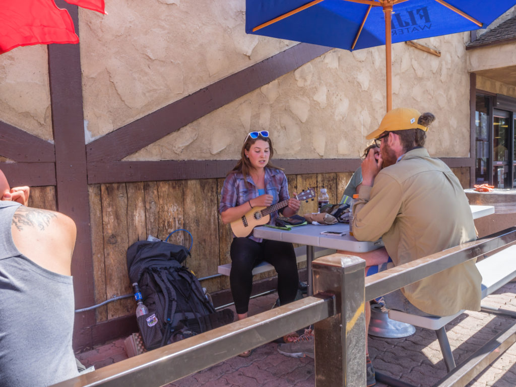
Kate (aka Boomerang) plays the ukulele outside the supermarket. Just a regular thru-hiker piece of entertainment!
It was the most hikers we’d seen in one go since McDonald’s, and before that was the Warner Springs Community Centre, some 200 miles or so back up trail. Despite the daily quotas on the PCT, hikers seem to come in density waves along the trail, waxing and waning at various points. It just turned out that Wrightwood was one of the busier places we have been to, probably because of the town’s super hiker friendly attitude, which was apparent before we even set foot in the place.
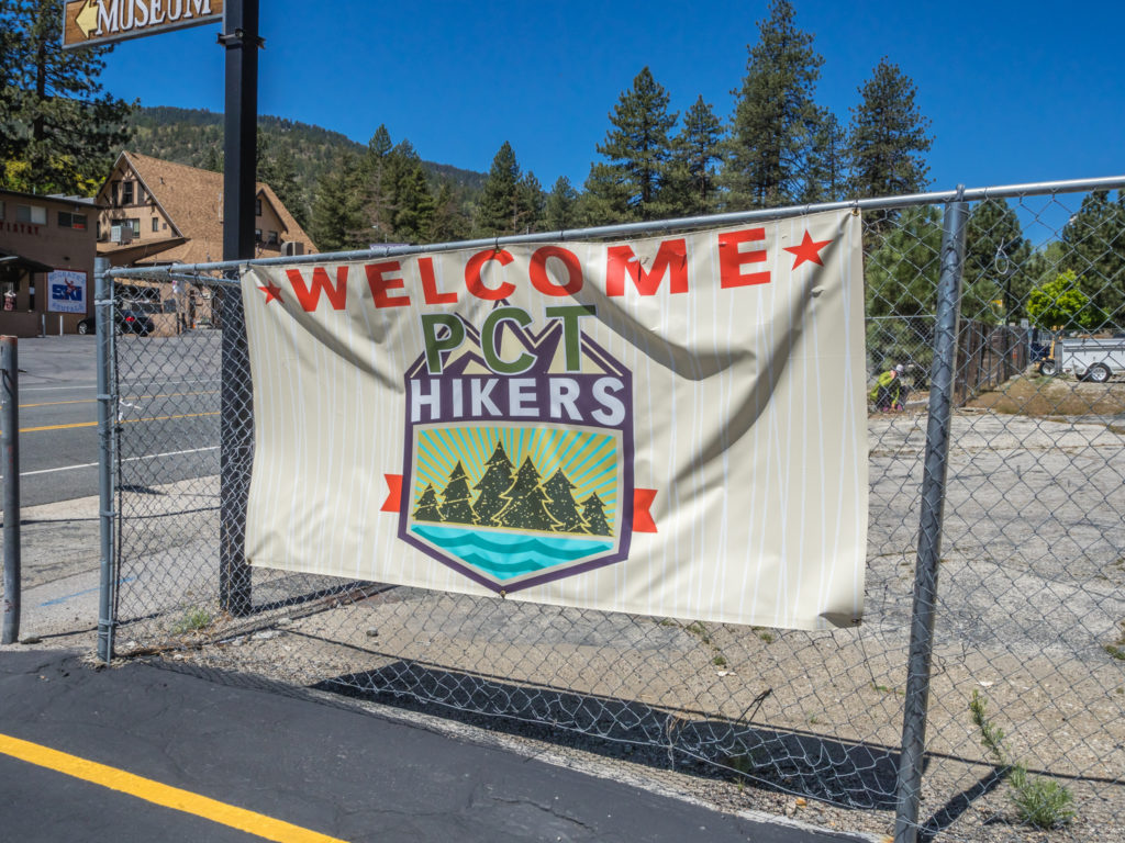
Wrightwood welcomes PCT hikers! Town signs like these are always excellent to see.
From our ride into town with Mamasita, to being given free pastries at the bakery, plus a free PCT badge for signing the trail register at the Hardware Store, to friendly neighbours chatting to us as we walked down the road, we were literally welcomed with every step. It’s easy to see why hikers find it difficult to leave such a place!
But onward we had to go, or we’d never make it to Canada this side of Christmas! It was now midday and we still had to get a ride back to the pull in at Inspiration Point to re-join the trail from where we had hitched into town yesterday. Walking along the main road with Wayne up front sticking his thumb out, it took less than a minute before trail angel Mary pulled up alongside us and offered us a ride back to Mile 369. We couldn’t believe our luck as once again, we hardly had to try. Wayne was even more excited at the fact we got to ride in the back of a pick-up truck!
Wayne was thrilled to be getting a hitch in the back of a pick up truck!
We couldn’t dilly-dally in town as we still had a long way to go to reach Canada. (2,277 miles in fact!)
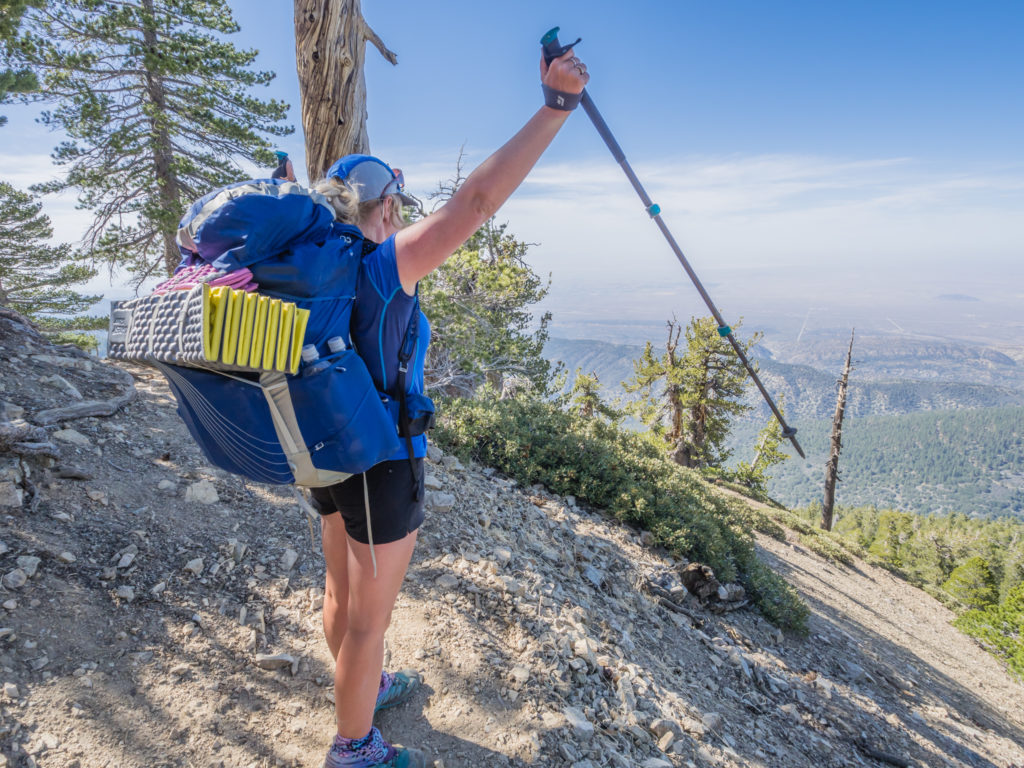
After re-joining the trail, we then had a lot of uphill walking to contend with as the PCT took us to the summit of Mount Baden-Powell. At 9,399 feet, it is the second major peak we have bagged along the trail. The mountain was named in 1931 in honour of Lord Baden-Powell who was the founder of Boy Scouting in America.
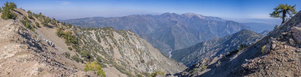
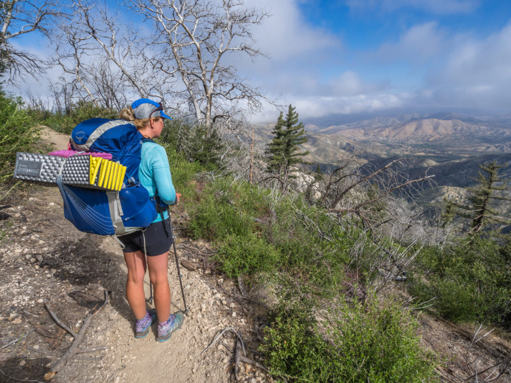
Panorama of the tremendous vista as we climbed our way up to 9,000 feet.
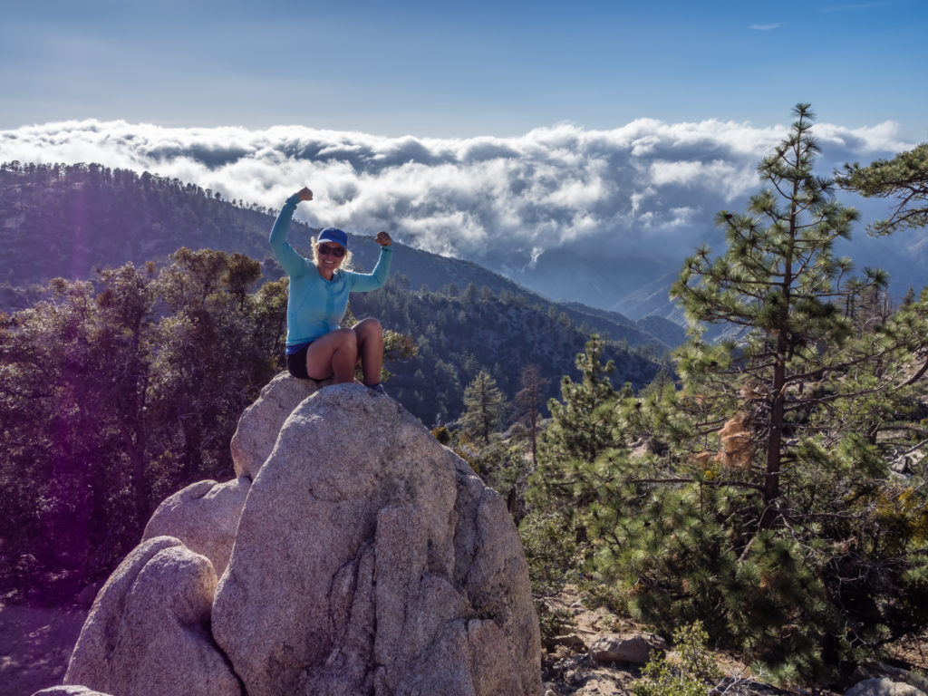
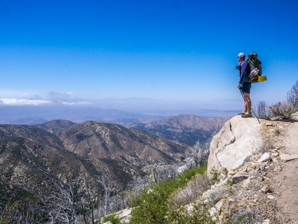
Enjoying the view from the edge!
Standing on the summit of Mount Baden-Powell on Day 31 of our PCT journey! A whole month on the trail!
Along with the PCT, another trail crosses the area known as the ‘Silver Moccasin Trail’, over which ‘thousands of scouts trek to high adventure’. The monument at the summit marks the highest point along this trail and has inscribed on it the important values of being a scout.
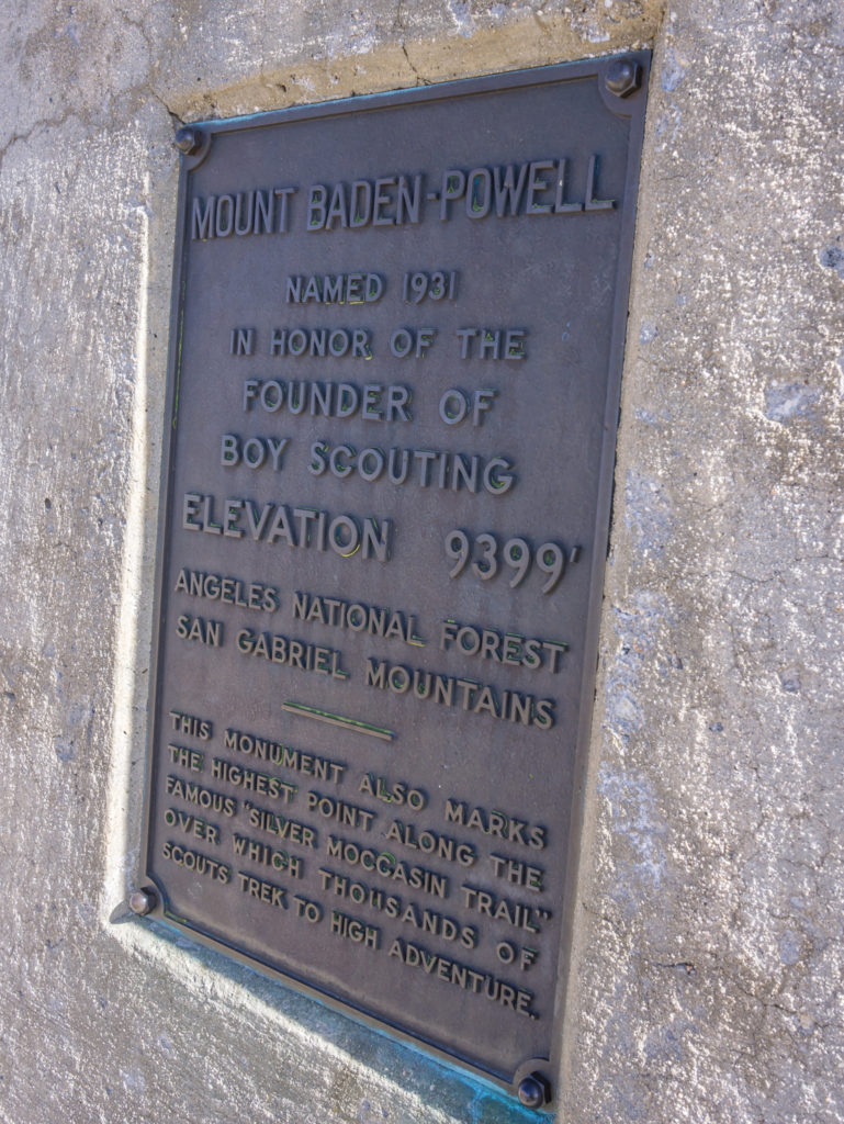
One of the information plaques on the monument at the summit of Mount Baden-Powell.
We took the time to sit at the summit and enjoy a late lunch whilst watching other hikers make their way to the American flag and elevation sign for an obligatory ‘selfie’ shot. The South Koreans did it right by bringing along their own flag to wave as well!
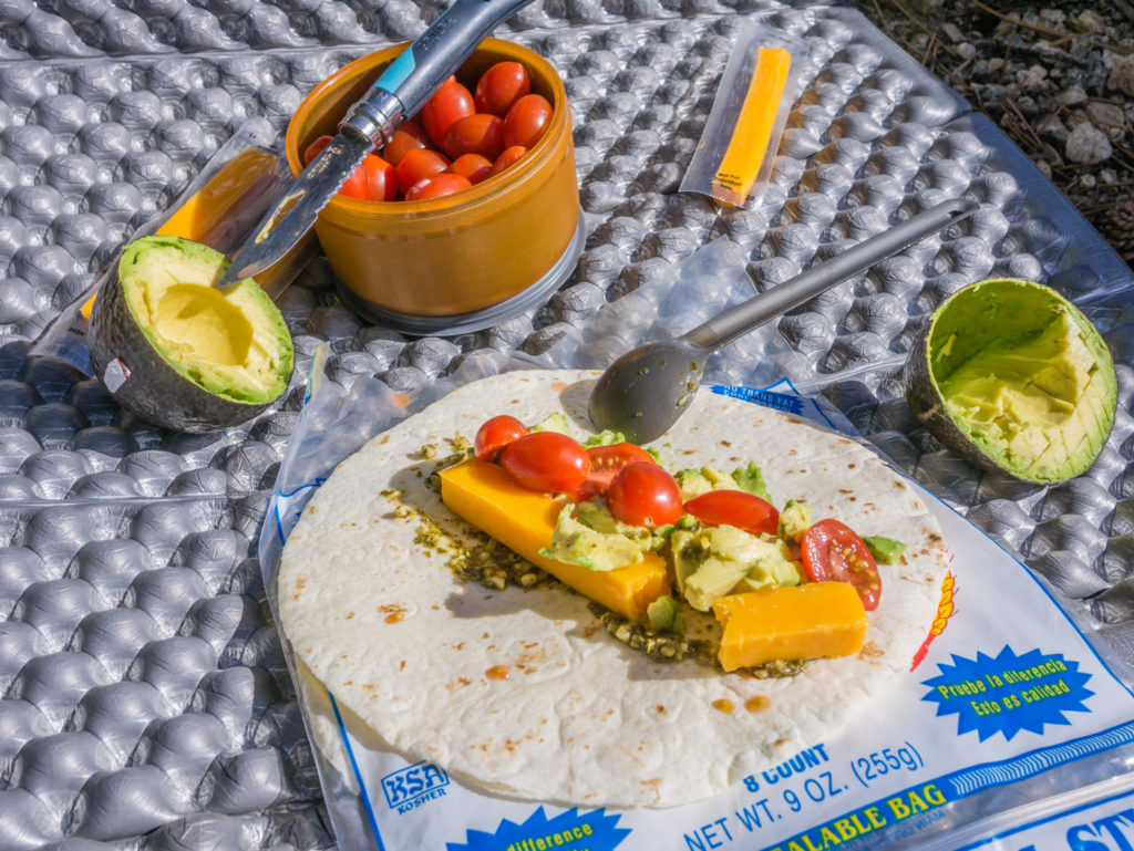
Having just left town, our lunch today consisted of some ‘fresh’ ingredients including cherry tomatoes and an avocado.
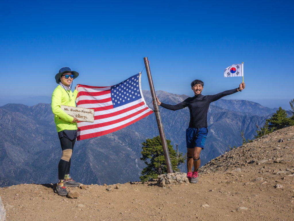
We loved that the Koreans brought along their own flag! So now we need to get our hands on a Union Jack.
We were pleased that the route was then mostly downhill as we made our way to Little Jimmy Spring to collect and filter water before pitching our tent (along with several other hikers who had left town before us all aiming for this water spot) at the Little Jimmy Campground, located at Mile 384. Even though we didn’t get back on the trail until around 12:30pm, we had still managed to pull in a respectable 15 miles before dark.
Putting on extra layers as it got much cooler as the sun went down.
Camped at 7,490 feet, it was much cooler than what we had gotten used to, so again we were glad of our down jackets and warmer layers. By the time we had set everything up, we had to cook in the dark with the use of our head torches, but fortunately there were picnic tables, this being a forestry campsite, which made it easier. We also had a simple dish tonight of spaghetti mixed with olive oil and pesto, so it didn’t take long to cook. It was our first camp on the PCT however where there are bear lockers present as bears have been known in the area. So what actually took us the longest was putting all of our food, plus any toiletries, into our OpSacs (odour-proof barrier bags), then into a dry bag, to then keep safe inside the bear locker! Even with our experience on the John Muir Trail in the Sierra Nevada, and never having a problem with bears (in fact, we never even saw one once), we went to bed with one eye open at first hoping we wouldn’t get disturbed in the night!
Day 32 –Friday 11th May 2018, Little Jimmy Campground at Mile 384 to Wild Camp at Mile 399, 18 miles including forced detour
After brewing a cup of tea this morning to go with our ‘Cranberry & Orange’ breakfast biscuits, whilst discussing the merits of fishing when we get to the Sierra Nevada with trail buddy Gandalph, we were the very last to leave camp at 8:40am.
Instead of going by known camp sites marked along the route, we have now decided to have a set amount of miles in mind that we’d like to complete and then look for somewhere suitable to camp near to that distance, subject to availability of water. Obviously, access to water really dictates everything out here on the trail. So today we were aiming for mile 400, which technically would have given us a 16 mile day, however there was a short detour because of an ‘Endangered Species Closure’ for part of the PCT to protect the endangered Mountain Yellow Frog. So we had to bypass this section by continuing on the PCT to Eagles Roost (Mile 390.2), then road walk 2.7 miles along Highway 2 to Buckhorn Campground, then follow the campground road and Burkhart Trail 2.2 miles to re-join the PCT further along, in effect adding around an extra 3 miles onto our day.
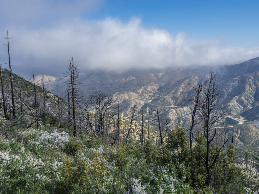
From Islip Saddle we had a climb of around a mile and a half to reach the trail junction just below the summit of Mount Williamson, where we then stopped to watch a cloud inversion hanging in the valley below. There were several other hikers congregated in the gap enjoying the view too, but we couldn’t sit and watch the clouds for too long as it was so windy and cold up there. Thankfully the trail then wound downhill to the road and the Eagles Roost Day Area, where we then joined the road for the forced detour.
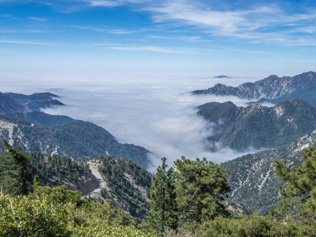
Taking time out to watch the cloud inversion below.
It was extremely windy at the top!
Although road walking is hard on the feet, we can generally pick up the pace and cover several miles in a shorter time, so it wasn’t long before we then reached the Buckhorn Campground. Being a National Forest campground we stopped for lunch there to make the most of the conveniences such as picnic benches and pit toilets before continuing on the Buckhart Trail, where after a mile or so we re-joined the PCT.
Having to take an alternate trail in order to protect the endangered species of Mountain Yellow Frog.
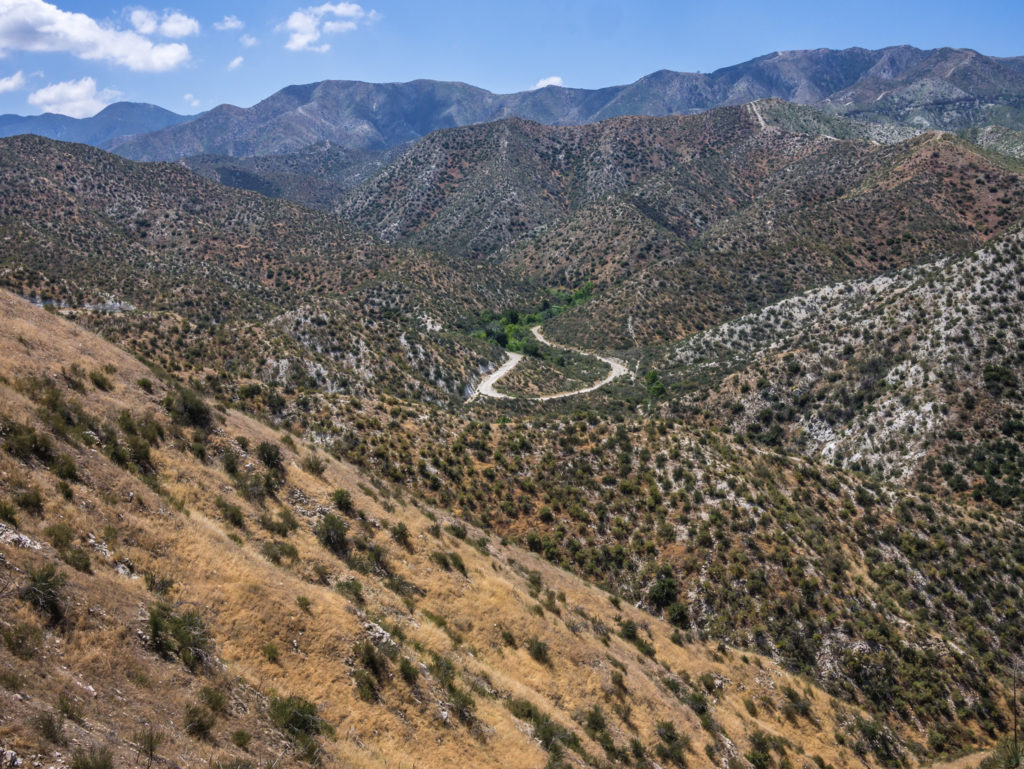
Hitting the road… The re-route at least meant we could make good time.
At Cooper Canyon, Mile 396, just another couple of miles down trail, we stopped again for another snack break of mixed nuts and dried fruit to give us that extra boost of energy for the final uphill of the day. Here, Gandalph caught up with us again. He too was aiming for around Mile 400.
Back on it, the trail gradually wound around to the road where we started looking for a camp spot after Mile 398 as it would soon turn into a ridge walk along a thin, narrow path where they’d be no chance of pitching the tent. At Mile 399 we were in luck with a wild camp spot not marked on the map. There was room for at least two tents on a rocky knoll with a tremendous view above the trail, looking out across the valley and beyond.
Feeling on top of the world! We had bagged ourselves another awesome wild camp spot!
Even better the cloud inversion was still happening, so Wayne had the chance to set up another time-lapse sequence right from our camp spot. Just for fun, we even time lapsed us setting up the tent because it was in such a great location!
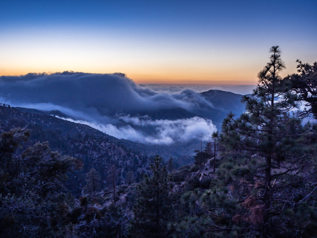
Watching another great cloud inversion spectacle from our camp spot.
Wayne was in his element, photographing and filming from what he now considers to be our best wild camp location so far. A few other hikers walked below where we had pitched without realising we were there, missing a great opportunity to also camp on the knoll and enjoy the view. But I must say, we didn’t mind one bit having it all to ourselves! This wild camp spot will definitely take some beating.
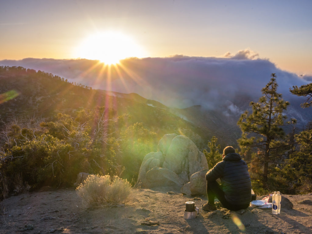
Taking a moment to watch the sun go down…
Day 33 –Saturday 12th May 2018, Wild Camp at Mile 399 to Wild Camp by Mill Creek Summit Fire Station, Mile 419, 20 miles
We were reluctant to leave our fabulous wild camp spot overlooking the valley and beyond, but make our miles we must! So today we had 20 miles to complete to take us to the Mill Creek Summit Fire Station at Mile 419 where we could fill up with water to see us through the following day, as after Camp Glenwood this morning at Mile 401, it was our only reliable water source until Mile 436. (Again, before we reach the Sierra Nevada, the availability of water is the dictating factor in terms of where we camp and how many miles we walk per day!)
So off we went just before 8am, the temperature, as forecast, much cooler than the previous week, which was very refreshing. It wasn’t long before we reached another milestone, crossing the 400 mile marker! Up to now, we have found that previous hikers have highlighted alongside the trail significant milestones reached using rocks. However today reaching ‘400’ miles was also denoted with pine cones, a cute little adaptation!
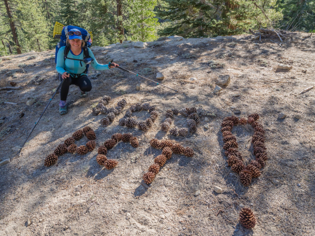
A unique trail marker made from pine cones signalling we had reached 400 miles!
On our route today, we crossed Highway 2 seven times in total as the PCT took us around several ridges that the road meandered through. The bonus about crossing the road is that there are usually ‘Day Use Areas’ at these points for drivers to pull in if they need a break or to use the restroom, which meant we had several opportunities to sit at a picnic table and also use a pit toilet should the need arise. We seemed to reach the Three Points Junction parking area in no time, so we took advantage of one of the picnic tables and devoured our second breakfast. (We’ve started having a packet of Belvita breakfast biscuits each before we leave camp as the four biscuits total 230 calories. Then at our first rest stop we have a packet of Kind breakfast biscuits, the two biscuits giving us an extra 220 calories, which will generally see us through until we stop for lunch.)
We had low cloud blowing in and out during the morning, so it was a ‘layers on, layers off’ kind of day.
Unlike the group of hikers behind us, we resisted the lure of food and beer by getting a hitch 1.9 miles along Highway 2 to Newcomb’s Ranch Restaurant. Popular with LA motorcyclists and exotic car enthusiasts, the restaurant is also a favourite stop with PCT hikers and as they claim ‘…A celebrity or two’. As we had carried enough food from Wrightwood to see us through to Agua Dulce, we weren’t about to make ourselves carry more grams than needed! Every meal eaten from our pack significantly lightens the load.
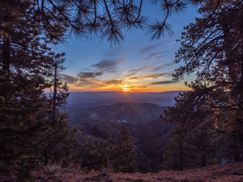
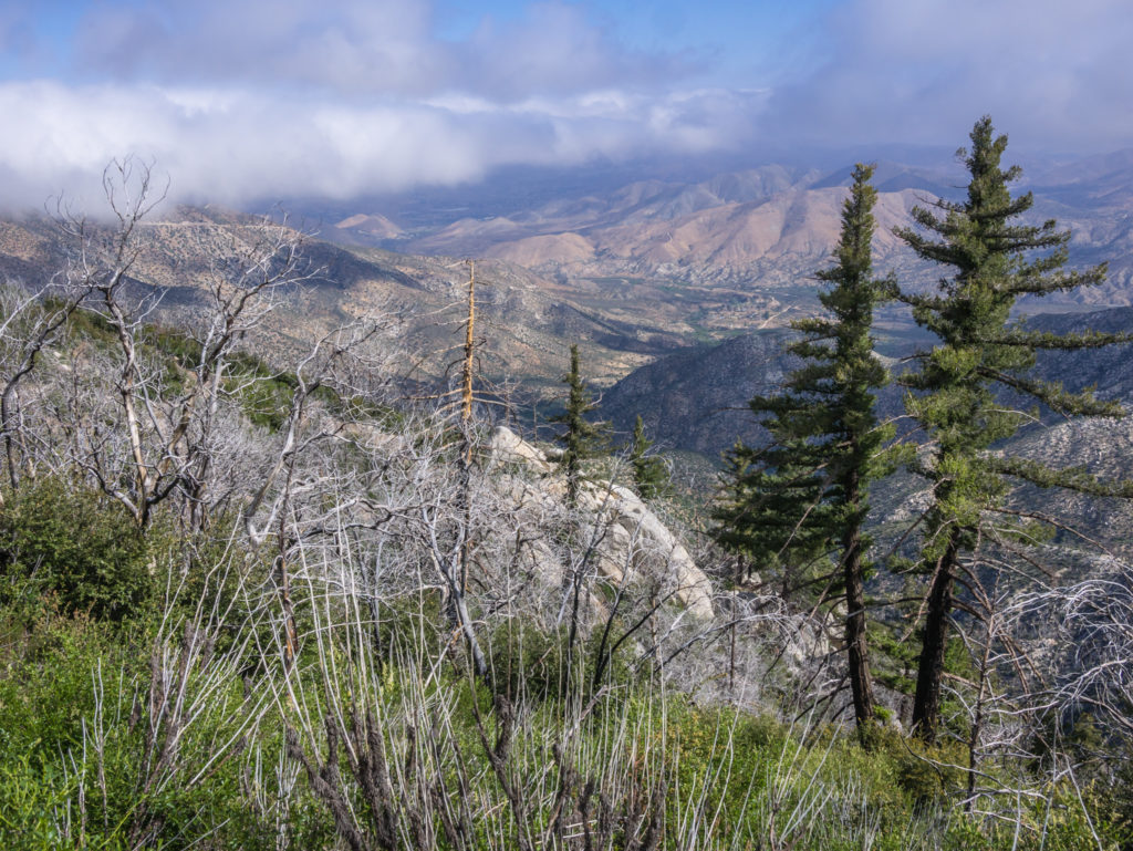
It took all morning for the cloud to lift revealing a tremendous panorama as we headed down from the pine forest back into the desert chaparral.
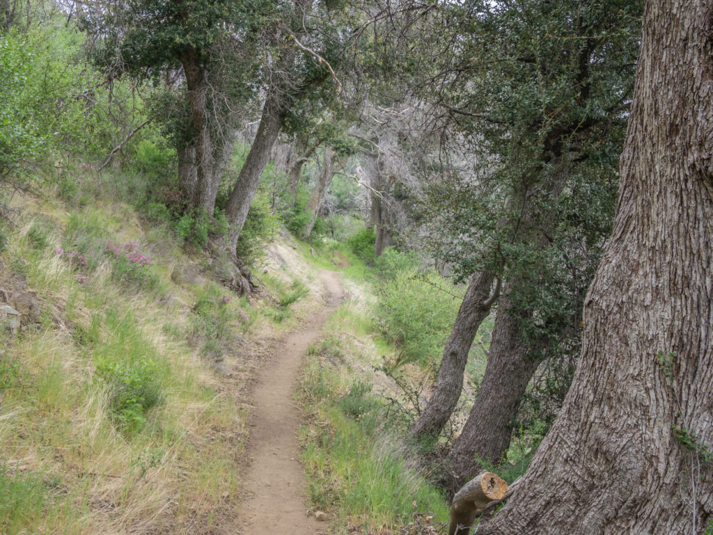
Leaving the pine forest on flat, well-trodden trail.
As the trail was generally flat today, we were making good progress and soon caught up with three male solo hikers – Papa Bear, Farlake and Chatty Man. (The third guy, we didn’t know, but could hear about a mile down the trail! If you picture Alan Carr, this guy looks nothing like him but he sounds identical!) They were all aiming to reach the Fire Station, just like us, so we knew it was going to be a busy camp location this evening.
It wasn’t until later in the day that we had tremendous views looking out to Palmdale and beyond to the Mojave, the desert spreading for miles upon miles into the distance. We couldn’t quite believe that we’d be crossing it via the LA aqueducts in less than a week’s time. Even further off was a huge mountain range soaring into the sky, which we debated was the gateway to the Sierra.
Looking out to the Mojave where the cities of Palmdale and Lancaster bask in year round sunshine.
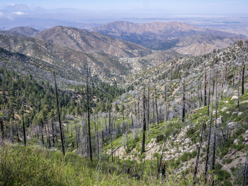
Walking through another burn area in the Angeles National Forest, but what an incredible view!
Looking much closer we could now see the road leading to the Fire Station, so we only had about 3 miles to go, which on good terrain takes us about an hour. Along the trail we saw a sign created by Trail Angel Mary (by sheer coincidence, most trail angels we have met have been called Mary), which offered PCT hikers rides into town or other assistance if needed. We didn’t need anything, but again, we were amazed at how much support is given to hikers along the PCT.
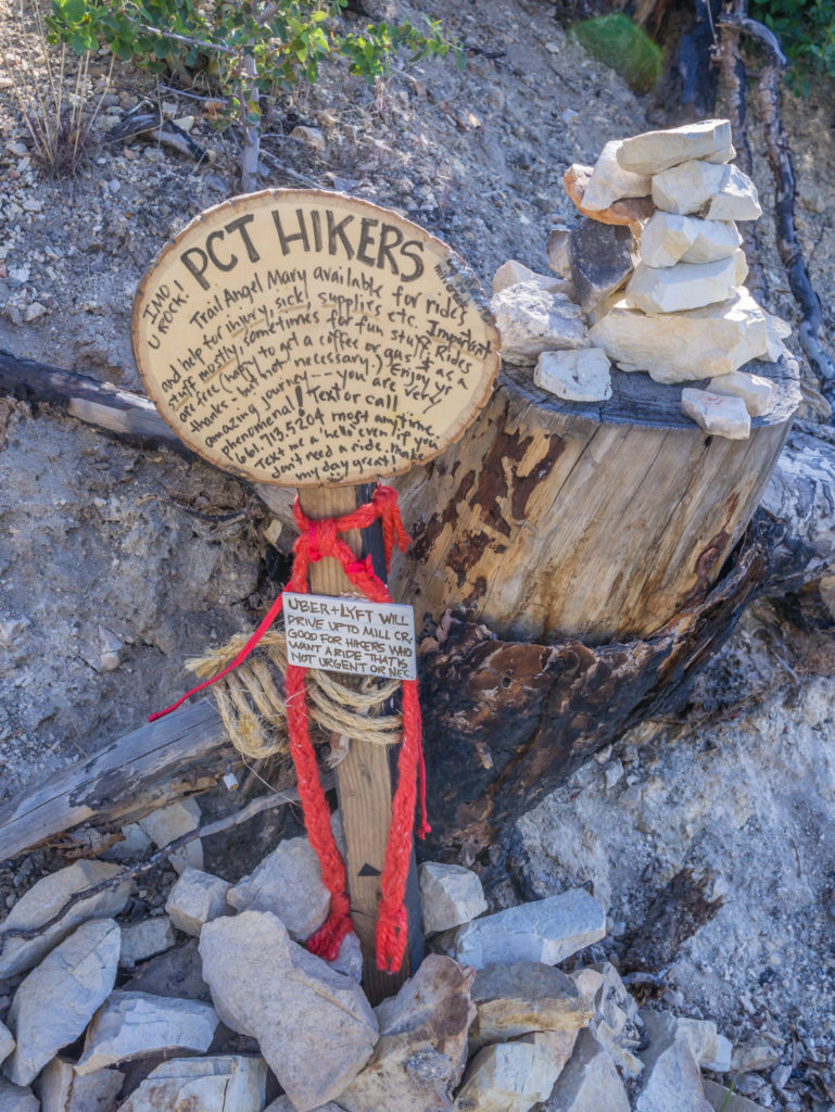
Thank you Trail Angel Mary for your wonderful support and assistance on the trail!
When we arrived, the entire area by the water tap had already been taken over by hikers, eagerly awaiting a delivery of pizzas and beer! For a $5 delivery charge to Mill Creek, a local pizzeria was cashing in on the inevitable ‘hiker hunger’ and delivering much sought after goodies to the trail. What a service! As we were filtering water and filling up our bottles, the pizzas arrived. It was like a school canteen when the cook calls ‘Seconds!’ Everyone was queued up collecting their orders then tucking in like they hadn’t eaten in a week. The pizzas looked and smelt good, but again we resisted the urge to buy extra food seeing as we already had enough rations.
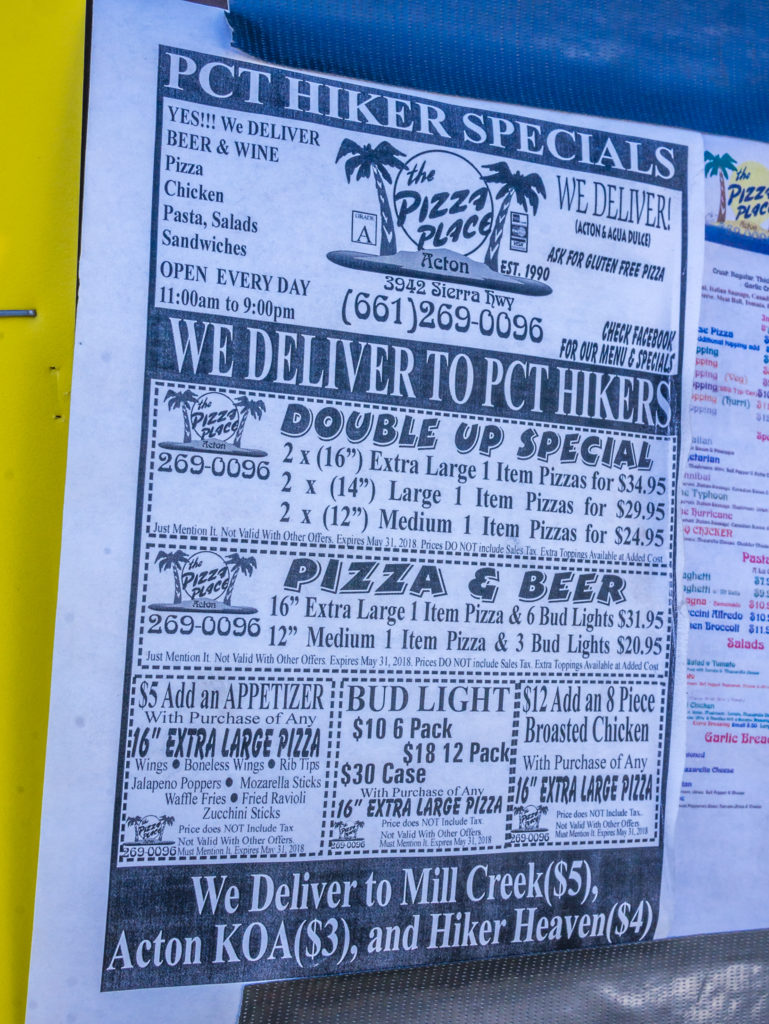
‘Hiker Specials’ from the Pizza Place at Acton, CA.
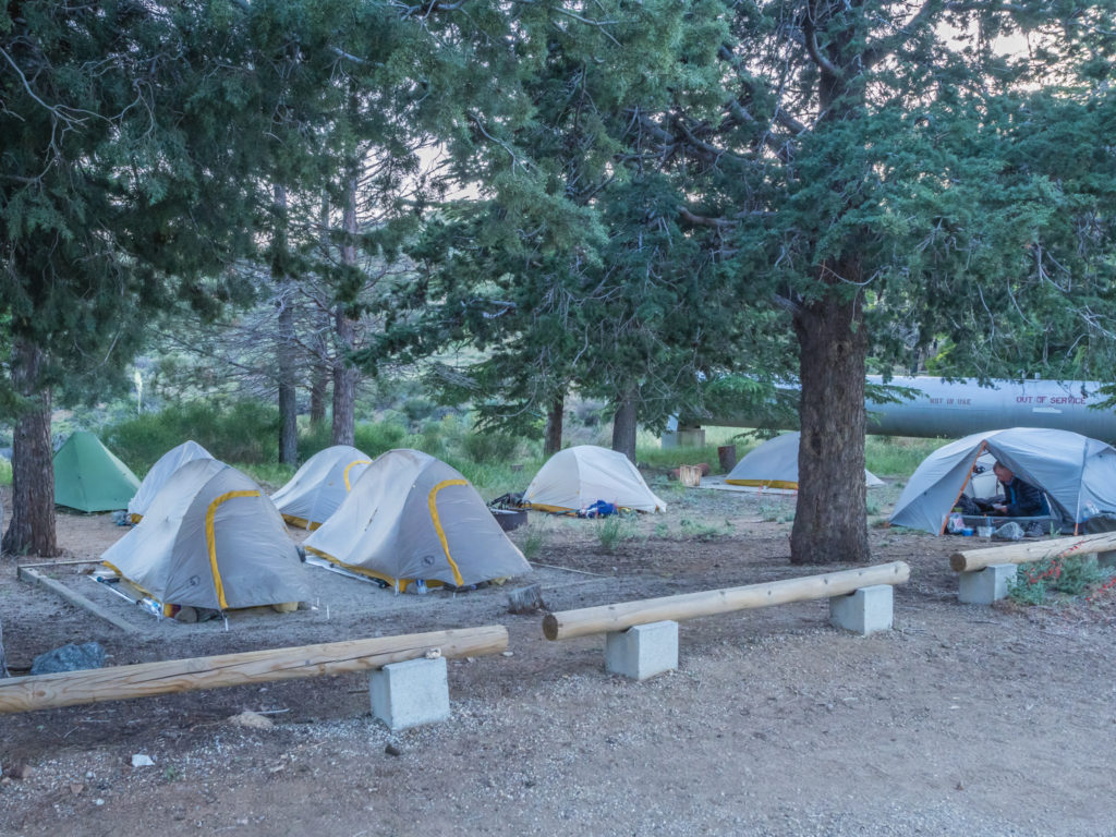
We walked downhill to the Mill Creek Picnic Area, where PCT hikers are permitted to camp, located below the Fire Station. There was already a mini tent village going on, so we just managed to find a big enough spot to squeeze our tent in before the others arrived.
We saw Gandalph again who was merrily getting through a 12-pack of Budweiser, along with a large ‘trail family’ known as The Squad. Ironman was camped there too, plus a whole load of other folk who we are yet to get acquainted with. As you can imagine, with so many tents packed into a small area of flat ground there was a bit of a snore fest going on in the night. Coupled with the continuous buzzing of the power lines overhead it didn’t make for the best night’s sleep, but as if by magic, most of the herd had disappeared back up the trail as early as 6am!
Day 34 –Sunday 13th May 2018, Wild Camp by Mill Creek Summit Fire Station, Mile 419 to North Fork Ranger Station, Mile 436, 17 miles
We weren’t quite the last to get back on the trail this morning as Gandalph had only just surfaced as we were about to leave at 7:45am, and he was nursing a bad head. By the look of him, we didn’t think he’d make it that far along the trail today! But if he needed water, he’d still have to push on the 17 miles to the Ranger Station, just like the rest of us.
Leaving the Mill Creek Summit Fire Station just before 8am.
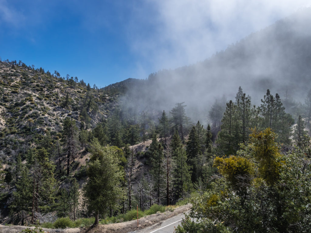
As we headed off uphill, the weather looked rather ominous as we were walking into thick cloud. It felt both cold and damp, so we put on our waterproof jackets to keep out the chill. We could barely see more than a foot in front at times, even though we knew behind the thick wall of white they’d be an incredible view.
The cloud just starts to lift enough to reveal an impressive view…
It took us until well after lunchtime to be able to see it however! Finally the sun seemed to burn through the low hanging cloud and as we started to head downhill, the magnificent mountains and desert beyond revealed themselves at last.
As the clouds lifted we could finally see where we’d be heading over the next few days.
Much of the area we were walking through again today had suffered from a forest fire in the past, so once again we were on the lookout for the extremely hazardous Poodle Dog Bush. Fortunately it’s strong aroma alerts you to its presence easily, so we were giving it a wide berth. It was also apparent that on one long section of trail, much of it had been cleared directly from the path to assist hikers passing by. We’ve now got to get more savvy about Poison Oak, as we’re still not 100% sure that we’ve been identifying the right plant! (If in doubt, note to selves, don’t wear shorts!)
The burn area kept us on our toes looking out for the dreaded Poodle Dog Bush but it was difficult to focus our attention on the trail when we had such a wonderful view!
Mountain vistas and magical trail moments…
Despite evidence of a burn, we were pleasantly surprised by how many flowers were blooming along the sides of the trail. Several bushes with delicate, pretty pink flowers caught our attention amidst the greenery. There were also several older trees that seemed to have survived against the odds, and at certain points where the trail became edged in long, wavy grass, it felt like wandering through an enchanted wood, especially with the mist hanging in the air as the cloud moved in and out of the ridges.
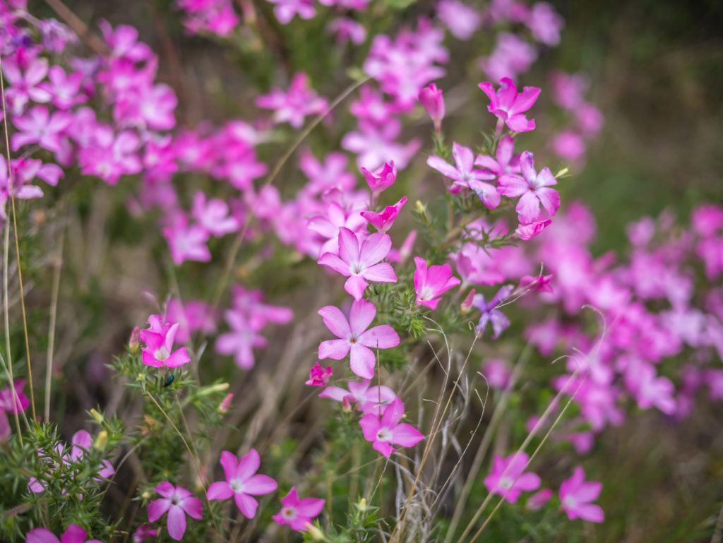
We may be returning to the desert but we were wowed by the beautiful flowers growing along the sides of the trail.
Waling through ancient woodland… It seemed like we were entering ‘Narnia’.
Wayne was suffering a bit today with his left shin and thinks he has developed shin splints, so we tried to slow the pace a little. With only having 8 miles in the morning to reach the KOA Campground at Acton where we plan on taking a ‘nearo’ to do laundry and use the WiFi, we will assess whether we need to take a full zero for Wayne to rest his leg if it doesn’t improve. Based on his experience of shin splints when we hiked the Pennine Way, rest generally cures it and previously his legs felt better within a couple of days. (If we have to take a zero at the KOA, the bonus is there is a swimming pool! But we will still have to pull in the miles further down the line so we would rather not have to use up another non-hiking day if possible!)
Through the burn forest, we made our way uphill and back into the cloud.
Putting on more layers as the weather kept changing so fast. (Get me back to the desert, I don’t like the cold!)
Even though we were trying to go slower, we still arrived at North Fork Ranger Station around 4pm. There were hikers already pitched near to the water, but again we managed to find a spot big enough for our tent before the masses descended around 5pm. There was an ice cooler filled with a variety of drinks cans that were charged at $1 each with an honesty box for payment. After drinking several litres of water each day, we completely indulged in a fizzy drink just to enjoy some flavour. Wayne opted to sample a ‘Root Beer’ for the first time, whilst I stuck to my favourite ‘Diet Coke’. (Having tried a sip of the Root Beer, we both think it tastes like an antiseptic wash, much like ‘TCP’! I’m certainly not disappointed we don’t have it in England.)
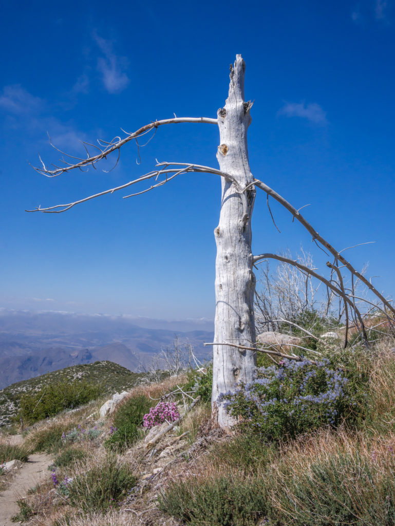
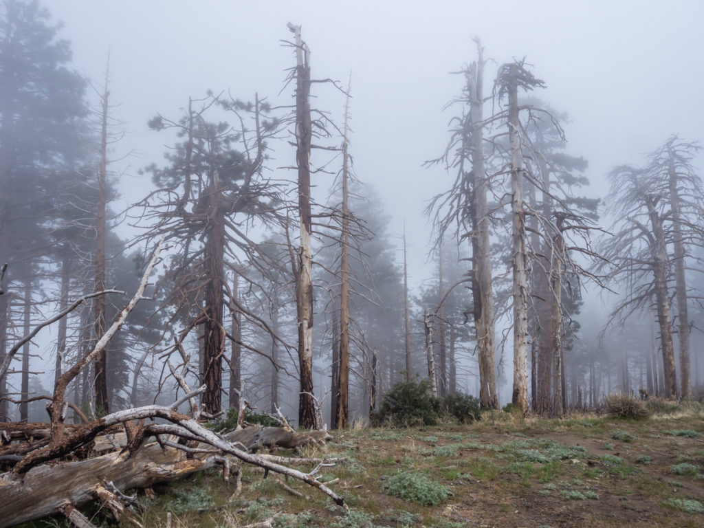
Standing strong through adversity. (Just for my mum as she loves pictures of ‘dead’ trees!)
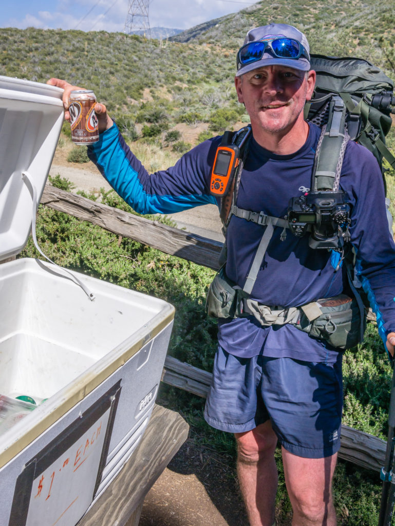
Excited to have a choice of fizzy drinks to purchase at the Ranger Station!
After some tent spotting and tent discussions with other hikers (as most seem to either have a Z-Pack or Big Agnes 1 or 2 person model, but all were admiring our 3-person Mountain Glow version with built-in light), Wayne got on with cooking dinner. Tonight, as we are rotating meals so as not to get bored, we were having ‘Four cheese Idahoan mash’ with a beef and vegetable soup mixture that we had rehydrated during the day. As well as the bean chilli mix, it has become one of our favourites as there is such a good range of vegetables in there.
Big Agnes tent competition?! No wonder we’re always looking for enough space to pitch our ‘condo’!
Tonight’s trail dinner delight – mashed potatoes with beef and vegetables. (And some added Spam!)
It felt great to get to camp a little earlier as we had more daylight and seemed to have much longer to get organised. We have now got our packing and unpacking routine down to a fine art, and with all our gear neatly stowed in its proper place in the tent, it’s easy to see why we have been named ‘Mr & Mrs Condo’ on the trail!
Day 35 – Monday 14th May 2018, North Fork Ranger Station, Mile 436 to KOA Campground, Acton, Mile 444.5, 8.5 miles
Hike, eat, sleep, repeat! Starting Day 35 on the PCT…
Yay, I got given a trail name today! “Smiley” – and as I do seem to smile a lot, I think it’s quite fitting! Hilariously though, the guy who bestowed it upon me, going by the trail name of ‘Paint Your Waggon’ (another story about that coming next), said as soon as he saw Wayne, “Well if you’re Smiley, then he must be Grumpy!” And to put it mildly, today he was.
Since yesterday afternoon, his left shin had been hurting him and today, in spite of massaging it with heat gel and taking some pain killers, it was hurting even more. It didn’t help that after leaving the Ranger Station, the next 8 miles of trail wound around ridge after ridge, with lots of pointless ups and downs before it eventually led downhill to the road. Wayne’s pace had slowed dramatically so I knew it was causing him real pain. Even the encouragement of taking a photo of the view or the pretty pink flowers at the side of the trail wasn’t helping to take his mind off it. It definitely seemed to be a case of shin splints so we knew the only way to get his leg better would be to rest it for at least a couple of days.
Back to the story about ‘Paint Your Waggon’. Having spoken to him at the trailhead, he mentioned that he has a summer job working at the Vermillion Valley Resort along the Sierra section of the PCT. We told him we had visited VVR during our thru-hike of the John Muir Trail in 2014, and what a coincidence, he was there at the same time! We didn’t recognise him at first as we remember him having had a long white beard, but being clean-shaven, he looked very different today! Of all the people, in all of the world, what are the odds at ever meeting this guy again? It was very uncanny!
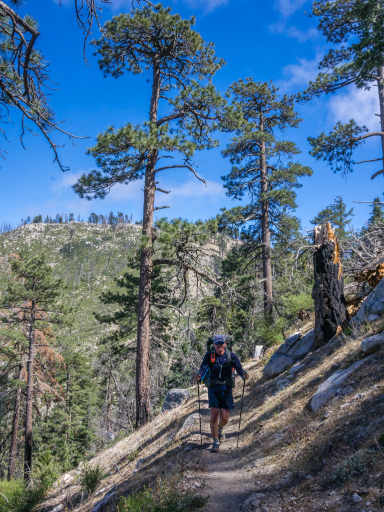
Today’s route took us over the crest of the first set of mountains.
Not feeling it today but grinning and bearing it…
It seemed a long ridge walk heading to Acton, especially for Wayne who was suffering with shin splints.
So near, yet so far… We could see the trailhead area from above but we still had a few downhill miles to cover to get there.
Looking back to where we had hiked from, the road winds its way through the mountains. It might have been the easiest way down for Wayne, but like a trooper he soldiered on!
As it so happened, we were heading to the KOA (Kampgrounds of America) in Acton and planning on spending the night there as we could take showers and do our laundry before heading on to Agua Dulce to do a food resupply the following day. The private campground is really hiker friendly, allowing PCTers to pitch for $15 per tent. The bonus of this particular campground is that it has a swimming pool and jacuzzi as well, so we were sold. We’d stay for two nights and take a zero day tomorrow allowing Wayne to properly rest his leg. At least we hoped that one zero day would be enough to get him on the mend. A cold soak in the pool, I convinced him, would do it the world of good!
Finally reaching the KOA at Acton where we planned on spending the night.
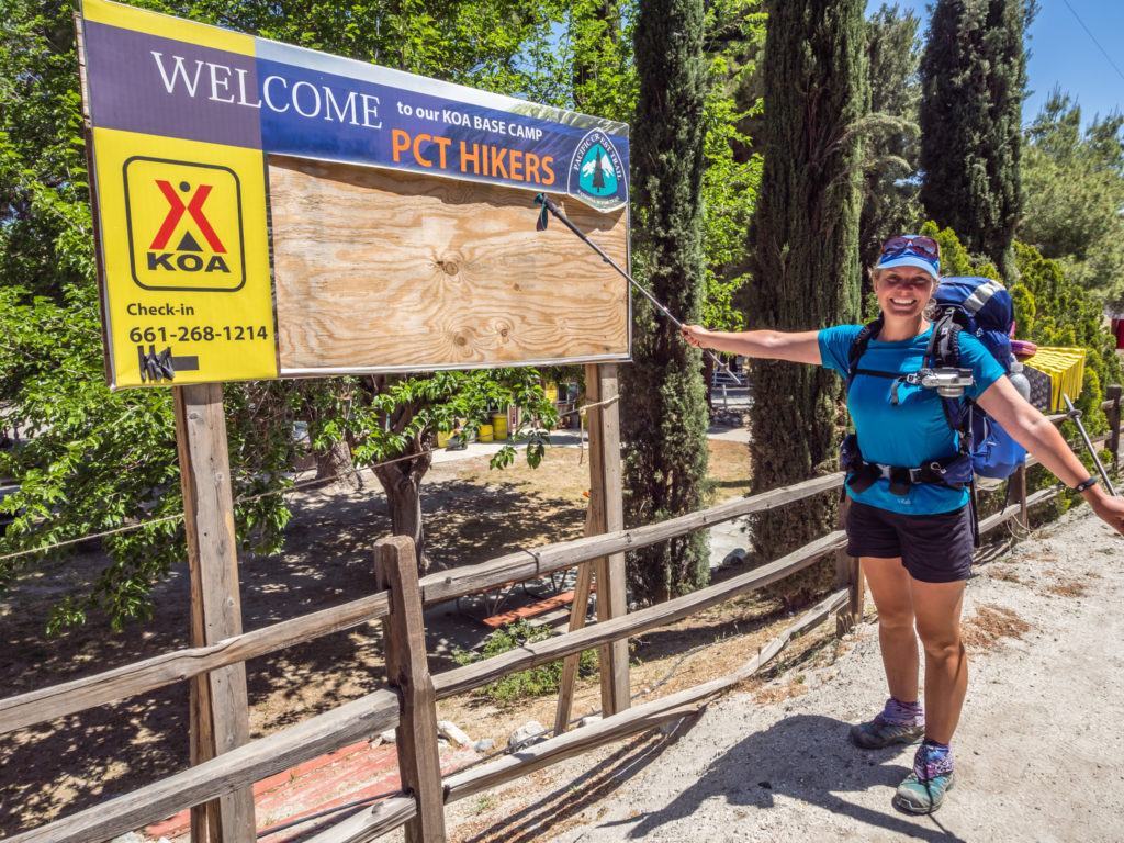
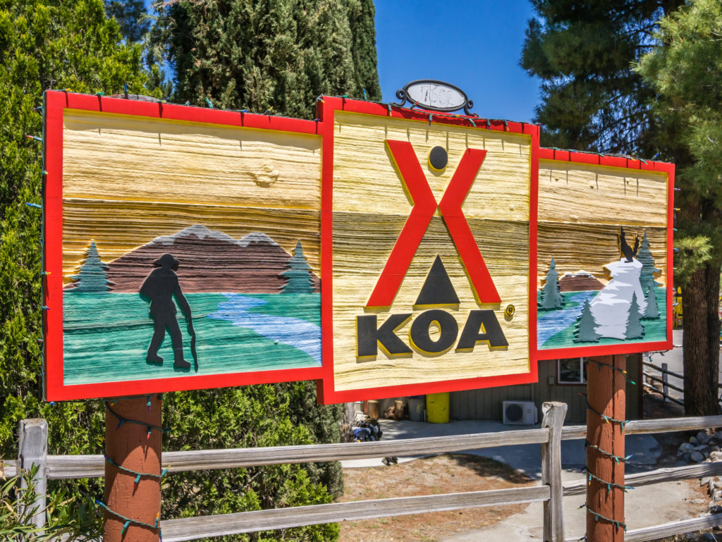
We’re always excited when we see that PCT hikers are welcome!
So we checked in, pitched the tent and went to browse in the camp shop. Our first priority was laundry, but grabbing a couple of tubs of ice-cream and sitting in the sunshine quickly overtook our desire for cleanliness. We began a serious case of ‘people watching’ as hiker after hiker came on in to purchase ice-cream and other goodies, charge their phone and make use of the free WiFi. Most of them only stayed for an hour or so, eager to push on to Agua Dulce and get to ‘Hiker Heaven’ where they would be able to stay the night for free.
‘Hiker Heaven’ is at mile 454.4 nobo from Campo, at the end of section D and the start of Section E. It is operated by Jeff and Donna Saufley who have been hosting PCT hikers in their home and backyard for the past 21 years! In addition to holding mail packages for hikers, they provide camping and limited accommodations, showers, laundry, transportation, and tons of information to hikers about the local area. They also have WiFi and, key for many hikers passing through, there is no charge for any of the services they provide. (Although a ‘donation’ is appreciated.)
We hadn’t yet decided if we were going to visit ‘Hiker Heaven’. We had the vision in mind of a ‘zoo’ in respect of the fact they can host up to 50 people per day, so we’ll see how it goes on our hike into Agua Dulce as the Saufley’s are located a mile out-of-town.
The afternoon then just seemed to fly by, what with showering, washing and drying clothes, eating and surfing the internet! With having WiFi, we were also trying to get another blog post and video completed and uploaded. We didn’t actually get chance to use the pool as unfortunately for us, it was undergoing maintenance today… Hopefully we’ll get in there tomorrow though!
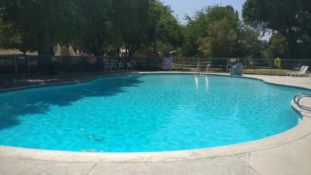
The on-site swimming pool at the KOA. We can’t wait to get the chance to take a dip!
Well, over 400 miles in and now it seems injury has struck! Overall, we think it’s nothing too serious, we just hope with a day or two of rest that Wayne’s shin will feel a lot better. It seems we’re not quite yet walking machines after all!
With 113 miles to go to reach our next resupply town, which will be Tehachapi, we have planned on roughly 20 mile days from here on in until we reach Kennedy Meadows, where we will then reassess our itinerary based on how much snow is still present in the Sierra. All being well and us continuing after our zero day, we should still get there for June 1st! We’ll keep you posted…
8 Comments
Thanks for another wonderful blog, and I’m enjoying the vlog as well. The two of you certainly make some nice sounding and looking dinners on trail. Your siimple dinner of pasta with pesto would qualify as a treat for me on trail. I hope Wayne is feeling better and that I get to continue following along on your adventure.
Thanks Mike! We’re back on trail and Wayne’s leg is holding up! Managed 55 miles in 3 days since the blog post, so think we’re good again.
More ‘Trail Kitchen’ to come in the next videos, especially as we’ve changed to ‘dry’ food for this section of the Mojave.
Thanks for following along! 🙂
Relieved to read your above comment that Wayne’s leg is holding up. I was quite concerned by the end of this post. Having been away, I’ve just found time to catch up on the last 3. As always, brilliant reporting. Just love following you along. Like you I am not an early riser, and so miss the beauty of the early morning. Fantastic that you have been up in time to capture so many magical sunrises. Happy hiking!
Thank you so much Helen. Hope you had a great time away!
We are just so thankful that Wayne’s leg seems to be better as we’d be gutted if we couldn’t finish the trail. We’re all set for the Sierra now and can’t wait to get back in the big mountains! Hopefully lots more sunrises and sunsets to come 🙂
Hi Danielle and Wayne.
Good to hear that you are on the road again. I look forward to the next video and report week 6. Again nice pictures!
Walter
Thanks Walter👍
We’re very relieved that Wayne’s leg is feeling much better and that we’re now well on our way to the Sierra Nevada! We should reach Kennedy Meadows in a week’s time!
Hi Danielle and Wayne,
Beautiful stories and pictures. Good to hear that Wayne recovered! Your trail kitchen is something else!! Very diversified. As we are intending to thru-hike the PCT in 2019 and still looking for a comfortable backpack, we were wondering if you have any idea of the weight of your packs when you leave town fully loaded? Would 5kg of food a person for 7 days be too much/too little?
Regards,
Marc (The Netherlands)
p.s.
I’m gonna pickup at least one of your guides on treksnappy.com 🙂 Surely a nice exercise for our upcoming PCT 🙂
Hi Marc,
Thanks for your great feedback! ‘Trail Kitchen’ is something we’re developing as food plays such an important motivating factor for us every day on the trail and we don’t want to get bored.
We haven’t weighed our packs on this trip, but we did on the Kungsleden. With around 5 days of food each, I’d say my pack is around 15kg, and Wayne’s is around 20kg, but he carries the tent, plus all his camera gear including tripod, and small tablet PC.
It all depends what you like to eat – we are comfort hikers and carry a small frying pan. Some PCTers don’t even carry a stove and cold soak everything!
Wayne changed his pack to the Osprey Atmos 65 to manage the weight better.
Hope that gives you an idea!
All the best with your own PCT adventure!
Danielle & Wayne