
“Walking is the best possible exercise. Habituate yourself to walk very far”.
– Thomas Jefferson
The Eleventh Week – Mission: Mosquito Avoidance
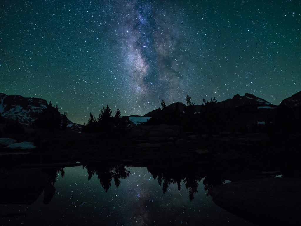
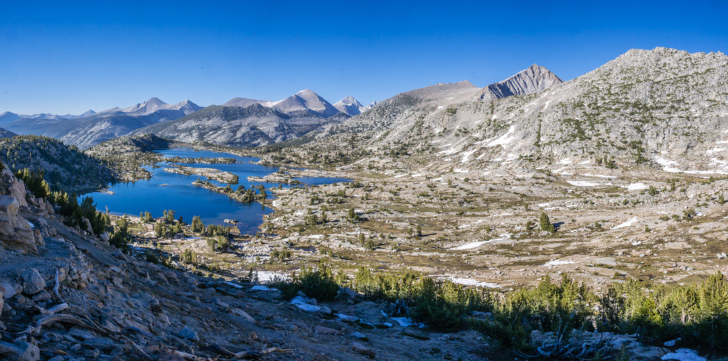
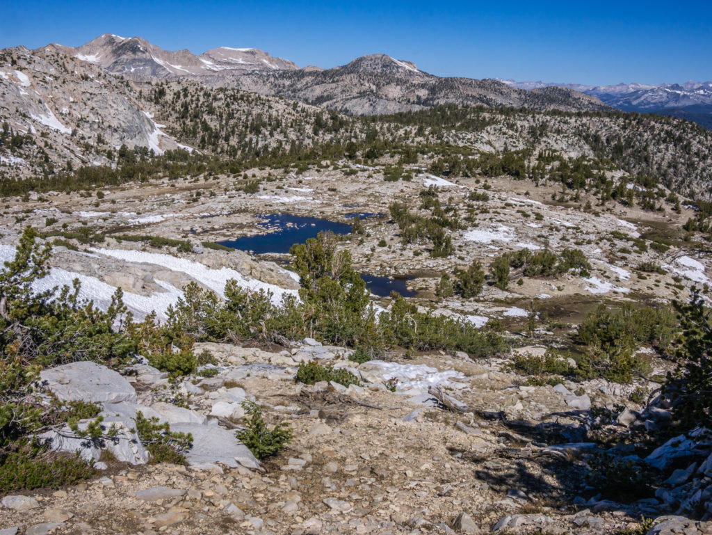
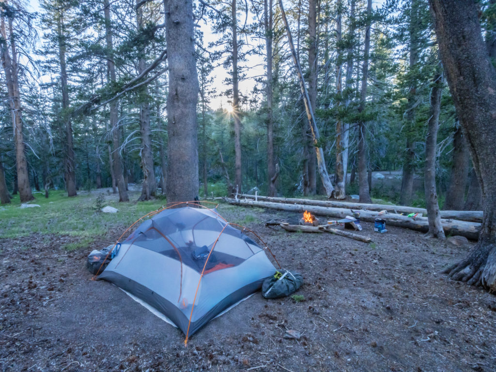
Reflections of the Milky Way captured from Marie Lake at Mile 866.
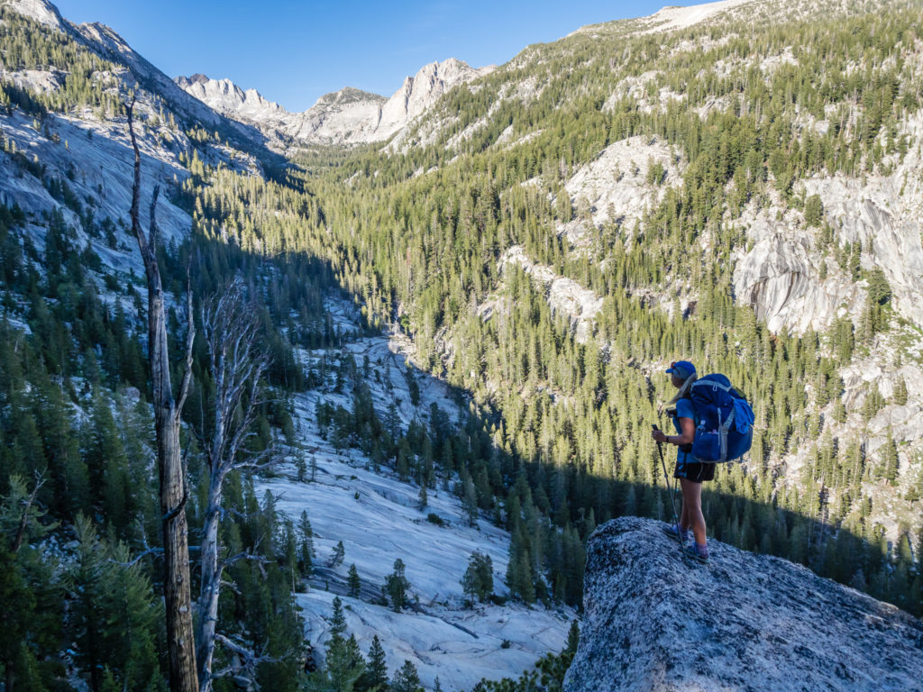
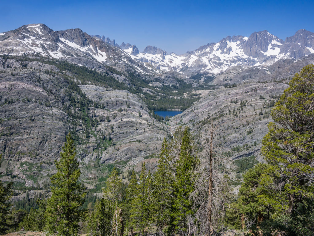
Day 71 – Tuesday 19th June 2018, Wild Camp in McClure Meadow at Mile 848 to Wild Camp by Marie Lake at Mile 866, 18 miles
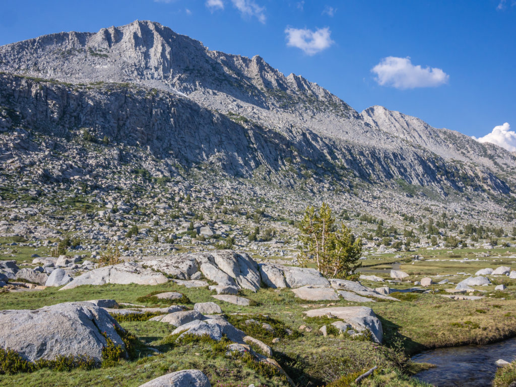
Our choice of wild camp last night may have looked picturesque as the sun set and the golden hour bathed McClure Meadow in a beautiful glow. However, the following morning was completely different when we woke up to a frozen tent. As we didn’t have an early morning mission to get over a pass today, we decided to wait for the sun to rise in the valley to dry out the tent fly. The meadow still looked pretty covered in glittering frost, but it was the mosquitoes that spoiled the moment as we were plagued by clouds of them as soon as the temperature started to increase.
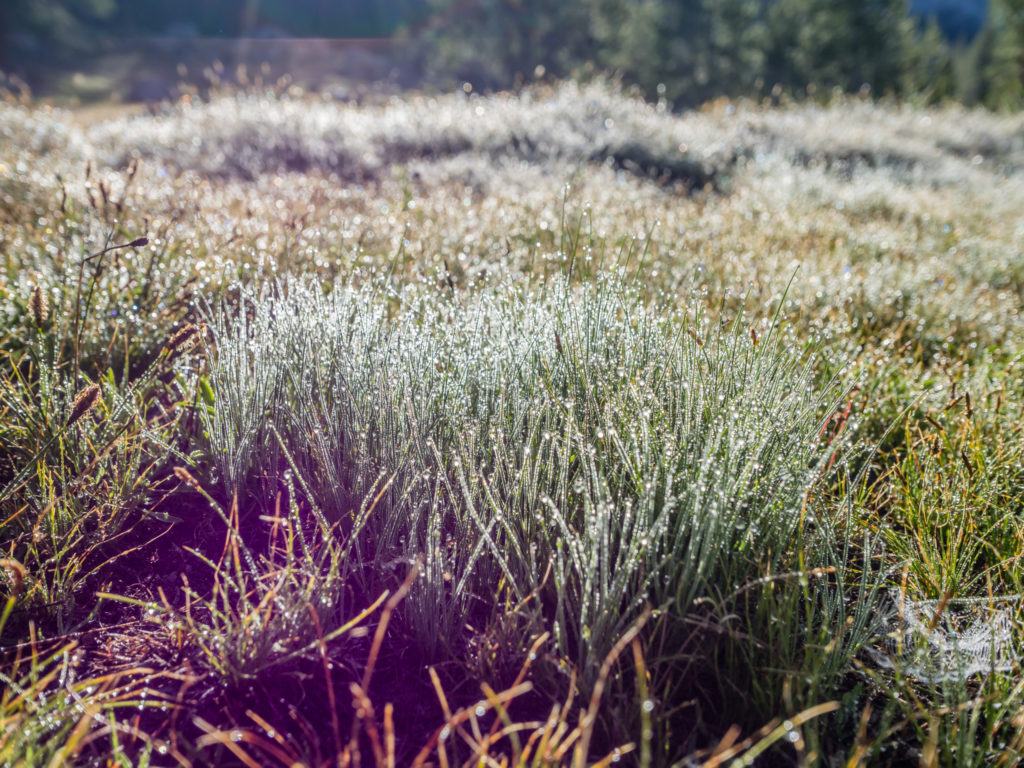
Waking up to early morning frost on McClure Meadow.
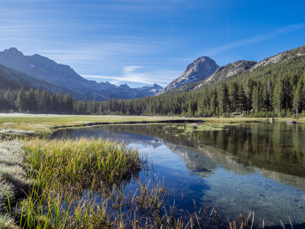
Beautiful reflections on a swollen Evolution Creek.
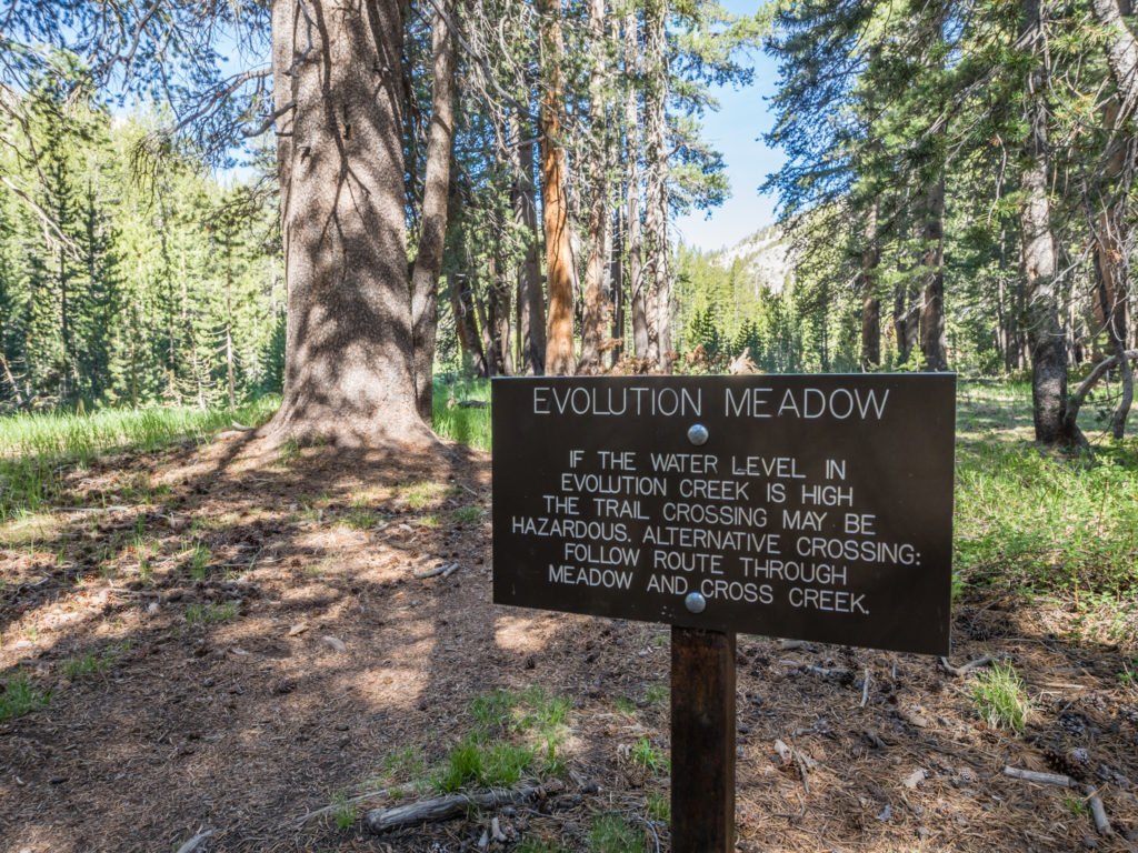
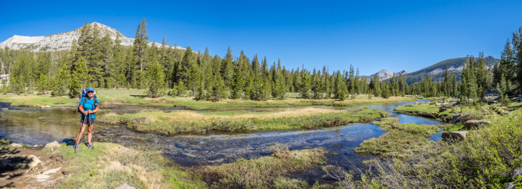
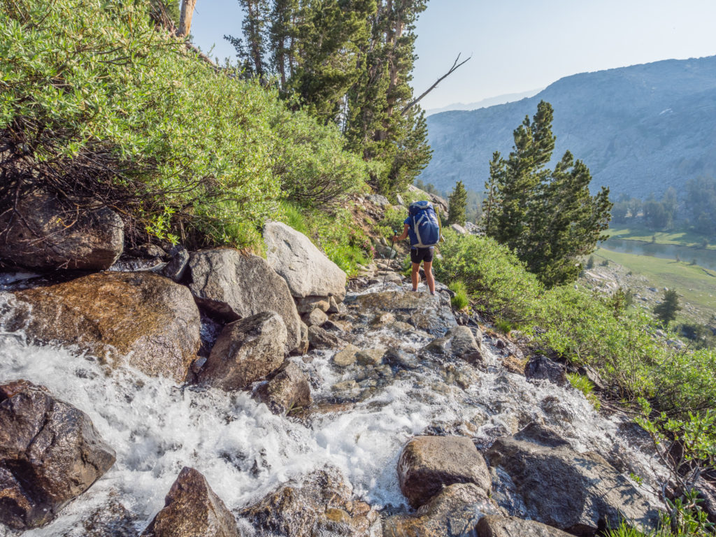
So as soon as everything had dried out and we had warmed up, we were glad to be on our way. As we set off walking through Evolution Valley, our first challenge of the day was fording Evolution Creek. The creek is considered as one of the most difficult to cross in the High Sierra as it can be both deep and fast flowing. With this in mind, we opted to take the ‘High Water Alternate Route’ that goes through Evolution Meadow. The creek in the meadow was much calmer, however the water level was still deep in places, coming just above the knee when we crossed. It was also freezing cold!
We decided on taking the ‘High Water Alternate Route’ through Evolution Meadow.
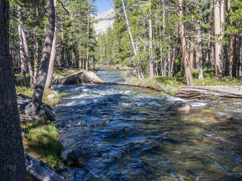
We avoided crossing the very full and fast flowing Evolution Creek.
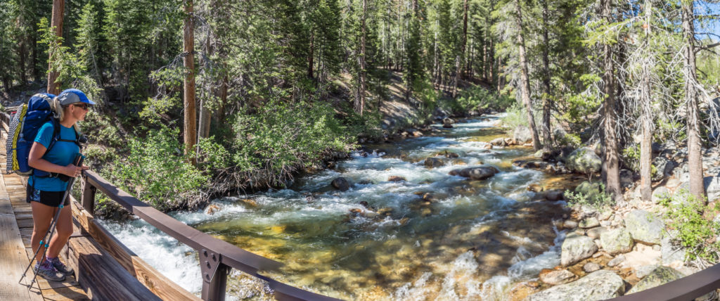
Thankfully later that morning when we also had to cross the raging South Fork San Joaquin River, it was via a wooden bridge. Further up trail where we crossed it once more, a steel bridge was in place this time, making it a whole lot easier than a dubious rock hop! The rest of the morning was then a scenic ridge walk alongside the river, which made a nice change to get out of the woods as we now had a tremendous view down the valley. Next to the river there is a giant boulder known as the John Muir Rock that dates back to his time first visiting the Sierra. The engraving on the rock is very worn and faded now, but it’s a real piece of history right on the trail.
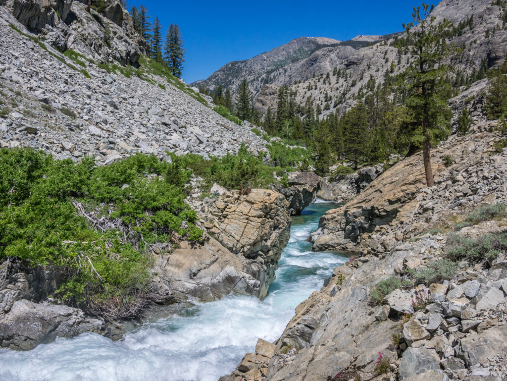
Enjoying walking alongside the South Fork San Joaquin River.
Walking beside the turquoise rushing waters made a nice change from being in the forest.
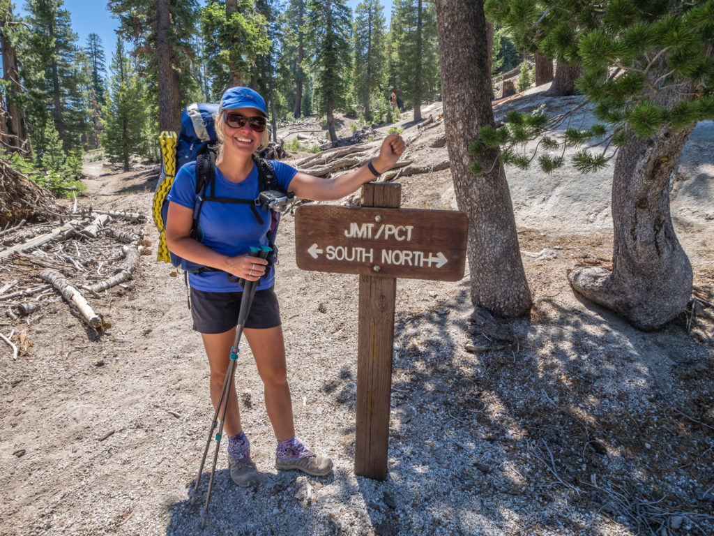
An important aspect of the trail today was that we crossed from Kings Canyon National Park into the John Muir Wilderness, part of the Sierra National Forest. Whilst we were filming at the new trail sign, we were passed by a National Park Trail Maintenance Crew who were armed with chain saws and axes ready to clear the JMT/PCT trail of fallen trees. They stopped briefly to chat to us about the park and the important work they do in restoring the trail to try and minimise erosion of an already heavily impacted area. They were just out for the summer, but we thought what a wonderful temporary job to have! Spending all summer outdoors in one of the most scenic places in the world – how do we apply?
Crossing the river by bridge and leaving Kings Canyon National Park with lots of wonderful memories from our PCT journey so far!
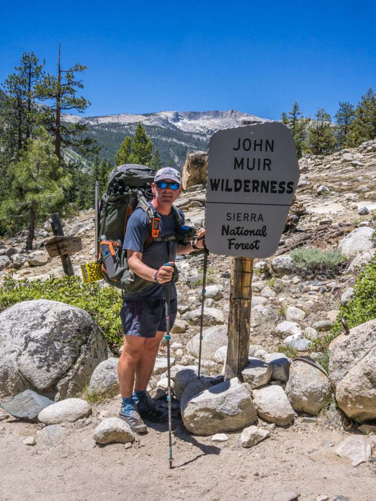
Entering the John Muir Wilderness… Cue more stunning scenery!
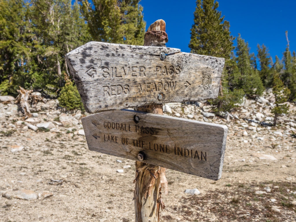
Having already organised our food resupply packages in Bishop meant that we could bypass Muir Trail Ranch, one of the usual resupply stops just off trail for both PCTers and JMTers. When we passed through on the JMT there was an excellent choice of freebie goodies in well organised ‘Hiker Bins’ (surplus food and toiletry resupply items that other hikers had donated after collecting their packages), so we were kind of in two minds whether to stop by. They also have overnight cabins, hot springs to bathe in and serve evening meals to guests. However, when we reached the trail junction with the turn off to MTR, there was a notice saying that they were currently open to hikers for the collection of resupply packages only. Full facilities would be available from 22nd June. (At least that solved our dilemma of not having to hike off trail an extra 3 miles!)
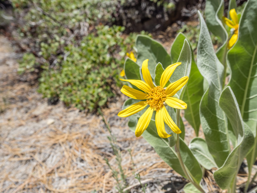
Along the trail we have started seeing bright yellow flowers that remind us of sunflowers. They have a really strong aroma and fill the area with colour.
Lunch today was in a scenic spot by the South Fork San Joaquin River at a riverside camp site we had used previously on the JMT. It was nice to revisit and sit there and reminisce about those late summer days on our favourite thru-hike. The immediate difference compared with four years ago was that the water level was significantly higher and the river was much faster flowing. We also had the annoyance of mosquitoes again, so out came the Deet spray affording us a little reprieve whilst we finished our tuna mayo wraps.
Water, water everywhere! No wonder we were having a problem with mosquitoes.
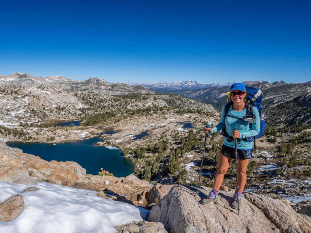
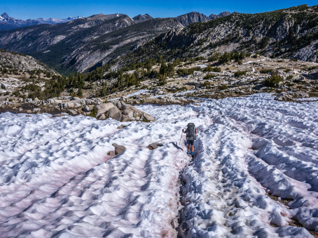
Our lunchtime calorie intake was to give us enough energy for the long, uphill climb to reach Selden Pass. Typically, this far in the High Sierra we had tried to get over a mountain pass each day first thing in the morning to avoid snow melt and post-holing. However as Selden Pass was lower in elevation compared to the previous five passes, and as we didn’t think they’d be much snow left after another hot, sunny week in the Sierra, we chanced it with a late afternoon traverse. We swiftly walked around the lakeside of Sally Keyes Lakes knowing it to be a mosquito hot spot, then made our way up to Heart Lake, not really getting chance to appreciate our beautiful surroundings because of being in bug hell.
Looking onto Heart Lake. We didn’t get much time to appreciate the view as we moved swiftly on to avoid the mosquito clouds.
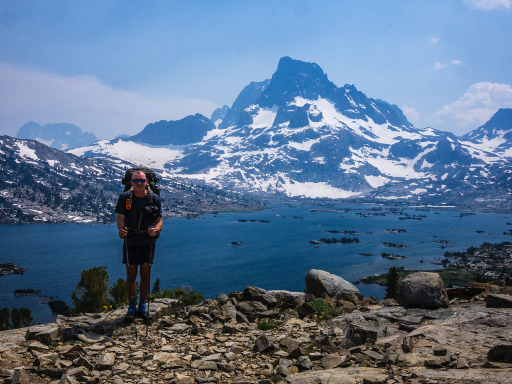
Finally after some more rocky switchbacks continually trying to dodge the fiercely hungry mosquitoes, we were on to the top of Selden Pass at 10,910 feet. As we predicted, there were only a few patches of snow either side of the pass that could easily be avoided by walking on rocks alongside the general route where the trail was covered over.
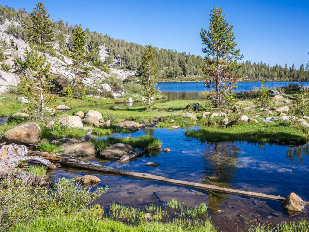
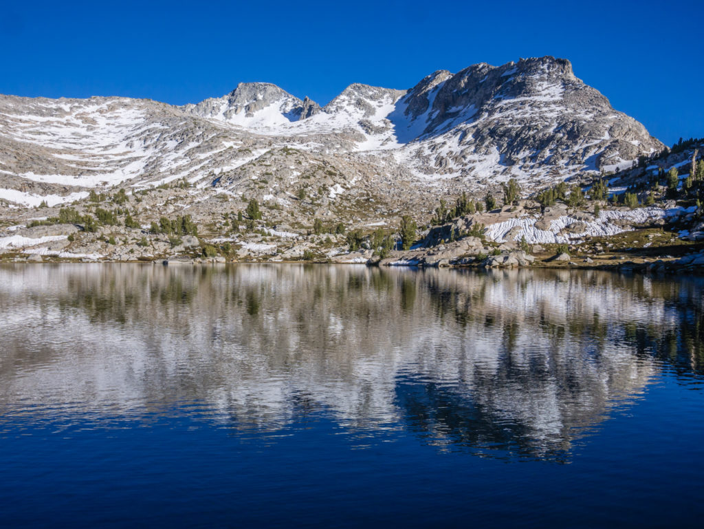
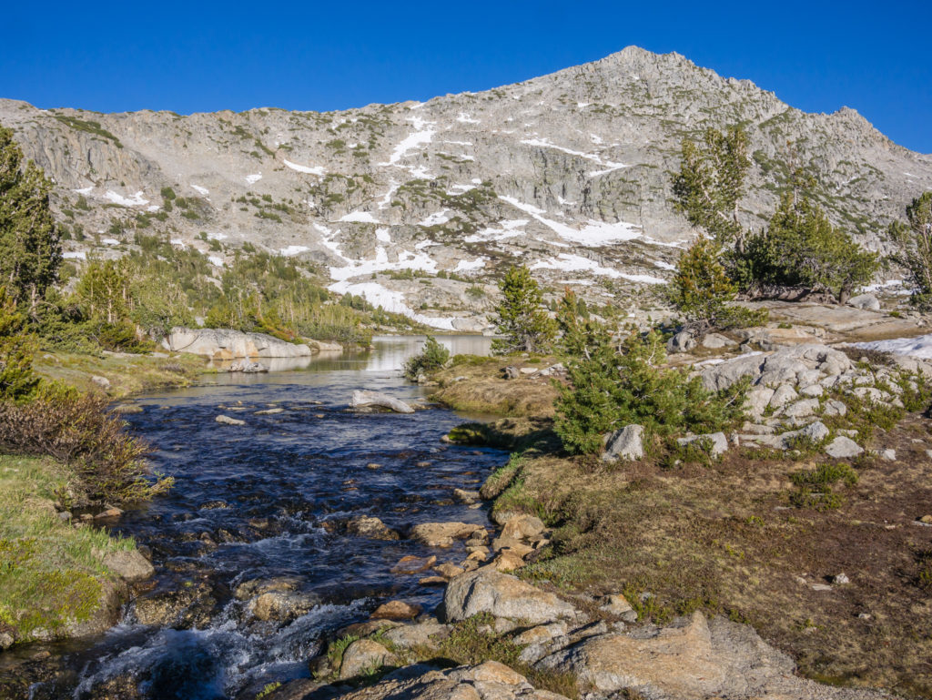
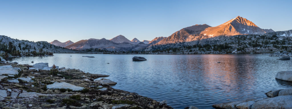
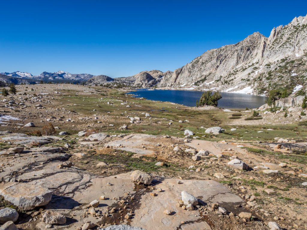
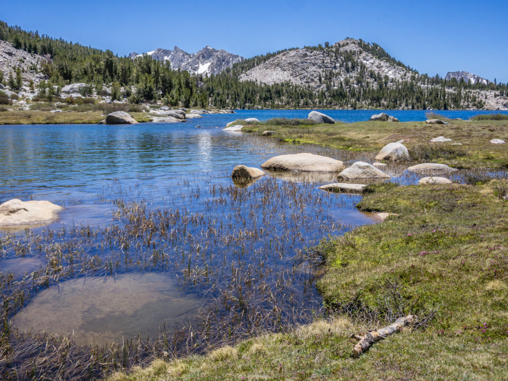
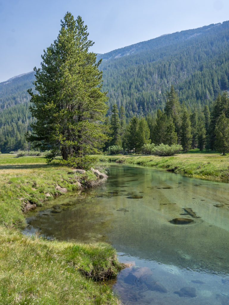
Looking onto Marie Lake from the top of Selden Pass.
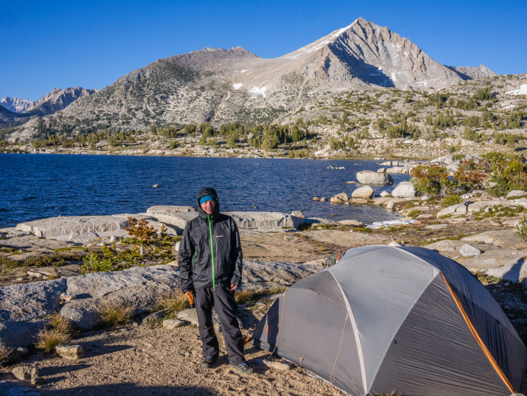
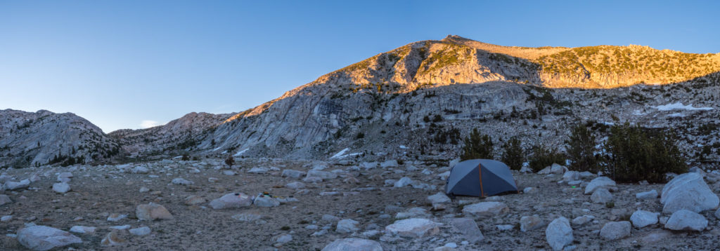
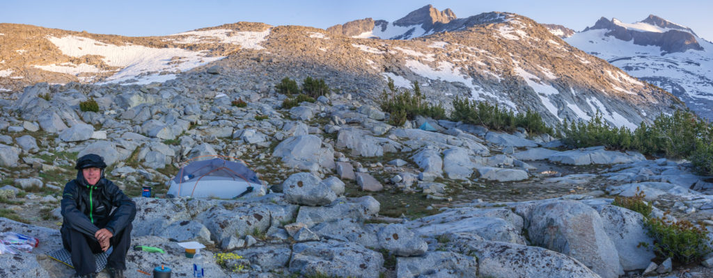
Once over the pass, our destination of choice was Marie Lake. After hiking up to the incredibly scenic spot early one morning on the JMT, for four years it had been Wayne’s dream wild camp location. So we planned it into our itinerary, as not only is the lake stunning but it is also a dark sky area which is perfect for star photography. At 10,500 feet, we thought the altitude would keep the mosquitoes at bay, but somehow they have adapted into supersonic biting machines at any elevation as they were out in force as soon as we pitched around the lake. Needless to say, it did not make for a comfortable rest stop despite the stunning view.
Walking around the outlet of Marie Lake looking for a suitable spot to camp. We had high hopes for this location!
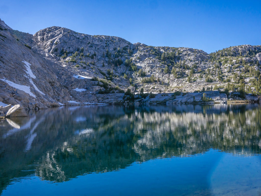
Beautiful reflections on Marie Lake.
We were trying not to let the mosquitoes spoil what is a stunning section of the PCT!
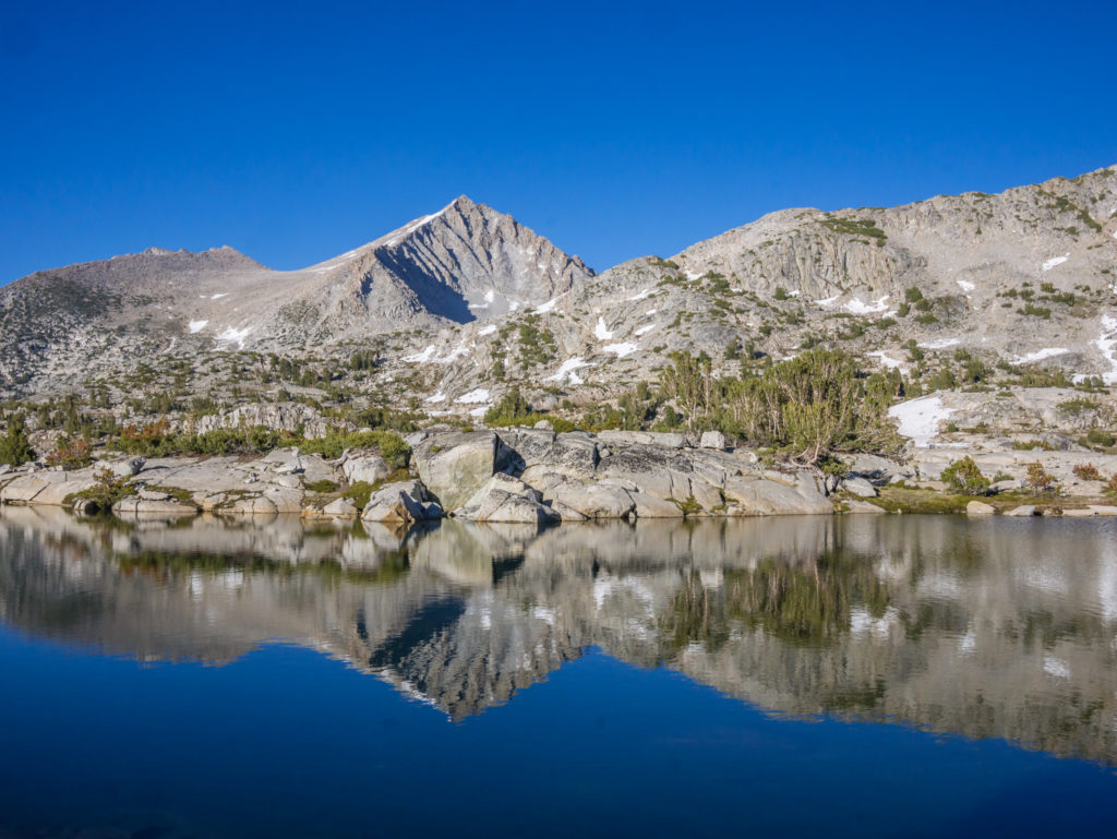
Calm, still waters produce mirror like reflections.
We crossed over the outlet to a mini island where we camped looking onto the north shore of the lake.
Wayne’s new tactic for cooking dinner is to completely cover up by wearing his mosquito head net as well as his waterproofs as they cannot impregnate the material. But it is still a nuisance when they are literally swarming everywhere. Dinner was therefore a whirlwind affair as we couldn’t get into the tent quick enough. It was our only place of solace until the sun went down and it became too cold for them to continue bothering us. Wayne’s dream wild camp had proven not so great in mosquito season. Maybe we need to try again one September!
Trained for war! Out came the battle garments to combat the mosquitoes!
Our camp spot at Marie Lake looking across to the north shore.
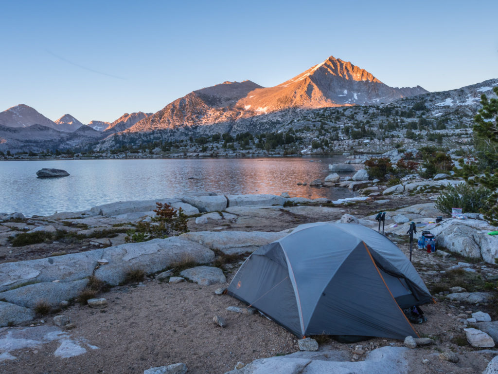
Marie Lake in the Golden Hour.
Day 72 – Wednesday 20th June 2018, Wild Camp by Marie Lake at Mile 866 to Wild Camp by Silver Lake at Mile 884, 18 miles
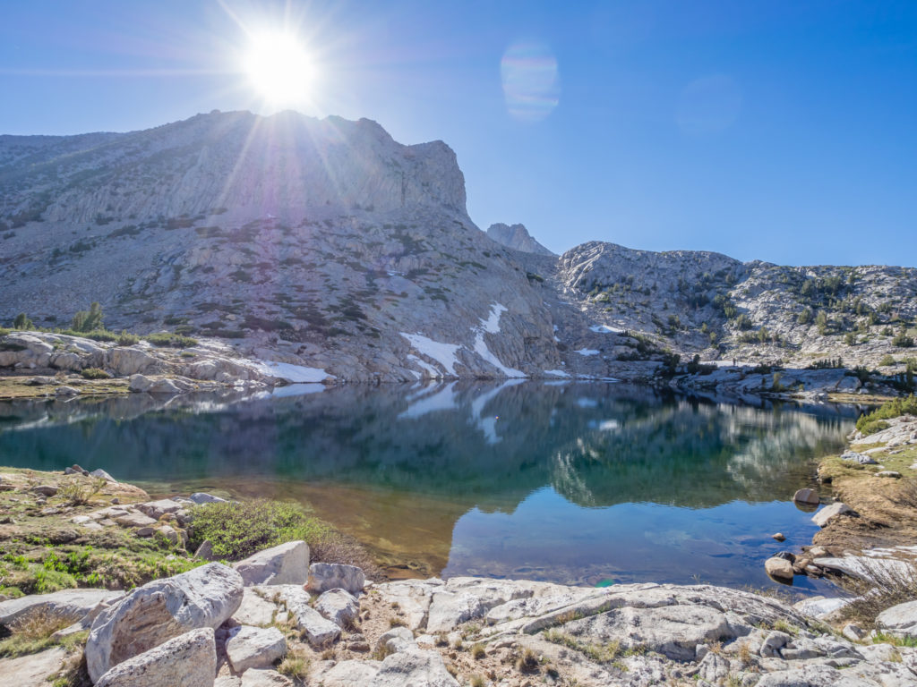
Thankfully, by Marie Lake it was much too cold for the mosquitoes during the early hours so Wayne managed to at least get out of the tent without fear of instant attack and set up for some star photography. Having spent the best part of 70 days without a single cloud, meaning Wayne was not getting any opportunities for time-lapse (and therefore carrying a tripod for nothing), he was finally getting the chance to put it to some use! And it was well worth getting up at 2am for! He was able to capture the Milky Way with a long exposure shot, and get some subtle reflections on the lake.
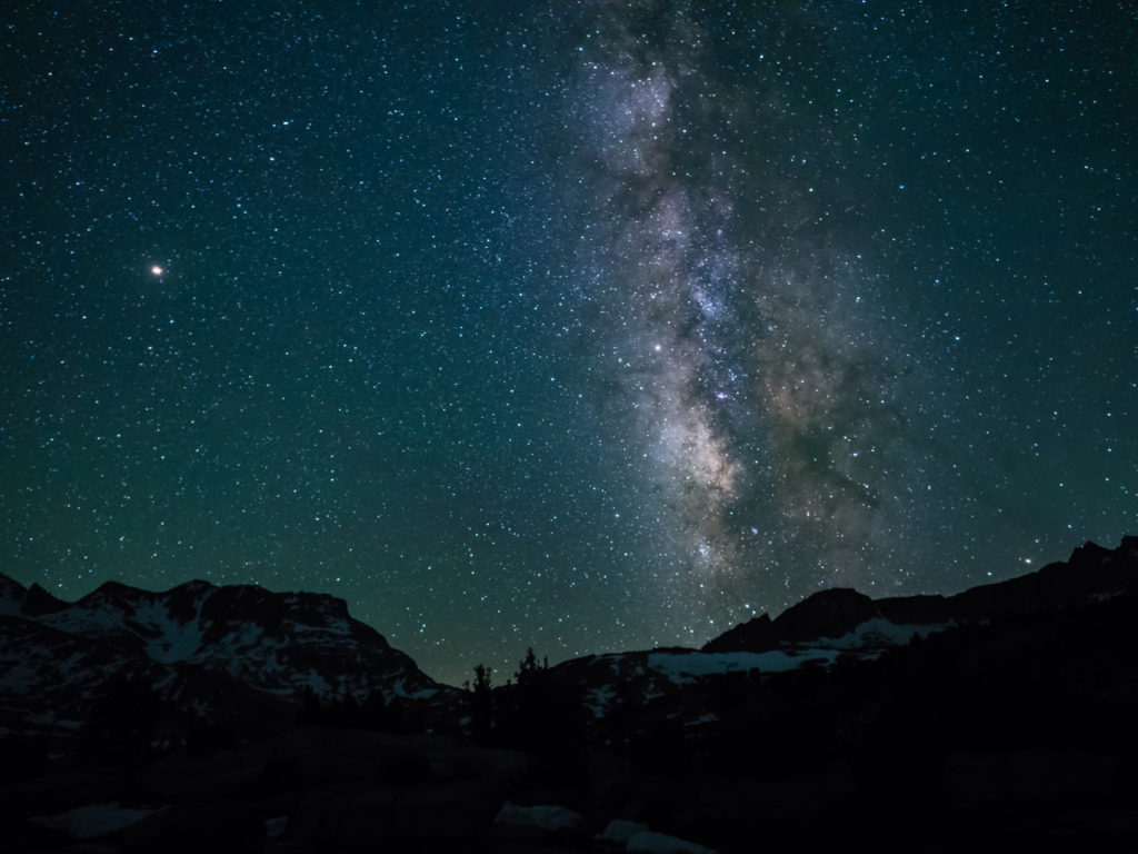
Capturing the Milky Way from Marie Lake.
After a broken sleep, but successful star photography shoot, we woke up at 7am with the sun already up and warming the tent through nicely. The only downside was that the mosquitoes were already swarming, intent on a good feast as we were the only victims in the vicinity. So we quickly packed everything up and made a hasty departure, not even taking the time for any photos of the lake in the early morning light through fear of getting bitten to death!
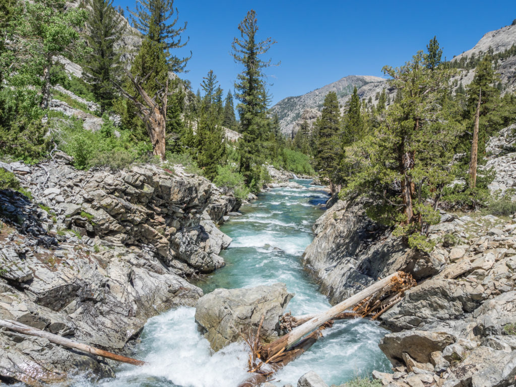
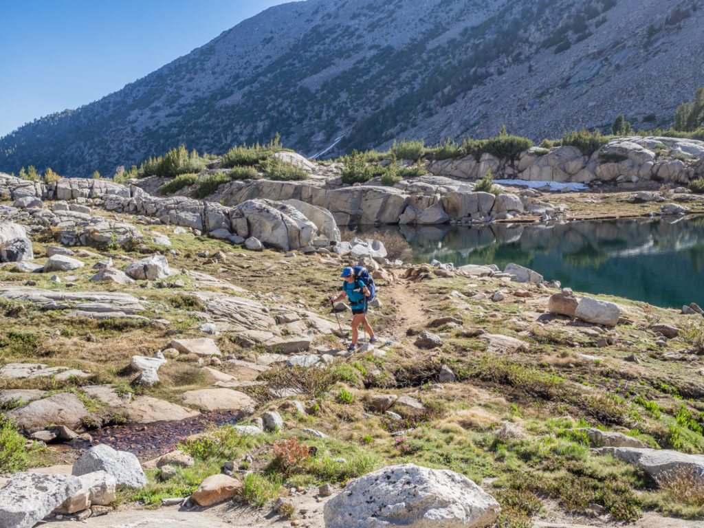
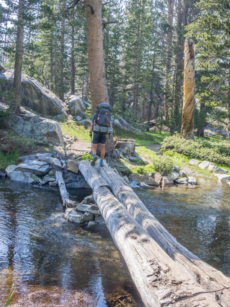
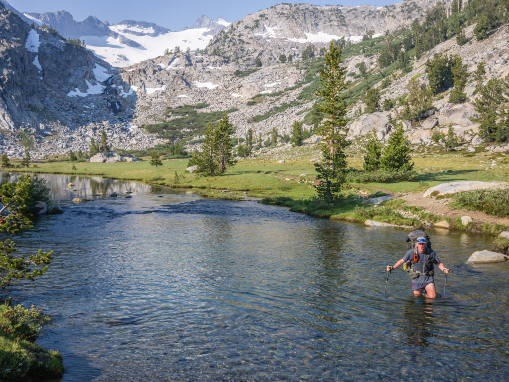
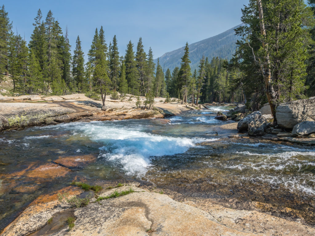
Apart from the Milky Way shots, one positive of camping at Marie Lake was that it set us up well for fording Bear Creek, another of the major river crossings along the PCT. After hiking along the trail a couple of miles, we first crossed the West Fork of Bear Creek at Mile 868.2. There was a strong current and the water level was knee-deep, but we managed it successfully without any problems. The main Bear Creek ford at Mile 869.1 again was manageable when we faced the flow. The crossing was wide which helped lessen the current, but the water level was mid-thigh deep in places (remember I’m a short person!) But all was OK! (I think we have at least one creek that is waist-high still to come though!)
Leaving Marie Lake and preparing for a day of creek crossings.
More reflections on this pretty part of the trail.
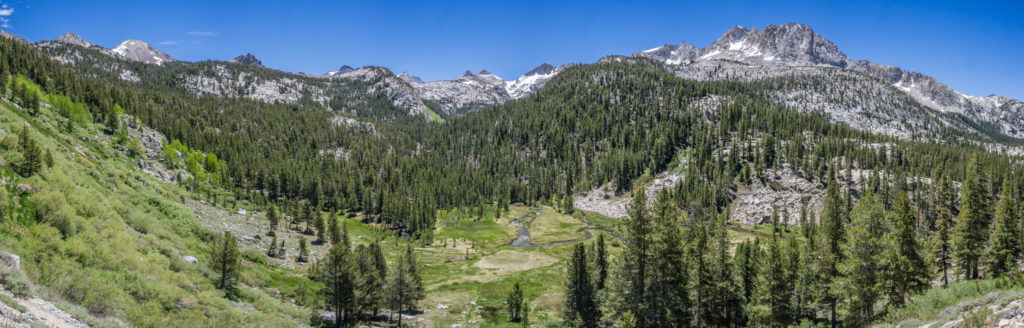
Panorama showing just one of the many expansive and flooded meadows that we passed.
We had a much easier day of creek crossings than we initially expected.
After the creek crossings, the trail was steady, weaving along through shaded woodland but we were both not feeling it today. The last five days traversing a mountain pass per day had definitely caught up with us. We were both really exhausted and today just felt like walking for walking’s sake. Quite literally we just wanted to get there and that’s not how it’s meant to feel. Usually it’s only one of us that has a ‘wobble’ kind of day and the other remains positive and brings the other one round. Not helping to improve our mood, it was damp and boggy in the forest and quite often the trail was turning into muddy swamps, so the dreaded mosquitoes were blighting our day once again.
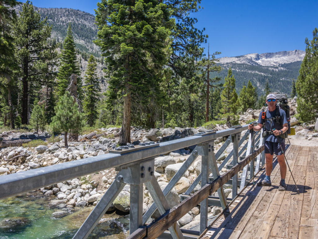
Thankfully we could cross the raging creek by bridge this time!
We were then treated to four miles of downhill to the junction with Vermilion Valley Resort Ferry Trail, where there were lots of switchbacks taking us from 10,000 feet down to 8,000 feet. The thought of lunch when we reached the junction kept us going. But we weren’t thrilled that we then had to go back up 2,000 feet hiking around the Vermilion Cliffs as we made our way up to Silver Pass. Our intention wasn’t to go over the pass today, but we had planned on camping about a mile before the top around Silver Lake. (We just hoped it wasn’t going to be a repeat of last night’s mosquito misery!) I guess now mosquito season is in full swing, it’s something we’re going to have to get used to.
It helped that after lunch we found a nice rocky spot directly in the wind, which kept them at bay. So we had a cup of tea and biscuits, (tea is the cure to all ills) and I filled up our collapsible bowl with water from a nearby creek and washed my hair. After 7 days of it being tied up and hidden by a cap, washing it felt so good!
Our next motivator was our second chocolate bar of the day, which we agreed we’d have when we made it to the top of the switchbacks on our way up to Silver Lake. (We dangle these little carrots all day long and treat different sections of the trail as mini milestones to accomplish.) On this occasion, we didn’t quite make it all the way to the top before we stopped for a snack break, but as it was already 5:30pm, we needed another energy boost to get us through the final 3 miles. Just as an aside, to pass the time on the trail sometimes, we’ve made up our own game of ‘Chocolate Bar Top Trumps’. We both have the same number of chocolate bars, but choose whichever we want each day from our own bear can. So we compare with categories like ‘Peanut power versus biscuit power’, how many calories from fat, how many grams per bar size, how much sodium etc. It keeps us entertained anyway!
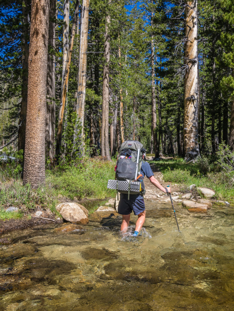
Just when we thought we were getting close to Silver Lake and our feet had about dried out before camp, we had two crossings of the North Fork Mono Creek to contend with. Both were unavoidable in getting our shoes wet for what felt like the hundredth time today already! One consolation was that we got to walk beside an impressively large waterfall, but there was no chance of our shoes drying out now before morning, which is never very nice putting on cold, wet shoes first thing in the day.
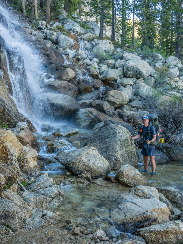
Passing a rushing waterfall helped to lift the mood.
After an already long and mentally challenging day, the last mile or so to Silver Lake seemed never-ending. There were mosquitoes in their hundreds plaguing us as we walked through Pocket Meadow on our way up to the lake, so of course we were praying it would either be mosquito free around the lake, or that it would be too cold and windy for them to get to us! The final switchbacks took a lot of effort and we still couldn’t see the lake for what felt like the longest time, but eventually it came into view. (The lake is actually lower than the trail and hidden by rocky outcrops so you have to hike a little way off trail to reach the lakeside.)
We had a tremendous view hiking around the Vermilion Cliffs before we reached Silver Pass.
Instead of going down towards the water, we decided to set up camp on a gravelly area to the east of the lake, which was quite exposed so we had a good breeze blowing through. Three other PCTers hiked by when we were preparing dinner and set up camp all around us as it was a perfect mosquito free spot! (Thankfully!) Making for a good end to the day, we also had a lovely sunset with a subtle alpine glow of pink-blue behind a skyline of snow-capped peaks making it look even more dramatic.
Our breezy camp spot on the plateau near to Silver Lake, which worked in our favour keeping the mosquitoes at bay.
Although it was another long hiking day, we now have less than a mile to reach the top of Silver Pass tomorrow. From our viewpoint by the lake, the pass looks free of snow, so we have set ourselves up for a good start in the morning. Let’s hope after a good night’s sleep we’re back in the zone and ready to cover more miles without it feeling so hard!
Day 73 – Thursday 21st June 2018, Wild Camp by Silver Lake at Mile 884 to Wild Camp by Deer Creek at Mile 901, 17 miles
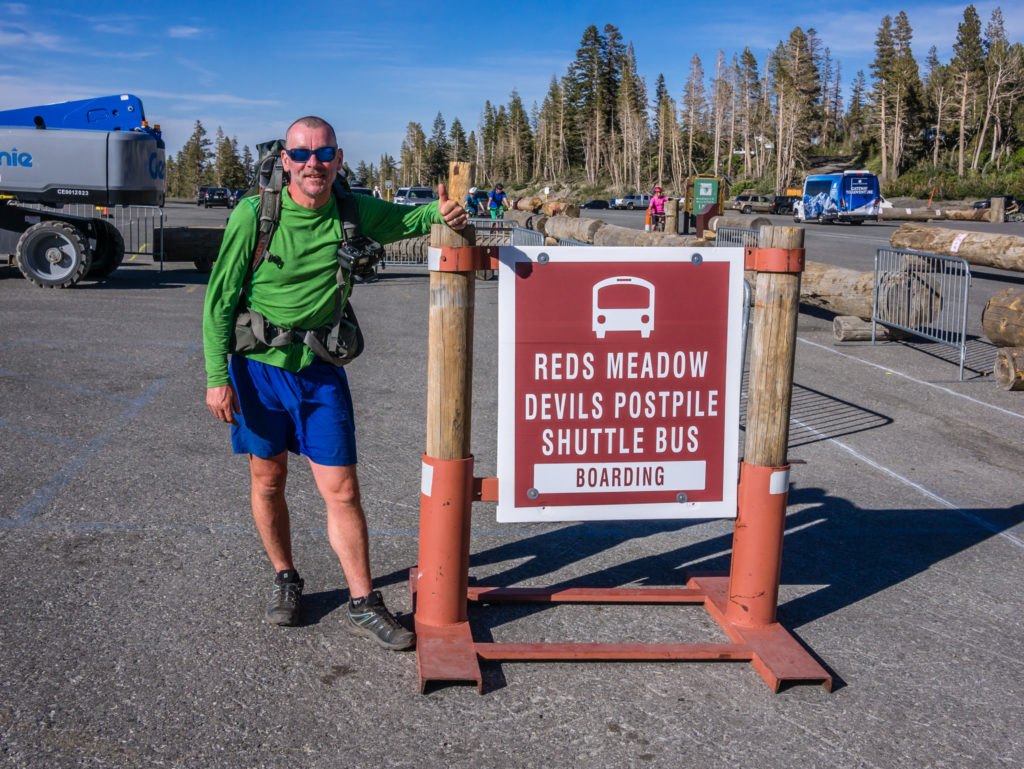
Optimistically, we had set the alarm for 6am but then switched it off and didn’t move until 7am! Both of us are just feeling really tired and are definitely ready for a zero day. We don’t have a zero day planned until July 5th when we reach Lake Tahoe, which is still a long way off, so we have the next best thing tomorrow. We have a nearo! We’ve planned on walking 6 miles to Reds Meadow Resort where we’ll be camping overnight after getting the shuttle into Mammoth to collect our food resupply package from the Post Office. We’re also hoping to do some laundry in Mammoth as we’ve had a 7 day stint in the mountains and everything is ready for a proper wash! (There may also be some ‘proper’ food and a bottle of wine going back up the mountain with us to Reds seeing as we’ll be getting the shuttle back and won’t have to hike with it!)
With that very thought keeping us going we got back on the trail and were in a slightly better mood. Silver Lake looked beautiful in the early morning sun and even better, we had less than a mile to go to reach the top of Silver Pass at Mile 884.9. At 10,748 feet, the pass was not so difficult as those we had traversed previously, the trail following one long contour as opposed to climbing up several switchbacks.
Looking onto Silver Lake in the early morning sun.
At the top of Silver Pass, which was a much easier traverse than any of those we had climbed previously.
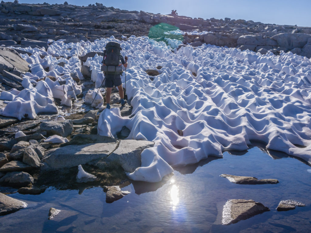
Pleasingly, there wasn’t any snow remaining on the south approach, but there were several patches to traverse on the north side which were a little slippery as they’d already had the sun on them first thing. We couldn’t stop to put our micro spikes on as we’d put them inside our bear cans now they were practically empty of food and they were buried in our packs so it would be hassle to unpack everything again. We therefore just had to take care and take it slow when needed to avoid sliding. In the end, as the foot holes were slippery, I zigzagged across the snow between the sun cups instead, as in those places the snow was still quite crisp. Fortunately, it was only a few hundred feet of descent before the snow cleared.
Slowly but surely making our way through the snow-covered sections, minus micro spikes.
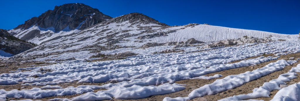
Panorama of the north side of the pass with patchy snow.
Looking back up to Silver Pass and the surrounding peaks.
Descending from Silver Pass, the trail wound down to Chief Lake, then on to Squaw Lake before running alongside Fish Creek. We stopped for our second breakfast just after the little wooden bridge crossing the creek, but we were once again pestered by mosquitoes, the 98% Deet seemingly not working today! (They seriously have developed a resistance to everything!)
Pleased that the rest of the trail was now mostly snow free!
Looking onto another pristine, alpine vista before heading down to Tully Hole.
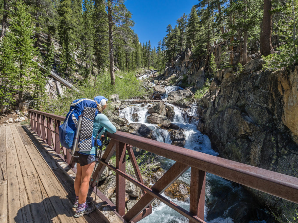
Having a bridge to cross the river makes such a difference. It’s the little things in life!
After crossing the creek again, this time getting wet feet as there wasn’t a bridge across, the trail wound down to Tully Hole, a picturesque meadow surrounded by thick pine forest and snow-capped mountains. It was the kind of scene you would find in a National Park brochure or travel magazine. The only downside, we were plagued by mosquitoes once again! We’re seriously hoping that our next few weeks are not blighted by these nuisance creatures as we continue hiking through Northern California as they really can spoil your day!
We were so looking forward to reaching Reds Meadow Resort the following day!
Tully Hole was such a picturesque spot!
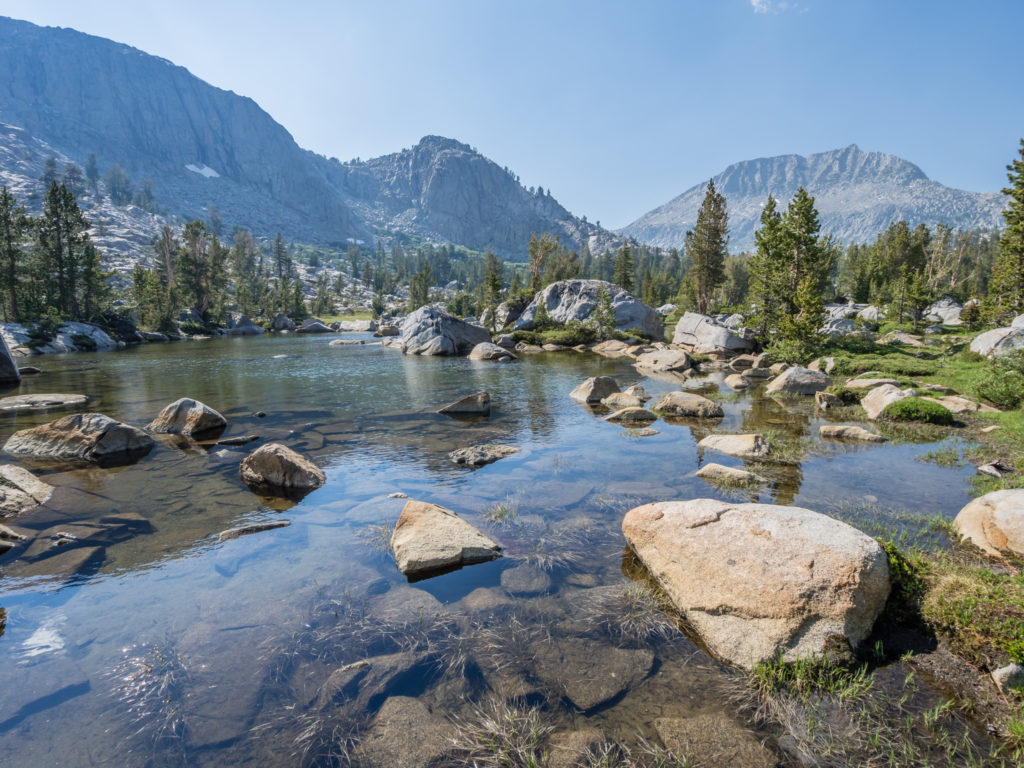
With so much effort now being put into mosquito avoidance, we’re getting quite savvy at picking the right spots to be free of their persistent presence. So today we enjoyed lunch by Lake Virginia, sat on a large boulder affording us a wonderful view of the lake, with a strong breeze that kept any mosquitoes at bay. After a good period of respite, we then hiked down to Purple Lake with its striking turquoise waters.
Passing but one of the many pristine lakes on this section.
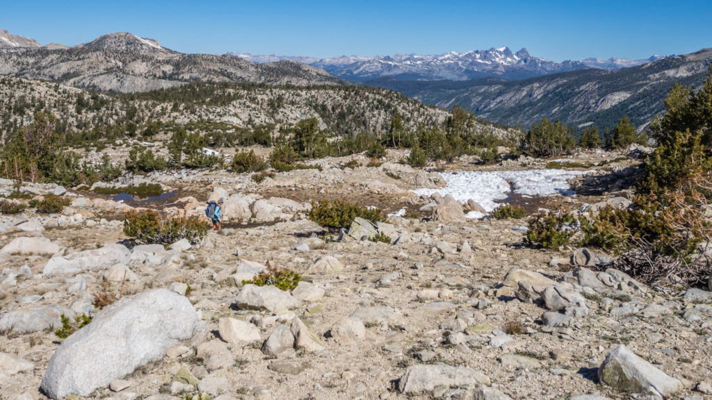
The PCT then went gradually uphill, winding around the mountainside towards the Duck Lake Trail. We continued along the ridge which gave us expansive views of the valley below and the mountain ranges beyond. It was hot climbing back up to 10,000 feet in the afternoon sun with very little shade so it was a welcome relief when the trail began descending again and took us into the comfort of the forest.
The ridge walk afforded us expansive views of the surrounding peaks.
It was such a contrast seeing huge mountains cloaked in green.
The highlight of today wasn’t the beautiful lakes we had passed, but the fact we had finally reached Mile 900! It was denoted simply with the figure written in pine cones in the middle of the trail. Now we’ve officially walked over a third of the entire PCT! (As pleasing as that is, it only amounts to 33% overall, so we know we’ve got to significantly increase our daily mileage over the next couple of months if we’re ever going to reach Canada before the end of September!)
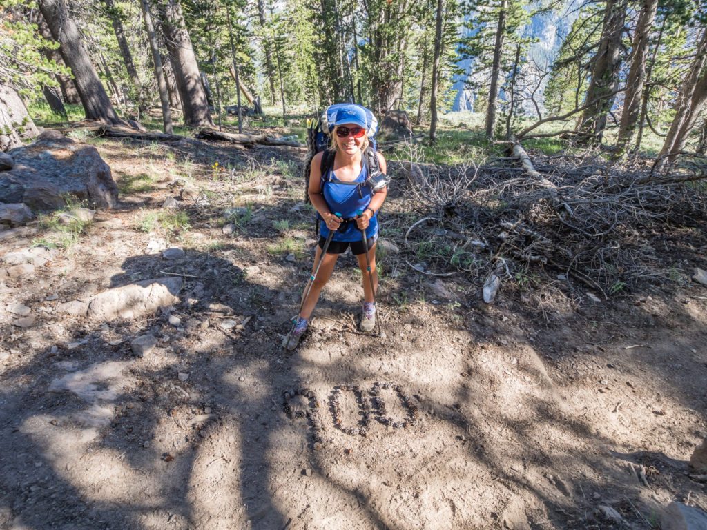
Another day, another milestone!
Shortly afterwards, we set up camp at Mile 901, just before the Deer Creek crossing. It was 6pm (an early finish!) so we still had a couple of hours of sunshine, and even though the camp site was close to the creek, it didn’t seem too bad in terms of mosquitoes and it also had a fire pit (2 major plus points!). So I got to work collecting bits of fallen wood from the forest floor to make a fire, whilst Wayne cleared out the fire pit and found us two logs to use as seating around it. Being close to water, we were also able to fill our collapsible bowl so we could have a proper wash without it being too cold or dark. It felt good that we had organised the tent and got everything sorted all before the sun dipped behind the mountains. It makes such a difference getting to camp a little earlier as we have much more time to get things done and everything isn’t such a rush before bedtime.
Our camp site in the woods beside Deer Creek.
It was the last of our food rations tonight, so we devoured our standard dinner of Idahoan Mash topped with a Minestrone rehydrated soup that we poured over as a sauce. Unfortunately, the gas ran out whilst boiling water needed for hot chocolates, so they were more of a chocolate milkshake, but they tasted good all the same. With it feeling like such a long week on the trail, we’re looking forward to treating ourselves to breakfast when we hike into Reds Meadow in the morning! It’s just a shame that here in America you can’t get a ‘full English’! (Where’s a Wetherspoons when you need one?!)
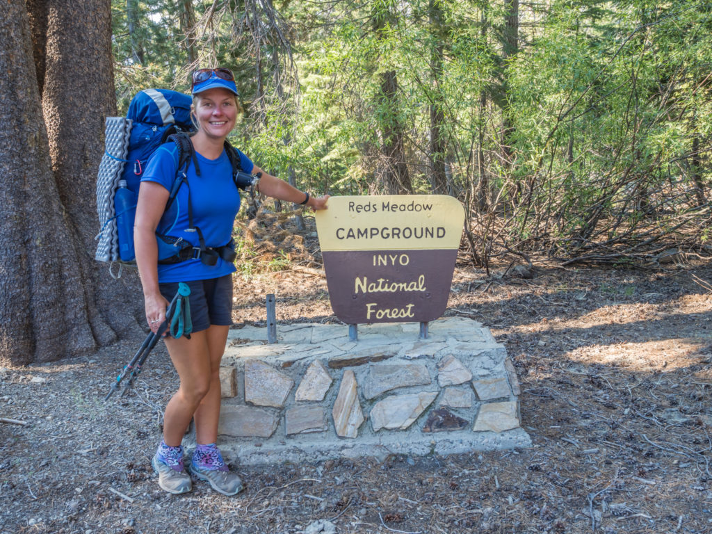
Day 74 – Friday 22nd June 2018, Wild Camp by Deer Creek at Mile 901 to Reds Meadow Campground, Inyo National Forest, at Mile 907, 6 miles
We were up and away from camp before 7:30am, the prospect of a cooked breakfast and a nearo day putting a very big spring in our step! It felt long overdue after such a demanding week hiking northwards through the High Sierra, so we were going to make the most of a rare ‘short’ hiking day!
The hike into Reds Meadow Resort was straightforward and we made good time. We followed Deer Creek before heading through Upper Crater Meadow, then past the distinctive peak of Red Cones before hiking through an old burn area that we remembered as being completely devastated back in 2014. There was still evidence of the burn, with many remaining trees all but charred stumps. Others that had been uprooted had simply toppled down the mountainside and there they still lay, just like someone had dropped a pot of toothpicks. But it was good to see four years on that new growth was occurring. The ground was cloaked in green as saplings were taking hold, and the few trees that had survived were in leaf, demonstrating that burns are needed to promote new growth, especially so for Sequoia trees.
After descending on some gentle switchbacks and reaching the trail junction, we diverted off the PCT to Reds Meadow Resort, a popular guest ranch with cabins, café and General Store. (The Reds Meadow name comes from Red Sotcher, who herded sheep there in the late 1800s). Leaving ourselves just six miles that morning to hike in, we made it in good time, arriving around 9:30am, eager to set ourselves up for the rest of the day with a hearty breakfast from the Mule House Café… Until we saw the price! We expected the café to be a little more on the expensive side with the resort having a captive market of hikers passing through daily. But we didn’t want to pay $15.95 each for the hiker breakfast, when it didn’t even come with a drink. So ‘Option 2’ was to pitch the tent at the nearby Inyo National Forest Campground and wait for food until we got the shuttle bus into town!
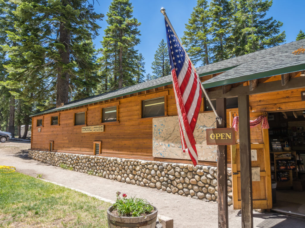
Excited to reach the Reds Meadow Resort Store until we saw the very heavily inflated prices.
We needed to get to the nearby town of Mammoth Lakes that day anyway as we had sent ourselves a food resupply parcel that was being held by the Post Office there. To reduce traffic on the valley road, a regular bus service between Reds Meadow and the Ski Resort in Mammoth operates every 30 minutes daily between 8am and 7pm, which is super convenient for hikers who need to get to town to do laundry or shopping. (Especially if you are budget conscious and want to avoid the extortionate prices at Reds. For example, I asked about showers and was told it was $7 for 7 minutes. Needless to say I decided on a bucket wash at the campground as $7 could buy us a bottle of wine!)
Being the thrifty hikers we are and all set to get breakfast later (hopefully from a chain restaurant like McDonald’s as it would be a lot cheaper), we were once again in the right place at the right time as we found ourselves on the receiving end of some good trail angel karma! First off, on a bench outside the store, a college graduate was conducting research about the use of mobile phones on the PCT. In return for answering a few questions on her survey (which was quick and easy as it was done electronically), she was giving hikers a whole array of goodies including carrots, pretzels, hummus, strawberries, jelly sweets and snack bars. So we had a good few handfuls, enough to keep us going a while longer at least, whilst we then hiked off to the nearby campground.
As an Inyo National Forest Campground it was $23 per pitch per night, which we thought was good value considering we had a picnic bench and the toilets were proper flush toilets with sink, running water and even a bar of soap! (We hadn’t realised when we pitched that the site also has a ‘Walk-in Backpackers’ area where hikers can camp for one night for free, which we ended up utilising the following night!) We were also lucky in that Susan, the campground host, after finding out we were thru-hiking the PCT, let us use her outside power point to re-charge all of our electronic devices!
We made the impromptu decision to camp at the Inyo National Forest Campground and then take the shuttle bus into Mammoth Lakes for food and laundry.
Now it was at the campground that we unwittingly met our second trail angel of the morning. As we were choosing where to pitch, a woman who was packing up her car asked us if we were PCT hikers. She explained that her son was currently on the trail (Trail Name: Grynch) and she was waiting for him with a new backpack and whole host of other wonderful treats as he would be passing through Reds Meadow sometime that day. Cue ‘Yes we are thru-hikers!’ Followed by the usual response ‘Oh you look too clean to be ‘hiker trash’! Well we do try and keep on top of the grime!
Anyway, Leah, as we later found out her name, then proceeded to open a giant box of doughnuts for us to help ourselves to and she also offered us root beers. Wow, what another wonderful act of kindness bestowed on us, because of course ‘the trail will provide’! (We would have been really peeved if we’d paid over $30 for breakfast when just by looking and smelling like a hiker we were given free food!)
An hour later we were on the bus heading into Mammoth Lakes armed with our micro spikes and ice axes ready to post home. With very little snow around now, we are assuming that we will no longer need them for the smaller passes in Yosemite and as we travel further north. Off-loading our snow gear will save us just under a kilogram of weight each, and when you’re carrying a fully loaded backpack every day, every single gram counts!
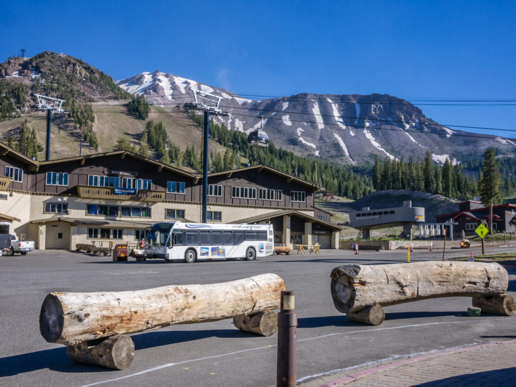
Heading into Mammoth Lakes, an upmarket ski and mountain biking resort town.
Town was a whistle-stop tour as usual. Once we reached ‘The Village’, there is a town trolley that does a loop to various points for free. However as we would have had to wait half an hour for the next bus going in the direction of the Post Office, it was quicker to walk. That’s one thing we learned very quickly from visiting the US in the past, that towns are not particularly well organised for pedestrians. Everything is so spread out, that you really need a car to get between places, which is very different to the UK, where everything you need is usually situated right in the town centre.
With our snow gear posted home (for a whopping $70) and our food resupply box collected, our next stop was the outdoor gear store as we needed camp soap, gas and a new wind shield for our stove. Being an upmarket ski town, Mammoth didn’t seem the type of place to have a McDonald’s, so we were also on the look out for any kind of fast food. We made a wrong turn down a side street, which happened to take us past the ‘Latin Market’. When we saw that it also doubled up as a taco café and was busy with Hispanics in and out, we know from experience that a place full of locals is the place to go. So in we went and out we came armed with fully loaded Californian burritos, complete with beans, jalapenos, salad, dressings, and a soda, all for $8 each. We sat on a picnic table outside with another PCTer named Easy Company and all three of us ate like it was our first meal in months!
With our hiker hunger satisfied for a while, we then completed our other tasks – laundry and a visit to the supermarket to purchase wine and food for that evening. (Well I did forfeit a proper shower!) As we were staying at a ‘proper’ campsite we were going to have a campfire and cook our own burgers. As usual, everything took twice as long as anticipated, and we only just managed to catch the last bus from town back to the ski resort, where we then had to change and get the shuttle back to Reds Meadow Inyo National Forest Campground.
Waiting for the bus to take us back to the campground. The 10 mile or so journey took around an hour. We had no intention of walking as off-trail miles don’t count!
The bus dropped us off right outside the campground and we returned to our campsite around 7pm. One of our neighbours kindly brought us over two bottles of Stella Artois beers ‘because we deserved them for hiking the PCT!’ Wayne then lit the camp fire and began prepping dinner. It was a nice, chilled evening, especially as we knew we weren’t getting back on the trail tomorrow until at least midday, which was check out time from the campsite. There’s a lot to be said for having a few treats as a morale booster, and after all that walking, we did feel like we deserved them!
Living up to my trail name! I seem to be having two plates or seconds of everything!
Day 75 – Saturday 23rd June 2018, Reds Meadow Campground, Inyo National Forest, at Mile 907 to Agnew Campground at Mile 915, 8 miles
I’d like to say that we enjoyed a ‘lazy’ morning at camp, but we had a multitude of tasks to get done before check out time, so it was a busy few hours leading up to midday.
The main job was sorting out our food resupply and filling up our bear cans once again, which was much easier this time round. This was because instead of having to cram in and carry 7 days of food, we’d only sent ourselves enough to get us to Tuolumne Meadows, which would take us 3 days to cover 35 miles. (We could have hiked it in 2 days, but we didn’t want to rush through this last section of the High Sierra!)
We also had a bucket wash, which felt great as I was able to wash my hair! With freshly laundered clothes as well, no one would consider us as ‘hiker trash’ today! Wayne even had a shave, making use of the mirror in the camp restrooms, a luxury item that is rarely used on the trail. He could finally see how much weight he has lost as currently he’s all skin and bone and needs to up his calorie intake again or they’ll be nothing left of him by the time we get to Canada!
After a late breakfast of fried egg cobs, we finally got back on the trail and re-joined the PCT at 1pm. As we were just doing half a day, we had only planned on hiking 8 miles to the Agnew Campground further up the valley. Today was generally an easy walk taking us through the Devil’s Postpile National Monument area. As we had already seen the rock formation up close on the JMT, we hiked along the ridge on the opposite side of the river and viewed the Postpile from up high in the valley.
Leaving the Reds Meadow Resort area and re-joining the PCT.
It was a busy section of trail as we were now in ‘day hiker’ territory, and we didn’t exactly blend in with our big packs! But it was nice to see plenty of children on the trail, out with their parents, enjoying the fresh air and sights and sounds of nature in the great outdoors!

Looking onto the Devil’s Postpile National Monument area from across the valley.
We stopped at the Soda Springs Campground along the way, simply as it was easier to fill our bottles with water from a tap than filter from a creek. We also utilised the picnic bench to sit and have lunch, in a much more civilised manner than perching on a rock. Today, as we had purchased some fresh foods in town, we had avocado, tomato and cheese cobs with mayonnaise. After 75 days on the trail, anything that is different to tuna is a real treat!
When we reached the Agnew Campground, we were really disappointed. It was another Inyo National Forest Campground, but nothing at all like last night’s wonderful, well-kept spot. For a start, the pitches were overgrown and more geared towards campers with a motor home or RV as there was nowhere suitable to put our tent. The toilets were pit toilets, and although clean, they did not compare with a flush and sink with running water, especially not when the site fees were still the same at $23 a night.
We could have actually put up with all of that if it hadn’t been for the clouds of mosquitoes attacking us as soon as we walked along the campground road. It was incessant and we were getting more and more agitated. So we made the hasty decision to hitch back to last night’s campground, which was both pleasant and relaxing as it was relatively free of any such biting bugs. We had done our 8 miles, so we hadn’t missed out any of the PCT trail. Conveniently, the shuttle bus goes straight past Agnew Campground, so we would just get a lift back there in the morning and continue on the trail from where we had left off.
So that’s what we did! It was a great plan! But instead of the shuttle bus, we got picked up straight away by hiker Justin, who was returning to Reds after picking up his car in Mammoth. He dropped us directly outside the campground, where we walked in and took a spot in the ‘Backpackers Walk-in Area’ so that we could camp for free. There were already some PCTers pitched for the night so we met Camp Finder, a retired German thru-hiker, and Laurids, a young guy from Denmark completing another section of the PCT. He started thru-hiking the trail in 2017 but had to bail out of the High Sierra because of the extremely high snow year, which made both the mountain passes and creek crossings dangerous and even more of a challenge. The conditions really required solid winter mountaineering skills!
Laurids was really excited to be returning to the trail and it was good to get his take on the PCT as a whole, having experienced last year’s challenging conditions. What we couldn’t believe was that we had just missed a bear encounter! Earlier that evening, Laurids like us, had also hitched a ride to the campground. Whilst in the car, a black bear was walking down the middle of the road, right before the turn-off to the camping area. He filmed the bear on his phone from the car window as it sauntered off into the forest, which must have been just a short while before we arrived. I guess you’ve just got to be in the right place at the right time.
We might be fortuitous with trail magic but in all the time we’ve ever spent in the American wilderness, we’ve never once seen a bear! With another 1,600 or so miles to go, we might get lucky and see one before we make it to Canada! On the other hand, if we don’t see a bear, we’re obviously doing all the right things with regards to ‘Leave No Trace’ principles, which can only be considered a good thing.
Day 76 – Sunday 24th June 2018, Agnew Campground at Mile 915 to Wild Camp after Donohue Pass at Mile 930, 15 miles
We had covered the miles, but we didn’t actually stay at the Agnew Campground, instead hitching back to Reds Meadow to avoid mosquito hell! So first thing Sunday morning we had to take the shuttle bus and return to the Agnew Campground where we re-joined the PCT from the point where we had left off yesterday. (It might sound like a lot of hassle, but it was worth it to have some reprieve from the mosquitoes just for one night!)
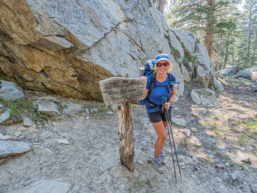
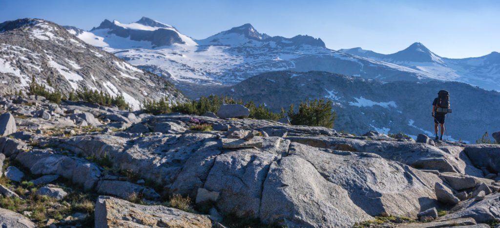
Today the PCT split from the JMT, the route following the top of the ridgeline on the east side of the valley. It felt great to be out of the trees and in the open once again looking onto an expansive vista. After the initial climb, we were high above the Middle Fork San Joaquin River that cut through the valley below and had excellent views across to Garnet Lake to the west, where the JMT alternate route meandered around several mountain lakes. (This included Rosalie Lake and Shadow Lake, which we had camped near on the JMT in 2014.) We also had a first class view of a tremendous skyline, Mount Ritter and Banner Peak dominating the scene.
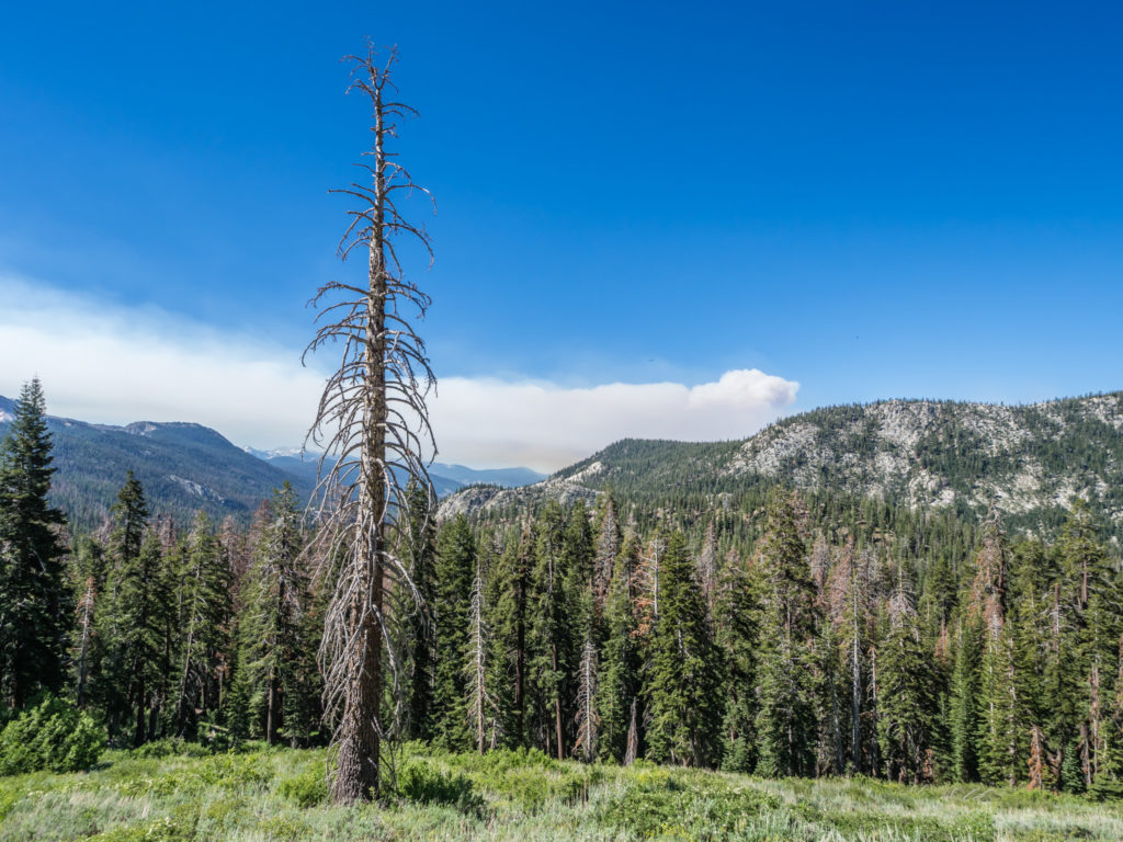
What we thought was the first cloud we had seen in weeks was actually smoke from a forest fire beginning to blow into the valley.
From the ridge we initially had clear blue skies and a wonderful view looking onto Garnet Lake.
We stopped for second breakfast to enjoy the view, joined by Co-Pilot and Camp Finder, but before long the sky was almost whited out with smoke blowing through the valley. We knew there had been a forest fire caused by lightning just a few miles away from Mammoth that had been allowed to burn, but because of unusually high winds today, the fire was rapidly spreading. Within minutes, Garnet Lake had been completely obscured by the smoke, whereas Ritter and Banner peaks, a little further down the valley, were just about visible through the haze.
Within a matter of half an hour, the smoke had completely filled the valley obscuring our view.
Our concern now was whether the fire would spread into this valley and force us off trail. We had read so much from last year about hikers having to skip sections because of forest fires, particularly throughout Oregon. You can never account for natural phenomena, just adapt to the trail conditions as you go. So after debating various scenarios, we set off again and kept on walking, hoping to stay one step ahead of whatever was transpiring back down the valley. Any hikers a couple of days behind us would most likely be in limbo, the fire possibly stopping them from continuing to Reds Meadow. An option would be to get out at Mammoth Pass (Horseshoe Lake Trail) and take a zero or two in Mammoth to find out more information and assess the situation. As it was, we could really smell the burning in the air and the smoke could easily affect people’s breathing the closer they were to it.
Continuing on towards Thousand Island Lake hoping that the wind would drop and that the fire wouldn’t affect us here.
As we hiked down towards Thousand Island Lake and then over Island Pass, the PCT and JMT having re-joined prior to the pass, it felt like it was our lucky day. The wind seemed to have changed direction and we no longer had thick smoke blowing towards us. Ritter and Banner Peaks were still mostly obscured by a smoky haze, but we were grateful that the direction we were walking in looked much clearer.
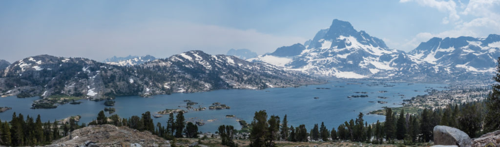
Panorama looking onto Thousand Island Lake.
Thankfully the smoke seemed to be clearing and we could see the impressive peaks surrounding the lake again.
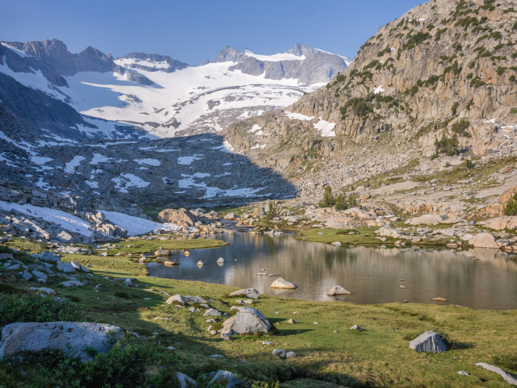
With the smoky haze across the sky, Thousand Island Lake looked a lot different to the first time we saw it. Before, we had camped around the western end of the lake and had our own private beach spot. This time around, apart from taking some quick photos, we didn’t even stop there for a break. Instead we pushed on, hoping to also make it over Donohue Pass today as well. Apart from a few patches of snow still clinging on, the trail was mostly free of snow until the final climb.
Another creek crossing successfully completed!
We remembered Donohue Pass at 11,073 feet as being rocky, but not particularly tricky. This time around though, it was hard going, it being our second climb of the day. It was especially tiring having to clamber around the rocky switchbacks that had been engineered with giant rocks wedged in as steps. Once again the trail tested our quads and put us through our paces towards the end of the day. We were glad to finally reach the top as all we wanted to do was find a camp spot and get our heads down.
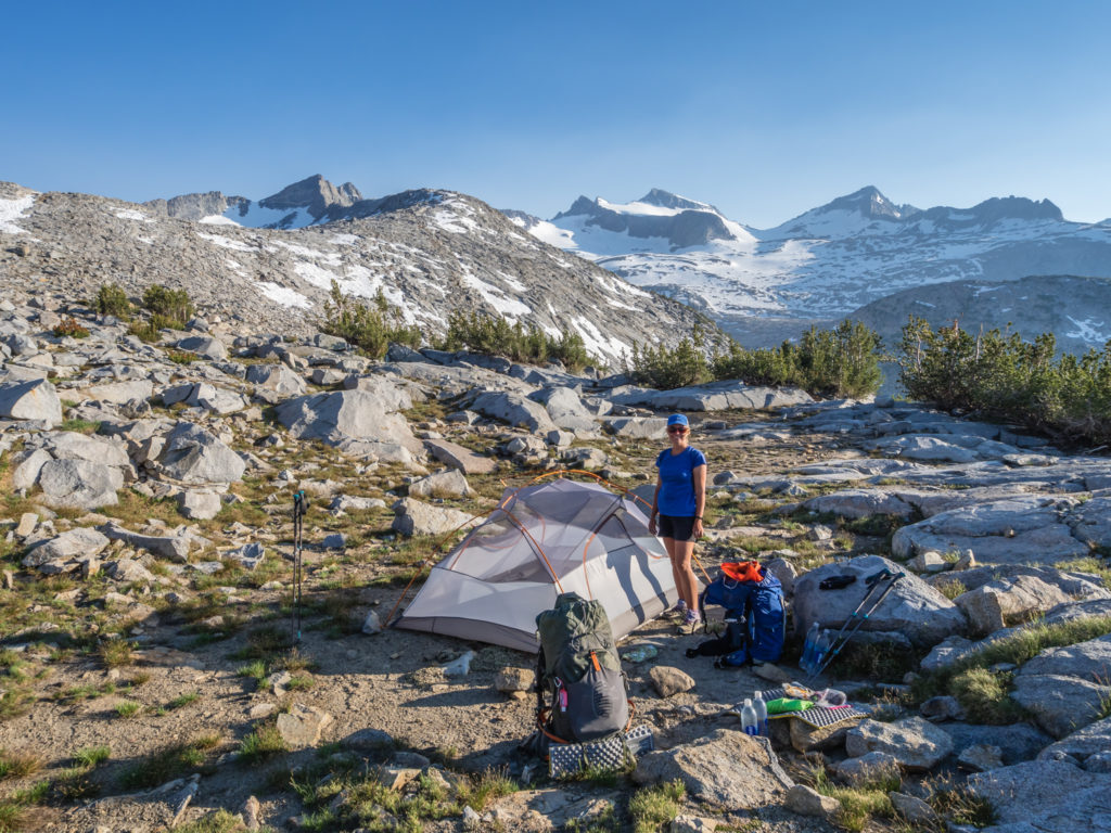
Determined to make it up to Donohue Pass for a shorter day tomorrow!
More rock hops as we try to avoid wet feet on our way to Donohue Pass.
Looking back to the surrounding peaks that were now in clear view.
The final section leading to the pass required a small amount of snow navigation.
Reaching the top of the pass at last!
With so much rock, as well as snow melt making much of the ground wet and boggy, there wasn’t a lot of choice in terms of suitable places to camp, especially not for a three-person ‘condo’! The GutHooks app had indicated there were three exposed tent sites on the northern side of the pass, so we set off down the other side hoping to find one. The only space big enough to fit our tent was adjacent to a stagnant pool of water, so we knew as soon as we stopped we would be mosquito fodder. But with no alternative other than hiking on more miles into Lyell Canyon (which we expected to be just as bad), we would have to grin and bear it. There’d be no option to hitch back to Reds Meadow Campground tonight! Not on our own as Easy Company had also earmarked this area to camp tonight, we were grateful of an extra body to spread the mosquito love around!
What would have been an amazing camp spot had the mosquitoes not been out in full attack mode!
We pitched the tent and rapidly got our gear inside, Wayne then putting on his best measure of defence – his waterproof clothing, which the mosquitoes can’t impregnate. They might not have been able to bite, but they were still annoying swarming around his head and around the cook pot when he started preparing dinner. Thankfully as I organise the inside of the tent and blow the sleep pads up etc, I didn’t have to suffer it for as long as him. But neither of us wanted to be outside the tent for any longer than was necessary!
Wayne wears his combat gear once again in order to protect himself from the mosquitoes whilst cooking away from the tent.
So it was a hurried dinner, followed by an even quicker hot chocolate drink before we took to the tent for some reprieve. Again, we find it infuriating that these mosquitoes don’t seem to be affected by altitude or temperature and harass us even when the sun has gone down! It would have been a good, scenic camp spot had it not been for their presence. Fingers crossed for better luck tomorrow down in Tuolumne Meadow!
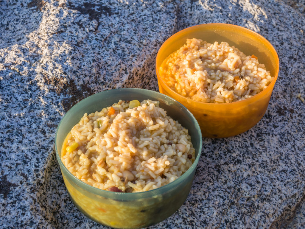
Our quick dinner of Chinese flavoured Rice with Spicy Mixed Bean Tuna.
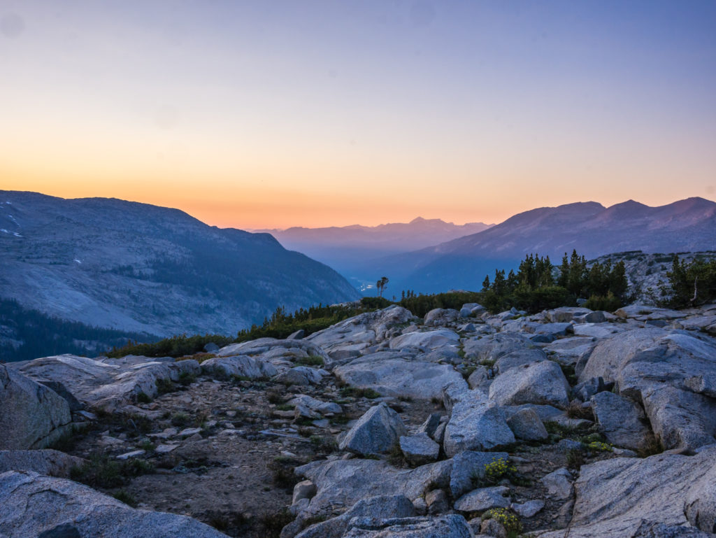
Looking down the valley we had lovely late evening light over Lyell Canyon.
Day 77 – Monday 25th June 2018, Wild Camp after Donohue Pass at Mile 930 to Tuolumne Meadows Campground at Mile 942.5, 12.5 miles
What a wonderful trail day! There’s nothing like the prospect of a burger and only half a day’s hiking to put a smile on your face and an even bigger spring in your step! Having remembered Lyell Canyon as being a long, but flat and beautiful walk through the valley bottom alongside the Lyell Fork River, we were really excited to have what we considered an ‘easy’ section of trail to end the week!
Continuing downhill from Donohue Pass we found ourselves in mosquito central once more!
Crossing a flooded section of trail!
This was one of our deepest crossings and it was icy cold!
Getting back on the trail that morning, we were also excited as we had entered Yosemite National Park, one of the most instantly recognisable areas of wilderness in the USA because of its striking granite domes.
Continuing our descent from Donohue Pass, there were a few pockets of mosquitoes, but we didn’t let them dampen our mood. We were too busy enjoying the smooth trail and beautiful plunge pools we passed by as we strode out through Lyell Canyon. They were so clear, we were very tempted to have a swim, even if the water was icy cold. The only thing holding us back was that burger waiting for us at the Tuolumne Meadows Café, we were that eager to get some proper food! So we agreed that as we embark on the northern section of California, it’s a must do the next time we see such a beautiful place to take a dip.
Walking beside the picturesque Lyell Fork River.
The water was so pristine; it was wonderful to see.
It was really hard to resist taking a dip!
We were starting to see the characteristic granite of Yosemite.
As we made our way into Tuolumne Meadows we couldn’t believe how busy the trail was. PCTers were no longer the majority! We passed several JMT thru-hikers walking in the opposite direction to us, numerous weekenders and day hikers, plus a large group of teenagers out here for a summer camp as it is already the school summer holidays here in the USA.
Not far to go for a burger now!
We crossed the Tuolumne River then made our way to the Tuolumne Meadows Store and Post Office. Outside it was already swarming with hikers and day trippers, but by the very nature of PCTers considered ‘Hiker Trash’, we had our own designated seating area with picnic tables, trash cans and shade, (in the words of a fellow thru-hiker) “Well away from the normal folk!” Having not had a proper shower since leaving Bishop, I can now well appreciate why people want to keep us separate and outside in the fresh air!
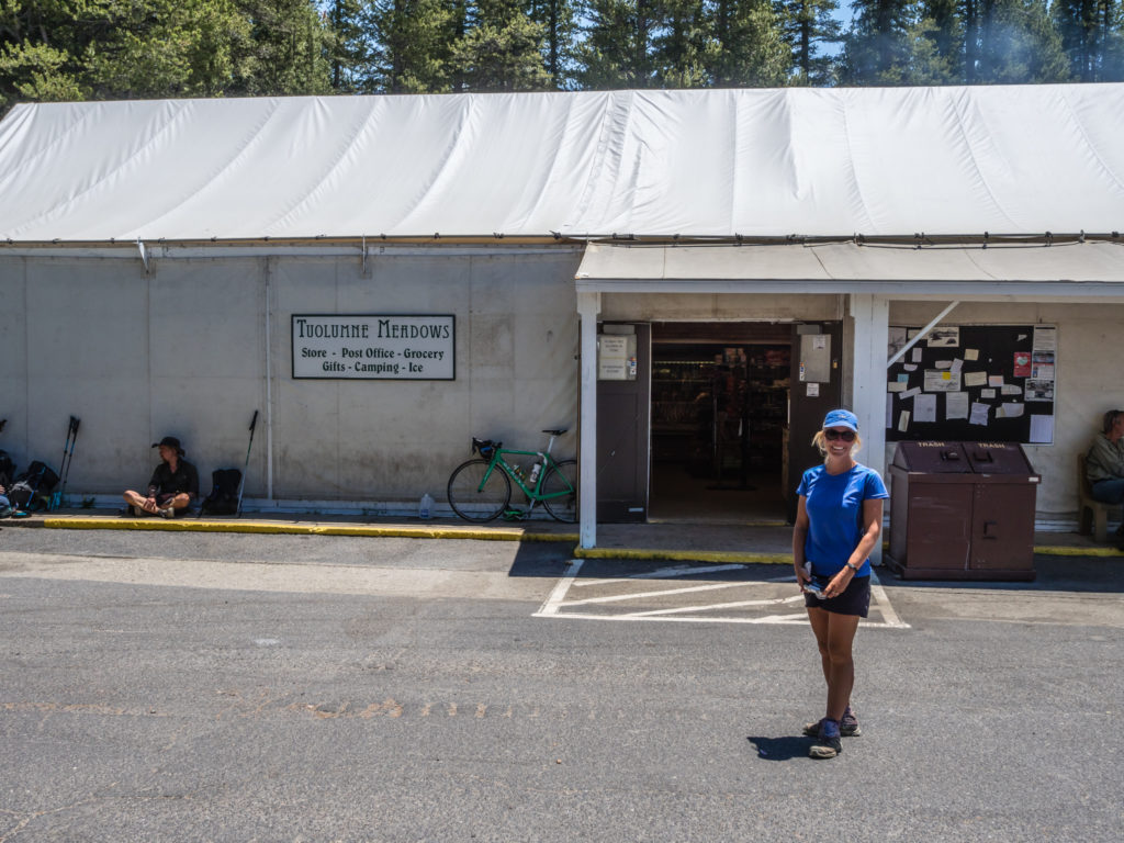
Outside the store. The designated thru-hiker area was behind the camera, although Easy Company sat in front of the store with some others is flouting the rules! 😉
It was like a ‘Thru-hiker’s Reunion and Soup Kitchen’ rolled into one as we saw familiar faces we had not seen on the trail in a long while, all having been into the café, now stuffing their faces with burgers, chips and ice-cream. Co-Pilot had made it in before us but was nodding off at the table having put in some 26/ 27 mile days! We also caught up with TerminX, Easy Company, Buzz Kill Bill, Old Timer and saw Ritz and Sprocket’s trail family all gathered around a bench too. Having thought we were going slower than most people, it was warming to find we are going at a similar pace to everyone else we have been seeing periodically on the trail since Tehachapi.
So excited for ‘proper’ food!
After some indulgence of our own, including burgers, potato wedges, fizzy drinks and ice-cream, we collected our resupply parcel from the Post Office, then made our way to the Tuolumne Meadows Campground just down the road. There is a large walk-in backpacker area where you can camp for $6 a night, which was perfect for us. A picnic bench, fire pit, bear locker, water faucet and flushing toilets are all luxuries we don’t usually have access to in the wilderness!

Wayne was particularly pleased that the Campground Host had shared the World Cup Football results as there is no cell phone service or Wi-fi in Tuolumne Meadows.
After setting up camp we were made aware of a problem bear in the area as there was a notice in the restrooms reminding campers about properly storing food and to be vigilant. Wayne later found out having attended the ‘Ranger Talk’ that evening that there is currently a very hungry bear in the vicinity that keeps making appearances around the Tuolumne Meadows Campsite and stealing campers’ food. He’s a year and a half old black bear, but cinnamon coloured with markings around his eyes that have earned him the name ‘Bandit’ from the Park Rangers. Currently weighing 65lbs, he needs 5,000 calories a day in Spring, but 20,000 calories a day in Fall when he is bulking up for hibernation. The Ranger explained that he has been abandoned by his mother so stealing human food is his way of surviving. The sad thing is, he will now be euthanized when caught as the policy is to no longer relocate problem bears as they simply find their way back to their original habitat. We didn’t see or hear any signs of him, but we saw a bear trap with food hanging inside at the entrance to the campground in anticipation of him returning.
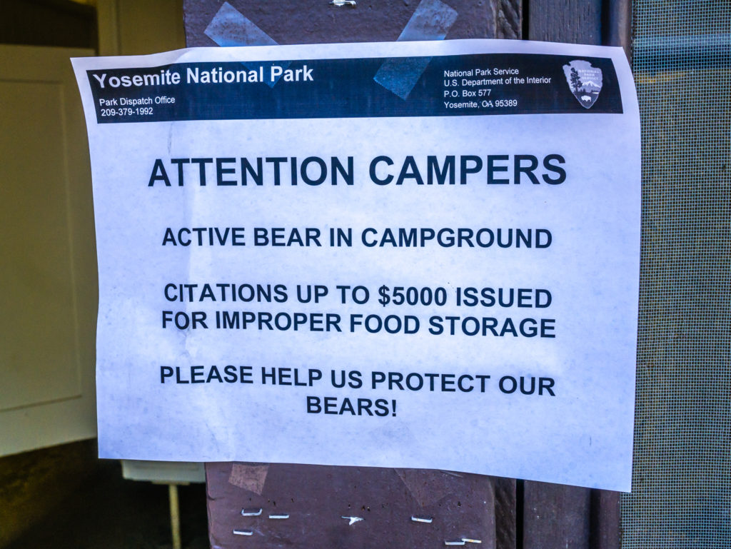
Notices around the campground alerted campers to the presence of a bear and to ensure they follow the correct food storage procedures.
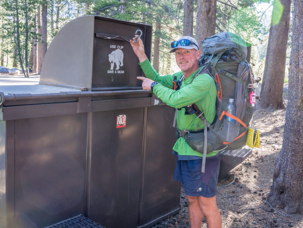
Any rubbish has to go in the proper bear proof trash cannisters.
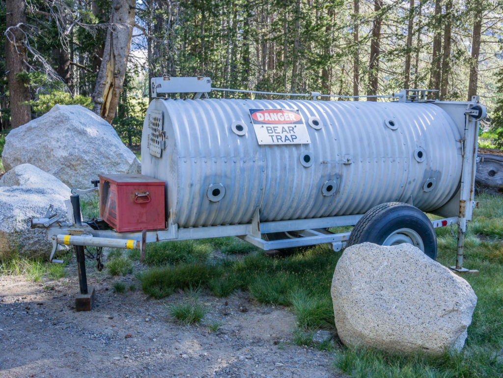
Sad times! This is the bear trap in use to catch Bandit, the nuisance bear that keeps visiting the campground for human food.
When Wayne returned from the talk just after 9pm, the backpacker camp was full to the brim! As the day had gone on, more and more PCTers had arrived and set up their tents, keen to make the most of the facilities of a store and café close by. We were surprised when fellow hiker Jen turned up and cowboy camped near us as we thought she was at least two days behind. Again, she had pushed the miles to make it Tuolumne, completing two long days but was thoroughly exhausted when she arrived.
Everyone is now in the same predicament, having to pick up the pace and push extra miles if they are to make it to Canada before the bad weather hits. We read that there is quite a high drop-out rate among thru-hikers at Sonora Pass or Lake Tahoe largely because people are tired and are fed up with the torment caused by mosquitoes when hiking in late June or early July. We can definitely sympathise as we too have been thoroughly fed up with their presence. But these things come to test us! Hopefully things will improve as we hike further north…
12 Comments
A bit late now, but sounds like a Beaton’s mesh midge jacket might have been a good bit of gear. Only weighs about 100g. Still the scenery makes up for the insect horrors!
That’s useful to know for future endeavours. Thanks for the tip!
Superb report Danielle. I’m so impressed by sll that you and Wayne have experienced and achieved. Well done both. Cyber love and best wishes to the pair of you!
Thank you 🙂 We’ve had some tough days and were starting to worry that we wouldn’t make it to Canada on time, but now we’ve passed halfway it seems a little easier somehow! 🙂
Back 3 weeks from travelling OS, I’ve finally managed to catch up on all your comprehensive, amazing blog posts.
It has been an effortless journey for me, but no wonder you have been feeling exhausted. Congratulations on your awesome hiking thus far and for the time and effort, allowing readers to come along. The scenery is simply magnificent. What a horrible shame that the mosquitos stop you enjoying it to the max.
All the very best as your journey continues!
Thank you so much Helen! Hope you had a wonderful trip and glad that you’re still finding the time to follow along 🙂 We’re keeping our fingers crossed that mossie season has now finished it’s cycle as it’s been much better lately!
Hi, nice to read your blog again. I arrived in Abisko today, finishing the Kungsleden in 17 Days, within a zero day. Here it is extreem warm ,and the musquitos are also making it a hard day on the Trail. I did not have a drop of rain all the way, and that is not normal for the Kungsleden. Keep on hiking!! Walter
Wow, excellent time and even better weather! It sounds like you were extremely lucky not getting any rain. We understand your pain with mosquitoes as they’ve been awful here! What was your favourite part of the hike? Did you detour to Skierfe?
Hi, nice to read that you are still making good progress. Just looked to your nice report after completing the Kungsleden myself yesterday. South to north, in 17 Days, including a 0 day, because it was to warm for Hiking. Tempertur is not normal high in Sweden for almost 3 weeks already. Did not have a drop of rain, during the Kungsleden. That in contrast the wearher you had. Hope you stay on Hiking the Pct, and post more reports. Walter
Thanks Walter! Glad you had a great hike 🙂 I think the weather is uncharacteristically ‘hot’ everywhere at the moment. We’ve had temperatures over 100°F every day this week here in Northern California and I hear the UK is currently in the throes of a massive heat wave! Dare I say it, it’s a bit too hot for walking!
Well, I’m just going to assume that you two were consumed by hungry bears or something….
I wish we had even seen a bear! 🙈🤣