
“Hiking is a bit like life: The journey only requires you to put one foot in front of the other …again and again and again. And if you allow yourself opportunity to be present throughout the entirety of the trek, you will witness beauty every step of the way, not just at the summit”.
– Unknown
The Eighteenth Week – Farewell California!… Hello Oregon!
With now less than 1,000 miles to go, we begin Week 18 bound for the Oregon border!
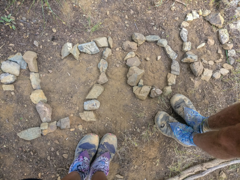
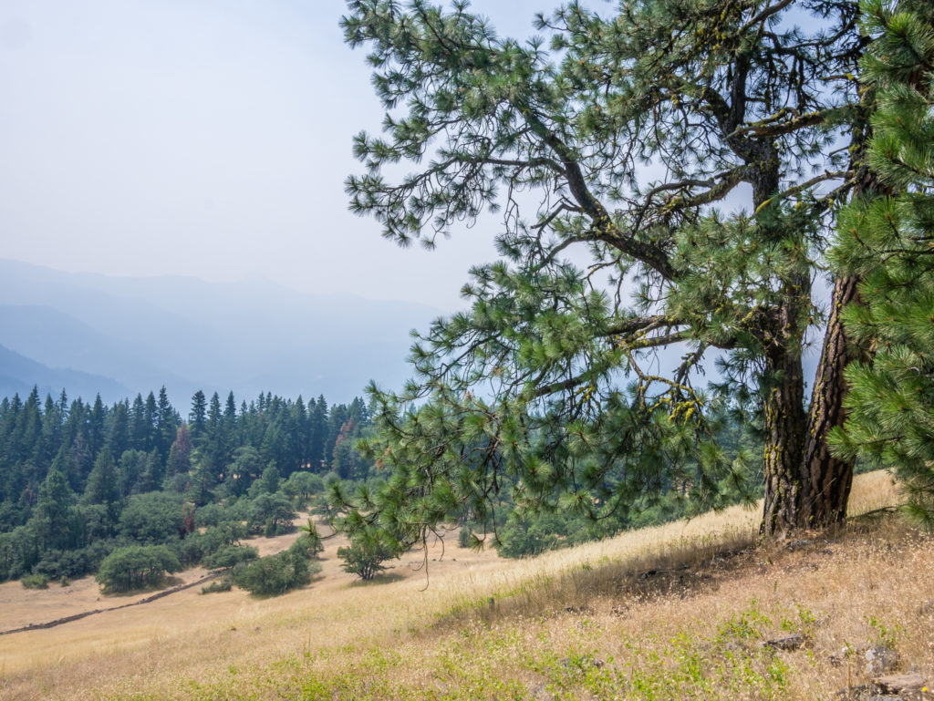
After almost 4 months on the trail, we are finally going to be skipping out of California and striding into Oregon! It has taken us 120 days to cover 1,691 miles, traversing a state that between south and north is so huge and diverse you could think you were in a completely different country. We’ve had highs and lows, walking through the hot, windswept desert to the snow-covered Sierra, from glorious sunrises to smoky sunsets, crossing wildflower meadows and rocky ridge lines, through extensive burn scars and laborious lava fields – California has without a doubt showcased it all and been an amazing experience that will stay with us forever!
But as we’re on a mission to make it to Canada before the bad weather hits, we’re now ready to move forward and see what state No. 2 of the PCT has to offer. Covering a distance of 454 trail miles, Oregon is merely a fraction of the length of California. Yet, it still boasts a varied landscape reaching from Ashland on the southern border with NorCal to The Bridge of Gods over the Colombia River Gorge where Oregon meets Washington state.
From thick, evergreen forests to barren, fossil-strewn deserts, to expansive craters and glaciated volcanic peaks – we have been looking forward to a change of scenery and the morale boost that reaching a new state will bring. Oregon is also home to the deepest lake in the United States, so we are excited at the opportunity of visiting the Crater Lake National Park (the only designated National Park in the state) for the very first time!
Day 120 – Tuesday, 7th August 2018, Wild Camp at Mile 1,680 to Grouse Gap Shelter at Mile 1,708, 28 miles
All packed up and having left camp at exactly 7am, we were on a mission today to reach Oregon as soon as possible! With just 11 miles standing between us and the state border, if all went to plan, we were expecting to get there around lunchtime. So there was no dawdling along, injured arm or not. We were more than ready to wave goodbye to the smoky skies of Northern California, and ever hopeful that Oregon would provide us with some clear vistas of the stunning big mountain scenery that we so craved. The most prominent pinnacles in the High Cascades volcanic chain comprising of ‘The Three Sisters’, ‘Mount Washington’, ‘Three-Fingered Jack’, ‘Mount Jefferson’ and ‘Mount Hood’ promised to be the grandest backdrop of all – if only the skies were smoke free and the encroaching wildfires had finally come to an end.
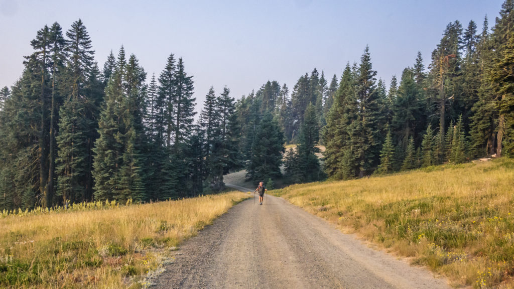
Setting off at first light on a mission to reach the Oregon border by midday.
A significant boost to morale was knowing that we now had less than 1,000 miles to go to reach the Canadian border!
Having been told repeatedly that the trails in Oregon are much gentler than those in either California or Washington and that this would be the place to pick up any slack and make our miles count, we were positive that we could smash out several big mile days that would keep us on track to achieve our end date. Some ‘easier’ trail coupled with a steadfast determination was what we hoped would get us end-to-end through Oregon in just 19 days! (This would be half the time compared with how long it took us to cover a similar distance through California – but we were working on the theory that we were now at peak fitness, managing 30 mile days with relative ease, and that Oregon was going to be half as hard! We could but hope!)
After 8 miles we stopped by a spring to collect water and have our second breakfast where Whoopie, Spell Check and Splifford soon joined us, followed by two other female American thru-hikers known as Nasty-Pants and Down Dog. (We are yet to ask how they both acquired their trail names!) Everyone seemed to be fighting back a wave of trail weariness, the last few weeks of smoke and tough terrain having taken its toll on both body and mind. But one thing was certain – we were all eager to continue and both excited and relieved that we would finally be getting to the end of Northern California – a major PCT milestone and feat in itself.
Enjoying a rare ‘flattish’ section of trail that we hoped would be typical of the PCT in Oregon!
Setting off with just a couple of miles left to reach the Oregon border, we talked about our incredible journey over the past 4 months, reminiscing about the highs and lows of the trail so far. Apart from suffering the recent effects of the wildfires, and not forgetting falling over and continuing to hike with an injured arm, we both agreed that mosquitoes had been our most bothersome aspect of the trail to date. Hiker hunger and heavy water carries early on in Southern California paled into insignificance. Any negatives however were greatly overshadowed by the high points. The desert had been far more spectacular than we ever expected, the Sierra a whole new experience traversing snowy mountain passes, and the flowers in full bloom across NorCal helped us see the beauty of the trail on a completely different level. Even more memorable had been the wonderful acts of kindness given by numerous ‘Trail Angels’ – complete strangers who went out of their way to help us with their unique form of ‘Trail Magic’, whether it be the provision of food or the offer of a ride, yet expecting nothing in return. We concluded therefore that Oregon would have a lot to live up to!
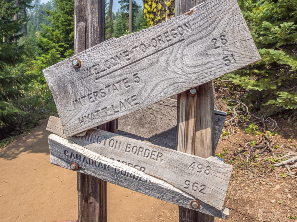
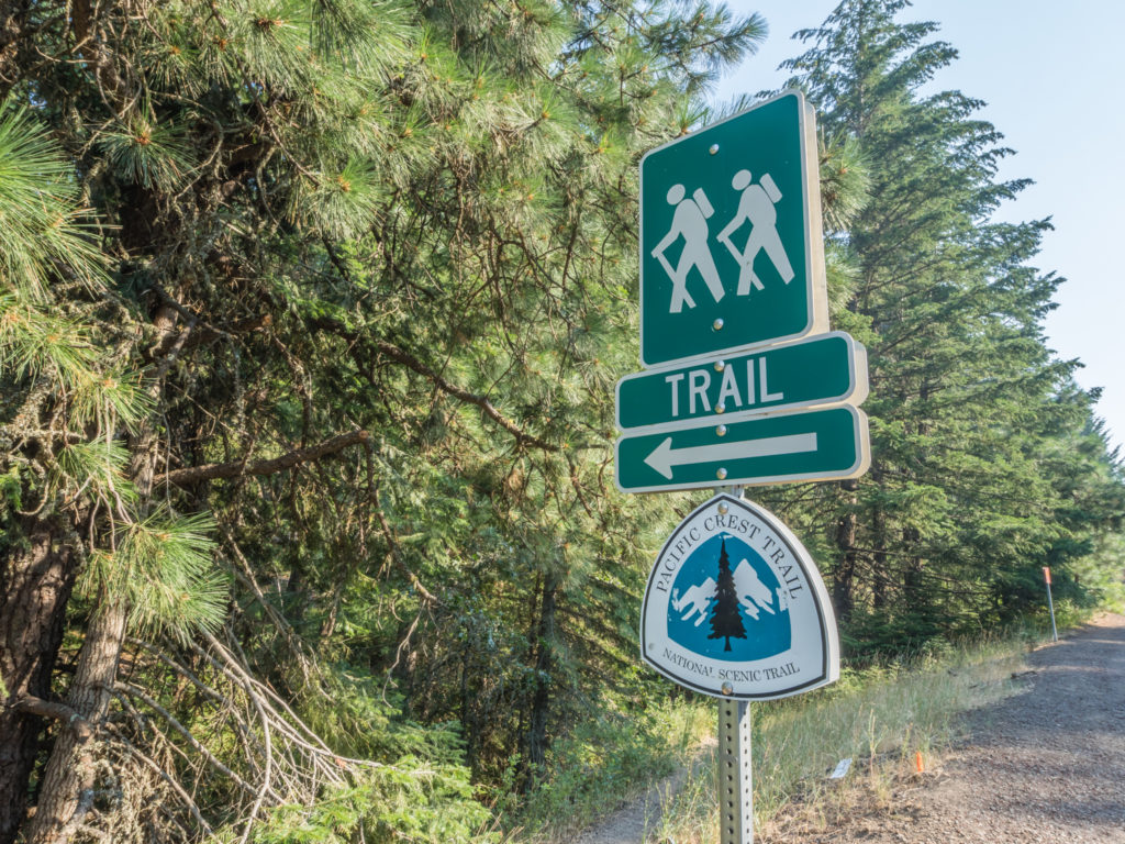
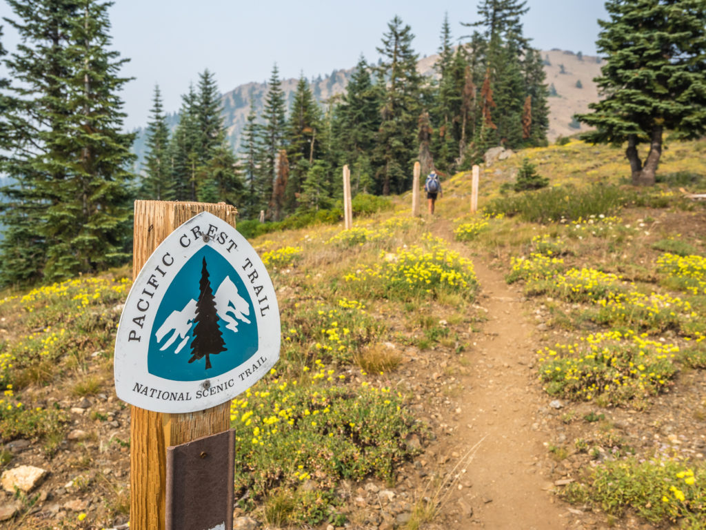
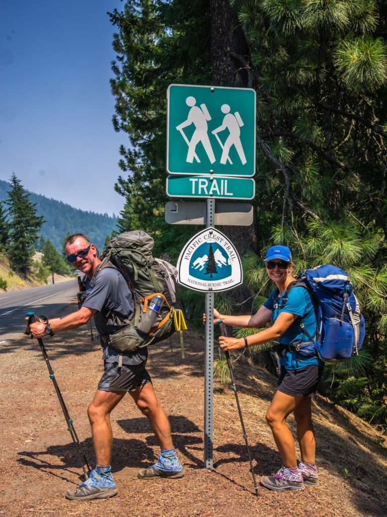
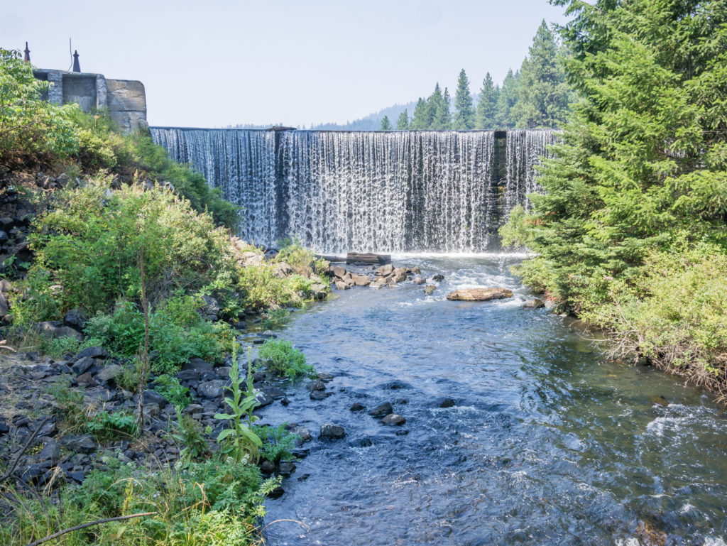
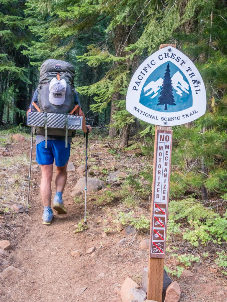
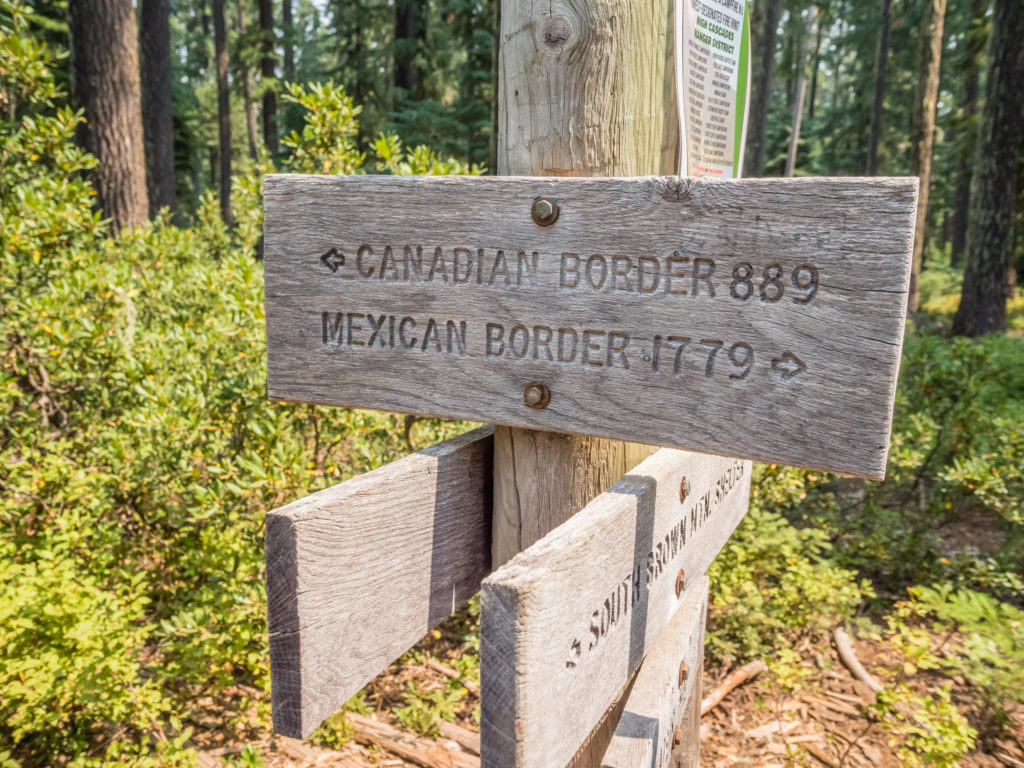
Leaving Northern California at last and crossing into Oregon where the official state border is marked simply by a broken sign!
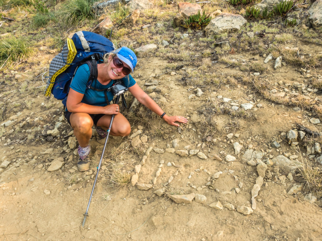
Out of the merry band of hikers to leave the spring earlier, we were the first to arrive at the state border. There was no fanfare celebrating our exit from California and arrival into Oregon however! Nor was there any trail magic, even though we’d secretly been hoping for some! (It felt rather like our experience on reaching the end of the West Highland Way in Scotland. On completion I was expecting a crowd of well-wishers around the ‘finish’ monument along with a bagpiper playing enthusiastically to celebrate our arrival at Fort William. But there was nothing of the sort!) Having just completed 1,691 miles on foot we felt like shouting it from the rooftops and really wanted to celebrate. Yet with no one else around and little to mark the occasion except for a broken sign and a trail register, we found the whole event quite underwhelming! When you’ve played an event out in your head at least a hundred times, the reality is never quite what you expected. We just hope now that when we finally reach the Canadian border our experience won’t be of a similar vein! (The one consolation of being the only hikers around I suppose, was that we were able to take plenty of photos without waiting or queuing as is the case sometimes at other prominent points along the trail.)
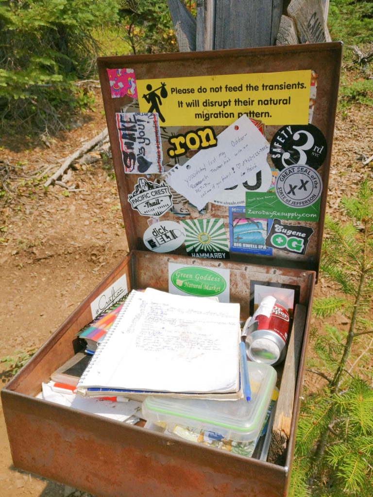
Signing the trail register. It’s OFFICIAL – we made it to Oregon!
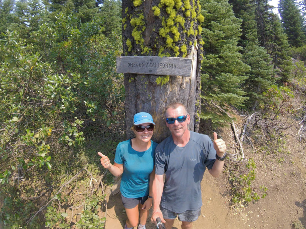
Getting out the selfie stick in lieu of a fanfare, bagpiper, and trail magic… We really wanted to celebrate but crossing the border turned out to be a simple, understated event!
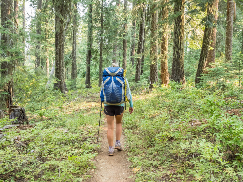
Our first footsteps in Oregon and the trail was excellent underfoot!
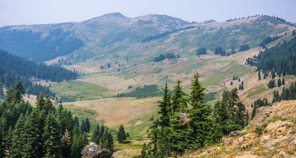
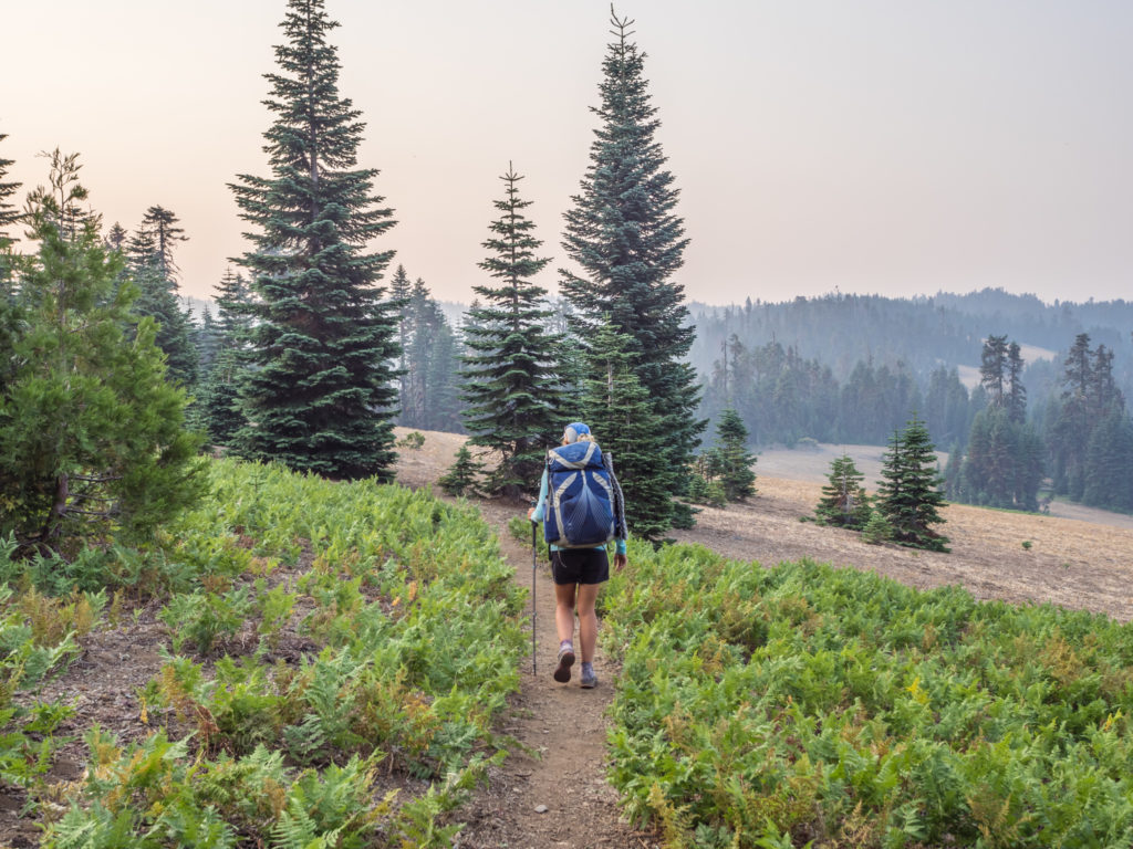
Oregon’s rolling hills – so far just a continuation of Northern California. (What were we really expecting?!)
The PCT continues through Oregon. Making the most of more gentle trail…
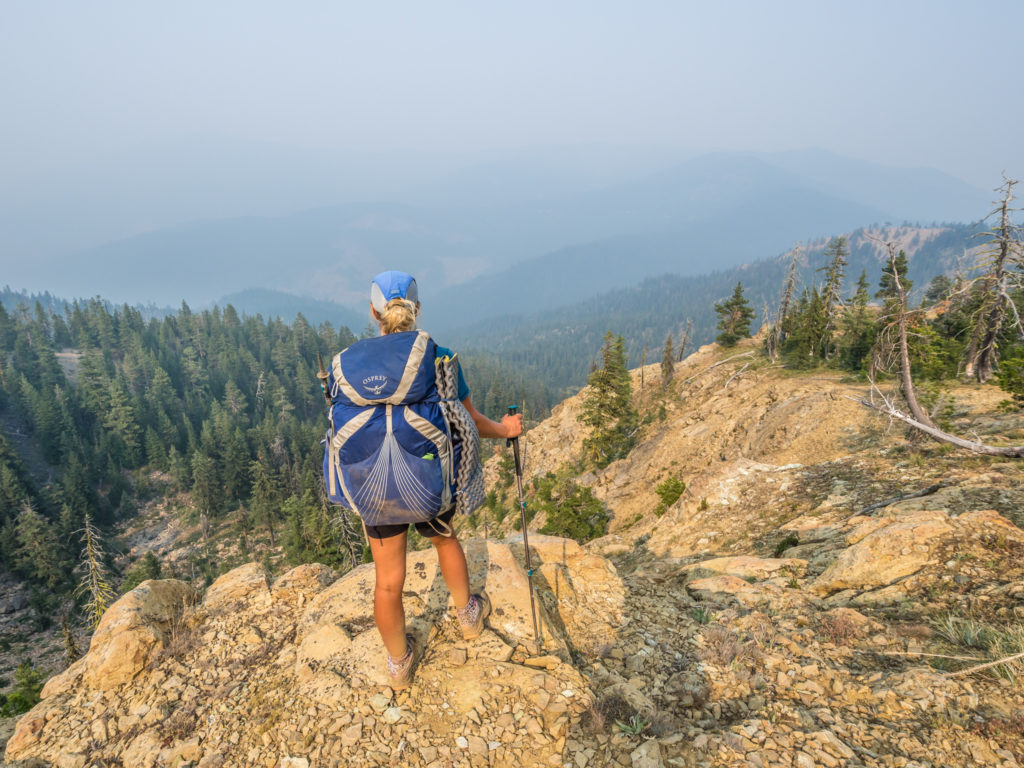
Looking north to find that unfortunately the smoky skies prevail.
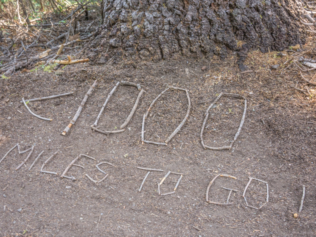
After leaving the border and hiking on a few more miles, we were disappointed to see smoky skies ahead. With the wildfires now surrounding us on all sides, we had expected as much. Thunderstorms over the weekend of July 14th – 15th had brought thousands of lightning strikes to the state of Oregon starting 150 wildfires, of which the Hendrix Fire was closest to us. Even though the PCT had recently been re-opened from the Oregon border to Ashland, the Hendrix Fire was not yet fully contained. We didn’t let the prevailing smoke dull our mood however. We were on a natural high because not only had we crossed into a new state today, but shortly afterwards we also passed the 1,700 mile trail marker! With every step we were getting that bit closer to Canada!
Our second significant feat of the day was passing the 1,700 mile trail marker!
Woo-hoo! Getting closer to Canada with every step.
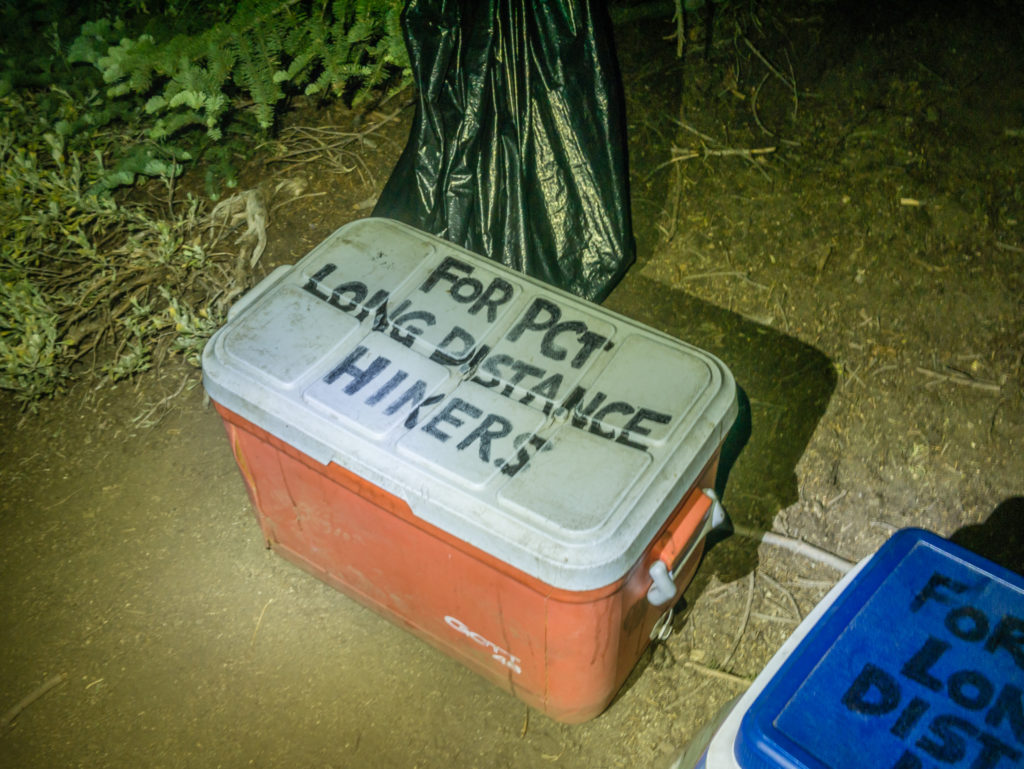
We had intended on reaching Grouse Gap Shelter at Mile 1,708 where we were going to set up camp for the night, so we still had to push on 8 more miles. With sunset getting a little earlier each night, we knew it would be a late one and it was dark before long. Using our head torches to light the way, we almost stumbled upon what was a very pleasant surprise and much-appreciated treat to end the day. It was our first and completely unexpected act of trail magic here in Oregon by way of two coolers filled with a range of ice-cold sodas, that some kind soul had painstakingly lugged up the mountainside from the road below. We downed our packs and savoured every gulp of the sweet, fizzy pop that gave us a much-needed sugar boost to power it down the switchbacks and make it the last mile to the shelter.
Stumbling upon an unexpected treat!
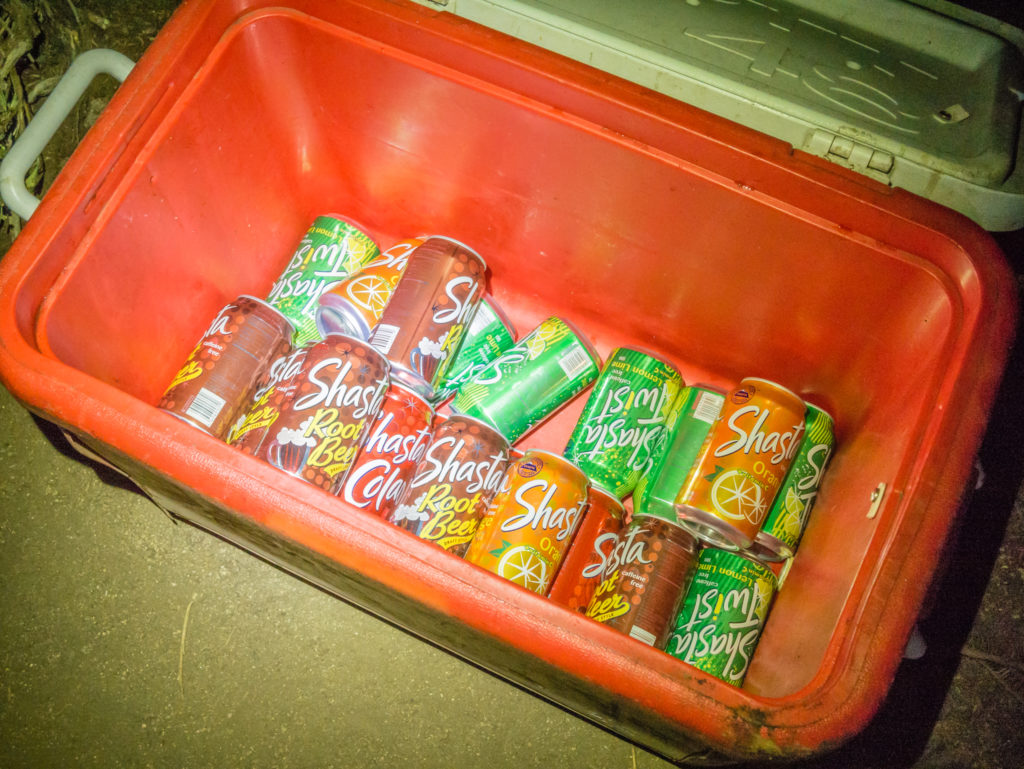
Many thanks to the wonderful trail angel who provided us with cold fizzy drinks on our first night in Oregon.
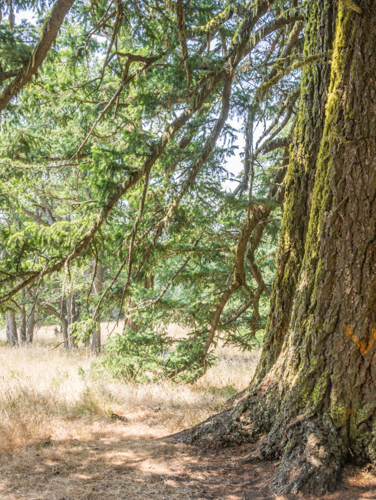
Arriving in darkness meant we couldn’t see the fantastic facility that has been provided for free by the USDA Forest Service until morning. Doubling as a picnic site in the summer and a snow shelter for cross-country skiers in winter, Grouse Gap has a covered pavilion enclosed on two sides with a central wood burning fireplace. There is also a picnic table and pit-toilets, which is why we chose it as a good place to camp that evening. The pavilion looks out over the Klamath National Forest with views to Mount Shasta (on a clear day!) and makes a good overnight stop for PCTers being less than half a mile from the trail.
Needless to say, after what had seemed like a long day, we were quick to set up the tent and enjoy our first night on the trail sleeping under the stars of Oregon.
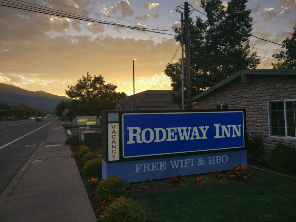
Day 121 – Wednesday, 8th August 2018, Wild Camp at Grouse Gap Shelter at Mile 1,708 to Old Highway 99 (Callaghan’s Resort) at Mile 1,719, 11 miles, hitch into Ashland, Rodeway Inn Motel
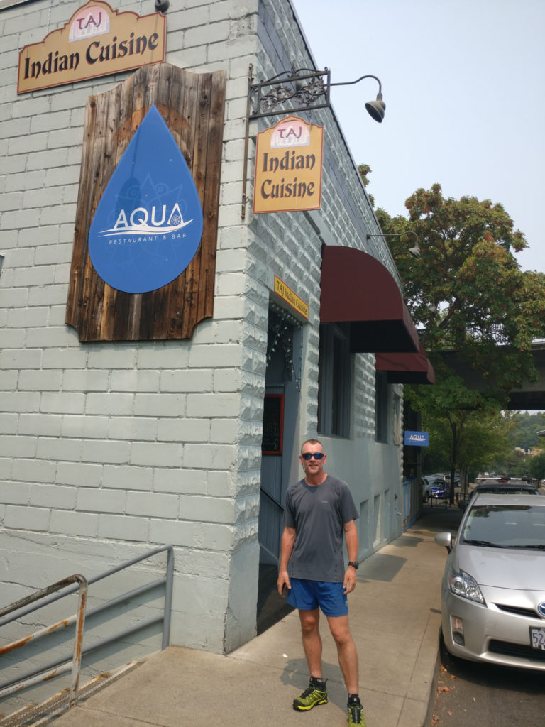
Today was one we had been looking forward to for a while – not least because I could finally rest my arm properly for a couple of days whilst we rested up and resupplied in Ashland. Not only would we be staying in a motel for two nights, but we had also heard about an all-you-can-eat Indian buffet in town that came well-recommended, so we were looking forward to sampling one of our favourite home cuisines that compared to England seems in short supply in the US. In addition to such off-trail luxuries, we discovered that Ashland is home to the world-famous Oregon Shakespeare Festival and is also ranked in the Top 10 of “The 100 Best Small Art Towns in America”, so it sounded like we were going to have a great – although Ashland has a lot to live up to if it is to rival Etna – our favourite trail town in California!
So after taking a look around the Grouse Gap Shelter at first light and appreciating the wonderful facility that has been extended to PCT hikers, we set off on the trail bound for Ashland with a very big spring in our step!
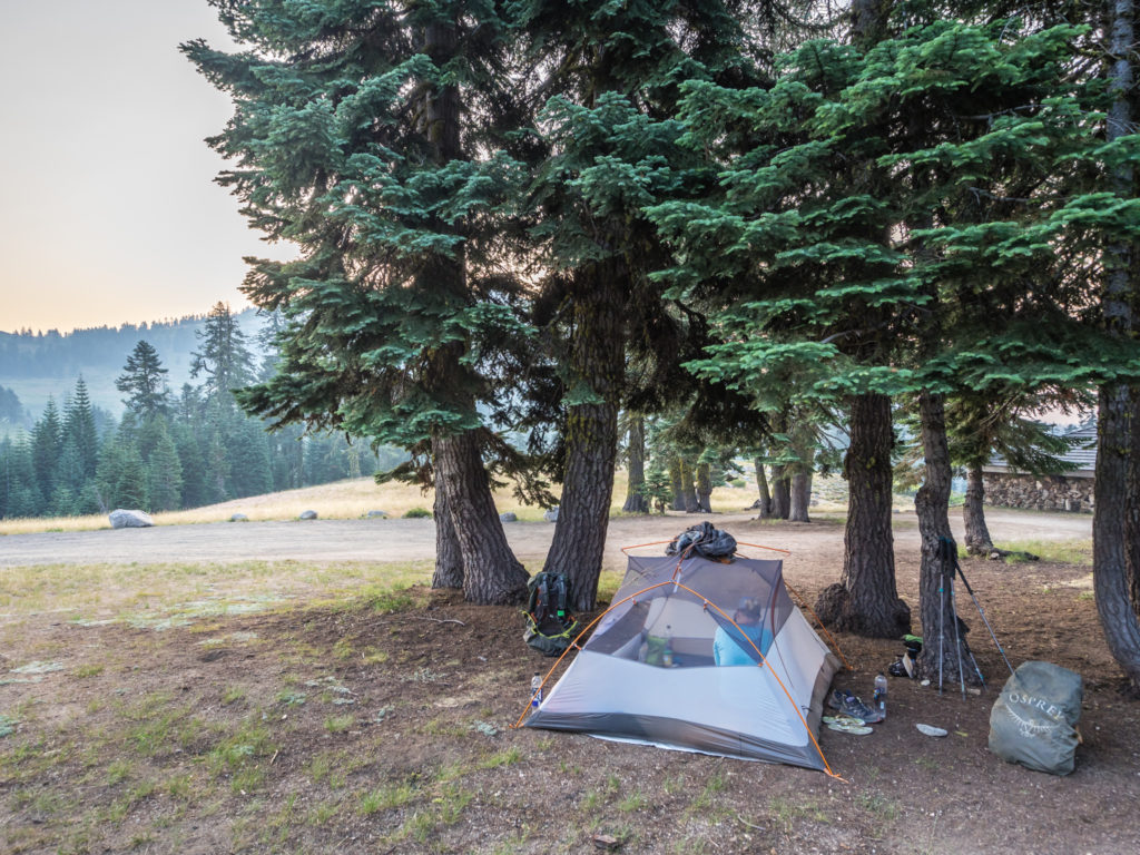
Our camp spot beside the Grouse Gap Shelter. As a freebie close to the trail, the shelter would be an excellent stop for PCTers caught out in bad weather.
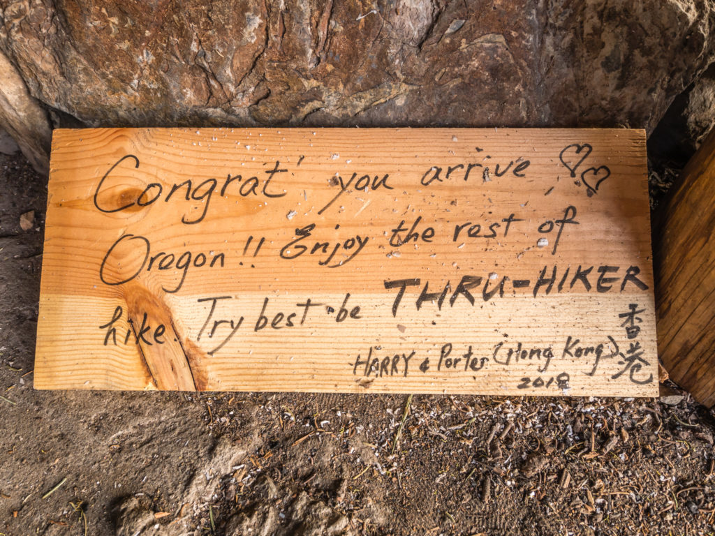
The English might not be accurate but the sentiment is. Try to be the best thru-hiker you can be. We can’t agree more!
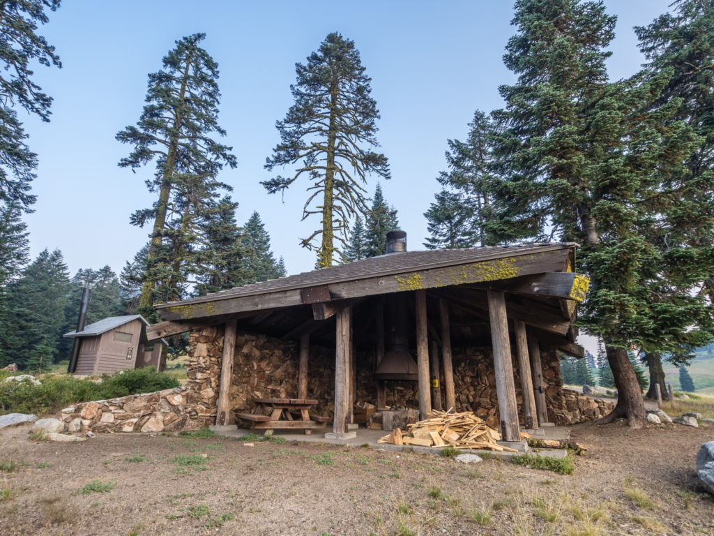
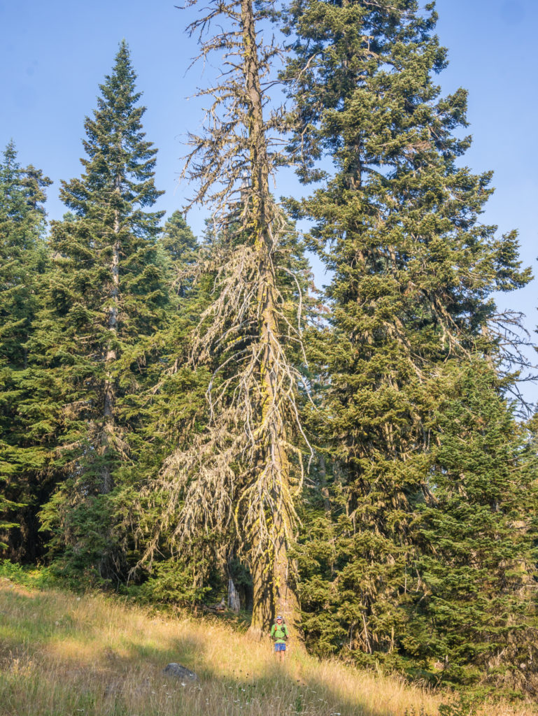
The Grouse Gap Shelter close to the PCT, at Mile 1,708.
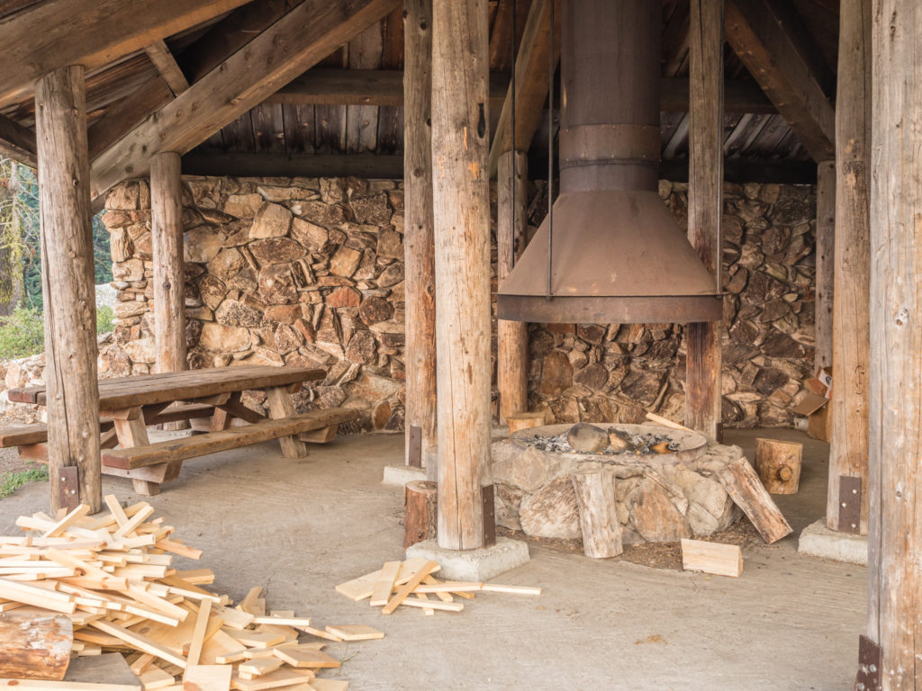
The Grouse Gap Shelter has a covered pavilion enclosed on two sides with a central wood burning fireplace – perfect for keeping you warm on a cold, autumnal night.
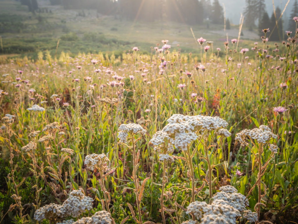
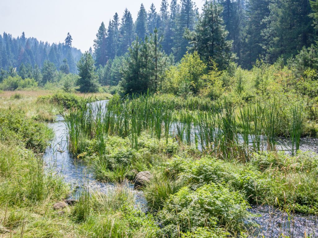
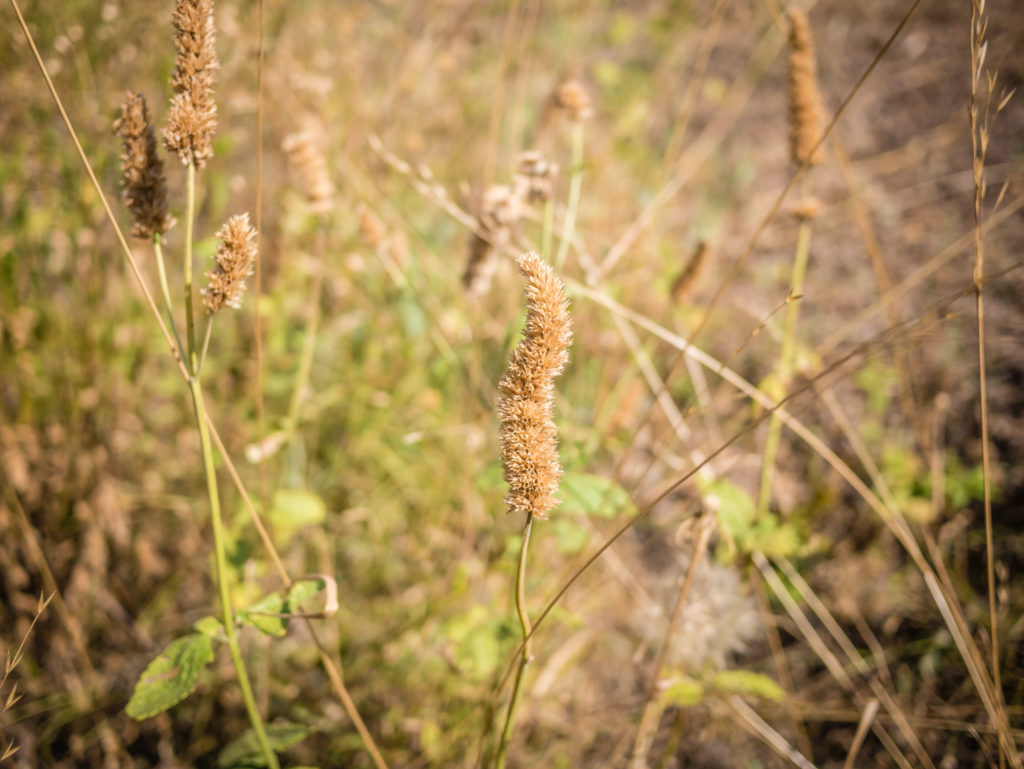
The wild flowers in southern Oregon are a wonderful continuation of Northern California.
Leaving the shelter and heading back up the forestry road to rejoin the PCT.
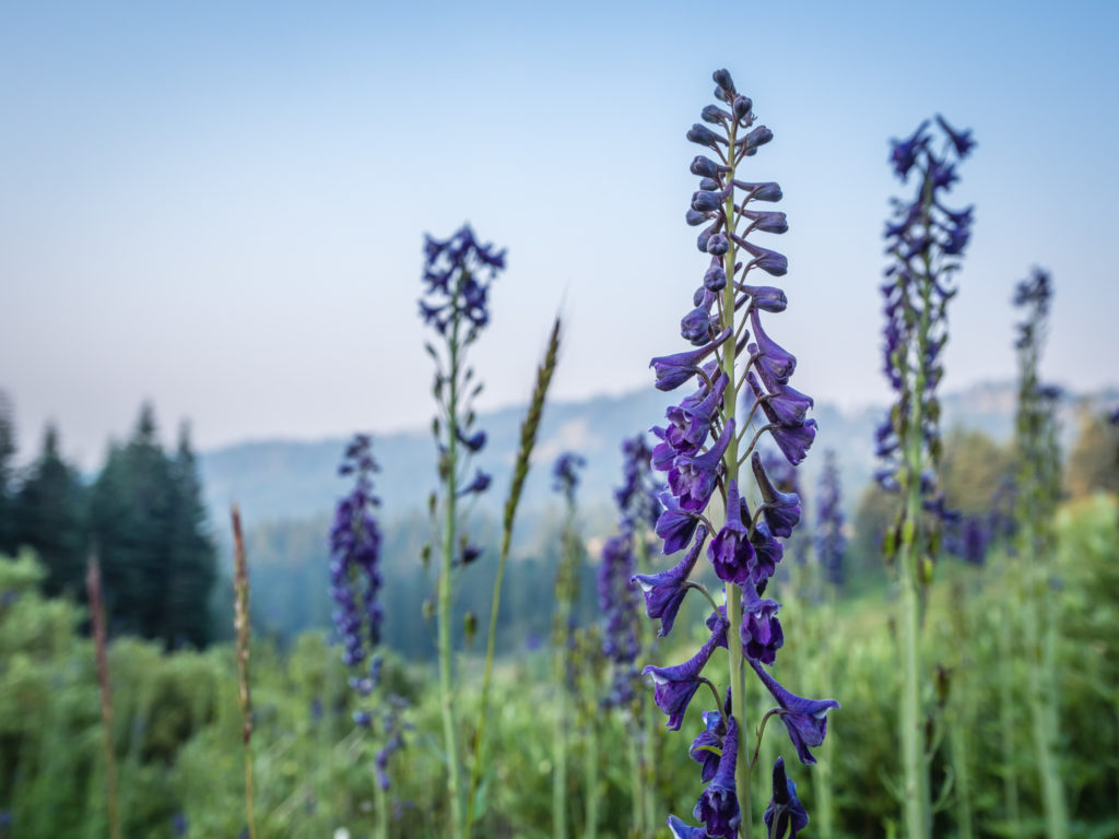
Purple Lupins still in full bloom.
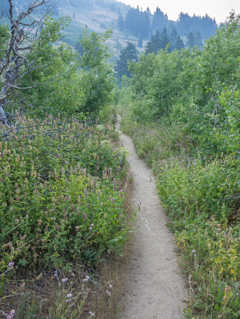
So far so good! We couldn’t yet complain about the conditions of the trail. So far it was both gentle and easy-going underfoot, just as anticipated.
More striking flowers line the trail.
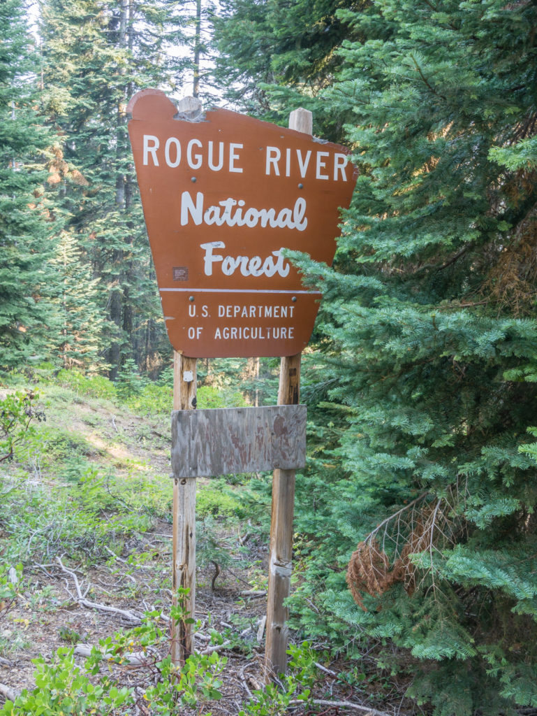
Entering the Rogue River National Forest.
Before long we had entered the Rogue River National Forest, much appreciative of the excellent trail that we had encountered so far. The smoky haze we had seen from afar yesterday did little to dampen our spirits as we enjoyed walking amongst a plethora of wild flowers, the sun trying its best to break through. We were keen to reach Ashland by early afternoon, so we just took one rest break to eat second breakfast, whilst also utilising the time to plan out our next food resupply, which we wanted to see us all the way through to the end of Washington. With Wayne carefully calculating calories to try and keep his rapid weight loss in check, we made a list of the exact number of breakfasts, lunches, dinners and snacks we needed to purchase that would hit his 5,000 calorie a day target based on reaching Washington in a maximum 20 days. We then calculated what ‘basics’ we needed to see us through Washington, with the idea that we’d also buy some fresh ingredients from the small communities we passed along the way. (We worked on the sum of 40 days worth of food, knowing that we would indulge in a few burgers or pizzas when we hit a trail town, and gave ourselves an extra day of rations in case we were held up by adverse weather.) Then it was all systems go to get to Interstate 5 and Callahan’s Mountain Lodge, where we were hoping to get a quick hitch into nearby Ashland.
The PCT crosses Old Highway 99 where we walked along the road to Callahan’s Lodge.
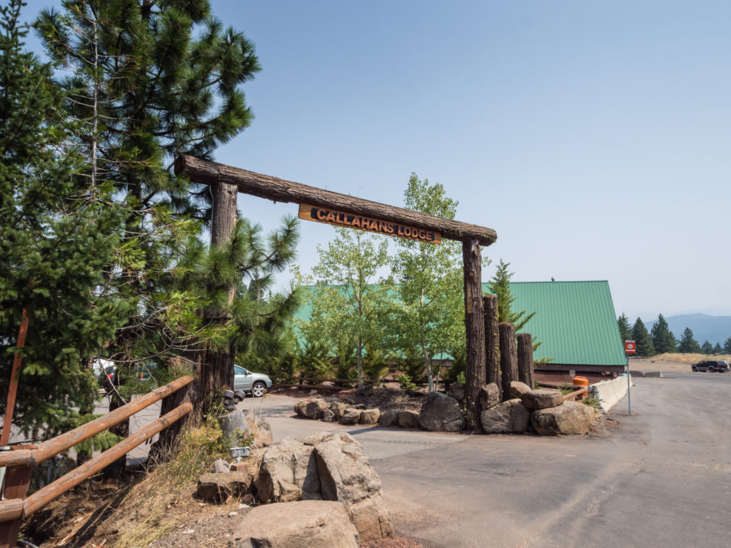
Although Callahan’s Lodge welcomes PCT hikers and offers both lodging and camping facilities, we wanted to stay in town so that we were closer to the amenities we required such as supermarkets, restaurants and the Post Office.
After reaching Callahan’s Lodge at around 1pm, it was clear that it was the wrong time of day for getting a hitch into town. Basically the cars parked there were staying put as they belonged to overnight guests. Those that had checked out of the lodge that morning were long gone. So instead of wasting time, we walked a short way down the road towards the slip road exit leading to Ashland where we were immediately picked up by Jolie, a local woman and herbalist who had just driven into the mountains to get some fresh plants to help with her breathing. As we drove closer to town, we could instantly see it for ourselves, but she told us about the thick, lingering smoke that had descended over Ashland as a result of the nearby wildfires, which had hung there for weeks. She said it was the worst effects of smoke Ashland had ever seen and recommended that we buy breathing masks whilst staying in town as the air quality was so poor. Residents were really having a hard time and had been advised by the local government to stay indoors as much as possible. Despite our optimism at having left the wildfires behind in Northern California, it seemed that no matter how farther north we were getting, we just couldn’t escape the ensuing smoke!
Dropping us off close to the Post Office, we thanked Jolie for both the ride and her advice, before heading off to collect our ‘bounce box’ and an extra resupply box of ‘treats’ sent from Etna, as well as a new pair of trail shoes ordered for Wayne from Amazon. (We were keeping our fingers crossed that they had been delivered to the correct address this time!) Thankfully all of our packages were ready for us, including some new socks that the Post Lady from Castella had kindly forwarded on for us as they had not arrived in the small window of time that we were there. (Online reviews and comments that we have read about the United States Postal Service tend to be very negative, but from our own experiences we have found the ‘Flat Rate Box Priority Service’ to be excellent and the counter staff nothing but helpful. Maybe it’s our English charm working wonders again, or the fact that we wait in line and respect the protocols, but we have no complaints and would 100% use the service again!)
Leaving the Post Office laden with boxes as well as wearing our backpacks, we were all set to catch the bus to the other end of town to get to our motel when we were surprised to hear the shout of “Two Plates”! Passing by in a car and waving out of the window was none other than our trail friend Co-Pilot! He was getting a ride back to the trail, but we felt pleased that we were gaining ground and catching him up! As we waited at the bus stop, we then got our next surprise of the day when another local trail angel named KC pulled up and offered to take us to the motel. It was another random act of kindness that was already making us fall in love with Oregon. When she dropped us off a few miles down the road, we asked if we could give her some money to recompense her for the fuel used. However, she declined the offer, instead asking us to ‘pay the kindness forward to another hiker in need’. It was a lovely gesture on her part after helping us out and we promised that indeed we would!
Weighed down with boxes as well as our packs, we were very grateful to trail angel KC for giving us a ride across town to our motel just off Highway 5 in Ashland.
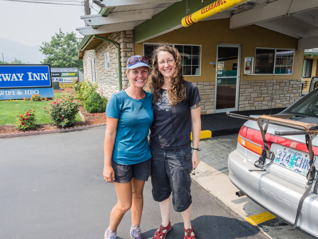
It was a smooth check-in at the Rodeway Inn, which we chose as it was ideally situated next to two large supermarkets, a pharmacy, a UPS store and a smaller Post Office – everything we needed to conduct our resupply ‘military style operation’. Knowing how long everything usually takes us in trail towns, we had decided to head straight to the supermarket (forfeiting an immediate shower) to purchase everything we needed and box up our supplies that evening so that all we would need to do the following day was take the boxes to the Post Office for shipping, before we could indulge in a ‘duvet day’ of sorts that would mostly involve eating, relaxing and more eating! We shopped between two supermarkets looking for the best deals on protein bars and our other hiker staples, and were extremely pleased when the total cost for 40 days worth of food came in at around 500 dollars! Even with the shipping costs for 8 boxes added on, we were well within our $20 a day budget. (That’s not to say we hadn’t already overspent on motels, restaurants and alcohol purchases – but it would all equal out in the end!)
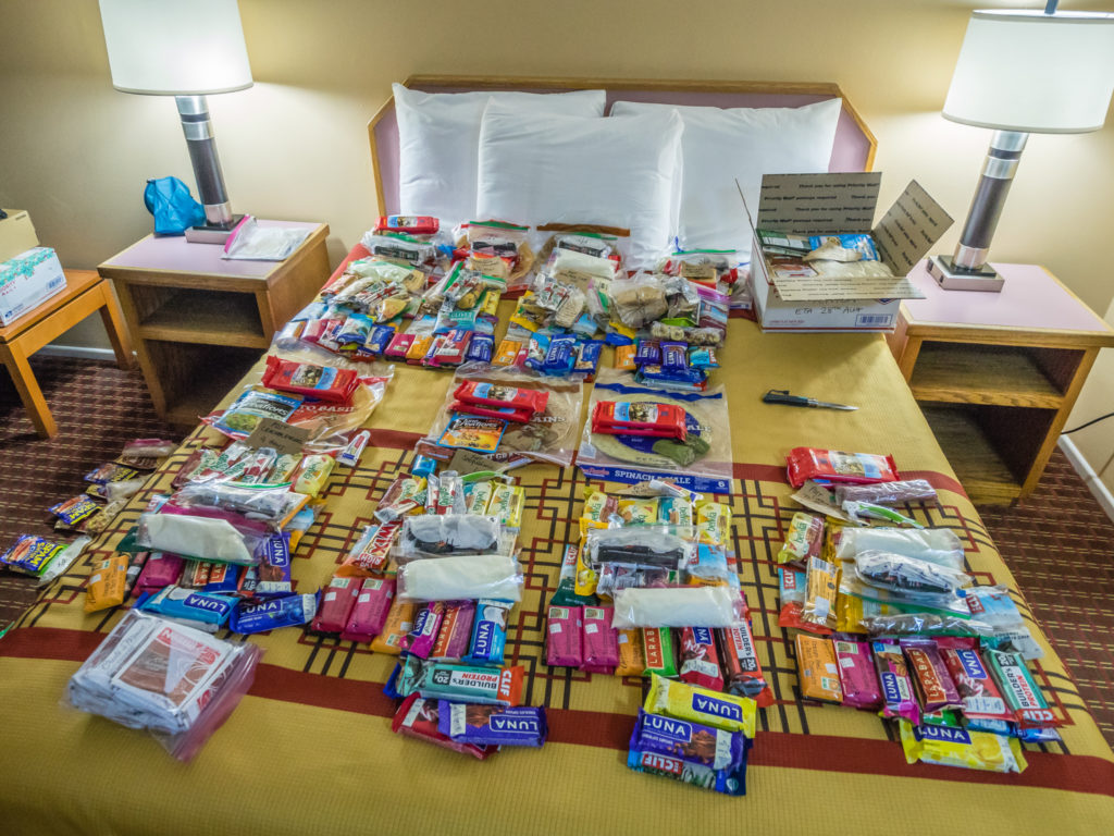
After buying resupplies from Albertsons supermarket and the highly discounted Shop N Kart across the road, we spent the rest of the evening portioning up food and organising boxes ready to collect from various re-supply locations across Oregon and Washington.
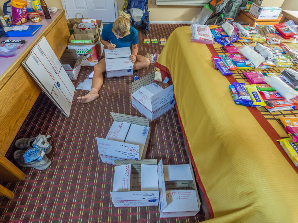
Undertaking the laborious task of labelling and filling boxes before we could finally take a shower and relax.
We worked until very late in the evening, but our planning and preparation would prove extremely beneficial in the long run, especially knowing how much extra we would have paid by resupplying in small trail town communities. We had learnt that lesson early on in Agua Dulce where our resupply for just 5 days came to a ridiculous $150! Pleased at our foresight and frugalness, we went to bed that night very content, even more so as we knew we could indulge in a lay in the following morning…
Days 122 & 123 – Thursday & Friday, 9th & 10th August 2018, Ashland, Oregon, Rodeway Inn Motel, zero miles
After enjoying a three-course breakfast at the motel (I literally had a plate of whatever was going – cereal with banana, toasted bagel with peanut butter, freshly baked waffle with maple syrup), we were full of energy and ready for our day ‘off’! We just had one ‘chore’ to complete from our ‘To Do’ list and that was to take all of our resupply boxes across to the Post Office for shipping. With the motel being situated right next to both the Post Office and a supermarket, it negated the need to take an Uber (Uber is not permitted within the Ashland city limits anyway), as we simply borrowed a trolley from the supermarket to effectively transport all of our resupply boxes just around the corner. Even more convenient was the UPS Store also located within the retail area as one of our packages (to Stevens Pass in Washington) could only be sent by UPS or Fedex.
$175 dollars later and all 8 of our resupply packages, plus our ‘bounce box’, were on their way north to be distributed between here and Canada! That meant we could finally let our hair down and head off in search of the all-you-can-eat Indian buffet we had been salivating over!
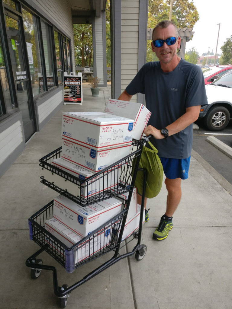
Our first task of the day was to deposit our resupply packages at the Post Office and UPS for shipping. Borrowing the supermarket trolley was very handy!
And now to the most important task of the day… Eating!
The previous evening in Ashland had seen us hurrying back to the motel because of heavy smoke in the air and thick ash that was falling making our eyes stream. However, tonight was like we were in a completely different place in the world.
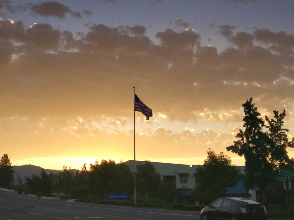
A minor reprieve for Ashland… The smoke had lifted revealing a beautiful golden sunset.
Feeling rather accomplished after our resupply efforts, we decided to stay an extra night in Ashland to allow us time to work on both the blog and video as we knew once we hit Washington any chance for uploading updates would be few and far between. It also meant another day of letting my arm rest. After Googling what I had done followed by closely matching my symptoms with what was posted on the internet (I never usually advocate this as it is such an unreliable source of diagnosis), I concluded that I had damaged my ‘rotator cuff’ in the fall. (The muscles, tendons and joint capsule that stabilises your shoulder.) Having never heard of a ‘rotator cuff’ before, I discovered that it is a common injury for sportspeople such as those who play volley ball, caused when they move to hit the ball and over stretch their arm. Reading the symptoms online – “When the rotator cuff tears, shoulder movement becomes painful and your arm may become weak. You may feel pain radiate down the side of your arm or in the front of your shoulder. The pain may be most noticeable when you lift your arm overhead” – the description matched how my arm felt 100%. The only downside of now knowing what was wrong with it was also finding out that “…Recovery can take 4 to 6 months, depending on the size of the tear and other factors”. With our journey to Canada incomplete, I genuinely hoped that my injury would recover in a much quicker time. For now, resting it whenever possible and pain relievers would have to do.
Taking an extra ‘zero’ day also meant we could plan out the final ‘sectors’ of the PCT. Using maps, the Guthooks App and Half Mile’s notes, we highlighted potential campsites and worked out our daily distances to ensure we would reach various trail towns on our preferred time schedule. It may seem regimented – but that’s how we work. (It’s probably the teacher and navy boy in us – but we don’t like leaving things to chance!)
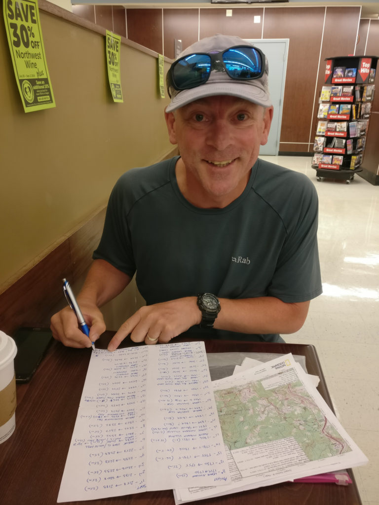
Whilst having a coffee in Albertsons Café, Wayne diligently plans out our final 6 weeks on the trail!
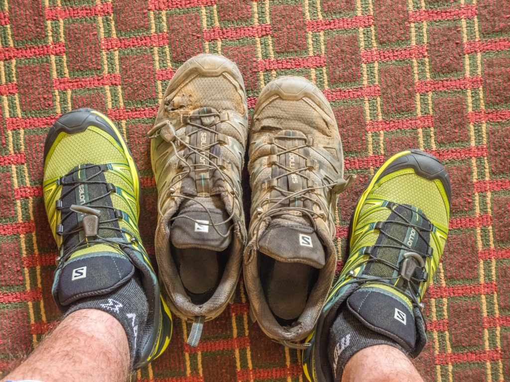
Wayne also got the chance to test out his new trail shoes. Rocking pair No. 3! He went for the bright green colour as they were $10 cheaper. After a couple of days back on the trail they’ll look dusty and brown anyway!
After what turned out to be another busy day of chores, this time of the ‘technical’ kind mostly sitting at a computer, a further day in town also meant more gluttony by way of treating ourselves to a sit-down set Chinese meal. And it was so far, so good with the arm – I had managed to leave it be as keeping it tight to my body and typing didn’t seem to affect my shoulder. But only time will tell on the trail whether it will heal much faster than the cases I have read online. All in all, an extra day in Ashland was very beneficial, both to our well-being and in terms of getting organised as we now felt much more prepared to tackle the remaining 950 or so miles! (It actually feels quite surreal saying that! To anyone else, that’s still a huge distance to cover. But to a PCTer – that’s now just a walk in the park!)
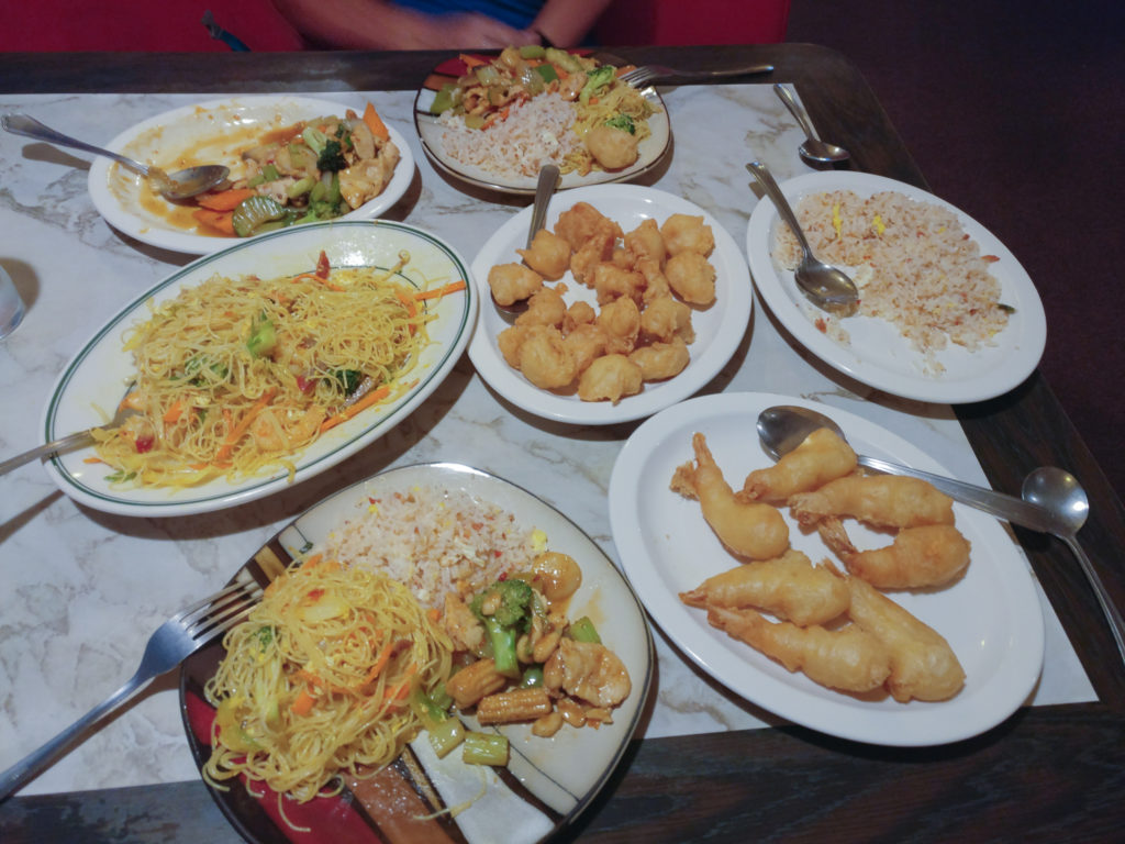
More food, more calories, more motivation!
Day 124 – Saturday, 11th August 2018, Ashland, Oregon, Rodeway Inn Motel, hitch back to PCT Mile 1,719 to Wild Camp at Mile 1,728, 9 miles
Such is the magnetism of trail towns, after checking out of the motel at 11am, we lingered in Ashland a while longer. Not content with the mountain of food we had consumed over the past few days, we decided to treat ourselves to one last indulgence before getting back on the trail by dining at the ‘Taco Bell‘ across the road from the motel. Our first experience of the Mexican fast-food chain was back in Lake Tahoe, which we had enjoyed. So being super convenient, we thought we’d give it another go. We had no complaints, but what made the experience extra special was meeting the Larson family. Wearing backpacks and showing off a deeply ingrained tan, thru-hikers stick out like a sore thumb in Ashland (and everywhere else), so we were quick to draw attention from the other customers when we sat down in the restaurant. On the table next to us, Mum Natasha immediately struck up a conversation about whether we were ‘bloggers’ having seemingly recognised us, followed by Dad and their three beautiful children who were all eager to chat with us and find out about our adventures on the PCT so far, especially Dad, having a keen interest in hiking the PCT himself one day. Such attention from complete strangers made us feel like ‘celebrities’, especially when they wanted to know our social media handles and said that they would love to follow along with our journey!
After a fun hour reliving our experiences so far for some newly acquainted but avid fans, we couldn’t put it off any longer. It was time to get back on the trail! We crossed over the road and decided that the petrol station would be a good place to try and hitch from as it was situated close to the slip road leading back to Interstate 5. We had learned by now that getting out my hitchhike poster usually acquired us a ride within 10 minutes or so of standing next to the roadside, and today was no different. Within a few minutes, local guy Alex had pulled up beside us offering us a ride back to the PCT trailhead, just where we had got off three days ago along ‘Old Highway 99’.
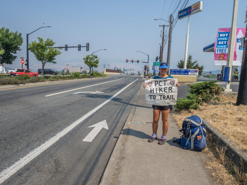
Trying our luck with hitching again! We got a ride back to the trail from a local guy within a matter of minutes.
Rejoining the trail along Old Highway 99, just a few feet from where we had stepped off the trail 3 days ago.
No sooner had we thanked Alex for the ride and waved him off, when none other than thru-hiker Blue strolled down the road. He had flipped up to the Oregon-Washington border and was now hiking SOBO. We had last seen him when we were getting back on the trail at Kearsarge Pass just as he was hitching out to Bishop. The time before that had been exactly the same thing! Blue was leaving the trail and trying to hitch into Tehachapi just as we got back on the trail courtesy of a ride from Jeff, one of the fantastic Tehachapi trail angels. Blue’s first words were “We’ve got to stop meeting like this!” It was hilarious and seemed that our chance meetings were a true embodiment of the expression ‘Ships passing in the night‘. We stood at the side of the road chatting for a while about various things that had happened on the trail since we had last bumped into each other and it was great to catch up with Blue again and find out his new plans. As a resident of Portland and true Oregonian, once he reached Ashland, Blue was actually debating on taking the bus home! (A few zero days in the comfort of your own home versus a couple of nights in a cheap motel – who wouldn’t?) As we waved goodbye again to one of our earliest trail friends, we wondered whether we’d ever catch up with him again. It didn’t seem likely now that Blue was hiking in the opposite direction – but people have been known to ‘flip-flop’ up and down the trail for all sorts of reasons, so we weren’t ruling out another chance encounter.
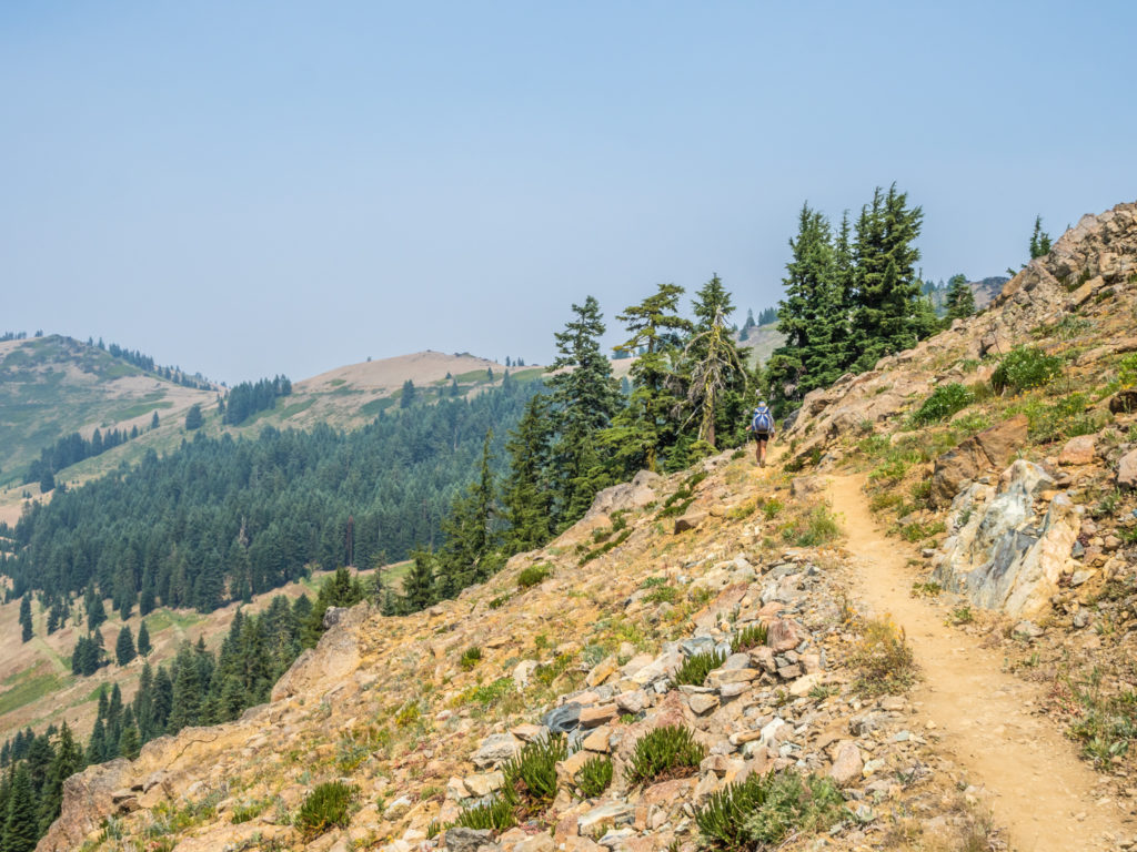
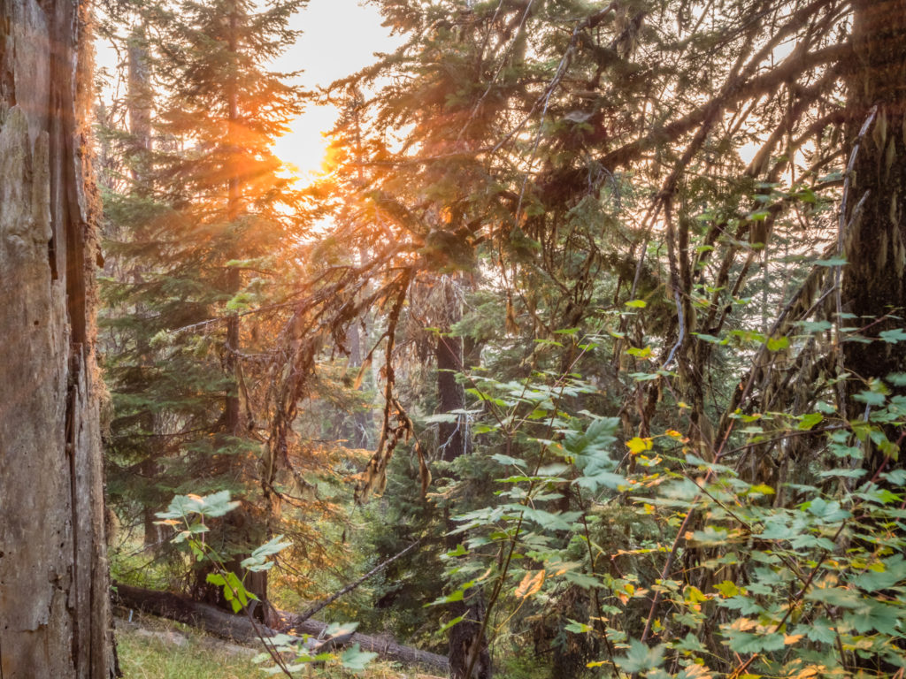
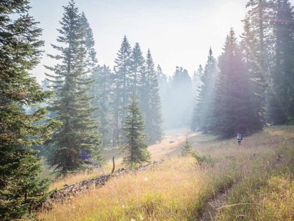
Back on trail, it was now around 4pm making it a much later start than we had originally planned. Thankfully, the trail conditions underfoot were excellent, so we were able to power out 9 miles before sunset and then call it a day – albeit a very short one. After rejoining the trail, the PCT skirts around Pillar Rock and continues to weave north through the Siskiyou Mountains. Along the route on a clear day we should have been able to see Porcupine Mountain, Soda Mountain and Hobart Bluff, however with another unfortunate change in wind direction, ash and thick white smoke was rapidly being blown back across Klamath County into Ashland, obscuring any views of the surrounding mountains. (After our experience of the spreading wildfires over the last few weeks, we were not surprised and have more or less got used to the ongoing situation now. We simply have to take each day as it comes and be thankful for any break in the smoke and the views that may suddenly reveal themselves!)
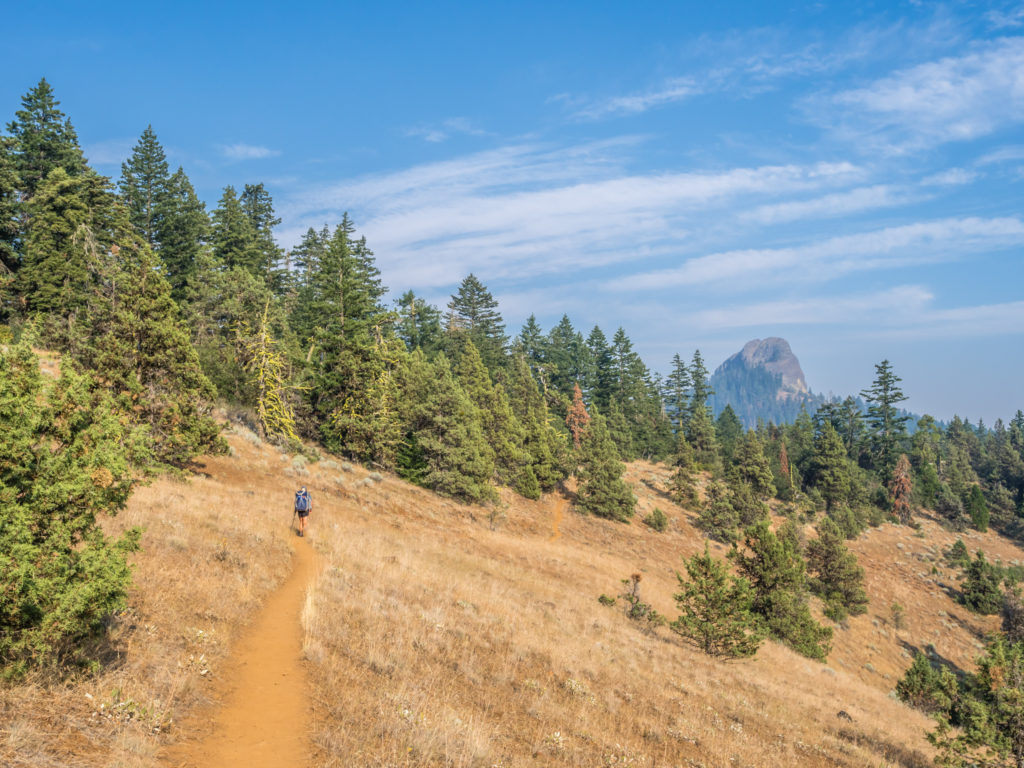
Finally breaking out of the ‘Ashland vortex’ and getting back on trail! We had a very late start, but the easy-going trail helped us make good time so that we were at least able to complete 9 miles before sunset.
Looking onto Pilot Rock as it was gradually becoming obscured. Persistent smoke from Oregon’s wildfires was engulfing Klamath County once again.
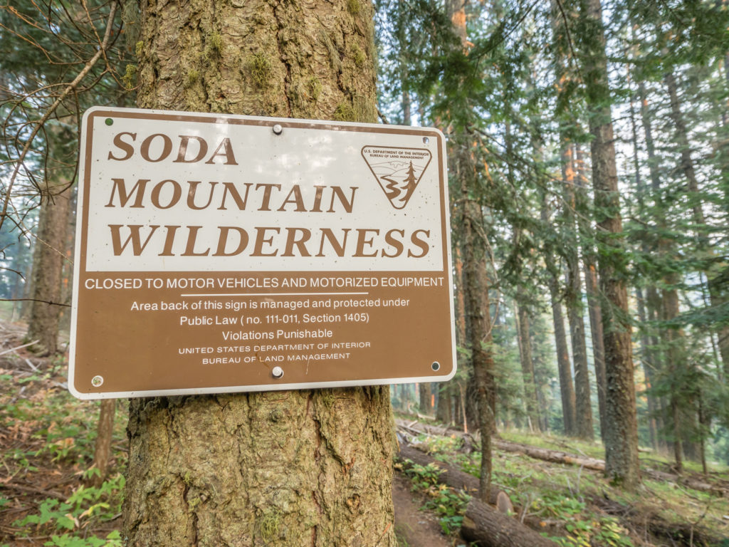
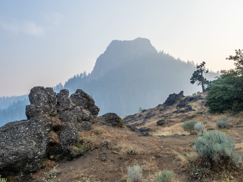
Entering the Soda Mountain Wilderness in Southern Oregon – a protected wilderness area inside the Cascade–Siskiyou National Monument.
At PCT Mile 1,725.4 we reached the Soda Mountain Wilderness boundary where we took a quick break before pushing on to Mile 1,728. We knew there would a small spring at this spot so had decided to camp close by so that we would have access to a water supply first thing in the morning. When we reached the spring there were already several hikers camped around the water, so we walked off trail a little and wild camped at the top of a dirt road that had been barricaded with fallen trees and was no longer in use. It was by no means a scenic spot but it would suffice for one night.
We watched the beginnings of sunset before reaching an old disused dirt road where we set up camp for the evening. In reality at this point on the PCT, wild camps are merely functional. They are now where we manage to get to before dark (or a little after) and not always the most picturesque of places!
Day 125 – Sunday, 12th August 2018, Wild Camp at Mile 1,728 to Wild Camp at Mile 1,755, 27 miles
Today we had that ‘Sunday morning’ feeling and didn’t set off until around 8am. We hadn’t yet adjusted back to the rhythms of the trail and were still feeling a bit lethargic from spending time in town. The prevailing smoke also made everything seem somewhat lacklustre, so to lift our mood we refocussed our attention back to the surrounding trees and other flora and fauna. As we walked amongst moss-covered Ponderosa pines and towering Douglas-Fir trees, identifiable by their deeply furrowed bark and soft, bottle-brush like needles, we smiled at how truly amazing trees are. That set Wayne off on a mission to be able to identify as many as he could of the different types of tree species we passed with the help of his newly installed ‘tree identification’ app. He is no ‘twitcher’ but he had also installed a ‘bird identification’ app too, which, when you’re walking through trees all day, does really help to pass the time. After spotting a woodpecker with a black body and white head, he deduced with the help of the app that it was the ‘White-headed Woodpecker’ (Picoides albolarvatus) – named by American ornithologist John Cassin in 1850. Discovering then that this particular woodpecker is listed as a ‘Critical Species in Oregon’, we felt privileged to have seen one foraging in the soft outer layers of bark of a Ponderosa pine.
Waking up to another smoky morning on trail…
Refocussing our attention back to the amazing flora and fauna of the wilderness.
A brilliant fluorescent yellow-green, moss-like lichen clings to the bark of a Ponderosa pine.
Waiting for Wayne as he takes his time trying to identify more trees!
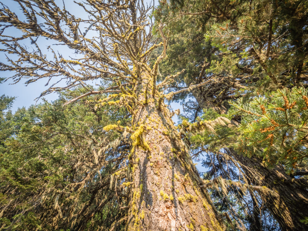
I’m not sure of the technical name – but this is definitely a ‘tall’ one!
When we reached Highway 66, we could have taken a 1.8 mile side trail to The Green Springs Inn to have a meal at the roadside restaurant, but somehow we managed to refrain. (We’ve had rather a lot of highly calorific ‘town food’ lately and I can definitely tell I’ve been putting on a few pounds!) So instead we continued on, the trail taking us around the base of Green Springs Mountain. Again we were walking amongst the trees and had no view beyond the immediate forest, but we were getting a bit more enjoyment out of it now that we were looking for clues to ‘name the tree’ and made identifying the different varieties into a game.
Along the route we had another trail register to sign. After flicking through the pages we saw that Marc and Tami had already passed through, along with Peanut and Cricket and a few other hikers we had met in the Sierra, who were all at least a week or two ahead of us now. Knowing that there were also several other acquaintances still behind us, we concluded that we were about in the middle of the pack and we were comfortable with that. We had our intended end date and we were still on track so we were happy with our progress. This is where the term ‘Hike your own hike‘ really rings true.
They are such a useful tool – Signing the second trail register we had seen in Oregon.
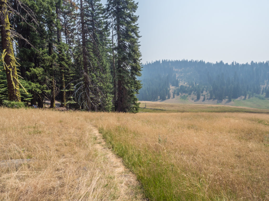
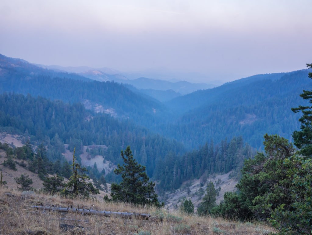
Looking out to the smoky horizon.
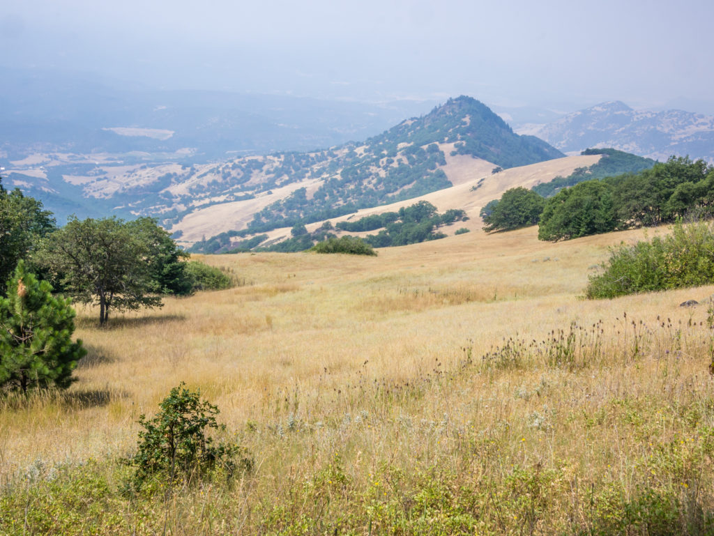
Our view across the Soda Mountain Wilderness. The dry, yellow grassland was really striking. From afar it looked akin to the rolling, sandy hills of the desert.
Heading back into the forest for Round 2 of ‘Name That Tree’!
We stopped for lunch by Little Hyatt Outlet, the outlet from Hyatt Reservoir located at PCT Mile 1,741. As rest stops go, it was a pretty lunch spot with a flowing waterfall and bridge over the large creek, so we took our time to soak up the scene sitting on the grassy bank close to the water’s edge. Following suit were new acquaintances Fern and Tommy Pickles. Fern was instantly memorable because of her quirky hiking attire. Up to now, she was the only female on trail we had seen hiking in a kilt.
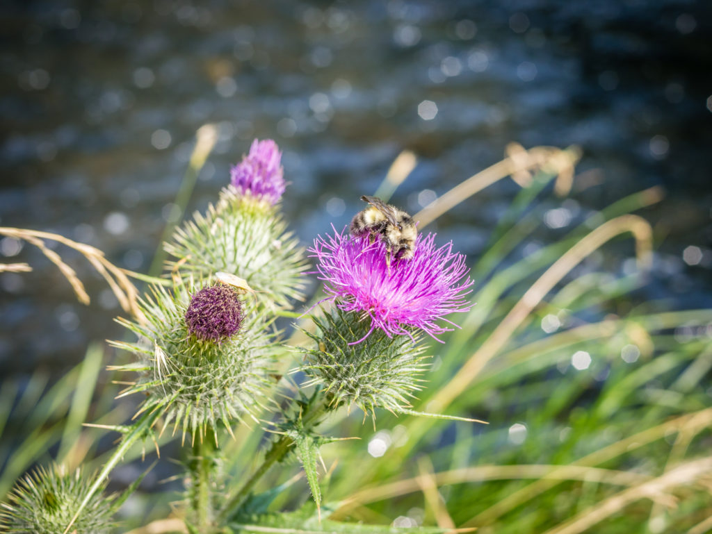
A bee is busy collecting pollen from a thistle close to Little Hyatt outlet.
The man-made waterfall from Hyatt Reservoir.
Lunch with a pretty view.
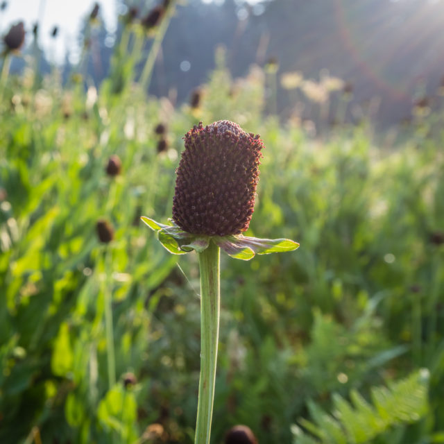
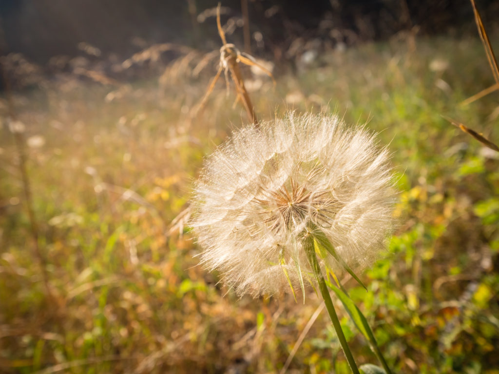
We could see that autumn was on its way in Oregon as lots of flowers were already starting to wither and seed.
The PCT then went around the east side of the reservoir taking us back into the forest where we crossed the Howard Prairie Canal flowing through the Howard Prairie County Recreation Area. There is a designated ‘PCT camp’ within the recreation area, however as we still had a couple of hours left before dark we intended on covering a few more miles. (Especially as we hadn’t gone the distance yesterday!) We had also been warned that the water in the canal could have been contaminated from boat fuel that had spilled into the lake, so we wanted to top up our water supplies from Grizzly Creek, which was further along the trail.
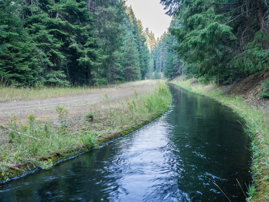
Crossing the Howard Prairie Canal. We were told that this was not a reliable water source as it could be contaminated with boat fuel so we hiked on to filter water from Grizzly Creek.
To make up for yesterday’s slackness, we continued on to Mile 1,755, which when we arrived around 9pm was very busy with PCTers already camped close to the spring. It was absolute darkness so we needed our head torches to search out a suitable camp spot as much of the remaining area was covered in long, dry grass. We just managed to squeeze our tent into a flattish spot that was a little off trail below Vulture Rock, yet we couldn’t see any view of it because of the dark.
Just as we were settling down to sleep a rustling noise startled us, but fortunately when I took a sneaky look out of the vestibule door it was only a deer foraging around the tent that quickly skittered off once it saw the flash of light from my head torch! As we settled down for the second time, we just hoped that there wouldn’t be any more unexpected visitors or surprises in the night.
Day 126 – Monday, 13th August 2018, Wild Camp at Mile 1,755 to Wild Camp at Mile 1,781.5, 26.5 miles
What we thought was going to be another ‘uneventful’ day on the trail for us here in Oregon amidst the continuing smoke-filled air, in fact presented us with two unexpected and very nice surprises! But more of that later…
After leaving camp at 7:30am, we spent the early part of the morning weaving our way through a combination of old woodland and dead fall areas, the trail relatively smooth and soft underfoot once again, just as we like it. Thankfully the persistent deer that returned and had been eating its way around our tent last night hadn’t stolen away with our trekking poles, a habit that some of the more mischievous deer have developed to fulfil their penchant for salt. (Our trekking pole handles and straps really do need a rinse as they are attracting far too many creatures lately!)
The PCT continues in Southern Oregon…
Still only able to use one arm and trekking pole, we were grateful of the smooth, easy going trail once again.
After hiking around the base of Old Baldy Mountain, we then entered the Rogue River National Forest. Just like ourselves, it seemed that the forest had woken up with the gentle sunrise. The dry pine needles crunched under our feet as we went, adding to the menagerie of bird song, tapping woodpeckers and creaking branches as squirrels raced skywards through the towering trees. Even though we were the only hikers around this morning, we were definitely not alone on the trail.
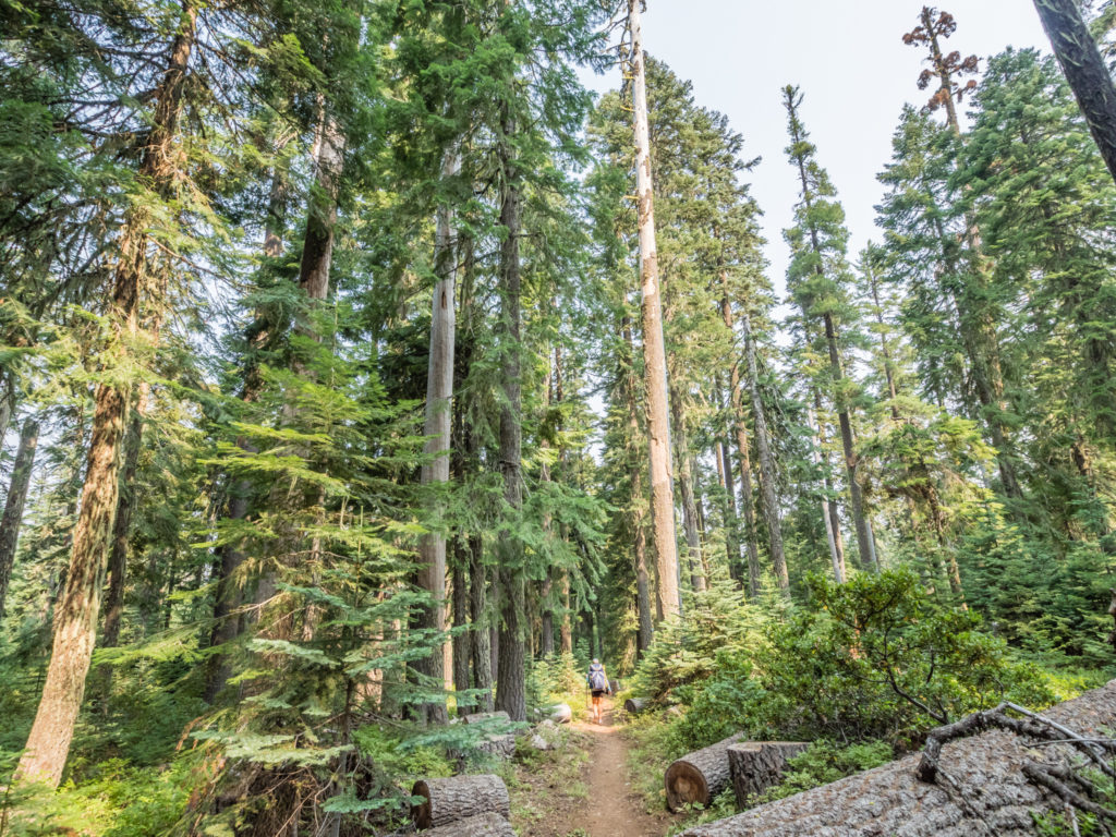
With the trees towering above us, we had to remind ourselves to look up and enjoy the trail from a different perspective!
We pushed on 8 miles in order to reach the Brown Mountain Shelter where we stopped for ‘lunch’. It was only 10:30am, but since resupplying in Ashland we have changed our food rations again to now include what we have named ‘Elevenses’. This lunch style meal has now replaced ‘second breakfast’, which we have swapped out in light of the fact we’ve been hankering after more savoury food items. Having four chocolate bars a day really does put you off sweet things, even to the point where we’ve both said that we are loathe to ever eat a Snickers bar again! So instead of granola, nuts and powdered milk, we thoroughly enjoyed whole-wheat flat breads with cheese, sliced tomato and mayonnaise. Likewise, we are now also carrying a pot of hummus and eagerly dipped in with the bread cut-offs! We have most likely reduced the amount of calories we’re now consuming by making the change to our daily rations, but at the moment it’s all about the flavour and having something different to eat as four months of repetitive trail food is not so appetising anymore, even with persistent hiker hunger!
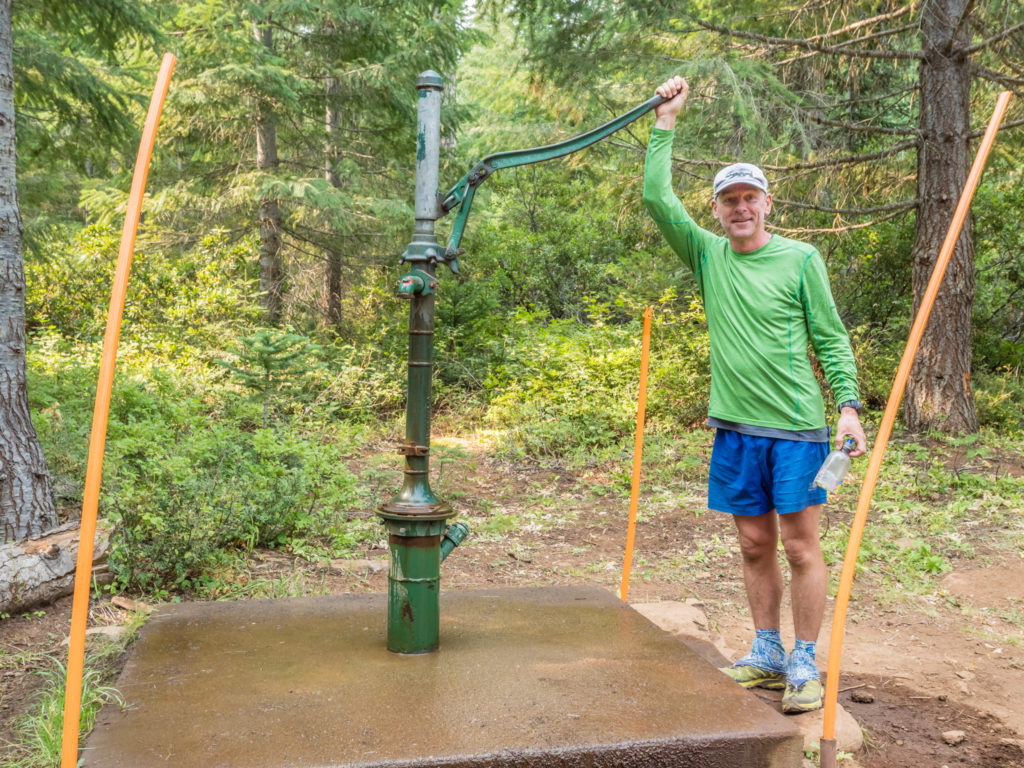
Next to the Brown Mountain Shelter is an old-fashioned water pump. With the next reliable water source being a further ten miles ahead we took the opportunity to top up our supplies.
Just as we were ready to leave the hut and get back on trail we had our first nice surprise of the day when none other than ‘Snake Eyes and Fugitive’ (whom we had first met back on Day 4 leaving Mount Laguna) strolled up to the water pump. We had to do a double take as they had both lost so much weight, but they instantly recognised us. The last time we had seen them was in Tehachapi over 1,200 miles back and we hadn’t known whether they were still on trail or not, and likewise, they thought the same about us. So it was great catching up again – this time the hot topic of conversation being ‘food’. They questioned us about what we were using as our staples, how we were increasing the calories and what we were doing to create some variety. Every thru-hiker obviously has the same issues, rapid weight-loss for men being a major concern. It was good to swap meal suggestions and find out about different snacks as even though we had already sent forward our resupply boxes, we would still be supplementing what was in there with fresh foods we could get hold of along the trail. After further discussions it seemed that Snake Eyes and Fugitive were on a similar schedule to us, so we expected that we’d now see them quite often along the trail.
We love seeing signs that remind us we have much fewer miles to cover to reach Canada than what we have already walked from the Mexican border!
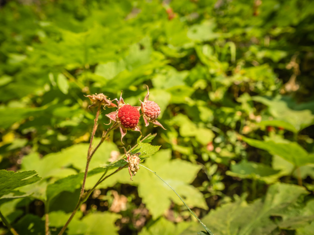
We spotted and sampled some ‘Thimble berries’ growing close to the trail. They look and taste much like a raspberry, yet they really are shaped like a thimble!
After leaving the cabin we found that we had an expansive lava field to traverse as we circumnavigated Brown Mountain. (The summit at 7,311 feet is shared between Jackson County and Klamath County as the northern part of the volcanic mountain falls within the Winema National Forest.) The huge jumble of lava rock, remnants of when the volcano erupted thousands of years ago, made for an awkward and annoying section of trail. With the rocks being so cumbersome there were potential trip hazards galore, which put Wayne on edge with me having already sustained an injury through falling. Thankfully the trail soon levelled out having had some maintenance making this troublesome section a whole lot easier.
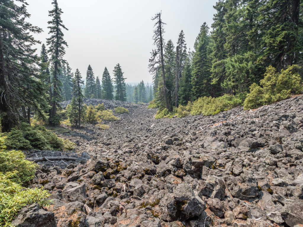
The cumbersome lava rock being so awkward to traverse really slowed down our pace.
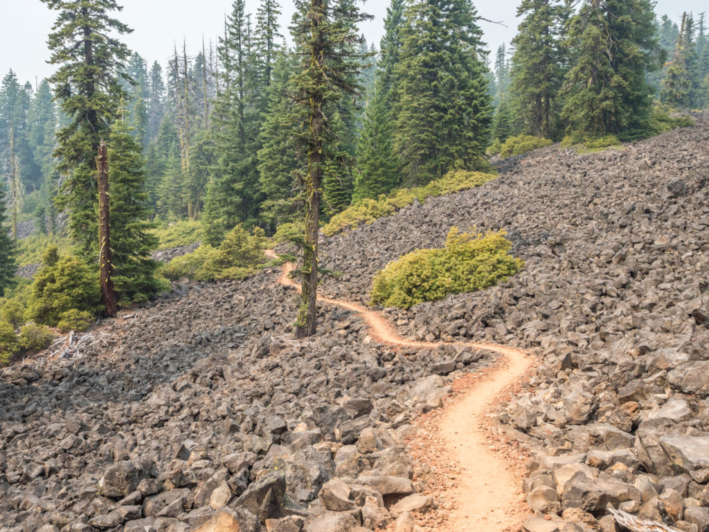
Fortunately the rest of the trail through the lava field had been manicured, which made for a much better experience.
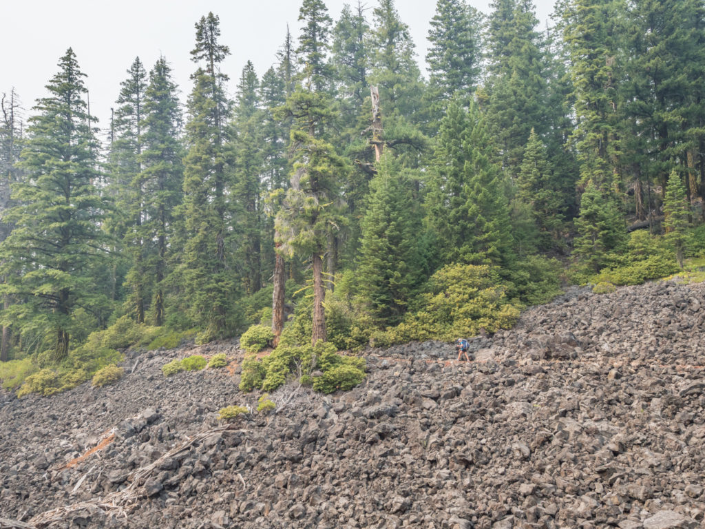
If you look closely, I am walking along the trail that weaves through the lava field.
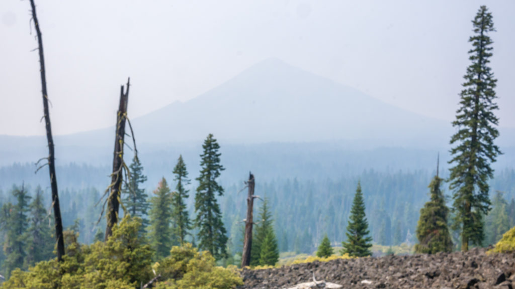
Behind the smoke screen is one of Oregon’s prominent volcanic peaks in the distance.
Finally leaving the lava field behind, we enjoyed our second surprise of the day. We were all smiles on reaching Highway 140 when we discovered some ‘Trail Magic’ taking place. ‘Magic Man’ had been camped out there in his pick-up truck for the past week lifting the spirits of passing thru-hikers with the offer of a beer and a cherry pie. So how could we refuse? Moments later, Snake Eyes and Fugitive caught us up and indulged in some ‘magic’ too. It was the perfect pick-me-up after a hard afternoon.
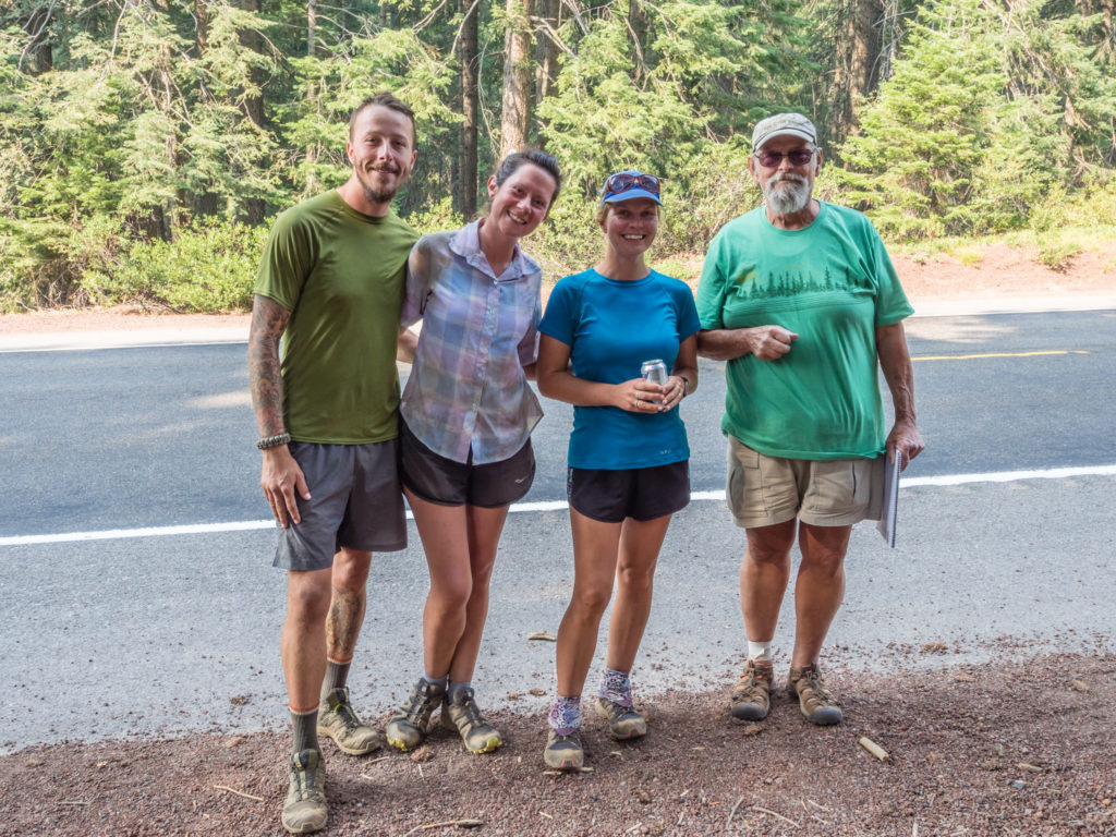
Fugitive, Snake Eyes, Two Plates and Magic Man
After thanking Magic Man for his kindness, we set off on the final stint of the day. When we reached Cascade Canal we decided to have an early dinner with us having easy access to water both for cooking and washing up. We also thought that another boost of calories would set us up for crossing the Sky Lakes Wilderness Boundary and the uphill climb of 1,000 feet that was to follow.
At around 8:15pm, we set up camp at the trail junction leading to Squaw Lake at PCT Mile 1,781. Although it was in a dry meadow there were a few mosquitoes around, but not so many as to be a raging nuisance. We had hoped that by now (mid-August) we would have missed the 4 stages of the mosquito life cycle here in Oregon and avoided them completely! Only time would tell…
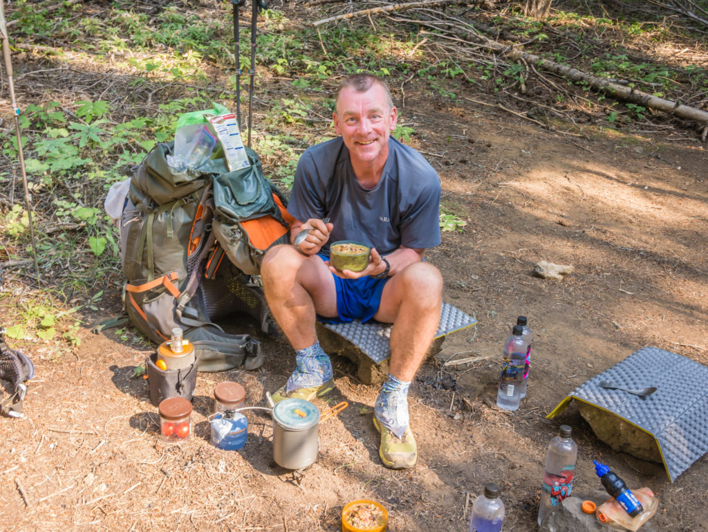
An early camp dinner of Idahoan mashed potatoes topped with a rehydrated ‘Beef & Vegetable Bear Creek Soup’.
It seems that it’s been ‘so far so good’ since crossing into Oregon state. The continuing wildfires are not knocking our spirits and we are even more determined to make it to the Canadian border now that we have less than 1,000 miles to go. Many hikers are under the impression that the trail in Oregon is ‘flat’, but we have already found that this is really a misconception. Comparative to the Sierra section, yes there’s minimal elevation change, but the majority of trail is most definitely not flat! Our experience so far in Southern Oregon has been of a much ‘gentler’ trail in nature that for the most part has been soft underfoot, making it easier for us to stride out and power through the miles. Whether this will continue as we head further north remains to be seen… But we’re keeping our fingers crossed for good, consistent trail seeing as we have plenty of 30+ mile days ahead!
12 Comments
Excellent as always and looking forward to the next installment.
Thanks Kevin, always good to get positive feedback!👍
Nice reading this to escape from the Autumn cold. Look forward to the rest of the journey.
Thanks Robin. If it’s any consolation, we’re currently travelling overland through China and it’s been raining solidly for the past 4 days preventing us from getting out and exploring the Zhangjiajie National Park that we specifically travelled to this area for. We’ve been productive with the spare time though by editing and uploading some more PCT blog posts and videos. Hope you enjoy them!
I’m still loving reading about your great adventures and remain in awe of your achievements.
Thanks David 🙂 Can’t believe it has been almost two months since we finished already! We’re steadily making our way through the remaining PCT blog posts and videos and uploading when we can as we travel through China. Hope you enjoy them.👍
Fun read, Danielle. You didn’t tell us what you thought of the Indian cuisine, and the Chinese food looked good, but Taco Bell is low grade dog food! Yuk! (My wife loves it….) Looking forward to the Sky Lake chapter, one of God’s many
Cascade miracles.
PS….You should have gone to the doctor! Thanks again for your beautifully descriptive prose.
Thanks Bob! We love spicy food and curry is one of our favourite dishes at home so we found the Indian was quite bland with it being an all-you-can-eat buffet and catering for the masses. The Chinese was good for the price and Taco Bell – well, I don’t think we’d bother going again but it was a change from trail food and cheap!
I think our latest blog post – Week 20 – really showcases what Oregon has to offer. The smoky conditions really improved for us after we reached the Three Sisters Wilderness. Up until then, the smoky skies spoiled a lot of our views. We really want to come back to Oregon & Washington in the future to re-hike some of the sections that we felt disappointed with – Crater Lake especially as the smoke was so bad on the day we visited.
Overall though, we were very lucky not to be affected too much by the wildfires so we can’t really complain. 🙂
Oregon looks less dramatic but still stunning. Keep those posts coming 😀
We’re on it!👍
So glad the arm hasn’t held you back too much. Do hope it improves more rapidly than ‘google’ suggests. I love Oregon. So looking forward to reading of your journey through here.
We felt like we rushed through Oregon in a whirlwind, so we definitely want to return in the future to appreciate it more fully!