
“I walked slowly to enjoy this freedom, and when I came out of the mountains, I saw the sky over the prairie, and I thought that if heaven was real, I hoped it was a place I never had to go, for this earth was greater than any paradise”.
– Daniel J. Rice
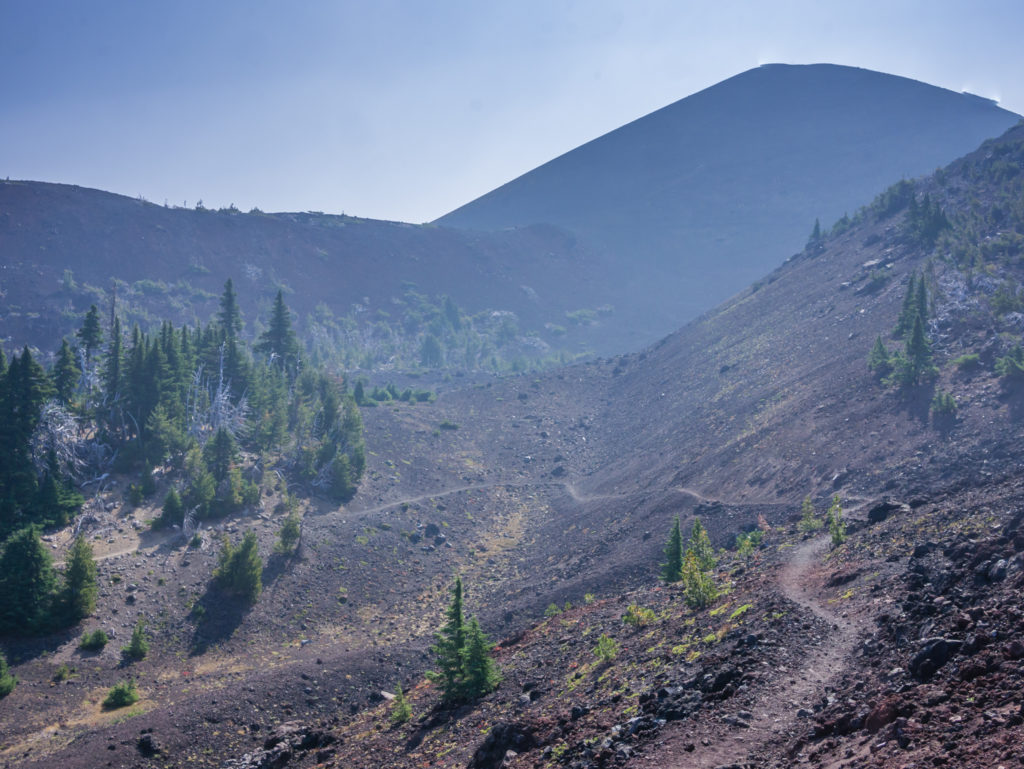
The Twentieth Week – Light At The End Of The Tunnel!
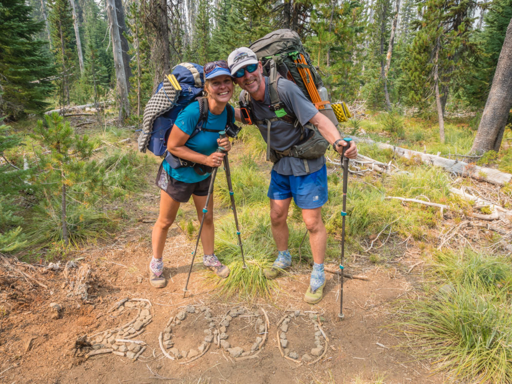
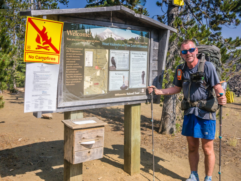
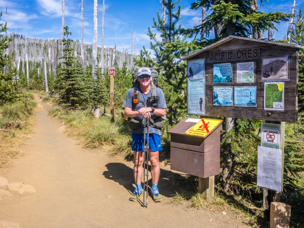
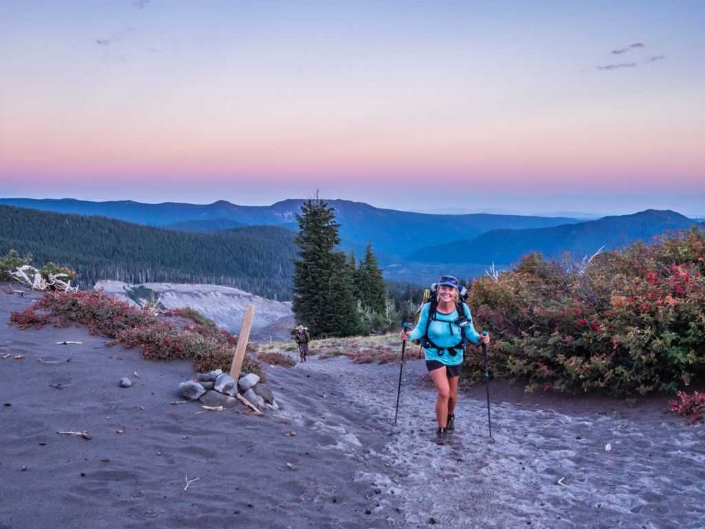
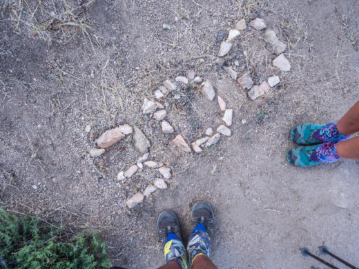
After 136 days on the trail, we were thrilled to have reached PCT Mile 2,000!
After one hundred and thirty-three days on the trail, we begin week 20 still in the dark as to the final outcome of our PCT adventure. As it stands, the Pacific Crest Trail remains closed from Harts Pass (PCT Mile 2,622) to the Canadian Border due to a 300 acre wildfire burning on the PCT at Holman Pass. That means that whilst the closure is in effect, thru-hikers cannot hike the final 30 or so miles to the Northern Terminus.
Finding out this unpleasant news via trail talk, then having it confirmed by reading the PCTA website, we were completely gutted. Being the kind of people who hate not to ‘finish’ something, it would be such an anti-climax not reaching Monument 78. Having envisioned what it would be like to reach the end of the trail and cross the border into Canada for what feels like a million times in our heads, not doing so would mean our entire thru-hike lacked a real conclusion, something we would find hard to deal with. Thankfully, as we still have over 600 miles to go until we may be placed in such a predicament, we are very much hoping that the wildfire will be contained before then and the trail reopened. We haven’t even reached Washington yet, so the situation in a few week’s time may be very different. All this agonising over what to do and whether we need to put ‘Plan B’ into action may well be for naught. But as yet, who knows…
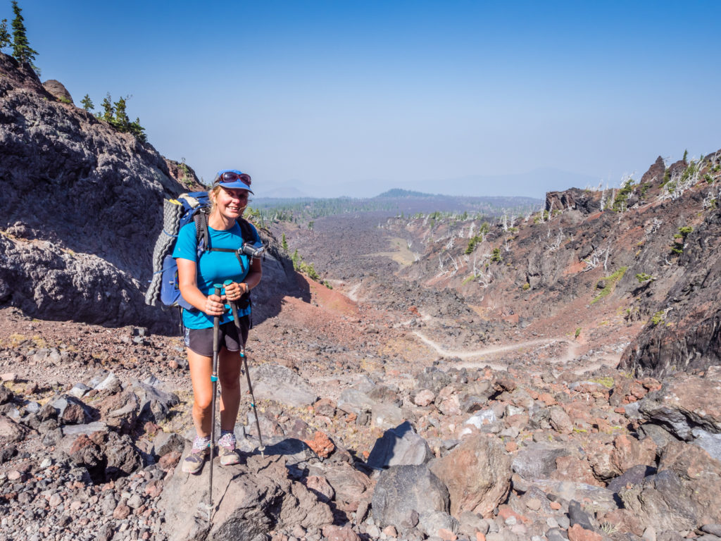
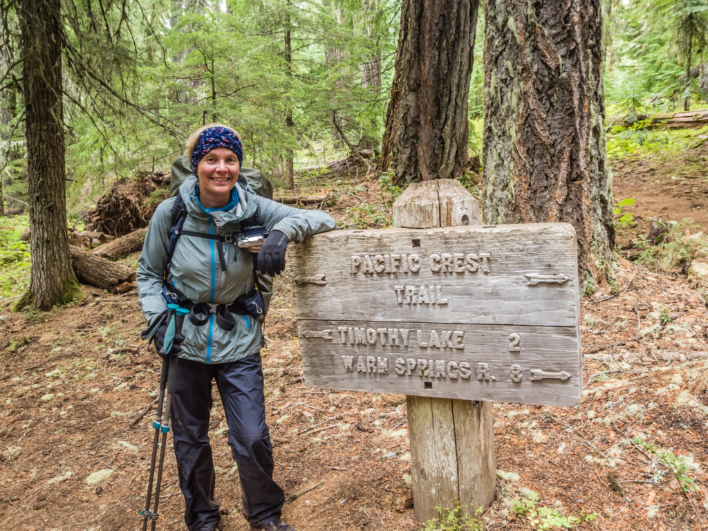
Day 134 – Tuesday, 21st August 2018, Wild Camp by Mac Lake at Mile 1,942 to Wild Camp by Foley Ridge Trail Junction at Mile 1,968, 26 miles
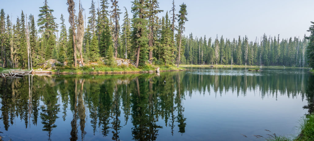
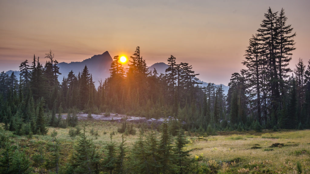
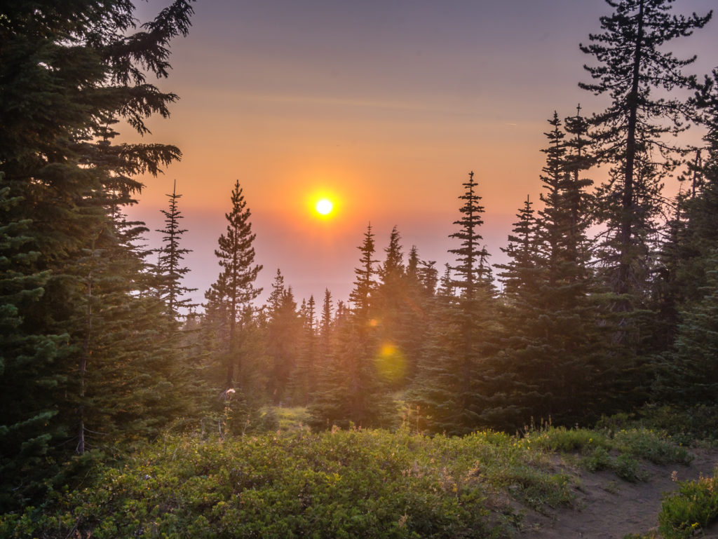
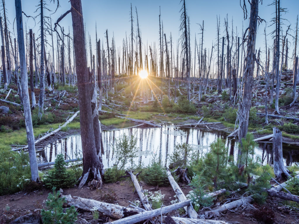
We were almost the last to leave the camp area by Mac Lake at 7:15am, but for once we were glad to be slower than the rest of the herd as we watched a beautiful sunrise appear above the trees, casting a shimmering red glow across the rippling water of the lake.
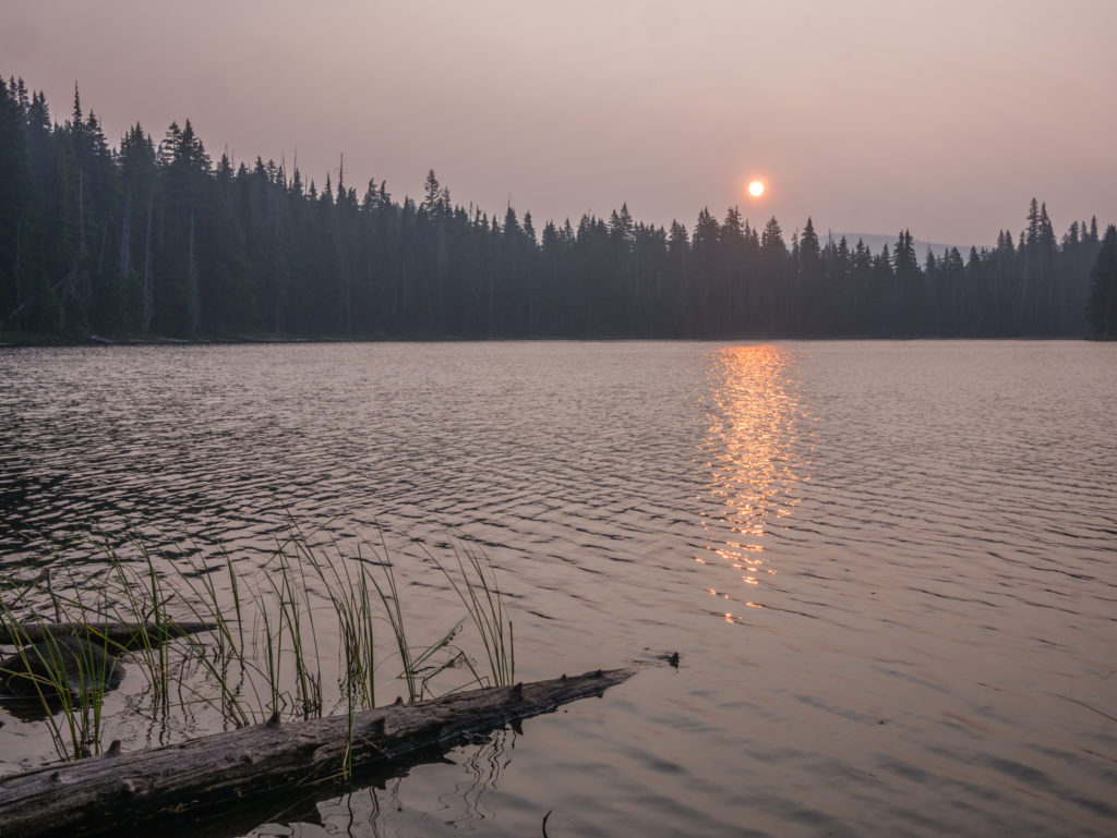
Early morning hues of pink fill the smoky skies as the sun casts a golden red glow across Mac Lake.
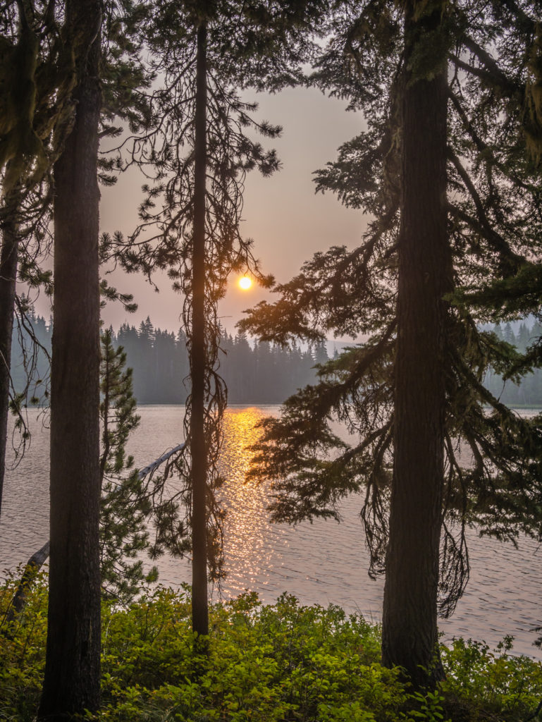
As we continue to watch the sunrise from our camp spot it grows more intense.
Bathed in the early morning glow before breaking camp.
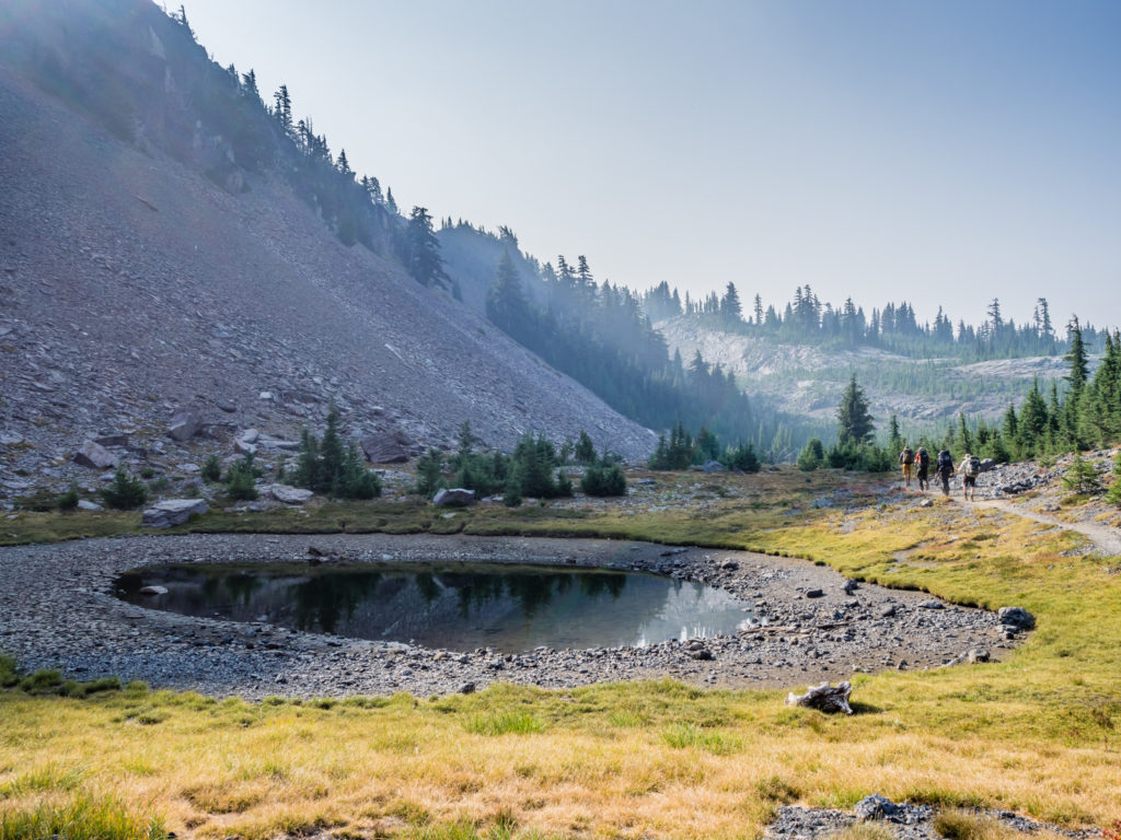
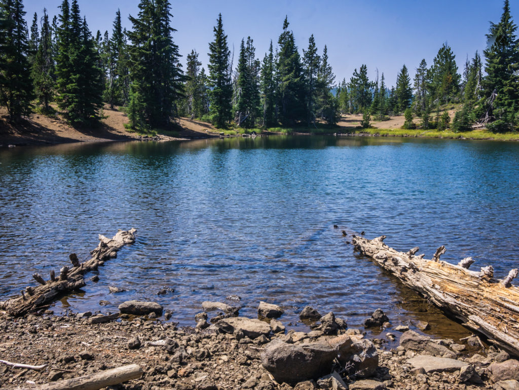
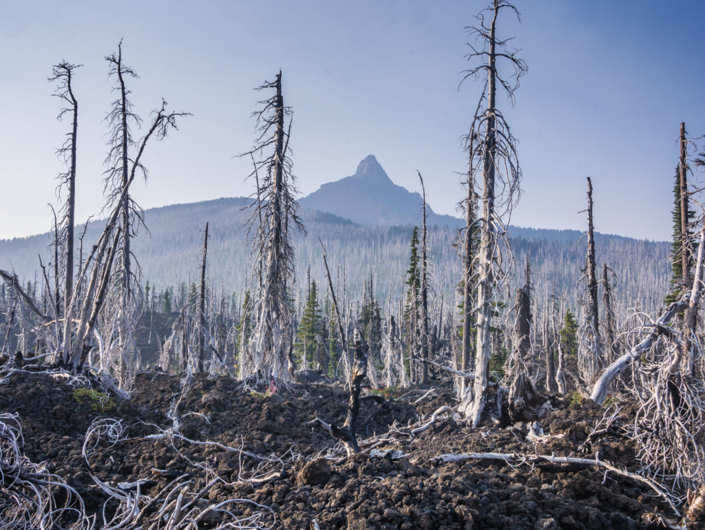
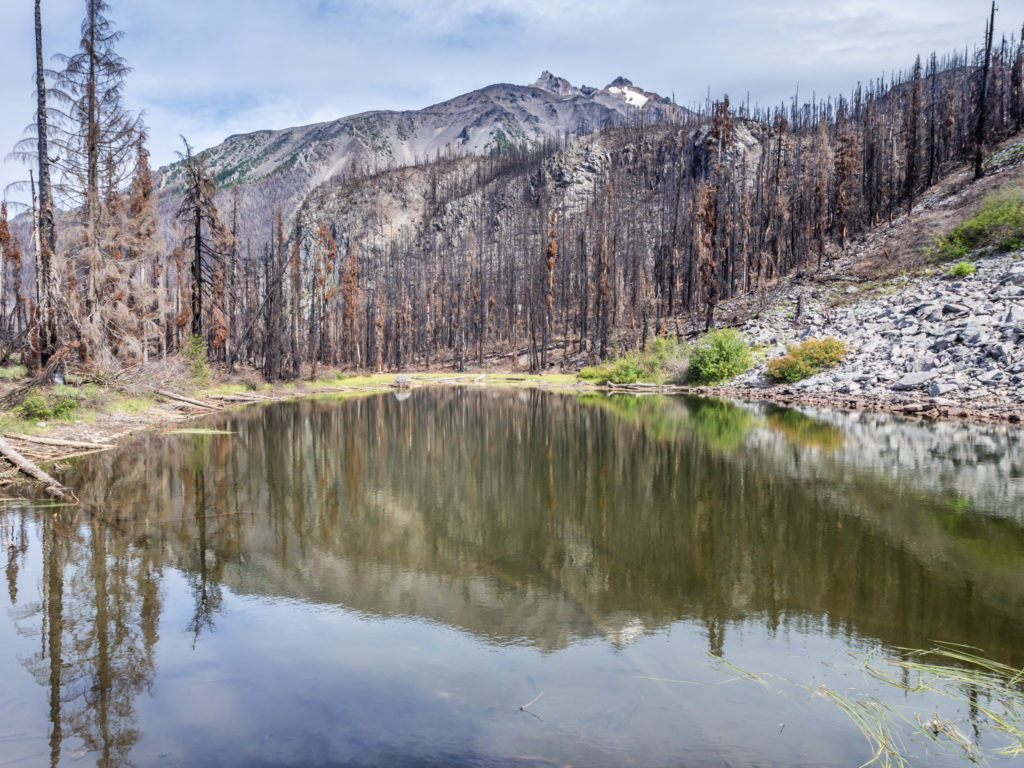
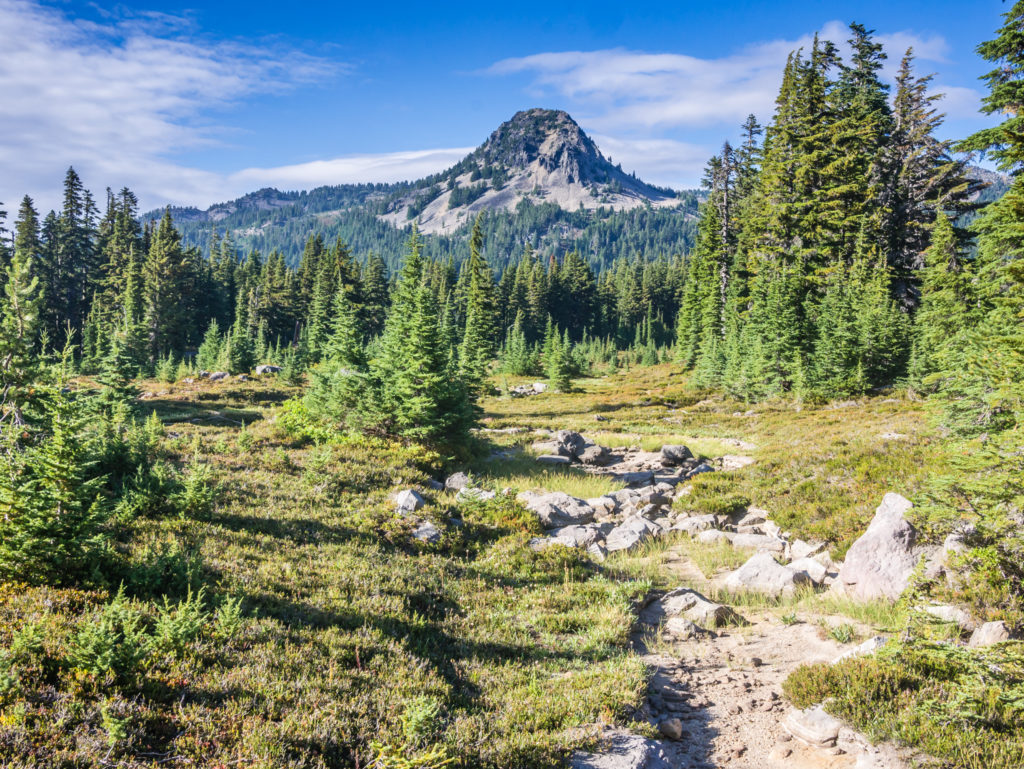
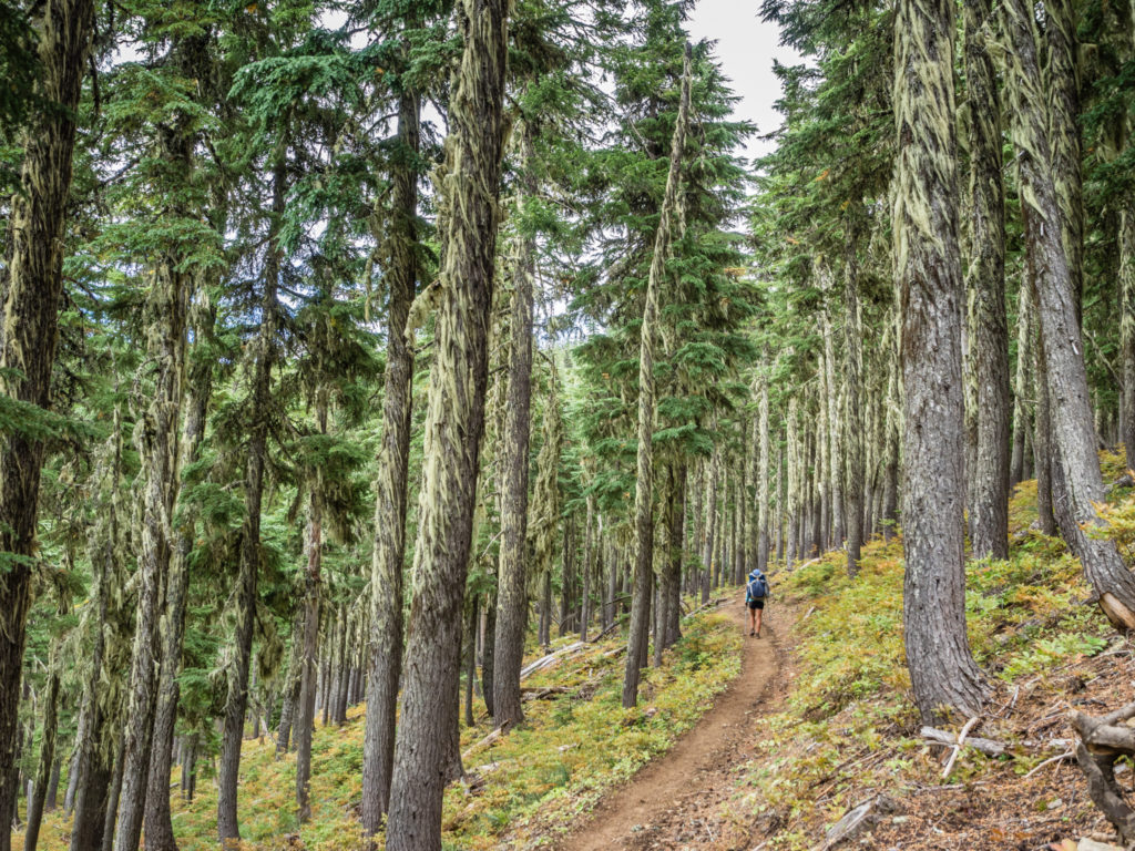
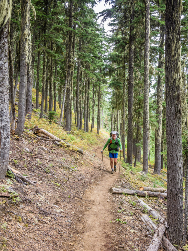
Today began much like any other day we had experienced in Oregon so far, with an ‘easy’ walk through the trees, but minus the surprise of any trail magic. We’ve got so used to the gentle gradients of the trail that the prospect of a thousand foot climb over four or so miles didn’t faze us in the slightest. The trail soon meandered through another old burn area, before passing by several ponds and lakes, many of which were much lower than what the waterline indicated. But at least we had regular access to water, even if it wasn’t the clearest or easiest to collect.
Passing another beautiful lake as we hit the trail. We would enjoy having regular access to water today.
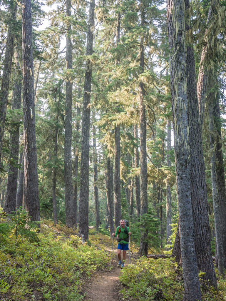
Appreciating an ‘easy’ walk through the trees.
Could the trail get any better? Maybe Oregon is a little bit ‘flat’ after all!
We took great pleasure in a morning of lakeside meanders.
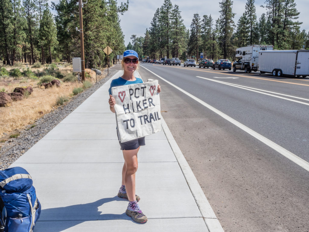
The highlight of the morning was getting cell service at the Elk Lake Trail Junction where we stopped to have lunch. We really needed to book accommodation for our overnight stay in the town of Sisters but had been without a signal for days. One phone call later and we were all booked in at the Sisters Inn & Suites with a bonus hiker discount that saved us a third of the cost advertised on the Booking.com website. (We usually use Booking.com as the app makes it both an easy and convenient way to search for accommodation, but not having a data signal, the old-fashioned method of telephoning actually proved more beneficial in this case!)
Not a highlight of my day was being stung by a wasp TWICE in the middle of my back. It had flown down the back of my top and quickly became agitated as I was squirming and writhing about trying to get it to fly back out! I squealed so loud that I’m surprised other hikers didn’t think there was a bear in the vicinity! At the time the pain was excruciating, even more so than when I took a tumble and hurt my arm and shoulder. Fortunately I don’t have any allergies and didn’t have a bad reaction to the wasp stings, except that the location was very annoying as my backpack kept rubbing and irritating them, thereby prolonging the pain.
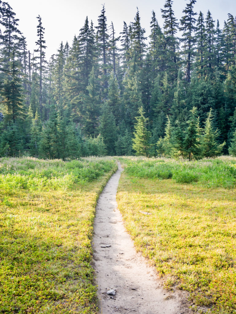
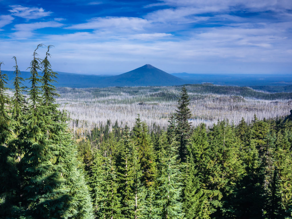
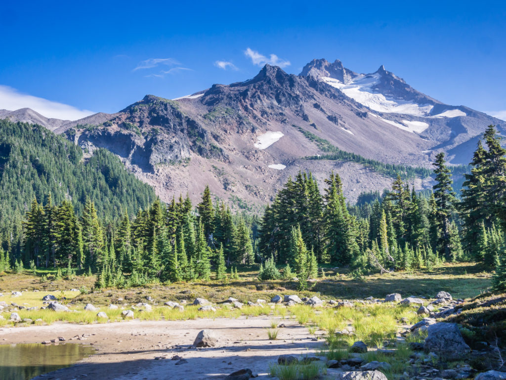
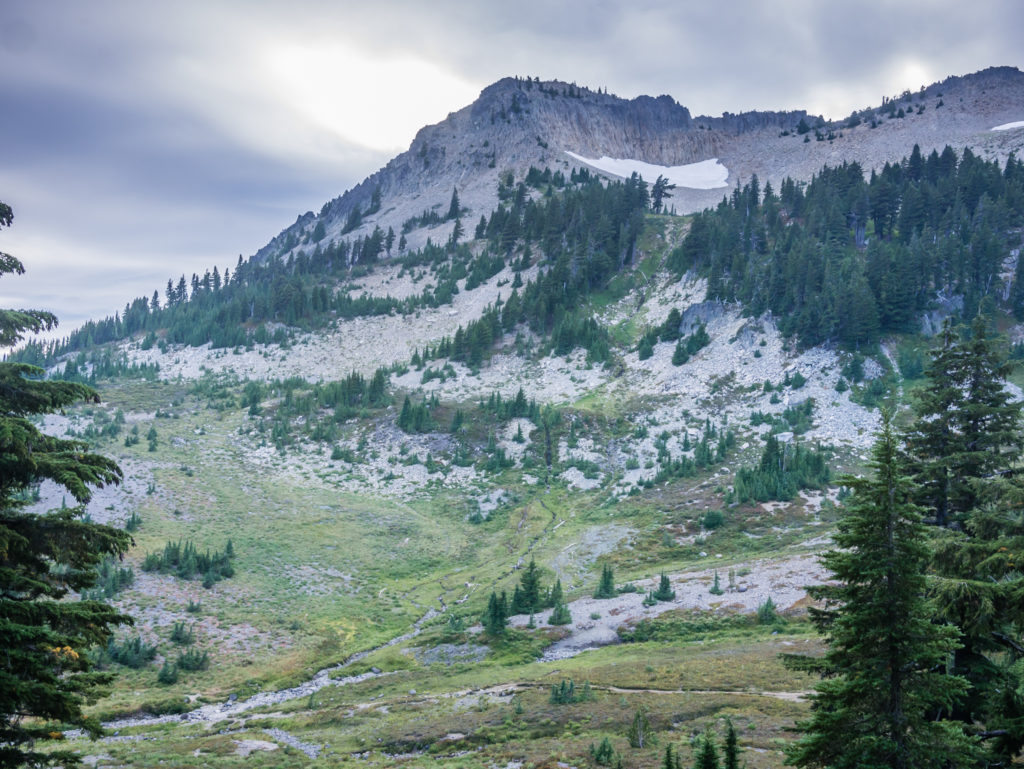
The afternoon wasn’t nearly as eventful, but presented us with some unexpected and very pleasant meadow walks, the trail finally winding out of the trees and affording us some terrific mountain views at last. We looked upon two out of the ‘Three Sisters’, which considering how bad the smoke was yesterday, was exceptional. It hadn’t gone completely – the smoke was still lingering in the air and made the sky seem hazy, but it had dispersed enough to see the volcanic peaks properly as opposed to just a faint silhouetted outline appearing through the whiteness. We hoped this was just a prelude with more good things to come!
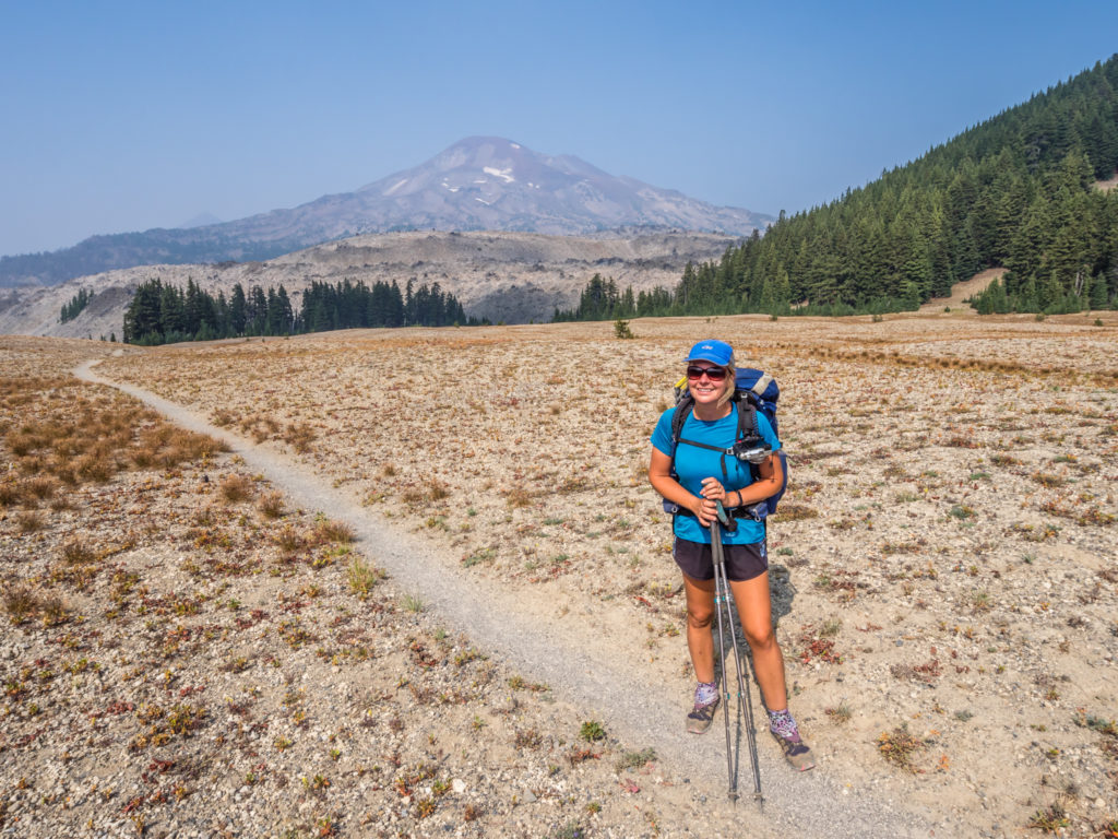
A magical meadow walk that gave us grand views of South Sister.
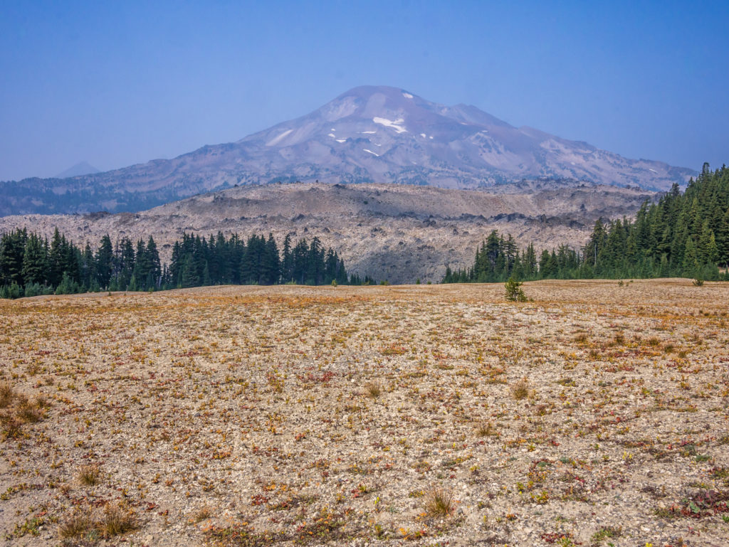
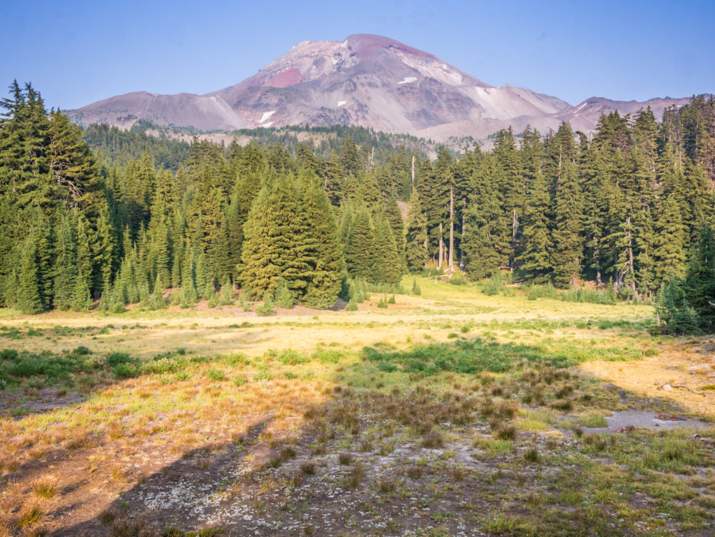
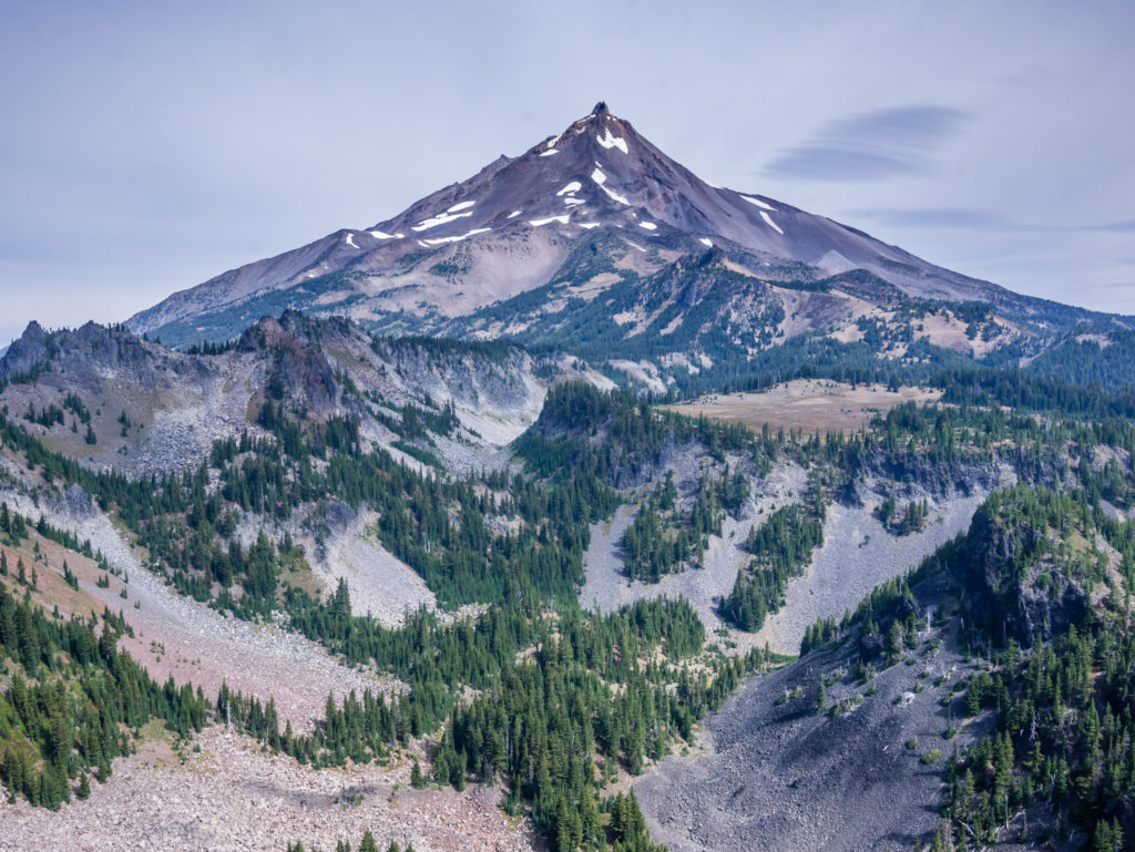
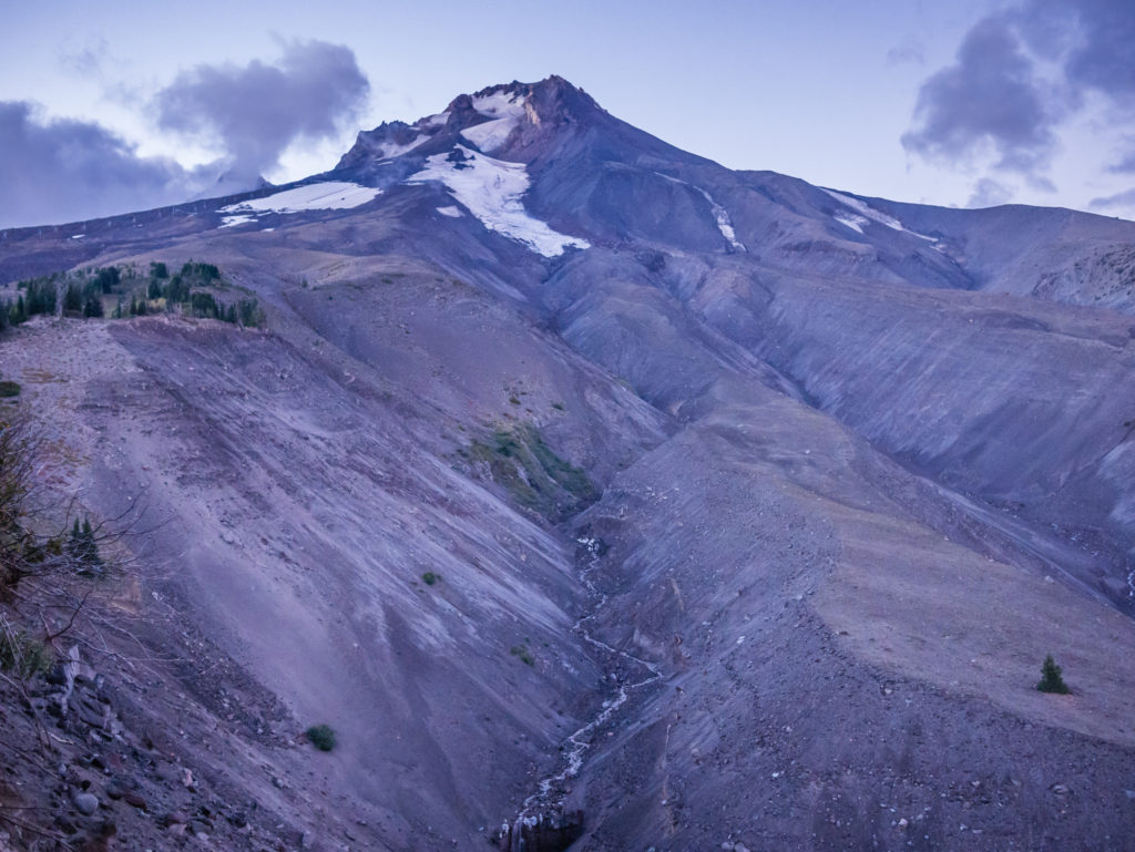
The tallest of the famous three sister chain and dominating the skyline at 10,363 feet was the magnificent South Sister. In the left of the picture you can just see the conical peak of Middle Sister poking out from behind.
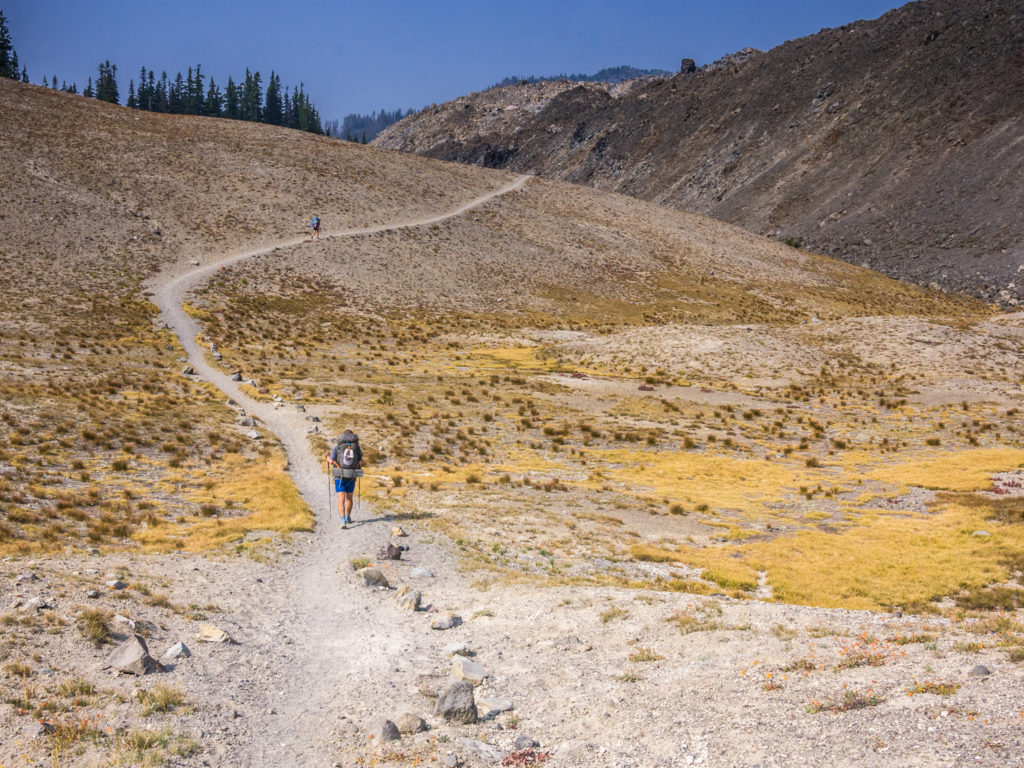
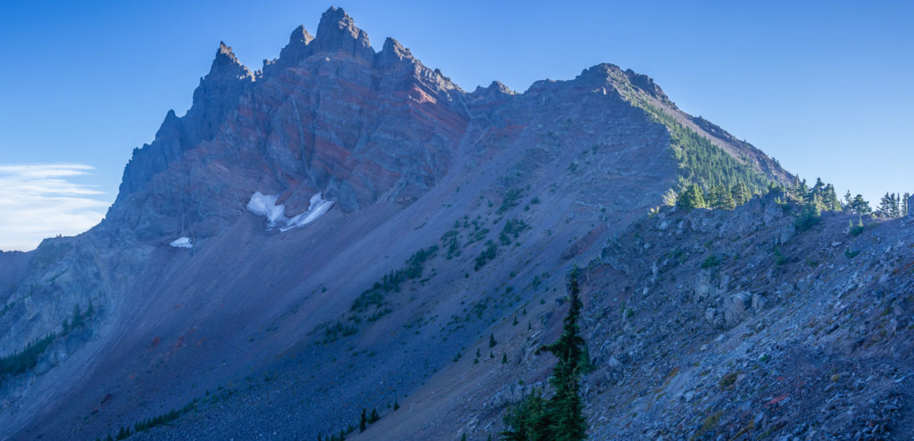
Continuing north in the Three Sisters Wilderness on a striking section that felt like we had been taken back to the desert.
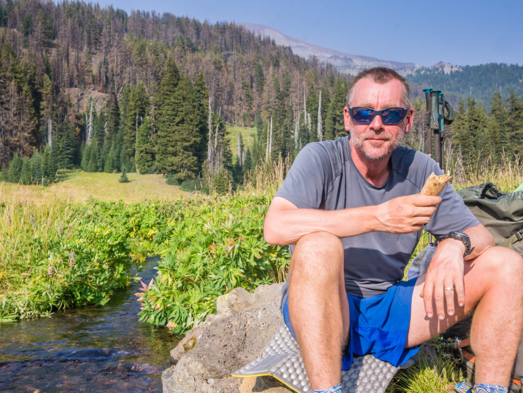
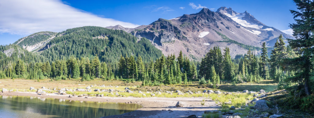
As a creek was flowing through the meadow, created by the meltwater coming directly from the glaciers atop the South Sister, we stopped to have dinner by the bank and enjoy the surrounding views of the Sisters. I even indulged in taking my shoes off and bathing my feet in the icy cold water, although I couldn’t keep them submerged in the creek for long!
Having a spot of lunch by the creek and enjoying tremendous views of the Sisters.
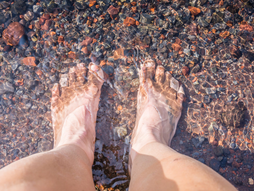
Throbbing and covered in plasters, it was nice to cool off my feet in the icy cold water, even if it was just for a few seconds!
If we’d have had more time (and energy), we would have liked to have hiked up to the summit of South Sister after finding out that Oregon’s third-tallest mountain has a path to its top. We had read that the trail is exceedingly steep, long and rugged, but that no technical climbing skills are required and the rewards are great. Unlike its sister peaks, South Sister has an uneroded summit crater about 0.4 km in diameter that holds a small crater lake known as Teardrop Pool, which is the highest lake in Oregon. From the summit, the towns of Bend, Sisters and Redmond are visible on a clear day as well as views ranging 100 miles south to Mount McLoughlin! (It sounded like an exciting side trip and will definitely be something we’ll keep in mind if we return to Oregon to do some future hiking!)
Witnessing the beginnings of fall foliage as bright yellow hues stand out in contrast with the rich, deep evergreens.
Having last erupted about 2,000 years ago, the cone of South Sister consists of basaltic andesite along with red scoria and tephra, a type of dark coloured volcanic rock, giving it the vivid red colour seen in the picture.
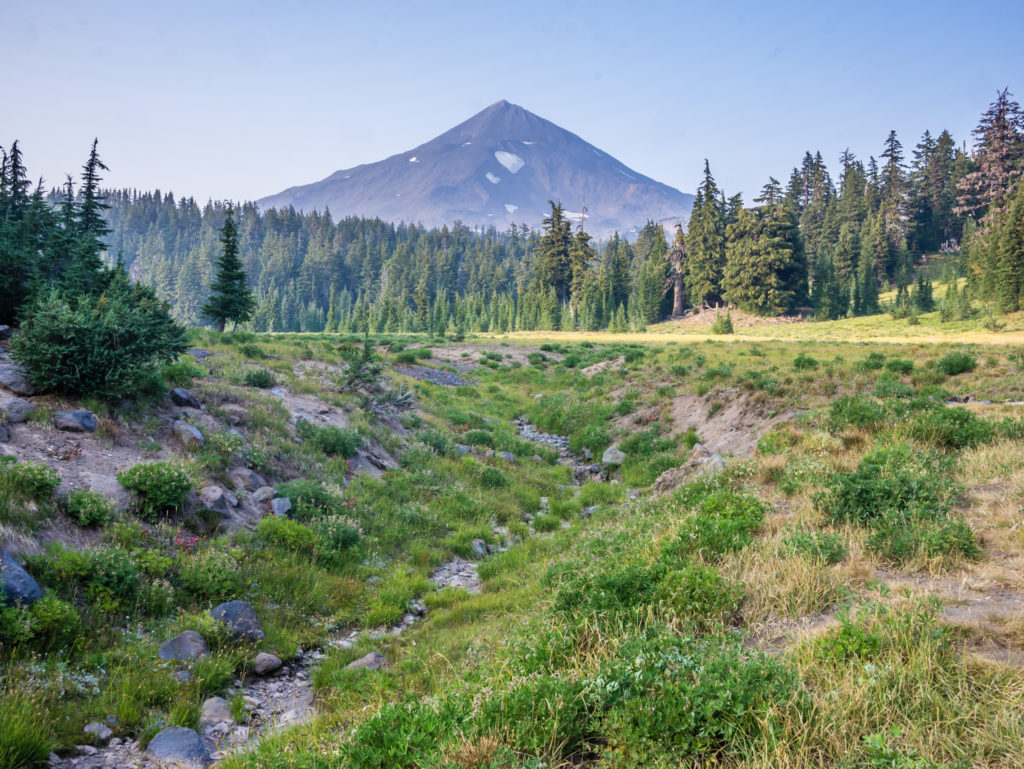
Continuing north along the PCT we were then treated to equally impressive views of the Middle Sister. With an elevation of 10,052 feet the mountain is cone-shaped. Over time, the eastern side has been heavily eroded by glaciation, whereas the western face remains mostly intact.
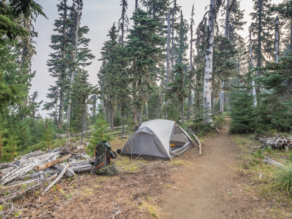
Having chosen a clearing in the trees by Foley Ridge Trail Junction in which to pitch the tent, tonight’s wild camp proved a good choice as we had a view looking back to both The Wife (a small, rugged peak being the remnants of a stratovolcano) and South Sister. We didn’t have the scenic spot all to ourselves however as more hikers arrived at the same spot and set up their tents just as darkness was descending across the valley. It seems we have got to get used to sharing camp spots as we get closer to Canada with more and more thru-hikers pushing the miles to complete the PCT on a similar itinerary to us.
The skyline showcasing The Wife and South Sister looked especially beautiful with the sun setting behind the peaks.
Day 135 – Wednesday, 22nd August 2018, Wild Camp by Foley Ridge Trail Junction at Mile 1,968 to Big Lake Youth Camp at Mile 1,995 (+1 mile off-trail), 28 miles
Heavy smoke had blown in again through the night, an effect of the continuing wildfires burning throughout Oregon, which was now obscuring our view of both the South Sister and the Wife as we left camp at 7am. It was a shame it had returned so quickly as today we would be entering the special scenic area known as the Obsidian Wilderness and skirting around Mount Washington. Whether we’d be able to view anything of worth was highly questionable because of the persistent smoke. However, if the winds changed direction again, we might be in with a chance of seeing something spectacular…
As we hiked up the ridge closer to the Middle Sister, thankfully the mountain no longer looked to be just a silhouette on the horizon as the sun rose behind it. With the increasing light, we could now see some more detail including one of the glaciers near the top of the peak. Walking was relatively easy again as the trail weaved its way across several open meadows, where the ground cover was already beginning to turn a deep autumnal red.
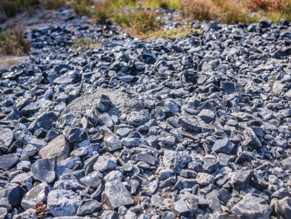
Entering the Obsidian Wilderness soon after, we discovered that this unique landscape encompasses crystal clear streams, wildflower meadows, rugged mountain views, young lava flows and obsidian cliffs. In the past, the cliffs were an important source of naturally occurring volcanic glass used by Native Americans to construct tools. We followed the PCT up the cliff to the south of the Obsidian Falls, and then crossed the stream directly above them. Cascading down the side of the ridge, the falls were a pretty spectacle, but what really caught our attention was the field of black obsidian rock glinting in the early morning sunlight. ‘Dragon glass’ as it is more commonly known amongst fellow ‘Game of Thrones’ fans, was scattered everywhere, littering the dusty earth.
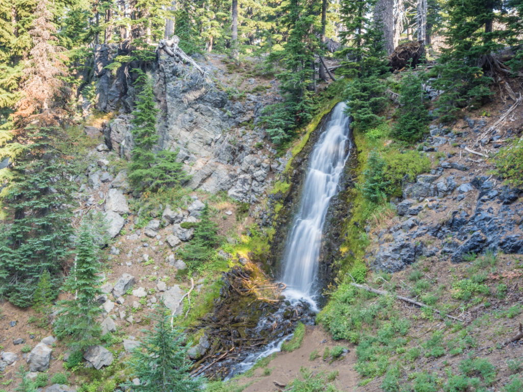
Where the PCT meets the east end of the Obsidian Trail, the splendid Obsidian Falls rush over a low cliff.
Crossing the crystal clear stream at the top of the Obsidian Falls.
Fierce sunlight sets the rippling water aglow.

Wildflowers thrive in the grassy banks beside the creek.
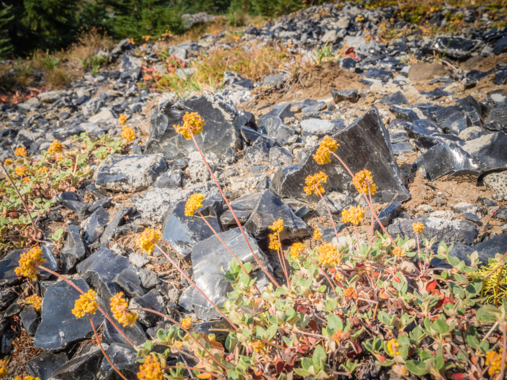
Shiny black obsidian is scattered everywhere amongst the dusty earth.
Passing through the Obsidian Limited Entry Area where we saw just a handful of other day hikers.
As the area is so unique, it now requires additional protection in an effort to preserve the natural beauty and wilderness experience. Hence there is a limited entry quota in effect enforced by the Forestry Service. Under this quota, only 30 day hikers and 40 overnight visitors are permitted into the area designated ‘The Obsidian Limited Entry Area’ each day. The Obsidian Limited Entry Area runs from approximately PCT Mile 1,978 just south of Obsidian Creek to approximately PCT Mile 1,979 near the Glacier Way Trail. Hikers and equestrians travelling the PCT with backcountry permits/ the PCT long-distance permit, are allowed to pass through as long as they don’t leave the PCT. (It is not permitted to camp in the restricted zone unless a special permit to camp at either Obsidian Creek or Glacier Creek has been obtained beforehand.)
The field of obsidian at the base of the mountains was a sparkling spectacle in the early morning sun.
This otherworldly landscape was dominated by Middle Sister, which rose above the surrounding cliffs.
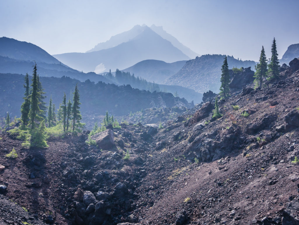
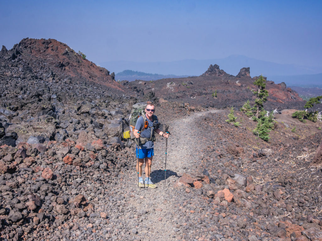
Just as quickly as we had entered the Obsidian Limited Entry Area, we found ourselves soon leaving it due to the area being just over a mile in length. Then came a tough section where we had to steadily make our way uphill through a lava field. The soft rock mixed with volcanic sand was difficult to walk on as we kept sinking into it and we couldn’t maintain a decent pace, which meant our progress was slowed. Having quickly become accustomed to the gentle grades that Oregon has treated us to, it seemed like extremely hard work, so we were glad when the climb came to an abrupt end and the trail took us back into the trees for a while.
Taking a breather after having steadily made our way up through the lava field.
Rocky underfoot, the trail was much more challenging than the soft tracks we had got used to lately in Oregon.
We were pleased when the trail began winding its way downhill on a much better track.
Following what had been a tedious section of trail, much of the volcanic rock thereafter had been cleared from our pathway and piled either side of it, the giant pieces forming a wall. The next section of lava field was also much nicer as it was mostly downhill as we headed for South Mathieu Lake. The lake was to be our early ‘dinner’ stop as it was the only place to access water for the next 15 miles, so we decided to cook and wash up whilst we had the opportunity. Any water we then carried would be for drinking during the long, dry segment before reaching the Big Lake Youth Camp, our intended camp spot for the night.
After a hard-going morning, we were appreciative of the trail that took us to downhill to South Mathieu Lake.
Sitting at the lake and enjoying the view whilst having an early ‘dinner’.
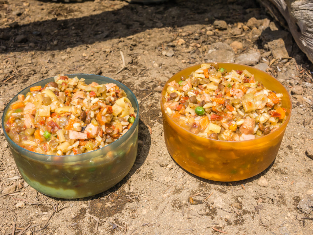
On the ‘trail kitchen menu’ today was rice mixed with a beef and vegetable minestrone, with added Spam. (After buying so many packets of it in Etna, we were now incorporating it with everything for that extra bit of protein!)
Apart from some day hikers in the Obsidian Wilderness and a couple of families having lunch by the lake, we hadn’t seen any of the big groups of PCTers that we’d been leapfrogging the past few days since leaving Shelter Cove. We assumed that they had pushed on to the 242 Highway so that they could hitch a ride to Bend and maximise their ‘town’ time! We on the other hand, were continuing on another 12 miles or so from the road, intending to hitch tomorrow morning from Highway 20 instead as we wanted to stay in the town of Sisters.
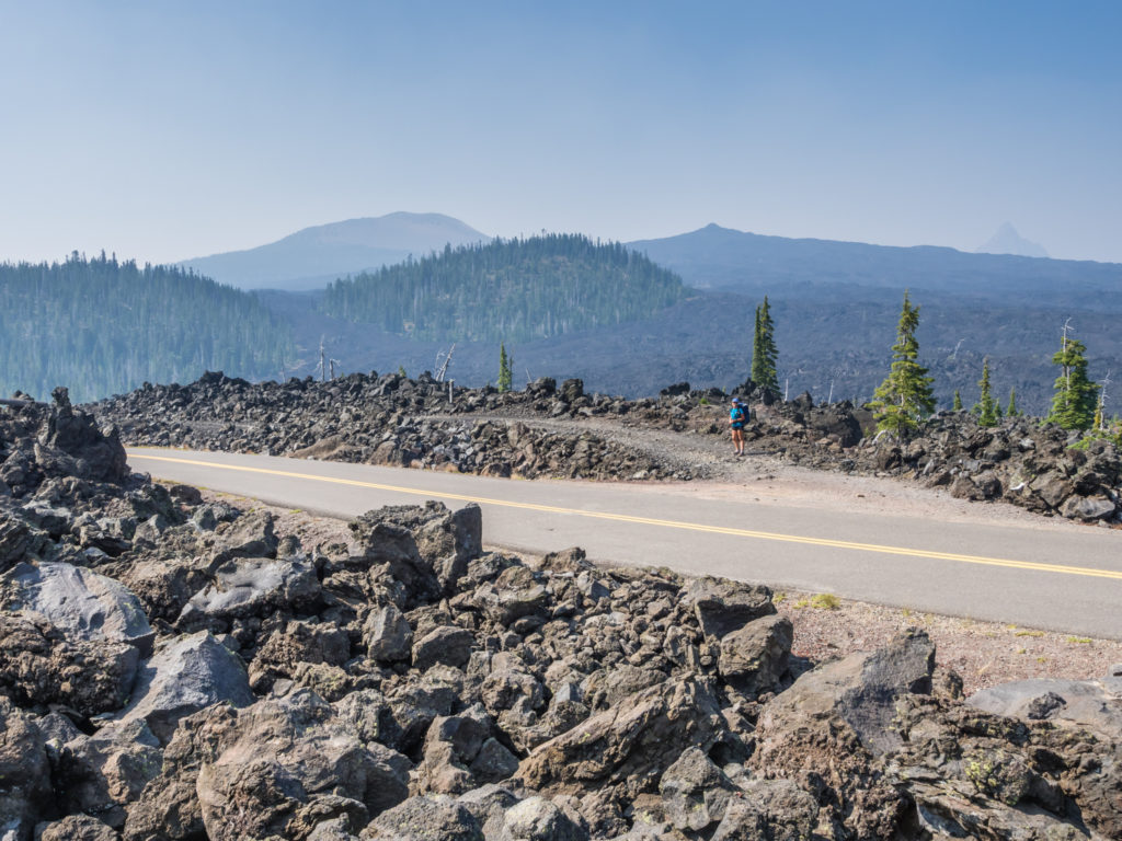
Doing that meant we had a tiresome trudge across an even larger lava field than earlier. Wayne commented that he felt sympathy for the incredible trail crew that must have worked tirelessly to fashion a pathway of sorts through the crumbly lava rock. It was extremely hot as we made our way steadily uphill over the rocks, but luckily there was an intermittent breeze that helped to cool us down a little. Just when we could see the road and thought it was over, we spied more lava rock and another expansive lava field sprawling into the distance. Looking at what we still had to tackle, we knew it was going to be a long day…
Was it simply being in the right place at the right time or a case of the trail will provide? Reaching Highway 242 and discovering some completely unexpected trail magic!
It was perfect timing when we got to the road. We had arrived just as a cool box left beside the trail was being refilled with a variety of goodies by the parents of Cheese-it and Monster (fellow PCT thru-hikers returning to this point of the trail after a few zero days in Portland). We were so grateful for the huge, soft pears and bottles of Vitamin Water given to us on such a hot and hard-going section of trail, this unexpected ‘magic’ giving us both the morale and energy boost we needed to push on for Big Lake Youth Camp.
Another thru-hiker following on behind us, also thrilled at the unexpected treats inside the cool box was Night Crawler. He was exhausted after setting off at 1:30am because of insomnia and having already hiked 28 miles, yet he too was contemplating reaching the Youth Camp by nightfall, which would mean he would have completed his first 40-mile day! It probably sounds crazy, but thru-hikers seem to be pushing the daily mileage more and more here in Oregon and amazingly rising to the challenge! (The fact that large sections of the trail are like a carpet underfoot helps considerably!)
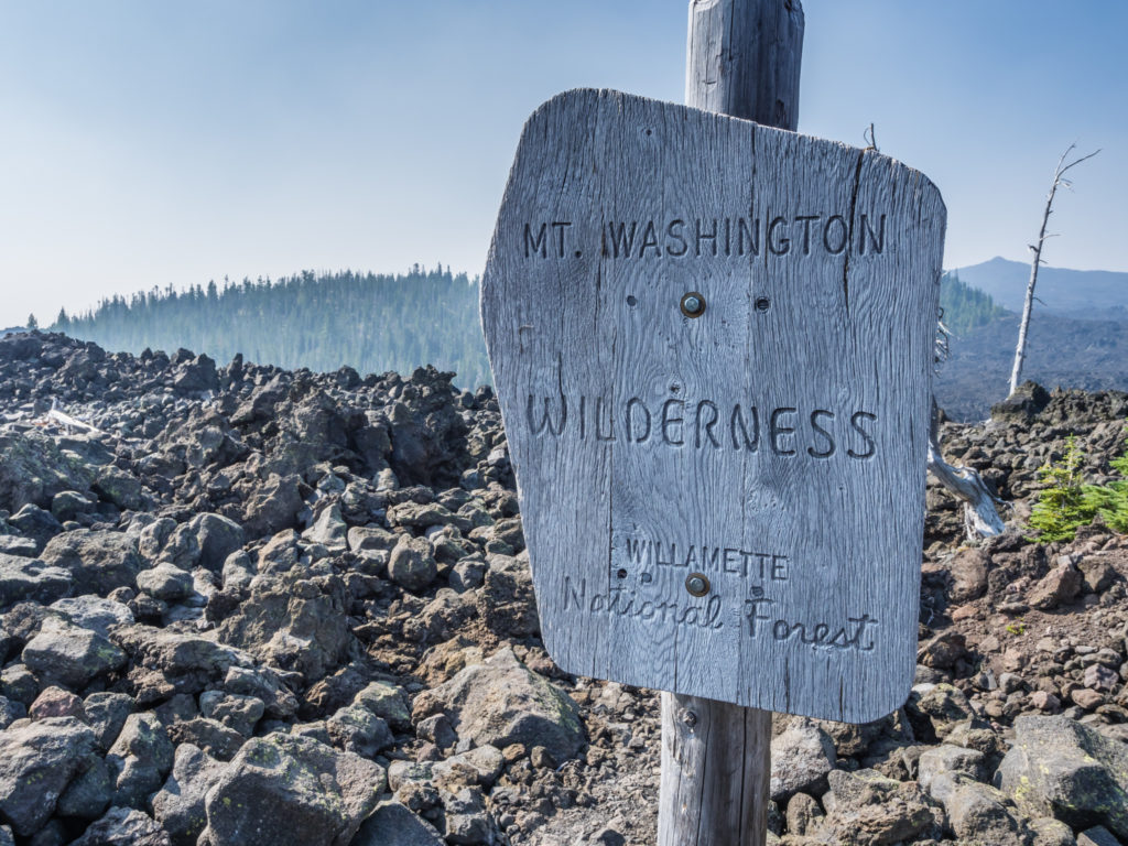
Entering the Mount Washington Wilderness in the Willamette National Forest.
We were eager to reach the Big Lake Youth Camp before nightfall, however we still had another huge lava field to cross before we could pick up the pace.
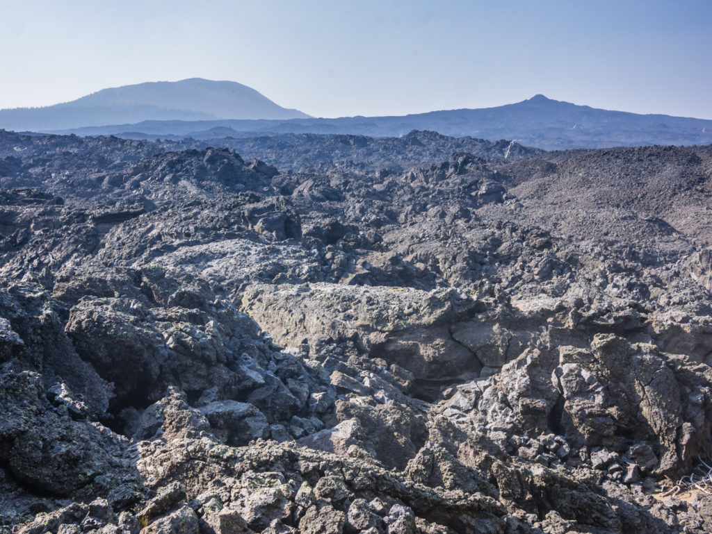
After crossing Highway 242 we had another huge stretch of lava field to contend with.
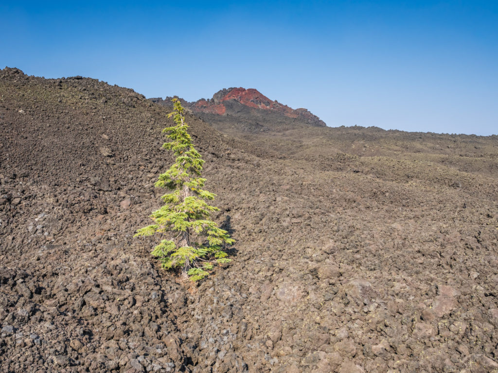
In the midst of the lava field we came upon a single, lonesome tree that was very much alive. We viewed it as a prime example of the term ‘survival of the fittest’.
Finally leaving the lava fields behind, we then entered an old burn area, but had another nice treat by way of a direct view looking onto Mount Washington. It would have been better if it wasn’t behind a smoke screen, but still, we could see an immense cone-shaped peak stretching up into the sky. As we followed the trail through the burn area, we realised we had been a little pre-emptive thinking that we’d left the cumbersome lava rocks behind as we now began another long stint through what felt like a lava rock assault course. Navigating our way through the numerous rocky obstacles really slowed us down and our feet screamed out for a soft, gentle trail once again. I hate to say it, but I was not liking Oregon at all right now!
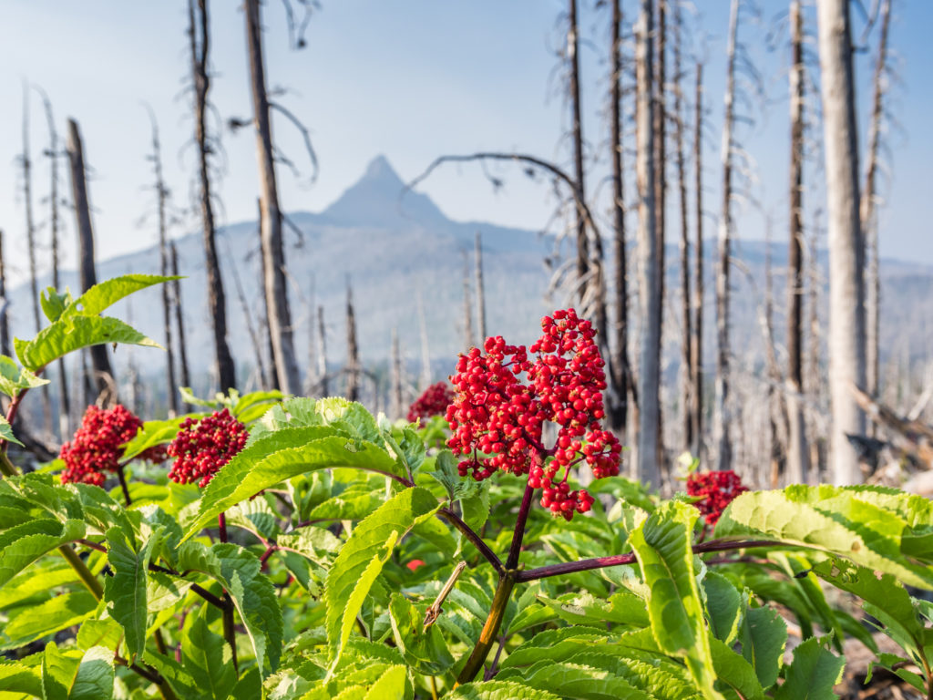
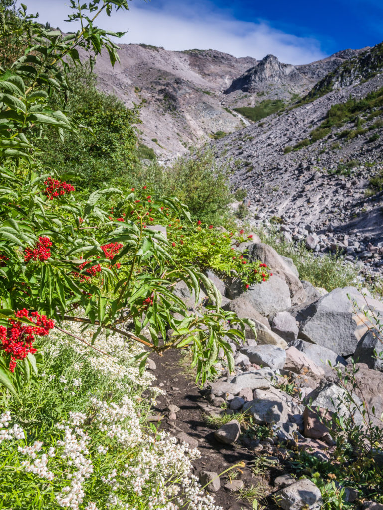
Vivid red berries stand out against the starkness of the burn area where we also get our first glimpse of the distinctive eroded peak of Mount Washington.
Looking beyond the charred trees onto Mount Washington, one of the many prominent peaks in Oregon’s Cascade Mountain Range.
Witnessing an incredible sunset that lit up the sky through the lingering smoke before we pushed on the final few miles to Big Lake Youth Camp.
It was completely dark by the time we finally arrived at Big Lake Youth Camp just after 9pm, so after quickly checking out the ‘PCT Hiker Hut’ and all the amazing facilities that are provided ‘free’ for PCTers, we just wanted to get the tent set up and get our heads down. It had been a thoroughly exhausting day. Sitting inside the hut making use of the WiFi before it closed was Milkshake, Loner and our Canadian friend Tim. He had made it through the lava field without taking a break since midday, ensuring that he would arrive at the Youth Camp in time for the free dinner at 6pm. Grateful that we had got here at all, we were now very much looking forward to the hot, cooked breakfast in the morning!
Heading down to the cove, a special area by the lake designated for hikers, we found there were several tents already pitched on the small beaches, so we had to make do with a spot close to the trail as it was the only area big enough to fit the condo. As Wayne is not particularly fond of sand ‘because it gets everywhere’, that was fine by him. Having to blow up sleep pads and get sorted at such a late hour when all we wanted to do was sleep, it was fine by me too! It had seemed like such a long, intense day.
Day 136 – Thursday, 23rd August 2018, Big Lake Youth Camp at Mile 1,995 to PCT Mile 2,001, 6 miles, hitch from Highway 20 to Sisters Inn & Suites, Sisters
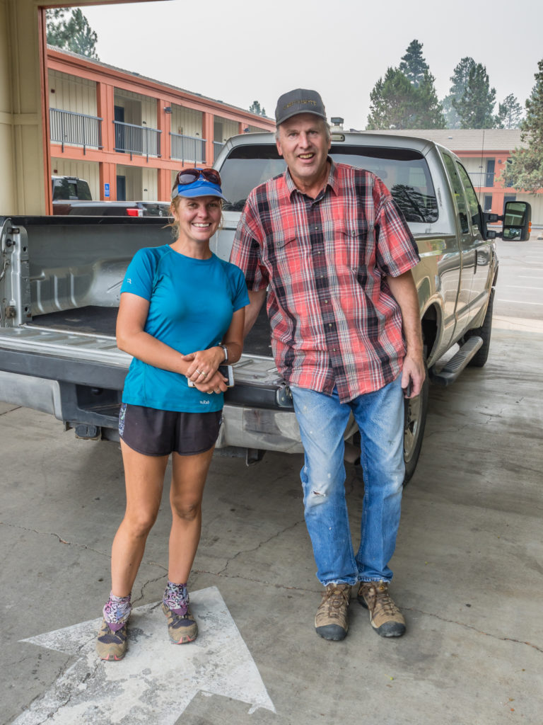
We had been looking forward to this day in what felt like such a long time, not just because we would be getting a ‘free’ home-cooked, hot breakfast courtesy of the generous folks at the Big Lake Youth Camp, but because we would finally be meeting up with our Oregonian friend Ryan. Otherwise known as ‘Trekker Heck’, he had become an online friend of ours some years back when he wanted to pick our brains about the John Muir Trail. Having had regular contact with him since 2014, we discovered we have many of the same interests – hiking and photography being the main two. How could we not then organise a proper meet-up whilst we were in the US, particularly as he had moved to the state of Oregon and was currently living in Eugene.
After rearranging our schedule to include an overnight stop in Sisters and a bit of mileage tweaking to allow us an extra nearo, we had phoned Ryan from the trail to put our meet-up plan into action. He was going to take the afternoon off work and drive to Sisters from Eugene so that we could meet up later for dinner. Hence we couldn’t lounge around at the Big Lake Youth Camp after breakfast as we needed to get to town and check-in at the motel so that we could at least take a shower and look presentable for when he arrived!
Our camp spot beside the trail as all of the designated hiker spots beside the cove were already taken when we arrived at Big Lake Youth Camp last night.
Had we not been meeting up with Ryan, we would most definitely have indulged in a zero day at the Big Lake Youth Camp. The facilities provided for ‘free’ for PCTers are top-notch (you can give a donation to support their great facilities but it is not mandatory), making it in our opinion one of the best places to stay on the entire PCT. As well as the separate cove area down by the lake in which hikers can set up camp (a regulation put in place by the Forestry Service based on the numbers of people permitted in the Youth Camp at one time), there is a separate PCT hiker hut with full facilities including kitchen area with fridge and kettle, washing machine and dryer, as well as a shower and toilet area through the back. The hut also has comfy chairs, a large table, hiker boxes to peruse and provides free WiFi, making it a really nice place just to hang around.
We heard that a generous donor had stumped up the cash for the provision of the hut, but that it is also sponsored by local businesses from the Sisters area who support the PCT and its thru-hikers year on year. For this amazing financial contribution and the wonderful facilities of the hut, as well as the incredible support and generosity given by both the local businesses and Big Lake Youth Camp, we are immensely grateful.
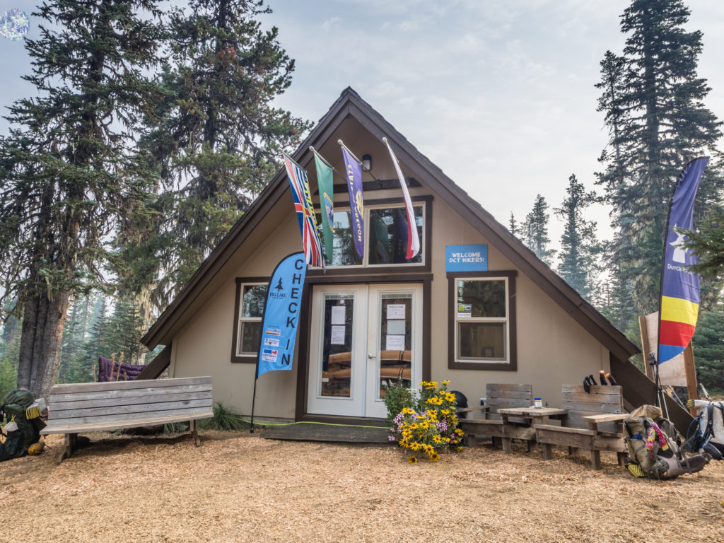
The fabulous ‘hiker hut’ facility at Big Lake Youth Camp.
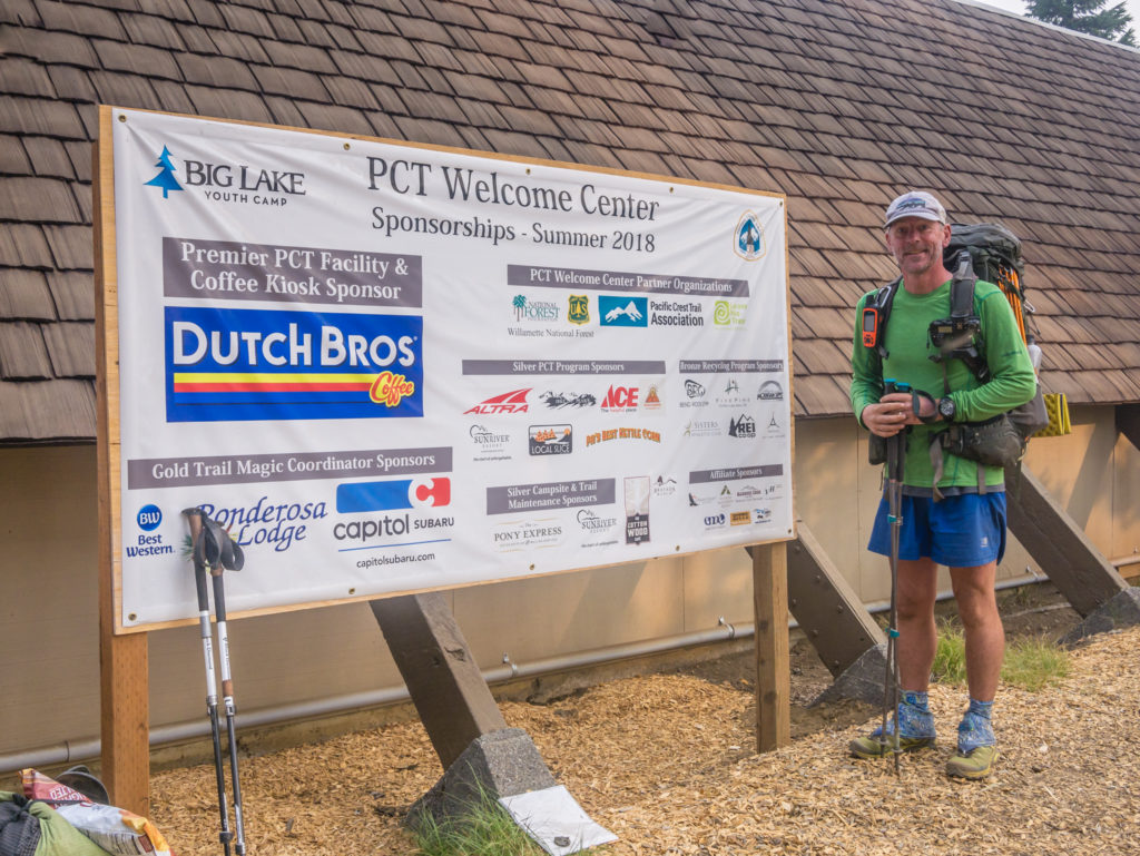
A huge thank you goes to Big Lake Youth Camp and all of the local businesses that support PCT hikers.
As the Youth Camp was in full swing catering to its proper guests, breakfast wasn’t being served to hikers until 9am, so we had a little time in the hut to appreciate the wonderful facilities specifically for PCTers passing through. When we headed over to the dining area eager to stand in line, we were happy to see scrambled eggs and biscuits in gravy were being served at the counter. (It was very much the format of a school dining hall complete with plastic dinner trays where you queue up and get served a little of everything on offer!) The ‘vegetarian’ bacon we were not so sure about however. (The Youth Camp only serves vegetarian food.) It was actually plant-based and dry-fried so it was more like a vegetable crisp, although it did taste of bacon making it quite bizarre. We sat with Tim and Canadian Treasure, but there were at least 10 other hikers along the table including Yucon, Machine and Night Crawler, and of course, just as at school, we couldn’t resist going up for ‘seconds’!
After breakfast, we collected our food resupply box that we had sent to the camp and sorted out our rations that would see us through to Cascade Locks. (It would appear that Wayne really likes fruit pies!) Tim and Canadian Treasure were taking a zero at the Camp and not moving on today, so we bid them a fond farewell wondering whether we would ever see them again on our way to Canada. The trail has an uncanny ability to separate people for long segments then reconnect them again when they are least expecting it, such as us bumping into Yucon and Machine again today after all this time! We were pleasantly surprised that they were still on trail after finding out that the two girls they were hiking with, Sidney and Shona, had left the trail at the end of Northern California because they were fed up with the smoke.
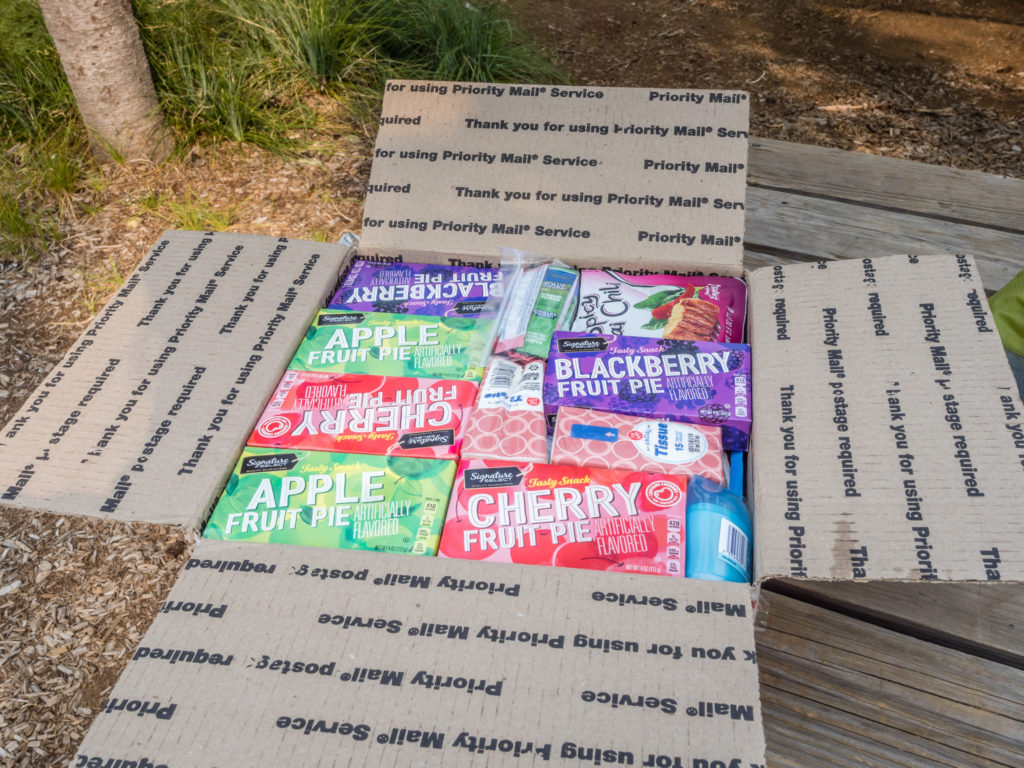
Opening our resupply box in readiness for the next section of trail to Cascade Locks. We suddenly realised how much Wayne likes fruit pies!
On our way out around 10:30am we left a donation of $20 and thanked the staff at Big Lake Youth Camp for their kindness. We had given ourselves just six miles to walk to Highway 20 where we would hitch to the town of Sisters, which was easy walking as the PCT generally follows a ski route, with a clear trail through the trees. The most exciting part before reaching town was passing the 2,000 mile marker just before midday!
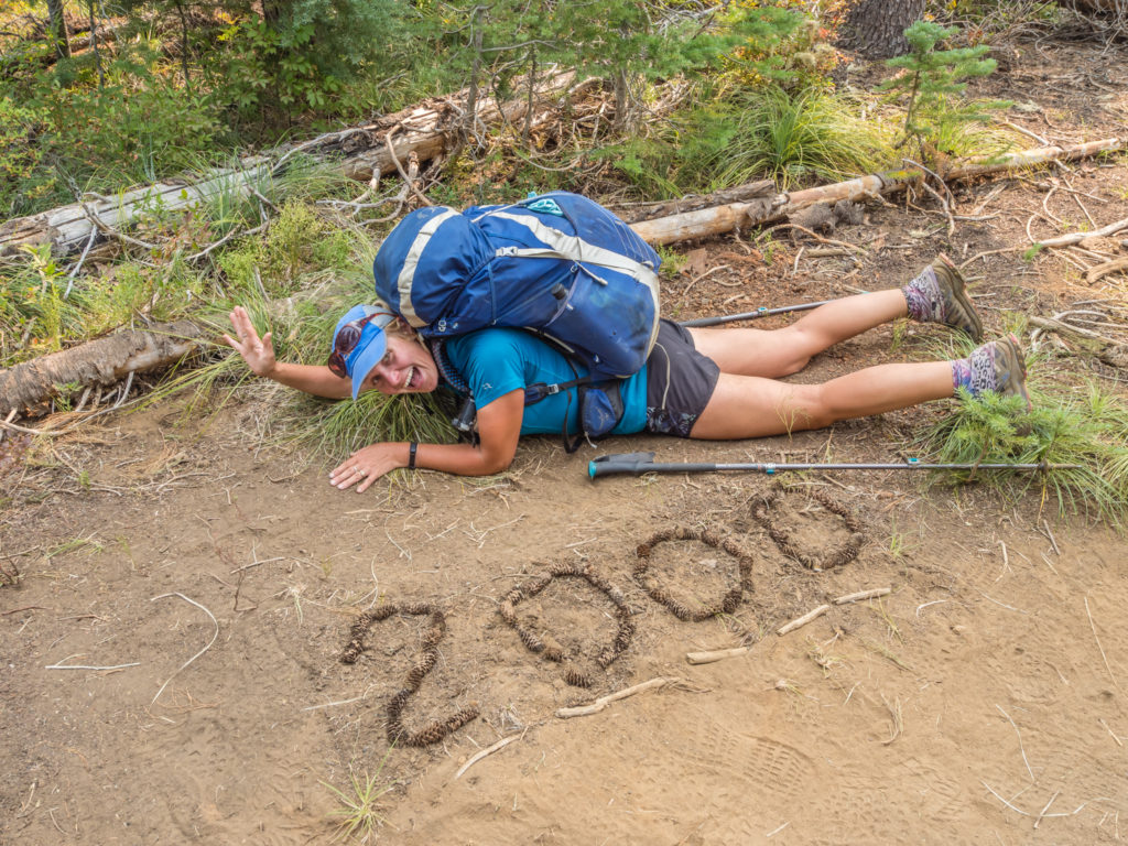
Finally reaching the 2,000 mile marker after 136 days on trail! I was so excited, for once I didn’t care about getting dirty!
At the highway, we quickly piggy-backed on a hitch already acquired by PCTer One Liner. He had just flagged down Chris, a local trail angel who was happy to drive us to town and drop us off at the motel. Incredibly, we arrived by 1pm giving us a whole hour to get ready before Ryan arrived. We really didn’t want to smell bad on our first ever meeting! It was bad enough having to go out for dinner in our ‘hiker clothes’, but at least they had been laundered for the occasion!
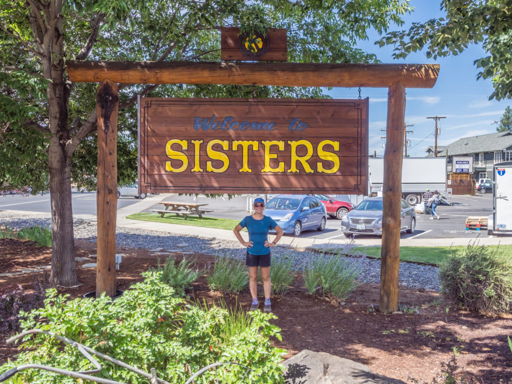
Reaching the Oregon town of Sisters where we stayed overnight and managed to squeeze in a nearo.
We were grateful to trail angel Chris for giving us a ride into town from Highway 20.
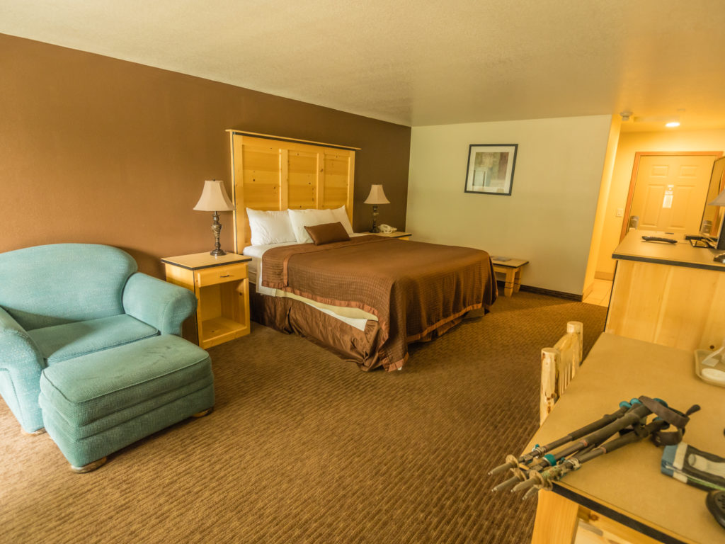
Wow look at all this space! After living in a tent for over four months now, it was such a luxury.
When Ryan arrived it was just like we were old friends. After making our first stop in town the Hike-N-Peaks outfitters store so that I could finally buy a new sleep pad to replace my ‘Exped Winterlite’ inflatable pad that had malfunctioned in more ways than one, we had the rest of the day to socialise. (Since my time in the Sierra, namely the night we camped at Marie Lake, my pad had been slowly deflating throughout the night because of a tiny puncture I had not been able to find. It hadn’t been too uncomfortable, so I’d made do with it until now, however a few nights ago the pad had de-laminated as well, making it feel like I was now sleeping on a hot dog. With the pad being from the UK and out of warranty, I finally had to give in and buy a replacement. This time I opted for a ‘Sea to Summit Comfort Light Insulated Sleeping Pad’ hoping it would be more robust as the Exped pad I was using was already a replacement having had one fail on me before.)
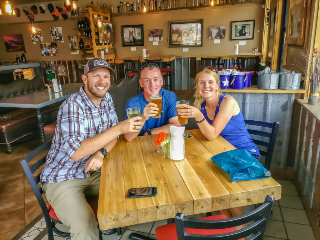
With that job out of the way, the afternoon then flew by in a flurry of PCT hiker tails and Ryan telling us about the impending birth of his first child, a son, whom we are sure will own his first pair of hiking boots before he can even walk! It was all very exciting swapping stories, finding out more things we have in common such as our obsession with ‘Game of Thrones’ and making comparisons between Britain and the USA – minus any mention of Trump and ‘Brexit’, both calamities that neither of us are particularly proud of right now with regards to our home nations.
Having sampled one of the specials at Hop & Brew we made our way across to the Sisters’ Saloon that had been well-recommended for their bison burger. My favourite dish of the day however was their ‘roasted Brussels sprouts in balsamic vinegar’, which is definitely a recipe I’m going to take back home!
Finally meeting the wonderful Mr Ryan Heck in person. Cheers to a friendship that continues across the miles!

Enjoying all-American fayre at the Sisters Saloon in Oregon.
It was then 9pm before we knew it and time for Ryan to make the 2 and a half hour journey back to Eugene after what had been a fun evening getting to know him better. It had made a nice change talking about a whole variety of subjects other than the PCT, but I’m sure Ryan needed a break from all the talking we bombarded him with, him being our one and only ‘captive’ audience! If only we’d had more time… We promised a return visit in the future when we would organise a camping weekend and young Griffin Wilder Heck (we were privy to the baby’s prospective name that at the time was a huge secret!) would be big enough to come on a hike with us! Start them young, that’s what we say!
Day 137 –Friday, 24th August 2018, Sisters Inn & Suites, Sisters, hitch from Highway 20 back to PCT Mile 2,001 to Wild Camp at Mile 2,012, 11 miles
Just as yesterday had felt like a whirlwind, we had a busy couple of hours again before checking out of the motel and getting back on the trail. After a typical ‘grab all you can eat’ from the small breakfast selection on offer in the motel kind of breakfast, we then headed across the road to the large Bi-Mart store to purchase 75 more Cliff and Lunar bars to add to our resupply for Washington, just to ensure we had enough snacks. (You know we don’t like to go hungry!) We then had to package them up and walk to the Post Office at the other end of town to send them forward to our designated resupply locations that should already have our other boxes waiting that we posted from Ashland. It was quite a rigmarole, but it would save us time and money in the long-run, especially as energy bars from shops along the trail are typically up to 3 times the price of what we pay in the large discount stores in major towns. (E.g. Cliff bar on trail = $2.50 versus Cliff bar from discount store = 98¢.) For those that had an itinerary and planned ahead such as us, it was a no brainer!
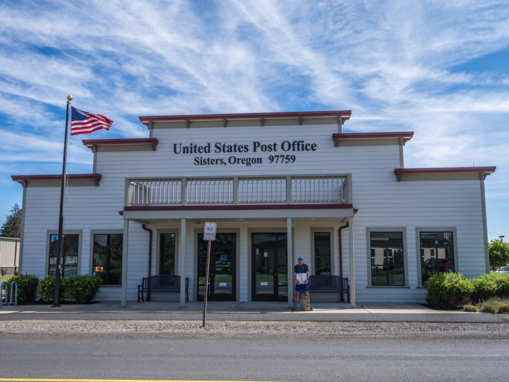
Making another resupply drop at the Post Office in Sisters.
By the time we were sorted it was already 1pm. Not that we needed any more encouragement with prolonging our stay in town, but there happened to be a McDonald’s at the opposite end of the parking lot from the motel, so we decided to take advantage of its close proximity and indulge in a ‘fast food’ lunch before getting back on the trail. With much the same idea, we saw fellow thru-hikers Yucon and Machine collecting burgers and fries from the counter when we walked inside. They had hitched into Sisters purely for food and to stock up with cigarettes and were also getting back on trail later.
Afterwards when we walked to the roadside to try and hitch a ride back to the trailhead we were picked up within a matter of minutes, as is our usual good fortune with hitching. It was a local guy commuting from Eugene who picked us up on his return home and we were even more grateful that he dropped us off right at the PCT trailhead off Highway 20 at Santiam Pass, directly across the road from where we had hitched into Sisters yesterday.
Getting out the hiker poster which once again secured us a ride back to the trail.
Rejoining the PCT back at the Santiam Pass Trailhead off Highway 20.
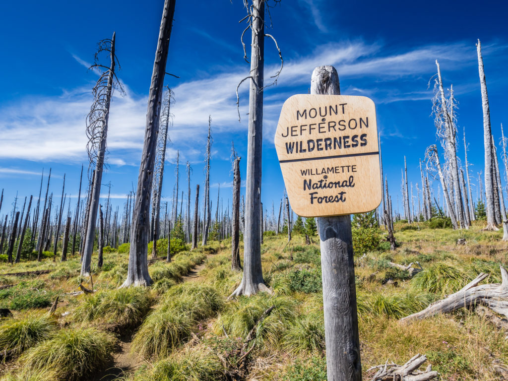
As we entered the Mount Jefferson Wilderness – it was like we had stepped onto another world entirely. We couldn’t quite believe our eyes when we looked upon vivid blue skies, the smoke having miraculously cleared overnight, thereby affording us expansive views in every direction. From this vantage point on the trail, we could actually see both the Middle and North Sisters that we hadn’t been able to see clearly just a couple of days previous, reaching up and piercing the skyline. We also enjoyed great views looking onto Black Butte, Oregon’s iconic and majestic cinder cone reaching 6,436 feet to the east of the PCT.
After reaching PCT Mile 2,000 yesterday we were on a natural high! It didn’t seem like we had far to go now having almost reached the end of Oregon.
What a difference a day makes. Entering the Mount Jefferson Wilderness under a sky of vivid blue.
To the east of the PCT, looking onto Black Butte, Oregon’s iconic and majestic cinder cone, which rises 6,436 feet above the extensive burn area.
Walking through another huge burn area, an ugly scar as far as the eye can see created by the extensive wildfires around Sisters in 2017, which caused the closure of 30 miles of the PCT that year (at one point eleven different wildfires were burning in the Central Cascade Range), we again were made to realise how lucky we have been with regards to not having our progress along the trail hindered so far by the wildfires and trail closures of 2018.
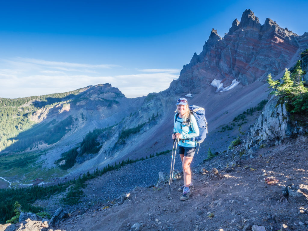
Beyond the forest of charred trees and sun-bleached snags, we hiked up and along the ridgeline towards the jagged peak of ‘Three Fingered Jack’. Named for its distinctive shape, (One account claims that the volcano received its name from Joaquin Murrieta, a gold miner and vaquero during the California Gold Rush also known as Three Fingered Jack. Others allege that the volcano was named after a trapper with less than five fingers on one of his hands.) the PCT skirts the western flank of Three Fingered Jack and when looking back affords tremendous views of the north face. With such wonderful, clear skies we took our time to enjoy the incredible views from up on the ridgeline, even spotting some mountain goat below the glacier on the western flank of the peak.
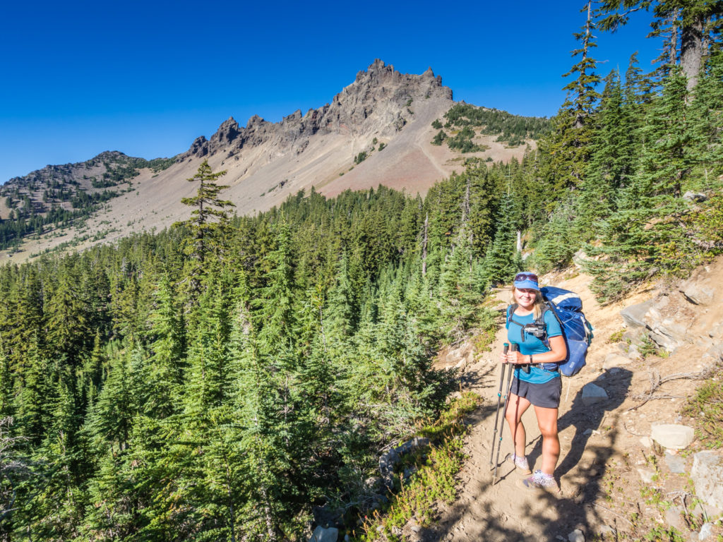
Heading uphill towards ‘Three Fingered Jack’ on what had turned into a glorious afternoon on the trail.
Enjoying the blue skies and immense views in every direction!
Heading around the western flank of Three Fingered Jack.
Panorama looking onto the north face of Three Fingered Jack from the ridgeline. Way off in the distance we spotted some white mountain goat that just looked like tiny specks from afar.
Whilst taking it all in, Yucon suddenly powered on past us, he and Machine to our surprise having made it back on trail in quick time. Not long after, we also bumped into Fern and Tommy Pickles, who were back on trail after taking a night off in Bend. It seems that everyone is now having to do big 28-30 mile days and like us, they don’t have enough time for zeros, so are just doing overnight in and out stops in towns. With a bit of prior planning and adjustment to our itinerary, we have saved our final zero for Cascade Locks, where we can rest up and relax for a day before tackling the final 500 miles of the PCT as we venture into Washington state. It doesn’t seem that long now!
The sun begins to set over the Mount Jefferson Wilderness.
We might be walking through a burn area but we had such an incredible view during the blue hour!
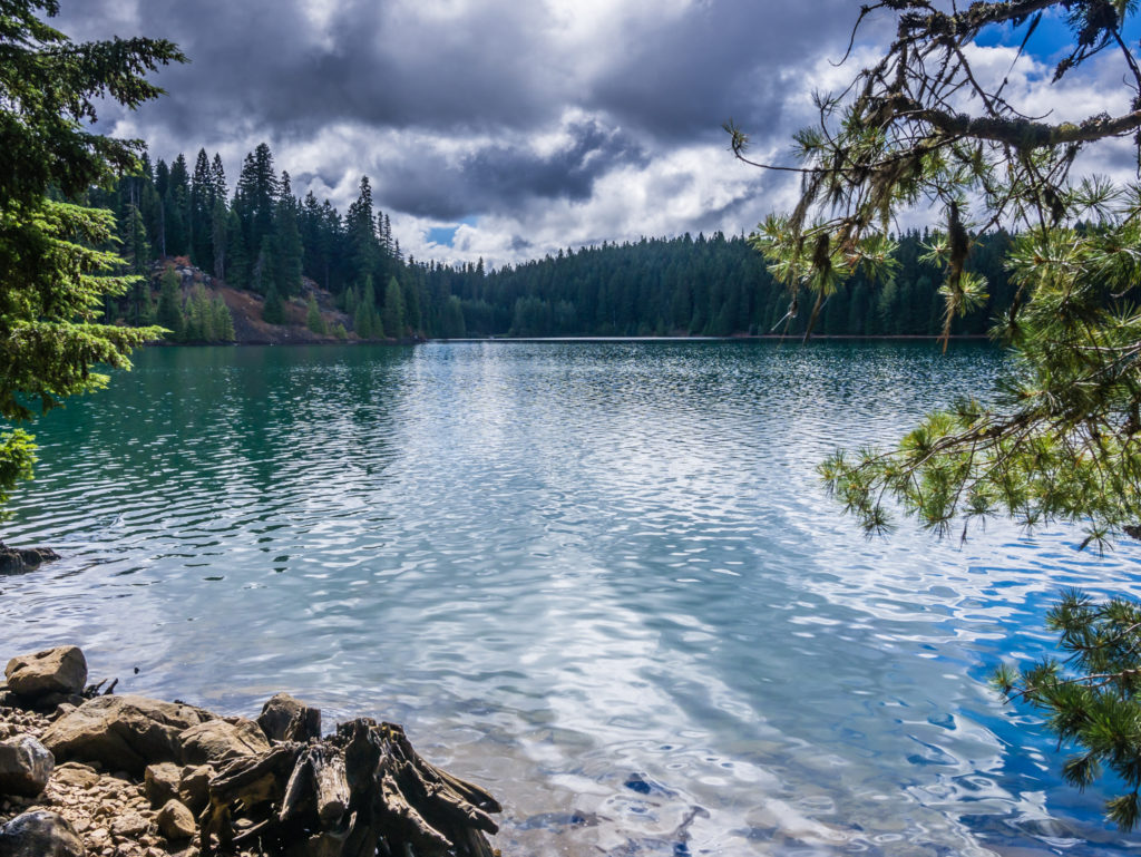
Panorama looking onto the serene Wasco Lake.
Passing the Wasco Lake Junction at PCT Mile 2,011 we started looking for a place to camp as there was a really cold wind funnelling through the valley and the temperature was dropping quickly. Now beyond the burn area we entered a small thicket of trees, where we spied a flattish place to pitch that would also offer us some protection from the wind. It was two miles short of our intended target, but we still had the last light of the fading blue hour to get set up. Nearby, with his hammock already strung up between two trees was Night Crawler who suddenly popped his head out of his zipped up bivy thinking that the noise coming from us setting up was that of a bear! We were sorry to wake him but the look on his face as he realised it was just us was priceless! After chuckling to ourselves about it later in the tent, we just hoped that there wasn’t a real bear intrusion during the night after all.
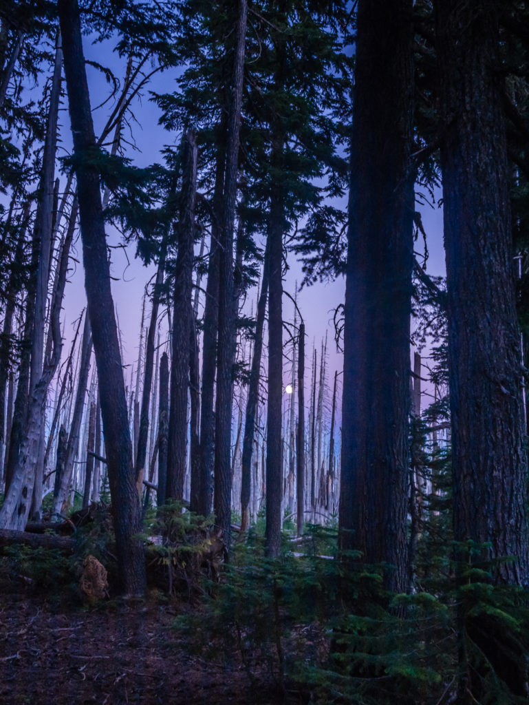
Even the view from our tent was special as we witnessed the rising moon amidst the purple sky.
Day 138 – Saturday, 25th August 2018, Wild Camp at Mile 2,012 to Wild Camp at Mile 2,037, 25 miles
Back to our usual camp routine, we woke up to what felt like a cool, crisp autumnal morning. There was no sign of Night Crawler – he must have got up really early as is his usual routine and was now long gone. Packing away the tent wearing our woolly hats and gloves, we realised it was no longer the weather for shorts but we currently had no alternative having bounced our leggings and other warmer layers further up trail. We had not anticipated such a rapid change, but with the temperature now feeling much lower in Northern Oregon than what we were used to, we wondered how cold it would get in Washington as we progressed further north. We were glad then that our warmer layers were in our bounce box waiting for us at Cascade Locks, now just a few days away. They would definitely be needed as it was already such an effort to get out of our warm, cosy sleeping bags and get moving!
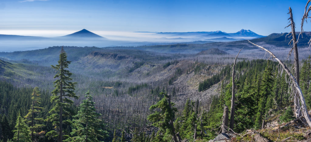
Looking back to the High Cascades that dominate the skyline in Central Oregon.
Having hardly seen any expansive views over the past few weeks because of the heavy smoke from the wildfires, today we were simply mesmerised by the grand vistas sprawling out in front of us as far as the eye could see!
Continuing through the Mount Jefferson Wilderness, we happened upon a chance meeting with a retired ranger who was out hiking for the weekend. We chatted with him about our journey on the PCT and the current conditions with regards to the smoky skies and continuing wildfires. Having worked for the National Park Service for over 30 years and being stationed in Seiad Valley in Northern California for part of that time, he was well-versed in dealing with the threat of wildfires, hazardous situations and trail closures due to safety concerns. Discussing the PCT closure at Hart’s Pass because of the Holman Fire burning in the Pasayten Wilderness, he gave us some hope that we would after all be able to finish our thru-hike in some form or other. In his ‘expert’ opinion, he thinks that the northern terminus will re-open or there will be an alternate hiking route to get us there by the time we get to Stehekin in a little less than four weeks. It was not official and there was nothing concrete to suggest this would be the case, but the idea gave us some comfort all the same.
After 5 miles, we took a snack break at a great spot looking onto Mount Jefferson. We felt really lucky that the strong winds today were keeping the smoke away, which meant we had some tremendous mountain views again.

Hiking along the ridge towards Mount Jefferson.
Our views were getting better by the second!
Looking rather grand! Mount Jefferson in all its glory.
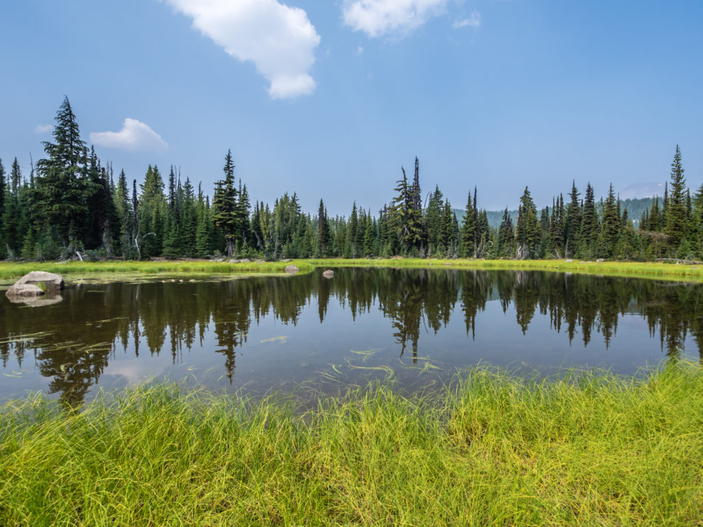
Once again Mount Jefferson dominated our view when we sat by Shale Lake for lunch. The small, pretty lake with a grassy bank, which was perfect for sitting on, offered beautiful reflections of Mount Jefferson in the receding water. It was a dreamy scene, though extremely cold. In fact, we had goose pimples sitting in shorts and even had to put on our waterproof jackets for extra warmth. After months of hot, dry weather, we simply had to accept that the much lower temperatures and cool winds were a sign of things to come. ‘Summer’ couldn’t last forever, no matter how much I wanted it to.
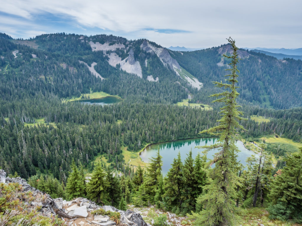
With their emerald-green waters, from the ridge we overlooked several striking lakes.
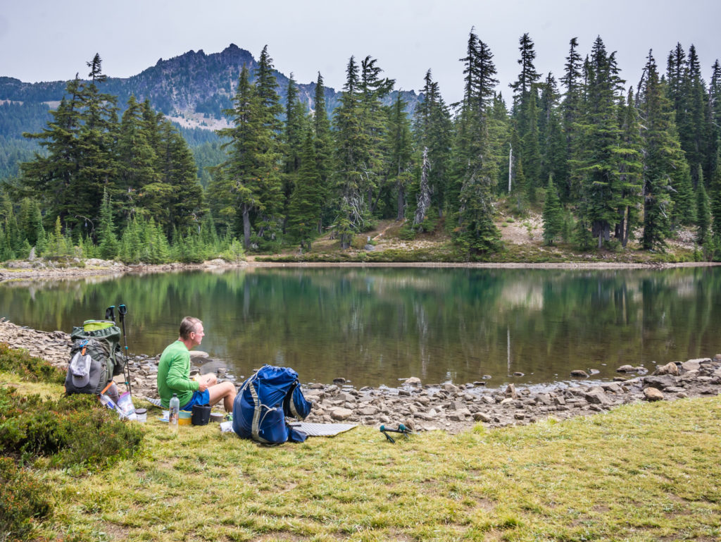
Sitting on the bank of Shale Lake for a spot of lunch.
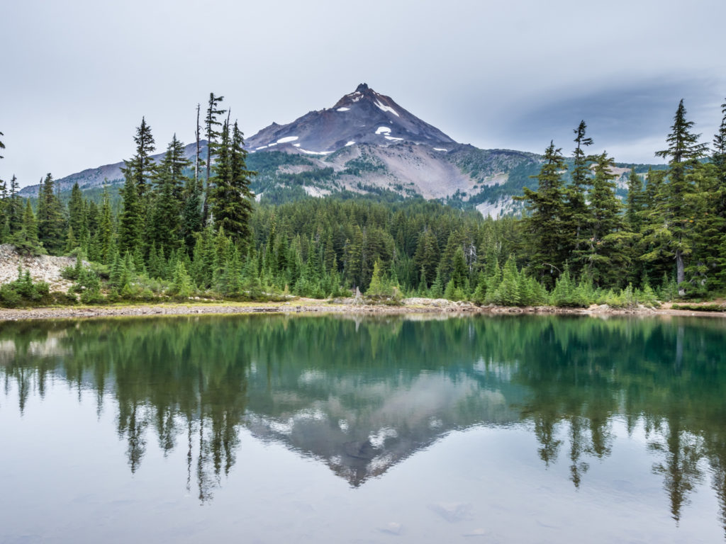
Beautiful reflections of Mount Jefferson in the still waters of Shale Lake.
Our next stop later in the day was at Milk Creek where we needed to top up our water supplies. Tipsy and Night Crawler were both napping on the other side of the creek, but we didn’t stay for long as there were lots of wasps around. They were making me nervous after being a stung a few days ago, so we just had a quick snack and got going again.
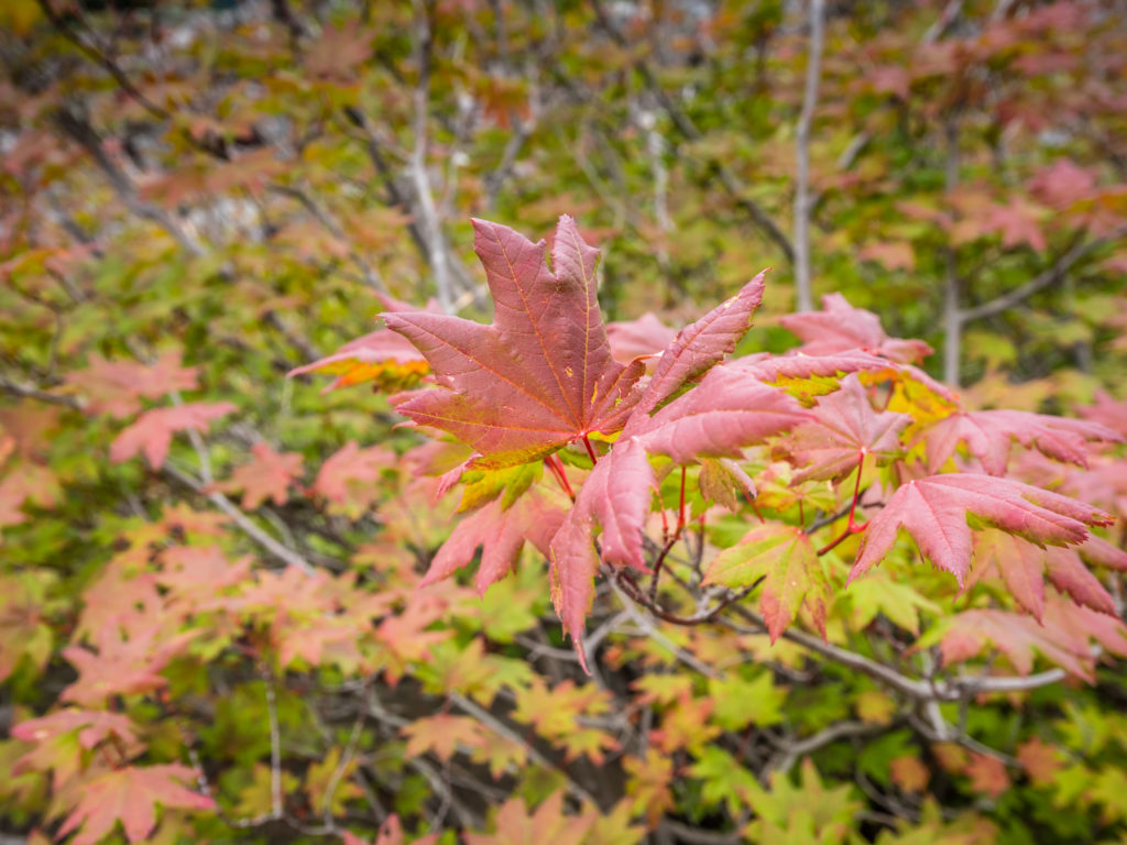
Bright green and red ‘maple-like’ trees that were growing alongside the trail caught our attention because of their vivid leaf colour.
More striking reflections from the PCT as it crosses the Mount Jefferson Wilderness area.
The next creek we came to, Russell Creek, was formed from glacial run off from Mount Jefferson, so by late afternoon it was both powerful and fast flowing. A rock hop looked more than a little sketchy, so we simply waded through the water in our trail shoes, which we considered to be the safest option at the time. Only by doing so, we now had cold, wet feet to contend with and most likely wet shoes the following morning too as it was doubtful that they would dry out at this late stage of the day. Sadly, the other notable thing about Russell Creek was that there was a horse corpse rotting in it. Its head was stuck underwater, and its rear end was fairly bloated, so on first glance it just looked like a huge rock covered in moss submerged in the creek. It had been there a while as there was a Forestry Service notice on a tree a mile earlier warning of an “animal carcass in the area around Russell Creek”, and to be aware of “increased animal activity”. We didn’t see any other animals prowling the area, and although very sad to witness the horse, it was a good reminder of why we go to the effort of filtering water every time, no matter the source.
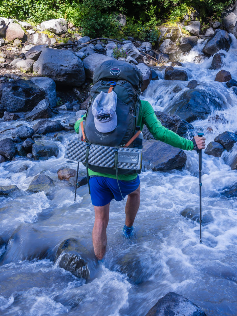
Wayne wades through a fast-flowing Russell Creek. It was the safest option so late in the day.
A little further on, the trail then levelled off on a high plateau, which was covered in colourful wildflowers and afforded us a tremendous view of Mount Jefferson. The sun was intermittent, with the sky over to the west filled with thick clouds blowing in that looked like they might bring rain. With the threat of a downpour, we decided to stop and have dinner before the heavens opened. In doing so, we sat overlooking Mount Jefferson and had a superb view of the glaciers on the western flank. Just as with earlier in the day however, we quickly got cold whilst sitting and ended up putting on our waterproof jackets and trousers as an extra layer in order to keep warm. Even with hot food inside us, we felt much better when we got moving again, and as we headed up the switchbacks we were treated to an even better view of Mount Jefferson’s north face covered in enormous glaciers of grey-white ice.
We enjoyed a beautiful walk as we got closer to Mount Jefferson.
Another of the lesser peaks that we passed en route through the Mount Jefferson Wilderness.
We stopped for dinner and enjoyed an incredible view looking onto the western flank of Mount Jefferson.
Panorama of Mount Jefferson, the second highest volcanic peak in Oregon reaching 10,497 feet.
By late afternoon we were donning full waterproofs, more to keep warm as it wasn’t actually raining yet.
Dark, moody skies signal that rain may be imminent.
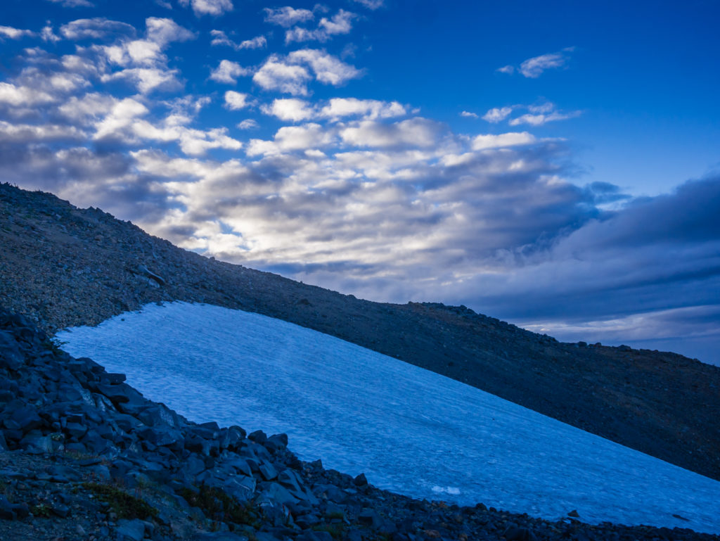
To our surprise, we found that we had to cross a patch of snow that was still clinging to the mountainside.
An impromptu change of plan meant that we ended up camping 3 miles short of where we really wanted to get to, largely because it was so cold and we wanted to quickly get the tent set up whilst a sliver of light remained. We had also climbed over 3,000 feet on really rocky terrain so as we were feeling tired, we called it a day. It was a good decision as we were inside the tent and wrapped up well for 9pm, just before the rain began to pour down. We are finding more and more each day that because the sun rises a little later and then sets a little earlier, we are struggling for enough daylight to complete our big miles. Hiking into the dark will soon be the norm on 25+mile days, which is something we will just have to accept. As we have to complete the trail by the 23rd of September, more than ever it will simply be a case of hike, eat, sleep, repeat!
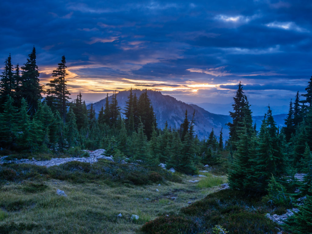
Fabulous sunset skies from our camp spot looking back to Mount Jefferson.
Day 139 – Sunday, 26th August 2018, Wild Camp at Mile 2,037 to Wild Camp at Mile 2,068, 31 miles
Amazingly, it was the first day out of 139 that we actually woke up to rain! Having pitched on a dry, little patch of grass last night that we thought was an excellent spot, we were dismayed to find that by morning it had become a boggy nightmare. The ground had become so saturated that water had even seeped through the tent liner leaving a wet pool under Wayne’s sleep pad. Thank goodness rain was as yet a rare occurrence on our PCT journey and that we hadn’t had to deal with wet gear on a regular basis.
Our journey on the PCT continues… Fingers crossed, the rain wouldn’t be here to stay as dealing with wet gear on the trail is not something we’d like to face day after day.
As the rain was unrelenting, we had to try and re-pack our rucksacks inside the vestibules of the tent before dismantling it and stuffing it, whilst being completely soaked through, into a large carrier bag. To his annoyance, that would be a few extra grams for Wayne to carry today! We were donning our full waterproofs when we set off, and were not very hopeful of the weather improving. There were thick, dark clouds looming all around, the effect of which gave us the feeling of a very miserable day ahead. The dull, dank atmosphere reminded us of several wet days back home in England hiking in the Lake District, where we eventually abandoned the trail and sought solace in a warm, inviting pub. There would be no such easy ‘get-outs’ on the PCT however!
England’s reputation for bad weather must be well ingrained overseas as everyone we saw on the trail that day passed comment that we must feel at home with the rain! It’s not something you enjoy, it’s just something you get used to and know to be prepared for! If it carried on raining today, it was something we’d just have to endure as we had 30 miles to cover to stay on track for reaching Timberline Lodge in readiness for a breakfast-buffet feast on Tuesday morning. So even though we had felt like staying put inside the tent, we had no choice but to get up and brave both the cold wind and wet weather. One consolation was that the entire West Coast was in dire need of rain after such a dry summer. The downpour would help to dampen the wildfires, and may possibly even put out the Holman Fire burning in Washington, which was the cause of the PCT trail closure leading to the Northern Terminus and Canadian border. We hoped so anyway!
Grateful of some natural shelter offered by the tree canopy as we set out on such a miserable day.
Orangutan passed us early on, also in full wet weather gear. It was then that we wondered how many thru-hikers would have carried waterproof jackets, trousers and even a backpack cover like ourselves since the start, or whether through non-use they might have been bounced to Cascade Locks ready for Washington. We both wished we had kept hold of our leggings and gillets for an extra layer of warmth, but we were sensible in keeping the waterproofs with us at all times. Over the past few days, they had also proved useful in providing us with an extra layer when needed to keep out the cold.
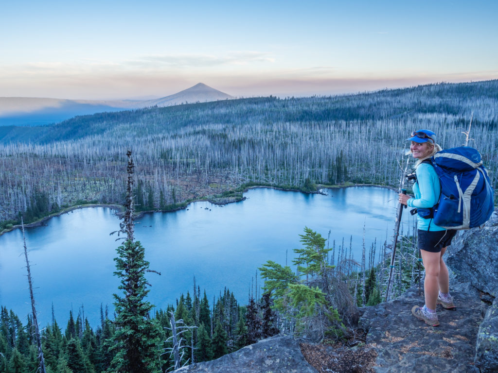
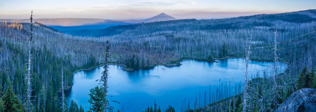
After about an hour or so, luckily for us, the rain soon turned to a drizzle and before long it was just a fine mist, but it still felt cold because of the wind chill and the low cloud was preventing the sun from breaking through. After around 8 miles, we were glad when we reached ‘Olallie Lake and Recreation Area’ as we found a small store selling hot coffee there. Earlier on, we hadn’t stopped for long enough to collect and filter water, let alone boil a pan of it for hot drinks, even though we were desperate for one. So the shop with its little veranda, benches and hot filter coffee was a welcome relief, so much so, that we ended up staying there for an hour chatting to Orangutan and his trail family, Night Crawler and SOBO hiker Snake Charmer. Curious to know what Washington was really like, we asked Snake Charmer for some first-hand info seeing as she had just hiked through ‘The Evergreen State’. She likened Washington to “Being in an enchanted forest mixed with a horror movie”! Having camped in an old burn area, she explained that the trees creaked and whined so much that she was frightened they would topple on her in the night! Maybe we shouldn’t have asked!
As well as enjoying the hot coffee and shelter provided by the Olallie Lake store, we happened to catch a glimpse of an osprey flying over the lake. We watched it as it swooped down a couple of times but we didn’t actually see it catch anything. The store also had a wooden sign indicating how far we had walked from Mexico and what distance remained for us to reach Canada, so of course we had to have a photo taken with it. The scales have definitely tipped in our favour now with less than 600 miles to go!
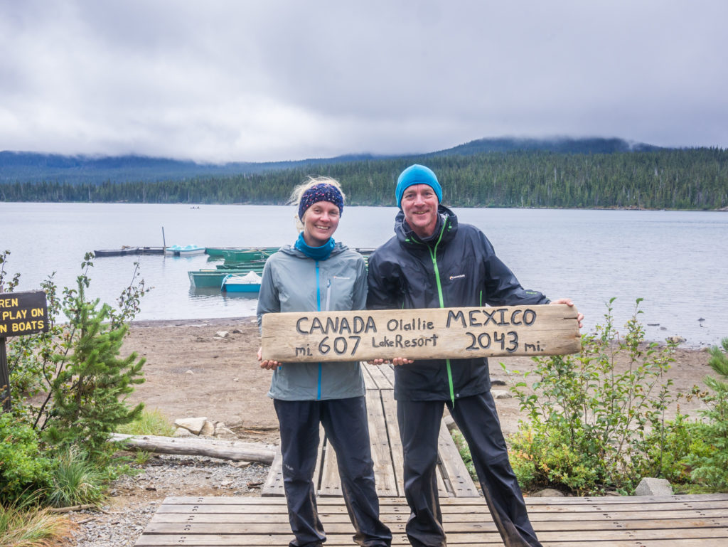
Taking a hot-coffee break at Olallie Lake. The mileage was a little outdated, but Canada was getting closer with every step!
When we finally set off again around midday, we realised that we’d be really pushed for time to complete a thirty-miler before dark, so we hurried on at as fast a pace as we could, only stopping for minimal breaks. At one point the sun was trying its best to break through so we stopped for lunch beside the trail and got out both the tent and the fly, hanging them from some nearby trees in the hope that they would dry off a bit whilst we are.
Dramatic lake reflections followed as the rain clouds seemed to be lifting.
Pushing on as we wanted to cover 30 miles today in order to reach Timberline Lodge tomorrow.
During the next stint we came across ‘Odie’, a well-known thru-hiker, currently going SOBO to meet as many NOBO hikers as possible to inform them about the ‘PCT Class of 2018 Yearbook’ he’s in the process of creating. He showed us an example of a similar one that he produced last year for the AT, which included both trail names, real names and the email addresses of those that thru-hiked the trail with photographs of hikers taken at the start and finish, plus pictures and names of all the trail angels that supported thru-hiker along the way. We think the production of a yearbook is an excellent idea and will definitely be purchasing one to go on the coffee table for family and friends to peruse when they pop round for a visit!
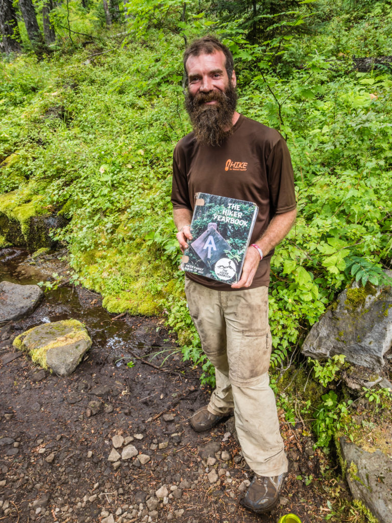
Meeting Odie a veteran thru-hiker who was showcasing his well used AT Hiker Yearbook. He was getting to know PCT hikers and canvassing along the trail, mooting the idea of a PCT Hiker Yearbook for the Class of 2018. What an excellent idea!
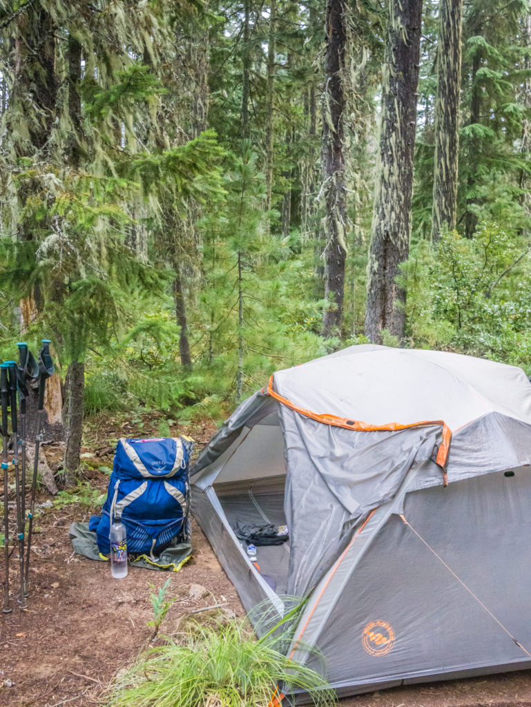
As expected, it was dark by the time we reached the 30-mile marker for the day. We couldn’t actually find the spot where we had planned on camping. Even with our head torches, we struggled to see well enough as the forest was so dense, so we pushed on an extra mile to a camp spot listed on the GutHooks app that was much easier to locate. Several other thru-hikers were already camped in what seemed to be a popular area, so we struggled to find a big enough pitch for the condo, in the end having to settle for a space close to the trail that was also near to another tent. But at this late hour, there wasn’t really an alternative.
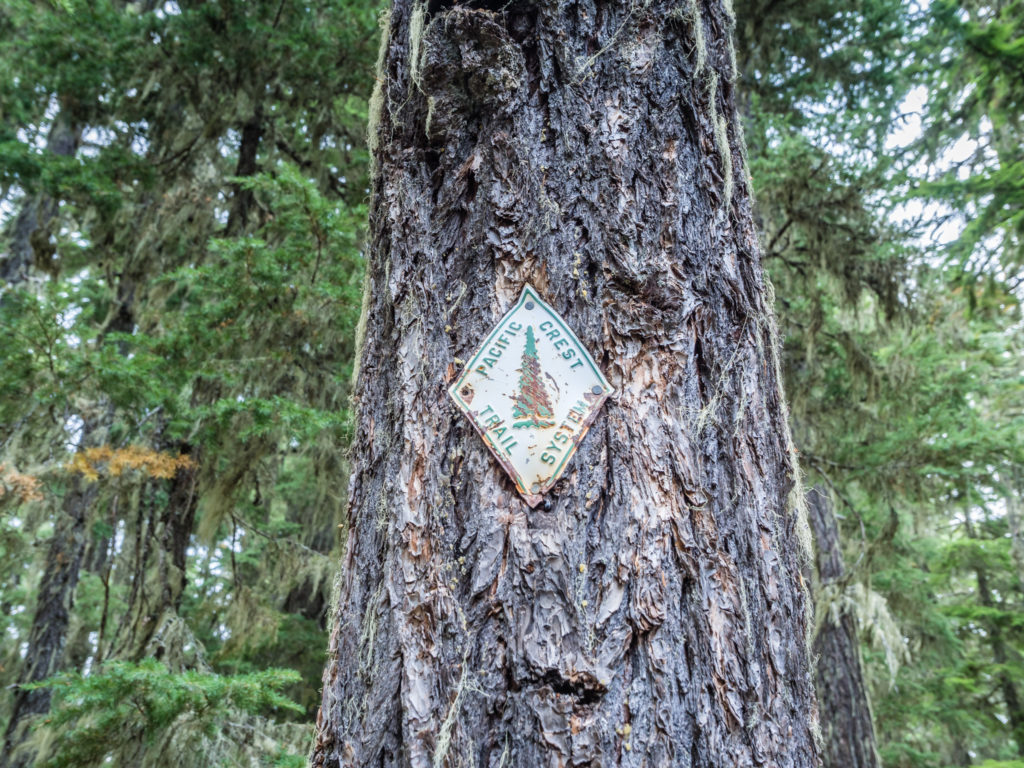
Spotting one of the old PCT trail blazes attached to a tree in Oregon.
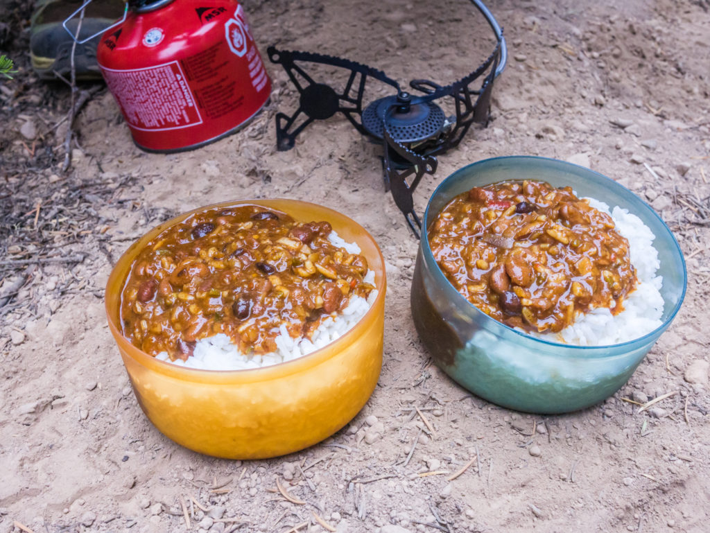
Taking a pit-stop to indulge in a trail kitchen favourite for dinner – Bear Creek ‘Darn Good’ Mixed Bean Chilli with rice.
The bonus of having pushed on a little further than we intended is that tomorrow we now only have to walk 29 miles to reach Timberline Lodge, renowned for having the best breakfast on the entire trail. Once again the best motivating factor for getting us moving and keeping us on track is the promise of ‘food’!
Day 140 – Monday, 27th August 2018, Wild Camp at Mile 2,068 to Wild Camp by Timberline Lodge at Mile 2,097, 29 miles
It was another wet, drizzly morning in Oregon when we awoke to the alarm at 5:30am, so we gave ourselves an extra half hour of warmth in our sleeping bags before we had to brave the cold and contend with the dampness in the air. Somehow it feels worse getting up to those conditions in darkness so waiting until after sunrise when we had some light just made everything seem that little bit better.
After updating the weather forecast on our Garmin In-Reach, it appeared that the day was going to improve. It was forecast to brighten up after midday so we hoped that the information would prove correct and that we’d at least be able to dry out the tent fly before evening. Even after only a couple of nights of rain, everything is now feeling damp so we are desperate to get our gear dried out properly so that we can stay warm and have a comfortable night’s sleep.
Wayne was not thrilled at the prospect of having to carry a wet tent again.
As we set off along the trail, once again weaving through a dense forest of fir and pine trees, we were thankful of the thick canopy above providing some natural shelter as the rain continued. Brushing past the wet undergrowth beside the trail, our waterproof trousers became covered in a thick layer of mud as dust and detritus clung to the soggy material. Not only did we have the problem of drying them out, but now they would also have to be cleaned as well, a task that would have to wait until we had the facility of a private bathroom in Cascade Locks. Looking at the state of our trousers, this would be a military operation using a shower hose!
But enough complaining! After so many days of excellent weather, we had to get rain at some point! The beauty of rain is that everything seemed greener and more lush. As dappled sunlight filtered through the trees, the bright green moss growing over the rocks and fallen tree trunks really caught our attention as we walked by, along with the maple-like leaves already turning a pretty shade of pink red. We were hoping to get a glimpse of Mount Hood as we entered the Mount Hood Wilderness area, but it wasn’t until much later in the day when we hiked above timberline that we were treated to a spectacular view of the glaciated peak looking dark and ominous on the moody skyline.
Entering a much richer and more lush Mount Hood National Forest after some heavy rain in the night.
Heading to Timothy Lake for our second breakfast or ‘elevenses’ but smiling as the rain seemed to have finally stopped.
Dark, ominous clouds linger over Timothy Lake.
The forecast for once had been correct! By mid-afternoon, the clouds were clearing and the sun was shining intermittently, which allowed us the chance to get the tent fly dry when we sat and had lunch along a dirt road. We passed a couple of trailheads leading to splendid lakes with equally nice campgrounds and both times we were hoping that Copper Tone would be parked there offering some of his wonderful ‘Trail Magic’ (we both would have got excited about the prospect of a root beer float right now!) – but we had no such luck! We had seen his name signed in the trail register at the Big Lake Youth Camp just a day or so before we got there, so we know he is in the area! Just what trailhead his magic is at right now is what we need to find out from any SOBOS coming our way!
Hoping that Copper Tone would be beside the road offering some of his amazing trail magic… But no such luck today!
Someone’s idea of a joke along the trail.
As the day progressed, the race was then on to reach Timberline Lodge before sunset. We passed Jan, the first thru-hiker we had met from the Czech Republic, then kept catching up to Fern and Tommy Pickles, as well as Milkshake and Loner as they took various rest breaks. One person who hadn’t caught us up yet was Night Crawler, but we knew he’d definitely be there at the lodge come breakfast tomorrow.
The last 5 miles to the Lodge were all uphill, which wasn’t surprising seeing as it’s situated on the timberline looking directly onto Mount Hood, the highest peak in Oregon reaching 11,239 feet. Had we been hiking up there on either of the previous two days we would have been in mist and cloud with no views at all. Today however, we had an excellent view of the glaciated peak and the hike up, although a little strenuous as we were powering up the switchbacks to get there before dark, was the best part of the day. Even the last mile and a half, of which the trail is made of sand, proved much more pleasant than anticipated, the rain having dampened the sand down leaving it much firmer to walk on.
Making our way above the treeline to Timberline Lodge.
Our first glimpse of Mount Hood’s glaciated peak as we reached the timberline at sunset.
As the sun slowly went down behind Timberline Lodge there was a wonderful pink blue alpine glow along the skyline and looking back to the southwest, we could see the conical peak of Mount Jefferson way off in the distance. After the smoky skies from the wildfires, followed by misty rain the last couple of days, visibility was excellent and we couldn’t believe our luck!
Enjoying the wonderful alpine glow that cloaked the valley in a striking pink-blue haze.
Crowned by 11 glaciers, our final view of the day was of the grandiose Mount Hood. At 11,249 feet it is the tallest mountain in Oregon and the second most climbed mountain in the world.
Finally making it around the ridge towards the lodge, Milkshake and Loner caught up with us, along with a male thru-hiker wearing a dress. We have seen him several times since Crater Lake, (but we are yet to find out his name) and the dress is still his favourite hiking attire despite the increasing cold! All of us were eager to get pitched and organised as the temperature was dropping rapidly. There is a camping area for PCT hikers opposite the lodge in a thicket of trees, which by 8:30pm when we arrived was already busy with tents, but we managed to get pitched in a semi-sheltered spot. Facing onto Mount Hood, and at an elevation of 6,000 feet, it was very blustery and felt much colder than what we’ve been used to of late. So Wayne pegged the tent out well with extra guy lines and we got set for a windy night.
Just before lights out, we heard a familiar voice. Kiwi thru-hiker ‘Blue’ whom we first met in Kennedy Meadows South had made her way to the camp area after hitching in from town. It was great to see her again and have a quick catch up, especially as she was armed with a bottle of Pinot Noir and kindly offered us a glass! What we were all looking forward to most however was breakfast in the morning!
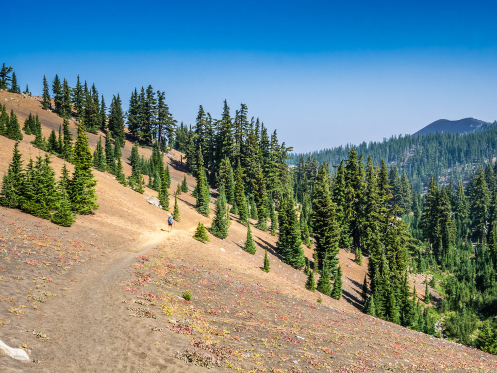
What a whirlwind week with regards to the changeable weather and wildfire conditions! Despite the last couple of days of rain, we still consider ourselves fortunate to have gone over 130 days on the trail without any. Whether we’ll be as lucky when we reach Washington, one can only hope… Yet by far, the most memorable aspect of this week is that our thoughts of Oregon have changed immensely since entering the Three Sisters Wilderness area, a mere introduction to Oregon’s dramatic volcanic scenery and expansive skyline views, which have served to imprint Oregon in our hearts forever. We like hiking through forests, but it is the big mountains that draw us to the great outdoors, and we have certainly seen that Oregon has got some of the best!
14 Comments
Such a relief that the smoke has shifted for you, but none-the-less, you have captured some amazing photographs. My favourite, the sun’s rays over the babbling stream as everyone was breaking camp! The 3rd last pic of you hiking towards Mt Hood is also right up there. I’m not surprised about the rain as I follow the blog of Linda’s Lens, who hikes in Oregon just about every weekend. I am familiar with Mt Hood through her and gratefully through a personal visit in 2016.
Such a variety of terrain through this section. Awesome read. Thanks.
Thanks for your great feedback again Helen.:-) We felt really lucky to have such incredible views of Mount Jefferson and Mount Hood after what felt like weeks of smoky skies from Northern California into Oregon. We’ll have to check out Linda’s blog. Thanks for the tip and for continuing to follow along with our journey!👍
How do you find the time to write all this up and add the great photos!? Amazing. I would think you would sleep every minute you could whilst on your rest breaks. Wonderful to see you on the home stretch and catching some cleaner, clearer vistas. Beautiful shots of Mt Jefferson.
Thanks Garry! 🙂 Writing did become more difficult through Oregon and Washington on the bigger mile days as when we got to camp, like you said, I did just want to sleep! Hence, my later trail reports are a series of notes, which I am now having to spend time writing up into paragraphs! Wayne edits the photos for me though, so a combined effort. (As we’re currently travelling through China, that’s why it’s also taking so long getting new posts out.) Hope you enjoy the next one!
Mrs. Fenton,
Your best chapter so far, this was really well done. I’ve enjoyed your writing all along – and “whilst” I’ve never used the word “whilst” I like it – but the pictures were really superb, beautiful photos. And not just the amazing summit shots, but some of burn pictures and rock and lava photos were just stunning. Your post made my Saturday. Thank You for doing this for us.
Your old Pal,
“Bob”
Hey old pal, thank you once again for such wonderful feedback. 🙂
I feel like I must reach the end of this PCT series with the same quality just to satisfy your needs!
The photos are easy when we have splendid scenery in front of us. My personal favourites are from the Goat Rocks Knife Edge, which are still to come.
Hope you enjoy the next post!
Wonderful views of those volcanic peaks and I guess rain had to happen at some point. Coming from the UK it must have felt weird to walk 2000 miles in dry sunshine and equally weird to finally see rain after all that time. I’ve hiked in Volcanic terrain in the Canary Islands and can vouch for just what a pain it can be!
Yep, we had definitely been lucky with the weather so we couldn’t complain at finally getting a little rain after so long.
I’ve seen via the web that the Peak District has already had a dusting of snow back home and that feels weird now being in China in good temperatures.
I think I’m a fair weather walker in truth! I love the sunshine. 🙂
I’ve heard that the Canary Islands has some good hiking. We’ve only been to Tenerife (some years back but was more of a party holiday!) – what island/ part did you do? Would you recommend it for a short walking holiday? We’re always looking for new options.
It’s a great place for walking. We’ve been Tenerife twice and Lanzarote once. Gran Canaria this year, all over Xmas and New Year when it’s not too hot. Some of the islands are a little tacky but with a bit of effort there are some superb walks. If you go to my blog and check out posts in January for the past 3 years you’ll see a load of stuff about our trips. Some boring family type stuff but loads of walks as well. Hope it gives you some ideas.
Thanks for the info and great tips Andy.
I’ll be sure to check out your blog for pictures and ideas. 😀
Was Ryan trolling you with his Exped hat?
Ha ha! I hadn’t noticed his hat until your comment. 😉
Another really good read, thanks very much. No pressure but I could do with the next video to keep me going!? Best wishes Grant.
Thanks Grant. A couple of video uploads have happened since your comment. Hope you’ve got your fix! 😉