
“Keep close to Nature’s heart… and break clear away, once in a while, and climb a mountain or spend a week in the woods. Wash your spirit clean”.
– John Muir
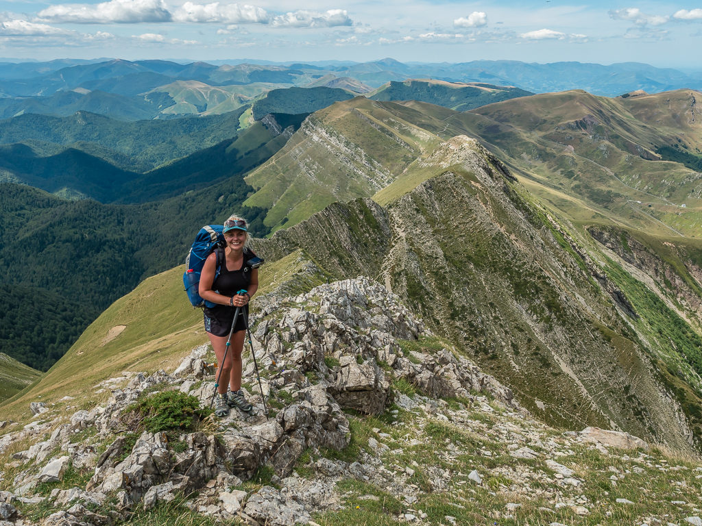
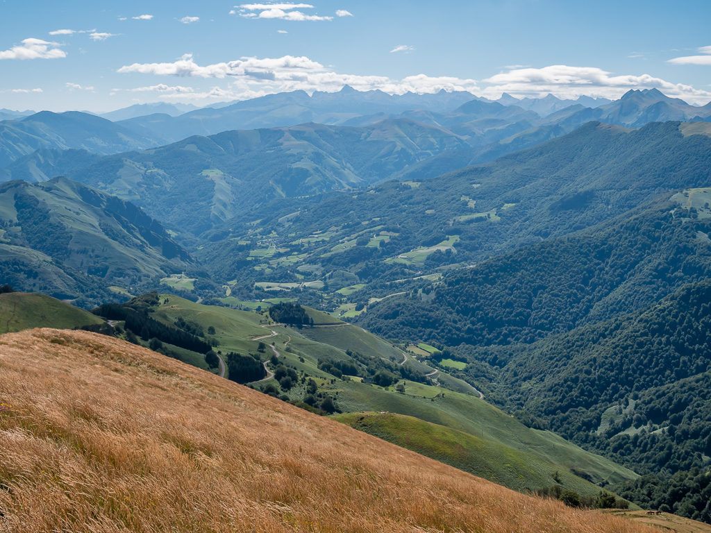
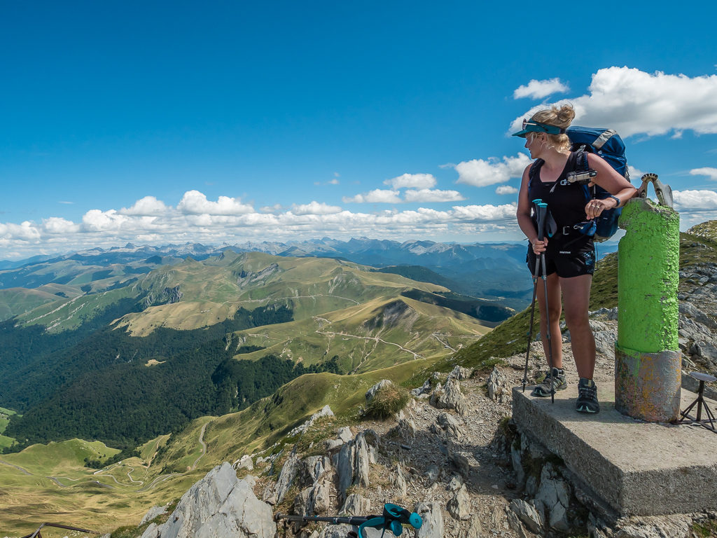
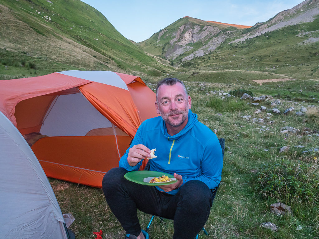
Thoroughly excited at being away from civilisation and back in the mountains again!
Summer 2019…
Having thrown ourselves back into work for the past 7 months in order to secure enough funds to spend another summer in the hills doing what we love best, it was with great excitement when July 2019 came around and our plans to return to the Pyrenees at last came to fruition!
After completing the PCT in 2018 and spending the best part of 6 months in some of the USA’s most pristine wilderness, we had been longing to get back on the trail. The simplicity of carrying only the essentials, walking the day away, meeting incredible people, and taking in amazing scenery is wholly addictive.
Living like ‘Hiker Trash’ is however an expensive hobby. So way back in January 2019, whilst feeling very overwhelmed at having to re-join the ‘rat race’ and begin saving again, the summer seemed a long way off. But goals are what keep us going, and as we jetted off to France’s upmarket coastal town of Biarritz on a no-frills flight from the UK on 31st July, 2019, it seemed only yesterday that we had been skipping through Washington to the Canadian border after completing all 2,652 miles!
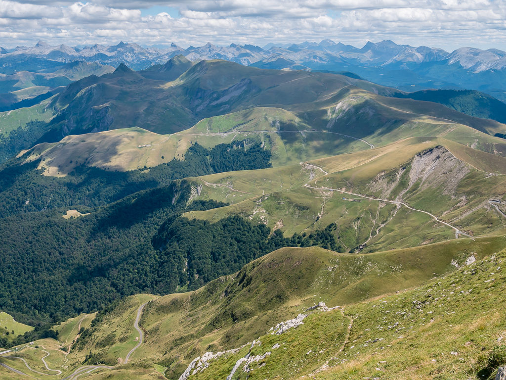
Eager to set off on yet another long-distance hiking adventure, this time we had decided on tackling the ‘Haute Randonnée Pyrénéenne‘ – the high route through the Pyrenees mountains, also combining some of the best of the GR10 in France as well as that of the GR11 across the border in Spain. At approximately 500 miles in length, our planned hike might not have been on the same scale or magnitude of that of the PCT. But in our opinion, the mountains in the Pyrenees are equally as grand and the alpine scenery just as beautiful as any of California’s Sierra Nevada. Since hiking through the Pyrenees on a 180-mile segment of the Spanish GR11 in 2017, we had always vowed to return, the wonderful experience having left such a lasting impression on us.
This time around, we would begin over the border on the west coast of France, setting off on the ‘GR10’ at Hendaye – our aim being to complete our own coast-to-coast traverse from the Atlantic to the Mediterranean Sea, finishing on the ‘GR11’ at Cap de Creus, the eastern-most point on the Spanish side. (Walking west to east into sunnier climes was for us most appealing, but our start and end points also conveniently coincided with cheaper flights to both Biarritz and Barcelona, from where we would be flying home. Flights across the border to start on the west coast of Spain, for example, were almost double the cost!)
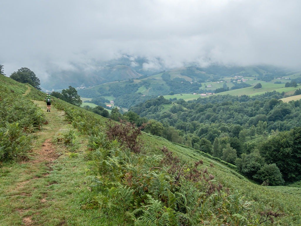
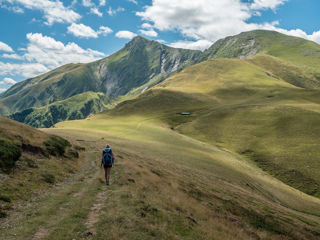
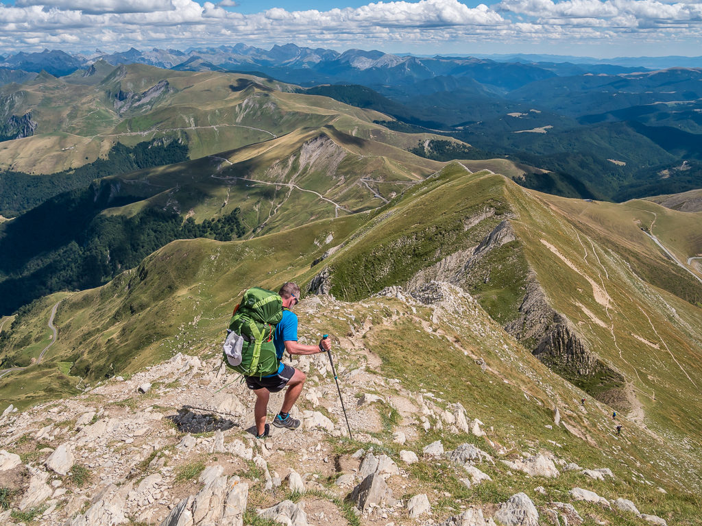
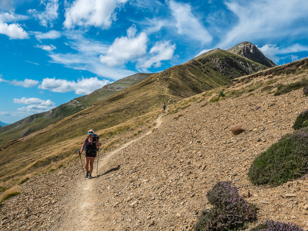
Giving ourselves a generous itinerary of 8 weeks and what we consider a leisurely pace of approximately 15 miles a day with a ‘rest day’ each week, it simply doesn’t compare with the 30+ mile days of the PCT. However from experience, we knew those 15 miles wouldn’t be on well-graded switchbacks but would involve a scramble up a hillside or a slow traverse over a boulder field, as we have repeatedly found European trails to be much more demanding in terms of terrain. But as always, we were up for the challenge!
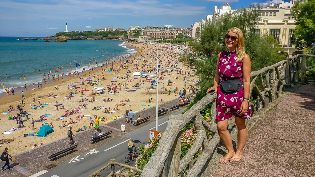
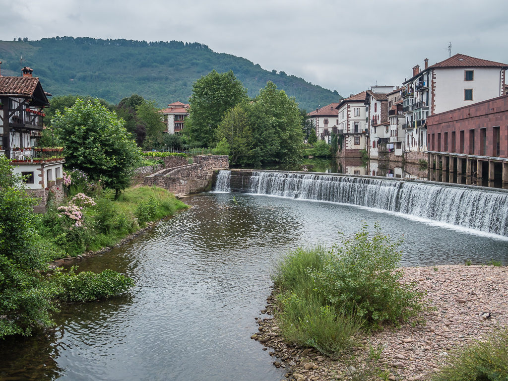
Pre-hike – Enjoying a day of sightseeing in Biarritz! Looking onto ‘Le Grande Plage’, the most popular tourist beach in the resort area.
Day 1 – ‘The Hills Are Alive With The Sound Of Music!’ Friday 2nd August, 2019, Hendaye following the GR10 to Wild Camp before the climb to Larrun, 18km
Starting a long-distance hike with the onset of a hangover isn’t recommended – but that’s how we departed Biarritz this morning after enjoying an afternoon of cocktails and ‘vin rouge’ whilst people watching on the Grande Plage yesterday. It was our one day as ‘tourists’ taking in the sights of what really is a well-to-do town on France’s southwest coast. This included walking along the promenade eye-balling the fantastically grande Hotel du Palais and wondering who actually stays there and similarly looking upon the Casino Municipal thinking people in Biarritz must have much more money than sense! In contrast, having got into the habit of making our finances stretch further, we were making a conscious effort to be money-savvy by looking out for any ‘Menus of the Day‘ and ‘Happy Hour‘ offers so that we wouldn’t be forced to go over budget on Day 1!
Not being able to resist a bowl of ‘moules marinières’, the quintessential French holiday dish being so close to the sea, we knew we’d end up spending ‘tourist dollar’, but we had off-set the costs of our ‘tourist day’ by staying in a chain airport hotel just a short bus ride from the town centre. Due to Biarritz being such a popular holiday destination for both French nationals as well as other Europeans, this choice of budget-hotel saved us from paying over the odds for standard accommodation.
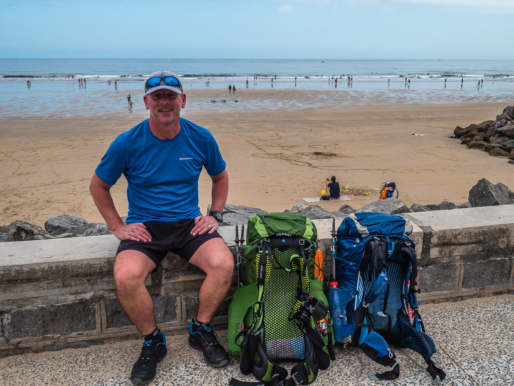
With our town clothes now stowed away for a ‘day off’ further up trail, it was back to business. Leaving Biarritz by train at 9:30am, we needed to travel further down the French coast to the small town of Hendaye where the official start of the GR10 begins. After finding our way to the beach for a customary dip of our toes in the Atlantic Ocean, we were ready for the off!
With our backpacks already feeling heavy – as is always the case on ‘Day 1’ with full supplies and non-essential gear that needs a good shake-down, we felt it was going to be a slow and steady walk out of town and into the foothills. With every intention to only take the bare-necessities on this trip, I had already ditched a tub of baby powder and a pair of leggings back at the hotel saving me a few hundred grams. However we were still carrying more than we really needed as we had packed enough food for 4 evening meals – when in fact we’d be going past both restaurants and shops at various points for at least the next few days! (Will we ever learn to ignore those niggling words ‘just in case’?)
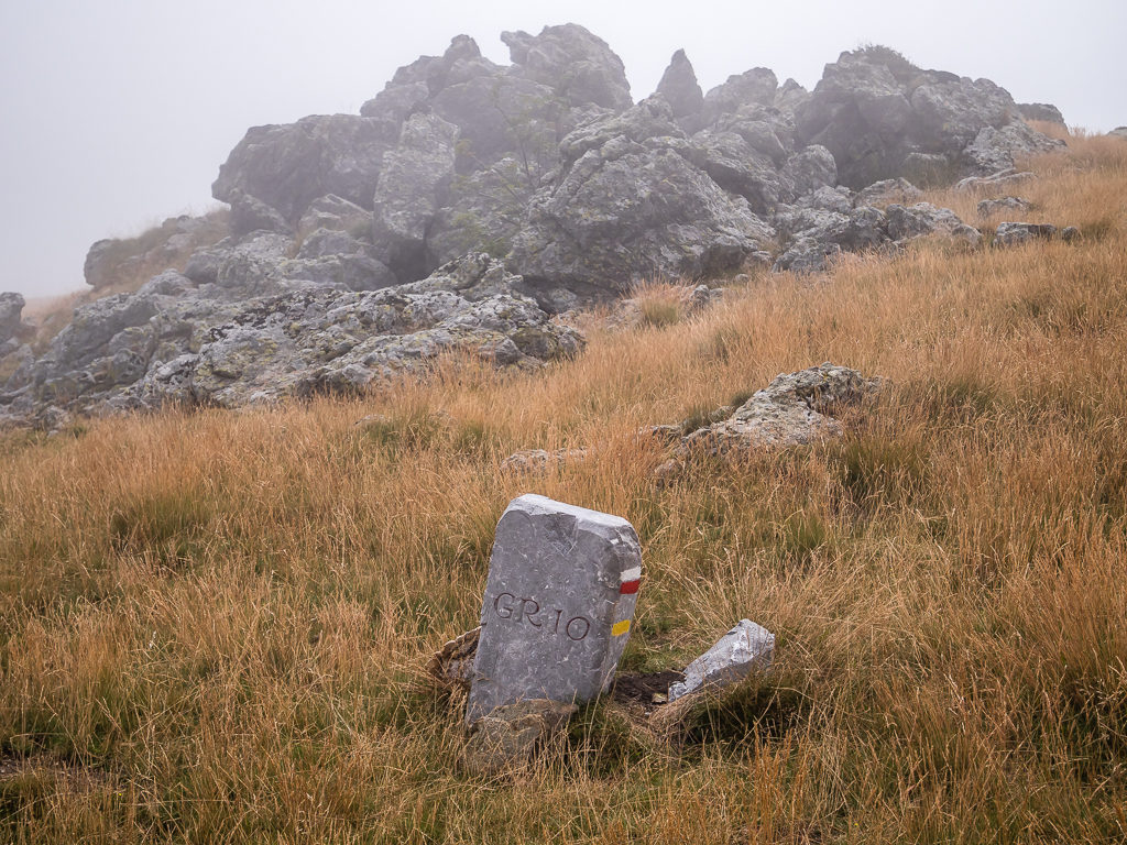
Taking a quick breather before starting our thru-hike from Hendaye Beach. At the western end of the GR10 long distance footpath, the town of Hendaye is also the furthest point in the South West of France you can go.
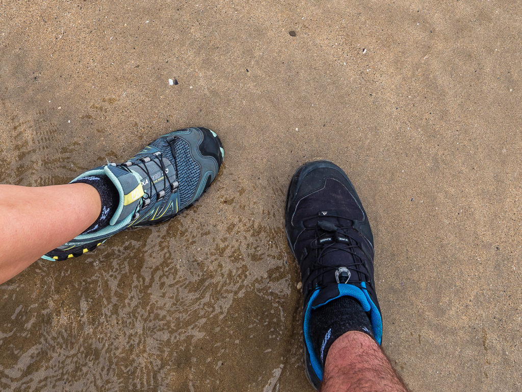
Dipping our toes in the Atlantic before heading off on another long-distance adventure!
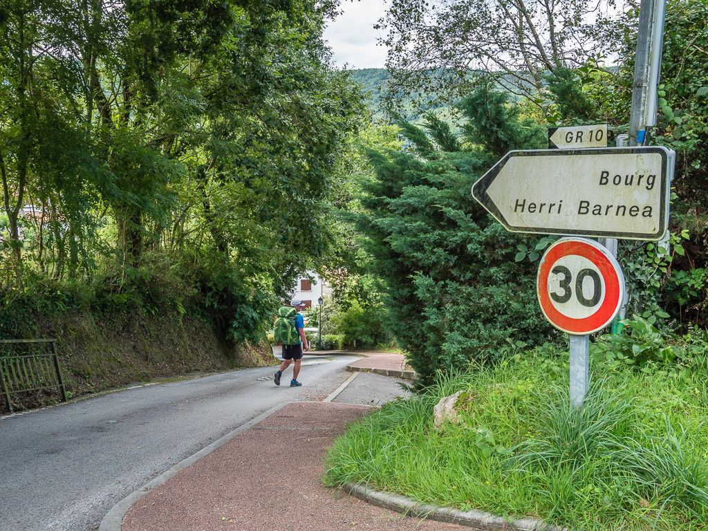
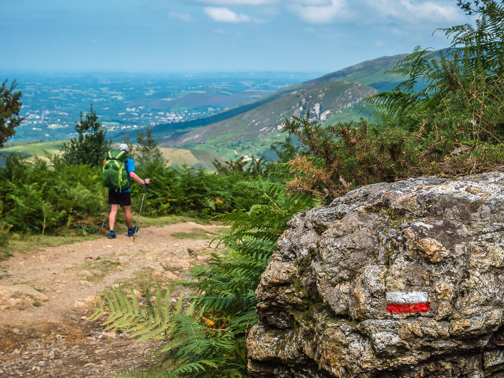
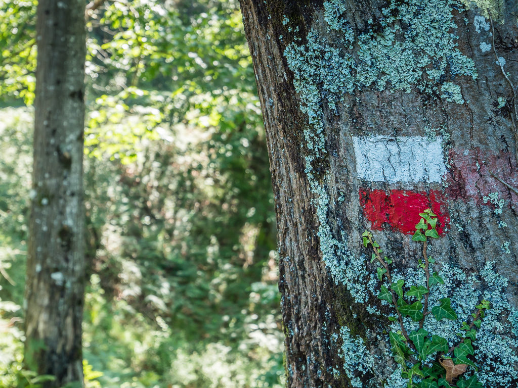
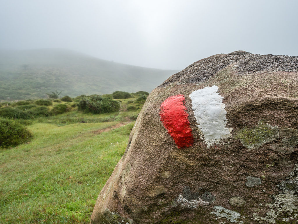
Having completed the obligatory ‘start’ ritual by way of walking out to the sea as it was low tide and putting our shoes in the shallowest pool of water (it was a low-key gesture after the effort of getting to the start point) we then left Hendaye behind and began walking towards the rolling green foothills to the south after stopping at the official GR10 sign in town for photos. We then didn’t have to worry too much about navigation as we quickly spotted the familiar white and red flashes painted at regular intervals on posts and fence panels signalling the way, a comfort we had got so used to whilst traversing the GR11.
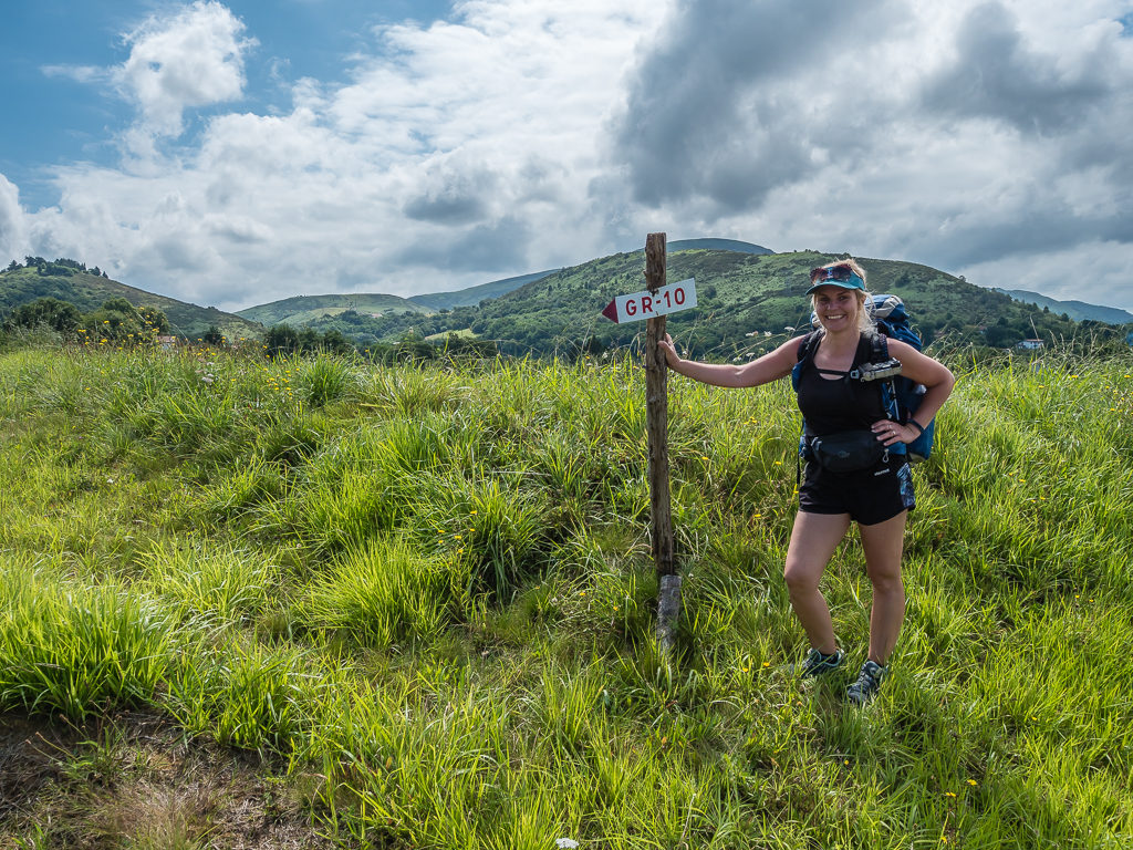
Heading in the right direction! The GR10 is well way-marked from the centre of town into the foothills.
Walking past Hendaye Marina, located at the mouth of the river Bidassoa, which marks the border with Spain.
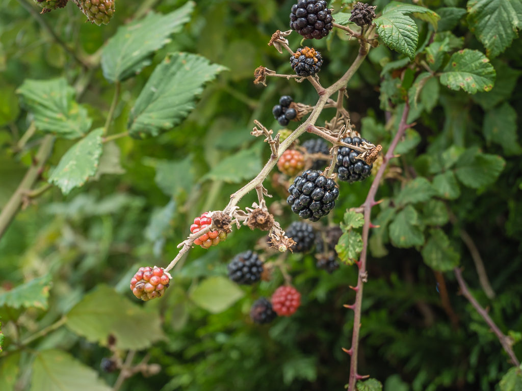
Our first glimpse of Basque blackberries that were ripening up nicely in the summer sunshine.
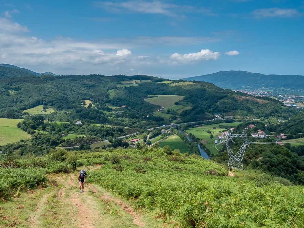
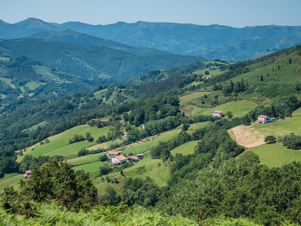
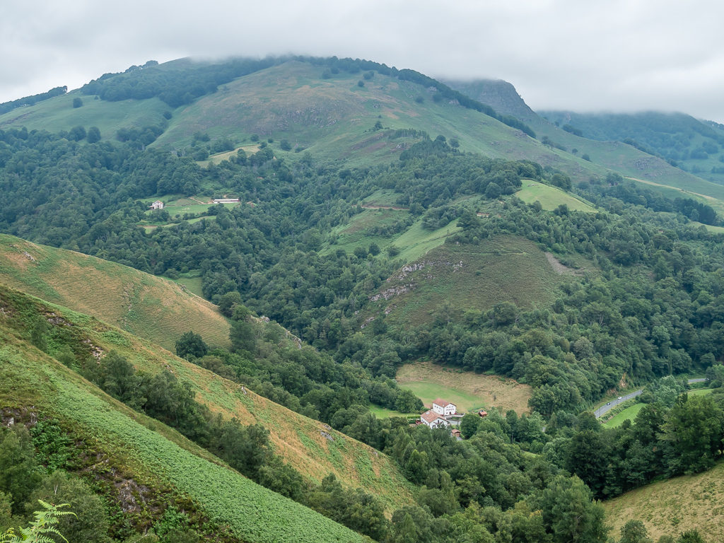
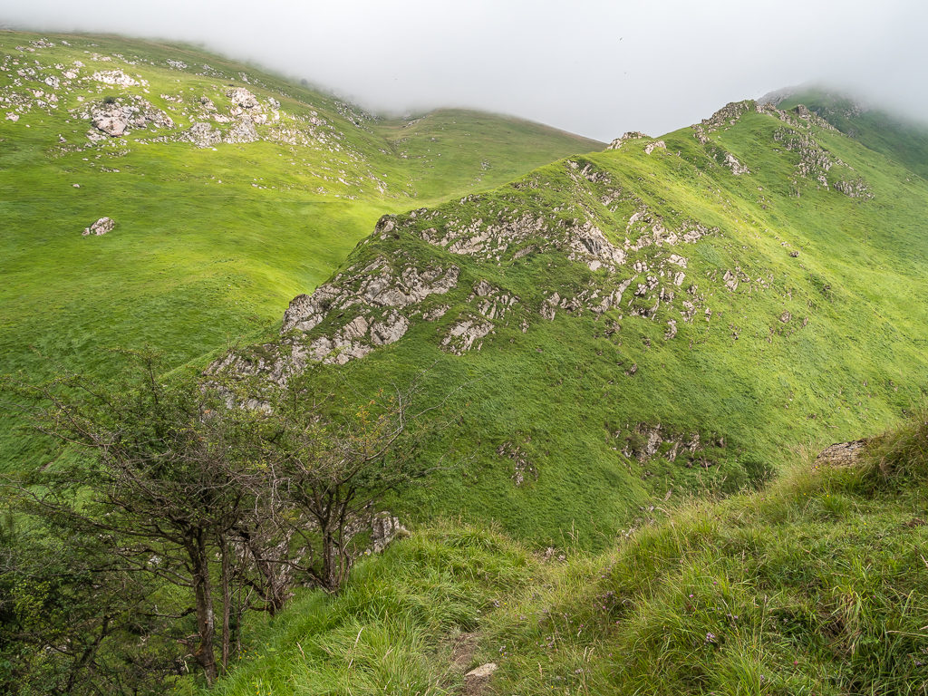
Under a hazy blue sky, we steadily made our way uphill and away from the French-Basque coast.
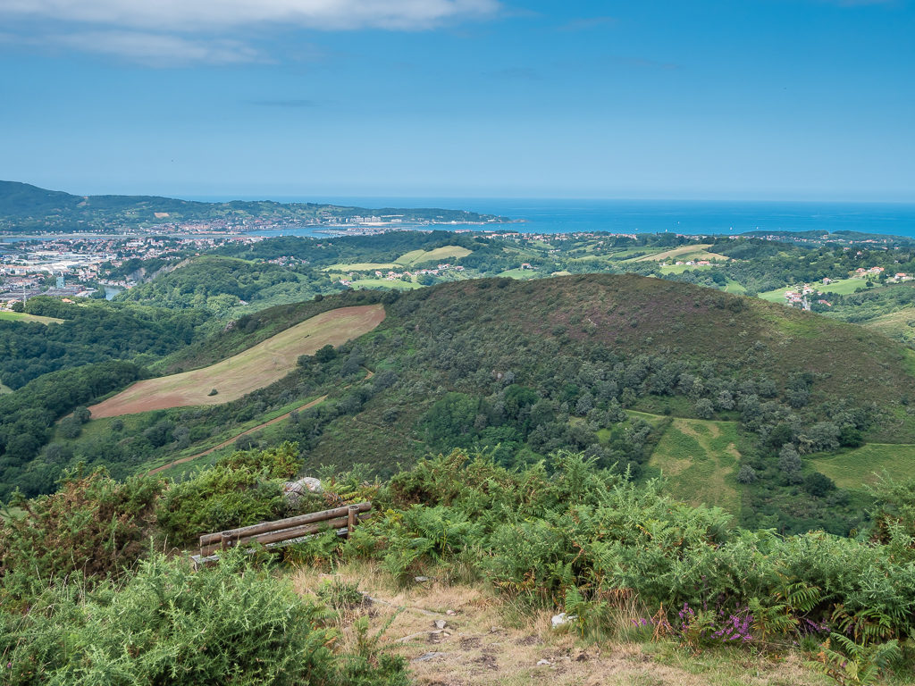
Enjoying the rolling hills and fantastic sea views looking back to the Atlantic as we entered the foothills of the Pyrenees.
Another example of good way-marking.
Rising rapidly above the Atlantic, we were pleased to see the familiar white and red flashes signalling we were on the right route.
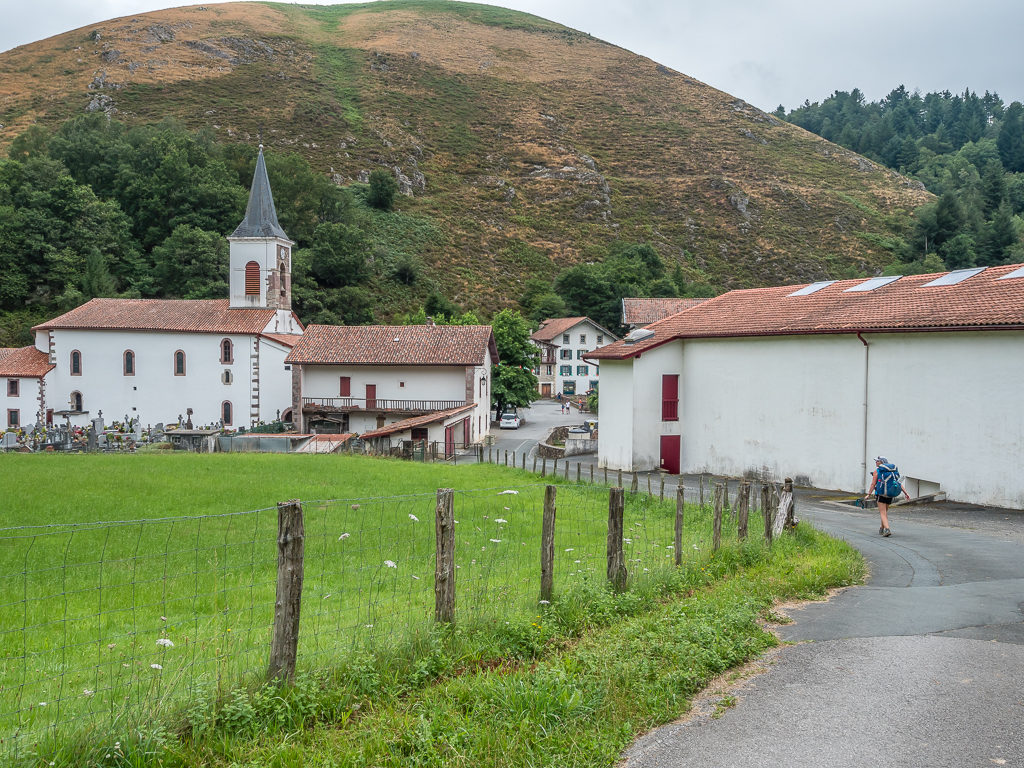
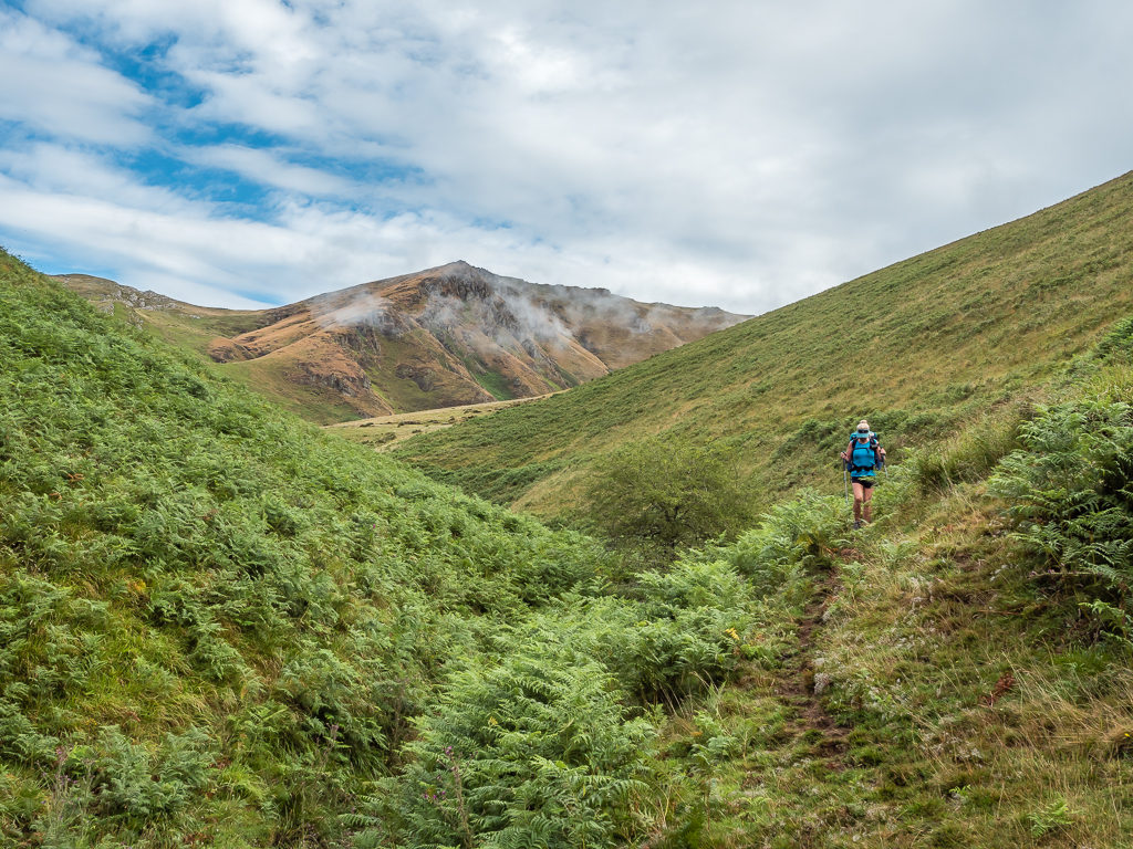
Staying on the GR10, today we had planned to walk 14km from Hendaye to Col d’Ibardin where we had then planned to turn off and join the HRP, whilst coincidentally crossing over an invisible ‘border line’ into Spain. France or Spain, no matter – we found the area as a whole to be characterised by classic-looking whitewashed stone houses with red-tiled roofs and shuttered windows that is predominantly Basque in culture.
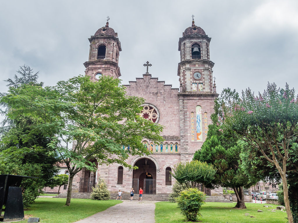
Reaching Biriatou just before 1pm, a pretty little Basque village with an elegant church standing atop a hill, we decided to sit and have refreshments in the square, whilst there was opportunity. It wasn’t particularly hot now we had left the coast behind and were higher in elevation, but we were most definitely feeling it as we had already tackled several uphill climbs after starting at sea level, including the Col d’Osin (374m) and the Col des Poiriers (316m), and there were still more to come. That being said, we had merely crossed many beautiful green hills as opposed to encountering any ‘real’ mountains yet!
Taking us progressively higher and affording us wonderful views back to the Atlantic, next we hiked over the summit of Xoldokogaina at 486m, (also spelt Choldokogagna) and then across the northern slopes of Mandale (574m). Reaching a forest track we stopped for another water break, glad of the pockets of shade and the extra fluids serving to re-hydrate our bodies and lessen the hangover. From there, descending steeply to Col d’Ibardin, which is right on the border between France and Spain, we took advantage of there being roadside shops and restaurants, stopping again this time for ice cream and drinks at the Ventas d’Ibardin.
Leaving refreshed, we said farewell to the GR10 for now as we crossed into Spain and picked up the HRP route. Continuing on the HRP would take us to Larrun, a 905 metre mountain, which would be our first ‘proper’ peak encountered so far. Covered in dolmens, stone circles and other neolithic monuments, it is held to be a sacred and iconic place in Basque culture.
Not wanting to tackle the summit on our first evening and being unsure exactly as to where we were going to camp, we made an impromptu decision to stop for dinner at a picnic site with running water that we passed en route courtesy of instructions in our guide book as the site wasn’t marked on our maps. Sitting in a shady spot on the grass and taking off our shoes, it was the perfect place to cook and take a rest in the early evening sun. It was just a shame that there was a sign stating ‘no camping’, otherwise we would have happily pitched up there for the night!
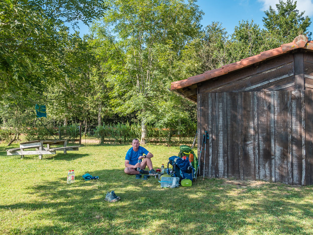
Enjoying a shady spot on the grass at a recreational site we passed along the HRP. We’ve learnt now that if there’s running water, to take advantage of it at every opportunity.
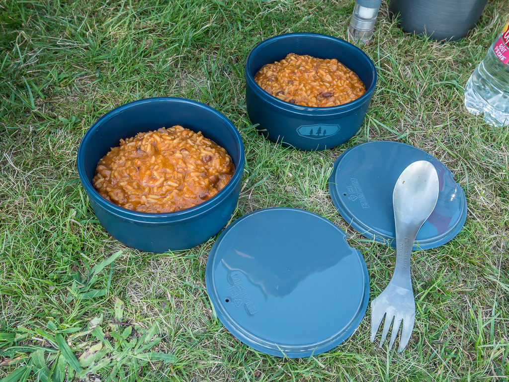
Our first trail dinner! In an effort to reduce some of our supplies, we ate one of our emergency rations – a Firepot ‘Chilli con Carne and Rice’ meal that we had brought with us from the UK.
After a hearty dinner and good half hour rest, we left the picnic site and headed uphill on a grassy track towards Larrun, which was easily spotted piercing the skyline with a large red and white building jutting out of the mountain top. Along the way, we finally introduced ourselves to a Swiss couple whom we had leap-frogged several times throughout the day after first seeing them in Hendaye. We had assumed that they were walking the GR10 route complete with large backpacks and walking poles much like ourselves – but after speaking to them, we found out that they too were attempting a full traverse of the HRP.
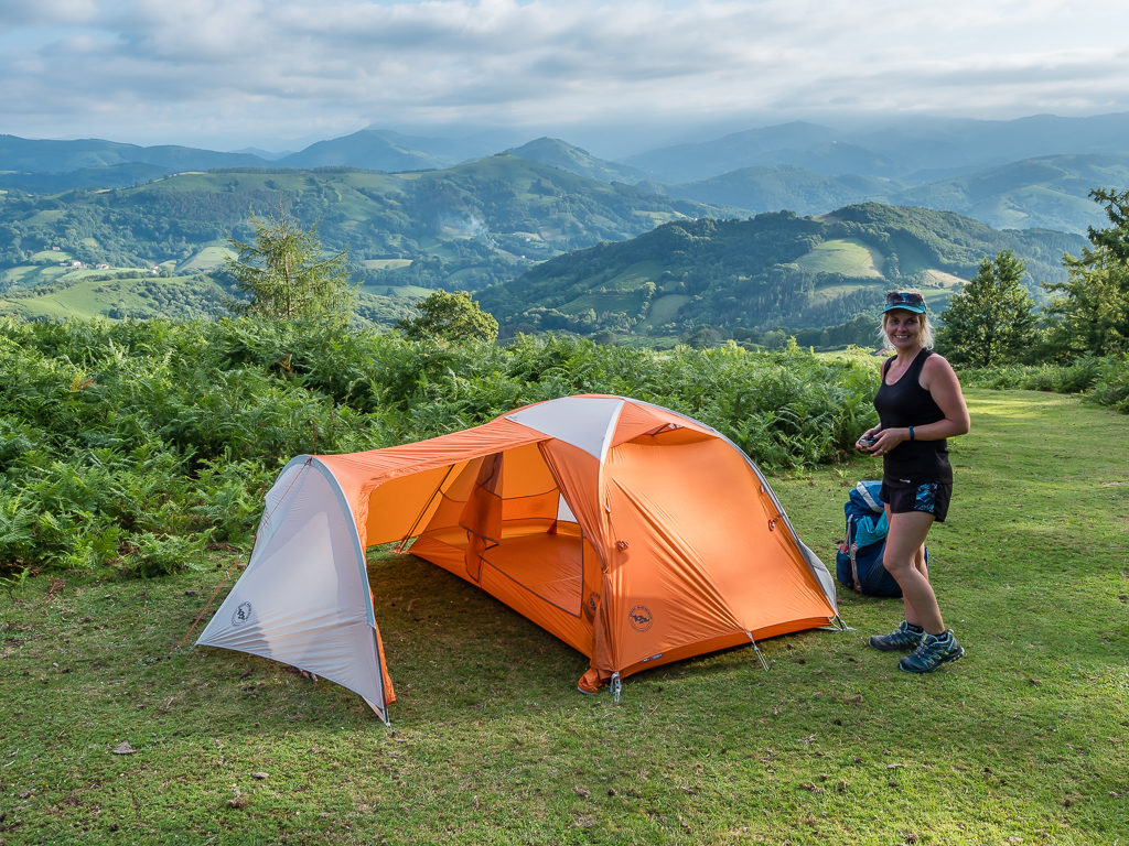
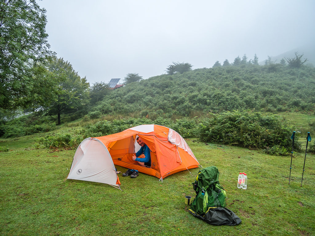
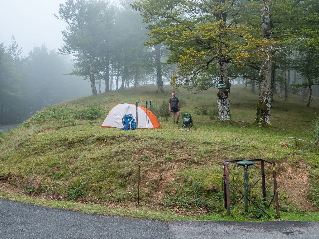
Setting up camp in the hope that the surrounding ferns would help to obscure us from view. We can’t really pull off ‘covert’ camping with a bright orange tent!
Watching the sun set through the trees from the comfort of our tent. Hopefully our first wild camp would be non-eventful…
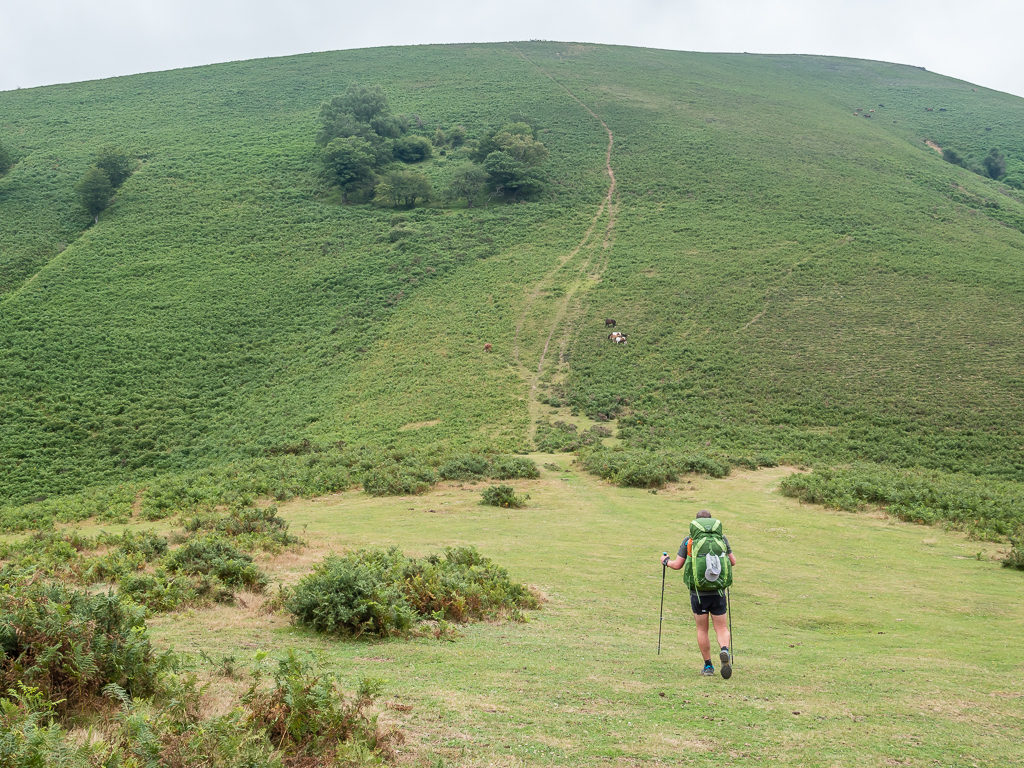
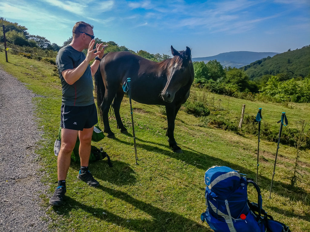
Not wanting to head up to the summit of Larrun as the sun was now beginning to set, but needing to find a wild camp spot where we could best avoid being seen by the locals as there were a few farmhouses dotted around the hills, we settled on a grassy spot beside the woods just off the trail leading up to the peak. With our tent being bright orange, it wasn’t ideal as we were sure we’d be able to be spotted from certain vantage points, but the ground in the woods just wasn’t flat enough or large enough to accommodate a two-person hotel with our giant foot print!
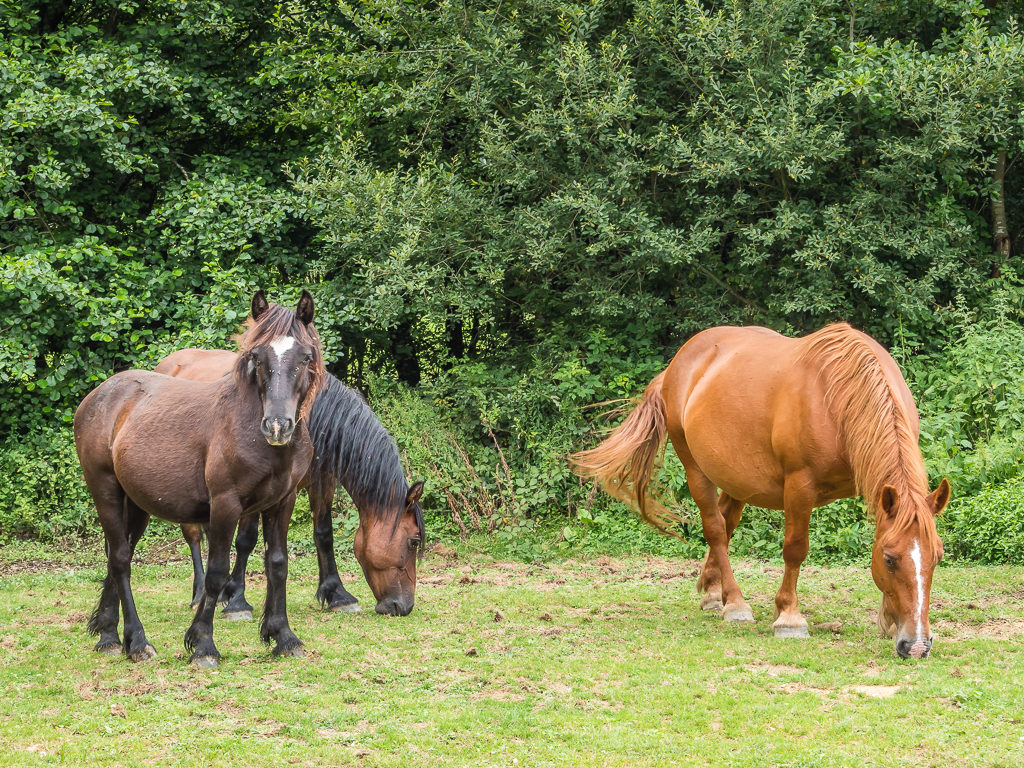
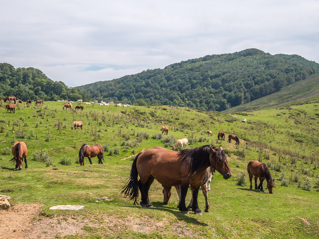
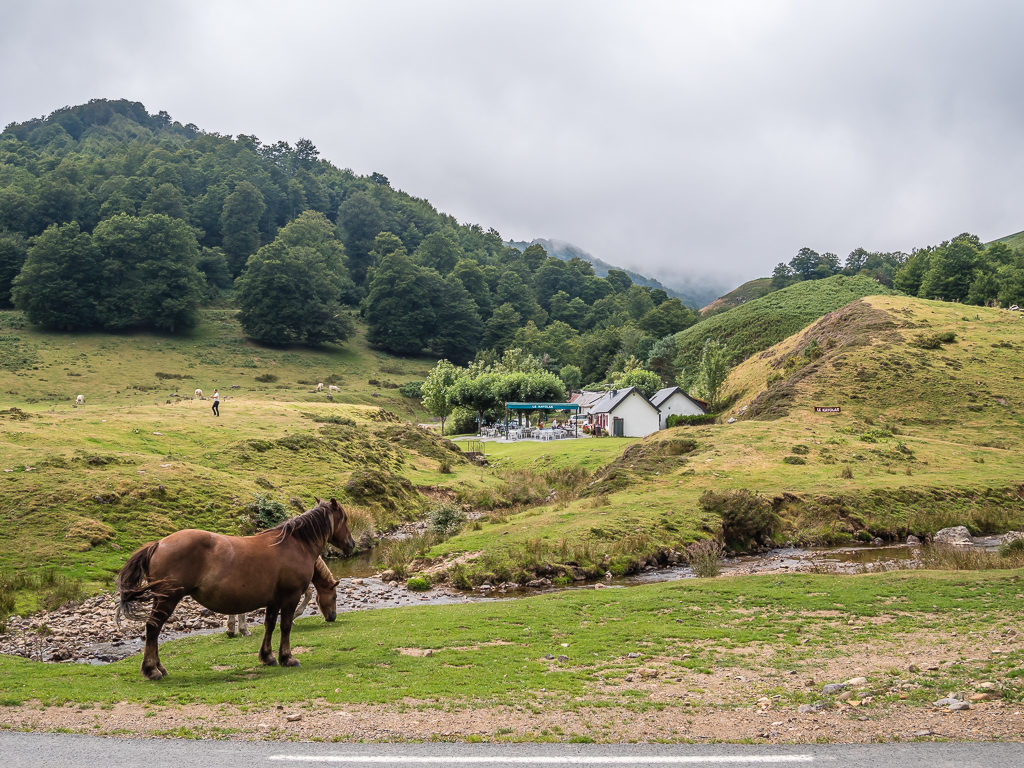
What we hadn’t envisaged was that the entire area would be home to large groups of free-roaming horses wandering the hills wearing neck bells. To anyone observing the scene they looked wild and free and so picturesque amongst the rolling landscape – but you don’t get a sense of the incessant ringing of bells throughout the night, plus the added annoyance of piles of horse dung everywhere and with it the persistent torture from giant horse flies! (That being said, we agreed it could be worse – at least we didn’t have mosquitoes on a mass scale to contend with yet!)
Slightly on edge with the thought of being asked to move on from where we had pitched as we were still within eyesight of managed pasture, we didn’t have a great night’s sleep. To add to that, we were also disturbed when a horse came jangling its bell around the tent during the early hours, so we struggled to settle for what felt like most of the night. Thankfully, some loud clapping from Wayne managed to scare the horse away and it didn’t return. But still, we were glad when morning finally came and we could move on…
Day 2 – ‘Walking Sauna!’ Saturday 3rd August, 2019, Wild Camp before Larrun to Wild Camp at Collado de Inaberri, HRP & GR11, 20km
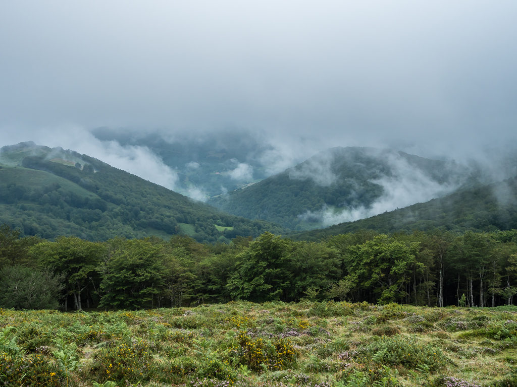
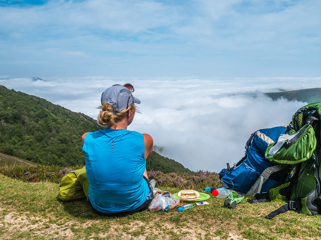
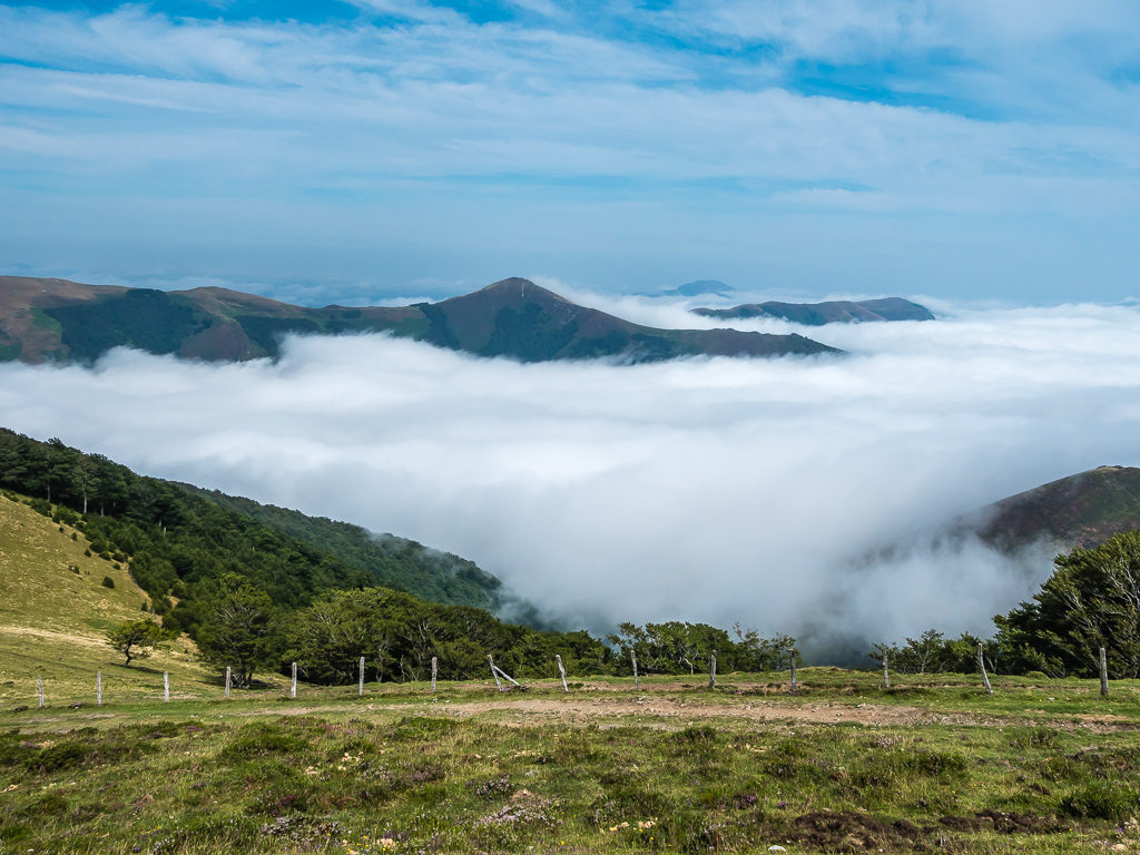
After being worried yesterday that our wild camp would be spotted from one of the farmhouses across the valley, we had no such trepidation this morning as we were completely obscured! It was our first morning waking up on trail and what an incredible one it was as we were treated to a tremendous cloud inversion in the valley below us.
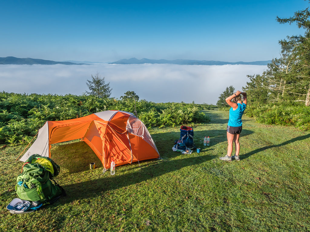
Looking out at such an incredible spectacle whilst getting ready to break camp.
Unfortunately, because of the humidity in the air our tent was sodden, so despite being packed up and wanting to leave, we didn’t manage to get away as early as we had hoped. After attempting to remove the excess water, we had to wait a while for the sun to crest over the mountains to the east before we had any real chance of the tent drying out, so unsurprisingly it was nearing 10am before we left camp. Even after all of the practise we’ve had over the years, old habits die hard!
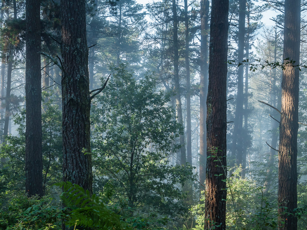
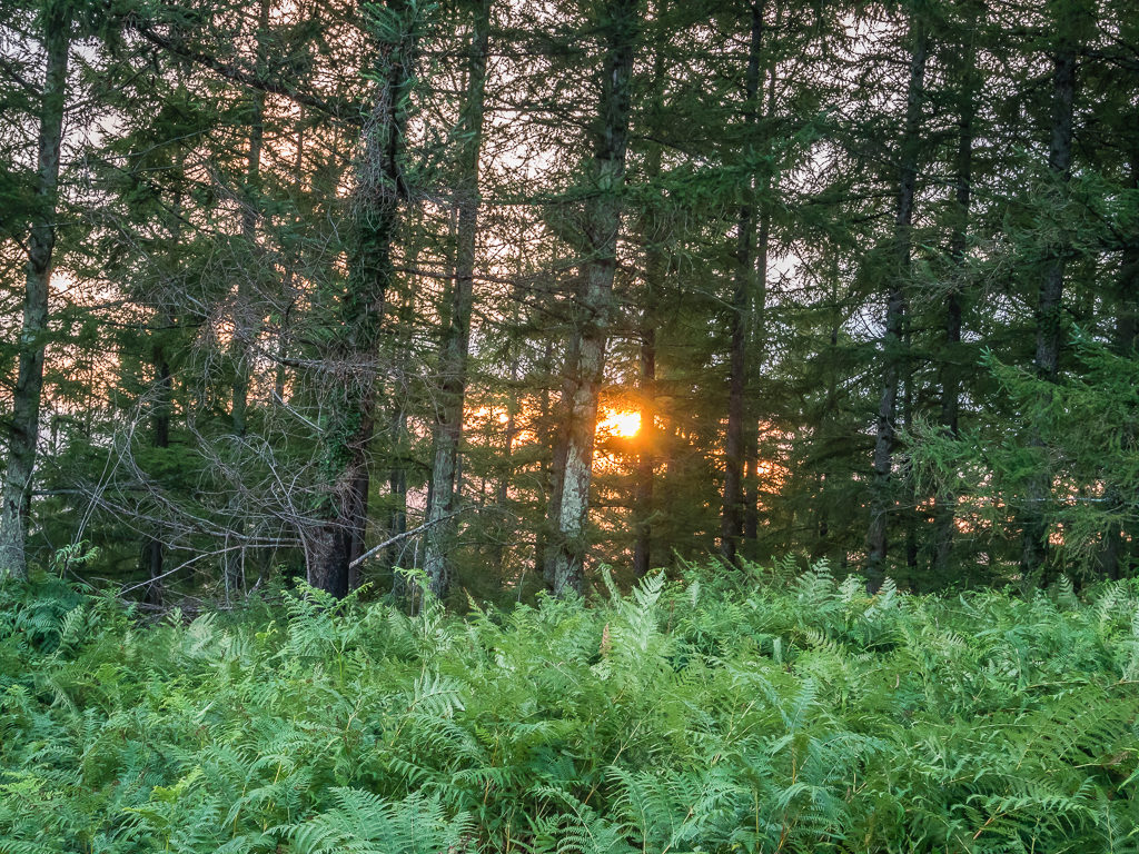
A mist rises from the forest as everywhere begins to warm up.
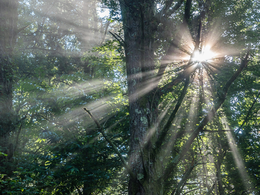
Another beautiful spectacle! Early morning sunlight filters through the trees.
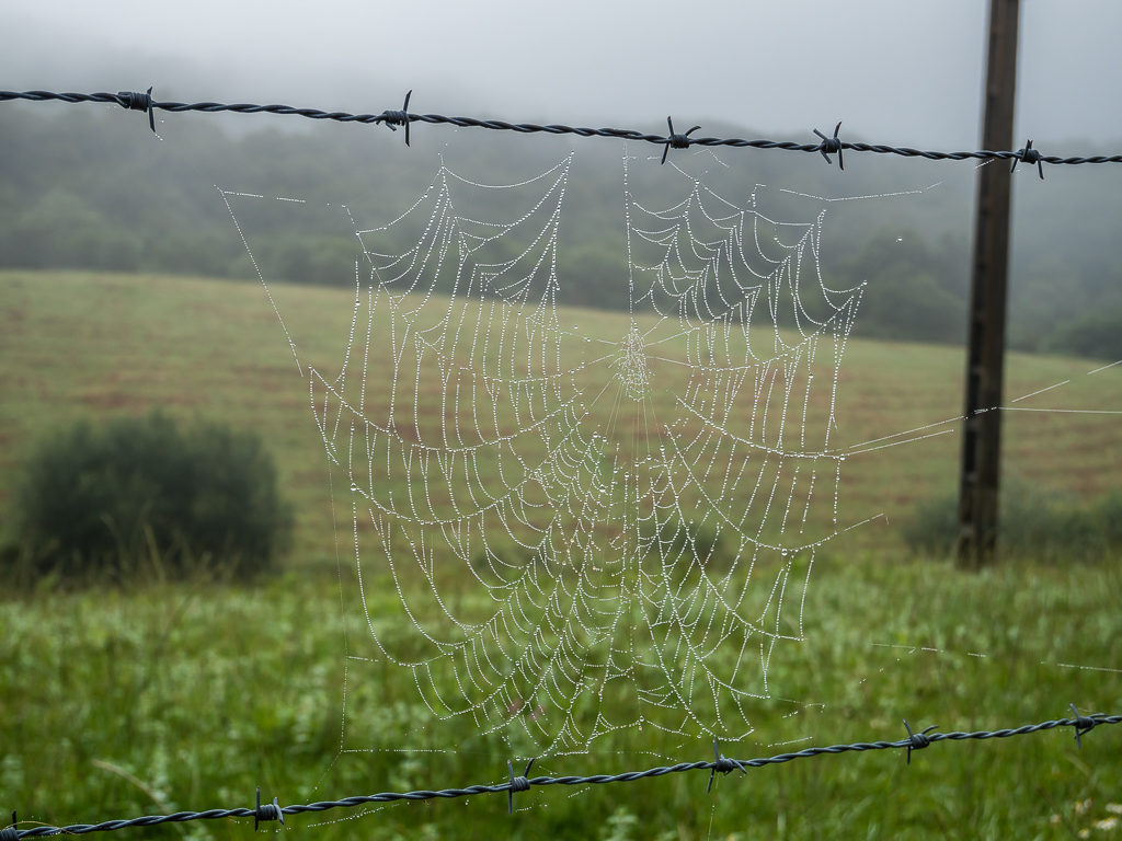
Moisture condenses on spiderweb silk in the form of dew drops.
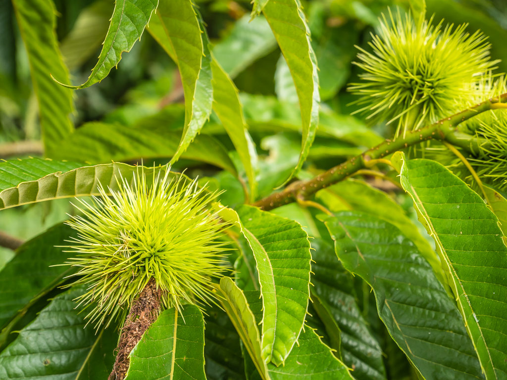
The European sweet chestnut tree grows well in Spain’s hilly western interior. With its prickly shell and sweet aroma, the sweet chestnut has long played an important role in the Mediterranean diet. Even today, many Spanish towns and villages still celebrate the sweet chestnut harvest.
In the Basque country, 55% of the land is covered in forests, full of beech, oak, chestnut, and pine trees. Walking through the forest, white and red flashes continue to mark the way.
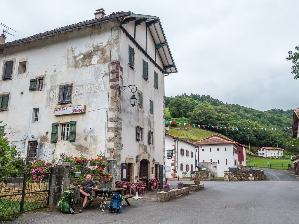
With several different routes presenting themselves to us, we decided to divert off the HRP, hiking instead on the GR11 under the shadow of Larrun towering above us to the north. This was in fact a shorter route down to Col de Lizuniaga where our map showed there was a restaurant. When we arrived around 11am, it looked closed so we stopped at the water point by the road to have a snack and fill up with water.
Setting off again, we followed a track that gradually wound uphill before the GR11 then joined a dirt road leading to the Col de Lizarrieta. Once again, we arrived at a settlement that was right on the borderline between France and Spain so we didn’t know whether to say “Bonjour!” or “Hola!”. Thankfully there were two restaurants, both busy with diners who had driven up to the col with it being the weekend, so we too decided to stop for a spot of lunch, not knowing when we might get the opportunity of dining in a restaurant on trail again.
We were actually hoping to buy sandwiches so that we could take some away with us but as they weren’t on offer, we decided on a charcutterie board with bread and some local fromage from the ‘Specials Board’ from the Hordago Ostatua – Bar Restaurant as it looked to be the most popular place of the two. We also couldn’t resist sampling some local Basque cider. On first taste, we found it was quite sour but being both cold and refreshing, it soon went down well, especially in the heat of the midday sun.
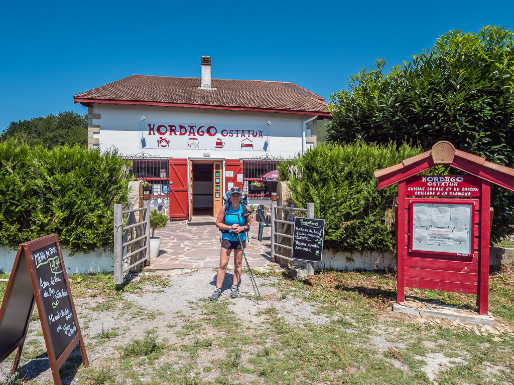
Stopping for refreshments at the Hordago Ostatua – Bar Restaurant, located on the Col de Lizarrieta over which the GR11 passes.
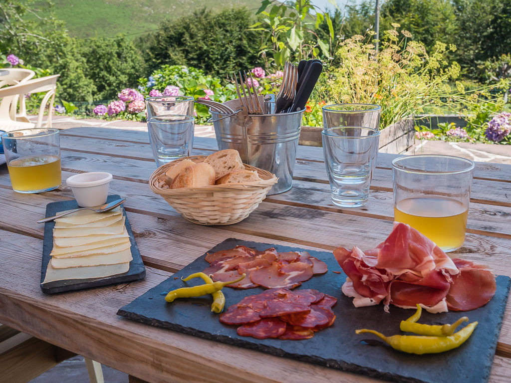
This was a gourmet lunch stop compared with our usual trail food! But we wouldn’t be doing this very often as our food and drinks came to a hefty 17 Euros.
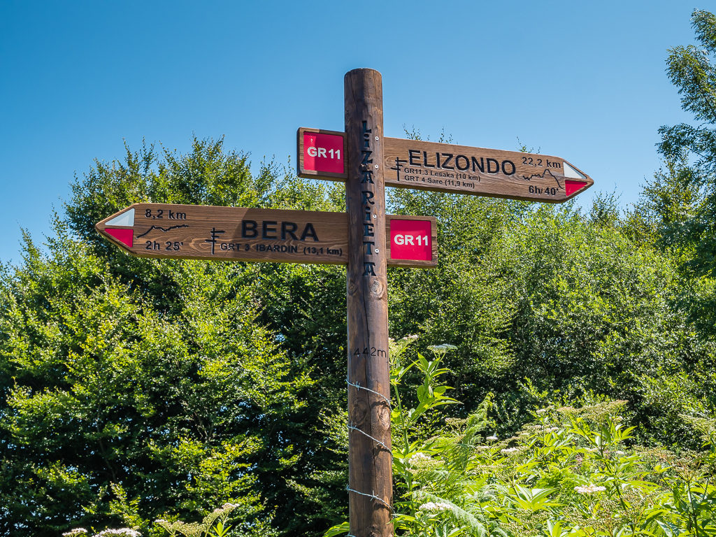
Excellent signage on the GR11 at Col de Lizarrieta. We wondered what the barbed wire around the post was for and realised it is to stop horses from scratching themselves against the post and knocking it over!
Leaving the restaurant just after 1pm, we again followed the GR11 white and red flashes. Around 45 minutes later, we found the water source and picnic site that had been described in our guide book at Col de Nabarlatz. Here, several paths meet up near the border stone no.50. With us planning on a dry camp tonight and this probably being our last chance of easy water access before tomorrow, we decided to fill up with 2 litres each.
Even then, if we’d have had the capacity to fill up with more water – we should have. It was so incredibly hot, with temperatures in the region of 29°c. But because of the humidity in the air, it felt much hotter and we were literally sweating buckets as we made our way uphill on bare mountainsides with not a single tree for cover during the hottest part of the day. The saying ‘Mad dogs and Englishmen‘ came to mind! It felt hotter than that of the Mojave Desert last year, which doesn’t seem possible – but in the desert it was a dry heat and we had a constant wind to cool us down.
As it happened, we met a fellow Englishman – Hamish – who was doing a circular route through the area over a fortnight. It was his first trip backpacking alone and he said he already felt like he had brought way too much gear with him and that he had been struggling with navigation. We chatted for a while and told him where we were headed and the location at which we had planned on wild camping that evening. Having already topped up our own water supplies and knowing Hamish hadn’t stopped at the picnic site as we did, we also mentioned where the next water supply was expected to be. (Just in case he needed some reassurance and wanted to catch up with some familiar faces, and also plan for for refuelling!)
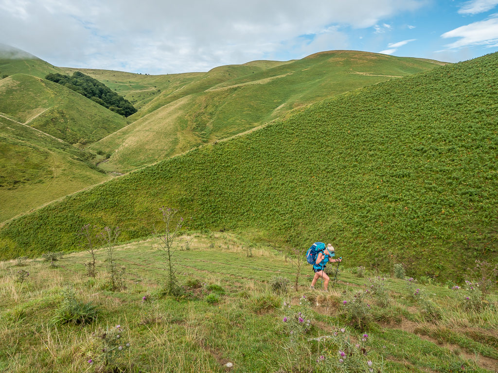
Today’s walking was primarily on tracks through woodland and pasture, over steep rolling hills. Although it wasn’t particularly lengthy in terms of kilometres, it felt like a very long day because of the intense heat.
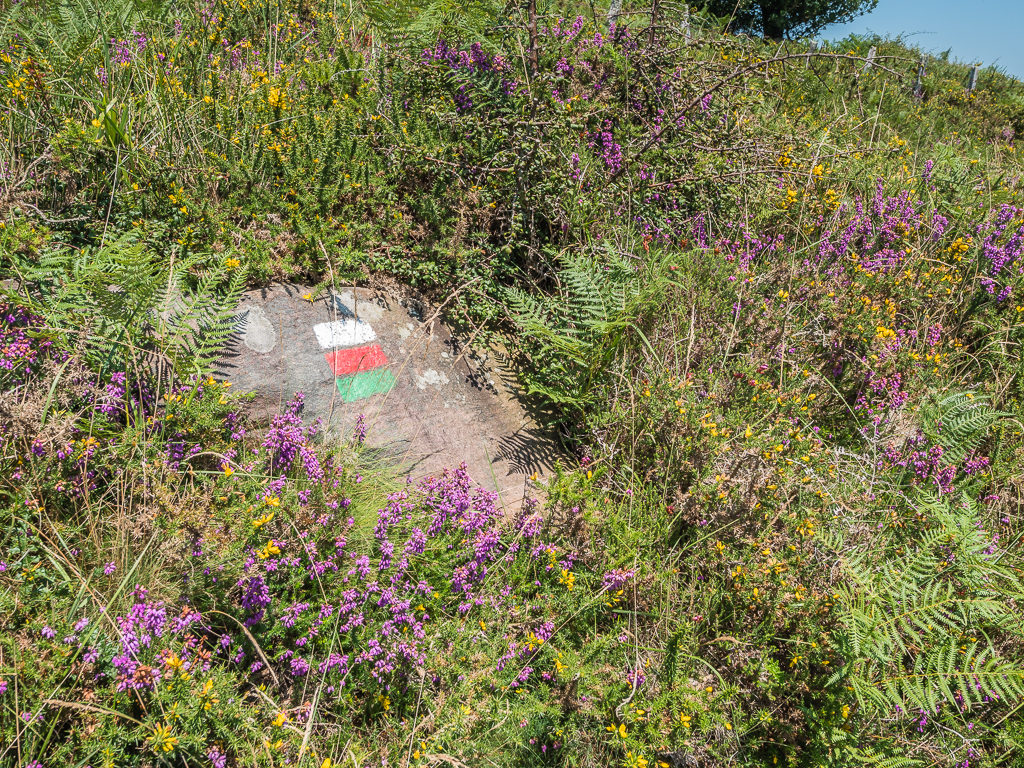
In France and Spain, walking trails are marked by blazes of paint on trees or rocks, with runes or cairns to indicate turns or dead ends. The long-distance paths, or GRs, are marked in red and white; the regional paths in red and yellow; and the local paths in yellow, orange or blue. A green flash generally means a variant of the main route.
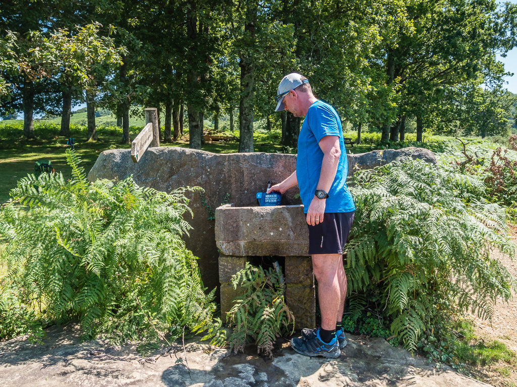
Sensibly filling up with water at the picnic site at Col de Nabarlatz in anticipation that we would struggle to find water elsewhere before tomorrow.
As we continued on towards Collado de Inaberri on the GR11, something we weren’t expecting to have to do on this long-distance hike was to navigate around a blown down tree blocking the trail. Thankfully all of our experience in Washington on ‘The day thou shalt not be mentioned’ meant that we knew exactly what to do by way of bypassing and navigating around it. Along the way, we saw several more wild horses roaming the hillsides and also spied some vultures soaring overhead in the thermals. We hoped they weren’t waiting in anticipation of us keeling over in the heat!
As it was so blisteringly hot, we had to stop a couple more times in any pocket of shade where we could find space to sit down and take a pack break. We were both exhausted from the heat and finding the weight of our packs really burdensome after so much uphill work. Walking east, the sun had been blazing on my right side all day and my face and shoulder felt burnt despite me reapplying sun-cream several of times. In the end, I had to put my hankie over my shoulder to act as a sun barrier fixing it in place by pushing it under my pack strap. It did the trick and it felt much better out of the direct sunlight.
We finally reached our intended wild camp spot at the Collado de Inaberri around 6:30pm. Hamish was a worry as we’d not seen him for a couple of hours and we thought he should have caught us up by now as we had been taking a slow walk because of the heat. Thankfully, he turned up about an hour or so after us, but with barely a drop of water left. He ended up setting up camp near to us, then leaving his pack and heading down the valley another kilometre or so to replenish his supplies from a water point noted in the guidebook. (The one we had mentioned earlier to him.)
As we were ‘dry-camping’ and we wanted to conserve our water, dinner was another quick boil Firepot meal – but this time it was ‘Spaghetti Bolognese‘ on the menu. Fortunately ‘hiker hunger’ hadn’t reared its ugly head yet – perhaps because it had been so hot we hadn’t yet developed much of an appetite. Once we had got our trail legs again, I was sure that we’d be constantly on the look out for food! (Maybe not going so far as to eat sweets dropped on the trail this time however!)
Much like last night, we experienced more jingling of bells as a herd of sheep came grazing around the tent. But it wasn’t the bells that gave us a fright this time – rather the fact that at half past midnight two cars drove right past us up the trail! How they even managed to reach the collada in a vehicle we have no idea. Luckily they had their headlights on so they didn’t drive right over the tents. But what startled us even more, was when they beeped their horns as they got closer and were laughing because they had woken us up. Thinking that this could have actually resulted in a life threatening incident, we didn’t find it the least bit funny.
Day 3 – ‘Where Did The Sun Go?’ Sunday 4th August, 2019, Wild Camp at Collado de Inaberri to Wild Camp by the Hunter’s Cabin at Collado de Urballo, GR11, 15.7km
Waking up early around 6:30am, we had a quick look outside to see that we were engulfed in mist and the tent was soaking wet again because of the heavy moisture in the air with us still being not too far from the coast. Hence, we turned over and went back to sleep and enjoyed a lazy morning at camp. (It doesn’t take much of an excuse!) Anyhow, we weren’t in any rush to get away as our intention was to reach the small town of Elizondo for around midday so that we could make the most of the facilities and fill up with a restaurant lunch.
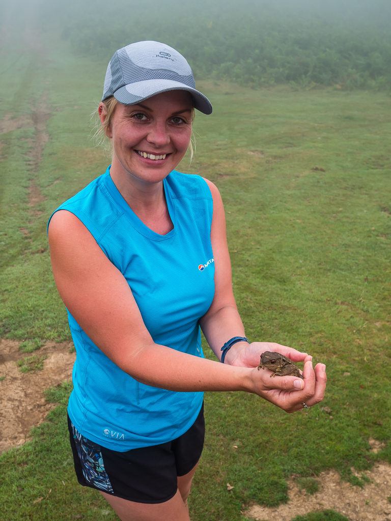
Whilst packing our gear away, we came across a little green frog friend nestled under my pack.
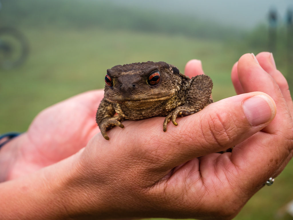
So far on trail we had seen horses, cows, vultures and now a frog!
Another unique trail marker!
Reaching an abandoned farmhouse after about 15 minutes and the water point that Hamish had hiked to last night, we were lucky enough to come across a gaggle of Griffon vultures gathered together in the long grass. After watching them for a few minutes, one suddenly took off in flight, with the rest quickly following. Soon they were soaring high above the valley and we got to see another spectacle of nature in the wonderful Basque country. We had only been on trail a couple of days, but we had already been wowed by the stunning landscape and how green and lush everything was. Watching the vultures gave us a euphoric sense of freedom. After working intensely over the past 7 months, it just felt so good to be back in the outdoors!
With approximately 5km further to reach Elizondo, we took a steady walk mostly on track, winding downhill towards the town following the GR11 route markers. Fortunately, the track cut across the road in several places relieving us of taking lengthy switchbacks downhill on tarmac. Despite the thick cloud cover overhead and the sun yet to break through, the heat was still intense and the air thoroughly humid so it was nice to have a canopy of trees overhead providing us with cooler air as we weaved in and out of the forest.
The Basque country not only has its own culture, but its own climate too, which keeps it gorgeously green.
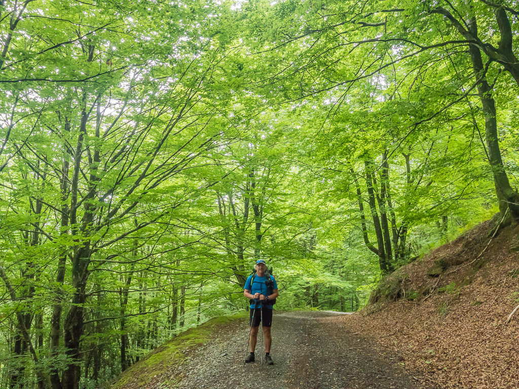
Walking under a canopy of vivid green glad of the cooler air.
From our vantage point, we could see the town of Elizondo nestled in the valley below us. Located on both banks of the Baztan River, the town is the capital of the Baztan valley and where most service establishments are concentrated, which is why we chose it as a resupply option off the GR11. Arriving in town just before 12:30pm, we discovered to our dismay that the supermarket was in fact closed on a Sunday! (We had completely forgotten about the limited opening times in France and Spain compared with the 24/7 culture at home.)
Trying to think of this more positively, we didn’t really need to top up with extra supplies anyway, so it actually saved us from carrying more unnecessary grams. We did however buy a loaf of bread from the ‘Patisserie‘ that was open and went to the main square where all the locals seemed to be gathered together hanging out in the 3 bar-restaurants situated alongside one another. Doing like the locals do, we ordered from the pinxos menu and shared a plate of calamari and potato croquettes for lunch, so it was still worth heading into town after all!
Arriving in Elizondo, a Basque town in Navarra province Spain, located on the banks of the Baztan River.
Elizondo’s historic parish church. Until 1918, the Iglesia de Santiago Apostol was located in the main square together with the Town Hall. However, after severe floods that devastated the valley it was decided to move the church stone by stone and rebuild it in its current location. Of the two towers, the one on the right-hand side with the clock is the original.
After filling up with water from the water point in the local church yard, we were soon back on the GR11. The trail goes straight through town and begins climbing primarily through woodland and pasture on paths and tracks over steep rolling hills to the Collado de Urballo, which at almost 900 metres, was going to be our intended camp spot for the night. Taking a steady walk uphill as it was still so warm, we did find one section of trail that was troublesome to navigate as it had become really overgrown. Here we found ourselves surrounded on both sides by large ferns and bracken and got scratched several times on our legs and arms by thorn bushes intruding on the trail. (Not so good when wearing shorts!)
From 200 metres at Elizondo, we had a climb of almost 700 metres to reach the Collado de Urballo (892m), our intended camp spot for the night.
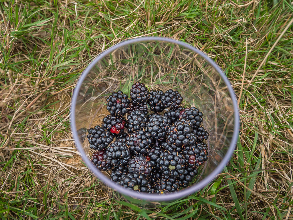
After spying some blackberry bushes, some of our scratches were self-inflicted. As the most ripe, plump blackberries were higher up or further back amongst the bracken, we couldn’t avoid getting scratched when trying to pick the best of them!
Busy collecting more blackberries in a cup for later, Wayne suddenly shouted me to return quickly to where we had taken off our packs. This was because a group of horses had come wandering along the trail. They seemed placid enough, stopping and munching on grass as they went but I was relieved not to have split them up as there were a couple of young foals amongst the group.
Wild horses wander up the trail munching on grass as they go.
Following a narrow path, we continued uphill for the final push arriving at a hunter’s cabin located just below the col before 6pm. The Collado de Urballo is a mere 10 metre or so walk from the cabin making it the perfect place to set up camp as it meant we had access to the water point outside the cabin. This was great for cooking dinner and washing up and we would also be able to fill up our water supplies again before setting off in the morning. The only downside to the location that evening was that the col was covered in low hanging cloud. With a fine mist continuously blowing in and out, we wouldn’t be able to do any laundry and get everything dry as we had planned. Neither would we be able to dry the tent out, which was still wet from earlier this morning.
The higher peaks to the southeast were shrouded in mist making for quite an eerie scene.
Setting up camp below the col on the other side of the parking area away from direct view of the cabin. We would soon be obscured by the mist anyway!
After setting up camp and not seeing anyone else on trail since leaving town, minutes later, hiker Tim walked through the gate with plans to get water and camp near the col as well. He was tackling the GR11 on roughly a similar timescale as us. Not only was it good to talk to a fellow hiker, but he was also a fellow Brit so it made conversing that much simpler! This was especially so as we could understand everything he was saying. (We can’t say likewise with our thick North Notts accents though!)
After cooking dinner (our meal tonight was a rather tasty Firepot ‘Porcini Mushroom Risotto‘ extra large portion that we shared), we sat together on the bench next to the cabin and swapped some hiker tales and recommendations with Tim. What was particularly great to hear and a relief before retiring to bed was that Tim had also met Hamish earlier that day, so Hamish had made it much further than what we had anticipated!
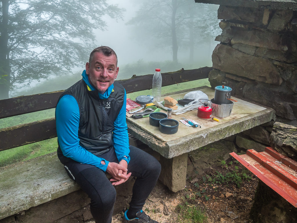
The hunter’s cabin was locked but it is basically a 2-man bothy with picnic tables and a water point outside. Even in the descending mist we sat outside and made use of the facilities.
Day 4 – ‘It Didn’t Go To Plan!’ Monday 5th August, 2019, Wild Camp by the Hunter’s Cabin at Collado de Urballo to Wild Camp on Col d’ Hauzay, GR11 & HRP, 16km
Today we awoke around 8am to the chopping of wood over at the cabin so we knew it was time to get up and be on our way! Bivouacking is usually tolerated in France between the hours of 7pm and 8am, but we didn’t expect anyone to be at the cabin, let alone be there that early in the morning. Conditions hadn’t improved much since last night so we still found ourselves heavily engulfed in mist with the tent saturated once again. We didn’t see much chance of the low cloud clearing early either, so we got ready, had a quick cereal bar breakfast and packed the tent away wet, with the intention of getting it out somewhere later to dry when the sun finally broke through.
As we were packing up, there were no signs of Tim. His tent was already gone. Three other hikers then passed us following the GR11 flashes before we got on our way, so it felt like it had been a busy couple of days with fellow hikers on trail! (This was all relatively so and nothing in comparison to the hikers were saw en masse daily on the PCT!)
Setting off on the GR11 before rejoining the HRP to take us to the community of Aldudes. After eating most of our emergency rations, now we really did need some resupplies!
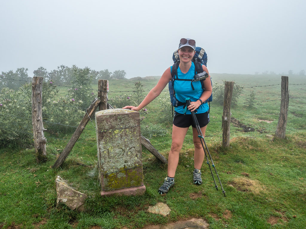
Reaching the border fence at ‘Border Stone 126’.
In 1659, the ‘Treaty of the Pyrenees’ was signed to end the 1635-1659 war between France and Spain and a new border was fixed at the Pyrenees, however this was not properly settled until the ‘Treaty of Limits’ in 1856. Border Stone 126 is one of about 600 numbered stones that were positioned in the 1860s to designate the border.
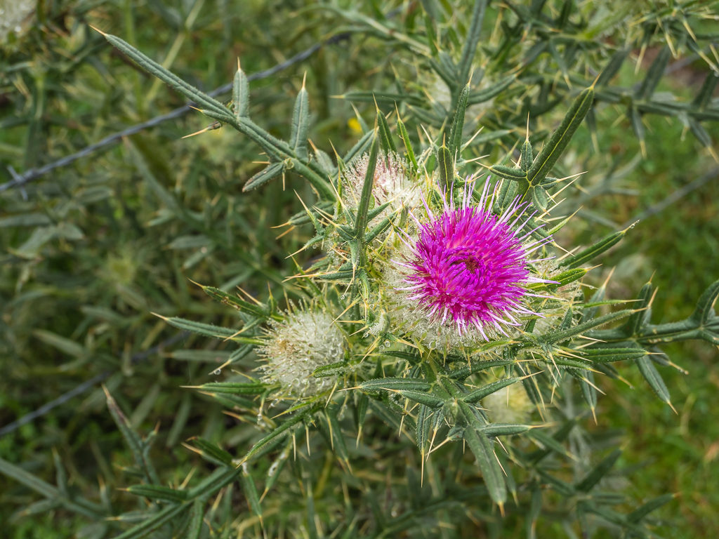
In Basque culture, the thistle was traditionally used as symbol of good fortune. It was fixed into the front door of the house and was given by the goddess Mari.
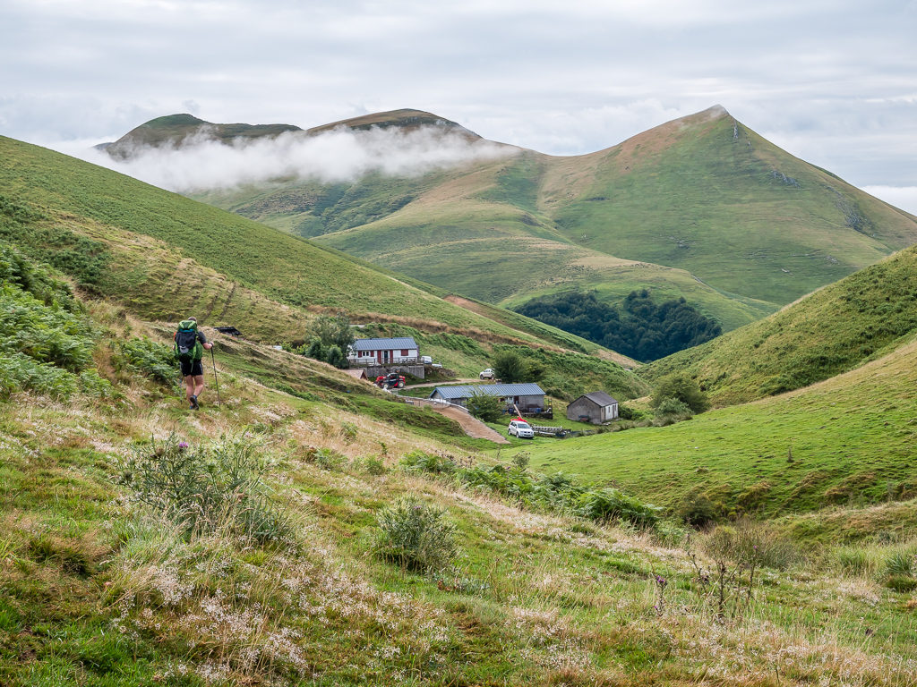
Leaving camp around 9:45am, also via the GR11 route, we followed a short section of it skirting around Harguibel Peak (935m) before re-joining the HRP, which took us down to the community of Aldudes. Reaching the small Basque town by 11:30am, we thought we had made excellent time. After resupplying with 3 day’s worth of food from the grocery store at the petrol station, we’d be well on track for making an early camp that afternoon after giving ourselves an easy-going 15km day.
Situated in the Vallée des Aldudes along the River Nive is the small Basque community of Aldudes.
Heading into Aldudes off the HRP to resupply for the next three days.
We hadn’t however taken into consideration the distinctly laid-back Basque nature and with it the limited opening times of amenities. (Much like siesta time in Spain!) Heading straight to the convenience store located at the petrol station, we were alarmed to see it was all closed up and even more so to find out it would remain closed until 3pm. Having worked out what the handwritten scribbled note on the door said “Ferme dimanche apre-midi et lundi matin” – translated as ‘Closed Sunday afternoon and Monday morning’ (my GCSE ‘A grade’ in French at last proving beneficial), we had no choice but to change our plans and hang around in town for an additional 3 hours!
This wouldn’t have been so bad if even a café had been open to wile away the time. But likewise, the restaurant in town was also closed and with a menu listed on the wall dating from 1967, it looked like it had remained that way for many years! Luckily there was a public toilet and a picnic bench that we could utilise, so we got ourselves settled in for the duration.
We had no choice but to wait around in town for over 3 hours as we needed to buy more food rations and this was the only place we would pass for resupply over the next 3 days.
After an hour or so of filling time with making tea and working out possible camp sites for the next week ahead, we were pleased to sit and chat with French guy, Vincent, who was also traversing the HRP but in the opposite direction. He helped make the next two hours pass quickly as he sat down with us at the picnic bench and prepared himself some lunch and gave us some good information about water sources and possible camping spots to come. He just reminded us of a true thru-hiker as you could smell him before he even came close, but having had lots of practise on the PCT we’re used to being in the company of ‘hiker trash’ and it didn’t bother us at all. He had developed a great hiker tan and had also managed to grow an impressive beard, but what we first noticed was the great wooden staff he was carrying adorned with various feathers he’d collected along the trail. Immediately Wayne had said to me “Here comes Gandalph!” and indeed it would have been a fine trail name to bestow on him!
Getting a little fidgety after what felt like an age of waiting, we walked through town and sat outside the petrol station at 2:50pm in anticipation of it opening at 3pm. We thought they’d be an influx of hikers there on the dot as we had seen several waiting about town like ourselves. So as soon as the door was opened we were straight inside and frenziedly filling a shopping basket with a whole array of goodies that we know to be good hiker staples. Our shopping for the next 3 days included 8 eggs, a pack of tortillas as they don’t have fresh bread delivered on a Monday, cheese, salami, an avocado, a beef tomato, a bag of angel hair pasta, a box of cereal bars, a couple of chocolate bars each and a big bag of jelly sweets. The eggs and tortilla wraps would give us lots of options for various meals and made it worthwhile carrying our mini frying pan again, so we were really pleased with our first proper resupply on trail.
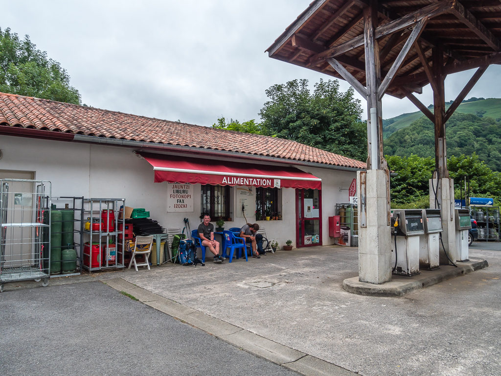
Waiting, waiting, waiting! Sat outside the petrol station in anticipation of the convenience store opening at 3pm that afternoon.
After removing the packaging from our shopping and taking it to the recycling point back in the main square, we finally set off around 3:45pm. Our route headed roughly east from town straight uphill to Col de Lepeder. On looked ahead and thinking we had a really steep climb up several hundred metres to the grassy summit towering above us, our route in fact skirted around the outside of Otsamunho Peak at 901 metres, following a much nicer trail to Col de Mizpira.
As the HRP isn’t a nationally recognised trail, there aren’t any way-markings unlike the regular white and red flashes of the GR10 and GR11, so we were continually checking our map and guidebooks downloaded to our phones to ensure that we hadn’t deviated off route. This was particularly important as we found ourselves back in the clouds and we couldn’t see further than 20 metres or so ahead. Without realising at first, we had in fact done just that, going off route by following a track now mostly in mist over the summit of Errola at 907m. Thankfully as we came over the other side, the track rejoined the HRP, which we then continued to follow down to Col de Meharroztegui.
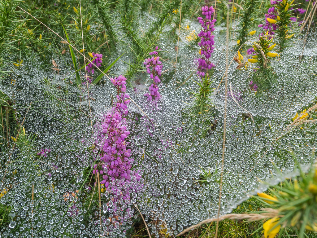
Delicate dew drops cling to spider web silk entangled on the foliage beside the trail.
Leaving Aldudes behind, we quickly gained height reaching the Col de Mizpira at 832 metres in less than 2 hours. Here we were afforded more fine views of the beautiful Basque region.
From afar, it looked like we had another steep, uphill climb to contend with, but it was in fact much gentler than anticipated. We think it always helps with grass underfoot.
Still not done for the day as we really wanted to camp by water tonight, we then had a steep uphill climb before joining the road that took us approximately 3km to Col d’Hauzay (965m). Here we found a suitable camping spot just off the parking area on a grassy knoll directly above the water point. It was now already 7pm so there wasn’t any point in us pushing on further especially as visibility was deteriorating even more due to the persistent mist. Although we were close to the road, there was no one else around and we thought it unlikely we’d see any more HRP hikers tonight as those we had seen this morning had stayed in town. So we decided it was as good a spot as any!
Fortunately, there was a relatively flat space large enough to fit our Big Agnes hotel opposite the water point.
For tonight’s dinner, we had hot Mexican bean soup with hunks of bread, followed by sandwiches we had bought from the shop in town, just in case we had another dry camp and couldn’t carry enough water for cooking. We were then wrapped up in our sleeping bags by 9:30pm again, which we have deemed our new hiker midnight!
Day 5 – ‘Vert, Verde, And Even More Green…’ Tuesday 6th August, 2019, Wild Camp on Col d’ Hauzay to Wild Camp by stream at Border Stone 223, HRP, Camino de Santiago & GR11, 26km
We had set the alarm for 6am with all good intentions of getting a really early start, forgetting that sunrise was currently around 7am. So when the alarm went off and everywhere was still in darkness, we decided to stay put for another hour. Having bought fresh ingredients yesterday from the convenience store in Aldudes, we treated ourselves to a cooked breakfast of wraps, cheese, salami and scrambled eggs with pepper and tomato sauce. They were our first trail breakfast ‘burritos’ and they turned out mighty fine!
With hot food inside us and the skies above beginning to clear, the day got off to an exceptionally good start when we broke camp before 9am – our earliest start time yet! Walking south following the road to the Col de Lindux (1,166m), we were not only excited to be climbing over 1,000 metres, but we would soon be crossing the border into Spanish territory and walking on part of the famous pilgrim route – the ‘Camino de Santiago‘.
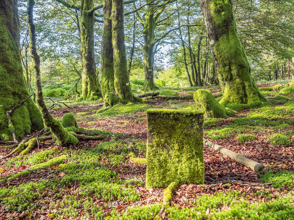
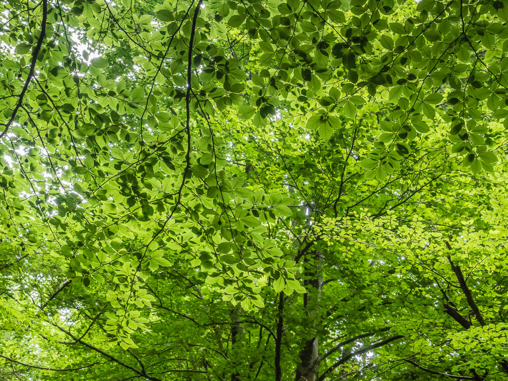
Dense moss, with its warm green velvet, coats everything from the ground up.
Long-limbed beech trees tower above the thriving forest floor. The natural beauty of the Basque forests is simply captivating.
Continuing along the road to the Col de Roncevaux (1,057m) where there is both a chapel and monument in memory of the medieval knight ‘Roland’, we learnt that the pass is not just important to the pilgrims crossing the Pyrenees here, but that it holds great historical significance for the nations either side of the border.
In his 46 year reign as the king of the Franks and emperor of the Romans, Charlemagne engineered glorious military victories but, in August 778, he suffered one stunning defeat, which saw a large force of Basques ambush a part of Charlemagne’s army in what is known as The Battle of Roncevaux Pass. Even though the Basque tribes were much less experienced warriors, their knowledge of the mountainous terrain gave them a real advantage. Hence, the Basques slayed the whole Frankish rearguard, including Roland, in a surprise attack.
This great battle is best remembered through the oldest extant piece of French literature, the ‘Song of Roland’. Written several centuries after the actual battle, the song greatly mythologizes the real events of 15th August 778. However, by the 11th century, Roland’s fame rose to such heights that he became the quintessential role model for knights, greatly influencing the code of chivalry in the Middle Ages.
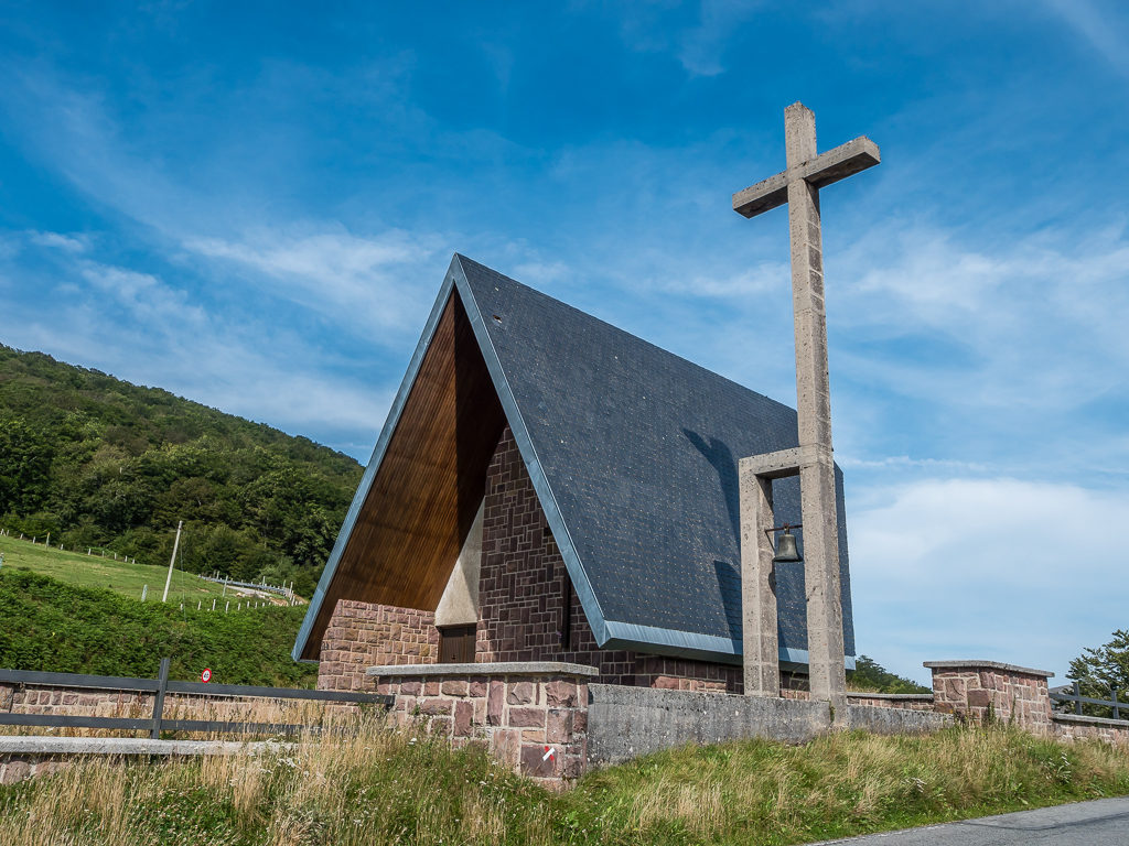
Roncesvalles (French: Roncevaux, Basque: Orreaga) is a small village and municipality of northern Spain famous in history for ‘The Battle of Roncevaux Pass’. The small collegiate church on the col contains several relics associated with Roland, the medieval knight in Charlemagne’s army who was slain.
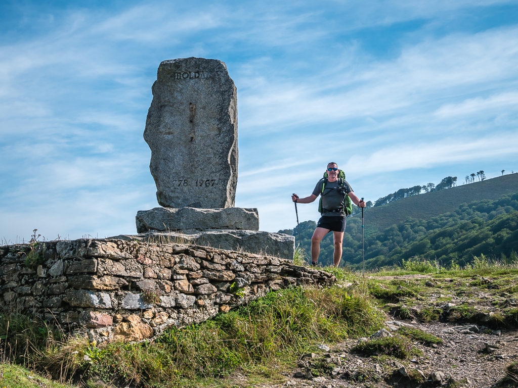
There is a stone monument near the pass commemorating the area where it is traditionally held that Roland died.
The monument itself was a busy spot on the trail – not just with coach loads of tourists turning up for photos at the historical site but because every year thousands of pilgrims begin their way to Santiago de Compostela from the monastery at Roncesvalles. We couldn’t wait to hike past the hoards and get back into the hills, so after a couple of quick photo ops of our own, we made our way east, the trail following a winding dirt road before taking off our packs and stopping for a snack break to give us a quick boost of energy in readiness for the climb ahead.
Sitting on the grass verge by the road, we suddenly heard hooves clattering on the ground like they were coming towards us in a hurry. Jumping up immediately, we were astonished to see a huge brown horse galloping in our direction intent on getting a snack for himself! He wasn’t aggressive, but rather persistent. Every time I moved away with my Twix in hand, he walked to the other side of me or went around the side of Wayne. I was praying he wouldn’t chew my pack or indeed trample us just to get hold of what we were eating!
Leaving the crowds behind… Or so we thought.
Getting a little too close for comfort – one of the wild horses who was rather intent on joining in with our snack break!
Steadily climbing the trail up to the Port de Cize – a pass at 1,430 metres where there is an emergency telephone, (also called Col de Lepoeder), we hadn’t expected to find lots of people sat at the top taking a rest. The people at the top were in fact Camino Santiago walkers going in the opposite direction to us, making their way downhill towards Roncesvalles and the monastery.
With so many people around, we decided not to stop at the top but to walk on a little further to the Col d’Intzondorre (1,375m). It was a good decision as beyond the emergency shelter, we were able to make our way off-trail to a beautiful grassy bank and be by ourselves. Watching an impressive cloud inversion in the valley below, we sat for an extended lunch break taking in the tremendous view.
What an incredible lunch spot! The grassy bank afforded us a prime view of the cloud inversion below.
As Wayne wanted to capture a time lapse of the unusual scene, we stayed for much longer than we had originally intended.
Setting off again, it was like someone had opened the floodgates. A continuous steam of walkers intent on reaching the monastery at Roncesvalles before nightfall lined the trail as far as the eye could see. As each person passed us, as is proper trail etiquette, we said “Bonjour!” or “Hola!” depending on whether we guessed (largely by what they were wearing and what backpacks they had) if they were French or Spanish! This was all very well for the first 20 or so people – but there were literally hundreds of them walking towards us of all different nationalities and ages, which soon made greeting everyone a wearisome task.
Having passed but a fraction of southbounders on the PCT, we weren’t used to giving way and sharing the trail with so many people, so we were glad when we finally left the Camino de Santiago and joined a lesser used path. Now following the French-Spanish border along the GR11 once more, we found ourselves walking around the base of Urkulu Peak to the Col d’Arnosteguy (1,236m) and Border Stone 205, where there is a small parking area beside the D428 – the road from St Jean-Pied-de-Port in France. There are several roads that wind over the mountains here to various viewpoints, which if on a road trip in the area would offer stunning views of the landscape.
After a busy couple of hours on the Camino de Santiago giving way and greeting a caravan of walkers coming from the opposite direction, we were happy to be back on the GR11. Who could blame us when we usually had the trail all to ourselves!
Free-roaming cattle and horses also enjoying being out in the hills.
After walking for another hour or so and taking in the beautiful views of the rolling green hills and forested peaks on the French side, our plan was to stop and set up camp when we reached the Col d’Orgambide (988m). On reaching the col and discovering there wasn’t any water however, despite their being an unmanned emergency shelter, we were forced to move on. (There was also a sign saying ‘No camping’, so we didn’t want to push our luck!)
Before leaving however, we took the opportunity to observe the cromlech at Col d’Orgambide, a stone circle located near Border Stone 212. Several cars stopped at this road junction and drove passed us or pulled up by the roadside to look out across the valley, but we were surprised by the fact that not a single person got out to look at the stone circle or take any pictures!
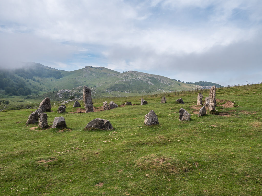
The cromlech located to the west of the pass at Col d’Orgambide is actually a very recent stone circle, which explains the contemporary artwork inscribed in some of the stones.
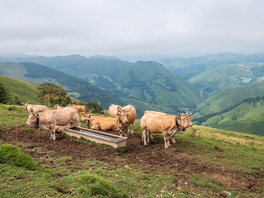
Pyrenean cows keeping guard of their water trough high above the valley! They definitely weren’t sharing.
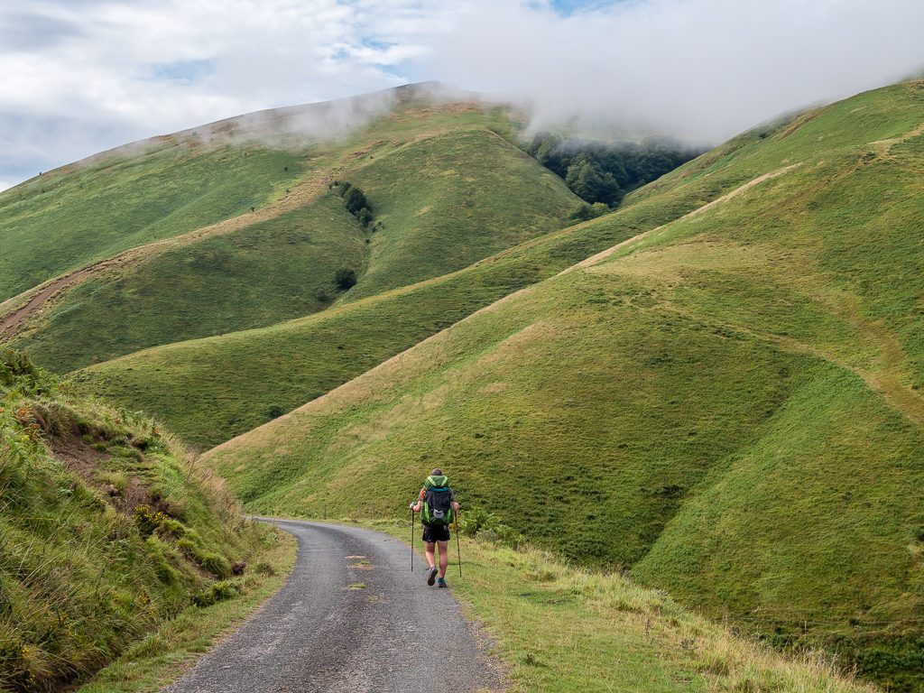
After leaving the pass, we decided to follow the road for a while as we could walk with a much faster pace. We then took a little used path down to the bridge known as the Pont de Chubigna and crossed over the River Neve. After what had already seemed like a tiresome day, we then began an approximate 400 metre climb up long, steady switchbacks to the Col d’Errozate at 1,345 metres.
Contouring around the lush green hills, the road seemed to stretch for miles.
Through the descending mist, pockets of light make the mountainous terrain ever more beautiful.
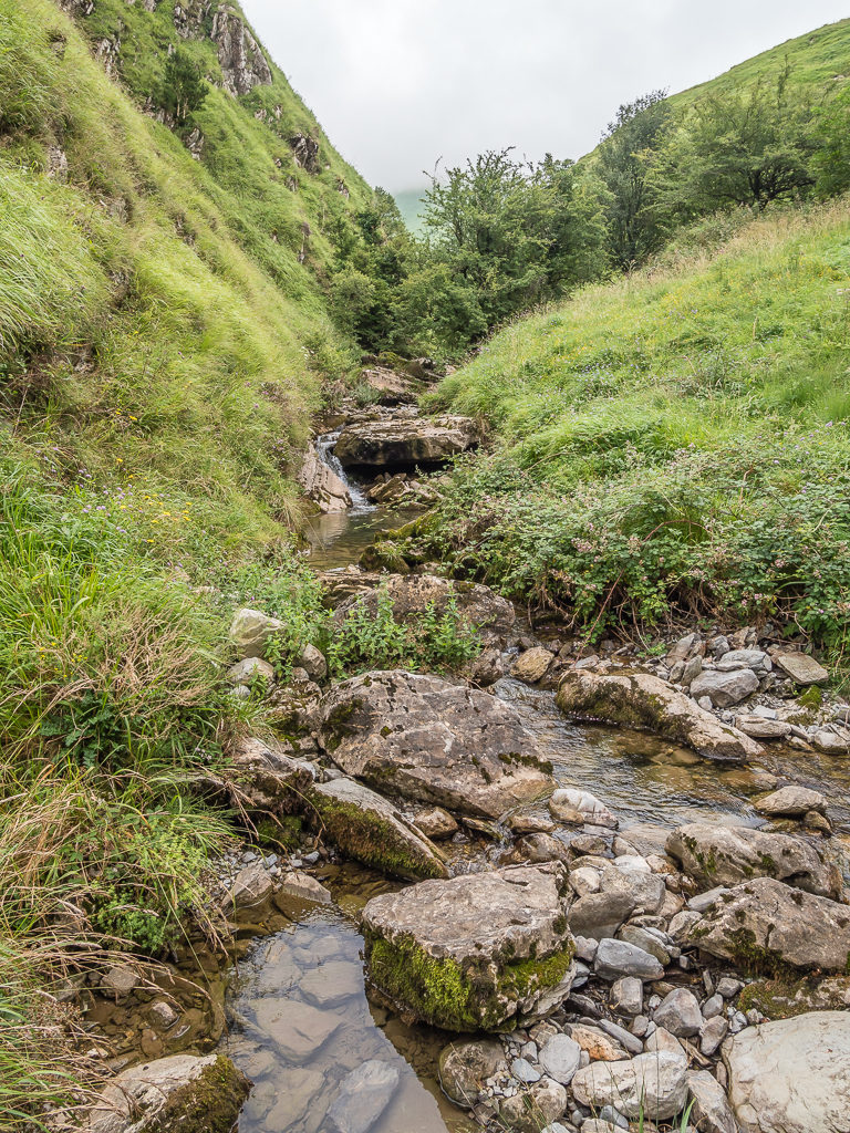
It was good to be able to stop and filter water at last after a lengthy dry section of trail.
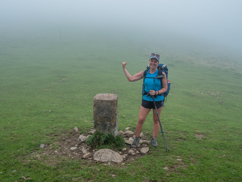
Reaching Border Stone 221 but we still pushed on. We now wanted to get to Border Stone 223 so that we could camp next to running water.
From the col, we then began a steady descent on a vague path down into the valley until we came to the confluence of two streams at Border Stone 223 where we thankful of running water and a large enough space by the stream on which to pitch our tent. We’d walked an extra 8km than what we had originally planned, but with our trail legs fast reconditioning themselves, we still managed to get to camp by 6:30pm!
Washing my hair for the first time since we started hiking last Friday, it was worth the extra few kilometres to be able to camp next to a running water supply. We also managed to rinse out some clothes, although there wasn’t a particularly good chance of them drying by morning as low cloud was now hanging over the valley completely obscuring the sun.
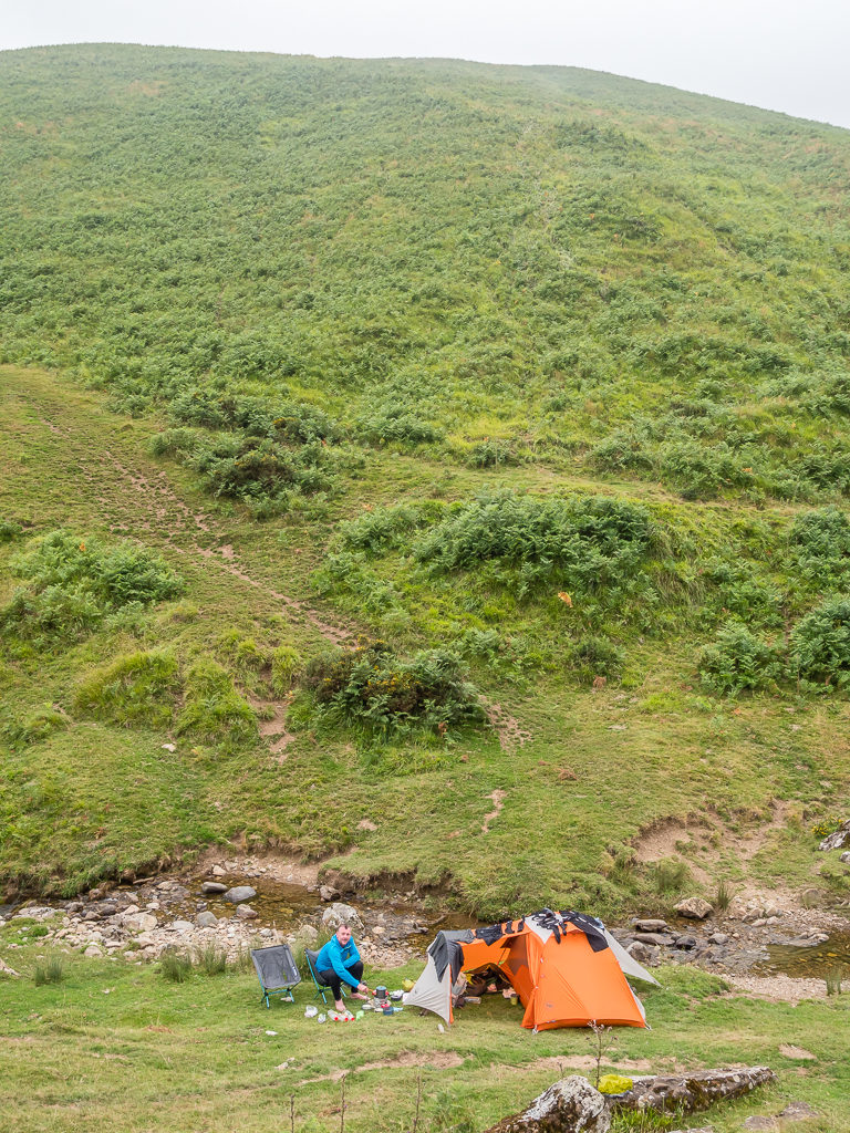
Our wild camp spot in the valley beside the stream. We made full use of having running water in such close proximity.
Whilst Wayne was busy preparing dinner, a local guy suddenly pulled up in his van on the road above where we were camped and shouted down to us in French. We were hoping that we hadn’t done anything wrong and got slightly disturbed when he let two dogs out of his van and started walking downhill towards us. We shouted back “Anglais?” but he shook his head, then was pointing at his dogs and speaking to us again in French. We managed to work out that he’d lost one of his dogs – one that was small and white, and he was asking us if we’d seen it. Unfortunately we hadn’t. Two other vans then pulled up with people who were also helping the guy to look for his missing dog up and down the valley. After telling them we hadn’t seen any signs of the dog, all three then returned to their vans and sped off down the road searching elsewhere.
Panic over! We weren’t getting moved on for wild camping in a place that wasn’t permitted. Settling down in the tent after dinner, we were then disturbed again however when we heard the familiar sound of jingling bells getting closer and closer. We assumed it was horses that had come to the stream to drink. Though when we took a peak out of the tent, we were startled to see cows, and lots of them, making their way upstream towards where we were pitched.
It wouldn’t be a restful night’s sleep if we had to endure the jingling from an entire herd, so Wayne got out of the tent and made an attempt at trying to shoo them away. Despite his best efforts it was a stand off as none of the cows budged, but rather they looked at us with disdain for encroaching on what must have been their regular late evening hang out. Fortunately, a passing shepherd with his dog scared them away for us, his dog giving a couple of short barks which made the cows back away. I said to Wayne, if the cows were to return in the night he’d have to do his best impression of a dog and make barking noises out of the tent to scare them away!
Day 6 – ‘Haute Route Pyrenees Or Just Hardcore Route People?’ Wednesday 7th August, 2019, Wild Camp by stream at Border Stone 223 to Camping Iraty, HRP & GR10, 16km
It had been nice to sleep next to the sound of running water instead of the clattering of bells reverberating across the valley. However, an entirely restful night had been short-lived as there had been a big storm during the early hours somewhere on the French side. It woke us as lightning flickered above the tent, but thankfully the rain didn’t make it’s way across the valley we were camped in. That didn’t mean our laundry was dry when we woke up as we had hoped for, and neither was the tent dry as more low mist had engulfed us. (We should be used to it by now especially as we had been told that the French side is always wet compared to over the border in Spain.)
The one consolation of being wet is that the hillsides were even more lush and as green as can be, which reminded us of home, except that we were already camped at over 1,000 metres. With England’s highest peak, Scafell Pike, reaching just 978 metres, it can sometimes feel surreal to be amongst peaks two or three times that height.
Fortunately the lingering mist began to lift and burn away revealing bright patches of blue that could be seen momentarily between the moving clouds. It gave promise that today’s weather in France would be much better. All we wanted was some fine, sunny weather to dry out our gear and good visibility for heading over the Crete d’Urkulu.
After dodging more cows heading in our direction down to the water, we got away from camp by 9:30am. We weren’t in too much of a rush as we only had around 15km planned for the day. We walked along the stream and up onto the road to reach the end of the valley before re-joining the HRP route in readiness to tackle the Crete d’Urkulu.
Hoping that the mist would lift so that we would have good visibility for tackling the Urkulu ridge. We knew from our guidebook that there would be hardly any paths or waymarks in the first hour of the walk.
Despite the climate being more humid and wet on the western side of the Pyrenees, we were thoroughly enjoying being immersed in a landscape rich in vegetation, where as far as the eye could see, everything was cloaked in vivid shades of green.
Following the trail to the farmhouses of Uhartegain (915m) before joining the road, which took us to the bottom of the valley.
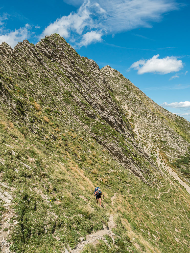
With more mist blowing in, visibility deteriorated as we slowly but surely made our way up to the Urkulu ridge line, so we ended up following a bearing straight up the bowl towards the summit, trudging over long grass that showed little signs of anyone else taking our route. That was until we managed to spot a worn track that was marked with white and red flashes, making navigation a whole lot easier. That being said, we still somehow ended up following a sheep track that led us a few metres off-course, after which we found ourselves inadvertently heading up the mountainside rather than veering around it. The track was so well-trodden that we were convinced we were on the right path until we came to an abrupt end at a rocky ledge. There we found several sheep chilling out on a ledge right above us who were probably thinking ‘Stupid humans!’.
Rather than go all the way back along the track retracing our steps to find the white and red markers again, we decided to make an ad-hoc attempt at going down the mountainside by zigzagging down the steep-sided slope until we hit the proper trail below us. Thankfully as the mountainside was covered in long, tufty grass, the steepness felt less intense as we could step down carefully moving sideways to keep our balance. It didn’t take long for us to hit the right track and get back on course. We just made a note to ourselves to be more vigilant in looking for the markers in future, especially when visibility is limited.
Glad to be back on solid ground after losing our way due to poor visibility whilst traversing the Crete d’Urkulu and having to make our own way down the steep-sided ridge.
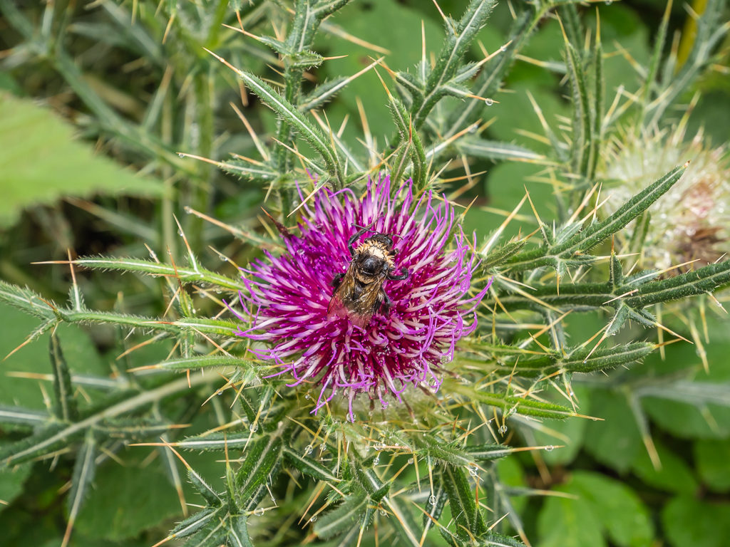
Capturing nature at work! A bumblebee forages for nectar and pollen on a thistle flower.
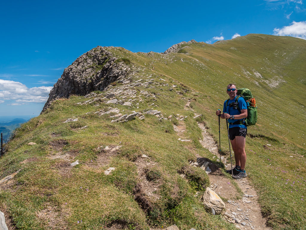
Skirting around Okabe Peak, we rejoined the GR10, which was once again reliably way-marked with large headstones and wooden signposts at every junction. As our high point reached 1,341 metres, had it been a clear day we would have glimpsed views of the Pic d’Orhy – the first 2,000 metre peak on the HRP that we’d be summitting tomorrow. Maybe it was a good thing that we hadn’t been able to see it as we’d already had some strenuous climbs this morning! Regardless of our limited views, we took the opportunity on Col d’Oraate (1,302m) to stop for lunch. It was nearing 1pm already, and today we were enjoying more tortilla wraps filled with cheese, salami, tomato and mayonnaise.
Bracken, heath and bilberries cloak the hillsides below Okabe Peak.
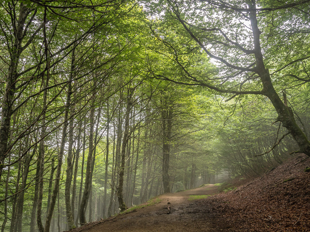
Hazy light filters through the foliage giving the forest a ghostly air. The forest of Irati is the largest in the Basque Country, and one of the main beech forests in Europe.
Passing the Okabe summit we reached an extensive grassy plateau. From here, the Haute Route follows the GR10 to Col Bagargui.
With the mist descending upon us again, we were glad of the regular trail markers along the GR10.
Our guidebook then said we had about a half hour walk downhill to the Chalet Pedro, which is an upmarket restaurant beside a parking area, predominantly for tourists. We hoped the restaurant also catered for passing hikers and that we’d be able to purchase an ice-cream or cold drink if nothing else. Thankfully, they were very accommodating at the restaurant letting us use the toilets and fill up our water bottles – but we expected nothing less having paid €12 when we arrived for just 2 ice-creams and 2 small bottles of cola and lemonade!
After leaving the restaurant, we had then planned to continue following the GR10 before reaching the D19 road where we were going to turn off to find ‘Camping Iraty’, a proper campsite with facilities that we’d seen marked on our map. There was no mention of this in the guidebook, nor was there any mention of camping for free along the stream in the valley where the Chalet Pedro is situated. Walking past, we saw several long stretches of beautiful green grass perfect for pitching up a tent within what is known as the Iraty Tourism Area. We didn’t actually see anyone tent camping however. In general, people were vacationing in motorhomes and campervans having travelled to the area by vehicle instead of on foot like ourselves.
With the GR10 trail running right through the Iraty Tourism Area, we observed several motorhomes parked up on the flat areas either side of the stream in a designated camp area known as ‘Aire Lac d’Iraty’. Charging a nominal fee of just 5 Euros per night for a motorhome inclusive of 2 people, it was not surprising that so many road trippers were taking advantage of staying in such a picturesque area!
Passing by and commenting on what a lovely campsite area it was, we read a sign that said ‘tent camping’ for one night is free between the hours of 18:00 and 09:00. Had we already been able to resupply with food for the next few days, it would have been a perfect spot to stay overnight. Unfortunately, as we still needed a shop to replenish some essentials, we had no choice but to push on. Walking along the road before turning up the switchbacks through the forest following the GR10 markers once more, we also saw two further bar-restaurants that looked popular, which again weren’t mentioned in our guidebook or shown on the map. (This is really useful to know if you want to buy dinner and then camp overnight for free!)
Feeling a little disappointed that we had missed out on such a great camping opportunity, gratefully, we found the ‘Camping Iraty’ site with ease after a kilometre or so walk up the D19 road. Even better was the price for such great facilities. (€3.50 per person for peak season – July & August, plus €3 for a tent.) Included in this fee were hot showers, clean toilets, separate sinks for washing laundry and cook pots, plus electricity sockets for charging our phones and battery packs. With everything we could have possibly needed, it was a win-win choice of campsite, and even better was that we arrived late afternoon giving us plenty of extra time in the evening for camp chores, as well as the chance of some relaxation.
With the tent set up and our camp chores completed by 5pm, all that we hoped for now was that our laundry (since having been rewashed and hung out on our makeshift line), would in fact be dry by the morning!
Dinner tonight was a vegetable cupa soup, followed by angel hair pasta mixed with Thai chicken soup as a sauce, complete with a fried egg on top, making use of our mini-frying pan once more. (Well we had to make it worthwhile carrying it!)
As we settled down to sleep, both satisfied that we’d had enough to eat and feeling refreshed after a hot shower, we could still hear the tinkling of bells as a herd of cows marched up the road next to the campsite. Fortunately, they had gone by 10pm, which allowed us the chance to tune into other sounds of nature such as some owls hooting nearby. Being in a proper campsite, we did miss the comforting sound of a stream flowing nearby like last night, but at least as we were safely enclosed within a fenced area, and wouldn’t have any cows joining us in the night!
Day 7 – ‘First Peak Bagged’ Thursday 8th August, 2019, Camping Iraty to Wild Camp by Cabane d’Ardane, HRP, 21km
After a sound night’s sleep, we got up at 7am but didn’t rush as we were still trying to get our laundry dry. There had been a brief rain shower during the night so Wayne had fetched all the clothing off the line and hung it as best he could inside the tent. But now we had the same problem as yesterday with everything still being damp, which meant it would soon start smelling musty – something we really didn’t want now that we were freshly showered!
Leaving camp at 9am, we headed a couple of kilometres further uphill along the D19 to the Iraty Tourist Complex. We knew there was a restaurant on site where we were hoping to get breakfast, but we were also counting on there being a shop so that we could resupply for the next couple of days. This food would then see us through to the town of Lescun and the end of Stage One! Fortunately we were in luck as there was a well-stocked store with all the main staples we needed, albeit they were a little pricey compared with an everyday supermarket, but that is to be expected on such a popular tourist and hiking route.
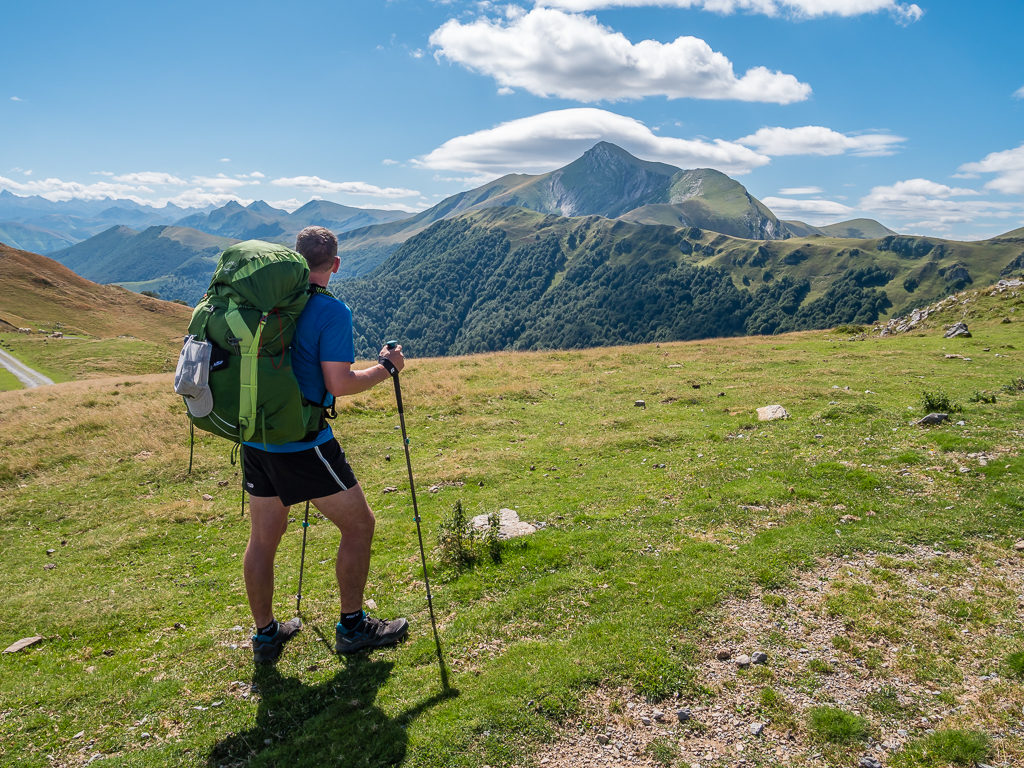
Our next stop was the restaurant where our request for ‘petit dejeuner, s’il vous plait?‘ was met with smiles, a basket of bread, butter and jams, a tea, coffee and two glasses of orange juice. We sat outside the restaurant on the terrace and were immediately wowed by fine views of Pic d’Orhy not too far in the distance. It was to be our first summit of over 2,000 metres on this trip and it looked like a superb peak to start with!
Our first glimpse of the 2,017 metre Pic d’Orhy, a prominent mountain piercing the skyline in the western Pyrenees.
The French Basque Country is famous for its awe-inspiring natural landscape. With its densely forested mountains, it is how we imagine the Lake District in England would be but for the depredations of free-ranging sheep which prevent natural tree growth.
Finishing up breakfast we were surprised by an uninvited guest on the scrounge for any leftovers… A little goat popped his head up at our table but was immediately shooed away by the owner armed with a water pistol! The goat was clearly a regular visitor.
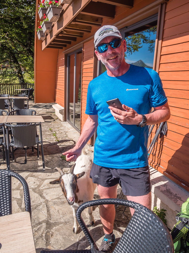
On the look-out for any leftover breakfast, a little goat appeared at our table!
Climbing the road past the ski chalets and leaving the resort behind, we headed up a steep path marked with yellow flashes (symbolising a route variant) and straight out onto the Crete d’Orgambidesca at 1,400 metres. Gaining a good amount of height already, it meant we only had a climb of around 600 or so metres to go! It was incredibly windy, which made us slightly apprehensive about the forthcoming ridge walk we were about to embark on. But with blue skies above and the forecast of a hot, sunny day, we couldn’t miss the exciting opportunity of bagging our first 2,000 metre peak in the Basque country!

Not just a pretty peak, Pic d’Orhy, whose grassy slopes are used as pasture, holds great importance in Basque mythology.
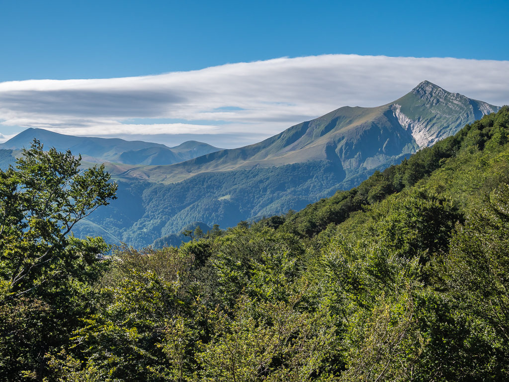
The extensive views we were now seeing having at last entered the Pyrenees ‘proper’ were simply whetting our appetites for more.
Following the yellow markers and keeping hold of our hats until we crossed to the other side of the ridge, we made our way around the grassy bank and kept to the marked path as closely as we could. With several cattle tracks also winding up the ridge however, it made it difficult to stay on track. When we came to a rocky ledge that had blue tape blocking the way and a sheer drop the other side we knew we’d somehow veered off-course. Looking up, we could see the faint line of a track around 10 metres above us so we had no choice but to zigzag up the steep-sided bank to get back on the right route.
Heading towards the Millagate Ridge we found there were several cattle tracks making it difficult to stay on course.
Green, glorious and grand – it was an exhilarating feeling knowing we were going to be stood on the summit of Pic d’Orhy later that day!
Once we were over the top of Millagate Ridge, we then had a much easier walk down to the Col de Tharta where the ascent of Pic d’Orhy really begins! Hence we took a drink and snack break to give us a good boost of energy ready for the long climb ahead of us, sitting in a grassy bowl that acted as a wind shelter because it was so blustery on the open plateau.
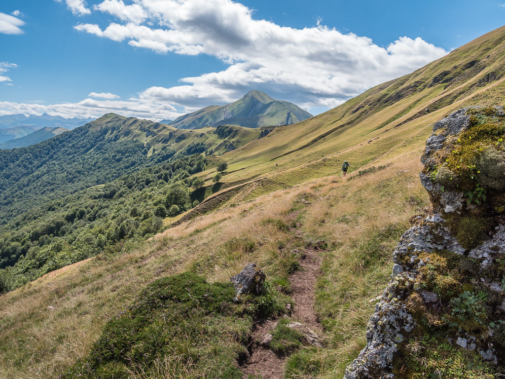
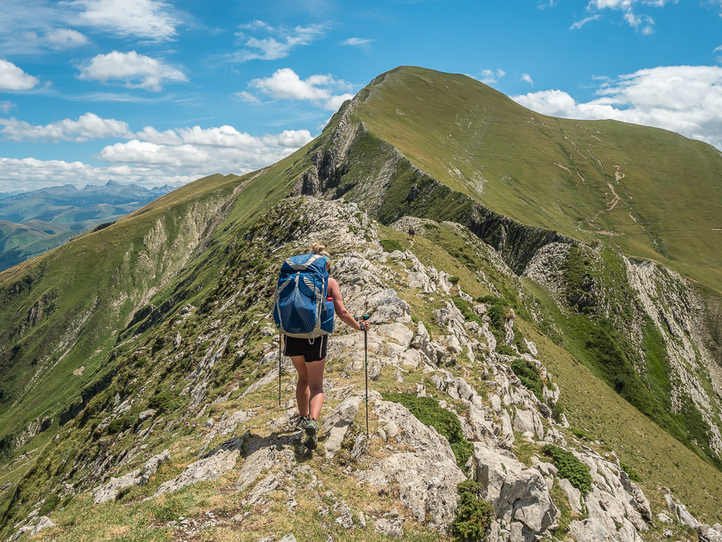
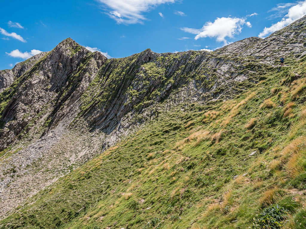
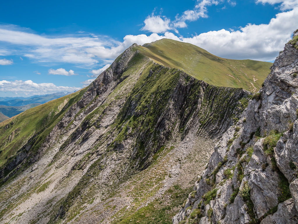
Steadily climbing another steep grassy ridge following a line of hunter’s shelters as a navigational aid, we reached the Crete de Zazpigagn at 1,765 metres. From here we had quite a nerve-wracking but exhilarating walk along a limestone ridge that became very narrow in places but gave us tremendous 360° views of the surrounding mountains. It was what I had envisioned ‘Striding Edge‘ back home in the Lake District to be like in glorious summer conditions.
All was going well until we were faced with a steep descent off the ridge down loose scree to get around a tricky section, which made me drop to a snail’s pace to ensure my footing was well-positioned, so that I wouldn’t slip. Taking our time manoeuvering around the rocks and focussing on each step as opposed to the long fall we’d have if we accidentally lost our footing, it was a relief to then climb steeply back onto the top of the ridge and follow a track for the last 300 metres taking us to the summit.
Tackling the Crete de Zazpigagn to reach the summit of the Pic d’Orhy. With such amazing weather and incredible views – this was one of my favourite days on trail by far!
Looking back towards the Col de Tharta and the direction we had hiked up from. The rolling hills and rugged peaks stretched for miles into the distance.
Leaving the limestone ridge temporarily to follow a narrow track towards the summit.
In my opinion, descending steeply on scree to reach the narrow track was more nerve-wracking than walking on top of the ridge itself!
But it was worth it! Back on the ridge and all smiles to be nearing the summit at last.
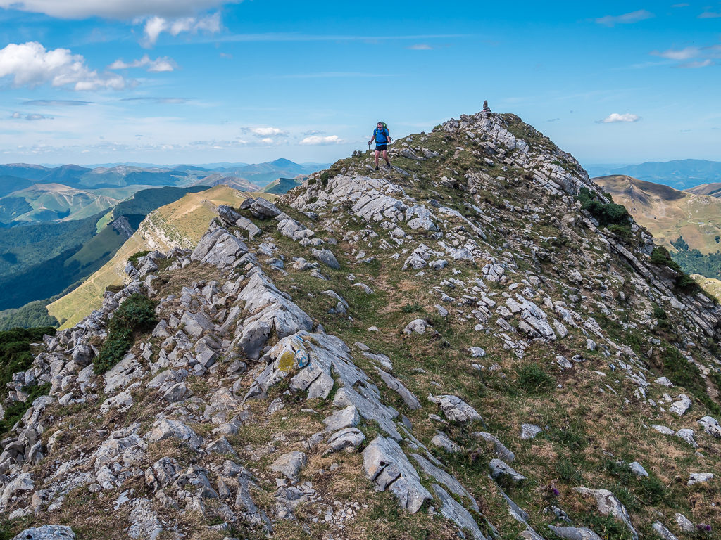
Carefully watching our footing whilst tackling the Crete de Zazpigagn.
The summit is in sight!
On finally reaching the summit of Pic d’Orhy at 2,017 metres, we were surprised to find it was busy at the top with several hikers already congregated around the summit post complete with a sheep’s skull on the top. So as is the English way, we patiently waited for a turn of our own as we wanted photos of the landscape and that all-important summit shot minus any people!
Happy with our achievement, we took the weight off our feet, finally downing our packs after 5 long hours of making our way up to the summit. Satisfied we had completed in what our guidebook had said was a ‘Grade 3’ route, we then devoured a proper thru-hiker’s lunch of ‘crisp’ sandwiches. These were actually made with half a baguette each, filled with soft cheese, a layer of crisps and mayonnaise. (‘Crisp’ sandwiches may just be an English thing, but my mother-in-law would have thoroughly approved!)
No more tentative steps – it was time for the final push to the summit!
Taking in the view from the summit post atop Pic d’Orhy!
These magnificent mountain views were a just reward for all of our efforts.
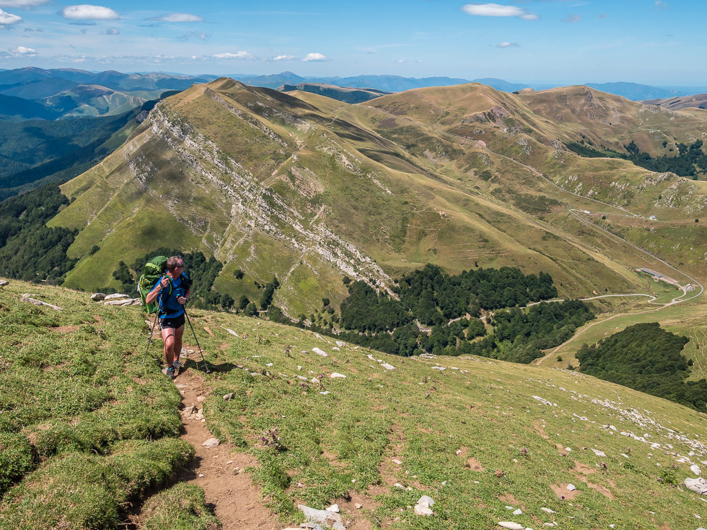
After refuelling at the top, it was soon time to come back down the mountain, which took us just a fraction of the time compared with the demands of the ascent. Winding downhill on decent track, we made our descent to the Port de Larrau (another border crossing between France and Spain), in just one hour!
Descending in a southeasterly direction keeping to the right side of the ridge to the Port de Larrau.
After the initial descent from the summit, the track was well-trodden and became easy walking enabling us to power down the mountain and make good time.
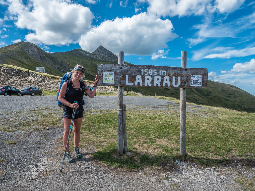
Reaching the Port de Larrau at 1585 metres, another border crossing between France and Spain, where there is a parking area on both sides of the pass. Border Stone 237 is also located here.
Reaching the car park area in what seemed like no time, again we stopped for drinks and also took the opportunity to sit down and empty the grass seeds from our shoes. (We’re really missing our Dirty Girl gaiters. Since wearing them out on the PCT, they were an invaluable piece of our kit that we are yet to replace.) But we didn’t procrastinate for long as we still needed to push on to make camp before dark.
Passing Border Stone 237 and crossing into France, we then decided to take the alternate route to the Cabane d’Ardane, our intended camp spot for that evening. This would mean missing out two lesser peaks plus another ridge walk along the HRP, but we agreed that we’d put our bodies through enough today – especially as we were only reaching the end of Week 1 and still reconditioning our trail legs. The alternate route was basically to follow the mountain road winding 7km downhill all the way to the Cabane d’Ardane at the foot of the valley.
With the sun now bearing down and the winds only intermittent, it was a long, hot walk along a narrow gravel road as far as the eye could see. But it still seemed the better option than more ascents and descents along a series of rough green ridges. We just didn’t have the energy left in our legs nor the inclination to continue on the Haute Route just then.
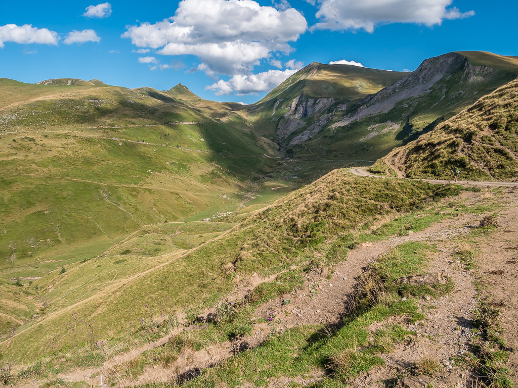
After a lengthy walk along the road, we could finally see the Cabane d’Ardane right in the distance at the foot of the valley in the shadow of several imposing peaks.
Taking the road route, we had covered the 7km in an hour and a half enabling us to reach camp and get set up before the sun went off the valley. We pitched our tent close to the stream in front of the cabin once we’d cleared a ton of sheep poop from the grass. It wasn’t just in the immediate vicinity – the whole valley was covered in the stuff, so we would have had the task to do wherever we chose to camp.
Despite seeing virtually no one on trail that day, we weren’t the only hikers camping beside the cabin! To our surprise, the Swiss couple whom we’d seen a few days ago were already camped there and preparing dinner when we arrived.
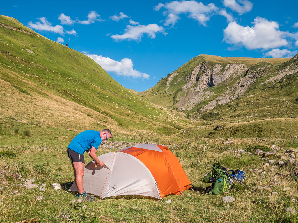
After clearing an area of sheep poop large enough to fit our Big Agnes hotel, we both got busy setting up camp.
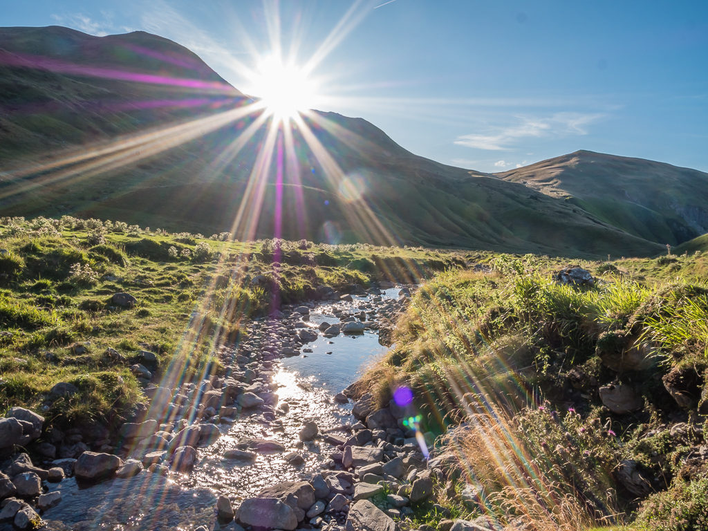
Making the most of the last rays of sunshine before the sun dips behind the mountains and the valley descends into darkness.
Although this looked to be a very beautiful camp spot on first inspection, there were however some negatives to it. Something we have started to get used to in the Basque country is the presence of cattle. In this valley in particular, there were lots of sheep and cows grazing – cue bell ringing until at least after dark! We also heard some shotgun noises in the distance that rather startled us and they went on intermittently throughout the night. Also, because of so much animal excrement everywhere, flies became a real annoyance until the sun went down, when quite fortunately the wind picked up again and helped to disperse them. Whether it be from cow bells or now from wind funnelling down the valley, we were bracing ourselves for another noisy night at camp.
Wayne had expertly cooked fried onions, bacon lardons and scrambled eggs for dinner, which we ate with bread tortillas.
After rinsing off in the stream and eating a hot dinner, we were thoroughly exhausted and ready for bed by 7:30pm. It had felt like a long, tiring day on trail even though we had only walked 21 kilometres, but the heat had really zapped it out of us.
Saying that, it was an incredible day all the same and one of our favourite experiences in the Pyrenees so far! The spectacular far-reaching views from the summit of Pic d’Orhy made both the lengthy climb and nerve-wracking ridge walk well worth the effort.
It was exciting to think that if this was only ‘Week 1’, and what a week it had been – then what other stunning spectacles would we see and what other unexpected challenges would we face over the next 7 weeks?
21 Comments
Many thanks for sharing your adventures once again.
Thanks Kevin👍 When we’re back home working, it takes a while for us to get round to updating the blog, so thank you for still reading & commenting.
Whilst editing the trail reports, it’s been so nice looking back at the photos and reliving all of the great things from last summer! As always, it’s made us really want to return to the Pyrenees and hike through our favourite parts again.😁
Great story telling as always and some superb photos. A traverse of the Pyrenees is high on my list of “things to do when I win the lottery” 😀
Looking forward to the next installment
Thanks Andy! It doesn’t cost us a great deal on trail – it’s more about being able to afford an extended period of time off work – hence the effort to save beforehand. It also helps being a teacher and having the ‘summer holidays’ – although the 6 weeks we used to have off have gradually been reduced to 4!😢 We can’t complain though as we’ve had several extended trips since selling our house. It’s also thanks to our parents as that’s where we live when we’re home. We call ourselves the ‘Boomerang Kids’ – we just keep coming back!
Hi you two. Many thanks for posting your diaries again. It’s great to be ‘Back on the Trail’ with you again!!
Looking forward to reading and seeing more – a great pick me up and nudge to get out there ourselves again.
We had planned to start the year with a daily 2-3 mile, slowly building up to 5 miles morning walk – flat to build up the stamina and more hilly to build up what is left of our leg muscles! However, the really bad weather has put that on hold as all trails everywhere around here are like mud baths!!
Still, another couple of weeks should hopefully dry things out a bit!
Take care of yourselves
Best wishes
John
Hi John,
Lovely to hear from you! How is life as a grandad? We hope you’re getting to spend plenty of time with your grandson to make up for the lack of walking at the moment. The weather’s been truly dreadful.
We drove to mid-Wales last weekend as we’d booked a shepherd’s hut for Valentine’s (doing a bit of glamping for a change!) But we literally only walked to the pub and back as it was flooded everywhere. Hoping for better weather for the May Bank Holiday!
(Easter Week we’re doing a narrow boat trip with my parents for my mum’s 60th, which will be a first for us! We might blog about it – we’ll see how it goes!)
Currently working on the next Pyrenees post & hope to publish this weekend.
Best regards,
Danielle & Wayne
Hi Danielle,
Many thanks for the reply.
Yes, grandson is going fine. Coming up to 6 months in a couple of weeks so not quite ready for the Pennine way yet!
We did a local walk (more of a stroll really) yesterday but it’s right claggy out there!! (There, that’ll get your readers reaching for the dictionaries!!)
Love narrow boats. Lucky enough to have done 4 wonderful holidays. Where are you going? Re. canal holidays, please be aware that there are some great pubs along the towpath that can catch you unawares if you don’t know aboiut them, so I thought I’d let you know as I know you’ll be wanting to avoid them of course!!!!
Just received your link to Pyrenees part 2. Looking forward to reading that over the next few days.
Take care of yourselves
Best regards
John
Hey John,
Glad to hear you’ve managed to get outdoors. The weather this weekend has been much better and it definitely feels like Spring is in the air at last!
We collect the narrow boat from Anderton, Northwich and it’s based on the Trent and Mersey Canal. We’d love to do the Cheshire Ring but we haven’t got enough time, plus we are ‘newbies’ so will probably do one of their shorter routes on the Shropshire Union Canal to Nantwich. We’re looking forward to doing something a bit different and the pubs along the way will be a bonus of course! I’m hoping to blog about it when I eventually get the ‘Pyrenees’ posts finished!
Best regards,
Danielle
Hi Danielle,
again impressive writing and photos. Looks like the Pyrenees should definitely being put on the list.
But hey, are You really carrying chairs with You ?!
Best Regards
Marcus
Hi Marcus, nice to hear from you. Yes we are carrying chairs!
They are the ‘Helinox Chair Zero’ and only weigh 488 grams each, so we justified it by equating it to carrying an extra bottle of water!
As we share the weight of other essential kit, we don’t mind carrying them as we like our home comforts at camp!
Best regards,
Danielle
Hello ,
A good point of the lockdown is that I just discovered your blog few days ago. Beautiful pictures with a lot of remembers for me as I hiked the HRP from Hendaye to Gavarnie last September with a loop on the faja de las Flores inside Parque de Ordesa and breche de Roland to arrive to Gavarnie. Worth the climb to arrive to the faja. Fantastic views on the canyon.You were lucky on Pic d’Orhy as I got a thunderstorm when I arrived on the difficult ridge before the summit. No view, gusty wind and hail! The ridge in the mist , wind and rain before cabane d’Ardane was a nightmare.
I see that you far from ultralight backpackers ( which is good) . Comfort first. Question : why did you change from Double Rainbow tent ( it seems that you had the old model-,the new one is wider ) you used on the JMT to the BA Copper Spur UL HV3?
Yves
Hi Yves, thank you for taking the time to read our blog and comment.
We initially changed tents from the Tarptent to the Big Agnes Copper Spur because it did not hold up to serious wet weather as it was only a single skin. It was perfect for the JMT but we had a lot of rain when we hiked the GR20 across Corsica and so wanted something more robust for when we tackled the Kungsleden in Sweden, expecting lots more wet weather.
We have since changed tents again as our UL3 was worn-out by the end of the PCT – the zips just kept coming apart and wouldn’t fasten on the inner. (Which is to be expected after 6 months of continual use!)
So when buying a new tent, we stuck with Big Agnes but opted for the hotel version as the vestibule offered us a space to hang wet gear and cook inside in the event of rain – which we also get a lot of when hiking and camping in the UK!
At first I wasn’t keen on the idea of down-sizing from a 3-person to a 2-person tent after getting used to having all that space. However, with the vestibule area we have just as much room to store gear etc so the 2-person is adequate for what we need. The only problem it can pose is the size of the footprint. We would be very limited on wild camp spots on the PCT for example with the Hotel tent as space on pre-exisitng sites can be small especially on busy sections of the trail.
We did feel very lucky with the weather on our Pyrenees traverse. I am enjoying looking back through our photos and working on the blog posts in the series during these uncertain times.
Happy reading & stay safe,
Best wishes, Danielle & Wayne
Hi Danielle , thanks a lot to answer so quickly.
I have actually a Motrail which is good when I am alone but the foot box of the sleeping bag gets often wet by condensation when we are 2 and it is not so easy to get out compare to 2 side doors tents. So apart from dreaming for ultralight with the Triplex, I would reduce my choices ( for about the same weight) between the Double Rainbow new wider version ( cheap, single wall, but resistant with silnylon 30D) and the BA Copper Spur UL HV2 , new version also . This more expensive tent seems more roomy with wider and awning-style vestibules like DR but thiner material of the rain fly and mainly the floor seems very delicate. What is your experience with your BA tent from last summer?
Waiting for the next post
Stay safe
Yves , a French guy living in Yorkshire.
Hi Yves, I am back working on the blog today! In answer to your question, we found our new BA tent perfect for the Pyrenees as there are an abundance of places to camp on grass. This meant that we didn’t need to carry an extra ground sheet as the material held up to the better ground conditions.
This was not the case on the PCT however, where camping is mostly on dirt/ rough ground so I carried a Tyvek ground sheet cut to the size of the footprint for extra protection of the tent inner.
Wow, living in Yorkshire, you’ve got lots of great hiking opportunities on your doorstep! The ‘Yorkshire Three Peaks’ is a great challenge and we particularly like the town of Hawes for the Wensleydale Cheese Factory! We can’t wait to get out and get hiking again.
Best regards,
Danielle
Hi Danielle
Trust this find you both safe and well.
Following the tent chat with interest.
When we were looking to get kit (before various life events came in the way so we still haven’t got any!!), we found the Hilleberg Nallo2GT. Loved the look of it – super light and super strong, but the big factor was the size, which as you say here is really important to maintain some semblance of sanity. It’s not cheap but I only read great reviews so wondered what you had heard / seen etc?
Take care and stay safe.
John
Hi John,
In all honesty I’m not familiar with the Hilleberg range of tents.
We’ve tended to go for US manufacturers as we wanted a semi free standing design and increased head room which the Big Agnes copper spur range offers.
Having plenty of space in the tent for two is crucial. We wanted space to put our packs and gear whilst still having room to relax if you’re stuck in the tent due to bad weather.
The Big Agnes hotel gave us that with the added bonus of plenty of vestibule space for cooking.
I’d suggest having a look at http://www.ultralightoutdoorgear.co.uk at their tent range which includes Hilleberg also.
Tents are always one of our most expensive purchases but considering how much time we spend in one it’s well spending the extra to get what you want.
Hi Wayne
Many thanks for the response. Interesting! So exactly the same as you, when we were looking for tents our main priority was to have as much space as possible, not wanting to have our rucksacks etc. outside the tent overnight and if possible somewhere to cook when the weather wasn’t too kind. Obviously weight was really important and was the quality. One day we came across the Hilleberg Nallo2GT at our local Cotswold Outdoor shop and instantly thought that it ticked every box we had. Sadly, in the 6-7 years that have now past which, due to health reasons didn’t allow me to do any serious walking prices have gone of from around £650 to around £850 today. Crazy money indeed, but all the reviews have been super positive.
So all was well, until you two came along with your Big Agnes copper spur range!!! Yours seems to be lighter and certainly cheaper by a country mile although I’m not quite sure which model you’re using.
Anyway, if your’re interested, here’s the link to the Nallo2 GT: https://hilleberg.com/eng/tent/red-label-tents/nallo-2-gt/
Take case and stay safe.
John
Hi Danielle ,
Thanks for the clear answer.
During the last days I have been travelling through your blog and videos. Good remembers also for me as I lived and worked in Chile and China.
I appreciate the fact that you show through your videos that there is not only dirty ultralight backpackers with long beard on the PCT but also older adults as you and Wayne who take care of their aspect and appreciate trail “gastronomy” at least outside the States.Spain is a good exemple of other type of trail food with cheese , egg tortillas and chorizo far from tortillas + peanut butter or Smarties snacks.
You show that having extra weight with small chair ans frying pan can make trail experience much worthy and comfy.
I appreciate the quality of picture and texts of the blog as well as the quality of the videos as a lot of them from other hickers are boring.
Waiting for week 4 in the Pyrénées
Stay safe
Yves
Thank you for taking the time to write such lovely comments Yves!
It’s really nice to get feedback as we do put a lot of time and effort into writing the blog posts and making the videos. (Even though they can take a while after the event!)
We are always thrilled when people are inspired by one of our write-ups to go out and have their own adventure, or enjoy reading about something they’ve done themselves and can relate to our experiences.
And as you have seen, thru-hiking doesn’t have to be ‘ultralight’ – we are much more about the comforts and enjoying good food on the trail, which for us makes for a better experience. It definitely helps that the two of us can share the load though.
It sounds like you’ve also enjoyed a good deal of travelling, living and working in some amazing places across the world!
Best regards,
Danielle & Wayne
I don’t even know where to start…. 😉 Guys, I love your blog! Lacs de Barroude brough me here when I was trying to escape covid reality by planning next treks in Pyrenees. I started reading your posts from 2019 adventure and suddenly I was there again ;). I spent summer of 2019 in Pyrenees as well, in fact we missed each other by a few days because I was just about to leave Andorra when it started to snow in early September (and you were in Ordino at the time). I never got to the Mediterrenian, however it was not my goal, I just wanted to spend 2 months in my favourite mountains.
Thank you for beautiful photos and interesting stories, you blog inspires me to start writing again (I also have a blog, but I’ve been so depressed due to be being stuck at home because of pandemic, that I gave up on writing :/)
I may have a few questions….do you have gpx track of you trek? What was your backpacks’ weight? I was carrying around 15 kg on my back (plus water and sometimes more food) and I think it I had had lighter backpack I would have got much further East 😉 Maybe you posted a list of gear and I missed it?
Please expect more comments from me 😉 since your post reminds me of amazing places where I’ve been and those where I am planning to be in the near future 😉
Greetings from Poland!
Ps. I absolutely love your omlettes/ scrambled eggs cooked on the trail – that’s what every trekker can only dream of 😉 But not everyone would like to carry eggs and frying pan 😀
Hi Kasia, thank you for getting in touch and for your lovely comments about our blog. I can’t believe we were both hiking in the Pyrenees at the same time!
I too have not felt like writing for a while so I completely understand your lack of motivation.
It’s tough being in another ‘lockdown’ and not being able to go anywhere. We can’t wait for places to open up again so that we can go further than our local area for walking.
In answer to your questions: We didn’t track the Pyrenees route as we needed to conserve battery power on our devices as we were wild camping the majority of the time. We do however have tracks of our GR11 hike that we did back in 2017 that are on Wayne’s Profile on Viewranger. You should be able to find them by clicking on this link (if they would be of use). https://my.viewranger.com/user/details/91584 It was our GR11 section hike that motivated us to plan a hike across the entire Pyrenees.
Our packs were a similar weight to yours – possibly heavier with 4 days of food and water as we both carried lightweight camp chairs, and Wayne carried a tripod. (We never really weigh them anymore. Everything we want to carry is in there so it is what it is!) I always seemed to have at least 2/3 loaves of bread every time we left town too!
We haven’t posted an up-to-date list of gear in a while. I think the most recent would have been a video on our YouTube Channel prior to us hiking the PCT in 2018 where Wayne talked through our kit and showed what we planned to take. We have since upgraded our tent and added camp chairs to our kit list. We talk about these in our blog posts and show different pieces of kit throughout our PCT video updates. (If you have a lot of free time currently, you might enjoy watching them!)
Our mini-frying pan is an ‘essential’ item for us as food is such an important motivator on long, challenging days! But as we hike as a couple, we can carry more items that others would deem a luxury as we can split the weight. One of our favourite things when hiking in America was ‘quesadillas’ – mini flour tortillas with cheese folded and crisped in the frying pan. (That frying pan was purchased in Colombia back in 2014 and has been to many parts of the world with us!) Eggs for breakfast are a must for setting you up for the day👍
Hope you are staying safe in Poland and feel free to ask us any more questions you may have.
Best regards,
Danielle