
“If you start, don’t give up, or you will be giving up at difficulties all your life”.
– Alfred Wainwright
The Tenth Week – A Pass Per Day
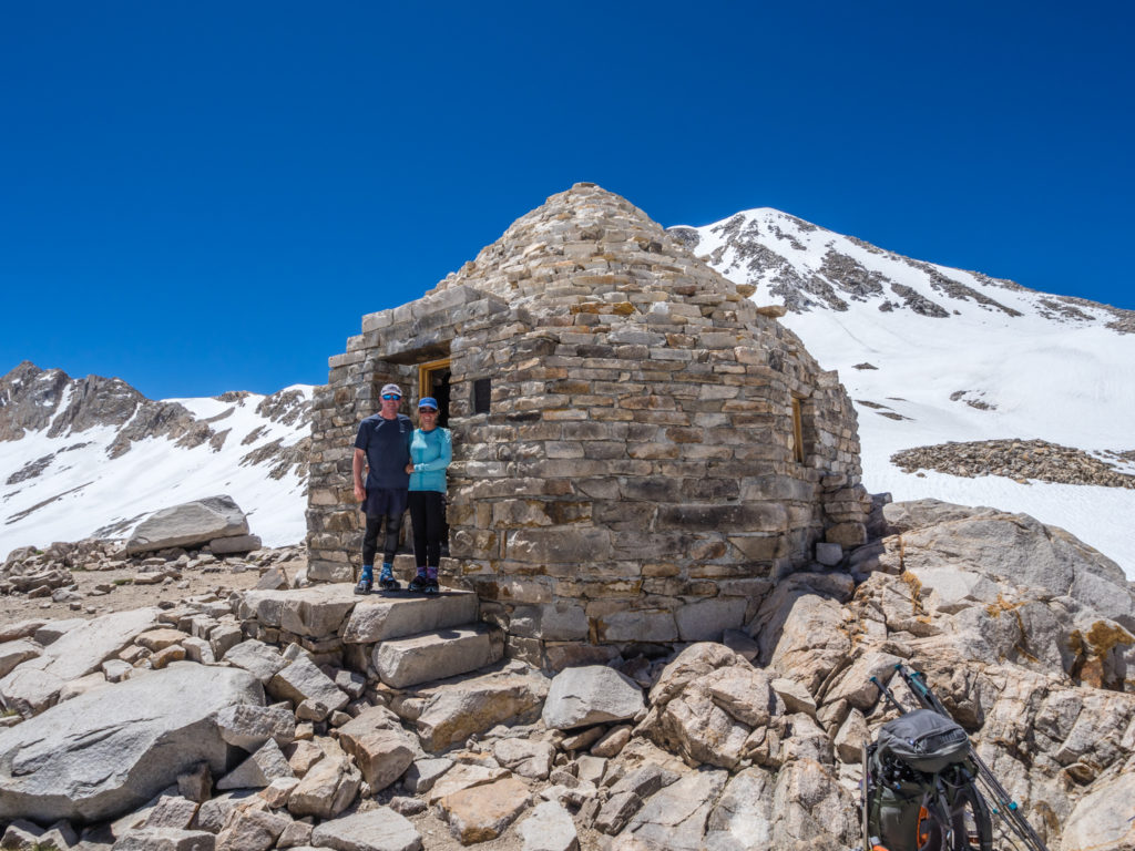
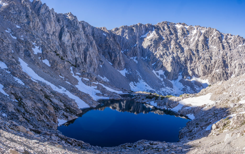
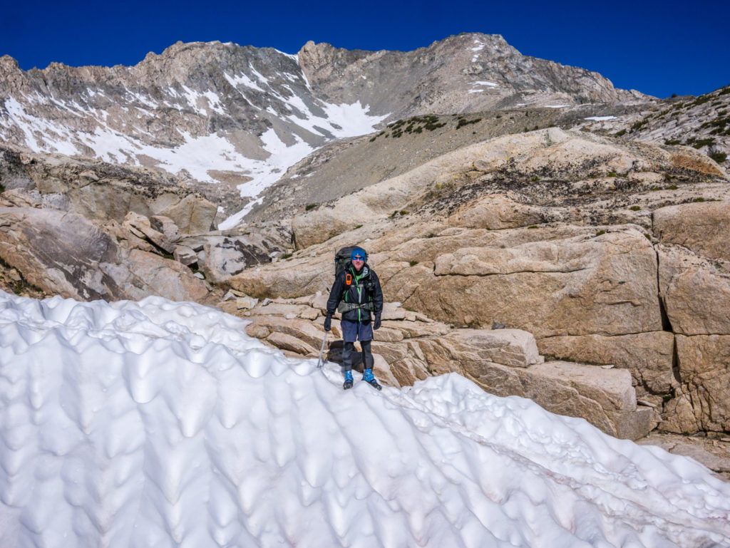
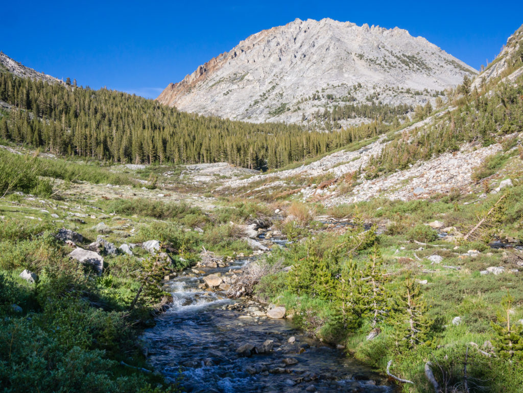
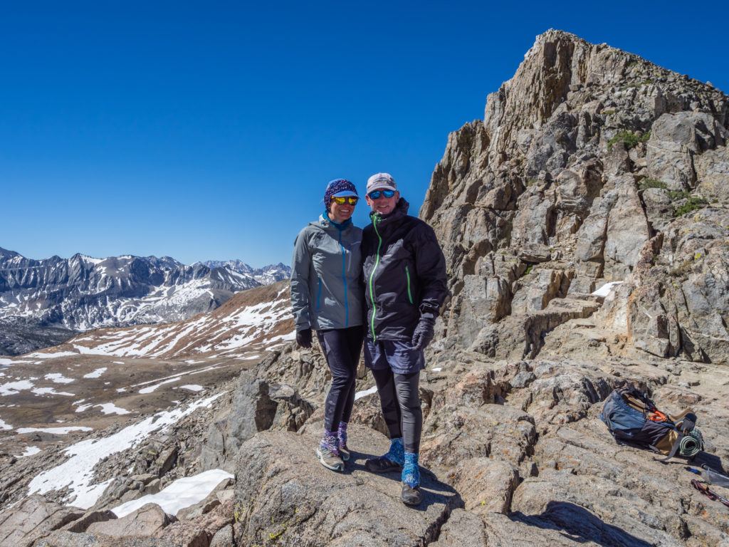
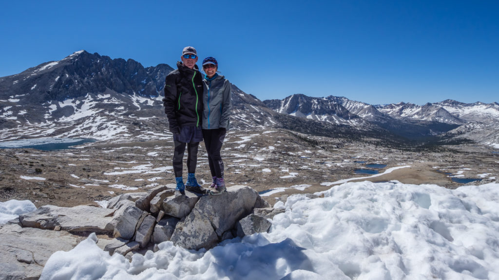
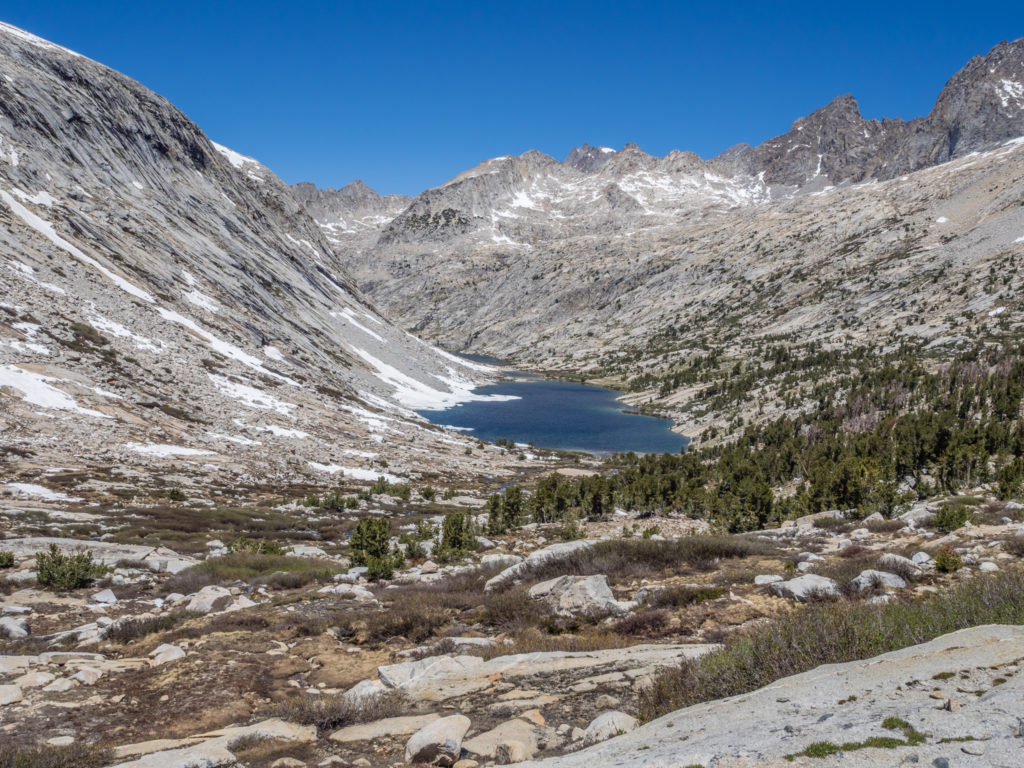
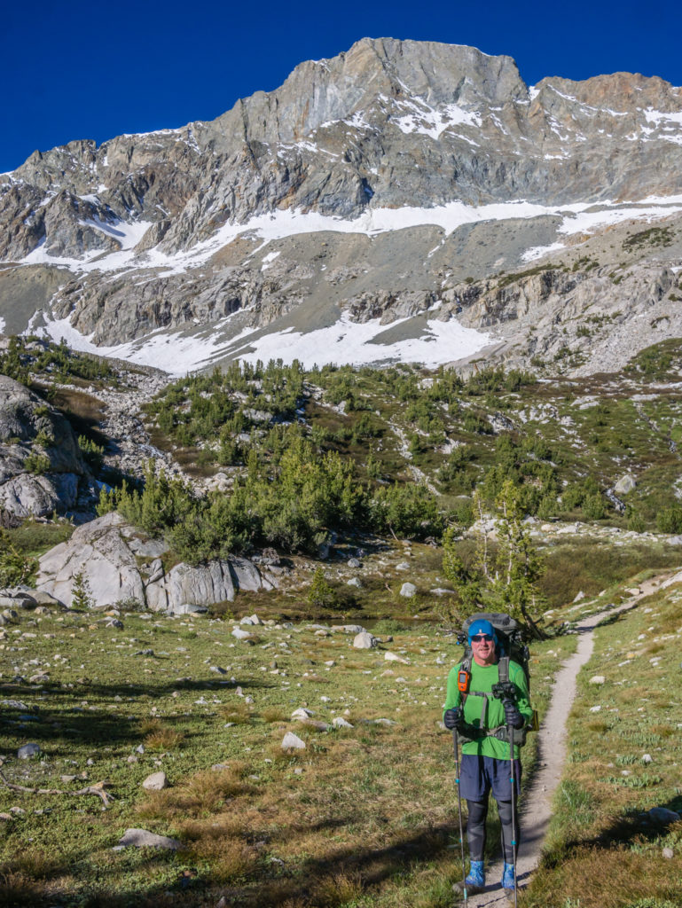
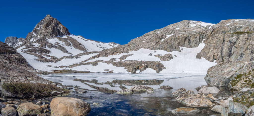
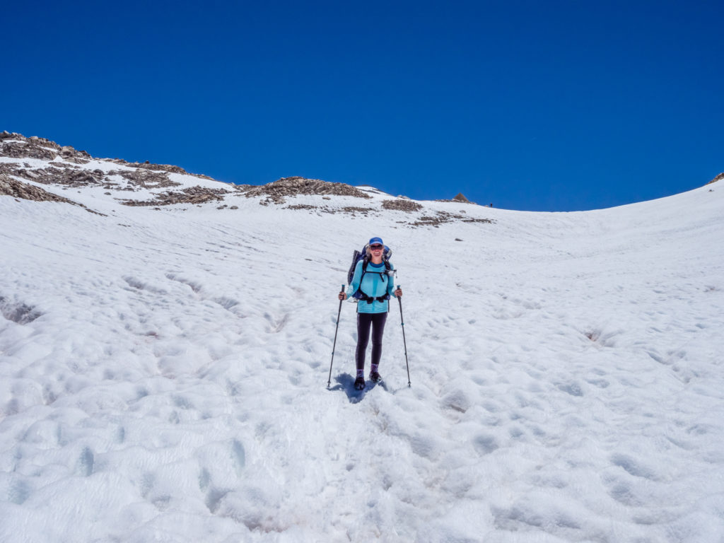
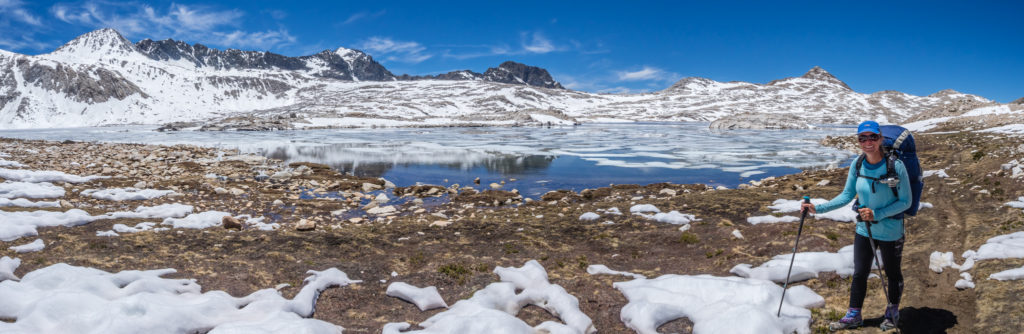
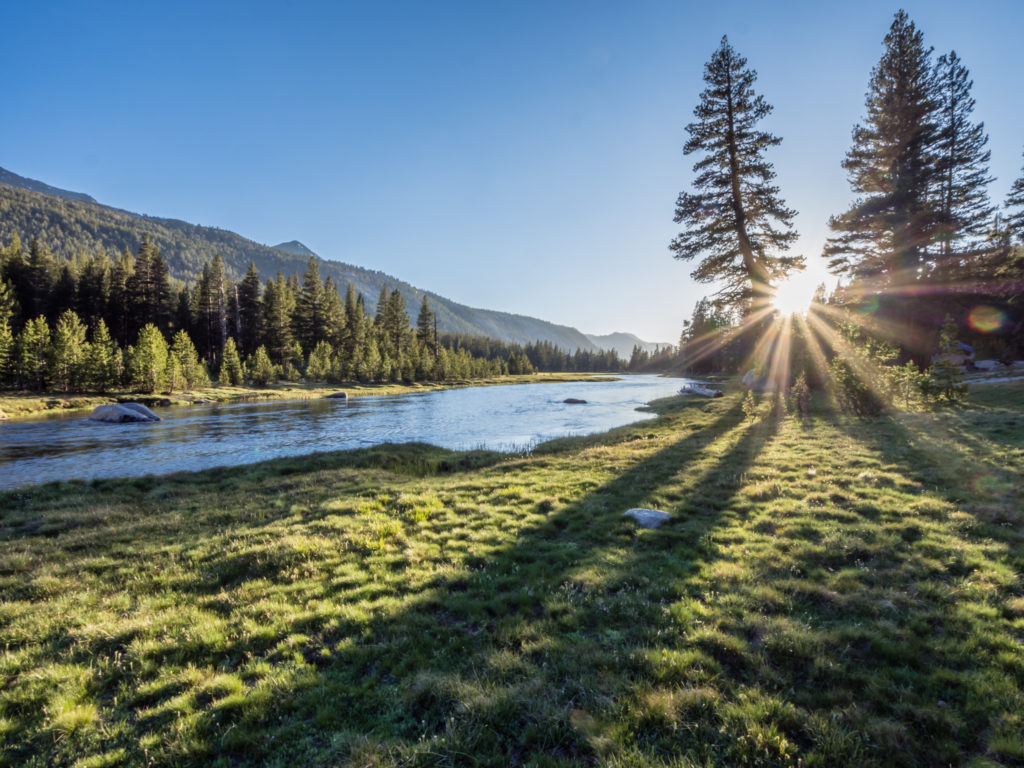
Stood in the entrance to the Muir Hut on top of Muir Pass. With two miles of snow either side to traverse, it was our most challenging pass in the High Sierra!
Days 64 & 65 – Tuesday 12th & Wednesday 13th June 2018, Vagabond Inn, Bishop, 0 miles
So as zero days go, we had planned it so that we could enjoy two back to back, allowing enough time in Bishop to have some down time as well as to purchase, organise and post on to ourselves packages that would resupply us with 20 days of food rations, taking us to the end of the Sierra, all the way to South Lake Tahoe in Northern California. It seems a long way off, but as we’ve already completed two months on the trail, it’ll be here before we know it!
We were really pleased with our decision to hitch all the way to Bishop as with it being a ‘city’ (in our opinion it is still very much a one street town, but is bigger and has more facilities than others we’ve visited off-trail), we had much more choice. This was both in terms of supermarkets, fast food chain restaurants and also outdoor gear shops, which in Bishop we were spoilt for choice as there are three!
The main task: Resupply. Twenty days of food shopping later and we had spent around $400 between ‘Smart & Final’ and ‘Vons’, but we were really pleased as we’d more or less managed to stick to our $20 a day food budget on trail. (That included 80 chocolate bars as we’re now giving ourselves two per day!) The trickiest part was how to get it all back to the motel so that we could organise and box it up. Luckily we were only staying just around the corner, so we borrowed a shopping trolley. Cue Wayne pushing a full trolley of goodies down the main high street and back to our room!
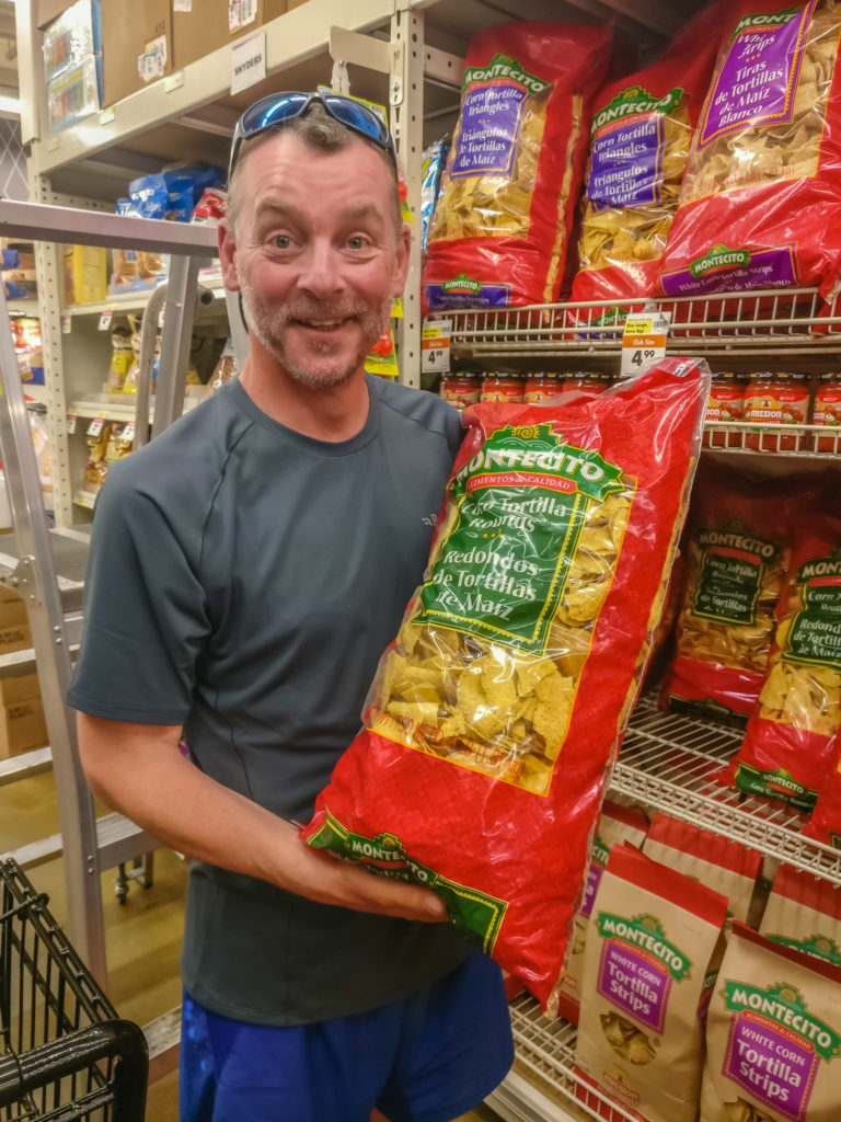
Checking out the resupply options in ‘Smart & Final’! They sell everything in bulk so it is excellent value for money.
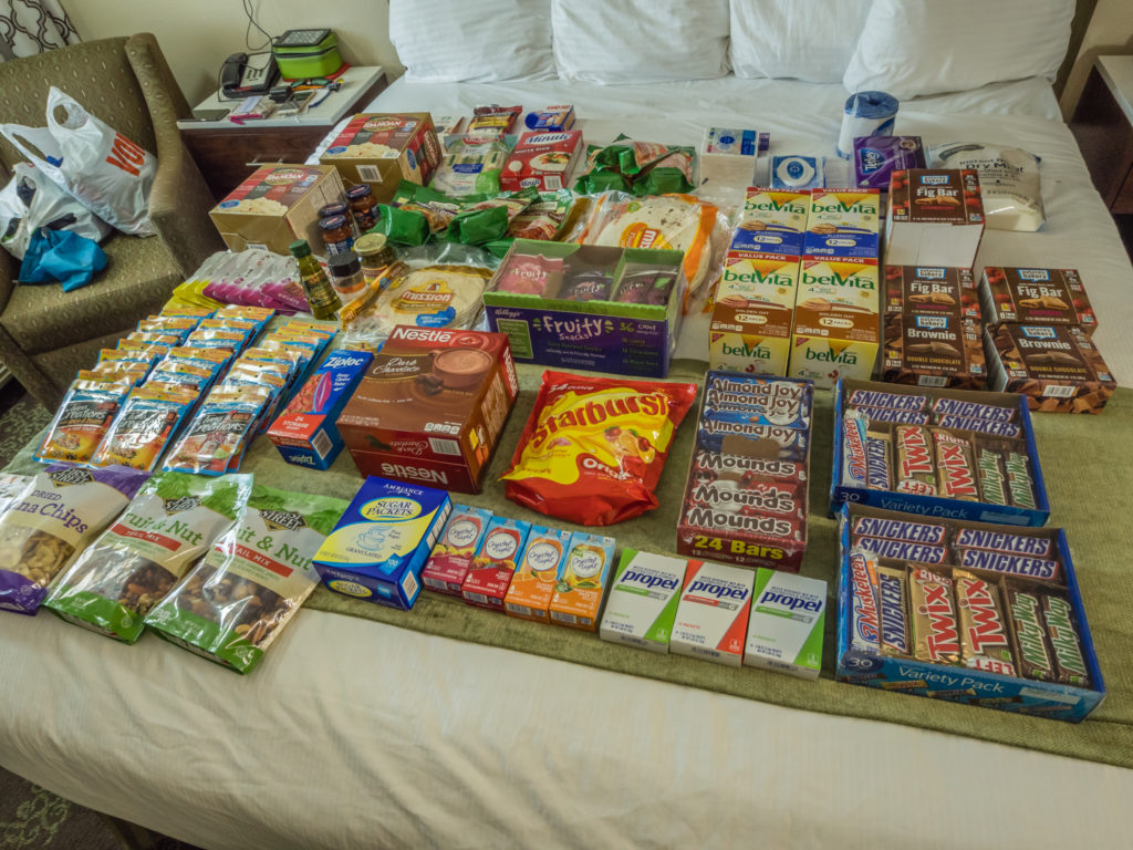
Our food rations for the next 20 days on trail!
We also still had the usual town tasks to get done as well. But in between blogging, video editing, laundry, gear maintenance, shopping and visits to the Post Office, we did manage a little ‘r & r’ around the motel pool one afternoon and also went to a local ‘Rodeo’ event. Unbeknown to us, it was the Californian High School Rodeo Finals in Bishop this week, so as it coincided with our stay and as tickets were only $7 each, we went along for the opening ceremony, which was a very grand and patriotic affair before the bucking broncos got down to business and showed their competitive edge. We also loved that everywhere we went in town real life cowboys and cowgirls were wandering around in full attire – hats, boots with spurs, chaps – the full works! It made a change from ‘spot the hiker’ as is the norm in trail towns!
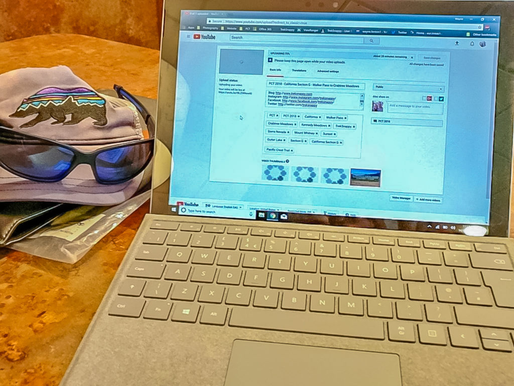
Busy editing another video update and uploading courtesy of McDonald’s free wi-fi!
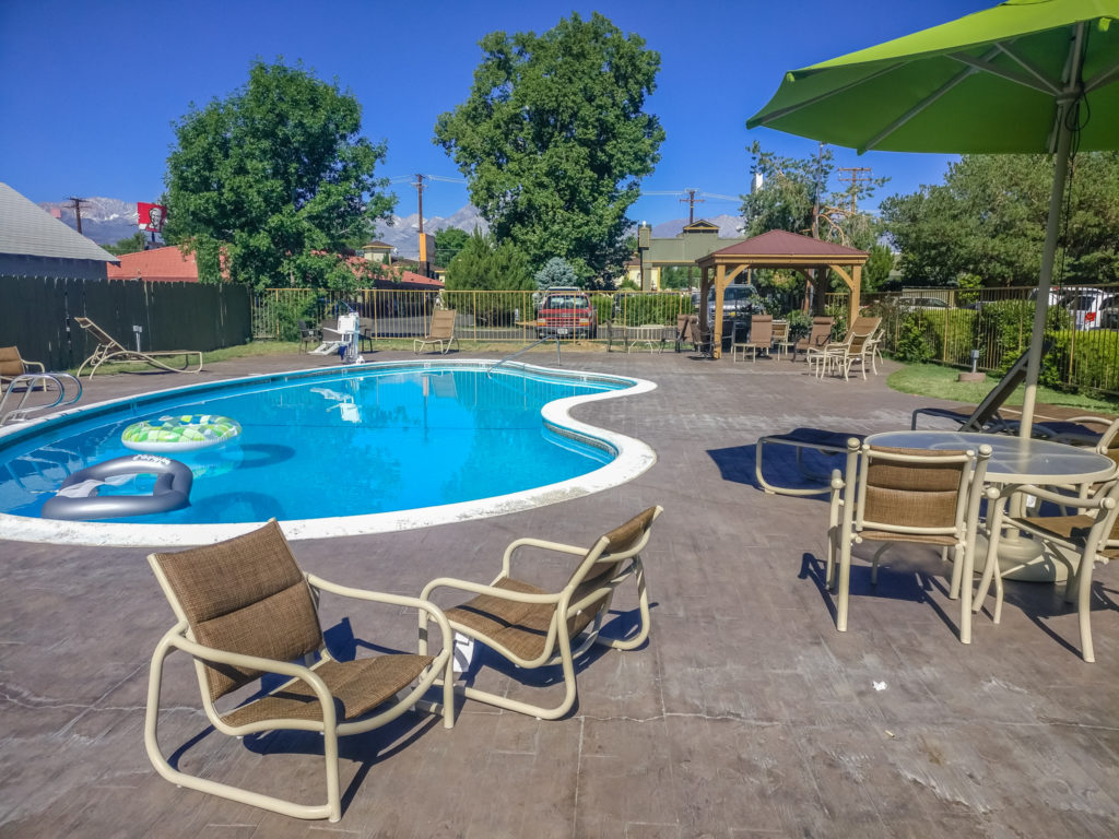
We managed to squeeze in a couple of hours around the pool on the final afternoon.
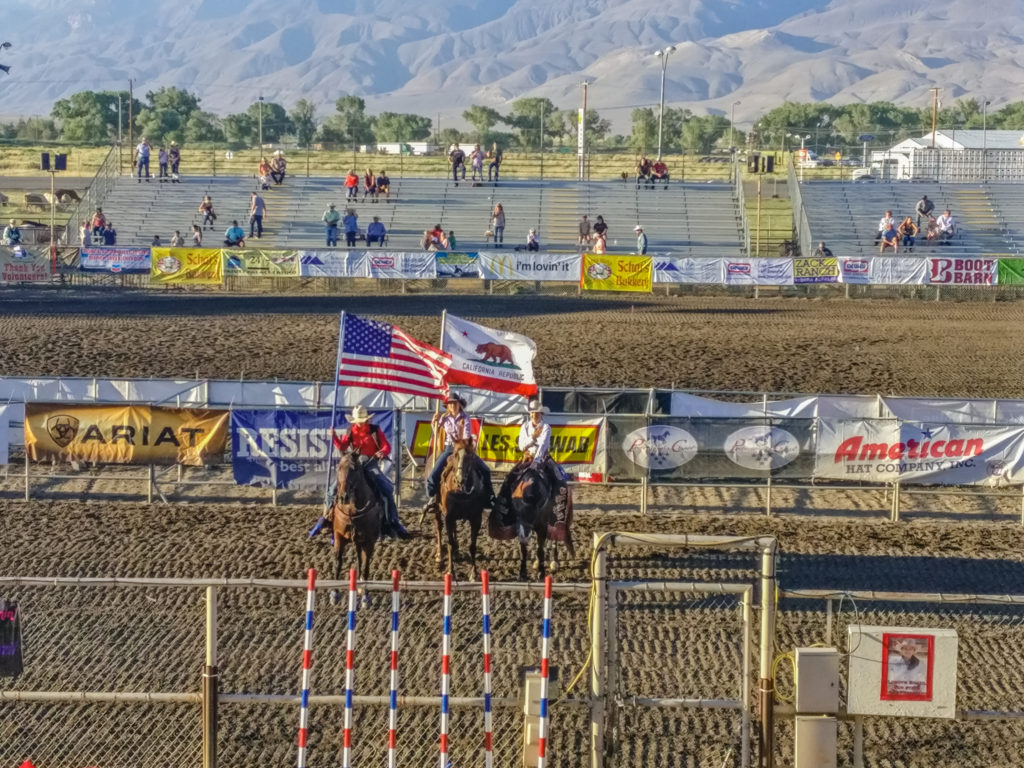
Our first experience of an American Rodeo! The opening ceremony at the Californian High School Rodeo Finals event in Bishop.
With Bishop having several fast food chain restaurants along the main road, we also took the opportunity to indulge in some ‘value for money’ calorie loading whilst we had the chance! Not satisfied with just a Texan BBQ on the first night, we also visited KFC, McDonald’s and a local Doughnut & Ice Cream Parlour! But most of all, I really wanted an ‘all-you-can-eat’ Chinese buffet. As Bishop didn’t have one of those, I’m pinning my hopes on South Lake Tahoe, which will be our next trail town and motel stop after 20 more days on the trail!
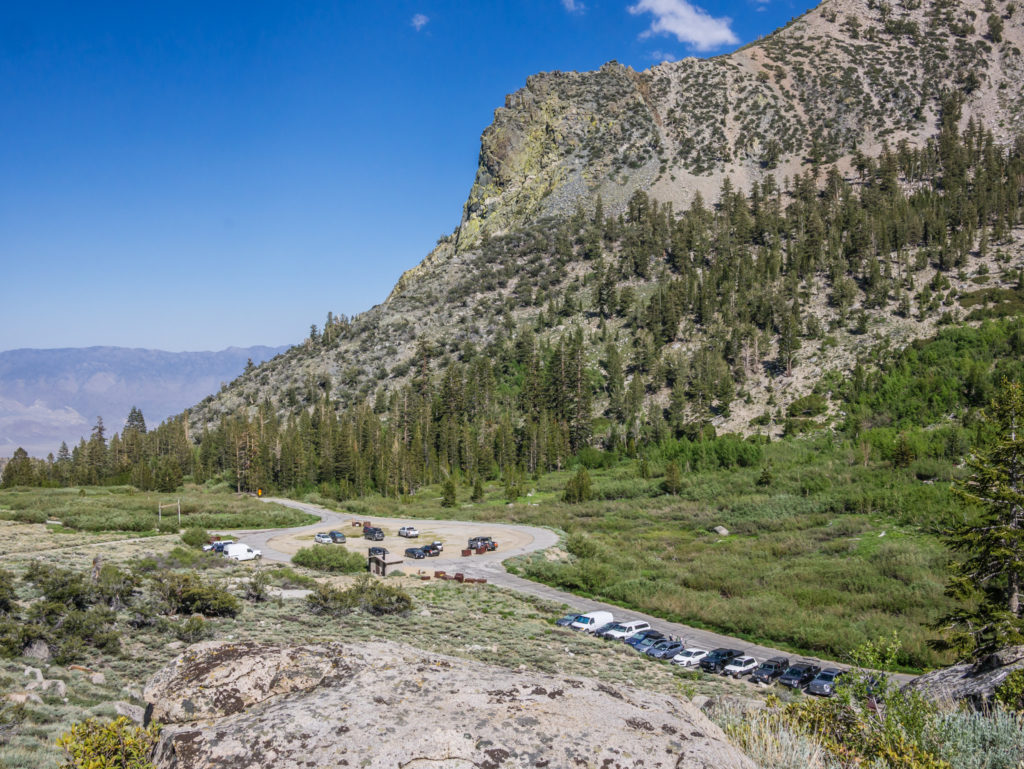
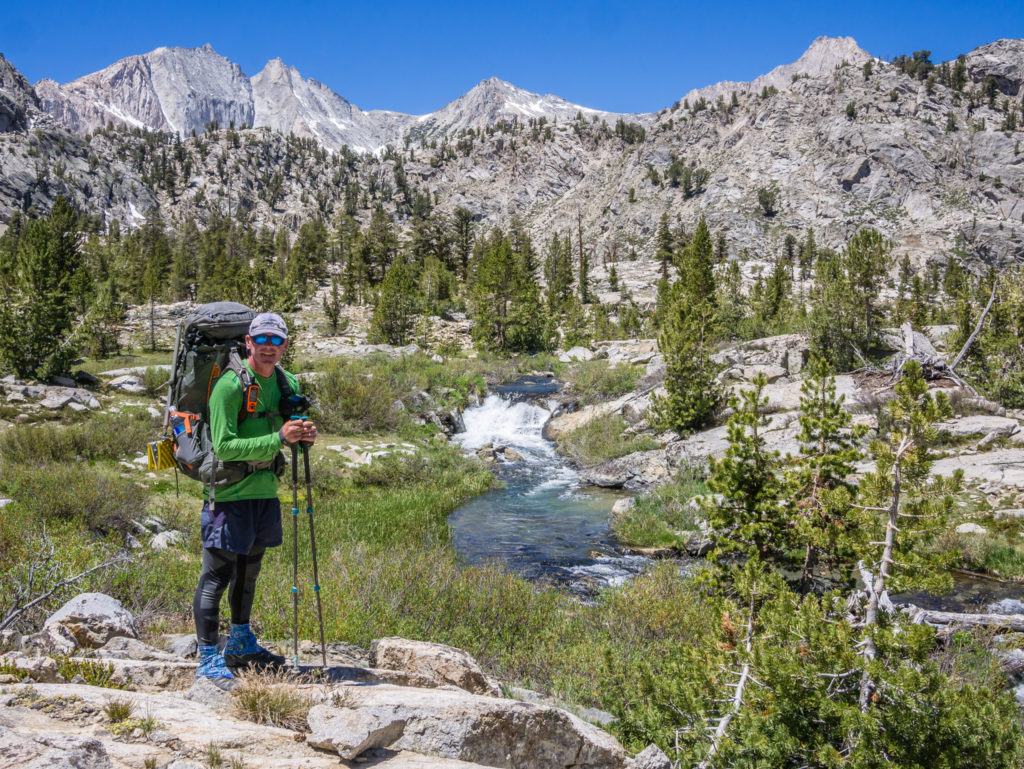
Day 66 – Thursday 14th June 2018, Vagabond Inn, Bishop to PCT Mile 789 back over Kearsarge Pass, via Eastern Sierra Transit Bus to Independence & Hitch to Onion Valley Trailhead, 8 miles
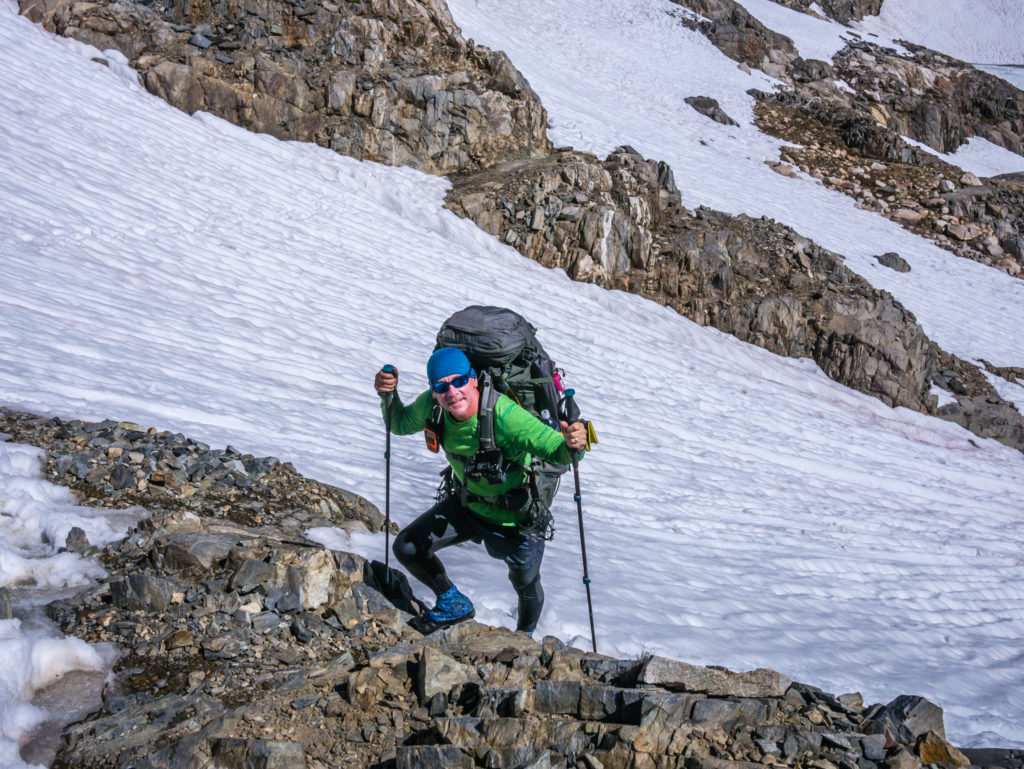
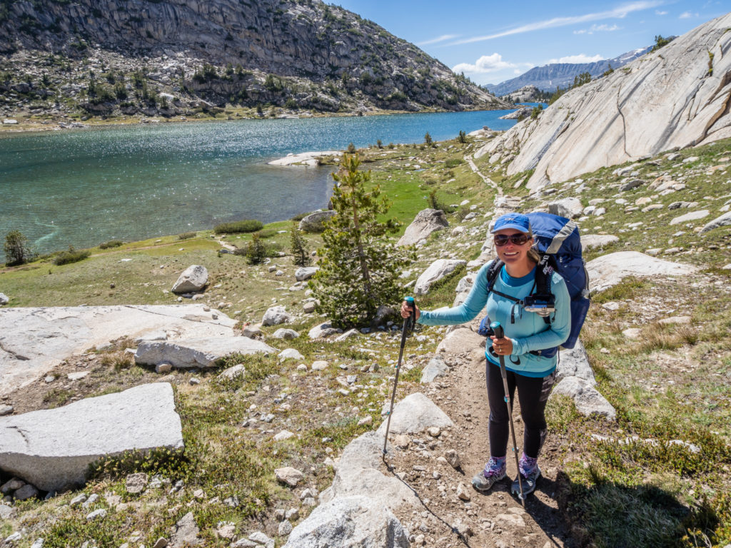
Just as trail days come and go, town days do too, so it was soon time to re-pack the rucksacks and swap a bed for the sleeping bags once more. Only this time our packs felt the heaviest they’ve ever been with bear cans literally rammed with seven days of food rations, plus ice axe and micro spikes, all additions to our original kit.
We’re just hoping that by the end of the week, once we’ve gone over all the ‘big’ passes, that we can post home the snow gear to save ourselves a few grams and lighten what is becoming an ever-increasing load! Similarly, we’ll do the same with the bear cans further down the trail once they’re no longer mandatory.
As we were still using the McDonald’s WiFi to upload pictures and video on the final morning of our stay, (the motel WiFi was shockingly poor), we took the Eastern Sierra Transit bus from Bishop at 1:15pm back to Independence, where we then needed to hitch a ride back to the Onion Valley Trailhead. (13 miles away.) It could have been too late in the day for a hitch going in that direction, so we were kind of chancing it. But as there were three other hikers on the bus as well, it gave us a bit of confidence that we weren’t the only ones with such a plan!
Going later paid off! We stood by the roadside waving my ‘PCT Hiker to Trail’ sign for no more than ten minutes, before we were offered a ride. Just before that, Farlake, whom we’d last seen in Tehachapi, was dropped off at the Post Office in Independence, just across the road from where we were trying to hitch. He was full of beans when he came out as he’d just picked up a package containing new trail shoes! We knew that jubilant feeling well when we’d swapped our old ones out for new, some 150 miles back now!
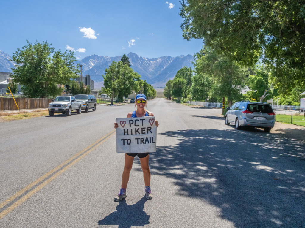
Making use of our ‘PCT Hiker To Trail’ poster and hoping to get ourselves a hitch back to the trailhead!
After the car pulled over, we put our packs in the boot and jumped in the back, grateful to Andrea and John from LA for giving us a ride back to the trailhead. They were staying at the Onion Valley Campground for a few days, but had just popped into town for supplies. Returning to the campsite with us hitching along, they had Just become our wonderful ‘Trail Angels’ for today!
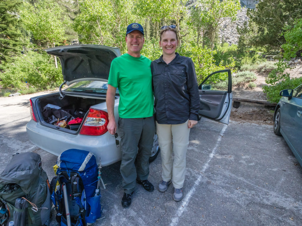
We were really grateful to Andrea and John for stopping and giving us a ride back to the trailhead. The support given to thru-hikers out here is phenomenal!
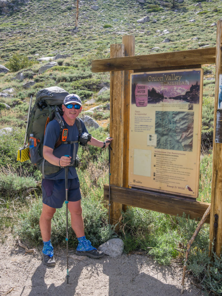
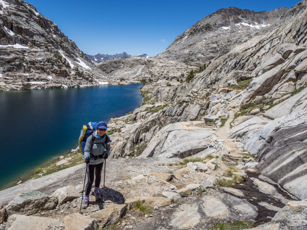
Back at the Onion Valley Trailhead ready to hike back over Kearsarge Pass to re-join the PCT.
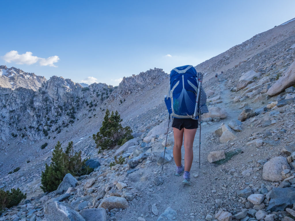
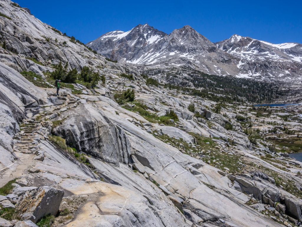
When we arrived back at the trailhead, we then had a repeat of Monday’s hike over Kearsarge Pass but in reverse. It was a very hot hike up to the top of the pass even when we set off around 4pm, so we were glad we hadn’t done it any earlier in the day. With fully loaded packs, we were also very slow to get going, the extra weight feeling quite burdensome, especially after a few days off.
We had a slow start up the switchbacks because of our very heavy packs! Looking back to the trailhead car park.
Just before the top, we bumped into Blue who was making his way down to the trailhead, with the intention of hitching to Independence. We hadn’t seen him since Tehachapi, but it always turns out that as we leave town and re-join the trail, Blue is just getting to town and taking a zero. (So we still haven’t all been out in town together for a beer!) Hopefully, our town itineraries will cross at some point in the future so we can do just that!
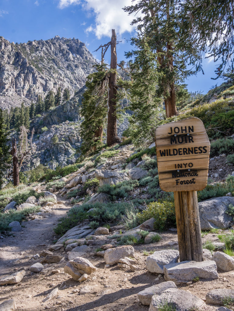
Re-entering the John Muir Wilderness.
Looking onto Heart Lake on our ascent.
Heading along the ridge that afforded us expansive views of the snow-capped High Sierra peaks to our left.
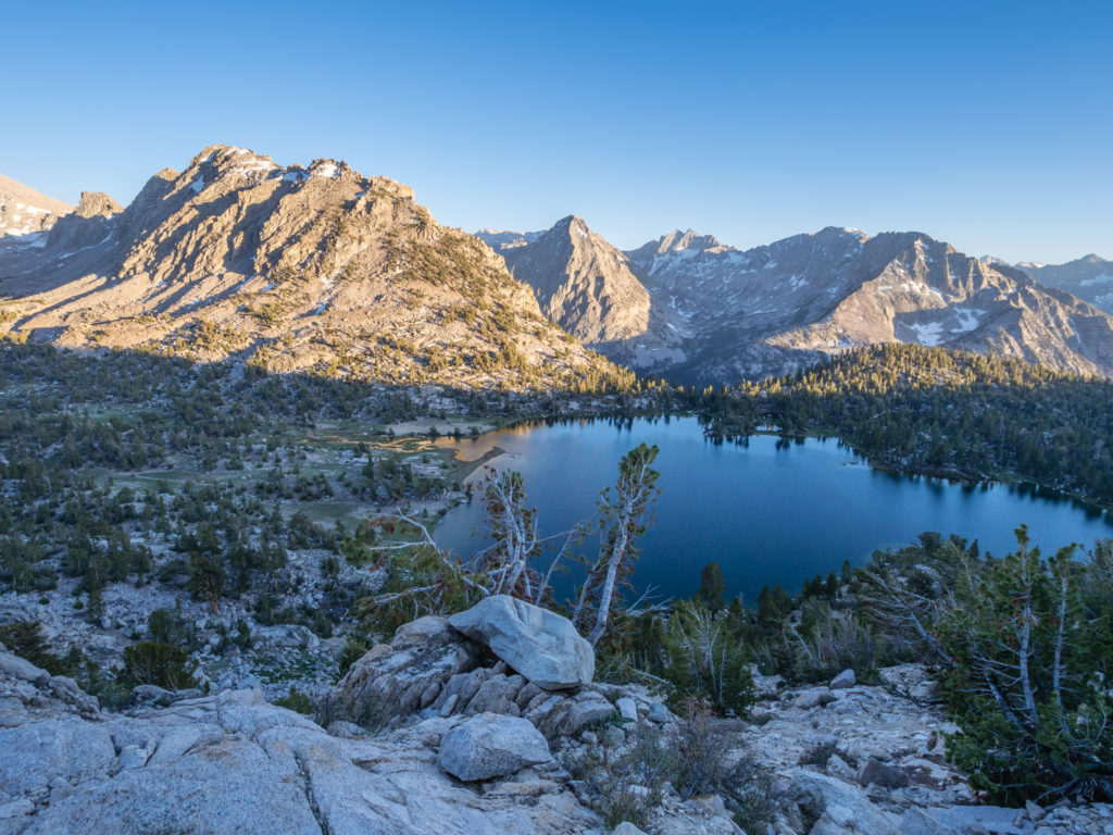
In the late evening light, looking onto beautiful Bullfrog Lake as we took the high route across Kearsarge.
We returned to the trail junction with the PCT, getting there around 8pm, and camped close by as it was just before sunset. We didn’t need to cook dinner as we’d already eaten in town, so it was a case of get the tent up and get to sleep in preparation for an early start tomorrow. We needed to have recharged our batteries ready to get up and over the other side of Glen Pass before any of the snow melted once the sun was up…
Day 67 – Friday 15th June 2018, Wild Camp at Mile 789 to Wild Camp at Mile 803, 14 miles
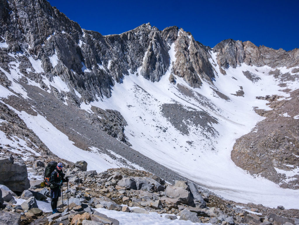
Back from Bishop and back on the trail, we were now facing a big mountain pass per day as we continued through the High Sierra. But we were in good spirits as we had really enjoyed the challenge of going over Forrester Pass last week, and as we had already successfully traversed the highest pass on the PCT in snow conditions, we weren’t too concerned about the rest. (Little did we know…)
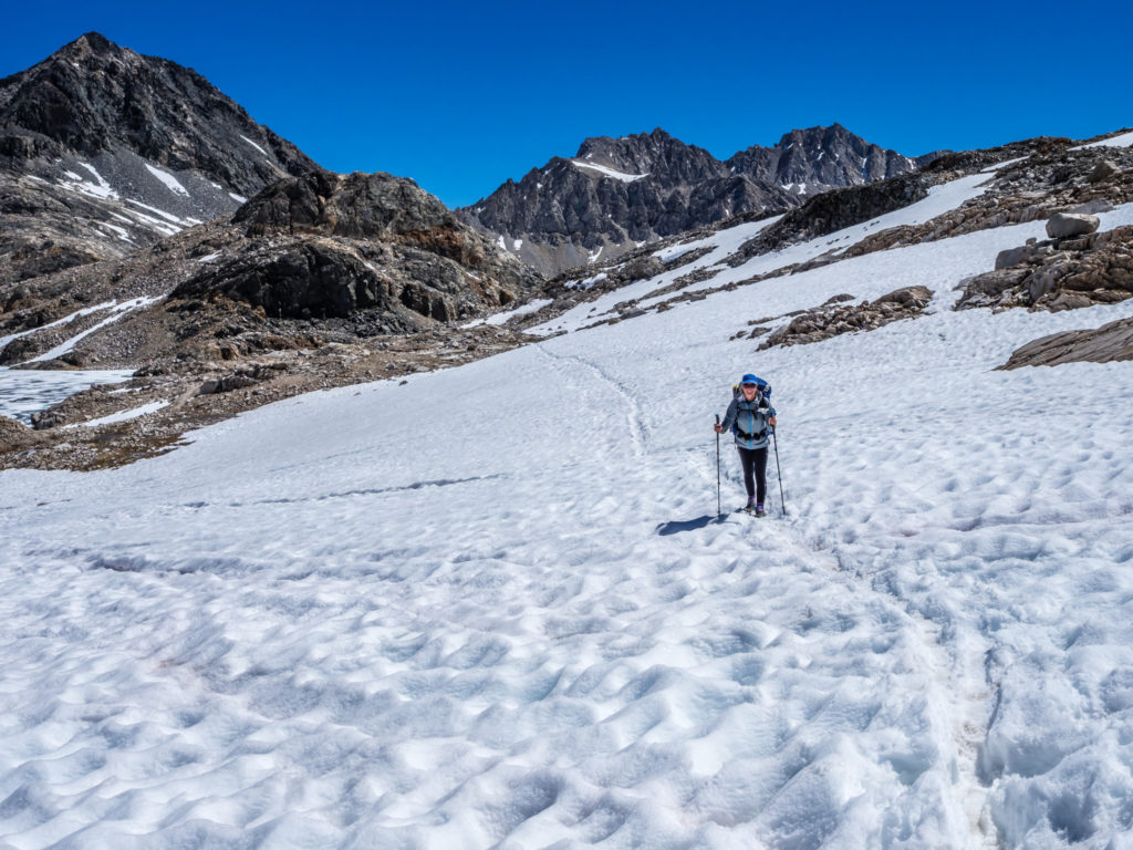
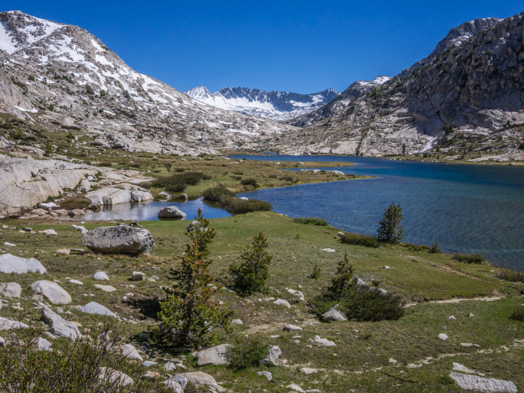
Today we were hiking over Glen Pass at 11,947 feet. At Mile 791.1, it was only a couple of miles from where we had camped last night, which had been our intention to get as close to the pass as possible. But we still wanted to get an early start and be up and over the other side to avoid any post-holing once the sun was up and causing the snow to melt at a rapid rate.
So after a 5am alarm call, we were away around 6:30am. Unlike the approach to Forrester where we were part of a long caravan of hikers making their way up to the pass, today there was just us on the way up. With taking two zero days, we now seem to be in the middle of two large bubbles, which we kind of like as there are currently less people on the trail.
Early morning reflections.
Heading for Glen Pass, it was a stony trail, with good switchbacks that were mostly free of snow on the south side, but we were slow making the ascent as our packs were just so heavy. With bear cans crammed full with 7 days of food, plus ice axes and micro spikes (extras to our usual kit), our backpacks are at maximum capacity. The only consolation, and we always say it, is that we’ll eat ourselves lighter, so in a few days they won’t feel half as bad!
Setting off for Glen Pass where the trail on the south side was mostly free of snow.
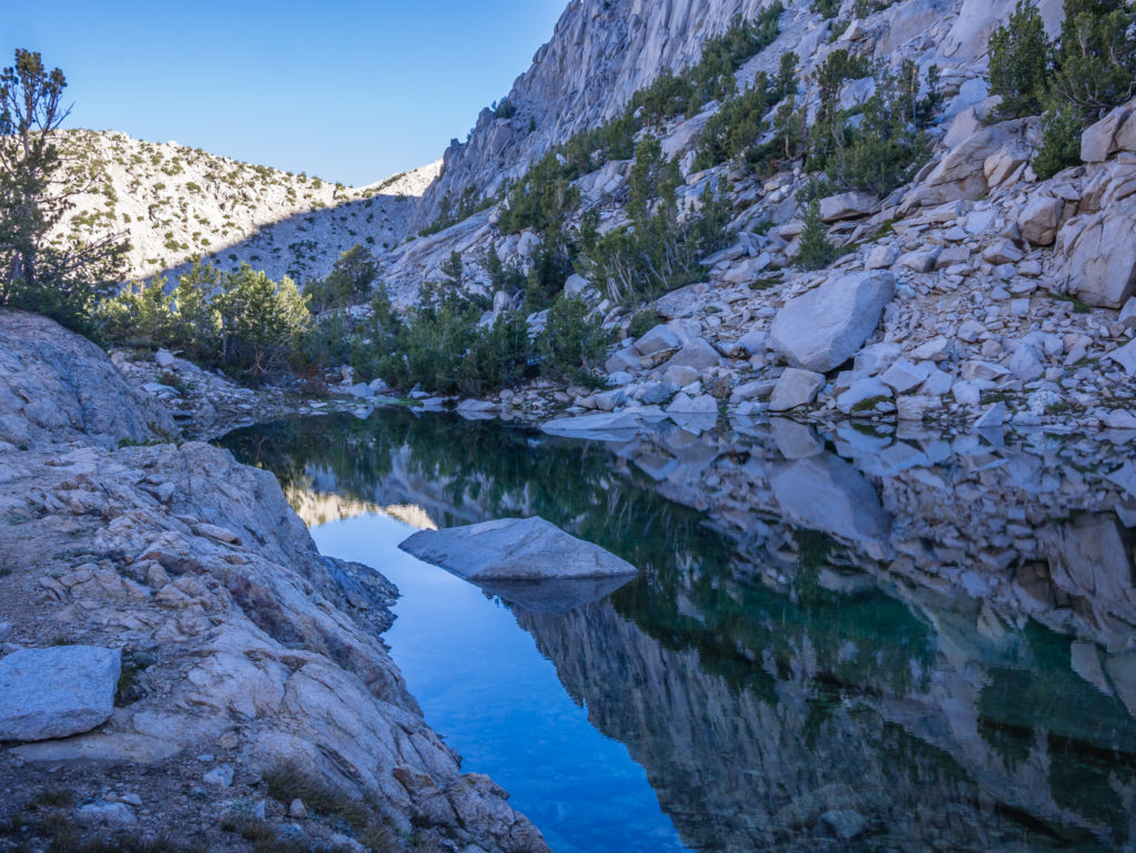
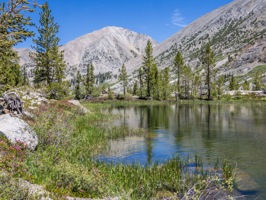
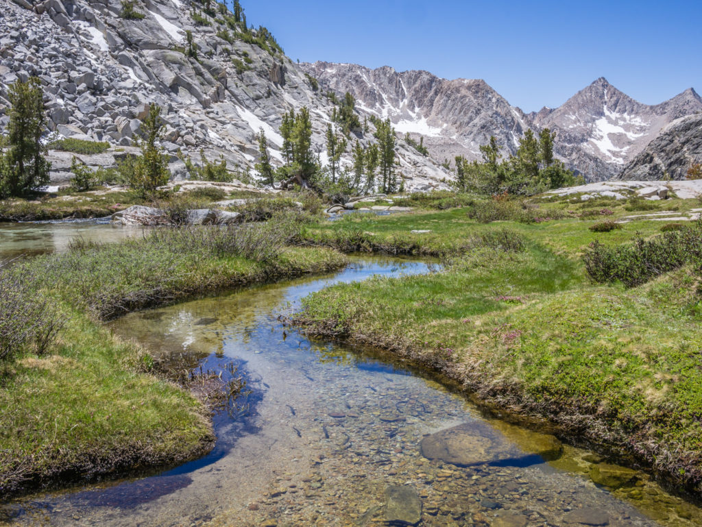
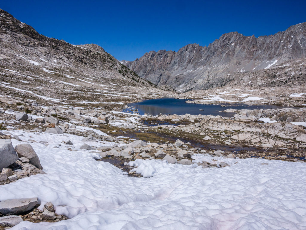
Looking onto a pristine mountain tarn.
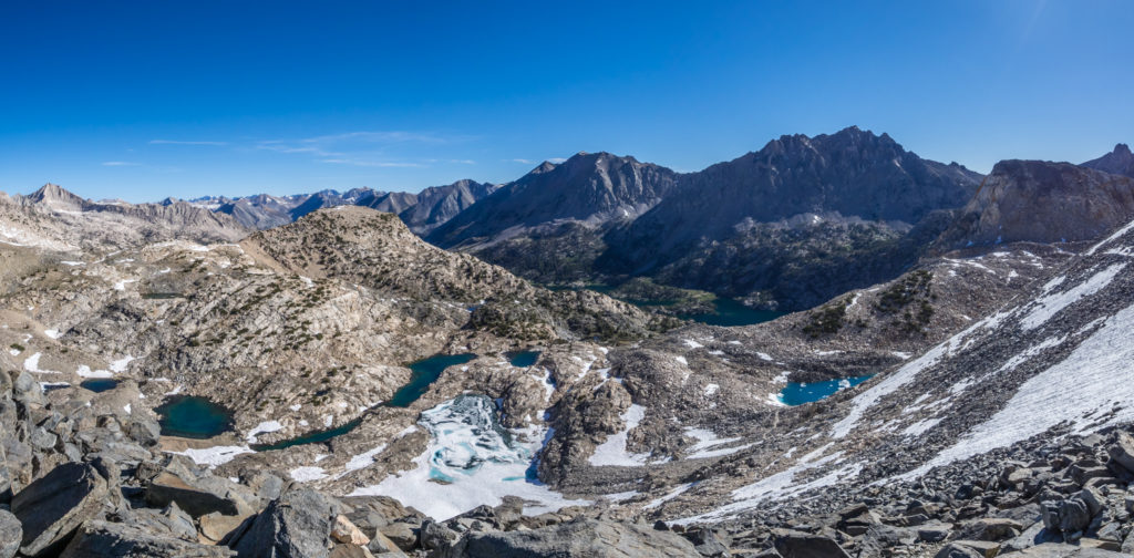
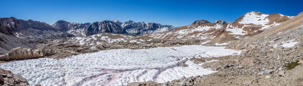
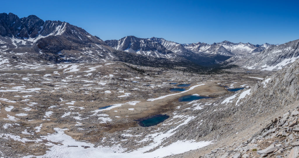
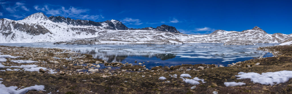
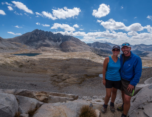
Panorama of the surrounding peaks.
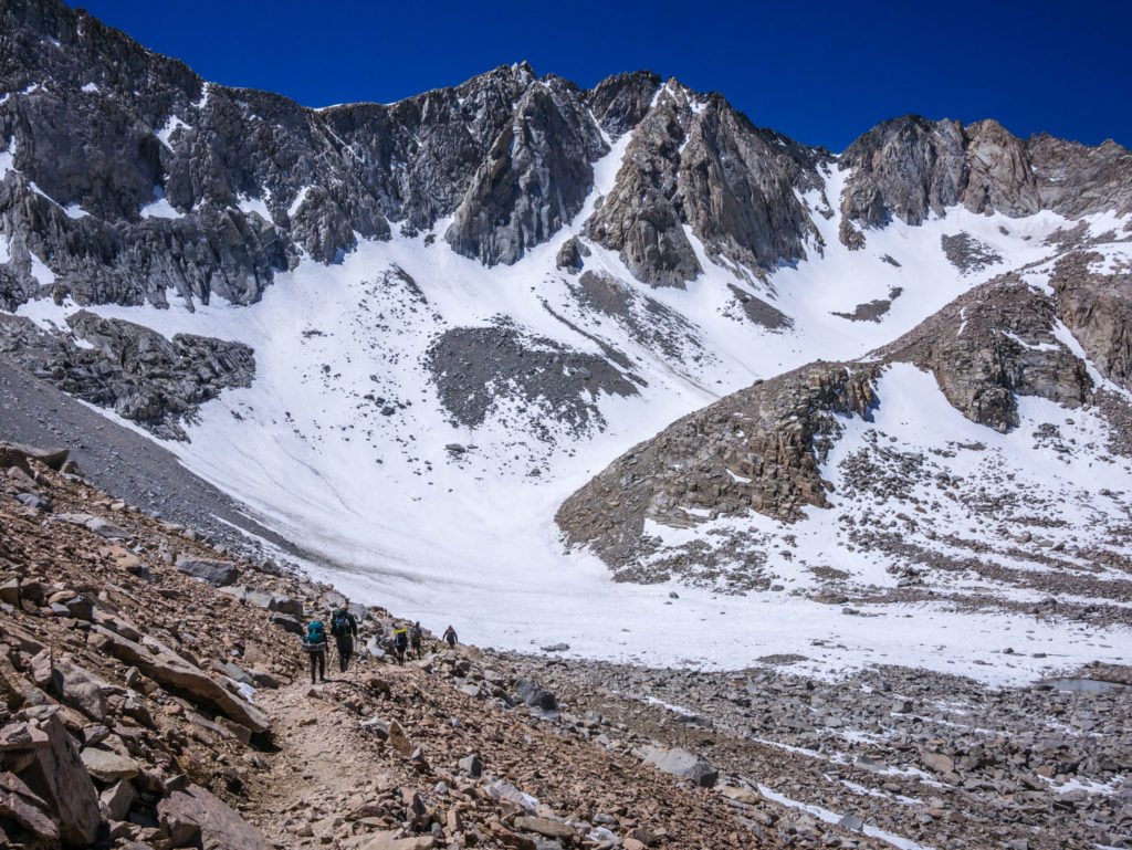
Closer to the pass, we had a good view overlooking some frozen mountain lakes. We could see that the surrounding peaks were still topped with snow, so we were lucky that the top of the pass, when we got there, was clear. There were a couple of other hikers at the top when we arrived and we could see a couple more setting off along the switchbacks on the north side, the route down mostly covered in snow. We watched as they manoeuvred themselves along the shelf of hardened snow, placing their feet in the existing shoe prints, just like we had done on Whitney and Forrester. So we didn’t waste any time putting on our micro spikes (we were carrying them so we might as well use them), and set off following the line of footprints in the snow.
Following the existing line of foot traffic through the snow-covered mountainside.
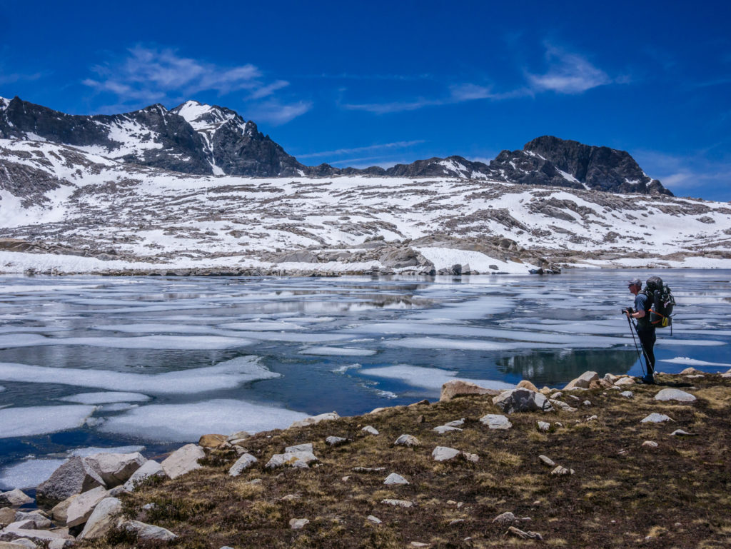
Looking onto frozen mountain lakes.
Traversing a thick snowy ledge.
Some parts of the trail where the snow had melted were more of a scramble over big boulders and smaller rocks, which we’d have found easier had we not been wearing the spikes. But we kept them on until we were sure there wouldn’t be any more snow fields to cross. The snow had all but disappeared as we neared Upper Rae Lake.
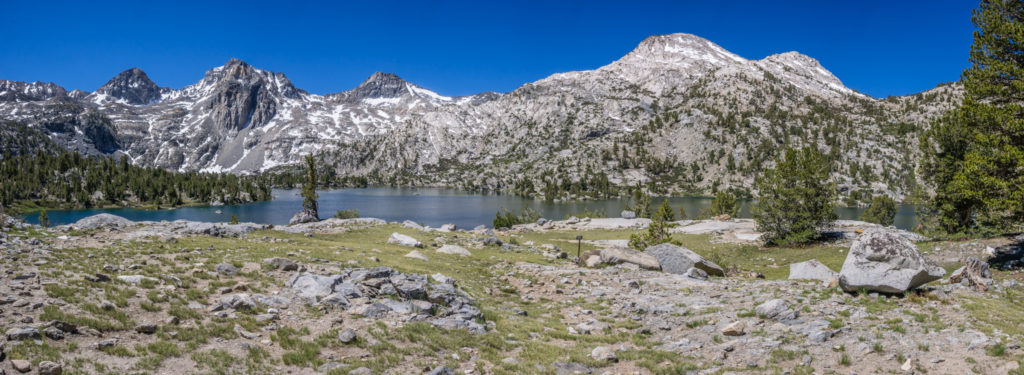
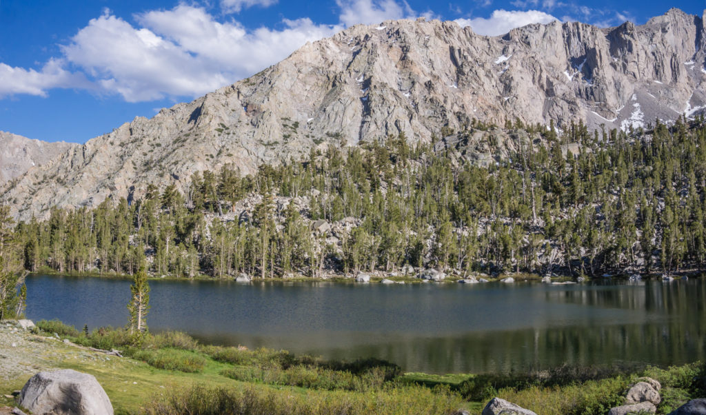
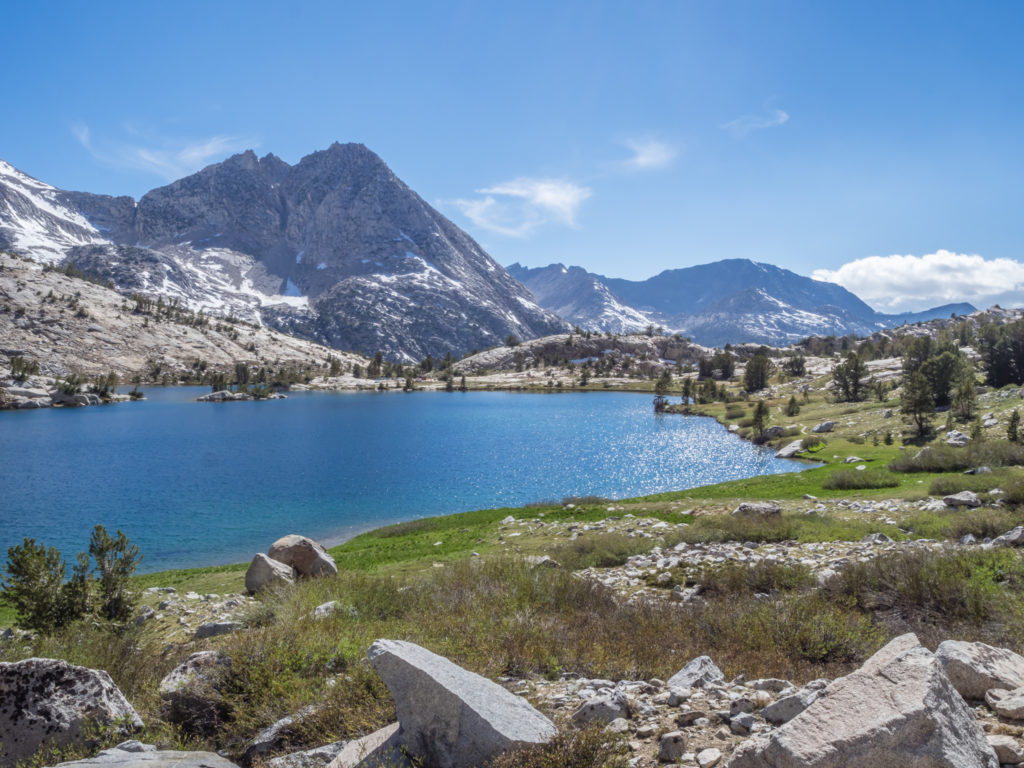
Looking onto Upper Rae Lake.
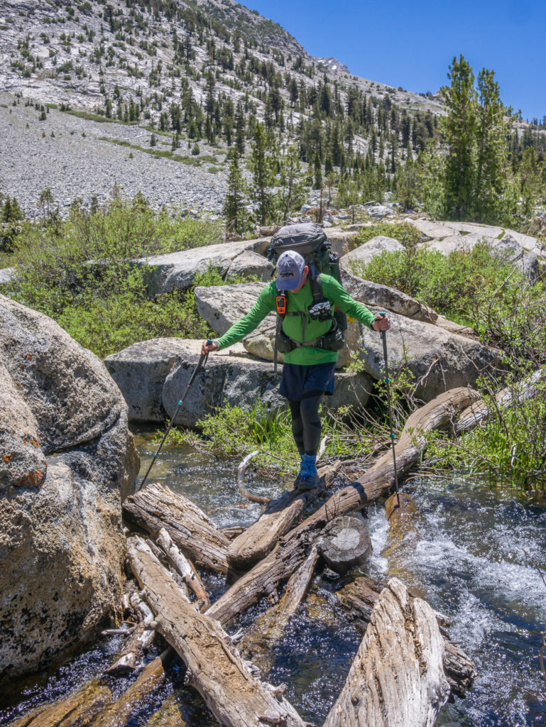
As we walked around the three bodies of water – collectively known as the Rae Lakes (Upper, Middle and Lower), we reminisced about the time we spent camping at both the Middle and Lower of the Rae Lakes during our time on the John Muir Trail in 2014. There were two significant differences we noticed today – the first, that we had to wade through the outlet of the Upper Lake to continue on the trail as there is just so much water this year! And secondly, we just couldn’t avoid them – there were hundreds of mosquitoes swarming around us every time we stopped to enjoy the view and take a photo (which would have made camping around the lake today quite a miserable affair!)
Wading through the outlet of Upper Rae Lake to continue on the trail.
Making my way across a flooded section of the lake.
Enjoying this wonderful, pristine area of the High Sierra.
So because we’re just slightly averse to being eaten alive, we didn’t spend too long there! We managed to get a few shots of Fin Dome, before continuing up the valley passing Arrowhead Lake and Dollar Lake. We had planned on reaching the suspension bridge over Woods Creek, located just before Mile 800, before we stopped for lunch. But we didn’t make it that far! Instead we stopped around Mile 798, utterly exhausted, the trail really taking it out of us today. We didn’t remember it as being so tough on the JMT, but maybe we’re now looking at it through rose-tinted spectacles!
Making use of some logs to help keep the feet dry this time!
Just one of the many beautiful bodies of water we passed on this section of trail.
Today, this section of the trail down from Glen Pass up towards Pinchot Pass was particularly rough, with numerous rocks and roots to keep manoeuvring around. Much of the ascent, although on switchbacks, was also going up large steps where slabs of rock have been used to create the trail. For someone with short legs, the tread on each step was a real effort to get up, especially with a heavy pack weighing my legs down! Wayne was also feeling it too. His hip belt is now the tightest it will go, but as he has lost at least 14lbs, his pack no longer settles on his hips, which usually bear the weight. So now the pack is pulling back and hurting his neck and shoulders. When there’s a grumpy person walking behind you, it doesn’t make for much trail conversation! We also had several more creek crossings to contend with that ranged from ankle to knee-deep, so we continuously had cold, wet feet throughout the day. Cue, grumpy person walking in front as well.
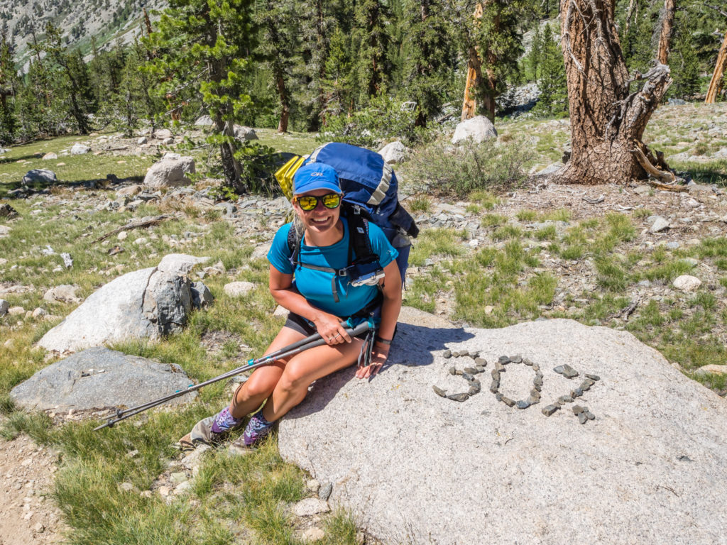
We weren’t sure whether to celebrate or cry! Someone on the trail had kindly informed us that we were 30% of the way through our journey to Canada. (After all that walking, it doesn’t actually sound that much!)
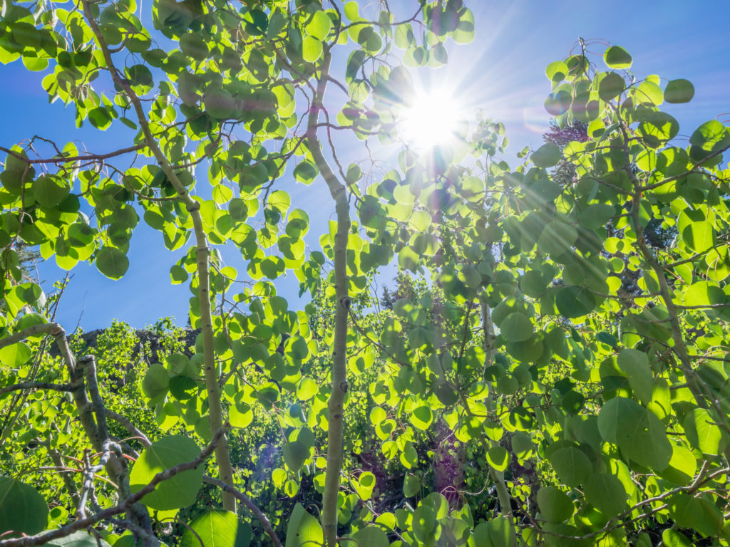
We passed some beautiful Aspens, their leaves fluttering in the breeze and catching the sunlight.
Reaching the Woods Creek suspension bridge took our minds off the mosquitoes for a short while as just after the bridge there is a stone marker signalling PCTers have reached Mile 800! We had an obligatory photograph, then had another snack break. With double breakfasts and double chocolate bar rations this week, no wonder we were stopping a lot and not seeming to get very far, very fast!
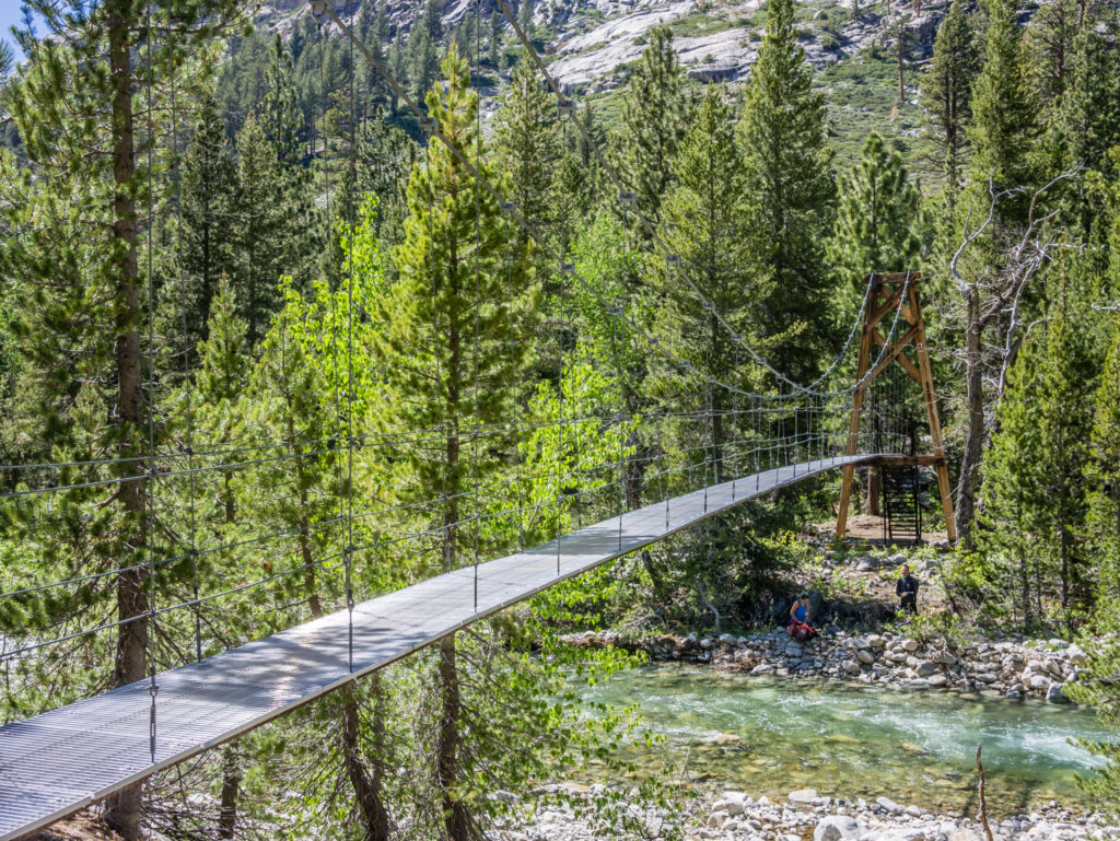
Arriving at the Woods Creek Suspension Bridge. (The sign indicates that only one person should cross at a time!)
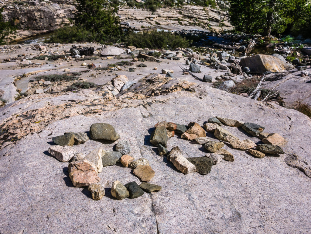
Reaching Mile 800!
To set us up from a good position in which to traverse Pinchot Pass the following morning, we had planned on camping just above the tree line at Mile 805. But we didn’t quite make it that far. Completely shattered, it felt like it had been one of the hardest days on the trail we had hiked so far, so we settled for a wild camp spot at Mile 803, leaving us the extra couple of miles still to add on in the morning on our approach up to Pinchot. It was a good call! Our pace had been slower than ever and our packs were like lead weights, so instead of grumbling our way through the last couple of miles, it was better to call it a day and hike fresh in the morning. From today’s experience, the PCT route hiking south to north definitely seems much harder than going in the opposite direction of north to south on the JMT. (But maybe my opinion will change again in a week once we have eaten all of our food!)
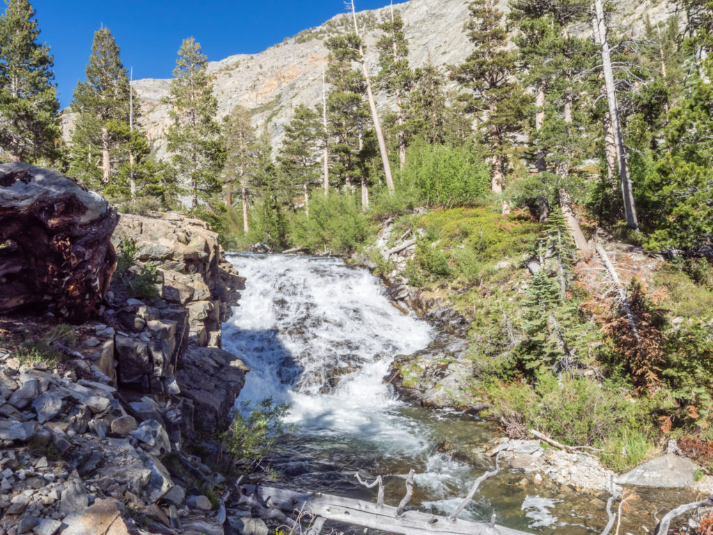
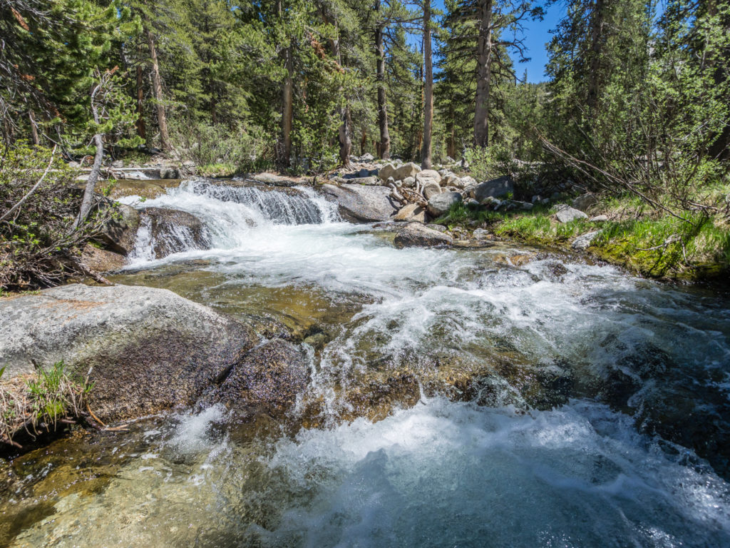
Looking back onto the fast flowing Woods Creek.
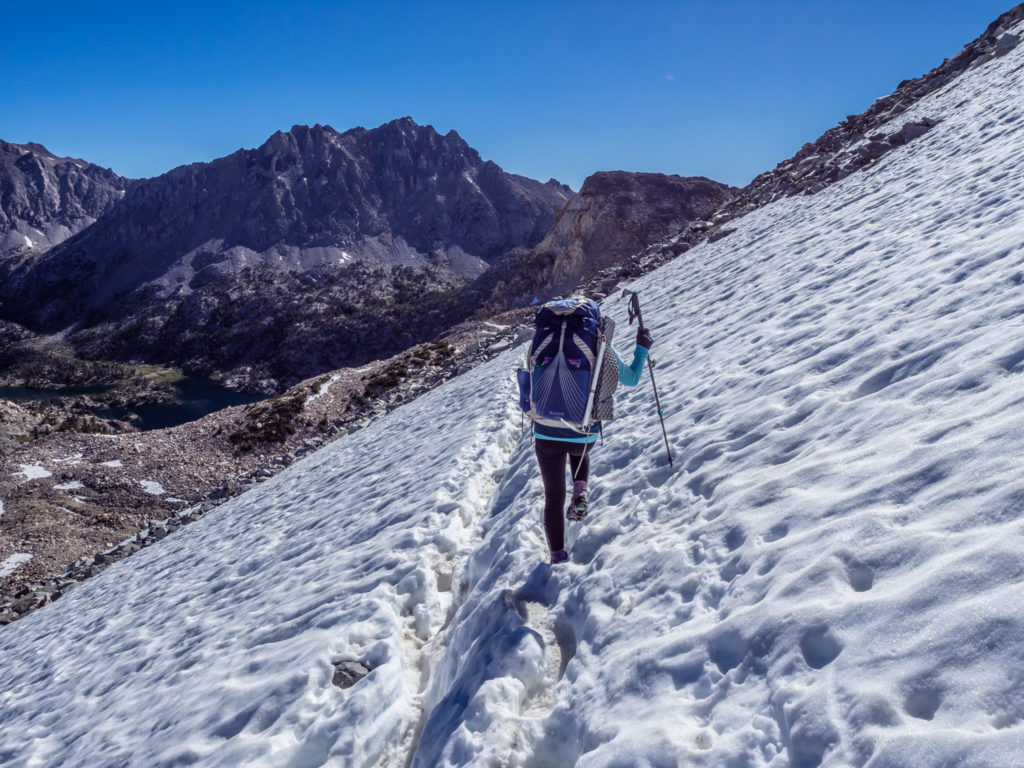
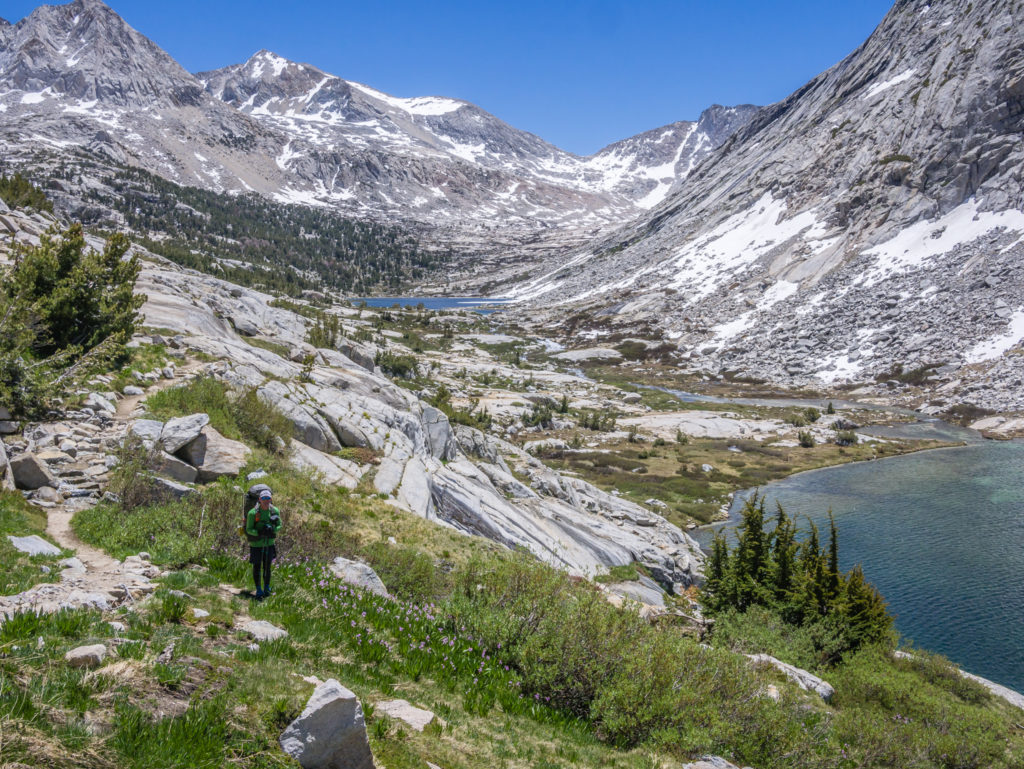
Making our way closer to Pinchot so we would have an easier traverse of the pass the following morning.
We enjoyed the stunning reflections, but not the persistent mosquitoes!
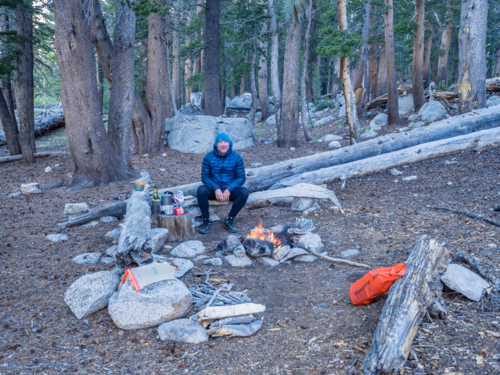
To avoid the mosquitoes at camp, Wayne put on full waterproofs, whilst I tested out the Deet spray. They were still a nuisance, buzzing around our heads, but they were less successful in getting fed! We had our main staple – Mashed Potato for dinner, with a Tortilla soup mix poured on top, plus hot chocolate and tea with biscuits, the latter putting a very big smile on our faces after a particularly tough day. As every English person knows, a cup of tea cures all! And then it was early to bed, ready for another big pass tomorrow!
Day 68 – Saturday 16th June 2018, Wild Camp at Mile 803 to Wild Camp at Mile 814, 11 miles
When I said yesterday was a tough hiking day, we hadn’t had the pleasure of traversing Pinchot Pass on the PCT coming from the south. (We certainly don’t remember it being such a tough undertaking on the JMT!) So now Pinchot takes the number one spot for most demanding ascent!
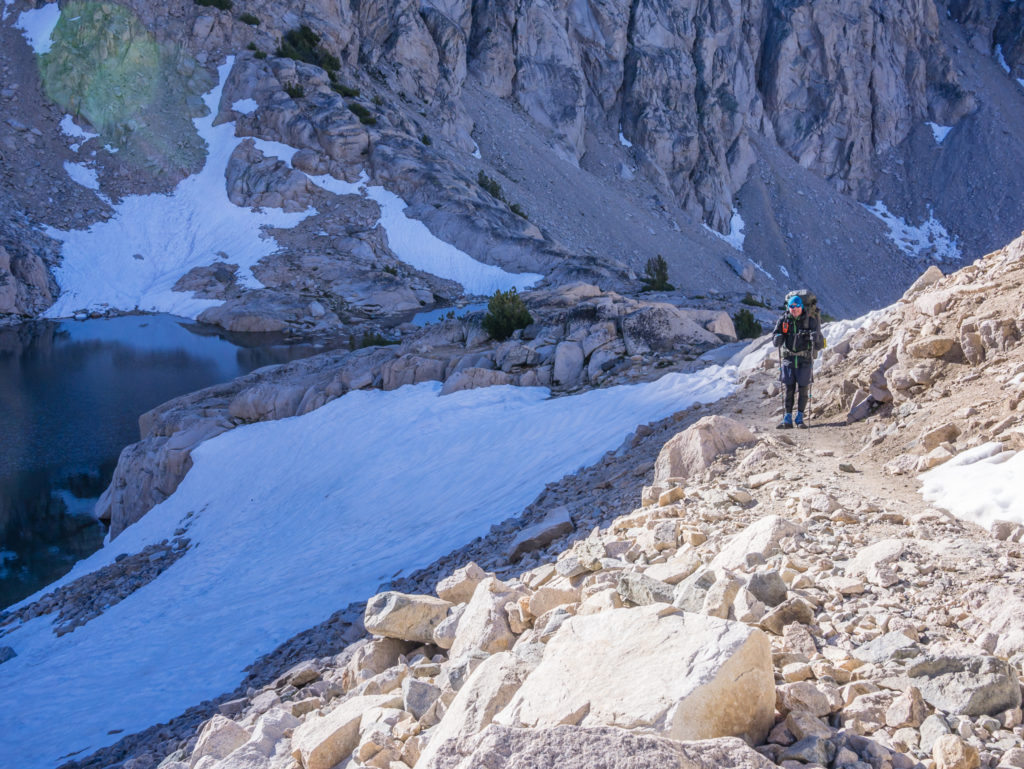
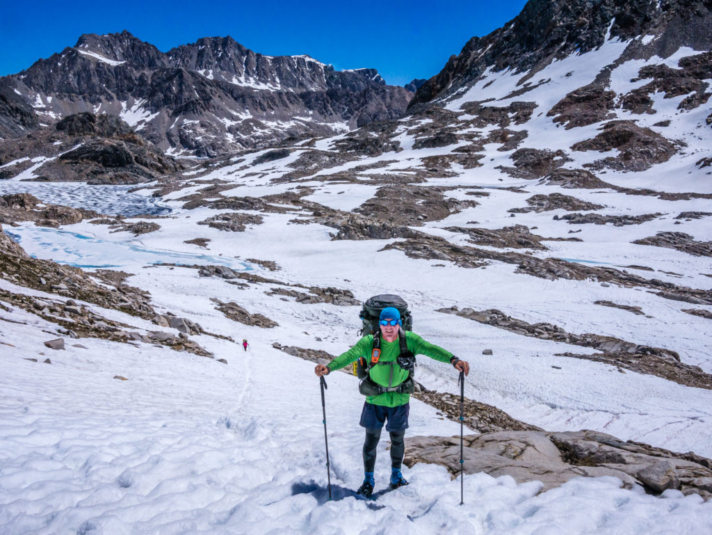
We had left ourselves 4 miles or so from last night’s camp at 9,800 feet to reach the top of the pass at 12,139 feet, which we though would take a couple of hours if the approach was free of snow. But despite there only being a handful of snow patches to cross, which we did easily without micro spikes today, the overall ascent was a long and time-consuming undertaking that took us over 3 hours.
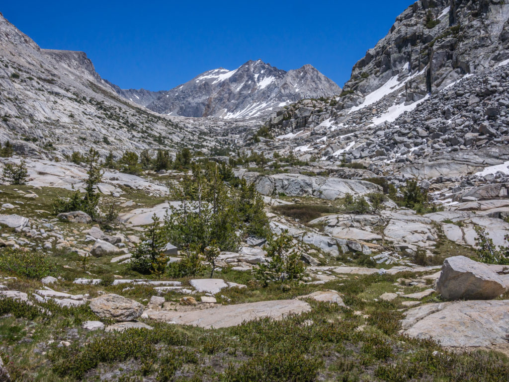
Panorama of the surrounding peaks as we made our way closer to Pinchot.
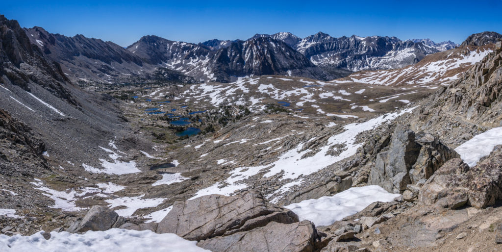
Looking back from the switchbacks during our long ascent.
It wasn’t the remaining snow that was a problem. Once again there were a lot of giant steps to climb as the trail gradually gained height up through the valley and with the heavy weight of our packs, our legs just didn’t feel like they had any strength to keep lifting them so high. (Just as if they had already been through an intensive gym workout, they were really feeling it from yesterday’s efforts and now they had to repeat it all over again!) We stopped partway up to eat a bag of jelly sweets for a quick energy boost, but we were still progressing up the switchbacks at what felt like a snail’s pace compared with how fast we had powered through some of the earlier desert sections.
It was our poorest time yet! Having left camp around 6:45am, we reached the top of Pinchot Pass just after 10am. There were several other hikers sat at the top of the pass when we arrived, all pleased to have made it and all exhausted because of how demanding the climb up there was! I don’t think anyone really expected Pinchot to be so tough having thought of Forrester as being the most difficult with it being the highest pass. But it shows how easy it is to underestimate the mountains.
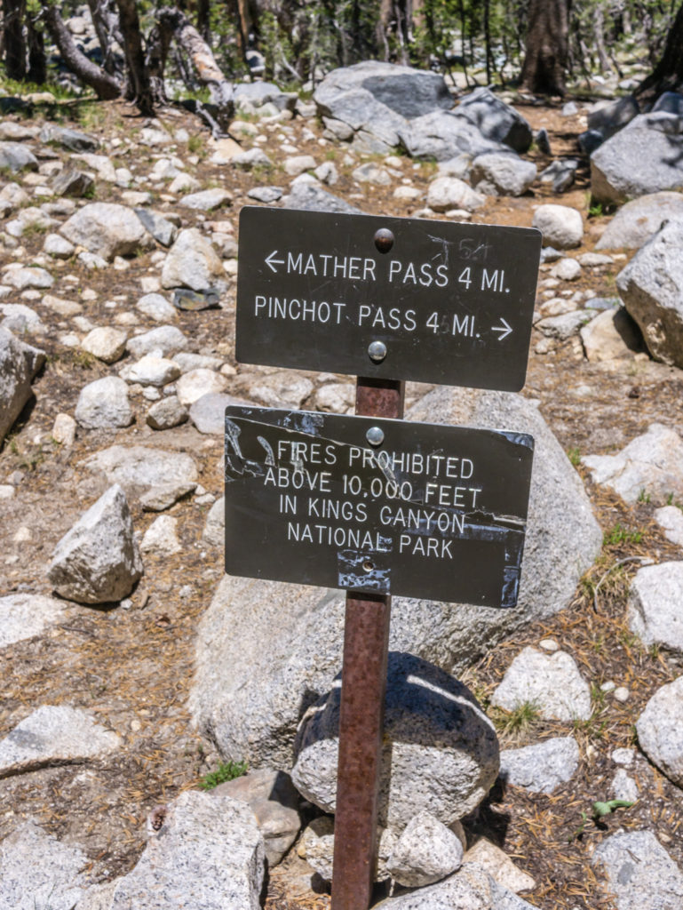
Here we met Co-Pilot and Loic, two French guys, who were thru-hiking the PCT, along with Mario from Mexico. They had even more of an excuse to be feeling tired as they had started this morning from the Woods Creek crossing, just before Mile 800, which meant they had over 3,500 feet of elevation gain to get to Pinchot Pass at Mile 807.1. They were also planning on hiking on at least another 10 miles today to get over Mather Pass at Mile 816.9 as well! Thankfully, we had given ourselves an itinerary that was much less demanding in that we would only be tackling one pass per day!
Happy to have finally made it to the top of the pass!
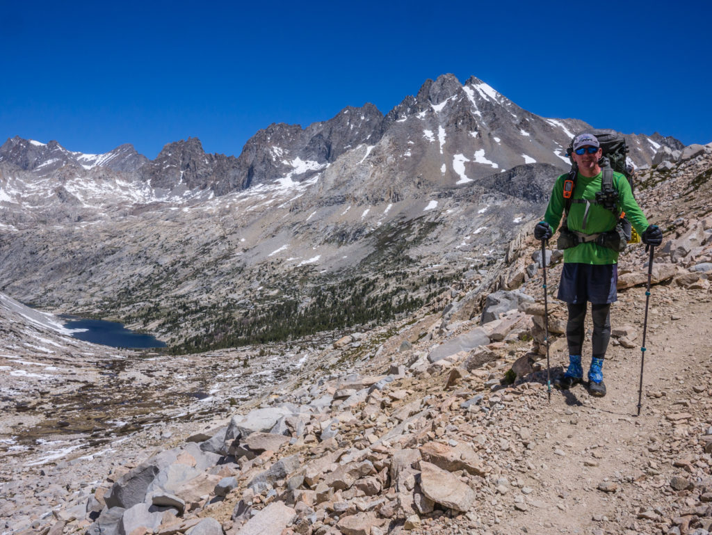
After Co-Pilot took our photo at the top of the pass, we quickly got going again, eager to get down the other side to Lake Marjorie where we were going to have a proper rest break and indulge in tea and biscuits with a view! From the top, several of the switchbacks leading down the north side were covered in snow, but we hardly walked on any of it, choosing instead to make our way down by scrambling across several rocky sections where the snow had melted. We then re-joined the proper trail just before the lake where it was completely snow free. The descent therefore was much easier, nicer and quicker!
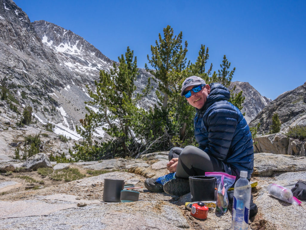
We had made much better time and had found ourselves a lovely scenic spot looking into the lake by 11:15am. As we had only planned on hiking around 11 miles in total, we stayed for around an hour and a half drinking tea and enjoying the view. We also took the opportunity to plan out our daily mileage and camp spots for the next week as we had to include some Post Office visits to collect food resupply parcels that we had sent from Bishop to both Mammoth, Tuolumne Meadows and North Kennedy Meadows Resort, but we had to make sure our dates would coincide with opening days and times. As you’re in the wilderness in the truest sense of the word for the majority of the time in the Sierra, timing and logistics for retrieving food resupply boxes are all important!
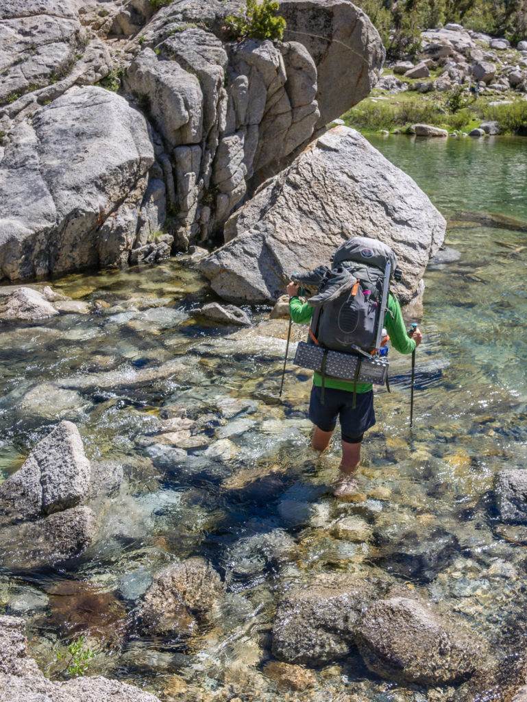
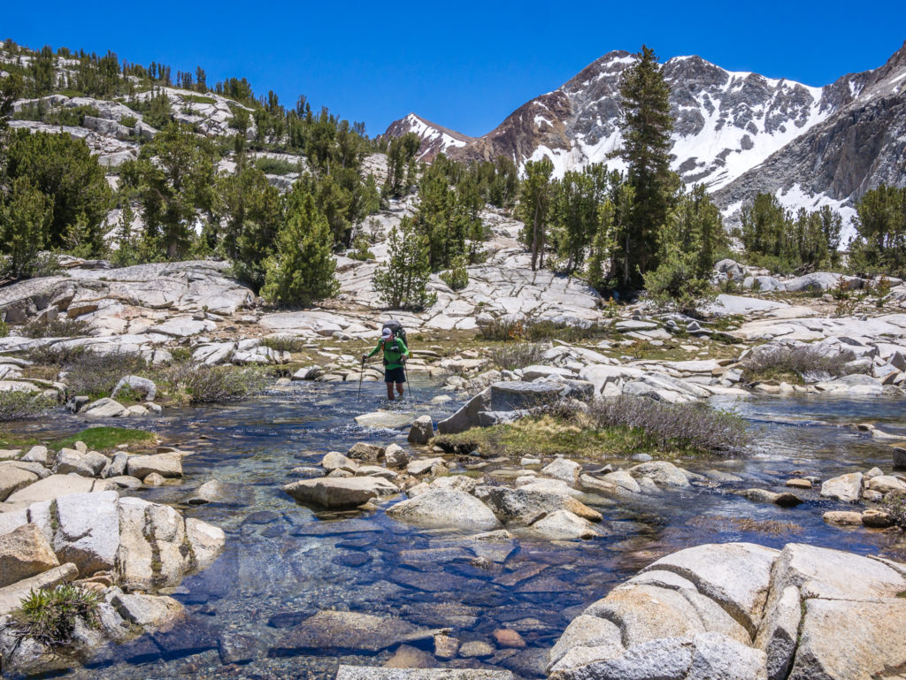
When we set off again, we had several creeks to cross at various points along the trail, all impossible to rock hop safely, so we bit the bullet and waded on through each one, the water levels ranging from ankle to knee-deep. It was good practise, as today we had a major river crossing to contend with. The South Fork Kings River flowing through the valley is known as a particularly hazardous crossing as it is both fast flowing and deep. One PCTer sadly lost her life last year (RIP) by being taken downstream by the raging flow as she tried to cross on her own. So after everything we had read and heard about it, we were not looking forward to the prospect of such a dangerous crossing. However, fortunately for us on this extremely low snow year, the river was manageable, the water level where we chose to cross came just below the knee and we were able to ford it safely by facing the flow and using walking poles to steady ourselves.
No chance of a rock hop!
We had to contend with crossing many fast flowing creeks along the trail today. (We did not cross here!)
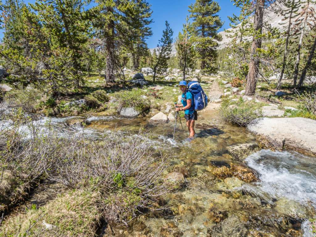
Facing the flow and steadily walking through the creek to rejoin the trail on the other side.
After completing several crossings successfully, it felt kind of exhilarating and we were much more confident in our abilities. Of course there are still other serious crossings to come as we hike further north that will vary depending on the river flow, but I in particular, won’t now be worrying about them beforehand.
From one pass to the next! We decided on an early camp rather than tackle two passes in one day.
By the time we had crossed the South Fork Kings River it was mid-afternoon, so we continued up the valley to the Upper Basin in an effort to get close to Mather Pass, hoping to make tomorrow morning’s ascent a little easier. (Our packs at least should feel a little lighter having eaten two day’s food rations.) We stopped and set up camp at Mile 814, leaving approximately 3 miles to go to reach the pass.
Our choice of camp spot was perfect! We had a 360° view of snow-covered peaks all around, including Cardinal Mountain to the east, Vertnacher Needle to the west, and a direct view to Mather Pass looking north. We were also close to water with the South Fork Kings River on our west side. But best of all, as we had hiked above the tree line and there was a breeze coming through the valley, there were no mosquitoes!
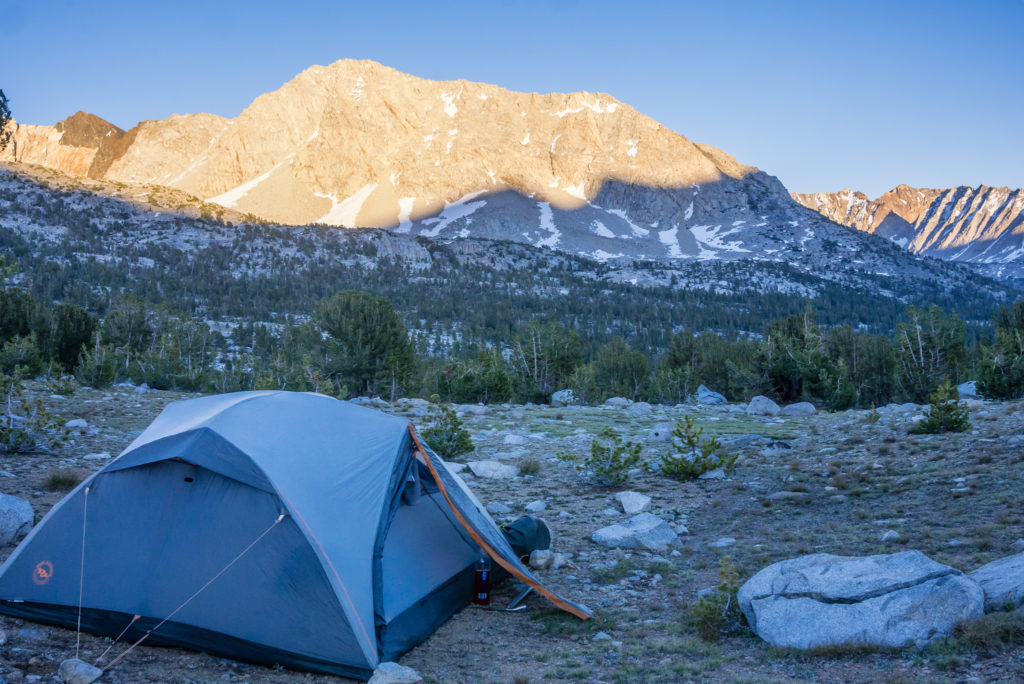
Our mosquito-free camp spot with a wonderful 360 degree view of the surrounding peaks!
Having access to water meant we could wash properly (no wet wipes tonight), launder some clothes and drink plenty of tea and hot chocolate! Whilst eating dinner, (tonight was our favourite dish of Idahoan Mash with a Mixed Bean Chilli Sauce), we watched in silence as two deer came foraging around the bushes close to where we had pitched the tent, then skittered off. It was great to see them up close and proved to be another plus point about our choice of campsite for today!
Day 69 – Sunday 17th June 2018, Wild Camp at Mile 814 to Wild Camp at Mile 833, 19 miles
Today was an emotional rollercoaster of a day! From the exhilarating final climb to the top of Mather Pass at 12,096 feet, the switchbacks free of snow on the south approach, to the sheer terror of having to come down the north side on a steep traverse, the trail hidden as it was still completely covered in snow! It was literally one extreme to the other and a real test of our abilities in winter conditions.
But that wasn’t even the start of it! The first hurdle we came to as soon as we broke camp was that the trail crossed over a branch of the South Fork King’s River. As our shoes were still damp from the last crossing we did yesterday, we were quite reluctant to get our feet cold(er) and wet so early in the day. So we kept following the river upstream looking for a suitable place to cross where we could make use of stepping-stones or logs. (Obviously only ‘sturdy’ looking ones after Wayne’s river crossing mishap last week!) We were persistent and went about a mile upstream before we found a section of river narrow enough to step from a rock straight onto the opposite bank. It was quite nerve-wracking as the water was flowing fast and looked quite deep at that specific point, but after some hesitation, we both made it across safely.
Making our way towards Mather Pass after successfully crossing the South Fork King’s River and not getting wet feet!
Looking back down the valley as we approached the top of Mather Pass.
After a 3 mile uphill climb, then came the top of Mather Pass. It had seemed a relatively easy final ascent compared with the previous two passes and we were all smiles on reaching the top. Unbeknown to us however was the difficult descent that was to follow, the north side of Mather still covered in plenty of snow.
On top of the pass, before our stressful descent through the snow!
We put on our micro spikes ready for the traverse, all set to walk in the previous foot prints leading in a vertical line down the mountainside. But once we got going it was nerve-wracking to say the least. The route down was steep and the snow was already slippery as it had begun to melt in the early morning sun, which meant post-holing was already a problem. Therefore we had to take our time with tentative steps, testing out the firmness of the snow before placing our full weight down. There were also some rocky sections we had to scramble around which was difficult wearing spikes and the whole descent made for a really uncomfortable couple of hours!
Glad to be down the first steep, snow-covered section and onto the switchbacks.
A busy section of trail! Everyone was relieved to have got down the north side of Mather Pass safely.
Irish Tony, the brave soul who went down before us decided that he was going to glissade down the mountain instead, which was certainly the quickest way down. It might have seemed a fun idea to him, but we considered it to be more dangerous as we didn’t know what was underneath the snow. We definitely didn’t want to risk injuring ourselves on any hidden rocks! The one positive of Irish Tony’s descent was that he found a mobile phone at the bottom, which belonged to our trail friend Jen. She had lost it earlier that morning during her own descent and had walked back through the snow looking for it.
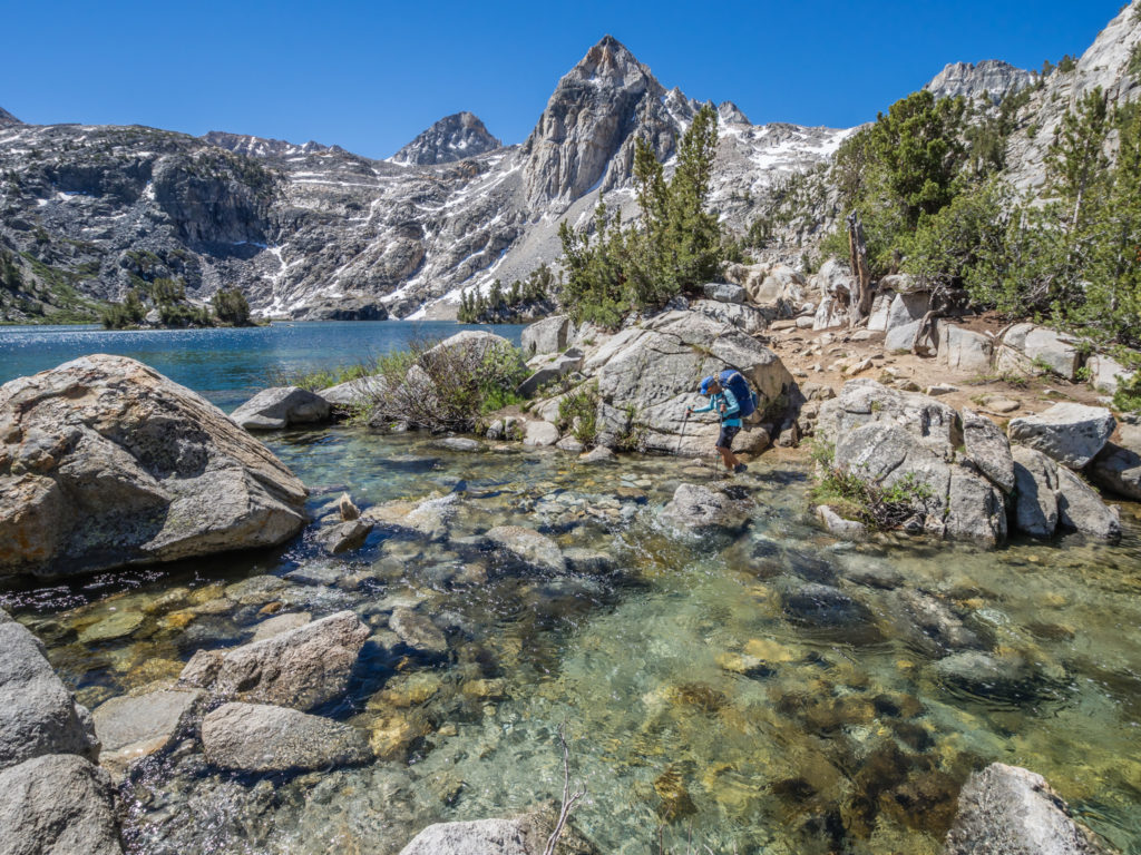
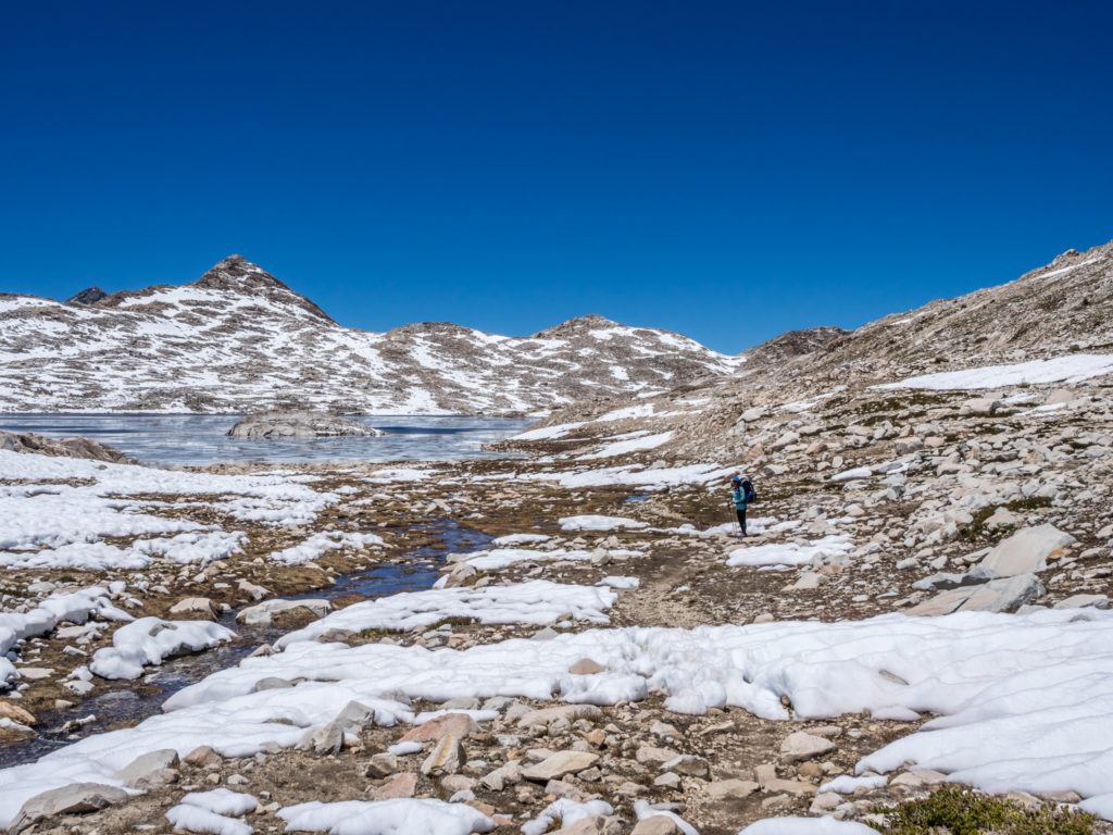
Making our way to Palisade Lakes.
Looking onto Upper Palisade Lake.
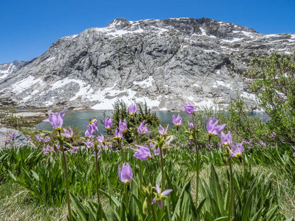
An injection of colour! Pretty purple flowers in bloom beside the lake.
The trail gradually winds down to the lake where you can walk along the shore line.
Glad that the steep descent and such a stressful moment on the trail was over, we decided to stop for lunch when we reached Palisade Lakes. Walking along the trail that followed close to the shore line, we spotted where we had camped above the Lower Palisade Lake on the JMT. At that time we had also gone for a swim, but there was no chance today as the water was much too cold!
Heading down to Lower Palisade Lake where we had lunch with a view!
Looking out onto the lakes before our descent on the Golden Staircase.
The water was both clear and full of fish!
Looking back up the valley towards Mather.
Our lunch spot overlooking Lower Palisade Lake.
Descending from Palisade Lakes via the Golden Staircase was today’s next big challenge. It feels like you are going down a million steps following switchback after switchback as you descend over 2,500 feet to the valley floor. Beyond, the trail then gets easier as you follow Palisade Creek through Deer Meadow.
Palisade Creek flows through a very lush Deer Meadow.
We always find it amazing how you can never see a way down when you look back but the trail has taken you right through the terrain!
Happy to have made it down the Golden Staircase to a much nicer walking track!
The day wouldn’t have felt so hard if we’d have camped somewhere along this section, but we were trying to push on further and cover some miles through Le Conte Canyon to get as close to the approach to Muir Pass as possible ready for tomorrow’s ascent. Hiking through Grouse Meadow at Mile 828, I had an aching neck from my pack and just felt completely exhausted from the day’s elevation changes, which was making me miserable. I just wanted to get there – but we were pushing on for Big Pete Meadow at Mile 833. The only thing I could do was keep reminding myself that the closer we got towards Muir Pass the easier it would be in the morning. (Wayne, who was in a much more positive mood than me, knew just to keep walking and keep quiet!)
Le Conte Canyon was not how we remembered it from 2014. Then, it had been a picturesque area that we loved hiking through. Today, it seemed devastated. There was evidence of a burn through the area, but we also considered that floods may have caused severe damage in the canyon from last year’s high snow year as there were now a lot of fallen trees and debris blocking the trail in numerous places. It made for difficult hiking as we were constantly stepping over roots and rocks and having to clamber over large tree trunks directly in our path, which was even more tiring.
It was a late arrival at camp, when we finally made it to Big Pete Meadow just before 8pm. It was cold as the sun had already dipped behind a mountain and it also meant that by the time we had pitched the tent and got sorted Wayne was cooking in dark, which he doesn’t like doing. So all in all, when I said it was an emotional rollercoaster of a day, it really was! We wanted to slow down and enjoy the High Sierra with less miles per day, but with having to traverse a mountain pass per day, we have found this extremely difficult to do because of having to be up and over before the snow melts. Let’s hope we have a more successful and less stressful day tomorrow after a good night’s sleep!
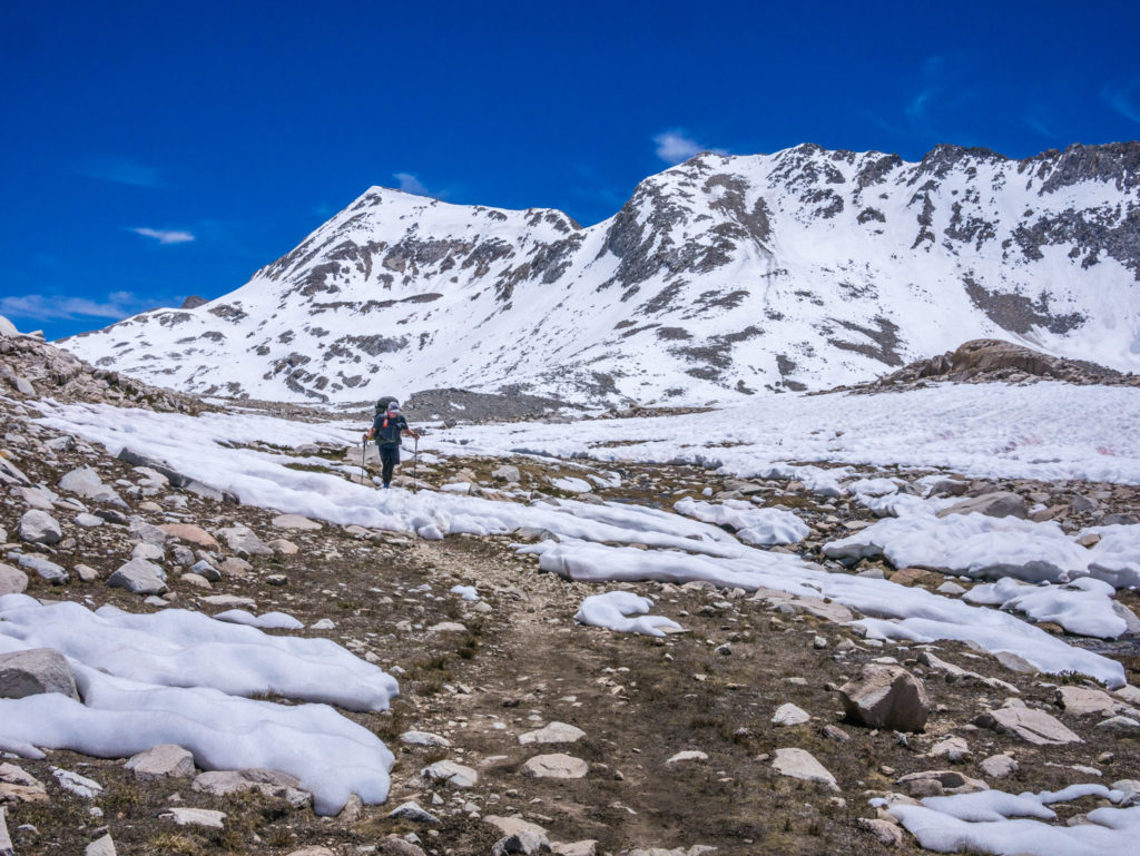
Day 70 – Monday 18th June 2018, Wild Camp at Mile 833 to Wild Camp in McClure Meadow at Mile 848, 15 miles
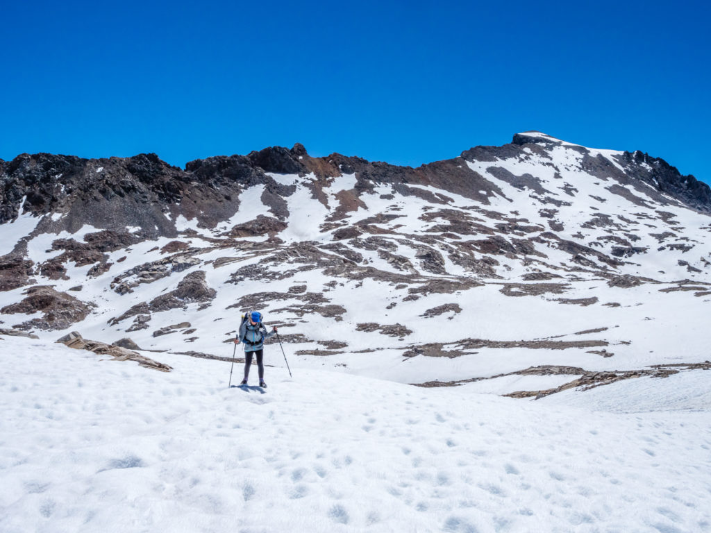
Well today was both exhausting and exhilarating at the same time! Our big challenge of the day was hiking up and over Muir Pass. It wasn’t the highest mountain pass at 11,973 feet, but it was the most challenging so far in that it was covered in solid snow approximately 2 miles either side of the top. That meant even with a 6:30am start on the trail from Mile 833, we still didn’t reach the Muir Hut on the top of the pass at Mile 838.6 until 11am. (So 4 and a half hours to cover 5.6 miles!)
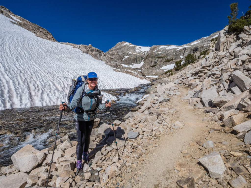
Unlike on Forrester where we seemed to make a quick ascent through the snow straight up the switchbacks and then on to the top, Muir Pass took a lot of effort and concentration as any sign of a trail was completely covered over. So from just before Helen Lake at Mile 837, we put on our micro spikes and slowly but surely made our way uphill, following the long lines of shoe prints already stamped into the thick snow on the approach to the pass, checking every now and then that we were still going in the right direction using GPS.
Ready for our next big challenge – Muir Pass!

Not looking forward to fording the Middle Fork King’s River as we knew the water was icy cold!
Again it was hard work, but what made it worth it was the incredible view. The whole area was absolutely stunning. Reflected brilliantly in the still waters of Helen Lake were the surrounding mountains blanketed in crisp, white snow, which contrasted vividly with the bright, blue sky. It didn’t help our already slow pace that we kept stopping and photographing each beautiful vista as our route meandered across different slopes. Without a doubt, each scene was picture postcard perfect!
Snowy reflections on Helen Lake.
Whereas it had seemed such a trudge going up Pinchot a few days ago, today it was fun to be hiking in snow and the incredible scenery more than made up for the effort. We had been a little apprehensive about what was to come as we’d heard via trail talk that the snow covering Muir Pass was 7 miles either side! After yesterday’s daunting descent from Mather as well that was a prospect we really didn’t want to face, so we were pleased to be enjoying the traverse after our initial concerns. What we still had to be careful of however, was river crossings, as well as any hidden dangers that may present themselves, such as ice bridges and cornices.
Enjoying our ascent across the snow-covered mountainsides.
In comparison to our time on the JMT in 2014, during which California was undergoing a severe drought, now because of the snow melt, the creeks were full and the main rivers were raging. Today, the Middle Fork Kings River was the first major river we came to in Le Conte Canyon after leaving camp that we had to ford. The sun hadn’t even crested over the mountains yet, so we were reluctant to get our feet cold and wet this early in the day. Having unsuccessfully looked upstream for a safer place to cross, (the few sporadic rocks and logs in the water were both icy and slippery), we decided to take no unnecessary risks. So in the end we just rolled up our leggings and waded through, using the support of our trekking poles to stay balanced. Just as anticipated, the freezing cold water was a shock to the nerves and it took just about until the top of the pass for our feet to warm through again!
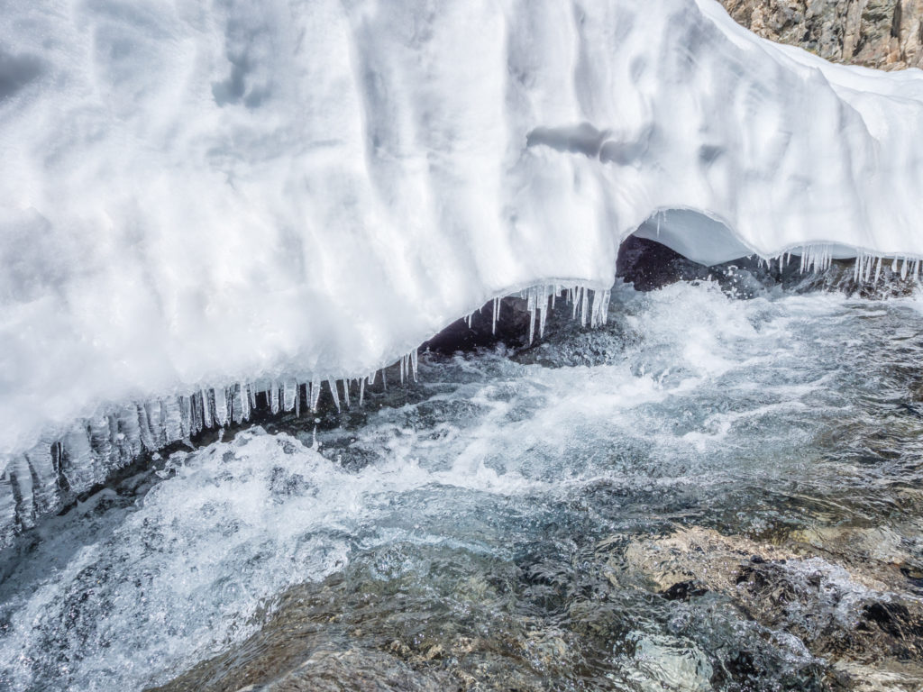
Hanging snow and icicles above the freezing cold waters.
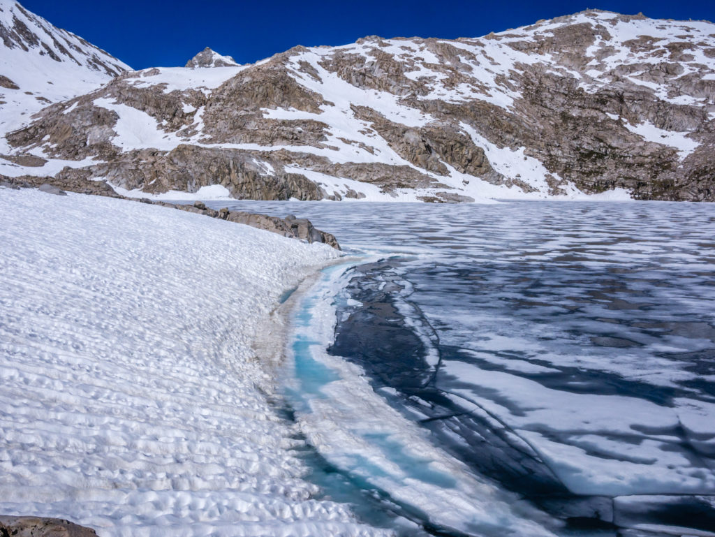
Much of the lake was still frozen.
We had a clear pathway through the snow to follow, which made it much easier.

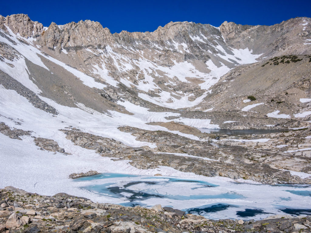
Showing the scale of the climb. For two miles, the approach to Muir Pass was blanketed in snow.
Slowly but surely making our way up to the top of the pass.
Although it was more demanding, we also found it exhilarating to be hiking up through the snow!
In several places where the creeks had been covered over with snow, (unbeknown to us, but were still flowing underneath), we also had to stay clear of ice bridges that had formed over the top. Post-holing through an ice bridge could have put us in great difficulty as well as causing us or our kit some serious damage. Post-holing anywhere in the snow is fraught with similar dangers, so we were a little concerned about descending from the pass so late in the day. After a morning of full sunshine, the snow on the north side of Muir Pass was starting to melt and feel a little slippery underfoot, so after a quick cup of tea and biscuits by the Muir Hut, as well as the obligatory photo or two, we made our way down in hast before any serious post-holing started.
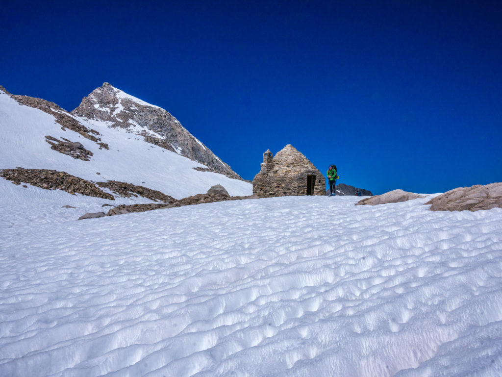
At last! Reaching the Muir Hut at the top of Muir Pass.
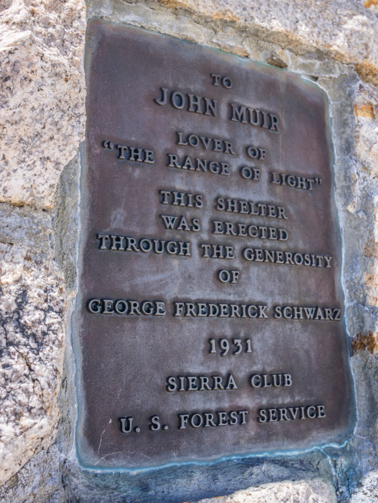
The plaque dedicating the hut to John Muir.
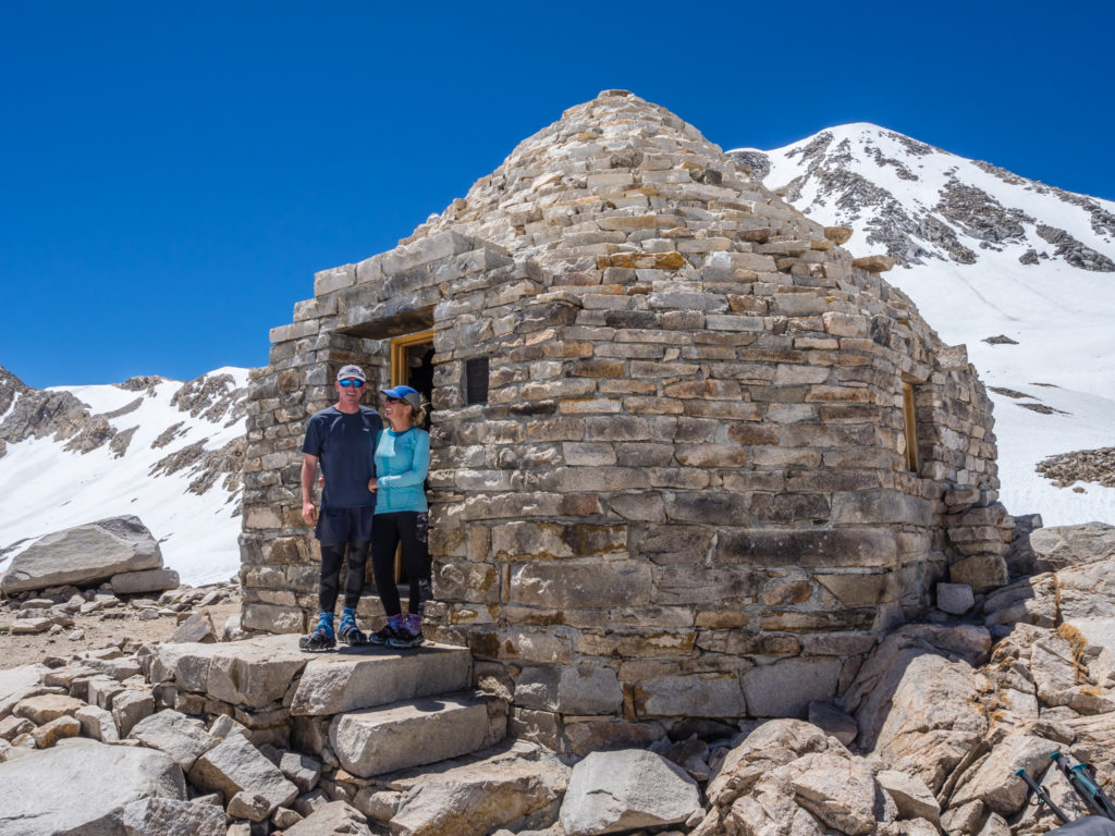
Happy to have made it to the top once again!
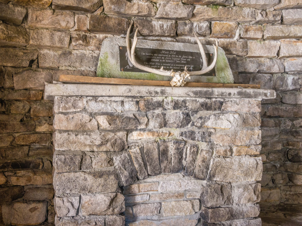
Inside the hut… It is a simple bothy with benches providing seating inside.
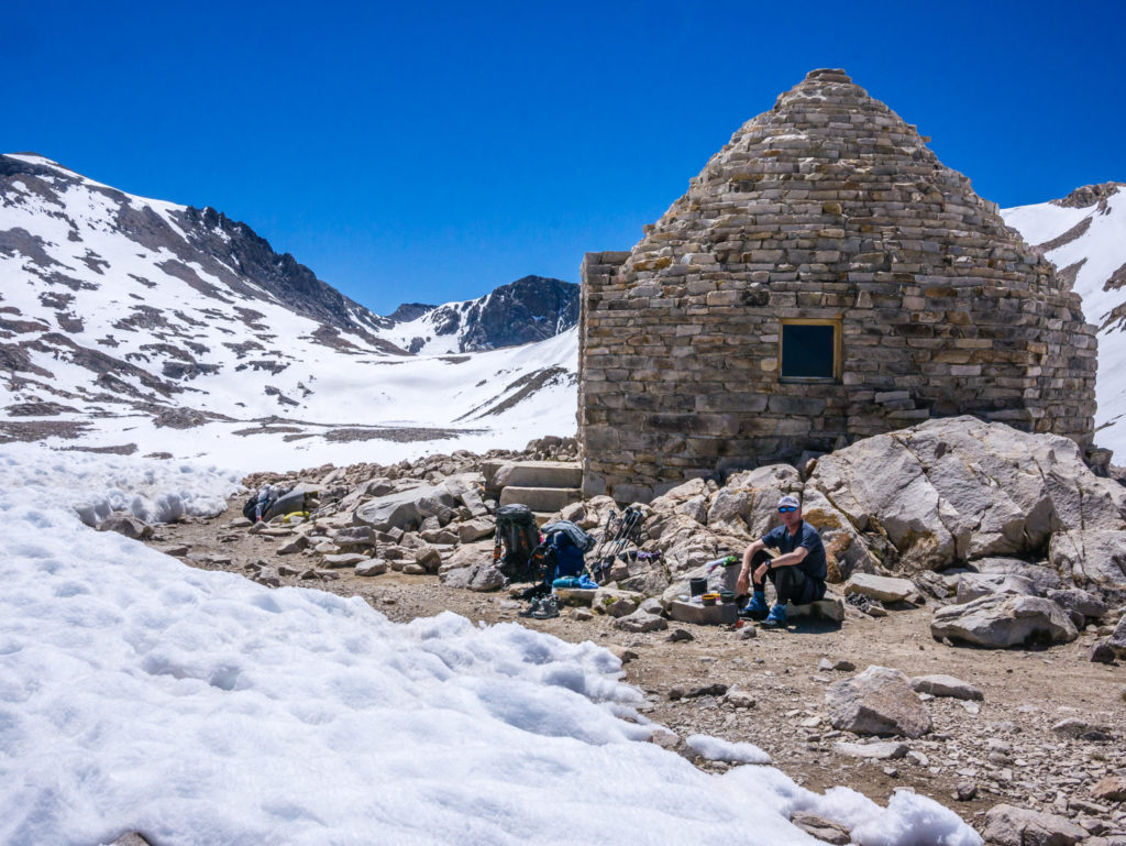
After all that effort it was time for a brew!
The route down was fairly straightforward, again following the previous lines of shoe prints whilst trying to avoid any sun cups where the snow was much softer and post-holing was almost guaranteed. Lake McDermand in the distance was a good reference point as we knew the trail should go to the left side of the lake before running right along the edge of Wanda Lake. (Both Helen and Wanda Lakes were named after the daughters of John Muir.)
Now for the descent. There was two miles of snow to traverse on the north side as well!
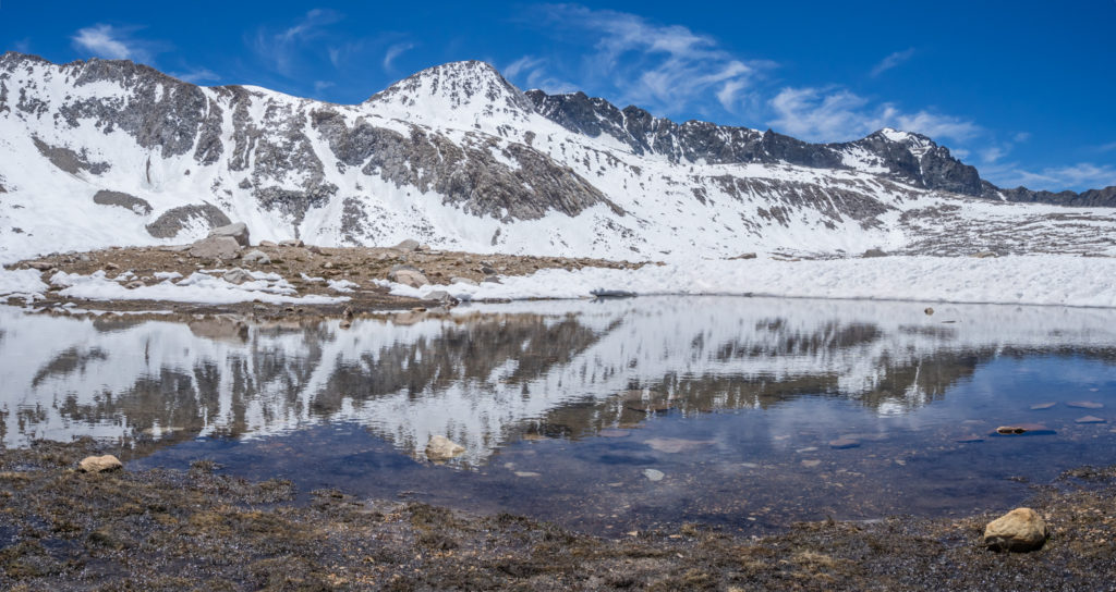
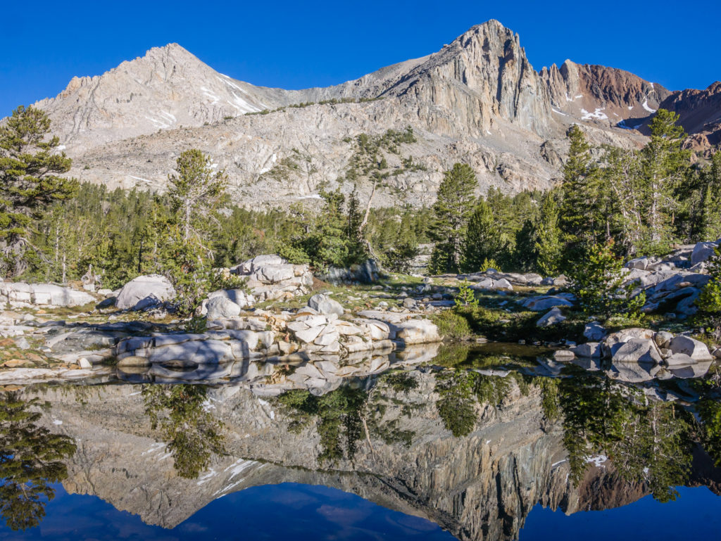
Magnificent reflections on Wanda Lake.
What a scenic treat on the other side of Muir Pass!
A wonderful walk through the Evolution Basin.
Panorama beside Wanda Lake.
Wanda Lake in the Evolution Basin was simply magnificent. It’s crystal clear waters lay still with giant shards of ice floating on top. As we walked around the lakeside trail, which was largely free of snow, it was eerily quiet, except for the sharp sound every now and again of ice on the surface cracking apart. Again, we could see wonderful reflections of the surrounding snow-capped peaks, and captivated by the serene scene Wayne commented, “When people ask why do we hike? Why have we chosen to walk from Mexico to Canada? This is why! This is not something you see every day!”
Simply stunning!

Looking onto the icy waters of Wanda Lake.
Does it get any better than this?!
One of our favourite days so far on the entire PCT! Making our way through Evolution Basin.
It was already 2pm by the time we had finished the main descent and our path was now free of any snow. We decided to have a late lunch looking on to Sapphire Lake at Mile 842, before continuing the rest of the way through the Evolution Basin. As we passed by Evolution Lake we spotted Co-Pilot, Loic and Mario camped at the north end of the lake, but other than them, we think the other thru-hikers we have spoken to regularly since re-joining the trail after Bishop are now all behind us. After getting to the top of Muir Pass even later in the day than us, they may have just decided to call it a day after the descent and set up camp in the Evolution Basin area as there are so many nice spots around the lake.
The trail winds down along the side of Evolution Lake.
From Evolution Lake looking back to Muir Pass.
Looking on to the northern shore.
We were hoping to reach Mile 850 today and camp close to Evolution Meadow to set us up for the next major river crossing the following day, Evolution Creek, which as a difficult and dangerous ford, is much more manageable early morning. We didn’t quite make it that far though. As it had already been a long and strenuous day and we were both tired, we were seduced by a lovely camp spot down in McClure Meadow. Not only did we have Evolution Creek flowing nearby through the lush green meadow, but we were surrounded by more magnificent mountains with side of the valley, the most dominant being Emerald Peak.
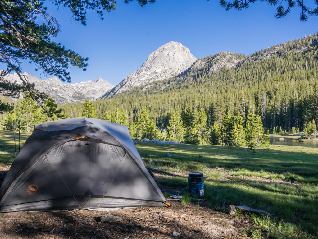
Setting up camp in McClure Meadow, a beautiful spot to end the day.
The meadow is bathed in a gorgeous light just before sunset.
Our camp spot also had a fire pit, which we put to good use trying to keep the mosquitoes at bay. Best of all, several deer came splashing through the creek and were chasing each other around throughout the meadow, which was wonderful to see!
Dinner around the campfire was Chinese Style Fried Rice with a Spicy Tuna and Bean Mix – a new trail kitchen ‘trial’ meal as we fancied a change. We’re hoping it will give us a good reserve of energy for tomorrow’s trail challenges. After the creek crossing we have yet another pass to go over. This one however, Selden Pass, is lower in elevation, so we’re hoping it will be free from snow to give our quad muscles a rest!
Making use of the camp fire to try and combat the mosquitoes!
This week has been a tough one! Taking on a mountain pass a day, especially in snow conditions has been physically challenging, and at times, mentally draining where we’ve really had to dig deep to keep going. I don’t think we appreciated it enough at the time, but compared to the High Sierra, the desert really was easy trail miles.
But as hard as it has been, hiking through the High Sierra has been thoroughly rewarding. From wondrous mountain vistas to serene lake reflections, the scenery has been sublime. As close to real ‘wilderness’ as you can get nowadays, you feel totally immersed in nature and quite separate from what’s going on elsewhere in the ‘real’ world. The greatest thing is that it’s not over yet!
8 Comments
Pleased to find another update, I was beginning to think you’d had an encounter with bears and come off worse for wear!
Pictures look amazing.
Thank you! Finding good enough internet out here has been troublesome, but in terms of the trail, we’re still going strong!
Amazing place. Serious hiking. I always underestimate how much slower it is uphill with a heavy pack. Even more so with snow and loose rock. Looking forward to the videos!
Thanks so much! The updates are slow as we’re struggling with the internet and time for editing, but there’s plenty more to come! 🙂
Wow, wow, wow. There were many great views along the JMT, but Wanda Lake and Upper Basin as the sun descended bathing the eastern peaks in alpenglow were 2 places that left me in complete awe, at a loss for words. It was like another planet in Upper Basin, and Lake Wanda made me want to cry it was so beautiful. Still no matter how good of a photographer you are and no matter how well you write nothing and no one can convey the overwhelming beauty that fills your soul in those places.
Exactly! It was a truly wonderful experience. Glad you have seen it for yourself 🙂
Love those pictures of the snowy High Sierra. I know the word is overused these days but the photos on the Muir Pass day are just awesome. I envy you seeing it in those conditions and wish I was brave enough to do a June hike through there.
Thanks Neil! We’ve been really lucky with both the weather and the fact that it’s been a ‘low’ snow year. I was really nervous about Forrester Pass, but it was actually my favourite traverse, followed by Muir as the scenery was so stunning. The micro spikes gave us so much grip, it wasn’t as daunting as we first thought! 🙂