
“I never get afraid of things; I only get excited”.
– Tom Hiddleston
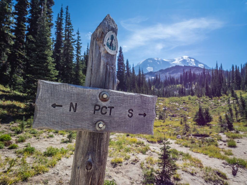
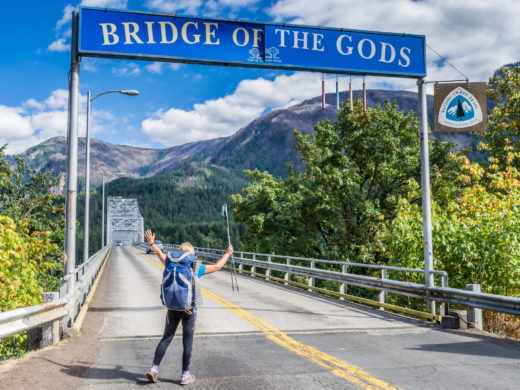
The Twenty-Second Week – Back To The Big Stuff!
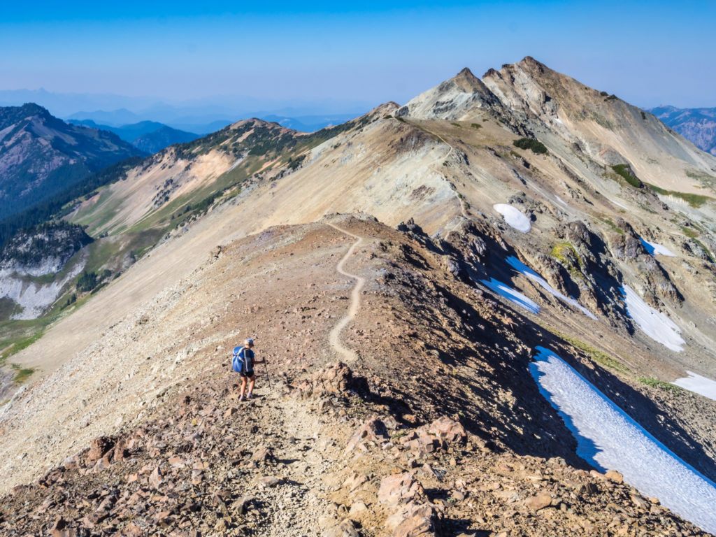
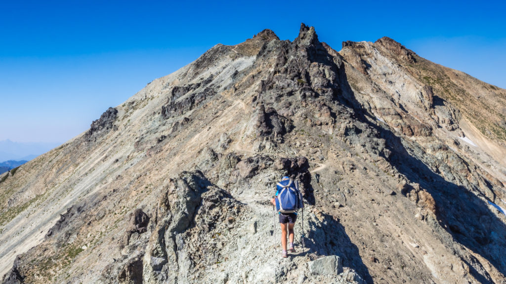
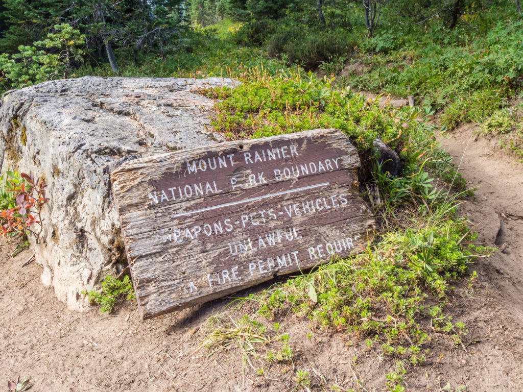
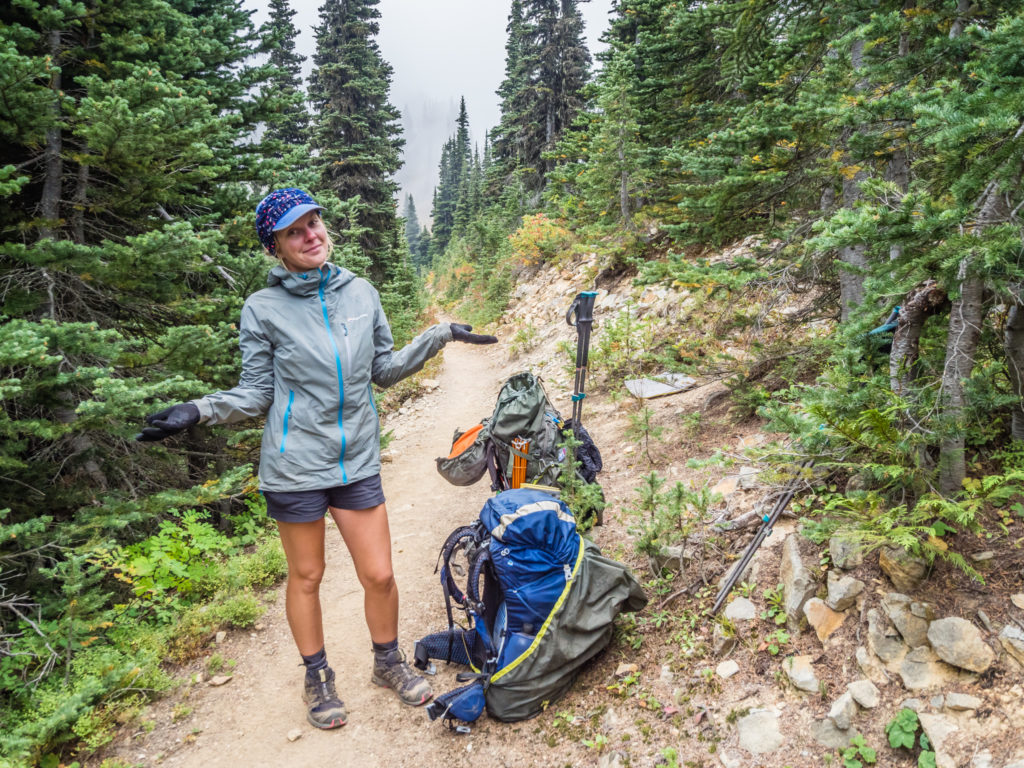
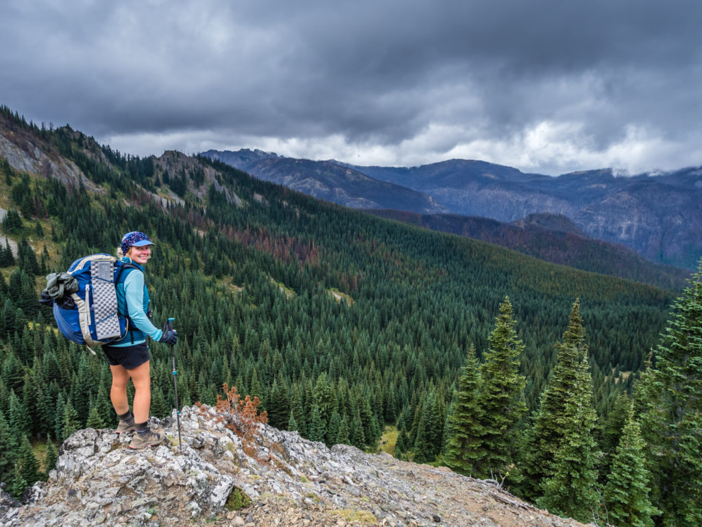
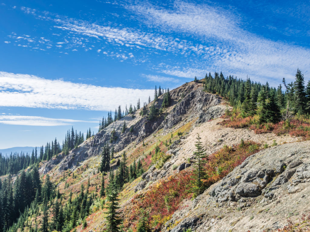
Preparing to cross the Knife’s Edge in the Goat Rocks Wilderness – an area of outstanding natural beauty along the PCT, which instantly became one of our favourite sections.
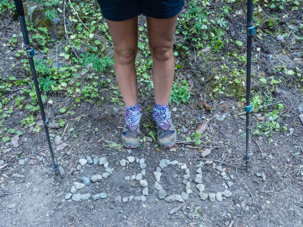
Day 148 – Tuesday, 4th September 2018, Wild Camp at Mile 2,234 to Wild Camp at Mile 2,259, 25 miles
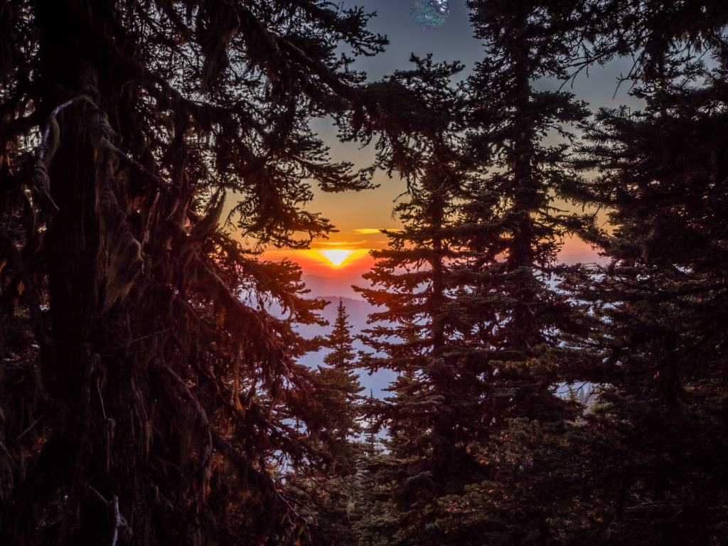
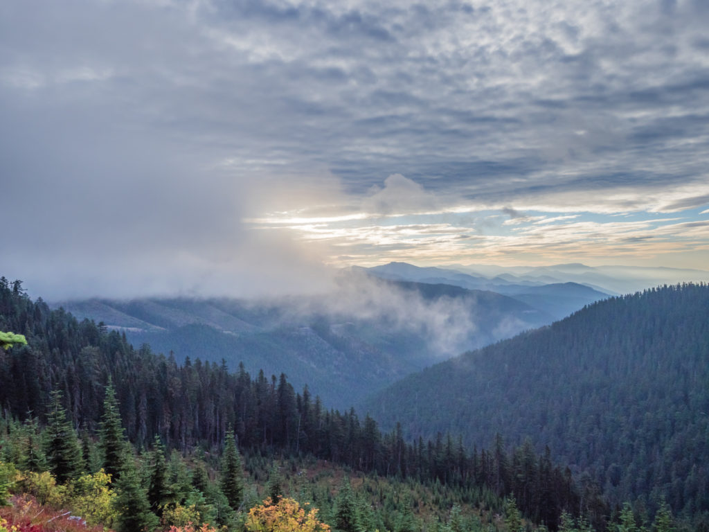
What a wonderful day to be walking in Washington! Despite the tent being covered in frost when we woke up and it feeling like a crisp, autumnal morning, by the time the sun had crested over the mountains and was blazing brightly in the clear blue sky, it was more like a warm summer’s day and far too hot to be hiking in leggings. (Bad choice of attire this morning!)
With clear skies and the sun shining overhead, we awoke to a glorious morning on trail in Washington!
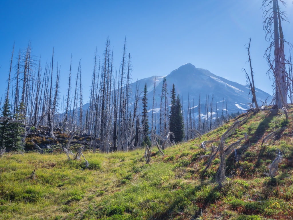
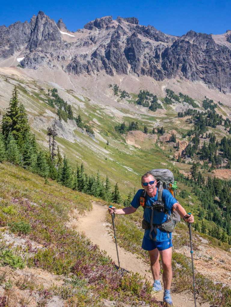
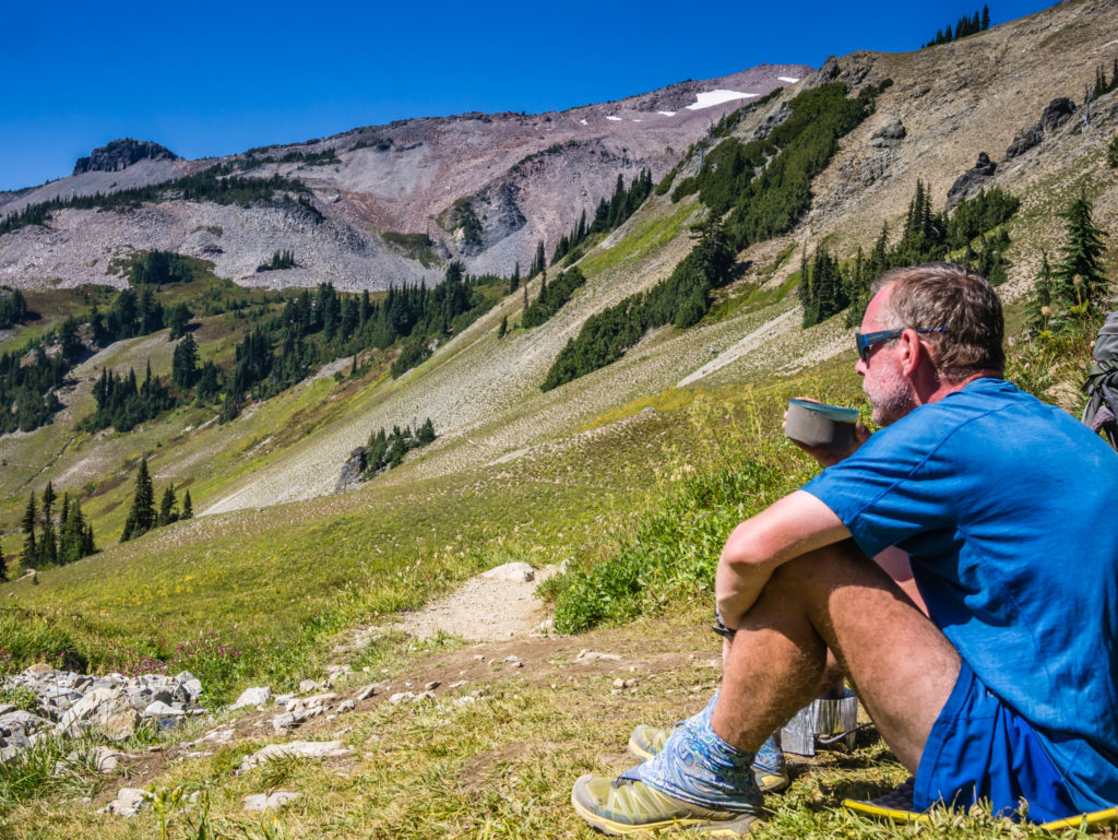
Leaving our wonderful wild camp spot beneath the imposing peak of Mount Adams.
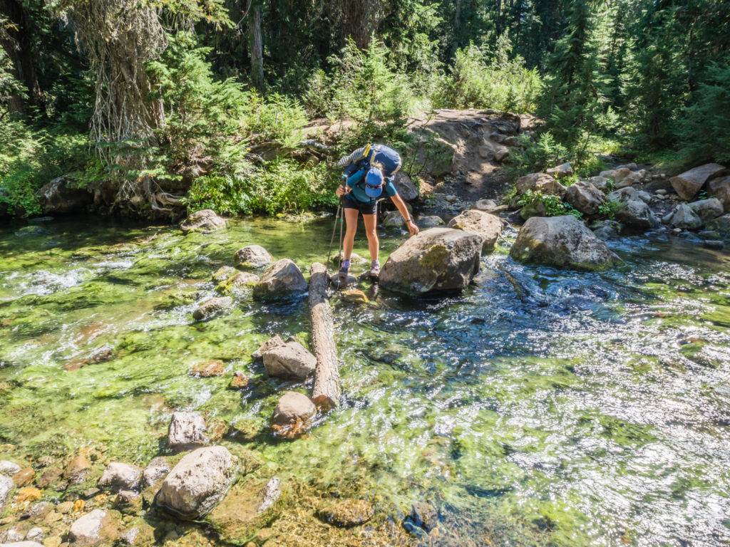
We crossed Riley Creek early morning, but with its cloudy glacial water we decided to wait for the next water source to filter and top up our supplies.
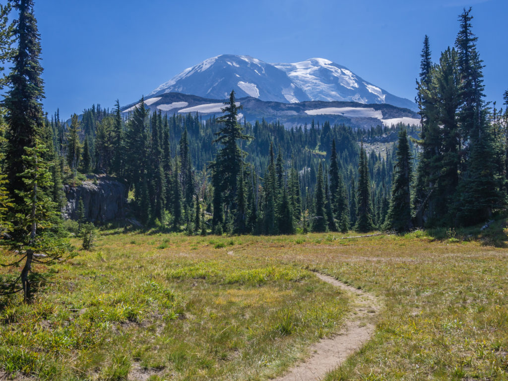
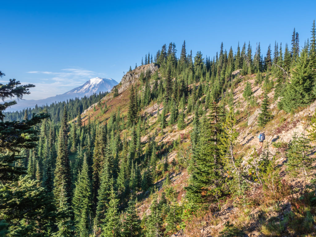
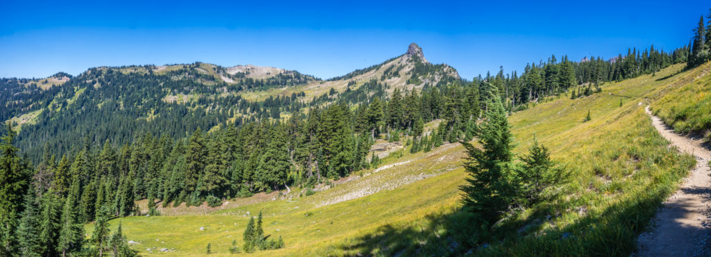
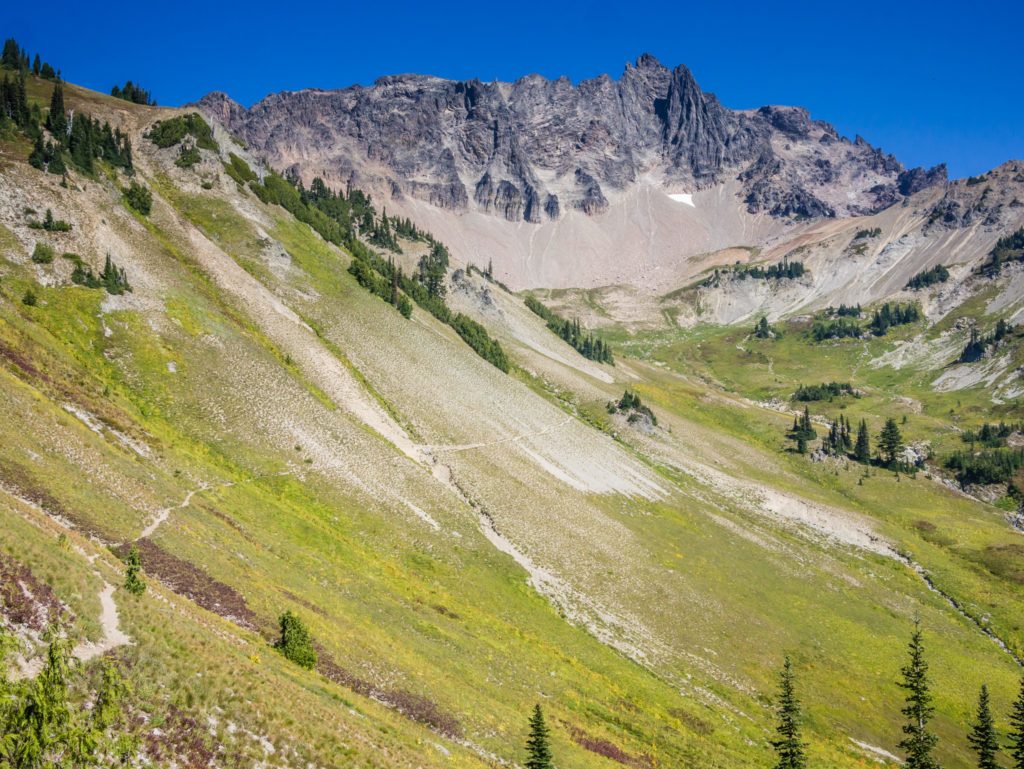
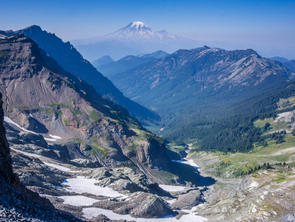
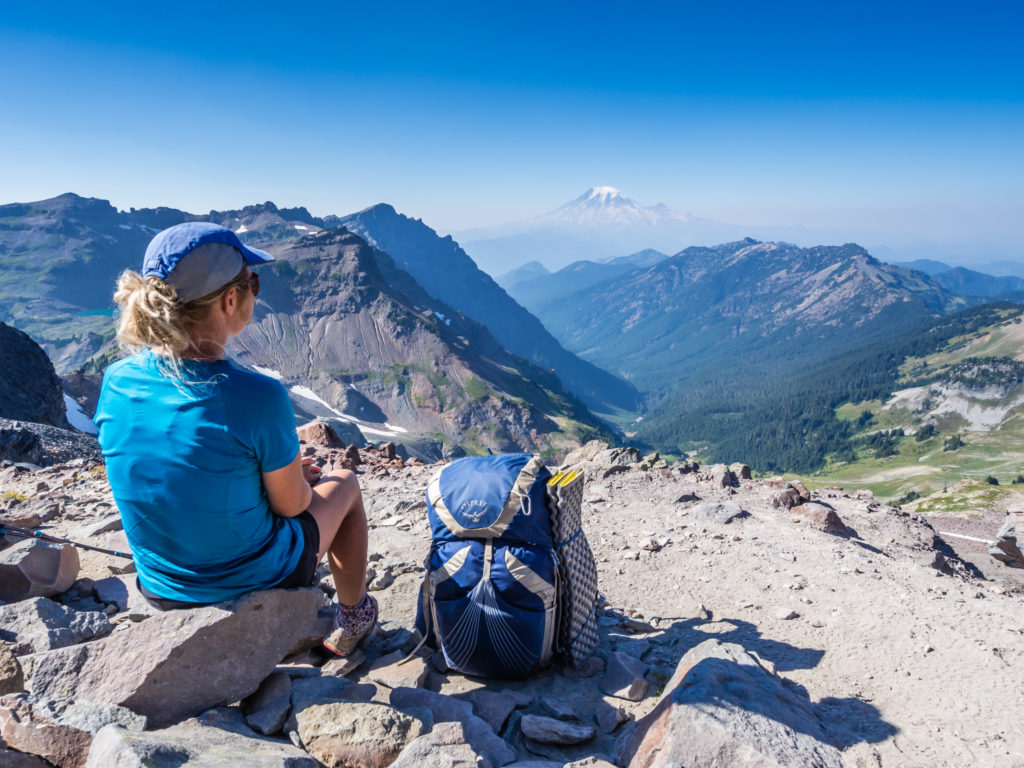
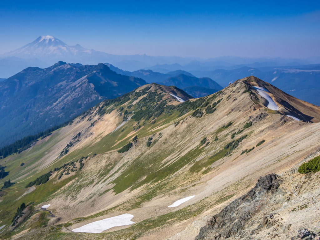
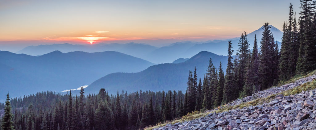
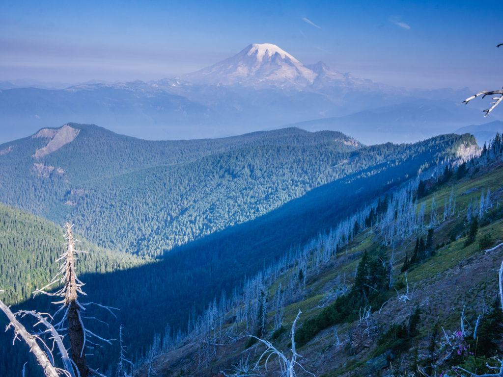
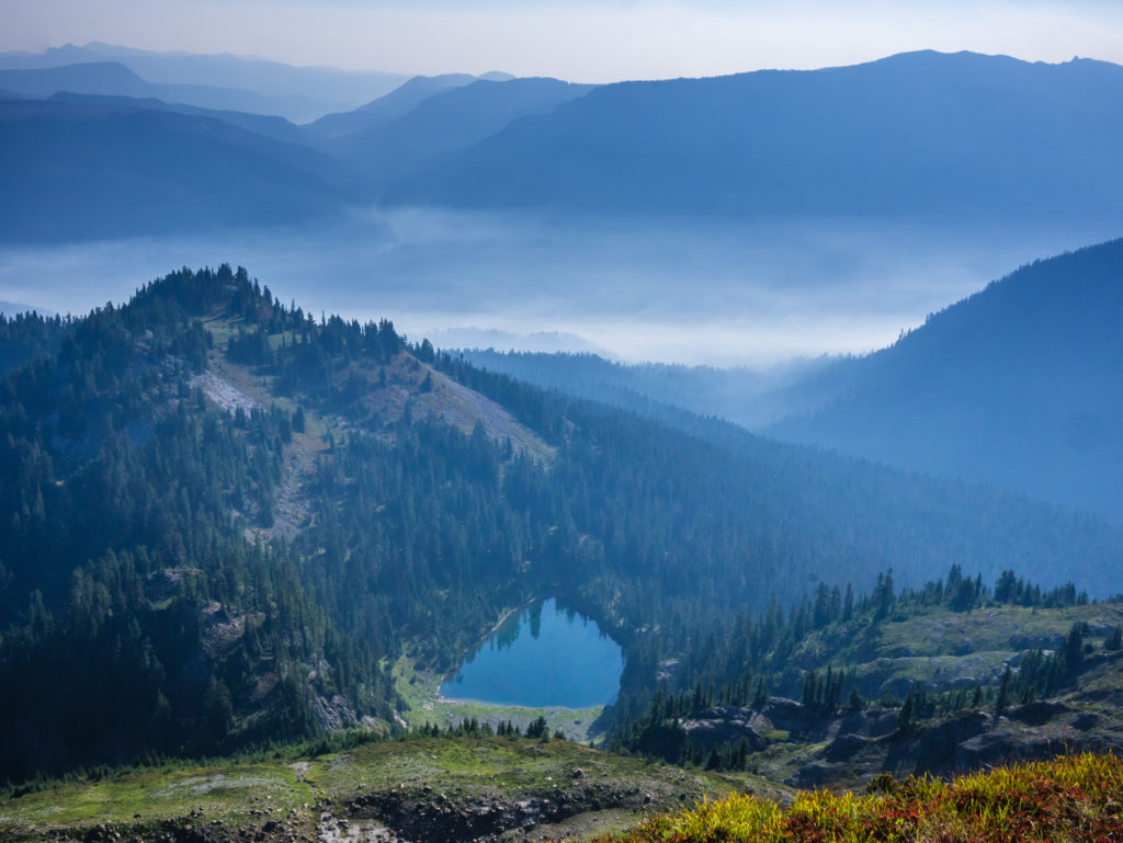
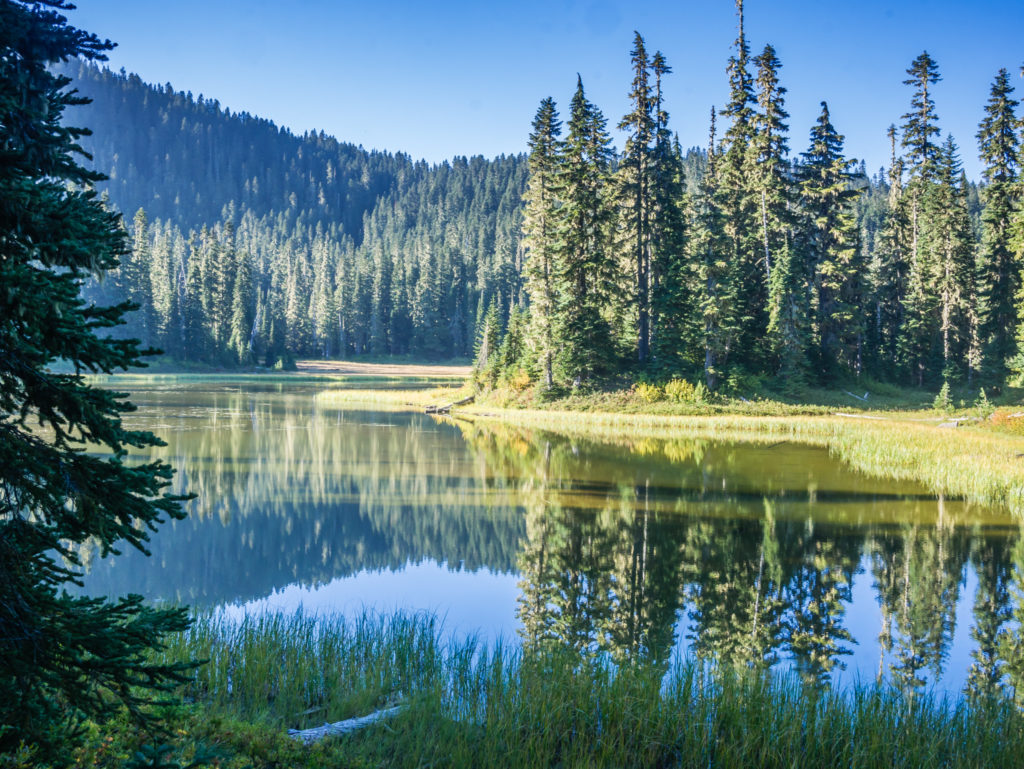
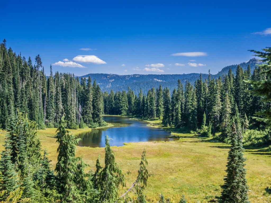
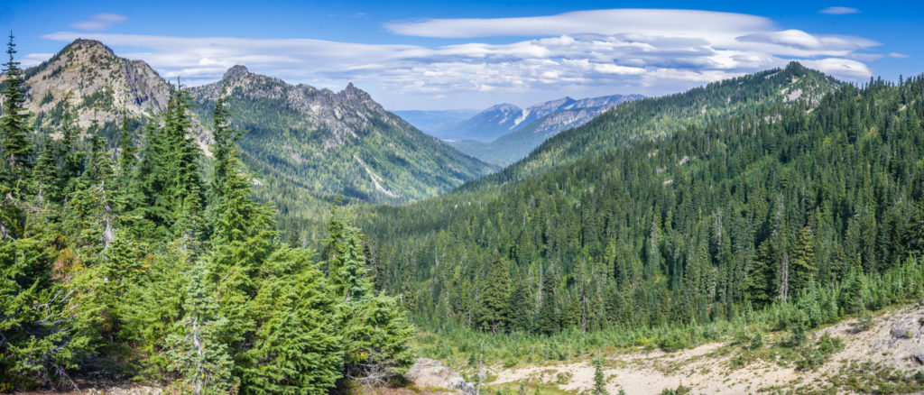
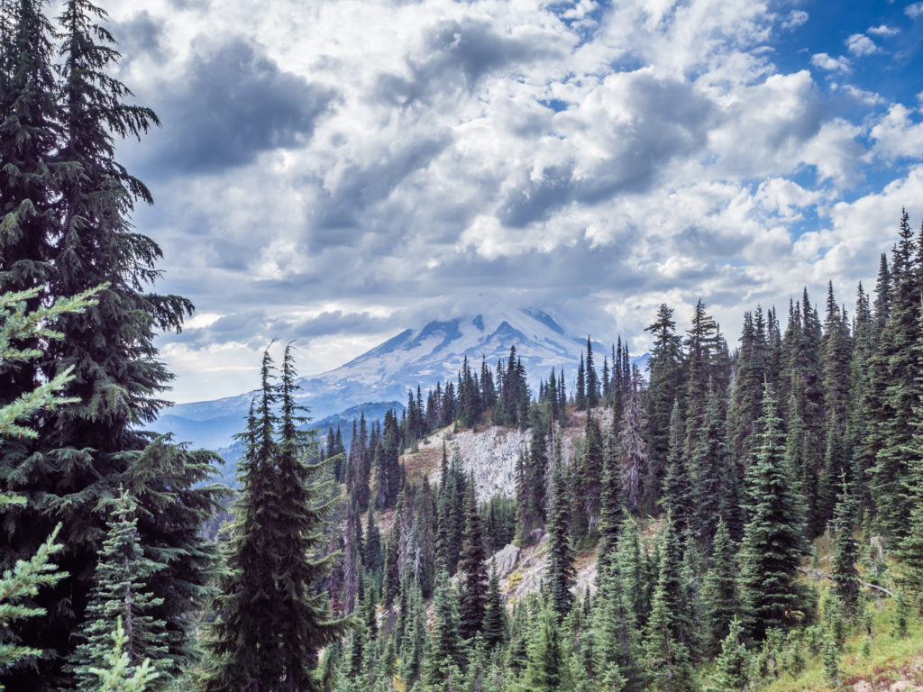
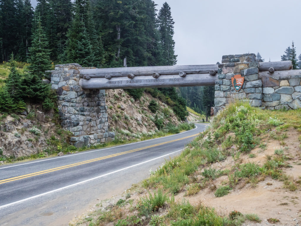
The good weather was perfect for showcasing the surrounding peaks of the Northern Cascades. On the distant horizon to the northwest we could see Mount St Helen’s, and due north, dominating our view was the giant volcanic beast that is Mount Rainier. At 14,410 feet, Mount Rainier is the highest volcano in Washington and is surrounded by the largest glacier system in the US outside Alaska with 41 glaciers radiating from its summit. The volcano, which last erupted 2,000 years ago, was sighted by English explorer George Vancouver in 1792 and named after his fellow explorer Peter Rainier. It is also known by its Indian name, Mount Tacoma.
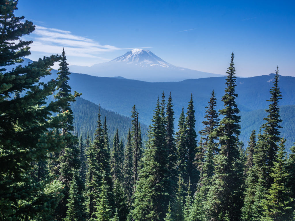
Looking onto glacier-capped Mount Rainier, which is Washington’s highest peak and the tallest mountain in the Cascade Range.
But it was Mount Adams that captivated our attention for much of the morning and really stole our hearts as we hiked west around the slopes of its base through the Mount Adams Wilderness in the Gifford Pinchot National Forest. The last eruptions on Mount Adams were between 1,000 and 2,000 years ago, but in May 1921 magma rose very close to the surface, the heat from which caused a massive snow slide that eradicated much of the forest on the western slopes. Taking us directly around the western flank of the volcano, the PCT crosses a number of lava flows from the most recent eruptions.
Following the PCT around the western flank of Mount Adams.
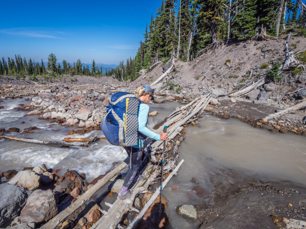
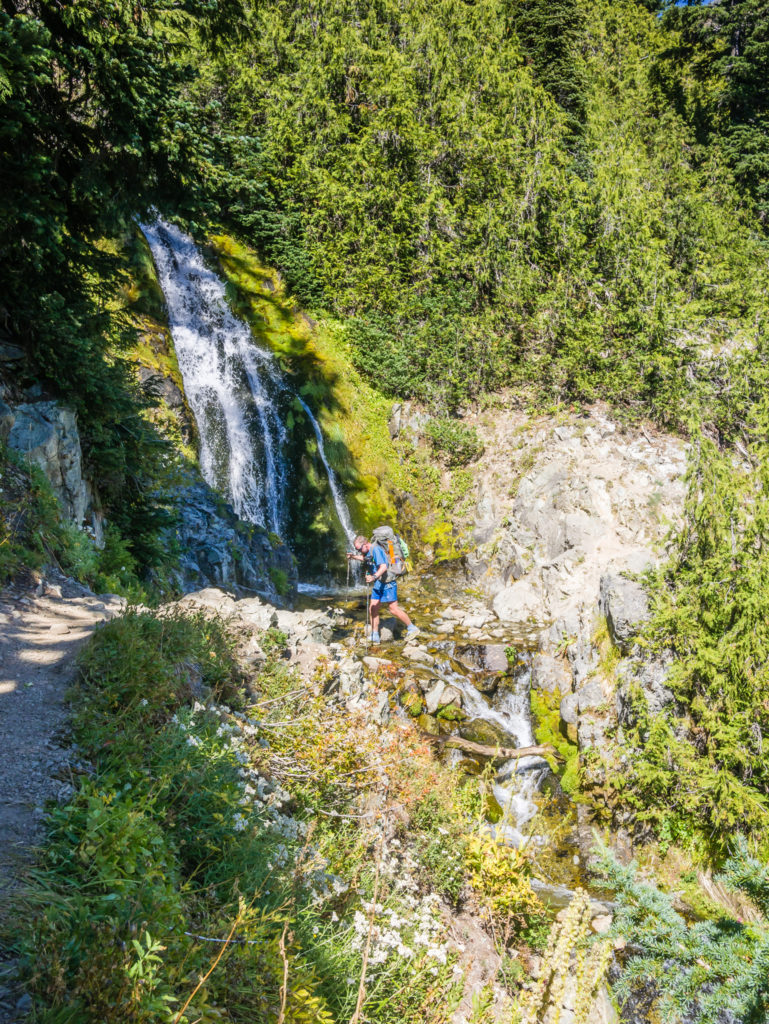
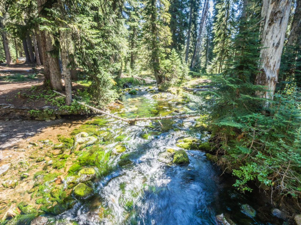
Tentatively crossing Adams Creek via the log bridge. Once again, as the water looked so murky we waited to top up our supplies. (This was to prolong the life of our filter more than anything else as the silt really clogs it up making it a much longer process to squeeze the water through.)
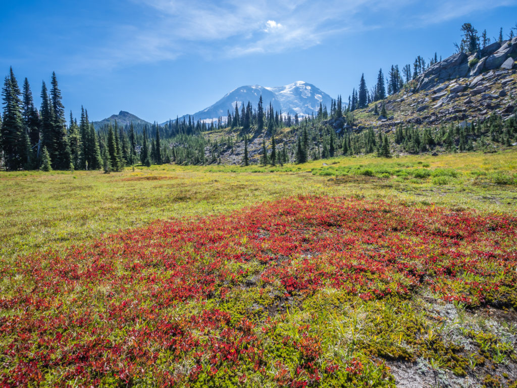
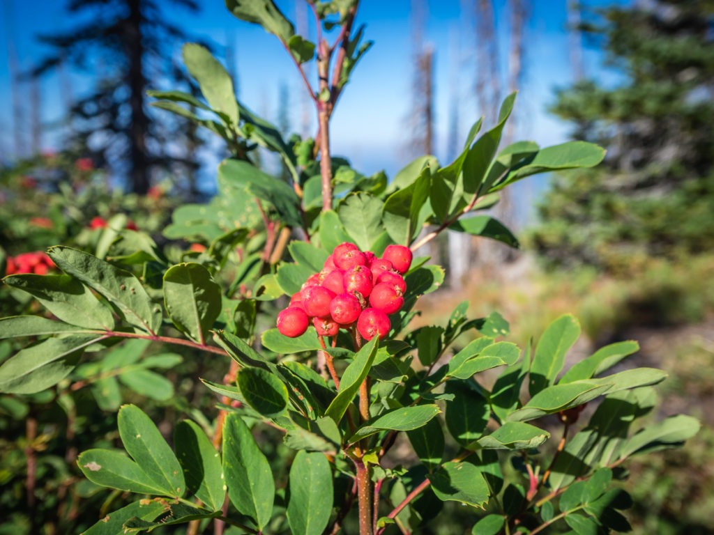
Colourful autumnal ground cover invigorates the landscape.
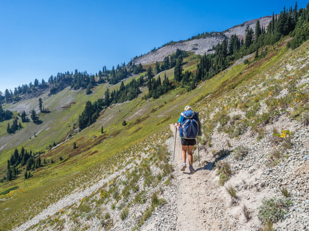
Revealing more of its beauty. Continuing north through Washington on the PCT.
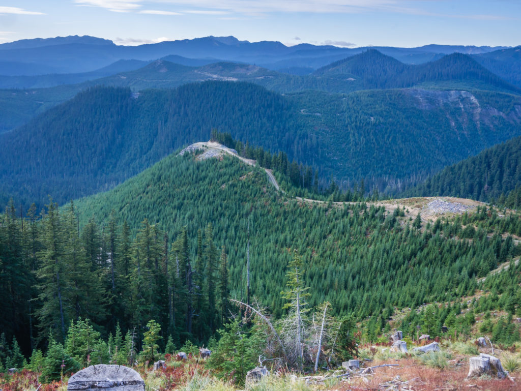
With tremendous skyline views of the Cascades in every direction, this was a section of the PCT we were thoroughly enjoying.
Just after midday, we decided to take an extended lunch stop by Killin Creek as it afforded us a wonderful view looking directly onto the peak of Mount Adams. There was also a lovely waterfall cascading from the creek and it was such an all-round beautiful spot, that we couldn’t allow ourselves to rush off. So we ended up spending an hour and a half there, immersed in the beauty of the incredible volcanic landscape.
Before setting off again, we chatted to a couple of guys hiking the ‘Round The Mountain’ Trail who had stopped to filter water from the creek. After they told us about the route, it sounded like another ideal backcountry trip that we’d love to hike in the future.
From our lunch spot, we had an incredible view looking directly onto Mount Adams.
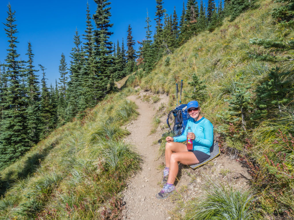
Not only was the scenery spectacular today, but we also had excellent terrain for making our miles. Despite a couple of short climbs, much of the trail was downhill and decent underfoot so we had a consistent, brisk pace making good time to each of our snack stops, even after taking an extra-long lunch. Another great spot today was Lava Spring where we topped up our water supplies in readiness to cover six more miles before making camp. The water from this spring is already filtered through a lava field, so is said (according to our guide-book anyway) to be the best spring water on the PCT.
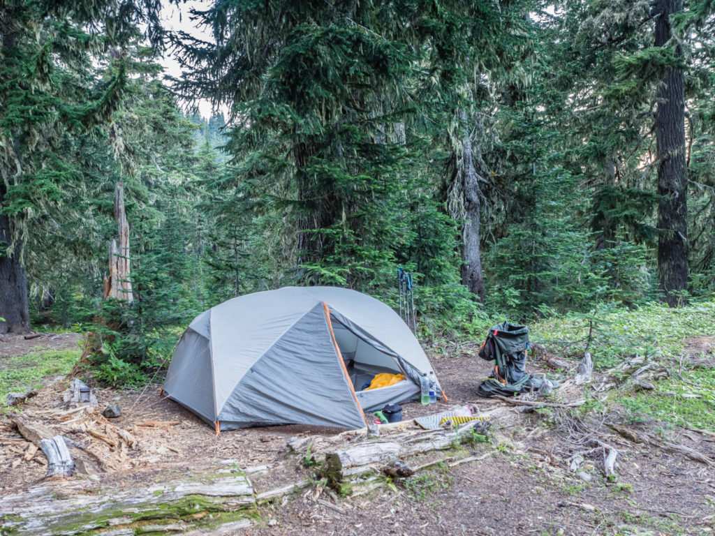
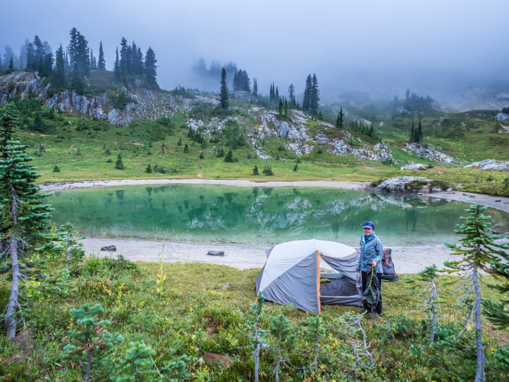
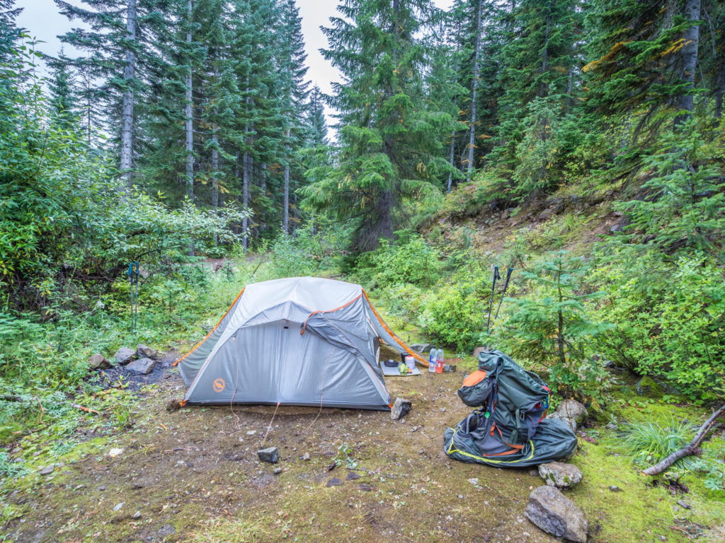
At the top of the final climb we happened upon a side trail veering off on the right, which after a little investigation, we discovered led to a small meadow area with a pre-used camp spot by some trees. So we made the impromptu decision to pitch our tent a mile short of our intended destination whilst we still had a little light, making it much easier to set everything up.
Before reaching camp, we were excited to have finally set foot in the much-anticipated Goat Rocks Wilderness!
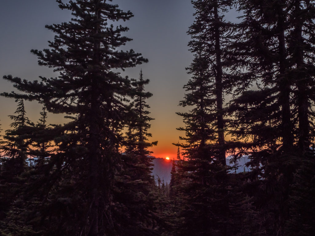
We pitched the tent just in time to watch a mesmerising sunset from the comfort of our camp.
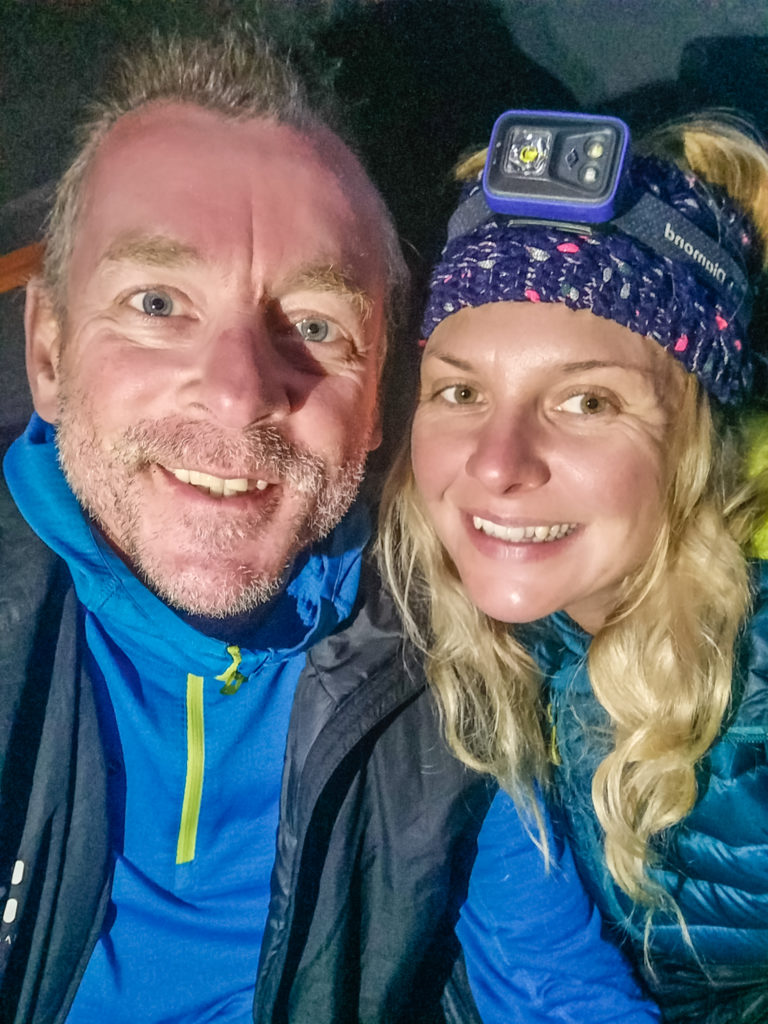
Selfie from the tent! Tonight we were feeling very happy.
After what had been a fabulous day on the trail, we were now even more eager and excited to explore the Goat Rocks Wilderness tomorrow, where we would be returning to alpine ridges and more majestic mountain scenery. We simply couldn’t wait!
Day 149 – Wednesday, 5th September 2018, Wild Camp at Mile 2,259 to Elk Pass at Mile 2,279, to PCT fire detour on Coyote Trail, Wild Camp by Beaver Bill Creek, 25 miles
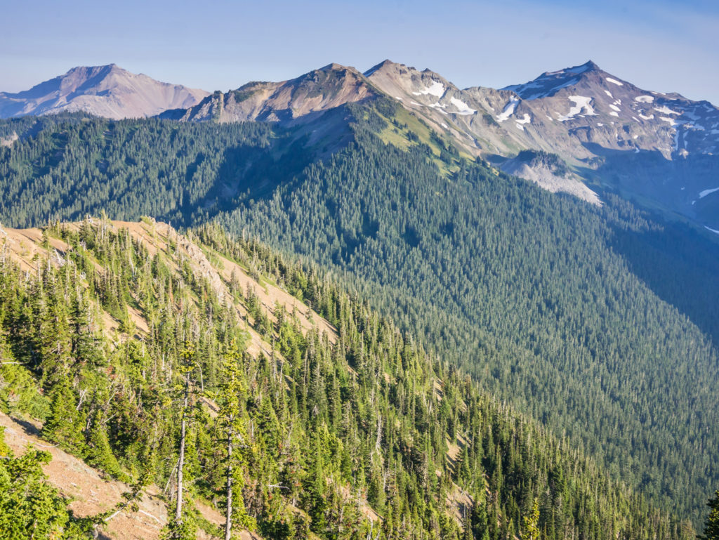
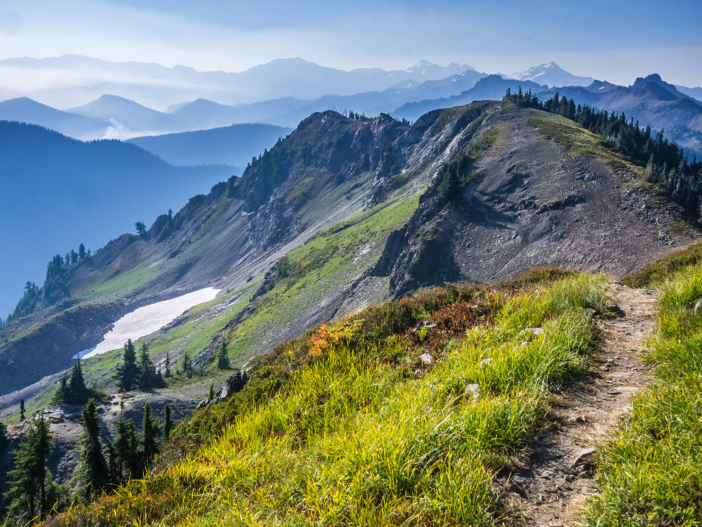
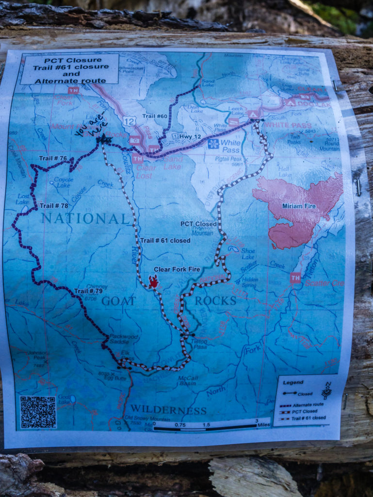
Our expectations were certainly realised when today turned out to be one to rival even the best of the Sierra with an absolutely spectacular ridge walk along the Knife’s Edge in the Goat Rocks Wilderness! It was such a shame that the PCT was then re-routed along the Coyote Trail as a result of the ongoing Miriam Fire, as it meant we couldn’t experience the full extent of what the Goat Rocks Wilderness area has to offer. But that just means we’ll have to return sometime in the future and explore the area further.
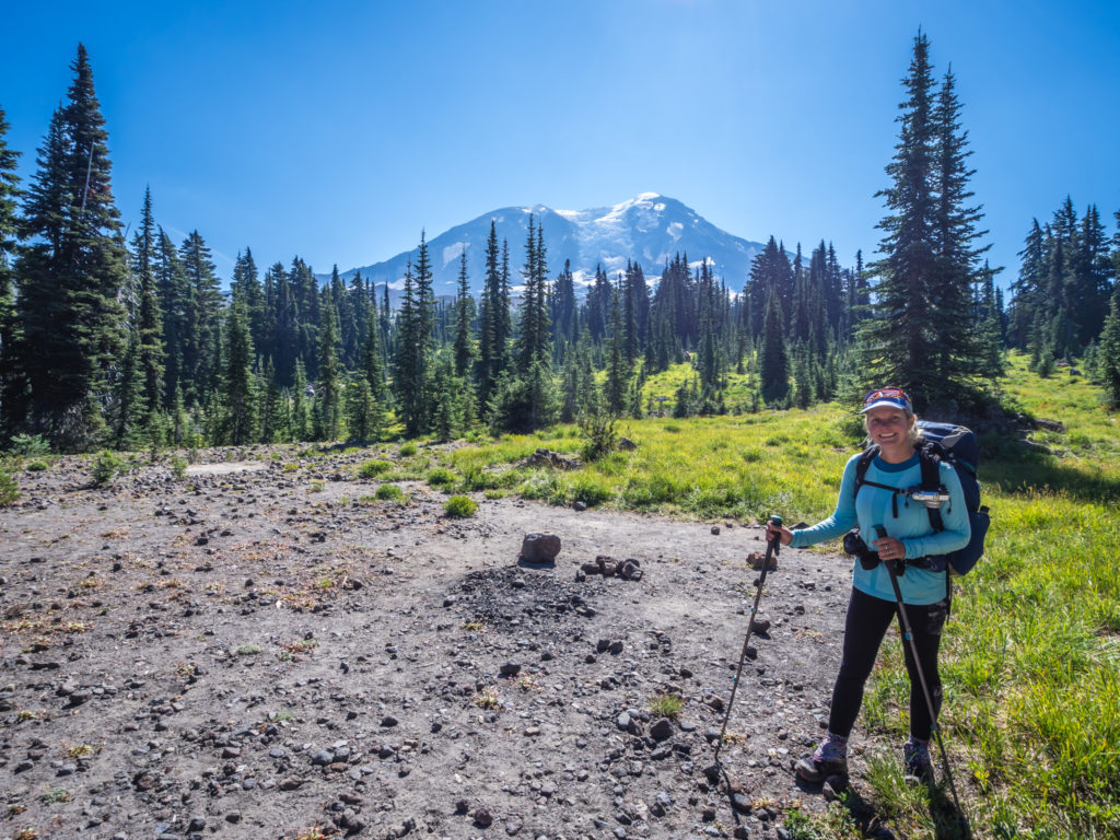
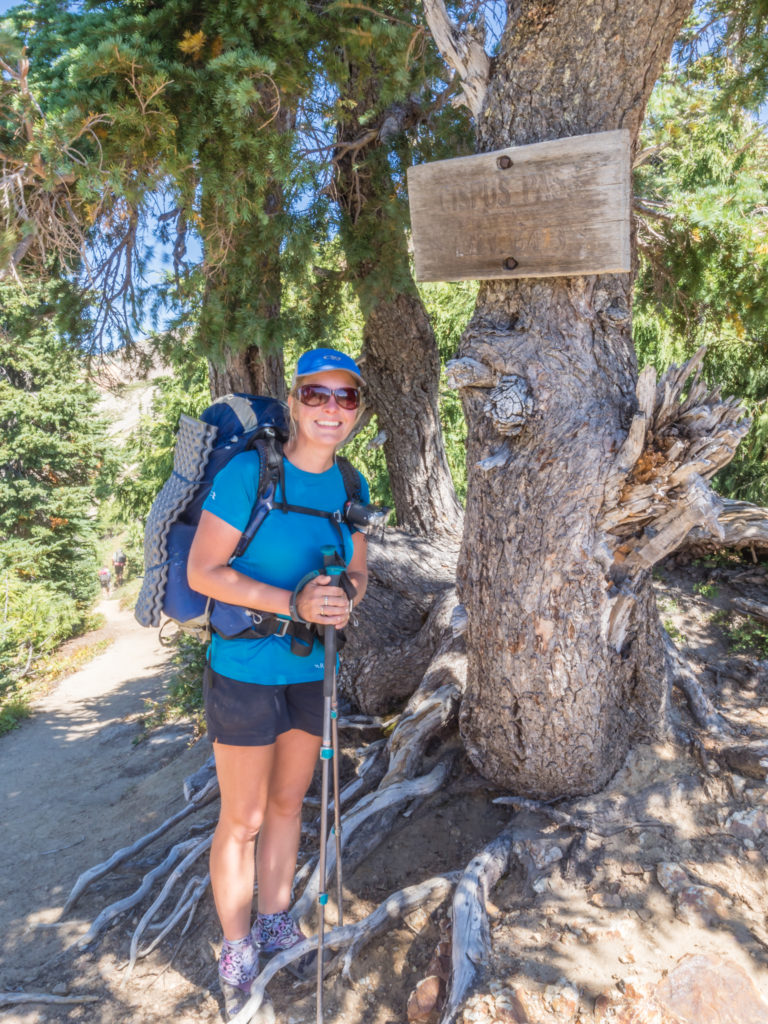
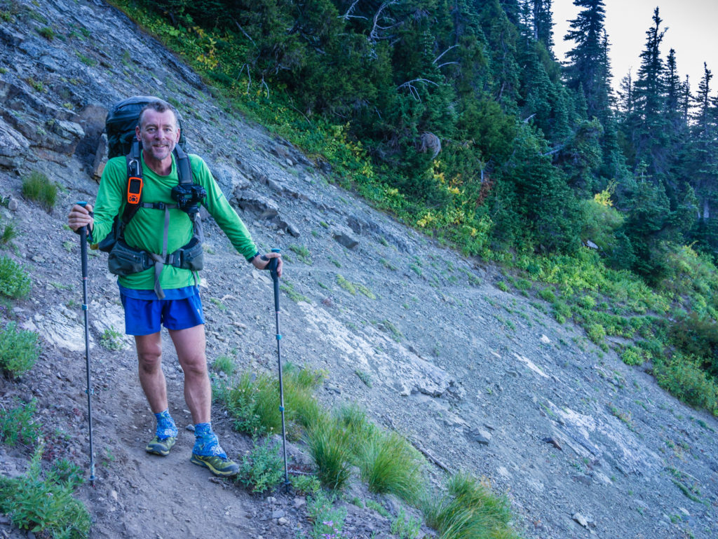
After breaking camp, (it was a good choice to pitch in the meadow as it was a warm night and the tent fly was dry in the morning) we had a downhill section through a forest dappled in sunlight, before the trail went around the open mountainside offering good views once again looking back to the northwest face of Mount Adams. Then began a steady uphill climb to Cispus Pass. At 6,470 feet it was our first major pass in Washington but it wasn’t too taxing, either that or we were far too busy taking photos of the surrounding mountains that looked stunning against the clear blue sky to feel the strain.

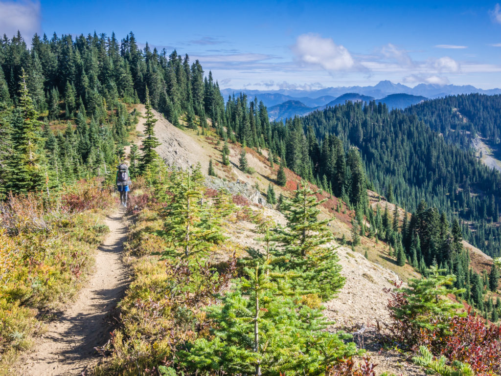
Our first morning in the Goat Rocks Wilderness and we were raring to go!
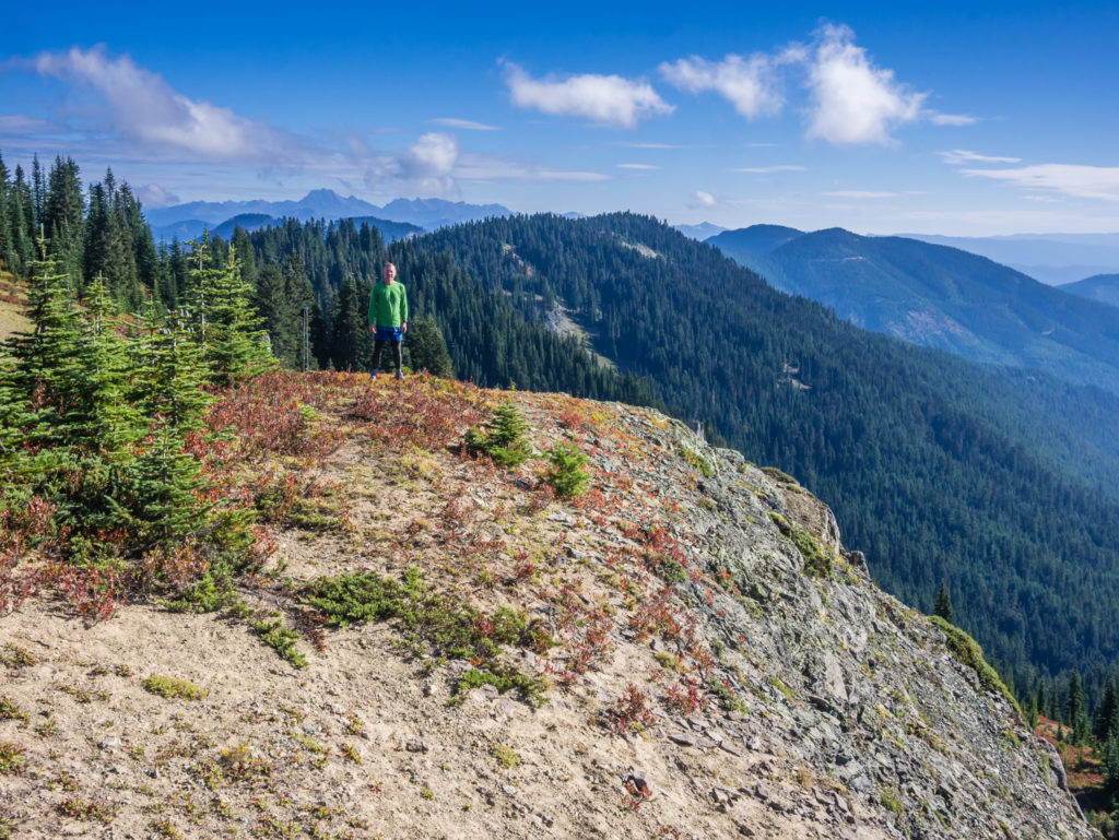
More fantastic, clear skies and another glimpse of Mount Rainier in the distance.
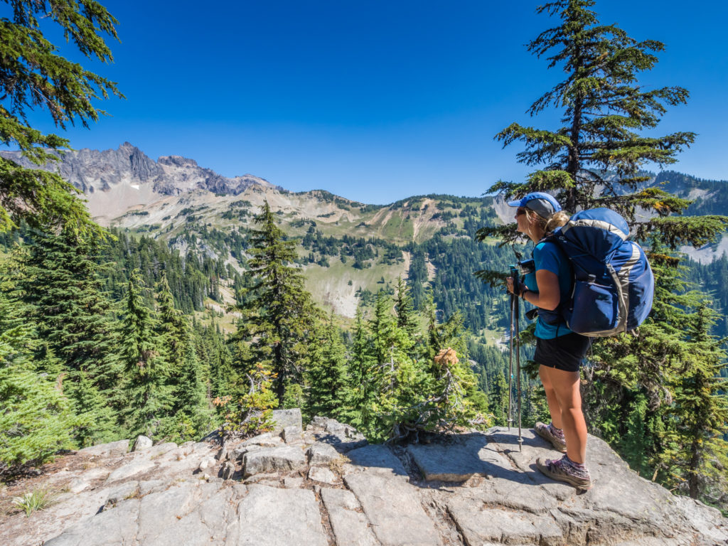
Taking a quick breather and enjoying the views from the ridge.
We loved how green and grand everything looked.
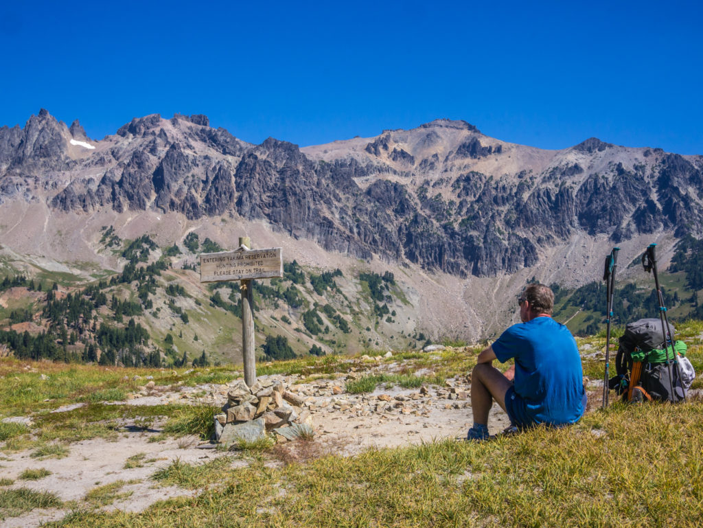
Entering the Yakima Indian Reservation area where we had splendid views of the surrounding craggy peaks.
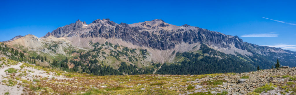
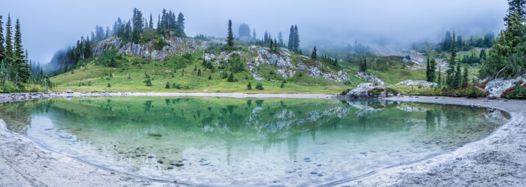
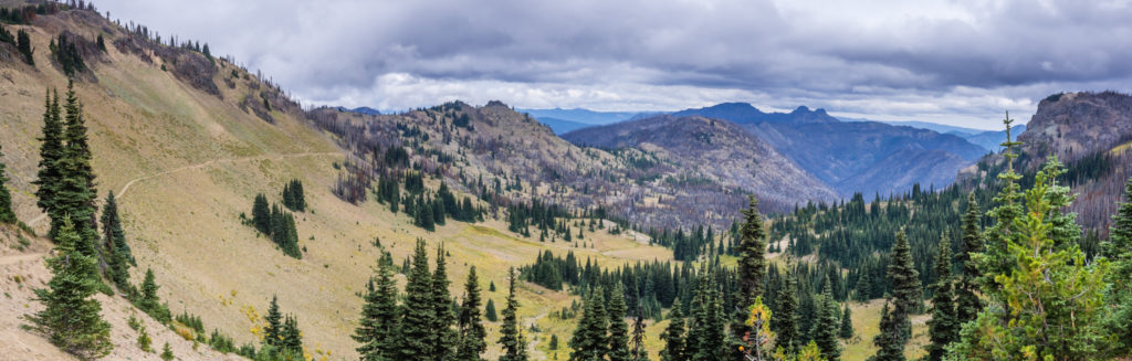
A panorama showcasing what we consider to be such a tremendous section of the PCT!
Continuing on towards Cispus Pass.
The landscape was simply stunning. Can Washington get any better than this?
The climb to Cispus Pass had been relatively easy. Little did we know it was merely the start of an intensive day of ascents and descents in the Goat Rocks Wilderness.
Once again in Washington we were treated to another incredible lunch spot where we sat by the Cispus River admiring the wonderful view down the valley with mountain ridge after mountain ridge silhouetted on the skyline as far as the eye could see.
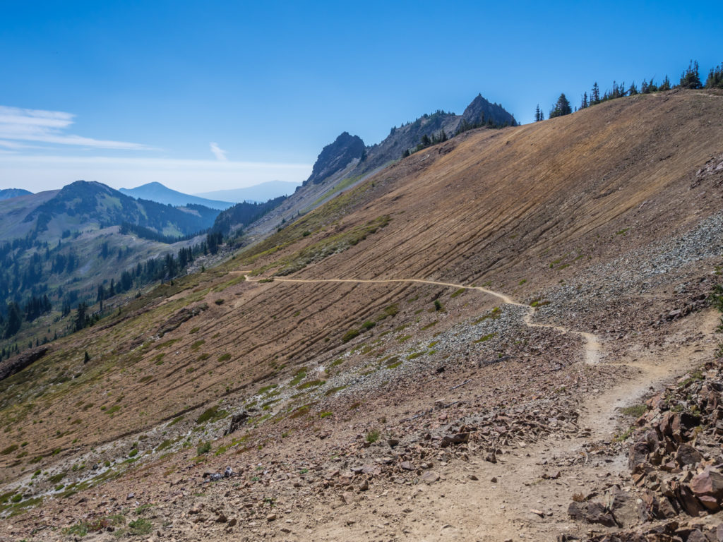
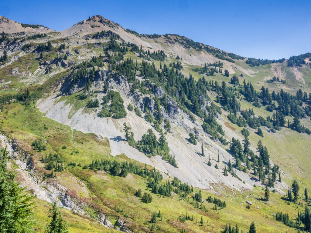
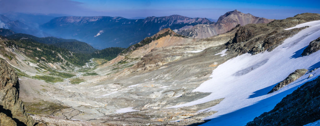
The trail snakes its way through the Cispus Basin across a slope of rough lava rock.

It was a joy to walk along the trail amidst such breathtaking scenery.
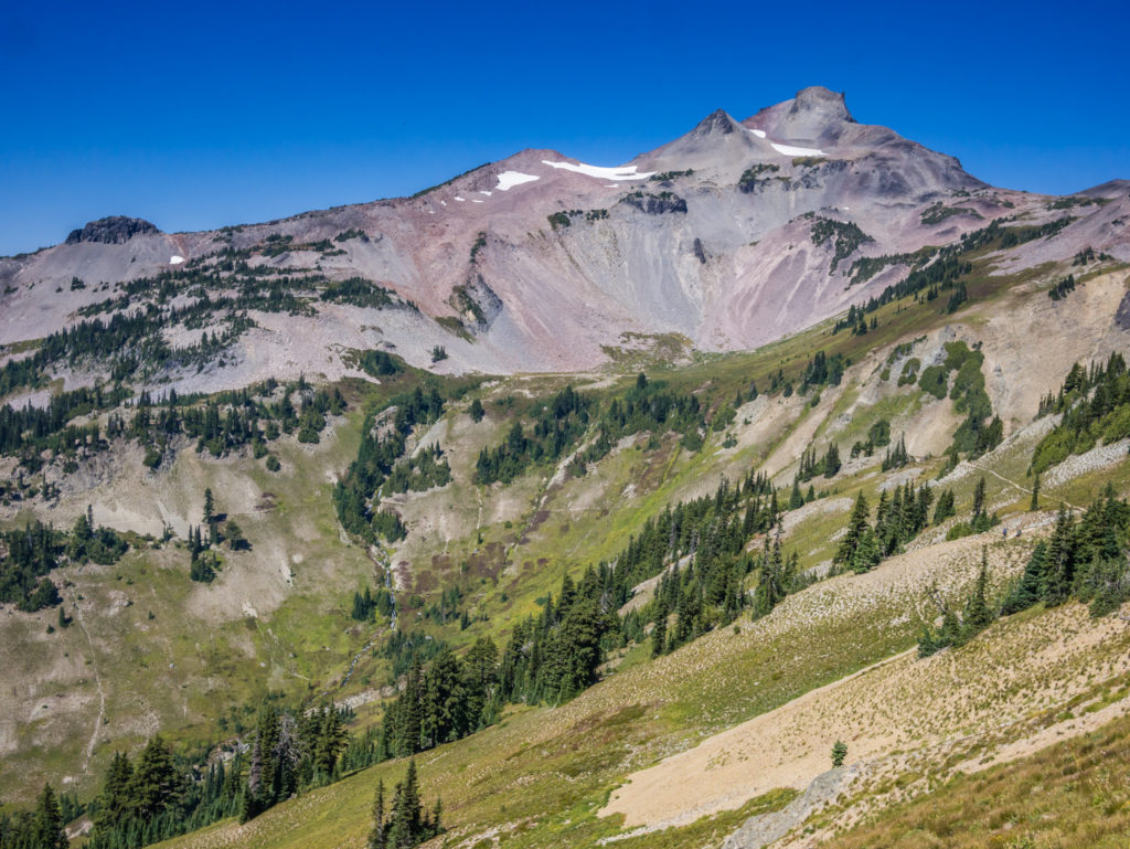
From one spectacular view to another! Looking towards the imposing Ives Peak.
Stopping by Cispus River for lunch. How could we resist such a relaxing spot!
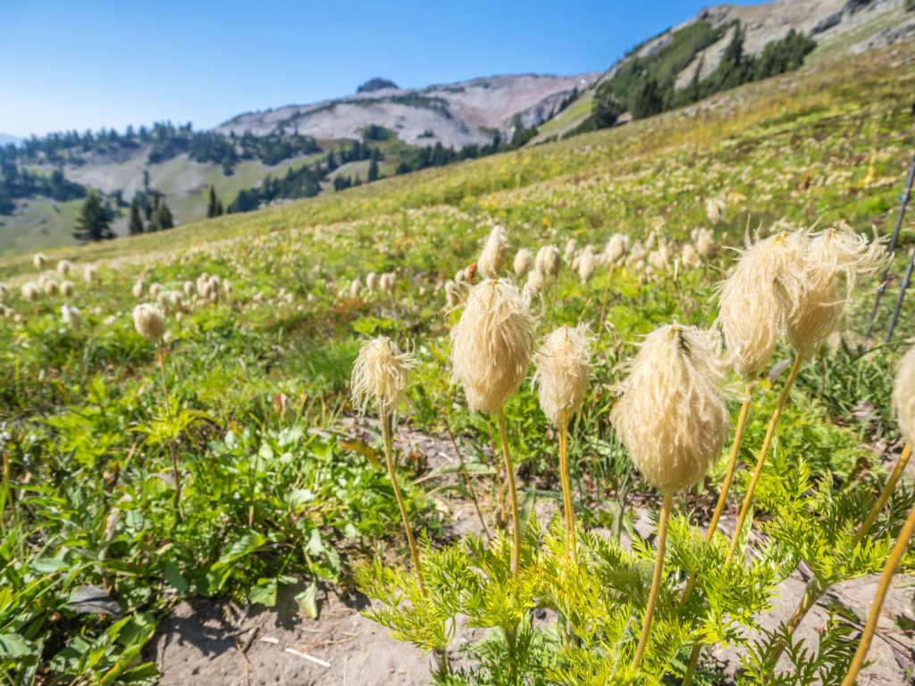
Scattered about the ground cover were these fluffy, white wildflowers.

Delicate purple and yellow wildflowers give the slopes an injection of colour.
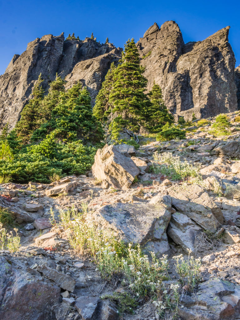
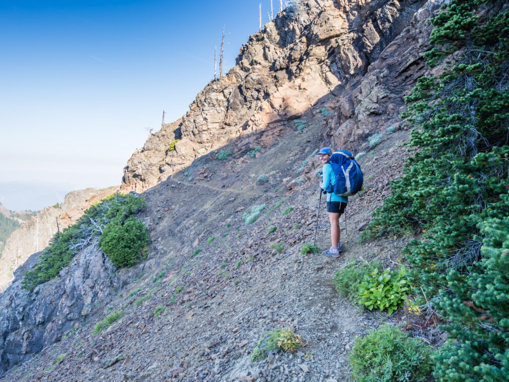
When we set off again, a little further along the trail we passed a gushing waterfall, the water cascading down rock covered in thick, green moss. The trail then climbed further over a large tallis field where we had to traverse two large snow patches that we were surprised to see. The second was a little trickier without micro spikes as the snow was already soft and slippery from the intense sun. When we reached the junction where it is possible to divert from the PCT and take an alternate route around Old Snowy Mountain (which we found out was once the old PCT route), the views in all directions were breathtaking.
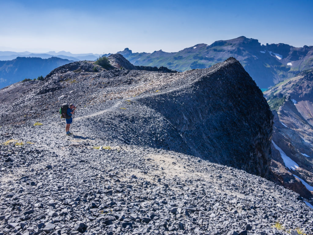
From our vantage point we could see the thin, winding trail along the Knife’s Edge snaking skyward in front of us and this was where we had to take a deep breath and then just get on with it! More excited than scared, we used the same rationale we had used back in the desert when walking along the narrow, sandy ridges that wound around the San Felipe Hills – because the PCT is also an equestrian trail, the route has to be suitable for horses. Keeping that in mind, along with the notion that ridges always look worse from a distance, we pushed on. (It would have been a different story however if the trail along the ridge had been covered in snow!)
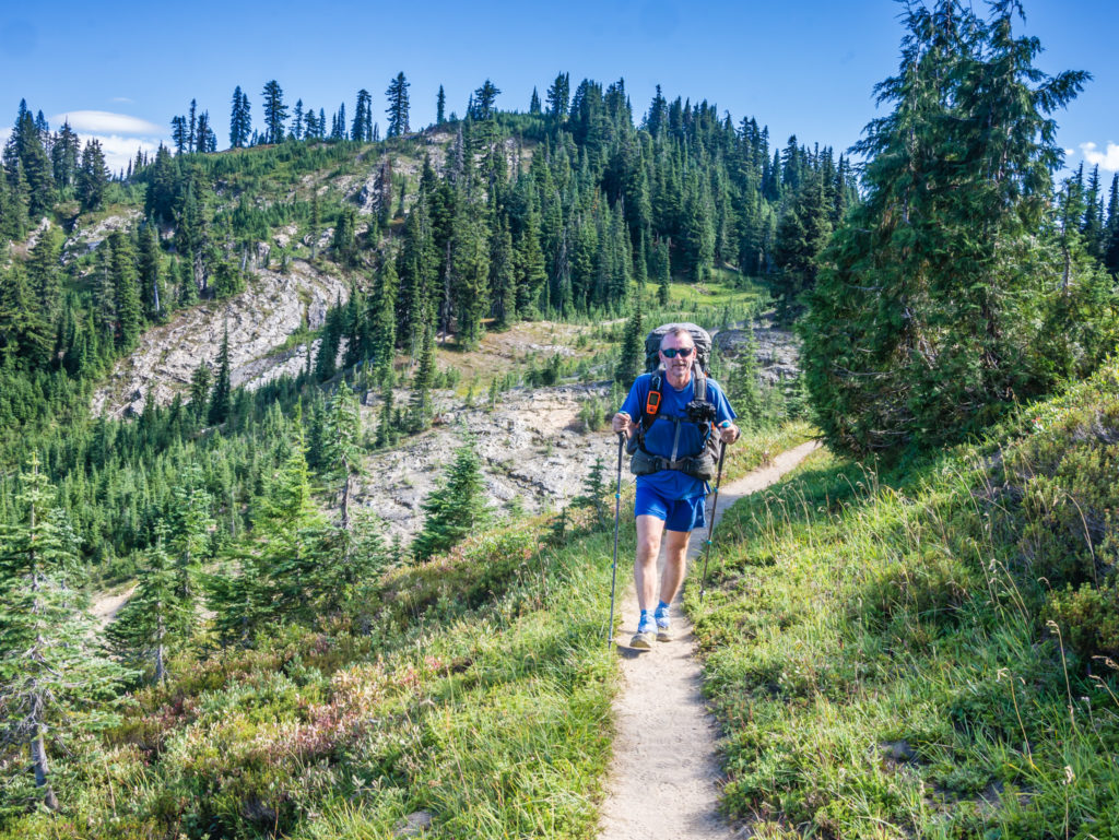
Steadily making our way across the mountainside, whilst taking it all in.
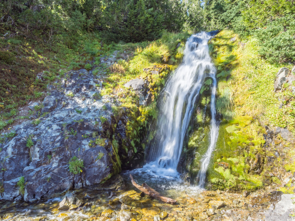
The gushing waterfall that we passed as we made our way around the ridge.
Crossing the path of the waterfall with a minor rock hop.
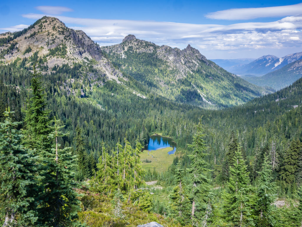
Looking back across the Cispus Basin towards Ives Peak.
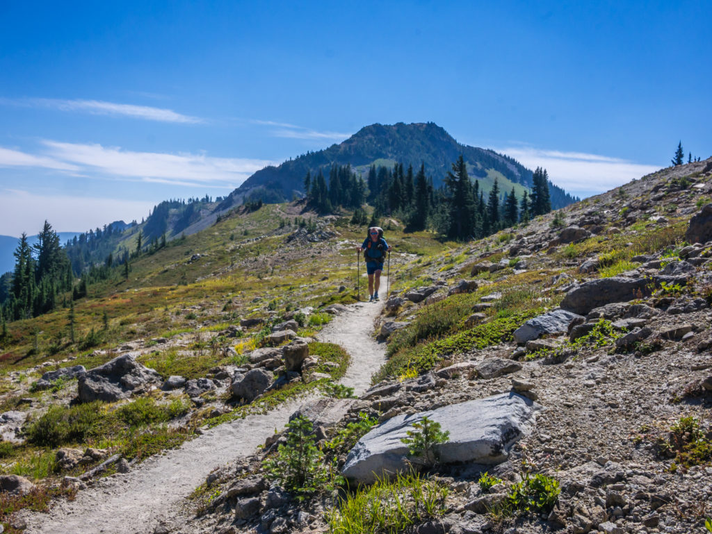
The Goat Rocks Wilderness showcases more wonderful mountain scenery.
Enjoying every second of today’s walk!
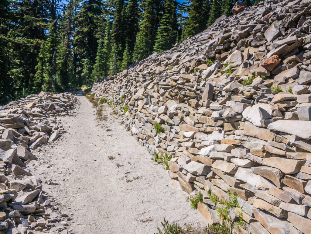
A huge ‘thank you’ to the trail crew that must have gone to great efforts to build this retainer wall making the trail a whole lot easier for us!
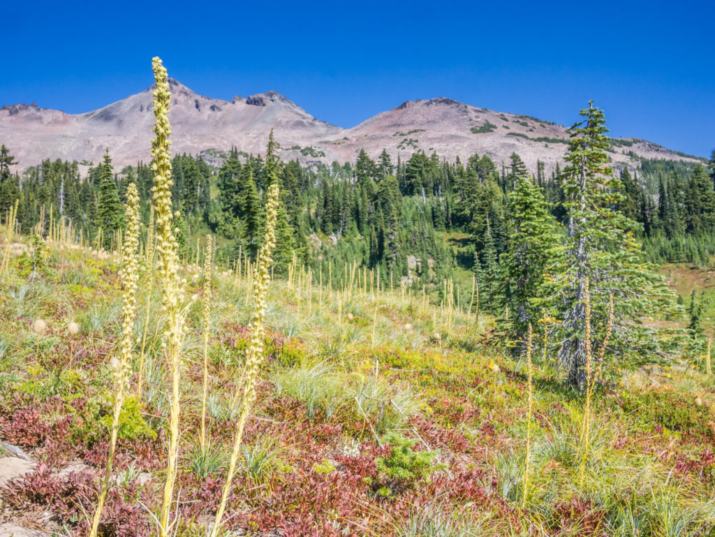
Below the ridges we found ourselves walking through beautiful alpine meadows dotted with autumnal colour.
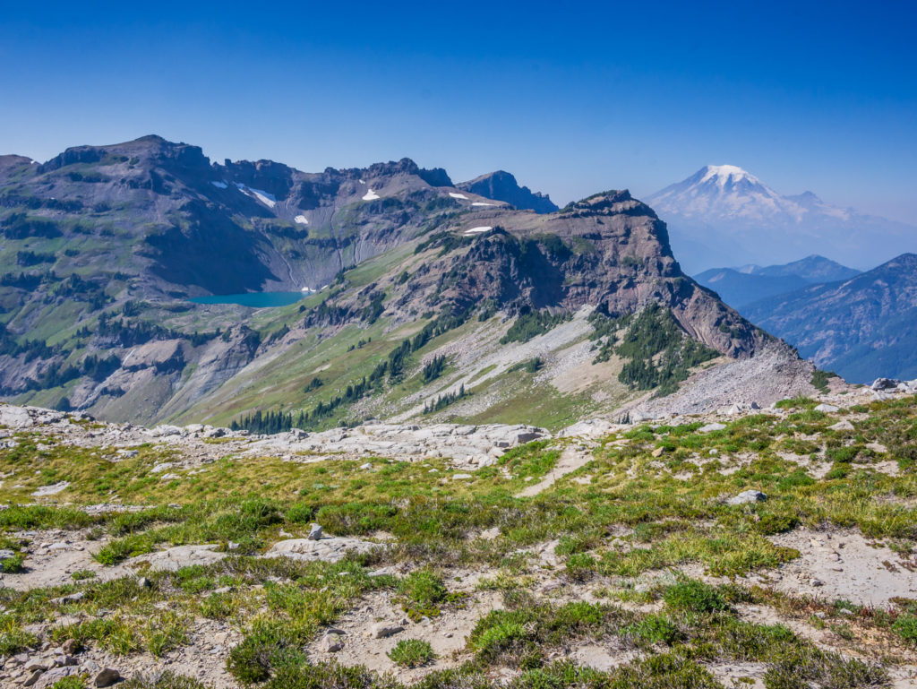
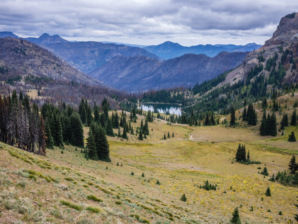
Turning the corner, we were treated to a whole new incredible view! Looking across to Goat Lake and Mount Rainier.
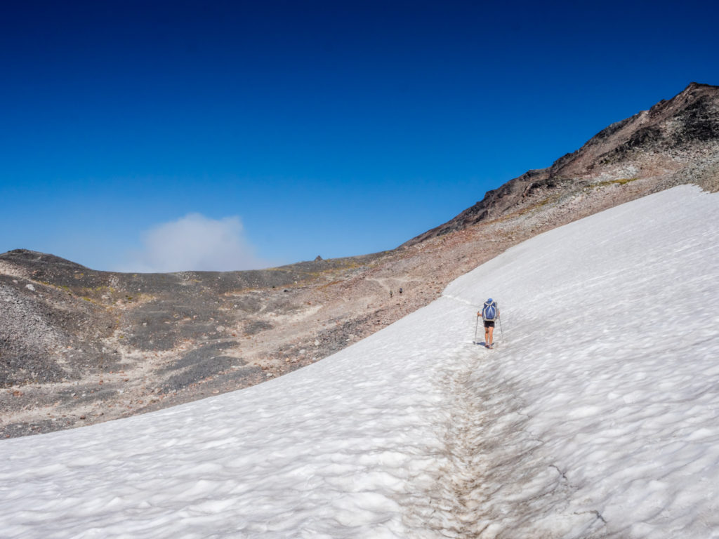
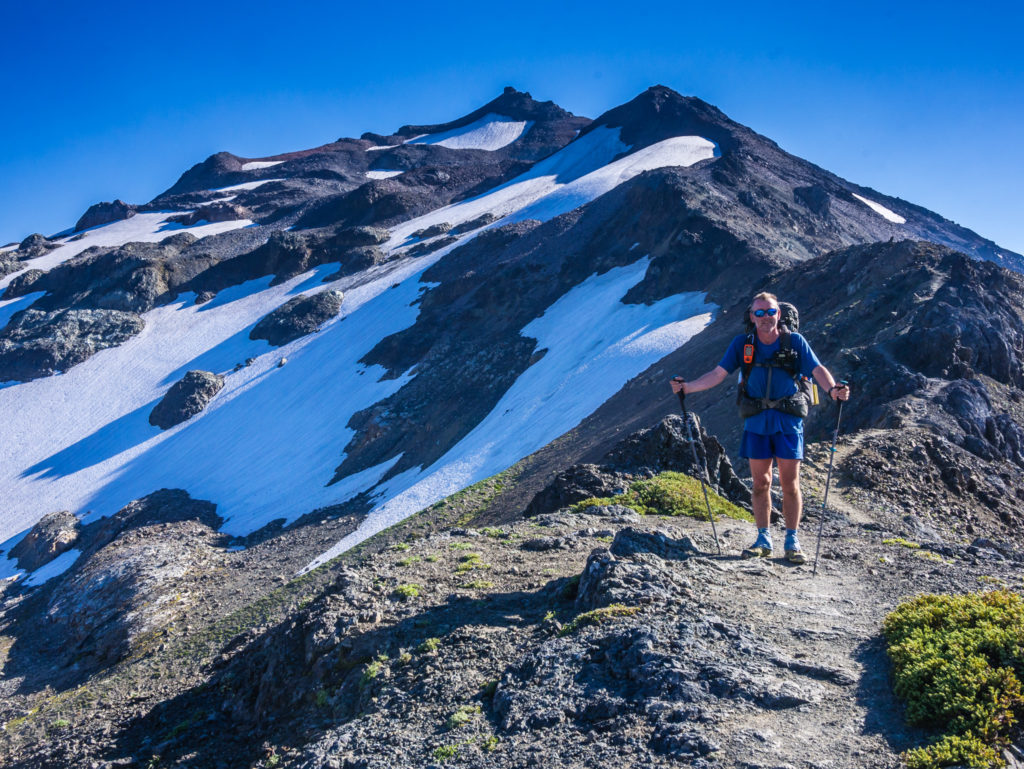
Crossing the snow patch leading to the trail junction where it is possible to take the alternate route around ‘Old Snowy Mountain’.
From afar, the grandiose Mount Rainier draws our attention.
Stopping again to take more photographs as we had spectacular views from every direction.
Heading to the trail junction knowing that our walk across the Knife’s Edge was imminent.
Reaching the PCT trail junction with ‘Old Snowy Mountain’.
Stopping for a rest break at the trail junction and psyching ourselves up in readiness for tackling the Knife’s Edge.
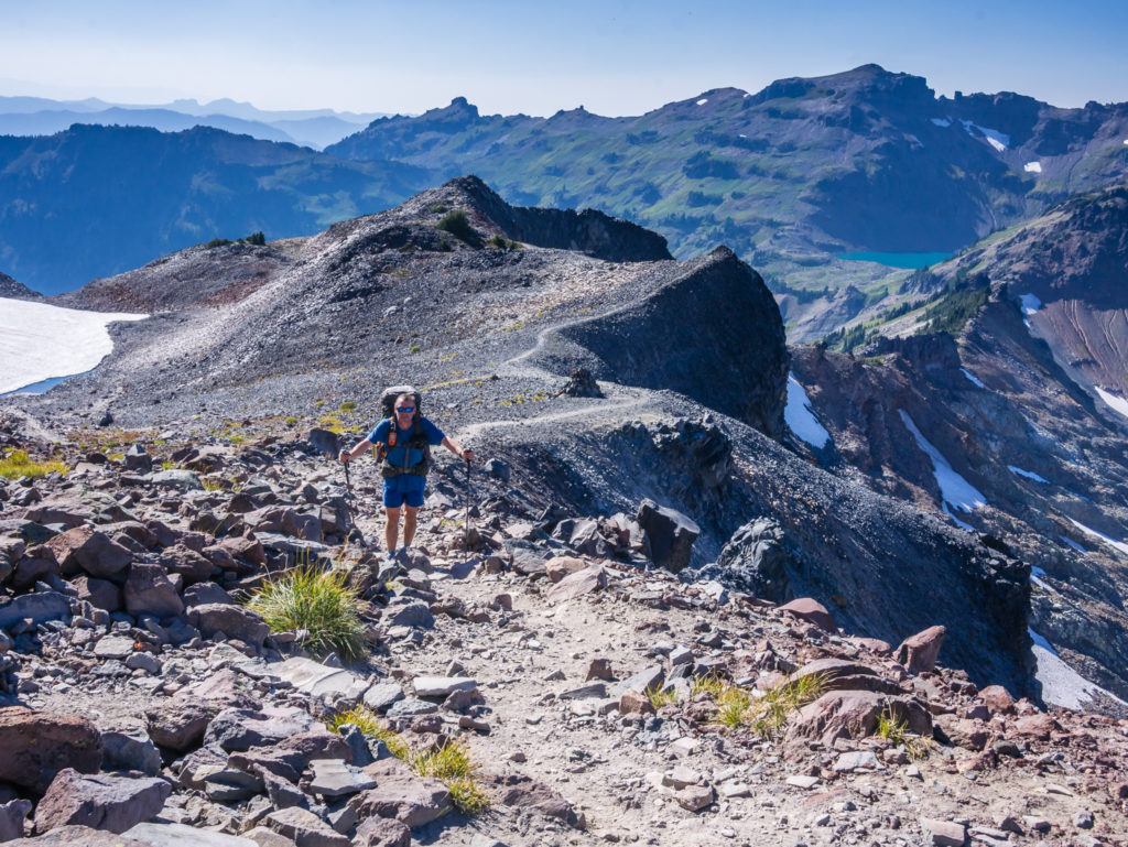
Starting up the ridgeline we took our time, not because we were overly nervous, but rather we wanted to take it all in and so we were stopping every few minutes to take photos in order to capture the incredible landscape from every angle! Not only was the ridgeline itself spectacular, but from the top of it we were amazed by the magnificent 360° panoramic views of the valley and surrounding volcanic peaks. Today we were feeling on top of the world – literally, and extremely lucky that the phase of bad weather had passed so that we could enjoy all of this under a clear, blue sky, something we had been missing since the wildfires began back in Northern California.
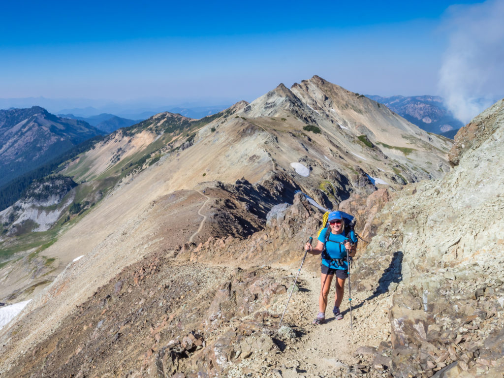
Setting off along the Knife’s Edge, which winds its way across the mountain range before descending to Elk Pass.
Looking to the east, our expansive view down the valley.
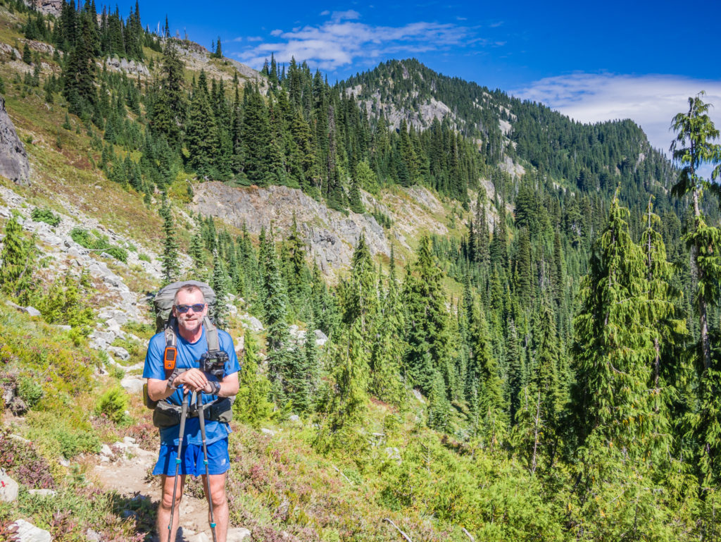
Looking back to Wayne who was following behind, with the peak of Old Snowy Mountain in the background.
Following the trail along the Knife’s Edge.
The trail always looks worse in photographs! We much prefer going up on this kind of terrain as opposed to descending.
Descending from the ridge was a little trickier as the trail was a mixture of grit and loose stone, which on the steeper sections felt quite slippery underfoot. So Wayne went ahead, whilst I took my time taking tentative steps. (Ever since my fall in the Marble Mountains after leaving Etna, I get a little paranoid on steep, downhill sections thinking ‘what if I fall again?’) I have never liked going downhill on scree to the point where I get shaky knees if a section looks too ominous, so I was glad when the descent from the Knife’s Edge was finally over!
Magnificent mountain views that seem to go on forever more.
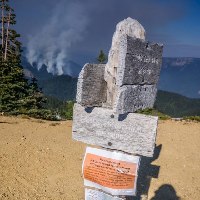
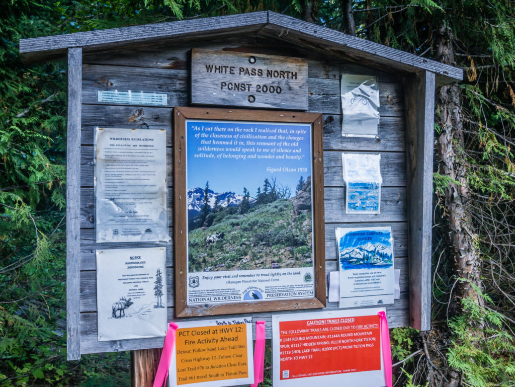
Reaching Elk Pass where the PCT was closed beyond this junction in the Goat Rocks Wilderness. As seen from the photograph, the Miriam Fire that had already burned 2,236 acres was still very much alive.
When we reached the trail junction at Elk Pass we took a quick rest break before we were then forced to detour off the PCT and take an alternate route along the Coyote Trail. It was the second re-route this year because of two wildfires in the Goat Rocks Wilderness in close proximity to the Pacific Crest Trail. (Namely the Miriam Fire, and most recently the Clear Fork Fire.) As the Coyote Trail is less frequented than the PCT, we found it to be much less ‘manicured’ and far more demanding. There was a lot of steep, uneven terrain, which also involved traversing several scree slopes, which less experienced hikers on the PCT would not be used to. It reminded us of the trails we have hiked in Europe and how lucky we’ve been that the PCT is naturally maintained for the most part by the tremendous amount of footfall it receives each year. A well-trodden trail, free of obstacles can make you much too comfortable however. Now the Coyote Trail seemed demanding and even difficult in places as we’d got used to the gentle grades of the equestrian friendly PCT, particularly having been spoilt by the much easier trail through Oregon.
Starting off along the Coyote Trail before the route became an extreme form of ‘gnarly’. (Our American friends refer to this term all the time on the trail, so we have adopted it now!)
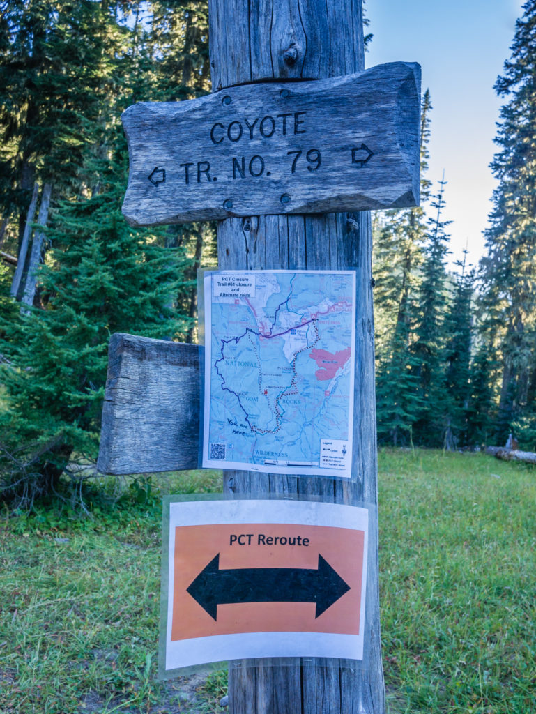
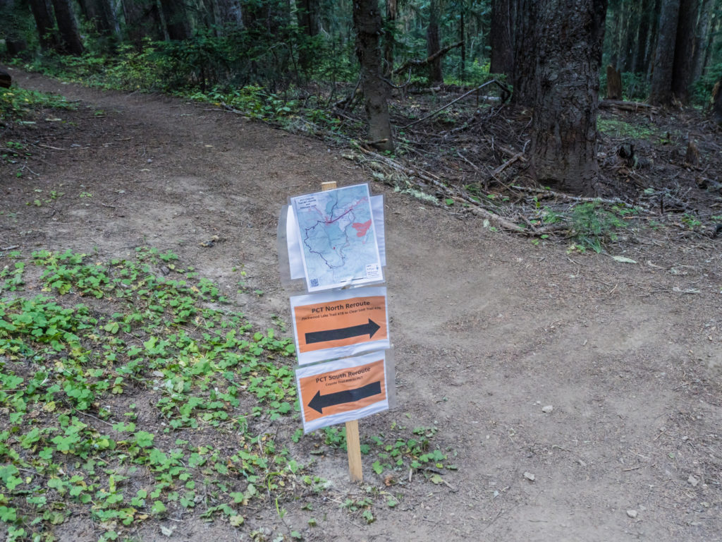
Thankfully the Coyote Trail reroute was well signposted as we didn’t have maps for this section with it not being the official PCT.
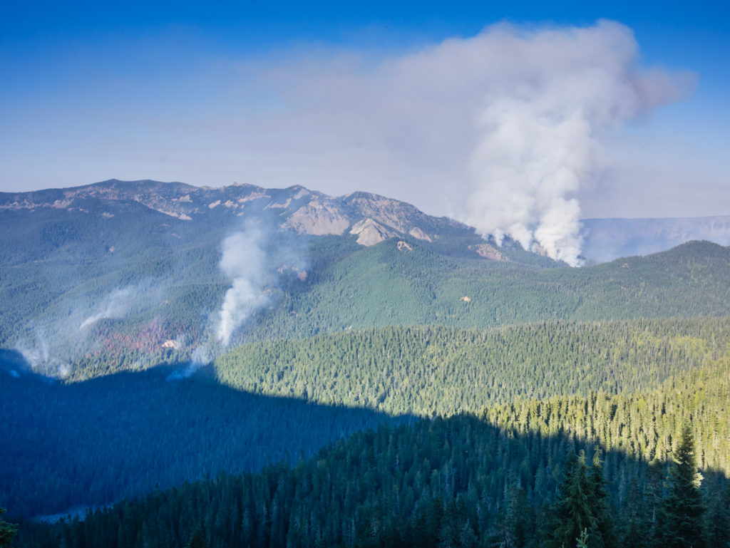
Another shot showing the fires in the Goat Rocks Wilderness area, which forced the closure of the PCT for hikers’ safety.
Particularly after the miles we’d already covered that day, along with the challenging terrain that we had already tackled, we found the next section of the Coyote Trail walking along another exposed edge to Chimney Rock to be very strenuous and demanding. We had been aiming to reach Lost Lake, (which would have been our preferred camp spot that night) but we had fallen an hour behind our predicted time. It wasn’t that we were now continually stopping to take photographs, but rather that our walking pace had dropped to around 2 miles per hour instead of our usual three as the less-used trail was just so gnarly that we really had to concentrate on our footing. (Some thru-hikers had decided to camp at Elk Pass and tackle this section in the morning when they were fresh. Had we known how difficult this section was going to be, we might have done the same!)
Although finding the Coyote Trail tougher than ‘usual’, it still afforded us tremendous views of the surrounding area.
Looking onto Chimney Rock.
As the sun was already getting low in the sky, we decided that after we had collected water at the next stop we would try and find a camp spot so that we wouldn’t have to continue walking in the dark, especially with the precipitous drops we were trying hard to avoid as we hiked around the mountainside. Some places were so steep and the trail so thin, that we had to avert our eyes from looking over the edge to the deep abyss below or we got a wave of vertigo making us feel unsteady on our feet!
A well-deserved reward after all of our efforts – a stunning sunset to end the day!
Our final view of the sun dipping behind the mountains before the trail took us into the trees and down to Beaver Bill Creek.
We were already exhausted and extremely hungry so we really wanted to have a rest break and cook dinner, but there just wasn’t a suitable place to stop. Instead we soldiered on, watching a beautiful sunset as we rounded another ridge, before finally reaching a creek with space for around 5 tents. With not having paper maps for this detour, and also the re-route not being on the Guthooks app, we didn’t have any accurate distances to go by beyond Elk Pass where we had already reached the 20-mile marker for the day. Using his Earthmate app instead, Wayne estimated that we’d hiked a further 5 miles from Elk Pass to Beaver Bill Creek where we were now camped. The area just past the creek was lovely, with logs for seating around a fire pit, however after a hastily cooked pot of Idahoan potatoes with a beef and vegetable soup poured over the top, all we wanted to do was sleep.
Although considerably tiring, it had been an amazing day on the trail. We would even go so far as to say it was one of the best, even with the inclusion of the detour on the Coyote Trail! It really is true that epic scenery does wonders for morale and as Washington was now more than living up to our expectations, we were thoroughly looking forward to what the rest of the trail had to offer, rather than wanting to rush through the last few weeks just to get to Canada.
Day 150 – Thursday, 6th September 2018, PCT fire detour on Coyote Trail to Wild Camp by Sand Lake at Mile 2,298 via Kracker Barrel Store/ White Pass, re-joining the PCT at Mile 2,295, 11 miles
After yesterday’s strenuous climbs, we were not expecting such a tough morning on the trail! We thought after leaving camp and reaching Lost Lake just a couple of miles ahead, that it would be a fairly easy 6 mile woodland walk downhill to the road. But how wrong could we be!
Our camp spot close to Beaver Bill Creek.
Leaving camp at first light and continuing along the Coyote Trail reroute.
When we got to the lakeside we were pleasantly surprised to bump into none other than Gummy Bear, whom we had last seen at the Acton KOA way back when in Southern California! Still donning his colourful shirt and vibrant green shorts (although now faded and becoming more ‘hiker trash’ by the day), as well as maintaining his thick, curly bear-like hair and beard, he was instantly recognisable walking towards us on the trail. We found out that Gummy Bear was now hiking SOBO having flipped up the trail after the Sierra, and was soon to be finishing his PCT adventure at Cascade Locks. Neither of us had long to chat as we needed to be on our way, but he quickly gave us the low down on his experience through Washington, very much likening it to that of the Sierra. After our exhilarating ridge walk and the tremendous views of yesterday, we couldn’t wait!
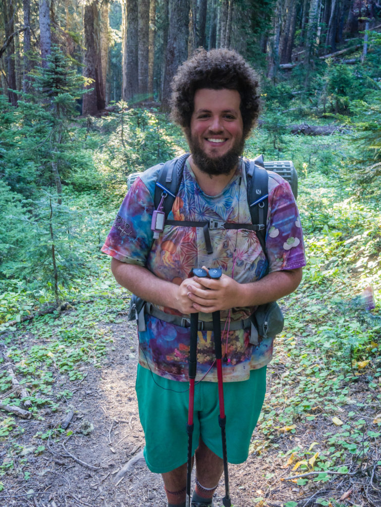
Introducing Gummy Bear – one of our more eccentric hiker friends tackling the PCT this year.
We had definitely got used to the luxury of the well-defined, well-trodden, well-graded PCT. Today however surprised us greatly as it was much more like the European trails we are familiar with – rough and ready, and steep! We had another tough, steep climb to the top of a ridge, followed by another exposed edge and tentative walk across a slope of scree before reaching the top of the pass down into the next valley.
For hikers not used to this kind of terrain, it might have seemed quite terrifying having to walk along an exposed edge on loose scree as in the case of Nick, a thru-hiker we met who had turned back as he just couldn’t face going across the narrow pathway along the scree slope with such an exposed edge. We tried to offer him support and encouragement as it would be a long way back to the junction at Packwood Lake, but he was adamant that he wanted to go back down the mountain and return to the trailhead. His plan was to reach the community of Packwood, find a ride and hitch around this section to White Pass and the Kracker Barrel store, (also our intended destination today), where he would then rejoin the PCT.
Tackling another scree slope and facing another exposed edge.
Is that a grimace or a grin?!

Wayne carefully makes his way across the scree slop towards the mountain pass.
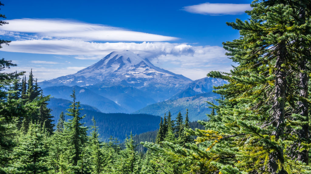
We didn’t turn back, but equally we felt that the Coyote Trail seemed a long and never-ending alternate route. With such exposure it would challenge anyone and put them through their paces whether they had a fear of heights or not. For all of our efforts over the past day and a half, the rewards came when we were presented with a spectacular view of Mount Rainier, looking tremendously majestic on the smoky skyline. Towering way above all the other volcanic peaks and ridges within view, its white glaciers stood out against the blue sky, the smoky haze around the base giving the mountain a magical, other worldly feel.
More tremendous views of Mount Rainier as we get closer by the day.
Taking a much-needed pack break, we sat at the top of the pass admiring the view, hoping that this would be the last climb of the day. However in this instance, we weren’t so lucky. After a long descent that weaved back and forth down the mountainside on gravelly switchbacks, we then had several more climbs taking us through an overgrown forest, where it seemed like we were in an endless fight with the overgrown vegetation blocking our path. This made it difficult to move at speed, and even more so as we were continually having to watch our footing and avoid obstructions with rocks and roots littering the trail. The Americans would definitely have described it as ‘gnarly’ and indeed it seemed a tough choice of alternate route to us too as there were just far too many obstacles hindering our progress.
Taking a breather and enjoying the view once we had finally reached the top of the pass.
Our route along the mountain top before the trail began taking us downhill.
Starting our descent into the next valley which would lead us to White Pass, which turned out to be much longer than expected.
We were so fed up by the fact we still hadn’t reached the road at 11:30am that we took an unplanned rest break so that we could snack on the plump, ripe huckleberries growing in abundance alongside the trail. It lifted our spirits a little. We were also buoyed by the fact we could now hear the traffic on the road, which meant that the highway was close. Just to finish us off though, we then had to ford a creek (there was just no way to avoid getting wet shoes) and contend with a final climb up the hillside to reach the highway.
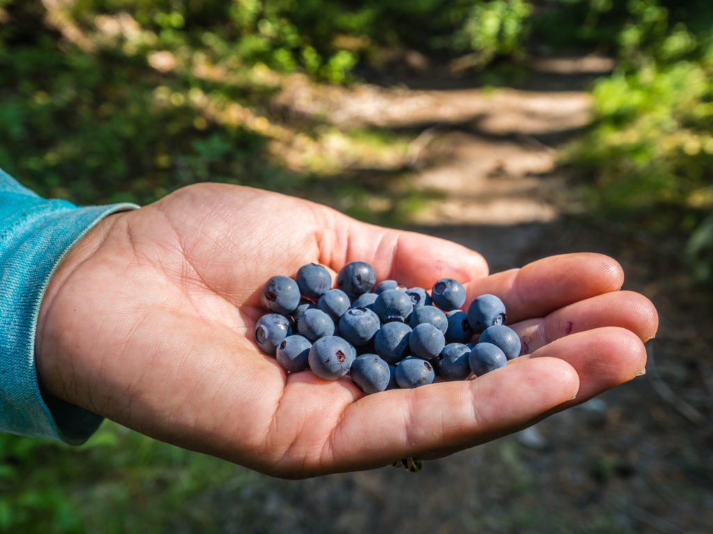
A nice handful of huckleberries helped to lift our spirits.
Not far to go to reach Highway 12. We just had to ford the Cowlitz River first!
Whether it be sheer luck, or the trail gods working in our favour once again, thankfully we got a hitch almost immediately from none other than ‘One Liner’s’ parents – Mary and Phil. After bringing One Liner some goodies to see him through to the end of the trail, they were spending the day ferrying thru-hikers up Highway 12 from where the alternate route finished to White Pass and the Kracker Barrel store, before they headed home to Seattle. They gave us sodas and cookies, some ‘Pop Tarts’ (a hiker food staple we had yet to try), plus a fresh loaf of granary bread, which after eating literally hundreds of tortillas, we couldn’t wait to tuck into!
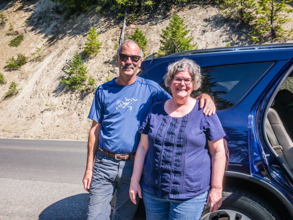
Mary and Phil, the wonderful trail angels that not only fed us with goodies but took us from the end of the alternate route to White Pass (saving us a hot and hard-on-the-feet road walk to rejoin the PCT).
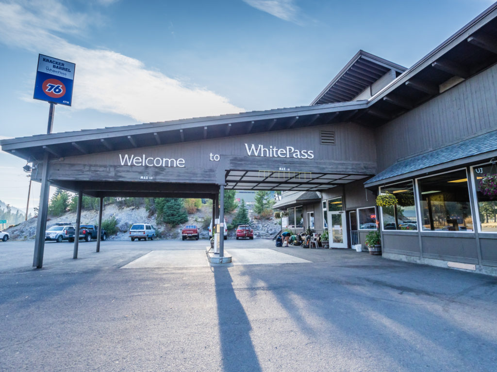
Reaching White Pass where we had sent our next resupply box to the Kracker Barrel store.
Arriving at the Kracker Barrel store mid-afternoon, we found that it was already teeming with PCTers and could quite easily have been mistaken for a ‘community centre’. It had a common room feel in the dining area with hikers lounging around chatting, eating and sorting out food resupply boxes. To the uninitiated, it would have appeared strange seeing people sat around in their waterproof trousers and jackets on such a hot day – but everyone was waiting on laundry and in the queue for a shower.
Along with our backpacks and wet shoes drying out in the sun outside the front of the store, was another long row of backpacks such as we had seen in Cascade Locks belonging to Legs, St Bernard, Sunshine and Trail Mix (whom we had not seen since Castella), the two Germans – Ghost and Ice-T (whom we had first met camping with Tim in Northern California), Gotham, Pete and Emily (fellow Brits), and two of the ‘High Society’ trail family crew. As each thru-hiker arrived, just like us, they walked inside complaining about the state of the trail and how long the fire re-route had taken them. But that was all then quickly forgotten on the sight of pizza and beer for sale!
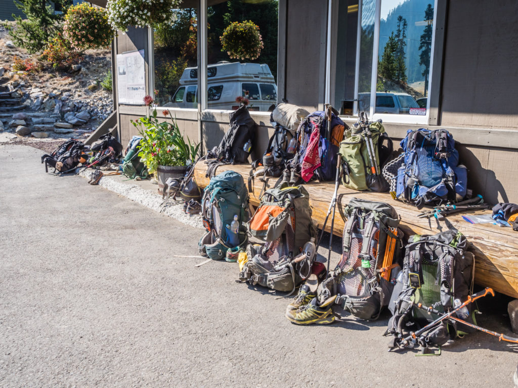
Left outside the Kracker Barrel store. They might not look much but this collection of dusty, smelly backpacks contained thousands of dollars worth of gear! It reminded me of the saying “Camping: Where you spend a small fortune to live like a homeless person”.
We needed showers and to do some laundry, but our first priority, as always was food! We treated ourselves to pizza, corn dogs (basically a sausage on a stick that has been coated in a thick layer of cornmeal batter and deep-fried), crisps, muffins, ice-cream, and chocolate bars – all before we did anything else! Sadly we didn’t treat ourselves to a beer though as we were told that we couldn’t consume it inside the seating area within the store, which sorely disappointed Sunshine and Trail Mix who have given us the new trail name of ‘Six Pack’ as they said that every time they see us we’ve usually got a six-pack in hand! (Clearly we must only bump into them in trail towns!)
With such a great atmosphere and feeling of camaraderie amongst the thru-hikers after what had turned out to be an intensive and tough couple of days, we found it difficult to drag ourselves away. For us, White Pass and the Kracker Barrel store was only intended as a rest stop and then we were meant to be hiking on at least another 10 miles, however it was looking more and more unlikely that this was going to happen. With the excuse of our laundry not being dry until 5:30pm and having to organise our rations, having picked up a resupply box that we had posted to the store, we finally got going at 6:30pm.
Covering a lot less miles than we initially intended, we hiked on just 3 miles to re-join the PCT proper at Mile 2,295. But instead of being disappointed, we congratulated ourselves on the fact that at least we had left. Plenty of other hikers had decided to pitch behind the store and stay there the night getting sucked right into the vortex! Having decided 3 miles was enough, we set up camp close to Sand Lake, just around some trees from where Sunshine and Trail Mix had already pitched up. They really would be disappointed now seeing as we hadn’t carried a six-pack out with us to share!
Leaving White Pass and getting back on the trail at 6:30pm. (Much later than intended!)
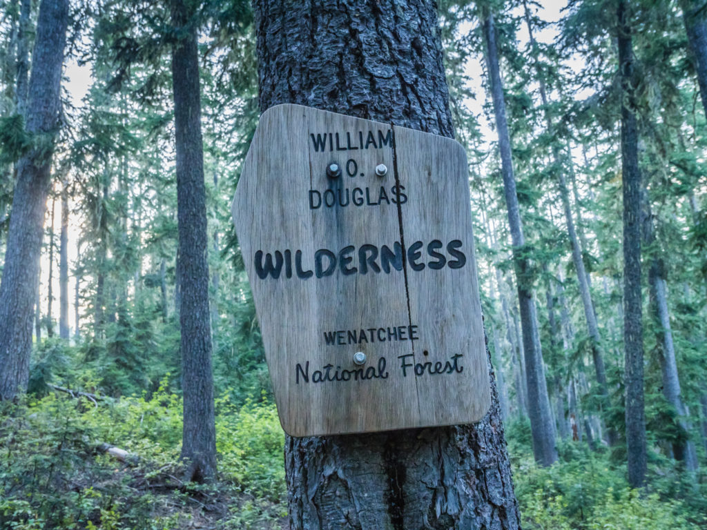
Our time in the Goat Rocks Wilderness was so short-lived. We were now entering the William O. Douglas Wilderness.
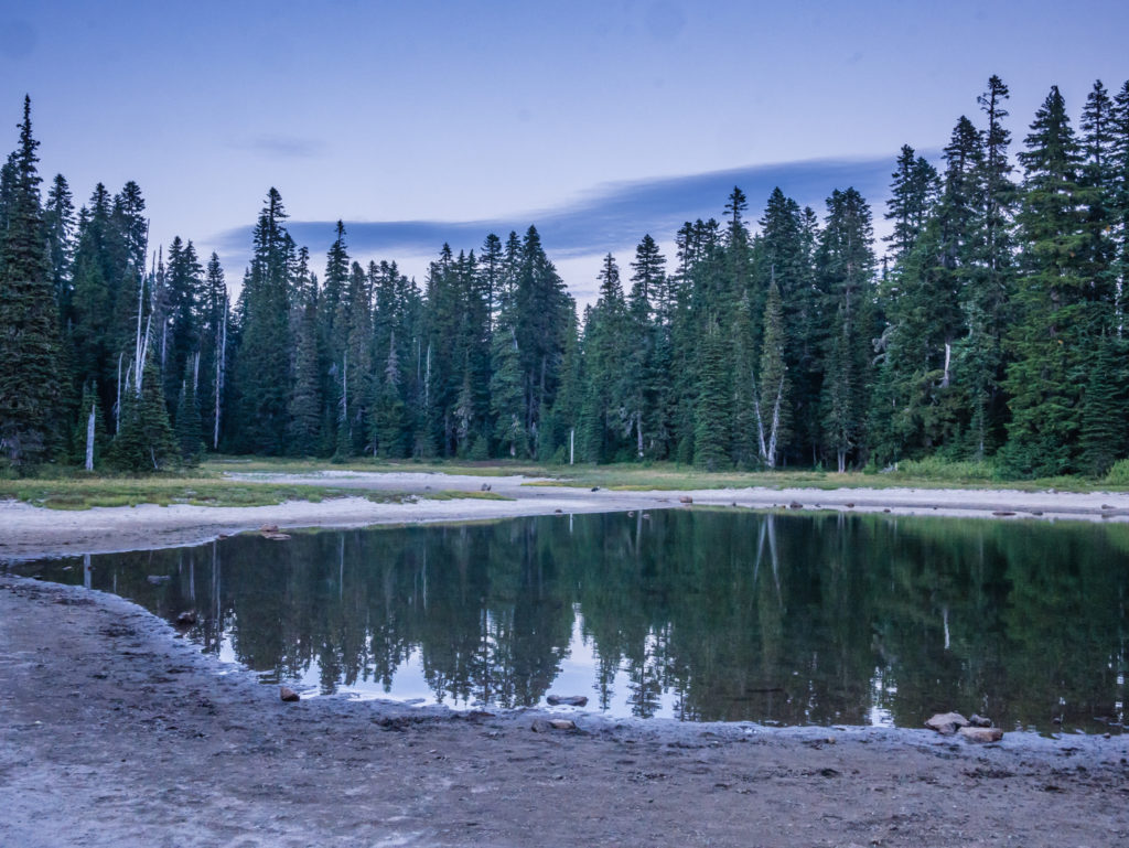
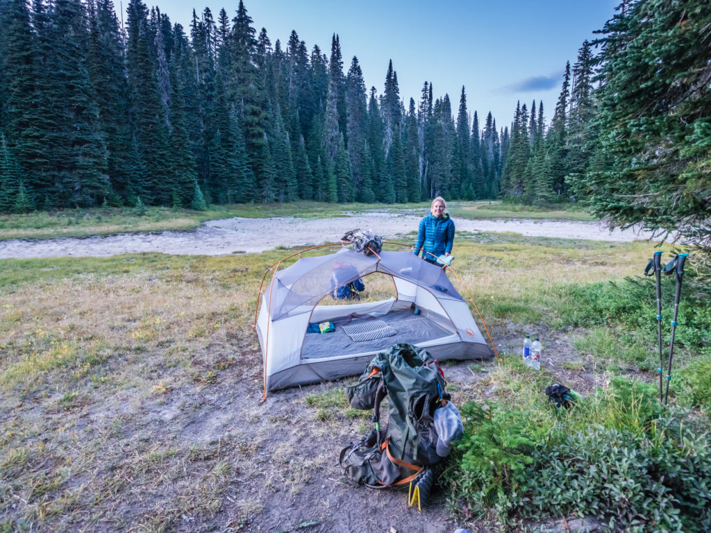
After just 3 miles, we decided to call it a day and pitched close to Sand Lake before it got dark.
Day 151 – Friday, 7th September 2018, Wild Camp by Sand Lake at Mile 2,298 to Wild Camp by Pond at Mile 2,323, 25 miles
Apart from a couple of disturbances in the night from an over zealous elk calling for a mate now that rutting season is underway, we felt well rested after yesterday’s exertions and ready to tackle a new day in Washington. We had been told that this next section leading to Snoqualmie was fairly easy-going and it would be a good place to pick up the miles, so we were going to see if this was true by walking three 28 mile days back to back so that we could reach Snoqualmie by Monday lunchtime. (That was the plan anyway!)
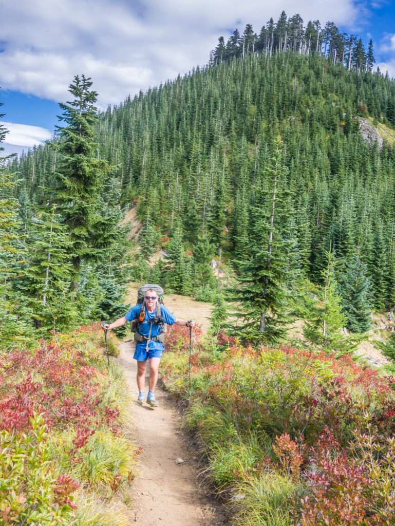
Packing the tent away at first light ready to tackle a 28-mile day.
Three miles into our morning and we passed the 2,300 mile marker! So far yet so near… Just 360 miles to go.
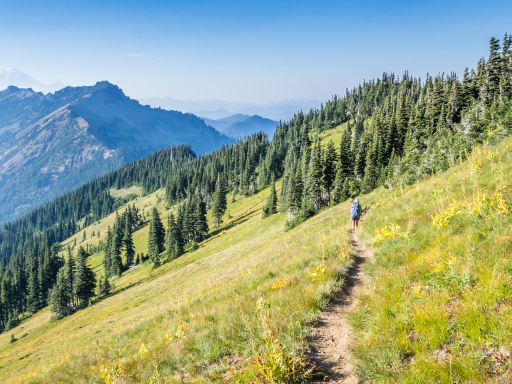
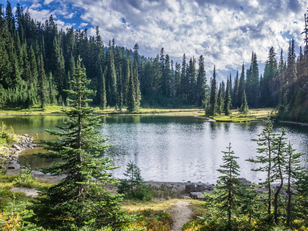
Indeed, now that we were back on the PCT proper and the trail had returned to the forested hills, it was nice and steady winding past several scenic lakes in the William O Douglas Wilderness. As the sun was shining and it was so pretty, we took the opportunity to stop for a tea and snack break at Snow Lake where there were dozens of bright blue dragonflies flitting about across the top of the water in a feeding frenzy. Thankfully there weren’t any mosquitoes to bother us now that their breeding season was finally at an end and we came away unscathed despite the presence of some persistent wasps.
Looking beautiful in the early morning light, Snow Lake was the perfect place for a rest stop.
As we were about to get on our way again, Sunshine and Trail Mix hiked by and we swapped stories about the elk last night as well as the merits of having an adjustable hip belt and the options for making it tighter, as both Trail Mix and Wayne were now on the final adjustment on their backpacks after losing so much weight. Wayne had already tried Trail Mix’s idea of padding it out with cut-off pieces of his old Z-Lite sleep pad, which wasn’t particularly comfortable. So, at best, we hoped he would maintain his current weight and manage with his pack for the last 16 days. With the extra supplies we had sent ourselves, Wayne now had a choice of six different protein snack bars per day as well as his cherry pie for breakfast, our ‘elevenses’ sandwich, and a cooked dinner (whether it be rice or instant mashed potato with a sauce topping). These rations would be pushing his calorie intake to between four and five thousand calories a day, not including the extra calories gained from binging on town food.
Leaving Snow Lake and heading back into the forest.
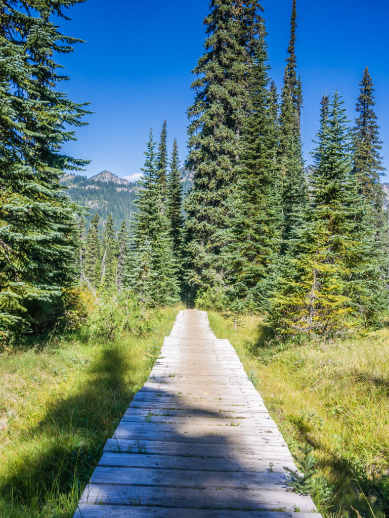
Thumbs up to the trail crews again! We were treated to a nice board walk through this boggy section of ground.
Trying my utmost not to get my feet wet this morning!
Walking through the lush hills and meadows of the William O. Douglas Wilderness.
Making good time as this section’s climbs and dips remained relatively moderate throughout.
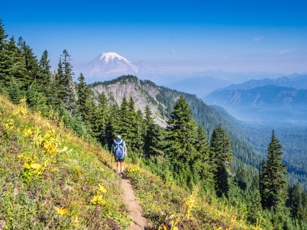
Soon after, we entered the Mount Rainier National Park where the majestic mountain took prominence on the skyline. The darkening clouds that were moving in from the west and collecting around the peak were a sure sign that we were going to hit rain at some point, but for now we savoured the views of Mount Rainier whilst picking handfuls of wild blueberries growing in abundance alongside the trail, eating them as we walked.
Mount Rainier looms large. At times the trail passes within 12 miles of the peak, and remains a near-constant part of the scenery.
Crossing the boundary into the Mount Rainier National Park.
A panorama of the tremendous mountainscapes within view.
Hiking through a swatch of old growth forests and beautiful mountain lakes and meadows.
We were thrilled to be staying one step ahead of the rain.

However Wayne was having major problems with his ‘new’ trail shoes that had torn right across the toe box. (I say ‘new’ as he only got them in Ashland, but they had now already done over 700 miles! He was hoping another patch up job would see him through to the end.)
We could tell that the weekend was starting and that this was a popular area with day hikers and over-nighters too as the trail was much busier than usual, and particularly so along the lakes we passed that already had huge numbers of tents pitched in the designated camp areas. This might also have been attributed to the fact that ‘hunting season’ had just begun so groups of hunters donning their camouflage gear and high visibility vests were out in force with their bows and arrows searching out some unsuspecting elk.
More dark, ominous looking clouds gather around the peak of Mount Rainier.
Just one of the many pretty lakes we passed en route today.
We had read of clear-cuts and exposed hillsides in Washington so it was wonderful to look upon a densely forested landscape.
Before the heavens opened, passing Dewey Lake, a popular spot with weekend campers.
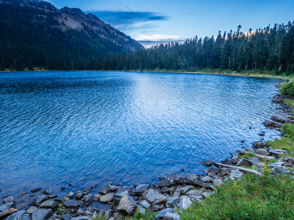
After 25 miles, we stopped just before Chinook Pass as it had started spotting with rain and we were already losing the light. With the temperature dropping rapidly, we thought it prudent to set up camp and stay dry before the weather turned for the worse. The problem we had however was that every place we looked for a camp spot was already taken by groups of hunters. In the end as we didn’t want to hike over the pass for fear of not having anywhere to camp on the other side, we ended up pitching right by a pond below Naches Peak on what we thought was the best out of a bad bunch of sloping spots, whilst the hunters had the better pre-used sites a little way off the bank under the shelter of some trees. (With having got used to enjoying much of the trail to ourselves for over 2,000 miles, we were just slightly annoyed by their presence, even though we know very well that we’ve got to share it. Now if they’d have invited us over for food, that would be a different story!)
Instead, Wayne sat outside in the darkness braving the cold to cook us up some hot soup to warm us through. We hoped that the bad weather wasn’t here to stay, but after getting a weather update on the Garmin for this location and Snoqualmie, the forecast for the week ahead didn’t look good.
Day 152 – Saturday, 8th September 2018, Wild Camp by Pond at Mile 2,323, to Wild Camp by Small Spring at Mile 2,352, 29 miles
We awoke to low cloud hanging in the air over the pond creating a fine drizzle. So we put on our waterproofs and quickly got everything packed away expecting heavier rain as the day progressed, but to our great relief, a huge downpour never materialised.
Packing our gear away and expecting a day of heavy rain.
Early morning reflections on the pond. It didn’t turn out to be too bad of a camp spot after all.
After leaving camp, (the hunters having already vacated their prime spots at the crack of dawn), we hiked over Chinook Pass and down to the trailhead that had both a large parking area and pit toilets. We had heard via trail talk that there had been some ‘Trail Magic’ happening at this particular spot all week, so we were really hoping for a hot coffee to warm us through on such a miserable morning. Unfortunately for us, despite there being plenty of parked cars at the trailhead, there was no one around with anything on offer to brighten up a cold, wet hiker’s day!
Crossing Washington State Route 410 at Chinook Pass. (Also known as the Chinook Scenic Byway.) The pass provides the east entrance to Mount Rainier National Park.
So we continued on, eager to get moving at a fast pace to generate some heat that would help us warm through. With an initial uphill climb along some nicely graded switchbacks we were soon much warmer and had to de-layer very quickly. As our cameras were safely stored in our packs to keep off the rain, we couldn’t take any photos, but with low cloud hanging over several mountain ridges and valleys as far as the eye could see, the scene was both dark, moody and foreboding.
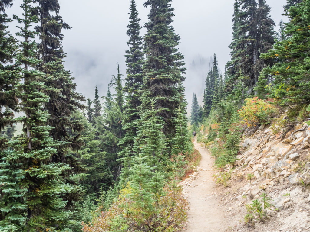
Although the trail underfoot was pleasant, we were heading into a sea of mist unsure of what the day ahead would present us with.
De-layering after an uphill climb but not very impressed with today’s weather!
Each time we turned up a switchback or hiked over a saddle we seemed to be walking into more low cloud and worsening weather. By mid-afternoon however, the cloud had lifted a little, so it felt brighter, although the sun had still not broken through. One good thing about the wet weather was that the rain had dampened down the soil, which meant we had some reprieve from the very fine dust that seems to get everywhere. (We swear that the dust in Oregon and Washington has been worse than the sand in the desert!) So we decided as the terrain was relatively easy and the elevation profiles for the next 30 or so miles looked ‘Oregon flat’ with a few minor undulations, that we would walk until dark and try to power out as many miles as we could in an attempt to claw back some of the miles we hadn’t made out of White Pass. In doing so, we hoped that this would make the next few days a little easier.
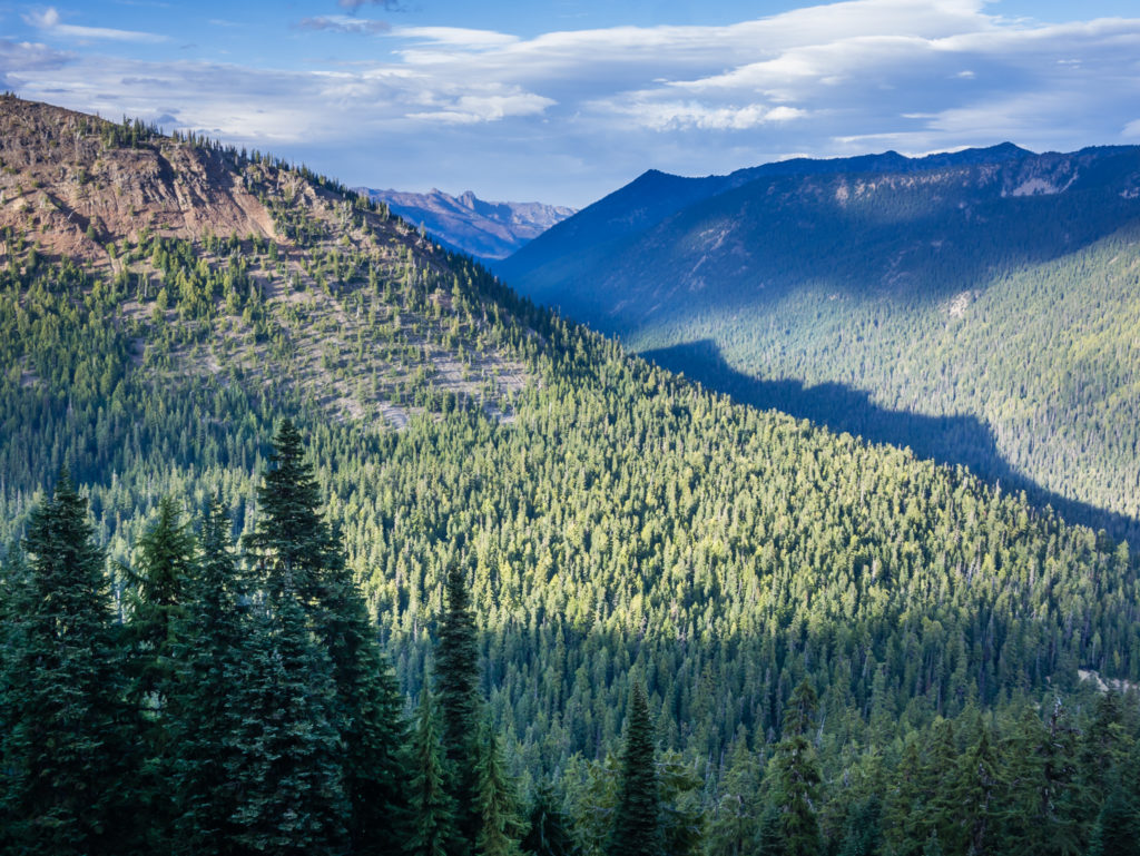
After a quick lunch break on Barnard Saddle, we then followed the trail along an exposed hillside that presented us with some tremendous mountain views to the east. With the clouds lifting at last we were able to see across to the other side of the valley where the mountainsides were covered in a thick forest of rich, green coniferous trees. Already some of the low growing shrubs were starting to turn different hues of yellow and red signalling autumn was encroaching on the landscape. We also walked through a couple of old burn areas. Having witnessed the extensive destruction of the wildfires through Oregon, it was a further reminder of the power of nature to both destroy and to rejuvenate.
Thankfully the clouds were lifting revealing our wonderful surroundings.
Heading from a carpet of green and yellow towards the burn scar.
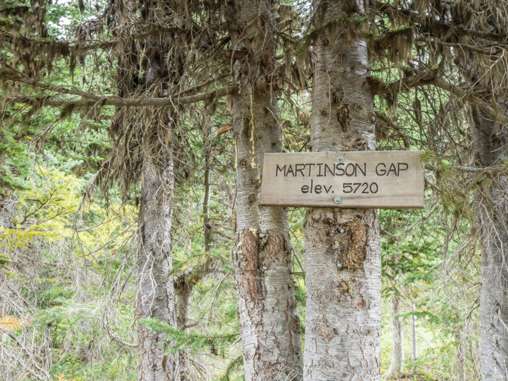
Reaching Martinson Gap in the Norse Peak Wilderness at PCT Mile 2,337.
Smiling as the rain had stopped (for now at least), and we had some expansive views once again.
Pushing on with the intention of having dinner at Urich Cabin at PCT Mile 2,347.
Feeling strong, we pushed on and did a 10-mile stint without taking a break all the way to Urich Cabin located next to Government Meadow just off the PCT at Mile 2,347. There were a few hikers who had already bagged their sleep space on the upstairs floor, but we had no intention of staying overnight in the shelter. We just wanted to get warm by the fire and make use of the table for preparing dinner. Emily, Pete and Snack Pack arrived just as we were leaving around 7pm, which had been a good decision as by now there were around 15-20 hikers all congregated in the shelter also enjoying the fire and setting up their sleep pads on the remaining bits of floor either downstairs or upstairs in the loft area.
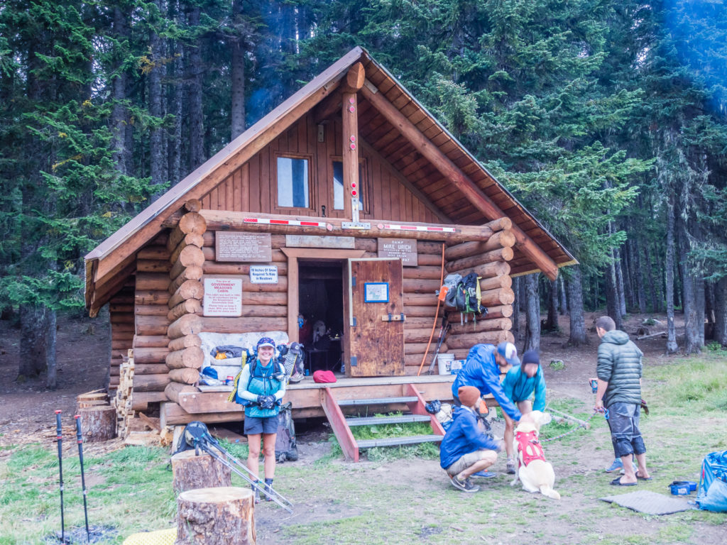
Like every other thru-hiker passing by that day, we made use of the facilities inside the Urich Cabin, a fantastic shelter provided for free along this section of the PCT near Government Meadow.
After re-joining the trail, about one and a half miles beyond the cabin we passed a family who had set up camp at the end of a dirt road. They had a large camp fire roaring away and a bag full of goodies, which they were eager to share with us. They said we were numbers ’15 and 16′ of the PCTers they had seen going past since setting up camp earlier and insisted that we have a shot of whiskey to warm us up and a handful of marshmallows. After thanking them for their hospitality we downed the whiskey and availed them of a few more marshmallows before hiking on – well it would have been rude of us to refuse!
Fiery skies captured our attention whilst tackling the final stretch.
Completing another 5 miles after leaving Urich Cabin, we arrived at a suitable camp spot at 9pm, close to a small spring so that we would have access to water in the morning. There were a couple of other tents already pitched in the vicinity, but we managed to get a spot by ourselves behind some trees. Compared to when we first ventured out of the tent this morning, the day had not been anywhere near as bad as we’d been expecting. We just hoped this run of good fortune would continue.
Day 153 – Sunday, 9th September 2018, Wild Camp by Small Spring at Mile 2,352, to Wild Camp by Dirt Road at Mile 2,379, 27 miles
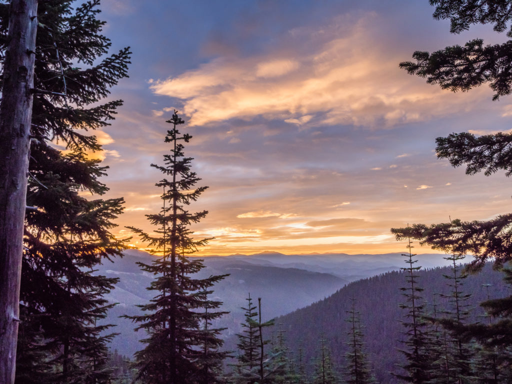
With an early start back on trail under the cover of cloudy skies, we were treated to a splendid golden pink sunrise, where we could see the delicate light filtering between the parting layers of cloud. (Sometimes it’s worth getting up that bit earlier, rather than dawdling and staying the extra half hour in the sleeping bag!)
Early morning mist begins to clear revealing a golden pink sunrise.
Based on the elevation profiles for today, we would be facing continual undulations and a series of ascents, some of them steeper than usual. Wayne called it a ‘steady day’, I on the other hand would say it felt tough! After several consecutive 25 mile days or more, they were beginning to take their toll on my calves and knees, which today were really aching on the uphill. I would just have to grin and bear it however as we had no choice but to get the miles done.
Looking down upon one of the forestry roads which led to an amazing camp spot right at the end of the mountain.
Following the trail towards Green Pass and Blowout Mountain.
Out of the trees and taking in the tremendous views from the ridge.

Feeling on top of the world!
Looking back to Blowout Mountain.
As the clouds began building up more and more overhead, we knew we had to get ourselves prepared for more wet weather that was sure to come later. But for now, back under the cover of the trees we had our minds firmly set to keep pushing on. Having crossed Tacoma Pass, we reached a small tributary of Tacoma Creek at PCT Mile 2,365 where we decided to filter water and stop for lunch. There was already a group of thru-hikers congregated there, none of whom we knew until Spygot, Southbound and Arrow rolled up and joined us, followed by Gotham. We were all abuzz talking about our finish dates and how the end of the trail would soon be upon us, but more importantly, how we were going to celebrate and what plans (if any) we had next!
Stopping for water and lunch at Tacoma Creek.
With dark, heavy clouds still overhead, we pushed on again and later had dinner with the same crowd when we saw them setting up camp in a small meadow area close to Stampede Pass. We were still intent on hiking a further 3 miles to make up for not escaping the vortex at Kracker Barrel sooner, but we allowed ourselves a break and some time to socialise before moving on. During this time, Nemo, a thru-hiker we had seen on Day 2 at Lake Morena turned up at the meadow with crutches. He explained that he had a stress fracture in his leg but was still trying to continue his thru-hike. He was certainly someone you wouldn’t forget meeting on trail with his debonair manner, but mostly because he was wearing a silk shirt with neck tie and velour jacket (think resplendent crossed with the Austin Powers look)! Nemo was the epitome of hiker trash ‘vogue’ but he was also a fine example of a thru-hiker’s unwavering resolve to complete the journey that had been started regardless of whatever obstacles were thrown at them. (We later found out that Nemo’s real name is James Vincent Massey IV – Thru-hikers really do come from all walks of life!)
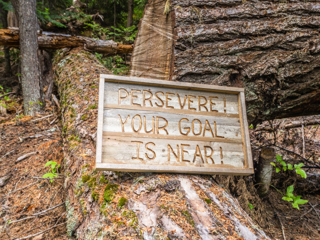
A fantastic little pick-me-up that someone had placed by the trail.
Pushing on a few more miles and aiming to reach Stirrup Creek before nightfall.
Leaving them all to enjoy their hot food we hiked on, and as is becoming ‘standard’ again, it ended up being dark before we made camp. Our intended spot was to pitch close to Stirrup Creek, but with a large number of hikers in front of us today, we were unsure as to whether they’d still be a pitch big enough for our tent with us arriving late. So before reaching the creek, we spied a large, flat spot just past a dirt road, and decided that would be good enough for tonight. It was a mile short of our intended target, but the ground was soft and mossy so we thought it would be a comfortable base for a good night’s sleep.
We still needed water however, so we hiked around two tenths of a mile before finding a small spring along the trail. Filtering water by the light of our head torches, we took just enough for hot chocolate drinks plus an extra litre for keeping us hydrated during the night. We then hiked back the 0.2 miles to the flat area we had spotted earlier. We’re not a fan of ever walking back to somewhere, but it seemed to be the best option with us not knowing the camp situation up ahead. With a spongy base below the tent, it felt comfortable and sleep came quickly. When the rain finally came late in the night however, we soon realised that spongy ground is not the best place to pitch at all!
Day 154 – Monday, 10th September 2018, Wild Camp by Dirt Road at Mile 2,379 to Snoqualmie Pass, Highway 90 & The Summit Inn at Mile 2,393, 14 miles
The heavy downpour we had been expecting finally came. It had rained all through the night and when we woke up to find ourselves stuck in the middle of a soft, boggy pool, it was still raining. Unlike on previous hikes where we might have stayed put for a while and waited out the downpour, we really didn’t have time for such a luxury. With already being at least half a day behind schedule, we needed to push on. So donning full waterproofs and taking the tent down as quickly as we could, we left the quagmire that had become our camp with little hope that they’d be a break in the rain. (It seemed even the trail god’s had abandoned us today!)
The soft mossy spot where we had camped was squelching underfoot by morning.
As anticipated, after hiking just a few miles we were soaked through. We know from experience that in continuous heavy rain even the best waterproof gear reaches saturation point before long. There was nothing we could do but put our heads down and plough on through it with civilisation still being around 10 miles away, where we were hoping to take some respite at Snoqualmie Pass. We had sent our next resupply parcel to the Summit Inn located next to the Summit at Snoqualmie Ski Resort area, where there are also several other conveniences, including a Chevron gas station, a couple of cafés and a microbrewery. So when we got there, we could at least take shelter and warm up with a hot drink (or console ourselves with a beer).
Staying overnight at the Summit Inn was not part of our plans, but if the rain persisted it was looking likely that we’d take a room just so that we could dry out all of our gear, including the tent that was still soaked through after last night. Walking in the rain, although not much fun, is bearable. But putting up a wet tent and putting on cold, wet clothes to a repeat of the same was not a prospect we were relishing. How long the rain would stay for we didn’t know as each valley we walked into seemed to have its own micro-climate. We just hoped the weather would improve quickly and that the remainder of our time in Washington wouldn’t become a complete wash-out!
Our route today took us around Mirror Lake and to the east of Silver Peak, but there were no views to speak of as the rain continued to pour down from a dull, grey sky. (The rain was that incessant we never even took our cameras out of our packs.) After passing Beaver Lake, the PCT crosses paths with a cross-country ski trail leading down to the Summit Ski Resort. From the top of the rise we could see the Interstate overpass and Highway 90 as well as a cluster of buildings including the Chevron gas station below us. As the ski trail seemed the most direct route to civilisation and the opportunity of getting warm and dry, we made the rash decision of taking the short-cut down the hillside. With rain lashing at our faces and our fingers numb with cold, (our gloves long since soaked through), we weren’t too concerned about missing out a mile or so of the proper PCT. Having seen plenty of footprints in the ski trail, it looked like every other thru-hiker in front of us had already done the same thing.
Looking bedraggled and feeling soaked to the bone, it was a huge relief when we reached the Summit Inn around 1:30pm. On entering we were thrilled to see a roaring fire in the middle of the Reception area, along with Legs and St Bernard who had arrived minutes before us. After enquiring about the price and availability of a room for the night, and seeing the rain still pouring heavily outside, we were easily persuaded to stay, even at a cost of $109! It was worth it to us just to warm up and get everything dry.
After checking in, it didn’t take long for our room to look trashed when we got everything out for an airing. Luckily the bathroom was equipped with a bath tub so we were able to hang the tent over the shower curtain rail above the bath to dry out. I then got to work scrubbing and rinsing off all the mud that had become caked up our waterproof trousers. With our gear then hanging off every available piece of fixtures and fittings and the heating on full blast, we hoped it would all be dry by the morning.
Then came the best part of the day. As with any rainy day at home, it’s nice to spend it indoors sat around the fire with a hot drink, feeling all warm and cosy. So to warm ourselves up we treated ourselves to large hot chocolates with whipped cream and an extra-large pizza to share at the Red Mountain Coffee Café next door to the Inn.
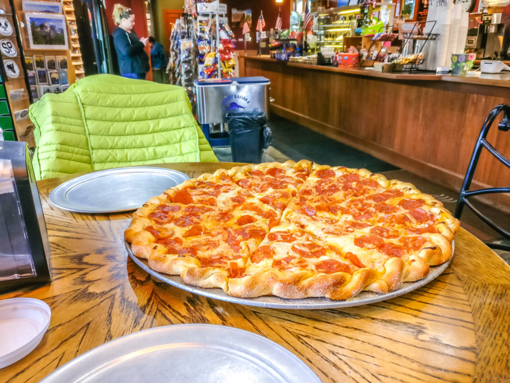
Taking advantage of the opportunity of more town food! Filling ourselves up with a traditional ‘pepperoni and cheese’ pizza.
When we left to go back to our room but found it was still raining, we then hot-footed it across the car park to the Dru Bru Pub where we decided to sample a set of flights each. With no further miles that day, we then also treated ourselves to a bottle of wine from Lee’s Summit Grocery Store to enjoy in the comfort of our room. Well, why not!
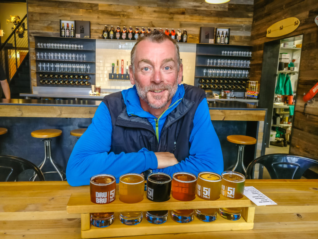
Wayne’s choice of flights from the Dru Bru microbrewery. Those dark clouds had a silver lining after all!
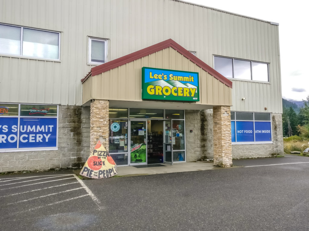
Heading to the Grocery Store to purchase a bottle of vino.
With stopping overnight at Snoqualmie Pass we would now be at least a day behind our intended schedule – so we would have to look at our plans again and make further adjustments. After our experiences over the last week, it seems we may have underestimated Washington both in terms of the weather and the terrain. Until now, we feel we have made good progress along the trail, however the weather and terrain are now beginning to hinder that.
But they will not deter us from our end goal. With less than 300 miles to go to reach the Canadian border, if we have to put in a few more thirty mile days to make our intended end-date then so be it. Completing our recent 50-miler has given us the confidence to know that when needed, we can definitely go the distance!

4 Comments
Delightful reading! I am so glad that the hiking gods blessed you with good weather as you got around Mt. Adams and Old Snowy! I feel bad for the folks that hit that section and get wet weather and clouds obscuring one of the more scenic sections of our trail. Having lived here all my life, I can tell you it doesn’t have to be fall for rain to ruin a good backpacking trip in Washington. It can be July and August and still rain for a week – not unlike England! But your infectious enthusiasm and positive outlook makes me smile – I can assure you, if you were reading my blog as I slogged from Mt. Rainier to Snoqualmie Pass in the rain there would be a lot of “F” bombs, and “this is B…S…t!” in an effort to truly convey how unpleasant it can be “whilst” attempting to be humorous in a sophomoric kind of way. And you got “gnarly” in there a couple of times – that was good. Your pictures around the Rocks and Rainier were blue ribbon stuff. And the fact that you take the time to comment on the comments makes me feel like I have a pen pal on the other side of the planet, and that’s fun. What are we going to do when you get to the end? Just sit around and watch TV all the time? It’s just so depressing to contemplate….Hope you guys are having the time of your lives on the beach
Warmest regards from Seattle,
Your old pal “Bob”
Hey Bob, thank you once again for taking the time to comment so comprehensively.
Glad that you’re still enjoying reading about our adventure. I have just one post left. Its really been a labour of love to get these last few posts edited and published online. They seem to take forever as we are now removed from the trail. Things that seemed so important then seem quite trivial now when I’m reading back through my notes!
When I finally get to the end, I’ll attempt to do a round-up post of our time exploring China. It is so culturally different, I just hope I can do it justice. We’re whiling away our days in Taiwan now at the beach or around the pool and spending a lot of time in the hotel gym as well, as we really feel the need to exercise having spent almost every waking hour of the day walking for six months! It’s a routine we won’t be able to maintain when we get home however as work takes up so much time, unfortunately.
Already planning our next walking adventure for Summer 2019, which will be tackling the entire GR11 route across Spain but taking in some of the Haute Route through the Pyrenees and jumping over the border into France to do some of the GR10 route as well. The scenery is on par with the High Sierra, so we will be in our element. (Need to get saving again in 2019 to make it happen!)
I’m going to seek out your blog and find out about your own experience in the Goat Rocks! Looking forward to a different perspective.
Best regards,
Danielle
I still find it hard to comprehend when you mention mile markers measured in thousands. It seems such an unfeasibly long way to walk. Keeping morale going in wet weather is really tough. I guess the gods had a grin if not a smile to send you a hotel room, beer and pizza on such a wet day. Keep going (as of course we all know you did!)
Thanks for reading and commenting again Andy. Yep, it blows my mind that we actually walked 2,660 miles. Now that it’s over, it doesn’t quite seem real! Even the fact we managed 30 mile days is something hard to believe.
That rainy day on trail was nothing compared to what we had the penultimate week. But now that it’s long since over, it doesn’t seem half as bad through rose-tinted glasses! Nostalgia would see me walking the trail again, however my feelings on the final week were ones of never wanting to do a long distance hike ever again 😉