
“There is pleasure in the pathless woods. There is rapture on the lonely shore. There is society where none intrudes, by the deep sea and music in its roar. I love not man the less, but Nature more”.
– Lord Byron
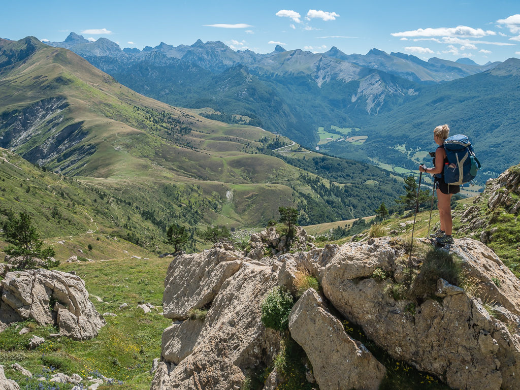
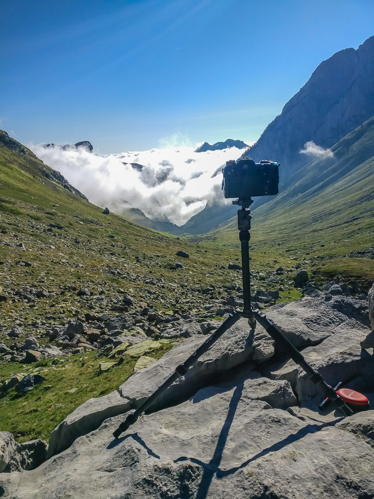
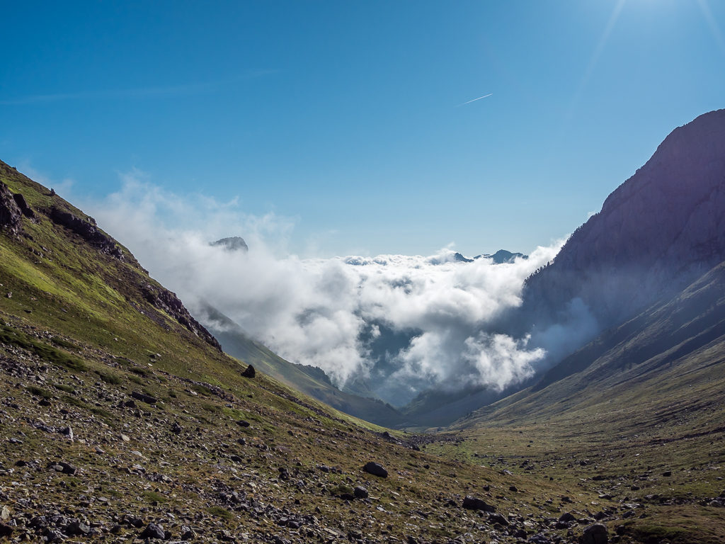
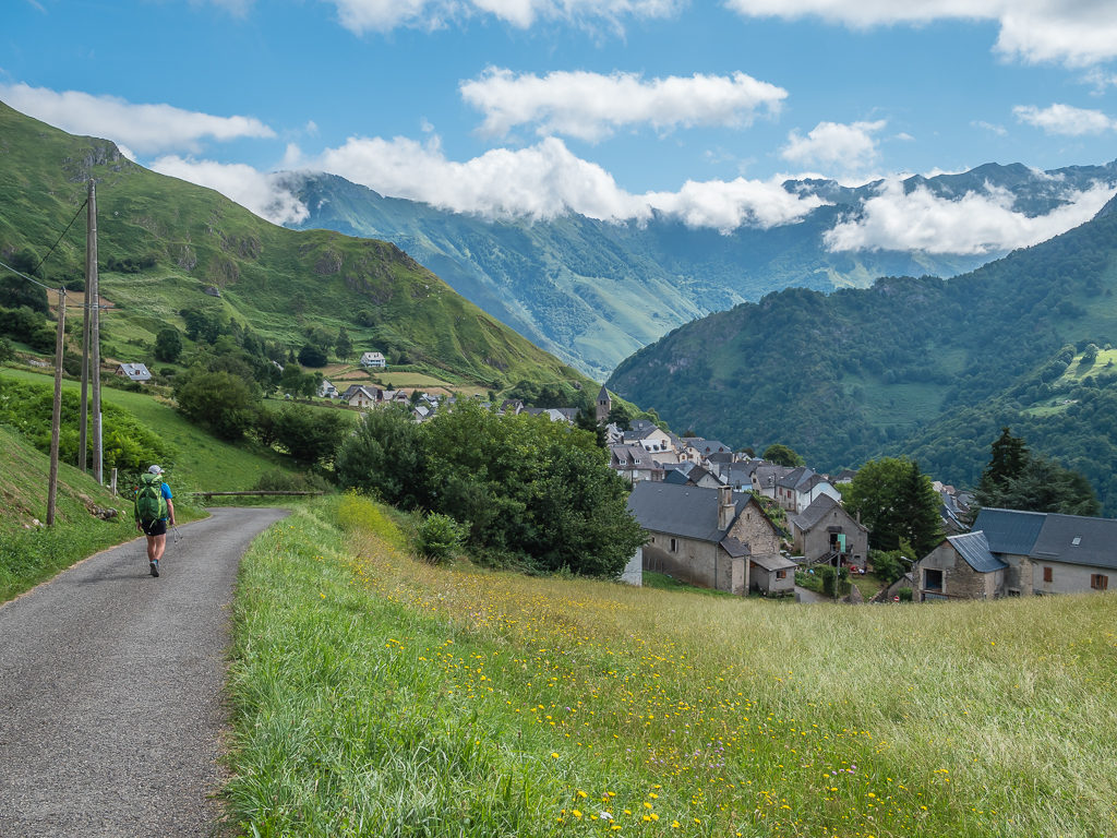
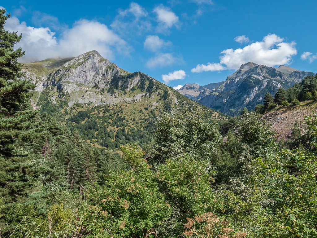
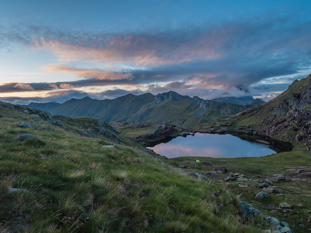
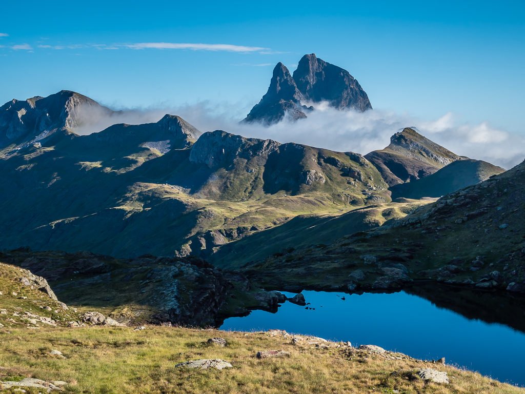
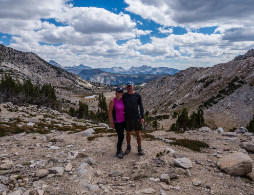
Starting our second week on trail and entering the high mountains of the Pyrenees. We were wowed by their grandeur and the fact that there wasn’t another soul around.
After such an incredible start to our Pyrenees adventure, we were hoping that the weather wouldn’t now let us down as we entered our second week on trail. Having crossed back into France at the Port de Larrau on Day 7, rain could be a real possibility over the next few days with the French Pyrenees being typically wetter than the Spanish side. But having what we considered to be a run of good fortune so far, we would remain positive and see how this next week would unfold as we finally hit the high Pyrenees proper…
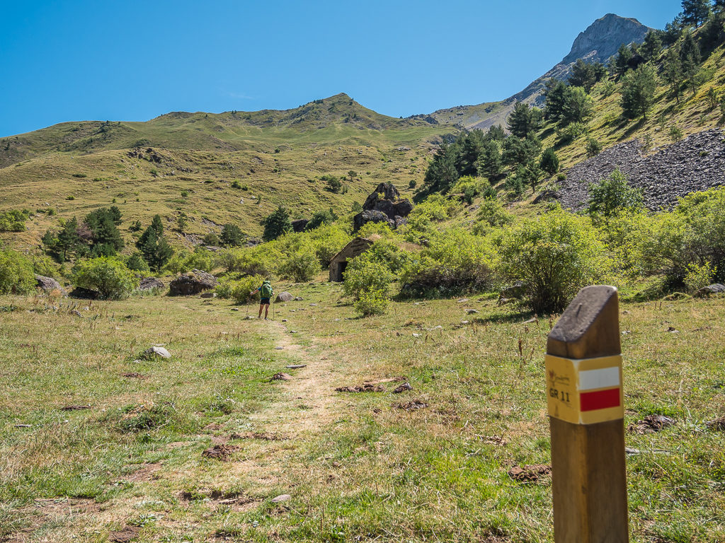
Day 8 – ‘Limestone Labyrinth’ Friday 9th August, 2019, Wild Camp by Cabane d’Ardane to Wild Camp at the Source de Marmatou, HRP, GR12, 22km
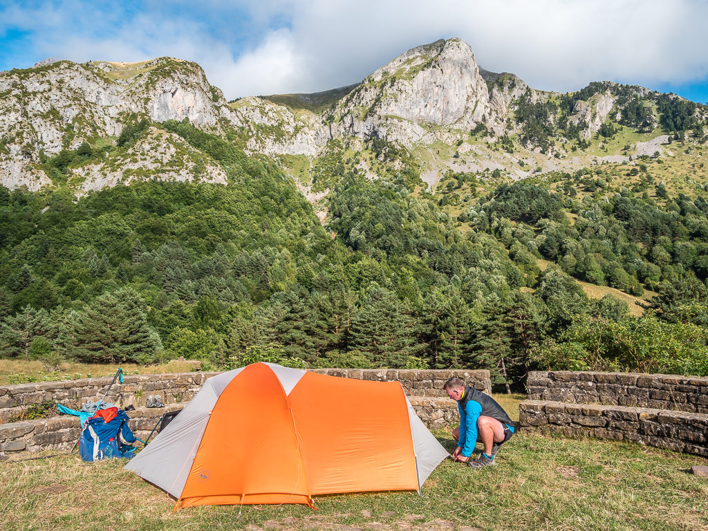
On the eve of entering our second week on trail, we didn’t have a great night’s sleep because of strong winds during the night – but the one positive was that we now know our new Big Agnes 2 person ‘Hotel’ tent will stand up to a good battering! We got up around 7:30am and weren’t surprised to see that the other hikers camped around the cabin had already packed up and were about to leave. Even with so much practise, we are still terrible at getting away from camp early!
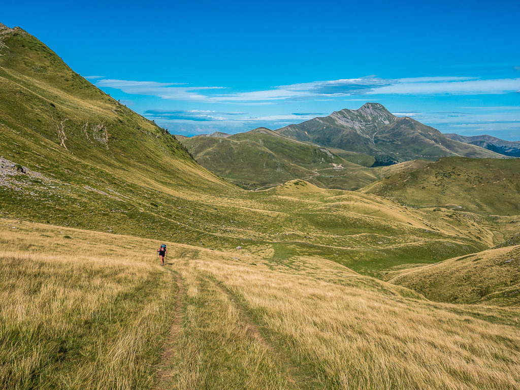
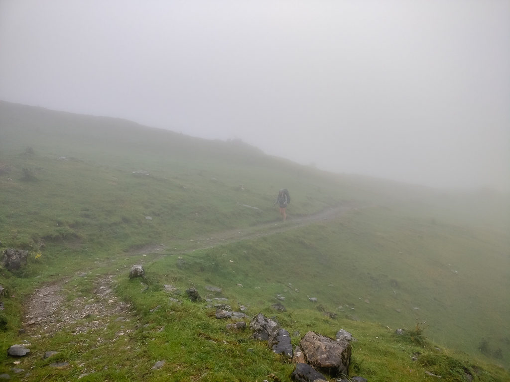
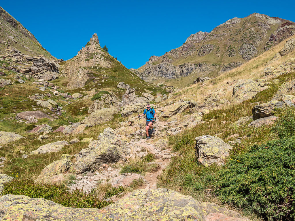
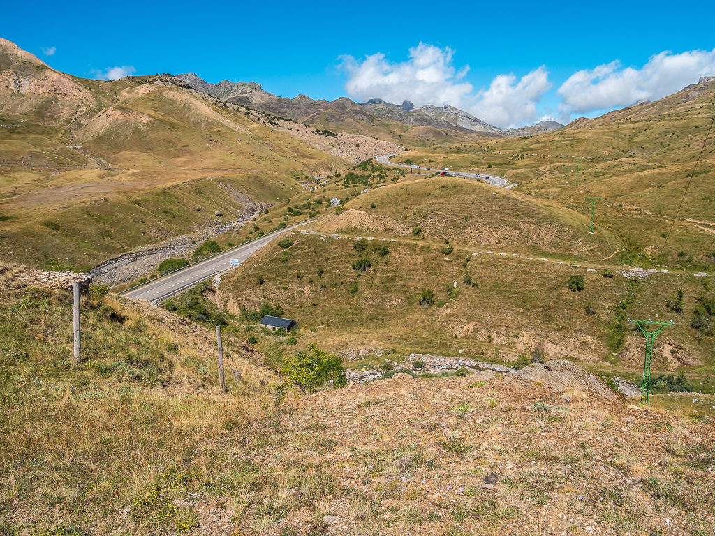
Fast forward to 9:30am after a hearty breakfast of bacon and egg cobs, and we were ready to hit the trail again. We had another road walk out of the valley zigzagging our way up to the Col Uthu at 1,664 metres and Border Stone 247. With verdant green peaks all around and well-made tracks through the grassy slopes, it would have been a beautiful start to today’s walk had it not been so windy. Strong gusts funnelling up each of the cols literally blasted us sideways, which made even the most straightforward of paths a really demanding trek, particularly going uphill. We had to stop and stow away our hats and sunglasses at one point or they would have been lost down the mountain somewhere in the abyss far below. We were also slowed up by a large herd of sheep walking along the same track similarly making their way over the col, we supposed to find shelter from the wind.
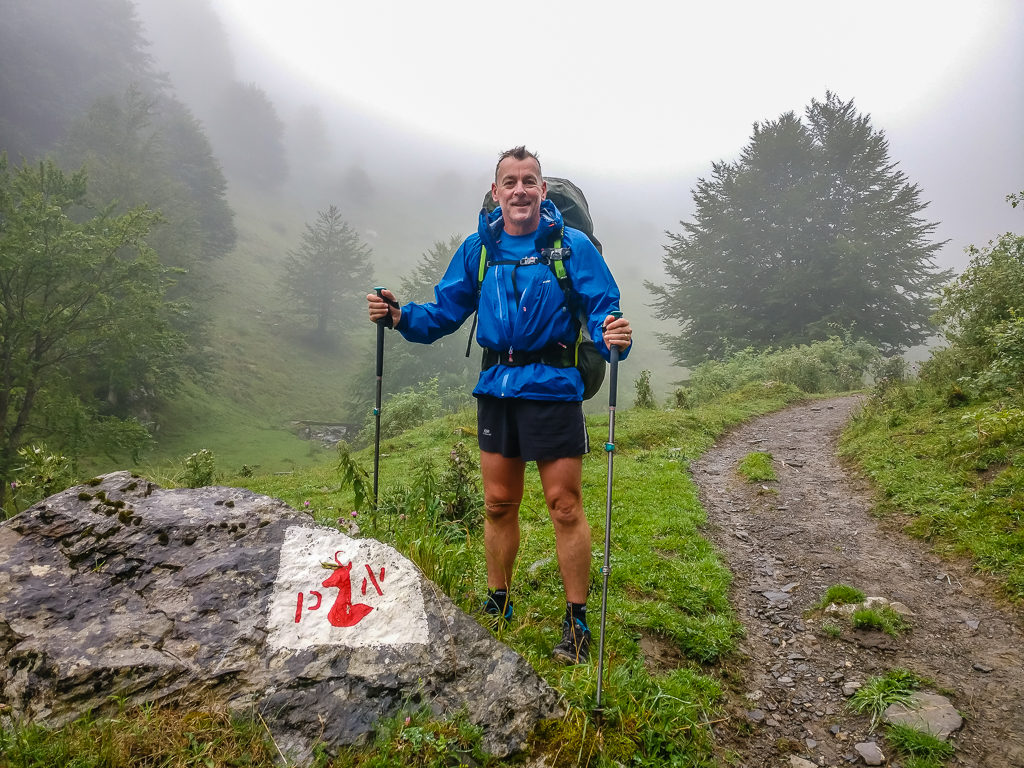
It was a rather windy but wonderful day all the same as we left the Cabane d’Ardane and got back on trail.
Battling against the wind to make our way up to the Col Uthu at 1,664 metres and the location of Border Stone 247.
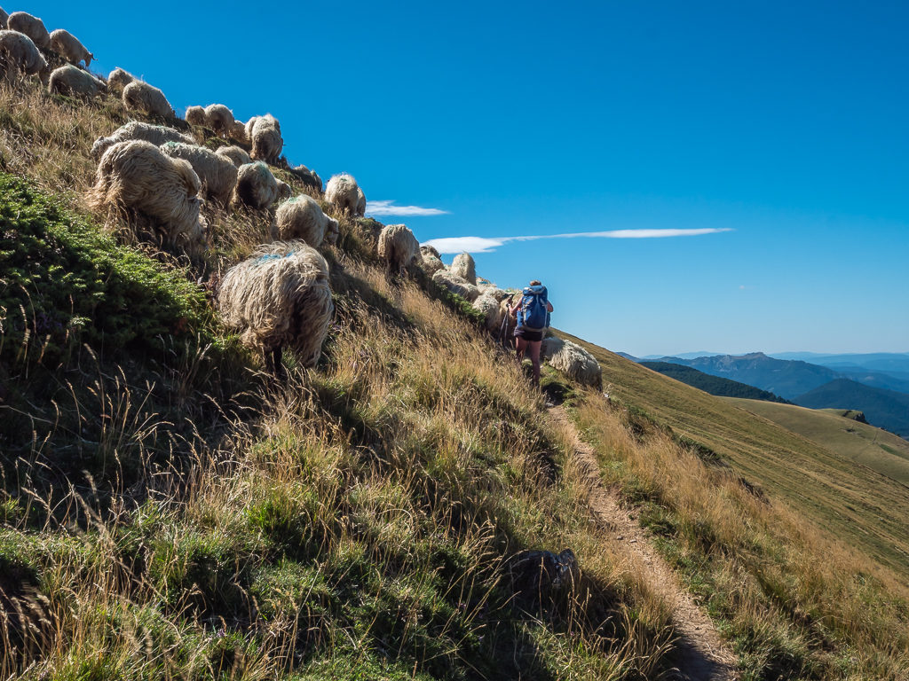
Sharing the trail with a herd of sheep who were busy minding their own business and making their own way to the col to shelter from the wind.
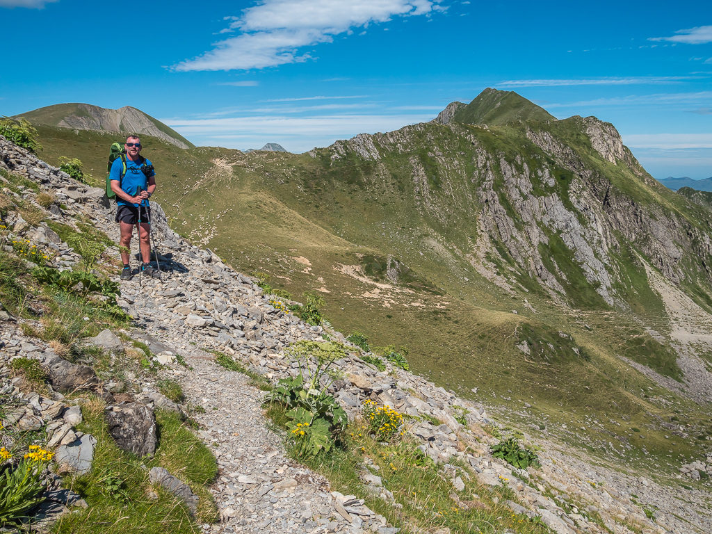
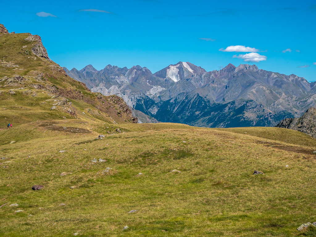
Thankfully our entire route was waymarked today with white and red flashes all the way to Col d’Anaye as the HRP here follows the same route as the GR12. That meant we didn’t have to keep getting out our map, which would have been a frustration in the unrelenting wind. Passing several border stones, we found ourselves regularly switching between France and Spain and when passing day hikers heading up in the opposite direction it was a toss up whether we greeted them with a “Bonjour!” or a “Hola!”.
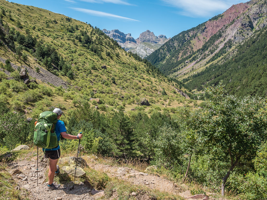
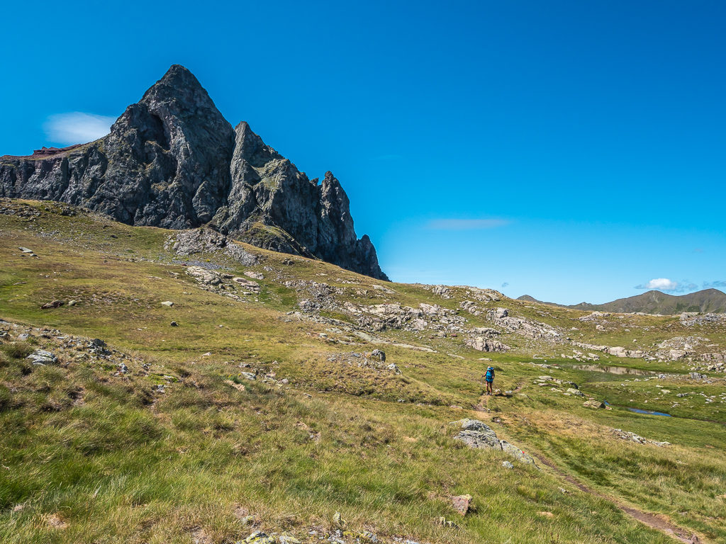
The perfect rock on which to stand and take in the magnificent panorama. From the frontier ridge there are excellent views taking in the Pic d’Orhy, the Bisaurin (2,668m) and the summits of the Lescun region.
Crossing the border into Spain and heading down steeply on the south side of Pic de Bimbalette to the Port de Bimbalette (1,677m).
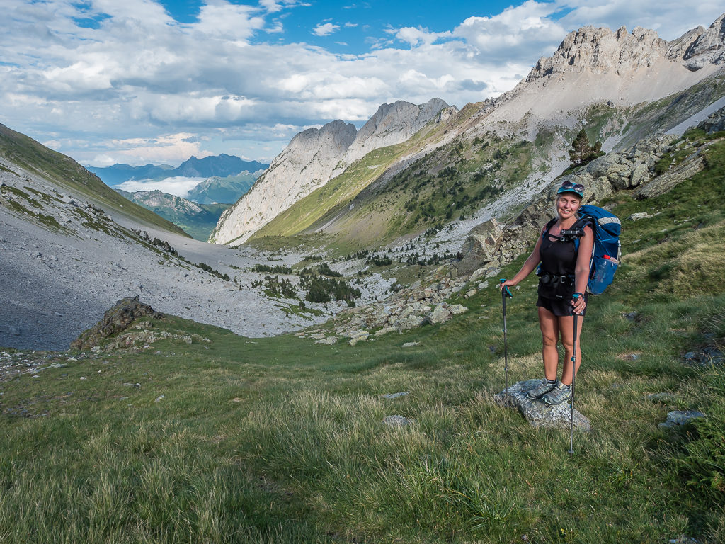
A positive consequence of the French Pyrenees being typically wetter than the Spanish side, is that the vegetation is much more verdant, such was our wonderful view here looking upon a scene most green and grand!
With a good, solid trail underfoot, it made our descent to the Port d’Ourdayte at 1,416 metres much less taxing.
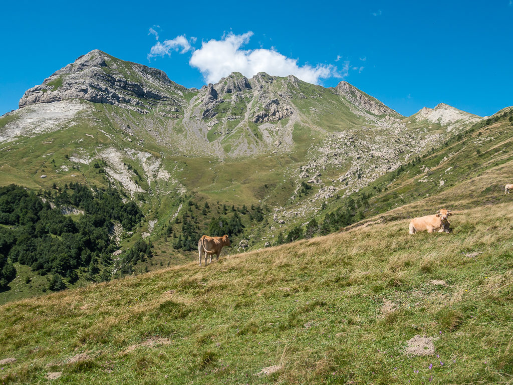
Pyrenean cows enjoy the summer pasture in the high mountains.
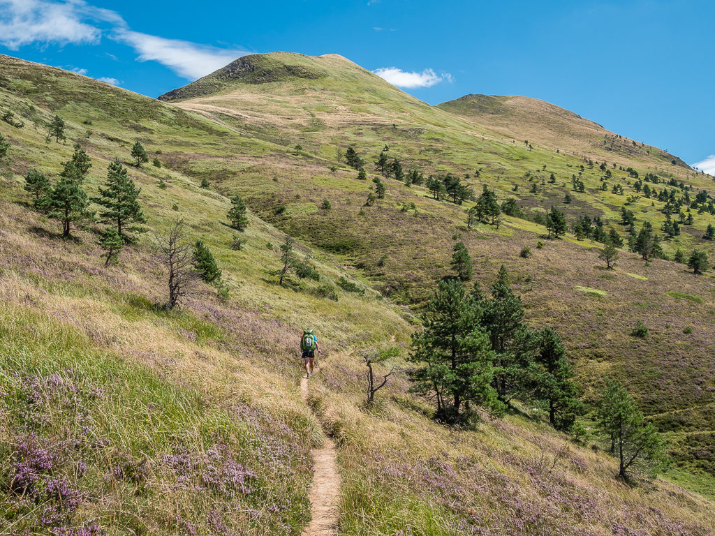
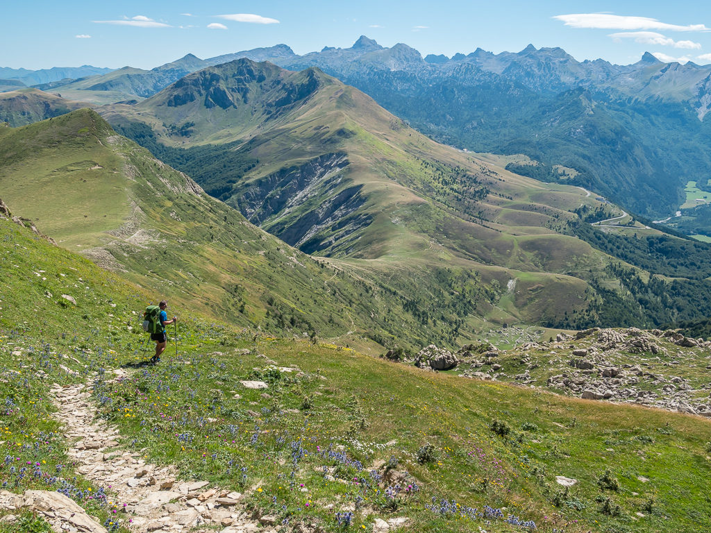
Weaving our way through the grassy hills, dotted with a few pine trees. At higher altitudes, gorse, broom and heather cover the ground.
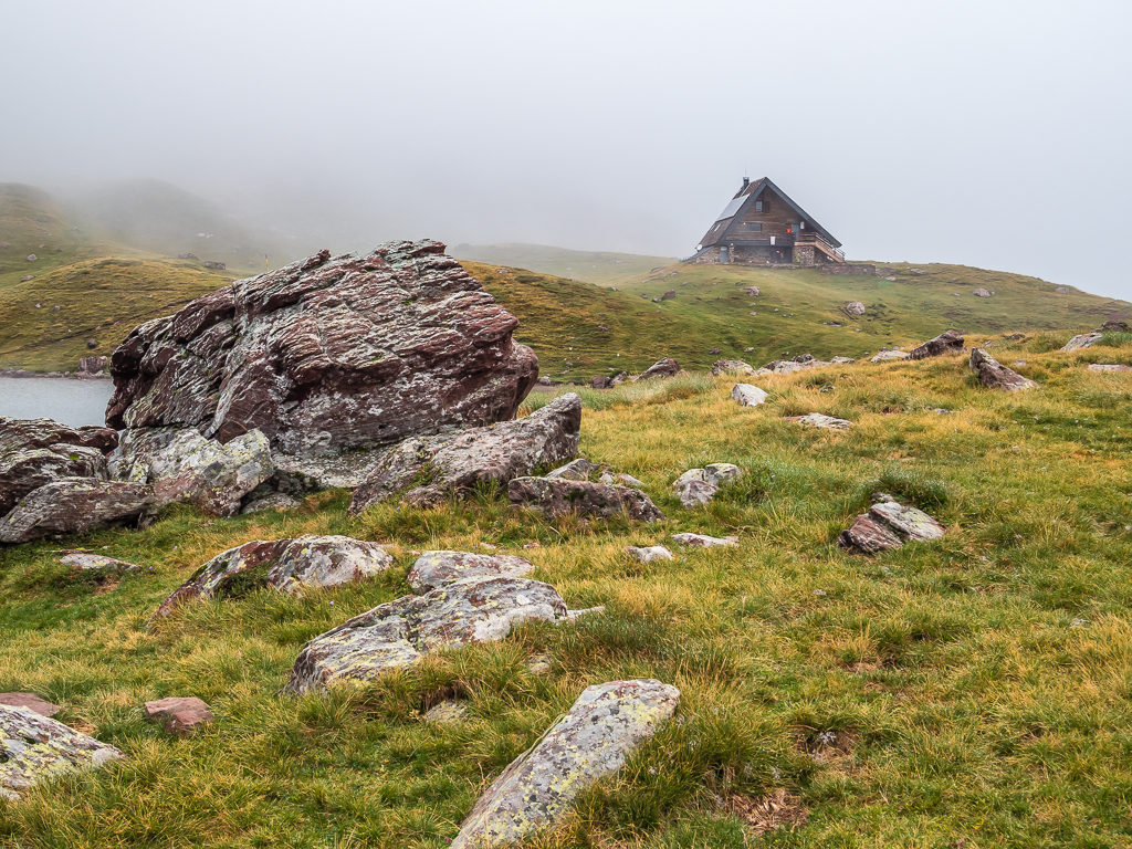
After around 4 hours, with only very short snack breaks and a stop to filter water from a small trickle coming out of the mountainside just in case it was our only opportunity until reaching camp, we reached the Refugio de Belagua at 1,428 metres. Undergoing major renovation work, it looked like it would be a great place to stop overnight when it reopens in 2020.
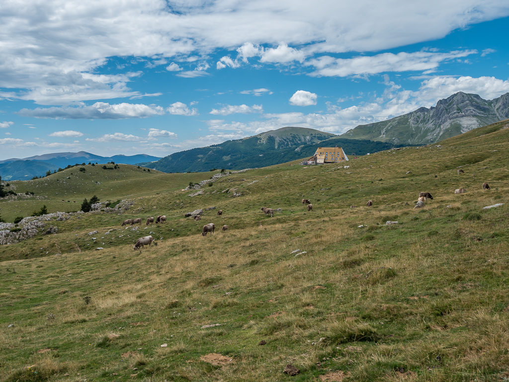
In the distance, the ‘Refugio de Belagua’ at 1,428 metres is noticeable on the skyline.
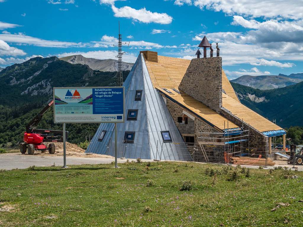
Undergoing major renovation work at the time we passed it in August 2019, the refuge was due to reopen sometime in 2020.
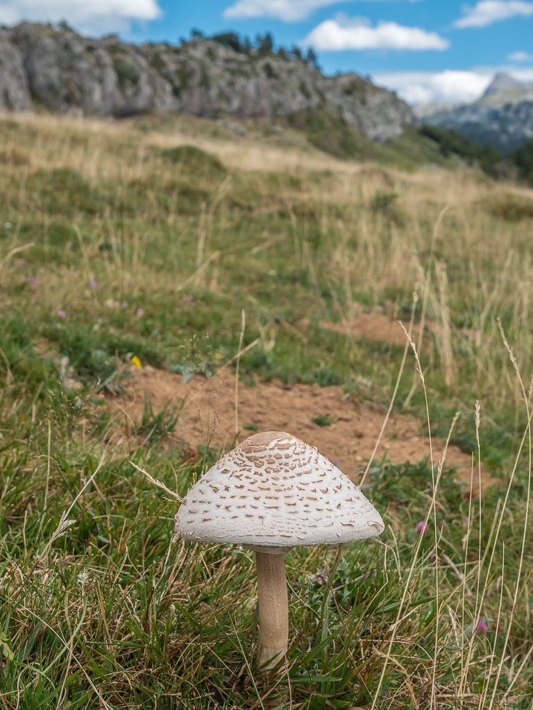
The first wild mushroom we had noticed beside the trail. With us still not being very confident with how to tell the difference between poisonous and edible mushrooms, we left it well alone.
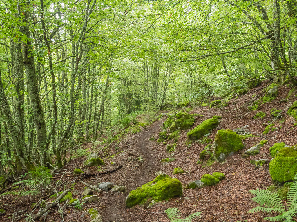
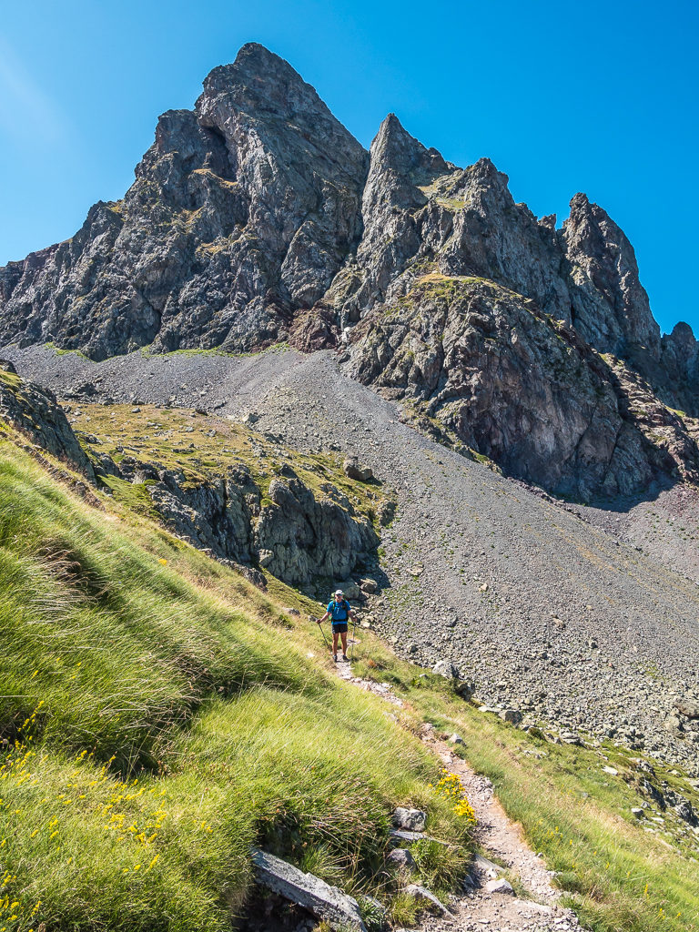
If we thought the morning’s walk had been tough having to contend with the wind, then this was nothing compared with the long and arduous walk over rocks and roots that we had to endure leading up to the Col d’Anaye. Winding our way through dense beech forest, we had several blowdowns to manoeuvre around, as well as an overgrown section thick with nettles to try and dodge – not the best when wearing shorts!
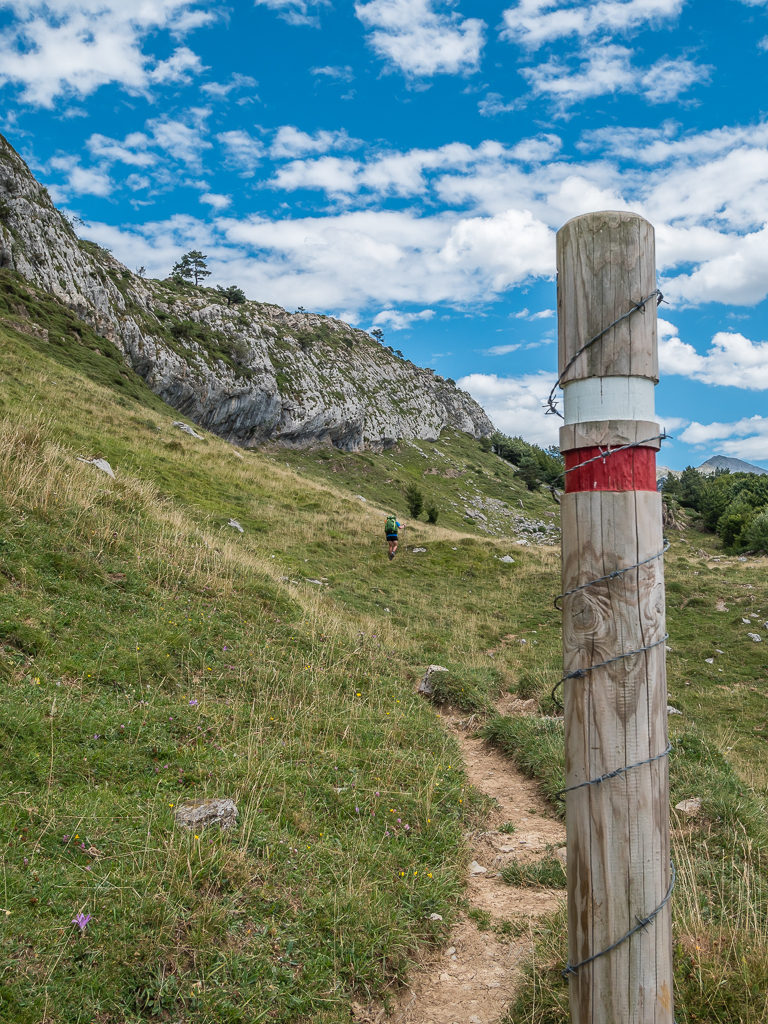
Following the white and red flashes of the GR12 into the beech forest, as the HRP here follows the same route.
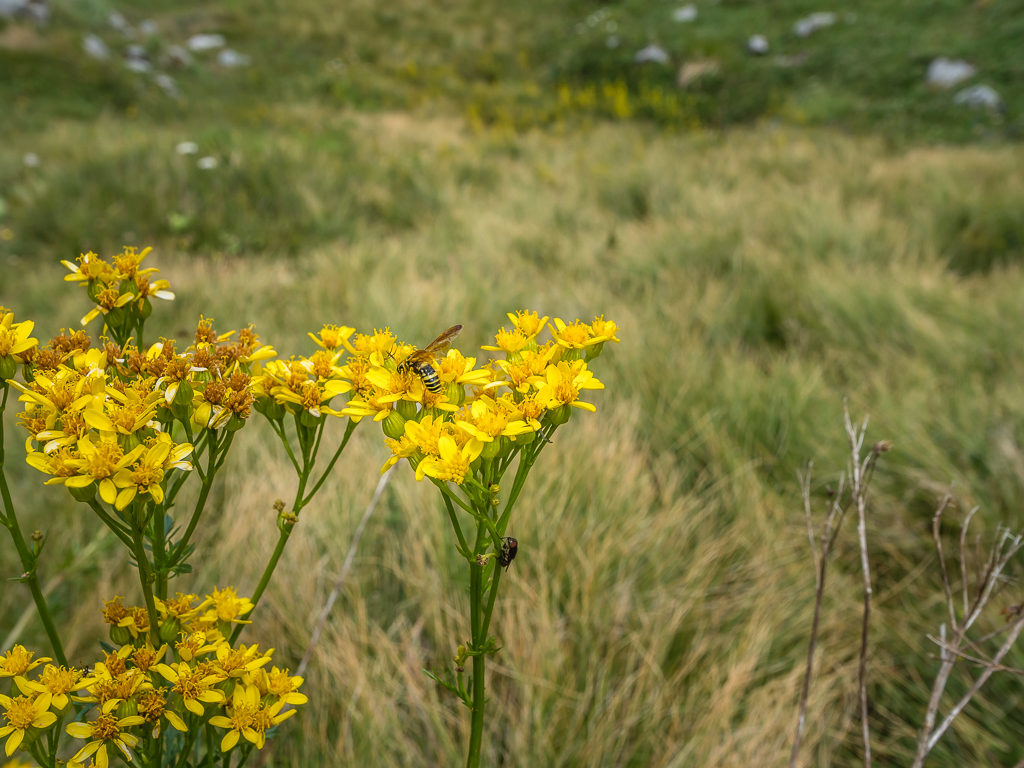
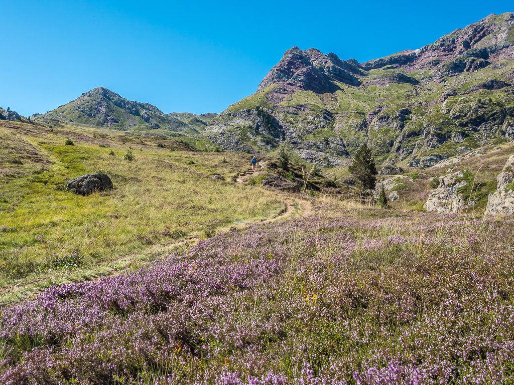
Known as the ‘Flower Garden of Europe’ the wild flowers of the Pyrenees are spectacular throughout the summer.
Heading into the forest, we were unaware that part of our route would be blocked by fallen trees. Luckily, our experience of clambering over blowdowns in Washington proved very useful!
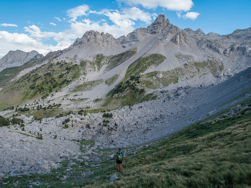
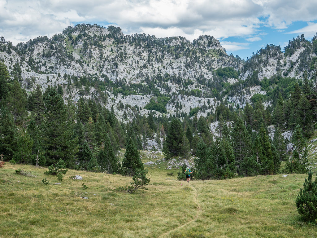
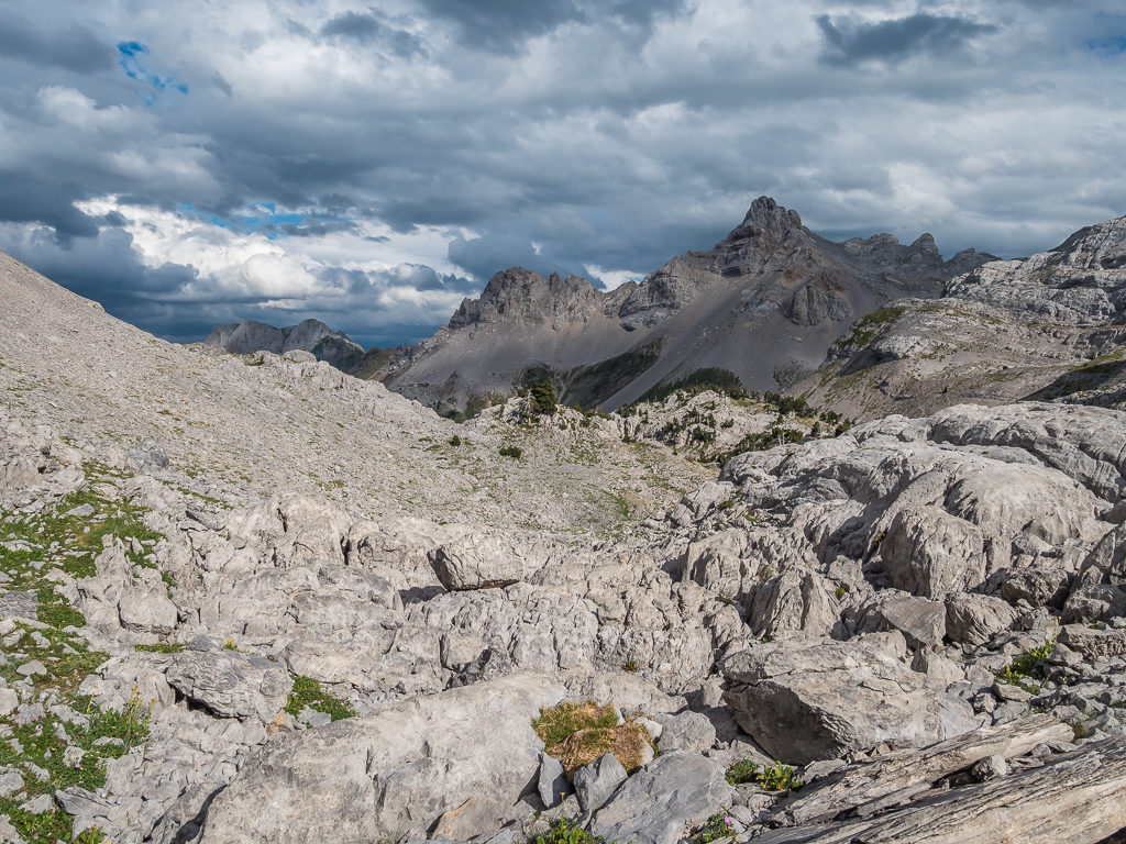
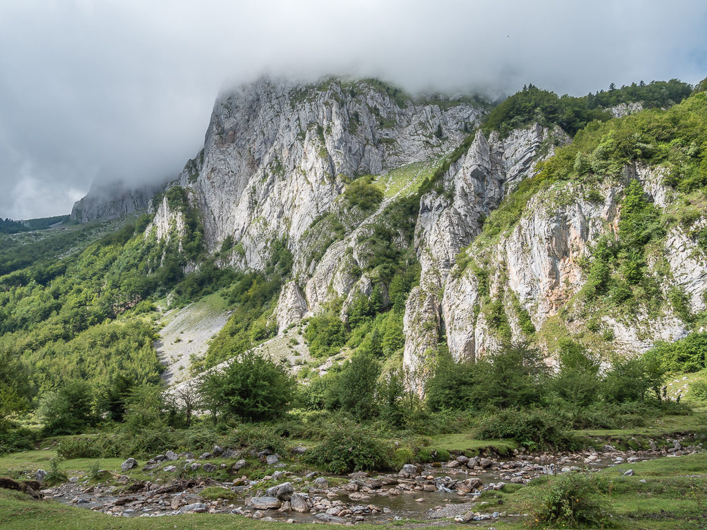
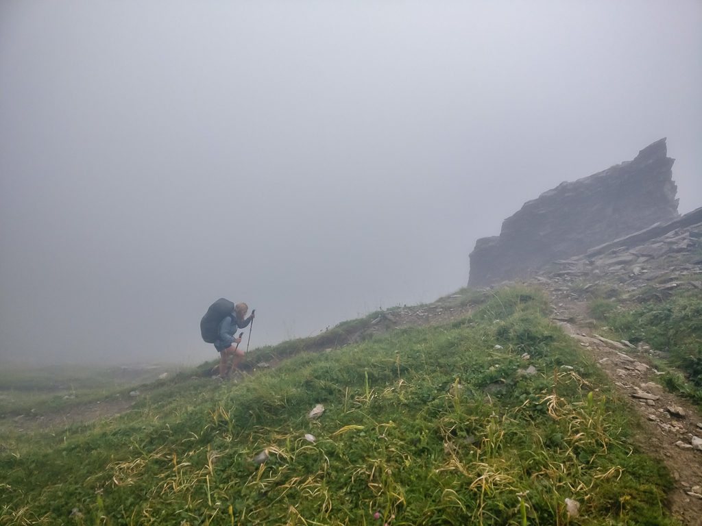
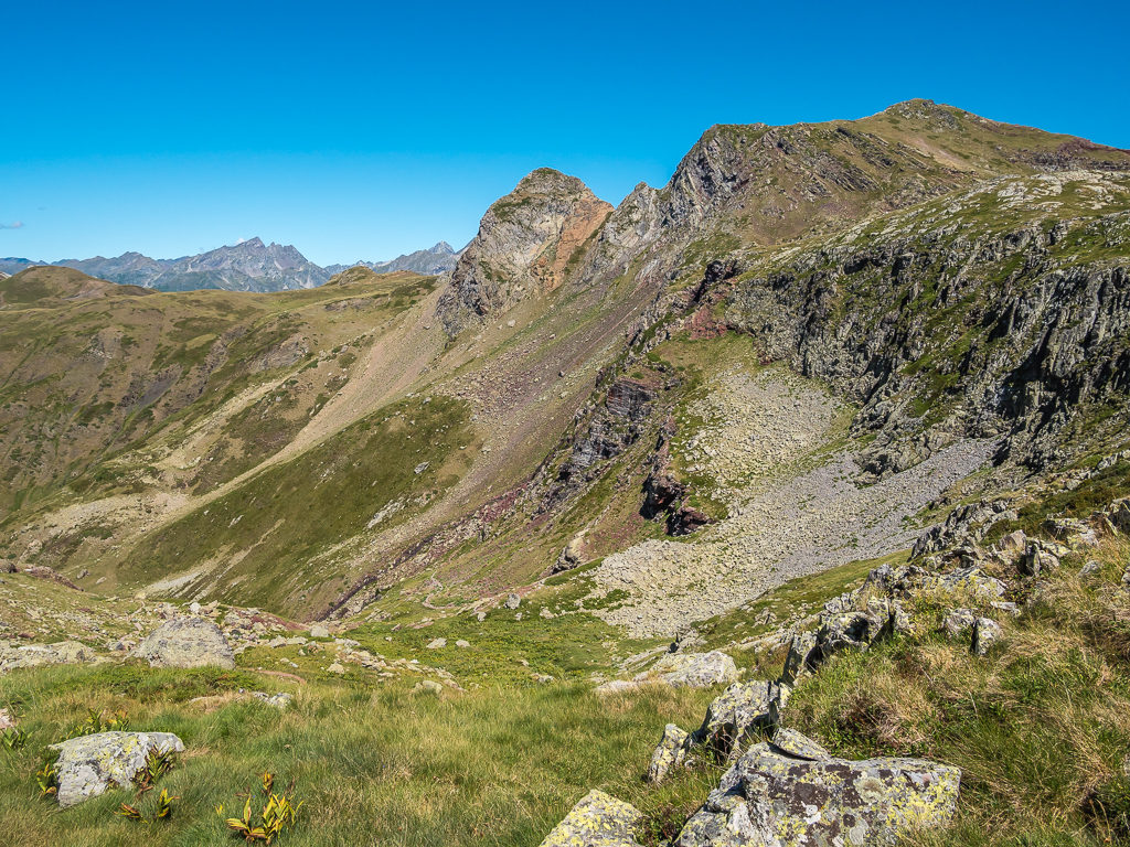
As the forest finally gave way to a landscape of towering grey peaks, we then found ourselves having to navigate our way through a labyrinth of limestone. The smell of pine needles and the warning squeaks of marmots dashing between rocks reminded us very much of our time in the Sierra Nevada on both the JMT and PCT. Entering the high mountains of the Pyrenees at last, we were still wowed by their grandeur and the fact that there wasn’t another soul around. Apart from the Swiss couple, whom we had already overtaken before reaching the refuge, we hadn’t seen anyone else on this route the entire day.
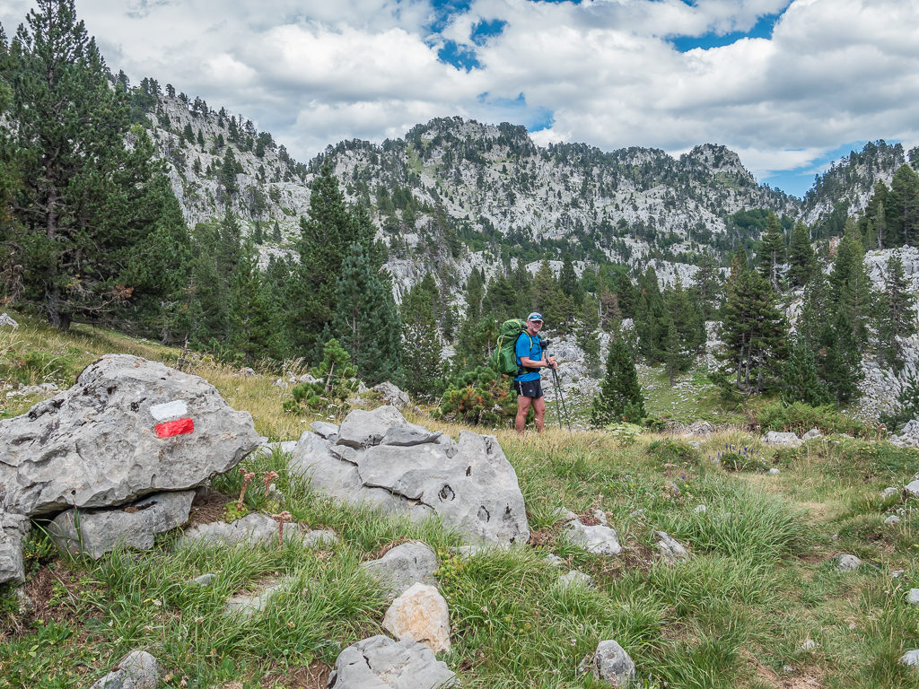
Steadily making our way through the forest towards the towering grey peaks dominating the skyline up ahead.
Entering the distinctive karst landscape on our way to the Col d’Anaye. It was a dramatic change in scenery compared with earlier that morning.
As the forest finally gave way to a landscape of towering grey peaks, we were treated to fine views over the Arres d’Anies.
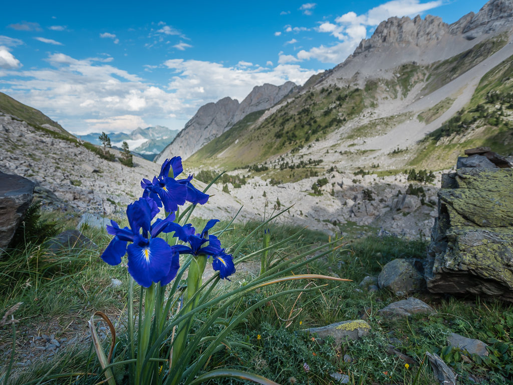
Growing beside the trail, we spotted the English Iris (Iris Latifolia), which is endemic to the Pyrenees.
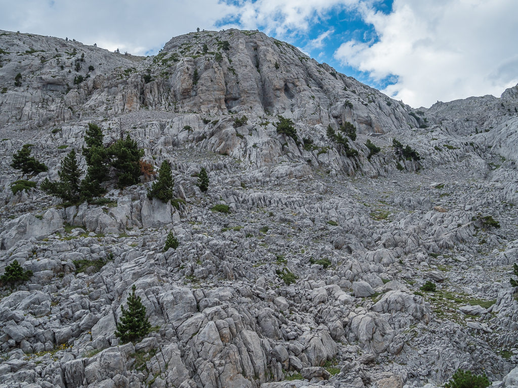
Walking through natural karst limestone formations where only a handful of pine trees can survive.
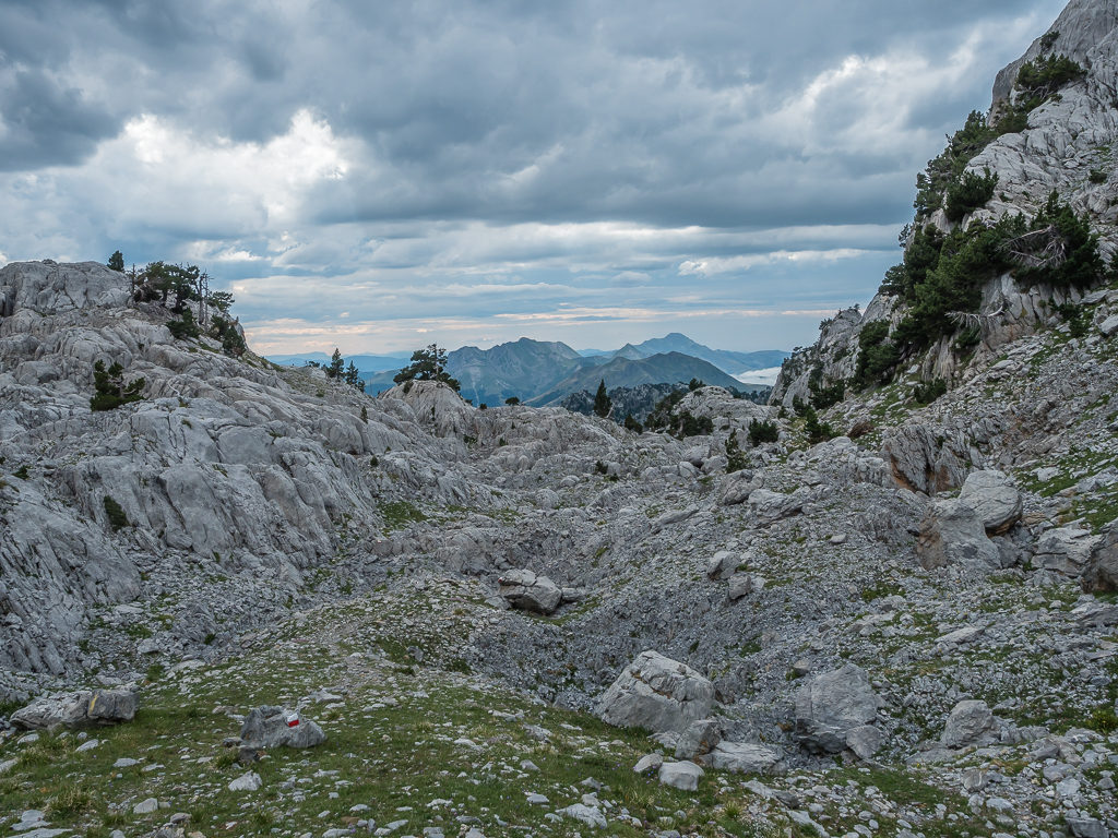
Weaving our way between deeply carved limestone rocks, still following the white and red markers, it was virtually silent. Gone was the continuous clanking of bells from farm cattle and likewise we were now well away from any roads to hear the noise of any vehicles. The only ones making any noise was ourselves, which startled a small brown deer that quickly bounded off up a ridge out of sight.
Enjoying the silence and contrasts of the bare karst landscape.
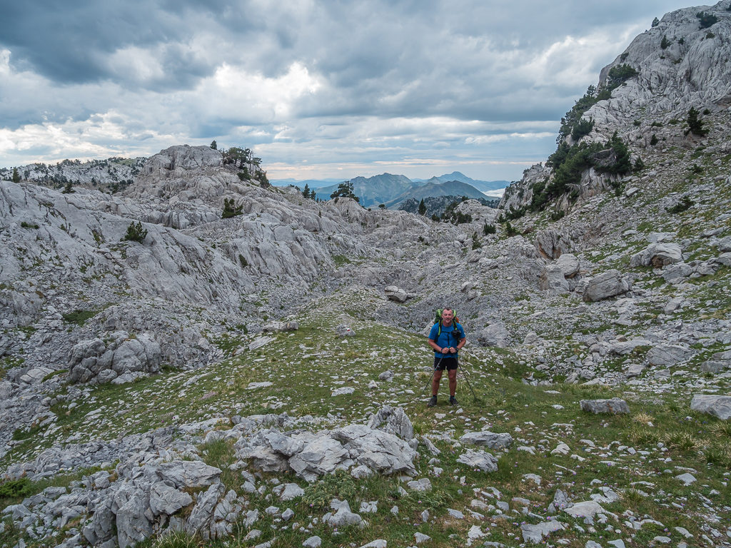
By this point, it was starting to feel like a long and tiring day. After making our way over so many cols, we wondered if we would ever reach the Source de Marmitou?
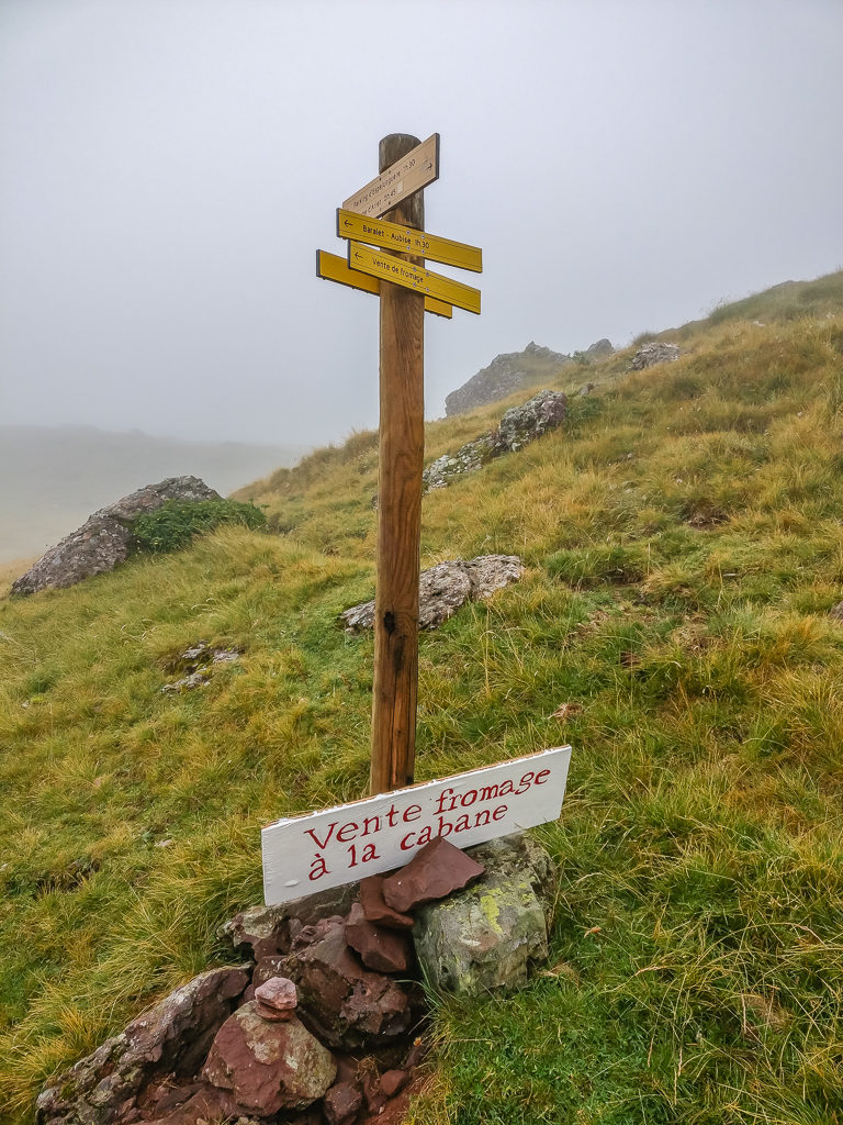
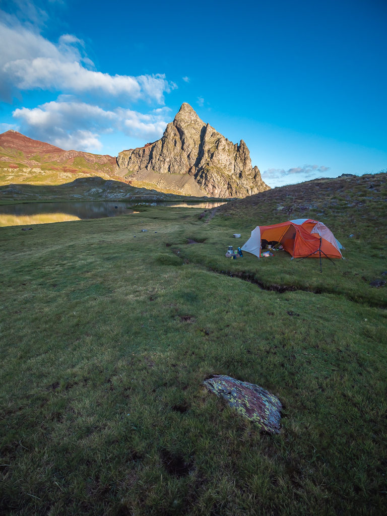
By 5pm we were feeling tired having not had a proper lunch break. We had merely been relying on snacks to see us through to camp as we were on the last of our food rations and due to arrive in town tomorrow morning. We had been estimating how long it would take us to reach the col and the trail junction as it felt slow going having to tread carefully over the rocky ground, when all of a sudden we were greeted with a large wooden signpost signalling the trail junction we’d been waiting for. Marked with both the GR12 routes and the direction of Lescun, we would now follow yellow dots and dashes taking us to the Col d’Anaye where we would descend east to the Vallon d’Anaye in France. Our guidebook had stated that the ‘Source de Marmitou is a fine place to pitch a tent’, so indeed this was where we intended on camping.

Reaching the trail junction at last!
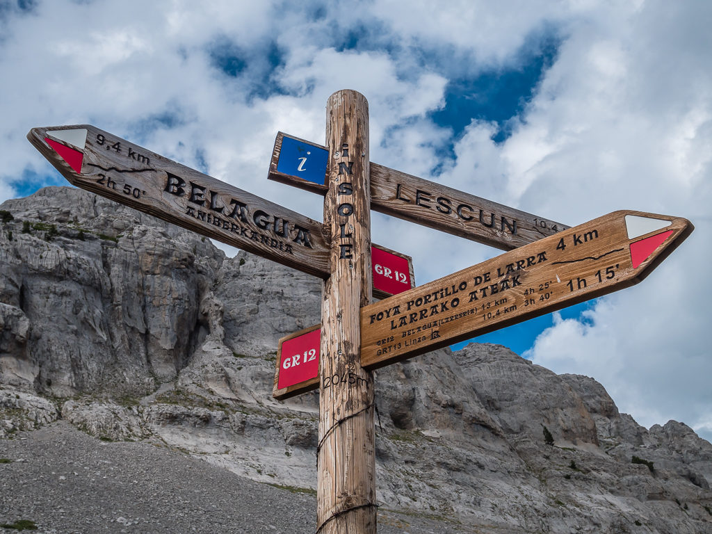
Having followed the markers of the GR12 for the best part of the day, the HRP takes a different route here, descending east to the Vallon d’Anaye in France and the village of Lescun for the option of resupply.
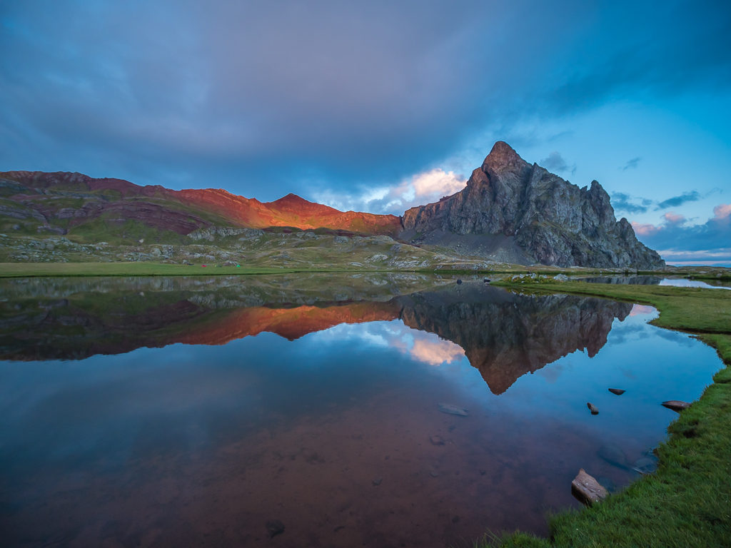
With the sky darkening and heavy clouds rolling in, it made for a moody mountain scene.
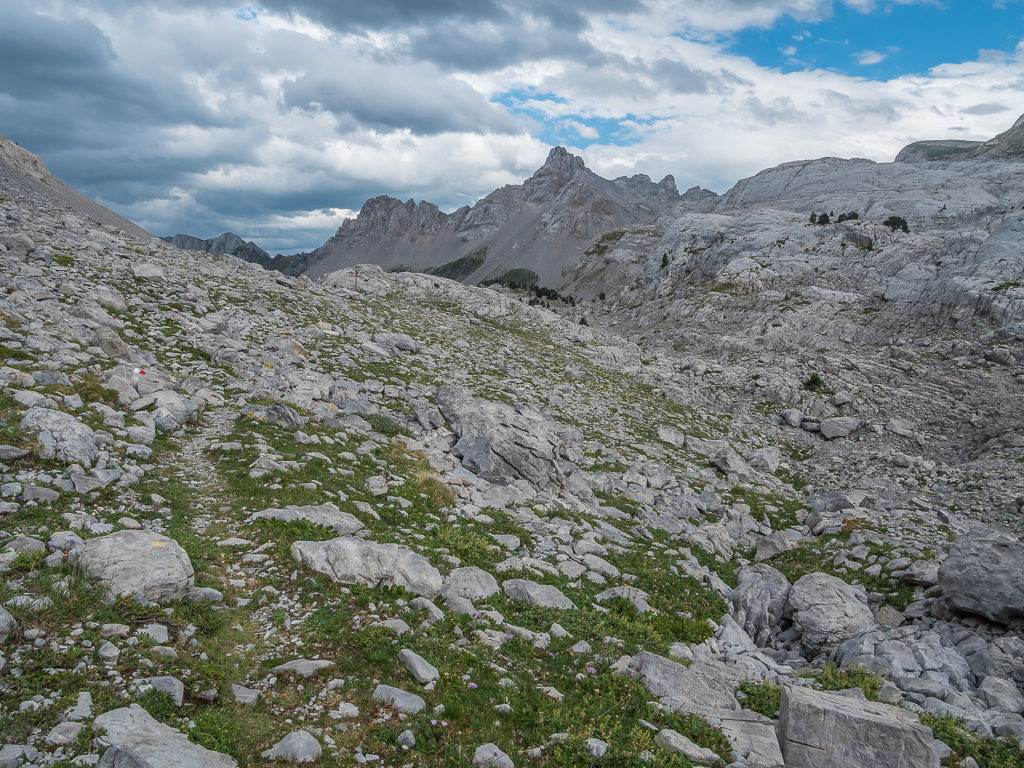
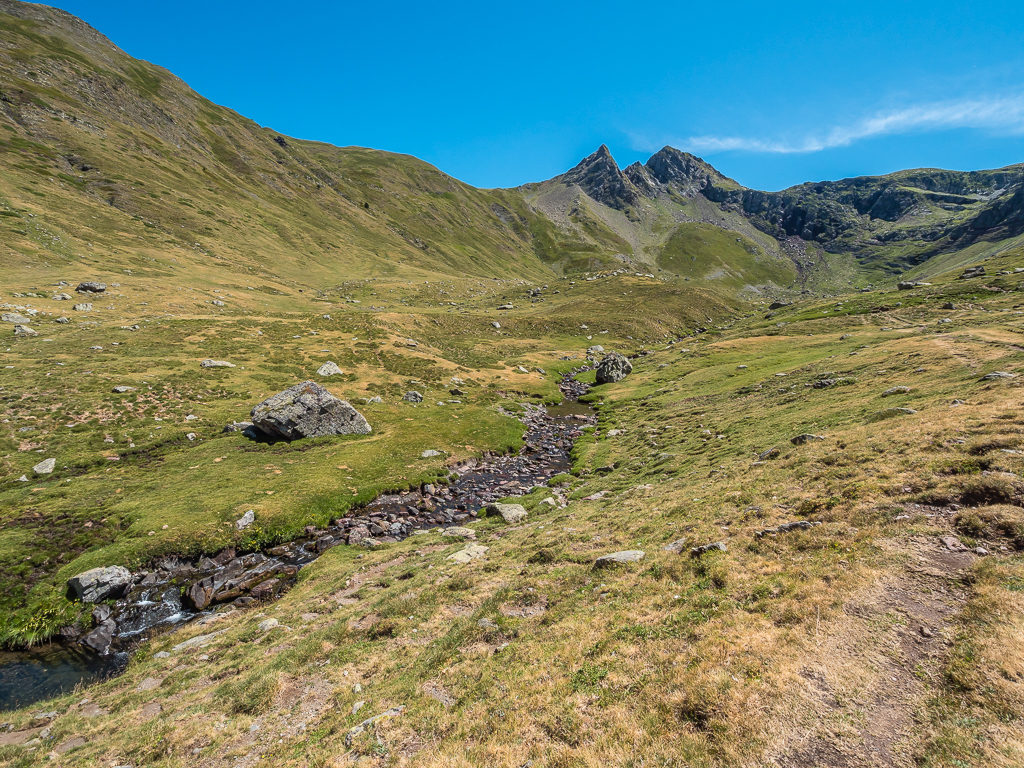
Traversing a beautiful limestone wilderness in search of water!
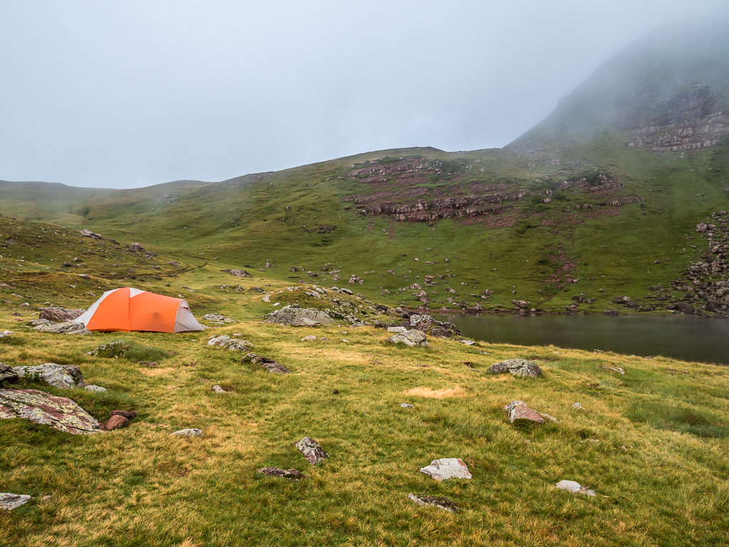
Crossing more boulders, there was still no sign of any water, which was disappointing when we came to a lovely grassy meadow that would have been an ideal place to make camp. The lack of water however meant we had no alternative but to push on in the hope that we’d come across a stream sometime soon. Descending further, we finally reached a series of small streams around 6:30pm. There was already someone pitched in the grassy bowl right at where we considered was the ‘Source de Marmitou’ as described in the guidebook, so we moved further uphill to another branch of the stream where we found a relatively flat patch of grass to put up our tent (once we had cleared away the sheep poop that seemed to be everywhere once more.) As more dark clouds rolled in overhead, we were grateful to have got pitched and to have washed and filtered water before the heavens opened.
Heading downhill looking for the source of the stream that was promised.
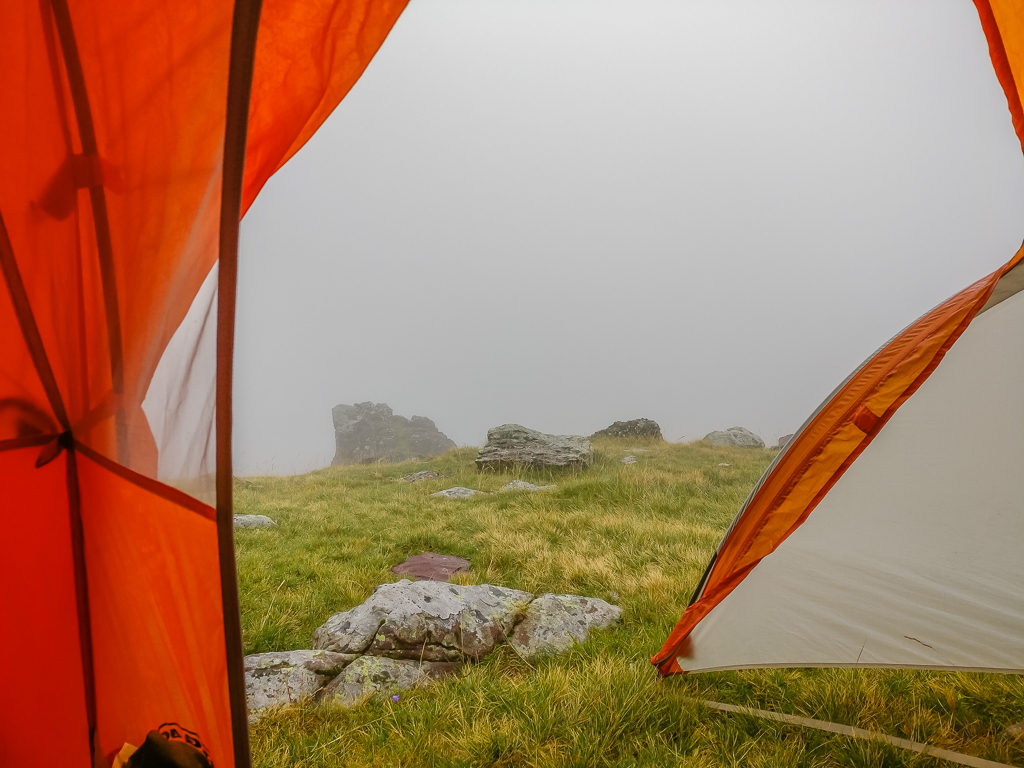
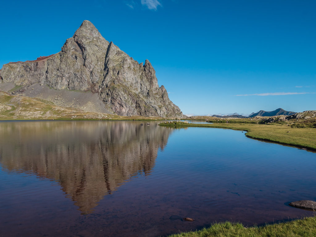
At last we found flowing water and set up camp close to a small tributary of the main stream. Surrounded by bare limestone peaks, it was a beautiful spot to spend the night.
In the relative comfort of our tent, Wayne was able to cook dinner in the vestibule with ease – our new Big Agnes hotel already proving its worth in wet weather. The only concern we now had was how to avoid being struck by lightning as we suddenly found ourselves in the midst of a tremendous thunderstorm!
Using a counting technique from our childhood – ‘1 elephant, 2 elephant, 3 elephant…’ we counted how many seconds passed from seeing the flash of lightning to hearing the crack of thunder – which we believe as a general rule of thumb signals how far away the storm is e.g. each second equates to approximately 1 mile in distance. Thankfully, the intervals between lightning and thunder were getting longer, which meant the storm was moving away. That didn’t stop the tent from getting another good battering of rain throughout the night however, but thankfully the rain and strong winds had finally abated by the early hours of the morning. It seemed that the Source de Marmitou would be a memorable camp in more ways than one!
Day 9 – ‘A Bonus Town Day!’ Saturday 10th August, 2019, Wild Camp at the Source de Marmatou to Camping du Lauzart, Lescun, HRP, GR10, 8km
After last night’s storm, we couldn’t believe it when we woke up to a dry tent! It would seem that all would bode well for a quick getaway from camp so that we could make the 8km to town before midday.
After a dreadful evening due to thunderstorms, we awoke to sunshine and a glorious clear morning.
After a light cereal bar breakfast and hot drink, we were soon packed away and following the trail gently downhill towards an open valley where we could see a splendid cloud inversion below us contained within a cirque of towering limestone peaks. Looking upon such a beautiful scene, we couldn’t miss the opportunity of capturing a time lapse on camera, so we took off our packs and settled down to watch it unfold as these things always take a good 15 minutes or more. Satisfied with what we were able to photograph, Wayne then led the way weaving through forest and crossing pasture as we continued downhill towards the open valley. After passing a large shepherd’s hut and crossing the Ruisseau d’Anaye stream, our descent then continued on a well-worn path waymarked with yellow flashes.
Stopping to capture a time lapse of the splendid cloud inversion right below us!
Set within a cirque of towering limestone peaks, the morning’s conditions made for a beautiful cloud inversion in the valley below.
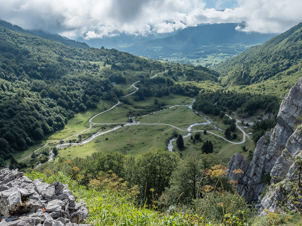
As Lescun sits at 900 metres, our total descent would take us over 1,000 metres down into the valley. Despite losing all that gain in elevation, we were in high spirits to be reaching the tiny village famous for the sharp, grey limestone peaks rising to the south that form a giant amphitheatre around the village known as the ‘Cirque de Lescun’. We were especially excited as it would also be our first overnight town stop of the trip, so of course we’d planned on staying at a proper campsite and enjoying a few beers!
Looking over the Plateau de Sanchese (1,090m) before making our descent. This was a popular area with campers as it is accessible by road from Lescun.
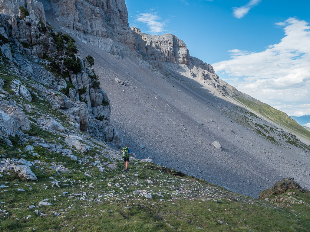
Zigzagging on a rocky path downhill close to the impressive limestone walls of the Pic de la Breque to reach the Plateau de Sanchese at 1,090m, our final descent was fairly steep but it made for a quick exit off the mountain. From the plateau, we then followed a dirt road through a lovely grassy meadow area besides a stream, next to which several campervans were parked up and groups of campers looked to be enjoying themselves in such wonderful surroundings. We noted the spot as a great place to pull up for the night for a future road trip even though there was a sign indicating campervans and tents were prohibited. From what we could see, the locals clearly weren’t worried!
Early morning light filtering through the clouds hitting the mountainside makes for a magical shot.
With the final kilometre or so being on tarmac, it enabled us to stride out at a good pace and make excellent time to Lescun. Reaching town just after 11:30am, we first checked out the one and only shop that we needed for our resupply. Our intention was to peruse what was on offer, then to return later to purchase food after we had set up at the campsite, showered and done our laundry. However, as there were only 2 gas cannisters left on the shelf, we quickly grabbed one of them along with 2 cold beers from the fridge and 2 sandwiches from the deli counter. The special of the day was ‘ham and cheese’ – the most common option of baguette in France and Spain. (We do miss a good old English sandwich though, as we have far greater variety in terms of fillings!) But for 5 euros each they were a delight as they were like huge door steps that would keep us full for the rest of the day.
Following the road and powering out the last few kilometres to town.
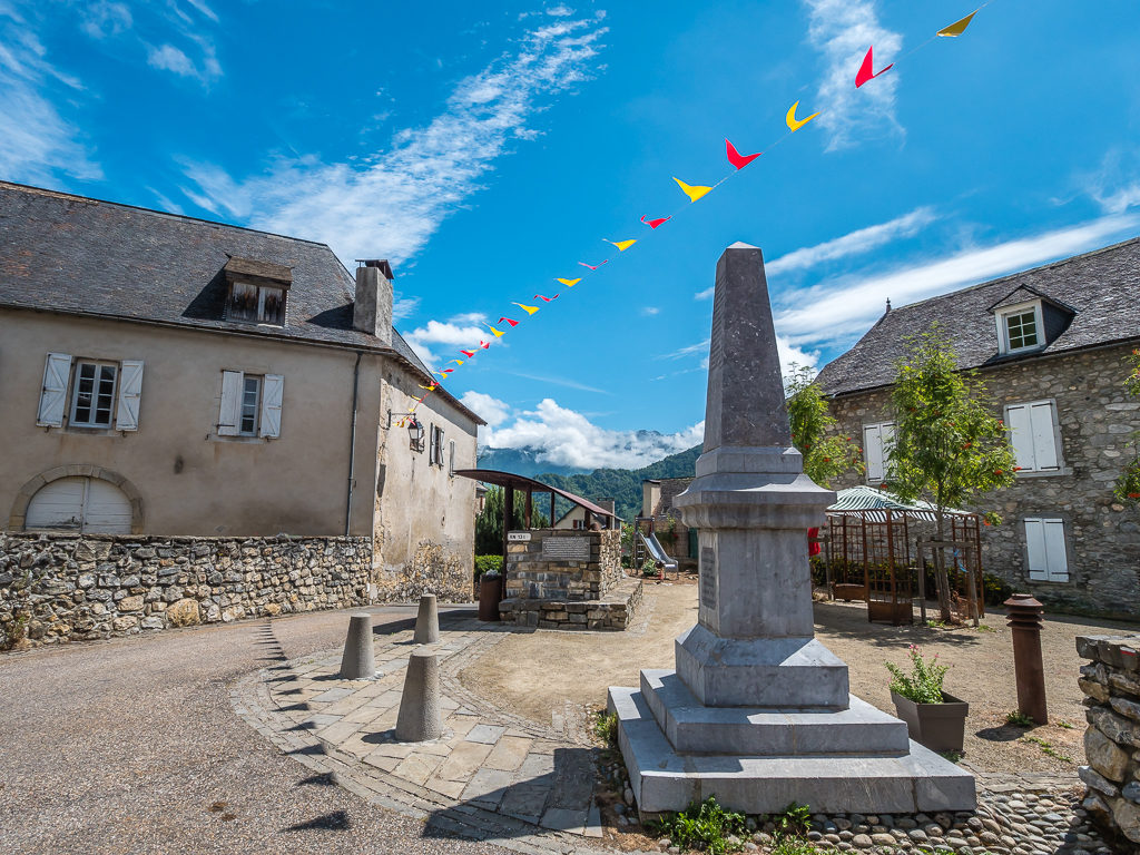
Reaching the traditional and charming village of Lescun situated at 900 metres.
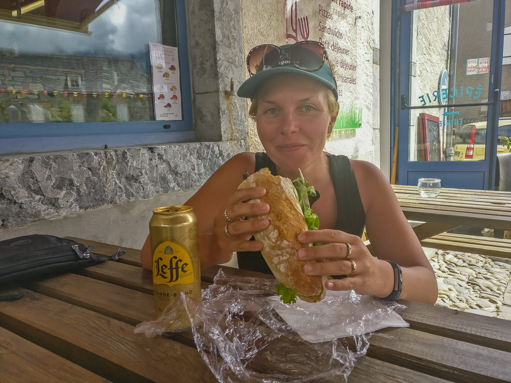
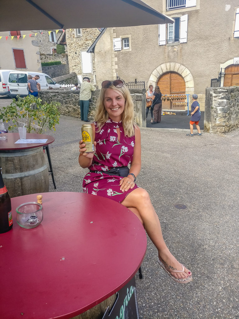
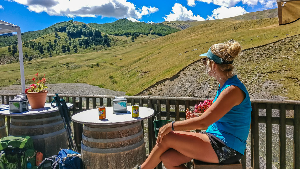
Our first port of call in Lescun – the ‘Epicerie’. Enjoying a mighty baguette and a long-awaited beer from the village’s grocery store, deli and cafe-bar rolled into one!
Sitting outside the shop on one of the benches with our goodies, we then spent a good few minutes people watching! The village, set around two main streets and a small square, was bustling with locals and tourists as there happened to be an artisan festival taking place this particular weekend. As the GR10 route runs right through the centre of Lescun, there were also several backpacks lent up against the walls of the surrounding buildings with pockets of thru-hikers sat eating and drinking in the main area. For once, it seemed that we’d hit town on the right day!
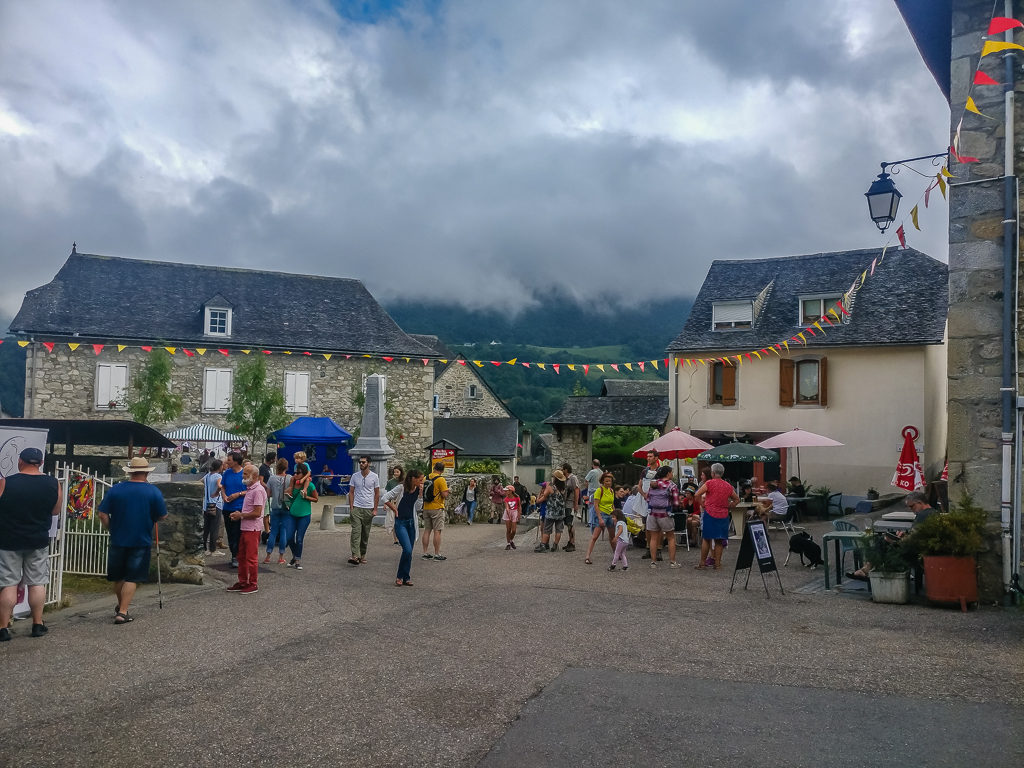
Passing dark clouds don’t put off the visitors. There was a steady stream of people throughout the day attending the artisan festival in the village.
Just as we were leaving, keeping our fingers crossed that the campsite wouldn’t be full with so many people around, Daniela and Erich, the Swiss couple whom we had been leapfrogging since Hendaye, arrived in town. So of course, we had a quick chat with them swapping tales about the events of the last couple of days and made arrangements to meet up with them later for drinks.
Hot-footing it to the campsite, which is located southeast of the village along the GR10, we were pleased to find that the Camping du Lauzart still had plenty of space for passing hikers. Having already checked the weather forecast for the next 48 hours back in town, we booked a 2-night stay after finding out that heavy rain was due the following day. (How fortunate when we had planned a night on the town drinking! At least we wouldn’t have to worry about hiking with a hangover now!) With a kitchenette area, laundry, and clean bathroom facilities, plus small on-site shop, we didn’t mind paying 15 Euros per night for camping. (This fee was made up of 11 Euros for 1 hiker including tent, plus an extra adult for 4 Euros.)
After prioritising our camp chores over rushing back to town, meaning we were now freshly showered and wearing our town clothes, the campsite host did a double-take as we got ready to head back to the square for dinner. With Wayne having shaved for the first time in a week, he must have looked a different person!
By the time we returned to the main street, the artisan festival was still in full swing, but first we had a long list of resupply items that we needed to purchase before we could let our hair down. (The main reason being that the shop closed at 7pm and with tomorrow being Sunday, it would only be open for a couple of hours early morning, during which time we had no intention of getting out of our sleeping bags with having given ourselves a designated ‘day off’!) So commenced one of our best but most expensive resupplies on the entire Pyrenees route! But every Euro spent was well worth it as we now had some good trail dinners to look forward to (as well as some new trail kitchen ideas).
With the necessities now taken care of, it was time for a bar crawl – which is quite an English thing – but also very difficult when there’s only 3 bars! So we settled for a jug of sangria, sitting at the terrace area outside the shop until it closed, which also doubles up as a café-bar in the day time, followed by a bowl of paella and a bottle of ‘vin rouge‘ from the Hébergement du Pic d’Anie Carrafancq. With everything seemingly winding down after 7pm, we found this was the only place still serving dinner, so we quickly put in an order enjoying some authentic local food before returning to the campsite.
What a difference a couple of hours make! Back at the bar in ‘town clothes’ acting like tourists.
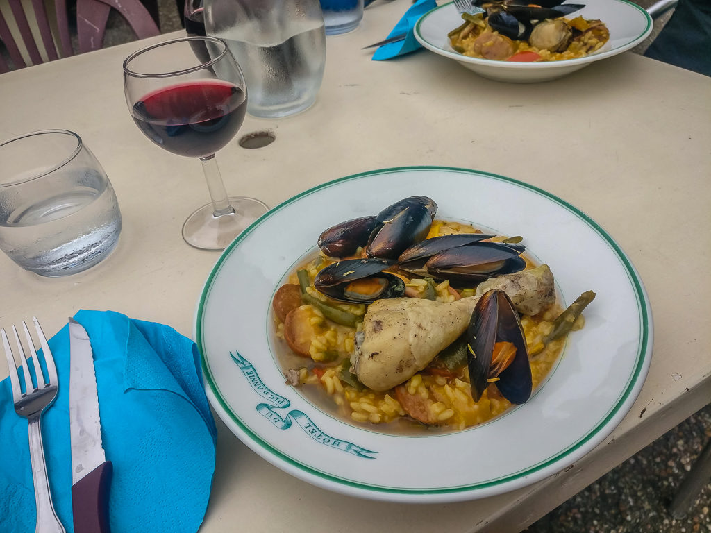
Sampling an authentic bowl of paella and a bottle of ‘vin rouge’ from the Hébergement du Pic d’Anie Carrafancq in the main square.
Back at the tent, we made use of our Helinox camp chairs, sitting out in the cool air under the moonlight. Compared with earlier, we could see a few more tents set up, now silhouetted around the camping field, and we also had a new friend by way of the resident cat who had taken a particular liking to my us. After jumping on my knee and padding around, he was purring loudly and enjoying the fuss, making it clear he was here for the duration. We only made a beeline for the tent when it started raining and we had no choice but to take shelter indoors. At least the weather forecast for once had been correct and we hadn’t decided to take a day off trail in vain.
Day 10 – ‘Forced Majeure’ Sunday 11th August, 2019, Zero Day at Camping du Lauzart, Lescun, 0km
With the hiker’s camping area quickly becoming waterlogged, we had a lazy morning where we were loath to leave the tent save for needing the toilet when we had no choice but to tread carefully and tackle the increasingly muddy ground. So because of the dreadful weather, Wayne cooked breakfast inside the vestibule of the tent – again, our Big Agnes Hotel proving its worth in adverse weather. Worsening still, we then endured a period of thunder and lightning, during which there was hardly a second between the two so we knew the lightning was very close!
Finally braving the elements around midday, we hurried over to the communal area inside the main building where we then sat for several hours making use of the power sockets to charge our electronics, as well as the Wi-Fi to upload some photos to social media. The best part of the day came at last when there was a break in the clouds and Wayne was able to cook some lunch, which was another delight by way of a baked Camembert served with cherry tomatoes, seeded bread and some delicious yellow plums.
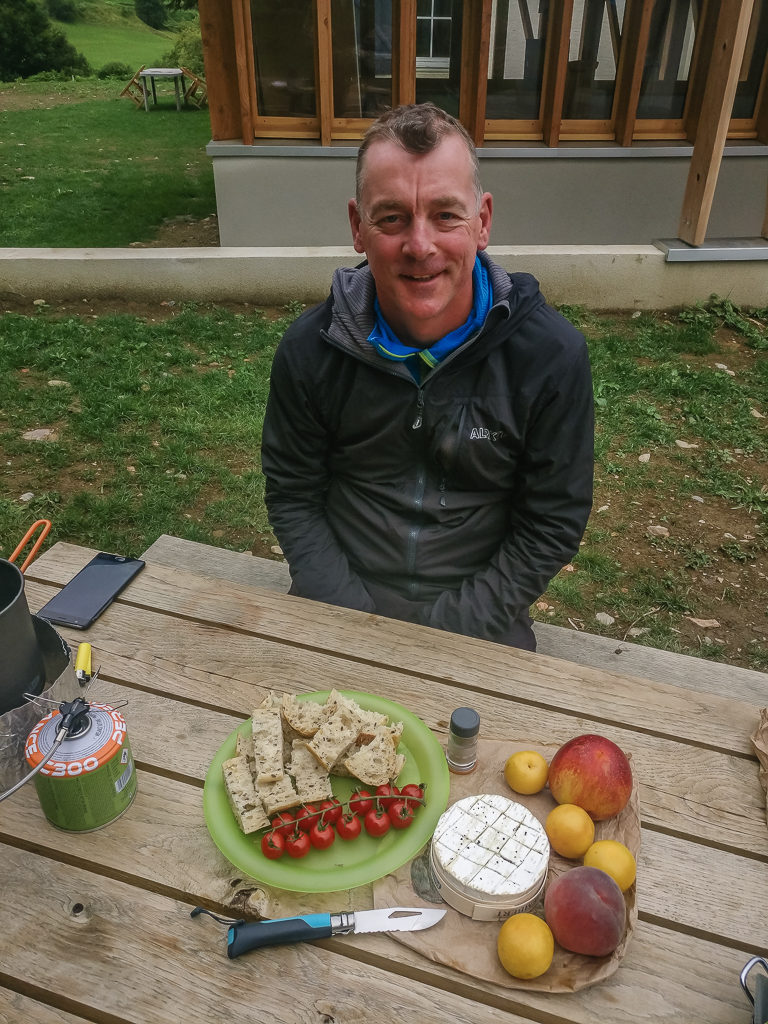
Our one and only photo from Day 10! With a brief break in the rain, we managed to get outside for a spot of late lunch – and a typical French one it was too with baked Camembert, bread and fresh fruit.
Lunch was then followed by more sitting indoors, working on the blog and researching resupply and accommodation options for further along the trail. It was lovely then to have a distraction and some people to chat to when the Swiss couple Daniela and Erich came in having booked to stay in a room at the gite because of the worsening weather. With more rain forecast through the night, we would have to decide whether to amend our itinerary for tomorrow or push on as planned. Only time would tell and we would make that decision in the morning…
Day 11 – ‘Always Be Prepared’ Monday 12th August, 2019, Camping du Lauzart, Lescun to Wild Camp by Lac d’Arlet, GR10, HRP, 16.5km
Well today we should have had ‘…Top-class views over the Aspe region’ according to our guidebook during our hike south from Lescun to Lac d’Arlet situated right on the Spanish border. When we awoke to more rain and a revised forecast giving heavy showers until at least 3pm however, we knew we’d be lucky to see anything at all. With intermittent showers blowing through and the campsite still enveloped in low mist, we knew there was zero chance of getting the tent dry before we departed, so we dragged our heels a bit. We were definitely not in any rush to get back on trail in such awful conditions.
We couldn’t justify another ‘zero day’ merely sitting around at camp though – it does get boring once all of our camp chores are done and then all we want to do is eat – so whatever the weather today, we would be heading back into the hills no matter what. But not before a breakfast of hot tea and double ‘pain au chocolate’ to set us up for the day, which would begin with a long climb out of Lescun.
Leaving the campsite, we had to tackle over 900 metres of ascent traversing the Col de Pau (1,942m) on the French-Spanish border, before then climbing the northern slopes of the Pic de Burcq (2,105m). Finally we had to cross the Col de Saoubathou (1,949m) to reach the Refuge d’Arlet situated at 1,986 metres. We didn’t intend on using the refuge, but we wanted to bivouac (the French version of wild camping) close to the Lac d’Arlet which was situated nearby. It was to be the first Pyrenean lake of this trip that we’d encounter, so it would be such a shame if today’s dreadful weather persisted and we could barely see it.
Similarly, today we would be entering the ‘Parc National des Pyrenees’, a protected area created over 50 years ago, that remains as the only national park in the French Pyrenees. Approximately 100km in length and covering an area of 45,707 hectares, it holds many wonders across a variety of landscapes making it a popular hiking area, but because of today’s poor visibility we were yet to witness any highlights.

Mountain weather is notoriously fickle – yet, it did seem that we were experiencing the worst of the weather over on the French side of the border.
Entering the ‘Parc National des Pyrenees’. Sprawling for 100km across the Franco-Spanish border, the National Park conceals some of the last pockets of true wilderness left in France.
If we had thought the campsite had turned into a muddy quagmire over the couple of days we had sought refuge there, then the trail outdid it ten-fold. The well-trodden track had become sodden and so churned up in places with the help of cattle also using the route, that had it not been for the support of our trekking poles, we’d have been slipping and sliding all over the place. Just when we thought the mist was lifting and it was trying to brighten up, the winds blew up through the valley and with them came another shower. At the time, we had been feeling positive about the weather improving so had made an impromptu stop for a lunch break, making use of some rocks beside the trail to sit on. Unfortunately, this was cut short when we began getting another soaking.
Hurrying along the trail at the fastest pace I’d managed since starting this trip (our trail legs are finally getting there!) I was thoroughly regretting my decision to leave my waterproof trousers at home just to save carrying a few more grams. I had prioritised carrying a lightweight chair over warmth and comfort in bad weather, which as the wind and rain lashed at my red, raw legs, now seemed rather foolish! Similarly, I was hiking in shorts as the one pair of leggings I’d brought were currently being used as bed wear. Wayne too was also suffering, and agreed it was a bad decision to have omitted to bring such an important piece of kit. In all honesty, we really didn’t think we’d need them, but it just goes to show that wind and rain can happen in any place, at any time, and we should always be prepared. We really should have known that from all of our experience hiking in England!
With it being so wet, our cameras had been safely stowed away in our backpacks. Hence a couple of hastily shot phone photos to show trail conditions and the deteriorating weather. (The trail at this point was actually not too bad underfoot compared with earlier!)
Despite the cold and the fact we lacked protection from waterproof trousers, visibility was our main concern as we couldn’t see more than a few metres either side of the trail.
Needless to say, it felt like we had flown down the trail at lightning speed, despite the sludgy conditions, just to get to camp and take refuge inside the tent. And indeed we had! Having left Lescun at 11am, we had covered the 16.5km and 900 metres of ascent all by 5pm, so were now warming up nicely in the comfort of our Big Agnes Hotel aided by a cup of hot soup. It felt rather novel to get to camp that early, but was especially comforting because of the cold, wet weather. After soft cheese, tomato and mustard crisp sandwiches for lunch, dinner was a warming bowl of creamy chicken and asparagus pasta. The chicken and asparagus were courtesy of a packet soup we had brought from home, but it tasted good all the same.
After hurriedly pitching the tent, we were able to take respite inside. Who would have known we were camped by a picturesque mountain lake from our view of Lac d’Arlet!
Attending to the call of nature, as luck would have it, the clag lifted briefly!
In an elevated position on the other side of the lake, we could also now see Refuge d’Arlet. With carrying a full resupply out of Lescun however, there was no need for us to make use of the facilities.
What we found quite unusual was the fact that ‘hiker hunger’ hadn’t seemed to have reared it’s ugly head yet – but we supposed it was because we were covering much less distance and walking for just a fraction of the time when compared with the daily miles we had to fulfill on the PCT, often walking from sunrise until well beyond sunset. We were also planning our food rations better in an effort to carry less, making use of cafés and shops as we passed through villages and towns to buy breakfasts or lunches. In the high mountains with limited facilities, of course we would have to carry more, but by combining the different routes of the HRP, GR10 and GR11, we had made resupplying much easier for ourselves. Hence, our plan to only ever carry a maximum 4 day’s worth of food was so far working well!
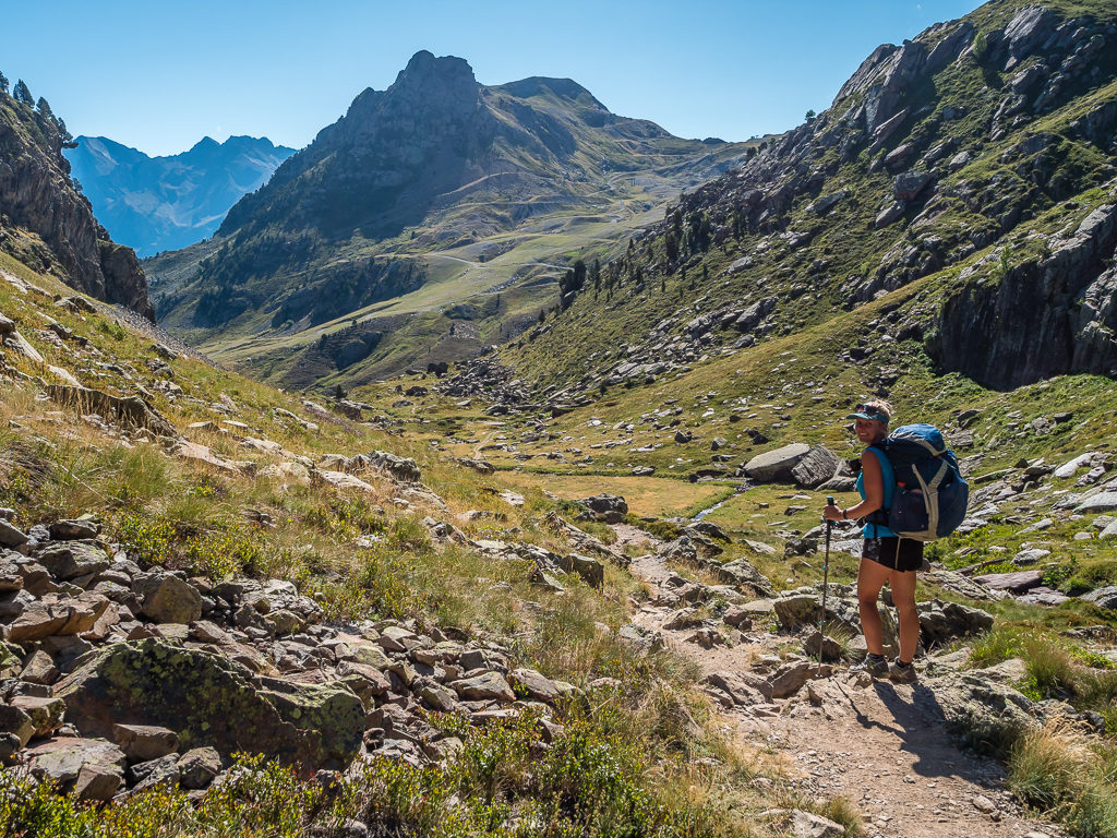
HRP Day 12 – ‘We’re Off To Sunny Spain, Y Viva España!’ Tuesday 13th August, 2019, Wild Camp by Lac d’Arlet to Wild Camp by the Recreation Area near Canfranc Estacion, HRP, GR11, 19km
Today, our plan was to continue on the HRP to the Spanish town of Candanchu, then further along the trail from Canfranc we would divert onto the GR11 for a few days and revisit some of our favourite spots from our Pyrenees hike in 2017. After the cold, wet weather of the last few days in France, we were very much hoping for the Spanish side to be drier and that we would be treated to some much needed sunshine over the border! (We had only endured two days of rain on the French side, but it was already feeling like Washington all over again!)
So we weren’t holding out much hope when we left Lac d’Arlet just like we’d arrived – under a veil of mist. We couldn’t even see the nearby refuge that lies on an elevated position overlooking the lake as all but our immediate surroundings were completely whited out. It was by sheer luck that I’d managed to get a few shots of the tent pitched by the lake late last night when I’d attended to the call of nature just before sunset and the mist had actually cleared a little. But for that, we could have been camped anywhere as we saw pretty much zero of the lake and none of the surrounding mountains.
Our camp spot close to Lac d’Arlet, which would have been wonderful in better weather.
Leaving camp under a veil of mist much like we had arrived, and wearing full waterproofs minus the trousers! (A serious mistake we wouldn’t be making again!)
With such poor visibility, we quickly revised our route, deciding to come off the HRP and follow a different marked trail down to the ski resort of Candanchu. Even though the variant route we had chosen to follow as an alternative was signposted and had ‘white, red, white’ flash marks painted at regular intervals on rocks, we still found ourselves almost a kilometre off-route about an hour after we had set off. Under normal conditions, there shouldn’t have been any route finding problems, but with visibility being so low, we had inadvertently followed a good, well-trodden path around the hillside that in fact turned out to be a cow track leading to a rocky ledge. With not being able to see what was over the other side or below us, we thought it safest to retrace our steps to the point where we could rejoin the proper path. It just meant we had to manoeuvre around two mother cows with their small calves once more, but thankfully French and Spanish cows seem to be much more laid-back and not so aggressive as we’ve found English cattle to be!
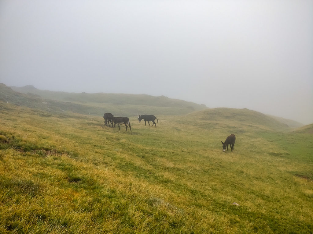
The poor weather conditions didn’t seem to be affecting the donkeys out on the hillside.
Reaching the Pla d’Espelunguere, a small plateau with a cabane on its northwestern side where a herder sells cheese. (We refrained from visiting as we were desperate to push on and cross the border in the hope of better weather in Spain.)
Back on track, it wasn’t long before we reached the first car parking area where we decided to take a rest break and have some lunch taking advantage of a break in the cloud. Unfortunately, there was a sheep dog hanging around eager for some scraps that didn’t seem too friendly and was rather intimidating. When we didn’t give him anything, he began barking at us and snarling in a kind of stand-off, so we quickly packed everything away again and hastily moved off. Heading uphill, we waited until we were well away from the large flock of sheep and their protector before looking for somewhere to sit and attempt to have lunch for a second time. Making the most of some moss-covered rocks to sit on in a small wooded area that would provide some cover should the heavens open again, we had found a much better spot minus the confrontation with a dog, especially as there were some raspberry bushes beside the trail. Already plump and ripe, we couldn’t resist treating ourselves to a couple of delicious handfuls and a good vitamin boost!
Reaching a wonderful pocket of green in the woods and stopping for a long-awaited lunch. It provided a safe haven after a worrying encounter with an aggressive sheepdog.
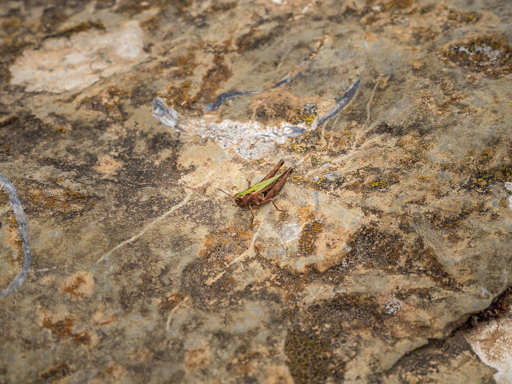
Well camouflaged, we spied a grass hopper resting on a rock.
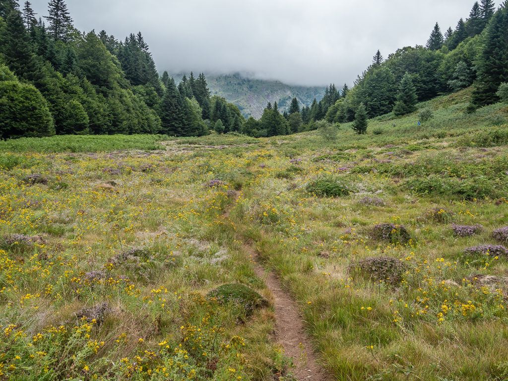
Finally enjoying a break in the cloud and what should have been a pleasant walk mainly through pastureland and forest.
Reaching the car park area where we then took the road directly to the Spanish border.
Descending from the woodland on a muddy track, the trail became noticeably rockier the further downhill we went. Finally crossing from France into Spain over the Puerto de Somport where it was already feeling much warmer and sunnier, we briefly joined the main Candanchu road where the walking was easy and we could stretch out our legs. We were already feeling more optimistic about the weather as the cloud layer was higher and there were patches of blue sky above.
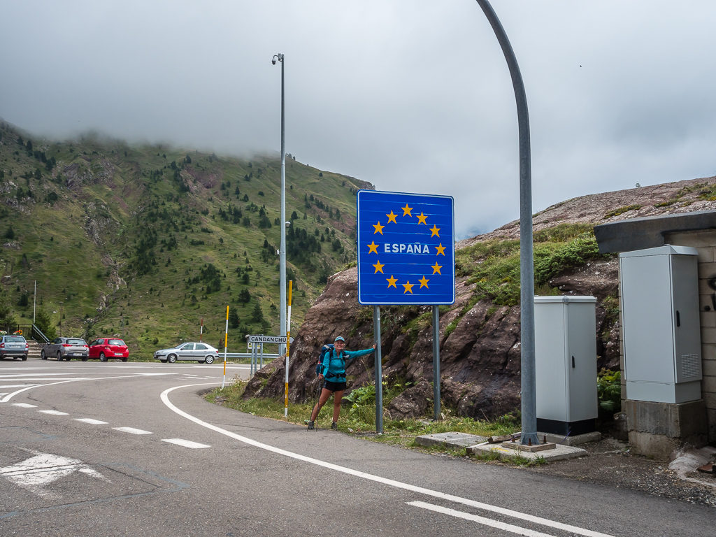
At last, we were all smiles to reach the Spanish border and the village of Candanchu where the promise of better weather beckoned!
Diverting off the highway and taking the marked trail running parallel to it. Already there was a marked difference in weather looking towards the east.
Then avoiding the motorway and too much walking on tarmac, we headed downhill following the GR11 trail, which also coincides with the well-waymarked GR65.3, a variation of the Camino de Santiago. Marked with yellow arrows as well as the familiar white and red flashes, we arrived at the large ski resort complex of Candanchu hoping to buy cold drinks and some cured meat to go in with tonight’s dinner, but unfortunately both on-site supermarkets were closed. With it being off-season there were a lot of building works taking place but other than that, there was nothing much happening at all.
We were glad that we hadn’t booked to stay in a hotel there as Candanchu literally seemed like a ghost town. Leaving empty-handed, we had an unexpected encounter with Swiss guy Erich, whom we bumped into by surprise on the main road through the ski resort. He was continuing his thru-hike on the HRP but was now walking solo since his wife Daniela had headed back home to Switzerland (she had only been accompanying him for the first stage of the route). We stopped for a quick chat and found out that Erich had planned on finding a cabin to rent overnight in the ski complex area, or alternatively he would get a room in the Refugio El Aguila if his options were limited because of it being off-season. We on the other hand, were planning on continuing to Canfranc and wild camping just before the town in a spot we remembered from our visit in 2017.
Walking through the main ski complex of Candanchu, we were disappointed to find that the supermarkets were closed. However, it was great to bump into Erich again whom we hadn’t seen for a few days!
Arriving at our intended location about an hour later, the recreation area was just as we remembered it complete with running water, picnic benches and an amphitheatre in the middle. After checking out the entire area for a flat spot to pitch the tent, we decided on the best position being right in the middle of the amphitheatre itself. This was because the rest of the ground, although grassy, was lumpy and uneven and covered in both thistles and cow dung. The whole area looked like it hadn’t been used in a while, but just to be sure we didn’t actually set up camp until just before 7pm. Instead, we got out our camp chairs and enjoyed relaxing in the late-evening sun for an hour looking onto some splendid Spanish peaks. We also took the opportunity to dry everything out as it was considerably warmer than when we had left France just a few hours ago. A few day walkers went by, but apart from the friendly ‘Hola!’ greeting, no one batted an eyelid at our presence.
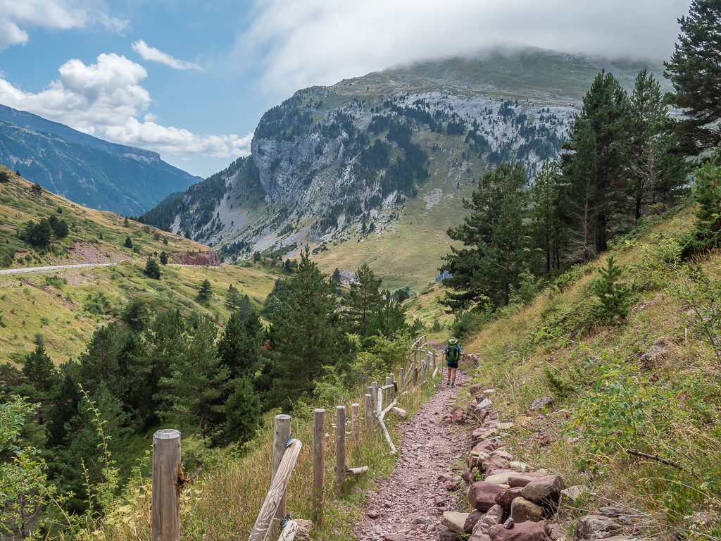
The further we followed the GR11, the brighter the skies and grander the view we had.
After searching the entire area, we pitched the tent within the stone walls of the amphitheatre as there was simply no other viable spot. With the cloud layer lifted, we were treated to stunning views in every direction.
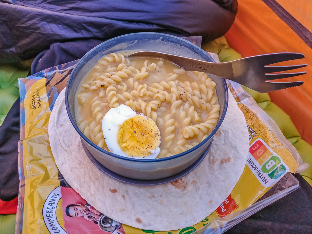
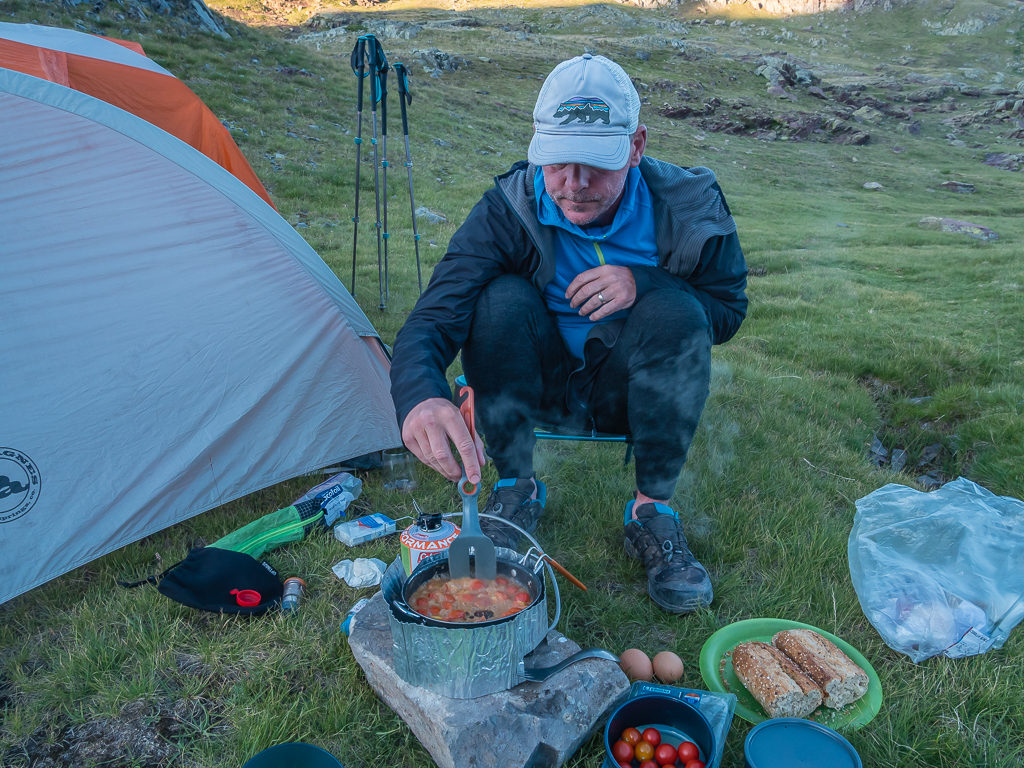
On tonight’s ‘Trail Kitchen’ menu: Fusilli pasta with a Thai chicken soup sauce, complete with an egg on top for a more authentic taste of Thai street food whilst on trail!
Dinner was tomato and vegetable soup for starters with tortilla wraps and soft cheese to dip in it, followed by pasta with Thai chicken curry soup as a sauce. We had just got settled after doing the washing up and were getting comfy in the tent, when we heard a car pull up followed by several voices talking together in Spanish. Next we could hear the chopping of wood and a BBQ being lit – clearly we weren’t the only ones with the idea of making use of the recreation area for the night. It just surprised us as it was mid-week and the noise went on until at least 1am as a small party transpired. Through intermittent sleep, we couldn’t fault them though, as we’d have well and truly enjoyed a vino or two as well tonight if we’d have been given the chance!
Day 13 – ‘Sunshine and Sangria’ Wednesday 14th August, 2019, Wild Camp by Recreation Area near Canfranc Estacion to Wild Camp by Ibon d’Anayet, GR11, 15km
After an early alarm call, we were up and sorted well before last night’s party-goers who had also camped at the recreation area. Eager to be on our way, we were in high spirits today because it was just a 3km walk to town and then only half a day’s hiking after that to our intended camp spot. Hence the day felt much more like a ‘nearo’! As the supermarket wouldn’t be open until 9am however, we took the opportunity to brew a cup of tea before leaving camp. Setting off downhill around 8:30am, we found the route was much clearer as a new set of waymarks had been installed making navigation a lot easier compared with the last time we had hiked this section of trail.
Having visited Canfranc Estacion in 2017, we knew the village was an excellent place to resupply and that 11 or so kilometres out of town the mountain lakes known as Ibones d’Anayet would be a fine place to pitch up for the night. Surrounded by some prestigious peaks either side of the border, the series of lakes are located in a magnificent plateau at 2,233 metres. An incredibly popular area for both day-hikers and climbers, the Pic d’Anayet dominates the skyline on the Spanish side, but it is the Pic du Midi d’Ossau standing at 2,884 metres on the French side that draws the most attention. Having become the source of various legends and due to its characteristic shape and isolation, it is one of the most photographed peaks of the Pyrenees. Only passing through the area en route to Sallent de Gállego on our previous section-hike of the GR11, we had earmarked the lakes as a prime spot to wild camp this time around.
Arriving in town just before 9:30am, we headed to a local café for a ‘proper’ breakfast before getting on with the task of resupplying. A little more confident understanding written Spanish than French after our time travelling around South America, I ordered pancakes with chocolate from the menu whereas Wayne opted for a toasted sandwich with bacon and fried egg. It was noticeable that Spanish breakfasts have a lot more choice and are far more substantial than the French ‘petit dejeuner’ of bread and jam! Fortunately, we just got our order placed before a bus load of Spanish tourists arrived on a special week-long pilgrimage to Lourdes. (We might have ordered our food first, but I was still waiting to use the one and only toilet half an hour later when the queue of women finally died down and the bus was about to depart!)
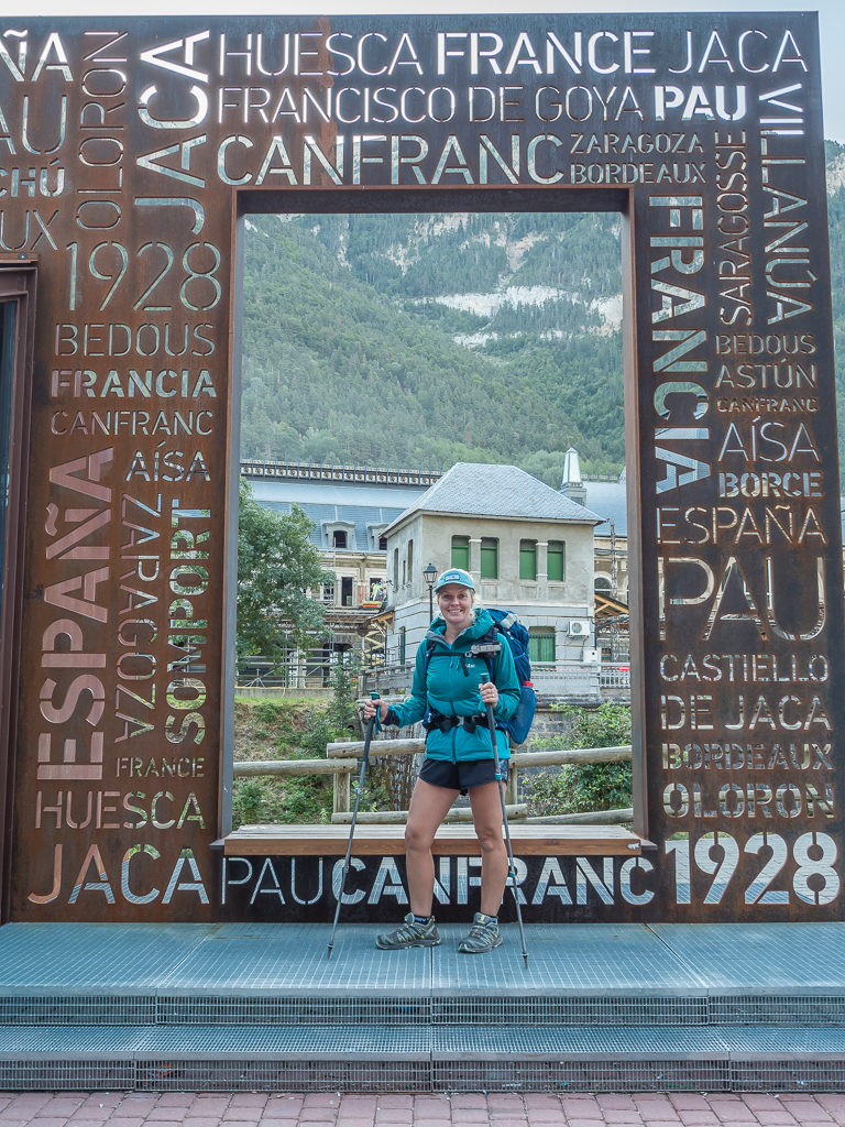
The original village of Canfranc Estación developed with the establishment of ‘Canfranc International Railway Station’ in 1928 to serve railway traffic across the Pyrenees.
Grateful to have finally used the restroom facilities, our next stop was the supermarket, which to our surprise is now a modern convenience store selling everything you could possibly need with opening hours until 9pm. This was very different to our experience in 2017 when it was merely a small greengrocers selling a few extra essentials for passing hikers. Needless to say, we made the most of stocking up with some fresh produce in readiness for a picnic by Anayet lake and what better accompaniment than a bottle of sangria! (For around €1.50 a bottle, how could we refuse!) Similarly, for just a few cents less a 1 litre carton of ‘vino tinto’ also caught our eye. Admittedly, it was bottom shelf stuff but worth a try! As we only had 1 day’s worth of food to carry, we didn’t mind hiking up almost 1,000 metres with an alcoholic beverage or two!
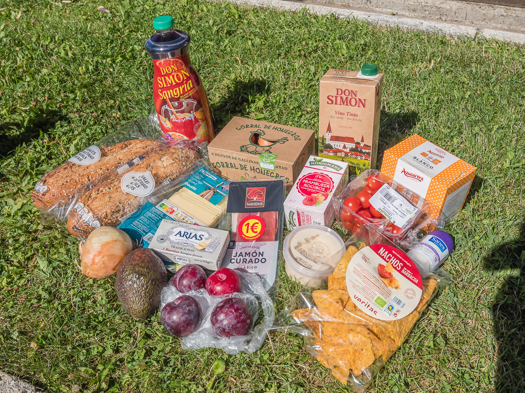
Our resupply of fresh goodies in readiness for a picnic feast beside the lake!
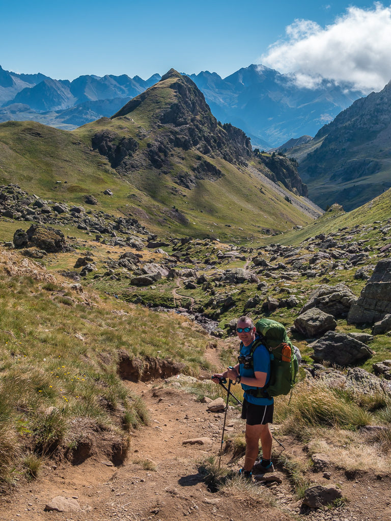
It was blue skies and bright sunshine as we departed Canfranc Estacion and headed back up the valley towards the recreation area we’d left earlier. Excited over the goodies we were hauling up the mountain with us, we spent some time reminiscing about our first visit to the Pyrenees in 2017, and how the GR11 trail now seemed better waymarked, with repainted flashes and new signs. Complete with distances to the next major landmark en route, the new signs were a vast improvement on what was there before. We had forgotten however how long and arduous the hike up the valley following the Rio d’a Canal Roya had been under a blazing sun, so we stopped a couple of times for drink breaks in an effort to keep well-hydrated as we still had a big climb of approximately 700 metres to go!
New signage along the trail made route finding much easier.
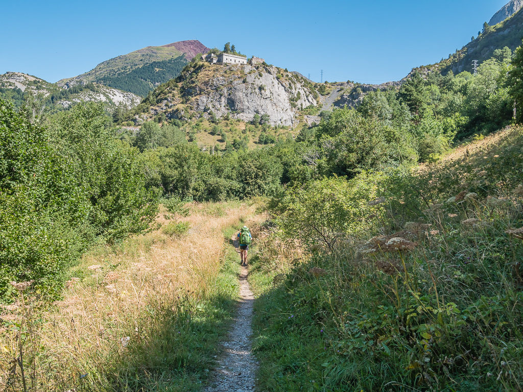
Located above Canfranc-Estación at 1,351m and dating back to 1592, the Fuerte de Coll de Ladrones acted as a fortress to protect the valley and was later used as a surveillance post to prevent smuggling. Today, the historic site is open to tourists.
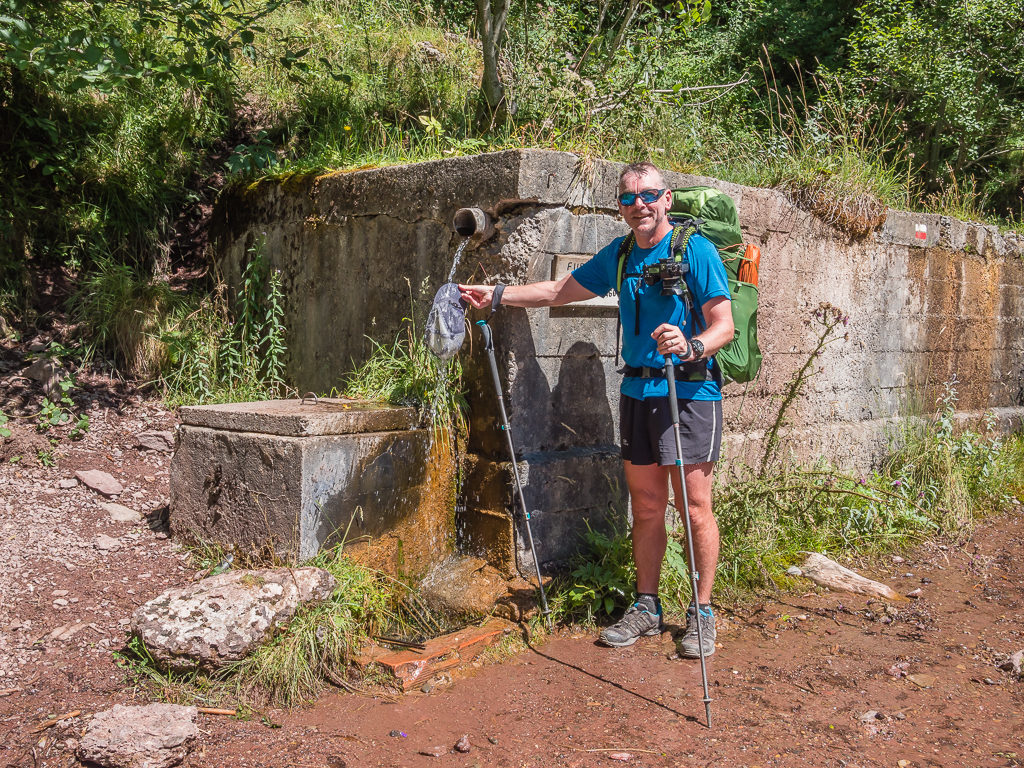
Making the most of the ‘fuente’, Wayne cools off by giving his cap a good soaking.
Enjoying a gentle section of trail. After crossing the Rio d’a Canal Roya there is a small bothy – the Refugio de Lacuars, where it is possible to take shelter if needed.
Looking back down the stunning Canal Roya valley. Regular waymarks lead us uphill towards the Plano d’a Rinconada.
Reaching the rich, grassy and relatively flat Plano d’a Rinconada before the big climb of the day.
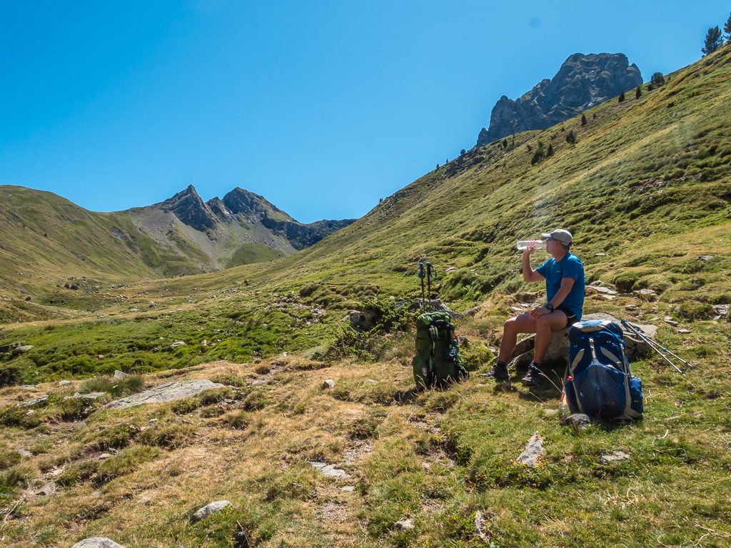
Without any trees to offer some shade, we paused to take on more water in an effort to keep well-hydrated. As always, we were hiking during the hottest part of the day.
Continuing now high above the stream, we gradually veered southeast into the Plano d’a Rinconada which was just as green and verdant as we remembered it. Reaching a grassy bowl, we then had to head uphill zigzagging under a series of crags before finally emerging at the top where the Ibon d’Anayet is situated in a large open meadow area at 2,233 metres. The skyline is dominated by the striking peak of Anayet soaring 2,574 metres. But it is the impressive mountain to the north over the border in France – the Pic du Midi d’Ossau, that is the most renowned.
Reaching the top of the pass after a hot, steady climb! The route up follows long switch backs through the crags after which we emerged on the edge of another expansive plateau.
Leaving the pass and heading towards the lakes with the striking peak of Anayet in the background. Almost the entire Anayet massif is considered remains of an old volcanic caldera.
Piercing a sky of vivid blue, the GR11 trail winds around the eastern flank of Anayet. The remains of a collapsed volcano, the pointed rocky landmark actually has 3 peaks: ‘The Tip of The Blacks’ classically known as ‘The False Anayet’ (2,459m), ‘The Vertex of Anayet’ (2,559m) and ‘Anayet’ peak (2,574m).
Looking north to more impressive peaks across the border in France.
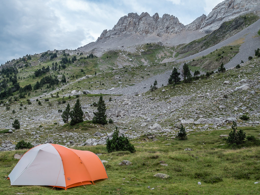
There were a few people picnicking and milling around the lake, but having arrived just before 4pm, most day hikers were already beginning their descent before they lost any light. We had planned on camping by the second, smaller lake to the north of the expansive meadow area, however as we walked along the well-worn track towards it, we were surprised to discover that the lake was bone dry.
With no choice but to return to the main lake, it didn’t take us long to find a decent spot that was sheltered from the wind with a little privacy. We didn’t want to set the tent up too early, so we enjoyed an hour of sunbathing whilst Wayne cooled the wine and sangria in the shallows of the lake! Making a mighty fine sandwich with avocado, cheese, tomato, cured ham and mayonnaise, we enjoyed a little picnic of our own, accompanied with tortilla chips and hummus. But the ‘piece de resistance’ was later when Wayne prepped and cooked steak sandwiches with a tomato and pepper sauce, complete with cheese and a fried egg on top! What a treat, not only in terms of our beautiful wild camp location, but also in the fine dining we were enjoying having carried all of the ingredients up that 700 metre climb!
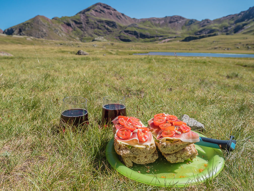
Soaking up the scenery and enjoying a wonderful picnic lunch accompanied with a glass of vino. This is camp life at its best!

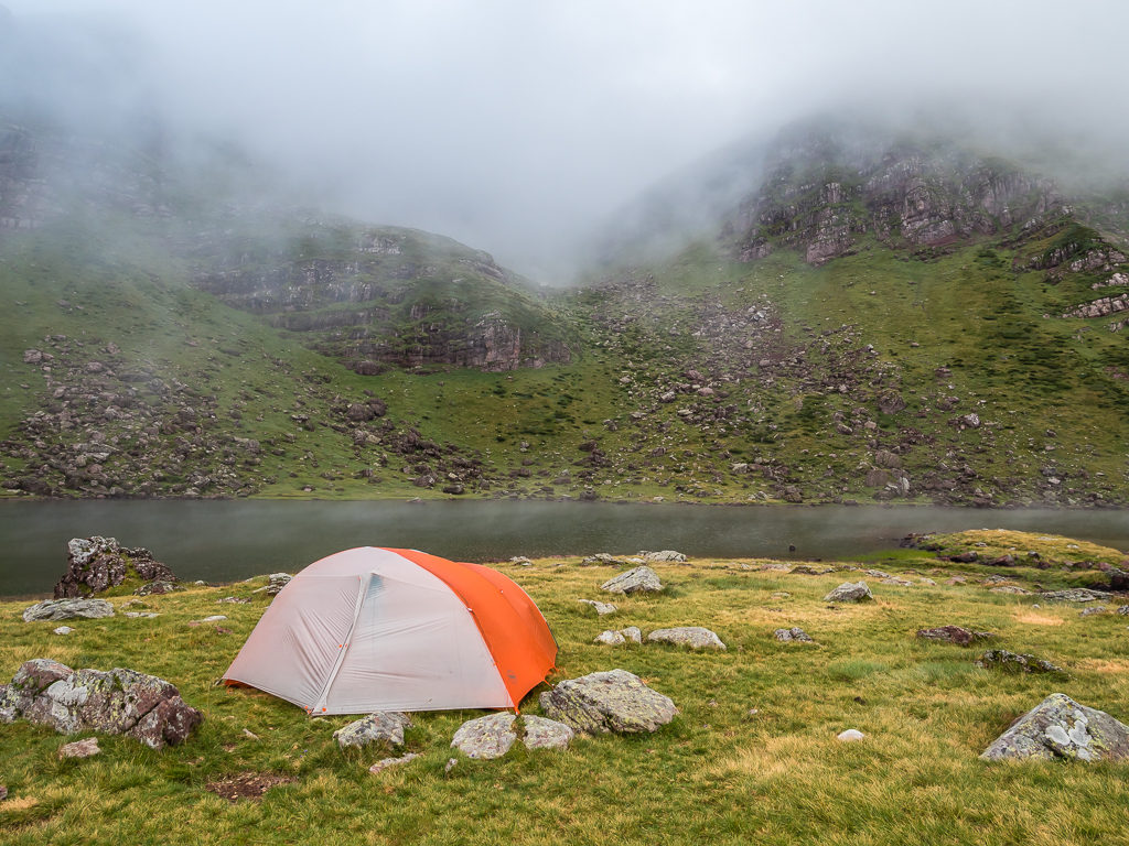
Setting up camp beside the first major lake of the Ibones d’Anayet plateau. It was an incredible wild camp location!
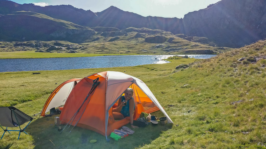
With impressive peaks in every direction, we enjoyed a ‘picture postcard view’ from the comfort of our tent.
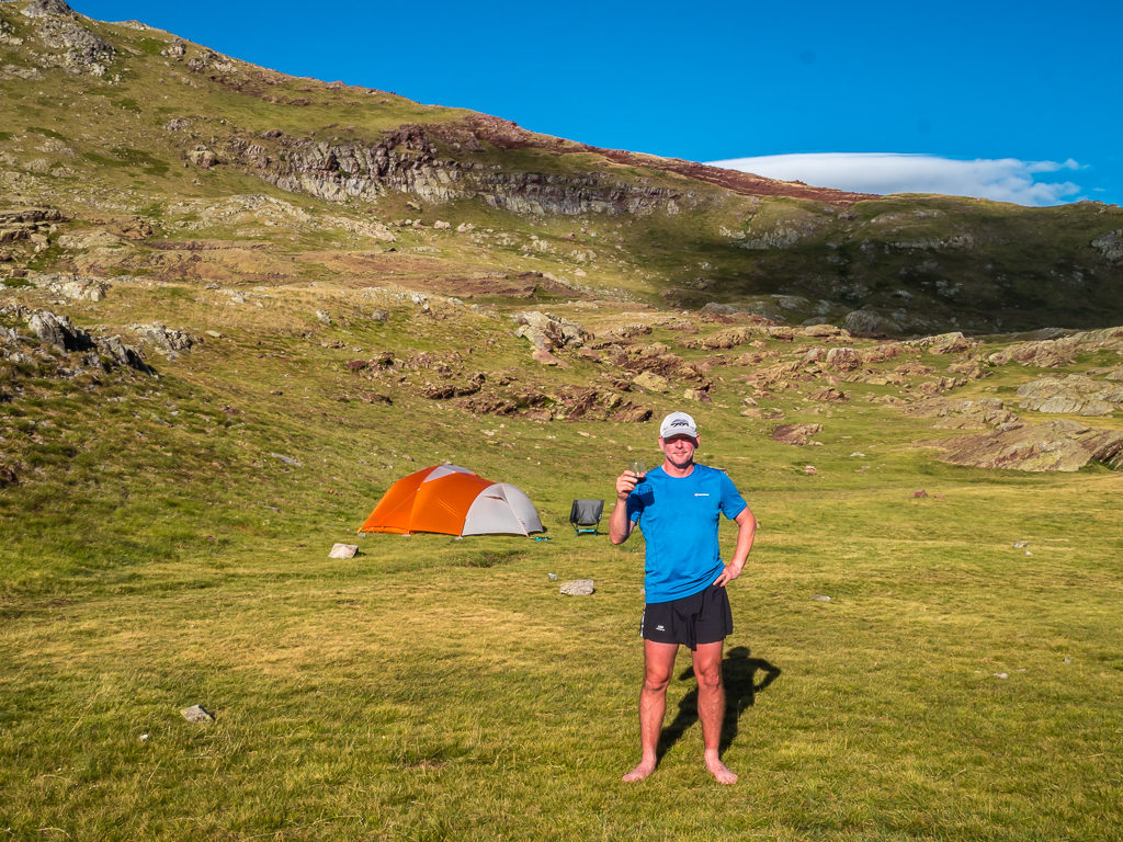
Cheers! The sun, scenery and sangria made this one of our favourite days on trail out of the entire summer!
Heading uphill behind the tent, we also had a great view of the Pic du Midi d’Ossau (2,884 m) rising above the Ossau Valley on the French side.
Wayne cooks a new ‘Trail Kitchen’ dinner. Having bought a piece of steak fresh from the butchers in Canfranc Estacion earlier that morning, ‘Steak Baguettes’ were on tonight’s menu.
Our added bits of kit to improve our comfort over a long-distance hike were also proving their worth! It was great to sit back and relax in our lightweight camp chairs and sip our wine from a cup instead of the plastic bowl we used to make do with. People walking around the lake looked bemused at our set up, especially with the mini frying pan and Wayne cooking up a storm. But carrying it all up here was worth every step. ‘Bon appetit’ – it was our tastiest camp meal to date!
The rest of the evening was then spent with our cameras capturing some incredible reflection shots of Anayet peak mirrored in the still waters of Ibón de Anayet. With a gentle mist hovering over the lake, the entire scene was both beautiful and captivating and looked particularly ethereal in the Blue Hour.
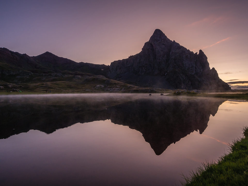
Capturing stunning reflections of Anayet peak on Ibón de Anayet during the Blue Hour.
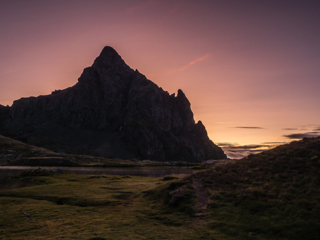
The stunning skies during sunset were a fitting end to such a fine day on trail.
Day 14 – Thursday 15th August, 2019, ‘Trail Kitchen Winner!’ Wild Camp by Ibon d’Anayet to Hotel Maximina, Sallent de Gallego, GR11, 12km
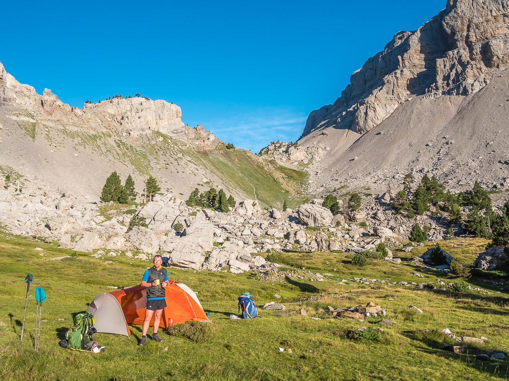
After a truly memorable day on trail yesterday, we were loathed to leave such a wonderful wild camp spot. Fortunately we didn’t need to rush away as we only had a short hike into the town of Sallent de Gallego, our next resupply and overnight stop, so we decided to linger a while longer and enjoy a beautiful morning beside the lake.
If last night’s dinner was ‘gourmet’ camp cooking, then this morning’s ‘Trail Kitchen’ menu could also be considered fine dining, especially at 2,200 metres on top of a mountain! At 8am, all was quiet around the lake, save for the sizzle of Serrano ham gently cooking with chopped onion and cherry tomatoes in our mini frying pan. Wayne was whisking eggs and preparing to make folded omelettes with a middle of melted cheese accompanied with sliced avocado. If we can get hold of fresh ingredients and we have the inclination to carry a few extra grams from town, then it’s fair to say that we eat better on the trail than when we’re at home! But when you’re walking long distances, there’s nothing like a hearty breakfast to set you up for the day and keep you motivated.
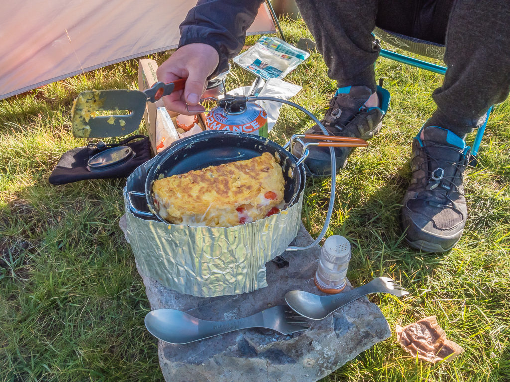
With fresh ingredients, Wayne throws together another tasty trail breakfast!
Making the most of such magnificent surroundings, we then enjoyed our time around camp watching the mountain reflections mirrored on the still water of the lake once again and waiting for the sun to crest over the mountains in the east, lighting up Anayet Peak under another bright sky of blue. This was what summers were made for – whiling away the hours outdoors looking at the wonders of nature.
Dramatic early morning skies reflected on one of the smaller Ibones de Anayet.
The striking peaks of the Anayet massif are mirrored in all their glory in the early morning Blue Hour.
Early morning sun lights up Anayet peak.
The waters of the large Ibón de Anayet are usually calm and create stunning reflections of the surrounding peaks. What a privilege to witness it all on such a clear day!
Over on the French side, the recognisable peaks of the Midi D’Ossau soar above the horizon, the volcanic mountain like an unmoved sentinel.
Yesterday, we had spotted just one cow grazing around the northern banks of the lake. It was minus a bell and thoroughly enjoying having the freedom to roam the meadow at will and eat the greenest, juiciest grass it could find. We had wondered if it felt lonely as it wasn’t part of a herd, but we felt happy for it, that it could wander and enjoy the silence. We assumed she was old and liked to think that some kind farmer had brought the cow up here to end her days in peace, now that she’d fulfilled her purpose. She was certainly enjoying life for the moment.
Around 11am, when we set off for Sallent de Gallego following the GR11 markers around the lake and across the meadow to where our descent began, the track quickly turned into a highway of day walkers all going in the opposite direction to us, heading up to the lake for an adventure of their own. What we hadn’t realised until later was that today was in fact ‘Ascension Day‘ (a religious festival and Spanish public holiday), which may be the reason so many people seemed to be heading up to Ibones de Anayet en masse! It felt like being back on the Camino Santiago all over again, with us greeting everyone with a pleasant ‘Hola!’ and giving way to people coming uphill, as is trail etiquette.
Leaving the lake and heading to the town of Sallent de Gallego following the GR11 down the Culivillas ravine.
The scenery was still as beautiful as ever with the foliage of the mountainsides in full bloom.
Heading downhill to the Anayet Ski Complex following the course of the Barranco Anayet. We had to cross the stream several times but we maintained a fast pace as the trail was so well-trodden and easy to follow.
Despite the busy trail, we still managed to maintain a quick pace going downhill following the course of the stream flowing through the valley, which meant despite our late start, we made really good time and reached the Anayet Ski Complex in less than an hour. Even better, instead of a long road walk then to Sallent de Gallego, we found that the trail had been re-routed off the highway making for a much more pleasant traverse to town. This was punctuated with a convenient stop for an ice-cream and a cold drink at the petrol station on the main road just outside the ski resort of Formigal!
As this section was entirely downhill, we made excellent time!
Having been descending, we hadn’t realised the spectacular view behind us until we stopped for a moment and looked back up the Culivillas ravine. Here the Culivillas Peak dominates the skyline.
Regular waymarks leads us down to the Anayet Ski Complex which was closed because it was ‘off-season’.
Compared with the rolling green hills of the Basque country, the mountainous terrain further east on the Spanish side of the border seemed much dryer and more rugged.
Looking back to the main highway from the the trail. The GR11 has now been re-routed around the Formigal section to avoid several kilometres of road-walking to Sallent de Gallego.
Located on the main highway between Formigal and Sallent de Gallego (a short diversion off trail) there is a petrol station and bar-restaurant, where we decided to take a rest break because of the soaring temperatures.
Passing the Rio de Gallego, and just as we had done in 2017, we then followed a waymarked track to the outskirts of town. We had earmarked Sallent de Gallego as our first major town stop en route, primarily as we knew it had a good outdoor gear shop and we now had a growing list of replacement items that we were hoping to purchase, but also as we had really liked the character of the town on our previous visit. Therefore this time around, instead of staying overnight in the municipal campground, we had booked a hotel online so that we could enjoy some of what the charming old town had to offer. After all, as Wayne keeps reminding me – ‘We’re on holiday!’.
These simple words of wisdom and such excellent advice we were given from an elderly lady hiker we passed early on during our PCT adventure still resonate today – “It’s not a death march!” Never have truer words been said, and we remind ourselves of that little nugget every time we start to feel guilty about not pushing the miles, or when we reward ourselves with a treat. Therefore this hike is all about enjoying the moments and immersing ourselves in the culture, not just rushing through at lightning speed or through the middle of the night, where we couldn’t even tell you what the scenery is like because we were surrounded in darkness.
It feels good to have a much less scheduled way of walking, with far more time and a lot less miles. I barely look at my watch now, as time is not an issue. We break when we feel like it and actually have time to stop and look at things properly to take it all in. It’s so liberating just to acknowledge the fact we’ll leave camp when we’re ready and we’ll get there when we get there! Admittedly, it’s a lot easier to do when we’ve only given ourselves on average 18 kilometres to hike per day (approximately 12 miles) – and some days we’ve broken up, which makes them much less. We’d usually have that nailed by lunchtime on the PCT, with the same amount of miles to do again. Now we’re actually getting to read and relax at camp, something we missed greatly on the PCT as there was never enough time to enjoy the camp side of things, which for us is a major aspect of the whole outdoors experience.
Arriving in town by 2:30pm, we then had plenty of time to get our town chores done and enjoy a self-indulgent ‘nearo’. As we couldn’t check in until 4pm, we headed straight to the Gorgol Free Mountain Outdoor Gear Shop where we were able to buy gas, socks, electrolyte powder sachets, a vest top for Wayne and replacement pole tips for myself, which the guy kindly changed for us in his workshop out the back.
Dropping our bags off at the hotel, we then went to the lavenderia to make a start on laundry. I say ‘make a start’ as we needed to wash everything, including the things we were wearing, so it would be a return trip later to put in a second load once we had showered and changed into clean gear. Fortunately, next to the laundry was a pizzeria and bar, so we settled in with a ‘grande’ glass of cerveza each, keeping note of the washing and drying time. It would have also been rude not to try a pizza, so we shared one – a spicy pepperoni, which we enjoyed as a late lunch.
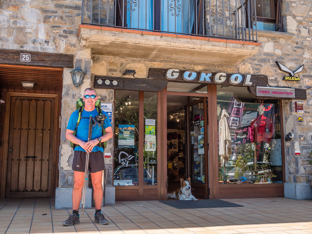
Our first stop in the town of Sallent de Gallego was a visit to the Gorgol Outdoor Gear shop for some gas and replacement items.
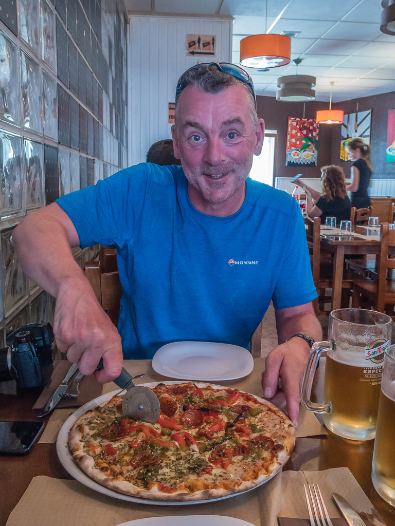
We enjoyed a late lunch of pizza and beer whilst waiting for our laundry to dry in the lavenderia next door!
After checking in, it was then time to get out the ‘town clothes’ once more and pretend we weren’t hikers for the night, but for the white feet and ankles giving us away. Freshly showered, laundered and a large bottle of sangria later, we were checking out some of Sallent de Gallego’s bars and general night-life. For a small place, there were a lot of people, which is when after a quick Google search we realised about today being a Spanish national holiday. Everywhere was busy and there was a general wait time of at least an hour for food, so it suited us to go with the flow and have a few more drinks. We were surprised to find a ‘Gin Bar’ (gin is obviously popular wherever you are in the world nowadays), so we couldn’t resist a glass of our favourite tipple – Bombay Sapphire and tonic.
As everything needed washing, we had to make two trips to the lavenderia. Having showered and with a clean town dress now making another appearance, it was time to wash our remaining gear before a late dinner!
Our night on the town was quite short-lived however as we found everywhere was shutting up by around 11pm. So after a lovely meal of lasagne, goats cheese salad and more pizza, it was time to enjoy sleeping in a proper bed – the first one in 2 weeks!
Having experienced another epic week on trail as a whole, the wet weather of Lescun suddenly seemed long behind us. Now across the border where the sunny skies of Spain held more promise, we were more than ready to see what ‘Week 3’ of our Pyrenees adventure would bring!
8 Comments
What a wonderful adventure…I look forward to your next post!
Thanks for taking the time to read and comment Jenna! 🙂
Cracking views once you left the rain behind. We did a short trip around the Midi D’Ossau a few years back. Amazing mountain but we suffered the same “walking inside a ping pong ball” fog for a whole day as well. The wild camp site was truly stunning, the high Pyrenees are tailor made for it
Definitely! We’ve just downloaded Brian Johnson’s new Cicerone Press title: “Seven Shorter Treks in the Pyrenees” and would love to do his recommended ‘Route 3: Tour de Vignemale and La Alta Ruta de Los Perdidos’. It combines trekking through the French Parc National des Pyrénées and Spanish Parque Nacional de Ordesa y Monte Perdido, combining the Tour de Vignemale with the Tour de Monte Perdido, and takes in six of the favourites of the high Pyrenees: Cauterets, Vignemale, Gavarnie, Pineta, Ordesa and the Picos del Infierno. It’s described as the most demanding trek in the guidebook, but we think it would be awesome! It’s high on our list of future hikes for when we next return to the Pyrenees.👍
Another guide book and route to add to the list 😀
Never would I have dreamed of those wild camp spots. Unbelievable these spots really do exist. Thanks for these really wild and scenic photos.
BTW: i assume Wayne is carrying the tent 🙂 . Where does he hide the tent? I am asking because I also use an Osprey Exos. With my Hilleberg Akto being attached to the designated straps the original rain cover does not fit anymore (not completely covering the hip belt area). Still looking for a proper solution.
Hi Marcus, Yes Wayne does carry the tent! He usually stuffs the fly and inner into his pack and then puts the poles in his side pocket and keeps them in place with the tightening straps. But likewise, our rain covers only just fit when our packs are full, and the hip belt area is still exposed. (We use the Osprey Ultralight Large covers.) Wayne had previously purchased an extra large pack cover but it was just too big and didn’t fit properly at all.
Hi Danielle, thanks for Your feedback. Stuffing the tent inside might be an option. Will try this.
All the best,
Marcus