
“When things don’t go as expected, trust the reroute.”
Lalah Delia
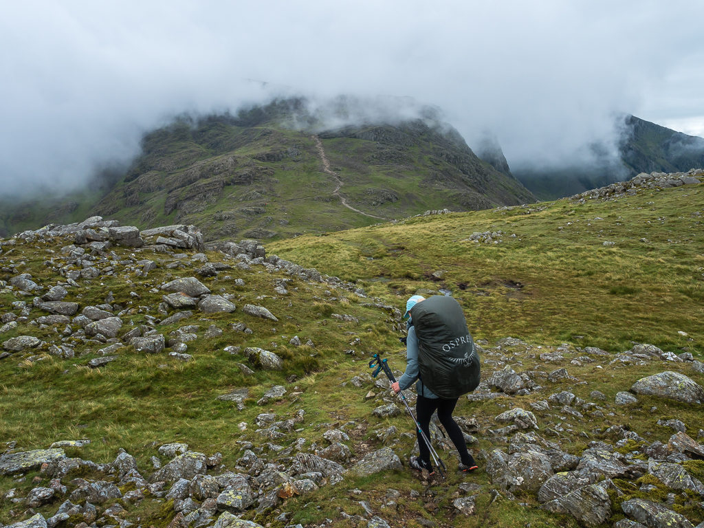
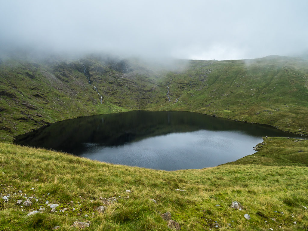
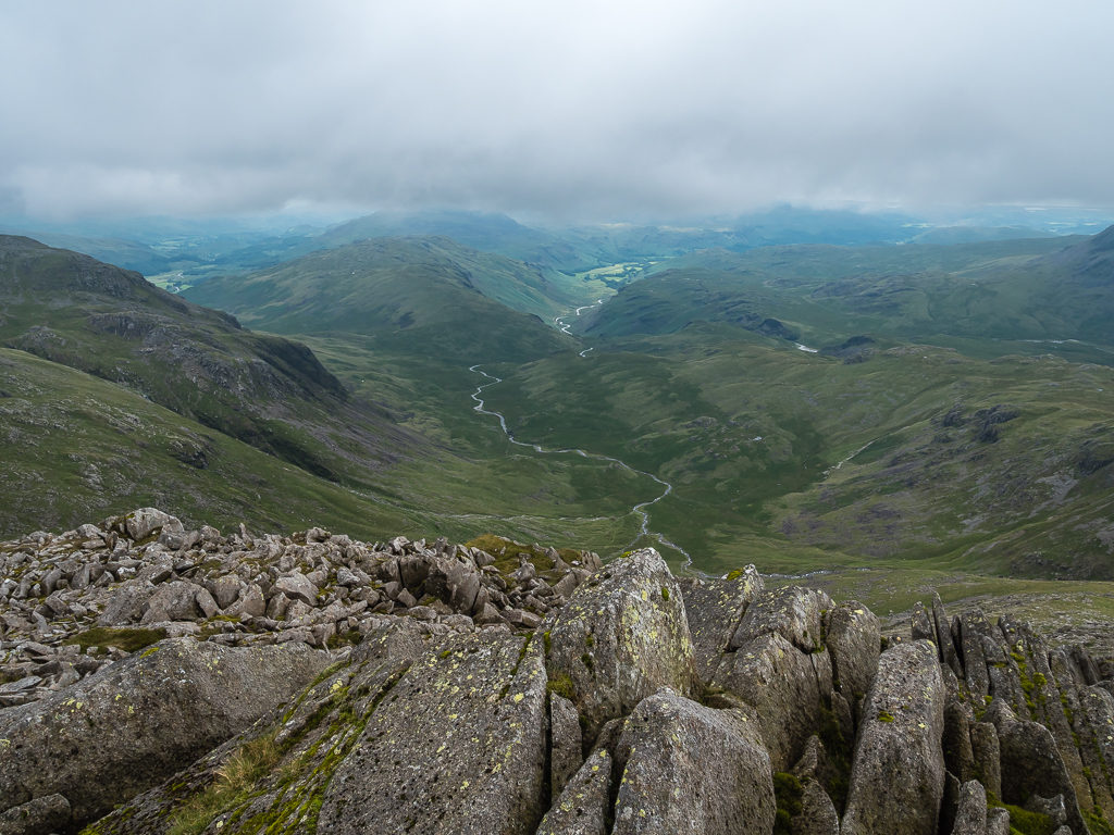
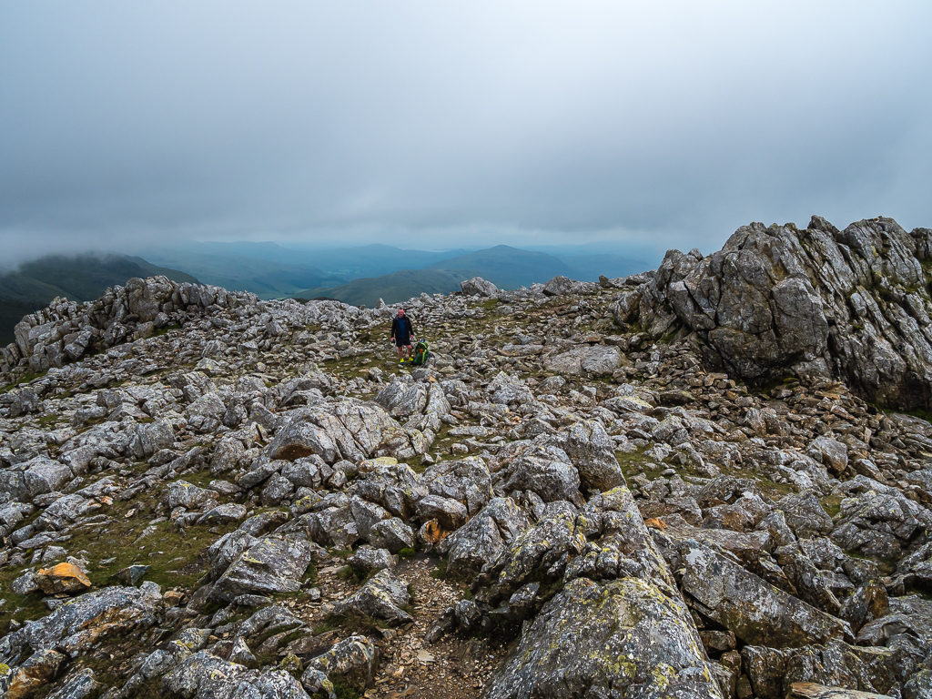
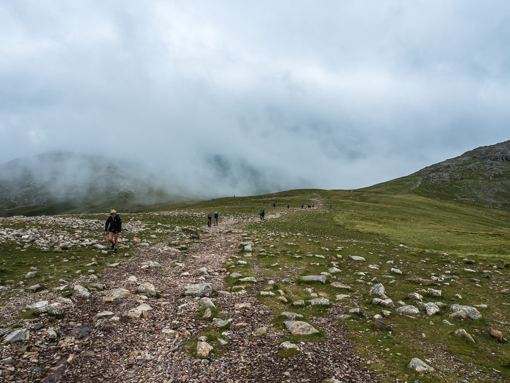
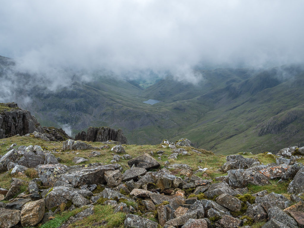
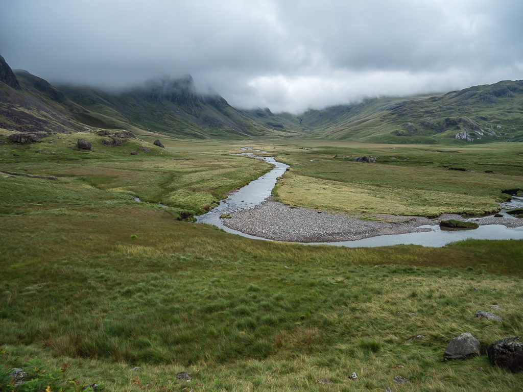
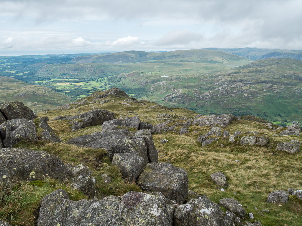
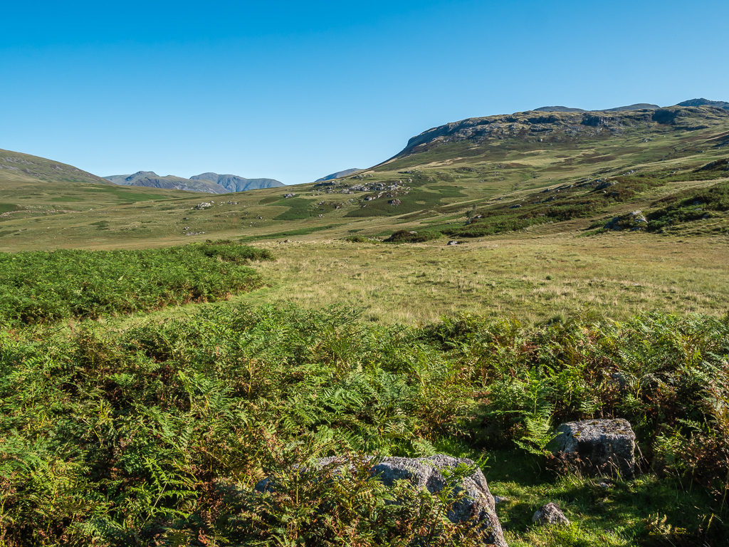
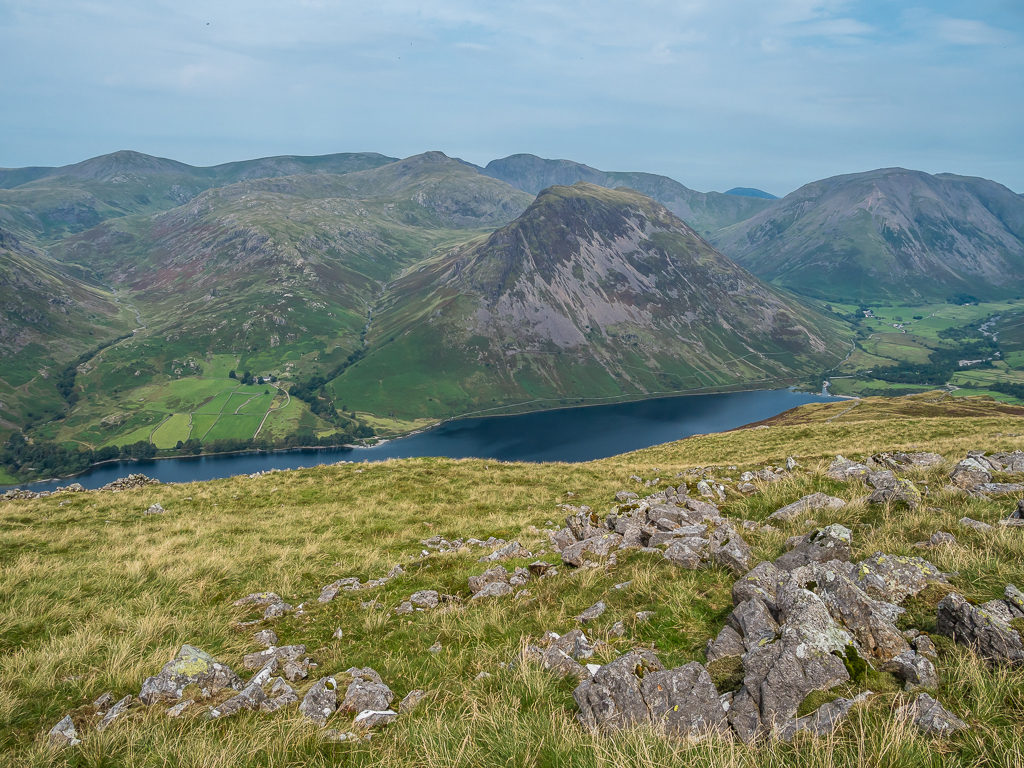
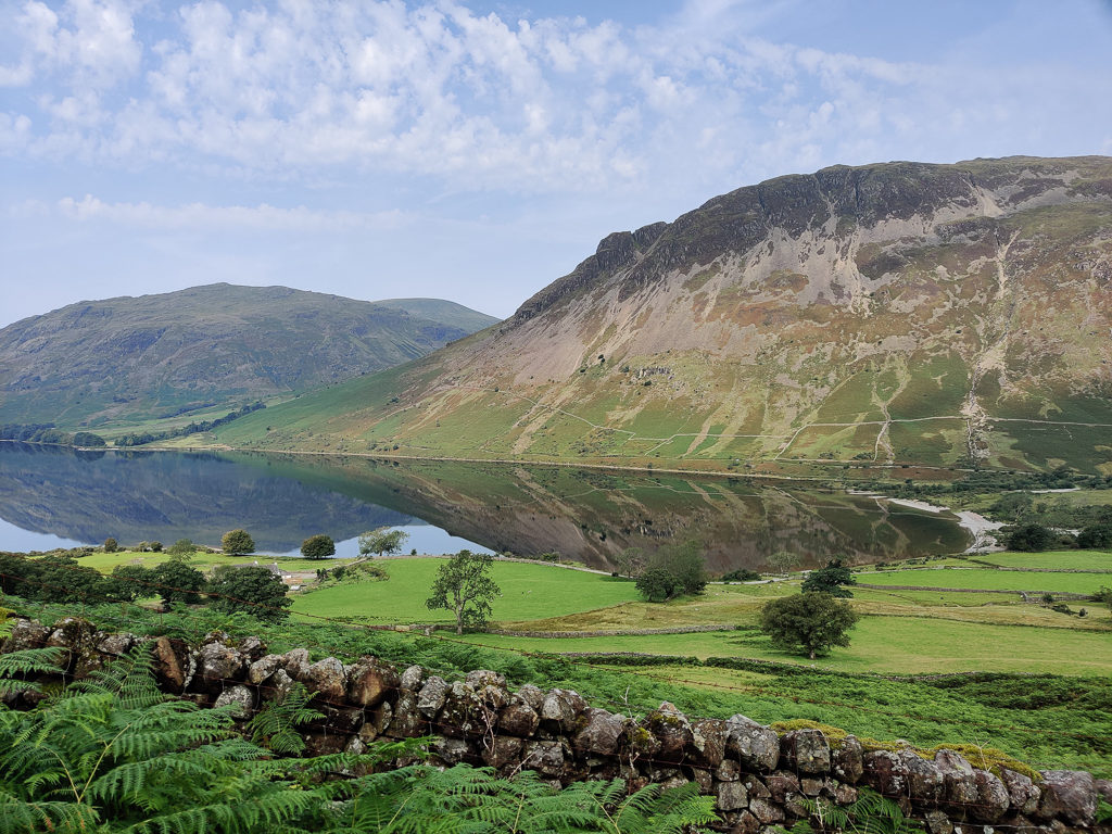
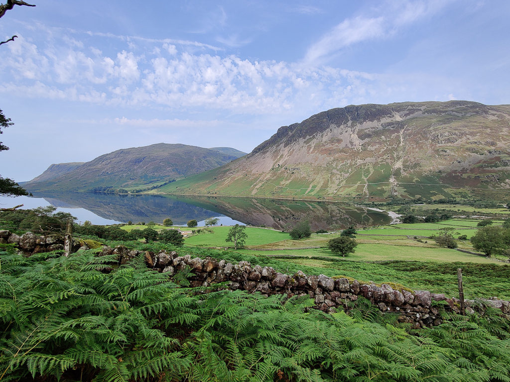
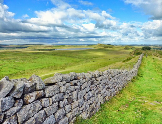
Getting accustomed to the changeable weather as we head down from the summit of Lingmell in readiness to tackle the unrelenting route up Scafell Pike.
Walking The Wainwrights – Section 2 – Langdale to Wasdale
Thursday 6th August 2020, Old Dungeon Ghyll Hotel, Langdale, to Wild camp at Sampson’s Stones, 21.8km
Peaks bagged: 25. Rossett Pike (651m), 26. Bowfell (903m), 27. Esk Pike (885m), 28. Lingmell (749m), 29. Scafell Pike (977m)
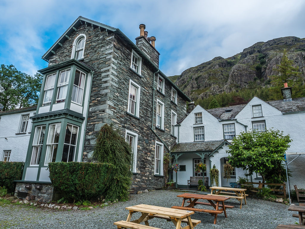
Having spent the night in Langdale at the Old Dungeon Ghyll hotel to wait out the dreadful weather, it seemed our contingency plan had worked as we awoke to a much better morning. When we looked out of our bedroom window around 6am, it would appear that the fell tops were still obscured by low cloud but at least it had finally stopped raining.
Hooray – a break in the cloud revealing blue skies at last!
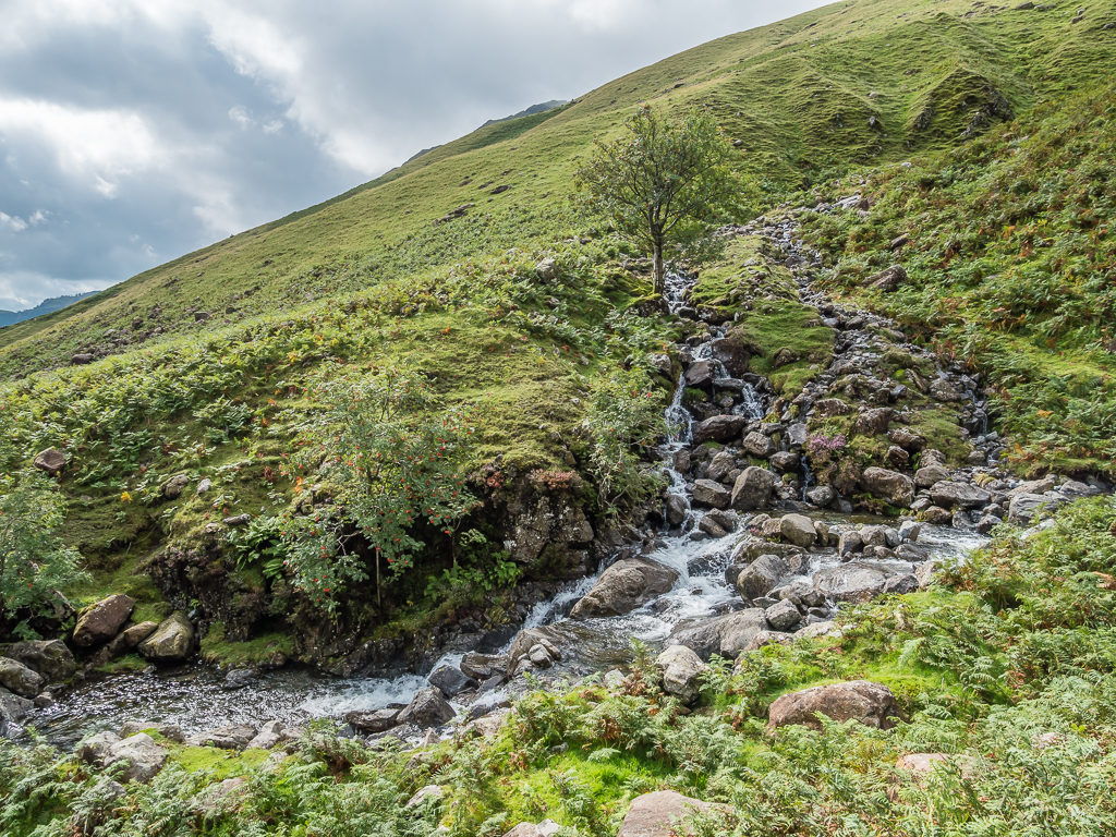
The Lakeland area is well known for being one of the wettest regions in England, but after the past few days it had completely reached saturation point. Rivers were bursting their banks, tiny becks and gills that were once merely a trickle and an unreliable water source were now full on raging torrents of water, and it appeared that waterfalls were now flowing off the fells in abundance. Quite literally, we have never seen it so waterlogged. It was no wonder we were having to dodge expansive areas of bog across numerous fells.
It was also the reason we were starting ‘Section 2’ from Langdale instead of Patterdale having bailed off the fell tops on Tuesday morning after being exposed to 40 mile per hour winds and heavy rainfall, which had not been fun. (Not even ‘Type 2’ fun.) Heading to town in search of a room in order to avoid the worst of it and to dry out all of our gear, the extreme weather conditions for this time of year (it was early August and meant to be the height of summer after all), had now put us at least a day and a half behind, which meant we were also 20 summits behind our intended target. Pulling in a couple over the course of the next few weeks would be perfectly doable – but twenty?
We were already feeling less positive that we could achieve our objective of summitting all 214 Wainwrights in 4 weeks, especially if the weather continued to be so changeable. It would not be our fitness that would let us down, but the weather could easily put a stop to everything. We just hoped we could stay on track for the rest of our planned sections and not miss out any more summits. But only time would tell…
So after making the most of our second hearty Cumbrian breakfast in two consecutive days, (we needed the energy in preparation for summitting England’s highest mountain today), it was time to push on and get back out on the fells.
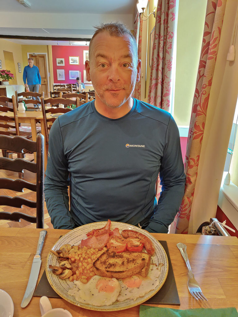
One of the best things about a hotel stay is a full English breakfast the following morning!
By the time we left the Old Dungeon Ghyll, setting off around 9:30am, the cloud layer had lifted and the sun was even breaking through. Now feeling much more positive, we had high expectations for what today would bring.
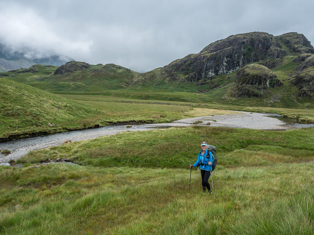
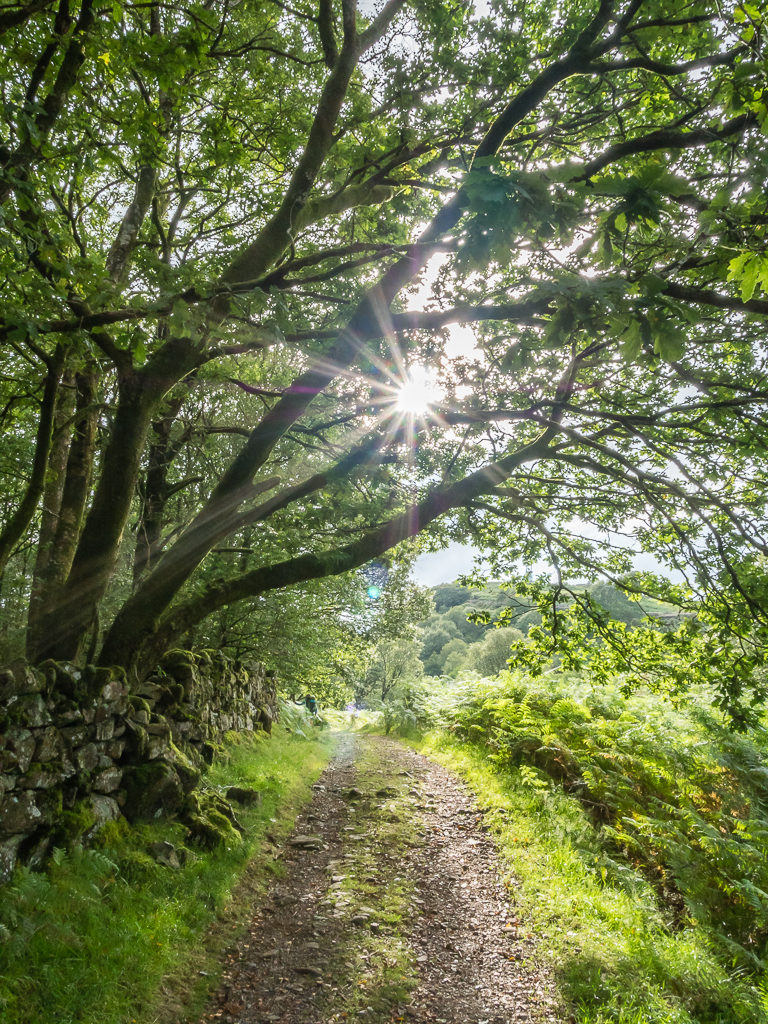
Heading off up the Mickleden valley along part of the Cumbria Way, our first peak of the day was going to be Rossett Pike. As the route is so well walked, much of the path has been slabbed, which made for much easier walking especially with so much water flowing off the fells into the valley.
Striding off through the Mickleden Valley and looking towards Pike Of Stickle and Gimmer Crag, with high expectations for the day ahead.
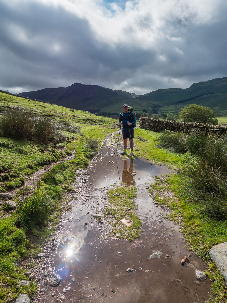
The trail up the valley is well-walked as it is also part of the Cumbria Way.
Low cloud still obscures the Langdale Pikes at the end of the valley but we were grateful that the rain had stopped.
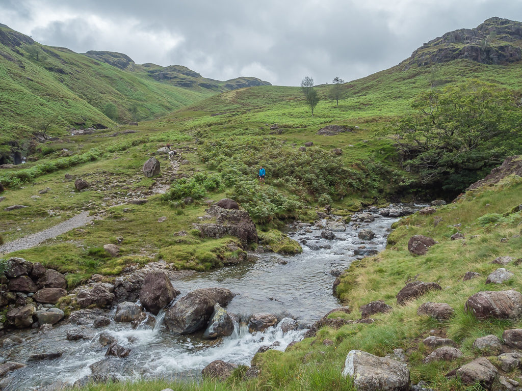
A very full and fast flowing Mickleden Beck after the last few days of heavy rainfall.
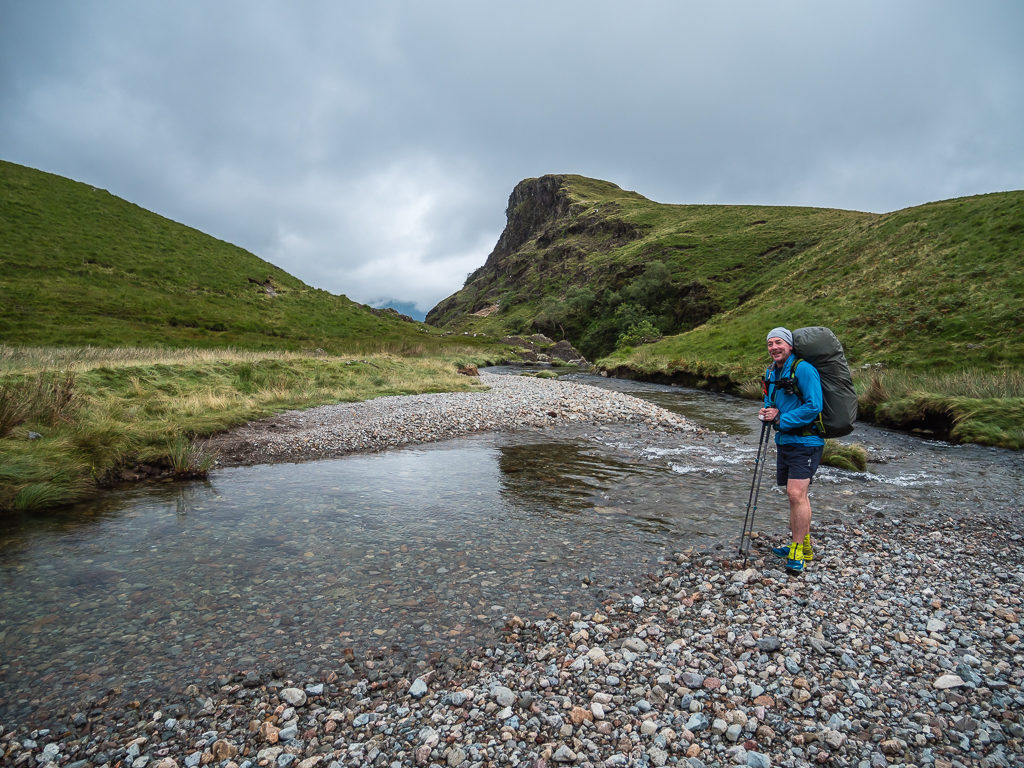
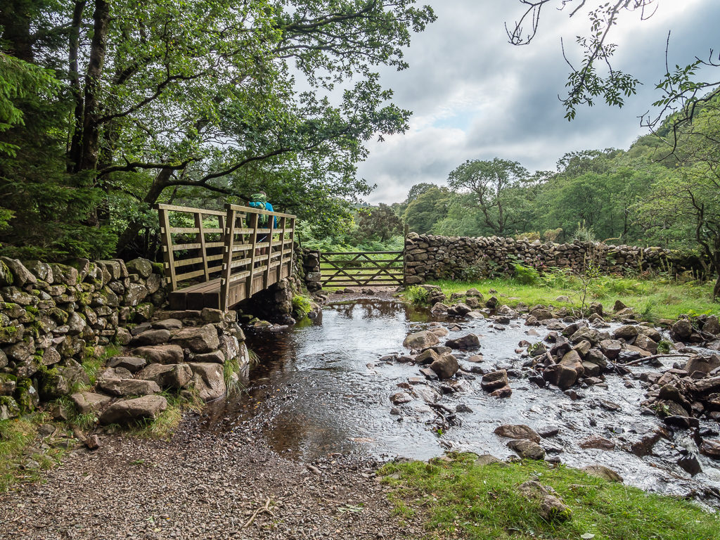
Thankful of the well-placed footbridge that allows for an easy crossing of Stake Gill.
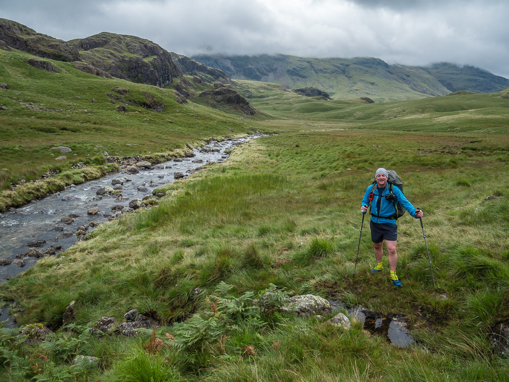
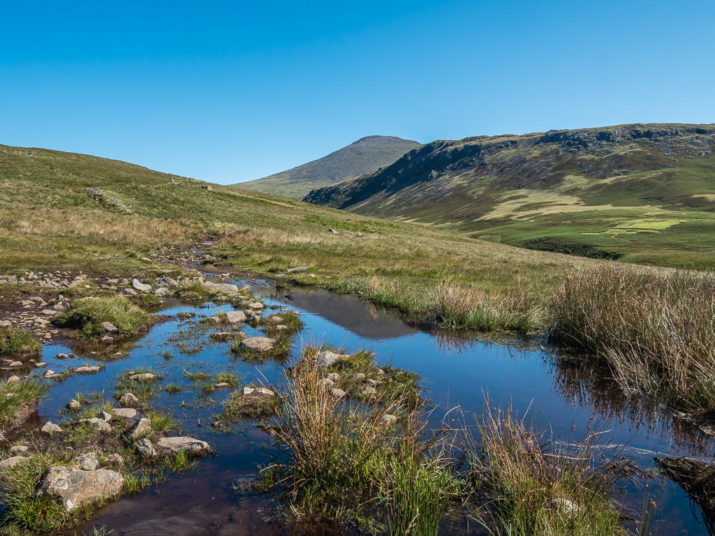
We took the left fork in the path leading towards Esk Hause and Rossett Pike. There would be no problem finding water on trail today!
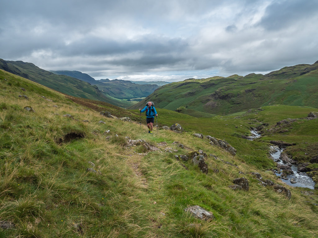
Ascending Rossett Gill on a nice, slabbed path, we had tremendous views looking back down the Mickleden Valley.
As we headed up to the summit at 651 metres, all of the surrounding fell tops were in white out as the cloud layer was still so low, so we didn’t have much of a view. However it was still relatively early, which meant there was a good chance of the sun burning through.
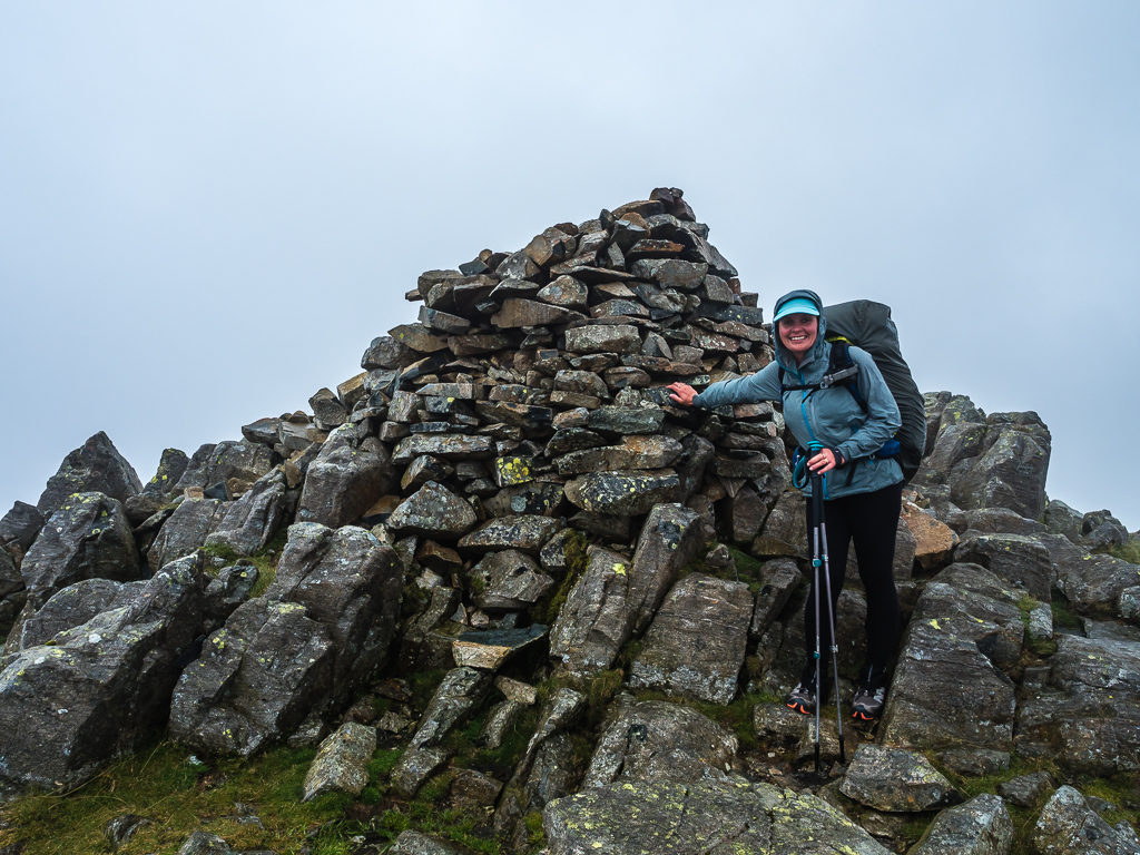
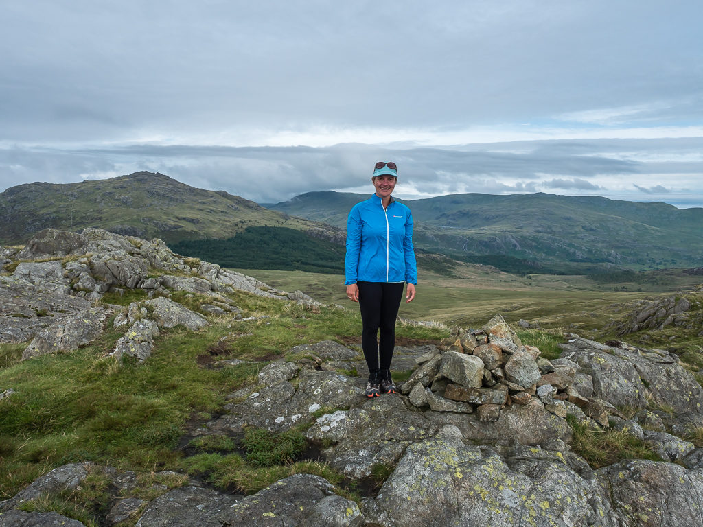
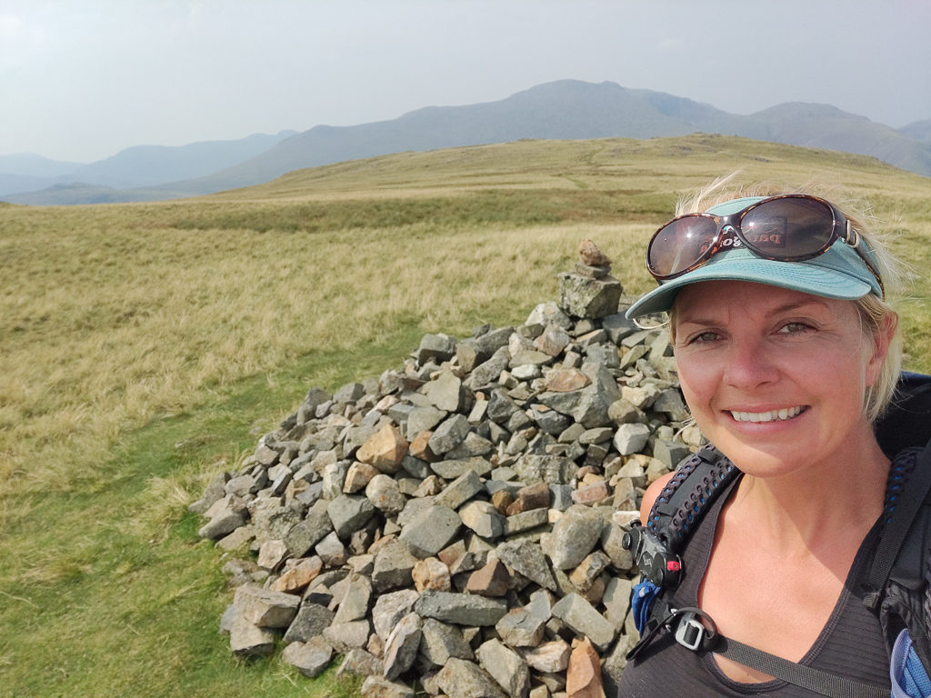
At 651 metres, reaching the summit cairn on Rossett Pike.
As the cloud layer began to lift, we enjoyed far-reaching views across the valley.
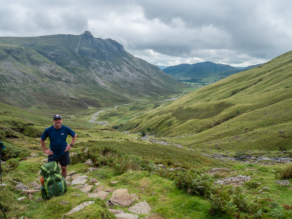
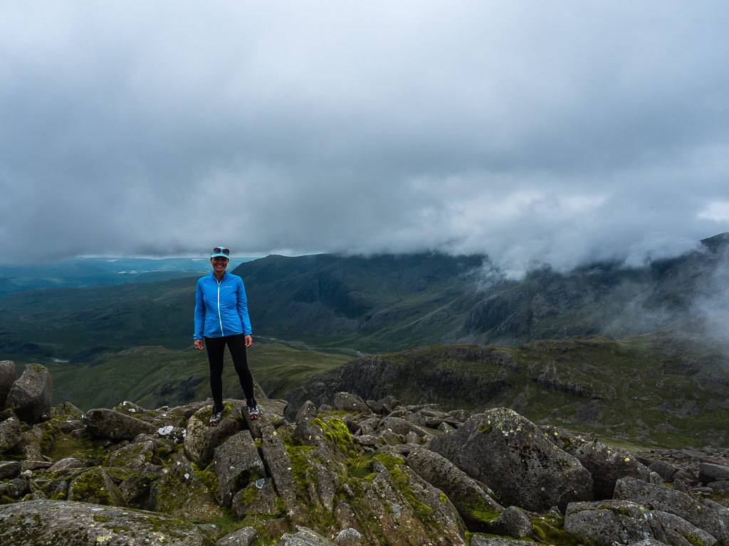
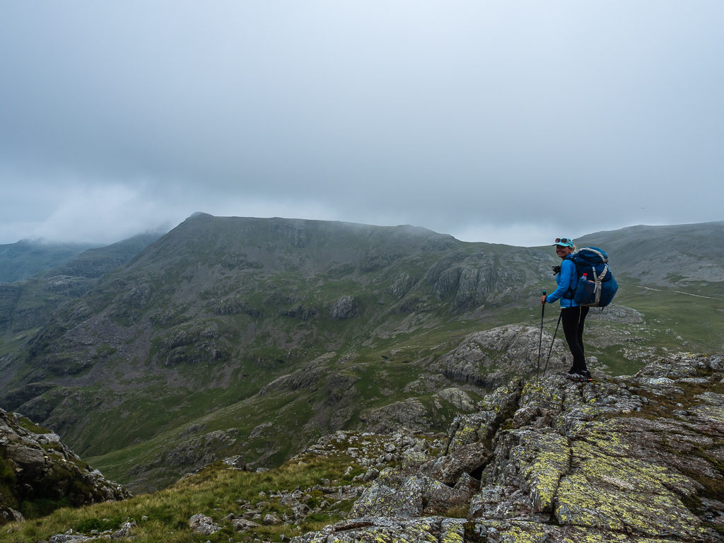
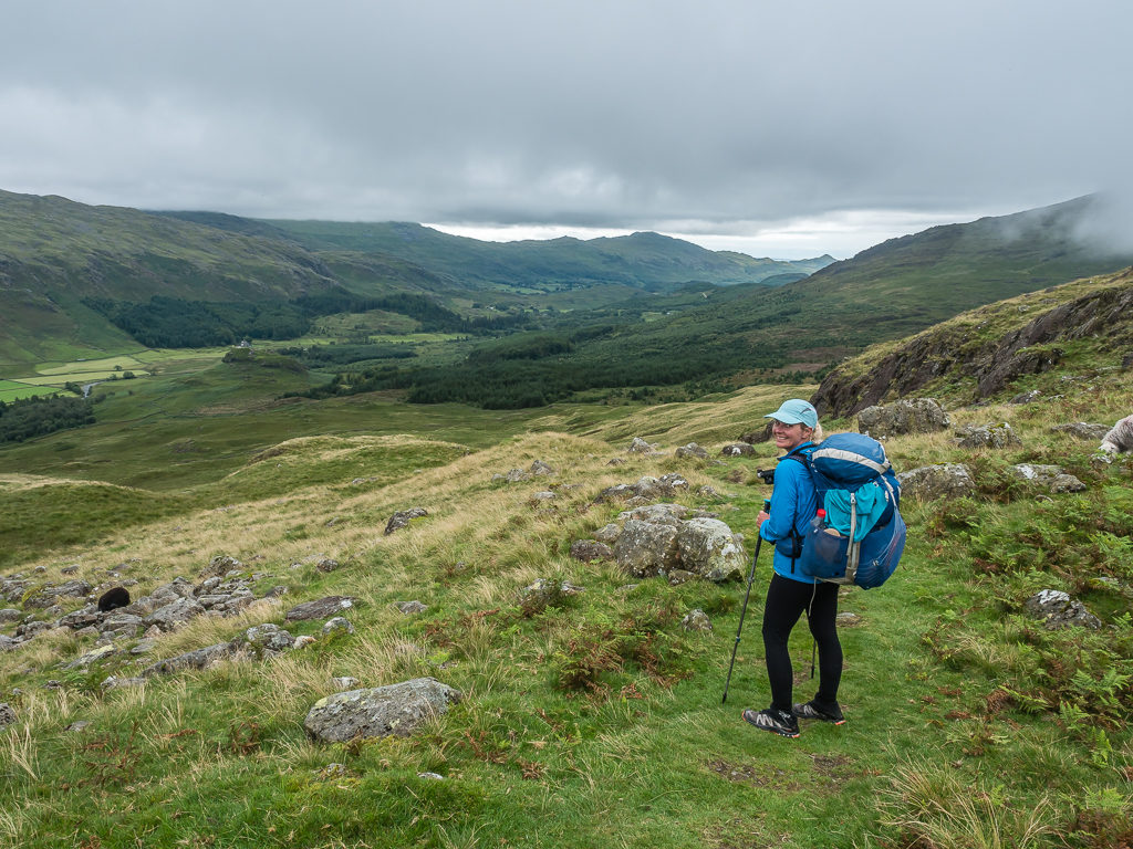
Skirting around Angle Tarn, we then climbed uphill over the rocky slopes of Bowfell. At 903 metres, it is the Lake District’s 6th highest peak and a popular spot as several hikers and runners were heading up to the summit. Making use of the rocky ground, we sat and ate lunch, which today was a sausage roll we had bought from Gregg’s back in Ambleside before waiting our turn for a photo at the summit cairn.
By the time we got there, we were in luck as the winds seemed to build from nowhere and blow away the clouds revealing magnificent mountain views to the southwest looking onto the Scafell massif. After glimpsing it for the briefest of moments however, the panorama then disappeared as the clouds quickly came in again obscuring all of the surrounding peaks.
Skirting around Angle Tarn as we made our way to Ore Gap in readiness for the steep climb up to Bowfell.
Bowfell is made up of several dramatic crags and the large plateau leading to the summit is known as the ‘River of Boulders’.
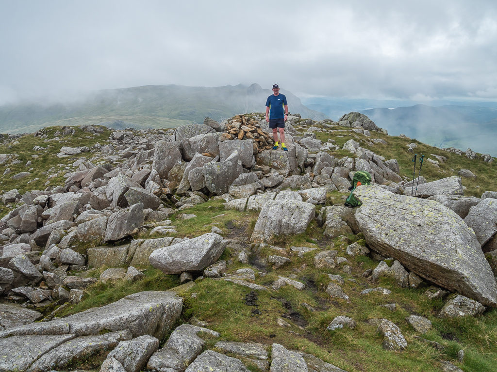
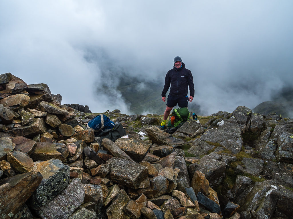
Reaching 903 metres, it was complete white out on the rocky summit of Bowfell.
But as luck would have it, the cloud again began to lift revealing impressive views of the surrounding valleys.
A sudden break in the cloud reveals far-reaching views of Eskdale to the southwest.
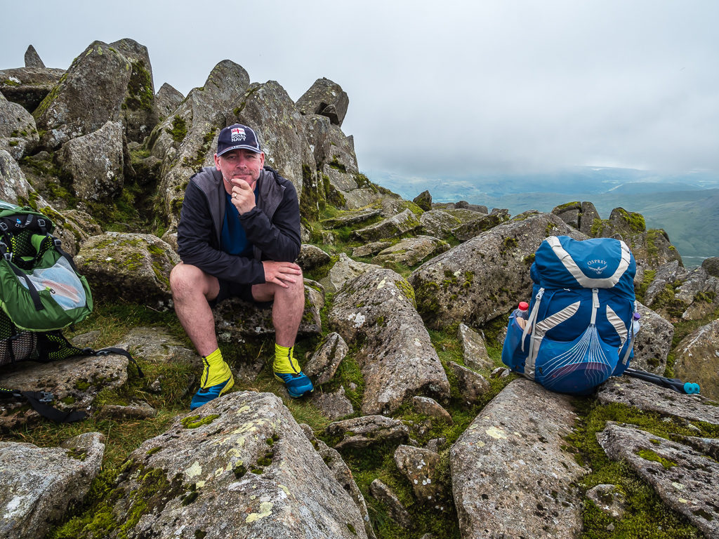
Making use of the boulders and stopping for a spot of lunch.
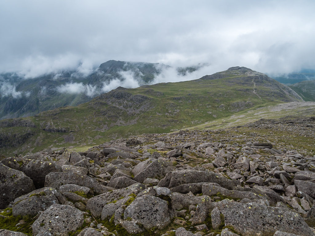
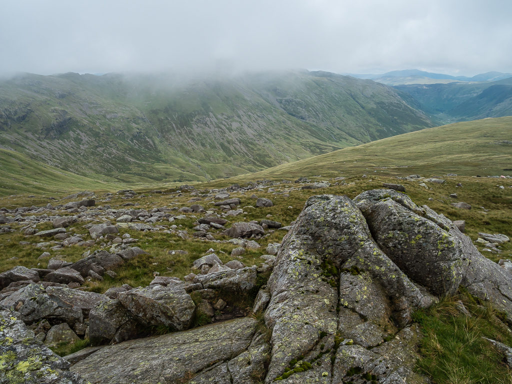
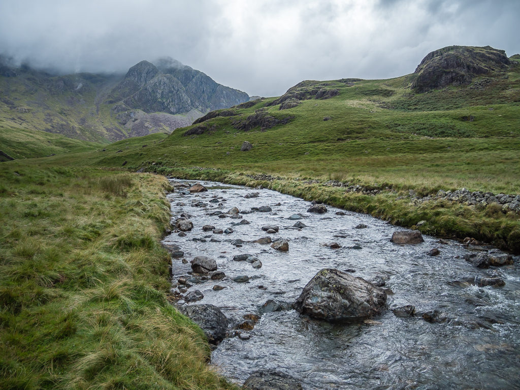
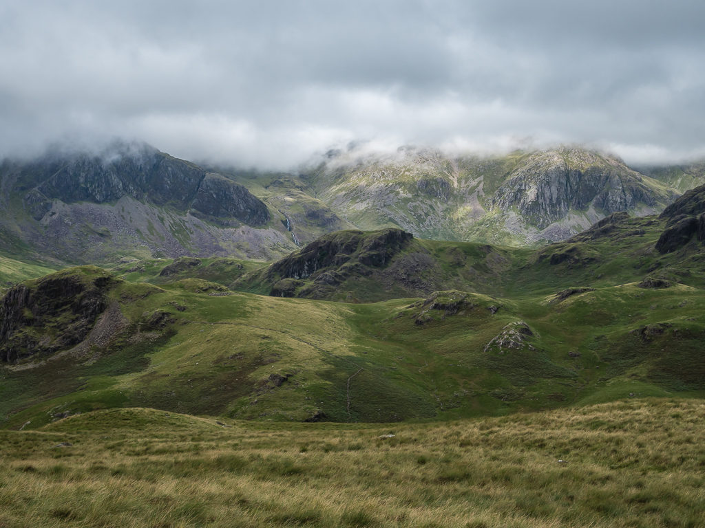
Looking across to Esk Pike, Great End and the Scafell range.
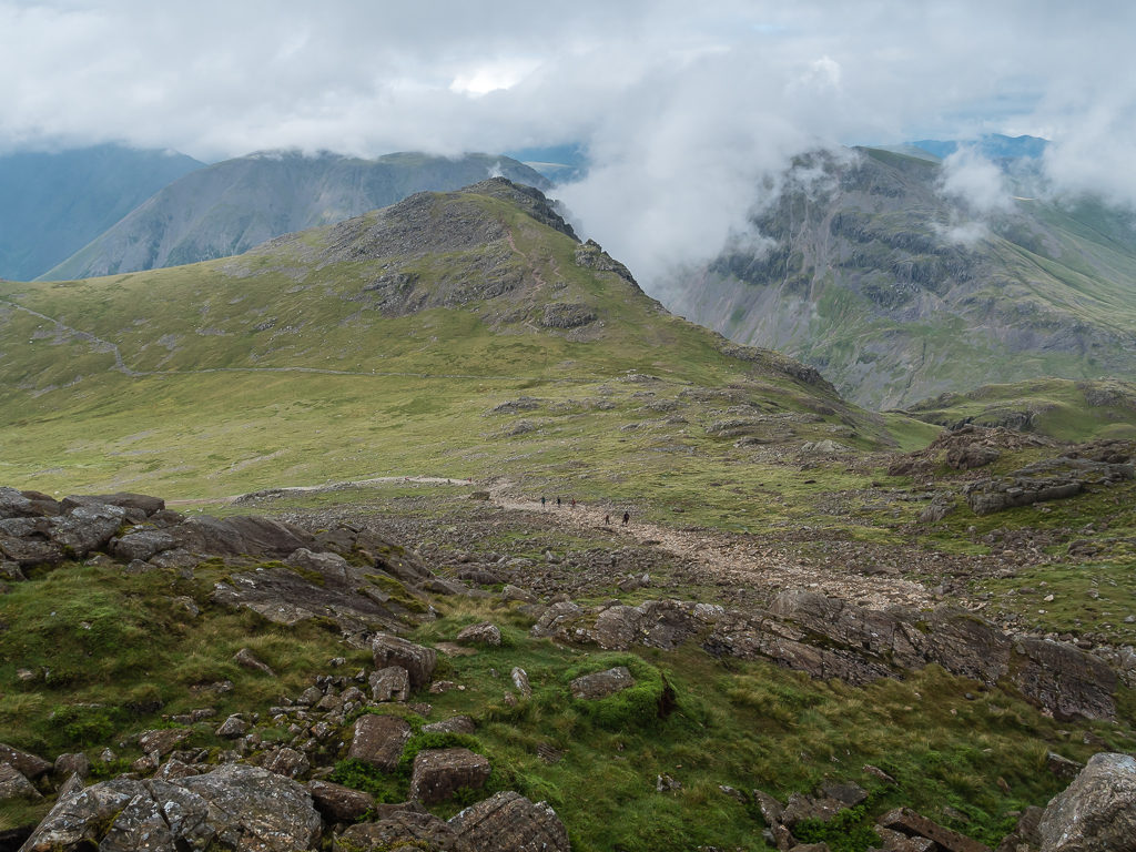
Carefully descending the stony track and taking the path back down to Ore Gap, we then climbed up to Esk Pike at 885 metres. Unfortunately, we weren’t as lucky with the view, so descending to Esk Hause and the junction leading to Allen Crags, we pushed onwards heading up the large open track busy with people coming and going in both directions, it being one of the main routes to Scafell Pike.
Leaving Bowfell and making our way back to Ore Gap – the col separating it from Esk Pike, in readiness for the climb up to the summit.
A series of steps rise up from Ore Gap leading to a striking, stony expanse.
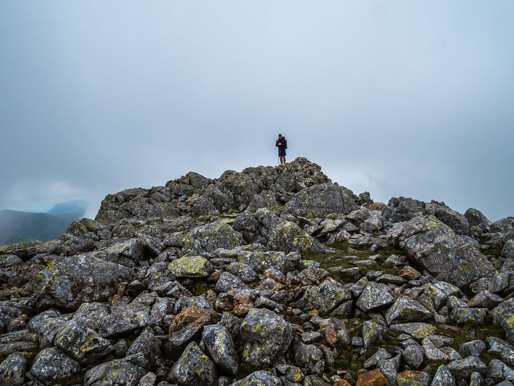
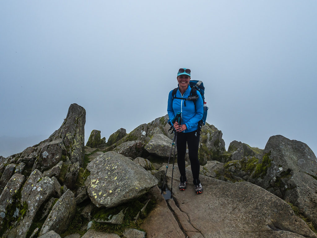
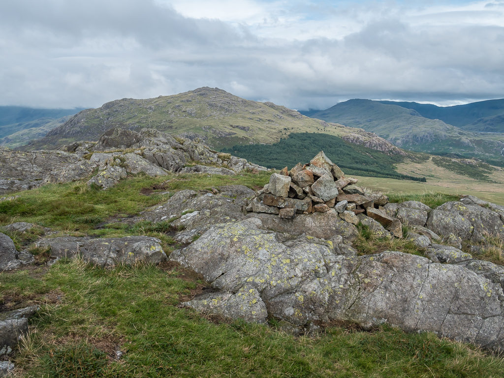
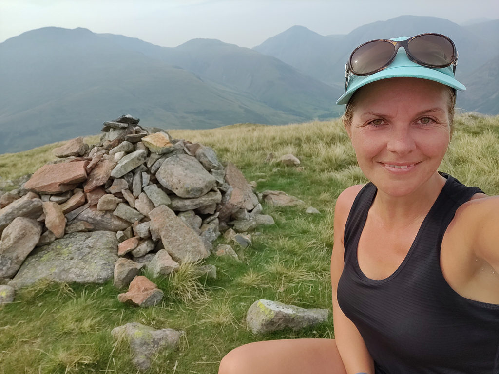
Another peak in the bag – on the summit of Esk Pike at 885 metres.
Keeping tally – This was our 27th summit on our latest walking challenge!
Looking towards Ill Crag from Esk Hause.
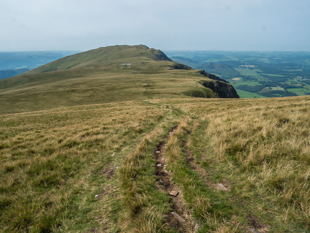
A wide track leads from Esk Hause towards Scafell Pike, which was the busiest trail so far with people walking the popular route up tp Scafell Pike.
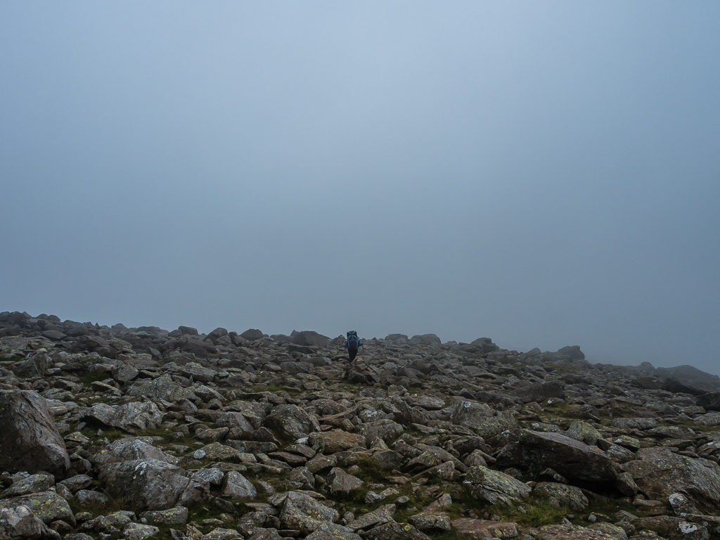
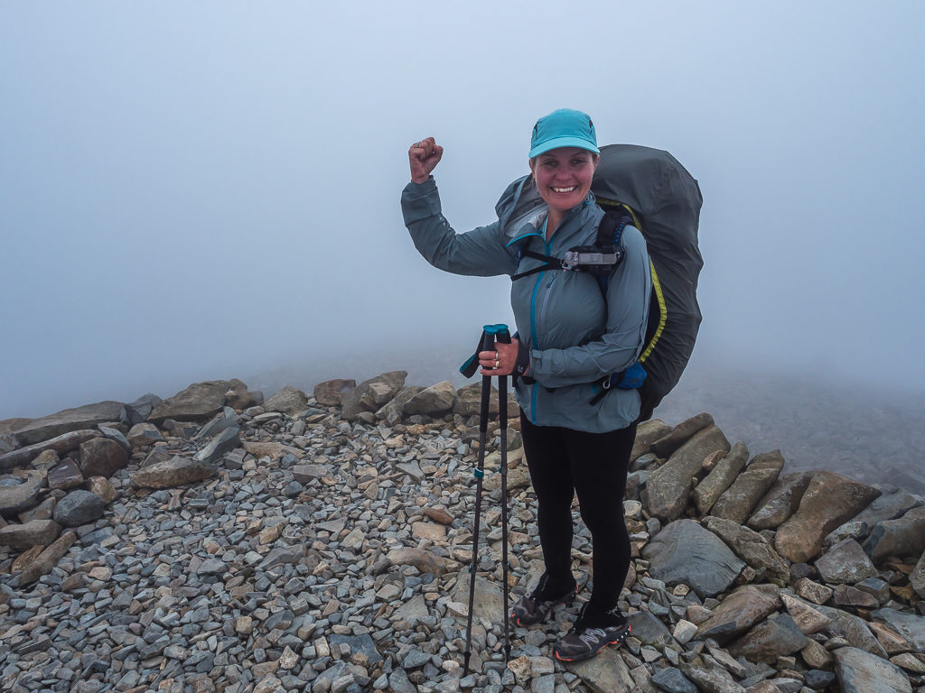
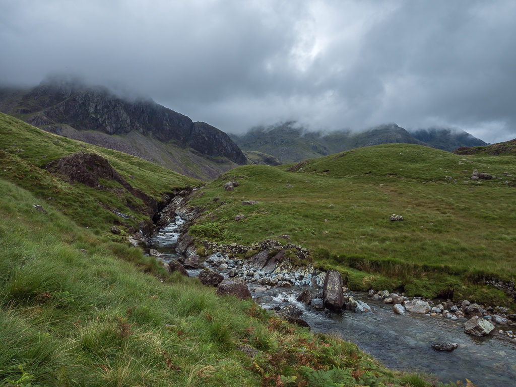
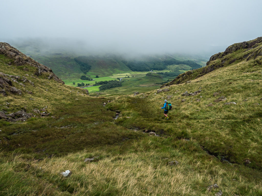
Stopping along the track to filter water from Calfcove Gill, we could then barely see but a few feet in front of us as the low cloud was causing such poor visibility, Because of this, we then unwittingly missed the turn off to Great End (907m). As we had already walked between Ill Crag (930m) and Broad Crag (934m) before realising, we didn’t want to turn back. So we continued down the path and instead of going straight up to the summit of Scafell Pike, we descended through a gully to where our path crossed the Corridor Route in order for us to hike up to the summit of Lingmell (749m).
Part of the descent was on loose scree, which was a little unnerving as the ground was so wet and even more slippery. At that point we couldn’t see much ahead of us either and it was difficult to orientate ourselves as we knew Lingmell has views out to Wast Water on its western front. With low cloud now also bringing a continuous drizzle that was quick to soak us through, and with us expecting little or no visibility from the summit, it seemed kind of futile descending over 200 metres to then have to regain all that height to get back up to Scafell Pike at 977m. But as we’ve never summited Lingmell before, it was definitely a peak we wanted to bag regardless, so we pushed on.
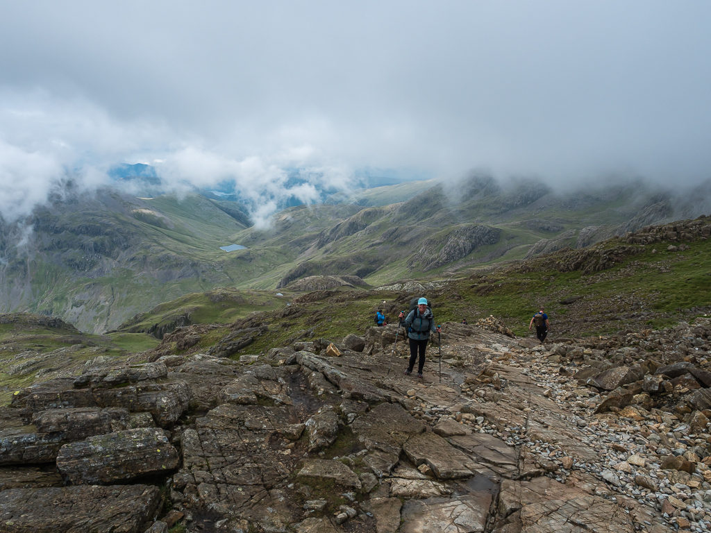
It was a bit of a trudge to reach the top and when we finally got there it was windy on the summit, so we layered up and decided to sit on the rocks and have a snack break. To our sheer surprise, it was then that the clouds began to break once more. At first we had just fleeting glimpses of Yewbarrow as the the mist parted, before the waning clouds then revealed far-reaching views out to Wast Water. Once again it was as if our timing couldn’t have been better! Even better still was when we started our descent and were treated to a clear view directly ahead of us leading straight up the giant wall of rock that is Scafell Pike. With our eyes looking skywards, we could see tiny dots of people both on the summit and walking across the fell top akin to a line of busy soldier ants.
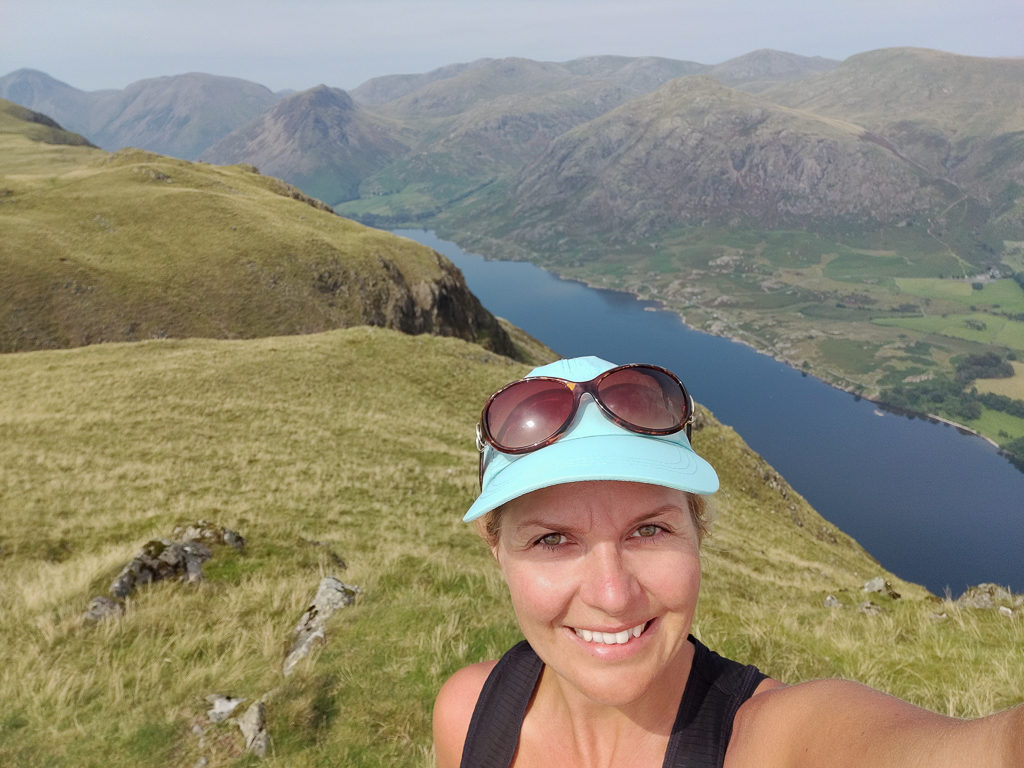
Despite summiting Scafell Pike and several other southern fells previously, it was our first time ascending Lingmell, so despite the poor view at that point we were still excited to have bagged another new peak.
A fleeting glimpse of Wast Water from Lingmell.
It was both cold and windy on the summit of Lingmell so we had to layer up once more.
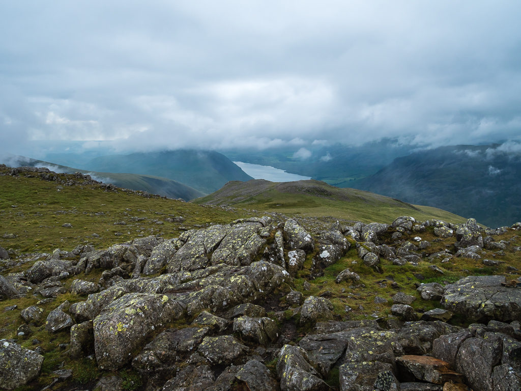
Looking towards Seathwaite and Styhead Tarn.
We had certainly accrued some good karma as by the time we descended from Lingmell the cloud had completely dispersed affording us excellent views of the Scafells!
It was then that Wayne slipped on a rock and landed straight on his derrière. He got straight back up again and it didn’t seem serious, except that when he walked over to me his hand was bleeding. We had a look and on close inspection we could see that he had split the skin right between his little finger and third finger. It looked deep, but it was a clean cut, so we just anti-septic wiped and strapped his fingers together with tape to encourage the cut to knit back together as it was in such an awkward place.
Rejoining the main path to Scafell Pike, it seemed like there were more people going down than were going up, as should be the case when it was nearing 5pm. It had taken us a lot longer than expected to cover today’s ground and we still had two more summits to go after Scafell Pike.
Looking back towards Lingmell as we began our climb up Scafell Pike.
The stony track is clear and easy to follow in good visibility and height is gained quickly.
By the time we reached the summit, in this instance we were flat out of luck as it was in complete white out. It also seemed like another world up there as the top was getting battered by strong winds, which made it feel much colder. We were glad to have on our waterproof coats and after taking some quick summit photos, we made a hasty exit down. Today’s peak bagging was not yet over however as we intended on also summiting Scafell (964m) and Slight Side (762m), two peaks we have hiked up on previous jaunts in the Lake District but in much better weather.
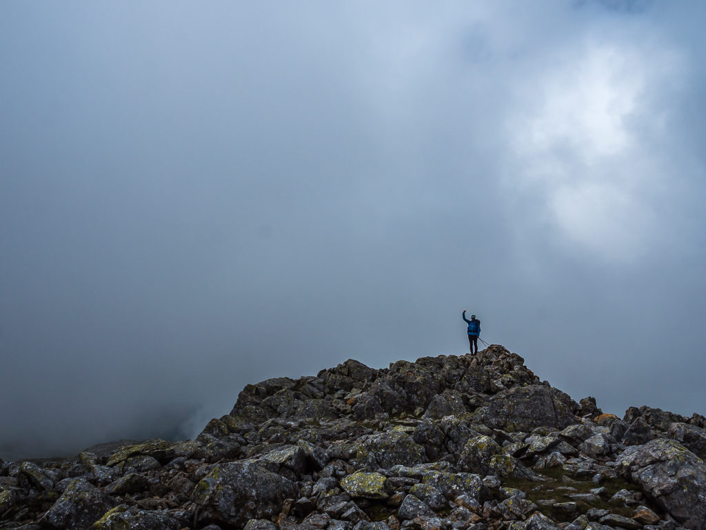
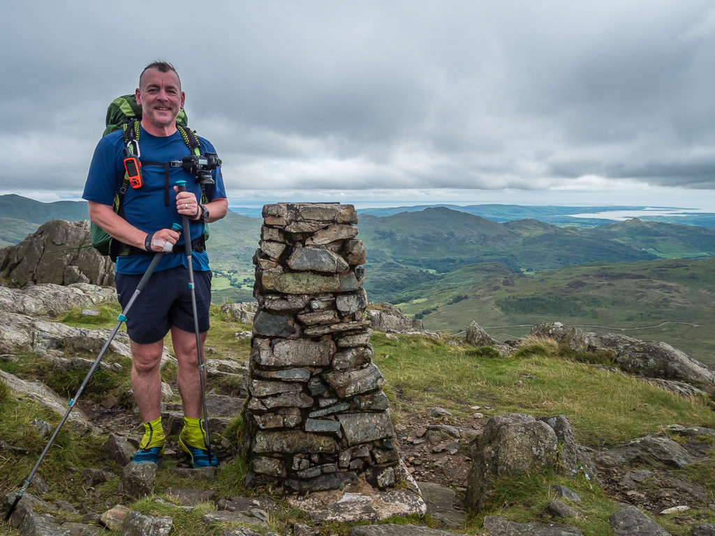
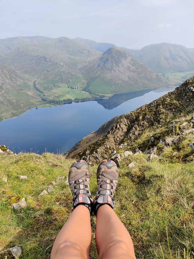
Bagging England’s highest mountain for the second time.
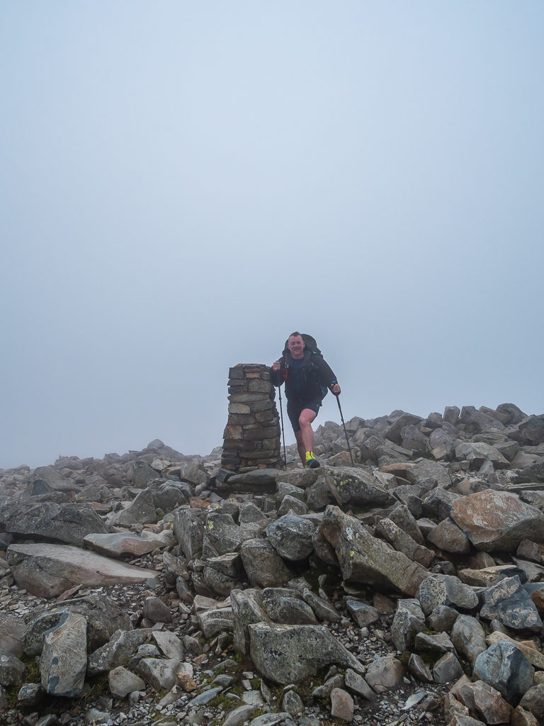
Reaching the summit cairn on Scafell Pike at 977 metres.
It’s not so straightforward to get over from Scafell Pike to Scafell however. We didn’t fancy taking the route across Lord’s Rake – from what we’d read about it previously, it’s more of a scrambling route and not for the faint-hearted. Maybe with day packs on, but certainly not in these wet weather conditions with poor visibility. So instead, we had planned on taking the Mickledore route around Broad End, hiking up a gully to Foxes Tarn, from where we could then follow a track leading up to the summit of Scafell. What we hadn’t realised however was that with all of the wet weather of late, the gully now had a huge waterfall flowing down it, having become the outlet to a bursting Foxes Tarn.
Already taking slow and tentative steps down the wet scree path, as well as carefully placing our footing on the large, slippery boulders that we had been crossing – the waterfall situation in the gully did not bode well. That was our route up and our only access onto Scafell, other than walking all the way around the mountain to a different path, which at this late hour we didn’t have time to do. (After almost 18km and so much elevation change today, we didn’t have the inclination either!)
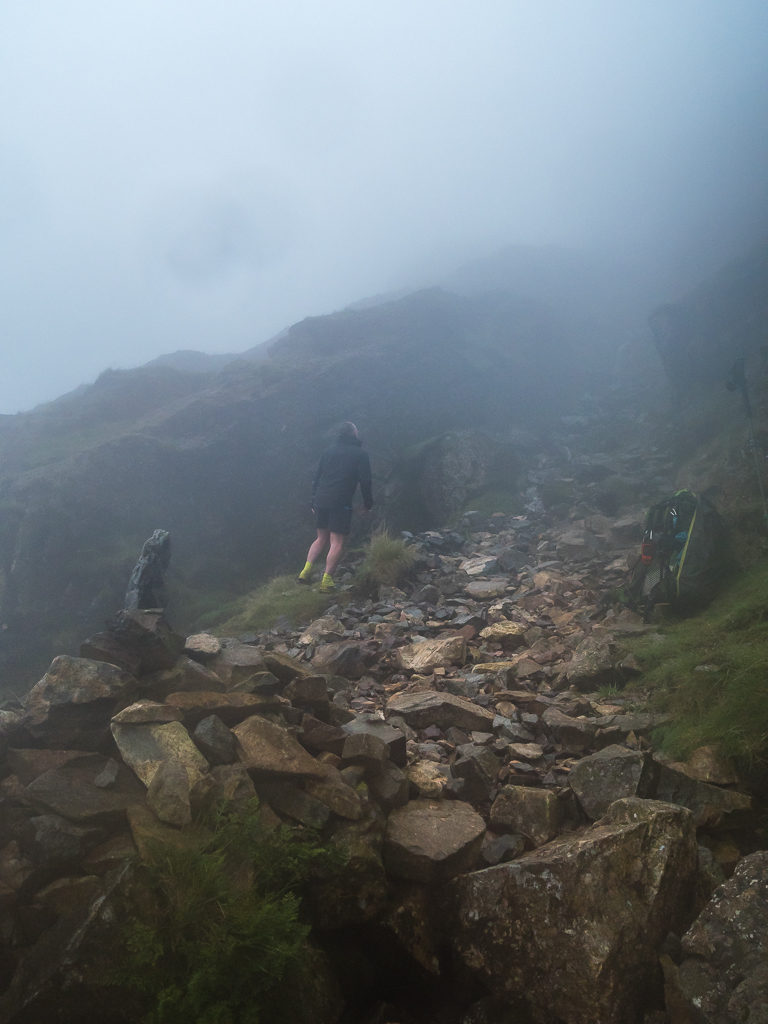
With our cameras now stowed away in our packs, this was a quick phone picture to show the change in conditions after descending Scafell Pike via the Mickledore route. Wayne is looking up at the ‘path’ to Scafell, which is actually a rock strewn gill with no real discernible path.
So what to do now? I was in two minds to risk it and try the scramble up. But thankfully Wayne disregarded my crazy idea just in the name of bagging a summit we had actually already been to before! He was right – wouldn’t we be the fools if we suffered a serious injury continuing on in such poor conditions and had to call out Mountain Rescue.
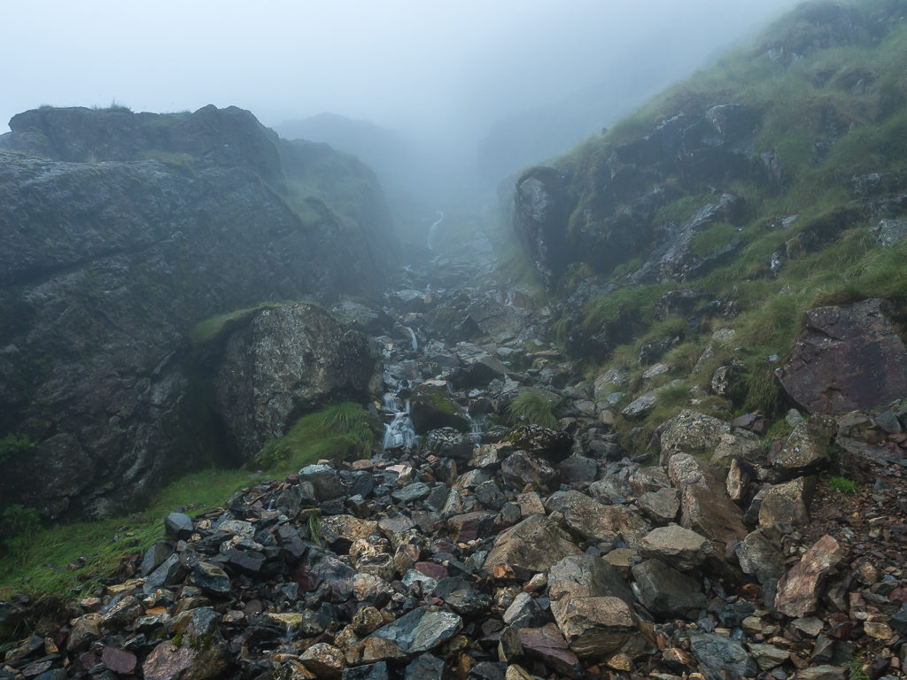
With poor visibility and in such wet and slippery conditions, we decided against scrambling up the gully which was currently a gushing waterfall.
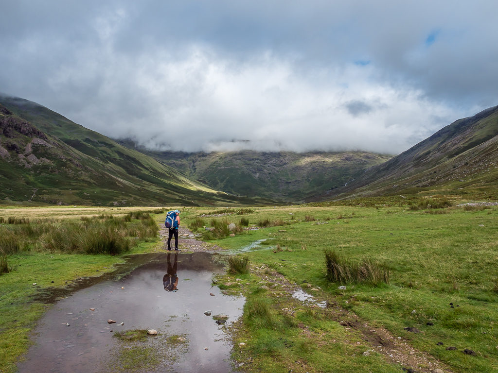
Neither did we want to climb back up to Scafell Pike after already descending about 150 metres, so we had to come up with a new plan and fast. Consulting our map, we decided to keep on hiking down towards Cam Spout and the River Esk as there was a red dotted line signalling a route. This would eventually join us back up with our original route after about 5km. With it now nearing 7pm, we decided that we didn’t want to push on that far as we were tiring and feeling very wet, so we would look out for any potential wild camp spots as we went, with a view to changing our route and making new plans when we were fresh in the morning. It would also give us the chance to see what the weather conditions were like seeing as rain had not been forecast today, yet we had been rained on for the last couple of hours!
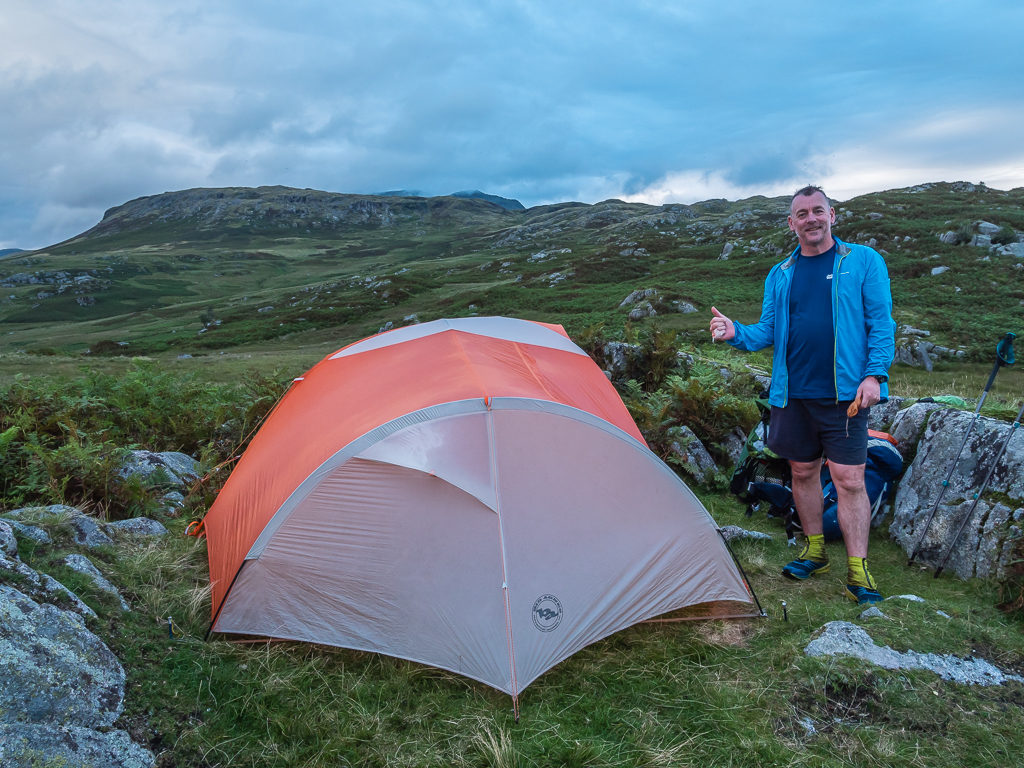
We decided it was a good plan, except that the area we were heading down to was called ‘Great Moss‘, so the potential of a wild camp spot seemed slim as the whole area was one giant bog. After giving up trying to dodge the worst of it seeing as our feet had already been wet for hours, we thankfully came to an area 375 metres in elevation called Sampson’s Stones. It was a grassy bank high enough above the bog that it drained well and the grass was suitably dry to camp on, with several ‘erratic’ boulders dotted here and there. We found a tremendous one to pitch behind that would offer us both wind protection and privacy from the trail, then set up within minutes, glad to have finally stopped for the day.
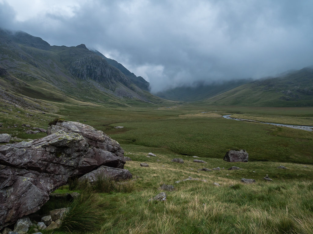
Having descended to Great Moss, we were now in the vast valley of Eskdale.
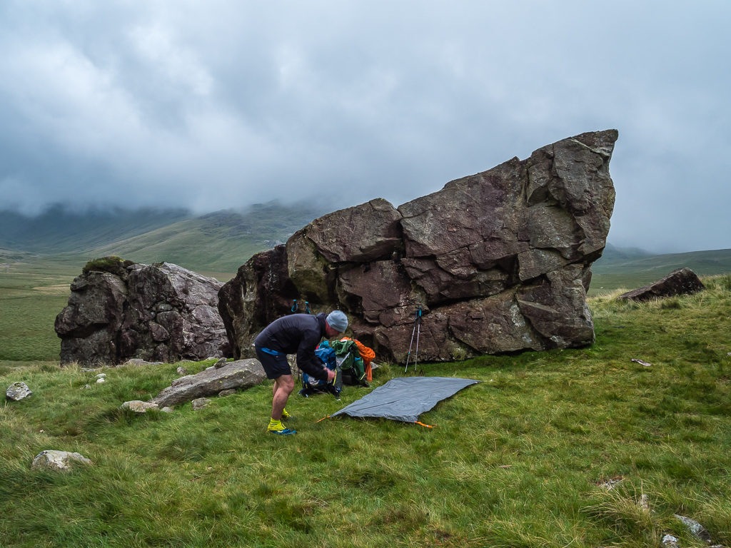
Setting up camp within the area known as Sampson’s Stones.
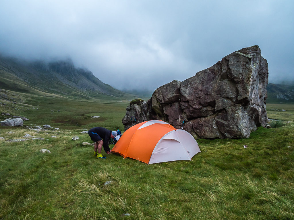
The large stone provided us with some much needed shelter and had it have been better weather, we would have appreciated what a wonderful spot it really is below the Scafell range looking towards the Upper Esk.
A hot cup of soup later followed by a bowl of rice and Katsu curry and all was good in the world again. Or nearly – if only our shoes and socks would dry out! (Putting on cold, wet shoes in the morning is never a good experience.)
It seemed that our daily itineraries were proving much tougher than we had anticipated. Where we could work out our timings precisely on the PCT walking 3+ miles an hour where the trail was good and we were at peak fitness, even estimating generously at 3km an hour here in the Lake District, we were hard pressed to keep to it. The terrain was proving to be so much more tiresome and navigating our way through bog was really slowing us down. Where we had achieved our intended summits and distances we had been walking for between 10 and 12 hours a day – now that isn’t a holiday!
We agreed that we had completely underestimated this whole undertaking. 214 summits in 4 weeks – it sounds so feasible on paper and when you think of the likes of Steve Birkenshaw and Paul Tierney running the entire route in under 7 days – how could it be so difficult? Well, just from this week alone we have such a renewed respect for fell running and fell runners in general as athletes. These guys in particular are machines! Being hampered by both the weather and terrain, we had to admit to ourselves that our goal in this instance just wouldn’t be achievable – especially as we didn’t have the option of extending our time period with me starting back at school for the new term on 1st September. We were loathe to say it, but it was time for a rethink and to come up with Plan B!
Friday 7th August 2020, Wild camp at Sampson’s Stones to Wild Camp at Eel Tarn, 24.5km
Peaks bagged: 30. Hard Knott (549m), 31. Harter Fell (653m), 32. Green Crag (489m)
Again, our Garmin weather forecast had stated just a 10% chance of rain for today at our specific location – well that 10% was winning out as we awoke again to low cloud and a wet tent. It was so disheartening after the weather forecast for the week ahead having looked much brighter. So instead of hurrying to get packed away, we wiped down the tent and brewed a hot drink in the hope that the cloud would lift and things would improve.
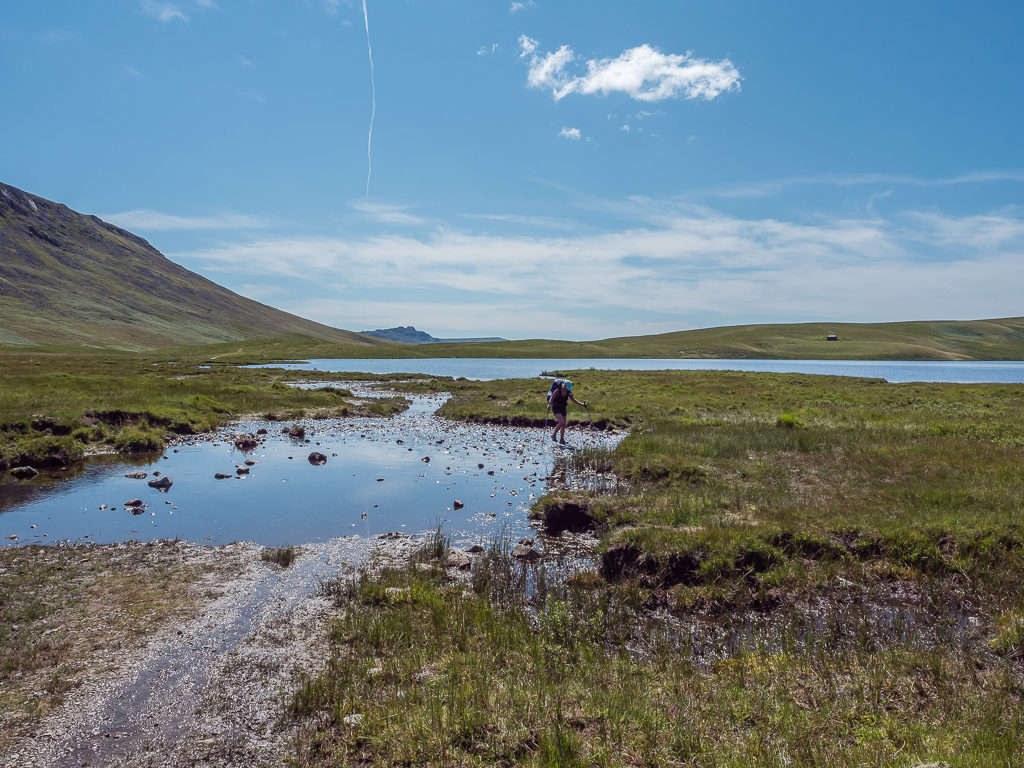
Indeed, by the time we set off the cloud had lifted somewhat and it was dry – except for our feet that had already waded through several sections of bog just to get from Sampson’s Stones to Green Crag where we then found ourselves having to make our first river crossing!
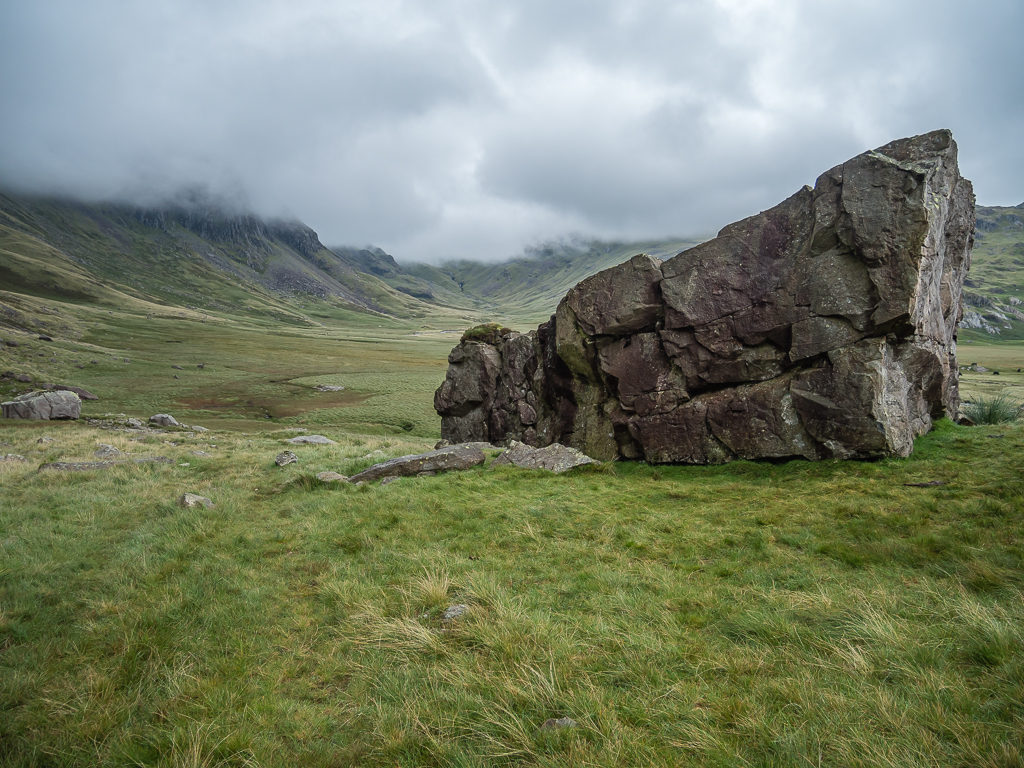
‘Leave no trace’ – The following morning after we had packed up and were ready to leave camp.
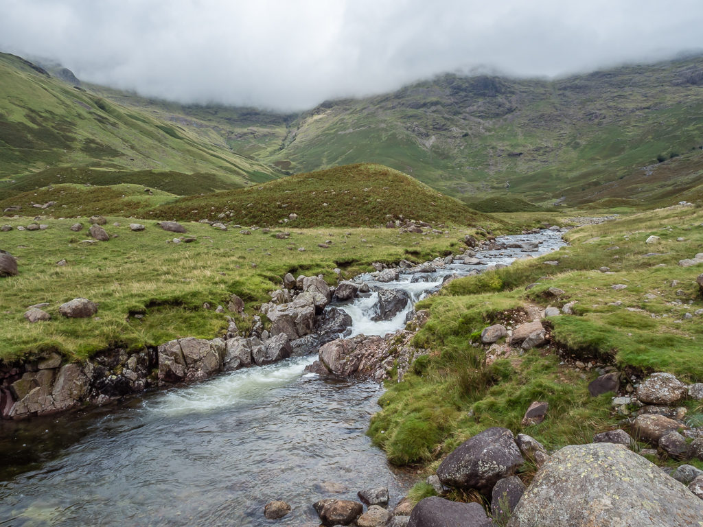
The River Esk flowing through the Upper Esk valley.
Realising that we needed to cross the river at some point in order to reach Hard Knott, which was to be our first summit of the day based on our newly revised plans.
Another day on trail and another boggy walk! There was no avoiding it this time.
Looking back after following the course of the River Esk in Upper Eskdale with the Scafell massif in cloud on the distant left.
We decided that this was the best place to cross the river, so with our feet already wet, we just waded on through.
Hiking down to Esk Falls, we then had an uphill climb to Hard Knott (549m), which would be our first new summit of the day. Our revised plan was to try and bag all of the Wainwrights we hadn’t previously done to relieve some pressure! With us having already hiked over 100 Wainwrights prior to this trip, this new target would hopefully give us some slack with the weather and allow for shorter hiking days where we could at least get to camp by 6pm. Even by reducing the number of summits we would have to traverse, given the current climate and conditions, we still believed it to be a tough challenge to complete within our timescale.
Happier with our revised plans which now seemed much more achievable.
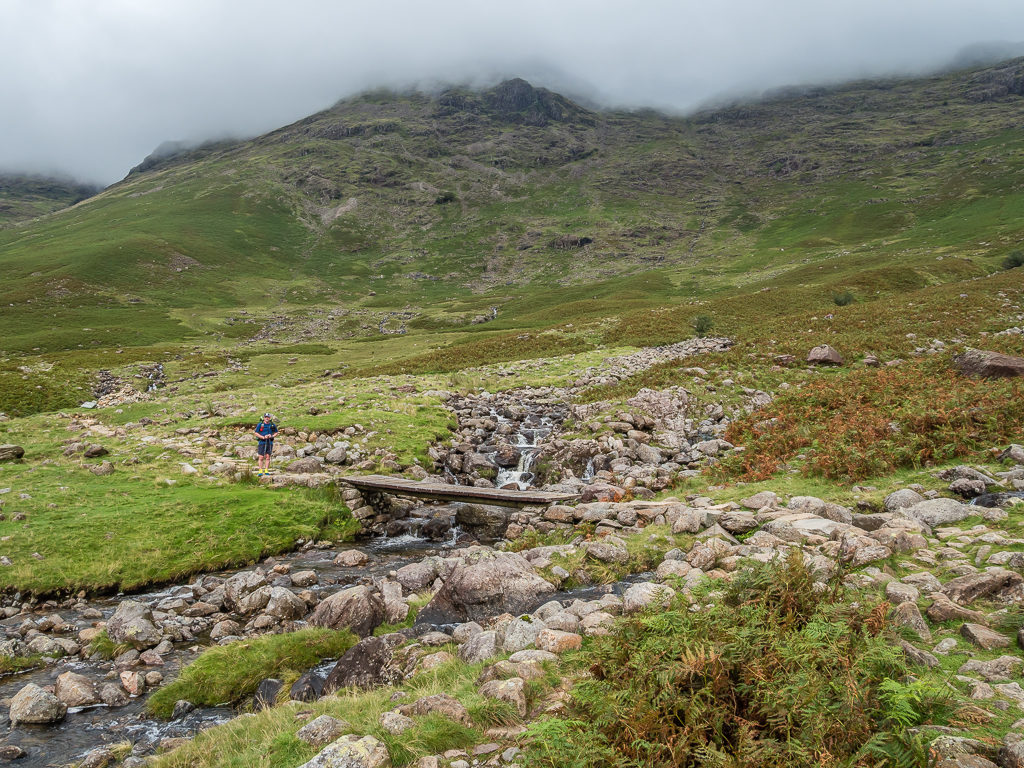
Just before crossing Lingcove Bridge en route to Hard Knott.
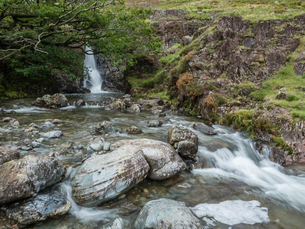
The lovely waterfalls along Lingcove Beck showing just how much rainfall the Southern Lakes had endured over the past week.
This summer’s hike was proving to be very different to the hot, dry days we enjoyed in the Pyrenees last year.
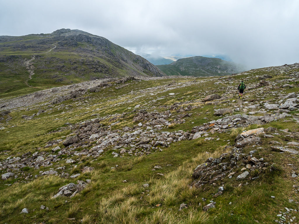
Following Lingcove Beck, we gradually made our way uphill, all the while looking for an obvious footpath leading to Hard Knott as there isn’t a marked trail going southwards to the summit.
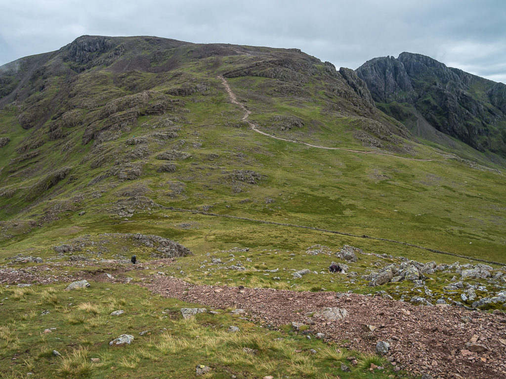
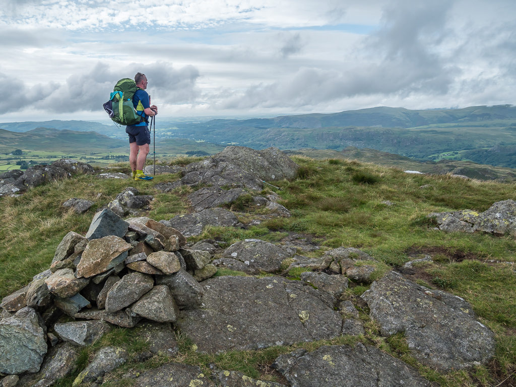
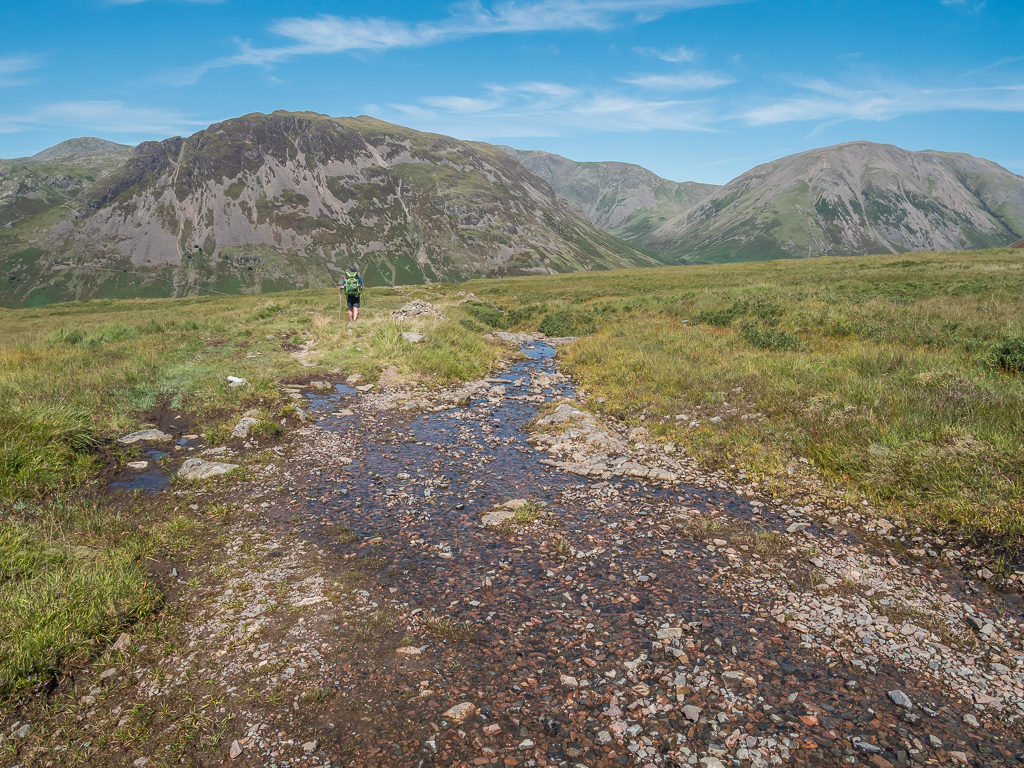
Finally reaching the summit of Hard Knott, it was a dismal scene with the mountain top covered in clag. So after our obligatory summit photo, we hiked down to Hardknott Pass in readiness for our second climb of the day up to Harter Fell at 653 metres. By the time we had made it partway, the sun had made an appearance and the weather on the whole seemed much improved. The cloud layer had also lifted so now we could see the summits all around us and once we had made it to the top of Harter Fell we could even glimpse the sea.
From the summit of Hard Knott, looking towards Crinkle Crags in the distance.
There were no issues identifying Hard Knott’s summit, it was just a shame there weren’t any views.
Descending from Hardknott Pass with views down to Eskdale and a long walk to Harter Fell ahead.
Enjoying the well-trodden, grassy path underfoot as we knew there was lots of bog to come!
Following the faint path between Hard Knott and Harter Fell. It was to be our second summit of the day and it was already early afternoon.
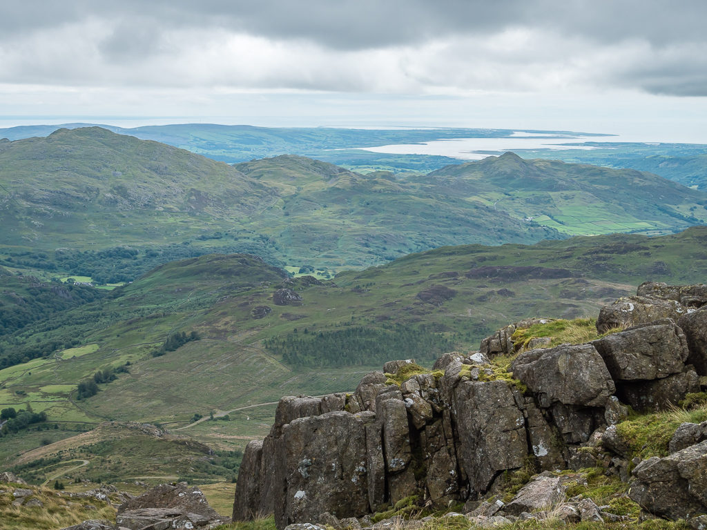
In clear weather, from the summit of Harter Fell it is possible to see Green Crag, Devoke Water and Morecambe Bay in the distance.
Looking back towards Eskdale. It had felt like a long traverse from Sampson’s Stones!
An obligatory photo at the summit trig pillar with the rocky outcrop behind, which is the highest point at 653 metres.
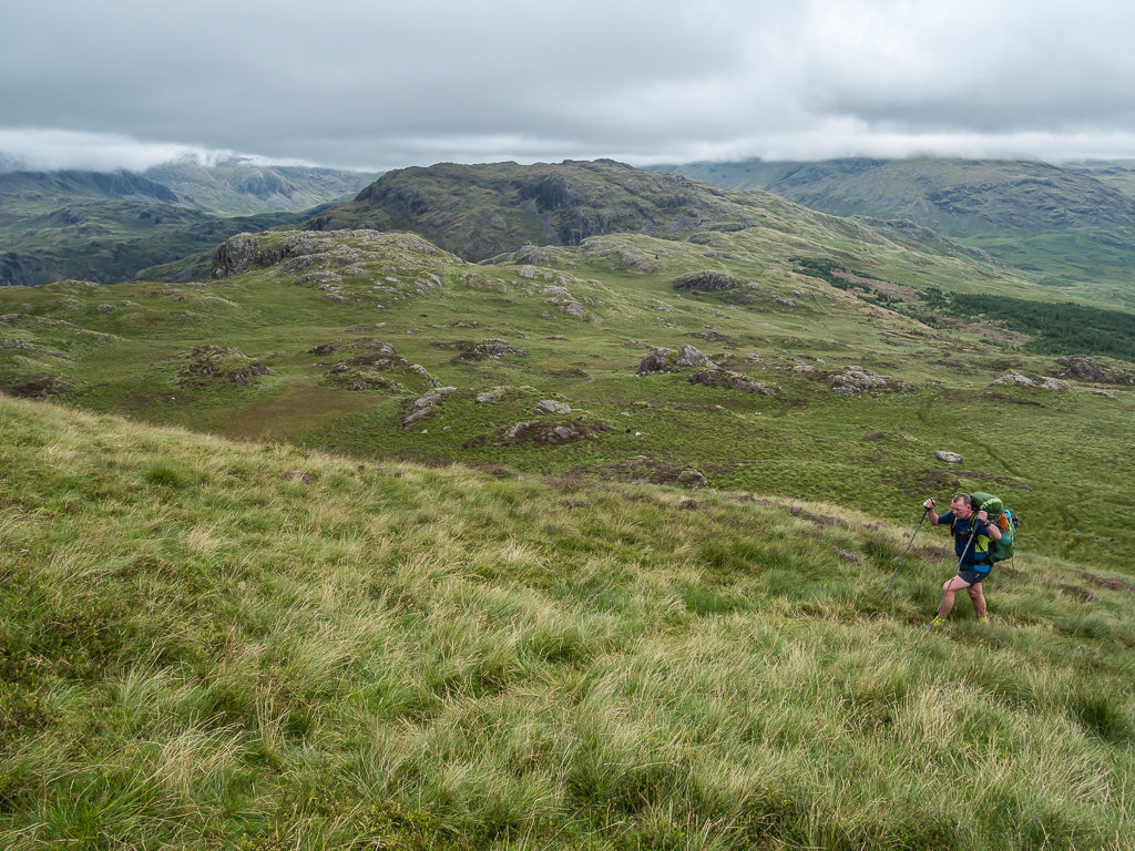
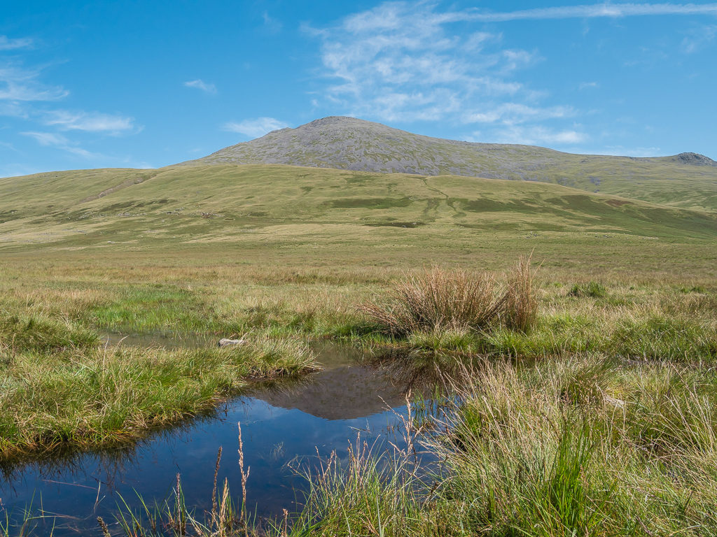
After taking a rest stop to have some lunch, we then had a long walk out to the top of Green Crag (489m) (a different Green Crag to that we had passed earlier), walking through Harter Forest followed by a long trudge through an extensive section of boggy ground leading right up to the crag. It was bearable as we had nice views and we could at least see the summit we were heading to, but after so much effort to get there, Wayne did question Wainwright’s choice of summits in this instance. I on the other hand was happy due to the fact we got a phone signal at the top, so was easily pleased! I guess he picked it for the far-reaching views out to Morecambe Bay, plus you can look straight back at the summit of Harter Fell, and also see the Coniston fells to the southeast.
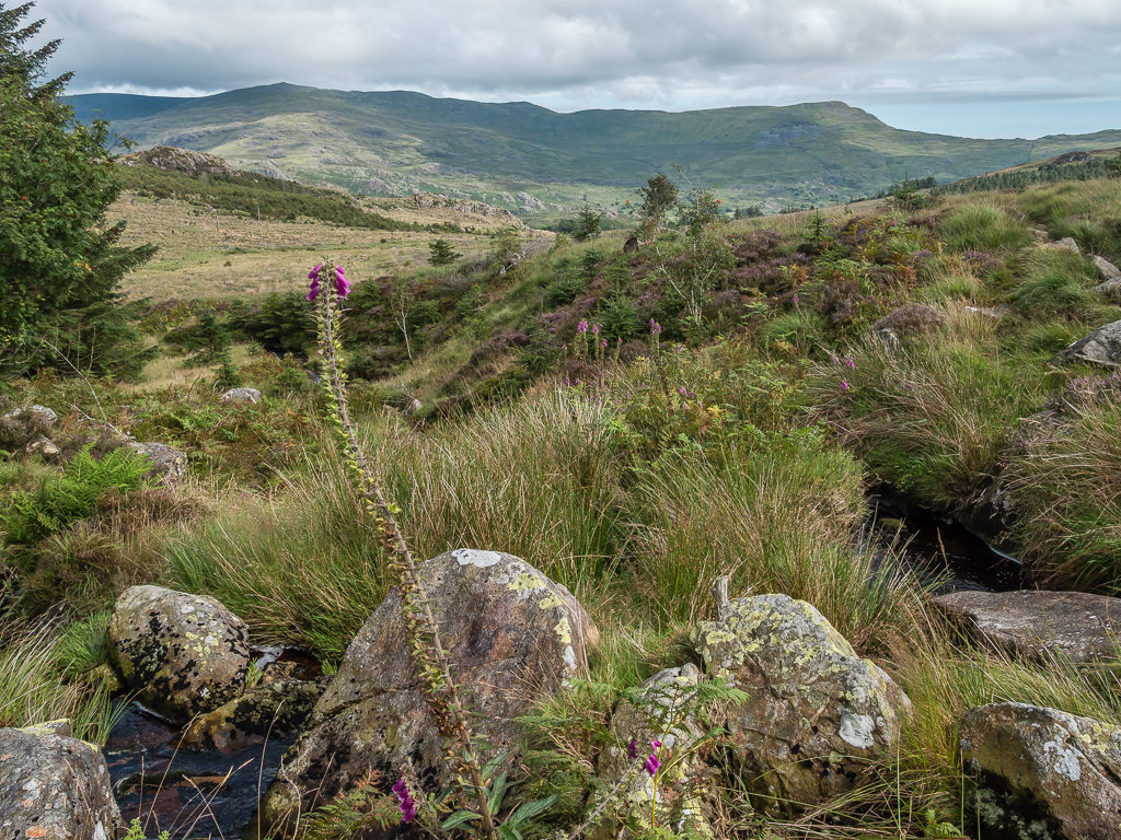
It was a scenic walk over to Green Crag, despite the worsening trail conditions.
After a lengthy section trudging through thick bog, Wayne questioned Wainwright’s choice of summits in this instance!
The unimposing summit of Green Crag with Harter Fell beyond.
At 4pm, it was just our third summit of the day, but it was the most taxing to get there.
From Green Crag we had then decided to hike down to Eskdale and see if we could get in at the National Trust campsite at Boot. Due to the Coronavirus, we thought it highly unlikely however as a lot of campsites remain closed to tents, or they will only accept pre-booked pitches. So if not, we would have to push on to Eel Tarn, about a kilometre or so further for a wild camp spot. On Wayne’s original plan, we would have had 9 summits in total to traverse today – so after Green Crag, there would have still been 6 more to go! The fact we hadn’t even got to the summit of Green Crag until 4pm really said it all. We had certainly given ourselves a challenge that was pretty much unachievable unless we were hiking 20+ hours a day! With our heavy packs full of luxuries, we are by no means fell runners and certainly not walking machines, no matter how much we like to think so!
Passing Low Birker Tarn on our descent to the village of Boot in Eskdale.
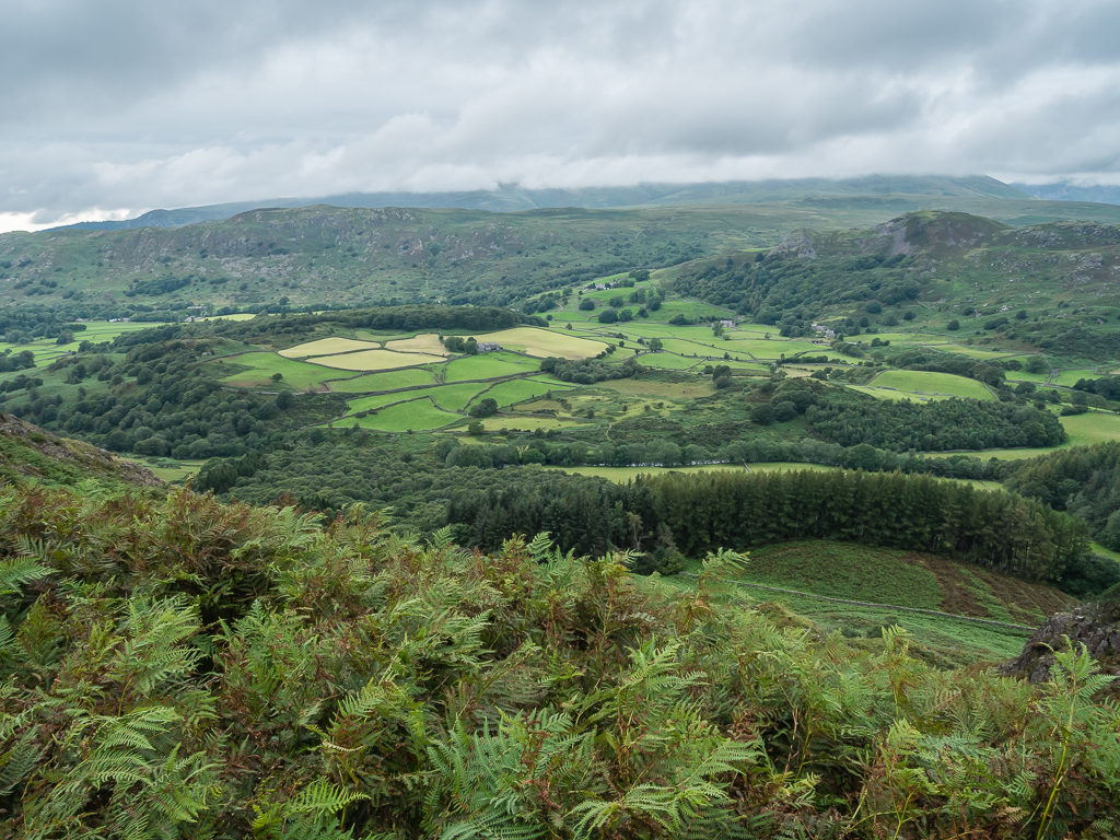
Looking out over the managed pastures in Eskdale.
The sun was finally shining as we reached the valley floor.
Thankful for the bridge after already enduring wet feet for several hours!
Enjoying the woodland scenery and some incredibly large trees.
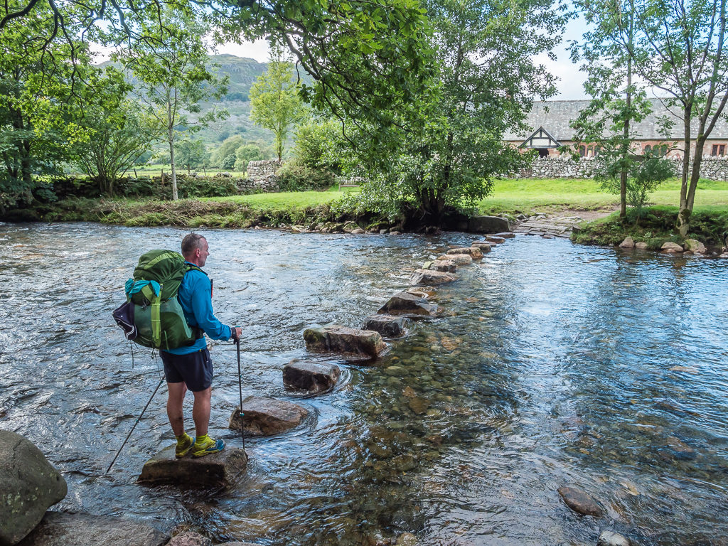
Stepping stones across the very full and fast flowing River Esk in order for us to reach the village of Boot.
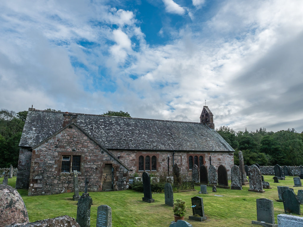
Tucked away by the river is Saint Catherine’s Church dating from the 14th Century, just a short walk from Boot village.
The campsite at Boot was a no go – there was a sign saying ‘Campsite Full. Pre-Bookings Only.’ We were still going to chance it and ask at the Reception if they had a spot for walkers, but we found it had closed at 6:30pm. It was already 6:50pm when we arrived, so we had missed it by 20 minutes. Oh well, onwards we must go!
Wayne really wasn’t feeling it now. He said his stomach felt dodgy and he was worried he was going to have diarrhoea, so we pushed on quickly to reach Eel Tarn by 7:30pm. By the time we had pitched and had a quick dinner of vegetable soup followed by a bowl of cous cous with a fried egg on top, it was past 9pm, so we had another late finish without any time to relax at camp.
Debating whether or not our tent would fit in this small enclosure near to the outlet of Eel Tarn.
Thankfully, in spite of the addition of our large vestibule – the tent did fit!
For tomorrow we had planned on summiting Illgill Head and Whin Rigg on the southern side of Wast Water as they are two fells we are yet to explore. We then wanted a lazy afternoon around the lake where we could do some laundry and have a rinse, followed by a hike up Yewbarrow for a wild camp. As our favourite fell top in the Lakes so far, we thought it would be the perfect opportunity to spend the night up there. One day, three fells – now that seemed much more manageable…
Saturday 8th August 2020, Wild Camp at Eel Tarn to Wasdale National Trust Campground, Wasdale, 9.6 km
After Wayne thinking he felt a lot better on reaching camp last night, he was actually up several times in the night desperate for the toilet, so he barely got any sleep. Yes, diarrhoea had reared its ugly head on the trail. I felt absolutely fine, so we discounted it being from something we had eaten and we also didn’t think it was from the water we’d been drinking as we had filtered every time since purchasing a new filter back in Ambleside.(This time we are trying Alpkit’s own version of the Sawyer Squeeze as it was very competitively priced at only £25 for the ‘Hippo‘, akin to the Sawyer ‘Mini’.) It also didn’t help that three other wild campers had turned up late after we’d gone to bed, blasting out music and talking loudly from their camp spot a little way off from us where they were pitched above the tarn. It’s amazing how sound travels in the eerie still of night.
Wayne therefore was still feeling rough in the morning and also very weak so we wouldn’t be bagging any peaks today. It was going to take him enough effort just to try and hike down to Wasdale where we were going to attempt to get a spot at the National Trust campsite. If not, we weren’t yet sure what we’d do as we wouldn’t be hiking up Yewbarrow with him in that state. Let’s put it this way – Wayne ended up having more stops for the toilet between our camp spot at Eel Tarn and getting to Wasdale than the actual number of kilometres we had walked to get there. Poor lad.
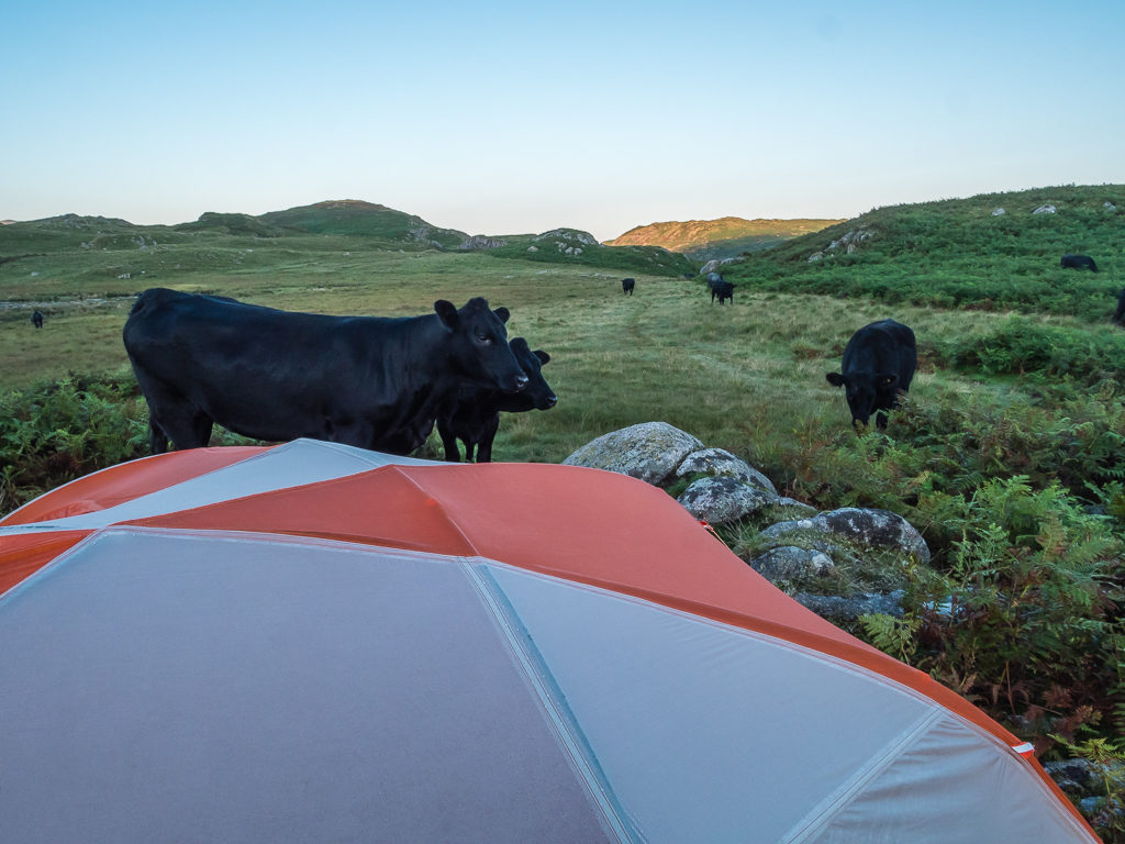
Waking up to a stand off with the local cows! Clearly we had pitched in their favourite spot.
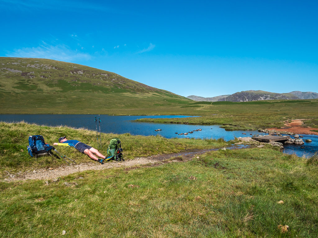
It was typical as well – today was the first day we’d had clear blue skies and the sun was shining. When we finally set off from camp at 9am (we’d been awake since 6am but had been taking things slow) there wasn’t a cloud in the sky and it promised to be a gorgeous day. Hiking along a decent path running parallel to Whillan Beck, we made it to Burnmoor Tarn after a few rest stops. It looked so beautiful in the midst of the surrounding peaks that we downed our packs and spent over an hour laid out on the grass in the sun admiring the view. I enjoyed the unexpected opportunity of topping up my tan whilst Wayne made the most of some time to recuperate. Scafell looked particularly stunning reflected in a rippling pool of bog water settled in the marshy area around the tarn.
Our first mission of the day was to take a slow and steady walk to Burnmoor Tarn and hope that Wayne could make it there without any accidents en route!
What a difference a day makes! It was wonderful to have clear, blue skies at last.
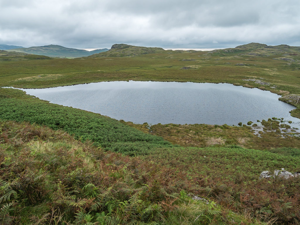
The beautiful Burnmoor Tarn.
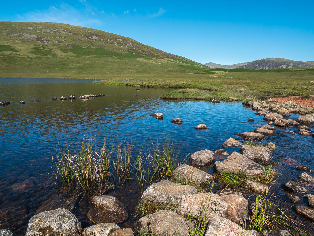
Burnmoor Tarn is one of the largest entirely natural tarns in the Lake District. Its waters flow into Whillan Beck at the tarn’s north-eastern corner, which immediately turns south and flows into Eskdale.
As Wayne had expended so much energy getting to the tarn, we decided on a long rest before attempting the next leg down to Wasdale.
After a much needed nap in the sunshine, finally setting off again for the campsite.
Today, a much less daunting looking Scafell reflected in a pool of bog water.
The final push was a gentle climb over a brow before descending into Wasdale at the north eastern end of Wast Water. We didn’t want to get our hopes up but we were really banking on the campsite finding us a spot. As it happened, we must have still had a surplus of good karma owed to us as they allowed us a pitch for two nights as walkers and even gave us a ‘green’ discount for travelling to the Lakes by train instead of using the car. So for 2 adults with a small backpacking tent for 2 nights, it only cost £34. That included hot showers and most importantly for Wayne, proper toilets! I was also excited that we could buy cold drinks from the on-site shop as I was desperate for a can of diet coke. I also wanted Wayne to have some coke too as it’s brilliant for killing stomach bugs. When you see what coke can do to a 2p coin – then you know it can really cleanse your gut! Fingers crossed it would do the job and he’d be feeling much better tomorrow.
After reaching the brow, the best bit about the next section of trail was that it was all downhill.
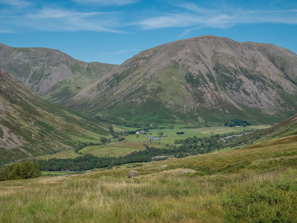
Looking towards the village of Wasdale Head flanked by the mighty Kirk Fell.
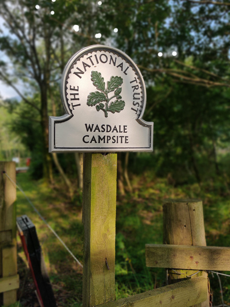
It was such a relief to at last reach the National Trust campsite at Wasdale and be told we could have a pitch for two nights!
If so, we intended on hiking back up the track to bag Illgill Head and Whin Rigg the following day whilst we were still based at the campsite as they were just too close to miss. But we wouldn’t know until the morning whether he’d manage to hike or not or whether he just needed another day to rest.
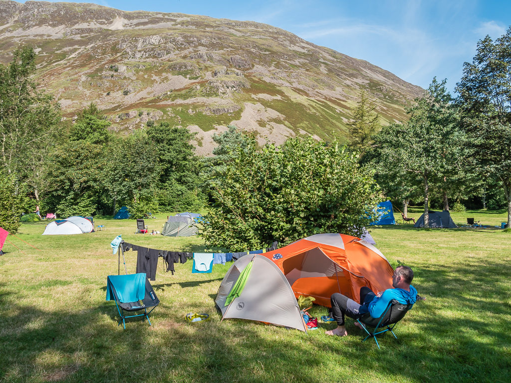
And rest he did. He spent the entire afternoon ‘recovering’ laid out by the tent napping in the shade, whilst I got to sit in my camp chair and read in the sunshine looking onto a fantastic view of Yewbarrow. Having carried them both for over 120km, it was only the first time that I’d got my chair and Kindle out since we had started hiking from Windermere exactly a week ago!
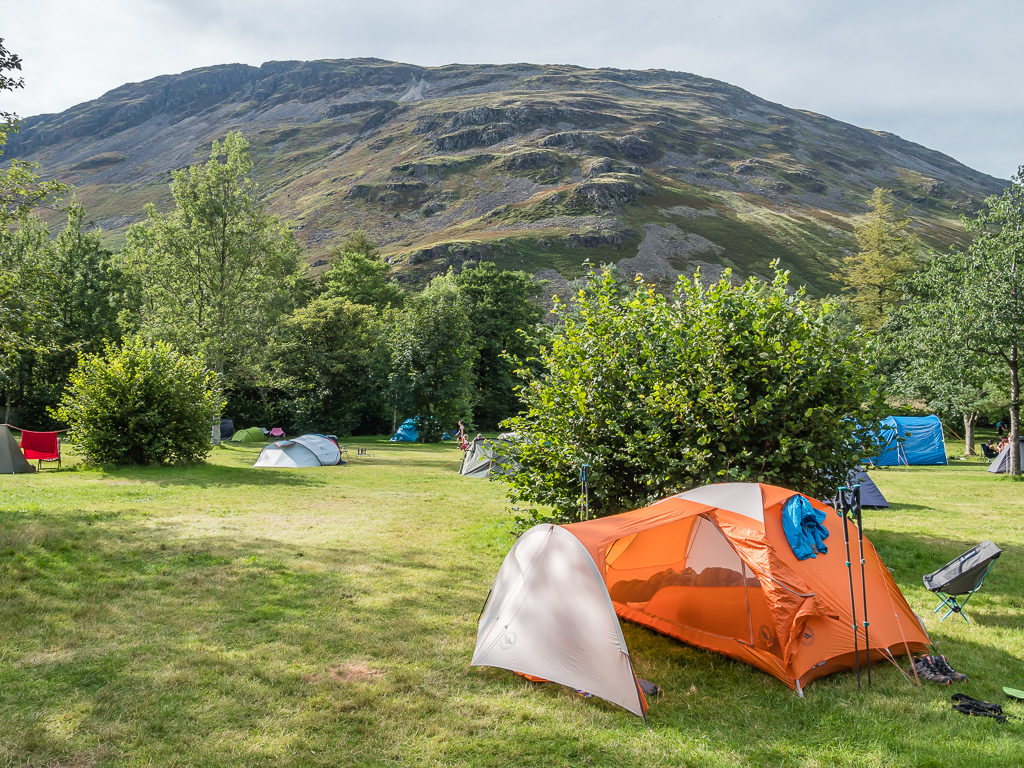
Our great camp spot looking directly onto Yewbarrow.
The positives of being in a proper campsite are of course the bathroom facilities, but the downside is having to smell everyone else’s barbeques and see people drinking wine and beer, which when car camping we would be wholeheartedly enjoying ourselves. Instead with our hiker rations, it’s not quite the same, and as Wayne still wasn’t feeling one hundred percent it was chicken soup on tonight’s menu for us! (Comfort food – that’s always a good stomach settler!) It would most definitely be an early night for the both of us and all we could do was wait and see how he would be feeling tomorrow…
Sunday 9th, Monday 10th & Tuesday 11th August 2020, Wasdale National Trust Campground, Wasdale, 3 zero days due to Wayne being ill.
Well Sunday came and went in a kind of blur. With blue skies and rising temperatures, all we did was spend the day relaxing (and in Wayne’s case -recuperating) here at camp. From our vantage point down in the Wasdale valley and being close to one of the main routes up Scafell Pike, we could see that the trail was really busy with day trippers making their own pilgrimage to the top of England’s highest mountain, as is always the case on weekends and summer holidays. From the campground, we also heard, then saw 3 air ambulances fly up to the mountain top, which didn’t bode well.
Having a day to literally do nothing was also advantageous as I was able to read an entire book on my Kindle! I am always complaining that I never get time to read, so despite ‘lockdown’ and thinking I would have lots of time for such activities – it was the first book I had actually completed cover to cover this year.
Unfortunately, even with all the rest, Wayne however was still no better – everything he drank or ate was going straight through him, so he was going to the toilet every hour or so. He was trying hard to only consume ‘bland’ or ‘plain’ food after we had bought some bits and bobs from the camp shop. But with the shop being incredibly low on stock down to a nationwide lack of supplies because of the Coronavirus pandemic, our choices were limited.
Enjoying the view from the campsite whilst taking a few days off trail to rest and recuperate.
First thing Monday morning, we enquired as to whether we could extend our stay by 1 extra night as Wayne was still feeling weak and couldn’t face walking out of Wasdale with a full pack of gear, especially as we’d be heading up Kirk Fell and over into Borrowdale in order to get the bus to Keswick for another resupply. I though couldn’t bare to sit around camp all day for two days in a row, so with Wayne still recuperating I took a walk to bag Illgill Head and Whin Rigg by myself.
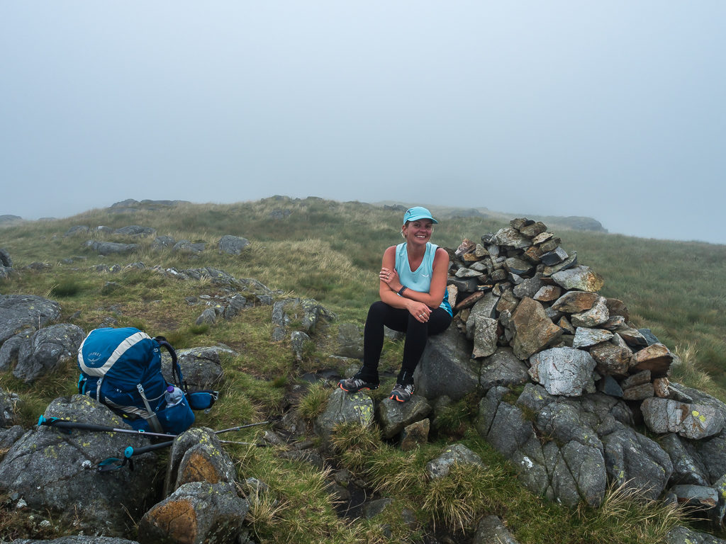
From the campsite, it’s a straightforward route uphill on good track so I felt confident about going it alone. I took a paper map with me and had memorised the route anyway – a good tip from Wayne was that the path ran alongside the boundary wall so it was easy to see and follow. Reaching the summit cairn on Illgill Head, I was thrilled to find that I had a phone signal from the top so I video-called my mum to tell her about Wayne being ill and that we had needed to take a few days off. After her initial shock that I had hiked off by myself somewhere and was alone on a mountain top, I felt really proud of myself for going it alone because that’s something I’ve never ever done before! We have to appreciate the small achievements too.
Selfie shot on Illgill Head at 609 metres. It was the first summit I’ve hiked to on my own!
Hiking on towards Whin Rigg. As I said, it was an easy path and the route was very straightforward!
Gaining all that height afforded incredible views looking back to Wast Water.
What a beautiful day to be out in the mountains!
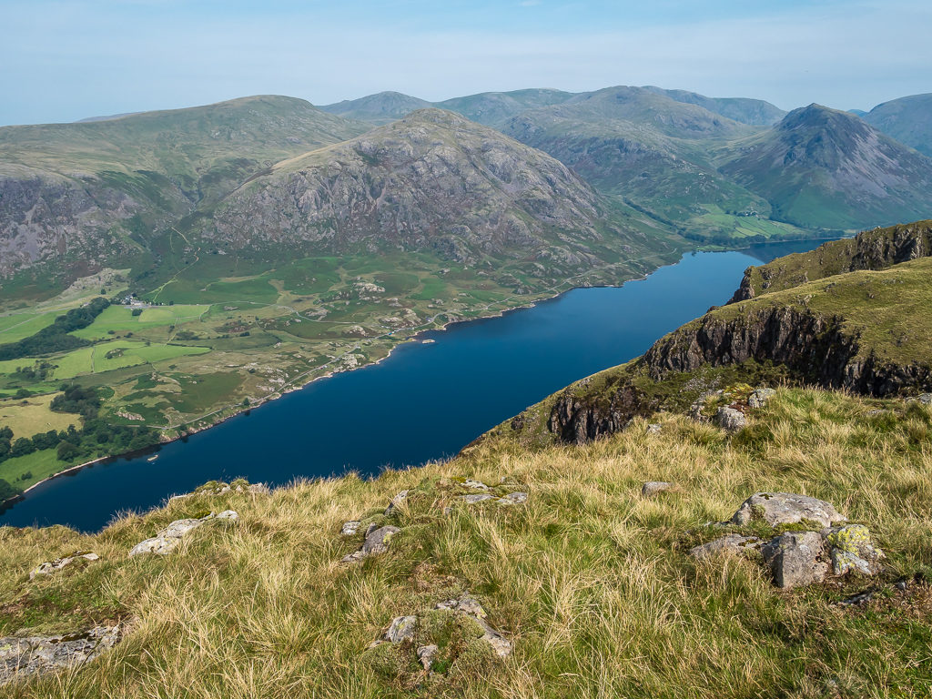
Yewbarrow flanks Wast Water to the north. Wasdale is the perfect place to be based for some serious peak bagging!
We have to admit that nothing has really gone to plan on this trip, so we’ve finally decided to just to enjoy the good weather whilst we’ve got it and the beauty of our surroundings. If we don’t do any more ‘peak bagging’ then so be it. After returning to camp excited at today’s achievements, Wayne said the two fells I’d bagged couldn’t count towards our summit total anyway as we didn’t hike them together!
With our minds set and the pressure now off, we went for an evening meal at the Wasdale Inn, about a kilometre down the road from camp. We were already tiring of the camp shop’s offerings and thought that we’d see what Wayne’s gut was like after getting some proper food into him. He ordered me a bottle of Pinot Grigio as consolation for having to stay put for a few days as well as calling an end to our challenge. The pub itself was really busy and there were long queues to the bar because of social distancing – only one person was allowed up to the bar at a time. Luckily we had got a table outside the front and weren’t in any rush – well, only if Wayne needed to get to the toilet quickly!
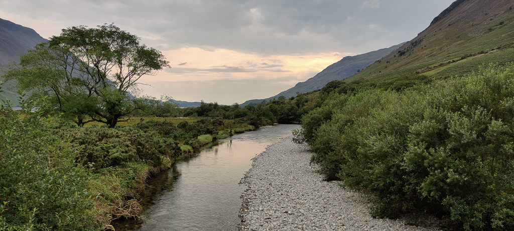
Walking from the campsite to the Wasdale Inn and crossing Lingmell Beck with subtle sunset skies.
Looking towards Lingmell and the Scafell massif from Wasdale. It felt like a life-time ago that we were hiking up there in such dismal weather, when literally just a few days had passed.
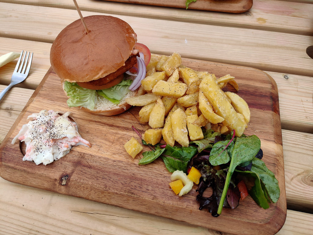
I was ravenous for this halloumi burger and chips!
After settling in for the night back at the campsite, we then experienced a tremendous thunderstorm during the night with huge flashes of lightning repeatedly flickering across the black sky and giant cracks of thunder sounding very close indeed. As people ventured out of their tents to watch the wild weather unfold, we were extremely glad not to be wild camped up a high fell somewhere!
Tuesday morning, we again enquired if we could extend our stay by a further night. As the manager said they had 20 new arrivals coming today, we thought our luck had finally ran out but then he agreed as we were walk-ins and didn’t have a car with us that we could keep our pitch for a final night. Phew! As Wayne was up at least 4 times in the night again – excluding the thunderstorm, we just weren’t ready to move on quite yet. So then ensued another day of the same for Wayne chilling around camp, but the shop had at least had a delivery so he could fill up on bananas and apples, which he hoped might help settle his stomach – or at least give him a vitamin boost.
Gorgeous reflections of Yewbarrow on Wast Water.
What a view! It’s one we could never tire of.
Just for a phone signal as I needed to Google a few things in preparation for the next week ahead such as the weather and potential camp sites, I hiked back up to Illgill Head as a signal is just non-existent in Wasdale. Even the pub doesn’t have Wi-Fi!
Bagging Illgill Head for a second time this week! (The things we do just to get internet access!)
Arrrr, this is the life! Enjoying views over Wast Water again.
With so much time on my hands, I was now partway through my second book, so Wayne’s bout of illness had in one way been a silver lining forcing us to actually slow down and do some relaxing – which wasn’t originally on the agenda!
For our last night in Wasdale, we walked to the pub for dinner again, this time leaving camp a little earlier to avoid the tea time rush, but it was still busy and the queue to the bar for drinks still very long – as we expect it to be here the entire summer! Without being too graphic, we were really hoping that another ‘proper’ meal would help Wayne finally pass a solid stool!
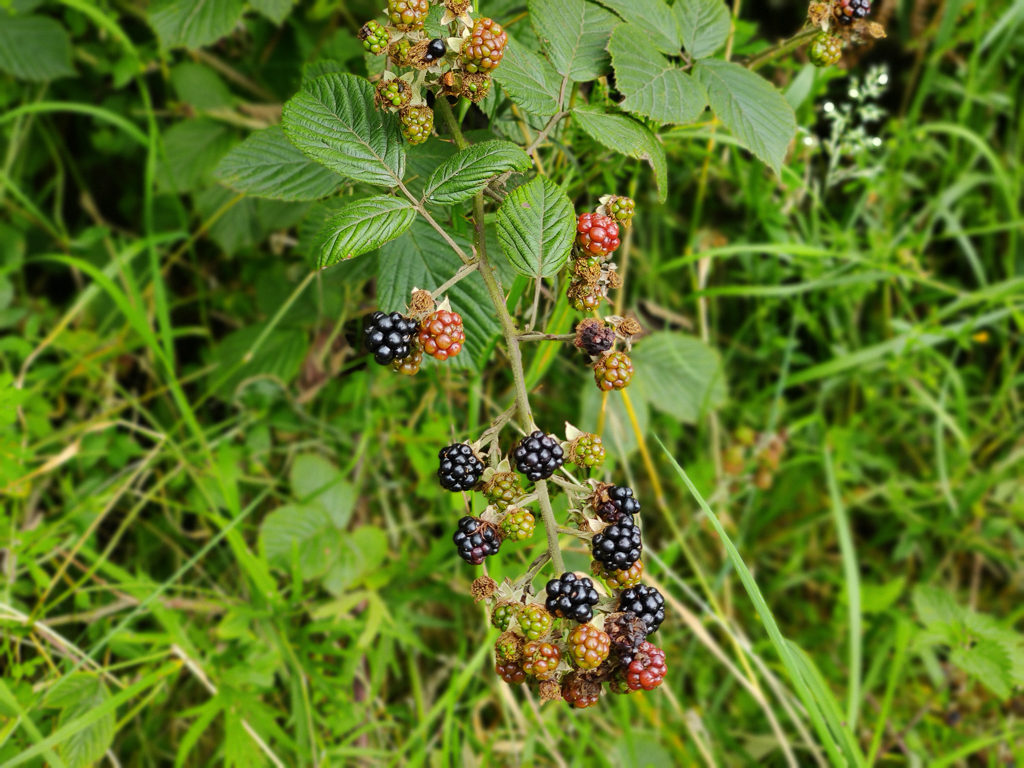
Spying juicy blackberries along the roadside during our walk to the Wasdale Inn.
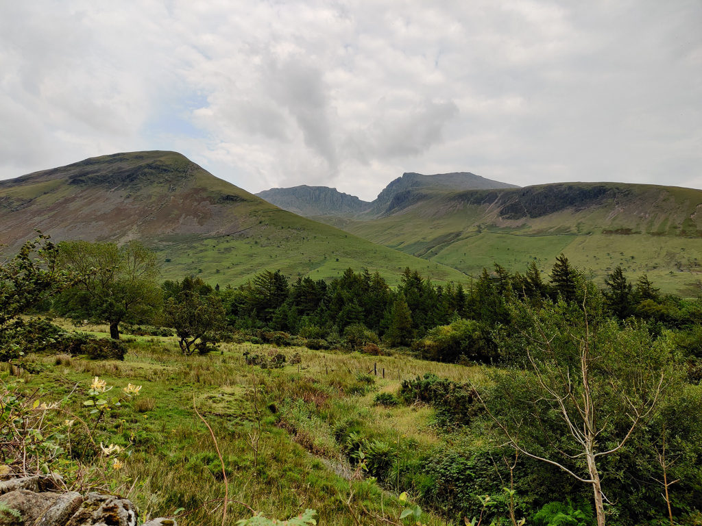
Looking towards Kirk Fell and Great Gable at the head of Wasdale.
Back at camp, we did some laundry and put up our infamous camp washing line that everyone always seems to admire. We also managed to charge our phones in the laundry room using the one available socket whilst rinsing out our gear. So it was now a case of all systems ready to go tomorrow. Thankfully Wayne seems a little better – although we’re not quite sure we’ll get as far as we intend, especially if it’s as hot as today at 27°C in the valley! But we have a plan to at least bag Kirk Fell then get over to Styhead Tarn and wild camp there if Wayne doesn’t have any energy left to go further.
The weather forecast for the next week will then determine whether we push on and explore more fells, or whether we call it a day and go home early. One thing’s for sure is that we will definitely be visiting the pharmacy when we finally get over to Keswick to get Wayne some medication!
8 Comments
I’ve read about the Lake District several times. But I wasn’t aware it’s such a vast and beautiful landscape. Wow!
Too bad Wayne fell ill so badly. But You made the best out of the situation. Hope to read Wayne recuperated completely in the next part.
Did You ever had problems with wild camping on the trip?
With best Regards
Marcus
I’m glad that our blog has put the Lake District on your radar – it’s one of our favourite places for hiking.
Due to such poor weather and Wayne being ill, we cut our trip short in the end. I am yet to finish the last couple of blog posts and get them uploaded, but they will explain our circumstances. We can always return to the Lakes at a later date – they are around a 4 hour drive from where we live, so we try and visit at least a couple of times a year to bag some more Wainwrights.
Wild camping is illegal in England, but it’s generally tolerated on the higher fells beyond pasture above the intake walls. You need to be discreet, pitch late and leave early, and most definitely follow the ‘leave no trace principles’. We’ve never had a problem with wild camping there! I would fully recommend it in summer – although you can never guarantee the weather whatever time of year!
Ah those views over Wast Water from Illgill Head. Absolutely stunning area of the world. It was an ambitious project even in good weather, but there is nothing wrong with ambition. With your hiking CV’s it was a very doable project for you both but unfortunately circumstances were stacked against you. I think 6 weeks would be ideal for a project like this if you could spare the time. That bit of wiggle room would make all the difference and make it a more enjoyable venture I think. Ah well. The fells will always be there. Hope Wayne is back to full fitness. Take care. Steve.
We love the Lakes and the days that were good were really good!
Best laid plans though. As you say, the fells will always be there.
We’ve just had to take a pragmatic approach and not be too disappointed.
Thanks for your well wishes and sorry that I took so long to respond.
Here’s to an end to ‘lockdown life’ and more wonderful hiking adventures – whenever that may be!
The best laid plans eh! Impressed with both of your dedication to keep the trip moving despite the weather and illness doing its best to throw you off track. Most people would have bailed out and gone home. Hoping that the next post will see you back on some sort of track 🙂
I had to chuckle at that comment as we did bail and go home in the end!
(I need to crack on and write the final blog post.)
Thanks for reading and commenting, as always!😊
Hey Danielle and Wayne,
I hope You are well, as far as possible in these rough times. I’m hoping You will continue the blog regarding this special hike.
Stay well and hope to read from Your adventures soon.
Best Regards
Marcus
Hi Marcus,
Thanks for continuing to follow the blog despite our lack of new content!
I have finally completed the last part of our Lake District adventure which is now online.
I can’t believe we finished it a year ago today!
We’re heading off to the Lakes again for a week on Friday but we’re not camping this time. We’re still planning on doing some walks though – but it’s meant to be more of a relaxing holiday after a busy year working on our new house!
Walking adventures to start again next year though now that restrictions are easing in other countries and we’re both double jabbed!
Hope you’re well and enjoying life,
All the best, Danielle