
“Jobs fill your pocket, but adventures fill your soul”.
– Jamie Lyn Beatty
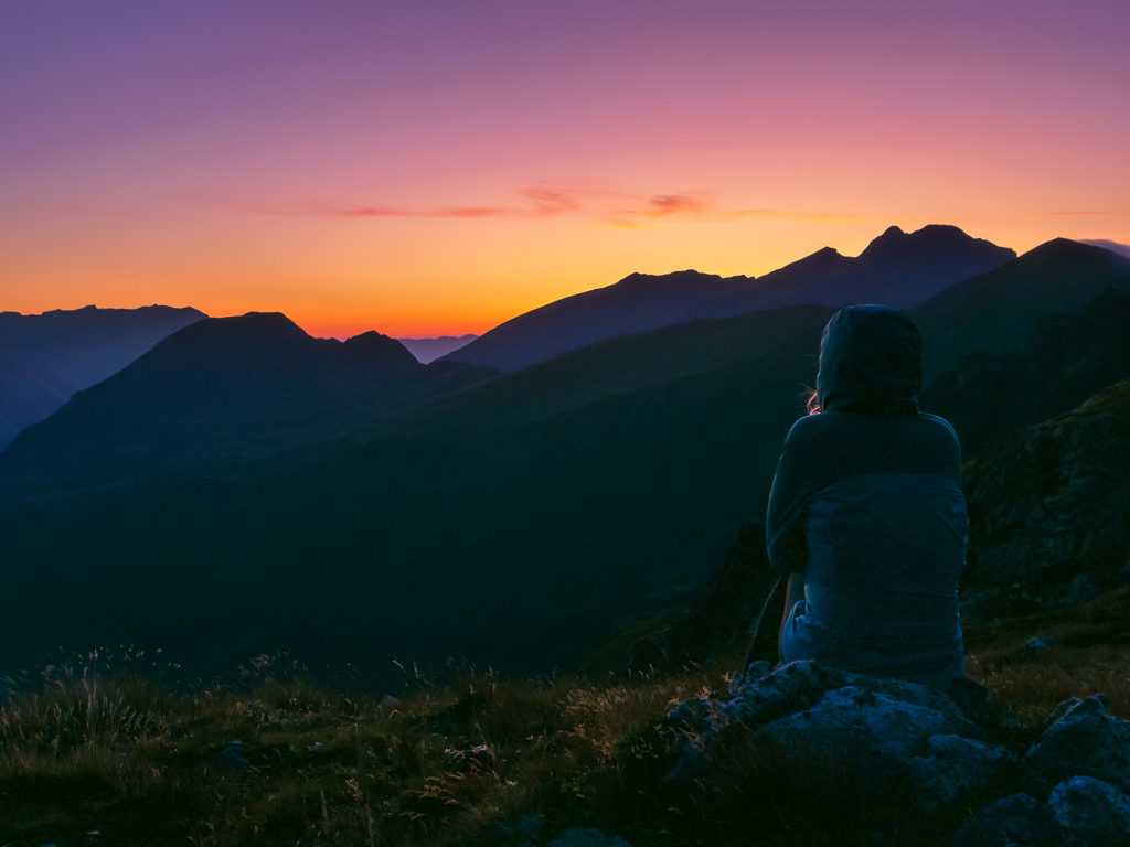
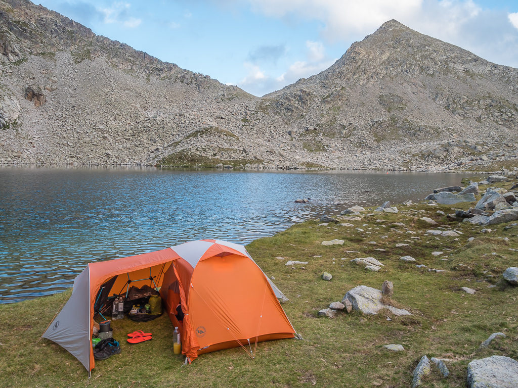
Watching the sun rise from our wild camp spot at Lacs de Barroude made for a superb start to Week 4.
With 21 days already in the bag, it was hugely satisfying to know that we were nearing halfway as we embarked on ‘Week 4’ of our trans-Pyrenean adventure. Giving ourselves a leisurely 8-week timescale with moderate daily distances to cover an approximate total of 500 miles, we were well on track for completion mid-September. By removing the pressures we had felt on the PCT, particularly towards the end when it had become a race against time to complete Washington before the onset of winter, this felt a different kind of walk and much more like a holiday. (As we had always intended it to be, hence carrying camp chairs and other non-essential items!)
We no longer had to put one foot in front of the other and keep moving just to power out the miles and tick off another section – instead we could take it slow, savour the scenery, enjoy time at camp and allow ourselves the luxury of a ‘zero day’ whenever we wanted as we didn’t have a set schedule. This meant the trail was once again an exciting place to be!
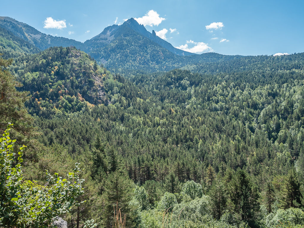
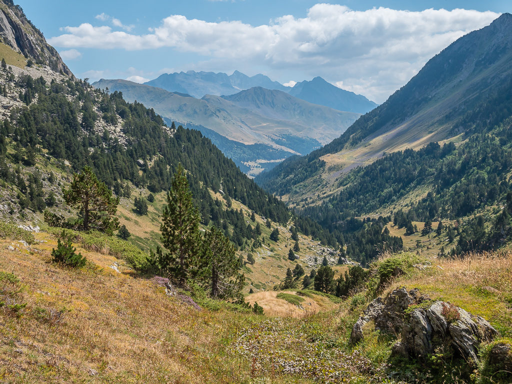
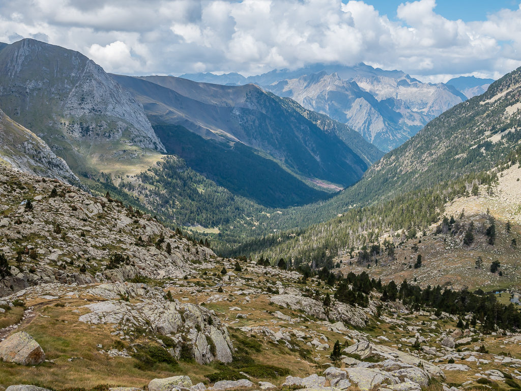
Seeing the dramatic changes in landscape day by day the further east we travelled – the lush, green, forested hills of the Basque country now replaced with bare rock and boulder fields – we were in awe of the true wonders of nature at work. “I am but a speck of dust in this vast universe…” said American scientist, Carl Sagan, and indeed as we crossed from one high mountain pass to another, we were able to appreciate our own insignificance in this remarkable place.
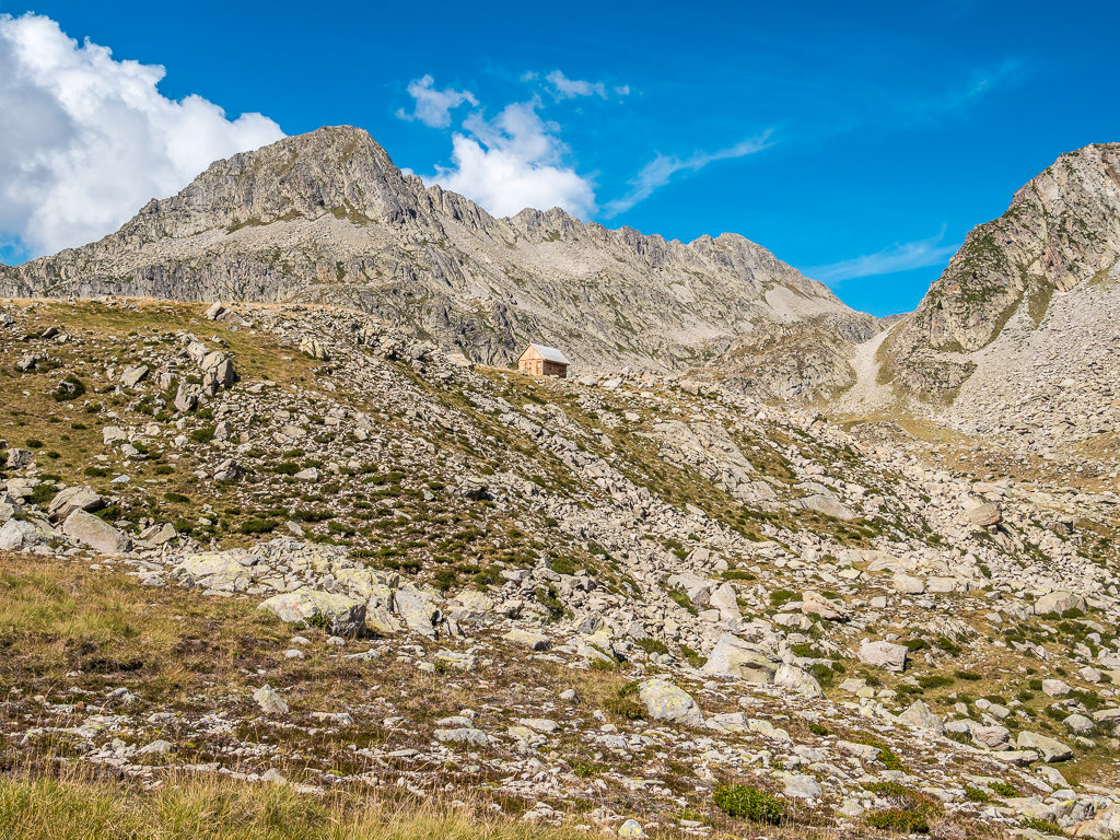
Day 22 – ‘An Unexpected Encounter’ Friday 23rd August, 2019, Wild Camp at Lacs de Barroude to Wild Camp past the Urdiceto Power Station next to the Barranco de Urdiceto, HRP, GR11, 24km
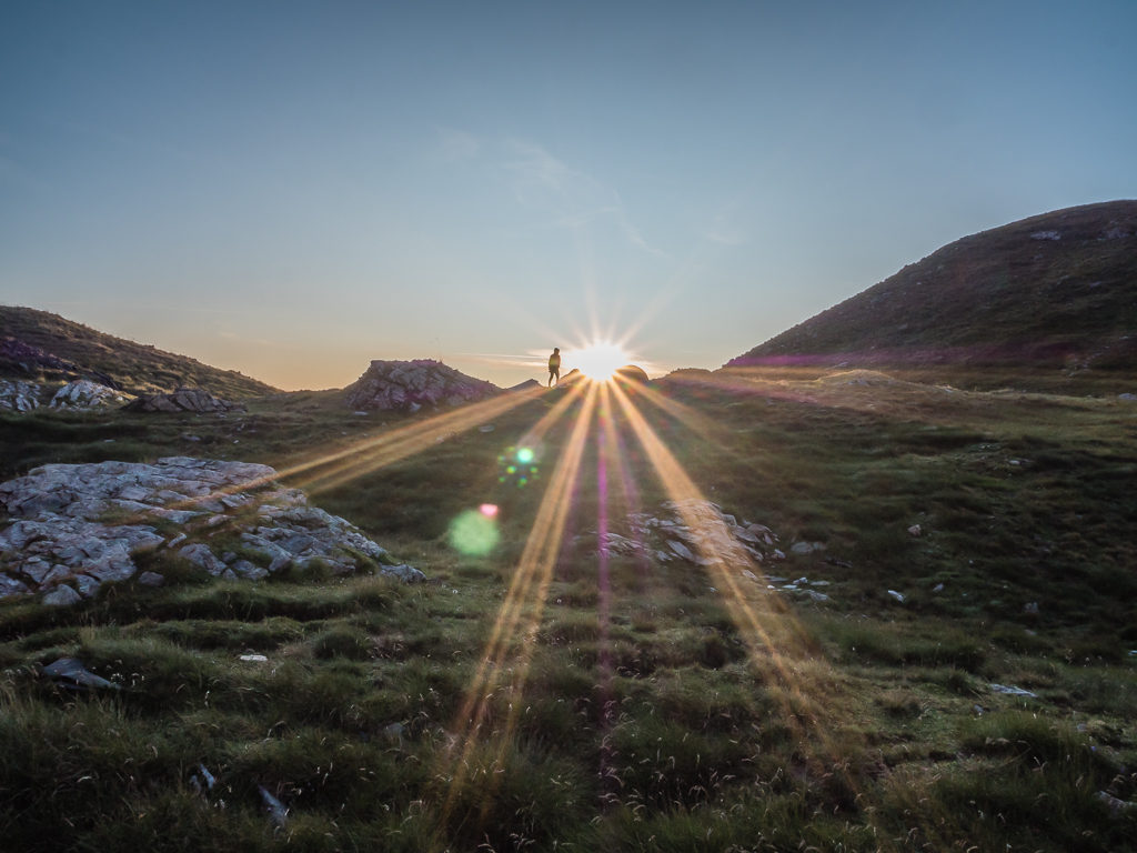
For once, we had set the alarm to go off before 7am in anticipation of seeing our first proper sunrise of this trip. As we had pitched in a prime position overlooking the mountain range to the east, we wanted to be ready when the sun finally peeked through the little notch carved out of the giant wall of rock now silhouetted against the sky. After around half an hour of sitting outside in the cold armed with our cameras, the sun’s golden rays finally spread through the notch caressing the landscape with a gentle radiance. Now that’s what early morning’s are made for!
Waking up earlier than usual in anticipation of a spectacular sunrise.
To the east, looking at the sky tinted with a delicate, orange glow from the grassy banks above Lacs de Barroude.
In the opposite direction, the first rays of light hit the top of the magnificent Muraille de Barroude. The immense wall, where a glacier still clings to life, stretches for almost 4km in a roughly north-south line.
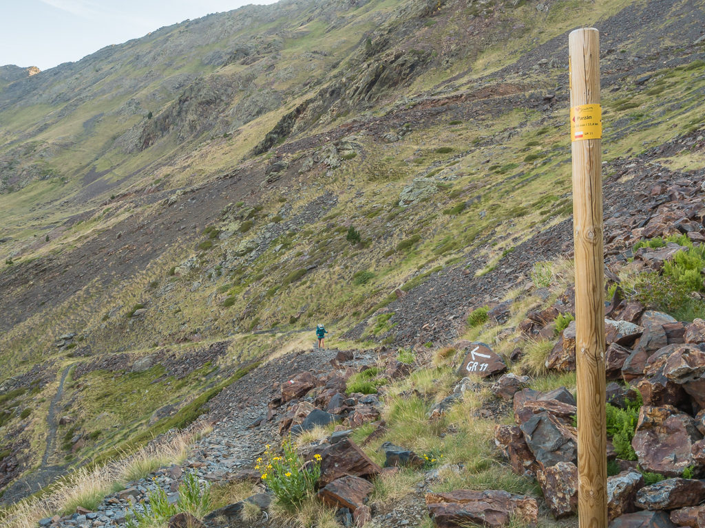
After enjoying the moment, it was time to get a brew on and get warmed up with a hot bowl of porridge and another 5 minutes in the sleeping bag. Even after an early wake up call, we still took two hours to get ready and didn’t get away from camp until around 10am! Today’s walking would be in two halves – the first section taking us back into Spain to the town of Parzan where we were going to resupply with food for the next two and a half days. After leaving Parzan, we would then hike on another 9 or so kilometres, camping before the Paso de los Caballos to make tomorrow both an easier and shorter day.
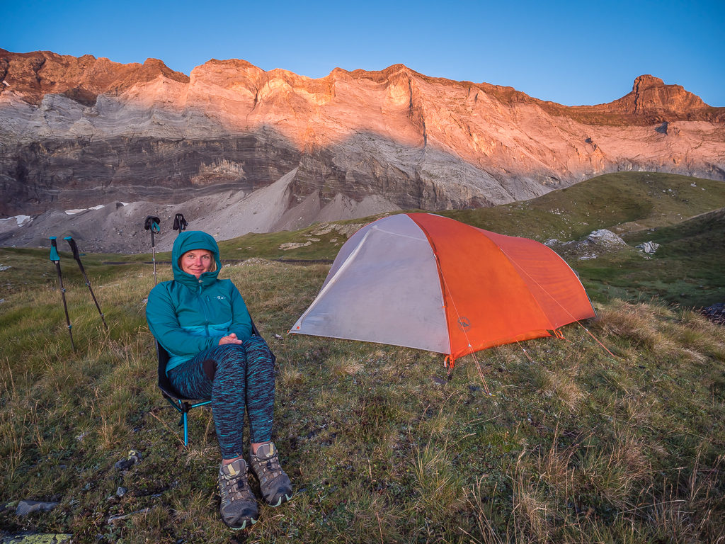
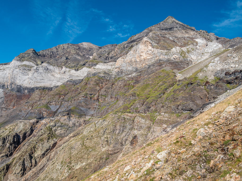
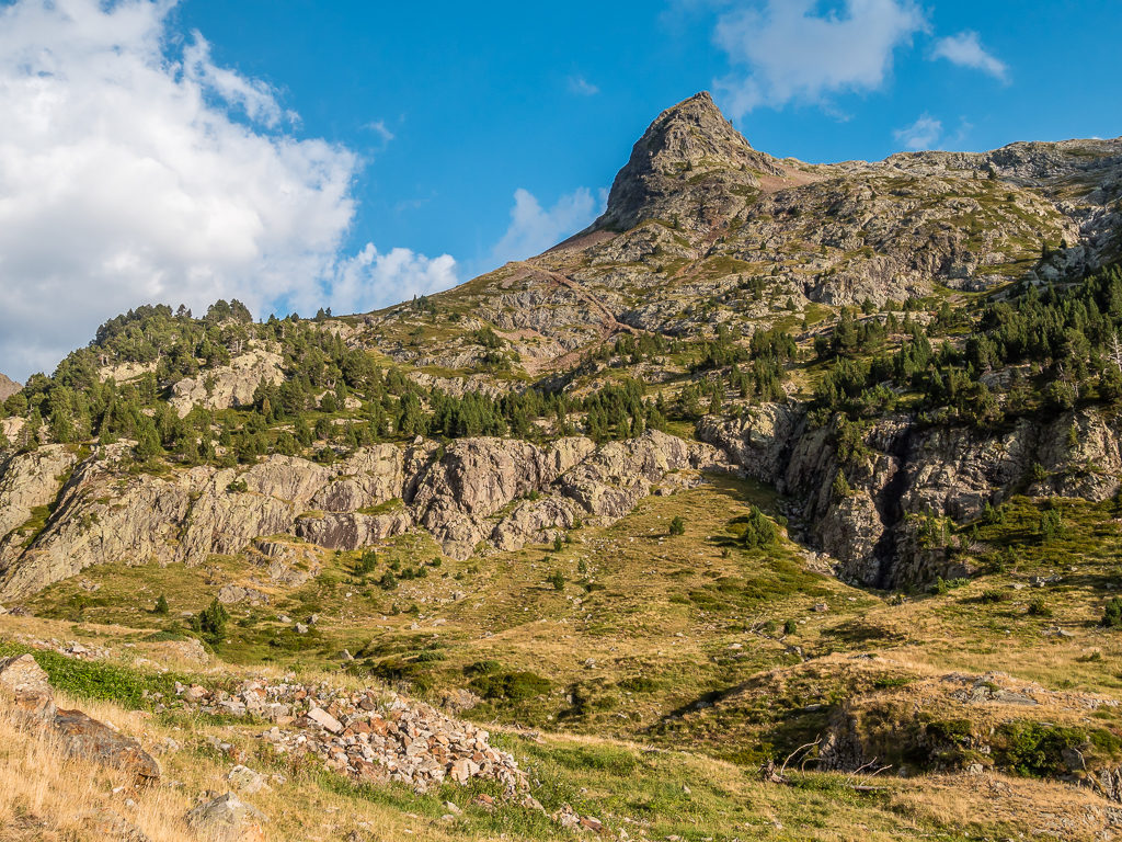
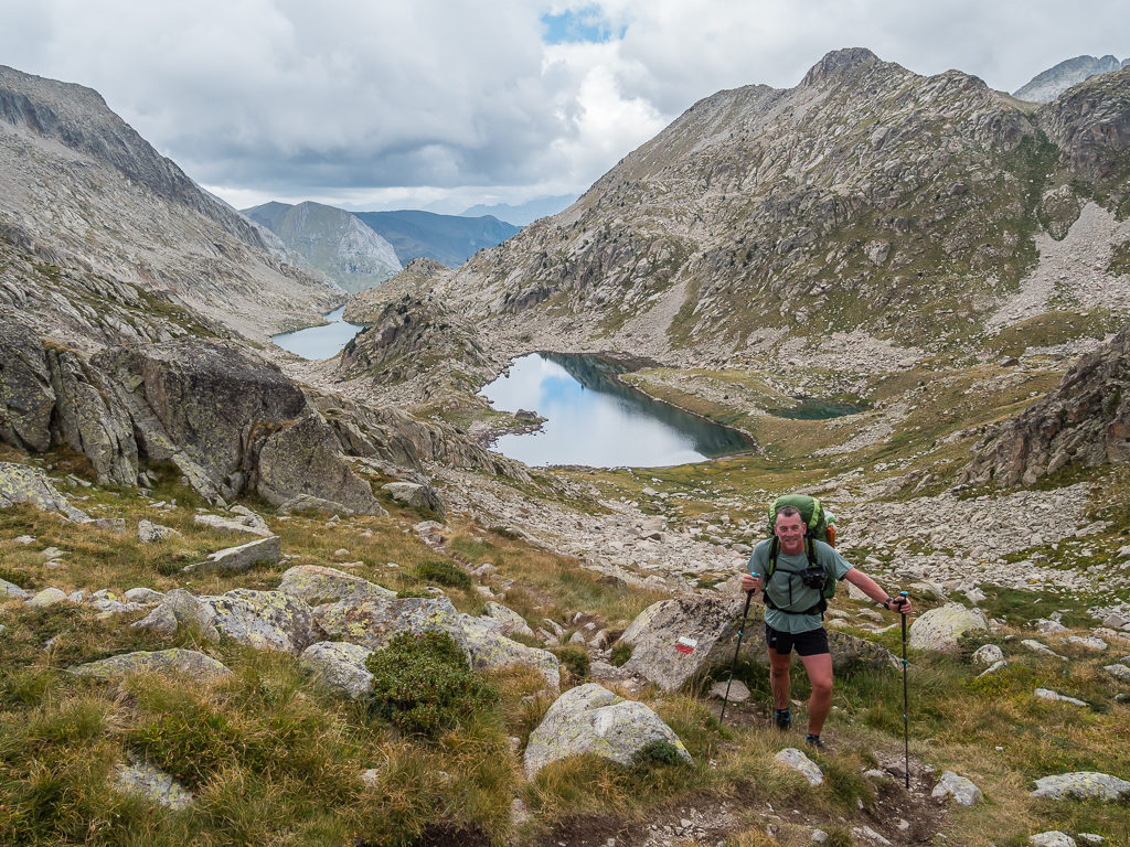
It was a cold but beautiful start to the day at Barroude Lakes. The peaks behind from the left are Point (3.028m), Pic Heid (3,022m), Petit Pic Blanc (2,957m), and Pic de Gerbats (2,904m) identifiable on the far right from its distinctive shape.
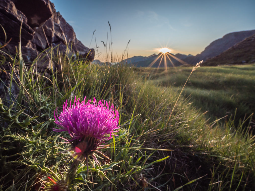
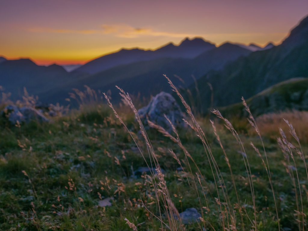
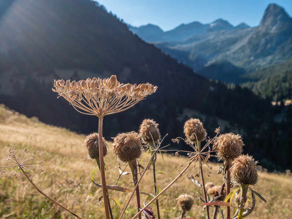
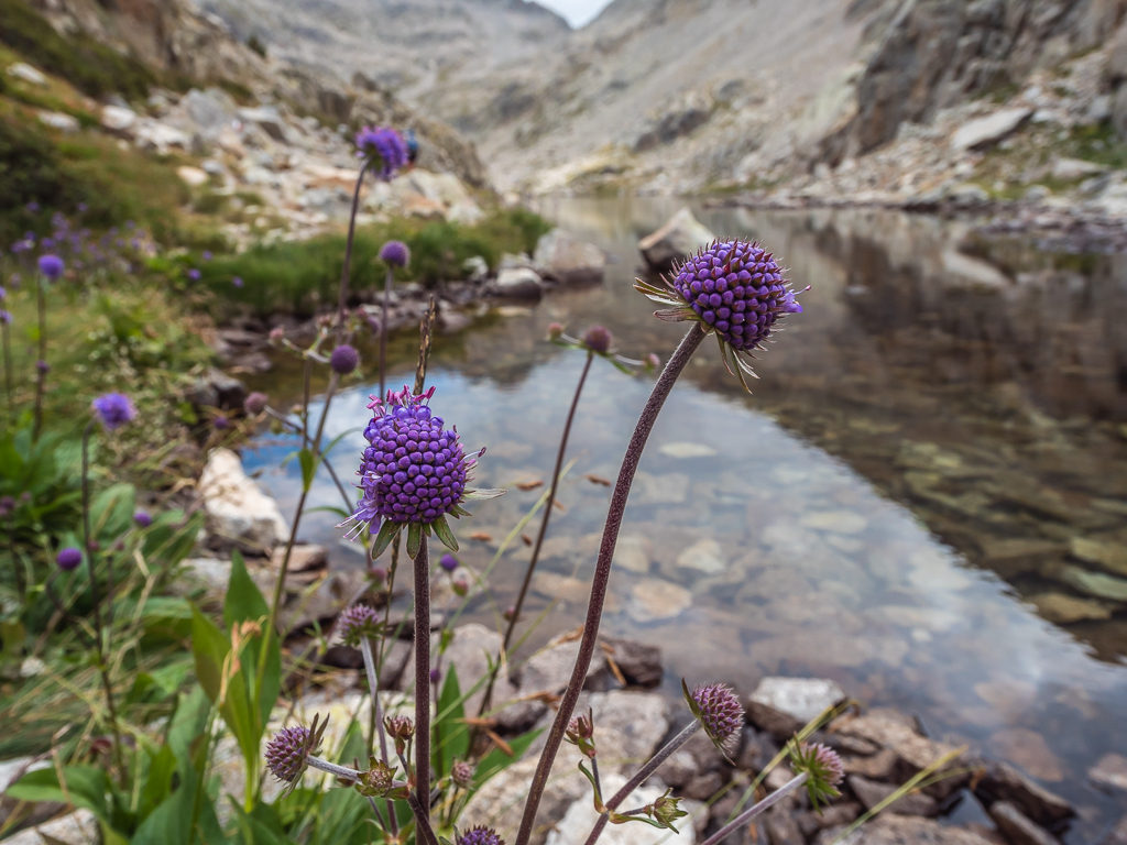
The sun finally crests above the peaks to the east illuminating a Pyrenean thistle (Cirsium pyrenaicum).
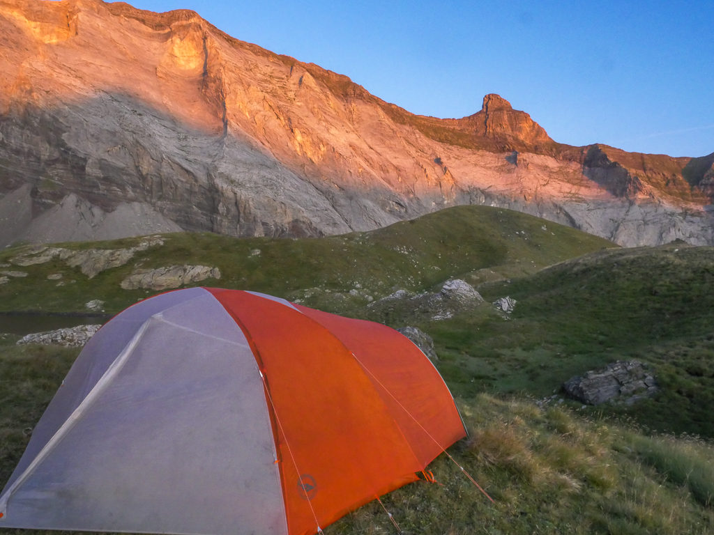
A wild camp spot with a prime view! The prominent Pic de Gerbats (2,904m) dominates the skyline because of its fin-like shape.
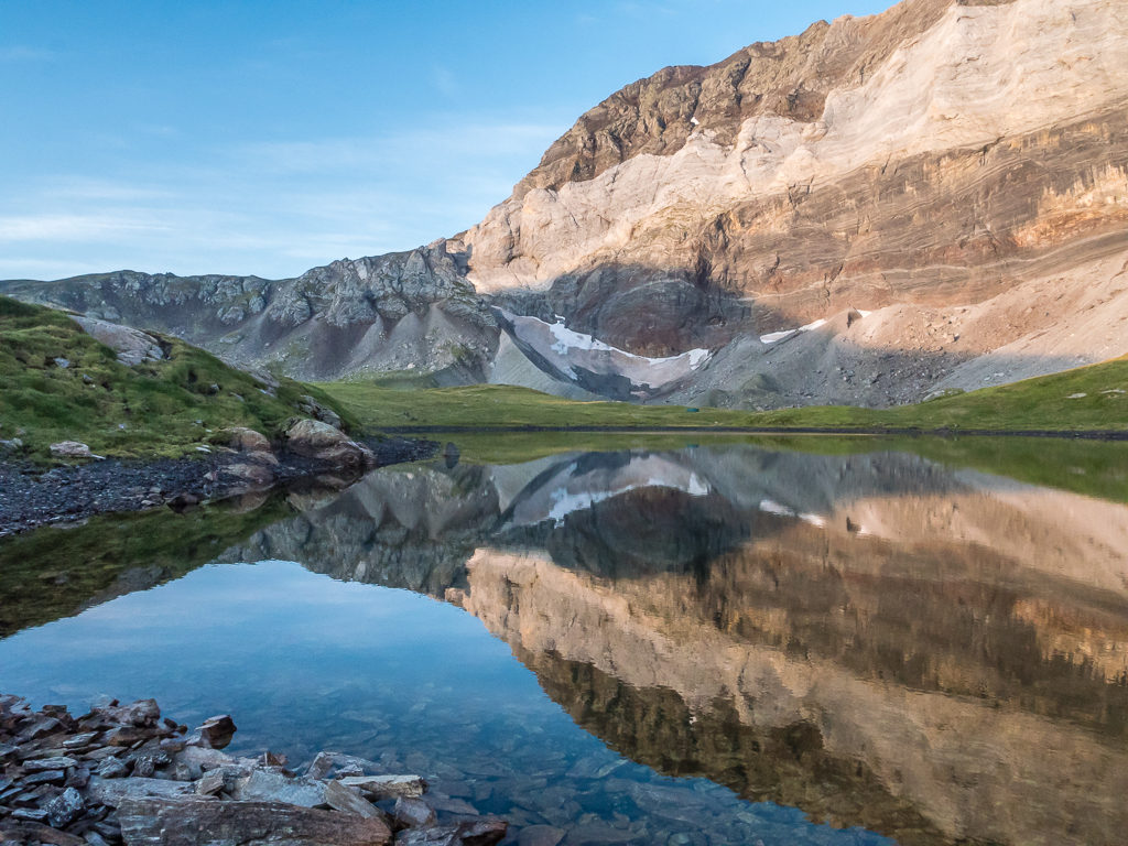
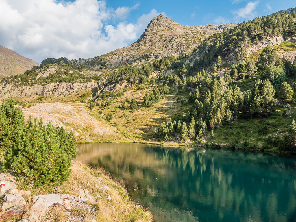
A reflection of Pic de Troumouse (3,085m) and the Barroude glacier on the still waters of the lake.
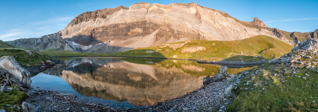
A panorama showing the magnificent Muraille de Barroude in all her glory reflected on the smaller of the two lakes.
Another beautiful day to be on trail. Sunrise this morning was definitely worth the wait!
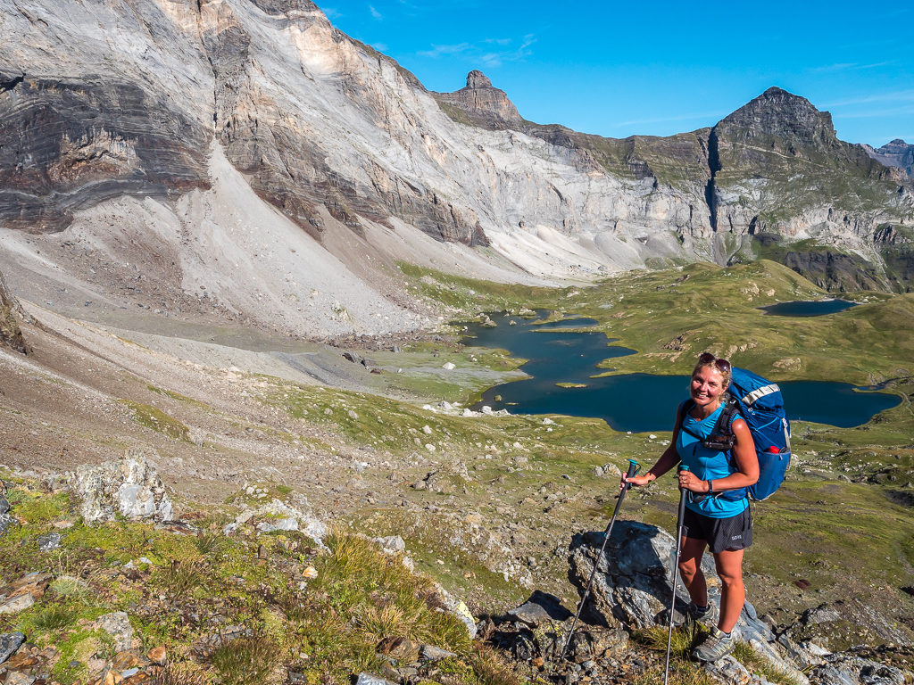
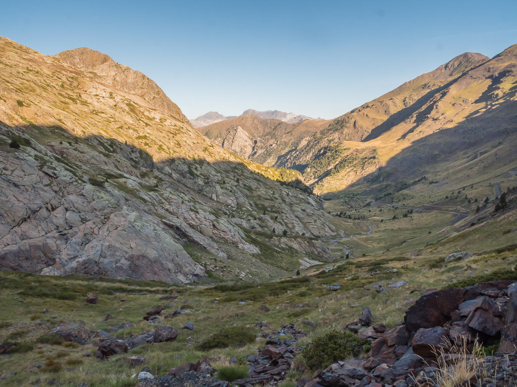
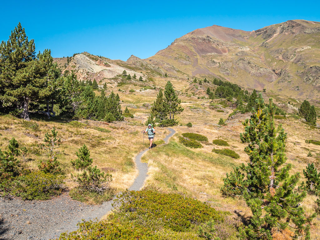
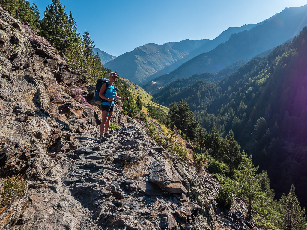
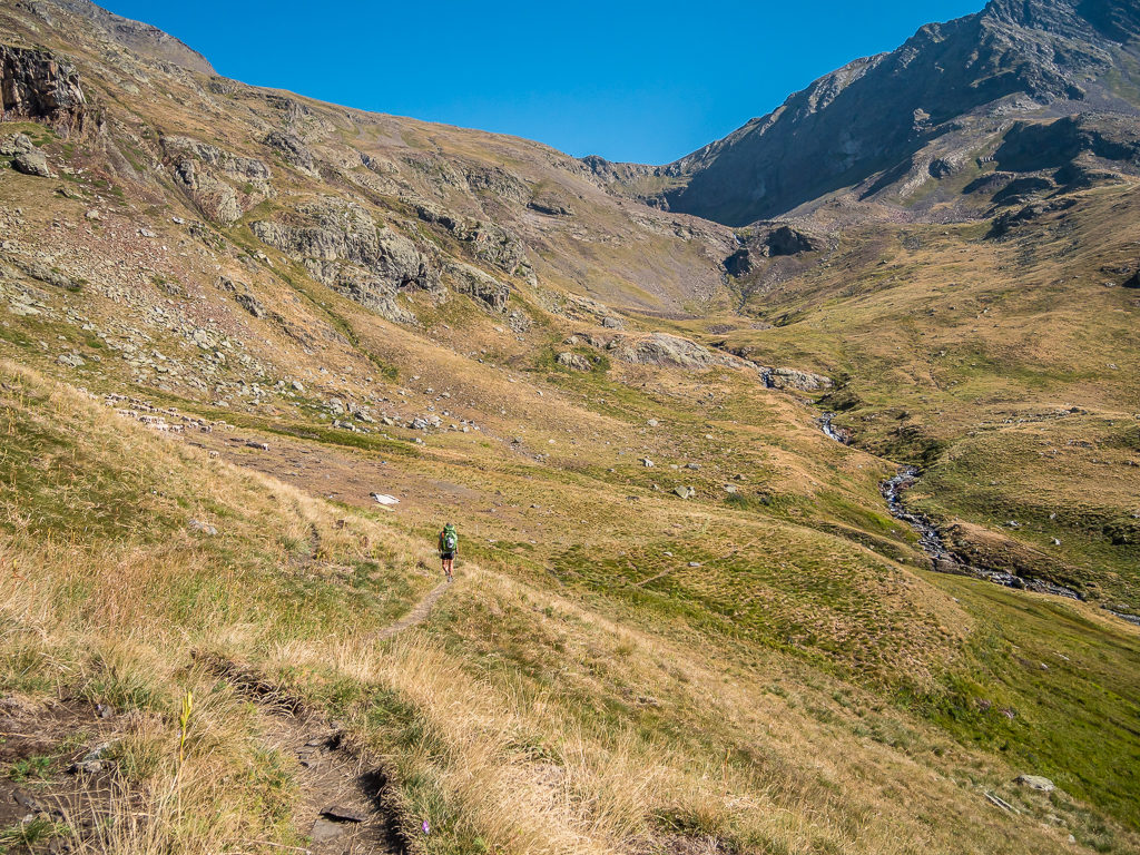
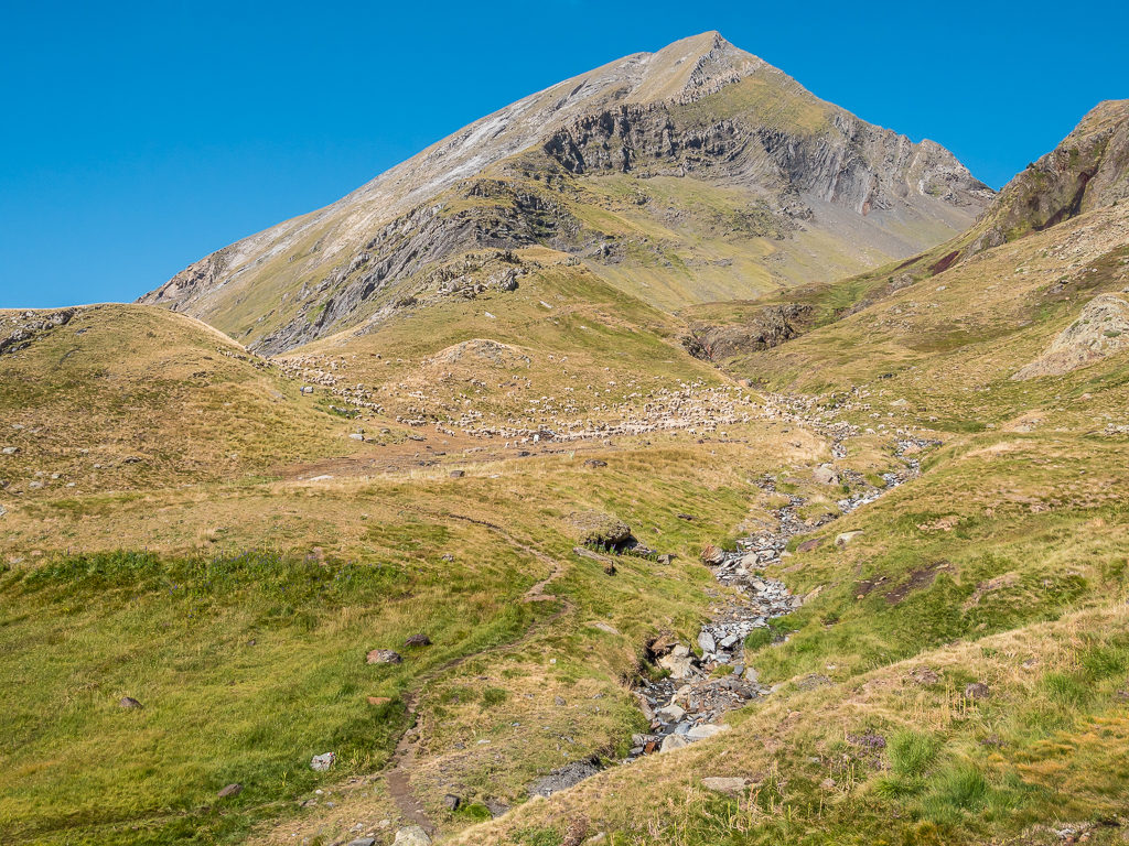
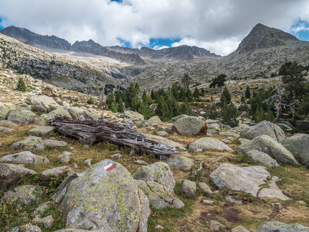
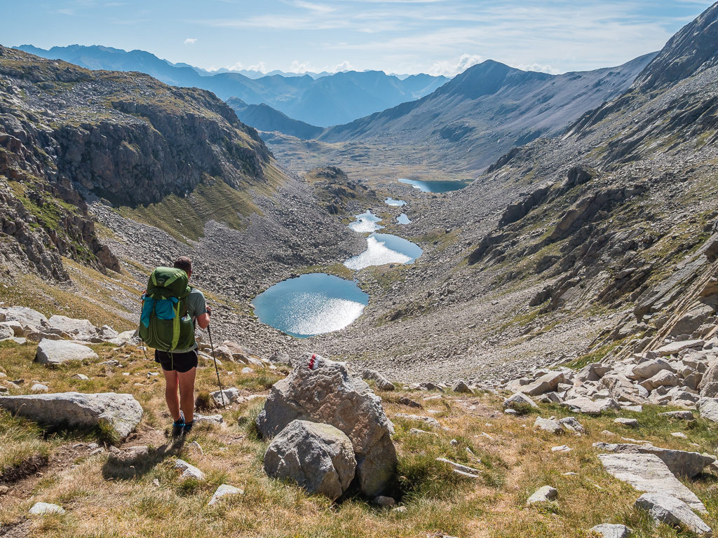
Finally vacating our wild camp spot at the Lacs de Barroude, we followed a path uphill running alongside a stream, which then switched back a few times taking us up to the Port de Barroude. At 2,543 metres, the pass marks the French-Spanish border, so it was another “Au revoir” to France for the time being and a sunny “Hola!” as we would be returning to Spain and picking up the GR11 route again. Before we descended into the Valle de Barrosa however, we took a few more moments to soak up the incredible view. From up high, we had a wonderful panoramic vista looking back to both the lakes and the Barroude wall, which were now fully bathed in bright sunlight.
With incredible views all around, steadily making our way uphill to the Port de Barroude – the pass marking the French-Spanish border.
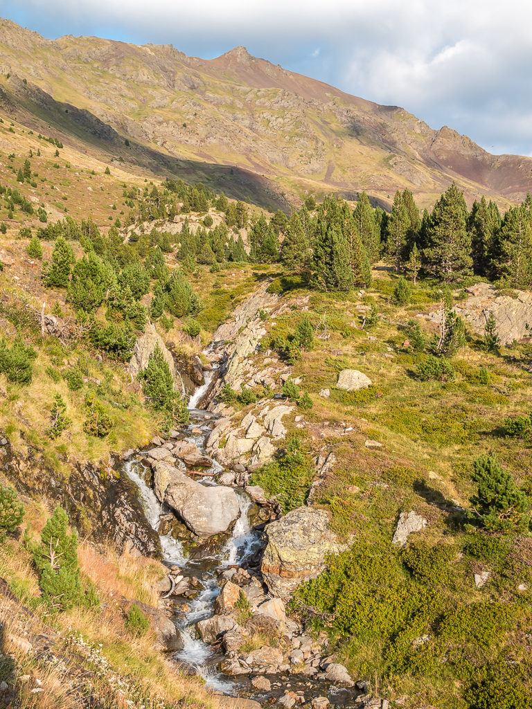
Taking an obvious path that followed the course of the stream.
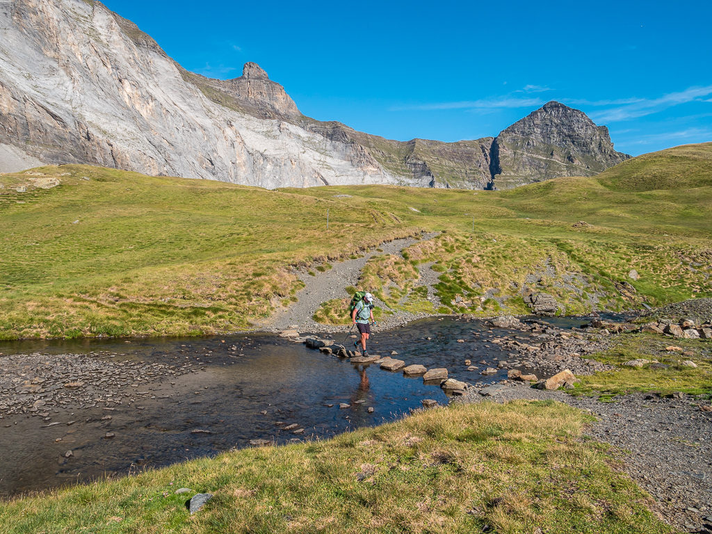
A convenient rock hop helped us cross the stream without any trouble.
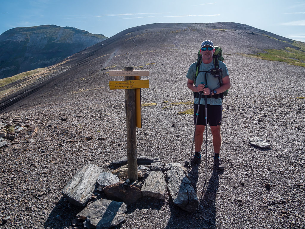
At 2,543 metres, reaching the Port de Barroude or Puerto de Barrosa, as it is called in both languages. The pass connects the valleys of La Gela and Barrosa in Aragon, Spain, and is a crossing point to France through the Lacs de Barroude under Sierra Morena.
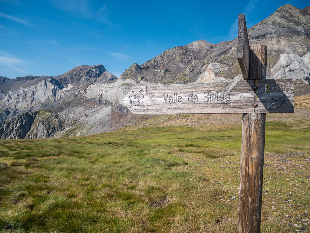
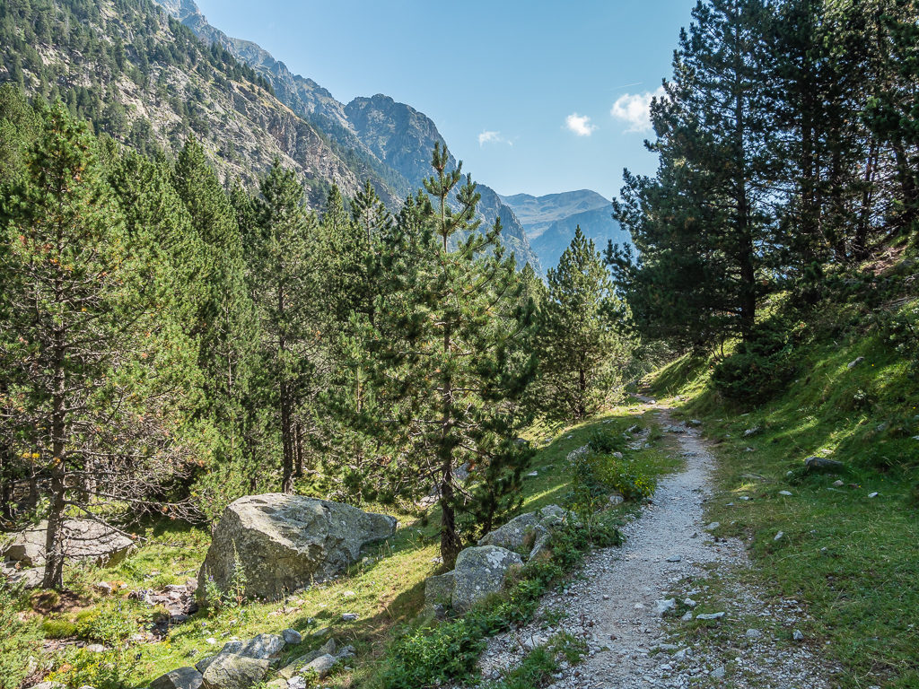
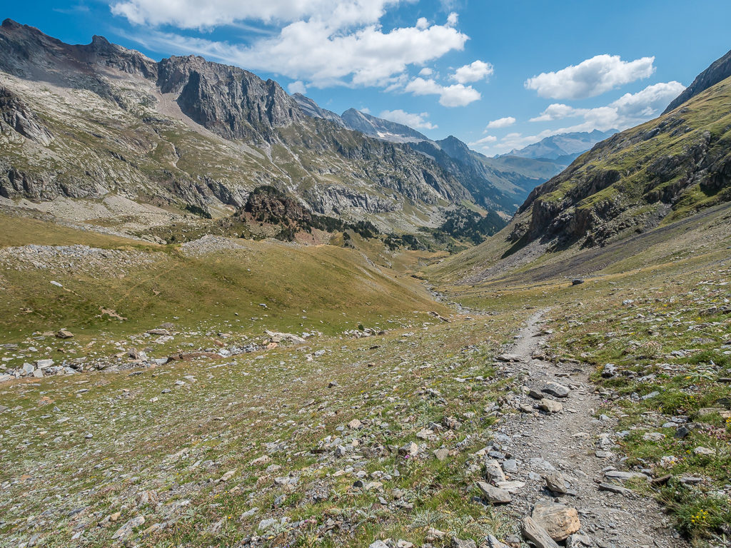
Descending through the Valle de Bielsa following a white and yellow flashed path.
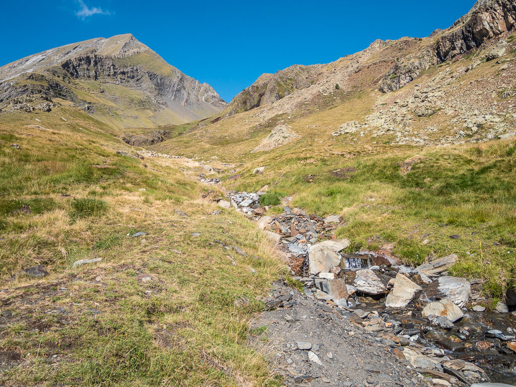
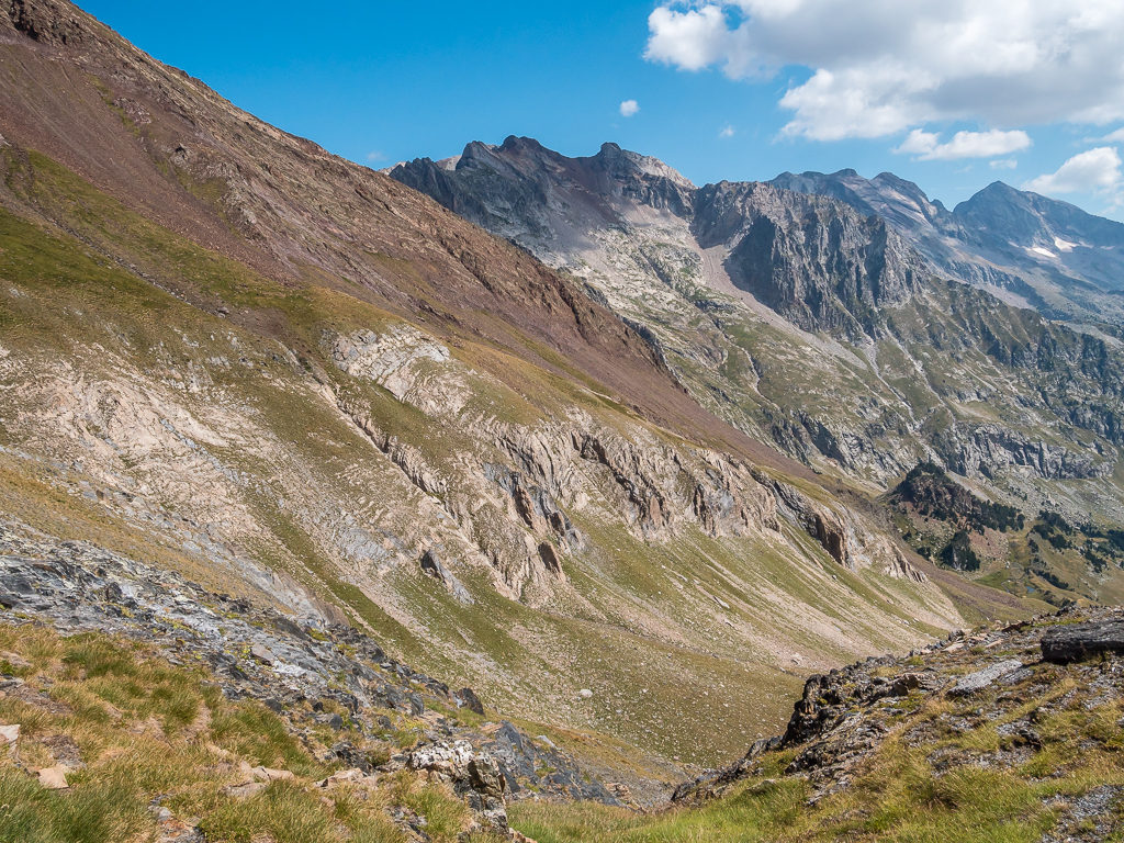
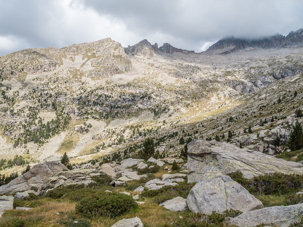
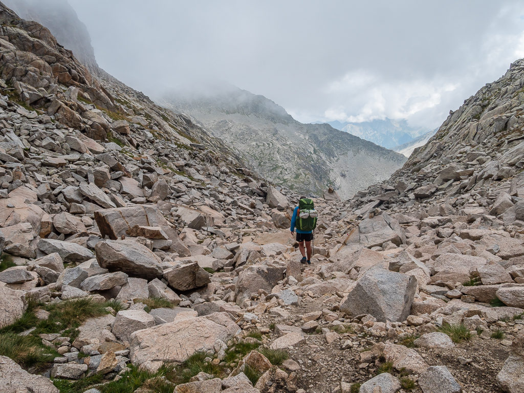
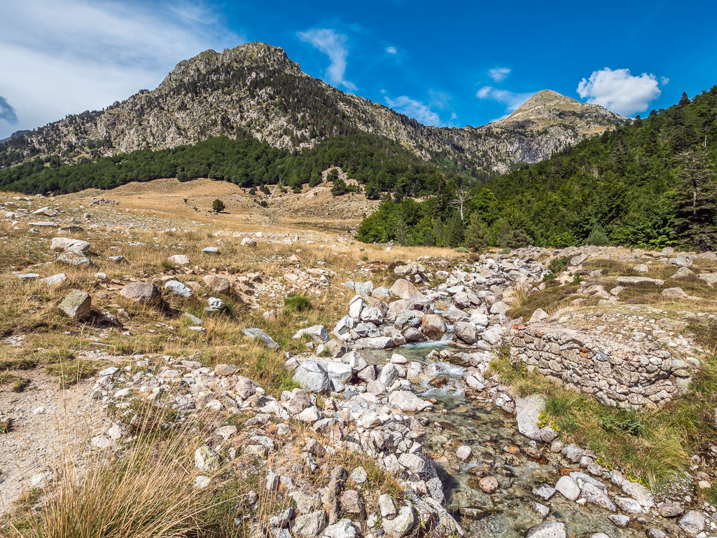
We would be descending over one thousand metres in total by the time we reached Parzan, but it was made so much easier for us because of the well-graded path switching steadily down the mountainside. That being said, the path was rocky in places and we had loose gravel underfoot sometimes but overall it was a pleasant walk down to the valley floor. Flanked on all sides by huge granite mountains, we passed the time pondering whether there were any routes up leading to what we considered would be obvious passes into the next valleys. With giant slabs, exposed ridges, near vertical scree slopes and lingering ice, we doubted the existence of any path. If there was any route at all, it would certainly not be one that we would want to walk. It just reminded us of what a guardian at one of the refuges had said to us on our previous Pyrenees trip when he offered us some advice – “That way is death!” Needless to say, we didn’t take the route option he was warning us about. Indeed, it scared us so much we’ve never forgotten it, and so always choose our routes carefully to match our ability and experience.
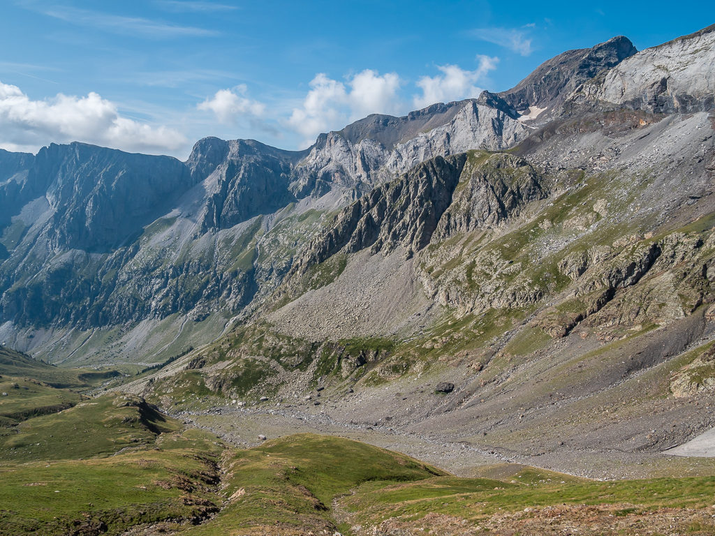
The great glacial cirque of Barrosa, under the imposing La Munia and Robiñera peaks, closes the valley sandwiched between the granite walls of Sierra Pelada and Sierra de Liena.
The Pic de la Munia culminating at 3,133 metres is the highest point of the three cirques of Troumouse, Barroude and Barrosa.
If there was a ‘high route’ across the scree and through the crags, we didn’t spot it. (Not that we would have wanted to tackle such an exposed route anyway!)
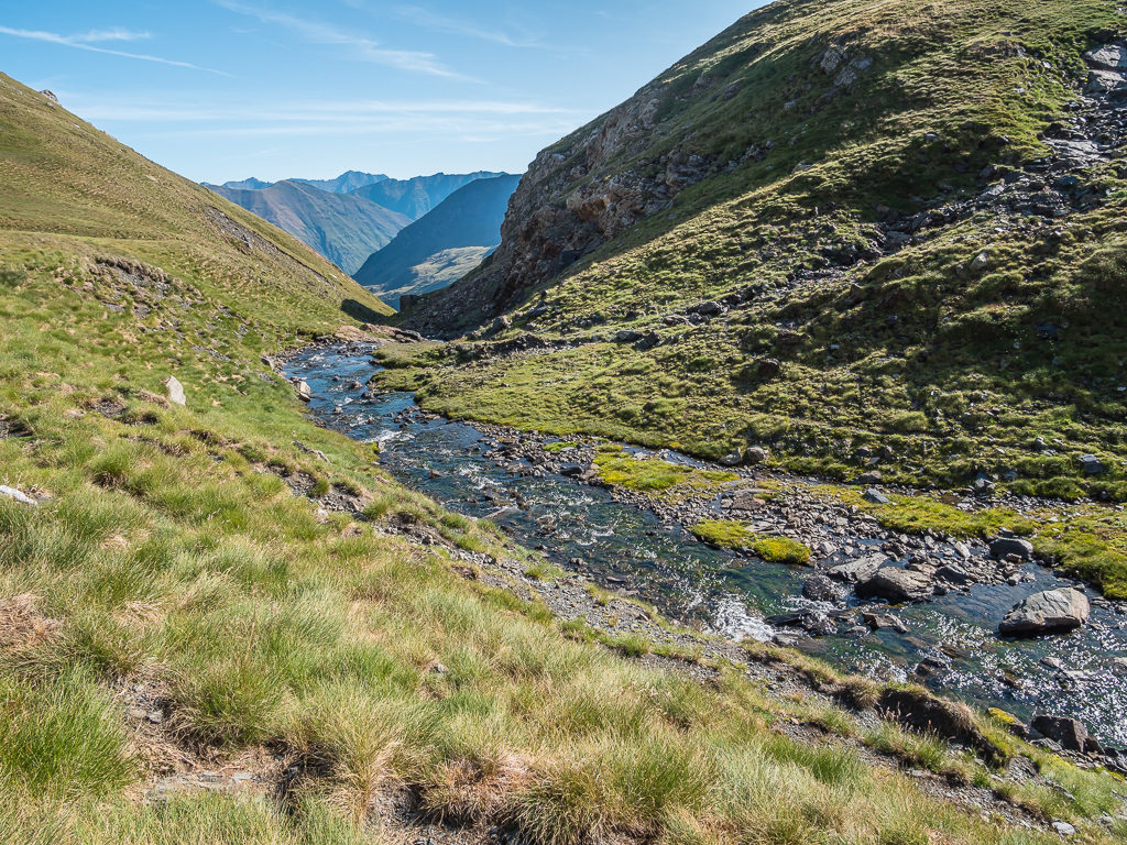
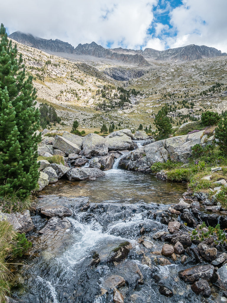
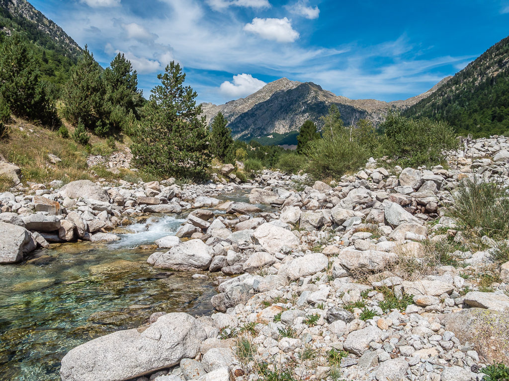
With the Barrosa River carving out the valley, the trail descends between pine trees and alpine meadow encompassed by large granite walls.
Looking onto the small, unmanned Refugio de Barrosa situated along the valley at 1,745 metres.
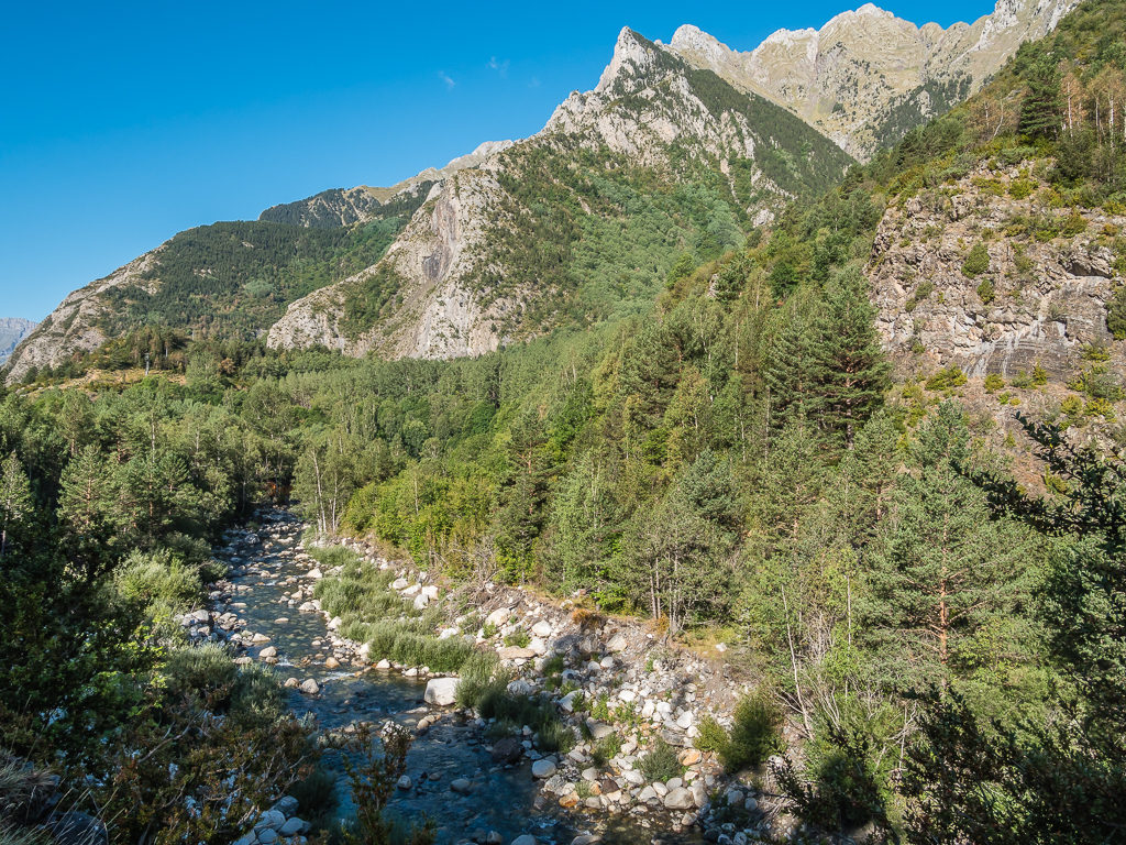
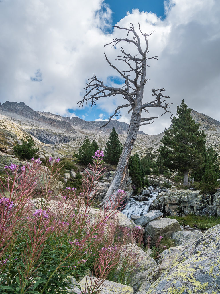
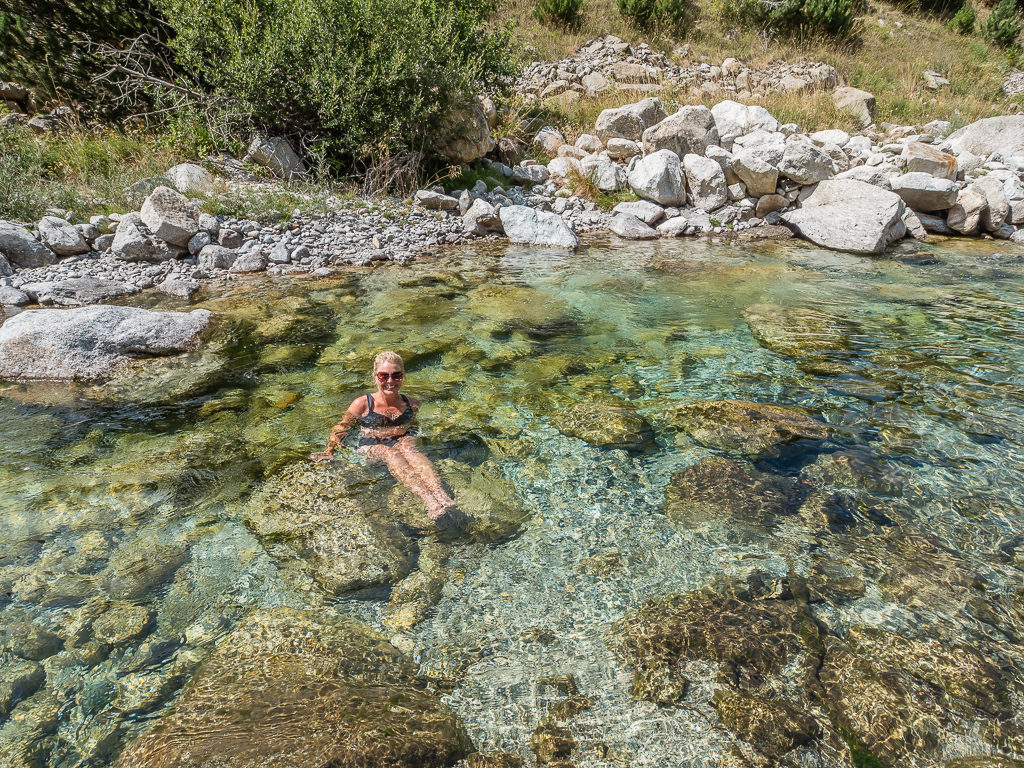
Reaching the Valle de Barrosa, it was lovely to see trees again and walk beneath the dappled shade they afforded us, enjoying the wonderful pine aroma whilst hearing the crunch of the dried needles beneath our feet. With the trail now weaving close to the river, we also spied several grassy banks that would have made perfect wild camp spots right next to some inviting looking plunge pools. But alas, we still had several more kilometres to go for the day as we were out of food and in need of a resupply.
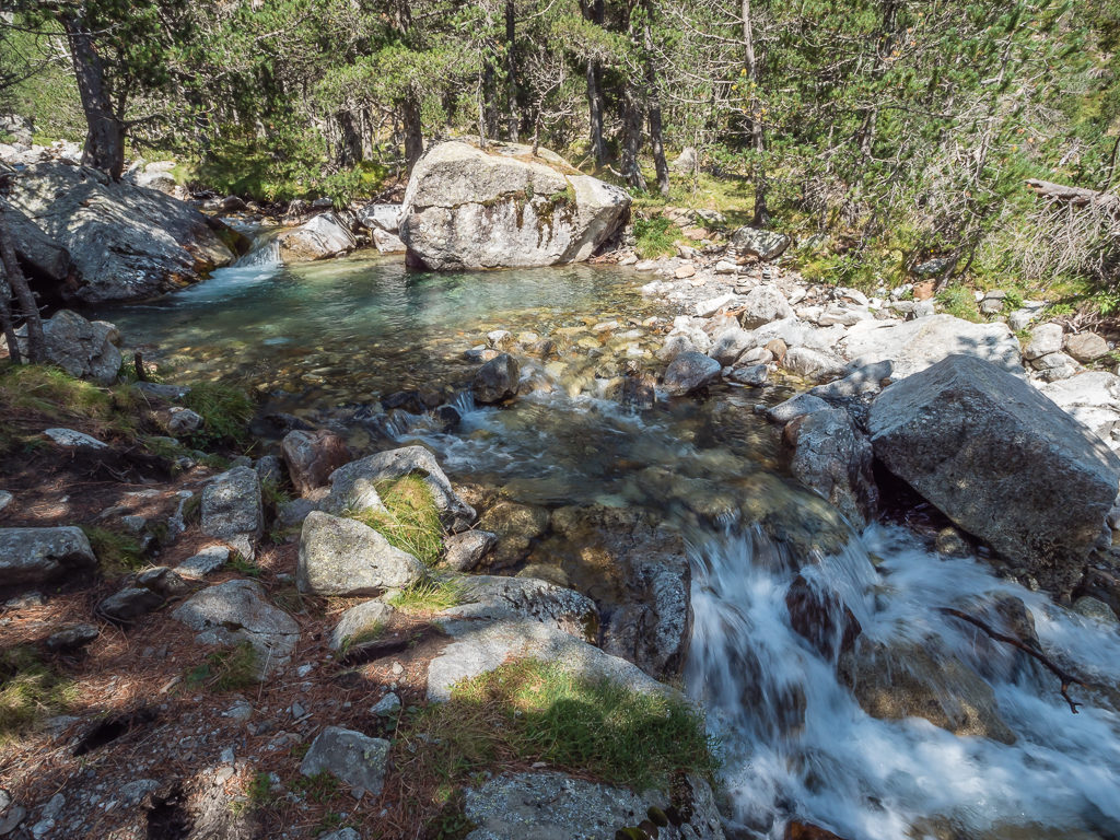
Just one of the many inviting looking plunge pools we passed walking through the Barrosa valley.
Following the stony track to the car park area, where we could pick up the A-138 road that links the Valle de Bielsa (Spain) with the Valle d’Aure (France) through the Bielsa tunnel to take us to Parzan.
The next part of the trail although through pleasant scenery, was not particularly enjoyable as we had to walk along a stony track to the car park, which was then followed by a 5km road walk to the village of Parzan in order for us to resupply. We had visited Parzan to resupply with food on our previous GR11 jaunt and remembered it as being a good place to stock up with hiker supplies, but this time around we were thoroughly disappointed with what was on offer – or lack of it.
The three supermacardos or supermarches (as they are known respectively in Spanish and French) located on the main highway, are there in the main to serve French consumers crossing the border by car, in pursuit of cheaper consumer goods like alcohol and wash powder that can be bought in bulk – ‘cash and carry’ style. This is because the tax on such items is much less in Spain compared with in France – so who can blame them? Even we had noticed that alcohol is significantly cheaper in Spain, so no wonder the French drive just 9 miles to save themselves quite a few Euros. Catering for their prime consumer therefore, the supermarkets had nothing remotely ‘travel size’ that a thru-hiker would endeavour to carry, despite the GR11 going straight through Parzan and hikers throughout the summer resupplying in the town.
Excited at the thought of fresh food and purchasing new supplies, we made short work of the 5 kilometres into Parzan.
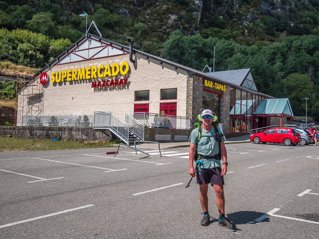
This time around however, we found that all three supermarkets were quite limited in terms of what they could offer hikers.
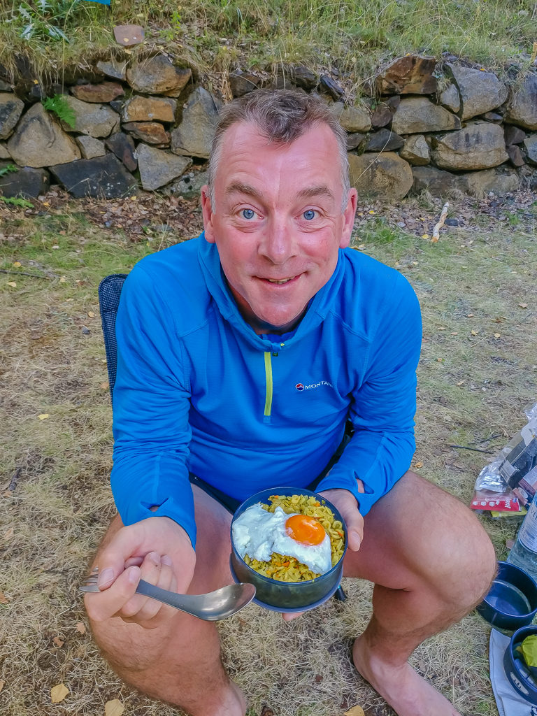
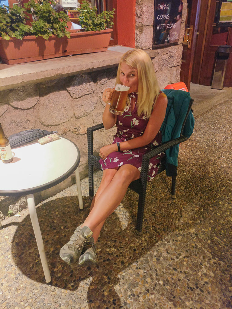
After the long, hot road walk and the disappointment that we couldn’t even buy any pre-cooked packet rice (Wayne had been hankering after some to cook ‘egg fried rice’ for breakfast), we found that Parzan had one redeeming feature – the excellent restaurant located next to the petrol station. We popped over to look at the menu and immediately took a table outside in anticipation of a hearty ‘platos combinados’.
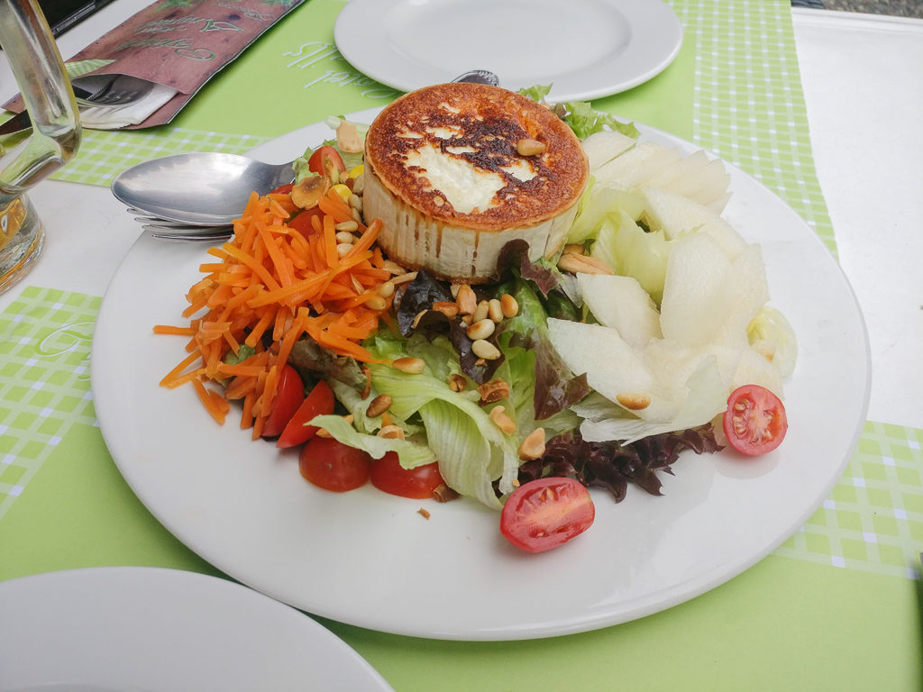
For €10.50 each, we had an amazing feast – Wayne choosing steak and chips with a fried egg, whilst I opted for lamb chops with asparagus and house fries. Washed down with two large beers, we were also given a small plate of cured meat and olives, plus a basket of bread. Between Spain and France we really can’t say we’ve had a bad meal yet. The fantastic lunch made up for us not being able to get a meal at Heas a couple of nights ago and it also meant we wouldn’t really need an evening meal that night saving us from two nights in a row of ‘instant noodles’ – as that’s about all we could get from the supermarket, apart from the standard cheese, meat and bread, of course.
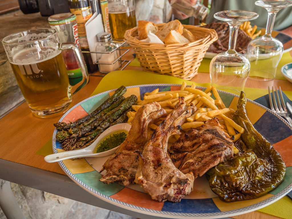
I could eat it all over again just looking at the picture! Lamb chops with an aioli sauce, house fries and grilled asparagus and habaneros – simply delicious and very filling!
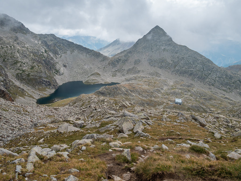
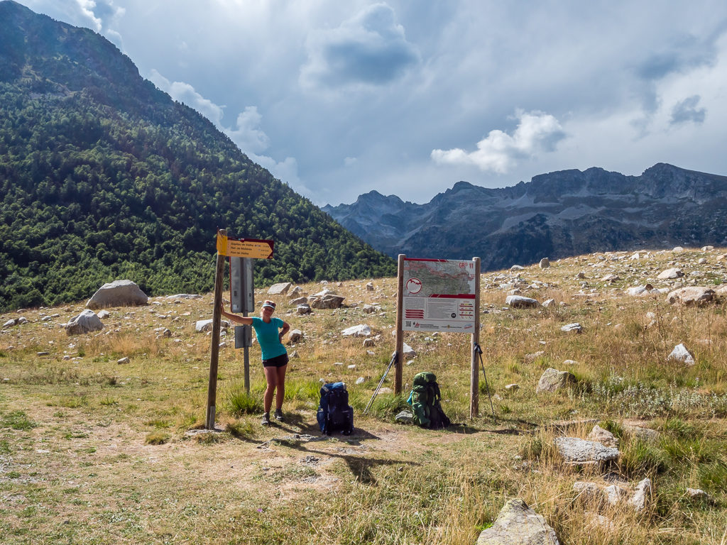
With our not very exciting supplies, we left Parzan around 4pm the same way we had came – via the long, tarmac A-138 main road. Except we didn’t have to walk the 5km back to the Valle de Barrosa car park, as now we had left the HRP route and would be rejoining the GR11 to take us to the Spanish town of Benasque, and the halfway point of our trip. Just 1.5km along the road, the GR11 turns off and follows a gravel track, winding uphill towards the Lago Urdiceto, climbing above the Barranco d’Ordizeto.
Last time around, we had found a good dry-camp spot just off the track about halfway to the reservoir. We didn’t want to camp in the same spot this time however as we wanted access to water, so we continued up the track aiming for somewhere past the reservoir but close to the Ordizeto River. That was when we had a chance encounter with none other than Brian Johnson – the author of both our GR10 and GR11 guidebooks!
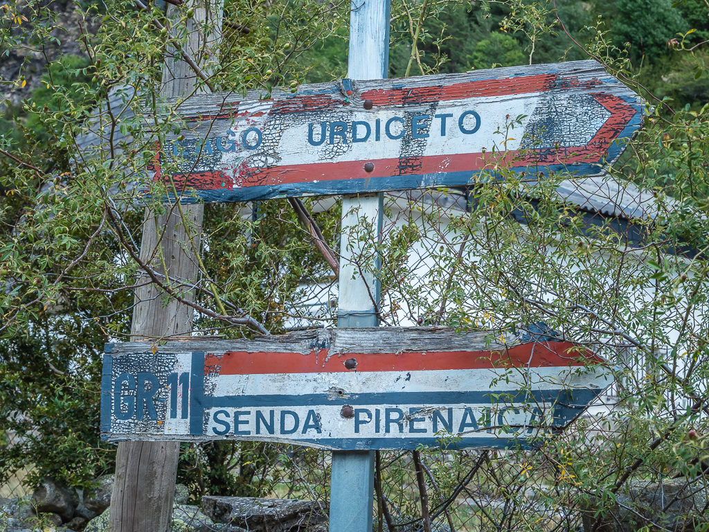
Old signage just off the main road signalling the track leading up to the reservoir, Lago Urdiceto.
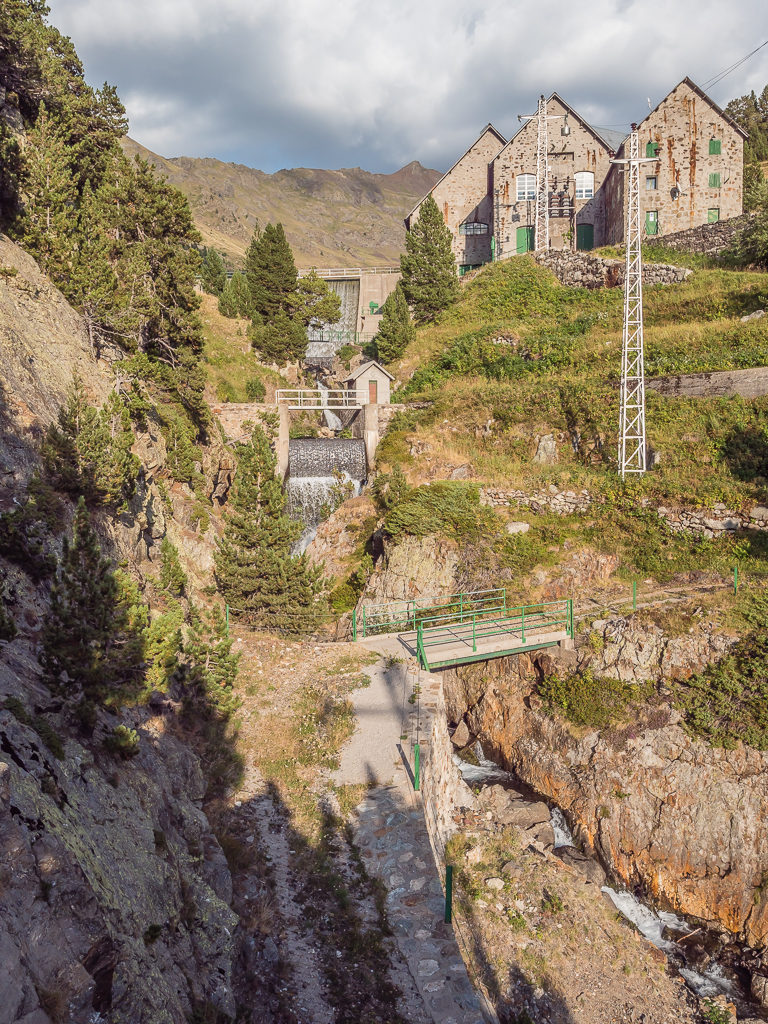
After 8.5 kilometres, we reached the Urdiceto dam and power station at 1,940m. (Also known as Central Electrica de Ordizeto.)
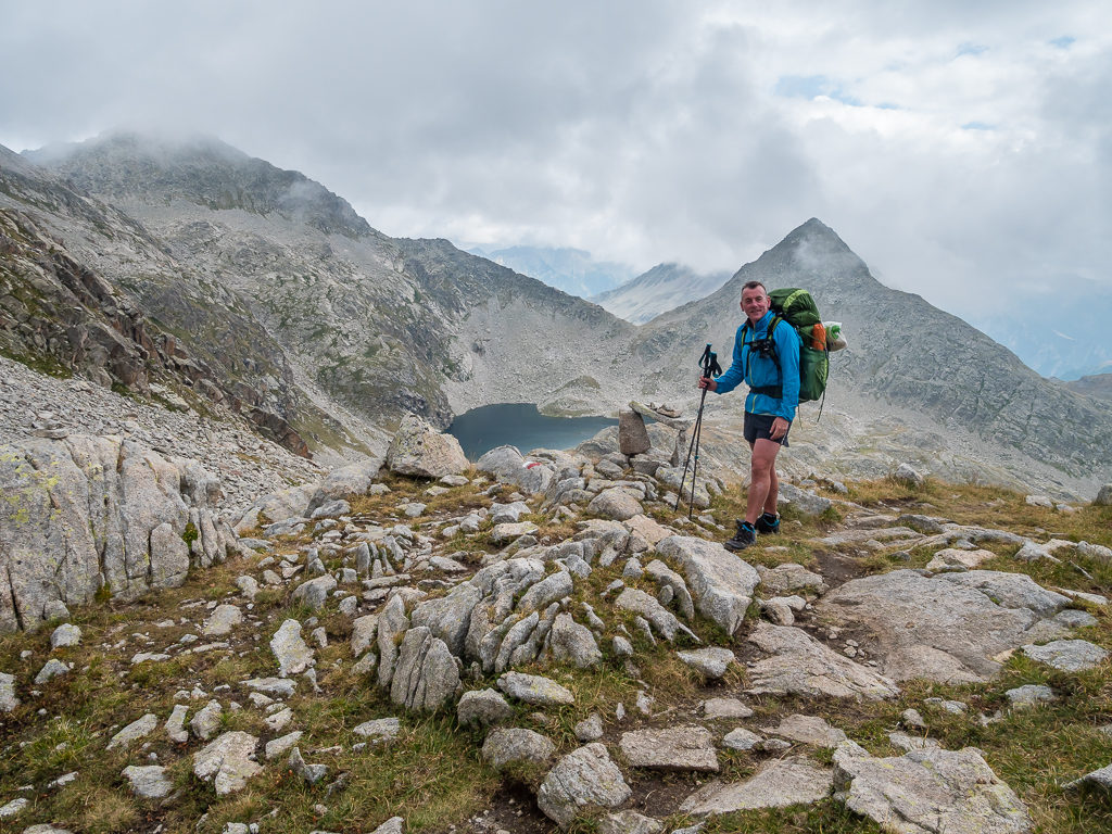
Stood in the middle of the track were two well-worn looking thru-hikers chatting together and it was only when Wayne walked past and heard them conversing in English did he stop to say “Hello!”. To our surprise, it was then that Brian asked what trail we were walking and if we were using his guidebook – resulting in Wayne’s immediate response, “Well it’s nice to meet you Brian!”. Wayne must say his name literally every other day remarking about the times and distances given in the guidebooks and how we reckon Brian must be a ‘super-fast’ hiker. Well here he was now, nearing 70, adorned in tattoos and donning a huge, grey beard. He didn’t look lightweight by any stretch of the imagination but he did look like a thru-hiker to the core.
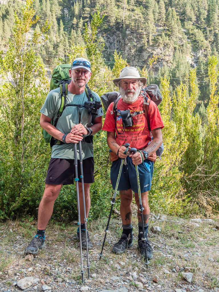
By pure chance, Wayne gets to have his photo taken with one of his hiking heroes – Mr Brian Johnson himself!
We chatted for about half an hour discussing the merits of the trail as well as the ease of the PCT compared with European trails, the PCT being another of Brian’s feats (and guidebook published by Cicerone). He quipped that he was carrying Mountain House meals from a bulk order he’d made to REI, so he didn’t need to resupply in Parzan. Lucky for him! We recommended he try the restaurant though as he was heading in the opposite direction to us, walking some various shorter, circular routes around the Pyrenees that he was devising for a new guidebook title.
The other guy stood chatting – Mike, another fellow Englishman, was walking the GR11 route and heading in our direction, so when we all parted he proceeded to join us in our hike up to the reservoir. We had only commented a day or so before how few English people we had actually seen hiking either of the 3 trails – the GR10, GR11 or HRP – and here we all were, four English folk together congregated outside Parzan.
The walk up to the reservoir, mostly on a stony track was not so bad with new company, but by now it was already nearing 8pm. When we reached some decent-ish looking ‘bivouac’ spots by the river, we parted ways with Mike as he was intending on hiking over the pass that evening and camping the other side of the Paso de los Caballos.
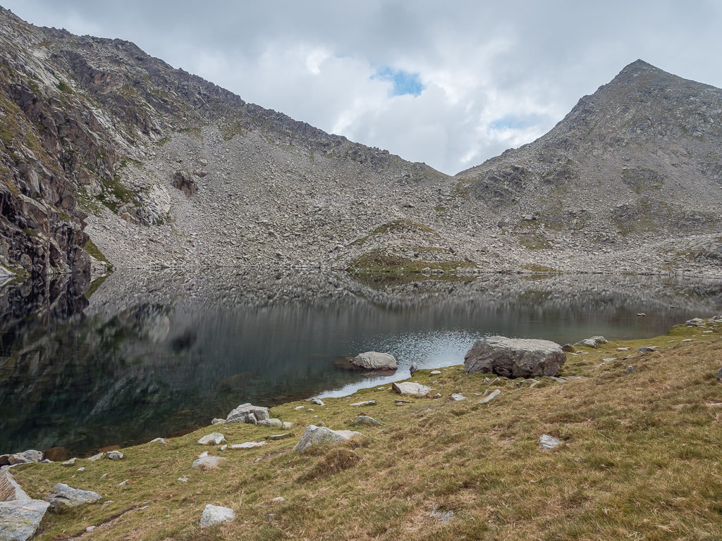
Passing the reservoir, which looked quite inviting in the late evening sun.
Looking for any flat spot to camp on, which proved quite a challenge as the ground was so uneven and the grass so tussocky.
Thankfully after a long while searching, we found a place just big enough to pitch the tent with access to water within a short walk.
In truth, although our wild camp was close to the river giving us access to water, it was not the best. The grass was tussocky so it was hard to find a flattish spot large enough on which to pitch a tent of our size. The task was also made more difficult as we were surrounded by numerous old cow pats that we were trying our best to avoid. Coupled with now being inundated by flies, we perhaps should have joined Mike and pushed on too. But it was too late and we’d already hiked off trail to find the camp spot, so making the most of the last remaining light before the sun went off the valley, we quickly unpacked and barricaded ourselves inside the tent.
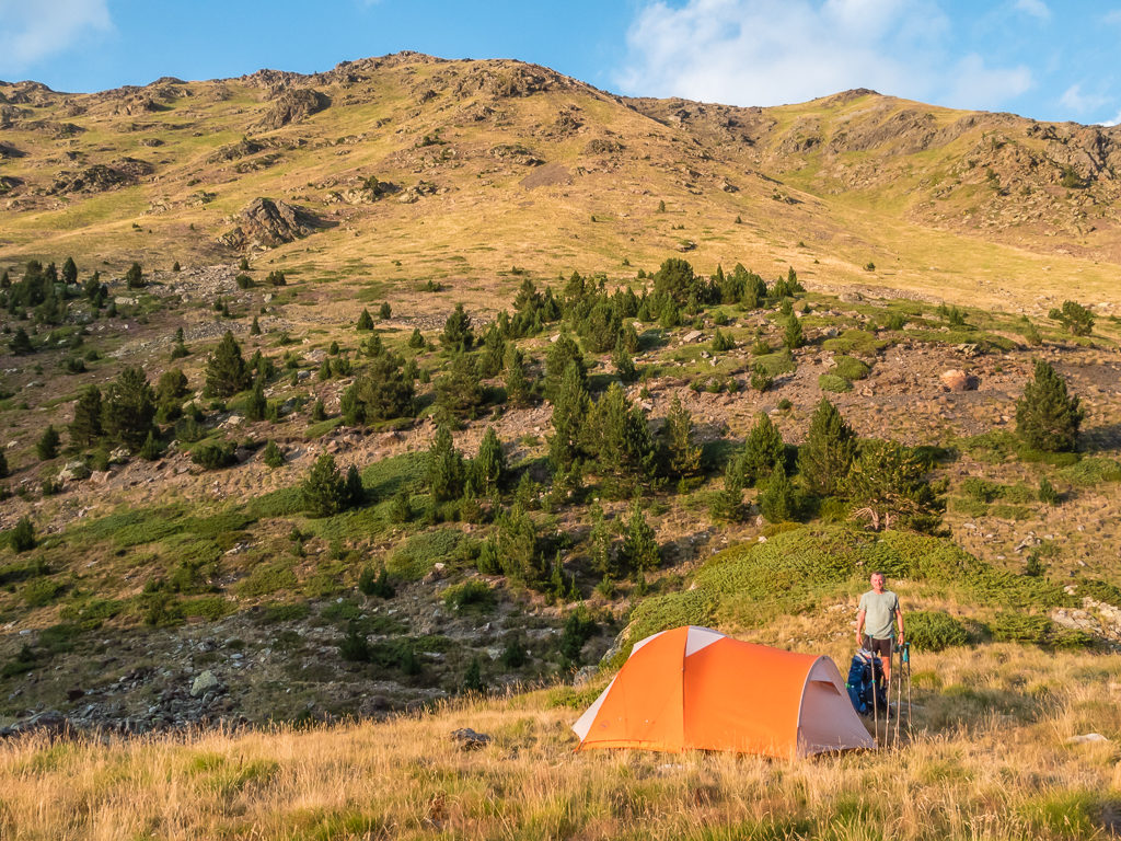
The best spot we could find whilst also trying to dodge cow pats littering the ground! We consoled ourselves with the beautiful views of the surrounding valley before the sun went down.
As we’d already eaten in town, we didn’t have to cook, thereby avoiding more annoyance from the persistent flies. We didn’t know where they’d come from, but they had been the worst we’d experienced so far on this trail. Maybe because there wasn’t any cattle present in the valley for them to feed on, we had become their unwitting victims. Anyhow, the tent saved us from any further discomfort and it wasn’t long before ‘hiker midnight’ consumed us instead.
Day 23 – ‘Space For Two More?’ Saturday 24th August, 2019, Wild Camp past the Urdiceto Power Station next to the Barranco de Urdiceto to Camping Forcalla at Es Plans, GR11, 11km
Waking up early, we decided to make a fast getaway in the relative cold to avoid another fly attack that was sure to come once the sun had risen in the valley. The tent was wet, but no matter. We just shook it out and packed the fly away in a carrier bag with the intention of getting it out to dry when we reached the top of the pass. As the pass was to the east, we knew the sun would already be up by the time we reached it, so we also planned on cooking breakfast there.
Leaving camp and hiking in shadow as we steadily made our way up the valley to the Paso de los Caballos at 2,314 metres.
Looking back across the valley as it was gradually coming into sunlight. Minus the flies, it felt much prettier this morning!
After leaving camp and crossing back over the river, we had zigzagged up the track and made it to the Paso de los Caballos at 2,314 metres by 9:30am. With the sun already burning away the morning dew, we got out our chairs and sat beside the emergency cabin looking across to our path winding down into the Valle de Gistain. We also had good, clear views looking out to the west side of the Posets.
With the tent fly also out and drying nicely, we sat and enjoyed a leisurely breakfast of ‘Havarti Cheese and Cured Sausage Quesadillas’, having managed to buy a packet of 20 small tortillas! It sounds a lot, but they were mini in size and would be the staple of both our breakfasts and lunches for the next two days seeing as we couldn’t get any fresh bread from Parzan.

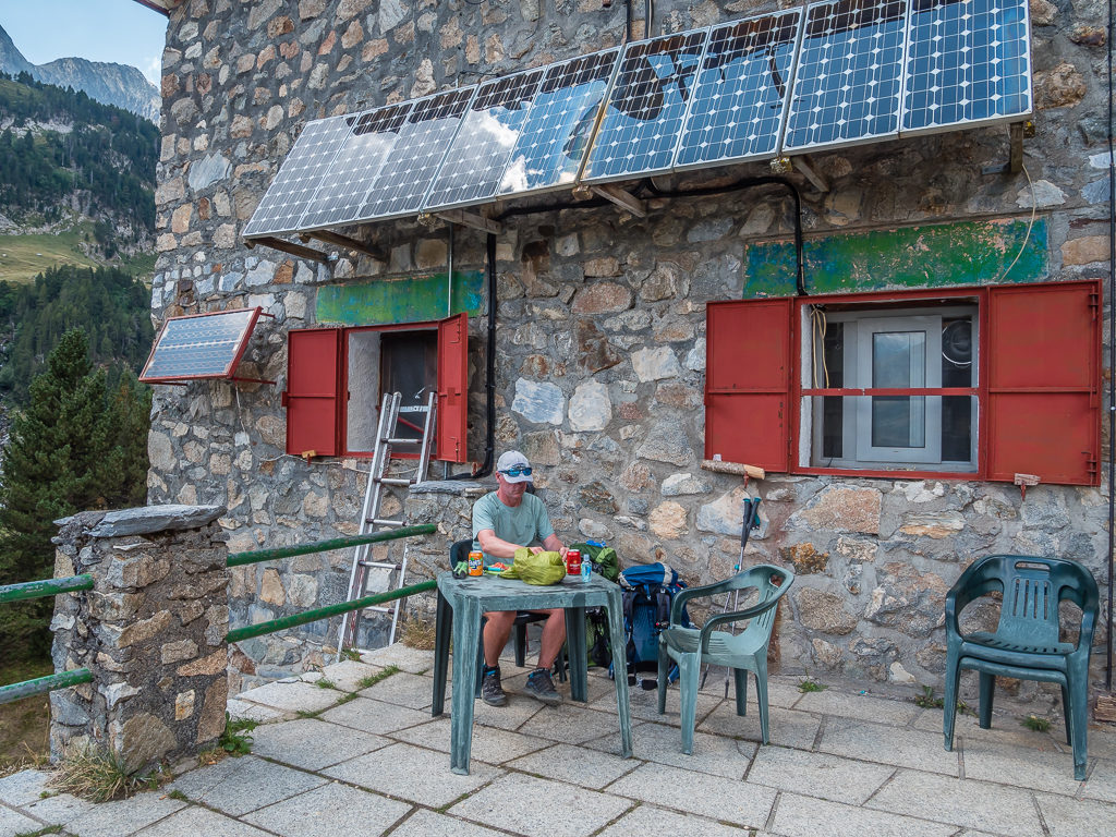
Enjoying our luxuries of camp chairs, plates, cups and a frying pan as Wayne prepares breakfast beside the emergency cabin on the other side of the pass.
Just before we left, two French, female hikers had arrived at the cabin after walking up from the opposite direction and they too got out their tent fly, sleeping bags and a load of other gear to dry out in the sun. It must have been a damp night whichever side of the valley we had all slept.
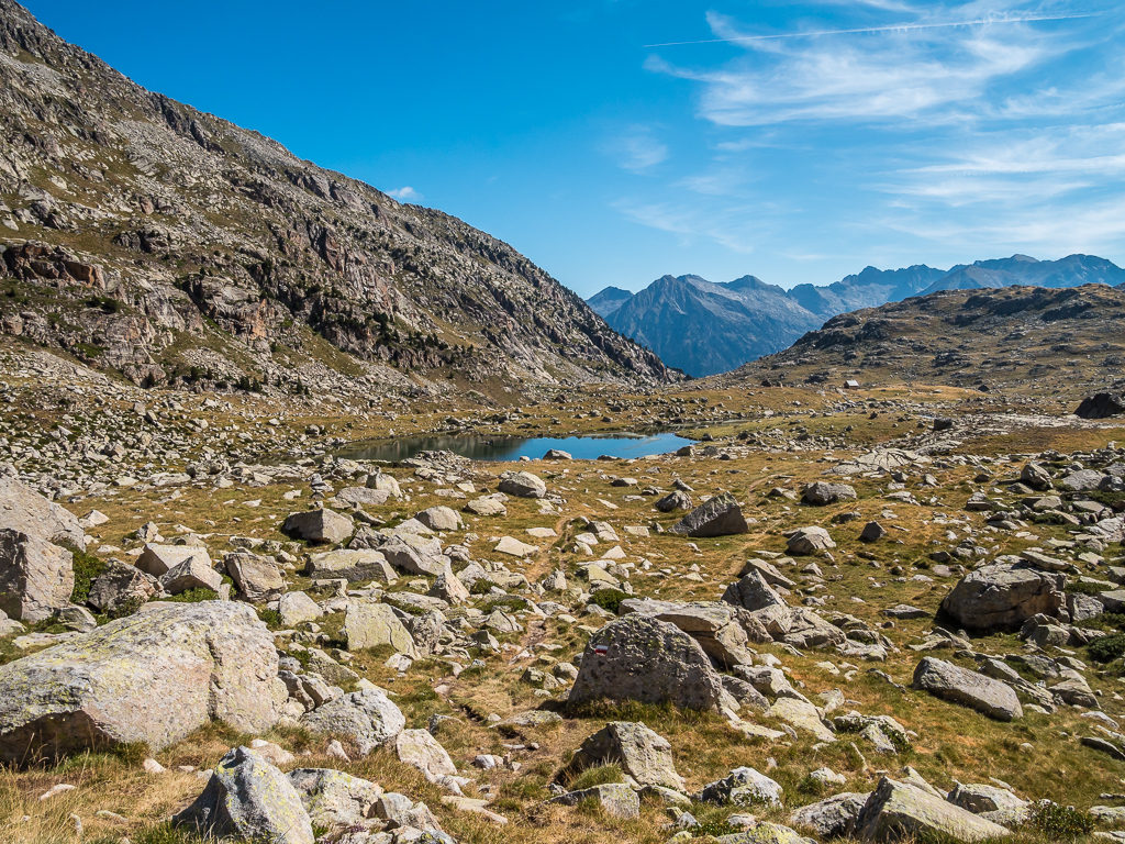
We knew it wasn’t a long walk to Camping Forcalla where we intended on staying tonight, and with just approximately 9km left to go, we estimated that we’d arrive by 1:30pm enabling us to enjoy a lovely half day and afternoon ‘off’. As the trail was now well-marked with the white and red flashes of the GR11, it was easy walking both in terms of navigation and because the trail today was mostly downhill. Reaching another little emergency cabin on a hill by midday – the Cabana Sellena (primitive but functional in bad weather), we stopped to have a rest break and enjoy the view of the surrounding landscape.
With cloudless skies and the temperature increasing, it was good to have some trees affording us pockets of shade when we stopped for water breaks.
Striking scenery in the Gistain valley, reminding us of some of our wonderful Lakeland fells back home.
Descending into the Valle de Gistain, today’s route was well way-marked with a good track underfoot – helping us make excellent time to camp.

Taking a quick breather beside the Cabana Sellena en route to Camping Forcalla.
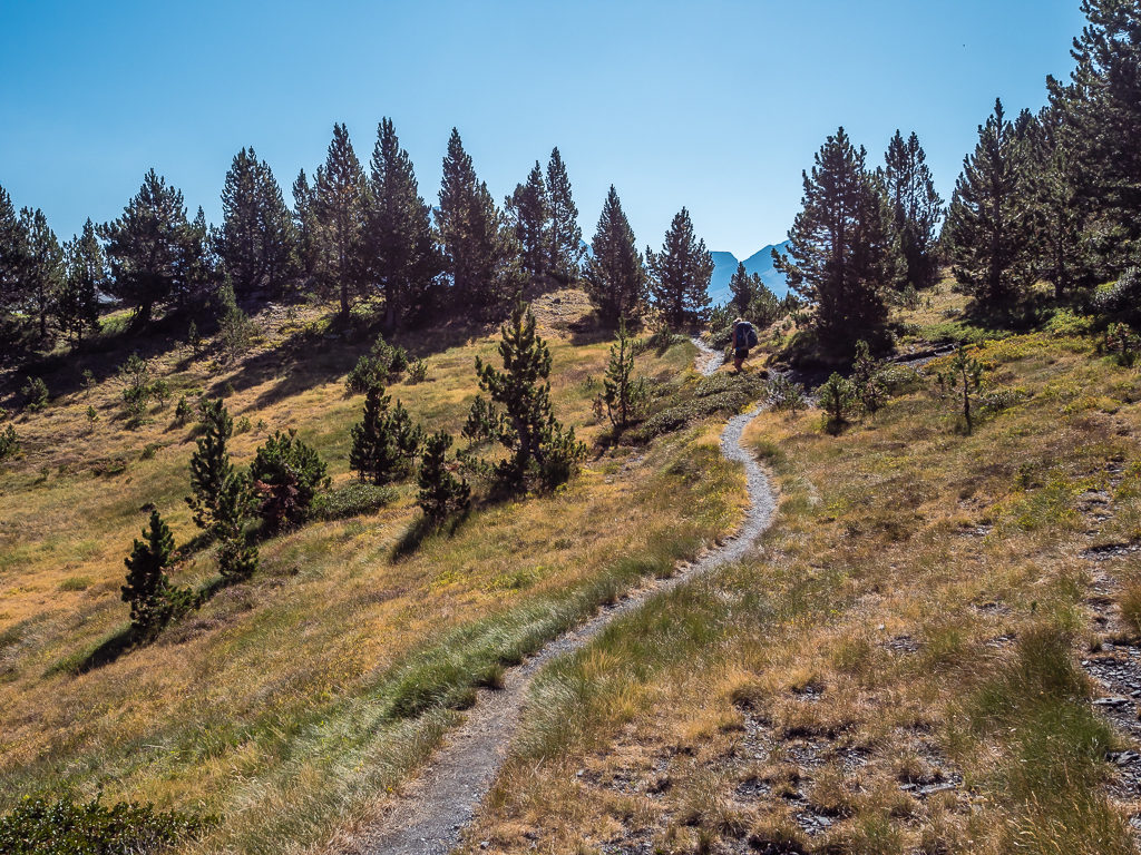
From this vantage point, we could see that the mountainsides were mostly covered in trees and it felt good to be entering woodland again – not just for the shade and wonderful aromas it afforded us but also for the variety of wildlife as there were now many more insects and wildflowers beside the trail. Bees were trying to get the last of the pollen from the drying flower heads, lizards darted between rocks on the lookout for prey, and butterflies fluttered back and forth in groups dancing between the ribbons of sunlight filtering through the trees. A valley walk is completely different compared with when the trail takes you out on a ridge line, traversing a barren landscape of rock from up high, both enjoyable experiences for different reasons.
Looking across to these densely forested mountains, it is how we imagine the Lake District in England would be but for the depredations of free-ranging sheep which prevent natural tree growth.
After sharing a packet of jelly sweets to give us a sugar boost for the final few kilometres, we then pushed on weaving between pine trees where the trail cut through several road switchbacks down to the Rio Cinqueta de la Pez. The car park area by the river was busy and there were several picnickers enjoying shady spots close to the water. Then before we knew it, we’d arrived at the campsite. That too looked extremely busy and we could see from the road that the terrace on which we’d camped last time was already full. A small, family-run campsite with decent facilities, Camping Forcalla is only open during the summer months of July and August. We went straight to the ‘Bar’, which is also the Main Reception, and thankfully secured ourselves a pitch for the night for €14.10. (Prices in France and Spain are per adult and per tent, not per site as in American National Parks.)
After leaving the Cabana Sellena, the trail then wound through a forest before joining a dirt road that led us to a car park area and picnic site. As it looked like a popular spot, we were uncertain as to whether there would be any pitches left at the nearby campsite.
Getting to camp by 1:30pm meant we had plenty of time for chores such as rinsing out clothes and setting up the bed area inside the tent, after which ensued an afternoon of complete relaxation. This included a lot of time moving my towel around following the course of the sun whilst baking myself to a crisp, whereas Wayne on the other hand was glad of the shade provided by two trees perfectly positioned in the corner of where we had pitched. With rest comes a little boredom however, and it wasn’t long before hunger pangs were getting the better of us. We had already had lunch and tried to resist breaking into any of tomorrow’s rations, consoling ourselves with the thought that we could have a big celebratory meal tomorrow night when we reached Benasque, our halfway point!
Making ourselves wait until 7:30pm for dinner, we had vegetable soup for starters (minus any bread), followed by a bowl of noodles with re-hydrated vegetables and a curry sauce, complete with a fried egg on top. They were actually really tasty and a new brand of instant noodles that we hadn’t tried before (‘Maggi’). So maybe Parzan did come good after all. We also treated ourselves to Twix chocolate bars for dessert. Hopefully that would keep our growing hiker hunger at bay until the morning!
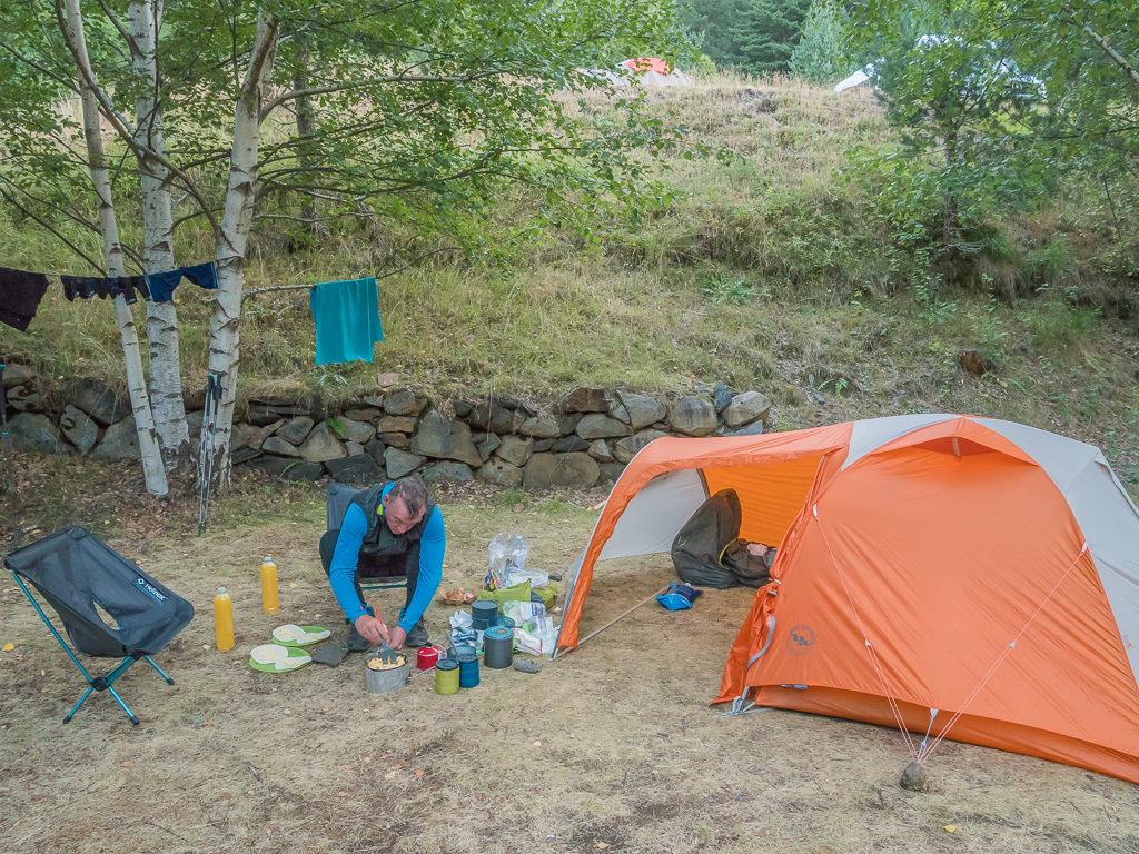
Resisting the urge to break into tomorrow’s rations, we dutifully waited until mid-evening to prepare and cook dinner despite being hungry for most of the afternoon.
Enjoying a new brand of instant noodles with added re-hydrated vegetables and a fried egg – you might not think so, but we agreed it was a dinner worth waiting for!
Day 24 – ‘Motoring On To Town’ Sunday 25th August, 2019, Camping Forcalla at Es Plans to Hotel Sommos Spa, Benasque, GR11, 23km
As soon as we woke up today, we were on a mission to get packed away and sorted as quickly as possible. There’s nothing like a forthcoming ‘Town Day’ and a few nights in a hotel to give us that extra motivation! Even with having a cooked breakfast of ‘scrambled egg wraps with melted cheese’ and hot drinks, we were still ready in an hour and a half – which was record timing for us!
We had already walked this section of the trail on our previous section-hike of the GR11 in 2017, so we knew what to expect in terms of terrain. It would be an easy but long walk to the Valle de Benasque. We just hoped it wasn’t as hot as two years ago when there was minimal shade to stave off the blazing sun from overhead, resulting in a giant packet of Haribo sweets becoming hot and sticky liquid jelly in my backpack.
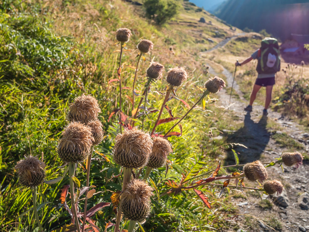
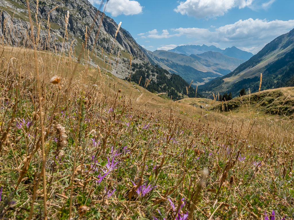
Late August and much of the flora had already gone to seed the further east we hiked.
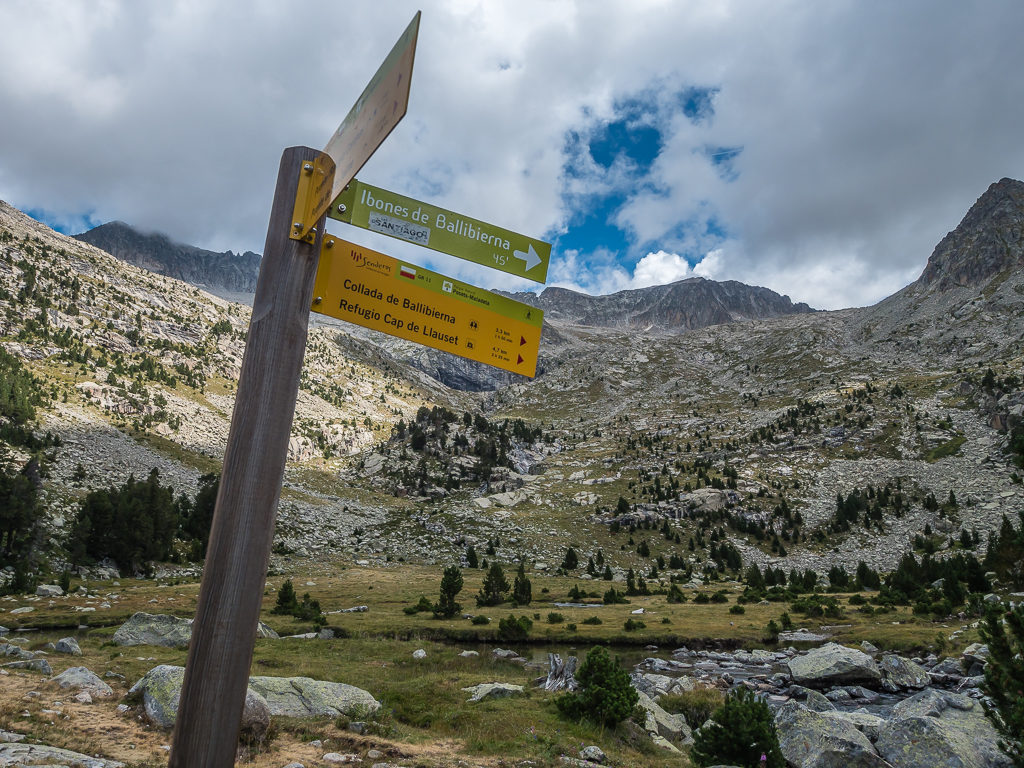
Setting off at 9am, it was a quick walk uphill from the campsite to the Refugio de Viados at 1,760 metres, followed by a long walk around the slopes of Punta Ixabre into the valley of the Barranco d’Anescruzes. Walking high above the steam, the trail was well-trodden and easy to follow with the GR11 markers signalling the route as we crossed a few small ravines, then made our way down a gully to where three streams meet. There are several routes to different passes that cross here, so it was pleasing to see a new signpost in place making the different variants a lot clearer. Our route was now uphill all the way to the Puerto de Chistau at 2,572m, which would give us access to the striking Valle de Estos on the other side of the pass.
Taking care on the rough track as we made our way towards the slopes of Punta Ixabre.
Thankfully the trail got a lot better under foot as we followed the long, winding path into the valley of the Barranco d’Anescruzes.
It looks like the pass is up ahead, which if we were following the HRP, it would lead due north to the Port d’Aygues Tortes at 2,683m on the French-Spanish border.
Except we had chosen to continue on the GR11 taking the same route to Benasque that we had done in 2017, so we crossed over the river and turned east heading for the Estos Valley over the Puerto de Chistau instead.
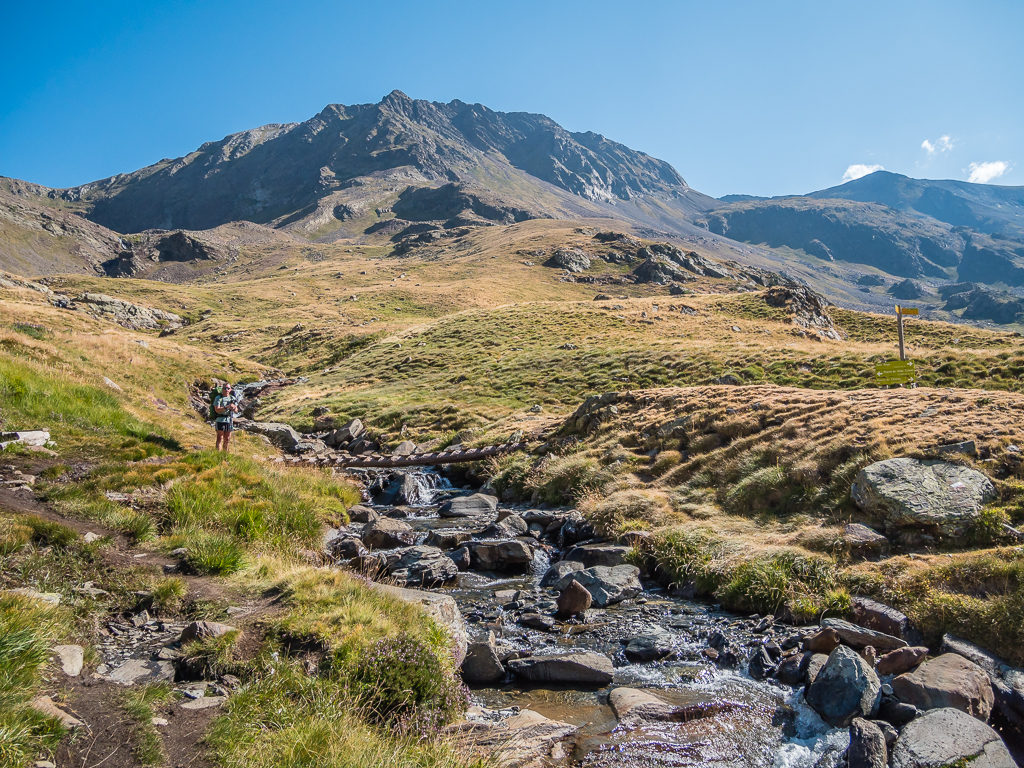
It was delightful to see that a new wooden bridge had been installed and we wouldn’t have to get wet feet crossing the river.
New and improved signage makes the different route variants much clearer.
We stopped briefly for a drink after crossing the Barranc de Gistain, sitting beside a series of newly erected wooden footbridges and also shared a bag of sweets for a quick energy boost before setting off for the pass.
Climbing steeply at first, we set a steady pace all the way to the top and didn’t stop for another break until we got there, where we then sat for just a few minutes looking out across the impressive Estos Valley. Even though we had been here before, it was like seeing it with fresh eyes – this grand valley affording us views of the two highest summits in the Pyrenees as we entered the Posets-Maladeta Parque Natural.
Starting the climb and looking back to the imposing peak of Punta L’Ixabre.
Looking back towards Punta L’Ixabre, which at 2,701 metres still commands attention from the adjoining valley.
Reaching the cairn at the top of the pass and looking towards the Valle de Estos, forming part of the Posets-Maladeta Nature Reserve. On the left, the magnificent peaks of Fitas de la Coma (2,719) and Fitas de O (2,877), and on the right, Tuca de Paul (2,698) and Tuca Posets (2,691) dominate the skyline.
Our path skirts around the mountainside on the right before descending across a steep wall of scree.
Having smashed out the biggest climb of the day in just over an hour, we then started our descent hoping to continue making good time. Knowing our hotel room in Benasque would be available from 4pm was just like dangling a carrot in front of a child! So we kept on going, thankful that the temperature wasn’t excessive as we descended on a path of scree on the right hand side of the valley all the way down to the Rio de Estos and an obvious path weaving it’s way along the valley floor. We had already overtaken two sets of walkers in front of us and before we knew it, we had reached the Refugio de Estos, situated in a prominent position on the mountainside at 1,890 metres. On a clear day, the veranda offers fine views looking onto the two highest peaks in the Pyrenees – namely, Aneto (3,404m) and Pico Posets (3,375m).
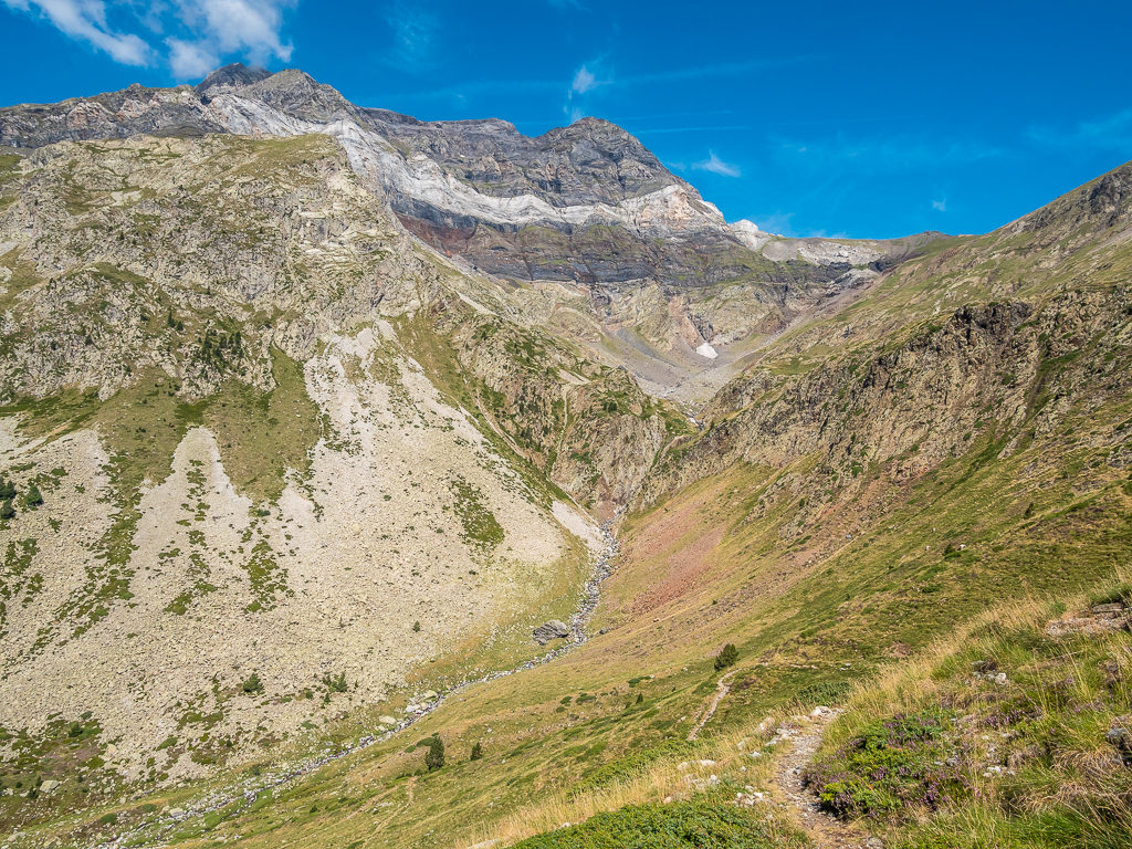
Heading into the beautiful Estós valley within the Posets-Maladeta Nature Reserve, which showcases some of the most iconic mountains in the Pyrenees.
With rich woodland and wild fauna, these lands are inhabited by bears, otters, chamois, deer, roe deer, wild boar and birds of prey (Golden Eagle, vulture and the Bearded vulture).
Carved by glaciers, this highly scenic and unspoilt valley is considered to be the most captivating in the Pyrenees.
Descending via a scree slope – yet it didn’t seem as daunting as the first time around!
The Pyrenees in all their splendour. In the distance, the Maladeta Massif or Malditos Mountains dominate the scene.
By the time we reached the refuge it was 1:45pm, so we gave ourselves half an hour on the terrace outside to sit and have lunch with a view. We were making wraps using the last of our rations, but purchased cold drinks (mine being a can of Estrella) from the refuge as a pre-town treat!
Wayne preps lunch in the seating area on the refuge veranda.
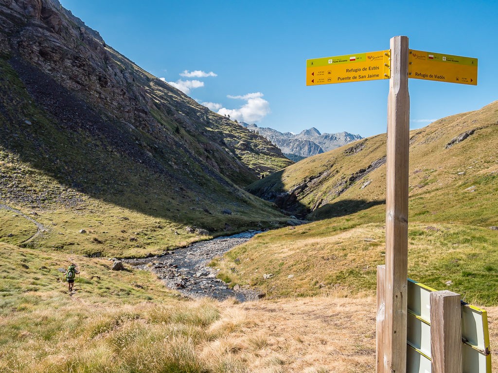
Leaving the refuge at 2:15pm, it was then an easy and fast walk down to Puento de San Jaime as it was mostly on a gravelled track, which then turned into a dirt road. Then arriving at Camping Aneto where we had stayed last time, we popped to the campsite supermarket hoping to buy ice-creams, but had forgotten about ‘siesta‘ so the shop was closed until 5pm. With it being just a little after 4pm, we didn’t want to wait around for that long, so we we decided to head straight to the main road for the final 3.5km into Benasque. As is always the case with a straightforward route and a burning desire to reach town as quickly as possible, we always seem to make good time when road walking – hence we made it to Benasque by 5pm!
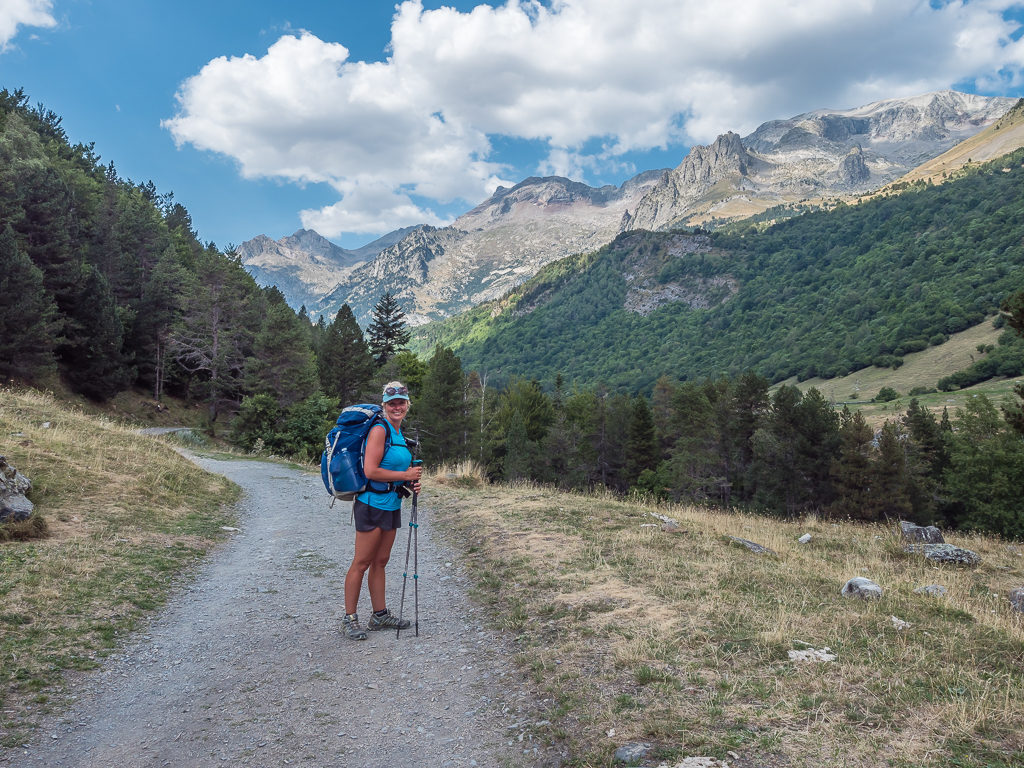
With an excellent track underfoot we could power out the remaining kilometres to Benasque with relative ease, all the while soaking up the tremendous views!
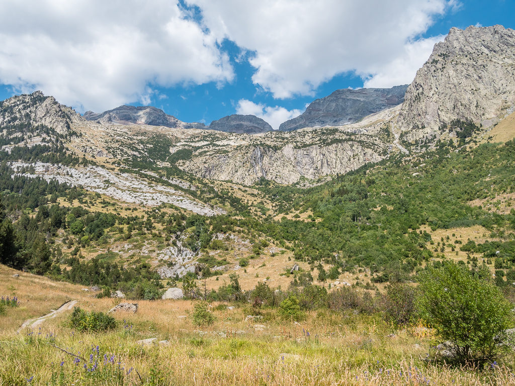
Rocky summits, glaciers and exposed ridges dominate the skyline in the Posets-Maladeta Natural Park.
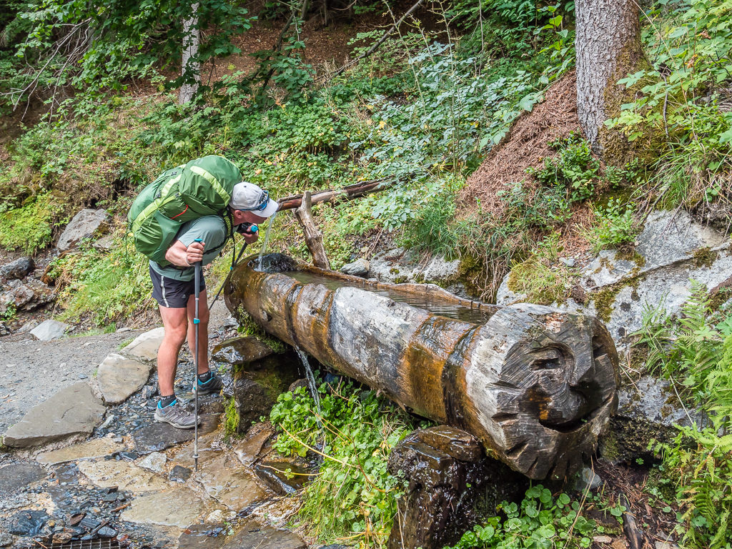
Having a quick drink stop and enjoying water straight from the mountains without having to filter it.
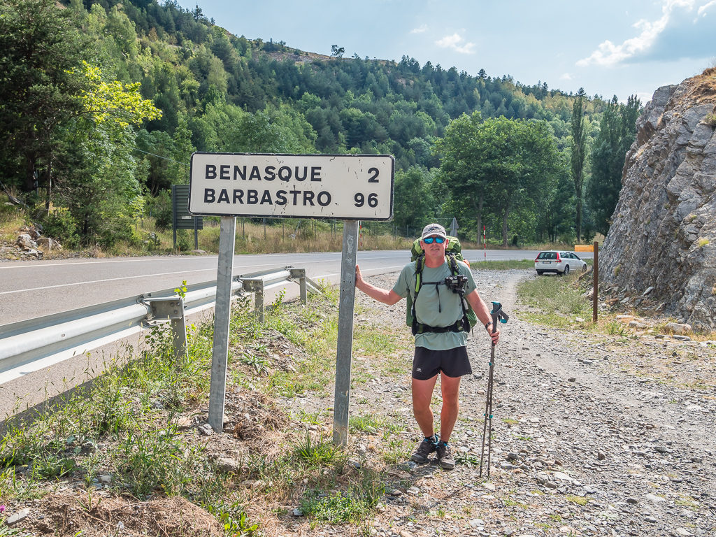
The final push – our last 2 kilometres of the day taking us to the small Spanish town of Benasque, our halfway point of the trip!
Surrounded by the largest concentration of peaks higher than 3000 metres in the entire Pyrenees, including the tallest Pyrenean peak Aneto (3,404m), the beautiful Benasque valley offers an abundance of outdoor activities both in summer and winter time thereby attracting visitors all year round. Situated right in the heart of the Pyrenees and with a population of around 2,000, the main town although looking fairly modern with its stone and slate architecture is steeped in history. The local Parish Church of Santa Maria La Mayor has Romanesque origins for example, and the Palacio de los Condes de Ribagorza on Calle Mayor dates back to the 16th century.
Wandering through the labyrinth of cobbled alleyways and onto the town’s main thoroughfare when we arrived, it was a surprise when we happened to see Mike, the fellow English hiker we’d met the other day when leaving Parzan. He had popped to town to resupply and was debating whether to get a hotel for the night or to push on. We chatted for a while, telling him our plans for the next few days, then wished him well on the rest of his journey on the GR11. After waving farewell, we then used ‘Google Maps’ to locate our own hotel, which happened to be located right at the other end of town. Benasque is not that big however, so it was literally a 10 minute walk from where we were in the main square, and of course, passing a supermarket en route we had to buy some sangria and a 1 litre box of our favourite ‘Dom Simon‘ vino tinto – the ‘el cheapo’ wine box we had first bought in Canfranc!
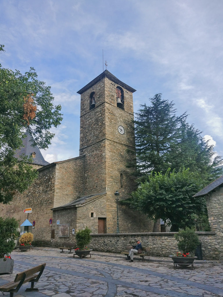
Walking past the ‘Parish Church of Santa Maria La Mayor’, the main church in the town of Benasque, which dates back to the 11th century.
Checking into the Hotel Sommos Spa, (which I had picked purely for the fact the hotel had a swimming pool), we found it highly amusing that we were given room number ‘1’, but at least we were close to the WiFi router, the leisure facilities and the bar! It was then time for some rest, relaxation and restaurant food to celebrate making it approximately halfway across the Pyrenees!
Considering Benasque to be the halfway point of journey, we had decided to give ourselves 3 nights and 2 zero days in town as a mini celebration. And what better way to mark the occasion than to feast on a ‘parrillada‘ – a giant plate of meat – one of our favourite meals that we’d enjoyed so much in South America. Having spied a parilla restaurant on our way into town, we then promptly headed there for dinner once we had showered and changed into our ‘town clothes’. (Reading this back and editing almost a year later, I have mixed feelings about this having taken part in ‘Veganuary‘ and us now trying to make more ethical choices and reduce our meat consumption.)
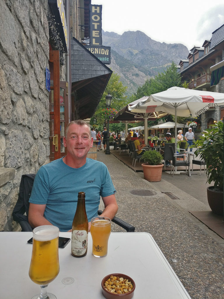
Enjoying a beer or two at Restaurante Aragüells, which quickly became one of our favourite bars in Benasque!
I might be wearing my ‘town dress’ but I was still rocking the hiker look with my trail shoes having broken my one and only pair of flip flops! Tomorrow would see us on a mission to find some more!
Sunday night in Benasque was busy – the terrace areas outside all of the bars and restaurants were buzzing with groups of people enjoying dinner and drinks ‘al fresco‘ – so it would be rude not to join them. As we kept on reiterating to ourselves as well as reminding everyone back home – not only were we walking across the Pyrenees, we were on holiday too!
Days 25 and 26 – ‘Resupply And Refuelling Heaven’ Monday 26th and Tuesday 27th August, 2019, Hotel Sommos Spa, Benasque, zero kilometres
We had been looking forward to reaching Benasque for several reasons. Not only did it signify us reaching the halfway point of this summer’s long distance hike, but we had also earmarked the town as a place to take a few days off trail and enjoy a ‘holiday’ within a holiday. Not that it was essential to stop and recharge the batteries as we had already been taking it steady, but it was a reward for our efforts so far and something we had very much been looking forward to as we hadn’t had the opportunity to stay there last time around!
Having briefly hiked into Benasque back in 2017 to find an ATM as we needed some more cash, we had not only been impressed with the facilities available in such a small place, but set amidst the splendid mountains of the Maladeta massif, we had fallen in love with the charming Spanish town and wished we had included it in our itinerary. Consequently, we had been longing to return and spend a decent amount of time there to really experience the place more as a tourist than a hiker, hence we had chosen a hotel with a swimming pool in which to wind down for a few days. If ever there was a place abroad to settle down and retire in, for us Benasque would be the one!
And wind down we did… From indulging in some of our favourite food dishes at the wonderful array of restaurants to sampling more Spanish wine and beer in the traditional bars to visiting every gear shop in town in search of new flip flops and a bikini, to spending time by the pool and in the jacuzzi – just because we could! All of which was tremendously enjoyed after our usual town chores of food resupply and several trips to the laundry to wash every piece of our gear in an effort to return to trail looking and smelling as fresh as we could! (Keeping in mind that after these few days of frivolity, we still had over 250 miles to walk to reach the Mediterranean!)
To lighten our load a little, in between hangovers and over-eating at the hotel breakfast because it was ‘included’ in the room price, we also made it to the Post Office in order to send home our used maps, our unused mosquito head nets, and a t-shirt of Wayne’s. Thankfully the opening hours were much more thru-hiker friendly than in Sallent de Gallego.
Feasting on one of our off-trail favourites – ‘Ensalada de Queso de Cabra’ – a deliciously fresh goats cheese salad.
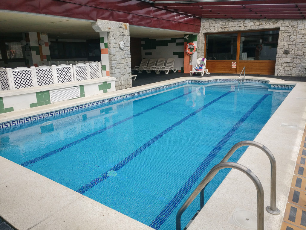
Taking time out for a dip in the hotel pool, the prime reason we picked this particular accommodation.
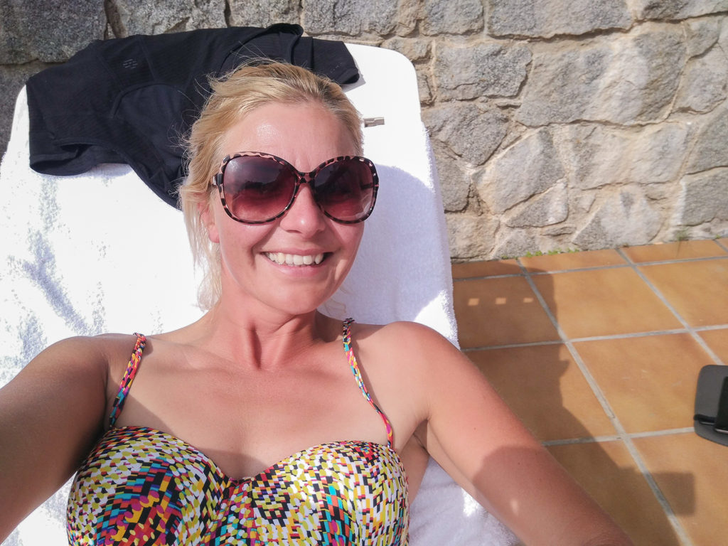
Benasque remains one of our favourite places to relax off-trail. Enjoying a spot of sunbathing during one of our ‘zero’ days.
All in all, the two days/three nights went far too fast and we fully recommend Benasque as a great authentic Spanish destination if you’re not bothered about being beside the coast but want a holiday with a mixture of local culture, decent bars and restaurants, epic mountain scenery, good access to walking/biking trails and above all, guaranteed sunshine!
Saying that, the final afternoon in town was however blighted by a 3-hour long thunderstorm and heavy rain, but it could have been worse – at least we weren’t on trail. So we took the bad weather as an opportunity to get organised and packed up in readiness for the following morning when we’d be having an early start and getting back on trail.
The weather forecast for the next few days was more blue skies and sunshine, but we couldn’t procrastinate any longer. All vacations must come to an end…
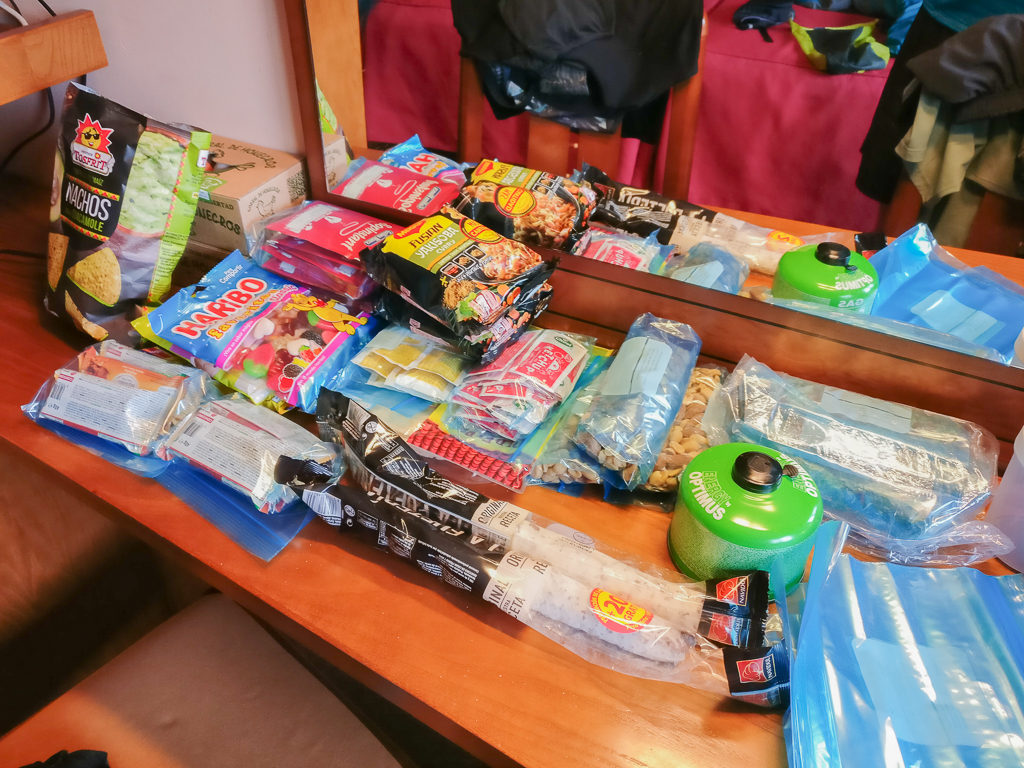
Along with laundry, one of our must-do town chores is organising our resupply. After purchasing what we need from the supermarket/ grocery store, this includes disposing of excess packaging and portioning out rations into sandwich bags ready for the next few days.
Day 27 – ‘Getting Back On It’ Wednesday 28th August, 2019, Hotel Sommos Spa, Benasque to Wild Camp by Estany Cap de Llauset, GR11, 13km
It had been lovely to stay in a traditional Spanish town for a few days. We had recharged our batteries and stocked up on ‘town calories’ feasting on the local delicacies – but as is always the way on a thru-hike, it was time to get back on trail. Going to the hotel restaurant as soon as it opened at 8am, we made the most of our last free hotel breakfast for a while enjoying toast, bacon, eggs, cheese, ham and a selection of pastries that were on offer. It wasn’t yet equivalent to the three giant plates worth of food as was consumed at the infamous Timberline Lodge on the PCT before we reached Washington, but we hadn’t just walked 2,000+ miles! (We’re still managing to ward off hiker hunger for now!)
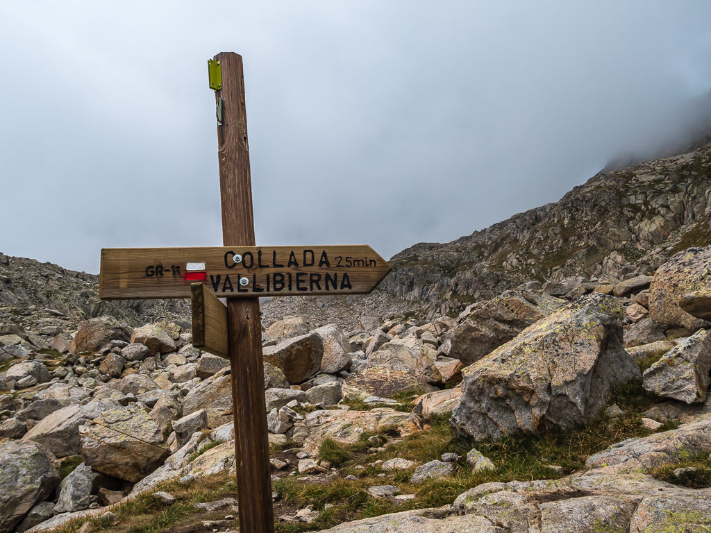
With 5km of road walking to cover from Benasque back to Camping Aneto in order to rejoin the GR11 trail, we left the hotel at 9am with our backpacks fully laden with fresh food supplies, plus a selection of free toiletries from the bathroom! We just needed to buy some bread from the ‘panaderia‘ on our way out of town. We left so early (9am was early for us!) because we needed to reach Senarta, another 3 and a half kilometres past Camping Aneto and Puento de San Jaime where we were going to take the 11:15am bus up the mountain to Puento del Corones situated at 1,980 metres. It was exactly what we did two years ago, saving us 3 hours of walking time and an extremely long climb. The day was going to be tough enough already as we had to traverse a boulder field up to Collado de Ballibierna at 2,732 metres, so we felt perfectly justified in our decision of taking the bus, otherwise the day’s total ascent would be 1,700 metres!
Saying a fond farewell to Benasque and hot-footing it to Senarta where we hoped to catch the bus up the mountain to Puento del Corones to save us an 800 metre climb.
Remembering the bus journey vividly for the hairpin turns the bus made as the road climbed steadily up a gorge lined with granite cliffs, the journey today was no different, myself taking the window seat whilst Wayne sat on the inside avoiding looking into the abyss! Forty-five minutes later and we had arrived, thankfully in one piece, at the Puento del Corones. There is an unmanned refuge located here, however camping is not allowed in the vicinity of the building. This was not an issue for us as we had already planned on bivouacking near to the smaller of the Cap de Laucet lakes, which would be a 5 hour or so walk from here.
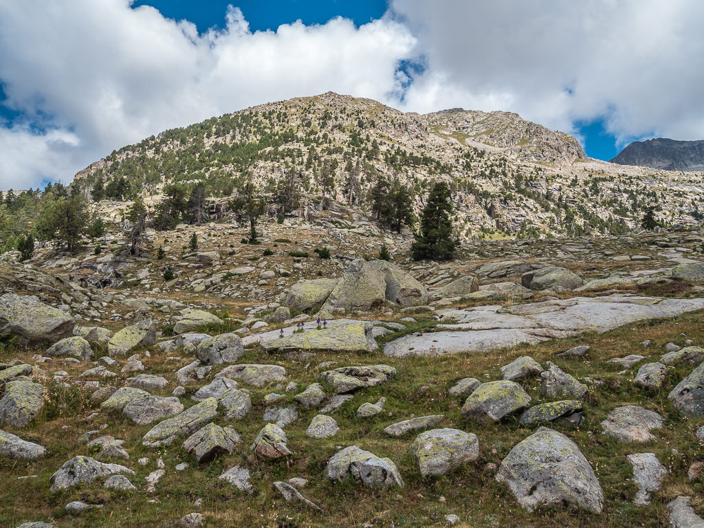
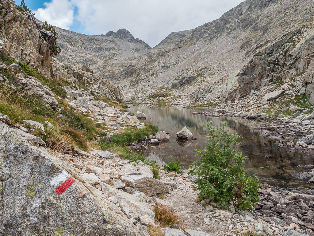
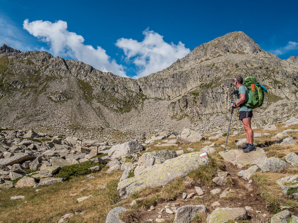
So we set off at midday – meaning we’d be hiking through the hottest part of the day (‘Mad dogs and Englishmen’ always comes to mind!) following the well-trodden path uphill towards the Pleta de Llosas (2,200m). As the path follows the stream most of the way up towards the Ballibierna lakes, we had regular access to water, yet luckily it wasn’t as hot a climb as we had expected due to increasing cloud cover overhead. Passing the plunge pool where I had stripped off and taken a dip last time around, we commented how different it felt, the trail being much quieter, but as we were pressed for time there was no repeat performance! Continuing uphill, we soon reached the smaller of the two lakes – the Ibon Inferior de Ballibierna situated at 2,440 metres. It was then that the route got a little more complex weaving between boulderfield and crags that were both rough and tough.
Glad to be off the bus and relying on our own two feet again! Setting off from the Puento del Corones and heading for the Collada de Ballibierna at 2,732 metres.
The lush, green, forested hills of the Basque country have gradually been replaced with bare rock and boulder fields the further east we’ve travelled.
Located on the south face of the Aneto and Maladeta massif, the stark and striking Valle de Ballibierna, which is a much less frequented hiking area than that of the upper Benasque valley.
Following the GR11 flashes, the path leaves the woodland behind and rises up alongside the Ballibierna ravine. In the distance, looking towards the rocky terrain and the sharp ridges of the Maladeta massif.
Passing the plunge pool where we had stopped to take a dip in 2017 amidst such breathtaking scenery. Thankfully today, the heat was much less intense so we pushed on towards the pass.
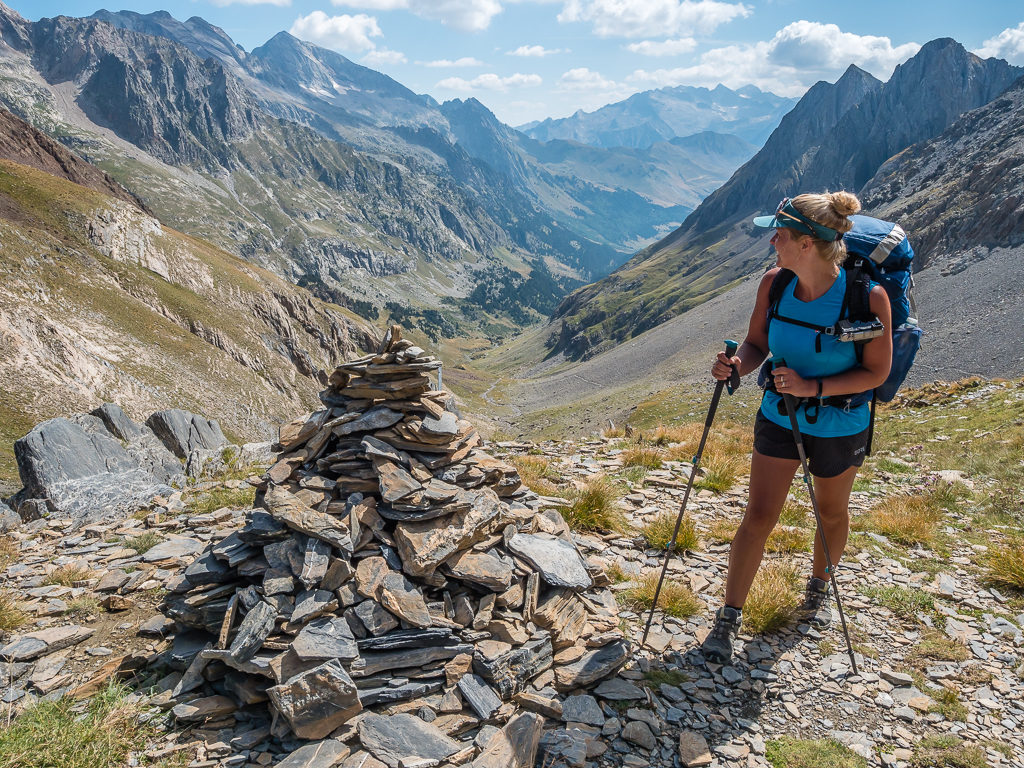
Continuing along the north shore of the lower lake and up the ridge to the east to reach the Ibon Superior de Ballibierna, we couldn’t believe that today we had it all to ourselves. On our previous hike, there had been several day walkers picnicking around the lower lake – but today, apart from us, there was no one. We didn’t stop for a break as we could see the pass straight ahead of us, so continuing on a combination of stony path and boulderfield we pushed on to the Collado de Ballibierna. At 2,732 metres, it didn’t seem quite as tough as the last time, but the temperature felt much colder at the top so we put on an extra layer whilst stopping to enjoy the views either side of the pass.
Surrounded by jagged peaks, windswept rocks, steep ravines and giant boulder fields – it was a beautiful reminder of how wild and remote we were.
Looking back to the magnificent mountains in the Posets-Maladeta Natural Park through which we had hiked just a few days ago.
Beautiful Pyrenean wildflowers thrive on the rocky slopes of the Maladeta massif. It’s amazing how flora and fauna can still survive at higher elevations in such harsh conditions.
Reaching the outlet of the smaller of the Ibones de Ballibierna where we were all alone on the trail. In the distance, we could see the pass as the clearly visible v-shaped notch in the wall of rock up ahead.
Sandwiched between the walls of rugged mountains, the Ibon Inferior de Ballibierna sits at 2,440 metres.
Looking back onto both Ballibierna lakes in all their splendour. In this inhospitable mountain environment they looked magnificent with the moody skies reflected on their mirror-like surfaces.
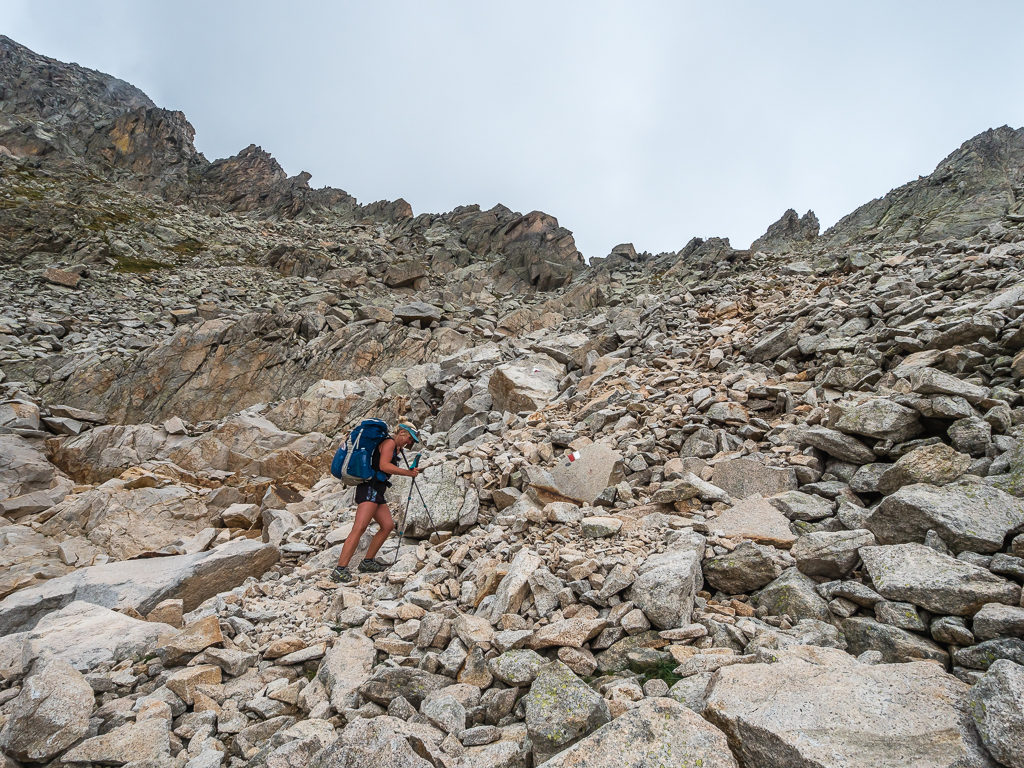
Preparing to tackle the final section of boulder field whilst making our way up to the Collada de Ballibierna at 2,732 metres.
Almost at the pass and it seemed like the weather was deteriorating.
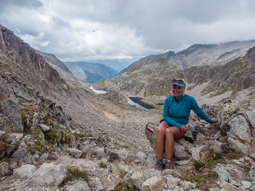
We finally made it! Taking a rest at the top of the pass where both higher and lower Ballibierna lakes can still be seen.
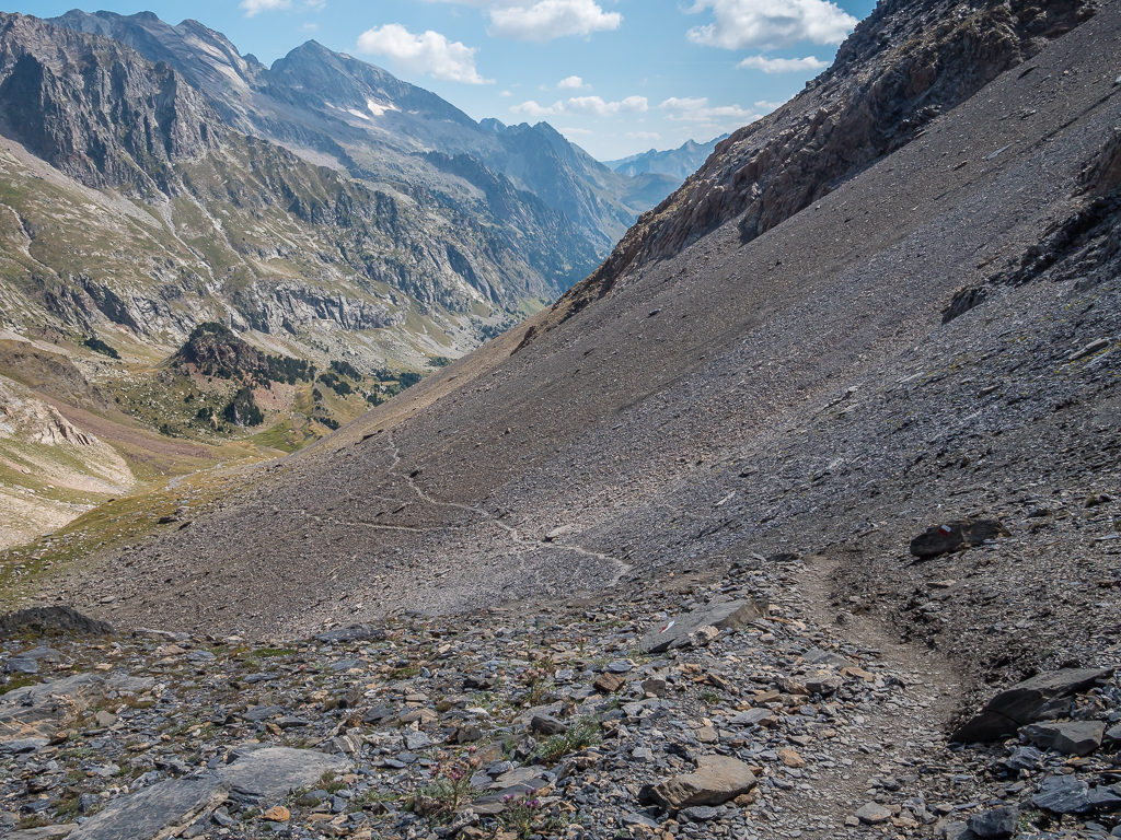
Our route down towards the Refugio de Cap de Llauset was again through boulder field, but it was clearly waymarked with white and red flashes making the descent much easier to navigate. It was hard going on the knees though with having to continually step down with care onto the giant boulders of granite and it was also mentally tiring having to concentrate on our footing for long periods of time. Fortunately, it wasn’t too long a walk down to the lake.
Over the pass and starting a tricky descent requiring due care and attention as we were stepping down between large boulders.
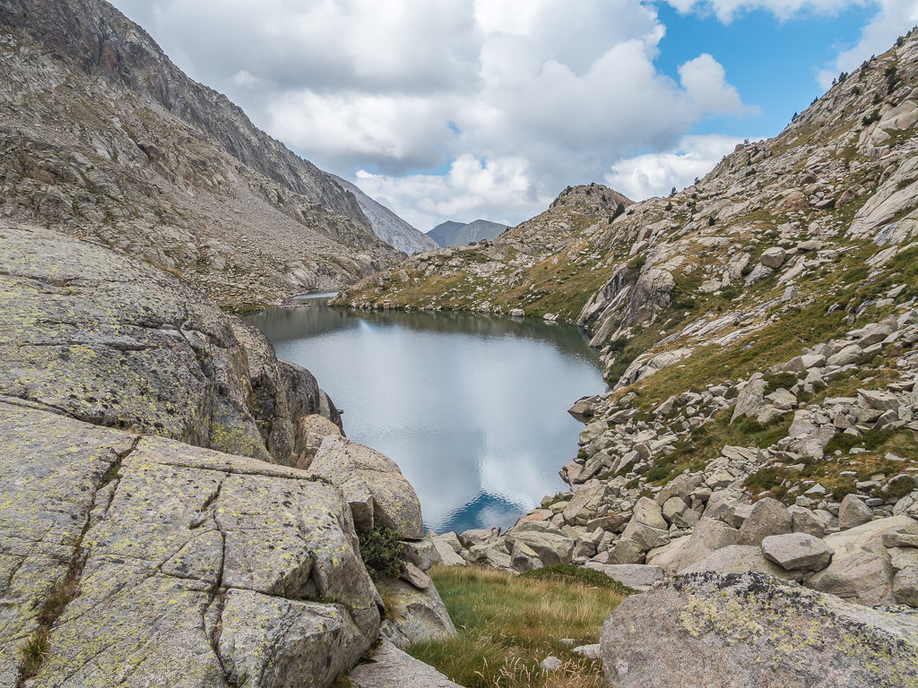
From the top of the pass we could see another magnificent mountain lake – the Ibon Cap de Llauset, as well as the sharply pointed peak of La Solana de Llauset reaching 2,672 metres.
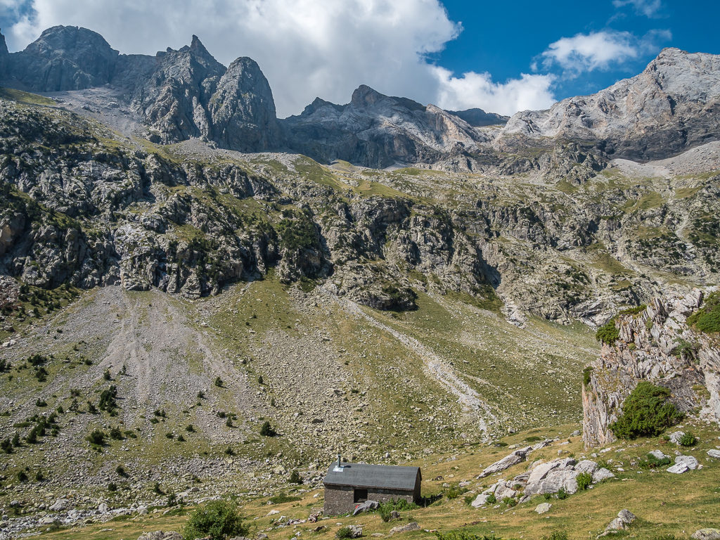
Below the Pic de La Solana de Llauset sits the Refugio de Cap de Llauset at 2,425 metres. The refuge was under renovation during our trip but has since re-opened, now providing 86 beds all year round.
We had originally earmarked a different camp spot for tonight over on the other side of the next pass, but as the Estany Cap de Llauset looked so pristine and undisturbed we made an impromptu decision to stay this side of the Collada d’es Ibons and make camp by the lakeside. We were also a little concerned about the possibility of thunder showers now that dark, ominous looking clouds filled the sky, so it wasn’t the best idea to push on and tackle another pass with the threat of not only rain but lightning too.
Happy with our decision, and having found an almost perfect grassy spot close to the water’s edge had it not been for the sheep poop everywhere that we first had to clear before pitching the tent, we then sat watching the beautiful reflections of the surrounding peaks shimmering in the turquoise waters.
It was nearing 5:30pm by the time we’d finished setting up and got organised, so we had a cup of hot soup then settled down for an hour’s nap before dinner. That’s one of the benefits of wild camping and embarking on a thru-hike with considerably less miles than our adventure on the PCT. Everything is far less regimental, so we can enjoy time at camp much more without feeling guilty. We have time to sit and time to nap and can really relax after a day’s walk. At 5:30pm on the PCT, we might still have had 10 miles to walk and often found ourselves continuing on in the dark to reach our set destination for the day. How different this preamble is!
Arriving by the lake shore of the Estany Cap de Llauset and looking for a good spot to camp.
Looking towards the pointed Pic de La Solana de Llauset, we were pitched up and all sorted by 5:30pm after which we were able to relax and enjoy our time at camp.
As well as the excitement of a scenic camp spot beside the lake, dinner tonight was something new! Having carried it from Benasque, we were going to feast on ‘Carne’ or meat-filled fresh tortellini pasta cooked and mixed with a fresh green pesto sauce. It was really delicious and I could have easily eaten two portions if we’d have had any leftovers – all that was missing was a handful of fresh pine nuts as a garnish! (Unfortunately we didn’t film a trail kitchen as it was a really quick dinner to cook and I was still a little sleepy after our earlier nap.) It had been the best decision to stop and make camp early – we now just had to add the next pass onto tomorrow’s agenda, but as the distance was only going to be around 11km, we could cope with that.
Day 28 – ‘Cruising Along, Or So We Thought!’ Thursday 29th August, 2019, Wild Camp by Estany Cap de Llauset to Wild Camp north of Hospital de Vielha, GR11, HRP, 12km
As we knew we only had a short day ahead, with approximately 11km or so to Hospital Vielha, we were in no rush to leave camp this morning. (It seems that I’ve been writing that quite a lot on this trip!) Enjoying a leisurely breakfast of scrambled eggs and cheese wraps again now we had our new supplies, with the added ‘extra’ of re-hydrated vegetables, we knew we’d have a good burst of energy to get us over the pass, followed by a long, gradual descent to the floor of the Valle de Salenques. As we estimated we’d only be walking for around 4-5 hours, we waited for the sun to crest over the eastern mountain ridge lighting up the both the lake and the rocky peaks behind us to the west.
What a wild camp spot! Waking up beside Estany Cap de Llauset under a beautiful, bright blue sky.
As the water of the Estany Cap de Llauset was so still and clear, we were treated to magical reflections of the surrounding peaks, along with the mirror image of the sun glistening on the surface of the pristine water. With yesterday’s clouds having disappeared completely and the temperature already feeling much hotter than when we had left Benasque, we knew that the tent would be dry in no time. So waiting for the sun to appear had been a win-win on both counts.
As the sun rose higher, we were treated to wonderful reflections of the Pic de La Solana de Llauset on the gentle rippling waters of the lake.
By the time we set off for the pass around 10:30am, we’d already seen a large group of walkers heading across the ridge high above us towards a different collada that seemed more of a scrambling route. There were also a couple of hikers in front of us heading up to the pass, as well as one eager Spaniard who had changed into his wet suit and was just about to go for a swim in the lake as we began the short climb up to the Collet dels Estanyets (2,521m).
Having camped at around 2,400 metres, we reached the pass fairly quickly after making our way uphill on a rocky path waymarked with the familiar white and red paint flashes of the GR11. There were a few boulders here and there to negotiate, but we were well-practised with this kind of terrain now so it didn’t slow us down too much.
Starting the short climb up to the Collet dels Estanyets at 2,521 metres and looking back to the Estany Cap de Llauset where we had wild camped last night.
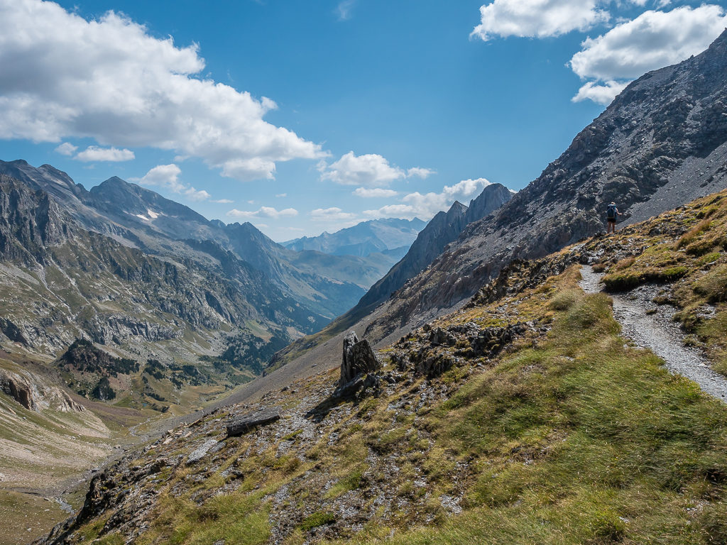
From the top of the pass, we had a tremendous view looking down onto the four Estanyets de Cap d’Anglos lit up by the mid-morning sun. Treading carefully as we stepped down from rock to rock on our descent, which in places was fairly steep through sections of boulder field, we were pleased with our decision to have camped before the pass at the other lake as it seemed much prettier and more secluded. With so many rocks now littering the ground on this side of the pass, we doubted whether we’d have even found a suitable camp spot until reaching either the third or fourth lake.
From the pass, we were afforded far-reaching views down the Anglos valley looking onto the four Estanyets de Cap d’Anglos.
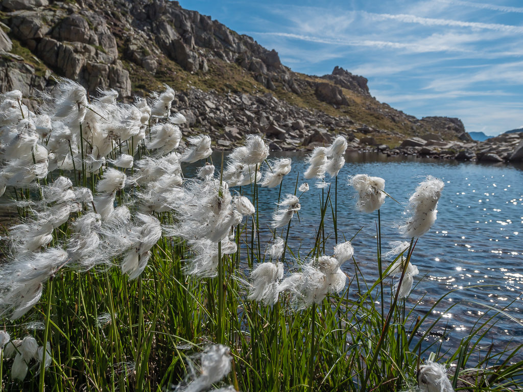
Cottongrass, otherwise known as ‘Bog Cotton’ blows in the gentle breeze beside one of the four lakes.
Surrounded by giant walls of rock, taking in the tremendous views of the upper Valle de Anglos.
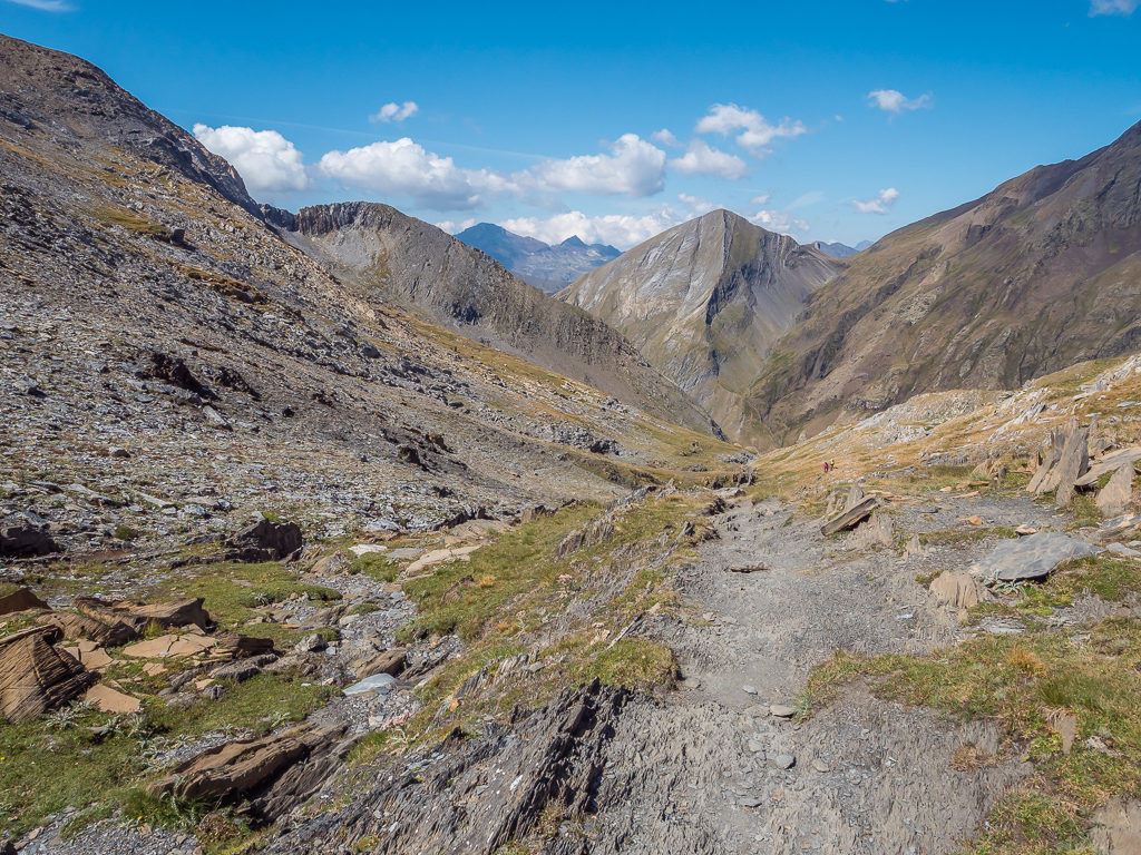
Reaching the Refugio d’Anglos, a small wooden, unmanned hut, we decided to sit on a rock and have a quick break in the sunshine before descending into the Valle de Salenques. This part of the walk was less enjoyable as the path took us out of the open and into the trees along the mountainside. Here the trail became a mass of rocks and roots and proved rather troublesome with us having to continually step over obstructions and focus our concentration on our feet, otherwise we could have quite easily lost our footing and suffered an injury. Teasingly, we could hear the river but couldn’t quite see it yet, rushing through the valley below us. No matter how much further we kept walking and manoeuvring downhill, clambering over large boulders and stepping over tree roots, the descent seemed to take an age and we wondered when we would ever reach the valley floor. It got to a point where it started to become reminiscent of our torturous descent from Goriz into the valley of Pineta, which we conveniently bypassed or rather avoided this time around by taking the HRP route, having grumbled through every moment of it whilst hiking the GR11 in 2017.
Spying the small, unmanned Refugio d’Anglos in the distance at 2,220 metres.
Descending further towards the Valle de Salenques, but stopping briefly to look back towards the refuge and the magnificent mountain range behind.
Thankfully after an hour or so, the river was in sight and the trail became a much better track the closer it got to the Panta de Senet lake complete with parking area and day walkers as it was just off the main N-230 highway. There were even picnic benches and a water point – now we knew we were definitely out of the backcountry and in tourist territory!
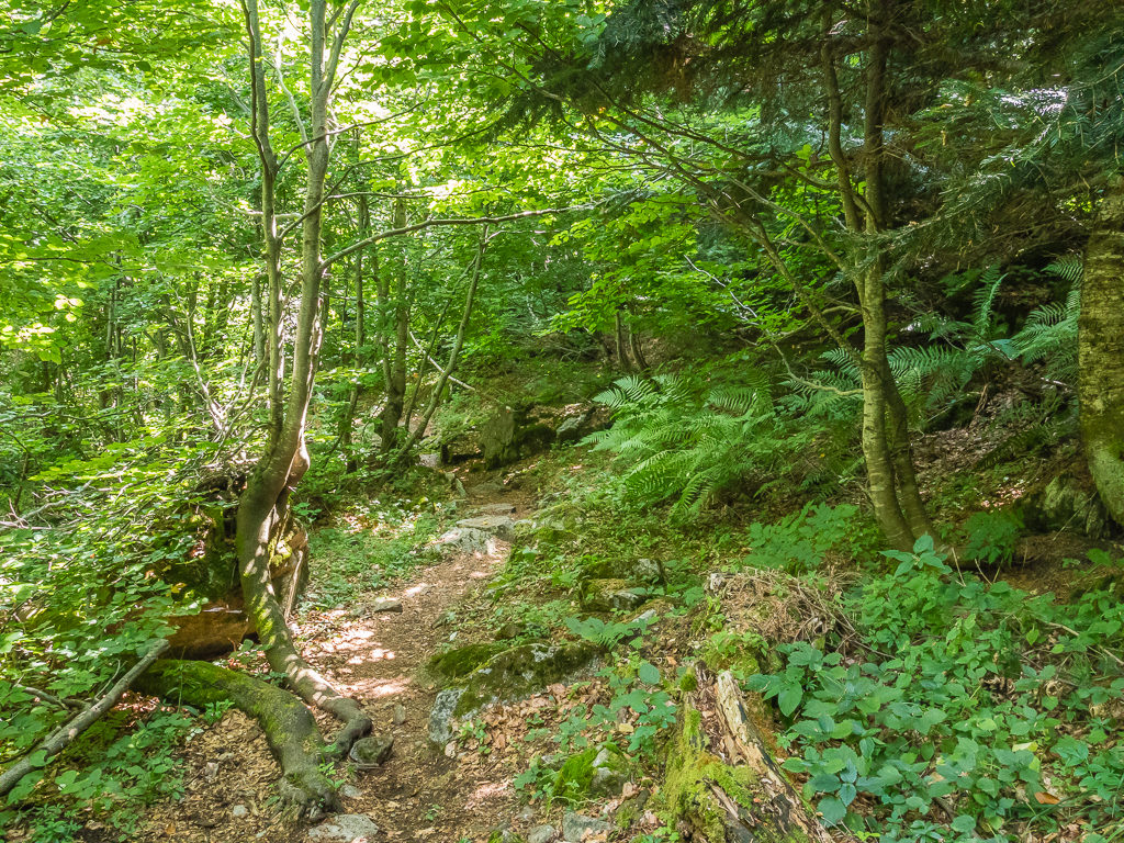
Leaving the bare, rocky slopes and entering an impressive beech forest enveloping us in romantic shades of green.
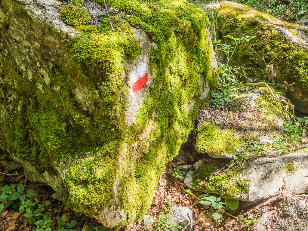
Ancient mosses cling to giant boulders that also act as a waymark with the white and red flashes of the GR11 painted on.
We followed the road a little way turning off into the next valley where the Barranc des Besiberri flowed to the left of us. Having spied several plunge pools earlier on in the day but opting to keep on going, we made the impromptu decision to stop by the stream for lunch and to take a dip. Why not take advantage of a free swim whilst we could?! It was only 2:30pm and we didn’t want to get to camp too early. Without strictly following the bivouac times, even we thought that 3pm would be far too early to pitch.
So after devouring the avocado, tomato and cheese sandwiches that we’d made earlier at breakfast, we stripped off to our underwear and headed for the cool, crystal clear water. It looked so inviting, but in reality it was absolutely freezing! Wayne tentatively stepped in to his knees, whilst I waded in and took the plunge. I could barely stay in up to my neck for five minutes however, the searing shock of the icy cold water making my body tingle and chilling me to the bone!
Following the course of the Barranc des Besiberri and deciding to stop for a dip!
Braving the icy cold waters in beautiful surroundings – albeit just for a few minutes!
Getting out, I felt akin to a cold-blooded lizard! Laying against a large rock I desperately needed the sun to warm me through as well as dry out my underwear. So we sat for an hour in total, letting the sun’s rays bring the warmth back to my cheeks again, and slowly but surely the rest of my body also regained it’s natural temperature.
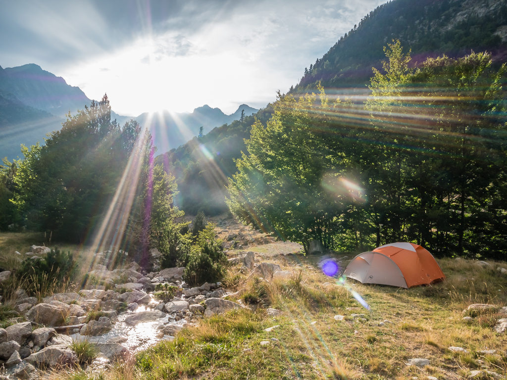
Setting off once again following the course of the stream, it wasn’t long before we came to a large picnic area complete with barbeques for public use, then beyond it was the Refugi de Conangles. At 1,555 metres, no wonder our knees had been feeling it as we’d descended almost 1,000 metres from the pass that morning. We had no need to go into the refuge so we carried on, re-joining the GR11 trail, which would take us towards the Hospital de Vielha. (Again, this was merely a reference point as there isn’t any accommodation or camping facilities near the hospital.) Pushing on a bit further up trail however, we managed to find a nice bivouac spot hidden by trees that was also close to a stream, which was perfect for starting tomorrow’s ascent into the next valley.
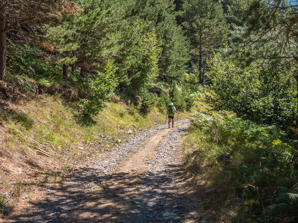
Dense woodland covers the lower mountain slopes, which includes Beech, Silver Fir and Scots Pine trees. The lush forests of the Spanish Pyrenees are rare in what is generally an arid country.
Back on trail and now following the GR11 route towards Hospital de Vielha.
Finding the camp spot around 5pm after filtering water proved rather fortuitous as thick cumulus clouds were now gathering above all the peaks that surrounded us, no matter which side of the valley. It looked like heavy rain and thunder showers would be imminent so we quickly got pitched and put all of our gear inside the vestibule.
After an hour or so, there were a few spots of rain on the tent as a fleeting shower passed over us. But thankfully, nothing more materialised. We were hedging our bets whether we’d have a dry tent in the morning though with camping close to water again.
It’s actually quite difficult attempting to ‘stealth’ camp in a bright orange tent, so a bit of cover from some trees is always very useful!
Dinner tonight was ‘Tagliatelle Pasta, Sausage and a Cheese Sauce’. Wayne could see some improvements to be made for next time however, like adding in tomato puree. But the meal was filling, so it would help us to sleep soundly after a bigger day on trail than what we had expected.
We can’t quite believe we have reached the end of ‘Week 4’ already! Time both on and off trail is flying by so quickly. Revisiting parts of the GR11 so that we could resupply in Benasque brought back some great memories, and our decision to enjoy some down time in such a charming place proved perfect as a mid-trail treat. But now recharged and raring to go again, we’re looking forward to rejoining the HRP and returning to some more high mountain thrills!

10 Comments
Once again really enjoying your journey here and through YouTube during these outdoors starved times.
Thanks Kevin! Looking back through old photos and footage is currently keeping us entertained too.😊
And you pass through another area where I’ve explored before! Back in the 90’s we took a trip to Benasque and camped in the Estos valley and beneath Aneto. Coincidentally while my own blog is paused as I have no new walks to write up, I’ve been scanning my old photos and writing up that trip. Link to the first post is below and I have couple more left to do.
https://surfnslide.wordpress.com/2020/04/06/back-in-time-pyrenees-1993-part-1/
Fantastic images and write up as always and these virtual hikes are keeping me sane in these challenging times 🙂
Thanks for reading and commenting again Andy.👍
I’ll look forward to reading your new blog posts and finding out about your own experiences in the Pyrenees!
Danielle,
thanks for presenting us the next stunning week of Your Pyrenees hike. The view down the Anglos valley is my favourite! Wow, what a view. But this week also seemed to be hard going at times.
Looking forward for the next part.
Best Regards
Marcus
The next part is now online Marcus! I hope this helps bring a smile to your face in these troubling times.
Thanks for your positive comments as always,
Stay safe,
Danielle
Thank you for sharing…these recaps have me feeling all the feels.
Thanks for reading and commenting Jenna.😊
Hopefully our recap of ‘Week 5’ will have you feeling the same!
Best regards,
Danielle
Hi you two.
Stunning photos and wonderful diary. Simply the best as a certain lady used to sing!!
Referencing the above:
Day 22: The sunrise shot with the Pyrenean thistle is stunning. Love it!!
The ‘Passing the reservoir, which looked quite inviting in the late evening sun’ shot really reminds me of Loughrigg Tarn for some reason!!
And yes, Day 23: the two Gistern valley shots certainly have a Lakeland feel to it!!
Day 27: Wow, the Collada de Ballibierna looks really hard going, no wonder you’re looking happy and rather relieved to be having a quick break at the top . . . and I thought the little old Cotswolds Way was tough!!
Stay safe
John
Thanks for your comments as always John,
Nice to hear from you. Hope you are also keeping safe and well.
I’m currently working on the final post. 👍
It seems like we reached the Med a lifetime ago now. We’re just itching to get back on trail!