
“Live your life by a compass, not a clock”.
– Stephen Covey
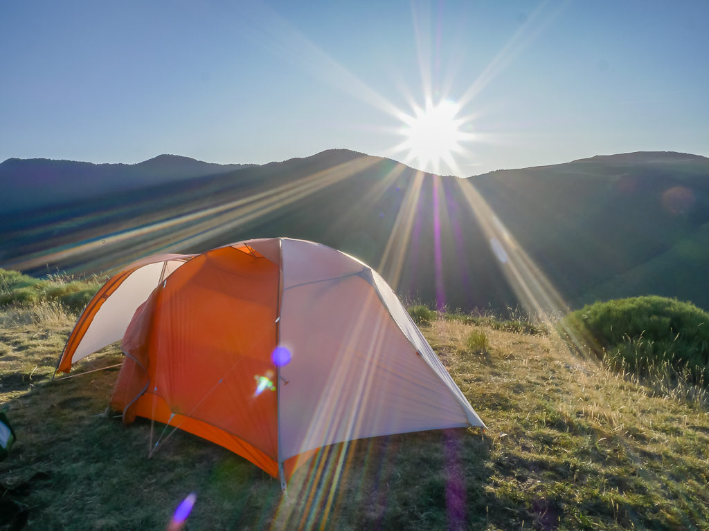
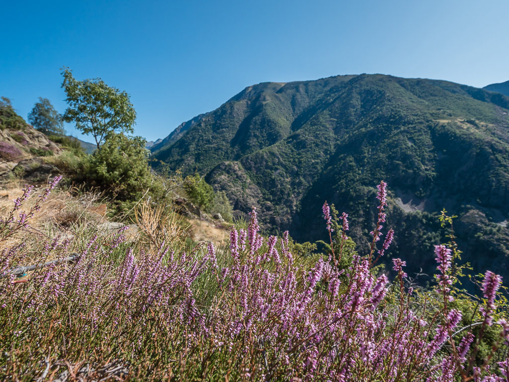
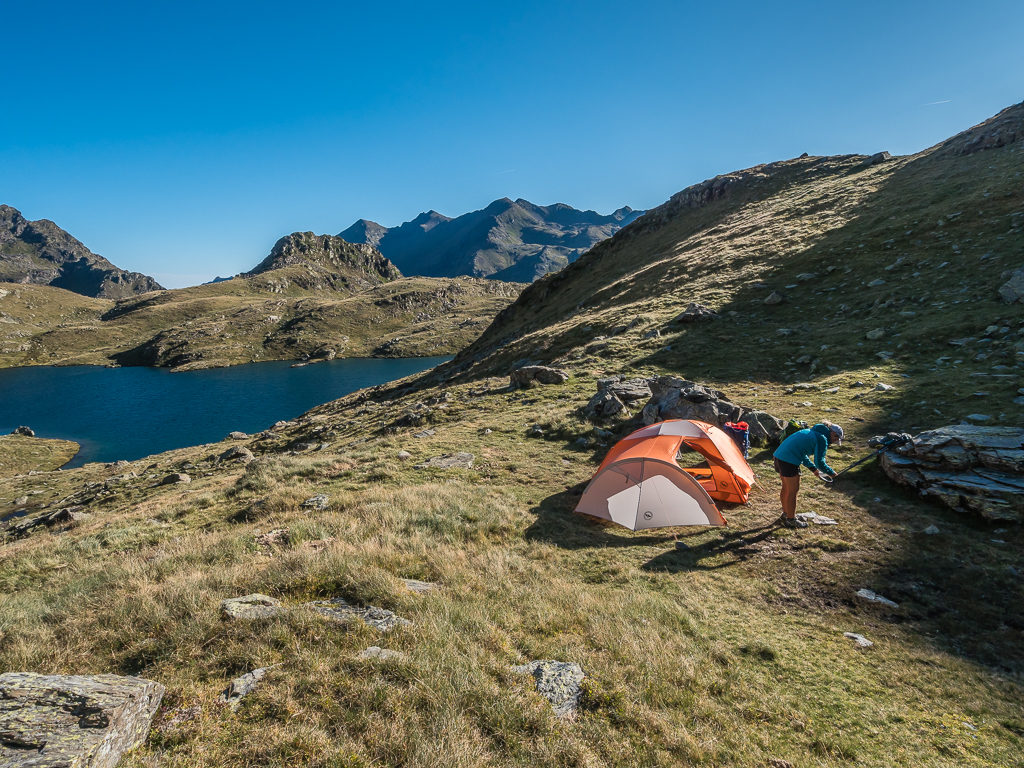
Week 6 started well with the early evening sun bathing the tent as we set up for a night of wild camping on Coll de Jou. Who would have known that snow would literally stop us in our tracks just a few days later!
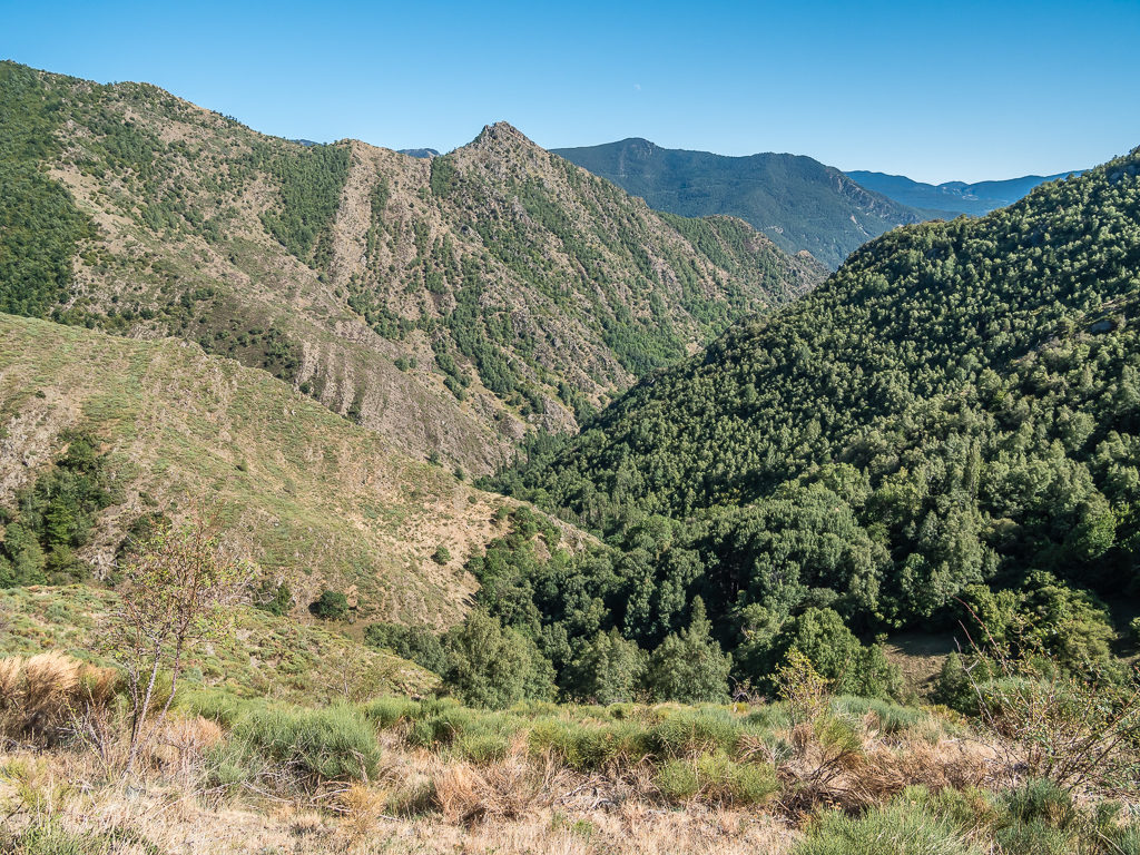
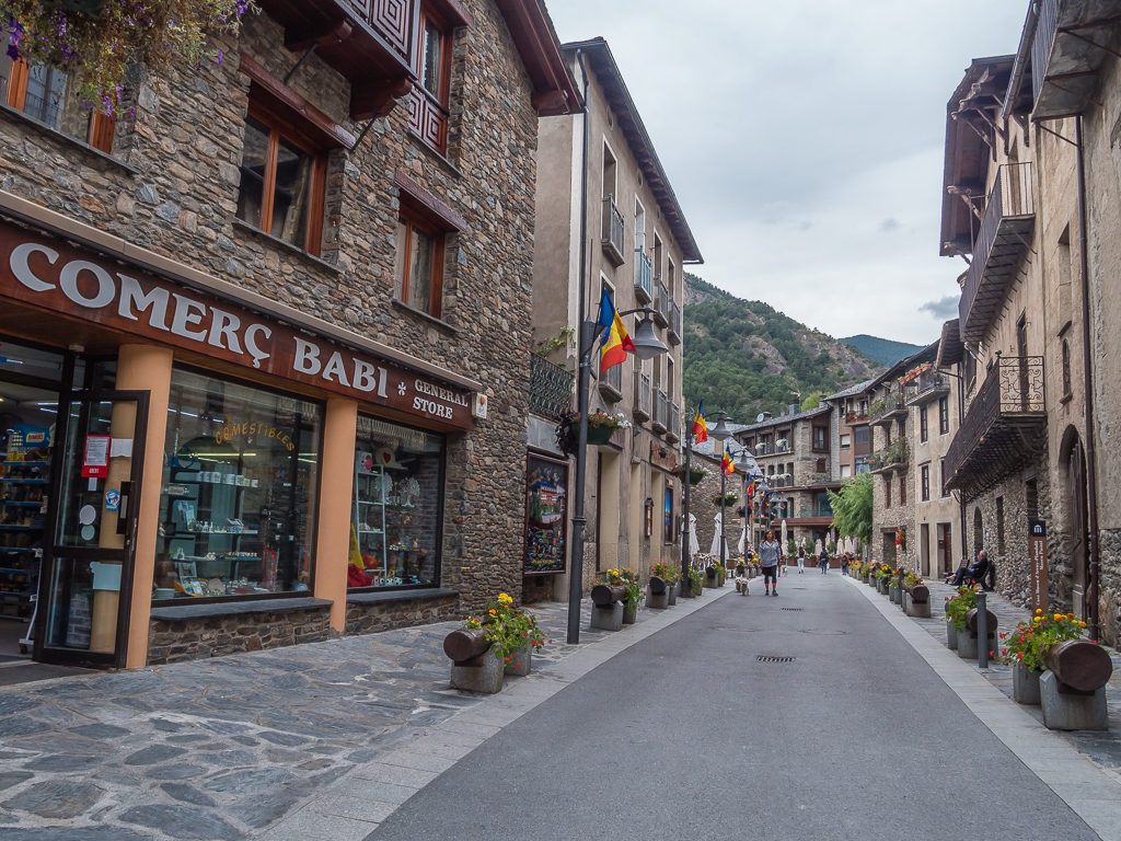
Putting the hair raising moments of ‘Week 5’ aside, ‘Week 6’ on the trail introduced us to the tiny, independent principality of Andorra, which was completely new territory for us. Nestled between France and Spain in the eastern Pyrenees, and measuring just 13 miles by 13 miles, this unique nation is home to around 80,000 people. Showcasing beautiful villages that seem immersed in the Middle Ages, three fantastic natural parks with well-preserved flora and fauna, and ever more remote and rugged mountains, we were wowed by yet more impressive scenery as we began traversing the high slopes of the Andorran Pyrenees. And therein our journey towards the Mediterranean continued…
Day 36 – ‘No Pleasure Without Pain’ Friday 6th September, 2019, Aiguestortes Camping Resort, Esterri d’Àneu to Wild Camp on Coll de Jou, GRT, GR11, 21.5km
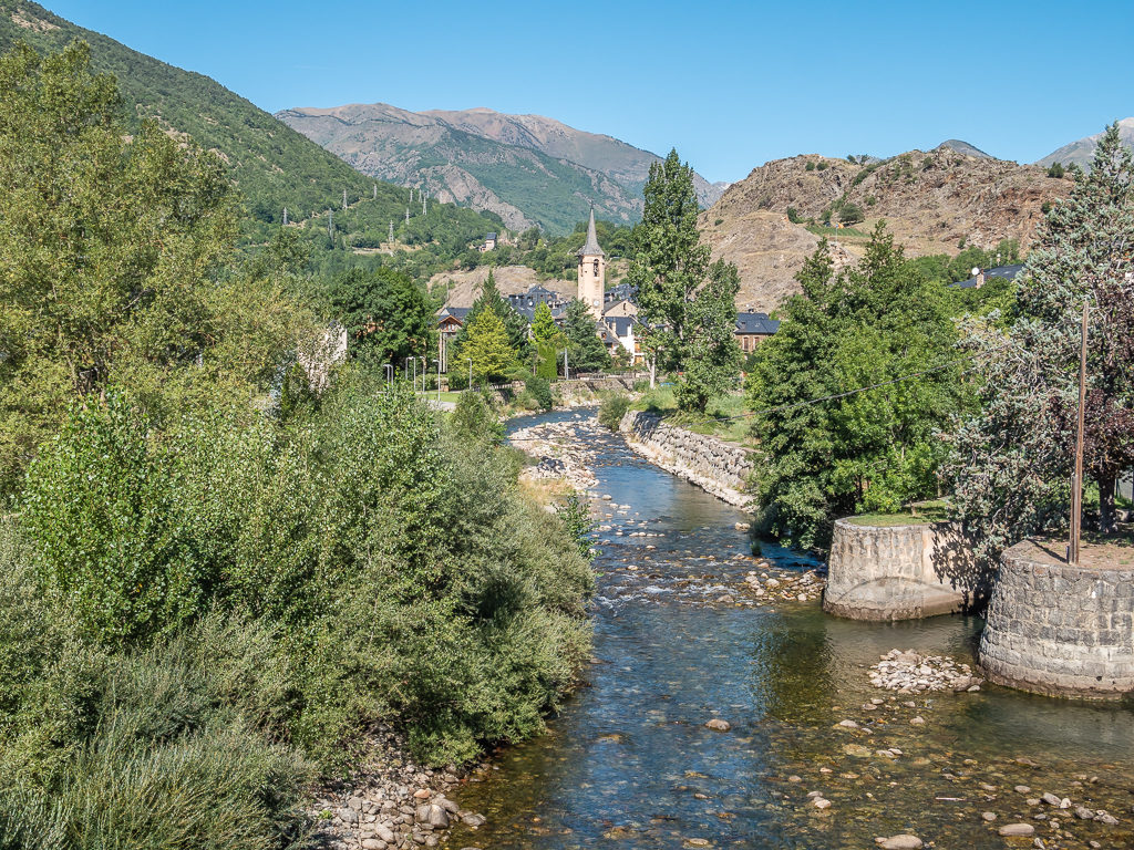
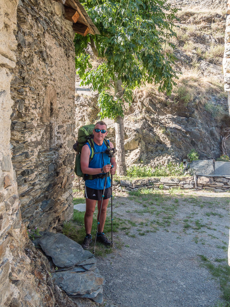
After a week where for one reason or another, we seemed to spend more time off-trail than putting in the miles, we agreed that all good things must come to an end – or we’d never make it to the Mediterranean Sea! Nonetheless, it was quite a wrench to vacate the campground and bid farewell to the charming community of Esterri d’Àneu. We could have easily stayed for a week or more; it was just so lovely and relaxing. Hence, it wasn’t until 10am that morning that we finally left the campsite and walked back to town.
As ever, making the most of the facilities to hand, we purchased some pizza slices from the panaderia for lunch as well as fresh bread to take with us for the forthcoming section. We then sat in the park and enjoyed tuna pasties and pan au chocolate for breakfast before leaving the town centre around 11am. Having looked at a series of information boards outside the small Tourist Information Centre, we decided on taking the GRT Sur les traces de Charlemagne route out of town, as it showed that we could conveniently connect with the GR11 later that day.
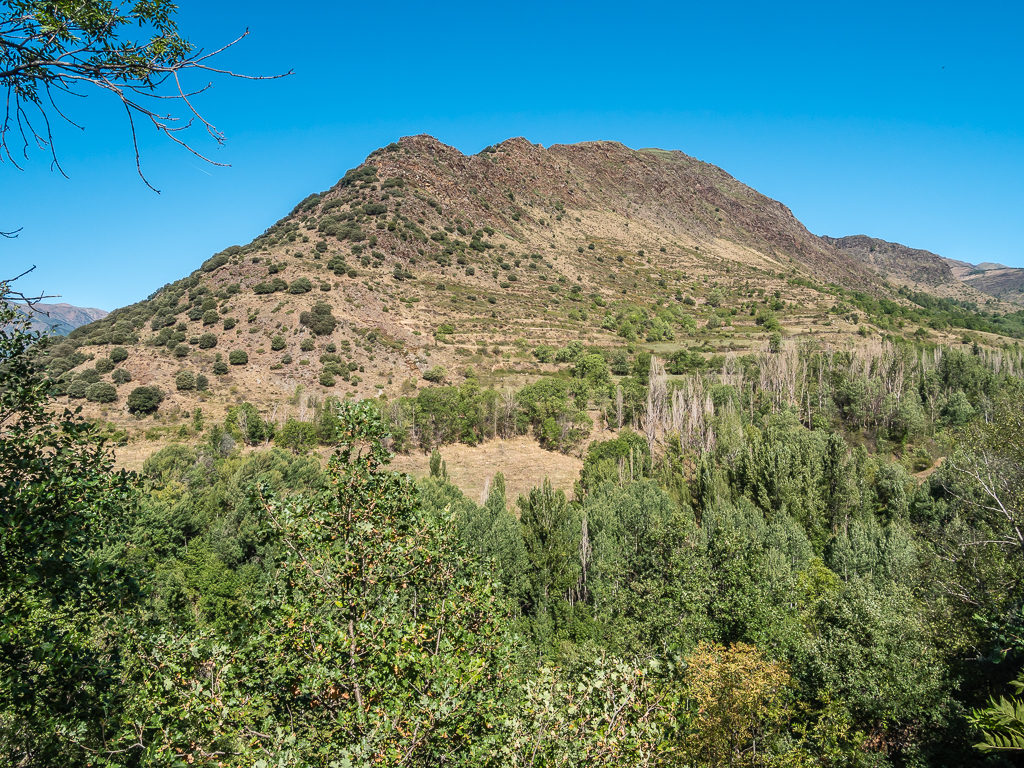
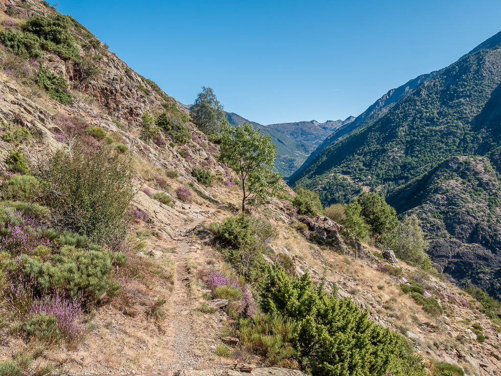
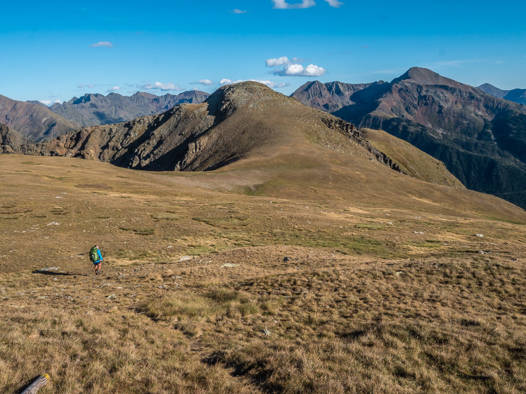
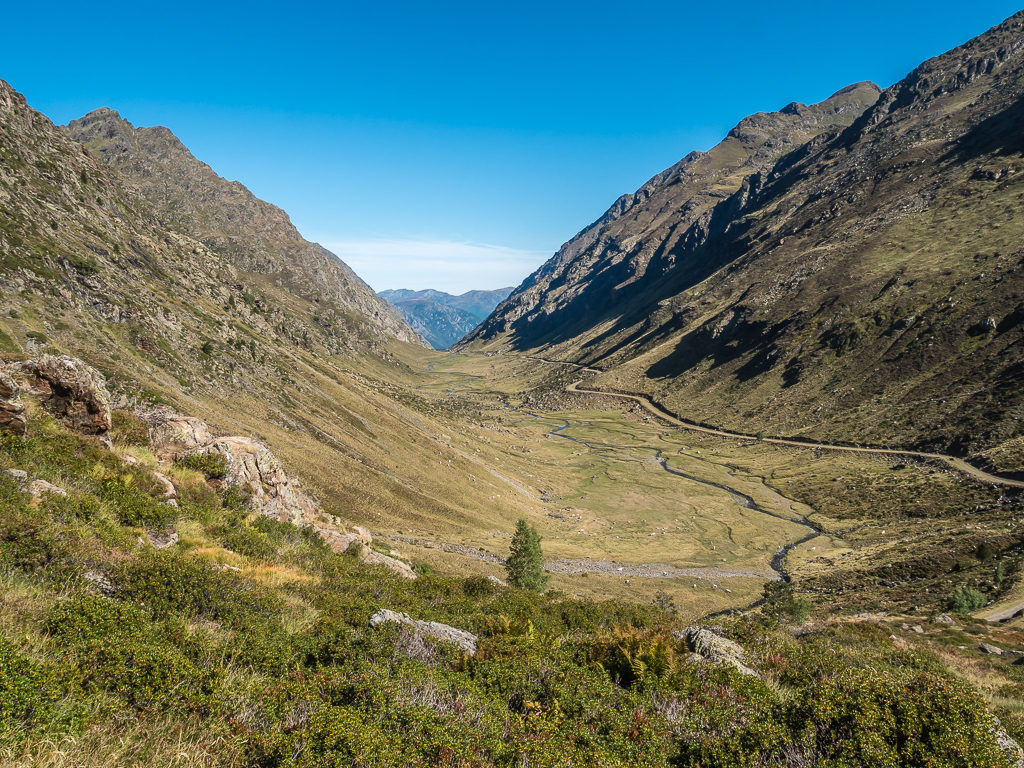
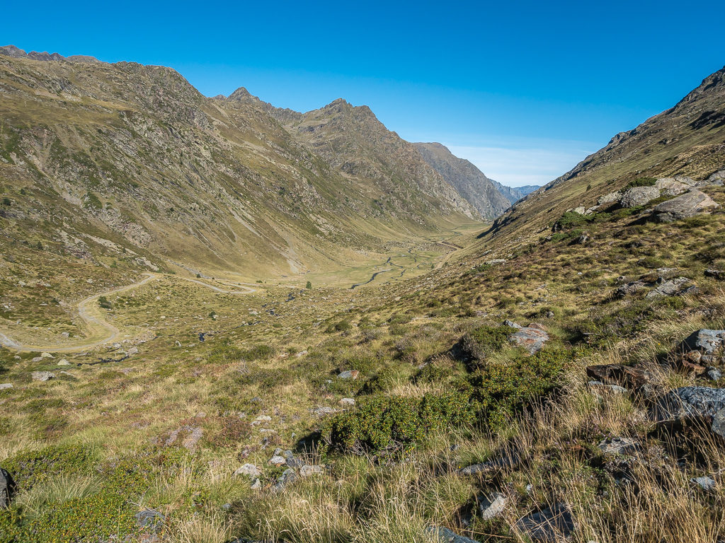
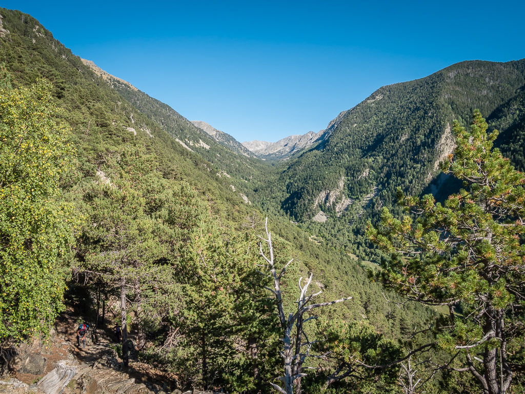
Starting at 960 metres from the valley floor, we initially followed the GRT path up to the tiny hamlet of Escalarre at 980m. Continuing on through Burgo and Llavorre, two further communities nestled in the hills, we still had a long climb ahead in order to rejoin the GR11 that would lead us to Tavascan where our journey along the HRP could resume. With the sun already bearing down, we took it steady along the rocky sections of the GRT, and were pleased when the trail suddenly became one long grassy path that was easier underfoot. With the switchbacks up the hillside then making for an easier climb, we seemed to gain height quickly – all the while the road winding through the valley and the buildings of Esterri d’Àneu getting smaller and smaller the further away we walked.
Saying a fond farewell to another charming Spanish settlement surrounded by the splendour of the Pyrenees mountains.

Leaving town following the GRT: Sur les traces de Charlemagne route, which translates as ‘In the footsteps of Charlemagne’. A 6-day circular walk between Ariège (France) and Spain, hikers can follow in the footsteps of Charles I, King of the Franks from 768, who crossed the Pyrenees to fight the Moors, enemies of Christendom, in order to reconquer Spain.
Heading back into the high mountains to rejoin the GR11.
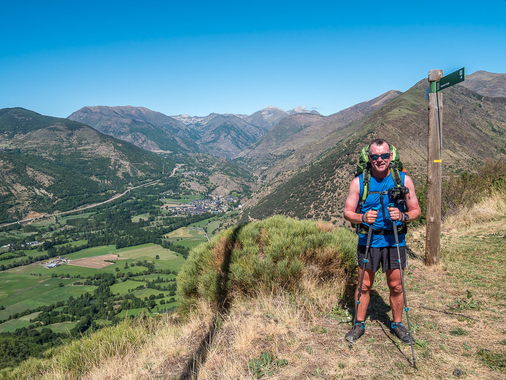
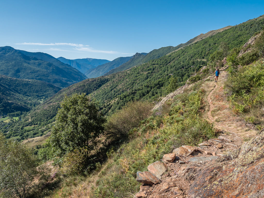
Signage and way-marking since leaving town had been excellent. Looking back across the valley, Esterri d’Àneu sits below the Pyrenean giants of the Aigüestortes i Estany de Sant Maurici National Park.
Reaching the settlement of Dorve, we then continued steeply uphill to the Collada de la Serra at 1,743 metres, which presented itself as a hidden, narrow pass. But the climb didn’t end there! Heading beyond the treeline, we pushed on further to the Coll de Calvo reaching 2,270 metres where we were treated to tremendous views of the forested slopes of the national park.
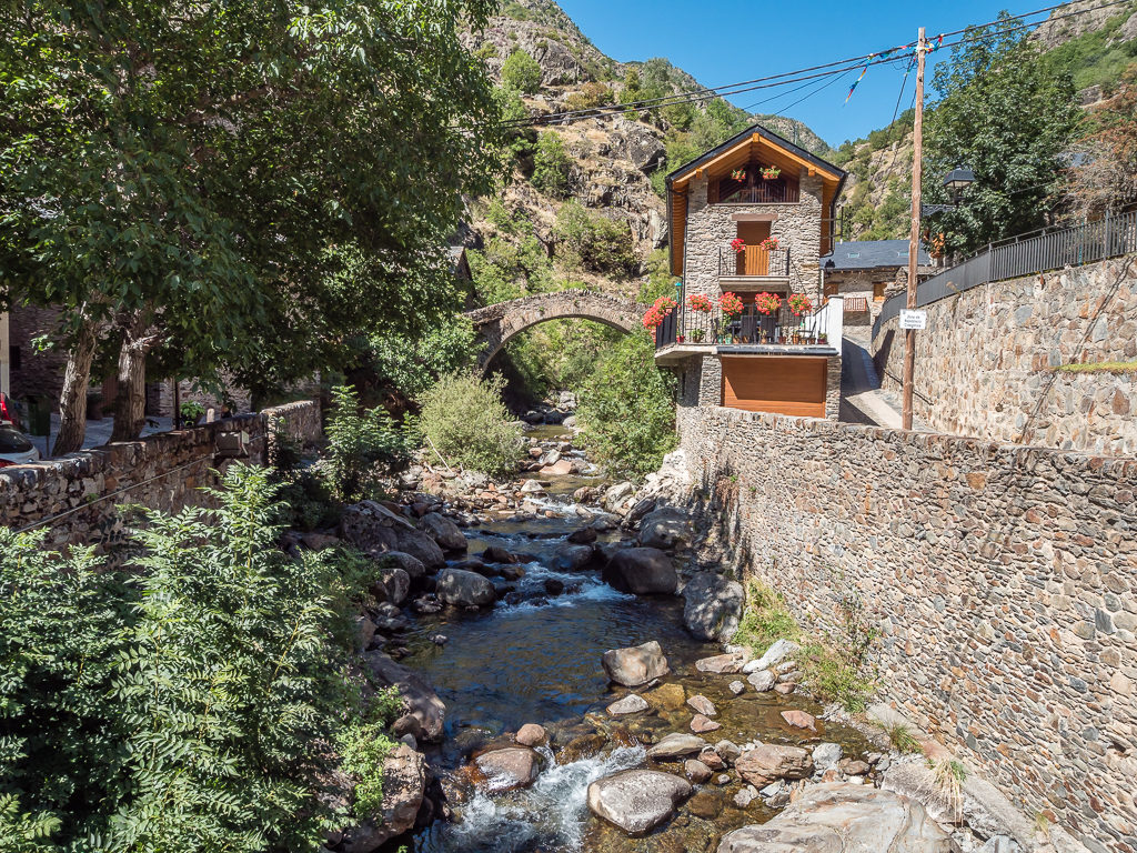
Over the other side of the pass, we gladly rejoined the GR11 but then had to face 1,000 metres of descent as we now headed steeply downhill to the small community of Estaon. Despite the hot sun, we were merely passing through, so we didn’t take advantage of there being a small refugio in the village. We did however make use of the water point, sitting on the cobbled thoroughfare to rest and hydrate with the cold, clean water that was spilling out of a tap into a large trough.
We were not the only ones to be glad of a drink break as a friendly dog came and sat by us, then kept sniffing around the water point so we used one of our plastic bottles to provide him with a drink too. (Giving him a fuss and some attention, we just hoped he wouldn’t follow us out of town and it become another ‘Stevie Jumpers’ saga, as with the beloved dog who followed us into Colca Canyon during a multi-day hike Peru.) Thankfully he stayed put when we walked off and wandered around the old church ruins, where we took the time to fill in the ‘Visitor’s book’ before rejoining the trail.
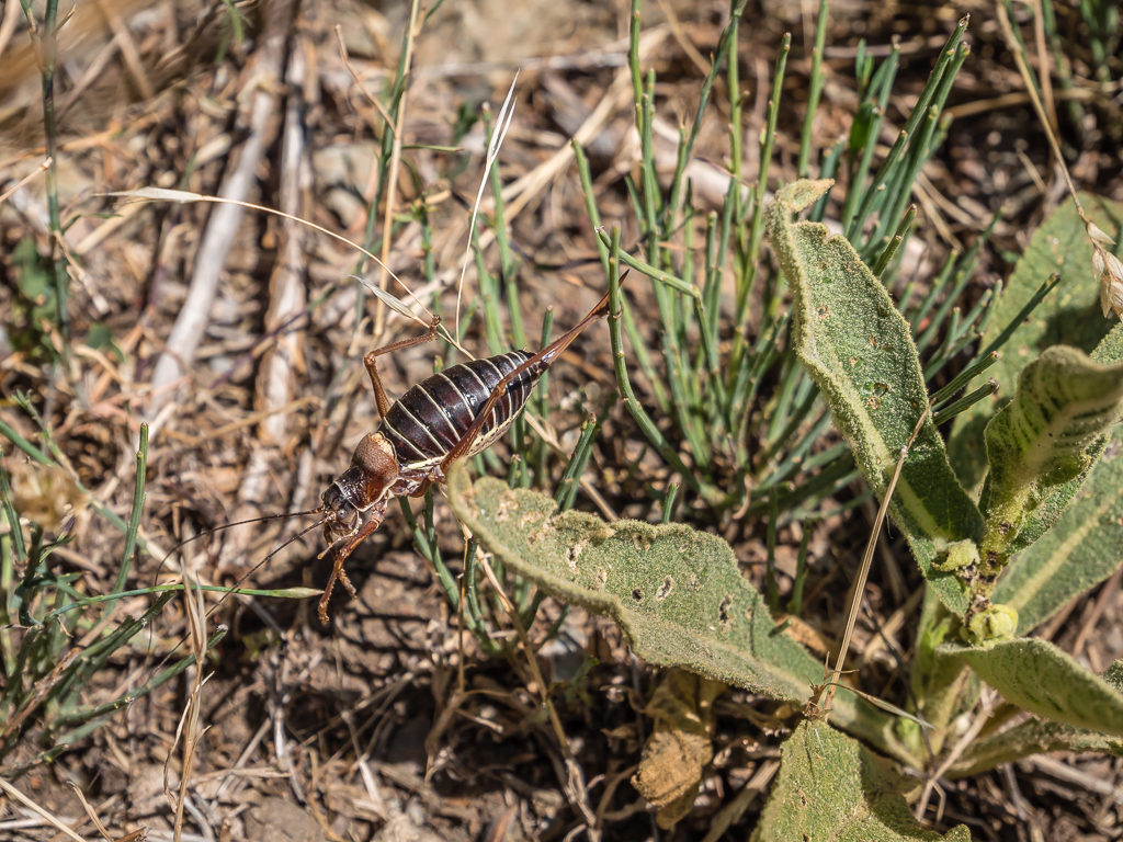
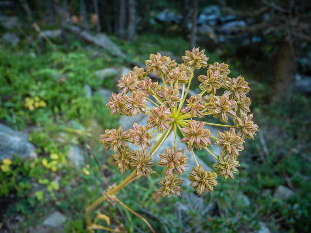
Spying a bug of some sort camouflaged amongst the vegetation beside the trail.
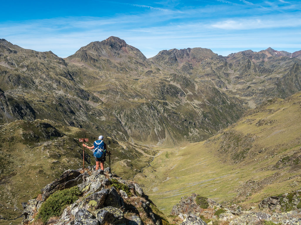
At 2,270 metres, on Coll de Calvo where we were briefly above the treeline before embarking on a steep descent to Estaon, some 1,000 metres below us.

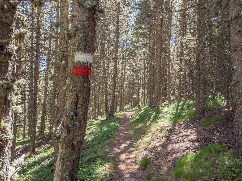
Enjoying a well-trodden trail and the familiarity of white and red paint flashes as we rejoined the GR11 with regular waymarkings.
Reaching the small community of Estaon in the heart of the Parc Natural de l’Alt Pirineu. Once again, signage was excellent.
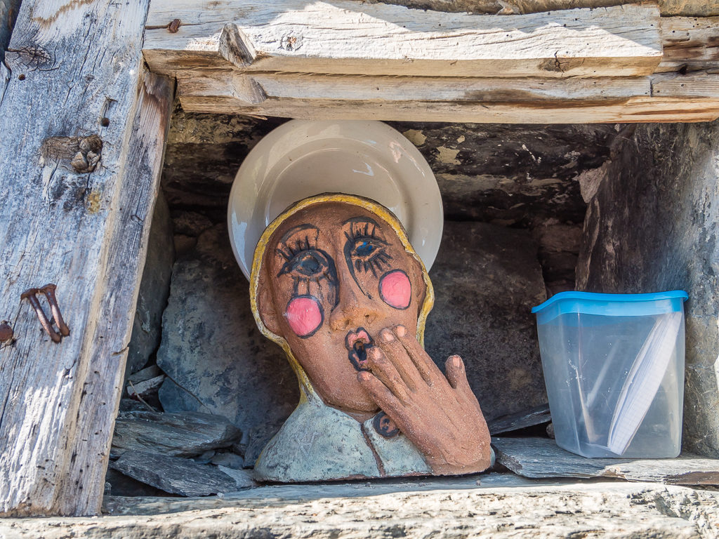
A quirky ornament located next to the ‘Visitor Book’, which we made time to sign whilst passing through the village.
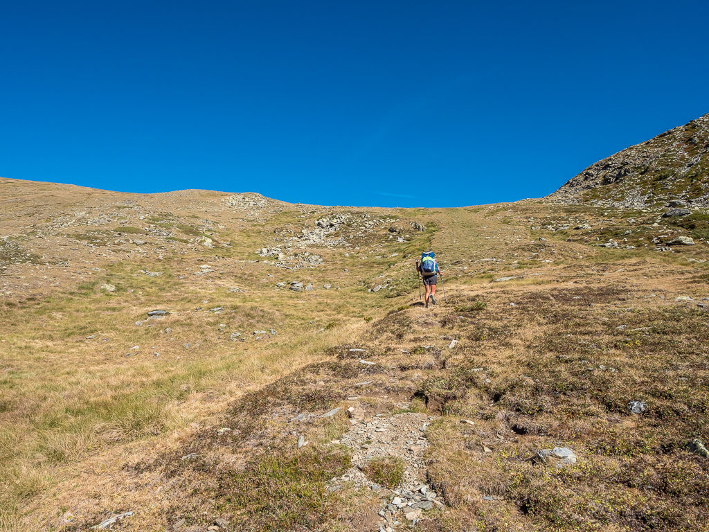
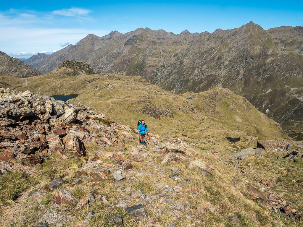
Making the most of some shade before another long climb ahead in order to reach the Coll de Jou – our intended camp spot that evening.
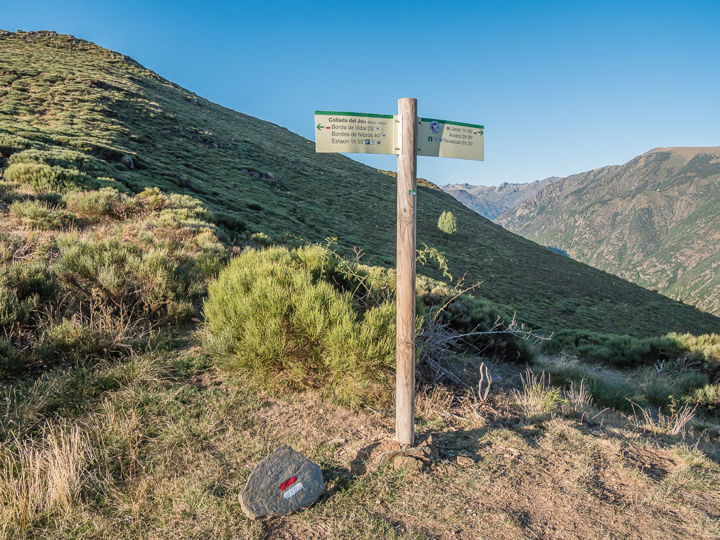
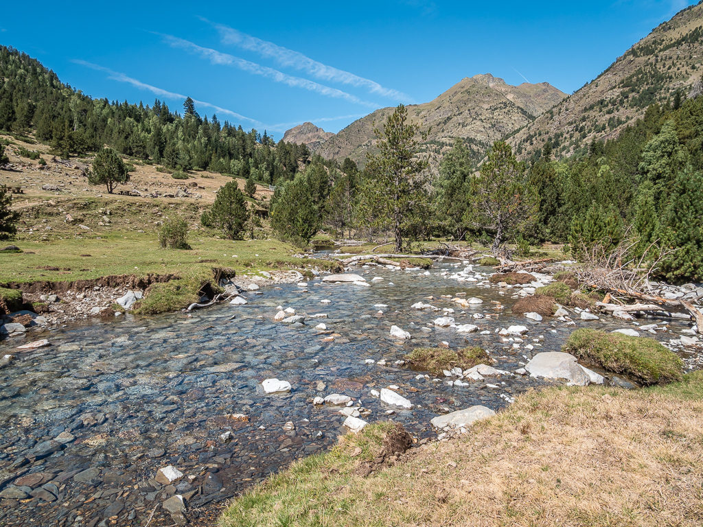
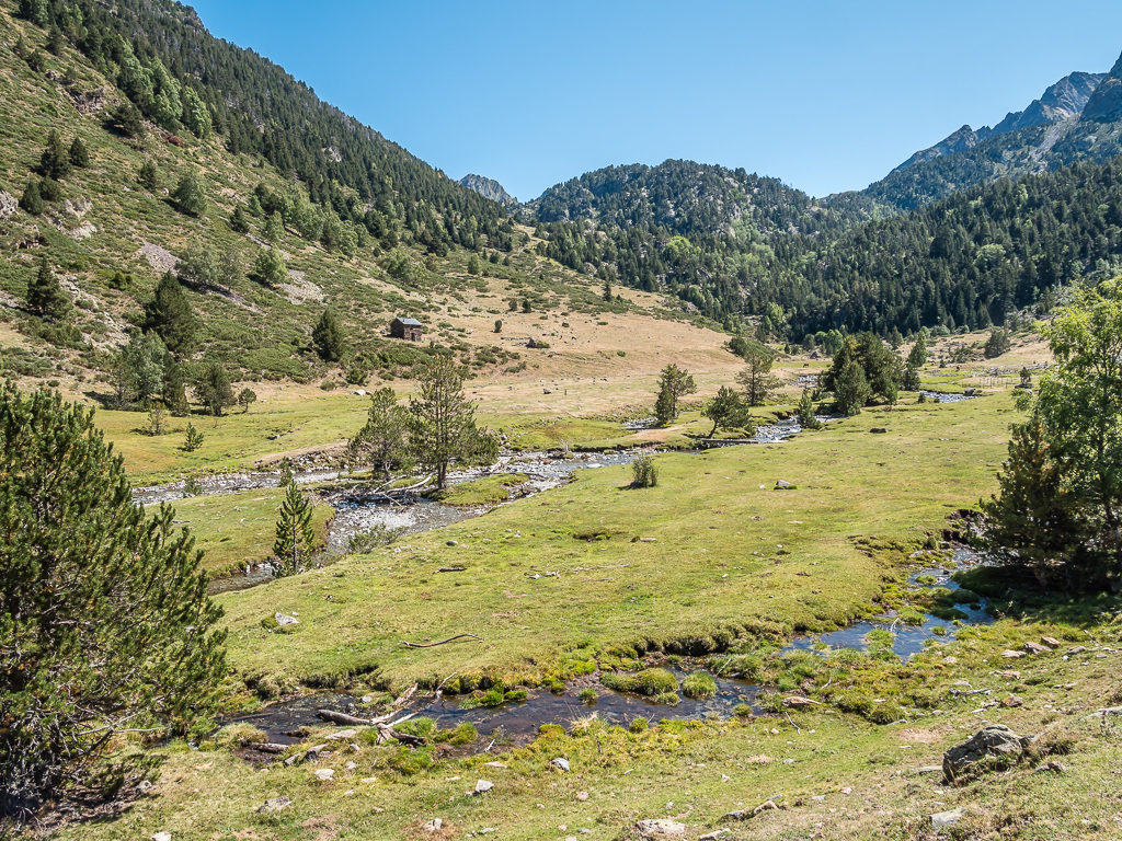
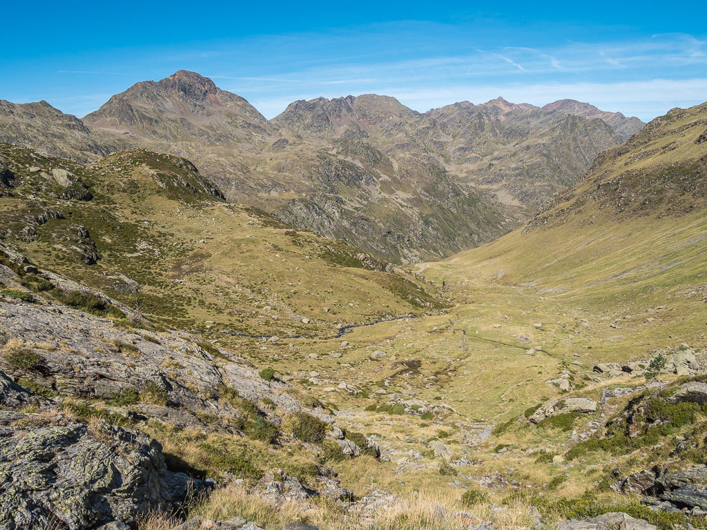
By 5pm we were tiring after the long and steep ascents and descents of the day, but we still had to push on and complete a long walk across the slopes of a fairly steep-sided mountain following the course of the Estaon River cutting the valley below us in order to reach our intended dry camp spot on top of the Coll de Jou. (Also known as Collado del Jou.) We would be wild camping at 1,830 metres so this meant we had to go down to the banks of the river and top up with water before the final climb of the day, which was a little annoying but also necessary if we wanted to stay alive and well!
Reaching the deserted village of Bordas de Nibrós (1,480m), we followed the course of the stream to the abandoned settlement – Borda de Vidal, where we decided to stop and filter water to replenish our supplies before setting off on the last leg. Fortunately the path was a series of long switchbacks following the contours of the mountain, so our gradual uphill climb wasn’t as steep or as taxing as we had anticipated. What was remarkable was the distinct change in vegetation, this area feeling much more arid and desert-like. Here, the mountainsides were covered in low-growing, thick scrub with tufts of spiky grass and heather intermingled. It reminded us a lot of the dry, desert hills of California – all that was missing were some flowering cacti.
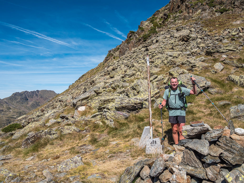
Finally reaching the top of the col just before 7:30pm, we were pleased to have made it with the sun still high above the ridge allowing us to set up camp in the light as opposed to in the shadow of the mountain where we knew temperatures would then drop rapidly. Not only were our efforts rewarded with sweeping views across both valleys, but we could also be content in the fact we had acquired ourselves a much more appealing menu for the next few days after Esterri d’Àneu had been such an excellent resupply stop.
Both relieved and satisfied to have reached the Coll de Jou before the sun had gone off the valley.
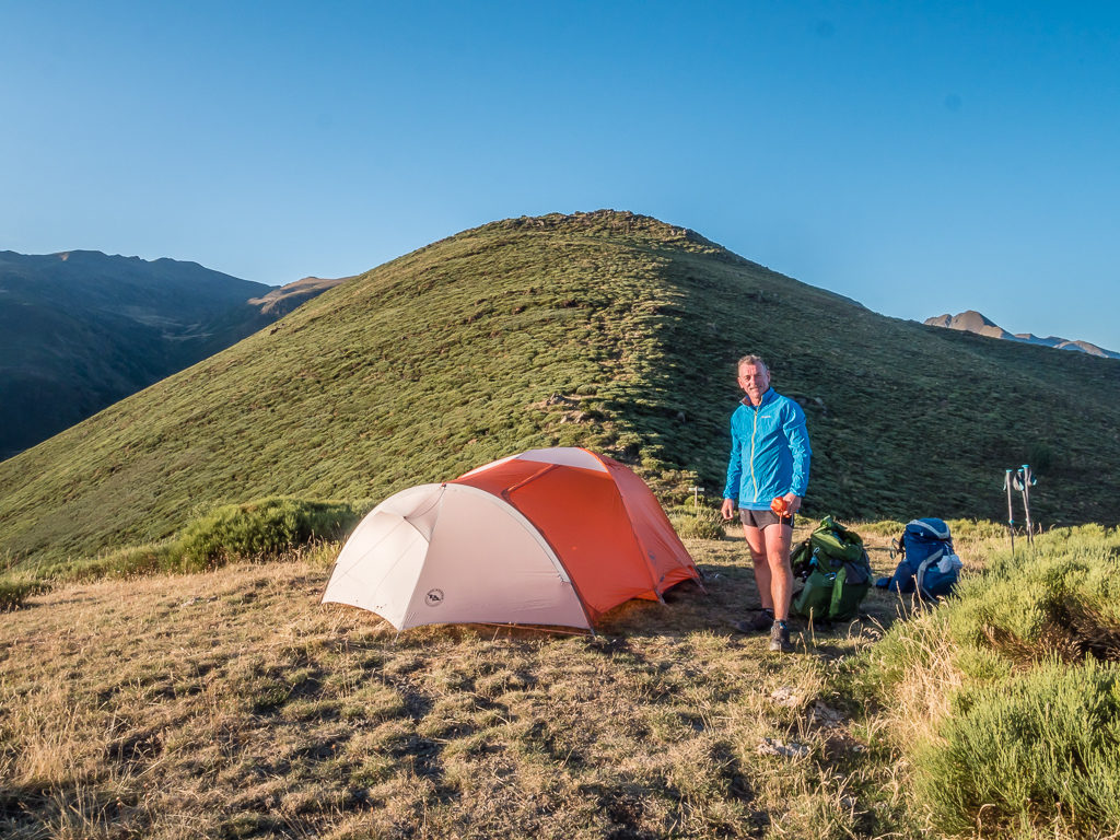
Setting up camp on the flattest part of the col a little off-trail.
Enjoying the last rays of the sun before it dipped behind the mountain ridge shrouding everywhere in darkness.
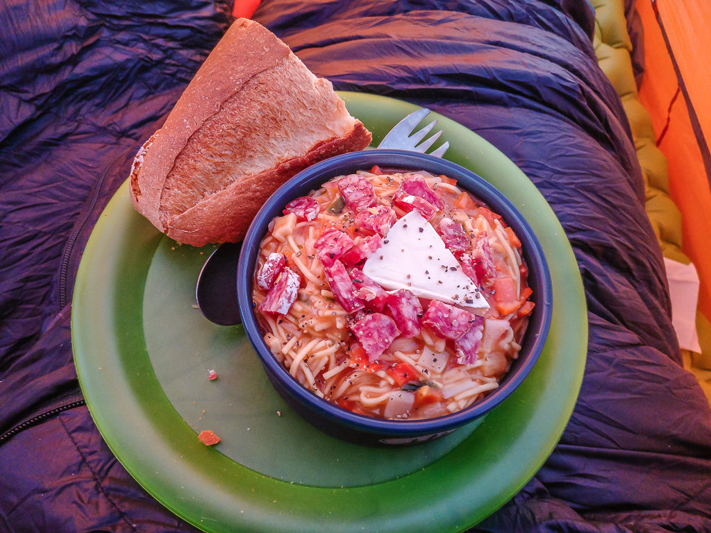
Tonight’s dinner was another ‘Trail Kitchen’ favourite – Quick cook angel hair pasta with tomato sauce, chopped saucisson and a soft-cheese triangle, served with a hunk of bread.
Thinking that we’d probably be the only people camping on top of the col that night, we were rather surprised to see a couple of llamas grazing along the hillside just after the pass – which is not an everyday sight in the Pyrenees! Wondering who would be hiking with llamas or whether they were in fact farm animals wandering the ridge, our question was quickly answered when we saw a family setting up camp behind the bluff who were using the llamas as pack animals. There was certainly plenty of vegetation for them to feast on, but access to water was the issue. We hoped they had carried plenty up with them. Based on our track record of breaking camp later than most folk, we also hoped to be up and away the next morning before the family as there wasn’t a lot of room on the col for them to pass by!
As soon as dinner was over, we were quick to call it a night and retire to our sleeping bags. The penalty of having a couple of days off had been the strenuous climb back out of the valley, which we were now feeling the affects of. The amount of elevation change coupled with today’s soaring temperatures had made the whole traverse from Esterri d’Àneu feel like a much more arduous undertaking than it should have been, and tomorrow would be more of the same with another lengthy climb out of Tavascan. But as the saying goes – ‘There’s no pleasure without pain’!
Day 37 – ‘The Long Way Up’ Saturday 7th September, 2019, Wild Camp on Coll de Jou to Wild Camp by Estany de Baborte, GR11, Porta del Cel, HRP, 19km
It was another lovely, sunny morning in the Pyrenees as we awoke once again to clear blue skies, but with stiff knees after yesterday’s long climb. After venturing out of the tent, we were pleased to see that the llamas were still grazing on the hillside to the right of us, so the family were not early risers either! As we only had around a two-hour walk to reach Tavascan the next village en route, we didn’t want to set off too early as we intended to rest and have lunch there, and going on our previous experiences of Spanish and French opening times, restaurants have set times for lunch and dinner service, so we thought it was best to arrive after midday.
So we left Coll de Jou a little after 10am descending on a good farm track to Aineto, another tiny village hugging the mountainside. We were still following the GR11, which then took us on an exposed path built along the mountainside overlooking the valley below. From such a vantage point, we had fine views towards the reservoir – Panta de Tavascan and the small village at the head of the valley. Even though we’d resupplied just a couple of days beforehand, we still needed to visit Tavascan as we had only been able to purchase a small gas cannister from Esterri d’Àneu, which wouldn’t be enough to see us through to Andorra.
Since hiking further east, we had noticed a dramatic change in vegetation. The mountainsides were now covered in low-growing, thick scrub interspersed with pockets of beautiful wild heather.
In complete contrast to the Basque Country, it was feeling much drier and the landscape more Mediterranean with bursts of colour from wild flowers and fragrant air thanks to wild herbs.
The trail, which followed the contours of the mountainside high above the valley, was well trodden with a path cut into the rock on the more exposed sections.
Looking down towards the reservoir – Panta de Tavascan, which was created by a dam located in the upper stretches of the river Noguera de Cardós.
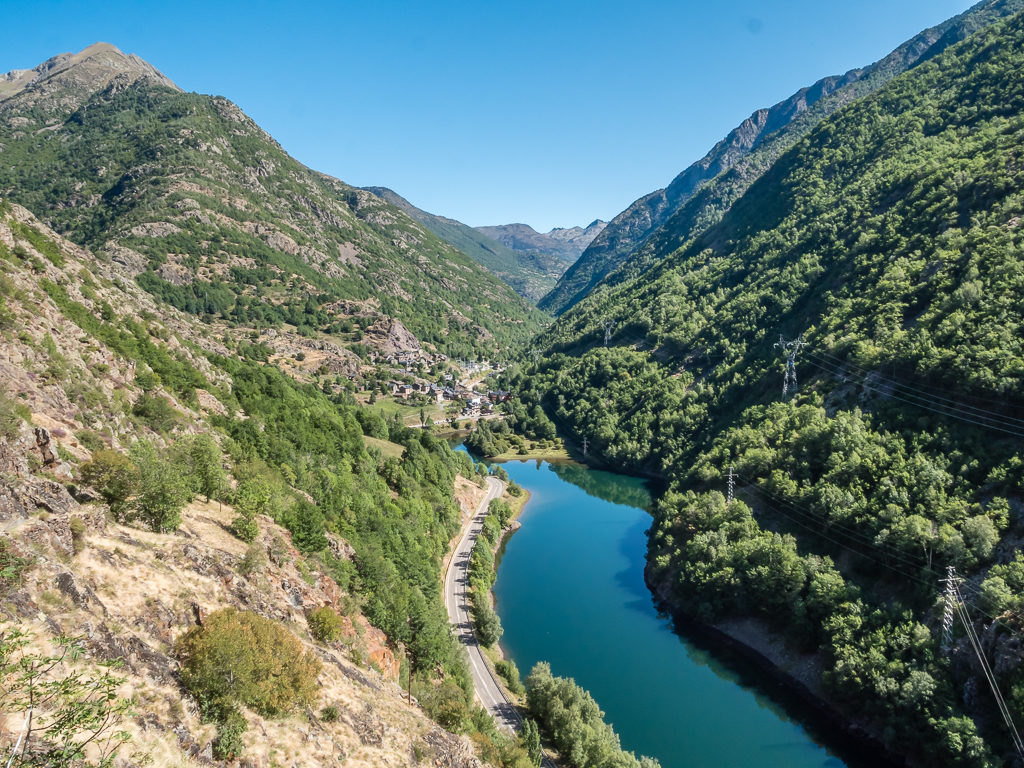
Getting closer to Tavascan village located at 1,122 metres on the slopes above the reservoir.
Reaching Tavascan, which has just 60 inhabitants. This Spanish village is both full of character and steeped in history. In the Second World War, Jews, French citizens and allied servicemen fleeing Nazi-occupied Europe crossed the Pyrenees from France through Tavascan.
We had toyed with the idea of changing our meal plan to save on gas, which would mean no longer having a cooked breakfast everyday. We were reluctant to do this however as eggs always seemed to be readily available so had become one of our main staples, and a good, hearty breakfast always sets us up for the day – both in terms of energy and motivation. It wasn’t necessary to debate this further though as we were able to purchase a large gas cannister from the outdoor gear shop in the centre of Tavascan for €14 when we arrived, which was brilliant as it would see us through 10 days at least. The shop also had a small fridge with a few essentials for hikers e.g. cheese, cured meat, eggs and chocolate bars, but as we were already stocked up with those supplies we only bought a postcard to send home.
We also popped into the small grocery store located on the opposite side of the street, which we found to be selling similar items as well as other hiker staples including pasta, soup, crisps, and sweets – so we could have resupplied in Tavascan if we’d have stuck with our original route, although we wouldn’t have had as much choice particularly in terms of ‘fresh’ food items. But we did buy another bread baguette as they sold freshly baked bread, just for some more carb-loading!
Although there were around 6 restaurants along the main street, we found that only a couple of them were open for lunch. We didn’t want a ‘Menu del dia’ with starter, main course and dessert, preferring a simple ‘platos combinados’ as we had a lot of walking still to do and didn’t want to feel too full! So we ordered two small pizzas and shared them, plus a bowl of chips. (We were still very full!)
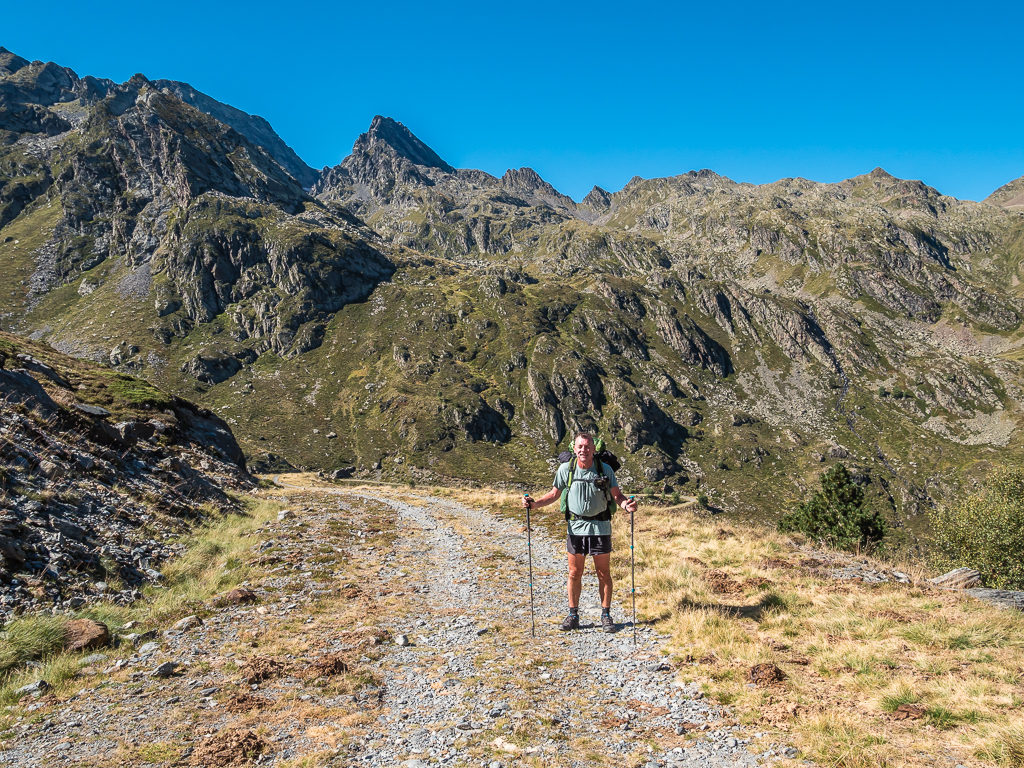
Dragging ourselves away from what could have quite easily been another town vortex, we left Tavascan just after 1pm, again taking the GR11 route. As expected, it was a steep uphill climb from the centre of the village over 2 kilometres on a trail that was both rocky and a little overgrown in places. As the tundra was now much more dry and scrub-like, it was really scratchy on our legs, especially with wearing shorts. But it could have been worse – at least the trail wasn’t lined with nettles!
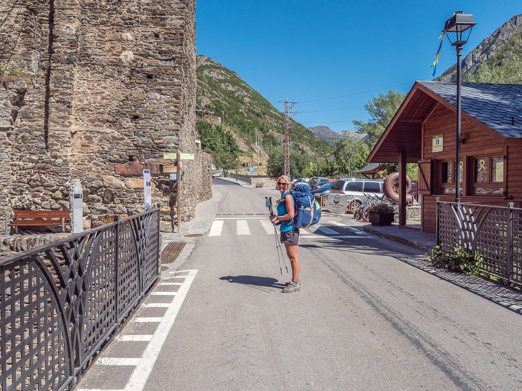
For once, we had managed a quick in and out! All ready to leave Tavascan with full packs and full bellies, having refuelled in readiness for the long climb ahead.
Looking back to the surrounding peaks as we began the climb.
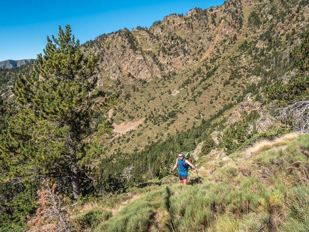
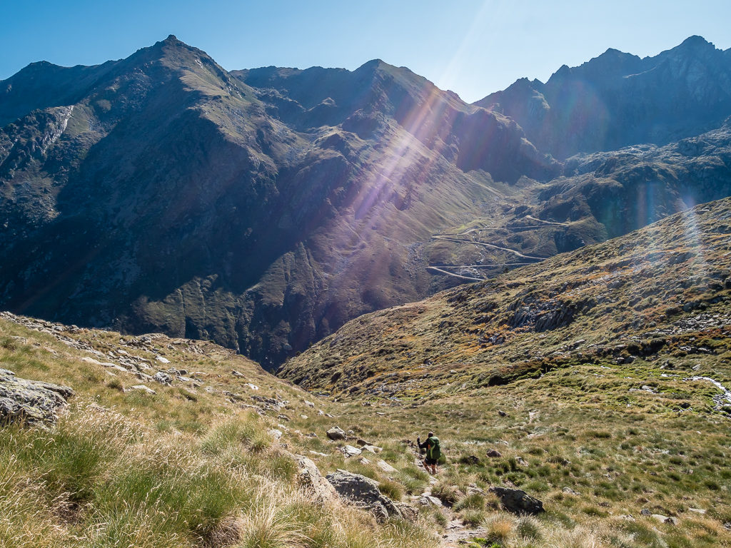
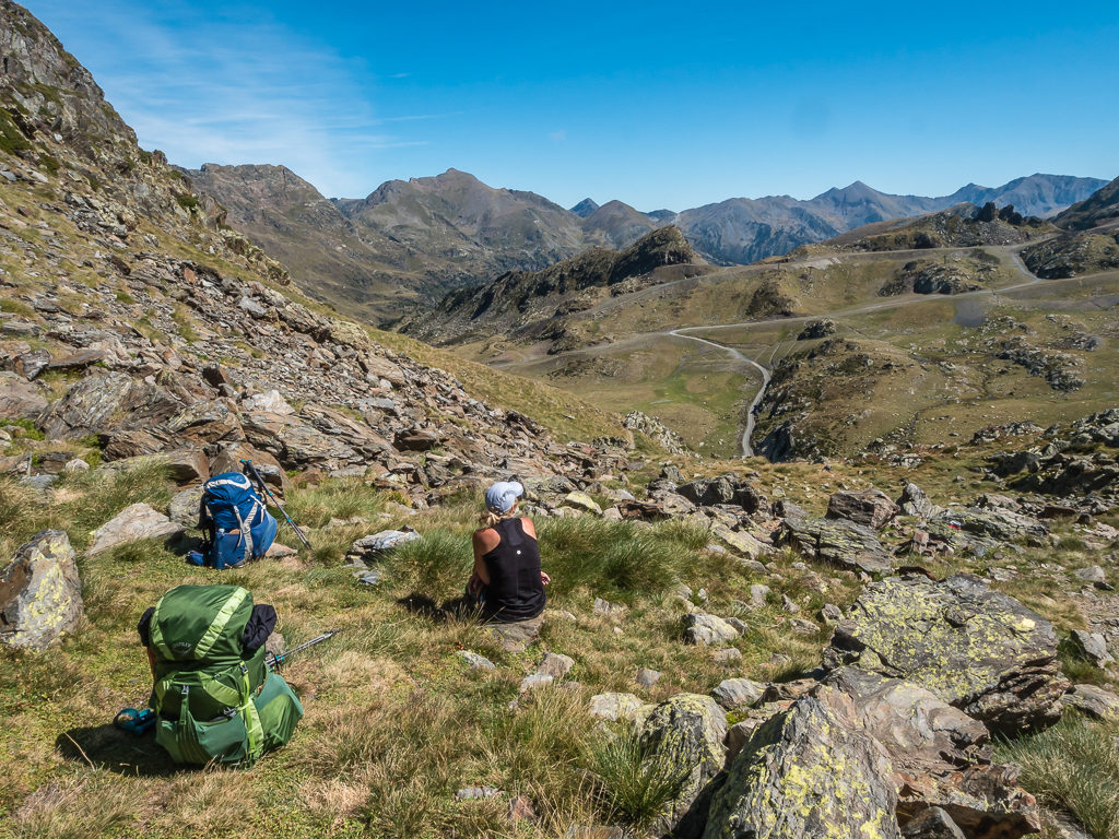
After the initial part of the ascent, we left the GR11 and followed another marked route – The Porta del Cel. This took us to a plateau – Ribera de Boldis where we stopped to filter water from the cascade flowing down the mountainside. With the sun bearing down just like yesterday and our packs heavy with fresh supplies, we were feeling the strain of another day with a large amount of ascent. It seemed like we were putting in an enormous amount of effort to get back on the HRP when there were wonderful campsites with swimming pools tucked away in every valley that we passed!
Pushing straight uphill towards the Collada de Boldis having already hiked up over 1,000 metres.
Having drank a litre of water each and feeling better hydrated, we continued to follow the trail up the valley to the Collada de Boldis, reaching 2,454 metres. On the way up, we passed only one other hiker travelling in the opposite direction. He asked if we could speak Spanish or French and was trying to explain to us that the refuge would still be a 4-hour walk from this point. With it now being around 3:00pm, that was perfectly fine with us as we hadn’t left town until after 1pm.
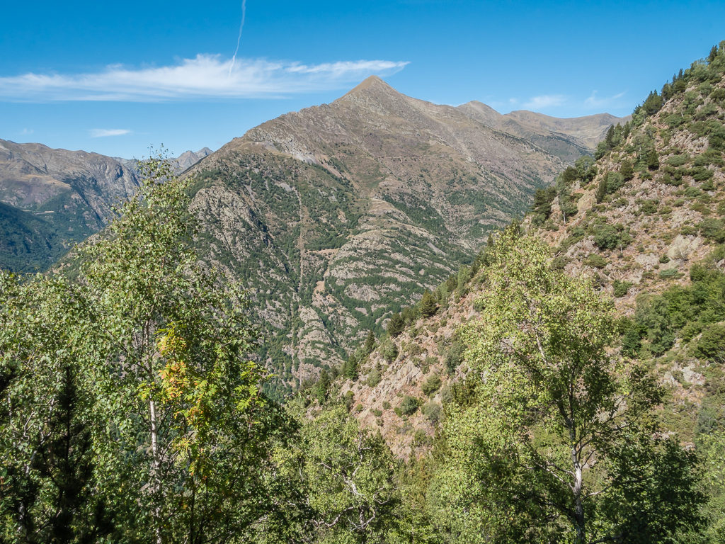
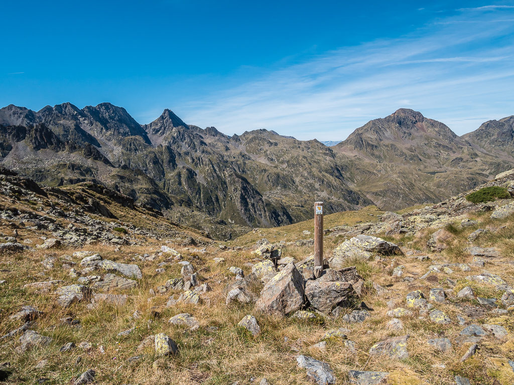
After reaching the collada, the day got much better! We were out of the dry scrub and the trees, and instead found ourselves returning to a world of high alpine scenery. Jagged peaks of grey granite could be seen in the distance as we looked towards France, the familiar scene of swirling mist and large clouds forming above the mountains reminding us of what great weather we’d experienced since staying largely on the Spanish side. But we were still to make it to the high-point of the day – the peak of Roca Cigalera at 2,667 metres. Heading roughly northeast, we followed the ridge up to the summit post where we stopped to record an update of our progress as we had wonderful panoramic views of the high mountains once more.
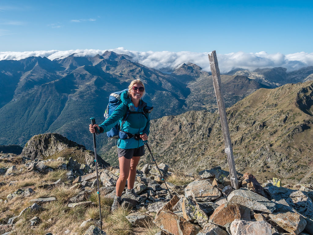
After following the Porta del Cel path, we were glad to be back in the high mountains. Big smiles on reaching the summit of Roca Cigalera – At 2,667 metres, it was the high point of our day!
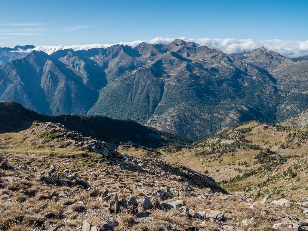
Looking across the valley to the tremendous peaks over the border in France, where the mountains were causing clouds to form.
For this section of the route, we had predominantly stayed on the Spanish side taking advantage of the much drier, hotter weather.
Striding out and taking advantage of the vast grassy plain before starting our descent to the Baborte Lakes.
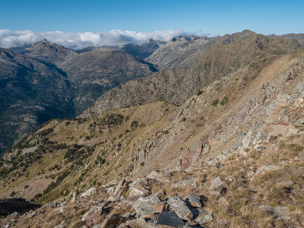
Descending steeply on a rocky track under the shadow of the ridge.
We would be chasing the sun as we pushed on towards the lakes as it was already dipping behind some of the larger peaks.
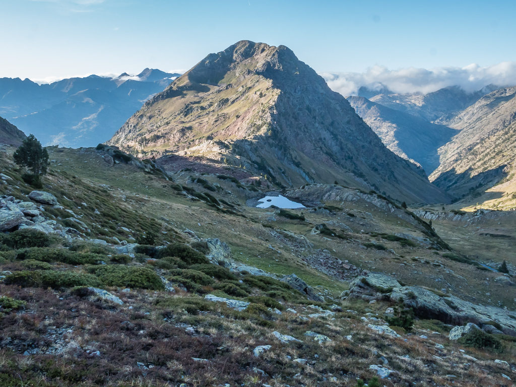
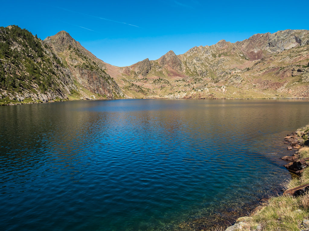
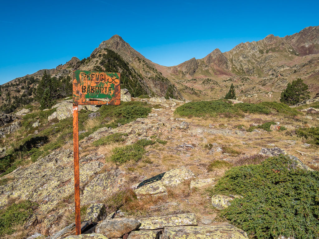
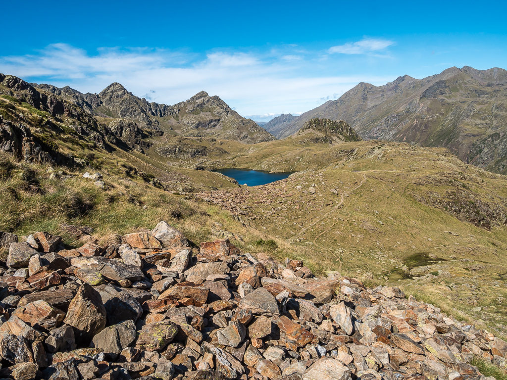
Continuing along the Porta del Cel, we were then able to rejoin the HRP route, which took us over Coll de Sellente at 2,488 metres and downhill towards Refuge Baborte. Although it took us a while to sight the refuge, we shouldn’t have missed it as it is actually bright orange and situated on a rocky outcrop high above the lake.
Our route down to the main lake where we had planned on wild camping was littered with boulders, but thankfully the path steadily weaved between and around them making for a much less demanding end to the day compared with what we had expected. We still felt drained though, which was not surprising with the culmination of two hard days of climbing equating to more than 2,000 metres of ascent.
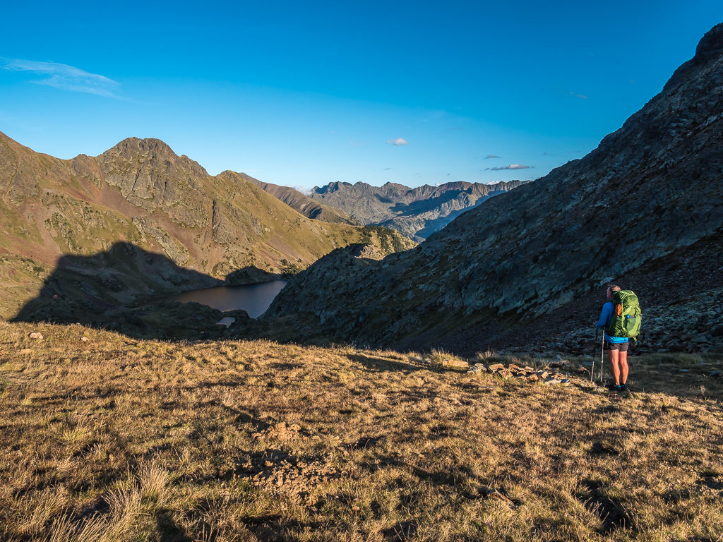
Looking towards Estany de Baborte in the shadow of the mountain.
We still had a fairly long hike down towards the main lake so we were glad that the path weaved between and around the numerous sections of boulders.
The refuge is situated on a rocky ledge above the lake. You can just see the orange roof where the line of shadow cuts across the mountainside.
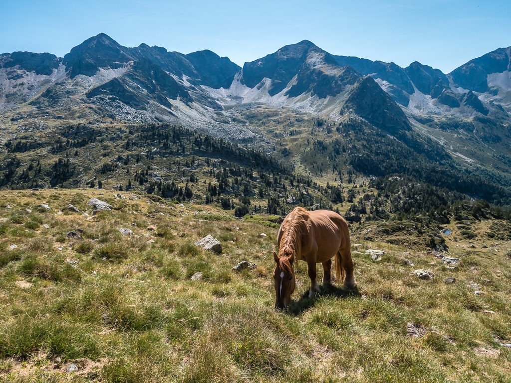
As we arrived around 7:30pm with the sun already off the valley, we didn’t bother going up to the refuge as we thought it would be busy with it being a Saturday night. Instead we passed several wild horses grazing down by the stream and headed towards the outlet of the lake.
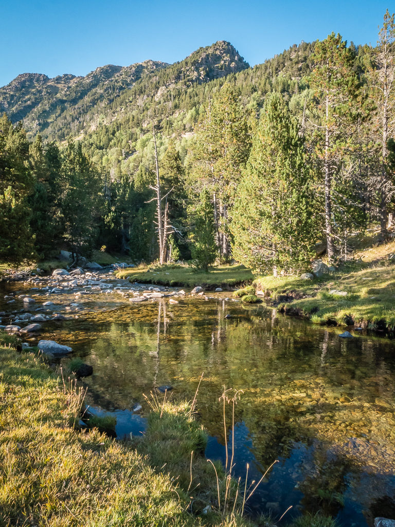
Apart from the hiker who had advised us of how long it would take us to get to the refuge, we hadn’t seen a soul all day – except when we continued down to the lakeside we now spied two tents already set up close to the water. There was plenty of space though, so we wandered further up the western shore so that we had a bit more privacy.
We got set up and into the tent as quickly as possible as there was now a biting cold wind sweeping through the valley, so we needed to get our layers on and get warmed up. Wayne cooked in the vestibule out of the wind – one of the benefits of our ‘hotel’ tent. We enjoyed hot soup and bread to warm us through, followed by meat-filled tortellini pasta covered with a tomato and vegetable sauce. Once I had rinsed the pots out and we’d settled down for bed, we couldn’t believe the time was almost 10pm!
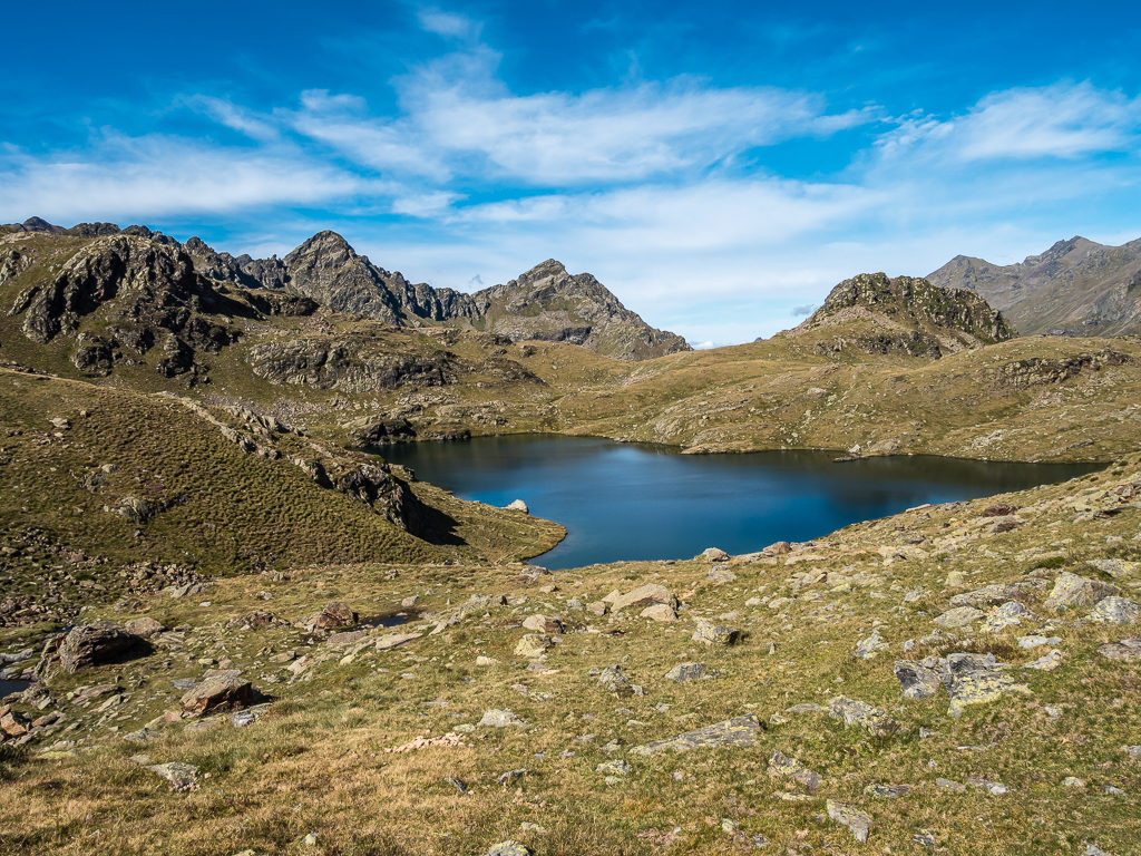
Following the path down to the beautiful Baborte lakes.
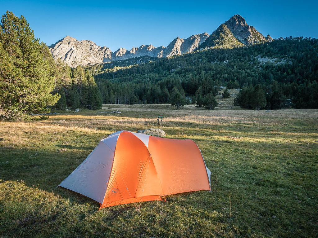
Managing to set up on a relatively flat section of ground behind a bluff close to the north-western shore of the lake. We had got the camp chairs out, but it was much too cold and windy to sit outside.
It had felt like a long while since we’d had the company of cattle during the night, so we were startled when the horses that had been grazing below the refuge had made their way over to the lake and woke us up! As the ground thudded with hooves and the sound of clanging bells got closer, I decided to clap my hands loudly. The sound was enough to spook them and off they all galloped, back up the valley where the noise of their bells soon became just a little tinkle way off in the distance. It was a great tactic and we would have a much better night’s sleep for it without having to reach for the ear plugs!
Day 38 – ‘The Andorran Pyrenees!’ Sunday 8th September, 2019, Wild Camp by Estany de Baborte to Wild Camp above Etang de la Soucarrane, HRP, 10km
It wasn’t the first time on this trip that we awoke to a frozen tent. We had assumed it would be the case just because of how cold it had got last night, with temperatures reaching around -2°C where we’d camped by Lake Baborte. So we definitely weren’t in any rush to get going as we’d have a long wait for the sun to crest over the surrounding peaks to warm us up and dry the tent out. Easily nodding back off to sleep, we didn’t then wake again until almost 9am!
And it wasn’t then until just after 11am that we were packed away and ready to get back on trail after a cooked breakfast of scrambled egg and cheese wraps. So much for the 8pm til 8am bivouac rule on the Spanish side! We didn’t feel too guilty however as there were still a few other hikers further round the lake packing up as well and we only had around 10km to hike today, literally taking us up and over the Port de Bouet at 2,509 metres and down the other side to the Etang de la Soucarrane where we were going to camp.
After waking up to a frozen tent, we were glad when the sun rose above the lake and we were treated to another glorious day.
Setting off along the eastern shore of the Estany de Baborte following the GR white and red paint flashes, we had a relatively easy walk descending all the way to the floor of the Vall Ferrera. Although the trail was rocky in places, we made good time and were quick to reach the forest where we crossed over the Barranc de Sottlo by footbridge. Soon after, we had then reached the car park and we’re back in day hiker territory.
Leaving Estany de Baborte and hiking downhill to the Vall Ferrera.
This area was looking decidedly dry and arid as we began our descent.
Our first sign indicating that we’d soon be crossing into the Andorran Pyrenees.
Reaching a stunning grassy plateau, we decided to sit and have a picnic lunch by the stream that was flowing gently through the Pla de Boet (1,860m). It was such a beautiful spot with lovely views looking to both ends of the valley that we just had to take some time to soak it all in and appreciate just quite where we were – literally a few kilometres from the border with Andorra. We also really needed to off-load some of that bread that had been weighing us down since stocking up in both Esterri d’Àneu and Tavascan!
Crossing the Riu de Baiau after lunch, we set off along the path going to the east of the valley, passing a small cabane as well as several more wild horses grazing along the grassy slopes where we stopped to film a mother and her foal. Looking up to what we thought was the next col from our picturesque spot, it appeared that we’d have a nice, straightforward uphill walk across a grassy slope to reach the top. But when indeed we continued on, eager to cross into Andorra for the time, we found that we were having to traverse a succession of false summits.
Each time we reached a high point and the assumed col, we quickly discovered another right behind it and so forth. After about the fifth ridge, it seemed like the climb to the Port de Boet – some 500 metres higher than where we’d stopped to have lunch, was never ending.
The Riu de Baiau flows gently through this pristine valley.
At 1,860 metres, the beautiful Pla de Boet where we picnicked on a grassy bank beside the stream before setting off for the pass.
Finally, our climb to the Port de Boet was complete! As we got to the top of the col however, a cold wind was funnelling up through the valley, so we had to put on an extra layer when we stopped for a drink break just over the other side of the pass. When Wayne’s phone bleeped with a text message informing us that phone calls would now be charged at £1 a minute and 1 megabyte of data would cost £5, we knew we were virtually on the Andorran border! The principality might be cheap in terms of income tax, sales tax and VAT, but these were the most extortionate phone charges we had ever come across! Up until now we’d enjoyed our usual mobile phone package with inclusive minutes, texts and data in both France and Spain with still being ‘part’ of Europe. (With the Brexit debacle being almost a done deal now however, I doubt we shall ever be so lucky again!)
A horses grazes on the grassy slopes as we make for Port de Boet.
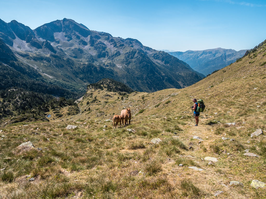
Watching a mother and foal beside the trail after traversing another false summit.
Descending from the pass with the high peaks of the Andorran Pyrenees dominating the skyline.
Heading downhill a couple of hundred metres to Étang de la Soucarrane. Set in a hanging valley, it was but another Pyrenean mountain lake next to which we intended to wild camp that evening.
Descending from the Port de Boet, we had left the Spanish side and were now in the Ariège Pyrenees Regional Natural Park over in France, the high mountains of the Andorran Pyrenees seemingly within striking distance. Continuing downhill a couple of hundred metres, the Étang de la Soucarrane translated from French as ‘Marigold Pond‘ quickly came into view. Arriving at the hanging valley just after 4pm, we chose to pitch the tent a little higher up on a spot above the lake in the hope that the tent would be dry in the morning. (We were making an attempt to learn from experience here having woken up to a sodden tent on a few past occasions because of camping too close to water.) The spot we picked was also a little more private as we wanted to have a full strip wash seeing as we hadn’t showered since our stay in Esterri d’Àneu.
Looking towards the Étang de la Soucarrane or ‘Marigold Pond’.
As we were tucked behind a larger string of peaks, the sun had gone off our camp spot by 6pm. To our dismay, mist and clouds then started rolling in towards the lake from both sides of the valley. Soon after, we found our view was obscured on both sides and we had to retreat inside the tent to stay warm and dry as everything, just like last night, was quickly becoming damp.
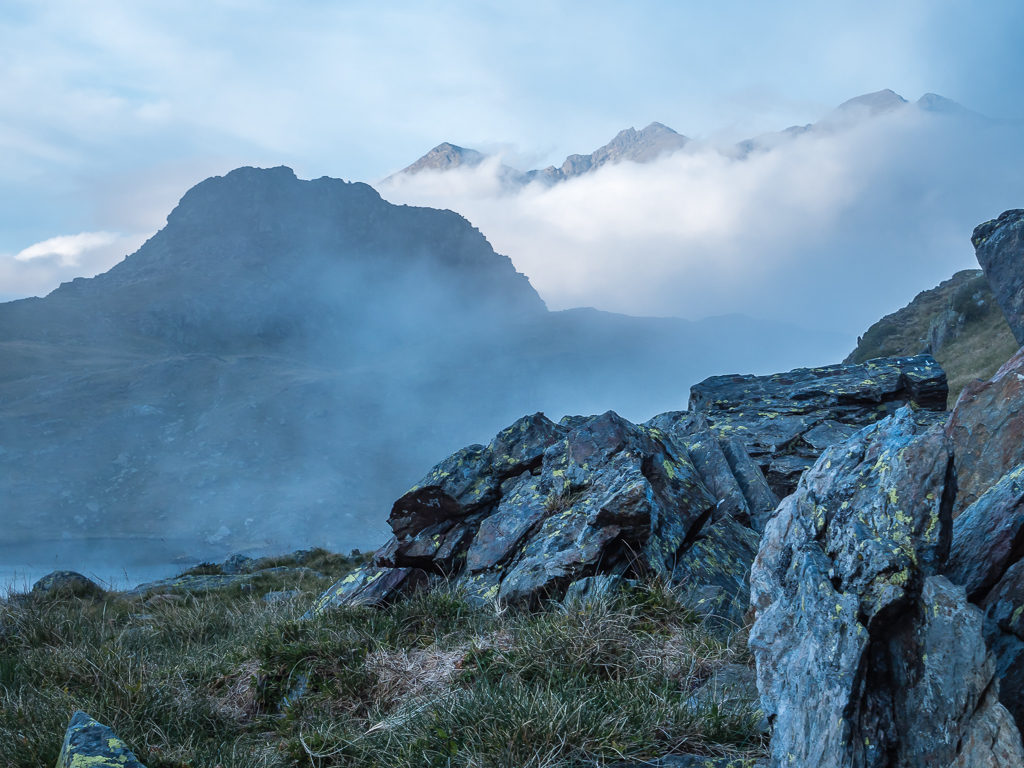
Within minutes there was a dramatic change in the weather going from clear visibility and blue skies to thick cloud and mist.
With the temperature also dropping rapidly, Wayne decided to cook an early dinner. Again, we enjoyed a hearty bowl of soup to warm us up followed by noodles, vegetables and a fried egg for tonight’s trail kitchen feast. It was nice then to have a few hours to make some trail notes without any distractions. (Not that I’m one to procrastinate at all!)
Day 39 – ‘Best Laid Plans!’ Monday 9th September, 2019, Wild Camp above Etang de la Soucarrane to Hotel Ordino, Ordino, HRP, 13.5km
It had been cold during the night, but not nearly as cold as the previous night at Baborte Lake, so it was a relief to wake up to a tent that was dry. This was largely because of us choosing to camp higher up above Lake Soucarrane and there was also a strong wind funnelling up the valley. The wind, although beneficial for the tent, did however mean it was a really cold start before the sun finally hit the valley and bathed us in light. So our intended 9am start quickly changed to 10am in the hope that we could warm up and set off in some sunshine.
The sun finally hit the hanging valley as we began to pack away our gear.
Once we had crossed over the border into Andorra we had a busy day ahead as we would need to catch a bus to the larger town of Ordino once we reached the small community of El Serrat in order to resupply. Carrying just 3 to 4 days’ worth of food is much less burdensome, but it does mean we are having to resupply more frequently, which on a route such as the HRP isn’t always so easy. Generally, to reach a village or town with at least a small grocery store, we are often having to descend over 1,000 metres, which in turn means we then have a long climb out again to rejoin the trail. Today for instance, we would be descending 1,415 metres in total!
So we set off, determined to reach the Port de Rat, a pass on the French-Andorran border at 2,539 metres, in just a couple of hours. Following an obvious path from the lake towards the clearly visible hairpin road bends on the opposite side of the valley, we took a short-cut crossing the Ruisseau de Medecourbe, joining what we thought was a stony disused road. Stopping to empty out our trail shoes of annoying grass seeds before the big climb, literally sitting on a rock in the middle of the road, (we are sorely missing our ‘Dirty Girl‘ gaiters and new pairs are definitely on the ‘must purchase’ gear list) we were startled to see a car approaching! Getting out of the way quickly, the car slowed and the driver asked us if we needed anything. In remarkably good English, he told us he was a shepherd and had been tending to his sheep further up the valley. He also informed us we still had a ‘good hour’ to go to reach the Port de Rat.
Looking north along the Vallée de Soulcem in Ariège, France, where the dirt road winds all the way to the Étang de Soulcem, a high mountain reservoir on the borders close to Andorra and Spain.
The Soulcem Valley is an impressive ‘U’ shaped valley carved by a glacier during the last ice age 10,000 years ago. The flat, fertile valley floor has been the high, summer pasture for sheep, cattle and Merens horses for centuries.
Slowly but surely making our way to the hairpin bends on the opposite side of the valley.
We couldn’t resist this photo on a rock opportunity as it was such a great look-out point!
Having seen less than a handful of hikers over the last couple of days, it came as a surprise to see a car travelling on this road!
Bidding the shepherd farewell, on we climbed following a series of white and red markers, interspersed with some spots of yellow. The climb looked worse from afar as it was actually steady, avoiding the rockiest parts of the slope, instead switching back up the grassy bank. Reaching the Port de Rat (2,539m) a little after midday, we felt like we’d made good progress, so we stopped and had lunch just over the top looking out onto the prominent Arcalis ski resort.
With most of the hard climb done, taking a quick breather on the final section up to the Port de Rat.
From our vantage point we enjoyed tremendous views looking back across the Soulcem Valley.
Reaching the high mountain pass known as ‘Port de Rat’ on the border between France and Andorra.
Stepping into Andorra for the first time!
With a resupply in town being our priority, we didn’t have time to linger so we were soon putting our packs back on and hitting the trail once more. Descending from the pass was straightforward, the rocky steps built into the mountainside helping us get down much quicker. Even though it was off-season in terms of the ski resort, there were still plenty of cars parked up along the roadside and several day hikers heading up the path to the Tristaina lakes. We bypassed this section of the trail, having seen numerous wonderful lakes on our Pyrenees traverse already, instead heading straight down the road for convenience. We were then able to rejoin the trail for a short section before taking an old gravel road running alongside the Riu de Tristaina that would lead us straight into El Serrat.
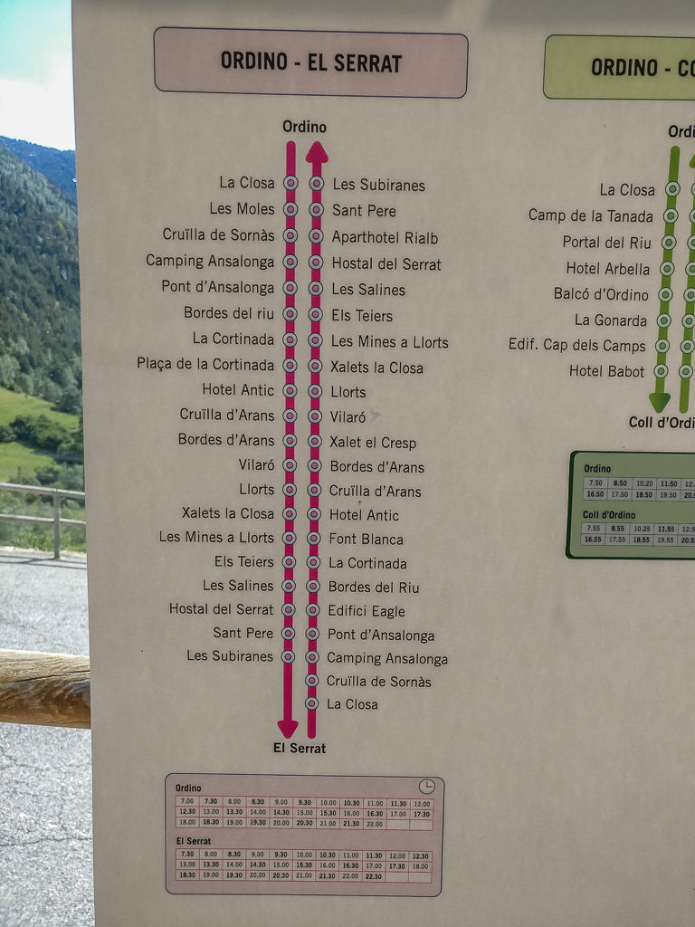
Passing up a lovely open picnic area that would have been perfect for a stealth camp, it then took us just over an hour to reach the small community, which has at least 3 bar-restaurants but is minus a shop! Fortunately as El Serrat is situated on the main C-G-3 highway, we had read in our guidebook that we’d be able to take a bus to the next ‘big’ town along the road. After checking the timetable at the bus stop, it was perfect timing as we only had to wait a few minutes for the 3pm bus to arrive, which for 20 cents each (we couldn’t believe how cheap the fare was!) took us on a 10-15 minute journey to Ordino.
Having chatted with a local on the bus who gave us some advice on where to find the best hiker supplies, once we had reached Ordino we then changed buses as we wanted to go to the larger supermarket a little further up the road towards the town of Massana. This was a great example of where a little Spanish goes a long way, as the incredibly helpful bus driver also knew exactly where we wanted to disembark, giving us directions to the supermarket and how to get the return bus.
We were pleased to find that we wouldn’t have to wait long as a bus was due in the next few minutes after our arrival in El Serrat.
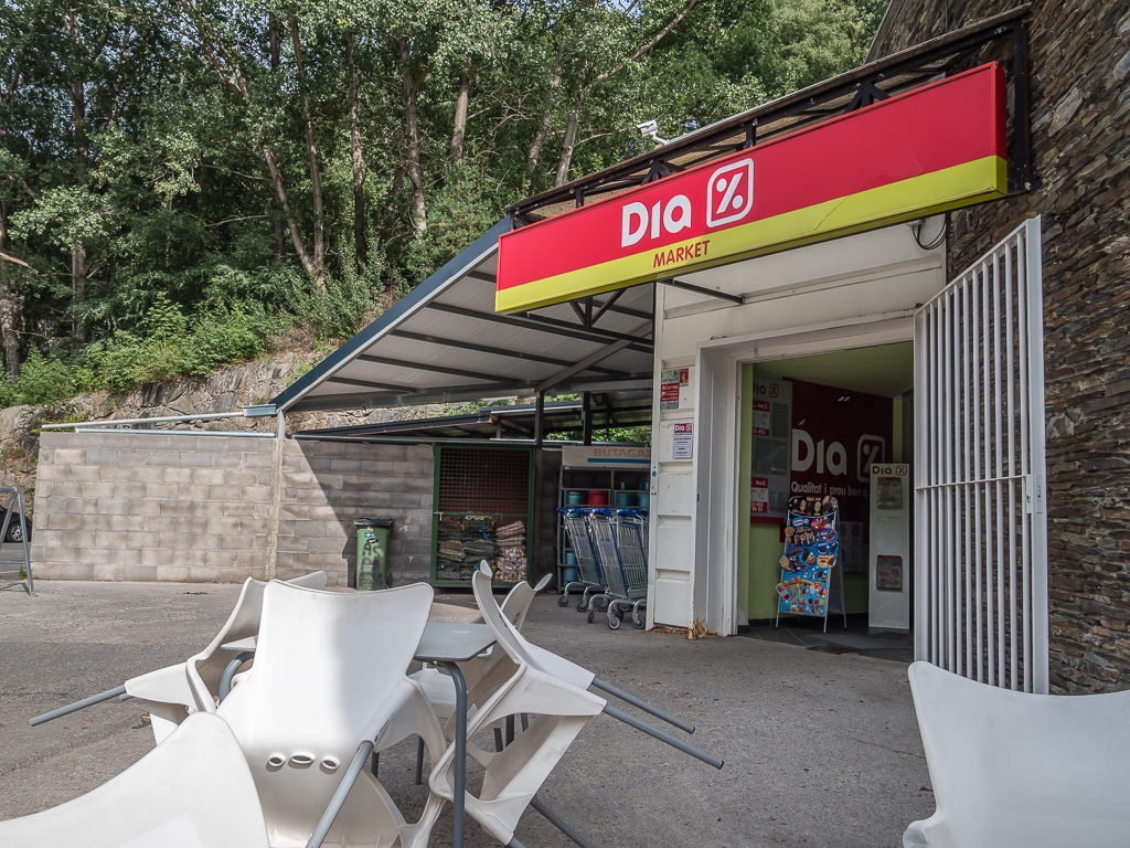
The ‘Dia’ supermarket where we purchased our next lot of food rations.
It wasn’t quite the ‘Carrefour’ standard of supermarkets we were expecting, but there was plenty of fresh food and we were able to do a good resupply. Wayne was extra happy as he was able to finally purchase pre-cooked packet rice, which he’d been wanting for weeks to add some variety to our breakfasts. Laying all the packaged goods out on a picnic table outside the supermarket, we were able to organise and portion up everything and dispose of any bulky packaging, making it much easier to fit into our food bags inside our backpacks. We’re pros at this resupply business now!
Ten minutes later and we were back on the bus to Ordino, where we’d decided to stop and have dinner in one of the restaurants to save us cooking that night, before then returning by bus to El Serrat and getting back on trail. We had intended on still hiking a further 2 kilometres into the Sorteny valley and camping near to the refugio – but in fact we ended up having a dramatic change of plan!
Since being incommunicado after entering Andorra due to the hefty data charges, we hadn’t been able to update our weather app for a few days. Hence we were unaware that torrential rain was forecast for later that evening and all of the following day. Having connected to the free WiFi in the ‘Topic‘ restaurant (a kind of Spanish version of Zizzis), we immediately set about finding accommodation in town as there was no way we wanted to hike up into the mountains and be faced with both rain and freezing temperatures. That’s what we’d given ourselves ‘spare’ days for – so we might as well use them as such! Amazingly, we found a hotel just around the corner by searching on Booking.com with a free room upgrade for only €75 for 2 nights. It was like it was meant to be!
After finishing dinner in the restaurant, we then headed to the local grocery store to stock up with some of our favourites – namely vino and sangria. If we were staying in town, then we were certainly going to make the most of it!
Having already resupplied earlier, we made a visit to the well-stocked general store in Ordino situated along one of the main thoroughfares purely to purchase alcohol!
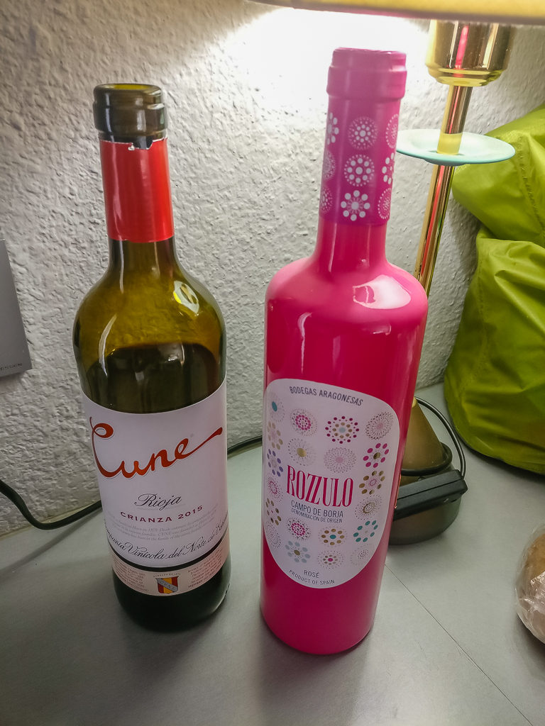
The ‘Cune Rioja Crianza’ has become one of our favourite reds!
Heading then to the hotel – Hotel Ordino – we were thrilled to find we had really bagged ourselves a bargain! The room was spacious and well-facilitated – much better than we expected for the price, so it was lovely just to have a shower and lay on a bed with fresh linen. We were also able to catch up on some world affairs having BBC News as the only English speaking channel on the TV. With the room also having a fridge, we were able to keep our new supplies fresh, and we could also rinse out some of our clothes and hang them on the balcony to dry. What an unexpected bonus!
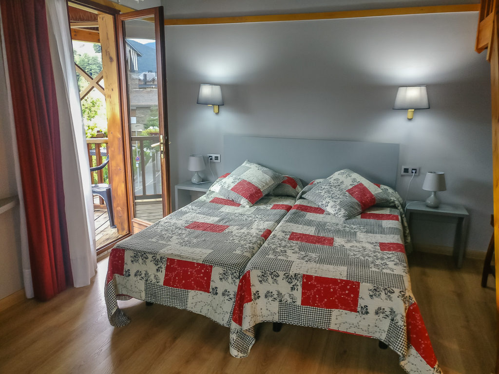
We got really lucky with this booking! With the free room upgrade there was also an extra bed in an upstairs mezzanine section of the room, as well as a fridge and balcony!
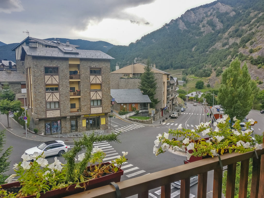
Our view of Ordino from the balcony. Conveniently, we were just a 5-minute walk from the centre of town.
Having looked out from the balcony and seen that dark clouds had already started rolling in, it made us all the more glad to have got off trail and to have booked a room for the next two nights. We worked out that we still have at least 200 kilometres to go in order to reach our end-point – Cap de Creus on the Mediterranean Sea, over the Spanish side of the Pyrenean border, but we still have plenty of time. We intend to finish on the 25th September, so with 16 days to cover the distance whilst still enjoying our new, slower pace – we know this is perfectly doable.
Day 40 – ‘Sleep, Eat, Drink, Repeat!’ Tuesday 10th September, 2019, Zero Day at Hotel Ordino, Ordino
After staying up until around 1am last night, we didn’t leave the hotel until after midday in search of lunch. We didn’t want to go back to the same restaurant as yesterday, but we were unsure as to whether anywhere would be open. As forecast, the heavy rain had come and it was pouring down all morning so we were glad not to have to leave the room. When the skies finally started clearing, we could see a fresh dusting of snow on the surrounding mountains, so we were even happier that we hadn’t camped last night, especially as the refuge was situated just below 2,000 metres. We had already endured enough cold, wet weather last September in Washington on the final section of the PCT!
Luckily we found a little gem of a place a little way down the main street where we were able to get a ‘Menu del dia’ for €12:50 each, which included a starter, main and dessert. It was only lunch time but we thought that might as well stock up on calories before heading off into the hills again tomorrow!
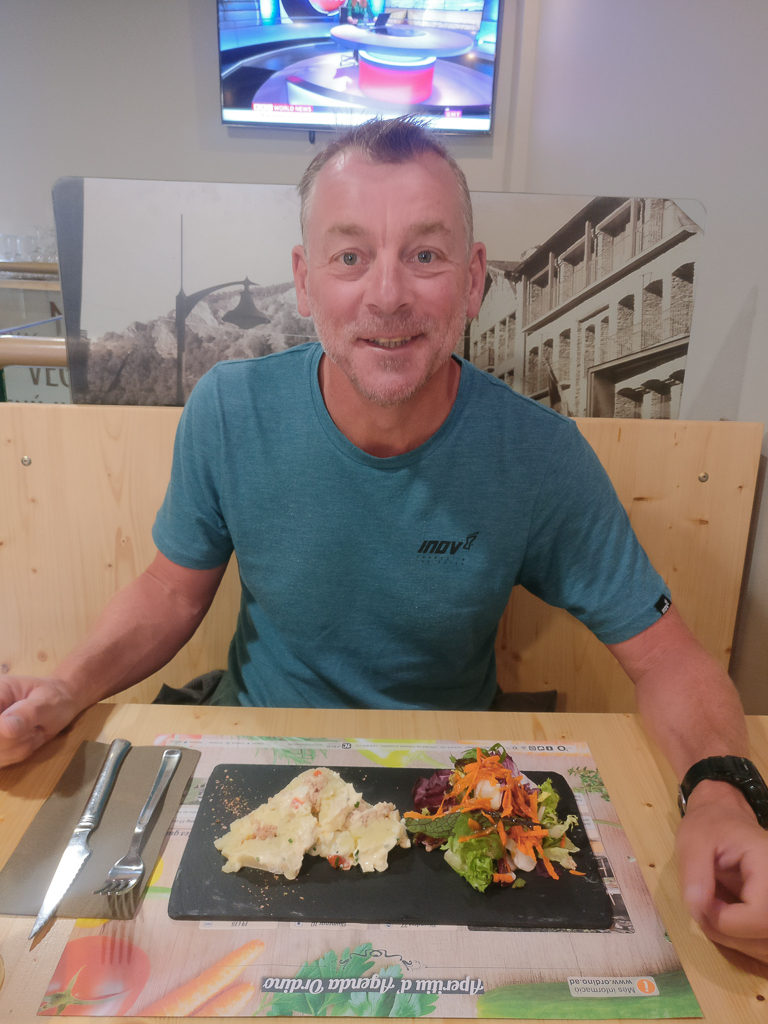
Freshly cooked and served with care and attention on pieces of slate, Wayne enjoyed a fish starter followed by Provençal chicken.
After a relaxing lunch then followed the drama of the day – well it seems we’ve always got to have a little drama! Today’s unexpected event was that we couldn’t get back into our room. The key just wouldn’t work in the lock, so thereby ensued a couple of hours of waiting around whilst the hotel called for a locksmith, who then struggled for a while trying to pick / bypass the lock before getting out his drill! It was finally all sorted, and for us was really only a minor inconvenience as we could still use the WiFi and surf the web whilst we waited.
With our plan to be back on trail tomorrow, we had a quiet night in. The forecast for the next few days seemed a little better, with temperatures rising later in the week, which would be good as the next section would see us crossing from Andorra back into France, where we would pick up the GR10. As has so far been typical north of the border, we’re expecting cloud and the possibility of rain. So we’ll see how we get on, otherwise we may have to drop back south into Spain and rejoin the GR11 route once more, which would actually be a shame as we’re looking forward to summiting Pic de Carlit, the highest peak in the eastern Pyrenees at 2,921 metres. (Or rather, I’m looking forward to it – Wayne is much less enthusiastic after the dramas of Tuc de Marimanha!)
Day 41 – ‘Knowing When To Turn Back!’ Wednesday 11th September, 2019, Pas de la Serrera and back to El Serrat, returning to Hotel Ordino, Ordino, GR11, 10km
After our setback with the weather, we were eager to get back on the trail and rejoin the HRP taking us through the remainder of Andorra and back into France. So we had a prompt and productive start to the day, getting up at 7:30am after the alarm, making sandwiches for lunch, having a quick breakfast of muesli with ‘proper’ milk (instead of the powdered stuff), showering, repacking our gear and checking out all before 9:30am. We then hotfooted it up the road in order to catch the minibus from Ordino back to the settlement of El Serrat where we would be back on track.
The weather, although significantly better than yesterday, was still not the best. In Ordino it was drizzling with rain as we departed on the bus, and looking north to where the highest peaks pierced the dull, white sky, they were still covered in snow. It did not look promising and it was especially bothersome as neither of us were carrying waterproof trousers. But we tried to remain positive as the forecast was much better for later in the day as well as for the forthcoming week.
Winding further north along the main highway back to El Serrat, it looked even more grey and miserable and no sooner had we stepped off the bus than the heavens really opened. We quickly put on our waterproof coats and covered our packs, hesitating whether or not to jump back on the bus and return to town. Whilst deliberating, the rain seemed to slow however, so we agreed that we’d go for it and push on to Refuge Sorteny in the hope that it would clear by 11am, as the forecast had predicted.
With our heads down we followed the markers, which led us up a dirt road before then zigzagging up a rocky path following the Riu Valira del Nord. Passing an unexpected ‘Botanical Garden’ complete with informative boards, we commented on whether we’d see anyone on the trail today. Would anyone really be crazy enough to head up into the mountains in what felt like winter conditions? It wasn’t long until we got our answer – as a large walking group appeared in front of us in full wet-weather gear, but still looking very wet and bedraggled and thoroughly fed up. They were making for the refuge and were soon huddled under the shelter of the doorway as we walked past, both of us with our hoods up, but minus waterproof leggings and showcasing red raw legs in our summer shorts.
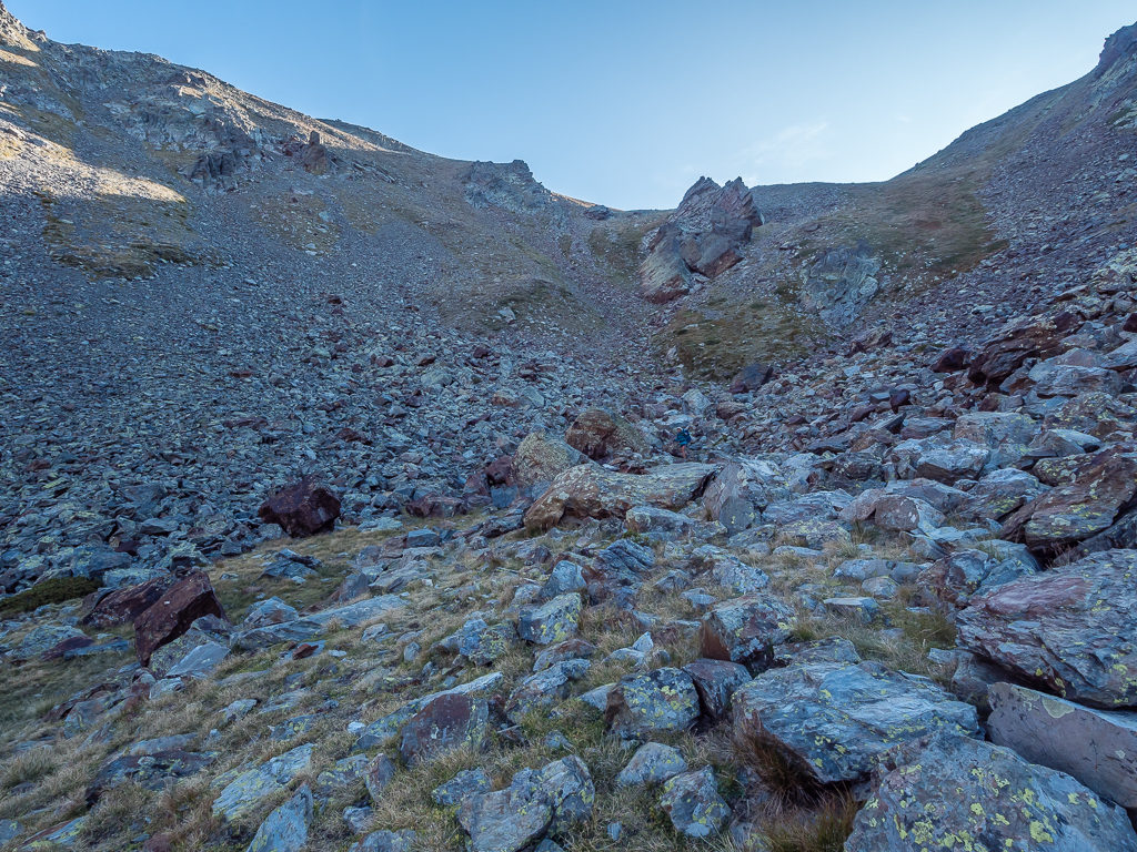
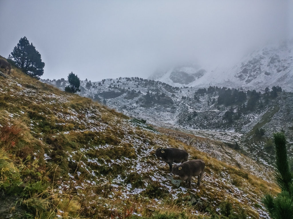
They probably thought we were foolish for continuing on, but it was nothing compared with the look we got from a shepherd as we reached the Pas de la Serrera at 2,231 metres. Covered in a full length poncho, he was heading back over the pass and down to the refuge with his dog. We on the other hand, were still trying to push on to the Collada dels Meners at 2,713 metres. We still had another 500 metres of climb however, and we were already slipping and sliding between thick mud and fresh cow pats on a track that had been torn apart by cattle, made even worse by the settling snow.
The peaks all around us were also blanketed in thick snow and looking up in the direction we would be heading, there was no other word for it – it looked bleak. Had it been dry, we might have just managed traversing the pass in the hope that the trail and conditions down the other side of the valley would be better. Yet it was still raining and by now we were both suffering from the cold and couldn’t feel our fingers. Hating the prospect of having to turn back, but being realistic by the fact that in no way were we adequately geared up for winter conditions, Wayne called it a day – we wouldn’t survive the next few hours up there in shorts!
Consequently, if the temperatures dropped further and with us already being wet and cold, we would struggle to warm up again and worse still would be having to face a wild camp at 2,200 metres – if we could even make it to our intended wild camp spot by the Refuge de Cabana Sorda. So we had no choice – we had to turn back as we were ill-prepared for such extreme weather.
Heading into thoroughly bleak conditions! (With our cameras safely stowed in our packs because of the earlier rain, we took some quick phone pics to show our dilemma.)
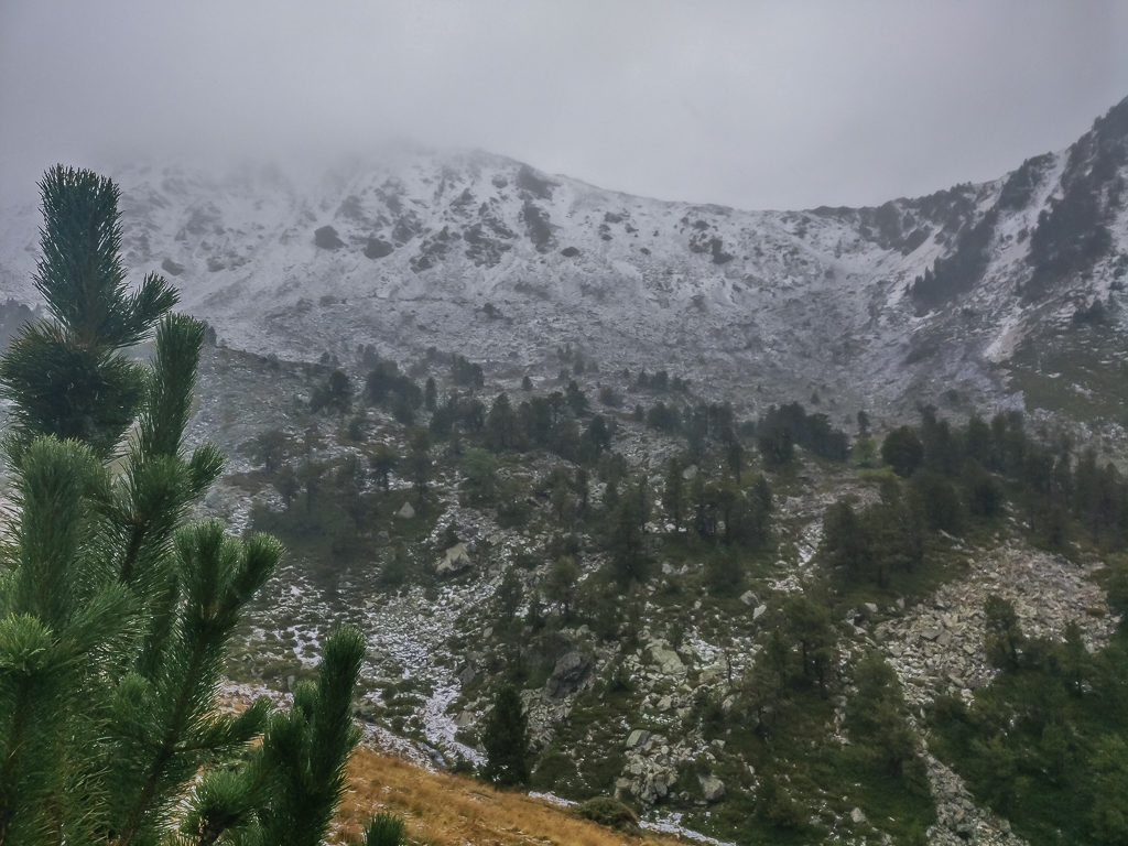
It looked to be almost white-out at the higher elevations, so it would have been ludicrous to push on for the pass located along the top of the ridge across the valley.
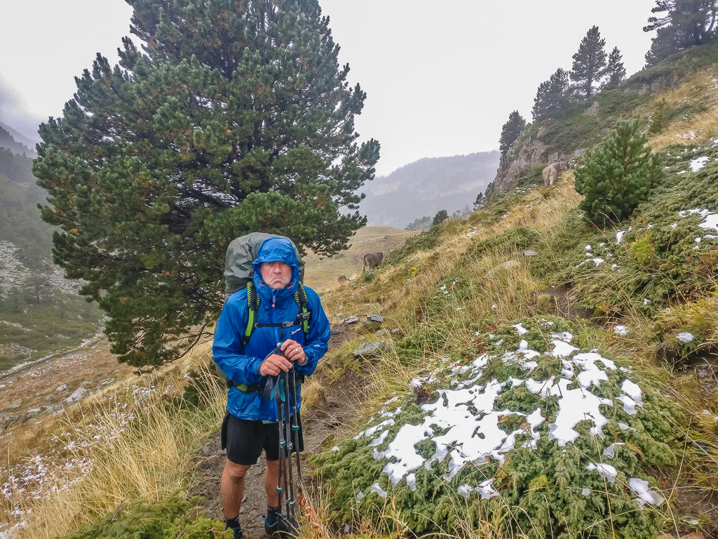
Sad but making the right call! It was time to turn back.
Retracing our steps, firm in the opinion that we’d made the right decision, we seemed to reach the refuge quickly and little by little, we began to warm through, the feeling returning to our fingers. Our feet however remained cold as they were soaked through from the sodden trail. Our plan was to return to town and get a room again at the hotel, then rethink and re-plan our route east.
With the sudden snowfall and freezing temperatures on the higher passes, taking the ‘Haute Route‘ through the remainder of the Pyrenees did not seem so appealing. Therefore we quickly made the decision that we’d leave town again tomorrow, but this time we would take the GR11 route through Andorra, which would generally keep us to good, way-marked paths at lower elevations, with plenty of opportunities to pass through towns to resupply – or indeed bail if the weather got any worse. We had assumed that we’d face some afternoon thunder showers when we were high up in the mountains, but had not even considered the possibility of us experiencing early snowfall in September (that’s why we ditched waterproof trousers from our essential kit). But it’s one of those things that you live and learn from!

Glad to have made it safely back to the road. We now just had to wait for the next passing bus!
Returning to town by bus, and indeed the same hotel room, we quickly warmed up and made new plans! We didn’t have to change too much as we already intended on finishing our Pyrenees traverse on the Spanish side via the GR11 route. To keep us on track for our preferred end-date however, we would just have to double up a couple of GR11 stages, which we could do easily with a few earlier starts leaving camp.
Being back in town also meant the luxury of enjoying another meal out, so for dinner that evening we returned to the lovely restaurant where we’d had lunch yesterday. It was quite tempting to exit the Pyrenees from this point as there are direct buses to Barcelona from several towns in Andorra, but as always we have an overriding determination to see this thing through. We need to reach the Mediterranean Sea to put closure on our thru-hike.
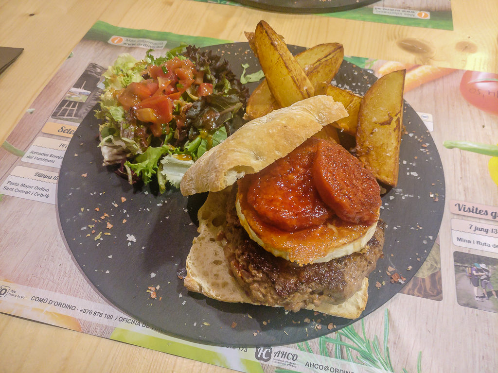
Tonight’s treat was a goat’s cheese and salami burger with a sun-dried tomato relish and homemade potato wedges.
Again we’ve learnt so much – not just about the places and cultures we’ve had the privilege to get to know and understand along the way – but also with regards to ourselves – what we enjoy more in terms of an itinerary, reasonable walking distances balanced with sufficient time at camp, essential gear that cannot be shaved off to save a few grams no matter what, and the kinds of trail experiences we enjoy most e.g. less people but a mixture of high mountains and nature.
Not surprisingly – we also love a good town day! It’s true to say that every single thing back in civilisation is appreciated so much more – from turning on a tap to get clean water, to climbing out of bed to use a proper toilet, to just switching on the TV for some ‘bubble gum’ for the mind. We are so fortunate that we get to enjoy both.
Day 42 – ‘Back On Track!’ Thursday 12th September, 2019, Ordino to Meadow Wild Camp before Refuge Riu dels Orris, GR11, 17km
When the alarm went off today, it felt like ‘Groundhog Day‘. After yesterday’s firm decision to abandon the ‘Haute Route‘ through the Pyrenees in favour of the GR11 on the Spanish side of the border, (which we hoped would be the less demanding and lower in elevation of the two, plus much better weather than its counterpart, the GR10 over in France) we were ready to get back on trail and get to the end, one way or another!
From our guidebook we recognised that the next two days crossing from Andorra back into Catalonia would be the final alpine section of the GR11. So we had to make the most of the remaining high mountains as we would soon be experiencing a much more arid, Mediterranean feel to the trail complete with olive trees and vineyards stretching over vast, dry plains as we continued east – a landscape so very different to the rolling green foothills in the west.
Changing routes meant that we didn’t have to leave Ordino quite so early though, so we enjoyed a light continental breakfast at a café in town before finally leaving around 11:30am. In complete contrast to yesterday, it was both sunny and dry to the point there was not a single cloud in the sky. We didn’t let this affect our new plans however as we could still see snow on the tops of the surrounding peaks. Set on our revised itinerary, we began the long climb of almost 700 metres out of town to the Coll d’Ordino at 1,983 metres, which felt much less taxing in the current circumstances of good weather.
Leaving Ordino today following the GR11, our revised route keeping to lower elevations compared with the HRP.
Walking through a lovely wildflower meadow as we headed up to the col.
When we finally emerged from the forest, following the path leading to Coll d’Ordino, we were stood in the middle of a vast, grassy plateau with extensive views to the high peaks over the French border. Seeing the snow-capped tops just made us feel all the more justified with sticking to our revised itinerary. We would not want to find ourselves in such a dangerous predicament again. Then followed a much gentler woodland walk between pine trees down to the next settlement Encamp located on the Valira d’Orient river.
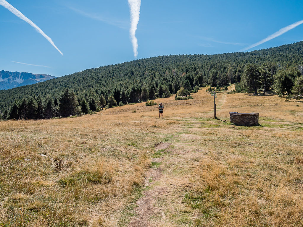
Reaching the top of Coll d’Ordino, an extensive plateau with 360° views.
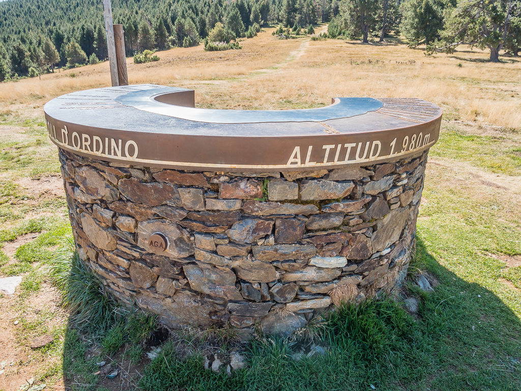
The trig point lists the surrounding peaks that can be seen from the col on both sides of the Pyrenean border.
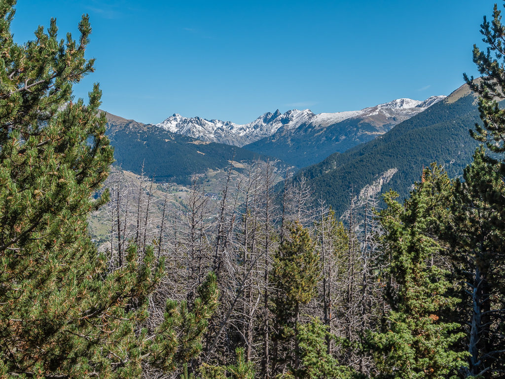
In spite of today’s full sunshine, the high peaks over the French border still had a covering of snow so we were glad not to be taking the GR10.
Arriving in Encamp around 2:30pm, we made a quick visit to a supermarket that we passed by chance on the main street so that we could top up with bread and a few other fresh supplies, including Monster Energy drinks to give us a good boost in readiness for the next climb of the day. We then had a late lunch, picnicking in the park before setting off again around 3:30pm.
The climb out of town to the Estany d’Engolasters was actually much more enjoyable than we had expected as once we had cleared the car park area, we found a lovely outdoor art exhibition to be taking place throughout the recreation area. As well as paintings of nature, there were several intricate animal sculptures positioned along the route that were in keeping with the surroundings. Being on a ‘tourist path’ that was both clear and well-marked also made for a much easier afternoon’s walk as it was relatively flat for a large section and so soft underfoot as the trail was covered in pine needles. Another plus point of taking this route from Encamp towards the Refugi de Fontverd was that there were several fonts available for us to top up with fresh water along the way.
Following the familiar GR markers as we began the next climb of the day. From Encamp at 1,238 metres, we were aiming to camp close to Refugi de Fontverd at 1,880 metres, so we still had over 600 metres to go!
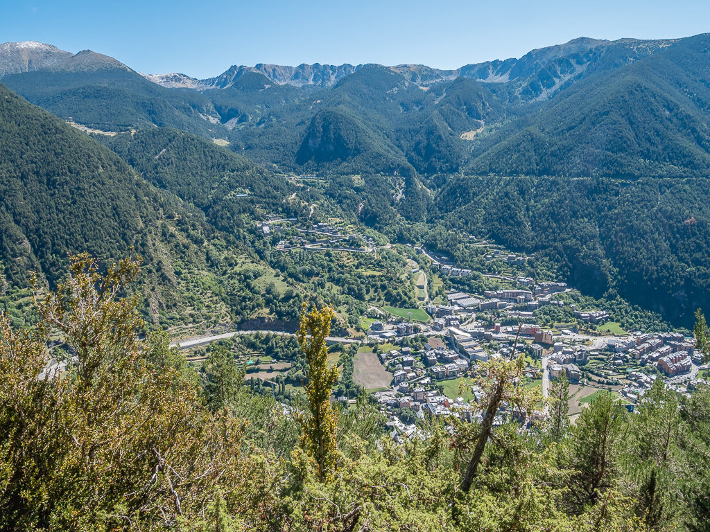
Looking back to the town of Encamp. The initial climb from town to the reservoir at 1,616 metres was less taxing than what we had expected.
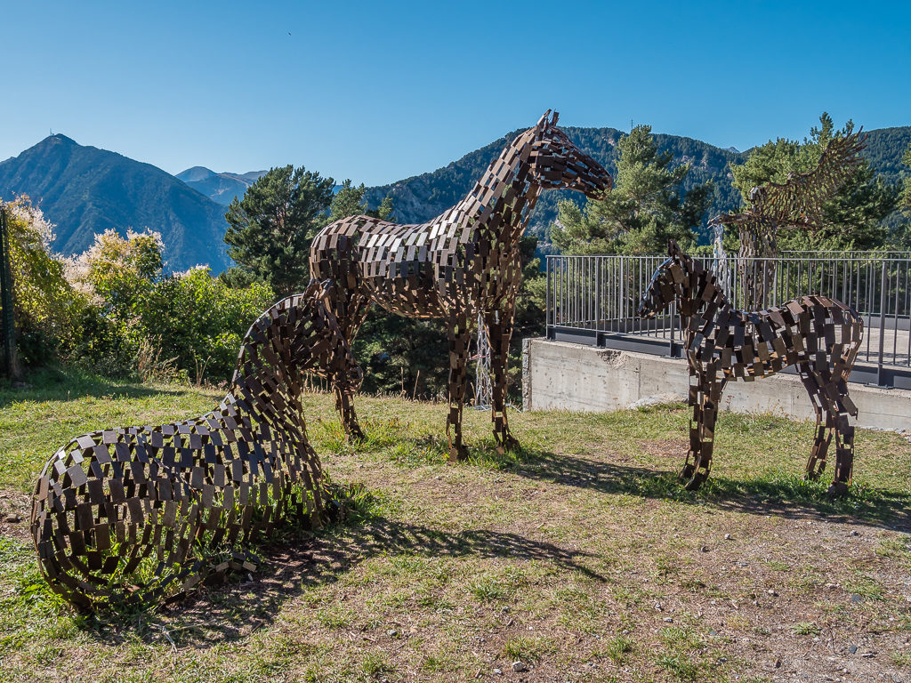
Taking time to look at and photograph some of the sculptures that were being exhibited in the recreation area.
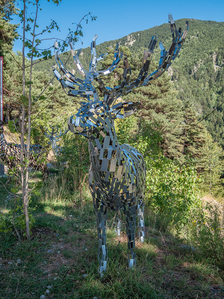
The sculptures made for both an interesting and enjoyable walk and took our minds off the actual climb.
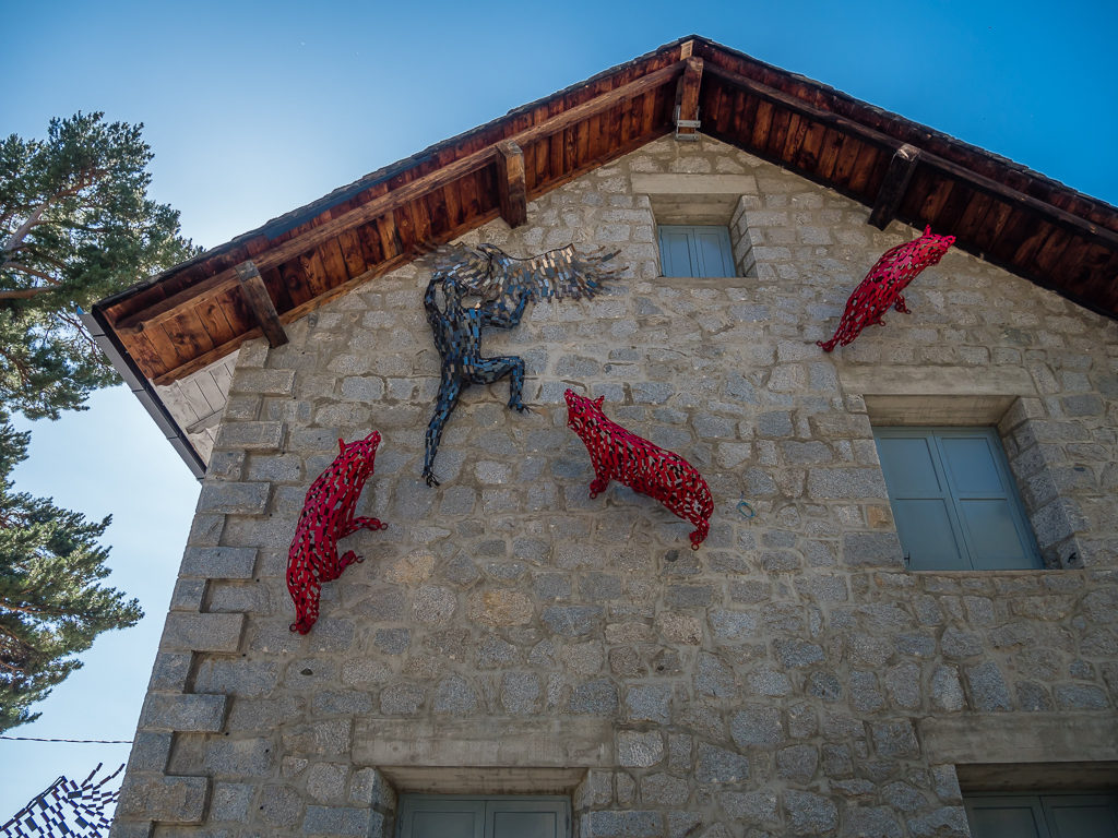
We liked how some of the sculptures had even been attached to the buildings.
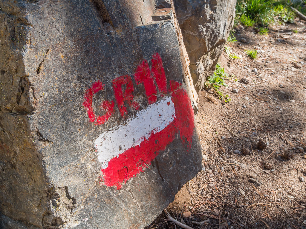
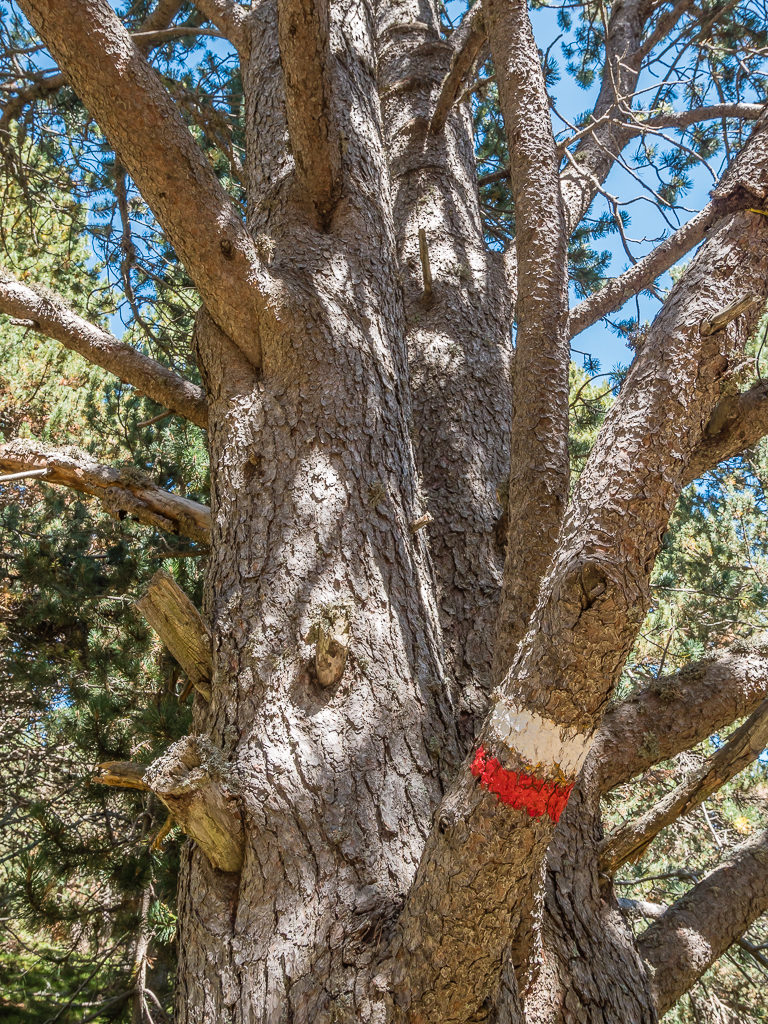
The GR11 was clearly way-marked, which made for easy navigation.
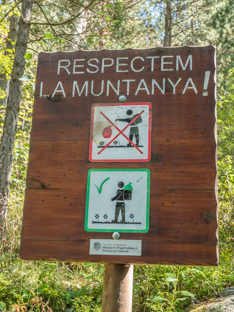
One of our favourite signs with an important message for anyone accessing the trail.
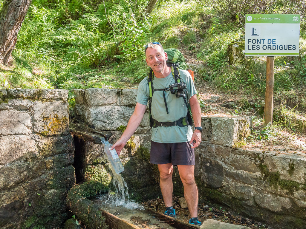
Enjoying being able to fill up with clean mountain water straight from the font without having to filter it.
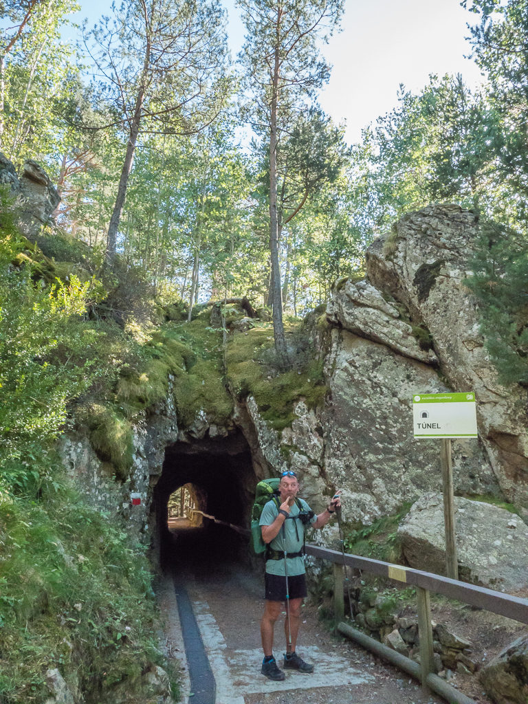
Beware of the tunnel!
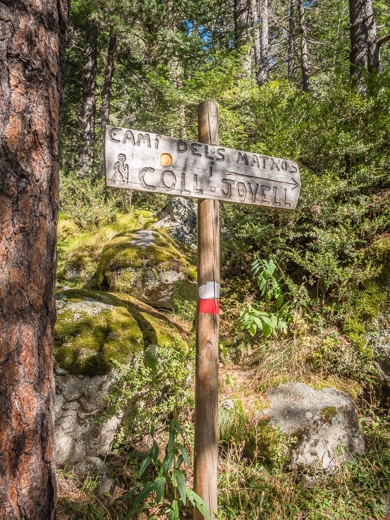
Following the ‘Cami dels Matxos’ to the next col.
Continuing uphill, we had a steady climb to Coll Jovell at 1,779 metres after which we had a pleasant walk along mostly forested hillsides following high above the Riu Madriu to the Fontverd Refuge situated in the middle of the Madriu valley. We couldn’t help but pause for a few moments to soak up the scenery when we came to a couple of glades along the rise offering beautiful views of the ridges to the west and northwest. Once again, the stunning landscape reminded us very much of the USA’s Sierra Nevada.
On a rocky outcrop a few metres slightly to the right above the pass, there is a lookout point with a perspective that extends far up the Madriu valley to the summit silhouettes emerging in the background.
Arriving at Refugi de Fontverd at 6:15pm, we decided to fill up with water then push on to find a better wild camp spot as there was already a large group of guys congregated outside the refuge, as well as several tents pitched in the vicinity. Continuing along the valley through meadows and pastures following the course of the river for another 45 minutes, we then found just the camp spot we had been searching for.
Discovering a picturesque, grassy meadow area, minus any cattle, surrounded by a string of jagged peaks, we decided it was the perfect spot to pitch the tent. With access to water as well as offering some privacy since we had crossed the stream to move away from the main trail, we didn’t think we’d find anything better this close to sunset. It also set us up well for an early morning climb the following day as the next two refugios were situated at 2,230 metres and 2,485 metres respectively. It appeared we were not out of the Andorran high mountains just yet!
The gentle waters of the Riu Madriu flowing through the valley.
Our picturesque wild camp meadow in Andorra. It was probably some of the flattest grass we had pitched on throughout the entire trip!

The late evening sun casts a golden glow over the wildflower meadow.
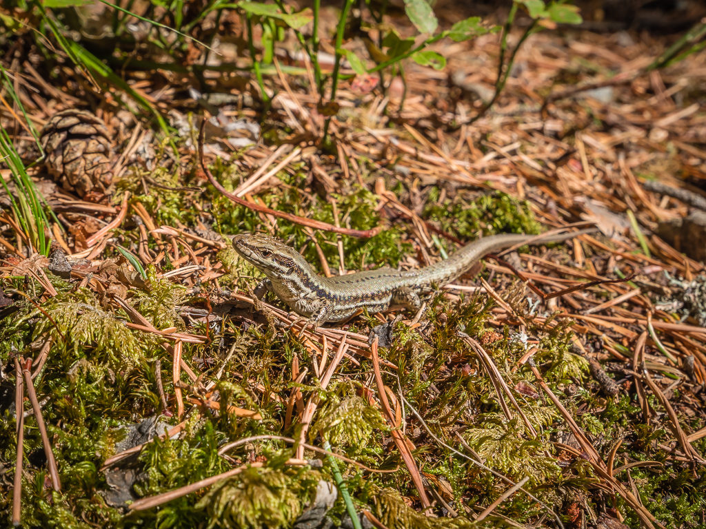
We think this is an Aurelio’s Rock Lizard. The species is endemic to the Iberian peninsula and they are found only in a small area near the confluence of Andorra, Spain and France. Their natural habitats are temperate grassland, rocky areas, and pastureland.
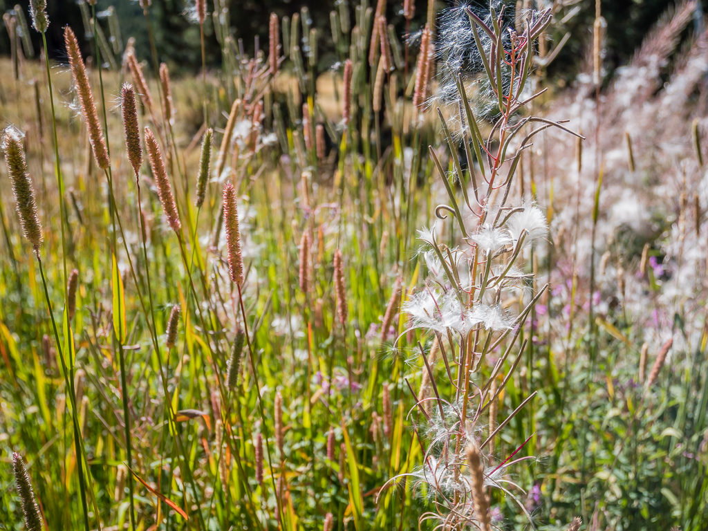
More beautiful flora surviving in the temperate to alpine climate.
After wandering around the meadow taking some photographs of the flora and fauna, we had a quick rinse off in the stream before the sun went off the valley. It was lucky that we had also cooked and eaten dinner when we first arrived, which was a Tortellini Bolognese, as we were inundated with flies as soon as the sun went down. We didn’t let them spoil our first Andorran wild camping experience however, as we were ready to call it a night and retreat inside the tent anyway.
Today had been a good day! We were back on track and the weather was no longer hampering our progress. Our revised plans so far had treated us to scenery that was equally as beautiful to any we had already experienced on our journey through the Pyrenees, so we didn’t feel any regret in our decision to change routes. We were still annoyed at our lack of foresight in neglecting to bring waterproof trousers though – especially after our experiences in Washington last year where they were 100% essential! Hopefully, as we cross the border back into Catalonia and continue further east into Mediterranean climes, they will be superfluous to requirements anyway – as we had originally anticipated. But with just two weeks left on the trail, whatever the weather – it would not deter us from our end goal of finally reaching the Mediterranean sea!

8 Comments
Hi Danielle ,
It should be terrible to write such a report and look back at such beautiful landscapes when you are stacked at home champing a bit , waiting for political decisions about tourism. It seems that bad weather arrived at the right time to enjoy food and room in Ordino Hotel. Waiting for the next 2 weeks with nice camp spots I hope . Meanwhile continue to dream.
Yves
Thanks Yves – yes, it just makes us desperate to get back to the mountains!
We are hoping to do some hiking in the Lake District this summer if and when campsites open back up again.
Fingers crossed! 🤞
Best regards, Danielle
Another enjoyable tour through the Pyrenees, this time with snow! Looking forward to the finale to see if you walk through any of the area around Canigou where I’ve walked myself and reached the summit.
Hi Andy, sorry to disappoint but we stayed on the Spanish side for the last section and followed mostly GR11!
We definitely didn’t want any more snow without having our winter gear.
It just means we will have to return to cover some more sections of the GR10 – Canigou looks too beautiful an area to miss.
Best regards,
Danielle
There was no snow when I climbed it in August a few years back. Biggest problem was the brutal heat (and the 1800m ascent/descent. A blog post below if you’re interested
https://surfnslide.wordpress.com/2012/10/13/sacred-mountain-a-climb-up-canigou/
Cloud inversions and a ridge walk – Looks magnificent!
Thanks for sharing.😊
Hi Danielle,
it seems to me You all always reach out for the full featured programming. What an adventure. As I am intending to leave for my Kungsleden thru-hike in two weeks (fingers crossed) I immediately rechecked my gear list for the full waterproofs 🙂
Once again thanks for sharing Your adventures with us. Hope You are able to venture out for some nice walks and camping nights soon.
Best Regards
Marcus
Best Regards
Hi Marcus, not long now until your own adventure starts! You must be really excited to be finally setting off on the Kungsleden.
All being well, we are heading up to the Lake District on 1st August with a plan to hike all 214 Wainwrights over 4 weeks!
Keep in touch and let us know how you get on.
Safe hiking,
Danielle & Wayne